geologic and engineering observations from the van earthquake of 2011
TRANSCRIPT
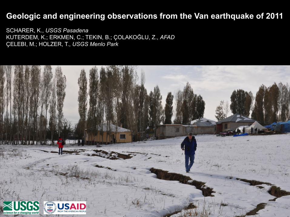
Geologic and engineering observations from the Van earthquake of 2011 SCHARER, K., USGS Pasadena KUTERDEM, K.; ERKMEN, C.; TEKIN, B.; ÇOLAKOĞLU, Z., AFAD ÇELEBI, M.; HOLZER, T., USGS Menlo Park
Lake Van
Lake Ercek
Van
Ercis
M5.6
USGS
AFAD
EMSC
KOERI
50 km
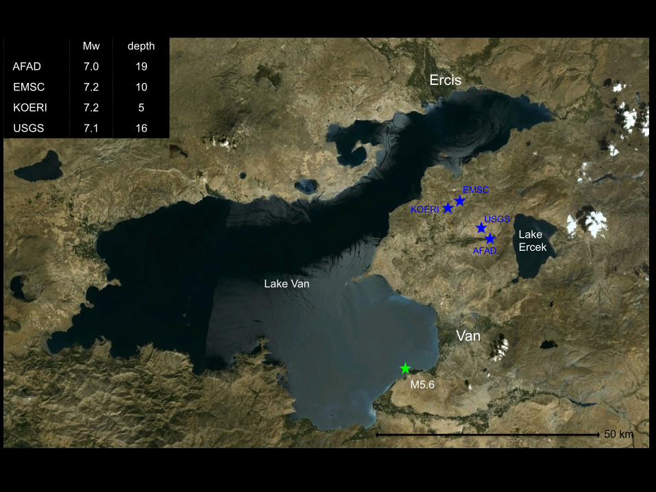
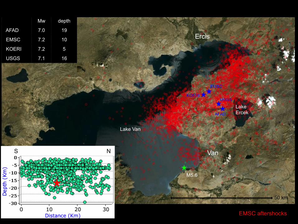
Mw depth
AFAD 7.0 19
EMSC 7.2 10
KOERI 7.2 5
USGS 7.1 16
Lake Van
Lake Ercek
Van
Ercis
M5.6
USGS
AFAD
EMSC
KOERI
50 km
S N
Mw depth
AFAD 7.0 19
EMSC 7.2 10
KOERI 7.2 5
USGS 7.1 16
EMSC aftershocks
Lake Van
Lake Ercek
Van
Ercis
M5.6
USGS
AFAD
EMSC
KOERI
50 km
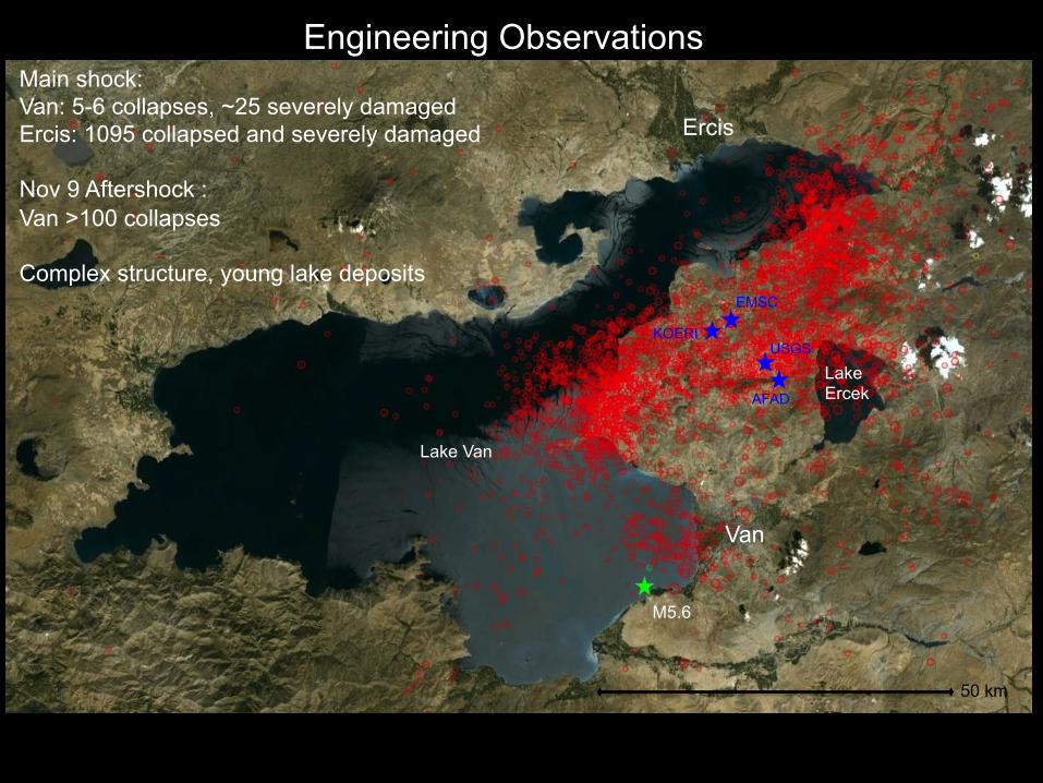
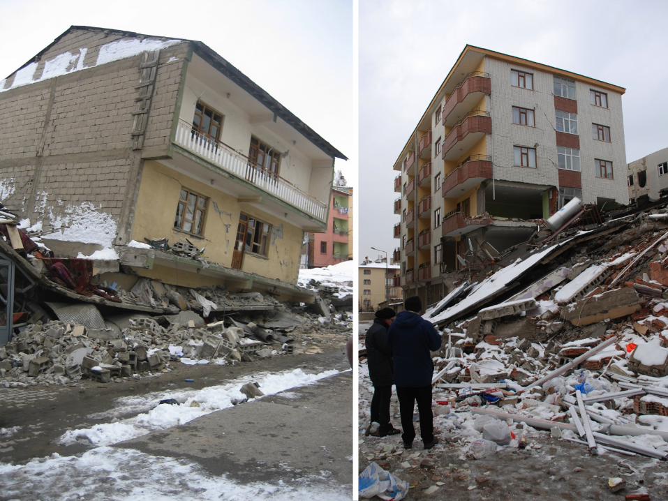
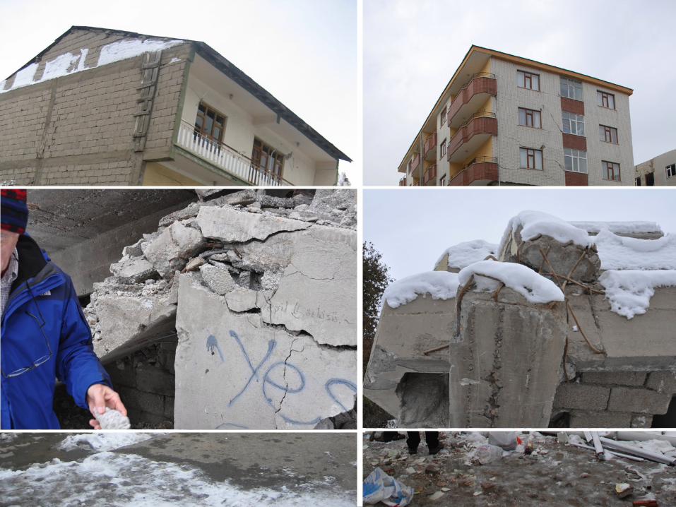
Main shock: Van: 5-6 collapses, ~25 severely damaged Ercis: 1095 collapsed and severely damaged Nov 9 Aftershock : Van >100 collapses Complex structure, young lake deposits
Engineering Observations
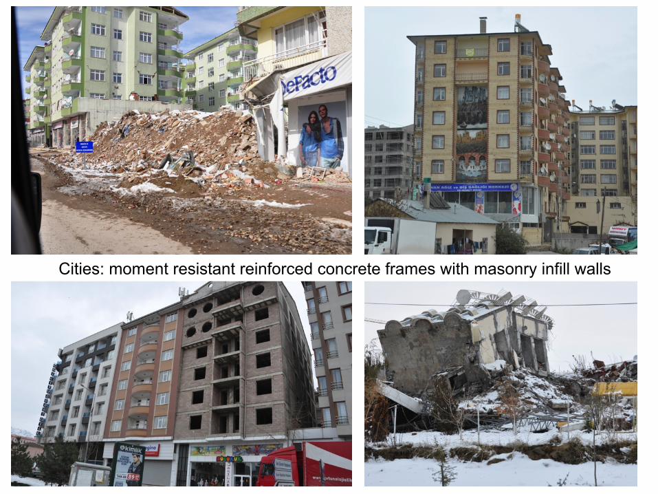
Cities: moment resistant reinforced concrete frames with masonry infill walls
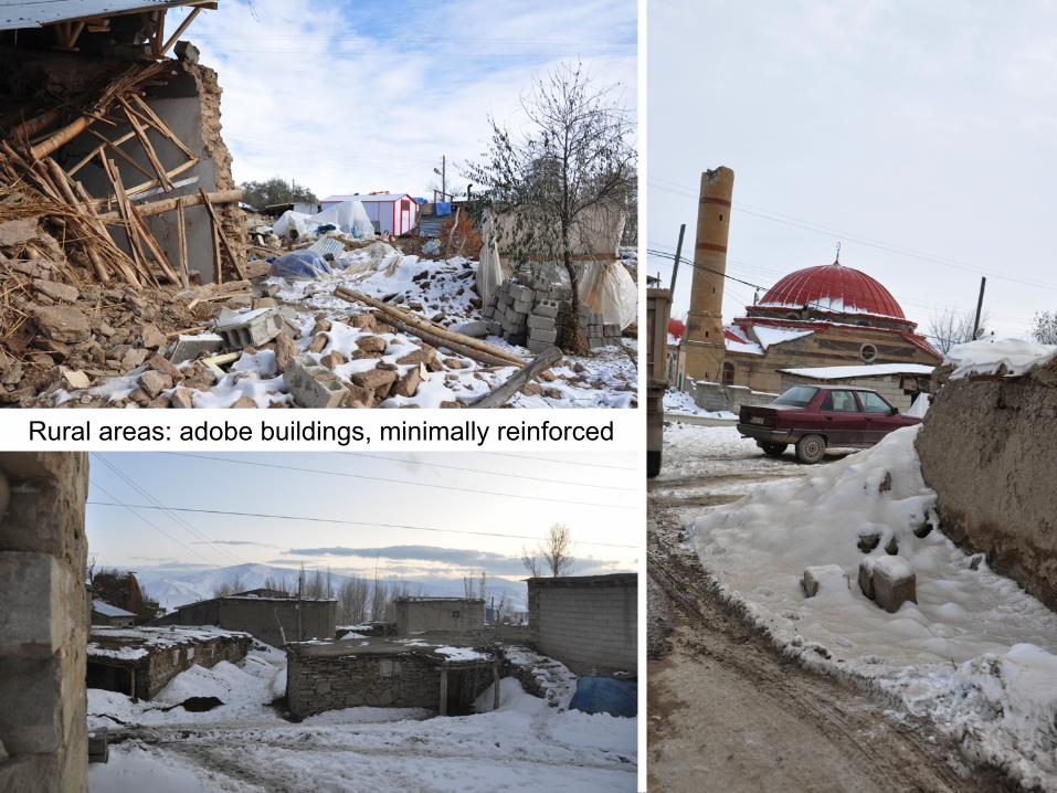
Rural areas: adobe buildings, minimally reinforced
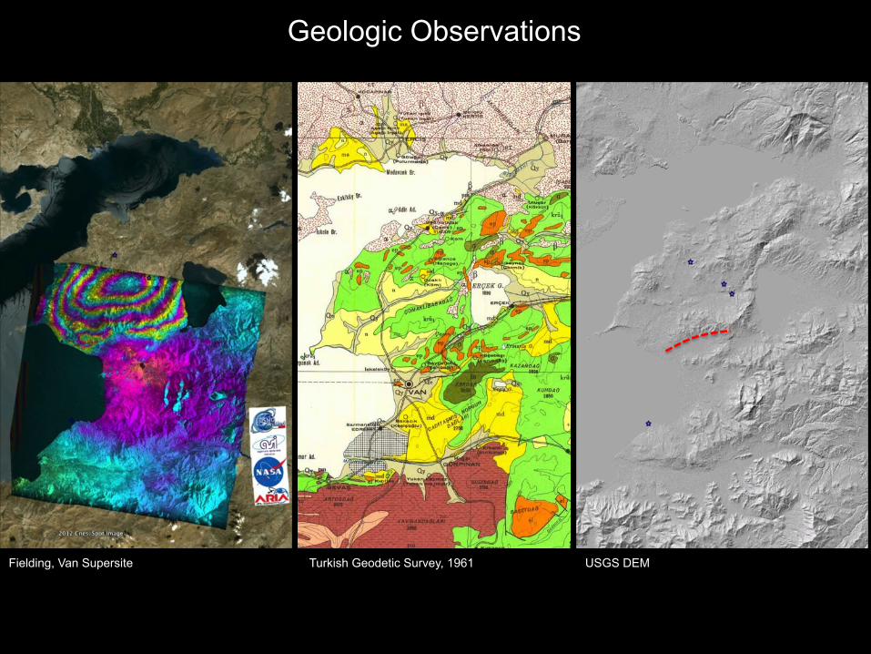
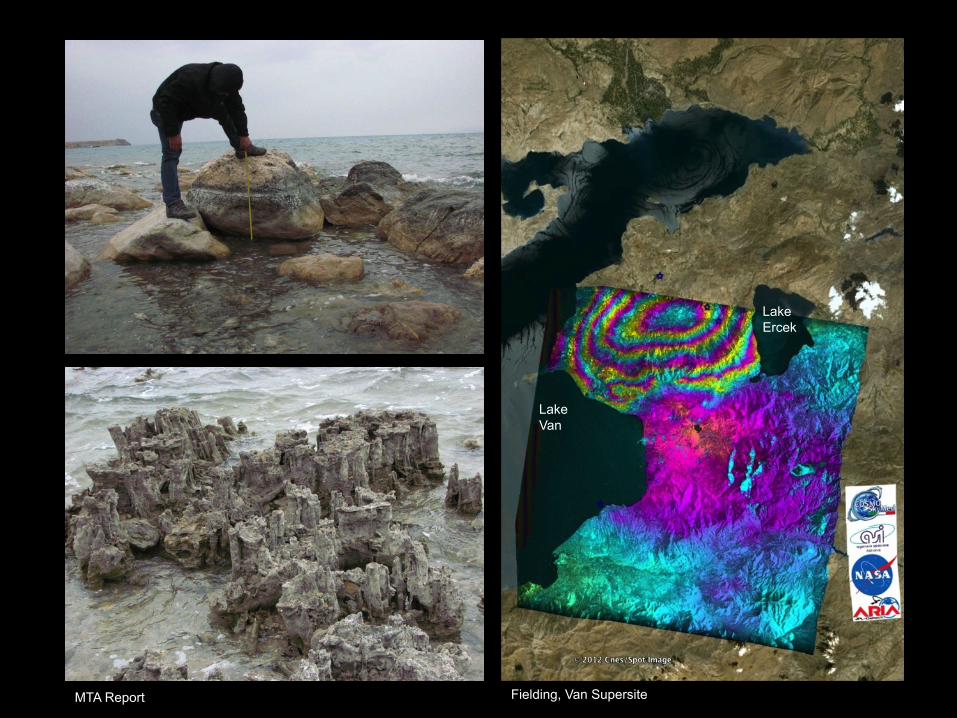
Fielding, Van Supersite Turkish Geodetic Survey, 1961 USGS DEM
Geologic Observations
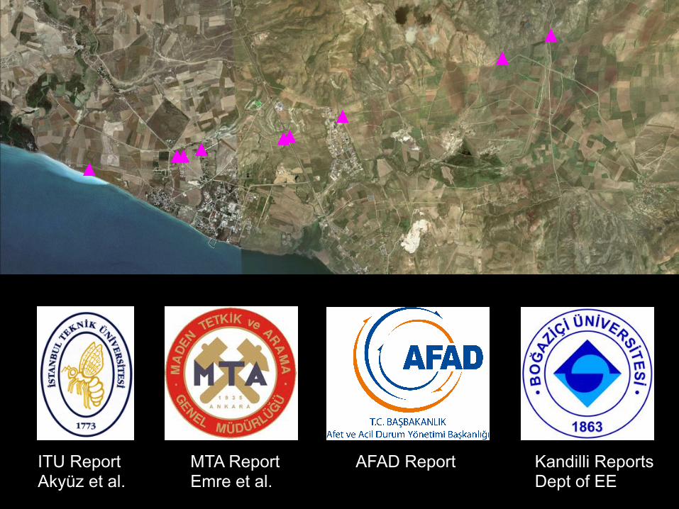
ITU Report Akyüz et al.
MTA Report Emre et al.
AFAD Report Kandilli Reports Dept of EE
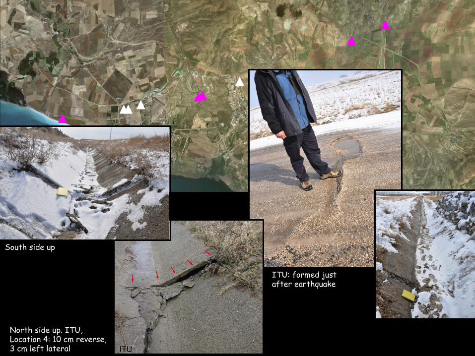
ITU: formed just after earthquake
ITU
ITU
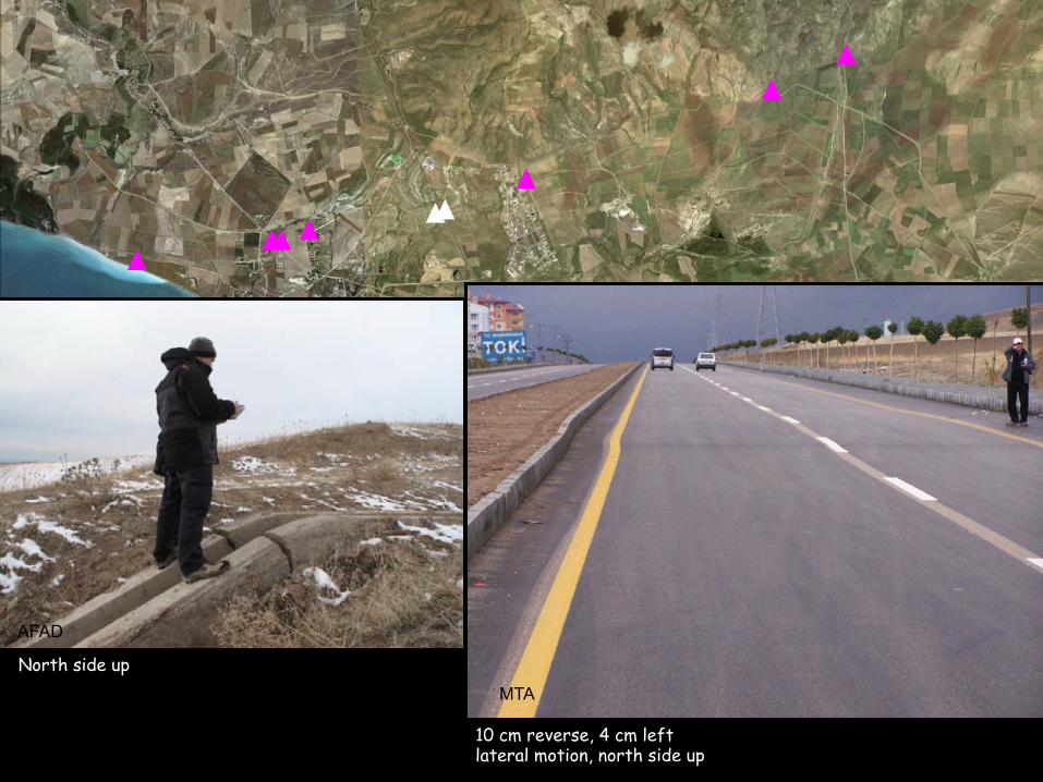
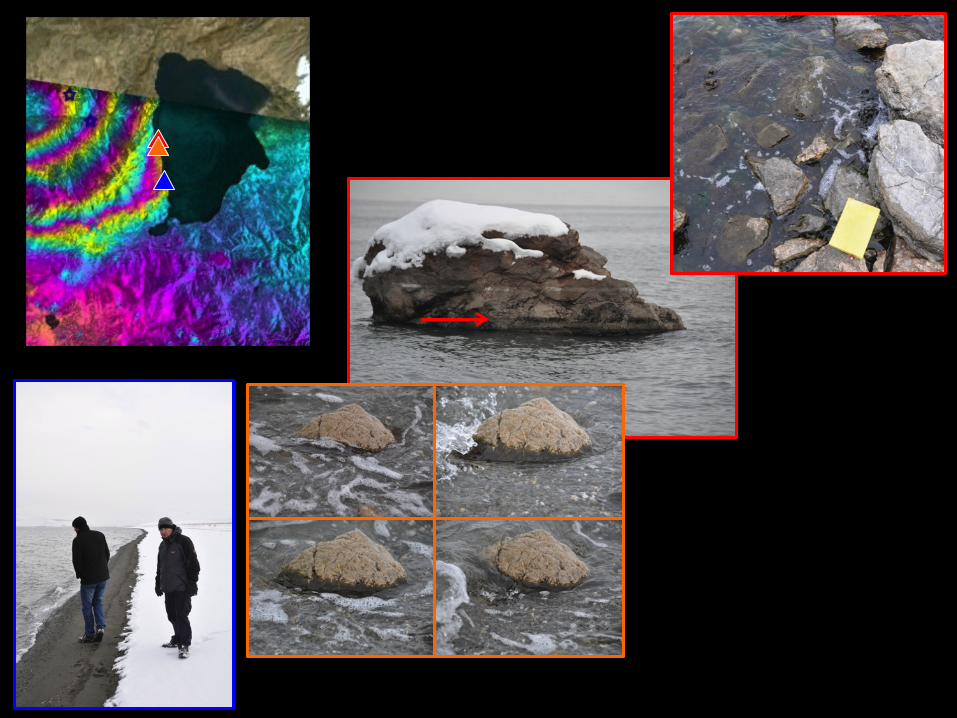
North side up. ITU, Location 4: 10 cm reverse, 3 cm left lateral
South side up
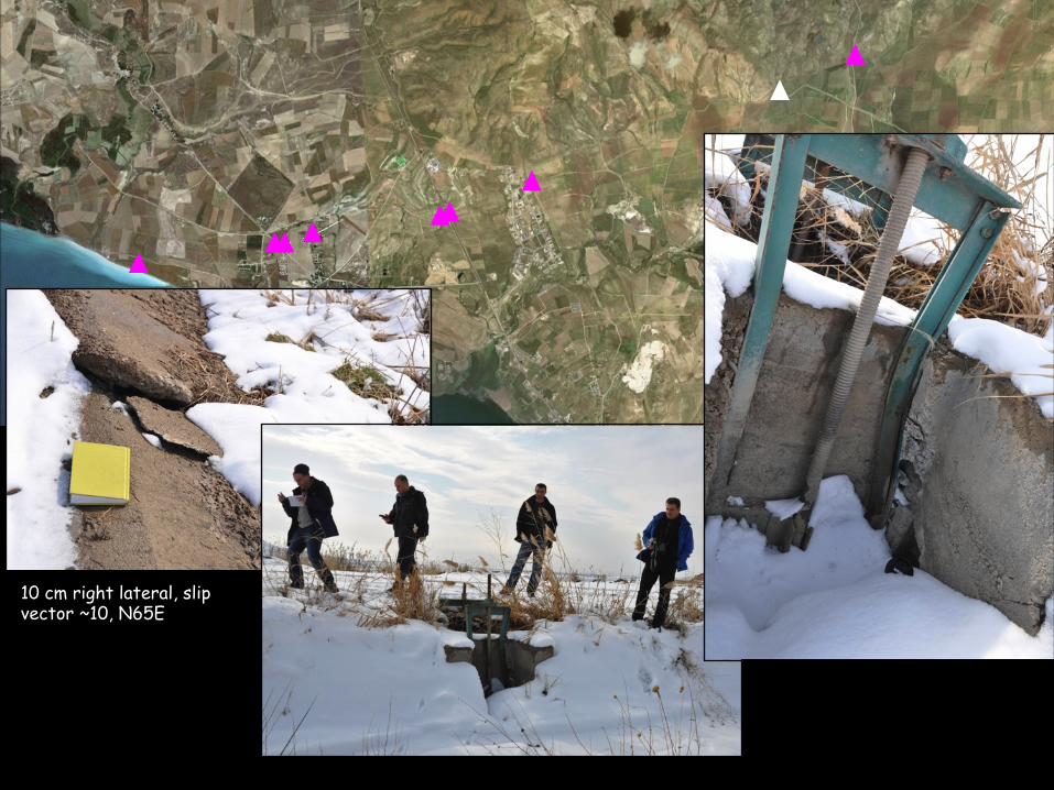
10 cm right lateral, slip vector ~10, N65E
AFAD
MTA
North side up
10 cm reverse, 4 cm left lateral motion, north side up
ITU
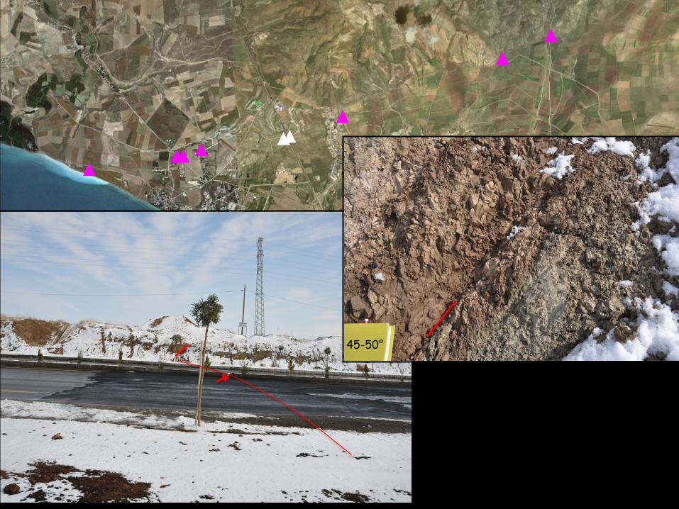
45-50°
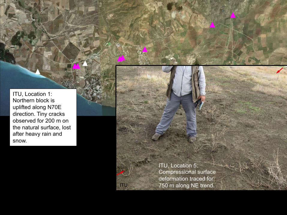
ITU, Location 5: Compressional surface deformation traced for 750 m along NE trend. ITU
ITU, Location 1: Northern block is uplifted along N70E direction. Tiny cracks observed for 200 m on the natural surface, lost after heavy rain and snow.
ITU
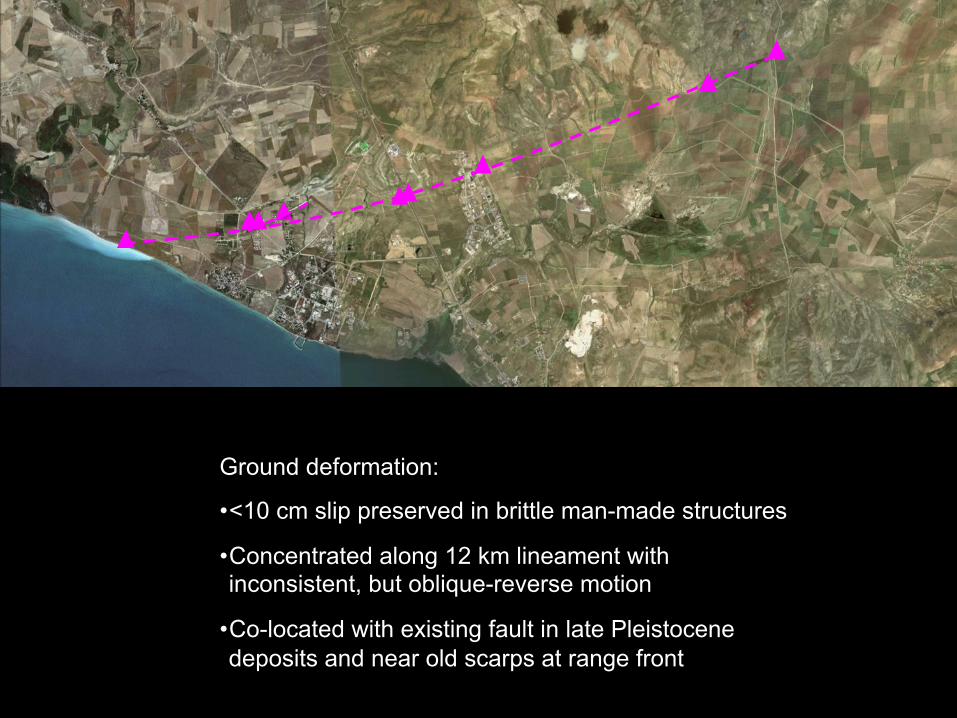
Ground deformation:
• <10 cm slip preserved in brittle man-made structures
• Concentrated along 12 km lineament with inconsistent, but oblique-reverse motion
• Co-located with existing fault in late Pleistocene deposits and near old scarps at range front

USGS-BW
USGS-CMT EB/FFM
KOERI
Depth (km
)
10
20
0 20 40
10X VE
A
B
A B
Fielding, Van Supersite
Regional view: • Lineament aligned with western margin of InSAR uplift pattern: axial surface associated with limb rotation
• 3D geometry of the hypocenter, lineament, and uplift pattern require multiple or curved fault
• Maximum uplift is region low topography
Fielding, Van Supersite MTA Report
Lake Van
Lake Ercek
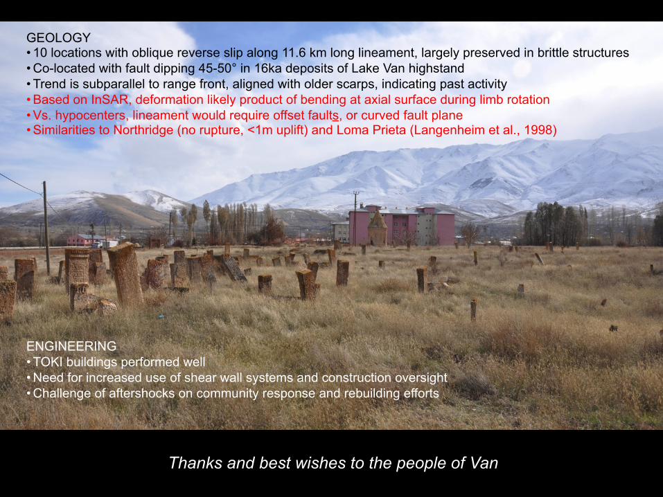
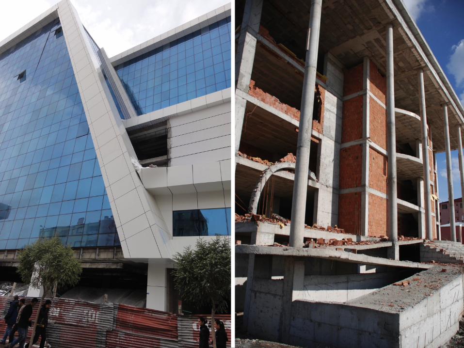
GEOLOGY • 10 locations with oblique reverse slip along 11.6 km long lineament, largely preserved in brittle structures • Co-located with fault dipping 45-50° in 16ka deposits of Lake Van highstand • Trend is subparallel to range front, aligned with older scarps, indicating past activity • Based on InSAR, deformation likely product of bending at axial surface during limb rotation • Vs. hypocenters, lineament would require offset faults, or curved fault plane • Similarities to Northridge (no rupture, <1m uplift) and Loma Prieta (Langenheim et al., 1998) ENGINEERING • TOKI buildings performed well • Need for increased use of shear wall systems and construction oversight • Challenge of aftershocks on community response and rebuilding efforts
Thanks and best wishes to the people of Van