presentation gis natura - wur
TRANSCRIPT
State of play of modern technologies used in spatial planning
Assoc. prof. Stelian Dimitrov, Ph.D.
What are geospatial technologies?§ Came from the convergence of these three technologies
§ GPS (or GNSS which is the correct name)- technology, based on earth-orbiting satellites providing us with precise location data
§ Remote sensing- using different flying platforms (satellite, aircraft or drone) to gather information about earth surface
§ GIS – platforms for gathering, processing and integrating geospatial data, and through application different methods and tools for spatial analysis- producing and visualizing geospatial information
Introduction: Why geospatial technologies in SP?
§ Modern spatial planning is directly associated with the application of geo-spatial information technologies (GIS):SO, THE USE OF GIS IS INEVITABLE!
§ In the centre of the process is the space and its attributes: We need integrative platform for spatial analysis and development of different scenarios or possible spatial arrangements and combinations of spatial attributes
§ The new geospatial technologies are changing dramatically the approaches and methods for data gathering, processing and analysis: provide a reliable information basis for decision making processes
§ Major challenges: too many data sources, different scales, resolution, formats, tools-the need of harmonization
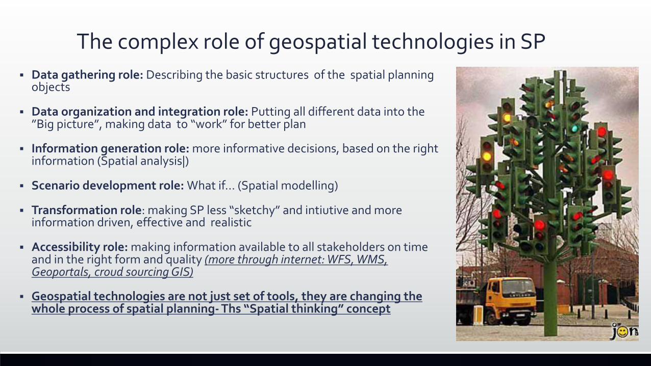
The complex role of geospatial technologies in SP§ Data gathering role: Describing the basic structures of the spatial planning
objects
§ Data organization and integration role: Putting all different data into the ”Big picture”, making data to “work” for better plan
§ Information generation role: more informative decisions, based on the right information (Spatial analysis|)
§ Scenario development role: What if… (Spatial modelling)
§ Transformation role: making SP less “sketchy” and intiutive and more information driven, effective and realistic
§ Accessibility role: making information available to all stakeholders on time and in the right form and quality (more through internet: WFS, WMS, Geoportals, croud sourcing GIS)
§ Geospatial technologies are not just set of tools, they are changing the whole process of spatial planning- Ths “Spatial thinking” concept
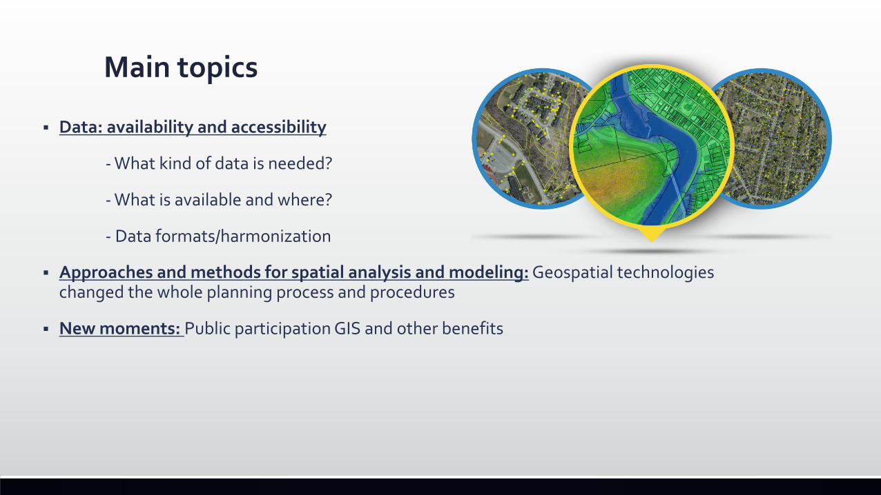
Main topics
§ Data: availability and accessibility
- What kind of data is needed?
- What is available and where?
- Data formats/harmonization
§ Approaches and methods for spatial analysis and modeling: Geospatial technologies changed the whole planning process and procedures
§ New moments: Public participation GIS and other benefits
Practical aspects - requirement for geospatial data for the Natura 2000 network Key message: Harmonisation of data from different sources is needed and the development of common standards for information to make best use of the available spatial planning tools.
§ Natura 2000 network- the the cornerstone of the European policy related to environmental protection
§ One of the largest organized, and to a great extent standardized, initiatives within the EU for collecting and processing geospatial information and data
- common structure of the data
- harmonized requirements
- clear system for reporting and data access
§ The challenges:
§ The large territorial extent of the network (including over 27.000 sites in EU28), and the unique character of each area.
§ Different status of the Data in different countries (not only speaking about Natura 2000 sites data, but also about the data for their assessment)
Spatial data for Natura 2000
§ Various GIS tools and technologies were introduced concerning the gathering, maintenance and accessibility of the spatial data on Natura 200 network- all member states developed own GIS based systems for Natura 2000
§ The European Commission (with the support of the EEA) has developed a public viewer for all Natura 2000 sites based on state of the art GIS technology
§ Database- all Natura 2000 sites available for download at scale 1:100 000
§ Web Map Service (WMS) protocol- ready to use
§ Web Feature Service (WFS) protocol- going to be available soon
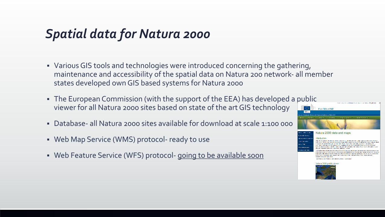
What are going to be the benefits from more accessible data?§ No need to put all the data in local machines- WFS and WMS protocols will allow
spatial planners to use more data from more sources in standardized way;
§ Easy data sharing- common protocols will make the data delivering and reporting between EC and member states much more effective
§ The Natura 2000 data will be used more widely- better decisions
§ Better understanding of Natura 2000
INSPIRE: Harmonising spatial information standards across Europe
§ The INSPIRE Directive addresses the spatial information of various fields, including the environment.
§ The main aim of the Directive is the establishment of an Infrastructure for Spatial Information in the European Community (INSPIRE)
§ The objective: overcoming the challenges regarding the lack of availability, accessibility, and sharing of spatial information across the various levels of public authority in Europe.
§ It defines common standards for 34 spatial data themes and Natura 2000 is one of the explicitly mentioned classification - designation schemes in INSPIRE Protected sites data specifications.
Three example projects on spatial data for nature and regional planningNatureSDI Plus project:
§ One of the first projects developed to directly contribute to the Annexes I and III of the INSPIRE Directive
§ Addressing the need for interoperable, accessible and harmonized datasets for geo-information provided in the field of environmental protection.
§ The aims of the project are achieved through state of the art methodologies and best practice examples
§ As the first step towards the harmonization process, the project analyses the data usability and accessibility within a wide European context.
§ Best Practices on interoperable datasets for nature conservation
HUMBOLD PROJECT§ Project that is designed to facilitate the integration and harmonization of different datasets
into a common European structure.
§ It contributes to the implementation of a European Spatial Data Infrastructure (ESDI) that integrates the diversity of spatial data available for a multitude of European organizations.
§ A key feature of the Humboldt project is the development of scenario applications that provide specific examples of the use of the Humboldt framework to address the challenges of the interoperability of geospatial data in a variety of application settings.
§ The main aim of the Protected Areas Scenario is to embed geo-information managed by park authorities in a seamless flow gathering data from diverse sources at different level, European, national, regional, enabling its exploitation for planning, management and tourism promotion.
§ The website of the project gives access to the open source software which is an output of the activities aimed at achieving the objectives.
§ Plan4all is focused at the harmonization of spatial planning data according to the INSPIRE Directive based on the existing best practices in EU regions and municipalities and the results of current research projects.
§ It is funded under eContentplus "Best Practices Network“, project started in May 2009.
§ The main objective of Plan4all was to build a network of organizations (local, regional and national public bodies, stakeholders, ICT industry organizations; organizations dealing with planning issues and regional development; universities; and international organizations)
§ The results of the project are
- European forums for SDI in spatial planning,
- Database of best practices and analysis of best practices
- Plan4All Geoportal- place for publishing, testing and harmonization of spatial planning data
Methods for spatial analysis and modelling of data
§ The complex character of the Natura 2000 sites requires a wide range of spatial and analytic approaches, methods and models to facilitate the design and decision-making in spatial planning process of Natura 2000 sites.
§ These approaches and techniques are required to make the complex links between spatial developments and habitat conservation needs
§ Different methods and techniques- spatial correlation, interpolation, overlay etc.
§ From data to information- improving the decision making (less intuitive, more informative decisions)
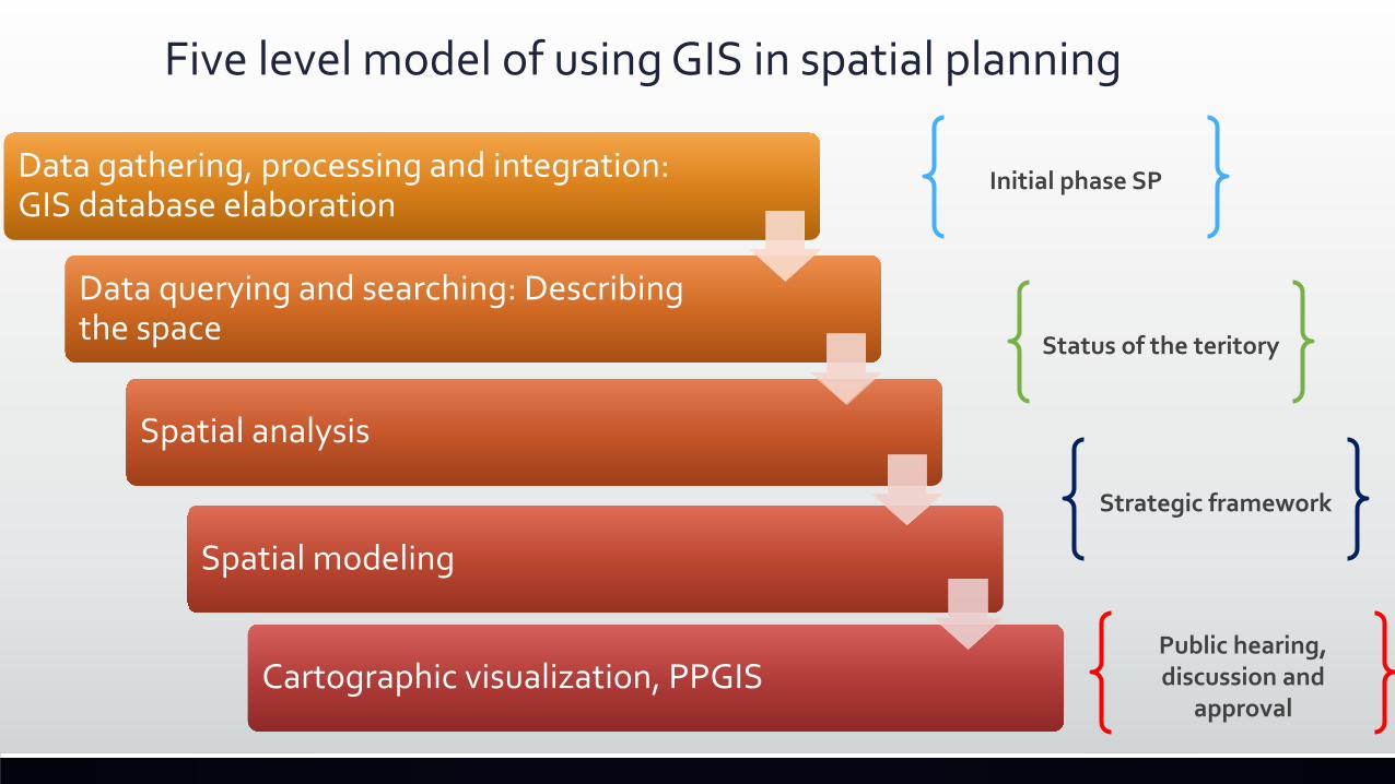
Five level model of using GIS in spatial planning
Data gathering, processing and integration: GIS database elaboration
Data querying and searching: Describing the space
Spatial analysis
Spatial modeling
Cartographic visualization, PPGIS
Initial phase SP
Status of the teritory
Strategic framework
Public hearing, discussion and
approval
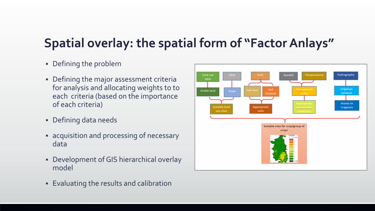
Spatial overlay: the spatial form of “Factor Anlays”§ Defining the problem
§ Defining the major assessment criteria for analysis and allocating weights to to each criteria (based on the importance of each criteria)
§ Defining data needs
§ acquisition and processing of necessary data
§ Development of GIS hierarchical overlay model
§ Evaluating the results and calibration
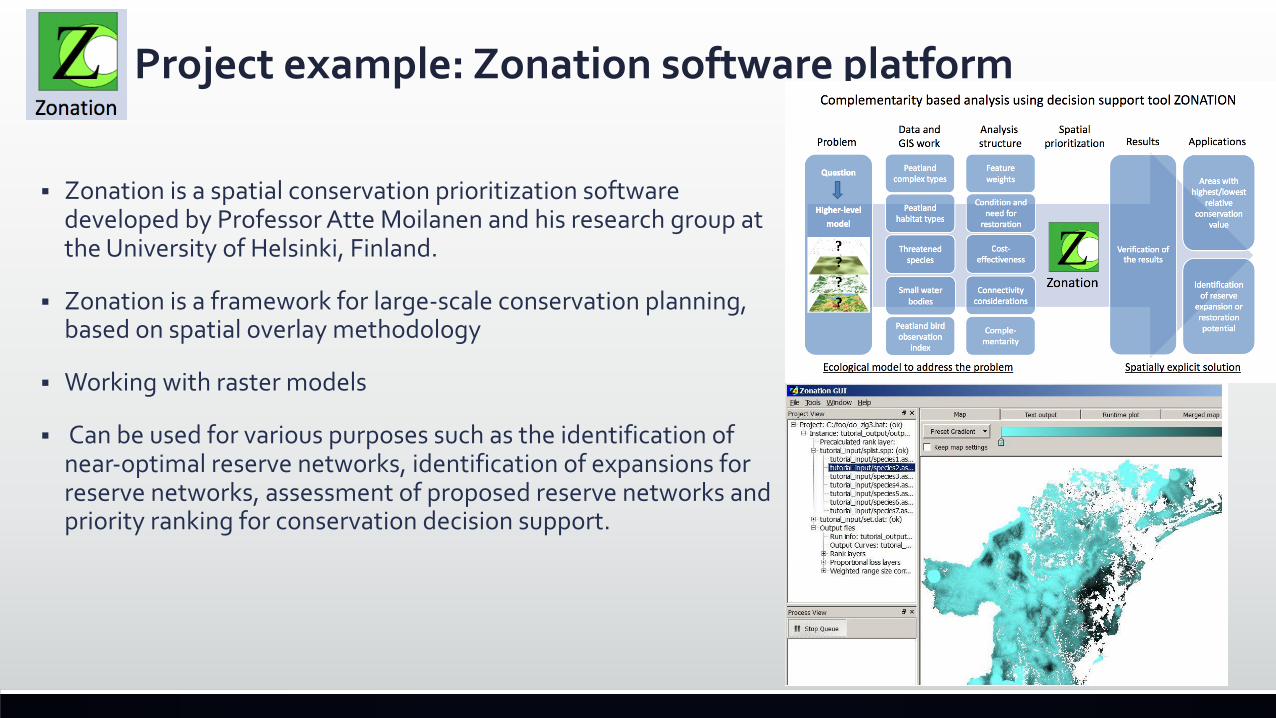
Project example: Zonation software platform
§ Zonation is a spatial conservation prioritization software developed by Professor Atte Moilanen and his research group at the University of Helsinki, Finland.
§ Zonation is a framework for large-scale conservation planning, based on spatial overlay methodology
§ Working with raster models
§ Can be used for various purposes such as the identification of near-optimal reserve networks, identification of expansions for reserve networks, assessment of proposed reserve networks and priority ranking for conservation decision support.
Remotely sensed data: The “Big Data” is more accessible and usable now§ Remote Sensing (RS) data and techniques are becoming more and more popular among
t spatial planners and natural resource managers,
§ They are supporting not only the planning procedures, but the whole process of managing and monitoring the status of the ecosystems, landscapes and the human-nature interaction.
§ Remote sensing supplies accurate and non-subjective information for land-use and other forms of spatial planning in areas where maps are not available, or for information generation, which cannot be collected with the traditional methods (such NDVI index for example).
§ Bridging information gaps and updating the information from the traditional analogue spatial maps.New forms: Unmanned aircrafts with different sensors
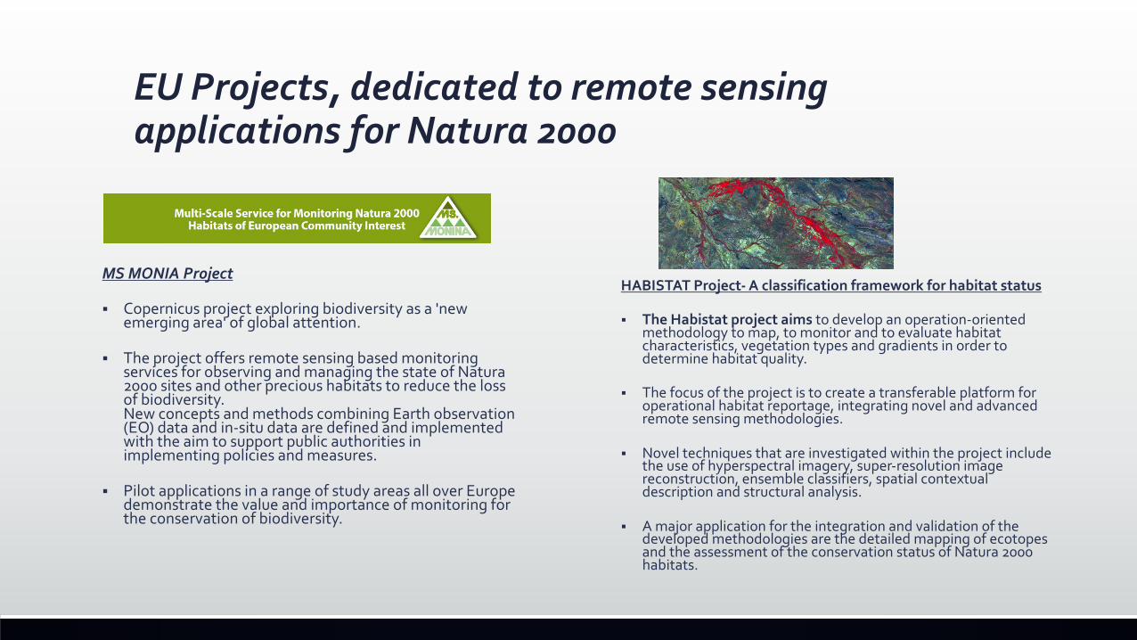
EU Projects, dedicated to remote sensing applications for Natura 2000
HABISTAT Project- A classification framework for habitat status
§ The Habistat project aims to develop an operation-oriented methodology to map, to monitor and to evaluate habitat characteristics, vegetation types and gradients in order to determine habitat quality.
§ The focus of the project is to create a transferable platform for operational habitat reportage, integrating novel and advanced remote sensing methodologies.
§ Novel techniques that are investigated within the project include the use of hyperspectral imagery, super-resolution image reconstruction, ensemble classifiers, spatial contextual description and structural analysis.
§ A major application for the integration and validation of the developed methodologies are the detailed mapping of ecotopesand the assessment of the conservation status of Natura 2000 habitats.
MS MONIA Project
§ Copernicus project exploring biodiversity as a 'new emerging area' of global attention.
§ The project offers remote sensing based monitoring services for observing and managing the state of Natura 2000 sites and other precious habitats to reduce the loss of biodiversity.New concepts and methods combining Earth observation (EO) data and in-situ data are defined and implemented with the aim to support public authorities in implementing policies and measures.
§ Pilot applications in a range of study areas all over Europe demonstrate the value and importance of monitoring for the conservation of biodiversity.
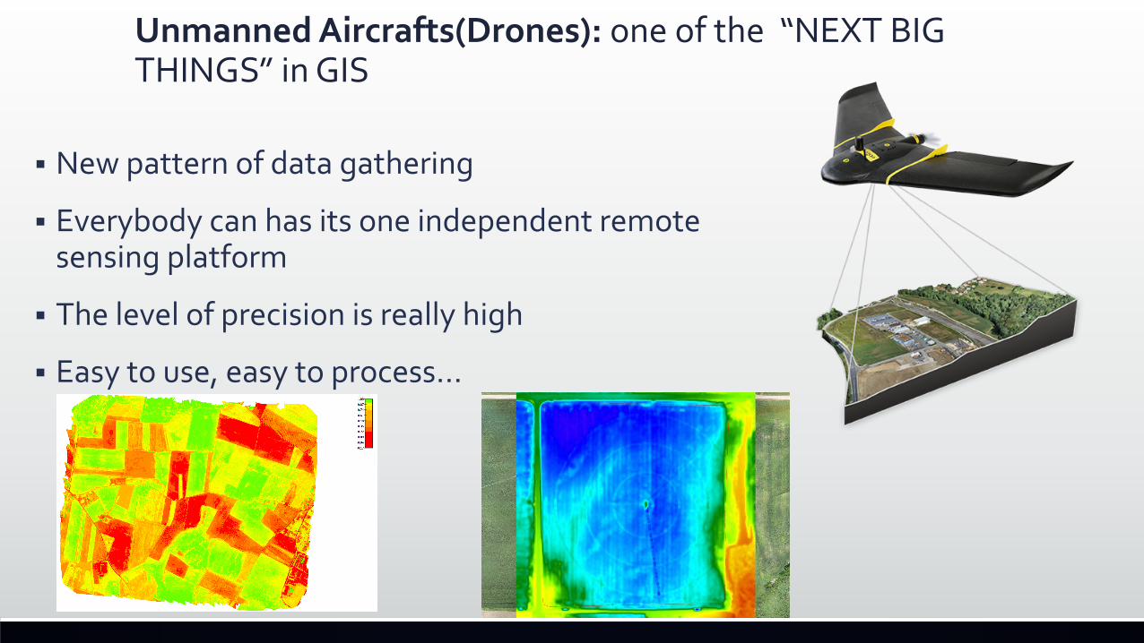
Unmanned Aircrafts(Drones): one of the “NEXT BIG THINGS” in GIS
§ New pattern of data gathering
§ Everybody can has its one independent remote sensing platform
§ The level of precision is really high
§ Easy to use, easy to process…
New approaches - Public Participation GIS (PPGIS)
§ Planning is a very complex process- many actors are involved, different stakeholders, community is involved
§ Need of effective tools for communication and participation
§ The necessity of geospatial information resources and the need for supporting and providing information during spatial planning, has transformed the GIS as a core inventory, analytical and visualization tool that creates a platform for consultation with multiple actors in every phase of the planning process
§ The rapid development and innovation in geospatial technology, its integration with the Internet technology, facilitated putting into practice in the field of spatial planning the so called public participation geographic information system (PPGIS)
PPGIS: definition and use§ Application designed to exploit the potential of GIS to promote community goals,
relating the technical capacity of geospatial technologies with local knowledge
§ They are not aiming at producing complex spatial analysis results and information, the purpose is to make community to understand the local place and the spatial arrangements, proposed by the plan
§ More story maps, less complicated content
§ The goals are usually not to turn participation into GIS, but to organize and present information needed to make public participation process in spatial planning more effective: more informed stakeholders=better decisions
§ Internet is the dominant platform

Examples§ http://gispro.bg/pleven_ipgvr/

Conclusions
§ The integration of Natura 2000 network in spatial planning requires the harmonization of data and common standards: That will result in better and more realistic plans
§ The use of spatial planning technologies (such GIS) to better address the challenges for Natura 2000 is a step towards integrated spatial planning- this is necessary to ensure connectivity of Natura 2000 sites through the EU.
§ The main benefits of the use of GIS and other spatial technologies and methods in for the Natura 2000 network are coming for their capacity to collect, process, store, manage, analyse and visualize the necessary spatially referred data to assess the impact of spatial developments in and around Natura 2000 sites.
§ Planners and experts can use these systems to add, extract, process, update and retrieve spatial information for plans or projects relevant for the Natura 2000 network or for a particular Natura 2000 site.
§ Furthermore GIS-based maps and visualizations greatly assist in understanding situations and widening participation in the planning and management procedures.- Better communication between different experts, departments, organizations, and the public.
Thank you!