fouth five-year review report for the lone pine … · fourth five-year review report lone pine...
TRANSCRIPT
FOURTH FIVE-YEAR REVIEW REPORT LONE PINE LANDFILL SUPERFUND SITE
MONMOUTH COUNTY, NEW JERSEY
£ < 5
V §z PRO^°
O z Ui O
Prepared by
U.S. Environmental Protection Agency Region 2
New York, New York
September 2014
Walter E. Mugdan, Director Emergency and Remedial Response Division
Date:
265529
IIIIIIIIIIIIIIIIIIIIIIIIHIIIIIlin

Table of Content
Executive Summary ...............i Five-Year Review Summary Form ii Introduction 1 Site Chronology 1 Background 1
Site Geology/Hydrogeology 2 Land and Resource Use 2 History of Contamination... ....2 Initial Response 3 Basis for Taking Action 3
Remedial Actions.. ... ... 4 Remedy Selection..... 4 Remedy Implementation .. .... .. 5 System Operations/Operation and Maintenance. 5
Progress Since Last Five-Year Review ..7 Proteciiveness Statementfrom the Last Five-Year Review................ ........7 Five-Year Review Process 7
Administrative Components . .. 7 Community Involvement 7 Document Review 8 Data Review ... 8 Site Inspection 10 Interviews .. 10 Institutional Controls Verification 10
Technical Assessment.... ..........................................11 Question A: Are the remedies functioning as intended by the decision documents?.. 11 Question B: Are the exposure assumptions, toxicity data, cleanup levels, and remedial action objectives used at the time of the remedy still valid? 11 Question C: Has any other information come to light that could call into question the protectiveness of the remedies?..... 12
Issues, Recommendations and Follow-Up Actions.... .....13 Protectiveness Statement ..................................................................13 Next Review. ................................13 Tables............ 14
Table 1: Chronology of Site Events 14
Table 2: Annual System O&M Costs 15 Table 3: Documents, Data and Information Reviewed in Completing the Five-Year Review
.......... ......... 16
Table 4 - Groundwater Contamination Concentrations —17 Comparison of Groundwater Criteria for Chemicals of Concern ..77
Attachments 18

Executive Summary
This is the fourth five-year review for the Lone Pine Landfill Superfund located in Freehold Township, Monmouth County, New Jersey. The purpose of this five-year review is to review information to determine if the remedy is and will continue to be protective of human health and the environment. The triggering action for this statutory five-year review was die completion of the 3rd five-year review in September 2009.
The various components of the remedy implemented at the site (landfill cap, slurry wall, leachate collection, methane gas ventilation, and waste water treatment facility) are intact and in good repair. The remedy protects the public and the environment from exposure to contaminated materials. An operation and maintenance program is in effect to monitor the cap's condition as well as the leachate and gas emissions at the site. Regular environmental sampling indicates that the remedy is functioning as intended by the decision documents. The remedy is protective of human health and the environment.
i

Five-Year Review Summary Form
ii

I s s u es/ Rec o m m c n (I a t i o n s
OU(s) without Issues/Recommendations Identified in the Five-Year Review; 01, 02
Issues and Recommendations Identified in die Five-Year Review:
QU(s): Sitewide Issue Category: No Issue
Issue:
Recommendation: None
Affect Current Protectiveness
Affect Future Protectiveness
Party Responsible
Oversight Party
Milestone Date
No No PRP EPA
Protectiveness Statemcnt(s)
Operable Unit: Protectiveness Determination: Addendum Due Date OU1 Protective (if applicable):
Protectiveness Statement: The remedy is protective of human health and the environment.
I' rote et i\ en ess S t ate in ent(s)
Operable Unit: Protectiveness Determination: Addendum Due Date OU2 Protective (if applicable):
Protectiveness Statement: The remedy is protective of human health and the environment
Siteyvide Protectiveness Statement
Protectiveness Determination: Addendum Due Date (if applicable): Protective
Protectiveness Statement: The remedy is protective of human health and the environment.
iii
Introduction
The purpose of a five-year review is to evaluate the implementation and performance of a remedy in order to determine if the remedy is and will continue to be protecti ve of human health and the environment and is functioning as intended by the decision documents. The methods, findings, and conclusions of reviews are documented in the five-year review. In addition, five-year review reports identify issues found during the review, if any, and document recommendations to address them.
This is the fourth five-year review for the Lone Pine Landfill Superfund site (site), located in Freehold, Monmouth County, New Jersey. The five-year review was conducted by the United States Environmental Protection Agency (EPA) Remedial Project Manager (RPM) Nigel Robinson. The review was conducted pursuant to Section 121(c) of the Comprehensive Environmental Response, Compensation, and Liability Act (CERCLA), as amended, 42 U.S.C. §9601 et seq. and 40 CFR 300.430(f)(4)(ii), and in accordance with the Comprehensive Five-Year Review Guidance, OSWER Directive 9355.7-03B-P (June 2001). This report will become part of the site file;
The triggering action for this statutory review is the previous five-year review, signed September 28,2009. A five-year review is required at this site due to the fact that hazardous substances, pollutants or contaminants remain at the site above levels that allow for unlimited use and unrestricted exposure. The site consists of 2 operable units. OU1 addresses the landfill. OU2 addresses groundwater contamination. Both OUs are addressed in this five-year review.
Site Chronology
See Table 1 for the site chronology.
Background
Physical Characteristics
The Lone Pine Landfill Superfund site is located in the Township of Freehold, New Jersey. The site (See Figure 1) is bounded by the Manasquan River to the north, Burke Road to the east, a forested wetland to the west, and a leaf composting facility to the south. The location is rural to suburban and the closest resident is approximately 600 feet south of the landfill. A local sportsman's club and the Turkey Swamp Wildlife Management Area are approximately 1,000 feet from the landfill. Additionally, a 700-acre municipal potable water supply reservoir is 16 miles downstream of the landfill, off of the Manasquan River.
The on-site topography is relatively flat but gradually slopes toward the Manasquan River in the north. The site lies within a 2.4-square-mile sub-basin of the regional Manasquan River watershed. Surface waters within the sub-basin drain into tributaries of the easterly flowing Manasquan River. Groundwater discharges in the immediate vicinity of the landfill and provides a major source of water for the Manasquan River, which has a variable flow rate of approximately 2 to 70 cubic feet per second (cfs). The groundwater in the vicinity of the site is currently utilized as a source of drinking water and is classified as such.
1

Site Geology/Hydrogeology
The geology is typical of the Atlantic Coastal Plain Physiographic Province, consisting of gently southeastward dipping unconsolidated marine and fluvial deposits of clay, silt, sand and gravel. The shallow geologic units beneath the landfill in descending order are the Vincentown Formation, the Hornerstown Formation, and the Red Bank Formation; these are of Paleocene to Late Cretaceous age.
The Vincentown Formation is a medium-grained sand that is absent north of the landfill and is up to 30 feet thick on the south side of the landfill. The Hornerstown Formation is a silty, finegrained sand with varying amounts of clay that is considered to be a confining layer. The Red Bank Formation, which is 50 to 60 feet in thickness, contains four distinct lithologic units. The upper unit is a partially indurated, silty, fine-grained sand which is about 10 feet in thickness. The next unit, which is called the Tinton Sand Member, is about 5 to 10 feet in thickness; it is a ferric carbonate sand. Beneath the Tinton Sand Member is a poorly sorted, medium-to-coarsegrained sand, 10 to 35 feet in thickness. The Navesink Formation is a massive, poorly sorted, clayey sand that is about 30 feet in thickness. This formation is considered to be a confining layer that separates the Wenonah-Mount Laurel aquifer system from the overlying Red Bank Formation.
The uppermost saturated units (Vincentown and Hornerstown Formations) comprise what is referred to as the Water Table aquifer. Horizontal flow in the Water Table aquifer is from the landfill towards the river. Calculated groundwater flow velocity from the landfill to the river ranges from 80 to 740 feet per year. Horizontal groundwater flow in the underlying Red Bank aquifer is also toward the river from the landfill, with calculated velocities ranging from 12 to 91 feet per year. Vertical groundwater flow in the vicinity of the landfill is downward from the Water Table aquifer to the Red Bank aquifer beneath die landfill, and is upward in the valley of the Manasquan River. Vertical groundwater flow is also upward over the entire area from the Navesink Formation to the Red Bank aquifer.
Land and Resource Use
The site lies in a rural area characterized predominantly by agricultural land use and low-to-mid density residential development. Other significant types of land use in the vicinity of the site include the Great Adventure Amusement Park and die Turkey Swamp Wildlife Management Area and County Park. Much of the land surrounding the site is open space and the potentially responsible parties (PRPs) have actively pursued the acquisition of adjacent parcels and donated them to the State of New Jersey to preserve the area and serve as a buffer. Wetlands were constructed on the property to the west of the site and the area has been designated as open space. Additional property to the east of the site is also open space. The current and future use of the property is being planned to reduce encroachment along the site. Overall development in the area has slowed. The most highly developed area in the vicinity of the site is Freehold Borough, the Monmouth County seat.
History of Contamination
The Lone Pine Landfill began operation in 1959 and throughout its history was operated by the now-defunct Lone Pine Corporation. Until it was closed, the landfill accepted a wide variety of
2
wastes for disposal, including municipal, commercial and industrial wastes. In addition, the landfill received thousands of drums containing chemical wastes from the facilities of Scientific Chemical Processing Company (SCP) in Newark arid Carlstadt, New Jersey. Drums, as well as tankers of liquid chemicals and containers of chemical sludges, were transported to the Lone Pine Landfill by Taylor Pumping Services, Inc., and disposed of at the landfill.
Initial Response
In 1981 and 1982, EPA and the New Jersey Department of Environmental Protection (NJDEP) conducted initial studies to ascertain the potential threat to public health and the environment from the site. Excavation and sampling demonstrated the presence of leaking drums containing a variety of organic substances, heavy metals and pesticides. Severe groundwater contamination was also documented.
Basis for Taking Action
The site was proposed for inclusion to the National Priorities List (NPL) of Superfund sites in October 1981. The site became final in September 1983. EPA conducted a remedial investigation (RI) at the site from 1985 to 1986. The RI indicated high levels of volatile organics, phenolic compounds, polyaromatic hydrocarbons (PAHs) and inorganic compounds in soils, groundwater and surface water.
In evaluating the potential risk to human health and the environment associated with the site, EPA focused on the groundwater contaminants that were likely to pose the most significant risk to human health and the environment. EPA identified several potential pathways by which the public could potentially be exposed to contaminant releases, including exposure to contaminated groundwater at die site.
The following hazardous substances were identified in the groundwater:
Acetone Chlorobenzene 1,2-Dichloroethane Toluene Xylenes Phenol Trichloroethene 1,1,2,2-Tetrachlorothane
At the time of the RI, EPA concluded that there was no exposure through the groundwater medium to nearby residents, since there were no private wells located within the contaminated plume. However, under future land-use or plume migration scenarios, the area impacted by the site could be developed residentially and the groundwater potentially used as a source of drinking water. The potential routes of exposure to residents for that scenario were ingestion of contaminants in groundwater and inhalation of groundwater vapors, via showering.
Ecological risks were not evaluated during the initial RI.
3
Benzene Chloroethane 1,2-Dichloroethene 2-Hexanone 2-Methylphenol Carbon Disulfide Chloroform Aluminum
2-Butanone 1,1 -Dichloroethane Ethylbenzene Methylene chloride 4-Methyl-2-pentanone Styrene Vinyl chloride Barium

Remedial Actions
Remedy Selection
The first Record of Decision (ROD) for Operable Unit 1 was signed in September 1984; a second ROD was signed in September 1990 for Operable Unit 2. The Operable Unit 1 ROD addressed containment of the landfill and cleanup of the contaminated landfill leachate directly beneath the landfill. The Operable Unit 2 ROD addressed the contaminated groundwater beyond the perimeter of the landfill.
The purpose of the 1984 ROD was to contain the landfill, landfill leachate and contaminated groundwater.
The 1984 ROD required the following:
• Installation of an impermeable cap and methane gas venting system to reduce the infiltration of precipitation and eliminate the problem of methane gas build-up from decaying garbage beneath the cap;
• Installation of a slurry wall around the perimeter of the landfill to control the migration of contaminants and groundwater through the area;
• Installation of a groundwater/leachate collection and treatment system to prevent contamination from leaching through and under the slurry wall; and
• Performance of an additional RI/FS to determine the nature and extent of off-site groundwater contamination and to assess the need for further off-site remediation.
In addition to the above ROD components, the 1984 ROD also set forth the following remedial action objectives:
® To maintain an adequate and safe drinking water supply for the population that could be affected by groundwater contamination migration;
• To protect the Manasquan River surface water uses (fishing, swimming and water supply) from contaminant release; and
• To prevent local exposure to contaminated materials at the site and in adjacent areas (soils, sediments, and leachate).
A requirement of the 1984 ROD was the performance of a remedial investigation and feasibility study (RI/FS) to determine the nature and extent of off-site groundwater contamination and to assess the need for further remediation. A PRP Group agreed to fund and perform this RI/FS under EPA oversight The RI/FS began in late 1985 and was completed in 1990. Based upon the RI/FS and public comments, EPA issued a ROD in September 1990 to address the contaminated groundwater beyond the perimeter of the landfill.
4

The 1990 ROD required the following components:
• Installation of a 2,800-foot long interceptor trench to collect contaminated groundwater and prevent it from entering the Manasquan River;
• Installation of three extraction wells for pumping leachate and contaminated groundwater;
• Construction of an on-site waste water and leachate treatment plant to treat the collected contaminated groundwater and leachate. This treatment plant could be built separately from Operable Unit 1 or the two systems could be integrated into a single design;
• Installation and connection of piping from die interceptor trench to the groundwater treatment plant;
• Conduct a long-term monitoring program; and
• Institutional controls to restrict groundwater usage in the area affected by the site.
In addition, the 1990 ROD set forth the following remedial action objectives;
• Prevent migration of contamination into the Manasquan River and other areas; and
• Restoration of the aquifer between the landfill and the river
Remedy Implementation
The design of the landfill remedy was prepared by the U.S. Army Corps of Engineers (COE) under EPA's supervision. Design work was initiated in September 1984 and was completed in June 1989 by the COE.
A group of PRPs agreed to fund, design and construct the groundwater remedy and to implement the Operable Unit 1 remedy based upon a modified version of EPA's design. A single treatment system would be implemented to address leachate and groundwater for both remedies. Construction of the remedy was performed by a group of PRPs under EPA and COE oversight. Construction began in July 1991 and was completed in December 1993. The construction components included: installation of a 57-acre multi-layer cap; installation of a 5,965-foot slurry cut-off wall; installation of a chemical leachate and methane gas collection system; construction of a powder activated carbon treatment wastewater treatment plant with piping to the Ocean County Utilities Authority sewage treatment plant; installation of a methane gas flare; construction of a perimeter drainage system; and installation of a hydraulic monitoring system.
System Operations/Operation and Maintenance
Since 1994, the PRP Group has been operating the extraction and treatment system under EPA oversight and have conducted long-term monitoring and maintenance activities according to the EPA approved operation and maintenance (O&M) plan.
5

The primary activities associated with O&M include the following:
• Monitor, observe, and evaluate the distribution and migration of groundwater impact during the operation of the treatment system and post-closure, and to assess the performance of the treatment system;
« Collect and analyze the groundwater and treatment plant discharge for volatile organic compounds; and
• Monitor the hydraulic gradient within the slurry wall to maintain an inward gradient across the slurry wall and to evaluate the effectiveness of the slurry wall.
Landfill Cap
The multilayer landfill cap consists of a manufactured prefabricated clay liner; a polyethylene geomembrane liner; a sand drainage layer with an overlying filter fabric; a soil cover; and a grass-covered topsoil layer. The construction was completed in November 1993. Periodic cap inspection and infiltration cell monitoring indicate the cap is generally operating as intended.
Interceptor Drain
The interceptor drain and groundwater extraction well system were placed into service in 1994. The interceptor drain prevents water from flowing towards the Manasquan River and is equipped with several sumps and submersible pumps. The water collected by the drain flows to the sumps and is pumped to the waste water treatment plant for treatment. There are also three groundwater extraction wells that pump from the Redbank aquifer to the waste water treatment plant. A fourth well is a shallow groundwater extraction well that pumps into die interceptor drain sump. Since start-up, the system has operated smoothly. Some of the pumps have been replaced and are flushed out at least once per month due to the build-up of iron precipitation and iron bacteria.
Routine inspections unveiled corrosion in Tank T-200 and the Re-aeration Tank. Since the summer of 2011 through 2014, the treatment plant has been shut down for 4-8 weeks each year to inspect these tanks. At times these tanks showed extensive corrosion and required repairs. While these tanks are taken offline, the treatment plant is shutdown, and this has allowed for inspection and servicing of the entire plant.
Annual O&M costs include the cost to extract and treat the contaminated groundwater, and groundwater monitoring and sampling events. Additional costs include utilities, the disposal of materials, carbon purchase and recharge, laboratory costs, and plant operation. The total O&M cost for the period between 2009 and 2013 is estimated at $7,281,965. The O&M costs for the past five years are summarized in Table 2. These costs are higher than those incurred in the previous five-year review period. Along with costs related to ongoing remedy optimization activities, the increase in costs are attributed to the more frequent inspections and repairs to Tank T-200 and the Re-aeration Tank.
Potential site impacts from climate change have been assessed, and the performance of the remedy is currently not at risk due to the expected effects of the climate change in the region and near the site.
6

Progress Since Last Five-Year Review
Protectiveness Statement from the Last Five-Year Review
The third five-year review was conducted in September 2009. It concluded that the various components of the remedy as implemented at the site (landfill cap, slurry wall, leachate collection, methane gas ventilation, and waste water treatment facility) were intact and in good repair. The remedy protected the public and the environment from exposure to contaminated materials. An O&M program was in effect to monitor the cap condition as well as the leachate and gas emissions at the site. Regular environmental sampling indicated that the remedy was functioning as intended by the decision documents. The remedy was protective and expected to remain protective of public health and the environment.
Status of Recommendations and Follow-up Actions
There were no recommendations or follow-up actions from the previous five-year review.
Since the last FYR, operation, maintenance and monitoring has occurred at the site in accordance with the consent decrees and the site O&M plan.
Five-Year Review Process
Administrative Components
The five-year review team included Nigel Robinson (EPA-RPM), Edward Modica (EPA-Hydrologist), Charles Nace (EPA-Human Health Risk Assessor), Charles Nace (EPA-Eeological Risk Assessor) and Natalie Loney (EPA-Community Involvement Coordinator). This is a PRP-lead site.
Community Involvement
Notification of this five-year review was published on the EPA's website. Once the five-year review is completed, the results will be made available at the following locations:
Monmouth County Public Library 125 Symmes Drive Manalapan, New Jersey 07202 (732-431-7220)
Freehold Township Health Department 1 Municipal Plaza Freehold, New Jersey 07728 (732-294-2000)
USEPA Record Center 290 Broadway, 18th floor New York, New York 10007 (212-637-4308)
7

This five-year review report and other site related documents are also available online at www.epa.gov/region2/npl/lonepinelandfill/.
Document Review
The documents, data and information which were reviewed in completing this five-year review are summarized in Table 3.
Data Review
The data reviewed included the data from the third five-year review and subsequent monitoring data from 2010 through 2013.
Groundwater Monitoring
Groundwater monitoring has been performed at the site since completion of the remedies to determine if the Operable Unit 1 and Operable Unit 2 remedies are achieving their intended goals. Groundwater quality data is collected from monitoring wells located outside the landfill within the plume area between the slurry wall and die interceptor trench that runs parallel to the Manasquan River. Wells of the monitoring network are screened in both the shallow water-table aquifer (Hornerstown) and in the deeper Red Bank aquifer (see Figure 2).
For the 2010-2013 period, 28 wells were sampled at a quarterly or semiannual frequency. Analysis of groundwater samples showed that volatile organic compounds were consistently detected in 7 wells (MWID-3, S-l, UR-1, UR-3, UR-6, UR-7, and EPA-03A) with chlorobenzene (CB) and benzene being the most frequently detected chemical constituents. In general, concentrations of chemical constituents tended to fluctuate about an average value with varying trends over the period. For example, well MWID-3 (screened in the shallow zone, located near section 3 of the trench) showed concentrations of CB that fluctuated about a 241 parts per billion (ppb) average, whereas concentrations of benzene fluctuated about the value of 4.9 ppb, with no discernible trend for either constituent. Analysis of groundwater samples from well UR-3 (Red Bank, near section 5 of trench) show average concentrations of CB and benzene of 36.3 ppb and 39.2 ppb, respectively, with no trends over the period. In addition, 1,1-dichloroethane (DCA) and vinyl chloride (VC) were consistently detected in this well at average concentrations of 4.1 ppb and 7.5 ppb respectively.
The highest concentrations of benzene were reported for well UR-6 (screened in upper Red Bank, located near Burke Road about 250 feet from the North East comer of landfill) at an average of 408 ppb, with a maximum of 1,310 ppb reported for the first half of 2011 and a minimum of 9.6 ppb reported for the second half of 2013; however, a decreasing trend for benzene is discernable for the period. The average concentration of CB for this well was 43.9 ppb. Ethylbenzene was also detected in this well at a maximum concentration of 708 ppb for the first half of 2011, and at a minimum of 0.28 ppb for the second half of 2013, with a decreasing trend observed over the period. VC was also reported at an average concentration of 10 ppb for the period. Other volatile organic compounds detected in the well on a less frequent basis include toluene, total xylene, 1,2-DCA, TCE, and phenol.
For the well EPA-03 A (screened in the middle Red Bank, located near Burke Rd between the landfill and the interceptor trench) concentrations of benzene were reported to fluctuate widely
8

about a 155 ppb average, with sporadic non-detections for several quarters of 2010 and 2011, then an increase to 76.4 ppb in third quarter of 2012, followed by a decrease to 1.5 ppb in second quarter of 2013, then to a maximum of 870 ppb in the last quarter of 2013. Similarly, concentrations of CB fluctuated about the average of 51 ppb, with a minimum of 2.2 ppb reported for the second quarter of 2011 and a maximum of 154 ppb reported for the last quarter of 2013; a discernable increasing trend was noted for CB for the period. In fact, for the 2013 sampling period, particularly for the last two quarters, there was an abrupt increase in the number of chemical constituents detected compared to preceding quarters, with some detections at relatively high concentrations. The sudden appearance of multiple chemical constituents at the end of 2013 is an anomalous sampling result. The reason for the sudden detection of multiple contaminants in the aquifer is not clear, although their sudden appearance may have been brought on by unusual seasonal water levels or by disturbances made to the system.
Table 4 provides a comparison of the maximum concentrations of ROD contaminants of concern that exceed the State Ground Water Quality Criteria (SGWQC) for die 2012-2013 and 2007-2008 periods. Many of the contaminants that are listed show higher concentrations for the later period than for the earlier period indicating that high levels of contaminants still persist in parts of the aquifer. However, the maximum concentrations for 2012-2013 are biased by the unusual spike of chemical constituents reported for the latter part of 2013 for well EPA-03A. In effect, the concentrations of contaminants for the current five-year review period are, on average, as low as or lower than those of the previous period, an indication that there have been reductions since the last review. Furthermore, sizable concentration reductions have occurred when compared to earlier periods (i.e., from 2002 to 2003). Consequently, although data for last five years show that the Red Bank aquifer still contains some high concentrations of contaminants, these levels have decreased over time.
The wastewater treatment plant is designed to treat up to 150 gallons per minute of groundwater contaminated with high levels of volatile organic compounds (VOCs) and metals from both Operable Units 1 and 2, and continues to operate as designed. The effluent from the treatment plant shows that all contaminants of concern have been reduced to below Federal Maximum Contaminant Levels (MCLs) and the SGWQC. The treated effluent is discharged to the Ocean County Utilities Authority sewage system.
Surface Water and Sediment Monitoring
Prior to implementing the remedies, VOCs, heavy metals and pesticides were detected in the Manasquan River above health based levels. Since implementation of Operable Unit 2, surface
• water monitoring has indicated that the landfill has negligible impact on the water quality of the Manasquan River. Surface water quality samples are collected from three transect locations along the Manasquan River to assess the influence of landfill on the river. The interceptor trench prevents contaminated groundwater flow from the site to the river.
For 2010-2013, water-quality results show that CB was detected in transects 2 and 3 during the second and third quarters of each year. Concentrations ranged from 0.5 to 9.6 ppb and averaged 3.9 ppb. Benzene was also detected in transect 3 in the third quarter of 2012 and 2013 at about 1 ppb. These detections are low, appear to be seasonally driven, and do not impact downstream surface water quality. No exceedences of ROD-action levels for metals were reported for surface water.
9

Sediment data have indicated that there are no VOC impacts from the site to river sediment. Pesticides have been detected in the river sediments but are likely the result of past agricultural
. practices from the north side of the river or upstream of the landfill.
Hydraulic Monitoring
A network of 36 monitoring wells and piezometers is used to monitor water levels in and adjacent to the landfill on a quarterly basis. Six pairs of monitoring points are used to monitor the effectiveness of the of the slurry wall by determining horizontal hydraulic gradients between the shallow water bearing zone within the landfill and the shallow water table outside the slurry wall.
• For the period 2010-2013, water-level data have shown groundwater gradients to be predominantly inward, characterized by declining water table elevations inside the landfill and relatively stable to declining water table elevations outside of the landfill. The inward groundwater gradient indicates that the slurry wall is functioning as an effective mechanism for shallow groundwater containment
Six pairs of monitoring wells are used to monitor the vertical hydraulic gradients beneath the landfill by comparing piezometric levels within the Red Bank aquifer with the piezometric levels in the shallow water bearing zone inside the perimeter of the of the slurry wall. For the period 2010-2013, upward gradients were consistently reported for two well pairs, although other well-pairs showed downward gradients for many of the quarters. The gradient outside of slurry wall remains upward, indicating that deeper groundwater migrating away from the landfill is being captured by the collection trench. These results are consistent with historical water level measurements and show that, for different locations over the landfill, both upward and downward gradients can be manifest depending on the season.
Site Inspection The inspection of the site was conducted on August 27,2014. The inspection was conducted by Nigel Robinson, EPA's Remedial Project manager. The purpose of the inspection was to assess the operation of die remedy, including the waste water treatment plant, the leachate collection system, the methane gas venting system, the integrity of the landfill cap, slurry wall and fencing to restrict access to the site. The site was found to be in good condition. The fence surrounding the site remains intact and there are no visible signs of trespass onto the site. The landfill cap is properly maintained.
No significant issues were identified during this inspection.
Interviews No issues regarding the site emerged during this five-year review process. Therefore, no interview was conducted with any of the stakeholder, which includes the setding parties, the State of New Jersey, local government officials or community officials. However, general discussions regarding the site took place over this period with the settling defendants and the State of New Jersey.
Institutional Controls Verification
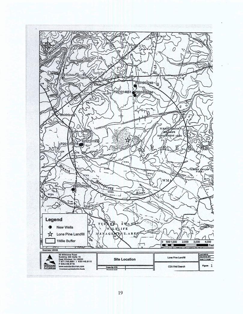
A Classification Exemption Area (CEA) has been established at the site and at buffer zones adjacent to the site (see Figure 2). The establishment of CEA will ensure that wells will not be
10

established within the contaminated groundwater associated with the site or draw contaminated groundwater from the site.
Technical Assessment
Question A: Are the remedies functioning as intended by the decision documents?
According to the RODs of 1984 and 1990, the Lone Pine Landfill site includes remedies for two operable units. OU1 addressed the 57-acre landfill proper and OU2 addressed contaminated groundwater between the landfill and the Manasquan River. OU1 includes installation of a slurry wall that encircles the landfill and is keyed into underlying confining layer, a multilayer cap, an active gas collection system, a leachate collection system, storm water control, and a wastewater treatment plant. The OU2 remedy is comprised of a 2,900-foot long interceptor drain, three recovery wells, and long-term monitoring of the aquifers and river waters, including sediment. The interceptor drain was designed to collect groundwater from the surficial and Red Bank aquifers and to prevent contaminated groundwater from discharging to the Manasquan River.
These remedies were needed to achieve the remedial goals of maintaining an adequate and safe drinking water supply that could be affected by groundwater contamination migration; preventing local exposure to contaminated soils, sediments, and leachate at the site and in adjacent areas; protecting the Manasquan River surface water from contaminant releases; preventing migration of contaminants into the Manasquan River and other areas; and a long-term restoration of the aquifer between the landfill and the River. All remedial activities were completed in June of 1994 with the monitoring program also initiated in that year.
Even though the concentrations for the majority of the contaminants of concern in groundwater remain above the cleanup standards, groundwater data has shown continued reduction since implementation of the remedy. In addition, surface water quality data continue to show low levels or no detections of VOCs and metals in the reach of the Manasquan River adjacent to die landfill, an indication that the interceptor trench is functioning properly and the contaminated groundwater and leachate are effectively contained. The inward groundwater gradient also indicates that the slurry wall is functioning as an effective mechanism for shallow groundwater containment. In addition, the landfill cap, the interceptor trench, and leachate and gas collection systems are functioning as intended by the decision documents.
Although not explicitly selected in the RODs, the state of New Jersey has established a CEA for the landfill proper and adjacent properties. The CEA prevents the installation of wells in aquifers underlying property and further ensures that the human health exposures are controlled.
Question B: Are the exposure assumptions, toxicity data, cleanup levels, and remedial action objectives used at the time of the remedy still valid?
Human Health The previous two five-year review evaluated the exposure assumptions and toxicity data and indicated that the exposure assumptions and toxicity data were still valid. The exposure assumptions and toxicity data were reviewed as part of this five-year review and they remain valid at this time. The cleanup levels have not changed since the last five-year review and
11

therefore are still valid. The remedial action objectives that were used at the time of the remedy are still valid. There is no vapor intrusion pathway to the closest residential structure that is more than 600 feet from the site.
Ecological The previous five-year review indicated the exposure pathways, environmental media, and ecological receptors that were used in the evaluation for potential ecological impacts identified in the RODs were still valid. The remedial actions that have occurred at the site have eliminated the pathways of exposure for ecological receptors. The landfill is capped, which prevents exposure to contaminated soils, and the groundwater is being captured and/or impeded through a combination of pumping and the slurry wall, which contains the plume and prevents exposure to contaminated groundwater. Given that the potential exposure pathways for ecological receptors have been eliminated, the remedy is protective for ecological receptors.
Question C: Has any other information come to light that could call into question the protectiveness of the remedies?
No.
Technical Assessment Summary
According to the reviewed data and site inspection, the remedies are functioning as intended by the decisions documents.
12

Issues, Recommendations and Follow-Up Actions
This FYR did not identify any issues, recommendations or follow up actions. Operation and maintenance activities at the site, including groundwater, surface water, and sediment monitoring will continue.
Protectiveness Statement
Next Review
The next five-year review report for the Lone Pine Landfill Superfund site is required five years from the completion date of this review.
13

Tables
Table 1: Chronology of Site Events
Event Date(s)
Landfill operating 1959-1979
Pre-NPL responses 1981
Initial studies conducted by EPA and NJDEP to ascertain the potential threat to public health and the environment from the landfill 1981-1982
Final NPL listing 1983
Remedial Investigation/Feasibility Study (RI/FS) for OU1 1982-1984
ROD signature (OU1) 1984
Remedial Design performed by the U.S. Army Corps of Engineers 1984-1989
Enforcement documents, AOC (OU1) for RI/FS 1985
Potentially Responsible Parties (PRPs) signed Consent Decree for (OU1) 1990
Remedial Action (OU1) 1988-1989
RI/FS (OU2) performed by PRPs 1985-1990
Record of Decision (OU2) 1990
Consent Decree (OU2) signed by PRPs 1992
Remedial Design (OU2) performed by PRPs 1992-1993
Remedial Action (OU2) performed by PRPs 1993-1994
Approval of Operations and Maintenance Plan 1993
Operation of the groundwater treatment plant began 1993
EPA completed first five-year review 1999
NJDEP established Classification Exemption Area 2005
EPA completed third five-year review 2009
Ongoing operations and maintenance 2009-2014
14

Table 2: Annual System O&M Costs
YEAR COSTS
2009 $1,012,492
2010 $1,136,061
2011 $1,124,405
2012 $1,140,006
2013 $2,869,001
TOTAL COSTS $7,281,965
15

Table 3: Documents, Data and Information Reviewed in Completing the Five-Year Review
Document Title, Author Submittal Date
Third Five-Year Review Report for the Lone Pine Landfill Superfund site September 2009
Record of Decision (OU1) for Lone Pine Landfill Superfund site September 1984
Record of Decision (OU2) for Lone Pine Landfill Superfund site September 1990
Consent Decree for the Lone Pine Landfill (OU1) Superfund site 1989
Consent Decree for the Lone Pine Landfill (OU2) Superfund site 1991
Lone Pine Landfill Superfund site Annual Operational and Maintenance Reports
2011-2014
Lone Pine Landfill Superfund site Annual Operable Unit #2 - Performance Evaluation Reports
2011-2014
Lone Pine Landfill Superfund site 2011 Biennial Monitoring Report
March 14,2011
2010 Groundwater Monitoring Report Operable Unit #1, Quarters 90-93 Lone Pine Landfill site
March 2011
2011 Operable Unit (OU-1) Performance Report, Quarters 94-97 Lone Pine Landfill site
March 2012
Lone Pine Landfill OU-1 Performance Evaluation Report Quarters 98-101
July 2013
Lone Pine Landfill 2013 Groundwater Monitoring Report for OU-1 Quarters 102-105
March 31,2014
Lone Pine Landfill, Annual Operation & Maintenance Reports 2011-2014
Lone Pine Landfill Superfund site CEA - Biennial Certification Monitoring Report
March 2013
16

Table 4 - Groundwater Contamination Concentrations
Comparison of Groundwater Criteria for Chemicals of Concern
Contaminant Maximum Concentration Detected ** in M£/l (2012-2013)
Maximum Concentration Detected ** in pg/1 (2007-2008)
SGWQC** in jig/1
ROD Action Levels in pg/1
ROD Parameters exceeding the SGWQC Acetone 432 33 6,000 *
Arsenic 7.3 10.7 3 50 Benzene 870 760 1 1 Chlorobenzene 341 260 50 4 1,2-Dichlorobenzene
95 17 2 2
1,1-Dichloroethyene
2.5 ND 1 2
Ethylbenzene 393 830 700 *
Methyl ethyl ketone (2-Butanone)
ND 39 300 *
Methylene Chloride
23 0.5 2 2
4-Methyl-2-pentone
886 140 *
Toluene 758 380 600 *
Vinyl Chloride 51 31 1 2 Xylene (total) 115 70 1,000 44
Additional Parameters exceeding the SGWQC Mercury ND 0.31 2 Manganese 364 361 50 Iron 87,300 110,000 300 Cadmium 1.8 6.4 4 Aluminium 815 7,570 200 ^Combined totals not to exceed 50 ppb **Maximum concentration detected at the time Classification Exception Area information
Submitted to the NJDEP (January 2002 to December 2003 Data)
17

Attachments
18
Legend • New Wells
• Lone Pine Landfill
• 1 Mile Buffer
I •
50 Millstone Road Building 300 Suit* 15 East Windsor. NJ 08520 T 877.786.8881 I 609.448.8110 F 609.448.8118 www.woodardcurran.com Figure 1
3,000 4,000 Feet
Lone Pine Landfill
CEAWell Search
19
