designing an effective drainage system for magura pourashava:a gis based approach
TRANSCRIPT

1

2
➢
➢
➢
➢
➢
➢

3

4

5
➢
➢
➢

6
Vulnerable
point
Existing Drain Soil
conditions
Strom water
run-off
Domestic used
water
Efficient Drainage
plan
Land
Elevation
Man-made drainage
1. Primary drains
2. Secondary drains
3. Tertiary drains
Figure 1: Conceptual framework
River Canal
Natural drainage
Drainage system

7

8
❑
❑
❑

9
•
•
❑
❑

10

11

12

13
Maps Secondary data
Journals
Seminar paper
Map (land use, contour) BBS Census Book
Relevant book
Dissertation
Data processing and interpretation
Data analysis and presentation
Finalization and report Writing
Pouroshava office Others NGO & office
Digital maps/GIS
coverage
Topic Selection
Conceptualization
Objective Selection
Selection of the Study Area
Reconnaissance Survey
Data Collection
Spatial data Aspatial data
Methodological design of the study
Primary data
Physical observation Interview methods

14
′ ′
Map 1: Map of Magura Pourashava

15
′ ′ ′
′

16

17

18

19
Recommendation and
Conclusion

20

21
0
0.5
1
1.5
2
2.5
3
3.5
1985 1990 1995 2000 2005 2010 2015
Series1
Linear (Series1)

22

23

24

25

26

27
Map 4: Existing Natural Drainage System of Magura Pourashava

28
Photograph 2:Naboganga River
29
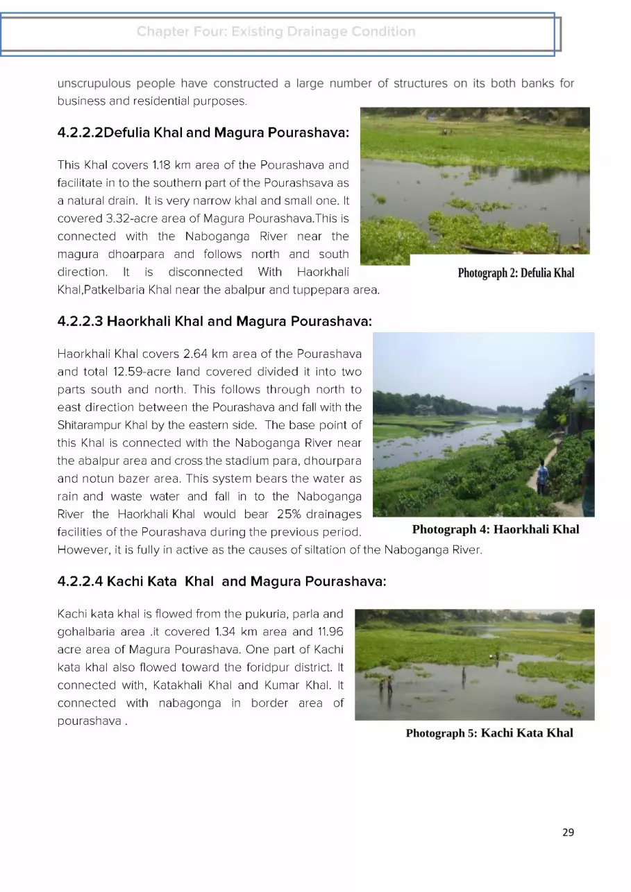
Photograph 2: Defulia Khal
Photograph 4: Haorkhali Khal
Photograph 5: Kachi Kata Khal

30
Photograph 7: Kumar Khal
Photograph 8:Narayan Thakur Khal

31
Photograph 8: Shitarampur Khal

32

33

34

35
❖
❖
❖
❖
❖

36

37

38
Map-5: DEM map of Magura Pourashava Map-6: Fill Sink Map of Magura Pourashava

39
Map-7: Flow Direction map
Map-9: Stream Definition Map
Map-8: Flow Accumulation Map
Map-10: Stream Segmentation Map

40
Map-11: Catchment Grid Delineation Map-12: Catchment Polygon Map
Map-13: Drainage Line Map Map-14: Drainage Point Map

41
Map-16: Existing Feature and derange line Map-15: water flow network

42

43

44

45
Map-17: Proposed Drain
Map-18: Drainage plan

46
Typical tertiary drainage
Typical secondary drainage
Typical primary drainage

47

48

49