iot based potholes and drainages detection system
TRANSCRIPT
IOT based Potholes and Drainages Detection System
1st Divyani Dongre
DepartmentofIT
JDCollegeofEngg.&Mgmt.,Nagpur,
DBATU,
4th Monali Sonekar
DepartmentofIT
JD College of Engg. & Mgmt.,
Nagpur, DBATU,
m
2nd Rani Jangam
DepartmentofIT
JDCollegeofEngg.&Mgmt.,
Nagpur, DBATU,
5thRimaKumbhalkar
DepartmentofIT
JDCollegeofEngg.& Mgmt.,
Nagpur, DBATU,India [email protected]
3rdAlishaGosavi
Departmentof IT
JDCollegeofEngg.&Mgmt.,Nagpur,
DBATU,
6thProf.AshishP.NanotkarDepar
tmentofIT
JDCollegeofEngg.&Mgmt.,
Nagpur, DBATU,
Abstract—Accidents owing to potholes has become an
alarming problem in today‘s life. The first step to solve
this problem requires, designing a device embedded on
the vehicle which can continuously scan the road surface
for identifying potholes, alerting the driver in time and
enable the driver to avoid the pothole. The importance of
the road infrastructure for the society could be
compared with importance of blood vessels for humans.
The major problems in developing countriesarethe
maintenance of roads. To ensure road surface quality it
should be monitored continuously and repaired as
necessary. The optimal distribution of resources for road
repairs is possible providing the availability of
comprehensive and objective real time data about the
state of the roads. The data in the system can be made
available to the general public as well as municipalities
and road maintenance agencies. Awareness of the
location of potholes will help drivers to avoid those roads
and being more careful while driving on the same roads.
The paper is describing a custom map system for road
irregularity detection using Android based smart-
phones. Identificationofpavement
distresssuchaspotholesandopendrainagesnot only
helpsdriversto avoidaccidentsorvehicledamages,but
alsohelpsauthoritiestomaintainroads.
Keywords—Potholes, Pavement, humps, Smart-Phones
I.INTRODUCTION
Number of vehicle on the roads has increased enormously in
the last decade. India being a developing country,
construction and development of infrastructure is still in
progress. This ever growing number of vehicles combined
with the lack of infrastructure makes the road difficult to
drive upon eventually leading to accidents. This paper
proposes a pothole detection system which aims at prior
warning to the drivers about the uneven roads and potholes
on the way. Roads are most significant apart of the
Country. Good road plays important role in transportation
sector like transporting, traveling, import, export, etc. It has
effect on the standard of driving and transportation that
increase the event level of entire country. In priority of roads
maybe a huge draw-back for the vehicle still as drivers.
The economy can depend upon transportation; however, the
most of the roads in India are slim and cram-full with poor
surface quality. Road maintenance are not satisfactory. The
traffic conditions in developing countries are more
complicated due to varied road conditions, a heterogeneous
mixture of vehicles and chaotic traffic. To avoid road
accidents it'll necessary that to enhance road quality however
as per the norms of government in India. Roads in India
unremarkably have speed-breakers in order that the vehicle’s
speed will be controlled to avoid accidents, owing to our
system we tend to also have in definable potholes that
created like as hot once of completion of the road. It's a
significant reason for traumatic accidents and loss of human
lives. Consequently, road evacuation and chuckhole
navigation system are important solutions to
improveaccidents and shield vehicles from injury due to
bad roads.
In the perspective of “Internet of things”, numerous devices
and objects will be connected to the Internet. Each
individually provides data, information, or even services. The
devices providing things can be personal objects we carry
around such as smart phones, tablets, and digital cameras.
Our daily environment, home, vehicle, or office connected
through a gateway device can also provide “things”. The
Internet of Things can be viewed as a gigantic network
consisting of sub networks of devices and computers
connected through a series of intermediate technologies.
This paper discusses previous chuckhole
detectionstrategies that are developed and proposes a cheap
answer to spot the potholes and humps on roads and supply
timely alerts to drivers. Machine learning is employed to
seek out the shortest path among all the ways that goes to
your destination. During which the map can find the potholes
and open drainages in our path. The database MySQL is
employed for information. An automaton application is
employed to alert drivers in order. that preventive
measuresbe taken to evade accidents. Alerts are given in
theforms of messages with an audio beep.
Journal of University of Shanghai for Science and Technology ISSN: 1007-6735
Volume 23, Issue 7, July - 2021 Page -791
II.LITERATURESURVEY
R.Fan,UOzgunalp,BHosking,MLiu,proposedthe
conceptinthispaperlikepresentarobustpothole detection
algorithm that is both accurate and computationally
efficient.Adensedisparitymapis first transformed to better
distinguish between damagedand undamaged
roadareas.Toachieve greaterdisparity transformation
efficiency,golden
sectionsearchanddynamicprogrammingareutilized
toestimatethetransformationparameters.
RajeshwarMadli,Santosh Hebbar,Praveenraj
Patar,G.V.Prasadaretheauthorthatstated a
stereovisionbasedpotholedetectionsystem is proposed.
Stereovisioncanprovideinformationonthesizeof
thepothole,withouttheneed for using highcost specialized
laserscanners.A disparitycalculation of
algorithm,whichisusedformapp generationwhich results in
detection ofpotholes from the fitted quadraticroad surface.
The systemproducesthesize,
volumeandpositionofthepotholeswhichallowsthepotholerepai
rtobeprioritizedaccordingtoitsseverity.
Byeoung-ho-Kang and Su-il-choiproposesthe concept to
sensing potholes by using 3D laser method. It is a sensing
method which uses light pulses to as certain the surface of
earth. The drawback in this methodis, it is highly affected by
heavy rain, fog, etc. Also does not work we lathered
reflections. The operating cost is high. It requires high end
hardware is required. The 3d laser checking is one of the
outstandingly flexible and productive advances for precisely
catching extensive arrangements of 3D facilitates.
This method uses laser pulses to detect theIrregularities
inbroadsurfaces
ArtiesMendes, Grits Strazdins,Leo Selavo
proposestheconceptofRealTimePotholeDetection using
Android Smart-phones with Accelerometers.
Thispaperisdescribingamobilesensingsystem for
roadirregularity detectionusingAndroidOSbased smart
phones.Selecteddataprocessingalgorithms
arediscussedandtheirevaluationpresentedwithtrue
positiverateashighas90%usingrealworld data. The
optimalparametersforthealgorithmsaredetermined.
KanaAzhary,FeerdMurtaza,MuhammadHerboon Mohammed
andHafedAdmanHabitstate Dan
approachoffindingandlocalizingthepotholesbased
oncomputervisioninas halt pavement images.
Histogramsfromtheinputimagesareclassifiedusing naïve
bayed classifierusingnormalizedgraphcut
segmentationscheme.Thisexperimentationshowed
67%accuracyonlocalizingthepotholesfromthe potholeimages.
III.METHODOLOGY
In this methodology, we actualize potholes identification system is a system that goes for notice to the driver about the uneven roads and potholes in its way. We consider the diverse manners by which objective of the framework can be accomplished. We legitimize the techniques that picked in
these undertakings and afterward we give insights concerning the working of the diverse sub.
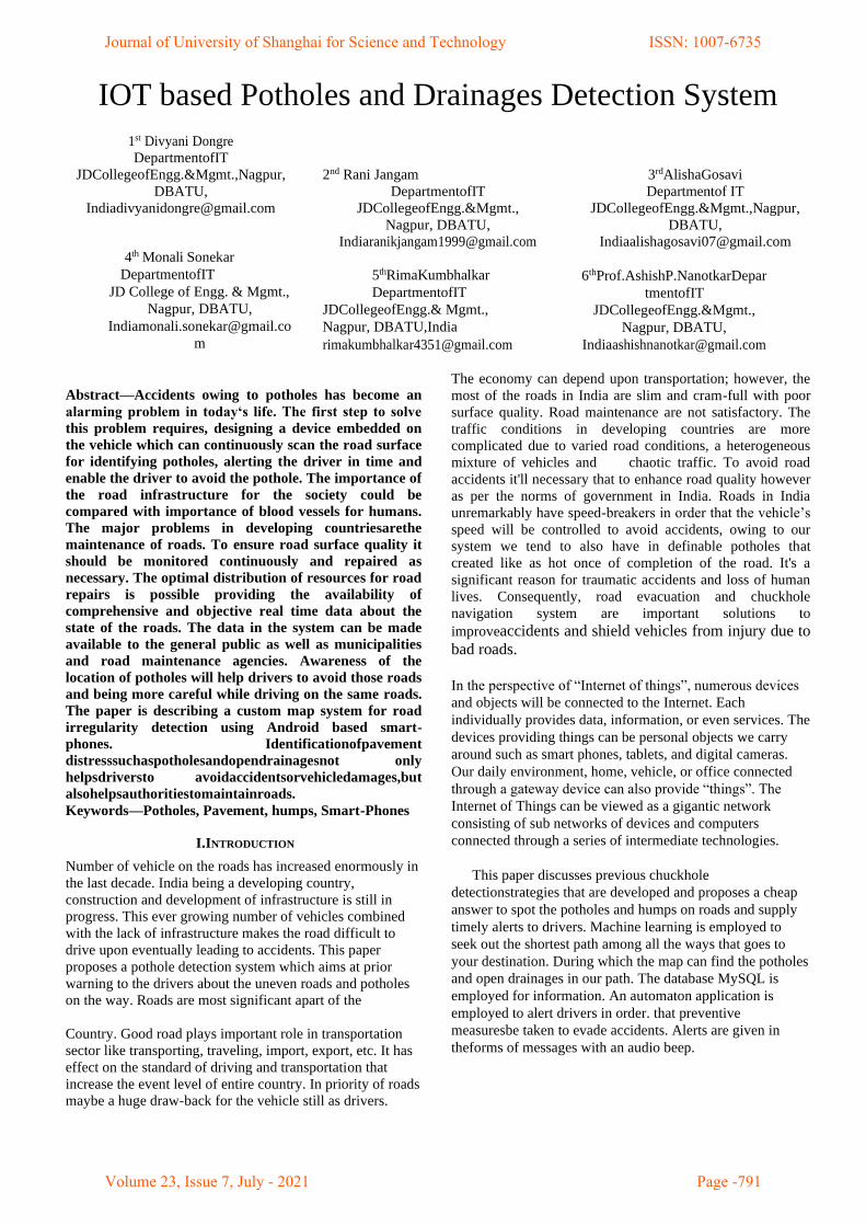
Fig. 1.Architecture
The architecture of the proposed system is shown in
figure.Itconsistsof4parts;registrationandloginmodule,
custommapmodule, weatherAPImoduleand
themobileapplicationmodule.Custommapmoduleis used to
gatherinformation aboutpotholes and
drainageandthegeographicallocationsandthis
informationissenttotheuser.WeatherAPImodule
detectsweatherinformationfromtheparticulararea. All
potholes and drainageandweatherAPIinformation processes
and stores in the database. Mobile applicationmoduleuses
informationstored Intheall
themodulesserverdatabaseandprovidestimely
alertstothedriverinmessagethrough.
A .Registration and login:-
Wecanstartwithfirstwithregistrationandthenlogin.
Sothattheadminanduserbothofwill registerand
loginincustommapthenadminanduserwillstartthe custommap.
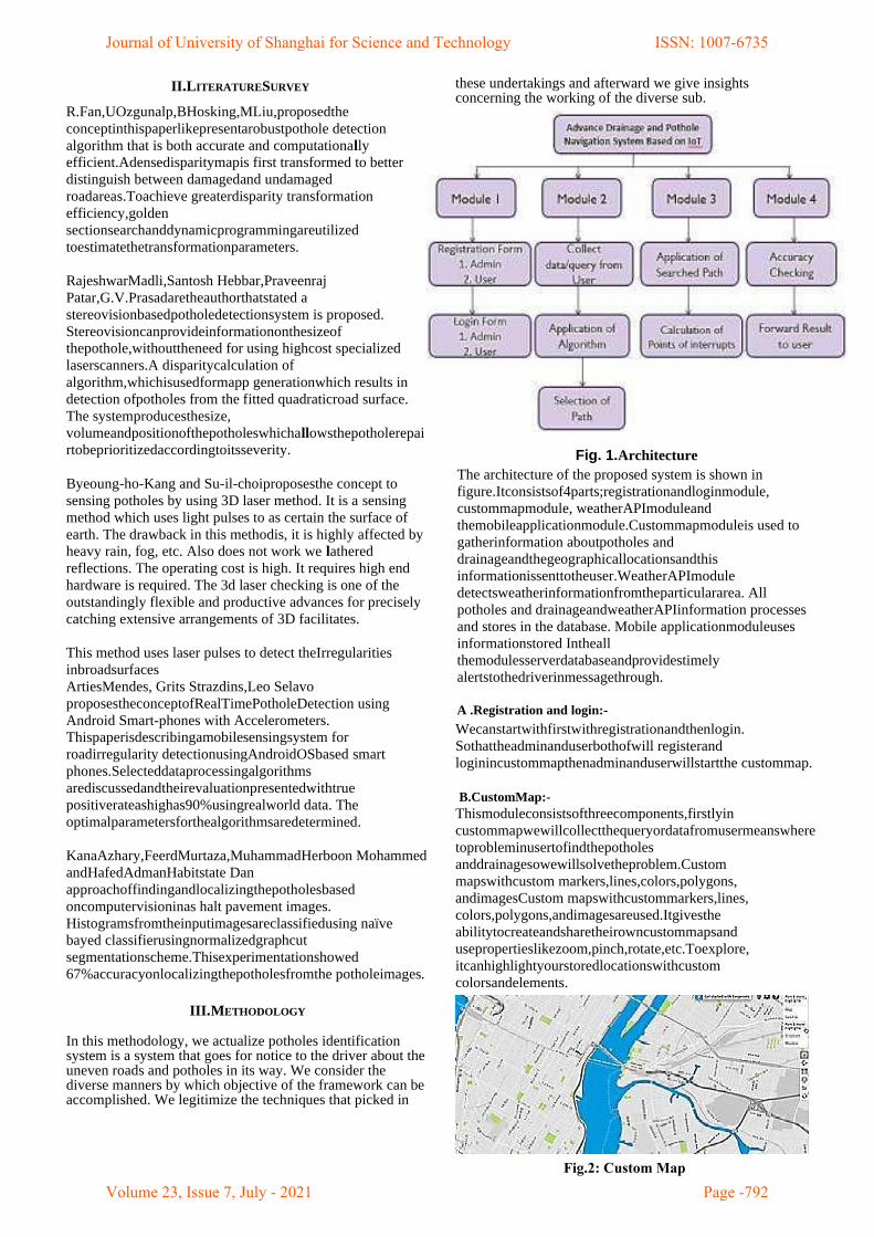
B.CustomMap:-
Thismoduleconsistsofthreecomponents,firstlyin
custommapwewillcollectthequeryordatafromusermeanswhere toprobleminusertofindthepotholes
anddrainagesowewillsolvetheproblem.Custom
mapswithcustom markers,lines,colors,polygons,
andimagesCustom mapswithcustommarkers,lines,
colors,polygons,andimagesareused.Itgivesthe
abilitytocreateandsharetheirowncustommapsand
usepropertieslikezoom,pinch,rotate,etc.Toexplore,
itcanhighlightyourstoredlocationswithcustom
colorsandelements.
Journal of University of Shanghai for Science and Technology ISSN: 1007-6735
Volume 23, Issue 7, July - 2021 Page -792Fig.2: Custom Map
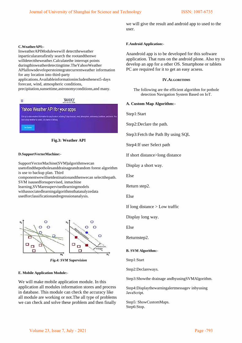
C.WeatherAPI:-
InweatherAPIModulewewill detecttheweather
inparticularareafirstly search the rootandthenwe
willdetecttheweather.Calculatethe interrupt points
duringthisweatherdetectingtime.TheYahooWeather
APIallowsdeveloperstointegratecurrentweather information
for any location into third-party
applications.Availableinformationincludesthenext5-days
forecast, wind, atmospheric conditions,
precipitation,sunsettime,astronomyconditions,and many.
Fig.3: Weather API
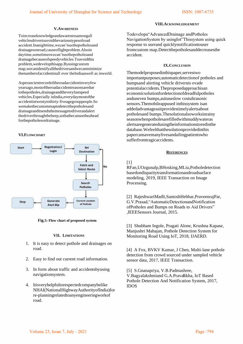
D.SupportVectorMachine:-
SupportVectorMachine(SVM)algorithmwecan
usetofindthepotholesanddrainageandrandom forest algorithm
is use to backup plan. Third
componentwewillsetdestinationandthenwecan selectthepath.
SVM isausedforsupervised, inmachine
learning,SVMaresupervisedlearningmodels
withassociatedlearningalgorithmsthatanalyzedata
usedforclassificationandregressionanalysis.
Fig.4: SVM Supervision
E. Mobile Application Module:-
We will make mobile application module. In this
application all modules information stores and process
in database. This module can check the accuracy like
all module are working or not.The all type of problems
we can check and solve these problem and then finally
we will give the result and android app to used to the
user.
F.Android Application:-
Anandroid app is to be developed for this software
application. That runs on the android plone. Also try to
develop an app for a other OS. Smartphone or tablets
PC are required for it to get an easy acsess.
IV.ALGORITHMS
The following are the efficient algorithm for pothole
detection Navigation System Based on IoT.
A. Custom Map Algorithm:-
Step1:Start
Step2:Declare the path.
Step3:Fetch the Path By using SQL
Step4:If user Select path
If short distance>long distance
Display a short way.
Else
Return step2.
Else
If long distance > Low traffic
Display long way.
Else
Returnstep2.
B. SVM Algorithm:-
Step1:Start
Step2:Declareways.
Step3:Showthe drainage andbyusingSVMAlgorithm.
Step4:Displaythewarningalertmessagev inbyusing
JavaScript.
Step5: ShowCustomMaps.
Step6:Stop.
Journal of University of Shanghai for Science and Technology ISSN: 1007-6735
Volume 23, Issue 7, July - 2021 Page -793
V.AWARENESS
Toincreaseknowledgeandawarenessamongall
vehiclesdrivertoavoidthevarioustypesofroad
accident.Inanighttime,wecan’tseethepotholesand
drainagesonroad,causeoflightproblem.Alsoin
daytime,sometimeswecan’tseethepotholesand
drainagebecauseofspeedyvehicles.Toavoidthis
problem,wedevelopthisapp.Byusingcustom
map,wecanidentifyallthedriversandwecanminimize
thenumberofaccidentinall over theIndiaaswell as inworld.
Asperancientrecordoftheroadaccidentinveryfew
yearsago,mostoftheroadaccidentreasonsaredue
tothepotholes,drainageandtheveryfastspeed
vehicles.Especially inIndia,everydaymostofthe
accidentintwentytothirty-fiveagegrouppeople.So
wemakethecustommaptodetectthepotholesand
drainageanditsendsthemessagetodriverandalert
thedriverthroughthebeep,sothathecanseetheahead
forthepotholesordrainage.
VI.FLOWCHART
Fig.5: Flow chart of proposed system
VII. LIMITATIONS
1. It is easy to detect pothole and drainages on
road.
2. Easy to find out current road information.
3. In form about traffic and accidentsbyusing
navigationsystem.
4. Itisveryhelpfultorespectedcompanybelike
NHAI(NationalHighwayAuthorityofIndia)for
re-planningrelatedtoanyengineeringworkof
road.
VIII.ACKNOWLEDGEMENT
Todevelopa“AdvancedDrainage andPotholes
NavigationSystem by usingIot”Thissystem using quick
response to userand quicklynotificationtouser
fromcustom map.Detectthepotholesanddecreasesthe
accident.
IX.CONCLUSION
Themodelproposedinthispaper,servestwo
importantpurposes;automaticdetectionof potholes and
bumpsand alerting vehicle driversto evade
potentialaccidents.Theproposedapproachisan
economicsolutionfordetectionofdreadfulpotholes
anduneven bumps,asituseslow costultrasonic
sensors.Themobileappused inthissystem isan
addedadvantageasitprovidestimelyalertsabout
potholesand bumps.Thesolutionalsoworksinrainy
seasonwhenpotholesarefilledwithmuddywateras
alertsaregeneratedusingtheinformationstoredinthe
database.Wefeelthatthesolutionprovidedinthis
papercansavemanylivesandailingpatientswho
sufferfromtragicaccidents.
REFERENCES
[1]
RFan,UOzgunalp,BHosking,MLiu,Potholedetection
basedondisparitytransformationandroadsurface
modeling, 2019, IEEE Transaction on Image
Processing.
[2] RajeshwariMadli,SantoshHebbar,PraveenrajPar,
G.V.Prasad,“AutomaticDetectionandNotification
ofPotholes and Bumps on Roads to Aid Drivers”
,IEEESensors Journal, 2015.
[3] Shubham Ingole, Pragati Alone, Krushna Kapase,
Manjushri Mahajan, Pothole Detection System for
Monitoring Road Using IoT, 2018, IJAERD.
[4] A Fox, BVKV Kumar, J Chen, Multi-lane pothole
detection from crowd sourced under sampled vehicle
sensor data, 2017, IEEE Transaction.
[5] S.Gnanapriya, V.B.Padmashree,
V.Bagyalakshmiand G.A.Pravalikha, IoT Based
Pothole Detection And Notification System, 2017,
IDOS
Journal of University of Shanghai for Science and Technology ISSN: 1007-6735
Volume 23, Issue 7, July - 2021 Page -794
[6] Rajeshwari Madli, Santosh Hebbar, Praveenraj
Patar, and Varaprasad Gola, Automatic Detection and
Notification of Potholes and Humps on Roads to Aid
Drivers, 2015, IEEE Explore.
[7] A.V.Aho, J.E.Hopcroft and J.D.Ulman, The Design
and Analysis of Computer Algorithms (Addison-
Wesley, Reading, Mass).
[8] M.S.Bazaraa and R.W.Langley, Adual shortest path
algorithm, SIAM J.Appl. Math. 26,3,496.
[9] R.Belman, On a routing problem, Quart. Appl.Math.
16(1958)88.
[10] G.B.Dantzig, All shortestroutesinagraph,Theoryof
Graphs, int.Symp.,Rome1966(Dunod,Paris)pp.91-92.
[11] E.V.DenardoandB.L.Fox,Shortest –
routemethods.I:Reaching,pruning,andbuckets,Oper.Res.27,1,
161.
Journal of University of Shanghai for Science and Technology ISSN: 1007-6735
Volume 23, Issue 7, July - 2021 Page -795