package ‘plotkml’
TRANSCRIPT

Package ‘plotKML’July 9, 2015
Version 0.5-3
Date 2015-07-07
Title Visualization of Spatial and Spatio-Temporal Objects in GoogleEarth
Maintainer Tomislav Hengl <[email protected]>
Depends R (>= 2.13.0)
Imports methods, tools, utils, XML, sp, raster, rgdal, spacetime,colorspace, plotrix, dismo, aqp, pixmap, plyr, stringr,colorRamps, scales, gstat, zoo, RColorBrewer, RSAGA, classInt
Suggests adehabitat, maptools, fossil, spcosa, rjson, animation,spatstat, RCurl, rgbif, Hmisc, GSIF, uuid, intervals, reshape,gdalUtils, snowfall, parallel
Description Writes sp-class, spacetime-class, raster-class and similar spatial and spatio-temporal objects to KML following some basic cartographic rules.
License GPL
URL http://plotkml.r-forge.r-project.org/
LazyLoad yes
NeedsCompilation no
Author Tomislav Hengl [cre, aut],Pierre Roudier [ctb],Dylan Beaudette [ctb],Edzer Pebesma [ctb],Michael Blaschek [ctb]
Repository CRAN
Date/Publication 2015-07-09 18:11:33
R topics documented:plotKML-package . . . . . . . . . . . . . . . . . . . . . . . . . . . . . . . . . . . . . . 3aesthetics . . . . . . . . . . . . . . . . . . . . . . . . . . . . . . . . . . . . . . . . . . 4baranja . . . . . . . . . . . . . . . . . . . . . . . . . . . . . . . . . . . . . . . . . . . . 5
1
2 R topics documented:
bigfoot . . . . . . . . . . . . . . . . . . . . . . . . . . . . . . . . . . . . . . . . . . . . 7check_projection . . . . . . . . . . . . . . . . . . . . . . . . . . . . . . . . . . . . . . 9col2kml . . . . . . . . . . . . . . . . . . . . . . . . . . . . . . . . . . . . . . . . . . . 10count.GridTopology . . . . . . . . . . . . . . . . . . . . . . . . . . . . . . . . . . . . . 11display.pal . . . . . . . . . . . . . . . . . . . . . . . . . . . . . . . . . . . . . . . . . . 11eberg . . . . . . . . . . . . . . . . . . . . . . . . . . . . . . . . . . . . . . . . . . . . 12fmd . . . . . . . . . . . . . . . . . . . . . . . . . . . . . . . . . . . . . . . . . . . . . 15geopath . . . . . . . . . . . . . . . . . . . . . . . . . . . . . . . . . . . . . . . . . . . 16getCRS-methods . . . . . . . . . . . . . . . . . . . . . . . . . . . . . . . . . . . . . . 17getWikiMedia.ImageInfo . . . . . . . . . . . . . . . . . . . . . . . . . . . . . . . . . . 18gpxbtour . . . . . . . . . . . . . . . . . . . . . . . . . . . . . . . . . . . . . . . . . . . 19grid2poly . . . . . . . . . . . . . . . . . . . . . . . . . . . . . . . . . . . . . . . . . . 21HRprec08 . . . . . . . . . . . . . . . . . . . . . . . . . . . . . . . . . . . . . . . . . . 22HRtemp08 . . . . . . . . . . . . . . . . . . . . . . . . . . . . . . . . . . . . . . . . . . 23kml-methods . . . . . . . . . . . . . . . . . . . . . . . . . . . . . . . . . . . . . . . . 26kml.tiles . . . . . . . . . . . . . . . . . . . . . . . . . . . . . . . . . . . . . . . . . . . 28kml_compress . . . . . . . . . . . . . . . . . . . . . . . . . . . . . . . . . . . . . . . . 29kml_description . . . . . . . . . . . . . . . . . . . . . . . . . . . . . . . . . . . . . . . 31kml_layer-methods . . . . . . . . . . . . . . . . . . . . . . . . . . . . . . . . . . . . . 31kml_layer.Raster . . . . . . . . . . . . . . . . . . . . . . . . . . . . . . . . . . . . . . 33kml_layer.RasterBrick . . . . . . . . . . . . . . . . . . . . . . . . . . . . . . . . . . . 34kml_layer.SoilProfileCollection . . . . . . . . . . . . . . . . . . . . . . . . . . . . . . . 35kml_layer.SpatialLines . . . . . . . . . . . . . . . . . . . . . . . . . . . . . . . . . . . 38kml_layer.SpatialPhotoOverlay . . . . . . . . . . . . . . . . . . . . . . . . . . . . . . . 39kml_layer.SpatialPixels . . . . . . . . . . . . . . . . . . . . . . . . . . . . . . . . . . . 41kml_layer.SpatialPoints . . . . . . . . . . . . . . . . . . . . . . . . . . . . . . . . . . . 42kml_layer.SpatialPolygons . . . . . . . . . . . . . . . . . . . . . . . . . . . . . . . . . 44kml_layer.STIDF . . . . . . . . . . . . . . . . . . . . . . . . . . . . . . . . . . . . . . 46kml_layer.STTDF . . . . . . . . . . . . . . . . . . . . . . . . . . . . . . . . . . . . . . 47kml_legend.bar . . . . . . . . . . . . . . . . . . . . . . . . . . . . . . . . . . . . . . . 49kml_legend.whitening . . . . . . . . . . . . . . . . . . . . . . . . . . . . . . . . . . . 50kml_metadata-methods . . . . . . . . . . . . . . . . . . . . . . . . . . . . . . . . . . . 51kml_open . . . . . . . . . . . . . . . . . . . . . . . . . . . . . . . . . . . . . . . . . . 52kml_screen . . . . . . . . . . . . . . . . . . . . . . . . . . . . . . . . . . . . . . . . . 53LST . . . . . . . . . . . . . . . . . . . . . . . . . . . . . . . . . . . . . . . . . . . . . 54makeCOLLADA . . . . . . . . . . . . . . . . . . . . . . . . . . . . . . . . . . . . . . 55metadata2SLD-methods . . . . . . . . . . . . . . . . . . . . . . . . . . . . . . . . . . 57metadata2SLD.SpatialPixels . . . . . . . . . . . . . . . . . . . . . . . . . . . . . . . . 57normalizeFilename . . . . . . . . . . . . . . . . . . . . . . . . . . . . . . . . . . . . . 58northcumbria . . . . . . . . . . . . . . . . . . . . . . . . . . . . . . . . . . . . . . . . 59plotKML-method . . . . . . . . . . . . . . . . . . . . . . . . . . . . . . . . . . . . . . 60plotKML.env . . . . . . . . . . . . . . . . . . . . . . . . . . . . . . . . . . . . . . . . 71plotKML.GDALobj . . . . . . . . . . . . . . . . . . . . . . . . . . . . . . . . . . . . . 73RasterBrickSimulations-class . . . . . . . . . . . . . . . . . . . . . . . . . . . . . . . . 75RasterBrickTimeSeries-class . . . . . . . . . . . . . . . . . . . . . . . . . . . . . . . . 76readGPX . . . . . . . . . . . . . . . . . . . . . . . . . . . . . . . . . . . . . . . . . . 77readKML.GBIFdensity . . . . . . . . . . . . . . . . . . . . . . . . . . . . . . . . . . . 78reproject . . . . . . . . . . . . . . . . . . . . . . . . . . . . . . . . . . . . . . . . . . . 79

plotKML-package 3
SAGA_pal . . . . . . . . . . . . . . . . . . . . . . . . . . . . . . . . . . . . . . . . . . 81sp.palette-class . . . . . . . . . . . . . . . . . . . . . . . . . . . . . . . . . . . . . . . 82SpatialMaxEntOutput-class . . . . . . . . . . . . . . . . . . . . . . . . . . . . . . . . . 83SpatialMetadata-class . . . . . . . . . . . . . . . . . . . . . . . . . . . . . . . . . . . . 84SpatialPhotoOverlay-class . . . . . . . . . . . . . . . . . . . . . . . . . . . . . . . . . 85SpatialPredictions-class . . . . . . . . . . . . . . . . . . . . . . . . . . . . . . . . . . . 86SpatialSamplingPattern-class . . . . . . . . . . . . . . . . . . . . . . . . . . . . . . . . 87SpatialVectorsSimulations-class . . . . . . . . . . . . . . . . . . . . . . . . . . . . . . 88spMetadata-methods . . . . . . . . . . . . . . . . . . . . . . . . . . . . . . . . . . . . 89spPhoto . . . . . . . . . . . . . . . . . . . . . . . . . . . . . . . . . . . . . . . . . . . 92vect2rast . . . . . . . . . . . . . . . . . . . . . . . . . . . . . . . . . . . . . . . . . . . 95vect2rast.SpatialPoints . . . . . . . . . . . . . . . . . . . . . . . . . . . . . . . . . . . 97whitening . . . . . . . . . . . . . . . . . . . . . . . . . . . . . . . . . . . . . . . . . . 98worldgrids_pal . . . . . . . . . . . . . . . . . . . . . . . . . . . . . . . . . . . . . . . 99
Index 102
plotKML-package Visualization of spatial and spatio-temporal objects in Google Earth
Description
A suite of functions for converting 2D and 3D spatio-temporal (sp, raster and spacetime packageclasses) objects into KML or KMZ documents for use in Google Earth.
Details
Package: plotKMLType: PackageURL: http://plotkml.r-forge.r-project.org/License: GPLLazyLoad: yes
Note
This package has been developed as a part of the Global Soil Information Facilities project, whichis run jointly by the ISRIC Institute and collaborators. ISRIC is a non-profit organization with amandate to serve the international community as custodian of global soil information and to increaseawareness and understanding of the role of soils in major global issues.
Author(s)
Tomislav Hengl (<[email protected]>), Pierre Roudier (<[email protected]>), Dy-lan Beaudette (<[email protected]>), Edzer Pebesma (<[email protected]>)
4 aesthetics
References
• KML documentation (http://code.google.com/apis/kml/documentation/)
• Google Earth Outreach project (http://earth.google.com/outreach/tutorials.html)
• Hengl, T., Roudier, P., Beaudette, D. and Pebesma, E. (2015) plotKML: Scientific Visualiza-tion of Spatio-Temporal Data. Journal of Statistical Software, 63(5): 1–25.
aesthetics Plotting aesthetics parameters
Description
Parses various object parameters / columns to KML aesthetics: size of the icons, fill color, labels,altitude, width, . . .
Usage
kml_aes(obj, ...)
Arguments
obj space-time object for plotting
... other arguments
Details
Valid aesthetics: colour = "black", fill = "white", shape, whitening, alpha, width = 1,labels, altitude = 0, size, balloon = FALSE. Specific features (target variables and theconnected hot-spots) can be emphasized by using two or three graphical parameters for the samevariable. See plotKML package homepage / vignette for more examples.
Author(s)
Pierre Roudier
See Also
kml-methods

baranja 5
baranja Baranja hill case study
Description
Baranja hill is a 4 by 4 km large study area in the Baranja region, eastern Croatia (corresponds toa size of an aerial photograph). This data set has been extensively used to describe various DEMmodelling and analysis steps (see Hengl and Reuter, 2008; Hengl et al., 2010). Object barxyzcontains 6370 precise observations of elevations (from field survey and digitized from the stereoimages); bargrid contains observed probabilities of streams (digitized from the 1:5000 topo map);barstr contains 100 simulated stream networks ("SpatialLines") using barxyz point data asinput (see examples below).
Usage
data(bargrid)
Format
The bargrid data frame (regular grid at 30 m intervals) contains the following columns:
p.obs observed probability of stream (0-1)
x a numeric vector; x-coordinate (m) in the MGI / Balkans zone 6
y a numeric vector; y-coordinate (m) in the MGI / Balkans zone 6
Note
Consider using the 30 m resolution grid (see bargrid) as the target resolution (output maps).
Author(s)
Tomislav Hengl
References
• Hengl, T., Reuter, H.I. (eds), (2008) Geomorphometry: Concepts, Software, Applications.Developments in Soil Science, vol. 33, Elsevier, 772 p.
• Hengl, T., Heuvelink, G. B. M., van Loon, E. E., (2010) On the uncertainty of stream networksderived from elevation data: the error propagation approach. Hydrology and Earth SystemSciences, 14:1153-1165.
• http://geomorphometry.org/content/baranja-hill
6 baranja
Examples
library(sp)library(gstat)## sampled elevations:data(barxyz)prj = "+proj=tmerc +lat_0=0 +lon_0=18 +k=0.9999 +x_0=6500000 +y_0=0 +ellps=bessel +units=m+towgs84=550.499,164.116,475.142,5.80967,2.07902,-11.62386,0.99999445824"coordinates(barxyz) <- ~x+yproj4string(barxyz) <- CRS(prj)## grids:data(bargrid)data(barstr)coordinates(bargrid) <- ~x+ygridded(bargrid) <- TRUEproj4string(bargrid) <- barxyz@proj4stringbargrid@grid## Not run: ## Example with simulated streams:data(R_pal)library(rgdal)library(RSAGA)pnt = list("sp.points", barxyz, col="black", pch="+")spplot(bargrid[1], sp.layout=pnt,
col.regions = R_pal[["blue_grey_red"]])## Deriving stream networks using geostatistical simulations:Z.ovgm <- vgm(psill=1831, model="Mat", range=1051, nugget=0, kappa=1.2)sel <- runif(length(barxyz$Z))<.2N.sim <- 5## geostatistical simulations:DEM.sim <- krige(Z~1, barxyz[sel,], bargrid, model=Z.ovgm, nmax=20,
nsim=N.sim, debug.level=-1)## Note: this operation can be time consuming
stream.list <- list(rep(NA, N.sim))## derive stream networks in SAGA GIS:for (i in 1:N.sim) {
writeGDAL(DEM.sim[i], paste("DEM", i, ".sdat", sep=""),drivername = "SAGA", mvFlag = -99999)
## filter the spurious sinks:rsaga.fill.sinks(in.dem=paste("DEM", i, ".sgrd", sep=""),
out.dem="DEMflt.sgrd", check.module.exists = FALSE)## extract the channel network SAGA GIS:rsaga.geoprocessor(lib="ta_channels", module=0,param=list(ELEVATION="DEMflt.sgrd",CHNLNTWRK=paste("channels", i, ".sgrd", sep=""),CHNLROUTE="channel_route.sgrd",SHAPES="channels.shp",INIT_GRID="DEMflt.sgrd",DIV_CELLS=3, MINLEN=40),check.module.exists = FALSE,show.output.on.console=FALSE)
stream.list[[i]] <- readOGR("channels.shp", "channels",verbose=FALSE)

bigfoot 7
proj4string(stream.list[[i]]) <- barxyz@proj4string}# plot all derived streams at top of each other:streams.plot <- as.list(rep(NA, N.sim))for(i in 1:N.sim){
streams.plot[[i]] <- list("sp.lines", stream.list[[i]])}spplot(DEM.sim[1], col.regions=grey(seq(0.4,1,0.025)), scales=list(draw=T),sp.layout=streams.plot)
## End(Not run)
bigfoot Bigfoot reports (USA)
Description
2984 observations of bigfoot (with attached dates). The field occurrence records have been obtainedfrom the BigFoot Research Organization (BFRO) website. The BFRO reports generally consist ofa description of the event and where it occurred, plus the quality classification. Similar data sethas been used by Lozier et al. (2009) to demonstrate possible miss-interpretations of the resultsof species distribution modeling. The maps in the USAWgrids data set represent typical griddedenvironmental covariates used for species distribution modeling.
Usage
data(bigfoot)
Format
The bigfoot data frame contains the following columns:
Lon a numeric vector; x-coordinate / longitude in the WGS84 system
Lat a numeric vector; y-coordinate / latitude in the WGS84 system
NAME name assigned by the observer (usually referent month / year)
DATE ’POSIXct’ class vector
TYPE confidence levels; according to the BFRO website: "Class A" reports involve clear sightingsin circumstances where misinterpretation or misidentification of other animals can be ruledout with greater confidence; "Class B" and "Class C" reports are less credible.
The USAWgrids data frame (46,018 pixels; Washington, Oregon, Nevada and California state) con-tains the following columns:
globedem a numeric vector; elevations from the ETOPO1 Global Relief Model
nlights03 an integer vector; lights at night image for 2003 (Version 2 DMSP-OLS NighttimeLights Time Series)
sroads a numeric vector; distance to main roads and railroads (National Atlas of the United States)

8 bigfoot
gcarb a numeric vector; Global Biomass Carbon Map (New IPCC Tier-1 Global Biomass CarbonMap for the Year 2000)
dTRI a numeric vector; density of pollutant releases (North American Pollutant Releases and Trans-fers database)
twi a numeric vector; Topographic Wetness Index based on the globedemstates an integer vector; USA statesglobcov land cover classes based on the MERIS FR images (GlobCover Land Cover version V2.2)s1 a numeric vector; x-coordinates in the Albers equal-area projection systems2 a numeric vector; y-coordinates in the Albers equal-area projection system
Note
According to the Time.com, a team of a dozen-plus experts from as far afield as Canada and Swedenhave proclaimed themselves 95 percent certain of the mythical animal’s existence on Kemerovoregion territory some 3,000 kilometers east of Moscow (announced at the Tashtagol conference in2011).
Author(s)
Tomislav Hengl
References
• Lozier, J.D., Aniello, P., Hickerson, M.J., (2009) Predicting the distribution of Sasquatch inwestern North America: anything goes with ecological niche modelling. Journal of Biogeog-raphy, 36(9):1623-1627.
• BigFoot Research Organization (http://www.bfro.net)
Examples
## Not run: # Load the BFRO records:library(sp)data(bigfoot)aea.prj <- "+proj=aea +lat_1=29.5 +lat_2=45.5 +lat_0=23 +lon_0=-96+x_0=0 +y_0=0 +ellps=GRS80 +datum=NAD83 +units=m +no_defs"library(sp)coordinates(bigfoot) <- ~Lon+Latproj4string(bigfoot) <- CRS("+proj=latlon +datum=WGS84")library(rgdal)bigfoot.aea <- spTransform(bigfoot, CRS(aea.prj))# Load the covariates:data(USAWgrids)gridded(USAWgrids) <- ~s1+s2proj4string(USAWgrids) <- CRS(aea.prj)# Visualize data:data(SAGA_pal)pnts <- list("sp.points", bigfoot.aea, pch="+", col="yellow")spplot(USAWgrids[2], col.regions=rev(SAGA_pal[[3]]), sp.layout=pnts)
## End(Not run)

check_projection 9
check_projection Extracts the proj4 parameters and checks if the projection matches thereferent CRS
Description
Function parse_proj4 gets the proj4 string from a space-time object and check_projectionchecks if the input projection is compatible with the referent projection system. The referent systemis by default the longlat projection with WGS84 datum (KML-compatible coordinates).
Usage
check_projection(obj, control = TRUE,ref_CRS = get("ref_CRS", envir = plotKML.opts))
Arguments
obj object of class Spatial* or Raster*
control logical; if TRUE, a logical value is returned, if FALSE, an error is thrown if thetest failed
ref_CRS the referent coordinate system.
Details
A cartographic projection is KML compatible if: (a) geographical coordinates are used, and (b) ifthey relate to the WGS84 ellispoid ("+proj=longlat +datum=WGS84"). You can also set your ownlocal referent projection system by specifiying plotKML.env(ref_CRS = ...).
Warning
obj needs to have a proper proj4 string (CRS), otherwise check_projection will not run. If thegeodetic datum is defined via the +towgs, consider converting the coordinates manually i.e. byusing the spTransform or reproject method.
Author(s)
Pierre Roudier, Tomislav Hengl, and Dylan Beaudette
References
• WGS84 (http://spatialreference.org/ref/epsg/4326/)
See Also
reproject, rgdal::CRS-class

10 col2kml
Examples
data(eberg)library(sp)library(rgdal)coordinates(eberg) <- ~X+Yproj4string(eberg) <- CRS("+init=epsg:31467")check_projection(eberg)# not yet ready for export to KML;parse_proj4(proj4string(eberg))eberg.geo <- reproject(eberg)check_projection(eberg.geo)# ... now ready for export
col2kml Convert a color strings to the KML format
Description
Converts some common color formats (internal R colors, hexadecimal format, Munsell color codes)color to KML format.
Usage
col2kml(colour)
Arguments
colour R color string
Value
KML-formatted color as #aabbggrr where aa=alpha (00 to ff), bb=blue (00 to ff), gg=green (00 toff), rr=red (00 to ff).
Author(s)
Pierre Roudier, Tomislav Hengl and Dylan Beaudette
See Also
aqp::munsell2rgb
Examples
col2kml("white")col2kml(colors()[2])hex2kml(rgb(1,1,1))x <- munsell2kml("10YR", "2", "4")kml2hex(x)

count.GridTopology 11
count.GridTopology Counts the number of occurrences of a list of vector object over aGridTopology
Description
Counts the number of occurrences of a vector object over a "GridTopology" for a list of vectorobjects (usually multiple realizations of the same process).
Usage
count.GridTopology(x, vectL, ...)
Arguments
x object of type "GridTopology"
vectL list of vectors of class "SpatialPoint*", "SpatialLines*" or "SpatialPolygons*"(equiprobable realizations of the same process)
... (optional) arguments passed to the lower level functions
Author(s)
Tomislav Hengl
See Also
SpatialVectorsSimulations-class, vect2rast
display.pal Display a color palette
Description
Plots a color palette in a new window.
Usage
display.pal(pal, sel=1:length(pal), names=FALSE)
Arguments
pal list; each palette a vector of HEX-formated colors
sel integer; selection of palettes to plot
names logical; specifies whether to print also the class names
12 eberg
Details
The internal palettes available in plotKML typically consists of 20 elements. If class names arerequrested (names=TRUE) than only one palette will be plotted.
Author(s)
Tomislav Hengl and Pierre Roudier
See Also
SAGA_pal, R_pal, worldgrids_pal
Examples
# SAGA GIS palette (http://saga-gis.org/en/about/software.html)data(SAGA_pal)names(SAGA_pal)## Not run: # display palettes:display.pal(pal=SAGA_pal, sel=c(1,2,7,8,10,11,17,18,19,21,22))dev.off()data(worldgrids_pal)worldgrids_pal[["globcov"]]display.pal(pal=worldgrids_pal, sel=c(5), names = TRUE)dev.off()# make icons (http://www.statmethods.net/advgraphs/parameters.html):for(i in 0:25){
png(filename=paste("icon", i, ".png", sep=""), width=45, height=45,bg="transparent", pointsize=16)par(mar=c(0,0,0,0))plot(x=1, y=1, axes=FALSE, xlab='', ylab='', pch=i, cex=4, lwd=2)dev.off()
}
## End(Not run)
eberg Ebergotzen — soil mapping case study
Description
Ebergötzen is 10 by 10 km study area in the vicinity of the city of Göttingen in Central Germany.This area has been extensively surveyed over the years, mainly for the purposes of developingoperational digital soil mapping techniques (Gehrt and Böhner, 2001), and has been used by theSAGA GIS development team to demonstrate various processing steps.eberg table contains 3670 observations (augers) of soil textures at five depths (0-10, 10-30, 30-50,50-70, and 70-90), and field records of soil types according to the German soil classification system.eberg_grid contains gridded maps at 100 m resolution that can be used as covariates for spatialprediction of soil variables. eberg_grid25 contains grids at finer resolution (25 m). eberg_zones

eberg 13
is a polygon map showing the distribution of parent material (Silt and sand, Sandy material, Clayeyderivats, Clay and loess). eberg_contours shows contour lines derived from the 25 m DEM of thearea using 10 m equidistance.
Usage
data(eberg)
Format
The eberg data frame (irregular points) contains the following columns:
ID universal identifier
soiltype a vector containing factors; soil classes according to the German soil classificationsystem: "A" (Auenboden), "B" (Braunerde), "D" (Pelosol), "G" (Gley), "Ha" (Moor), "Hw"(HMoor), "K" (Kolluvisol), "L" (Parabraunerde), "N" (Ranker), "Q" (Regosol), "R" (Rendz-ina), "S" (Pseudogley), "Z" (Pararendzina)
TAXGRSC a vector containing factors; full soil class names according to the German soil classifica-tion system (see soiltype column)
X a numeric vector; x-coordinate (m) in DHDN / Gauss-Krueger zone 3 (German coordinate sys-tem)
Y a numeric vector; y-coordinate (m) in DHDN / Gauss-Krueger zone 3 (German coordinate sys-tem)
UHDICM_* a numeric vector; upper horizon depth in cm per horizon
LHDICM_* a numeric vector; lower horizon depth in cm per horizon
SNDMHT_* a numeric vector; sand content estimated by hand per horizon (0-100 percent); see Ad-hoc-AG Boden (2005) for more details
SLTMHT_* a numeric vector; silt content estimated by hand per horizon (0-100 percent)
CLYMHT_* a numeric vector; clay content estimated by hand per horizon (0-100 percent)
The eberg_grid data frame (regular grid at 100 m resolution) contains the following columns:
PRMGEO6 a vector containing factors, parent material classes from the geological map (mappingunits)
DEMSRT6 a numeric vector; elevation values from the SRTM DEM
TWISRT6 a numeric vector; Topographic Wetness Index derived using the SAGA algorithm
TIRAST6 a numeric vector; Thermal Infrared (TIR) reflection values from the ASTER L1 imageband 14 (2010-06-05T10:26:50Z) obtained via the NASA’s GloVis browser
LNCCOR6 a vector containing factors; Corine Land Cover 2006 classes
x a numeric vector; x-coordinate (m) in DHDN / Gauss-Krueger zone 3 (German coordinate sys-tem)
y a numeric vector; y-coordinate (m) in DHDN / Gauss-Krueger zone 3 (German coordinate sys-tem)
The eberg_grid25 data frame (regular grid at 25 m resolution) contains the following columns:

14 eberg
DEMTOPx a numeric vector; elevation values from the topographic map
HBTSOLx a vector containing factors; main soil type according to the German soil classificationsystem (see column "soiltype" above) estimated per crop field
TWITOPx a numeric vector; Topographic Wetness Index derived using the SAGA algorithm
NVILANx a numeric vector; NDVI image derived using the Landsat image from the Image 2000project
x a numeric vector; x-coordinate (m) in DHDN / Gauss-Krueger zone 3 (German coordinate sys-tem)
y a numeric vector; y-coordinate (m) in DHDN / Gauss-Krueger zone 3 (German coordinate sys-tem)
Note
Texture by hand method can be used to determine the content of soil earth fractions only to anaccuracy of ±5-10% (Skaggs et al. 2001). A surveyor distinguishes to which of the 32 textureclasses a soil samples belongs to, and then estimates the content of fractions; e.g. texture class St2has 10% clay, 25% silt and 65% sand (Ad-hoc-AG Boden, 2005).
Author(s)
The Ebergötzen dataset is courtesy of Gehrt Ernst (<[email protected]>), the StateAuthority for Mining, Energy and Geology, Hannover, Germany and Olaf Conrad, University ofHamburg (<[email protected]>). The original data set has been prepared for thisexercise by Tomislav Hengl (<[email protected]>).
References
• Ad-hoc-AG Boden, (2005) Bodenkundliche Kartieranleitung. 5th Ed, Bundesanstalt fur Ge-owissenschaften und Rohstoffe und Niedersächsisches Landesamt für Bodenforshung, Han-nover, p. 423.
• Böhner, J., McCloy, K. R. and Strobl, J. (Eds), (2006) SAGA — Analysis and ModellingApplications. Göttinger Geographische Abhandlungen, Heft 115. Verlag Erich Goltze GmbH,Göttingen, 117 pp.
• Gehrt, E., Böhner, J., (2001) Vom punkt zur flache — probleme des ‘upscaling’ in der bo-denkartierung. In: Diskussionsforum Bodenwissenschaften: Vom Bohrstock zum Bildschirm.FH, Osnabrück, pp. 17-34.
• Skaggs, T. H., Arya, L. M., Shouse, P. J., Mohanty, B. P., (2001) Estimating Particle-SizeDistribution from Limited Soil Texture Data. Soil Science Society of America Journal 65 (4):1038-1044.
• http://geomorphometry.org/content/ebergotzen
Examples
data(eberg)data(eberg_grid)data(eberg_zones)data(eberg_contours)

fmd 15
library(sp)coordinates(eberg) <- ~X+Yproj4string(eberg) <- CRS("+init=epsg:31467")gridded(eberg_grid) <- ~x+yproj4string(eberg_grid) <- CRS("+init=epsg:31467")# visualize the maps:data(SAGA_pal)l.sp <- list("sp.lines", eberg_contours, col="black")## Not run:spplot(eberg_grid["DEMSRT6"], col.regions = SAGA_pal[[1]], sp.layout=l.sp)spplot(eberg_zones, sp.layout=list("sp.points", eberg, col="black", pch="+"))
## End(Not run)
fmd 2001 food-and-mouth epidemic, north Cumbria (UK)
Description
This data set gives the spatial locations and reported times of food-and-mouth disease in northCumbria (UK), 2001. It is of no scientific value, as it deliberately excludes confidential informationon farms at risk in the study-region. It is included in the package purely as an illustrative example.
Usage
data(fmd)
Format
A matrix containing (x,y,t) coordinates of the 648 observations.
Author(s)
Edith Gabriel <[email protected]>
References
Diggle, P., Rowlingson, B. and Su, T. (2005). Point process methodology for on-line spatio-temporal disease surveillance. Environmetrics, 16, 423–34.
See Also
northcumbria for boundaries of the county of north Cumbria.

16 geopath
geopath Geopath — shortest trajectory line between two geographic locations
Description
Derives a SpatialLines class object showing the shortest path between the two geographic locationsand based on the Haversine Formula for Great Circle distance.
Usage
geopath(lon1, lon2, lat1, lat2, ID, n.points, print.geo = FALSE)
Arguments
lon1 longitude coordinate of the first point
lon2 longitude coordinate of the second point
lat1 latitude coordinate of the first point
lat2 latitude coordinate of the second point
ID (optional) point ID character
n.points number of intermediate points
print.geo prints the distance and bearing
Details
Number of points between the start and end point is derived using a simple formula:
round(sqrt(distc)/sqrt(2), 0)
where distc is the Great Circle Distance.
Value
Bearing is expressed in degrees from north. Distance is expressed in kilometers (Great CircleDistance).
Author(s)
Tomislav Hengl
References
• fossil package (http://CRAN.R-project.org/package=fossil)
• Haversine formula from Math Forums (http://mathforum.org/dr.math/)

getCRS-methods 17
See Also
kml_layer.SpatialLines, kml_layer.STTDF, fossil::earth.bear
Examples
library(fossil)ams.ny <- geopath(lon1=4.892222, lon2=-74.005973, lat1=52.373056, lat2=40.714353,
print.geo=TRUE)# write to a file:kml(ams.ny)
getCRS-methods Methods to get the proj4 string
Description
Gets the proj4 string from a object of type "Spatial" or "Raster".
Usage
## S4 method for signature 'Spatial'getCRS(obj)## S4 method for signature 'Raster'getCRS(obj)
Arguments
obj object of type "Spatial" or "Raster"
Details
For more details about the PROJ.4 parameters refer to the http://trac.osgeo.org.
Author(s)
Tomislav Hengl and Pierre Roudier
See Also
sp::CRS, raster::raster, check_projection
18 getWikiMedia.ImageInfo
Examples
data(eberg_grid)library(sp)coordinates(eberg_grid) <- ~x+ygridded(eberg_grid) <- TRUElibrary(rgdal)proj4string(eberg_grid) <- CRS("+init=epsg:31467")library(raster)r <- raster(eberg_grid[1])getCRS(r)r.ll <- reproject(r)getCRS(r.ll)
getWikiMedia.ImageInfo
Gets EXIF information
Description
getWikiMedia.ImageInfo function fetches the EXIF (Exchangeable image file format) data via theWikimedia API for any donated image. The resulting EXIF data (named list) can then be furtherused to construct an object of class "SpatialPhotoOverlay", which can be parsed to KML.
Usage
getWikiMedia.ImageInfo(imagename,APIsource = "https://commons.wikimedia.org/w/api.php",module = "imageinfo",details = c("url", "metadata", "size", "extlinks"), testURL = TRUE)
Arguments
imagename Wikimedia commons unique image title
APIsource location of the API service
module default module
details detailed parameters of interest
testURL logical; species if the program should first test whether the image exist at all(recommended)
Details
Although this is often not visible in picture editing programs, almost any image uploaded to Wiki-media contains usefull EXIF metadata. However, it is highly recommended that you insert the someimportant tags in the image header yourself, by using e.g. the EXIF tool (courtesy of Phil Harvey),before uploading the files to Wikimedia. The getWikiMedia.ImageInfo function assumes that allrequired metadata has already been entered by the user before the upload, hence no further changes

gpxbtour 19
in the metadata will be possible. Examples of how to embed EXIF tags into an image file are avail-able here.To geocode an uploaded image consider adding:
{{location|lat deg|lat min|lat sec|NS|long deg|long min|long sec|EW}}
tag to the file description, in which case getWikiMedia.ImageInfo will automatically look for theattached coordinates via the external links. For practical purposes and because the image propertiesinformation determined by the Wikimedia system can are more reliable, the function will rewritesome important EXIF metadata (image width and height) using the actual values determined byWikimedia server.For a list of modules and parameters that can be used via getWikiMedia.ImageInfo, please referto Wikimedia API manual.
Author(s)
Tomislav Hengl
References
• Wikimedia API (http://www.mediawiki.org/wiki/API)
• EXIF tool (http://www.sno.phy.queensu.ca/~phil/exiftool/)
• EXIF Tags (http://www.sno.phy.queensu.ca/~phil/exiftool/TagNames/EXIF.html)
See Also
spPhoto, Rexif::getExifPy
Examples
## Not run: # Photo taken using a GPS-enabled camera:imagename = "Africa_Museum_Nijmegen.jpg"x <- getWikiMedia.ImageInfo(imagename)# Get the GPS info:x$metadata[grep(names(x$metadata), pattern="GPS")]# prints the complete list of metadata tags;
## End(Not run)
gpxbtour GPS log of a bike tour
Description
GPS log of a bike tour from Wageningen (the Netherlands) to Münster (Germany). The tablecontains 3228 records of GPS locations, speed and elevation.
20 gpxbtour
Usage
data(gpxbtour)
Format
The data frame contains the following columns:
lon longitude (x-coordinate)
lat latitude (y-coordinate)
ele GPS-estimated elevation in m
speed GPS-estimated speed in km per hour
time XML Schema time
Note
The log was produced using the GlobalSat GH-615 GPS watch. The original data log (trackpoints)was first saved to GPX exchange format (http://www.topografix.com/gpx.asp) and then im-ported to R using the XML package and formatted to a data frame.
Author(s)
Tomislav Hengl
Examples
## Not run: ## load the data:data(gpxbtour)library(sp)## format the time column:gpxbtour$ctime <- as.POSIXct(gpxbtour$time, format="%Y-%m-%dT%H:%M:%SZ")coordinates(gpxbtour) <- ~lon+latproj4string(gpxbtour) <- CRS("+proj=longlat +datum=WGS84")## convert to a STTDF class:library(spacetime)library(adehabitat)gpx.ltraj <- as.ltraj(coordinates(gpxbtour), gpxbtour$ctime, id = "th")gpx.st <- as(gpx.ltraj, "STTDF")## Google maps plot:library(RgoogleMaps)llc <- c(mean(gpx.st@sp@bbox[2,]), mean(gpx.st@sp@bbox[1,]))MyMap <- GetMap.bbox(center=llc, zoom=8, destfile="map.png")PlotOnStaticMap(MyMap, lat=gpx.st@sp@coords[,2], lon=gpx.st@sp@coords[,1],
FUN=lines, col="black", lwd=4)
## End(Not run)
grid2poly 21
grid2poly Converts a gridded map to a polygon map
Description
Converts a "SpatialGridDataFrame" object to a polygon map with each available grid node rep-resented with a polygon. To allow further export to KML, grid2poly will, by default, convert anyprojected coordinates to the lat-lon system (geographic coordinates in the WGS84 system).
Usage
grid2poly(obj, var.name = names(obj)[1], reproject = TRUE,method = c("sp", "raster", "RSAGA")[1], tmp.file = TRUE,saga_lib = "shapes_grid", saga_module = 3, silent = FALSE, ...)
Arguments
obj "SpatialGridDataFrame" object
var.name target variable column name
reproject logical; reproject coordinates to lat lon system?
method decide to convert grids to polygons either using "sp", "raster" or "RSAGA"packages
tmp.file logical; specify whether to create a temporary file, or to actually write to theworkding directory (in the case of SAGA GIS is used to convert grids)
saga_lib string; SAGA GIS library name
saga_module SAGA GIS module number; see ?rsaga_get_modules for more details
silent logical; specifies whether to print the SAGA GIS output
... additional arguments that can be parsed to the rasterToPolygons command
Details
grid2poly is not recommended for large grids (»10e4 pixels). Consider splitting large input gridsinto tiles before running grid2poly. For converting large grids to polygons consider using SAGAGIS (method = "RSAGA") instead of using the default sp method.
Author(s)
Tomislav Hengl
See Also
vect2rast, raster::rasterToPolygons
22 HRprec08
Examples
data(eberg_grid)library(sp)coordinates(eberg_grid) <- ~x+ygridded(eberg_grid) <- TRUEproj4string(eberg_grid) <- CRS("+init=epsg:31467")data(SAGA_pal)## Not run: # compare various methods:system.time(dem_poly <- grid2poly(eberg_grid, "DEMSRT6", method = "raster"))system.time(dem_poly <- grid2poly(eberg_grid, "DEMSRT6", method = "sp"))system.time(dem_poly <- grid2poly(eberg_grid, "DEMSRT6", method = "RSAGA"))## plotting large polygons in R -> not a good idea# spplot(dem_poly, col.regions = SAGA_pal[[1]])## visualize the data in Google Earth:kml(dem_poly, colour_scale = SAGA_pal[[1]], colour = DEMSRT6, kmz = TRUE)
## End(Not run)
HRprec08 Daily precipitation for Croatia for year 2008
Description
The daily measurements of precipitation (rain gauges) for year 2008 kindly contributed by the Croa-tian National Meteorological Service. HRprec08 contains 175,059 measurements of precipitationsums (489 stations by 365 days).
Usage
data(HRprec08)
Format
The HRprec08 data frames contain the following columns:
NAME name of the meteorological station
Lon a numeric vector; x-coordiante / longitude in the WGS84 system
Lat a numeric vector; y-coordinate / latitude in the WGS84 system
DATE ’Date’ class vector
PREC daily cummulative precipitation in mm (precipitation from the day before)
Note
The precipitation estimates in mm (HRprec08) are collected in a bottle within the rain gauge andreadings are usually manual by an observer at 7 a.m. The precipitation collected in the morningrefer to the precipitation for previous 24 hours. To project coordinates we suggest using the UTMzone 33N system as this coordinate system was used to prepare the gridded predictors.

HRtemp08 23
Author(s)
Tomislav Hengl and Melita Percec Tadic
References
• Testik, F.Y. and Gebremichael, M. Eds (2011) Rainfall: State of the Science. Geophysicalmonograph series, Vol. 191, 287 p.
• Zaninovic K., Gajic-Capka, M., Percec Tadic, M. et al., (2010) Klimatski atlas Hrvatske /Climate atlas of Croatia 1961-1990., 1971-2000. Zagreb, Croatian National MeteorologicalService, 200 p.
• AGGM book datasets (http://spatial-analyst.net/book/HRclim2008)
See Also
HRtemp08
Examples
data(HRprec08)library(sp)## Not run: # subset:prec.2008.05.01 <- HRprec08[HRprec08$DATE=="2008-05-01",]coordinates(prec.2008.05.01) <- ~Lon+Latproj4string(prec.2008.05.01) <- CRS("+proj=lonlat +datum=WGS84")# write to KML:shape = "http://plotkml.r-forge.r-project.org/circle.png"data(SAGA_pal)kml(prec.2008.05.01, size = PREC, shape = shape, colour = PREC,
colour_scale = SAGA_pal[[9]], labels = PREC)
## End(Not run)
HRtemp08 Daily temperatures for Croatia for year 2008
Description
The daily measurements of temperature (thermometers) for year 2008 kindly contributed by theCroatian National Meteorological Service. HRtemp08 contains 56,608 measurements of temperature(159 stations by 365 days).
Usage
data(HRtemp08)

24 HRtemp08
Format
The HRtemp08 data frames contain the following columns:
NAME name of the meteorological station
Lon a numeric vector; x-coordiante / longitude in the WGS84 system
Lat a numeric vector; y-coordinate / latitude in the WGS84 system
DATE ’Date’ class vector
TEMP daily temperature measurements in degree C
Note
The precision of the temperature readings in HRtemp08 is tenth of degree C. On most climatologicalstations temperature is measured three times a day, at 7 a.m., 1 p.m. and 9 p.m. The daily mean canbe calculated as a weighted average.
Author(s)
Tomislav Hengl, Melita Percec Tadic and Benedikt Gräler
References
• Hengl, T., Heuvelink, G.B.M., Percec Tadic, M., Pebesma, E., (2011) Spatio-temporal predic-tion of daily temperatures using time-series of MODIS LST images. Theoretical and AppliedClimatology, 107(1-2): 265-277.
• AGGM book datasets (http://spatial-analyst.net/book/HRclim2008)
See Also
HRprec08
Examples
data(HRtemp08)
## Not run:## examples from: http://dx.doi.org/10.1007/s00704-011-0464-2library(spacetime)library(gstat)library(sp)sp <- SpatialPoints(HRtemp08[,c("Lon","Lat")])proj4string(sp) <- CRS("+proj=longlat +datum=WGS84")HRtemp08.st <- STIDF(sp, time = HRtemp08$DATE-.5,
data = HRtemp08[,c("NAME","TEMP")],endTime = as.POSIXct(HRtemp08$DATE+.5))
## Country borders:con0 <- url("http://www.gadm.org/data/rda/HRV_adm1.RData")load(con0)stplot(HRtemp08.st[,"2008-07-02::2008-07-03","TEMP"],
na.rm=TRUE, col.regions=SAGA_pal[[1]],

HRtemp08 25
sp.layout=list("sp.polygons", gadm))
## Load covariates:con <- url("http://plotkml.r-forge.r-project.org/HRgrid1km.rda")load(con)str(HRgrid1km)sel.s <- c("HRdem","HRdsea","HRtwi","Lat","Lon")## Prepare static covariates:begin <- as.Date("2008-01-01")endTime <- as.POSIXct(as.Date("2008-12-31"))sp.grid <- as(HRgrid1km, "SpatialPixels")HRgrid1km.st0 <- STFDF(sp.grid, time=begin,
data=HRgrid1km@data[,sel.s], endTime=endTime)## Prepare dynamic covariates:sel.d <- which(!names(HRgrid1km) %in% sel.s)dates <- sapply(names(HRgrid1km)[sel.d],
function(x){strsplit(x, "LST")[[1]][2]})dates <- as.Date(dates, format="%Y_%m_%d")## Sort values of MODIS LST bands:m <- data.frame(MODIS.LST = as.vector(unlist(HRgrid1km@data[,sel.d])))## >10M values!## Create an object of type STFDF:HRgrid1km.stD <- STFDF(sp.grid, time=dates-4, data=m,
endTime=as.POSIXct(dates+4))
## Overlay in space and time:HRtemp08.stxy <- spTransform(HRtemp08.st, CRS(proj4string(HRgrid1km)))ov.s <- over(HRtemp08.stxy, HRgrid1km.st0)ov.d <- over(HRtemp08.stxy, HRgrid1km.stD)## Prepare the regression matrix:regm <- do.call(cbind, list(HRtemp08.stxy@data, ov.s, ov.d))## Estimate cumulative days:regm$cday <- floor(unclass(HRtemp08.stxy@endTime)/86400-.5)str(regm)## Plot a single station:scatter.smooth(regm$cday[regm$NAME=="Zavi<c5><be>an"],
regm$TEMP[regm$NAME=="Zavi<c5><be>an"],xlab="Cumulative days",ylab="Mean daily temperature (\260C)",ylim=c(-12,28), main="GL039 (Zavi\236an)",col="grey")
## Run PCA so we can filter missing pixels in the MODIS images:pca <- prcomp(~HRdem+HRdsea+Lat+Lon+HRtwi+MODIS.LST,
data=regm, scale.=TRUE)selc <- c("TEMP","Lon","Lat","cday")regm.pca <- cbind( regm[-pca$na.action, selc],
as.data.frame(pca$x))## Fit a spatio-temporal regression model:theta <- min(regm.pca$cday)lm.HRtemp08 <- lm(TEMP~PC1+PC2+PC3+PC4+PC5+PC6
+cos((cday-theta)*pi/180), data=regm.pca)summary(lm.HRtemp08)
26 kml-methods
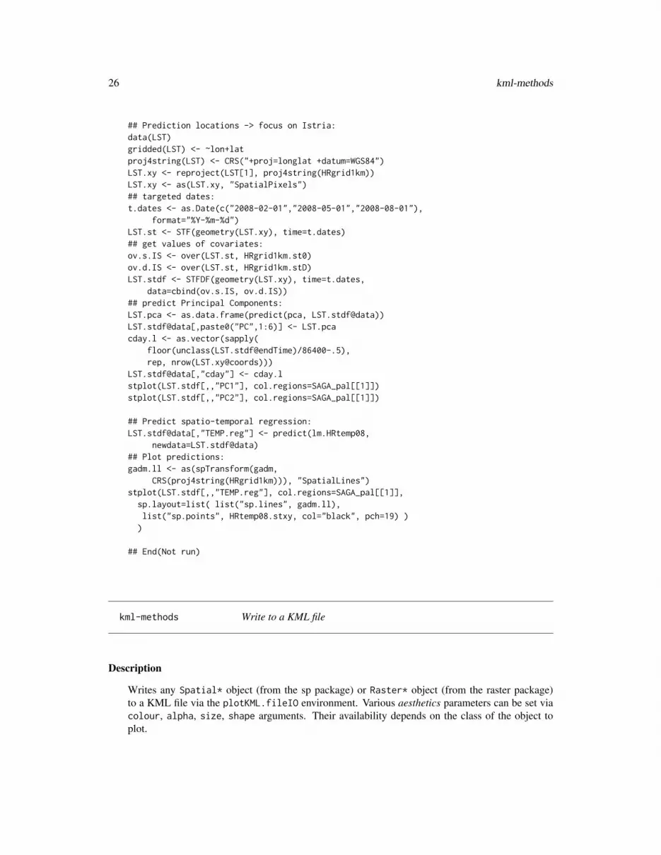
## Prediction locations -> focus on Istria:data(LST)gridded(LST) <- ~lon+latproj4string(LST) <- CRS("+proj=longlat +datum=WGS84")LST.xy <- reproject(LST[1], proj4string(HRgrid1km))LST.xy <- as(LST.xy, "SpatialPixels")## targeted dates:t.dates <- as.Date(c("2008-02-01","2008-05-01","2008-08-01"),
format="%Y-%m-%d")LST.st <- STF(geometry(LST.xy), time=t.dates)## get values of covariates:ov.s.IS <- over(LST.st, HRgrid1km.st0)ov.d.IS <- over(LST.st, HRgrid1km.stD)LST.stdf <- STFDF(geometry(LST.xy), time=t.dates,
data=cbind(ov.s.IS, ov.d.IS))## predict Principal Components:LST.pca <- as.data.frame(predict(pca, LST.stdf@data))LST.stdf@data[,paste0("PC",1:6)] <- LST.pcacday.l <- as.vector(sapply(
floor(unclass(LST.stdf@endTime)/86400-.5),rep, nrow(LST.xy@coords)))
LST.stdf@data[,"cday"] <- cday.lstplot(LST.stdf[,,"PC1"], col.regions=SAGA_pal[[1]])stplot(LST.stdf[,,"PC2"], col.regions=SAGA_pal[[1]])
## Predict spatio-temporal regression:LST.stdf@data[,"TEMP.reg"] <- predict(lm.HRtemp08,
newdata=LST.stdf@data)## Plot predictions:gadm.ll <- as(spTransform(gadm,
CRS(proj4string(HRgrid1km))), "SpatialLines")stplot(LST.stdf[,,"TEMP.reg"], col.regions=SAGA_pal[[1]],
sp.layout=list( list("sp.lines", gadm.ll),list("sp.points", HRtemp08.stxy, col="black", pch=19) ))
## End(Not run)
kml-methods Write to a KML file
Description
Writes any Spatial* object (from the sp package) or Raster* object (from the raster package)to a KML file via the plotKML.fileIO environment. Various aesthetics parameters can be set viacolour, alpha, size, shape arguments. Their availability depends on the class of the object toplot.

kml-methods 27
Usage
## S4 method for signature 'Raster'kml(obj, folder.name, file.name, kmz, ...)## S4 method for signature 'Spatial'kml(obj, folder.name, file.name, kmz, ...)## S4 method for signature 'STIDF'kml(obj, folder.name, file.name, kmz, ...)## S4 method for signature 'SoilProfileCollection'kml(obj, folder.name, file.name, kmz, ...)## S4 method for signature 'SpatialPhotoOverlay'kml(obj, folder.name, file.name, kmz, ...)
Arguments
obj object inheriting from the Spatial* or the Raster* classes
folder.name character; folder name in the KML file
file.name character; output KML file name
kmz logical; specief whether to compress the KML file
... additional aesthetics arguments (see details below)
Details
To kml you can also pass folder.name, file.name (output file name *.kml), overwrite (logical;overwrites the existing file) and kmz (logical; specifies whether to compress the kml file) arguments.Gridded objects (objects of class "SpatialGridDataFrame" or "RasterLayer" require at least oneaesthetics parameter to run, usually the colour.)
Value
A KML file. By default parses the object name and adds a ".kml" extension.
Author(s)
Pierre Roudier, Tomislav Hengl and Dylan Beaudette
See Also
kml_open, kml_aes, kml_close, kml_compress
Examples
# Plotting a SpatialPointsDataFrame objectlibrary(rgdal)data(eberg)eberg <- eberg[runif(nrow(eberg))<.1,]library(sp)library(rgdal)coordinates(eberg) <- ~X+Yproj4string(eberg) <- CRS("+init=epsg:31467")

28 kml.tiles
## Not run: # Simple plotkml(eberg, file = "eberg-0.kml")# Plot using aestheticsshape = "http://maps.google.com/mapfiles/kml/pal2/icon18.png"kml(eberg, colour = SNDMHT_A, size = CLYMHT_A,
alpha = 0.75, file = "eberg-1.kml", shape=shape)
## End(Not run)
kml.tiles Write vector object as tiled KML
Description
Writes vector object as tiled KML. Suitable for plotting large vectors i.e. large spatial data sets.
Usage
kml.tiles(obj, folder.name, file.name,block.x, kml.logo, cpus, home.url=".", desc=NULL,open.kml=TRUE, return.list=FALSE, ...)
Arguments
obj "SpatialPoints*" or "SpatialLines*" or "SpatialPolygons*"; vector layer
folder.name character; KML folder name
file.name character; output KML file name
block.x numeric; size of block in decimal degrees (geographical coordinates)
kml.logo character; optional project logo file (PNG)
cpus integer; specifies number of CPUs to be used by the snowfall package to speedthings up
home.url character; optional web-directory where the PNGs will be stored
desc character; optional layer description
open.kml logical; specifies whether to open the KML file after writing
return.list logical; specifies whether to return list of tiled objects
... (optional) aesthetics arguments (see aesthetics)
Value
Returns a list of KML files.
Note
This operation can be time-consuming for processing very large vectors. To speed up writing ofKMLs, use the snowfall package.

kml_compress 29
Author(s)
Tomislav Hengl
See Also
plotKML, plotKML.GDALobj
Examples
## Not run:library(sp)library(snowfall)library(GSIF)library(rgdal)
data(eberg)coordinates(eberg) <- ~X+Yproj4string(eberg) <- CRS("+init=epsg:31467")## plot using tiles:shape = "http://maps.google.com/mapfiles/kml/pal2/icon18.png"tiles.p <- kml.tiles(eberg["SNDMHT_A"], block.x=0.05,
size=0.8, z.lim=c(20,50), colour=SNDMHT_A, shape=shape,labels=SNDMHT_A, return.list=TRUE)
## Returns a list of tilesdata(eberg_contours)tiles.l <- kml.tiles(eberg_contours, block.x=0.05,
colour=Z, z.lim=range(eberg_contours$Z),colour_scale=SAGA_pal[[1]], return.list=TRUE)
## End(Not run)
kml_compress Compress a KML file with auxiliary files
Description
Compresses the KML file toghether with the auxiliary files (images, models, textures) using thedefault ZIP program.
Usage
kml_compress(file.name, zip = "", files = "", rm = FALSE, ...)
Arguments
file.name KML file name
zip (optional) location of an external ZIP program
files a character vector specifying the list of auxiliary files

30 kml_compress
rm logical; specify whether to remove temporary files
... other kml arguments
Details
The KMZ file can carry the model files (.dae), textures and ground overlay images. For practicalpurposes, we recommend that you, instead of compressing the images together with the KML file,consider serving the ground overlay images via a server i.e. as network links.If no internal ZIP program exists, the function looks for the system ZIP program:
Sys.getenv("R_ZIPCMD", "zip")
External ZIP program can also be specified via the zip argument.
Author(s)
Pierre Roudier, Tomislav Hengl and Dylan Beaudette
References
• KMZ description (http://code.google.com/apis/kml/documentation/)
See Also
kml-methods, kml_open
Examples
data(eberg)eberg <- eberg[runif(nrow(eberg))<.1,]library(sp)library(rgdal)library(raster)coordinates(eberg) <- ~X+Yproj4string(eberg) <- CRS("+init=epsg:31467")kml_open("eberg.kml")kml_layer(eberg, colour = CLYMHT_A)kml_close("eberg.kml")# compress:kml_compress("eberg.kml")
kml_description 31
kml_description Generate a table description from a data frame
Description
Converts a two-column data frame to a table in HTML format. This can then parsed to a KML fileas the layer description.
Usage
kml_description(x, iframe = NULL, caption = "Object summary",fix.enc = TRUE, cwidth = 150, twidth = 300,delim.sign = "_", asText = FALSE)
Arguments
x object of class "data.frame" with two columns
iframe (optional) iframe content
caption character; table caption
fix.enc logical; specify whether to fix encoding
cwidth numeric; first column width
twidth numeric; table width
delim.sign character; delimiter sign
asText logical; specifies whether to return the formatted table as text or XML
Author(s)
Tomislav Hengl
See Also
kml-methods
kml_layer-methods Write objects to a KML connection
Description
Writes any Spatial* object (from the sp package), spatio-temporal object (from the ST-classpackage) or Raster* object (from the raster package) to a KML file (connection) as a separatelayer. Various aesthetics, i.e. ways to represent target variables, can be set via colour, transparency,size, width, shape arguments. Their availability depends on the class of the object to plot.

32 kml_layer-methods
Usage
kml_layer(obj, ...)
Arguments
obj object inheriting from the Spatial* or the Raster* classes
... additional aesthetics arguments; see details for each kml_layer function and thekml_aes function
Value
An XML object that can be further parsed to a KML file (via an open connection).
Author(s)
Pierre Roudier, Tomislav Hengl and Dylan Beaudette
See Also
kml_layer.SpatialPoints, kml_layer.Raster, kml_layer.SpatialLines, kml_layer.SpatialPolygons,kml_layer.STIDF, kml_layer.STTDF, kml_layer.SoilProfileCollection, kml-methods, kml_open,kml_close
Examples
library(rgdal)data(eberg_grid)library(sp)library(raster)gridded(eberg_grid) <- ~x+yproj4string(eberg_grid) <- CRS("+init=epsg:31467")data(SAGA_pal)data(R_pal)## Not run: # Plot two layers one after the other:kml_open("eberg_grids.kml")kml_layer(eberg_grid, colour=DEMSRT6, colour_scale=R_pal[["terrain_colors"]])kml_layer(eberg_grid, colour=TWISRT6, colour_scale=SAGA_pal[[1]])kml_close("eberg_grids.kml")# print the result:library(XML)xmlRoot(xmlTreeParse("eberg_grids.kml"))[["Document"]]
## End(Not run)

kml_layer.Raster 33
kml_layer.Raster Writes raster objects to KML
Description
Writes rasters to PNG images and makes a KML code (ground overlays). Works with "RasterLayer"and "RasterStack" class objects. Target attributes can be specified using aesthetics arguments (e.g."colour").
Usage
kml_layer.Raster(obj, subfolder.name = paste(class(obj)), plot.legend = TRUE,metadata = NULL, raster_name,png.width = ncol(obj), png.height = nrow(obj),min.png.width = 800, TimeSpan.begin, TimeSpan.end,layer.name, ...)
Arguments
obj object of class "RasterLayer", "SpatialPixelsDataFrame" or "SpatialGridDataFrame"
subfolder.name character; optional subfolder name
plot.legend logical; specify whether a map legend should be generated automatically
metadata (optional) specify the metadata object
raster_name (optional) specify the output file name (PNG)
png.width (optional) width of the PNG file
png.height (optional) height of the PNG file
min.png.width (optional) minimum width of the PNG file
TimeSpan.begin object of class "POSIXct"; (optional) begin of the sampling period
TimeSpan.end object of class "POSIXct"; (optional) end of the sampling period
layer.name character; optional layer name
... additional aesthetics arguments
Details
Google Earth does not properly handle a 24-bit PNG file which has a single transparent color(read more at Google Earth Help). To force transparency, plotKML will try to set it using the-matte -transparent "#FFFFFF" option in the ImageMagick convert program (ImageMagickneeds to be installed separately and located using plotKML.env()).
Author(s)
Tomislav Hengl, Pierre Roudier and Dylan Beaudette

34 kml_layer.RasterBrick
See Also
kml-methods, kml_open, kml_layer.RasterBrick, plotKML-method
Examples
data(eberg_grid)library(sp)coordinates(eberg_grid) <- ~x+ygridded(eberg_grid) <- TRUEproj4string(eberg_grid) <- CRS("+init=epsg:31467")data(SAGA_pal)library(raster)r <- raster(eberg_grid["TWISRT6"])## Not run: # KML plot with a single raster:kml(r, colour_scale = SAGA_pal[[1]], colour = TWISRT6)
## End(Not run)
kml_layer.RasterBrick Export a time series of images to KML
Description
Writes a series of images to PNGs and uses them to create ground overlays. Works only with"RasterBrick" class objects with time dimension specified via the "@zvalue".
Usage
kml_layer.RasterBrick(obj, plot.legend = TRUE, dtime = "", tz = "GMT",z.lim = c(min(minValue(obj), na.rm=TRUE), max(maxValue(obj), na.rm=TRUE)),colour_scale = get("colour_scale_numeric", envir = plotKML.opts),home_url = get("home_url", envir = plotKML.opts),metadata = NULL, html.table = NULL,altitudeMode = "clampToGround", balloon = FALSE,png.width, png.height, min.png.width = 800, ...)
Arguments
obj object of class "RasterBrick" (e.g. a time series of images)
plot.legend logical; specify whether a map legend should be generated automatically
dtime temporal support (point or block) expressed in seconds
tz referent time zone
z.lim upper and lower limits (unique for all maps in the time series); the function bydefault uses the absolute minimum and maximum in values
colour_scale color palette; by default uses the color scale for numeric variables
home_url (optional) URL directory / location of the images

kml_layer.SoilProfileCollection 35
metadata (optional) the metadata object
html.table (optional) the description block (html)
altitudeMode character; the default altitudeMode
balloon logical; specifies whether to display balloon for each element
png.width (optional) width of the PNG files
png.height (optional) height of the PNG files
min.png.width (optional) minimum width of the PNG file
... additional arguments (see aesthetics)
Details
This method is recommended for visualization of numeric bands representing the same variable i.e.time series of images. To export a stack of images of different type see kml_layer.Raster. If the"@zvalue" slot is empty, dates will be added by subtracting days from the current day with 1–dayincrements.
Author(s)
Tomislav Hengl
See Also
kml-methods, kml_open, kml_layer.Raster, plotKML-method
kml_layer.SoilProfileCollection
Writes a list of soil profiles to KML
Description
Writes object of type "SoilProfileCollection" (a number of soil profiles with site and horizondata) to KML. Several attributes such as horizontal and vertical exaggeration can be passed viaarguments.
Usage
kml_layer.SoilProfileCollection(obj,var.name, var.min = 0, var.scale,site_names = profile_id(obj),method = c("soil_block", "depth_function")[1],block.size = 100,color.name, z.scale = 1, x.min, max.depth = 300,plot.points = TRUE,LabelScale = get("LabelScale", envir = plotKML.opts) * 0.7,IconColor = "#ff0000ff",

36 kml_layer.SoilProfileCollection
shape = paste(get("home_url", envir = plotKML.opts),"circlesquare.png", sep = ""),
outline = TRUE, visibility = TRUE, extrude = TRUE, tessellate = TRUE,altitudeMode = "relativeToGround", camera.distance = 0.01,tilt = 90, heading = 0, roll = 0,metadata = NULL, html.table = NULL, plot.scalebar = TRUE,scalebar = paste(get("home_url", envir = plotKML.opts),
"soilprofile_scalebar.png", sep = ""),... )
Arguments
obj object of class "SoilProfileCollection" (package aqp)var.name target column name in the horizons slotvar.min smallest valuevar.scale exaggeration in vertical dimensionsite_names site names as listed in the site tablemethod visualization type (soil block or depth-function)block.size (optional) size of the block of landcolor.name (optional) column name carrying the color information for each horizonz.scale exaggeration in horizontal directionx.min offset in longitude direction (in decimal degrees)max.depth maximum height/depht of a profile in cmplot.points logical; specifies whether to plot horizon centres with attribute valuesLabelScale numeric; specifies size of the labels for each horizonIconColor colors for the labels for each horizonshape default icon for Google placemarksoutline logical; specifies whether to draw outline for the soil-depth functions (or simply
a line)visibility logical; specifies whether to make the layer visibleextrude logical; specifies whether to extrude horizon centerstessellate logical; specifies whether to tessellate polygonsaltitudeMode by default relativeToGroundcamera.distance
distance from a profile in arc degreestilt angle between the direction of the LookAt position and the normal to the surface
of the earthheading orientation towards northroll rotation about the y axismetadata (optional) spatial metadata for the input objecthtml.table (optional) tabular content (attributes) for each horizonplot.scalebar logical; specifies whether to plot a scale bar next to the profile plotscalebar default icon for the scale bar... additional style arguments

kml_layer.SoilProfileCollection 37
Details
Horizon depths are typically expressed in cm, hence the default exaggeration factor (z.scale) is10. It is highly recommended to turn off the terrain layer in Google Earth, otherwise Google Earthwill deform the plots in areas of high relief.
Note
The spatial exaggeration needs to be used because often the detail in the background imagery inGoogle Earth is limited to a spatial accuracy of 2–20 m, hence there is no point of zooming intoobjects of size of few meters. These exaggeration factors were selected empirically and will needto be adjusted as the detail in the background imagery increases.
Author(s)
Tomislav Hengl, Dylan Beaudette and Pierre Roudier
References
• Algorithms for Quantitative Pedology (http://CRAN.r-project.org/package=aqp)
See Also
kml_layer.SpatialPhotoOverlay, plotKML-method
Examples
## Not run: ## install.packages("aqp", repos="http://R-Forge.R-project.org")library(aqp)library(fossil)library(plyr)data(ca630)## Promote to SoilProfileCollectionca <- join(ca630$lab, ca630$site, type='inner')depths(ca) <- pedon_key ~ hzn_top + hzn_bot## extract site datasite(ca) <- ~ mlra + ssa + lon + lat + cntrl_depth_to_top + cntrl_depth_to_bot + sampled_taxon_name# generate SpatialPointslibrary(sp)coordinates(ca) <- ~ lon + lat## assign CRS dataproj4string(ca) <- "+proj=longlat +datum=NAD83"## plot changes in base saturation by sum of cations method (pH 8.2):kml(ca, method = "depth_function", file.name = "ca_bs_8_2.kml",
var.name="bs_8.2", balloon = TRUE)## plot changes in cation exchange capacity by sum of cations method (pH 8.2):kml(ca, file.name = "ca_CEC8_2.kml", var.name="CEC8.2", IconColor = "#ff009000")## plot soil profile as 'block':kml(ca, file.name = "ca_CEC8_2_block.kml", var.name="CEC8.2", balloon = TRUE)
## End(Not run)

38 kml_layer.SpatialLines
kml_layer.SpatialLines
Writes spatial lines to KML
Description
Writes object of class "SpatialLines*" to KML with a possibility to parse attribute variables usingseveral aesthetics arguments.
Usage
kml_layer.SpatialLines(obj, subfolder.name = paste(class(obj)),extrude = FALSE, z.scale = 1, metadata = NULL,html.table = NULL, TimeSpan.begin = "", TimeSpan.end = "", ...)
Arguments
obj object of class "SpatialLines*"
subfolder.name character; optional subfolder name
extrude logical; specifies whether to connect the LinearRing to the ground
z.scale vertical exaggeration
metadata (optional) specify the metadata object
html.table optional description block (html) for each GPS point (vertices)
TimeSpan.begin (optional) beginning of the referent time period
TimeSpan.end (optional) end of the referent time period
... additional style arguments (see aesthetics)
Details
Only colour and width (aesthetics) are recommended when visualizing SpatialLines* objects.TimeSpan.begin and TimeSpan.end are optional TimeStamp vectors in the format:yyyy-mm-ddThh:mm:sszzzzzzUse the same time values for both TimeSpan.begin and TimeSpan.end if the measurements referto a single moment in time. TimeSpan.begin and TimeSpan.end can be either a single value or avector of values.
Author(s)
Pierre Roudier, Tomislav Hengl and Dylan Beaudette
See Also
kml-methods, kml_open, kml_layer.SpatialPolygons, plotKML-method

kml_layer.SpatialPhotoOverlay 39
Examples
library(rgdal)library(sp)data(eberg_contours)data(SAGA_pal)names(eberg_contours)# KML plot with elevations used as 'colour' argument:kml(eberg_contours, colour_scale = SAGA_pal[[1]], colour = Z, kmz = TRUE)
kml_layer.SpatialPhotoOverlay
Exports objects of type SpatialPhotoOverlay to KML
Description
Writes object of type SpatialPhotoOverlay to KML together with a COLLADA 3D model file (op-tional).
Usage
kml_layer.SpatialPhotoOverlay(obj, method = c("PhotoOverlay", "monolith")[1],PhotoOverlay.shape = obj@PhotoOverlay$shape, href = obj@filename,coords, dae.name = "", heading = obj@PhotoOverlay$heading,tilt = obj@PhotoOverlay$tilt, roll = obj@PhotoOverlay$roll,near = obj@PhotoOverlay$near, range = obj@PhotoOverlay$range,leftFov = obj@PhotoOverlay$leftFov, rightFov = obj@PhotoOverlay$rightFov,bottomFov = obj@PhotoOverlay$bottomFov, topFov = obj@PhotoOverlay$topFov,altitudeMode = "clampToGround", block.size = 100, max.depth = 300,scale.x = 1, scale.y = 1, scale.z = 1, refreshMode = "once",html.table = NULL, ... )
Arguments
obj object of class "SpatialPhotoOverlay" (a photograph with spatial coordi-nates, metadata and orientation)
method visualization type: either "PhotoOverlay" or "monolith"PhotoOverlay.shape
PhotoOverlay shape value (KML)
href location of the image file
coords (optional) 3D coordinates of the trapesoid corners
dae.name (optional) COLLADA 3D model file name (without the extension)
heading a PhotoOverlay argument; direction (azimuth) of the camera, in degrees
tilt a PhotoOverlay argument; rotation, in degrees, of the camera around the X axis
roll a PhotoOverlay argument; rotation, in degrees, of the camera around the Z axis

40 kml_layer.SpatialPhotoOverlay
near a PhotoOverlay argument; measurement in meters along the viewing directionfrom the camera viewpoint to the PhotoOverlay shape
range a PhotoOverlay argument; distance in meters from the point specified by <lon-gitude>, <latitude>, and <altitude> to the LookAt position
leftFov a PhotoOverlay argument; angle, in degrees, between the camera’s viewing di-rection and the left side of the view volume
rightFov a PhotoOverlay argument; angle, in degrees, between the camera’s viewing di-rection and the right side of the view volume
bottomFov a PhotoOverlay argument; angle, in degrees, between the camera’s viewing di-rection and the bottom side of the view volume
topFov a PhotoOverlay argument; angle, in degrees, between the camera’s viewing di-rection and the top side of the view volume
altitudeMode altitude mode
block.size width of the block (100 m by default)
max.depth 300 m by default
scale.x exaggeration in X dimension (COLLADA rectangle)
scale.y exaggeration in Y dimension (COLLADA rectangle)
scale.z exaggeration in Z dimension (COLLADA rectangle)
refreshMode refresh mode for the COLLADA object
html.table (optional) specify the description block (html) for each point
... other additional arguments
Details
The default widht and height (100 m and 300 m) were selected based on empirical testing (level ofdetail in the background imagery in Google Earth). User specified coordinates can be passed viathe cords argument. For more info see makeCOLLADA.rectangle.
Author(s)
Tomislav Hengl
References
• KML Reference (http://code.google.com/apis/kml/documentation/kmlreference.html)
• COLLADA Reference (http://collada.org/mediawiki/)
See Also
spPhoto, getWikiMedia.ImageInfo

kml_layer.SpatialPixels 41
Examples
## Not run: # display spatially referenced photograph in Google Earth:imagename = "Soil_monolith.jpg"x1 <- getWikiMedia.ImageInfo(imagename)sm <- spPhoto(filename = x1$url$url, exif.info = x1$metadata)kml_open("sm.kml")kml_layer(sm, method="monolith")kml_close("sm.kml")kml_compress("sm.kml", files="Soil_monolith_jpg.dae")
## End(Not run)
kml_layer.SpatialPixels
Writes SpatialPixels or SpatialGrid objects to KML
Description
Writes sp classes "SpatialGrid" or "SpatialPixels" to PNG images and makes a KML docu-ment (ground overlays). Target attributes can be specified using aesthetics arguments (e.g. "colour").
Usage
kml_layer.SpatialPixels(obj, subfolder.name = paste(class(obj)), raster_name,plot.legend = TRUE, metadata = NULL,png.width = gridparameters(obj)[1,"cells.dim"],png.height = gridparameters(obj)[2,"cells.dim"],min.png.width = 800, TimeSpan.begin, TimeSpan.end,layer.name, ...)
Arguments
obj object of class "RasterLayer", "SpatialPixelsDataFrame" or "SpatialGridDataFrame"
subfolder.name character; optional subfolder name
plot.legend logical; specify whether a map legend should be generated automatically
metadata (optional) specify the metadata object
raster_name (optional) specify the output file name (PNG)
png.width (optional) width of the PNG file
png.height (optional) height of the PNG file
min.png.width (optional) minimum width of the PNG file
TimeSpan.begin object of class "POSIXct"; (optional) begin of the sampling period
TimeSpan.end object of class "POSIXct"; (optional) end of the sampling period
layer.name character; optional layer name
... additional aesthetics arguments

42 kml_layer.SpatialPoints
Details
Google Earth does not properly handle a 24-bit PNG file which has a single transparent color(read more at Google Earth Help). To force transparency, plotKML will try to set it using the-matte -transparent "#FFFFFF" option in the ImageMagick convert program (ImageMagickneeds to be installed separately and located using plotKML.env()). The PNG export uses the’cairographics’, which will never use a palette and normally creates a larger 32-bit ARGB file, butthen always allows transparancy.
Author(s)
Tomislav Hengl, Pierre Roudier and Dylan Beaudette
See Also
kml-methods, kml_open, kml_layer.Raster, plotKML-method
Examples
data(eberg_grid)library(sp)library(rgdal)library(raster)coordinates(eberg_grid) <- ~x+ygridded(eberg_grid) <- TRUEproj4string(eberg_grid) <- CRS("+init=epsg:31467")data(SAGA_pal)## Not run: ## KML plot with a single raster:kml(eberg_grid, colour_scale = SAGA_pal[[1]], colour = TWISRT6)## make a larger image:kml(eberg_grid, colour_scale = SAGA_pal[[1]], colour = TWISRT6,
png.width = 600, png.height = 600)
## End(Not run)
kml_layer.SpatialPoints
Writes spatial points to KML
Description
Writes object of class "SpatialPoints*" to KML with a possibility to parse attribute variablesusing several aesthetics arguments.
Usage
kml_layer.SpatialPoints(obj, subfolder.name = paste(class(obj)),extrude = TRUE, z.scale = 1,LabelScale = get("LabelScale", envir = plotKML.opts),metadata = NULL, html.table = NULL, TimeSpan.begin = "",TimeSpan.end = "", points_names, ...)

kml_layer.SpatialPoints 43
Arguments
obj object of class "SpatialPoints*"
subfolder.name character; optional subfolder name
extrude logical; specifies whether to connect the point to the ground with a line
z.scale numeric; exaggeration in vertical dimension
LabelScale numeric; scale factor for size of labels
metadata (optional) specify the metadata object
html.table (optional) specify the description block (html) for each point
TimeSpan.begin (optional) beginning of the referent time period
TimeSpan.end (optional) end of the referent time period
points_names character; forces the point labels (size of the character vector must equal thenumber of the points)
... additional style arguments (see aesthetics)
Details
TimeSpan.begin and TimeSpan.end are optional TimeStamp vectors:
yyyy-mm-ddThh:mm:sszzzzzz
For observations at point support (a single moment in time), use the same time values for bothTimeSpan.begin and TimeSpan.end. TimeSpan.begin and TimeSpan.end can be either a singlevalue or a vector of values.Optional aesthetics arguments are shapes (icons), colour, sizes, altitude (if not a 3D ob-ject; variable to be used to specify altitude above ground), altitudeMode (altitude mode type(clampToGround, relativeToGround or absolute). Although this function can be used to plotover five variables, more than three aesthetics arguments is not recommended (e.g. limit to size andcolour).
Author(s)
Pierre Roudier, Tomislav Hengl and Dylan Beaudette
See Also
kml_layer.STTDF, plotKML-method
Examples
data(eberg)data(SAGA_pal)library(sp)library(rgdal)coordinates(eberg) <- ~X+Yproj4string(eberg) <- CRS("+init=epsg:31467")names(eberg)

44 kml_layer.SpatialPolygons
# subset to 10 percent:eberg <- eberg[runif(nrow(eberg))<.1,]## Not run: # plot the measured CLAY content:kml(eberg, labels = CLYMHT_A)shape = "http://maps.google.com/mapfiles/kml/pal2/icon18.png"# color only:kml(eberg, shape = shape, colour = SLTMHT_A, labels = "", colour_scale = SAGA_pal[[1]])# two variables at the same time:kml(eberg, shape = shape, size = CLYMHT_A, colour = SLTMHT_A, labels = "")# two aesthetics elements are effective in emphasizing hot-spots:kml(eberg, shape = shape, altitude = CLYMHT_A*10, extrude = TRUE,
colour = CLYMHT_A, labels = CLYMHT_A, kmz = TRUE)
## End(Not run)
## example of how plotKML is programmed:data(HRtemp08)HRtemp08[1,]library(XML)p1 = newXMLNode("Placemark")begin <- format(HRtemp08[1,"DATE"]-.5, "%Y-%m-%dT%H:%M:%SZ")end <- format(HRtemp08[1,"DATE"]+.5, "%Y-%m-%dT%H:%M:%SZ")txt <- sprintf('<name>%s</name><TimeStamp><begin>%s</begin><end>%s</end></TimeStamp>
<Point><coordinates>%.4f,%.4f,%.0f</coordinates></Point>', HRtemp08[1,"NAME"],begin, end, HRtemp08[1,"Lon"], HRtemp08[1,"Lat"], 0)
parseXMLAndAdd(txt, parent=p1)p1
kml_layer.SpatialPolygons
Writes spatial polygons to KML
Description
Writes object of class "SpatialPolygons*" to KML with a possibility to parse attribute variablesusing several aesthetics arguments.
Usage
kml_layer.SpatialPolygons(obj, subfolder.name = paste(class(obj)),extrude = TRUE, tessellate = FALSE,outline = TRUE, plot.labpt = FALSE, z.scale = 1,LabelScale = get("LabelScale", envir = plotKML.opts),metadata = NULL, html.table = NULL, TimeSpan.begin = "",TimeSpan.end = "", colorMode = "normal", ...)
Arguments
obj object of class "SpatialPolygons*"

kml_layer.SpatialPolygons 45
subfolder.name character; optional subfolder name
extrude logical; specifies whether to connect the point to the ground with a line
tessellate logical; specifies whether to connect the LinearRing to the ground
outline logical; specifies whether to outline the polygon
plot.labpt logical; specifies whether to add the label point (polygon centre)
z.scale numeric; exaggeration in vertical dimension
LabelScale numeric; scale factor for size of labels
metadata (optional) specify the metadata object
html.table optional description block (html) for each GPS point (vertices)
TimeSpan.begin (optional) beginning of the referent time period
TimeSpan.end (optional) end of the referent time period
colorMode (optional) KML color mode (normal or random)
... additional style arguments (see aesthetics)
Details
Label points are be default not plotted. We recommend adding the legend to attribute maps instead.Transparency can be set by using the alpha argument.TimeSpan.begin and TimeSpan.end are optional TimeStamp vectors:
yyyy-mm-ddThh:mm:sszzzzzz
Use the same time values for both TimeSpan.begin and TimeSpan.end if the measurements referto a single moment in time. TimeSpan.begin and TimeSpan.end can be either a single value or avector of values.
Author(s)
Pierre Roudier, Tomislav Hengl and Dylan Beaudette
See Also
kml_layer.SpatialLines, kml_layer.STIDF, , plotKML-method
Examples
library(rgdal)library(sp)data(eberg_zones)names(eberg_zones)## Not run: # visualize zones using random colors:kml(eberg_zones, colorMode = "random")# with labels:kml(eberg_zones, colour = ZONES, plot.labpt = TRUE, labels = ZONES, kmz = TRUE)
## End(Not run)

46 kml_layer.STIDF
kml_layer.STIDF Write irregular spatio-temporal observations (points, lines and poly-gons) to KML
Description
Writes an object of class "STIDF" (unstructured/irregular spatio-temporal data) to a KML file witha possibility to parse attribute variables using several aesthetics arguments.
Usage
kml_layer.STIDF(obj, dtime, ...)
Arguments
obj space-time object of class "STIDF" (spatio-temporal irregular data frame) orclass "STFDF" (spatio-temporal full data frame)
dtime temporal support (point or block) expressed in seconds
... additional arguments that can be passed to the kml_layer.Spatial method
Details
An object of class "STIDF" contains a slot of type "Spatial*", which is parsed via the kml_layermethod depending on the type of spatial object (points, lines, polygons). The dateTime is defined as:
yyyy-mm-ddThh:mm:sszzzzzz
where T is the separator between the date and the time, and the time zone is either Z (for UTC) orzzzzzz, which represents ?hh:mm in relation to UTC. For more info on how Time Stamps work seehttp://kml-samples.googlecode.com. If the time is measured at block support, then:
<TimeStamp><begin> </begin><end> </end></TimeStamp>
tags will be inserted. Temporal support for any spacetime class, if not specified by the user, isdetermined as a difference between the "time" (indicating begin time) and "endTime" slots.
Author(s)
Tomislav Hengl and Benedikt Gräler
References
• Pebesma, E. (2012) Classes and Methods for Spatio-Temporal Data in R. Journal of StatisticalSoftware. 51(7): 1-30.
• spacetime package (http://CRAN.R-project.org/package=spacetime)

kml_layer.STTDF 47
See Also
kml_layer.STTDF, plotKML-method
Examples
## Not run:data(HRtemp08)
# format the time column:HRtemp08$ctime <- as.POSIXct(HRtemp08$DATE, format="%Y-%m-%dT%H:%M:%SZ")
# create a STIDF object:library(spacetime)sp <- SpatialPoints(HRtemp08[,c("Lon","Lat")])proj4string(sp) <- CRS("+proj=longlat +datum=WGS84")HRtemp08.st <- STIDF(sp, time = HRtemp08$ctime, data = HRtemp08[,c("NAME","TEMP")])
# write to a KML file:HRtemp08_jan <- HRtemp08.st[1:500]shape <- "http://maps.google.com/mapfiles/kml/pal2/icon18.png"kml(HRtemp08_jan, dtime = 24*3600, colour = TEMP, shape = shape, labels = "", kmz=TRUE)
## North Carolina SIDS data set:library(maptools)fname <- system.file("shapes/sids.shp", package="maptools")[1]nc <- readShapePoly(fname, proj4string=CRS("+proj=longlat +datum=NAD27"))time <- as.POSIXct(strptime(c(rep("1974-01-01", length(nc)),
rep("1979-01-01", length(nc))), format="%Y-%m-%d"), tz = "GMT")data <- data.frame(BIR = c(nc$BIR74, nc$BIR79), NWBIR = c(nc$NWBIR74, nc$NWBIR79),
SID = c(nc$SID74, nc$SID79))# copy polygons:nc.poly <- rep(slot(nc, "polygons"), 2)# fix the polygon IDs:for(i in 1:length(row.names(data))) { nc.poly[[i]]@ID = row.names(data)[i] }sp <- SpatialPolygons(nc.poly, proj4string=CRS("+proj=longlat +datum=NAD27"))# create a STIDF object:nct <- STIDF(sp, time = time, data = data)# write to a KML file:kml(nct, colour = SID)
## End(Not run)
kml_layer.STTDF Write a space-time trajectory to KML
Description
Writes an object of class "STTDF" to a KML file with a possibility to parse attribute variables usingseveral aesthetics arguments.
48 kml_layer.STTDF
Usage
kml_layer.STTDF(obj, id.name = names(obj@data)[which(names(obj@data)== "burst")],dtime, extrude = FALSE,start.icon = paste(get("home_url", envir = plotKML.opts),
"3Dballyellow.png", sep = ""),end.icon = paste(get("home_url", envir = plotKML.opts),
"golfhole.png", sep = ""),LabelScale = 0.8 * get("LabelScale", envir = plotKML.opts), z.scale = 1,metadata = NULL, html.table = NULL, ... )
Arguments
obj space-time object of class "STTDF" (spatio-temporal irregular data.frames tra-jectory)
id.name trajectory ID column name
dtime temporal support size (in seconds)
extrude logical; extrude GPS vertices?
start.icon start icon name (3Dballyellow.png)
end.icon destination icon name (golfhole.png)
LabelScale the default size of icons
z.scale vertical exaggeration
metadata (optional) specify the metadata object
html.table optional description block (html) for each GPS point (vertices)
... other optional arguments
Details
The dateTime is defined as yyyy-mm-ddThh:mm:sszzzzzz, where T is the separator between thedate and the time, and the time zone is either Z (for UTC) or zzzzzz, which represents ±hh:mm inrelation to UTC. For more info on how Time Stamps work see http://kml-samples.googlecode.com. If the time is measured at block support, then:
<TimeStamp><begin> </begin><end> </end></TimeStamp>
tags will be inserted. Temporal support for any spacetime class, if not specified by the user, isdetermined as a difference between the "time" (indicating begin time) and "endTime" slots.
Author(s)
Tomislav Hengl
kml_legend.bar 49
References
•• Pebesma, E. (2012) Classes and Methods for Spatio-Temporal Data in R. Journal of Statistical
Software. 51(7): 1-30.• spacetime package (http://CRAN.R-project.org/package=spacetime)
See Also
readGPX, plotKML-method
kml_legend.bar Generates a legend bar (PNG file)
Description
Produces a PNG file that can be used as a screen overlay — legend bar for numeric and factor typevariables.
Usage
kml_legend.bar(x, width, height, pointsize = 14, legend.file, legend.pal,z.lim = range(x, na.rm=TRUE, finite=TRUE), factor.labels)
Arguments
x numeric or factor-type vectorwidth numeric; (optional) width of image in pixelsheight numeric; (optional) height of image in pixelspointsize numeric; point size for the plotlegend.file PNG file namelegend.pal character; color palettez.lim numeric; lower and upper limitsfactor.labels character; class names if applicable
Details
When exporting raster layers to KML the legend bar is generated by default. If the width and heightare not provided, the function will try to estimate them automatically.
Author(s)
Tomislav Hengl, Pierre Roudier, and Dylan Beaudette
See Also
grDevices::png, kml-methods, kml_layer

50 kml_legend.whitening
kml_legend.whitening Whitening legend (PNG)
Description
Produces a PNG file that can be used in KML plots (visualization of uncertainty).
Usage
kml_legend.whitening(legend.res = 0.01, width = 120, height = 300, pointsize = 14,x.lim, e.lim, leg.asp = 0.3 * width/height,legend.file = "whitening_legend.png",matte = FALSE)
Arguments
legend.res numeric; resolution on a 0-1 scale
width integer; image width
height integer; image height
pointsize integer; point size in units for text
x.lim numeric; upper and lower limits for target variable
e.lim numeric; upper and lower limits for the normalized error
leg.asp numeric; legend aspect
legend.file character; output PNG file name
matte logical; specify whether to fix transparency using ImageMagick
Details
The output PNG file shows a 2D legend with values on the vertical axis and uncertainty on thehorizontal axis. Whitening is only valid with Hue-Saturation-Intensity system where Hue’s areused to represent values of the target variable, so that the amount of white color can be linearly usedto represent uncertainty (i.e. whitening can not be used with different color palettes; or at least wedo not recommend this).
Note
Google Earth does not properly handle a 24-bit PNG file which has a single transparent color. Inorder to force transparency in the output PNG, the function with try using ImageMagick convertfunction. ImageMagick needs to be installed separately and located using plotKML.env().
Author(s)
Tomislav Hengl
kml_metadata-methods 51
References
• Hengl, T., Heuvelink, G.M.B., Stein, A., (2004) A generic framework for spatial prediction ofsoil variables based on regression-kriging. Geoderma 122 (1-2): 75-93.
• Hengl, T., (2003) Visualisation of uncertainty using the HSI colour model: computations withcolours. 7th International Conference on GeoComputation (CD-ROM), p. 8.
See Also
whitening
Examples
## Not run: # create the 2D legend for whitening (PNG file):kml_legend.whitening(x.lim=c(5,20), e.lim=c(.6,1))
## End(Not run)
kml_metadata-methods Add metadata table to the active layer
Description
Adds a selection of metadata to the description box of an active layer.
Usage
## S4 method for signature 'SpatialMetadata'kml_metadata(obj, cwidth = 150, twidth = 500, asText = FALSE)
Arguments
obj object of class "SpatialMetadata"
cwidth html column width for the field names
twidth html total table width
asText logical; return the output as XML or characters
Details
The kml_metadata function, by default, prints out only a number of selected metadata fields:
1. "Citation_title",
2. "Abstract",
3. "Object_Count",
4. "Beginning_Date",
5. "Ending_Date",

52 kml_open
6. "Data_Order_URL",7. "Other_Citation_Details",8. "Citation_URL",9. "Data_Set_Credit",
10. "Data_Distributing_Organization",11. "Format_Information_Content",12. "Native_Data_Set_Environment"
See data(mdnames) for a complete list of metadata fields.
Author(s)
Tomislav Hengl
See Also
spMetadata
kml_open Open / close a KML file connection
Description
Opens a KML file in write mode and initiates the KML header. The same file connection is furtheraccessible by other kml_*() functions such as kml_layer() and kml_close(). kml_View tries toopen the produced file using the default application.
Usage
kml_open(file.name, folder.name = file.name, kml_open = TRUE,kml_visibility = TRUE, overwrite = TRUE, use.Google_gx = FALSE,kml_xsd = get("kml_xsd", envir = plotKML.opts),xmlns = get("kml_url", envir = plotKML.opts),xmlns_gx = get("kml_gx", envir = plotKML.opts))
Arguments
file.name KML file namefolder.name character string; KML folder namekml_open logical; specify whether to open the folder by defaultkml_visibility logical; specify whether to make the whole folder visibleoverwrite logical; if TRUE, "name" will be overwritten if it existsuse.Google_gx logical; specify whether to use the Google’s extended schemakml_xsd URL of the KML scheme to be usedxmlns URL of the OGC KML standardxmlns_gx URL of the extended standard... other arguments

kml_screen 53
Details
These lower level functions can be used to create customized multi-layered KML files. See plotKMLpackage homepage / manual for more examples.
Author(s)
Pierre Roudier, Tomislav Hengl and Dylan Beaudette
See Also
plotKML-method, kml_layer, kml-methods
kml_screen Add a screen overlay
Description
Adds an image file (map legend or logo) as screen overlay. The same file connection is further ac-cessible by other kml_*() functions such as kml_layer() and kml_close(). This allows creationof customized multi-layered KML files.
Usage
kml_screen(image.file, sname = "",position = c("UL","ML","LL","BC","LR","MR","UR","TC")[1],overlayXY, screenXY, xyunits = c("fraction", "pixels", "insetPixels")[1],rotation = 0, size = c(0,0) )
Arguments
image.file image file to be used for screen overlay
sname screen overlay name
position one of the nine standard positions
overlayXY manually specified tie point on the overlay image e.g. 'x="0" y="1"'
screenXY manually specified matching tie point on the scren e.g. 'x="0" y="1"'
xyunits values of the XY units (("pixels", "fraction", or "insetPixels")
rotation (optional) rotation in degrees clock-wise
size size correction in x and y direction
Details
If nothing else is specified the function looks for some of the nine typical positions: "UL" (upperleft), "ML" (middle left), "LL" (lower left), "BC" (bottom centre), "LR" (lower right), "MR" (middleright), "UR" (upper right), and "TC" (top centre). The x and y values can be specified in threedifferent ways: as pixels ("pixels"), as fractions of the image ("fraction"), or as inset pixels("insetPixels") — an offset in pixels from the upper right corner of the image.

54 LST
Note
The function, by default, calculates with fractions. If you change the xyunits type, all other ele-ments need to be expressed in the same units.
Author(s)
Tomislav Hengl
References
• KML Reference (http://code.google.com/apis/kml/documentation/)
See Also
kml-methods
Examples
library(rgdal)library(sp)data(eberg_zones)## Not run: # add logo in the top-center:kml_open("eberg_screen.kml")kml_layer(eberg_zones)logo = "http://meta.isric.org/images/ISRIC_right.png"kml_screen(image.file = logo, position = "TC", sname = "ISRIC logo")kml_close("eberg_screen.kml")kml_compress("eberg_screen.kml")
## End(Not run)
LST Time series of MODIS LST images
Description
LST contains a spatial sub-sample (Istra region in Croatia) of 46 time series of MODIS LST images(estimated Land Surface Temperature in degrees C) at 1 km resolution. The temporal support sizeof these images is 8-days.
Usage
data(LST)

makeCOLLADA 55
Format
The LST data frame contains the following layers:
LST2008_01_01 8-day MODIS LST mosaick for period 2007-12-29 to 2008-01-04
LST2008_01_09 8-day MODIS LST mosaick for period 2008-01-05 to 2008-01-13
... subsequent bands
lon a numeric vector; x-coordinate (m) in the WGS84 system
lat a numeric vector; y-coordinate (m) in the WGS84 system
Note
Time series of 46 day-time and night-time 8-day composite LST images (MOD11A2 product bands1 and 5) was obtained from the NASA’s FTP server (ftp://ladsftp.nascom.nasa.gov). Theoriginal 8-day composite images were created by patching together images from a period of ±4days, so that the proportion of clouds can be reduced to a minimum. The "zvalue" slot in the"RasterBrick" object can be used as the dateTime column expressed as:
yyyy-mm-ddThh:mm:sszzzzzz
where T is the separator between the date and the time, and the time zone is either Z (for UTC) orzzzzzz, which represents ±hh:mm in relation to UTC.
Author(s)
Tomislav Hengl and Melita Percec Tadic
References
• Hengl, T., Heuvelink, G.B.M., Percec Tadic, M., Pebesma, E., (2011) Spatio-temporal predic-tion of daily temperatures using time-series of MODIS LST images. Theoretical and AppliedClimatology, 107(1-2): 265-277.
• MODIS products (https://lpdaac.usgs.gov/products/modis_products_table)
makeCOLLADA Generate a COLLADA file representing the 3D model of a rectangle
Description
Produces a COLLADA file representing the 3D model of a rectangle with the image specifies viahref wrapped over the surface (as texture fill). This allows free rotation of any rectangular imagein the 3D space.

56 makeCOLLADA
Usage
makeCOLLADA.rectangle(coords, filename, href, DateTime,up_axis = "Z_UP", authoring_tool = "plotKML",technique_profile = "GOOGLEEARTH",double_sided = TRUE)
Arguments
coords a matrix defining the rectangle: 4 points with X, Z and Y coordinates (P1 —upper right, P2 — upper left, P3 — lower right, P4 — lower left)
filename output filename with *.dae extension
href location of the image used for wrapping (texture fill)
DateTime creation / update time (system time)
up_axis specify which axis is errected
authoring_tool specify authoring tooltechnique_profile
specify technique profile
double_sided logical; specify whether to drape image on both sides
Details
COLLADA is managed by the nonprofit technology consortium, the Khronos Group. You can alsosimply drag and drop a COLLADA (.dae) file on top of the virtual Earth.
Author(s)
Tomislav Hengl
References
• COLLADA Schema (http://collada.org/mediawiki/)
See Also
kml_layer.SpatialPhotoOverlay
Examples
## Not run: # image previously uploaded to Wikimedia commons:imagename = "Soil_monolith.jpg"x1 <- getWikiMedia.ImageInfo(imagename)sm <- spPhoto(filename = x1$url$url, exif.info = x1$metadata)kml(sm, method="monolith")xmlTreeParse("Soil_monolith_jpg.dae")
## End(Not run)

metadata2SLD-methods 57
metadata2SLD-methods Methods to create a Styled Layer Description (SLD) file
Description
Creates a Styled Layer Description (SLD) file, that can be attached to a spatial layer contributed toGeoServer. It writes the "sp.pallete" object (legend entries, titles and colors) to an external file.
Usage
## S4 method for signature 'SpatialMetadata'metadata2SLD(obj, ...)
Arguments
obj object of class "SpatialMetadata"... other arguments
Details
The structure of the SLD file is determined by the object class (Point, Polygon, SpatialPixels).
Author(s)
Tomislav Hengl
See Also
metadata2SLD.SpatialPixels, spMetadata
metadata2SLD.SpatialPixels
Writes a Styled Layer Description (SLD) file
Description
Writes a Styled Layer Description (SLD) file, that can be attached to a spatial layer contributed toGeoServer.
Usage
metadata2SLD.SpatialPixels(obj,Format_Information_Content = xmlValue(obj@xml[["//formcont"]]),obj.name = normalizeFilename(deparse(substitute(obj))),sld.file = set.file.extension(obj.name, ".sld"),Citation_title = xmlValue(obj@xml[["//title"]]),ColorMap_type = "intervals", opacity = 1,brw.trg = 'Greys', target.var, ...)

58 normalizeFilename
Arguments
obj object of class "SpatialMetadata"Format_Information_Content
character; class of the object to be written to SLD file
obj.name character; name of the layer
sld.file character; name of the output file
Citation_title character; title of the layer
ColorMap_type character; type of the colorMap see http://docs.geoserver.org
opacity logical; specifies the opacity
brw.trg character; color scheme according to www.colorbrewer2.org; default to ’Greys’
target.var character; target variable used to calculate the class-intervals
... additional arguments
Author(s)
Tomislav Hengl
See Also
spMetadata
Examples
## Not run: # generate missing metadatadata(eberg_grid)library(sp)coordinates(eberg_grid) <- ~x+ygridded(eberg_grid) <- TRUEproj4string(eberg_grid) <- CRS("+init=epsg:31467")# with localy prepared metadata file:eberg_TWI <- as(eberg_grid["TWISRT6"], "SpatialPixelsDataFrame")eberg.md <- spMetadata(eberg_TWI, Target_variable="TWISRT6")# export to SLD format:metadata2SLD(eberg.md, "eberg_TWI.sld")
## End(Not run)
normalizeFilename Normalize filename string
Description
Remove all reserved characters from the file name.

northcumbria 59
Usage
normalizeFilename(x, form = c("default", "8.3")[1],fix.encoding = TRUE, sub.sign = "_")
Arguments
x input character
form target format (standard or the short 8.3 file name)
fix.encoding logical; specifies whether to fix the encoding
sub.sign substitution symbol
Details
This function removes all reserved characters: (less than), (greater than), (colon), (double quote),(forward slash), (backslash), (vertical bar or pipe), (question mark), (asterisk), and empty spaces,from the file name. This is important when writing a list of objects to an external file (e.g. KML)as it prevents from creating erroneous file names.
Author(s)
Tomislav Hengl
See Also
utils::shortPathName, RSAGA:set.file.extension
Examples
normalizeFilename("name[%].txt")normalizeFilename("name .txt")
northcumbria Polygon boundary of north Cumbria
Description
This data set gives the boundary of the county of north Cumbria (UK).
Usage
data(northcumbria)
Format
A matrix containing (x,y) coordinates of the boundary.
60 plotKML-method
Author(s)
Edith Gabriel <[email protected]>
See Also
fmd for the space-time pattern of food-and-mouth disease in this county in 2001.
plotKML-method Methods for plotting results of spatial analysis in Google Earth
Description
The method writes inputs and outputs of spatial analysis (a list of point, gridded and/or polygondata usually) to KML and opens the KML file in Google Earth (or any other default package usedto view KML/KMZ files).
Usage
## S4 method for signature 'SpatialPointsDataFrame'plotKML(obj,
folder.name = normalizeFilename(deparse(substitute(obj, env = parent.frame()))),file.name = paste(folder.name, ".kml", sep=""),size, colour, points_names,shape = "http://maps.google.com/mapfiles/kml/pal2/icon18.png",
metadata = NULL, kmz = get("kmz", envir = plotKML.opts), open.kml = TRUE, ...)## S4 method for signature 'SpatialLinesDataFrame'plotKML(obj,
folder.name = normalizeFilename(deparse(substitute(obj, env = parent.frame()))),file.name = paste(folder.name, ".kml", sep=""),
metadata = NULL, kmz = get("kmz", envir = plotKML.opts), open.kml = TRUE, ...)## S4 method for signature 'SpatialPolygonsDataFrame'plotKML(obj,
folder.name = normalizeFilename(deparse(substitute(obj, env = parent.frame()))),file.name = paste(folder.name, ".kml", sep=""),colour, plot.labpt, labels, metadata = NULL,kmz = get("kmz", envir = plotKML.opts), open.kml = TRUE, ...)
## S4 method for signature 'SpatialPixelsDataFrame'plotKML(obj,
folder.name = normalizeFilename(deparse(substitute(obj, env = parent.frame()))),file.name = paste(folder.name, ".kml", sep=""),colour, raster_name, metadata = NULL, kmz = FALSE, open.kml = TRUE, ...)
## S4 method for signature 'SpatialGridDataFrame'plotKML(obj,
folder.name = normalizeFilename(deparse(substitute(obj, env = parent.frame()))),file.name = paste(folder.name, ".kml", sep=""),colour, raster_name, metadata = NULL, kmz = FALSE, open.kml = TRUE, ...)
## S4 method for signature 'RasterLayer'

plotKML-method 61
plotKML(obj,folder.name = normalizeFilename(deparse(substitute(obj, env = parent.frame()))),file.name = paste(folder.name, ".kml", sep=""),colour, raster_name, metadata = NULL, kmz = FALSE, open.kml = TRUE, ...)
## S4 method for signature 'SpatialPhotoOverlay'plotKML(obj,
folder.name = normalizeFilename(deparse(substitute(obj, env = parent.frame()))),file.name = paste(folder.name, ".kml", sep=""),dae.name, kmz = get("kmz", envir = plotKML.opts), open.kml = TRUE, ...)
## S4 method for signature 'SoilProfileCollection'plotKML(obj,
folder.name = normalizeFilename(deparse(substitute(obj, env = parent.frame()))),file.name = paste(folder.name, ".kml", sep=""),var.name, metadata = NULL, kmz = get("kmz", envir = plotKML.opts),open.kml = TRUE, ...)
## S4 method for signature 'STIDF'plotKML(obj,
folder.name = normalizeFilename(deparse(substitute(obj, env = parent.frame()))),file.name = paste(folder.name, ".kml", sep=""),colour, shape = "http://maps.google.com/mapfiles/kml/pal2/icon18.png",points_names, kmz = get("kmz", envir = plotKML.opts), open.kml = TRUE, ...)
## S4 method for signature 'STFDF'plotKML(obj, ...)## S4 method for signature 'STSDF'plotKML(obj, ...)## S4 method for signature 'STTDF'plotKML(obj,
folder.name = normalizeFilename(deparse(substitute(obj, env = parent.frame()))),file.name = paste(folder.name, ".kml", sep=""),
colour, start.icon = "http://maps.google.com/mapfiles/kml/pal2/icon18.png",kmz = get("kmz", envir = plotKML.opts), open.kml = TRUE, ...)
## S4 method for signature 'RasterBrickTimeSeries'plotKML(obj,
folder.name = normalizeFilename(deparse(substitute(obj, env = parent.frame()))),file.name = paste(folder.name, ".kml", sep=""),pngwidth = 680, pngheight = 180, pngpointsize = 14,kmz = get("kmz", envir = plotKML.opts), open.kml = TRUE, ...)
## S4 method for signature 'RasterBrickSimulations'plotKML(obj,
folder.name = normalizeFilename(deparse(substitute(obj, env = parent.frame()))),file.name = paste(folder.name, ".kml", sep=""),obj.summary = TRUE,pngwidth = 680, pngheight = 200, pngpointsize = 14,kmz = get("kmz", envir = plotKML.opts), open.kml = TRUE, ...)
## S4 method for signature 'SpatialMaxEntOutput'plotKML(obj,
folder.name = normalizeFilename(deparse(substitute(obj, env = parent.frame()))),file.name = paste(folder.name, ".kml", sep=""),
62 plotKML-method
html.file = obj@maxent@html,iframe.width = 800, iframe.height = 800, pngwidth = 280,pngheight = 280, pngpointsize = 14, colour,shape = "http://plotkml.r-forge.r-project.org/icon17.png",kmz = get("kmz", envir = plotKML.opts), open.kml = TRUE,TimeSpan.begin = [email protected], TimeSpan.end = [email protected], ...)
## S4 method for signature 'SpatialPredictions'plotKML(obj,
folder.name = normalizeFilename(deparse(substitute(obj, env = parent.frame()))),file.name = paste(folder.name, ".kml", sep=""), colour,grid2poly = FALSE, obj.summary = TRUE, plot.svar = FALSE,pngwidth = 210, pngheight = 580, pngpointsize = 14,
metadata = NULL, kmz = get("kmz", envir = plotKML.opts), open.kml = TRUE, ...)## S4 method for signature 'SpatialSamplingPattern'plotKML(obj,
folder.name = normalizeFilename(deparse(substitute(obj, env = parent.frame()))),file.name = paste(folder.name, ".kml", sep=""),colour, kmz = get("kmz", envir = plotKML.opts), open.kml = TRUE, ...)
## S4 method for signature 'SpatialVectorsSimulations'plotKML(obj,
folder.name = normalizeFilename(deparse(substitute(obj, env = parent.frame()))),file.name = paste(folder.name, ".kml", sep=""), colour,grid2poly = FALSE, obj.summary = TRUE, plot.svar = FALSE,kmz = get("kmz", envir = plotKML.opts), open.kml = TRUE, ...)
## S4 method for signature 'list'plotKML(obj,
folder.name = normalizeFilename(deparse(substitute(obj, env=parent.frame()))),file.name = paste(folder.name, ".kml", sep=""),size = NULL, colour, points_names = "",shape = "http://maps.google.com/mapfiles/kml/pal2/icon18.png",plot.labpt = TRUE, labels = "", metadata = NULL,kmz = get("kmz", envir = plotKML.opts), open.kml = TRUE, ...)
Arguments
obj input object of specific class; either some sp, or raster or spacetime packageclass object, or plotKML composite objects containing both inputs and outputsof analysis
folder.name character; folder name in the KML file
file.name character; output KML file name
size for point objects for plotting (see aesthetics)
colour colour variable for plotting (see aesthetics)
points_names vector of characters that can be used as labels
shape character; icons used for plotting (see aesthetics)
raster_name (optional) specify the output file name (PNG)
var.name target variable name (only valid for visualization of "SoilProfileCollection"class data

plotKML-method 63
metadata (optional) the metadata object
plot.labpt logical; specifies whether to plot centroids for polygon data
labels character vector; list of labels that will attached to the centroids
start.icon icon for the start position (for trajectory data)
dae.name output DAE file name
html.file specify the location of the html file containing report data (if the input object isof class "SpatialMaxEntOutput")
iframe.width integer; width of the screen for iframe
iframe.height integer; height of the screen for iframe
TimeSpan.begin object of class "POSIXct"; begin of the sampling period
TimeSpan.end object of class "POSIXct"; end of the sampling period
pngwidth integer; width of the PNG plot (screen image)
pngheight integer; height of the PNG plot (screen image)
pngpointsize integer; text size in the PNG plot (screen image)
grid2poly logical; specifies whether to convert gridded object to polygons
obj.summary logical; specifies whether to print the object summary
plot.svar logical; specifies whether to plot the model uncertainty
kmz logical; specifies whether to compress the output KML file
open.kml logical; specifies whether to directly open the output KML file (i.e. in GoogleEarth)
... (optional) arguments passed to the lower level functions
Details
This is a generic function to plot various spatial and spatio-temporal R objects that contain bothinputs and outputs of spatial analysis. The resulting plots (referred to as ‘views’) are expected to becartographically complete as they should contain legends, and data and model descriptions. In prin-ciple, plotKML works with both simple spatial objects, and complex objects such as "SpatialPredictions","SpatialVectorsSimulations", "RasterBrickSimulations", "RasterBrickTimeSeries", "SpatialMaxEntOutput"and similar. To further customize visualizations consider combining the lower level functionskml_open, kml_close, kml_compress, kml_screen into your own plotKML() method.
All ST-classes are coerced to the STIDF format and hence use the plotKML method for STIDFs.
Note
To prepare a list of objects of class "SpatialPointsDataFrame", "SpatialLinesDataFrame","SpatialPolygonsDataFrame", or "SpatialPixelsDataFrame" consider using the GSIF::tilefunction. Writting large spatial objects via plotKML can be time consuming. Please refer to thepackage manual for more information.
See Also
SpatialPredictions-class, SpatialVectorsSimulations-class, RasterBrickSimulations-class,RasterBrickTimeSeries-class, SpatialMaxEntOutput-class, SpatialSamplingPattern-class
64 plotKML-method
Examples
plotKML.env(silent = FALSE, kmz = FALSE)## -------------- SpatialPointsDataFrame --------- ##library(sp)library(rgdal)data(eberg)coordinates(eberg) <- ~X+Yproj4string(eberg) <- CRS("+init=epsg:31467")## subset to 20 percent:eberg <- eberg[runif(nrow(eberg))<.1,]## Not run: ## bubble type plot:plotKML(eberg["CLYMHT_A"])plotKML(eberg["CLYMHT_A"], colour_scale=rep("#FFFF00", 2), points_names="")
## End(Not run)## plot points with a legend:shape = "http://maps.google.com/mapfiles/kml/pal2/icon18.png"kml_open("eberg_CLYMHT_A.kml")kml_layer(eberg["CLYMHT_A"], colour=CLYMHT_A, z.lim=c(20,60),
colour_scale=SAGA_pal[[1]], shape=shape, points_names="")kml_legend.bar(x=eberg$CLYMHT_A, legend.file="kml_legend.png",
legend.pal=SAGA_pal[[1]], z.lim=c(20,60))kml_screen(image.file="kml_legend.png")kml_close("eberg_CLYMHT_A.kml")
## -------------- SpatialLinesDataFrame --------- ##data(eberg_contours)## Not run:plotKML(eberg_contours)## plot contour lines with actual altitudes:plotKML(eberg_contours, colour=Z, altitude=Z)
## End(Not run)
## -------------- SpatialPolygonsDataFrame --------- ##data(eberg_zones)## Not run:plotKML(eberg_zones["ZONES"])## add altitude:zmin = 230plotKML(eberg_zones["ZONES"], altitude=zmin+runif(length(eberg_zones))*500)
## End(Not run)
## -------------- SpatialPixelsDataFrame --------- ##library(rgdal)library(raster)data(eberg_grid)gridded(eberg_grid) <- ~x+yproj4string(eberg_grid) <- CRS("+init=epsg:31467")TWI <- reproject(eberg_grid["TWISRT6"])data(SAGA_pal)

plotKML-method 65
## Not run: ## set limits manually (increase resolution):plotKML(TWI, colour_scale = SAGA_pal[[1]])plotKML(TWI, z.lim=c(12,20), colour_scale = SAGA_pal[[1]])
## End(Not run)## categorical data:eberg_grid$LNCCOR6 <- as.factor(paste(eberg_grid$LNCCOR6))levels(eberg_grid$LNCCOR6)data(worldgrids_pal)## attr(worldgrids_pal["corine2k"][[1]], "names")pal = as.character(worldgrids_pal["corine2k"][[1]][c(1,11,13,14,16,17,18)])LNCCOR6 <- reproject(eberg_grid["LNCCOR6"])## Not run:plotKML(LNCCOR6, colour_scale=pal)
## End(Not run)
## -------------- SpatialPhotoOverlay --------- #### Not run:library(RCurl)imagename = "Soil_monolith.jpg"urlExists = url.exists("http://commons.wikimedia.org")if(urlExists){
x1 <- getWikiMedia.ImageInfo(imagename)sm <- spPhoto(filename = x1$url$url, exif.info = x1$metadata)# str(sm)plotKML(sm)
}
## End(Not run)
## -------------- SoilProfileCollection --------- ##library(aqp)library(plyr)## sample profile from Nigeria:lon = 3.90; lat = 7.50; id = "ISRIC:NG0017"; FAO1988 = "LXp"top = c(0, 18, 36, 65, 87, 127)bottom = c(18, 36, 65, 87, 127, 181)ORCDRC = c(18.4, 4.4, 3.6, 3.6, 3.2, 1.2)hue = c("7.5YR", "7.5YR", "2.5YR", "5YR", "5YR", "10YR")value = c(3, 4, 5, 5, 5, 7); chroma = c(2, 4, 6, 8, 4, 3)## prepare a SoilProfileCollection:prof1 <- join(data.frame(id, top, bottom, ORCDRC, hue, value, chroma),
data.frame(id, lon, lat, FAO1988), type='inner')prof1$soil_color <- with(prof1, munsell2rgb(hue, value, chroma))depths(prof1) <- id ~ top + bottomsite(prof1) <- ~ lon + lat + FAO1988coordinates(prof1) <- ~ lon + latproj4string(prof1) <- CRS("+proj=longlat +datum=WGS84")prof1## Not run:plotKML(prof1, var.name="ORCDRC", color.name="soil_color")

66 plotKML-method
## End(Not run)
## -------------- STIDF --------- ##library(sp)library(spacetime)## daily temperatures for Croatia:data(HRtemp08)## format the time column:HRtemp08$ctime <- as.POSIXct(HRtemp08$DATE, format="%Y-%m-%dT%H:%M:%SZ")## create a STIDF object:sp <- SpatialPoints(HRtemp08[,c("Lon","Lat")])proj4string(sp) <- CRS("+proj=longlat +datum=WGS84")HRtemp08.st <- STIDF(sp, time = HRtemp08$ctime, data = HRtemp08[,c("NAME","TEMP")])## subset to first 500 records:HRtemp08_jan <- HRtemp08.st[1:500]str(HRtemp08_jan)## Not run:plotKML(HRtemp08_jan[,,"TEMP"], LabelScale = .4)
## End(Not run)
## foot-and-mouth disease data:data(fmd)fmd0 <- data.frame(fmd)coordinates(fmd0) <- c("X", "Y")proj4string(fmd0) <- CRS("+init=epsg:27700")fmd_sp <- as(fmd0, "SpatialPoints")dates <- as.Date("2001-02-18")+fmd0$ReportedDaylibrary(spacetime)fmd_ST <- STIDF(fmd_sp, dates, data.frame(ReportedDay=fmd0$ReportedDay))data(SAGA_pal)## Not run:plotKML(fmd_ST, colour_scale=SAGA_pal[[1]])
## End(Not run)
## -------------- STFDF --------- ##
## results of krigeST:library(gstat)library(sp)library(spacetime)library(raster)## define space-time variogramsumMetricVgm <- vgmST("sumMetric",
space=vgm( 4.4, "Lin", 196.6, 3),time =vgm( 2.2, "Lin", 1.1, 2),joint=vgm(34.6, "Exp", 136.6, 12),stAni=51.7)
## example from the gstat package:data(air)rr <- rural[,"2005-06-01/2005-06-03"]rr <- as(rr,"STSDF")

plotKML-method 67
x1 <- seq(from=6,to=15,by=1)x2 <- seq(from=48,to=55,by=1)DE_gridded <- SpatialPoints(cbind(rep(x1,length(x2)), rep(x2,each=length(x1))),
proj4string=CRS(proj4string(rr@sp)))gridded(DE_gridded) <- TRUEDE_pred <- STF(sp=as(DE_gridded,"SpatialPoints"), time=rr@time)DE_kriged <- krigeST(PM10~1, data=rr, newdata=DE_pred,
modelList=sumMetricVgm)gridded(DE_kriged@sp) <- TRUEstplot(DE_kriged)## plot in Google Earth:z.lim = range(DE_kriged@data, na.rm=TRUE)## Not run:plotKML(DE_kriged, z.lim=z.lim)## add observations points:plotKML(rr, z.lim=z.lim)
## End(Not run)
## -------------- STTDF --------- #### Not run:library(fossil)library(spacetime)library(adehabitat)data(gpxbtour)## format the time column:gpxbtour$ctime <- as.POSIXct(gpxbtour$time, format="%Y-%m-%dT%H:%M:%SZ")coordinates(gpxbtour) <- ~lon+latproj4string(gpxbtour) <- CRS("+proj=longlat +datum=WGS84")xy <- as.list(data.frame(t(coordinates(gpxbtour))))gpxbtour$dist.km <- sapply(xy, function(x) {
deg.dist(long1=x[1], lat1=x[2], long2=xy[[1]][1], lat2=xy[[1]][2])} )## convert to a STTDF class:gpx.ltraj <- as.ltraj(coordinates(gpxbtour), gpxbtour$ctime, id = "th")gpx.st <- as(gpx.ltraj, "STTDF")gpx.st$speed <- gpxbtour$speedgpx.st@sp@proj4string <- CRS("+proj=longlat +datum=WGS84")str(gpx.st)plotKML(gpx.st, colour="speed")
## End(Not run)
## -------------- Spatial Metadata --------- #### Not run:eberg.md <- spMetadata(eberg, xml.file=system.file("eberg.xml", package="plotKML"),
Target_variable="SNDMHT_A", Citation_title="Ebergotzen profiles")plotKML(eberg[1:100,"CLYMHT_A"], metadata=eberg.md)
## End(Not run)
## -------------- RasterBrickTimeSeries --------- ##library(raster)

68 plotKML-method
library(sp)data(LST)gridded(LST) <- ~lon+latproj4string(LST) <- CRS("+proj=longlat +datum=WGS84")dates <- sapply(strsplit(names(LST), "LST"), function(x){x[[2]]})datesf <- format(as.Date(dates, "%Y_%m_%d"), "%Y-%m-%dT%H:%M:%SZ")## begin / end dates +/- 4 days:TimeSpan.begin = as.POSIXct(unclass(as.POSIXct(datesf))-4*24*60*60, origin="1970-01-01")TimeSpan.end = as.POSIXct(unclass(as.POSIXct(datesf))+4*24*60*60, origin="1970-01-01")## pick climatic stations in the area:pnts <- HRtemp08[which(HRtemp08$NAME=="Pazin")[1],]pnts <- rbind(pnts, HRtemp08[which(HRtemp08$NAME=="Crni Lug - NP Risnjak")[1],])pnts <- rbind(pnts, HRtemp08[which(HRtemp08$NAME=="Cres")[1],])coordinates(pnts) <- ~Lon + Latproj4string(pnts) <- CRS("+proj=longlat +datum=WGS84")## get the dates from the file names:LST_ll <- brick(LST[1:5])LST_ll@title = "Time series of MODIS Land Surface Temperature images"LST.ts <- new("RasterBrickTimeSeries", variable = "LST", sampled = pnts,
rasters = LST_ll, TimeSpan.begin = TimeSpan.begin[1:5],TimeSpan.end = TimeSpan.end[1:5])
data(SAGA_pal)## Not run: ## plot MODIS images in Google Earth:plotKML(LST.ts, colour_scale=SAGA_pal[[1]])
## End(Not run)
## -------------- Spatial Predictions --------- ##library(sp)library(rgdal)library(gstat)data(meuse)coordinates(meuse) <- ~x+yproj4string(meuse) <- CRS("+init=epsg:28992")## load grids:data(meuse.grid)gridded(meuse.grid) <- ~x+yproj4string(meuse.grid) <- CRS("+init=epsg:28992")## Not run: ## fit a model:library(GSIF)omm <- fit.gstatModel(observations = meuse, formulaString = om~dist,
family = gaussian(log), covariates = meuse.grid)## produce SpatialPredictions:om.rk <- predict(omm, predictionLocations = meuse.grid)## plot the whole geostatical mapping project in Google Earth:plotKML(om.rk, colour_scale = SAGA_pal[[1]])## plot each cell as polygon:plotKML(om.rk, colour_scale = SAGA_pal[[1]], grid2poly = TRUE)
## End(Not run)
## -------------- SpatialSamplingPattern --------- #### Not run:

plotKML-method 69
library(spcosa)library(sp)## read a polygon map:shpFarmsum <- readOGR(dsn = system.file("maps", package = "spcosa"),
layer = "farmsum")## stratify `Farmsum' into 50 stratamyStratification <- stratify(shpFarmsum, nStrata = 50)## sample two sampling units per stratummySamplingPattern <- spsample(myStratification, n = 2)## attach the correct proj4 string:library(RCurl)urlExists = url.exists("http://spatialreference.org/ref/sr-org/6781/proj4/")if(urlExists){
nl.rd <- getURL("http://spatialreference.org/ref/sr-org/6781/proj4/")proj4string(mySamplingPattern@sample) <- CRS(nl.rd)# prepare spatial domain (polygons):sp.domain <- as(myStratification@cells, "SpatialPolygons")sp.domain <- SpatialPolygonsDataFrame(sp.domain,
data.frame(ID=as.factor(myStratification@stratumId)), match.ID = FALSE)proj4string(sp.domain) <- CRS(nl.rd)# create new object:mySamplingPattern.ssp <- new("SpatialSamplingPattern",
method = class(mySamplingPattern), pattern = mySamplingPattern@sample,sp.domain = sp.domain)
# the same plot now in Google Earth:shape = "http://maps.google.com/mapfiles/kml/pal2/icon18.png"plotKML(mySamplingPattern.ssp, shape = shape)
}
## End(Not run)
## -------------- RasterBrickSimulations --------- #### Not run:library(sp)library(gstat)data(barxyz)## define the projection system:prj = "+proj=tmerc +lat_0=0 +lon_0=18 +k=0.9999 +x_0=6500000 +y_0=0
+ellps=bessel +units=m+towgs84=550.499,164.116,475.142,5.80967,2.07902,-11.62386,0.99999445824"
coordinates(barxyz) <- ~x+yproj4string(barxyz) <- CRS(prj)data(bargrid)coordinates(bargrid) <- ~x+ygridded(bargrid) <- TRUEproj4string(bargrid) <- CRS(prj)## fit a variogram and generate simulations:Z.ovgm <- vgm(psill=1352, model="Mat", range=650, nugget=0, kappa=1.2)sel <- runif(length(barxyz$Z))<.2## Note: this operation can be time consumingsims <- krige(Z~1, barxyz[sel,], bargrid, model=Z.ovgm, nmax=20,
nsim=10, debug.level=-1)## specify the cross-section:

70 plotKML-method
t1 <- Line(matrix(c(bargrid@bbox[1,1], bargrid@bbox[1,2], 5073012, 5073012), ncol=2))transect <- SpatialLines(list(Lines(list(t1), ID="t")), CRS(prj))## glue to a RasterBrickSimulations object:library(raster)bardem_sims <- new("RasterBrickSimulations", variable = "elevations",
sampled = transect, realizations = brick(sims))## plot the whole project and open in Google Earth:data(R_pal)plotKML(bardem_sims, colour_scale = R_pal[[4]])
## End(Not run)
## -------------- SpatialVectorsSimulations --------- #### Not run:data(barstr)data(bargrid)library(sp)coordinates(bargrid) <- ~ x+ygridded(bargrid) <- TRUE## output topology:cell.size = bargrid@grid@cellsize[1]bbox = bargrid@bboxnrows = round(abs(diff(bbox[1,])/cell.size), 0)ncols = round(abs(diff(bbox[2,])/cell.size), 0)gridT = GridTopology(cellcentre.offset=bbox[,1],
cellsize=c(cell.size,cell.size),cells.dim=c(nrows, ncols))
bar_sum <- count.GridTopology(gridT, vectL=barstr[1:5])## NOTE: this operation can be time consuming!## plot the whole project and open in Google Earth:plotKML(bar_sum)
## End(Not run)
## -------------- SpatialMaxEntOutput --------- #### Not run:library(maptools)library(rgdal)data(bigfoot)aea.prj <- "+proj=aea +lat_1=29.5 +lat_2=45.5 +lat_0=23 +lon_0=-96
+x_0=0 +y_0=0 +ellps=GRS80 +datum=NAD83 +units=m +no_defs"data(USAWgrids)gridded(USAWgrids) <- ~s1+s2proj4string(USAWgrids) <- CRS(aea.prj)bbox <- spTransform(USAWgrids, CRS("+proj=longlat +datum=WGS84"))@bboxsel = bigfoot$Lon > bbox[1,1] & bigfoot$Lon < bbox[1,2] &
bigfoot$Lat > bbox[2,1] & bigfoot$Lat < bbox[2,2]bigfoot <- bigfoot[sel,]coordinates(bigfoot) <- ~Lon+Latproj4string(bigfoot) <- CRS("+proj=longlat +datum=WGS84")library(spatstat)bigfoot.aea <- as.ppp(spTransform(bigfoot, CRS(aea.prj)))## Load the covariates:
plotKML.env 71
sel.grids <- c("globedem","nlights03","sdroads","gcarb","twi","globcov")library(GSIF)library(dismo)## run MaxEnt analysis:jar <- paste(system.file(package="dismo"), "/java/maxent.jar", sep='')if(file.exists(jar)){
bigfoot.smo <- MaxEnt(bigfoot.aea, USAWgrids[sel.grids])icon = "http://plotkml.r-forge.r-project.org/bigfoot.png"data(R_pal)plotKML(bigfoot.smo, colour_scale = R_pal[["bpy_colors"]], shape = icon)
}
## End(Not run)
plotKML.env plotKML specific environmental variables / paths
Description
Sets the environmental, package specific parameters and settings (URLs, names, default colorpalettes and similar) that can be later on passed to other functions.
Usage
plotKML.env(colour_scale_numeric = "", colour_scale_factor = "",colour_scale_svar = "", ref_CRS, NAflag, icon, LabelScale, size_range,license_url, metadata_sel, kmz, kml_xsd, kml_url, kml_gx, gpx_xsd,fgdc_xsd, inspire_xsd, convert, gdalwarp, gdal_translate, python,home_url, show.env = TRUE, silent = TRUE)
Arguments
colour_scale_numeric
default colour scheme for numeric variablescolour_scale_factor
default colour scheme for factor variablescolour_scale_svar
default colour scheme for model error (e.g. mapping error)
ref_CRS the referent CRS proj4string ("+proj=longlat +datum=WGS84")
NAflag the default missing value flag (usually "-99999")
icon the default icon URL
LabelScale the default scale factor for labels
size_range the default size range
license_url the default license URL
metadata_sel a list of the default metadata fields for summary
kmz logical; the default compression setting

72 plotKML.env
kml_xsd the default KML scheme URL
kml_url the default KML format URL
kml_gx the default extended KML scheme URL
gpx_xsd the default GPX scheme URL
fgdc_xsd the default metadata scheme URL
inspire_xsd the default metadata scheme URL
convert a path to ImageMagick convert program
gdalwarp a path to gdalwarp program
gdal_translate a path to gdalwarp program
python a path to Python program
home_url the default location of all icons and auxiliary files
show.env logical; specify whether to print all environmental parameters
silent logical; specify whether to search for paths for external software
Details
The function will try to locate external software tools under either Windows or Unix platform andthen save the results to the plotKML.opts environment. plotKML-package does not look automat-ically for software paths (unless you specify this manually in your "Rprofile.site").The external software tools are not required by default and most of operations in plotKML-packagecan be run without using them. GDAL, SAGA GIS and Python are highly recommended, however,for processing large data sets. The function paths looks for GDAL, ImageMagick, Python, SAGAGIS, in the Windows Registry Hive, the Program Files directory or the usr/bin installation (Unix).
Warning
Under Linux OS you need to install GDAL binaries by using:sudo apt-get install gdal-bin
Note
To further customize the plotKML options, consider putting:library(plotKML); plotKML.env(..., show.env = FALSE)in your "/etc/Rprofile.site".
Author(s)
Tomislav Hengl, Dylan Beaudette
References
• ImageMagick (http://imagemagick.org)
• GDAL (http://gdal.org)
• SAGA GIS (http://www.saga-gis.org)
• Python (http://python.org)

plotKML.GDALobj 73
Examples
## Not run: ## look for paths:library(gdalUtils)pts <- paths()ptsplotKML.env(silent = FALSE)gdalwarp <- get("gdalwarp", envir = plotKML.opts)## if missing you need to install it!system(paste(gdalwarp, "--help-general"))system(paste(gdalwarp, "--formats"), intern = TRUE)
## End(Not run)plotKML.env(show.env = FALSE)get("home_url", envir = plotKML.opts)
plotKML.GDALobj Write tiled objects to KML
Description
Write tiled objects to KML. Suitable for plotting large rasters i.e. large spatial data sets.
Usage
plotKML.GDALobj(obj, file.name, block.x, tiles=NULL,tiles.sel=NULL, altitude=0, altitudeMode="relativeToGround", colour_scale,z.lim=NULL, breaks.lst=NULL, kml.logo, overwrite=TRUE, cpus,home.url=".", desc=NULL, open.kml=TRUE)
Arguments
obj "GDALobj" object i.e. a pointer to a spatial layer
file.name character; output KML file name
block.x numeric; size of block in meters or corresponding mapping units
tiles data.frame; tiling definition generated using GSIF::tile
tiles.sel integer; selection of tiles to be plotted
altitude numeric; altitude of the ground overlay
altitudeMode character; either "absolute", "relativeToGround" or "clampToGround"
colour_scale character; color palette
z.lim numeric; upper lower boundaries
breaks.lst numeric; optional break lines (must be of size length(colour_scale)+1)
kml.logo character; optional project logo file (PNG)
overwrite logical; specifies whether to overwrite PNGs if available
74 plotKML.GDALobj
cpus integer; specifies number of CPUs to be used by the snowfall package to speedthings up
home.url character; optional web-directory where the PNGs will be stored
desc character; optional layer description
open.kml logical; specifies whether to open the KML file after writing
Value
Returns a list of KML files.
Note
This operation can be time-consuming for processing very large rasters e.g. more than 10,000 by10,000 pixels. To speed up writing of KMLs, use the snowfall package.
Author(s)
Tomislav Hengl
See Also
plotKML, kml.tiles
Examples
## Not run:library(sp)library(snowfall)library(GSIF)library(rgdal)fn = system.file("pictures/SP27GTIF.TIF",package = "rgdal")
obj <- GDALinfo(fn)tiles <- getSpatialTiles(obj, block.x=5000,
return.SpatialPolygons = FALSE)## plot using tiles:plotKML.GDALobj(obj, tiles=tiles, z.lim=c(0,185))## Even better ideas is to first reproject## the large grid using 'gdalUtils::gdalwarp', then tile...
## End(Not run)

RasterBrickSimulations-class 75
RasterBrickSimulations-class
A class for spatial simulations containing equiprobable gridded fea-tures
Description
A class containing input and output maps containing multiple realizations of the same feature.Objects of this class can be directly visualized in Google Earth by using the plotKML-method.
Slots
variable: character; variable name
sampled: object of class "SpatialLines"; one or more lines (cross sections) that can be used tovisualize how the values change in space
realizations: object of class "RasterBrick"; multiple realizations of the same feature
Methods
plotKML signature(obj = "RasterBrickSimulations"): plots all objects in Google Earth
Author(s)
Tomislav Hengl
See Also
SpatialVectorsSimulations-class, RasterBrickTimeSeries-class, plotKML-method
Examples
## Not run: # load input data:data(barxyz)# define the projection system:prj = "+proj=tmerc +lat_0=0 +lon_0=18 +k=0.9999 +x_0=6500000 +y_0=0 +ellps=bessel +units=m+towgs84=550.499,164.116,475.142,5.80967,2.07902,-11.62386,0.99999445824"library(sp)coordinates(barxyz) <- ~x+yproj4string(barxyz) <- CRS(prj)data(bargrid)coordinates(bargrid) <- ~x+ygridded(bargrid) <- TRUEproj4string(bargrid) <- CRS(prj)# fit a variogram and generate simulations:library(gstat)Z.ovgm <- vgm(psill=1352, model="Mat", range=650, nugget=0, kappa=1.2)sel <- runif(length(barxyz$Z))<.2 # Note: this operation can be time consuming
76 RasterBrickTimeSeries-class
sims <- krige(Z~1, barxyz[sel,], bargrid, model=Z.ovgm, nmax=20, nsim=10, debug.level=-1)# specify the cross-section:t1 <- Line(matrix(c(bargrid@bbox[1,1],bargrid@bbox[1,2],5073012,5073012), ncol=2))transect <- SpatialLines(list(Lines(list(t1), ID="t")), CRS(prj))# glue to a RasterBrickSimulations object:bardem_sims <- new("RasterBrickSimulations", variable = "elevations",
sampled = transect, realizations = brick(sims))# plot the whole project and open in Google Earth:data(R_pal)plotKML(bardem_sims, colour_scale = R_pal[[4]])
## End(Not run)
RasterBrickTimeSeries-class
A class for a time series of regular grids
Description
A class containing list of rasters, begin, end times and sample points to allow exploration of the val-ues. Objects of this class can be directly visualized in Google Earth by using the plotKML-method.
Slots
variable: object of class "character"; variable name
sampled: object of class "SpatialPoints"; one or more points that can be used to visualize tem-poral changes in the target variable
rasters: object of class "RasterBrick"; a time-series of raster objects
TimeSpan.begin: object of class "POSIXct"; begin of sampling for each raster map
TimeSpan.end: object of class "POSIXct"; end of sampling for each raster map
Methods
plotKML signature(obj = "RasterBrickTimeSeries"): plots time-series of rasters in GoogleEarth
Author(s)
Tomislav Hengl
See Also
RasterBrickSimulations-class, plotKML-method

readGPX 77
readGPX Import GPX (GPS track) files
Description
Reads various elements from a *.gpx file — metadata, waypoints, tracks and routes — and convertsthem to dataframes.
Usage
readGPX(gpx.file, metadata = TRUE, bounds = TRUE,waypoints = TRUE, tracks = TRUE, routes = TRUE)
Arguments
gpx.file location of the gpx.filemetadata logical; species whether the metadata should be importedbounds logical; species whether the bounding box coordinates should be importedwaypoints logical; species whether all waypoints should be importedtracks logical; species whether all tracks should be importedroutes logical; species whether all routes should be imported
Details
Waypoint is a point of interest, or named feature on a map. Track is an ordered list of pointsdescribing a path. Route is an ordered list of waypoints representing a series of turn points leadingto a destination.
Author(s)
Tomislav Hengl
References
• GPX data format (http://www.topografix.com/gpx.asp)• XML tutorial (http://www.omegahat.org/RSXML/Tour.pdf)
See Also
rgdal::readOGR, kml_layer.STTDF
Examples
## Not run: # read GPX file from web:fells_loop <- readGPX("http://www.topografix.com/fells_loop.gpx")str(fells_loop)
## End(Not run)
78 readKML.GBIFdensity
readKML.GBIFdensity Imports GBIF cell density records
Description
Read GBIF cell (1–degree) density record counts and converts them to a "raster" object.
Usage
readKML.GBIFdensity(kml.file, gbif.url = FALSE, silent = FALSE)
Arguments
kml.file GBIF cell density file (local file or URL)
gbif.url logical; species whether the cellid and taxon content information should be alsoimported (usually not used)
silent logical; species whether the progress bar should be printed
Details
This document contains data shared through the GBIF Network — see http://data.gbif.org formore information. GBIF records are constantly updated and every map derived refers to a certaindate indicated in the @zname Last update slot.All usage of these data must be in accordance with the GBIF Data Use Agreement: http://www.gbif.org/disclaimer/datause.
Author(s)
Tomislav Hengl
References
• GBIF cell density description (http://data.gbif.org/ws/rest/density)
See Also
readGPX
Examples
## Not run: # reading taxon density maps:kml.file <- "taxon-celldensity-2294100.kml"# download.file(paste("http://data.gbif.org/occurrences/taxon/celldensity/", kml.file, sep=""),# destfile=paste(getwd(), kml.file, sep=""))# this will not run (you must first accept the data usage agreeent);# instead, obtain the kml file via a web browser, and save it to the working directory:r <- readKML.GBIFdensity(kml.file)class(r)
reproject 79
summary(r)image(r)# add world borders:library(maps)country.m = map('world', plot=FALSE, fill=TRUE)IDs <- sapply(strsplit(country.m$names, ":"), function(x) x[1])library(maptools)country <- as(map2SpatialPolygons(country.m, IDs=IDs), "SpatialLines")lines(country)# to import a list of files, use e.g.:kml.list <- list(kml.file)r.lst <- lapply(kml.list, readKML.GBIFdensity, silent = TRUE)# mask out missing layers (empty KML files):mask <- !sapply(r.lst, is.null)r.lst <- brick(r.lst[mask])
## End(Not run)
reproject Methods to reproject maps to a referent coordinate system (WGS84)
Description
This wrapper function reprojects any vector or raster spatial data to some referent coordinate system(by default: geographic coordinates on the World Geodetic System of 1984 / WGS84 datum).
Usage
## S4 method for signature 'SpatialPoints'reproject(obj, CRS, ...)## S4 method for signature 'SpatialPolygons'reproject(obj, CRS, ...)## S4 method for signature 'SpatialLines'reproject(obj, CRS, ...)## S4 method for signature 'RasterLayer'reproject(obj, CRS, program = "raster", tmp.file = TRUE,
NAflag, show.output.on.console = FALSE, method, ...)## S4 method for signature 'SpatialGridDataFrame'reproject(obj, CRS, tmp.file = TRUE, program = "raster",
NAflag, show.output.on.console = FALSE, ...)## S4 method for signature 'SpatialPixelsDataFrame'reproject(obj, CRS, tmp.file = TRUE, program = "raster",
NAflag, show.output.on.console = FALSE, ...)## S4 method for signature 'RasterBrick'reproject(obj, CRS)## S4 method for signature 'RasterStack'reproject(obj, CRS)

80 reproject
Arguments
obj Spatial* or Raster* object
CRS object of class "CRS"; proj4 string
program reprojection engine; either raster package or GDAL
tmp.file logical; specifies whether to create a temporary file or not
NAflag character; missing value flagshow.output.on.console
logical; specifies whether to print the progress
method character; resampling method e.g."bilinear"
... arguments evaluated in the context of function projectRaster from the rasterpackage
Details
In the case of raster and/or gridded maps, by selecting program = "GDAL" gdalwarp functionalitywill be initiated (otherwise it tries to reproject via the package raster). This requires that GDAL areinstalled and located from R via paths().
Warning
obj needs to have a proper proj4 string (CRS), otherwise reproject will not run.
Author(s)
Pierre Roudier, Tomislav Hengl and Dylan Beaudette
References
• Raster package (http://CRAN.R-project.org/package=raster)
• GDAL (http://GDAL.org)
See Also
paths, projectRaster, spTransform, CRS-class
Examples
## example with vector data:data(eberg)library(sp)library(rgdal)coordinates(eberg) <- ~X+Yproj4string(eberg) <- CRS("+init=epsg:31467")eberg.geo <- reproject(eberg)## Not run: ## example with raster data:data(eberg_grid25)gridded(eberg_grid25) <- ~x+yproj4string(eberg_grid25) <- CRS("+init=epsg:31467")

SAGA_pal 81
## reproject to geographical coords (can take few minutes!):eberg_grid_ll <- reproject(eberg_grid25[1])## much faster when using GDAL:eberg_grid_ll2 <- reproject(eberg_grid25[1], program = "GDAL")## optional: compare processing times:system.time(eberg_grid_ll <- reproject(eberg_grid25[1]))system.time(eberg_grid_ll2 <- reproject(eberg_grid25[1], program="GDAL"))
## End(Not run)
SAGA_pal Colour palettes for numeric variables
Description
SAGA_pal contains 22 colour palettes imported from SAGA GIS (Conrad, 2007). R_pal 12 stan-dard colour palettes used in R to visualize continuous and binary variables. Each colour paletteconsists of 20 colours in the hexadecimal system. Use display.pal function to plot different setsof palettes.
Usage
data(SAGA_pal)data(R_pal)
Note
rainbow_75, heat colors, terrain_colors, topo_colors, and bpy_colors are the standardcolor palettes used in R to visualize numeric/continuous variables. soc_pal, pH_pal, tex_pal,BS_pal and CEC_pal palettes are suitable for visualization of soil variables (soil organic carbon,pH, soil texture fractions, Base Saturation and Cation Exchange Capacity). blue_grey_red paletteis recommended for visualization of binary variables (values in the range 0-1), and grey_black is awhite-to-black type color palette that contains no white color (hence it will not confuse low valueswith NA values in the PNG/GIF files).Possibly the most used palettes for visualization of numeric variables are rev(rainbow(65)[1:48])and SAGA_pal[[1]] (the SAGA GIS default palette). It is however worth mentioning that in thedata visualization literature (and the cartography literature in particular), the rainbow (sometimesalso called spectral) color ramp is generally recognized as a bad choice for visualization of sequen-tial/continuous variables (Rogowitz and Treinish, 1998; Borland and Russell, 2007).
Author(s)
SAGA GIS has been created by the SAGA GIS development team (lead by J. Böhner and O. Conrad,from the Institute of Geography, University of Hamburg, Germany). The colour palettes have beenexported from SAGA (as ".sprm" SAGA parameter files) and ported to R. All palletes describedhere were prepared for R by Tomislav Hengl (<[email protected]>).
82 sp.palette-class
References
• Conrad, O., (2007). SAGA — Entwurf, Funktionsumfang und Anwendung eines Systems fürAutomatisierte Geowissenschaftliche Analysen. Electronic doctoral dissertation, Universityof Göttingen.
• Rogowitz, B.E., Treinish, L.A., (1998, December). Data visualization: the end of the rainbow.Spectrum, IEEE, 35(12):52-59
• Borland, D. and Russell, M. T. II, (2007). Rainbow Color Map (Still) Considered Harmful.Computer Graphics and Applications, IEEE, 27(2):14-17.
• http://cran.r-project.org/package=RColorBrewer
• http://cran.r-project.org/package=colorspace
See Also
worldgrids_pal, RColorBrewer::display.brewer.all
Examples
data(SAGA_pal)data(R_pal)## Not run: # visualize SAGA GIS palettes:display.pal(pal=SAGA_pal, sel=c(1,2,7,8,10,11,17,18,19,21,22))dev.off()display.pal(R_pal)names(R_pal)dev.off()
## End(Not run)
sp.palette-class A class for color palette
Description
A class for color palette that can be further used to create an object of class "SpatialMetadata".
Slots
bounds: object of class "numeric" or "character"; class boundaries
color: object of class "character"; contains HEX colors
icons: object of class "character"; (optional) contains symbols or URI to icons
names: object of class "character"; class names (optional)
type: object of class "character"; variable type

SpatialMaxEntOutput-class 83
Note
Size of class boundaries (upper and lower) is 1 element larger then the size of colors and elementnames.
Author(s)
Tomislav Hengl
See Also
spMetadata, metadata2SLD-methods
SpatialMaxEntOutput-class
A class for outputs of analysis produced using the dismo package(MaxEnt)
Description
A class containing input and output data produced by running the maxent (Maximum Entropy)species distribution modeling algorithm. Object of this class can be directly visualized in GoogleEarth by using the plotKML-method.
Slots
sciname: object of class "character"; vector of species name compatible with the rgbif package;usually latin "genus" and "species" name
occurrences: object of class "SpatialPoints"; occurrence-only records
TimeSpan.begin: object of class "POSIXct"; begin of the sampling period
TimeSpan.end: object of class "POSIXct"; end of the sampling period
maxent: object of class "MaxEnt" (species distribution model); produced as an output of the dismo::maxentfunction
sp.domain: object of class "Spatial" (ideally "SpatialPolygonsDataFrame" or "SpatialPixelsDataFrame");assumed spatial domain that can be set by the user or it will be estimated by MaxEnt (see ex-amples below)
predicted: object of class "RasterLayer"; contains results of prediction produced using theMaxEnt software
Methods
plotKML signature(obj = "SpatialMaxEntOutput"): plots all MaxEnt output objects inGoogle Earth

84 SpatialMetadata-class
Note
MaxEnt requires the maxent.jar file to be in the ’java’ folder of the dismo package (see: system.file("java", package="dismo")).For more info refer to the dismo package documentation.
Author(s)
Tomislav Hengl
References
• Hijmans, R.J, Elith, J., (2012) Species distribution modeling with R. CRAN, Vignette for thedismo package, 72 p.
• dismo package (http://CRAN.R-project.org/package=dismo)
• rgbif package (http://CRAN.R-project.org/package=rgbif)
See Also
plotKML-method, dismo::maxent, rgbif::taxonsearch, GSIF::MaxEnt
SpatialMetadata-class A class for spatial metadata
Description
A class containing spatial metadata in the Federal Geographic Data Committee (FGDC) ContentStandard for Digital Geospatial Metadata.
Slots
xml: object of class "XMLInternalDocument"; a metadata slot
field.names: object of class "character"; corresponding metadata column names
palette: object of class "sp.palette"; contains legend names and colors
sp: object of class "Spatial"; bounding box and projection system of the input object
Methods
summary signature(obj = "SpatialMetadata"): summarize object
GetPalette signature(obj = "SpatialMetadata"): get only the color slot
GetNames signature(obj = "SpatialMetadata"): get metadata field names
Author(s)
Tomislav Hengl and Michael Blaschek
SpatialPhotoOverlay-class 85
See Also
spMetadata, metadata2SLD-methods
Examples
## Not run:data(eberg)library(sp)coordinates(eberg) <- ~X+Yproj4string(eberg) <- CRS("+init=epsg:31467")names(eberg)# add metadata:eberg.md <- spMetadata(eberg, xml.file=system.file("eberg.xml", package="plotKML"),
Target_variable="SNDMHT_A")p <- GetPalette(eberg.md)str(p)x <- summary(eberg.md)str(x)
## End(Not run)
SpatialPhotoOverlay-class
A class for Spatial PhotoOverlay
Description
A class for spatial photographs (spatially and geometrically defined) that can be plotted in GoogleEarth.
Slots
filename object of class "character"; URI of the filename location (typically a URL)
pixmap object of class "pixmapRGB"; RGB bands of a bitmapped images
exif.info object of class "list"; EXIF photo metadata
PhotoOverlay object of class "list"; list of the camera geometry parameters (KML specifications)
sp object of class "SpatialPoints"; location of the camera
Extends
Class "pixmapRGB".
Methods
summary signature(obj = "SpatialMetadata"): summarize object
86 SpatialPredictions-class
Author(s)
Tomislav Hengl
See Also
plotKML-method, spPhoto
SpatialPredictions-class
A class for spatial predictions produced using gstat package
Description
A class containing input and output maps generated through the process of geostatistical mapping.Object of this class can be directly visualized in Google Earth by using the plotKML-method.
Slots
variable: object of class "character"; variable name
observed: object of class "SpatialPointsDataFrame" (must be 2D); see sp::SpatialPointsDataFrame
regModel.summary: contains the summary of the regression model
vgmModel: object of class "data.frame"; contains the variogram parameters passed from gstat
predicted: object of class "SpatialPixelsDataFrame"; see sp::SpatialPixelsDataFrame
validation: object of class "SpatialPointsDataFrame" containing results of validation
Methods
plot signature(x = "SpatialPredictions"): spatial predictions, regression model (observedvs predicted), original variogram and variogram for residuals
plotKML signature(obj = "SpatialPredictions"): plots all objects in Google Earth
summary signature(obj = "SpatialPredictions"): summarize object by showing the map-ping accuracy (cross-validation) and the amount of variation explained by the model
Note
"SpatialPredictions" saves results of predictions for a single target variable, which can be oftype numeric or factor. Multiple variables can be combined into a list.
Author(s)
Tomislav Hengl

SpatialSamplingPattern-class 87
References
• Hengl, T. (2009) A Practical Guide to Geostatistical Mapping, 2nd Edt. University of Ams-terdam, www.lulu.com, 291 p.
• Hengl, T., Nikolic, M., MacMillan, R.A., (2012) Mapping efficiency and information content.International Journal of Applied Earth Observation and Geoinformation, special issue SpatialStatistics Conference.
See Also
plotKML-method, GSIF::fit.gstatModel, gstat::gstat-class, RasterBrickSimulations-class
SpatialSamplingPattern-class
A class for spatial samples produced using various spsample methods
Description
A class containing input and output objects generated by some sampling optimisation algorithm.Objects of this type can be directly visualized in Google Earth by using the plotKML-method.
Slots
method: object of class "character"; sampling optimisation method
pattern: object of class "SpatialPoints"; sampling points
sp.domain: object of class "SpatialPolygonsDataFrame"; spatial domain / strata
Methods
plotKML signature(obj = "SpatialSamplingPattern"): plots generated sampling plan inGoogle Earth
Author(s)
Tomislav Hengl
See Also
plotKML-method, spcosa::spsample, plotKML-method

88 SpatialVectorsSimulations-class
SpatialVectorsSimulations-class
A class for spatial simulations containing equiprobable line, point orpolygon features
Description
A class containing input and output maps generated as equiprobable simulations of the same discreteobject (for example multiple realizations of stream networks). Objects of this type can be directlyvisualized in Google Earth by using the plotKML-method.
Slots
realizations: object of class "list"; multiple realizations of the same feature e.g. multiplerealizations of stream network
summaries: object of class "SpatialGridDataFrame"; summary measures
Methods
plotKML signature(obj = "SpatialVectorsSimulations"): plots simulated vector objectsand summaries (grids) in Google Earth
Author(s)
Tomislav Hengl
See Also
RasterBrickSimulations-class, plotKML-method
Examples
## load a list of equiprobable streams:data(barstr)data(bargrid)library(sp)coordinates(bargrid) <- ~ x+ygridded(bargrid) <- TRUE## output topology:cell.size = bargrid@grid@cellsize[1]bbox = bargrid@bboxnrows = round(abs(diff(bbox[1,])/cell.size), 0)ncols = round(abs(diff(bbox[2,])/cell.size), 0)gridT = GridTopology(cellcentre.offset=bbox[,1], cellsize=c(cell.size,cell.size),
cells.dim=c(nrows, ncols))## Not run: ## derive summaries (observed frequency and the entropy or error):bar_sum <- count.GridTopology(gridT, vectL=barstr[1:5])## NOTE: this operation can be time consuming!
spMetadata-methods 89
## plot the whole project and open in Google Earth:plotKML(bar_sum, grid2poly = TRUE)
## End(Not run)
spMetadata-methods Methods to generate spatial metadata
Description
The spMetadata function will try to generate missing metadata (bounding box, location info, ses-sion info, metadata creator info and similar) for any Spatial* object (from the sp package) orRaster* object (from the raster package). The resulting object of class SpatialMetadata-classcan be used e.g. to generate a Layer description documents (<description> tag).The read.metadata function reads the formatted metadata (.xml), prepared following e.g. theFederal Geographic Data Committee (FGDC) Content Standard for Digital Geospatial Metadata orINSPIRE standard, and converts them to a data frame.
Usage
## S4 method for signature 'RasterLayer'spMetadata(obj, bounds, color, ... )## S4 method for signature 'Spatial'spMetadata(obj, xml.file, out.xml.file,
md.type = c("FGDC", "INSPIRE")[1],generate.missing = TRUE, GoogleGeocode = FALSE,signif.digit = 3, colour_scale, color = NULL, bounds,legend_names, icons, validate.schema = FALSE, ...)
Arguments
obj some "Spatial" or "Raster" class object with "data" slot
xml.file character; optional input XML metadata file
out.xml.file character; optional output XML metadata file
md.type character; metadata standard FGDC or INSPIREgenerate.missing
logical; specifies whether to automatically generate missing fields
GoogleGeocode logical; specifies whether the function should try to use GoogleGeocoding func-tionality to determine the location name
signif.digit integer; the default number of significant digits (in the case of rounding)
colour_scale the color scheme used to visualize this data
color character; list of colors (rgb()) that can be passed instead of using the pallete
bounds numeric vector; upper and lower bounds used for visualization

90 spMetadata-methods
legend_names character; legend names in the order of bounds
icons character; file name or URL used for icons (if applicable)validate.schema
logical; specifies whether to validate the schema using the xmlSchemaValidate
... additional arguments to be passed e.g. via the metadata.env()
Details
spMetadata tries to locate a metadata file in the working directory (it looks for a metadata filewith the same name as the object name). If no .xml file exists, it will load the template xmlfile available in the system folder (e.g. system.file("FGDC.xml", package="plotKML") orsystem.file("INSPIRE_ISO19139.xml", package="plotKML")). The FGDC.xml/INSPIRE_ISO19139.xmlfiles contain typical metadata entries with description and examples. For practical purposes, onemetadata object in plotKML can be associated with only one variable i.e. one column in the "data"slot (the first column by default). To prepare a metadata xml file following the FGDC standard,consider using e.g. the Tkme software: Another editor for formal metadata, by Peter N. Schweitzer(U.S. Geological Survey). Before commiting the metadata file, try also running a validation test.Before committing the metadata file following the INSPIRE standard, try running the INSPIREGeoportal Metadata Validator.spMetadata tries to automatically generate the most usefull information, so that a user can easilyfind out about the input data and procedures followed to generate the visualization (KML). Typicalmetadata entries include e.g. (FGDC):
• metadata[["idinfo"]][["native"]] — Session info e.g.: Produced using R version 2.12.2(2011-02-25) running on Windows 7 x64.
• metadata[["spdoinfo"]][["indspref"]] — Indirect spatial reference estimated using theGoogle Maps API Web Services.
• metadata[["idinfo"]][["spdom"]][["bounding"]] — Bounding box in the WGS84 ge-ographical coordinates estimated by reprojecting the original bounding box.
and for INSPIRE metadata:
• metadata[["fileIdentifier"]][["CharacterString"]] — Metadata file identifier (notmandatory for INSPIRE-compl.) created by UUIDgenerate from package UUID (version 4UUID).
• metadata[["dateStamp"]][["Date"]] — Metadata date stamp created using Sys.Date().
• metadata[["identificationInfo"]][["MD_DataIdentification"]] [["extent"]][["EX_Extent"]][["geographicElement"]][["EX_GeographicBoundingBox"]]— Bounding box in the WGS84 geographical coordinates estimated by reprojecting the orig-inal bounding box.
By default, plotKML uses the Creative Commons license, but this can be adjusted by setting theUse_Constraints argument.
Author(s)
Tomislav Hengl and Michael Blaschek
spMetadata-methods 91
References
• The Federal Geographic Data Committee, (2006) FGDC Don’t Duck Metadata — A shortreference guide for writing quality metadata. Vers. 1, http://www.fgdc.gov/metadata/documents/MetadataQuickGuide.pdf
• Content Standard for Digital Geospatial Metadata (http://www.fgdc.gov/metadata/csdgm/)
• Tkme metadata editor (http://geology.usgs.gov/tools/metadata/tools/doc/tkme.html)
• INSPIRE, INS MD, Commission Regulation (EC) No 1205/2008 of 3 December 2008 im-plementing Directive 2007/2/EC of the European Parliament and of the Council as regardsmetadata (Text with EEA relevance). See also Corrigendum to INSPIRE Metadata Regula-tion.
• INSPIRE, INS MDTG, (2013) INSPIRE Metadata Implementing Rules: Technical Guidelinesbased on EN ISO 19115 and EN ISO 19119, v1.3
See Also
kml_metadata, SpatialMetadata-class, sp::Spatial, kml_open
Examples
## Not run:library(sp)library(uuid)library(rjson)## read metadata from the system file:x <- read.metadata(system.file("FGDC.xml", package="plotKML"))str(x)## generate missing metadatadata(eberg)coordinates(eberg) <- ~X+Yproj4string(eberg) <- CRS("+init=epsg:31467")## no metadata file specified:eberg.md <- spMetadata(eberg["SNDMHT_A"])## this generates some metadata automatically e.g.:xmlRoot(eberg.md@xml)[["eainfo"]][["detailed"]][["attr"]]## combine with localy prepared metadata file:eberg.md <- spMetadata(eberg["SNDMHT_A"],
xml.file=system.file("eberg.xml", package="plotKML"))## Additional metadat entries can be added by using e.g.:eberg.md <- spMetadata(eberg["SNDMHT_A"],
md.type="INSPIRE",CI_Citation_title = 'Ebergotzen data set',CI_Online_resource_URL = 'http://geomorphometry.org/content/ebergotzen')
## the same using the FGDC template:eberg.md <- spMetadata(eberg["SNDMHT_A"],
Citation_title = 'Ebergotzen data set',Citation_URL = 'http://geomorphometry.org/content/ebergotzen')
## Complete list of names:mdnames <- read.csv(system.file("mdnames.csv", package="plotKML"))mdnames$field.names## these can be assigned to the "metadata" environment by using:

92 spPhoto
metadata.env(CI_Citation_title = 'Ebergotzen data set')get("CI_Citation_title", metadata)
## write data and metadata to a file:library(rgdal)writeOGR(eberg["SNDMHT_A"], "eberg_SAND.shp", ".", "ESRI Shapefile")saveXML(eberg.md@xml, "eberg_SAND.xml")## export to SLD format:metadata2SLD(eberg.md, "eberg.sld")## plot the layer with the metadata:kml(eberg, file.name = "eberg_md.kml", colour = SNDMHT_A, metadata = eberg.md, kmz = TRUE)
## End(Not run)
spPhoto Generate an object of class "SpatialPhotoOverlay"
Description
spPhoto function can be used to wrap pixel map (pixmapRGB), EXIF (Exchangeable Image Fileformat) data, spatial location information (standing point), and PhotoOverlay (geometry) parame-ters to create an object of class "SpatialPhotoOverlay". This object can then be parsed to KMLand visualized using Google Earth.
Usage
spPhoto(filename, obj, pixmap, exif.info = NULL, ImageWidth = 0,ImageHeight = 0, bands = rep(rep(1, ImageHeight*ImageWidth), 3),bbox = c(0, 0, 3/36000*ImageWidth, 3/36000*ImageHeight),DateTime = "", ExposureTime = "", FocalLength = "50 mm",Flash = "No Flash", rotation = 0, leftFov = -30, rightFov = 30,bottomFov = -30, topFov = 30, near = 50,shape = c("rectangle", "cylinder", "sphere")[1], range = 1000, tilt = 90,heading = 0, roll = 0, test.filename = TRUE)
Arguments
filename file name with extension (ideally an URL)
obj object of class "SpatialPoints" (requires a single point object)
pixmap object of class "pixmapRGB" (see package pixmap)
exif.info named list containing all available EXIF metadata
ImageWidth (optional) image width in pixels
ImageHeight (optional) image height in pixels
bands (optional) RGB bands as vectors (see pixmap::pixmapRGB)
bbox (optional) bounding box coordinates (by default 1 pixel is about 1 m in arc de-grees)
spPhoto 93
DateTime (optional) usually available from the camera EXIF data
ExposureTime (optional) usually available from the camera EXIF data
FocalLength (optional) usually available from the camera EXIF data
Flash (optional) usually available from the camera EXIF data
rotation (optional) rotation angle in 0–90 degrees
leftFov (optional) angle, in degrees, between the camera’s viewing direction and the leftside of the view volume (-180 – 0)
rightFov (optional) angle, in degrees, between the camera’s viewing direction and theright side of the view volume (0 – 180)
bottomFov (optional) angle, in degrees, between the camera’s viewing direction and thebottom side of the view volume (-90 – 0)
topFov (optional) angle, in degrees, between the camera’s viewing direction and the topside of the view volume (0 – 90)
near (optional) measurement in meters along the viewing direction from the cameraviewpoint to the PhotoOverlay shape
shape (optional) shape type — rectangle (standard photograph), cylinder (for panora-mas), or sphere (for spherical panoramas)
range (optional) distance from the camera to the placemark
tilt (optional) rotation, in degrees, of the camera around the X axis
heading (optional) direction (azimuth) of the camera, in degrees (0 – 360)
roll (optional) rotation about the y axis, in degrees (0 – 180)
test.filename logical; species whether a test should be first performed that the file name reallyexists (recommended)
Details
The most effective way to import a field photograph to SpatialPhotoOverlay for parsing to KMLis to: (a) use the EXIF tool (courtesy of Phil Harvey) to add any important tags in the image file,(b) once you’ve added all important tags, you can upload your image either to a local installation ofMediawiki or to a public portal such as the Wikimedia Commons, (c) enter the missing informationif necessary and add an image description. Once the image is on the server, you only need to recordits unique name and then read all metadata from the Wikimedia server following the examples be-low.You can also consider importing images to R by using the pixmap package, and reading the tech-nical information via e.g. the Rexif package. If the image is taken using a GPS enabled camera,by getting the EXIF metadata you can generate the complete SpatialPhotoOverlay object withminimum user interaction. Otherwise, you need to at least specify: creation date, file name, andlocation of the focal point of the camera (e.g. by creating "SpatialPoints" object).
Value
Returns an object of class "SpatialPhotoOverlay":
filename URL location of the original image

94 spPhoto
pixmap optional; local copy of the image ("pixmapRGB" class)
exif.info list of EXIF metadata
PhotoOverlay list of the camera geometry parameters (KML specifications)
sp location of the camera ("SpatialPoints" class)
Note
The spPhoto function will try to automatically fix the aspect ratio of the ViewVolume settings(leftFov, rightFov, bottomFov, topFov), and based on the original aspect ratio as specified inthe EXIF data. This might not work for all images, in which case you will have to manually adjustthose parameters.Dimension of 3/36000*ImageWidth in decimal degrees is about 10 m in nature (3-arc seconds isabout 100 m, depending on the latitude).
Author(s)
Tomislav Hengl
References
• EXIF tool (http://www.sno.phy.queensu.ca/~phil/exiftool/)
• Wikimedia API (http://www.mediawiki.org/wiki/API)
See Also
getWikiMedia.ImageInfo, pixmap::pixmapRGB, spMetadata
Examples
## Not run: # two examples with images on Wikimedia Commons# (1) soil monolith (manually entered coordinates):imagename = "Soil_monolith.jpg"# import EXIF data using the Wikimedia API:x1 <- getWikiMedia.ImageInfo(imagename)# create a SpatialPhotoOverlay:sm <- spPhoto(filename = x1$url$url, exif.info = x1$metadata)# plot it in Google Earthkml(sm, method="monolith", kmz=TRUE)# (2) PhotoOverlay (geotagged photo):imagename = "Africa_Museum_Nijmegen.jpg"x2 <- getWikiMedia.ImageInfo(imagename)af <- spPhoto(filename = x2$url$url, exif.info = x2$metadata)kml(af)
## End(Not run)

vect2rast 95
vect2rast Convert points, lines and/or polygons to rasters
Description
Converts any "SpatialPoints*", "SpatialLines*", or "SpatialPolygons*" object to a rastermap, and (optional) writes it to an external file (GDAL-supported formats; writes to SAGA GISformat by default).
Usage
## S4 method for signature 'SpatialPoints'vect2rast(obj, fname = names(obj)[1], cell.size, bbox,
file.name, silent = FALSE, method = c("raster", "SAGA")[1],FIELD = 0, MULTIPLE = 1, LINE_TYPE = 0, GRID_TYPE = 2, ... )
## S4 method for signature 'SpatialLines'vect2rast(obj, fname = names(obj)[1], cell.size, bbox,
file.name, silent = FALSE, method = c("raster", "SAGA")[1],FIELD = 0, MULTIPLE = 1, LINE_TYPE = 1, GRID_TYPE = 2, ... )
## S4 method for signature 'SpatialPolygons'vect2rast(obj, fname = names(obj)[1], cell.size, bbox,
file.name, silent = FALSE, method = c("raster", "SAGA")[1],FIELD = 0, MULTIPLE = 0, LINE_TYPE = 1, GRID_TYPE = 2, ... )
Arguments
obj Spatial-PointsDataFrame,-LinesDataFrame or -PolygonsDataFrame object
fname character; target variable
cell.size numeric; output cell size
bbox matrix; output bounding box
file.name character; (optional) output file name
silent logical; specifies whether to print the output
method character; output rasterization engine (either raster package or SAGA GIS)
FIELD integer; target column in the output shape file (see rsaga.get.usage("grid_gridding", 0))
MULTIPLE integer; method for multiple values (see rsaga.get.usage("grid_gridding", 0))
LINE_TYPE integer; method for lines (see rsaga.get.usage("grid_gridding", 0))
GRID_TYPE integer; preferred target grid type (see rsaga.get.usage("grid_gridding", 0))
... additional arguments that can be passed to the raster::rasterize command
96 vect2rast
Details
This function basically extends the rasterize function available in the raster package. The advan-tage of vect2rast, however, is that it requires no input from the user’s side i.e. it automaticallydetermines the grid cell size and the bounding box based on the properties of the input data set.The grid cell size is estimated based on the density/size of features in the map (nndist functionin spatstat package): (a) in the case of "SpatialPoints" cell size is determined as half the meandistance between the nearest points; (b) in the case of "SpatialLines" half cell size is determinedas half the mean distance between the lines; (c) in the case of polygon data cell size is determined ashalf the median size (area) of polygons of interest. For more details see Hengl (2006). To processlarger vector maps consider using method="SAGA".
Value
Returns an object of type "SpatialGridDataFrame".
Author(s)
Tomislav Hengl
References
• Hengl T., (2006) Finding the right pixel size. Computers and Geosciences, 32(9): 1283-1298.
• Raster package (http://CRAN.R-project.org/package=raster)
• SpatStat package (http://www.spatstat.org)
See Also
vect2rast.SpatialPoints, raster::rasterize, spatstat::nndist
Examples
## Not run:data(eberg)library(sp)library(maptools)library(spatstat)coordinates(eberg) <- ~X+Ydata(eberg_zones)# point map:x <- vect2rast(eberg, fname = "SNDMHT_A")image(x)# polygon map:x <- vect2rast(eberg_zones)image(x)# for large data sets use SAGA GIS:x <- vect2rast(eberg_zones, method = "SAGA")
## End(Not run)

vect2rast.SpatialPoints 97
vect2rast.SpatialPoints
Converts points to rasters
Description
Converts object of class "SpatialPoints*" to a raster map, and (optional) writes it to an externalfile (GDAL-supported formats; it used the SAGA GIS format by default).
Usage
vect2rast.SpatialPoints(obj, fname = names(obj)[1], cell.size, bbox,file.name, silent = FALSE, method = c("raster", "SAGA")[1], FIELD = 0,MULTIPLE = 1, LINE_TYPE = 0, GRID_TYPE = 2, ... )
Arguments
obj "SpatialPoints*" object
fname target variable name in the "data" slot
cell.size (optional) grid cell size in the output raster map
bbox (optional) output bounding box (class "bbox") for cropping the data
file.name (optional) file name to export the resulting raster map
silent logical; specifies whether to print any output of processing
method character; specifies the gridding method
FIELD character; SAGA GIS argument attribute table field number
MULTIPLE character; SAGA GIS argument method for multiple values — [0] first, [1] last,[2] minimum, [3] maximum, [4] mean
LINE_TYPE character; SAGA GIS argument method for rasterization — [0] thin, [1] thick
GRID_TYPE character; SAGA GIS argument for coding type — [0] integer (1 byte), [1] inte-ger (2 byte), [2] integer (4 byte), [3] floating point (4 byte), [4] floating point (8byte)
... additional arguments that can be passed to the raster::rasterize command
Value
Returns an object of type "SpatialGridDataFrame".
Author(s)
Tomislav Hengl
See Also
vect2rast

98 whitening
Examples
## Not run:library(sp)data(meuse)coordinates(meuse) <- ~x+y# point map:x <- vect2rast(meuse, fname = "om")data(SAGA_pal)sp.p <- list("sp.points", meuse, pch="+", cex=1.5, col="black")spplot(x, col.regions=SAGA_pal[[1]], sp.layout=sp.p)
## End(Not run)
whitening whitening
Description
Derives a ‘whitenned’ color based on the Hue-Saturation-Intensity color model. This method can beused to visualize uncertainty: the original color is leached proportionally to the uncertainty (whitecolor indicates maximum uncertainty).
Usage
whitening(z, zvar, zlim = c(min(z, na.rm=TRUE), max(z, na.rm=TRUE)),elim = c(.4,1), global.var = var(z, na.rm=TRUE), col.type = "RGB")
Arguments
z numeric; target variable (e.g. predicted values)
zvar numeric; prediction error (variance)
zlim upper and lower limits for target variable
elim upper and lower limits for the normalized error
global.var global variance (either estimated from the data or specified)
col.type characted; "RGB" or "HEX"
Details
The HSI is a psychologically appealing color model for visualization of uncertainty: hue is used tovisualize values and whitening (paleness or leaching percentage) is used to visualize the uncertainty,or in other words the map is incomplete in the areas of high uncertainty. Unlike standard legendsfor continuous variables, this legend has two axis — one for value range and one for uncertaintyrange (see also kml_legend.whitening).The standard range for elim is 0.4 and 1.0 (maximum). This assumes that a satisfactory predictionis when the model explains more than 85% of the total variation (normalized error = 40%). Other-wise, if the value of the normalized error get above 80%, the model accounts for less than 50% of

worldgrids_pal 99
variability.Whitening is of special interest for visualization of the prediction errors in geostatistics. Formulasto derive the whitening color are explained in Hengl et al. (2004).
Author(s)
Tomislav Hengl and Pierre Roudier
References
• Hengl, T., Heuvelink, G.M.B., Stein, A., (2004) A generic framework for spatial prediction ofsoil variables based on regression-kriging. Geoderma 122 (1-2): 75-93.
• Hue-Saturation-Intensity color model (http://en.wikipedia.org/wiki/HSL_and_HSV)
See Also
kml_legend.whitening
Examples
whitening(z=15, zvar=5, zlim=c(10,20), global.var=7)# significant color;whitening(z=15, zvar=5, zlim=c(10,20), global.var=4)# error exceeds global.var -> totally white;
worldgrids_pal Standard global color palettes for factor variables
Description
A number of color palettes used to visualize various environmental categorical / factor variables:land cover classes, water types, anthroms, soil types and similar. Each colour palette consists of avariable number of colours (hexadecimal system). Factor levels names are attached as attributes tothe palette.
Usage
data(worldgrids_pal)
Format
The list contains:
anthroms Color palette used for the global map of anthroms (Ellis and Ramankutty, 2008).
bodemfgr A simplified color palette for soil types.
corine2k Color palette used in the Corine 2000 project for land cover classes (Büttner, et al.,2002).

100 worldgrids_pal
glc2000 Color palette used for the Global Land Cover 2000 mapping project (Global Land Cover2000).
globcov Color palette used for the ENVISAT-based Global Land Cover map at resolution of 300m (GlobCover Land Cover version V2.2).
gtkaart Color palette used for the Ground water levels map of the Netherlands (Gaast et al. 2005).
IGBP Color palette for 17 land cover classes defined by the International Geosphere BiosphereProgramme (IGBP).
lgn3 Color palette used for the Dutch land use map (Hazeu, 2005).
t250vlak Color palette used for the most general land use classes at scale 1:250k (TOP250NL).
watert Color palette used for the water types (generalized) in the Netherlands.
Note
These colour palettes are only valid for factor-type variables. The names of classes used in thelegend can be obtained by loading the palette list.
Author(s)
Tomislav Hengl
References
• Bicheron, P. et al. (2008) GLOBCOVER: Products Description and Validation Report. ME-DIAS France, Toulouse, 47 p.
• Büttner, G. et al. (2002) Corine Land Cover update 2000, Technical guidelines. EEA (Euro-pean Environment Agency), Kopenhagen.
• Ellis, E.C., Ramankutty, N. (2008) Putting people in the map: anthropogenic biomes of theworld. Frontiers in Ecology and the Environment, Vol. 6, No. 8, pp. 439-447.
• Fritz, S. et al. (2003) Harmonisation, mosaicing and production of the Global Land Cover2000 database. JRC report EUR 20849 EN, Luxembourg, 41 p.
• Gaast, J.W.J. van der, H.R.J. Vroon en M. Pleijter, (2006) De grondwaterdynamiek in hetwaterschap Regge en Dinkel. Wageningen, Alterra-rapport 1335.
• Hazeu, G.W., (2005) Landelijk Grondgebruiksbestand Nederland (LGN5). Vervaardiging,nauwkeurigheid en gebruik. Wageningen, Alterra. Alterra-report 1213, 92 pp.
• Puijenbroek, P. van; Clement, J., (2008) Het oppervlaktewater getypeerd: de eerste Neder-landse watertypenkaart. Agro informatica 21(3): 21-25.
See Also
SAGA_pal, R_pal

worldgrids_pal 101
Examples
data(worldgrids_pal)## Not run: # globcov palette with class names:display.pal(worldgrids_pal)dev.off()display.pal(worldgrids_pal, sel=5, names=TRUE)
## End(Not run)

Index
∗Topic classesRasterBrickSimulations-class, 75RasterBrickTimeSeries-class, 76sp.palette-class, 82SpatialMaxEntOutput-class, 83SpatialMetadata-class, 84SpatialPhotoOverlay-class, 85SpatialPredictions-class, 86SpatialSamplingPattern-class, 87SpatialVectorsSimulations-class,
88∗Topic color
col2kml, 10SAGA_pal, 81worldgrids_pal, 99
∗Topic datasetsbaranja, 5bigfoot, 7eberg, 12fmd, 15gpxbtour, 19HRprec08, 22HRtemp08, 23LST, 54northcumbria, 59SAGA_pal, 81
∗Topic methodsgetCRS-methods, 17kml-methods, 26kml_layer-methods, 31kml_metadata-methods, 51metadata2SLD-methods, 57plotKML-method, 60spMetadata-methods, 89
∗Topic spatialaesthetics, 4check_projection, 9count.GridTopology, 11display.pal, 11
geopath, 16getCRS-methods, 17grid2poly, 21kml-methods, 26kml.tiles, 28kml_layer-methods, 31kml_layer.Raster, 33kml_layer.RasterBrick, 34kml_layer.SoilProfileCollection,
35kml_layer.SpatialLines, 38kml_layer.SpatialPhotoOverlay, 39kml_layer.SpatialPixels, 41kml_layer.SpatialPoints, 42kml_layer.SpatialPolygons, 44kml_layer.STIDF, 46kml_layer.STTDF, 47kml_legend.bar, 49kml_open, 52makeCOLLADA, 55metadata2SLD-methods, 57metadata2SLD.SpatialPixels, 57plotKML-method, 60plotKML-package, 3plotKML.env, 71plotKML.GDALobj, 73readGPX, 77readKML.GBIFdensity, 78reproject, 79spMetadata-methods, 89spPhoto, 92vect2rast, 95vect2rast.SpatialPoints, 97
∗Topic utilitieskml_compress, 29normalizeFilename, 58
aesthetics, 4, 28, 33, 38, 41, 43, 62
baranja, 5
102

INDEX 103
bargrid (baranja), 5barstr (baranja), 5barxyz (baranja), 5bigfoot, 7
check_projection, 9, 17col2kml, 10color_palettes (SAGA_pal), 81count.GridTopology, 11CRS-class, 80
display.pal, 11
eberg, 12eberg_contours (eberg), 12eberg_grid (eberg), 12eberg_grid25 (eberg), 12eberg_zones (eberg), 12extractProjValue (check_projection), 9
fmd, 15, 60
geopath, 16getCRS (getCRS-methods), 17getCRS,Raster-method (getCRS-methods),
17getCRS,Spatial-method (getCRS-methods),
17getCRS-methods, 17getCRS.Raster (getCRS-methods), 17getCRS.Spatial (getCRS-methods), 17GetNames (SpatialMetadata-class), 84GetNames,SpatialMetadata-method
(SpatialMetadata-class), 84GetPalette (SpatialMetadata-class), 84GetPalette,SpatialMetadata-method
(SpatialMetadata-class), 84getWikiMedia.ImageInfo, 18, 40, 94gpxbtour, 19grid2poly, 21
hex2kml (col2kml), 10HRprec08, 22, 24HRtemp08, 23, 23
kml (kml-methods), 26kml,Raster-method (kml-methods), 26kml,SoilProfileCollection-method
(kml-methods), 26kml,Spatial-method (kml-methods), 26
kml,SpatialPhotoOverlay-method(kml-methods), 26
kml,STIDF-method (kml-methods), 26kml-methods, 26kml.Spatial (kml-methods), 26kml.tiles, 28, 74kml2hex (col2kml), 10kml_aes, 27kml_aes (aesthetics), 4kml_alpha (kml_layer-methods), 31kml_altitude (kml_layer-methods), 31kml_altitude_mode (kml_layer-methods),
31kml_close, 27, 32, 63kml_close (kml_open), 52kml_colour (kml_layer-methods), 31kml_compress, 27, 29, 63kml_description, 31kml_layer, 49, 53kml_layer (kml_layer-methods), 31kml_layer,RasterBrick-method
(kml_layer-methods), 31kml_layer,RasterLayer-method
(kml_layer-methods), 31kml_layer,RasterStack-method
(kml_layer-methods), 31kml_layer,SoilProfileCollection-method
(kml_layer-methods), 31kml_layer,SpatialGrid-method
(kml_layer-methods), 31kml_layer,SpatialLines-method
(kml_layer-methods), 31kml_layer,SpatialPhotoOverlay-method
(kml_layer-methods), 31kml_layer,SpatialPixels-method
(kml_layer-methods), 31kml_layer,SpatialPoints-method
(kml_layer-methods), 31kml_layer,SpatialPolygons-method
(kml_layer-methods), 31kml_layer,STFDF-method
(kml_layer-methods), 31kml_layer,STIDF-method
(kml_layer-methods), 31kml_layer,STSDF-method
(kml_layer-methods), 31kml_layer,STTDF-method
(kml_layer-methods), 31
104 INDEX
kml_layer-methods, 31kml_layer.Raster, 32, 33, 35, 42kml_layer.RasterBrick, 34, 34kml_layer.SoilProfileCollection, 32, 35kml_layer.SpatialLines, 17, 32, 38, 45kml_layer.SpatialPhotoOverlay, 37, 39,
56kml_layer.SpatialPixels, 41kml_layer.SpatialPoints, 32, 42kml_layer.SpatialPolygons, 32, 38, 44kml_layer.STFDF (kml_layer.STIDF), 46kml_layer.STIDF, 32, 45, 46kml_layer.STTDF, 17, 32, 43, 47, 47, 77kml_legend.bar, 49kml_legend.whitening, 50, 98, 99kml_metadata, 91kml_metadata (kml_metadata-methods), 51kml_metadata,SpatialMetadata-method
(kml_metadata-methods), 51kml_metadata-methods, 51kml_open, 27, 30, 32, 34, 35, 38, 42, 52, 63, 91kml_screen, 53, 63kml_shape (kml_layer-methods), 31kml_size (kml_layer-methods), 31kml_View (kml_open), 52kml_width (aesthetics), 4
LST, 54
makeCOLLADA, 55makeCOLLADA.rectangle, 40metadata (spMetadata-methods), 89metadata2SLD (metadata2SLD-methods), 57metadata2SLD,SpatialMetadata-method
(metadata2SLD-methods), 57metadata2SLD-methods, 57metadata2SLD.Spatial
(metadata2SLD-methods), 57metadata2SLD.SpatialPixels, 57, 57munsell2kml (col2kml), 10
normalizeFilename, 58northcumbria, 15, 59
parse_proj4 (check_projection), 9paths, 80paths (plotKML.env), 71plot,SpatialPredictions,ANY-method
(SpatialPredictions-class), 86
plot.SpatialPredictions(SpatialPredictions-class), 86
plotKML, 29, 74plotKML (plotKML-method), 60plotKML,list-method (plotKML-method), 60plotKML,RasterBrickSimulations
(RasterBrickSimulations-class),75
plotKML,RasterBrickSimulations-method(plotKML-method), 60
plotKML,RasterBrickTimeSeries(RasterBrickTimeSeries-class),76
plotKML,RasterBrickTimeSeries-method(plotKML-method), 60
plotKML,RasterLayer-method(plotKML-method), 60
plotKML,SoilProfileCollection-method(plotKML-method), 60
plotKML,SpatialGridDataFrame-method(plotKML-method), 60
plotKML,SpatialLinesDataFrame-method(plotKML-method), 60
plotKML,SpatialMaxEntOutput-method(plotKML-method), 60
plotKML,SpatialPhotoOverlay-method(plotKML-method), 60
plotKML,SpatialPixelsDataFrame-method(plotKML-method), 60
plotKML,SpatialPointsDataFrame-method(plotKML-method), 60
plotKML,SpatialPolygonsDataFrame-method(plotKML-method), 60
plotKML,SpatialPredictions-method(plotKML-method), 60
plotKML,SpatialSamplingPattern(SpatialSamplingPattern-class),87
plotKML,SpatialSamplingPattern-method(plotKML-method), 60
plotKML,SpatialVectorsSimulations(SpatialVectorsSimulations-class),88
plotKML,SpatialVectorsSimulations-method(plotKML-method), 60
plotKML,STFDF-method (plotKML-method),60
plotKML,STIDF-method (plotKML-method),

INDEX 105
60plotKML,STSDF-method (plotKML-method),
60plotKML,STTDF-method (plotKML-method),
60plotKML-method, 60plotKML-package, 3, 72plotKML.env, 71plotKML.fileIO (kml-methods), 26plotKML.GDALobj, 29, 73plotKML.opts (plotKML.env), 71projectRaster, 80
R_pal, 12, 100R_pal (SAGA_pal), 81RasterBrick (kml_layer.RasterBrick), 34RasterBrickSimulations-class, 75RasterBrickTimeSeries-class, 76rasterize, 96rasterize (vect2rast), 95RasterLayer (kml_layer.Raster), 33read.metadata (spMetadata-methods), 89readGPX, 49, 77, 78readKML.GBIFdensity, 78reproject, 9, 79reproject,RasterBrick-method
(reproject), 79reproject,RasterLayer-method
(reproject), 79reproject,RasterStack-method
(reproject), 79reproject,SpatialGridDataFrame-method
(reproject), 79reproject,SpatialLines-method
(reproject), 79reproject,SpatialPixelsDataFrame-method
(reproject), 79reproject,SpatialPoints-method
(reproject), 79reproject,SpatialPolygons-method
(reproject), 79reproject.RasterBrick (reproject), 79reproject.RasterLayer (reproject), 79reproject.RasterStack (reproject), 79reproject.SpatialGrid (reproject), 79reproject.SpatialPoints (reproject), 79
SAGA_pal, 12, 81, 100
SoilProfileCollection(kml_layer.SoilProfileCollection),35
sp.palette-class, 82SpatialLines (kml_layer.SpatialLines),
38SpatialMaxEntOutput-class, 83SpatialMetadata-class, 84SpatialPhotoOverlay (spPhoto), 92SpatialPhotoOverlay-class, 85SpatialPixels
(kml_layer.SpatialPixels), 41SpatialPoints
(kml_layer.SpatialPoints), 42SpatialPolygons
(kml_layer.SpatialPolygons), 44SpatialPredictions-class, 86SpatialSamplingPattern-class, 87SpatialVectorsSimulations-class, 88spMetadata, 52, 57, 58, 83, 85, 94spMetadata (spMetadata-methods), 89spMetadata,RasterLayer-method
(spMetadata-methods), 89spMetadata,Spatial-method
(spMetadata-methods), 89spMetadata-methods, 89spMetadata.Raster (spMetadata-methods),
89spMetadata.Spatial
(spMetadata-methods), 89spPhoto, 19, 40, 86, 92spPhoto,SpatialPhotoOverlay
(SpatialPhotoOverlay-class), 85spTransform, 80STIDF (kml_layer.STIDF), 46STTDF (kml_layer.STTDF), 47summary,SpatialMetadata-method
(SpatialMetadata-class), 84
trajectory (gpxbtour), 19
USAWgrids (bigfoot), 7
vect2rast, 11, 21, 95, 97vect2rast,SpatialLines-method
(vect2rast), 95vect2rast,SpatialPoints-method
(vect2rast), 95

106 INDEX
vect2rast,SpatialPolygons-method(vect2rast), 95
vect2rast.SpatialLines (vect2rast), 95vect2rast.SpatialPoints, 96, 97vect2rast.SpatialPolygons (vect2rast),
95
whitening, 51, 98worldgrids_pal, 12, 82, 99