supplemental draft environmental impact statement
TRANSCRIPT
Prepared by:
Supplemental Draft Environmental Impact Statement Sea Port Oil Terminal Deepwater Port Project
October 2021
Docket No. MARAD-2019-0011
Volume I

-Page Intentionally Left Blank-
SUPPLEMENTAL DRAFT ENVIRONMENTAL IMPACT STATEMENT
FOR
SEA PORT OIL TERMINAL DEEPWATER PORT APPLICATION, Volumes 1, 2, and 3
DOCKET NUMBER: MARAD-2019-0011
PREPARED BY: Environmental Resources Management for
USCG Vessel and Facility Operating Standards (CG-OES-2)
U.S. Coast Guard Headquarters
2703 Martin Luther King Jr Ave, SE
Washington DC 20593-7509
CONTACT INFORMATION: Matt Layman, USCG, CG-OES-2, 202-372-1421, or Melissa Perera, USCG, CG-OES-3, 202-372-1446
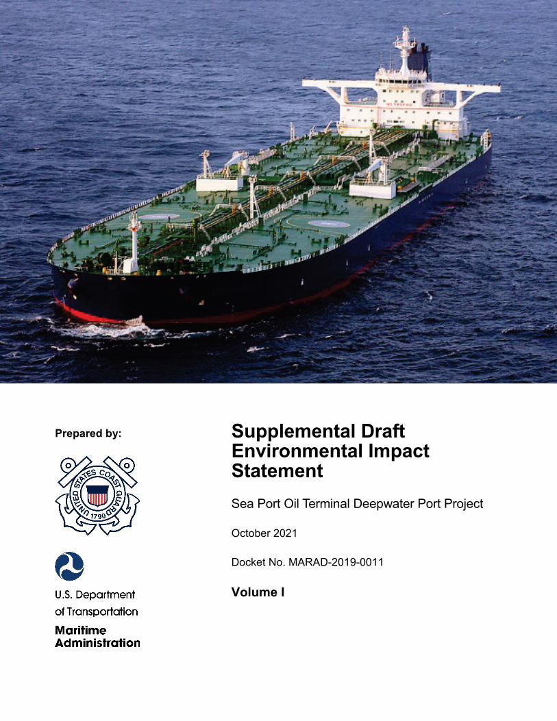
SPOT Terminal Services LLC, a wholly owned subsidiary of Enterprise Products Operating LLC, seeks a Federal license under the Deepwater Port Act of 1974 (DWPA), as amended, to own, construct, operate, and eventually decommission a deepwater port for the liquefaction and export of crude oil. The proposed deepwater port would be located in Federal waters within the Outer Continental Shelf, Galveston Area, South Addition Protraction Area (Gulf of Mexico) approximately 27.2 to 30.8 nautical miles off the coast of Brazoria County, Texas, in water depths of approximately 115 feet (35 meters). The onshore components would consist of modifications to the existing Enterprise Crude Houston (ECHO) Terminal, located on the southeast side of Houston, to support delivery of crude oil to the proposed Oyster Creek Terminal; one 50.1-mile pipeline from the existing ECHO Terminal to the proposed Oyster Creek Terminal; one pipeline interconnection; a new Oyster Creek Terminal, including seven aboveground storage tanks; two collocated 12.2-mile crude oil pipelines from the Oyster Creek Terminal to the shore crossing where the onshore pipelines meet the offshore pipelines supplying the SPOT DWP; and ancillary facilities for the onshore pipelines. The offshore components would consist of two collocated 46.9-mile offshore pipelines for crude oil delivery from the Oyster Creek Terminal to the platform; one fixed offshore platform; two SPM buoys to concurrently moor two VLCCs or other crude oil carriers; four pipeline end manifolds (PLEM)—two per SPM buoy—to provide the interconnection with the pipelines; four 0.66-nautical mile pipelines (two per PLEM) to deliver crude oil from the platform to the PLEMs; four 0.66-nautical mile vapor recovery pipelines (two per PLEM) to connect the VLCC or other crude oil carrier to the three vapor combustion units on the platform; three service vessel moorings, located in the southwest corner of Galveston Area lease block 463; and an anchorage area in Galveston Area lease block A-59.
DATE OF PUBLICATION: October 29, 2021
Environmental October 21, 2021 Protection Specialist Date Title/Position
Chief, Vessel & Facility October 21, 2021 Operating Standards Date Title/Position
Acknowledged: Director, Office of Deepwater Port Licensing
October 21, 2021 and Port Conveyance Date Title/Position
DATE COMMENTS MUST BE RECEIVED: December 13, 2021
Preparer/Environmental Project Manager
Reviewer
This document has been prepared in support of the Administrator of the Maritime Administration for purposes of issuing a Record of Decision for this deepwater port license application.
Maritime Administration Official
SUPPLEMENTAL DRAFT ENVIRONMENTAL IMPACT STATEMENT FOR
SPOT TERMINALS LLC DEEPWATER PORT LICENSE APPLICATION
Location: Federal waters within the Outer Continental Shelf, Galveston Area, South Addition Protraction Area (Gulf of Mexico) approximately 27.2 to 30.8 nautical miles off the coast of Brazoria County, Texas. Docket Number: MARAD-2019-0011 Prepared By: The U.S. Coast Guard (USCG) with technical support from its third party environmental contractor, Environmental Resources Management. Cooperating Agencies: U.S. Environmental Protection Agency; U.S. Department of the Interior’s Bureau of Ocean Energy Management, Bureau of Safety and Environmental Enforcement, and U.S. Fish and Wildlife Service; U.S. Department of Commerce’s National Oceanic and Atmospheric Administration, National Marine Fisheries Service (NMFS); U.S. Department of Agriculture’s Natural Resources Conservation Service; U.S. Army Corps of Engineers; and U.S. Department of Transportation Pipeline and Hazardous Materials Safety Administration. Contact Information: Matthew Layman, USCG, CG-OES-2, 202-372-1421; or Melissa Perera, USCG, CG-OES-3, 202-372-1446. Abstract: SPOT Terminal Services LLC, a wholly owned subsidiary of Enterprise Products Operating LLC, seeks a Federal license under the Deepwater Port Act of 1974 (DWPA), as amended, to own, construct, operate, and eventually decommission a deepwater port for the export of crude oil. The proposed deepwater port would be located in Federal waters within the Outer Continental Shelf, Galveston Area, South Addition Protraction Area (Gulf of Mexico) approximately 27.2 to 30.8 nautical miles off the coast of Brazoria County, Texas, in water depths of approximately 115 feet (35 meters). The onshore components would consist of modifications to the existing Enterprise Crude Houston (ECHO) Terminal, located on the southeast side of Houston, to support delivery of crude oil to the proposed Oyster Creek Terminal; one 50.1-mile pipeline from the existing ECHO Terminal to the proposed Oyster Creek Terminal; one pipeline interconnection; a new Oyster Creek Terminal, including seven aboveground storage tanks; two collocated 12.2-mile crude oil pipelines from the Oyster Creek Terminal to the shore crossing where the onshore pipelines meet the offshore pipelines supplying the SPOT DWP; and ancillary facilities for the onshore pipelines. The offshore components would consist of two collocated 46.9-mile offshore pipelines for crude oil delivery from the Oyster Creek Terminal to the platform; one fixed offshore platform; two SPM buoys to concurrently moor two VLCCs or other crude oil carriers; four pipeline end manifolds (PLEM)—two per SPM buoy—to provide the interconnection with the pipelines; four 0.66-nautical mile pipelines (two per PLEM) to deliver crude oil from the platform to the PLEMs; four 0.66-nautical mile vapor recovery pipelines (two per PLEM) to connect the VLCC or other crude oil carrier to the three vapor combustion units on the platform; three service vessel moorings, located in the southwest corner of Galveston Area lease block 463; and an anchorage area in Galveston Area lease block A-59.
Date of Publication: October 29, 2021

Sea Port Oil Terminal Deepwater Port Project Supplemental Draft Environmental Impact Statement Table of Contents
i
TABLE OF CONTENTS
VOLUME I
EXECUTIVE SUMMARY
ES1. Introduction ................................................................................................................................ 1
ES2. Description of the Proposed Action .......................................................................................... 3
ES3. Public Involvement .................................................................................................................... 4
ES4. Alternatives Considered ............................................................................................................ 5
ES5. Existing Conditions .................................................................................................................... 8 ES5.1. Water Resources ............................................................................................................... 9
ES5.1.1. Groundwater ................................................................................................................. 9 ES5.1.2. Surface Water ............................................................................................................... 9 ES5.1.3. Wetlands ....................................................................................................................... 9 ES5.1.4. Physical Oceanography ................................................................................................ 9 ES5.1.5. Coastal and Marine Environments ............................................................................. 10
ES5.2. Habitats .......................................................................................................................... 10 ES5.2.1. Vegetation .................................................................................................................. 10 ES5.2.2. Oyster Reefs ............................................................................................................... 10 ES5.2.3. Marine Protected Areas .............................................................................................. 11 ES5.2.4. Gulf Ecological Management Sites ............................................................................ 11
ES5.3. Wildlife and Aquatic Resources ..................................................................................... 11 ES5.3.1. Wildlife ....................................................................................................................... 11 ES5.3.2. Freshwater Fisheries ................................................................................................... 12 ES5.3.3. Benthic Resources ...................................................................................................... 12 ES5.3.4. Plankton ...................................................................................................................... 12 ES5.3.5. Marine Mammals (Non-Endangered)......................................................................... 12
ES5.4. Estuarine and Marine Fisheries ...................................................................................... 12 ES5.5. Threatened and Endangered Species .............................................................................. 13 ES5.6. Geologic and Soil Resources .......................................................................................... 13
ES5.6.1. Regional and Local Geology ...................................................................................... 13 ES5.6.2. Soil and Sediment Character ...................................................................................... 13 ES5.6.3. Geologic Hazards ....................................................................................................... 14 ES5.6.4. Mineral and Paleontological Resources ..................................................................... 14 ES5.6.5. Offshore Geophysical Investigation ........................................................................... 14
ES5.7. Cultural Resources ......................................................................................................... 14 ES5.8. Land Use, Recreation, Visual Resources, and Ocean Use ............................................. 14
ES5.8.1. Land Use .................................................................................................................... 14 ES5.8.2. Recreation ................................................................................................................... 15
Sea Port Oil Terminal Deepwater Port Project Supplemental Draft Environmental Impact Statement Table of Contents
ii
ES5.8.3. Visual Resources ........................................................................................................ 15 ES5.8.4. Ocean Use .................................................................................................................. 15
ES5.9. Transportation ................................................................................................................ 15 ES5.9.1. Road Network and Traffic .......................................................................................... 16 ES5.9.2. Marine Navigation and Vessel Traffic ....................................................................... 16 ES5.9.3. Air Traffic .................................................................................................................. 16
ES5.10. Air Quality ..................................................................................................................... 16 ES5.10.1. Regional Climate ........................................................................................................ 16 ES5.10.2. Onshore Air Quality ................................................................................................... 17 ES5.10.3. Offshore Air Quality .................................................................................................. 17
ES5.11. Noise .............................................................................................................................. 17 ES5.12. Socioeconomics .............................................................................................................. 17
ES5.12.1. Population and Demographics .................................................................................... 18 ES5.12.2. Housing ...................................................................................................................... 18 ES5.12.3. Employment and Income............................................................................................ 18 ES5.12.4. Public Services ........................................................................................................... 18 ES5.12.5. Recreation and Tourism ............................................................................................. 19 ES5.12.6. Commercial Fisheries ................................................................................................. 19 ES5.12.7. Marine Commerce and Shipping ................................................................................ 19 ES5.12.8. Offshore Mineral Resources ....................................................................................... 19
ES5.13. Environmental Justice .................................................................................................... 20
ES6. Proposed Project Impacts ....................................................................................................... 20 ES6.1. Activities generating impacts ......................................................................................... 20 ES6.2. Summary of Construction and Operation Impacts ......................................................... 20 ES6.3. Summary of Decommissioning Impacts ........................................................................ 27
ES7. Safety ......................................................................................................................................... 27
ES8. Cumulative Impacts ................................................................................................................. 28
1. Introduction ....................................................................................................................................... 1-1 1.1. Overview ................................................................................................................................... 1-1 1.2. Deepwater Port Regulatory Criteria .......................................................................................... 1-8 1.3. Purpose and Need ................................................................................................................... 1-10 1.4. Scope and Organization of the Draft Environmental Impact Statement ................................. 1-11 1.5. Public and Agency Review and Comment.............................................................................. 1-13 For the Supplemental Draft EIS, MARAD and USCG are providing outreach, translation of
Project documents, and interpretation services for certain populations with limited English proficiency. The full analysis and explanation is provided in Appendix AA. ........................ 1-15
1.6. Permits, Approvals, and Regulatory Requirements ................................................................ 1-15 1.6.1. Endangered Species Act .............................................................................................. 1-20 1.6.2. Magnuson-Stevens Fishery Conservation and Management Act ................................ 1-20 1.6.3. Marine Mammal Protection Act .................................................................................. 1-20 1.6.4. National Historic Preservation Act.............................................................................. 1-22
Sea Port Oil Terminal Deepwater Port Project Supplemental Draft Environmental Impact Statement Table of Contents
iii
1.6.5. Marine Protection, Research, and Sanctuaries Act ..................................................... 1-22 1.6.6. Coastal Zone Management Act ................................................................................... 1-23 1.6.7. Clean Water Act .......................................................................................................... 1-23 1.6.8. Rivers and Harbors Act ............................................................................................... 1-24 1.6.9. Clean Air Act .............................................................................................................. 1-25 1.6.10. Migratory Bird Treaty Act .......................................................................................... 1-27 1.6.11. Bald and Golden Eagle Protection Act........................................................................ 1-28 1.6.12. Oil Pollution Act ......................................................................................................... 1-28 1.6.13. Archeological Resources Protection Act ..................................................................... 1-28 1.6.14. Native American Graves Protection and Repatriation Act.......................................... 1-29 1.6.15. Texas Natural Resources Code, State-Owned Submerged Land ................................ 1-29
2. Description of the Proposed Action and Alternatives .................................................................... 2-1 2.1. Introduction ............................................................................................................................... 2-1 2.2. Detailed Description of the Proposed Action............................................................................ 2-1
2.2.1. Onshore Storage/Supply Components........................................................................... 2-2 2.2.2. Offshore/Marine Components ....................................................................................... 2-9 2.2.3. Very Large Crude Carriers and Other Crude Oil Carriers .......................................... 2-30 2.2.4. Service Vessels and Helicopters.................................................................................. 2-30 2.2.5. Onshore Construction and Installation ........................................................................ 2-31 2.2.6. Offshore Construction and Installation ....................................................................... 2-43 2.2.7. Startup and Commissioning ........................................................................................ 2-47 2.2.8. Operation ..................................................................................................................... 2-47 2.2.9. Decommissioning ........................................................................................................ 2-59 2.2.10. Best Management Practices ........................................................................................ 2-61
2.3. No Action Alternative ............................................................................................................. 2-61 2.4. System Alternatives ................................................................................................................ 2-62
2.4.1. Expansion of Proposed or Existing Offshore Crude Oil Loading Terminals in the Gulf of Mexico .................................................................................................................... 2-63
2.4.2. Construction of New or Expansion of Existing Onshore Crude Oil Terminals on the Gulf Coast ................................................................................................................... 2-67
2.5. Alternative Onshore Pipeline Routes ...................................................................................... 2-67 2.5.1. Onshore Pipeline Alternative 1 from ECHO Terminal to Sandy Point (Proposed
Action) ......................................................................................................................... 2-70 2.5.2. Onshore Pipeline Alternative 2 from ECHO Terminal to Sandy Point ....................... 2-70 2.5.3. Onshore Pipeline Alternative 3 from Sandy Point to Shore (Proposed Action) ......... 2-70 2.5.4. Onshore Pipeline Alternative 4 from Sandy Point to Shore ........................................ 2-70 2.5.5. Onshore Pipeline Alternative 5 from Sandy Point to Shore ........................................ 2-71
2.6. Alternative Onshore Terminal Sites and Designs ................................................................... 2-71 2.6.1. Onshore Sites Considered ........................................................................................... 2-71 2.6.2. Alternative Onshore Crude Oil Storage Terminal Design .......................................... 2-73
2.7. Alternative Deepwater Port, Anchorage, and Offshore Pipeline Locations ........................... 2-74
Sea Port Oil Terminal Deepwater Port Project Supplemental Draft Environmental Impact Statement Table of Contents
iv
2.7.1. Deepwater Port, Anchorage, and Offshore Pipeline Alternative 1 (Proposed Action) ... 2-75
2.7.2. Deepwater Port, Anchorage, and Offshore Pipeline Alternative 2 ............................. 2-75 2.7.3. Deepwater Port, Anchorage, and Offshore Pipeline Alternative 3 ............................. 2-77
2.8. Alternative Deepwater Port and Component Designs ............................................................ 2-77 2.8.1. Offshore Deepwater Port Design Alternatives ............................................................ 2-77 2.8.2. Alternative Volatile Organic Compound Control Technologies ................................. 2-79
2.9. Alternative Construction Methods .......................................................................................... 2-80 2.9.1. Alternative Shoreline Pipeline Construction Methods ................................................ 2-80 2.9.2. Alternative Offshore Construction Foundation/Pile Driving Methods ....................... 2-82
2.10. Decommissioning Alternatives ............................................................................................... 2-83 2.10.1. Decommissioning Alternative 1 (Proposed Action) ................................................... 2-83 2.10.2. Decommissioning Alternative 2 .................................................................................. 2-84 2.10.3. Decommissioning Alternative 3 .................................................................................. 2-84 2.10.4. Decommissioning Alternative 4 .................................................................................. 2-85
2.11. Identification of the Agencies’ Preferred Alternative ............................................................. 2-85
3. Environmental Analysis of the Proposed Action ............................................................................ 3-1 3.1. Introduction ............................................................................................................................... 3-1 3.2. Evaluation Criteria for Assessing Environmental Consequences ............................................. 3-1
3.2.1. Descriptions of Impact .................................................................................................. 3-1 3.2.2. Evaluation Criteria ........................................................................................................ 3-2
3.3. Water Resources ....................................................................................................................... 3-5 3.3.1. Definition of the Resource ............................................................................................ 3-5 3.3.2. Existing Threats............................................................................................................. 3-6 3.3.3. Groundwater .................................................................................................................. 3-7 3.3.4. Surface Water .............................................................................................................. 3-15 3.3.5. Wetlands ...................................................................................................................... 3-33 3.3.6. Physical Oceanography ............................................................................................... 3-49 3.3.7. Coastal and Marine Environment and Marine Water Quality ..................................... 3-54
3.4. Habitats ................................................................................................................................... 3-74 3.4.1. Definition of the Resource .......................................................................................... 3-74 3.4.2. Existing Threats........................................................................................................... 3-74 3.4.3. Vegetation ................................................................................................................... 3-74 3.4.4. Oyster Reefs ................................................................................................................ 3-94 3.4.5. Marine Protected Areas ............................................................................................. 3-101 3.4.6. Gulf Ecological Management Sites ........................................................................... 3-104
3.5. Wildlife and Aquatic Resources ........................................................................................... 3-106 3.5.1. Definition of the Resource ........................................................................................ 3-106 3.5.2. Existing Threats......................................................................................................... 3-106 3.5.3. Wildlife ..................................................................................................................... 3-107 3.5.4. Freshwater Fisheries .................................................................................................. 3-128 3.5.5. Benthic Resources ..................................................................................................... 3-131

Sea Port Oil Terminal Deepwater Port Project Supplemental Draft Environmental Impact Statement Table of Contents
v
3.5.6. Plankton ..................................................................................................................... 3-141 3.5.7. Marine Mammals (Non-Endangered) ....................................................................... 3-151
3.6. Estuarine and Marine Fisheries ............................................................................................. 3-183 3.6.1. Definition of the Resource ........................................................................................ 3-183 3.6.2. Existing Threats......................................................................................................... 3-183 3.6.3. Existing Conditions ................................................................................................... 3-184 3.6.4. Impacts and Mitigation .............................................................................................. 3-187
3.7. Threatened and Endangered Species ..................................................................................... 3-202 3.7.1. Federally Listed Threatened and Endangered Species .............................................. 3-202 3.7.2. State-Listed Threatened and Endangered Species ..................................................... 3-224 3.7.3. Impacts and Mitigation .............................................................................................. 3-227
3.8. Geologic and Soil Resources ................................................................................................ 3-229 3.8.1. Definition of the Resource ........................................................................................ 3-230 3.8.2. Existing Threats......................................................................................................... 3-230 3.8.3. Regional and Local Geology ..................................................................................... 3-230 3.8.4. Soil and Sediment Characteristics ............................................................................. 3-235 3.8.5. Geologic Hazards ...................................................................................................... 3-246 3.8.6. Mineral and Paleontological Resources .................................................................... 3-254 3.8.7. Offshore Geophysical Investigation .......................................................................... 3-258
3.9. Cultural Resources ................................................................................................................ 3-259 3.9.1. Definition of the Resource ........................................................................................ 3-259 3.9.2. Existing Threats......................................................................................................... 3-262 3.9.3. Existing Conditions ................................................................................................... 3-262 3.9.4. Impacts and Mitigation .............................................................................................. 3-276
3.10. Land Use, Recreation, Visual Resources, and Ocean Use .................................................... 3-279 3.10.1. Definition of the Resource ........................................................................................ 3-279 3.10.2. Existing Threats......................................................................................................... 3-280 3.10.3. Land Use ................................................................................................................... 3-280 3.10.4. Recreation Resources ................................................................................................ 3-291 3.10.5. Visual Resources ....................................................................................................... 3-297 3.10.6. Ocean Use ................................................................................................................. 3-301
3.11. Transportation ....................................................................................................................... 3-310 3.11.1. Definition of the Resource ........................................................................................ 3-310 3.11.2. Existing Threats......................................................................................................... 3-311 3.11.3. Road Network and Traffic ......................................................................................... 3-311 3.11.4. Marine Navigation and Vessel Traffic ...................................................................... 3-322 3.11.5. Air Traffic ................................................................................................................. 3-333
3.12. Air Quality ............................................................................................................................ 3-334 3.12.1. Definition of the Resource ........................................................................................ 3-335 3.12.2. Existing Threats......................................................................................................... 3-335 3.12.3. Regional Climate ....................................................................................................... 3-338 3.12.4. Onshore Air Quality .................................................................................................. 3-339 3.12.5. Offshore Air Quality ................................................................................................. 3-345
Sea Port Oil Terminal Deepwater Port Project Supplemental Draft Environmental Impact Statement Table of Contents
vi
3.12.6. Greenhouse Gas Impact Assessment ......................................................................... 3-355 3.12.7. General Conformity................................................................................................... 3-358
3.13. Noise ..................................................................................................................................... 3-360 3.13.1. Definition of the Resource ........................................................................................ 3-360 3.13.2. Existing Threats......................................................................................................... 3-361 3.13.3. Onshore Noise ........................................................................................................... 3-366 3.13.4. Offshore Noise .......................................................................................................... 3-375
3.14. Socioeconomics .................................................................................................................... 3-380 3.14.1. Definition of the Resource ........................................................................................ 3-380 3.14.2. Existing Threats......................................................................................................... 3-381 3.14.3. Population and Demographics .................................................................................. 3-381 3.14.4. Housing ..................................................................................................................... 3-384 3.14.5. Employment and Income .......................................................................................... 3-390 3.14.6. Public Services .......................................................................................................... 3-398 3.14.7. Recreation and Tourism ............................................................................................ 3-403 3.14.8. Commercial Fisheries ................................................................................................ 3-409 3.14.9. Marine Commerce and Shipping ............................................................................... 3-412 3.14.10. Offshore Mineral Resources, Including Oil and Gas ............................................ 3-415
3.15. Environmental Justice ........................................................................................................... 3-416 3.15.1. Definition of the Resource ........................................................................................ 3-416 3.15.2. Existing Threats......................................................................................................... 3-418 3.15.3. Existing Conditions ................................................................................................... 3-418 3.15.4. Impacts and Mitigation .............................................................................................. 3-423
3.16. Decommissioning ................................................................................................................. 3-432 3.16.1. Onshore Decommissioning Impacts .......................................................................... 3-432 3.16.2. Offshore Decommissioning Impacts ......................................................................... 3-433
3.17. Evaluation of Alternatives .................................................................................................... 3-434 3.17.1. Alternative Onshore Pipeline Routes ........................................................................ 3-434 3.17.2. Alternative Onshore Terminal Sites .......................................................................... 3-441 3.17.3. Alternative Onshore Crude Oil Storage Terminal Design ........................................ 3-445 3.17.4. Alternative Deepwater Port and Offshore Pipeline Locations .................................. 3-446 3.17.5. Alternative Deepwater Port and Component Designs ............................................... 3-449 3.17.6. Alternative Construction Methods ............................................................................ 3-451 3.17.7. Decommissioning Alternatives ................................................................................. 3-453
4. Safety .................................................................................................................................................. 4-1 4.1. Introduction ............................................................................................................................... 4-1 4.2. Laws and Regulations ............................................................................................................... 4-1 4.3. Crude Oil Hazards ..................................................................................................................... 4-2
4.3.1. Hazards .......................................................................................................................... 4-2 4.3.2. Physical Properties ........................................................................................................ 4-3 4.3.3. Chemical Properties ...................................................................................................... 4-8
4.4. Threats from a Crude Oil Spill ................................................................................................ 4-11
Sea Port Oil Terminal Deepwater Port Project Supplemental Draft Environmental Impact Statement Table of Contents
vii
4.4.1. Pipeline and Component Integrity Threats .................................................................. 4-11 4.4.2. First-Party Oil Spill Risk Analysis .............................................................................. 4-16 4.4.3. First-Party Oil Spill Modeling ..................................................................................... 4-19
4.5. Evaluation of Public Safety..................................................................................................... 4-24 4.5.1. Safety Review Criteria ................................................................................................ 4-24 4.5.2. Site-Specific Input Data .............................................................................................. 4-25 4.5.3. Direct Impact on Public Safety and Property .............................................................. 4-25 4.5.4. Bounding Case (Worst Credible Impact) .................................................................... 4-26 4.5.5. Deepwater Crude Oil Ports ......................................................................................... 4-26 4.5.6. Very Large and Other Crude Oil Carriers ................................................................... 4-26 4.5.7. Port Security ................................................................................................................ 4-27
4.6. Third-Party Crude Oil Spill Analysis ...................................................................................... 4-29 4.6.1. Purpose and Objectives ............................................................................................... 4-30 4.6.2. Technical Approach .................................................................................................... 4-30 4.6.3. Potential Impacts from Oil Spills Onshore and Offshore ............................................ 4-30 4.6.4. Summary of the Oil Spill Findings ............................................................................. 4-53 4.6.5. Third-Party Spill Risk Analysis .................................................................................. 4-54
4.7. Marine Safety .......................................................................................................................... 4-55 4.7.1. Marine Safety Standards ............................................................................................. 4-55 4.7.2. Navigational Safety Measures ..................................................................................... 4-59 4.7.3. Very Large Crude Oil Carrier Support ........................................................................ 4-64
4.8. Offshore Pipeline Safety ......................................................................................................... 4-68 4.8.1. Offshore Pipeline Safety Standards ............................................................................. 4-68 4.8.2. Offshore Pipeline Incident Data .................................................................................. 4-69 4.8.3. Offshore Hazards from Outside Forces ....................................................................... 4-69
4.9. Reliability and Safety of Onshore Facilities and Pipelines ..................................................... 4-70 4.9.1. Safety Standards .......................................................................................................... 4-70 4.9.2. Pipeline Accident Data ................................................................................................ 4-82 4.9.3. Applicant Accident Data ............................................................................................. 4-84 4.9.4. Impact on Public Safety .............................................................................................. 4-84
5. Cumulative Impacts .......................................................................................................................... 5-1 5.1. Cumulative Impact Assessment Methodology.......................................................................... 5-1 5.2. Past, Present, and Reasonably Foreseeable Future Actions ...................................................... 5-3
5.2.1. Deepwater Ports .......................................................................................................... 5-18 5.2.2. Onshore Terminals ...................................................................................................... 5-19 5.2.3. Oil and Gas Activity .................................................................................................... 5-19 5.2.4. Pipeline System Projects ............................................................................................. 5-20 5.2.5. Utilities ........................................................................................................................ 5-20 5.2.6. Other Industrial Facilities ............................................................................................ 5-20 5.2.7. Commercial and Residential Developments ............................................................... 5-21 5.2.8. Federal, State, and/or Municipal Government Activities ............................................ 5-21
5.3. Potential Cumulative Impacts by Resource Area .................................................................... 5-22
Sea Port Oil Terminal Deepwater Port Project Supplemental Draft Environmental Impact Statement Table of Contents
viii
5.3.1. Water Resources .......................................................................................................... 5-22 5.3.2. Biological Resources ................................................................................................... 5-24 5.3.3. Geologic and Soil Resources ....................................................................................... 5-39 5.3.4. Cultural Resources ...................................................................................................... 5-41 5.3.5. Land Use, Recreation, Visual Resources, and Ocean Use .......................................... 5-42 5.3.6. Transportation ............................................................................................................. 5-45 5.3.7. Air Quality .................................................................................................................. 5-47 5.3.8. Noise ........................................................................................................................... 5-49 5.3.9. Socioeconomics ........................................................................................................... 5-51 5.3.10. Safety and Security...................................................................................................... 5-52
6. Coastal Zone Consistency ................................................................................................................. 6-1
7. Irreversible and Irretrievable Commitment of Resources ............................................................ 7-1
8. Relationship Between Short-Term Uses and Long-Term Productivity........................................ 8-1
9. References .......................................................................................................................................... 9-1
10. List of Preparers .............................................................................................................................. 10-1 10.1. Agency Preparers .................................................................................................................... 10-1 10.2. Contractor Preparers ............................................................................................................... 10-1
LIST OF TABLES
Table ES-1: Summary of Impacts from Proposed SPOT Project Activities ............................................... 22
Table 1.6-1: Major Permits, Approvals, and Consultations for Deepwater Ports .................................... 1-16
Table 2.2-1: Collocation of the ECHO to Oyster Creek Pipeline with Other Rights-of-Way ................... 2-3
Table 2.2-2: Collocation of the Oyster Creek to Shore Pipelines with Other Rights-of-Way ................... 2-9
Table 2.2-3: Lease Block Information for the SPOT Project ................................................................... 2-10
Table 2.2-4: Equipment List and Location for the SPOT Project ............................................................ 2-15
Table 2.2-5: Summary of Materials to be Stored on the SPOT Deepwater Port Platform ...................... 2-26
Table 2.2-6: Characteristics of Typical Crude Oil Carriers Which May Call on the SPOT Deepwater Port ................................................................................................................................. 2-30
Table 2.2-7: Land Requirements for the Onshore Components of the SPOT Project ............................. 2-32
Table 2.2-8: HDD Crossings for the ECHO to Oyster Creek Pipeline and the Oyster Creek to Shore Pipelines of the SPOT Project........................................................................................ 2-38
Table 2.2-9: Bore Crossings for the ECHO to Oyster Creek Pipeline and the Oyster Creek to Shore Pipelines of the SPOT Project........................................................................................ 2-39
Table 2.2-10: Seafloor Requirements for the Offshore Components of the SPOT Project ..................... 2-44
Table 2.2-11: Piles Summary for the SPOT Deepwater Port ................................................................... 2-46
Table 2.2-12: SPOT DWP Personnel ....................................................................................................... 2-49
Sea Port Oil Terminal Deepwater Port Project Supplemental Draft Environmental Impact Statement Table of Contents
ix
Table 2.2-13: Summary of Seawater Withdrawal Requirements for the SPOT DWP............................. 2-52
Table 2.2-14: Summary of Discharges from the SPOT DWP Platform .................................................. 2-53
Table 2.2-15: Weather Criteria for Mooring of Vessels at the SPOT DWP ............................................ 2-55
Table 3.2-1: Evaluation Criteria for Determining Environmental Consequences by Resource Area ........ 3-3
Table 3.3.3-1: Water Wells within 150 feet of the SPOT Project Workspace ........................................... 3-8
Table 3.3.3-2: Potential Sources of Contaminated Groundwater within 0.25 Mile of the SPOT Project Workspace ..................................................................................................................... 3-10
Table 3.3.3-3: SPOT Project Isolatable Sections for Project Components .............................................. 3-14
Table 3.3.4-1: Waterbody Crossings by the Onshore Pipeline and Terminal .......................................... 3-16
Table 3.3.4-2: Watersheds Crossed by the Onshore Pipelines and Terminals for the SPOT Project ...... 3-17
Table 3.3.4-3: Major Impaired Surface Waters and Segments Crossed by SPOT Project Onshore Pipelines ......................................................................................................................... 3-18
Table 3.3.4-4: Flood Hazard Zones Crossed by the SPOT Project .......................................................... 3-19
Table 3.3.4-5: Waterbodies Crossed and Crossing Methods for the SPOT DWP Onshore Pipelines ..... 3-20
Table 3.3.4-6: Water Requirements for Hydrostatic Testing of Onshore Pipelines and Terminals ......... 3-26
Table 3.3.5-1: Onshore Wetlands Crossed by the SPOT DWP Project ................................................... 3-34
Table 3.3.5-2: Wetlands Affected by the Construction and Operation of the SPOT Project ................... 3-43
Table 3.3.5-3: Summary of the Minimum Suites Required and the Mitigation Ratios Applied for Each Mitigation Bank ............................................................................................................. 3-48
Table 3.3.7-1: Summary of Water Quality Baseline Sampling Results ................................................... 3-58
Table 3.3.7-2: Seawater Usage at the SPOT Deepwater Port .................................................................. 3-64
Table 3.3.7-3: Operational Discharges at the SPOT Deepwater Port ...................................................... 3-65
Table 3.3.7-4: Summary of Fuels, Chemicals, and Lubricants to be Stored at the SPOT DWP ............. 3-69
Table 3.3.7-5: Percent of Shoreline Habitats Oiled by > 1 g/m2 .............................................................. 3-70
Table 3.3.7-6: Minimum Time for Oil to Reach the Shore and Maximum Surface Area of Floating Oil for the Most Likely Scenario Oil Spill ................................................................................ 3-70
Table 3.3.7-7: Modeled Results of PAH in the Water Column for the Most Likely Scenario Oil Spill .. 3-71
Table 3.3.7-8: SPOT Project Isolatable Sections ..................................................................................... 3-73
Table 3.4.3-1: TPWD-Defined Vegetation Communities Crossed by the Onshore Pipelines ................. 3-77
Table 3.4.3-2: GLO Priority Protection Habitat Crossed by the Oyster Creek to Shore Pipelines .......... 3-79
Table 3.4.3-3: Noxious and Invasive Weeds Observed Within the Survey Corridor for the Onshore Pipeline .......................................................................................................................... 3-81
Table 3.4.3-4: Onshore Pipeline Right-of-Way Widths........................................................................... 3-84
Table 3.4.3-5: Impacts on Vegetation Communities from the SPOT Project .......................................... 3-85
Table 3.4.4-1: Modeled Results of Polycyclic Aromatic Hydrocarbon in the Water Column ................ 3-98
Table 3.4.4-2: Spill Model Results for the Release of 687,272 Barrels of Oil ........................................ 3-99
Sea Port Oil Terminal Deepwater Port Project Supplemental Draft Environmental Impact Statement Table of Contents
x
Table 3.4.4-3: Area Affected by Dissolved Aromatic Hydrocarbons .................................................... 3-100
Table 3.5.3-1: Representative Species within Onshore Vegetation Communities for the SPOT Deepwater Port Project .................................................................................................................. 3-109
Table 3.5.3-2: Birds of Conservation Concern in Regions 37 and M20 that Could Be Affected by the SPOT Deepwater Port Project ..................................................................................... 3-113
Table 3.5.3-3: Estimated Number of Lights for the SPOT Deepwater Port Platform ........................... 3-123
Table 3.5.4-1: Waterbodies Crossed by Onshore Pipelines and Access Roads ..................................... 3-128
Table 3.5.5-1: Level-Bottom Seafloor Assemblage Size Groupings ..................................................... 3-134
Table 3.5.5-2: Comparison of Macroinfaunal Assemblages on the Continental Shelf of the Northern Gulf of Mexico ..................................................................................................................... 3-134
Table 3.5.6-1: Plankton Size Groupings ................................................................................................ 3-141
Table 3.5.6-2: Seasonality and Peak Seasonal Occurrence of Select Larval Fishes (<10 millimeter standard length) in the Northern Gulf of Mexico ........................................................ 3-142
Table 3.5.6-3: Larval Taxa Identified for 82 SEAMAP Stations near the Proposed SPOT Deepwater Port Site ............................................................................................................................... 3-145
Table 3.5.6-4: Projected Annual Estimates of Entrainment ................................................................... 3-148
Table 3.5.6-5: Projected Annual Larval Entrainment Values ................................................................ 3-148
Table 3.5.6-6: Projected Annual Egg Entrainment Values .................................................................... 3-149
Table 3.5.7-1: Gulf of Mexico Marine Mammal Summary with Likelihood of Occurrence ................. 3-152
Table 3.5.7-2: Hearing Groups of Marine Mammals in the Gulf of Mexico ......................................... 3-152
Table 3.5.7-3: BSE Abundance Stock Estimates ................................................................................... 3-155
Table 3.5.7-4: Acoustic Injury and Disturbance Thresholds for Marine Mammals .............................. 3-171
Table 3.5.7-5: Behavioral Disturbance Threshold Distances Associated with Various Construction Activities ...................................................................................................................... 3-172
Table 3.5.7-6: Threshold Distances for Injury to and Behavioral Response of Marine Mammals for 30-inch and 72-inch Mitigated and Unmitigated Impact Driven Steel Piles ..................... 3-173
Table 3.5.7-7: Threshold Distances for Behavioral Response of Marine Mammals Due to VLCC Traffic Associated with Operation of the SPOT Project .......................................................... 3-174
Table 3.5.7-8: Number of Construction Vessels Required for Installation of SPOT Project Components . 3-176
Table 3.5.7-9: Time Period for Offshore Construction Activities ......................................................... 3-176
Table 3.5.7-10: General Characteristics of Crude Oil Carriers that Could Call on the SPOT Deepwater Port ............................................................................................................................... 3-177
Table 3.5.7-11: Modeled Results of Polycyclic Aromatic Hydrocarbon in the Water Column ............ 3-181
Table 3.6.3-1: Key Finfish Species of High Commercial and/or Recreational Importance in the GoM Listed by Habitat .......................................................................................................... 3-184
Table 3.6.3-2: Commercial Fisheries Landings and Values for the GoM and Texas (2008–2018) ...... 3-185
Table 3.6.3-3: Texas Recreational Harvest of Key Species (Thousands of Fish) .................................. 3-186
Sea Port Oil Terminal Deepwater Port Project Supplemental Draft Environmental Impact Statement Table of Contents
xi
Table 3.6.4-1: SPOT Deepwater Port Operational Seawater Usage ...................................................... 3-190
Table 3.6.4-2: Water Discharge Rates during Operation at the Proposed SPOT Deepwater Port ......... 3-190
Table 3.6.4-3: Summary of Annual Impacts on Fish Species of Concern from Water Withdrawals .... 3-191
Table 3.6.4-4: Typical Underwater Sound Pressure Levels Produced by Pile Types and Installation Method ......................................................................................................................... 3-193
Table 3.6.4-5: Underwater Noise Criteria for Fish ................................................................................ 3-193
Table 3.6.4-6: Threshold Distances for Injury to and Behavioral Response of Fish for the 30-inch and 72-inch Impact Driven Steel Piles ..................................................................................... 3-194
Table 3.6.4-7: Threshold Distances for Injury to and Behavioral Response of Fish Due to Vessel Traffic Associated with the SPOT Project ............................................................................... 3-195
Table 3.7.1-1: Threatened, Endangered, or Candidate Species Potentially Occurring Within the SPOT Project Area ................................................................................................................. 3-204
Table 3.7.1-2: Sea Turtle Nests in the Vicinity of the SPOT Project .................................................... 3-216
Table 3.7.1-3: Threshold Distances for Injury to and Behavioral Response of Sea Turtles .................. 3-220
Table 3.7.2-1: State-Listed Threatened and Endangered Species that Could Occur Within the SPOT Project Area ................................................................................................................. 3-224
Table 3.8-1: Soil Types and Characteristics within the SPOT Project Area.......................................... 3-236
Table 3.8-2: Soils Crossed and Major Characteristics that May Affect the SPOT Project .................... 3-238
Table 3.8-3: Summary of Sediment Characteristics in Geotechnical Piston Core Samples .................. 3-239
Table 3.8-4: Summary of Detected Chemical Results in Sediment Collected from the Proposed Project Area .............................................................................................................................. 3-240
Table 3.8-5: Growth and Normal Faults within 1 Mile of the Onshore Pipeline Centerlines................ 3-249
Table 3.8-6: Growth Faults within 10 Nautical Miles of the Offshore Project Area ............................. 3-250
Table 3.8-7: Number of Mineral Resources within 0.25 mile of the Onshore Pipelines by County ..... 3-254
Table 3.9-1: Federal Cultural Resource Laws and Executive Orders .................................................... 3-260
Table 3.9-2: Native American Tribes Contacted by the Applicant and MARAD/USCG ..................... 3-264
Table 3.9-3: Onshore Cultural Context .................................................................................................. 3-268
Table 3.9-4: Cultural Resources Revisited or Identified During Onshore Archaeological Investigations .. 3-270
Table 3.9-5: Standing Structures Assessed During the Onshore Historic Standing Structure Surveys . 3-271
Table 3.9-6: Offshore Cultural Context ................................................................................................. 3-273
Table 3.9-7: Results of Offshore Cultural Resource Surveys ................................................................ 3-274
Table 3.10.3-1: Miles of NLCD Land Cover Classes Crossed by the Onshore Pipeline Segments ...... 3-281
Table 3.10.3-2: NLCD Land Cover Classes within the Proposed Oyster Creek Terminal Site ............ 3-285
Table 3.10.3-3: Construction and Operation Impacts on NLCD Land Cover Classes (Acres) ............. 3-289
Table 3.10.6-1: GLO Tracts Crossed by the Proposed Offshore Pipelines............................................ 3-305
Table 3.10.6-2: Pipelines and Subsea Cables Crossed by the Proposed Offshore Pipelines ................. 3-306

Sea Port Oil Terminal Deepwater Port Project Supplemental Draft Environmental Impact Statement Table of Contents
xii
Table 3.11-1: Intersection Level of Service Definitions ........................................................................ 3-314
Table 3.11-2: Existing Intersection Level of Service ............................................................................. 3-315
Table 3.11-3: Intersection Level of Service during Onshore Pipeline Construction ............................. 3-318
Table 3.11-4: ECHO to Oyster Creek Pipeline Road Crossings ............................................................ 3-319
Table 3.11-5: Oyster Creek to Shore Pipelines Road Crossings ............................................................ 3-320
Table 3.11-6: Railroads Crossed by the Onshore Pipelines ................................................................... 3-320
Table 3.11-7: Vessel Transits through Galveston Area Lease Block 463 ............................................. 3-328
Table 3.11-8: Vessel Types Transiting Through Galveston Area Lease Block 463, January 2016–December 2017 ............................................................................................................ 3-328
Table 3.12-1: Proposed Onshore Construction Emissions for the SPOT Project .................................. 3-341
Table 3.12-2: Proposed Operation Emissions Summary at ECHO Terminal and Mainline Valve Sites ..... 3-342
Table 3.12-3: Proposed Operation Emissions Summary at Oyster Creek Terminal .............................. 3-343
Table 3.12-4: De Minimis Thresholds and Site-Wide Emissions for the Oyster Creek Terminal Impact Evaluation .................................................................................................................... 3-343
Table 3.12-5: SCREEN3 Modeling Results .......................................................................................... 3-344
Table 3.12-6: Proposed Onshore Operation GHG Emissions ................................................................ 3-344
Table 3.12-7: Background Ambient Air Quality and Ambient Air Quality Standards .......................... 3-346
Table 3.12-8: Proposed Offshore Construction Emissions .................................................................... 3-348
Table 3.12-9: Proposed Offshore Operation Emissions ......................................................................... 3-349
Table 3.12-10: Proposed Offshore Operation GHG Emissions ............................................................. 3-350
Table 3.12-11: NAAQS Analysis Results .............................................................................................. 3-353
Table 3.12-12: PSD Increment Analysis Results ................................................................................... 3-354
Table 3.12-13: TCEQ MERA and State Property Line Analysis Results .............................................. 3-355
Table 3.12-14: Estimated Social Cost of Construction GHG Emissions ............................................... 3-356
Table 3.12-15: Estimated Social Cost of Annual Operational GHG Emissions .................................... 3-357
Table 3.12-16: Total Construction Emissions within the HGB Ozone Nonattainment Area (Tons per Year) ............................................................................................................................ 3-359
Table 3.13-1: Comparison of Typical A-Weighted Sound Levels in Air .............................................. 3-360
Table 3.13-2: Marine Mammal Functional Hearing Groups from NMFS Guidance ............................. 3-363
Table 3.13-3: Underwater Noise Injury and Behavioral Response Criteria for Marine Mammals ....... 3-364
Table 3.13-4: Underwater Noise Criteria for Sea Turtles ...................................................................... 3-366
Table 3.13-5: Underwater Noise Criteria for Fish ................................................................................. 3-366
Table 3.13-6: ECHO Terminal Noise Sensitive Area Locations ........................................................... 3-367
Table 3.13-7: Oyster Creek Terminal Noise Sensitive Area Locations ................................................. 3-367
Table 3.13-8: Measured 24-Hour Ambient Average Sound Levels for HDD Sites............................... 3-368
Sea Port Oil Terminal Deepwater Port Project Supplemental Draft Environmental Impact Statement Table of Contents
xiii
Table 3.13-9: Typical Pipeline and Aboveground Facility Construction Equipment Noise Levels ...... 3-369
Table 3.13-10: Noise Modeling Results for Horizontal Directional Drills for the Onshore Pipelines .. 3-370
Table 3.13-11: Noise Modeling Results for Operation of the Oyster Creek Terminal .......................... 3-374
Table 3.13-12: Typical Noise Sources during Offshore Construction ................................................... 3-377
Table 3.13-13: Typical Underwater Sound Pressure Levels for Various Construction and Operation Activities ...................................................................................................................... 3-378
Table 3.13-14: Typical Noise Sources during Offshore Platform Operation ........................................ 3-379
Table 3.14-1: Population Change (2010–2017) ..................................................................................... 3-382
Table 3.14-2: Total Housing and Vacant Units (2017) .......................................................................... 3-387
Table 3.14-3: Hotel/Motel Rooms in the Socioeconomic Analysis Area .............................................. 3-388
Table 3.14-4: Labor Force, Unemployment, and Income (2017) .......................................................... 3-391
Table 3.14-5: Unemployed Workers in Brazoria County by Industry Sector (October 2016) .............. 3-391
Table 3.14-6: Jobs in Texas, Brazoria County, and Harris County, by Industry 2016 .......................... 3-393
Table 3.14-7: Construction and Installation Workforce ........................................................................ 3-395
Table 3.14-8: Operation Workforce ....................................................................................................... 3-397
Table 3.14-9: General Hospitals in Brazoria County ............................................................................. 3-399
Table 3.14-10: Police Department Personnel ........................................................................................ 3-400
Table 3.14-11: Public School Systems .................................................................................................. 3-401
Table 3.14-12: Driving Time to Hospitals ............................................................................................. 3-402
Table 3.14-13: Ocean Economy—Tourism and Recreation: Establishments and Self-Employment for Texas Coastal Counties (2016) .................................................................................... 3-405
Table 3.14-14: Ocean Economy—Living Resources: Establishments and Self-Employment for Texas Coastal Counties (2016) ............................................................................................... 3-411
Table 3.15-1: Minority and Low-Income Population Data .................................................................... 3-419
Table 3.17-1: Summary of Onshore Pipeline Alternatives 1 and 2 ....................................................... 3-438
Table 3.17-2: Summary of Onshore Pipeline Alternatives 3 Through 5 ............................................... 3-439
Table 3.17-3: Summary of Onshore Storage Terminal Alternatives 1 Through 4 ................................. 3-444
Table 3.17-4: Environmental Evaluation of the Deepwater Port Location Alternatives ....................... 3-448
Table 4.3-1: Worldwide Crude Oil Physical and Chemical Properties...................................................... 4-5
Table 4.3-2: SPOT DWP Three Crude Oil Physical Properties ................................................................. 4-8
Table 4.3-3: Compositions of Crude Oils Exported by SPOT DWP ......................................................... 4-8
Table 4.3-4: West Texas Intermediate Crude Oil Chemical Properties ..................................................... 4-9
Table 4.3-5: Western Canadian Select Crude Oil Chemical Properties ..................................................... 4-9
Table 4.3-6: Condensate Crude Oil Chemical Properties ........................................................................ 4-10
Table 4.5-1: Visiting SPOT DWP Crude Oil Carrier General Characteristics ........................................ 4-27
Table 4.6-1: Distances to Thermal Radiation Levels—Onshore Pipeline Rupture ................................. 4-36
Sea Port Oil Terminal Deepwater Port Project Supplemental Draft Environmental Impact Statement Table of Contents
xiv
Table 4.6-2: Distances to Thermal Radiation Levels—Accidental Ship Collision .................................. 4-38
Table 4.6-3: Distances to Thermal Radiation Levels—Platform Riser Rupture ...................................... 4-39
Table 4.6-4: Distances to Thermal Radiation Levels—Intentional Threats ............................................. 4-39
Table 4.6-5: Maximum Distances for the Major Onshore and Offshore Hazards ................................... 4-53
Table 4.6-6: Flammable and Dispersion Distances for Oil Spill Scenarios ............................................. 4-55
Table 4.7-1: Gulf of Mexico Vessel Collisions with Fixed Leg Platforms (2013–2017) ........................ 4-64
Table 4.7-2: Proposed Weather Criteria and Operational Limits for SPOT DWP .................................. 4-67
Table 4.8-1: Crude Oil Offshore Pipeline Incident Summary ................................................................. 4-69
Table 4.9-1: Mileage of High Population Areas Along Proposed Onshore Pipeline ............................... 4-76
Table 4.9-2: Mileage of Other Populated Areas Along Proposed Onshore Pipeline ............................... 4-76
Table 4.9-3: Mileage of Commercially Navigable Waterways Along Proposed Onshore Pipeline ........ 4-77
Table 4.9-4: Mileage of Protected Areas Along Proposed Onshore Pipeline .......................................... 4-80
Table 4.9-5: Mileage of Priority Habitat Protection Areas Along Proposed Onshore Pipeline ............... 4-80
Table 4.9-6: Mileage of Unusually Sensitive Areas Along Proposed Onshore Pipeline ......................... 4-80
Table 4.9-7: Count of Public Water System Wells in Proposed Onshore Pipeline Buffer Zone ............. 4-81
Table 4.9-8: Count of Groundwater Wells in Proposed Onshore Pipeline Buffer Zone ......................... 4-82
Table 4.9-9: Count of SDRDB Wells located in Proposed Onshore Pipeline Buffer Zone ..................... 4-82
Table 4.9-10: Crude Oil Pipeline Significant Incidents by Cause (2009–2018) ...................................... 4-83
Table 4.9-11: Excavation, Natural Forces, and Outside Force Incidents by Cause (2009–2018) ........... 4-83
Table 4.9-12: Fatalities and Injuries of Crude Oil Transmission Pipelines (2010–2018) ........................ 4-85
Table 5.1-1: Regions of Influence by Onshore Resource Type ................................................................. 5-4
Table 5.1-2: Regions of Influence by Offshore Resource Type ................................................................ 5-6
Table 5.2-1: Offshore and Onshore Cumulative Projects Identified for Consideration in the Cumulative Impacts Analysis .............................................................................................................. 5-9
Table 5.3.1-1: Summary of Cumulative Impacts of Alternatives on Water Resources ........................... 5-24
Table 5.3.2-1: Average Annual Entrainment using Base-Mortality for the SPOT and GulfLink Projects .. 5-26
Table 5.3.2-2: Pile Driving Parameters for the SPOT and GulfLink Projects ......................................... 5-33
Table 5.3.2-3: Abundance of Sea Turtles Greater than or Equal to 30-Centimeters Diameter (11.8 Inches) in the Gulf of Mexico to the EEZ .................................................................................. 5-36
Table 5.3.2-4: Estimated Annual Injuries or Mortality of Sea Turtles Greater than or Equal to 30-Centimeters Diameter (11.8 Inches) from Vessels in the Gulf of Mexico ..................... 5-36
Table 5.3.2-5: Summary of Cumulative Impacts of Alternatives on Biological Resources .................... 5-39
Table 5.3.3-1: Summary of Cumulative Impacts of Alternatives on Geological and Soil Resources ..... 5-41
Table 5.3.4-1: Summary of Cumulative Impacts of Alternatives on Cultural Resources ........................ 5-42
Sea Port Oil Terminal Deepwater Port Project Supplemental Draft Environmental Impact Statement Table of Contents
xv
Table 5.3.5-1: Summary of Cumulative Impacts of Alternatives on Land Use, Recreation, Visual Resources, and/or Ocean Use ........................................................................................ 5-44
Table 5.3.6-1: Cumulative Ship-to-Ship Transfer Trips Avoided ........................................................... 5-46
Table 5.3.6-2: Summary of Cumulative Impacts of Alternatives on Transportation ............................... 5-47
Table 5.3.7-1: Summary of Cumulative Impacts of Alternatives on Air Quality .................................... 5-48
Table 5.3.8-1: Summary of Cumulative Impacts of Alternatives on Noise ............................................. 5-51
Table 5.3.10-1: Summary of Cumulative Impacts of Alternatives on Safety and Security ..................... 5-53
LIST OF FIGURES
Figure 1.1-1: Project Location Map ........................................................................................................... 1-4
Figure 1.1-2: Project Components ............................................................................................................. 1-5
Figure 1.1-3: Enterprise Products Operating LLC Asset Map ................................................................... 1-7
Figure 1.1-4: Relative Ship Sizes and Channel Depths ............................................................................. 1-8
Figure 2.2-1: Aerial View of the Existing ECHO Terminal and Proposed Modifications ........................ 2-4
Figure 2.2-2: Oyster Creek Terminal Plot Plan ......................................................................................... 2-8
Figure 2.2-3: Lease Blocks Crossed by the SPOT DWP Offshore Pipelines .......................................... 2-12
Figure 2.2-4: Proposed Deepwater Port Schematic ................................................................................. 2-13
Figure 2.2-5: SPOT DWP Platform Block Flow Diagram ...................................................................... 2-14
Figure 2.2-6: Confined Bubble Curtain System for 72-inch Platform Piles ............................................ 2-25
Figure 2.2-7: SPM Buoy Mooring Schematic ......................................................................................... 2-28
Figure 2.2-8: Typical Pipeline Construction Sequence ............................................................................ 2-35
Figure 2.2-9: Safety Zones and Limited Access Areas for the SPOT Deepwater Port ............................ 2-57
Figure 2.2-10: Anchorage Area ............................................................................................................... 2-58
Figure 2.4-1: System Alternatives Considered in this EIS ...................................................................... 2-65
Figure 2.5-1: Alternative Onshore Pipeline Routes ................................................................................. 2-69
Figure 2.6-1: Alternative Onshore Storage Terminal Sites ...................................................................... 2-72
Figure 2.7-1: Alternative Deepwater Port Sites and Offshore Pipeline Routes ....................................... 2-76
Figure 3.3.6-1: Bathymetry Map of Area Proximal to SPOT Deepwater Port ........................................ 3-50
Figure 3.3.6-2: Gulf of Mexico Currents ................................................................................................. 3-52
Figure 3.3.7-1: Gulf of Mexico 2019 Hypoxic Zone Measured July 23–29, 2019 .................................. 3-55
Figure 3.3.7-2: Water Quality Sampling Locations ................................................................................. 3-57
Figure 3.3.7-3: Overseas Ballast Water Discharge to the Gulf of Mexico Coast by Ballast Water Management Type (2005-2021) .................................................................................... 3-69
Figure 3.4.3-1: Level III and Level IV Ecoregions Crossed by the SPOT Project .................................. 3-76

Sea Port Oil Terminal Deepwater Port Project Supplemental Draft Environmental Impact Statement Table of Contents
xvi
Figure 3.4.3-2: Seagrass Distribution Nearest to SPOT Deepwater Port ................................................ 3-93
Figure 3.4.4-1: Oyster Reefs Identified Along the Oyster Creek to Shore Pipeline Route...................... 3-95
Figure 3.4.4-2: Selected Spill Locations—Nearshore and at the Deepwater Port ................................... 3-99
Figure 3.4.5-1: SPOT Project in Relation to Flower Garden Bank National Marine Sanctuary and Marine Protected Areas ............................................................................................................ 3-103
Figure 3.4.6-1: Gulf Ecological Management Sites in Proximity to the SPOT Deepwater Port ........... 3-105
Figure 3.5.3-1: Distance from Oyster Creek to Shore Pipelines to Brazoria National Wildlife Refuge 3-112
Figure 3.5.5-1: Bottom Sediment Types in the Gulf of Mexico ............................................................ 3-133
Figure 3.5.5-2: Regional Studies of the Continental Shelf of the Gulf of Mexico ................................ 3-135
Figure 3.5.6-1: SEAMAP Sampling Stations near the SPOT Deepwater Port ...................................... 3-144
Figure 3.5.7-1: Estuaries with Bottlenose Dolphin Populations in Relation to the SPOT Deepwater Port . 3-155
Figure 3.6.4-1: Safety Zones and Limited Access Areas for the SPOT Deepwater Port ....................... 3-197
Figure 3.7.1-1: Sea Turtle Nesting Beaches in the Vicinity of the SPOT Project ................................. 3-218
Figure 3.8-1: Geologic Resources in the Onshore Project Area ............................................................ 3-232
Figure 3.8-2: Seafloor Features in the Project Area ............................................................................... 3-233
Figure 3.8-3: Seismic Hazard Map, Peak Ground Acceleration (10% Probability of Exceedance in 50 Years) ........................................................................................................................... 3-247
Figure 3.8-4: Seismic Hazard Map, Peak Ground Acceleration (2% Probability of Exceedance in 50 Years) .................................................................................................................. 3-248
Figure 3.8-5: Cenozoic Hydrocarbon Pools ........................................................................................... 3-256
Figure 3.10.3-1: NLCD Land Cover Classes, Onshore Pipeline Route ................................................. 3-282
Figure 3.10.3-2: NLCD Land Cover Classes, Oyster Creek Terminal Site ........................................... 3-286
Figure 3.10.4-1: Regional Recreation Resources Offshore Freeport, Texas ......................................... 3-293
Figure 3.10.6-1: Active Oil and Gas Activities in the Freeport, Texas Region ..................................... 3-303
Figure 3.10.6-2: GLO Tracts Crossed by the Proposed Offshore Pipeline ............................................ 3-304
Figure 3.10.6-3: Military Warning Areas Offshore Texas ..................................................................... 3-307
Figure 3.11-1: Transportation Study Area ............................................................................................. 3-313
Figure 3.11-2: Navigation Fairways, Anchorages, and Lease Blocks ................................................... 3-323
Figure 3.11-3: Restricted Navigation Areas .......................................................................................... 3-324
Figure 3.11-4: AIS Traffic Volumes, 2016–2017 .................................................................................. 3-327
Figure 3.14-1: Estimated SPOT Project Construction Workforce by Month ........................................ 3-383
Figure 3.14-2: Estimated Commuting Area for Project Construction Workers ..................................... 3-386
Figure 3.15-1 U.S. Census Block Groups and Environmental Justice Populations ........................... 3-422
Figure 3.17-1: Alternative Onshore Pipeline Routes Evaluated ............................................................ 3-436
Figure 3.17-2: Alternative Onshore Pipeline Routes 3a and 3b ............................................................. 3-437

Sea Port Oil Terminal Deepwater Port Project Supplemental Draft Environmental Impact Statement Table of Contents
xvii
Figure 3.17-3: Alternative Onshore Storage Terminal Sites Evaluated ................................................. 3-443
Figure 3.17-4: Alternative Deepwater Port Sites and Offshore Pipeline Routes Evaluated .................. 3-447
Figure 4.6-1: Proposed Onshore Pipeline Route for the SPOT Project ................................................... 4-34
Figure 4.6-2: Longest Line Section for the SPOT Project Onshore Pipelines ......................................... 4-35
Figure 4.6-3: Proposed SPOT Offshore Crude Pipeline Route................................................................ 4-37
Figure 4.6-4: 5-kW/m2 Thermal Hazard Zone from Accidental Cargo Tank Breach—Ship Collision with 2-m2 Spill Area for WCS, WTI, and Condensate .......................................................... 4-41
Figure 4.6-5: 5-kW/m2 Thermal Hazard Zone from 36-inch Dual Riser Rupture—Ship Collision with the Platform for WCS, WTI, and Condensate ..................................................................... 4-42
Figure 4.6-6: 5-kW/m2 Thermal Hazard Zone from Intentional Threats—Cargo Tank Breach with 16-m2 Spill Area for WCS, WTI, and Condensate ................................................................... 4-43
Figure 4.6-7: COSIM Oil Fate and Trajectory Modeling Overview........................................................ 4-45
Figure 4.6-8: Selected Spill Locations: Nearshore and at the Deepwater Port ........................................ 4-45
Figure 4.6-9: SPOT DWP and Close to Shoreline Oil Spill Scenarios near Texas Gulf Coast ............... 4-47
Figure 4.6-10: Close to Shore Scenario (Scenario 2) of Potential Oil Spill Effect on Shoreline............. 4-48
Figure 4.6-11: SPOT DWP Scenario (Scenario 1) of Potential Oil Spill Effect on Shoreline ................ 4-49
Figure 4.6-12: VLCC Scenario (Scenario 3) of Potential Oil Spill Effect on Shoreline ......................... 4-50
Figure 4.6-13: Close to Shoreline Scenario (Scenario 2) of Gulf of Mexico Potential Oil Spill Impact . 4-51
Figure 4.6-14: SPOT DWP Scenario (Scenario 1) of Gulf of Mexico Potential Oil Spill Impact........... 4-52
Figure 4.6-15: VLCC Scenario (Scenario 3) of Gulf of Mexico Potential Oil Spill Impact ................... 4-53
Figure 4.7-1: Depiction of Potential Safety Zones and Areas to be Avoided .......................................... 4-61
Figure 4.7-2: Approximate Safety Zones with Designated Anchorage Area .......................................... 4-63
Figure 4.7-3: Anticipated Trade Carrier Routes to SPM Buoy ................................................................ 4-66
Figure 4.9-1: High Consequence Areas Along Proposed Onshore Pipeline ............................................ 4-75
Figure 4.9-2: Protected High Consequence Areas Along Proposed Onshore Pipeline ............................ 4-78
Figure 4.9-3: Public Water System High Consequence Areas Along Proposed Onshore Pipeline ......... 4-79
Figure 4.9-4: Number of EPO and Subsidiary Oil Spills by Size ............................................................ 4-84
Figure 5.2-1: Cumulative Projects—Overview........................................................................................ 5-15
Figure 5.2-2: Cumulative Projects—Northern Brazoria County ............................................................. 5-16
Figure 5.2-3: Cumulative Projects—Southern Brazoria County ............................................................. 5-17
Figure 5.3-1: Large Vessel Traffic (Tankers) in the Gulf of Mexico in 2017 ......................................... 5-29
Figure 5.3-2: Average Annual Kilometers of Vessel Traffic from all Vessels in the Gulf of Mexico Based on 2014-2018 AIS Data ................................................................................................. 5-31
Sea Port Oil Terminal Deepwater Port Project Supplemental Draft Environmental Impact Statement Table of Contents
xviii
VOLUME II
LIST OF APPENDICES
A Public Notices
B Initial Notification Letters
C Comments on the Draft EIS

Sea Port Oil Terminal Deepwater Port Project Supplemental Draft Environmental Impact Statement Table of Contents
xix
VOLUME III LIST OF APPENDICES
D Agency Correspondence
E1 Biological Assessment and Essential Fish Habitat Assessment
E2 Addendum to the Biological Assessment
F Applicant’s Onshore Construction Spill Response Plan
G Consistency with the Texas Coastal Management Program
H Spill Risk Analysis
I Summary of Hypothetical Oil Spill Response Actions
J USGS Topographic Map Route Series
K Facility Layout 3-D Illustrations
L HDD Contingency Plan
M Onshore Pipeline Construction Best Management Practices, Revised November 2020
N List of Applicant’s Best Management Practices and Agency Recommended Mitigation Measures
O Unanticipated Discovery of Contamination Plan
P Compensatory Wetland Mitigation Plan
Q Revegetation Plan
R SPOT Project Onshore Noise Impact Reports
S Ichthyoplankton Impact Assessment
T Soil Maps
U Unanticipated Discoveries Plan for Cultural Resources and Human Remains
V Draft General Conformity Determination
W SPOT Water Quality Environmental Baseline Survey: Acoustic Monitoring Offshore Texas
X Oil Spill Modeling Technical Report
Y Analysis of Cumulative Lightering Activity
Z Mail Line Valve Alignment Sheet
AA Providing Meaningful Participation for Populations with Limited English Proficiency
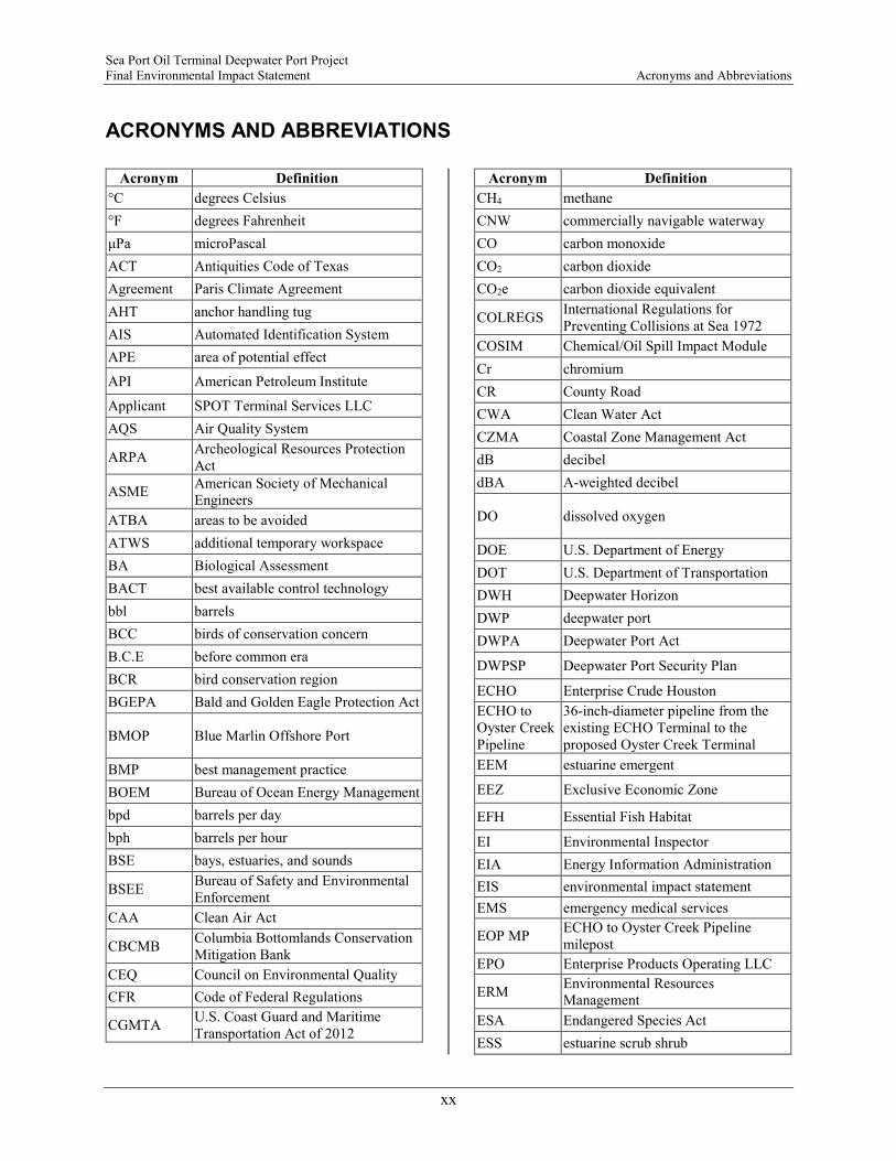
Sea Port Oil Terminal Deepwater Port Project Final Environmental Impact Statement Acronyms and Abbreviations
xx
ACRONYMS AND ABBREVIATIONS
Acronym Definition °C degrees Celsius °F degrees Fahrenheit μPa microPascal ACT Antiquities Code of Texas Agreement Paris Climate Agreement AHT anchor handling tug AIS Automated Identification System APE area of potential effect
API American Petroleum Institute
Applicant SPOT Terminal Services LLC AQS Air Quality System
ARPA Archeological Resources Protection Act
ASME American Society of Mechanical Engineers
ATBA areas to be avoided ATWS additional temporary workspace BA Biological Assessment BACT best available control technology bbl barrels BCC birds of conservation concern B.C.E before common era BCR bird conservation region BGEPA Bald and Golden Eagle Protection Act
BMOP Blue Marlin Offshore Port
BMP best management practice BOEM Bureau of Ocean Energy Management bpd barrels per day bph barrels per hour BSE bays, estuaries, and sounds
BSEE Bureau of Safety and Environmental Enforcement
CAA Clean Air Act
CBCMB Columbia Bottomlands Conservation Mitigation Bank
CEQ Council on Environmental Quality CFR Code of Federal Regulations
CGMTA U.S. Coast Guard and Maritime Transportation Act of 2012
Acronym Definition CH4 methane CNW commercially navigable waterway CO carbon monoxide CO2 carbon dioxide CO2e carbon dioxide equivalent
COLREGS International Regulations for Preventing Collisions at Sea 1972
COSIM Chemical/Oil Spill Impact Module Cr chromium CR County Road CWA Clean Water Act CZMA Coastal Zone Management Act dB decibel dBA A-weighted decibel
DO dissolved oxygen
DOE U.S. Department of Energy DOT U.S. Department of Transportation DWH Deepwater Horizon DWP deepwater port DWPA Deepwater Port Act
DWPSP Deepwater Port Security Plan
ECHO Enterprise Crude Houston ECHO to Oyster Creek Pipeline
36-inch-diameter pipeline from the existing ECHO Terminal to the proposed Oyster Creek Terminal
EEM estuarine emergent
EEZ Exclusive Economic Zone
EFH Essential Fish Habitat
EI Environmental Inspector EIA Energy Information Administration EIS environmental impact statement EMS emergency medical services
EOP MP ECHO to Oyster Creek Pipeline milepost
EPO Enterprise Products Operating LLC
ERM Environmental Resources Management
ESA Endangered Species Act ESS estuarine scrub shrub
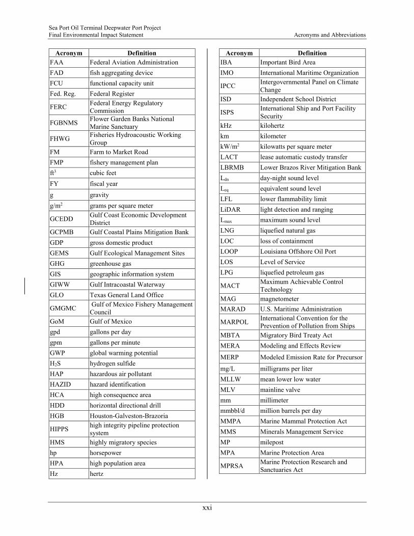
Sea Port Oil Terminal Deepwater Port Project Final Environmental Impact Statement Acronyms and Abbreviations
xxi
Acronym Definition FAA Federal Aviation Administration FAD fish aggregating device FCU functional capacity unit Fed. Reg. Federal Register
FERC Federal Energy Regulatory Commission
FGBNMS Flower Garden Banks National Marine Sanctuary
FHWG Fisheries Hydroacoustic Working Group
FM Farm to Market Road FMP fishery management plan ft3 cubic feet FY fiscal year g gravity g/m2 grams per square meter
GCEDD Gulf Coast Economic Development District
GCPMB Gulf Coastal Plains Mitigation Bank GDP gross domestic product GEMS Gulf Ecological Management Sites GHG greenhouse gas GIS geographic information system GIWW Gulf Intracoastal Waterway GLO Texas General Land Office
GMGMC Gulf of Mexico Fishery Management Council
GoM Gulf of Mexico gpd gallons per day gpm gallons per minute GWP global warming potential H2S hydrogen sulfide HAP hazardous air pollutant HAZID hazard identification HCA high consequence area HDD horizontal directional drill HGB Houston-Galveston-Brazoria
HIPPS high integrity pipeline protection system
HMS highly migratory species hp horsepower HPA high population area Hz hertz
Acronym Definition IBA Important Bird Area IMO International Maritime Organization
IPCC Intergovernmental Panel on Climate Change
ISD Independent School District
ISPS International Ship and Port Facility Security
kHz kilohertz km kilometer kW/m2 kilowatts per square meter LACT lease automatic custody transfer LBRMB Lower Brazos River Mitigation Bank Ldn day-night sound level Leq equivalent sound level LFL lower flammability limit LiDAR light detection and ranging Lmax maximum sound level LNG liquefied natural gas LOC loss of containment LOOP Louisiana Offshore Oil Port LOS Level of Service LPG liquefied petroleum gas
MACT Maximum Achievable Control Technology
MAG magnetometer MARAD U.S. Maritime Administration
MARPOL International Convention for the Prevention of Pollution from Ships
MBTA Migratory Bird Treaty Act MERA Modeling and Effects Review
MERP Modeled Emission Rate for Precursor
mg/L milligrams per liter MLLW mean lower low water MLV mainline valve mm millimeter mmbbl/d million barrels per day MMPA Marine Mammal Protection Act MMS Minerals Management Service MP milepost MPA Marine Protection Area
MPRSA Marine Protection Research and Sanctuaries Act

Sea Port Oil Terminal Deepwater Port Project Final Environmental Impact Statement Acronyms and Abbreviations
xxii
Acronym Definition
MSA Magnuson-Stevens Fishery Conservation and Management Act
N2O nitrous oxide NAA no anchor area
NAAQS National Ambient Air Quality Standards
NAGPRA Native American Graves Protection and Repatriation Act
NEPA National Environmental Policy Act NFPA National Fire Protection Association NHPA National Historic Preservation Act Ni nickel NLCD National Land Cover Database NMFS National Marine Fisheries Service NO2 nitrogen dioxide NOA Notice of Application NOI Notice of Intent NOx nitrogen oxides
NPDES National Pollutant Discharge Elimination System
NRCS Natural Resources Conservation Service
NRHP National Register of Historic Places NRI Nationwide Rivers Inventory NSA noise sensitive area NSR New Source Review NTL Notices to Lessees and Operators NWR National Wildlife Refuge OCP Operator Cleanup Program OCS Outer Continental Shelf OPA90 Oil Pollution Act of 1990 OPAREA operating areas OPSMAN Port Operations Manual
OSP MP Oyster Creek to Shore Pipeline milepost
Oyster Creek to Shore Pipelines
two 36-inch-diameter crude oil pipelines from the Oyster Creek Terminal to the shore crossing
Pa Pascal PAH polycyclic aromatic hydrocarbon Pb lead PBF physical and biological features PCB polychlorinated biphenyl PEM palustrine emergent
Acronym Definition PFO palustrine forested pga peak ground acceleration
PHMSA Pipeline and Hazardous Materials Administration
PLEM pipeline end manifold
PM10 particulate matter with aerodynamic diameter of less than 10 micrometers
PM2.5 particulate matter with aerodynamic diameter of less than 2.5 micrometers
ppb parts per billion ppb-hours parts per billion per hours PRA permit review area PRM permittee-responsible mitigation
Project Sea Port Oil Terminal Deepwater Port Project
Proposed Action the proposed SPOT Project
PSD Prevention of Significant Deterioration
PSS palustrine scrub-shrub PSV pressure safety valve PTS permanent threshold shift RHA Rivers and Harbors Act RMC resource management code RMS root mean square
ROD Record of Decision
ROI Region of Influence RP return period
RRC Railroad Commission of Texas
RTHL Register of Texas Historic Landmarks RV recreational vehicle SAL State Antiquities Landmark
SCC stress corrosion cracking
SDRDB Submitted Driller's Report Database
SEAMAP Southeast Area Monitoring and Assessment Program
Secretary Secretary of Transportation SEL sound exposure level SELcum cumulative sound exposure level SH State Highway SHPO State Historic Preservation Office
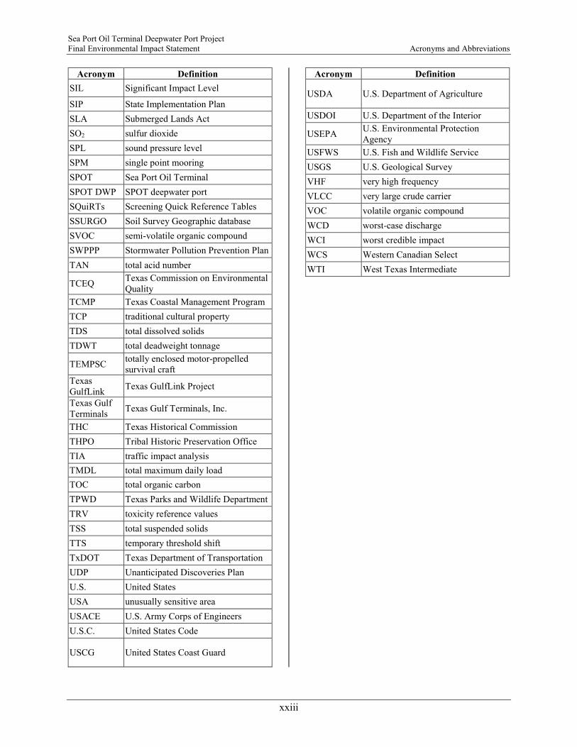
Sea Port Oil Terminal Deepwater Port Project Final Environmental Impact Statement Acronyms and Abbreviations
xxiii
Acronym Definition SIL Significant Impact Level
SIP State Implementation Plan SLA Submerged Lands Act SO2 sulfur dioxide SPL sound pressure level SPM single point mooring SPOT Sea Port Oil Terminal SPOT DWP SPOT deepwater port SQuiRTs Screening Quick Reference Tables SSURGO Soil Survey Geographic database SVOC semi-volatile organic compound SWPPP Stormwater Pollution Prevention Plan TAN total acid number
TCEQ Texas Commission on Environmental Quality
TCMP Texas Coastal Management Program TCP traditional cultural property TDS total dissolved solids TDWT total deadweight tonnage
TEMPSC totally enclosed motor-propelled survival craft
Texas GulfLink Texas GulfLink Project
Texas Gulf Terminals Texas Gulf Terminals, Inc.
THC Texas Historical Commission THPO Tribal Historic Preservation Office TIA traffic impact analysis TMDL total maximum daily load TOC total organic carbon TPWD Texas Parks and Wildlife Department TRV toxicity reference values TSS total suspended solids TTS temporary threshold shift TxDOT Texas Department of Transportation UDP Unanticipated Discoveries Plan U.S. United States USA unusually sensitive area USACE U.S. Army Corps of Engineers U.S.C. United States Code
USCG United States Coast Guard
Acronym Definition
USDA U.S. Department of Agriculture
USDOI U.S. Department of the Interior
USEPA U.S. Environmental Protection Agency
USFWS U.S. Fish and Wildlife Service USGS U.S. Geological Survey VHF very high frequency VLCC very large crude carrier VOC volatile organic compound WCD worst-case discharge WCI worst credible impact WCS Western Canadian Select WTI West Texas Intermediate

-Page Intentionally Left Blank-