revised draft environmental impact statement
TRANSCRIPT
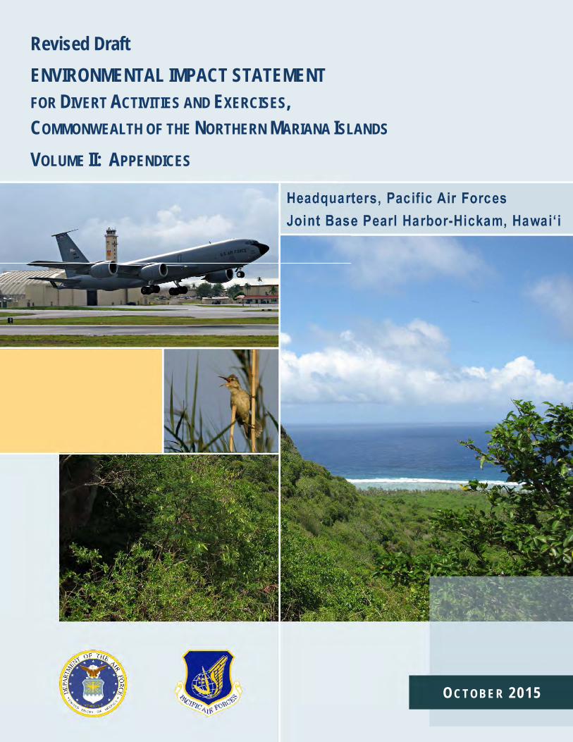
Revised Draft ENVIRONMENTAL IMPACT STATEMENT FOR DIVERT ACTIVITIES AND EXERCISES, COMMONWEALTH OF THE NORTHERN MARIANA ISLANDS VOLUME II: APPENDICES
OC T OB E R 2015
Revised Draft EIS for Divert Activities and Exercises
HQ PACAF, Joint Base Pearl Harbor-Hickam, HI October 2015 i
REVISED DRAFT ENVIRONMENTAL IMPACT STATEMENT 1 DIVERT ACTIVITIES AND EXERCISES 2
COMMONWEALTH OF THE NORTHERN MARIANA ISLANDS (CNMI) 3
VOLUME II: APPENDICES 4
TABLE OF CONTENTS 5
A. COOPERATING AGENCY REQUESTS AND ACCEPTANCE LETTERS 6
B. ESA SECTION 7 CONSULTATION SUPPORTING DOCUMENTATION 7
C. CZMA COMPLIANCE SUPPORTING DOCUMENTATION 8
D. NHPA SECTION 106 CONSULTATION SUPPORTING DOCUMENTATION 9
E. AIR QUALITY CALCULATIONS AND MODELING 10
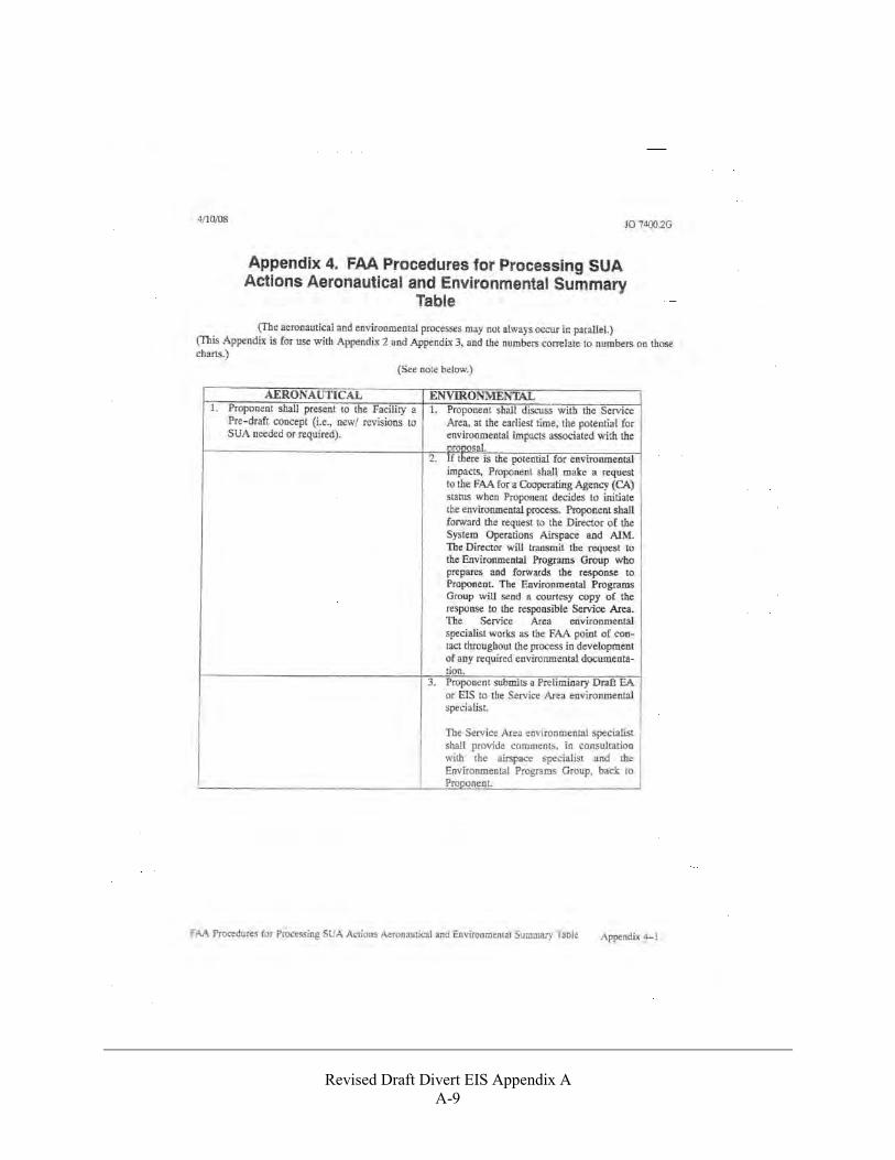
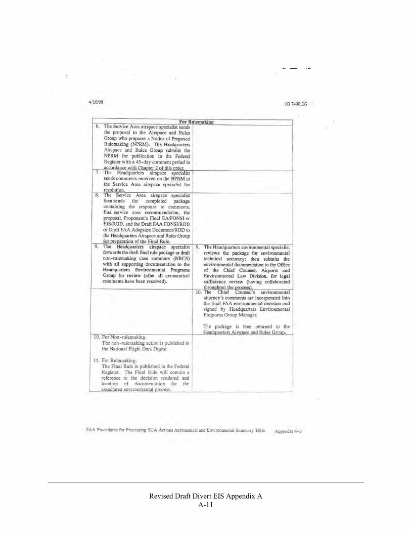
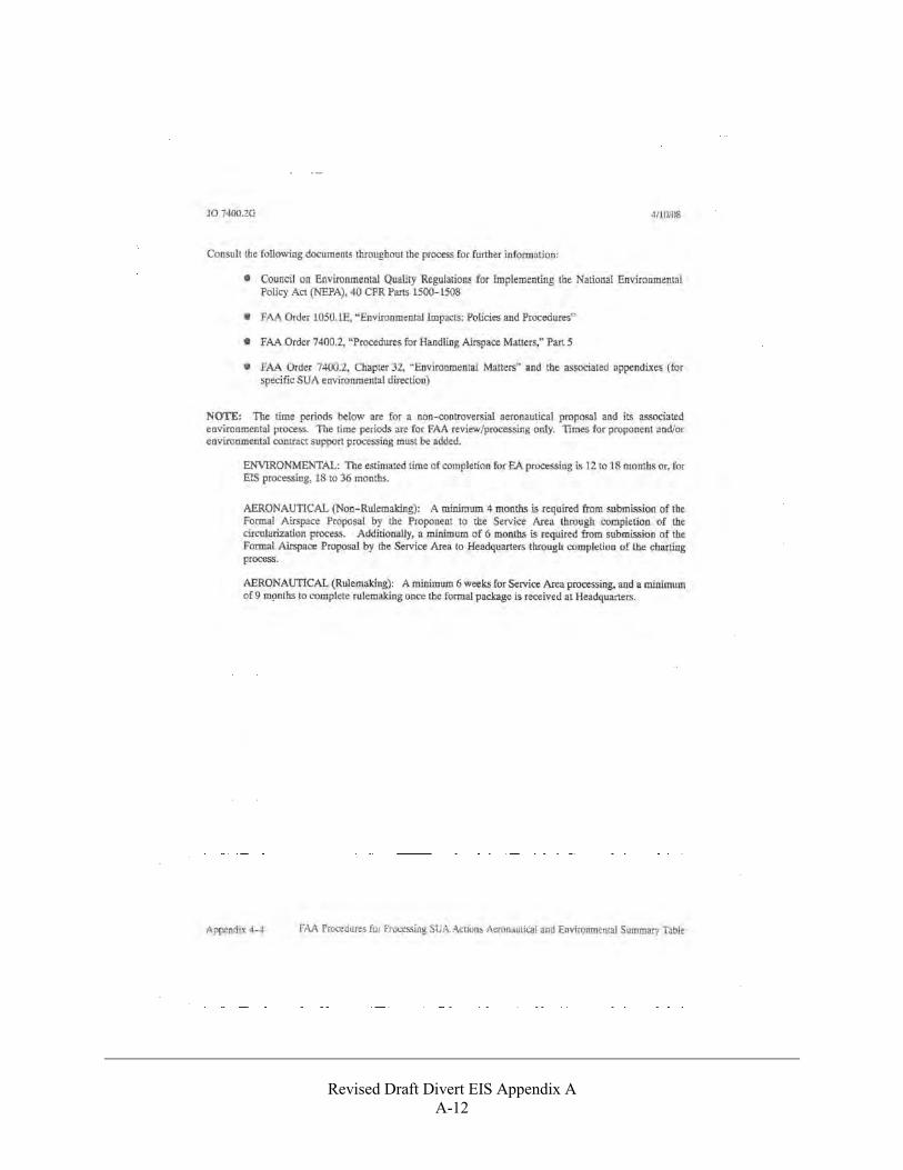
F. AERONAUTICAL STUDY IN THE COMMONWEALTH OF THE NORTHERN 11 MARIANA ISLANDS 12
G. PUBLIC INVOLVEMENT AND COMMENTS 13
14
Revised Draft EIS for Divert Activities and Exercises
HQ PACAF, Joint Base Pearl Harbor-Hickam, HI October 2015 ii
THIS PAGE INTENTIONALLY LEFT BLANK 1
A P P E N D I X A
Cooperating Agency Requests and Acceptance Letters
Revised Draft Divert EIS Appendix A
A-1
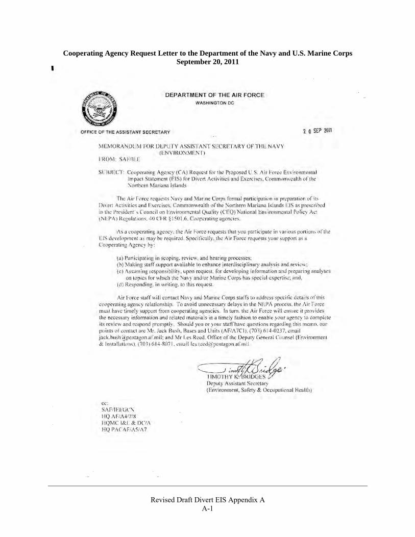
Cooperating Agency Request Letter to the Department of the Navy and U.S. Marine Corps September 20, 2011
Revised Draft Divert EIS Appendix A
A-2
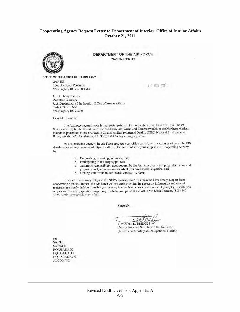
Cooperating Agency Request Letter to Department of Interior, Office of Insular Affairs October 21, 2011
Revised Draft Divert EIS Appendix A
A-3
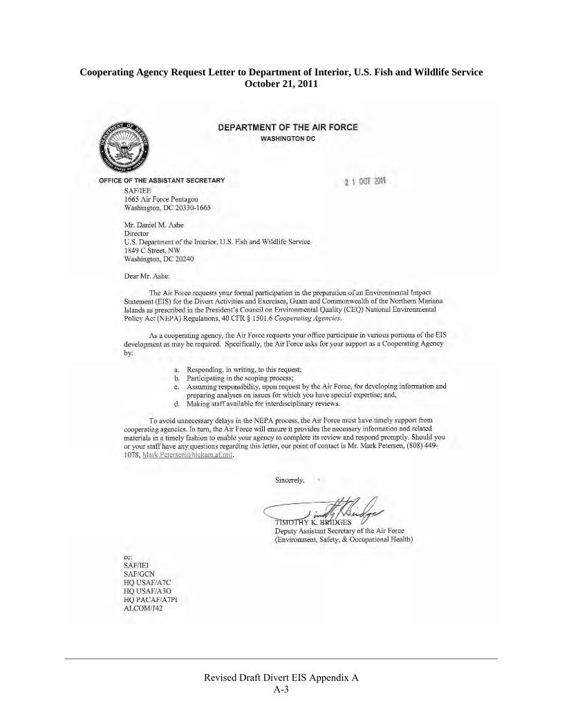
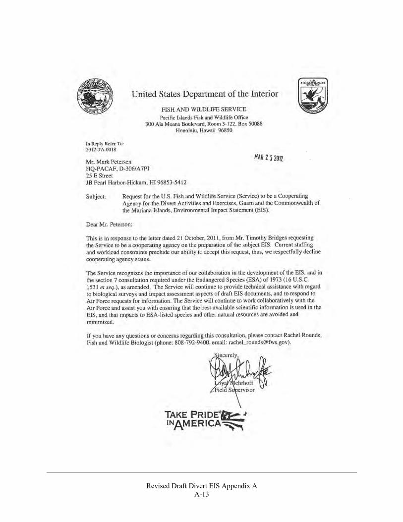
Cooperating Agency Request Letter to Department of Interior, U.S. Fish and Wildlife Service October 21, 2011
Revised Draft Divert EIS Appendix A
A-4
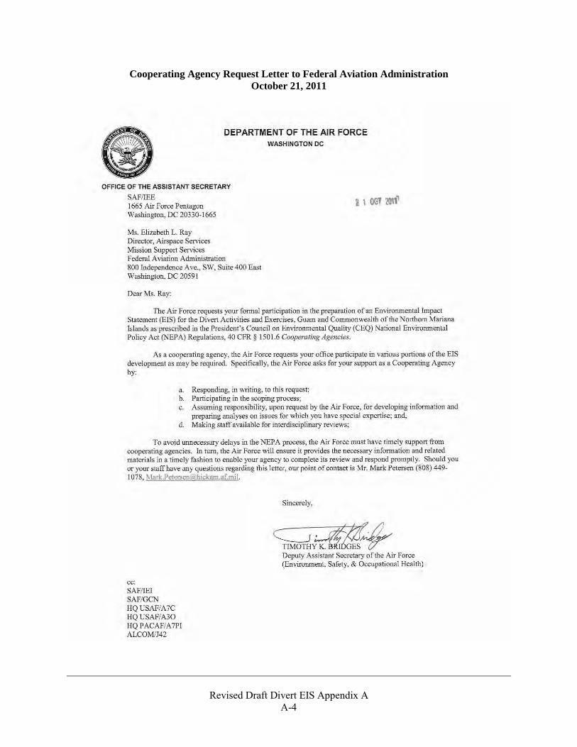
Cooperating Agency Request Letter to Federal Aviation Administration October 21, 2011
Revised Draft Divert EIS Appendix A
A-5
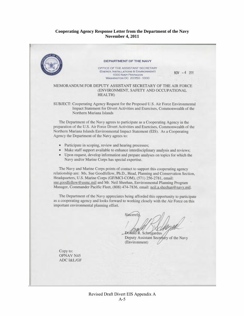
Cooperating Agency Response Letter from the Department of the Navy November 4, 2011
Revised Draft Divert EIS Appendix A
A-6
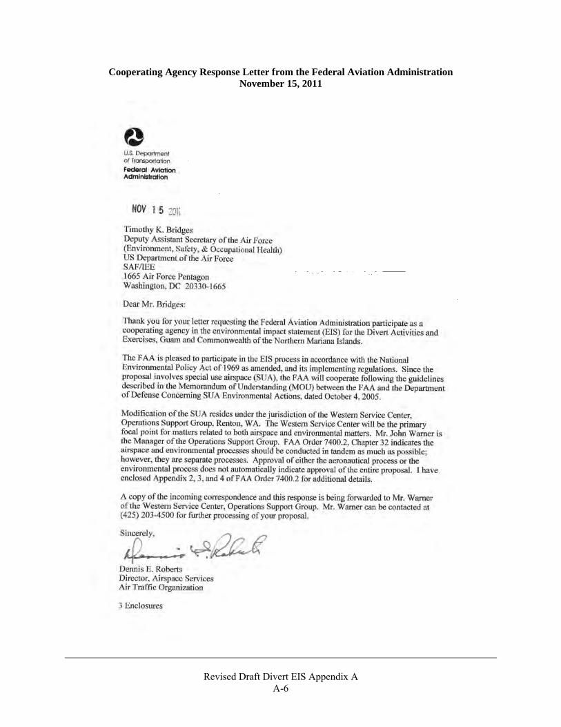
Cooperating Agency Response Letter from the Federal Aviation Administration November 15, 2011
Revised Draft Divert EIS Appendix A
A-7
Revised Draft Divert EIS Appendix A
A-8
Revised Draft Divert EIS Appendix A
A-9

Revised Draft Divert EIS Appendix A
A-10
Revised Draft Divert EIS Appendix A
A-11
Revised Draft Divert EIS Appendix A
A-12
Revised Draft Divert EIS Appendix A
A-13

Revised Draft Divert EIS Appendix A
A-14
THIS PAGE INTENTIONALLY LEFT BLANK

A P P E N D I X B
ESA Section 7 Consultation Supporting Documentation
Revised Draft Divert EIS Appendix B
B-1
Section 7 Consultation History
In addition to the letters and documents found in this appendix, interactions between the USAF and USFWS related to Section 7 consultation for actions on Saipan for this project took place over several dates between July 14, 2011 and July 1, 2013. The USAF submitted the Final Biological Assessment to the USFWS on September 10, 2012. The USAF received the Final Biological Opinion from the USFWS on July 1, 2013. On August 20, 2013, the USAF received a memo from the USFWS with three minor corrections to the Biological Opinion after signing.
Interactions between the USAF and USFWS related to Section 7 consultation for actions on Tinian for this project are ongoing. The USAF submitted a memo to the USFWS on July 8, 2015 requesting concurrence with the may affect, not likely to adversely affect determination for nesting green and hawksbill sea turtles on Tinian. The USAF is awaiting concurrence from USFWS with this determination.
Interactions between the USAF and NMFS related to Section 7 consultation for actions on Saipan and Tinian this project took place between October 3, 2012 and October 30, 2012. The USAF sent a letter to NMFS requesting formal concurrence with the not likely to adversely to affect determination for threatened and endangered marine species on October 3, 2012. The USAF received a letter from NMFS stating concurrence with the not likely to adversely affect determination for threatened and endangered marine species on October 30, 2012.
Revised Draft Divert EIS Appendix B
B-2
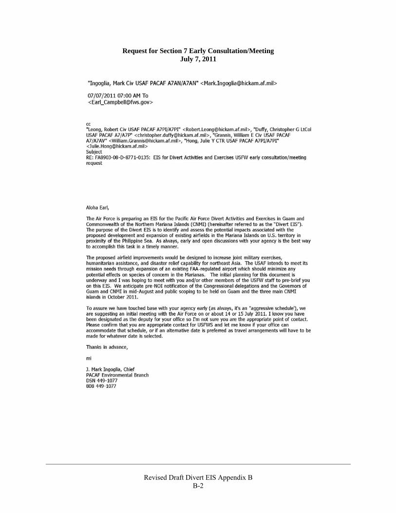
Request for Section 7 Early Consultation/Meeting July 7, 2011
Revised Draft Divert EIS Appendix B
B-3
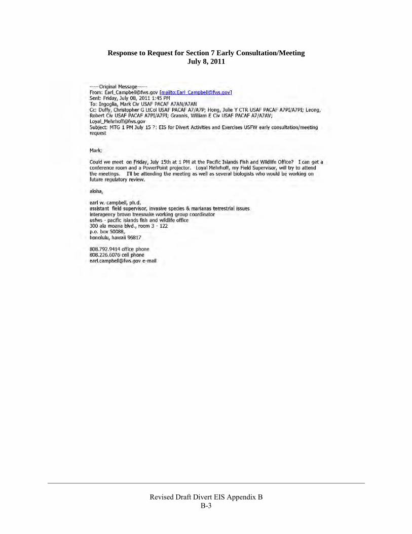
Response to Request for Section 7 Early Consultation/Meeting July 8, 2011
Revised Draft Divert EIS Appendix B
B-4
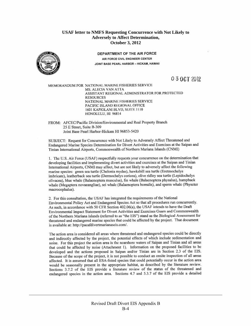
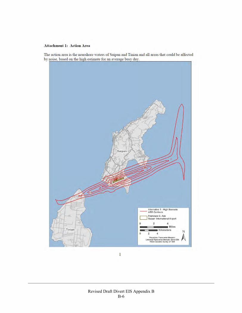
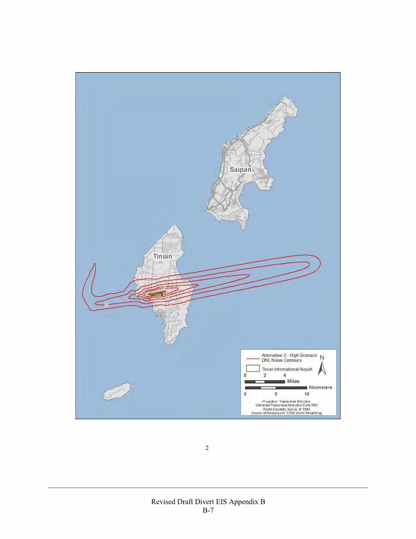
USAF letter to NMFS Requesting Concurrence with Not Likely to Adversely to Affect Determination,
October 3, 2012
Revised Draft Divert EIS Appendix B
B-5
Revised Draft Divert EIS Appendix B
B-6
Revised Draft Divert EIS Appendix B
B-7
Revised Draft Divert EIS Appendix B
B-8
Revised Draft Divert EIS Appendix B
B-9
Revised Draft Divert EIS Appendix B
B-10
NMFS Response Letter to USAF Stating Concurrence with the Not Likely to Adversely to Affect Determination,
October 30, 2012
Revised Draft Divert EIS Appendix B
B-11
Revised Draft Divert EIS Appendix B
B-12
Revised Draft Divert EIS Appendix B
B-13

Revised Draft Divert EIS Appendix B
B-14
USAF Letter to USFWS Requesting Concurrence with the Not Likely to Adversely to Affect Determination for Nesting Green and Hawksbill Sea Turtles,
July 8, 2015
Revised Draft Divert EIS Appendix B
B-15
Revised Draft Divert EIS Appendix B
B-16
Revised Draft Divert EIS Appendix B
B-17
Revised Draft Divert EIS Appendix B
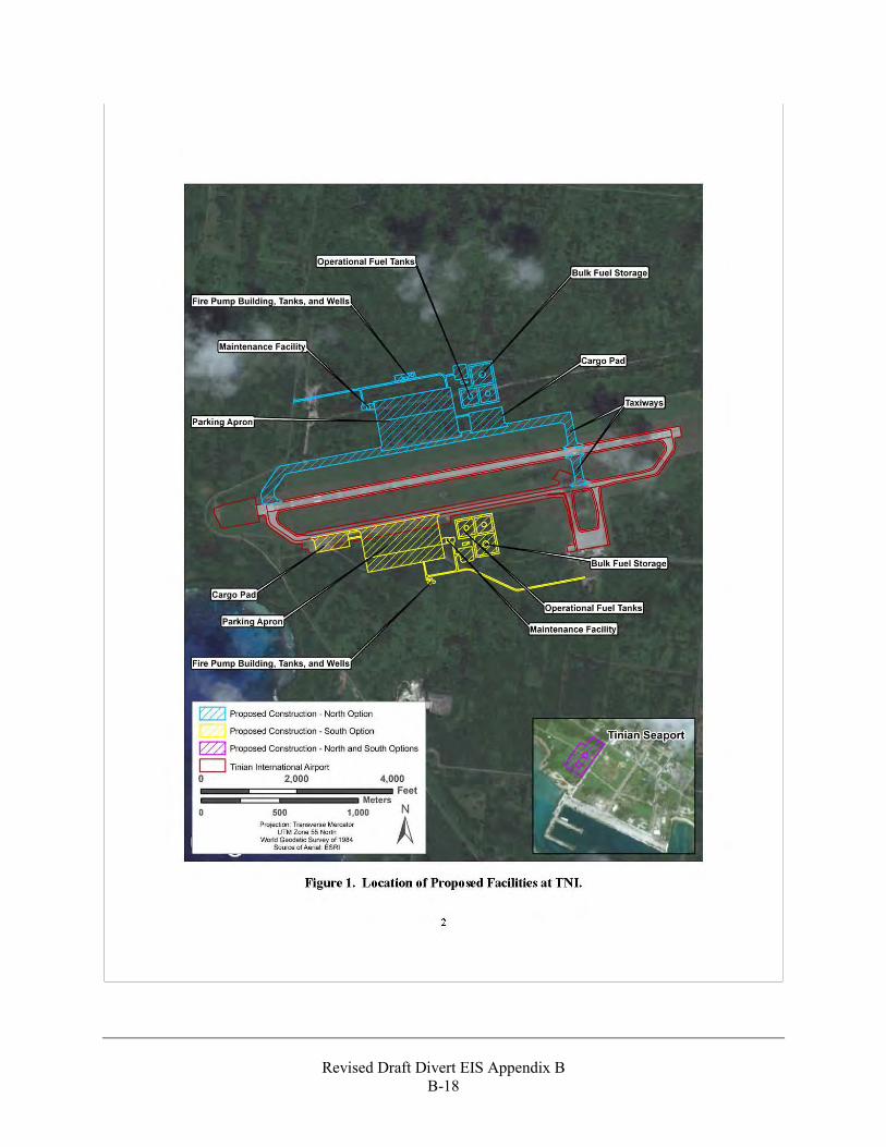
B-18
Revised Draft Divert EIS Appendix B
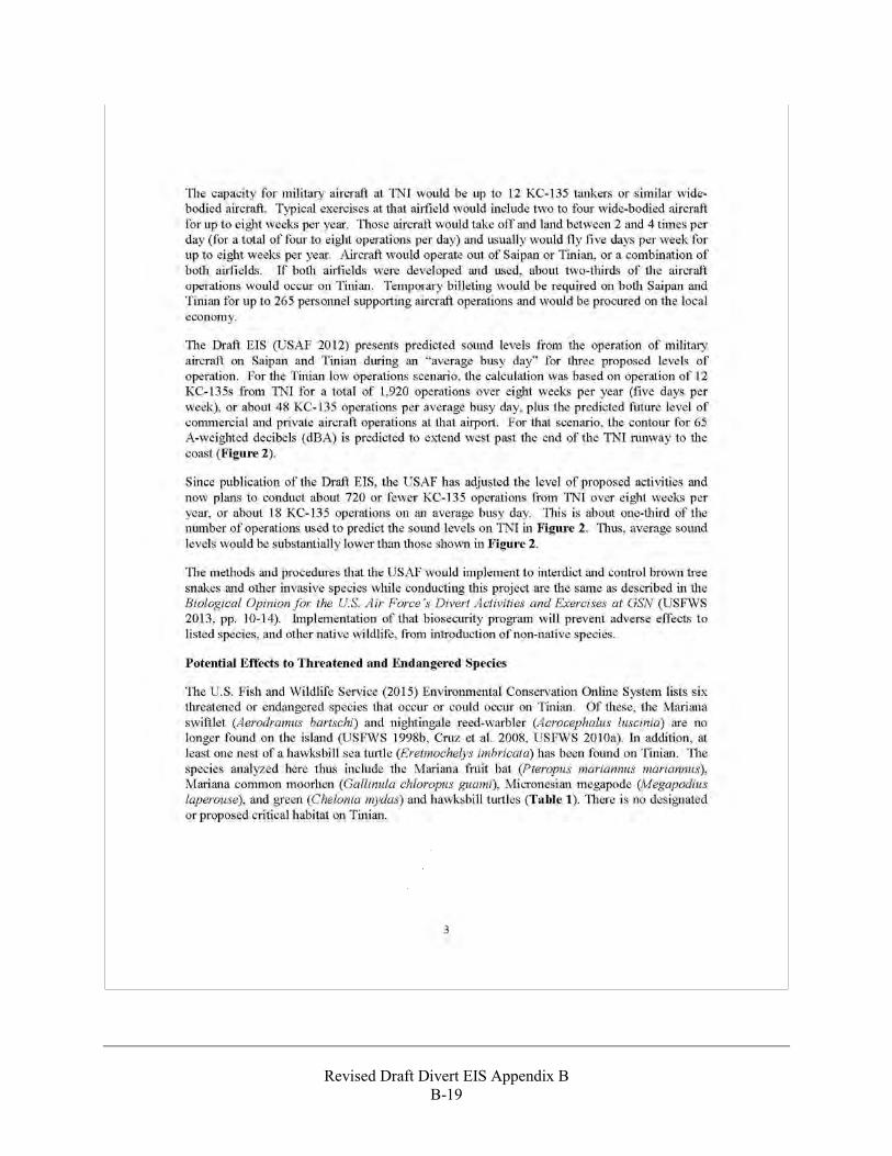
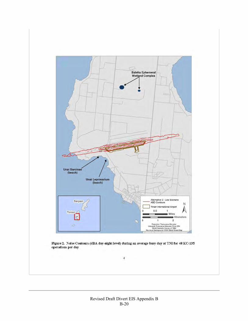
B-19
Revised Draft Divert EIS Appendix B
B-20
Revised Draft Divert EIS Appendix B
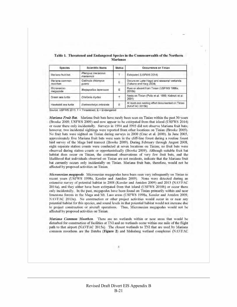
B-21
Revised Draft Divert EIS Appendix B
B-22
Revised Draft Divert EIS Appendix B
B-23
Revised Draft Divert EIS Appendix B
B-24
Revised Draft Divert EIS Appendix B
B-25
Revised Draft Divert EIS Appendix B
B-26
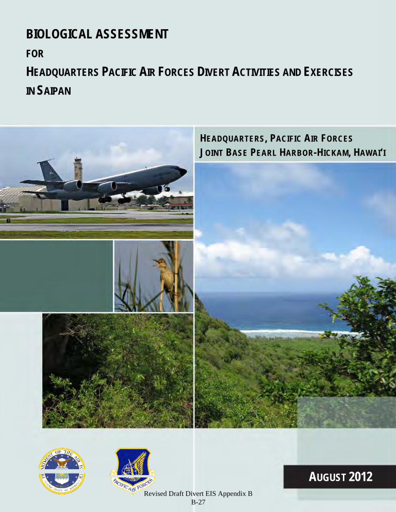
BIOLOGICAL ASSESSMENT FOR HEADQUARTERS PACIFIC AIR FORCES DIVERT ACTIVITIES AND EXERCISES
IN SAIPAN
HEADQUARTERS, PACIFIC AIR FORCES JOINT BASE PEARL HARBOR-HICKAM, HAWAI‘I
AUGUST 2012 Revised Draft Divert EIS Appendix B
B-27
ABBREVIATIONS AND ACRONYMS
ac acre
AFB Air Force Base
BA Biological Assessment
BEAR Basic Expeditionary Airfield Resources
cm centimeter
CNMI Commonwealth of the Northern Mariana Islands
dBA A-weighted decibel
DNL Day-Night Average Sound Level
DOD Department of Defense
EIS Environmental Impact Statement
ESA Endangered Species Act
F.R. Federal Register
GSN Saipan International Airport (Federal Aviation Authority international airport code)
ha hectare
lb pound
kg kilogram
km kilometers
mi miles
m meters
PACAF Pacific Air Forces
SUMB Saipan Upland Mitigation Bank
USAF U.S. Air Force
U.S.C. U.S. Code
USFWS U.S. Fish and Wildlife Service
Revised Draft Divert EIS Appendix B B-28
BIOLOGICAL ASSESSMENT FOR
HEADQUARTERS PACIFIC AIR FORCES DIVERT ACTIVITIES AND EXERCISES IN SAIPAN
HEADQUARTERS PACIFIC AIR FORCES (PACAF) JOINT BASE PEARL HARBOR-HICKAM, HAWAI‘I 96853-5233
AUGUST 2012
Revised Draft Divert EIS Appendix B B-29

Revised Draft Divert EIS Appendix B B-30
Biological Assessment for Divert Activities and Exercises
HQ PACAF, Joint Base Pearl Harbor-Hickam, HI August 2012 i
BIOLOGICAL ASSESSMENT
FOR PACIFIC AIR FORCE DIVERT ACTIVITIES AND EXERCISES
IN SAIPAN
TABLE OF CONTENTS
ABBREVIATIONS AND ACRONYMS ......................................................... INSIDE FRONT COVER
1. INTRODUCTION .......................................................................................................................... 1-1
1.1 SCOPE OF DOCUMENT AND PROJECT ...................................................................................... 1-2 1.2 PROTECTED SPECIES ADDRESSED .......................................................................................... 1-2 1.3 CONSULTATION HISTORY ....................................................................................................... 1-3
2. PROJECT DESCRIPTION AND ACTION AREA.................................................................... 2-1
2.1 CONSTRUCTION ...................................................................................................................... 2-1 2.2 IMPLEMENTATION .................................................................................................................. 2-8 2.3 ACTION AREA ....................................................................................................................... 2-12 2.4 IMPACT MINIMIZATION AND CONSERVATION MEASURES ................................................... 2-13
3. STATUS OF THREATENED AND ENDANGERED SPECIES ON SAIPAN ....................... 3-1
3.1 NIGHTINGALE REED-WARBLER ............................................................................................. 3-1 3.2 MARIANA COMMON MOORHEN ............................................................................................. 3-2 3.3 MARIANA SWIFTLET ............................................................................................................... 3-3 3.4 GREEN SEA TURTLE ............................................................................................................... 3-4
4. ENVIRONMENTAL BASELINE ................................................................................................ 4-1
4.1 VEGETATION........................................................................................................................... 4-2 4.2 WILDLIFE ................................................................................................................................ 4-4 4.3 SURVEYS FOR NIGHTINGALE REED-WARBLERS .................................................................... 4-6 4.4 SURVEYS FOR COMMON MOORHENS ..................................................................................... 4-6
5. EFFECTS OF THE ACTION ....................................................................................................... 5-1
5.1 NIGHTINGALE REED-WARBLER ............................................................................................. 5-1 5.1.1 Impacts During Construction .................................................................................... 5-1 5.1.2 Impacts During Implementation ................................................................................ 5-5 5.1.3 Invasive Species ...................................................................................................... 5-12 5.1.4 Cumulative Effects .................................................................................................. 5-12
5.2 MARIANA COMMON MOORHEN ........................................................................................... 5-13 5.3 MARIANA SWIFTLET ............................................................................................................. 5-13 5.4 GREEN SEA TURTLES............................................................................................................ 5-13
6. CONCLUSIONS ............................................................................................................................ 6-1
7. REFERENCES ............................................................................................................................... 7-1
Revised Draft Divert EIS Appendix B B-31
Biological Assessment for Divert Activities and Exercises
HQ PACAF, Joint Base Pearl Harbor-Hickam, HI August 2012 ii
FIGURES
2-1. Overview of Proposed Facility Locations at GSN ......................................................................... 2-3 2-2. Proposed Parking Apron, Hangar, and Maintenance Facility ........................................................ 2-5 2-3. Proposed Temporary Munitions Storage Area ............................................................................... 2-6 2-4. Proposed Hazardous Cargo Pad and Arm/Disarm Pad ................................................................... 2-7 2-5. Proposed Fuel Tanks and Site of the Basic Expeditionary Airfield Resources 550 Initial
Housekeeping Set Kit ..................................................................................................................... 2-9 2-6. Proposed Site Plan for Two Fuel Tanks at the Port of Saipan ...................................................... 2-10 4-1. Vegetation Communities at GSN ................................................................................................... 4-3 4-2. Areas surveyed at GSN in 2012 ..................................................................................................... 4-5 4-3. Nightingale Reed-Warbler Territories Detected within Surveyed Areas at GSN, January–
April 2012 ....................................................................................................................................... 4-7 5-1. Proposed Project Facilities and Nightingale Reed-Warbler Territories ......................................... 5-3 5-2. Low Scenario Predicted DNL Noise Contours (dBA) During a Military Exercise at GSN
(USAF 2012) .................................................................................................................................. 5-7 5-3. Medium Scenario Predicted DNL Noise Contours (dBA) During a Military Exercise at
GSN (USAF 2012) ......................................................................................................................... 5-8 5-4. High Scenario Predicted DNL Noise Contours (dBA) During a Military Exercise at GSN
(USAF 2012) .................................................................................................................................. 5-9 5-5. Predicted DNL Noise Contours (dBA) During a Military Exercise at GSN (medium
scenario in USAF 2012) ............................................................................................................... 5-10
TABLES
2-1. Project Elements that Might be Constructed on Saipan ................................................................. 2-2 2-2. Impact Minimization Measures Required by the Saipan Upland Mitigation Bank
Biological Opinion. ...................................................................................................................... 2-13 5-1. Amount of Vegetation Communities to be Removed for Construction of All Proposed
Facilities at GSN (hectares [acres]) ................................................................................................ 5-2 5-2. Nightingale Reed-Warbler Territories at GSN, 2012 ..................................................................... 5-4
Revised Draft Divert EIS Appendix B B-32
Biological Assessment for Divert Activities and Exercises
HQ PACAF, Joint Base Pearl Harbor-Hickam, HI August 2012 1-1
1. Introduction 1
The U.S. Air Force (USAF) proposes to improve the Saipan International Airport (hereafter referred to by 2 the airport code GSN) and associated infrastructure to support expanding mission requirements in the 3 western Pacific. After completing an analysis as required by the National Environmental Policy Act, the 4 USAF would consider developing and constructing facilities and infrastructure at GSN to support a 5 combination of USAF and joint cargo, fighter, and tanker aircraft and associated support personnel for 6 divert landings, periodic exercises, and humanitarian assistance and disaster relief. 7
The purpose of the proposed project is to establish divert activity capabilities to support and conduct 8 current, emerging, and future exercises, while ensuring the capability to meet mission requirements in the 9 event that access to Andersen Air Force Base (AFB) on Guam or other western Pacific locations is 10 limited or denied. For example, the need for humanitarian assistance can arise suddenly and without 11 warning, such as disaster response in Japan during the 2011 earthquake and tsunami. If this were to occur 12 during scheduled training exercises at Andersen AFB, training or response efforts might be delayed or 13 impeded. Furthermore, natural or man-made disasters could impact Andersen AFB’s missions, requiring 14 reliance on designed and designated divert airfield capabilities. Because of the proximity to 15 forward-deployed forces in the western Pacific, the Marianas provides the best alternative for 16 forward-deployed U.S. forces to train on U.S.-owned lands and to develop the proposed additional divert 17 capabilities. 18
The USAF and other services must achieve the missions mandated by Title 10 United States Code 19 (U.S.C.) in the event of a disruption of operational capabilities at Andersen AFB or other western Pacific 20 locations. To more assuredly achieve this mission, an additional location within the Marianas 21 Archipelago must have the capabilities to sustain USAF missions on a temporary basis. Facilities and 22 activities at GSN would not replace the capabilities at Andersen AFB, but would be an additional location 23 on U.S. territory in the western Pacific that can help ensure continued military readiness should access to 24 Andersen AFB or other western Pacific locations be limited or denied, such as during a training event, 25 humanitarian assistance efforts, or natural or man-made disasters. The need for this project is derived 26 from the following related operational requirements that are necessary to successfully support the mission 27 of the Pacific Air Forces (PACAF): 28
Ensure airfield accessibility if access to Andersen AFB or other western Pacific airfields is 29 limited or denied 30
Provide for contingency operations to include humanitarian assistance and disaster relief efforts 31
Accommodate future increases in operational tempo and associated training 32
Achieve and sustain readiness. 33
This project would develop critical enhancements at GSN to increase operational and divert capabilities 34 needed by the USAF, especially in humanitarian assistance and disaster relief and joint exercises. These 35 enhancements are required for the USAF to maintain a state of military readiness commensurate with the 36 national defense and humanitarian assistance and disaster relief missions. This project focuses on the 37 development and improvement of existing divert or contingency airfield capabilities and does not include 38 the permanent deployment or “beddown” of forces in the Marianas. Hence, construction activities for the 39 project are focused on improvements needed at GSN to increase USAF capabilities to respond to 40 emergent needs, to ensure forces that are diverted from Andersen AFB or other western Pacific locations 41 can continue to operate, and to train to these capabilities. 42
Revised Draft Divert EIS Appendix B B-33
Biological Assessment for Divert Activities and Exercises
HQ PACAF, Joint Base Pearl Harbor-Hickam, HI August 2012 1-2
In summary, the proposed project is needed because there is not an existing divert or contingency airfield 1 on U.S. territory in the western Pacific that is designed and designated to provide strategic operational 2 and exercise capabilities for U.S. forces when needed and humanitarian assistance and disaster relief in 3 times of natural or man-made disasters. Implementation of the project would support the PACAF mission 4 to provide ready air and space power to promote U.S. interests in the Asia-Pacific region during 5 peacetime, through crisis, and in war. For additional information on the purpose and need of the project, 6 see the Environmental Impact Statement (EIS) for Divert Activities and Exercises, Guam and 7 Commonwealth of the Northern Mariana Islands (USAF 2012). 8
1.1 Scope of Document and Project 9
The purpose of this Biological Assessment (BA) is to assess the potential effects of establishing divert 10 capabilities and associated operations at GSN on terrestrial species listed as endangered or threatened 11 under the Endangered Species Act (ESA) and their designated critical habitat. This BA addresses the 12 potential impacts of improving facilities at GSN. It also addresses implementation of divert activities and 13 exercises at the airport, including ground movements and immediate approaches and departures of aircraft 14 at the airport during unit-level training and exercises. It does not, however, address actual air warfare and 15 air logistics training (i.e., above 3,050 meters [m] (10,000 feet)) that would occur in the Mariana Islands 16 Range Complex or elsewhere by aircraft temporarily operating from GSN. Those air warfare and training 17 activities are described in the Mariana Islands Range Complex Environmental Impact Statement/ 18 Overseas Environmental Impact Statement, May 2010 (DON 2010), and impacts on ESA-listed species 19 from those activities have been addressed in Biological Opinions developed by the U.S. Fish and Wildlife 20 Service (USFWS) (USFWS 2010a) and National Marine Fisheries Service (NMFS 2011). 21
The USAF has requested that this project be appended to the Programmatic Biological Opinion 22 Regarding the Reestablishment, Management, and Use of the Saipan Upland Mitigation Bank (SUMB), 23 Saipan (USFWS 2008a). This BA therefore considers and addresses the impact analyses methodologies 24 and mitigation measures described in the SUMB Biological Opinion. 25
1.2 Protected Species Addressed 26
There are 16 species listed as threatened or endangered that occur or have occurred in the Mariana Islands 27 archipelago (USFWS 2011a). Based on conversations with USFWS staff during informal consultation 28 (see Section 1.3), the USAF has determined that six of those species could occur in terrestrial 29 environments on Saipan: threatened Mariana fruit bat (Pteropus mariannus mariannus), endangered 30 nightingale reed-warbler (Acrocephalus luscinia), endangered Mariana swiftlet (Aerodramus bartschi), 31 endangered Mariana common moorhen (Gallinula chloropus guami), endangered Micronesian megapode 32 (Megapodius laperouse), and threatened green sea turtle (Chelonia mydas). 33
The Mariana fruit bat and Micronesian megapode are restricted to forested habitats, primarily on the 34 northern part of the island (USFWS 1998a, 2009a). Land at and surrounding GSN where facilities would 35 be developed and divert activities and exercises would occur has been cleared of native vegetation or is 36 vegetated with second-growth forests dominated by tangantangan (Leucaena leucocephala). Due to lack 37 of suitable habitat within the action area, and based on discussions with the USFWS in January 2012, 38 systematic surveys for these species were not conducted for this project. However, during surveys of the 39 action area conducted in 2012 for other rare species and to characterize avian populations (MES 2012), 40 observers were vigilant for megapodes and flying and roosting fruit bats. Even though observation times 41 of those surveys were favorable for detection of these species, no fruit bats or megapodes were observed 42 or heard during any of the surveys. In addition, no optimal habitat was found in the areas surveyed of 43 sufficient quality or quantity to support these species. Because these species are rare or do not occur on 44
Revised Draft Divert EIS Appendix B B-34
Biological Assessment for Divert Activities and Exercises
HQ PACAF, Joint Base Pearl Harbor-Hickam, HI August 2012 1-3
the southern part of Saipan and there is no habitat for them within the action area, the USAF concludes 1 that developing divert capabilities and conducting divert activities and exercises at GSN will have no 2 affect on the Mariana fruit bat and Micronesian megapode, and those species are not discussed further in 3 this BA. 4
In addition to the threatened green sea turtle, the endangered hawksbill sea turtle (Eretmochelys 5 imbricata), leatherback sea turtle (Dermochelys coriacea), and olive Ridley turtle (Lepidochelys olivacea) 6 can occur in the ocean surrounding Saipan. The USAF will consult with the National Oceanic and 7 Atmospheric Administration Fisheries Service as required by the ESA to address impacts of their 8 proposed project on those species in the marine environment, and those species are not addressed in this 9 BA. 10
Six species classified as candidates for listing under the ESA occur in the Commonwealth of the Northern 11 Mariana Islands (CNMI) (76 Federal Register [FR] 66370). Two of those species, the Mariana eight-spot 12 butterfly (Hypolimnas octocula mariannensis) and humped tree snail (Partula gibba) might occur on 13 Saipan. Although host plants used by the Mariana eight-spot butterfly (Procris pedunculata and 14 Elatostema calcareum) occur on Saipan, this butterfly has not been detected there in recent years and it 15 could be extirpated from the island (USFWS 2011b). The humped tree snail is known to occur on Saipan, 16 but its preferred habitat of cool, shaded forests or other areas with high humidity (USFWS 2011c) does 17 not occur within the upland areas that might be developed for the USAF’s proposed project (MES 2012). 18 Although a few scattered individuals of host plant species (e.g., papaya [Carica papaya], coconut palm 19 [Cocos nucifera], hodda [Ficus tinctoria], and sumac [Aidia cochichinensis]) were found within the 20 project survey areas during surveys conducted on and around GSN in 2012, Mariana eight-spot butterflies 21 and humped tree snails were not detected and the host plants do not appear to be of sufficient abundance 22 or have the characteristics necessary to support a population of either candidate species. It is therefore 23 unlikely that the proposed project would have any adverse effect on these candidate species and they are 24 not further discussed in this BA. 25
1.3 Consultation History 26
The following interactions between the USAF and USFWS related to this project have occurred. 27
July 14, 2011 – USAF and USFWS staff met in the USFWS office in Honolulu, Hawaii, to 28 introduce the project, obtain a list of protected species that might occur in the project area, and 29 discuss the consultation process. 30
July 15, 2011 – Staff from HDR, a contractor working for PACAF, requested of the USFWS 31 information about the nightingale reed-warbler survey protocol and about the SUMB. The 32 requested information was sent by USFWS staff on July 18. 33
September 7, 2011 – Staff from HDR requested copies of Biological Opinions for the SUMB 34 and for activities at and near GSN. Those Biological Opinions were sent by USFWS staff on 35 September 23. 36
January 5, 2012 – USAF and USFWS staff met in the USFWS office in Honolulu, Hawaii, to 37 discuss plans for nightingale reed-warbler surveys and potential impacts on that and other species. 38
May 31, 2012 – USAF and USFWS staff met in the USFWS office in Honolulu, Hawaii, to 39 discuss the results of surveys conducted for threatened and endangered species and the process 40 for completing the consultation. 41
July 6, 2012 – USAF and USFWS staff met in the USFWS office in Honolulu, Hawaii, to discuss 42 USFWS comments on the Draft EIS for this project. 43
Revised Draft Divert EIS Appendix B B-35

Biological Assessment for Divert Activities and Exercises
HQ PACAF, Joint Base Pearl Harbor-Hickam, HI August 2012 1-4
July 19, 2012 – USAF submitted a draft of this BA to the USFWS for review. 1
July 27, 2012 – USAF and USFWS staff had a phone conversation to discuss USFWS comments 2 on the draft BA. 3
August 8, 2012 – USFWS provided by email additional comments on the draft BA. 4
Revised Draft Divert EIS Appendix B B-36
Biological Assessment for Divert Activities and Exercises
HQ PACAF, Joint Base Pearl Harbor-Hickam, HI August 2012 2-1
2. Project Description and Action Area 1
This section describes the USAF plan to develop airfield operational capabilities at GSN, exercise divert 2 and humanitarian assistance and disaster relief airlift staging capabilities, conduct joint military exercises, 3 implement fueling and fuel storage, and develop billeting and other personnel requirements. This section 4 also identifies the action area that could be directly or indirectly affected by developing divert capabilities 5 and conducting divert activities and exercises on Saipan, and the measures that the USAF would take to 6 avoid and minimize impacts on threatened and endangered species. Additional details about this 7 proposed project are in the associated EIS (USAF 2012). 8
The USAF proposes to improve facilities and infrastructure at GSN to support a combination of USAF 9 and joint cargo, fighter, and tanker aircraft and associated support personnel for divert landings, periodic 10 exercises, and humanitarian assistance and disaster relief. Divert landings and humanitarian assistance 11 and disaster relief would occur at the airport as required. The expanded facilities would be used on an 12 as-needed basis and would not be used as a permanent full-time beddown or installation location. 13
GSN would be improved to an airfield design that can accommodate up to 12 KC-135 or similar aircraft. 14 This airfield design would also accommodate other military cargo and tactical aircraft. Because the space 15 required to accommodate large heavy lift cargo aircraft is approximately twice as large as what is required 16 to support fighter and tactical aircraft, it is assumed that up to 24 fighter or tactical aircraft could be 17 diverted to or exercised from GSN simultaneously, or a mix of fighter, tactical, and heavy lift cargo 18 aircraft (e.g., 10 large cargo aircraft and 4 fighters) aircraft could be diverted to or exercised from GSN 19 simultaneously as long as the mix does not exceed airfield design capabilities. The number of temporary 20 support personnel accompanying the aircraft would not exceed 700, regardless of what mix of aircraft is 21 diverted to or exercised from GSN. 22
2.1 Construction 23
To reduce strain on existing airport and commercial facilities and infrastructure, the USAF would 24 construct and expand new facilities, rather than fully utilize existing facilities during the construction and 25 implementation phases. These new facilities could include an expanded runway; associated pavement 26 markings and lighting; parking aprons; temporary munitions storage area; hazardous cargo pad; an 27 arm/disarm pad; aircraft hangar; maintenance facility; jet fuel receiving, storage, and distribution system; 28 and navigational aids. Temporary billeting facilities could also be developed at the airport. The total size 29 of these facilities, if they are all constructed, would be about 26 hectares (ha) (63 acres [ac]); 24 ha 30 (59 ac) would be at GSN and 2 ha (4 ac) would be at the Port of Saipan (see Table 2-1). 31
The projected timeline for the completion of most or all construction is 24 to 36 months. However, the 32 timing of construction would depend on the completion of a Safety Management Plan and agreement by 33 the Federal Aviation Administration, Commonwealth Ports Authority, and commercial carriers. 34
Facilities at GSN and the Port of Saipan would be constructed in phases. The USAF currently plans to 35 construct the bulk fuels tank, maintenance facility, and hazardous cargo pad in the first phase of 36 construction, one or both parking aprons and the remainder of the airport fuel system in the second phase, 37 and the fuel storage tanks at the Port of Saipan in a third phase. Depending on mission needs and 38 Congressional authorization and appropriations, some project elements might not be completed on 39 Saipan, or a smaller facility than listed in Table 2-1 could be developed. For example, the USAF might 40 decide not to extend one or both ends of the GSN runway, or might decide not to construct the entire 41 parking apron. This BA addresses all project elements listed in Table 2-1; however, as described further 42 in Section 2.4, the USAF would mitigate impacts separately for each project phase as projects are 43 authorized and appropriated by Congress. 44
Revised Draft Divert EIS Appendix B B-37
Biological Assessment for Divert Activities and Exercises
HQ PACAF, Joint Base Pearl Harbor-Hickam, HI August 2012 2-2
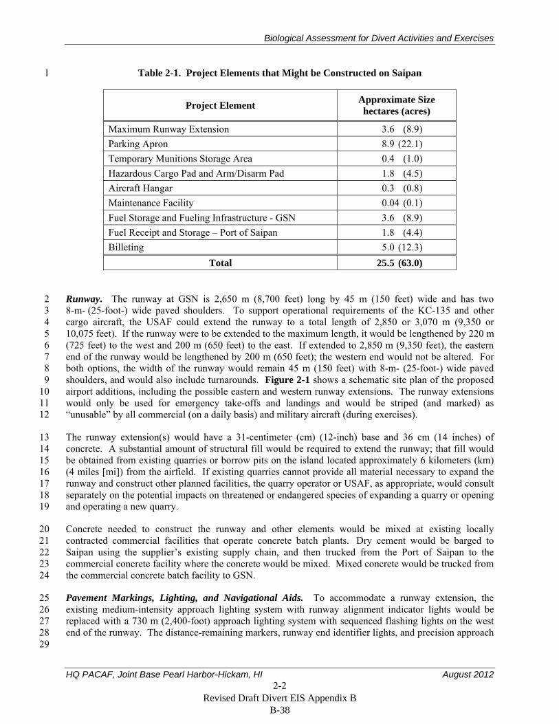
Table 2-1. Project Elements that Might be Constructed on Saipan 1
Project Element Approximate Size hectares (acres)
Maximum Runway Extension 3.6 (8.9) Parking Apron 8.9 (22.1) Temporary Munitions Storage Area 0.4 (1.0) Hazardous Cargo Pad and Arm/Disarm Pad 1.8 (4.5) Aircraft Hangar 0.3 (0.8) Maintenance Facility 0.04 (0.1) Fuel Storage and Fueling Infrastructure - GSN 3.6 (8.9) Fuel Receipt and Storage – Port of Saipan 1.8 (4.4) Billeting 5.0 (12.3)
Total 25.5 (63.0)
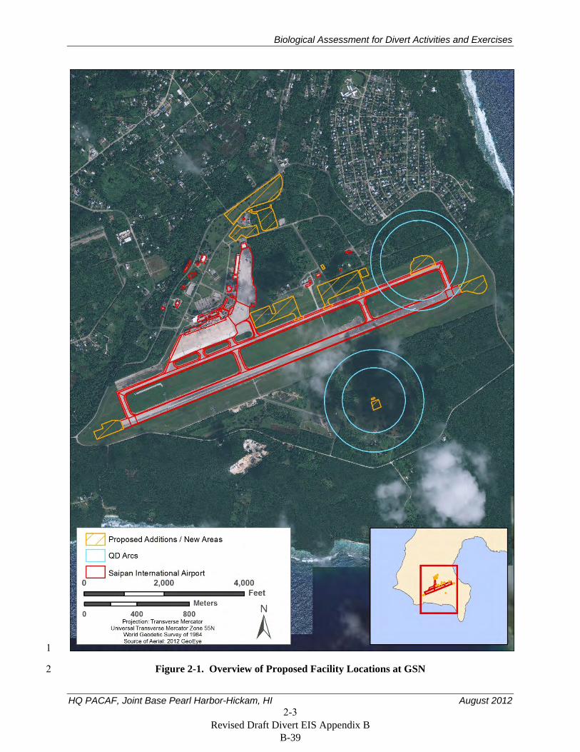
Runway. The runway at GSN is 2,650 m (8,700 feet) long by 45 m (150 feet) wide and has two 2 8-m- (25-foot-) wide paved shoulders. To support operational requirements of the KC-135 and other 3 cargo aircraft, the USAF could extend the runway to a total length of 2,850 or 3,070 m (9,350 or 4 10,075 feet). If the runway were to be extended to the maximum length, it would be lengthened by 220 m 5 (725 feet) to the west and 200 m (650 feet) to the east. If extended to 2,850 m (9,350 feet), the eastern 6 end of the runway would be lengthened by 200 m (650 feet); the western end would not be altered. For 7 both options, the width of the runway would remain 45 m (150 feet) with 8-m- (25-foot-) wide paved 8 shoulders, and would also include turnarounds. Figure 2-1 shows a schematic site plan of the proposed 9 airport additions, including the possible eastern and western runway extensions. The runway extensions 10 would only be used for emergency take-offs and landings and would be striped (and marked) as 11 “unusable” by all commercial (on a daily basis) and military aircraft (during exercises). 12
The runway extension(s) would have a 31-centimeter (cm) (12-inch) base and 36 cm (14 inches) of 13 concrete. A substantial amount of structural fill would be required to extend the runway; that fill would 14 be obtained from existing quarries or borrow pits on the island located approximately 6 kilometers (km) 15 (4 miles [mi]) from the airfield. If existing quarries cannot provide all material necessary to expand the 16 runway and construct other planned facilities, the quarry operator or USAF, as appropriate, would consult 17 separately on the potential impacts on threatened or endangered species of expanding a quarry or opening 18 and operating a new quarry. 19
Concrete needed to construct the runway and other elements would be mixed at existing locally 20 contracted commercial facilities that operate concrete batch plants. Dry cement would be barged to 21 Saipan using the supplier’s existing supply chain, and then trucked from the Port of Saipan to the 22 commercial concrete facility where the concrete would be mixed. Mixed concrete would be trucked from 23 the commercial concrete batch facility to GSN. 24
Pavement Markings, Lighting, and Navigational Aids. To accommodate a runway extension, the 25 existing medium-intensity approach lighting system with runway alignment indicator lights would be 26 replaced with a 730 m (2,400-foot) approach lighting system with sequenced flashing lights on the west 27 end of the runway. The distance-remaining markers, runway end identifier lights, and precision approach 28 29
Revised Draft Divert EIS Appendix B B-38
Biological Assessment for Divert Activities and Exercises
HQ PACAF, Joint Base Pearl Harbor-Hickam, HI August 2012 2-3
1
Figure 2-1. Overview of Proposed Facility Locations at GSN 2
Revised Draft Divert EIS Appendix B B-39
Biological Assessment for Divert Activities and Exercises
HQ PACAF, Joint Base Pearl Harbor-Hickam, HI August 2012 2-4
path indicator systems also could be replaced and the middle marker and nondirectional beacon could 1 need to be relocated. In addition, the glideslope and localizer would be relocated if the threshold 2 locations are changed. The existing runway edge lights would be extended along the length of the 3 proposed runway addition. All proposed lighting system improvements are in accordance with Unified 4 Facilities Criteria 3-535-01, Visual Air Navigation Facilities. 5
Parking Aprons. To meet operational requirements, new ramp areas and parking aprons would be 6 constructed adjacent to the GSN taxiway to accommodate up to 12 KC-135 aircraft. To avoid existing 7 cultural resources, two separate parking aprons would be constructed adjacent to each other on the 8 northern side of the existing taxiway (see Figures 2-1 and 2-2), with up to six KC-135 parking spots on 9 each apron. The design strength would require a 31-cm (12-inch) base with 36 cm (14 inches) of concrete 10 for the entire ramp expansion. Lights would be installed on the northeastern boundary to provide 11 adequate security and operational lighting for night operations. Airfield lighting systems would include 12 only the lighting facilities required to support the aircraft operational areas. Controls and equipment vault 13 facilities would be included on the parking aprons as necessary to provide a complete and usable system. 14
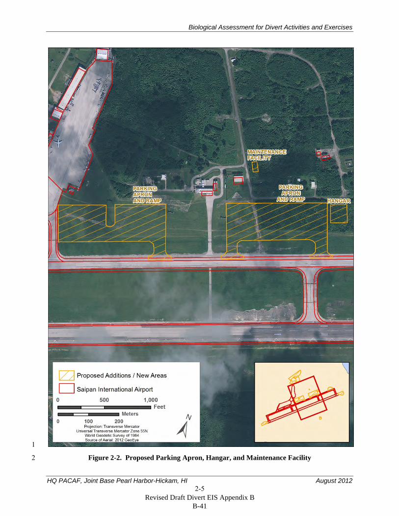
Temporary Munitions Storage Area. A standard 7-Bar earth-covered magazine would be constructed to 15 store munitions removed from diverted aircraft temporarily until the aircraft can return to its place of 16 origin or planned destination. That magazine would be located approximately 535 m (1,750 feet) south of 17 the centerline of the runway and 355 m (1,160 feet) east of the GSN Aircraft Rescue Training Area 18 (see Figure 2-3). To adhere to minimum safety criteria and standoff distances in compliance with 19 Department of Defense (DOD) Manual 6055.09-M, Ammunition and Explosives Safety Standards, and 20 based on the 534-m (1,750-foot) distance between the magazine location and the nearest inhabited 21 building (considered to be the runway centerline), the maximum quantity of munitions that could be 22 stored in the magazine would be approximately 37,650 kilograms (kg) (83,000 pounds [lbs]) net 23 explosive weight. 24
A multi-cube magazine also would be constructed as part of the temporary munitions storage area. The 25 earth-covered magazine would be approximately 29 m (95 feet) by 11 m (35 feet) and the multi-cube 26 magazine would be adjacent to the earth-covered magazine with a size of approximately 63 m (205 feet) 27 by 63 m (207 feet). The existing road infrastructure that connects the aircraft rescue training area to the 28 runway would be used as the primary munitions hauling route. 29
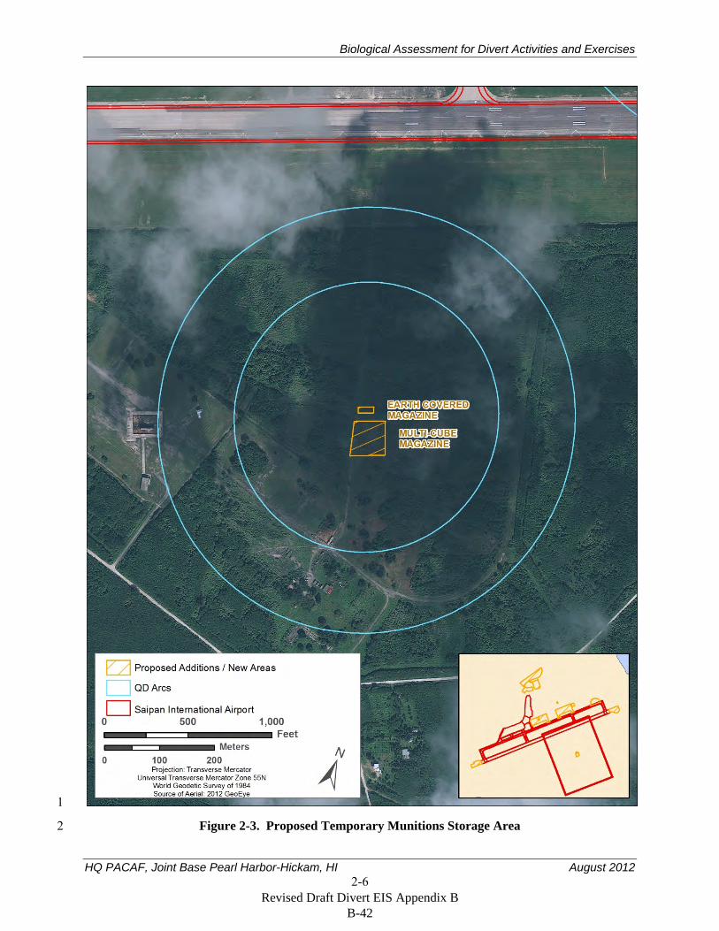
Hazardous Cargo and Arm/Disarm Pad. A hazardous cargo aircraft parking pad would be constructed 30 and used to handle munitions and other hazardous cargo from diverted aircraft safely, and would also be 31 used as an arm/disarm pad. To meet operational requirements and to adhere to minimum safety criteria 32 and standoff distances in compliance with DOD Manual 6055.09-M, DOD Ammunition and Explosives 33 Safety Standards, that pad would be located at the eastern end of the taxiway (see Figure 2-4) and the 34 maximum net explosive weight stored there would not exceed 4,990 kilograms (11,000 pounds). The pad 35 would be approximately 205 m (670 feet) by 113 m (370 feet) and would have a flow-through horseshoe 36 design to allow aircraft to taxi directly onto and off of the hazardous cargo pad from the taxiway. 37
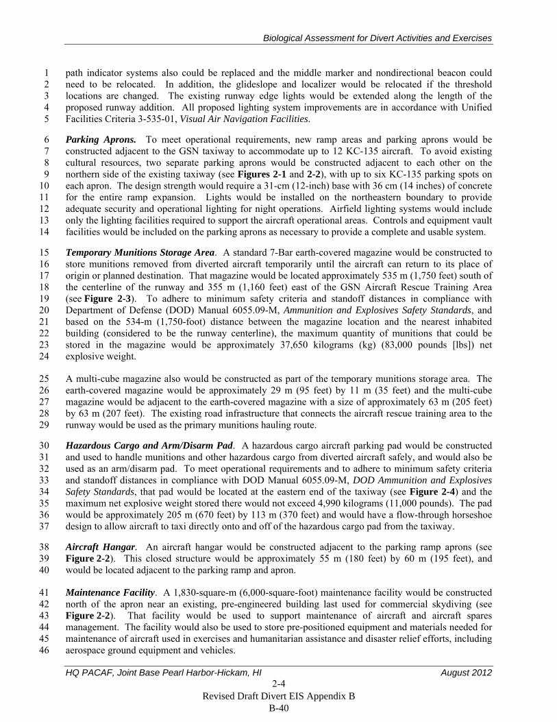
Aircraft Hangar. An aircraft hangar would be constructed adjacent to the parking ramp aprons (see 38 Figure 2-2). This closed structure would be approximately 55 m (180 feet) by 60 m (195 feet), and 39 would be located adjacent to the parking ramp and apron. 40
Maintenance Facility. A 1,830-square-m (6,000-square-foot) maintenance facility would be constructed 41 north of the apron near an existing, pre-engineered building last used for commercial skydiving (see 42 Figure 2-2). That facility would be used to support maintenance of aircraft and aircraft spares 43 management. The facility would also be used to store pre-positioned equipment and materials needed for 44 maintenance of aircraft used in exercises and humanitarian assistance and disaster relief efforts, including 45 aerospace ground equipment and vehicles. 46
Revised Draft Divert EIS Appendix B B-40
Biological Assessment for Divert Activities and Exercises
HQ PACAF, Joint Base Pearl Harbor-Hickam, HI August 2012 2-5
1
Figure 2-2. Proposed Parking Apron, Hangar, and Maintenance Facility 2
Revised Draft Divert EIS Appendix B B-41
Biological Assessment for Divert Activities and Exercises
HQ PACAF, Joint Base Pearl Harbor-Hickam, HI August 2012 2-6
1
Figure 2-3. Proposed Temporary Munitions Storage Area 2
Revised Draft Divert EIS Appendix B B-42
Biological Assessment for Divert Activities and Exercises
HQ PACAF, Joint Base Pearl Harbor-Hickam, HI August 2012 2-7
1
Figure 2-4. Proposed Hazardous Cargo Pad and Arm/Disarm Pad 2
Revised Draft Divert EIS Appendix B B-43
Biological Assessment for Divert Activities and Exercises
HQ PACAF, Joint Base Pearl Harbor-Hickam, HI August 2012 2-8
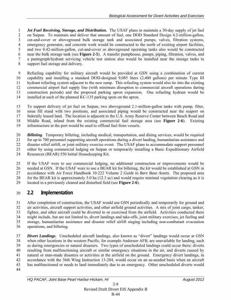
Jet Fuel Receiving, Storage, and Distribution. The USAF plans to maintain a 30-day supply of jet fuel 1 on Saipan. To maintain and deliver that amount of fuel, one DOD Standard Design 4.2-million-gallon, 2 cut-and-cover or aboveground bulk storage tank and associated pumps, valves, filtration systems, 3 emergency generator, and concrete work would be constructed to the north of existing airport facilities, 4 and two 0.42-million-gallon, cut-and-cover or aboveground operating tanks also would be constructed 5 near the bulk storage tank (see Figure 2-5). A transfer pumphouse, pumps, piping, filtration, valves, and 6 a pantograph/hydrant servicing vehicle test station also would be installed near the storage tanks to 7 support fuel storage and delivery. 8
Refueling capability for military aircraft would be provided at GSN using a combination of current 9 capability and installing a standard DOD-designed 9,085 liters (2,400 gallons) per minute Type III 10 hydrant refueling system adjacent to the new ramp. This refueling system would also tie into the existing 11 commercial airport fuel supply line (with minimum disruption to commercial aircraft operations during 12 construction periods) and the proposed parking apron expansion. One refueling hydrant would be 13 installed at each of the planned KC-135 parking spots on the apron. 14
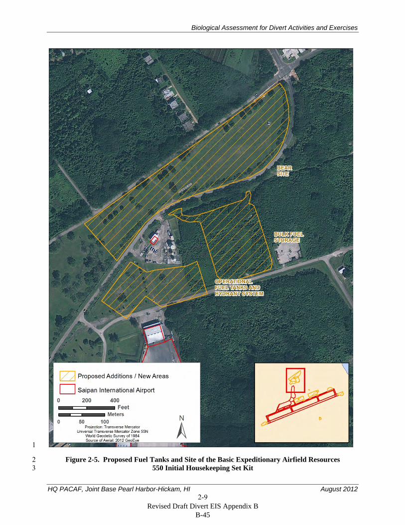
To support delivery of jet fuel on Saipan, two aboveground 2.1-million-gallon tanks with pump, filter, 15 issue fill stand with two positions, and associated piping would be constructed near the seaport on 16 federally leased land. The location is adjacent to the U.S. Army Reserve Center between Beach Road and 17 Middle Road, inland from the existing commercial fuel storage area (see Figure 2-6). Existing 18 infrastructure at the port would be used to offload fuel from vessels. 19
Billeting. Temporary billeting, including medical, transportation, and dining services, would be required 20 for up to 700 personnel supporting aircraft operations during a divert landing, humanitarian assistance and 21 disaster relief airlift, or joint military exercise event. The USAF plans to accommodate support personnel 22 either by using commercial lodging on Saipan or temporarily installing a Basic Expeditionary Airfield 23 Resources (BEAR) 550 Initial Housekeeping Kit. 24
If the USAF were to use commercial lodging, no additional construction or improvements would be 25 needed at GSN. If the USAF were to use a BEAR kit for billeting, the kit would be established at GSN in 26 accordance with Air Force Handbook 10-222 Volume 2 Guide to Bare Base Assets. The proposed area 27 for the BEAR kit is approximately 5.0 ha (12.3 ac) and would require minimal vegetation clearing as it is 28 located in a previously cleared and disturbed field (see Figure 2-6). 29
2.2 Implementation 30
After completion of construction, the USAF would use GSN periodically and temporarily for ground and 31 air activities, aircraft support activities, and other airfield ground activities. A mix of joint cargo, tanker, 32 fighter, and other aircraft could be diverted to or exercised from the airfield. Activities conducted there 33 might include, but are not limited to, divert landings and take-offs, joint military exercises, jet fueling and 34 storage, humanitarian assistance and disaster relief airlift staging including non-combatant evacuation 35 operations, and billeting. 36
Divert Landings. Unscheduled aircraft landings, also known as “divert” landings would occur at GSN 37 when other locations in the western Pacific, for example Andersen AFB, are unavailable for landing, such 38 as during emergencies or natural disasters. Two types of unscheduled landings could occur there: diverts 39 resulting from malfunctioning aircraft or similar emergency situations in the air, and diverts caused by 40 natural or man-made disasters or activities at the airfield on the ground. Emergency divert landings, in 41 accordance with the 36th Wing Instruction 13-204, would occur on an as-needed basis when an aircraft 42 has malfunctioned or needs to land immediately due to an emergency. Other unscheduled diverts would 43 44
Revised Draft Divert EIS Appendix B B-44
Biological Assessment for Divert Activities and Exercises
HQ PACAF, Joint Base Pearl Harbor-Hickam, HI August 2012 2-9
1
Figure 2-5. Proposed Fuel Tanks and Site of the Basic Expeditionary Airfield Resources 2 550 Initial Housekeeping Set Kit 3
Revised Draft Divert EIS Appendix B B-45
Biological Assessment for Divert Activities and Exercises
HQ PACAF, Joint Base Pearl Harbor-Hickam, HI August 2012 2-10
1
Figure 2-6. Proposed Site Plan for Two Fuel Tanks at the Port of Saipan 2
Revised Draft Divert EIS Appendix B B-46
Biological Assessment for Divert Activities and Exercises
HQ PACAF, Joint Base Pearl Harbor-Hickam, HI August 2012 2-11
occur when the scheduled or planned location for landing is no longer accessible or operational, such as 1 during typhoons, earthquakes, or other natural or man-made disasters. During a divert event when the 2 scheduled or planned location for landing is no longer accessible or operational, the aircraft could 3 continue to operate from the divert airport for up to 30 days until a more permanent home base is 4 established. Aircraft conducting divert landings at the airfield could require refueling, maintenance, 5 temporary munitions download and storage, and billeting support. 6
Humanitarian Airlift Staging. Humanitarian airlift staging, including non-combatant evacuation 7 operations, would occur at GSN in the event of an emergency or disaster. Examples of this type of 8 operation include Operation Tomodachi, the DOD relief effort implemented following the 9 2011 earthquake and tsunami in Japan and Operation Fiery Vigil following the 1991 eruption of Mount 10 Pinatubo in the Philippines resulting in the evacuation of 20,000 people. For Operation Tomodachi, DOD 11 officials reported that at least 20 U.S. naval ships, 140 aircraft, and approximately 20,000 military 12 personnel were involved in humanitarian assistance and disaster relief efforts in and around Japan. At 13 least 227 tons of relief supplies and humanitarian supplies were delivered to Japan. For Operation Fiery 14 Vigil, Clark AFB was evacuated, and more than 20 U.S. Naval ships and their personnel sortied from 15 Subic Bay Naval Base to evacuate more than 20,000 personnel to Andersen AFB for further transport to 16 safe havens. This operation included around-the-clock arrivals from the Philippines, processing through 17 U.S. Immigration screening, and around-the-clock departures to cities of safe haven. 18
Emergency responses to natural disasters of this nature would require pre-planning and exercising for the 19 potential contingency. The joint military exercises required to prepare for and execute humanitarian 20 airlift and disaster relief missions in real world situations are described in the following sections. 21
Joint Military Exercises. A limited number of scheduled joint, combined, and unit-level military training 22 activities and exercises, as described and analyzed in the Mariana Islands Range Complex EIS (DON 23 2010) and associated Biological Opinions (USFWS 2010a; NMFS 2011), would occur at GSN. Those 24 exercises would focus on real-world proficiency in sustaining joint forces and detecting, tracking, and 25 engaging units at sea, in the air, and on land in response to a wide range of missions. 26
Joint military exercises are an important opportunity to bring together multi-service and multi-national 27 platforms that do not always have the opportunity to train or exercise collectively. The U.S. Navy, 28 USAF, U.S. Marine Corp, and military from other countries operate a variety of combat and 29 combat-support aircraft designed to meet joint and multi-national training objectives for many exercises. 30 These joint and multinational exercises are commonly referred to as joint-combined exercises. The 31 United States routinely deploys forces to train in the western Pacific. Joint and combined exercises and 32 training maintain a stabilizing presence in the region, while allowing U.S. forces and other nations to 33 practice joint-combined skills in peacetime to prepare for success during a contingency. 34
Examples of typical combined exercises include Valiant Shield and Cope North. Valiant Shield occurs 35 biannually and usually takes place in September. This exercise involves land and maritime forces from 36 U.S. Navy, USAF, and U.S. Marine Corp, combined with multi-national forces, including observers from 37 the Pacific Rim nations. Cope North occurs annually and typically takes place in mid-February and also 38 might include multi-national forces. Aircraft and personnel participating in these combined exercises 39 would be temporarily located at and operate from GSN for a combined total of about 60 days per year. 40 No more than 700 personnel would participate in exercises at GSN at any given time, with a typical 41 exercise population being a 12-ship fighter package of 145 to 170 personnel. In addition, unit-level 42 training would also occur at GSN to exercise the capability to conduct divert landings and humanitarian 43 airlift staging. 44
Jet Fuel Receiving, Storage, and Distribution. Receipt of jet fuel at the Port of Saipan would be through 45 the existing port commercial facilities. The ability to store fuel and transfer fuel from the receiving port 46
Revised Draft Divert EIS Appendix B B-47
Biological Assessment for Divert Activities and Exercises
HQ PACAF, Joint Base Pearl Harbor-Hickam, HI August 2012 2-12
to the airfield would be developed. Once these elements are constructed, as discussed in Section 2.1.1.5, 1 they would be operated in support of divert landings, military exercises, and humanitarian assistance and 2 disaster relief efforts. 3
Jet fuel would be offloaded at the existing fuel offloading facility at the Saipan seaport from vessels that 4 are capable of navigating the harbor. Fuel would be offloaded into the two 2.1-million-gallon bulk 5 storage tanks to be constructed adjacent to the seaport (see Figure 2-6). Standard fuel transfer tank trucks 6 would be used to transfer fuel over existing paved roads from the port to the 4.2-million-gallon bulk 7 storage tank at the airport. It would take six tank trucks (37,855 liters [10,000 gallons] each) 14 days 8 working approximately 10 hours per day to fill the bulk storage tank at the airport. During scheduled 9 joint military exercises, bulk jet fuel at the airport bulk tank would be transferred to one of two operating 10 tanks, and the fuel would then be transferred to fuel tanker aircraft or other aircraft taking part in the 11 exercises. 12
Billeting. Temporary billeting would be required for up to 700 personnel that would support aircraft 13 operations at GSN during a divert landing, humanitarian airlift, or military exercise event. The USAF 14 plans to accommodate support personnel either by using commercial lodging on Saipan or a BEAR kit. If 15 the USAF were to use commercial lodging, the USAF and PACAF would enter into agreements with 16 local hotels to accommodate personnel in commercial lodging during planned activities such as exercises, 17 and local facilities and modular trailers would be used to conduct airfield support activities, such as 18 administrative functions. 19
If the USAF were to use a BEAR kit for billeting, it would include about 45 billet tents, showers, latrines, 20 12 administrative shelters, 2 Power Pro shelters, an alert shelter, and a mortuary. A 920-kilowatt 21 generator set and fuel bladders for the generators would also be installed. 22
The BEAR kit would be installed away from the existing taxiway and the future ramp, reducing the noise 23 level at the BEAR base, but close enough to service and support the operation. The planned area is 24 approximately 5.0 ha (12.3 ac) (see Figure 2-6). Access to the BEAR base would be through the service 25 road used to monitor and maintain the water wells in the area. A perimeter fence with two vehicular gates 26 and a pedestrian gate would surround the cantonment. An existing water source at the intersection of 27 Flame Tree Road and Airport Access Road would be used. At a minimum, a 5-cm (2-inch) waterline 28 would be installed to support the BEAR base from this location. A 21-cm (8-inch) sewer line with 29 manholes spaced 107 m (350 feet) apart would be installed from the BEAR base to the sewer main line at 30 the intersection of Flame Tree Road and Airport Access Road. 31
To operate the BEAR base on commercial power, a 1,200-kilovolt-ampere, 13.8-kilovolt to 32 4.16/2.4-kilovolt, pad-mounted transformer would be installed. Primary service to the transformer would 33 require 3-phase, 15- kilovolt cable from the nearest overhead utility to the pad-mounted transformer. 34
2.3 Action Area 35
As described further in Section 5.1, loss and degradation of nightingale reed-warbler habitat and 36 temporary disruption of breeding and other behaviors could occur at and adjacent to GSN during 37 construction of facilities and during implementation of divert activities and exercises. Noise from 38 military aircraft participating in divert activities and exercises could also temporarily disrupt the behavior 39 of nightingale reed-warblers under the flight paths at GSN. Mitigation for adverse impacts include 40 financial support provided by the USAF to conserve and manage nightingale reed-warbler habitat at the 41 Saipan Upland Mitigation Bank, located in the Marpi region on the northeastern portion of Saipan. 42 Because adverse impacts and mitigation could occur on the northern and southern portions of Saipan, the 43 action area is defined as the entire Island of Saipan. 44
Revised Draft Divert EIS Appendix B B-48
Biological Assessment for Divert Activities and Exercises
HQ PACAF, Joint Base Pearl Harbor-Hickam, HI August 2012 2-13
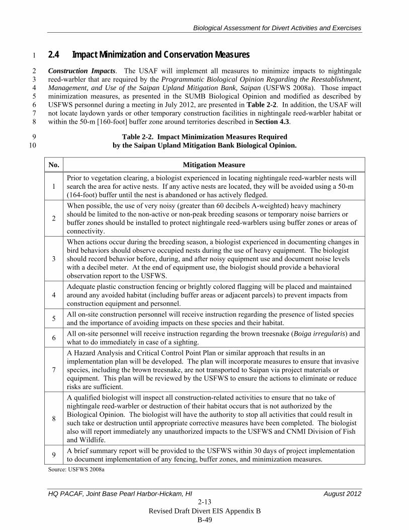
2.4 Impact Minimization and Conservation Measures 1
Construction Impacts. The USAF will implement all measures to minimize impacts to nightingale 2 reed-warbler that are required by the Programmatic Biological Opinion Regarding the Reestablishment, 3 Management, and Use of the Saipan Upland Mitigation Bank, Saipan (USFWS 2008a). Those impact 4 minimization measures, as presented in the SUMB Biological Opinion and modified as described by 5 USFWS personnel during a meeting in July 2012, are presented in Table 2-2. In addition, the USAF will 6 not locate laydown yards or other temporary construction facilities in nightingale reed-warbler habitat or 7 within the 50-m [160-foot] buffer zone around territories described in Section 4.3. 8
Table 2-2. Impact Minimization Measures Required 9 by the Saipan Upland Mitigation Bank Biological Opinion. 10
No. Mitigation Measure
1 Prior to vegetation clearing, a biologist experienced in locating nightingale reed-warbler nests will search the area for active nests. If any active nests are located, they will be avoided using a 50-m (164-foot) buffer until the nest is abandoned or has actively fledged.
2
When possible, the use of very noisy (greater than 60 decibels A-weighted) heavy machinery should be limited to the non-active or non-peak breeding seasons or temporary noise barriers or buffer zones should be installed to protect nightingale reed-warblers using buffer zones or areas of connectivity.
3
When actions occur during the breeding season, a biologist experienced in documenting changes in bird behaviors should observe occupied nests during the use of heavy equipment. The biologist should record behavior before, during, and after noisy equipment use and document noise levels with a decibel meter. At the end of equipment use, the biologist should provide a behavioral observation report to the USFWS.
4 Adequate plastic construction fencing or brightly colored flagging will be placed and maintained around any avoided habitat (including buffer areas or adjacent parcels) to prevent impacts from construction equipment and personnel.
5 All on-site construction personnel will receive instruction regarding the presence of listed species and the importance of avoiding impacts on these species and their habitat.
6 All on-site personnel will receive instruction regarding the brown treesnake (Boiga irregularis) and what to do immediately in case of a sighting.
7
A Hazard Analysis and Critical Control Point Plan or similar approach that results in an implementation plan will be developed. The plan will incorporate measures to ensure that invasive species, including the brown treesnake, are not transported to Saipan via project materials or equipment. This plan will be reviewed by the USFWS to ensure the actions to eliminate or reduce risks are sufficient.
8
A qualified biologist will inspect all construction-related activities to ensure that no take of nightingale reed-warbler or destruction of their habitat occurs that is not authorized by the Biological Opinion. The biologist will have the authority to stop all activities that could result in such take or destruction until appropriate corrective measures have been completed. The biologist also will report immediately any unauthorized impacts to the USFWS and CNMI Division of Fish and Wildlife.
9 A brief summary report will be provided to the USFWS within 30 days of project implementation to document implementation of any fencing, buffer zones, and minimization measures.
Source: USFWS 2008a
Revised Draft Divert EIS Appendix B B-49
Biological Assessment for Divert Activities and Exercises
HQ PACAF, Joint Base Pearl Harbor-Hickam, HI August 2012 2-14
Habitat Loss. The USAF will purchase one credit from the SUMB for each nightingale reed-warbler 1 territory that is cleared of vegetation during project construction. As required by the SUMB Biological 2 Opinion, if more than 29 percent of a territory is cleared or otherwise destroyed, the USAF will purchase 3 one credit to compensate for the loss of that territory. If less than 29 percent of a territory is directly 4 affected, the USAF will purchase a partial credit equal to the proportion of the territory cleared of 5 vegetation or otherwise disturbed. 6
As described in Section 2, the USAF plans to construct facilities at GSN in stages and, depending on 7 mission needs and Congressional authorization and appropriations, some project elements might not be 8 completed on Saipan. The USAF, therefore, cannot state with certainty at this time whether or how many 9 territories would be directly or indirectly affected by construction of facilities at GSN. Prior to the 10 construction start each fiscal year or phase of construction, the USAF will present a construction plan to 11 the USFWS and CNMI Division of Fish and Wildlife and will purchase the number of credits required to 12 mitigate for the direct impacts of construction activities planned for that year or phase. 13
To mitigate for the indirect impacts on nightingale reed-warblers during the implementation phase of this 14 project (see Section 5.1.2), the USAF will purchase credits or otherwise fund conservation activities at 15 the SUMB conservation area as required in the SUMB Biological Opinion. That mitigation will be 16 implemented prior to initiation of the first training exercise at GSN that results in the level of indirect 17 impacts to be mitigated, as determined during the formal consultation. 18
Invasive Species. To reduce or eliminate the spread of brown treesnakes and other nonnative species 19 during development, maintenance, and operation of facilities at GSN, the USAF will develop, submit to 20 the USFWS for review, and implement Hazard Analysis and Critical Control Point Plans (or equivalent) 21 as required by the SUMB Biological Opinion, including plans for receipt of materials and equipment 22 shipped to Saipan for construction and implementation of the project. Those Plans, and all associated 23 implementing instructions developed by the USAF, Joint Region Marianas, and other involved military 24 organizations, will be compliant with the invasive species interdiction and control requirements in the 25 Duncan Hunter National Defense Authorization Act, Public Law 110-417, Section 316 (2009), and DOD 26 Defense Transportation Regulations, Chapter 505 protocols. At a minimum, those plans and 27 implementing instructions will address the following as appropriate, based on the specifics of each 28 activity. 29
One-hundred percent inspection of all outgoing aircraft and materials from Andersen Air Force 30 Base and Naval Base Guam, as currently required by Joint Region Marianas Instruction 5090.4, 31 using trained quarantine officers and dog detection teams, and redundant inspections conducted 32 on Saipan during project development and training activities. 33
Protocols and procedures for inspection of commercial materials and equipment being shipped 34 from elsewhere on Guam, and from other locations, to GSN. 35
Use existing or new, temporary or permanent, snake-free quarantine areas on Saipan for 36 inspection of cargo traveling from Guam to Saipan when applicable. Those areas will be subject 37 to (1) multiple day and night searches with appropriately trained interdiction canine teams that 38 meet performance standards, (2) snake trapping, and (3) visual inspections for snakes. 39
Support of rapid response actions to brown treesnake sightings at GSN or the fuel facility at the 40 Port of Saipan. 41
Invasive species awareness training for all military and contractor personnel. 42
As stated in Section 1.2, this biological assessment does not address air warfare and air logistics training 43 that would occur in the Mariana Islands Range Complex or elsewhere by aircraft temporarily operating 44
Revised Draft Divert EIS Appendix B B-50
Biological Assessment for Divert Activities and Exercises
HQ PACAF, Joint Base Pearl Harbor-Hickam, HI August 2012 2-15
from GSN. Impacts on ESA-listed species from those activities, and the requirements for the control and 1 interdiction of invasive species, have been addressed in Biological Opinions developed by the U.S. Fish 2 and Wildlife Service (USFWS 2010a) and National Oceanic and Atmospheric Administration Fisheries 3 Service (formerly National Marine Fisheries Service) (NMFS 2011). Section 7 consultations also have 4 been completed, and requirements for invasive species control and interdiction have been developed, for 5 other ongoing for military training and operations in the Mariana Islands (e.g., USFWS 2006a, 2008b). 6 Those control and interdiction requirements include the following. 7
Direct routing of personnel and cargo to GSN to avoid Guam seaports and airfields when possible 8
Inspections of all outgoing aircraft and equipment from Guam and redundant inspections on 9 Saipan 10
Establishment and operation of snake-free quarantine areas when applicable 11
Environmental education of personnel 12
Self inspection of equipment by service members 13
Pathway analyses for all activities or groups of activities 14
Involvement of the USFWS, Department of Agriculture, and other agencies in the development 15 and implementation of protocols and practices 16
Participation in the development and implementation of the Regional Biosecurity Plan. 17
The above requirements for control and interdiction of invasive species are incorporated into 18 implementing instructions developed by Joint Region Marianas and other involved military organizations, 19 and those instructions will be followed for all military training activities and exercises on and from GSN. 20 The instructions are updated as necessary to incorporate changes resulting from new policies and 21 practices and to include revised or additional requirements resulting from applicable Section 7 22 consultations. 23
The USAF acknowledges that there is a limited availability of inspectors, trained dogs, and quarantine 24 facilities and equipment on Guam and in the CNMI. Planning for training exercises generally begins 25 months prior to implementation of an exercise, and planning for complex training that would require a 26 substantial number of inspectors, quarantine areas, or other personnel or equipment for control and 27 interdiction of invasive species generally would begin more than a year in advance of the exercise. 28 During that planning period, the U.S. Department of Agriculture and CNMI Department of Land and 29 Natural Resources (the agencies responsible for conducting searches for and interdiction of brown 30 treesnakes on Guam and the CNMI, respectively), USFWS, USAF, Joint Region Marianas staff 31 responsible for managing their brown treesnake program, CNMI Department of Lands and Natural 32 Resources staff, and other participants will cooperatively identify the inspection and interdiction 33 requirements for the exercise, including the number of trained quarantine officers and dog detection 34 teams. The USAF and those other agencies will also develop plans to ensure that inspection personnel are 35 available and that all requirements can be met, and will identify the support that the USAF will need to 36 provide for the inspections. 37
Revised Draft Divert EIS Appendix B B-51
Biological Assessment for Divert Activities and Exercises
HQ PACAF, Joint Base Pearl Harbor-Hickam, HI August 2012 2-16
THIS PAGE INTENTIONALLY LEFT BLANK 1
Revised Draft Divert EIS Appendix B B-52
Biological Assessment for Divert Activities and Exercises
HQ PACAF, Joint Base Pearl Harbor-Hickam, HI August 2012 3-1
3. Status of Threatened and Endangered Species on Saipan 1
This section summarizes information on the status and ecology of four threatened or endangered species 2 that occur on Saipan. It does not discuss the Mariana fruit bat and Micronesian megapode, because, as 3 described in Section 1, the USAF has determined that developing divert capabilities and conducting 4 divert activities and exercises at GSN will have no affect on those species. 5
3.1 Nightingale Reed-Warbler 6
The following description of the nightingale reed-warbler comes primarily from the following sources, 7 which are incorporated by reference. 8
Recovery Plan for the Nightingale Reed-Warbler (USFWS 1998b) 9
Programmatic Biological Opinion Regarding the Reestablishment, Management and Use of the 10 Saipan Upland Mitigation Bank, Saipan (USFWS 2008a) 11
Nightingale Reed-Warbler 5-Year Review Summary and Evaluation (USFWS 2010b). 12
Section 4.3 describes the results of surveys conducted around GSN to determine the abundance of 13 nightingale reed-warblers in areas that could be directly and indirectly affected by the project. 14
Legal Status. The nightingale reed-warbler was listed under the ESA as endangered in 1970 15 (35 FR 18319). No critical habitat has been designated for this species. The current recovery plan for the 16 nightingale reed-warbler was published in 1998 (USFWS 1998b). 17
Description and Taxonomy. The nightingale reed-warbler is approximately 16 to 21 cm (6 to 8 inches) 18 long, grey to olive brown above, pale yellow below, and has a relatively long bill. Males are slightly 19 larger than females. This species is in the marsh warbler family Acrocephalidae (USFWS 2008a). 20
Distribution and Abundance. There are three recognized subspecies of nightingale reed-warbler: 21 A. l. luscinia on Guam, Saipan, and Alamagan; A. l. nijoi on Aguiguan; and A. l. yamashinae on Pagan. 22 There is prehistoric evidence that this species also occurred on Tinian, but it does not occur there now. 23 Cibois et al. (2011) suggested that the nightingale reed-warbler on these islands might be separate species. 24
A volcanic eruption on Pagan in 1981 destroyed the only known habitat on that island and 25 A. l. yamashinae is believed to be extinct. A. l. nijoi on Aguiguan are rare and might also be extinct. 26 A. l. luscinia have been extirpated from Guam and now occur only on Saipan and Alamagan (USFWS 27 2008a, 2010b). Less than 500 individuals are believed to occur on Alamagan (USFWS 2010a, p. 40). 28
Camp et al. (2009) summarized the results of islandwide forest bird surveys on Saipan over the previous 29 three decades and reported that the number of nightingale reed-warbler detections had decreased from 287 30 in 1982, to 190 in 1987, to 118 in 2007. Density estimates per square kilometer of suitable habitat 31 subsequently declined as a result of decreased detections in the respective survey years (58 birds, 1982; 32 40 birds, 1987; 23 birds, 2007). Based on the 2007 islandwide forest bird survey, the population estimate 33 for nightingale reed-warblers on Saipan is 2,742 (Camp et al. 2009). 34
Habitat. Nightingale reed-warblers are found on Saipan in a variety of vegetation associations and are 35 most abundant in areas of dense understory, including open, secondary, and tangantangan forests; 36 elephant grass (Pennisetum purpureum) meadows; marshes; and wetland and forest edges. The species is 37 uncommon or absent from residential areas, golf courses, limestone forests, beach strand, and swordgrass 38
Revised Draft Divert EIS Appendix B B-53
Biological Assessment for Divert Activities and Exercises
HQ PACAF, Joint Base Pearl Harbor-Hickam, HI August 2012 3-2
(Miscanthus floridulus) savannah (Craig 1992, Mosher and Fancy 2002, USFWS 2008a, Camp et al. 1 2009). 2
Diet. The nightingale reed-warbler feeds primarily on insects and their larvae. Their diet also includes 3 geckos, lizards, spiders, and snails. Nestlings are fed a variety of food items, including small caterpillars, 4 large spiders, grasshoppers, skinks, geckos, ants, beetles, millipedes, moths, and praying mantids 5 (USFWS 1998b). 6
Threats. Habitat loss and degradation is a primary threat to the nightingale reed-warbler on Saipan. 7 Intensive agriculture on that island during the first half of the 20th century caused the loss of a substantial 8 amount of wetland and upland habitat for this species. Much of that land has since reverted to 9 second-growth forest that is used by reed-warblers. However, many second-growth forests have been and 10 are being converted to urban development to support the large increase in the human population on 11 Saipan. The human population increased by 429 percent from 1980 to 2000 (Camp et al. 2009, 12 USFWS 2010b). 13
The establishment of the brown treesnake on Saipan would have serious impacts on this species. USFWS 14 (2010b) stated that the spread of the brown treesnake to Saipan would likely cause the extirpation of 15 nightingale reed-warblers from that island. The brown treesnake was the primary cause of the extirpation 16 of forest tree birds, including the nightingale reed-warbler, from Guam. 17
Predation by introduced species such as feral cats (Felis catus) and rats (Rattus spp.) could be reducing 18 the reproductive success of nightingale reed-warblers. Seventy-five percent of 28 active nests that failed 19 were preyed upon by those or other species (USFWS 1998b, 2010b). 20
Other threats to this species include environmental contaminants in wetland habitat, fire in upland habitat, 21 and the possible spread of the west Nile virus to Saipan (USFWS 1998, 2010b). 22
3.2 Mariana Common Moorhen 23
The following description comes primarily from the following sources, which are incorporated by 24 reference. 25
Mariana Common Moorhen Recovery Plan (USFWS 1992) 26
Distribution and Abundance of the Mariana Subspecies of the Common Moorhen (Takano and 27 Haig 2004) 28
Mariana Common Moorhen 5-Year Review Summary and Evaluation (USFWS 2009b). 29
Legal Status. The Mariana common moorhen was listed under the ESA as endangered in 1984 30 (49 FR 33881). No critical habitat has been designated for this species. The current recovery plan for the 31 common moorhen was published in 1992 (USFWS 1992). 32
Description and Taxonomy. The Mariana common moorhen is a slate-black member of the Rallidae 33 family, and is about 36 cm (14 inches) in length. The distinguishing physical characteristics of adult birds 34 include a red bill and frontal shield, white undertail coverts, a white line along the flank, and long 35 olive-green legs with large unwebbed feet. Males and females are nearly identical in appearance and are 36 difficult to distinguish from each other (USFWS 1992). 37
Distribution and Abundance. This species occurs on Guam, Tinian, Saipan, and rarely on Rota. The 38 USFWS (1992) identified two primary wetlands on Saipan that are used by common moorhens: Lake 39
Revised Draft Divert EIS Appendix B B-54
Biological Assessment for Divert Activities and Exercises
HQ PACAF, Joint Base Pearl Harbor-Hickam, HI August 2012 3-3
Susupe and Puntan Muchot/Garapan. Takano and Haig (2004) counted 154 moorhen at 18 locations on 1 Saipan in 2001. 2
Habitat. The moorhen inhabits emergent vegetation of natural and man-made freshwater lakes, marshes 3 and swamps. The key characteristics of moorhen habitat appear to be a combination of deep (greater than 4 60 cm [24 inches]) marshes with robust emergent vegetation and equal areas of cover and open water. 5 This species is known to be wary and closely associated with cover provided by edge vegetation 6 (USFWS 1992, Takano and Haig 2004). 7
Diet. Moorhens feed on plant and animal matter in or near water. Observers have noted grass, adult 8 insects, and insect larvae in moorhen stomachs. Moorhen are probably opportunistic feeders, so their diet 9 varies among areas (USFWS 1992). 10
Threats. The loss of wetlands is the most important factor in the decline of common moorhens. Many 11 wetlands in the Mariana Islands have been filled or dredged for commercial or residential development. 12 Additionally, there has been a decline of traditional wetland agricultural practices such as taro and rice 13 cultivation, which has diminished the amount of wetlands available to the moorhen. Some wetlands have 14 experienced accelerated sedimentation due to land clearing, road building, grassland fires, and other 15 human activities. Predation by nonnative species such as rats and monitor lizards (Varanus indicus) 16 could also be adversely affecting this species (USFWS 1992, 2009b). 17
3.3 Mariana Swiftlet 18
The following description of the Mariana swiftlet comes primarily from the following sources, which are 19 incorporated by reference. 20
Recovery Plan for the Mariana Islands Population of the Vanikoro Swiftlet (USFWS 1991) 21
Relative Abundance and Distribution of Mariana Swiftlets in the Northern Mariana Islands (Cruz 22 et al. 2008) 23
Mariana Swiftlet or Chachaguak 5-Year Review Summary and Evaluation (USFWS 2010c). 24
Legal Status. The Mariana swiftlet was listed under the ESA as endangered in 1984 (49 FR 33881). No 25 critical habitat has been designated for this species. The current recovery plan for the Mariana swiftlet 26 was published in 1991(USFWS 1991). 27
Description and Taxonomy. The Mariana swiftlet has sooty black upper parts with a slightly paler rump. 28 The underparts are dark gray but with a brownish tinge. Some white is present at the base of the feathers 29 in the loreal region. The plumage of both sexes is alike. The average weight of adult swiftlets is 30 7.4 grams (0.3 ounces). The swiftlet is in the Apodidae family (USFWS 1991). 31
Distribution and Abundance. Swiftlets currently are known to occur on Guam, Aguiguan, and Saipan 32 (Cruz et al. 2008). The population in 2010 was estimated to be more than 5,000, with most located on 33 Saipan. This species currently nests in at least 10 caves on Saipan (MES 2012). 34
Habitat. On Saipan, swiftlets nest and roost in caves and their preferred foraging habitats include areas 35 over forests, clifflines, grassy hills, and grassy ravines (USFWS 1991, 2010c). 36
Diet. Swiftlets mostly eat insects that they catch while in flight (USFWS 1991). On Aguiguan, swiftlets 37 consumed primarily hymenopterans and hemipternas (Valdez et al. 2011). 38
Revised Draft Divert EIS Appendix B B-55
Biological Assessment for Divert Activities and Exercises
HQ PACAF, Joint Base Pearl Harbor-Hickam, HI August 2012 3-4
Threats. Human disturbance at nesting colonies is an important threat to this species. Other threats 1 include predation by brown treesnakes (on Guam) and other nonnative predators, and the presence of 2 cockroaches and wasps in nest caves (USFWS 1991, 2010c). 3
3.4 Green Sea Turtle 4
The following description of the green sea turtle comes primarily from the following sources, which are 5 incorporated by reference. 6
Recovery Plan for U.S. Pacific Populations of the East Pacific Green Turtle (NMFS 1998) 7
An Assessment of the Sea Turtles and Their Marine and Terrestrial Habitats at Saipan, 8 Commonwealth of the Northern Mariana Islands (Kolinski et al. 2001) 9
Green Turtle Nesting Sites and Sea Turtle Legislation Throughout Oceania (Maison et al. 2010). 10
Legal Status. The green sea turtle was classified as threatened under the ESA in 1978. The breeding 11 populations in Florida and the Pacific coast of Mexico are classified as endangered; elsewhere the species 12 is listed as threatened (43 FR 32800). No critical habitat has been designated for this species in the 13 Pacific Ocean. The current recovery plan for the Pacific population of the green turtle was published in 14 1998 (NMFS 1998). 15
Description and Taxonomy. Green sea turtles have a smooth top shell with shades of black, gray, green, 16 brown, and yellow; their bottom shell is yellowish white. Adults can weigh 136 to 158 kg (300 to 17 350 lbs) and hatchlings weigh about 0.02 kg (0.05 lbs). Adults can reach 1 m (3 feet) in length and 18 hatchlings are about 5 cm (2 inches) long. Green sea turtles are in the Cheloniidae family. 19
Distribution and Abundance. The green turtle is globally distributed and generally found in tropical and 20 subtropical waters along continental coasts and islands between 30° north and 30° south latitude. This 21 species generally nests on Saipan from March through August with some year-round nesting documented. 22 It is estimated that possibly fewer than 10 individual turtles nest annually on Saipan, Tinian, and Rota. In 23 1999, turtle activity was documented at eight beaches, with six nests found on a total of three beaches 24 (Kolinski et al. 2001). Monitoring of nesting activity on Saipan since 1999 has documented 4 to 18 nests 25 per year. At least five beaches on Saipan have been monitored somewhat consistently over the past 26 5 years: Bird Island, Wing, Tank, Lao Lao Bay, and Obyan beaches (Maison et al. 2010). 27
Habitat. Green turtles primarily use three types of habitat: beaches for nesting, open ocean convergence 28 zones, and coastal areas for feeding. 29
Threats. The principal cause of the historical, worldwide decline of the green turtle is long-term harvest 30 of eggs and adults on nesting beaches and harvest of juveniles and adults on feeding grounds. These 31 harvests continue in some areas of the world and compromise efforts to recover this species. Incidental 32 capture in fishing gear, primarily in gillnets, but also in trawls, traps and pots, longlines, and dredges is a 33 serious ongoing source of mortality. Green turtles are also threatened in some areas of the world by the 34 disease fibropapillomatosis. 35
Revised Draft Divert EIS Appendix B B-56
Biological Assessment for Divert Activities and Exercises
HQ PACAF, Joint Base Pearl Harbor-Hickam, HI August 2012 4-1
4. Environmental Baseline 1
This section describes the current environment in the action area as influenced by past and present 2 impacts of human activities. The current environment, impacts of human activities on Saipan, and current 3 status of the nightingale reed-warbler on the island, have been described in detail in the following reports, 4 which are incorporated here by reference. 5
Recovery Plan for the Nightingale Reed-Warbler (USFWS 1998b) 6
Final Biological Opinion for the Proposed Rehabilitation of Runway 07/25 and Relocation of 7 Water Catchment Reservoir, Saipan International Airport (USFWS 2006b) 8
Programmatic Biological Opinion Regarding the Reestablishment, Management and Use of the 9 Saipan Upland Mitigation Bank, Saipan (USFWS 2008a) 10
Nightingale Reed-Warbler 5-Year Review Summary and Evaluation (USFWS 2010b) 11
Biological Report: Saipan International Airport Project Site, Saipan, CNMI (MES 2012) 12
Draft EIS for Divert Activities and Exercises, Guam and Commonwealth of the Northern Mariana 13 Islands (USAF 2012). 14
To support delivery of jet fuel on Saipan, two aboveground 2.1-million-gallon tanks and associated 15 infrastructure would be installed on previously cleared and developed land at the Port of Saipan 16 (see Figure 2-6). A portion of that flat site has a deteriorating asphalt surface, and fine limestone gravel 17 has been spread across most of the remainder of the site. There is a thin stand of dense, weedy vegetation 18 around the perimeter of the site; vegetation in the remainder of the area is sparse. This developed site 19 does not contain suitable habitat for nightingale reed-warblers or other ESA-listed species, and is not 20 described further in this section. 21
The remainder of this section describes in detail the environment on and around GSN, and the results of 22 surveys conducted to determine the presence of ESA-listed species and other biological resources in that 23 area. GSN is situated on approximately 285 ha (700 ac) in the southern portion of the Saipan (see 24 Figure 2-1). It is owned and operated by the Commonwealth Ports Authority under the Commonwealth 25 Ports Authority Act (Public Law 2-48), which was enacted in October 1981. The 2002 Saipan 26 International Airport Master Plan outlines the development strategy for the airport (Commonwealth Ports 27 Authority 2002). GSN facilities currently include a 2,650-m- (8,700-foot-) long runway and adjacent 28 taxiway and parking ramps and a terminal, cargo-handling facility, parking lots, drainage detention basin, 29 and other operational facilities to the north of the runway. GSN property to the south of the runway is 30 undeveloped and leased for cattle grazing. The land surrounding the airport is used primarily for 31 agricultural, recreation, and conservation. 32
Large portions of areas to the north and south of the current airport, including areas where the USAF 33 would construct facilities and implement divert activities and exercises, were developed before and during 34 World War II as aircraft parking areas, taxiways, and other airfield-related structures. Degraded aircraft 35 parking surfaces and other structures are still visible in some areas, although much of that area is now 36 covered with tangantangan. 37
The most recent development at GSN that affected listed species, and required consultation under 38 Section 7 of the ESA occurred after 2006. That consultation covered rehabilitation of the GSN runway 39 and relocation of a water catchment reservoir from between the runway and taxiway to its current position 40 to the north of the runway. The USFWS estimated that disturbance of about 10 ha (25 ac) for those 41 activities would directly affect nightingale reed-warblers in two territories and indirectly affect 42
Revised Draft Divert EIS Appendix B B-57
Biological Assessment for Divert Activities and Exercises
HQ PACAF, Joint Base Pearl Harbor-Hickam, HI August 2012 4-2
reed-warblers in three other territories (USFWS 2006b). No other listed threatened or endangered species 1 were adversely affected by the project. 2
4.1 Vegetation 3
Vegetation communities at and around GSN were mapped and characterized during field surveys 4 conducted during October 2011. Vegetation community types observed at and surrounding the sites 5 where construction and improvements would occur include tangantangan forest, mowed fields, park 6 areas, and lands used for agriculture and grazing (see Figure 4-1), and are described in the following 7 paragraphs. 8
Tangantangan Forest. Canopy vegetation in tangantangan forest is characterized by a near monoculture 9 of nonnative tangantangan. The following forest tree species were most commonly observed within those 10 forests: ahgao (Premna obtusifolia), hodda, pago (Hibiscus tiliaceus), sumak, lada (Morinda citrifolia), 11 and papaya; and nonnative trongkon-kalaskas (Albizia lebbeck) and atbut or flame tree (Delonix 12 regia). The understory of tangantangan forest consists largely of nonnative herbaceous weeds. Common 13 species include coral berry (Rivina humilis), rosary pea (Abrus precatorius), Chinese violet (Asystasia 14 gangetica), and achyranthes (Achyranthes canescens). Gaps in the tangantangan forest and some areas of 15 canopy are blanketed by a layer of vines. These vines include the native akankang tasi (Canavalia rosea); 16 and the nonnative bittervine (Mikania micrantha), abubo (Stictocardia tilifolia), coral vine (Antigonon 17 leptopus), and ivy gourd (Coccinia grandis). Vines present in the area are stimulated by the opening up 18 of the canopy after storm disturbances and can form oppressive vine mats that retard the growth of, 19 or kill, native vegetation. 20
Mowed Fields. Mowed field habitat consists mainly of introduced grasses and herbaceous ground cover. 21 These fields occur between and around the airfield runways, taxiways, parking ramps, and associated 22 disturbed sites. They are characterized by grasses, including Bermuda grass (Cynodon dactylon), 23 crowfoot grass (Dactyloctenium aegyptium), broadleaf carpetgrass (Axonopus compressus), golden 24 beardgrass (Chrysopogon aciculatus), (Chloris sp.), and herbaceous weeds including the sensitive plant, 25 shameplant (Mimosa pudica), tropical lucerne (Stylosanthes guianensis), and white moneywort 26 (Alysicarpus vaginalis). 27
Park Areas. Parks at and near GSN are characterized by areas with grass that is mowed close to ground 28 level and that have narrow strips of ornamental trees and shrubs that have been planted primarily along 29 road edges. Grasses in park areas are characterized by Bermuda grass and golden beardgrass. 30 Ornamental trees that have been planted along road edges are characterized by atbut or flame tree and 31 several species of plumeria (Plumeria spp.). Hodda also occurs at several locations in the park areas. 32 Shrub species planted along road edges are characterized by bougainvilla (Bougainvilla sp.), lantana 33 (Lantana camara), and several species of hibiscus (Hibiscus spp.). 34
Agriculture/Grazing. Areas used for agriculture and grazing are located south of GSN within and near 35 the area where the munitions storage area would be located. That location is characterized by scrub 36 habitat with sparse trees. Adjacent areas include stands of tangantangan, grazed land, scrub habitat, and 37 agricultural plots that are fallow or planted with local crops. Grazed areas are characterized by a sparse 38 occurrence of trees including atbut or flame tree and mango (Mangifera indica) with a minor 39 occurrence of Ahgoa. Scrub habitat has a mix of shrub and herbaceous species dominated by lantana, 40 Jack-in-the-bush (Chromolaena odorata), nettleleaf velvetberry (Stachytarpheta urticifolia), and 41 romerillo (Bidens alba). Tangantangan occurs as short saplings scattered through the scrub habitat. 42
Revised Draft Divert EIS Appendix B B-58
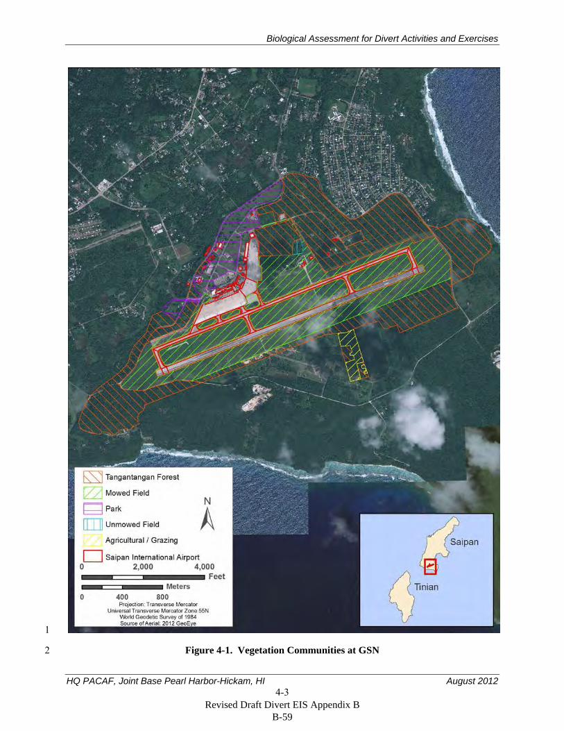
Biological Assessment for Divert Activities and Exercises
HQ PACAF, Joint Base Pearl Harbor-Hickam, HI August 2012 4-3
1
Figure 4-1. Vegetation Communities at GSN 2
Revised Draft Divert EIS Appendix B B-59
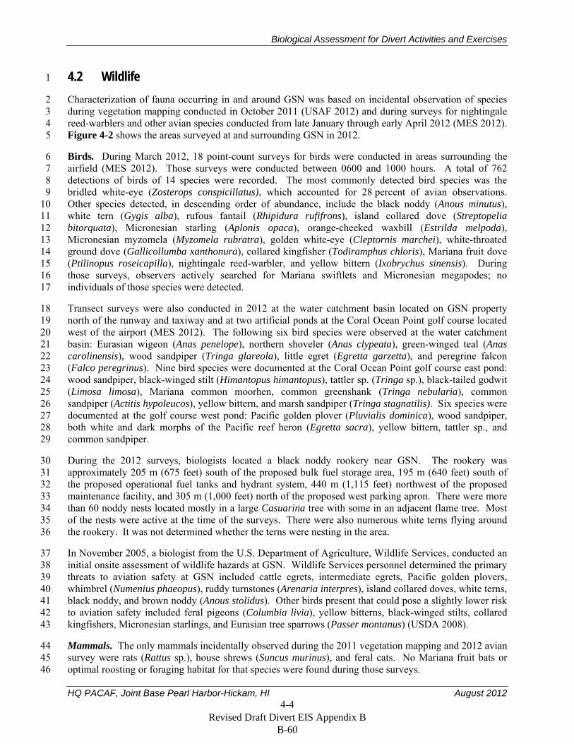
Biological Assessment for Divert Activities and Exercises
HQ PACAF, Joint Base Pearl Harbor-Hickam, HI August 2012 4-4
4.2 Wildlife 1
Characterization of fauna occurring in and around GSN was based on incidental observation of species 2 during vegetation mapping conducted in October 2011 (USAF 2012) and during surveys for nightingale 3 reed-warblers and other avian species conducted from late January through early April 2012 (MES 2012). 4 Figure 4-2 shows the areas surveyed at and surrounding GSN in 2012. 5
Birds. During March 2012, 18 point-count surveys for birds were conducted in areas surrounding the 6 airfield (MES 2012). Those surveys were conducted between 0600 and 1000 hours. A total of 762 7 detections of birds of 14 species were recorded. The most commonly detected bird species was the 8 bridled white-eye (Zosterops conspicillatus), which accounted for 28 percent of avian observations. 9 Other species detected, in descending order of abundance, include the black noddy (Anous minutus), 10 white tern (Gygis alba), rufous fantail (Rhipidura rufifrons), island collared dove (Streptopelia 11 bitorquata), Micronesian starling (Aplonis opaca), orange-cheeked waxbill (Estrilda melpoda), 12 Micronesian myzomela (Myzomela rubratra), golden white-eye (Cleptornis marchei), white-throated 13 ground dove (Gallicollumba xanthonura), collared kingfisher (Todiramphus chloris), Mariana fruit dove 14 (Ptilinopus roseicapilla), nightingale reed-warbler, and yellow bittern (Ixobrychus sinensis). During 15 those surveys, observers actively searched for Mariana swiftlets and Micronesian megapodes; no 16 individuals of those species were detected. 17
Transect surveys were also conducted in 2012 at the water catchment basin located on GSN property 18 north of the runway and taxiway and at two artificial ponds at the Coral Ocean Point golf course located 19 west of the airport (MES 2012). The following six bird species were observed at the water catchment 20 basin: Eurasian wigeon (Anas penelope), northern shoveler (Anas clypeata), green-winged teal (Anas 21 carolinensis), wood sandpiper (Tringa glareola), little egret (Egretta garzetta), and peregrine falcon 22 (Falco peregrinus). Nine bird species were documented at the Coral Ocean Point golf course east pond: 23 wood sandpiper, black-winged stilt (Himantopus himantopus), tattler sp. (Tringa sp.), black-tailed godwit 24 (Limosa limosa), Mariana common moorhen, common greenshank (Tringa nebularia), common 25 sandpiper (Actitis hypoleucos), yellow bittern, and marsh sandpiper (Tringa stagnatilis). Six species were 26 documented at the golf course west pond: Pacific golden plover (Pluvialis dominica), wood sandpiper, 27 both white and dark morphs of the Pacific reef heron (Egretta sacra), yellow bittern, tattler sp., and 28 common sandpiper. 29
During the 2012 surveys, biologists located a black noddy rookery near GSN. The rookery was 30 approximately 205 m (675 feet) south of the proposed bulk fuel storage area, 195 m (640 feet) south of 31 the proposed operational fuel tanks and hydrant system, 440 m (1,115 feet) northwest of the proposed 32 maintenance facility, and 305 m (1,000 feet) north of the proposed west parking apron. There were more 33 than 60 noddy nests located mostly in a large Casuarina tree with some in an adjacent flame tree. Most 34 of the nests were active at the time of the surveys. There were also numerous white terns flying around 35 the rookery. It was not determined whether the terns were nesting in the area. 36
In November 2005, a biologist from the U.S. Department of Agriculture, Wildlife Services, conducted an 37 initial onsite assessment of wildlife hazards at GSN. Wildlife Services personnel determined the primary 38 threats to aviation safety at GSN included cattle egrets, intermediate egrets, Pacific golden plovers, 39 whimbrel (Numenius phaeopus), ruddy turnstones (Arenaria interpres), island collared doves, white terns, 40 black noddy, and brown noddy (Anous stolidus). Other birds present that could pose a slightly lower risk 41 to aviation safety included feral pigeons (Columbia livia), yellow bitterns, black-winged stilts, collared 42 kingfishers, Micronesian starlings, and Eurasian tree sparrows (Passer montanus) (USDA 2008). 43
Mammals. The only mammals incidentally observed during the 2011 vegetation mapping and 2012 avian 44 survey were rats (Rattus sp.), house shrews (Suncus murinus), and feral cats. No Mariana fruit bats or 45 optimal roosting or foraging habitat for that species were found during those surveys. 46
Revised Draft Divert EIS Appendix B B-60
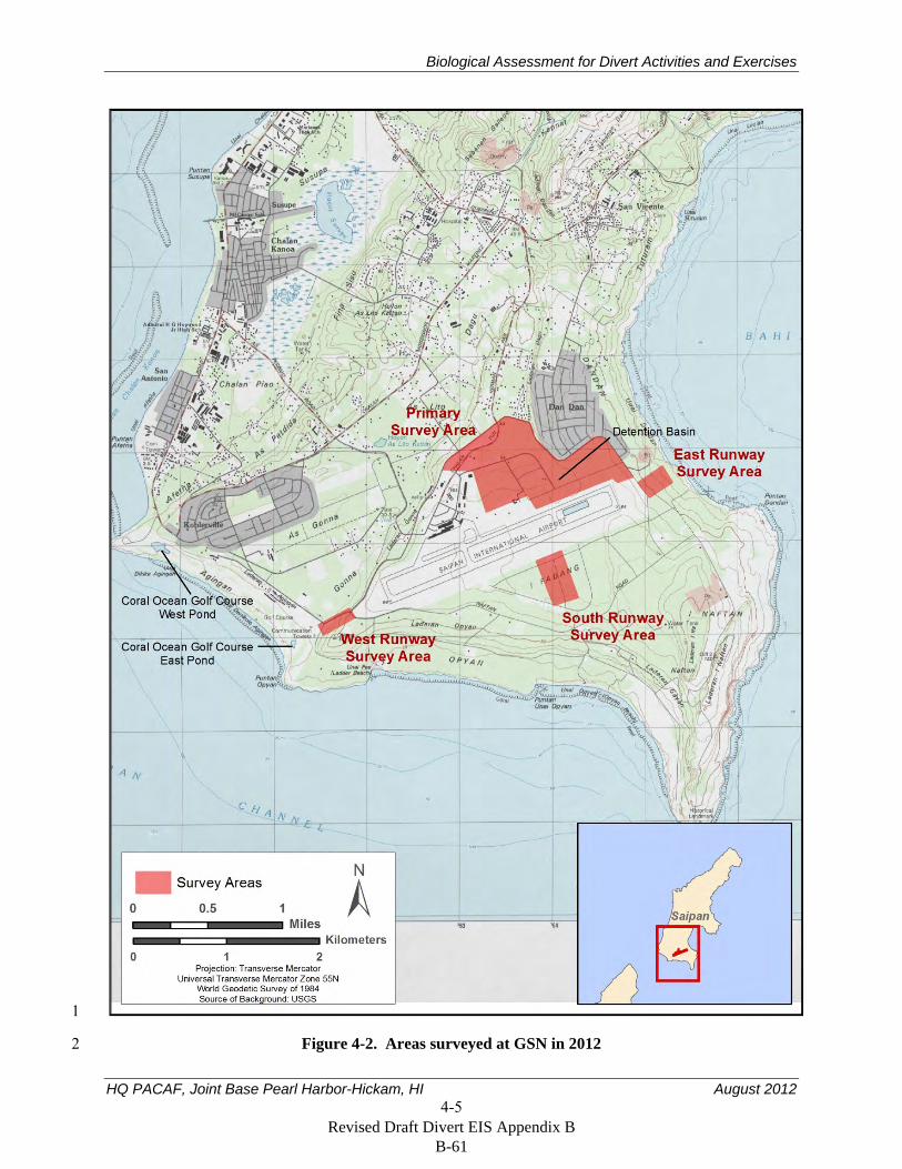
Biological Assessment for Divert Activities and Exercises
HQ PACAF, Joint Base Pearl Harbor-Hickam, HI August 2012 4-5
1
Figure 4-2. Areas surveyed at GSN in 2012 2
Revised Draft Divert EIS Appendix B B-61
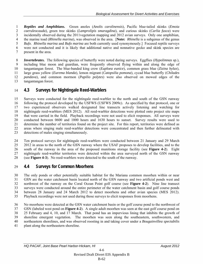
Biological Assessment for Divert Activities and Exercises
HQ PACAF, Joint Base Pearl Harbor-Hickam, HI August 2012 4-6
Reptiles and Amphibians. Green anoles (Anolis carolinensis), Pacific blue-tailed skinks (Emoia 1 caeruleocauda), green tree skinks (Lamprolipis smaragdina), and curious skinks (Carlia fusca) were 2 incidentally observed during the 2011vegetation mapping and 2012 avian surveys. Only one amphibian, 3 the marine toad (Rhinella marina), was observed in the area. [Note: Rhinella is a subgenus of the genus 4 Bufo. Rhinella marina and Bufo marina are both currently used synonymously.] Focused reptile surveys 5 were not conducted and it is likely that additional native and nonnative gecko and skink species are 6 present in the area. 7
Invertebrates. The following species of butterfly were noted during surveys. Eggflies (Hypolimnas sp.), 8 including blue moon and guardian, were frequently observed flying within and along the edge of 9 tangantangan forest. The blue-banded king crow (Euploea eunice), common grass blue (Zizina hylax), 10 large grass yellow (Eurema blanda), lemon migrant (Catopsilia pomona), cycad blue butterfly (Chilades 11 pandava), and common mormon (Papilio polytes) were also observed on mowed edges of the 12 tangantangan forest. 13
4.3 Surveys for Nightingale Reed-Warblers 14
Surveys were conducted for the nightingale reed-warbler to the north and south of the GSN runway 15 following the protocol developed by the USFWS (USFWS 2009c). As specified by that protocol, one or 16 two experienced observers walked designated line transects actively listening and watching for 17 nightingale reed-warblers (MES 2012). All reed-warbler detections were plotted onto project site maps 18 that were carried in the field. Playback recordings were not used to elicit responses. All surveys were 19 conducted between 0600 and 1000 hours and 1630 hours to sunset. Survey results were used to 20 determine the number of territories found on the project site. For this report, territories were defined as 21 areas where singing male reed-warbler detections were concentrated and then further delineated with 22 detections of males singing simultaneously. 23
Ten protocol surveys for nightingale reed-warblers were conducted between 21 January and 29 March 24 2012 in areas to the north of the GSN runway where the USAF proposes to develop facilities, and to the 25 south of the runway in the area of the proposed munitions storage facility (see Figure 4-2). Eight 26 nightingale reed-warbler territories were detected within the area surveyed north of the GSN runway 27 (see Figure 4-3). No reed-warblers were detected to the south of the runway. 28
4.4 Surveys for Common Moorhens 29
The only ponds or other potentially suitable habitat for the Mariana common moorhen within or near 30 GSN are the water catchment basin located north of the GSN runway and two artificial ponds west and 31 northwest of the runway on the Coral Ocean Point golf course (see Figure 4-2). Nine line transect 32 surveys were conducted around the entire perimeter of the water catchment basin and golf course ponds 33 between 28 January and 24 March 2012 to detect moorhens and other avian species (MES 2012). 34 Playback recordings were not used during those surveys to elicit responses from moorhens. 35
No moorhens were detected at the GSN water catchment basin or the golf course pond to the northwest of 36 GSN (labeled west pond on Figure 4-2). A single adult moorhen was seen at the east golf course pond on 37 25 February and 4, 10, and 17 March. That pond has an impervious lining that inhibits the growth of 38 shoreline emergent vegetation. The moorhen was seen along the southeastern, southwestern, and 39 northeastern shorelines, and was observed roosting in and taking cover under a Bougainvillea spectabilis 40 plant along the northeastern shoreline. 41
Revised Draft Divert EIS Appendix B B-62
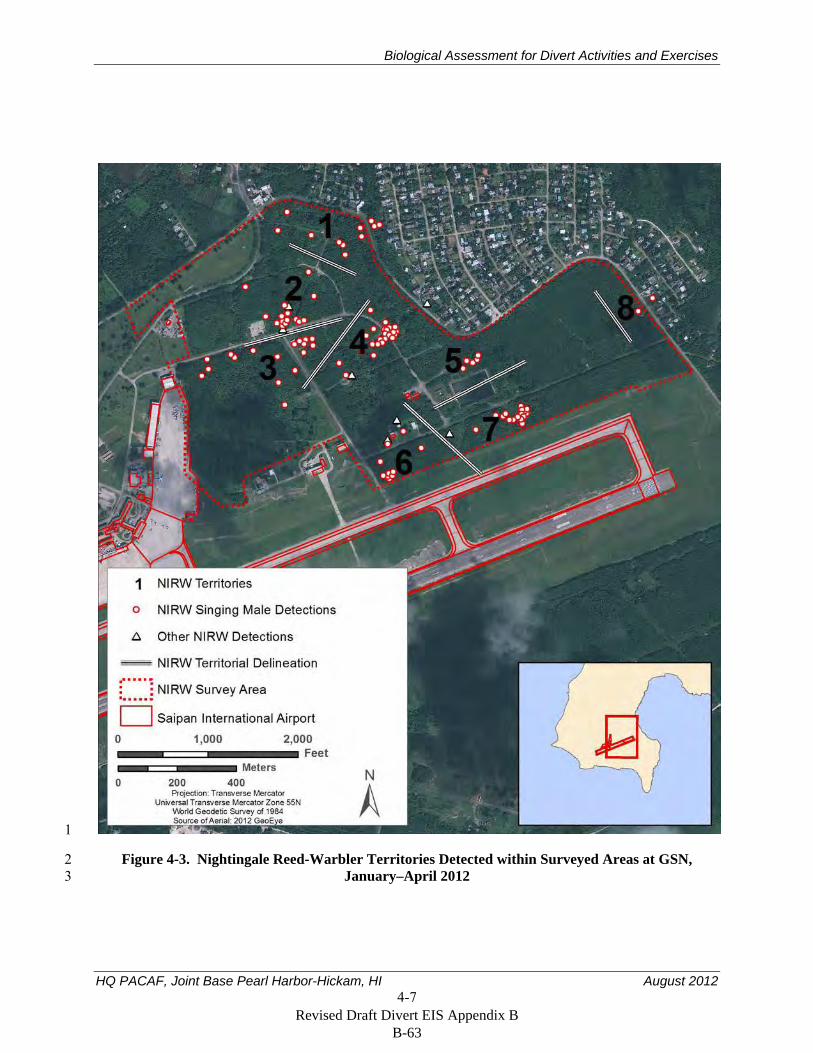
Biological Assessment for Divert Activities and Exercises
HQ PACAF, Joint Base Pearl Harbor-Hickam, HI August 2012 4-7
1
Figure 4-3. Nightingale Reed-Warbler Territories Detected within Surveyed Areas at GSN, 2 January–April 2012 3
Revised Draft Divert EIS Appendix B B-63

Biological Assessment for Divert Activities and Exercises
HQ PACAF, Joint Base Pearl Harbor-Hickam, HI August 2012 4-8
Two reconnaissance-level surveys also were conducted in the tangantangan forests east and west of the 1 GSN runways (see Figure 4-2). More extensive protocol surveys were not conducted in those areas 2 because the USAF does not plan to develop facilities within, or otherwise directly disturb, those forested 3 areas. One singing male was detected west of the runway during one of those surveys. 4
Moorhens have been detected at the east golf course pond since about 2001 during surveys conducted by 5 or for the CNMI Division of Fish and Wildlife (Paul Radley, CNMI Division of Fish and Wildlife, 6 personal communication, March 26, 2012). 7
Revised Draft Divert EIS Appendix B B-64

Biological Assessment for Divert Activities and Exercises
HQ PACAF, Joint Base Pearl Harbor-Hickam, HI August 2012 5-1
5. Effects of the Action 1
As described in Section 1.2, the USAF has determined that plans to establish divert capabilities at GSN 2 and conduct divert activities and exercises on Saipan would have no affect on the Mariana fruit bat and 3 Micronesian megapode. These decisions were based on the lack of suitable habitat for those threatened 4 and endangered species near GSN, and effects on those species are not further discussed here. 5
5.1 Nightingale Reed-Warbler 6
Development and construction of facilities and infrastructure at GSN to support divert landings, periodic 7 exercises, and humanitarian assistance and disaster relief would result in the loss and degradation of 8 habitat for nightingale reed-warblers, and noise from those construction activities could temporarily 9 disrupt the behavior of reed-warblers living adjacent to construction areas. Noise, human activity, and 10 other disturbances during implementation of ground and air activities, aircraft support activities, and other 11 airfield ground activities could also temporarily disrupt the behavior of nightingale reed-warblers in areas 12 surrounding GSN. Transportation of equipment and personnel from Guam and other locations could 13 result in the introduction of invasive species into Saipan, including the brown treesnake; the USAF would 14 continue to implement practices to prevent the transport and release of brown treesnakes and other 15 invasive species. 16
5.1.1 Impacts During Construction 17
Development of all proposed facilities would require the disturbance of up to about 24 ha (59 ac) at GSN 18 and 2 ha (4 ac) at the Port of Saipan. In part to minimize impacts on nightingale reed-warblers, the USAF 19 plans to locate most of their facilities in existing developed areas or areas that are currently mowed or 20 otherwise periodically disturbed (see Table 5-1). However, because of the requirements to site some 21 facilities in specific locations (such as parking ramps next to the taxiway), and because of the lack of 22 cleared areas north of the existing GSN facilities, about 4.5 ha (11.0 ac) of tangantangan forest would be 23 disturbed to develop and construct all proposed facilities (see Table 5-1). 24
The following evaluation of potential impacts on nightingale reed-warbler territories is based on the 25 assumption that all proposed facilities will be developed. It is important to note that the USAF might not 26 develop all facilities, and the impacts on nightingale reed-warbler, and associated required mitigation, 27 could be less than that described. The following criteria in the SUMB Programmatic Biological Opinion 28 (USFWS 2008a) was used to determine whether nightingale reed-warbler territories would be directly or 29 indirectly affected. 30
“Direct effects include clearing of vegetation or otherwise destroying a territory. If 29 percent or 31 more of a territory is cleared or otherwise destroyed, then the entire territory will be considered 32 destroyed. If less than 29 percent of a territory is cleared or otherwise destroyed, then only that 33 portion of the territory will be considered directly affected and the remaining portion will be 34 considered indirectly affected.” 35
“Habitat will be considered indirectly affected when the remaining portion of a territory where 36 less than 29 percent is cleared of vegetation; or any portion of an adjacent nightingale 37 reed-warbler territory would be subject to increased risk from nonnative invasive plant or animal 38 access to habitat, feral ungulate access to habitat, predators…, human intrusion, erosion, or fire 39 risk due to implementation of the proposed project.” 40
Revised Draft Divert EIS Appendix B B-65
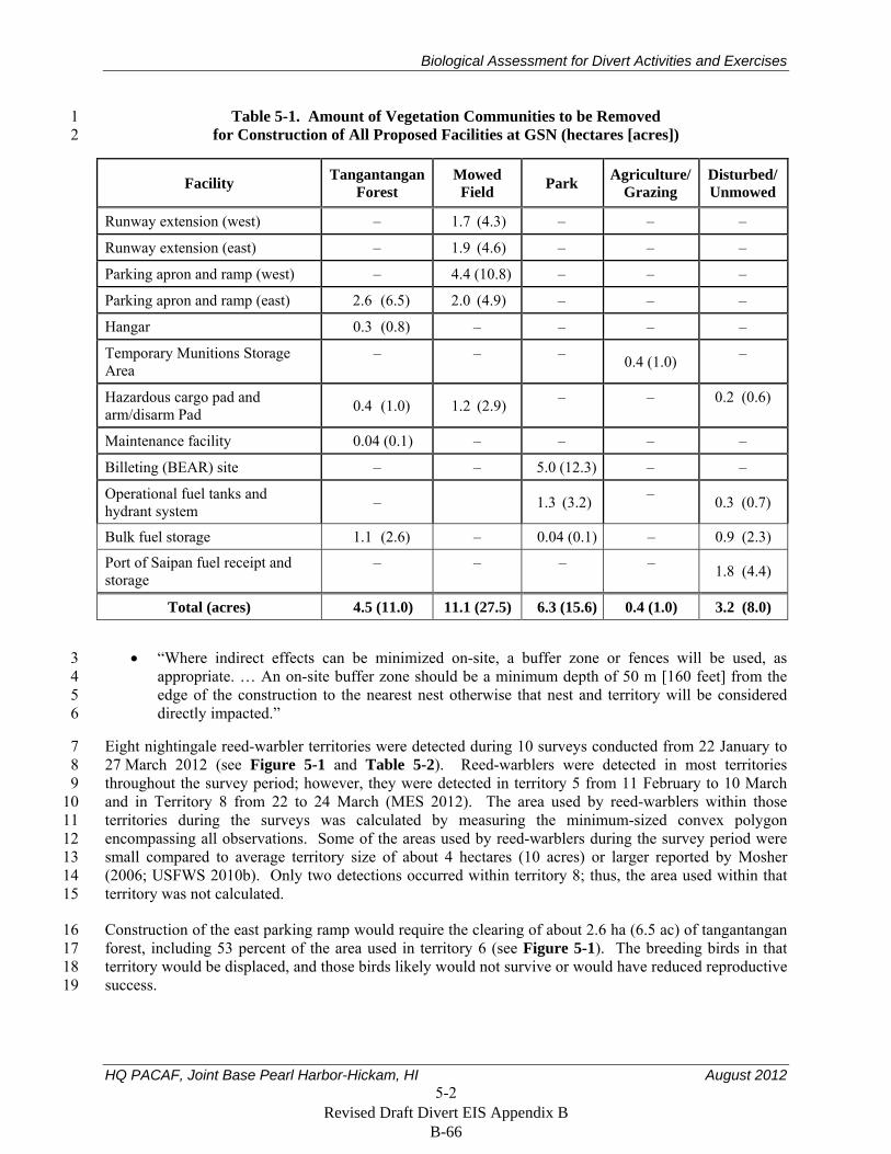
Biological Assessment for Divert Activities and Exercises
HQ PACAF, Joint Base Pearl Harbor-Hickam, HI August 2012 5-2
Table 5-1. Amount of Vegetation Communities to be Removed 1 for Construction of All Proposed Facilities at GSN (hectares [acres]) 2
Facility Tangantangan Forest
Mowed Field Park Agriculture/
Grazing Disturbed/Unmowed
Runway extension (west) – 1.7 (4.3) – – –
Runway extension (east) – 1.9 (4.6) – – –
Parking apron and ramp (west) – 4.4 (10.8) – – –
Parking apron and ramp (east) 2.6 (6.5) 2.0 (4.9) – – –
Hangar 0.3 (0.8) – – – –
Temporary Munitions Storage Area
– – – 0.4 (1.0) –
Hazardous cargo pad and arm/disarm Pad 0.4 (1.0) 1.2 (2.9) – – 0.2 (0.6)
Maintenance facility 0.04 (0.1) – – – –
Billeting (BEAR) site – – 5.0 (12.3) – –
Operational fuel tanks and hydrant system – 1.3 (3.2) – 0.3 (0.7)
Bulk fuel storage 1.1 (2.6) – 0.04 (0.1) – 0.9 (2.3)
Port of Saipan fuel receipt and storage
– – – – 1.8 (4.4)
Total (acres) 4.5 (11.0) 11.1 (27.5) 6.3 (15.6) 0.4 (1.0) 3.2 (8.0)
“Where indirect effects can be minimized on-site, a buffer zone or fences will be used, as 3 appropriate. … An on-site buffer zone should be a minimum depth of 50 m [160 feet] from the 4 edge of the construction to the nearest nest otherwise that nest and territory will be considered 5 directly impacted.” 6
Eight nightingale reed-warbler territories were detected during 10 surveys conducted from 22 January to 7 27 March 2012 (see Figure 5-1 and Table 5-2). Reed-warblers were detected in most territories 8 throughout the survey period; however, they were detected in territory 5 from 11 February to 10 March 9 and in Territory 8 from 22 to 24 March (MES 2012). The area used by reed-warblers within those 10 territories during the surveys was calculated by measuring the minimum-sized convex polygon 11 encompassing all observations. Some of the areas used by reed-warblers during the survey period were 12 small compared to average territory size of about 4 hectares (10 acres) or larger reported by Mosher 13 (2006; USFWS 2010b). Only two detections occurred within territory 8; thus, the area used within that 14 territory was not calculated. 15
Construction of the east parking ramp would require the clearing of about 2.6 ha (6.5 ac) of tangantangan 16 forest, including 53 percent of the area used in territory 6 (see Figure 5-1). The breeding birds in that 17 territory would be displaced, and those birds likely would not survive or would have reduced reproductive 18 success. 19
Revised Draft Divert EIS Appendix B B-66
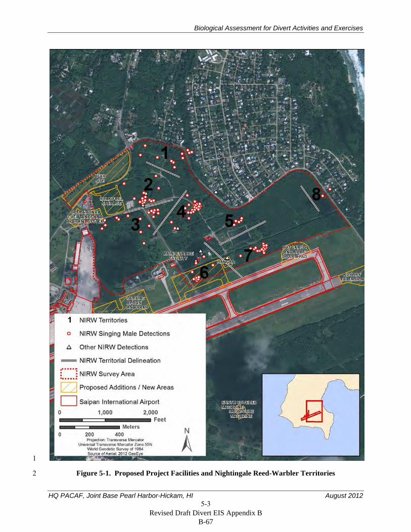
Biological Assessment for Divert Activities and Exercises
HQ PACAF, Joint Base Pearl Harbor-Hickam, HI August 2012 5-3
1
Figure 5-1. Proposed Project Facilities and Nightingale Reed-Warbler Territories 2
Revised Draft Divert EIS Appendix B B-67
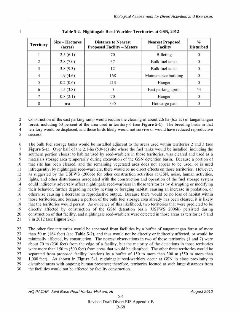
Biological Assessment for Divert Activities and Exercises
HQ PACAF, Joint Base Pearl Harbor-Hickam, HI August 2012 5-4
Table 5-2. Nightingale Reed-Warbler Territories at GSN, 2012 1
Territory Size – Hectares (acres)
Distance to Nearest Proposed Facility – Meters
Nearest Proposed Facility
% Disturbed
1 2.5 (6.1) 70 Billeting 0 2 2.8 (7.0) 37 Bulk fuel tanks 0 3 3.8 (9.3) 12 Bulk fuel tanks 0 4 1.9 (4.6) 168 Maintenance building 0 5 0.2 (0.6) 213 Hanger 0 6 1.5 (3.8) 0 East parking apron 53 7 0.8 (2.1) 70 Hanger 0 8 n/a 335 Hot cargo pad 0
Construction of the east parking ramp would require the clearing of about 2.6 ha (6.5 ac) of tangantangan 2 forest, including 53 percent of the area used in territory 6 (see Figure 5-1). The breeding birds in that 3 territory would be displaced, and those birds likely would not survive or would have reduced reproductive 4 success. 5
The bulk fuel storage tanks would be installed adjacent to the areas used within territories 2 and 3 (see 6 Figure 5-1). Over half of the 2.1-ha (5.0-ac) site where the fuel tanks would be installed, including the 7 southern portion closest to habitat used by reed-warblers in those territories, was cleared and used as a 8 materials storage area temporarily during excavation of the GSN detention basin. Because a portion of 9 that site has been cleared, and the remaining vegetated area does not appear to be used, or is used 10 infrequently, by nightingale reed-warblers, there would be no direct effects on those territories. However, 11 as suggested by the USFWS (2006b) for other construction activities at GSN, noise, human activities, 12 lights, and other disturbances associated with the construction and operation of the fuel storage system 13 could indirectly adversely affect nightingale reed-warblers in those territories by disrupting or modifying 14 their behavior, further degrading nearby nesting or foraging habitat, causing an increase in predation, or 15 otherwise causing a decrease in reproductive output. Because there would be no loss of habitat within 16 those territories, and because a portion of the bulk fuel storage area already has been cleared, it is likely 17 that the territories would persist. As evidence of this likelihood, two territories that were predicted to be 18 directly affected by construction of the GSN detention basin (USFWS 2006b) persisted during 19 construction of that facility, and nightingale reed-warblers were detected in those areas as territories 5 and 20 7 in 2012 (see Figure 5-1). 21
The other five territories would be separated from facilities by a buffer of tangantangan forest of more 22 than 50 m (164 feet) (see Table 5-2), and thus would not be directly or indirectly affected, or would be 23 minimally affected, by construction. The nearest observations in two of those territories (1 and 7) were 24 about 70 m (230 feet) from the edge of a facility, but the majority of the detections in those territories 25 were more than 150 m (500 feet) from areas that would be disturbed. The other three territories would be 26 separated from proposed facility locations by a buffer of 150 to more than 300 m (550 to more than 27 1,000 feet). As shown in Figure 5-1, nightingale reed-warblers occur at GSN in close proximity to 28 disturbed areas with ongoing human presence; therefore, territories located at such large distances from 29 the facilities would not be affected by facility construction. 30
Revised Draft Divert EIS Appendix B B-68
Biological Assessment for Divert Activities and Exercises
HQ PACAF, Joint Base Pearl Harbor-Hickam, HI August 2012 5-5
5.1.2 Impacts During Implementation 1
As further described in Section 2.2, after completion of construction, the USAF would use GSN 2 periodically and temporarily for divert landings and takeoffs, joint military exercises, airlift staging for 3 humanitarian assistance and disaster relief, and other activities. All activities would be conducted within 4 existing disturbed and developed areas and would not result in any additional habitat loss. 5
During implementation of the project, nightingale reed-warblers living at and near GSN, including those 6 occurring in the tangantangan forests to the east and west of the runway, could be adversely affected by 7 an increase in noise, lighting at night, and human activities during divert activities and exercises. To 8 ensure that nightingale reed-warblers are not disturbed during activities and exercises, personnel would be 9 restricted to the developed facilities at GSN and would be briefed on that and other requirements for the 10 protection of nightingale reed-warblers and other listed species. In addition, if personnel are to be billeted 11 at GSN, the location of the BEAR facility would be temporarily fenced in part to keep personnel away 12 from nightingale reed-warbler habitat. 13
The increase in takeoffs and landings of large aircraft at GSN could cause more birds at GSN to be struck 14 and killed by aircraft. However, nightingale reed-warblers nest and forage in dense vegetation 15 (Craig 1992, USFWS 1998b) and therefore are unlikely to be struck by military or other aircraft taking off 16 from, or landing at GSN. 17
The periodic increase in frequency and intensity of noise from military operating during military exercises 18 at GSN has the potential to adversely affect nightingale reed-warblers living adjacent to or near GSN. On 19 average, about 13 large aircraft (e.g., 747-200 and 767-300 commercial aircraft), and 126 smaller aircraft 20 currently arrive or depart daily at GSN (USAF 2012, Section 3.1.2.1), and nightingale reed-warblers and 21 other animals living below the flight paths at GSN are exposed to noise from those takeoffs and landings 22 year round. During military exercises, which might occur at GSN as many as 8 weeks per year, up to 23 about 72 additional takeoffs and landings by large aircraft such as the KC-135 and smaller jet aircraft 24 such as the F-18 or F-22 could occur on a very busy day. 25
To compare the sound levels generated by those aircraft, sound energy level per aircraft type was 26 estimated at 1,000 feet from the end of the runway during takeoff. Sound energy level is calculated as the 27 sum of sound energy over the duration of a noise event (such as a flyover) and represents an equivalent 28 noise event with a one-second duration. Because the energy level is normalized to one second, it is higher 29 than the maximum sound level for that event. The actual sound level will vary depending on power 30 setting, accent and decent angle, weather, and other factors. Sound levels are reported here in units of 31 A-weighted decibel (dBA), which is weighted by the ability of humans to hear various sound frequencies, 32 and is used to characterize sound levels that can be sensed by the human ear. The auditory sensitivity of 33 birds to sound frequencies differ from those of humans; however, because there is no standard or 34 commonly used measure that characterizes sound levels sensed by birds, results are reported in dBA, 35 which is measured on a logarithmic scale. 36
The estimated sound energy level of a B-747 commercial aircraft during takeoff at 1,000 feet is 106.3 37 dBA. The sound energy level of a KC-135 (103.9 dBA) and F-16 (109.1 dBA) is similar, and the sound 38 energy level of an F-22 is higher (122.6 dBA). 39
To evaluate the potential cumulative increase in noise levels that would occur during planned joint 40 military exercises or other unit-level exercises, the USAF modeled and reported in the Draft EIS 41
Revised Draft Divert EIS Appendix B B-69
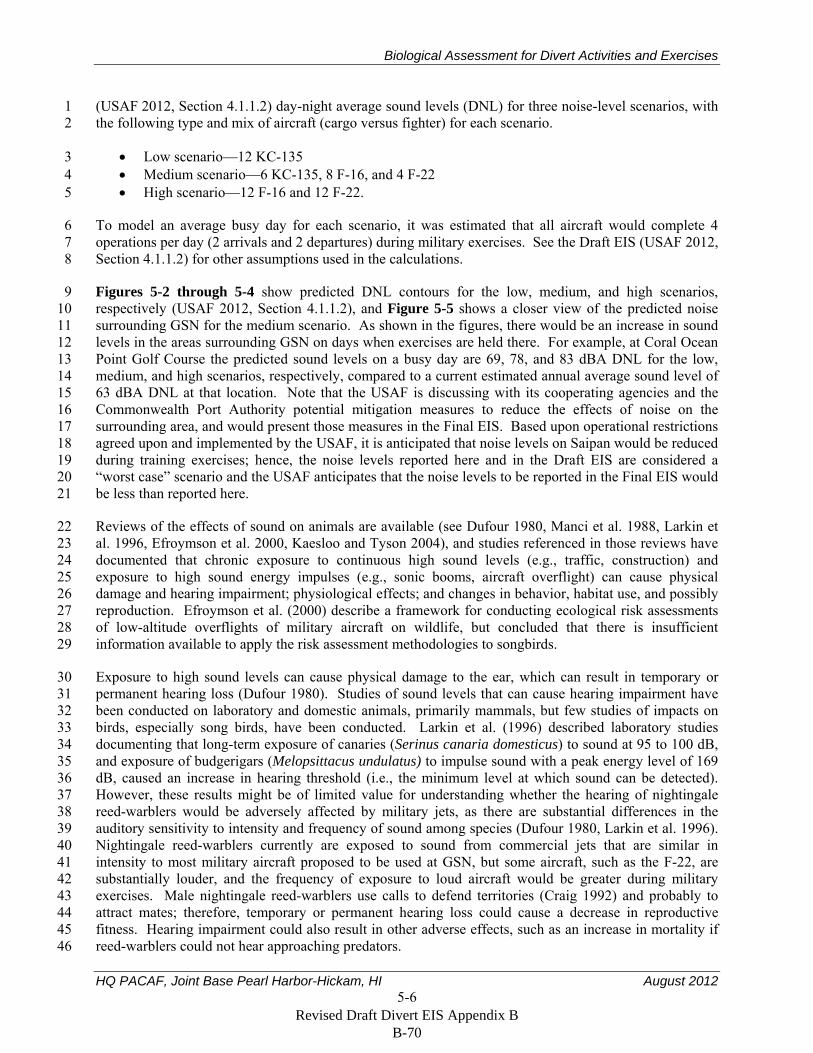
Biological Assessment for Divert Activities and Exercises
HQ PACAF, Joint Base Pearl Harbor-Hickam, HI August 2012 5-6
(USAF 2012, Section 4.1.1.2) day-night average sound levels (DNL) for three noise-level scenarios, with 1 the following type and mix of aircraft (cargo versus fighter) for each scenario. 2
Low scenario—12 KC-135 3 Medium scenario—6 KC-135, 8 F-16, and 4 F-22 4 High scenario—12 F-16 and 12 F-22. 5
To model an average busy day for each scenario, it was estimated that all aircraft would complete 4 6 operations per day (2 arrivals and 2 departures) during military exercises. See the Draft EIS (USAF 2012, 7 Section 4.1.1.2) for other assumptions used in the calculations. 8
Figures 5-2 through 5-4 show predicted DNL contours for the low, medium, and high scenarios, 9 respectively (USAF 2012, Section 4.1.1.2), and Figure 5-5 shows a closer view of the predicted noise 10 surrounding GSN for the medium scenario. As shown in the figures, there would be an increase in sound 11 levels in the areas surrounding GSN on days when exercises are held there. For example, at Coral Ocean 12 Point Golf Course the predicted sound levels on a busy day are 69, 78, and 83 dBA DNL for the low, 13 medium, and high scenarios, respectively, compared to a current estimated annual average sound level of 14 63 dBA DNL at that location. Note that the USAF is discussing with its cooperating agencies and the 15 Commonwealth Port Authority potential mitigation measures to reduce the effects of noise on the 16 surrounding area, and would present those measures in the Final EIS. Based upon operational restrictions 17 agreed upon and implemented by the USAF, it is anticipated that noise levels on Saipan would be reduced 18 during training exercises; hence, the noise levels reported here and in the Draft EIS are considered a 19 “worst case” scenario and the USAF anticipates that the noise levels to be reported in the Final EIS would 20 be less than reported here. 21
Reviews of the effects of sound on animals are available (see Dufour 1980, Manci et al. 1988, Larkin et 22 al. 1996, Efroymson et al. 2000, Kaesloo and Tyson 2004), and studies referenced in those reviews have 23 documented that chronic exposure to continuous high sound levels (e.g., traffic, construction) and 24 exposure to high sound energy impulses (e.g., sonic booms, aircraft overflight) can cause physical 25 damage and hearing impairment; physiological effects; and changes in behavior, habitat use, and possibly 26 reproduction. Efroymson et al. (2000) describe a framework for conducting ecological risk assessments 27 of low-altitude overflights of military aircraft on wildlife, but concluded that there is insufficient 28 information available to apply the risk assessment methodologies to songbirds. 29
Exposure to high sound levels can cause physical damage to the ear, which can result in temporary or 30 permanent hearing loss (Dufour 1980). Studies of sound levels that can cause hearing impairment have 31 been conducted on laboratory and domestic animals, primarily mammals, but few studies of impacts on 32 birds, especially song birds, have been conducted. Larkin et al. (1996) described laboratory studies 33 documenting that long-term exposure of canaries (Serinus canaria domesticus) to sound at 95 to 100 dB, 34 and exposure of budgerigars (Melopsittacus undulatus) to impulse sound with a peak energy level of 169 35 dB, caused an increase in hearing threshold (i.e., the minimum level at which sound can be detected). 36 However, these results might be of limited value for understanding whether the hearing of nightingale 37 reed-warblers would be adversely affected by military jets, as there are substantial differences in the 38 auditory sensitivity to intensity and frequency of sound among species (Dufour 1980, Larkin et al. 1996). 39 Nightingale reed-warblers currently are exposed to sound from commercial jets that are similar in 40 intensity to most military aircraft proposed to be used at GSN, but some aircraft, such as the F-22, are 41 substantially louder, and the frequency of exposure to loud aircraft would be greater during military 42 exercises. Male nightingale reed-warblers use calls to defend territories (Craig 1992) and probably to 43 attract mates; therefore, temporary or permanent hearing loss could cause a decrease in reproductive 44 fitness. Hearing impairment could also result in other adverse effects, such as an increase in mortality if 45 reed-warblers could not hear approaching predators. 46
Revised Draft Divert EIS Appendix B B-70
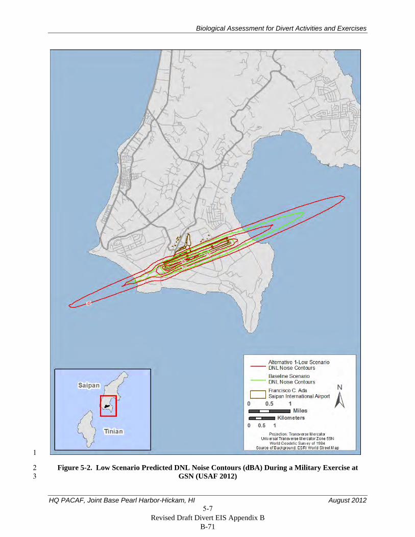
Biological Assessment for Divert Activities and Exercises
HQ PACAF, Joint Base Pearl Harbor-Hickam, HI August 2012 5-7
1
Figure 5-2. Low Scenario Predicted DNL Noise Contours (dBA) During a Military Exercise at 2 GSN (USAF 2012) 3
Revised Draft Divert EIS Appendix B B-71
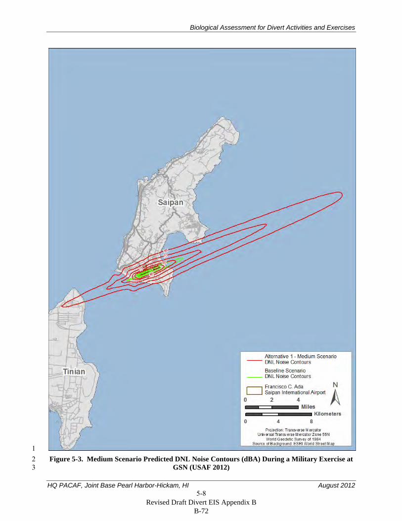
Biological Assessment for Divert Activities and Exercises
HQ PACAF, Joint Base Pearl Harbor-Hickam, HI August 2012 5-8
1 Figure 5-3. Medium Scenario Predicted DNL Noise Contours (dBA) During a Military Exercise at 2
GSN (USAF 2012) 3
Revised Draft Divert EIS Appendix B B-72
Biological Assessment for Divert Activities and Exercises
HQ PACAF, Joint Base Pearl Harbor-Hickam, HI August 2012 5-9
1 Figure 5-4. High Scenario Predicted DNL Noise Contours (dBA) During a Military Exercise at 2
GSN (USAF 2012) 3
Revised Draft Divert EIS Appendix B B-73
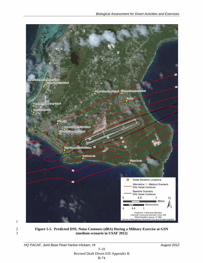
Biological Assessment for Divert Activities and Exercises
HQ PACAF, Joint Base Pearl Harbor-Hickam, HI August 2012 5-10
1
Figure 5-5. Predicted DNL Noise Contours (dBA) During a Military Exercise at GSN 2 (medium scenario in USAF 2012) 3
Revised Draft Divert EIS Appendix B B-74
Biological Assessment for Divert Activities and Exercises
HQ PACAF, Joint Base Pearl Harbor-Hickam, HI August 2012 5-11
Exposure to loud noises can also cause physiological changes in animals, such as an increase in blood 1 pressure and heart rate, changes in blood chemistry, and changes in digestive and respiratory functions. 2 Numerous studies of the physiological response of mammals to noise have been conducted (see reviews 3 by Dufour 1980, Manci et al. 1988, Larkin et al. 1996), but no studies have been done to measure the 4 physiological response of wild songbirds to noise, or to evaluate the long-term consequences of those 5 physiological changes on the survival or reproductive fitness of wild animals. 6
The most likely, detectable response of nightingale reed-warblers to an increase in takeoffs and landings 7 of loud aircraft, and to other noises at GSN, might be a temporary or permanent change in behavior. 8 Birds have been documented to abandon nests temporarily or permanently, avoid areas, and otherwise 9 modify their behavior in response to noise. Efroymson et al. (2000) summarize more than 40 studies or 10 observations of the response of raptors and waterbirds to overflights. Responses varied substantially, 11 with some birds flushing or otherwise reacting in response to aircraft passing more than 1 km (0.6 miles) 12 away, but many birds not reacting, even in response to overflights closer than 100 m (330 feet). The 13 response to overflights can vary with season or timing of nesting, and probably also in response to 14 numerous other factors. For example, Mexican spotted owls (Strix occidentalis lucida) were less likely 15 to flush in response to noise early during nesting than later during the nesting season, but flush response 16 did not differ between the nesting and non-nesting season (Delany et al. 1999). Awbrey and Hunsaker 17 (1997) and Hunsaker et al (2007) documented a weak correlation between noise levels and number of 18 nesting attempts by coastal California gnatcatchers at Naval Air Station Miramar, but concluded that 19 noise from fixed-wing military aircraft and helicopters had no measurable effect on reproductive success. 20 Flushing from nests or other changes in behavior could have an effect on reproduction or survival. For 21 example, a sooty tern (Onychoprion fuscatus) colony had 99 percent nest failure in a year when low-22 flying, supersonic aircraft frequently flew over the colony; nest failure might have been, in part, due to 23 damage to eggs as females rapidly left their nests (Manci et al. 1988). 24
Birds and other wildlife have been documented to become habituated to aircraft overflights and other 25 noises after continuous or frequent exposure. For example, red-tailed hawks (Buteo jamaicansis) that 26 were previously exposed to helicopters exhibited less response than hawks that had not been previously 27 exposed (Andersen et al. 1989). Habituation also has been frequently noted when using noise-making 28 devices to scare birds away from crops or airfields (Larkin et al. 1999, Efroymson et al. 2000). 29 Nightingale reed-warblers living near GSN are exposed to numerous takeoffs and landings of commercial 30 jets daily and those birds, therefore, might not react in as strenuous a manner as unhabituated birds to the 31 infrequent and temporary increase in noise from divert activities and exercises. 32
Loud noises can also mask other sounds that are important to birds, such as territorial calls or the sounds 33 of approaching predators (Larkin et al 1996, Kaesloo and Tyson 2004). Because the noise from military 34 aircraft at GSN would be of short duration, most takeoffs and landings should not adversely affect 35 nightingale reed-warblers in this manner. However, if numerous aircraft take off and land over a short 36 period, nightingale reed-warblers might not be able to hear territorial calls or other sounds for an extended 37 period. 38
In summary, nightingale reed-warbler would be exposed to high sound levels when military aircraft take 39 off and land during exercises at GSN, which would occur up to 8 weeks per year. Those birds currently 40 are exposed to noise from commercial jets that are of similar or lower intensity than that of the military 41 aircraft that would operate at GSN. Similar disturbances and noise levels have caused other birds to flush 42 or leave their nests, and resulted in other adverse consequences. However, there is insufficient 43 information available to determine how nightingale reed-warblers at GSN would react to the increase in 44 frequency of loud overflights, and the increase in sound intensity during some of those overflights. In 45 addition, other than to generalize that nightingale reed-warblers with territories near GSN and directly 46
Revised Draft Divert EIS Appendix B B-75
Biological Assessment for Divert Activities and Exercises
HQ PACAF, Joint Base Pearl Harbor-Hickam, HI August 2012 5-12
under the flight paths are more likely to be affected than birds living farther away, it is not possible to 1 specify where or how many territories might be affected by an increase in operations of loud aircraft. 2
To mitigate for the impacts of noise and indirect impacts on nightingale reed-warblers that will occur 3 during the implementation phase of this project, the USAF will purchase credits or otherwise fund 4 conservation activities at the SUMB conservation area as required in the SUMB Biological Opinion. 5
5.1.3 Invasive Species 6
The USFWS lists predation by introduced species as one of the two main threats to the recovery of 7 nightingale reed-warblers, and states that establishment of the brown treesnake on Saipan would result in 8 the extirpation of that bird, as occurred on Guam (USFWS 2010b). 9
Brown treesnakes and other invasive species could be released into Saipan when personnel and equipment 10 are transported from Guam and other locations for construction of facilities and during divert events and 11 exercises. To prevent this from happening, the USAF would continue their ongoing program of 12 interdicting the transport of invasive species in the Mariana Islands. As further described in Section 2.4, 13 this would include the following: 14
Developing and implementing a Hazard Analysis and Critical Control Point Plan during 15 construction and maintenance and operation of facilities at GSN and the Port of Saipan 16
Inspecting outgoing aircraft, equipment, and materials from Guam with trained quarantine 17 officers and dog detection teams 18
Use existing or new, temporary or permanent, snake-free quarantine areas on Saipan for 19 inspection of cargo traveling from Guam to Saipan when applicable. Those areas will be subject 20 to (1) multiple day and night searches with appropriately trained interdiction canine teams that 21 meet performance standards, (2) snake trapping, and (3) visual inspections for snakes. 22
Implementing other interdiction and control requirements in the applicable Biological Opinions 23 (e.g., USFWS 2006a, 2010a) and associated implementing instructions for training exercises in 24 the Mariana Islands including but not limited to the procedures in JTREGMARIANAS 25 Instruction 5090.4 for inspection of equipment and gear. 26
5.1.4 Cumulative Effects 27
Reasonably foreseeable future activities that might occur on Saipan are described in Section 5.1 of the 28 EIS for Divert Activities and Exercises, Guam and Commonwealth of the Northern Mariana Islands 29 (USAF 2012). Future Commonwealth or private activities that are reasonably certain to occur within the 30 action area include road development and widening; geothermal, solar, and other energy production; 31 improvement and expansion of water, wastewater, power, and other public works systems; and 32 development of commercial, residential, medical, and other facilities. Those activities, along with the 33 USAF proposal to clear 4.5 ha (11.0 ac) of tangantangan forest to develop infrastructure at GSN, would 34 contribute to the cumulative loss of habitat for the nightingale reed-warbler on Saipan. Those activities 35 would also cause an increase in noise during construction, habitat degradation, other indirect impacts that 36 would cumulatively adversely affect nightingale reed-warblers and possibly other ESA protected species 37 on Saipan. 38
Revised Draft Divert EIS Appendix B B-76
Biological Assessment for Divert Activities and Exercises
HQ PACAF, Joint Base Pearl Harbor-Hickam, HI August 2012 5-13
5.2 Mariana Common Moorhen 1
A single Mariana common moorhen was observed during four of nine surveys of the east golf course 2 pond, which is about 0.9 km (0.6 mi) southwest of GSN. That pond has an impervious liner that prevents 3 the establishment of shoreline emergent vegetation and the surrounding vegetation is mowed or 4 maintained for operation of the golf course. Moorhens nest in wetlands with emergent vegetation 5 USFWS (1992), and it is, therefore, unlikely that moorhens nest at that pond. No moorhens were seen at 6 the two other surface waters surveyed near GSN (see Section 4.4). 7
During planned joint military exercises or other unit-level exercises, any moorhens located at the golf 8 course pond would be exposed to more frequent takeoffs or landing of aircraft. Sound levels from those 9 aircraft would be similar to or louder than the commercial jets at GSN. Noise from the take-off and 10 landing of those aircraft might cause Mariana common moorhens using that or other surface waters near 11 GSN to temporarily disrupt their behavior. However, because any bird using those ponds would be 12 habituated to frequent noise from current operations at GSN, and because the increase in noise from 13 divert activities and exercises would be infrequent, it is very unlikely that Mariana common moorhen 14 would avoid the use of those ponds. 15
Because (1) the surface waters near GSN are marginal habitat that are used temporarily by moorhens, 16 (2) birds there likely are habituated to noise from current operations at GSN, (3) any increase in noise 17 from divert activities and exercises would be temporary and infrequent, and (4) the ongoing program for 18 interdicting the transport of brown treesnakes and other invasive species in the Mariana Islands would be 19 implemented for this project (see Section 2.4), the USAF concludes that any adverse impacts would be 20 temporary and insignificant, and that developing divert capabilities and conducting divert activities and 21 exercises at GSN may affect, but are unlikely to adversely affect, Mariana common moorhens. 22
5.3 Mariana Swiftlet 23
Mariana swiftlets nest in caves located in central Saipan (Cruz et al. 2008) and favor ridge crests and 24 open, grassy areas for foraging (USFWS 1991). No swiftlets were detected during bird surveys 25 conducted at GSN during 2012, and the nearest cave used by these birds for roosting and nesting is more 26 than 3 km (2 mi) north of GSN (MES 2012). 27
The clearing of up to 4.5 ha (11.0 ac) of second-growth forest for this project would have an insignificant 28 adverse effect on the availability of foraging habitat for this species because tangantangan forest is 29 common in the area and is not preferred foraging habitat. In addition, any adverse effect would be offset 30 by the benefit of long-term protection of forest habitat in the SUMB that would be funded by the 31 Air Force to compensate for the loss of nightingale reed-warbler habitat. The possibility of a swiftlet 32 being harmed by aircraft during divert activities and exercises is discountable because the area is distant 33 from nesting caves, the second-growth forests at the end of the runways are not preferred foraging habitat, 34 and swiftlets likely avoid the busy airspace around GSN. For these reasons, the USAF concludes that 35 developing divert capabilities and conducting divert activities and exercises at GSN may affect, but are 36 not likely to adversely affect, Mariana swiftlets. 37
5.4 Green Sea Turtles 38
Up to 18 green sea turtles nests have been found annually on Saipan since 1999 (Kolinski et al. 2001, 39 Maison et al. 2010). Nesting habitat for this species would not be directly affected by this project. 40 However, green sea turtles nesting on beaches of southern Saipan, and hatchling turtles moving from 41 nests to the ocean, could be temporarily exposed to noise from military aircraft participating in divert 42
Revised Draft Divert EIS Appendix B B-77
Biological Assessment for Divert Activities and Exercises
HQ PACAF, Joint Base Pearl Harbor-Hickam, HI August 2012 5-14
activities or exercises (DON 2010). Exposure to elevated noise levels would be brief (seconds) and, with 1 the exception of emergency divert landings and associated take-offs, would occur over a period of no 2 more than 8 weeks of the year. Any behavioral avoidance reaction would be short-term and would not 3 permanently displace sea turtles or result in physical harm. Noise from take-offs and landing would not 4 result in chronic stress because it is unlikely that individual sea turtles would be repeatedly exposed to 5 low-altitude overflights. Therefore, any effects would be insignificant and would not be sufficient to 6 harm or harass sea turtles, and the USAF concludes that developing divert capabilities and conducting 7 divert activities and exercises at GSN may affect, but are not likely to adversely affect, green sea turtles in 8 terrestrial environments. 9
Revised Draft Divert EIS Appendix B B-78
Biological Assessment for Divert Activities and Exercises
HQ PACAF, Joint Base Pearl Harbor-Hickam, HI August 2012 6-1
6. Conclusions 1
Based on the description of the project in Section 2 of this BA and further described in the associated EIS 2 (USAF 2012), the status of species and environmental baseline described in Sections 3 and 4, and the 3 analysis of impacts in Section 5, the USAF concludes the following about the potential impacts on 4 threatened and endangered species from developing divert capabilities and conducting divert activities 5 and exercises at GSN. 6
The proposed project will have no affect on Mariana fruit bat and Micronesian megapodes 7
The proposed project may affect, but is unlikely to adversely affect, the Mariana common 8 moorhen, Mariana swiftlet, and nesting green sea turtle 9
The proposed project may affect, and is likely to adversely affect, the nightingale reed-warbler. 10
Revised Draft Divert EIS Appendix B B-79

Biological Assessment for Divert Activities and Exercises
HQ PACAF, Joint Base Pearl Harbor-Hickam, HI August 2012 6-2
THIS PAGE INTENTIONALLY LEFT BLANK 1
Revised Draft Divert EIS Appendix B B-80
Biological Assessment for Divert Activities and Exercises
HQ PACAF, Joint Base Pearl Harbor-Hickam, HI August 2012 7-1
7. References Anderson et al. 1989
Andersen, D.E., O.J. Rongstad, and W.R. Mytton 1989. Response of nesting Red-tailed Hawks to helicopter overflights. Condor 91:296-299.
Anderson et al. 1990
Andersen, D.E., O.J. Rongstad, and W.R. Mytton. 1990. Home-range changes of raptors exposed to increased human activity levels in southeastern Colorado. Wildlife Society Bulletin 18:134-142.
Awbrey and Hunsaker 1997
Awbrey, F.T., and D. Hunsaker. 1997. Effects of fixed-wing military aircraft noise on California gnatcatcher reproduction. Journal of the Acoustical Society of America 102:3177.
Commonwealth Ports Authority 2002
Commonwealth Ports Authority. 2002. Saipan International Airport Master Plan. April 2002.
Camp et al. 2009 Camp, R.J., T.K. Pratt, A. P. Marshall, F. Amidon, and L.L. Williams. 2009. Recent status and trends of the land bird avifauna on Saipan, Mariana Islands, with emphasis on the endangered nightingale reed-warbler Acrocephalus luscinia. Bird Conservation International 19:323-337.
Cibois et al. 2011 Cibois, A. J.S. Beadell, E. Pasquet, B. Slikas, S.A. Sonsthagen, J-C. Thibault, and R.C. Fleischer. 2011. Charting the course of reed-warblers across the Pacific islands. Journal of Biogeography 30: 1963–1975.
Craig 1992 Craig, R.J. 1992. Territoriality, habitat use and ecological distinctness of an endangered Pacific island reed-warbler. Journal of Field Ornithology 63:436–444.
Cruz et al. 2008 Cruz, J.B., S.R. Kremer, G. Martin, L.L. Williams, and V.A. Camacho. 2008. Relative abundance and distribution of Mariana swiftlets (Aves: Apodidae) in the northern Mariana Islands. Pacific Science 62:233-246.
DON 2010 DON (Department of the Navy). 2010. Mariana Islands Range Complex Final Environmental Impact Statement/Overseas Environmental Impact Statement. May 2010. Volume 1.
Delany et al. 1999
Delaney, D.K., T.G. Grubb, P. Beiber, L.L. Pater, and M.H. Reiser. 1999. Effects of helicopter noise on Mexican spotted owls. Journal of Wildlife Management 63:60-76.
Dufour 1980 Dufor, P.A. 1980. Effects of noise on wildlife and other animals: Review of research since 1971. U.S. Environmental Protection Agency. EPA 550/9 BO-00.Washington, D.C.
Efroymson et al. 2000
Efroymson, R.A., R.A. Rose, S. Nemeth, and G.W. Suter II. 2000. Ecological risk assessment framework for low-altitude overflights by fixed-wing and rotary-wing military aircraft. Oak Ridge National Laboratories, Environmental Sciences Division. Publication 5010. Oak Ridge, Tennessee.
Revised Draft Divert EIS Appendix B B-81
Biological Assessment for Divert Activities and Exercises
HQ PACAF, Joint Base Pearl Harbor-Hickam, HI August 2012 7-2
Hunsaker et al. 2007
Hunsaker, D., J. Rice, and J. Kern. 2007. The effects of helicopter noise on the reproductive success of the coastal California gnatcatcher. Journal of the Acoustical Society of America. 122:3058.
Kaseloo and Tyson 2004
Kaseloo, P.A., and K.O. Tyson. 2004. Synthesis of noise effects on wildlife populations. U.S. Department of Transportation, Federal Highway Administration. FHWA-HEP-06-016. McLean, Virginia.
Kolinski et al. 2001
Kolinski, S.P., D.M. Parker, L.I. Ilo, and J.K. Ruak. 2001. An assessment of the sea turtles and their marine and terrestrial habitats at Saipan, Commonwealth of the Northern Mariana Islands. Micronesica 34:55-72.
Larkin et al. 1996 Larkin, R.P., L.L. Pater, and D.J. Tazik, D.J. 1996. Effects of military noise on wildlife: A literature review. U.S.Army Construction Engineering Research Laboratories Technical Report 96/21. Champaign, Illinois.
Maison et al 2010 Maison, K.A., K.I. Kinain, and K.P. Frutchey. 2010. Green turtle nesting sites and sea turtle legislation throughout Oceania. U.S. National Oceanic and Atmospheric Administration Memorandum NMFS-F/SPO-110.
Manci et al. 1988 Manci, K.M., D.N. Gladwin, R. Villella, and M.G. Cavendish. 1988. Effects of aircraft noise and sonic booms on domestic animals and wildlife: a literature synthesis. U.S. Fish and Wildlife Service. National Ecology Research Center, NERC-88/29. Ft. Collins, Colorado.
MES 2012 Micronesian Environmental Services (MES). 2012. Biological Report: Saipan International Airport Project Site, Saipan, CNMI. Saipan, Commonwealth of the Northern Mariana Islands.
Mosher 2006 Mosher, S.M. 2006. Ecology of the endangered nightingale reed-warbler (Acrocephalus luscinia) on Saipan, Micronesia. Master’s Thesis, University of Idaho, Moscow, Idaho.
Mosher and Fancy 2002
Mosher, S.M. and S.G. Fancy. 2002. Description of nests, eggs, and nestlings of the endangered nightingale reed-warbler on Saipan, Micronesia. Wilson Bulletin 114:1-10.
NMFS 1998 NMFS (National Marine Fisheries Service). 1998. Recovery Plan for the U.S. Pacific Populations of the East Pacific Green Turtle. National Marine Fisheries Service, Silver Spring, Maryland and U.S. Fish and Wildlife Service, Portland Oregon.
NMFS 2011 NMFS. 2011. National Marine Fisheries Service Endangered Species Act Section 7 Biological Opinion for Military Readiness Activities on the Mariana Islands Range Complex. National Marine Fisheries Service Office of Protected Resources, Washington D.C. August 2011.
Takano and Haig 2004
Takano, L.L., and S.M. Haig. 2004. Distribution and Abundance of the Mariana Subspecies of the Common Moorhen. Waterbirds 27:245-250.
Revised Draft Divert EIS Appendix B B-82
Biological Assessment for Divert Activities and Exercises
HQ PACAF, Joint Base Pearl Harbor-Hickam, HI August 2012 7-3
USAF 2012 U.S. Air Force (USAF). 2012. Draft Environmental Impact Statement for proposed Divert Activities and Exercises, Guam and Commonwealth of the Northern Mariana Islands (CNMI). Pacific Air Forces, Joint Base Pearl Harbor-Hickam, Hawaii.
USDA 2008 U.S. Department of Agriculture (USDA). 2008. Wildlife Hazard Assessment: Francisco C. Ada, Saipan International Airport. Saipan, Commonwealth of the Northern Mariana Islands. August 2008.
USFWS 1991 U.S. Fish and Wildlife Service (USFWS). 1991. Recovery Plan for the Mariana Islands Population of the Vanikoro Swiftlet, Aerodramus vanikorensis bartschi. Portland, Oregon.
USFWS 1992 USFWS 1992. Recovery Plan Mariana Common Moorhen Gallinula chloropos guami. Region One, Portland, Oregon.
USFWS 1998a USFWS 1998. Recovery Plan for the Micronesian Megapode (Megapodius laperouse laperouse). Portland, Oregon.
USFWS 1998b USFWS 1998. Recovery Plan for the Nightingale Reed-Warbler (Acrocephalus luscinia). Portland, Oregon.
USFWS 2006a USFWS 2006. Biological Opinion on the Establishment and Operation of an Intelligence, Surveillance, Reconnaissance, and Strike Capability Project on Anderson Air Force Base, Guam. 1-2-2006-F-266. Honolulu, Hawaii.
USFWS 2006b USFWS 2006. Final Biological Opinion for the Proposed Rehabilitation of Runway 07/25 and Relocation of water Catchment Reservoir, Saipan International Airport, Commonwealth of the Northern Mariana Islands. 1-2-2006-F-741. Honolulu, Hawaii.
USFWS 2008a USFWS. 2008. Programmatic Biological Opinion Regarding the Reestablishment, Management, and Use of the Saipan Upland Mitigation Bank, Saipan. 2008-F-0033. Honolulu, Hawaii.
USFWS 2008b USFWS 2008. Biological Opinion for the Joint Guam Program Office Relocation of the U.S. Marine Corps from Okinawa to Guam and Associated Activities on Guam and Tinian. 2010-F-0122. Honolulu, Hawaii.
USFWS 2009a USFWS 2009. Draft Revised Recovery Plan for the Mariana Fruit Bat or Fanahi (Pteropus mariannus mariannus). Portland, Oregon.
USFWS 2009b USFWS 2009. Mariana Common Moorhen 5-Year Review Summary and Evaluation. Pacific Islands Fish and Wildlife Office, Honolulu, Hawaii.
USFWS 2009c USFWS 2009. Recommended Survey Guidelines for the Nightingale Reed-Warbler. Pacific Islands Fish and Wildlife Office, Honolulu, Hawaii.
USFWS 2010a USFWS 2010. Biological Opinion for the Mariana Islands Range Complex, Guam and the Commonwealth of the Northern Mariana Islands 2010-2015. 2009-F-0345. Honolulu, Hawaii.
Revised Draft Divert EIS Appendix B B-83
Biological Assessment for Divert Activities and Exercises
HQ PACAF, Joint Base Pearl Harbor-Hickam, HI August 2012 7-4
USFWS 2010b USFWS 2010. Nightingale Reed-Warbler (Acrocephalus luscinia) 5-Year Review Summary and Evaluation. Pacific Islands Fish and Wildlife Office, Honolulu, Hawaii.
USFWS 2010c USFWS 2010. Mariana Swiftlet or Chachaguak (Aerodramus bartschi) 5-Year Review Summary and Evaluation. Pacific Islands Fish and Wildlife Office, Honolulu, Hawaii.
USFWS 2011a USFWS 2011. Guam and Commonwealth of the Northern Mariana Islands Animal & Plants: Updated February 2, 2011. Listed Species, as Designated Under the Endangered Species Act. << http://www.fws.gov/pacificislands/species.html>> (downloaded March 5, 2012).
USFWS 2011b USFWS 2011. U.S. Fish and Wildlife Service Species Assessment and Listing Priority Assignment Form, Hypolimnas octucula mariannensis. <<http://ecos.fws.gov/speciesProfile/profile/speciesProfile.action?spcode=I0R7>> (downloaded June 5, 2012).
USFWS 2011c USFWS 2011. U.S. Fish and Wildlife Service Species Assessment and Listing Priority Assignment Form, Partula gibba. <<http://ecos.fws.gov/speciesProfile/profile/speciesProfile.action?spcode=G0AC>> (downloaded June 5, 2012).
Valdez et al. 2011 Valdez. E.W., G.J. Wiles, and T.J. O’Shea. 2011. Diets of the sympatric Pacific sheath-tailed bat (Emballonura semicaudata rotensis) and Mariana swiftlet (Aerodramus bartschi) on Aguiguan, Mariana Islands. Pacific Science 65:301–309.
Revised Draft Divert EIS Appendix B B-84
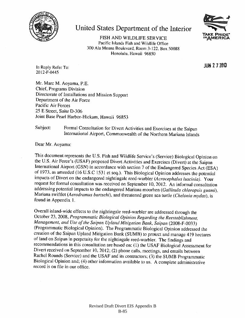
Revised Draft Divert EIS Appendix B B-85
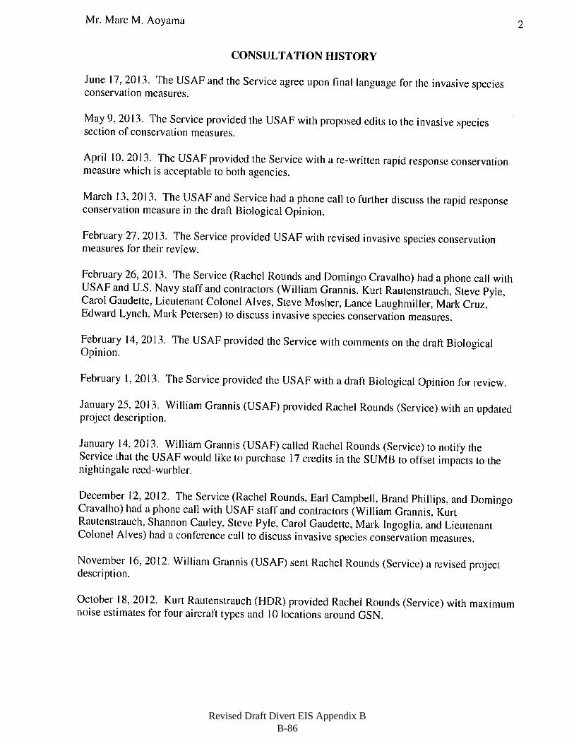
Revised Draft Divert EIS Appendix B B-86
Revised Draft Divert EIS Appendix B B-87
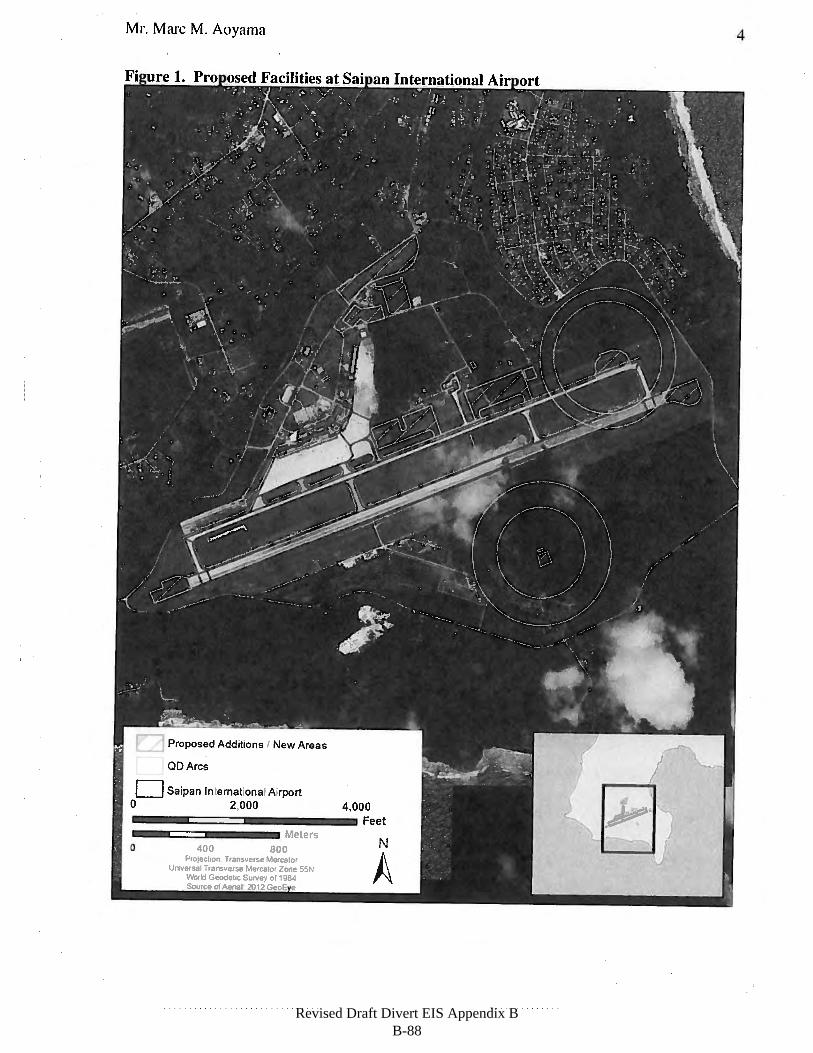
Revised Draft Divert EIS Appendix B B-88
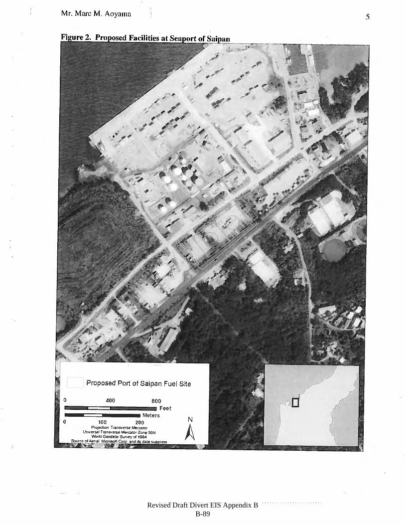
Revised Draft Divert EIS Appendix B B-89
Revised Draft Divert EIS Appendix B B-90
Revised Draft Divert EIS Appendix B B-91
Revised Draft Divert EIS Appendix B B-92
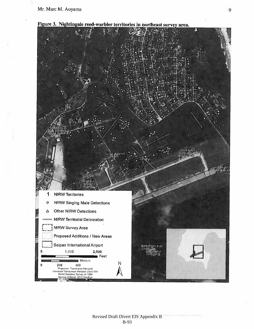
Revised Draft Divert EIS Appendix B B-93
Revised Draft Divert EIS Appendix B B-94
Revised Draft Divert EIS Appendix B B-95
Revised Draft Divert EIS Appendix B B-96
Revised Draft Divert EIS Appendix B B-97
Revised Draft Divert EIS Appendix B B-98
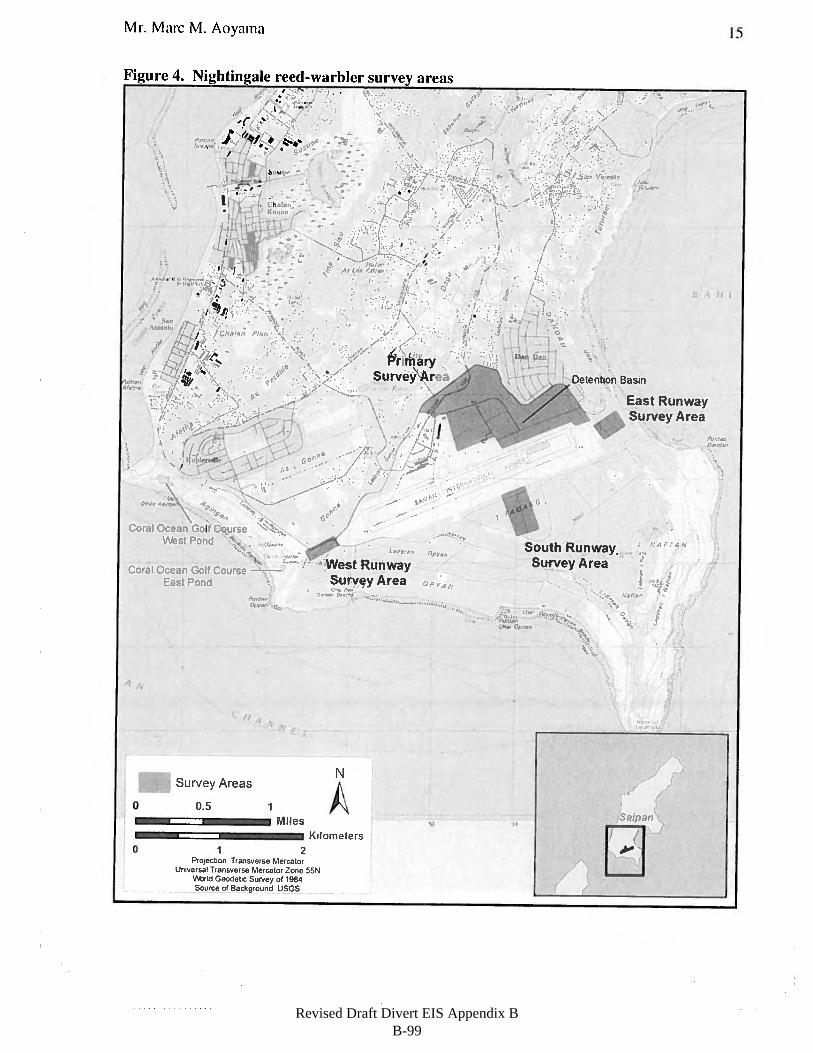
Revised Draft Divert EIS Appendix B B-99
Revised Draft Divert EIS Appendix B B-100
Revised Draft Divert EIS Appendix B B-101
Revised Draft Divert EIS Appendix B B-102
Revised Draft Divert EIS Appendix B B-103
Revised Draft Divert EIS Appendix B B-104
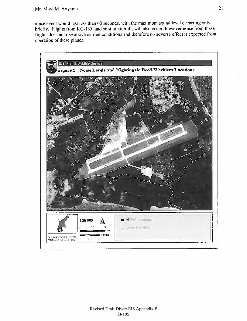
Revised Draft Divert EIS Appendix B B-105
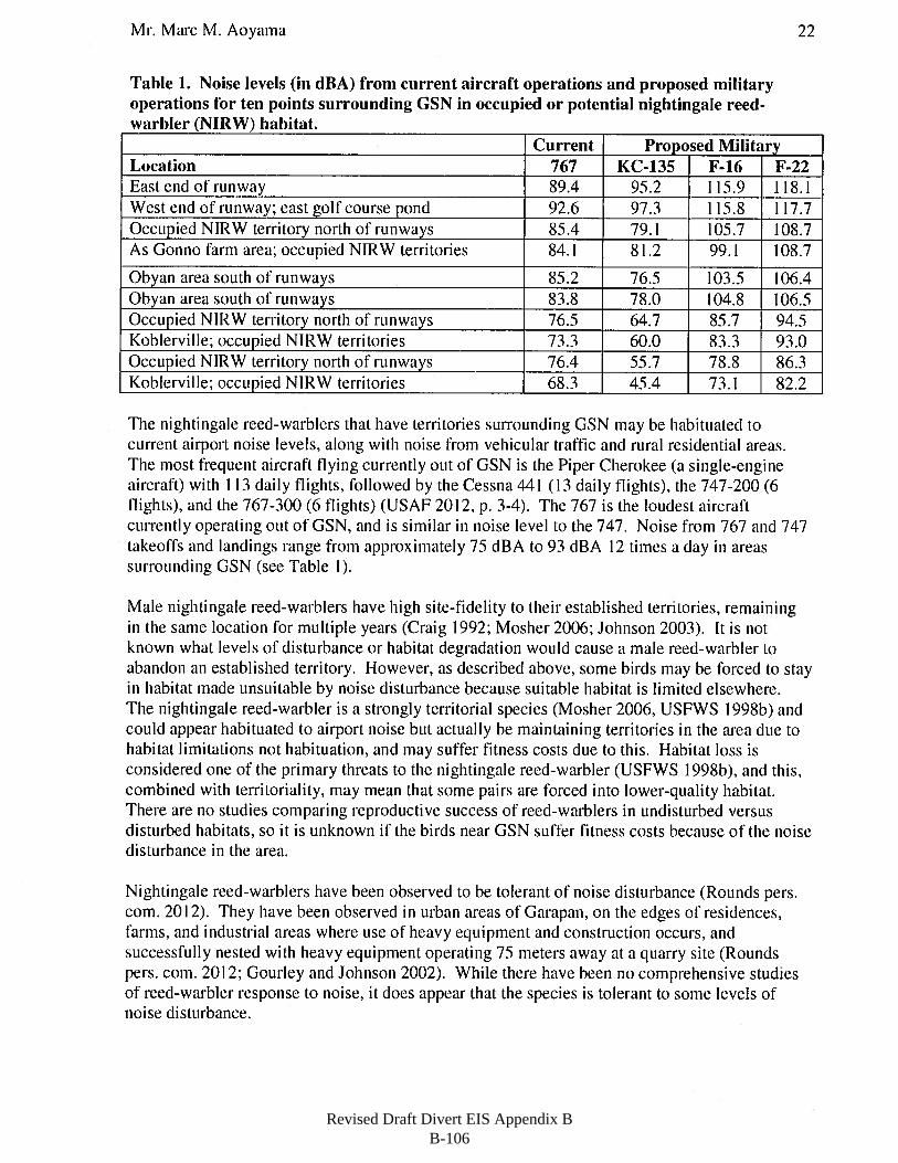
Revised Draft Divert EIS Appendix B B-106
Revised Draft Divert EIS Appendix B B-107
Revised Draft Divert EIS Appendix B B-108
Revised Draft Divert EIS Appendix B B-109
Revised Draft Divert EIS Appendix B B-110
Revised Draft Divert EIS Appendix B B-111
Revised Draft Divert EIS Appendix B B-112
Revised Draft Divert EIS Appendix B B-113
Revised Draft Divert EIS Appendix B B-114
Revised Draft Divert EIS Appendix B B-115
Revised Draft Divert EIS Appendix B B-116
Revised Draft Divert EIS Appendix B B-117

Revised Draft Divert EIS Appendix B B-118
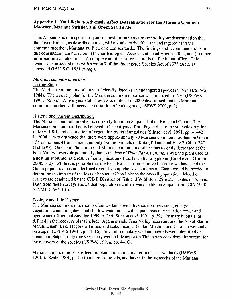
Revised Draft Divert EIS Appendix B B-119
Revised Draft Divert EIS Appendix B B-120
Revised Draft Divert EIS Appendix B B-121
Revised Draft Divert EIS Appendix B B-122
Revised Draft Divert EIS Appendix B B-123
Revised Draft Divert EIS Appendix B B-124
Revised Draft Divert EIS Appendix B B-125
Revised Draft Divert EIS Appendix B B-126
Revised Draft Divert EIS Appendix B B-127
Revised Draft Divert EIS Appendix B B-128
Revised Draft Divert EIS Appendix B B-129
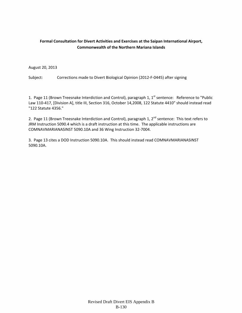
Formal Consultation for Divert Activities and Exercises at the Saipan International Airport,
Commonwealth of the Northern Mariana Islands
August 20, 2013
Subject: Corrections made to Divert Biological Opinion (2012‐F‐0445) after signing
1. Page 11 (Brown Treesnake Interdiction and Control), paragraph 1, 1st sentence: Reference to "Public Law 110‐417, [Division A], title III, Section 316, October 14,2008, 122 Statute 4410" should instead read "122 Statute 4356." 2. Page 11 (Brown Treesnake Interdiction and Control), paragraph 1, 2nd sentence: This text refers to JRM Instruction 5090.4 which is a draft instruction at this time. The applicable instructions are COMNAVMARIANASINST 5090.10A and 36 Wing Instruction 32‐7004. 3. Page 13 cites a DOD Instruction 5090.10A. This should instead read COMNAVMARIANASINST 5090.10A.
Revised Draft Divert EIS Appendix B B-130

A P P E N D I X C
CZMA Compliance Supporting Documentation
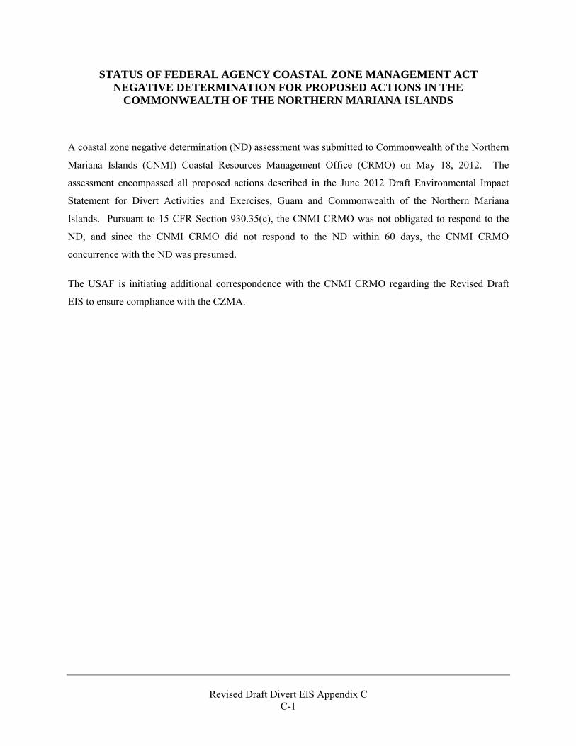
Revised Draft Divert EIS Appendix C
C-1
STATUS OF FEDERAL AGENCY COASTAL ZONE MANAGEMENT ACT NEGATIVE DETERMINATION FOR PROPOSED ACTIONS IN THE
COMMONWEALTH OF THE NORTHERN MARIANA ISLANDS
A coastal zone negative determination (ND) assessment was submitted to Commonwealth of the Northern
Mariana Islands (CNMI) Coastal Resources Management Office (CRMO) on May 18, 2012. The
assessment encompassed all proposed actions described in the June 2012 Draft Environmental Impact
Statement for Divert Activities and Exercises, Guam and Commonwealth of the Northern Mariana
Islands. Pursuant to 15 CFR Section 930.35(c), the CNMI CRMO was not obligated to respond to the
ND, and since the CNMI CRMO did not respond to the ND within 60 days, the CNMI CRMO
concurrence with the ND was presumed.
The USAF is initiating additional correspondence with the CNMI CRMO regarding the Revised Draft
EIS to ensure compliance with the CZMA.

Revised Draft Divert EIS Appendix C
C-2
THIS PAGE INTENTIONALLY LEFT BLANK
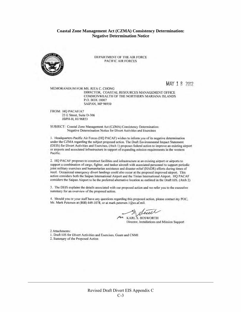
Revised Draft Divert EIS Appendix C
C-3
Coastal Zone Management Act (CZMA) Consistency Determination: Negative Determination Notice
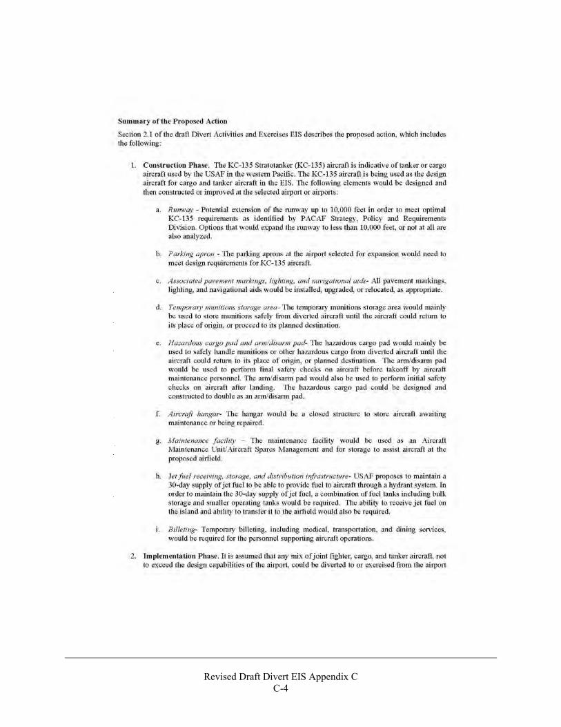
Revised Draft Divert EIS Appendix C
C-4
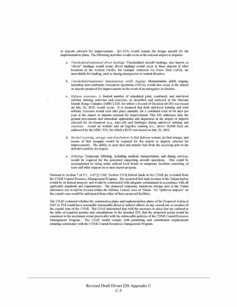
Revised Draft Divert EIS Appendix C
C-5

Revised Draft Divert EIS Appendix C
C-6
THIS PAGE INTENTIONALLY LEFT BLANK
A P P E N D I X D
NHPA Section 106 Consultation Supporting Documentation
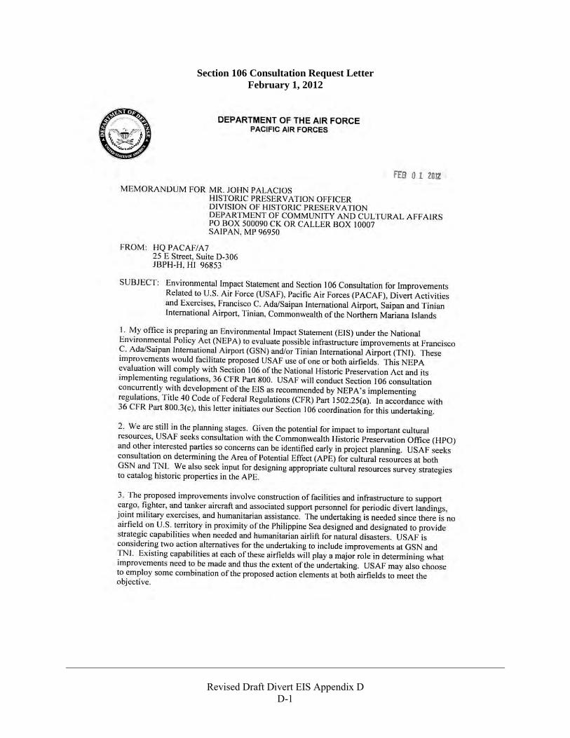
Revised Draft Divert EIS Appendix D
D-1
Section 106 Consultation Request Letter February 1, 2012
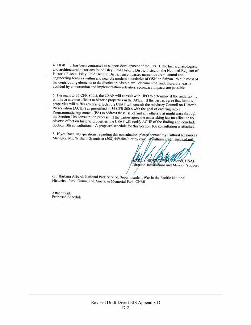
Revised Draft Divert EIS Appendix D
D-2
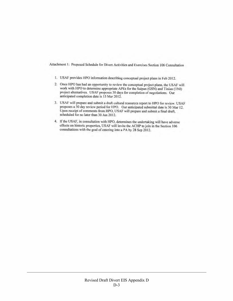
Revised Draft Divert EIS Appendix D
D-3
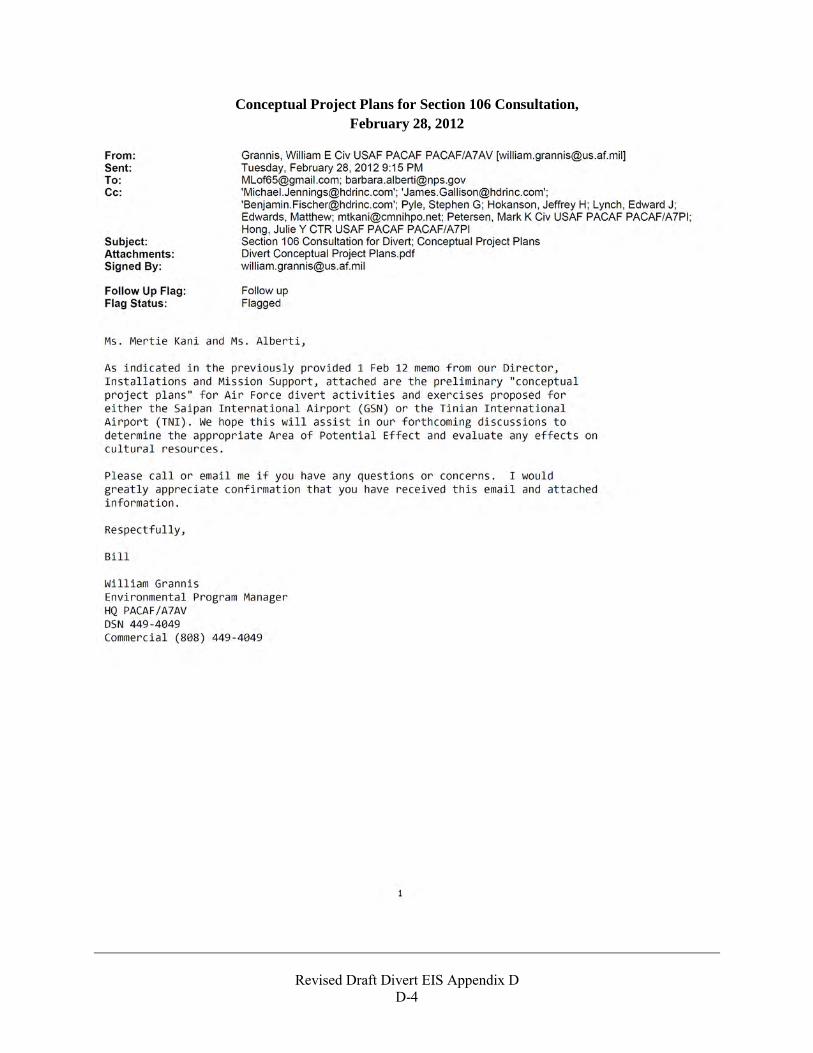
Revised Draft Divert EIS Appendix D
D-4
Conceptual Project Plans for Section 106 Consultation, February 28, 2012
Revised Draft Divert EIS Appendix D
D-5
Revised Draft Divert EIS Appendix D
D-6
Revised Draft Divert EIS Appendix D
D-7
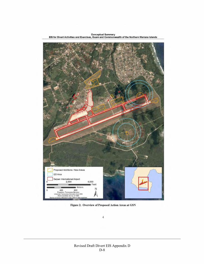
Revised Draft Divert EIS Appendix D
D-8
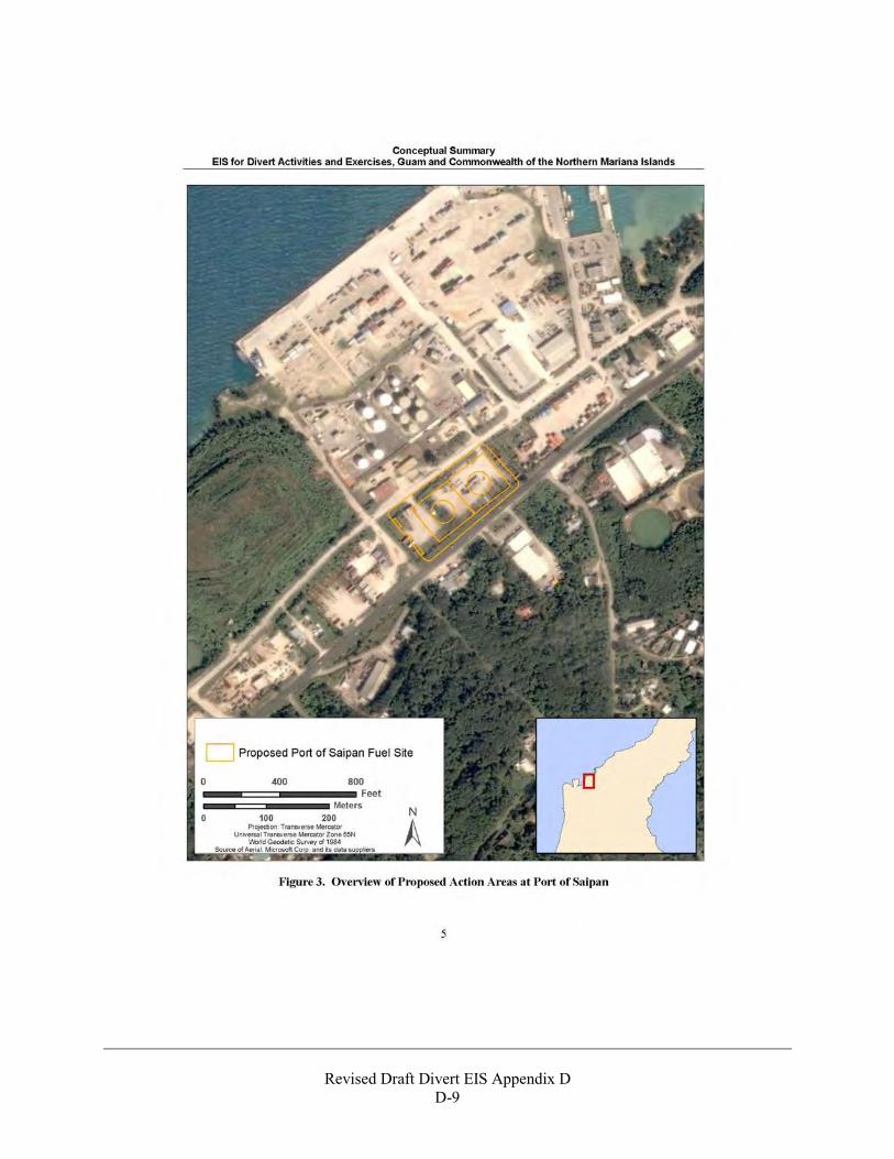
Revised Draft Divert EIS Appendix D
D-9
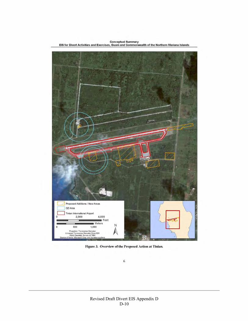
Revised Draft Divert EIS Appendix D
D-10
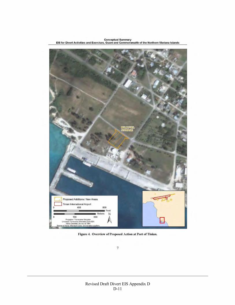
Revised Draft Divert EIS Appendix D
D-11
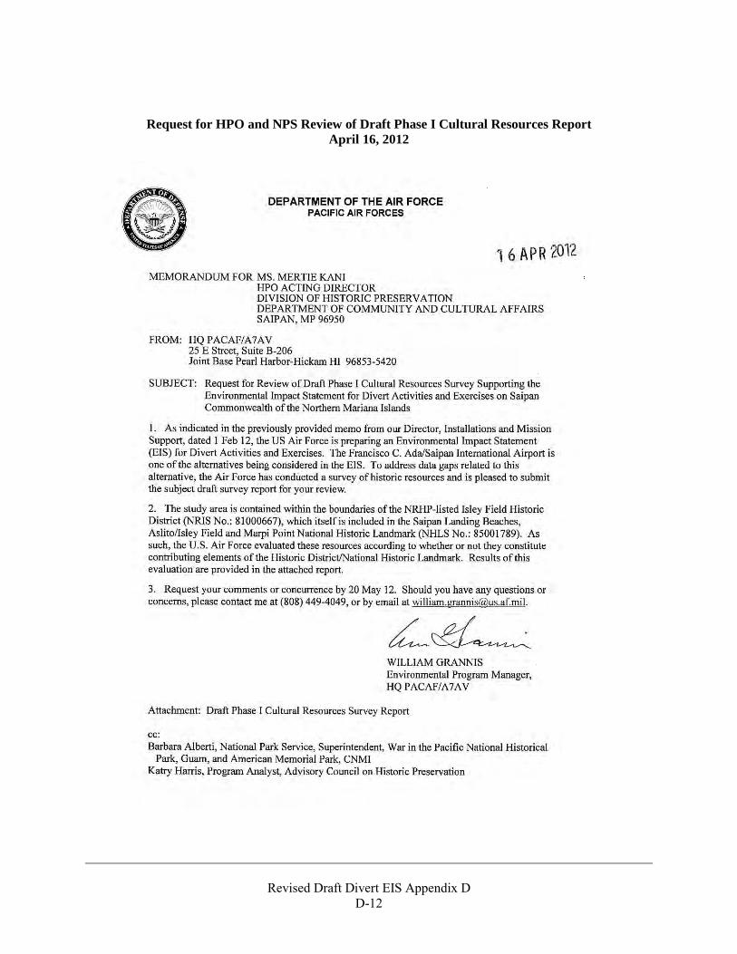
Revised Draft Divert EIS Appendix D
D-12
Request for HPO and NPS Review of Draft Phase I Cultural Resources Report April 16, 2012
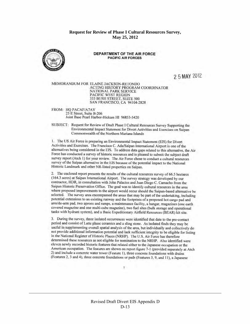
Revised Draft Divert EIS Appendix D
D-13
Request for Review of Phase I Cultural Resources Survey, May 25, 2012
Revised Draft Divert EIS Appendix D
D-14
Revised Draft Divert EIS Appendix D
D-15
Revised Draft Divert EIS Appendix D
D-16
Section 106 Review and Comments Letter from CNMI HPO May 31, 2012
Revised Draft Divert EIS Appendix D
D-17
Revised Draft Divert EIS Appendix D
D-18
Response to Request for Review of Phase I Cultural Resources Survey Letter, June 25, 2012
Revised Draft Divert EIS Appendix D
D-19
Revised Draft Divert EIS Appendix D
D-20
USAF News Release regarding historical sites at GSN and TNI September 2, 2012
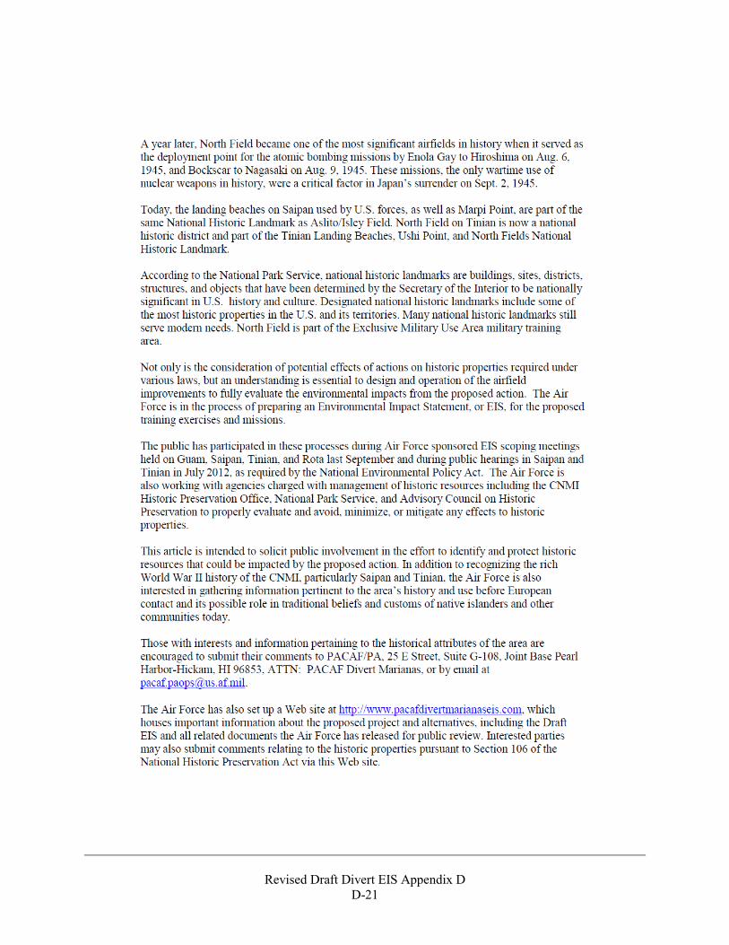
Revised Draft Divert EIS Appendix D
D-21
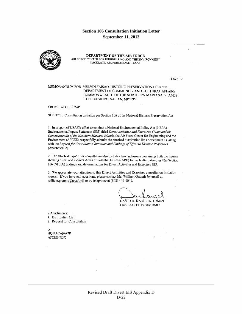
Revised Draft Divert EIS Appendix D
D-22
Section 106 Consultation Initiation Letter September 11, 2012
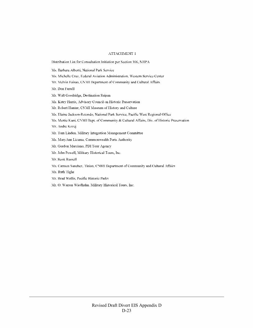
Revised Draft Divert EIS Appendix D
D-23
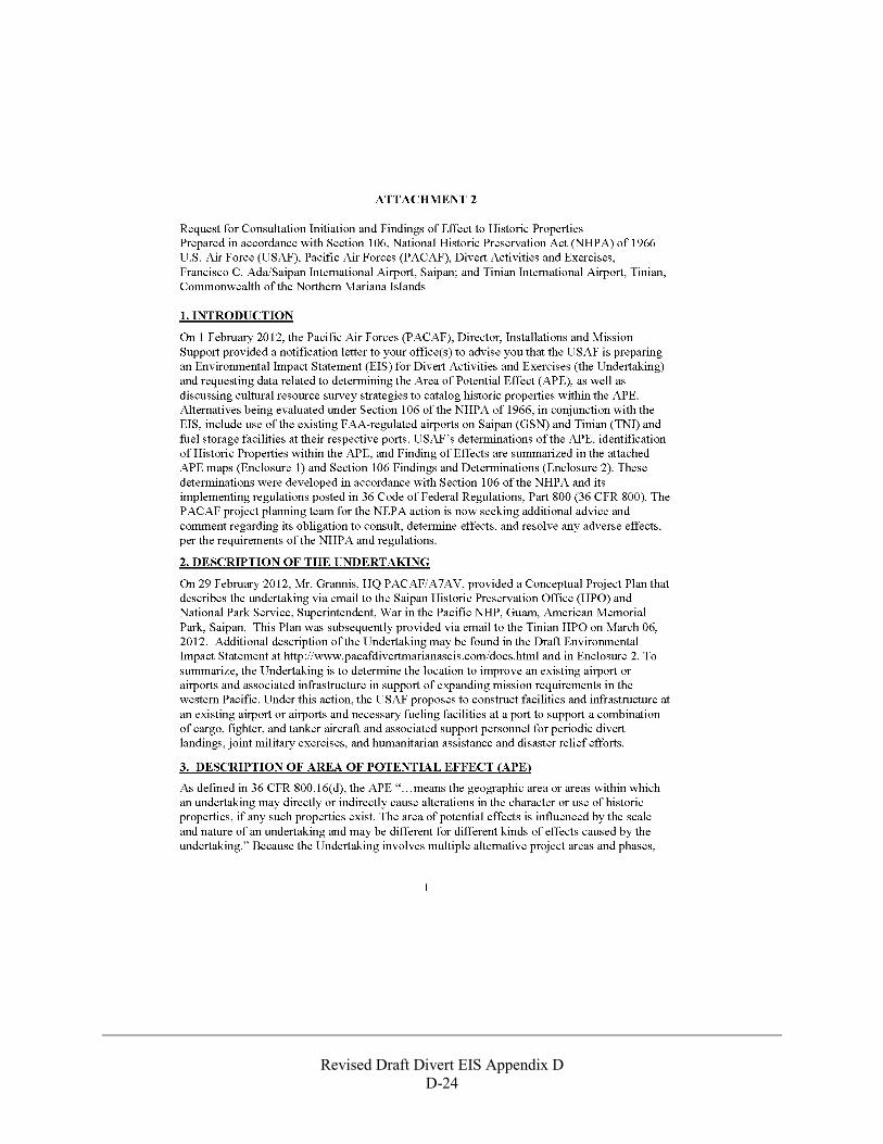
Revised Draft Divert EIS Appendix D
D-24
Revised Draft Divert EIS Appendix D
D-25
Revised Draft Divert EIS Appendix D
D-26

Revised Draft Divert EIS Appendix D
D-27

Revised Draft Divert EIS Appendix D
D-28
Note: Culturally sensitive information has been redacted from this page.

Revised Draft Divert EIS Appendix D
D-29
Note: Culturally sensitive information has been redacted from this page.
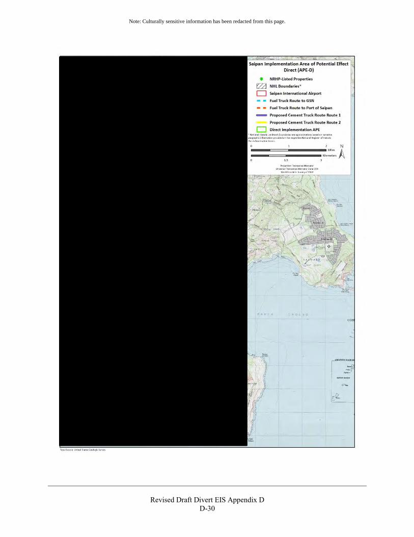
Revised Draft Divert EIS Appendix D
D-30
Note: Culturally sensitive information has been redacted from this page.
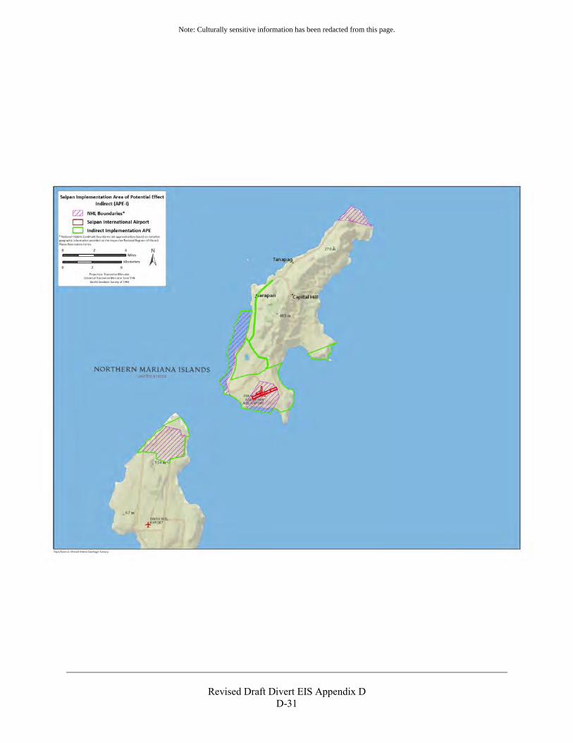
Revised Draft Divert EIS Appendix D
D-31
Note: Culturally sensitive information has been redacted from this page.
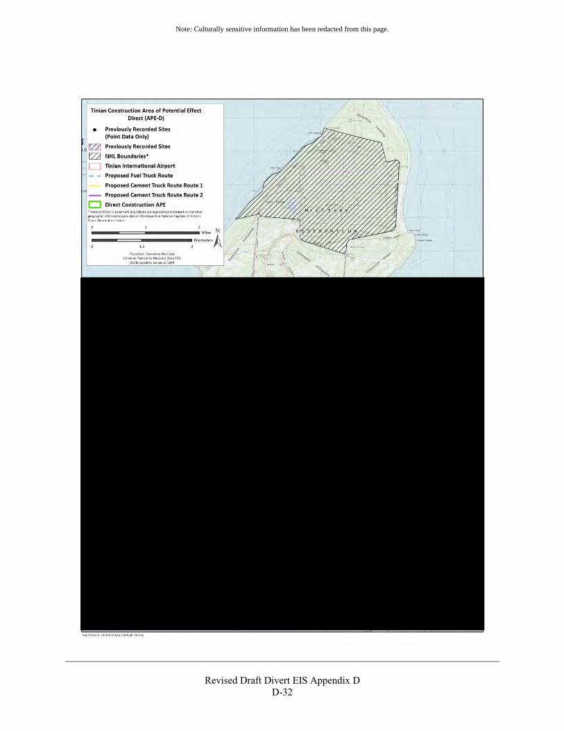
Revised Draft Divert EIS Appendix D
D-32
Note: Culturally sensitive information has been redacted from this page.
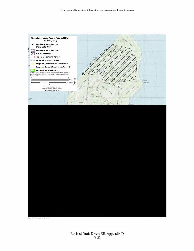
Revised Draft Divert EIS Appendix D
D-33
Note: Culturally sensitive information has been redacted from this page.
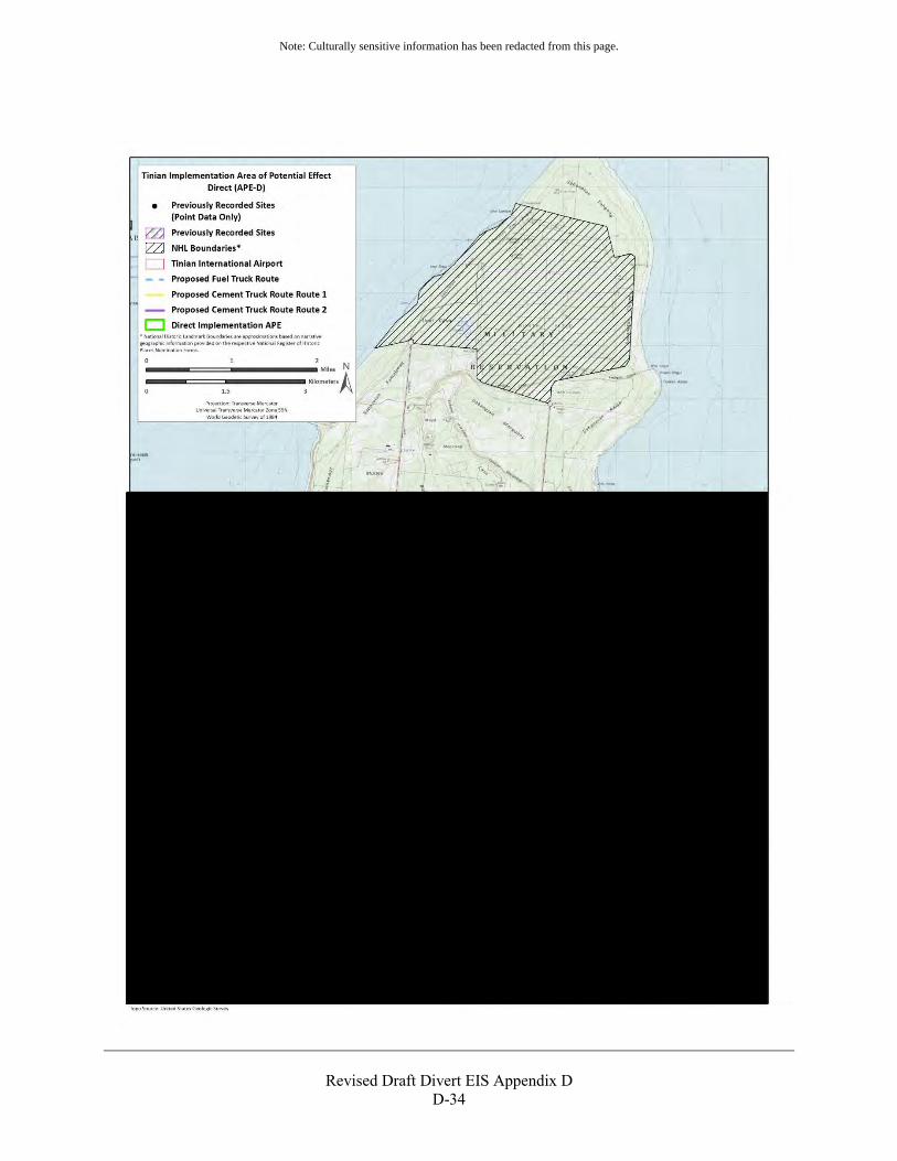
Revised Draft Divert EIS Appendix D
D-34
Note: Culturally sensitive information has been redacted from this page.
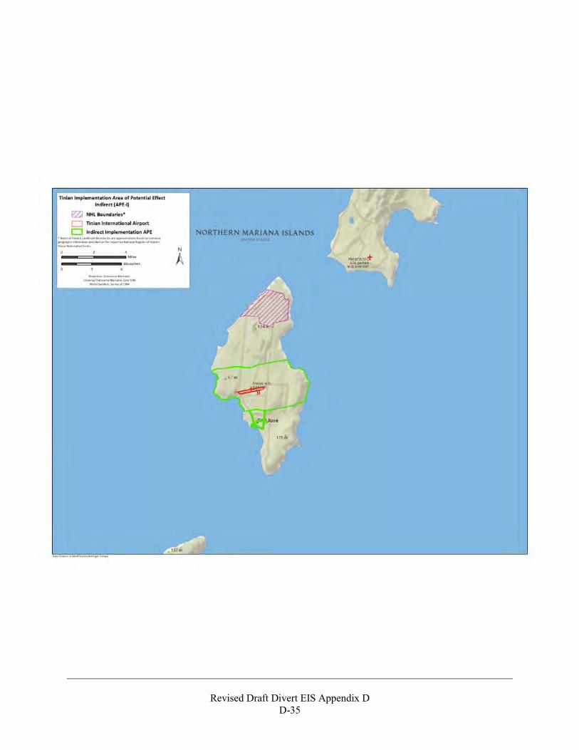
Revised Draft Divert EIS Appendix D
D-35
Revised Draft Divert EIS Appendix D
D-36
Revised Draft Divert EIS Appendix D
D-37
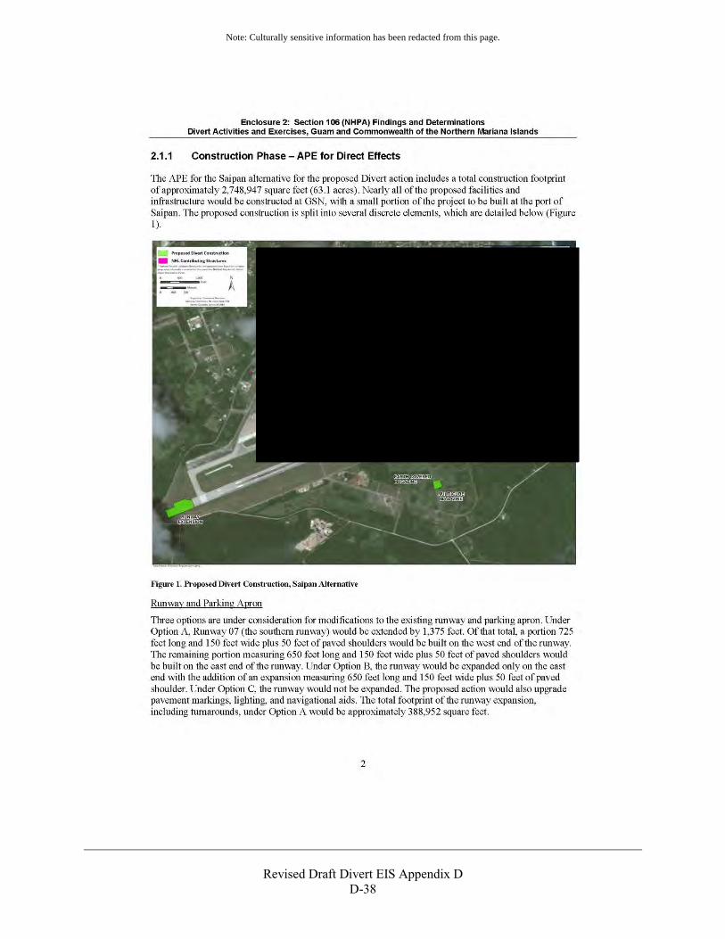
Revised Draft Divert EIS Appendix D
D-38
Note: Culturally sensitive information has been redacted from this page.
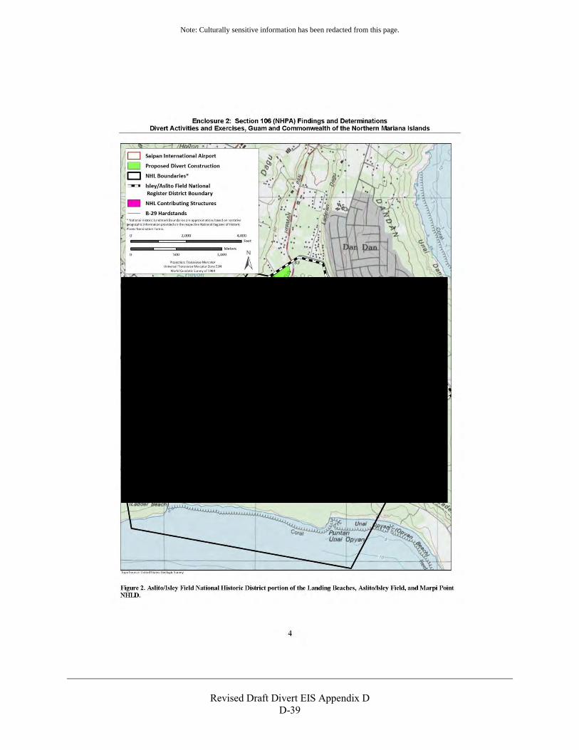
Revised Draft Divert EIS Appendix D
D-39
Note: Culturally sensitive information has been redacted from this page.
Revised Draft Divert EIS Appendix D
D-40
Note: Culturally sensitive information has been redacted from this page.
Revised Draft Divert EIS Appendix D
D-41
Note: Culturally sensitive information has been redacted from this page.
Revised Draft Divert EIS Appendix D
D-42
Revised Draft Divert EIS Appendix D
D-43
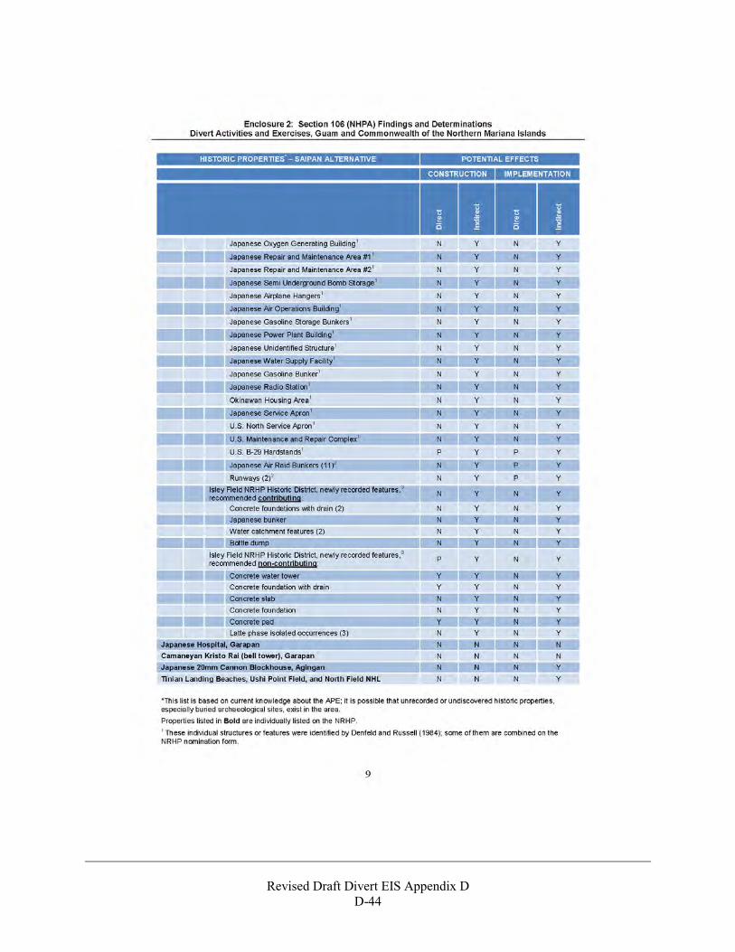
Revised Draft Divert EIS Appendix D
D-44
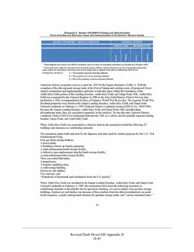
Revised Draft Divert EIS Appendix D
D-45
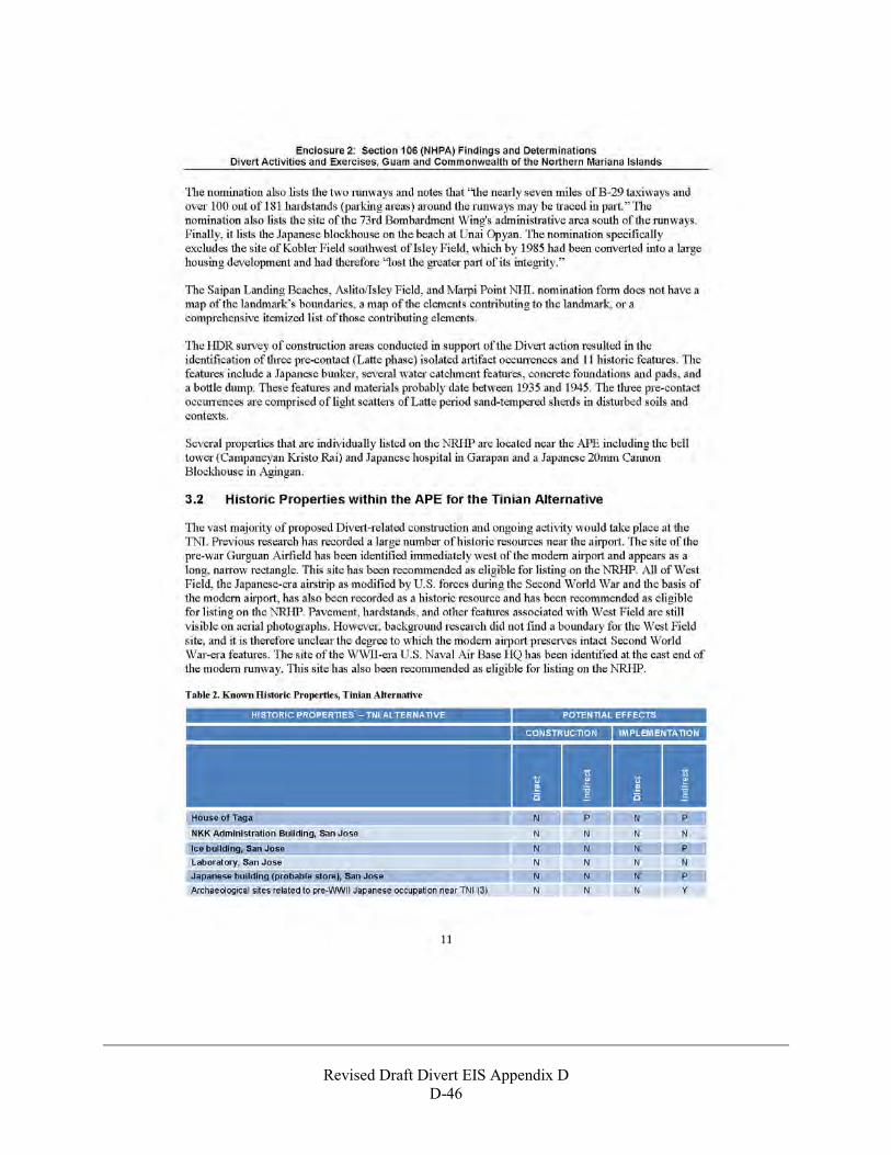
Revised Draft Divert EIS Appendix D
D-46
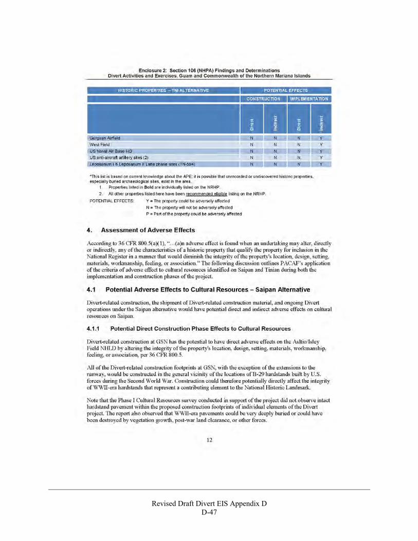
Revised Draft Divert EIS Appendix D
D-47
Revised Draft Divert EIS Appendix D
D-48
Revised Draft Divert EIS Appendix D
D-49
Revised Draft Divert EIS Appendix D
D-50
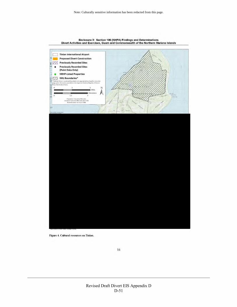
Revised Draft Divert EIS Appendix D
D-51
Note: Culturally sensitive information has been redacted from this page.
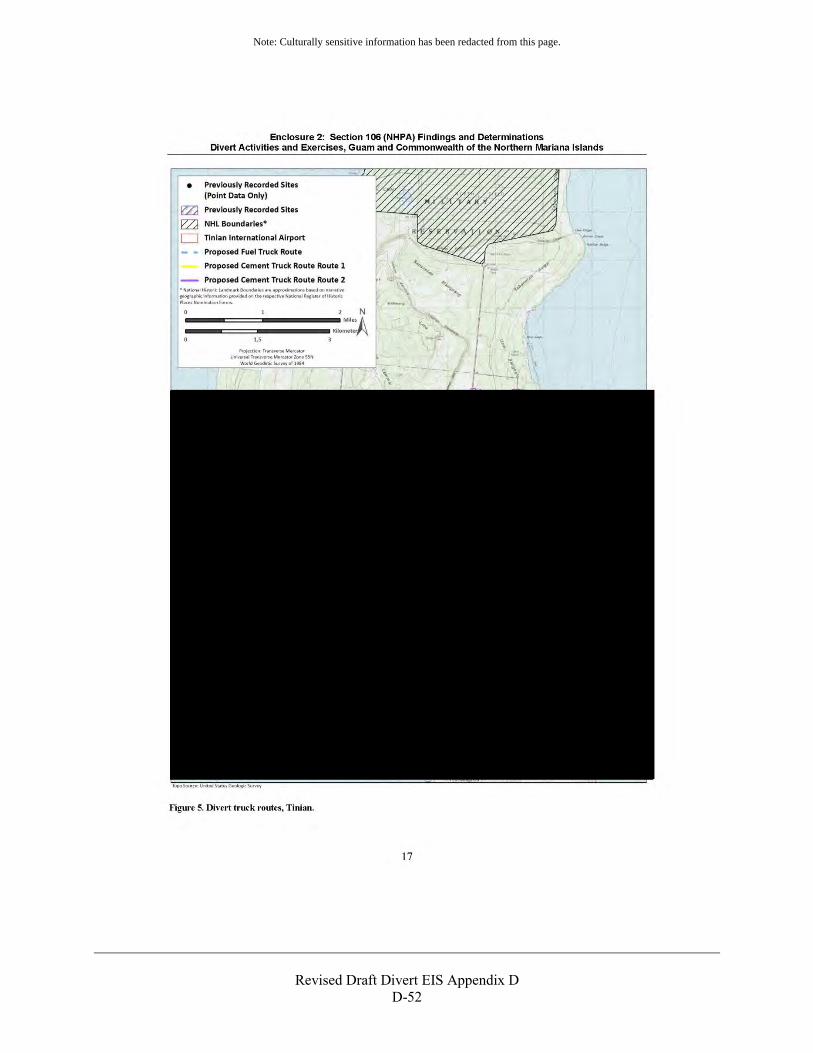
Revised Draft Divert EIS Appendix D
D-52
Note: Culturally sensitive information has been redacted from this page.
Revised Draft Divert EIS Appendix D
D-53
National Park Service Letter regarding Section 106 Consultation October 10, 2012
Revised Draft Divert EIS Appendix D
D-54

Revised Draft Divert EIS Appendix D
D-55
Revised Draft Divert EIS Appendix D
D-56
Section 106 Consultation and Findings of Effects to Historic Properties, October 16, 2012
Revised Draft Divert EIS Appendix D
D-57
Revised Draft Divert EIS Appendix D
D-58
Section 106 Consultation and Notification of Adverse Effect, October 29, 2012
Revised Draft Divert EIS Appendix D
D-59

THIS PAGE INTENTIONALLY LEFT BLANK
Revised Draft Divert EIS Appendix D D-60
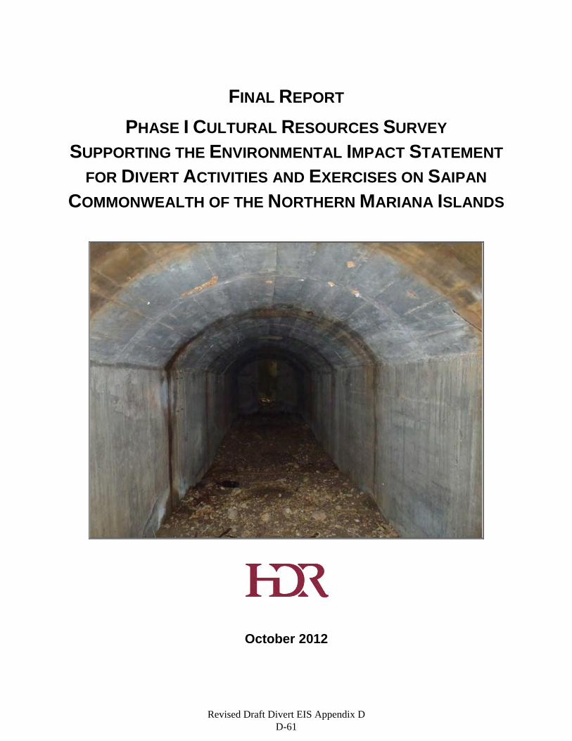
FINAL REPORT PHASE I CULTURAL RESOURCES SURVEY
SUPPORTING THE ENVIRONMENTAL IMPACT STATEMENT FOR DIVERT ACTIVITIES AND EXERCISES ON SAIPAN
COMMONWEALTH OF THE NORTHERN MARIANA ISLANDS
October 2012
Revised Draft Divert EIS Appendix D D-61

Revised Draft Divert EIS Appendix D D-62
Revised Draft Divert EIS Appendix D D-63

Revised Draft Divert EIS Appendix D D-64
FINAL REPORT PHASE I CULTURAL RESOURCES SURVEY
SUPPORTING THE ENVIRONMENTAL IMPACT STATEMENT FOR DIVERT ACTIVITIES AND EXERCISES
COMMONWEALTH OF THE NORTHERN MARIANA ISLANDS
By
Ben Fischer Jim Gallison, PhD, RPA Jeff Hokanson, MA, RPA
Michael Jennings Matthew Edwards, MHP, PhD, RPA
And Michael Church, PhD, RPA
Maps by
Ben Fischer
Prepared For:
Headquarter, Pacific Air Forces Joint Base Pearl Harbor-Hickam, Hawai‘i
Prepared By:
HDR Environmental, Operations and Construction, Inc.
9563 South Kingston Court Englewood, CO 80112
October 2012
Revised Draft Divert EIS Appendix D D-65

Revised Draft Divert EIS Appendix D D-66
Final Phase I Cultural Resources Survey for the Divert Activities and Exercises
October 2012 i
ACRONYMS AND ABBREVIATIONS
AFCEE Air Force Center for Engineering and the Environment az Azimuth BEAR Basic Expeditionary Airfield Resources B.P. Before Present (radiocarbon years) CFR Code of Federal Regulations CNMI Commonwealth of the Northern Mariana Islands cm centimeters EIS Environmental Impact Statement ENSO El Nino/Southern Oscillation ft feet FHP Forest Health Protection FIA Forest Inventory and Analysis GPS Global Positioning System GSN Francisco C. Ada/Saipan International Airport HDR HDR Environmental, Operations and Construction, Inc. HPO Historic Preservation Office IO Isolated Occurrence km kilometers km2 square kilometers m meters m3 cubic meters mi2 square miles mm millimeters NHL National Historic Landmark NHLS National Historic Landmark System NHPA National Historic Preservation Act NPS National Park Service NRHP National Register of Historic Places NRIS National Register Inventory System PACAF Headquarters, Pacific Air Forces U.N. United Nations USDA United States Department of Agriculture USGS United States Geological Survey WWII World War II
Revised Draft Divert EIS Appendix D D-67
Final Phase I Cultural Resources Survey for the Divert Activities and Exercises
ii October 2012
ACKNOWLEDGEMENTS
The authors would like to thank the following individuals and institutions whose assistance greatly facilitated the completion of this volume: Juan Camancho at the CNMI Division of Historic Preservation, for assisting with background research in advance of the survey; security staff at Saipan International Airport for facilitating access to survey areas on airport property; Bernard Marcos with PACAF who provided us with up-to-date project planning information in the field to help direct our survey efforts; Bill Grannis with PACAF and Toni Ristau at AFCEE provided valuable advice on a draft version of the report that greatly contributed to the quality of this final version. Comments on the draft from Merti Kani and Historic Preservation Officer Melvin Faisao, also at the CNMI Division of Historic Preservation, are also appreciated. While many individuals and institutions made contributions to this volume, the authors are solely responsible for any inaccuracies that it may contain.
Revised Draft Divert EIS Appendix D D-68
Final Phase I Cultural Resources Survey for the Divert Activities and Exercises
October 2012 iii
ABSTRACT
HDR Environmental, Operations and Construction, Inc. (HDR), was contracted by the Air Force Center for Engineering and the Environment (AFCEE) on behalf of Headquarters, Pacific Air Forces to complete a cultural resource survey pursuant to the preparation of an Environmental Impact Statement (EIS). The EIS will evaluate possible infrastructure improvements at Francisco C. Ada/Saipan International Airport (GSN), along with other alternatives. However, given the potential for impact to important cultural resources, specifically the Isley Field Historic District, which is also part of the Saipan Landing Beaches, Aslito/Isley Field, and Marpi Point National Historic Landmark, survey of the GSN Alternative was deemed prudent. This report details the approach used by HDR to identify, record, and evaluate cultural resources within the project area.
Selection of the GSN Alternative would entail extensions to an existing runway and the footprints of a proposed hot cargo pad and arm/de-arm pad, two aprons and ramps, a maintenance facility, a hangar, magazines (one earth covered magazine and one multi-cube magazine), two fuel sites (bulk storage and operational tanks with hydrant system), and a Basic Expeditionary Airfield Resources (BEAR) kit site. As part of the survey, HDR surveyed 66.5 hectares (164.3 acres) in the vicinity of the airport. The project also involves the use of fuel storage tanks and offloading facilities at the Port of Saipan.
The area that could be impacted by the selection of the GSN Alternative was surveyed by HDR cultural resources professionals who meet or exceed the Secretary of Interior’s Professional Qualification Standards. During the course of the investigation, which took place September 17–29, 2011, HDR found and recorded three pre-contact isolated occurrences and 11 features associated with the Historic District/Landmark. In addition, eight previously recorded Japanese bunkers (AB1 through AB8) were found to be adjacent to the study area as were remnants of B-29 hardstands.
The three isolated occurrences date to the pre-contact period and consist of Latte phase ceramics and a sling stone. As isolated finds they are important for spatial analysis of the area but individually do not retain adequate integrity or additional information potential. They are therefore recommended as not eligible for nomination to the National Register of Historic Places (NRHP).
The 11 features are historic in age and related either to the Japanese occupation or the American occupation. The features include bottle middens, ceramic scatters, concrete foundations, water catchment features, and a previously unrecorded Japanese bunker. Features 1 and 3, the remains of water catchment or storage structures, and Features 5, 9, and 11, concrete foundation pads, do not retain significant integrity to be considered eligible for the NRHP under any criteria. The remaining newly recorded features do retain sufficient integrity to warrant inclusion as contributing elements to the Isley Field Historic District/Landmark.
Six of the previously recorded Japanese bunkers are north of the runway and can be avoided by the project as can the other two bunkers at the edge of the BEAR-kit site. The hardstand remnants exist across the project area. While they were originally included as contributing elements to the Historic District/Landmark, they no longer retain sufficient integrity to remain so.
Revised Draft Divert EIS Appendix D D-69

Final Phase I Cultural Resources Survey for the Divert Activities and Exercises
iv October 2012
This page intentionally left blank.
Revised Draft Divert EIS Appendix D D-70

Final Phase I Cultural Resources Survey for the Divert Activities and Exercises
October 2012 v
Table of Contents
1. Introduction ............................................................................................................................................ 1 2. Environmental Overview ....................................................................................................................... 5
2.1. Flora and Fauna............................................................................................................................ 5 2.2. Geology and Soils ......................................................................................................................... 7 2.3. Saipan Geology ............................................................................................................................ 7 2.4. Conclusion .................................................................................................................................. 10
3. Prehistoric and Historic Context .......................................................................................................... 11 3.1. Pre-Contact Period ..................................................................................................................... 11
3.1.1. Pre-Latte Phase (ca. 1500 B.C. – A.D. 800/1000) ........................................................ 12 3.1.2. Latte Phase (A.D. 800/1000 – Contact)......................................................................... 13
3.2. Post Contact Context .................................................................................................................. 17 3.2.1. The Spanish Period (1521 – 1898) ................................................................................ 17 3.2.2. The Early Twentieth Century (1898 – 1941) ................................................................. 19 3.2.3. World War II (1941 – 1944) ........................................................................................... 21 3.2.4. The Second American Period (1944 – present) ............................................................ 23
4. Previous Research .............................................................................................................................. 25 4.1. Saipan ......................................................................................................................................... 25 4.2. Summary of National Register Status......................................................................................... 27 4.3. Conclusion .................................................................................................................................. 28
5. Research Design ................................................................................................................................. 29 5.1. Prehistoric Period Research Questions ...................................................................................... 29 5.2. Historic Period Research Questions ........................................................................................... 31
6. Methodology ........................................................................................................................................ 33 6.1. Pre-Field Investigations .............................................................................................................. 33 6.2. Field Methods ............................................................................................................................. 33 6.3. Artifact Recording ....................................................................................................................... 33
6.3.1. Ceramic Analysis ........................................................................................................... 33 6.3.2. Ground Stone ................................................................................................................ 34 6.3.3. Metal, Concrete, and Glass ........................................................................................... 34
6.4. Other Artifacts and Features ....................................................................................................... 34 6.5. Evaluation Standards: National Register of Historic Places Eligibility Criteria ........................... 35 6.6. Conclusion .................................................................................................................................. 36
7. Survey Results .................................................................................................................................... 37 7.1. Isolated Occurrences .................................................................................................................. 38 7.2. New Features to Isley Field Historic District ............................................................................... 40
7.2.1. Feature 1 ....................................................................................................................... 41 7.2.2. Features 2, 3 and 4........................................................................................................ 41 7.2.3. Feature 5 ....................................................................................................................... 43 7.2.4. Feature 6 ....................................................................................................................... 45 7.2.5. Feature 7 ....................................................................................................................... 49 7.2.6. Feature 8 ....................................................................................................................... 50 7.2.7. Feature 9 ....................................................................................................................... 51 7.2.8. Feature 10 ..................................................................................................................... 51 7.2.9. Feature 11 ..................................................................................................................... 53 7.2.10. Hardstands .................................................................................................................... 53
Revised Draft Divert EIS Appendix D D-71
Final Phase I Cultural Resources Survey for the Divert Activities and Exercises
vi October 2012
7.2.11. Japanese Bunkers at Isley Field .................................................................................... 55 8. Discussion ........................................................................................................................................... 59
8.1. Analysis of Prehistoric Period Resources ................................................................................... 59 8.2. Analysis of Historic Period Resources ........................................................................................ 59
9. Recommendations .............................................................................................................................. 61 9.1. Features Found Ineligible for Inclusion to the District as Contributing Elements ....................... 63
9.1.1. Feature 1 ....................................................................................................................... 63 9.1.2. Feature 3 ....................................................................................................................... 63 9.1.3. Features 5, 9, and 11..................................................................................................... 63 9.1.4. Hardstands .................................................................................................................... 63
9.2. Prehistoric Isolated Occurrences ................................................................................................ 64 10. References Cited ................................................................................................................................. 65
List of Tables
Table 4-1. Features and Structures Recorded by Denfeld and Russel (1984) at Isley Field. .................... 26 Table 7-1. Pre-Contact IOs Recorded During Survey. ............................................................................... 38 Table 7-2. Newly Identified Isley Field Historic District Features ................................................................ 40 Table 7-3. Concentration A. ........................................................................................................................ 52 Table 7-4. Concentration B. ........................................................................................................................ 52 Table 9-1. Features Associated with the District’s Period of Significance. ................................................. 62 Table 9-2. Prehistoric Isolated Occurances. ............................................................................................... 64
Revised Draft Divert EIS Appendix D D-72
Final Phase I Cultural Resources Survey for the Divert Activities and Exercises
October 2012 vii
List of Figures
Figure 1-1. National Historic Landmark Locations. ....................................................................................... 2 Figure 1-2. Survey Area. ............................................................................................................................... 3 Figure 1-3. Survey Area (continued). ............................................................................................................ 4 Figure 2-1. Detail Vegetation Map of the Project Area in Saipan (Adapted from Liu and Fischer 2006). .... 7 Figure 2-2. Generalized Surface Geology Map of Saipan (adapted from Clould et al. 1956). ..................... 9 Figure 3-1. Map of Rail Lines on Saipan (Sugar King Foundation 2011). .................................................. 21 Figure 4-1. Isley Field Structures and Features Recorded as Part of the Site’s NRHP Nomination Process
(Denfeld and Russel 1984). ..................................................................................................... 25 Figure 7-1. Map of Spatially Isolated Historic Features and Artifacts in the Project Area. ......................... 37 Figure 7-2. IO2 Plainware Ceramic Sherd. ................................................................................................. 38 Figure 7-3. IO2 Sling Stone......................................................................................................................... 39 Figure 7-4. IO3 Plainware Ceramic Rim Sherd........................................................................................... 39 Figure 7-5. View South of Water Retention Structure (Feature 1). ............................................................. 41 Figure 7-6. Overview of Feature 3 (Typical of Features 2, 3, and 4). ......................................................... 42 Figure 7-7. Feature 3 Detail of Concrete Pit East Wall. .............................................................................. 42 Figure 7-8. Feature 3 Drain Centered Features 2, 3, and 4. ...................................................................... 43 Figure 7-9. Locations of Features 6 through 10. ......................................................................................... 44 Figure 7-10. Interior of Japanese Bunker, Feature 6. ................................................................................. 45 Figure 7-11. Bunker Entrance Profile. ......................................................................................................... 46 Figure 7-12. Bunker Interior Profile. ............................................................................................................ 47 Figure 7-13. Bunker Plan View. .................................................................................................................. 48 Figure 7-14. Japanese Bottle Inside Bunker. .............................................................................................. 49 Figure 7-15. Pilings, Feature 7. ................................................................................................................... 49 Figure 7-16. Pilings, Feature 8. ................................................................................................................... 50 Figure 7-17. Drainage Line, Feature 8. ....................................................................................................... 50 Figure 7-18. Concrete Pad, Feature 9. ....................................................................................................... 51 Figure 7-19. Bottle Dump, Feature 10. ....................................................................................................... 52 Figure 7-20. Shenango China Plate Found in Feature 10. ......................................................................... 53 Figure 7-21. Map of Historic B-29 Hardstand Locations. ............................................................................ 54 Figure 7-22. Map of Japanese Bunker Locations. ...................................................................................... 56 Figure 7-23. Map of Japanese Bunker Locations (continued). ................................................................... 57 Figure 7-24. View Southeast of Bunker AB2. ............................................................................................. 58
Revised Draft Divert EIS Appendix D D-73

Final Phase I Cultural Resources Survey for the Divert Activities and Exercises
viii October 2012
This page intentionally left blank.
Revised Draft Divert EIS Appendix D D-74
Final Phase I Cultural Resources Survey for the Divert Activities and Exercises
October 2012 1
1. INTRODUCTION
This report details the results of the cultural resource inventory completed by HDR Environmental, Operations and Construction, Inc. (HDR). HDR was contracted by the Air Force Center for Engineering and the Environment (AFCEE) to complete the survey on behalf of Headquarters Pacific Air Forces (PACAF) pursuant to the preparation of an Environmental Impact Statement (EIS) to evaluate possible infrastructure improvements at Francisco C. Ada/Saipan International Airport (GSN), along with other alternatives. Given the potential for impact to important cultural resources, specifically the Isley Field Historic District, which is also part of the Saipan Landing Beaches, Aslito/Isley Field, and Marpi Point National Historic Landmark (NHL), survey of the GSN Alternative was deemed prudent. This report details the approach used by HDR to identify, record, and evaluate cultural resources within the study area. The inventory was completed between September 17 and September 29, 2011.
Much of the study area had been previously surveyed by Micronesian Archaeological Survey in 1980. The previous survey identified 29 features, all of which are associated with the Japanese and American occupations during World War II (WWII). In 1981 the airfield was listed on the NRHP as the Isley Field Historic District. In 1985, Isley Field was included in a discontiguous National Historic Landmark (NHL) that also includes Marpi Point on the northern tip of the island and the U.S. landing beaches along the island’s western shore (Figure 1-1).
Most of the survey areas are located in and adjacent to GSN in I Fadang on the island of Saipan (Figure 1-2). This part of the island lies upon a clastic and reef limestone plateau covered by shallow soils that were leveled during activities and events related to WWII. Vegetation is generally composed of secondary growth limestone forests that include a mixture of native and introduced species, specifically Tangantangan (Leucaena leucocephala). A small portion of the heavily developed Port of Saipan was also surveyed (Figure 1-3).
This report has been prepared in accordance with the requirements and guidelines established by the Commonwealth of the Northern Mariana Islands (CNMI) Historic Preservation Office (HPO), in the Department of Community and Cultural Affairs. Prior to beginning fieldwork, HDR archaeologists completed background research and prepared a research design that guided all field efforts and prioritized the data that was gathered. All background research, fieldwork, and report compilation activities were supervised or performed by professionals meeting the Secretary of Interior’s Professional Qualification Standards as promulgated in 36 Code of Federal Regulations (CFR) Part 61. These standards define minimum education and experience requirement to identify, evaluate, record, and treat cultural resources. HDR personnel involved in the survey reported here who meet these requirements for archaeology are Jeffrey Hokanson, Dr. James Gallison, Dr. Michael Church, and Dr. Matthew Edwards. Dr. Edwards also meets the professional qualification standards for architectural history. Jeffrey Hokanson served as Principal Investigator for the project.
This report presents the results of the survey of all project areas. Chapter 2 provides an overview of the natural environment and discusses local flora, fauna, geology, and climate. Chapter 3 is an overview of the cultural history of the Northern Marianas and provides the context for interpretation and evaluation of the cultural resources identified during the survey. Chapter 4 discusses previous cultural resource inventories in the area and an overview on the Isley Historic District. Chapter 5 presents the project research design. Field and lab methodology are the focus of Chapter 6. Chapter 7 discusses the results of the field investigations. Chapter 8 includes interpretation of the sites and a discussion of how the data collected relates to the research design. Management recommendations are presented in Chapter 9, and the bibliography is Chapter 10.
Revised Draft Divert EIS Appendix D D-75
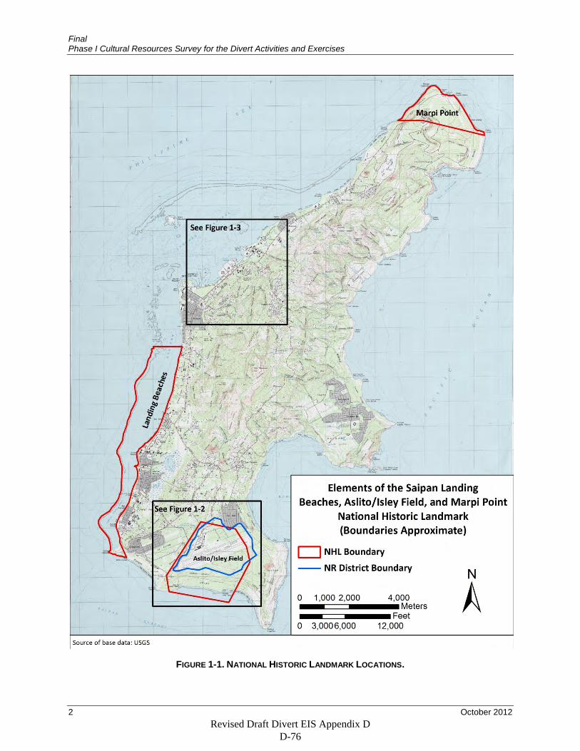
Final Phase I Cultural Resources Survey for the Divert Activities and Exercises
2 October 2012
FIGURE 1-1. NATIONAL HISTORIC LANDMARK LOCATIONS.
Revised Draft Divert EIS Appendix D D-76
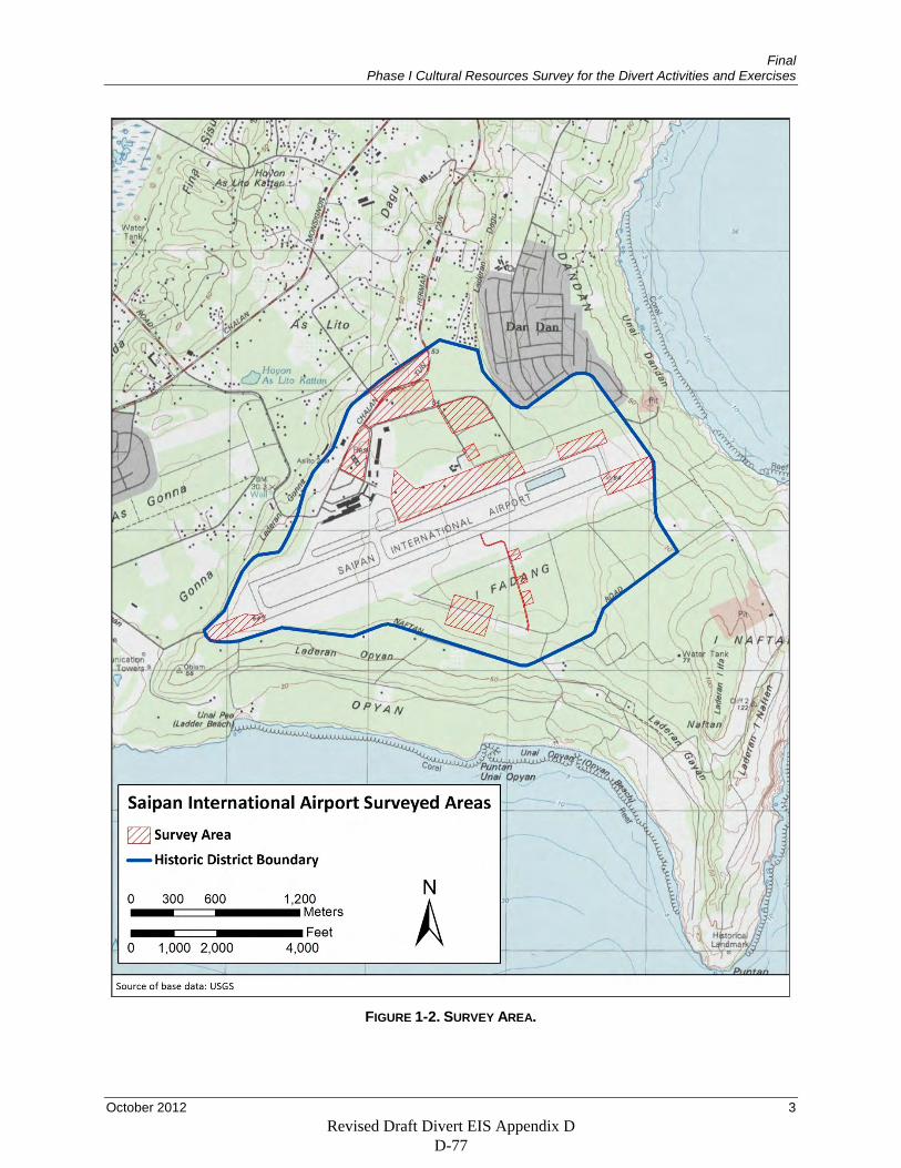
Final Phase I Cultural Resources Survey for the Divert Activities and Exercises
October 2012 3
FIGURE 1-2. SURVEY AREA.
Revised Draft Divert EIS Appendix D D-77
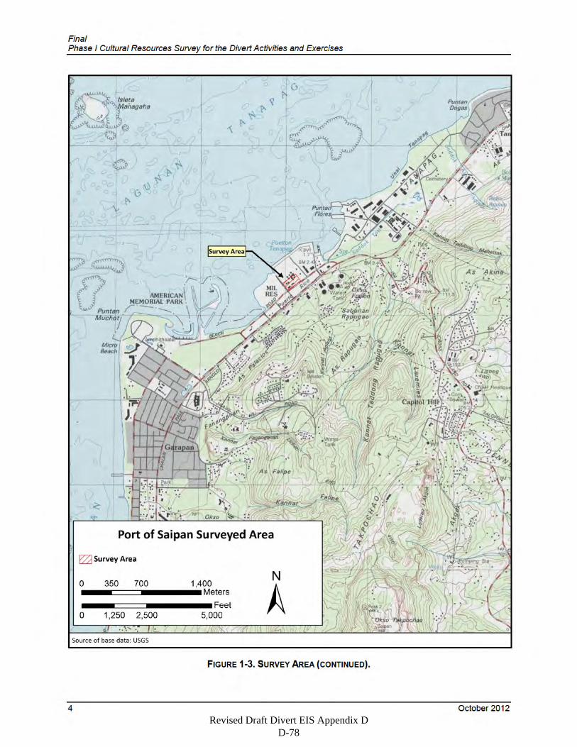
Revised Draft Divert EIS Appendix D D-78
Final Phase I Cultural Resources Survey for the Divert Activities and Exercises
October 2012 5
2. ENVIRONMENTAL OVERVIEW
The Mariana Islands are an archipelago of 15 islands that make up the northernmost extent of Micronesia. Guam, the largest and southernmost of the Mariana Islands (not within the CNMI, but forming its own political territory within the United States) encompasses roughly 538 square kilometers (km2) (208 square miles [mi2]). The other 14 islands are part of the Commonwealth of the Northern Mariana Islands (CNMI). The largest islands in the CNMI are Saipan, Rota, and Tinian. Saipan is the second largest island in the Marianas after Guam and encompasses roughly 121 km2 (47 mi2) while Rota and Tinian are roughly 85 km2 (33 mi2) and 101 km2 (39 mi2) respectively. Of the three islands, Rota boasts the highest point of elevation, Mt. Manira at 490 meters (m) (1,612 feet [ft]). The highest point in Saipan, Mt. Tapotchau, is 472 m (1,554 ft), Guam’s highest point, Mt. Lamlam, is 406 m (1,332 ft) and the highest point in Tinian, Puntan Carolinas, is just 196 m (557 ft) above sea level.
Weather in the Mariana Islands is considered tropical, generally warm and humid throughout the year with a relative humidity above 80 percent and an average annual temperature between 24° and 27° Celsius (75° and 80° Fahrenheit). Rainfall is seasonal with a typical dry season lasting from January to April and a wet season lasting from July to November with a mean annual rainfall of about 216 centimeters (cm) (85 inches).
2.1. Flora and Fauna The native vegetation of the Mariana Islands has been drastically altered by human activity and agricultural practices. Much of the natural vegetation was utterly destroyed during WWII. Most notably, Saipan, Tinian, and Guam were the setting for major military campaigns that profoundly altered the landscape (DeBell and Whitesell 1993). Since the war, much of the remaining natural flora and fauna have given way to invasive species.
Several attempts have been made to categorize the vegetative communities of the CNMI. In 1980, a survey was conducted on Saipan, Rota, and Tinian by the U.S. Forest Service in partnership with the CNMI government (Liu and Fischer 2006). The survey produced vegetation maps from the interpretation of black and white aerial photographs taken in 1976. The results indicated that the native limestone forest type of vegetation environment was dominant only on Rota. Introduced tree species and secondary vegetation encompassed significant portions of Tinian and Saipan.
More recently, a vegetation survey was undertaken for the CNMI and Guam. The survey used high resolution spatial imagery and was a concerted effort by the U.S. Department of Agriculture (USDA) Forest Service Pacific Southwest Region, Forest Health Protection (FHP) and the Pacific Northwest Research Station, Forest Inventory and Analysis (FIA) programs (Liu and Fischer 2006). The survey concluded that roughly half of Guam is now covered by secondary vegetation.
The second largest island (Saipan) of the Marianas has a complicated geologic structure and topographic diversity; as well as more than 3,500 years of human history including extensive landscape augmentation (Fosberg 1960). Saipan has also undergone recent rapid growth and urban development, further fragmenting what is left of native limestone forests. The majority of the island has been disturbed at some point during the island’s history, resulting in unstable vegetation patterns.
The native vegetation communities of the CNMI and the island territory of Guam are considered a primary limestone forest. Saipan was most likely forested with a mix of vegetation dominated by gulos (Cynometra ramiflora), acacia petit feuille (Acacia confuse), Barringtonia, and Erythrina (Mueller-Dombois and Fosberg 1998). Thatch screwpine (Pandanus tectorius) and screwpine (Pandanus dubius), grand devil’s claw (Pisonia grandis), umbrella catchbirdtree (Pisonia umbellifera), fago (Ochrosia
Revised Draft Divert EIS Appendix D D-79
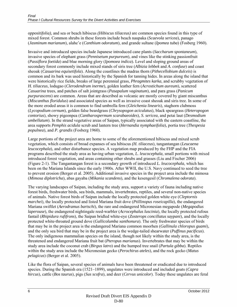
Final Phase I Cultural Resources Survey for the Divert Activities and Exercises
6 October 2012
oppositifolia), and sea or beach hibiscus (Hibiscus tiliaceus) are common species found in this type of mixed forest. Common shrubs in these forests include beach naupaka (Scaevola sericea), panago (Jasminum marianum), alahe’e (Canthium odoratum), and grande sultane (Ipomea tuba) (Fosberg 1960).
Invasive and introduced species include Japanese introduced cane plants (Saccharum spontaneum), invasive species of elephant grass (Pennisetum purpureum), and vines like the stinking passionfruit (Passiflora foetida) and blue morning glory (Ipomoea indica). Level and sloping ground areas of secondary forest commonly include mixed stands of siris tree (Albizia lebbek and A. confuse) and coast sheoak (Casuarina equisetifola). Along the coastlines the madras thorn (Pithecellobium dulceis) is common and its bark was used historically by the Spanish for tanning hides. In areas along the island that were historically rice fields, breaks of large perennial grass, Phragmites karka, and scrubby vegetation of H. tiliaceus, lodugao (Clerodendrum inerme), golden leather fern (Acrostichum aureum), scattered Casuarina trees, and patches of salt jointgrass (Pasapalum vaginatum), and para grass (Panicum purpurascens) are common. Areas that are described as volcanic are mostly covered by giant miscanthus (Miscanthus floridulus) and associated species as well as invasive coast sheoak and siris tree. In some of the more eroded areas it is common to find umbrella fern (Gleichenia linearis), staghorn clubmoss (Lycopodium cernum), golden false beardgrass (Chrysopogon aciculatus), black speargrass (Heteropogon contorius), showy pigeonpea (Cantharospermum scarabaeoides), S. sericea, and petai laut (Desmodium umbellatum). In the strand vegetative areas of Saipan, typically associated with the eastern coastline, the area supports Pemphis acidula scrub and lantern tree (Hernandia nymphaeifolia), portia tree (Thespesia populnea), and P. grandis (Fosberg 1960).
Large portions of the project area are home to some of the aforementioned hibiscus and mixed scrub vegetation, which consists of broad expanses of sea hibiscus (H. tiliaceus), tangantangan (Leucaena leucocephala), and other disturbance species. A vegetation map produced by the FHP and the FIA programs described the study area as having urban vegetation, L. leucocephala, small portions with mixed introduced forest vegetation, and areas containing other shrubs and grasses (Liu and Fischer 2006) (Figure 2-1). The Tangantangan forest is a secondary growth of introduced L. leucocephala, which has been on the Mariana Islands since the early 1900s. After WWII, the U.S. Navy continued to seed the tree to prevent erosion (Berger et al. 2005). Additional invasive species in the project area include the mimosa (Mimosa diplotricha), abas gayaba (Mikania scandens), and the kesengesil (Chromalena odorata).
The varying landscapes of Saipan, including the study area, support a variety of fauna including native forest birds, freshwater birds, sea birds, mammals, invertebrates, reptiles, and several non-native species of animals. Native forest birds of Saipan include the locally protected golden white eye (Cleptornis marchei), the locally protected and listed Mariana fruit dove (Ptillinopus roseicapilla), the endangered Mariana swiftlet (Aerodramus bartschi), the rare and endangered Micronesian megapode (Megapodius laperouse), the endangered nightingale reed-warbler (Acrocephalus luscinia), the locally protected rufous fantail (Rhipidura rufifrons), the Saipan bridled white-eye (Zosterops concillatus saypani), and the locally protected white-throated ground dove (Gallicolumba xanthonura). The only freshwater species of birds that may be in the project area is the endangered Mariana common moorhen (Gallinula chloropus guami), and the only sea bird that may be in the project area is the wedge-tailed shearwater (Puffinus pacificus). The only indigenous mammalian species on the island, though not likely within the study area, is the threatened and endangered Mariana fruit bat (Pteropus marianus). Invertebrates that may be within the study area include the coconut crab (Birgus latro) and the humped tree snail (Partula gibba). Reptiles within the study area include the Micronesian gecko (Perochirus ateles), and the rock gecko (Matus pelagicus) (Berger et al. 2005).
Like the flora of Saipan, several species of animals have been threatened or eradicated due to introduced species. During the Spanish era (1521–1899), ungulates were introduced and included goats (Capra hircus), cattle (Bos taurus), pigs (Sus scofra), and deer (Cervus unicolor). Today these ungulates are feral
Revised Draft Divert EIS Appendix D D-80
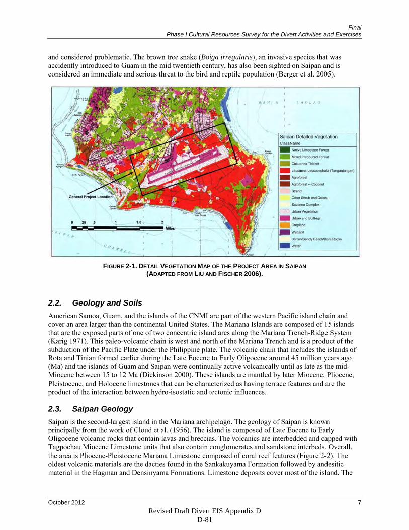
Final Phase I Cultural Resources Survey for the Divert Activities and Exercises
October 2012 7
and considered problematic. The brown tree snake (Boiga irregularis), an invasive species that was accidently introduced to Guam in the mid twentieth century, has also been sighted on Saipan and is considered an immediate and serious threat to the bird and reptile population (Berger et al. 2005).
FIGURE 2-1. DETAIL VEGETATION MAP OF THE PROJECT AREA IN SAIPAN
(ADAPTED FROM LIU AND FISCHER 2006).
2.2. Geology and Soils American Samoa, Guam, and the islands of the CNMI are part of the western Pacific island chain and cover an area larger than the continental United States. The Mariana Islands are composed of 15 islands that are the exposed parts of one of two concentric island arcs along the Mariana Trench-Ridge System (Karig 1971). This paleo-volcanic chain is west and north of the Mariana Trench and is a product of the subduction of the Pacific Plate under the Philippine plate. The volcanic chain that includes the islands of Rota and Tinian formed earlier during the Late Eocene to Early Oligocene around 45 million years ago (Ma) and the islands of Guam and Saipan were continually active volcanically until as late as the mid-Miocene between 15 to 12 Ma (Dickinson 2000). These islands are mantled by later Miocene, Pliocene, Pleistocene, and Holocene limestones that can be characterized as having terrace features and are the product of the interaction between hydro-isostatic and tectonic influences.
2.3. Saipan Geology Saipan is the second-largest island in the Mariana archipelago. The geology of Saipan is known principally from the work of Cloud et al. (1956). The island is composed of Late Eocene to Early Oligocene volcanic rocks that contain lavas and breccias. The volcanics are interbedded and capped with Tagpochau Miocene Limestone units that also contain conglomerates and sandstone interbeds. Overall, the area is Pliocene-Pleistocene Mariana Limestone composed of coral reef features (Figure 2-2). The oldest volcanic materials are the dacties found in the Sankakuyama Formation followed by andesitic material in the Hagman and Densinyama Formations. Limestone deposits cover most of the island. The
Revised Draft Divert EIS Appendix D D-81
Final Phase I Cultural Resources Survey for the Divert Activities and Exercises
8 October 2012
oldest are the late Eocene Matansa Formation and the Miocene Tagpochau Formation. The Pleistocene Mariana Formations cover the largest area.
A mountainous ridge extends north and south along the center length of the island and is referred to as the axial upland (Cloud et al. 1956). The core of the island consists of volcanic rock capped and bordered with limestone formations that make up five other geomorphic features. Mt. Tagpochau stands at 473 m (1,555 ft) and is composed of uplifted limestone. On the northwestern and eastern coastlines are low terrace benches. The western shoreline is referred to as the western coastal plain. Located along the eastern coastline, bordering the entrance to Bahia Laolao, are the south-eastern coastal fault ridges. Towards the center of the island is the Donni clay hills belt. The Saipan airport is on the Kagman Peninsula, a 50 to 70 m (164 to 230 ft) high area known as the southern low limestone platform. This central peninsula is composed mainly of Mariana Limestone that consists of clastic and reef limestone with argillaceous rubbly facies (Carruth 2003). The limestone is tilted upwards towards the north from faulting and erosion and is underlain by the volcanic Fina-sisu hills to the west and predominately Dandan Limestone to the east; to the north is the internally drained Dago Depression filled with late Quaternary clays (Cloud et al. 1956:30).
Uplift created a series of well-developed terraces during periods of emergence region wide. The highest and oldest uplifts are within Miocene limestone at 500 m (1,640 ft) with younger terraces in the Mariana Limestone that reach elevations of greater than 50 m (164 ft) (Dickinson 1999). The younger emergent Pleistocene-Holocene reef limestones are mapped as Tanapag Limestone (Cloud et al. 1956). The last high stand in sea levels occurred throughout the Mariana Islands around 4200 radiocarbon years Before Present (B.P.) and then declined at unknown rates to create the modern coastline (Kayanne et a1. 1993). According to Dickinson (2000), emergent reef flats and benched paleoshorelines during the post Middle Holocene were exposed to a level of 1.2 to 1.9 m (3.9 to 6.2 ft) above modern low tide. The costal plains from Tanapag Harbor to the south end of the island and along the shores of Magicienne Bay exhibit a gently sloping western coastline containing a lagoon and barrier reef system. Fringing reefs also occur along the eastern side of the island. Many of these features are the products of an expanded shoreline following mid-Holocene sea level decline.
The soils on Saipan are largely the product of weathering of the local limestone and to a lesser degree the weathering of volcanic bedrock, with some coral sand and marsh deposits (McCracken 1953; Taylor 1951). A soil map of the study area around the airport shows that this area consists of Chinen-Urban Land soils formed in limestone that are well drained and nearly level and disturbed from construction activity and the events of WWII (Young 1989). Bulldozed areas, areas of limestone gravel fill, and piles of concrete and rubble characterize these areas. Most of this disturbance in the study area is probably associated with the development of the flight line and supporting facilities at the airport. This Chinen-Urban Land soil unit makes up about 4 percent of the soils on Saipan and typically consists of gravelly sandy loam fill material to a depth of 25 cm spread over older Chinen soils. The older Chinen soils are typically 50 to 75 cm thick over jagged, irregular limestone and consist of thin, very dark grayish brown clay over a yellowish red clay loam. This unit has pockets of gravelly sand loam and local rock outcrops of limestone.
Revised Draft Divert EIS Appendix D D-82
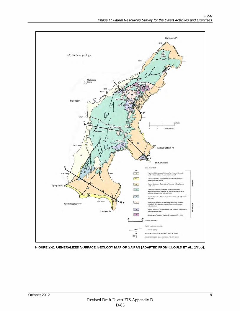
Final Phase I Cultural Resources Survey for the Divert Activities and Exercises
October 2012 9
FIGURE 2-2. GENERALIZED SURFACE GEOLOGY MAP OF SAIPAN (ADAPTED FROM CLOULD ET AL. 1956).
Revised Draft Divert EIS Appendix D D-83
Final Phase I Cultural Resources Survey for the Divert Activities and Exercises
10 October 2012
2.4. Conclusion The natural environment of Saipan has provided food and shelter for humans for thousands of years. Native flora and fauna and in particular marine resources were exploited by Chamorros. The island’s fertile soils support various indigenous plant foods which have aided in sustaining local populations.
Vegetation in the project area is primarily a hibiscus and mixed scrub community. This vegetative community is dominated by sea hibiscus (H. tiliaceus, also called pago), tangantangan (L. leucocephala), and other disturbance species. The presence of this type of vegetation is an indicator of human disturbance as it is a non-native species. Tangantangan was planted on the island to curb the erosion that took place shortly after the bombardment of the island. The activities and developments associated with WWII have drastically altered the natural landscape within the study area. In this environment, prehistoric materials are expected to be in a secondary context. WWII-era material is more likely due to its proximity to Aslito/Isley airfield.
Revised Draft Divert EIS Appendix D D-84
Final Phase I Cultural Resources Survey for the Divert Activities and Exercises
October 2012 11
3. PREHISTORIC AND HISTORIC CONTEXT
The Mariana Islands have been occupied for at least 3,500 years and have been home to prehistoric Chamorro populations and much more recent settlers from Spain and its colonies, the Caroline Islands, Germany, Japan, and the United States. This chapter presents a chronological overview of the human occupation of the Marianas and describes the archaeological traces these settlers left on the islands. The islands have been the subject of archaeological research since the 1920s (Thompson and Hornbostel 1932), and the presence of the U.S. military brought considerable attention to Marianas archaeology in the mid 1940s (Osborne 1947; Reed 1954). Current understanding of Marianas prehistory is largely the work of one researcher, Alexander Spoehr, who surveyed Guam, Saipan, Rota, and Tinian in the mid 1950s and who developed the first prehistoric chronology (Spoehr 1957). Knowledge dramatically increased after 1977 with the start of the Micronesian Survey of the Office of Historic Preservation for the U.S. Trust Territories of the Pacific Islands (Craib 1983). Major themes in Marianas archaeology include the degree of socio-political complexity, the effects of colonizing populations on island ecology, and the age and timing of colonization (Kirch and Ellison 1994; Rainbird 1994).
3.1. Pre-Contact Period The Marianas were colonized about 3500 B.P., well before other islands in Micronesia. Radiocarbon dates indicate an initial colonization by 3479 ± 200 B.P. for Saipan and 3270 ±170 B.P. for Guam (Craib 1983). Paleoenvironmental data from the Pago River Valley on Guam shows a sharp increase in charcoal around 4300 B.P. (possibly due to forest clearing by humans), a contemporaneous appearance of coconut pollen from potentially human-introduced trees, and then, slightly later, a reduction in pollen from forest trees and an increase in pollen from fire-adapted ferns (Athens et al. 2008). Another sample, from the Orote Peninsula on Guam, found evidence of human arrival at 3550 B.P. (charcoal), significant forest clearing by 2450 B.P, and significant grassland expansion by 1400 B.P.; these dates compare well with the direct archaeological evidence of colonization by about 1500 B.C. (Athens et al. 2004, 2008; Athens and Ward 2004). Colonization on Guam must have post-dated 3000 B.C., as the earliest remains from the Tarague Beach site on Guam overlie Merizo limestone that was deposited about 3000 B.C. (Kurashina and Clayshulte 1983).
A date of colonization by 3000 B.P. fits with linguistic evidence (Spriggs 1996, 1998), although linguistic data do suggest the possibility of a much earlier colonization date, between 4500 and 4000 B.P. (Spriggs 1999). Most of the colonists in Micronesia were part of the Oceanic subgroup of the Austronesian language, but the Chamorro and Palauan languages are exceptions—both belong to the Western Malayo-Polynesian subgroup that is most closely related to the Philippine-Sulawesi area and, in the case of Chamorro, possibly Formosan languages of Taiwan (Blust 2000). This southeast Asian origin for the Chamorro people is supported by craniofacial characteristics (Hanihara 1997; Ishida and Dodo 1997).
Colonization of the Marianas and other island chains may have been aided by a system in which colonists expanded slowly to new locations over long distances then used these isolated colonies to quickly spread to relatively close islands (Clark et al. 2010). This model may explain the pauses indicated by the archaeological record in the colonization of the Pacific islands (Irwin 1998). However, as they moved across the vast expanse of ocean, these colonists caused environmental changes (Kirch 2002). Over time, colonists introduced rats, which probably had a significant influence on ground nesting land and seabird populations. Colonists also introduced geckoes, skinks, gardens snails, and weeds. Once colonists started thinning and burning forest, landscape would have become dominated by fire-resistant ferns and grasses. Deforestation would have led to accelerated erosion on steep slopes, infilling and extending valley bottoms along coastal plains. In addition, increased sediment transportation in freshwater streams and rivers would have modified the inshore marine environment, changing the types of marine resources available. Humans and rats appear to have reduced bird diversity across the Pacific.
Revised Draft Divert EIS Appendix D D-85
Final Phase I Cultural Resources Survey for the Divert Activities and Exercises
12 October 2012
Kirch says that the big themes across the Pacific islands are pre-contact population sizes, colonization history including languages and spatial origins, intensification and specialization in agricultural practices (note that Marianas lack the really intensive terraces of other Pacific islands such as Hawai‘i) especially in regards to “social production” for status contests, and of course status and power differentiation.
3.1.1. Pre-Latte Phase (ca. 1500 B.C. – A.D. 800/1000) The Pre-Latte phase begins with the colonization of the Marianas and is defined by two kinds of pottery: Marianas Red pottery, which has thin walls, red slips or paint, and calcareous sand-temper, and lime-filled impressed pottery, which has the same paste and calcareous sand temper and distinct impressed or incised decoration that was filled with white lime after firing. Both types are somewhat similar to the Lapita ceramics of Melanesia, and it is likely that both Marianas and Lapita ceramics are descendants of an older southeast Asian tradition (Kirch 2002; Spoehr 1957). Marianas pottery is quite similar to types recovered from the Philippines in assemblages from the early to middle second millennium B.C., and is part of the ongoing question of Taiwanese or Philippine-Sulawesi origins for the Chamorro peoples (Kirch 2002).
Pre-Latte phase pottery changed slightly over time (Moore and Hunter-Anderson 1996). The pottery made until about 500 B.C. consists of thin-walled (4–6 millimeter [mm]) ceramics with calcareous sand temper that is found in two forms, an undecorated globular jar with a restricted mouth and a small carinated bowl. Ceramics made between about 500 B.C. and A.D. 1 have less complex rim forms, decoration only on vessel lips, less lime filling of designs, and either calcareous sand or mixed calcareous and volcanic sand temper. Ceramics from 500 B.C. to A.D. 1 are usually open bowls with vertical sides. Between A.D. 1 and 1000, pottery was made as bowls with round bottoms and sometimes with suspension holes. These vessels have thinner walls and surfaces that are either untreated, polished, burnished, or striated. The researchers speculate that the change in form to flat-bottom bowls may be for use in earth ovens instead of aboveground hearths. Researchers suggest that change in form was due to increasing population density and larger food-consuming groups as people expanded from small sandy beaches to interior areas, where agriculture would have been possible.
Artifacts from Pre-Latte phase sites also include flaked stone, some of which may have been made from materials imported from other Northern Marianas Islands (Spoehr 1957). Assemblages also include shell adzes, fishhooks, fishing sinkers, and shell bracelets, beads, and other ornaments. Burials have been found but are much less common than burials associated with the Latte phase (Liston 1996).
Pre-Latte phase sites are located on the coastal lowlands, with a smaller number of sites in major river valleys, and into the uplands of the island interior. Procurement of resources depended on site location. The presence of bivalves at sites suggests that people in coastal settlements harvested resources from shallow water and lagoon areas. Occupants probably collected wild plants for food, and may have cultivated plants, although specific evidence for agriculture or horticulture is lacking (Liston 1996).
The Pre-Latte phase people used the entire island and exploited resources in both coastal and inland environments using a mix of hunting, gathering, and possibly horticulture. However, settlement focused on coastal regions. The emphasis on coastal resources meant that Pre-Latte period populations were small. Coral reefs are productive, but not enough to sustain large populations – 17 kilometers (km) of coastal zone would be needed to support 30 people (Bayliss-Smith 1975). Coastlines during the period were further inland than they are now. Carson (Carson 2011; Carson and Peterson 2011) says that sea level increased during the early Holocene, peaking at about 1.8 m higher than today between 3400 through 1050 B.C. Coral reefs were already present by 3000–2000 B.C., prior to colonization. Sea level then began to drop through A.D. 200, quickly reaching modern levels. Sea level decrease produced more coastal land, supplemented by storm surge deposits. Indeed, it is this decline in shoreline that may have made the Marianas suitable for large-scale human occupation (Dickinson 2000). These geomorphic
Revised Draft Divert EIS Appendix D D-86
Final Phase I Cultural Resources Survey for the Divert Activities and Exercises
October 2012 13
processes mean that Pre-Latte phase sites are poorly known. Test excavations on Guam found massive sand deposits over Pre-Latte sites, which can be 2 m below the modern surface and well inland of current shorelines (Carson and Peterson 2011).
The Pre-Latte phase is well-documented on Saipan due to excavations at Chalan Piao on the island’s west coast, which was first occupied around 1700–1200 B.C. when the site area was a shallow embayment with sand bars that later became a sandy beach fronting brackish marsh. The site was first documented by Spoehr in the 1950s. Salvage excavations in 1989 excavated 4.5 cubic meters (m3) of cultural deposits (Amesbury et al. 1996). The youngest intact deposits dated to 1396–865 B.C. (one radiocarbon dated sample), the oldest to 1731–1226 B.C. (one dated sample). Sherds from the site are Marianas Red with thin walls, red slipped or painted, calcareous sand temper; a small number were decorated with lime-filled lines. The researchers recovered 355 whole beads, as well as unfinished beads and bead-making tools. Beads became smaller over time. Shell adzes, which are common at Latte period sites but rare at Pre-Latte sites, were recovered only from the surface. Fishing gear was rare compared to Latte-period sites on Saipan, possibly indicating a change in fishing techniques. The researchers suggest that the simplification of pottery decoration and forms and the reduction in the number and size of shell ornaments may reflect an increasing use of inland plant foods and inshore marine resources and possibly social change related to this change in landscape use (Amesbury et al. 1996).
On Tinian, the early Pre-Latte phase is represented by the Unai Chulu site on the largest beach of the northwest coat of the island (Craib 1993). Although disturbed during the invasion by U.S. forces in WWII and by subsequent impacts, the site preserves two distinct cultural horizons, with the earlier horizon radiocarbon-dated to approximately 3865–3490 B.P. Cultural materials at the site include abundant pot sherds and shell beads and a very small number of lithic artifacts. Pottery at the site shows a slow transition from calcareous sand temper to a mix of calcareous sand and volcanic sand temper. The site demonstrates that Tinian was colonized at about the same time as Guam, Saipan, and Rota.
3.1.2. Latte Phase (A.D. 800/1000 – Contact) The Latte phase is named for the stone columns found at many sites dating to after about A.D. 1000. Although deposits associated with Latte sites have been radiocarbon dated to A.D. 845 ± 145, this single early date is from a site that is dominated by a much later component, and no dates from materials directly associated with latte sets are known from before A.D. 1150 (Graves 1986). These columns, called latte, were cut from rock outcrops of limestone or basalt and consisted of two parts. The upright foundation rock is called a haligi, and the hemispherical cap on top of the haligi is called the tasa. They typically occur in two parallel rows, each row consisting of three to eight latte. Latte can be more than 2 m tall, although at archaeological sites they are usually found as fallen haligi without the attached tasa (Liston 1996). Latte may be a Marianas manifestation of hierarchical social structures common to Micronesia (Bodner 1997). Social change and the accompanying construction of latte may also be part of a Pacific-wide phenomenon of fortified constructions associated with periods of storminess and drought in the region during the Little Ice Age of 1450 to 1850 (Field and Lape 2010). Latte on the Mariana Islands range from 6 to 14 stones. The number of latte sets corresponds to the superstructure’s likely size. Latte sets with 8 stones are most common; sets with 10, 12, or 14 stones are progressively less common.
Latte sets are associated with artifacts and features indicative of a wide range of domestic activities, and include prepared floors, cooking areas, fire-cracked rock, ceramic vessels, grinding tools, scrapers made of stone and shell, faunal remains, shell and stone debitage, fishing tools, and sling stones (Graves 1986). Latte sets are also associated with burials.
The latte are believed to have had several functions. Early Spanish explorers describe villages where individuals with high social status lived in dwellings raised on stone posts. Latte are believed to be the remains of these stone posts. An intensive analysis by Graves (1986) supports this interpretation,
Revised Draft Divert EIS Appendix D D-87
Final Phase I Cultural Resources Survey for the Divert Activities and Exercises
14 October 2012
concluding that most latte sets represent bases for the residences of high-ranking members of prehistoric Chamorro social groups. Burtchard suggests that the latte structures were used in a highly developed social system in which villages competed for resources due to population pressures, limited agricultural land, and a strain on food sources (Burtchard 1991). The competition may have led to warfare between villages and resulted in the formation of a hierarchical social system where villagers with higher social status built houses elevated on the latte foundations. Some researchers have associated latte with burial practices and others infer that latte served as territorial markers for lineages and markers of land and resources ownership (Liston 1996).
Latte are associated chronologically with dramatic changes in landscape use and climate (Nunn 2007; Nunn et al. 2007). Around A.D. 1300, the entire Pacific Basin was affected by rapid cooling and sea-level fall, and possibly increased storminess, that caused massive and enduring changes to Pacific environments relative to the warm, dry, and more stable period during the Medieval Climate Anomaly (A.D. 750–1250). As sea levels fell, fewer food resources would have been available in coastal zones, leading to persistent conflict, shifts in settlements to inland areas or small islands, and an end to long-distance ocean voyages. In the Marianas, Hunter-Anderson (2010) points out that the conditions of the Medieval Climate Anomaly would have been favorable to agriculture, with reliable harvests encouraging expansion into the uplands and increases in populations. Latte appear during this climate regime. When conditions became less predictable during the Little Ice Age (1350–1900 A.D.), prehistoric Chamorros may have moved to high-elevation locations where rainfall was more consistent, and adopted rice as a supplement to other food plants and one that could be grown at the edges of interior wetlands. Hunter-Anderson observed an increase in the number of inland storage or camp sites at sites occupied during the Little Ice Age, replacing the comparatively high proportion of inland habitation sites that were occupied during the Medieval Warm Period. She attributes the change to the shift from low return but low labor domestic crops to higher labor but higher return crops. The presence of sling stone caches suggests increased territoriality and competition for inland areas suited to agriculture.
The ceramics of the Latte phase, which actually appear about 200 years before lattes, differ from the Pre-Latte phase in vessel rim shape, temper, and decoration. The base and body of Latte-phase vessels are round and the openings are small. Rims are generally plain and usually thicker than the vessel walls. The majority of vessels are plain and undecorated, but some have wiped or combed finishes. Most ceramics have volcanic sand temper, while other vessels have a mixed sand temper. A small percentage of the vessels from Latte-phase contexts have grog (crushed sherd) temper. The round ceramic design may have been designed for boiling and storing food (Liston 1996). Latte period ceramics also show regional variation. Graves believes that the early uniform ceramic production tradition in the Marianas was altered into two traditions, one on Saipan and Tinian and one on Guam and maybe Rota, beginning by A.D. 1000 or maybe earlier (Graves et al. 1990). Compositional analysis confirms this two-tradition model: there are at least two clay sources indicated for Saipan and for Guam. These findings suggest that there was a limit to movement of pottery-making techniques that separated Guam and Saipan during the Latte period. However, he says, pottery exchange across islands increased during the Latte period, whereas Pre-Latte period pottery was mostly exchanged within islands. Graves concludes that the patterning in Latte period pottery is consistent with the other evidence (especially latte sets) indicating hierarchical social organization, aggregated settlements, and higher population density, all of which would have led to greater competition between settlements and created an atmosphere conducive to the use of pottery traditions as a way of distinguishing communities from each other.
The majority of Latte-phase habitation sites are along the coast and in fertile river valleys. Small settlements have also been found near freshwater sources and upland marshes. These inland settlements are believed to be associated with a larger population and greater reliance on agriculture (Liston 1996).
Revised Draft Divert EIS Appendix D D-88
Final Phase I Cultural Resources Survey for the Divert Activities and Exercises
October 2012 15
Features associated with the Latte phase include subsurface postholes, fire pits, ovens, burials, stone alignments, and support holes for haligi. Typical artifacts include ceramics, basalt mortars, pestles, sling stones, shell beads, shell fishhooks, bone fishhooks, and bone spear points. The presence of pestles, pounders, and mortars suggest a subsistence regime that included the cultivation of starchy foods.
Burials are most often found located between latte rows or on the seaward side of a latte row. When a burial is located between latte rows, skeletons are extended with feet toward the shore and oriented perpendicular to the long axis of the set of latte. When a burial is located on the ocean side of a latte row, the skeleton is oriented either perpendicular or parallel to the shoreline. Burials are usually primary interments or partial or whole secondary interments. Artifacts associated with burials include sling stones, coral rocks, and stone and shell tools. In some instances, ceramic sherds have been found near the ankles and/or wrists (Liston 1996).
The large number of Latte-phase burials has allowed for extensive research on prehistoric health and diet, especially after the completion of several large-scale cultural resources management projects in the 1990s (Hanson and Pietrusewsky 1997). The Latte-phase diet included shellfish, sea turtles, and deep water and near-shore fish such as marlin, swordfish, dolphin fish, and tuna (Ambrose et al. 1997), all of which continued to be used into historic times (Allen and Bartram 2008; Amesbury et al. 2003; Hensley and Sherwood 1993). All resources were used—for example, analysis of shellfish suggests that prehistoric Mariana Islanders did not necessarily select species with high caloric returns over species with lower caloric returns (Szabó and Amesbury 2011). The only land fauna were coconut crabs, land crabs, fruit bats, monitor lizards, and birds, several species of which may have been hunted to extinction in prehistory (Pregill and Steadman 2009; Steadman 1999a, 1999b). Pigs, dogs, and chickens, although found elsewhere in Micronesia, have not been observed archaeologically in the Marianas, but rats appear to have arrived around 800 to 1000 A.D. (Pregill and Steadman 2009; Steadman 1999b). Diets were dominated by terrestrial plant foods—marine resources made up less than 30 percent of diets (Ambrose et al. 1997). Plant foods were mostly starchy tree and root crops: breadfruit, taro, yams, bananas, sugar cane, coconuts, and rice. Minor plant foots included arrowroot, cycad seeds, pandums, fruit, and seaweed (Ambrose et al. 1997). Yam and other roots and tubers may have been cooked using pits, a historically documented technique that may have appeared about 1000 years B.P., indicating inland agriculture by that time (Moore 2005). DNA analysis indicates that the two breadfruit species on Guam originated from multiple crossings of plant strains across Micronesia, not just a single colonization spread (Zerega et al. 2004).
Although historic and linguistic sources indicate that the indigenous Mariana Islanders of Micronesia cultivated rice before initial Western contact in the early 1500s, it is not known when or why rice cultivation was adopted in these islands, the only case of rice cultivation in remote Oceania (Hunter-Anderson et al. 1995). Recent excavations in Guam have confirmed the late prehistoric presence of rice in pottery sherds, and the available evidence-from archaeology, palaeoethnobotany, linguistics, and history-suggest that labor-intensive rice agriculture may have been valuable in ceremonial exchanges (Ibid.). Early Spanish accounts of Chamorro culture report that rice was involved in rituals, feasts, exchange, and other status-related behavior (Pollock 1983).
Researchers note that the different types of mollusks in prehistoric sites are due to a change to or from mangrove habitat at specific locations (Amesbury 1996). When mangrove forest disappeared, human populations were forced to collect mollusks from coastal reefs. This change in habitat explains what would otherwise be interpreted as overexploitation of particular species of mollusks. Mollusks are therefore more useful for reconstructing past environment than reconstructing past diets (Amesbury 1996).
Revised Draft Divert EIS Appendix D D-89
Final Phase I Cultural Resources Survey for the Divert Activities and Exercises
16 October 2012
Diets varied slightly from island to island. Diets of individuals from Guam and Rota were fairly similar, but Saipan diets had much less protein and more sugar cane and/or seaweed (Ambrose et al. 1997). An isotopic analysis of 10 Latte-phase burials from Afetna, Saipan, indicates higher than expected open ocean food (McGovern-Wilson and Quinn 1996). However, another isotopic analysis of individuals from Saipan and Rota found that Rota’s occupants ate more marine foods than those from Saipan during the Latte period, that some individuals during the Latte period had greater access than others to marine resources, and that Pre-Latte period diets consisted of both coastal and open ocean or deep water fish while Latte period diets consisted mostly of fish from coastal reefs and lagoons (Pate et al. 2009).
Remains from the Latte period site of Apurguan on Guam suggest a well-balanced and varied diet, average age at death of 43.5 years with a large number of deaths at 2 to 9 years, some prevalence of arthritis, slow population growth, and possible sex differences in the use of betel nuts (Douglas et al. 1997). Dental health was generally good, with relatively few caries or other problems, possibly due to the side effects of chewing betel nuts (increased saliva flow, cleansing due to abrasion, etc.) (Hocart and Frankhauser 1996). Yaws disease was common, affecting 21 percent of the individuals in one sample from Latte period sites in Guam (Pietrusewsky et al. 1997). The population also showed evidence of high levels of physical activity and habitual motion compared to contemporaneous Hawaiians (Pietrusewsky et al. 1997). The specific types of skeletal stress is consistent with the use of trumplines, but there is little ethnohistoric or ethnographic evidence for their use in the Marianas (Hanson and Butler 1997). However, health was not uniformly good: data from the dental remains from juvenile burials suggests that Latte-period populations were densely concentrated and subject to frequent disruptions to subsistence due to storms and drought, resulting in impaired immune systems and physiological stress (Stodder 1997). Some high-ranking individuals may have had greater access to subsistence resources and were thus better able to survive fluctuations (Ibid.)
Although researchers agree that Latte-period social structures were hierarchical, there is less agreement on the details. Thompson and Hornbostel (1932) argued for a three-tier society based mostly on a single Spanish observer’s comments in the 1600s and another Spanish observer’s comments from the 1800s. Cordy’s (1986) analysis of social stratification across Micronesia finds that greater population density is associated with reduced social stratification, but that absolute population correlates positively with social stratification. Because the Marianas consisted of a very large number of political entities with small absolute populations, social stratification was very limited, producing only two status tiers (Cordy 1986). Cordy (1983) also cites primary documentary evidence suggesting that there were no hierarchies other than chiefs and everyone else. There may have been high-status individuals associated with chiefs, but they were not a separate class. Moreover, chiefs drew power in part from consensus and did not receive hugely different treatment. Villages only allied for special events (i.e., war) and not often enough to produce another tier of nobility.
In summary, the Latte phase is characterized by a time of population growth, a change in ceramic technology, and the use of stone architecture. The ceramic technology, the construction of fire pits and ovens, and the construction of latte suggest that people invested more time in habitation areas or settlements. This pattern indicates a less mobile lifestyle and the transition from horticulture to more intensive agriculture. Settlement took place mainly along the coastal areas where food resources were abundant, but population increase likely prompted the settlement of inland environments and a move toward agricultural subsistence to supplement wild food.
During his survey of Saipan, Spoehr (1957) observed that twentieth century plowing had disturbed archaeological materials despite shallow plow depths. He also noted that expansion of the village of Garapan and construction of a large sugar mill and an accompanying village at Chalan Kanoa had destroyed many archaeological sites. However, he said the largest source of disturbance was the invasion of the island during WWII and the construction of base facilities following the American occupation.
Revised Draft Divert EIS Appendix D D-90
Final Phase I Cultural Resources Survey for the Divert Activities and Exercises
October 2012 17
Local informants and previous archaeological investigations reported that most of the archaeological sites were on the western and southern coastal areas. After U.S. capture of the islands, great areas were bulldozed and then covered with crushed limestone to provide foundations for warehouses, troop quarters, and airstrips. The entire coastal terrace from Agingan to Cape Obian was transformed into a giant ammunition dump, with virtually all the topsoil bulldozed into revetments. Despite the damage, Spoehr identified six partially intact Latte sites: the Objan, Laulau, Bapot, Fanunchulujan, Chalan Kija, and Chalan Galeite sites. He excavated portions of three sites, Objan, Laulau, and Chalan Kija. He also observed several sites consisting only of ceramic artifacts, but said none of these sites had evidence of middens, houses, or other large features.
On Tinian, Spoehr found much less disturbance to prehistoric sites other than around the harbor. Most of the disturbance to archaeological sites was in the caves used as strong points by Japanese forces. Spoehr recorded 11 sites with latte sets, a latte quarry, and two large artifact scatters. One of those sites, the House of Taga, has by far the largest latte in the Marianas.
On Rota, Spoehr’s less comprehensive survey recorded a large number of Latte sites, especially on the north coast. The Muchon Point site includes a 14-column latte structure. Despite disturbance, including a coastal trench system built by Japanese forces during the war, Rota’s prehistoric sites were in relatively good condition, although with shallow cultural deposits.
3.2. Post Contact Context 3.2.1. The Spanish Period (1521 – 1898) Spanish explorers first saw the Pacific Ocean in 1513 from the west coast of Panama. Six years later, five ships left Spain under the command of the Portuguese pilot Ferdinand Magellan and his mostly Spanish crew of 265 men. In March 1521, the four surviving ships and their starving crew landed on Guam. Magellan’s landing site is not known. Chamorro tradition says that Magellan made landfall in Umatac Bay (Rogers and Ballendorf 1989), but the exact location is not known. Magellan named Guam and the rest of the island chain the “Ladrones,” or thieves, as a comment on the residents’ thefts from his ships. Magellan died in the Philippines shortly after the fleet left Guam. In 1522, 31 of the expedition’s original crew returned to Spain on the Victoria, the fleet’s single surviving vessel and the first ship to circumnavigate the globe.
In 1526, the Loyosa expedition, piloted by a veteran of the Magellan expedition Sebastian del Cano, reached the Marianas and retrieved a crew member who had deserted from the Magellan expedition and was living on Rota. However, the great distance from Spain to the western Pacific limited Spanish interest in the region. In addition, Spain ceded its rights to parts of the Pacific to Portugal; the line of demarcation was 297.5 marine leagues (about 1,500 km or 900 miles) east of Maluku in what is now Indonesia. The Philippines remained on the Spanish side. Portugal began expanding into the area, creating a trade route that extended around Africa to India and ultimately to Japan.
It was not until 1564 that Spain showed significant interest in the eastern Pacific. In November of that year, a fleet of five ships under Miguel Lopez de Legazpi left New Spain (Spain’s western hemisphere possessions) seeking a shorter route to Spain’s eastern Pacific territory than the route around Africa. In 1565, the expedition landed in the Marianas, the first Spanish contact with the islands since 1526, and claimed them for Spain. Legazpi then left for Cebu in the Philippines. In 1571, the Spanish presence in the Philippines shifted to Manila.
The distance between Manila and Spain meant that the Philippine colony was supplied from New Spain. Although it was a dependency of the Viceroyalty of New Spain, Manila did gain some self-government in 1583 and an autonomous Supreme Court in 1595. Over the late 1500s and 1600s, the ostensibly Spanish
Revised Draft Divert EIS Appendix D D-91
Final Phase I Cultural Resources Survey for the Divert Activities and Exercises
18 October 2012
city became dominated by Chinese immigrants while the Spanish population remained extremely small. Moreover, the Manila economy depended on direct financial assistance from New Spain in the form of silver from New World mines, even in the early 1800s.
The galleons that carried this silver sailed once every year, and often stopped at the Marianas for resupply during the crossing from Mexico. Roughly 100 ships stopped in the Marianas between Legazpi’s visit and the mid 1600s, leading to steady but rare contact between Chamorros and Spanish sailors eager to trade iron for fresh fruits and vegetables. Some of these stops did not end peacefully—Spanish accounts include mention of combat between sailors and Chamorros. The return voyage from Manila to Mexico sailed further north and avoided the Marianas.
Spain did not have an active presence in the Marianas until 1668. In 1662, the Jesuit Diego Luis de San Vitores applied to Mariana, the queen regent of Spain, for permission to found a mission in the islands. Arriving in 1668, he renamed the islands Los Marianas in honor of the Queen Regent. Spanish explorers and missionaries arrived on Saipan, Rota, and Tinian in the same year.
Early Spanish accounts of the Chamorro population describes them as fishermen and farmers who used outrigger canoes, nets, spears, and hooks and lines; they also gathered shellfish from the reefs (Spoehr 1954). They raised yams, taro, bananas, breadfruit, sugar cane, coconut palms, and rice. They had no domesticated animals. The Chamorros lived in small hamlets and villages, usually located along the coast, although fertile interior areas were also occupied. Villages featured bachelors’ houses where ancestors’ skulls were stored. They had a hierarchical social structure and conducted frequent warfare with one another.
San Vitores composed a Chamorro-language grammar and catechism but was killed in 1672 by Chamorros in what would lead to a decade of conflict between the indigenous population and the tiny number of Spaniards on Guam. Conflict was probably the result of imposed baptism of infants, different perspectives on premarital sex and other traditional practices, and other factors. All resistance was crushed after the arrival in 1679 of Jose de Quiroga, who commanded the campaign against the Chamorro and who largely succeeded by 1685. Resistance was completely crushed by the end of the 1600s. Filipinos began settling on Guam, displacing the remnant population. Introduced disease was a major factor that decimated the indigenous population. Shell estimates the total Marianas population in 1568 at 72,000, in 1600 at 61,000, in 1638 at 42,000, in 1668 at 25,619, and in 1699 only 8,100 (Shell 1999, 2001). The Spanish responded to this demographic catastrophe by forcibly concentrating populations on Guam, Saipan, and Rota. By 1700, the remaining indigenous population was concentrated on Guam and Rota.
By 1700 agriculture consisted of native food crops as well as introduced tobacco, maize, sweet potatoes, squash, red peppers, cucumbers, tomatoes, onions, garlic, beans, eggplant, pineapple, cantaloupe, watermelon, lemons, limes, oranges, peanuts, coffee, cacao, and cassava. The Spanish also introduced water buffalo, cattle, pigs, goats, cats, dogs, horses, mules, and probably chickens, as well as deer.
During the 1700s, Tinian and Saipan were visited only occasionally. The British Commodore George Anson circumnavigated the globe between 1740 and 1744 to disrupt Spanish commerce; he spent several months on Tinian gathering food and allowing his crew to recuperate. Anson encountered only a small group of Spaniards and Chamorros who were on Tinian to hunt feral pigs and cattle. Tinian served mostly as a larder for Guam for most of the eighteenth century, but it is not known whether Saipan had a similar function.
For the Marianas as a whole, population waned again during the mid- to late-nineteenth century as waves of epidemics hit the islands. The most notable epidemics were from smallpox, measles, whooping cough, and influenza. These diseases affected the population in 1849, 1855, 1856, 1861, 1883, 1888, and 1890
Revised Draft Divert EIS Appendix D D-92
Final Phase I Cultural Resources Survey for the Divert Activities and Exercises
October 2012 19
and claimed the lives of thousands of people (DeFant and Leon Guerrero 2006:8). As a result of these epidemics and scant financial support from Spain and the Philippians, Guam ended the nineteenth century weak and vulnerable.
Despite continued low populations, attempts were made to settle Saipan and Agrihan, but only by tiny and transient groups. The first real attempt to resettle Saipan was by Caroline Islanders, who started making regular trading voyages to Guam by the early 1800s. In 1815, Carolinians were given government permission to settle on Saipan in exchange for transporting pork and beef from Tinian to Guam. By 1849, Caroline Islanders had founded the town of Garapan, which had 424 Carolinian and 9 Chamorro inhabitants by 1865. Chamorro population increased in the late 1800s. The two groups preserved some cultural distinctions, including matrilineal lineages and clans among Carolinians.
Meanwhile, Tinian was resettled in 1869 by H. G. Johnson, who obtained a concession giving him usufruct of Tinian for eight years and who brought approximately 230 Carolinians to the island to work. When Johnson died in 1875, these Carolinians moved to the town of Tanapag on Saipan.
Municipal government on Saipan was basically nonexistent until 1855, when the Spanish governor of the Marianas imposed municipal government and assimilation under a Spanish official. Tradition evolved where the gobernadorcillo, the third position behind the alcalde (governor) and friar-priest, would move from Agana to a northern island after he finished his term of office. The limited role of government was hampered by slow communications between the Philippines, which oversaw the Marianas, and local Marianas government in Agana—in the late 1800s, mail ships arrived at Agana only twice a year.
3.2.2. The Early Twentieth Century (1898 – 1941) Spain ceded Guam to the United States after the end of the Spanish-American war in 1898 and sold the other Mariana Islands to Germany. Germany formally took control of the Marianas north of Guam in November 1899 after purchasing the islands from Spain in the same year and administered them as part of Germany’s New Guinea Protectorate. Under Bismarck, Germany sought colonies to match other European powers and to have a presence in the Pacific. Indeed, Germany had also claimed the Caroline Islands and had captured Yap in 1885. This dispute was settled by the Papacy and Spain retained sovereignty, but Germany had freedom of trade and was allowed to establish coaling stations on the Carolines (Hezel 1983).
Although the number of Germans on the islands was never large, Germany did initiate smallpox vaccinations, provided a government doctor, and opened schools on Saipan and Rota. Germany was primarily interested in coconut production. Increasing numbers of Chamorros settled on Saipan during this period. Also, a group of Carolinians left Guam for Saipan due to dislike for American efforts to get them to wear western clothing.
On Guam, the First American Period (1898–1941) began when the United States captured Guam during the Spanish-American War. The bloodless capture of Guam began on June 20, 1898, when the USS Charleston under Captain Henry Glass entered Apra Harbor and fired on the long-abandoned Fort Santa Cruz. After waiting for and being disappointed by the lack of return fire, Captain Glass prepared an armed landing party. In the meantime, locals began to gather on the shore. They assumed the shelling was a salute and sent for two little antique brass cannons in order that they could return the courtesy (Rogers 1995:110). However, the cannons were of little use as there was no gunpowder on the island. This prompted the Spanish to launch a party by boat to the USS Charleston to apologize for not returning the salute. Upon learning that the shells represented an attack, the Spanish outpost surrendered (Wolff 1961). The U.S. flag was raised over Fort Santa Cruz on June 21, 1898. The following day, Glass and his ship withdrew to the Philippines, leaving no one behind to rule the island. The island fell into a state of
Revised Draft Divert EIS Appendix D D-93

Final Phase I Cultural Resources Survey for the Divert Activities and Exercises
20 October 2012
authoritative confusion which would not be resolved until the arrival of the first U.S. naval governor on August 7, 1899.
The U.S. Navy was responsible for Guam for the next 42 years. It established a naval base, started English-speaking schools, and created a public health system. During this time the population, particularly those considered “native,” rebounded substantially. The naval administration’s desire for economic sustainability led to the development of a system of landholding that allowed anyone to claim tracts of unused land for agricultural development. Copra (coconut) plantations became numerous, and an increasing number were owned by Japanese farmers (Liston 1996), a trend that would foreshadow future events.
Germany lost control of the Northern Marianas in October 1914 when Japan captured the islands during the First World War. In 1919, the League of Nations recognized the Japanese protectorate over the northern Marianas. Protectorate status meant that residents of the islands were considered citizens of Japan. Japanese schools were established, sugar cane became the main crop, and colonists arrived from Japan and Japanese possessions. The political separation of Guam and the Commonwealth of the Northern Mariana Islands is a result of this early twentieth century history.
In 1922, the Japanese navy was replaced with the civilian South Seas Government as the manager of Micronesian islands. The same year, sugar cane production began to increase on Saipan and eventually dominated agricultural activity on the island thanks to the efforts of Haruji Matsue, a recent graduate of Louisiana State University. By 1934 Matsue was shipping 640,000 metric tons of sugar per year to Japan, and a mill, town, and narrow-gauge railroad were built at Chalan Kanoa for sugar cane production (Figure 3-1). A mill was also built on Rota. With sugar cane intensification, large numbers of Japanese workers moved to Saipan and other Marianas islands. In 1935, the Japanese withdrew from the League of Nations but claimed the islands remained part of their empire. By 1937, there were nearly 21,000 Japanese on Saipan, mostly from Okinawa. These Okinawan settlers were largely egalitarian, although archaeological evidence suggests signs of an emerging economic class structure (Dixon 2004). Garapan became a mostly Japanese town. Japan built Aslito Field on Saipan in 1934 and began fortifying the Marianas in 1935.
Chamorro and Carolinian culture remained largely intact during the early years of the Japanese period, although the Caroline Islanders considered themselves a marginalized group (Alkire 1984). Traditionally, Chamorro and Carolinian families had a village house and a farm house. As the Japanese population increased and the sugar industry increased demand for agricultural land, political and economic forces made it difficult for Chamorro and Carolinian families to retain ownership of their land. The Japanese government initially validated Chamorro and Carolinian land ownership, and Japanese farmers paid rent for sugar cane production (Petty 2002). This process made land a commodity with a cash value, not something to be developed as new rural homesteads. By 1931, Japanese were allowed to purchase private land, and by 1944 at least one third of Chamorro and Carolinian families owned no rural property (Spoehr 1954). The project area has a remnant of this period in the form of an Okinawan farm house; these formal structures probably replaced the more expedient rural houses built by the original Chamorro or Carolinian land owners.
Revised Draft Divert EIS Appendix D D-94
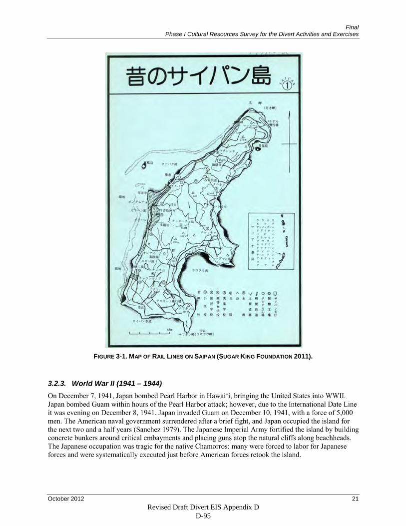
Final Phase I Cultural Resources Survey for the Divert Activities and Exercises
October 2012 21
FIGURE 3-1. MAP OF RAIL LINES ON SAIPAN (SUGAR KING FOUNDATION 2011).
3.2.3. World War II (1941 – 1944) On December 7, 1941, Japan bombed Pearl Harbor in Hawai‘i, bringing the United States into WWII. Japan bombed Guam within hours of the Pearl Harbor attack; however, due to the International Date Line it was evening on December 8, 1941. Japan invaded Guam on December 10, 1941, with a force of 5,000 men. The American naval government surrendered after a brief fight, and Japan occupied the island for the next two and a half years (Sanchez 1979). The Japanese Imperial Army fortified the island by building concrete bunkers around critical embayments and placing guns atop the natural cliffs along beachheads. The Japanese occupation was tragic for the native Chamorros: many were forced to labor for Japanese forces and were systematically executed just before American forces retook the island.
Revised Draft Divert EIS Appendix D D-95
Final Phase I Cultural Resources Survey for the Divert Activities and Exercises
22 October 2012
The Marianna islands of Saipan, Tinian, and Guam were indispensable strategic strongholds for the Japanese during WWII. The islands served as important defensible locations for Japan as well as outposts for bombing missions and airstrikes.
The American forces recognized the importance of these islands and surprised the Japanese with a drive across the Pacific toward the Marianas. The Japanese did not expect the United States to attack the Marianas because of its relative close proximity to Japan and its distance from Hawai‘i. The Japanese were convinced that the next target of the United States would be Palau instead (Bowers 2001[1950]). After February 1944, Japan realized that U.S. forces were likely to strike the Marianas and began to reinforce the 1,500 military personnel then on Saipan. However, U.S. submarines sank many Japanese troop carriers and cargo ships supplying the Marianas. Although many passengers survived, they often arrived in the Marianas without weapons or other equipment. The loss of equipment meant that Japanese defenses on the islands were incomplete at the time of the U.S. invasion. Although the troop complement on Saipan had increased to a total of roughly 31,000 Japanese troops (25,000 Army and 6,000 Navy personnel) and many pillboxes, blockhouses, and other fortifications had been built, many large guns were not emplaced. Aslito Field had no ground defenses and lacked provisions for demolition if threatened with enemy capture (Denfeld 1997).
On June 15, 1944, the 2nd and 4th Marine Divisions invaded Saipan. Prior to the invasion, 7 battleships and 11 destroyers shelled the islands of Saipan and Tinian for two days. The U.S. landing on June 15th was made on the west side of the island on the coastal lowlands, when 700 amphibious vehicles transported troops to the beaches on both sides of Afetna Beach. Invasion was aided by air power (Tate 1995) and by tracked landing vehicles, at least one of which still sits off the Saipan coast (Arnold 2011). The 2nd and 4th Marine Divisions were the first to make landfall marking the first time U.S. soldiers set foot on Japanese soil during the war (Bowers 2001[1950]). Over 8,000 Marines landed on that beach; 2,000 of them were killed during the first day of action.
The Japanese fighter strip on the west side of the island was the first area captured during the assault. On the night of June 16th, the second day of the invasion, a tank battle ensued. The battle involved 44 Japanese tanks, the largest such battle in the Pacific. The U.S. dominated this battle and obliterated the Japanese tank fleet on the island (Chapin 1994). On the third day of fighting, the 27th Army Division joined the battle. On June 19th, the Japanese Imperial Navy tried to destroy the U.S. Saipan invasion Naval Fleet. The air to sea battle was later dubbed The Great Marianas Turkey Shoot and ultimately resulted in the destruction of 330 Japanese aircraft (Chapin 1994). Aside from this sea battle, the effectiveness of the U.S. Naval fleets proved to be critical for the victory in Saipan. The U.S. Navy reduced the transportation of weaponry, construction materials, and troops that were destined for the defense placements on Saipan.
On June 18, 1944, during the battle of Saipan, Aslito Field renamed Conroy Field in honor of Colonel Gardiner Conroy of 165th regiment, who was killed in battle for Makin in the Gilbert Islands in November 1943. In late June 1944, the Navy renamed the field in honor of Lieutenant Commander Robert Isley, who was shot down and killed over Aslito on 13 June (Goldberg 2007)
On June 22nd, Aslito Field was taken by U.S. troops. The airfield was used almost immediately for airstrikes, supply runs, and aerial photography missions: the latter were used to mark the locations of bunkers, trench lines, and the natural contours of the island.
On July 6th in Paradise Valley, just north of Tanapag, Lieutenant General Yoshitsugu Saito gave his last order for Japanese troops to fight to the death. The order was given to surmount a final gyokusai, a banzai attack or suicide charge. After the order, Lt. Gen. Suito committed ritual suicide, or hari-kari. On July 7th the banzai attack ensued and resulted in the death of 4,311 Japanese soldiers (Chapin 1994).
Revised Draft Divert EIS Appendix D D-96
Final Phase I Cultural Resources Survey for the Divert Activities and Exercises
October 2012 23
The remaining soldiers killed themselves and Japanese civilians with gunfire, grenades, and hand weapons rather than allowing themselves or the civilians to surrender to American soldiers. Hundreds of Japanese civilians—men, women, and children—also committed suicide; several hundred jumped to their deaths at the northern end of the island off of the steep precipices now named Suicide and Banzai Cliffs.
On July 9th, the island of Saipan was considered secure; at final count 23,811 Japanese soldiers were known dead, 3,225 U.S. soldiers were killed in action, and an additional 326 soldiers were listed as missing in action. Five American soldiers were given a Medal of Honor commendation for their heroic actions during the war; three were awarded posthumously.
Today remnant scars of the battle of Saipan and the Japanese encampments prior to the battle remain. Within close proximity of the project area, located between the main and commuter terminals is the former Japanese and American Air Operations Building. To the north of the Air Operations Building and the current Saipan terminals, a Japanese building, water supply structure, and a bunker remain. Southwest of this network of buildings, four gasoline storage structures still stand. One of these structures currently houses the Saipan HPO. North of these structures is the former Japanese power plant, now the American Red Cross building. Along the road to the airport are remains of Japanese barracks and air raid shelters. Northeast of the airport terminal are the remains of a complex of Japanese buildings used during the war including a hospital, barracks, a refrigerated pyrotechnics building, a dispensary, a headquarters building, a power plant, an oxygen building, a maintenance building, a bomb storage facility, and hangars, as well as an American maintenance complex and 65 keyhole-shaped paved hardstands for B-29s (Lotz 1998). Beyond the immediate project area, previous archaeological survey (Denfeld 1992) recorded two 6-inch gun casemates at Aginan Point. At Aginan Beach, one circular blockhouse for four 20 mm guns still stands in a beach park at Coral Ocean Point Resort. Many caves contain artifacts from Japanese forces, which used caves as defensive positions (Taborosi and Jenson 2002). At Nafutan Point shore and Mount Nafutan are the caves used to defend against U.S. Army 27th division. On the peninsula are two guns from the 140 mm and 6 inch Whitworth Armstrong batteries.
On Rota, the Ginalagan complex of caves and associated defenses was in excellent condition in the early 1990s (Denfeld 1992). The complex consists of 1.5 km of natural caves with a 150 m parapet of stone and concrete forming a protected trench, as well as associated cisterns, gun positions, pillboxes, and other structures. The complex never came under heavy attack and therefore survived the war relatively intact.
On Tinian, Denfeld recorded several remaining Japanese defenses, including a 6-inch gun and three gun cave positions on the southern end of the island, several pillboxes on the eastern shore of the island, and pillboxes and a 140 mm defense gun at the north end of the island (Denfeld 1992). The Japanese inter-island radio station at the center of the island still stands and was used as a slaughterhouse in 1992. Although Ushi airfield was expanded by U.S. forces as North Field for B-29 Superfortress use, the airfield preserves the Japanese-built air operations building, air headquarters, bombproof power plant, air raid shelters, and underground storage bunker.
3.2.4. The Second American Period (1944 – present) The post-war economy focused on government jobs and private industry and caused cultural changes such as a reduction in the Chamorro use of lanchos, which involved families living in rural areas during the weekdays to raise crops and returning to villages for church and social affairs on the weekends (Rogers 1995:202). In fact, subsistence farming nearly ceased in the post-war years. Tourism, particularly from Japan, Korea, and Taiwan, has become increasingly important to Guam’s economy. Currently, the Guam government, the tourist/service industry, and U.S. military bases are the primary sources of employment for Guam’s population (Liston 1996).
Revised Draft Divert EIS Appendix D D-97
Final Phase I Cultural Resources Survey for the Divert Activities and Exercises
24 October 2012
The U.S. role in the governance of Saipan, Rota, and Tinian differs from Guam due to differences in how the islands were acquired (Herald 1992, McKibben 1990). Spain ceded Guam to the United States after the end of the Spanish-American war in 1898. Guam’s territorial status, under which it was managed by the U.S. Congress, was part of a trajectory that traditionally resulted in statehood. Guam is one of the four unincorporated territories currently held by the United States, the others being Puerto Rico, the Virgin Islands, and American Samoa. In contrast, the United States was given supervisory control of the other Mariana Islands and the rest of Japan’s Micronesian possessions by the United Nations (U.N.) under the Trust Agreement. The Trust Agreement was a bilateral contract between the United States and the U.N. Security Council that made the United States responsible for providing for the islands’ political, economic, and social needs and to promote the island’s eventual adoption of self-government. The United States demanded that the U.N. designate the Trust territory a strategic area, a concession that gave the Security Council, not the General Assembly, authority over the Trust Agreement. This ensured that the United States could veto any decisions regarding the islands. The United States did little to develop the islands until formally criticized by the U.N. in 1961. Congress increased appropriations for the islands and in 1964 created a Congress of Micronesia. In 1969, the Marianas chose to become a separate entity from the rest of the Micronesian islands and in 1972 began negotiating commonwealth status, in part because the proximity of the Northern Marianas to Guam made them more Americanized. The resulting formation of the Commonwealth of the Northern Mariana Islands led the other Micronesian islands to separate into three political entities: the Republic of the Marshall Islands, the Federated States of Micronesia, and the Republic of Palau. Each entity negotiates its relationship with the United States separately and each has its own constitution. Under the Trustee Agreement, in contrast, the United States was to aid the Micronesian territories in becoming independent.
Revised Draft Divert EIS Appendix D D-98
Final Phase I Cultural Resources Survey for the Divert Activities and Exercises
October 2012 25
4. PREVIOUS RESEARCH
Prior to the beginning of fieldwork, HDR conducted a search for previous archaeological research in the project area.
4.1. Saipan The project area was previously surveyed in 1980 in preparation for nominating Isley Field to the National Register of Historic Places (Denfeld and Russel 1984). The field was listed on the National Register of Historic Places as a Historic District in 1981 (National Register Information System [NRIS] No.: 81000667). As recorded, the district includes 27 intact structures, an Okinawan farm house foundation, two runways, hundreds of hardstands and foundations from the U.S. period, concrete and asphalt roads, and many other features and artifacts (Figure 4-1). The nomination separated Isley Field into three areas: the Japanese Aslito Field complex; the two Isley runways, taxiways, and 110 hardstands; and the 73rd Bomb Wing Headquarters and associated structures. The nomination used the airport perimeter fence as it stood in 1980 as the Isley Field site boundary. The nomination specifically identified 29 structures and other features, with all B-29 hardstands collapsed into a single data point (Table 4-1). The Isley Field nomination form strongly suggests that additional features and associated artifacts not specifically mentioned in the nomination are present at the site, and the HDR survey was expected to encounter many cultural resources associated with both the Japanese and U.S. occupations of the area. Because of the site’s construction history, HDR expected that Japanese-built features would differ stylistically from U.S. features and would be less expedient in their design and construction.
FIGURE 4-1. ISLEY FIELD STRUCTURES AND FEATURES RECORDED AS PART OF THE SITE’S NRHP NOMINATION PROCESS (DENFELD AND RUSSEL 1984).
Revised Draft Divert EIS Appendix D D-99
Final Phase I Cultural Resources Survey for the Divert Activities and Exercises
26 October 2012
TABLE 4-1. FEATURES AND STRUCTURES RECORDED BY DENFELD AND RUSSEL (1984) AT ISLEY FIELD.
Feature or Structure Number Description
SP-H-1 Japanese Barracks Complex
SP-H-2 Japanese Military Hospital
SP-H-3 Japanese Engineers Barracks
SP-H-4 Japanese Barracks Complex
SP-H-5 Japanese Staff Quarters
SP-H-6 Japanese Pyrotechnics Bldg.
SP-H-7 Japanese Garage
SP-H-8 Japanese Sentry Post
SP-H-9 Japanese Road
SP-H-10 Japanese Dispensary
SP-H-11 Japanese Administration Building
SP-H-12 Japanese Power Plant
SP-H-13 Japanese Oxygen Generating Building
SP-H-14 Japanese Repair and Maintenance Area #1
SP-H-15 Japanese Repair and Maintenance Area #2
SP-H-16 Japanese Semi Underground Bomb Storage
SP-H-17 Japanese Airplane Hangers
SP-H-18 Japanese Air Operations Building
SP-H-19 Japanese Gasoline Storage Bunkers
SP-H-20 Japanese Power Plant Building
SP-H-21 Japanese Unidentified Structure
SP-H-22 Japanese Water Supply Facility
SP-H-23 Japanese Gasoline Bunker
SP-H-24 Japanese Radio Station
SP-H-25 Okinawan Housing Area
SP-H-26 Japanese Service Apron
SP-H-27 U.S. North Service Apron
SP-H-28 U.S. Maintenance and Repair Complex
SP-H-29 U.S. B-29 Hardstands
Revised Draft Divert EIS Appendix D D-100
Final Phase I Cultural Resources Survey for the Divert Activities and Exercises
October 2012 27
4.2. Summary of National Register Status The former Aslito/Isley Field was nominated to the NRHP as a historic district on September 16, 1980, and was included in the NRHP on June 26, 1981, as the “Isley Field Historic District” (NRIS No.: 81000667). As nominated, the district is defined by the “perimeter road,” probably Flame Tree Road (on the north, west, and east) and Naftan Road (along the south), that encircles Saipan International Airport and encompasses 1,189 acres (see Figure 1-2). The condition of the historic fabric contained within the district is listed as deteriorated and altered by the modern airport. Twenty-seven buildings and structures are mentioned in the nomination as contributing to the NRHP eligibility of the property. These include:
• Operations Center. This building was built and used by the Japanese and later used for similar purposes by the U.S. 73rd Bombardment Wing. At the time of the nomination the structure had been refitted for use by the Marianas Visitors Bureau, now known as the Marianas Visitors Authority, and was called out as a “...fine example of adaptive reuse.”
• Four gas drum storage bunkers
• Power plant.
• A building to house an electric generator.
• Semi-subterranean bomb storage facility. This structure was called out in the nomination as being particularly unique, representing “...the only remaining example of this type of building in Micronesia, and the structure is in excellent condition.”
• Defensive gun emplacement atop the bomb storage facility.
• Semi-subterranean fuel storage facility.
• Three associated fuel tanks.
• Pump house.
• Torpedo regulating shop.
• Cold storage building.
• Eleven air raid shelters.
The nomination also briefly mentions the two runways as well as “...hundreds of hardstands and foundations from the U.S. period.” The Historic Properties Database lists 27 contributing buildings (those listed above), two contributing structures (probably the runways), and zero non-contributing elements but no other details are offered.
Isley Field was later included in a National Historic Landmark (NHL) recommendation for three of Saipan’s WWII-era sites (see Figure 1-1). The separate WWII-related properties were listed as Saipan Landing Beaches, Aslito/Isley Field, and Marpi Point NHL on February 4, 1985 (National Historic Landmark System [NHLS] No.: 85001789). In the landmark nomination, Isley Field’s size is listed as 1,453 acres, whereas the district nomination is for 1,189 acres. No reason for the expansion is given although the NHL nomination notes a Japanese blockhouse on Unai Obyan beach (Koblerville) as a contributing element to the Aslito/Isley Field portion of the NHL that was not included in the district nomination. All of the features noted in the district nomination are recommended for inclusion in the Aslito/Isley Field portion of the landmark designation including:
• The sites of the two B-29 runways, taxiways, and hardstands.
• The 73rd Bombardment Wing’s administrative area, listed as the Operations Center in the district nomination.
Revised Draft Divert EIS Appendix D D-101
Final Phase I Cultural Resources Survey for the Divert Activities and Exercises
28 October 2012
• All concrete structures associated with Aslito Field. This would presumably include all of the structures listed on the district nomination (above) as well as any previously undocumented Japanese structures within the district boundary such as the semi-subterranean bunker discovered during the present study and described in this report.
4.3. Conclusion The previous research on the Marianas suggests that severely disturbed prehistoric material such as ceramic, flaked stone, and ground stone artifacts, probably from the Latte period given the rarity of inland Pre-Latte phase sites, are likely to exist in the project area. The significant amount of historic modification to the area likely impacted pre-contact sites and therefore the presence of intact features, although possible, is not likely. It is much more likely to encounter historic artifacts and features associated with the construction of Japanese Aslito Field beginning in 1934 and the U.S. expansion of the facility during WWII (at which time it was renamed Isley Field). Artifacts dating to this period may include bottle dumps, military supplies and equipment, refuse piles, and other durable metal objects. Features associated with this period, such as concrete foundations, are also likely to be encountered.
Revised Draft Divert EIS Appendix D D-102
Final Phase I Cultural Resources Survey for the Divert Activities and Exercises
October 2012 29
5. RESEARCH DESIGN
5.1. Prehistoric Period Research Questions The analysis of prehistoric cultural materials will focus on obtaining information on when and how the interior of Saipan was used and how that patterning varies from previous archaeological findings. While more is known about the archaeology of the coastal areas of Saipan and the other southern Mariana Islands, the prehistoric archaeology of the interior limestone plateaus has also been studied. Extensive residential sites reflecting sedentary populations are well documented along the coast (DeFant and Leon Guerrero 2006), and past research suggests that these populations exploited all areas of the islands (Hunter-Anderson and Moore 1994). However, inland sites are not as well documented and generally consist of sherd scatters, sometimes with grinding stones and other stone tools. Latte sets are extremely uncommon at inland sites. The limited finds suggest that the upland plateaus, including the limestone plateau on which Saipan International Airport is located, were used during the Latte phase as occasionally occupied resource procurement and agricultural areas (Reinman 1977; Kurashina 1986). However, DeFant and Leon Guerrero (2006) note that the reasons for this shift are unknown. They suggest that the most plausible reasons involve population increase, environmental change, and/or the intensification of agriculture. A further issue is the actual timing of this expansion to inland areas. As Graves et al. (1990) point out, Marianas pottery is more variable than is often assumed, so ascription of Pre-Latte or Latte phase dates to artifact scatter sites may not be accurate.
The current project’s research questions will aim to provide data on when, why, and how upland resources were added to the prehistoric economy of the Mariana Islands. Differences in the environmental conditions of habitats along the coastline and near shore environments and of habitats in the upland interior project area suggest that the upland limestone forest was used in response to ecological effects or changes to the structure of the island culture.
As explained in the review of the prehistory period, the prehistoric record of the larger islands in the Marianas can be summarized as consisting of the Pre-Latte phase and the Latte phase. Pre-Latte phase sites are small and are usually located on small beaches and along former lagoons. The sites were likely temporary and utilized a wide variety of environments oriented toward exploitation of fish, shellfish, and gathered plants. The artifact inventory from Pre-Latte phase sites indicate an emphasis on marine resources and little evidence for processing plant foods. The interior limestone forest may have held little interest as a food source at this time. During the early part of the Latte phase, populations increased and settlements expanded in size and number. The Latte phase is characterized by latte structures, often associated with human burials and larger villages. Tool kits were more diverse with large thick pottery and subsistence shifts from bivalve to gastropod shellfish and adoption of deep-water fishing. Dry land rice cultivation may have been introduced at this time (Hunter-Anderson et al. 1995).
This record of settlement change correlates in time with eustatic and isostatic changes in sea level, climate change, and vegetation changes. Most of the earliest settlements in the Marianas were located very near the shorelines (Hunter-Anderson and Butler 1995). Pre-Latte phase sites were located on narrow beaches recently exposed from a decline in sea level from a mid Holocene high stand of up to 3 m above modern levels (Nunn 2007). Extensive use of the near-shore resources was supplemented with inland areas that provided areas for crops or forest products as well as areas in which to hunt for birds and fruit bats or to obtain other protein sources such as coconut crabs and large monitor lizards (Carson 2011).
Interior settlement may have occurred as a result of utilizing a wide variety of habitats during this time. However, larger interior settlements were likely placed specific to certain topographic locations that provided the best soils for supporting agriculture and horticultural activities. Continuing sea level decline during the late years of the Pre-Latte phase increased beach progradation and created larger areas for settlement and more backshore area for crops (Nunn 1995). On the west coast of Saipan at the site of
Revised Draft Divert EIS Appendix D D-103
Final Phase I Cultural Resources Survey for the Divert Activities and Exercises
30 October 2012
Chalan Piao, these changes resulted in a shift in onshore environments from open water lagoons to mangrove swamps. As sea levels continued to fall, the coastal mangrove fringe eroded and disappeared, which changed the ecosystem. Shellfish diets changed as a result, with the larger arc clam (Anadara antiquata) used during the Pre-Latte phase shifting to smaller bivalves (Tellina and Fragum) and gastropods (Strombus sp.) from coral reefs during the Latte phase (Amesbury 2007).
The Latte phase is associated with a time when the falling sea levels in the Marianas stabilized around 2,000 years ago. This period is generally assumed to have seen an increase in population as more of the shoreline was exposed and opened for settlement (Butler 1990). Latte sites are also found in island interiors (Hunter-Anderson and Moore 1994). The increased use of the interior for farming is supported in part by studies on Guam that indicate increased slope erosion and increased levels of sedimentation with significant amounts of charcoal from burning the forest to clear areas for gardening beginning around 2000 B.P. (Athens and Ward 2004). The shift to larger settlements on the coast is accompanied by an increased use of terrestrial food relative to marine foods as indicated by stable isotope data for late prehistoric remains (Ambrose et al. 1997, McGovern-Wilson and Quinn 1966). On Saipan, isotopic analysis of collagen and apatite carbonate from prehistoric human remains indicated that sugar cane and seaweeds may have been very important dietary items (Ambrose et al. 1997). According to Moore (2005), a variety of indigenous plant foods were consumed prehistorically that included indigenous breadfruit, taro, yams, bananas, sugar cane, coconuts, and rice. The terrestrial plant diet was supplement by shellfish and mostly reef and lagoon fishes and fewer deep ocean fish species (Ambrose et al. 1997).
The establishment of more permanent settlements during the Latte period accompanied major changes in technology, and the range of cultural materials became more numerous and more diverse. As population increased so did agricultural production (Butler 1988). Latte-phase ceramic vessel forms suggest increased use of pots for boiling and storing food, and there appears to be more use of stone mortars, pounders, and pestles; both changes are consistent with increased intensification of plant food use. Meanwhile, the larger populations of the Latte phase required expansion of site locations to a wider range of island habitats. This expansion would have involved more use of the interior areas of the island with the use of small short terms camps for extracting local resources (Hunter-Anderson and Butler 1995).
The use of interior resources may have also been in response to stresses associated with food shortages from changes in climate that reduced the availability of marine resources. Saipan is affected by a variety of weather related events tied to oscillations in El Nino and La Nina phenomena and shifts in the tropical atmosphere that produce the wet season monsoons and dry season trade winds. During an El Nino year the mean sea level drops and during La Nina events the sea level is elevated above its normal value. Records from Guam, Yap, and Saipan indicate the net difference is about 0.6 m (Lander 2004). Drought cycles are also associated with El Nino/Southern Oscillation (ENSO) phenomena that can last from two to seven years (Vander Brug 1986) and some were likely as severe as the drought during the Little Ice Age in A.D. 1350–1900, which was accompanied by a decrease in sea levels of as much as 0.9 m below present levels (Nunn 1998). As Moore (2005) argues, changes in the climate that created periods of drought may have required the placement of a number of gardens in a variety of areas to offset food shortages. Costal residents would therefore have been forced to move inland to farm.
Finally, the interior may have been used in response to damage associated with typhoons. Although the coastline is generally protected from typhoon driven waves, the storms do damage resources. At higher than normal seasonal extremes, typhoon-related storm surges would increase tidal sea-level inundations and increase erosion of offshore reefs and beaches, resulting in considerable damage to inshore marine resources. These events would likely force coastal residents to seek shelter and find alternative food resources in the interior. Depending on the frequency and intensity of storms, the interior may have provided a refuge that, with time, caused changes in settlement patterns and a shift to a greater reliance on resources available in the limestone forest.
Revised Draft Divert EIS Appendix D D-104
Final Phase I Cultural Resources Survey for the Divert Activities and Exercises
October 2012 31
A review of the literature on the prehistoric period in the Marianas strongly suggests it is unlikely that the area near Saipan International Airport was ever densely populated or extensively utilized. The forest environment was likely used prehistorically to collect wild plant foods and hunt small animals, activities that would have left relatively little trace. The area may also have been used for agriculture or horticulture, but it lacks water and has what Young (1989) describes as very shallow and well drained Chinen-Takpochao and Chinen-lands soils. These soils are considered poorly to moderately suited to commercial and subsistence farming (Young 1988). However, the land before construction of the airport was topographically fairly level with slopes less than 5 percent and was less than 2 km from settlements along the western coast at Chalan Piao and Agingan. Access to the area was not restricted by steep slopes and required an elevation gain of less than 60 m.
The largest obstacle to finding evidence for prehistoric use of the project area is the construction of the airport. Much of the project area at the Saipan International Airport was cleared and leveled in 1934 when the Japanese built Aslito Field. The continued expansion of the airport during and since WWII has required grading activities and placement of bulldozed fill for the construction of the runways and airport facilities. It is obvious that these activities have greatly altered and modified the original landscape. Young (1988) describes the land in this area as bulldozed and disturbed with piles of rubble and debris fills. About 90 percent of the area is characterized as strongly altered by human activity with up to 25 cm of gravel materials placed over the original soils.
Despite the obvious disturbance to the project area, archaeological materials may still be present in surface and subsurface contexts. At the survey level, the goal is to document any archaeological resources and investigate areas to determine their physical features. Inspection of cut features and debris piles may find fire cracked rock, charcoal, and pottery fragments, and other artifacts that indicate the presence of subsurface cultural deposits. Even if subsurface cultural deposits are not found, disturbed surface finds will show the range of prehistoric human activity that occurred in the project area. Vegetation patterns may also help to define areas that potentially preserve buried deposits. For example, areas that support large trees may indicate areas that have not been bulldozed. In these areas, the investigation of subsurface exposures and the examination of sediment in upturned tree roots may be the best way to find evidence for buried sites.
In sum, there are three main likely causes of inland landscape use: intensification due to population increase, use of inland resources to offset loss of marine resources from short-term climate-related sea level change, and use of inland areas to offset loss of coastal resources as a result of typhoons. Archaeological survey will help to understand the degree to which these different causes were at work. The focus will be on several types of artifacts and their chronological patterning. First, ground stone artifacts and agricultural features will be treated as indicators of intensification of plant food resource use consistent with increased population as the primary causal factor in inland resource exploitation. However, evidence indicating that sites date to the periods when sea levels were increasing or decreasing rapidly will instead support inland resource use as a response to large-scale climate change, as these climate changes took place well after the Latte-phase increase in population. Finally, highly ephemeral sites may be indicative of short-term use of inland resources in response to typhoon damage.
5.2. Historic Period Research Questions At the time of European contact, the Chamorro population on Saipan lived primarily along the coast in small villages that provided suitable farmland for cultivated plant crops and access to supplies of seafood. Ethnographic information on use of the interior portions of the island is limited. After European contact the addition of chicken, dog, and pig were added to the local diet (Steadman 1999a). However, the very small number of Spaniards on Saipan between first contact and the island’s forcible depopulation in 1698 suggest that cultural materials from this period may be indistinguishable from prehistoric materials. This expectation is only reinforced by the sharp drop in the Chamorro population following contact with
Revised Draft Divert EIS Appendix D D-105
Final Phase I Cultural Resources Survey for the Divert Activities and Exercises
32 October 2012
European explorers. The abandonment of the island from 1698 to 1815 means that any materials from these years will be an important data point in understanding the degree to which Saipan was used during this period. Particular attention will be paid to decorated European ceramics, which may indicate very specific date ranges.
During the periods of German and Japanese control, Chamorro and Caroline Islander populations increased on Saipan. Spoehr (1954) reports that the established pattern in Chamorro society was for each family to have two residences: a larger house in a village and a second smaller structure (lancho) on a farm. Cultivated areas were small to accommodate manual slash-and-burn agriculture that was still prevalent in the 1950s. However, what is not as well documented is whether Chamorro and Caroline populations followed this pattern during the period of Japanese control of Saipan, when the island was largely turned over to sugar cane production and was home to large numbers of Japanese and Okinawan immigrants. Survey may find indications of which groups used the interior during this period. Evidence for Chamorro lancho farms and Okinawan farmhouses may be preserved in the project area as overgrown cultivated areas and groves of banana trees with agricultural field features and collapsed structures along with the outlines of oxcart trails that lead to coastal villages.
The most likely outcome of archaeological survey is artifacts and features related to WWII and the Japanese preparations for war beginning in the 1930s. Because this period is very well-documented, any artifacts or features recorded on survey will be evaluated against the documentary record to determine, for example, if particular artifacts can be assigned to particular military units. In the case of military features, particular attention will be paid to how complete they were during the war to provide additional information on the degree to which Japanese forces were able to dig in prior to the U.S. invasion.
Revised Draft Divert EIS Appendix D D-106
Final Phase I Cultural Resources Survey for the Divert Activities and Exercises
October 2012 33
6. METHODOLOGY
6.1. Pre-Field Investigations Prior to fieldwork, HDR completed a thorough review of existing cultural resource reports and other documentation relevant to the project area and its immediate vicinity. Any previously recorded cultural properties (prehistoric or historic archaeological sites) in the project area were noted and their locations recorded.
6.2. Field Methods The project area was surveyed by archaeologists walking multiple, parallel, and non-overlapping transects spaced at 10 m intervals. The survey entailed thorough surface inspection.
For this survey, sites were defined as any area that contained evidence of purposeful human activity as demonstrated by the presence of 10 artifacts (ceramics, ground stone, flaked stone) in a 10 x 10 m (or 100 m2) area or the presence of a feature (such as a latte).
When cultural remains were encountered, a determination was made as to whether they were an isolated occurrence (IO) or a site. IOs are isolated cultural remains that do not qualify as sites and generally consist of a single artifact or an artifact scatter that is of extremely low density and widely dispersed. When an IO was encountered, all artifacts comprising the isolate were recorded and their location plotted on a map of the project area and recorded using a Global Position System (GPS).
When sites were encountered, boundaries were defined and plotted on a scaled plan view map along with prominent landscape and cultural features. Digital photographs were taken showing the site setting, features, and artifact concentrations. Sites were plotted on the site map, and the site itself was plotted on the U.S. Geological Survey (USGS) quadrangle map. Further, the site locations were recorded using a GPS.
6.3. Artifact Recording Ceramics and ground stone are expected to be the most common artifact classes encountered in the project areas. Proper analysis of these artifact classes is important for addressing the research issues presented above. Therefore, robust analytical methods have been devised to record and extract useful data about these artifacts.
6.3.1. Ceramic Analysis Each sherd was examined and placed in the current ceramic typology. The main attributes recorded in the field were Type of Temper, Temper Size and Density, Surface Treatment, Vessel Form, and Thickness. All pertinent data was collected in the field and therefore surface collection was not necessary. Note that particular attention was paid to the attributes that best correlated with the island of manufacture—temper type and sherd thickness (Graves et al. 1990).
Temper type was determined by examining the consistency of the temper and determining its composition. Temper types included sand, volcanic, and calcareous sand. Temper size was determined by measuring the largest clast visible in the cross-section of a sherd. Temper density estimates were achieved by counting the total number of pieces of tempering material visible in the profile and on the surface of each sherd.
Revised Draft Divert EIS Appendix D D-107
Final Phase I Cultural Resources Survey for the Divert Activities and Exercises
34 October 2012
Surface treatment was determined with the aid of a magnifying glass. Evidence for surface treatment was recorded as a qualitative variable and included textured or smooth. Texture was further refined into incised, lime-impressed, or random marked.
Vessel form was determined by examining sherd characteristics including thickness and circumference. Form was recorded as simple bowl, simple jar, complex bowl, or complex jar. Simple forms have little evidence of finishing such as polishing or rim modification. Complex forms show signs of smudging, interior smoothing, and/or highly modified rims. Rims were recorded in terms of rim eversion or inversion, thickness, and decoration or surface treatment.
Thickness was measured using standard calipers. Measurements included thickness to the nearest mm and when possible, 1/10 mm.
6.3.2. Ground Stone Ground stone artifacts identified during the survey will be analyzed to address issues relating to food processing strategies, tool use, and technology. Attributes recorded included raw material type, artifact size, form, number of facets, and the presence of pecking.
Raw materials will be recorded as the type of material from which the grinding implement was made. Basalt and limestone are expected to be the most common.
Artifact size will be measured in centimeters. Measurements of maximum length, maximum width, maximum thickness, and depth or basis will be collected. Ground stone form will be recorded as flat, shallow mortar/basin, or deep mortar. The number of identifiable facets will be counted for all ground stone and recorded as an integer. Finally, the presence of pecking or rejuvenation will be recorded as either present or absent.
6.3.3. Metal, Concrete, and Glass Metal and glass artifacts along with concrete features encountered were from the historic period. Metal artifacts were measured, markings and manufacturing technology noted, and function determined (when possible).
Like ceramics, concrete is composed of paste and temper. Variation in temper (e.g., crushed rock, natural gravel, or sand) varied with manufacturing preferences both geographically and through time, and thus allowed for relative dating (when possible). Observations on temper included type, size, and density.
Attributes recorded for glass artifacts included color, size, markings, and frequency. Color was recorded as clear, amber (brown), green, and clear. Size was recorded in terms of container size. Markings, exterior textures, and embossing on the sides and bases were also recorded. Special attention was paid to the basal markings which were used to determine where a bottle was made and when it was made. Analysis of the markings on bottles can often determine when and where the bottles were made and thus when they may have been deposited. Examination of bottle size and the associated artifacts was used to infer the activities associated with the creation of a historic site.
6.4. Other Artifacts and Features All other artifacts were noted and their physical properties recorded. Attributes included type of material from which the artifact was made, type, size, and evidence of use or damage. Features were measured and their manufacturing style recorded. Presence of feature fill, datable material, or additional information potential was also noted.
Revised Draft Divert EIS Appendix D D-108
Final Phase I Cultural Resources Survey for the Divert Activities and Exercises
October 2012 35
6.5. Evaluation Standards: National Register of Historic Places Eligibility Criteria
Upon completion of the fieldwork, data from site recording was assembled and organized, and a recommendation was made for each site based upon the NRHP eligibility criteria.
The development of NRHP eligibility recommendations follows the guidelines set forth under the National Historic Preservation Act (NHPA), Section 106 guidelines. All cultural resources were evaluated for significance using the NRHP criteria in 36 CFR 60.4. To be listed in or considered eligible for the NRHP, a cultural resource must meet at least one of the four following criteria:
A. The resource is associated with events that have made a significant contribution to the broad pattern of history.
B. The resource is associated with the lives of people significant in the past. C. The resource embodies distinctive characteristics of a type, period, or method of construction;
represents the work of a master; possesses high artistic value; or represents a significant and distinguishable entity whose components may lack individual distinction.
D. The resource has yielded, or may be likely to yield, information important in prehistory or history.
A step-by-step process for applying the criteria of 36 CFR 60.4 is described in detail in National Register Bulletin 15, How to Apply the National Register Criteria for Evaluation (National Park Service [NPS] 2002):
• Categorize the property. A property must be classified as a district, site, building, structure, or object for inclusion in the NRHP.
• Determine which prehistoric or historic context(s) the property represents. A property must possess significance in American history, architecture, archaeology, engineering, or culture when evaluated within the historic context of a relevant geographic area.
• Determine whether the property is significant under the NRHP criteria. This is done by identifying the links to important events or persons, design, or construction features, or information potential that make the property important.
• Determine if the property represents a type usually excluded from the NRHP. If so, determine if it meets any of the criteria considerations.
• Determine whether the property retains integrity. Evaluate the aspects of location, design, setting, workmanship, materials, feeling, and association that the property must retain to convey its historic significance.
In addition to meeting at least one of the above criteria, a cultural resource must also possess the majority, if not all, of the aspects of integrity: location, design, setting, materials, workmanship, feeling, and association. Integrity is defined as the authenticity of a property’s historic identity, as evidenced by the survival of physical characteristics it possessed in the past, and its capacity to convey information about a culture or people, historic patterns, or architectural or engineering design or technology.
Location refers to the place where an event occurred or a property was constructed. Design considers elements such as plan, form, and style of a property. Setting is the physical environment of the property. Materials refer to the physical elements used to construct the property. Workmanship refers to the craftsmanship of the creators of a property. Feeling is the property’s ability to convey its historic time and place. Association refers to the link between the property and a historic event or person.
Revised Draft Divert EIS Appendix D D-109
Final Phase I Cultural Resources Survey for the Divert Activities and Exercises
36 October 2012
As described in Chapter 4, the former Aslito/Isley Field, Saipan International Airport, is listed on the NRHP as an historic district for its association with the Battle of Saipan and the War of the Pacific during WWII as the “Isley Field Historic District” (NRIS No.: 81000667). For the purposes of the NRHP, a District “…possesses a significant concentration, linkage, or continuity of sites, buildings, structures, or objects united historically or aesthetically by plan or physical development (NPS 1993:10).”
Not every site, building, structure, or object within the boundaries of a NRHP-eligible district contribute to the district’s overall eligibility. In order to be a contributing resource, each site, building, structure, or object within the district must be evaluated as to whether it possesses the following characteristics (NPS 1993:11):
• It was present during the period of time that the property achieved its significance.
• It relates to the documented significance of the property.
• It possesses historical integrity or is capable of yielding important information relevant to the significance of the property.
Districts may also be discontiguous, as when several historically-related sites or buildings are fragmented by modern development (NPS 1993:11). Additional guidance in dealing with districts associated with a historic battle is also relevant for evaluating Aslito/Isley Field. Because the historic event, the battle, is itself both destructive and temporary, the location, setting, feeling, and association aspects of integrity are weighted more heavily in evaluating the historic integrity of a property than for properties associated with other types of historical events. A NRHP Bulletin devoted to the evaluation of historic battlefields offers a basic test of integrity by asking whether a participant in the battle would recognize the property as it exists today (NSP 1999).
6.6. Conclusion Following these methods ensured that the project area was thoroughly investigated and that all cultural resources comprehensively recorded. The specific data requirements for the presented research questions were collected and new data concerning the use of the area was developed. Finally, all sites found during the course of the project were evaluated pursuant to the NRHP criteria thereby guaranteeing that important sites or sites with additional information potential can be identified prior to any undertaking.
Revised Draft Divert EIS Appendix D D-110
Revised Draft Divert EIS Appendix D D-111
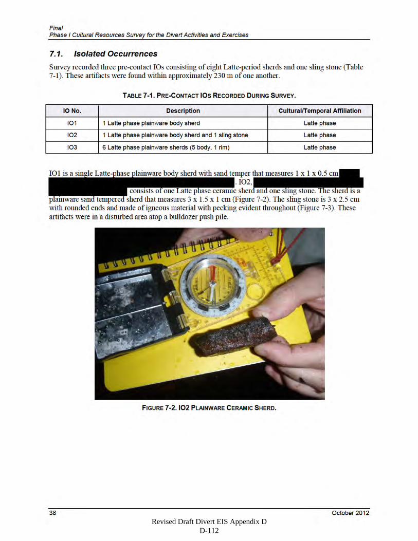
Revised Draft Divert EIS Appendix D D-112
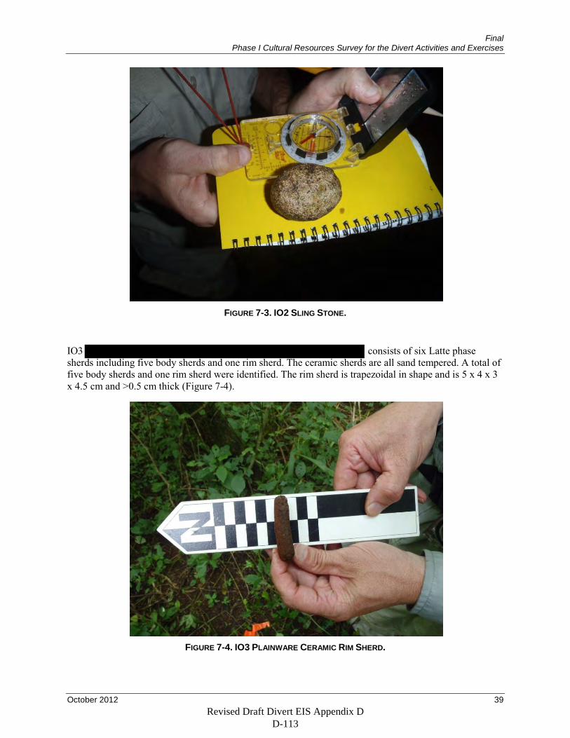
Final Phase I Cultural Resources Survey for the Divert Activities and Exercises
October 2012 39
FIGURE 7-3. IO2 SLING STONE.
IO3 consists of six Latte phase sherds including five body sherds and one rim sherd. The ceramic sherds are all sand tempered. A total of five body sherds and one rim sherd were identified. The rim sherd is trapezoidal in shape and is 5 x 4 x 3 x 4.5 cm and >0.5 cm thick (Figure 7-4).
FIGURE 7-4. IO3 PLAINWARE CERAMIC RIM SHERD.
Revised Draft Divert EIS Appendix D D-113
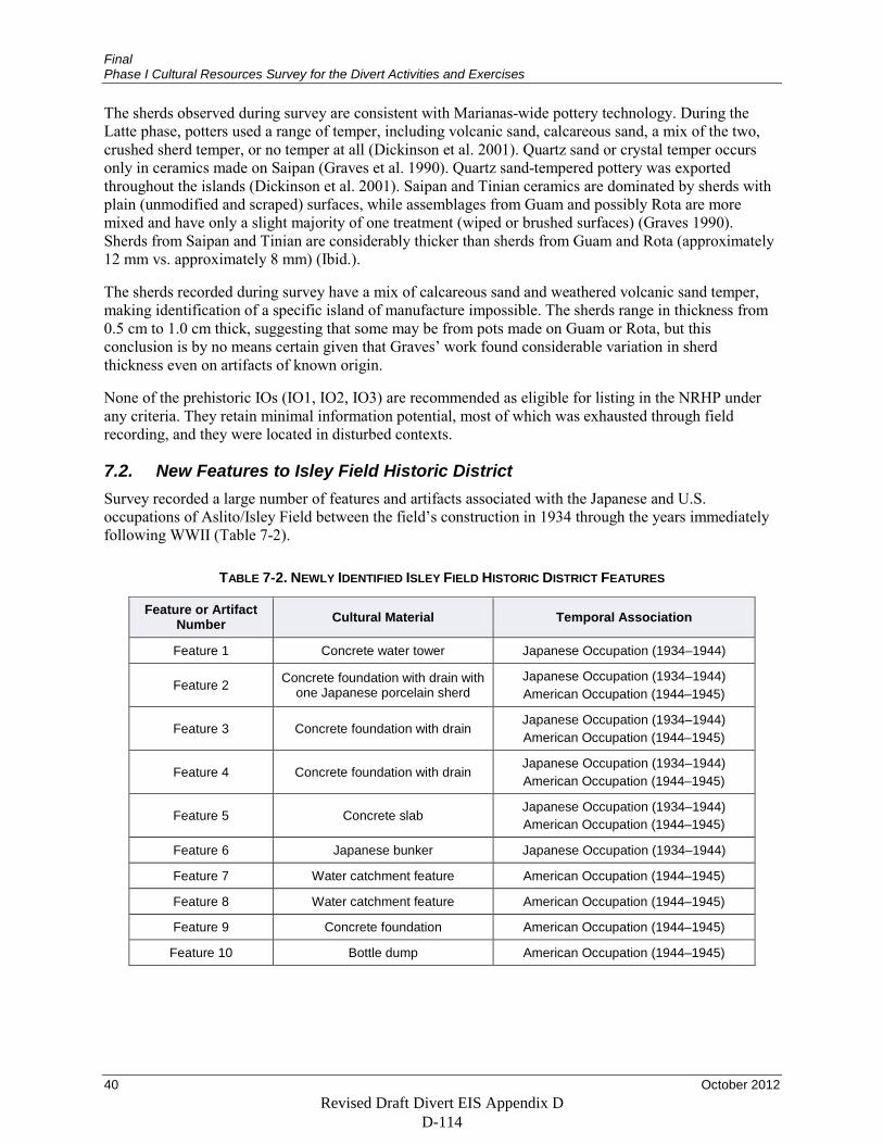
Final Phase I Cultural Resources Survey for the Divert Activities and Exercises
40 October 2012
The sherds observed during survey are consistent with Marianas-wide pottery technology. During the Latte phase, potters used a range of temper, including volcanic sand, calcareous sand, a mix of the two, crushed sherd temper, or no temper at all (Dickinson et al. 2001). Quartz sand or crystal temper occurs only in ceramics made on Saipan (Graves et al. 1990). Quartz sand-tempered pottery was exported throughout the islands (Dickinson et al. 2001). Saipan and Tinian ceramics are dominated by sherds with plain (unmodified and scraped) surfaces, while assemblages from Guam and possibly Rota are more mixed and have only a slight majority of one treatment (wiped or brushed surfaces) (Graves 1990). Sherds from Saipan and Tinian are considerably thicker than sherds from Guam and Rota (approximately 12 mm vs. approximately 8 mm) (Ibid.).
The sherds recorded during survey have a mix of calcareous sand and weathered volcanic sand temper, making identification of a specific island of manufacture impossible. The sherds range in thickness from 0.5 cm to 1.0 cm thick, suggesting that some may be from pots made on Guam or Rota, but this conclusion is by no means certain given that Graves’ work found considerable variation in sherd thickness even on artifacts of known origin.
None of the prehistoric IOs (IO1, IO2, IO3) are recommended as eligible for listing in the NRHP under any criteria. They retain minimal information potential, most of which was exhausted through field recording, and they were located in disturbed contexts.
7.2. New Features to Isley Field Historic District Survey recorded a large number of features and artifacts associated with the Japanese and U.S. occupations of Aslito/Isley Field between the field’s construction in 1934 through the years immediately following WWII (Table 7-2).
TABLE 7-2. NEWLY IDENTIFIED ISLEY FIELD HISTORIC DISTRICT FEATURES
Feature or Artifact Number Cultural Material Temporal Association
Feature 1 Concrete water tower Japanese Occupation (1934–1944)
Feature 2 Concrete foundation with drain with one Japanese porcelain sherd
Japanese Occupation (1934–1944) American Occupation (1944–1945)
Feature 3 Concrete foundation with drain Japanese Occupation (1934–1944) American Occupation (1944–1945)
Feature 4 Concrete foundation with drain Japanese Occupation (1934–1944) American Occupation (1944–1945)
Feature 5 Concrete slab Japanese Occupation (1934–1944) American Occupation (1944–1945)
Feature 6 Japanese bunker Japanese Occupation (1934–1944)
Feature 7 Water catchment feature American Occupation (1944–1945)
Feature 8 Water catchment feature American Occupation (1944–1945)
Feature 9 Concrete foundation American Occupation (1944–1945)
Feature 10 Bottle dump American Occupation (1944–1945)
Revised Draft Divert EIS Appendix D D-114
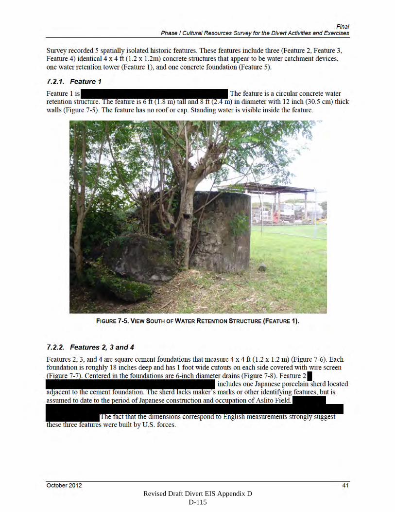
Revised Draft Divert EIS Appendix D D-115
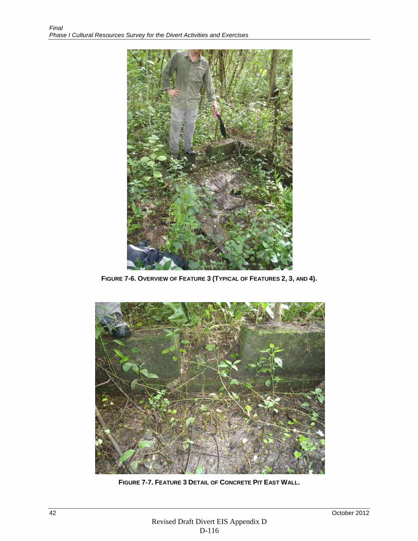
Final Phase I Cultural Resources Survey for the Divert Activities and Exercises
42 October 2012
FIGURE 7-6. OVERVIEW OF FEATURE 3 (TYPICAL OF FEATURES 2, 3, AND 4).
FIGURE 7-7. FEATURE 3 DETAIL OF CONCRETE PIT EAST WALL.
Revised Draft Divert EIS Appendix D D-116
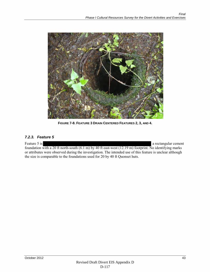
Final Phase I Cultural Resources Survey for the Divert Activities and Exercises
October 2012 43
FIGURE 7-8. FEATURE 3 DRAIN CENTERED FEATURES 2, 3, AND 4.
7.2.3. Feature 5 Feature 5 is a rectangular cement foundation with a 20 ft north-south (6.1 m) by 40 ft east-west (12.19 m) footprint. No identifying marks or attributes were observed during the investigation. The intended use of this feature is unclear although the size is comparable to the foundations used for 20 by 40 ft Quonset huts.
Revised Draft Divert EIS Appendix D D-117
Revised Draft Divert EIS Appendix D D-118
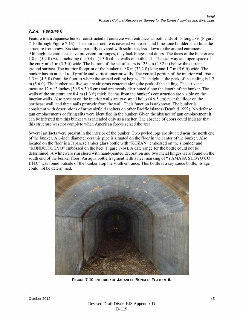
Final Phase I Cultural Resources Survey for the Divert Activities and Exercises
October 2012 45
7.2.4. Feature 6 Feature 6 is a Japanese bunker constructed of concrete with entrances at both ends of its long axis (Figure 7-10 through Figure 7-13). The entire structure is covered with earth and limestone boulders that hide the structure from view. Six stairs, partially covered with sediment, lead down to the arched entrances. Although the entrances have provision for hinges, they lack hinges and doors. The faces of the bunker are 1.8 m (5.9 ft) wide including the 0.4 m (1.3 ft) thick walls on both ends. The stairway and open space of the entry are 1 m (3.3 ft) wide. The bottom of the set of stairs is 125 cm (49.2 in) below the current ground surface. The interior footprint of the bunker is 9.8 m (32.2 ft) long and 1.7 m (5.6 ft) wide. The bunker has an arched roof profile and vertical interior walls. The vertical portion of the interior wall rises 1.3 m (4.3 ft) from the floor to where the arched ceiling begins. The height at the peak of the ceiling is 1.7 m (5.6 ft). The bunker has five square air vents centered along the peak of the ceiling. The air vents measure 12 x 12 inches (30.5 x 30.5 cm) and are evenly distributed along the length of the bunker. The walls of the structure are 0.4 m (1.3 ft) thick. Seams from the bunker’s construction are visible on the interior walls. Also present on the interior walls are two small holes (4 x 5 cm) near the floor on the northeast wall, and three nails protrude from the wall. Their function is unknown. The bunker is consistent with descriptions of army airfield shelters on other Pacific islands (Denfeld 1992). No defense gun emplacements or firing slits were identified in the bunker. Given the absence of gun emplacement it can be inferred that this bunker was intended only as a shelter. The absence of doors could indicate that this structure was not complete when American forces seized the area.
Several artifacts were present in the interior of the bunker. Two peeled logs are situated near the north end of the bunker. A 6-inch diameter ceramic pipe is situated on the floor in the center of the bunker. Also located on the floor is a Japanese amber glass bottle with “KOZAN” embossed on the shoulder and “KONDO/TOKYO” embossed on the heel (Figure 7-14). A date range for the bottle could not be determined. A whiteware rim sherd with hand-painted decoration and two metal hinges were found on the south end of the bunker floor. An aqua bottle fragment with a heel marking of “YAMASA SHOYU CO LTD.” was found outside of the bunker atop the south entrance. This bottle is a soy sauce bottle; its age could not be determined.
FIGURE 7-10. INTERIOR OF JAPANESE BUNKER, FEATURE 6.
Revised Draft Divert EIS Appendix D D-119
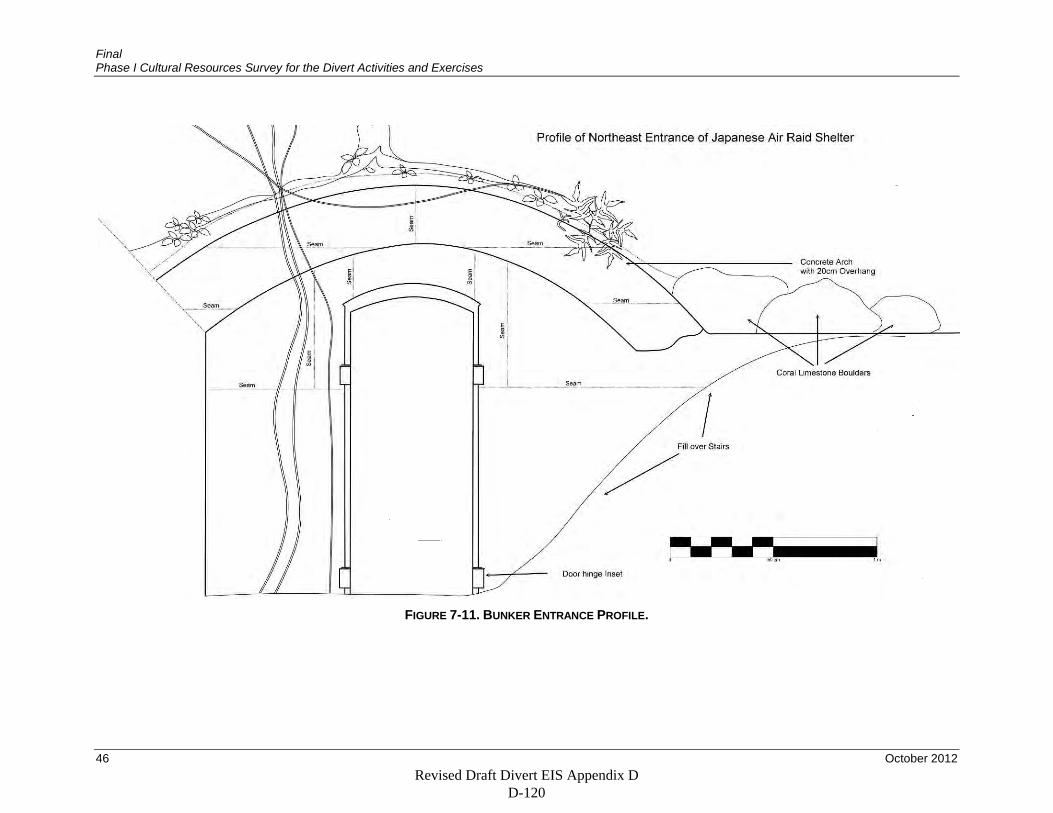
Final Phase I Cultural Resources Survey for the Divert Activities and Exercises
46 October 2012
FIGURE 7-11. BUNKER ENTRANCE PROFILE.
Revised Draft Divert EIS Appendix D D-120
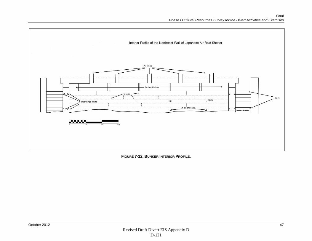
Final Phase I Cultural Resources Survey for the Divert Activities and Exercises
October 2012 47
FIGURE 7-12. BUNKER INTERIOR PROFILE.
Revised Draft Divert EIS Appendix D D-121
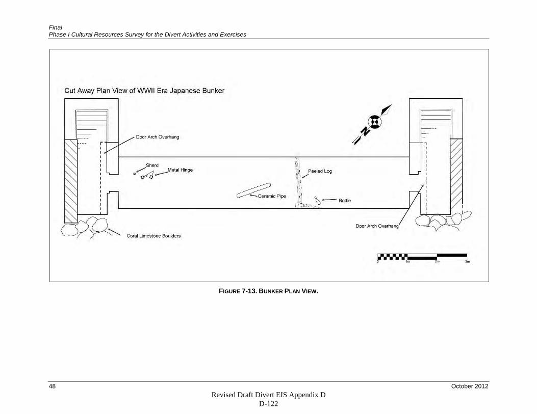
Final Phase I Cultural Resources Survey for the Divert Activities and Exercises
48 October 2012
FIGURE 7-13. BUNKER PLAN VIEW.
Revised Draft Divert EIS Appendix D D-122
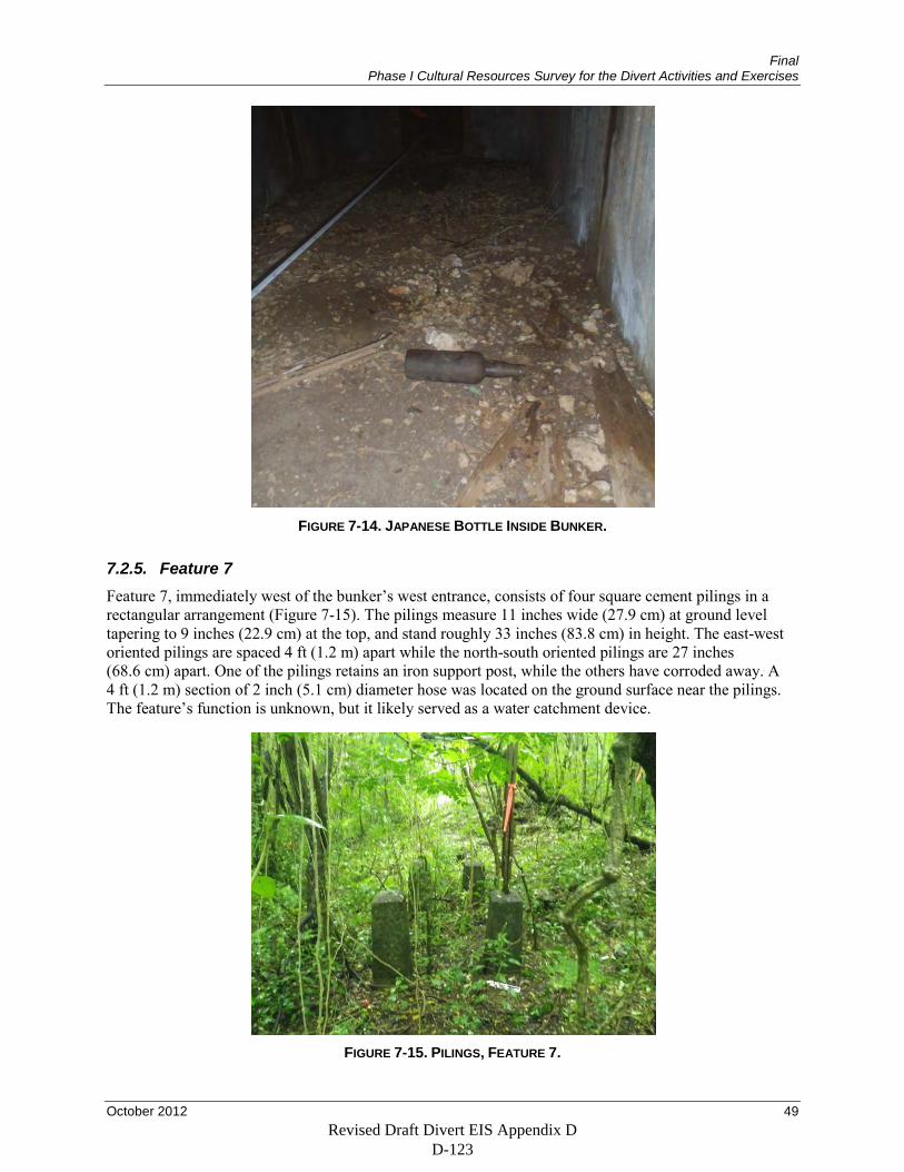
Final Phase I Cultural Resources Survey for the Divert Activities and Exercises
October 2012 49
FIGURE 7-14. JAPANESE BOTTLE INSIDE BUNKER.
7.2.5. Feature 7 Feature 7, immediately west of the bunker’s west entrance, consists of four square cement pilings in a rectangular arrangement (Figure 7-15). The pilings measure 11 inches wide (27.9 cm) at ground level tapering to 9 inches (22.9 cm) at the top, and stand roughly 33 inches (83.8 cm) in height. The east-west oriented pilings are spaced 4 ft (1.2 m) apart while the north-south oriented pilings are 27 inches (68.6 cm) apart. One of the pilings retains an iron support post, while the others have corroded away. A 4 ft (1.2 m) section of 2 inch (5.1 cm) diameter hose was located on the ground surface near the pilings. The feature’s function is unknown, but it likely served as a water catchment device.
FIGURE 7-15. PILINGS, FEATURE 7.
Revised Draft Divert EIS Appendix D D-123
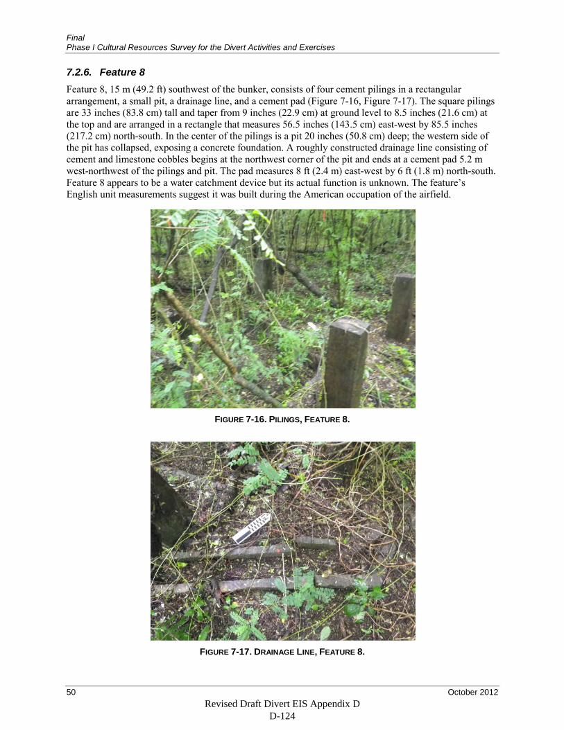
Final Phase I Cultural Resources Survey for the Divert Activities and Exercises
50 October 2012
7.2.6. Feature 8 Feature 8, 15 m (49.2 ft) southwest of the bunker, consists of four cement pilings in a rectangular arrangement, a small pit, a drainage line, and a cement pad (Figure 7-16, Figure 7-17). The square pilings are 33 inches (83.8 cm) tall and taper from 9 inches (22.9 cm) at ground level to 8.5 inches (21.6 cm) at the top and are arranged in a rectangle that measures 56.5 inches (143.5 cm) east-west by 85.5 inches (217.2 cm) north-south. In the center of the pilings is a pit 20 inches (50.8 cm) deep; the western side of the pit has collapsed, exposing a concrete foundation. A roughly constructed drainage line consisting of cement and limestone cobbles begins at the northwest corner of the pit and ends at a cement pad 5.2 m west-northwest of the pilings and pit. The pad measures 8 ft (2.4 m) east-west by 6 ft (1.8 m) north-south. Feature 8 appears to be a water catchment device but its actual function is unknown. The feature’s English unit measurements suggest it was built during the American occupation of the airfield.
FIGURE 7-16. PILINGS, FEATURE 8.
FIGURE 7-17. DRAINAGE LINE, FEATURE 8.
Revised Draft Divert EIS Appendix D D-124
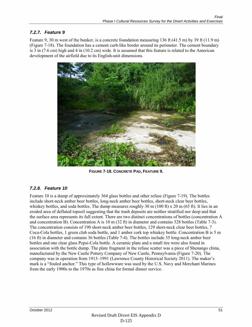
Final Phase I Cultural Resources Survey for the Divert Activities and Exercises
October 2012 51
7.2.7. Feature 9 Feature 9, 30 m west of the bunker, is a concrete foundation measuring 136 ft (41.5 m) by 39 ft (11.9 m) (Figure 7-18). The foundation has a cement curb-like border around its perimeter. The cement boundary is 3 in (7.6 cm) high and 4 in (10.2 cm) wide. It is assumed that this feature is related to the American development of the airfield due to its English-unit dimensions.
FIGURE 7-18. CONCRETE PAD, FEATURE 9.
7.2.8. Feature 10 Feature 10 is a dump of approximately 364 glass bottles and other refuse (Figure 7-19). The bottles include short-neck amber beer bottles, long-neck amber beer bottles, short-neck clear beer bottles, whiskey bottles, and soda bottles. The dump measures roughly 30 m (100 ft) x 20 m (65 ft). It lies in an eroded area of deflated topsoil suggesting that the trash deposits are neither stratified nor deep and that the surface area represents its full extent. There are two distinct concentrations of bottles (concentration A and concentration B). Concentration A is 10 m (32 ft) in diameter and contains 328 bottles (Table 7-3). The concentration consists of 190 short-neck amber beer bottles, 129 short-neck clear beer bottles, 7 Coca-Cola bottles, 1 green club soda bottle, and 1 amber cork top whiskey bottle. Concentration B is 5 m (16 ft) in diameter and contains 36 bottles (Table 7-4). The bottles include 35 long-neck amber beer bottles and one clear glass Pepsi-Cola bottle. A ceramic plate and a small tire were also found in association with the bottle dump. The plate fragment in the refuse scatter was a piece of Shenango china, manufactured by the New Castle Pottery Company of New Castle, Pennsylvania (Figure 7-20). The company was in operation from 1913–1991 (Lawrence County Historical Society 2011). The maker’s mark is a “fouled anchor.” This type of hollowware was used by the U.S. Navy and Merchant Marines from the early 1900s to the 1970s as fine china for formal dinner service.
Revised Draft Divert EIS Appendix D D-125
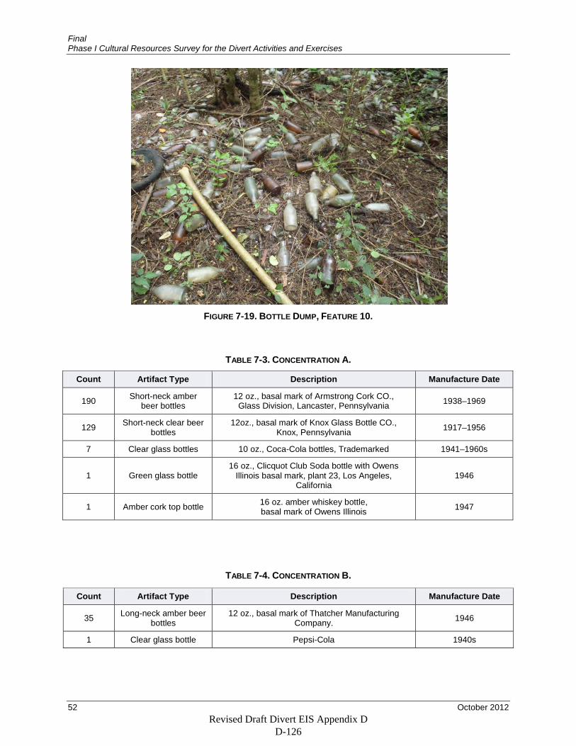
Final Phase I Cultural Resources Survey for the Divert Activities and Exercises
52 October 2012
FIGURE 7-19. BOTTLE DUMP, FEATURE 10.
TABLE 7-3. CONCENTRATION A.
Count Artifact Type Description Manufacture Date
190 Short-neck amber beer bottles
12 oz., basal mark of Armstrong Cork CO., Glass Division, Lancaster, Pennsylvania 1938–1969
129 Short-neck clear beer bottles
12oz., basal mark of Knox Glass Bottle CO., Knox, Pennsylvania 1917–1956
7 Clear glass bottles 10 oz., Coca-Cola bottles, Trademarked 1941–1960s
1 Green glass bottle 16 oz., Clicquot Club Soda bottle with Owens
Illinois basal mark, plant 23, Los Angeles, California
1946
1 Amber cork top bottle 16 oz. amber whiskey bottle, basal mark of Owens Illinois 1947
TABLE 7-4. CONCENTRATION B.
Count Artifact Type Description Manufacture Date
35 Long-neck amber beer bottles
12 oz., basal mark of Thatcher Manufacturing Company. 1946
1 Clear glass bottle Pepsi-Cola 1940s
Revised Draft Divert EIS Appendix D D-126
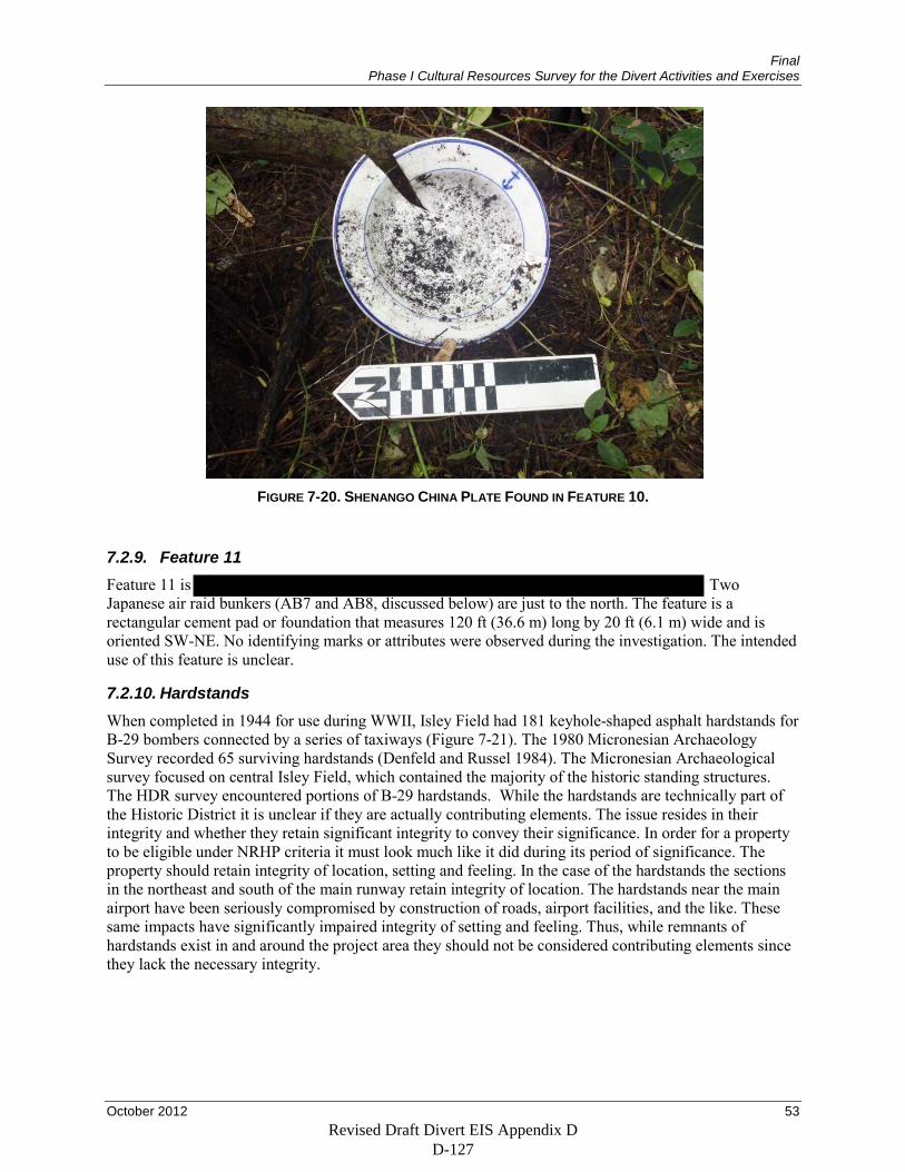
Final Phase I Cultural Resources Survey for the Divert Activities and Exercises
October 2012 53
FIGURE 7-20. SHENANGO CHINA PLATE FOUND IN FEATURE 10.
7.2.9. Feature 11 Feature 11 is Two Japanese air raid bunkers (AB7 and AB8, discussed below) are just to the north. The feature is a rectangular cement pad or foundation that measures 120 ft (36.6 m) long by 20 ft (6.1 m) wide and is oriented SW-NE. No identifying marks or attributes were observed during the investigation. The intended use of this feature is unclear.
7.2.10. Hardstands When completed in 1944 for use during WWII, Isley Field had 181 keyhole-shaped asphalt hardstands for B-29 bombers connected by a series of taxiways (Figure 7-21). The 1980 Micronesian Archaeology Survey recorded 65 surviving hardstands (Denfeld and Russel 1984). The Micronesian Archaeological survey focused on central Isley Field, which contained the majority of the historic standing structures. The HDR survey encountered portions of B-29 hardstands. While the hardstands are technically part of the Historic District it is unclear if they are actually contributing elements. The issue resides in their integrity and whether they retain significant integrity to convey their significance. In order for a property to be eligible under NRHP criteria it must look much like it did during its period of significance. The property should retain integrity of location, setting and feeling. In the case of the hardstands the sections in the northeast and south of the main runway retain integrity of location. The hardstands near the main airport have been seriously compromised by construction of roads, airport facilities, and the like. These same impacts have significantly impaired integrity of setting and feeling. Thus, while remnants of hardstands exist in and around the project area they should not be considered contributing elements since they lack the necessary integrity.
Revised Draft Divert EIS Appendix D D-127
Revised Draft Divert EIS Appendix D D-128
Revised Draft Divert EIS Appendix D D-129

Revised Draft Divert EIS Appendix D D-130

Revised Draft Divert EIS Appendix D D-131
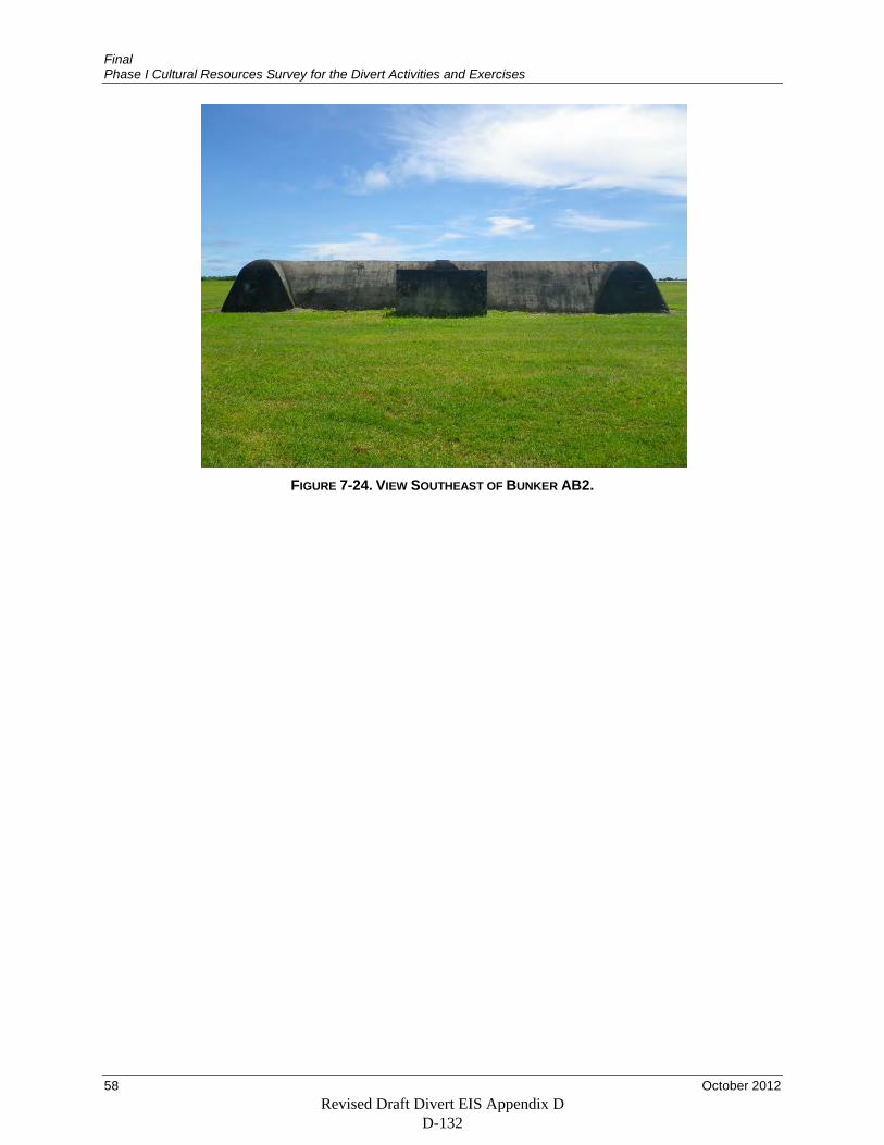
Final Phase I Cultural Resources Survey for the Divert Activities and Exercises
58 October 2012
FIGURE 7-24. VIEW SOUTHEAST OF BUNKER AB2.
Revised Draft Divert EIS Appendix D D-132
Final Phase I Cultural Resources Survey for the Divert Activities and Exercises
October 2012 59
8. DISCUSSION
8.1. Analysis of Prehistoric Period Resources The project’s research questions for the prehistoric period involve the relationship between interior land use patterns and the greater forces that led to that landscape use. The potential causes included population pressures, competition for resources, and environmental change. During the Pre-Latte phase, populations were small and concentrated in coastal areas close to marine resources (Cunningham 1992). During the Latte phase (A.D. 800/1000–Contact) the archaeological record shows an increase in population. This increase coincides with lower sea levels and El Nino and La Nina weather patterns. Records from Guam, Yap, and Saipan indicate the net difference was about 0.6 m (Lander 2004). The change in sea level provided more inhabitable coastline which added marine food sources and thus stimulated an increase in population. Population increase would have increased demand and competition for marine resources and coastal farmland, necessitating expansion of inland hunting, gathering, and agriculture. The severity of the period’s ENSO events would have reduced the reliability of coastal resource yields. An increase in typhoons and tropical storm surges associated with large-scale climate patterns would have altered coastal habitat. For example, bivalve species from Latte-phase shell middens indicate silty habitats that could have resulted from erosion caused by severe storms (Amesbury 1996); storm-related erosion could also have damaged lowland areas suited to agriculture. In addition, populations may have moved inland for shelter from frequent storms.
Although survey recorded very few prehistoric artifacts, these artifacts are consistent with increased interior landscape use. The remains of pottery are indicative of interior use for resource collection or storage. The sling stone is consistent with either hunting or with conflict over inland territory. Unfortunately, the modification of the project area by the bombardment of the island prior to the U.S. invasion and by the construction of Aslito/Isley Field destroyed any evidence that may have existed of prehistoric agricultural fields, occupation sites, or short-term activity areas, making interpretation of the prehistoric archaeological record difficult.
8.2. Analysis of Historic Period Resources The research questions for historic-period cultural resources involved the Japanese occupation of the island prior to and during WWII. Survey recorded no historic artifacts or features that date to before the construction of Aslito Field, and the project’s results therefore do not allow for evaluation of the research questions involving the effects of Japanese colonists and colonial-era landscape use on Chamorro and Carolinian population’s subsistence and settlement patterns.
The project also sought to evaluate the extent to which Japanese forces were able to prepare for the U.S. invasion during WWII. Japan expected U.S. forces to attack Palau before the Marianas, and did not begin preparing facilities in the Mariana Islands for invasion until February 1944, only five months before the U.S. invasion. Aslito Field served as the principal airbase in the Marianas functioning as a fighter field and a forward maintenance facility. The field was defended by 2 medium anti-aircraft guns, and 11 medium anti-aircraft guns were located south of the field. In February 1944 Japan began reinforcing the 1,500 military personnel on Saipan, and 31,000 troops were in place when U.S. forces arrived. However, U.S. submarines took a heavy toll on Japanese vessels, severely disrupting the transport of construction equipment and military hardware from Japan to the Marianas. Although Saipan had many pillboxes, blockhouses, and other fortifications, several large guns were not emplaced, and Aslito Field had no ground defenses. In addition, the airfield had no provisions for demolition if threatened with capture, so U.S. forces were able to begin using the facility soon after the invasion.
This incomplete preparation for invasion by Japanese forces may be the reason for the incomplete state of the Japanese airfield defense bunker recorded during the current survey. Although the bunker is basically
Revised Draft Divert EIS Appendix D D-133
Final Phase I Cultural Resources Survey for the Divert Activities and Exercises
60 October 2012
complete and covered in earth and limestone boulders, it lacks doors. There are two likely explanations. One is that the doors were never installed because they were lost in transport from Japan due to U.S. attacks on supply ships. The alternative is that the doors were removed as scrap metal after the war, but the other six bunkers that were evaluated as part of the survey still have their doors, making this explanation less likely.
Survey also recorded several features that were probably built by U.S. forces after the capture of Aslito Field. The strategic location of the Marianas for B-29 bomber missions to Japan meant that the U.S. military began improving and expanding Aslito Field soon after the invasion. These improvements included 181 hardstands and associated taxiways but also included a large number of quickly built structures. The concrete pedestals and pads recorded during survey are probably supports for temporary buildings and provisions for water supply and wastewater removal for U.S.-built structures. Concrete slabs comparable in size to the one recorded during the current survey have been identified as Quonset hut briefing rooms (Grant et al. 2007). The bottles in the bottle dump recorded during survey were made between 1938 and 1969 but were probably left at Isley Field during the field’s occupation by the U.S. military between 1944 and 1949. However, these features and artifacts do not expand in any substantive way on the history of Isley Field as preserved in the documentary record and as known through the material record of hardstands, runways, standing buildings, and other features.
Revised Draft Divert EIS Appendix D D-134
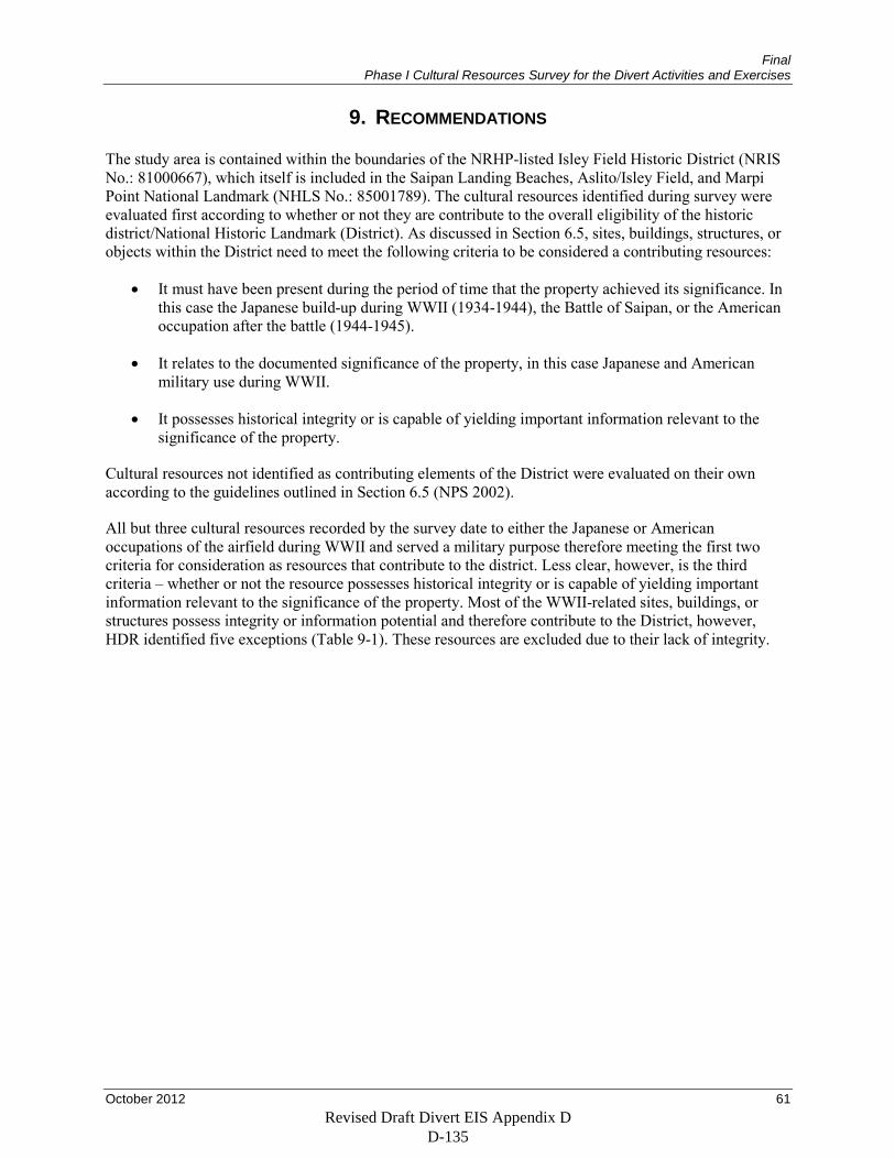
Final Phase I Cultural Resources Survey for the Divert Activities and Exercises
October 2012 61
9. RECOMMENDATIONS
The study area is contained within the boundaries of the NRHP-listed Isley Field Historic District (NRIS No.: 81000667), which itself is included in the Saipan Landing Beaches, Aslito/Isley Field, and Marpi Point National Landmark (NHLS No.: 85001789). The cultural resources identified during survey were evaluated first according to whether or not they are contribute to the overall eligibility of the historic district/National Historic Landmark (District). As discussed in Section 6.5, sites, buildings, structures, or objects within the District need to meet the following criteria to be considered a contributing resources:
• It must have been present during the period of time that the property achieved its significance. In this case the Japanese build-up during WWII (1934-1944), the Battle of Saipan, or the American occupation after the battle (1944-1945).
• It relates to the documented significance of the property, in this case Japanese and American military use during WWII.
• It possesses historical integrity or is capable of yielding important information relevant to the significance of the property.
Cultural resources not identified as contributing elements of the District were evaluated on their own according to the guidelines outlined in Section 6.5 (NPS 2002).
All but three cultural resources recorded by the survey date to either the Japanese or American occupations of the airfield during WWII and served a military purpose therefore meeting the first two criteria for consideration as resources that contribute to the district. Less clear, however, is the third criteria – whether or not the resource possesses historical integrity or is capable of yielding important information relevant to the significance of the property. Most of the WWII-related sites, buildings, or structures possess integrity or information potential and therefore contribute to the District, however, HDR identified five exceptions (Table 9-1). These resources are excluded due to their lack of integrity.
Revised Draft Divert EIS Appendix D D-135
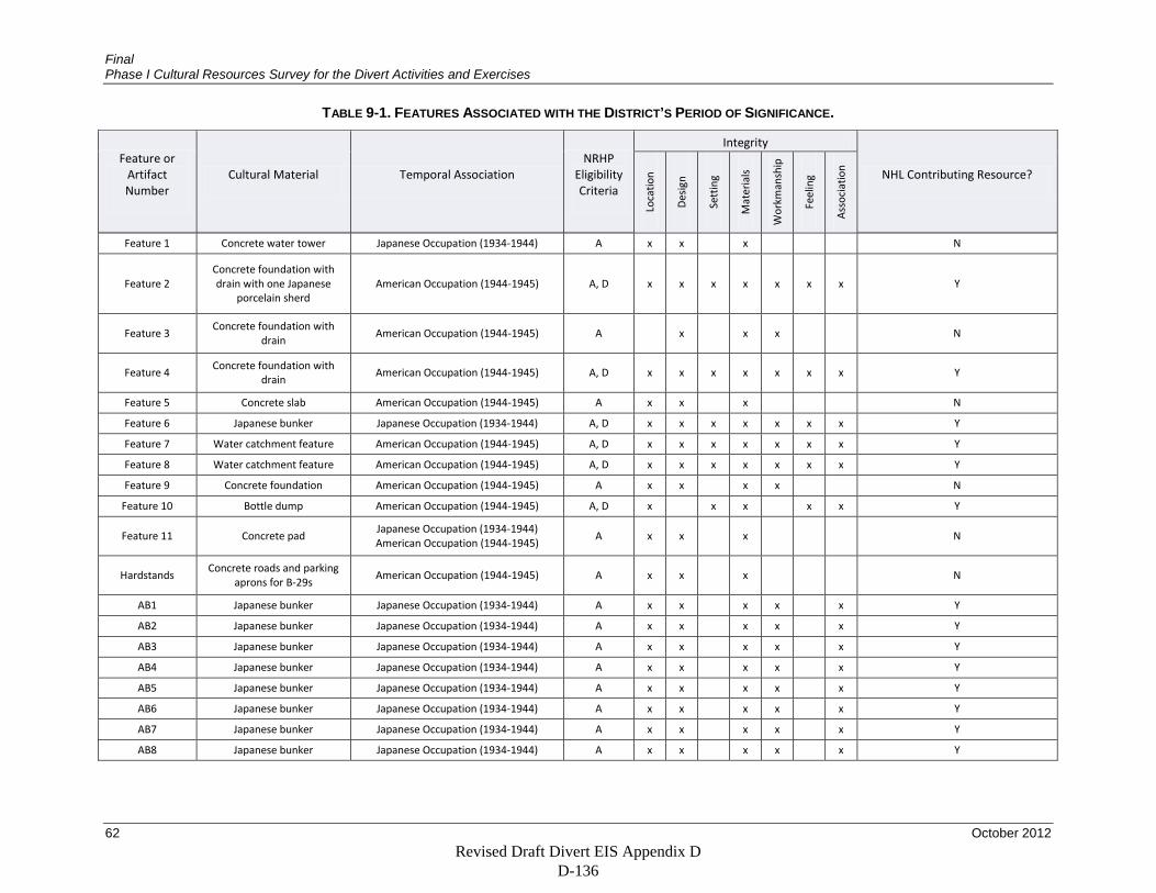
Final Phase I Cultural Resources Survey for the Divert Activities and Exercises
62 October 2012
TABLE 9-1. FEATURES ASSOCIATED WITH THE DISTRICT’S PERIOD OF SIGNIFICANCE.
Feature or Artifact Number
Cultural Material Temporal Association NRHP
Eligibility Criteria
Integrity
NHL Contributing Resource?
Loca
tion
Des
ign
Sett
ing
Mat
eria
ls
Wor
kman
ship
Feel
ing
Ass
ocia
tion
Feature 1 Concrete water tower Japanese Occupation (1934-1944) A x x x
N
Feature 2 Concrete foundation with drain with one Japanese
porcelain sherd American Occupation (1944-1945) A, D x x x x x x x Y
Feature 3 Concrete foundation with
drain American Occupation (1944-1945) A
x x x N
Feature 4 Concrete foundation with
drain American Occupation (1944-1945) A, D x x x x x x x Y
Feature 5 Concrete slab American Occupation (1944-1945) A x x x
N
Feature 6 Japanese bunker Japanese Occupation (1934-1944) A, D x x x x x x x Y
Feature 7 Water catchment feature American Occupation (1944-1945) A, D x x x x x x x Y
Feature 8 Water catchment feature American Occupation (1944-1945) A, D x x x x x x x Y
Feature 9 Concrete foundation American Occupation (1944-1945) A x x x x N
Feature 10 Bottle dump American Occupation (1944-1945) A, D x x x x x Y
Feature 11 Concrete pad Japanese Occupation (1934-1944) American Occupation (1944-1945)
A x x
x
N
Hardstands Concrete roads and parking
aprons for B-29s American Occupation (1944-1945) A x x x
N
AB1 Japanese bunker Japanese Occupation (1934-1944) A x x x x x Y
AB2 Japanese bunker Japanese Occupation (1934-1944) A x x x x x Y
AB3 Japanese bunker Japanese Occupation (1934-1944) A x x x x x Y
AB4 Japanese bunker Japanese Occupation (1934-1944) A x x x x x Y
AB5 Japanese bunker Japanese Occupation (1934-1944) A x x x x x Y
AB6 Japanese bunker Japanese Occupation (1934-1944) A x x x x x Y
AB7 Japanese bunker Japanese Occupation (1934-1944) A x x x x x Y
AB8 Japanese bunker Japanese Occupation (1934-1944) A x x x x x Y
Revised Draft Divert EIS Appendix D D-136
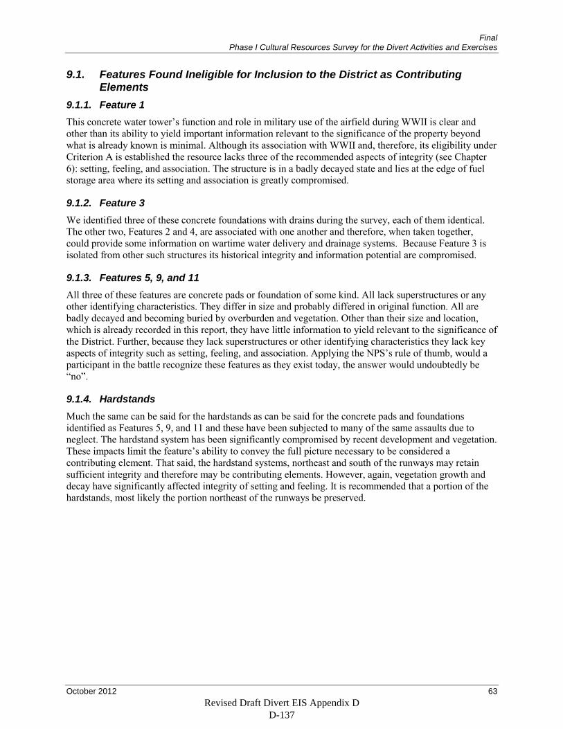
Final Phase I Cultural Resources Survey for the Divert Activities and Exercises
October 2012 63
9.1. Features Found Ineligible for Inclusion to the District as Contributing Elements
9.1.1. Feature 1 This concrete water tower’s function and role in military use of the airfield during WWII is clear and other than its ability to yield important information relevant to the significance of the property beyond what is already known is minimal. Although its association with WWII and, therefore, its eligibility under Criterion A is established the resource lacks three of the recommended aspects of integrity (see Chapter 6): setting, feeling, and association. The structure is in a badly decayed state and lies at the edge of fuel storage area where its setting and association is greatly compromised.
9.1.2. Feature 3 We identified three of these concrete foundations with drains during the survey, each of them identical. The other two, Features 2 and 4, are associated with one another and therefore, when taken together, could provide some information on wartime water delivery and drainage systems. Because Feature 3 is isolated from other such structures its historical integrity and information potential are compromised.
9.1.3. Features 5, 9, and 11 All three of these features are concrete pads or foundation of some kind. All lack superstructures or any other identifying characteristics. They differ in size and probably differed in original function. All are badly decayed and becoming buried by overburden and vegetation. Other than their size and location, which is already recorded in this report, they have little information to yield relevant to the significance of the District. Further, because they lack superstructures or other identifying characteristics they lack key aspects of integrity such as setting, feeling, and association. Applying the NPS’s rule of thumb, would a participant in the battle recognize these features as they exist today, the answer would undoubtedly be “no”.
9.1.4. Hardstands Much the same can be said for the hardstands as can be said for the concrete pads and foundations identified as Features 5, 9, and 11 and these have been subjected to many of the same assaults due to neglect. The hardstand system has been significantly compromised by recent development and vegetation. These impacts limit the feature’s ability to convey the full picture necessary to be considered a contributing element. That said, the hardstand systems, northeast and south of the runways may retain sufficient integrity and therefore may be contributing elements. However, again, vegetation growth and decay have significantly affected integrity of setting and feeling. It is recommended that a portion of the hardstands, most likely the portion northeast of the runways be preserved.
Revised Draft Divert EIS Appendix D D-137
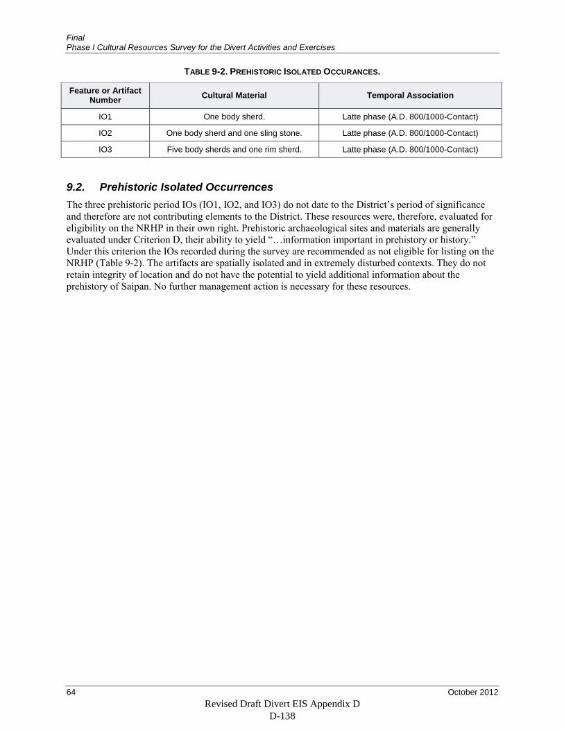
Final Phase I Cultural Resources Survey for the Divert Activities and Exercises
64 October 2012
TABLE 9-2. PREHISTORIC ISOLATED OCCURANCES.
Feature or Artifact Number Cultural Material Temporal Association
IO1 One body sherd. Latte phase (A.D. 800/1000-Contact)
IO2 One body sherd and one sling stone. Latte phase (A.D. 800/1000-Contact)
IO3 Five body sherds and one rim sherd. Latte phase (A.D. 800/1000-Contact)
9.2. Prehistoric Isolated Occurrences The three prehistoric period IOs (IO1, IO2, and IO3) do not date to the District’s period of significance and therefore are not contributing elements to the District. These resources were, therefore, evaluated for eligibility on the NRHP in their own right. Prehistoric archaeological sites and materials are generally evaluated under Criterion D, their ability to yield “…information important in prehistory or history.” Under this criterion the IOs recorded during the survey are recommended as not eligible for listing on the NRHP (Table 9-2). The artifacts are spatially isolated and in extremely disturbed contexts. They do not retain integrity of location and do not have the potential to yield additional information about the prehistory of Saipan. No further management action is necessary for these resources.
Revised Draft Divert EIS Appendix D D-138
Final Phase I Cultural Resources Survey for the Divert Activities and Exercises
October 2012 65
10. REFERENCES CITED
Alkire, W. H. 1984 The Carolinians of Saipan and the Commonwealth of the Northern Mariana Islands. Pacific
Affairs 57(2):270–283.
Allen, S., and P. Bartram 2008 Guam as a Fishing Community. Administrative Report H-08-01. Pacific Islands Fisheries
Science Center, Honolulu, Hawai‘i.
Ambrose, S. H., B. M. Butler, D. B. Hanson, R. L. Hunter Anderson, and H. W. Krueger 1997 Stable Isotopic Analysis of Human Diet in the Marianas Archipelago, Western Pacific.
American Journal of Physical Anthropology 104(3):343–361.
Amesbury, J. R. 1999 Changes in Species Composition of Archaeological Marine Shell Assemblages in Guam.
Micronesica 31(2):347–366.
2007 Mollusk Collecting and Environmental Ehange during the Prehistoric Period in the Mariana Islands. Coral Reefs 26(4):947–958.
Amesbury, J. R., R. L. Hunter-Anderson, and A. G. Non 2003 Review of Archaeological and Historical Data Concerning Reef Fishing in the US Flag Islands
of Micronesia: Guam and the Northern Mariana Islands. Western Pacific Regional Fishery Management Council, Honolulu.
2008 An Analysis of Archaeological and Historical Data on Fisheries for Pelagic Species in Guam and the Northern Mariana Islands. Pelagic Fisheries Research Program, Joint Institute for Marine and Atmospheric Research, School of Ocean and Earth Science and Technology, University of Hawai‘i at Mānoa.
Amesbury, J. R., D. R. Moore, and R. L. Hunter-Anderson 1996 Cultural Adaptations and Late Holocene Sea Level Change in the Marianas: Recent
Excavations at Chalan Piao, Saipan, Micronesia. Bulletin of the Indo-Pacific Prehistory Association 15:53–69.
Arnold, W. S. 2011 Investigations in Invasion Innovation: The Archaeological and Historical Study of a WWII
Landing Vehicle Tracked in Saipan. Australian Archaeology:63.
Athens, J. S., M. F. Dega, and J. V. Ward 2004 Austronesian Colonisation of the Mariana Islands: The Palaeoenvironmental Evidence. Bulletin
of the Indo-Pacific Prehistory Association 24:21–30.
2008 Austronesian colonization of the Mariana Islands: the Paleoenvironmental Evidence. Bulletin of the Indo-Pacific Prehistory Association 24(0):21.
Revised Draft Divert EIS Appendix D D-139
Final Phase I Cultural Resources Survey for the Divert Activities and Exercises
66 October 2012
Athens, J. S., and J. V. Ward 2004 Holocene Vegetation, Savanna origins and Human Settlement of Guam. Records of the
Australian Museum 29:15–30.
Bayliss-Smith, T. 1975 The Price of Protein: Marine Fisheries in Pacific Subsistence. 13th Pacific Science Congress.
University of British Columbia, Vancouver.
Berger, G. M, J. Gourley, and G. Shroer. 2005 Comprehensive Wildlife Conservation Strategy for the Commonwealth of the Northern Mariana
Islands. Submitted to the National Advisory Acceptance Team. Copies available from the U.S. Fish and Wildlife Service, Portland, Oregon and online at: http://www.dfw.gov.mp/Downloads/Conservation%20Area%20Management%20Plans/CWCS%20WHOLE%20DOCUMENT%20FINAL.pdf
Blust, R. A. 2000 Chamorro Historical Phonology. Oceanic Linguistics 39(1):83–122.
Bodner, C. C. 1997 On Architecture and Social Power: Some Possible Philippine-Oceanic Links. Bulletin of the
Indo-Pacific Prehistory Association 16:89–102.
Bowers, N. M. 1950 Problems of resettlement on Saipan, Tinian and Rota, Mariana Islands. Pacific Science Board,
National Research Council (Sl).
Burtchard, G. C. 1991 An Archaeological Inventory of the Gun Beach-Fafai Wastewater Corridor Gognga Cover
through Harmon Annex, Guam. International Archaeological Research Institute, Honolulu, Hawai‘i. Submitted to EMPSCO, Guam.
Butler, B. M. 1988 Archaeological Investigations on the North Coast of Rota, Mariana Islands. Southern Illinois
University.
1990 Pots as Tools: the Marianas case. Micronesica 2:33–46.
Carson, M. T. 2011 Palaeohabitat of First Settlement Sites 1500–1000 B.C. in Guam, Mariana Islands, Western
Pacific. Journal of Archaeological Science 38(9):2207–2221.
Carson, M. T., and J. A. Peterson 2011 Calcrete Formation and Implications for Buried Archaeological Deposits in the Mariana
Islands, Western Pacific. Geoarchaeology 26(4):501–513.
Revised Draft Divert EIS Appendix D D-140
Final Phase I Cultural Resources Survey for the Divert Activities and Exercises
October 2012 67
Carruth, R. L. 2003 Ground-Water Resources of Saipan, Commonwealth of the Northern Mariana Islands. Water-
Resources Investigation Report 03-4178. U.S. Geological Survey, Honolulu, Hawai‘i.
1999 Construction, Geological, and Hydrologic Data from Five Exploratory Wells on Rota, Commonwealth of the Northern Mariana Islands, 1999. U.S. Geological Survey Open-File Report 2005-1042. U.S. Geological Survey, Honolulu, Hawai‘i.
Chapin, J. C. 1994 Breaching the Marianas: The Battle for Saipan. History and Museums Division, Headquarters,
U.S. Marine Corps.
Clark, G., F. Petchey, O. Winter, M. Carson, and P. O’Day 2010 New Radiocarbon Dates from the Bapot-1 Site in Saipan and Neolithic Dispersal by Stratified
Diffusion. Journal of Pacific Archaeology 1(1):21–35.
Cloud, P. E., Jr., R. G. Schmidt, and H. W. Burke 1956 Geology of Saipan Mariana Islands: Part 1. General Geology. Geological Survey Professional
Paper 280-A. U.S. Government Printing Office, Washington.
Cordy, R. 1983 Social Stratification in the Mariana Islands. Oceania 53(3):272–276.
1986 Relationships Between the Extent of Social Stratification and Population in Micronesian Polities at European Contact. American Anthropologist 88(1):136–142.
Craib, J. L. 1983 Micronesian Prehistory: an Archeological Overview. Science 219(4587):922.
1993 Early Occupation at Unai Chulu, Tinian, Commonwealth of the Northern Mariana Islands. Bulletin of the Indo-Pacific Prehistory Association 13(0):116–134.
Cruz, J. B., S. R. Kremer, G. Martin, L. L. Williams, and V. A. Camacho 2008 Relative Abundance and Distribution of Mariana Swiftlets (Aves: Apodidae) in Northern
Mariana Islands. Pacific Science 62(2):233–246.
Cunningham, Lawrence J. 1992 Ancient Chamorro Society. The Bess Press, Inc. Honolulu, Hawai‘i.
DeBell, D. S. and Whitesell, C. D. 1993 Upland Forests of the American/Pacific Islands: Research Opportunities in Micronesia and
American Samoa. General Technical Report. PSW-GTR-145. Pacific Southwest Research Station, Albany, California.
Revised Draft Divert EIS Appendix D D-141
Final Phase I Cultural Resources Survey for the Divert Activities and Exercises
68 October 2012
Deenik, J. 2010 Soils of Tinian: Properties and Diversity. Tinian Grazing and Livestock Management
Workshop, June 16-18. Electronic document, www.marianasgrazingacademy.org/PDF’s/Soils/soils tinian 2010 notes.pdf
DeFant, D. G. 2008 Early Human Burials from the Naton Beach Site, Tumon Bay, Island of Guam, Mariana
Islands. The Journal of Island and Coastal Archaeology 3(1):149–153.
DeFant, D. G., and L. R. C. L. Guerro 2006 Archaeological Survey of Seven Parcels Within the Munitions Storage Area, Andersen Air
Force Base, Island of Guam. Paul H. Rosendahl, Ph.D. Report No. 2552-101206, G.M.F., Guam. Submitted to Andersen Air Force Base, Guam.
Denfeld, D. C. 1992 Japanese Fortifications and Other Military Structures in the Central Pacific. Micronesian
Archaeological Survey Report No. 9. CNMI Div. of Historic Preservation, Saipan.
1997 Hold the Marianas: the Japanese Defense of the Mariana Islands. White Mane Publishers, Shippensburg, Pennsylvania.
Denfeld, D., and S. C. Russell 1984 Home of the Superfort: An Historical and Archaeological Survey of Isley Field. Issue 21 of
Report (Micronesian Archaeological Survey). Micronesian Archaeological Survey, Office of the High Commissioner, Trust Territory of the Pacific Islands, Saipan, CNMI.
Dickinson, W. R. 1999 Holocene Sea-level record on Funafuti and Potential Impact of Global Warming on Central
Pacific Atolls. Quaternary Research 51:124–132.
2000 Hydro-isostatic and Tectonic Influences on Emergent Holocene Paleoshorelines in the Mariana Islands, Western Pacific Ocean. Journal of Coastal Research 16(3):735–746.
Dickinson, W. R., B. M. Butler, D. R. Moore, and M. Swift 2001 Geologic Sources and Geographic Distribution of Sand Tempers in Prehistoric Potsherds from
the Mariana Islands. Geoarchaeology 16(8):827–854.
Dixon, B. 2004 The Archaeology of Rural Settlement and Class in a Pre-WWII Japanese Plantation on Tinian,
Commonwealth of the Northern Mariana Islands. International Journal of Historical Archaeology 8(4):281–299.
Doan, D. B., H. W. Burke, H. G. May, C. H. Stensland, and D. I. Blumenstock. 1960 Military Geology of Tinian, Mariana Islands. U.S. Army Corps of Engineers, Washington, DC.
Revised Draft Divert EIS Appendix D D-142
Final Phase I Cultural Resources Survey for the Divert Activities and Exercises
October 2012 69
Douglas, M. T., M. Pietrusewsky, and R. M. Ikehara Quebral 1997 Skeletal Biology of Apurguan: A Precontact Chamorro Site on Guam. American Journal of
Physical Anthropology 104(3):291–313.
Falanrum, M. C., T. G. Cole, and A. H. Ambacher 1989 Vegetation Survey of Rota, Tinian, and Saipan, commonwealth of the Northern Mariana
Islands. Resource Bulletin PSW-RB-27. USDA Forest Service, Pacific Southwest Forest and Range Experiment Station, Berkeley, California.
Field, J. S., and P. V. Lape 2010 Paleoclimates and the Emergence of Fortifications in the Tropical Pacific islands. Journal of
Anthropological Archaeology 29(1):113–124.
Fosberg, Raymond F. 1960 The Vegetation of Micronesia: General Descriptions, the Vegetation of the Marianas Islands,
and a Detailed Consideration of the Vegetation of Guam. Bulletin of the American Museum of Natural History 119: Article 1 (pp. 8–76).
Goldberg, H. J. 2007 D-Day in the Pacific: the Battle of Saipan. Indiana University Press, Bloomington.
Grant, M., M. Travisanao, S. Wenzlau, M. Durst 2007 Results of Cultural Resource Inventories for Establishment and Operation of an Intelligence,
Surveillance, Reconnaissance, and Strike Capability and the Deployment of Red Horse Squadron, Andersen Air Force Base, Guam. Geo-Marine, Inc., Plano, Texas.
Graves, M. W. 1986 Organization and Differentiation within Late Prehistoric Ranked Social Units, Mariana Islands,
Western Pacific. Journal of Field Archaeology 13(2):139–154.
Graves, M. W., T. L. Hunt, and D. Moore 1990 Ceramic Production in the Marianas Islands: Explaining Change and Diversity in Prehistoric
Interaction and Exchange in Exchange, Interaction and Social Complexity in Oceania. Asian Perspectives 29(2):211–233.
Hanihara, T. 1997 Craniofacial Affinities of Mariana Islanders and Circum-Pacific Peoples. American Journal of
Physical Anthropology 104(3):411–425.
Hanson, D. B., and B. M. Butler 1997 A Biocultural Perspective on Marianas Prehistory: Recent Trends in Bioarchaeological
Research. American Journal of Physical Anthropology 104(3):271–290.
Revised Draft Divert EIS Appendix D D-143
Final Phase I Cultural Resources Survey for the Divert Activities and Exercises
70 October 2012
Hanson, D. B., and M. Pietrusewsky 1997 Bioarchaeological Research in the Mariana Islands of the Western Pacific: an Overview.
American Journal of Physical Anthropology 104(3):267–269.
Hensley, R. A., and T. S. Sherwood 1993 An Overview of Guam’s Inshore Fisheries. Marine Fisheries Review 55(2):129–138.
Herald, M. 1992 Northern Mariana Islands: A Change in Course under Its Covenant with the United States.
Oregon Law Review 71:127.
Hezel, Francis X. 1983 The First Taint of Civilization: a History of the Caroline and Marshall Islands in Pre-Colonial
Days, 1521–1885. Honolulu: Pacific Islands Studies Program, Center for Pacific and Asian Studies, University of Hawai‘i.
Hocart, C. H., and B. Frankhauser 1996 Betel Nut Residues in Archaeological Samples of Human Teeth from the Mariana Islands.
Cellular and Molecular Life Sciences 52(3):281–285.
Hunter-Anderson, R. L. 2010 Cultural Responses to a Late Holocene Climatic Oscillation in the Mariana Islands, Micronesia:
Lessons from the Past. Human Ecology Review 17(2):149.
Hunter-Anderson, R. L., and B. M. Butler 1995 An Overview of Northern Marianas Prehistory. Micronesian Archaeological Survey Report
No. 31. Micronesian Archaeological Research Services, Guam.
Hunter-Anderson, R. L., and D. R. Moore 1994 Archaeology in Manenggon Hills Yona, Guam. Micronesian Archaeological Research Services,
Guam.
Hunter-Anderson, R. L., G. B. Thompson, and D. R. Moore 1995 Rice as a Prehistoric Valuable in the Mariana Islands, Micronesia. Asian Perspectives
34(1):69–89.
Irwin, G. 1998 The Colonisation of the Pacific Plate: Chronological, Navigational and Social Issues. Journal of
the Polynesian Society 107(2):111–143.
Ishida, H., and Y. Dodo 1997 Cranial Variation in Prehistoric Human Skeletal Remains from the Marianas. American Journal
of Physical Anthropology 104(3):399–410.
Revised Draft Divert EIS Appendix D D-144
Final Phase I Cultural Resources Survey for the Divert Activities and Exercises
October 2012 71
Karig, D. E. 1971 Structural History of the Marana Island Arc System: Geological Society of America Bulletin
(82):323–344.
Kayanne, H., I. Ishii, E. Matsumoto, and N. Yonekura 1993 Late Holocene Sea-level Change on Rota and Guam, Mariana Islands, and its Constraint on
Geophysical Predictions. Quaternary Research 40:189–200.
Kirch, P. V. 2002 On the Road of the Winds: an Archaeological History of the Pacific Islands Before European
Contact. University of California Press, Berkeley.
Kirch, P. V., and J. Ellison 1994 Palaeoenvironmental Evidence for Human Colonization of Remote Oceanic Islands. Antiquity
68:310–331.
Kurashina, H. 1986 Prehistoric Settlement Patterns on Guam. Paper presented at the meeting of the Society for
American Archaeology, New Orleans, Louisiana.
Kurashina, H., and R. N. Clayshulte 1983 Site Formation Processes and Cultural Sequence at Tarague, Guam. Bulletin of the Indo-Pacific
Prehistory Association 4:114–122.
Kurashina, H., T. McGrath, and H. Manner 1987 Archaeological Survey of Areas 1, 2, 1-A, and 2-A at Northwest Field, Andersen Air Force
Base and Naval Communications Area Master Station Western Pacific, Finegayan, Guam, Marianas Islands. Prepared for Department of Navy, Pacific Division, Naval Facilities Engineering Command. University of Guam, Mangilao, Guam.
Lander, M. A. 2004 Rainfall Climatology for Saipan: Distribution, Return-Periods, El Niño, Tropical Cyclones, and
Long-Term Variations. Technical Report 103. Water and Environmental Research Institute of the Western Pacific, University of Guam, Mangilao.
Lawrence County Historical Society 2011 History of Shenango China. Electronic document,
http://www.lawrencechs.com/history of shenango china.html, accessed October 20, 2011.
Liston, J. 1996 The Legacy of Tarague Embayment and Its Inhabitants, Andersen AFB, Guam, Vol. 1:
Archaeology. International Archaeology. Submitted to Andersen Air Force Base, Guam., Honolulu, Hawai‘i.
Revised Draft Divert EIS Appendix D D-145
Final Phase I Cultural Resources Survey for the Divert Activities and Exercises
72 October 2012
Liu, Zhanfeng, and Fischer, Lisa 2006 Commonwealth of the Northern Mariana Islands Vegetation Mapping Using Very High Spatial
Resolution Imagery. Methodology paper produced in collaboration with the USDA Forest Service, Forest Health Protection and the Pacific Northwest Research Station, Forest Inventory and Analysis Program. Available online at: www.fs.fed.us/r5/spf/fhp/fhm/landcover/islands/CNMI Report.pdf
Lotz, D. 1998 World War II Remnants: Guam, Northern Mariana Islands, A Guide and History. Arizona
Memorial Museum Association, Honolulu, Hawai‘i.
McCracken, R. J. 1953 A Preliminary Report on the Soils of Saipan, Mariana Islands. Pacific Science 7:267–277.
McGovern-Wilson, R., and C. Quinn 1996 Stable Isotope Analysis of Ten Individuals from Afetna, Saipan, Northern Mariana Islands.
Journal of Archaeological Science 23(1):59–65.
McKibben, L. A. 1990 Political Relationship between the United States and Pacific Islands Entities: The Path to Self-
Government in the Northern Mariana Islands, Palau, and Guam. Harvard International Law Journal 31:257.
Moore, D. R. 2005 Archaeological Evidence of a Prehistoric Farming Technique on Guam. Micronesica 38(1):93–
120.
Moore, D. R., and R. L. Hunter-Anderson 1996 Pots and Pans in the Intermediate Pre-Latte (2500–1600 B.P.), Mariana Islands, Micronesia. In
The Western Pacific, 5000 to 2000 BP: 3rd Archaeological Conference, 1–6 August 1996, Port-Vila, Vanuatu. O.R.S.T.O.M. and Vanuatu National Museum. Australian National University, Canberra.
Mueller-Dombois, D., and Fosberg, F. R. 1998 Vegetation of the Tropical Pacific Islands. Springer Press, New York.
Mylroie, J. E., J. W. Jenson, D. Taborosi, J. M. U. Jocson, D. T. Vann, and C. Wexel 2001 Karst Features of Guam in Terms of a General Model of Carbonate Island Karst. Journal of
Cave and Karst Studies 63(1):9–22.
National Park Service (NPS) 1993 Guidelines for Evaluating and Registering Historical Archaeological Sites and Districts.
National Register Bulletin 36, US Department of the Interior, Washington.
1999 Guidelines for Identifying, Evaluating, and Registering America’s Historic Battlefields. National Register Bulletin 40, US Department of the Interior, Washington.
Revised Draft Divert EIS Appendix D D-146
Final Phase I Cultural Resources Survey for the Divert Activities and Exercises
October 2012 73
2002 How to Apply the National Register Criteria for Evaluation. National Register Bulletin 15, US Department of the Interior, Washington.
Naval Facilities Engineering Command, Pacific 2010 Final Environmental Impact Statement, Guam and CNMI Military Relocation: Relocating
Marines from Okinawa, Visiting Aircraft Carrier Berthing, and Army Air and Missile Defense Task Force. Joint Guam Program Office, Pearl Harbor, Hawai‘i.
Nunn, P. D. 1997 Late Quaternary Environmental Changes on Pacific Islands: Controversy, Certainty and
Conjecture. Journal of Quaternary Science 12(5):443–450
1998 Sea-level Changes Over the Past 1,000 years in the Pacific. Journal of Coastal Research 14(1):23–30
2007 The AD 1300 Event in the Pacific Basin. Geographical Review 97(1):1–23.
Nunn, P. D., R. Hunter-Anderson, M. T. Carson, F. Thomas, S. Ulm, and M. J. Rowland 2007 Times of Plenty, Times of Less: Last-Millennium Societal Disruption in the Pacific Basin.
Human Ecology 35(4):385–401.
Osborne, D. 1947 Archaeology on Guam: A Progress Report. American Anthropologist 49(3):518–524.
Pate, F. D., J. L. Craib, and G. M. Heathcote 2009 Stable Isotopic Analysis of Prehistoric Human Diet in the Mariana Ialands, Western Pacific.
Australian Archaeology (52):1–4.
Petty, B. M. 2002 Saipan Oral Histories of the Pacific War. McFarland, Jefferson, North Carolina.
Pietrusewsky, M., M. T. Douglas, and R. M. Ikehara-Quebral 1997 An Assessment of Health and Disease in the Prehistoric Inhabitants of the Mariana Islands.
American Journal of Physical Anthropology 104(3):315–342.
Piper, A. M. 1947 Water Resources of Guam and the Ex-Japanese Mandated islands of the Western Pacific.
Unpublished U.S. Geological Survey report for the U.S. Navy. On file at the U.S. Geological Survey Water Resources Division office in Honolulu.
Pollock, N. J. 1983 The Early Use of Rice in Guam: The Evidence from the Historic Sources. The Journal of the
Polynesian Society 92(4):509–520.
Revised Draft Divert EIS Appendix D D-147
Final Phase I Cultural Resources Survey for the Divert Activities and Exercises
74 October 2012
Pregill, G. K., and D. W. Steadman 2009 The Prehistory and Biogeography of Terrestrial Vertebrates on Guam, Mariana Islands.
Diversity and Distributions 15(6):983–996.
Rainbird, P. 1994 Prehistory in the Northwest Tropical Pacific: the Caroline, Mariana, and Marshall Islands.
Journal of World Prehistory 8(3):293–349.
Reed, E. K. 1954 Archeology in Guam, 1952: A Status Report. American Anthropologist 56(5):877–879.
Reinman, F. M. 1977 An Archaeological Survey and Preliminary Test Excavations on the Island of Guam, Mariana
Islands, 1965–1966. Micronesian Area Research Center, Agana, Guam.
Rogers, R. F. 1995 Destiny’s Landfall: A History of Guam. University of Hawai‘i Press, Honolulu.
Rogers, R. F., and D. A. Ballendorf 1989 Magellan’s Landfall in the Mariana Islands. The Journal of Pacific History 24(2):193–208.
Sanchez, P. C. 1979 Uncle Sam, Please Come Back to Our Island. Sanchez Publication Series, Tamuning, Guam.
Shell, R. J. 1999 The Marianas Population Decline: 17th Century Estimates. The Journal of Pacific History
34(3):291–305.
2001 The Ladrones Population. The Journal of Pacific History 36(2):225–236.
Siegrist, H. G., and M. K Reagan 2008 Generalized Geology of Guam, Mariana Islands. Water and Environmental Research Institute
of Western Pacific, Guam Hydrologic Survey Program.
Spoehr, A. 1954 Saipan, the Ethnology of a War-Devastated Island. Chicago Natural History Museum, Chicago,
Illinois.
1957 Marianas Prehistory: Archaeological Survey and Excavations on Saipan, Tinian and Rota. Fieldiana: Anthropology 48.
Spriggs, M. 1996 Chronology and Colonisation in Island Southeast Asia and the Pacific: New Data and an
Evaluation. In Oceanic Culture History: Essays in Honour of Roger Green, edited by J. M. Davidson, pp. 33–50. New Zealand Journal of Archaeology, Dunedin North.
Revised Draft Divert EIS Appendix D D-148
Final Phase I Cultural Resources Survey for the Divert Activities and Exercises
October 2012 75
1998 From Taiwan to the Tuamotus: Absolute Dating of Austronesian Language Spread and Major Subgroups. Archaeology and Language II: Archaeological Data and Linguistic Hypotheses 2:115.
1999 Archaeological Dates and Linguistic Subgroups in the Settlement of the Island Southeast Asian-Pacific Region. Bulletin of the Indo-Pacific Prehistory Association 18:17–24.
Steadman, D. W. 1999a The Biogeography and Extinction of Megapodes in Oceania. Zoologische Verhandelingen
327:7–22.
1999b The Prehistory of Vertebrates, Especially Birds, on Tinian, Aguiguan, and Rota, Northern Mariana Islands. Micronesica 31(2):319–345.
Stodder, A. L. W. 1997 Subadult Stress, Morbidity, and Longevity in Latte Period Populations on Guam, Mariana
Islands. American Journal of Physical Anthropology 104(3):363–380.
Sugar King Foundation 2011 Map of Saipan Showing Railroad Routes. Electronic document,
http://sugarking.org/images/photo/map.jpeg, accessed December 2011.
Szabó, K., and J. R. Amesbury 2011 Molluscs in a World of Islands: The Use of Shellfish as a Food Resource in the Tropical Island
Asia-Pacific Region. Quaternary International 239.
Taborosi, D., and J. W. Jenson 2002 World War II Artefacts and Wartime Use of Caves in Guam, Mariana Islands. Capra 4.
Tate, M. D. 1995 Operation Forager: Air Power in the Campaign for Saipan. Thesis, U.S. Army Command and
General Staff College, Fort Leavenworth, Kansas.
Taylor, J. L. 1951 Saipan: A Study in Land Utilization. Economic Geography 27 (4): 340–347.
Thompson, L. 1942 Guam and Its People: A Study of Culture Change and Colonial Education. Studies of the
Pacific No. 8. American Council, Institute of Pacific Relations, Honolulu.
Thompson, L., and G. Hornbostel 1932 Archaeology of the Marianas Islands. The Museum, Honolulu.
United States Department of Agriculture 1988 Soil Survey of Territory of Guam. Soil Conservation Service prepared in cooperation with
Guam Department of Commerce and the University of Guam.
Revised Draft Divert EIS Appendix D D-149
Final Phase I Cultural Resources Survey for the Divert Activities and Exercises
76 October 2012
Van der Brug, O. 1986 The 1983 Drought in the Western Pacific. U.S. Dept. of the Interior, Geological Survey,
Washington, D.C.
Wolff, L. 1961 Little Brown Brother: How the United States Purchased and Pacified the Philippine Islands at
the Century's Turn. Doubleday, Garden City, New York.
Young, F. J. 1989 Soil Survey of the Islands of Aguijan, Rota, Saipan and Tinian, Commonwealth of the Northern
Mariana Islands. U.S. Department of Agriculture, Soil Conservation Service.
Zerega, N. J. C., D. Ragone, and T. J. Motley 2004 Complex Origins of Breadfruit (Artocarpus altilis, Moraceae): Implications for Human
Migrations in Oceania. American Journal of Botany 91(5):760.
Revised Draft Divert EIS Appendix D D-150

Revised Draft Divert EIS Appendix D D-151
Revised Draft Divert EIS Appendix D D-152
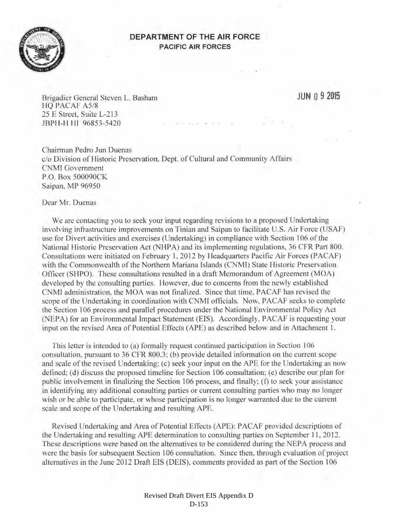
Revised Draft Divert EIS Appendix D D-153
Revised Draft Divert EIS Appendix D D-154
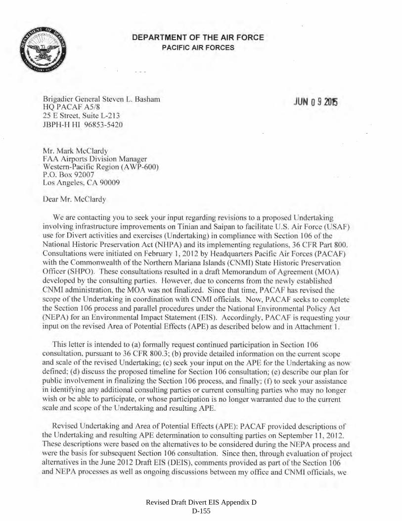
Revised Draft Divert EIS Appendix D D-155
Revised Draft Divert EIS Appendix D D-156
Revised Draft Divert EIS Appendix D D-157
Revised Draft Divert EIS Appendix D D-158
Revised Draft Divert EIS Appendix D D-159
Revised Draft Divert EIS Appendix D D-160
Revised Draft Divert EIS Appendix D D-161

Revised Draft Divert EIS Appendix D D-162
Revised Draft Divert EIS Appendix D D-163
Revised Draft Divert EIS Appendix D D-164
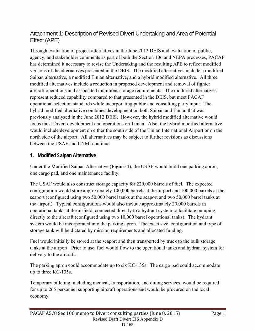
PACAFA5/8Sec106memotoDivertconsultingparties(June8,2015) Page1
Attachment 1: Description of Revised Divert Undertaking and Area of Potential Effect (APE)
Through evaluation of project alternatives in the June 2012 DEIS and evaluation of public, agency, and stakeholder comments as part of both the Section 106 and NEPA processes, PACAF has determined it necessary to revise the Undertaking and the resulting APE to reflect modified versions of the alternatives presented in the DEIS. The modified alternatives include a modified Saipan alternative, a modified Tinian alternative, and a hybrid modified alternative. All three modified alternatives include a reduction in proposed development and removal of fighter aircraft operations and associated munitions storage requirements. The modified alternatives represent reduced capability compared to that presented in the DEIS, but meet PACAF operational selection standards while incorporating public and consulting party input. The hybrid modified alternative combines development on both Saipan and Tinian that was previously analyzed in the June 2012 DEIS. However, the hybrid modified alternative would focus most Divert development and operations on Tinian. Also, the hybrid modified alternative would include development on either the south side of the Tinian International Airport or on the north side of the airport. All alternatives may be subject to further revisions as discussions between the USAF and CNMI continue.
1. Modified Saipan Alternative
Under the Modified Saipan Alternative (Figure 1), the USAF would build one parking apron, one cargo pad, and one maintenance facility.
The USAF would also construct storage capacity for 220,000 barrels of fuel. The expected configuration would store approximately 100,000 barrels at the airport and 100,000 barrels at the seaport (configured using two 50,000 barrel tanks at the seaport and two 50,000 barrel tanks at the airport). Typical configurations would also include approximately 20,000 barrels in operational tanks at the airfield; connected directly to a hydrant system to facilitate pumping directly to the aircraft (configured using two 10,000 barrel operational tanks). The hydrant system would be incorporated into the parking apron. The exact size, configuration and type of storage tank will be dictated by mission requirements and allocated funding.
Fuel would initially be stored at the seaport and then transported by truck to the bulk storage tanks at the airport. Prior to use, fuel would flow to the operational tanks and hydrant system for delivery to the aircraft.
The parking apron could accommodate up to six KC-135s. The cargo pad could accommodate up to three KC-135s.
Temporary billeting, including medical, transportation, and dining services, would be required for up to 265 personnel supporting aircraft operations and would be procured on the local economy.
Revised Draft Divert EIS Appendix D D-165
PACAFA5/8Sec106memotoDivertconsultingparties(June8,2015) Page2
Note: Infrastructure footprints are approximate and subject to further revisions.
Figure 1. Proposed Construction at Saipan under the Modified Saipan Alternative
Revised Draft Divert EIS Appendix D D-166
PACAFA5/8Sec106memotoDivertconsultingparties(June8,2015) Page3
The Modified Saipan Alternative includes a reduced operational capability in terms of types of aircraft flown to and from GSN, as well as a decrease in operations during exercises described in the Draft EIS. The Modified Saipan Alternative would continue to include emergency military divert landings or emergency humanitarian assistance staging referenced in the Draft EIS. At GSN, these emergency activities (i.e., divert landings and humanitarian assistance) could also occur under the No Action Alternative in compliance with FAA Airport Sponsor Assurance C. 27, and 36th Wing Instruction 13-204, Airfield Operations Instruction.
Under the Modified Saipan Alternative, only wide-body type aircraft such as the KC-135 would participate in joint military exercises as part of divert activities and exercises. These aircraft have similar flight characteristics and noise patterns as existing commercial aircraft operating from GSN. Specific types of aircraft that could be flown to and from GSN would include, but not be limited to, the KC-135 used for aircraft refueling and airlift; the KC-46 Pegasus used for aircraft refueling; the C-130 Hercules used for airlift; the C-17 Globemaster used for airlift; and the C-5 Galaxy used for airlift. All aircraft flown to and from GSN as part of divert activities and exercises under the Modified Saipan Alternative would:
Have the same or similar noise profile as the KC-135, which was the aircraft analyzed in the noise Low Scenario in the Draft EIS Section 4.1;
Have the same or similar air emissions as the KC-135, which was the aircraft analyzed in the noise Low Scenario in the Draft EIS Section 4.2;
Not transport munitions.
Under the Modified Saipan Alternative, the USAF anticipates typical exercises at GSN to include 2-4 wide-body type aircraft for up to eight weeks per year, rather than 12 aircraft for 8 weeks as originally described in the Draft EIS; therefore, reducing the overall expected number of flights to and from GSN. The USAF anticipates that under the Modified Saipan Alternative, 2-4 KC-135s would operate up to eight weeks annually (typically not on weekends). A past example of a typical exercise is Cope North, where each aircraft would take off and land twice per day, for a total of 4 operations per day, and would fly 5 days per week. Therefore, each aircraft would complete 60 operations over a three week period; and up to 4 aircraft would complete 240 operations. During another past example, Exercise Valiant Shield, each aircraft would take off and land 4 times per day, for a total of 8 operations per day, and would fly 5 days per week. Therefore, during three weeks of Valiant Shield, each aircraft would complete 120 operations; 4 aircraft would complete 480 operations. Based on the reduced operations described above, approximately 720 operations by KC-135 or similar aircraft would be completed annually under the Modified Saipan Alternative, in contrast to the 1,920 operations described under Alternative 1 in the Draft EIS. This is a reduction of more than half of the originally proposed operations, in addition to limiting the type of aircraft being flown.
Revised Draft Divert EIS Appendix D D-167
PACAFA5/8Sec106memotoDivertconsultingparties(June8,2015) Page4
As noted in our 2012 description of the Undertaking, GSN is completely contained within the boundaries of the Isley Historic District portion of the Landing Beaches, Aslito/Isley Field, and Marpi Point National Historic Landmark (NHL), or National Historic Landmark District (NHLD). Because of this landmark status, the historic property merits special consideration under 36 CFR 800.10. Despite the reduced impact at GSN in this modified Undertaking compared to the original Undertaking, we consider an effect on any contiguous part of the NHL to be an effect to that entire part of the NHL, or NHLD.
With the Modified Saipan Alternative, the USAF has attempted to address the comments of concerned parties provided during the Section 106 process in regards to how the proposed projects would adversely affect the NHLD and additional resources resulting in a single APE for construction and operational activities, as well as both direct and indirect effects (Figure 2). With the change in the APE, modifications to proposed projects and operations within the APE have been made as well. These modifications have reduced or removed some of the direct and indirect adverse effects to the NHLD.
2. Tinian Alternative (Modified)
Under the Modified Tinian Alternative (Figure 3), the USAF would build one parking apron, one cargo pad, and one maintenance facility. Development would occur on either the North or South side of the runway.
For the North Option, all construction would be on the North side of the runway. The USAF would build taxiways to connect the cargo and parking aprons to the runway.
For the South Option, all construction would be on the South side of the runway. No new taxiways are required.
We would also construct storage capacity for 220,000 barrels of fuel. The expected configuration would store approximately 100,000 barrels at the airport and 100,000 barrels at the seaport. Typical configurations would also include approximately 20,000 barrels in operational tanks at the airfield, connected directly to the hydrant system to facilitate pumping to the aircraft. The hydrant system would be incorporated into the parking apron. The exact size, configuration and type of storage tank will be dictated by mission requirements and allocated funding.
Fuel would initially be stored at the seaport and then transported by truck to the bulk storage tanks at the airport. Prior to use, fuel would flow to the operational tanks and hydrant system for delivery to the aircraft.
Revised Draft Divert EIS Appendix D D-168
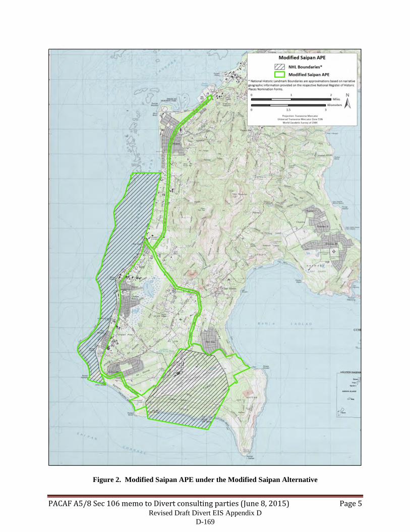
PACAFA5/8Sec106memotoDivertconsultingparties(June8,2015) Page5
Figure 2. Modified Saipan APE under the Modified Saipan Alternative
Revised Draft Divert EIS Appendix D D-169
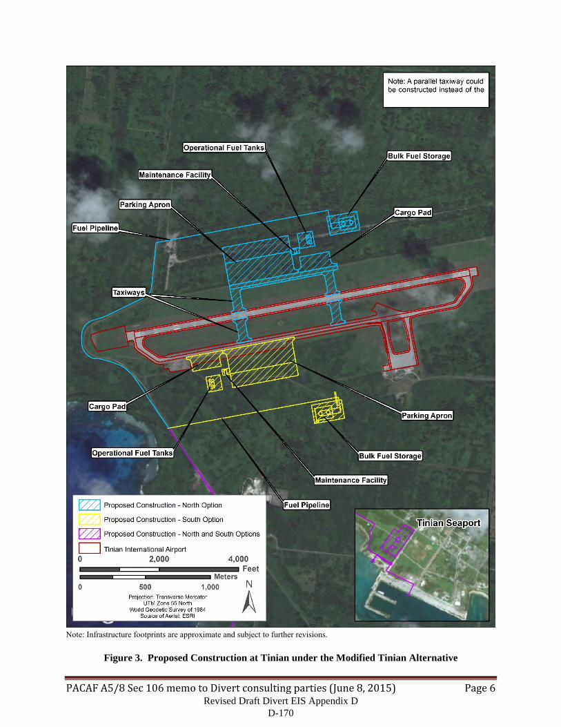
PACAFA5/8Sec106memotoDivertconsultingparties(June8,2015) Page6
Note: Infrastructure footprints are approximate and subject to further revisions.
Figure 3. Proposed Construction at Tinian under the Modified Tinian Alternative
Revised Draft Divert EIS Appendix D D-170
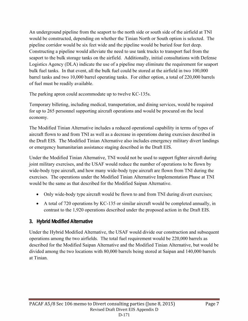
PACAFA5/8Sec106memotoDivertconsultingparties(June8,2015) Page7
An underground pipeline from the seaport to the north side or south side of the airfield at TNI would be constructed, depending on whether the Tinian North or South option is selected. The pipeline corridor would be six feet wide and the pipeline would be buried four feet deep. Constructing a pipeline would alleviate the need to use tank trucks to transport fuel from the seaport to the bulk storage tanks on the airfield. Additionally, initial consultations with Defense Logistics Agency (DLA) indicate the use of a pipeline may eliminate the requirement for seaport bulk fuel tanks. In that event, all the bulk fuel could be stored at the airfield in two 100,000 barrel tanks and two 10,000 barrel operating tanks. For either option, a total of 220,000 barrels of fuel must be readily available.
The parking apron could accommodate up to twelve KC-135s.
Temporary billeting, including medical, transportation, and dining services, would be required for up to 265 personnel supporting aircraft operations and would be procured on the local economy.
The Modified Tinian Alternative includes a reduced operational capability in terms of types of aircraft flown to and from TNI as well as a decrease in operations during exercises described in the Draft EIS. The Modified Tinian Alternative also includes emergency military divert landings or emergency humanitarian assistance staging described in the Draft EIS.
Under the Modified Tinian Alternative, TNI would not be used to support fighter aircraft during joint military exercises, and the USAF would reduce the number of operations to be flown by wide-body type aircraft, and how many wide-body type aircraft are flown from TNI during the exercises. The operations under the Modified Tinian Alternative Implementation Phase at TNI would be the same as that described for the Modified Saipan Alternative.
Only wide-body type aircraft would be flown to and from TNI during divert exercises;
A total of 720 operations by KC-135 or similar aircraft would be completed annually, in contrast to the 1,920 operations described under the proposed action in the Draft EIS.
3. Hybrid Modified Alternative
Under the Hybrid Modified Alternative, the USAF would divide our construction and subsequent operations among the two airfields. The total fuel requirement would be 220,000 barrels as described for the Modified Saipan Alternative and the Modified Tinian Alternative, but would be divided among the two locations with 80,000 barrels being stored at Saipan and 140,000 barrels at Tinian.
Revised Draft Divert EIS Appendix D D-171

PACAFA5/8Sec106memotoDivertconsultingparties(June8,2015) Page8
Figure 4. Modified Tinian APE under the Modified Tinian Alternative
Revised Draft Divert EIS Appendix D D-172
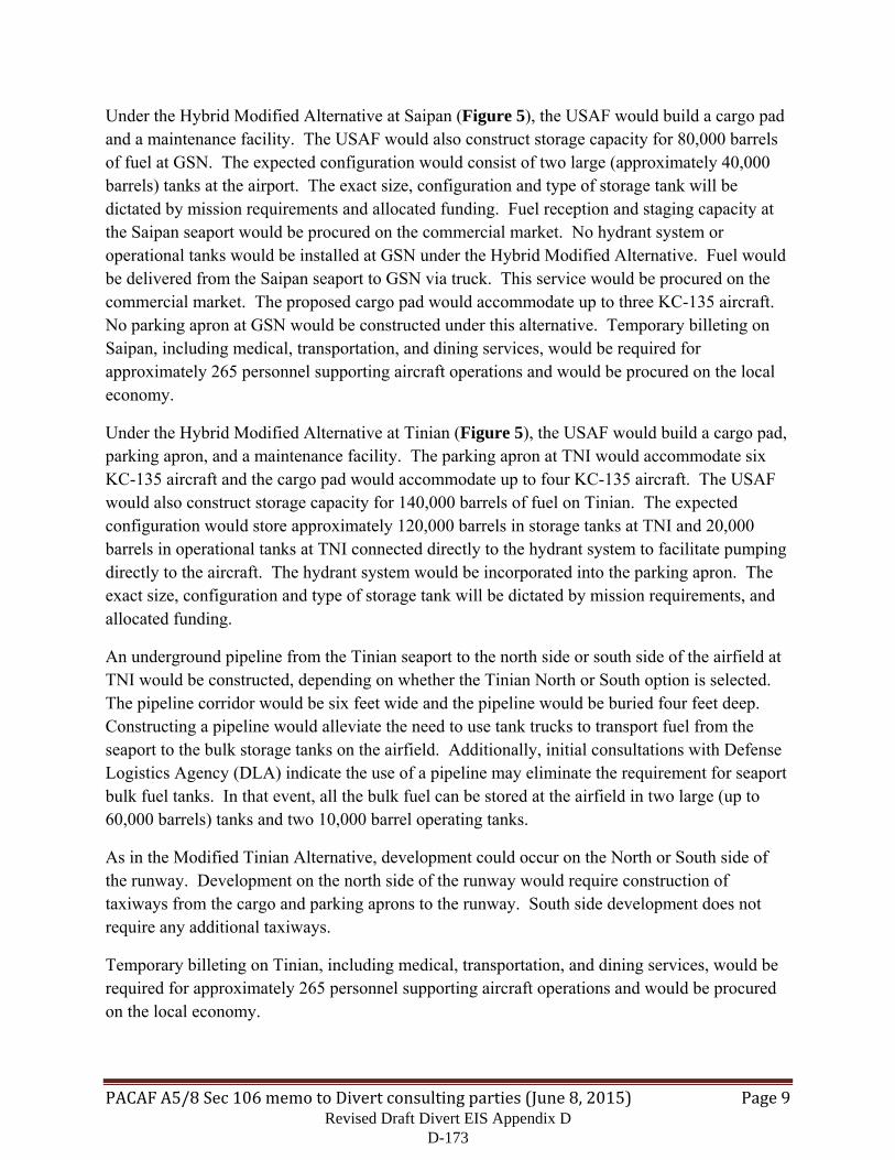
PACAFA5/8Sec106memotoDivertconsultingparties(June8,2015) Page9
Under the Hybrid Modified Alternative at Saipan (Figure 5), the USAF would build a cargo pad and a maintenance facility. The USAF would also construct storage capacity for 80,000 barrels of fuel at GSN. The expected configuration would consist of two large (approximately 40,000 barrels) tanks at the airport. The exact size, configuration and type of storage tank will be dictated by mission requirements and allocated funding. Fuel reception and staging capacity at the Saipan seaport would be procured on the commercial market. No hydrant system or operational tanks would be installed at GSN under the Hybrid Modified Alternative. Fuel would be delivered from the Saipan seaport to GSN via truck. This service would be procured on the commercial market. The proposed cargo pad would accommodate up to three KC-135 aircraft. No parking apron at GSN would be constructed under this alternative. Temporary billeting on Saipan, including medical, transportation, and dining services, would be required for approximately 265 personnel supporting aircraft operations and would be procured on the local economy.
Under the Hybrid Modified Alternative at Tinian (Figure 5), the USAF would build a cargo pad, parking apron, and a maintenance facility. The parking apron at TNI would accommodate six KC-135 aircraft and the cargo pad would accommodate up to four KC-135 aircraft. The USAF would also construct storage capacity for 140,000 barrels of fuel on Tinian. The expected configuration would store approximately 120,000 barrels in storage tanks at TNI and 20,000 barrels in operational tanks at TNI connected directly to the hydrant system to facilitate pumping directly to the aircraft. The hydrant system would be incorporated into the parking apron. The exact size, configuration and type of storage tank will be dictated by mission requirements, and allocated funding.
An underground pipeline from the Tinian seaport to the north side or south side of the airfield at TNI would be constructed, depending on whether the Tinian North or South option is selected. The pipeline corridor would be six feet wide and the pipeline would be buried four feet deep. Constructing a pipeline would alleviate the need to use tank trucks to transport fuel from the seaport to the bulk storage tanks on the airfield. Additionally, initial consultations with Defense Logistics Agency (DLA) indicate the use of a pipeline may eliminate the requirement for seaport bulk fuel tanks. In that event, all the bulk fuel can be stored at the airfield in two large (up to 60,000 barrels) tanks and two 10,000 barrel operating tanks.
As in the Modified Tinian Alternative, development could occur on the North or South side of the runway. Development on the north side of the runway would require construction of taxiways from the cargo and parking aprons to the runway. South side development does not require any additional taxiways.
Temporary billeting on Tinian, including medical, transportation, and dining services, would be required for approximately 265 personnel supporting aircraft operations and would be procured on the local economy.
Revised Draft Divert EIS Appendix D D-173
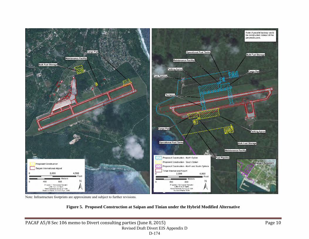
PACAFA5/8Sec106memotoDivertconsultingparties(June8,2015) Page10
Note: Infrastructure footprints are approximate and subject to further revisions.
Figure 5. Proposed Construction at Saipan and Tinian under the Hybrid Modified Alternative
Revised Draft Divert EIS Appendix D D-174
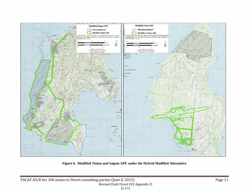
PACAFA5/8Sec106memotoDivertconsultingparties(June8,2015) Page11
Figure 6. Modified Tinian and Saipan APE under the Hybrid Modified Alternative
Revised Draft Divert EIS Appendix D D-175

PACAFA5/8Sec106memotoDivertconsultingparties(June8,2015) Page12
The Hybrid Modified Alternative would support the same total number of expected operations by KC-135 aircraft (720 per year) as the Modified Saipan Alternative and the Modified Tinian Alternative but would distribute those operations over both GSN and TNI. TNI would be the primary divert/exercise location and would realize the majority of the development. GSN would be the secondary divert/exercise location and experience significantly less development. The specific number of aircraft expected to utilize each location would vary and will depend on mission requirements. For planning purposes, the TNI portion of this alternative, when complete, is expected to have parking capacity for 7 to 10 KC-135 or similar aircraft. The GSN portion is expected to have parking capacity for 2 to 5 KC-135 or similar aircraft. While the construction and expected operations are distributed among the two locations, environmental analysis should be performed using 720 as the number of annual operations as exercises may occur at either location. As in the alternatives described above, the KC-135 is the primary aircraft and will be the platform used for analysis.
The Hybrid Modified Alternative would also include emergency military divert landings or emergency humanitarian assistance staging at GSN and TNI described in the Draft EIS.
Revised Draft Divert EIS Appendix D D-176
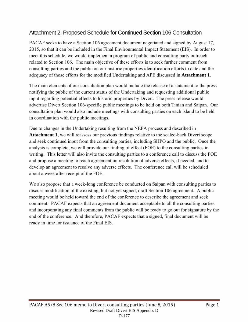
PACAFA5/8Sec106memotoDivertconsultingparties(June8,2015) Page1
Attachment 2: Proposed Schedule for Continued Section 106 Consultation
PACAF seeks to have a Section 106 agreement document negotiated and signed by August 17, 2015, so that it can be included in the Final Environmental Impact Statement (EIS). In order to meet this schedule, we would implement a program of public and consulting party outreach related to Section 106. The main objective of these efforts is to seek further comment from consulting parties and the public on our historic properties identification efforts to date and the adequacy of those efforts for the modified Undertaking and APE discussed in Attachment 1.
The main elements of our consultation plan would include the release of a statement to the press notifying the public of the current status of the Undertaking and requesting additional public input regarding potential effects to historic properties by Divert. The press release would advertise Divert Section 106-specific public meetings to be held on both Tinian and Saipan. Our consultation plan would also include meetings with consulting parties on each island to be held in coordination with the public meetings.
Due to changes in the Undertaking resulting from the NEPA process and described in Attachment 1, we will reassess our previous findings relative to the scaled-back Divert scope and seek continued input from the consulting parties, including SHPO and the public. Once the analysis is complete, we will provide our finding of effect (FOE) to the consulting parties in writing. This letter will also invite the consulting parties to a conference call to discuss the FOE and propose a meeting to reach agreement on resolution of adverse effects, if needed, and to develop an agreement to resolve any adverse effects. The conference call will be scheduled about a week after receipt of the FOE.
We also propose that a week-long conference be conducted on Saipan with consulting parties to discuss modification of the existing, but not yet signed, draft Section 106 agreement. A public meeting would be held toward the end of the conference to describe the agreement and seek comment. PACAF expects that an agreement document acceptable to all the consulting parties and incorporating any final comments from the public will be ready to go out for signature by the end of the conference. And therefore, PACAF expects that a signed, final document will be ready in time for issuance of the Final EIS.
Revised Draft Divert EIS Appendix D D-177
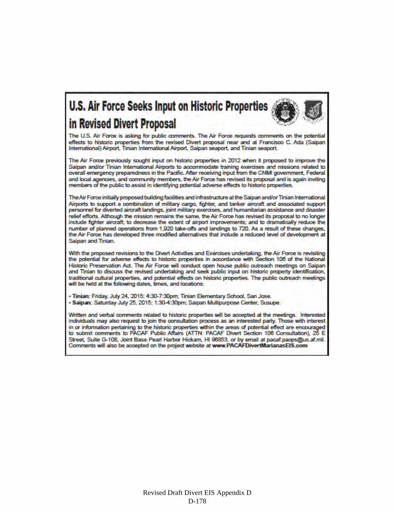
Revised Draft Divert EIS Appendix D D-178
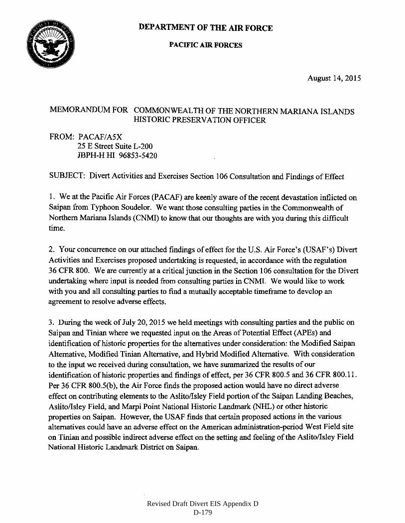
DEPARTMENT OF THE AIR FORCE
PACIFIC AIR FORCES
August 14, 2015
MEMORANDUM FOR COMMONWEALTH OF THE NORTHERN MARIANA ISLANDS HISTORIC PRESERVATION OFFICER
FROM: PACAF/A5X 25 E Street Suite L-200 JBPH-H HI 96853-5420
SUBJECT: Divert Activities and Exercises Section 106 Consultation and Findings of Effect
1. We at the Pacific Air Forces (P ACAF) are keenly aware of the recent devastation inflicted on Saipan from Typhoon Soudelor. We want those consulting parties in the Commonwealth of
Northern Mariana Islands (CNMI) to know that our thoughts are with you during this difficult time.
2. Your concurrence on our attached findings of effect for the U.S. Air Force's (USAF's) Divert
Activities and Exercises proposed undertaking is requested, in accordance with the regulation
36 CFR 800. We are currently at a critical junction in the Section 106 consultation for the Divert undertaking where input is needed from consulting parties in CNMI. We would like to work with you and all consulting parties to find a mutually acceptable timeframe to develop an agreement to resolve adverse effects.
3. During the week of July 20, 2015 we held meetings with consulting parties and the public on
Saipan and Tinian where we requested input on the Areas of Potential Effect (APEs) and
identification of historic properties for the alternatives under consideration: the Modified Saipan
Alternative, Modified Tinian Alternative, and Hybrid Modified Alternative. With consideration
to the input we received during consultation, we have summarized the results of our
identification of historic properties and findings of effect, per 36 CFR 800.5 and 36 CFR 800.11.
Per 36 CFR 800.5(b), the Air Force finds the proposed action would have no direct adverse
effect on contributing elements to the Aslito/Isley Field portion of the Saipan Landing Beaches, Aslito/Isley Field, and Marpi Point National Historic Landmark (NHL) or other historic properties on Saipan. However, the USAF finds that certain proposed actions in the various alternatives could have an adverse effect on the American administration-period West Field site
on Tinian and possible indirect adverse effect on the setting and feeling of the Aslito/Isley Field National Historic Landmark District on Saipan.
Revised Draft Divert EIS Appendix D D-179
4. We would normally expect your response to our no adverse effect finding within thirty (30)
days of receipt of this letter, per 36 CFR 800.5(c). However, in recognition of the recent devastation experienced on Saipan, we will consider any responses received by
October 15, 2015. Regarding the finding of effects to Tinian's West Field and Saipan's
Aslito/Isley Field, we request your comments and look forward to further consultations on ways
to avoid, minimize, or mitigate the effects. We also invite you to participate in a conference call
concerning these findings after you return to official duty. We will send a separate invitation for
this call by email that provides date, time and call-in information.
5. Thank you for your continued interest and involvement in Section 106 consultation for the
Divert proposal. Please contact Mr. William Grannis at (808) 449-4049 or by email at
[email protected] with any questions or comments regarding the Divert proposal.
MI~~ol~l. USAF Chief, Strategy and Plans Division
Attachment: Section 106 Findings of Effect for Divert Activities and Exercises
cc:
Commonwealth of the Northern Mariana Islands Historic Preservation Review Board Federal Aviation Administration, Western-Pacific Region Governor of the Commonwealth of the Northern Mariana Islands Individual Consulting Parties: Mr. Sam McPhetres and Ms. Deborah Fleming National Park Service, Pacific-West Region Office of the Mayor, Tinian Commander, Joint Region Marianas Advisory Council on Historic Preservation
2
Revised Draft Divert EIS Appendix D D-180
Section 106 (NHPA) Finding of Effects EIS for Divert Activities and Exercises, Commonwealth of the Northern Mariana Islands, August 2015
1
1. Introduction
This document presents the U.S. Air Force (USAF), Pacific Air Forces’ (PACAF) findings regarding effects to historic properties from the proposed Divert Activities and Exercises (Divert) undertaking (Undertaking) (Figure 1). A detailed description of the Undertaking and Areas of Potential Effect (APE) (Figure 2) were presented to the consulting parties in a letter dated June 9, 2015 and during meetings with the consulting parties and the public on Saipan and Tinian during the week of July 20, 2015. PACAF has considered the input it has received so far from the consulting parties and the public in this Finding of Effect (FOE).
2. Identification of Historic Properties (36 CFR 800.4)
Having defined its Undertaking and identified the APE, PACAF conducted a review of existing information regarding historic properties within the APE and has sought, or is seeking, additional information from consulting parties pursuant to 36 CFR 800.4 (a)(2)&(3). Although no Federally recognized Indian tribes or Native Hawaiian organizations exist in the Commonwealth of the Northern Marianas Islands (CNMI) (36 CFR 800.4(a)(4)), PACAF is reaching out to Chamorro and Carolinian representatives.
In its review of existing information, PACAF has found that the majority of the APE on Tinian has been previously surveyed for cultural resources and its findings are based on the results of those studies (Figure 3). Similarly, the APE on Saipan was surveyed in 1980 in preparation for nominating Isley Field to the National Register of Historic Places (NRHP) (Denfeld and Russell 1984). PACAF also contracted a cultural resources consulting firm to perform a Phase I cultural resources survey and inventory of proposed construction sites at Saipan International Airport (FAA airport code GSN) as it is part of a National Historic Landmark (NHL).
The following discussion is based on findings from these efforts and represent PACAF’s good faith effort to identify historic properties within the APE pursuant to 36 CFR 800.4 (b).
2.1 Modified Saipan Alternative
2.1.1 Previous Survey Coverage of the APE
As already mentioned, the Modified Saipan APE was surveyed for archaeological sites, historic buildings and structures, and other cultural resources in recent decades. The portion of the APE comprising the Isley Field Historic District was surveyed in 1980 in preparation for nominating Isley Field to the National Register of Historic Places (NRHP) and includes all proposed construction areas at GSN (Denfeld and Russell 1984). USAF also surveyed the proposed construction areas for the parking apron, bulk fuel storage, maintenance facility, and cargo pad at GSN as well as for the bulk fuel storage area at the Port of Saipan in support of the Section 106 process associated with an earlier version of the Divert EIS (Fischer et al. 2012). No cultural resource surveys have been performed to date along existing roads proposed for use.
2.1.2 Historic Properties within the APE
Under the Modified Saipan Alternative, the vast majority of construction and ongoing activity would take place at GSN with much less construction and activity at the seaport. With the exception of the aboveground storage tanks at the Port of Saipan and existing roads, all proposed Divert-related construction and implementation activities would take place within the boundaries of Aslito/Isley Field.
Revised Draft Divert EIS Appendix D D-181
Section 106 (NHPA) Finding of Effects EIS for Divert Activities and Exercises, Commonwealth of the Northern Mariana Islands, August 2015
2
Aslito/Isley Field was nominated to the National Register in 1980 as the Isley Field Historic District but was later included in a National Historic Landmark (NHL) recommendation for three of Saipan’s World War II-era sites. The three World War II-related properties were listed together as the Saipan Landing Beaches, Aslito/Isley Field, and Marpi Point National Historic Landmark (SNHL) on February 4, 1985 (National Historic Landmark System No.: 85001789). Because the SNHL consists of three discontinuous areas, they are considered separately in this analysis. We follow the SNHL nomination in using the term National Historic Landmark District (NHLD) to refer to the individual components of the NHL (the Landing Beaches, Marpi Point, and Aslito/Isley Field) rather than the NHL as a whole.
When Aslito/Isley Field was nominated as a historic district, the nomination listed the following buildings and structures as contributing elements:
The operations center built and used by the Japanese and later used for similar purposes by the U.S. 73rd Bombardment Wing,
Four gas drum storage bunkers, A power plant, A building to house an electric generator, A semi-subterranean bomb storage facility, A defensive gun emplacement atop the bomb storage facility, A semi-subterranean fuel storage facility, Three associated fuel tanks, A pump house, A torpedo regulating shop, A cold storage building, Eleven air raid shelters, Two runways, and “(H)undreds of hardstands and foundations from the U.S. period.”
When Aslito/Isley Field was included in the SNHL, the nomination form listed the following buildings and structures as contributing elements at the airfield: the air operations building, two power plants, four gasoline storage buildings, fourteen air raid shelters (an increase of three shelters from the district nomination), an aerial bomb magazine, a partly underground structure for gasoline storage tanks, and “various structural ruins.” The nomination also lists the two runways and notes that “the nearly seven miles of B-29 taxiways and over 100 out of 181 hardstands (parking areas) around the runways may be traced in part.” The nomination also lists the site of the 73rd Bombardment Wing’s administrative area south of the runways. Finally, it lists the Japanese blockhouse on the beach at Unai Opyan. The nomination specifically excludes the site of Kobler Field southwest of Isley Field, which by 1985 was converted into a large housing development and had therefore “lost the greater part of its integrity.” Also excluded are the “modern air terminal, its vehicle parking lot, and its concrete aircraft parking area in front.”
The 2012 USAF survey identified three pre-contact isolated occurrences and ten historic features within the boundaries of the Aslito/Isley Field portion of the SNHL. The features include a Japanese bunker, several water catchment features, concrete foundations and pads, and a bottle dump. These features and materials probably date between 1935 and 1945. The three pre-contact occurrences are comprised of light scatters of Latte period sand-tempered pottery fragments in disturbed soils and contexts.
Revised Draft Divert EIS Appendix D D-182
Section 106 (NHPA) Finding of Effects EIS for Divert Activities and Exercises, Commonwealth of the Northern Mariana Islands, August 2015
3
2.2 Modified Tinian Alternative
2.2.1 Previous Survey Coverage of the APE
The APE for the Modified Tinian Alternative was surveyed for historic properties in recent decades (Allen and Nees 2001; Athens 2009; Dixon and Welch 2002; Franklin and Haun 1995; Gosser et al. 2001; Henry and Haun 1995; Jones 1991; More et al. 1986; Thursby 2010). Areas that have been previously surveyed include all proposed construction areas at the seaport, all proposed construction areas at Tinian International Airport (FAA airport code TNI) under both the North and South Options, and portions of the APE incorporating noise contour areas. The only areas that have not been previously surveyed include about 3.5 kilometers (2.2 miles) of existing roads in and around San Jose that would possibly serve as truck routes for construction material and fuel trucks. In addition to archaeological and architectural surveys, a Traditional Cultural Property (TCP) study conducted on Tinian in support of a separate undertaking being considered by the U.S. Marine Corps Forces, Pacific (MARFORPAC) (Griffin et al. 2015). The study used ethnographic information from archival research, oral history interviews, and natural resource inventories to identify and evaluate potential TCPs in the Military Lease Area on the northern two-thirds of Tinian.
2.2.2 Historic Properties within the APE
Under the Modified Tinian Alternative, the vast majority of construction and ongoing activity would take place at TNI with much less construction and activity at the seaport. Previous surveys have recorded a large number of historic resources near the airport, especially to the west. Many of these sites may be associated with the pre-war Gurguan Airfield and have been recommended eligible by MARFORPAC in survey reports they have produced for their CNMI Joint Military Training (CJMT) undertaking (Dixon et al. 2014). The site of the WWII-era U.S. Naval Air Base Headquarters (HQ) has been identified at the east end of the modern runway. This site has also been recommended as eligible for listing on the NRHP. These sites lie under the noise effects portion of the APE.
All of West Field, the Japanese-era airstrip as modified by U.S. forces during the Second World War and the basis of the modern airport, has also been recorded as a historic resource and has also been recommended as eligible for listing on the NRHP (Dixon et al. 2014). Pavement, hardstands, and other features associated with West Field are still visible on aerial photographs. However, the exact location of preserved historic fabric related to the site has not been determined at this time.
2.3 Modified Hybrid Alternative
The Modified Hybrid Alternative APE is a combination of the APEs for the Modified Saipan and Tinian APEs; therefore, previous coverage of the APE and historic properties within the APE are the same as those detailed above for each alternative.
3. Assessment of Adverse Effects (36 CFR 800.5)
According to 36CFR800.5(a)(1), “…(a)n adverse effect is found when an undertaking may alter, directly or indirectly, any of the characteristics of a historic property that qualify the property for inclusion in the National Register in a manner that would diminish the integrity of the property’s location, design, setting, materials, workmanship, feeling, or association.” Direct effects may include actions such as ground-disturbing activity within archaeological sites and modifications to historic structures. Indirect effects may include vibrations caused by vehicle traffic and changes to the setting or view-shed of a historic
Revised Draft Divert EIS Appendix D D-183
Section 106 (NHPA) Finding of Effects EIS for Divert Activities and Exercises, Commonwealth of the Northern Mariana Islands, August 2015
4
property. The following discussion outlines PACAF’s application of the criteria of adverse effect to cultural resources identified on Saipan and Tinian.
3.1 Modified Saipan Alternative: Construction and Implementation
Based on the results of previous inventories, construction proposed under the Modified Saipan Alternative would have no direct adverse effects to known contributing elements of the Aslito/Isley Field portion of the SNHL or other historic properties on Saipan. The proposed construction footprints for several elements, including the proposed cargo pad, parking apron, and hydrant system are in the general vicinity of the American administration-period B-29 hardstand network identified in Denfeld and Russell (1984) as “Site 29.” However, our survey identified no remains of the B-29 hardstand network in proposed construction areas. Our report observed that WWII-era pavements could be very deeply buried or could have been destroyed by vegetation growth, post-war land clearance, or other forces (Fischer et al. 2012). Furthermore, HDR concluded that construction footprints of the proposed Divert-related structures at GSN would not directly affect any of the standing historic structures (listed above) that constitute contributing elements to the NHLD.
USAF identified one feature in proposed construction areas that could sustain direct effects. However, we have recommended that this feature, an American Administration-period concrete foundation referred to as “Feature 9,” does not contribute to the character defining properties of the SNHL (Fischer et al. 2012). The feature is badly decayed, lacks superstructure or other identifying characteristics, and lacks key aspects of integrity such as setting, feeling, and association. The USAF recognizes that the determination of whether the feature contributes to the NHLD is ultimately a determination made by the Secretary of Interior. Other non-contributing features are also present in areas proposed for construction; however, adverse effects to non-contributing features generally do not affect the integrity and eligibility of the larger district or NHL.
The construction of Divert-related facilities would not have direct effects to the Landing Beaches portion of the SNHL, which would see no modifications as part of the proposed Divert project. Divert-related construction would also not have adverse effects to the Marpi Point portion of the SNHL, which is north of all proposed actions and the APE.
Divert-related construction of aboveground fuel storage tanks at the Saipan seaport would not have direct adverse effects to historic properties at the port. Although the area of the modern port was the site of Navy Seabee activity during the war, no evidence of this remains and the project construction footprint is well inland from where these activities are thought to have taken place. The port is not part of the SNHL, nor is the construction footprint on or near an NRHP-listed or NRHP-eligible archaeological or architectural resource.
Under 36 CFR 800.5, adverse effects include the introduction of visual, atmospheric or audible elements that diminish the integrity of the property’s significant historic features. Construction of new Divert-related facilities around existing historic structures within the boundaries of the Aslito/Isley Field NHLD may alter the integrity of setting and feeling of contributing historic structures. Visual, atmospheric and audible elements of the implementation phase of the Divert undertaking would consist of slightly increased aircraft noise over a maximum of eight week period per year and presence of tanker aircraft parked on the parking apron or cargo pad or arriving/departing the airport, which is consistent with existing use of the airfield. The USAF has determined the increased noise and presence of tanker aircraft for a short period of time would not constitute an indirect adverse affect on the integrity of setting or feeling of the SNHL.
Revised Draft Divert EIS Appendix D D-184
Section 106 (NHPA) Finding of Effects EIS for Divert Activities and Exercises, Commonwealth of the Northern Mariana Islands, August 2015
5
The Modified Saipan Alternative would involve transportation on existing roads of construction material and fuel from the Port of Saipan to the airport. This activity would have no adverse effects to historic properties. A study conducted by the California Department of Transportation in 2002 found that ground vibration from transportation along existing paved roads had virtually no effect on historic buildings located more than 5 meters away and that, in fact, such vibrations dropped below the perception threshold beyond 45 meters. The study considered heavy trucks as the vehicular source of vibration, similar to the trucks likely to be used during Divert construction or for fuel transportation, and assumed wood-framed historic buildings and structures. The standing structures in the SNHL are of stronger concrete construction and even more resistant to vibration effects.
The Modified Saipan Alternative could contribute to long-term, indirect, adverse cumulative effect on historical resources associated with the Japanese and U.S. occupations prior to, during, and immediately following WWII. Most of the historic structures in the Isley/Aslito field historic district and landmark are far enough away from the Divert activity and training exercise areas proposed under this alternative that long-term, cumulative effects on these structures are expected to be minimal to none. The district as a whole also faces increased fragmentation of its constituent parts from development. This process is already well underway from continued improvements for commercial air travel at GSN. However, affects to the district’s overall cohesiveness from Divert-related construction and implementation activities are possible.
3.2 Modified Tinian Alternative: Construction and Implementation
Proposed construction under either the Tinian North Option or South Option of the Modified Tinian Alternative could have direct and/or indirect adverse effects to one archaeological site, TN-6-0030 (also sometimes referred to as Site 3005). That site is the American administration-period West Field, which has been recommended eligible for listing in the NRHP under Criteria A and D (Dixon et al. 2014). Construction under either option would potentially compromise archaeological deposits that make the site eligible under Criterion D. Construction would also introduce new elements to the landscape at TNI that could diminish integrity of setting, design, and feeling at West Field.
Under the Modified Tinian Alternative, the vast majority of construction and ongoing activity would take place at TNI with much less construction and activity at the seaport. Construction of fuel storage and distribution facilities at the Port of Tinian would have no direct effects to historic properties. The port does not contain known NRHP-listed or NRHP-eligible properties.
Although Tinian is home to the Tinian Landing Beaches, Ushi Point Field, and North Field NHL, the landmark is well to the north of the APE and the resource will not experience any direct or indirect adverse effects as a result of the undertaking, nor would any of the TCPs identified by MARFORPAC (Griffin et al. 2015).
Historic properties located near the airport such as those associated with the Gurguan Airfield site to the west and the Naval Air Base HQ site to the east of TNI lie under the noise effects portion of the APE. However, noise effects are normally assessed in terms of interference with appreciation of a property’s historical feeling or setting. Since these sites are not widely accessible or interpreted for public visitation, USAF finds that noise effects to these sites are minimal and that they will not be adversely affected by the Undertaking. Further, USAF finds no adverse effect to the setting and feeling of historic properties whose period of significance dates to times when Gurguan and West fields were considerably more active than would be the case during Divert activites and exercises.
Revised Draft Divert EIS Appendix D D-185
Section 106 (NHPA) Finding of Effects EIS for Divert Activities and Exercises, Commonwealth of the Northern Mariana Islands, August 2015
6
The Modified Tinian Alternative would involve transportation on existing roads of construction material and fuel from the port in San Jose to the airport. As discussed above for the Saipan alternative, this type of traffic would have no adverse effects to historic properties.
3.3 Hybrid Modified Alternative: Construction and Implementation
Direct effects from construction under the Hybrid Modified Alternative would be the combination of those discussed for the Modified Saipan Alternative and Modified Tinian Alternative. Construction would not result in direct, adverse effects to historic properties on Saipan. Although construction on Tinian would be reduced compared to the Modified Tinian Alternative, construction would still take place within West Field and thus could adversely affect that site through ground-disturbing activities potentially compromising archaeological deposits and/or structural remains.
Indirect effects from construction under the Hybrid Modified Alternative are similar to those discussed for the Modified Saipan Alternative and Modified Tinian Alternative. Construction of new Divert-related facilities at GSN and TNI would potentially alter the feeling of historic structures that contribute to the NHLD on Saipan and West Field on Tinian, although the modified hybrid alternative involving Saipan would have a much smaller construction footprint and corresponding reduced effect on the feeling of the historic structures at the Aslito/Isley Field NHLD.
Under the Hybrid Modified Alternative, the implementation phase of the proposed undertaking would divide the deployment of personnel and aircraft among the two islands. However, any given operation could take place at one island or the other, and the full number of 265 personnel and 720 operations on each island were used for the analysis. Therefore, adverse effects for the implementation phase would be the combination of those described under the Modified Saipan Alternative and Modified Tinian Alternative. These effects consist of an indirect adverse effect on the integrity of feeling of the Saipan Landing Beaches and Aslito/Isley Field portions of the SNHL and an indirect adverse effect on historic properties located at or near TNI including West Field, the Gurguan Airfield site, and the Naval Air Base HQ site.
Cumulative adverse effects on historic properties under the Hybrid Modified Alternative would be the combination of those discussed under the Modified Saipan Alternative and Modified Hybrid Alternative. These effects include fragmentation of the Aslito/Isley Field NHLD.
Revised Draft Divert EIS Appendix D D-186
Section 106 (NHPA) Finding of Effects EIS for Divert Activities and Exercises, Commonwealth of the Northern Mariana Islands, August 2015
7
4. References Cited
Allen, J. and R.C. Nees 2001 Cultural Resources Survey of the Military Leaseback Area, Tinian, Commonwealth of the
Northern Mariana Islands. Volume II: Site Descriptions and Excavation Results, Eastern Leaseback Areas 8-14, with Summaries of Laboratory Results. Prepared for the Department of the Navy, Pacific Division, Naval Facilities Engineering Command, Honolulu, HI by Ogden Environmental and Energy Services Co., Inc., Honolulu, Hawaii.
Athens, S. (ed.) 2009 Final Archaeological Surveys and Cultural Resources Studies on Guam and the Commonwealth
of the Northern Mariana Islands in Support of the Joint Guam Build-Up Environmental Impact Statement Volume III-I, Tinian Narrative by D. Tuggle. Prepared for TEC by International Archaeological Research Institute, Inc., Honolulu, HI.
Denfeld D.C. and S.C. Russell 1984 Home of the Superfort: An Historical and Archaeological Survey of Isley Field. Issue 21 of
Report (Micronesian Archaeological Survey). Micronesian Archaeological Survey, Office of the High Commissioner, Trust Territory of the Pacific Islands, Saipan, CNMI.
Dixon, B., and D. Welch 2002 Archaeological Survey of the West Tinian Airport Improvement Area, Commonwealth of the
Northern Mariana Islands. IARII, Honolulu, Hawaii. Dixon, B., R. Jones, T. Rudolph, and R. Schaefer 2014 Cultural Resources Survey on Tinian in Support of the Commonwealth of the Northern Mariana
Islands Joint Military Training Environmental Impact Statement/Overseas Environmental Impact Statement. Draft V2. Prepared for the Department of the Navy, Pacific Division, Naval Facilities Engineering Command, Honolulu, HI.
Fischer, B., J. Gallison, J. Hokanson, M. Jennings, M. Edwards, and M. Church 2012 Phase I Cultural Resources Survey Supporting the Environmental Impact Statement for Divert
Activities and Exercises, Commonwealth of the Northern Mariana Islands. Prepared for Headquarter, Pacific Air Forces Joint Base Pearl Harbor-Hickam, Hawai‘i by HDR Inc. Englewood, Colorado.
Franklin, L.J. and A.E. Haun 1995 Phase I Archaeological Survey and Emergency Data Recovery in the Military Lease Area, Island
of Tinian, Commonwealth of the Northern Mariana Islands. Prepared for the Department of the Navy, Pacific Division Naval Facilities Engineering Command, Honolulu, HI by Paul H. Rosendahl, Ph.D., Inc., Hilo, HI.
Gosser, D., J. Allen, R.C. Nees, K. Aronson, C. O’Hare, and M.F. Riford 2001 Cultural Resources Survey of the Military Leaseback Area, Tinian, Commonwealth of the
Northern Mariana Islands. Prepared for the Department of the Navy, Pacific Division, Naval Facilities Engineering Command, Honolulu, HI by Ogden Environmental and Energy Services Company, Inc., Honolulu, HI.
Revised Draft Divert EIS Appendix D D-187
Section 106 (NHPA) Finding of Effects EIS for Divert Activities and Exercises, Commonwealth of the Northern Mariana Islands, August 2015
8
Griffin, A., T. McCurdy, B. Dixon, R. Jones 2014 Identification and Evaluation of Traditional Cultural Properties on the Island of Tinian,
Commonwealth of the Northern Mariana Islands. Final V3. Prepared for the Department of the Navy, Pacific Division, Naval Facilities Engineering Command, Honolulu, HI.
Henry, J.D. and A.E. Haun 1995 Additional Phase I Archaeological Inventory and Phase II Archaeological Inventory Survey in
the Military Lease Area, Island of Tinian, Commonwealth of the Northern Mariana Islands. Prepared for Department of the Navy, Pacific Division, Naval Facilities Engineering Command, Honolulu, HI by Paul H. Rosendahl, Phd., Inc., Hilo, HI.
Jones, J.B. 1991 Archaeological Survey of Non-Indigenous Historic Resources on the Portion of the Island of
Tinian, Commonwealth of the Northern Mariana Islands (CNMI) Leased for Military Purposes. Prepared for the Department of the Navy, Pacific Division, Naval Facilities Engineering Command.
Moore, D.R., M.J. McNerney, and R.L. Hunter-Anderson 1986 An Archaeological Survey of Portions of Tinian Island, Commonwealth of the Northern Mariana
Islands. Prepared for Pacific Division, Naval Facilities Engineering Command, Honolulu, HI by American Resources Group, Ltd., Carbondale, IL.
Thursby, L. 2010 Final Architectural Survey of the Tinian Harbor and Voice of America Facility, Tinian,
Commonwealth of the Northern Mariana Islands Supporting the Joint Guam Build-Up Environmental Impact Statement. Prepared for NAVFAC Pacific, by TEC, Inc. Joint Venture. October.
Revised Draft Divert EIS Appendix D D-188

Section 106 (NHPA) Finding of Effects EIS for Divert Activities and Exercises, Commonwealth of the Northern Mariana Islands, August 2015
9
5. Figures
Figure 1. Divert Activities and Exercises Undertaking Maps Figure 2. Divert Activities and Exercises Areas of Potential Effects (APE) Maps Figure 3. Previous Survey Coverage Map for Modified Tinian Alternative
Revised Draft Divert EIS Appendix D D-189

Section 106 (NHPA) Finding of Effects EIS for Divert Activities and Exercises, Commonwealth of the Northern Mariana Islands, August 2015
10
Figure 1. Divert Activities and Exercises Undertaking Maps
Revised Draft Divert EIS Appendix D D-190
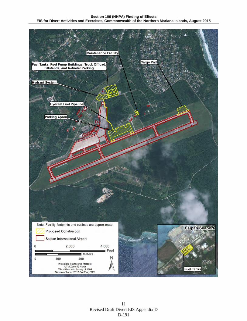
Section 106 (NHPA) Finding of Effects EIS for Divert Activities and Exercises, Commonwealth of the Northern Mariana Islands, August 2015
11
Revised Draft Divert EIS Appendix D D-191
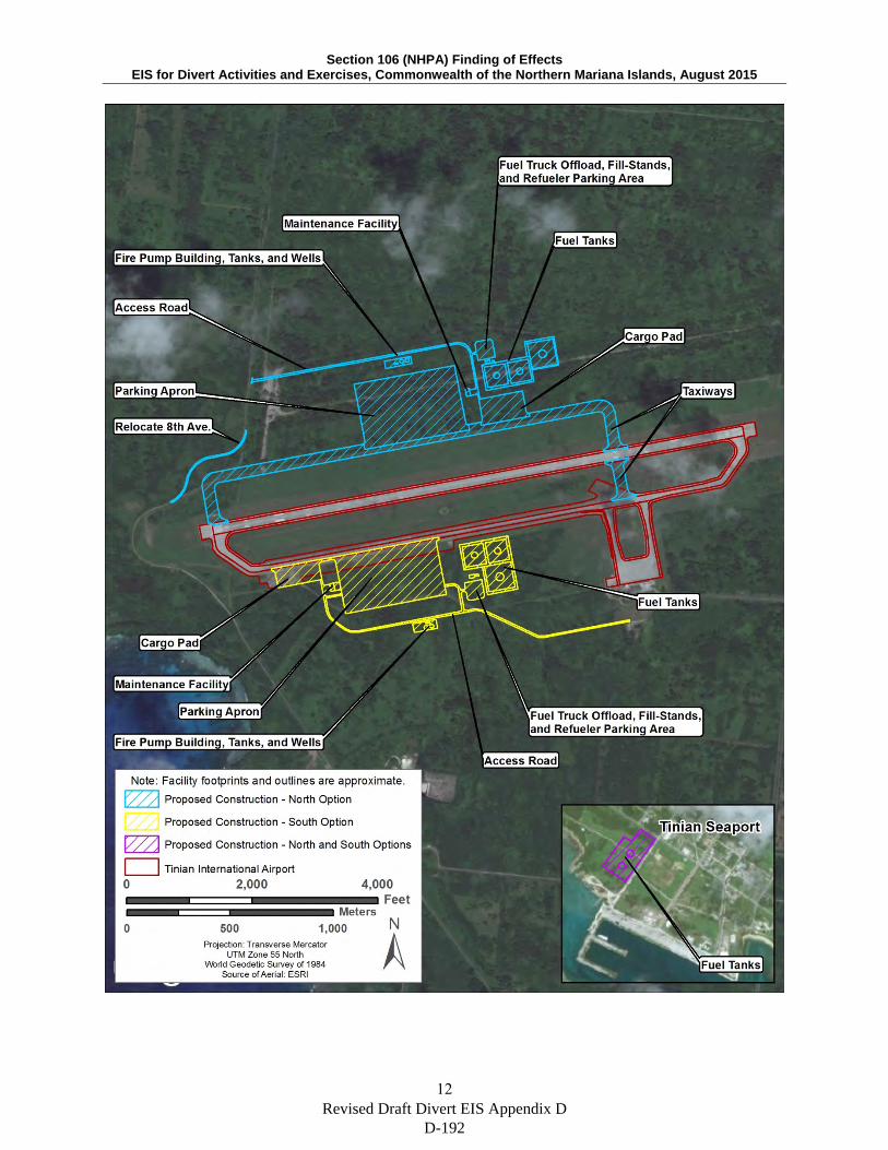
Section 106 (NHPA) Finding of Effects EIS for Divert Activities and Exercises, Commonwealth of the Northern Mariana Islands, August 2015
12
Revised Draft Divert EIS Appendix D D-192

Section 106 (NHPA) Finding of Effects EIS for Divert Activities and Exercises, Commonwealth of the Northern Mariana Islands, August 2015
13
Figure 2. Divert Activities and Exercises Areas of Potential Effects (APE) Maps
Revised Draft Divert EIS Appendix D D-193
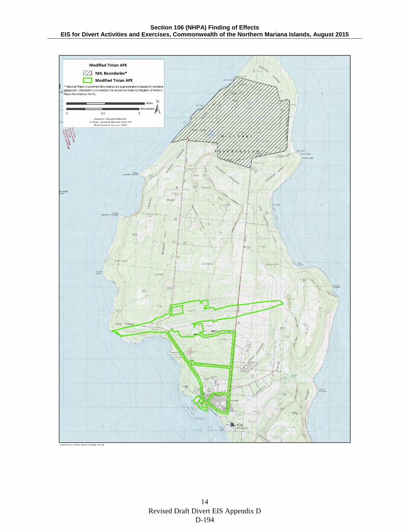
Section 106 (NHPA) Finding of Effects EIS for Divert Activities and Exercises, Commonwealth of the Northern Mariana Islands, August 2015
14
Revised Draft Divert EIS Appendix D D-194
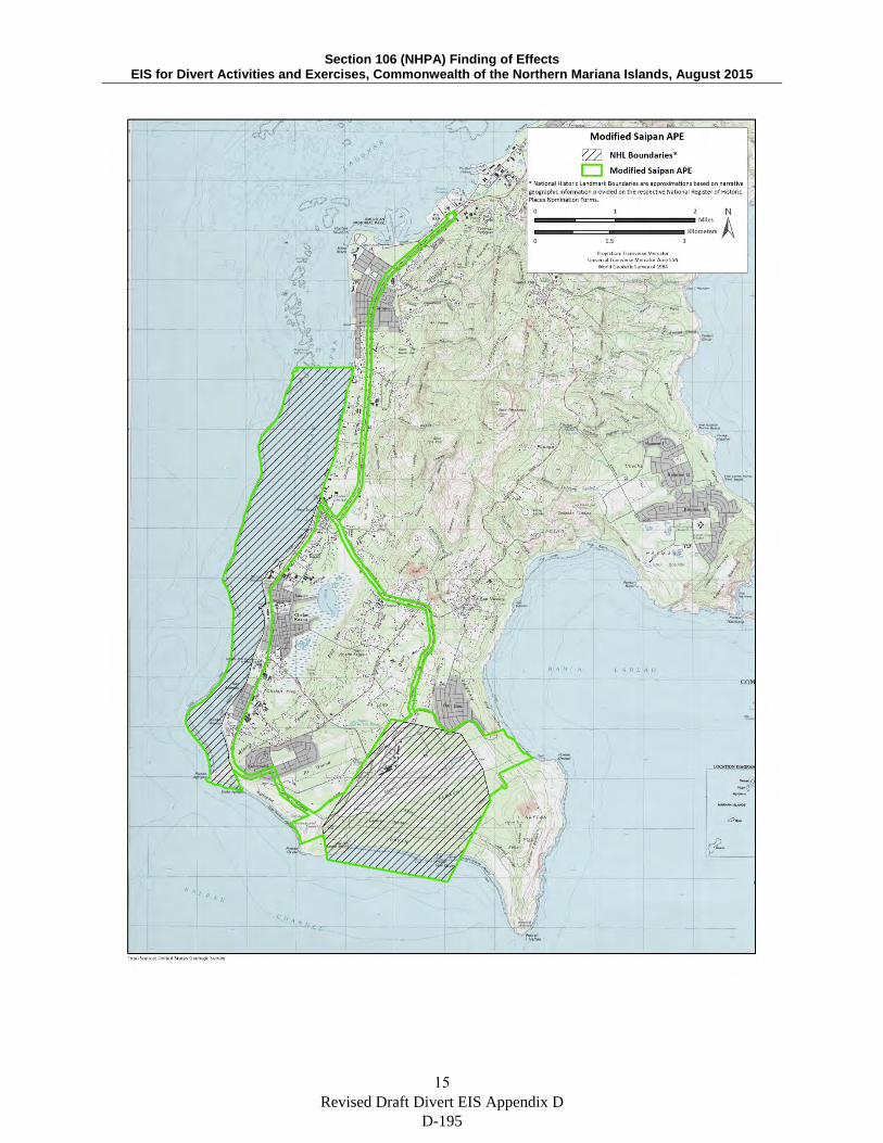
Section 106 (NHPA) Finding of Effects EIS for Divert Activities and Exercises, Commonwealth of the Northern Mariana Islands, August 2015
15
Revised Draft Divert EIS Appendix D D-195
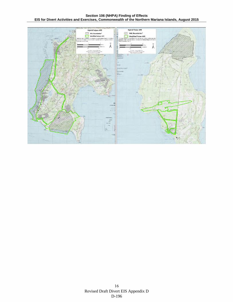
Section 106 (NHPA) Finding of Effects EIS for Divert Activities and Exercises, Commonwealth of the Northern Mariana Islands, August 2015
16 Revised Draft Divert EIS Appendix D
D-196

Section 106 (NHPA) Finding of Effects EIS for Divert Activities and Exercises, Commonwealth of the Northern Mariana Islands, August 2015
17
Figure 3. Previous Survey Coverage Map for Modified Tinian Alternative
Revised Draft Divert EIS Appendix D D-197
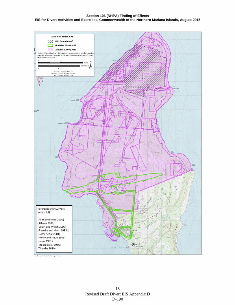
Section 106 (NHPA) Finding of Effects EIS for Divert Activities and Exercises, Commonwealth of the Northern Mariana Islands, August 2015
18
Revised Draft Divert EIS Appendix D D-198

A P P E N D I X E
Air Quality Calculations and Modeling
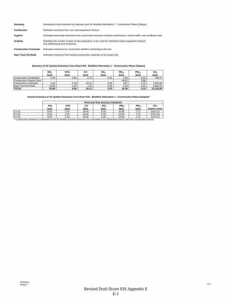
SummaryPhase I E-1
Summary Summarizes total emissions by calendar year for Modified Alternative 1 - Construction Phase (Saipan).
Combustion Estimates emissions from non-road equipment exhaust.
Fugitive Estimates particulate emissions from construction activities including earthmoving, vehicle traffic, and windblown dust.
Grading Estimates the number of days of site preparation, to be used for estimating heavy equipment exhaustand earthmoving dust emissions.
Construction Commuter Estimates emissions for construction workers commuting to the site.
Haul Truck On-Road Estimates emissions from hauling construction materials to the project site.
NOx VOC CO SO2 PM10 PM2.5 CO2(ton) (ton) (ton) (ton) (ton) (ton) (ton)
Construction Combustion 6.39 0.94 2.75 0.41 0.44 0.43 738.47 Construction Fugitive Dust - - - - 48.52 3.88 - Construction Commuter 4.33 4.78 44.22 0.08 0.67 0.43 7,933.88 Haul Truck On-Road 13.36 1.24 7.14 0.04 0.43 0.41 3,464.53 TOTAL 24.08 6.96 54.11 0.53 50.06 5.15 12,136.88
NOx VOC CO SO2 PM10 PM2.5 CO2 (tpy) (tpy) (tpy) (tpy) (tpy) (tpy) (metric tons)
CY 01 8.03 2.32 18.04 0.18 16.69 1.72 3,670.13CY 02 8.03 2.32 18.04 0.18 16.69 1.72 3,670.13CY 03 8.03 2.32 18.04 0.18 16.69 1.72 3,670.13* Construction duration is estimated to be 36 months and the emissions are assumed to be distributed evenly over the construction period.
Annual Summary of Air Quality Emissions from Divert EIS - Modified Alternative 1 - Construction Phase (Saipan)*
Summary of Air Quality Emissions from Divert EIS - Modified Alternative 1 - Construction Phase (Saipan)
Point and Area Sources Combined
Revised Draft Divert EIS Appendix E E-1
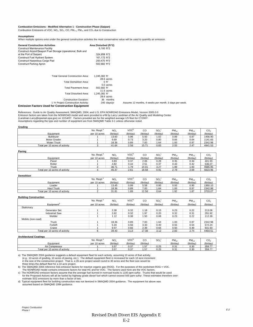
Project CombustionPhase I E-2
Combustion Emissions - Modified Alternative 1 - Construction Phase (Saipan)Combustion Emissions of VOC, NOx, SO2, CO, PM2.5, PM10, and CO2 due to Construction
AssumptionsWhen multiple options exist under the general construction activites the most conservative value will be used to quantify air emission.
General Construction Activities Area Disturbed (ft^2)Construct Maintenance Facility 6,100 ft^2Construct Airport/Seaport Fuel Storage (operational, Bulk and at the Port of Saipan) 324,958 ft^2Construct Fuel Hydrant System 161,172 ft^2Construct Hazardous Cargo Pad 250,470 ft^2Construct Parking Apron 502,682 ft^2
Total General Construction Area: 1,245,382 ft2
28.6 acresTotal Demolition Area: 0 ft2
0.0 acresTotal Pavement Area: 502,682 ft2
11.5 acresTotal Disturbed Area: 1,245,382 ft2
28.6 acresConstruction Duration: 36 months
1 Yr Project Construction Activity: 240 days/yr Assume 12 months, 4 weeks per month, 5 days per week.Emission Factors Used for Construction Equipment
References: Guide to Air Quality Assessment, SMAQMD, 2004; and U.S. EPA NONROAD Emissions Model, Version 2005.0.0Emission factors are taken from the NONROAD model and were provided to e²M by Larry Landman of the Air Quality and Modeling Center ([email protected]) on 12/14/07. Factors provided are for the weighted average US fleet for CY2007. Assumptions regarding the type and number of equipment are from SMAQMD Table 3-1 unless otherwise noted.
Grading No. Reqd.a NOx VOCb CO SO2
c PM10 PM2.5 CO2
Equipment per 10 acres (lb/day) (lb/day) (lb/day) (lb/day) (lb/day) (lb/day) (lb/day)Bulldozer 1 13.60 0.96 5.50 1.02 0.89 0.87 1456.90
Motor Grader 1 9.69 0.73 3.20 0.80 0.66 0.64 1141.65Water Truck 1 18.36 0.89 7.00 1.64 1.00 0.97 2342.98
Total per 10 acres of activity 3 41.64 2.58 15.71 0.83 2.55 2.47 4941.53
PavingNo. Reqd.a NOx VOCb CO SO2
c PM10 PM2.5 CO2
Equipment per 10 acres (lb/day) (lb/day) (lb/day) (lb/day) (lb/day) (lb/day) (lb/day)Paver 1 3.83 0.37 2.06 0.28 0.35 0.34 401.93Roller 1 4.82 0.44 2.51 0.37 0.43 0.42 536.07Truck 2 36.71 1.79 14.01 3.27 1.99 1.93 4685.95
Total per 10 acres of activity 4 45.37 2.61 18.58 0.91 2.78 2.69 5623.96
DemolitionNo. Reqd.a NOx VOCb CO SO2
c PM10 PM2.5 CO2
Equipment per 10 acres (lb/day) (lb/day) (lb/day) (lb/day) (lb/day) (lb/day) (lb/day)Loader 1 13.45 0.99 5.58 0.95 0.93 0.90 1360.10
Haul Truck 1 18.36 0.89 7.00 1.64 1.00 0.97 2342.98Total per 10 acres of activity 2 31.81 1.89 12.58 0.64 1.92 1.87 3703.07
Building ConstructionNo. Reqd.a NOx VOCb CO SO2
c PM10 PM2.5 CO2
Equipmentd per 10 acres (lb/day) (lb/day) (lb/day) (lb/day) (lb/day) (lb/day) (lb/day) Stationary
Generator Set 1 2.38 0.32 1.18 0.15 0.23 0.22 213.06Industrial Saw 1 2.62 0.32 1.97 0.20 0.32 0.31 291.92
Welder 1 1.12 0.38 1.50 0.08 0.23 0.22 112.39 Mobile (non-road)
Truck 1 18.36 0.89 7.00 1.64 1.00 0.97 2342.98Forklift 1 5.34 0.56 3.33 0.40 0.55 0.54 572.24Crane 1 9.57 0.66 2.39 0.65 0.50 0.49 931.93
Total per 10 acres of activity 6 39.40 3.13 17.38 3.12 2.83 2.74 4464.51
Architectural CoatingsNo. Reqd.a NOx VOCb CO SO2
c PM10 PM2.5 CO2
Equipment per 10 acres (lb/day) (lb/day) (lb/day) (lb/day) (lb/day) (lb/day)Air Compressor 1 3.57 0.37 1.57 0.25 0.31 0.30 359.77
Total per 10 acres of activity 1 3.57 0.37 1.57 0.25 0.31 0.30 359.77
a) The SMAQMD 2004 guidance suggests a default equipment fleet for each activity, assuming 10 acres of that activity, (e.g., 10 acres of grading, 10 acres of paving, etc.). The default equipment fleet is increased for each 10 acre increment in the size of the construction project. That is, a 26 acre project would round to 30 acres and the fleet size would be three times the default fleet for a 10 acre project.b) The SMAQMD 2004 reference lists emission factors for reactive organic gas (ROG). For the purposes of this worksheet ROG = VOC. The NONROAD model contains emissions factors for total HC and for VOC. The factors used here are the VOC factors.c) The NONROAD emission factors assume that the average fuel burned in nonroad trucks is 1100 ppm sulfur. Trucks that would be used for the Proposed Actions will all be fueled by highway grade diesel fuel which cannot exceed 500 ppm sulfur. These estimates therefore over- estimate SO2 emissions by more than a factor of two.d) Typical equipment fleet for building construction was not itemized in SMAQMD 2004 guidance. The equipment list above was assumed based on SMAQMD 1994 guidance.
Revised Draft Divert EIS Appendix E E-2
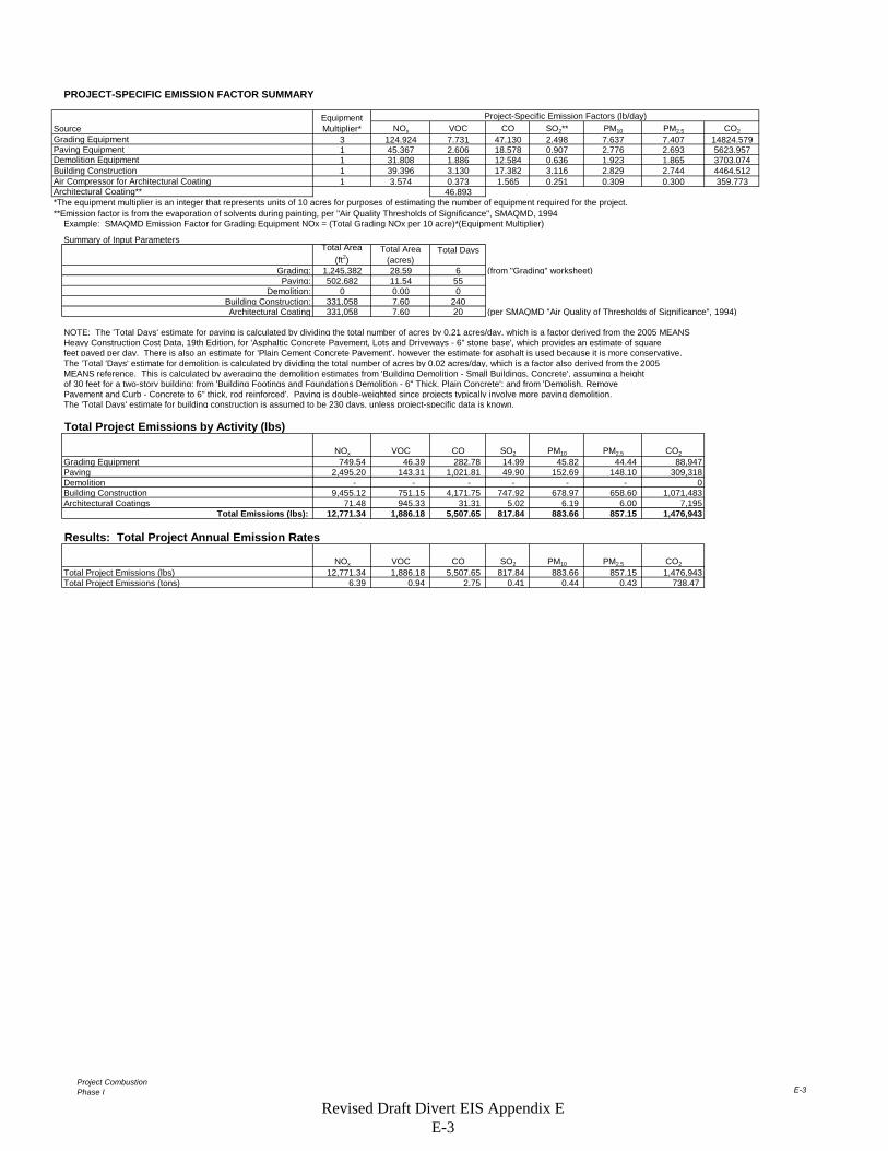
Project CombustionPhase I E-3
PROJECT-SPECIFIC EMISSION FACTOR SUMMARY
Project-Specific Emission Factors (lb/day)NOx VOC CO SO2** PM10 PM2.5 CO2
3 124.924 7.731 47.130 2.498 7.637 7.407 14824.5791 45.367 2.606 18.578 0.907 2.776 2.693 5623.9571 31.808 1.886 12.584 0.636 1.923 1.865 3703.0741 39.396 3.130 17.382 3.116 2.829 2.744 4464.5121 3.574 0.373 1.565 0.251 0.309 0.300 359.773
46.893*The equipment multiplier is an integer that represents units of 10 acres for purposes of estimating the number of equipment required for the project.**Emission factor is from the evaporation of solvents during painting, per "Air Quality Thresholds of Significance", SMAQMD, 1994
Example: SMAQMD Emission Factor for Grading Equipment NOx = (Total Grading NOx per 10 acre)*(Equipment Multiplier)
Summary of Input ParametersTotal Days
Grading: 1,245,382 28.59 6 (from "Grading" worksheet)Paving: 502,682 11.54 55
Demolition: 0 0.00 0Building Construction: 331,058 7.60 240Architectural Coating 331,058 7.60 20 (per SMAQMD "Air Quality of Thresholds of Significance", 1994)
NOTE: The 'Total Days' estimate for paving is calculated by dividing the total number of acres by 0.21 acres/day, which is a factor derived from the 2005 MEANSHeavy Construction Cost Data, 19th Edition, for 'Asphaltic Concrete Pavement, Lots and Driveways - 6" stone base', which provides an estimate of squarefeet paved per day. There is also an estimate for 'Plain Cement Concrete Pavement', however the estimate for asphalt is used because it is more conservative. The 'Total 'Days' estimate for demolition is calculated by dividing the total number of acres by 0.02 acres/day, which is a factor also derived from the 2005 MEANS reference. This is calculated by averaging the demolition estimates from 'Building Demolition - Small Buildings, Concrete', assuming a height of 30 feet for a two-story building; from 'Building Footings and Foundations Demolition - 6" Thick, Plain Concrete'; and from 'Demolish, Remove Pavement and Curb - Concrete to 6" thick, rod reinforced'. Paving is double-weighted since projects typically involve more paving demolition.The 'Total Days' estimate for building construction is assumed to be 230 days, unless project-specific data is known.
Total Project Emissions by Activity (lbs)
NOx VOC CO SO2 PM10 PM2.5 CO2
Grading Equipment 749.54 46.39 282.78 14.99 45.82 44.44 88,947Paving 2,495.20 143.31 1,021.81 49.90 152.69 148.10 309,318Demolition - - - - - - 0Building Construction 9,455.12 751.15 4,171.75 747.92 678.97 658.60 1,071,483Architectural Coatings 71.48 945.33 31.31 5.02 6.19 6.00 7,195
Total Emissions (lbs): 12,771.34 1,886.18 5,507.65 817.84 883.66 857.15 1,476,943
Results: Total Project Annual Emission Rates
NOx VOC CO SO2 PM10 PM2.5 CO2
Total Project Emissions (lbs) 12,771.34 1,886.18 5,507.65 817.84 883.66 857.15 1,476,943Total Project Emissions (tons) 6.39 0.94 2.75 0.41 0.44 0.43 738.47
SourceGrading Equipment
Total Area (ft2)
Total Area (acres)
Equipment Multiplier*
Architectural Coating**
Demolition EquipmentBuilding Construction
Paving Equipment
Air Compressor for Architectural Coating
Revised Draft Divert EIS Appendix E E-3
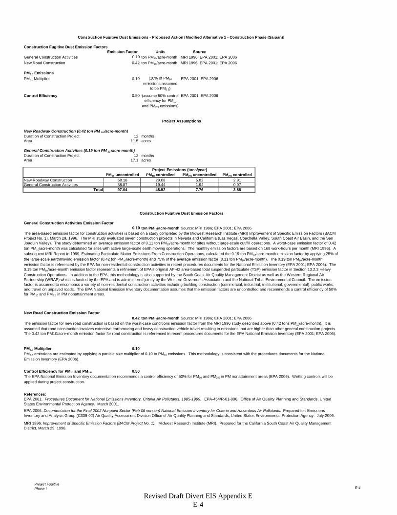
Project FugitivePhase I E-4
Construction Fugitive Dust Emission FactorsEmission Factor Units Source
General Construction Activities 0.19 ton PM10/acre-month MRI 1996; EPA 2001; EPA 2006New Road Construction 0.42 ton PM10/acre-month MRI 1996; EPA 2001; EPA 2006
PM2.5 EmissionsPM2.5 Multiplier 0.10 EPA 2001; EPA 2006
Control Efficiency 0.50 EPA 2001; EPA 2006
New Roadway Construction (0.42 ton PM 10 /acre-month)Duration of Construction Project 12 monthsArea 11.5 acres
General Construction Activities (0.19 ton PM 10 /acre-month)Duration of Construction Project 12 monthsArea 17.1 acres
PM10 uncontrolled PM10 controlled PM2.5 uncontrolled PM2.5 controlledNew Roadway Construction 58.16 29.08 5.82 2.91General Construction Activities 38.87 19.44 1.94 0.97
Total 97.04 48.52 7.76 3.88
General Construction Activities Emission Factor0.19 ton PM10/acre-month Source: MRI 1996; EPA 2001; EPA 2006
New Road Construction Emission Factor0.42 ton PM10/acre-month Source: MRI 1996; EPA 2001; EPA 2006
PM2.5 Multiplier 0.10
Control Efficiency for PM10 and PM2.5 0.50
References:
Construction Fugitive Dust Emissions - Proposed Action [Modified Alternative 1 - Construction Phase (Saipan)]
(10% of PM10
emissions assumed to be PM2.5)
(assume 50% control efficiency for PM10
and PM2.5 emissions)
Project Assumptions
Project Emissions (tons/year)
The EPA National Emission Inventory documentation recommends a control efficiency of 50% for PM10 and PM2.5 in PM nonattainment areas (EPA 2006). Wetting controls will be applied during project construction.
EPA 2001. Procedures Document for National Emissions Inventory, Criteria Air Pollutants, 1985-1999. EPA-454/R-01-006. Office of Air Quality Planning and Standards, United States Environmental Protection Agency. March 2001.
EPA 2006. Documentation for the Final 2002 Nonpoint Sector (Feb 06 version) National Emission Inventory for Criteria and Hazardous Air Pollutants. Prepared for: Emissions Inventory and Analysis Group (C339-02) Air Quality Assessment Division Office of Air Quality Planning and Standards, United States Environmental Protection Agency. July 2006.
MRI 1996. Improvement of Specific Emission Factors (BACM Project No. 1). Midwest Research Institute (MRI). Prepared for the California South Coast Air Quality Management District, March 29, 1996.
Construction Fugitive Dust Emission Factors
The area-based emission factor for construction activities is based on a study completed by the Midwest Research Institute (MRI) Improvement of Specific Emission Factors (BACM Project No. 1), March 29, 1996. The MRI study evaluated seven construction projects in Nevada and California (Las Vegas, Coachella Valley, South Coast Air Basin, and the San Joaquin Valley). The study determined an average emission factor of 0.11 ton PM10/acre-month for sites without large-scale cut/fill operations. A worst-case emission factor of 0.42 ton PM10/acre-month was calculated for sites with active large-scale earth moving operations. The monthly emission factors are based on 168 work-hours per month (MRI 1996). A subsequent MRI Report in 1999, Estimating Particulate Matter Emissions From Construction Operations, calculated the 0.19 ton PM10/acre-month emission factor by applying 25% of the large-scale earthmoving emission factor (0.42 ton PM10/acre-month) and 75% of the average emission factor (0.11 ton PM10/acre-month). The 0.19 ton PM10/acre-month emission factor is referenced by the EPA for non-residential construction activities in recent procedures documents for the National Emission Inventory (EPA 2001; EPA 2006). The 0.19 ton PM10/acre-month emission factor represents a refinement of EPA's original AP-42 area-based total suspended particulate (TSP) emission factor in Section 13.2.3 Heavy Construction Operations. In addition to the EPA, this methodology is also supported by the South Coast Air Quality Management District as well as the Western Regional Air Partnership (WRAP) which is funded by the EPA and is administered jointly by the Western Governor's Association and the National Tribal Environmental Council. The emission factor is assumed to encompass a variety of non-residential construction activities including building construction (commercial, industrial, institutional, governmental), public works, and travel on unpaved roads. The EPA National Emission Inventory documentation assumes that the emission factors are uncontrolled and recommends a control efficiency of 50% for PM10 and PM2.5 in PM nonattainment areas.
The emission factor for new road construction is based on the worst-case conditions emission factor from the MRI 1996 study described above (0.42 tons PM10/acre-month). It is assumed that road construction involves extensive earthmoving and heavy construction vehicle travel resulting in emissions that are higher than other general construction projects. The 0.42 ton PM10/acre-month emission factor for road construction is referenced in recent procedures documents for the EPA National Emission Inventory (EPA 2001; EPA 2006).
PM2.5 emissions are estimated by applying a particle size multiplier of 0.10 to PM10 emissions. This methodology is consistent with the procedures documents for the National Emission Inventory (EPA 2006).
Revised Draft Divert EIS Appendix E E-4
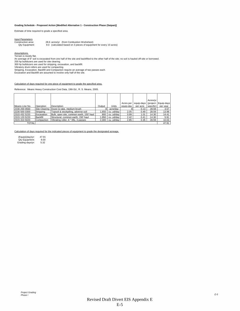
Project GradingPhase I E-5
Grading Schedule - Proposed Action [Modified Alternative 1 - Construction Phase (Saipan)]
Estimate of time required to grade a specified area.
Input ParametersConstruction area: 28.6 acres/yr (from Combustion Worksheet)
Qty Equipment: 9.0 (calculated based on 3 pieces of equipment for every 10 acres)
Assumptions.Terrain is mostly flat.An average of 6" soil is excavated from one half of the site and backfilled to the other half of the site; no soil is hauled off-site or borrowed.200 hp bulldozers are used for site clearing.300 hp bulldozers are used for stripping, excavation, and backfill.Vibratory drum rollers are used for compacting.Stripping, Excavation, Backfill and Compaction require an average of two passes each.Excavation and Backfill are assumed to involve only half of the site.
Calculation of days required for one piece of equipment to grade the specified area.
Reference: Means Heavy Construction Cost Data, 19th Ed., R. S. Means, 2005.
Means Line No. Operation Description Output UnitsAcres per equip-day
equip-days per acre
Acres/yr (project-specific)
Equip-days per year
2230 200 0550 Site Clearing Dozer & rake, medium brush 8 acre/day 8 0.13 28.59 3.572230 500 0300 Stripping Topsoil & stockpiling, adverse soil 1,650 cu. yd/day 2.05 0.49 28.59 13.982315 432 5220 Excavation Bulk, open site, common earth, 150' haul 800 cu. yd/day 0.99 1.01 14.30 14.412315 120 5220 Backfill Structural, common earth, 150' haul 1,950 cu. yd/day 2.42 0.41 14.30 5.912315 310 5020 Compaction Vibrating roller, 6 " lifts, 3 passes 2,300 cu. yd/day 2.85 0.35 28.59 10.03
TOTAL 47.91
Calculation of days required for the indicated pieces of equipment to grade the designated acreage.
(Equip)(day)/yr: 47.91Qty Equipment: 9.00
Grading days/yr: 5.32
Revised Draft Divert EIS Appendix E E-5
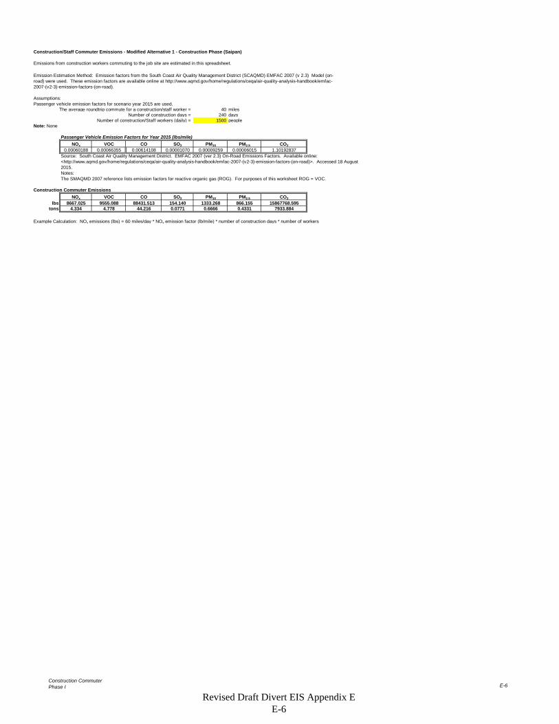
Construction CommuterPhase I E-6
Construction/Staff Commuter Emissions - Modified Alternative 1 - Construction Phase (Saipan)
Emissions from construction workers commuting to the job site are estimated in this spreadsheet.
Assumptions:Passenger vehicle emission factors for scenario year 2015 are used.
The average roundtrip commute for a construction/staff worker = 40 milesNumber of construction days = 240 days
Number of construction/Staff workers (daily) = 1500 peopleNote: None
Passenger Vehicle Emission Factors for Year 2015 (lbs/mile)NOx VOC CO SO2 PM10 PM2.5 CO2
0.00060188 0.00066355 0.00614108 0.00001070 0.00009259 0.00006015 1.10192837
Notes:The SMAQMD 2007 reference lists emission factors for reactive organic gas (ROG). For purposes of this worksheet ROG = VOC.
Construction Commuter EmissionsNOx VOC CO SO2 PM10 PM2.5 CO2
lbs 8667.025 9555.088 88431.513 154.140 1333.268 866.155 15867768.595tons 4.334 4.778 44.216 0.0771 0.6666 0.4331 7933.884
Example Calculation: NOx emissions (lbs) = 60 miles/day * NOx emission factor (lb/mile) * number of construction days * number of workers
Emission Estimation Method: Emission factors from the South Coast Air Quality Management District (SCAQMD) EMFAC 2007 (v 2.3) Model (on-road) were used. These emission factors are available online at http://www.aqmd.gov/home/regulations/ceqa/air-quality-analysis-handbook/emfac-2007-(v2-3)-emission-factors-(on-road).
Source: South Coast Air Quality Management District. EMFAC 2007 (ver 2.3) On-Road Emissions Factors. Available online: <http://www.aqmd.gov/home/regulations/ceqa/air-quality-analysis-handbook/emfac-2007-(v2-3)-emission-factors-(on-road)>. Accessed 18 August 2015.
Revised Draft Divert EIS Appendix E E-6
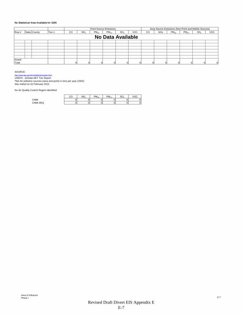
Area of InfluencePhase I E-7
No Statistical Area Available for GSN
Row # State County Tier-1 CO NOx PM10 PM2.5 SO2 VOC CO NOx PM10 PM2.5 SO2 VOC
Grand Total 0 0 0 0 0 0 0 0 0 0 0 0
SOURCE:http://www.epa.gov/ttn/chief/eiinformation.html
USEPA - AirData NET Tier Report*Net Air pollution sources (area and point) in tons per year (2002)Site visited on 02 February 2012.
No Air Quality Control Region Identified
CO NOx PM10 PM2.5 SO2 VOCCNMI 0 0 0 0 0 0CNMI DEQ 0 0 0 0 0 0
Point Source Emissions Area Source Emissions (Non-Point and Mobile Sources)
No Data Available
Revised Draft Divert EIS Appendix E E-7
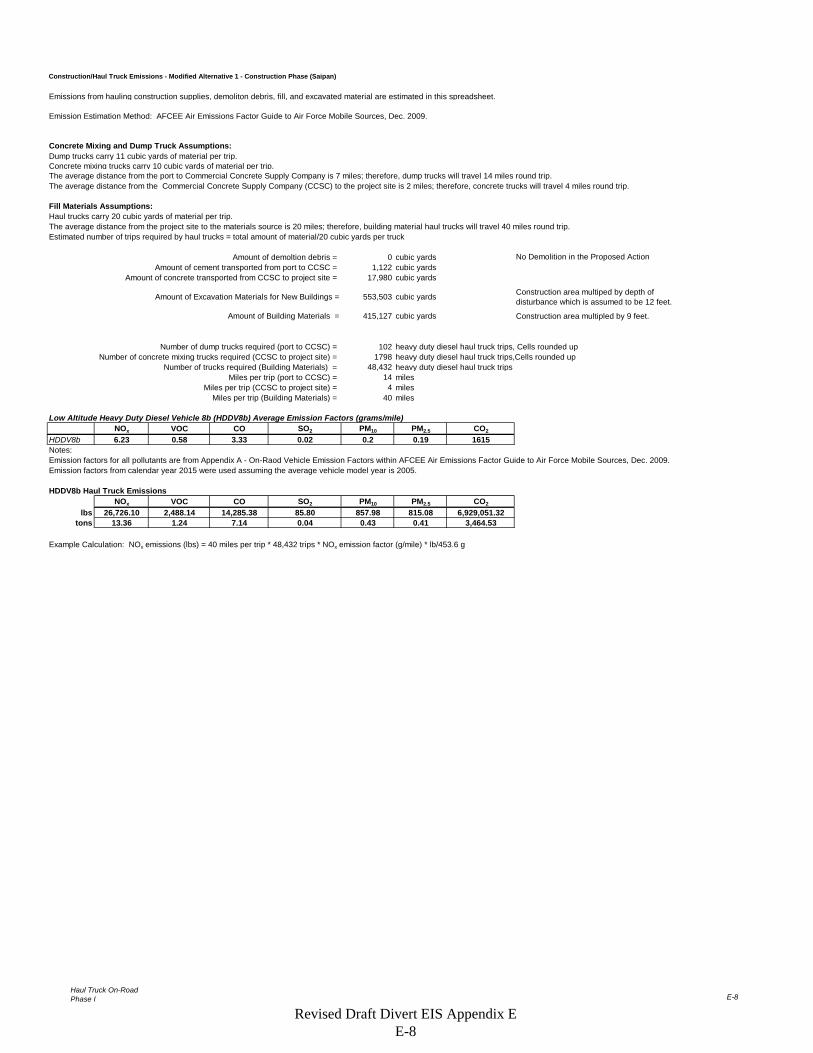
Haul Truck On-RoadPhase I E-8
Construction/Haul Truck Emissions - Modified Alternative 1 - Construction Phase (Saipan)
Emissions from hauling construction supplies, demoliton debris, fill, and excavated material are estimated in this spreadsheet.
Concrete Mixing and Dump Truck Assumptions:Dump trucks carry 11 cubic yards of material per trip.Concrete mixing trucks carry 10 cubic yards of material per trip.The average distance from the port to Commercial Concrete Supply Company is 7 miles; therefore, dump trucks will travel 14 miles round trip.The average distance from the Commercial Concrete Supply Company (CCSC) to the project site is 2 miles; therefore, concrete trucks will travel 4 miles round trip.
Fill Materials Assumptions:Haul trucks carry 20 cubic yards of material per trip.The average distance from the project site to the materials source is 20 miles; therefore, building material haul trucks will travel 40 miles round trip.Estimated number of trips required by haul trucks = total amount of material/20 cubic yards per truck
Amount of demoltion debris = 0 cubic yardsAmount of cement transported from port to CCSC = 1,122 cubic yards
Amount of concrete transported from CCSC to project site = 17,980 cubic yards
Amount of Excavation Materials for New Buildings = 553,503 cubic yards Construction area multiped by depth of disturbance which is assumed to be 12 feet.
Amount of Building Materials = 415,127 cubic yards
Number of dump trucks required (port to CCSC) = 102 heavy duty diesel haul truck trips, Cells rounded upNumber of concrete mixing trucks required (CCSC to project site) = 1798 heavy duty diesel haul truck trips,Cells rounded up
Number of trucks required (Building Materials) = 48,432 heavy duty diesel haul truck tripsMiles per trip (port to CCSC) = 14 miles
Miles per trip (CCSC to project site) = 4 milesMiles per trip (Building Materials) = 40 miles
Low Altitude Heavy Duty Diesel Vehicle 8b (HDDV8b) Average Emission Factors (grams/mile)NOx VOC CO SO2 PM10 PM2.5 CO2
HDDV8b 6.23 0.58 3.33 0.02 0.2 0.19 1615
Emission factors for all pollutants are from Appendix A - On-Raod Vehicle Emission Factors within AFCEE Air Emissions Factor Guide to Air Force Mobile Sources, Dec. 2009.Emission factors from calendar year 2015 were used assuming the average vehicle model year is 2005.
HDDV8b Haul Truck EmissionsNOx VOC CO SO2 PM10 PM2.5 CO2
lbs 26,726.10 2,488.14 14,285.38 85.80 857.98 815.08 6,929,051.32tons 13.36 1.24 7.14 0.04 0.43 0.41 3,464.53
Example Calculation: NOx emissions (lbs) = 40 miles per trip * 48,432 trips * NOx emission factor (g/mile) * lb/453.6 g
No Demolition in the Proposed Action
Construction area multipled by 9 feet.
Notes:
Emission Estimation Method: AFCEE Air Emissions Factor Guide to Air Force Mobile Sources, Dec. 2009.
Revised Draft Divert EIS Appendix E E-8
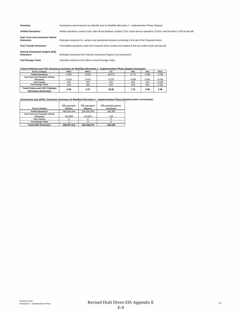
Summary SheetAlternative 1 - Implementation Phase E-9
Summary Summarizes total emissions by calendar year for Modified Alternative 1 - Implementation Phase (Saipan).
Airfield Operations Airfield operations consist of taxi, take-off and landings (sorties/LTOs), touch-and-go operations (TGOs), and low flybys (LFB) by aircraft.
Fuel Truck and Commuter Vehicle Emissions Estimates emissions for workers and operational vehicles commuting to the site of the Proposed Action.
Fuel Transfer Emissions Fuel loading operations under the Proposed Action involves the loading of fuel into tanker trucks and aircraft.
Internal Combustion Engine (ICE) Emissions Estimates Emissions from Internal Combustion Engines (e.g Generators)
Fuel Storage Tanks Estimates emissions from Above Ground Storage Tanks.
Criteria Pollutant and VOC Emissions Summary for Modified Alternative 1 - Implementation Phase (Saipan) (tons/year)Source Category PM10 PM2.5 CO NOx SOx VOCs
Airfield Operations 0.055 0.053 18.672 6.771 0.982 1.246Fuel Truck and Commuter Vehicle
Emissions 0.023 0.019 0.279 0.536 0.001 0.048Fuel Transfer N/A N/A N/A N/A N/A 0.339
Fuel Storage Tanks N/A N/A N/A N/A N/A 1.332Total Criteria and VOC Pollutant
Emissions (tons/year)0.08 0.07 18.95 7.31 0.98 2.96
Greenhouse Gas (GHG) Emissions Summary for Modified Alternative 1 - Implementation Phase (Saipan) (metric tonnes/year)
Source CategoryCO2-equivalent
(lb/year)CO2-equivalent
(kg/year)CO2-equivalent (metric
tonne/year)Airfield Operations* 366,634,444 166,305,384 166,305
Fuel Truck and Commuter Vehicle Emissions 292,969 132,891 133
Fuel Transfer 0 0 0Fuel Storage Tanks 0 0 0
Total GHG Emissions 366,927,413 166,438,275 166,438
Revised Draft Divert EIS Appendix E E-9
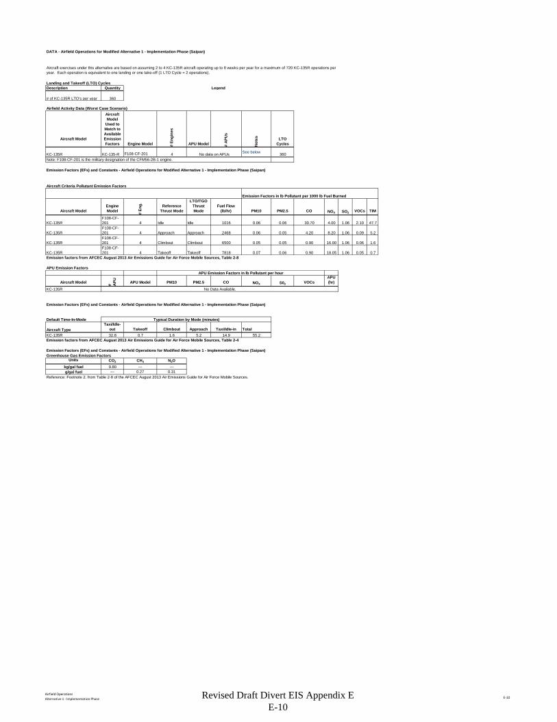
Airfield OperationsAlternative 1 - Implementation Phase E-10
DATA - Airfield Operations for Modified Alternative 1 - Implementation Phase (Saipan)
Landing and Takeoff (LTO) CyclesDescription Quantity Legend
# of KC-135R LTO's per year 360
Airfield Activity Data (Worst Case Scenario)
Aircraft Model
Aircraft Model
Used to Match to Available Emission Factors Engine Model #
Engi
nes
APU Model # A
PUs
Not
es LTO Cycles
KC-135R KC-135-R F108-CF-201 4 See below 360Note: F108-CF-201 is the military designation of the CFM56-2B-1 engine.
Emission Factors (EFs) and Constants - Airfield Operations for Modified Alternative 1 - Implementation Phase (Saipan)
Aircraft Criteria Pollutant Emission Factors
Aircraft ModelEngine Model #
Eng. Reference
Thrust Mode
LTO/TGO Thrust Mode
Fuel Flow(lb/hr) PM10 PM2.5 CO NOX SO2 VOCs TIM
KC-135RF108-CF-201 4 Idle Idle 1016 0.06 0.06 30.70 4.00 1.06 2.10 47.7
KC-135RF108-CF-201 4 Approach Approach 2468 0.06 0.05 4.20 8.20 1.06 0.09 5.2
KC-135RF108-CF-201 4 Climbout Climbout 6500 0.05 0.05 0.90 16.00 1.06 0.06 1.6
KC-135RF108-CF-201 4 Takeoff Takeoff 7818 0.07 0.06 0.90 18.05 1.06 0.05 0.7
Emission factors from AFCEC August 2013 Air Emissions Guide for Air Force Mobile Sources, Table 2-8
APU Emission FactorsAPU Emission Factors in lb Pollutant per hour
Aircraft Model # APU APU Model PM10 PM2.5 CO NOX S02 VOCs
APU(hr)
KC-135R
Emission Factors (EFs) and Constants - Airfield Operations for Modified Alternative 1 - Implementation Phase (Saipan)
Default Time-In-Mode
Aircraft TypeTaxi/Idle-
out Takeoff Climbout Approach Taxi/Idle-in TotalKC-135R 32.8 0.7 1.6 5.2 14.9 55.2Emission factors from AFCEC August 2013 Air Emissions Guide for Air Force Mobile Sources, Table 2-4
Emission Factors (EFs) and Constants - Airfield Operations for Modified Alternative 1 - Implementation Phase (Saipan)Greenhouse Gas Emission Factors
Units CO2 CH4 N2Okg/gal fuel 9.80 --- ---g/gal fuel --- 0.27 0.31
Reference: Footnote 2. from Table 2-8 of the AFCEC August 2013 Air Emissions Guide for Air Force Mobile Sources.
Typical Duration by Mode (minutes)
No Data Available.
Aircraft exercises under this alternative are based on assuming 2 to 4 KC-135R aircraft operating up to 8 weeks per year for a maximum of 720 KC-135R operations per year. Each operation is equivalent to one landing or one take-off (1 LTO Cycle = 2 operations).
Emission Factors in lb Pollutant per 1000 lb Fuel Burned
No data on APUs
Revised Draft Divert EIS Appendix E E-10
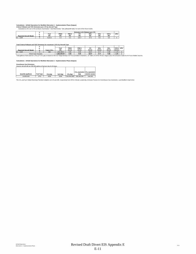
Airfield OperationsAlternative 1 - Implementation Phase E-11
Calculations - Airfield Operations for Modified Alternative 1 - Implementation Phase (Saipan)Criteria Pollutant and VOC Emissions per LTO by Aircraft Type Calculated as the sum of the products of [(minutes) * (fuel flow/minute) * (lbs pollutant/lb fuel)] for each of the thrust modes.
U Emission in lb Pollutant per LTO
P Fuel PM10 PM2.5 CO NOx SOx VOCs APU
A (lb) (lb) (lb) (lb) (lb) (lb) (lb)KC - 135R 0 5144.6 0.3 0.3 103.7 37.6 5.5 6.9 0
Total Criteria Pollutant and VOC Emissions for maximum LTO's by Aircraft Type
UP Fuel PM10 PM2.5 CO NOx SOx VOCs APU
A (lb) (tons) (tons) (tons) (tons) (tons) (tons)KC - 135R 0 360 1,852,065.6 0.05 0.05 18.67 6.77 0.98 1.25 0
Worst Case Scenario 1,852,065.60 0.05 0.05 18.67 6.77 0.98 1.25 0Total gallons of fuel used for LTOs (277,671 gal.) is based on the 6.67 lb/gal density of JP-8 as provided in footnote 2. of Table 2-8 of the AFCEC August 2013 Air Emissions Guide for Air Force Mobile Sources.
Calculations - Airfield Operations for Modified Alternative 1 - Implementation Phase (Saipan)
Greenhouse Gas Emissions Assume aircraft will use 300,000 gallons of fuel per day for 56 days.
Quantity (gallons) Fuel Type CH4 (kg) N2O (kg) CO2 (kg)CO2-equivalent
(kg)CO2-equivalent (metric tonne)
16,800,000 JP-8 4536 5208 164,640,000 166,305,384 166,305
The CH4 and N2O Global Warming Potential multipliers are 25 and 298, respectively from EPA's Climate Leadership, Emission Factors for Greenhouse Gas Inventories, Last Modified 4 April 2014.
Reported Aircraft Model Total LTO's
Reported Aircraft Model
Revised Draft Divert EIS Appendix E E-11
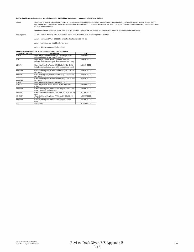
Fuel Truck-Commuter Vehicle EmsAlternative 1 - Implementation Phase E-13
DATA - Fuel Truck and Commuter Vehicle Emissions for Modified Alternative 1 - Implementation Phase (Saipan)
Given:
Assumptions: A Gross Vehicle Weight (GVW) of 36,200 lbs will be used, based off of an 84 passenger Blue Bird bus.
Assume fuel truck GVW > 60,000 lbs since fuel load alone is 83,400 lbs.
Assume fuel trucks travel at 55 miles per hour
Assume 40 miles per roundtrip for busses.
Vehicle Weight Classes for Which Emission Factors are PublishedVehicle Category
LDGV
LDGT1
LDGT3
HDGV2B
HDGV5
HDGV8ALDDVLDDT34
HDDV2B
HDDV5
HDDV8A
HDDV8B
MC
Class 2b Heavy-Duty Diesel Vehicles (8501-10,000 lbs GVW – includes pickup trucks)
A2230070000
Class 5 Heavy-Duty Diesel Vehicles (16,001-19,500 lbs GVW)
A2230070000
Class 8a Heavy-Duty Diesel Vehicles (33,001-60,000 lbs GVW)
A2230070000
Class 8b Heavy-Duty Diesel Vehicles (>60,000 lbs GVW)
A2230070000
Motorcycles A2201080000
Class 8a Heavy-Duty Gasoline Vehicles (33,001-60,000 lbs GVW)
A2201070000
Light-Duty Diesel Vehicles (Passenger Cars)Light-Duty Diesel Trucks 3 and 4 (6,001-8,500 lbs GVW)
A2230002000
Six 10,000 gal Fuel Trucks will take 14 days at 10hrs/day to provide initial fill from Saipan port to Saipan International Airport (Site of Proposed Action). The six 10,000 gallon Fueld trucks will operate 10hrs/day for the duration of the exercises. The total exercise time is 8 weeks (56 days), therefore the fuel trucks will operate an additional 42 days after the initial fill.
Under the commercial lodging option six busses will transport a total of 256 personnel 4 roundtrips/day for a total of 24 roundtrips/day for 8 weeks.
Description SCCLight-Duty Gasoline Vehicles (i.e., passenger cars) does not include SUVs, vans or pickups
A2201001000
Light-Duty Gasoline Trucks 1 (0-6,000 lbs GVW - includes pickup trucks, sport utility vehicles and vans)
A2201020000
Light-Duty Gasoline Trucks 3 (6,001-8,500 lbs. GVW - includes pickup trucks, sport utility vehicles and vans)
A2201040000
Class 2b Heavy-Duty Gasoline Vehicles (8501-10,000 lbs GVW)
A2201070000
Class 5 Heavy-Duty Gasoline Vehicles (16,001-19,500 lbs GVW)
A2201070000
Revised Draft Divert EIS Appendix E E-12
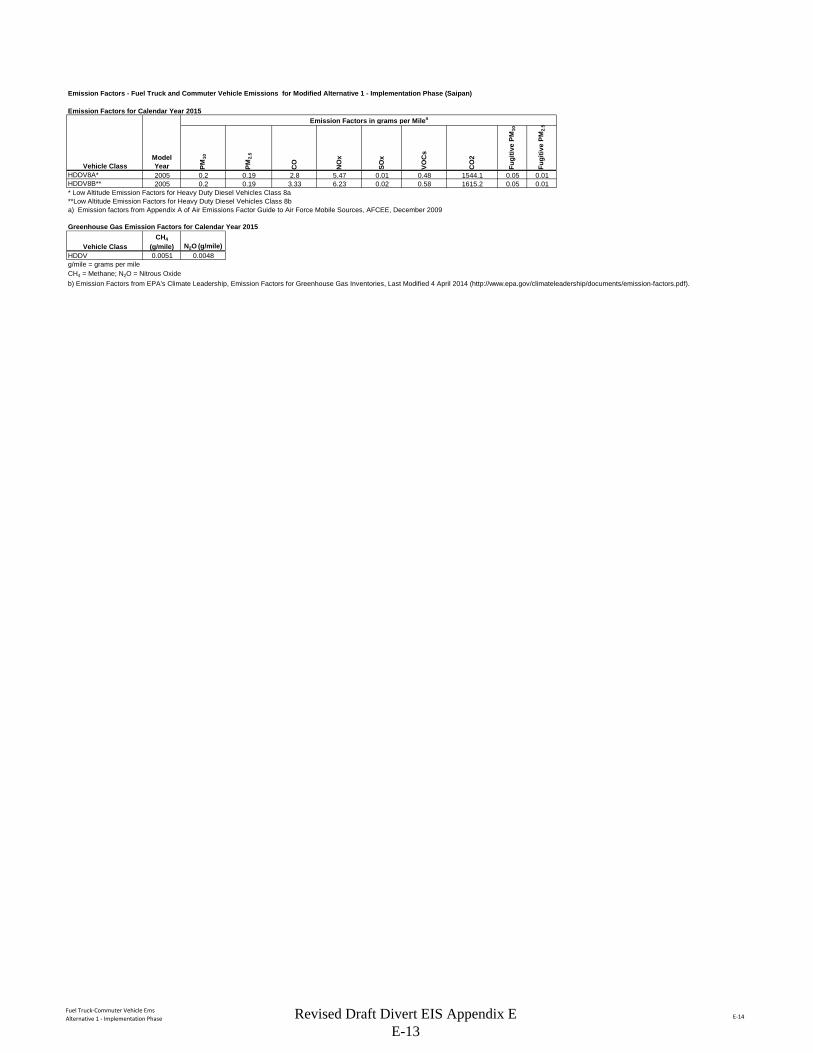
Fuel Truck-Commuter Vehicle EmsAlternative 1 - Implementation Phase E-14
Emission Factors - Fuel Truck and Commuter Vehicle Emissions for Modified Alternative 1 - Implementation Phase (Saipan)
Emission Factors for Calendar Year 2015Emission Factors in grams per Milea
PM10
PM2.
5
CO
NO
x
SOx
VOC
s
CO
2
Fugi
tive
PM10
Fugi
tive
PM2.
5
HDDV8A* 2005 0.2 0.19 2.8 5.47 0.01 0.48 1544.1 0.05 0.01HDDV8B** 2005 0.2 0.19 3.33 6.23 0.02 0.58 1615.2 0.05 0.01* Low Altitude Emission Factors for Heavy Duty Diesel Vehicles Class 8a**Low Altitude Emission Factors for Heavy Duty Diesel Vehicles Class 8ba) Emission factors from Appendix A of Air Emissions Factor Guide to Air Force Mobile Sources, AFCEE, December 2009
Greenhouse Gas Emission Factors for Calendar Year 2015
HDDV 0.0051 0.0048g/mile = grams per mileCH4 = Methane; N2O = Nitrous Oxideb) Emission Factors from EPA's Climate Leadership, Emission Factors for Greenhouse Gas Inventories, Last Modified 4 April 2014 (http://www.epa.gov/climateleadership/documents/emission-factors.pdf).
Vehicle ClassModel Year
Vehicle ClassCH4
(g/mile) N2O (g/mile)
Revised Draft Divert EIS Appendix E E-13
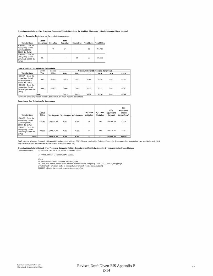
Fuel Truck-Commuter Vehicle EmsAlternative 1 - Implementation Phase E-15
Emission Calculations - Fuel Truck and Commuter Vehicle Emissions for Modified Alternative 1 - Implementation Phase (Saipan)
Miles for Commuter Emissions for 8 week training exercises
Vehicle ClassSpeed
Miles/hour Miles/TripTotal
Trips/Day Hours/Day Total Days Total MilesHDDV8A - Class 8a Heavy-Duty Diesel Vehicles (33,001-60,000 lbs GVW)
--- 40 24 --- 56 53,760
HDDV8B - Class 8b Heavy-Duty Diesel Vehicles (>60,000 lbs GVW)
55 --- --- 10 56 30,800
Criteria and VOC Emissions for CommutersModel Annual Criteria Pollutant Emissions (tons/year)
Vehicle Class Year Miles PM10 PM2.5 CO NOx SOx VOCsHDDV8A - Class 8a Heavy-Duty Diesel Vehicles (33,001-60,000 lbs GVW)
2005 53,760 0.015 0.012 0.166 0.324 0.001 0.028
HDDV8B - Class 8b Heavy-Duty Diesel Vehicles (>60,000 lbs GVW)
2005 30,800 0.008 0.007 0.113 0.212 0.001 0.020
Total 0.023 0.019 0.279 0.536 0.001 0.048Particulate emissions include exhaust, brake wear, tire wear. Assume paved road.
Greenhouse Gas Emissions for Commuters
Vehicle ClassAnnual Miles CO2 (lb/year) CH4 (lb/year) N2O (lb/year)
CH4 GWP Multiplier
N2O GWP Multiplier
CO2
Equivalent (lb/year)
CO2
Equivalent (metric
tonnes/year)
HDDV8A - Class 8a Heavy-Duty Diesel Vehicles (33,001-60,000 lbs GVW)
53,760 183,004.44 0.60 0.57 25 298 183,189.08 83.09
HDDV8B - Class 8b Heavy-Duty Diesel Vehicles (>60,000 lbs GVW)
30,800 109,674.07 0.35 0.33 25 298 109,779.86 49.80
Total 292,678.52 0.95 0.89 --- --- 292,968.94 132.89
Emission Calculations Method - Fuel Truck and Commuter Vehicle Emissions for Modified Alternative 1 - Implementation Phase (Saipan)Calculation Method:
GWP = Global Warming Potential; 100-year GWP values obtained from EPA's Climate Leadership, Emission Factors for Greenhouse Gas Inventories, Last Modified 4 April 2014 (http://www.epa.gov/climateleadership/documents/emission-factors.pdf)
Equation 4-1 , AFCEE 2009, Mobile Emissions Guide
EP = VMTVehCat * EFPolVehCat * 0.002205
Where,EP = Emissions of each individual pollutant (lb/yr)VMTVehCat = Annual vehicle miles traveled by each vehicle category (LDGV, LDGT1, LDDV, etc.) (mi/yr)EFPolVehCat = Emission factor of each pollutant for each vehicle category (g/mi)0.002205 = Factor for converting grams to pounds (g/lb).
Revised Draft Divert EIS Appendix E E-14
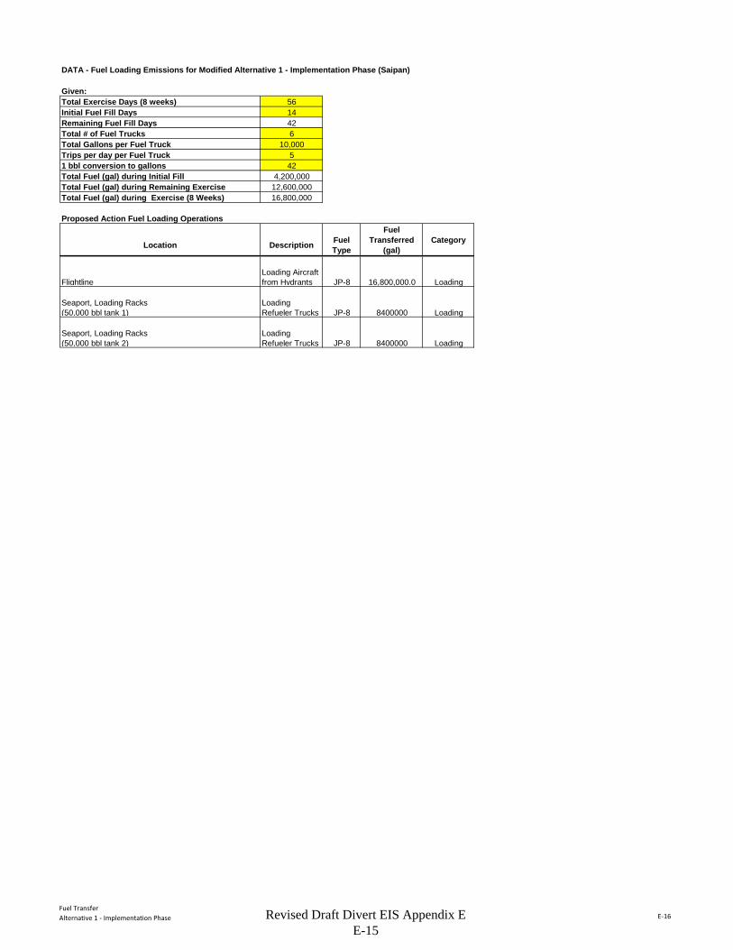
Fuel TransferAlternative 1 - Implementation Phase E-16
DATA - Fuel Loading Emissions for Modified Alternative 1 - Implementation Phase (Saipan)
Given:Total Exercise Days (8 weeks) 56Initial Fuel Fill Days 14Remaining Fuel Fill Days 42Total # of Fuel Trucks 6Total Gallons per Fuel Truck 10,000Trips per day per Fuel Truck 51 bbl conversion to gallons 42Total Fuel (gal) during Initial Fill 4,200,000Total Fuel (gal) during Remaining Exercise 12,600,000Total Fuel (gal) during Exercise (8 Weeks) 16,800,000
Proposed Action Fuel Loading Operations
Location Description Fuel Type
Fuel Transferred
(gal)Category
FlightlineLoading Aircraft from Hydrants JP-8 16,800,000.0 Loading
Seaport, Loading Racks (50,000 bbl tank 1)
Loading Refueler Trucks JP-8 8400000 Loading
Seaport, Loading Racks (50,000 bbl tank 2)
Loading Refueler Trucks JP-8 8400000 Loading
Revised Draft Divert EIS Appendix E E-15
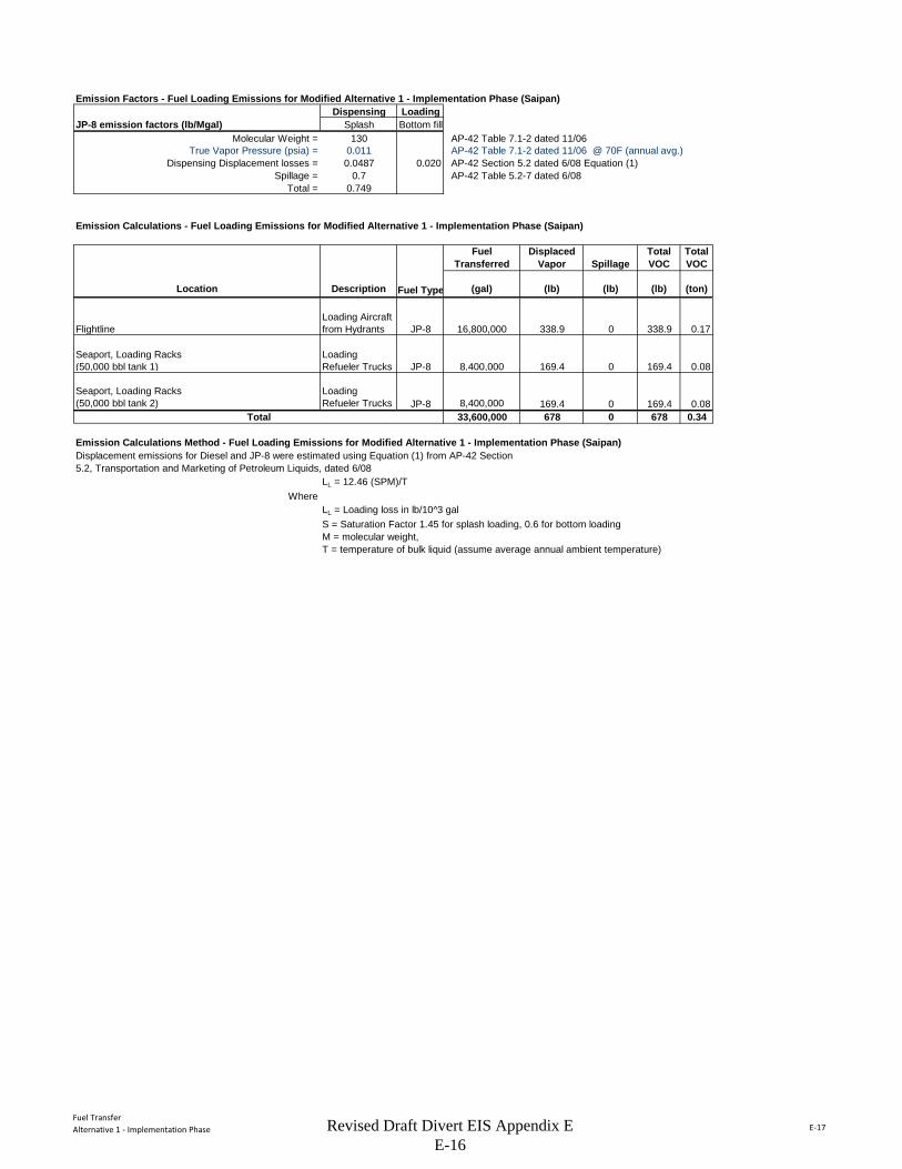
Fuel TransferAlternative 1 - Implementation Phase E-17
Emission Factors - Fuel Loading Emissions for Modified Alternative 1 - Implementation Phase (Saipan)Dispensing Loading
JP-8 emission factors (lb/Mgal) Splash Bottom fillMolecular Weight = 130 AP-42 Table 7.1-2 dated 11/06
True Vapor Pressure (psia) = 0.011 AP-42 Table 7.1-2 dated 11/06 @ 70F (annual avg.)Dispensing Displacement losses = 0.0487 0.020 AP-42 Section 5.2 dated 6/08 Equation (1)
Spillage = 0.7 AP-42 Table 5.2-7 dated 6/08Total = 0.749
Emission Calculations - Fuel Loading Emissions for Modified Alternative 1 - Implementation Phase (Saipan)
Fuel Transferred
Displaced Vapor Spillage
Total VOC
Total VOC
Location Description Fuel Type (gal) (lb) (lb) (lb) (ton)
FlightlineLoading Aircraft from Hydrants JP-8 16,800,000 338.9 0 338.9 0.17
Seaport, Loading Racks (50,000 bbl tank 1)
Loading Refueler Trucks JP-8 8,400,000 169.4 0 169.4 0.08
Seaport, Loading Racks (50,000 bbl tank 2)
Loading Refueler Trucks JP-8 8,400,000 169.4 0 169.4 0.08
Total 33,600,000 678 0 678 0.34
Emission Calculations Method - Fuel Loading Emissions for Modified Alternative 1 - Implementation Phase (Saipan)Displacement emissions for Diesel and JP-8 were estimated using Equation (1) from AP-42 Section5.2, Transportation and Marketing of Petroleum Liquids, dated 6/08
LL = 12.46 (SPM)/TWhere
LL = Loading loss in lb/10^3 galS = Saturation Factor 1.45 for splash loading, 0.6 for bottom loadingM = molecular weight, T = temperature of bulk liquid (assume average annual ambient temperature)
Revised Draft Divert EIS Appendix E E-16
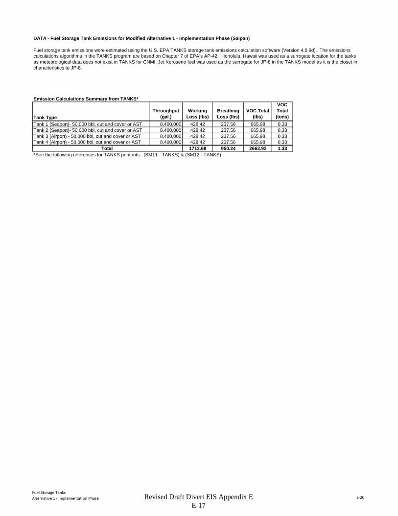
Fuel Storage TanksAlternative 1 - Implementation Phase E-20
DATA - Fuel Storage Tank Emissions for Modified Alternative 1 - Implementation Phase (Saipan)
Emission Calculations Summary from TANKS*
Tank TypeThroughput
(gal.)Working
Loss (lbs)Breathing Loss (lbs)
VOC Total (lbs)
VOC Total (tons)
Tank 1 (Seaport)- 50,000 bbl, cut and cover or AST 8,400,000 428.42 237.56 665.98 0.33Tank 2 (Seaport)- 50,000 bbl, cut and cover or AST 8,400,000 428.42 237.56 665.98 0.33Tank 3 (Airport) - 50,000 bbl, cut and cover or AST 8,400,000 428.42 237.56 665.98 0.33Tank 4 (Airport) - 50,000 bbl, cut and cover or AST 8,400,000 428.42 237.56 665.98 0.33
1713.68 950.24 2663.92 1.33*See the following references for TANKS printouts. (SM11 - TANKS) & (SM12 - TANKS)
Fuel storage tank emissions were estimated using the U.S. EPA TANKS storage tank emissions calculation software (Version 4.0.9d). The emissions calculations algorithms in the TANKS program are based on Chapter 7 of EPA’s AP-42. Honolulu, Hawaii was used as a surrogate location for the tanks as meteorological data does not exist in TANKS for CNMI. Jet Kerosene fuel was used as the surrogate for JP-8 in the TANKS model as it is the closet in characteristics to JP-8.
Total
Revised Draft Divert EIS Appendix E E-17
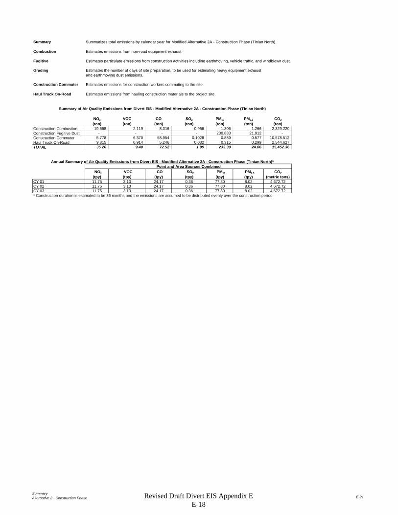
SummaryAlternative 2 - Construction Phase E-21
Summary Summarizes total emissions by calendar year for Modified Alternative 2A - Construction Phase (Tinian North).
Combustion Estimates emissions from non-road equipment exhaust.
Fugitive Estimates particulate emissions from construction activities including earthmoving, vehicle traffic, and windblown dust.
Grading Estimates the number of days of site preparation, to be used for estimating heavy equipment exhaustand earthmoving dust emissions.
Construction Commuter Estimates emissions for construction workers commuting to the site.
Haul Truck On-Road Estimates emissions from hauling construction materials to the project site.
NOx VOC CO SO2 PM10 PM2.5 CO2(ton) (ton) (ton) (ton) (ton) (ton) (ton)
Construction Combustion 19.668 2.119 8.316 0.956 1.306 1.266 2,329.220 Construction Fugitive Dust - - - - 230.883 21.912 - Construction Commuter 5.778 6.370 58.954 0.1028 0.889 0.577 10,578.512 Haul Truck On-Road 9.815 0.914 5.246 0.032 0.315 0.299 2,544.627 TOTAL 35.26 9.40 72.52 1.09 233.39 24.06 15,452.36
NOx VOC CO SO2 PM10 PM2.5 CO2(tpy) (tpy) (tpy) (tpy) (tpy) (tpy) (metric tons)
CY 01 11.75 3.13 24.17 0.36 77.80 8.02 4,672.72CY 02 11.75 3.13 24.17 0.36 77.80 8.02 4,672.72CY 03 11.75 3.13 24.17 0.36 77.80 8.02 4,672.72* Construction duration is estimated to be 36 months and the emissions are assumed to be distributed evenly over the construction period.
Point and Area Sources Combined
Summary of Air Quality Emissions from Divert EIS - Modified Alternative 2A - Construction Phase (Tinian North)
Annual Summary of Air Quality Emissions from Divert EIS - Modified Alternative 2A - Construction Phase (Tinian North)*
Revised Draft Divert EIS Appendix E E-18
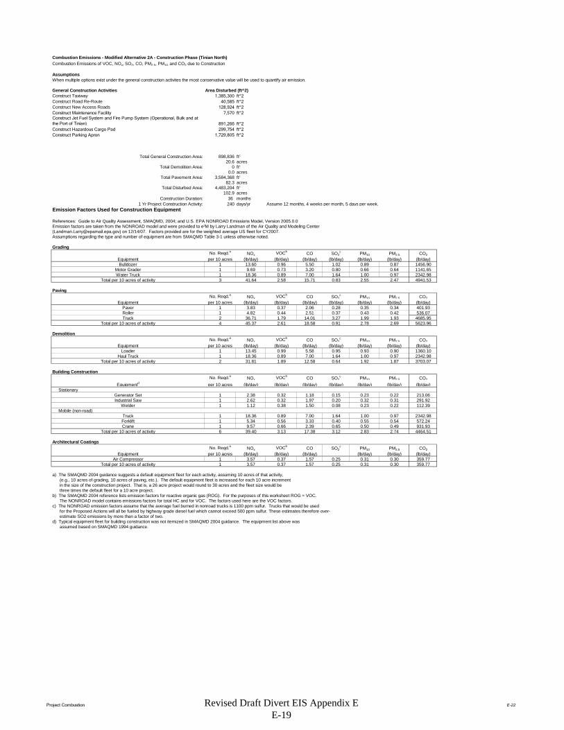
Project Combustion E-22
Combustion Emissions - Modified Alternative 2A - Construction Phase (Tinian North)Combustion Emissions of VOC, NOx, SO2, CO, PM2.5, PM10, and CO2 due to Construction
AssumptionsWhen multiple options exist under the general construction activites the most conservative value will be used to quantify air emission.
General Construction Activities Area Disturbed (ft^2)Construct Taxiway 1,385,300 ft^2Construct Road Re-Route 40,585 ft^2Construct New Access Roads 128,924 ft^2Construct Maintenance Facility 7,570 ft^2Construct Jet Fuel System and Fire Pump System (Operational, Bulk and at the Port of Tinian) 891,266 ft^2Construct Hazardous Cargo Pad 299,754 ft^2Construct Parking Apron 1,729,805 ft^2
Total General Construction Area: 898,836 ft2
20.6 acresTotal Demolition Area: 0 ft2
0.0 acresTotal Pavement Area: 3,584,368 ft2
82.3 acresTotal Disturbed Area: 4,483,204 ft2
102.9 acresConstruction Duration: 36 months
1 Yr Project Construction Activity: 240 days/yr Assume 12 months, 4 weeks per month, 5 days per week.Emission Factors Used for Construction Equipment
References: Guide to Air Quality Assessment, SMAQMD, 2004; and U.S. EPA NONROAD Emissions Model, Version 2005.0.0Emission factors are taken from the NONROAD model and were provided to e²M by Larry Landman of the Air Quality and Modeling Center ([email protected]) on 12/14/07. Factors provided are for the weighted average US fleet for CY2007. Assumptions regarding the type and number of equipment are from SMAQMD Table 3-1 unless otherwise noted.
Grading No. Reqd.a NOx VOCb CO SO2
c PM10 PM2.5 CO2Equipment per 10 acres (lb/day) (lb/day) (lb/day) (lb/day) (lb/day) (lb/day) (lb/day)Bulldozer 1 13.60 0.96 5.50 1.02 0.89 0.87 1456.90
Motor Grader 1 9.69 0.73 3.20 0.80 0.66 0.64 1141.65Water Truck 1 18.36 0.89 7.00 1.64 1.00 0.97 2342.98
Total per 10 acres of activity 3 41.64 2.58 15.71 0.83 2.55 2.47 4941.53
PavingNo. Reqd.a NOx VOCb CO SO2
c PM10 PM2.5 CO2Equipment per 10 acres (lb/day) (lb/day) (lb/day) (lb/day) (lb/day) (lb/day) (lb/day)
Paver 1 3.83 0.37 2.06 0.28 0.35 0.34 401.93Roller 1 4.82 0.44 2.51 0.37 0.43 0.42 536.07Truck 2 36.71 1.79 14.01 3.27 1.99 1.93 4685.95
Total per 10 acres of activity 4 45.37 2.61 18.58 0.91 2.78 2.69 5623.96
DemolitionNo. Reqd.a NOx VOCb CO SO2
c PM10 PM2.5 CO2Equipment per 10 acres (lb/day) (lb/day) (lb/day) (lb/day) (lb/day) (lb/day) (lb/day)
Loader 1 13.45 0.99 5.58 0.95 0.93 0.90 1360.10Haul Truck 1 18.36 0.89 7.00 1.64 1.00 0.97 2342.98
Total per 10 acres of activity 2 31.81 1.89 12.58 0.64 1.92 1.87 3703.07
Building ConstructionNo. Reqd.a NOx VOCb CO SO2
c PM10 PM2.5 CO2
Equipmentd per 10 acres (lb/day) (lb/day) (lb/day) (lb/day) (lb/day) (lb/day) (lb/day) Stationary
Generator Set 1 2.38 0.32 1.18 0.15 0.23 0.22 213.06Industrial Saw 1 2.62 0.32 1.97 0.20 0.32 0.31 291.92
Welder 1 1.12 0.38 1.50 0.08 0.23 0.22 112.39 Mobile (non-road)
Truck 1 18.36 0.89 7.00 1.64 1.00 0.97 2342.98Forklift 1 5.34 0.56 3.33 0.40 0.55 0.54 572.24Crane 1 9.57 0.66 2.39 0.65 0.50 0.49 931.93
Total per 10 acres of activity 6 39.40 3.13 17.38 3.12 2.83 2.74 4464.51
Architectural CoatingsNo. Reqd.a NOx VOCb CO SO2
c PM10 PM2.5 CO2Equipment per 10 acres (lb/day) (lb/day) (lb/day) (lb/day) (lb/day) (lb/day)
Air Compressor 1 3.57 0.37 1.57 0.25 0.31 0.30 359.77Total per 10 acres of activity 1 3.57 0.37 1.57 0.25 0.31 0.30 359.77
a) The SMAQMD 2004 guidance suggests a default equipment fleet for each activity, assuming 10 acres of that activity, (e.g., 10 acres of grading, 10 acres of paving, etc.). The default equipment fleet is increased for each 10 acre increment in the size of the construction project. That is, a 26 acre project would round to 30 acres and the fleet size would be three times the default fleet for a 10 acre project.b) The SMAQMD 2004 reference lists emission factors for reactive organic gas (ROG). For the purposes of this worksheet ROG = VOC. The NONROAD model contains emissions factors for total HC and for VOC. The factors used here are the VOC factors.c) The NONROAD emission factors assume that the average fuel burned in nonroad trucks is 1100 ppm sulfur. Trucks that would be used for the Proposed Actions will all be fueled by highway grade diesel fuel which cannot exceed 500 ppm sulfur. These estimates therefore over- estimate SO2 emissions by more than a factor of two.d) Typical equipment fleet for building construction was not itemized in SMAQMD 2004 guidance. The equipment list above was assumed based on SMAQMD 1994 guidance.
Revised Draft Divert EIS Appendix E E-19
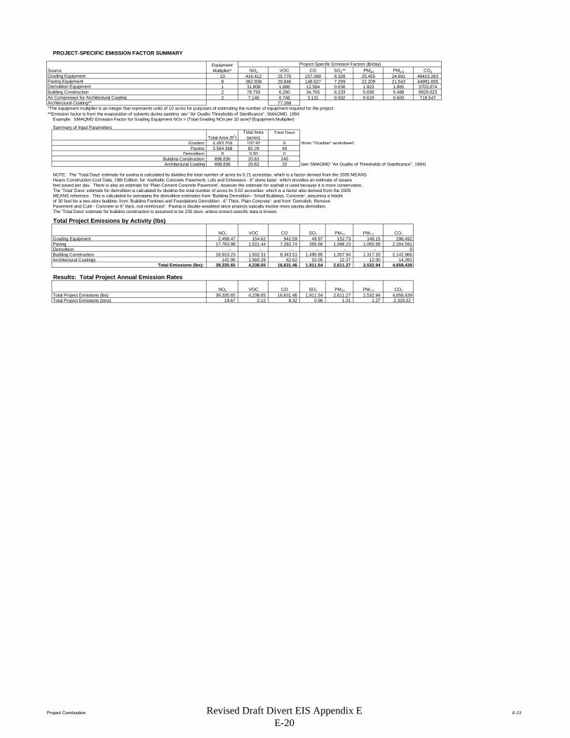
Project Combustion E-23
PROJECT-SPECIFIC EMISSION FACTOR SUMMARY
Project-Specific Emission Factors (lb/day)NOx VOC CO SO2** PM10 PM2.5 CO2
10 416.412 25.770 157.099 8.328 25.455 24.691 49415.2638 362.938 20.846 148.627 7.259 22.209 21.543 44991.6551 31.808 1.886 12.584 0.636 1.923 1.865 3703.0742 78.793 6.260 34.765 6.233 5.658 5.488 8929.0232 7.148 0.746 3.131 0.502 0.619 0.600 719.547
77.268*The equipment multiplier is an integer that represents units of 10 acres for purposes of estimating the number of equipment required for the project.**Emission factor is from the evaporation of solvents during painting, per "Air Quality Thresholds of Significance", SMAQMD, 1994
Example: SMAQMD Emission Factor for Grading Equipment NOx = (Total Grading NOx per 10 acre)*(Equipment Multiplier)
Summary of Input ParametersTotal Days
Grading: 4,483,204 102.92 6 (from "Grading" worksheet)Paving: 3,584,368 82.29 49
Demolition: 0 0.00 0Building Construction: 898,836 20.63 240Architectural Coating 898,836 20.63 20 (per SMAQMD "Air Quality of Thresholds of Significance", 1994)
NOTE: The 'Total Days' estimate for paving is calculated by dividing the total number of acres by 0.21 acres/day, which is a factor derived from the 2005 MEANSHeavy Construction Cost Data, 19th Edition, for 'Asphaltic Concrete Pavement, Lots and Driveways - 6" stone base', which provides an estimate of squarefeet paved per day. There is also an estimate for 'Plain Cement Concrete Pavement', however the estimate for asphalt is used because it is more conservative. The 'Total 'Days' estimate for demolition is calculated by dividing the total number of acres by 0.02 acres/day, which is a factor also derived from the 2005 MEANS reference. This is calculated by averaging the demolition estimates from 'Building Demolition - Small Buildings, Concrete', assuming a height of 30 feet for a two-story building; from 'Building Footings and Foundations Demolition - 6" Thick, Plain Concrete'; and from 'Demolish, Remove Pavement and Curb - Concrete to 6" thick, rod reinforced'. Paving is double-weighted since projects typically involve more paving demolition.The 'Total Days' estimate for building construction is assumed to be 230 days, unless project-specific data is known.
Total Project Emissions by Activity (lbs)
NOx VOC CO SO2 PM10 PM2.5 CO2Grading Equipment 2,498.47 154.62 942.59 49.97 152.73 148.15 296,492Paving 17,783.98 1,021.44 7,282.74 355.68 1,088.23 1,055.58 2,204,591Demolition - - - - - - 0Building Construction 18,910.23 1,502.31 8,343.51 1,495.85 1,357.94 1,317.20 2,142,966Architectural Coatings 142.96 1,560.28 62.62 10.05 12.37 12.00 14,391
Total Emissions (lbs): 39,335.65 4,238.65 16,631.46 1,911.54 2,611.27 2,532.94 4,658,439
Results: Total Project Annual Emission Rates
NOx VOC CO SO2 PM10 PM2.5 CO2Total Project Emissions (lbs) 39,335.65 4,238.65 16,631.46 1,911.54 2,611.27 2,532.94 4,658,439Total Project Emissions (tons) 19.67 2.12 8.32 0.96 1.31 1.27 2,329.22
SourceGrading Equipment
Total Area (ft2)Total Area
(acres)
Equipment Multiplier*
Architectural Coating**
Demolition EquipmentBuilding Construction
Paving Equipment
Air Compressor for Architectural Coating
Revised Draft Divert EIS Appendix E E-20
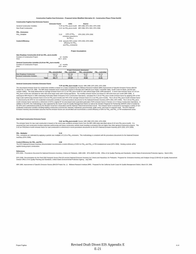
Project Fugitive E-24
Construction Fugitive Dust Emission FactorsEmission Factor Units Source
General Construction Activities 0.19 ton PM10/acre-month MRI 1996; EPA 2001; EPA 2006New Road Construction 0.42 ton PM10/acre-month MRI 1996; EPA 2001; EPA 2006
PM2.5 EmissionsPM2.5 Multiplier 0.10 EPA 2001; EPA 2006
Control Efficiency 0.50 EPA 2001; EPA 2006
New Roadway Construction (0.42 ton PM 10 /acre-month)Duration of Construction Project 12 monthsArea 82.3 acres
General Construction Activities (0.19 ton PM 10 /acre-month)Duration of Construction Project 12 monthsArea 20.6 acres
PM10 uncontrolled PM10 controlled PM2.5 uncontrolled PM2.5 controlledNew Roadway Construction 414.72 207.36 41.47 20.74General Construction Activities 47.05 23.52 2.35 1.18
Total 461.77 230.88 43.82 21.91
General Construction Activities Emission Factor0.19 ton PM10/acre-month Source: MRI 1996; EPA 2001; EPA 2006
New Road Construction Emission Factor0.42 ton PM10/acre-month Source: MRI 1996; EPA 2001; EPA 2006
PM2.5 Multiplier 0.10
Control Efficiency for PM10 and PM2.5 0.50
References:
The EPA National Emission Inventory documentation recommends a control efficiency of 50% for PM10 and PM2.5 in PM nonattainment areas (EPA 2006). Wetting controls will be applied during project construction.
EPA 2001. Procedures Document for National Emissions Inventory, Criteria Air Pollutants, 1985-1999. EPA-454/R-01-006. Office of Air Quality Planning and Standards, United States Environmental Protection Agency. March 2001.
EPA 2006. Documentation for the Final 2002 Nonpoint Sector (Feb 06 version) National Emission Inventory for Criteria and Hazardous Air Pollutants. Prepared for: Emissions Inventory and Analysis Group (C339-02) Air Quality Assessment Division Office of Air Quality Planning and Standards, United States Environmental Protection Agency. July 2006.
MRI 1996. Improvement of Specific Emission Factors (BACM Project No. 1). Midwest Research Institute (MRI). Prepared for the California South Coast Air Quality Management District, March 29, 1996.
The area-based emission factor for construction activities is based on a study completed by the Midwest Research Institute (MRI) Improvement of Specific Emission Factors (BACM Project No. 1), March 29, 1996. The MRI study evaluated seven construction projects in Nevada and California (Las Vegas, Coachella Valley, South Coast Air Basin, and the San Joaquin Valley). The study determined an average emission factor of 0.11 ton PM10/acre-month for sites without large-scale cut/fill operations. A worst-case emission factor of 0.42 ton PM10/acre-month was calculated for sites with active large-scale earth moving operations. The monthly emission factors are based on 168 work-hours per month (MRI 1996). A subsequent MRI Report in 1999, Estimating Particulate Matter Emissions From Construction Operations, calculated the 0.19 ton PM10/acre-month emission factor by applying 25% of the large-scale earthmoving emission factor (0.42 ton PM10/acre-month) and 75% of the average emission factor (0.11 ton PM10/acre-month). The 0.19 ton PM10/acre-month emission factor is referenced by the EPA for non-residential construction activities in recent procedures documents for the National Emission Inventory (EPA 2001; EPA 2006). The 0.19 ton PM10/acre-month emission factor represents a refinement of EPA's original AP-42 area-based total suspended particulate (TSP) emission factor in Section 13.2.3 Heavy Construction Operations. In addition to the EPA, this methodology is also supported by the South Coast Air Quality Management District as well as the Western Regional Air Partnership (WRAP) which is funded by the EPA and is administered jointly by the Western Governor's Association and the National Tribal Environmental Council. The emission factor is assumed to encompass a variety of non-residential construction activities including building construction (commercial, industrial, institutional, governmental), public works, and travel on unpaved roads. The EPA National Emission Inventory documentation assumes that the emission factors are uncontrolled and recommends a control efficiency of 50% for PM10 and PM2.5 in PM nonattainment areas.
The emission factor for new road construction is based on the worst-case conditions emission factor from the MRI 1996 study described above (0.42 tons PM10/acre-month). It is assumed that road construction involves extensive earthmoving and heavy construction vehicle travel resulting in emissions that are higher than other general construction projects. The 0.42 ton PM10/acre-month emission factor for road construction is referenced in recent procedures documents for the EPA National Emission Inventory (EPA 2001; EPA 2006).
PM2.5 emissions are estimated by applying a particle size multiplier of 0.10 to PM10 emissions. This methodology is consistent with the procedures documents for the National Emission Inventory (EPA 2006).
Construction Fugitive Dust Emissions - Proposed Action [Modified Alternative 2A - Construction Phase (Tinian North)]
(10% of PM10
emissions assumed to be PM2.5)
(assume 50% control efficiency for PM10
and PM2.5 emissions)
Project Assumptions
Project Emissions (tons/year)
Revised Draft Divert EIS Appendix E E-21

Project Grading E-25
Grading Schedule - Proposed Action [Modified Alternative 2A - Construction Phase (Tinian North)]
Estimate of time required to grade a specified area.
Input ParametersConstruction area: 102.9 acres/yr (from Combustion Worksheet)
Qty Equipment: 31.0 (calculated based on 3 pieces of equipment for every 10 acres)
Assumptions.Terrain is mostly flat.An average of 6" soil is excavated from one half of the site and backfilled to the other half of the site; no soil is hauled off-site or borrowed.200 hp bulldozers are used for site clearing.300 hp bulldozers are used for stripping, excavation, and backfill.Vibratory drum rollers are used for compacting.Stripping, Excavation, Backfill and Compaction require an average of two passes each.Excavation and Backfill are assumed to involve only half of the site.
Calculation of days required for one piece of equipment to grade the specified area.
Reference: Means Heavy Construction Cost Data, 19th Ed., R. S. Means, 2005.
Means Line No. Operation Description Output UnitsAcres per equip-day
equip-days per acre Acres/yr (project-specific)
Equip-days per year
2230 200 0550 Site Clearing Dozer & rake, medium brush 8 acre/day 8 0.13 102.92 12.872230 500 0300 Stripping Topsoil & stockpiling, adverse soil 1,650 cu. yd/day 2.05 0.49 102.92 50.322315 432 5220 Excavation Bulk, open site, common earth, 150' haul 800 cu. yd/day 0.99 1.01 51.46 51.892315 120 5220 Backfill Structural, common earth, 150' haul 1,950 cu. yd/day 2.42 0.41 51.46 21.292315 310 5020 Compaction Vibrating roller, 6 " lifts, 3 passes 2,300 cu. yd/day 2.85 0.35 102.92 36.10
TOTAL 172.45
Calculation of days required for the indicated pieces of equipment to grade the designated acreage.
(Equip)(day)/yr: 172.45Qty Equipment: 31.00
Grading days/yr: 5.56
Revised Draft Divert EIS Appendix E E-22
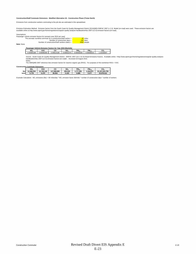
Construction Commuter E-26
Construction/Staff Commuter Emissions - Modified Alternative 2A - Construction Phase (Tinian North)
Emissions from construction workers commuting to the job site are estimated in this spreadsheet.
Assumptions:Passenger vehicle emission factors for scenario year 2015 are used.
The average roundtrip commute for a construction/staff worker = 40 milesNumber of construction days = 240 days
Number of construction/Staff workers (daily) = 2000 peopleNote: None
Passenger Vehicle Emission Factors for Year 2015 (lbs/mile)NOx VOC CO SO2 PM10 PM2.5 CO2
0.00060188 0.00066355 0.00614108 0.00001070 0.00009259 0.00006015 1.10192837
Notes:The SMAQMD 2007 reference lists emission factors for reactive organic gas (ROG). For purposes of this worksheet ROG = VOC.
Construction Commuter EmissionsNOx VOC CO SO2 PM10 PM2.5 CO2
lbs 11,556.034 12,740.118 117,908.683 205.519 1,777.691 1,154.873 21,157,024.793tons 5.778 6.370 58.954 0.103 0.889 0.577 10,578.512
Example Calculation: NOx emissions (lbs) = 60 miles/day * NOx emission factor (lb/mile) * number of construction days * number of workers
Emission Estimation Method: Emission factors from the South Coast Air Quality Management District (SCAQMD) EMFAC 2007 (v 2.3) Model (on-road) were used. These emission factors are available online at http://www.aqmd.gov/home/regulations/ceqa/air-quality-analysis-handbook/emfac-2007-(v2-3)-emission-factors-(on-road).
Source: South Coast Air Quality Management District. EMFAC 2007 (ver 2.3) On-Road Emissions Factors. Available online: <http://www.aqmd.gov/home/regulations/ceqa/air-quality-analysis-handbook/emfac-2007-(v2-3)-emission-factors-(on-road)>. Accessed 18 August 2015.
Revised Draft Divert EIS Appendix E E-23

Area of Influence E-27
No Statistical Area Available for TNI
Row # State County Tier-1 CO NOx PM10 PM2.5 SO2 VOC CO NOx PM10 PM2.5 SO2 VOC
Grand Total 0 0 0 0 0 0 0 0 0 0 0 0
SOURCE:http://www.epa.gov/ttn/chief/eiinformation.html
USEPA - AirData NET Tier Report*Net Air pollution sources (area and point) in tons per year (2002)Site visited on 02 February 2012.
No Air Quality Control Region Identified
CO NOx PM10 PM2.5 SO2 VOCCNMI 0 0 0 0 0 0CNMI DEQ 0 0 0 0 0 0
Point Source Emissions Area Source Emissions (Non-Point and Mobile Sources)
No Data Available
Revised Draft Divert EIS Appendix E E-24
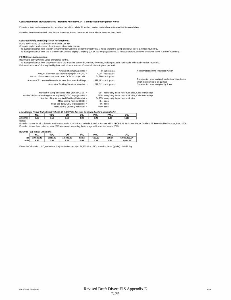
Haul Truck On-Road E-28
Construction/Haul Truck Emissions - Modified Alternative 2A - Construction Phase (Tinian North)
Emissions from hauling construction supplies, demoliton debris, fill, and excavated material are estimated in this spreadsheet.
Concrete Mixing and Dump Truck Assumptions:Dump trucks carry 11 cubic yards of material per trip.Concrete mixing trucks carry 10 cubic yards of material per trip.The average distance from the port to Commercial Concrete Supply Company is 1.7 miles; therefore, dump trucks will travel 3.4 miles round trip.The average distance from the Commercial Concrete Supply Company (CCSC) to the project site is 2.3 miles; therefore, concrete trucks will travel 4.6 miles round trip.
Fill Materials Assumptions:Haul trucks carry 20 cubic yards of material per trip.The average distance from the project site to the materials source is 20 miles; therefore, building material haul trucks will travel 40 miles round trip.Estimated number of trips required by haul trucks = total amount of material/20 cubic yards per truck
Amount of demoltion debris = 0 cubic yardsAmount of cement transported from port to CCSC = 4,004 cubic yards
Amount of concrete transported from CCSC to project site = 64,780 cubic yards
Amount of Excavation Materials for New Structures/Buildings = 399,483 cubic yards Construction area multiped by depth of disturbance which is assumed to be 12 feet.
Amount of Building/Structure Materials = 299,612 cubic yards
Number of dump trucks required (port to CCSC) = 364 heavy duty diesel haul truck trips, Cells rounded upNumber of concrete mixing trucks required (CCSC to project site) = 6478 heavy duty diesel haul truck trips, Cells rounded up
Number of trucks required (Building Materials) = 34,955 heavy duty diesel haul truck tripsMiles per trip (port to CCSC) = 3.4 miles
Miles per trip (CCSC to project site) = 4.6 milesMiles per trip (Building Materials) = 40.0 miles
Low Altitude Heavy Duty Diesel Vehicle 8b (HDDV8b) Average Emission Factors (grams/mile)NOx VOC CO SO2 PM10 PM2.5 CO2
HDDV8b 6.23 0.58 3.33 0.02 0.20 0.19 1615
Emission factors for all pollutants are from Appendix A - On-Raod Vehicle Emission Factors within AFCEE Air Emissions Factor Guide to Air Force Mobile Sources, Dec. 2009.Emission factors from calendar year 2015 were used assuming the average vehicle model year is 2005.
HDDV8b Haul Truck EmissionsNOx VOC CO SO2 PM10 PM2.5 CO2
lbs 19,629.80 1,827.49 10,492.33 63.02 630.17 598.66 5,089,253.54tons 9.81 0.91 5.25 0.03 0.32 0.30 2,544.63
Example Calculation: NOx emissions (lbs) = 40 miles per trip * 34,955 trips * NOx emission factor (g/mile) * lb/453.6 g
No Demolition in the Proposed Action
Construction area multipled by 9 feet.
Notes:
Emission Estimation Method: AFCEE Air Emissions Factor Guide to Air Force Mobile Sources, Dec. 2009.
Revised Draft Divert EIS Appendix E E-25

Fuel Storage TanksAlternative 1 - Implementation Phase E-40
DATA - Fuel Storage Tank Emissions for Modified Alternative 2a - Implementation Phase (Tinian North)
Emission Calculations Summary from TANKS*
Tank TypeThroughput
(gal.)Working Loss
(lbs)Breathing Loss
(lbs)VOC Total
(lbs)VOC Total
(tons)
Tank 1 (Seaport) - 50,000 bbl, cut and cover or AST 8,400,000 428.42 237.56 665.98 0.33Tank 2 (Seaport) - 50,000 bbl, cut and cover or AST 8,400,000 428.42 237.56 665.98 0.33Tank 3 (Airport) - 60,000 bbl, cut and cover or AST 4,581,818 210.07 714.88 924.95 0.46Tank 4 (Airport) - 60,000 bbl, cut and cover or AST 4,581,818 210.07 714.88 924.95 0.46Tank 5 (Airport) - 100,000 bbl, cut and cover or AST 7,636,364 350.11 1172.01 1522.12 0.76
1,627.09 3,076.89 4,703.98 2.35*See the following references for TANKS printouts. (SM12 - TANKS) & (SM13 - TANKS)
Fuel storage tank emissions were estimated using the U.S. EPA TANKS storage tank emissions calculation software (Version 4.0.9d). The emissions calculations algorithms in the TANKS program are based on Chapter 7 of EPA’s AP-42. Honolulu, Hawaii was used as a surrogate location for the tanks as meteorological data does not exist in TANKS for CNMI. Jet Kerosene fuel was used as the surrogate for JP-8 in the TANKS model as it is the closet in characteristics to JP-8.
Total
Revised Draft Divert EIS Appendix E E-26

Summary SheetAlternative 1 - Implementation Phase E-29
Summary Summarizes total emissions by calendar year for Modified Alternative 2a - Implementation Phase (Tinian North).
Airfield Operations Aircraft operations consist of taxi, take-off and landings (sorties or LTOs), touch-and-go operations (TGOs), and low flybys (LFB) by base aircraft.
Fuel Truck and Commuter Vehicle Emissions Estimates emissions for workers and operational vehicles commuting to the site of the Proposed Action.
Fuel Transfer Emissions Fuel loading operations under the Proposed Action involves the loading of fuel into tanker trucks and aircraft.
Internal Combustion Engine (ICE) Emissions Estimates Emissions from Internal Combustion Engines (e.g Generators)
Fuel Storage Tanks Estimates emissions from Above Ground Storage Tanks.
Criteria Pollutant and VOC Emissions Summary for Modified Alternative 2a - Implementation Phase (Tinian North) (tons/year)Source Category PM10 PM2.5 CO NOx SOx VOCs
Airfield Operations 0.05 0.05 18.67 6.77 0.98 1.25Fuel Truck and Commuter Vehicle
Emissions 0.02 0.02 0.28 0.54 0.00 0.05Fuel Transfer N/A N/A N/A N/A N/A 0.34
Fuel Storage Tanks N/A N/A N/A N/A N/A 2.35Total Criteria and VOC
Pollutant Emissions (tons/year)
0.08 0.07 18.95 7.31 0.98 3.98
Greenhouse Gas (GHG) Emissions Summary for Modified Alternative 2a - Implementation Phase (Tinian North) (metric tonnes/year)
Source CategoryCO2-equivalent
(lb/year)CO2-equivalent
(kg/year)CO2-equivalent (metric
tonne/year)
Airfield Operations* 366,634,444 166,305,384 166,305Fuel Truck and Commuter Vehicle
Emissions 292,969 132,891 133Fuel Transfer 0 0 0
Fuel Storage Tanks 0 0 0Total GHG Emissions 366,927,413 166,438,275 166,438
Revised Draft Divert EIS Appendix E E-27

Airfield OperationsAlternative 1 - Implementation Phase E-30
DATA - Airfield Operations for Modified Alternative 2a - Implementation Phase (Tinian North)
Landing and Takeoff (LTO) CyclesDescription Quantity Legend
# of KC-135R LTO's per year 360
Airfield Activity Data (Worst Case Scenario)
Aircraft Model
Aircraft Model
Used to Match to Available Emission Factors Engine Model #
Engi
nes
APU Model # A
PUs
Not
es LTO Cycles
KC-135R KC-135-R F108-CF-201 4 See below 360Note: F108-CF-201 is the military designation of the CFM56-2B-1 engine.
Emission Factors (EFs) and Constants - Airfield Operations for Modified Alternative 2a - Implementation Phase (Tinian North)
Aircraft Criteria Pollutant Emission Factors
Aircraft ModelEngine Model #
Eng. Reference
Thrust Mode
LTO/TGO Thrust Mode
Fuel Flow(lb/hr) PM10 PM2.5 CO NOX SO2 VOCs TIM
KC-135RF108-CF-201 4 Idle Idle 1016 0.06 0.06 30.70 4.00 1.06 2.10 47.7
KC-135RF108-CF-201 4 Approach Approach 2468 0.06 0.05 4.20 8.20 1.06 0.09 5.2
KC-135RF108-CF-201 4 Climbout Climbout 6500 0.05 0.05 0.90 16.00 1.06 0.06 1.6
KC-135RF108-CF-201 4 Takeoff Takeoff 7818 0.07 0.06 0.90 18.05 1.06 0.05 0.7
Emission factors from AFCEC August 2013 Air Emissions Guide for Air Force Mobile Sources, Table 2-8
APU Emission FactorsAPU Emission Factors in lb Pollutant per hour
Aircraft Model # APU APU Model PM10 PM2.5 CO NOX S02 VOCs
APU(hr)
KC-135R
Emission Factors (EFs) and Constants - Airfield Operations forModified Alternative 2a - Implementation Phase (Tinian North)
Default Time-In-Mode Aircraft Type Taxi/Idle- Takeoff Climbout Approach Taxi/Idle-in TotalKC-135R 32.8 0.7 1.6 5.2 14.9 55.2Emission factors from AFCEC August 2013 Air Emissions Guide for Air Force Mobile Sources, Table 2-4
Emission Factors (EFs) and Constants - Airfield Operations for Modified Alternative 2a - Implementation Phase (Tinian North)
Greenhouse Gas Emission FactorsUnits CO2 CH4 N2O
kg/gal fuel 9.80 --- ---g/gal fuel --- 0.27 0.31
Reference: Footnote 2. from Table 2-8 of the AFCEC August 2013 Air Emissions Guide for Air Force Mobile Sources.
Aircraft exercises under this alternative are based on assuming 2 to 4 KC-135R aircraft operating up to 8 weeks per year for a maximum of 720 KC-135R operations per year. Each operation is equivalent to one landing or one take-off (1 LTO Cycle = 2 operations).
Emission Factors in lb Pollutant per 1000 lb Fuel Burned
No data on APUs
No Data Available.
Typical Duration by Mode (minutes)
Revised Draft Divert EIS Appendix E E-28

Airfield OperationsAlternative 1 - Implementation Phase E-31
Calculations - Airfield Operations for Modified Alternative 2a - Implementation Phase (Tinian North)Criteria Pollutant and VOC Emissions per LTO by Aircraft Type Calculated as the sum of the products of [(minutes) * (fuel flow/minute) * (lbs pollutant/lb fuel)] for each of the thrust modes.
U Emission in lb Pollutant per LTOP Fuel PM10 PM2.5 CO NOx SOx VOCs APU
A (lb) (lb) (lb) (lb) (lb) (lb) (lb)KC - 135R 0 5144.6 0.3 0.3 103.7 37.6 5.5 6.9 0
Total Criteria Pollutant and VOC Emissions for maximum LTO's by Aircraft Type
UP Fuel PM10 PM2.5 CO NOx SOx VOCs APU
A (lb) (tons) (tons) (tons) (tons) (tons) (tons)KC - 135R 0 360 1,852,065.6 0.05 0.05 18.67 6.77 0.98 1.25 0
Worst Case Scenario 1,852,065.60 0.05 0.05 18.67 6.77 0.98 1.25 0Total gallons of fuel used for LTOs (277,671 gal.) is based on the 6.67 lb/gal density of JP-8 as provided in footnote 2. of Table 2-8 of the AFCEC August 2013 Air Emissions Guide for Air Force Mobile Sources.
Calculations - Airfield Operations for Modified Alternative 2a - Implementation Phase (Tinian North)
Greenhouse Gas Emissions Assume aircraft will use 300,000 gallons of fuel per day for 56 days.
Quantity (gallons) Fuel Type CH4 (kg) N2O (kg) CO2 (kg)CO2-equivalent
(kg)CO2-equivalent (metric tonne)
16,800,000 JP-8 4536 5208 164,640,000 166,305,384 166,305The CH4 and N2O Global Warming Potential multipliers are 25 and 298, respectively from EPA's Climate Leadership, Emission Factors for Greenhouse Gas Inventories, Last Modified 4 April 2014.
Reported Aircraft Model
Reported Aircraft Model Total LTO's
Revised Draft Divert EIS Appendix E E-29
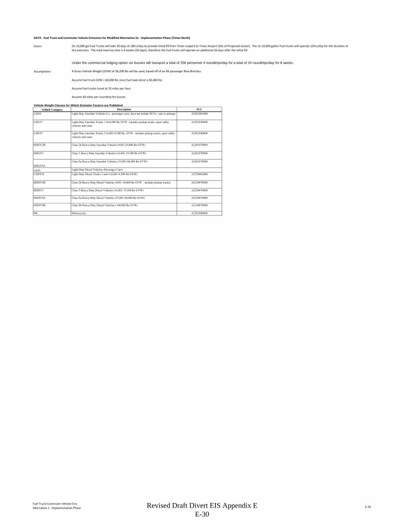
Fuel Truck-Commuter Vehicle EmsAlternative 1 - Implementation Phase E-34
DATA - Fuel Truck and Commuter Vehicle Emissions for Modified Alternative 2a - Implementation Phase (Tinian North)
Given:
Assumptions: A Gross Vehicle Weight (GVW) of 36,200 lbs will be used, based off of an 84 passenger Blue Bird bus.
Assume fuel truck GVW > 60,000 lbs since fuel load alone is 83,400 lbs.
Assume fuel trucks travel at 55 miles per hour
Assume 40 miles per roundtrip for busses.
Vehicle Weight Classes for Which Emission Factors are PublishedVehicle Category
LDGV
LDGT1
LDGT3
HDGV2B
HDGV5
HDGV8ALDDVLDDT34
HDDV2B
HDDV5
HDDV8A
HDDV8B
MC
Class 2b Heavy-Duty Diesel Vehicles (8501-10,000 lbs GVW – includes pickup trucks) A2230070000
Class 5 Heavy-Duty Diesel Vehicles (16,001-19,500 lbs GVW) A2230070000
Class 8a Heavy-Duty Diesel Vehicles (33,001-60,000 lbs GVW) A2230070000
Class 8b Heavy-Duty Diesel Vehicles (>60,000 lbs GVW) A2230070000
Motorcycles A2201080000
A2201070000
Light-Duty Diesel Vehicles (Passenger Cars)Light-Duty Diesel Trucks 3 and 4 (6,001-8,500 lbs GVW) A2230002000
Six 10,000 gal Fuel Trucks will take 30 days at 10hrs/day to provide initial fill from Tinian seaport to Tinian Airport (Site of Proposed Action). The six 10,000 gallon Fuel trucks will operate 10hrs/day for the duration of the exercises. The total exercise time is 8 weeks (56 days), therefore the fuel trucks will operate an additional 26 days after the initial fill.
Under the commercial lodging option six busses will transport a total of 256 personnel 4 roundtrips/day for a total of 24 roundtrips/day for 8 weeks.
Description SCCLight-Duty Gasoline Vehicles (i.e., passenger cars) does not include SUVs, vans or pickups A2201001000
Light-Duty Gasoline Trucks 1 (0-6,000 lbs GVW - includes pickup trucks, sport utility vehicles and vans)
A2201020000
Light-Duty Gasoline Trucks 3 (6,001-8,500 lbs. GVW - includes pickup trucks, sport utility vehicles and vans)
A2201040000
Class 2b Heavy-Duty Gasoline Vehicles (8501-10,000 lbs GVW) A2201070000
Class 5 Heavy-Duty Gasoline Vehicles (16,001-19,500 lbs GVW) A2201070000
Class 8a Heavy-Duty Gasoline Vehicles (33,001-60,000 lbs GVW)
Revised Draft Divert EIS Appendix E E-30

Fuel Truck-Commuter Vehicle EmsAlternative 1 - Implementation Phase E-35
Emission Factors - Fuel Truck and Commuter Vehicle Emissions for Modified Alternative 2a - Implementation Phase (Tinian North)
Emission Factors for Calendar Year 2015Emission Factors in grams per Milea
PM10
PM2.
5
CO
NO
x
SOx
VO
Cs
CO
2
Fugi
tive
PM10
Fugi
tive
PM2.
5
HDDV8A* 2005 0.2 0.19 2.8 5.47 0.01 0.48 1544.1 0.05 0.01HDDV8B** 2005 0.2 0.19 3.33 6.23 0.02 0.58 1615.2 0.05 0.01* Low Altitude Emission Factors for Heavy Duty Diesel Vehicles Class 8a**Low Altitude Emission Factors for Heavy Duty Diesel Vehicles Class 8ba) Emission factors from Appendix A of Air Emissions Factor Guide to Air Force Mobile Sources, AFCEE, December 2009
Greenhouse Gas Emission Factors for Calendar Year 2015
HDDV 0.0051 0.0048g/mile = grams per mileCH4 = Methane; N2O = Nitrous Oxideb) Emission Factors from EPA's Climate Leadership, Emission Factors for Greenhouse Gas Inventories, Last Modified 4 April 2014 (http://www.epa.gov/climateleadership/documents/emission-factors.pdf).
Vehicle Class Model Year
Vehicle ClassCH4
(g/mile) N2O (g/mile)
Revised Draft Divert EIS Appendix E E-31
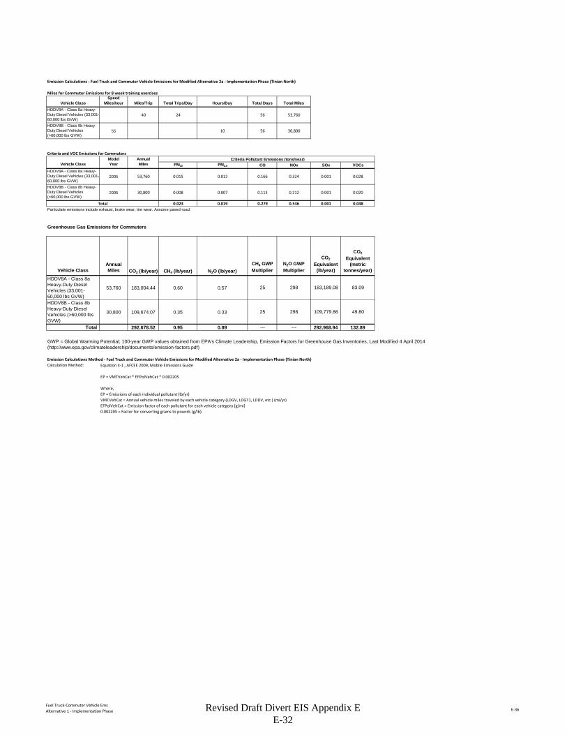
Fuel Truck-Commuter Vehicle EmsAlternative 1 - Implementation Phase E-36
Emission Calculations - Fuel Truck and Commuter Vehicle Emissions for Modified Alternative 2a - Implementation Phase (Tinian North)
Miles for Commuter Emissions for 8 week training exercises
Vehicle ClassSpeed
Miles/hour Miles/Trip Total Trips/Day Hours/Day Total Days Total MilesHDDV8A - Class 8a Heavy-Duty Diesel Vehicles (33,001-60,000 lbs GVW)
40 24 56 53,760
HDDV8B - Class 8b Heavy-Duty Diesel Vehicles (>60,000 lbs GVW)
55 10 56 30,800
Criteria and VOC Emissions for CommutersModel Annual Criteria Pollutant Emissions (tons/year)
Vehicle Class Year Miles PM10 PM2.5 CO NOx SOx VOCsHDDV8A - Class 8a Heavy-Duty Diesel Vehicles (33,001-60,000 lbs GVW)
2005 53,760 0.015 0.012 0.166 0.324 0.001 0.028
HDDV8B - Class 8b Heavy-Duty Diesel Vehicles (>60,000 lbs GVW)
2005 30,800 0.008 0.007 0.113 0.212 0.001 0.020
Total 0.023 0.019 0.279 0.536 0.001 0.048Particulate emissions include exhaust, brake wear, tire wear. Assume paved road.
Greenhouse Gas Emissions for Commuters
Vehicle ClassAnnual Miles CO2 (lb/year) CH4 (lb/year) N2O (lb/year)
CH4 GWP Multiplier
N2O GWP Multiplier
CO2
Equivalent (lb/year)
CO2
Equivalent (metric
tonnes/year)
HDDV8A - Class 8a Heavy-Duty Diesel Vehicles (33,001-60,000 lbs GVW)
53,760 183,004.44 0.60 0.57 25 298 183,189.08 83.09
HDDV8B - Class 8b Heavy-Duty Diesel Vehicles (>60,000 lbs GVW)
30,800 109,674.07 0.35 0.33 25 298 109,779.86 49.80
Total 292,678.52 0.95 0.89 --- --- 292,968.94 132.89
Emission Calculations Method - Fuel Truck and Commuter Vehicle Emissions for Modified Alternative 2a - Implementation Phase (Tinian North)Calculation Method:
GWP = Global Warming Potential; 100-year GWP values obtained from EPA's Climate Leadership, Emission Factors for Greenhouse Gas Inventories, Last Modified 4 April 2014 (http://www.epa.gov/climateleadership/documents/emission-factors.pdf)
Equation 4-1 , AFCEE 2009, Mobile Emissions Guide
EP = VMTVehCat * EFPolVehCat * 0.002205
Where,EP = Emissions of each individual pollutant (lb/yr)VMTVehCat = Annual vehicle miles traveled by each vehicle category (LDGV, LDGT1, LDDV, etc.) (mi/yr)EFPolVehCat = Emission factor of each pollutant for each vehicle category (g/mi)0.002205 = Factor for converting grams to pounds (g/lb).
Revised Draft Divert EIS Appendix E E-32
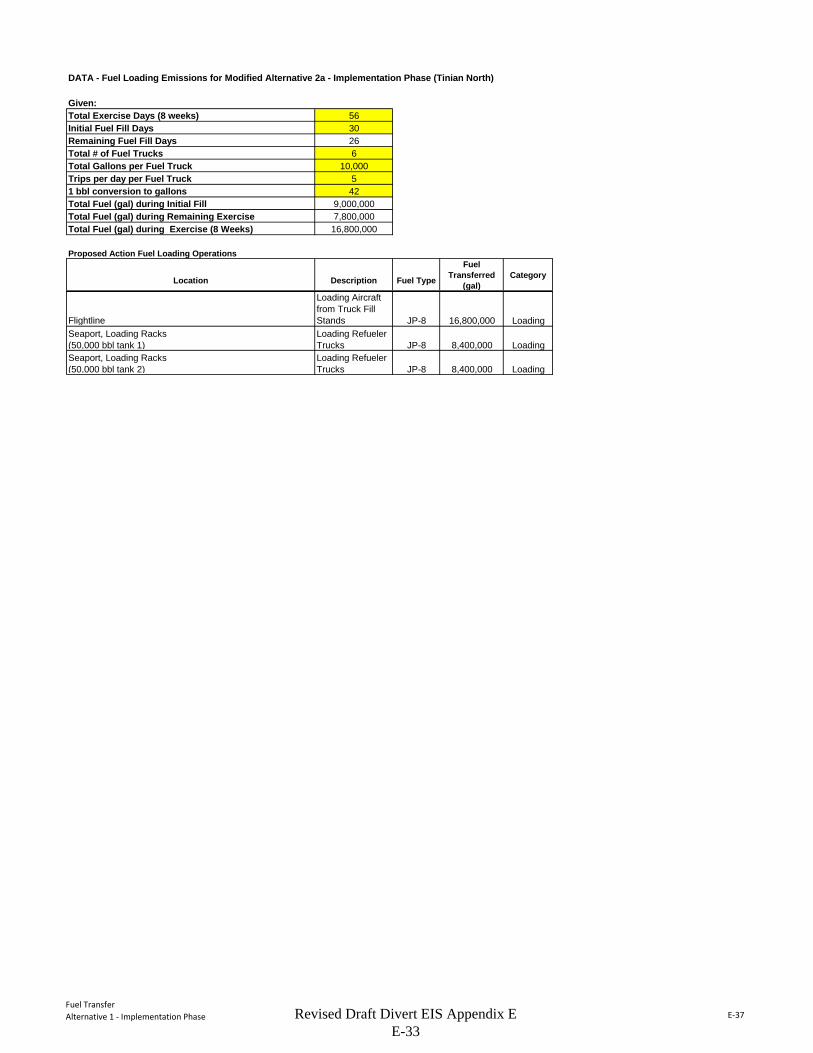
Fuel TransferAlternative 1 - Implementation Phase E-37
DATA - Fuel Loading Emissions for Modified Alternative 2a - Implementation Phase (Tinian North)
Given:Total Exercise Days (8 weeks) 56Initial Fuel Fill Days 30Remaining Fuel Fill Days 26Total # of Fuel Trucks 6Total Gallons per Fuel Truck 10,000Trips per day per Fuel Truck 51 bbl conversion to gallons 42Total Fuel (gal) during Initial Fill 9,000,000Total Fuel (gal) during Remaining Exercise 7,800,000Total Fuel (gal) during Exercise (8 Weeks) 16,800,000
Proposed Action Fuel Loading Operations
Location Description Fuel Type
Fuel Transferred
(gal)Category
Flightline
Loading Aircraft from Truck Fill Stands JP-8 16,800,000 Loading
Seaport, Loading Racks (50,000 bbl tank 1)
Loading Refueler Trucks JP-8 8,400,000 Loading
Seaport, Loading Racks (50,000 bbl tank 2)
Loading Refueler Trucks JP-8 8,400,000 Loading
Revised Draft Divert EIS Appendix E E-33
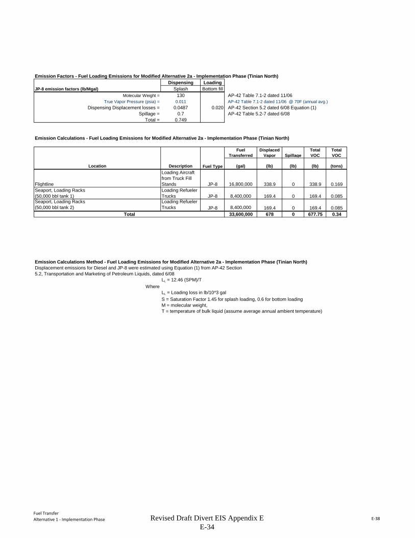
Fuel TransferAlternative 1 - Implementation Phase E-38
Emission Factors - Fuel Loading Emissions for Modified Alternative 2a - Implementation Phase (Tinian North)Dispensing Loading
JP-8 emission factors (lb/Mgal) Splash Bottom fillMolecular Weight = 130 AP-42 Table 7.1-2 dated 11/06
True Vapor Pressure (psia) = 0.011 AP-42 Table 7.1-2 dated 11/06 @ 70F (annual avg.)Dispensing Displacement losses = 0.0487 0.020 AP-42 Section 5.2 dated 6/08 Equation (1)
Spillage = 0.7 AP-42 Table 5.2-7 dated 6/08Total = 0.749
Emission Calculations - Fuel Loading Emissions for Modified Alternative 2a - Implementation Phase (Tinian North)
Fuel Transferred
Displaced Vapor Spillage
Total VOC
Total VOC
Location Description Fuel Type (gal) (lb) (lb) (lb) (tons)
Flightline
Loading Aircraft from Truck Fill Stands JP-8 16,800,000 338.9 0 338.9 0.169
Seaport, Loading Racks (50,000 bbl tank 1)
Loading Refueler Trucks JP-8 8,400,000 169.4 0 169.4 0.085
Seaport, Loading Racks (50,000 bbl tank 2)
Loading Refueler Trucks JP-8 8,400,000 169.4 0 169.4 0.085
Total 33,600,000 678 0 677.75 0.34
Emission Calculations Method - Fuel Loading Emissions for Modified Alternative 2a - Implementation Phase (Tinian North)Displacement emissions for Diesel and JP-8 were estimated using Equation (1) from AP-42 Section5.2, Transportation and Marketing of Petroleum Liquids, dated 6/08
LL = 12.46 (SPM)/TWhere
LL = Loading loss in lb/10^3 galS = Saturation Factor 1.45 for splash loading, 0.6 for bottom loadingM = molecular weight, T = temperature of bulk liquid (assume average annual ambient temperature)
Revised Draft Divert EIS Appendix E E-34

SummaryAlternative 2 - Construction Phase E-21
Summary Summarizes total emissions by calendar year for Modified Alternative 2B - Construction Phase (Tinian South).
Combustion Estimates emissions from non-road equipment exhaust.
Fugitive Estimates particulate emissions from construction activities including earthmoving, vehicle traffic, and windblown dust.
Grading Estimates the number of days of site preparation, to be used for estimating heavy equipment exhaustand earthmoving dust emissions.
Construction Commuter Estimates emissions for construction workers commuting to the site.
Haul Truck On-Road Estimates emissions from hauling construction materials to the project site.
NOx VOC CO SO2 PM10 PM2.5 CO2(ton) (ton) (ton) (ton) (ton) (ton) (ton)
Construction Combustion 13.236 1.755 5.702 0.827 0.912 0.885 1,535.230 Construction Fugitive Dust - - - - 95.708 8.371 - Construction Commuter 5.778 6.370 58.954 0.1028 0.889 0.577 10,578.512 Haul Truck On-Road 9.929 0.924 5.307 0.032 0.319 0.303 2,574.326 TOTAL 28.94 9.05 69.96 0.96 97.83 10.14 14,688.07
NOx VOC CO SO2 PM10 PM2.5 CO2(tpy) (tpy) (tpy) (tpy) (tpy) (tpy) (metric tons)
CY 01 9.65 3.02 23.32 0.32 32.61 3.38 4,441.60CY 02 9.65 3.02 23.32 0.32 32.61 3.38 4,441.60CY 03 9.65 3.02 23.32 0.32 32.61 3.38 4,441.60* Construction duration is estimated to be 36 months and the emissions are assumed to be distributed evenly over the construction period.
Point and Area Sources Combined
Summary of Air Quality Emissions from Divert EIS - Modified Alternative 2B - Construction Phase (Tinian South)
Annual Summary of Air Quality Emissions from Divert EIS - Modified Alternative 2B - Construction Phase (Tinian South)*
Revised Draft Divert EIS Appendix E E-35
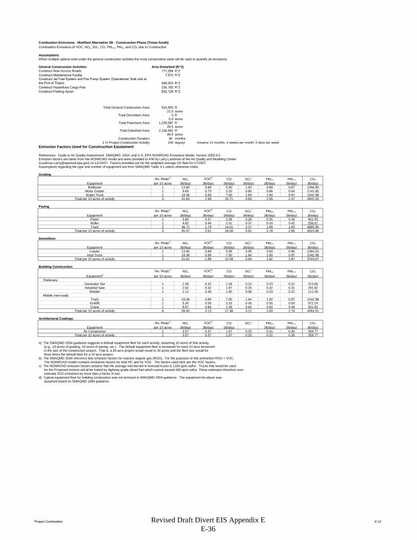
Project Combustion E-22
Combustion Emissions - Modified Alternative 2B - Construction Phase (Tinian South)Combustion Emissions of VOC, NOx, SO2, CO, PM2.5, PM10, and CO2 due to Construction
AssumptionsWhen multiple options exist under the general construction activites the most conservative value will be used to quantify air emissions.
General Construction Activities Area Disturbed (ft^2)Construct New Access Roads 177,294 ft^2Construct Maintenance Facility 7,972 ft^2Construct Jet Fuel System and Fire Pump System (Operational, Bulk and at the Port of Tinian) 908,933 ft^2Construct Hazardous Cargo Pad 230,165 ft^2Construct Parking Apron 832,128 ft^2
Total General Construction Area: 916,905 ft2
21.0 acresTotal Demolition Area: 0 ft2
0.0 acresTotal Pavement Area: 1,239,587 ft2
28.5 acresTotal Disturbed Area: 2,156,492 ft2
49.5 acresConstruction Duration: 36 months
1 Yr Project Construction Activity: 240 days/yr Assume 12 months, 4 weeks per month, 5 days per week.Emission Factors Used for Construction Equipment
References: Guide to Air Quality Assessment, SMAQMD, 2004; and U.S. EPA NONROAD Emissions Model, Version 2005.0.0Emission factors are taken from the NONROAD model and were provided to e²M by Larry Landman of the Air Quality and Modeling Center ([email protected]) on 12/14/07. Factors provided are for the weighted average US fleet for CY2007. Assumptions regarding the type and number of equipment are from SMAQMD Table 3-1 unless otherwise noted.
Grading No. Reqd.a NOx VOCb CO SO2
c PM10 PM2.5 CO2Equipment per 10 acres (lb/day) (lb/day) (lb/day) (lb/day) (lb/day) (lb/day) (lb/day)Bulldozer 1 13.60 0.96 5.50 1.02 0.89 0.87 1456.90
Motor Grader 1 9.69 0.73 3.20 0.80 0.66 0.64 1141.65Water Truck 1 18.36 0.89 7.00 1.64 1.00 0.97 2342.98
Total per 10 acres of activity 3 41.64 2.58 15.71 0.83 2.55 2.47 4941.53
PavingNo. Reqd.a NOx VOCb CO SO2
c PM10 PM2.5 CO2Equipment per 10 acres (lb/day) (lb/day) (lb/day) (lb/day) (lb/day) (lb/day) (lb/day)
Paver 1 3.83 0.37 2.06 0.28 0.35 0.34 401.93Roller 1 4.82 0.44 2.51 0.37 0.43 0.42 536.07Truck 2 36.71 1.79 14.01 3.27 1.99 1.93 4685.95
Total per 10 acres of activity 4 45.37 2.61 18.58 0.91 2.78 2.69 5623.96
DemolitionNo. Reqd.a NOx VOCb CO SO2
c PM10 PM2.5 CO2Equipment per 10 acres (lb/day) (lb/day) (lb/day) (lb/day) (lb/day) (lb/day) (lb/day)
Loader 1 13.45 0.99 5.58 0.95 0.93 0.90 1360.10Haul Truck 1 18.36 0.89 7.00 1.64 1.00 0.97 2342.98
Total per 10 acres of activity 2 31.81 1.89 12.58 0.64 1.92 1.87 3703.07
Building ConstructionNo. Reqd.a NOx VOCb CO SO2
c PM10 PM2.5 CO2
Equipmentd per 10 acres (lb/day) (lb/day) (lb/day) (lb/day) (lb/day) (lb/day) (lb/day) Stationary
Generator Set 1 2.38 0.32 1.18 0.15 0.23 0.22 213.06Industrial Saw 1 2.62 0.32 1.97 0.20 0.32 0.31 291.92
Welder 1 1.12 0.38 1.50 0.08 0.23 0.22 112.39 Mobile (non-road)
Truck 1 18.36 0.89 7.00 1.64 1.00 0.97 2342.98Forklift 1 5.34 0.56 3.33 0.40 0.55 0.54 572.24Crane 1 9.57 0.66 2.39 0.65 0.50 0.49 931.93
Total per 10 acres of activity 6 39.40 3.13 17.38 3.12 2.83 2.74 4464.51
Architectural CoatingsNo. Reqd.a NOx VOCb CO SO2
c PM10 PM2.5 CO2Equipment per 10 acres (lb/day) (lb/day) (lb/day) (lb/day) (lb/day) (lb/day)
Air Compressor 1 3.57 0.37 1.57 0.25 0.31 0.30 359.77Total per 10 acres of activity 1 3.57 0.37 1.57 0.25 0.31 0.30 359.77
a) The SMAQMD 2004 guidance suggests a default equipment fleet for each activity, assuming 10 acres of that activity, (e.g., 10 acres of grading, 10 acres of paving, etc.). The default equipment fleet is increased for each 10 acre increment in the size of the construction project. That is, a 26 acre project would round to 30 acres and the fleet size would be three times the default fleet for a 10 acre project.b) The SMAQMD 2004 reference lists emission factors for reactive organic gas (ROG). For the purposes of this worksheet ROG = VOC. The NONROAD model contains emissions factors for total HC and for VOC. The factors used here are the VOC factors.c) The NONROAD emission factors assume that the average fuel burned in nonroad trucks is 1100 ppm sulfur. Trucks that would be used for the Proposed Actions will all be fueled by highway grade diesel fuel which cannot exceed 500 ppm sulfur. These estimates therefore over- estimate SO2 emissions by more than a factor of two.d) Typical equipment fleet for building construction was not itemized in SMAQMD 2004 guidance. The equipment list above was assumed based on SMAQMD 1994 guidance.
Revised Draft Divert EIS Appendix E E-36

Project Combustion E-23
PROJECT-SPECIFIC EMISSION FACTOR SUMMARY
Project-Specific Emission Factors (lb/day)NOx VOC CO SO2** PM10 PM2.5 CO2
5 208.206 12.885 78.549 4.164 12.728 12.346 24707.6323 136.102 7.817 55.735 2.722 8.328 8.078 16871.8711 31.808 1.886 12.584 0.636 1.923 1.865 3703.0742 78.793 6.260 34.765 6.233 5.658 5.488 8929.0232 7.148 0.746 3.131 0.502 0.619 0.600 719.547
78.040*The equipment multiplier is an integer that represents units of 10 acres for purposes of estimating the number of equipment required for the project.**Emission factor is from the evaporation of solvents during painting, per "Air Quality Thresholds of Significance", SMAQMD, 1994
Example: SMAQMD Emission Factor for Grading Equipment NOx = (Total Grading NOx per 10 acre)*(Equipment Multiplier)
Summary of Input ParametersTotal Days
Grading: 2,156,492 49.51 6 (from "Grading" worksheet)Paving: 1,239,587 28.46 45
Demolition: 0 0.00 0Building Construction: 916,905 21.05 240Architectural Coating 916,905 21.05 20 (per SMAQMD "Air Quality of Thresholds of Significance", 1994)
NOTE: The 'Total Days' estimate for paving is calculated by dividing the total number of acres by 0.21 acres/day, which is a factor derived from the 2005 MEANSHeavy Construction Cost Data, 19th Edition, for 'Asphaltic Concrete Pavement, Lots and Driveways - 6" stone base', which provides an estimate of squarefeet paved per day. There is also an estimate for 'Plain Cement Concrete Pavement', however the estimate for asphalt is used because it is more conservative. The 'Total 'Days' estimate for demolition is calculated by dividing the total number of acres by 0.02 acres/day, which is a factor also derived from the 2005 MEANS reference. This is calculated by averaging the demolition estimates from 'Building Demolition - Small Buildings, Concrete', assuming a height of 30 feet for a two-story building; from 'Building Footings and Foundations Demolition - 6" Thick, Plain Concrete'; and from 'Demolish, Remove Pavement and Curb - Concrete to 6" thick, rod reinforced'. Paving is double-weighted since projects typically involve more paving demolition.The 'Total Days' estimate for building construction is assumed to be 230 days, unless project-specific data is known.
Total Project Emissions by Activity (lbs)
NOx VOC CO SO2 PM10 PM2.5 CO2Grading Equipment 1,249.24 77.31 471.30 24.98 76.37 74.07 148,246Paving 6,169.95 354.38 2,526.67 123.40 377.55 366.22 764,858Demolition - - - - - - 0Building Construction 18,910.23 1,502.31 8,343.51 1,495.85 1,357.94 1,317.20 2,142,966Architectural Coatings 142.96 1,575.74 62.62 10.05 12.37 12.00 14,391
Total Emissions (lbs): 26,472.38 3,509.73 11,404.09 1,654.28 1,824.23 1,769.50 3,070,460
Results: Total Project Annual Emission Rates
NOx VOC CO SO2 PM10 PM2.5 CO2Total Project Emissions (lbs) 26,472.38 3,509.73 11,404.09 1,654.28 1,824.23 1,769.50 3,070,460Total Project Emissions (tons) 13.24 1.75 5.70 0.83 0.91 0.88 1,535.23
SourceGrading Equipment
Total Area (ft2)Total Area
(acres)
Equipment Multiplier*
Architectural Coating**
Demolition EquipmentBuilding Construction
Paving Equipment
Air Compressor for Architectural Coating
Revised Draft Divert EIS Appendix E E-37

Project Fugitive E-24
Construction Fugitive Dust Emission FactorsEmission Factor Units Source
General Construction Activities 0.19 ton PM10/acre-month MRI 1996; EPA 2001; EPA 2006New Road Construction 0.42 ton PM10/acre-month MRI 1996; EPA 2001; EPA 2006
PM2.5 EmissionsPM2.5 Multiplier 0.10 EPA 2001; EPA 2006
Control Efficiency 0.50 EPA 2001; EPA 2006
New Roadway Construction (0.42 ton PM 10 /acre-month)Duration of Construction Project 12 monthsArea 28.5 acres
General Construction Activities (0.19 ton PM 10 /acre-month)Duration of Construction Project 12 monthsArea 21.0 acres
PM10 uncontrolled PM10 controlled PM2.5 uncontrolled PM2.5 controlledNew Roadway Construction 143.42 71.71 14.34 7.17General Construction Activities 47.99 24.00 2.40 1.20
Total 191.42 95.71 16.74 8.37
General Construction Activities Emission Factor0.19 ton PM10/acre-month Source: MRI 1996; EPA 2001; EPA 2006
New Road Construction Emission Factor0.42 ton PM10/acre-month Source: MRI 1996; EPA 2001; EPA 2006
PM2.5 Multiplier 0.10
Control Efficiency for PM10 and PM2.5 0.50
References:
Construction Fugitive Dust Emissions - Proposed Action [Modified Alternative 2B - Construction Phase (Tinian South)]
(10% of PM10
emissions assumed to be PM2.5)
(assume 50% control efficiency for PM10
and PM2.5 emissions)
Project Assumptions
Project Emissions (tons/year)
The EPA National Emission Inventory documentation recommends a control efficiency of 50% for PM10 and PM2.5 in PM nonattainment areas (EPA 2006). Wetting controls will be applied during project construction.
EPA 2001. Procedures Document for National Emissions Inventory, Criteria Air Pollutants, 1985-1999. EPA-454/R-01-006. Office of Air Quality Planning and Standards, United States Environmental Protection Agency. March 2001.
EPA 2006. Documentation for the Final 2002 Nonpoint Sector (Feb 06 version) National Emission Inventory for Criteria and Hazardous Air Pollutants. Prepared for: Emissions Inventory and Analysis Group (C339-02) Air Quality Assessment Division Office of Air Quality Planning and Standards, United States Environmental Protection Agency. July 2006.
MRI 1996. Improvement of Specific Emission Factors (BACM Project No. 1). Midwest Research Institute (MRI). Prepared for the California South Coast Air Quality Management District, March 29, 1996.
The area-based emission factor for construction activities is based on a study completed by the Midwest Research Institute (MRI) Improvement of Specific Emission Factors (BACM Project No. 1), March 29, 1996. The MRI study evaluated seven construction projects in Nevada and California (Las Vegas, Coachella Valley, South Coast Air Basin, and the San Joaquin Valley). The study determined an average emission factor of 0.11 ton PM10/acre-month for sites without large-scale cut/fill operations. A worst-case emission factor of 0.42 ton PM10/acre-month was calculated for sites with active large-scale earth moving operations. The monthly emission factors are based on 168 work-hours per month (MRI 1996). A subsequent MRI Report in 1999, Estimating Particulate Matter Emissions From Construction Operations, calculated the 0.19 ton PM10/acre-month emission factor by applying 25% of the large-scale earthmoving emission factor (0.42 ton PM10/acre-month) and 75% of the average emission factor (0.11 ton PM10/acre-month). The 0.19 ton PM10/acre-month emission factor is referenced by the EPA for non-residential construction activities in recent procedures documents for the National Emission Inventory (EPA 2001; EPA 2006). The 0.19 ton PM10/acre-month emission factor represents a refinement of EPA's original AP-42 area-based total suspended particulate (TSP) emission factor in Section 13.2.3 Heavy Construction Operations. In addition to the EPA, this methodology is also supported by the South Coast Air Quality Management District as well as the Western Regional Air Partnership (WRAP) which is funded by the EPA and is administered jointly by the Western Governor's Association and the National Tribal Environmental Council. The emission factor is assumed to encompass a variety of non-residential construction activities including building construction (commercial, industrial, institutional, governmental), public works, and travel on unpaved roads. The EPA National Emission Inventory documentation assumes that the emission factors are uncontrolled and recommends a control efficiency of 50% for PM10 and PM2.5 in PM nonattainment areas.
The emission factor for new road construction is based on the worst-case conditions emission factor from the MRI 1996 study described above (0.42 tons PM10/acre-month). It is assumed that road construction involves extensive earthmoving and heavy construction vehicle travel resulting in emissions that are higher than other general construction projects. The 0.42 ton PM10/acre-month emission factor for road construction is referenced in recent procedures documents for the EPA National Emission Inventory (EPA 2001; EPA 2006).
PM2.5 emissions are estimated by applying a particle size multiplier of 0.10 to PM10 emissions. This methodology is consistent with the procedures documents for the National Emission Inventory (EPA 2006).
Revised Draft Divert EIS Appendix E E-38
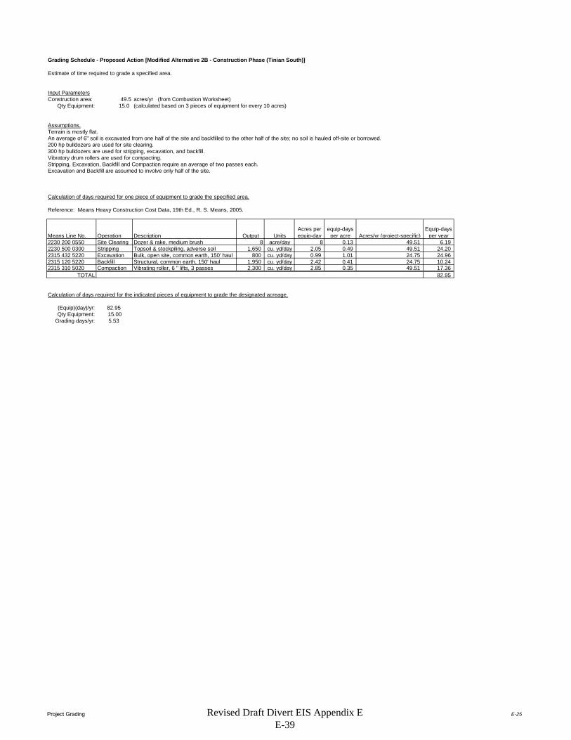
Project Grading E-25
Grading Schedule - Proposed Action [Modified Alternative 2B - Construction Phase (Tinian South)]
Estimate of time required to grade a specified area.
Input ParametersConstruction area: 49.5 acres/yr (from Combustion Worksheet)
Qty Equipment: 15.0 (calculated based on 3 pieces of equipment for every 10 acres)
Assumptions.Terrain is mostly flat.An average of 6" soil is excavated from one half of the site and backfilled to the other half of the site; no soil is hauled off-site or borrowed.200 hp bulldozers are used for site clearing.300 hp bulldozers are used for stripping, excavation, and backfill.Vibratory drum rollers are used for compacting.Stripping, Excavation, Backfill and Compaction require an average of two passes each.Excavation and Backfill are assumed to involve only half of the site.
Calculation of days required for one piece of equipment to grade the specified area.
Reference: Means Heavy Construction Cost Data, 19th Ed., R. S. Means, 2005.
Means Line No. Operation Description Output UnitsAcres per equip-day
equip-days per acre Acres/yr (project-specific)
Equip-days per year
2230 200 0550 Site Clearing Dozer & rake, medium brush 8 acre/day 8 0.13 49.51 6.192230 500 0300 Stripping Topsoil & stockpiling, adverse soil 1,650 cu. yd/day 2.05 0.49 49.51 24.202315 432 5220 Excavation Bulk, open site, common earth, 150' haul 800 cu. yd/day 0.99 1.01 24.75 24.962315 120 5220 Backfill Structural, common earth, 150' haul 1,950 cu. yd/day 2.42 0.41 24.75 10.242315 310 5020 Compaction Vibrating roller, 6 " lifts, 3 passes 2,300 cu. yd/day 2.85 0.35 49.51 17.36
TOTAL 82.95
Calculation of days required for the indicated pieces of equipment to grade the designated acreage.
(Equip)(day)/yr: 82.95Qty Equipment: 15.00
Grading days/yr: 5.53
Revised Draft Divert EIS Appendix E E-39

Construction Commuter E-26
Construction/Staff Commuter Emissions - Modified Alternative 2B - Construction Phase (Tinian South)
Emissions from construction workers commuting to the job site are estimated in this spreadsheet.
Assumptions:Passenger vehicle emission factors for scenario year 2015 are used.
The average roundtrip commute for a construction/staff worker = 40 milesNumber of construction days = 240 days
Number of construction/Staff workers (daily) = 2000 peopleNote: None
Passenger Vehicle Emission Factors for Year 2015 (lbs/mile)NOx VOC CO SO2 PM10 PM2.5 CO2
0.00060188 0.00066355 0.00614108 0.00001070 0.00009259 0.00006015 1.10192837
Notes:The SMAQMD 2007 reference lists emission factors for reactive organic gas (ROG). For purposes of this worksheet ROG = VOC.
Construction Commuter EmissionsNOx VOC CO SO2 PM10 PM2.5 CO2
lbs 11,556.034 12,740.118 117,908.683 205.519 1,777.691 1,154.873 21,157,024.793tons 5.778 6.370 58.954 0.103 0.889 0.577 10,578.512
Example Calculation: NOx emissions (lbs) = 60 miles/day * NOx emission factor (lb/mile) * number of construction days * number of workers
Emission Estimation Method: Emission factors from the South Coast Air Quality Management District (SCAQMD) EMFAC 2007 (v 2.3) Model (on-road) were used. These emission factors are available online at http://www.aqmd.gov/home/regulations/ceqa/air-quality-analysis-handbook/emfac-2007-(v2-3)-emission-factors-(on-road).
Source: South Coast Air Quality Management District. EMFAC 2007 (ver 2.3) On-Road Emissions Factors. Available online: <http://www.aqmd.gov/home/regulations/ceqa/air-quality-analysis-handbook/emfac-2007-(v2-3)-emission-factors-(on-road)>. Accessed 18 August 2015.
Revised Draft Divert EIS Appendix E E-40
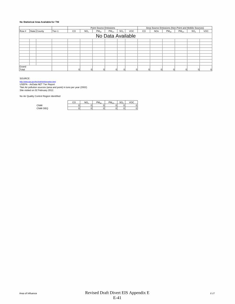
Area of Influence E-27
No Statistical Area Available for TNI
Row # State County Tier-1 CO NOx PM10 PM2.5 SO2 VOC CO NOx PM10 PM2.5 SO2 VOC
Grand Total 0 0 0 0 0 0 0 0 0 0 0 0
SOURCE:http://www.epa.gov/ttn/chief/eiinformation.html
USEPA - AirData NET Tier Report*Net Air pollution sources (area and point) in tons per year (2002)Site visited on 02 February 2012.
No Air Quality Control Region Identified
CO NOx PM10 PM2.5 SO2 VOCCNMI 0 0 0 0 0 0CNMI DEQ 0 0 0 0 0 0
Point Source Emissions Area Source Emissions (Non-Point and Mobile Sources)
No Data Available
Revised Draft Divert EIS Appendix E E-41
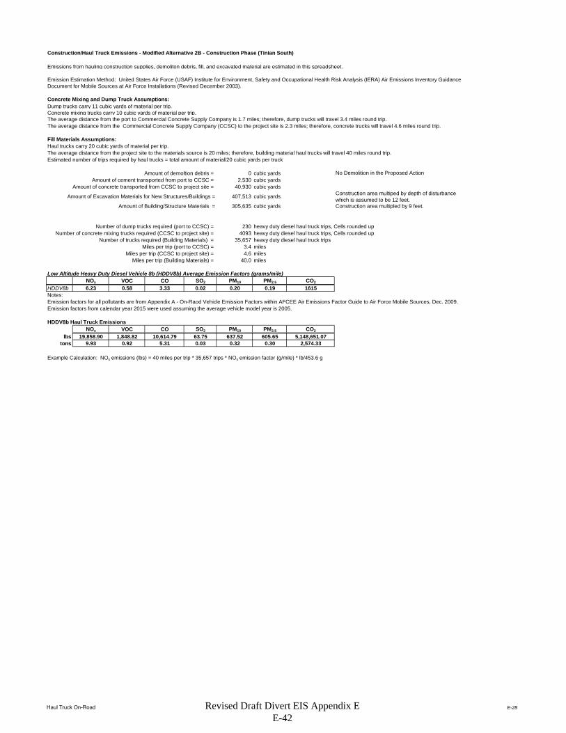
Haul Truck On-Road E-28
Construction/Haul Truck Emissions - Modified Alternative 2B - Construction Phase (Tinian South)
Emissions from hauling construction supplies, demoliton debris, fill, and excavated material are estimated in this spreadsheet.
Concrete Mixing and Dump Truck Assumptions:Dump trucks carry 11 cubic yards of material per trip.Concrete mixing trucks carry 10 cubic yards of material per trip.The average distance from the port to Commercial Concrete Supply Company is 1.7 miles; therefore, dump trucks will travel 3.4 miles round trip.The average distance from the Commercial Concrete Supply Company (CCSC) to the project site is 2.3 miles; therefore, concrete trucks will travel 4.6 miles round trip.
Fill Materials Assumptions:Haul trucks carry 20 cubic yards of material per trip.The average distance from the project site to the materials source is 20 miles; therefore, building material haul trucks will travel 40 miles round trip.Estimated number of trips required by haul trucks = total amount of material/20 cubic yards per truck
Amount of demoltion debris = 0 cubic yardsAmount of cement transported from port to CCSC = 2,530 cubic yards
Amount of concrete transported from CCSC to project site = 40,930 cubic yards
Amount of Excavation Materials for New Structures/Buildings = 407,513 cubic yards Construction area multiped by depth of disturbance which is assumed to be 12 feet.
Amount of Building/Structure Materials = 305,635 cubic yards
Number of dump trucks required (port to CCSC) = 230 heavy duty diesel haul truck trips, Cells rounded upNumber of concrete mixing trucks required (CCSC to project site) = 4093 heavy duty diesel haul truck trips, Cells rounded up
Number of trucks required (Building Materials) = 35,657 heavy duty diesel haul truck tripsMiles per trip (port to CCSC) = 3.4 miles
Miles per trip (CCSC to project site) = 4.6 milesMiles per trip (Building Materials) = 40.0 miles
Low Altitude Heavy Duty Diesel Vehicle 8b (HDDV8b) Average Emission Factors (grams/mile)NOx VOC CO SO2 PM10 PM2.5 CO2
HDDV8b 6.23 0.58 3.33 0.02 0.20 0.19 1615
Emission factors for all pollutants are from Appendix A - On-Raod Vehicle Emission Factors within AFCEE Air Emissions Factor Guide to Air Force Mobile Sources, Dec. 2009.Emission factors from calendar year 2015 were used assuming the average vehicle model year is 2005.
HDDV8b Haul Truck EmissionsNOx VOC CO SO2 PM10 PM2.5 CO2
lbs 19,858.90 1,848.82 10,614.79 63.75 637.52 605.65 5,148,651.07tons 9.93 0.92 5.31 0.03 0.32 0.30 2,574.33
Example Calculation: NOx emissions (lbs) = 40 miles per trip * 35,657 trips * NOx emission factor (g/mile) * lb/453.6 g
No Demolition in the Proposed Action
Construction area multipled by 9 feet.
Notes:
Emission Estimation Method: United States Air Force (USAF) Institute for Environment, Safety and Occupational Health Risk Analysis (IERA) Air Emissions Inventory Guidance Document for Mobile Sources at Air Force Installations (Revised December 2003).
Revised Draft Divert EIS Appendix E E-42

Summary SheetAlternative 1 - Implementation Phase E-29
Summary Summarizes total emissions by calendar year for Modified Alternative 2b - Implementation Phase (Tinian South).
Airfield Operations Aircraft operations consist of taxi, take-off and landings (sorties or LTOs), touch-and-go operations (TGOs), and low flybys (LFB) by base aircraft.
Fuel Truck and Commuter Vehicle Emissions Estimates emissions for workers and operational vehicles commuting to the site of the Proposed Action.
Fuel Transfer Emissions Fuel loading operations under the Proposed Action involves the loading of fuel into tanker trucks and aircraft.
Internal Combustion Engine (ICE) Emissions Estimates Emissions from Internal Combustion Engines (e.g Generators)
Fuel Storage Tanks Estimates emissions from Above Ground Storage Tanks.
Criteria Pollutant and VOC Emissions Summary for Modified Alternative 2b - Implementation Phase (Tinian South) (tons/year)Source Category PM10 PM2.5 CO NOx SOx VOCs
Airfield Operations 0.05 0.05 18.67 6.77 0.98 1.25Fuel Truck and Commuter Vehicle
Emissions 0.02 0.02 0.28 0.54 0.00 0.05Fuel Transfer N/A N/A N/A N/A N/A 0.34
Fuel Storage Tanks N/A N/A N/A N/A N/A 2.35Total Criteria and VOC
Pollutant Emissions (tons/year)
0.08 0.07 18.95 7.31 0.98 3.98
Greenhouse Gas (GHG) Emissions Summary for Modified Alternative 2b - Implementation Phase (Tinian South) (metric tonnes/year)
Source CategoryCO2-equivalent
(lb/year)CO2-equivalent
(kg/year)CO2-equivalent (metric
tonne/year)
Airfield Operations* 366,634,444 166,305,384 166,305Fuel Truck and Commuter Vehicle
Emissions 292,969 132,891 133Fuel Transfer 0 0 0
Fuel Storage Tanks 0 0 0Total GHG Emissions 366,927,413 166,438,275 166,438
Revised Draft Divert EIS Appendix E E-43

Airfield OperationsAlternative 1 - Implementation Phase E-30
DATA - Airfield Operations for Modified Alternative 2b - Implementation Phase (Tinian South)
Landing and Takeoff (LTO) CyclesDescription Quantity Legend
# of KC-135R LTO's per year 360
Airfield Activity Data (Worst Case Scenario)
Aircraft Model
Aircraft Model
Used to Match to Available Emission Factors Engine Model #
Engi
nes
APU Model # A
PUs
Not
es LTO Cycles
KC-135R KC-135-R F108-CF-201 4 See below 360Note: F108-CF-201 is the military designation of the CFM56-2B-1 engine.
Emission Factors (EFs) and Constants - Airfield Operations for Modified Alternative 2b - Implementation Phase (Tinian South)
Aircraft Criteria Pollutant Emission Factors
Aircraft ModelEngine Model #
Eng. Reference
Thrust Mode
LTO/TGO Thrust Mode
Fuel Flow(lb/hr) PM10 PM2.5 CO NOX SO2 VOCs TIM
KC-135RF108-CF-201 4 Idle Idle 1016 0.06 0.06 30.70 4.00 1.06 2.10 47.7
KC-135RF108-CF-201 4 Approach Approach 2468 0.06 0.05 4.20 8.20 1.06 0.09 5.2
KC-135RF108-CF-201 4 Climbout Climbout 6500 0.05 0.05 0.90 16.00 1.06 0.06 1.6
KC-135RF108-CF-201 4 Takeoff Takeoff 7818 0.07 0.06 0.90 18.05 1.06 0.05 0.7
Emission factors from AFCEC August 2013 Air Emissions Guide for Air Force Mobile Sources, Table 2-8
APU Emission FactorsAPU Emission Factors in lb Pollutant per hour
Aircraft Model # APU APU Model PM10 PM2.5 CO NOX S02 VOCs
APU(hr)
KC-135R
Emission Factors (EFs) and Constants - Airfield Operations forModified Alternative 2b - Implementation Phase (Tinian South)
Default Time-In-Mode Aircraft Type Taxi/Idle- Takeoff Climbout Approach Taxi/Idle-in TotalKC-135R 32.8 0.7 1.6 5.2 14.9 55.2Emission factors from AFCEC August 2013 Air Emissions Guide for Air Force Mobile Sources, Table 2-4
Emission Factors (EFs) and Constants - Airfield Operations for Modified Alternative 2b - Implementation Phase (Tinian South)
Greenhouse Gas Emission FactorsUnits CO2 CH4 N2O
kg/gal fuel 9.80 --- ---g/gal fuel --- 0.27 0.31
Reference: Footnote 2. from Table 2-8 of the AFCEC August 2013 Air Emissions Guide for Air Force Mobile Sources.
Aircraft exercises under this alternative are based on assuming 2 to 4 KC-135R aircraft operating up to 8 weeks per year for a maximum of 720 KC-135R operations per year. Each operation is equivalent to one landing or one take-off (1 LTO cycle = 2 operations).
Emission Factors in lb Pollutant per 1000 lb Fuel Burned
No data on APUs
No Data Available.
Typical Duration by Mode (minutes)
Revised Draft Divert EIS Appendix E E-44

Airfield OperationsAlternative 1 - Implementation Phase E-31
Calculations - Airfield Operations for Modified Alternative 2a - Implementation Phase (Tinian North)Criteria Pollutant and VOC Emissions per LTO by Aircraft Type Calculated as the sum of the products of [(minutes) * (fuel flow/minute) * (lbs pollutant/lb fuel)] for each of the thrust modes.
U Emission in lb Pollutant per LTOP Fuel PM10 PM2.5 CO NOx SOx VOCs APU
A (lb) (lb) (lb) (lb) (lb) (lb) (lb)KC - 135R 0 5144.6 0.3 0.3 103.7 37.6 5.5 6.9 0
Total Criteria Pollutant and VOC Emissions for maximum LTO's by Aircraft Type
UP Fuel PM10 PM2.5 CO NOx SOx VOCs APU
A (lb) (tons) (tons) (tons) (tons) (tons) (tons)KC - 135R 0 360 1,852,065.6 0.05 0.05 18.67 6.77 0.98 1.25 0
Worst Case Scenario 1,852,065.60 0.05 0.05 18.67 6.77 0.98 1.25 0Total gallons of fuel used for LTOs (277,671 gal.) is based on the 6.67 lb/gal density of JP-8 as provided in footnote 2. of Table 2-8 of the AFCEC August 2013 Air Emissions Guide for Air Force Mobile Sources.
Calculations - Airfield Operations for Modified Alternative 2a - Implementation Phase (Tinian North)
Greenhouse Gas Emissions Assume aircraft will use 300,000 gallons of fuel per day for 56 days.
Quantity (gallons) Fuel Type CH4 (kg) N2O (kg) CO2 (kg)CO2-equivalent
(kg)CO2-equivalent (metric tonne)
16,800,000 JP-8 4536 5208 164,640,000 166,305,384 166,305The CH4 and N2O Global Warming Potential multipliers are 25 and 298, respectively from EPA's Climate Leadership, Emission Factors for Greenhouse Gas Inventories, Last Modified 4 April 2014.
Reported Aircraft Model
Reported Aircraft Model Total LTO's
Revised Draft Divert EIS Appendix E E-45

Fuel Truck-Commuter Vehicle EmsAlternative 1 - Implementation Phase E-34
DATA - Fuel Truck and Commuter Vehicle Emissions for Modified Alternative 2b - Implementation Phase (Tinian South)
Given:
Assumptions: A Gross Vehicle Weight (GVW) of 36,200 lbs will be used, based off of an 84 passenger Blue Bird bus.
Assume fuel truck GVW > 60,000 lbs since fuel load alone is 83,400 lbs.
Assume fuel trucks travel at 55 miles per hour
Assume 40 miles per roundtrip for busses.
Vehicle Weight Classes for Which Emission Factors are PublishedVehicle Category
LDGV
LDGT1
LDGT3
HDGV2B
HDGV5
HDGV8ALDDVLDDT34
HDDV2B
HDDV5
HDDV8A
HDDV8B
MC
Six 10,000 gal Fuel Trucks will take 30 days at 10hrs/day to provide initial fill from Tinian seaport to Tinian Airport (Site of Proposed Action). The six 10,000 gallon Fuel trucks will operate 10hrs/day for the duration of the exercises. The total exercise time is 8 weeks (56 days), therefore the fuel trucks will operate an additional 26 days after the initial fill.
Under the commercial lodging option six busses will transport a total of 256 personnel 4 roundtrips/day for a total of 24 roundtrips/day for 8 weeks.
Description SCCLight-Duty Gasoline Vehicles (i.e., passenger cars) does not include SUVs, vans or pickups A2201001000
Light-Duty Gasoline Trucks 1 (0-6,000 lbs GVW - includes pickup trucks, sport utility vehicles and vans)
A2201020000
Light-Duty Gasoline Trucks 3 (6,001-8,500 lbs. GVW - includes pickup trucks, sport utility vehicles and vans)
A2201040000
Class 2b Heavy-Duty Gasoline Vehicles (8501-10,000 lbs GVW) A2201070000
Class 5 Heavy-Duty Gasoline Vehicles (16,001-19,500 lbs GVW) A2201070000
Class 8a Heavy-Duty Gasoline Vehicles (33,001-60,000 lbs GVW) A2201070000
Light-Duty Diesel Vehicles (Passenger Cars)Light-Duty Diesel Trucks 3 and 4 (6,001-8,500 lbs GVW) A2230002000
Class 2b Heavy-Duty Diesel Vehicles (8501-10,000 lbs GVW – includes pickup trucks) A2230070000
Class 5 Heavy-Duty Diesel Vehicles (16,001-19,500 lbs GVW) A2230070000
Class 8a Heavy-Duty Diesel Vehicles (33,001-60,000 lbs GVW) A2230070000
Class 8b Heavy-Duty Diesel Vehicles (>60,000 lbs GVW) A2230070000
Motorcycles A2201080000
Revised Draft Divert EIS Appendix E E-46
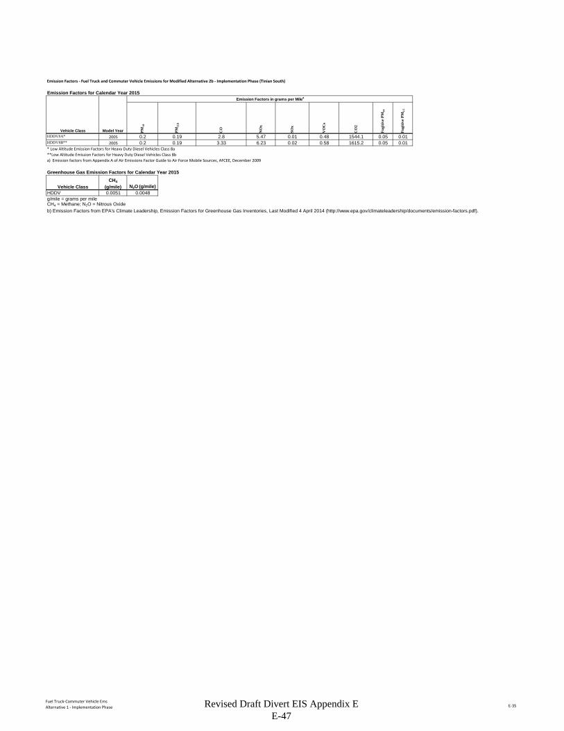
Fuel Truck-Commuter Vehicle EmsAlternative 1 - Implementation Phase E-35
Emission Factors - Fuel Truck and Commuter Vehicle Emissions for Modified Alternative 2b - Implementation Phase (Tinian South)
Emission Factors for Calendar Year 2015Emission Factors in grams per Milea
PM10
PM2.
5
CO
NO
x
SOx
VO
Cs
CO
2
Fugi
tive
PM10
Fugi
tive
PM2.
5
HDDV8A* 2005 0.2 0.19 2.8 5.47 0.01 0.48 1544.1 0.05 0.01HDDV8B** 2005 0.2 0.19 3.33 6.23 0.02 0.58 1615.2 0.05 0.01* Low Altitude Emission Factors for Heavy Duty Diesel Vehicles Class 8a**Low Altitude Emission Factors for Heavy Duty Diesel Vehicles Class 8ba) Emission factors from Appendix A of Air Emissions Factor Guide to Air Force Mobile Sources, AFCEE, December 2009
Greenhouse Gas Emission Factors for Calendar Year 2015
HDDV 0.0051 0.0048g/mile = grams per mileCH4 = Methane; N2O = Nitrous Oxideb) Emission Factors from EPA's Climate Leadership, Emission Factors for Greenhouse Gas Inventories, Last Modified 4 April 2014 (http://www.epa.gov/climateleadership/documents/emission-factors.pdf).
Vehicle Class Model Year
Vehicle ClassCH4
(g/mile) N2O (g/mile)
Revised Draft Divert EIS Appendix E E-47

Fuel Truck-Commuter Vehicle EmsAlternative 1 - Implementation Phase E-36
Emission Calculations - Fuel Truck and Commuter Vehicle Emissions for Modified Alternative 2b - Implementation Phase (Tinian South)
Miles for Commuter Emissions for 8 week training exercises
Vehicle ClassSpeed
Miles/hour Miles/Trip Total Trips/Day Hours/Day Total Days Total MilesHDDV8A - Class 8a Heavy-Duty Diesel Vehicles (33,001-60,000 lbs GVW)
40 24 56 53,760
HDDV8B - Class 8b Heavy-Duty Diesel Vehicles (>60,000 lbs GVW)
55 10 56 30,800
Criteria and VOC Emissions for CommutersModel Annual Criteria Pollutant Emissions (tons/year)
Vehicle Class Year Miles PM10 PM2.5 CO NOx SOx VOCsHDDV8A - Class 8a Heavy-Duty Diesel Vehicles (33,001-60,000 lbs GVW)
2005 53,760 0.015 0.012 0.166 0.324 0.001 0.028
HDDV8B - Class 8b Heavy-Duty Diesel Vehicles (>60,000 lbs GVW)
2005 30,800 0.008 0.007 0.113 0.212 0.001 0.020
Total 0.023 0.019 0.279 0.536 0.001 0.048Particulate emissions include exhaust, brake wear, tire wear. Assume paved road.
Greenhouse Gas Emissions for Commuters
Vehicle ClassAnnual Miles CO2 (lb/year) CH4 (lb/year) N2O (lb/year)
CH4 GWP Multiplier
N2O GWP Multiplier
CO2
Equivalent (lb/year)
CO2
Equivalent (metric
tonnes/year)
HDDV8A - Class 8a Heavy-Duty Diesel Vehicles (33,001-60,000 lbs GVW)
53,760 183,004.44 0.60 0.57 25 298 183,189.08 83.09
HDDV8B - Class 8b Heavy-Duty Diesel Vehicles (>60,000 lbs GVW)
30,800 109,674.07 0.35 0.33 25 298 109,779.86 49.80
Total 292,678.52 0.95 0.89 --- --- 292,968.94 132.89
Emission Calculations Method - Fuel Truck and Commuter Vehicle Emissions for Modified Alternative 2b - Implementation Phase (Tinian South)Calculation Method: Equation 4-1 , AFCEE 2009, Mobile Emissions Guide
EP = VMTVehCat * EFPolVehCat * 0.002205
Where,EP = Emissions of each individual pollutant (lb/yr)VMTVehCat = Annual vehicle miles traveled by each vehicle category (LDGV, LDGT1, LDDV, etc.) (mi/yr)EFPolVehCat = Emission factor of each pollutant for each vehicle category (g/mi)0.002205 = Factor for converting grams to pounds (g/lb).
GWP = Global Warming Potential; 100-year GWP values obtained from EPA's Climate Leadership, Emission Factors for Greenhouse Gas Inventories, Last Modified 4 April 2014 (http://www.epa.gov/climateleadership/documents/emission-factors.pdf)
Revised Draft Divert EIS Appendix E E-48

Fuel TransferAlternative 1 - Implementation Phase E-37
DATA - Fuel Loading Emissions for Modified Alternative 2b - Implementation Phase (Tinian South)
Given:Total Exercise Days (8 weeks) 56Initial Fuel Fill Days 30Remaining Fuel Fill Days 26Total # of Fuel Trucks 6Total Gallons per Fuel Truck 10,000Trips per day per Fuel Truck 51 bbl conversion to gallons 42Total Fuel (gal) during Initial Fill 9,000,000Total Fuel (gal) during Remaining Exercise 7,800,000Total Fuel (gal) during Exercise (8 Weeks) 16,800,000
Proposed Action Fuel Loading Operations
Location Description Fuel Type
Fuel Transferred
(gal)Category
Flightline
Loading Aircraft from Truck Fill Stands JP-8 16,800,000 Loading
Seaport, Loading Racks (50,000 bbl tank 1)
Loading Refueler Trucks JP-8 8,400,000 Loading
Seaport, Loading Racks (50,000 bbl tank 2)
Loading Refueler Trucks JP-8 8,400,000 Loading
Revised Draft Divert EIS Appendix E E-49

Fuel TransferAlternative 1 - Implementation Phase E-38
Emission Factors - Fuel Loading Emissions for Modified Alternative 2b - Implementation Phase (Tinian South)Dispensing Loading
JP-8 emission factors (lb/Mgal) Splash Bottom fillMolecular Weight = 130 AP-42 Table 7.1-2 dated 11/06
True Vapor Pressure (psia) = 0.011 AP-42 Table 7.1-2 dated 11/06 @ 70F (annual avg.)Dispensing Displacement losses = 0.0487 0.020 AP-42 Section 5.2 dated 6/08 Equation (1)
Spillage = 0.7 AP-42 Table 5.2-7 dated 6/08Total = 0.749
Emission Calculations - Fuel Loading Emissions for Modified Alternative 2b - Implementation Phase (Tinian South)
Fuel Transferred
Displaced Vapor Spillage
Total VOC
Total VOC
Location Description Fuel Type (gal) (lb) (lb) (lb) (tons)
Flightline
Loading Aircraft from Truck Fill Stands JP-8 16,800,000 338.9 0 338.9 0.17
Seaport, Loading Racks (50,000 bbl tank 1)
Loading Refueler Trucks JP-8 8,400,000 169.4 0 169.4 0.08
Seaport, Loading Racks (50,000 bbl tank 2)
Loading Refueler Trucks JP-8 8,400,000 169.4 0 169.4 0.08
Total 33,600,000 678 0 677.75 0.34
Emission Calculations Method - Fuel Loading Emissions for Modified Alternative 2b - Implementation Phase (Tinian South)Displacement emissions for Diesel and JP-8 were estimated using Equation (1) from AP-42 Section5.2, Transportation and Marketing of Petroleum Liquids, dated 6/08
LL = 12.46 (SPM)/TWhere
LL = Loading loss in lb/10^3 galS = Saturation Factor 1.45 for splash loading, 0.6 for bottom loadingM = molecular weight, T = temperature of bulk liquid (assume average annual ambient temperature)
Revised Draft Divert EIS Appendix E E-50
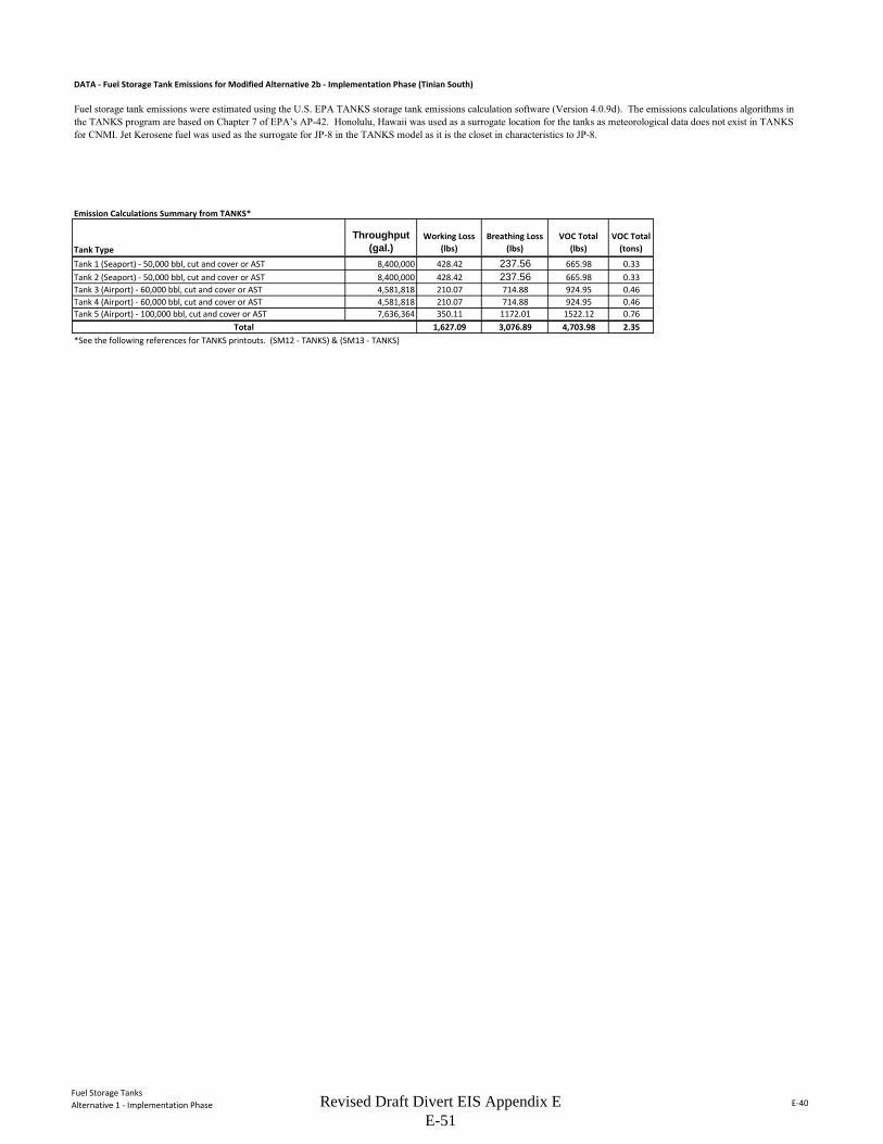
Fuel Storage TanksAlternative 1 - Implementation Phase E-40
DATA - Fuel Storage Tank Emissions for Modified Alternative 2b - Implementation Phase (Tinian South)
Emission Calculations Summary from TANKS*
Tank TypeThroughput
(gal.)Working Loss
(lbs)Breathing Loss
(lbs)VOC Total
(lbs)VOC Total
(tons)
Tank 1 (Seaport) - 50,000 bbl, cut and cover or AST 8,400,000 428.42 237.56 665.98 0.33Tank 2 (Seaport) - 50,000 bbl, cut and cover or AST 8,400,000 428.42 237.56 665.98 0.33Tank 3 (Airport) - 60,000 bbl, cut and cover or AST 4,581,818 210.07 714.88 924.95 0.46Tank 4 (Airport) - 60,000 bbl, cut and cover or AST 4,581,818 210.07 714.88 924.95 0.46Tank 5 (Airport) - 100,000 bbl, cut and cover or AST 7,636,364 350.11 1172.01 1522.12 0.76
1,627.09 3,076.89 4,703.98 2.35*See the following references for TANKS printouts. (SM12 - TANKS) & (SM13 - TANKS)
Fuel storage tank emissions were estimated using the U.S. EPA TANKS storage tank emissions calculation software (Version 4.0.9d). The emissions calculations algorithms in the TANKS program are based on Chapter 7 of EPA’s AP-42. Honolulu, Hawaii was used as a surrogate location for the tanks as meteorological data does not exist in TANKS for CNMI. Jet Kerosene fuel was used as the surrogate for JP-8 in the TANKS model as it is the closet in characteristics to JP-8.
Total
Revised Draft Divert EIS Appendix E E-51
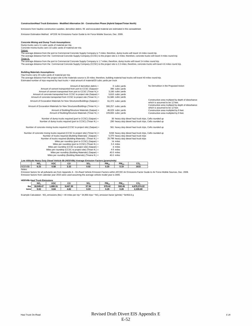
Haul Truck On-Road E-28
Construction/Haul Truck Emissions - Modified Alternative 3A - Construction Phase (Hybrid Saipan/Tinian North)
Emissions from hauling construction supplies, demoliton debris, fill, and excavated material are estimated in this spreadsheet.
Concrete Mixing and Dump Truck Assumptions:Dump trucks carry 11 cubic yards of material per trip.Concrete mixing trucks carry 10 cubic yards of material per trip.SaipanThe average distance from the port to Commercial Concrete Supply Company is 7 miles; therefore, dump trucks will travel 14 miles round trip.The average distance from the Commercial Concrete Supply Company (CCSC) to the project site is 2 miles; therefore, concrete trucks will travel 4 miles round trip.Tinian N.The average distance from the port to Commercial Concrete Supply Company is 1.7 miles; therefore, dump trucks will travel 3.4 miles round trip.The average distance from the Commercial Concrete Supply Company (CCSC) to the project site is 2.3 miles; therefore, concrete trucks will travel 4.6 miles round trip.
Building Materials Assumptions:Haul trucks carry 20 cubic yards of material per trip.The average distance from the project site to the materials source is 20 miles; therefore, building material haul trucks will travel 40 miles round trip.Estimated number of trips required by haul trucks = total amount of material/20 cubic yards per truck
Amount of demoltion debris = 0 cubic yardsAmount of cement transported from port to CCSC (Saipan)= 396 cubic yards
Amount of cement transported from port to CCSC (Tinian N.)= 3,190 cubic yards5,610 cubic yards
51,580 cubic yards
61,372 cubic yards Construction area multiped by depth of disturbance which is assumed to be 12 feet.
306,257 cubic yards Construction area multiped by depth of disturbance which is assumed to be 12 feet.
Amount of Building/Structure Materials (Saipan) = 46,029 cubic yardsAmount of Building/Structure Materials (Tinian N.) = 229,693 cubic yards
Number of dump trucks required (port to CCSC) (Saipan) = 36 heavy duty diesel haul truck trips, Cells rounded upNumber of dump trucks required (port to CCSC) (Tinian N.) = 290 heavy duty diesel haul truck trips, Cells rounded up
561 heavy duty diesel haul truck trips, Cells rounded up
5158 heavy duty diesel haul truck trips, Cells rounded upNumber of trucks required (Building Materials) (Saipan) = 5,370 heavy duty diesel haul truck trips
Number of trucks required (Building Materials) (Tinian N.) = 26,798 heavy duty diesel haul truck tripsMiles per roundtrip (port to CCSC) (Saipan) = 14 miles
Miles per roundtrip (port to CCSC) (Tinain N.) = 3.4 milesMiles per roundtrip (CCSC to project site) (Saipan) = 4 miles
Miles per roundtrip (CCSC to project site) (Tinian N.) = 4.6 milesMiles per roundtrip (Building Materials) (Saipan) = 40.0 miles
Miles per roundtrip (Building Materials) (Tinaina N.) = 40.0 miles
Low Altitude Heavy Duty Diesel Vehicle 8b (HDDV8b) Average Emission Factors (grams/mile)NOx VOC CO SO2 PM10 PM2.5 CO2
HDDV8b 6.23 0.58 3.33 0.02 0.20 0.19 1615
Emission factors for all pollutants are from Appendix A - On-Raod Vehicle Emission Factors within AFCEE Air Emissions Factor Guide to Air Force Mobile Sources, Dec. 2009.Emission factors from calendar year 2015 were used assuming the average vehicle model year is 2005.
HDDV8b Haul Truck EmissionsNOx VOC CO SO2 PM10 PM2.5 CO2
lbs 18,049.47 1,680.31 9,647.30 57.94 579.42 550.45 4,679,374.22tons 9.02 0.84 4.82 0.03 0.29 0.28 2,339.69
Example Calculation: NOx emissions (lbs) = 40 miles per trip * 34,955 trips * NOx emission factor (g/mile) * lb/453.6 g
No Demolition in the Proposed Action
Construction area multipled by 9 feet.
Notes:
Emission Estimation Method: AFCEE Air Emissions Factor Guide to Air Force Mobile Sources, Dec. 2009.
Amount of concrete transported from CCSC to project site (Saipan) = Amount of concrete transported from CCSC to project site (Tinian N.) =
Amount of Excavation Materials for New Structures/Buildings (Saipan) =
Amount of Excavation Materials for New Structures/Buildings (Tinian N.) =
Number of concrete mixing trucks required (CCSC to project site) (Saipan) =
Construction area multipled by 9 feet.
Number of concrete mixing trucks required (CCSC to project site) (Tinian N.) =
Revised Draft Divert EIS Appendix E E-52
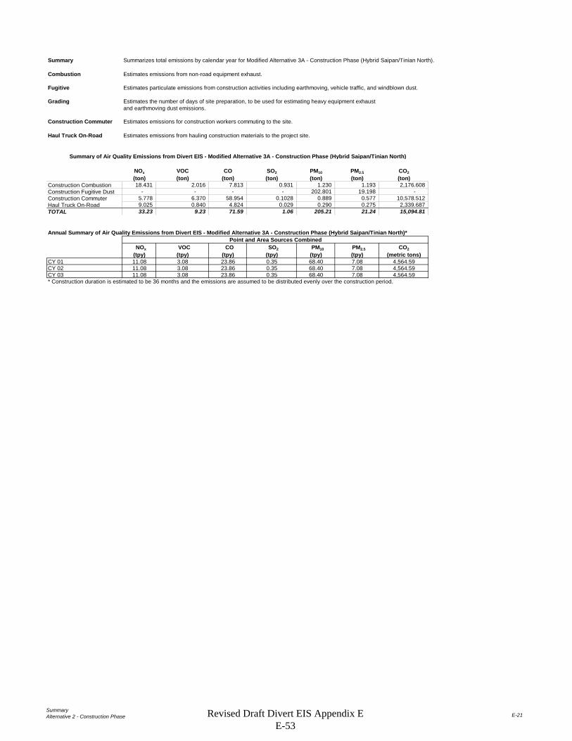
SummaryAlternative 2 - Construction Phase E-21
Summary Summarizes total emissions by calendar year for Modified Alternative 3A - Construction Phase (Hybrid Saipan/Tinian North).
Combustion Estimates emissions from non-road equipment exhaust.
Fugitive Estimates particulate emissions from construction activities including earthmoving, vehicle traffic, and windblown dust.
Grading Estimates the number of days of site preparation, to be used for estimating heavy equipment exhaustand earthmoving dust emissions.
Construction Commuter Estimates emissions for construction workers commuting to the site.
Haul Truck On-Road Estimates emissions from hauling construction materials to the project site.
NOx VOC CO SO2 PM10 PM2.5 CO2(ton) (ton) (ton) (ton) (ton) (ton) (ton)
Construction Combustion 18.431 2.016 7.813 0.931 1.230 1.193 2,176.608 Construction Fugitive Dust - - - - 202.801 19.198 - Construction Commuter 5.778 6.370 58.954 0.1028 0.889 0.577 10,578.512 Haul Truck On-Road 9.025 0.840 4.824 0.029 0.290 0.275 2,339.687 TOTAL 33.23 9.23 71.59 1.06 205.21 21.24 15,094.81
NOx VOC CO SO2 PM10 PM2.5 CO2(tpy) (tpy) (tpy) (tpy) (tpy) (tpy) (metric tons)
CY 01 11.08 3.08 23.86 0.35 68.40 7.08 4,564.59CY 02 11.08 3.08 23.86 0.35 68.40 7.08 4,564.59CY 03 11.08 3.08 23.86 0.35 68.40 7.08 4,564.59* Construction duration is estimated to be 36 months and the emissions are assumed to be distributed evenly over the construction period.
Point and Area Sources Combined
Summary of Air Quality Emissions from Divert EIS - Modified Alternative 3A - Construction Phase (Hybrid Saipan/Tinian North)
Annual Summary of Air Quality Emissions from Divert EIS - Modified Alternative 3A - Construction Phase (Hybrid Saipan/Tinian North)*
Revised Draft Divert EIS Appendix E E-53
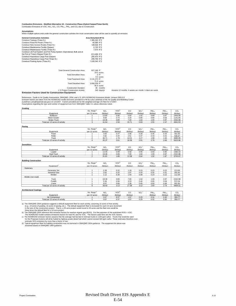
Project Combustion E-22
Combustion Emissions - Modified Alternative 3A - Construction Phase (Hybrid Saipan/Tinian North)Combustion Emissions of VOC, NOx, SO2, CO, PM2.5, PM10, and CO2 due to Construction
AssumptionsWhen multiple options exist under the general construction activites the most conservative value will be used to quantify air emission.
General Construction Activities Area Disturbed (ft^2)Construct Taxiway (Tinian N.) 1,385,300 ft^2Construct Road Re-Route (Tinian N.) 40,585 ft^2Construct New Access Roads (Tinian N.) 128,924 ft^2Construct Maintenance Facility (Saipan) 6,100 ft^2Construct Maintenance Facility (Tinian N.) 7,570 ft^2Construct Jet Fuel System and Fire Pump System (Operational, Bulk and at the Port of Tinian) (Saipan/Tinian N.) 813,496 ft^2Construct Hazardous Cargo Pad (Saipan) 250,470 ft^2Construct Hazardous Cargo Pad (Tinian N.) 299,754 ft^2Construct Parking Apron (Tinian N.) 1,026,340 ft^2
Total General Construction Area: 827,166 ft2
19.0 acresTotal Demolition Area: 0 ft2
0.0 acresTotal Pavement Area: 3,131,373 ft2
71.9 acresTotal Disturbed Area: 3,958,539 ft2
90.9 acresConstruction Duration: 36 months
1 Yr Project Construction Activity: 240 days/yr Assume 12 months, 4 weeks per month, 5 days per week.Emission Factors Used for Construction Equipment
References: Guide to Air Quality Assessment, SMAQMD, 2004; and U.S. EPA NONROAD Emissions Model, Version 2005.0.0Emission factors are taken from the NONROAD model and were provided to e²M by Larry Landman of the Air Quality and Modeling Center ([email protected]) on 12/14/07. Factors provided are for the weighted average US fleet for CY2007. Assumptions regarding the type and number of equipment are from SMAQMD Table 3-1 unless otherwise noted.
Grading No. Reqd.a NOx VOCb CO SO2
c PM10 PM2.5 CO2Equipment per 10 acres (lb/day) (lb/day) (lb/day) (lb/day) (lb/day) (lb/day) (lb/day)Bulldozer 1 13.60 0.96 5.50 1.02 0.89 0.87 1456.90
Motor Grader 1 9.69 0.73 3.20 0.80 0.66 0.64 1141.65Water Truck 1 18.36 0.89 7.00 1.64 1.00 0.97 2342.98
Total per 10 acres of activity 3 41.64 2.58 15.71 0.83 2.55 2.47 4941.53
PavingNo. Reqd.a NOx VOCb CO SO2
c PM10 PM2.5 CO2Equipment per 10 acres (lb/day) (lb/day) (lb/day) (lb/day) (lb/day) (lb/day) (lb/day)
Paver 1 3.83 0.37 2.06 0.28 0.35 0.34 401.93Roller 1 4.82 0.44 2.51 0.37 0.43 0.42 536.07Truck 2 36.71 1.79 14.01 3.27 1.99 1.93 4685.95
Total per 10 acres of activity 4 45.37 2.61 18.58 0.91 2.78 2.69 5623.96
DemolitionNo. Reqd.a NOx VOCb CO SO2
c PM10 PM2.5 CO2Equipment per 10 acres (lb/day) (lb/day) (lb/day) (lb/day) (lb/day) (lb/day) (lb/day)
Loader 1 13.45 0.99 5.58 0.95 0.93 0.90 1360.10Haul Truck 1 18.36 0.89 7.00 1.64 1.00 0.97 2342.98
Total per 10 acres of activity 2 31.81 1.89 12.58 0.64 1.92 1.87 3703.07
Building ConstructionNo. Reqd.a NOx VOCb CO SO2
c PM10 PM2.5 CO2
Equipmentd per 10 acres (lb/day) (lb/day) (lb/day) (lb/day) (lb/day) (lb/day) (lb/day) Stationary
Generator Set 1 2.38 0.32 1.18 0.15 0.23 0.22 213.06Industrial Saw 1 2.62 0.32 1.97 0.20 0.32 0.31 291.92
Welder 1 1.12 0.38 1.50 0.08 0.23 0.22 112.39 Mobile (non-road)
Truck 1 18.36 0.89 7.00 1.64 1.00 0.97 2342.98Forklift 1 5.34 0.56 3.33 0.40 0.55 0.54 572.24Crane 1 9.57 0.66 2.39 0.65 0.50 0.49 931.93
Total per 10 acres of activity 6 39.40 3.13 17.38 3.12 2.83 2.74 4464.51
Architectural CoatingsNo. Reqd.a NOx VOCb CO SO2
c PM10 PM2.5 CO2Equipment per 10 acres (lb/day) (lb/day) (lb/day) (lb/day) (lb/day) (lb/day)
Air Compressor 1 3.57 0.37 1.57 0.25 0.31 0.30 359.77Total per 10 acres of activity 1 3.57 0.37 1.57 0.25 0.31 0.30 359.77
a) The SMAQMD 2004 guidance suggests a default equipment fleet for each activity, assuming 10 acres of that activity, (e.g., 10 acres of grading, 10 acres of paving, etc.). The default equipment fleet is increased for each 10 acre increment in the size of the construction project. That is, a 26 acre project would round to 30 acres and the fleet size would be three times the default fleet for a 10 acre project.b) The SMAQMD 2004 reference lists emission factors for reactive organic gas (ROG). For the purposes of this worksheet ROG = VOC. The NONROAD model contains emissions factors for total HC and for VOC. The factors used here are the VOC factors.c) The NONROAD emission factors assume that the average fuel burned in nonroad trucks is 1100 ppm sulfur. Trucks that would be used for the Proposed Actions will all be fueled by highway grade diesel fuel which cannot exceed 500 ppm sulfur. These estimates therefore over- estimate SO2 emissions by more than a factor of two.d) Typical equipment fleet for building construction was not itemized in SMAQMD 2004 guidance. The equipment list above was assumed based on SMAQMD 1994 guidance.
Revised Draft Divert EIS Appendix E E-54

Project Combustion E-23
PROJECT-SPECIFIC EMISSION FACTOR SUMMARY
Project-Specific Emission Factors (lb/day)NOx VOC CO SO2** PM10 PM2.5 CO2
9 374.771 23.193 141.389 7.495 22.910 22.222 44473.7377 317.571 18.240 130.049 6.351 19.433 18.850 39367.6981 31.808 1.886 12.584 0.636 1.923 1.865 3703.0742 78.793 6.260 34.765 6.233 5.658 5.488 8929.0232 7.148 0.746 3.131 0.502 0.619 0.600 719.547
74.123*The equipment multiplier is an integer that represents units of 10 acres for purposes of estimating the number of equipment required for the project.**Emission factor is from the evaporation of solvents during painting, per "Air Quality Thresholds of Significance", SMAQMD, 1994
Example: SMAQMD Emission Factor for Grading Equipment NOx = (Total Grading NOx per 10 acre)*(Equipment Multiplier)
Summary of Input ParametersTotal Days
Grading: 3,958,539 90.88 6 (from "Grading" worksheet)Paving: 3,131,373 71.89 49
Demolition: 0 0.00 0Building Construction: 827,166 18.99 240Architectural Coating 827,166 18.99 20 (per SMAQMD "Air Quality of Thresholds of Significance", 1994)
NOTE: The 'Total Days' estimate for paving is calculated by dividing the total number of acres by 0.21 acres/day, which is a factor derived from the 2005 MEANSHeavy Construction Cost Data, 19th Edition, for 'Asphaltic Concrete Pavement, Lots and Driveways - 6" stone base', which provides an estimate of squarefeet paved per day. There is also an estimate for 'Plain Cement Concrete Pavement', however the estimate for asphalt is used because it is more conservative. The 'Total 'Days' estimate for demolition is calculated by dividing the total number of acres by 0.02 acres/day, which is a factor also derived from the 2005 MEANS reference. This is calculated by averaging the demolition estimates from 'Building Demolition - Small Buildings, Concrete', assuming a height of 30 feet for a two-story building; from 'Building Footings and Foundations Demolition - 6" Thick, Plain Concrete'; and from 'Demolish, Remove Pavement and Curb - Concrete to 6" thick, rod reinforced'. Paving is double-weighted since projects typically involve more paving demolition.The 'Total Days' estimate for building construction is assumed to be 230 days, unless project-specific data is known.
Total Project Emissions by Activity (lbs)
NOx VOC CO SO2 PM10 PM2.5 CO2Grading Equipment 2,248.63 139.16 848.33 44.97 137.46 133.33 266,842Paving 15,560.98 893.76 6,372.40 311.22 952.20 923.63 1,929,017Demolition - - - - - - 0Building Construction 18,910.23 1,502.31 8,343.51 1,495.85 1,357.94 1,317.20 2,142,966Architectural Coatings 142.96 1,497.39 62.62 10.05 12.37 12.00 14,391
Total Emissions (lbs): 36,862.80 4,032.62 15,626.86 1,862.09 2,459.97 2,386.17 4,353,216
Results: Total Project Annual Emission Rates
NOx VOC CO SO2 PM10 PM2.5 CO2Total Project Emissions (lbs) 36,862.80 4,032.62 15,626.86 1,862.09 2,459.97 2,386.17 4,353,216Total Project Emissions (tons) 18.43 2.02 7.81 0.93 1.23 1.19 2,176.61
SourceGrading Equipment
Total Area (ft2)Total Area
(acres)
Equipment Multiplier*
Architectural Coating**
Demolition EquipmentBuilding Construction
Paving Equipment
Air Compressor for Architectural Coating
Revised Draft Divert EIS Appendix E E-55

Project Fugitive E-24
Construction Fugitive Dust Emission FactorsEmission Factor Units Source
General Construction Activities 0.19 ton PM10/acre-month MRI 1996; EPA 2001; EPA 2006New Road Construction 0.42 ton PM10/acre-month MRI 1996; EPA 2001; EPA 2006
PM2.5 EmissionsPM2.5 Multiplier 0.10 EPA 2001; EPA 2006
Control Efficiency 0.50 EPA 2001; EPA 2006
New Roadway Construction (0.42 ton PM 10 /acre-month)Duration of Construction Project 12 monthsArea 71.9 acres
General Construction Activities (0.19 ton PM 10 /acre-month)Duration of Construction Project 12 monthsArea 19.0 acres
PM10 uncontrolled PM10 controlled PM2.5 uncontrolled PM2.5 controlledNew Roadway Construction 362.31 181.15 36.23 18.12General Construction Activities 43.30 21.65 2.16 1.08
Total 405.60 202.80 38.40 19.20
General Construction Activities Emission Factor0.19 ton PM10/acre-month Source: MRI 1996; EPA 2001; EPA 2006
New Road Construction Emission Factor0.42 ton PM10/acre-month Source: MRI 1996; EPA 2001; EPA 2006
PM2.5 Multiplier 0.10
Control Efficiency for PM10 and PM2.5 0.50
References:
The EPA National Emission Inventory documentation recommends a control efficiency of 50% for PM10 and PM2.5 in PM nonattainment areas (EPA 2006). Wetting controls will be applied during project construction.
EPA 2001. Procedures Document for National Emissions Inventory, Criteria Air Pollutants, 1985-1999. EPA-454/R-01-006. Office of Air Quality Planning and Standards, United States Environmental Protection Agency. March 2001.
EPA 2006. Documentation for the Final 2002 Nonpoint Sector (Feb 06 version) National Emission Inventory for Criteria and Hazardous Air Pollutants. Prepared for: Emissions Inventory and Analysis Group (C339-02) Air Quality Assessment Division Office of Air Quality Planning and Standards, United States Environmental Protection Agency. July 2006.
MRI 1996. Improvement of Specific Emission Factors (BACM Project No. 1). Midwest Research Institute (MRI). Prepared for the California South Coast Air Quality Management District, March 29, 1996.
The area-based emission factor for construction activities is based on a study completed by the Midwest Research Institute (MRI) Improvement of Specific Emission Factors (BACM Project No. 1), March 29, 1996. The MRI study evaluated seven construction projects in Nevada and California (Las Vegas, Coachella Valley, South Coast Air Basin, and the San Joaquin Valley). The study determined an average emission factor of 0.11 ton PM10/acre-month for sites without large-scale cut/fill operations. A worst-case emission factor of 0.42 ton PM10/acre-month was calculated for sites with active large-scale earth moving operations. The monthly emission factors are based on 168 work-hours per month (MRI 1996). A subsequent MRI Report in 1999, Estimating Particulate Matter Emissions From Construction Operations, calculated the 0.19 ton PM10/acre-month emission factor by applying 25% of the large-scale earthmoving emission factor (0.42 ton PM10/acre-month) and 75% of the average emission factor (0.11 ton PM10/acre-month). The 0.19 ton PM10/acre-month emission factor is referenced by the EPA for non-residential construction activities in recent procedures documents for the National Emission Inventory (EPA 2001; EPA 2006). The 0.19 ton PM10/acre-month emission factor represents a refinement of EPA's original AP-42 area-based total suspended particulate (TSP) emission factor in Section 13.2.3 Heavy Construction Operations. In addition to the EPA, this methodology is also supported by the South Coast Air Quality Management District as well as the Western Regional Air Partnership (WRAP) which is funded by the EPA and is administered jointly by the Western Governor's Association and the National Tribal Environmental Council. The emission factor is assumed to encompass a variety of non-residential construction activities including building construction (commercial, industrial, institutional, governmental), public works, and travel on unpaved roads. The EPA National Emission Inventory documentation assumes that the emission factors are uncontrolled and recommends a control efficiency of 50% for PM10 and PM2.5 in PM nonattainment areas.
The emission factor for new road construction is based on the worst-case conditions emission factor from the MRI 1996 study described above (0.42 tons PM10/acre-month). It is assumed that road construction involves extensive earthmoving and heavy construction vehicle travel resulting in emissions that are higher than other general construction projects. The 0.42 ton PM10/acre-month emission factor for road construction is referenced in recent procedures documents for the EPA National Emission Inventory (EPA 2001; EPA 2006).
PM2.5 emissions are estimated by applying a particle size multiplier of 0.10 to PM10 emissions. This methodology is consistent with the procedures documents for the National Emission Inventory (EPA 2006).
Construction Fugitive Dust Emissions - Proposed Action [Modified Alternative 3A - Construction Phase (Hybrid Saipan/Tinian North)]
(10% of PM10
emissions assumed to be PM2.5)
(assume 50% control efficiency for PM10
and PM2.5 emissions)
Project Assumptions
Project Emissions (tons/year)
Revised Draft Divert EIS Appendix E E-56

Project Grading E-25
Grading Schedule - Proposed Action [Modified Alternative 3A - Construction Phase (Hybrid Saipan/Tinian North)]
Estimate of time required to grade a specified area.
Input ParametersConstruction area: 90.9 acres/yr (from Combustion Worksheet)
Qty Equipment: 28.0 (calculated based on 3 pieces of equipment for every 10 acres)
Assumptions.Terrain is mostly flat.An average of 6" soil is excavated from one half of the site and backfilled to the other half of the site; no soil is hauled off-site or borrowed.200 hp bulldozers are used for site clearing.300 hp bulldozers are used for stripping, excavation, and backfill.Vibratory drum rollers are used for compacting.Stripping, Excavation, Backfill and Compaction require an average of two passes each.Excavation and Backfill are assumed to involve only half of the site.
Calculation of days required for one piece of equipment to grade the specified area.
Reference: Means Heavy Construction Cost Data, 19th Ed., R. S. Means, 2005.
Means Line No. Operation Description Output UnitsAcres per equip-day
equip-days per acre Acres/yr (project-specific)
Equip-days per year
2230 200 0550 Site Clearing Dozer & rake, medium brush 8 acre/day 8 0.13 90.88 11.362230 500 0300 Stripping Topsoil & stockpiling, adverse soil 1,650 cu. yd/day 2.05 0.49 90.88 44.432315 432 5220 Excavation Bulk, open site, common earth, 150' haul 800 cu. yd/day 0.99 1.01 45.44 45.822315 120 5220 Backfill Structural, common earth, 150' haul 1,950 cu. yd/day 2.42 0.41 45.44 18.802315 310 5020 Compaction Vibrating roller, 6 " lifts, 3 passes 2,300 cu. yd/day 2.85 0.35 90.88 31.87
TOTAL 152.27
Calculation of days required for the indicated pieces of equipment to grade the designated acreage.
(Equip)(day)/yr: 152.27Qty Equipment: 28.00
Grading days/yr: 5.44
Revised Draft Divert EIS Appendix E E-57
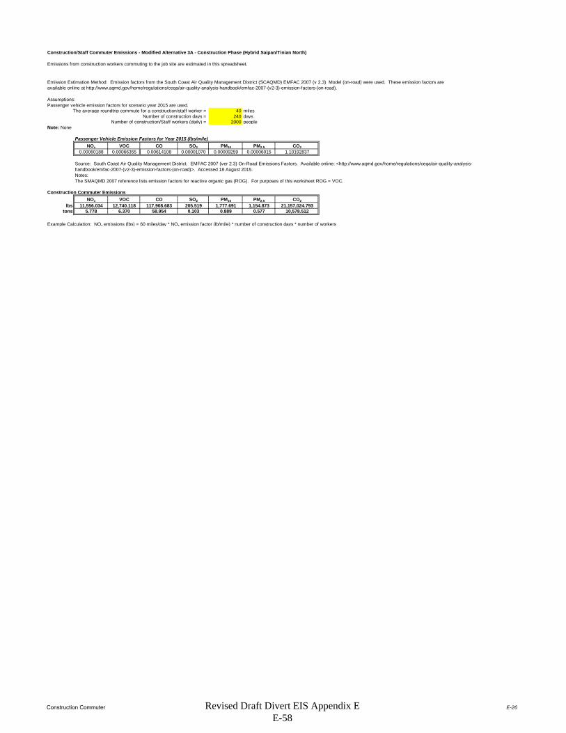
Construction Commuter E-26
Construction/Staff Commuter Emissions - Modified Alternative 3A - Construction Phase (Hybrid Saipan/Tinian North)
Emissions from construction workers commuting to the job site are estimated in this spreadsheet.
Assumptions:Passenger vehicle emission factors for scenario year 2015 are used.
The average roundtrip commute for a construction/staff worker = 40 milesNumber of construction days = 240 days
Number of construction/Staff workers (daily) = 2000 peopleNote: None
Passenger Vehicle Emission Factors for Year 2015 (lbs/mile)NOx VOC CO SO2 PM10 PM2.5 CO2
0.00060188 0.00066355 0.00614108 0.00001070 0.00009259 0.00006015 1.10192837
Notes:The SMAQMD 2007 reference lists emission factors for reactive organic gas (ROG). For purposes of this worksheet ROG = VOC.
Construction Commuter EmissionsNOx VOC CO SO2 PM10 PM2.5 CO2
lbs 11,556.034 12,740.118 117,908.683 205.519 1,777.691 1,154.873 21,157,024.793tons 5.778 6.370 58.954 0.103 0.889 0.577 10,578.512
Example Calculation: NOx emissions (lbs) = 60 miles/day * NOx emission factor (lb/mile) * number of construction days * number of workers
Emission Estimation Method: Emission factors from the South Coast Air Quality Management District (SCAQMD) EMFAC 2007 (v 2.3) Model (on-road) were used. These emission factors are available online at http://www.aqmd.gov/home/regulations/ceqa/air-quality-analysis-handbook/emfac-2007-(v2-3)-emission-factors-(on-road).
Source: South Coast Air Quality Management District. EMFAC 2007 (ver 2.3) On-Road Emissions Factors. Available online: <http://www.aqmd.gov/home/regulations/ceqa/air-quality-analysis-handbook/emfac-2007-(v2-3)-emission-factors-(on-road)>. Accessed 18 August 2015.
Revised Draft Divert EIS Appendix E E-58

Area of Influence E-27
No Statistical Area Available for TNI
Row # State County Tier-1 CO NOx PM10 PM2.5 SO2 VOC CO NOx PM10 PM2.5 SO2 VOC
Grand Total 0 0 0 0 0 0 0 0 0 0 0 0
SOURCE:http://www.epa.gov/ttn/chief/eiinformation.html
USEPA - AirData NET Tier Report*Net Air pollution sources (area and point) in tons per year (2002)Site visited on 02 February 2012.
No Air Quality Control Region Identified
CO NOx PM10 PM2.5 SO2 VOCCNMI 0 0 0 0 0 0CNMI DEQ 0 0 0 0 0 0
Point Source Emissions Area Source Emissions (Non-Point and Mobile Sources)
No Data Available
Revised Draft Divert EIS Appendix E E-59
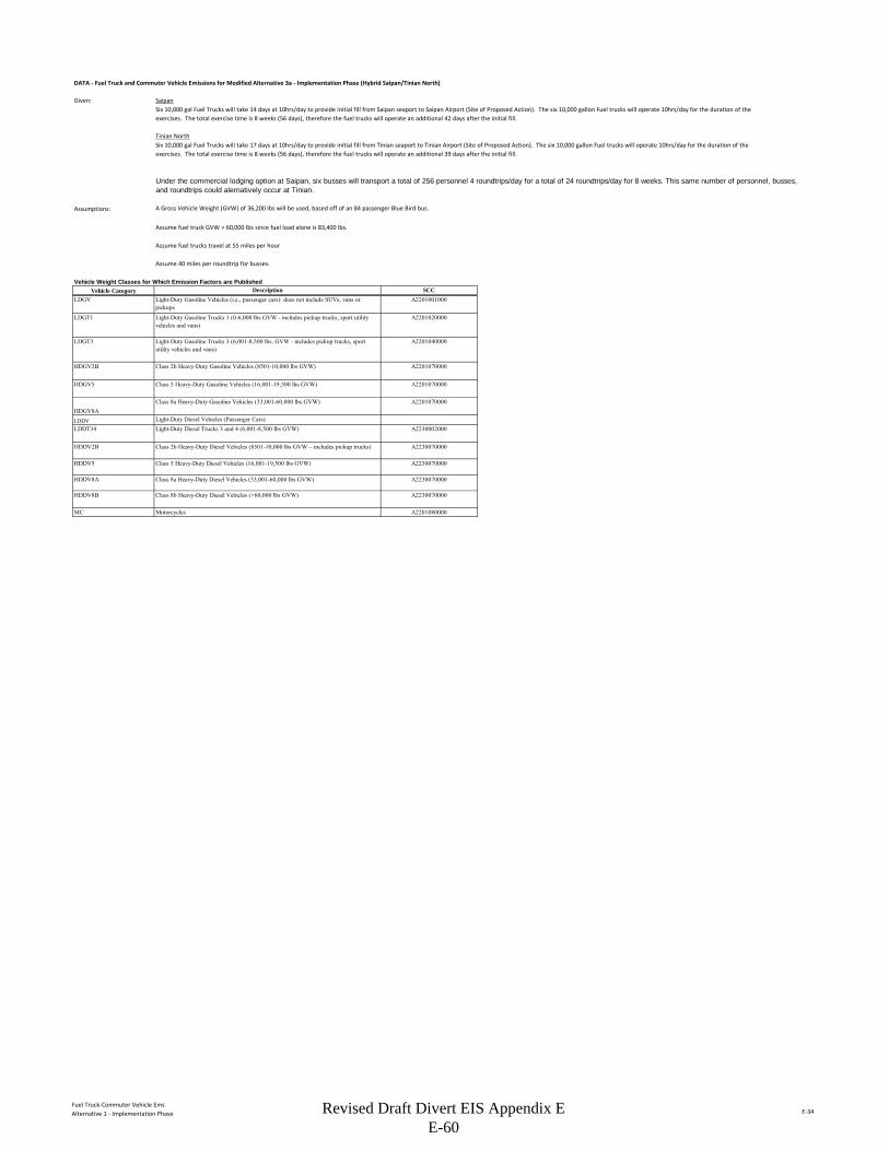
Fuel Truck-Commuter Vehicle EmsAlternative 1 - Implementation Phase E-34
DATA - Fuel Truck and Commuter Vehicle Emissions for Modified Alternative 3a - Implementation Phase (Hybrid Saipan/Tinian North)
Given: Saipan
Tinian North
Assumptions: A Gross Vehicle Weight (GVW) of 36,200 lbs will be used, based off of an 84 passenger Blue Bird bus.
Assume fuel truck GVW > 60,000 lbs since fuel load alone is 83,400 lbs.
Assume fuel trucks travel at 55 miles per hour
Assume 40 miles per roundtrip for busses.
Vehicle Weight Classes for Which Emission Factors are PublishedVehicle Category
LDGV
LDGT1
LDGT3
HDGV2B
HDGV5
HDGV8ALDDVLDDT34
HDDV2B
HDDV5
HDDV8A
HDDV8B
MC
Six 10,000 gal Fuel Trucks will take 14 days at 10hrs/day to provide initial fill from Saipan seaport to Saipan Airport (Site of Proposed Action). The six 10,000 gallon Fuel trucks will operate 10hrs/day for the duration of the exercises. The total exercise time is 8 weeks (56 days), therefore the fuel trucks will operate an additional 42 days after the initial fill.
Under the commercial lodging option at Saipan, six busses will transport a total of 256 personnel 4 roundtrips/day for a total of 24 roundtrips/day for 8 weeks. This same number of personnel, busses, and roundtrips could alernatively occur at Tinian.
Class 2b Heavy-Duty Diesel Vehicles (8501-10,000 lbs GVW – includes pickup trucks) A2230070000
Class 5 Heavy-Duty Diesel Vehicles (16,001-19,500 lbs GVW) A2230070000
Class 8a Heavy-Duty Diesel Vehicles (33,001-60,000 lbs GVW) A2230070000
Class 8b Heavy-Duty Diesel Vehicles (>60,000 lbs GVW)
Motorcycles A2201080000
A2201070000
Light-Duty Diesel Vehicles (Passenger Cars)Light-Duty Diesel Trucks 3 and 4 (6,001-8,500 lbs GVW) A2230002000
Six 10,000 gal Fuel Trucks will take 17 days at 10hrs/day to provide initial fill from Tinian seaport to Tinian Airport (Site of Proposed Action). The six 10,000 gallon Fuel trucks will operate 10hrs/day for the duration of the exercises. The total exercise time is 8 weeks (56 days), therefore the fuel trucks will operate an additional 39 days after the initial fill.
Description SCCLight-Duty Gasoline Vehicles (i.e., passenger cars) does not include SUVs, vans or pickups
A2201001000
Light-Duty Gasoline Trucks 1 (0-6,000 lbs GVW - includes pickup trucks, sport utility vehicles and vans)
A2201020000
Light-Duty Gasoline Trucks 3 (6,001-8,500 lbs. GVW - includes pickup trucks, sport utility vehicles and vans)
A2201040000
Class 2b Heavy-Duty Gasoline Vehicles (8501-10,000 lbs GVW) A2201070000
Class 5 Heavy-Duty Gasoline Vehicles (16,001-19,500 lbs GVW) A2201070000
Class 8a Heavy-Duty Gasoline Vehicles (33,001-60,000 lbs GVW)
A2230070000
Revised Draft Divert EIS Appendix E E-60

Fuel Truck-Commuter Vehicle EmsAlternative 1 - Implementation Phase E-35
Emission Factors - Fuel Truck and Commuter Vehicle Emissions for Modified Alternative 3a - Implementation Phase (Hybrid Saipan/Tinian North)
Emission Factors for Calendar Year 2015Emission Factors in grams per Milea
PM10
PM2.
5
CO
NO
x
SOx
VO
Cs
CO
2
Fugi
tive
PM10
Fugi
tive
PM2.
5
HDDV8A* 2005 0.2 0.19 2.8 5.47 0.01 0.48 1544.1 0.05 0.01HDDV8B** 2005 0.2 0.19 3.33 6.23 0.02 0.58 1615.2 0.05 0.01* Low Altitude Emission Factors for Heavy Duty Diesel Vehicles Class 8a**Low Altitude Emission Factors for Heavy Duty Diesel Vehicles Class 8ba) Emission factors from Appendix A of Air Emissions Factor Guide to Air Force Mobile Sources, AFCEE, December 2009
Greenhouse Gas Emission Factors for Calendar Year 2015
HDDV 0.0051 0.0048g/mile = grams per mileCH4 = Methane; N2O = Nitrous Oxideb) Emission Factors from EPA's Climate Leadership, Emission Factors for Greenhouse Gas Inventories, Last Modified 4 April 2014 (http://www.epa.gov/climateleadership/documents/emission-factors.pdf).
Vehicle Class Model Year
Vehicle ClassCH4
(g/mile) N2O (g/mile)
Revised Draft Divert EIS Appendix E E-61

Fuel Truck-Commuter Vehicle EmsAlternative 1 - Implementation Phase E-36
Emission Calculations - Fuel Truck and Commuter Vehicle Emissions for Modified Alternative 3a - Implementation Phase (Hybrid Saipan/Tinian North)
Miles for Commuter Emissions for 8 week training exercises
Vehicle ClassSpeed
Miles/hour Miles/Trip Total Trips/Day Hours/Day Total Days Total MilesHDDV8A - Class 8a Heavy-Duty Diesel Vehicles (33,001-60,000 lbs GVW)
40 24 56 53,760
HDDV8B - Class 8b Heavy-Duty Diesel Vehicles (>60,000 lbs GVW)
55 10 56 30,800
Criteria and VOC Emissions for CommutersModel Annual Criteria Pollutant Emissions (tons/year)
Vehicle Class Year Miles PM10 PM2.5 CO NOx SOx VOCsHDDV8A - Class 8a Heavy-Duty Diesel Vehicles (33,001-60,000 lbs GVW)
2005 53,760 0.015 0.012 0.166 0.324 0.001 0.028
HDDV8B - Class 8b Heavy-Duty Diesel Vehicles (>60,000 lbs GVW)
2005 30,800 0.008 0.007 0.113 0.212 0.001 0.020
Total 0.023 0.019 0.279 0.536 0.001 0.048Particulate emissions include exhaust, brake wear, tire wear. Assume paved road.
Greenhouse Gas Emissions for Commuters
Vehicle ClassAnnual Miles CO2 (lb/year) CH4 (lb/year) N2O (lb/year)
CH4 GWP Multiplier
N2O GWP Multiplier
CO2
Equivalent (lb/year)
CO2 Equivalent (metric
tonnes/year)HDDV8A - Class 8a Heavy-Duty Diesel Vehicles (33,001-60,000 lbs GVW)
53,760 183,004.44 0.60 0.57 25 298 183,189.08 83.09
HDDV8B - Class 8b Heavy-Duty Diesel Vehicles (>60,000 lbs GVW)
30,800 109,674.07 0.35 0.33 25 298 109,779.86 49.80
Total 292,678.52 0.95 0.89 --- --- 292,968.94 132.89
Emission Calculations Method - Fuel Truck and Commuter Vehicle Emissions for Modified Alternative 3a - Implementation Phase (Hybrid Saipan/Tinian North)Calculation Method:
GWP = Global Warming Potential; 100-year GWP values obtained from EPA's Climate Leadership, Emission Factors for Greenhouse Gas Inventories, Last Modified 4 April 2014 (http://www.epa.gov/climateleadership/documents/emission-factors.pdf)
Equation 4-1 , AFCEE 2009, Mobile Emissions Guide
EP = VMTVehCat * EFPolVehCat * 0.002205
Where,EP = Emissions of each individual pollutant (lb/yr)VMTVehCat = Annual vehicle miles traveled by each vehicle category (LDGV, LDGT1, LDDV, etc.) (mi/yr)EFPolVehCat = Emission factor of each pollutant for each vehicle category (g/mi)0.002205 = Factor for converting grams to pounds (g/lb).
Revised Draft Divert EIS Appendix E E-62
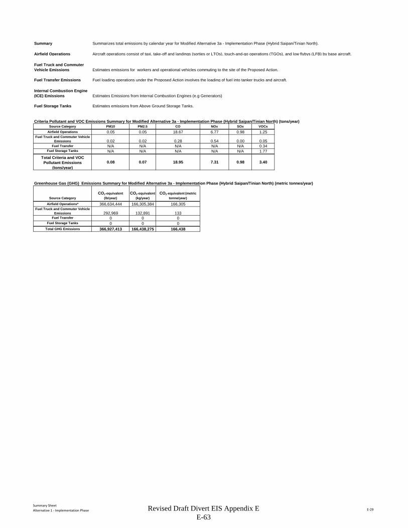
Summary SheetAlternative 1 - Implementation Phase E-29
Summary Summarizes total emissions by calendar year for Modified Alternative 3a - Implementation Phase (Hybrid Saipan/Tinian North).
Airfield Operations Aircraft operations consist of taxi, take-off and landings (sorties or LTOs), touch-and-go operations (TGOs), and low flybys (LFB) by base aircraft.
Fuel Truck and Commuter Vehicle Emissions Estimates emissions for workers and operational vehicles commuting to the site of the Proposed Action.
Fuel Transfer Emissions Fuel loading operations under the Proposed Action involves the loading of fuel into tanker trucks and aircraft.
Internal Combustion Engine (ICE) Emissions Estimates Emissions from Internal Combustion Engines (e.g Generators)
Fuel Storage Tanks Estimates emissions from Above Ground Storage Tanks.
Criteria Pollutant and VOC Emissions Summary for Modified Alternative 3a - Implementation Phase (Hybrid Saipan/Tinian North) (tons/year)Source Category PM10 PM2.5 CO NOx SOx VOCs
Airfield Operations 0.05 0.05 18.67 6.77 0.98 1.25Fuel Truck and Commuter Vehicle
Emissions 0.02 0.02 0.28 0.54 0.00 0.05Fuel Transfer N/A N/A N/A N/A N/A 0.34
Fuel Storage Tanks N/A N/A N/A N/A N/A 1.77Total Criteria and VOC
Pollutant Emissions (tons/year)
0.08 0.07 18.95 7.31 0.98 3.40
Greenhouse Gas (GHG) Emissions Summary for Modified Alternative 3a - Implementation Phase (Hybrid Saipan/Tinian North) (metric tonnes/year)
Source CategoryCO2-equivalent
(lb/year)CO2-equivalent
(kg/year)CO2-equivalent (metric
tonne/year)
Airfield Operations* 366,634,444 166,305,384 166,305Fuel Truck and Commuter Vehicle
Emissions 292,969 132,891 133Fuel Transfer 0 0 0
Fuel Storage Tanks 0 0 0Total GHG Emissions 366,927,413 166,438,275 166,438
Revised Draft Divert EIS Appendix E E-63

Airfield OperationsAlternative 1 - Implementation Phase E-30
DATA - Airfield Operations for Modified Alternative 3a - Implementation Phase (Hybrid Saipan/Tinian North)
Landing and Takeoff (LTO) CyclesDescription Quantity Legend
# of KC-135R LTO's per year 360
Airfield Activity Data (Worst Case Scenario)
Aircraft Model
Aircraft Model
Used to Match to Available Emission Factors Engine Model #
Engi
nes
APU Model # A
PUs
Not
es LTO Cycles
KC-135R KC-135-R F108-CF-201 4 See below 360Note: F108-CF-201 is the military designation of the CFM56-2B-1 engine.
Emission Factors (EFs) and Constants - Airfield Operations for Modified Alternative 3a - Implementation Phase (Hybrid Saipan/Tinian North)
Aircraft Criteria Pollutant Emission Factors
Aircraft ModelEngine Model #
Eng. Reference
Thrust Mode
LTO/TGO Thrust Mode
Fuel Flow(lb/hr) PM10 PM2.5 CO NOX SO2 VOCs TIM
KC-135RF108-CF-201 4 Idle Idle 1016 0.06 0.06 30.70 4.00 1.06 2.10 47.7
KC-135RF108-CF-201 4 Approach Approach 2468 0.06 0.05 4.20 8.20 1.06 0.09 5.2
KC-135RF108-CF-201 4 Climbout Climbout 6500 0.05 0.05 0.90 16.00 1.06 0.06 1.6
KC-135RF108-CF-201 4 Takeoff Takeoff 7818 0.07 0.06 0.90 18.05 1.06 0.05 0.7
Emission factors from AFCEC August 2013 Air Emissions Guide for Air Force Mobile Sources, Table 2-8
APU Emission FactorsAPU Emission Factors in lb Pollutant per hour
Aircraft Model # APU APU Model PM10 PM2.5 CO NOX S02 VOCs
APU(hr)
KC-135R
Emission Factors (EFs) and Constants - Airfield Operations for Modified Alternative 3a - Implementation Phase (Hybrid Saipan/Tinian North)
Default Time-In-Mode Aircraft Type Taxi/Idle- Takeoff Climbout Approach Taxi/Idle-in TotalKC-135R 32.8 0.7 1.6 5.2 14.9 55.2Emission factors from AFCEC August 2013 Air Emissions Guide for Air Force Mobile Sources, Table 2-4
Emission Factors (EFs) and Constants - Airfield Operations for Modified Alternative 3a - Implementation Phase (Hybrid Saipan/Tinian North)
Greenhouse Gas Emission FactorsUnits CO2 CH4 N2O
kg/gal fuel 9.80 --- ---g/gal fuel --- 0.27 0.31
Reference: Footnote 2. from Table 2-8 of the AFCEC August 2013 Air Emissions Guide for Air Force Mobile Sources.
Aircraft exercises under this alternative are based on assuming 2 to 4 KC-135R aircraft operating up to 8 weeks per year for a maximum of 720 KC-135R operations per year. Each operation is equivalent to one landing or one take-off (1 LTO Cycle = 2 operations). These 720 total operations could occur at either Saipan or Tinian North.
Emission Factors in lb Pollutant per 1000 lb Fuel Burned
No data on APUs
No Data Available.
Typical Duration by Mode (minutes)
Revised Draft Divert EIS Appendix E E-64
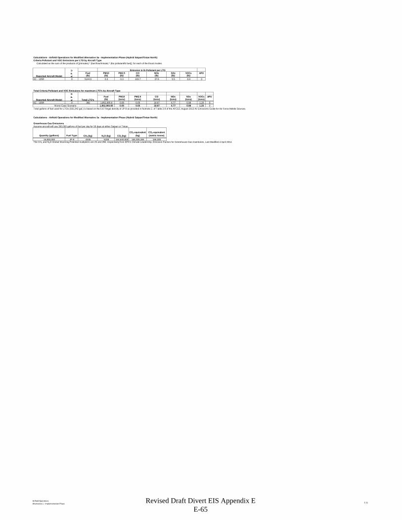
Airfield OperationsAlternative 1 - Implementation Phase E-31
Calculations - Airfield Operations for Modified Alternative 3a - Implementation Phase (Hybrid Saipan/Tinian North)Criteria Pollutant and VOC Emissions per LTO by Aircraft Type Calculated as the sum of the products of [(minutes) * (fuel flow/minute) * (lbs pollutant/lb fuel)] for each of the thrust modes.
U Emission in lb Pollutant per LTOP Fuel PM10 PM2.5 CO NOx SOx VOCs APU
A (lb) (lb) (lb) (lb) (lb) (lb) (lb)KC - 135R 0 5144.6 0.3 0.3 103.7 37.6 5.5 6.9 0
Total Criteria Pollutant and VOC Emissions for maximum LTO's by Aircraft Type
UP Fuel PM10 PM2.5 CO NOx SOx VOCs APU
A (lb) (tons) (tons) (tons) (tons) (tons) (tons)KC - 135R 0 360 1,852,065.6 0.05 0.05 18.67 6.77 0.98 1.25 0
Worst Case Scenario 1,852,065.60 0.05 0.05 18.67 6.77 0.98 1.25 0Total gallons of fuel used for LTOs (555,342 gal.) is based on the 6.67 lb/gal density of JP-8 as provided in footnote 2. of Table 2-8 of the AFCEC August 2013 Air Emissions Guide for Air Force Mobile Sources.
Calculations - Airfield Operations for Modified Alternative 3a - Implementation Phase (Hybrid Saipan/Tinian North)
Greenhouse Gas Emissions Assume aircraft will use 300,000 gallons of fuel per day for 56 days at either Saipan or Tinian.
Quantity (gallons) Fuel Type CH4 (kg) N2O (kg) CO2 (kg)CO2-equivalent
(kg)CO2-equivalent (metric tonne)
16,800,000 JP-8 4536 5208 164,640,000 166,305,384 166,305The CH4 and N2O Global Warming Potential multipliers are 25 and 298, respectively from EPA's Climate Leadership, Emission Factors for Greenhouse Gas Inventories, Last Modified 4 April 2014.
Reported Aircraft Model
Reported Aircraft Model Total LTO's
Revised Draft Divert EIS Appendix E E-65

Fuel TransferAlternative 1 - Implementation Phase E-37
DATA - Fuel Loading Emissions for Modified Alternative 3a - Implementation Phase (Hybrid Saipan/Tinian North)
Given: SaipanTotal Exercise Days (8 weeks) 56Initial Fuel Fill Days 14Remaining Fuel Fill Days 42Total # of Fuel Trucks 6Total Gallons per Fuel Truck 10,000Trips per day per Fuel Truck 51 bbl conversion to gallons 42Total Fuel (gal) during Initial Fill 4,200,000Total Fuel (gal) during Remaining Exercise 12,600,000Total Fuel (gal) during Exercise (8 Weeks) 16,800,000
Proposed Action Fuel Loading Operations
Location Description Fuel Type
Fuel Transferred
(gal)Category
Saipan Airport Flightline
Loading Aircraft from Truck Fill Stands JP-8 16,800,000 Loading
Saipan Seaport, Loading Racks (50,000 bbl tank 1)
Loading Refueler Trucks JP-8 8,400,000 Loading
Saipan Seaport, Loading Racks (50,000 bbl tank 2)
Loading Refueler Trucks JP-8 8,400,000 Loading
Given: Tinian NorthTotal Exercise Days (8 weeks) 56Initial Fuel Fill Days 17Remaining Fuel Fill Days 39Total # of Fuel Trucks 6Total Gallons per Fuel Truck 10,000Trips per day per Fuel Truck 51 bbl conversion to gallons 42Total Fuel (gal) during Initial Fill 5,100,000Total Fuel (gal) during Remaining Exercise 11,700,000Total Fuel (gal) during Exercise (8 Weeks) 16,800,000
Proposed Action Fuel Loading Operations
Location Description Fuel Type
Fuel Transferred
(gal)Category
Tinian North Flightline
Loading Aircraft from Truck Fill Stands JP-8 16,800,000 Loading
Tinian Seaport, Loading Racks (50,000 bbl tank 1)
Loading Refueler Trucks JP-8 8,400,000 Loading
Tinian Seaport, Loading Racks (50,000 bbl tank 2)
Loading Refueler Trucks JP-8 8,400,000 Loading
Revised Draft Divert EIS Appendix E E-66
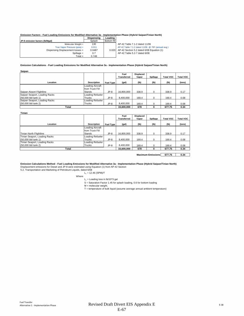
Fuel TransferAlternative 1 - Implementation Phase E-38
Emission Factors - Fuel Loading Emissions for Modified Alternative 3a - Implementation Phase (Hybrid Saipan/Tinian North)Dispensing Loading
JP-8 emission factors (lb/Mgal) Splash Bottom fillMolecular Weight = 130 AP-42 Table 7.1-2 dated 11/06
True Vapor Pressure (psia) = 0.011 AP-42 Table 7.1-2 dated 11/06 @ 70F (annual avg.)Dispensing Displacement losses = 0.0487 0.020 AP-42 Section 5.2 dated 6/08 Equation (1)
Spillage = 0.7 AP-42 Table 5.2-7 dated 6/08Total = 0.749
Emission Calculations - Fuel Loading Emissions for Modified Alternative 3a - Implementation Phase (Hybrid Saipan/Tinian North)
SaipanFuel
Transferred Displaced
Vapor Spillage Total VOC Total VOC
Location Description Fuel Type (gal) (lb) (lb) (lb) (tons)
Saipan Airport Flightline
Loading Aircraft from Truck Fill Stands JP-8 16,800,000 338.9 0 338.9 0.17
Saipan Seaport, Loading Racks (50,000 bbl tank 1)
Loading Refueler Trucks JP-8 8,400,000 169.4 0 169.4 0.08
Saipan Seaport, Loading Racks (50,000 bbl tank 2)
Loading Refueler Trucks JP-8 8,400,000 169.4 0 169.4 0.08
Total 33,600,000 678 0 677.75 0.34
TinianFuel
Transferred Displaced
Vapor Spillage Total VOC Total VOC
Location Description Fuel Type (gal) (lb) (lb) (lb) (tons)
Tinian North Flightline
Loading Aircraft from Truck Fill Stands JP-8 16,800,000 338.9 0 338.9 0.17
Tinian Seaport, Loading Racks (50,000 bbl tank 1)
Loading Refueler Trucks JP-8 8,400,000 169.4 0 169.4 0.08
Tinian Seaport, Loading Racks (50,000 bbl tank 2)
Loading Refueler Trucks JP-8 8,400,000 169.4 0 169.4 0.08
Total 33,600,000 678 0 677.75 0.34
Maximum Emissions 677.75 0.34
Emission Calculations Method - Fuel Loading Emissions for Modified Alternative 3a - Implementation Phase (Hybrid Saipan/Tinian North)Displacement emissions for Diesel and JP-8 were estimated using Equation (1) from AP-42 Section5.2, Transportation and Marketing of Petroleum Liquids, dated 6/08
LL = 12.46 (SPM)/TWhere
LL = Loading loss in lb/10^3 galS = Saturation Factor 1.45 for splash loading, 0.6 for bottom loadingM = molecular weight, T = temperature of bulk liquid (assume average annual ambient temperature)
Revised Draft Divert EIS Appendix E E-67
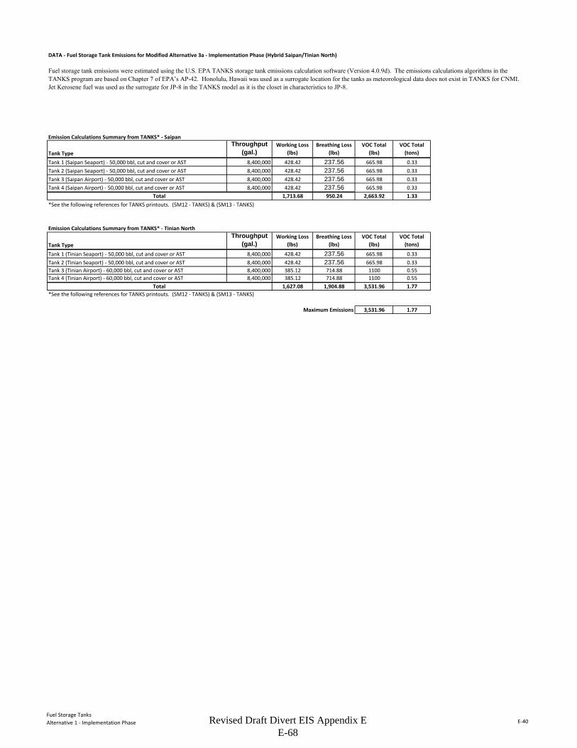
Fuel Storage TanksAlternative 1 - Implementation Phase E-40
DATA - Fuel Storage Tank Emissions for Modified Alternative 3a - Implementation Phase (Hybrid Saipan/Tinian North)
Emission Calculations Summary from TANKS* - Saipan
Tank TypeThroughput
(gal.)Working Loss
(lbs)Breathing Loss
(lbs)VOC Total
(lbs)VOC Total
(tons)
Tank 1 (Saipan Seaport) - 50,000 bbl, cut and cover or AST 8,400,000 428.42 237.56 665.98 0.33Tank 2 (Saipan Seaport) - 50,000 bbl, cut and cover or AST 8,400,000 428.42 237.56 665.98 0.33Tank 3 (Saipan Airport) - 50,000 bbl, cut and cover or AST 8,400,000 428.42 237.56 665.98 0.33Tank 4 (Saipan Airport) - 50,000 bbl, cut and cover or AST 8,400,000 428.42 237.56 665.98 0.33
1,713.68 950.24 2,663.92 1.33*See the following references for TANKS printouts. (SM12 - TANKS) & (SM13 - TANKS)
Emission Calculations Summary from TANKS* - Tinian North
Tank TypeThroughput
(gal.)Working Loss
(lbs)Breathing Loss
(lbs)VOC Total
(lbs)VOC Total
(tons)
Tank 1 (Tinian Seaport) - 50,000 bbl, cut and cover or AST 8,400,000 428.42 237.56 665.98 0.33Tank 2 (Tinian Seaport) - 50,000 bbl, cut and cover or AST 8,400,000 428.42 237.56 665.98 0.33Tank 3 (Tinian Airport) - 60,000 bbl, cut and cover or AST 8,400,000 385.12 714.88 1100 0.55Tank 4 (Tinian Airport) - 60,000 bbl, cut and cover or AST 8,400,000 385.12 714.88 1100 0.55
1,627.08 1,904.88 3,531.96 1.77*See the following references for TANKS printouts. (SM12 - TANKS) & (SM13 - TANKS)
Maximum Emissions 3,531.96 1.77
Fuel storage tank emissions were estimated using the U.S. EPA TANKS storage tank emissions calculation software (Version 4.0.9d). The emissions calculations algorithms in the TANKS program are based on Chapter 7 of EPA’s AP-42. Honolulu, Hawaii was used as a surrogate location for the tanks as meteorological data does not exist in TANKS for CNMI. Jet Kerosene fuel was used as the surrogate for JP-8 in the TANKS model as it is the closet in characteristics to JP-8.
Total
Total
Revised Draft Divert EIS Appendix E E-68
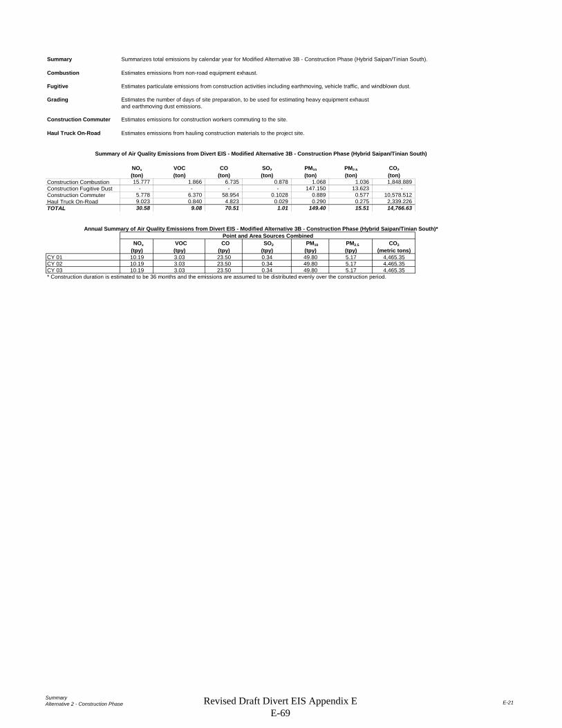
SummaryAlternative 2 - Construction Phase E-21
Summary Summarizes total emissions by calendar year for Modified Alternative 3B - Construction Phase (Hybrid Saipan/Tinian South).
Combustion Estimates emissions from non-road equipment exhaust.
Fugitive Estimates particulate emissions from construction activities including earthmoving, vehicle traffic, and windblown dust.
Grading Estimates the number of days of site preparation, to be used for estimating heavy equipment exhaustand earthmoving dust emissions.
Construction Commuter Estimates emissions for construction workers commuting to the site.
Haul Truck On-Road Estimates emissions from hauling construction materials to the project site.
NOx VOC CO SO2 PM10 PM2.5 CO2(ton) (ton) (ton) (ton) (ton) (ton) (ton)
Construction Combustion 15.777 1.866 6.735 0.878 1.068 1.036 1,848.889 Construction Fugitive Dust - - - - 147.150 13.623 - Construction Commuter 5.778 6.370 58.954 0.1028 0.889 0.577 10,578.512 Haul Truck On-Road 9.023 0.840 4.823 0.029 0.290 0.275 2,339.226 TOTAL 30.58 9.08 70.51 1.01 149.40 15.51 14,766.63
NOx VOC CO SO2 PM10 PM2.5 CO2(tpy) (tpy) (tpy) (tpy) (tpy) (tpy) (metric tons)
CY 01 10.19 3.03 23.50 0.34 49.80 5.17 4,465.35CY 02 10.19 3.03 23.50 0.34 49.80 5.17 4,465.35CY 03 10.19 3.03 23.50 0.34 49.80 5.17 4,465.35* Construction duration is estimated to be 36 months and the emissions are assumed to be distributed evenly over the construction period.
Point and Area Sources CombinedAnnual Summary of Air Quality Emissions from Divert EIS - Modified Alternative 3B - Construction Phase (Hybrid Saipan/Tinian South)*
Summary of Air Quality Emissions from Divert EIS - Modified Alternative 3B - Construction Phase (Hybrid Saipan/Tinian South)
Revised Draft Divert EIS Appendix E E-69
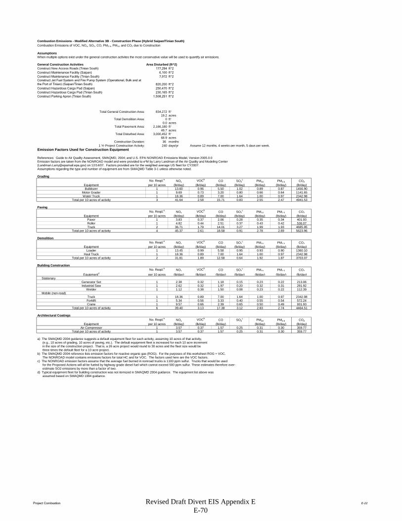
Project Combustion E-22
Combustion Emissions - Modified Alternative 3B - Construction Phase (Hybrid Saipan/Tinian South)Combustion Emissions of VOC, NOx, SO2, CO, PM2.5, PM10, and CO2 due to Construction
AssumptionsWhen multiple options exist under the general construction activites the most conservative value will be used to quantify air emissions.
General Construction Activities Area Disturbed (ft^2)Construct New Access Roads (Tinian South) 177,294 ft^2Construct Maintenance Facility (Saipan) 6,100 ft^2Construct Maintenance Facility (Tinian South) 7,972 ft^2Construct Jet Fuel System and Fire Pump System (Operational, Bulk and at the Port of Tinian) (Saipan/Tinian South) 820,200 ft^2Construct Hazardous Cargo Pad (Saipan) 250,470 ft^2Construct Hazardous Cargo Pad (Tinian South) 230,165 ft^2Construct Parking Apron (Tinian South) 1,508,251 ft^2
Total General Construction Area: 834,272 ft2
19.2 acresTotal Demolition Area: 0 ft2
0.0 acresTotal Pavement Area: 2,166,180 ft2
49.7 acresTotal Disturbed Area: 3,000,452 ft2
68.9 acresConstruction Duration: 36 months
1 Yr Project Construction Activity: 240 days/yr Assume 12 months, 4 weeks per month, 5 days per week.Emission Factors Used for Construction Equipment
References: Guide to Air Quality Assessment, SMAQMD, 2004; and U.S. EPA NONROAD Emissions Model, Version 2005.0.0Emission factors are taken from the NONROAD model and were provided to e²M by Larry Landman of the Air Quality and Modeling Center ([email protected]) on 12/14/07. Factors provided are for the weighted average US fleet for CY2007. Assumptions regarding the type and number of equipment are from SMAQMD Table 3-1 unless otherwise noted.
Grading No. Reqd.a NOx VOCb CO SO2
c PM10 PM2.5 CO2Equipment per 10 acres (lb/day) (lb/day) (lb/day) (lb/day) (lb/day) (lb/day) (lb/day)Bulldozer 1 13.60 0.96 5.50 1.02 0.89 0.87 1456.90
Motor Grader 1 9.69 0.73 3.20 0.80 0.66 0.64 1141.65Water Truck 1 18.36 0.89 7.00 1.64 1.00 0.97 2342.98
Total per 10 acres of activity 3 41.64 2.58 15.71 0.83 2.55 2.47 4941.53
PavingNo. Reqd.a NOx VOCb CO SO2
c PM10 PM2.5 CO2Equipment per 10 acres (lb/day) (lb/day) (lb/day) (lb/day) (lb/day) (lb/day) (lb/day)
Paver 1 3.83 0.37 2.06 0.28 0.35 0.34 401.93Roller 1 4.82 0.44 2.51 0.37 0.43 0.42 536.07Truck 2 36.71 1.79 14.01 3.27 1.99 1.93 4685.95
Total per 10 acres of activity 4 45.37 2.61 18.58 0.91 2.78 2.69 5623.96
DemolitionNo. Reqd.a NOx VOCb CO SO2
c PM10 PM2.5 CO2Equipment per 10 acres (lb/day) (lb/day) (lb/day) (lb/day) (lb/day) (lb/day) (lb/day)
Loader 1 13.45 0.99 5.58 0.95 0.93 0.90 1360.10Haul Truck 1 18.36 0.89 7.00 1.64 1.00 0.97 2342.98
Total per 10 acres of activity 2 31.81 1.89 12.58 0.64 1.92 1.87 3703.07
Building ConstructionNo. Reqd.a NOx VOCb CO SO2
c PM10 PM2.5 CO2
Equipmentd per 10 acres (lb/day) (lb/day) (lb/day) (lb/day) (lb/day) (lb/day) (lb/day) Stationary
Generator Set 1 2.38 0.32 1.18 0.15 0.23 0.22 213.06Industrial Saw 1 2.62 0.32 1.97 0.20 0.32 0.31 291.92
Welder 1 1.12 0.38 1.50 0.08 0.23 0.22 112.39 Mobile (non-road)
Truck 1 18.36 0.89 7.00 1.64 1.00 0.97 2342.98Forklift 1 5.34 0.56 3.33 0.40 0.55 0.54 572.24Crane 1 9.57 0.66 2.39 0.65 0.50 0.49 931.93
Total per 10 acres of activity 6 39.40 3.13 17.38 3.12 2.83 2.74 4464.51
Architectural CoatingsNo. Reqd.a NOx VOCb CO SO2
c PM10 PM2.5 CO2Equipment per 10 acres (lb/day) (lb/day) (lb/day) (lb/day) (lb/day) (lb/day)
Air Compressor 1 3.57 0.37 1.57 0.25 0.31 0.30 359.77Total per 10 acres of activity 1 3.57 0.37 1.57 0.25 0.31 0.30 359.77
a) The SMAQMD 2004 guidance suggests a default equipment fleet for each activity, assuming 10 acres of that activity, (e.g., 10 acres of grading, 10 acres of paving, etc.). The default equipment fleet is increased for each 10 acre increment in the size of the construction project. That is, a 26 acre project would round to 30 acres and the fleet size would be three times the default fleet for a 10 acre project.b) The SMAQMD 2004 reference lists emission factors for reactive organic gas (ROG). For the purposes of this worksheet ROG = VOC. The NONROAD model contains emissions factors for total HC and for VOC. The factors used here are the VOC factors.c) The NONROAD emission factors assume that the average fuel burned in nonroad trucks is 1100 ppm sulfur. Trucks that would be used for the Proposed Actions will all be fueled by highway grade diesel fuel which cannot exceed 500 ppm sulfur. These estimates therefore over- estimate SO2 emissions by more than a factor of two.d) Typical equipment fleet for building construction was not itemized in SMAQMD 2004 guidance. The equipment list above was assumed based on SMAQMD 1994 guidance.
Revised Draft Divert EIS Appendix E E-70

Project Combustion E-23
PROJECT-SPECIFIC EMISSION FACTOR SUMMARY
Project-Specific Emission Factors (lb/day)NOx VOC CO SO2** PM10 PM2.5 CO2
7 291.489 18.039 109.969 5.830 17.819 17.284 34590.6845 226.836 13.029 92.892 4.537 13.880 13.464 28119.7841 31.808 1.886 12.584 0.636 1.923 1.865 3703.0742 78.793 6.260 34.765 6.233 5.658 5.488 8929.0232 7.148 0.746 3.131 0.502 0.619 0.600 719.547
74.441*The equipment multiplier is an integer that represents units of 10 acres for purposes of estimating the number of equipment required for the project.**Emission factor is from the evaporation of solvents during painting, per "Air Quality Thresholds of Significance", SMAQMD, 1994
Example: SMAQMD Emission Factor for Grading Equipment NOx = (Total Grading NOx per 10 acre)*(Equipment Multiplier)
Summary of Input ParametersTotal Days
Grading: 3,000,452 68.88 6 (from "Grading" worksheet)Paving: 2,166,180 49.73 47
Demolition: 0 0.00 0Building Construction: 834,272 19.15 240Architectural Coating 834,272 19.15 20 (per SMAQMD "Air Quality of Thresholds of Significance", 1994)
NOTE: The 'Total Days' estimate for paving is calculated by dividing the total number of acres by 0.21 acres/day, which is a factor derived from the 2005 MEANSHeavy Construction Cost Data, 19th Edition, for 'Asphaltic Concrete Pavement, Lots and Driveways - 6" stone base', which provides an estimate of squarefeet paved per day. There is also an estimate for 'Plain Cement Concrete Pavement', however the estimate for asphalt is used because it is more conservative. The 'Total 'Days' estimate for demolition is calculated by dividing the total number of acres by 0.02 acres/day, which is a factor also derived from the 2005 MEANS reference. This is calculated by averaging the demolition estimates from 'Building Demolition - Small Buildings, Concrete', assuming a height of 30 feet for a two-story building; from 'Building Footings and Foundations Demolition - 6" Thick, Plain Concrete'; and from 'Demolish, Remove Pavement and Curb - Concrete to 6" thick, rod reinforced'. Paving is double-weighted since projects typically involve more paving demolition.The 'Total Days' estimate for building construction is assumed to be 230 days, unless project-specific data is known.
Total Project Emissions by Activity (lbs)
NOx VOC CO SO2 PM10 PM2.5 CO2Grading Equipment 1,748.93 108.23 659.82 34.98 106.91 103.70 207,544Paving 10,752.05 617.56 4,403.09 215.04 657.93 638.20 1,332,878Demolition - - - - - - 0Building Construction 18,910.23 1,502.31 8,343.51 1,495.85 1,357.94 1,317.20 2,142,966Architectural Coatings 142.96 1,503.74 62.62 10.05 12.37 12.00 14,391
Total Emissions (lbs): 31,554.17 3,731.84 13,469.03 1,755.91 2,135.16 2,071.11 3,697,778
Results: Total Project Annual Emission Rates
NOx VOC CO SO2 PM10 PM2.5 CO2Total Project Emissions (lbs) 31,554.17 3,731.84 13,469.03 1,755.91 2,135.16 2,071.11 3,697,778Total Project Emissions (tons) 15.78 1.87 6.73 0.88 1.07 1.04 1,848.89
SourceGrading Equipment
Total Area (ft2)Total Area
(acres)
Equipment Multiplier*
Architectural Coating**
Demolition EquipmentBuilding Construction
Paving Equipment
Air Compressor for Architectural Coating
Revised Draft Divert EIS Appendix E E-71

Project Fugitive E-24
Construction Fugitive Dust Emission FactorsEmission Factor Units Source
General Construction Activities 0.19 ton PM10/acre-month MRI 1996; EPA 2001; EPA 2006New Road Construction 0.42 ton PM10/acre-month MRI 1996; EPA 2001; EPA 2006
PM2.5 EmissionsPM2.5 Multiplier 0.10 EPA 2001; EPA 2006
Control Efficiency 0.50 EPA 2001; EPA 2006
New Roadway Construction (0.42 ton PM 10 /acre-month)Duration of Construction Project 12 monthsArea 49.7 acres
General Construction Activities (0.19 ton PM 10 /acre-month)Duration of Construction Project 12 monthsArea 19.2 acres
PM10 uncontrolled PM10 controlled PM2.5 uncontrolled PM2.5 controlledNew Roadway Construction 250.63 125.32 25.06 12.53General Construction Activities 43.67 21.83 2.18 1.09
Total 294.30 147.15 27.25 13.62
General Construction Activities Emission Factor0.19 ton PM10/acre-month Source: MRI 1996; EPA 2001; EPA 2006
New Road Construction Emission Factor0.42 ton PM10/acre-month Source: MRI 1996; EPA 2001; EPA 2006
PM2.5 Multiplier 0.10
Control Efficiency for PM10 and PM2.5 0.50
References:
The EPA National Emission Inventory documentation recommends a control efficiency of 50% for PM10 and PM2.5 in PM nonattainment areas (EPA 2006). Wetting controls will be applied during project construction.
EPA 2001. Procedures Document for National Emissions Inventory, Criteria Air Pollutants, 1985-1999. EPA-454/R-01-006. Office of Air Quality Planning and Standards, United States Environmental Protection Agency. March 2001.
EPA 2006. Documentation for the Final 2002 Nonpoint Sector (Feb 06 version) National Emission Inventory for Criteria and Hazardous Air Pollutants. Prepared for: Emissions Inventory and Analysis Group (C339-02) Air Quality Assessment Division Office of Air Quality Planning and Standards, United States Environmental Protection Agency. July 2006.
MRI 1996. Improvement of Specific Emission Factors (BACM Project No. 1). Midwest Research Institute (MRI). Prepared for the California South Coast Air Quality Management District, March 29, 1996.
The area-based emission factor for construction activities is based on a study completed by the Midwest Research Institute (MRI) Improvement of Specific Emission Factors (BACM Project No. 1), March 29, 1996. The MRI study evaluated seven construction projects in Nevada and California (Las Vegas, Coachella Valley, South Coast Air Basin, and the San Joaquin Valley). The study determined an average emission factor of 0.11 ton PM10/acre-month for sites without large-scale cut/fill operations. A worst-case emission factor of 0.42 ton PM10/acre-month was calculated for sites with active large-scale earth moving operations. The monthly emission factors are based on 168 work-hours per month (MRI 1996). A subsequent MRI Report in 1999, Estimating Particulate Matter Emissions From Construction Operations, calculated the 0.19 ton PM10/acre-month emission factor by applying 25% of the large-scale earthmoving emission factor (0.42 ton PM10/acre-month) and 75% of the average emission factor (0.11 ton PM10/acre-month). The 0.19 ton PM10/acre-month emission factor is referenced by the EPA for non-residential construction activities in recent procedures documents for the National Emission Inventory (EPA 2001; EPA 2006). The 0.19 ton PM10/acre-month emission factor represents a refinement of EPA's original AP-42 area-based total suspended particulate (TSP) emission factor in Section 13.2.3 Heavy Construction Operations. In addition to the EPA, this methodology is also supported by the South Coast Air Quality Management District as well as the Western Regional Air Partnership (WRAP) which is funded by the EPA and is administered jointly by the Western Governor's Association and the National Tribal Environmental Council. The emission factor is assumed to encompass a variety of non-residential construction activities including building construction (commercial, industrial, institutional, governmental), public works, and travel on unpaved roads. The EPA National Emission Inventory documentation assumes that the emission factors are uncontrolled and recommends a control efficiency of 50% for PM10 and PM2.5 in PM nonattainment areas.
The emission factor for new road construction is based on the worst-case conditions emission factor from the MRI 1996 study described above (0.42 tons PM10/acre-month). It is assumed that road construction involves extensive earthmoving and heavy construction vehicle travel resulting in emissions that are higher than other general construction projects. The 0.42 ton PM10/acre-month emission factor for road construction is referenced in recent procedures documents for the EPA National Emission Inventory (EPA 2001; EPA 2006).
PM2.5 emissions are estimated by applying a particle size multiplier of 0.10 to PM10 emissions. This methodology is consistent with the procedures documents for the National Emission Inventory (EPA 2006).
Construction Fugitive Dust Emissions - Proposed Action [Modified Alternative 3B - Construction Phase (Hybrid Saipan/Tinian South)]
(10% of PM10
emissions assumed to be PM2.5)
(assume 50% control efficiency for PM10
and PM2.5 emissions)
Project Assumptions
Project Emissions (tons/year)
Revised Draft Divert EIS Appendix E E-72

Project Grading E-25
Grading Schedule - Proposed Action [Modified Alternative 3B - Construction Phase (Hybrid Saipan/Tinian South)]
Estimate of time required to grade a specified area.
Input ParametersConstruction area: 68.9 acres/yr (from Combustion Worksheet)
Qty Equipment: 21.0 (calculated based on 3 pieces of equipment for every 10 acres)
Assumptions.Terrain is mostly flat.An average of 6" soil is excavated from one half of the site and backfilled to the other half of the site; no soil is hauled off-site or borrowed.200 hp bulldozers are used for site clearing.300 hp bulldozers are used for stripping, excavation, and backfill.Vibratory drum rollers are used for compacting.Stripping, Excavation, Backfill and Compaction require an average of two passes each.Excavation and Backfill are assumed to involve only half of the site.
Calculation of days required for one piece of equipment to grade the specified area.
Reference: Means Heavy Construction Cost Data, 19th Ed., R. S. Means, 2005.
Means Line No. Operation Description Output UnitsAcres per equip-day
equip-days per acre Acres/yr (project-specific)
Equip-days per year
2230 200 0550 Site Clearing Dozer & rake, medium brush 8 acre/day 8 0.13 68.88 8.612230 500 0300 Stripping Topsoil & stockpiling, adverse soil 1,650 cu. yd/day 2.05 0.49 68.88 33.682315 432 5220 Excavation Bulk, open site, common earth, 150' haul 800 cu. yd/day 0.99 1.01 34.44 34.732315 120 5220 Backfill Structural, common earth, 150' haul 1,950 cu. yd/day 2.42 0.41 34.44 14.252315 310 5020 Compaction Vibrating roller, 6 " lifts, 3 passes 2,300 cu. yd/day 2.85 0.35 68.88 24.16
TOTAL 115.42
Calculation of days required for the indicated pieces of equipment to grade the designated acreage.
(Equip)(day)/yr: 115.42Qty Equipment: 21.00
Grading days/yr: 5.50
Revised Draft Divert EIS Appendix E E-73

Construction Commuter E-26
Construction/Staff Commuter Emissions - Modified Alternative 3B - Construction Phase (Hybrid Saipan/Tinian South)
Emissions from construction workers commuting to the job site are estimated in this spreadsheet.
Assumptions:Passenger vehicle emission factors for scenario year 2015 are used.
The average roundtrip commute for a construction/staff worker = 40 milesNumber of construction days = 240 days
Number of construction/Staff workers (daily) = 2000 peopleNote: None
Passenger Vehicle Emission Factors for Year 2015 (lbs/mile)NOx VOC CO SO2 PM10 PM2.5 CO2
0.00060188 0.00066355 0.00614108 0.00001070 0.00009259 0.00006015 1.10192837
Notes:The SMAQMD 2007 reference lists emission factors for reactive organic gas (ROG). For purposes of this worksheet ROG = VOC.
Construction Commuter EmissionsNOx VOC CO SO2 PM10 PM2.5 CO2
lbs 11,556.034 12,740.118 117,908.683 205.519 1,777.691 1,154.873 21,157,024.793tons 5.778 6.370 58.954 0.103 0.889 0.577 10,578.512
Example Calculation: NOx emissions (lbs) = 60 miles/day * NOx emission factor (lb/mile) * number of construction days * number of workers
Emission Estimation Method: Emission factors from the South Coast Air Quality Management District (SCAQMD) EMFAC 2007 (v 2.3) Model (on-road) were used. These emission factors are available online at http://www.aqmd.gov/home/regulations/ceqa/air-quality-analysis-handbook/emfac-2007-(v2-3)-emission-factors-(on-road).
Source: South Coast Air Quality Management District. EMFAC 2007 (ver 2.3) On-Road Emissions Factors. Available online: <http://www.aqmd.gov/home/regulations/ceqa/air-quality-analysis-handbook/emfac-2007-(v2-3)-emission-factors-(on-road)>. Accessed 18 August 2015.
Revised Draft Divert EIS Appendix E E-74

Area of Influence E-27
No Statistical Area Available for TNI
Row # State County Tier-1 CO NOx PM10 PM2.5 SO2 VOC CO NOx PM10 PM2.5 SO2 VOC
Grand Total 0 0 0 0 0 0 0 0 0 0 0 0
SOURCE:http://www.epa.gov/ttn/chief/eiinformation.html
USEPA - AirData NET Tier Report*Net Air pollution sources (area and point) in tons per year (2002)Site visited on 02 February 2012.
No Air Quality Control Region Identified
CO NOx PM10 PM2.5 SO2 VOCCNMI 0 0 0 0 0 0CNMI DEQ 0 0 0 0 0 0
Point Source Emissions Area Source Emissions (Non-Point and Mobile Sources)
No Data Available
Revised Draft Divert EIS Appendix E E-75
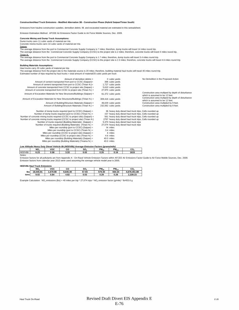
Haul Truck On-Road E-28
Construction/Haul Truck Emissions - Modified Alternative 3B - Construction Phase (Hybrid Saipan/Tinian South)
Emissions from hauling construction supplies, demoliton debris, fill, and excavated material are estimated in this spreadsheet.
Concrete Mixing and Dump Truck Assumptions:Dump trucks carry 11 cubic yards of material per trip.Concrete mixing trucks carry 10 cubic yards of material per trip.SaipanThe average distance from the port to Commercial Concrete Supply Company is 7 miles; therefore, dump trucks will travel 14 miles round trip.The average distance from the Commercial Concrete Supply Company (CCSC) to the project site is 2 miles; therefore, concrete trucks will travel 4 miles round trip.Tinian N.The average distance from the port to Commercial Concrete Supply Company is 1.7 miles; therefore, dump trucks will travel 3.4 miles round trip.The average distance from the Commercial Concrete Supply Company (CCSC) to the project site is 2.3 miles; therefore, concrete trucks will travel 4.6 miles round trip.
Building Materials Assumptions:Haul trucks carry 20 cubic yards of material per trip.The average distance from the project site to the materials source is 20 miles; therefore, building material haul trucks will travel 40 miles round trip.Estimated number of trips required by haul trucks = total amount of material/20 cubic yards per truck
Amount of demoltion debris = 0 cubic yardsAmount of cement transported from port to CCSC (Saipan)= 396 cubic yards
Amount of cement transported from port to CCSC (Tinian N.)= 1,727 cubic yards5,610 cubic yards
27,970 cubic yards
61,372 cubic yards Construction area multiped by depth of disturbance which is assumed to be 12 feet.
309,416 cubic yards Construction area multiped by depth of disturbance which is assumed to be 12 feet.
Amount of Building/Structure Materials (Saipan) = 46,029 cubic yardsAmount of Building/Structure Materials (Tinian N.) = 232,062 cubic yards
Number of dump trucks required (port to CCSC) (Saipan) = 36 heavy duty diesel haul truck trips, Cells rounded upNumber of dump trucks required (port to CCSC) (Tinian N.) = 157 heavy duty diesel haul truck trips, Cells rounded up
561 heavy duty diesel haul truck trips, Cells rounded up2797 heavy duty diesel haul truck trips, Cells rounded up
Number of trucks required (Building Materials) (Saipan) = 5,370 heavy duty diesel haul truck tripsNumber of trucks required (Building Materials) (Tinian N.) = 27,074 heavy duty diesel haul truck trips
Miles per roundtrip (port to CCSC) (Saipan) = 14 milesMiles per roundtrip (port to CCSC) (Tinain N.) = 3.4 miles
Miles per roundtrip (CCSC to project site) (Saipan) = 4 milesMiles per roundtrip (CCSC to project site) (Tinian N.) = 4.6 miles
Miles per roundtrip (Building Materials) (Saipan) = 40.0 milesMiles per roundtrip (Building Materials) (Tinaina N.) = 40.0 miles
Low Altitude Heavy Duty Diesel Vehicle 8b (HDDV8b) Average Emission Factors (grams/mile)NOx VOC CO SO2 PM10 PM2.5 CO2
HDDV8b 6.23 0.58 3.33 0.02 0.20 0.19 1615
Emission factors for all pollutants are from Appendix A - On-Raod Vehicle Emission Factors within AFCEE Air Emissions Factor Guide to Air Force Mobile Sources, Dec. 2009.Emission factors from calendar year 2015 were used assuming the average vehicle model year is 2005.
HDDV8b Haul Truck EmissionsNOx VOC CO SO2 PM10 PM2.5 CO2
lbs 18,045.91 1,679.98 9,645.40 57.93 579.30 550.34 4,678,451.88tons 9.02 0.84 4.82 0.03 0.29 0.28 2,339.23
Example Calculation: NOx emissions (lbs) = 40 miles per trip * 27,074 trips * NOx emission factor (g/mile) * lb/453.6 g
Notes:
No Demolition in the Proposed Action
Emission Estimation Method: AFCEE Air Emissions Factor Guide to Air Force Mobile Sources, Dec. 2009.
Amount of concrete transported from CCSC to project site (Saipan) = Amount of concrete transported from CCSC to project site (Tinian N.) =
Amount of Excavation Materials for New Structures/Buildings (Saipan) =
Amount of Excavation Materials for New Structures/Buildings (Tinian N.) =
Construction area multipled by 9 feet.Construction area multipled by 9 feet.
Number of concrete mixing trucks required (CCSC to project site) (Saipan) = Number of concrete mixing trucks required (CCSC to project site) (Tinian N.)
Revised Draft Divert EIS Appendix E E-76

Summary SheetAlternative 1 - Implementation Phase E-29
Summary Summarizes total emissions by calendar year for Modified Alternative 3b - Implementation Phase (Hybrid Saipan/Tinian South).
Airfield Operations Aircraft operations consist of taxi, take-off and landings (sorties or LTOs), touch-and-go operations (TGOs), and low flybys (LFB) by base aircraft.
Fuel Truck and Commuter Vehicle Emissions Estimates emissions for workers and operational vehicles commuting to the site of the Proposed Action.
Fuel Transfer Emissions Fuel loading operations under the Proposed Action involves the loading of fuel into tanker trucks and aircraft.
Internal Combustion Engine (ICE) Emissions Estimates Emissions from Internal Combustion Engines (e.g Generators)
Fuel Storage Tanks Estimates emissions from Above Ground Storage Tanks.
Criteria Pollutant and VOC Emissions Summary for Modified Alternative 3b - Implementation Phase (Hybrid Saipan/Tinian South) (tons/year)Source Category PM10 PM2.5 CO NOx SOx VOCs
Airfield Operations 0.05 0.05 18.67 6.77 0.98 1.25Fuel Truck and Commuter Vehicle
Emissions 0.02 0.02 0.28 0.54 0.00 0.05Fuel Transfer N/A N/A N/A N/A N/A 0.34
Fuel Storage Tanks N/A N/A N/A N/A N/A 1.77Total Criteria and VOC
Pollutant Emissions (tons/year)
0.08 0.07 18.95 7.31 0.98 3.40
Greenhouse Gas (GHG) Emissions Summary for Modified Alternative 3b - Implementation Phase (Hybrid Saipan/Tinian South) (metric tonnes/year)
Source CategoryCO2-equivalent
(lb/year)CO2-equivalent
(kg/year)CO2-equivalent (metric
tonne/year)
Airfield Operations* 366,634,444 166,305,384 166,305Fuel Truck and Commuter Vehicle
Emissions 292,969 132,891 133Fuel Transfer 0 0 0
Fuel Storage Tanks 0 0 0Total GHG Emissions 366,927,413 166,438,275 166,438
Revised Draft Divert EIS Appendix E E-77
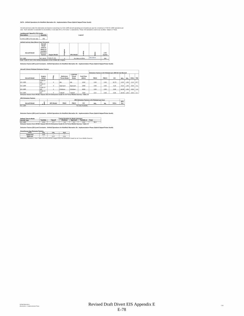
Airfield OperationsAlternative 1 - Implementation Phase E-30
DATA - Airfield Operations for Modified Alternative 3b - Implementation Phase (Hybrid Saipan/Tinian South)
Landing and Takeoff (LTO) CyclesDescription Quantity Legend
# of KC-135R LTO's per year 360
Airfield Activity Data (Worst Case Scenario)
Aircraft Model
Aircraft Model
Used to Match to Available Emission Factors Engine Model #
Engi
nes
APU Model # A
PUs
Not
es LTO Cycles
KC-135R KC-135-R F108-CF-201 4 See below 360Note: F108-CF-201 is the military designation of the CFM56-2B-1 engine.
Emission Factors (EFs) and Constants - Airfield Operations for Modified Alternative 3b - Implementation Phase (Hybrid Saipan/Tinian South)
Aircraft Criteria Pollutant Emission Factors
Aircraft ModelEngine Model #
Eng. Reference
Thrust Mode
LTO/TGO Thrust Mode
Fuel Flow(lb/hr) PM10 PM2.5 CO NOX SO2 VOCs TIM
KC-135RF108-CF-201 4 Idle Idle 1016 0.06 0.06 30.70 4.00 1.06 2.10 47.7
KC-135RF108-CF-201 4 Approach Approach 2468 0.06 0.05 4.20 8.20 1.06 0.09 5.2
KC-135RF108-CF-201 4 Climbout Climbout 6500 0.05 0.05 0.90 16.00 1.06 0.06 1.6
KC-135RF108-CF-201 4 Takeoff Takeoff 7818 0.07 0.06 0.90 18.05 1.06 0.05 0.7
Emission factors from AFCEC August 2013 Air Emissions Guide for Air Force Mobile Sources, Table 2-8
APU Emission FactorsAPU Emission Factors in lb Pollutant per hour
Aircraft Model # APU APU Model PM10 PM2.5 CO NOX S02 VOCs
APU(hr)
KC-135R
Emission Factors (EFs) and Constants - Airfield Operations for Modified Alternative 3b - Implementation Phase (Hybrid Saipan/Tinian South)
Default Time-In-Mode Aircraft Type Taxi/Idle- Takeoff Climbout Approach Taxi/Idle-in TotalKC-135R 32.8 0.7 1.6 5.2 14.9 55.2Emission factors from AFCEC August 2013 Air Emissions Guide for Air Force Mobile Sources, Table 2-4
Emission Factors (EFs) and Constants - Airfield Operations for Modified Alternative 3b - Implementation Phase (Hybrid Saipan/Tinian South)
Greenhouse Gas Emission FactorsUnits CO2 CH4 N2O
kg/gal fuel 9.80 --- ---g/gal fuel --- 0.27 0.31
Reference: Footnote 2. from Table 2-8 of the AFCEC August 2013 Air Emissions Guide for Air Force Mobile Sources.
Aircraft exercises under this alternative are based on assuming 2 to 4 KC-135R aircraft operating up to 8 weeks per year for a maximum of 720 KC-135R operations per year. Each operation is equivalent to one landing or one take-off (1 LTO Cycle = 2 operations). These 720 operations could occur at either Saipan or Tinian.
Emission Factors in lb Pollutant per 1000 lb Fuel Burned
No data on APUs
No Data Available.
Typical Duration by Mode (minutes)
Revised Draft Divert EIS Appendix E E-78
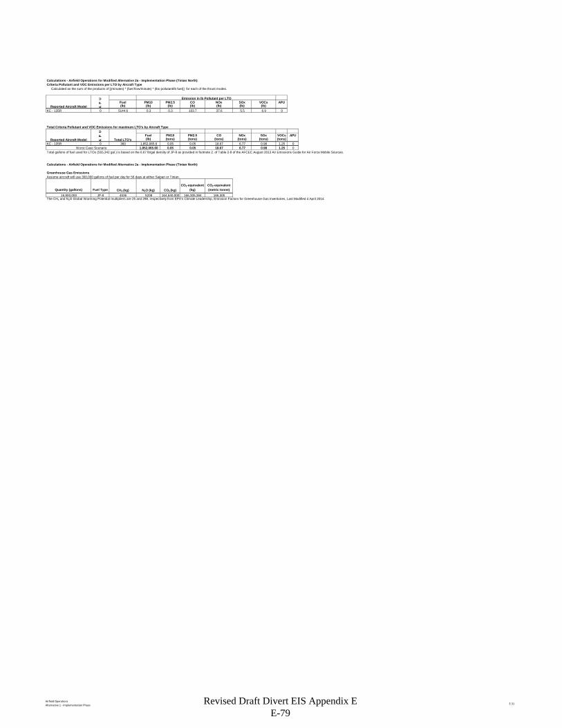
Airfield OperationsAlternative 1 - Implementation Phase E-31
Calculations - Airfield Operations for Modified Alternative 2a - Implementation Phase (Tinian North)Criteria Pollutant and VOC Emissions per LTO by Aircraft Type Calculated as the sum of the products of [(minutes) * (fuel flow/minute) * (lbs pollutant/lb fuel)] for each of the thrust modes.
U Emission in lb Pollutant per LTOP Fuel PM10 PM2.5 CO NOx SOx VOCs APU
A (lb) (lb) (lb) (lb) (lb) (lb) (lb)KC - 135R 0 5144.6 0.3 0.3 103.7 37.6 5.5 6.9 0
Total Criteria Pollutant and VOC Emissions for maximum LTO's by Aircraft Type
UP Fuel PM10 PM2.5 CO NOx SOx VOCs APU
A (lb) (tons) (tons) (tons) (tons) (tons) (tons)KC - 135R 0 360 1,852,065.6 0.05 0.05 18.67 6.77 0.98 1.25 0
Worst Case Scenario 1,852,065.60 0.05 0.05 18.67 6.77 0.98 1.25 0Total gallons of fuel used for LTOs (555,342 gal.) is based on the 6.67 lb/gal density of JP-8 as provided in footnote 2. of Table 2-8 of the AFCEC August 2013 Air Emissions Guide for Air Force Mobile Sources.
Calculations - Airfield Operations for Modified Alternative 2a - Implementation Phase (Tinian North)
Greenhouse Gas Emissions Assume aircraft will use 300,000 gallons of fuel per day for 56 days at either Saipan or Tinian.
Quantity (gallons) Fuel Type CH4 (kg) N2O (kg) CO2 (kg)CO2-equivalent
(kg)CO2-equivalent (metric tonne)
16,800,000 JP-8 4536 5208 164,640,000 166,305,384 166,305The CH4 and N2O Global Warming Potential multipliers are 25 and 298, respectively from EPA's Climate Leadership, Emission Factors for Greenhouse Gas Inventories, Last Modified 4 April 2014.
Reported Aircraft Model
Reported Aircraft Model Total LTO's
Revised Draft Divert EIS Appendix E E-79
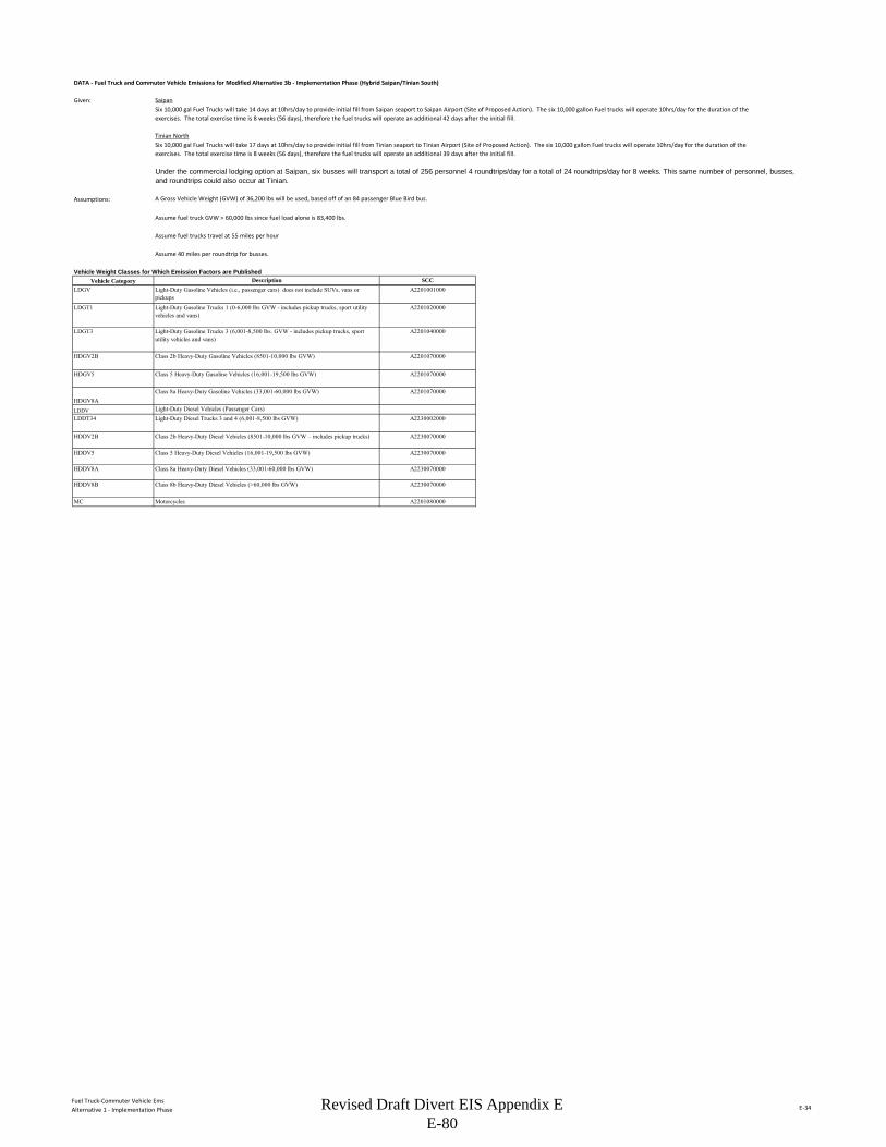
Fuel Truck-Commuter Vehicle EmsAlternative 1 - Implementation Phase E-34
DATA - Fuel Truck and Commuter Vehicle Emissions for Modified Alternative 3b - Implementation Phase (Hybrid Saipan/Tinian South)
Given: Saipan
Tinian North
Assumptions: A Gross Vehicle Weight (GVW) of 36,200 lbs will be used, based off of an 84 passenger Blue Bird bus.
Assume fuel truck GVW > 60,000 lbs since fuel load alone is 83,400 lbs.
Assume fuel trucks travel at 55 miles per hour
Assume 40 miles per roundtrip for busses.
Vehicle Weight Classes for Which Emission Factors are PublishedVehicle Category
LDGV
LDGT1
LDGT3
HDGV2B
HDGV5
HDGV8ALDDVLDDT34
HDDV2B
HDDV5
HDDV8A
HDDV8B
MC
Description SCCLight-Duty Gasoline Vehicles (i.e., passenger cars) does not include SUVs, vans or pickups
A2201001000
Light-Duty Gasoline Trucks 1 (0-6,000 lbs GVW - includes pickup trucks, sport utility vehicles and vans)
A2201020000
Light-Duty Gasoline Trucks 3 (6,001-8,500 lbs. GVW - includes pickup trucks, sport utility vehicles and vans)
A2201040000
Class 2b Heavy-Duty Gasoline Vehicles (8501-10,000 lbs GVW) A2201070000
Class 5 Heavy-Duty Gasoline Vehicles (16,001-19,500 lbs GVW) A2201070000
Class 8a Heavy-Duty Gasoline Vehicles (33,001-60,000 lbs GVW)
Class 8b Heavy-Duty Diesel Vehicles (>60,000 lbs GVW) A2230070000
Motorcycles A2201080000
A2201070000
Light-Duty Diesel Vehicles (Passenger Cars)Light-Duty Diesel Trucks 3 and 4 (6,001-8,500 lbs GVW) A2230002000
Six 10,000 gal Fuel Trucks will take 14 days at 10hrs/day to provide initial fill from Saipan seaport to Saipan Airport (Site of Proposed Action). The six 10,000 gallon Fuel trucks will operate 10hrs/day for the duration of the exercises. The total exercise time is 8 weeks (56 days), therefore the fuel trucks will operate an additional 42 days after the initial fill.
Six 10,000 gal Fuel Trucks will take 17 days at 10hrs/day to provide initial fill from Tinian seaport to Tinian Airport (Site of Proposed Action). The six 10,000 gallon Fuel trucks will operate 10hrs/day for the duration of the exercises. The total exercise time is 8 weeks (56 days), therefore the fuel trucks will operate an additional 39 days after the initial fill.
Under the commercial lodging option at Saipan, six busses will transport a total of 256 personnel 4 roundtrips/day for a total of 24 roundtrips/day for 8 weeks. This same number of personnel, busses, and roundtrips could also occur at Tinian.
Class 2b Heavy-Duty Diesel Vehicles (8501-10,000 lbs GVW – includes pickup trucks) A2230070000
Class 5 Heavy-Duty Diesel Vehicles (16,001-19,500 lbs GVW) A2230070000
Class 8a Heavy-Duty Diesel Vehicles (33,001-60,000 lbs GVW) A2230070000
Revised Draft Divert EIS Appendix E E-80
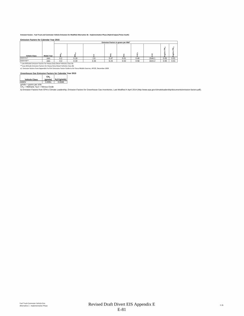
Fuel Truck-Commuter Vehicle EmsAlternative 1 - Implementation Phase E-35
Emission Factors - Fuel Truck and Commuter Vehicle Emissions for Modified Alternative 3b - Implementation Phase (Hybrid Saipan/Tinian South)
Emission Factors for Calendar Year 2015Emission Factors in grams per Milea
PM10
PM2.
5
CO
NO
x
SOx
VO
Cs
CO
2
Fugi
tive
PM10
Fugi
tive
PM2.
5
HDDV8A* 2005 0.2 0.19 2.8 5.47 0.01 0.48 1544.1 0.05 0.01HDDV8B** 2005 0.2 0.19 3.33 6.23 0.02 0.58 1615.2 0.05 0.01* Low Altitude Emission Factors for Heavy Duty Diesel Vehicles Class 8a**Low Altitude Emission Factors for Heavy Duty Diesel Vehicles Class 8ba) Emission factors from Appendix A of Air Emissions Factor Guide to Air Force Mobile Sources, AFCEE, December 2009
Greenhouse Gas Emission Factors for Calendar Year 2015
HDDV 0.0051 0.0048g/mile = grams per mileCH4 = Methane; N2O = Nitrous Oxideb) Emission Factors from EPA's Climate Leadership, Emission Factors for Greenhouse Gas Inventories, Last Modified 4 April 2014 (http://www.epa.gov/climateleadership/documents/emission-factors.pdf).
Vehicle Class Model Year
Vehicle ClassCH4
(g/mile) N2O (g/mile)
Revised Draft Divert EIS Appendix E E-81
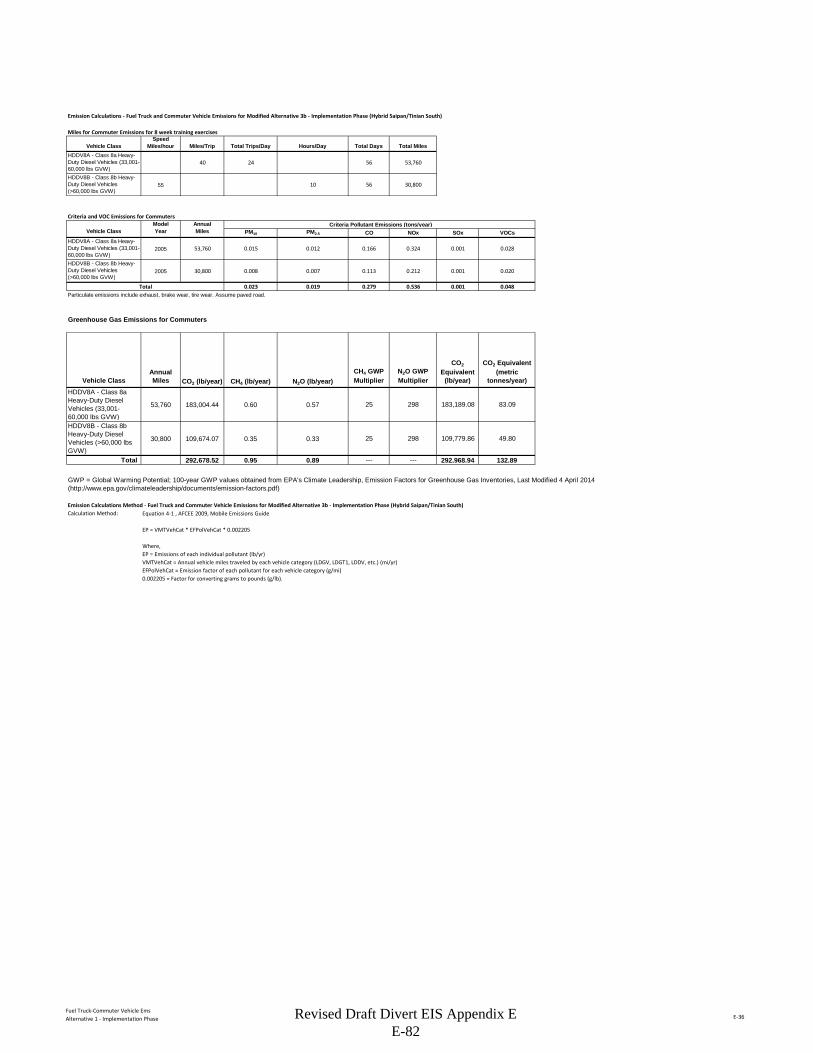
Fuel Truck-Commuter Vehicle EmsAlternative 1 - Implementation Phase E-36
Emission Calculations - Fuel Truck and Commuter Vehicle Emissions for Modified Alternative 3b - Implementation Phase (Hybrid Saipan/Tinian South)
Miles for Commuter Emissions for 8 week training exercises
Vehicle ClassSpeed
Miles/hour Miles/Trip Total Trips/Day Hours/Day Total Days Total MilesHDDV8A - Class 8a Heavy-Duty Diesel Vehicles (33,001-60,000 lbs GVW)
40 24 56 53,760
HDDV8B - Class 8b Heavy-Duty Diesel Vehicles (>60,000 lbs GVW)
55 10 56 30,800
Criteria and VOC Emissions for CommutersModel Annual Criteria Pollutant Emissions (tons/year)
Vehicle Class Year Miles PM10 PM2.5 CO NOx SOx VOCsHDDV8A - Class 8a Heavy-Duty Diesel Vehicles (33,001-60,000 lbs GVW)
2005 53,760 0.015 0.012 0.166 0.324 0.001 0.028
HDDV8B - Class 8b Heavy-Duty Diesel Vehicles (>60,000 lbs GVW)
2005 30,800 0.008 0.007 0.113 0.212 0.001 0.020
Total 0.023 0.019 0.279 0.536 0.001 0.048Particulate emissions include exhaust, brake wear, tire wear. Assume paved road.
Greenhouse Gas Emissions for Commuters
Vehicle ClassAnnual Miles CO2 (lb/year) CH4 (lb/year) N2O (lb/year)
CH4 GWP Multiplier
N2O GWP Multiplier
CO2
Equivalent (lb/year)
CO2 Equivalent (metric
tonnes/year)HDDV8A - Class 8a Heavy-Duty Diesel Vehicles (33,001-60,000 lbs GVW)
53,760 183,004.44 0.60 0.57 25 298 183,189.08 83.09
HDDV8B - Class 8b Heavy-Duty Diesel Vehicles (>60,000 lbs GVW)
30,800 109,674.07 0.35 0.33 25 298 109,779.86 49.80
Total 292,678.52 0.95 0.89 --- --- 292,968.94 132.89
Emission Calculations Method - Fuel Truck and Commuter Vehicle Emissions for Modified Alternative 3b - Implementation Phase (Hybrid Saipan/Tinian South)Calculation Method: Equation 4-1 , AFCEE 2009, Mobile Emissions Guide
EP = VMTVehCat * EFPolVehCat * 0.002205
Where,EP = Emissions of each individual pollutant (lb/yr)VMTVehCat = Annual vehicle miles traveled by each vehicle category (LDGV, LDGT1, LDDV, etc.) (mi/yr)EFPolVehCat = Emission factor of each pollutant for each vehicle category (g/mi)0.002205 = Factor for converting grams to pounds (g/lb).
GWP = Global Warming Potential; 100-year GWP values obtained from EPA's Climate Leadership, Emission Factors for Greenhouse Gas Inventories, Last Modified 4 April 2014 (http://www.epa.gov/climateleadership/documents/emission-factors.pdf)
Revised Draft Divert EIS Appendix E E-82
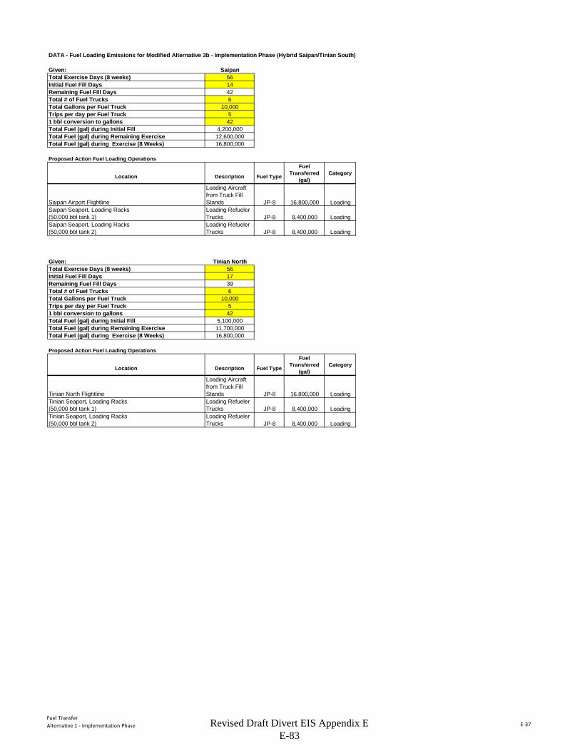
Fuel TransferAlternative 1 - Implementation Phase E-37
DATA - Fuel Loading Emissions for Modified Alternative 3b - Implementation Phase (Hybrid Saipan/Tinian South)
Given: SaipanTotal Exercise Days (8 weeks) 56Initial Fuel Fill Days 14Remaining Fuel Fill Days 42Total # of Fuel Trucks 6Total Gallons per Fuel Truck 10,000Trips per day per Fuel Truck 51 bbl conversion to gallons 42Total Fuel (gal) during Initial Fill 4,200,000Total Fuel (gal) during Remaining Exercise 12,600,000Total Fuel (gal) during Exercise (8 Weeks) 16,800,000
Proposed Action Fuel Loading Operations
Location Description Fuel Type
Fuel Transferred
(gal)Category
Saipan Airport Flightline
Loading Aircraft from Truck Fill Stands JP-8 16,800,000 Loading
Saipan Seaport, Loading Racks (50,000 bbl tank 1)
Loading Refueler Trucks JP-8 8,400,000 Loading
Saipan Seaport, Loading Racks (50,000 bbl tank 2)
Loading Refueler Trucks JP-8 8,400,000 Loading
Given: Tinian NorthTotal Exercise Days (8 weeks) 56Initial Fuel Fill Days 17Remaining Fuel Fill Days 39Total # of Fuel Trucks 6Total Gallons per Fuel Truck 10,000Trips per day per Fuel Truck 51 bbl conversion to gallons 42Total Fuel (gal) during Initial Fill 5,100,000Total Fuel (gal) during Remaining Exercise 11,700,000Total Fuel (gal) during Exercise (8 Weeks) 16,800,000
Proposed Action Fuel Loading Operations
Location Description Fuel Type
Fuel Transferred
(gal)Category
Tinian North Flightline
Loading Aircraft from Truck Fill Stands JP-8 16,800,000 Loading
Tinian Seaport, Loading Racks (50,000 bbl tank 1)
Loading Refueler Trucks JP-8 8,400,000 Loading
Tinian Seaport, Loading Racks (50,000 bbl tank 2)
Loading Refueler Trucks JP-8 8,400,000 Loading
Revised Draft Divert EIS Appendix E E-83
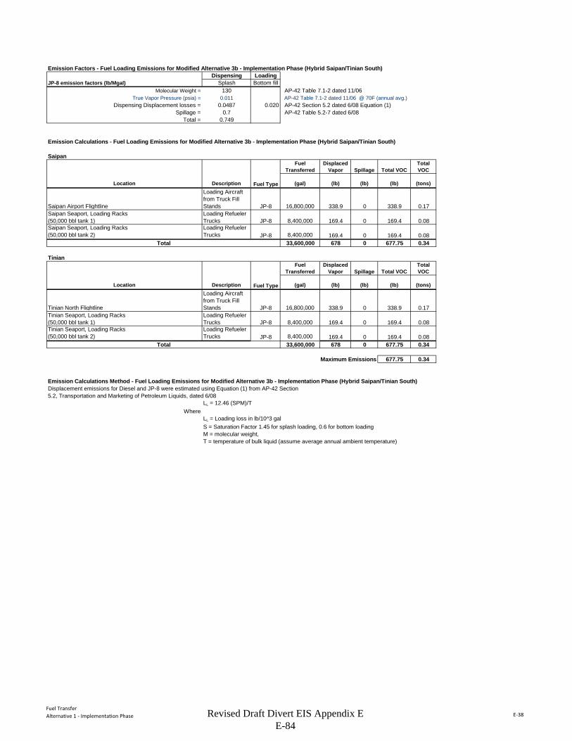
Fuel TransferAlternative 1 - Implementation Phase E-38
Emission Factors - Fuel Loading Emissions for Modified Alternative 3b - Implementation Phase (Hybrid Saipan/Tinian South)Dispensing Loading
JP-8 emission factors (lb/Mgal) Splash Bottom fillMolecular Weight = 130 AP-42 Table 7.1-2 dated 11/06
True Vapor Pressure (psia) = 0.011 AP-42 Table 7.1-2 dated 11/06 @ 70F (annual avg.)Dispensing Displacement losses = 0.0487 0.020 AP-42 Section 5.2 dated 6/08 Equation (1)
Spillage = 0.7 AP-42 Table 5.2-7 dated 6/08Total = 0.749
Emission Calculations - Fuel Loading Emissions for Modified Alternative 3b - Implementation Phase (Hybrid Saipan/Tinian South)
SaipanFuel
Transferred Displaced
Vapor Spillage Total VOCTotal VOC
Location Description Fuel Type (gal) (lb) (lb) (lb) (tons)
Saipan Airport Flightline
Loading Aircraft from Truck Fill Stands JP-8 16,800,000 338.9 0 338.9 0.17
Saipan Seaport, Loading Racks (50,000 bbl tank 1)
Loading Refueler Trucks JP-8 8,400,000 169.4 0 169.4 0.08
Saipan Seaport, Loading Racks (50,000 bbl tank 2)
Loading Refueler Trucks JP-8 8,400,000 169.4 0 169.4 0.08
Total 33,600,000 678 0 677.75 0.34
TinianFuel
Transferred Displaced
Vapor Spillage Total VOCTotal VOC
Location Description Fuel Type (gal) (lb) (lb) (lb) (tons)
Tinian North Flightline
Loading Aircraft from Truck Fill Stands JP-8 16,800,000 338.9 0 338.9 0.17
Tinian Seaport, Loading Racks (50,000 bbl tank 1)
Loading Refueler Trucks JP-8 8,400,000 169.4 0 169.4 0.08
Tinian Seaport, Loading Racks (50,000 bbl tank 2)
Loading Refueler Trucks JP-8 8,400,000 169.4 0 169.4 0.08
Total 33,600,000 678 0 677.75 0.34
Maximum Emissions 677.75 0.34
Emission Calculations Method - Fuel Loading Emissions for Modified Alternative 3b - Implementation Phase (Hybrid Saipan/Tinian South)Displacement emissions for Diesel and JP-8 were estimated using Equation (1) from AP-42 Section5.2, Transportation and Marketing of Petroleum Liquids, dated 6/08
LL = 12.46 (SPM)/TWhere
LL = Loading loss in lb/10^3 galS = Saturation Factor 1.45 for splash loading, 0.6 for bottom loadingM = molecular weight, T = temperature of bulk liquid (assume average annual ambient temperature)
Revised Draft Divert EIS Appendix E E-84
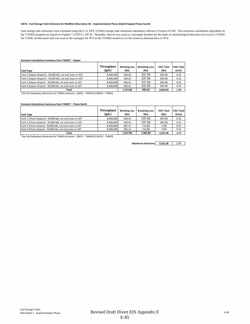
Fuel Storage TanksAlternative 1 - Implementation Phase E-40
DATA - Fuel Storage Tank Emissions for Modified Alternative 3b - Implementation Phase (Hybrid Saipan/Tinian South)
Emission Calculations Summary from TANKS* - Saipan
Tank TypeThroughput
(gal.)Working Loss
(lbs)Breathing Loss
(lbs)VOC Total
(lbs)VOC Total
(tons)
Tank 1 (Saipan Seaport) - 50,000 bbl, cut and cover or AST 8,400,000 428.42 237.56 665.98 0.33Tank 2 (Saipan Seaport) - 50,000 bbl, cut and cover or AST 8,400,000 428.42 237.56 665.98 0.33Tank 3 (Saipan Airport) - 50,000 bbl, cut and cover or AST 8,400,000 428.42 237.56 665.98 0.33Tank 4 (Saipan Airport) - 50,000 bbl, cut and cover or AST 8,400,000 428.42 237.56 665.98 0.33
1,713.68 950.24 2,663.92 1.33*See the following references for TANKS printouts. (SM12 - TANKS) & (SM13 - TANKS)
Emission Calculations Summary from TANKS* - Tinian North
Tank TypeThroughput
(gal.)Working Loss
(lbs)Breathing Loss
(lbs)VOC Total
(lbs)VOC Total
(tons)
Tank 1 (Tinian Seaport) - 50,000 bbl, cut and cover or AST 8,400,000 428.42 237.56 665.98 0.33Tank 2 (Tinian Seaport) - 50,000 bbl, cut and cover or AST 8,400,000 428.42 237.56 665.98 0.33Tank 3 (Tinian Airport) - 60,000 bbl, cut and cover or AST 8,400,000 385.12 714.88 1100 0.55Tank 4 (Tinian Airport) - 60,000 bbl, cut and cover or AST 8,400,000 385.12 714.88 1100 0.55
1,627.08 1,904.88 3,531.96 1.77*See the following references for TANKS printouts. (SM12 - TANKS) & (SM13 - TANKS)
Maximum Emissions 3,531.96 1.77
Fuel storage tank emissions were estimated using the U.S. EPA TANKS storage tank emissions calculation software (Version 4.0.9d). The emissions calculations algorithms in the TANKS program are based on Chapter 7 of EPA’s AP-42. Honolulu, Hawaii was used as a surrogate location for the tanks as meteorological data does not exist in TANKS for CNMI. Jet Kerosene fuel was used as the surrogate for JP-8 in the TANKS model as it is the closet in characteristics to JP-8.
Total
Total
Revised Draft Divert EIS Appendix E E-85

THIS PAGE INTENTIONALLY LEFT BLANK
A P P E N D I X F
Aeronautical Study in the Commonwealth of the Northern Mariana Islands (Placeholder)
Revised Draft Divert EIS Appendix F
F-1
Aeronautical Study
The USAF is revising the Aeronautical Study in accordance with the Modified Alternatives presented in this Revised Draft EIS. The Revised Aeronautical Study will be completed before the Final EIS is published.

THIS PAGE INTENTIONALLY LEFT BLANK

A P P E N D I X G
Public Involvement and Comments
Revised Draft Divert EIS Appendix G
G-i
APPENDIX G PUBLIC INVOLVEMENT AND COMMENTS
TABLE OF CONTENTS
Notice of Intent (Federal Register), September 27, 2011 ......................................................................... G-1
Notice of Availability (Federal Register), June 8, 2012 ........................................................................... G-2
Newspaper Advertisement of Notice of Availability ................................................................................ G-3
Comments Received on the Draft EIS
U.S. Environmental Protection Agency, July 26, 2012 ............................................................................ G-5
National Marine Fisheries Service, July 18, 2012 .................................................................................. G-16
National Marine Fisheries Service, July 17, 2012 .................................................................................. G-19
National Park Service, July 31, 2012 ...................................................................................................... G-22
National Park Service, June 25, 2012 ..................................................................................................... G-26
Guam Department of Aquatic and Wildlife Resources, July 16, 2012 ................................................... G-28
CNMI Military Integration Management Committee, July 20, 2012 ..................................................... G-37
Office of the Mayor, Municipality of Tinian and Aguiguan, July 23, 2012 ........................................... G-50
Don Farrell, June 26, 2012 ...................................................................................................................... G-55
Senator Judith P. Guthertz, 31st Guam Legislature, July 19, 2012 ........................................................ G-58
Gregorio Kilili Camacho Sablan, Member of Congress, Undated .......................................................... G-60
Tinian Position Paper, July 3, 2012 ........................................................................................................ G-63
CNMI Division of Environmental Quality, July 11, 2012 ...................................................................... G-67
Lawrence Duponcheel, Tinian Cattleman Association, Undated ........................................................... G-68
Commonwealth Ports Authority, July 23, 2012 ...................................................................................... G-74
Transcript, Susupe, Saipan, June 25, 2012 ............................................................................................. G-75
Transcript, San Jose, Tinian, June 26, 2012 .......................................................................................... G-109
Dr. Justine B. de Cruz, July 3, 2012 ..................................................................................................... G-142
Revised Draft Divert EIS Appendix G
G-ii
Reo Arriola, June 24, 2012 ................................................................................................................... G-144
Ignacio Cabrera, Undated ..................................................................................................................... G-145
Anonymous, July 12, 2012 ................................................................................................................... G-146
Governor Fitial White Paper, Undated ................................................................................................. G-147
Comment Responses
Comment Response Matrix ................................................................................................................... G-151
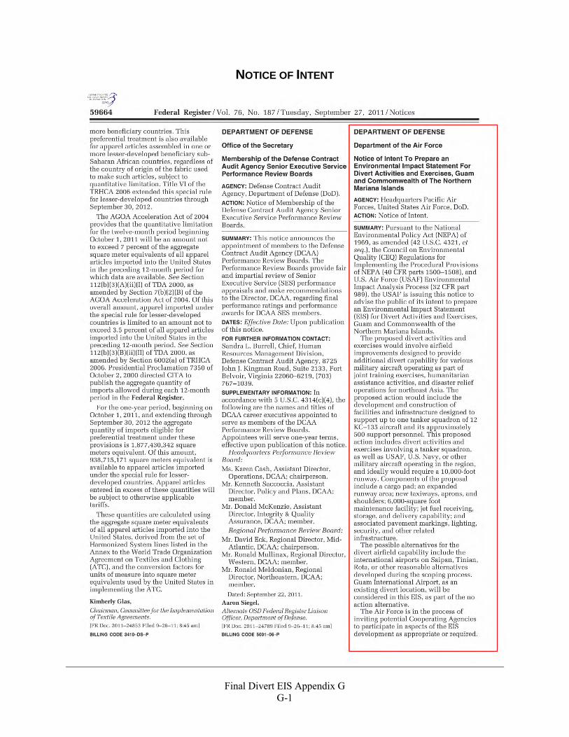
Final Divert EIS Appendix G
G-1
NOTICE OF INTENT
Final Divert EIS Appendix G
G-2
NOTICE OF AVAILABILITY
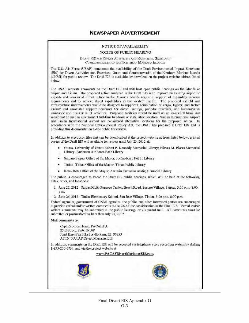
Final Divert EIS Appendix G
G-3
NEWSPAPER ADVERTISEMENT

Final Divert EIS Appendix G
G-4
THIS PAGE INTENTIONALLY LEFT BLANK

COMMENTS RECEIVED ON THE DRAFT EIS

THIS PAGE INTENTIONALLY LEFT BLANK
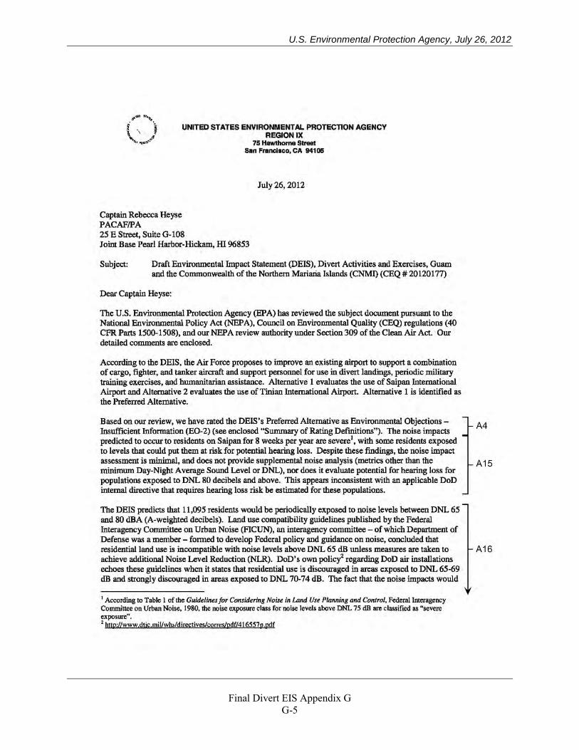
U.S. Environmental Protection Agency, July 26, 2012
Final Divert EIS Appendix G
G-5
U.S. Environmental Protection Agency, July 26, 2012
Final Divert EIS Appendix G
G-6
U.S. Environmental Protection Agency, July 26, 2012
Final Divert EIS Appendix G
G-7
U.S. Environmental Protection Agency, July 26, 2012
Final Divert EIS Appendix G
G-8
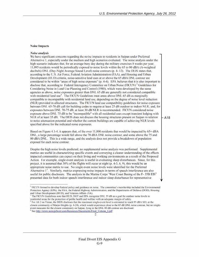
U.S. Environmental Protection Agency, July 26, 2012
Final Divert EIS Appendix G
G-9
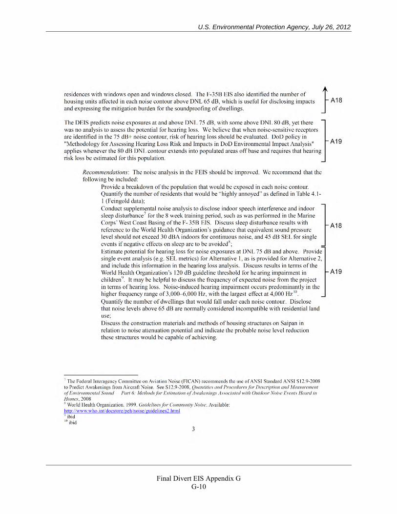
U.S. Environmental Protection Agency, July 26, 2012
Final Divert EIS Appendix G
G-10
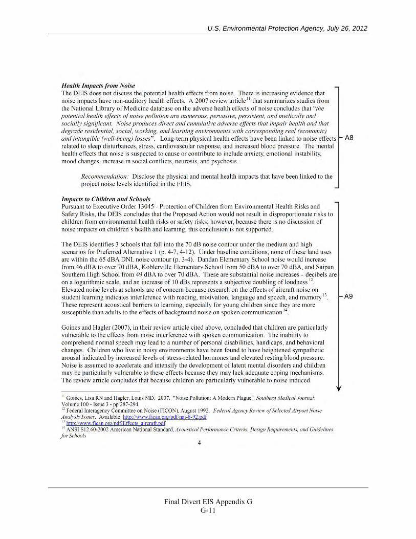
U.S. Environmental Protection Agency, July 26, 2012
Final Divert EIS Appendix G
G-11
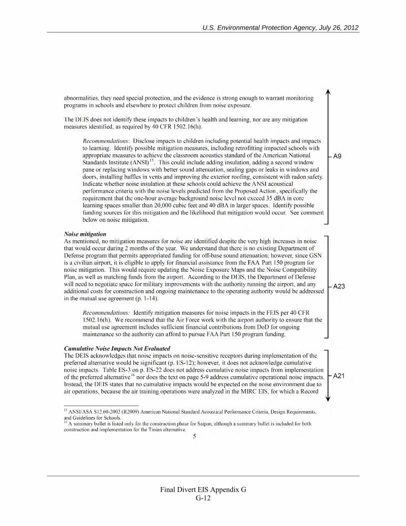
U.S. Environmental Protection Agency, July 26, 2012
Final Divert EIS Appendix G
G-12
U.S. Environmental Protection Agency, July 26, 2012
Final Divert EIS Appendix G
G-13
U.S. Environmental Protection Agency, July 26, 2012
Final Divert EIS Appendix G
G-14
U.S. Environmental Protection Agency, July 26, 2012
Final Divert EIS Appendix G
G-15
National Marine Fisheries Service, July 17, 2012
Final Divert EIS Appendix G
G-16
National Marine Fisheries Service, July 17, 2012
Final Divert EIS Appendix G
G-17
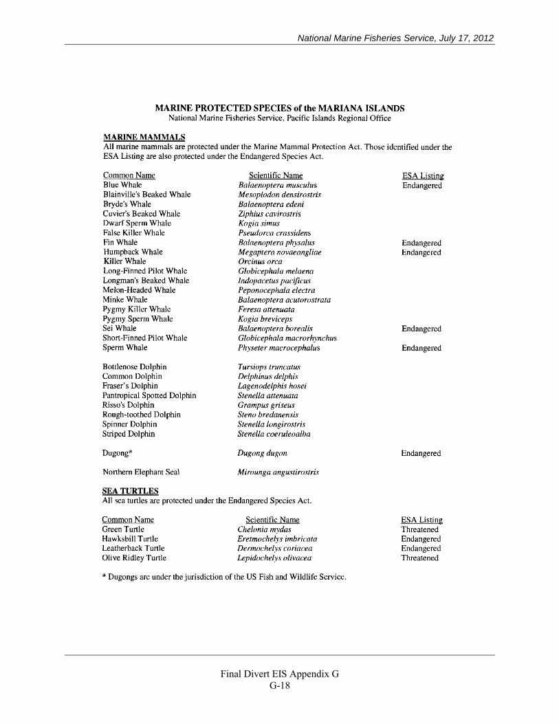
National Marine Fisheries Service, July 17, 2012
Final Divert EIS Appendix G
G-18
National Marine Fisheries Service, July 17, 2012
Final Divert EIS Appendix G
G-19
National Marine Fisheries Service, July 17, 2012
Final Divert EIS Appendix G
G-20

National Marine Fisheries Service, July 17, 2012
Final Divert EIS Appendix G
G-21
National Park Service, July 31, 2012
Final Divert EIS Appendix G
G-22
National Park Service, July 31, 2012
Final Divert EIS Appendix G
G-23
National Park Service, July 31, 2012
Final Divert EIS Appendix G
G-24
National Park Service, July 31, 2012
Final Divert EIS Appendix G
G-25
National Park Service, June 25, 2012
Final Divert EIS Appendix G
G-26
National Park Service, June 25, 2012
Final Divert EIS Appendix G
G-27
Guam Department of Aquatic and Wildlife Resources, July 16, 2012
Final Divert EIS Appendix G
G-28
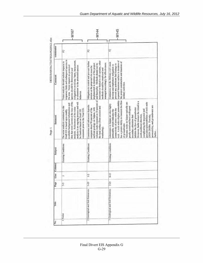
Guam Department of Aquatic and Wildlife Resources, July 16, 2012
Final Divert EIS Appendix G
G-29
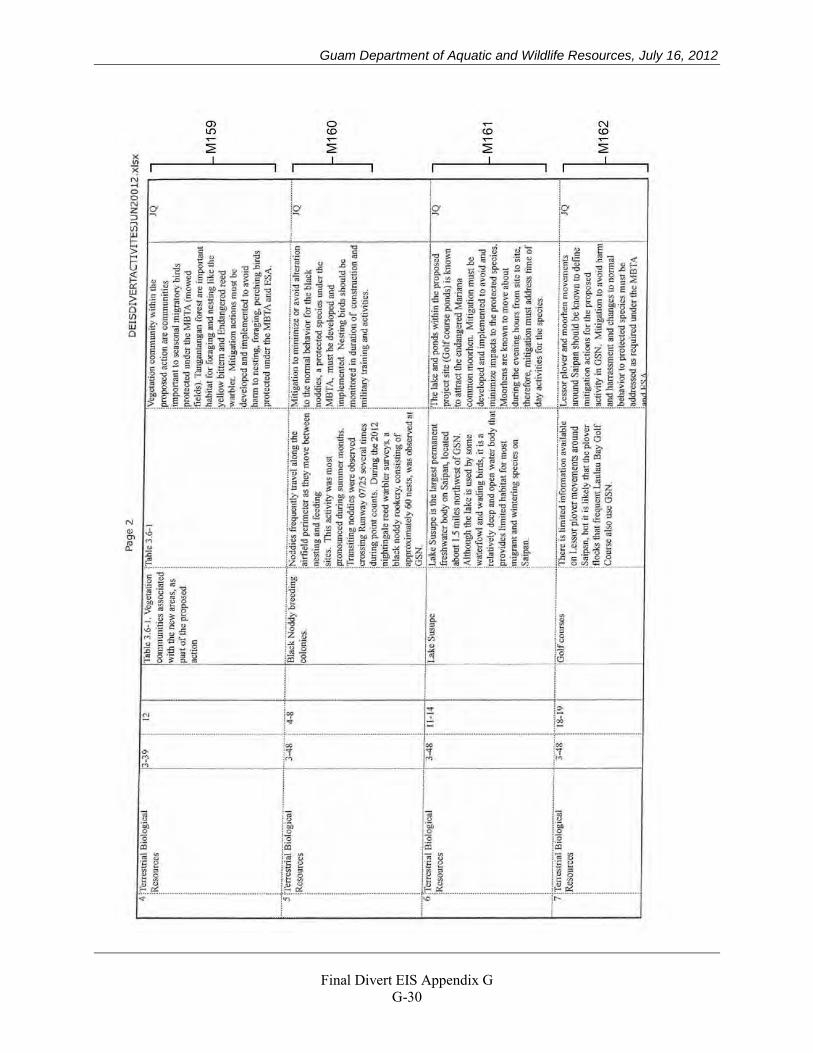
Guam Department of Aquatic and Wildlife Resources, July 16, 2012
Final Divert EIS Appendix G
G-30
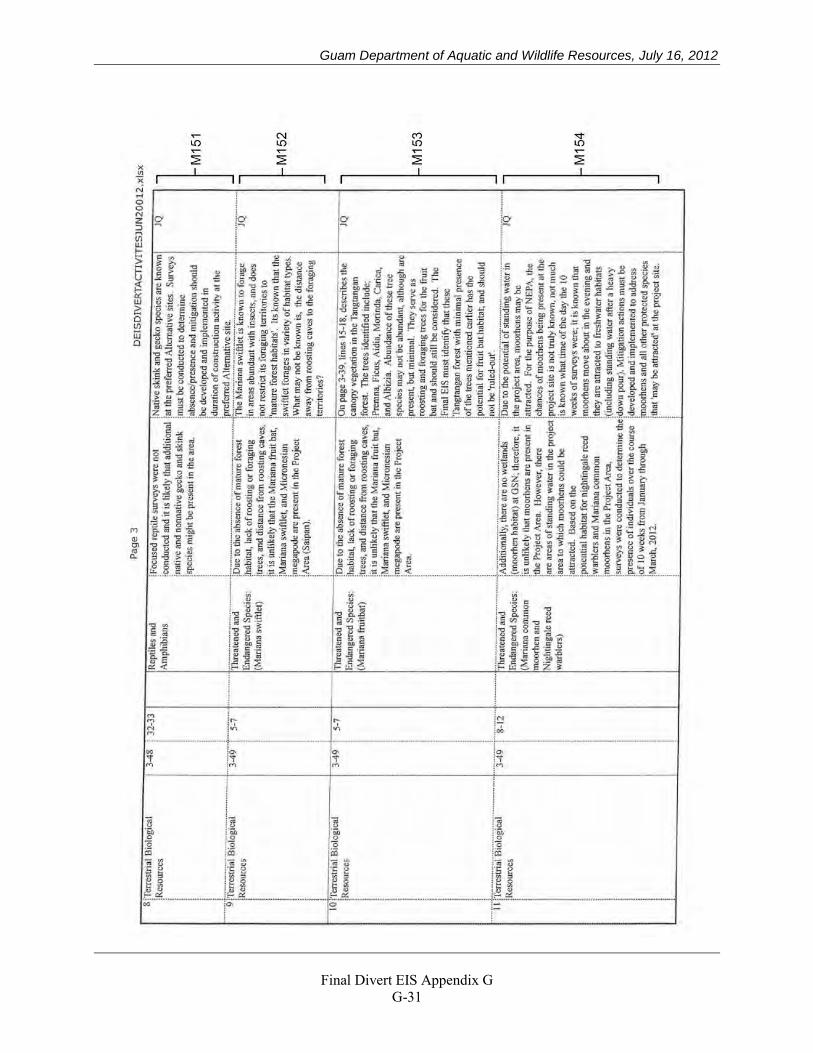
Guam Department of Aquatic and Wildlife Resources, July 16, 2012
Final Divert EIS Appendix G
G-31
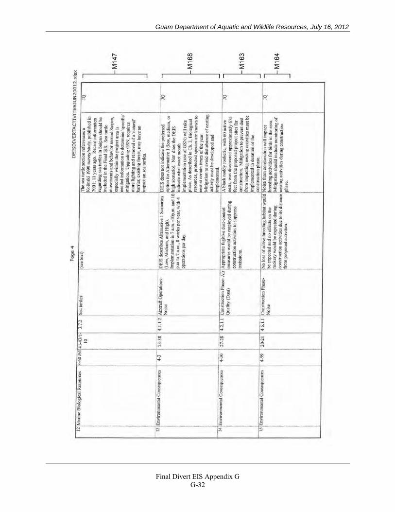
Guam Department of Aquatic and Wildlife Resources, July 16, 2012
Final Divert EIS Appendix G
G-32
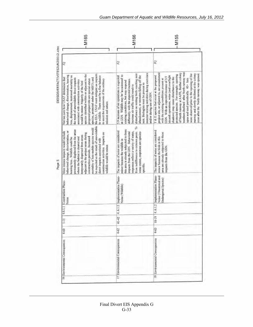
Guam Department of Aquatic and Wildlife Resources, July 16, 2012
Final Divert EIS Appendix G
G-33
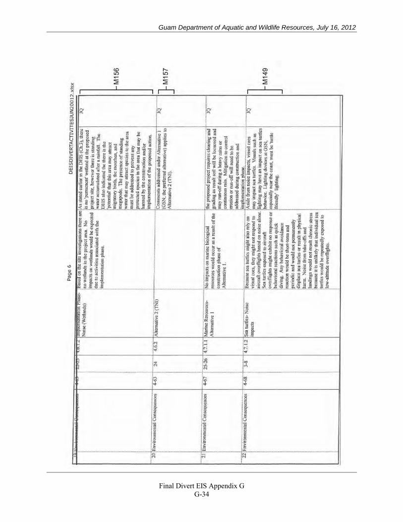
Guam Department of Aquatic and Wildlife Resources, July 16, 2012
Final Divert EIS Appendix G
G-34
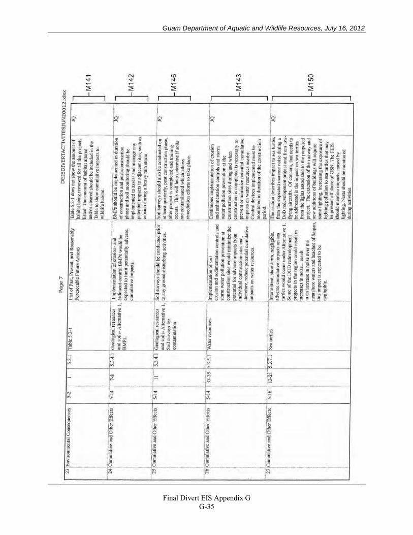
Guam Department of Aquatic and Wildlife Resources, July 16, 2012
Final Divert EIS Appendix G
G-35
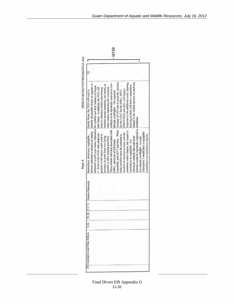
Guam Department of Aquatic and Wildlife Resources, July 16, 2012
Final Divert EIS Appendix G
G-36
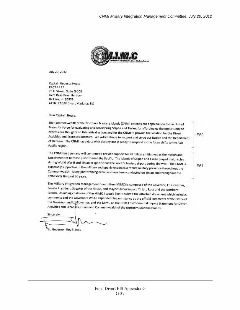
CNMI Military Integration Management Committee, July 20, 2012
Final Divert EIS Appendix G
G-37

CNMI Military Integration Management Committee, July 20, 2012
Final Divert EIS Appendix G
G-38
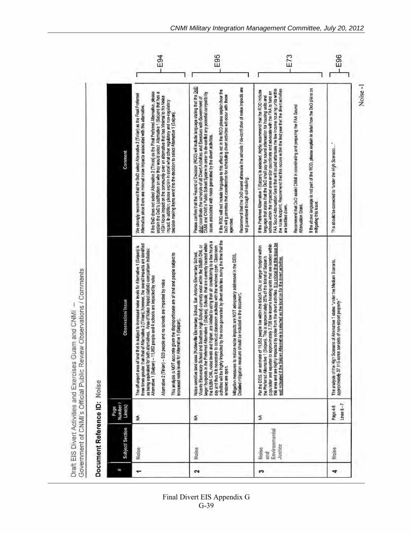
CNMI Military Integration Management Committee, July 20, 2012
Final Divert EIS Appendix G
G-39
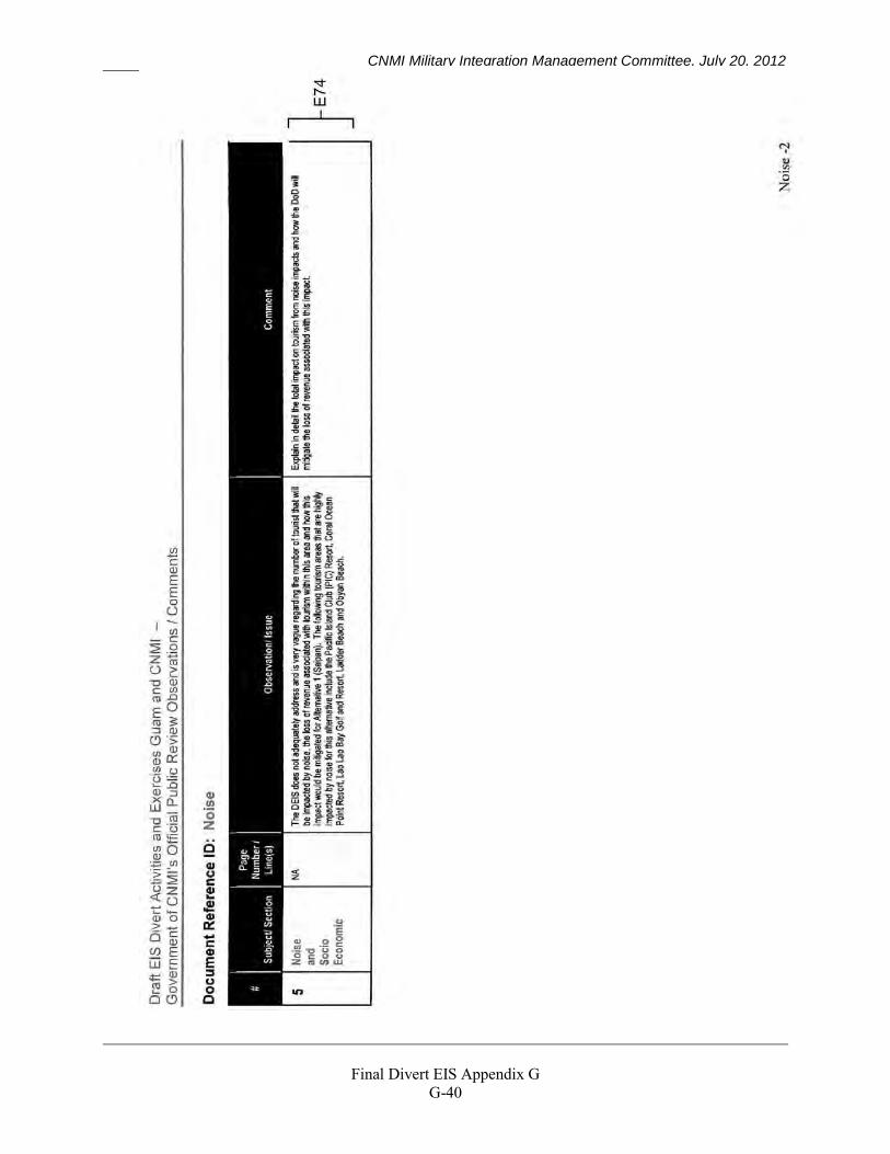
CNMI Military Integration Management Committee, July 20, 2012
Final Divert EIS Appendix G
G-40
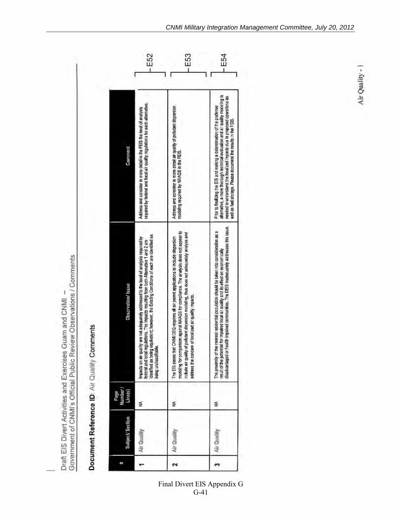
CNMI Military Integration Management Committee, July 20, 2012
Final Divert EIS Appendix G
G-41
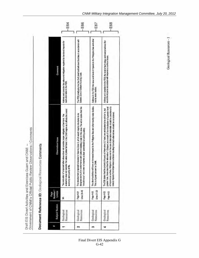
CNMI Military Integration Management Committee, July 20, 2012
Final Divert EIS Appendix G
G-42
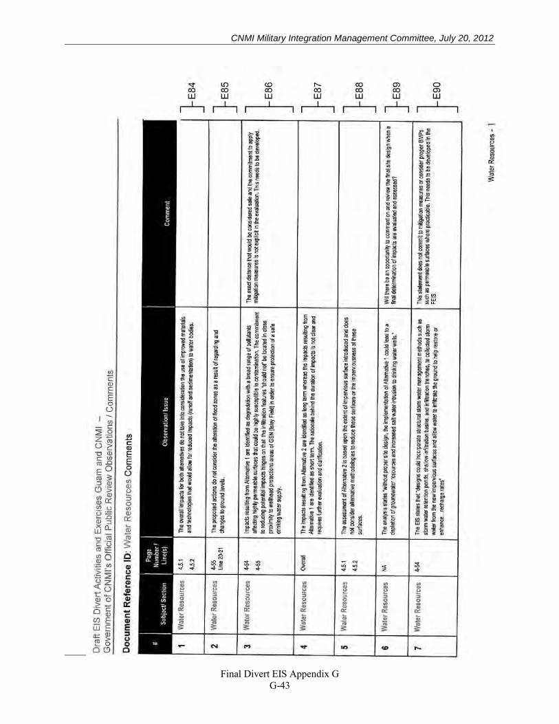
CNMI Military Integration Management Committee, July 20, 2012
Final Divert EIS Appendix G
G-43
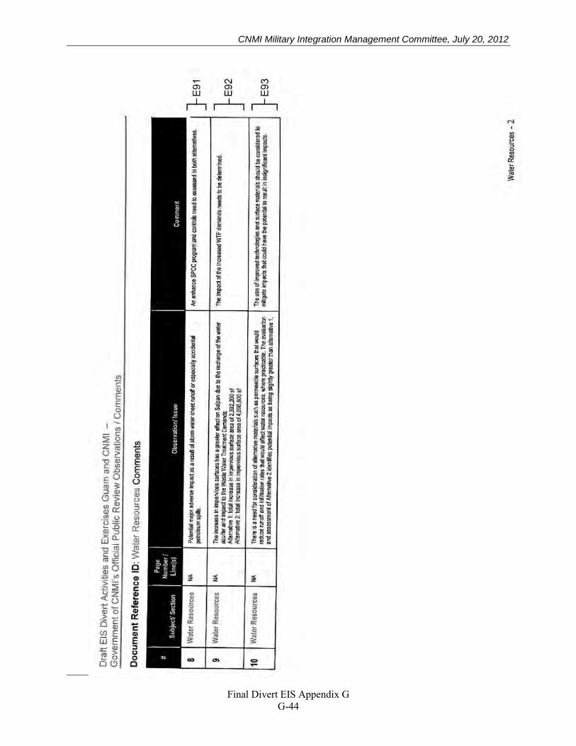
CNMI Military Integration Management Committee, July 20, 2012
Final Divert EIS Appendix G
G-44
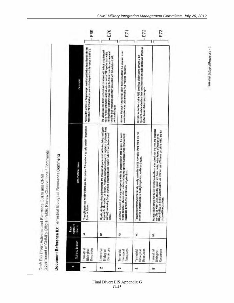
CNMI Military Integration Management Committee, July 20, 2012
Final Divert EIS Appendix G
G-45
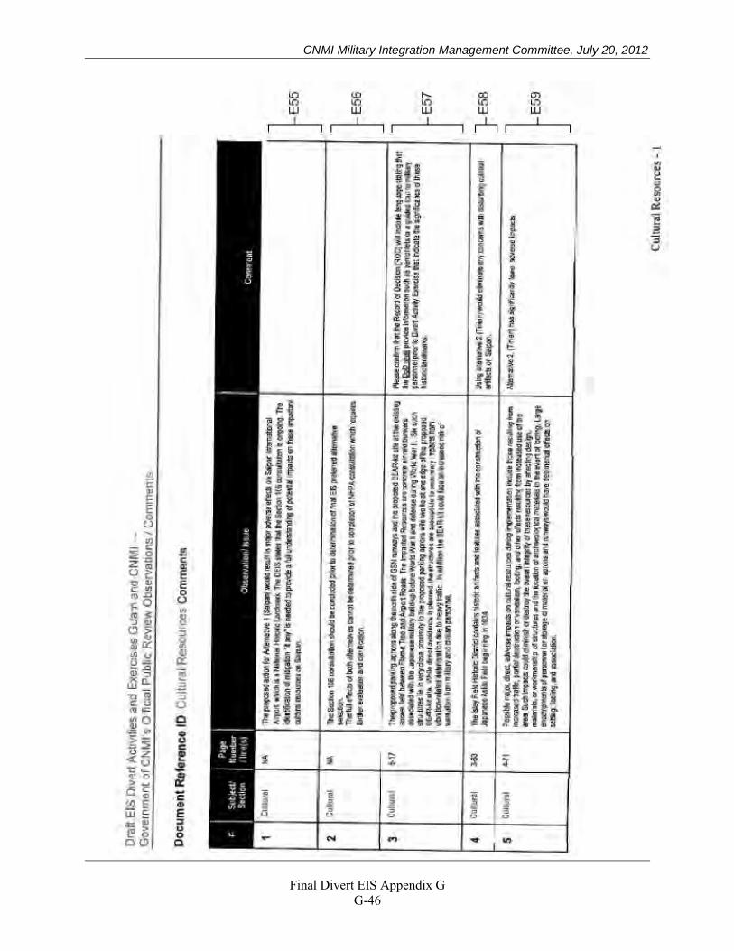
CNMI Military Integration Management Committee, July 20, 2012
Final Divert EIS Appendix G
G-46
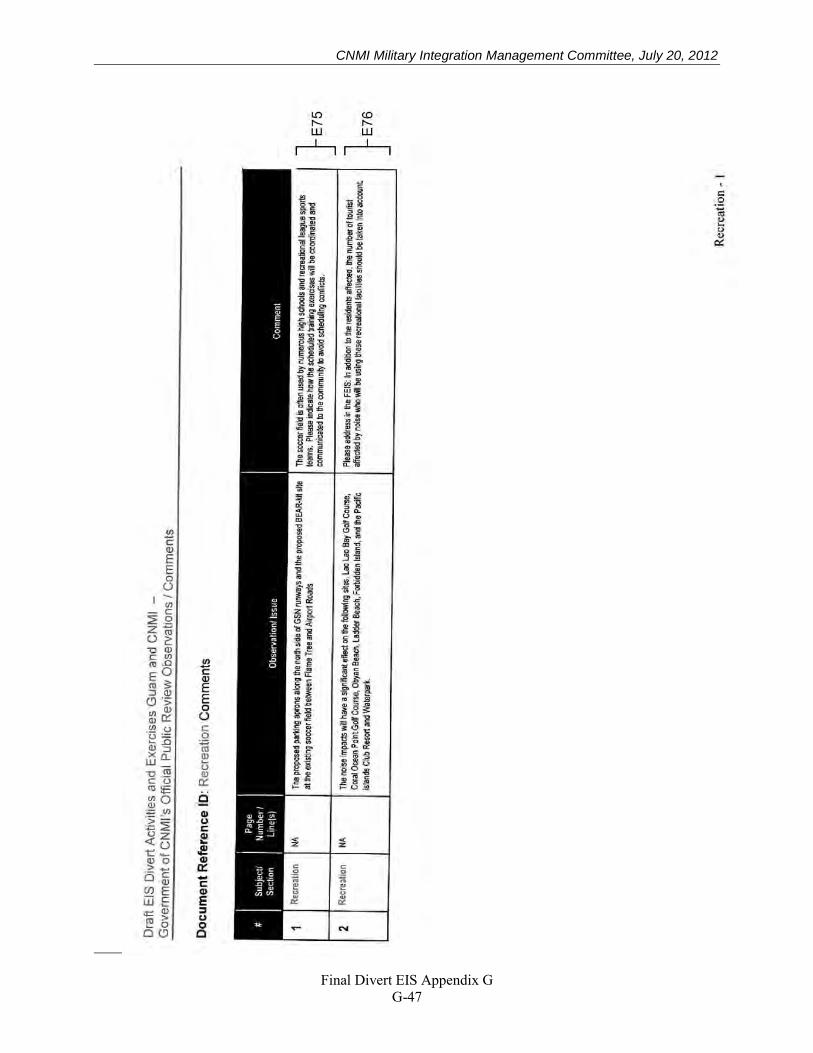
CNMI Military Integration Management Committee, July 20, 2012
Final Divert EIS Appendix G
G-47
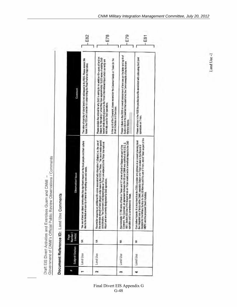
CNMI Military Integration Management Committee, July 20, 2012
Final Divert EIS Appendix G
G-48
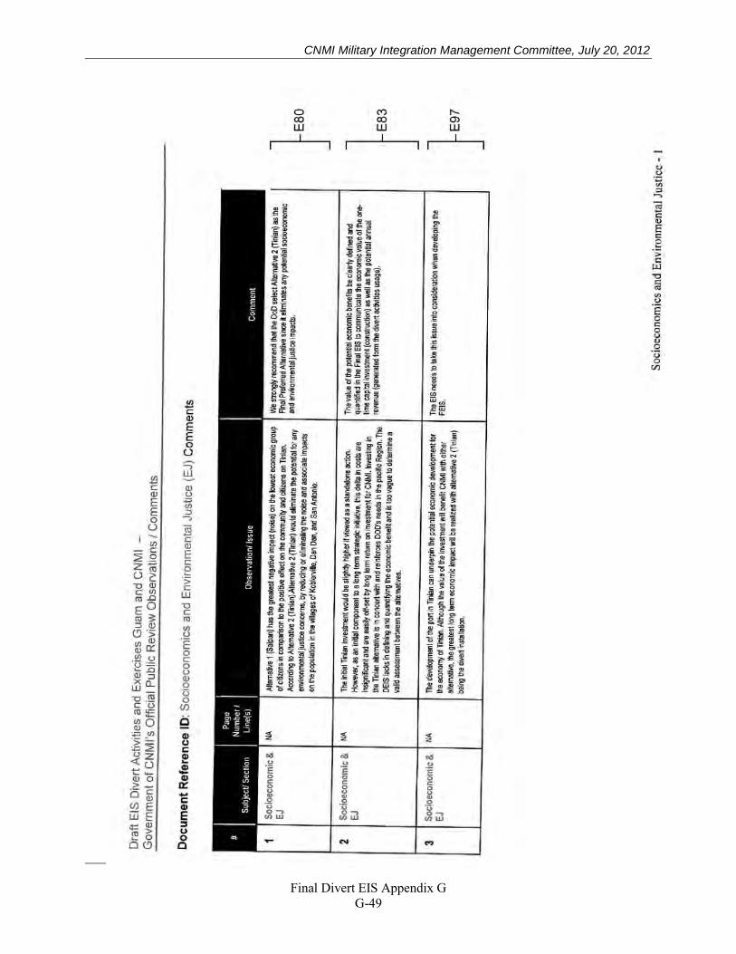
CNMI Military Integration Management Committee, July 20, 2012
Final Divert EIS Appendix G
G-49
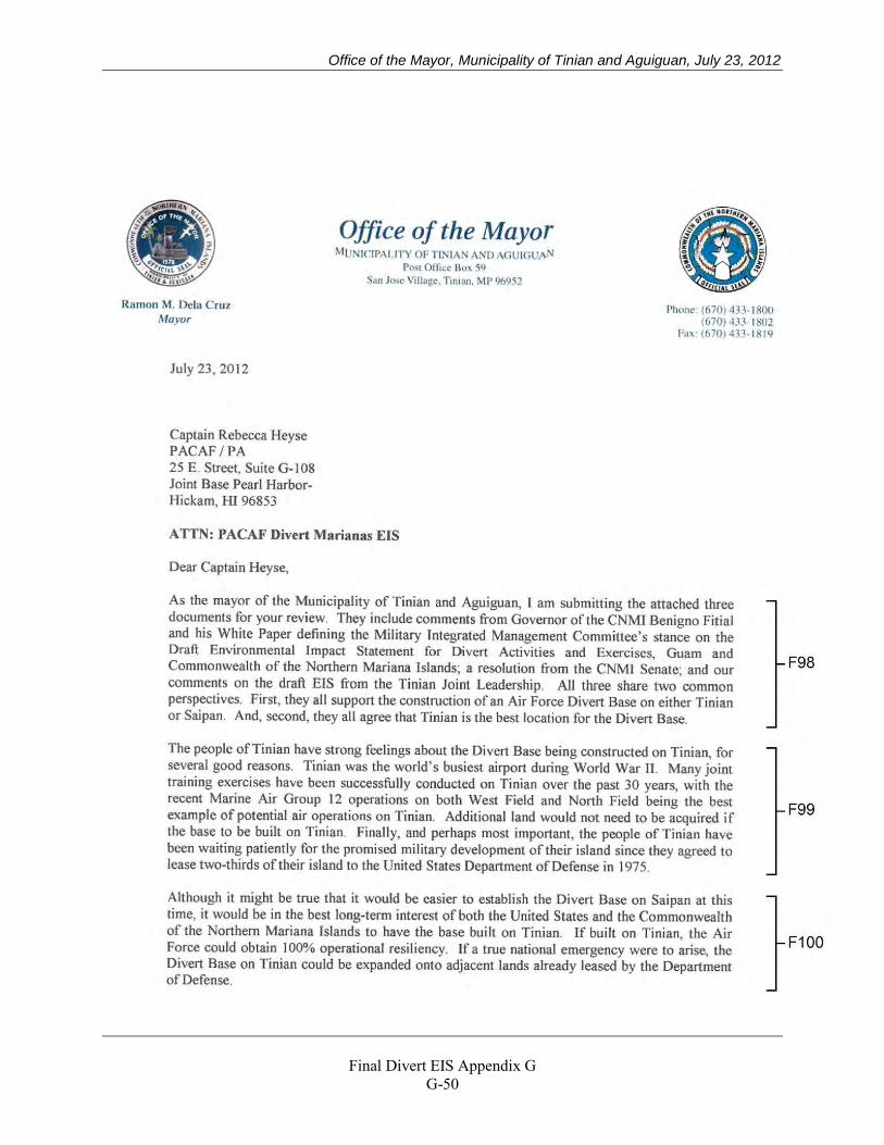
Office of the Mayor, Municipality of Tinian and Aguiguan, July 23, 2012
Final Divert EIS Appendix G
G-50
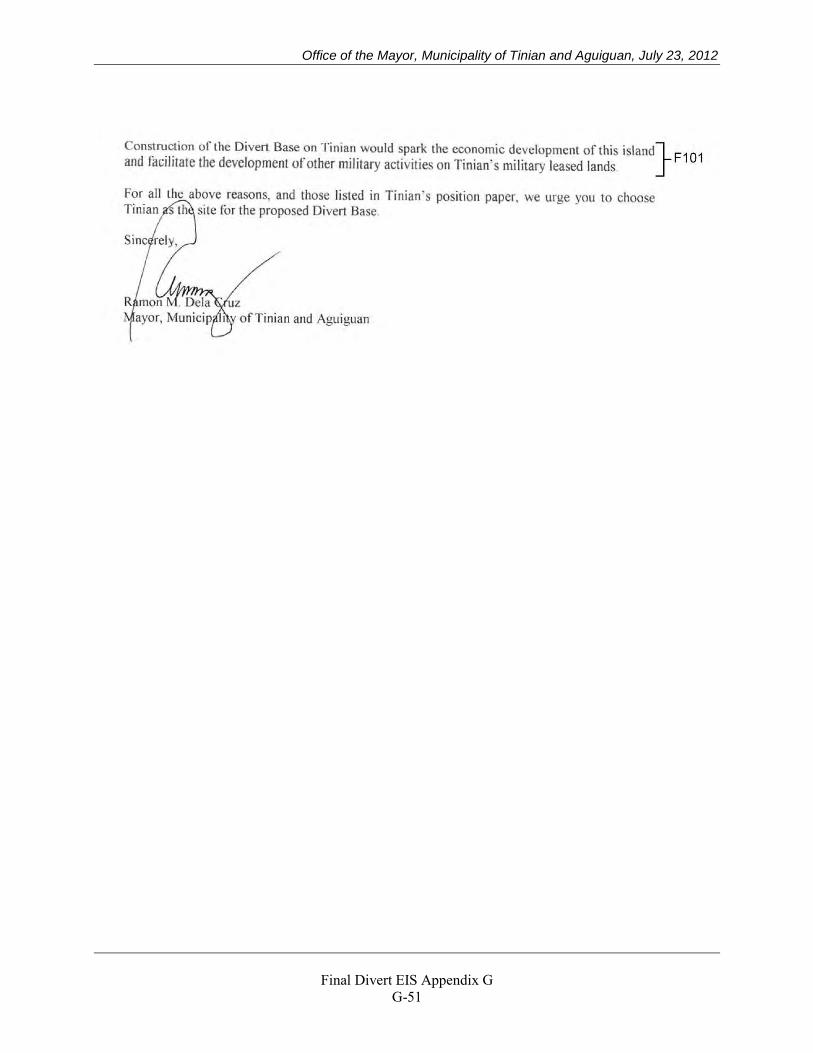
Office of the Mayor, Municipality of Tinian and Aguiguan, July 23, 2012
Final Divert EIS Appendix G
G-51
Office of the Mayor, Municipality of Tinian and Aguiguan, July 23, 2012
Final Divert EIS Appendix G
G-52
Office of the Mayor, Municipality of Tinian and Aguiguan, July 23, 2012
Final Divert EIS Appendix G
G-53
Office of the Mayor, Municipality of Tinian and Aguiguan, July 23, 2012
Final Divert EIS Appendix G
G-54
Don Farrell, June 26, 2012
Final Divert EIS Appendix G
G-55
Don Farrell, June 26, 2012
Final Divert EIS Appendix G
G-56
Don Farrell, June 26, 2012
Final Divert EIS Appendix G
G-57
Senator Judith P. Guthertz, 31st Guam Legislature, July 19, 2012
Final Divert EIS Appendix G
G-58
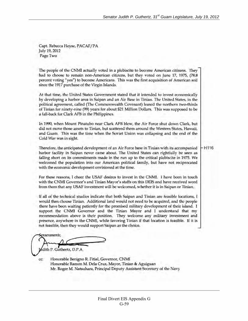
Senator Judith P. Guthertz, 31st Guam Legislature, July 19, 2012
Final Divert EIS Appendix G
G-59
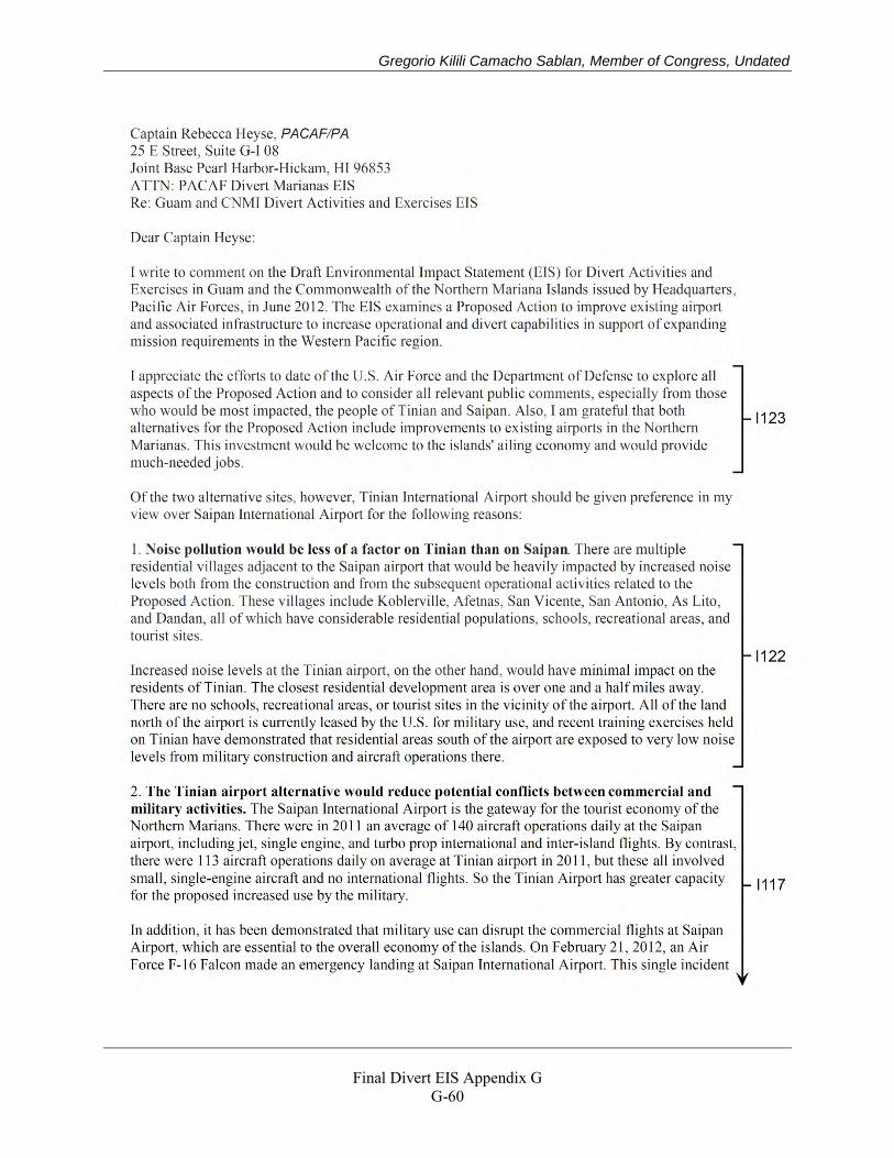
Gregorio Kilili Camacho Sablan, Member of Congress, Undated
Final Divert EIS Appendix G
G-60
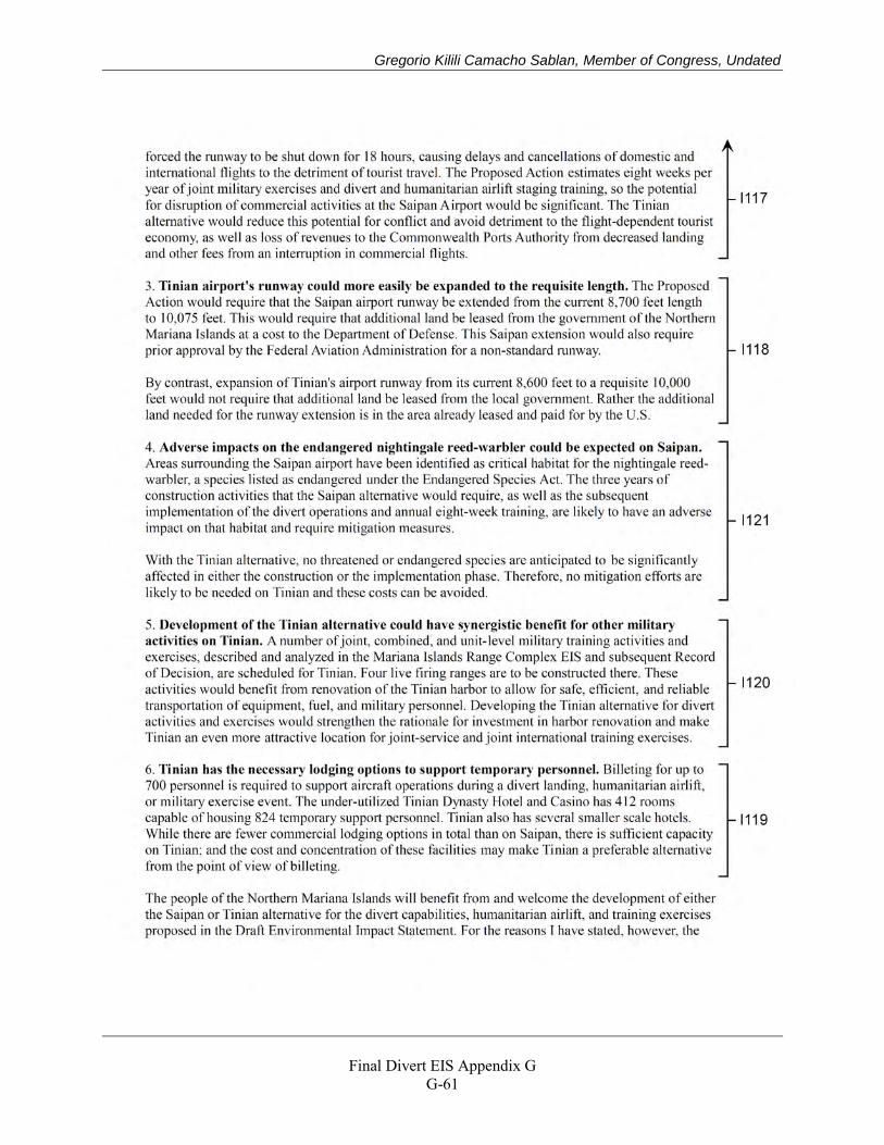
Gregorio Kilili Camacho Sablan, Member of Congress, Undated
Final Divert EIS Appendix G
G-61

Gregorio Kilili Camacho Sablan, Member of Congress, Undated
Final Divert EIS Appendix G
G-62
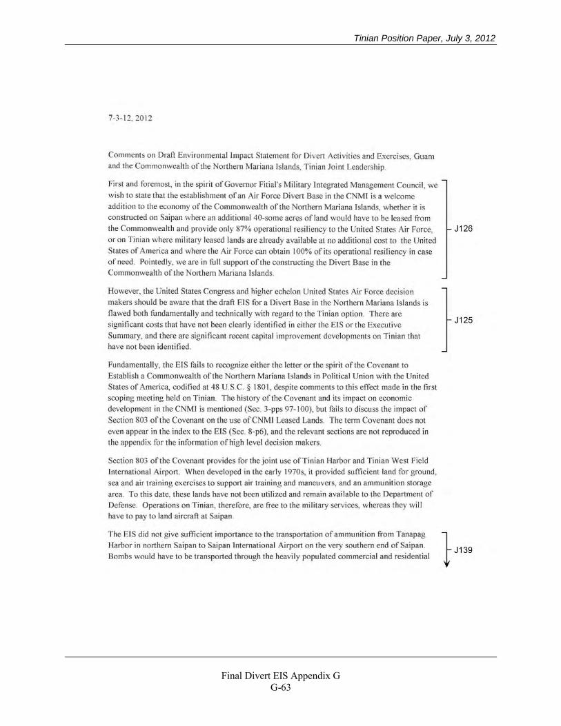
Tinian Position Paper, July 3, 2012
Final Divert EIS Appendix G
G-63
Tinian Position Paper, July 3, 2012
Final Divert EIS Appendix G
G-64
Tinian Position Paper, July 3, 2012
Final Divert EIS Appendix G
G-65
Tinian Position Paper, July 3, 2012
Final Divert EIS Appendix G
G-66
CNMI Division of Environmental Quality, July 11, 2012
Final Divert EIS Appendix G
G-67
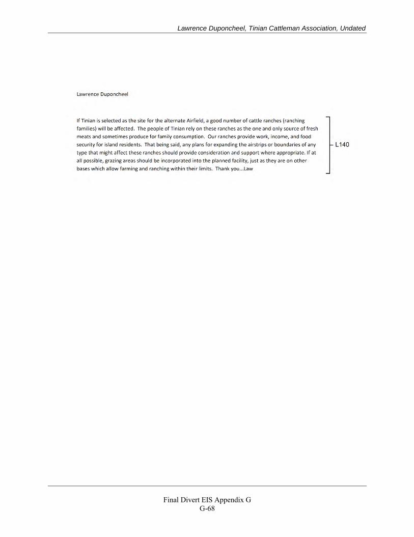
Lawrence Duponcheel, Tinian Cattleman Association, Undated
Final Divert EIS Appendix G
G-68
Commonwealth Ports Authority, July 23, 2012
Revised Draft Divert EIS Appendix G
G-69
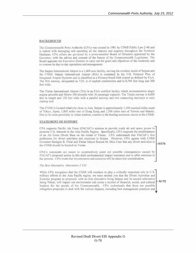
Commonwealth Ports Authority, July 23, 2012
Revised Draft Divert EIS Appendix G
G-70
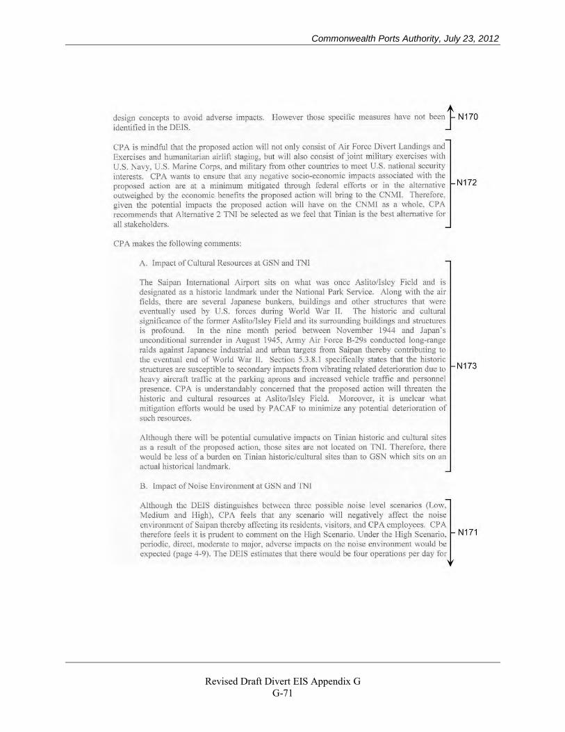
Commonwealth Ports Authority, July 23, 2012
Revised Draft Divert EIS Appendix G
G-71
Commonwealth Ports Authority, July 23, 2012
Revised Draft Divert EIS Appendix G
G-72
Commonwealth Ports Authority, July 23, 2012
Revised Draft Divert EIS Appendix G
G-73
Transcript, Susupe, Saipan, June 25, 2012
Revised Draft Divert EIS Appendix G
G-74
Transcript, Susupe, Saipan, June 25, 2012
Revised Draft Divert EIS Appendix G
G-75
Transcript, Susupe, Saipan, June 25, 2012
Revised Draft Divert EIS Appendix G
G-76
Transcript, Susupe, Saipan, June 25, 2012
Revised Draft Divert EIS Appendix G
G-77
Transcript, Susupe, Saipan, June 25, 2012
Revised Draft Divert EIS Appendix G
G-78
Transcript, Susupe, Saipan, June 25, 2012
Revised Draft Divert EIS Appendix G
G-79
Transcript, Susupe, Saipan, June 25, 2012
Revised Draft Divert EIS Appendix G
G-80
Transcript, Susupe, Saipan, June 25, 2012
Revised Draft Divert EIS Appendix G
G-81
Transcript, Susupe, Saipan, June 25, 2012
Revised Draft Divert EIS Appendix G
G-82
Transcript, Susupe, Saipan, June 25, 2012
Revised Draft Divert EIS Appendix G
G-83
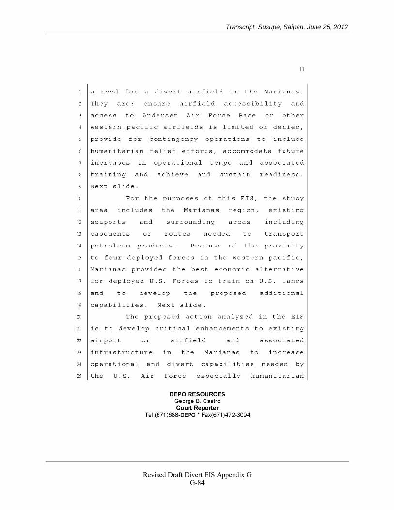
Transcript, Susupe, Saipan, June 25, 2012
Revised Draft Divert EIS Appendix G
G-84
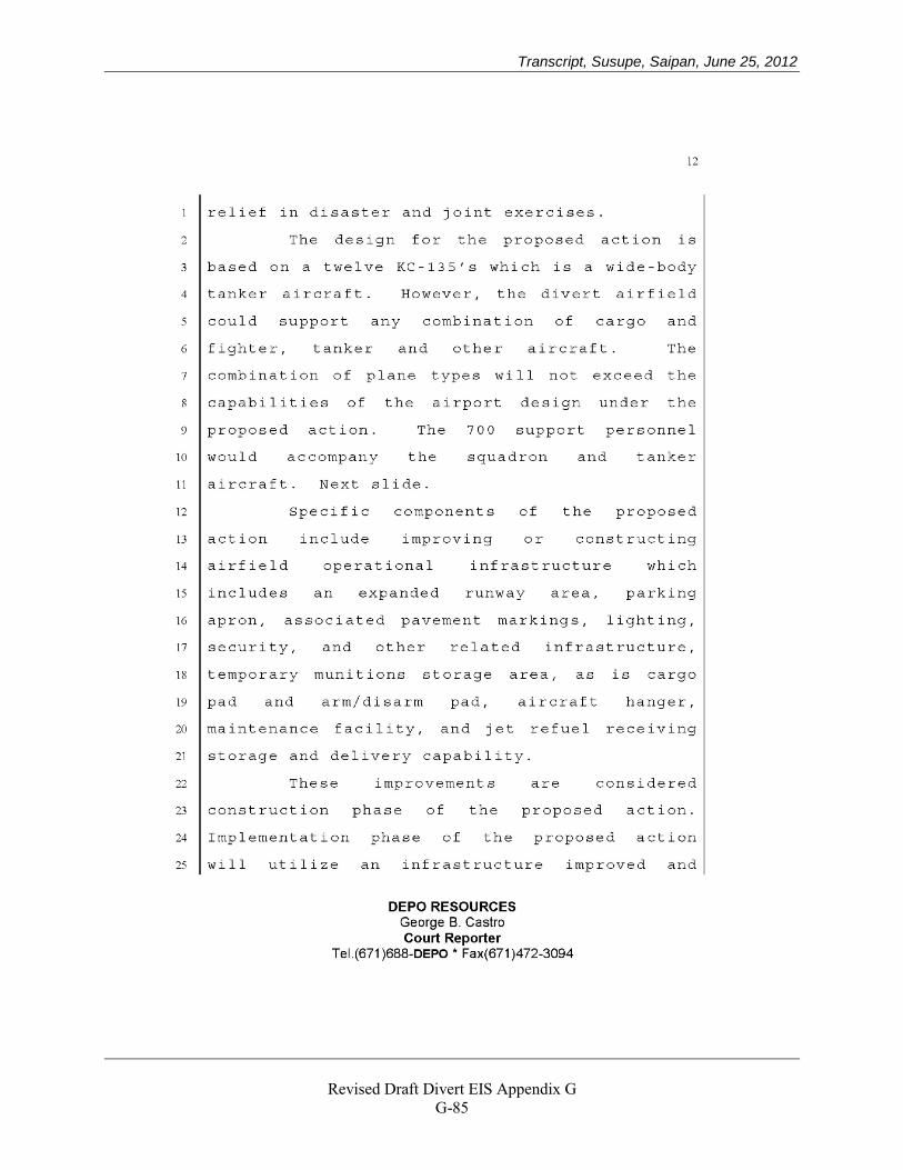
Transcript, Susupe, Saipan, June 25, 2012
Revised Draft Divert EIS Appendix G
G-85
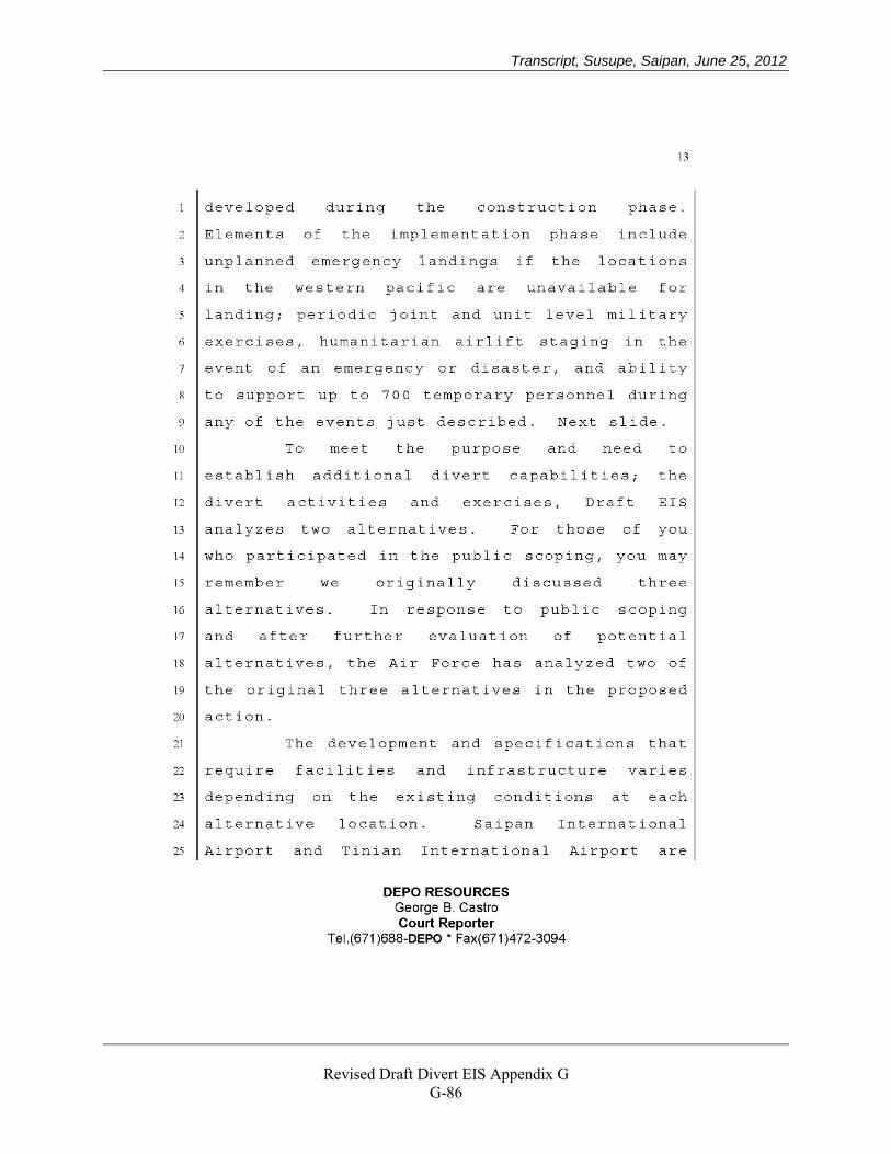
Transcript, Susupe, Saipan, June 25, 2012
Revised Draft Divert EIS Appendix G
G-86
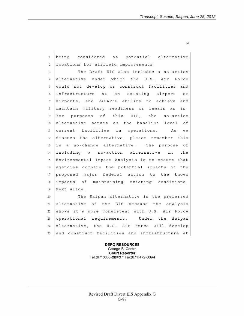
Transcript, Susupe, Saipan, June 25, 2012
Revised Draft Divert EIS Appendix G
G-87
Transcript, Susupe, Saipan, June 25, 2012
Revised Draft Divert EIS Appendix G
G-88
Transcript, Susupe, Saipan, June 25, 2012
Revised Draft Divert EIS Appendix G
G-89
Transcript, Susupe, Saipan, June 25, 2012
Revised Draft Divert EIS Appendix G
G-90
Transcript, Susupe, Saipan, June 25, 2012
Revised Draft Divert EIS Appendix G
G-91
Transcript, Susupe, Saipan, June 25, 2012
Revised Draft Divert EIS Appendix G
G-92
Transcript, Susupe, Saipan, June 25, 2012
Revised Draft Divert EIS Appendix G
G-93
Transcript, Susupe, Saipan, June 25, 2012
Revised Draft Divert EIS Appendix G
G-94
Transcript, Susupe, Saipan, June 25, 2012
Revised Draft Divert EIS Appendix G
G-95
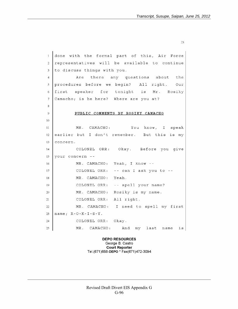
Transcript, Susupe, Saipan, June 25, 2012
Revised Draft Divert EIS Appendix G
G-96
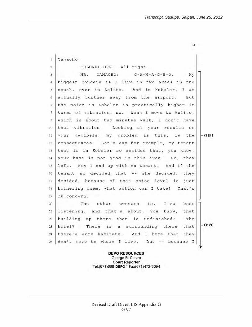
Transcript, Susupe, Saipan, June 25, 2012
Revised Draft Divert EIS Appendix G
G-97
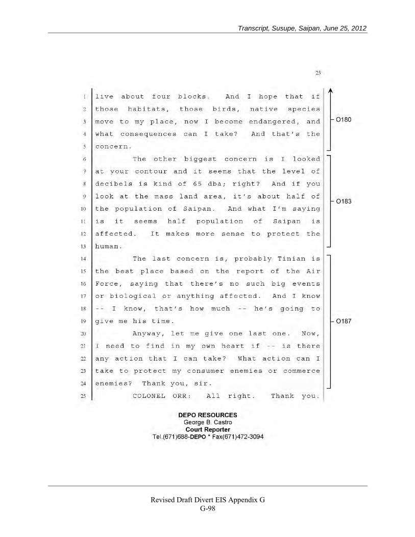
Transcript, Susupe, Saipan, June 25, 2012
Revised Draft Divert EIS Appendix G
G-98
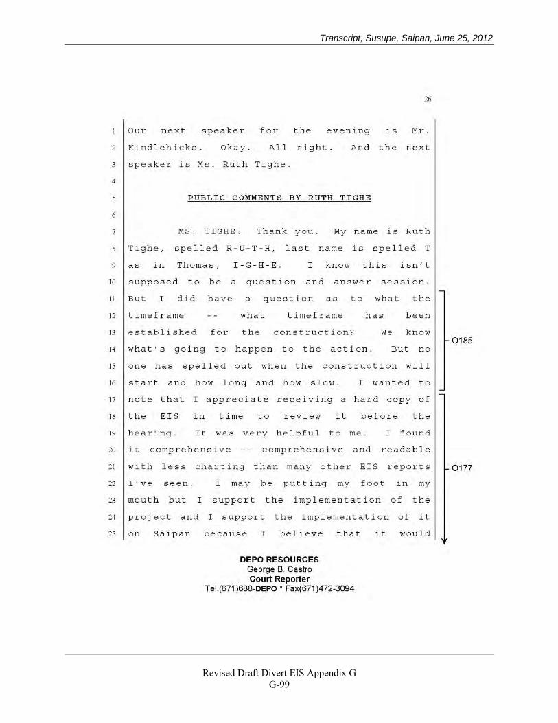
Transcript, Susupe, Saipan, June 25, 2012
Revised Draft Divert EIS Appendix G
G-99
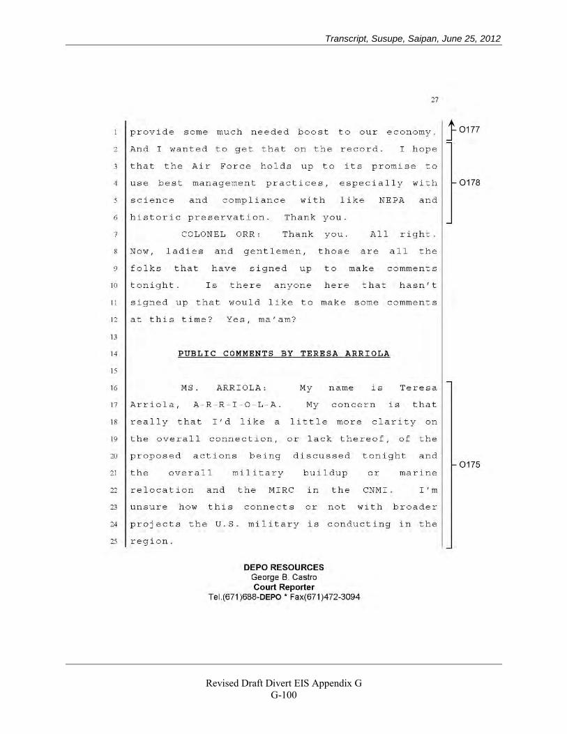
Transcript, Susupe, Saipan, June 25, 2012
Revised Draft Divert EIS Appendix G
G-100
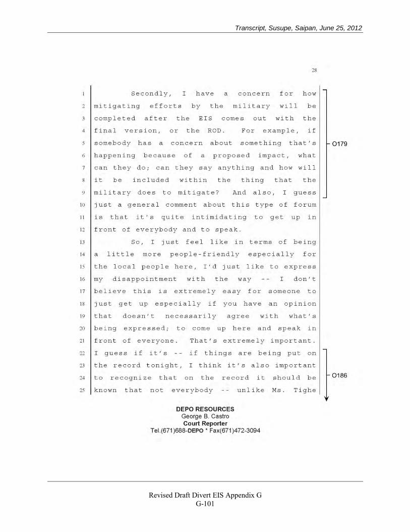
Transcript, Susupe, Saipan, June 25, 2012
Revised Draft Divert EIS Appendix G
G-101
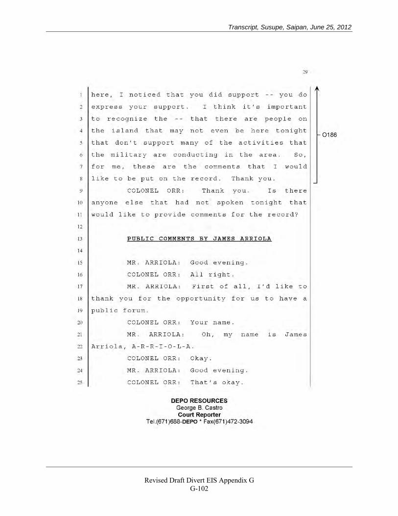
Transcript, Susupe, Saipan, June 25, 2012
Revised Draft Divert EIS Appendix G
G-102
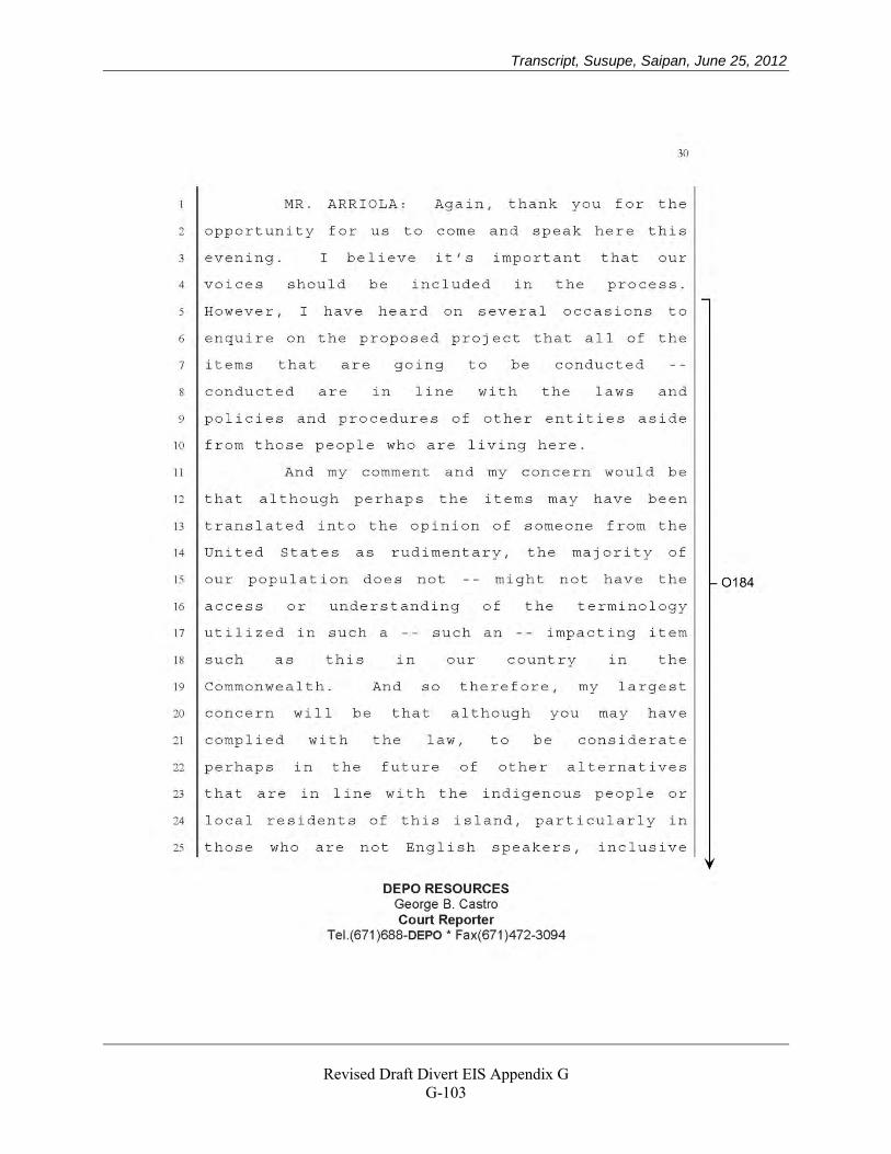
Transcript, Susupe, Saipan, June 25, 2012
Revised Draft Divert EIS Appendix G
G-103
Transcript, Susupe, Saipan, June 25, 2012
Revised Draft Divert EIS Appendix G
G-104
Transcript, Susupe, Saipan, June 25, 2012
Revised Draft Divert EIS Appendix G
G-105
Transcript, Susupe, Saipan, June 25, 2012
Revised Draft Divert EIS Appendix G
G-106
Transcript, Susupe, Saipan, June 25, 2012
Revised Draft Divert EIS Appendix G
G-107
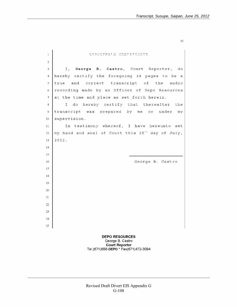
Transcript, Susupe, Saipan, June 25, 2012
Revised Draft Divert EIS Appendix G
G-108
Transcript, San Jose, Tinian, June 26, 2012
Revised Draft Divert EIS Appendix G
G-109
Transcript, San Jose, Tinian, June 26, 2012
Revised Draft Divert EIS Appendix G
G-110
Transcript, San Jose, Tinian, June 26, 2012
Revised Draft Divert EIS Appendix G
G-111
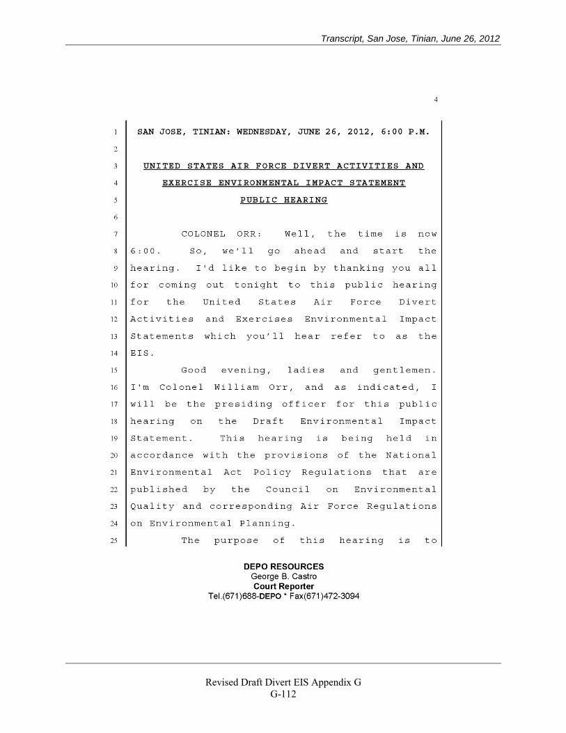
Transcript, San Jose, Tinian, June 26, 2012
Revised Draft Divert EIS Appendix G
G-112
Transcript, San Jose, Tinian, June 26, 2012
Revised Draft Divert EIS Appendix G
G-113
Transcript, San Jose, Tinian, June 26, 2012
Revised Draft Divert EIS Appendix G
G-114
Transcript, San Jose, Tinian, June 26, 2012
Revised Draft Divert EIS Appendix G
G-115
Transcript, San Jose, Tinian, June 26, 2012
Revised Draft Divert EIS Appendix G
G-116
Transcript, San Jose, Tinian, June 26, 2012
Revised Draft Divert EIS Appendix G
G-117
Transcript, San Jose, Tinian, June 26, 2012
Revised Draft Divert EIS Appendix G
G-118
Transcript, San Jose, Tinian, June 26, 2012
Revised Draft Divert EIS Appendix G
G-119
Transcript, San Jose, Tinian, June 26, 2012
Revised Draft Divert EIS Appendix G
G-120
Transcript, San Jose, Tinian, June 26, 2012
Revised Draft Divert EIS Appendix G
G-121
Transcript, San Jose, Tinian, June 26, 2012
Revised Draft Divert EIS Appendix G
G-122
Transcript, San Jose, Tinian, June 26, 2012
Revised Draft Divert EIS Appendix G
G-123
Transcript, San Jose, Tinian, June 26, 2012
Revised Draft Divert EIS Appendix G
G-124
Transcript, San Jose, Tinian, June 26, 2012
Revised Draft Divert EIS Appendix G
G-125
Transcript, San Jose, Tinian, June 26, 2012
Revised Draft Divert EIS Appendix G
G-126
Transcript, San Jose, Tinian, June 26, 2012
Revised Draft Divert EIS Appendix G
G-127
Transcript, San Jose, Tinian, June 26, 2012
Revised Draft Divert EIS Appendix G
G-128
Transcript, San Jose, Tinian, June 26, 2012
Revised Draft Divert EIS Appendix G
G-129
Transcript, San Jose, Tinian, June 26, 2012
Revised Draft Divert EIS Appendix G
G-130
Transcript, San Jose, Tinian, June 26, 2012
Revised Draft Divert EIS Appendix G
G-131
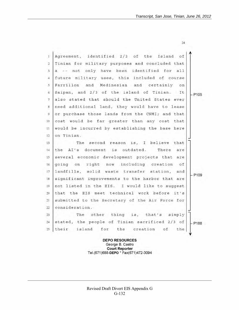
Transcript, San Jose, Tinian, June 26, 2012
Revised Draft Divert EIS Appendix G
G-132
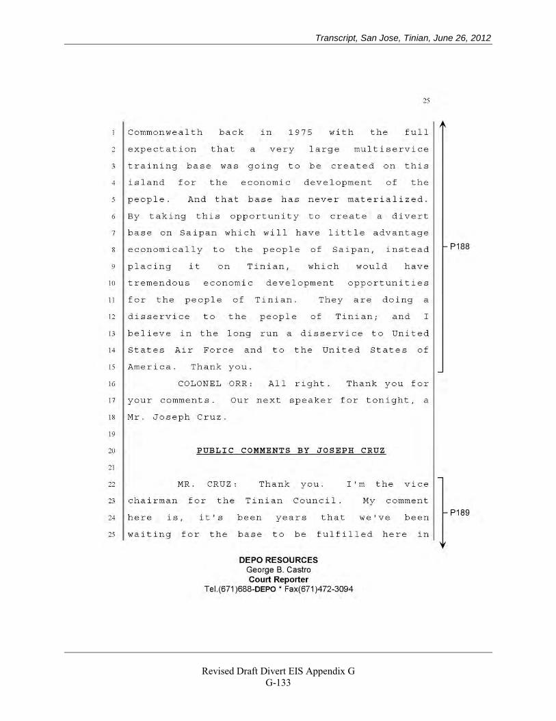
Transcript, San Jose, Tinian, June 26, 2012
Revised Draft Divert EIS Appendix G
G-133
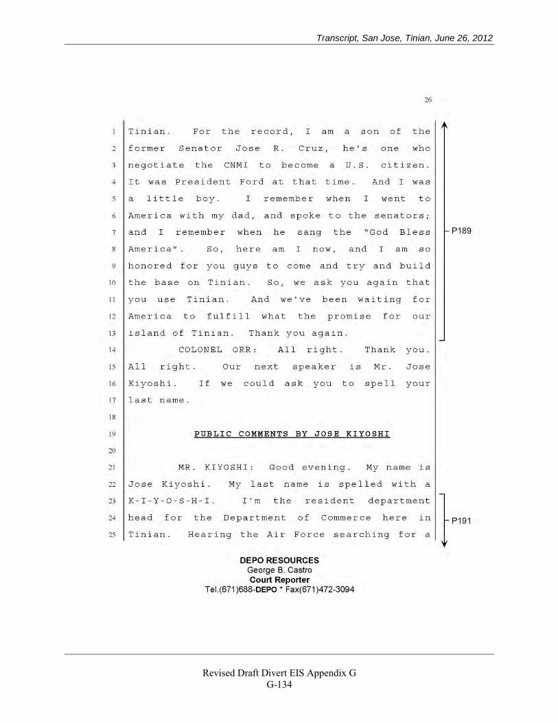
Transcript, San Jose, Tinian, June 26, 2012
Revised Draft Divert EIS Appendix G
G-134
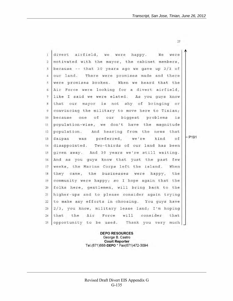
Transcript, San Jose, Tinian, June 26, 2012
Revised Draft Divert EIS Appendix G
G-135
Transcript, San Jose, Tinian, June 26, 2012
Revised Draft Divert EIS Appendix G
G-136
Transcript, San Jose, Tinian, June 26, 2012
Revised Draft Divert EIS Appendix G
G-137
Transcript, San Jose, Tinian, June 26, 2012
Revised Draft Divert EIS Appendix G
G-138
Transcript, San Jose, Tinian, June 26, 2012
Revised Draft Divert EIS Appendix G
G-139
Transcript, San Jose, Tinian, June 26, 2012
Revised Draft Divert EIS Appendix G
G-140
Transcript, San Jose, Tinian, June 26, 2012
Revised Draft Divert EIS Appendix G
G-141
Dr. Justine B. de Cruz, July 3, 2012
Revised Draft Divert EIS Appendix G
G-142
Dr. Justine B. de Cruz, July 3, 2012
Revised Draft Divert EIS Appendix G
G-143
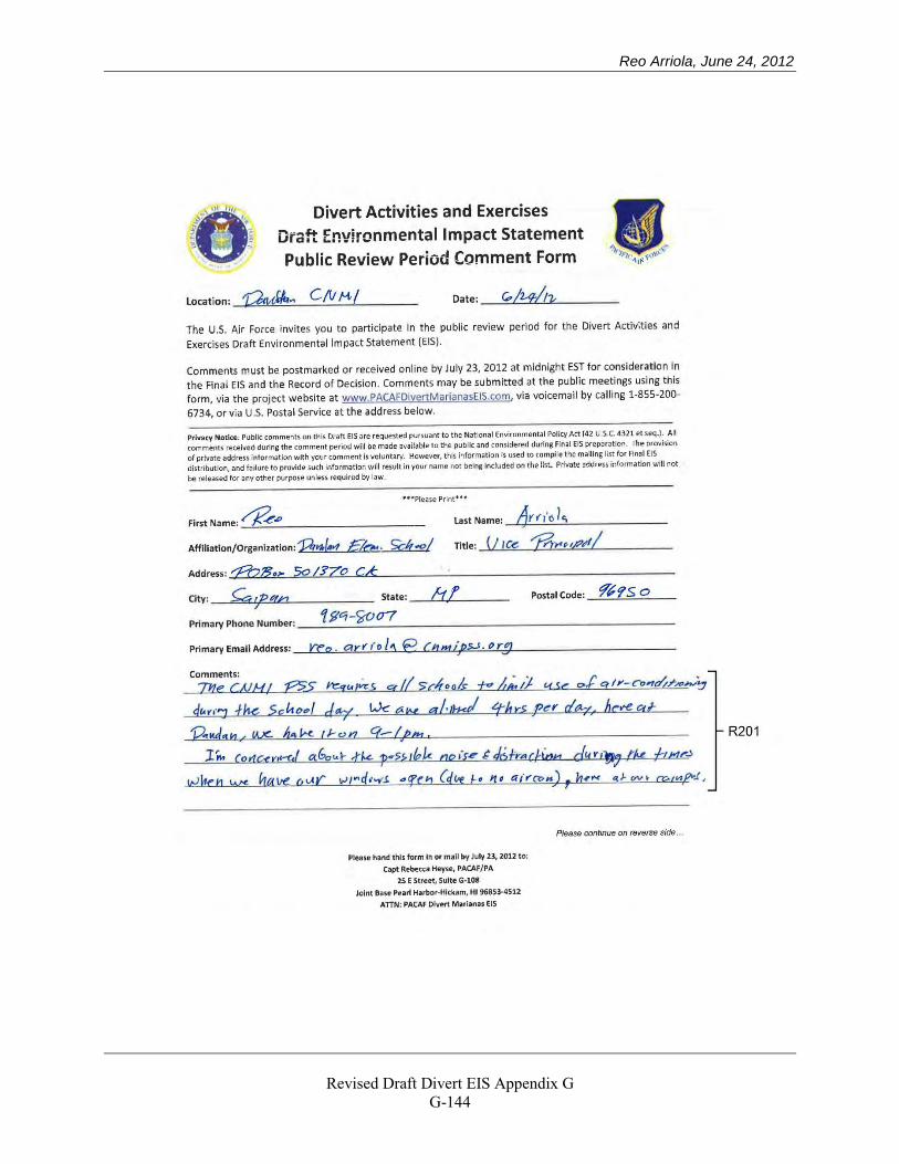
Reo Arriola, June 24, 2012
Revised Draft Divert EIS Appendix G
G-144
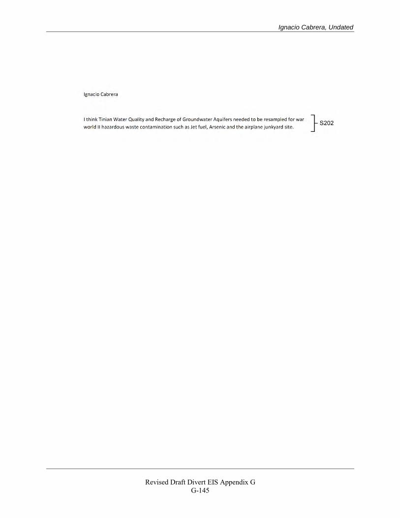
Ignacio Cabrera, Undated
Revised Draft Divert EIS Appendix G
G-145
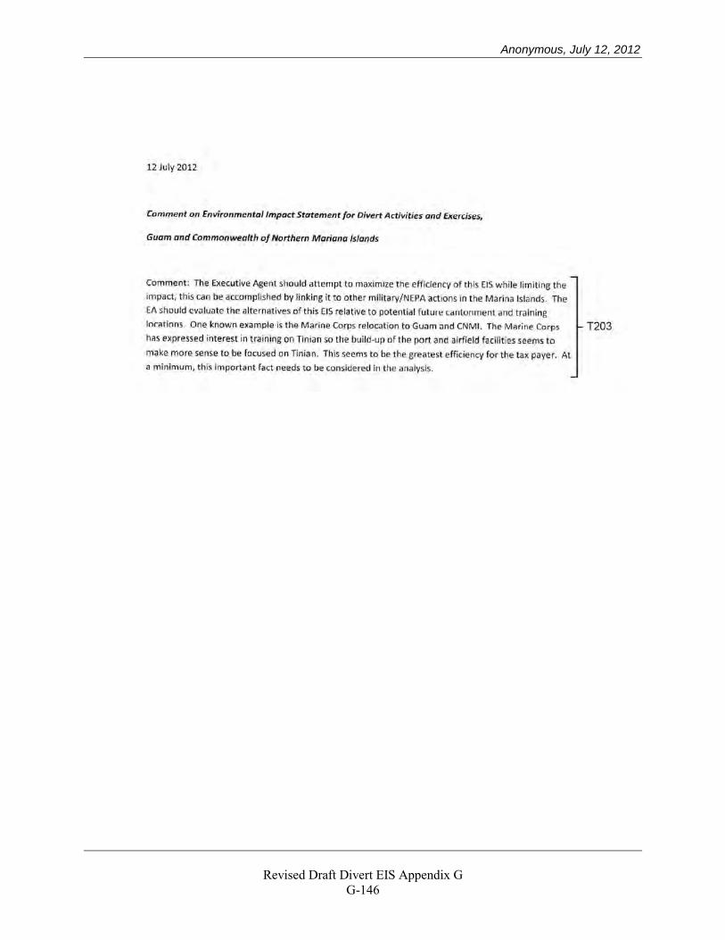
Anonymous, July 12, 2012
Revised Draft Divert EIS Appendix G
G-146
Governor Fitial White Paper, Undated
Revised Draft Divert EIS Appendix G
G-147
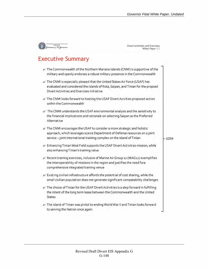
Governor Fitial White Paper, Undated
Revised Draft Divert EIS Appendix G
G-148
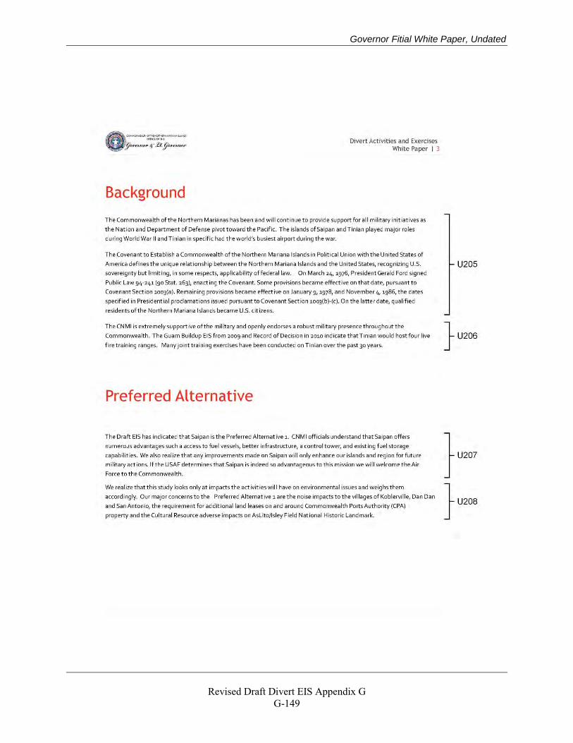
Governor Fitial White Paper, Undated
Revised Draft Divert EIS Appendix G
G-149
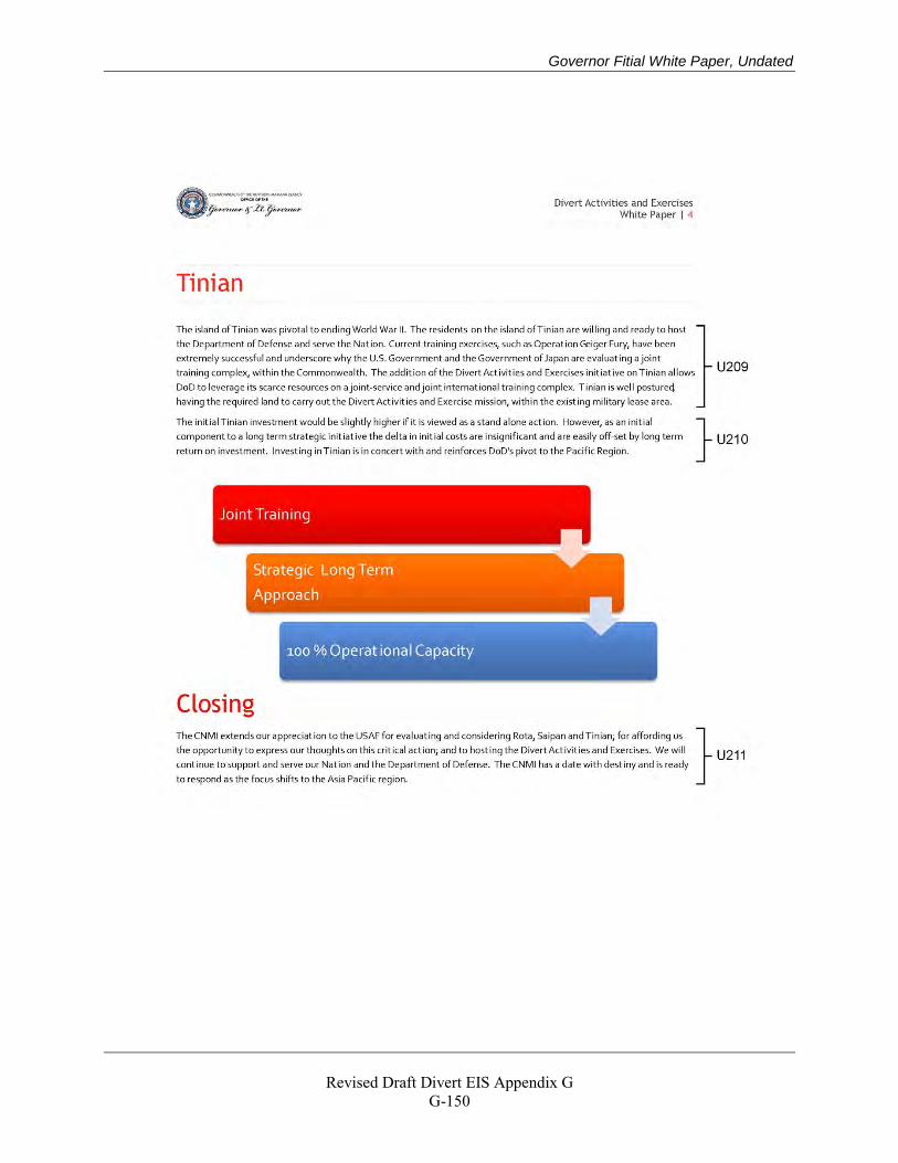
Governor Fitial White Paper, Undated
Revised Draft Divert EIS Appendix G
G-150
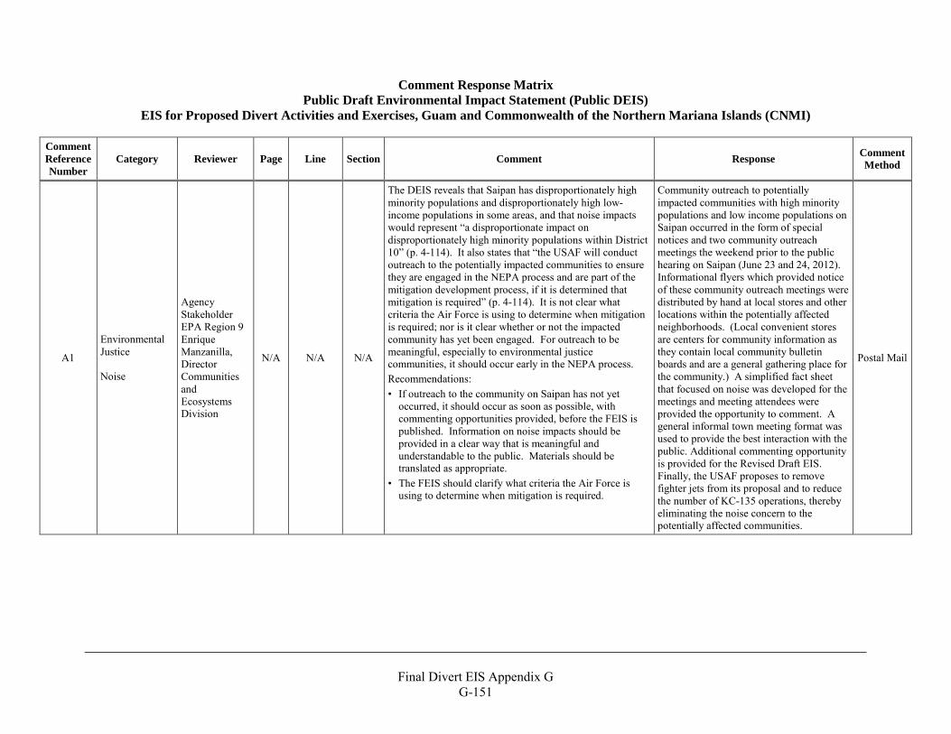
Final Divert EIS Appendix G
G-151
Comment Response Matrix Public Draft Environmental Impact Statement (Public DEIS)
EIS for Proposed Divert Activities and Exercises, Guam and Commonwealth of the Northern Mariana Islands (CNMI)
Comment Reference Number
Category Reviewer Page Line Section Comment Response Comment Method
A1
Environmental Justice Noise
Agency Stakeholder EPA Region 9 Enrique Manzanilla, Director Communities and Ecosystems Division
N/A N/A N/A
The DEIS reveals that Saipan has disproportionately high minority populations and disproportionately high low-income populations in some areas, and that noise impacts would represent “a disproportionate impact on disproportionately high minority populations within District 10” (p. 4-114). It also states that “the USAF will conduct outreach to the potentially impacted communities to ensure they are engaged in the NEPA process and are part of the mitigation development process, if it is determined that mitigation is required” (p. 4-114). It is not clear what criteria the Air Force is using to determine when mitigation is required; nor is it clear whether or not the impacted community has yet been engaged. For outreach to be meaningful, especially to environmental justice communities, it should occur early in the NEPA process. Recommendations: • If outreach to the community on Saipan has not yet
occurred, it should occur as soon as possible, with commenting opportunities provided, before the FEIS is published. Information on noise impacts should be provided in a clear way that is meaningful and understandable to the public. Materials should be translated as appropriate.
• The FEIS should clarify what criteria the Air Force is using to determine when mitigation is required.
Community outreach to potentially impacted communities with high minority populations and low income populations on Saipan occurred in the form of special notices and two community outreach meetings the weekend prior to the public hearing on Saipan (June 23 and 24, 2012). Informational flyers which provided notice of these community outreach meetings were distributed by hand at local stores and other locations within the potentially affected neighborhoods. (Local convenient stores are centers for community information as they contain local community bulletin boards and are a general gathering place for the community.) A simplified fact sheet that focused on noise was developed for the meetings and meeting attendees were provided the opportunity to comment. A general informal town meeting format was used to provide the best interaction with the public. Additional commenting opportunity is provided for the Revised Draft EIS. Finally, the USAF proposes to remove fighter jets from its proposal and to reduce the number of KC-135 operations, thereby eliminating the noise concern to the potentially affected communities.
Postal Mail
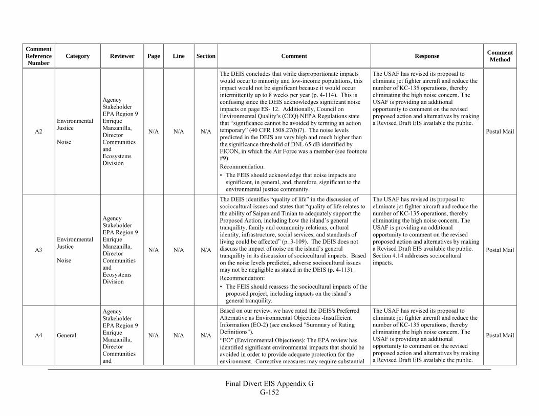
Final Divert EIS Appendix G
G-152
Comment Reference Number
Category Reviewer Page Line Section Comment Response Comment Method
A2
Environmental Justice Noise
Agency Stakeholder EPA Region 9 Enrique Manzanilla, Director Communities and Ecosystems Division
N/A N/A N/A
The DEIS concludes that while disproportionate impacts would occur to minority and low-income populations, this impact would not be significant because it would occur intermittently up to 8 weeks per year (p. 4-114). This is confusing since the DEIS acknowledges significant noise impacts on page ES- 12. Additionally, Council on Environmental Quality’s (CEQ) NEPA Regulations state that “significance cannot be avoided by terming an action temporary” (40 CFR 1508.27(b)7). The noise levels predicted in the DEIS are very high and much higher than the significance threshold of DNL 65 dB identified by FICON, in which the Air Force was a member (see footnote #9). Recommendation: • The FEIS should acknowledge that noise impacts are
significant, in general, and, therefore, significant to the environmental justice community.
The USAF has revised its proposal to eliminate jet fighter aircraft and reduce the number of KC-135 operations, thereby eliminating the high noise concern. The USAF is providing an additional opportunity to comment on the revised proposed action and alternatives by making a Revised Draft EIS available the public.
Postal Mail
A3
Environmental Justice Noise
Agency Stakeholder EPA Region 9 Enrique Manzanilla, Director Communities and Ecosystems Division
N/A N/A N/A
The DEIS identifies “quality of life” in the discussion of sociocultural issues and states that “quality of life relates to the ability of Saipan and Tinian to adequately support the Proposed Action, including how the island’s general tranquility, family and community relations, cultural identity, infrastructure, social services, and standards of living could be affected” (p. 3-109). The DEIS does not discuss the impact of noise on the island’s general tranquility in its discussion of sociocultural impacts. Based on the noise levels predicted, adverse sociocultural issues may not be negligible as stated in the DEIS (p. 4-113). Recommendation: • The FEIS should reassess the sociocultural impacts of the
proposed project, including impacts on the island’s general tranquility.
The USAF has revised its proposal to eliminate jet fighter aircraft and reduce the number of KC-135 operations, thereby eliminating the high noise concern. The USAF is providing an additional opportunity to comment on the revised proposed action and alternatives by making a Revised Draft EIS available the public. Section 4.14 addresses sociocultural impacts.
Postal Mail
A4 General
Agency Stakeholder EPA Region 9 Enrique Manzanilla, Director Communities and
N/A N/A N/A
Based on our review, we have rated the DEIS's Preferred Alternative as Environmental Objections -Insufficient Information (EO-2) (see enclosed "Summary of Rating Definitions"). “EO” (Environmental Objections): The EPA review has identified significant environmental impacts that should be avoided in order to provide adequate protection for the environment. Corrective measures may require substantial
The USAF has revised its proposal to eliminate jet fighter aircraft and reduce the number of KC-135 operations, thereby eliminating the high noise concern. The USAF is providing an additional opportunity to comment on the revised proposed action and alternatives by making a Revised Draft EIS available the public.
Postal Mail
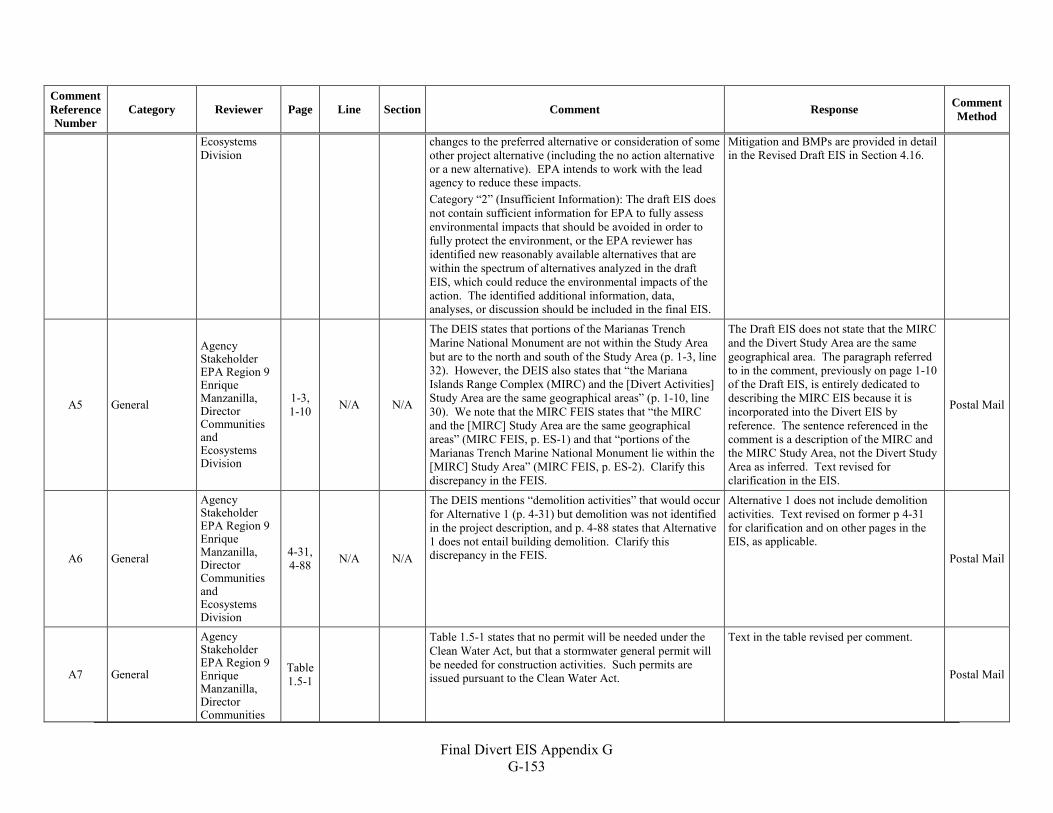
Final Divert EIS Appendix G
G-153
Comment Reference Number
Category Reviewer Page Line Section Comment Response Comment Method
Ecosystems Division
changes to the preferred alternative or consideration of some other project alternative (including the no action alternative or a new alternative). EPA intends to work with the lead agency to reduce these impacts. Category “2” (Insufficient Information): The draft EIS does not contain sufficient information for EPA to fully assess environmental impacts that should be avoided in order to fully protect the environment, or the EPA reviewer has identified new reasonably available alternatives that are within the spectrum of alternatives analyzed in the draft EIS, which could reduce the environmental impacts of the action. The identified additional information, data, analyses, or discussion should be included in the final EIS.
Mitigation and BMPs are provided in detail in the Revised Draft EIS in Section 4.16.
A5 General
Agency Stakeholder EPA Region 9 Enrique Manzanilla, Director Communities and Ecosystems Division
1-3, 1-10 N/A N/A
The DEIS states that portions of the Marianas Trench Marine National Monument are not within the Study Area but are to the north and south of the Study Area (p. 1-3, line 32). However, the DEIS also states that “the Mariana Islands Range Complex (MIRC) and the [Divert Activities] Study Area are the same geographical areas” (p. 1-10, line 30). We note that the MIRC FEIS states that “the MIRC and the [MIRC] Study Area are the same geographical areas” (MIRC FEIS, p. ES-1) and that “portions of the Marianas Trench Marine National Monument lie within the [MIRC] Study Area” (MIRC FEIS, p. ES-2). Clarify this discrepancy in the FEIS.
The Draft EIS does not state that the MIRC and the Divert Study Area are the same geographical area. The paragraph referred to in the comment, previously on page 1-10 of the Draft EIS, is entirely dedicated to describing the MIRC EIS because it is incorporated into the Divert EIS by reference. The sentence referenced in the comment is a description of the MIRC and the MIRC Study Area, not the Divert Study Area as inferred. Text revised for clarification in the EIS.
Postal Mail
A6 General
Agency Stakeholder EPA Region 9 Enrique Manzanilla, Director Communities and Ecosystems Division
4-31, 4-88 N/A N/A
The DEIS mentions “demolition activities” that would occur for Alternative 1 (p. 4-31) but demolition was not identified in the project description, and p. 4-88 states that Alternative 1 does not entail building demolition. Clarify this discrepancy in the FEIS.
Alternative 1 does not include demolition activities. Text revised on former p 4-31 for clarification and on other pages in the EIS, as applicable.
Postal Mail
A7 General
Agency Stakeholder EPA Region 9 Enrique Manzanilla, Director Communities
Table 1.5-1
Table 1.5-1 states that no permit will be needed under the Clean Water Act, but that a stormwater general permit will be needed for construction activities. Such permits are issued pursuant to the Clean Water Act.
Text in the table revised per comment.
Postal Mail
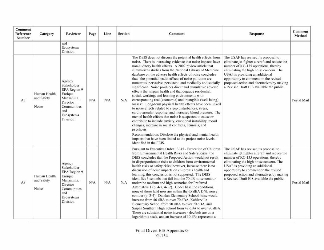
Final Divert EIS Appendix G
G-154
Comment Reference Number
Category Reviewer Page Line Section Comment Response Comment Method
and Ecosystems Division
A8
Human Health and Safety Noise
Agency Stakeholder EPA Region 9 Enrique Manzanilla, Director Communities and Ecosystems Division
N/A N/A N/A
The DEIS does not discuss the potential health effects from noise. There is increasing evidence that noise impacts have non-auditory health effects. A 2007 review article that summarizes studies from the National Library of Medicine database on the adverse health effects of noise concludes that “the potential health effects of noise pollution are numerous, pervasive, persistent, and medically and socially significant. Noise produces direct and cumulative adverse effects that impair health and that degrade residential, social, working, and learning environments with corresponding real (economic) and intangible (well-being) losses”. Long-term physical health effects have been linked to noise effects related to sleep disturbances, stress, cardiovascular response, and increased blood pressure. The mental health effects that noise is suspected to cause or contribute to include anxiety, emotional instability, mood changes, increase in social conflicts, neurosis, and psychosis. Recommendation: Disclose the physical and mental health impacts that have been linked to the project noise levels identified in the FEIS.
The USAF has revised its proposal to eliminate jet fighter aircraft and reduce the number of KC-135 operations, thereby eliminating the high noise concern. The USAF is providing an additional opportunity to comment on the revised proposed action and alternatives by making a Revised Draft EIS available the public.
Postal Mail
A9
Human Health and Safety Noise
Agency Stakeholder EPA Region 9 Enrique Manzanilla, Director Communities and Ecosystems Division
N/A N/A N/A
Pursuant to Executive Order 13045 - Protection of Children from Environmental Health Risks and Safety Risks, the DEIS concludes that the Proposed Action would not result in disproportionate risks to children from environmental health risks or safety risks; however, because there is no discussion of noise impacts on children’s health and learning, this conclusion is not supported. The DEIS identifies 3 schools that fall into the 70 dB noise contour under the medium and high scenarios for Preferred Alternative 1 (p. 4-7, 4-12). Under baseline conditions, none of these land uses are within the 65 dBA DNL noise contour (p. 3-4). Dandan Elementary School noise would increase from 46 dBA to over 70 dBA, Koblerville Elementary School from 50 dBA to over 70 dBA, and Saipan Southern High School from 49 dBA to over 70 dBA. These are substantial noise increases - decibels are on a logarithmic scale, and an increase of 10 dBs represents a
The USAF has revised its proposal to eliminate jet fighter aircraft and reduce the number of KC-135 operations, thereby eliminating the high noise concern. The USAF is providing an additional opportunity to comment on the revised proposed action and alternatives by making a Revised Draft EIS available the public. Postal Mail
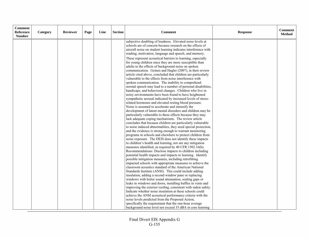
Final Divert EIS Appendix G
G-155
Comment Reference Number
Category Reviewer Page Line Section Comment Response Comment Method
subjective doubling of loudness. Elevated noise levels at schools are of concern because research on the effects of aircraft noise on student learning indicates interference with reading, motivation, language and speech, and memory. These represent acoustical barriers to learning, especially for young children since they are more susceptible than adults to the effects of background noise on spoken communication. Goines and Hagler (2007), in their review article cited above, concluded that children are particularly vulnerable to the effects from noise interference with spoken communication. The inability to comprehend normal speech may lead to a number of personal disabilities, handicaps, and behavioral changes. Children who live in noisy environments have been found to have heightened sympathetic arousal indicated by increased levels of stress-related hormones and elevated resting blood pressure. Noise is assumed to accelerate and intensify the development of latent mental disorders and children may be particularly vulnerable to these effects because they may lack adequate coping mechanisms. The review article concludes that because children are particularly vulnerable to noise induced abnormalities, they need special protection, and the evidence is strong enough to warrant monitoring programs in schools and elsewhere to protect children from noise exposure. The DEIS does not identify these impacts to children’s health and learning, nor are any mitigation measures identified, as required by 40 CFR 1502.16(h). Recommendations: Disclose impacts to children including potential health impacts and impacts to learning. Identify possible mitigation measures, including retrofitting impacted schools with appropriate measures to achieve the classroom acoustics standard of the American National Standards Institute (ANSI). This could include adding insulation, adding a second window pane or replacing windows with better sound attenuation, sealing gaps or leaks in windows and doors, installing baffles in vents and improving the exterior roofing, consistent with radon safety. Indicate whether noise insulation at these schools could achieve the ANSI acoustical performance criteria with the noise levels predicted from the Proposed Action, specifically the requirement that the one-hour average background noise level not exceed 35 dBA in core learning
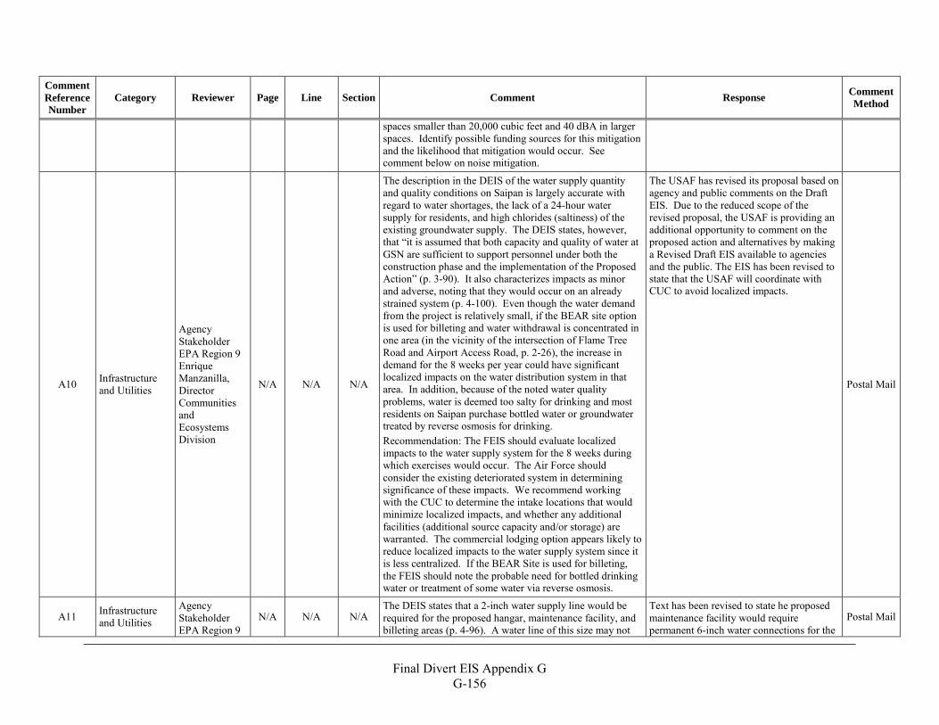
Final Divert EIS Appendix G
G-156
Comment Reference Number
Category Reviewer Page Line Section Comment Response Comment Method
spaces smaller than 20,000 cubic feet and 40 dBA in larger spaces. Identify possible funding sources for this mitigation and the likelihood that mitigation would occur. See comment below on noise mitigation.
A10 Infrastructure and Utilities
Agency Stakeholder EPA Region 9 Enrique Manzanilla, Director Communities and Ecosystems Division
N/A N/A N/A
The description in the DEIS of the water supply quantity and quality conditions on Saipan is largely accurate with regard to water shortages, the lack of a 24-hour water supply for residents, and high chlorides (saltiness) of the existing groundwater supply. The DEIS states, however, that “it is assumed that both capacity and quality of water at GSN are sufficient to support personnel under both the construction phase and the implementation of the Proposed Action” (p. 3-90). It also characterizes impacts as minor and adverse, noting that they would occur on an already strained system (p. 4-100). Even though the water demand from the project is relatively small, if the BEAR site option is used for billeting and water withdrawal is concentrated in one area (in the vicinity of the intersection of Flame Tree Road and Airport Access Road, p. 2-26), the increase in demand for the 8 weeks per year could have significant localized impacts on the water distribution system in that area. In addition, because of the noted water quality problems, water is deemed too salty for drinking and most residents on Saipan purchase bottled water or groundwater treated by reverse osmosis for drinking. Recommendation: The FEIS should evaluate localized impacts to the water supply system for the 8 weeks during which exercises would occur. The Air Force should consider the existing deteriorated system in determining significance of these impacts. We recommend working with the CUC to determine the intake locations that would minimize localized impacts, and whether any additional facilities (additional source capacity and/or storage) are warranted. The commercial lodging option appears likely to reduce localized impacts to the water supply system since it is less centralized. If the BEAR Site is used for billeting, the FEIS should note the probable need for bottled drinking water or treatment of some water via reverse osmosis.
The USAF has revised its proposal based on agency and public comments on the Draft EIS. Due to the reduced scope of the revised proposal, the USAF is providing an additional opportunity to comment on the proposed action and alternatives by making a Revised Draft EIS available to agencies and the public. The EIS has been revised to state that the USAF will coordinate with CUC to avoid localized impacts.
Postal Mail
A11 Infrastructure and Utilities
Agency Stakeholder EPA Region 9
N/A N/A N/A The DEIS states that a 2-inch water supply line would be required for the proposed hangar, maintenance facility, and billeting areas (p. 4-96). A water line of this size may not
Text has been revised to state he proposed maintenance facility would require permanent 6-inch water connections for the
Postal Mail
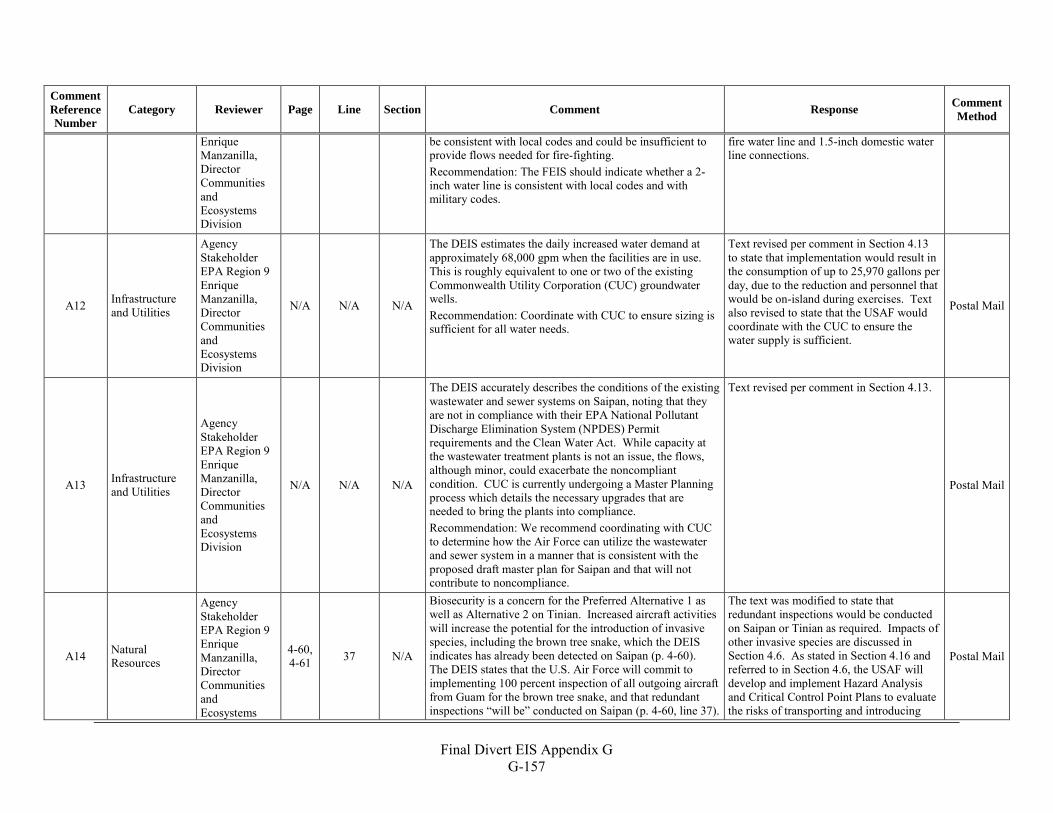
Final Divert EIS Appendix G
G-157
Comment Reference Number
Category Reviewer Page Line Section Comment Response Comment Method
Enrique Manzanilla, Director Communities and Ecosystems Division
be consistent with local codes and could be insufficient to provide flows needed for fire-fighting. Recommendation: The FEIS should indicate whether a 2-inch water line is consistent with local codes and with military codes.
fire water line and 1.5-inch domestic water line connections.
A12 Infrastructure and Utilities
Agency Stakeholder EPA Region 9 Enrique Manzanilla, Director Communities and Ecosystems Division
N/A N/A N/A
The DEIS estimates the daily increased water demand at approximately 68,000 gpm when the facilities are in use. This is roughly equivalent to one or two of the existing Commonwealth Utility Corporation (CUC) groundwater wells. Recommendation: Coordinate with CUC to ensure sizing is sufficient for all water needs.
Text revised per comment in Section 4.13 to state that implementation would result in the consumption of up to 25,970 gallons per day, due to the reduction and personnel that would be on-island during exercises. Text also revised to state that the USAF would coordinate with the CUC to ensure the water supply is sufficient.
Postal Mail
A13 Infrastructure and Utilities
Agency Stakeholder EPA Region 9 Enrique Manzanilla, Director Communities and Ecosystems Division
N/A N/A N/A
The DEIS accurately describes the conditions of the existing wastewater and sewer systems on Saipan, noting that they are not in compliance with their EPA National Pollutant Discharge Elimination System (NPDES) Permit requirements and the Clean Water Act. While capacity at the wastewater treatment plants is not an issue, the flows, although minor, could exacerbate the noncompliant condition. CUC is currently undergoing a Master Planning process which details the necessary upgrades that are needed to bring the plants into compliance. Recommendation: We recommend coordinating with CUC to determine how the Air Force can utilize the wastewater and sewer system in a manner that is consistent with the proposed draft master plan for Saipan and that will not contribute to noncompliance.
Text revised per comment in Section 4.13.
Postal Mail
A14 Natural Resources
Agency Stakeholder EPA Region 9 Enrique Manzanilla, Director Communities and Ecosystems
4-60, 4-61 37 N/A
Biosecurity is a concern for the Preferred Alternative 1 as well as Alternative 2 on Tinian. Increased aircraft activities will increase the potential for the introduction of invasive species, including the brown tree snake, which the DEIS indicates has already been detected on Saipan (p. 4-60). The DEIS states that the U.S. Air Force will commit to implementing 100 percent inspection of all outgoing aircraft from Guam for the brown tree snake, and that redundant inspections “will be” conducted on Saipan (p. 4-60, line 37).
The text was modified to state that redundant inspections would be conducted on Saipan or Tinian as required. Impacts of other invasive species are discussed in Section 4.6. As stated in Section 4.16 and referred to in Section 4.6, the USAF will develop and implement Hazard Analysis and Critical Control Point Plans to evaluate the risks of transporting and introducing
Postal Mail
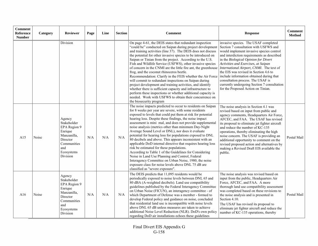
Final Divert EIS Appendix G
G-158
Comment Reference Number
Category Reviewer Page Line Section Comment Response Comment Method
Division On page 4-61, the DEIS states that redundant inspection “could be” conducted on Saipan during project development and training activities (line 37). The DEIS does not discuss the potential for other invasive species to be introduced on Saipan or Tinian from the project. According to the U.S. Fish and Wildlife Service (USFWS), other invasive species of concern in the CNMI are the little fire ant, the greenhouse frog, and the coconut rhinoceros beetle. Recommendation: Clarify in the FEIS whether the Air Force will commit to redundant inspections on Saipan during project development and training activities, and identify whether there is sufficient capacity and infrastructure to perform these inspections or whether additional capacity is needed. Work with USFWS to obtain their concurrence on the biosecurity program
invasive species. The USAF completed Section 7 consultation with USFWS and would implement invasive species control and interdiction requirements as described in the Biological Opinion for Divert Activities and Exercises, at Saipan International Airport, CNMI. The text of the EIS was revised in Section 4.6 to include information obtained during that consultation process. The USAF is currently undergoing Section 7 consultation for the Proposed Action on Tinian.
A15 Noise
Agency Stakeholder EPA Region 9 Enrique Manzanilla, Director Communities and Ecosystems Division
N/A N/A N/A
The noise impacts predicted to occur to residents on Saipan for 8 weeks per year are severe, with some residents exposed to levels that could put them at risk for potential hearing loss. Despite these findings, the noise impact assessment is mini mal, and does not provide supplemental noise analysis (metrics other than minimum Day-Night Average Sound Level or DNL), nor does it evaluate potential for hearing loss for populations exposed to DNL 80 decibels and above. This appears inconsistent with an applicable DoD internal directive that requires hearing loss risk be estimated for these populations. According to Table 1 of the Guidelines for Considering Noise in Land Use Planning and Control, Federal Interagency Committee on Urban Noise, 1980, the noise exposure class for noise levels above DNL 75 dB are classified as "severe exposure".
The noise analysis in Section 4.1 was revised based on input from public and agency comments, Headquarters Air Force, AFCEC, and FAA. The USAF has revised its proposal to eliminate jet fighter aircraft and reduce the number of KC-135 operations, thereby eliminating the high noise concern. The USAF is providing an additional opportunity to comment on the revised proposed action and alternatives by making a Revised Draft EIS available the public.
Postal Mail
A16 Noise
Agency Stakeholder EPA Region 9 Enrique Manzanilla, Director Communities and Ecosystems Division
N/A N/A N/A
The DEIS predicts that 11,095 residents would be periodically exposed to noise levels between DNL 65 and 80 dBA (A-weighted decibels). Land use compatibility guidelines published by the Federal Interagency Committee on Urban Noise (FICUN), an interagency committee - of which Department of Defense was a member - formed to develop Federal policy and guidance on noise, concluded that residential land use is incompatible with noise levels above DNL 65 dB unless measures are taken to achieve additional Noise Level Reduction (NLR). DoD's own policy regarding DoD air installations echoes these guidelines
The noise analysis was revised based on input from the public, Headquarters Air Force, AFCEC, and FAA. A more thorough land use compatibility assessment was completed based on these revisions to the noise analysis and is presented in Section 4.10. The USAF has revised its proposal to eliminate jet fighter aircraft and reduce the number of KC-135 operations, thereby
Postal Mail
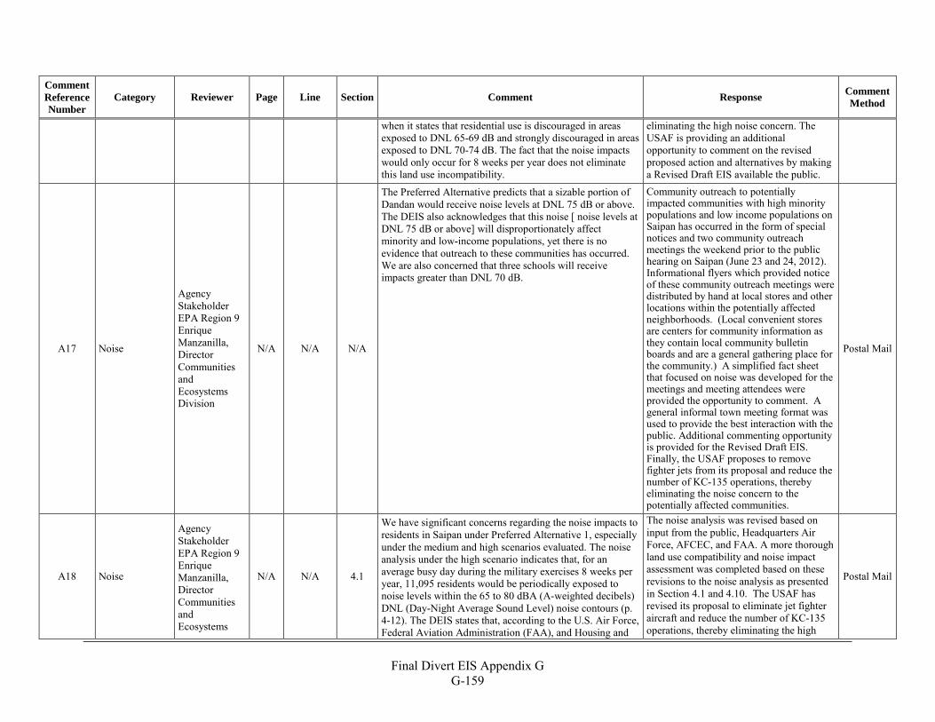
Final Divert EIS Appendix G
G-159
Comment Reference Number
Category Reviewer Page Line Section Comment Response Comment Method
when it states that residential use is discouraged in areas exposed to DNL 65-69 dB and strongly discouraged in areas exposed to DNL 70-74 dB. The fact that the noise impacts would only occur for 8 weeks per year does not eliminate this land use incompatibility.
eliminating the high noise concern. The USAF is providing an additional opportunity to comment on the revised proposed action and alternatives by making a Revised Draft EIS available the public.
A17 Noise
Agency Stakeholder EPA Region 9 Enrique Manzanilla, Director Communities and Ecosystems Division
N/A N/A N/A
The Preferred Alternative predicts that a sizable portion of Dandan would receive noise levels at DNL 75 dB or above. The DEIS also acknowledges that this noise [ noise levels at DNL 75 dB or above] will disproportionately affect minority and low-income populations, yet there is no evidence that outreach to these communities has occurred. We are also concerned that three schools will receive impacts greater than DNL 70 dB.
Community outreach to potentially impacted communities with high minority populations and low income populations on Saipan has occurred in the form of special notices and two community outreach meetings the weekend prior to the public hearing on Saipan (June 23 and 24, 2012). Informational flyers which provided notice of these community outreach meetings were distributed by hand at local stores and other locations within the potentially affected neighborhoods. (Local convenient stores are centers for community information as they contain local community bulletin boards and are a general gathering place for the community.) A simplified fact sheet that focused on noise was developed for the meetings and meeting attendees were provided the opportunity to comment. A general informal town meeting format was used to provide the best interaction with the public. Additional commenting opportunity is provided for the Revised Draft EIS. Finally, the USAF proposes to remove fighter jets from its proposal and reduce the number of KC-135 operations, thereby eliminating the noise concern to the potentially affected communities.
Postal Mail
A18 Noise
Agency Stakeholder EPA Region 9 Enrique Manzanilla, Director Communities and Ecosystems
N/A N/A 4.1
We have significant concerns regarding the noise impacts to residents in Saipan under Preferred Alternative 1, especially under the medium and high scenarios evaluated. The noise analysis under the high scenario indicates that, for an average busy day during the military exercises 8 weeks per year, 11,095 residents would be periodically exposed to noise levels within the 65 to 80 dBA (A-weighted decibels) DNL (Day-Night Average Sound Level) noise contours (p. 4-12). The DEIS states that, according to the U.S. Air Force, Federal Aviation Administration (FAA), and Housing and
The noise analysis was revised based on input from the public, Headquarters Air Force, AFCEC, and FAA. A more thorough land use compatibility and noise impact assessment was completed based on these revisions to the noise analysis as presented in Section 4.1 and 4.10. The USAF has revised its proposal to eliminate jet fighter aircraft and reduce the number of KC-135 operations, thereby eliminating the high
Postal Mail
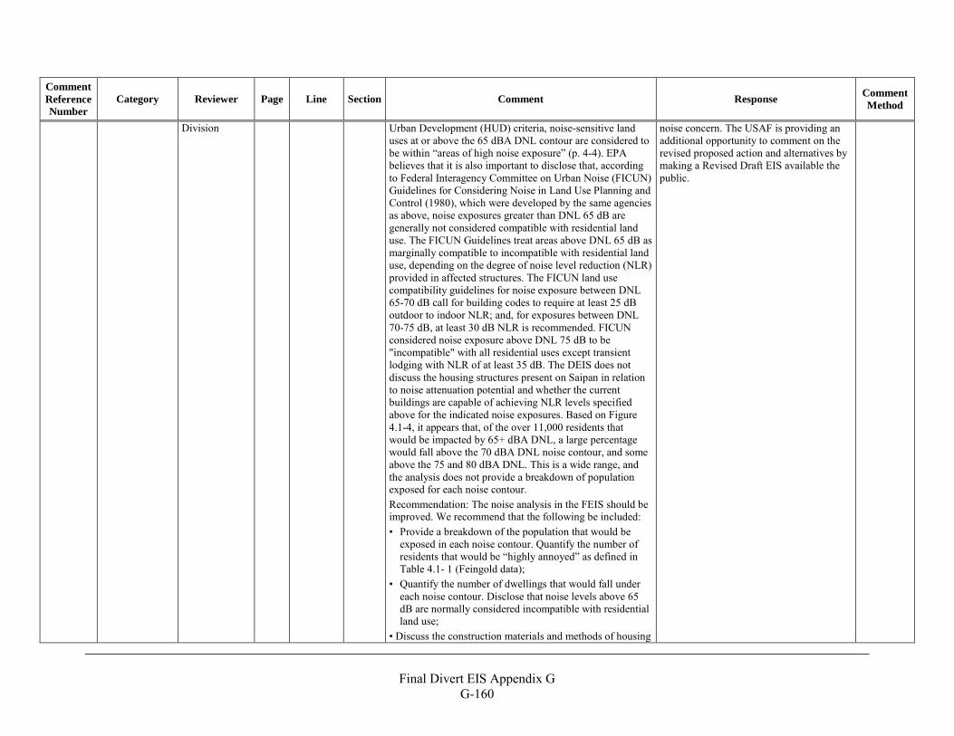
Final Divert EIS Appendix G
G-160
Comment Reference Number
Category Reviewer Page Line Section Comment Response Comment Method
Division Urban Development (HUD) criteria, noise-sensitive land uses at or above the 65 dBA DNL contour are considered to be within “areas of high noise exposure” (p. 4-4). EPA believes that it is also important to disclose that, according to Federal Interagency Committee on Urban Noise (FICUN) Guidelines for Considering Noise in Land Use Planning and Control (1980), which were developed by the same agencies as above, noise exposures greater than DNL 65 dB are generally not considered compatible with residential land use. The FICUN Guidelines treat areas above DNL 65 dB as marginally compatible to incompatible with residential land use, depending on the degree of noise level reduction (NLR) provided in affected structures. The FICUN land use compatibility guidelines for noise exposure between DNL 65-70 dB call for building codes to require at least 25 dB outdoor to indoor NLR; and, for exposures between DNL 70-75 dB, at least 30 dB NLR is recommended. FICUN considered noise exposure above DNL 75 dB to be "incompatible" with all residential uses except transient lodging with NLR of at least 35 dB. The DEIS does not discuss the housing structures present on Saipan in relation to noise attenuation potential and whether the current buildings are capable of achieving NLR levels specified above for the indicated noise exposures. Based on Figure 4.1-4, it appears that, of the over 11,000 residents that would be impacted by 65+ dBA DNL, a large percentage would fall above the 70 dBA DNL noise contour, and some above the 75 and 80 dBA DNL. This is a wide range, and the analysis does not provide a breakdown of population exposed for each noise contour. Recommendation: The noise analysis in the FEIS should be improved. We recommend that the following be included: • Provide a breakdown of the population that would be
exposed in each noise contour. Quantify the number of residents that would be “highly annoyed” as defined in Table 4.1- 1 (Feingold data);
• Quantify the number of dwellings that would fall under each noise contour. Disclose that noise levels above 65 dB are normally considered incompatible with residential land use;
• Discuss the construction materials and methods of housing
noise concern. The USAF is providing an additional opportunity to comment on the revised proposed action and alternatives by making a Revised Draft EIS available the public.
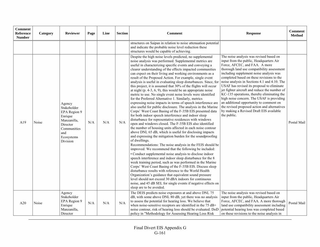
Final Divert EIS Appendix G
G-161
Comment Reference Number
Category Reviewer Page Line Section Comment Response Comment Method
structures on Saipan in relation to noise attenuation potential and indicate the probable noise level reduction these structures would be capable of achieving.
A19 Noise
Agency Stakeholder EPA Region 9 Enrique Manzanilla, Director Communities and Ecosystems Division
N/A N/A N/A
Despite the high noise levels predicted, no supplemental noise analysis was performed. Supplemental metrics are useful in characterizing specific events and conveying a clearer understanding of the effects impacted communities can expect on their living and working environments as a result of the Proposed Action. For example, single event analysis is useful in evaluating sleep disturbances. Since, for this project, it is assumed that 30% of the flights will occur at night (p. 4-3, 6, 9), this would be an appropriate noise metric to use. No single event noise levels were identified for the Preferred Alternative 1. Similarly, metrics expressing noise impacts in terms of speech interference are also useful for public disclosure. The analysis in the Marine Corps’ West Coast Basing of the F-35B EIS presented data for both indoor speech interference and indoor sleep disturbance for representative residences with windows open and windows closed. The F-35B EIS also identified the number of housing units affected in each noise contour above DNL 65 dB, which is useful for disclosing impacts and expressing the mitigation burden for the soundproofing of dwellings. Recommendations: The noise analysis in the FEIS should be improved. We recommend that the following be included: • Conduct supplemental noise analysis to disclose indoor speech interference and indoor sleep disturbance for the 8 week training period, such as was performed in the Marine Corps’ West Coast Basing of the F-35B EIS. Discuss sleep disturbance results with reference to the World Health Organization’s guidance that equivalent sound pressure level should not exceed 30 dBA indoors for continuous noise, and 45 dB SEL for single events if negative effects on sleep are to be avoided.
The noise analysis was revised based on input from the public, Headquarters Air Force, AFCEC, and FAA. A more thorough land use compatibility assessment including supplement noise analysis was completed based on these revisions to the noise analysis in Sections 4.1 and 4.10. The USAF has revised its proposal to eliminate jet fighter aircraft and reduce the number of KC-135 operations, thereby eliminating the high noise concern. The USAF is providing an additional opportunity to comment on the revised proposed action and alternatives by making a Revised Draft EIS available the public.
Postal Mail
A20 Noise
Agency Stakeholder EPA Region 9 Enrique Manzanilla, Director
N/A N/A N/A
The DEIS predicts noise exposures at and above DNL 75 dB, with some above DNL 80 dB, yet there was no analysis to assess the potential for hearing loss. We believe that when noise-sensitive receptors are identified in the 75 dB+ noise contour, risk of hearing loss should be evaluated. DoD policy in "Methodology for Assessing Hearing Loss Risk
The noise analysis was revised based on input from the public, Headquarters Air Force, AFCEC, and FAA. A more thorough land use compatibility assessment including potential hearing loss was completed based on these revisions to the noise analysis in
Postal Mail
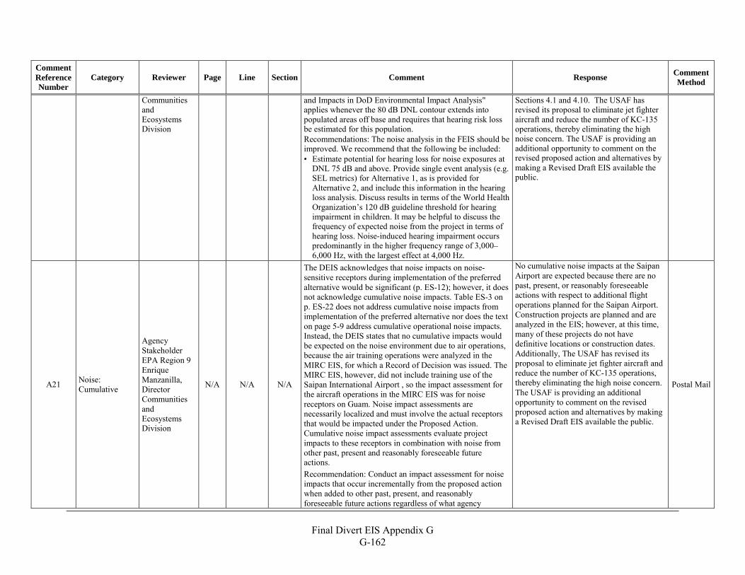
Final Divert EIS Appendix G
G-162
Comment Reference Number
Category Reviewer Page Line Section Comment Response Comment Method
Communities and Ecosystems Division
and Impacts in DoD Environmental Impact Analysis" applies whenever the 80 dB DNL contour extends into populated areas off base and requires that hearing risk loss be estimated for this population. Recommendations: The noise analysis in the FEIS should be improved. We recommend that the following be included: • Estimate potential for hearing loss for noise exposures at
DNL 75 dB and above. Provide single event analysis (e.g. SEL metrics) for Alternative 1, as is provided for Alternative 2, and include this information in the hearing loss analysis. Discuss results in terms of the World Health Organization’s 120 dB guideline threshold for hearing impairment in children. It may be helpful to discuss the frequency of expected noise from the project in terms of hearing loss. Noise-induced hearing impairment occurs predominantly in the higher frequency range of 3,000–6,000 Hz, with the largest effect at 4,000 Hz.
Sections 4.1 and 4.10. The USAF has revised its proposal to eliminate jet fighter aircraft and reduce the number of KC-135 operations, thereby eliminating the high noise concern. The USAF is providing an additional opportunity to comment on the revised proposed action and alternatives by making a Revised Draft EIS available the public.
A21 Noise: Cumulative
Agency Stakeholder EPA Region 9 Enrique Manzanilla, Director Communities and Ecosystems Division
N/A N/A N/A
The DEIS acknowledges that noise impacts on noise-sensitive receptors during implementation of the preferred alternative would be significant (p. ES-12); however, it does not acknowledge cumulative noise impacts. Table ES-3 on p. ES-22 does not address cumulative noise impacts from implementation of the preferred alternative nor does the text on page 5-9 address cumulative operational noise impacts. Instead, the DEIS states that no cumulative impacts would be expected on the noise environment due to air operations, because the air training operations were analyzed in the MIRC EIS, for which a Record of Decision was issued. The MIRC EIS, however, did not include training use of the Saipan International Airport , so the impact assessment for the aircraft operations in the MIRC EIS was for noise receptors on Guam. Noise impact assessments are necessarily localized and must involve the actual receptors that would be impacted under the Proposed Action. Cumulative noise impact assessments evaluate project impacts to these receptors in combination with noise from other past, present and reasonably foreseeable future actions. Recommendation: Conduct an impact assessment for noise impacts that occur incrementally from the proposed action when added to other past, present, and reasonably foreseeable future actions regardless of what agency
No cumulative noise impacts at the Saipan Airport are expected because there are no past, present, or reasonably foreseeable actions with respect to additional flight operations planned for the Saipan Airport. Construction projects are planned and are analyzed in the EIS; however, at this time, many of these projects do not have definitive locations or construction dates. Additionally, The USAF has revised its proposal to eliminate jet fighter aircraft and reduce the number of KC-135 operations, thereby eliminating the high noise concern. The USAF is providing an additional opportunity to comment on the revised proposed action and alternatives by making a Revised Draft EIS available the public.
Postal Mail
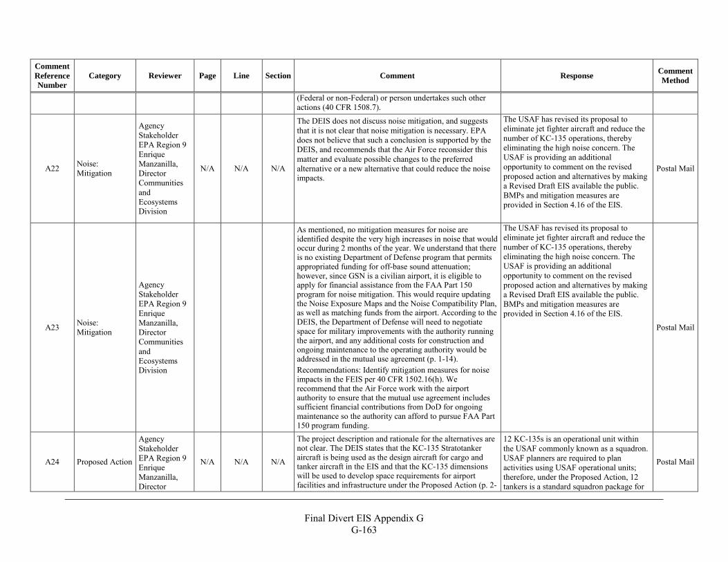
Final Divert EIS Appendix G
G-163
Comment Reference Number
Category Reviewer Page Line Section Comment Response Comment Method
(Federal or non-Federal) or person undertakes such other actions (40 CFR 1508.7).
A22 Noise: Mitigation
Agency Stakeholder EPA Region 9 Enrique Manzanilla, Director Communities and Ecosystems Division
N/A N/A N/A
The DEIS does not discuss noise mitigation, and suggests that it is not clear that noise mitigation is necessary. EPA does not believe that such a conclusion is supported by the DEIS, and recommends that the Air Force reconsider this matter and evaluate possible changes to the preferred alternative or a new alternative that could reduce the noise impacts.
The USAF has revised its proposal to eliminate jet fighter aircraft and reduce the number of KC-135 operations, thereby eliminating the high noise concern. The USAF is providing an additional opportunity to comment on the revised proposed action and alternatives by making a Revised Draft EIS available the public. BMPs and mitigation measures are provided in Section 4.16 of the EIS.
Postal Mail
A23 Noise: Mitigation
Agency Stakeholder EPA Region 9 Enrique Manzanilla, Director Communities and Ecosystems Division
As mentioned, no mitigation measures for noise are identified despite the very high increases in noise that would occur during 2 months of the year. We understand that there is no existing Department of Defense program that permits appropriated funding for off-base sound attenuation; however, since GSN is a civilian airport, it is eligible to apply for financial assistance from the FAA Part 150 program for noise mitigation. This would require updating the Noise Exposure Maps and the Noise Compatibility Plan, as well as matching funds from the airport. According to the DEIS, the Department of Defense will need to negotiate space for military improvements with the authority running the airport, and any additional costs for construction and ongoing maintenance to the operating authority would be addressed in the mutual use agreement (p. 1-14). Recommendations: Identify mitigation measures for noise impacts in the FEIS per 40 CFR 1502.16(h). We recommend that the Air Force work with the airport authority to ensure that the mutual use agreement includes sufficient financial contributions from DoD for ongoing maintenance so the authority can afford to pursue FAA Part 150 program funding.
The USAF has revised its proposal to eliminate jet fighter aircraft and reduce the number of KC-135 operations, thereby eliminating the high noise concern. The USAF is providing an additional opportunity to comment on the revised proposed action and alternatives by making a Revised Draft EIS available the public. BMPs and mitigation measures are provided in Section 4.16 of the EIS. Postal Mail
A24 Proposed Action
Agency Stakeholder EPA Region 9 Enrique Manzanilla, Director
N/A N/A N/A
The project description and rationale for the alternatives are not clear. The DEIS states that the KC-135 Stratotanker aircraft is being used as the design aircraft for cargo and tanker aircraft in the EIS and that the KC-135 dimensions will be used to develop space requirements for airport facilities and infrastructure under the Proposed Action (p. 2-
12 KC-135s is an operational unit within the USAF commonly known as a squadron. USAF planners are required to plan activities using USAF operational units; therefore, under the Proposed Action, 12 tankers is a standard squadron package for
Postal Mail
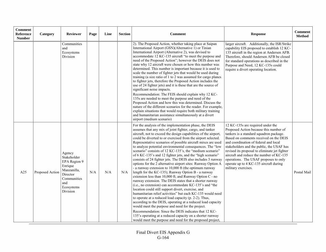
Final Divert EIS Appendix G
G-164
Comment Reference Number
Category Reviewer Page Line Section Comment Response Comment Method
Communities and Ecosystems Division
2). The Proposed Action, whether taking place at Saipan International Airport (GSN)(Alternative 1) or Tinian International Airport (Alternative 2), was devised to accommodate 12 KC-135 aircraft “to meet the purpose and need of the Proposed Action”; however the DEIS does not state why 12 aircraft were chosen or how this number was determined. This number is important because it is used to scale the number of fighter jets that would be used during training (a size ratio of 1 to 2 was assumed for cargo planes to fighter jets, therefore the Proposed Action includes the use of 24 fighter jets) and it is these that are the source of significant noise impacts. Recommendation: The FEIS should explain why 12 KC-135s are needed to meet the purpose and need of the Proposed Action and how this was determined. Discuss the nature of the different scenarios for the reader. For example, explain situations that would require both military training and humanitarian assistance simultaneously at a divert airport (medium scenario)
larger aircraft. Additionally, the ISR/Strike capability EIS proposed to establish 12 KC-135 aircraft in the region at Andersen AFB. Therefore, should Andersen AFB be closed for standard operations as described in the Purpose and Need, 12 KC-135s could require a divert operating location.
A25 Proposed Action
Agency Stakeholder EPA Region 9 Enrique Manzanilla, Director Communities and Ecosystems Division
N/A N/A N/A
For the analysis of the implementation phase, the DEIS assumes that any mix of joint fighter, cargo, and tanker aircraft, not to exceed the design capabilities of the airport, could be diverted to or exercised from the airport selected. Representative scenarios of possible aircraft mixes are used to analyze potential environmental consequences. The “low scenario” consists of 12 KC-135’s, the “medium scenario” of 6 KC-135’s and 12 fighter jets, and the “high scenario” consists of 24 fighter jets. The DEIS also includes 3 runway options for the 2 alternative airport sites: Runway Option A - a runway extension to 10,000 ft (the optimum runway length for the KC-135); Runway Option B - a runway extension less than 10,000 ft; and Runway Option C - no runway extension. The DEIS states that a shorter runway (i.e., no extension) can accommodate KC-135’s and “the location could still support divert, exercise, and humanitarian relief activities” but each KC-135 would need to operate at a reduced load capacity (p. 2-2). Thus, according to the DEIS, operating at a reduced load capacity would meet the purpose and need for the project. Recommendation: Since the DEIS indicates that 12 KC-135’s operating at a reduced capacity on a shorter runway would meet the purpose and need for the proposed project,
12 KC-135s are required under the Proposed Action because this number of tankers is a standard squadron package. Based on comments received on the DEIS and coordination of federal and local stakeholders and the public, the USAF has revised its proposal to eliminate jet fighter aircraft and reduce the number of KC-135 operations. The USAF proposes to only operate up to 4 KC-135 aircraft during military exercises.
Postal Mail
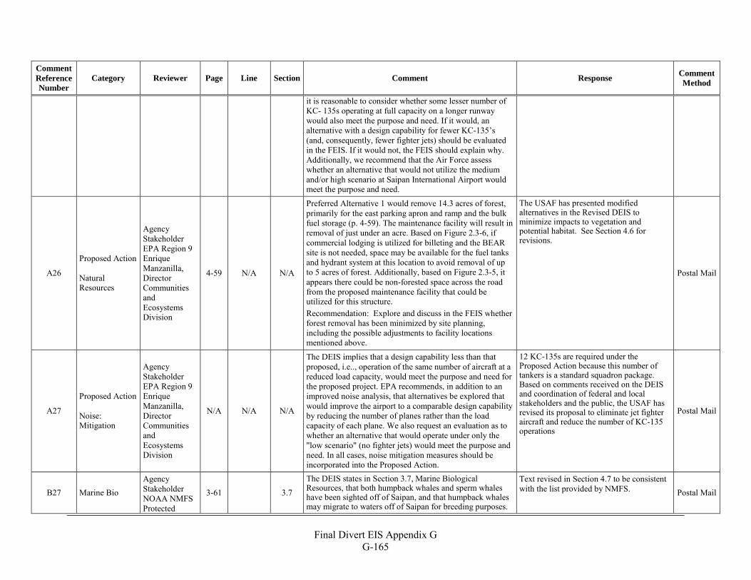
Final Divert EIS Appendix G
G-165
Comment Reference Number
Category Reviewer Page Line Section Comment Response Comment Method
it is reasonable to consider whether some lesser number of KC- 135s operating at full capacity on a longer runway would also meet the purpose and need. If it would, an alternative with a design capability for fewer KC-135’s (and, consequently, fewer fighter jets) should be evaluated in the FEIS. If it would not, the FEIS should explain why. Additionally, we recommend that the Air Force assess whether an alternative that would not utilize the medium and/or high scenario at Saipan International Airport would meet the purpose and need.
A26
Proposed Action Natural Resources
Agency Stakeholder EPA Region 9 Enrique Manzanilla, Director Communities and Ecosystems Division
4-59 N/A N/A
Preferred Alternative 1 would remove 14.3 acres of forest, primarily for the east parking apron and ramp and the bulk fuel storage (p. 4-59). The maintenance facility will result in removal of just under an acre. Based on Figure 2.3-6, if commercial lodging is utilized for billeting and the BEAR site is not needed, space may be available for the fuel tanks and hydrant system at this location to avoid removal of up to 5 acres of forest. Additionally, based on Figure 2.3-5, it appears there could be non-forested space across the road from the proposed maintenance facility that could be utilized for this structure. Recommendation: Explore and discuss in the FEIS whether forest removal has been minimized by site planning, including the possible adjustments to facility locations mentioned above.
The USAF has presented modified alternatives in the Revised DEIS to minimize impacts to vegetation and potential habitat. See Section 4.6 for revisions.
Postal Mail
A27
Proposed Action Noise: Mitigation
Agency Stakeholder EPA Region 9 Enrique Manzanilla, Director Communities and Ecosystems Division
N/A N/A N/A
The DEIS implies that a design capability less than that proposed, i.e.., operation of the same number of aircraft at a reduced load capacity, would meet the purpose and need for the proposed project. EPA recommends, in addition to an improved noise analysis, that alternatives be explored that would improve the airport to a comparable design capability by reducing the number of planes rather than the load capacity of each plane. We also request an evaluation as to whether an alternative that would operate under only the "low scenario" (no fighter jets) would meet the purpose and need. In all cases, noise mitigation measures should be incorporated into the Proposed Action.
12 KC-135s are required under the Proposed Action because this number of tankers is a standard squadron package. Based on comments received on the DEIS and coordination of federal and local stakeholders and the public, the USAF has revised its proposal to eliminate jet fighter aircraft and reduce the number of KC-135 operations
Postal Mail
B27 Marine Bio Agency Stakeholder NOAA NMFS Protected
3-61
3.7
The DEIS states in Section 3.7, Marine Biological Resources, that both humpback whales and sperm whales have been sighted off of Saipan, and that humpback whales may migrate to waters off of Saipan for breeding purposes.
Text revised in Section 4.7 to be consistent with the list provided by NMFS. Postal Mail
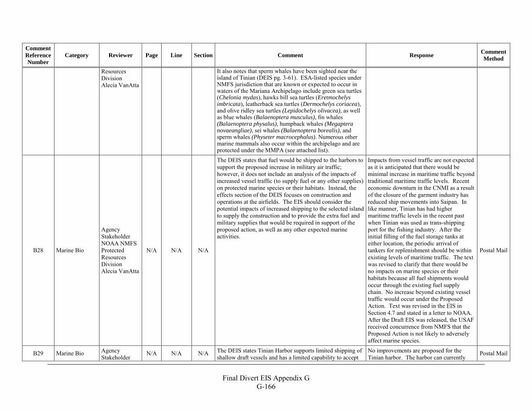
Final Divert EIS Appendix G
G-166
Comment Reference Number
Category Reviewer Page Line Section Comment Response Comment Method
Resources Division Alecia VanAtta
It also notes that sperm whales have been sighted near the island of Tinian (DEIS pg. 3-61). ESA-listed species under NMFS jurisdiction that are known or expected to occur in waters of the Mariana Archipelago include green sea turtles (Chelonia mydas), hawks bill sea turtles (Eretmochelys imbricata), leatherback sea turtles (Dermochelys coriacea), and olive ridley sea turtles (Lepidochelys olivacea), as well as blue whales (Balaenoptera musculus), fin whales (Balaenoptera physalus), humpback whales (Megaptera novaeangliae), sei whales (Balaenoptera borealis), and sperm whales (Physeter macrocephalus). Numerous other marine mammals also occur within the archipelago and are protected under the MMPA (see attached list).
B28 Marine Bio
Agency Stakeholder NOAA NMFS Protected Resources Division Alecia VanAtta
N/A N/A N/A
The DEIS states that fuel would be shipped to the harbors to support the proposed increase in military air traffic; however, it does not include an analysis of the impacts of increased vessel traffic (to supply fuel or any other supplies) on protected marine species or their habitats. Instead, the effects section of the DEIS focuses on construction and operations at the airfields. The EIS should consider the potential impacts of increased shipping to the selected island to supply the construction and to provide the extra fuel and military supplies that would be required in support of the proposed action, as well as any other expected marine activities.
Impacts from vessel traffic are not expected as it is anticipated that there would be minimal increase in maritime traffic beyond traditional maritime traffic levels. Recent economic downturn in the CNMI as a result of the closure of the garment industry has reduced ship movements into Saipan. In like manner, Tinian has had higher maritime traffic levels in the recent past when Tinian was used as trans-shipping port for the fishing industry. After the initial filling of the fuel storage tanks at either location, the periodic arrival of tankers for replenishment should be within existing levels of maritime traffic. The text was revised to clarify that there would be no impacts on marine species or their habitats because all fuel shipments would occur through the existing fuel supply chain. No increase beyond existing vessel traffic would occur under the Proposed Action. Text was revised in the EIS in Section 4.7 and stated in a letter to NOAA. After the Draft EIS was released, the USAF received concurrence from NMFS that the Proposed Action is not likely to adversely affect marine species.
Postal Mail
B29 Marine Bio Agency Stakeholder
N/A N/A N/A The DEIS states Tinian Harbor supports limited shipping of shallow draft vessels and has a limited capability to accept
No improvements are proposed for the Tinian harbor. The harbor can currently
Postal Mail
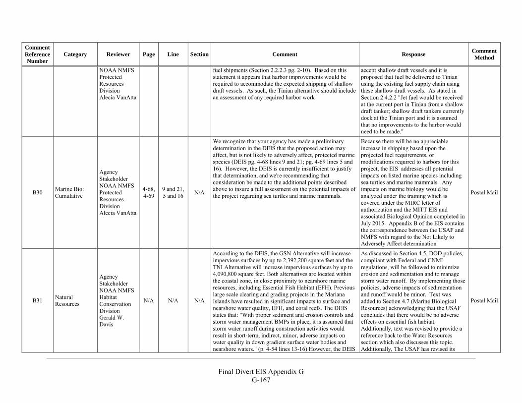
Final Divert EIS Appendix G
G-167
Comment Reference Number
Category Reviewer Page Line Section Comment Response Comment Method
NOAA NMFS Protected Resources Division Alecia VanAtta
fuel shipments (Section 2.2.2.3 pg. 2-10). Based on this statement it appears that harbor improvements would be required to accommodate the expected shipping of shallow draft vessels. As such, the Tinian alternative should include an assessment of any required harbor work
accept shallow draft vessels and it is proposed that fuel be delivered to Tinian using the existing fuel supply chain using these shallow draft vessels. As stated in Section 2.4.2.2 "Jet fuel would be received at the current port in Tinian from a shallow draft tanker; shallow draft tankers currently dock at the Tinian port and it is assumed that no improvements to the harbor would need to be made."
B30 Marine Bio: Cumulative
Agency Stakeholder NOAA NMFS Protected Resources Division Alecia VanAtta
4-68, 4-69
9 and 21, 5 and 16 N/A
We recognize that your agency has made a preliminary determination in the DEIS that the proposed action may affect, but is not likely to adversely affect, protected marine species (DEIS pg. 4-68 lines 9 and 21; pg. 4-69 lines 5 and 16). However, the DEIS is currently insufficient to justify that determination, and we're recommending that consideration be made to the additional points described above to insure a full assessment on the potential impacts of the project regarding sea turtles and marine mammals.
Because there will be no appreciable increase in shipping based upon the projected fuel requirements, or modifications required to harbors for this project, the EIS addresses all potential impacts on listed marine species including sea turtles and marine mammals. Any impacts on marine biology would be analyzed under the training which is covered under the MIRC letter of authorization and the MITT EIS and associated Biological Opinion completed in July 2015. Appendix B of the EIS contains the correspondence between the USAF and NMFS with regard to the Not Likely to Adversely Affect determination
Postal Mail
B31 Natural Resources
Agency Stakeholder NOAA NMFS Habitat Conservation Division Gerald W. Davis
N/A N/A N/A
According to the DEIS, the GSN Alternative will increase impervious surfaces by up to 2,392,200 square feet and the TNI Alternative will increase impervious surfaces by up to 4,090,800 square feet. Both alternatives are located within the coastal zone, in close proximity to nearshore marine resources, including Essential Fish Habitat (EFH). Previous large scale clearing and grading projects in the Mariana Islands have resulted in significant impacts to surface and nearshore water quality, EFH, and coral reefs. The DEIS states that: "With proper sediment and erosion controls and storm water management BMPs in place, it is assumed that storm water runoff during construction activities would result in short-term, indirect, minor, adverse impacts on water quality in down gradient surface water bodies and nearshore waters." (p. 4-54 lines 13-16) However, the DEIS
As discussed in Section 4.5, DOD policies, compliant with Federal and CNMI regulations, will be followed to minimize erosion and sedimentation and to manage storm water runoff. By implementing those policies, adverse impacts of sedimentation and runoff would be minor. Text was added to Section 4.7 (Marine Biological Resources) acknowledging that the USAF concludes that there would be no adverse effects on essential fish habitat. Additionally, text was revised to provide a reference back to the Water Resources section which also discusses this topic. Additionally, The USAF has revised its
Postal Mail
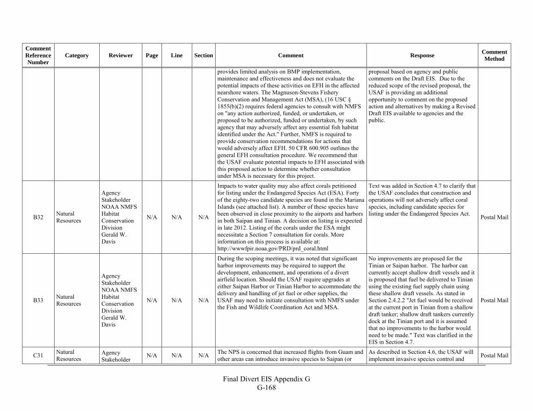
Final Divert EIS Appendix G
G-168
Comment Reference Number
Category Reviewer Page Line Section Comment Response Comment Method
provides limited analysis on BMP implementation, maintenance and effectiveness and does not evaluate the potential impacts of these activities on EFH in the affected nearshore waters. The Magnuson-Stevens Fishery Conservation and Management Act (MSA), (16 USC § 1855(b)(2) requires federal agencies to consult with NMFS on "any action authorized, funded, or undertaken, or proposed to be authorized, funded or undertaken, by such agency that may adversely affect any essential fish habitat identified under the Act." Further, NMFS is required to provide conservation recommendations for actions that would adversely affect EFH. 50 CFR 600.905 outlines the general EFH consultation procedure. We recommend that the USAF evaluate potential impacts to EFH associated with this proposed action to determine whether consultation under MSA is necessary for this project.
proposal based on agency and public comments on the Draft EIS. Due to the reduced scope of the revised proposal, the USAF is providing an additional opportunity to comment on the proposed action and alternatives by making a Revised Draft EIS available to agencies and the public.
B32 Natural Resources
Agency Stakeholder NOAA NMFS Habitat Conservation Division Gerald W. Davis
N/A N/A N/A
Impacts to water quality may also affect corals petitioned for listing under the Endangered Species Act (ESA). Forty of the eighty-two candidate species are found in the Mariana Islands (see attached list). A number of these species have been observed in close proximity to the airports and harbors in both Saipan and Tinian. A decision on listing is expected in late 2012. Listing of the corals under the ESA might necessitate a Section 7 consultation for corals. More information on this process is available at: http://wwwfpir.noaa.gov/PRD/prd_coral.html
Text was added in Section 4.7 to clarify that the USAF concludes that construction and operations will not adversely affect coral species, including candidate species for listing under the Endangered Species Act. Postal Mail
B33 Natural Resources
Agency Stakeholder NOAA NMFS Habitat Conservation Division Gerald W. Davis
N/A N/A N/A
During the scoping meetings, it was noted that significant harbor improvements may be required to support the development, enhancement, and operations of a divert airfield location. Should the USAF require upgrades at either Saipan Harbor or Tinian Harbor to accommodate the delivery and handling of jet fuel or other supplies, the USAF may need to initiate consultation with NMFS under the Fish and Wildlife Coordination Act and MSA.
No improvements are proposed for the Tinian or Saipan harbor. The harbor can currently accept shallow draft vessels and it is proposed that fuel be delivered to Tinian using the existing fuel supply chain using these shallow draft vessels. As stated in Section 2.4.2.2 "Jet fuel would be received at the current port in Tinian from a shallow draft tanker; shallow draft tankers currently dock at the Tinian port and it is assumed that no improvements to the harbor would need to be made." Text was clarified in the EIS in Section 4.7.
Postal Mail
C31 Natural Resources
Agency Stakeholder
N/A N/A N/A The NPS is concerned that increased flights from Guam and other areas can introduce invasive species to Saipan (or
As described in Section 4.6, the USAF will implement invasive species control and Postal Mail
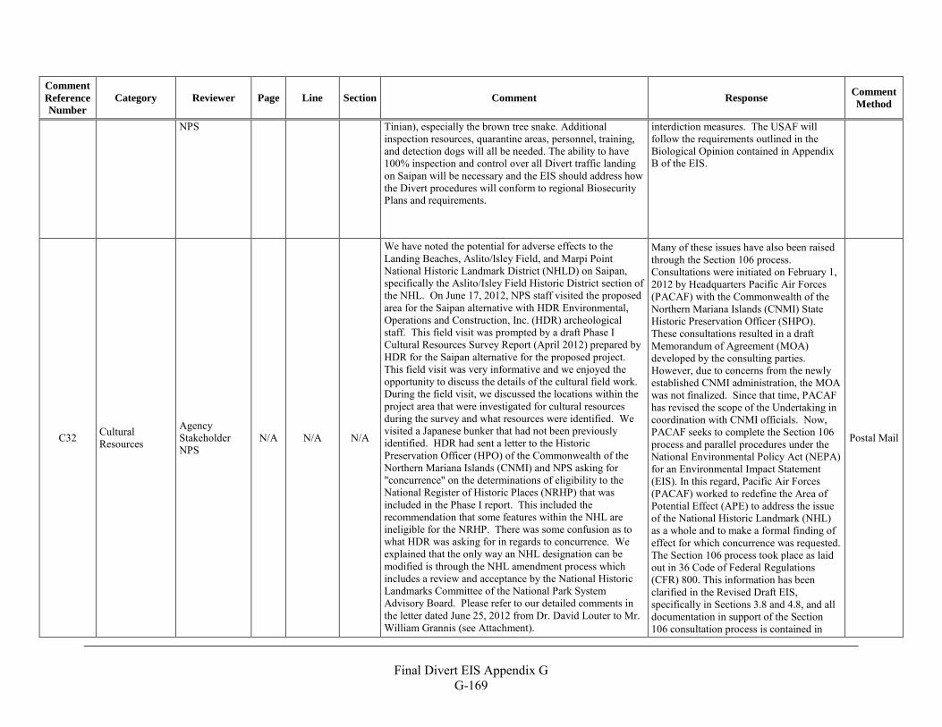
Final Divert EIS Appendix G
G-169
Comment Reference Number
Category Reviewer Page Line Section Comment Response Comment Method
NPS Tinian), especially the brown tree snake. Additional inspection resources, quarantine areas, personnel, training, and detection dogs will all be needed. The ability to have 100% inspection and control over all Divert traffic landing on Saipan will be necessary and the EIS should address how the Divert procedures will conform to regional Biosecurity Plans and requirements.
interdiction measures. The USAF will follow the requirements outlined in the Biological Opinion contained in Appendix B of the EIS.
C32 Cultural Resources
Agency Stakeholder NPS
N/A N/A N/A
We have noted the potential for adverse effects to the Landing Beaches, Aslito/lsley Field, and Marpi Point National Historic Landmark District (NHLD) on Saipan, specifically the Aslito/Isley Field Historic District section of the NHL. On June 17, 2012, NPS staff visited the proposed area for the Saipan alternative with HDR Environmental, Operations and Construction, Inc. (HDR) archeological staff. This field visit was prompted by a draft Phase I Cultural Resources Survey Report (April 2012) prepared by HDR for the Saipan alternative for the proposed project. This field visit was very informative and we enjoyed the opportunity to discuss the details of the cultural field work. During the field visit, we discussed the locations within the project area that were investigated for cultural resources during the survey and what resources were identified. We visited a Japanese bunker that had not been previously identified. HDR had sent a letter to the Historic Preservation Officer (HPO) of the Commonwealth of the Northern Mariana Islands (CNMI) and NPS asking for "concurrence" on the determinations of eligibility to the National Register of Historic Places (NRHP) that was included in the Phase I report. This included the recommendation that some features within the NHL are ineligible for the NRHP. There was some confusion as to what HDR was asking for in regards to concurrence. We explained that the only way an NHL designation can be modified is through the NHL amendment process which includes a review and acceptance by the National Historic Landmarks Committee of the National Park System Advisory Board. Please refer to our detailed comments in the letter dated June 25, 2012 from Dr. David Louter to Mr. William Grannis (see Attachment).
Many of these issues have also been raised through the Section 106 process. Consultations were initiated on February 1, 2012 by Headquarters Pacific Air Forces (PACAF) with the Commonwealth of the Northern Mariana Islands (CNMI) State Historic Preservation Officer (SHPO). These consultations resulted in a draft Memorandum of Agreement (MOA) developed by the consulting parties. However, due to concerns from the newly established CNMI administration, the MOA was not finalized. Since that time, PACAF has revised the scope of the Undertaking in coordination with CNMI officials. Now, PACAF seeks to complete the Section 106 process and parallel procedures under the National Environmental Policy Act (NEPA) for an Environmental Impact Statement (EIS). In this regard, Pacific Air Forces (PACAF) worked to redefine the Area of Potential Effect (APE) to address the issue of the National Historic Landmark (NHL) as a whole and to make a formal finding of effect for which concurrence was requested. The Section 106 process took place as laid out in 36 Code of Federal Regulations (CFR) 800. This information has been clarified in the Revised Draft EIS, specifically in Sections 3.8 and 4.8, and all documentation in support of the Section 106 consultation process is contained in
Postal Mail
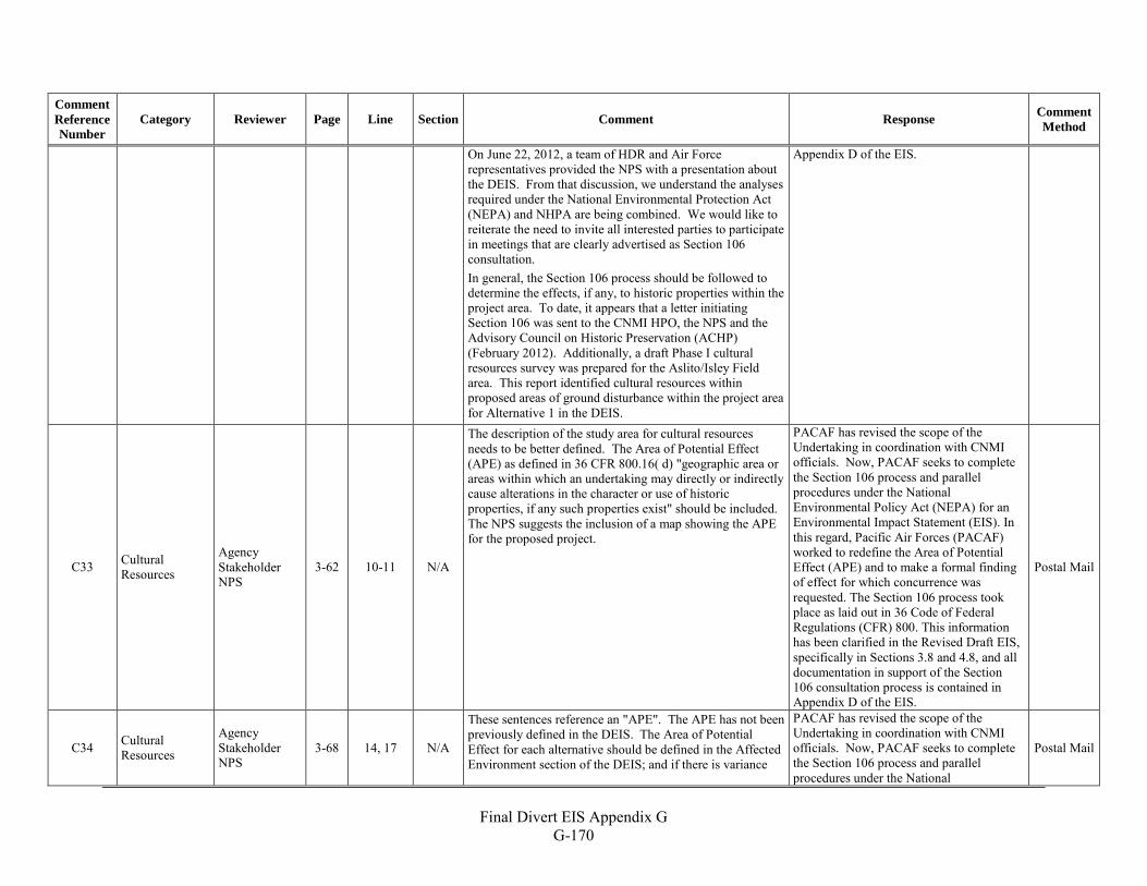
Final Divert EIS Appendix G
G-170
Comment Reference Number
Category Reviewer Page Line Section Comment Response Comment Method
On June 22, 2012, a team of HDR and Air Force representatives provided the NPS with a presentation about the DEIS. From that discussion, we understand the analyses required under the National Environmental Protection Act (NEPA) and NHPA are being combined. We would like to reiterate the need to invite all interested parties to participate in meetings that are clearly advertised as Section 106 consultation. In general, the Section 106 process should be followed to determine the effects, if any, to historic properties within the project area. To date, it appears that a letter initiating Section 106 was sent to the CNMI HPO, the NPS and the Advisory Council on Historic Preservation (ACHP) (February 2012). Additionally, a draft Phase I cultural resources survey was prepared for the Aslito/Isley Field area. This report identified cultural resources within proposed areas of ground disturbance within the project area for Alternative 1 in the DEIS.
Appendix D of the EIS.
C33 Cultural Resources
Agency Stakeholder NPS
3-62 10-11 N/A
The description of the study area for cultural resources needs to be better defined. The Area of Potential Effect (APE) as defined in 36 CFR 800.16( d) "geographic area or areas within which an undertaking may directly or indirectly cause alterations in the character or use of historic properties, if any such properties exist" should be included. The NPS suggests the inclusion of a map showing the APE for the proposed project.
PACAF has revised the scope of the Undertaking in coordination with CNMI officials. Now, PACAF seeks to complete the Section 106 process and parallel procedures under the National Environmental Policy Act (NEPA) for an Environmental Impact Statement (EIS). In this regard, Pacific Air Forces (PACAF) worked to redefine the Area of Potential Effect (APE) and to make a formal finding of effect for which concurrence was requested. The Section 106 process took place as laid out in 36 Code of Federal Regulations (CFR) 800. This information has been clarified in the Revised Draft EIS, specifically in Sections 3.8 and 4.8, and all documentation in support of the Section 106 consultation process is contained in Appendix D of the EIS.
Postal Mail
C34 Cultural Resources
Agency Stakeholder NPS
3-68 14, 17 N/A
These sentences reference an "APE". The APE has not been previously defined in the DEIS. The Area of Potential Effect for each alternative should be defined in the Affected Environment section of the DEIS; and if there is variance
PACAF has revised the scope of the Undertaking in coordination with CNMI officials. Now, PACAF seeks to complete the Section 106 process and parallel procedures under the National
Postal Mail
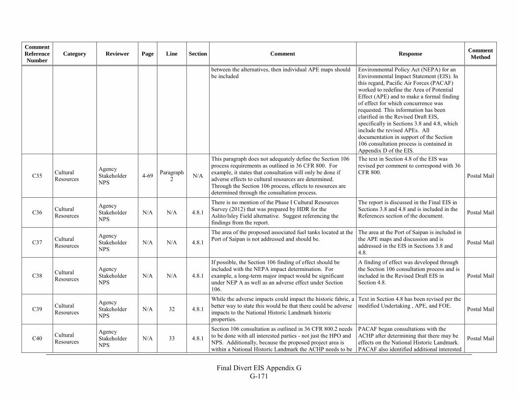
Final Divert EIS Appendix G
G-171
Comment Reference Number
Category Reviewer Page Line Section Comment Response Comment Method
between the alternatives, then individual APE maps should be included
Environmental Policy Act (NEPA) for an Environmental Impact Statement (EIS). In this regard, Pacific Air Forces (PACAF) worked to redefine the Area of Potential Effect (APE) and to make a formal finding of effect for which concurrence was requested. This information has been clarified in the Revised Draft EIS, specifically in Sections 3.8 and 4.8, which include the revised APEs. All documentation in support of the Section 106 consultation process is contained in Appendix D of the EIS.
C35 Cultural Resources
Agency Stakeholder NPS
4-69 Paragraph 2 N/A
This paragraph does not adequately define the Section 106 process requirements as outlined in 36 CFR 800. For example, it states that consultation will only be done if adverse effects to cultural resources are determined. Through the Section 106 process, effects to resources are determined through the consultation process.
The text in Section 4.8 of the EIS was revised per comment to correspond with 36 CFR 800. Postal Mail
C36 Cultural Resources
Agency Stakeholder NPS
N/A N/A 4.8.1
There is no mention of the Phase I Cultural Resources Survey (2012) that was prepared by HDR for the Aslito/lsley Field alternative. Suggest referencing the findings from the report.
The report is discussed in the Final EIS in Sections 3.8 and 4.8 and is included in the References section of the document. Postal Mail
C37 Cultural Resources
Agency Stakeholder NPS
N/A N/A 4.8.1
The area of the proposed associated fuel tanks located at the Port of Saipan is not addressed and should be.
The area at the Port of Saipan is included in the APE maps and discussion and is addressed in the EIS in Sections 3.8 and 4.8.
Postal Mail
C38 Cultural Resources
Agency Stakeholder NPS
N/A N/A 4.8.1
If possible, the Section 106 finding of effect should be included with the NEPA impact determination. For example, a long-term major impact would be significant under NEP A as well as an adverse effect under Section 106.
A finding of effect was developed through the Section 106 consultation process and is included in the Revised Draft EIS in Section 4.8.
Postal Mail
C39 Cultural Resources
Agency Stakeholder NPS
N/A 32 4.8.1
While the adverse impacts could impact the historic fabric, a better way to state this would be that there could be adverse impacts to the National Historic Landmark historic properties.
Text in Section 4.8 has been revised per the modified Undertaking , APE, and FOE. Postal Mail
C40 Cultural Resources
Agency Stakeholder NPS
N/A 33 4.8.1 Section 106 consultation as outlined in 36 CFR 800.2 needs to be done with all interested parties - not just the HPO and NPS. Additionally, because the proposed project area is within a National Historic Landmark the ACHP needs to be
PACAF began consultations with the ACHP after determining that there may be effects on the National Historic Landmark. PACAF also identified additional interested
Postal Mail
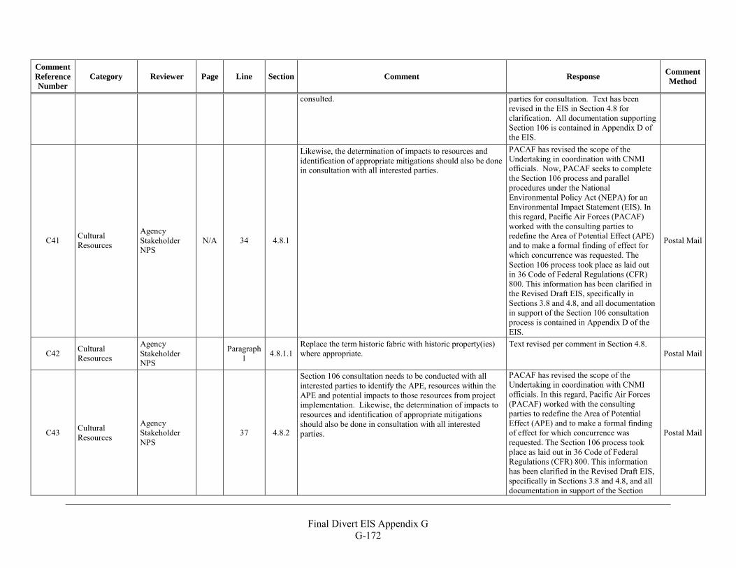
Final Divert EIS Appendix G
G-172
Comment Reference Number
Category Reviewer Page Line Section Comment Response Comment Method
consulted. parties for consultation. Text has been revised in the EIS in Section 4.8 for clarification. All documentation supporting Section 106 is contained in Appendix D of the EIS.
C41 Cultural Resources
Agency Stakeholder NPS
N/A 34 4.8.1
Likewise, the determination of impacts to resources and identification of appropriate mitigations should also be done in consultation with all interested parties.
PACAF has revised the scope of the Undertaking in coordination with CNMI officials. Now, PACAF seeks to complete the Section 106 process and parallel procedures under the National Environmental Policy Act (NEPA) for an Environmental Impact Statement (EIS). In this regard, Pacific Air Forces (PACAF) worked with the consulting parties to redefine the Area of Potential Effect (APE) and to make a formal finding of effect for which concurrence was requested. The Section 106 process took place as laid out in 36 Code of Federal Regulations (CFR) 800. This information has been clarified in the Revised Draft EIS, specifically in Sections 3.8 and 4.8, and all documentation in support of the Section 106 consultation process is contained in Appendix D of the EIS.
Postal Mail
C42 Cultural Resources
Agency Stakeholder NPS
Paragraph 1 4.8.1.1
Replace the term historic fabric with historic property(ies) where appropriate.
Text revised per comment in Section 4.8. Postal Mail
C43 Cultural Resources
Agency Stakeholder NPS
37 4.8.2
Section 106 consultation needs to be conducted with all interested parties to identify the APE, resources within the APE and potential impacts to those resources from project implementation. Likewise, the determination of impacts to resources and identification of appropriate mitigations should also be done in consultation with all interested parties.
PACAF has revised the scope of the Undertaking in coordination with CNMI officials. In this regard, Pacific Air Forces (PACAF) worked with the consulting parties to redefine the Area of Potential Effect (APE) and to make a formal finding of effect for which concurrence was requested. The Section 106 process took place as laid out in 36 Code of Federal Regulations (CFR) 800. This information has been clarified in the Revised Draft EIS, specifically in Sections 3.8 and 4.8, and all documentation in support of the Section
Postal Mail
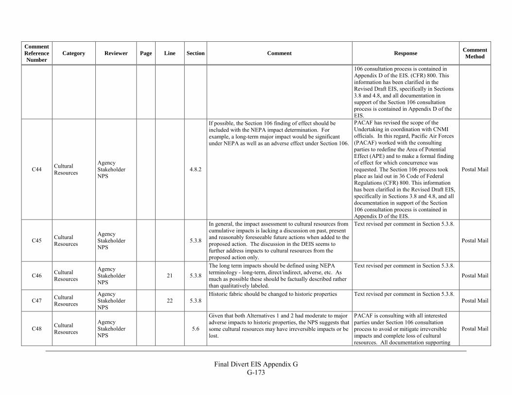
Final Divert EIS Appendix G
G-173
Comment Reference Number
Category Reviewer Page Line Section Comment Response Comment Method
106 consultation process is contained in Appendix D of the EIS. (CFR) 800. This information has been clarified in the Revised Draft EIS, specifically in Sections 3.8 and 4.8, and all documentation in support of the Section 106 consultation process is contained in Appendix D of the EIS.
C44 Cultural Resources
Agency Stakeholder NPS
4.8.2
If possible, the Section 106 finding of effect should be included with the NEPA impact determination. For example, a long-term major impact would be significant under NEPA as well as an adverse effect under Section 106.
PACAF has revised the scope of the Undertaking in coordination with CNMI officials. In this regard, Pacific Air Forces (PACAF) worked with the consulting parties to redefine the Area of Potential Effect (APE) and to make a formal finding of effect for which concurrence was requested. The Section 106 process took place as laid out in 36 Code of Federal Regulations (CFR) 800. This information has been clarified in the Revised Draft EIS, specifically in Sections 3.8 and 4.8, and all documentation in support of the Section 106 consultation process is contained in Appendix D of the EIS.
Postal Mail
C45 Cultural Resources
Agency Stakeholder NPS
5.3.8
In general, the impact assessment to cultural resources from cumulative impacts is lacking a discussion on past, present and reasonably foreseeable future actions when added to the proposed action. The discussion in the DEIS seems to further address impacts to cultural resources from the proposed action only.
Text revised per comment in Section 5.3.8.
Postal Mail
C46 Cultural Resources
Agency Stakeholder NPS
21 5.3.8
The long term impacts should be defined using NEPA terminology - long-term, direct/indirect, adverse, etc. As much as possible these should be factually described rather than qualitatively labeled.
Text revised per comment in Section 5.3.8.
Postal Mail
C47 Cultural Resources
Agency Stakeholder NPS
22 5.3.8 Historic fabric should be changed to historic properties Text revised per comment in Section 5.3.8.
Postal Mail
C48 Cultural Resources
Agency Stakeholder NPS
5.6
Given that both Alternatives 1 and 2 had moderate to major adverse impacts to historic properties, the NPS suggests that some cultural resources may have irreversible impacts or be lost.
PACAF is consulting with all interested parties under Section 106 consultation process to avoid or mitigate irreversible impacts and complete loss of cultural resources. All documentation supporting
Postal Mail
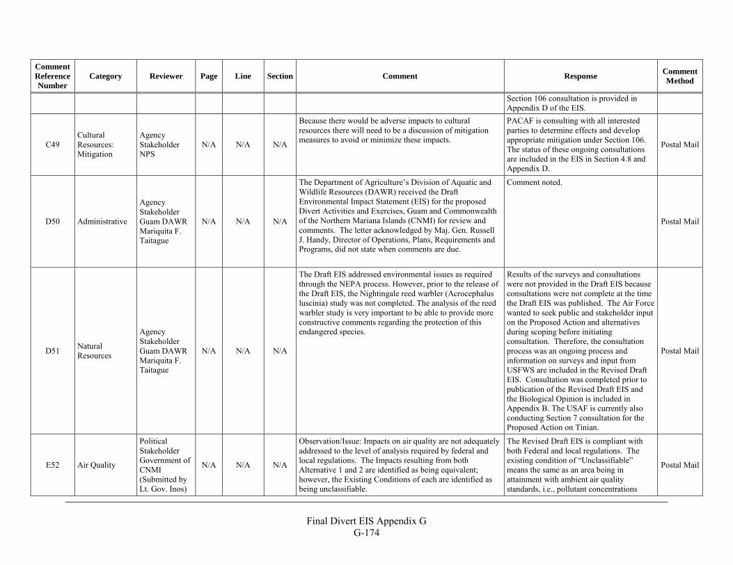
Final Divert EIS Appendix G
G-174
Comment Reference Number
Category Reviewer Page Line Section Comment Response Comment Method
Section 106 consultation is provided in Appendix D of the EIS.
C49 Cultural Resources: Mitigation
Agency Stakeholder NPS
N/A N/A N/A
Because there would be adverse impacts to cultural resources there will need to be a discussion of mitigation measures to avoid or minimize these impacts.
PACAF is consulting with all interested parties to determine effects and develop appropriate mitigation under Section 106. The status of these ongoing consultations are included in the EIS in Section 4.8 and Appendix D.
Postal Mail
D50 Administrative
Agency Stakeholder Guam DAWR Mariquita F. Taitague
N/A N/A N/A
The Department of Agriculture’s Division of Aquatic and Wildlife Resources (DAWR) received the Draft Environmental Impact Statement (EIS) for the proposed Divert Activities and Exercises, Guam and Commonwealth of the Northern Mariana Islands (CNMI) for review and comments. The letter acknowledged by Maj. Gen. Russell J. Handy, Director of Operations, Plans, Requirements and Programs, did not state when comments are due.
Comment noted.
Postal Mail
D51 Natural Resources
Agency Stakeholder Guam DAWR Mariquita F. Taitague
N/A N/A N/A
The Draft EIS addressed environmental issues as required through the NEPA process. However, prior to the release of the Draft EIS, the Nightingale reed warbler (Acrocephalus luscinia) study was not completed. The analysis of the reed warbler study is very important to be able to provide more constructive comments regarding the protection of this endangered species.
Results of the surveys and consultations were not provided in the Draft EIS because consultations were not complete at the time the Draft EIS was published. The Air Force wanted to seek public and stakeholder input on the Proposed Action and alternatives during scoping before initiating consultation. Therefore, the consultation process was an ongoing process and information on surveys and input from USFWS are included in the Revised Draft EIS. Consultation was completed prior to publication of the Revised Draft EIS and the Biological Opinion is included in Appendix B. The USAF is currently also conducting Section 7 consultation for the Proposed Action on Tinian.
Postal Mail
E52 Air Quality
Political Stakeholder Government of CNMI (Submitted by Lt. Gov. Inos)
N/A N/A N/A
Observation/Issue: Impacts on air quality are not adequately addressed to the level of analysis required by federal and local regulations. The Impacts resulting from both Alternative 1 and 2 are identified as being equivalent; however, the Existing Conditions of each are identified as being unclassifiable.
The Revised Draft EIS is compliant with both Federal and local regulations. The existing condition of “Unclassifiable” means the same as an area being in attainment with ambient air quality standards, i.e., pollutant concentrations
Postal Mail
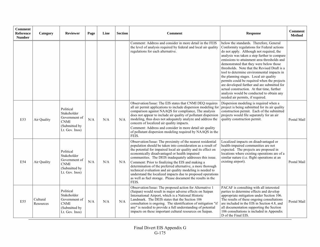
Final Divert EIS Appendix G
G-175
Comment Reference Number
Category Reviewer Page Line Section Comment Response Comment Method
Comment: Address and consider in more detail in the FEIS the level of analysis required by federal and local air quality regulations for each alternative.
below the standards. Therefore, General Conformity regulations for Federal actions do not apply. Although not required, the analysis was taken a step further to compare emissions to attainment area thresholds and demonstrated that they were below those thresholds. Note that the Revised Draft is a tool to determine environmental impacts in the planning stages. Local air quality permits could be required when the projects are developed further and are submitted for actual construction. At that time, further analysis would be conducted to obtain any needed air permits, if required.
E53 Air Quality
Political Stakeholder Government of CNMI (Submitted by Lt. Gov. Inos)
N/A N/A N/A
Observation/Issue: The EIS states that CNMI DEQ requires all air permit applications to include dispersion modeling for comparison against NAAQS for compliance, The analysis does not appear to include air quality of pollutant dispersion modeling, thus does not adequately analyze and address the concern of localized air quality impacts. Comment: Address and consider in more detail air quality of pollutant dispersion modeling required by NAAQS in the FEIS.
Dispersion modeling is required when a project is being submitted for its air quality construction permit. Each of the submitted projects would file separately for an air quality construction permit. Postal Mail
E54 Air Quality
Political Stakeholder Government of CNMI (Submitted by Lt. Gov. Inos)
N/A N/A N/A
Observation/Issue: The proximity of the nearest residential population should be taken into consideration as a result of the potential for impaired local air quality and its effect on economically disadvantaged or health impaired communities. The DEIS inadequately addresses this issue. Comment: Prior to finalizing the EIS and making a determination of the preferred alternative, a more thorough technical evaluation and air quality modeling is needed to understand the localized impacts due to proposed operations as well as fuel storage. Please document the results in the FEIS.
Localized impacts on disadvantaged or health-impaired communities are not expected. The projects are proposed in locations where existing operations are of a similar nature (i.e. flight operations at an existing airport). Postal Mail
E55 Cultural Resources
Political Stakeholder Government of CNMI (Submitted by Lt. Gov. Inos)
N/A N/A N/A
Observation/Issue: The proposed action for Alternative 1 (Saipan) would result in major adverse effects on Saipan International Airport, which is a National Historic Landmark. The DEIS states that the Section 106 consultation is ongoing. The identification of mitigation "if any" is needed to provide a full understanding of potential impacts on these important cultural resources on Saipan.
PACAF is consulting with all interested parties to determine effects and develop appropriate mitigation under Section 106. The results of these ongoing consultations are included in the EIS in Section 4.8, and all documentation supporting the Section 106 consultations is included in Appendix D of the Final EIS.
Postal Mail
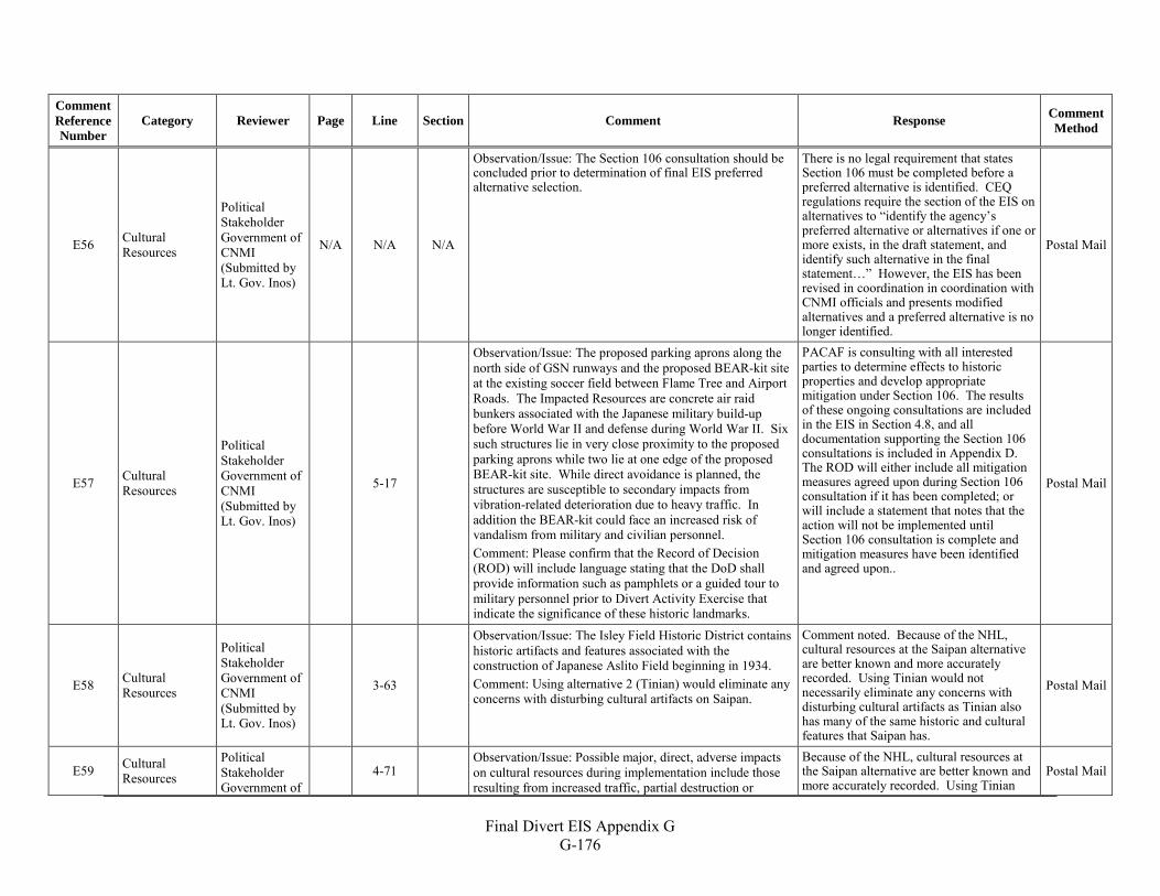
Final Divert EIS Appendix G
G-176
Comment Reference Number
Category Reviewer Page Line Section Comment Response Comment Method
E56 Cultural Resources
Political Stakeholder Government of CNMI (Submitted by Lt. Gov. Inos)
N/A N/A N/A
Observation/Issue: The Section 106 consultation should be concluded prior to determination of final EIS preferred alternative selection.
There is no legal requirement that states Section 106 must be completed before a preferred alternative is identified. CEQ regulations require the section of the EIS on alternatives to “identify the agency’s preferred alternative or alternatives if one or more exists, in the draft statement, and identify such alternative in the final statement…” However, the EIS has been revised in coordination in coordination with CNMI officials and presents modified alternatives and a preferred alternative is no longer identified.
Postal Mail
E57 Cultural Resources
Political Stakeholder Government of CNMI (Submitted by Lt. Gov. Inos)
5-17
Observation/Issue: The proposed parking aprons along the north side of GSN runways and the proposed BEAR-kit site at the existing soccer field between Flame Tree and Airport Roads. The Impacted Resources are concrete air raid bunkers associated with the Japanese military build-up before World War II and defense during World War II. Six such structures lie in very close proximity to the proposed parking aprons while two lie at one edge of the proposed BEAR-kit site. While direct avoidance is planned, the structures are susceptible to secondary impacts from vibration-related deterioration due to heavy traffic. In addition the BEAR-kit could face an increased risk of vandalism from military and civilian personnel. Comment: Please confirm that the Record of Decision (ROD) will include language stating that the DoD shall provide information such as pamphlets or a guided tour to military personnel prior to Divert Activity Exercise that indicate the significance of these historic landmarks.
PACAF is consulting with all interested parties to determine effects to historic properties and develop appropriate mitigation under Section 106. The results of these ongoing consultations are included in the EIS in Section 4.8, and all documentation supporting the Section 106 consultations is included in Appendix D. The ROD will either include all mitigation measures agreed upon during Section 106 consultation if it has been completed; or will include a statement that notes that the action will not be implemented until Section 106 consultation is complete and mitigation measures have been identified and agreed upon..
Postal Mail
E58 Cultural Resources
Political Stakeholder Government of CNMI (Submitted by Lt. Gov. Inos)
3-63
Observation/Issue: The Isley Field Historic District contains historic artifacts and features associated with the construction of Japanese Aslito Field beginning in 1934. Comment: Using alternative 2 (Tinian) would eliminate any concerns with disturbing cultural artifacts on Saipan.
Comment noted. Because of the NHL, cultural resources at the Saipan alternative are better known and more accurately recorded. Using Tinian would not necessarily eliminate any concerns with disturbing cultural artifacts as Tinian also has many of the same historic and cultural features that Saipan has.
Postal Mail
E59 Cultural Resources
Political Stakeholder Government of
4-71
Observation/Issue: Possible major, direct, adverse impacts on cultural resources during implementation include those resulting from increased traffic, partial destruction or
Because of the NHL, cultural resources at the Saipan alternative are better known and more accurately recorded. Using Tinian
Postal Mail
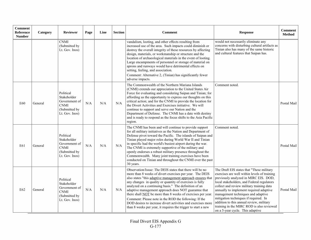
Final Divert EIS Appendix G
G-177
Comment Reference Number
Category Reviewer Page Line Section Comment Response Comment Method
CNMI (Submitted by Lt. Gov. Inos)
vandalism, looting, and other effects resulting from increased use of the area. Such impacts could diminish or destroy the overall integrity of these resources by affecting design, materials, or workmanship or structure and the location of archaeological materials in the event of looting. Large encampments of personnel or storage of material on aprons and runways would have detrimental effects on setting, feeling, and association. Comment: Alternative 2, (Tinian) has significantly fewer adverse impacts.
would not necessarily eliminate any concerns with disturbing cultural artifacts as Tinian also has many of the same historic and cultural features that Saipan has.
E60 General
Political Stakeholder Government of CNMI (Submitted by Lt. Gov. Inos)
N/A N/A N/A
The Commonwealth of the Northern Mariana Islands (CNMI) extends our appreciation to the United States Air Force for evaluating and considering Saipan and Tinian; for affording us the opportunity to express our thoughts on this critical action; and for the CNMI to provide the location for the Divert Activities and Exercises initiative. We will continue to support and serve our Nation and the Department of Defense. The CNMI has a date with destiny and is ready to respond as the focus shifts to the Asia Pacific region.
Comment noted.
Postal Mail
E61 General
Political Stakeholder Government of CNMI (Submitted by Lt. Gov. Inos)
N/A N/A N/A
The CNMI has been and will continue to provide support for all military initiatives as the Nation and Department of Defense pivot toward the Pacific. The islands of Saipan and Tinian played major roles during World War II and Tinian in specific had the world's busiest airport during the war. The CNMI is extremely supportive of the military and openly endorses a robust military presence throughout the Commonwealth. Many joint training exercises have been conducted on Tinian and throughout the CNMI over the past 30 years.
Comment noted.
Postal Mail
E62 General
Political Stakeholder Government of CNMI (Submitted by Lt. Gov. Inos)
N/A N/A N/A
Observation/Issue: The DEIS states that there will be no more than 8 weeks of divert exercises per year. The DEIS also states "this adaptive management approach ensures that any changes in quality or quantity of exercises is fully analyzed on a continuing basis." The definition of an adaptive management approach does NOT guarantee that there shall NOT be more than 8 weeks of exercises per year. Comment: Please note in the ROD the following: If the DOD desires to increase divert activities and exercises more than 8 weeks per year, it requires the trigger to start a new
The Draft EIS states that "These military exercises are well within levels of training previously analyzed in MIRC EIS. DOD, local stakeholders, and Federal regulators collect and review military training data annually to implement required adaptive management techniques and adaptive mitigation techniques if required. In addition to this annual review, military training in the MIRC ROD is also reviewed on a 5-year cycle. This adaptive
Postal Mail
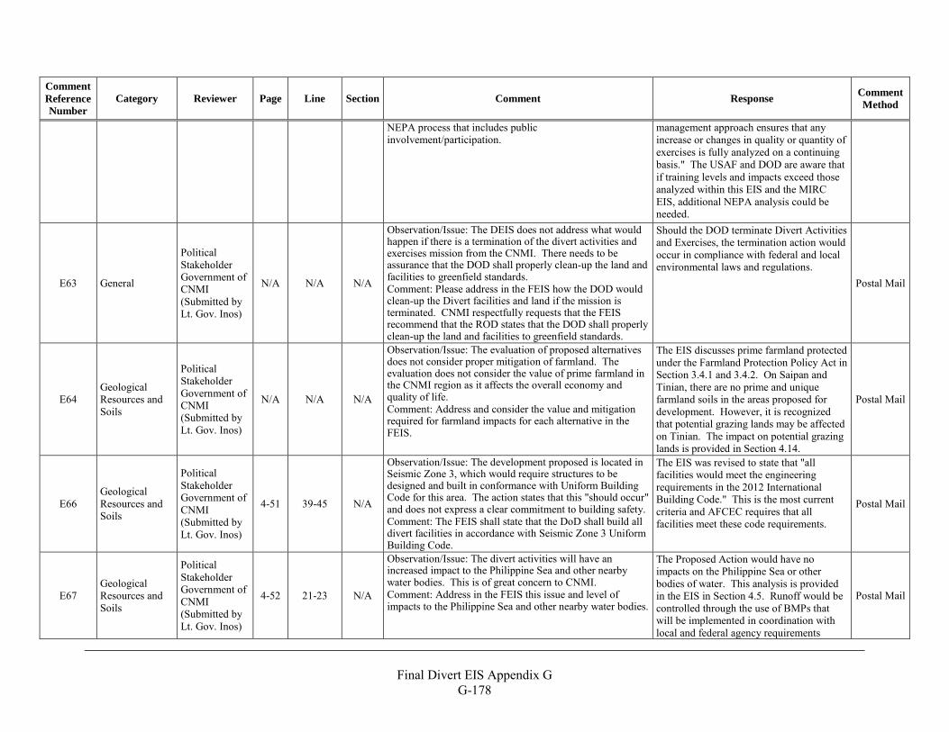
Final Divert EIS Appendix G
G-178
Comment Reference Number
Category Reviewer Page Line Section Comment Response Comment Method
NEPA process that includes public involvement/participation.
management approach ensures that any increase or changes in quality or quantity of exercises is fully analyzed on a continuing basis." The USAF and DOD are aware that if training levels and impacts exceed those analyzed within this EIS and the MIRC EIS, additional NEPA analysis could be needed.
E63 General
Political Stakeholder Government of CNMI (Submitted by Lt. Gov. Inos)
N/A N/A N/A
Observation/Issue: The DEIS does not address what would happen if there is a termination of the divert activities and exercises mission from the CNMI. There needs to be assurance that the DOD shall properly clean-up the land and facilities to greenfield standards. Comment: Please address in the FEIS how the DOD would clean-up the Divert facilities and land if the mission is terminated. CNMI respectfully requests that the FEIS recommend that the ROD states that the DOD shall properly clean-up the land and facilities to greenfield standards.
Should the DOD terminate Divert Activities and Exercises, the termination action would occur in compliance with federal and local environmental laws and regulations.
Postal Mail
E64 Geological Resources and Soils
Political Stakeholder Government of CNMI (Submitted by Lt. Gov. Inos)
N/A N/A N/A
Observation/Issue: The evaluation of proposed alternatives does not consider proper mitigation of farmland. The evaluation does not consider the value of prime farmland in the CNMI region as it affects the overall economy and quality of life. Comment: Address and consider the value and mitigation required for farmland impacts for each alternative in the FEIS.
The EIS discusses prime farmland protected under the Farmland Protection Policy Act in Section 3.4.1 and 3.4.2. On Saipan and Tinian, there are no prime and unique farmland soils in the areas proposed for development. However, it is recognized that potential grazing lands may be affected on Tinian. The impact on potential grazing lands is provided in Section 4.14.
Postal Mail
E66 Geological Resources and Soils
Political Stakeholder Government of CNMI (Submitted by Lt. Gov. Inos)
4-51 39-45 N/A
Observation/Issue: The development proposed is located in Seismic Zone 3, which would require structures to be designed and built in conformance with Uniform Building Code for this area. The action states that this "should occur" and does not express a clear commitment to building safety. Comment: The FEIS shall state that the DoD shall build all divert facilities in accordance with Seismic Zone 3 Uniform Building Code.
The EIS was revised to state that "all facilities would meet the engineering requirements in the 2012 International Building Code." This is the most current criteria and AFCEC requires that all facilities meet these code requirements.
Postal Mail
E67 Geological Resources and Soils
Political Stakeholder Government of CNMI (Submitted by Lt. Gov. Inos)
4-52 21-23 N/A
Observation/Issue: The divert activities will have an increased impact to the Philippine Sea and other nearby water bodies. This is of great concern to CNMI. Comment: Address in the FEIS this issue and level of impacts to the Philippine Sea and other nearby water bodies.
The Proposed Action would have no impacts on the Philippine Sea or other bodies of water. This analysis is provided in the EIS in Section 4.5. Runoff would be controlled through the use of BMPs that will be implemented in coordination with local and federal agency requirements
Postal Mail
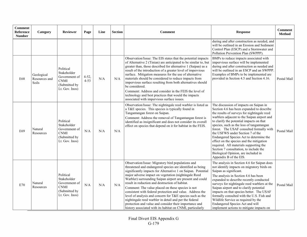
Final Divert EIS Appendix G
G-179
Comment Reference Number
Category Reviewer Page Line Section Comment Response Comment Method
during and after construction as needed, and will be outlined in an Erosion and Sediment Control Plan (ESCP) and a Stormwater and Pollution Prevention Plan (SWPPP).
E68 Geological Resources and Soils
Political Stakeholder Government of CNMI (Submitted by Lt. Gov. Inos)
4-52, 4-53 N/A N/A
Observation/Issue: The EIS states that the potential impacts of Alternative 2 (Tinian) are anticipated to be similar to, but greater than, those described for alternative 1 (Saipan) as a result of the introduction of a greater level of impervious surface. Mitigation measures for the use of alternative materials should be considered to reduce impacts from impervious surface resulting from both alternatives should be considered. Comment: Address and consider in the FEIS the level of technology and best practices that would the impacts associated with impervious surface issues.
BMPs to reduce impacts associated with impervious surface will be implemented during and after construction as needed and will be outlined in an ESCP and an SWPPP. Examples of BMPs to be implemented are provided in Section 4.5 and Section 4.16. Postal Mail
E69 Natural Resources
Political Stakeholder Government of CNMI (Submitted by Lt. Gov. Inos)
N/A N/A N/A
Observation/Issue: The nightingale reed warbler is listed as a T&E species. This species is typically found in Tangantangan forest on Saipan. Comment: Address the removal of Tangantangan forest is identified as insignificant and does not consider its overall effect on species that depend on it for habitat in the FEIS.
The discussion of impacts on Saipan in Section 4.6 has been expanded to describe the results of surveys for nightingale reed warblers adjacent to the Saipan airport and to clarify the potential impacts on that species, such as the loss of tangantangan forest. The USAF consulted formally with the USFWS under Section 7 of the Endangered Species Act to determine the effect on the species and the mitigation required. All materials supporting the Section 7 consultation, to include the Biological Opinion, are included in Appendix B of the EIS.
Postal Mail
E70 Natural Resources
Political Stakeholder Government of CNMI (Submitted by Lt. Gov. Inos)
N/A N/A N/A
Observation/Issue: Migratory bird populations and threatened and endangered species are identified as being significantly impacts for Alternative 1 on Saipan. Potential major adverse impact on vegetation (nightingale Reed Warbler) surrounding Saipan airport are present and could result in reduction and destruction of habitat. Comment: The value placed on these species is not consistent with federal protection and value. Address the level of analysis and concern for T&E species such as the nightingale reed warbler in detail and per the federal protection and value and consider their importance and history associated with its habitat on CNMI, particularly
The analysis in Section 4.6 for Saipan does not identify impacts on migratory birds on Saipan as significant. The analysis in Section 4.6 has been expanded to describe recently conducted surveys for nightingale reed warblers at the Saipan airport and to clarify potential impacts on that species better. The USAF formally consulted with the U.S. Fish and Wildlife Service as required by the Endangered Species Act and will implement actions to mitigate impacts on
Postal Mail
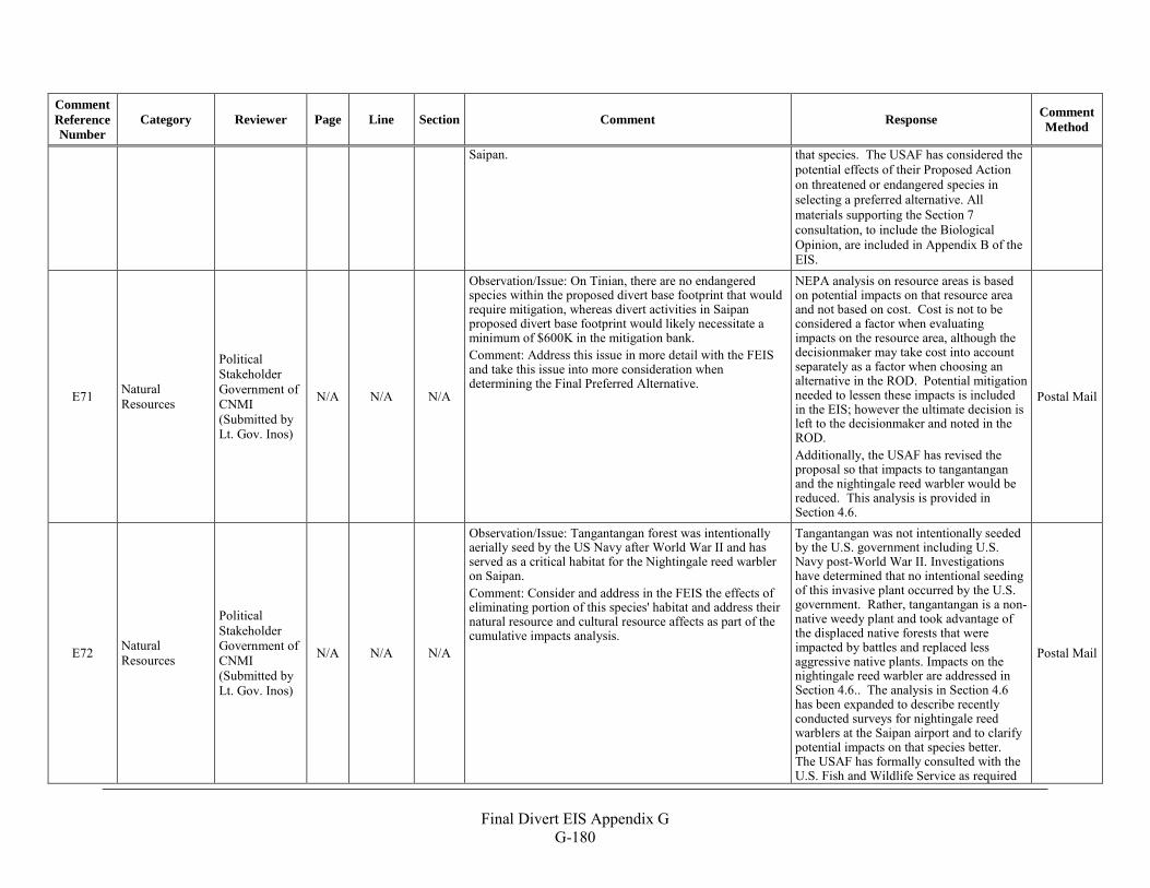
Final Divert EIS Appendix G
G-180
Comment Reference Number
Category Reviewer Page Line Section Comment Response Comment Method
Saipan. that species. The USAF has considered the potential effects of their Proposed Action on threatened or endangered species in selecting a preferred alternative. All materials supporting the Section 7 consultation, to include the Biological Opinion, are included in Appendix B of the EIS.
E71 Natural Resources
Political Stakeholder Government of CNMI (Submitted by Lt. Gov. Inos)
N/A N/A N/A
Observation/Issue: On Tinian, there are no endangered species within the proposed divert base footprint that would require mitigation, whereas divert activities in Saipan proposed divert base footprint would likely necessitate a minimum of $600K in the mitigation bank. Comment: Address this issue in more detail with the FEIS and take this issue into more consideration when determining the Final Preferred Alternative.
NEPA analysis on resource areas is based on potential impacts on that resource area and not based on cost. Cost is not to be considered a factor when evaluating impacts on the resource area, although the decisionmaker may take cost into account separately as a factor when choosing an alternative in the ROD. Potential mitigation needed to lessen these impacts is included in the EIS; however the ultimate decision is left to the decisionmaker and noted in the ROD. Additionally, the USAF has revised the proposal so that impacts to tangantangan and the nightingale reed warbler would be reduced. This analysis is provided in Section 4.6.
Postal Mail
E72 Natural Resources
Political Stakeholder Government of CNMI (Submitted by Lt. Gov. Inos)
N/A N/A N/A
Observation/Issue: Tangantangan forest was intentionally aerially seed by the US Navy after World War II and has served as a critical habitat for the Nightingale reed warbler on Saipan. Comment: Consider and address in the FEIS the effects of eliminating portion of this species' habitat and address their natural resource and cultural resource affects as part of the cumulative impacts analysis.
Tangantangan was not intentionally seeded by the U.S. government including U.S. Navy post-World War II. Investigations have determined that no intentional seeding of this invasive plant occurred by the U.S. government. Rather, tangantangan is a non-native weedy plant and took advantage of the displaced native forests that were impacted by battles and replaced less aggressive native plants. Impacts on the nightingale reed warbler are addressed in Section 4.6.. The analysis in Section 4.6 has been expanded to describe recently conducted surveys for nightingale reed warblers at the Saipan airport and to clarify potential impacts on that species better. The USAF has formally consulted with the U.S. Fish and Wildlife Service as required
Postal Mail
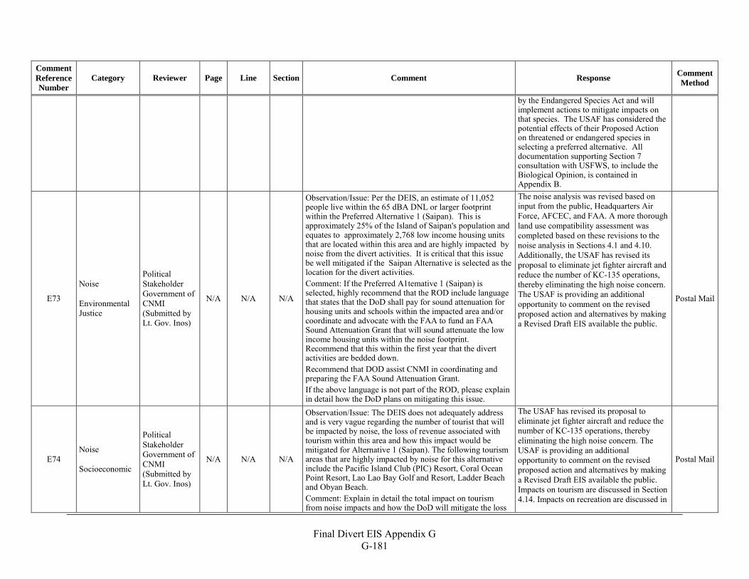
Final Divert EIS Appendix G
G-181
Comment Reference Number
Category Reviewer Page Line Section Comment Response Comment Method
by the Endangered Species Act and will implement actions to mitigate impacts on that species. The USAF has considered the potential effects of their Proposed Action on threatened or endangered species in selecting a preferred alternative. All documentation supporting Section 7 consultation with USFWS, to include the Biological Opinion, is contained in Appendix B.
E73
Noise Environmental Justice
Political Stakeholder Government of CNMI (Submitted by Lt. Gov. Inos)
N/A N/A N/A
Observation/Issue: Per the DEIS, an estimate of 11,052 people live within the 65 dBA DNL or larger footprint within the Preferred Alternative 1 (Saipan). This is approximately 25% of the Island of Saipan's population and equates to approximately 2,768 low income housing units that are located within this area and are highly impacted by noise from the divert activities. It is critical that this issue be well mitigated if the Saipan Alternative is selected as the location for the divert activities. Comment: If the Preferred A1temative 1 (Saipan) is selected, highly recommend that the ROD include language that states that the DoD shall pay for sound attenuation for housing units and schools within the impacted area and/or coordinate and advocate with the FAA to fund an FAA Sound Attenuation Grant that will sound attenuate the low income housing units within the noise footprint. Recommend that this within the first year that the divert activities are bedded down. Recommend that DOD assist CNMI in coordinating and preparing the FAA Sound Attenuation Grant. If the above language is not part of the ROD, please explain in detail how the DoD plans on mitigating this issue.
The noise analysis was revised based on input from the public, Headquarters Air Force, AFCEC, and FAA. A more thorough land use compatibility assessment was completed based on these revisions to the noise analysis in Sections 4.1 and 4.10. Additionally, the USAF has revised its proposal to eliminate jet fighter aircraft and reduce the number of KC-135 operations, thereby eliminating the high noise concern. The USAF is providing an additional opportunity to comment on the revised proposed action and alternatives by making a Revised Draft EIS available the public.
Postal Mail
E74 Noise Socioeconomic
Political Stakeholder Government of CNMI (Submitted by Lt. Gov. Inos)
N/A N/A N/A
Observation/Issue: The DEIS does not adequately address and is very vague regarding the number of tourist that will be impacted by noise, the loss of revenue associated with tourism within this area and how this impact would be mitigated for Alternative 1 (Saipan). The following tourism areas that are highly impacted by noise for this alternative include the Pacific Island Club (PIC) Resort, Coral Ocean Point Resort, Lao Lao Bay Golf and Resort, Ladder Beach and Obyan Beach. Comment: Explain in detail the total impact on tourism from noise impacts and how the DoD will mitigate the loss
The USAF has revised its proposal to eliminate jet fighter aircraft and reduce the number of KC-135 operations, thereby eliminating the high noise concern. The USAF is providing an additional opportunity to comment on the revised proposed action and alternatives by making a Revised Draft EIS available the public. Impacts on tourism are discussed in Section 4.14. Impacts on recreation are discussed in
Postal Mail
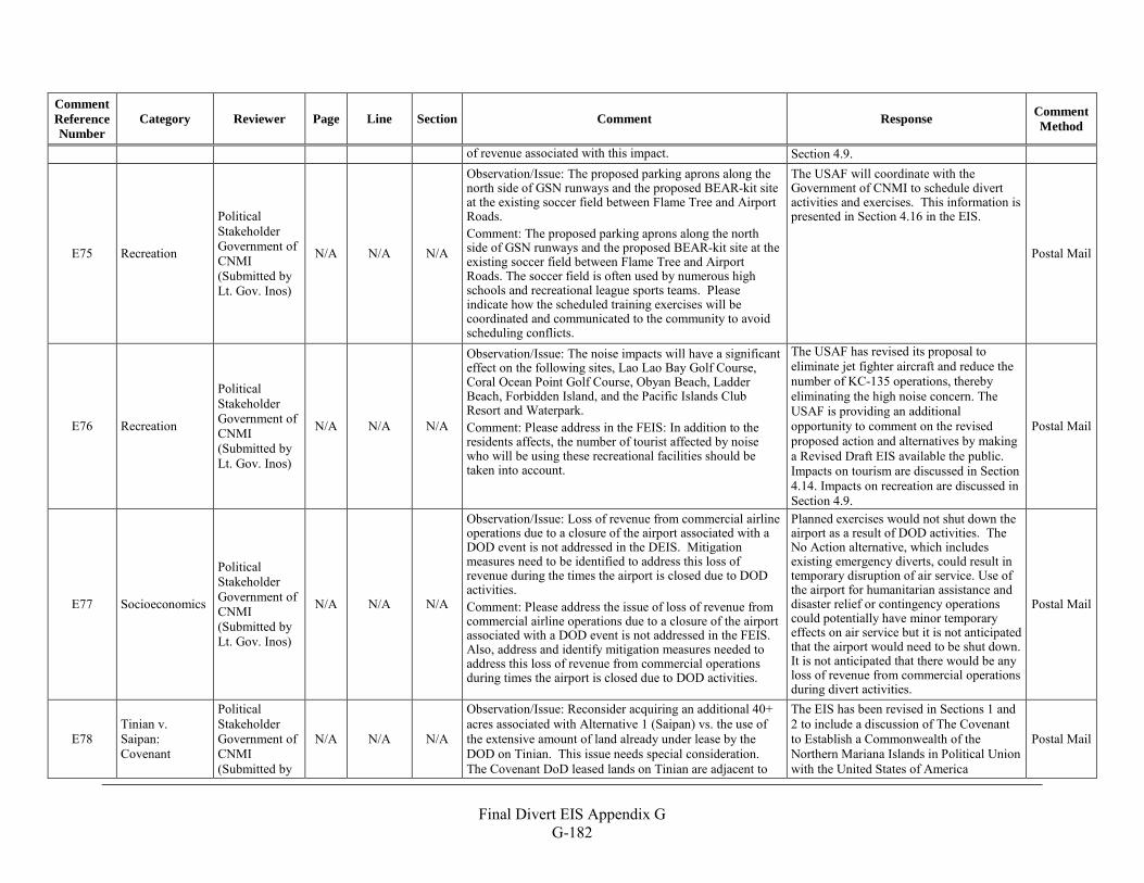
Final Divert EIS Appendix G
G-182
Comment Reference Number
Category Reviewer Page Line Section Comment Response Comment Method
of revenue associated with this impact. Section 4.9.
E75 Recreation
Political Stakeholder Government of CNMI (Submitted by Lt. Gov. Inos)
N/A N/A N/A
Observation/Issue: The proposed parking aprons along the north side of GSN runways and the proposed BEAR-kit site at the existing soccer field between Flame Tree and Airport Roads. Comment: The proposed parking aprons along the north side of GSN runways and the proposed BEAR-kit site at the existing soccer field between Flame Tree and Airport Roads. The soccer field is often used by numerous high schools and recreational league sports teams. Please indicate how the scheduled training exercises will be coordinated and communicated to the community to avoid scheduling conflicts.
The USAF will coordinate with the Government of CNMI to schedule divert activities and exercises. This information is presented in Section 4.16 in the EIS.
Postal Mail
E76 Recreation
Political Stakeholder Government of CNMI (Submitted by Lt. Gov. Inos)
N/A N/A N/A
Observation/Issue: The noise impacts will have a significant effect on the following sites, Lao Lao Bay Golf Course, Coral Ocean Point Golf Course, Obyan Beach, Ladder Beach, Forbidden Island, and the Pacific Islands Club Resort and Waterpark. Comment: Please address in the FEIS: In addition to the residents affects, the number of tourist affected by noise who will be using these recreational facilities should be taken into account.
The USAF has revised its proposal to eliminate jet fighter aircraft and reduce the number of KC-135 operations, thereby eliminating the high noise concern. The USAF is providing an additional opportunity to comment on the revised proposed action and alternatives by making a Revised Draft EIS available the public. Impacts on tourism are discussed in Section 4.14. Impacts on recreation are discussed in Section 4.9.
Postal Mail
E77 Socioeconomics
Political Stakeholder Government of CNMI (Submitted by Lt. Gov. Inos)
N/A N/A N/A
Observation/Issue: Loss of revenue from commercial airline operations due to a closure of the airport associated with a DOD event is not addressed in the DEIS. Mitigation measures need to be identified to address this loss of revenue during the times the airport is closed due to DOD activities. Comment: Please address the issue of loss of revenue from commercial airline operations due to a closure of the airport associated with a DOD event is not addressed in the FEIS. Also, address and identify mitigation measures needed to address this loss of revenue from commercial operations during times the airport is closed due to DOD activities.
Planned exercises would not shut down the airport as a result of DOD activities. The No Action alternative, which includes existing emergency diverts, could result in temporary disruption of air service. Use of the airport for humanitarian assistance and disaster relief or contingency operations could potentially have minor temporary effects on air service but it is not anticipated that the airport would need to be shut down. It is not anticipated that there would be any loss of revenue from commercial operations during divert activities.
Postal Mail
E78 Tinian v. Saipan: Covenant
Political Stakeholder Government of CNMI (Submitted by
N/A N/A N/A
Observation/Issue: Reconsider acquiring an additional 40+ acres associated with Alternative 1 (Saipan) vs. the use of the extensive amount of land already under lease by the DOD on Tinian. This issue needs special consideration. The Covenant DoD leased lands on Tinian are adjacent to
The EIS has been revised in Sections 1 and 2 to include a discussion of The Covenant to Establish a Commonwealth of the Northern Mariana Islands in Political Union with the United States of America
Postal Mail
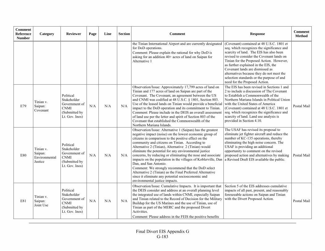
Final Divert EIS Appendix G
G-183
Comment Reference Number
Category Reviewer Page Line Section Comment Response Comment Method
the Tinian International Airport and are currently designated for DoD operations. Comment: Please explain the rational for why DoD is asking for an addition 40+ acres of land on Saipan for Alternative 1
(Covenant) contained at 48 U.S.C. 1801 et seq. which recognizes the significance and scarcity of land. The EIS has also been revised to consider the Covenant lands on Tinian for the Proposed Action. However, as further explained in the EIS, the Covenant lands are dismissed as alternatives because they do not meet the selection standards or the purpose of and need for the Proposed Action.
E79 Tinian v. Saipan: Covenant
Political Stakeholder Government of CNMI (Submitted by Lt. Gov. Inos)
N/A N/A N/A
Observation/Issue: Approximately 17,799 acres of land on Tinian and 177 acres of land on Saipan are part of the Covenant. The Covenant, an agreement between the US and CNMI was codified at 48 U.S.C. § 1801, Section 803. Use of the leased lands on Tinian would provide a beneficial impact to the DoD operation and its commitment to Tinian. Comment: Please include in the DEIS an overall assessment of land use per the letter and spirit of Section 803 of the Covenant that established the Commonwealth of the Northern Mariana Islands.
The EIS has been revised in Sections 1 and 2 to include a discussion of The Covenant to Establish a Commonwealth of the Northern Mariana Islands in Political Union with the United States of America (Covenant) contained at 48 U.S.C. 1801 et seq. which recognizes the significance and scarcity of land. Land use analysis is provided in Section 4.10.
Postal Mail
E80
Tinian v. Saipan: Environmental Justice
Political Stakeholder Government of CNMI (Submitted by Lt. Gov. Inos)
N/A N/A N/A
Observation/Issue: Alternative 1 (Saipan) has the greatest negative impact (noise) on the lowest economic group of citizens in comparison to the positive effect on the community and citizens on Tinian. According to Alternative 2 (Tinian), Alternative 2 (Tinian) would eliminate the potential for any environmental justice concerns, by reducing or eliminating the nose and associate impacts on the population in the villages of Koblerville, Dan Dan, and San Antonio. Comment: We strongly recommend that the DoD select Alternative 2 (Tinian) as the Final Preferred Alternative since it eliminate any potential socioeconomic and environmental justice impacts.
The USAF has revised its proposal to eliminate jet fighter aircraft and reduce the number of KC-135 operations, thereby eliminating the high noise concern. The USAF is providing an additional opportunity to comment on the revised proposed action and alternatives by making a Revised Draft EIS available the public.
Postal Mail
E81 Tinian v. Saipan: Joint Use
Political Stakeholder Government of CNMI (Submitted by Lt. Gov. Inos)
N/A N/A N/A
Observation/Issue: Cumulative Impacts. It is important that the DEIS consider and address at an overall planning level the integrated use of lands within CNMI, especially Saipan and Tinian related to the Record of Decision for the Military Buildup for the US Marines and the use of Tinian, use of Tinian as part of the MERC and the proposed Divert Activities. Comment: Please address in the FEIS the positive benefits
Section 5 of the EIS addresses cumulative impacts of all past, present, and reasonably foreseeable actions on Saipan and Tinian with the Divert Proposed Action. Postal Mail
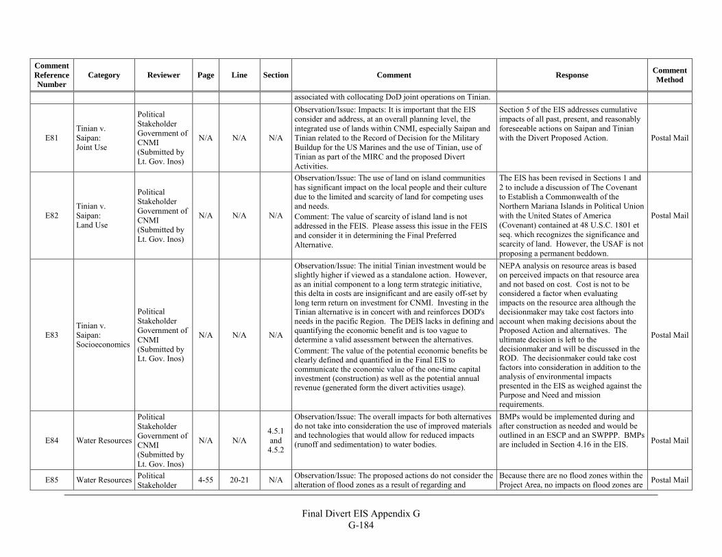
Final Divert EIS Appendix G
G-184
Comment Reference Number
Category Reviewer Page Line Section Comment Response Comment Method
associated with collocating DoD joint operations on Tinian.
E81 Tinian v. Saipan: Joint Use
Political Stakeholder Government of CNMI (Submitted by Lt. Gov. Inos)
N/A N/A N/A
Observation/Issue: Impacts: It is important that the EIS consider and address, at an overall planning level, the integrated use of lands within CNMI, especially Saipan and Tinian related to the Record of Decision for the Military Buildup for the US Marines and the use of Tinian, use of Tinian as part of the MIRC and the proposed Divert Activities.
Section 5 of the EIS addresses cumulative impacts of all past, present, and reasonably foreseeable actions on Saipan and Tinian with the Divert Proposed Action. Postal Mail
E82 Tinian v. Saipan: Land Use
Political Stakeholder Government of CNMI (Submitted by Lt. Gov. Inos)
N/A N/A N/A
Observation/Issue: The use of land on island communities has significant impact on the local people and their culture due to the limited and scarcity of land for competing uses and needs. Comment: The value of scarcity of island land is not addressed in the FEIS. Please assess this issue in the FEIS and consider it in determining the Final Preferred Alternative.
The EIS has been revised in Sections 1 and 2 to include a discussion of The Covenant to Establish a Commonwealth of the Northern Mariana Islands in Political Union with the United States of America (Covenant) contained at 48 U.S.C. 1801 et seq. which recognizes the significance and scarcity of land. However, the USAF is not proposing a permanent beddown.
Postal Mail
E83 Tinian v. Saipan: Socioeconomics
Political Stakeholder Government of CNMI (Submitted by Lt. Gov. Inos)
N/A N/A N/A
Observation/Issue: The initial Tinian investment would be slightly higher if viewed as a standalone action. However, as an initial component to a long term strategic initiative, this delta in costs are insignificant and are easily off-set by long term return on investment for CNMI. Investing in the Tinian alternative is in concert with and reinforces DOD's needs in the pacific Region. The DEIS lacks in defining and quantifying the economic benefit and is too vague to determine a valid assessment between the alternatives. Comment: The value of the potential economic benefits be clearly defined and quantified in the Final EIS to communicate the economic value of the one-time capital investment (construction) as well as the potential annual revenue (generated form the divert activities usage).
NEPA analysis on resource areas is based on perceived impacts on that resource area and not based on cost. Cost is not to be considered a factor when evaluating impacts on the resource area although the decisionmaker may take cost factors into account when making decisions about the Proposed Action and alternatives. The ultimate decision is left to the decisionmaker and will be discussed in the ROD. The decisionmaker could take cost factors into consideration in addition to the analysis of environmental impacts presented in the EIS as weighed against the Purpose and Need and mission requirements.
Postal Mail
E84 Water Resources
Political Stakeholder Government of CNMI (Submitted by Lt. Gov. Inos)
N/A N/A 4.5.1 and
4.5.2
Observation/Issue: The overall impacts for both alternatives do not take into consideration the use of improved materials and technologies that would allow for reduced impacts (runoff and sedimentation) to water bodies.
BMPs would be implemented during and after construction as needed and would be outlined in an ESCP and an SWPPP. BMPs are included in Section 4.16 in the EIS. Postal Mail
E85 Water Resources Political Stakeholder 4-55 20-21 N/A Observation/Issue: The proposed actions do not consider the
alteration of flood zones as a result of regarding and Because there are no flood zones within the Project Area, no impacts on flood zones are Postal Mail
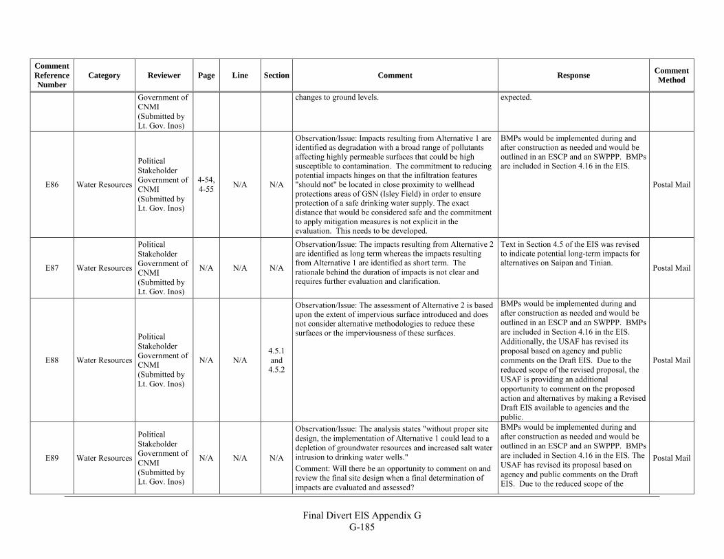
Final Divert EIS Appendix G
G-185
Comment Reference Number
Category Reviewer Page Line Section Comment Response Comment Method
Government of CNMI (Submitted by Lt. Gov. Inos)
changes to ground levels. expected.
E86 Water Resources
Political Stakeholder Government of CNMI (Submitted by Lt. Gov. Inos)
4-54, 4-55 N/A N/A
Observation/Issue: Impacts resulting from Alternative 1 are identified as degradation with a broad range of pollutants affecting highly permeable surfaces that could be high susceptible to contamination. The commitment to reducing potential impacts hinges on that the infiltration features "should not" be located in close proximity to wellhead protections areas of GSN (Isley Field) in order to ensure protection of a safe drinking water supply. The exact distance that would be considered safe and the commitment to apply mitigation measures is not explicit in the evaluation. This needs to be developed.
BMPs would be implemented during and after construction as needed and would be outlined in an ESCP and an SWPPP. BMPs are included in Section 4.16 in the EIS.
Postal Mail
E87 Water Resources
Political Stakeholder Government of CNMI (Submitted by Lt. Gov. Inos)
N/A N/A N/A
Observation/Issue: The impacts resulting from Alternative 2 are identified as long term whereas the impacts resulting from Alternative 1 are identified as short term. The rationale behind the duration of impacts is not clear and requires further evaluation and clarification.
Text in Section 4.5 of the EIS was revised to indicate potential long-term impacts for alternatives on Saipan and Tinian. Postal Mail
E88 Water Resources
Political Stakeholder Government of CNMI (Submitted by Lt. Gov. Inos)
N/A N/A 4.5.1 and
4.5.2
Observation/Issue: The assessment of Alternative 2 is based upon the extent of impervious surface introduced and does not consider alternative methodologies to reduce these surfaces or the imperviousness of these surfaces.
BMPs would be implemented during and after construction as needed and would be outlined in an ESCP and an SWPPP. BMPs are included in Section 4.16 in the EIS. Additionally, the USAF has revised its proposal based on agency and public comments on the Draft EIS. Due to the reduced scope of the revised proposal, the USAF is providing an additional opportunity to comment on the proposed action and alternatives by making a Revised Draft EIS available to agencies and the public.
Postal Mail
E89 Water Resources
Political Stakeholder Government of CNMI (Submitted by Lt. Gov. Inos)
N/A N/A N/A
Observation/Issue: The analysis states "without proper site design, the implementation of Alternative 1 could lead to a depletion of groundwater resources and increased salt water intrusion to drinking water wells." Comment: Will there be an opportunity to comment on and review the final site design when a final determination of impacts are evaluated and assessed?
BMPs would be implemented during and after construction as needed and would be outlined in an ESCP and an SWPPP. BMPs are included in Section 4.16 in the EIS. The USAF has revised its proposal based on agency and public comments on the Draft EIS. Due to the reduced scope of the
Postal Mail
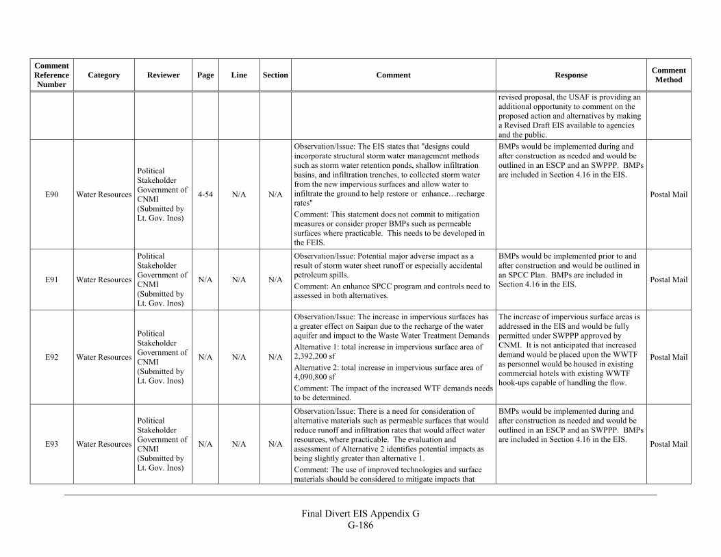
Final Divert EIS Appendix G
G-186
Comment Reference Number
Category Reviewer Page Line Section Comment Response Comment Method
revised proposal, the USAF is providing an additional opportunity to comment on the proposed action and alternatives by making a Revised Draft EIS available to agencies and the public.
E90 Water Resources
Political Stakeholder Government of CNMI (Submitted by Lt. Gov. Inos)
4-54 N/A N/A
Observation/Issue: The EIS states that "designs could incorporate structural storm water management methods such as storm water retention ponds, shallow infiltration basins, and infiltration trenches, to collected storm water from the new impervious surfaces and allow water to infiltrate the ground to help restore or enhance…recharge rates" Comment: This statement does not commit to mitigation measures or consider proper BMPs such as permeable surfaces where practicable. This needs to be developed in the FEIS.
BMPs would be implemented during and after construction as needed and would be outlined in an ESCP and an SWPPP. BMPs are included in Section 4.16 in the EIS.
Postal Mail
E91 Water Resources
Political Stakeholder Government of CNMI (Submitted by Lt. Gov. Inos)
N/A N/A N/A
Observation/Issue: Potential major adverse impact as a result of storm water sheet runoff or especially accidental petroleum spills. Comment: An enhance SPCC program and controls need to assessed in both alternatives.
BMPs would be implemented prior to and after construction and would be outlined in an SPCC Plan. BMPs are included in Section 4.16 in the EIS. Postal Mail
E92 Water Resources
Political Stakeholder Government of CNMI (Submitted by Lt. Gov. Inos)
N/A N/A N/A
Observation/Issue: The increase in impervious surfaces has a greater effect on Saipan due to the recharge of the water aquifer and impact to the Waste Water Treatment Demands Alternative 1: total increase in impervious surface area of 2,392,200 sf Alternative 2: total increase in impervious surface area of 4,090,800 sf Comment: The impact of the increased WTF demands needs to be determined.
The increase of impervious surface areas is addressed in the EIS and would be fully permitted under SWPPP approved by CNMI. It is not anticipated that increased demand would be placed upon the WWTF as personnel would be housed in existing commercial hotels with existing WWTF hook-ups capable of handling the flow.
Postal Mail
E93 Water Resources
Political Stakeholder Government of CNMI (Submitted by Lt. Gov. Inos)
N/A N/A N/A
Observation/Issue: There is a need for consideration of alternative materials such as permeable surfaces that would reduce runoff and infiltration rates that would affect water resources, where practicable. The evaluation and assessment of Alternative 2 identifies potential impacts as being slightly greater than alternative 1. Comment: The use of improved technologies and surface materials should be considered to mitigate impacts that
BMPs would be implemented during and after construction as needed and would be outlined in an ESCP and an SWPPP. BMPs are included in Section 4.16 in the EIS. Postal Mail
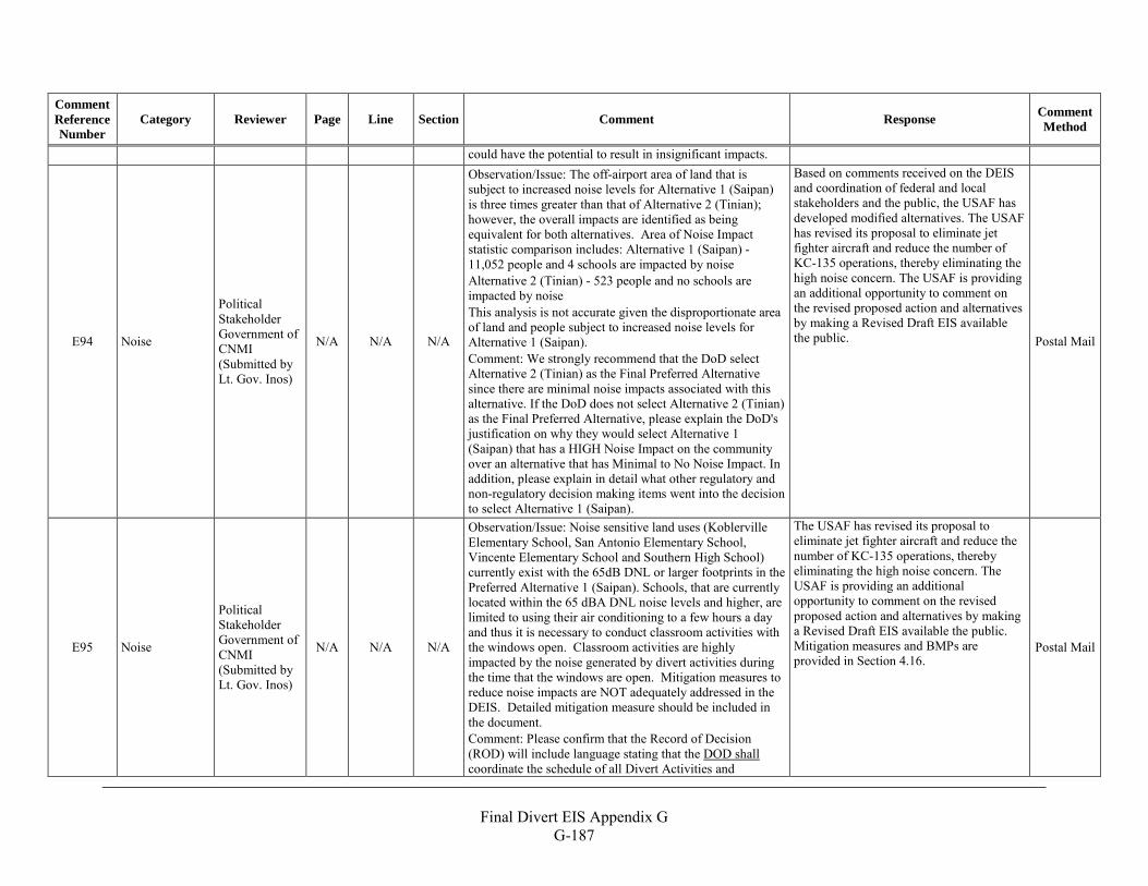
Final Divert EIS Appendix G
G-187
Comment Reference Number
Category Reviewer Page Line Section Comment Response Comment Method
could have the potential to result in insignificant impacts.
E94 Noise
Political Stakeholder Government of CNMI (Submitted by Lt. Gov. Inos)
N/A N/A N/A
Observation/Issue: The off-airport area of land that is subject to increased noise levels for Alternative 1 (Saipan) is three times greater than that of Alternative 2 (Tinian); however, the overall impacts are identified as being equivalent for both alternatives. Area of Noise Impact statistic comparison includes: Alternative 1 (Saipan) -11,052 people and 4 schools are impacted by noise Alternative 2 (Tinian) - 523 people and no schools are impacted by noise This analysis is not accurate given the disproportionate area of land and people subject to increased noise levels for Alternative 1 (Saipan). Comment: We strongly recommend that the DoD select Alternative 2 (Tinian) as the Final Preferred Alternative since there are minimal noise impacts associated with this alternative. If the DoD does not select Alternative 2 (Tinian) as the Final Preferred Alternative, please explain the DoD's justification on why they would select Alternative 1 (Saipan) that has a HIGH Noise Impact on the community over an alternative that has Minimal to No Noise Impact. In addition, please explain in detail what other regulatory and non-regulatory decision making items went into the decision to select Alternative 1 (Saipan).
Based on comments received on the DEIS and coordination of federal and local stakeholders and the public, the USAF has developed modified alternatives. The USAF has revised its proposal to eliminate jet fighter aircraft and reduce the number of KC-135 operations, thereby eliminating the high noise concern. The USAF is providing an additional opportunity to comment on the revised proposed action and alternatives by making a Revised Draft EIS available the public.
Postal Mail
E95 Noise
Political Stakeholder Government of CNMI (Submitted by Lt. Gov. Inos)
N/A N/A N/A
Observation/Issue: Noise sensitive land uses (Koblerville Elementary School, San Antonio Elementary School, Vincente Elementary School and Southern High School) currently exist with the 65dB DNL or larger footprints in the Preferred Alternative 1 (Saipan). Schools, that are currently located within the 65 dBA DNL noise levels and higher, are limited to using their air conditioning to a few hours a day and thus it is necessary to conduct classroom activities with the windows open. Classroom activities are highly impacted by the noise generated by divert activities during the time that the windows are open. Mitigation measures to reduce noise impacts are NOT adequately addressed in the DEIS. Detailed mitigation measure should be included in the document. Comment: Please confirm that the Record of Decision (ROD) will include language stating that the DOD shall coordinate the schedule of all Divert Activities and
The USAF has revised its proposal to eliminate jet fighter aircraft and reduce the number of KC-135 operations, thereby eliminating the high noise concern. The USAF is providing an additional opportunity to comment on the revised proposed action and alternatives by making a Revised Draft EIS available the public. Mitigation measures and BMPs are provided in Section 4.16.
Postal Mail
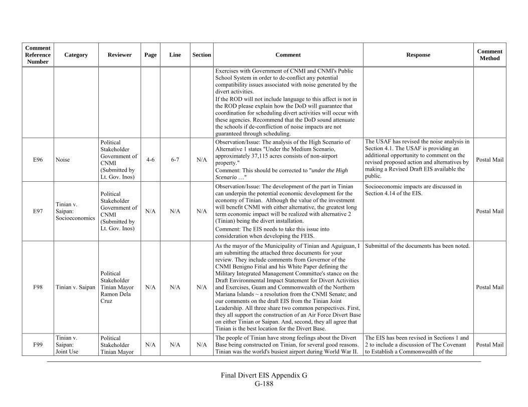
Final Divert EIS Appendix G
G-188
Comment Reference Number
Category Reviewer Page Line Section Comment Response Comment Method
Exercises with Government of CNMI and CNMI's Public School System in order to de-conflict any potential compatibility issues associated with noise generated by the divert activities. If the ROD will not include language to this affect is not in the ROD please explain how the DoD will guarantee that coordination for scheduling divert activities will occur with these agencies. Recommend that the DoD sound attenuate the schools if de-confliction of noise impacts are not guaranteed through scheduling.
E96 Noise
Political Stakeholder Government of CNMI (Submitted by Lt. Gov. Inos)
4-6 6-7 N/A
Observation/Issue: The analysis of the High Scenario of Alternative 1 states "Under the Medium Scenario, approximately 37,115 acres consists of non-airport property." Comment: This should be corrected to "under the High Scenario …"
The USAF has revised the noise analysis in Section 4.1. The USAF is providing an additional opportunity to comment on the revised proposed action and alternatives by making a Revised Draft EIS available the public.
Postal Mail
E97 Tinian v. Saipan: Socioeconomics
Political Stakeholder Government of CNMI (Submitted by Lt. Gov. Inos)
N/A N/A N/A
Observation/Issue: The development of the part in Tinian can underpin the potential economic development for the economy of Tinian. Although the value of the investment will benefit CNMI with either alternative, the greatest long term economic impact will be realized with alternative 2 (Tinian) being the divert installation. Comment: The EIS needs to take this issue into consideration when developing the FEIS.
Socioeconomic impacts are discussed in Section 4.14 of the EIS.
Postal Mail
F98 Tinian v. Saipan
Political Stakeholder Tinian Mayor Ramon Dela Cruz
N/A N/A N/A
As the mayor of the Municipality of Tinian and Aguiguan, I am submitting the attached three documents for your review. They include comments from Governor of the CNMI Benigno Fitial and his White Paper defining the Military Integrated Management Committee's stance on the Draft Environmental Impact Statement for Divert Activities and Exercises, Guam and Commonwealth of the Northern Mariana Islands ~ a resolution from the CNMI Senate; and our comments on the draft EIS from the Tinian Joint Leadership. All three share two common perspectives. First, they all support the construction of an Air Force Divert Base on either Tinian or Saipan. And, second, they all agree that Tinian is the best location for the Divert Base.
Submittal of the documents has been noted.
Postal Mail
F99 Tinian v. Saipan: Joint Use
Political Stakeholder Tinian Mayor
N/A N/A N/A The people of Tinian have strong feelings about the Divert Base being constructed on Tinian, for several good reasons. Tinian was the world's busiest airport during World War II.
The EIS has been revised in Sections 1 and 2 to include a discussion of The Covenant to Establish a Commonwealth of the
Postal Mail
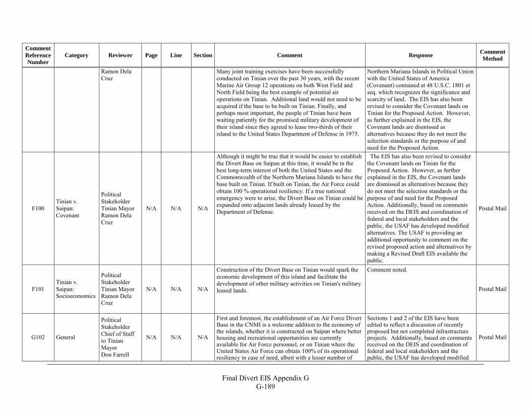
Final Divert EIS Appendix G
G-189
Comment Reference Number
Category Reviewer Page Line Section Comment Response Comment Method
Ramon Dela Cruz
Many joint training exercises have been successfully conducted on Tinian over the past 30 years, with the recent Marine Air Group 12 operations on both West Field and North Field being the best example of potential air operations on Tinian. Additional land would not need to be acquired if the base to be built on Tinian. Finally, and perhaps most important, the people of Tinian have been waiting patiently for the promised military development of their island since they agreed to lease two-thirds of their island to the United States Department of Defense in 1975.
Northern Mariana Islands in Political Union with the United States of America (Covenant) contained at 48 U.S.C. 1801 et seq. which recognizes the significance and scarcity of land. The EIS has also been revised to consider the Covenant lands on Tinian for the Proposed Action. However, as further explained in the EIS, the Covenant lands are dismissed as alternatives because they do not meet the selection standards or the purpose of and need for the Proposed Action.
F100 Tinian v. Saipan: Covenant
Political Stakeholder Tinian Mayor Ramon Dela Cruz
N/A N/A N/A
Although it might be true that it would be easier to establish the Divert Base on Saipan at this time, it would be in the best long-term interest of both the United States and the Commonwealth of the Northern Mariana Islands to have the base built on Tinian. If built on Tinian, the Air Force could obtain 100 % operational resiliency. If a true national emergency were to arise, the Divert Base on Tinian could be expanded onto adjacent lands already leased by the Department of Defense.
The EIS has also been revised to consider the Covenant lands on Tinian for the Proposed Action. However, as further explained in the EIS, the Covenant lands are dismissed as alternatives because they do not meet the selection standards or the purpose of and need for the Proposed Action. Additionally, based on comments received on the DEIS and coordination of federal and local stakeholders and the public, the USAF has developed modified alternatives. The USAF is providing an additional opportunity to comment on the revised proposed action and alternatives by making a Revised Draft EIS available the public.
Postal Mail
F101 Tinian v. Saipan: Socioeconomics
Political Stakeholder Tinian Mayor Ramon Dela Cruz
N/A N/A N/A
Construction of the Divert Base on Tinian would spark the economic development of this island and facilitate the development of other military activities on Tinian's military leased lands.
Comment noted.
Postal Mail
G102 General
Political Stakeholder Chief of Staff to Tinian Mayor Don Farrell
N/A N/A N/A
First and foremost, the establishment of an Air Force Divert Base in the CNMI is a welcome addition to the economy of the islands, whether it is constructed on Saipan where better housing and recreational opportunities are currently available for Air Force personnel, or on Tinian where the United States Air Force can obtain 100% of its operational resiliency in case of need, albeit with a lesser number of
Sections 1 and 2 of the EIS have been edited to reflect a discussion of recently proposed but not completed infrastructure projects. Additionally, based on comments received on the DEIS and coordination of federal and local stakeholders and the public, the USAF has developed modified
Postal Mail
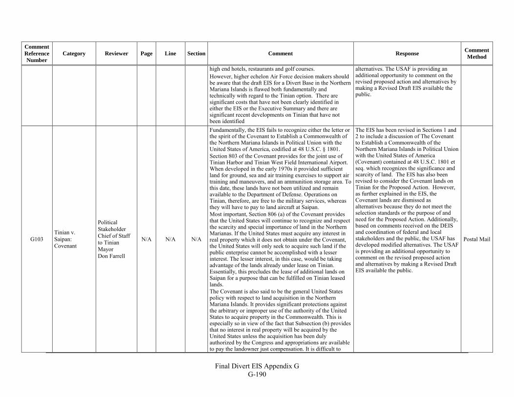
Final Divert EIS Appendix G
G-190
Comment Reference Number
Category Reviewer Page Line Section Comment Response Comment Method
high end hotels, restaurants and golf courses. However, higher echelon Air Force decision makers should be aware that the draft EIS for a Divert Base in the Northern Mariana Islands is flawed both fundamentally and technically with regard to the Tinian option. There are significant costs that have not been clearly identified in either the EIS or the Executive Summary and there are significant recent developments on Tinian that have not been identified
alternatives. The USAF is providing an additional opportunity to comment on the revised proposed action and alternatives by making a Revised Draft EIS available the public.
G103 Tinian v. Saipan: Covenant
Political Stakeholder Chief of Staff to Tinian Mayor Don Farrell
N/A N/A N/A
Fundamentally, the EIS fails to recognize either the letter or the spirit of the Covenant to Establish a Commonwealth of the Northern Mariana Islands in Political Union with the United States of America, codified at 48 U.S.C. § 1801. Section 803 of the Covenant provides for the joint use of Tinian Harbor and Tinian West Field International Airport. When developed in the early 1970s it provided sufficient land for ground, sea and air training exercises to support air training and maneuvers, and an ammunition storage area. To this date, these lands have not been utilized and remain available to the Department of Defense. Operations on Tinian, therefore, are free to the military services, whereas they will have to pay to land aircraft at Saipan. Most important, Section 806 (a) of the Covenant provides that the United States will continue to recognize and respect the scarcity and special importance of land in the Northern Marianas. If the United States must acquire any interest in real property which it does not obtain under the Covenant, the United States will only seek to acquire such land if the public enterprise cannot be accomplished with a lesser interest. The lesser interest, in this case, would be taking advantage of the lands already under lease on Tinian. Essentially, this precludes the lease of additional lands on Saipan for a purpose that can be fulfilled on Tinian leased lands. The Covenant is also said to be the general United States policy with respect to land acquisition in the Northern Mariana Islands. It provides significant protections against the arbitrary or improper use of the authority of the United States to acquire property in the Commonwealth. This is especially so in view of the fact that Subsection (b) provides that no interest in real property will be acquired by the United States unless the acquisition has been duly authorized by the Congress and appropriations are available to pay the landowner just compensation. It is difficult to
The EIS has been revised in Sections 1 and 2 to include a discussion of The Covenant to Establish a Commonwealth of the Northern Mariana Islands in Political Union with the United States of America (Covenant) contained at 48 U.S.C. 1801 et seq. which recognizes the significance and scarcity of land. The EIS has also been revised to consider the Covenant lands on Tinian for the Proposed Action. However, as further explained in the EIS, the Covenant lands are dismissed as alternatives because they do not meet the selection standards or the purpose of and need for the Proposed Action. Additionally, based on comments received on the DEIS and coordination of federal and local stakeholders and the public, the USAF has developed modified alternatives. The USAF is providing an additional opportunity to comment on the revised proposed action and alternatives by making a Revised Draft EIS available the public.
Postal Mail
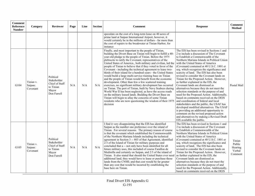
Final Divert EIS Appendix G
G-191
Comment Reference Number
Category Reviewer Page Line Section Comment Response Comment Method
speculate on the cost of a long-term lease on 40 acres of prime land at Saipan International Airport, however, it would certainly be in the millions of dollars - far more than the cost of repairs to the breakwater at Tinian Harbor, for instance
G104 Tinian v. Saipan: Covenant
Political Stakeholder Chief of Staff to Tinian Mayor Don Farrell
N/A N/A N/A
Finally, and most important to the people of Tinian, building the Divert Base on Tinian will begin to fulfill a 40-year-old pledge to the people of Tinian. Before the 1975 plebiscite to ratify the Covenant, representatives of the United States of America., both military and civilian, led the people of Tinian to believe that if they voted in favor of the Covenant - including the technical agreement to lease two-thirds of their island for a hundred years - the United States would build a large multi-service training base on Tinian and the people of Tinian would benefit from the economic development. Other than few a few scattered training exercises, no significant military development has occurred on Tinian. The port of Tinian, built by Navy Seabees during World War II has been neglected, as have the access roads on the military leased lands. Building the Divert Base on Tinian will begin to allay the concerns of some Tinian residents who are now questioning the wisdom of their 1975 decision
The EIS has been revised in Sections 1 and 2 to include a discussion of The Covenant to Establish a Commonwealth of the Northern Mariana Islands in Political Union with the United States of America (Covenant) contained at 48 U.S.C. 1801 et seq. which recognizes the significance and scarcity of land. The EIS has also been revised to consider the Covenant lands on Tinian for the Proposed Action. However, as further explained in the EIS, the Covenant lands are dismissed as alternatives because they do not meet the selection standards or the purpose of and need for the Proposed Action. Additionally, based on comments received on the DEIS and coordination of federal and local stakeholders and the public, the USAF has developed modified alternatives. The USAF is providing an additional opportunity to comment on the revised proposed action and alternatives by making a Revised Draft EIS available the public.
Postal Mail
G105 Tinian v. Saipan: Covenant
Political Stakeholder Chief of Staff to Tinian Mayor Don Farrell
N/A N/A N/A
I find it very disappointing that the EIS has identified Saipan as the number one preference over the island of Tinian. For several reasons. The primary reason of course is that the covenant which established the Commonwealth of the Northern Mariana Islands including the technical agreement in Section 3 -- 803 of that Agreement, identified 2/3 of the Island of Tinian for military purposes and concluded that a -- not only have been identified for all future military uses, this included of course Farallon de Medinilla and certainly on Saipan, and 2/3 of the island of Tinian. It also stated that should the United States ever need additional land, they would have to lease or purchase those lands from the CNMI; and that cost would be far greater than any cost that would be incurred by establishing the base here on Tinian.
The EIS has been revised in Sections 1 and 2 to include a discussion of The Covenant to Establish a Commonwealth of the Northern Mariana Islands in Political Union with the United States of America (Covenant) contained at 48 U.S.C. 1801 et seq. which recognizes the significance and scarcity of land. The EIS has also been revised to consider the Covenant lands on Tinian for the Proposed Action. However, as further explained in the EIS, the Covenant lands are dismissed as alternatives because they do not meet the selection standards or the purpose of and need for the Proposed Action. Additionally, based on comments received on the DEIS
Tinian Public
Hearing Verbal
Comment
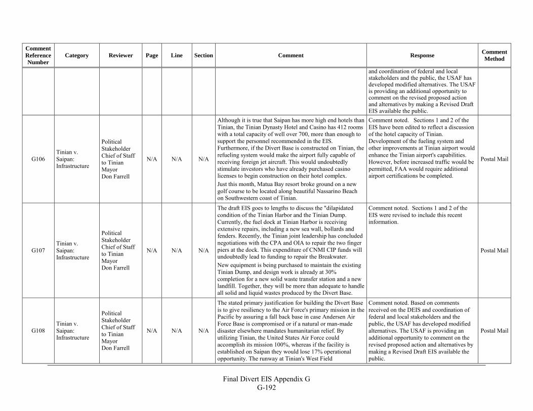
Final Divert EIS Appendix G
G-192
Comment Reference Number
Category Reviewer Page Line Section Comment Response Comment Method
and coordination of federal and local stakeholders and the public, the USAF has developed modified alternatives. The USAF is providing an additional opportunity to comment on the revised proposed action and alternatives by making a Revised Draft EIS available the public.
G106 Tinian v. Saipan: Infrastructure
Political Stakeholder Chief of Staff to Tinian Mayor Don Farrell
N/A N/A N/A
Although it is true that Saipan has more high end hotels than Tinian, the Tinian Dynasty Hotel and Casino has 412 rooms with a total capacity of well over 700, more than enough to support the personnel recommended in the EIS. Furthermore, if the Divert Base is constructed on Tinian, the refueling system would make the airport fully capable of receiving foreign jet aircraft. This would undoubtedly stimulate investors who have already purchased casino licenses to begin construction on their hotel complex. Just this month, Matua Bay resort broke ground on a new golf course to be located along beautiful Nassarino Beach on Southwestern coast of Tinian.
Comment noted. Sections 1 and 2 of the EIS have been edited to reflect a discussion of the hotel capacity of Tinian. Development of the fueling system and other improvements at Tinian airport would enhance the Tinian airport's capabilities. However, before increased traffic would be permitted, FAA would require additional airport certifications be completed.
Postal Mail
G107 Tinian v. Saipan: Infrastructure
Political Stakeholder Chief of Staff to Tinian Mayor Don Farrell
N/A N/A N/A
The draft EIS goes to lengths to discuss the "dilapidated condition of the Tinian Harbor and the Tinian Dump. Currently, the fuel dock at Tinian Harbor is receiving extensive repairs, including a new sea wall, bollards and fenders. Recently, the Tinian joint leadership has concluded negotiations with the CPA and OIA to repair the two finger piers at the dock. This expenditure of CNMI CIP funds will undoubtedly lead to funding to repair the Breakwater. New equipment is being purchased to maintain the existing Tinian Dump, and design work is already at 30% completion for a new solid waste transfer station and a new landfill. Together, they will be more than adequate to handle all solid and liquid wastes produced by the Divert Base.
Comment noted. Sections 1 and 2 of the EIS were revised to include this recent information.
Postal Mail
G108 Tinian v. Saipan: Infrastructure
Political Stakeholder Chief of Staff to Tinian Mayor Don Farrell
N/A N/A N/A
The stated primary justification for building the Divert Base is to give resiliency to the Air Force's primary mission in the Pacific by assuring a fall back base in case Andersen Air Force Base is compromised or if a natural or man-made disaster elsewhere mandates humanitarian relief. By utilizing Tinian, the United States Air Force could accomplish its mission 100%, whereas if the facility is established on Saipan they would lose 17% operational opportunity. The runway at Tinian's West Field
Comment noted. Based on comments received on the DEIS and coordination of federal and local stakeholders and the public, the USAF has developed modified alternatives. The USAF is providing an additional opportunity to comment on the revised proposed action and alternatives by making a Revised Draft EIS available the public.
Postal Mail
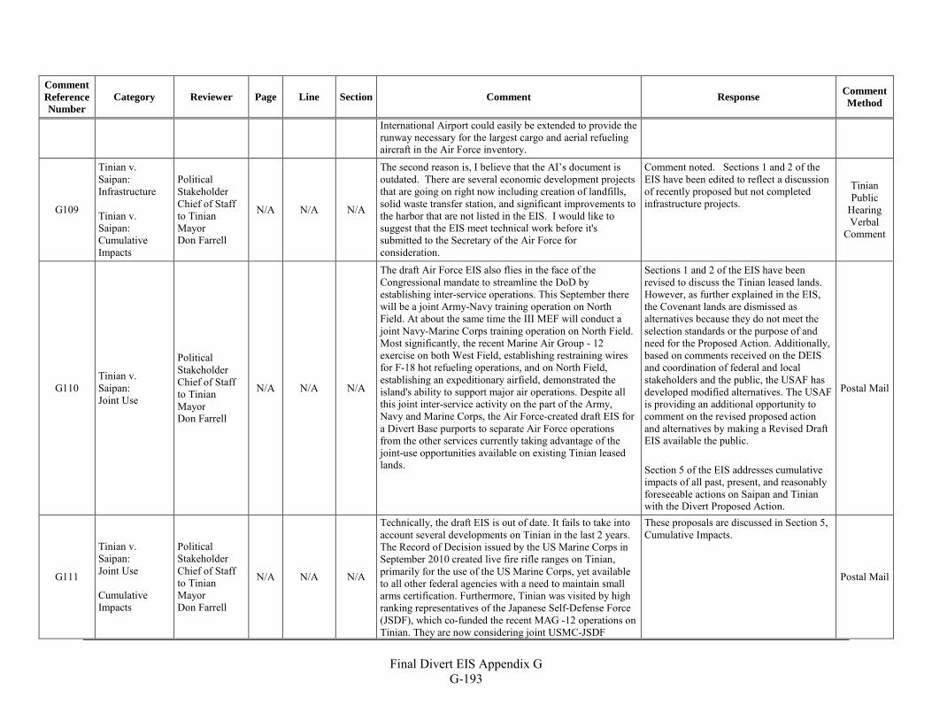
Final Divert EIS Appendix G
G-193
Comment Reference Number
Category Reviewer Page Line Section Comment Response Comment Method
International Airport could easily be extended to provide the runway necessary for the largest cargo and aerial refueling aircraft in the Air Force inventory.
G109
Tinian v. Saipan: Infrastructure Tinian v. Saipan: Cumulative Impacts
Political Stakeholder Chief of Staff to Tinian Mayor Don Farrell
N/A N/A N/A
The second reason is, I believe that the AI’s document is outdated. There are several economic development projects that are going on right now including creation of landfills, solid waste transfer station, and significant improvements to the harbor that are not listed in the EIS. I would like to suggest that the EIS meet technical work before it's submitted to the Secretary of the Air Force for consideration.
Comment noted. Sections 1 and 2 of the EIS have been edited to reflect a discussion of recently proposed but not completed infrastructure projects.
Tinian Public
Hearing Verbal
Comment
G110 Tinian v. Saipan: Joint Use
Political Stakeholder Chief of Staff to Tinian Mayor Don Farrell
N/A N/A N/A
The draft Air Force EIS also flies in the face of the Congressional mandate to streamline the DoD by establishing inter-service operations. This September there will be a joint Army-Navy training operation on North Field. At about the same time the III MEF will conduct a joint Navy-Marine Corps training operation on North Field. Most significantly, the recent Marine Air Group - 12 exercise on both West Field, establishing restraining wires for F-18 hot refueling operations, and on North Field, establishing an expeditionary airfield, demonstrated the island's ability to support major air operations. Despite all this joint inter-service activity on the part of the Army, Navy and Marine Corps, the Air Force-created draft EIS for a Divert Base purports to separate Air Force operations from the other services currently taking advantage of the joint-use opportunities available on existing Tinian leased lands.
Sections 1 and 2 of the EIS have been revised to discuss the Tinian leased lands. However, as further explained in the EIS, the Covenant lands are dismissed as alternatives because they do not meet the selection standards or the purpose of and need for the Proposed Action. Additionally, based on comments received on the DEIS and coordination of federal and local stakeholders and the public, the USAF has developed modified alternatives. The USAF is providing an additional opportunity to comment on the revised proposed action and alternatives by making a Revised Draft EIS available the public. Section 5 of the EIS addresses cumulative impacts of all past, present, and reasonably foreseeable actions on Saipan and Tinian with the Divert Proposed Action.
Postal Mail
G111
Tinian v. Saipan: Joint Use Cumulative Impacts
Political Stakeholder Chief of Staff to Tinian Mayor Don Farrell
N/A N/A N/A
Technically, the draft EIS is out of date. It fails to take into account several developments on Tinian in the last 2 years. The Record of Decision issued by the US Marine Corps in September 2010 created live fire rifle ranges on Tinian, primarily for the use of the US Marine Corps, yet available to all other federal agencies with a need to maintain small arms certification. Furthermore, Tinian was visited by high ranking representatives of the Japanese Self-Defense Force (JSDF), which co-funded the recent MAG -12 operations on Tinian. They are now considering joint USMC-JSDF
These proposals are discussed in Section 5, Cumulative Impacts.
Postal Mail
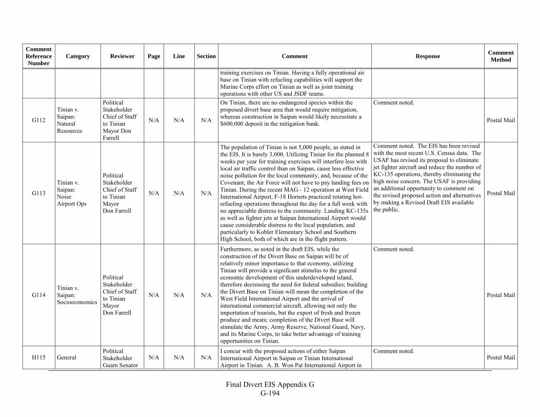
Final Divert EIS Appendix G
G-194
Comment Reference Number
Category Reviewer Page Line Section Comment Response Comment Method
training exercises on Tinian. Having a fully operational air base on Tinian with refueling capabilities will support the Marine Corps effort on Tinian as well as joint training operations with other US and JSDF teams.
G112
Tinian v. Saipan: Natural Resources
Political Stakeholder Chief of Staff to Tinian Mayor Don Farrell
N/A N/A N/A
On Tinian, there are no endangered species within the proposed divert base area that would require mitigation, whereas construction in Saipan would likely necessitate a $600,000 deposit in the mitigation bank.
Comment noted.
Postal Mail
G113
Tinian v. Saipan: Noise Airport Ops
Political Stakeholder Chief of Staff to Tinian Mayor Don Farrell
N/A N/A N/A
The population of Tinian is not 5,000 people, as stated in the EIS. It is barely 3,000. Utilizing Tinian for the planned 8 weeks per year for training exercises will interfere less with local air traffic control than on Saipan, cause less effective noise pollution for the local community, and, because of the Covenant, the Air Force will not have to pay landing fees on Tinian. During the recent MAG - 12 operation at West Field International Airport, F-18 Hornets practiced rotating hot-refueling operations throughout the day for a full week with no appreciable distress to the community. Landing KC-135s as well as fighter jets at Saipan International Airport would cause considerable distress to the local population, and particularly to Kobler Elementary School and Southern High School, both of which are in the flight pattern.
Comment noted. The EIS has been revised with the most recent U.S. Census data. The USAF has revised its proposal to eliminate jet fighter aircraft and reduce the number of KC-135 operations, thereby eliminating the high noise concern. The USAF is providing an additional opportunity to comment on the revised proposed action and alternatives by making a Revised Draft EIS available the public.
Postal Mail
G114 Tinian v. Saipan: Socioeconomics
Political Stakeholder Chief of Staff to Tinian Mayor Don Farrell
N/A N/A N/A
Furthermore, as noted in the draft EIS, while the construction of the Divert Base on Saipan will be of relatively minor importance to that economy, utilizing Tinian will provide a significant stimulus to the general economic development of this underdeveloped island, therefore decreasing the need for federal subsidies; building the Divert Base on Tinian will mean the completion of the West Field International Airport and the arrival of international commercial aircraft, allowing not only the importation of tourists, but the export of fresh and frozen produce and meats; completion of the Divert Base will stimulate the Army, Army Reserve, National Guard, Navy, and its Marine Corps, to take better advantage of training opportunities on Tinian.
Comment noted.
Postal Mail
H115 General Political Stakeholder Guam Senator
N/A N/A N/A I concur with the proposed actions of either Saipan International Airport in Saipan or Tinian International Airport in Tinian. A. B. Won Pat International Airport in
Comment noted. Postal Mail
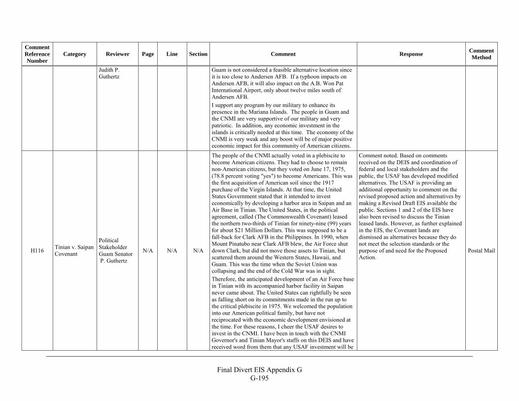
Final Divert EIS Appendix G
G-195
Comment Reference Number
Category Reviewer Page Line Section Comment Response Comment Method
Judith P. Guthertz
Guam is not considered a feasible alternative location since it is too close to Andersen AFB. If a typhoon impacts on Andersen AFB, it will also impact on the A.B. Won Pat International Airport, only about twelve miles south of Andersen AFB. I support any program by our military to enhance its presence in the Mariana Islands. The people in Guam and the CNMI are very supportive of our military and very patriotic. In addition, any economic investment in the islands is critically needed at this time. The economy of the CNMI is very weak and any boost will be of major positive economic impact for this community of American citizens.
H116 Tinian v. Saipan Covenant
Political Stakeholder Guam Senator P. Guthertz
N/A N/A N/A
The people of the CNMI actually voted in a plebiscite to become American citizens. They had to choose to remain non-American citizens, but they voted on June 17, 1975, (78.8 percent voting "yes") to become Americans. This was the first acquisition of American soil since the 1917 purchase of the Virgin Islands. At that time, the United States Government stated that it intended to invest economically by developing a harbor area in Saipan and an Air Base in Tinian. The United States, in the political agreement, called (The Commonwealth Covenant) leased the northern two-thirds of Tinian for ninety-nine (99) years for about $21 Million Dollars. This was supposed to be a fall-back for Clark AFB in the Philippines. In 1990, when Mount Pinatubo near Clark AFB blew, the Air Force shut down Clark, but did not move those assets to Tinian, but scattered them around the Western States, Hawaii, and Guam. This was the time when the Soviet Union was collapsing and the end of the Cold War was in sight. Therefore, the anticipated development of an Air Force base in Tinian with its accompanied harbor facility in Saipan never came about. The United States can rightfully be seen as falling short on its commitments made in the run up to the critical plebiscite in 1975. We welcomed the population into our American political family, but have not reciprocated with the economic development envisioned at the time. For these reasons, I cheer the USAF desires to invest in the CNMI. I have been in touch with the CNMI Governor's and Tinian Mayor's staffs on this DEIS and have received word from them that any USAF investment will be
Comment noted. Based on comments received on the DEIS and coordination of federal and local stakeholders and the public, the USAF has developed modified alternatives. The USAF is providing an additional opportunity to comment on the revised proposed action and alternatives by making a Revised Draft EIS available the public. Sections 1 and 2 of the EIS have also been revised to discuss the Tinian leased lands. However, as further explained in the EIS, the Covenant lands are dismissed as alternatives because they do not meet the selection standards or the purpose of and need for the Proposed Action.
Postal Mail
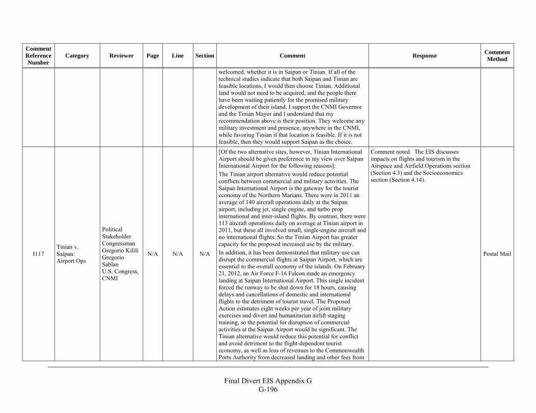
Final Divert EIS Appendix G
G-196
Comment Reference Number
Category Reviewer Page Line Section Comment Response Comment Method
welcomed, whether it is in Saipan or Tinian. If all of the technical studies indicate that both Saipan and Tinian are feasible locations, I would then choose Tinian. Additional land would not need to be acquired, and the people there have been waiting patiently for the promised military development of their island. I support the CNMI Governor and the Tinian Mayor and I understand that my recommendation above is their position. They welcome any military investment and presence, anywhere in the CNMI, while favoring Tinian if that location is feasible. If it is not feasible, then they would support Saipan as the choice.
I117 Tinian v. Saipan: Airport Ops
Political Stakeholder Congressman Gregorio Kilili Gregorio Sablan U.S. Congress, CNMI
N/A N/A N/A
[Of the two alternative sites, however, Tinian International Airport should be given preference in my view over Saipan International Airport for the following reasons]: The Tinian airport alternative would reduce potential conflicts between commercial and military activities. The Saipan International Airport is the gateway for the tourist economy of the Northern Marians. There were in 2011 an average of 140 aircraft operations daily at the Saipan airport, including jet, single engine, and turbo prop international and inter-island flights. By contrast, there were 113 aircraft operations daily on average at Tinian airport in 2011, but these all involved small, single-engine aircraft and no international flights. So the Tinian Airport has greater capacity for the proposed increased use by the military. In addition, it has been demonstrated that military use can disrupt the commercial flights at Saipan Airport, which are essential to the overall economy of the islands. On February 21, 2012, an Air Force F-16 Falcon made an emergency landing at Saipan International Airport. This single incident forced the runway to be shut down for 18 hours, causing delays and cancellations of domestic and international flights to the detriment of tourist travel. The Proposed Action estimates eight weeks per year of joint military exercises and divert and humanitarian airlift staging training, so the potential for disruption of commercial activities at the Saipan Airport would be significant. The Tinian alternative would reduce this potential for conflict and avoid detriment to the flight-dependent tourist economy, as well as loss of revenues to the Commonwealth Ports Authority from decreased landing and other fees from
Comment noted. The EIS discusses impacts on flights and tourism in the Airspace and Airfield Operations section (Section 4.3) and the Socioeconomics section (Section 4.14).
Postal Mail
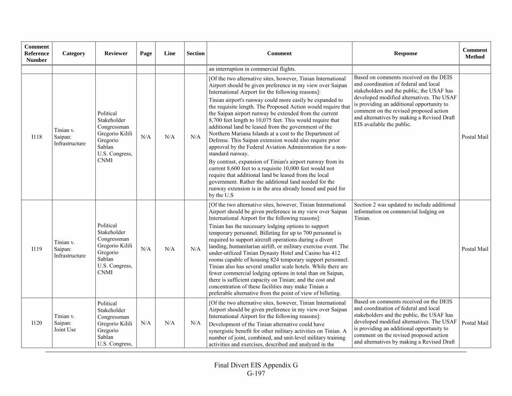
Final Divert EIS Appendix G
G-197
Comment Reference Number
Category Reviewer Page Line Section Comment Response Comment Method
an interruption in commercial flights.
I118 Tinian v. Saipan: Infrastructure
Political Stakeholder Congressman Gregorio Kilili Gregorio Sablan U.S. Congress, CNMI
N/A N/A N/A
[Of the two alternative sites, however, Tinian International Airport should be given preference in my view over Saipan International Airport for the following reasons]: Tinian airport's runway could more easily be expanded to the requisite length. The Proposed Action would require that the Saipan airport runway be extended from the current 8,700 feet length to 10,075 feet. This would require that additional land be leased from the government of the Northern Mariana Islands at a cost to the Department of Defense. This Saipan extension would also require prior approval by the Federal Aviation Administration for a non-standard runway. By contrast, expansion of Tinian's airport runway from its current 8,600 feet to a requisite 10,000 feet would not require that additional land be leased from the local government. Rather the additional land needed for the runway extension is in the area already leased and paid for by the U.S
Based on comments received on the DEIS and coordination of federal and local stakeholders and the public, the USAF has developed modified alternatives. The USAF is providing an additional opportunity to comment on the revised proposed action and alternatives by making a Revised Draft EIS available the public.
Postal Mail
I119 Tinian v. Saipan: Infrastructure
Political Stakeholder Congressman Gregorio Kilili Gregorio Sablan U.S. Congress, CNMI
N/A N/A N/A
[Of the two alternative sites, however, Tinian International Airport should be given preference in my view over Saipan International Airport for the following reasons]: Tinian has the necessary lodging options to support temporary personnel. Billeting for up to 700 personnel is required to support aircraft operations during a divert landing, humanitarian airlift, or military exercise event. The under-utilized Tinian Dynasty Hotel and Casino has 412 rooms capable of housing 824 temporary support personnel. Tinian also has several smaller scale hotels. While there are fewer commercial lodging options in total than on Saipan, there is sufficient capacity on Tinian; and the cost and concentration of these facilities may make Tinian a preferable alternative from the point of view of billeting.
Section 2 was updated to include additional information on commercial lodging on Tinian.
Postal Mail
I120 Tinian v. Saipan: Joint Use
Political Stakeholder Congressman Gregorio Kilili Gregorio Sablan U.S. Congress,
N/A N/A N/A
[Of the two alternative sites, however, Tinian International Airport should be given preference in my view over Saipan International Airport for the following reasons]: Development of the Tinian alternative could have synergistic benefit for other military activities on Tinian. A number of joint, combined, and unit-level military training activities and exercises, described and analyzed in the
Based on comments received on the DEIS and coordination of federal and local stakeholders and the public, the USAF has developed modified alternatives. The USAF is providing an additional opportunity to comment on the revised proposed action and alternatives by making a Revised Draft
Postal Mail
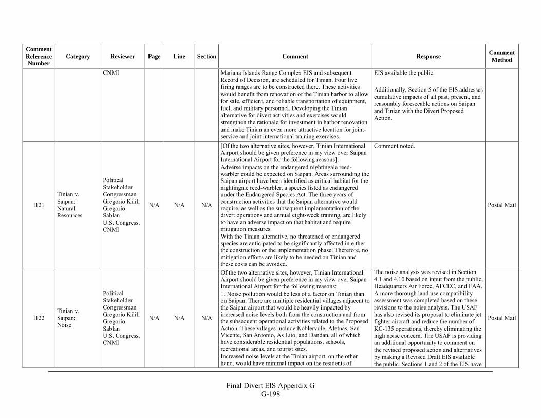
Final Divert EIS Appendix G
G-198
Comment Reference Number
Category Reviewer Page Line Section Comment Response Comment Method
CNMI Mariana Islands Range Complex EIS and subsequent Record of Decision, are scheduled for Tinian. Four live firing ranges are to be constructed there. These activities would benefit from renovation of the Tinian harbor to allow for safe, efficient, and reliable transportation of equipment, fuel, and military personnel. Developing the Tinian alternative for divert activities and exercises would strengthen the rationale for investment in harbor renovation and make Tinian an even more attractive location for joint-service and joint international training exercises.
EIS available the public. Additionally, Section 5 of the EIS addresses cumulative impacts of all past, present, and reasonably foreseeable actions on Saipan and Tinian with the Divert Proposed Action.
I121
Tinian v. Saipan: Natural Resources
Political Stakeholder Congressman Gregorio Kilili Gregorio Sablan U.S. Congress, CNMI
N/A N/A N/A
[Of the two alternative sites, however, Tinian International Airport should be given preference in my view over Saipan International Airport for the following reasons]: Adverse impacts on the endangered nightingale reed-warbler could be expected on Saipan. Areas surrounding the Saipan airport have been identified as critical habitat for the nightingale reed-warbler, a species listed as endangered under the Endangered Species Act. The three years of construction activities that the Saipan alternative would require, as well as the subsequent implementation of the divert operations and annual eight-week training, are likely to have an adverse impact on that habitat and require mitigation measures. With the Tinian alternative, no threatened or endangered species are anticipated to be significantly affected in either the construction or the implementation phase. Therefore, no mitigation efforts are likely to be needed on Tinian and these costs can be avoided.
Comment noted.
Postal Mail
I122 Tinian v. Saipan: Noise
Political Stakeholder Congressman Gregorio Kilili Gregorio Sablan U.S. Congress, CNMI
N/A N/A N/A
Of the two alternative sites, however, Tinian International Airport should be given preference in my view over Saipan International Airport for the following reasons: 1. Noise pollution would be less of a factor on Tinian than on Saipan. There are multiple residential villages adjacent to the Saipan airport that would be heavily impacted by increased noise levels both from the construction and from the subsequent operational activities related to the Proposed Action. These villages include Koblerville, Afetnas, San Vicente, San Antonio, As Lito, and Dandan, all of which have considerable residential populations, schools, recreational areas, and tourist sites. Increased noise levels at the Tinian airport, on the other hand, would have minimal impact on the residents of
The noise analysis was revised in Section 4.1 and 4.10 based on input from the public, Headquarters Air Force, AFCEC, and FAA. A more thorough land use compatibility assessment was completed based on these revisions to the noise analysis. The USAF has also revised its proposal to eliminate jet fighter aircraft and reduce the number of KC-135 operations, thereby eliminating the high noise concern. The USAF is providing an additional opportunity to comment on the revised proposed action and alternatives by making a Revised Draft EIS available the public. Sections 1 and 2 of the EIS have
Postal Mail
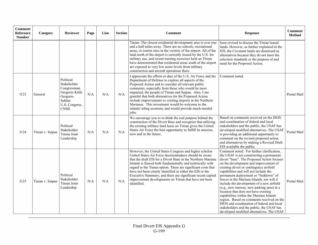
Final Divert EIS Appendix G
G-199
Comment Reference Number
Category Reviewer Page Line Section Comment Response Comment Method
Tinian. The closest residential development area is over one and a half miles away. There are no schools, recreational areas, or tourist sites in the vicinity of the airport. All of the land north of the airport is currently leased by the U.S. for military use, and recent training exercises held on Tinian have demonstrated that residential areas south of the airport are exposed to very low noise levels from military construction and aircraft operations there.
been revised to discuss the Tinian leased lands. However, as further explained in the EIS, the Covenant lands are dismissed as alternatives because they do not meet the selection standards or the purpose of and need for the Proposed Action.
I123 General
Political Stakeholder Congressman Gregorio Kilili Gregorio Sablan U.S. Congress, CNMI
N/A N/A N/A
I appreciate the efforts to date of the U.S. Air Force and the Department of Defense to explore all aspects of the Proposed Action and to consider all relevant public comments, especially from those who would be most impacted, the people of Tinian and Saipan. Also, I am grateful that both alternatives for the Proposed Action include improvements to existing airports in the Northern Marianas. This investment would be welcome to the islands' ailing economy and would provide much-needed jobs.
Comment noted.
Postal Mail
J124 Tinian v. Saipan
Political Stakeholder Tinian Joint Leadership
N/A N/A N/A
We encourage you to re-think the real purpose behind the construction of the Divert Base and recognize that utilizing the existing military land lease on Tinian gives the United States Air Force the best opportunity to fulfill its mission, now and in the future.
Based on comments received on the DEIS and coordination of federal and local stakeholders and the public, the USAF has developed modified alternatives. The USAF is providing an additional opportunity to comment on the revised proposed action and alternatives by making a Revised Draft EIS available the public.
Postal Mail
J125 Tinian v. Saipan
Political Stakeholder Tinian Joint Leadership
N/A N/A N/A
However, the United States Congress and higher echelon United States Air Force decisionmakers should be aware that the draft EIS for a Divert Base in the Northern Mariana Islands is flawed both fundamentally and technically with regard to the Tinian option. There are significant costs that have not been clearly identified in either the EIS or the Executive Summary, and there are significant recent capital improvement developments on Tinian that have not been identified.
Comment noted. For further clarification, the USAF is not constructing a permanent divert “base”. The Proposed Action focuses on the development and improvement of existing divert or contingency airfield capabilities and will not include the permanent deployment or “beddown” of forces in the Mariana Islands, nor will it include the development of a new airfield (e.g., new runway, new parking area) in a location that does not have existing capabilities within the Mariana Islands region. Based on comments received on the DEIS and coordination of federal and local stakeholders and the public, the USAF has developed modified alternatives. The USAF
Postal Mail
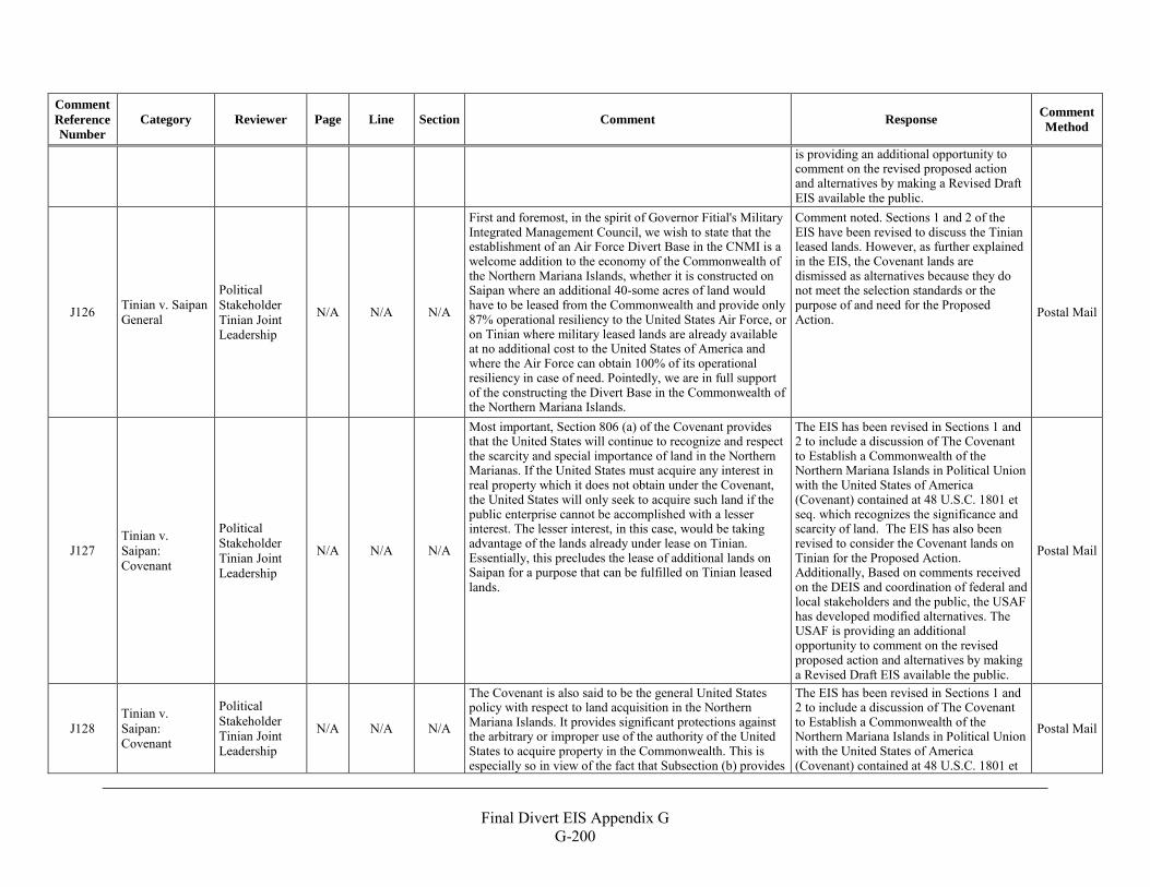
Final Divert EIS Appendix G
G-200
Comment Reference Number
Category Reviewer Page Line Section Comment Response Comment Method
is providing an additional opportunity to comment on the revised proposed action and alternatives by making a Revised Draft EIS available the public.
J126 Tinian v. Saipan General
Political Stakeholder Tinian Joint Leadership
N/A N/A N/A
First and foremost, in the spirit of Governor Fitial's Military Integrated Management Council, we wish to state that the establishment of an Air Force Divert Base in the CNMI is a welcome addition to the economy of the Commonwealth of the Northern Mariana Islands, whether it is constructed on Saipan where an additional 40-some acres of land would have to be leased from the Commonwealth and provide only 87% operational resiliency to the United States Air Force, or on Tinian where military leased lands are already available at no additional cost to the United States of America and where the Air Force can obtain 100% of its operational resiliency in case of need. Pointedly, we are in full support of the constructing the Divert Base in the Commonwealth of the Northern Mariana Islands.
Comment noted. Sections 1 and 2 of the EIS have been revised to discuss the Tinian leased lands. However, as further explained in the EIS, the Covenant lands are dismissed as alternatives because they do not meet the selection standards or the purpose of and need for the Proposed Action. Postal Mail
J127 Tinian v. Saipan: Covenant
Political Stakeholder Tinian Joint Leadership
N/A N/A N/A
Most important, Section 806 (a) of the Covenant provides that the United States will continue to recognize and respect the scarcity and special importance of land in the Northern Marianas. If the United States must acquire any interest in real property which it does not obtain under the Covenant, the United States will only seek to acquire such land if the public enterprise cannot be accomplished with a lesser interest. The lesser interest, in this case, would be taking advantage of the lands already under lease on Tinian. Essentially, this precludes the lease of additional lands on Saipan for a purpose that can be fulfilled on Tinian leased lands.
The EIS has been revised in Sections 1 and 2 to include a discussion of The Covenant to Establish a Commonwealth of the Northern Mariana Islands in Political Union with the United States of America (Covenant) contained at 48 U.S.C. 1801 et seq. which recognizes the significance and scarcity of land. The EIS has also been revised to consider the Covenant lands on Tinian for the Proposed Action. Additionally, Based on comments received on the DEIS and coordination of federal and local stakeholders and the public, the USAF has developed modified alternatives. The USAF is providing an additional opportunity to comment on the revised proposed action and alternatives by making a Revised Draft EIS available the public.
Postal Mail
J128 Tinian v. Saipan: Covenant
Political Stakeholder Tinian Joint Leadership
N/A N/A N/A
The Covenant is also said to be the general United States policy with respect to land acquisition in the Northern Mariana Islands. It provides significant protections against the arbitrary or improper use of the authority of the United States to acquire property in the Commonwealth. This is especially so in view of the fact that Subsection (b) provides
The EIS has been revised in Sections 1 and 2 to include a discussion of The Covenant to Establish a Commonwealth of the Northern Mariana Islands in Political Union with the United States of America (Covenant) contained at 48 U.S.C. 1801 et
Postal Mail
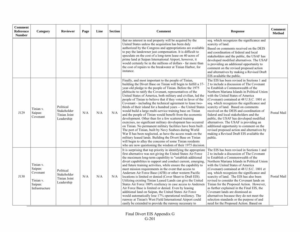
Final Divert EIS Appendix G
G-201
Comment Reference Number
Category Reviewer Page Line Section Comment Response Comment Method
that no interest in real property will be acquired by the United States unless the acquisition has been duly authorized by the Congress and appropriations are available to pay the landowner just compensation. It is difficult to speculate on the cost of a long-term lease on 40 acres of prime land at Saipan International Airport, however, it would certainly be in the millions of dollars - far more than the cost of repairs to the breakwater at Tinian Harbor, for instance.
seq. which recognizes the significance and scarcity of land. Based on comments received on the DEIS and coordination of federal and local stakeholders and the public, the USAF has developed modified alternatives. The USAF is providing an additional opportunity to comment on the revised proposed action and alternatives by making a Revised Draft EIS available the public.
J129 Tinian v. Saipan: Covenant
Political Stakeholder Tinian Joint Leadership
N/A N/A N/A
Finally, and most important to the people of Tinian, building the Divert Base on Tinian will begin to fulfill a 37-year-old pledge to the people of Tinian. Before the 1975 plebiscite to ratify the Covenant, representatives of the United States of America, both military and civilian, led the people of Tinian to believe that if they voted in favor of the Covenant - including the technical agreement to lease two-thirds of their island for a hundred years -- the United States would build a large multi-service training base on Tinian and the people of Tinian would benefit from the economic development. Other than for a few scattered training exercises, no significant military development has occurred on Tinian. No permanent military facilities have been built . The port of Tinian, built by Navy Seabees during World War Il has been neglected, as have the access roads on the military leased lands. Building the Divert Base on Tinian will begin to allay the concerns of some Tinian residents who are now questioning the wisdom of their 1975 decision.
The EIS has been revised in Sections 1 and 2 to include a discussion of The Covenant to Establish a Commonwealth of the Northern Mariana Islands in Political Union with the United States of America (Covenant) contained at 48 U.S.C. 1801 et seq. which recognizes the significance and scarcity of land. Based on comments received on the DEIS and coordination of federal and local stakeholders and the public, the USAF has developed modified alternatives. The USAF is providing an additional opportunity to comment on the revised proposed action and alternatives by making a Revised Draft EIS available the public.
Postal Mail
J130
Tinian v. Saipan: Covenant Tinian v. Saipan: Infrastructure
Political Stakeholder Tinian Joint Leadership
N/A N/A N/A
It is surprising that top priority in identifying the appropriate first alternative was not giving the United States Air Force the maximum long-term capability to "establish additional divert capabilities to support and conduct current, emerging, and future training activities, while ensure the capability to meet mission requirements in the event that access to Andersen Air Force Base (AFB) or other western Pacific locations is limited or denied (Cover Sheet to Draft EIS). Utilizing existing Tinian Leased Lands can give the United States Air Force 100% resiliency in case access to Andersen Air Force Base is limited or denied. Even by leasing additional land on Saipan, the United States Air Force would automatically lose 17% operational resiliency. The runway at Tinian's West Field International Airport could easily be extended to provide the runway necessary to
The EIS has been revised in Sections 1 and 2 to include a discussion of The Covenant to Establish a Commonwealth of the Northern Mariana Islands in Political Union with the United States of America (Covenant) contained at 48 U.S.C. 1801 et seq. which recognizes the significance and scarcity of land. The EIS has also been revised to consider the Covenant lands on Tinian for the Proposed Action. However, as further explained in the Final EIS, the Covenant lands are dismissed as alternatives because they do not meet the selection standards or the purpose of and need for the Proposed Action. Based on
Postal Mail
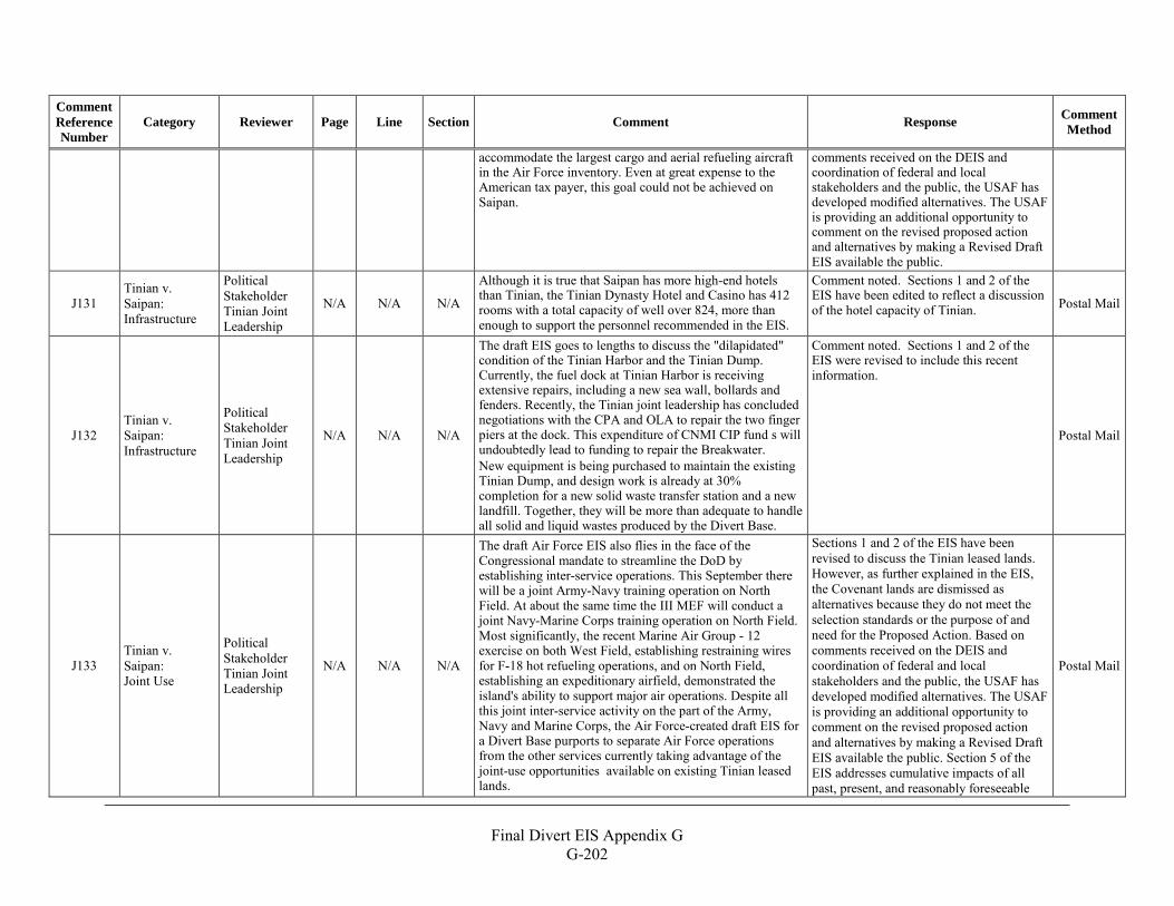
Final Divert EIS Appendix G
G-202
Comment Reference Number
Category Reviewer Page Line Section Comment Response Comment Method
accommodate the largest cargo and aerial refueling aircraft in the Air Force inventory. Even at great expense to the American tax payer, this goal could not be achieved on Saipan.
comments received on the DEIS and coordination of federal and local stakeholders and the public, the USAF has developed modified alternatives. The USAF is providing an additional opportunity to comment on the revised proposed action and alternatives by making a Revised Draft EIS available the public.
J131 Tinian v. Saipan: Infrastructure
Political Stakeholder Tinian Joint Leadership
N/A N/A N/A
Although it is true that Saipan has more high-end hotels than Tinian, the Tinian Dynasty Hotel and Casino has 412 rooms with a total capacity of well over 824, more than enough to support the personnel recommended in the EIS.
Comment noted. Sections 1 and 2 of the EIS have been edited to reflect a discussion of the hotel capacity of Tinian. Postal Mail
J132 Tinian v. Saipan: Infrastructure
Political Stakeholder Tinian Joint Leadership
N/A N/A N/A
The draft EIS goes to lengths to discuss the "dilapidated" condition of the Tinian Harbor and the Tinian Dump. Currently, the fuel dock at Tinian Harbor is receiving extensive repairs, including a new sea wall, bollards and fenders. Recently, the Tinian joint leadership has concluded negotiations with the CPA and OLA to repair the two finger piers at the dock. This expenditure of CNMI CIP fund s will undoubtedly lead to funding to repair the Breakwater. New equipment is being purchased to maintain the existing Tinian Dump, and design work is already at 30% completion for a new solid waste transfer station and a new landfill. Together, they will be more than adequate to handle all solid and liquid wastes produced by the Divert Base.
Comment noted. Sections 1 and 2 of the EIS were revised to include this recent information.
Postal Mail
J133 Tinian v. Saipan: Joint Use
Political Stakeholder Tinian Joint Leadership
N/A N/A N/A
The draft Air Force EIS also flies in the face of the Congressional mandate to streamline the DoD by establishing inter-service operations. This September there will be a joint Army-Navy training operation on North Field. At about the same time the III MEF will conduct a joint Navy-Marine Corps training operation on North Field. Most significantly, the recent Marine Air Group - 12 exercise on both West Field, establishing restraining wires for F-18 hot refueling operations, and on North Field, establishing an expeditionary airfield, demonstrated the island's ability to support major air operations. Despite all this joint inter-service activity on the part of the Army, Navy and Marine Corps, the Air Force-created draft EIS for a Divert Base purports to separate Air Force operations from the other services currently taking advantage of the joint-use opportunities available on existing Tinian leased lands.
Sections 1 and 2 of the EIS have been revised to discuss the Tinian leased lands. However, as further explained in the EIS, the Covenant lands are dismissed as alternatives because they do not meet the selection standards or the purpose of and need for the Proposed Action. Based on comments received on the DEIS and coordination of federal and local stakeholders and the public, the USAF has developed modified alternatives. The USAF is providing an additional opportunity to comment on the revised proposed action and alternatives by making a Revised Draft EIS available the public. Section 5 of the EIS addresses cumulative impacts of all past, present, and reasonably foreseeable
Postal Mail
Final Divert EIS Appendix G
G-203
Comment Reference Number
Category Reviewer Page Line Section Comment Response Comment Method
actions on Saipan and Tinian with the Divert Proposed Action.
J134 Tinian v. Saipan: Joint Use
Political Stakeholder Tinian Joint Leadership
N/A N/A N/A
Technically, the draft EIS is out of date. It fails to take into account several developments on Tinian in the last 2 years. The Record of Decision issued by the US Marine Corps in September 2010 created live fire rifle ranges on Tinian, primarily for the use of the US Marine Corps, yet available to all other federal agencies with a need to maintain small arms certification. Furthermore, Tinian was visited by high ranking representatives of the Japanese Self-Defense Force (JSDF), which co-funded the recent MAG - 12 operations on Tinian. They are now considering joint USMC-JSDF training exercises on Tinian. Having a fully operational air base on Tinian with refueling capabilities will support the Marine Corps effort on Tinian, as well as joint training operations with other US and JSDF teams.
Section 5 of the EIS addresses cumulative impacts of all past, present, and reasonably foreseeable actions on Saipan and Tinian with the Divert Proposed Action.
Postal Mail
J135
Tinian v. Saipan: Natural Resources
Political Stakeholder Tinian Joint Leadership
N/A N/A N/A
On Tinian, there are no endangered species within the proposed divert base area that would require mitigation, whereas const ruction in Saipan would likely necessitate a $600,000 deposit in the mitigation bank.
Comment noted.
Postal Mail
J136
Tinian v. Saipan: Noise Airport Ops
Political Stakeholder Tinian Joint Leadership
N/A N/A N/A
The population of Tinian is not 5,000 people, as stated in the EIS. It is barely 3,000. Utilizing Tinian for the planned 8 weeks per year for training exercises will interfere less with local air traffic control than on Saipan, cause less effective noise pollution for the local community, and, because of the Covenant, the Air Force will not have to pay landing fees on Tinian. During the recent MAG - 12 operation at West Field International Airport, F-18 Hornets practiced rotating hot-refueling operations throughout the day for a full week with no appreciable distress to the community. Landing KC-135s as well as fighter jets at Saipan International Airport would cause considerable distress to the local population, and particularly to Kobler Elementary School and Southern High School, both of which are in the flight pattern.
Comment noted. The EIS has been revised with the most recent U.S. Census data. The USAF has revised its proposal to eliminate jet fighter aircraft and reduce the number of KC-135 operations, thereby eliminating the high noise concern. The USAF is providing an additional opportunity to comment on the revised proposed action and alternatives by making a Revised Draft EIS available the public.
Postal Mail
J137 Tinian v. Saipan: Socioeconomics
Political Stakeholder Tinian Joint Leadership
N/A N/A N/A
Furthermore, as noted in the draft EIS, while the construction of the Divert Base on Saipan will be of relatively minor importance to that economy, utilizing Tinian will provide a significant stimulus to the general economic development of this underdeveloped island, therefore decreasing the need for federal subsidies; building the Divert Base on Tinian will mean the completion of the West Field International Airport and the arrival of
Comment noted. For further clarification, the USAF is not constructing a permanent divert “base”. The Proposed Action focuses on the development and improvement of existing divert or contingency airfield capabilities and would not include the permanent deployment or “beddown” of forces in the Mariana Islands, nor would it
Postal Mail
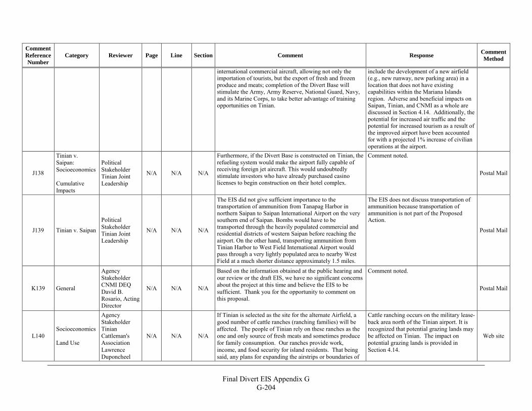
Final Divert EIS Appendix G
G-204
Comment Reference Number
Category Reviewer Page Line Section Comment Response Comment Method
international commercial aircraft, allowing not only the importation of tourists, but the export of fresh and frozen produce and meats; completion of the Divert Base will stimulate the Army, Army Reserve, National Guard, Navy, and its Marine Corps, to take better advantage of training opportunities on Tinian.
include the development of a new airfield (e.g., new runway, new parking area) in a location that does not have existing capabilities within the Mariana Islands region. Adverse and beneficial impacts on Saipan, Tinian, and CNMI as a whole are discussed in Section 4.14. Additionally, the potential for increased air traffic and the potential for increased tourism as a result of the improved airport have been accounted for with a projected 1% increase of civilian operations at the airport.
J138
Tinian v. Saipan: Socioeconomics Cumulative Impacts
Political Stakeholder Tinian Joint Leadership
N/A N/A N/A
Furthermore, if the Divert Base is constructed on Tinian, the refueling system would make the airport fully capable of receiving foreign jet aircraft. This would undoubtedly stimulate investors who have already purchased casino licenses to begin construction on their hotel complex.
Comment noted.
Postal Mail
J139 Tinian v. Saipan
Political Stakeholder Tinian Joint Leadership
N/A N/A N/A
The EIS did not give sufficient importance to the transportation of ammunition from Tanapag Harbor in northern Saipan to Saipan International Airport on the very southern end of Saipan. Bombs would have to be transported through the heavily populated commercial and residential districts of western Saipan before reaching the airport. On the other hand, transporting ammunition from Tinian Harbor to West Field International Airport would pass through a very lightly populated area to nearby West Field at a much shorter distance approximately 1.5 miles.
The EIS does not discuss transportation of ammunition because transportation of ammunition is not part of the Proposed Action.
Postal Mail
K139 General
Agency Stakeholder CNMI DEQ David B. Rosario, Acting Director
N/A N/A N/A
Based on the information obtained at the public hearing and our review or the draft EIS, we have no significant concerns about the project at this time and believe the EIS to be sufficient. Thank you for the opportunity to comment on this proposal.
Comment noted.
Postal Mail
L140 Socioeconomics Land Use
Agency Stakeholder Tinian Cattleman's Association Lawrence Duponcheel
N/A N/A N/A
If Tinian is selected as the site for the alternate Airfield, a good number of cattle ranches (ranching families) will be affected. The people of Tinian rely on these ranches as the one and only source of fresh meats and sometimes produce for family consumption. Our ranches provide work, income, and food security for island residents. That being said, any plans for expanding the airstrips or boundaries of
Cattle ranching occurs on the military lease-back area north of the Tinian airport. It is recognized that potential grazing lands may be affected on Tinian. The impact on potential grazing lands is provided in Section 4.14.
Web site
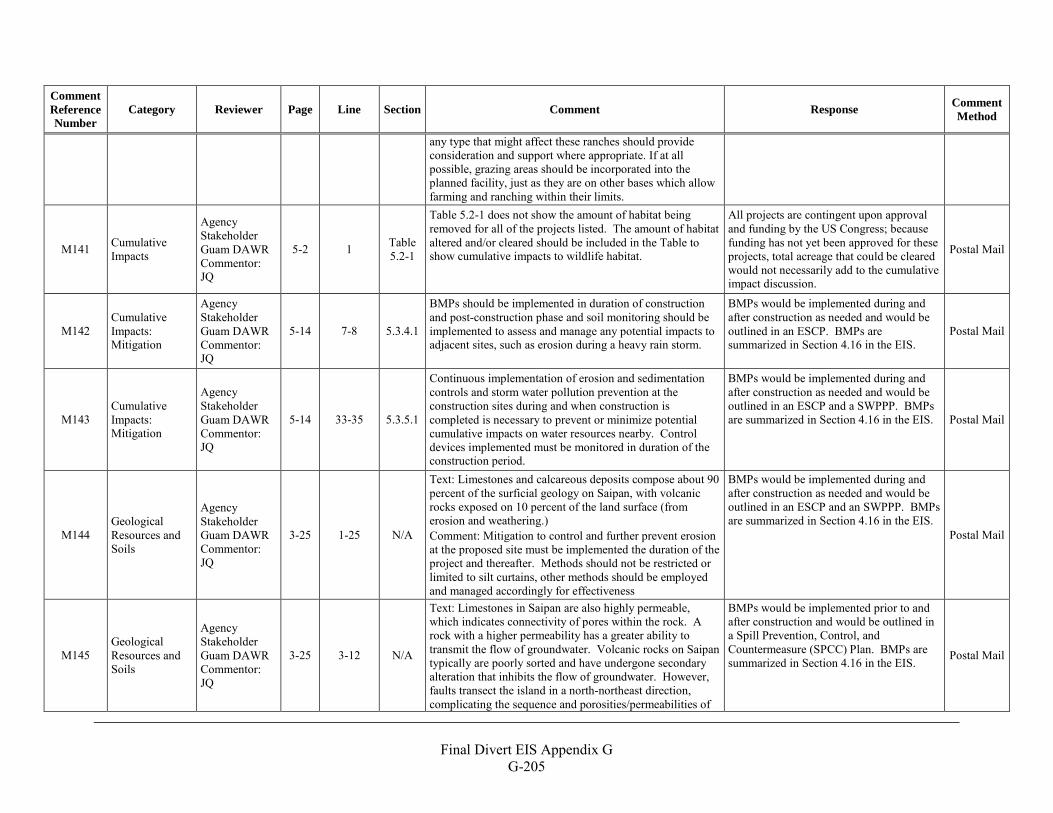
Final Divert EIS Appendix G
G-205
Comment Reference Number
Category Reviewer Page Line Section Comment Response Comment Method
any type that might affect these ranches should provide consideration and support where appropriate. If at all possible, grazing areas should be incorporated into the planned facility, just as they are on other bases which allow farming and ranching within their limits.
M141 Cumulative Impacts
Agency Stakeholder Guam DAWR Commentor: JQ
5-2 1 Table 5.2-1
Table 5.2-1 does not show the amount of habitat being removed for all of the projects listed. The amount of habitat altered and/or cleared should be included in the Table to show cumulative impacts to wildlife habitat.
All projects are contingent upon approval and funding by the US Congress; because funding has not yet been approved for these projects, total acreage that could be cleared would not necessarily add to the cumulative impact discussion.
Postal Mail
M142 Cumulative Impacts: Mitigation
Agency Stakeholder Guam DAWR Commentor: JQ
5-14 7-8 5.3.4.1
BMPs should be implemented in duration of construction and post-construction phase and soil monitoring should be implemented to assess and manage any potential impacts to adjacent sites, such as erosion during a heavy rain storm.
BMPs would be implemented during and after construction as needed and would be outlined in an ESCP. BMPs are summarized in Section 4.16 in the EIS.
Postal Mail
M143 Cumulative Impacts: Mitigation
Agency Stakeholder Guam DAWR Commentor: JQ
5-14 33-35 5.3.5.1
Continuous implementation of erosion and sedimentation controls and storm water pollution prevention at the construction sites during and when construction is completed is necessary to prevent or minimize potential cumulative impacts on water resources nearby. Control devices implemented must be monitored in duration of the construction period.
BMPs would be implemented during and after construction as needed and would be outlined in an ESCP and a SWPPP. BMPs are summarized in Section 4.16 in the EIS. Postal Mail
M144 Geological Resources and Soils
Agency Stakeholder Guam DAWR Commentor: JQ
3-25 1-25 N/A
Text: Limestones and calcareous deposits compose about 90 percent of the surficial geology on Saipan, with volcanic rocks exposed on 10 percent of the land surface (from erosion and weathering.) Comment: Mitigation to control and further prevent erosion at the proposed site must be implemented the duration of the project and thereafter. Methods should not be restricted or limited to silt curtains, other methods should be employed and managed accordingly for effectiveness
BMPs would be implemented during and after construction as needed and would be outlined in an ESCP and an SWPPP. BMPs are summarized in Section 4.16 in the EIS.
Postal Mail
M145 Geological Resources and Soils
Agency Stakeholder Guam DAWR Commentor: JQ
3-25 3-12 N/A
Text: Limestones in Saipan are also highly permeable, which indicates connectivity of pores within the rock. A rock with a higher permeability has a greater ability to transmit the flow of groundwater. Volcanic rocks on Saipan typically are poorly sorted and have undergone secondary alteration that inhibits the flow of groundwater. However, faults transect the island in a north-northeast direction, complicating the sequence and porosities/permeabilities of
BMPs would be implemented prior to and after construction and would be outlined in a Spill Prevention, Control, and Countermeasure (SPCC) Plan. BMPs are summarized in Section 4.16 in the EIS. Postal Mail
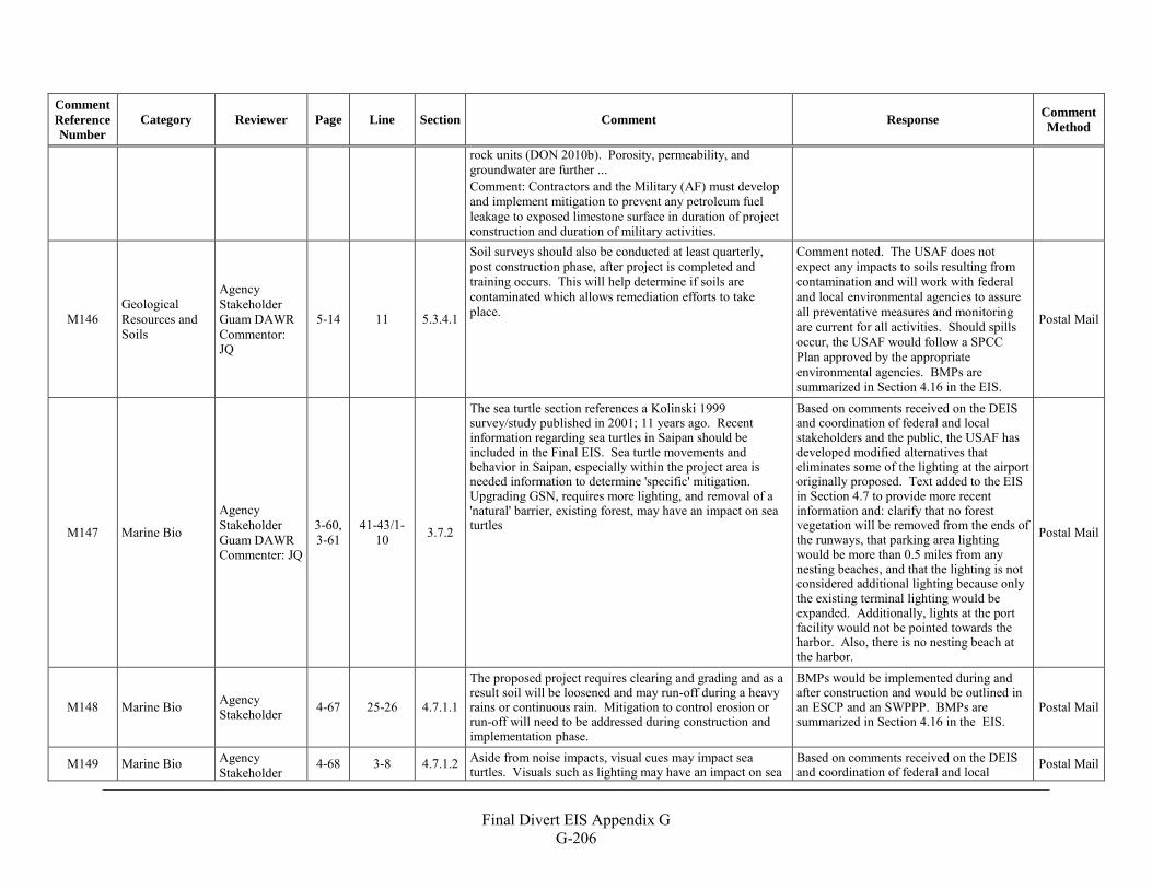
Final Divert EIS Appendix G
G-206
Comment Reference Number
Category Reviewer Page Line Section Comment Response Comment Method
rock units (DON 2010b). Porosity, permeability, and groundwater are further ... Comment: Contractors and the Military (AF) must develop and implement mitigation to prevent any petroleum fuel leakage to exposed limestone surface in duration of project construction and duration of military activities.
M146 Geological Resources and Soils
Agency Stakeholder Guam DAWR Commentor: JQ
5-14 11 5.3.4.1
Soil surveys should also be conducted at least quarterly, post construction phase, after project is completed and training occurs. This will help determine if soils are contaminated which allows remediation efforts to take place.
Comment noted. The USAF does not expect any impacts to soils resulting from contamination and will work with federal and local environmental agencies to assure all preventative measures and monitoring are current for all activities. Should spills occur, the USAF would follow a SPCC Plan approved by the appropriate environmental agencies. BMPs are summarized in Section 4.16 in the EIS.
Postal Mail
M147 Marine Bio
Agency Stakeholder Guam DAWR Commenter: JQ
3-60, 3-61
41-43/1-10 3.7.2
The sea turtle section references a Kolinski 1999 survey/study published in 2001; 11 years ago. Recent information regarding sea turtles in Saipan should be included in the Final EIS. Sea turtle movements and behavior in Saipan, especially within the project area is needed information to determine 'specific' mitigation. Upgrading GSN, requires more lighting, and removal of a 'natural' barrier, existing forest, may have an impact on sea turtles
Based on comments received on the DEIS and coordination of federal and local stakeholders and the public, the USAF has developed modified alternatives that eliminates some of the lighting at the airport originally proposed. Text added to the EIS in Section 4.7 to provide more recent information and: clarify that no forest vegetation will be removed from the ends of the runways, that parking area lighting would be more than 0.5 miles from any nesting beaches, and that the lighting is not considered additional lighting because only the existing terminal lighting would be expanded. Additionally, lights at the port facility would not be pointed towards the harbor. Also, there is no nesting beach at the harbor.
Postal Mail
M148 Marine Bio Agency Stakeholder 4-67 25-26 4.7.1.1
The proposed project requires clearing and grading and as a result soil will be loosened and may run-off during a heavy rains or continuous rain. Mitigation to control erosion or run-off will need to be addressed during construction and implementation phase.
BMPs would be implemented during and after construction and would be outlined in an ESCP and an SWPPP. BMPs are summarized in Section 4.16 in the EIS.
Postal Mail
M149 Marine Bio Agency Stakeholder
4-68 3-8 4.7.1.2 Aside from noise impacts, visual cues may impact sea turtles. Visuals such as lighting may have an impact on sea
Based on comments received on the DEIS and coordination of federal and local Postal Mail
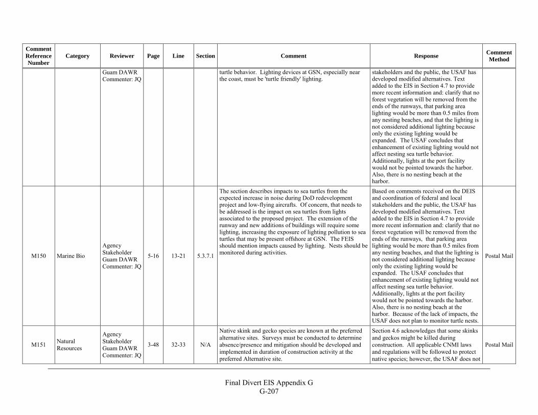
Final Divert EIS Appendix G
G-207
Comment Reference Number
Category Reviewer Page Line Section Comment Response Comment Method
Guam DAWR Commenter: JQ
turtle behavior. Lighting devices at GSN, especially near the coast, must be 'turtle friendly' lighting.
stakeholders and the public, the USAF has developed modified alternatives. Text added to the EIS in Section 4.7 to provide more recent information and: clarify that no forest vegetation will be removed from the ends of the runways, that parking area lighting would be more than 0.5 miles from any nesting beaches, and that the lighting is not considered additional lighting because only the existing lighting would be expanded. The USAF concludes that enhancement of existing lighting would not affect nesting sea turtle behavior. Additionally, lights at the port facility would not be pointed towards the harbor. Also, there is no nesting beach at the harbor.
M150 Marine Bio
Agency Stakeholder Guam DAWR Commenter: JQ
5-16 13-21 5.3.7.1
The section describes impacts to sea turtles from the expected increase in noise during DoD redevelopment project and low-flying aircrafts. Of concern, that needs to be addressed is the impact on sea turtles from lights associated to the proposed project. The extension of the runway and new additions of buildings will require some lighting, increasing the exposure of lighting pollution to sea turtles that may be present offshore at GSN. The FEIS should mention impacts caused by lighting. Nests should be monitored during activities.
Based on comments received on the DEIS and coordination of federal and local stakeholders and the public, the USAF has developed modified alternatives. Text added to the EIS in Section 4.7 to provide more recent information and: clarify that no forest vegetation will be removed from the ends of the runways, that parking area lighting would be more than 0.5 miles from any nesting beaches, and that the lighting is not considered additional lighting because only the existing lighting would be expanded. The USAF concludes that enhancement of existing lighting would not affect nesting sea turtle behavior. Additionally, lights at the port facility would not be pointed towards the harbor. Also, there is no nesting beach at the harbor. Because of the lack of impacts, the USAF does not plan to monitor turtle nests.
Postal Mail
M151 Natural Resources
Agency Stakeholder Guam DAWR Commenter: JQ
3-48 32-33 N/A
Native skink and gecko species are known at the preferred alternative sites. Surveys must be conducted to determine absence/presence and mitigation should be developed and implemented in duration of construction activity at the preferred Alternative site.
Section 4.6 acknowledges that some skinks and geckos might be killed during construction. All applicable CNMI laws and regulations will be followed to protect native species; however, the USAF does not
Postal Mail
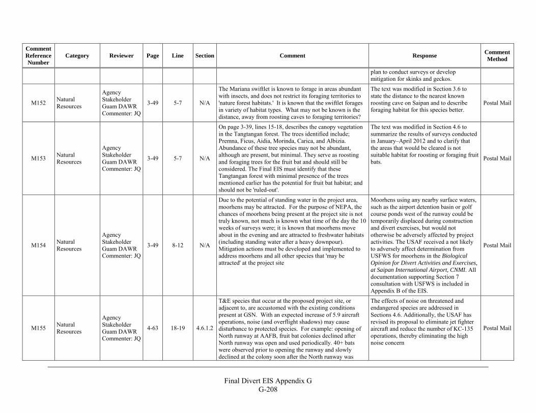
Final Divert EIS Appendix G
G-208
Comment Reference Number
Category Reviewer Page Line Section Comment Response Comment Method
plan to conduct surveys or develop mitigation for skinks and geckos.
M152 Natural Resources
Agency Stakeholder Guam DAWR Commenter: JQ
3-49 5-7 N/A
The Mariana swiftlet is known to forage in areas abundant with insects, and does not restrict its foraging territories to 'nature forest habitats.' It is known that the swiftlet forages in variety of habitat types. What may not be known is the distance, away from roosting caves to foraging territories?
The text was modified in Section 3.6 to state the distance to the nearest known roosting cave on Saipan and to describe foraging habitat for this species better.
Postal Mail
M153 Natural Resources
Agency Stakeholder Guam DAWR Commenter: JQ
3-49 5-7 N/A
On page 3-39, lines 15-18, describes the canopy vegetation in the Tangtangan forest. The trees identified include; Premna, Ficus, Aidia, Morinda, Carica, and Albizia. Abundance of these tree species may not be abundant, although are present, but minimal. They serve as roosting and foraging trees for the fruit bat and should still be considered. The Final EIS must identify that these Tangtangan forest with minimal presence of the trees mentioned earlier has the potential for fruit bat habitat; and should not be 'ruled-out'.
The text was modified in Section 4.6 to summarize the results of surveys conducted in January–April 2012 and to clarify that the areas that would be cleared is not suitable habitat for roosting or foraging fruit bats. Postal Mail
M154 Natural Resources
Agency Stakeholder Guam DAWR Commenter: JQ
3-49 8-12 N/A
Due to the potential of standing water in the project area, moorhens may be attracted. For the purpose of NEPA, the chances of moorhens being present at the project site is not truly known, not much is known what time of the day the 10 weeks of surveys were; it is known that moorhens move about in the evening and are attracted to freshwater habitats (including standing water after a heavy downpour). Mitigation actions must be developed and implemented to address moorhens and all other species that 'may be attracted' at the project site
Moorhens using any nearby surface waters, such as the airport detention basin or golf course ponds west of the runway could be temporarily displaced during construction and divert exercises, but would not otherwise be adversely affected by project activities. The USAF received a not likely to adversely affect determination from USFWS for moorhens in the Biological Opinion for Divert Activities and Exercises, at Saipan International Airport, CNMI. All documentation supporting Section 7 consultation with USFWS is included in Appendix B of the EIS.
Postal Mail
M155 Natural Resources
Agency Stakeholder Guam DAWR Commenter: JQ
4-63 18-19 4.6.1.2
T&E species that occur at the proposed project site, or adjacent to, are accustomed with the existing conditions present at GSN. With an expected increase of 5.9 aircraft operations, noise (and overflight shadows) may cause disturbance to protected species. For example: opening of North runway at AAFB, fruit bat colonies declined after North runway was open and used periodically. 40+ bats were observed prior to opening the runway and slowly declined at the colony soon after the North runway was
The effects of noise on threatened and endangered species are addressed in Sections 4.6. Additionally, the USAF has revised its proposal to eliminate jet fighter aircraft and reduce the number of KC-135 operations, thereby eliminating the high noise concern
Postal Mail
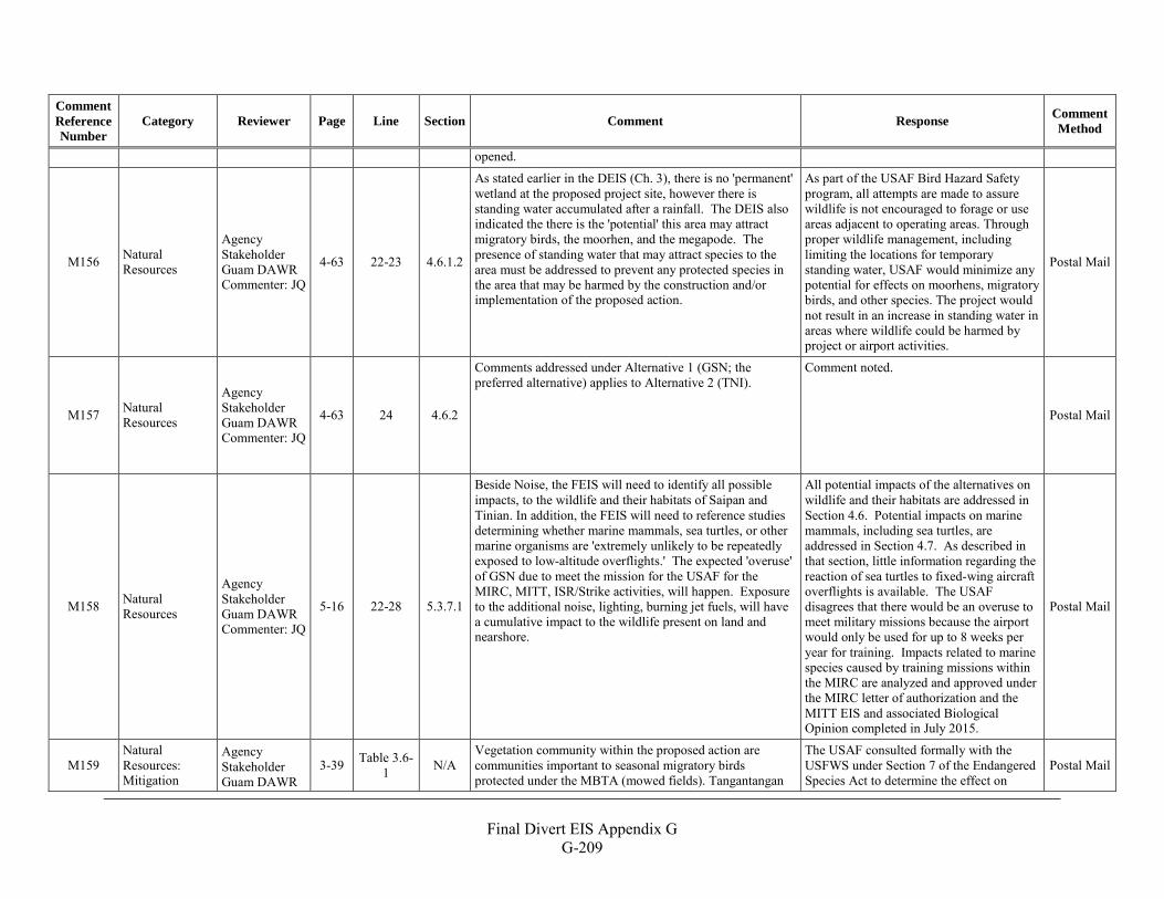
Final Divert EIS Appendix G
G-209
Comment Reference Number
Category Reviewer Page Line Section Comment Response Comment Method
opened.
M156 Natural Resources
Agency Stakeholder Guam DAWR Commenter: JQ
4-63 22-23 4.6.1.2
As stated earlier in the DEIS (Ch. 3), there is no 'permanent' wetland at the proposed project site, however there is standing water accumulated after a rainfall. The DEIS also indicated the there is the 'potential' this area may attract migratory birds, the moorhen, and the megapode. The presence of standing water that may attract species to the area must be addressed to prevent any protected species in the area that may be harmed by the construction and/or implementation of the proposed action.
As part of the USAF Bird Hazard Safety program, all attempts are made to assure wildlife is not encouraged to forage or use areas adjacent to operating areas. Through proper wildlife management, including limiting the locations for temporary standing water, USAF would minimize any potential for effects on moorhens, migratory birds, and other species. The project would not result in an increase in standing water in areas where wildlife could be harmed by project or airport activities.
Postal Mail
M157 Natural Resources
Agency Stakeholder Guam DAWR Commenter: JQ
4-63 24 4.6.2
Comments addressed under Alternative 1 (GSN; the preferred alternative) applies to Alternative 2 (TNI).
Comment noted.
Postal Mail
M158 Natural Resources
Agency Stakeholder Guam DAWR Commenter: JQ
5-16 22-28 5.3.7.1
Beside Noise, the FEIS will need to identify all possible impacts, to the wildlife and their habitats of Saipan and Tinian. In addition, the FEIS will need to reference studies determining whether marine mammals, sea turtles, or other marine organisms are 'extremely unlikely to be repeatedly exposed to low-altitude overflights.' The expected 'overuse' of GSN due to meet the mission for the USAF for the MIRC, MITT, ISR/Strike activities, will happen. Exposure to the additional noise, lighting, burning jet fuels, will have a cumulative impact to the wildlife present on land and nearshore.
All potential impacts of the alternatives on wildlife and their habitats are addressed in Section 4.6. Potential impacts on marine mammals, including sea turtles, are addressed in Section 4.7. As described in that section, little information regarding the reaction of sea turtles to fixed-wing aircraft overflights is available. The USAF disagrees that there would be an overuse to meet military missions because the airport would only be used for up to 8 weeks per year for training. Impacts related to marine species caused by training missions within the MIRC are analyzed and approved under the MIRC letter of authorization and the MITT EIS and associated Biological Opinion completed in July 2015.
Postal Mail
M159 Natural Resources: Mitigation
Agency Stakeholder Guam DAWR
3-39 Table 3.6-1 N/A
Vegetation community within the proposed action are communities important to seasonal migratory birds protected under the MBTA (mowed fields). Tangantangan
The USAF consulted formally with the USFWS under Section 7 of the Endangered Species Act to determine the effect on
Postal Mail
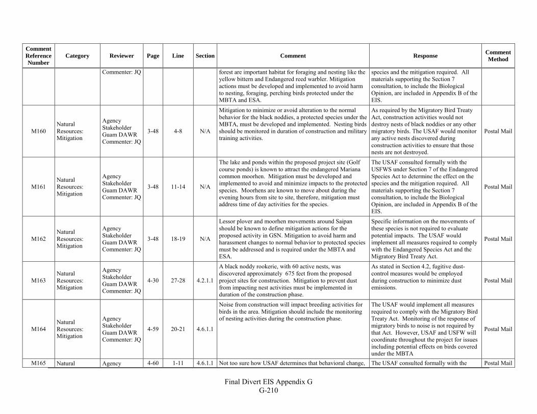
Final Divert EIS Appendix G
G-210
Comment Reference Number
Category Reviewer Page Line Section Comment Response Comment Method
Commenter: JQ forest are important habitat for foraging and nesting like the yellow bittern and Endangered reed warbler. Mitigation actions must be developed and implemented to avoid harm to nesting, foraging, perching birds protected under the MBTA and ESA.
species and the mitigation required. All materials supporting the Section 7 consultation, to include the Biological Opinion, are included in Appendix B of the EIS.
M160 Natural Resources: Mitigation
Agency Stakeholder Guam DAWR Commenter: JQ
3-48 4-8 N/A
Mitigation to minimize or avoid alteration to the normal behavior for the black noddies, a protected species under the MBTA, must be developed and implemented. Nesting birds should be monitored in duration of construction and military training activities.
As required by the Migratory Bird Treaty Act, construction activities would not destroy nests of black noddies or any other migratory birds. The USAF would monitor any active nests discovered during construction activities to ensure that those nests are not destroyed.
Postal Mail
M161 Natural Resources: Mitigation
Agency Stakeholder Guam DAWR Commenter: JQ
3-48 11-14 N/A
The lake and ponds within the proposed project site (Golf course ponds) is known to attract the endangered Mariana common moorhen. Mitigation must be developed and implemented to avoid and minimize impacts to the protected species. Moorhens are known to move about during the evening hours from site to site, therefore, mitigation must address time of day activities for the species.
The USAF consulted formally with the USFWS under Section 7 of the Endangered Species Act to determine the effect on the species and the mitigation required. All materials supporting the Section 7 consultation, to include the Biological Opinion, are included in Appendix B of the EIS.
Postal Mail
M162 Natural Resources: Mitigation
Agency Stakeholder Guam DAWR Commenter: JQ
3-48 18-19 N/A
Lessor plover and moorhen movements around Saipan should be known to define mitigation actions for the proposed activity in GSN. Mitigation to avoid harm and harassment changes to normal behavior to protected species must be addressed and is required under the MBTA and ESA.
Specific information on the movements of these species is not required to evaluate potential impacts. The USAF would implement all measures required to comply with the Endangered Species Act and the Migratory Bird Treaty Act.
Postal Mail
M163 Natural Resources: Mitigation
Agency Stakeholder Guam DAWR Commenter: JQ
4-30 27-28 4.2.1.1
A black noddy rookerie, with 60 active nests, was discovered approximately 675 feet from the proposed project sites for construction. Mitigation to prevent dust from impacting nest activities must be implemented in duration of the construction phase.
As stated in Section 4.2, fugitive dust-control measures would be employed during construction to minimize dust emissions.
Postal Mail
M164 Natural Resources: Mitigation
Agency Stakeholder Guam DAWR Commenter: JQ
4-59 20-21 4.6.1.1
Noise from construction will impact breeding activities for birds in the area. Mitigation should include the monitoring of nesting activities during the construction phase.
The USAF would implement all measures required to comply with the Migratory Bird Treaty Act. Monitoring of the response of migratory birds to noise is not required by that Act. However, USAF and USFW will coordinate throughout the project for issues including potential effects on birds covered under the MBTA
Postal Mail
M165 Natural Agency 4-60 1-11 4.6.1.1 Not too sure how USAF determines that behavioral change, The USAF consulted formally with the Postal Mail
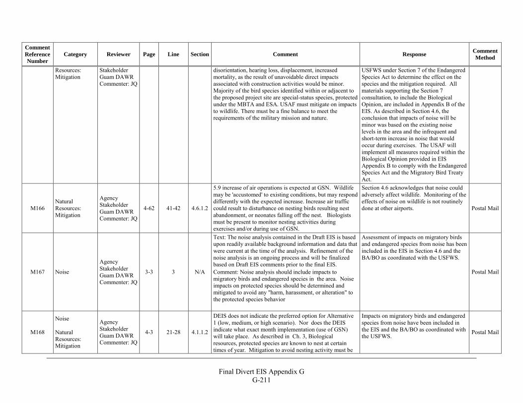
Final Divert EIS Appendix G
G-211
Comment Reference Number
Category Reviewer Page Line Section Comment Response Comment Method
Resources: Mitigation
Stakeholder Guam DAWR Commenter: JQ
disorientation, hearing loss, displacement, increased mortality, as the result of unavoidable direct impacts associated with construction activities would be minor. Majority of the bird species identified within or adjacent to the proposed project site are special-status species, protected under the MBTA and ESA. USAF must mitigate on impacts to wildlife. There must be a fine balance to meet the requirements of the military mission and nature.
USFWS under Section 7 of the Endangered Species Act to determine the effect on the species and the mitigation required. All materials supporting the Section 7 consultation, to include the Biological Opinion, are included in Appendix B of the EIS. As described in Section 4.6, the conclusion that impacts of noise will be minor was based on the existing noise levels in the area and the infrequent and short-term increase in noise that would occur during exercises. The USAF will implement all measures required within the Biological Opinion provided in EIS Appendix B to comply with the Endangered Species Act and the Migratory Bird Treaty Act.
M166 Natural Resources: Mitigation
Agency Stakeholder Guam DAWR Commenter: JQ
4-62 41-42 4.6.1.2
5.9 increase of air operations is expected at GSN. Wildlife may be 'accustomed' to existing conditions, but may respond differently with the expected increase. Increase air traffic could result to disturbance on nesting birds resulting nest abandonment, or neonates falling off the nest. Biologists must be present to monitor nesting activities during exercises and/or during use of GSN.
Section 4.6 acknowledges that noise could adversely affect wildlife. Monitoring of the effects of noise on wildlife is not routinely done at other airports. Postal Mail
M167 Noise
Agency Stakeholder Guam DAWR Commenter: JQ
3-3 3 N/A
Text: The noise analysis contained in the Draft EIS is based upon readily available background information and data that were current at the time of the analysis. Refinement of the noise analysis is an ongoing process and will be finalized based on Draft EIS comments prior to the final EIS. Comment: Noise analysis should include impacts to migratory birds and endangered species in the area. Noise impacts on protected species should be determined and mitigated to avoid any "harm, harassment, or alteration" to the protected species behavior
Assessment of impacts on migratory birds and endangered species from noise has been included in the EIS in Section 4.6 and the BA/BO as coordinated with the USFWS.
Postal Mail
M168
Noise Natural Resources: Mitigation
Agency Stakeholder Guam DAWR Commenter: JQ
4-3 21-28 4.1.1.2
DEIS does not indicate the preferred option for Alternative 1 (low, medium, or high scenario). Nor does the DEIS indicate what exact month implementation (use of GSN) will take place. As described in Ch. 3, Biological resources, protected species are known to nest at certain times of year. Mitigation to avoid nesting activity must be
Impacts on migratory birds and endangered species from noise have been included in the EIS and the BA/BO as coordinated with the USFWS.
Postal Mail
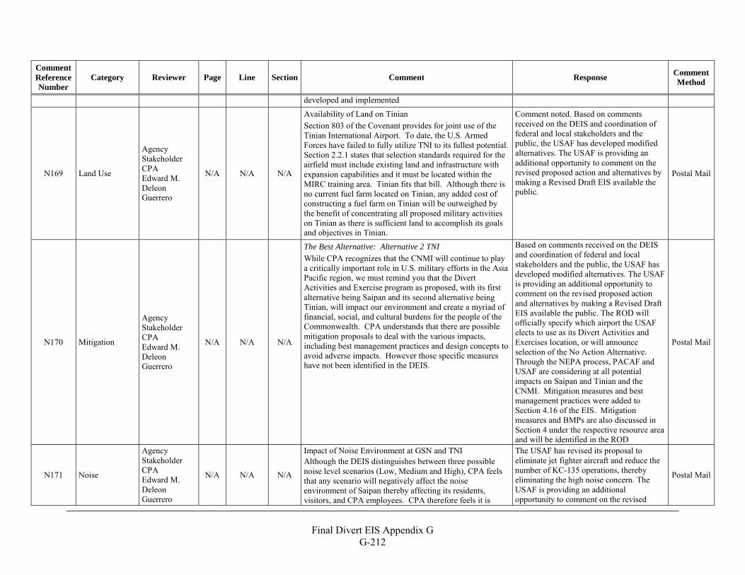
Final Divert EIS Appendix G
G-212
Comment Reference Number
Category Reviewer Page Line Section Comment Response Comment Method
developed and implemented
N169 Land Use
Agency Stakeholder CPA Edward M. Deleon Guerrero
N/A N/A N/A
Availability of Land on Tinian Section 803 of the Covenant provides for joint use of the Tinian International Airport. To date, the U.S. Armed Forces have failed to fully utilize TNI to its fullest potential. Section 2.2.1 states that selection standards required for the airfield must include existing land and infrastructure with expansion capabilities and it must be located within the MIRC training area. Tinian fits that bill. Although there is no current fuel farm located on Tinian, any added cost of constructing a fuel farm on Tinian will be outweighed by the benefit of concentrating all proposed military activities on Tinian as there is sufficient land to accomplish its goals and objectives in Tinian.
Comment noted. Based on comments received on the DEIS and coordination of federal and local stakeholders and the public, the USAF has developed modified alternatives. The USAF is providing an additional opportunity to comment on the revised proposed action and alternatives by making a Revised Draft EIS available the public.
Postal Mail
N170 Mitigation
Agency Stakeholder CPA Edward M. Deleon Guerrero
N/A N/A N/A
The Best Alternative: Alternative 2 TNI While CPA recognizes that the CNMI will continue to play a critically important role in U.S. military efforts in the Asia Pacific region, we must remind you that the Divert Activities and Exercise program as proposed, with its first alternative being Saipan and its second alternative being Tinian, will impact our environment and create a myriad of financial, social, and cultural burdens for the people of the Commonwealth. CPA understands that there are possible mitigation proposals to deal with the various impacts, including best management practices and design concepts to avoid adverse impacts. However those specific measures have not been identified in the DEIS.
Based on comments received on the DEIS and coordination of federal and local stakeholders and the public, the USAF has developed modified alternatives. The USAF is providing an additional opportunity to comment on the revised proposed action and alternatives by making a Revised Draft EIS available the public. The ROD will officially specify which airport the USAF elects to use as its Divert Activities and Exercises location, or will announce selection of the No Action Alternative. Through the NEPA process, PACAF and USAF are considering at all potential impacts on Saipan and Tinian and the CNMI. Mitigation measures and best management practices were added to Section 4.16 of the EIS. Mitigation measures and BMPs are also discussed in Section 4 under the respective resource area and will be identified in the ROD
Postal Mail
N171 Noise
Agency Stakeholder CPA Edward M. Deleon Guerrero
N/A N/A N/A
Impact of Noise Environment at GSN and TNI Although the DEIS distinguishes between three possible noise level scenarios (Low, Medium and High), CPA feels that any scenario will negatively affect the noise environment of Saipan thereby affecting its residents, visitors, and CPA employees. CPA therefore feels it is
The USAF has revised its proposal to eliminate jet fighter aircraft and reduce the number of KC-135 operations, thereby eliminating the high noise concern. The USAF is providing an additional opportunity to comment on the revised
Postal Mail
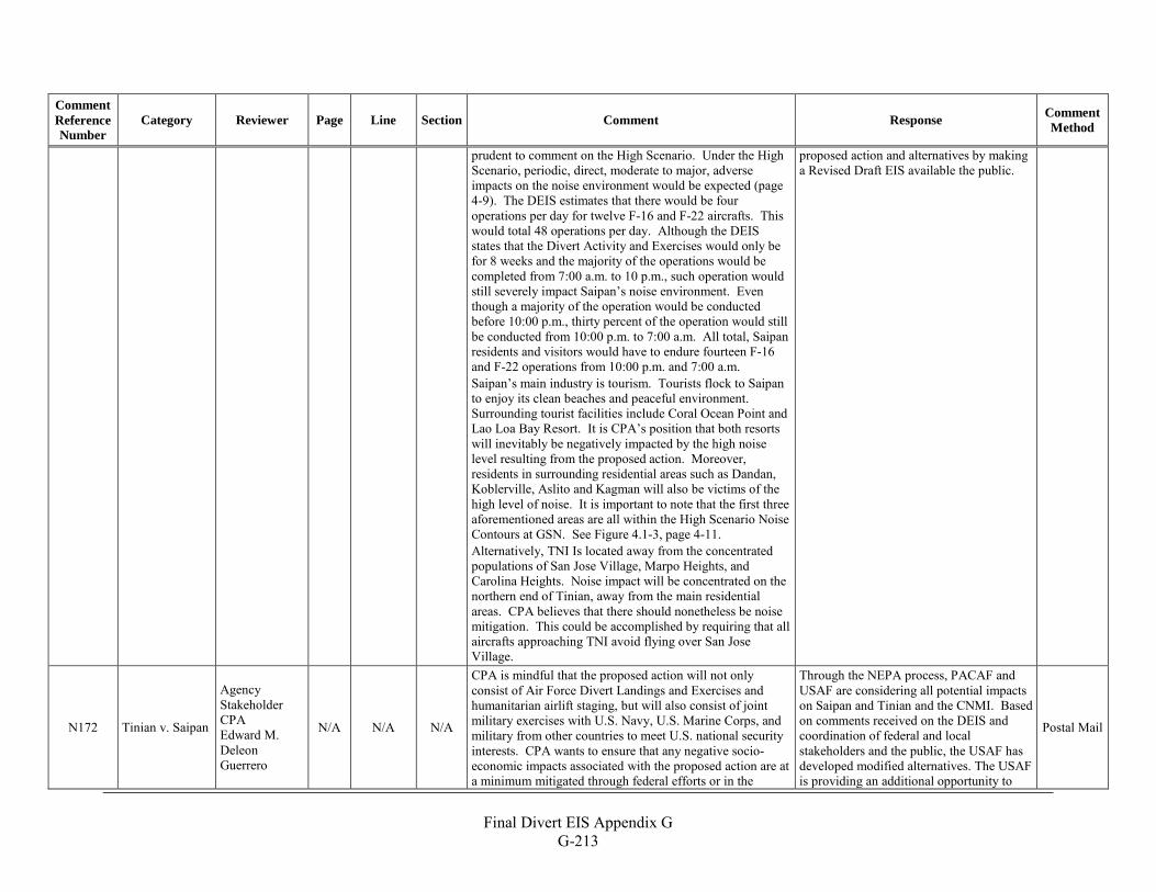
Final Divert EIS Appendix G
G-213
Comment Reference Number
Category Reviewer Page Line Section Comment Response Comment Method
prudent to comment on the High Scenario. Under the High Scenario, periodic, direct, moderate to major, adverse impacts on the noise environment would be expected (page 4-9). The DEIS estimates that there would be four operations per day for twelve F-16 and F-22 aircrafts. This would total 48 operations per day. Although the DEIS states that the Divert Activity and Exercises would only be for 8 weeks and the majority of the operations would be completed from 7:00 a.m. to 10 p.m., such operation would still severely impact Saipan’s noise environment. Even though a majority of the operation would be conducted before 10:00 p.m., thirty percent of the operation would still be conducted from 10:00 p.m. to 7:00 a.m. All total, Saipan residents and visitors would have to endure fourteen F-16 and F-22 operations from 10:00 p.m. and 7:00 a.m. Saipan’s main industry is tourism. Tourists flock to Saipan to enjoy its clean beaches and peaceful environment. Surrounding tourist facilities include Coral Ocean Point and Lao Loa Bay Resort. It is CPA’s position that both resorts will inevitably be negatively impacted by the high noise level resulting from the proposed action. Moreover, residents in surrounding residential areas such as Dandan, Koblerville, Aslito and Kagman will also be victims of the high level of noise. It is important to note that the first three aforementioned areas are all within the High Scenario Noise Contours at GSN. See Figure 4.1-3, page 4-11. Alternatively, TNI Is located away from the concentrated populations of San Jose Village, Marpo Heights, and Carolina Heights. Noise impact will be concentrated on the northern end of Tinian, away from the main residential areas. CPA believes that there should nonetheless be noise mitigation. This could be accomplished by requiring that all aircrafts approaching TNI avoid flying over San Jose Village.
proposed action and alternatives by making a Revised Draft EIS available the public.
N172 Tinian v. Saipan
Agency Stakeholder CPA Edward M. Deleon Guerrero
N/A N/A N/A
CPA is mindful that the proposed action will not only consist of Air Force Divert Landings and Exercises and humanitarian airlift staging, but will also consist of joint military exercises with U.S. Navy, U.S. Marine Corps, and military from other countries to meet U.S. national security interests. CPA wants to ensure that any negative socio-economic impacts associated with the proposed action are at a minimum mitigated through federal efforts or in the
Through the NEPA process, PACAF and USAF are considering all potential impacts on Saipan and Tinian and the CNMI. Based on comments received on the DEIS and coordination of federal and local stakeholders and the public, the USAF has developed modified alternatives. The USAF is providing an additional opportunity to
Postal Mail
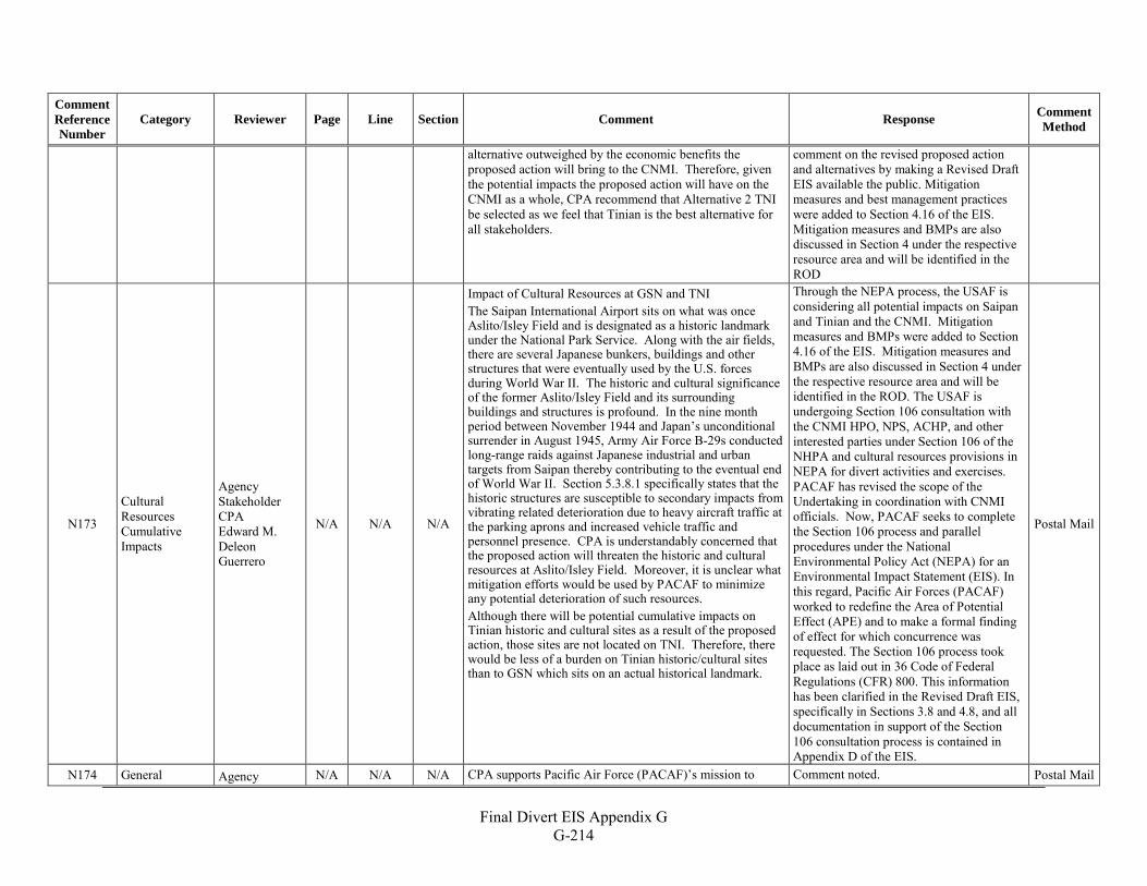
Final Divert EIS Appendix G
G-214
Comment Reference Number
Category Reviewer Page Line Section Comment Response Comment Method
alternative outweighed by the economic benefits the proposed action will bring to the CNMI. Therefore, given the potential impacts the proposed action will have on the CNMI as a whole, CPA recommend that Alternative 2 TNI be selected as we feel that Tinian is the best alternative for all stakeholders.
comment on the revised proposed action and alternatives by making a Revised Draft EIS available the public. Mitigation measures and best management practices were added to Section 4.16 of the EIS. Mitigation measures and BMPs are also discussed in Section 4 under the respective resource area and will be identified in the ROD
N173
Cultural Resources Cumulative Impacts
Agency Stakeholder CPA Edward M. Deleon Guerrero
N/A N/A N/A
Impact of Cultural Resources at GSN and TNI The Saipan International Airport sits on what was once Aslito/Isley Field and is designated as a historic landmark under the National Park Service. Along with the air fields, there are several Japanese bunkers, buildings and other structures that were eventually used by the U.S. forces during World War II. The historic and cultural significance of the former Aslito/Isley Field and its surrounding buildings and structures is profound. In the nine month period between November 1944 and Japan’s unconditional surrender in August 1945, Army Air Force B-29s conducted long-range raids against Japanese industrial and urban targets from Saipan thereby contributing to the eventual end of World War II. Section 5.3.8.1 specifically states that the historic structures are susceptible to secondary impacts from vibrating related deterioration due to heavy aircraft traffic at the parking aprons and increased vehicle traffic and personnel presence. CPA is understandably concerned that the proposed action will threaten the historic and cultural resources at Aslito/Isley Field. Moreover, it is unclear what mitigation efforts would be used by PACAF to minimize any potential deterioration of such resources. Although there will be potential cumulative impacts on Tinian historic and cultural sites as a result of the proposed action, those sites are not located on TNI. Therefore, there would be less of a burden on Tinian historic/cultural sites than to GSN which sits on an actual historical landmark.
Through the NEPA process, the USAF is considering all potential impacts on Saipan and Tinian and the CNMI. Mitigation measures and BMPs were added to Section 4.16 of the EIS. Mitigation measures and BMPs are also discussed in Section 4 under the respective resource area and will be identified in the ROD. The USAF is undergoing Section 106 consultation with the CNMI HPO, NPS, ACHP, and other interested parties under Section 106 of the NHPA and cultural resources provisions in NEPA for divert activities and exercises. PACAF has revised the scope of the Undertaking in coordination with CNMI officials. Now, PACAF seeks to complete the Section 106 process and parallel procedures under the National Environmental Policy Act (NEPA) for an Environmental Impact Statement (EIS). In this regard, Pacific Air Forces (PACAF) worked to redefine the Area of Potential Effect (APE) and to make a formal finding of effect for which concurrence was requested. The Section 106 process took place as laid out in 36 Code of Federal Regulations (CFR) 800. This information has been clarified in the Revised Draft EIS, specifically in Sections 3.8 and 4.8, and all documentation in support of the Section 106 consultation process is contained in Appendix D of the EIS.
Postal Mail
N174 General Agency N/A N/A N/A CPA supports Pacific Air Force (PACAF)’s mission to Comment noted. Postal Mail
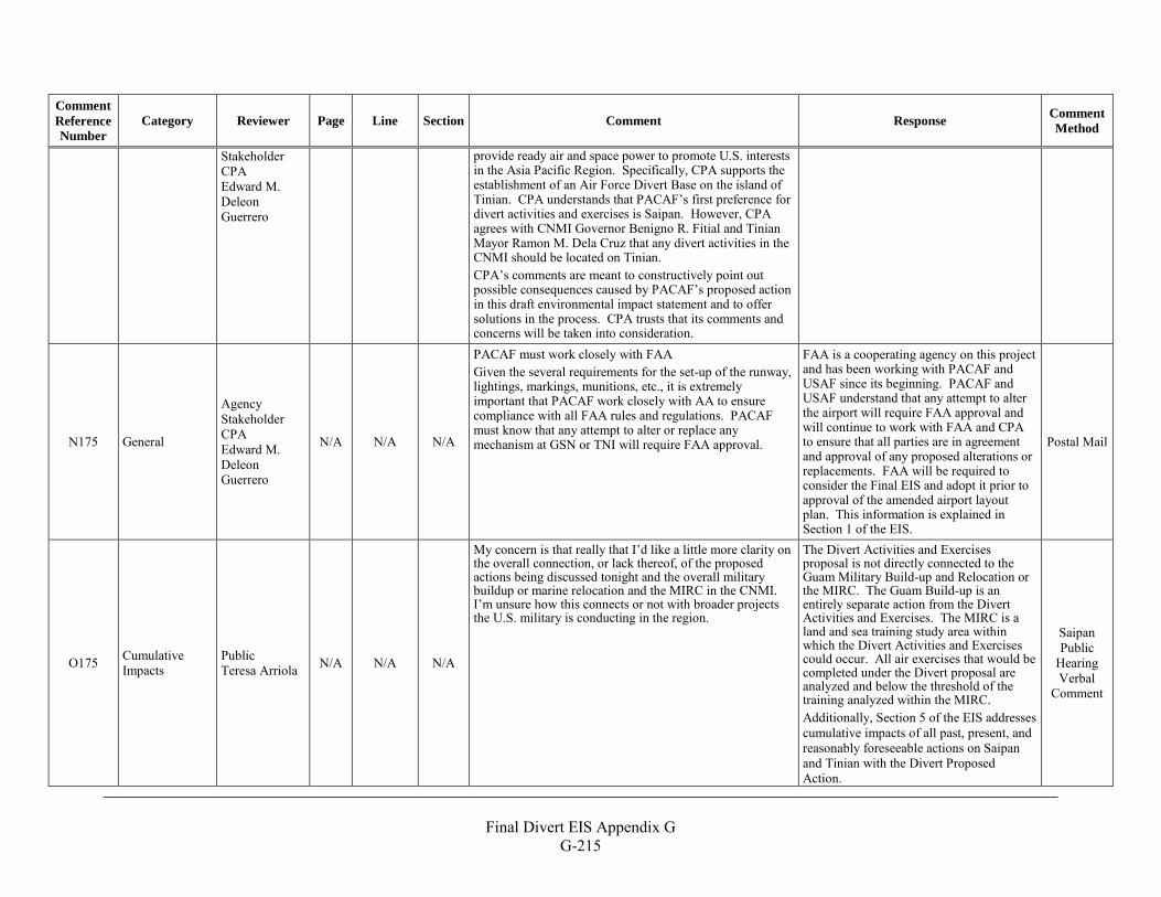
Final Divert EIS Appendix G
G-215
Comment Reference Number
Category Reviewer Page Line Section Comment Response Comment Method
Stakeholder CPA Edward M. Deleon Guerrero
provide ready air and space power to promote U.S. interests in the Asia Pacific Region. Specifically, CPA supports the establishment of an Air Force Divert Base on the island of Tinian. CPA understands that PACAF’s first preference for divert activities and exercises is Saipan. However, CPA agrees with CNMI Governor Benigno R. Fitial and Tinian Mayor Ramon M. Dela Cruz that any divert activities in the CNMI should be located on Tinian. CPA’s comments are meant to constructively point out possible consequences caused by PACAF’s proposed action in this draft environmental impact statement and to offer solutions in the process. CPA trusts that its comments and concerns will be taken into consideration.
N175 General
Agency Stakeholder CPA Edward M. Deleon Guerrero
N/A N/A N/A
PACAF must work closely with FAA Given the several requirements for the set-up of the runway, lightings, markings, munitions, etc., it is extremely important that PACAF work closely with AA to ensure compliance with all FAA rules and regulations. PACAF must know that any attempt to alter or replace any mechanism at GSN or TNI will require FAA approval.
FAA is a cooperating agency on this project and has been working with PACAF and USAF since its beginning. PACAF and USAF understand that any attempt to alter the airport will require FAA approval and will continue to work with FAA and CPA to ensure that all parties are in agreement and approval of any proposed alterations or replacements. FAA will be required to consider the Final EIS and adopt it prior to approval of the amended airport layout plan. This information is explained in Section 1 of the EIS.
Postal Mail
O175 Cumulative Impacts
Public Teresa Arriola N/A N/A N/A
My concern is that really that I’d like a little more clarity on the overall connection, or lack thereof, of the proposed actions being discussed tonight and the overall military buildup or marine relocation and the MIRC in the CNMI. I’m unsure how this connects or not with broader projects the U.S. military is conducting in the region.
The Divert Activities and Exercises proposal is not directly connected to the Guam Military Build-up and Relocation or the MIRC. The Guam Build-up is an entirely separate action from the Divert Activities and Exercises. The MIRC is a land and sea training study area within which the Divert Activities and Exercises could occur. All air exercises that would be completed under the Divert proposal are analyzed and below the threshold of the training analyzed within the MIRC. Additionally, Section 5 of the EIS addresses cumulative impacts of all past, present, and reasonably foreseeable actions on Saipan and Tinian with the Divert Proposed Action.
Saipan Public
Hearing Verbal
Comment
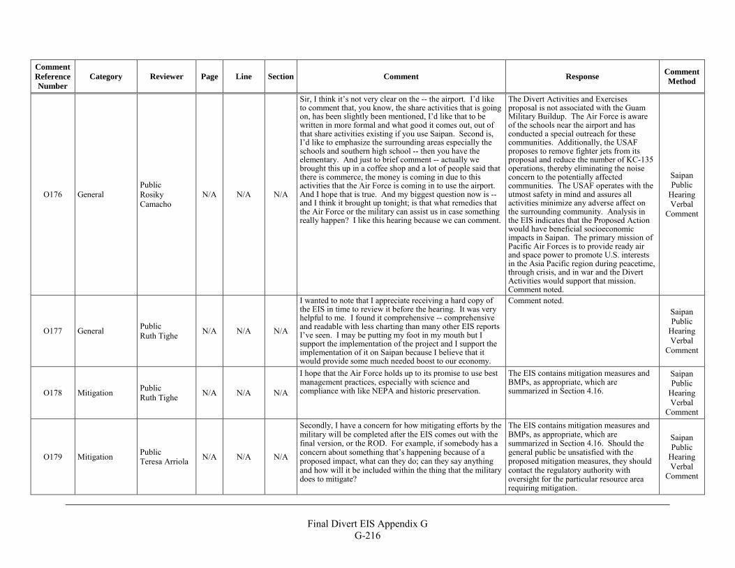
Final Divert EIS Appendix G
G-216
Comment Reference Number
Category Reviewer Page Line Section Comment Response Comment Method
O176 General Public Rosiky Camacho
N/A N/A N/A
Sir, I think it’s not very clear on the -- the airport. I’d like to comment that, you know, the share activities that is going on, has been slightly been mentioned, I’d like that to be written in more formal and what good it comes out, out of that share activities existing if you use Saipan. Second is, I’d like to emphasize the surrounding areas especially the schools and southern high school -- then you have the elementary. And just to brief comment -- actually we brought this up in a coffee shop and a lot of people said that there is commerce, the money is coming in due to this activities that the Air Force is coming in to use the airport. And I hope that is true. And my biggest question now is -- and I think it brought up tonight; is that what remedies that the Air Force or the military can assist us in case something really happen? I like this hearing because we can comment.
The Divert Activities and Exercises proposal is not associated with the Guam Military Buildup. The Air Force is aware of the schools near the airport and has conducted a special outreach for these communities. Additionally, the USAF proposes to remove fighter jets from its proposal and reduce the number of KC-135 operations, thereby eliminating the noise concern to the potentially affected communities. The USAF operates with the utmost safety in mind and assures all activities minimize any adverse affect on the surrounding community. Analysis in the EIS indicates that the Proposed Action would have beneficial socioeconomic impacts in Saipan. The primary mission of Pacific Air Forces is to provide ready air and space power to promote U.S. interests in the Asia Pacific region during peacetime, through crisis, and in war and the Divert Activities would support that mission. Comment noted.
Saipan Public
Hearing Verbal
Comment
O177 General Public Ruth Tighe N/A N/A N/A
I wanted to note that I appreciate receiving a hard copy of the EIS in time to review it before the hearing. It was very helpful to me. I found it comprehensive -- comprehensive and readable with less charting than many other EIS reports I’ve seen. I may be putting my foot in my mouth but I support the implementation of the project and I support the implementation of it on Saipan because I believe that it would provide some much needed boost to our economy.
Comment noted. Saipan Public
Hearing Verbal
Comment
O178 Mitigation Public Ruth Tighe N/A N/A N/A
I hope that the Air Force holds up to its promise to use best management practices, especially with science and compliance with like NEPA and historic preservation.
The EIS contains mitigation measures and BMPs, as appropriate, which are summarized in Section 4.16.
Saipan Public
Hearing Verbal
Comment
O179 Mitigation Public Teresa Arriola N/A N/A N/A
Secondly, I have a concern for how mitigating efforts by the military will be completed after the EIS comes out with the final version, or the ROD. For example, if somebody has a concern about something that’s happening because of a proposed impact, what can they do; can they say anything and how will it be included within the thing that the military does to mitigate?
The EIS contains mitigation measures and BMPs, as appropriate, which are summarized in Section 4.16. Should the general public be unsatisfied with the proposed mitigation measures, they should contact the regulatory authority with oversight for the particular resource area requiring mitigation.
Saipan Public
Hearing Verbal
Comment
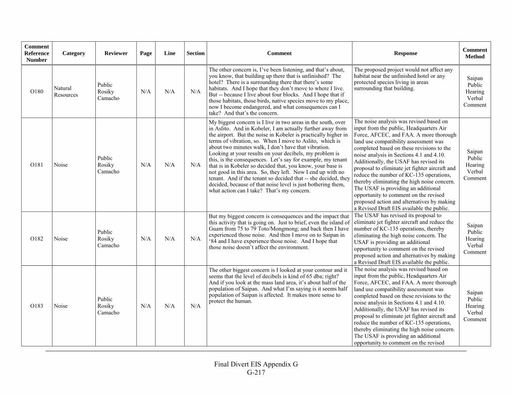
Final Divert EIS Appendix G
G-217
Comment Reference Number
Category Reviewer Page Line Section Comment Response Comment Method
O180 Natural Resources
Public Rosiky Camacho
N/A N/A N/A
The other concern is, I’ve been listening, and that’s about, you know, that building up there that is unfinished? The hotel? There is a surrounding there that there’s some habitats. And I hope that they don’t move to where I live. But -- because I live about four blocks. And I hope that if those habitats, those birds, native species move to my place, now I become endangered, and what consequences can I take? And that’s the concern.
The proposed project would not affect any habitat near the unfinished hotel or any protected species living in areas surrounding that building.
Saipan Public
Hearing Verbal
Comment
O181 Noise Public Rosiky Camacho
N/A N/A N/A
My biggest concern is I live in two areas in the south, over in Aslito. And in Kobeler, I am actually further away from the airport. But the noise in Kobeler is practically higher in terms of vibration, so. When I move to Aslito, which is about two minutes walk, I don’t have that vibration. Looking at your results on your decibels, my problem is this, is the consequences. Let’s say for example, my tenant that is in Kobeler so decided that, you know, your base is not good in this area. So, they left. Now I end up with no tenant. And if the tenant so decided that -- she decided, they decided, because of that noise level is just bothering them, what action can I take? That’s my concern.
The noise analysis was revised based on input from the public, Headquarters Air Force, AFCEC, and FAA. A more thorough land use compatibility assessment was completed based on these revisions to the noise analysis in Sections 4.1 and 4.10. Additionally, the USAF has revised its proposal to eliminate jet fighter aircraft and reduce the number of KC-135 operations, thereby eliminating the high noise concern. The USAF is providing an additional opportunity to comment on the revised proposed action and alternatives by making a Revised Draft EIS available the public.
Saipan Public
Hearing Verbal
Comment
O182 Noise Public Rosiky Camacho
N/A N/A N/A
But my biggest concern is consequences and the impact that this activity that is going on. Just to brief, even the island of Guam from 75 to 79 Toto/Mongmong; and back then I have experienced those noise. And then I move on to Saipan in ‘84 and I have experience those noise. And I hope that those noise doesn’t affect the environment.
The USAF has revised its proposal to eliminate jet fighter aircraft and reduce the number of KC-135 operations, thereby eliminating the high noise concern. The USAF is providing an additional opportunity to comment on the revised proposed action and alternatives by making a Revised Draft EIS available the public.
Saipan Public
Hearing Verbal
Comment
O183 Noise Public Rosiky Camacho
N/A N/A N/A
The other biggest concern is I looked at your contour and it seems that the level of decibels is kind of 65 dba; right? And if you look at the mass land area, it’s about half of the population of Saipan. And what I’m saying is it seems half population of Saipan is affected. It makes more sense to protect the human.
The noise analysis was revised based on input from the public, Headquarters Air Force, AFCEC, and FAA. A more thorough land use compatibility assessment was completed based on these revisions to the noise analysis in Sections 4.1 and 4.10. Additionally, the USAF has revised its proposal to eliminate jet fighter aircraft and reduce the number of KC-135 operations, thereby eliminating the high noise concern. The USAF is providing an additional opportunity to comment on the revised
Saipan Public
Hearing Verbal
Comment
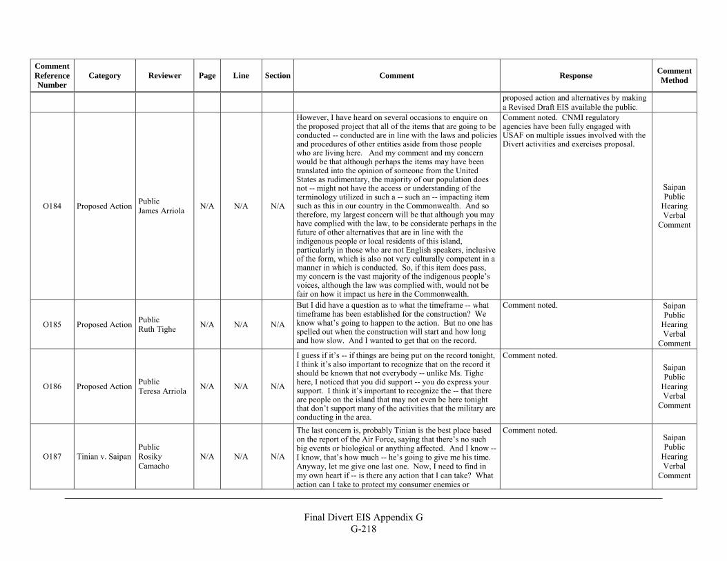
Final Divert EIS Appendix G
G-218
Comment Reference Number
Category Reviewer Page Line Section Comment Response Comment Method
proposed action and alternatives by making a Revised Draft EIS available the public.
O184 Proposed Action Public James Arriola N/A N/A N/A
However, I have heard on several occasions to enquire on the proposed project that all of the items that are going to be conducted -- conducted are in line with the laws and policies and procedures of other entities aside from those people who are living here. And my comment and my concern would be that although perhaps the items may have been translated into the opinion of someone from the United States as rudimentary, the majority of our population does not -- might not have the access or understanding of the terminology utilized in such a -- such an -- impacting item such as this in our country in the Commonwealth. And so therefore, my largest concern will be that although you may have complied with the law, to be considerate perhaps in the future of other alternatives that are in line with the indigenous people or local residents of this island, particularly in those who are not English speakers, inclusive of the form, which is also not very culturally competent in a manner in which is conducted. So, if this item does pass, my concern is the vast majority of the indigenous people’s voices, although the law was complied with, would not be fair on how it impact us here in the Commonwealth.
Comment noted. CNMI regulatory agencies have been fully engaged with USAF on multiple issues involved with the Divert activities and exercises proposal.
Saipan Public
Hearing Verbal
Comment
O185 Proposed Action Public Ruth Tighe N/A N/A N/A
But I did have a question as to what the timeframe -- what timeframe has been established for the construction? We know what’s going to happen to the action. But no one has spelled out when the construction will start and how long and how slow. And I wanted to get that on the record.
Comment noted. Saipan Public
Hearing Verbal
Comment
O186 Proposed Action Public Teresa Arriola N/A N/A N/A
I guess if it’s -- if things are being put on the record tonight, I think it’s also important to recognize that on the record it should be known that not everybody -- unlike Ms. Tighe here, I noticed that you did support -- you do express your support. I think it’s important to recognize the -- that there are people on the island that may not even be here tonight that don’t support many of the activities that the military are conducting in the area.
Comment noted. Saipan Public
Hearing Verbal
Comment
O187 Tinian v. Saipan Public Rosiky Camacho
N/A N/A N/A
The last concern is, probably Tinian is the best place based on the report of the Air Force, saying that there’s no such big events or biological or anything affected. And I know -- I know, that’s how much -- he’s going to give me his time. Anyway, let me give one last one. Now, I need to find in my own heart if -- is there any action that I can take? What action can I take to protect my consumer enemies or
Comment noted. Saipan Public
Hearing Verbal
Comment
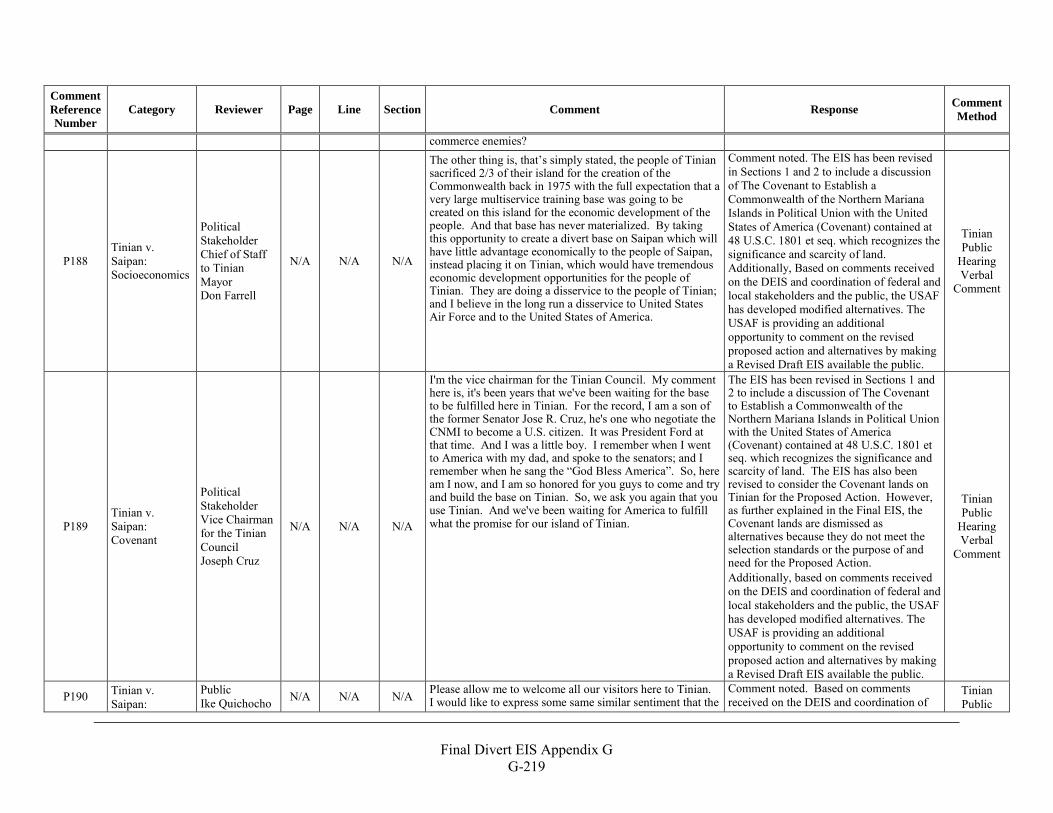
Final Divert EIS Appendix G
G-219
Comment Reference Number
Category Reviewer Page Line Section Comment Response Comment Method
commerce enemies?
P188 Tinian v. Saipan: Socioeconomics
Political Stakeholder Chief of Staff to Tinian Mayor Don Farrell
N/A N/A N/A
The other thing is, that’s simply stated, the people of Tinian sacrificed 2/3 of their island for the creation of the Commonwealth back in 1975 with the full expectation that a very large multiservice training base was going to be created on this island for the economic development of the people. And that base has never materialized. By taking this opportunity to create a divert base on Saipan which will have little advantage economically to the people of Saipan, instead placing it on Tinian, which would have tremendous economic development opportunities for the people of Tinian. They are doing a disservice to the people of Tinian; and I believe in the long run a disservice to United States Air Force and to the United States of America.
Comment noted. The EIS has been revised in Sections 1 and 2 to include a discussion of The Covenant to Establish a Commonwealth of the Northern Mariana Islands in Political Union with the United States of America (Covenant) contained at 48 U.S.C. 1801 et seq. which recognizes the significance and scarcity of land. Additionally, Based on comments received on the DEIS and coordination of federal and local stakeholders and the public, the USAF has developed modified alternatives. The USAF is providing an additional opportunity to comment on the revised proposed action and alternatives by making a Revised Draft EIS available the public.
Tinian Public
Hearing Verbal
Comment
P189 Tinian v. Saipan: Covenant
Political Stakeholder Vice Chairman for the Tinian Council Joseph Cruz
N/A N/A N/A
I'm the vice chairman for the Tinian Council. My comment here is, it's been years that we've been waiting for the base to be fulfilled here in Tinian. For the record, I am a son of the former Senator Jose R. Cruz, he's one who negotiate the CNMI to become a U.S. citizen. It was President Ford at that time. And I was a little boy. I remember when I went to America with my dad, and spoke to the senators; and I remember when he sang the “God Bless America”. So, here am I now, and I am so honored for you guys to come and try and build the base on Tinian. So, we ask you again that you use Tinian. And we've been waiting for America to fulfill what the promise for our island of Tinian.
The EIS has been revised in Sections 1 and 2 to include a discussion of The Covenant to Establish a Commonwealth of the Northern Mariana Islands in Political Union with the United States of America (Covenant) contained at 48 U.S.C. 1801 et seq. which recognizes the significance and scarcity of land. The EIS has also been revised to consider the Covenant lands on Tinian for the Proposed Action. However, as further explained in the Final EIS, the Covenant lands are dismissed as alternatives because they do not meet the selection standards or the purpose of and need for the Proposed Action. Additionally, based on comments received on the DEIS and coordination of federal and local stakeholders and the public, the USAF has developed modified alternatives. The USAF is providing an additional opportunity to comment on the revised proposed action and alternatives by making a Revised Draft EIS available the public.
Tinian Public
Hearing Verbal
Comment
P190 Tinian v. Saipan:
Public Ike Quichocho N/A N/A N/A Please allow me to welcome all our visitors here to Tinian.
I would like to express some same similar sentiment that the Comment noted. Based on comments received on the DEIS and coordination of
Tinian Public
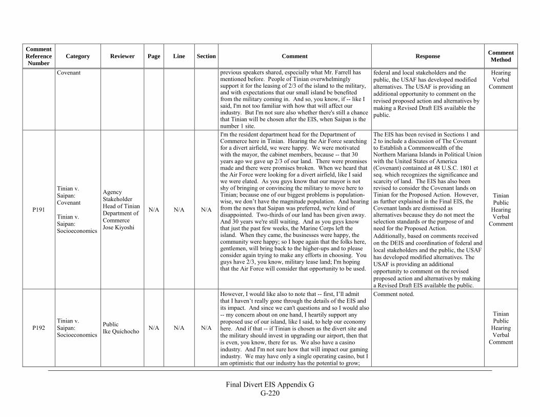
Final Divert EIS Appendix G
G-220
Comment Reference Number
Category Reviewer Page Line Section Comment Response Comment Method
Covenant previous speakers shared, especially what Mr. Farrell has mentioned before. People of Tinian overwhelmingly support it for the leasing of 2/3 of the island to the military, and with expectations that our small island be benefited from the military coming in. And so, you know, if -- like I said, I'm not too familiar with how that will affect our industry. But I'm not sure also whether there's still a chance that Tinian will be chosen after the EIS, when Saipan is the number 1 site.
federal and local stakeholders and the public, the USAF has developed modified alternatives. The USAF is providing an additional opportunity to comment on the revised proposed action and alternatives by making a Revised Draft EIS available the public.
Hearing Verbal
Comment
P191
Tinian v. Saipan: Covenant Tinian v. Saipan: Socioeconomics
Agency Stakeholder Head of Tinian Department of Commerce Jose Kiyoshi
N/A N/A N/A
I'm the resident department head for the Department of Commerce here in Tinian. Hearing the Air Force searching for a divert airfield, we were happy. We were motivated with the mayor, the cabinet members, because -- that 30 years ago we gave up 2/3 of our land. There were promises made and there were promises broken. When we heard that the Air Force were looking for a divert airfield, like I said we were elated. As you guys know that our mayor is not shy of bringing or convincing the military to move here to Tinian; because one of our biggest problems is population-wise, we don’t have the magnitude population. And hearing from the news that Saipan was preferred, we're kind of disappointed. Two-thirds of our land has been given away. And 30 years we're still waiting. And as you guys know that just the past few weeks, the Marine Corps left the island. When they came, the businesses were happy, the community were happy; so I hope again that the folks here, gentlemen, will bring back to the higher-ups and to please consider again trying to make any efforts in choosing. You guys have 2/3, you know, military lease land; I'm hoping that the Air Force will consider that opportunity to be used.
The EIS has been revised in Sections 1 and 2 to include a discussion of The Covenant to Establish a Commonwealth of the Northern Mariana Islands in Political Union with the United States of America (Covenant) contained at 48 U.S.C. 1801 et seq. which recognizes the significance and scarcity of land. The EIS has also been revised to consider the Covenant lands on Tinian for the Proposed Action. However, as further explained in the Final EIS, the Covenant lands are dismissed as alternatives because they do not meet the selection standards or the purpose of and need for the Proposed Action. Additionally, based on comments received on the DEIS and coordination of federal and local stakeholders and the public, the USAF has developed modified alternatives. The USAF is providing an additional opportunity to comment on the revised proposed action and alternatives by making a Revised Draft EIS available the public.
Tinian Public
Hearing Verbal
Comment
P192 Tinian v. Saipan: Socioeconomics
Public Ike Quichocho N/A N/A N/A
However, I would like also to note that -- first, I’ll admit that I haven’t really gone through the details of the EIS and its impact. And since we can't questions and so I would also -- my concern about on one hand, I heartily support any proposed use of our island, like I said, to help our economy here. And if that -- if Tinian is chosen as the divert site and the military should invest in upgrading our airport, then that is even, you know, there for us. We also have a casino industry. And I'm not sure how that will impact our gaming industry. We may have only a single operating casino, but I am optimistic that our industry has the potential to grow;
Comment noted.
Tinian Public
Hearing Verbal
Comment
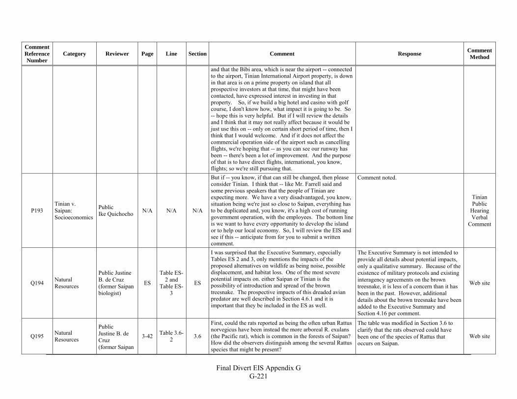
Final Divert EIS Appendix G
G-221
Comment Reference Number
Category Reviewer Page Line Section Comment Response Comment Method
and that the Bibi area, which is near the airport -- connected to the airport, Tinian International Airport property, is down in that area is on a prime property on island that all prospective investors at that time, that might have been contacted, have expressed interest in investing in that property. So, if we build a big hotel and casino with golf course, I don't know how, what impact it is going to be. So -- hope this is very helpful. But if I will review the details and I think that it may not really affect because it would be just use this on -- only on certain short period of time, then I think that I would welcome. And if it does not affect the commercial operation side of the airport such as cancelling flights, we're hoping that -- as you can see our runway has been -- there's been a lot of improvement. And the purpose of that is to have direct flights, international, you know, flights; so we're still pursuing that.
P193 Tinian v. Saipan: Socioeconomics
Public Ike Quichocho N/A N/A N/A
But if -- you know, if that can still be changed, then please consider Tinian. I think that -- like Mr. Farrell said and some previous speakers that the people of Tinian are expecting more. We have a very disadvantaged, you know, situation being we're just so close to Saipan, everything has to be duplicated and, you know, it's a high cost of running government operation, with the employees. The bottom line is we want to have every opportunity to develop the island or to help our local economy. So, I will review the EIS and see if this -- anticipate from for you to submit a written comment.
Comment noted.
Tinian Public
Hearing Verbal
Comment
Q194 Natural Resources
Public Justine B. de Cruz (former Saipan biologist)
ES
Table ES-2 and
Table ES-3
ES
I was surprised that the Executive Summary, especially Tables ES 2 and 3, only mentions the impacts of the proposed alternatives on wildlife as being noise, possible displacement, and habitat loss. One of the most severe potential impacts on. either Saipan or Tinian is the possibility of introduction and spread of the brown treesnake. The prospective impacts of this dreaded avian predator are well described in Section 4.6.1 and it is important that they be included in the ES as well.
The Executive Summary is not intended to provide all details about potential impacts, only a qualitative summary. Because of the existence of military protocols and existing interagency agreements on the brown treesnake, it is less of a concern than it has been in the past. However, additional details about the brown treesnake have been added to the Executive Summary and Section 4.16 per comment.
Web site
Q195 Natural Resources
Public Justine B. de Cruz (former Saipan
3-42 Table 3.6-2 3.6
First, could the rats reported as being the often urban Rattus norvegicus have been instead the more arboreal R. exulans (the Pacific rat), which is common in the forests of Saipan? How did the observers distinguish among the several Rattus species that might be present?
The table was modified in Section 3.6 to clarify that the rats observed could have been one of the species of Rattus that occurs on Saipan.
Web site
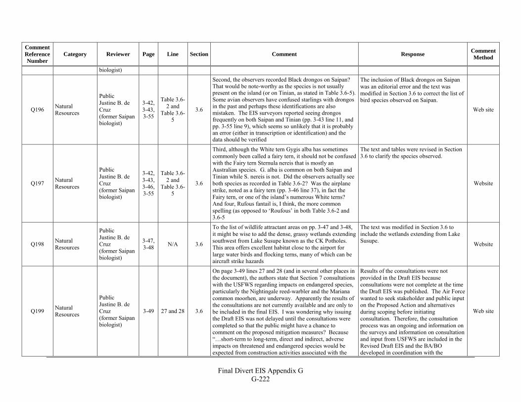
Final Divert EIS Appendix G
G-222
Comment Reference Number
Category Reviewer Page Line Section Comment Response Comment Method
biologist)
Q196 Natural Resources
Public Justine B. de Cruz (former Saipan biologist)
3-42, 3-43, 3-55
Table 3.6-2 and
Table 3.6-5
3.6
Second, the observers recorded Black drongos on Saipan? That would be note-worthy as the species is not usually present on the island (or on Tinian, as stated in Table 3.6-5). Some avian observers have confused starlings with drongos in the past and perhaps these identifications are also mistaken. The EIS surveyors reported seeing drongos frequently on both Saipan and Tinian (pp. 3-43 line 11, and pp. 3-55 line 9), which seems so unlikely that it is probably an error (either in transcription or identification) and the data should be verified
The inclusion of Black drongos on Saipan was an editorial error and the text was modified in Section 3.6 to correct the list of bird species observed on Saipan.
Web site
Q197 Natural Resources
Public Justine B. de Cruz (former Saipan biologist)
3-42, 3-43, 3-46, 3-55
Table 3.6-2 and
Table 3.6-5
3.6
Third, although the White tern Gygis alba has sometimes commonly been called a fairy tern, it should not be confused with the Fairy tern Sternula nereis that is mostly an Australian species. G. alba is common on both Saipan and Tinian while S. nereis is not. Did the observers actually see both species as recorded in Table 3.6-2? Was the airplane strike, noted as a fairy tern (pp. 3-46 line 37), in fact the Fairy tern, or one of the island’s numerous White terns? And four, Rufous fantail is, I think, the more common spelling (as opposed to ‘Roufous’ in both Table 3.6-2 and 3.6-5
The text and tables were revised in Section 3.6 to clarify the species observed.
Website
Q198 Natural Resources
Public Justine B. de Cruz (former Saipan biologist)
3-47, 3-48 N/A 3.6
To the list of wildlife attractant areas on pp. 3-47 and 3-48, it might be wise to add the dense, grassy wetlands extending southwest from Lake Susupe known as the CK Potholes. This area offers excellent habitat close to the airport for large water birds and flocking terns, many of which can be aircraft strike hazards
The text was modified in Section 3.6 to include the wetlands extending from Lake Susupe. Website
Q199 Natural Resources
Public Justine B. de Cruz (former Saipan biologist)
3-49 27 and 28 3.6
On page 3-49 lines 27 and 28 (and in several other places in the document), the authors state that Section 7 consultations with the USFWS regarding impacts on endangered species, particularly the Nightingale reed-warbler and the Mariana common moorhen, are underway. Apparently the results of the consultations are not currently available and are only to be included in the final EIS. I was wondering why issuing the Draft EIS was not delayed until the consultations were completed so that the public might have a chance to comment on the proposed mitigation measures? Because “…short-term to long-term, direct and indirect, adverse impacts on threatened and endangered species would be expected from construction activities associated with the
Results of the consultations were not provided in the Draft EIS because consultations were not complete at the time the Draft EIS was published. The Air Force wanted to seek stakeholder and public input on the Proposed Action and alternatives during scoping before initiating consultation. Therefore, the consultation process was an ongoing and information on the surveys and information on consultation and input from USFWS are included in the Revised Draft EIS and the BA/BO developed in coordination with the
Web site
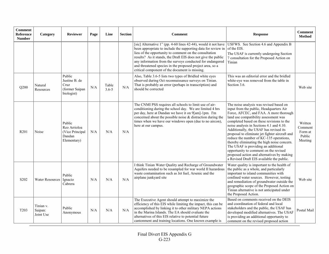
Final Divert EIS Appendix G
G-223
Comment Reference Number
Category Reviewer Page Line Section Comment Response Comment Method
[sic] Alternative 1” (pp. 4-60 lines 42-44), would it not have been appropriate to include the supporting data for review in lieu of the opportunity to comment on the consultation results? As it stands, the Draft EIS does not give the public any information from the surveys conducted for endangered and threatened species in the proposed project area, so a critical component of the document is missing.
USFWS. See Section 4.6 and Appendix B of the EIS. The USAF is currently undergoing Section 7 consultation for the Proposed Action on Tinian
Q200 Natural Resources
Public Justine B. de Cruz (former Saipan biologist)
N/A Table 3.6-5 N/A
Also, Table 3.6-5 lists two types of Bridled white eyes observed during Oct reconnaissance surveys on Tinian. That is probably an error (perhaps in transcription) and should be corrected
This was an editorial error and the bridled white-eye was removed from the table in Section 3.6.
Web site
R201 Noise
Public Reo Arrioloa (Vice Principal Dandan Elementary)
N/A N/A N/A
The CNMI PSS requires all schools to limit use of air-conditioning during the school day. We are limited 4 hrs per day, here at Dandan we have it on 9[am]-1pm. I'm concerned about the possible noise & distraction during the times when we have our windows open (due to no aircon), here at our campus.
The noise analysis was revised based on input from the public, Headquarters Air Force, AFCEC, and FAA. A more thorough land use compatibility assessment was completed based on these revisions to the noise analysis in Sections 4.1 and 4.10. Additionally, the USAF has revised its proposal to eliminate jet fighter aircraft and reduce the number of KC-135 operations, thereby eliminating the high noise concern. The USAF is providing an additional opportunity to comment on the revised proposed action and alternatives by making a Revised Draft EIS available the public.
Written Comment Form at Public
Meeting
S202 Water Resources Public Ignacio Cabrera
N/A N/A N/A
I think Tinian Water Quality and Recharge of Groundwater Aquifers needed to be resampled for war world II hazardous waste contamination such as Jet fuel, Arsenic and the airplane junkyard site
Water quality is important to the health of the public as a whole, and particularly important to island communities with confined water sources. However, testing and remediation of groundwater outside the geographic scope of the Proposed Action on Tinian alternative is not anticipated under the Proposed Action.
Web site
T203 Tinian v. Saipan: Joint Use
Public Anonymous N/A N/A N/A
The Executive Agent should attempt to maximize the efficiency of this EIS while limiting the impact, this can be accomplished by linking it to other military NEPA actions in the Marina Islands. The EA should evaluate the alternatives of this EIS relative to potential future cantonment and training locations. One known example is
Based on comments received on the DEIS and coordination of federal and local stakeholders and the public, the USAF has developed modified alternatives. The USAF is providing an additional opportunity to comment on the revised proposed action
Postal Mail
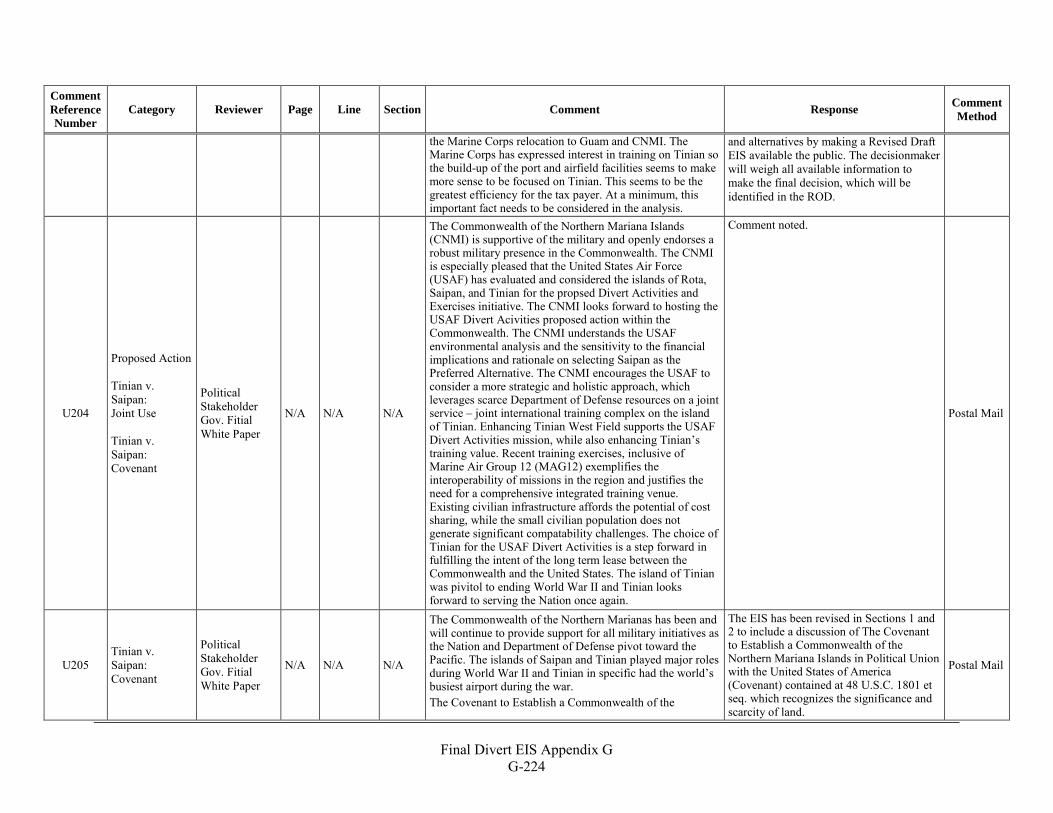
Final Divert EIS Appendix G
G-224
Comment Reference Number
Category Reviewer Page Line Section Comment Response Comment Method
the Marine Corps relocation to Guam and CNMI. The Marine Corps has expressed interest in training on Tinian so the build-up of the port and airfield facilities seems to make more sense to be focused on Tinian. This seems to be the greatest efficiency for the tax payer. At a minimum, this important fact needs to be considered in the analysis.
and alternatives by making a Revised Draft EIS available the public. The decisionmaker will weigh all available information to make the final decision, which will be identified in the ROD.
U204
Proposed Action Tinian v. Saipan: Joint Use Tinian v. Saipan: Covenant
Political Stakeholder Gov. Fitial White Paper
N/A N/A N/A
The Commonwealth of the Northern Mariana Islands (CNMI) is supportive of the military and openly endorses a robust military presence in the Commonwealth. The CNMI is especially pleased that the United States Air Force (USAF) has evaluated and considered the islands of Rota, Saipan, and Tinian for the propsed Divert Activities and Exercises initiative. The CNMI looks forward to hosting the USAF Divert Acivities proposed action within the Commonwealth. The CNMI understands the USAF environmental analysis and the sensitivity to the financial implications and rationale on selecting Saipan as the Preferred Alternative. The CNMI encourages the USAF to consider a more strategic and holistic approach, which leverages scarce Department of Defense resources on a joint service – joint international training complex on the island of Tinian. Enhancing Tinian West Field supports the USAF Divert Activities mission, while also enhancing Tinian’s training value. Recent training exercises, inclusive of Marine Air Group 12 (MAG12) exemplifies the interoperability of missions in the region and justifies the need for a comprehensive integrated training venue. Existing civilian infrastructure affords the potential of cost sharing, while the small civilian population does not generate significant compatability challenges. The choice of Tinian for the USAF Divert Activities is a step forward in fulfilling the intent of the long term lease between the Commonwealth and the United States. The island of Tinian was pivitol to ending World War II and Tinian looks forward to serving the Nation once again.
Comment noted.
Postal Mail
U205 Tinian v. Saipan: Covenant
Political Stakeholder Gov. Fitial White Paper
N/A N/A N/A
The Commonwealth of the Northern Marianas has been and will continue to provide support for all military initiatives as the Nation and Department of Defense pivot toward the Pacific. The islands of Saipan and Tinian played major roles during World War II and Tinian in specific had the world’s busiest airport during the war. The Covenant to Establish a Commonwealth of the
The EIS has been revised in Sections 1 and 2 to include a discussion of The Covenant to Establish a Commonwealth of the Northern Mariana Islands in Political Union with the United States of America (Covenant) contained at 48 U.S.C. 1801 et seq. which recognizes the significance and scarcity of land.
Postal Mail
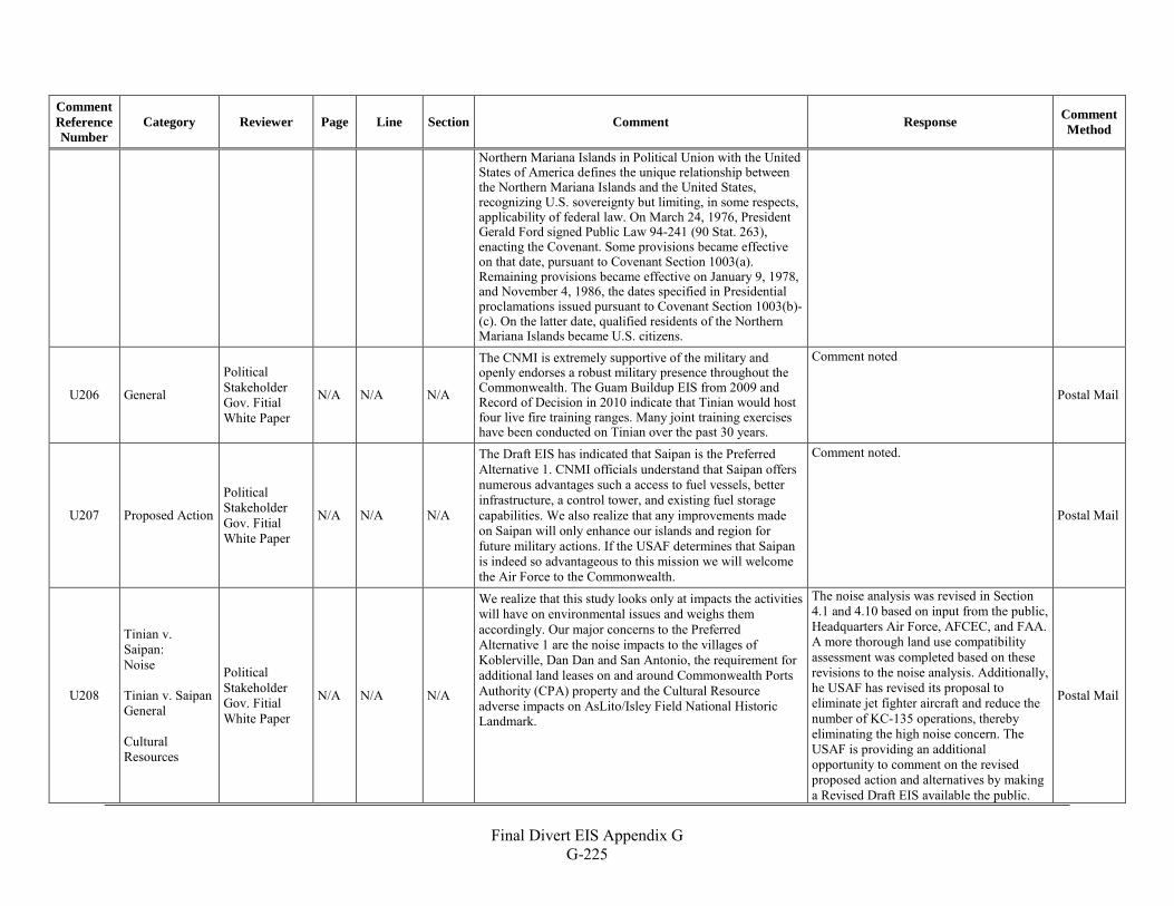
Final Divert EIS Appendix G
G-225
Comment Reference Number
Category Reviewer Page Line Section Comment Response Comment Method
Northern Mariana Islands in Political Union with the United States of America defines the unique relationship between the Northern Mariana Islands and the United States, recognizing U.S. sovereignty but limiting, in some respects, applicability of federal law. On March 24, 1976, President Gerald Ford signed Public Law 94-241 (90 Stat. 263), enacting the Covenant. Some provisions became effective on that date, pursuant to Covenant Section 1003(a). Remaining provisions became effective on January 9, 1978, and November 4, 1986, the dates specified in Presidential proclamations issued pursuant to Covenant Section 1003(b)-(c). On the latter date, qualified residents of the Northern Mariana Islands became U.S. citizens.
U206 General
Political Stakeholder Gov. Fitial White Paper
N/A N/A N/A
The CNMI is extremely supportive of the military and openly endorses a robust military presence throughout the Commonwealth. The Guam Buildup EIS from 2009 and Record of Decision in 2010 indicate that Tinian would host four live fire training ranges. Many joint training exercises have been conducted on Tinian over the past 30 years.
Comment noted
Postal Mail
U207 Proposed Action
Political Stakeholder Gov. Fitial White Paper
N/A N/A N/A
The Draft EIS has indicated that Saipan is the Preferred Alternative 1. CNMI officials understand that Saipan offers numerous advantages such a access to fuel vessels, better infrastructure, a control tower, and existing fuel storage capabilities. We also realize that any improvements made on Saipan will only enhance our islands and region for future military actions. If the USAF determines that Saipan is indeed so advantageous to this mission we will welcome the Air Force to the Commonwealth.
Comment noted.
Postal Mail
U208
Tinian v. Saipan: Noise Tinian v. Saipan General Cultural Resources
Political Stakeholder Gov. Fitial White Paper
N/A N/A N/A
We realize that this study looks only at impacts the activities will have on environmental issues and weighs them accordingly. Our major concerns to the Preferred Alternative 1 are the noise impacts to the villages of Koblerville, Dan Dan and San Antonio, the requirement for additional land leases on and around Commonwealth Ports Authority (CPA) property and the Cultural Resource adverse impacts on AsLito/Isley Field National Historic Landmark.
The noise analysis was revised in Section 4.1 and 4.10 based on input from the public, Headquarters Air Force, AFCEC, and FAA. A more thorough land use compatibility assessment was completed based on these revisions to the noise analysis. Additionally, he USAF has revised its proposal to eliminate jet fighter aircraft and reduce the number of KC-135 operations, thereby eliminating the high noise concern. The USAF is providing an additional opportunity to comment on the revised proposed action and alternatives by making a Revised Draft EIS available the public.
Postal Mail
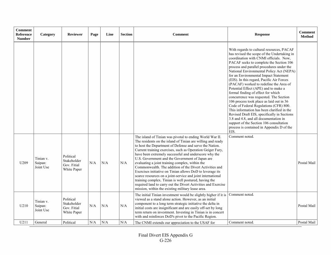
Final Divert EIS Appendix G
G-226
Comment Reference Number
Category Reviewer Page Line Section Comment Response Comment Method
With regards to cultural resources, PACAF has revised the scope of the Undertaking in coordination with CNMI officials. Now, PACAF seeks to complete the Section 106 process and parallel procedures under the National Environmental Policy Act (NEPA) for an Environmental Impact Statement (EIS). In this regard, Pacific Air Forces (PACAF) worked to redefine the Area of Potential Effect (APE) and to make a formal finding of effect for which concurrence was requested. The Section 106 process took place as laid out in 36 Code of Federal Regulations (CFR) 800. This information has been clarified in the Revised Draft EIS, specifically in Sections 3.8 and 4.8, and all documentation in support of the Section 106 consultation process is contained in Appendix D of the EIS.
U209 Tinian v. Saipan: Joint Use
Political Stakeholder Gov. Fitial White Paper
N/A N/A N/A
The island of Tinian was pivotal to ending World War II. The residents on the island of Tinian are willing and ready to host the Department of Defense and serve the Nation. Current training exercises, such as Operation Geiger Fury, have been extremely successful and underscore why the U.S. Government and the Government of Japan are evaluating a joint training complex, within the Commonwealth. The addition of the Divert Activities and Exercises initiative on Tinian allows DoD to leverage its scarce resources on a joint-service and joint international training complex. Tinian is well postured, having the required land to carry out the Divert Activities and Exercise mission, within the existing military lease area.
Comment noted.
Postal Mail
U210 Tinian v. Saipan: Joint Use
Political Stakeholder Gov. Fitial White Paper
N/A N/A N/A
The initial Tinian investment would be slightly higher if it is viewed as a stand alone action. However, as an initial component to a long term strategic initiative the delta in initial costs are insignificant and are easily off-set by long term return on investment. Investing in Tinian is in concert with and reinforces DoD's pivot to the Pacific Region.
Comment noted.
Postal Mail
U211 General Political N/A N/A N/A The CNMI extends our appreciation to the USAF for Comment noted. Postal Mail
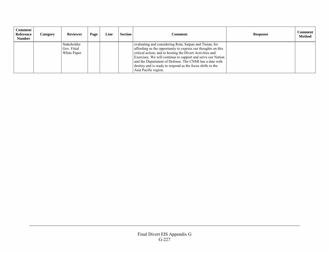
Final Divert EIS Appendix G
G-227
Comment Reference Number
Category Reviewer Page Line Section Comment Response Comment Method
Stakeholder Gov. Fitial White Paper
evaluating and considering Rota, Saipan and Tinian; for affording us the opportunity to express our thoughts on this critical action; and to hosting the Divert Activities and Exercises. We will continue to support and serve our Nation and the Department of Defense. The CNMI has a date with destiny and is ready to respond as the focus shifts to the Asia Pacific region.

THIS PAGE INTENTIONALLY LEFT BLANK
Final Divert EIS Appendix G G-228