some engineering geological advantages for development of underground transportation system for...
TRANSCRIPT
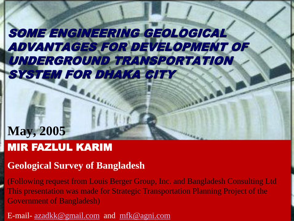
SOME ENGINEERING GEOLOGICAL
ADVANTAGES FOR DEVELOPMENT OF
UNDERGROUND TRANSPORTATION
SYSTEM FOR DHAKA CITY
May, 2005
MIR FAZLUL KARIM
Geological Survey of Bangladesh
(Following request from Louis Berger Group, Inc. and Bangladesh Consulting Ltd
This presentation was made for Strategic Transportation Planning Project of the
Government of Bangladesh)
E-mail- [email protected] and [email protected]

THE DATABASE OF THIS PRESENTATION IS
FROM DIFFERENT GEOLOGICAL
INVESTIGATIONS DONE BY THE GEOLOGICAL
SURVEY OF BANTGLADESH AND THE PAPER IS
PREPARED TO PROVIDE SOME CONCEP ON THE
GEOLOGY OF DHAKA CITY AND
ENGINEERING GEOLOGICAL ADVANTAGES AND
DISADVANTAGES FOR PLANNING, DESIGNING
AND DEVELOPMENT OF UNDERGROUND
TRANSPORTATION SYSTEM FOR THE MEGACITY
OF DHAKA
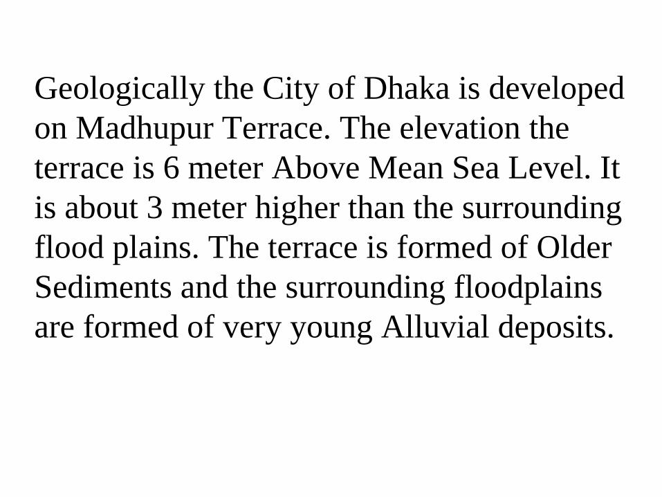
Geologically the City of Dhaka is developed
on Madhupur Terrace. The elevation the
terrace is 6 meter Above Mean Sea Level. It
is about 3 meter higher than the surrounding
flood plains. The terrace is formed of Older
Sediments and the surrounding floodplains
are formed of very young Alluvial deposits.

The issues confronting urban tunneling are not “can
tunnel technically be done?” but rather “what
are the advantages and disadvantages of
adopting one tunneling technique over another
and the consequences of the decision?”
The consequences concern are… 1. Public and political aspects
2. Cost and source of funding
3. Alignment
4. Geological and Hydro-Geological condition,
Risk Assessment and Ground Condition
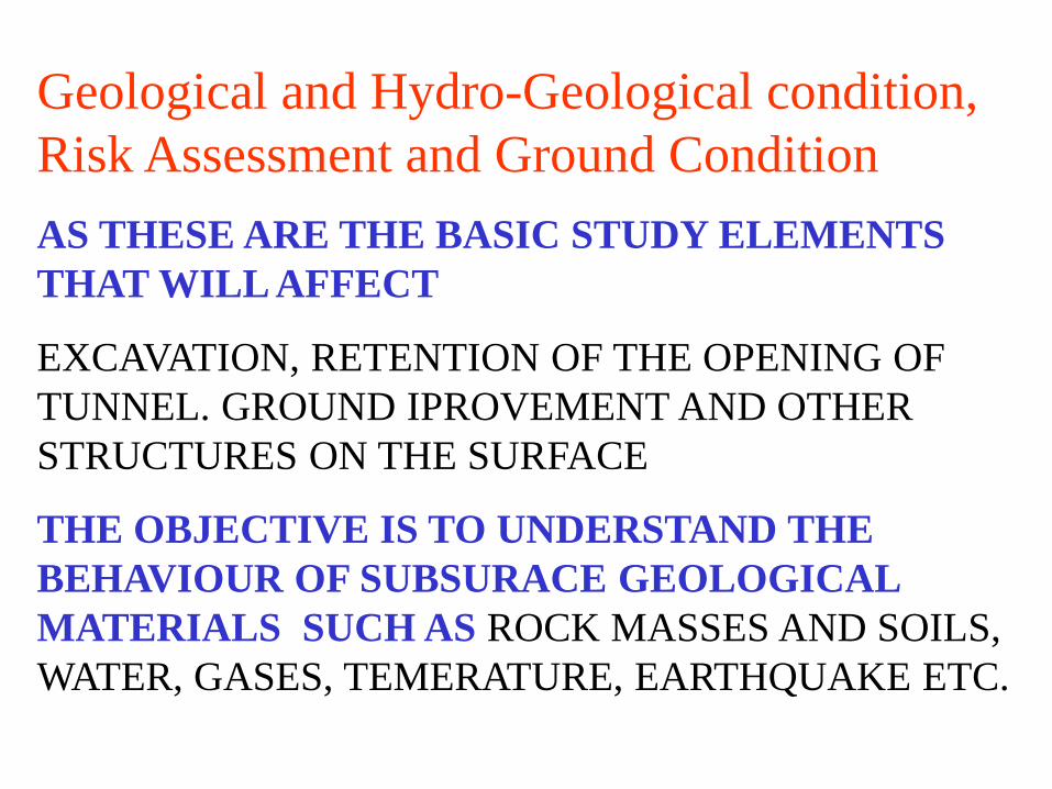
Geological and Hydro-Geological condition,
Risk Assessment and Ground Condition
AS THESE ARE THE BASIC STUDY ELEMENTS
THAT WILL AFFECT
EXCAVATION, RETENTION OF THE OPENING OF
TUNNEL. GROUND IPROVEMENT AND OTHER
STRUCTURES ON THE SURFACE
THE OBJECTIVE IS TO UNDERSTAND THE
BEHAVIOUR OF SUBSURACE GEOLOGICAL
MATERIALS SUCH AS ROCK MASSES AND SOILS,
WATER, GASES, TEMERATURE, EARTHQUAKE ETC.

Geological and Hydro-Geological condition,
Risk Assessment and Ground Condition
•Topography for Elevation Control
•Surface Geology and Geomorphology
•Subsurface Geological Structure
•Stratigraphic Boundary conditions: Vertical and
Lateral
•Geo-Engineering Characteristics of Sediments
•Surface Water and Runoff Characteristics

Dhaka City
Elevation Map
Dark areas are prone
to annual flooding.
URBAN SETTELEMENTS
Topography for Elevation Control and Understanding of
Surface flooding

SURFACE GEOLOGY
AND
GEOMORPHOLOGY
3D MODEL OF DHAKA
JOYDEVPUR BLOCK
MONOCLINAL
CLAY BED ON
SAND BRED
GEOLOGICAL
STRUCTURES
POSSIBLE
FAULT
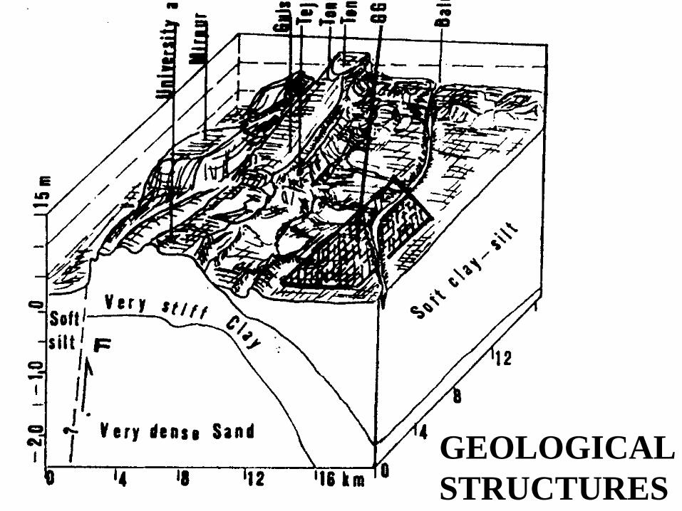
GEOLOGICAL
STRUCTURES

RED SOIL
CENTRAL
DHAKA
YELLOWISH
BROWN SOIL
EASTERN
DHAKA
GREY SOIL
WESTERN
DHAKA
0 M
6 M AMSL
YELLOWISH BROWN
THICK SAND
GEOLOGY OF DHAKA CITY

TONGI
RAMNA
UTTERA
BASHABO
SURFACE GEOLOGY
OF OF DHAKA CITY
0 meter
5meter
- 5 meter
- 10 meter
TUNNEL HORIZONE

Hydro-Geological condition
The permanent Ground Water Level is
located about 70m below the surface and
the all Hydro-geological environment is
favorable for underground activities,

There are three distinct
geomorphologic units
1. Central high area: This unit is
an elongated tableland above
flood level that stretches from
south to north. The elevation is
7m above mean sea level
(AMSL).
2. Complex of low and high areas:
This unit consists of narrow
strips of benches or foot slopes,
rounded to elongated saddle of
central unit, narrow and shallow
erosion gullies and incised
valleys or abandoned channels.
3. Complex of low areas: It consists
of flood plains of the rivers
Burhiganga, Sitalkhya and
Meghna, which is annually
flooded. The unit is flat and the
elevation is below 2m AMSL.
TONGI
RAMNA
UTTERA
BASHABO
JOIDEBPUR
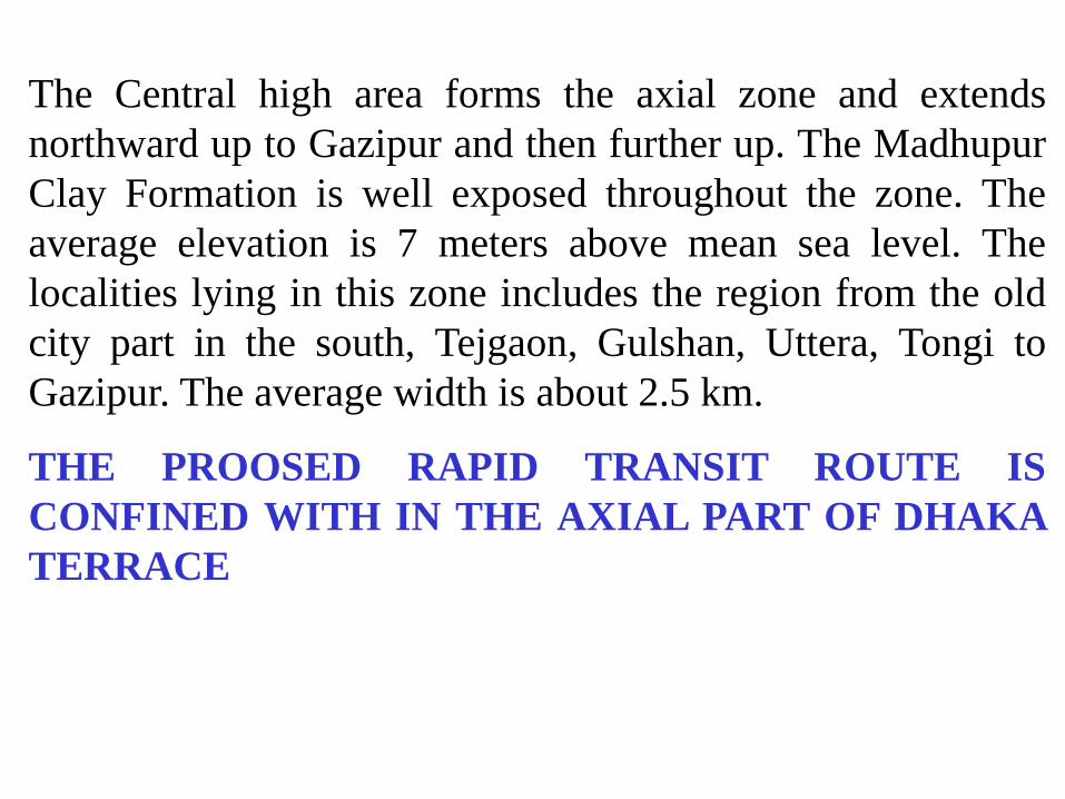
The Central high area forms the axial zone and extends
northward up to Gazipur and then further up. The Madhupur
Clay Formation is well exposed throughout the zone. The
average elevation is 7 meters above mean sea level. The
localities lying in this zone includes the region from the old
city part in the south, Tejgaon, Gulshan, Uttera, Tongi to
Gazipur. The average width is about 2.5 km.
THE PROOSED RAPID TRANSIT ROUTE IS
CONFINED WITH IN THE AXIAL PART OF DHAKA
TERRACE

Surface Water and Runoff Characteristics
The zone is drained by numerous large and long
streams, which were once connected with the
rivers flowing through the outskirts of the city.
Most of the long streams are deep enough to cut
through Madhupur Clay Formation. There are
number of depressions in this zone, mainly along
the abandoned streams.
THE PROOSED RAPID TRANSIT ROUTE IS
CONFINED WITH IN THE AXIAL PART OF
DHAKA TERRACE

This zone is rated as Class 1 type ground condition, it
is composed of very stiff to hard reddish brown Clay-
Silt (Madhupur Clay Formation), having good
engineering properties of the materials and considered
to produce less ground motion than the other two
zones. As the zone is composed of stable geological
materials, this will undergo elastic and plastic
deformation and will serve to dampen any seismic
motion and maintain some strength level. Most of the
area in this zone is stable and suitable for wide
engineering options for foundation design
consideration. State and suitability of underground
excavation and tunneling is highly suitable for
underground constructions.
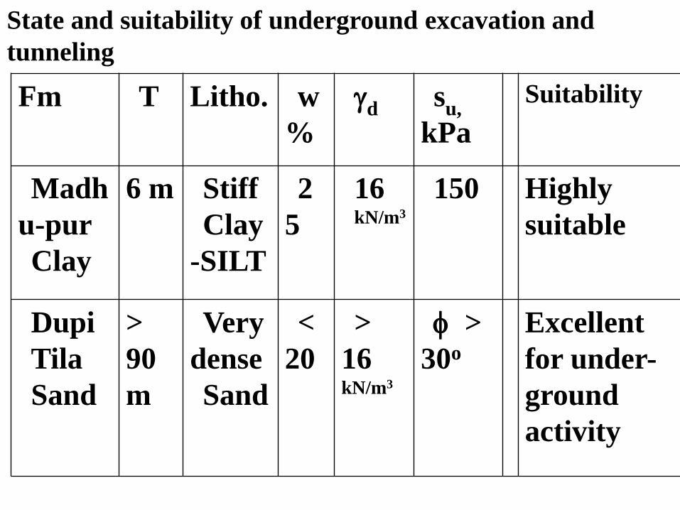
Fm T Litho. w
%
d su,
kPa
Suitability
Madh
u-pur
Clay
6 m Stiff
Clay
-SILT
2
5
16 kN/m3
150 Highly
suitable
Dupi
Tila
Sand
>
90
m
Very
dense
Sand
<
20
>
16 kN/m3
>
30o
Excellent
for under-
ground
activity
State and suitability of underground excavation and
tunneling
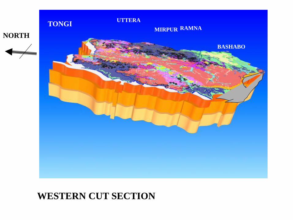
WESTERN CUT SECTION
NORTH
TONGI RAMNA
UTTERA
BASHABO
MIRPUR

RED CLAY
SANDSTONE
CLAY
SILT
TONGI
RAMNA
UTTERA
BASHABO
MIRPUR

TONGI RAMNA
UTTERA BASHABO MIRPUR
CLAY
SANDSTONE
CLAY
CLAY -SILT
NORTH

TONGI
RAMNA
UTTERA
BASHABO
MIRPUR
THICK CLAY IN THE
SOUTH EAST AND
EASTERN PART OF
DHAKA

WHAT WE WILL ENCOUNTER IN DEFFERENT PARTS
OF DHAKA CITY
CLAY
SILT
SAND
CLAY
SAND
CLAY
SAND
CLAY
SILT
TYPE A A TYPE A B TYPE A C TYPE B TYPE C
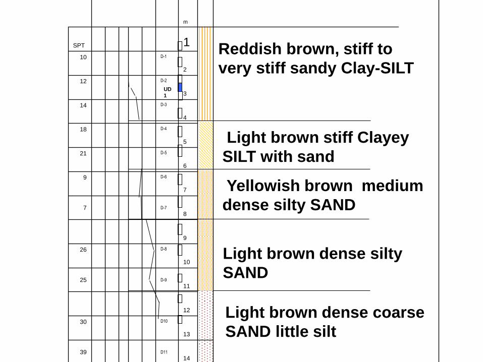
UD
1
Light brown stiff Clayey
SILT with sand
Yellowish brown medium
dense silty SAND
Light brown dense silty
SAND
Light brown dense coarse
SAND little silt
Reddish brown, stiff to
very stiff sandy Clay-SILT
18 D-14 43
17 D-13
42
16
D12
35
15
14 D11
39
13
D10
30
12
11 D-9
25
10
D-8
26
9
8 D-7
7
7
D-6 9
6
D-5
21
5
D-4
18
4
D-3
14
3
D-2
12
2
D-1
10
1 SPT
m

UD
1
Reddish to yellowish brown, stiff to very
stiff, Clay-SILT little sand
Yellowish brown, very soft sandy SILT,
(FILL)
Yellowish brown, stiff to very stiff, highly
plastic, mottled Clay-SILT little sand
Layer Change at 2.70m
Light grey, very stiff, highly plastic, sandy
clayey SILT
Yellowish brown, very stiff, Clayey
SILT with sand
16.00 D-12 25
15.00
14.00
D-11 20
13.00
18
12.00 D-10
11.00
D-9 16
10.00
9.00 D-8 21
8.00
D-7 20
7.00
D-6 19
6.00
D-5 20
5.00
D-4 13
4.00
D-3 10
3.00
D-2 1
2.00
2
1.00

2024 Mass
Rapid Transit
System
Phasing
CLAY
SILT
SAND
5m
30m
0m
5m
30m
0m
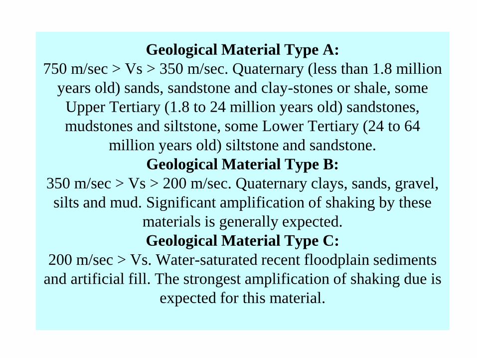
Geological Material Type A:
750 m/sec > Vs > 350 m/sec. Quaternary (less than 1.8 million
years old) sands, sandstone and clay-stones or shale, some
Upper Tertiary (1.8 to 24 million years old) sandstones,
mudstones and siltstone, some Lower Tertiary (24 to 64
million years old) siltstone and sandstone.
Geological Material Type B:
350 m/sec > Vs > 200 m/sec. Quaternary clays, sands, gravel,
silts and mud. Significant amplification of shaking by these
materials is generally expected.
Geological Material Type C:
200 m/sec > Vs. Water-saturated recent floodplain sediments
and artificial fill. The strongest amplification of shaking due is
expected for this material.

D
ha
n
m
on
di
K
a
m
ra
gi
r
C
ha
r
Isl
a
m
pu
r
D
e
m
ra
R
a
m
na
B
as
ha
bo
M
ir
pu
r
K
af
ru
l
B
ar
id
ha
ra
Ut
te
ra
Ut
te
r
K
ha
n
6m
4m
2m
0m
- 2m
- 4m
- 6m
- 8m
- 10m
- 12m
- 14m
- 16m
DT - DUPITILA SANDSTONE
MC -
MADHUPUR
CLAY
RESIDUUM
DT
DT
MC
MC
MC
DT
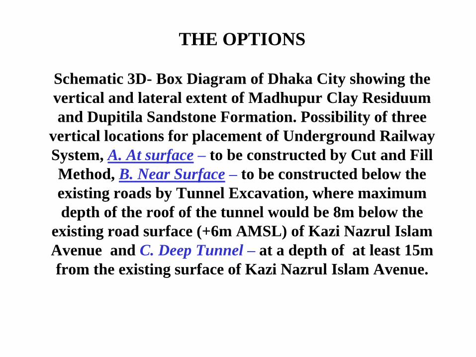
THE OPTIONS
Schematic 3D- Box Diagram of Dhaka City showing the
vertical and lateral extent of Madhupur Clay Residuum
and Dupitila Sandstone Formation. Possibility of three
vertical locations for placement of Underground Railway
System, A. At surface – to be constructed by Cut and Fill
Method, B. Near Surface – to be constructed below the
existing roads by Tunnel Excavation, where maximum
depth of the roof of the tunnel would be 8m below the
existing road surface (+6m AMSL) of Kazi Nazrul Islam
Avenue and C. Deep Tunnel – at a depth of at least 15m
from the existing surface of Kazi Nazrul Islam Avenue.

CITY ENGINEERING
GEOLOGY
DISADVANTAGES GEOLOGICAL
ADVENTAGES
KOLKATA AND
BANGKOK
YOUNG DELTAIC
SEDIMENTS,
SOFT CLAY, SILT
AND SAND AND
PEAT AT NEAR
SURFACE
ONLY CHOICE - CUT
AND FILL AS NO
FIRM STRTUM AT A
CONSIDERABLE
DEPTH. HEAVY
DEWATERING
EASY FOR
EXCAVATION AND
EASY FOR
REMOVAL OF
WASTE
MANHATTAN
AND MANY
EUROPEAN
CITIES
HARD ROCK DIFFICULT TO
DRILL OR
EXCAVATE..
REMOVAL
DIFFICULT
REQUIRES LESS
PROTECTION
DURING
PREGRESION OF
TUNNEL
DHAKA TERRACE OF
SEDIMENTARY
ROCK OR STIFF
CLAY AND VERY
DENSE SAND
WILL REQUIER
MODERATE
PROTECTION TO
RETAIN TUNNELS
BEFOR RIMMING
FREEDOM OF
CHOICE FOR ANY
METHOD OF
TUNNELING AND
REMOVAL OF WSTE
MATERIALS
A COMPARISON WITH OTHER CITIES

GEOLOGICAL SURVEY OF BANGLADESH CONSIDERS DHAKA GROUND CONDITION TO BE THE BEST THAN ANY OTHER CITIES IN THE WORLD FOR UNDER GROUND
ACTIVITIES
THANK YOU [email protected]