red cedar cir office and vehicle minor repair - city of fort
TRANSCRIPT
CDR150073
CDR150074
CDR150075
¬«287
¬«14
Red C
edar
Cir
Conifer St
Hickory St
N Co
llege
Ave
©
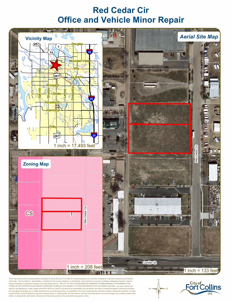
Red Cedar CirOffice and Vehicle Minor Repair
These map products and all underlying data are developed for use by the City of Fort Collins for its internal purposes only, and were not designed or intended for general use by membersof the public. The City makes no representation or warranty as to its accuracy, timeliness, or completeness, and in particular, its accuracy in labeling or displaying dimensions, contours,property boundaries, or placement of location of any map features thereon. THE CITY OF FORT COLLINS MAKES NO WARRANTY OF MERCHANTABILITY OR WARRANTY FORFITNESS OF USE FOR PARTICULAR PURPOSE, EXPRESSED OR IMPLIED, WITH RESPECT TO THESE MAP PRODUCTS OR THE UNDERLYING DATA. Any users of these mapproducts, map applications, or data, accepts same AS IS, WITH ALL FAULTS, and assumes all responsibility of the use thereof, and further covenants and agrees to hold the City harmlessfrom and against all damage, loss, or liability arising from any use of this map product, in consideration of the City's having made this information available. Independent verification of all datacontained herein should be obtained by any users of these products, or underlying data. The City disclaims, and shall not be held liable for any and all damage, loss, or liability, whether direct,indirect, or consequential, which arises or may arise from these map products or the use thereof by any person or entity.
1 inch = 133 feet
_̂
£¤287
£¤287
£¤287
UV14¬«1
§̈¦25
§̈¦25
§̈¦25
Douglas
Vine
Mountain Vista
Mulberry
Trilby
Lema
y
Shiel
ds
Harmony
Taft H
ill
Prospect
Horsetooth
Drake
Timbe
rline
ICS
Red C
edar
Cir
Aerial Site MapVicinity Map
Zoning Map
1 inch = 208 feet
1 inch = 17,493 feet

CONCEPTUAL REVIEW: APPLICATION
Community Development & Neighborhood Services – 281 N College Ave – Fort Collins, CO 80522-0580
Development Review Guide – STEP 2 of 8
General Information All proposed development projects begin with Conceptual Review. Anyone with a development idea can schedule a Conceptual Review meeting to get feedback on prospective development ideas. At this stage, the development idea does not need to be finalized or professionally presented. However, a sketch plan and this application must be submitted to City Staff prior to the Conceptual Review meeting. The more information you are able to provide, the better feedback you are likely to get from the meeting. Please be aware that any information submitted may be considered a public record, available for review by anyone who requests it, including the media.
Conceptual Reviews are scheduled on three Monday mornings per month on a “first come, first served” basis. One 45 meeting is allocated per applicant and only three conceptual reviews are done each Monday morning. Conceptual Review is a free service. Complete applications and sketch plans must be submitted to City Staff no later than 5 pm, two Tuesdays prior to the meeting date. Application materials must be e-mailed to [email protected]. If you do not have access to e-mail, other accommodations can be made upon request. At Conceptual Review, you will meet with Staff from a number of City departments, such as Community Development and Neighborhood Services (Zoning, Current Planning, and Development Review Engineering), Light and Power, Stormwater, Water/Waste Water, Advance Planning (Long Range Planning and Transportation Planning) and Poudre Fire Authority. Comments are offered by staff to assist you in preparing the detailed components of the project application. There is no approval or denial of development proposals associated with Conceptual Review. At the meeting you will be presented with a letter from staff, summarizing comments on your proposal. *BOLDED ITEMS ARE REQUIRED* *The more info provided, the more detailed your comments from staff will be.* Contact Name(s) and Role(s) (Please identify whether Consultant or Owner, etc) ________________________
______________________________________________________________________________________
Business Name (if applicable) ______________________________________________________________
Your Mailing Address _____________________________________________________________________
Phone Number ______________________Email Address _______________________________________
Site Address or Description (parcel # if no address) ____________________________________________
_______________________________________________________________________________________
Description of Proposal (attach additional sheets if necessary) ____________________________________
_______________________________________________________________________________________
_______________________________________________________________________________________
Proposed Use ______________________________ Existing Use _________________________________
Total Building Square Footage ___________ S.F. Number of Stories ______ Lot Dimensions _____________
Age of any Existing Structures _____________________________________________________________ Info available on Larimer County’s Website: http://www.co.larimer.co.us/assessor/query/search.cfm If any structures are 50+ years old, good quality, color photos of all sides of the structure are required for conceptual.
Is your property in a Flood Plain? □ Yes □ No If yes, then at what risk is it? ___________________ Info available on FC Maps: http://gisweb.fcgov.com/redirect/default.aspx?layerTheme=Floodplains.
Increase in Impervious Area __________________________________________________________ S.F. (Approximate amount of additional building, pavement, or etc. that will cover existing bare ground to be added to the site)
Suggested items for the Sketch Plan: Property location and boundaries, surrounding land uses, proposed use(s), existing and proposed improvements (buildings, landscaping, parking/drive areas, water treatment/detention, drainage), existing natural features (water bodies, wetlands, large trees, wildlife, canals, irrigation ditches), utility line locations (if known), photographs (helpful but not required). Things to consider when making a proposal: How does the site drain now? Will it change? If so, what will change?
CR
T S
KE
TC
H P
LAN
- N
OT
FO
R C
ON
ST
RU
CT
ION
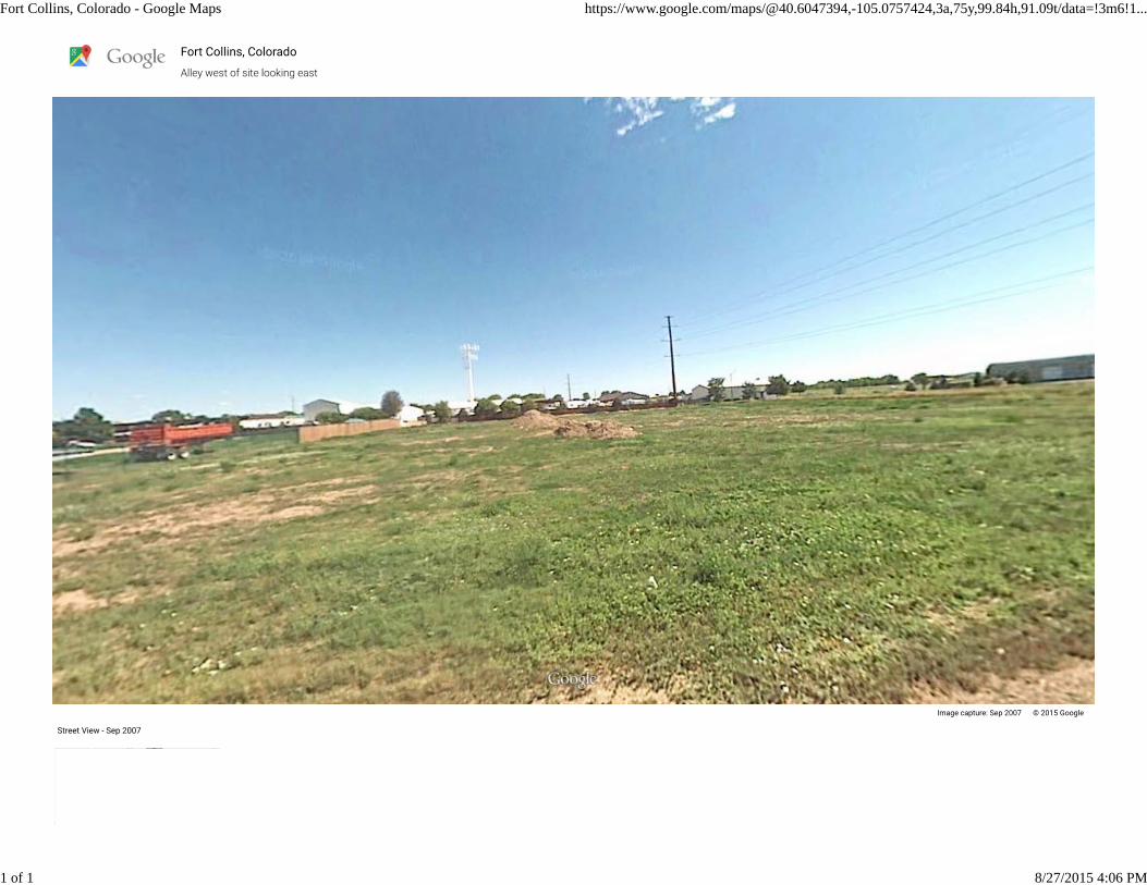
Fort Collins, Colorado - Google Maps https://www.google.com/maps/@40.6047394,-105.0757424,3a,75y,99.84h,91.09t/data=!3m6!1...
1 of 1 8/27/2015 4:06 PM
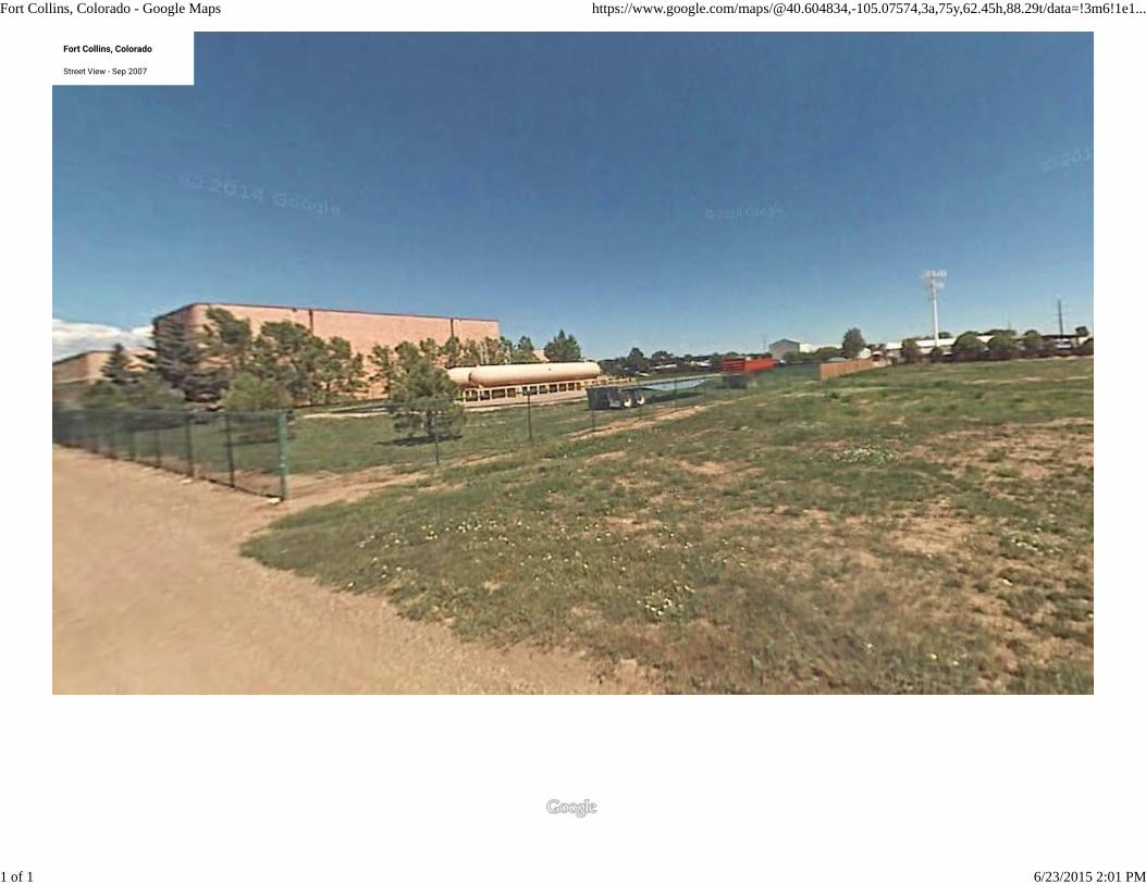
Fort Collins, Colorado - Google Maps https://www.google.com/maps/@40.604834,-105.07574,3a,75y,62.45h,88.29t/data=!3m6!1e1...
1 of 1 6/23/2015 2:01 PM
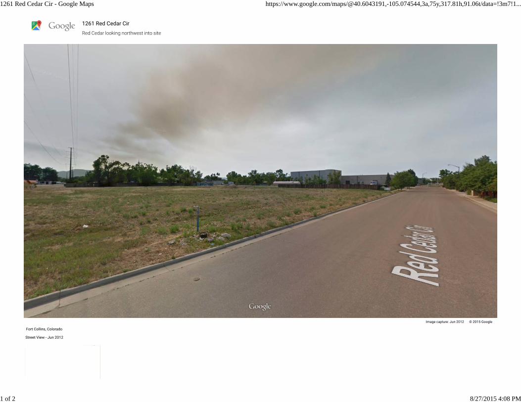
1261 Red Cedar Cir - Google Maps https://www.google.com/maps/@40.6043191,-105.074544,3a,75y,317.81h,91.06t/data=!3m7!1...
1 of 2 8/27/2015 4:08 PM

1261 Red Cedar Cir - Google Maps https://www.google.com/maps/@40.6043191,-105.074544,3a,75y,317.81h,91.06t/data=!3m7!1...
2 of 2 8/27/2015 4:08 PM
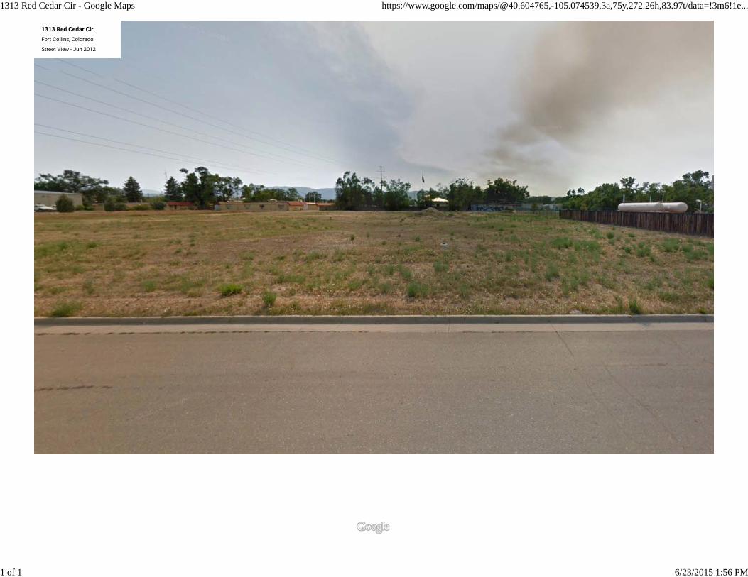
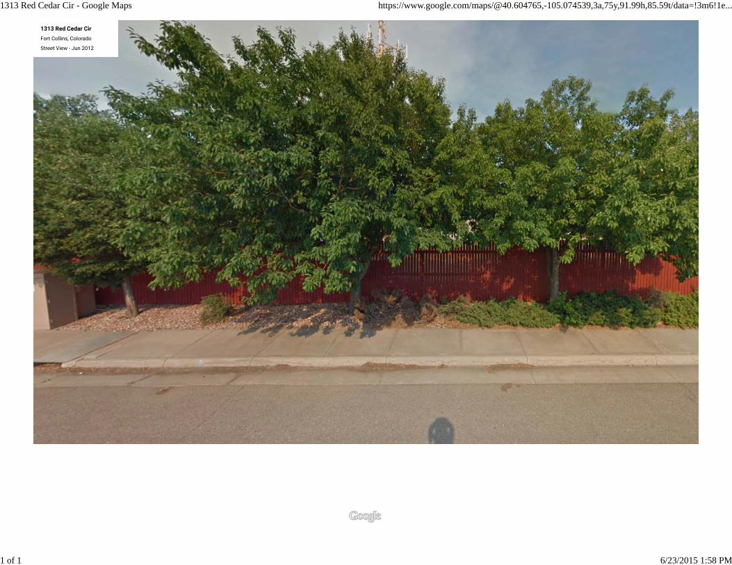
1313 Red Cedar Cir - Google Maps https://www.google.com/maps/@40.604765,-105.074539,3a,75y,272.26h,83.97t/data=!3m6!1e...
1 of 1 6/23/2015 1:56 PM
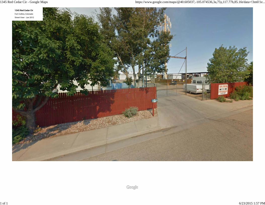
1345 Red Cedar Cir - Google Maps https://www.google.com/maps/@40.605037,-105.074536,3a,75y,117.77h,85.16t/data=!3m6!1e...
1 of 1 6/23/2015 1:57 PM
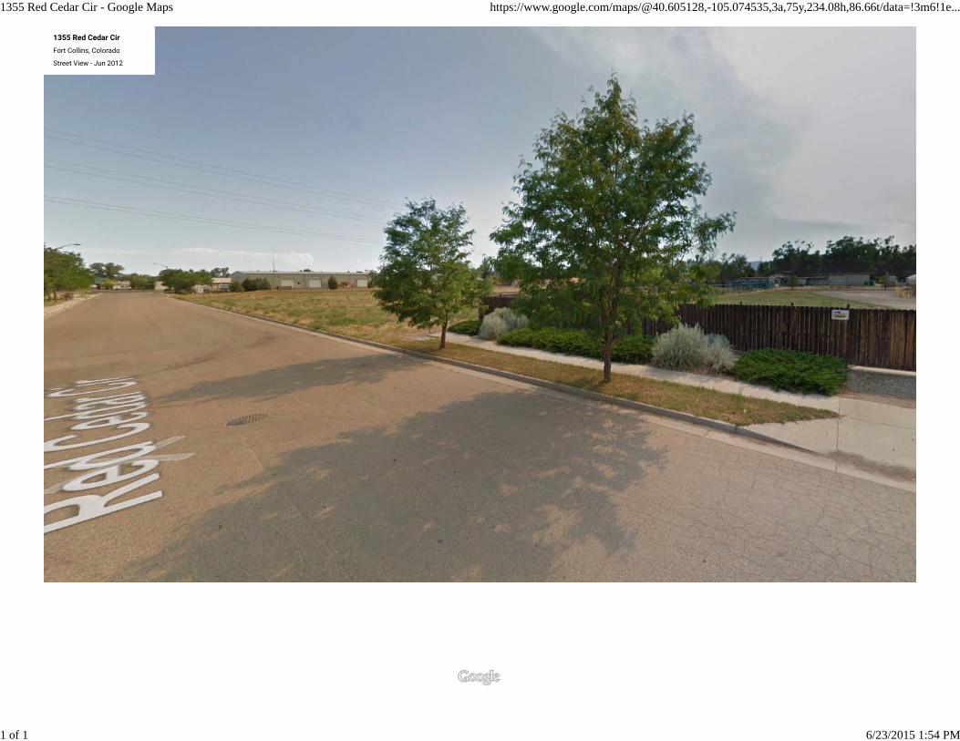
1355 Red Cedar Cir - Google Maps https://www.google.com/maps/@40.605128,-105.074535,3a,75y,234.08h,86.66t/data=!3m6!1e...
1 of 1 6/23/2015 1:54 PM
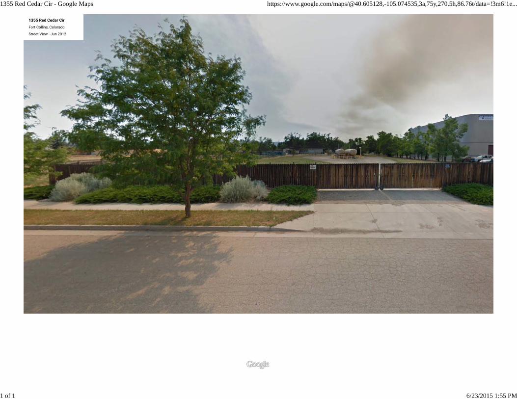
1355 Red Cedar Cir - Google Maps https://www.google.com/maps/@40.605128,-105.074535,3a,75y,270.5h,86.76t/data=!3m6!1e...
1 of 1 6/23/2015 1:55 PM
1313 Red Cedar Cir - Google Maps https://www.google.com/maps/@40.604765,-105.074539,3a,75y,91.99h,85.59t/data=!3m6!1e...
1 of 1 6/23/2015 1:58 PM
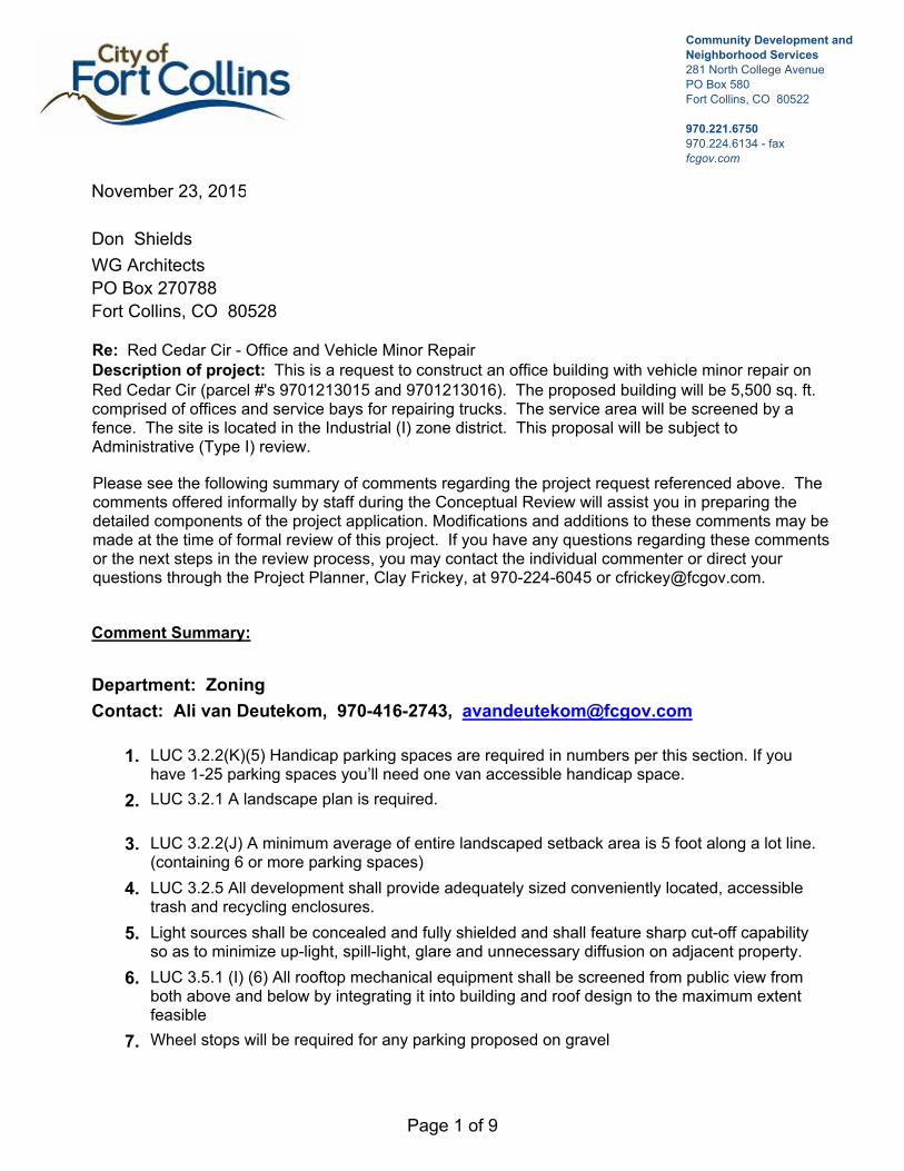
Community Development and Neighborhood Services 281 North College AvenuePO Box 580Fort Collins, CO 80522
970.221.6750970.224.6134 - faxfcgov.com
Don Shields
November 23, 2015
WG Architects
PO Box 270788
Fort Collins, CO 80528
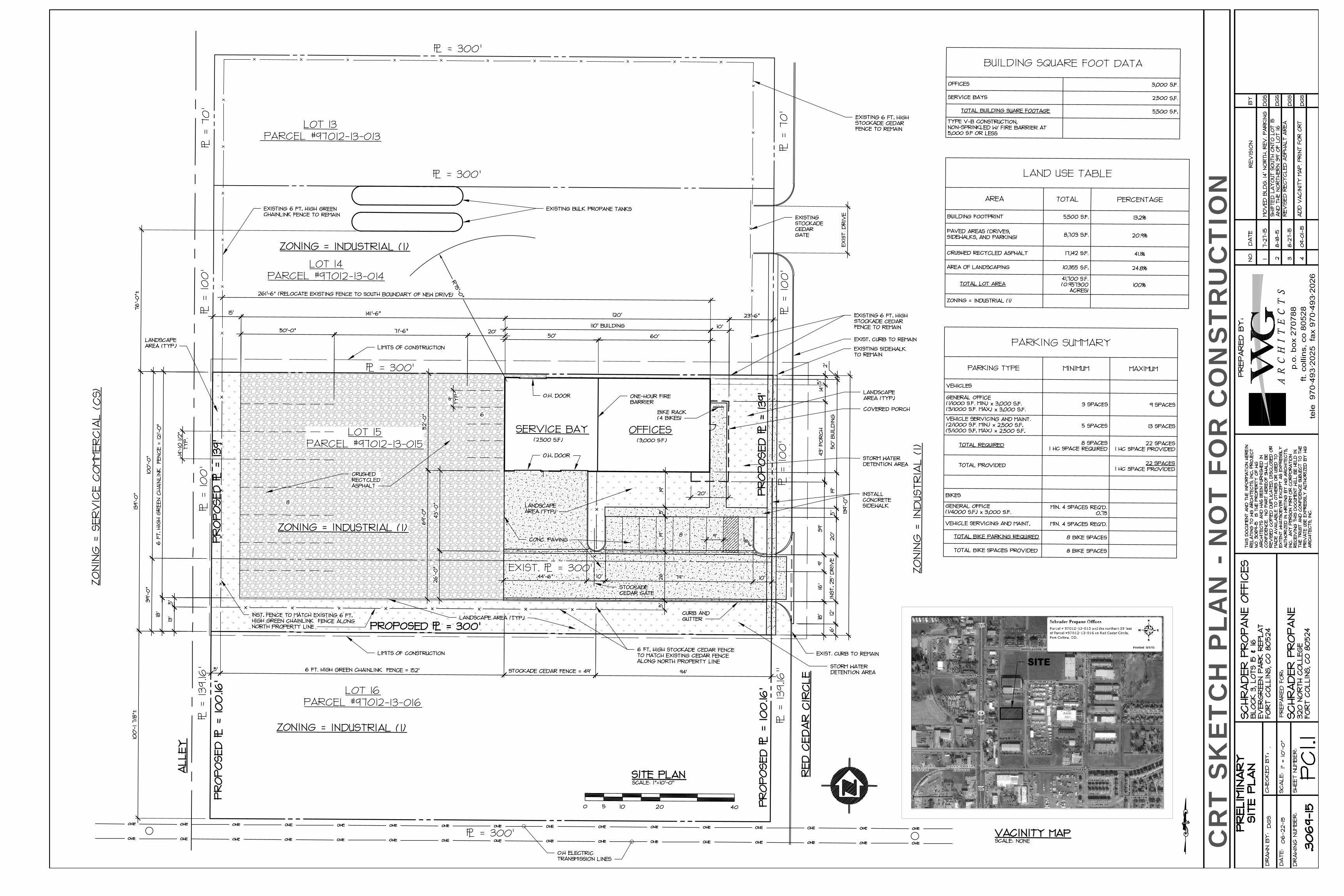
Re: Red Cedar Cir - Office and Vehicle Minor RepairDescription of project: This is a request to construct an office building with vehicle minor repair on Red Cedar Cir (parcel #'s 9701213015 and 9701213016). The proposed building will be 5,500 sq. ft. comprised of offices and service bays for repairing trucks. The service area will be screened by a fence. The site is located in the Industrial (I) zone district. This proposal will be subject to Administrative (Type I) review.
Please see the following summary of comments regarding the project request referenced above. The comments offered informally by staff during the Conceptual Review will assist you in preparing the detailed components of the project application. Modifications and additions to these comments may be made at the time of formal review of this project. If you have any questions regarding these comments or the next steps in the review process, you may contact the individual commenter or direct your questions through the Project Planner, Clay Frickey, at 970-224-6045 or [email protected].
Comment Summary:
Contact: Ali van Deutekom, 970-416-2743, [email protected]
Department: Zoning
LUC 3.2.2(K)(5) Handicap parking spaces are required in numbers per this section. If you have 1-25 parking spaces you’ll need one van accessible handicap space.
1.
LUC 3.2.1 A landscape plan is required.2.
LUC 3.2.2(J) A minimum average of entire landscaped setback area is 5 foot along a lot line. (containing 6 or more parking spaces)
3.
LUC 3.2.5 All development shall provide adequately sized conveniently located, accessible trash and recycling enclosures.
4.
Light sources shall be concealed and fully shielded and shall feature sharp cut-off capability so as to minimize up-light, spill-light, glare and unnecessary diffusion on adjacent property.
5.
LUC 3.5.1 (I) (6) All rooftop mechanical equipment shall be screened from public view from both above and below by integrating it into building and roof design to the maximum extent feasible
6.
Wheel stops will be required for any parking proposed on gravel7.
Page 1 of 9
Contact: Heather McDowell, 9702246065, [email protected]
Department: Water-Wastewater Engineering
Existing water mains in the vicinity include an 8-inch water main in Red Cedar Circle and a 36-inch water main along the southern boundary line of Lot 16. There is also a 75’ wide “Trans Line Easement” that straddles the lot line (37.5’ easement on Lot 16). It is unknown if the 36-inch water main is within that easement or not.
1.
Existing sewer mains in the vicinity include and 8-inch sewer main in Red Cedar Circle and an 8-inch main in the alley to the west of the property.
2.
There does not appear to be existing water or sewer services stubbed into Lot 15 or 16 at this time.
3.
The water conservation standards for landscape and irrigation will apply. Information on these requirements can be found at: http://www.fcgov.com/standards
4.
Development fees and water rights will be due at building permit.5.
Contact: Heather McDowell, 9702246065, [email protected]
Department: Stormwater Engineering
The design of this site must conform to the drainage basin design of the Dry Creek Master Drainage Plan as well the Fort Collins Stormwater Criteria Manual.
1.
Onsite detention is required for the runoff volume difference between the 100 year developed inflow rate with the 2 year historic release rate. In the Dry Creek basin the two year historic release rate is 0.2 cfs/acre. Parking lot detention for water quantity is allowed as long as it is not deeper than one foot.
2.
This site is located within the Northeast College Corridor Outfall (NECCO) area, and as such, there are generally two requirements:
- The site will be assessed NECCO system charges for its portion of the NECCO pond and outfall system, $28,007/acre. The fees would be due prior to receiving a building permit.
- This site looks to be situated in basin 426 of the NECCO drainage basins, and will be required to provide onsite detention. Water quality will be provided in the regional pond and doesn't need to be provided onsite.
3.
A drainage report, erosion control report, and construction plans are required and they must be prepared by a Professional Engineer registered in Colorado. The drainage report must address the four-step process for selecting structural BMPs. There is a final site inspection required when the project is complete and the maintenance is handed over to an HOA or another maintenance organization. The erosion control report requirements are in the Fort Collins Stormwater Manual, Section 1.3.3, Volume 3, Chapter 7 of the Fort Collins Amendments. If you need clarification concerning this section, please contact the Erosion Control Inspector, Jesse Schlam at 224-6015 or [email protected].
4.
Low Impact Development (LID) requirements are required on all new or redeveloping property which includes sites required to be brought into compliance with the Land Use Code. These require a higher degree of water quality treatment for 50% of the new impervious area and 25% of new paved areas must be pervious. Standard operating procedures (SOPs) for all onsite drainage facilities will be included as part of the Development Agreement. More information and links can be found at: http://www.fcgov.com/utilities/what-we-do/stormwater/stormwater-quality/low-impact-development
5.
Page 2 of 9
Per Colorado Revised Statute §37-92-602 (8) effective August 5, 2015, criteria regarding detention drain time will apply to this project. As part of the drainage design, the engineer will be required to show compliance with this statute using a standard spreadsheet (available on request) that will need to be included in the drainage report. Upon completion of the project, the engineer will also be required to upload the approved spreadsheet onto the Statewide Compliance Portal. This will apply to any volume based stormwater storage, including extended detention basins and bio-retention cells.
6.
The city wide Stormwater development fee (PIF) is $7,817/acre ($0.1795 sq.-ft.) for new impervious area over 350 sq.-ft., and there is a $1,045.00/acre ($0.024/sq.-ft.) review fee. No fee is charged for existing impervious area. These fees are to be paid at the time each building permit is issued. Information on fees can be found at: http://www.fcgov.com/utilities/business/builders-and-developers/plant-investment-development-fees or contact Jean Pakech at 221-6375 for questions on fees. There is also an erosion control escrow required before the Development Construction permit is issued. The amount of the escrow is determined by the design engineer, and is based on the site disturbance area, cost of the measures, or a minimum amount in accordance with the Fort Collins Stormwater Manual.
7.
Contact: Jim Lynxwiler, 970-416-2869, [email protected]
Department: Fire Authority
FIRE CONTAINMENT The building exceeds 5000 square feet and the proposal shows that fire containment is being chosen over the installation of an automatic sprinkler system. Containment construction shall be reviewed and approved by the Poudre Fire Authority at time of building permit (and prior to installation).
1.
FIRE LANES Fire access is required to within 150' of all portions of the building exterior. The building is considered out of access from Red Cedar Circle and an Emergency Access Easement will be required along the drive aisled from the curb cut at Red Cedar to the western edge of the building. Code language and fire lane specifications provided below.
> IFC 503.1.1: Approved fire Lanes shall be provided for every facility, building or portion of a building hereafter constructed or moved into or within the jurisdiction. The fire apparatus access road shall comply with the requirements of this section and shall extend to within 150 feet of all portions of the facility and all portions of the exterior walls of the first story of the building as measured by an approved route around the exterior of the building or facility. When any portion of the facility or any portion of an exterior wall of the first story of the building is located more than 150 feet from fire apparatus access, the fire code official is authorized to increase the dimension if the building is equipped throughout with an approved, automatic fire-sprinkler system.
FIRE LANE SPECIFICATIONS A fire lane plan shall be submitted for approval prior to installation. In addition to the design criteria already contained in relevant standards and policies, any new fire lane must meet the following general requirements: > Shall be designated on the plat as an Emergency Access Easement. > Maintain the required 20 foot minimum unobstructed width & 14 foot minimum overhead clearance. > Be designed as a flat, hard, all-weather driving surface capable of supporting 40 tons. > Dead-end fire access roads in excess of 150 feet in length shall be provided with an approved area for turning around fire apparatus. > The required turning radii of a fire apparatus access road shall be a minimum of 25 feet inside and 50 feet outside. Turning radii shall be detailed on submitted plans.
2.
Page 3 of 9
> Be visible by painting and/or signage, and maintained unobstructed at all times. > Additional access requirements exist for buildings greater than 30' in height. Refer to Appendix D of the 2012 IFC or contact PFA for details. International Fire Code 503.2.3, 503.2.4, 503.2.5, 503.3, 503.4 and Appendix D; FCLUC 3.6.2(B)2006 and Local Amendments.
WATER SUPPLY A fire hydrant is required within 300' of the building as measured along the path of vehicle travel. The existing utility infrastructure available in the area appears to meet this requirement however, it is the responsibility of the applicant to verify hydrant location, pressure and volume. Code language provided below.
> IFC 508.1 and Appendix B: COMMERCIAL REQUIREMENTS: Hydrants to provide 1,500 gpm at 20 psi residual pressure, spaced not further than 300 feet to the building.
3.
SECURITY GATES > IFC 503.6: The installation of security gates across a fire apparatus access road shall be approved by the fire chief. Where security gates are installed, they shall have an approved means of emergency operation. The security gates and the emergency operation shall be maintained operational at all times.
2012 IFC D103.5: Gates securing fire apparatus access roads shall comply with all of the following criteria: 1. The minimum gate width for vehicle access shall be 20 feet. 2. Gates shall be of the swinging or sliding type. 3. Construction of gates shall be of materials that allow manual operation by one person. 4. Gate components shall be maintained in an operative condition at all times and replaced or repaired when defective. 5. Electric gates shall be equipped with a means of opening the gate by fire department personnel for emergency access. Emergency opening devices shall be approved by the fire code official. 6. Manual opening gates shall not be locked with an unapproved padlock, or chain and padlock, unless they are capable of being opened by means of forcible entry tools or when a key box containing the key(s) to the lock is installed at the gate location. 7. Gate design and locking device specifications shall be submitted for approval by the fire code official prior to installation. 8. Electric gate operators, where provided, shall be listed in accordance with UL 325. 9. Gates intended for automatic operation shall be designed, constructed and installed to comply with the requirements of ASTM F 2200.
Visit http://www.knoxbox.com/store/Knox-Key-Switches.cfm for key switch information.
4.
Contact: Kelly Kimple, , [email protected]
Department: Environmental Planning
With respect to landscaping and design, the City of Fort Collins Land Use Code, in Article 3.2.1 (E)(3), requires that you use low-water-use plants and grasses in your landscaping or re-landscaping and reduce bluegrass lawns as much as possible.
1.
The applicant should make note of Article 3.2.1(C) that requires developments to submit a landscape and tree protection plan, and if receiving water service from the City, an irrigation plan, that: "...(4) protects significant trees, natural systems, and habitat, and (5) enhances the pedestrian environment". Note that a significant tree is defined as a tree having DBH (Diameter at Breast Height) of six inches or more. If any of the trees within this site have a DBH of greater than six inches, a review of the trees shall be conducted with Tim Buchanan, City Forester (970-221-6361 or [email protected]) to determine the status of the existing trees and any mitigation requirements that could result from the proposed
2.
Page 4 of 9
development.
Our city has an established identity as a forward-thinking community that cares about the quality of life it offers its citizens and has many sustainability programs and goals that may benefit your project. Of particular interest may be the:
1. ClimateWise program: fcgov.com/climatewise/2. Zero Waste Plan and the Waste Reduction and Recycling Assistance Program (WRAP): fcgov.com/recycling/pdf/_20120404_WRAP_ProgramOverview.pdf, contact Caroline Mitchell at 970-221-6288 or [email protected] 3. Green Building and the Climate Action Plan: fcgov.com/enviro/green-building.php, contact Tony Raeker at 970-416-4238 or [email protected]. Integrated Design Assistance Program: fcgov.com/idap, contact Gary Schroeder at 970-224-6003 or [email protected]
Please consider the City’s sustainability goals and ways for your development to engage with these efforts.
3.
Contact: Sheri Langenberger, 970-221-6573, [email protected]
Department: Engineering Development Review
Marc Virata [email protected] or 221-6567 will be the Engineer assigned to this project. Please contact him if you have further questions regarding the engineering comments or requirements.
1.
Larimer County Road Impact Fees and Street Oversizing Fees are due at the time of building permit. Please contact Matt Baker at 224-6108 if you have any questions.
2.
The City's Transportation Development Review Fee (TDRF) is due at the time of submittal. For additional information on these fees, please see: http://www.fcgov.com/engineering/dev-review.php
3.
Any damaged curb, gutter and sidewalk existing prior to construction, as well as streets, sidewalks, curbs and gutters, destroyed, damaged or removed due to construction of this project, shall be replaced or restored to City of Fort Collins standards at the Developer's expense prior to the acceptance of completed improvements and/or prior to the issuance of the first Certificate of Occupancy.
4.
A public detached sidewalk along the frontage of the property will need to be designed and constructed and shall meet ADA standards.
5.
Any public improvements must be designed and built in accordance with the Larimer County Urban Area Street Standards (LCUASS). They are available online at: http://www.larimer.org/engineering/GMARdStds/UrbanSt.htm
6.
This project is responsible for dedicating any right-of-way and easements that are necessary or required by the City for this project. This shall including the standard utility easements that are to be provided behind the right-of-way (8 foot along the alley, and 9 foot along Red Cedar Circle). Additional right of way will likely need to be dedicated to accommodate the detached sidewalk and parkway that will need to be constructed along the frontage of the property.
7.
A repay for the recent alley improvements will be due. This will need to be paid prior to issuance of a building permit on the site.
8.
We will need to look at the driveway location. The standards require that a minimum separation between driveways for this category of road would be 30 feet between driveway edges is provided or that they align. Since the sketch provided does not who the east side of the road I am not sure where the other driveways are.
9.
Utility plans will be required and a Development Agreement will be recorded once the project is finalized.
10.
Page 5 of 9
A Development Construction Permit (DCP) will need to be obtained prior to starting any work on the site.
11.
LCUASS parking setbacks (Figure 19-6) apply and will need to be followed depending on parking design.
12.
I have no concerns regarding where this plan shows the gate and fencing for enclosing the back area as shown, but would have concerns and comments if the gate were to be moved east of the parking stalls.
13.
Bike parking required for the project cannot be placed within the right-of-way and if placed just behind the right-of-way need to be placed so that when bikes are parked they do not extend into the right-of-way.
14.
In regards to construction of this site. The public right-of-way shall not be used for staging or storage of materials or equipment associated with the Development, nor shall it be used for parking by any contractors, subcontractors, or other personnel working for or hired by the Developer to construct the Development. The Developer will need to find a location(s) on private property to accommodate any necessary Staging and/or parking needs associated with the completion of the Development. Information on the location(s) of these areas will be required to be provided to the City as a part of the Development Construction Permit application.
15.
Contact: Tyler Siegmund, 970-416-2772, [email protected]
Department: Electric Engineering
Is it known if sigle phase or 3 phase service will be needed. There is currently primary service available in the area.
1.
Electric Capacity Fee, Building Site charges and any system modification charges necessary will apply to this development. A link to our electric fee estimator is below. http://www.fcgov.com/utilities/business/builders and developers/plant-investment development fees/electric-development fee estimator?id=2
2.
Transformer location will need to be coordinated with Light & Power. Transformer must be placed within 10 ft of a driveable surface for installation and maintenance purposes. Also, the transformer must have a front clearance of 10 ft and side/rear clearance of 3 ft.
3.
Please contact Light & Power Engineering if you have any questions at 221-6700. Please reference our policies, development charge processes, and use our fee estimator at http://www.fcgov.com/utilities/business/builders-and-developers.
4.
A commercial service information form (C-1 form) and a one line diagram will need to be completed and submitted to Light & Power Engineering. A link to C-1 document is below:
http://www.fcgov.com/utilities/business/builders-and-developers/development- forms-guidelines-regulations
5.
If it is anticipated that the existing transformer on the lot to the north will be utilized to provide power then a utility easement will need to be dedicated around the transformer on the lot to the north. This is to protect the Developer in the event that the property to the north changes ownership in the future. A utility easement will ensure that this property has legal access to maintain the electric service from the transformer on the lot to the north. Please contact me if you have any questions.
6.
Contact: Sarah Carter, 970-416-2748, [email protected]
Department: Building Inspection
Pre-Submittal meetings are offered to assist the designer/builder by assuring, early on in the 1.
Page 6 of 9
design, that the new commercial or multi-family projects are on track to complying with all of the adopted City codes and Standards listed below. The proposed project should be in the early to mid-design stage for this meeting to be effective and is typically scheduled after the Current Planning conceptual review meeting. Applicants of new commercial or multi-family projects are advised to call 416-2341 to schedule a pre-submittal meeting. Applicants should be prepared to present site plans, floor plans, and elevations and be able to discuss code issues of occupancy, square footage and type of construction being proposed. Construction shall comply with the following adopted codes as amended:2012 International Building Code (IBC) 2012 International Residential Code (IRC) 2012 International Energy Conservation Code (IECC) 2012 International Mechanical Code (IMC) 2012 International Fuel Gas Code (IFGC) 2012 International Plumbing Code (IPC) as amended by the State of Colorado2014 National Electrical Code (NEC) as amended by the State of ColoradoFort Collins has amendments to most of the codes listed above. See the fcgov.com web page to view them.
Accessibility: State Law CRS 9-5 & ICC/ANSI A117.1-2009.Snow Load Live Load: 30 PSF / Ground Snow Load 30 PSF.Frost Depth: 30 inches.Wind Load: 100- MPH 3 Second Gust Exposure B.Seismic Design: Category B.Climate Zone: Zone 5Energy Code Use 1. Single Family; Duplex; Townhomes: 2012 IRC Chapter 11 or 2012 IECC.2. Multi-family and Condominiums 3 stories max: 2012 IECC residential chapter.3. Commercial and Multi-family 4 stories and taller: 2012 IECC commercial chapter.
Contact: Clay Frickey, 970-224-6045, [email protected]
Planning Services
Will you be replatting as a part of this development proposal? The current proposal shows the development occurring on two different lots. A replat might be beneficial in the event of future redevelopment.
1.
Will the 14 parking spaces shown in the rear of the lot be usable by the public? If not, these spaces will not count towards your parking requirement. Your site plan as shown meets the minimum but staff would prefer if you excluded the 14 spaces in the rear of the lot from your parking calculation.
2.
The parking summary shows there are 8 bike parking spaces included on the site plan but the site plan only shows a rack for 4 spaces. Please update the site plan to show where the 4 additional bike spaces will be provided.
3.
Chainlink fences are not allowed for screening per Land Use Code section 3.8.11(B). The fencing along the west property line will need to provide screening from adjacent uses.
4.
Please consider adding a direct sidewalk connection from the main entrance to the sidewalk along Red Cedar Cir. This will clearly delineate the main entrance and provide a more direct connection for pedestrians.
5.
Staff would prefer the fence along the western property line to be moved to the edge of the parking area. This would provide an improved landscape buffer along the alley as the landscaping would be visible from the street.
6.
For your landscape plan, please look at the recent submittal from Raw Urth Designs. Staff would like a similar species mix to create a consistent look and feel to the district. Staff can
7.
Page 7 of 9
provide you with a copy of this submittal.
The proposed development project is subject to a Type 1 review and public hearing, the decision maker for Type 1 hearings is an Administrative Hearing Officer. The applicant for this development request is not required to hold a neighborhood meeting for a Type 1 hearing, but if you would like to have one to notify your neighbors of the proposal, please let me know and I can help you in setting a date, time and location for a meeting. Neighborhood Meetings are a great way to get public feedback and avoid potential hiccups that may occur later in the review process.
8.
Please see the Development Review Guide at www.fcgov.com/drg. This online guide features a color coded flowchart with comprehensive, easy to read information on each step in the process. This guide includes links to just about every resource you need during development review.
9.
This development proposal will be subject to all applicable standards of the Fort Collins Land Use Code (LUC), including Article 3 General Development Standards. The entire LUC is available for your review on the web at http://www.colocode.com/ftcollins/landuse/begin.htm.
10.
If this proposal is unable to satisfy any of the requirements set forth in the LUC, a Modification of Standard Request will need to be submitted with your formal development proposal. Please see Section 2.8.2 of the LUC for more information on criteria to apply for a Modification of Standard.
11.
Please see the Submittal Requirements and Checklist at: http://www.fcgov.com/developmentreview/applications.php.
12.
The request will be subject to the Development Review Fee Schedule that is available in the Community Development and Neighborhood Services office. The fees are due at the time of submittal of the required documents for the appropriate development review process by City staff and affected outside reviewing agencies. Also, the required Transportation Development Review Fee must be paid at time of submittal.
13.
When you are ready to submit your formal plans, please make an appointment with Community Development and Neighborhood Services at (970)221-6750.
14.
Page 8 of 9

Pre-Submittal Meetings for Building Permits
Pre-Submittal meetings are offered to assist the designer/builder by assuring, early on in the design, that the new commercial or multi-family projects are on track to complying with all of the adopted City codes and Standards listed below. The proposed project should be in the early to mid-design stage for this meeting to be effective and is typically scheduled after the Current Planning conceptual review meeting.
Applicants of new commercial or multi-family projects are advised to call 970-416-2341 to schedule a pre-submittal meeting. Applicants should be prepared to present site plans, floor plans, and elevations and be able to discuss code issues of occupancy, square footage and type of construction being proposed.
Construction shall comply with the following adopted codes as amended:
20012 International Building Code (IBC) 2012 International Residential Code (IRC) 20012 International Energy Conservation Code (IECC) 2012 International Mechanical Code (IMC) 2012 International Fuel Gas Code (IFGC) 2012 International Plumbing Code (IPC) as amended by the State of Colorado2014 National Electrical Code (NEC) as amended by the State of Colorado
Accessibility: State Law CRS 9-5 & ICC/ANSI A117.1-2009.Snow Load Live Load: 30 PSF / Ground Snow Load 30 PSF.Frost Depth: 30 inches.Wind Load: 100- MPH 3 Second Gust Exposure B.Seismic Design: Category B.Climate Zone: Zone 5.Energy Code Use 1. Single Family; Duplex; Townhomes: 2012 IRC Chapter 11 or 2012 IECC Chapter 4. 2. Multi-family and Condominiums 3 stories max: 2012 IECC Chapter 4 Residential Provisions. 3. Commercial and Multi-family 4 stories and taller: 2012 IECC Chapter 4 Commercial Provisions.
Fort Collins Green Code Amendments effective starting 2/17/2014. A copy of these requirements can be obtained at the Building Office or contact the above phone number.
City of Fort CollinsBuilding ServicesPlan Review970-416-2341
Page 9 of 9
¬«287
Palmer Dr
Pavilion Ln
Fronta
ge R
d
Kensington Dr
S Coll
ege A
ve
S Mason St
E Harmony RdW Harmony Rd
©
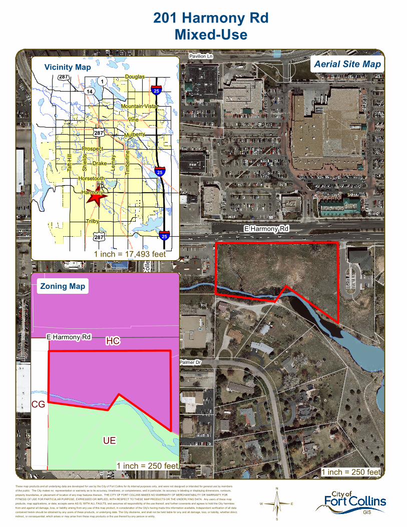
201 Harmony RdMixed-Use
These map products and all underlying data are developed for use by the City of Fort Collins for its internal purposes only, and were not designed or intended for general use by membersof the public. The City makes no representation or warranty as to its accuracy, timeliness, or completeness, and in particular, its accuracy in labeling or displaying dimensions, contours,property boundaries, or placement of location of any map features thereon. THE CITY OF FORT COLLINS MAKES NO WARRANTY OF MERCHANTABILITY OR WARRANTY FORFITNESS OF USE FOR PARTICULAR PURPOSE, EXPRESSED OR IMPLIED, WITH RESPECT TO THESE MAP PRODUCTS OR THE UNDERLYING DATA. Any users of these mapproducts, map applications, or data, accepts same AS IS, WITH ALL FAULTS, and assumes all responsibility of the use thereof, and further covenants and agrees to hold the City harmlessfrom and against all damage, loss, or liability arising from any use of this map product, in consideration of the City's having made this information available. Independent verification of all datacontained herein should be obtained by any users of these products, or underlying data. The City disclaims, and shall not be held liable for any and all damage, loss, or liability, whether direct,indirect, or consequential, which arises or may arise from these map products or the use thereof by any person or entity.
1 inch = 250 feet
_̂
£¤287
£¤287
£¤287
UV14¬«1
§̈¦25
§̈¦25
§̈¦25
Douglas
Vine
Mountain Vista
Mulberry
Trilby
Lema
y
Shiel
ds
Harmony
Taft H
ill
Prospect
Horsetooth
Drake
Timbe
rline
HC
UE
CG
E Harmony Rd
Aerial Site MapVicinity Map
Zoning Map
1 inch = 250 feet
1 inch = 17,493 feet

CONCEPTUAL REVIEW: APPLICATION
Community Development & Neighborhood Services – 281 N College Ave – Fort Collins, CO 80522-0580
Development Review Guide – STEP 2 of 8
General Information All proposed development projects begin with Conceptual Review. Anyone with a development idea can schedule a Conceptual Review meeting to get feedback on prospective development ideas. At this stage, the development idea does not need to be finalized or professionally presented. However, a sketch plan and this application must be submitted to City Staff prior to the Conceptual Review meeting. The more information you are able to provide, the better feedback you are likely to get from the meeting. Please be aware that any information submitted may be considered a public record, available for review by anyone who requests it, including the media.
Conceptual Reviews are scheduled on three Monday mornings per month on a “first come, first served” basis. One 45 meeting is allocated per applicant and only three conceptual reviews are done each Monday morning. Conceptual Review is a free service. Complete applications and sketch plans must be submitted to City Staff no later than 5 pm, two Tuesdays prior to the meeting date. Application materials must be e-mailed to [email protected]. If you do not have access to e-mail, other accommodations can be made upon request. At Conceptual Review, you will meet with Staff from a number of City departments, such as Community Development and Neighborhood Services (Zoning, Current Planning, and Development Review Engineering), Light and Power, Stormwater, Water/Waste Water, Advance Planning (Long Range Planning and Transportation Planning) and Poudre Fire Authority. Comments are offered by staff to assist you in preparing the detailed components of the project application. There is no approval or denial of development proposals associated with Conceptual Review. At the meeting you will be presented with a letter from staff, summarizing comments on your proposal. *BOLDED ITEMS ARE REQUIRED* *The more info provided, the more detailed your comments from staff will be.* Contact Name(s) and Role(s) (Please identify whether Consultant or Owner, etc) ________________________
______________________________________________________________________________________
Business Name (if applicable) ______________________________________________________________
Your Mailing Address _____________________________________________________________________
Phone Number ______________________Email Address _______________________________________
Site Address or Description (parcel # if no address) ____________________________________________
_______________________________________________________________________________________
Description of Proposal (attach additional sheets if necessary) ____________________________________
_______________________________________________________________________________________
_______________________________________________________________________________________
Proposed Use ______________________________ Existing Use _________________________________
Total Building Square Footage ___________ S.F. Number of Stories ______ Lot Dimensions _____________
Age of any Existing Structures _____________________________________________________________ Info available on Larimer County’s Website: http://www.co.larimer.co.us/assessor/query/search.cfm If any structures are 50+ years old, good quality, color photos of all sides of the structure are required for conceptual.
Is your property in a Flood Plain? □ Yes □ No If yes, then at what risk is it? ___________________ Info available on FC Maps: http://gisweb.fcgov.com/redirect/default.aspx?layerTheme=Floodplains.
Increase in Impervious Area __________________________________________________________ S.F. (Approximate amount of additional building, pavement, or etc. that will cover existing bare ground to be added to the site)
Suggested items for the Sketch Plan: Property location and boundaries, surrounding land uses, proposed use(s), existing and proposed improvements (buildings, landscaping, parking/drive areas, water treatment/detention, drainage), existing natural features (water bodies, wetlands, large trees, wildlife, canals, irrigation ditches), utility line locations (if known), photographs (helpful but not required). Things to consider when making a proposal: How does the site drain now? Will it change? If so, what will change?
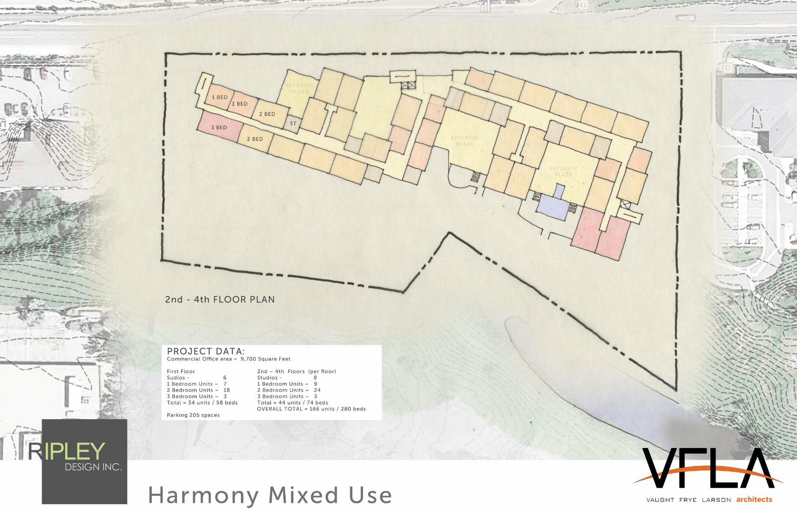
Harmony Mixed Use Project, Fort Collins, CO. October 12, 2015
1764 Prospector Avenue, Suite 2, Park City, UT 84060 P 435.901.0181 E [email protected]
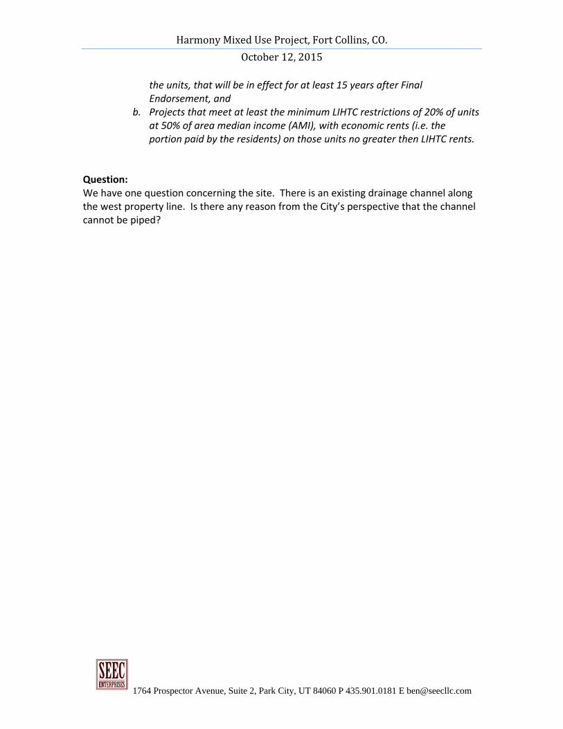
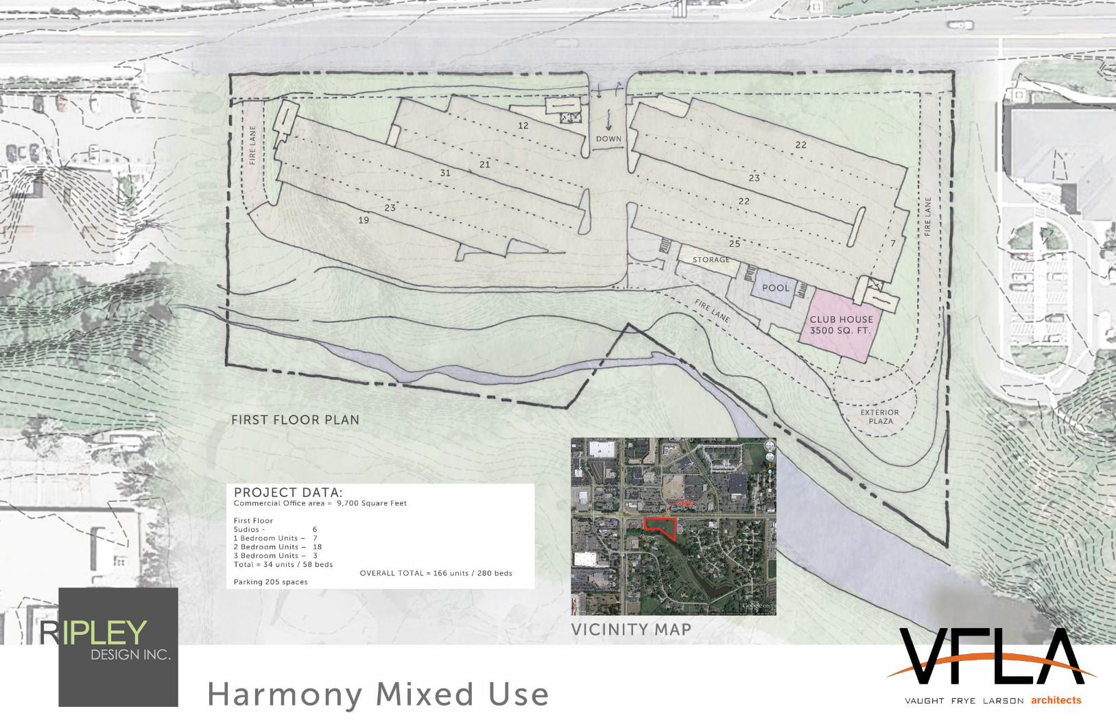
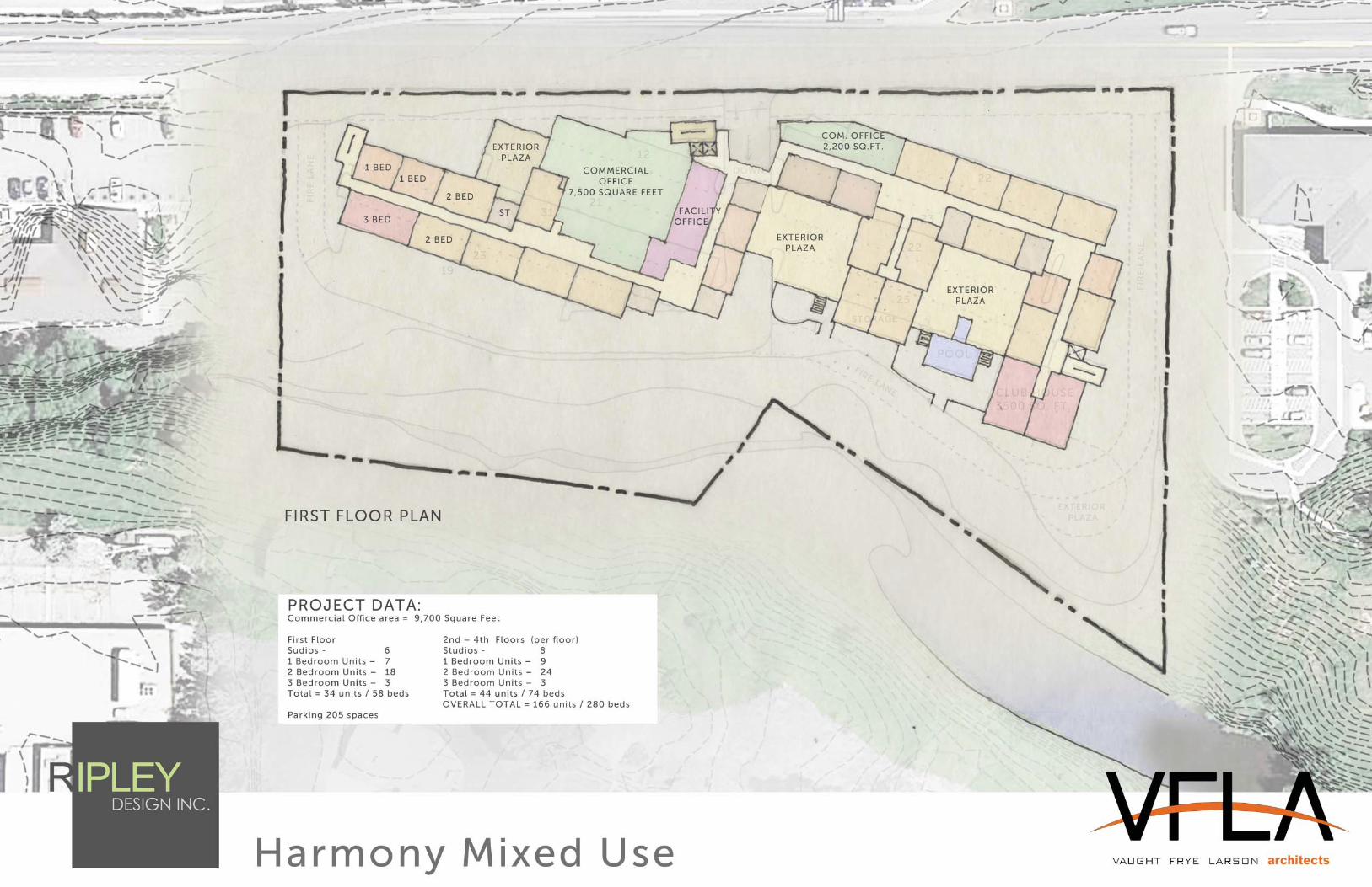
Fort Collins Harmony Mixed Use Narrative: The Harmony and College mixed use community consists of 166 “mixed income” units and 9,500 square feet of office located on the South East corner of Harmony and College in Fort Collins, Colorado. This new development utilizes the attractive physical features throughout the Harmony Corridor as a foundation to introduce a new style of urban living and office enhancing the creative energies within the community. The Harmony Corridor acts as the southern gateway to Fort Collins from Interstate 25, and provides the premier location for the fastest growing industries in the region. Close proximity to quality neighborhoods, golf courses, hiking trails, schools and cultural facilities, make the corridor the most attractive business center in northern Colorado. The Harmony & College Apartments will be developed as a sophisticated urban mixed‐use project with a high level of finish and service. The building will have primary uses on the main floor and residential apartments above. The project will include commercial/offices uses, a fitness area, clubroom with an open kitchen/bar area, private dining room, business/meeting facilities, bike storage area, dog wash station, multiple outdoor terrace areas and a ground level outdoor pool and landscaped promenade. The property will enhance the natural features of the 4.9 acre site, while preserving the waterways and the natural resources. The residences will feature nine‐foot ceilings, washer/dryers, stainless steel appliances, granite kitchen and bathroom countertops, wood flooring in the kitchens and living rooms, and outdoor balconies and terraces. The project will take advantage of the existing grade and provide podium parking under the building. The main floor will be accessed at grade along Harmony Road while the parking will be under that floor as the grade drops away to the south. The residences will consist of mixed income residences consisting of 20% affordable residences and 80% market rate residences. The development is strategically aligned with the cities economic and ethical motivations for ending homelessness in Fort Collins. Definition of the Affordable housing:
1. Affordable housing is defined as projects meeting both of the following requirements:
a. Projects that have a recorded Regulatory Agreement with the rent and occupancy restrictions or a Project‐Based Section 8 contract for 90% of
Harmony Mixed Use Project, Fort Collins, CO. October 12, 2015
1764 Prospector Avenue, Suite 2, Park City, UT 84060 P 435.901.0181 E [email protected]
the units, that will be in effect for at least 15 years after Final Endorsement, and
b. Projects that meet at least the minimum LIHTC restrictions of 20% of units at 50% of area median income (AMI), with economic rents (i.e. the portion paid by the residents) on those units no greater then LIHTC rents.
Question: We have one question concerning the site. There is an existing drainage channel along the west property line. Is there any reason from the City’s perspective that the channel cannot be piped?
Community Development and Neighborhood Services 281 North College AvenuePO Box 580Fort Collins, CO 80522
970.221.6750970.224.6134 - faxfcgov.com
Ben Massimino
January 05, 2016
SEEC Enterprises
PO Box 680513
Park City, UT 84068
Re: 201 Harmony Rd - Mixed-useDescription of project: This is a request to construct a 4-story, mixed-use building at 201 Harmony Rd. (parcel #9601200004). The first floor will provide 9,700 sq. ft. of commercial space. The rest of the project will be comprised of 34 apartment units with 205 parking spaces. 20% of the apartments will be affordable housing units. The site is located in the Harmony Corridor (HC) zone district. This proposal will be subject to Administrative (Type I) review.
Please see the following summary of comments regarding the project request referenced above. The comments offered informally by staff during the Conceptual Review will assist you in preparing the detailed components of the project application. Modifications and additions to these comments may be made at the time of formal review of this project. If you have any questions regarding these comments or the next steps in the review process, you may contact the individual commenter or direct your questions through the Project Planner, Pete Wray, at 970-221-6754 or [email protected].
Comment Summary:
Contact: Ali van Deutekom, 970-416-2743, [email protected]
Department: Zoning
Based on the unit counts you would need to provide 279 parking spaces PLUS the 10 required spaces for the office use.
1.5 spaces per one bedroom1.75 spaces for 2 bedroom2 spaces for 3 bedrooms
1 space per 1,000 SF of office
1.
LUC 3.2.2(K)(5) Handicap parking spaces are required in numbers per this section. If you have 1-25 parking spaces you’ll need one van accessible handicap space.
2.
Bike parking requirements are:
1 space per bedroom (60% enclosed)
4 spaces for the office use (20% enclosed)
3.
LUC 3.2.5 All development shall provide adequately sized conveniently located, accessible trash and recycling enclosures.
4.
Page 1 of 10
Light sources shall be concealed and fully shielded and shall feature sharp cut-off capability so as to minimize up-light, spill-light, glare and unnecessary diffusion on adjacent property.
5.
LUC 3.5.1 (I) (6) All rooftop mechanical equipment shall be screened from public view from both above and below by integrating it into building and roof design to the maximum extent feasible
6.
A shadow analysis will be required if you exceed 40 feet in height.7.
Contact: Heather McDowell, 970-224-6065, [email protected]
Department: Water-Wastewater Engineering
This project area is within the Fort Collins-Loveland Water District. Please coordinate with them for water main information and tie-in requirements.
1.
This project area is within the South Fort Collins Sanitation District. Please coordinate with them for sewer main information and tie-in requirements.
2.
Contact: Heidi Hansen, 970-221-6854, [email protected]
Department: Stormwater Engineering
1. A portion of this property is located in the City regulated, 100-year Mail Creek floodway. Any development within the floodway must obtain a floodplain use permit and comply with the safety regulations of Chapter 10 of City Municipal Code. The permit form can be obtained at http://www.fcgov.com/utilities/what-we-do/stormwater/flooding/forms-documents. A Flood Risk Map is attached.
1.
2. A portion of this property is located within the erosion buffer zone for Mail Creek. Construction of a structure is not allowed in an erosion buffer zone. Nonstructural development must meet the standards of Section 10-202 of the City Municipal Code. Proposed vegetation within the erosion buffer zone must be non-irrigated native vegetation that enhances the stability of the creek.
2.
3. The boundaries of the floodplain and erosion buffer zone should be included on any plans so that it is readily evident whether the proposed work is located inside or outside of the floodplain. Contact Beck Anderson of Stormwater Master Planning at [email protected] for floodplain CAD line work, as required per the floodplain development review check list.
3.
4. Development review checklists for floodplain requirements can be obtained at http://www.fcgov.com/utilities/what-we-do/stormwater/flooding/forms-documents. Please utilize these documents when preparing your plans for submittal.
4.
5. If the ditch along the western property line is piped and an outfall to Mail Creek is proposed, the outfall will require a floodplain use permit and a no-rise certification, signed and stamped by a Colorado Registered Professional Engineer, to ensure that the construction of the outfall in the Mail Creek floodway does not alter flood flows on neighboring properties.
5.
6. Please be aware that the City has a trash rack (cleanout grate) across Mail Creek and periodically cleans debris from the rack. The access for the cleanout is from the property to the south. Any proposed improvements must not affect the trash rack or the City’s access to it.
6.
7. Please contact Heidi Hansen with any questions about these comments or to schedule a meeting to discuss any requirements for development in the floodplain. [email protected] 970-221-6854.
7.
The design of this site must conform to the drainage basin design of the Mail Creek Master Drainage Plan as well the Fort Collins Stormwater Criteria Manual.
8.
Page 2 of 10
Onsite detention is required for the runoff volume difference between the 100 year developed inflow rate with the 2 year historic release rate.
9.
A drainage report, erosion control report, and construction plans are required and they must be prepared by a Professional Engineer registered in Colorado. The drainage report must address the four-step process for selecting structural BMPs. There is a final site inspection required when the project is complete and the maintenance is handed over to an HOA or another maintenance organization. The erosion control report requirements are in the Fort Collins Stormwater Manual, Section 1.3.3, Volume 3, Chapter 7 of the Fort Collins Amendments. If you need clarification concerning this section, please contact the Erosion Control Inspector, Jesse Schlam at 224-6015 or [email protected].
10.
Fifty percent of the site runoff is required to be treated using the standard water quality treatment as described in the Fort Collins Stormwater Manual, Volume 3-Best Management Practices (BMPs). (http://www.fcgov.com/utilities/business/builders-and-developers/development-forms-guidelines-regulations/stormwater-criteria) Extended detention is the usual method selected for water quality treatment; however the use of any of the BMPs is encouraged.
11.
Low Impact Development (LID) requirements are required on all new or redeveloping property which includes sites required to be brought into compliance with the Land Use Code. These require a higher degree of water quality treatment for 50% of the new impervious area and 25% of new paved areas must be pervious. Standard operating procedures (SOPs) for all onsite drainage facilities will be included as part of the Development Agreement. More information and links can be found at: http://www.fcgov.com/utilities/what-we-do/stormwater/stormwater-quality/low-impact-development
12.
Per Colorado Revised Statute §37-92-602 (8) effective August 5, 2015, criteria regarding detention drain time will apply to this project. As part of the drainage design, the engineer will be required to show compliance with this statute using a standard spreadsheet (available on request) that will need to be included in the drainage report. Upon completion of the project, the engineer will also be required to upload the approved spreadsheet onto the Statewide Compliance Portal. This will apply to any volume based stormwater storage, including extended detention basins and bio-retention cells.
13.
The city wide Stormwater development fee (PIF) is $7,817/acre ($0.1795 sq.-ft.) for new impervious area over 350 sq.-ft., and there is a $1,045.00/acre ($0.024/sq.-ft.) review fee. No fee is charged for existing impervious area. These fees are to be paid at the time each building permit is issued. Information on fees can be found at: http://www.fcgov.com/utilities/business/builders-and-developers/plant-investment-development-fees or contact Jean Pakech at 221-6375 for questions on fees. There is also an erosion control escrow required before the Development Construction permit is issued. The amount of the escrow is determined by the design engineer, and is based on the site disturbance area, cost of the measures, or a minimum amount in accordance with the Fort Collins Stormwater Manual.
14.
The ditch near the west property line is the Larimer County Ditch #2. A proposal to pipe the ditch through the property would need to be coordinated and approved with the ditch company. For reference, the storm box outlet for this ditch on the south side of Harmony Road is a 4’ x 10’ box culvert.
15.
Contact: Jim Lynxwiler, 970-416-2869, [email protected]
Department: Fire Authority
FIRE LANES Fire access is required to within 150' of all portions of the building's exterior. Fire access may not be measured from an arterial road and an Emergency Access Easement will be required on the property to meet minimum code requirements. Additional fire access requirements
1.
Page 3 of 10
correspond to buildings exceeding 30' in height. Code language and fire lane specifications provided below.
> IFC 503.1.1: Approved fire Lanes shall be provided for every facility, building or portion of a building hereafter constructed or moved into or within the jurisdiction. The fire apparatus access road shall comply with the requirements of this section and shall extend to within 150 feet of all portions of the facility and all portions of the exterior walls of the first story of the building as measured by an approved route around the exterior of the building or facility. When any portion of the facility or any portion of an exterior wall of the first story of the building is located more than 150 feet from fire apparatus access, the fire code official is authorized to increase the dimension if the building is equipped throughout with an approved, automatic fire-sprinkler system.
FIRE LANE SPECIFICATIONS A fire lane plan shall be submitted for approval prior to installation. In addition to the design criteria already contained in relevant standards and policies, any new fire lane must meet the following general requirements: > Shall be designated on the plat as an Emergency Access Easement. > Maintain the required 20 foot minimum unobstructed width & 14 foot minimum overhead clearance. > Be designed as a flat, hard, all-weather driving surface capable of supporting 40 tons. > Dead-end fire access roads in excess of 150 feet in length shall be provided with an approved area for turning around fire apparatus. > The required turning radii of a fire apparatus access road shall be a minimum of 25 feet inside and 50 feet outside. Turning radii shall be detailed on submitted plans. > Be visible by painting and/or signage, and maintained unobstructed at all times. > Additional access requirements exist for buildings greater than 30' in height. Refer to Appendix D of the 2012 IFC or contact PFA for details. International Fire Code 503.2.3, 503.2.4, 503.2.5, 503.3, 503.4 and Appendix D; FCLUC 3.6.2(B)2006 and Local Amendments.
STRUCTURES EXCEEDING 30' IN HEIGHT Buildings exceeding 30' in height require a 30' wide fire lane positioned no closer than 15' from the building and no farther than 30' from the building. It is unclear if this code requirement is being met based upon the materials submitted for review.
When site constraints or other complicating factors impact the project's ability to meet the prescriptive code, the fire marshal may consider other offsetting measures as a way to meet the intent of the fire code. In such cases, further discussion is required. Code language provided below. See Appendix D of the 2012 IFC for more information.
AERIAL FIRE APPARATUS ACCESS ROADS - WHERE REQUIRED > IFC D105.1: Where the vertical distance between the grade plane and the highest roof surface exceeds 30 feet, approved aerial fire apparatus access roads shall be provided. For purposes of this section, the highest roof surface shall be determined by measurement to the eave of a pitched roof, the intersection of the roof to the exterior wall, or the top of parapet walls, whichever is greater.
AERIAL FIRE APPARATUS ACCESS ROADS - WIDTH > IFC D105.2; FCLUC 3.6.2(B)2006; and Local Amendments: Aerial fire apparatus access roads shall have a minimum unobstructed width of 30 feet, exclusive of shoulders, in the immediate vicinity of the building or portion thereof.
AERIAL FIRE APPARATUS ACCESS ROADS - PROXIMITY TO BUILDING > IFC D105.3: At least one of the required access routes meeting this condition shall be located within a minimum of 15 feet and a maximum of 30 feet from the building, and shall be positioned parallel to one entire side of the building. The side of the building on which the aerial fire apparatus access road is positioned shall be approved by the fire code official.
2.
Page 4 of 10
ROOF ACCESS > IFC 504.3: New buildings four or more stories in height shall be provided with a stairway to the roof. Stairway access to the roof shall be in accordance with IFC 1009.12. Such stairways shall be marked at street and floor levels with a sign indicating that the stairway continues to the roof.
3.
AUTOMATIC FIRE SPRINKLER SYSTEM This building will require an automatic fire sprinkler system under a separate permit. Please contact Assistant Fire Marshal, Joe Jaramillo with any fire sprinkler related questions at 970-416-2868.
4.
FIRE STANDPIPE SYSTEM > IFC Sections 905 and 913: Standpipe systems shall be provided in new buildings and structures in accordance with Section 905 or the 2012 International Fire Code. Approved standpipe systems shall be installed throughout buildings where the floor level of the highest story is located more than 30 feet above the lowest level of fire department vehicle access, or where the floor level of the lowest story is located more than 30 feet below the highest level of fire department vehicle access. The standpipe system shall be capable of supplying at minimum of 100 psi to the top habitable floor. An approved fire pump may be required to achieve this minimum pressure. Buildings equipped with standpipes are required to have a hydrant within 100 feet of the Fire Department Connection.
5.
WATER SUPPLY Hydrant spacing and flow must meet minimum requirements based on type of occupancy. Due to the size and scope of this project, more than one hydrant will be required. One hydrant will be required within 100' of the Fire Department Connection. Code language provided below.
> IFC 508.1 and Appendix B: COMMERCIAL REQUIREMENTS: Hydrants to provide 1,500 gpm at 20 psi residual pressure, spaced not further than 300 feet to the building, on 600-foot centers thereafter.
> IFC 507.1.1: Buildings equipped with a standpipe system installed in accordance with Section 905 shall have a fire hydrant within 100 feet of the fire department connections. Exception: The distance shall be permitted to exceed 100 feet where approved by the fire code official.
6.
PUBLIC-SAFETY RADIO AMPLIFICATION SYSTEM New buildings require a fire department, emergency communication system evaluation (test) after the core/shell but prior to final build out. For the purposes of this section, fire walls shall not be used to define separate buildings. Where adequate radio coverage cannot be established within a building, public-safety radio amplification systems shall be designed and installed in accordance with criteria established by the Poudre Fire Authority. Poudre Fire Authority Bureau Admin Policy #07-01
7.
Contact: Kelly Kimple, 970-416-2401, [email protected]
Department: Environmental Planning
An Ecological Characterization Study is required by Section 3.4.1 (D)(1) as the site is within 500 feet of a known natural habitat or feature (wetlands, larimer canal #2, and riparian forest). The minimum buffer zone standard of 50' for these features, as identified in Section 3.4.1(E) of the Land Use Code, as you proceed with your site design process. Please note that the Ecological Characterization Study is due a minimum of 10 days prior to the PDP submittal.
1.
Within the buffer zone, according to Article 3.4.1(E)(1)(g), the City has the ability to determine if the existing landscaping within the buffer zone is incompatible with the purposes of the buffer zone. Please ensure that your ECS discusses the existing vegetation and identifies potential restoration options. If it is determined to be insufficient, then restoration and
2.
Page 5 of 10
mitigation measures will be required.
With respect to lighting, the City of Fort Collins Land Use Code, in Article 3.2.4(D)(6) requires that "natural areas and natural features shall be protected from light spillage from off site sources." Thus, lighting from the parking areas or other site amenities shall not spill over to the buffer areas.
3.
With respect to landscaping and design, the City of Fort Collins Land Use Code, in Article 3.2.1 (E)(3), requires that you use low-water-use plants and grasses in your landscaping or re-landscaping and reduce bluegrass lawns as much as possible.
4.
The applicant should make note of Article 3.2.1(C) that requires developments to submit a landscape and tree protection plan, and if receiving water service from the City, an irrigation plan, that: "...(4) protects significant trees, natural systems, and habitat, and (5) enhances the pedestrian environment". Note that a significant tree is defined as a tree having DBH (Diameter at Breast Height) of six inches or more. If any of the trees within this site have a DBH of greater than six inches, a review of the trees shall be conducted with Tim Buchanan, City Forester (970-221-6361 or [email protected]) to determine the status of the existing trees and any mitigation requirements that could result from the proposed development.
5.
Contact: Sheri Langenberger, 970-221-6573, [email protected]
Department: Engineering Development Review
Larimer County Road Impact Fees and Street Oversizing Fees are due at the time of building permit. Please contact Matt Baker at 224-6108 if you have any questions.
1.
The City's Transportation Development Review Fee (TDRF) is due at the time of submittal. For additional information on these fees, please see: http://www.fcgov.com/engineering/dev-review.php
2.
Any damaged curb, gutter and sidewalk existing prior to construction, as well as streets, sidewalks, curbs and gutters, destroyed, damaged or removed due to construction of this project, shall be replaced or restored to City of Fort Collins standards at the Developer's expense prior to the acceptance of completed improvements and/or prior to the issuance of the first Certificate of Occupancy. All public sidewalk, driveways and ramps existing or proposed adjacent or within the site need to meet ADA standards, if they currently do not, they will need to be reconstructed so that they do meet current ADA standards as a part of this project
3.
Any public improvements must be designed and built in accordance with the Larimer County Urban Area Street Standards (LCUASS). They are available online at: http://www.larimer.org/engineering/GMARdStds/UrbanSt.htm
4.
This project is responsible for dedicating any right-of-way and easements that are necessary or required by the City for this project. This shall including the standard utility easements that are to be provided behind the right-of-way (15 foot along Harmony). Right-of-way for Harmony Road, including that needed for the right turn lane into the exiting access will need to be dedicated with the project.
5.
Access into the site: in accordance with the Harmony Road Access Control Plan this parcel will not get a direct access point off of Harmony Road, but access is to be per the existing access driveways that are along each edge of the property (the west property line and the east property line). When the property to the east developed it was anticipated that a right turn lane would be needed into this access point upon the development of this property with both developments taking access off of this driveway. The adjacent development did provide the City with some funds to help cover the cost of the driveway reconstruction when the right turn lane is constructed. The City will need to determine if when the 3rd travel lane is added in this section of roadway if a right turn lane will still be needed or if the right turn lane that is to be built will be able to serve as that 3rd lane and the travel lane (this impacts the amount of right of way needed). The TIS will likely be needed to fully determine this.
6.
Page 6 of 10
The project will be responsible for designing and installing the right turn lane needed for the eastern access point and designing and installing the detached sidewalk along the frontage in the ultimate location.
7.
Utility plans will be required and a Development Agreement will be recorded once the project is finalized.
8.
A Development Construction Permit (DCP) will need to be obtained prior to starting any work on the site.
9.
LCUASS parking setbacks (Figure 19-6) apply and will need to be followed.10.
All fences, barriers, posts or other encroachments within the public right-of-way are only permitted upon approval of an encroachment permit. Applications for encroachment permits shall be made to Engineering Department for review and approval prior to installation. Encroachment items shall not be shown on the site plan as they may not be approved, need to be modified or moved, or if the permit is revoked then the site/ landscape plan is in non-compliance.
11.
Any rain gardens within the right-of-way cannot be used to treat the development/ site storm runoff. We can look at the use of rain gardens to treat street flows – the design standards for these are still in development.
12.
Bike parking required for the project cannot be placed within the right-of-way and if placed just behind the right-of-way need to be placed so that when bikes are parked they do not extend into the right-of-way.
13.
In regards to construction of this site. The public right-of-way shall not be used for staging or storage of materials or equipment associated with the Development, nor shall it be used for parking by any contractors, subcontractors, or other personnel working for or hired by the Developer to construct the Development. The Developer will need to find a location(s) on private property to accommodate any necessary Staging and/or parking needs associated with the completion of the Development . Information on the location(s) of these areas will be required to be provided to the City as a part of the Development Construction Permit application.
14.
Contact: Tyler Siegmund, 970-416-2772, [email protected]
Department: Electric Engineering
Light and Power has electric facilities at northeast corner of the site that can be utilized to provide power.
1.
Electric capacity fee, building site charges and system modification charges will apply. See the City website for an estimate of charges and construction policies, practices and procedures. http://www.fcgov.com/utilities/business/builders-and-developers/plant-investment-development-fees
2.
The location of the electric services will need to be coordinated with Light and Power Engineering. Please note that the residential units must be metered individually. Meter locations will need to be coordinated with Light and Power Engineering.
3.
Street light placement will need to be coordinated with Light & Power. Shaded trees are required to maintain 40 feet of separation clearances and ornamental trees are required to maintain 15 feet of separation clearances from street lights. A link to the City of Fort Collins street lighting requirements can be found below:http://www.larimer.org/engineering/GMARdStds/Ch15_04_01_2007.pdf
4.
Transformer location will need to be coordinated with Light & Power. Each transformer must be placed within 10 ft of a drivable surface for installation and maintenance purposes. Transformer must have a front clearance of 8 ft and side/rear clearance of 3 ft.
5.
Page 7 of 10
A commercial service information form (C 1) and a one line diagram for the commercial meter will need to be filled out and submitted to Light & Power Dept. A link to this document is below:
http://www.fcgov.com/utilities/business/builders-and-developers/development- forms-guidelines-regulations
6.
Please contact Light & Power Engineering if you have any questions at 221-6700. Please reference our policies, development charge processes, and use our fee estimator at http://www.fcgov.com/utilities/business/builders-and-developers.
7.
Contact: Sarah Carter, 970-416-2748, [email protected]
Department: Building Inspection
Pre-Submittal meetings are offered to assist the designer/builder by assuring, early on in the design, that the new commercial or multi-family projects are on track to complying with all of the adopted City codes and Standards listed below. The proposed project should be in the early to mid-design stage for this meeting to be effective and is typically scheduled after the Current Planning conceptual review meeting. Applicants of new commercial or multi-family projects are advised to call 416-2341 to schedule a pre-submittal meeting. Applicants should be prepared to present site plans, floor plans, and elevations and be able to discuss code issues of occupancy, square footage and type of construction being proposed. Construction shall comply with the following adopted codes as amended:2012 International Building Code (IBC) 2012 International Residential Code (IRC) 2012 International Energy Conservation Code (IECC) 2012 International Mechanical Code (IMC) 2012 International Fuel Gas Code (IFGC) 2012 International Plumbing Code (IPC) as amended by the State of Colorado2014 National Electrical Code (NEC) as amended by the State of ColoradoFort Collins has amendments to most of the codes listed above. See the fcgov.com web page to view them.
Accessibility: State Law CRS 9-5 & ICC/ANSI A117.1-2009.Snow Load Live Load: 30 PSF / Ground Snow Load 30 PSF.Frost Depth: 30 inches.Wind Load: 100- MPH 3 Second Gust Exposure B.Seismic Design: Category B.Climate Zone: Zone 5Energy Code Use 1. Single Family; Duplex; Townhomes: 2012 IRC Chapter 11 or 2012 IECC.2. Multi-family and Condominiums 3 stories max: 2012 IECC residential chapter.3. Commercial and Multi-family 4 stories and taller: 2012 IECC commercial chapter.
1.
Contact: Pete Wray, 970-221-6754, [email protected]
Planning Services
1. Need more clarification on front setbacks from Harmony for building placement, sidewalk and landscaping, signage and if entrance turn lane can be accomodated along frontage.
1.
2. A pre-submittal meeting may be advised to coordinate the treatment of floodplain mitigation, riparian corridor, tree protection, buffers, landscape enhancements and or screening for site.
2.
Page 8 of 10
3. Building elevations would be helpful for staff to review at conceptual meeting if available.3.
4. This property is not in the TOD overlay district.4.
5. A neighborhood Meeting is not required, but advisable to get feedback from the neighborhood prior to hearing.
5.
The proposed development project is subject to a Type 1 review and public hearing, the decision maker for Type 1 hearings is an Administrative Hearing Officer. The applicant for this development request is not required to hold a neighborhood meeting for a Type 1 hearing, but if you would like to have one to notify your neighbors of the proposal, please let me know and I can help you in setting a date, time and location for a meeting. Neighborhood Meetings are a great way to get public feedback and avoid potential hiccups that may occur later in the review process.
6.
Please see the Development Review Guide at www.fcgov.com/drg. This online guide features a color coded flowchart with comprehensive, easy to read information on each step in the process. This guide includes links to just about every resource you need during development review.
7.
This development proposal will be subject to all applicable standards of the Fort Collins Land Use Code (LUC), including Article 3 General Development Standards. The entire LUC is available for your review on the web at http://www.colocode.com/ftcollins/landuse/begin.htm.
8.
If this proposal is unable to satisfy any of the requirements set forth in the LUC, a Modification of Standard Request will need to be submitted with your formal development proposal. Please see Section 2.8.2 of the LUC for more information on criteria to apply for a Modification of Standard.
9.
Please see the Submittal Requirements and Checklist at: http://www.fcgov.com/developmentreview/applications.php.
10.
The request will be subject to the Development Review Fee Schedule that is available in the Community Development and Neighborhood Services office. The fees are due at the time of submittal of the required documents for the appropriate development review process by City staff and affected outside reviewing agencies. Also, the required Transportation Development Review Fee must be paid at time of submittal.
11.
When you are ready to submit your formal plans, please make an appointment with Community Development and Neighborhood Services at (970)221-6750.
12.
Page 9 of 10
Pre-Submittal Meetings for Building Permits
Pre-Submittal meetings are offered to assist the designer/builder by assuring, early on in the design, that the new commercial or multi-family projects are on track to complying with all of the adopted City codes and Standards listed below. The proposed project should be in the early to mid-design stage for this meeting to be effective and is typically scheduled after the Current Planning conceptual review meeting.
Applicants of new commercial or multi-family projects are advised to call 970-416-2341 to schedule a pre-submittal meeting. Applicants should be prepared to present site plans, floor plans, and elevations and be able to discuss code issues of occupancy, square footage and type of construction being proposed.
Construction shall comply with the following adopted codes as amended:
20012 International Building Code (IBC) 2012 International Residential Code (IRC) 20012 International Energy Conservation Code (IECC) 2012 International Mechanical Code (IMC) 2012 International Fuel Gas Code (IFGC) 2012 International Plumbing Code (IPC) as amended by the State of Colorado2014 National Electrical Code (NEC) as amended by the State of Colorado
Accessibility: State Law CRS 9-5 & ICC/ANSI A117.1-2009.Snow Load Live Load: 30 PSF / Ground Snow Load 30 PSF.Frost Depth: 30 inches.Wind Load: 100- MPH 3 Second Gust Exposure B.Seismic Design: Category B.Climate Zone: Zone 5.Energy Code Use 1. Single Family; Duplex; Townhomes: 2012 IRC Chapter 11 or 2012 IECC Chapter 4. 2. Multi-family and Condominiums 3 stories max: 2012 IECC Chapter 4 Residential Provisions. 3. Commercial and Multi-family 4 stories and taller: 2012 IECC Chapter 4 Commercial Provisions.
Fort Collins Green Code Amendments effective starting 2/17/2014. A copy of these requirements can be obtained at the Building Office or contact the above phone number.
City of Fort CollinsBuilding ServicesPlan Review970-416-2341
Page 10 of 10
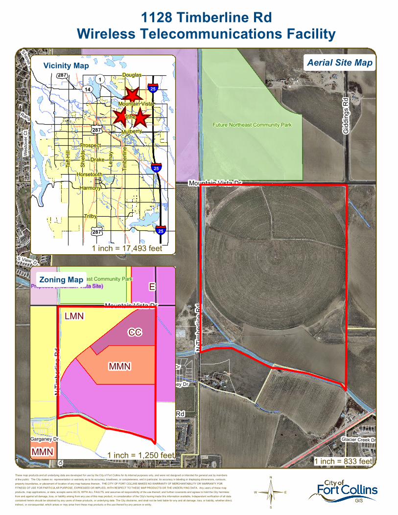
Proposed (mountain Vista Site)
Proposed (vine Site)
Future Northeast Community Park
Iron Horse Park
Mandarin Dr
Rosybill Dr
Chesapeake Dr
Sherell Dr
Aleutian Dr
Shearwater Dr
Adriel Dr
Friar Tuck Ct
Merga
nser
Dr
Maid Marian Ct
Ouze
l Dr
Sherwood Forest Ct
Rangeview Dr
S View Dr
Glacier Creek Dr
Gosly
n Dr
S V ie w Cir
Barrin
gton C
t
Westo
ver C
t
Garganey Dr
Merga
nser
Dr
Conifer St
Mountain Vista DrN
Timbe
rline R
d
E Suniga Rd
Gidd
ings R
d
Turnb
erry R
dTu
rnberr
y Rd
©
1128 Timberline RdWireless Telecommunications Facility
These map products and all underlying data are developed for use by the City of Fort Collins for its internal purposes only, and were not designed or intended for general use by membersof the public. The City makes no representation or warranty as to its accuracy, timeliness, or completeness, and in particular, its accuracy in labeling or displaying dimensions, contours,property boundaries, or placement of location of any map features thereon. THE CITY OF FORT COLLINS MAKES NO WARRANTY OF MERCHANTABILITY OR WARRANTY FORFITNESS OF USE FOR PARTICULAR PURPOSE, EXPRESSED OR IMPLIED, WITH RESPECT TO THESE MAP PRODUCTS OR THE UNDERLYING DATA. Any users of these mapproducts, map applications, or data, accepts same AS IS, WITH ALL FAULTS, and assumes all responsibility of the use thereof, and further covenants and agrees to hold the City harmlessfrom and against all damage, loss, or liability arising from any use of this map product, in consideration of the City's having made this information available. Independent verification of all datacontained herein should be obtained by any users of these products, or underlying data. The City disclaims, and shall not be held liable for any and all damage, loss, or liability, whether direct,indirect, or consequential, which arises or may arise from these map products or the use thereof by any person or entity.
1 inch = 833 feet
_̂
_̂
_̂
£¤287
£¤287
£¤287
UV14¬«1
§̈¦25
§̈¦25
§̈¦25
Douglas
Vine
Mountain Vista
Mulberry
Trilby
Lema
y
Shiel
ds
Harmony
Taft H
ill
Prospect
Horsetooth
Drake
Timbe
rline
E
LMN
MMN
CC
MMN
Proposed (mountain Vista Site)Future Northeast Community Park
Garganey Dr
N Tim
berlin
e Rd
Mountain Vista Dr
Aerial Site MapVicinity Map
Zoning Map
1 inch = 1,250 feet
1 inch = 17,493 feet
CONCEPTUAL REVIEW: APPLICATION
Community Development & Neighborhood Services – 281 N College Ave – Fort Collins, CO 80522-0580
Development Review Guide – STEP 2 of 8
General Information All proposed development projects begin with Conceptual Review. Anyone with a development idea can schedule a Conceptual Review meeting to get feedback on prospective development ideas. At this stage, the development idea does not need to be finalized or professionally presented. However, a sketch plan and this application must be submitted to City Staff prior to the Conceptual Review meeting. The more information you are able to provide, the better feedback you are likely to get from the meeting. Please be aware that any information submitted may be considered a public record, available for review by anyone who requests it, including the media.
Conceptual Reviews are scheduled on three Monday mornings per month on a “first come, first served” basis. One 45 meeting is allocated per applicant and only three conceptual reviews are done each Monday morning. Conceptual Review is a free service. Complete applications and sketch plans must be submitted to City Staff no later than 5 pm, two Tuesdays prior to the meeting date. Application materials must be e-mailed to [email protected]. If you do not have access to e-mail, other accommodations can be made upon request. At Conceptual Review, you will meet with Staff from a number of City departments, such as Community Development and Neighborhood Services (Zoning, Current Planning, and Development Review Engineering), Light and Power, Stormwater, Water/Waste Water, Advance Planning (Long Range Planning and Transportation Planning) and Poudre Fire Authority. Comments are offered by staff to assist you in preparing the detailed components of the project application. There is no approval or denial of development proposals associated with Conceptual Review. At the meeting you will be presented with a letter from staff, summarizing comments on your proposal. *BOLDED ITEMS ARE REQUIRED* *The more info provided, the more detailed your comments from staff will be.* Contact Name(s) and Role(s) (Please identify whether Consultant or Owner, etc) ________________________
______________________________________________________________________________________
Business Name (if applicable) ______________________________________________________________
Your Mailing Address _____________________________________________________________________
Phone Number ______________________Email Address _______________________________________
Site Address or Description (parcel # if no address) ____________________________________________
_______________________________________________________________________________________
Description of Proposal (attach additional sheets if necessary) ____________________________________
_______________________________________________________________________________________
_______________________________________________________________________________________
Proposed Use ______________________________ Existing Use _________________________________
Total Building Square Footage ___________ S.F. Number of Stories ______ Lot Dimensions _____________
Age of any Existing Structures _____________________________________________________________ Info available on Larimer County’s Website: http://www.co.larimer.co.us/assessor/query/search.cfm If any structures are 50+ years old, good quality, color photos of all sides of the structure are required for conceptual.
Is your property in a Flood Plain? □ Yes □ No If yes, then at what risk is it? ___________________ Info available on FC Maps: http://gisweb.fcgov.com/redirect/default.aspx?layerTheme=Floodplains.
Increase in Impervious Area __________________________________________________________ S.F. (Approximate amount of additional building, pavement, or etc. that will cover existing bare ground to be added to the site)
Suggested items for the Sketch Plan: Property location and boundaries, surrounding land uses, proposed use(s), existing and proposed improvements (buildings, landscaping, parking/drive areas, water treatment/detention, drainage), existing natural features (water bodies, wetlands, large trees, wildlife, canals, irrigation ditches), utility line locations (if known), photographs (helpful but not required). Things to consider when making a proposal: How does the site drain now? Will it change? If so, what will change?
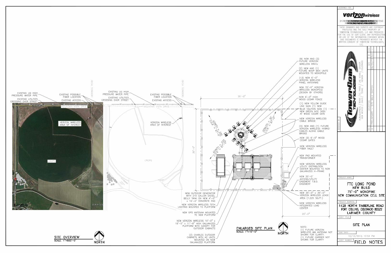
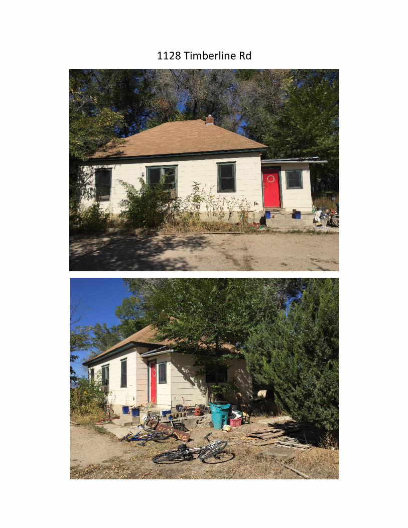
1128 Timberline Rd
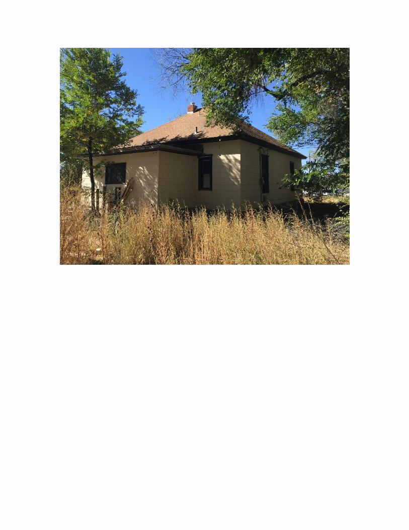
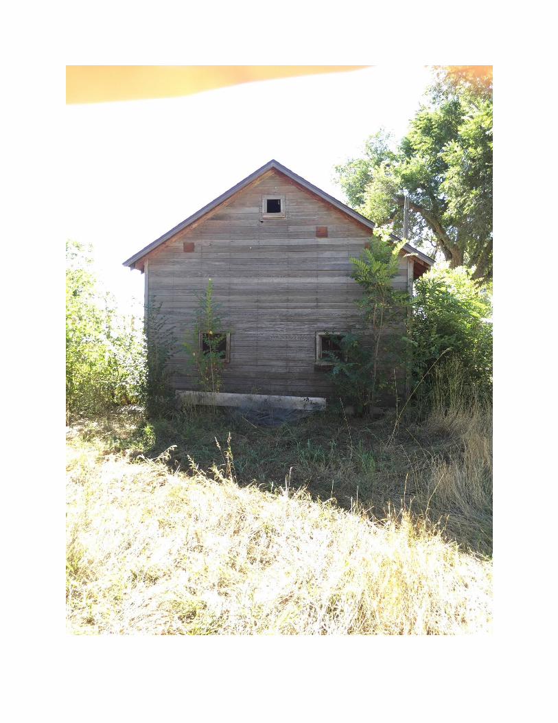
Community Development and Neighborhood Services 281 North College AvenuePO Box 580Fort Collins, CO 80522
970.221.6750970.224.6134 - faxfcgov.com
Greg Dibona
January 05, 2016
Centerline Solutions
16360 Table Mountain Parkway
Golden, CO 80403
Re: 1128 Timberline Rd - Wireless Telecommunications FacilityDescription of project: This is a request to construct a wireless telecommunications facility at 1128 Timberline Rd. (parcel #8705000001). The proposed tower will be 70’ tall and have a 35’ x 35’ area for ground equipment. The site is currently being used as farm land. The site is located in the Community Commercial (CC) zone district. This proposal will be subject to Administrative (Type I) review.
Please see the following summary of comments regarding the project request referenced above. The comments offered informally by staff during the Conceptual Review will assist you in preparing the detailed components of the project application. Modifications and additions to these comments may be made at the time of formal review of this project. If you have any questions regarding these comments or the next steps in the review process, you may contact the individual commenter or direct your questions through the Project Planner, Ted Shepard, at 970-221-6343 or [email protected].
Comment Summary:
Contact: Ali van Deutekom, 970-416-2743, [email protected]
Department: Zoning
It does not appear to be platted land. This will require a type I with plat.1.
Contact: Heather McDowell, 970-224-6065, [email protected]
Department: Water-Wastewater Engineering
It doesn’t appear that this project will impact water or sewer facilities in this area nor does it appear that there are any proposed modifications to the water or sewer with this proposal. If that changes, please coordinate ELCO Water District and/or Boxelder Sanitation District for information and tie-in requirements.
1.
Contact: Heather McDowell, 970-224-6065, [email protected]
Department: Stormwater Engineering
The design of this site must conform to the drainage basin design of the Boxelder/Cooper Slough Master Drainage Plan as well the Fort Collins Stormwater Criteria Manual.
1.
Page 1 of 7
If there is an increase in imperviousness greater than 1000 square feet a drainage report, erosion control report and construction plans are required and they must be prepared by a Professional Engineer registered in Colorado. The drainage report must address the four-step process for selecting structural BMPs. Standard operating procedures (SOPs) for all onsite drainage facilities need to be prepared by the drainage engineer. If there is less than 1,000 square feet of new impervious area on an existing development, a drainage letter along with a grading plan should be sufficient to document the existing and proposed drainage patterns. If there is less than 1,000 but more than 350 square feet of new impervious area; a site grading and erosion control plan is required instead of a complete construction plan set.
2.
Onsite detention is required if the increase in imperviousness is 1000 square feet or more. Detention is required for the runoff volume difference between the 100 year developed inflow rate with the 2 year historic release rate.
3.
If there is an increase in imperviousness greater than 1000 square feet and a detention pond is required, per Colorado Revised Statute §37-92-602 (8) effective August 5, 2015, criteria regarding detention drain time will apply to this project. As part of the drainage design, the engineer will be required to show compliance with this statute using a standard spreadsheet (available on request) that will need to be included in the drainage report. Upon completion of the project, the engineer will also be required to upload the approved spreadsheet onto the Statewide Compliance Portal. This will apply to any volume based stormwater storage, including extended detention basins and bio-retention cells.
4.
Fifty percent of the site runoff is required to be treated using the standard water quality treatment as described in the Fort Collins Stormwater Manual, Volume 3-Best Management Practices (BMPs). (http://www.fcgov.com/utilities/business/builders-and-developers/development-forms-guidelines-regulations/stormwater-criteria) Extended detention is the usual method selected for water quality treatment; however the use of any of the BMPs is encouraged.
5.
Low Impact Development (LID) requirements are required on all new or redeveloping property which includes sites required to be brought into compliance with the Land Use Code. These require a higher degree of water quality treatment for 50% of the new impervious area and 25% of new paved areas must be pervious. Standard operating procedures (SOPs) for all onsite drainage facilities will be included as part of the Development Agreement. More information and links can be found at: http://www.fcgov.com/utilities/what-we-do/stormwater/stormwater-quality/low-impact-development
6.
The city wide Stormwater development fee (PIF) is $7,817/acre ($0.1795 sq.-ft.) for new impervious area over 350 sq.-ft., and there is a $1,045.00/acre ($0.024/sq.-ft.) review fee. No fee is charged for existing impervious area. These fees are to be paid at the time each building permit is issued. Information on fees can be found at: http://www.fcgov.com/utilities/business/builders-and-developers/plant-investment-development-fees or contact Jean Pakech at 221-6375 for questions on fees. There is also an erosion control escrow required before the Development Construction permit is issued. The amount of the escrow is determined by the design engineer, and is based on the site disturbance area, cost of the measures, or a minimum amount in accordance with the Fort Collins Stormwater Manual.
7.
7.
Contact: Katie Dorn, 970-416-4250, [email protected]
Department: Historical Preservation
3.8.13(c)(14) Historic Sites and Structures. Wireless telecommunication facilities and equipment shall not be located on any historic site or structure unless permission is first
1.
Page 2 of 7
obtained from the city's Landmark Preservation Commission as required by Chapter 14 of the City Code.
Wireless telecommunication facilities are reviewed through the National Historic Preservation Act, Section 106 process. The applicant will need to use the Larimer County Assesor's property record search to identify all buildings 50 years old or older. Next, the applicant is required to hire a historic preservation expert to survey all buildings 50 years old or older. For more information about the process, please contact Joe Saldibar, the Colorado State Historic Preservation Officer at 303.866.3741 or [email protected].
2.
Contact: Jim Lynxwiler, 970-416-2869, [email protected]
Department: Fire Authority
FIRE LANES Fire access is required to the facility. Code language and fire lane specifications provided below.
> IFC 503.1.1: Approved fire Lanes shall be provided for every facility, building or portion of a building hereafter constructed or moved into or within the jurisdiction. The fire apparatus access road shall comply with the requirements of this section and shall extend to within 150 feet of all portions of the facility and all portions of the exterior walls of the first story of the building as measured by an approved route around the exterior of the building or facility.
FIRE LANE SPECIFICATIONS A fire lane plan shall be submitted for approval prior to installation. In addition to the design criteria already contained in relevant standards and policies, any new fire lane must meet the following general requirements: > Shall be dedicated as an Emergency Access Easement. > Maintain the required 20 foot minimum unobstructed width & 14 foot minimum overhead clearance. > Be designed as a flat, all-weather driving surface capable of supporting 40 tons. Compacted road base is acceptable in this application. > Dead-end fire access roads in excess of 150 feet in length shall be provided with an approved area for turning around fire apparatus. > The required turning radii of a fire apparatus access road shall be a minimum of 25 feet inside and 50 feet outside. Turning radii shall be detailed on submitted plans. > Be visible by painting and/or signage, and maintained unobstructed at all times. International Fire Code 503.2.3, 503.2.4, 503.2.5, 503.3, 503.4 and Appendix D; FCLUC 3.6.2(B)2006 and Local Amendments.
1.
PREMISE IDENTIFICATION The facility address is required to be posted on the fence and at the main road. Code language provided below.
> IFC 505.1: New and existing buildings shall have approved address numbers, building numbers or approved building identification placed in a position that is plainly legible, visible from the street or road fronting the property, and posted with a minimum of six-inch numerals on a contrasting background. Where access is by means of a private road and the building cannot be viewed from the public way, a monument, pole or other sign or means shall be used to identify the structure.
2.
Contact: Kelly Kimple, 970-416-2401, [email protected]
Department: Environmental Planning
An Ecological Characterization Study is required by Section 3.4.1 (D)(1) as the site is within 1.
Page 3 of 7
500 feet of a known natural habitat or feature (Larimer and Weld Canal and No. 8 outlet). However, since the standard 50' buffer would not extend to the proposed tower location, the ECS is waived for this proposal.
Given the tower's location within existing urban agriculture and its proximity to the ditches, staff would recommend the use of a stealth tower, such as a silo. Please also consider landscaping to enhance its transition and function in the landscape, including evergreen trees and shrubs.
2.
Contact: Sheri Langenberger, 970-221-6573, [email protected]
Department: Engineering Development Review
Larimer County Road Impact Fees and Street Oversizing Fees are due at the time of building permit. Please contact Matt Baker at 224-6108 if you have any questions.
1.
The City's Transportation Development Review Fee (TDRF) is due at the time of submittal. For additional information on these fees, please see: http://www.fcgov.com/engineering/dev-review.php
2.
Any public improvements must be designed and built in accordance with the Larimer County Urban Area Street Standards (LCUASS). They are available online at: http://www.larimer.org/engineering/GMARdStds/UrbanSt.htm
3.
This project is responsible for dedicating any right-of-way and easements that are necessary or required by the City for this project. If the property needs to be platted this shall including the standard utility easements that are to be provided behind the right-of-way (15 foot along an arterial) and the additional right-of-way along to meet the ½ right-of-way requirements.
4.
The location looks to be in a place that it will not conflict with the master planned roads as shown on the Master Street Plan, but this is something that the project would need to make sure of before submittal. It is possible with the development of the area that a public roadway aligning with Giddings would be extended south.
5.
In regards to construction of this site. The public right-of-way shall not be used for staging or storage of materials or equipment associated with the Development, nor shall it be used for parking by any contractors, subcontractors, or other personnel working for or hired by the Developer to construct the Development. The Developer will need to find a location(s) on private property to accommodate any necessary Staging and/or parking needs associated with the completion of the Development . Information on the location(s) of these areas will be required to be provided to the City as a part of the Development Construction Permit application.
6.
Contact: Tyler Siegmund, 970-416-2772, [email protected]
Department: Electric Engineering
Light and Power has electric facilities along the west side of Timberline Rd or along the west side of Giddings Rd that can be utilized to provide power. It will be the developers responsibility for the cost to extend power to the site. Please contact Light and Power engineering for the best route and a cost estimate to extend power to the site.
1.
Please provide a one line diagram and a C-1 form to Light and Power Engineering. The C-1 form can be found at: http://zeus.fcgov.com/utils-procedures/files/EngWiki/WikiPdfs/C/C-1Form.pdf
2.
Electric capacity fee, building site charges and system modification charges will apply. See the City website for an estimate of charges and construction policies, practices and procedures. http://www.fcgov.com/utilities/business/builders-and-developers/plant-investment-development-fees
3.
Page 4 of 7
Transformer location will need to be coordinated with Light & Power. Transformer must be placed within 10 ft of a drivable surface for installation and maintenance purposes. The transformer must also have a front clearance of 10 ft and side/rear clearance of 3 ft minimum.
4.
Please contact Light & Power Engineering if you have any questions at 221-6700. Please reference our policies, development charge processes, and use our fee estimator at http://www.fcgov.com/utilities/business/builders-and-developers.
5.
Contact: Ted Shepard, 970-221-6343, [email protected]
Planning Services
The request for a Wireless Telecommunications Facility (cell tower) in the C-C (Community Commercial) zone district is a permitted land use subject to review by the City of Fort Collins Administrative Hearing Officer.
1.
The selected site is within the Mountain Vista Sub-area Plan and very close to the alignment of the future Mountain Vista Drive that would connect current alignment of Mountain Vista Drive to Timberline Road in a southwest diagonal direction. This alignment is on the City¿s Master Street Plan as a four-lane arterial street and is a key urban design component of the Plan. This planned road is specifically designed to offer unimpeded, dramatic views of Long¿s Peak. A proposed cell tower in this location has the potential to obstruct these views. Centerline Solutions is strongly encouraged to find an alternative site in the desired coverage area that would be less impactful to the goals of the Mountain Vista Sub-area Plan.
2.
The following comments apply to a generic site in Northeast coverage area:3.
The proposed height, 70 feet, is at the high end of the range for cell towers within the City of Fort Collins. The site is an agricultural field in an undeveloped area of the City. Section 3.8.13(C)(2) of the Land Use Code requires that a wireless telecommunications facility “shall also be compatible with the surrounding natural environment considering land forms, topography, and other natural features.”
4.
In addition, Section 3.8.13(C)(15) states: “To the extent reasonably feasible, the applicant shall employ stealth technology so as to convert the wireless telecommunication facility into wireless telecommunication equipment, as the best method by which to mitigate and/or camouflage visual impacts. Stealth technology consists of, but is not limited to, the use of grain binds, silos or elevators, church steeples, water towers, clock towers, bell towers, false penthouses or other similar mimic structures. Such mimic structures shall have a contextual relationship to the adjacent area.”
5.
For the reasons stated above, any cell tower within the Mountain Vista Sub-area Plan would have to be constructed of stealth technology.
6.
Ground mounted equipment and the solid enclosure must comply with the landscaping standards of Section 3.8.13(C)(4). This requires a combination of properly selected groundcover, shrubs and trees that will thrive in the micro-climate. Note that there must be a mix of deciduous and evergreen plants for year-round color. Irrigation will be needed to ensure plant viability over the long term. The use of earthen berms is encouraged.
7.
Please note that the enclosure may consist of wood, masonry, stucco, or any other opaque material. Fencing cannot exceed six feet in height. Chain link is not allowed.
8.
Any security lighting must be sharp cut-off and down-directional. While the code states explicitly that high-pressure sodium must be the light source, Staff will allow other light sources but only as long as the color tone of the light is warm and not cool. As measured by the Kelvin scale, light sources must be specified to be 3,000 or lower.
9.
Page 5 of 7
The proposed development project is subject to a Type 1 review and public hearing, the decision maker for Type 1 hearings is an Administrative Hearing Officer. The applicant for this development request is not required to hold a neighborhood meeting for a Type 1 hearing, but if you would like to have one to notify your neighbors of the proposal, please let me know and I can help you in setting a date, time and location for a meeting. Neighborhood Meetings are a great way to get public feedback and avoid potential hiccups that may occur later in the review process.
10.
Please see the Development Review Guide at www.fcgov.com/drg. This online guide features a color coded flowchart with comprehensive, easy to read information on each step in the process. This guide includes links to just about every resource you need during development review.
11.
This development proposal will be subject to all applicable standards of the Fort Collins Land Use Code (LUC), including Article 3 General Development Standards. The entire LUC is available for your review on the web at http://www.colocode.com/ftcollins/landuse/begin.htm.
12.
If this proposal is unable to satisfy any of the requirements set forth in the LUC, a Modification of Standard Request will need to be submitted with your formal development proposal. Please see Section 2.8.2 of the LUC for more information on criteria to apply for a Modification of Standard.
13.
Please see the Submittal Requirements and Checklist at: http://www.fcgov.com/developmentreview/applications.php.
14.
The request will be subject to the Development Review Fee Schedule that is available in the Community Development and Neighborhood Services office. The fees are due at the time of submittal of the required documents for the appropriate development review process by City staff and affected outside reviewing agencies. Also, the required Transportation Development Review Fee must be paid at time of submittal.
15.
When you are ready to submit your formal plans, please make an appointment with Community Development and Neighborhood Services at (970)221-6750.
16.
Page 6 of 7

Pre-Submittal Meetings for Building Permits
Pre-Submittal meetings are offered to assist the designer/builder by assuring, early on in the design, that the new commercial or multi-family projects are on track to complying with all of the adopted City codes and Standards listed below. The proposed project should be in the early to mid-design stage for this meeting to be effective and is typically scheduled after the Current Planning conceptual review meeting.
Applicants of new commercial or multi-family projects are advised to call 970-416-2341 to schedule a pre-submittal meeting. Applicants should be prepared to present site plans, floor plans, and elevations and be able to discuss code issues of occupancy, square footage and type of construction being proposed.
Construction shall comply with the following adopted codes as amended:
20012 International Building Code (IBC) 2012 International Residential Code (IRC) 20012 International Energy Conservation Code (IECC) 2012 International Mechanical Code (IMC) 2012 International Fuel Gas Code (IFGC) 2012 International Plumbing Code (IPC) as amended by the State of Colorado2014 National Electrical Code (NEC) as amended by the State of Colorado
Accessibility: State Law CRS 9-5 & ICC/ANSI A117.1-2009.Snow Load Live Load: 30 PSF / Ground Snow Load 30 PSF.Frost Depth: 30 inches.Wind Load: 100- MPH 3 Second Gust Exposure B.Seismic Design: Category B.Climate Zone: Zone 5.Energy Code Use 1. Single Family; Duplex; Townhomes: 2012 IRC Chapter 11 or 2012 IECC Chapter 4. 2. Multi-family and Condominiums 3 stories max: 2012 IECC Chapter 4 Residential Provisions. 3. Commercial and Multi-family 4 stories and taller: 2012 IECC Chapter 4 Commercial Provisions.
Fort Collins Green Code Amendments effective starting 2/17/2014. A copy of these requirements can be obtained at the Building Office or contact the above phone number.
City of Fort CollinsBuilding ServicesPlan Review970-416-2341
Page 7 of 7