michael walnoha crime analyst ii topeka police department
TRANSCRIPT

Michael Walnoha Crime Analyst IITopeka Police Department
James AndersonCrime Analysis Unit CoordinatorTopeka Police Department

• Capital City of Kansas
L t d i t l i th hi• Located approximately in the geographic center of the country
• Diverse business community
• Estimated 122,642 population (U.S. Census 2007)
• Approximately 56 square milespp y q


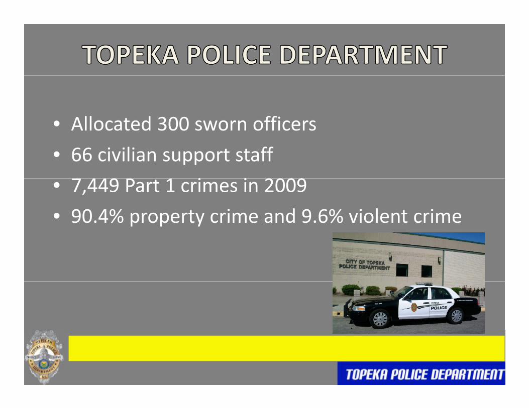
• Allocated 300 sworn officersAllocated 300 sworn officers
• 66 civilian support staff
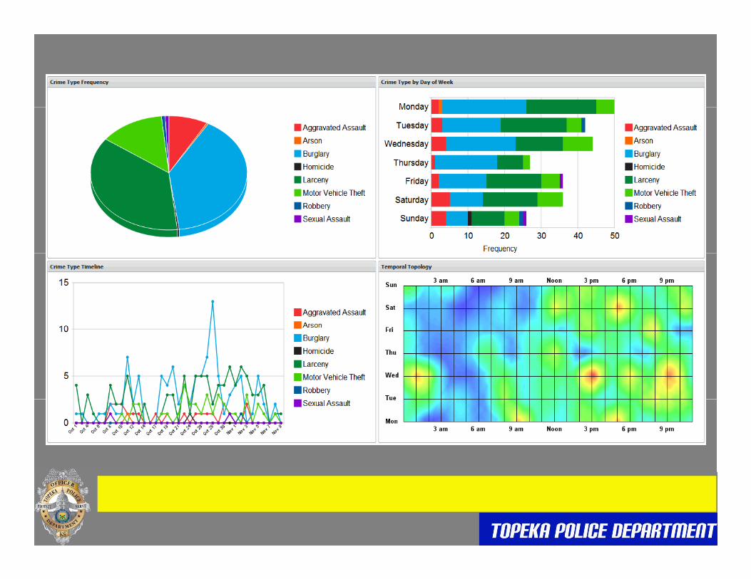
9 i i 2009• 7,449 Part 1 crimes in 2009
• 90.4% property crime and 9.6% violent crime

WEST

• 3 Analysts responsible for finding trends3 Analysts responsible for finding trends, identifying suspects, compiling crime stats, & producing crime mapsproducing crime maps
• Software used in mapping: ArcGIS (Spatial Analyst & Hawth’s Tools extensions) ArcViewAnalyst & Hawth s Tools extensions), ArcView3.3 (CrimeView extension for time midpoints), ATAC Google Earth Spider Near RepeatATAC, Google Earth, Spider, Near Repeat Calculator, & Crimestat III

X CORD Y CORD1961164.13 265101.251962784 49 267207 07
If I gave you the following
1962784.49 267207.071962457.40 267136.961963446.68 267300.871966345.49 267333.531965416.04 266793.851965764.29 266877.791965774 83 266310 061965774.83 266310.061967306.27 273587.471967460.50 272539.601967744.53 274389.131962092.41 263134.131963493.49 263190.191963427 40 264511 781963427.40 264511.781963177.93 262492.091962467.41 266566.661962812.93 265399.461961552.88 266708.781963813.89 265494.991965007 36 266505 461965007.36 266505.461963133.18 266288.02
Could you tell me anything about this data?
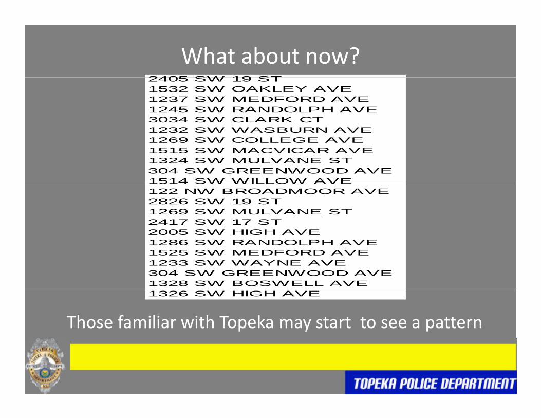
2405 SW 19 ST
What about now?2405 SW 19 ST1532 SW OAKLEY AVE1237 SW MEDFORD AVE1245 SW RANDOLPH AVE3034 SW CLARK CT1232 SW WASBURN AVE1232 SW WASBURN AVE1269 SW COLLEGE AVE1515 SW MACVICAR AVE1324 SW MULVANE ST304 SW GREENWOOD AVE1514 SW WILLOW AVE1514 SW WILLOW AVE122 NW BROADMOOR AVE2826 SW 19 ST1269 SW MULVANE ST2417 SW 17 ST2005 SW HIGH AVE1286 SW RANDOLPH AVE1525 SW MEDFORD AVE1233 SW WAYNE AVE304 SW GREENWOOD AVE1328 SW BOSWELL AVE1326 SW HIGH AVE
Those familiar with Topeka may start to see a pattern

If I give you this I’m sure all of you see a concentration

• GIS offers Police Departments a powerfulGIS offers Police Departments a powerful visualization and analytical tool to aid in decision makingdecision making
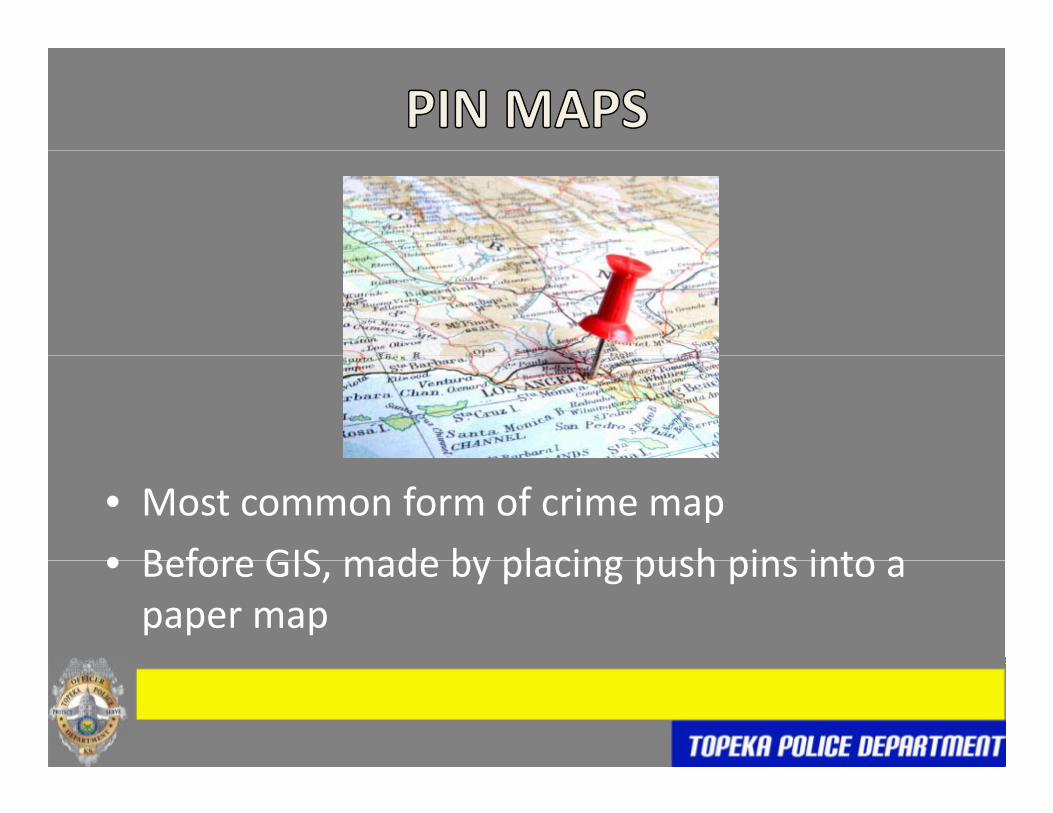
• Most common form of crime map
• Before GIS made by placing push pins into a• Before GIS, made by placing push pins into a paper map


• Keeps public informed of where crime isKeeps public informed of where crime is occurring


• The near repeat phenomenon states that if aThe near repeat phenomenon states that if a location is the target of a crime (such as burglary) the homes within a relatively shortburglary), the homes within a relatively short distance have an increased chance of being burglarized for a limited number of weeksburglarized for a limited number of weeks


• Show areas containing dense clusters ofShow areas containing dense clusters of criminal incidents
• Kernel Density Nearest Neighbor Hierarchical• Kernel Density, Nearest Neighbor Hierarchical (NNH), & Gi*


0000


• DDACTS is an operational model that uses theDDACTS is an operational model that uses the integration of location‐based crime and traffic data to establish effective and efficientdata to establish effective and efficient methods for deploying law enforcement and other resourcesother resources


• Risk terrain modeling is an approach to risk h d di i k fassessment that standardizes risk factors to
common geographic units. Separate map l h bi d i G hilayers are then combined in a Geographic Information System (GIS) to produce “risk
i ” h i h bterrain” maps showing the presence, absence, or intensity of all risk factors at every location h h h hthroughout the geography.


PROLIFIC CAR BURGLAR PAROLED IN JULY 2008 AND PLACED ON GPS IN AUGUST 2008.
CRIME ANALYSIS COMPARES GPS POINTS TO KNOWN CRIMESCRIME ANALYSIS COMPARES GPS POINTS TO KNOWN CRIMES.
SUSPECT IS PLACED IN NUMEROUS BULLETINS WHEN THE M.O. OF AVEHICLE BREAK‐IN MATCHES THAT OF SUSPECT AND CONFIRMED WITH GPS POINTS WHEN AVAILABLE.
UNIFORM OFFICERS OBSERVE THIS INDIVIDUAL COMMITTING CRIMES AT T PA C IN APRIL OF 2009T.P.A.C. IN APRIL OF 2009.
PAROLE PROVIDES ALL GPS COORDINATES ON THIS INDIVIDUAL AND AN OPERATION STARTS WHERE CRIME ANALYSIS EXAMINES ALLGPS POINTS IN RELATION TO KNOWN CRIMES.
SUSPECT IS POTENTIALLY LINKED TO 38 VEHICLE BREAK‐INS.

• August, 2008‐April, 2009
• 981 Vehicle break ins and attempted vehicle break ins
• 2406 suspect GPS points


Distance approximately
Car broken into between 04:45 and 06:45
18 feet

Purse recovered on the east side of 1600 SW Boswell

• SUSPECT IS ARRESTED AND CHARGED WITH 24 CAR BURGLARIESBURGLARIES
• SUSPECT PLEADS TO 15 BURGLARIES BASED SOLELY ON GPS• SUSPECT PLEADS TO 15 BURGLARIES BASED SOLELY ON GPS POINT PROXIMITY AND 1 PAWN TICKET AFTER PRELIMINARY TRIAL
• SERVES ONE YEAR IN JAIL

• Analyzes the locations of a connected series ofAnalyzes the locations of a connected series of crimes to determine the most probable area of offender residenceof offender residence

CITY IS HIT WITH A SERIES OF ARSONS IN LATE 2008 AND EARLY 2009CITY IS HIT WITH A SERIES OF ARSONS IN LATE 2008 AND EARLY 2009.
FIRE DEPARTMENT REQUESTS ASSISTANCE AND TPD AND FIRE DEPARTMENT MEET IN APRIL.
TFD HAS 3 POTENTIAL SUSPECTS.
CRIME ANALYSIS CREATES A GEOGRAPHIC PROFILE ON THE ARSONSCRIME ANALYSIS CREATES A GEOGRAPHIC PROFILE ON THE ARSONS. PROFILE STATES THE SUSPECT HAS BOTH COMMUTER (LIVES OUTSIDE DEFINED AREA) AND MARAUDER (LIVES INSIDE DEFINED AREA) CHARACTERISTICS.
ONE OF THE THREE POTENTIAL SUSPECTS FITS THIS PROFILE AND CRIME ANALYSIS SUGGESTS HE SHOULD BE THE PRIME TARGET OF THEIR INVESTIGATIONSINVESTIGATIONS.
CRIME ANALYSIS ALSO SHOWS THE MOST LIKELY AREA FOR THE NEXT EVENT.


ON MAY 10, 2009 THE PRIME TARGET IS ARRESTED BY UNIFORM OFFICERS AFTER HIS CELL PHONE IS FOUND ON AUNIFORM OFFICERS AFTER HIS CELL PHONE IS FOUND ON A LURKING & PROWLING CALL AT 820 SW 6TH AVE WHICH FALLS WITHIN AREA IDENTIFIED AS MOST LIKELY FOR THE NEXT EVENT.
CURRENTLY IN PRISON ON MULTIPLE ARSONS

• USE OF SPATIAL & TEMPORAL MODELING TOUSE OF SPATIAL & TEMPORAL MODELING TO PREDICT THE LOCATION, TIME, & DAY OF THE NEXT CRIME IN A SERIESNEXT CRIME IN A SERIES

• APRIL 2004 CITY IS HIT WITH A SERIES OF RESIDENTIAL BURGLARIES WHERE REAR DOORS ARE KICKED IN, A PILLOW CASE IS TAKEN, AND SMALL ITEMS ARE STOLEN
CRIME ANALYSIS TRACKS SERIES AND IDENTIFIES THE SUSPECT• CRIME ANALYSIS TRACKS SERIES AND IDENTIFIES THE SUSPECT AS A BALD B/M WITH GLASSES FROM A LINKED REPORT THAT HAD WITNESS INFORMATION
• A FORECAST ON THE SERIES IS SENT OUT AND PUT IN ROLL CALL FOR OFFICERS

RELATED CRIMES

SEQUENCE OF CRIMES

SPATIAL-TEMPORALMOVING AVERAGEMOVING AVERAGE

CORRELATED WALKPREDICTION OF NEXT EVENT

CORRELATED WALKPREDICTION WITH ACTUAL
NEXT EVENTS

• SUSPECT IS CAUGHT IN THE ACT OF BREAKING INTO A HOUSE THE NEXT DAY, IN THE AREA PREDICTED, DURING THE TIMES PREDICTEDPREDICTED
• FROM PROPERTY IN HIS POSSESSION HE IS LINKED TO 2 OTHER BURGLARIES THAT DAY
• WITNESSES ARE ABLE TO CONNECT HIM TO SEVERAL OTHER BURGLARIES IN THE SERIES BUT SUSPECT DOESN’T CONFESS TO ANY OTHERSANY OTHERS
• SERVES 6 MONTHS IN PRISON & WHEN HE GETS OUT HE IS LINKED TO ANOTHER SERIES OF BURGLARIES IN THE SAME AREA FOR WHICH HE IS CURRENTLY SERVING TIME

James Anderson Michael WalnohaJames Anderson(785) 368-9444
Michael Walnoha (785) 368-9517