living at tzintzuntzán, michoacán, mexico: analyzing community patterns with gis
TRANSCRIPT
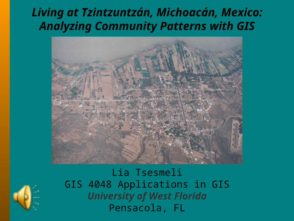
Living at Tzintzuntzán, Michoacán, Mexico:Analyzing Community Patterns with GIS
Lia TsesmeliGIS 4048 Applications in GIS
University of West FloridaPensacola, FL
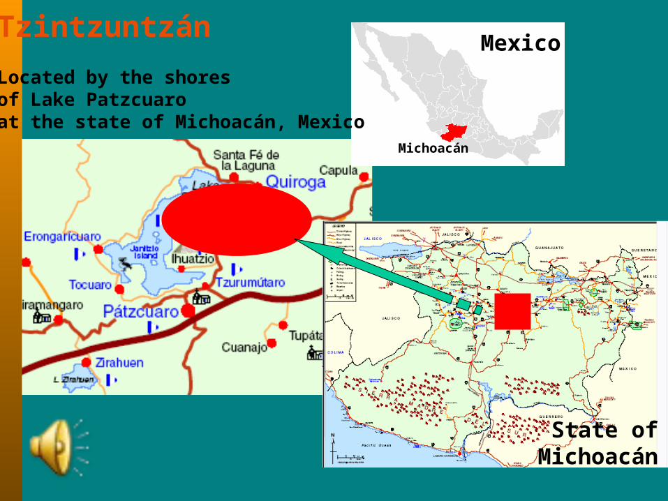
Mexico
State ofMichoacán
TzintzuntzánLocated by the shoresof Lake Patzcuaroat the state of Michoacán, Mexico
Michoacán
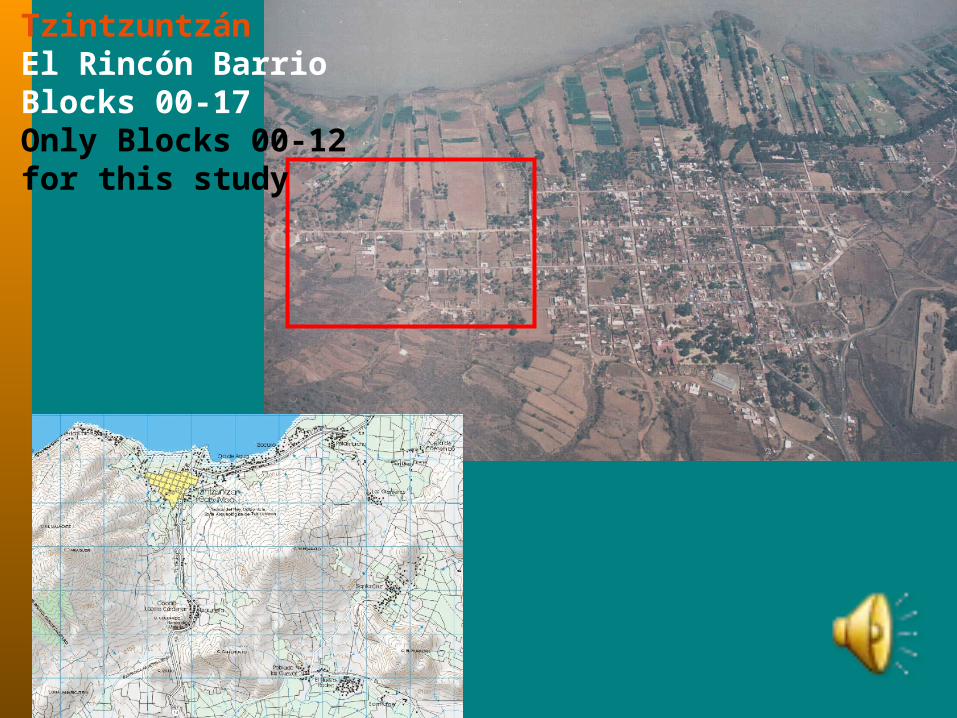
TzintzuntzánEl Rincón BarrioBlocks 00-17Only Blocks 00-12for this study
Methodology/Analytical Methods:Spatial Data from INEGI: AutoCAD files of roads, outline of community borders, .tif files of area maps and aerial images were used in this project.
Maps collected by the cultural anthropologists Dr. Foster, Dr. Kemper and Dr. Cahn, were also used to create the residence layers for each period in question.
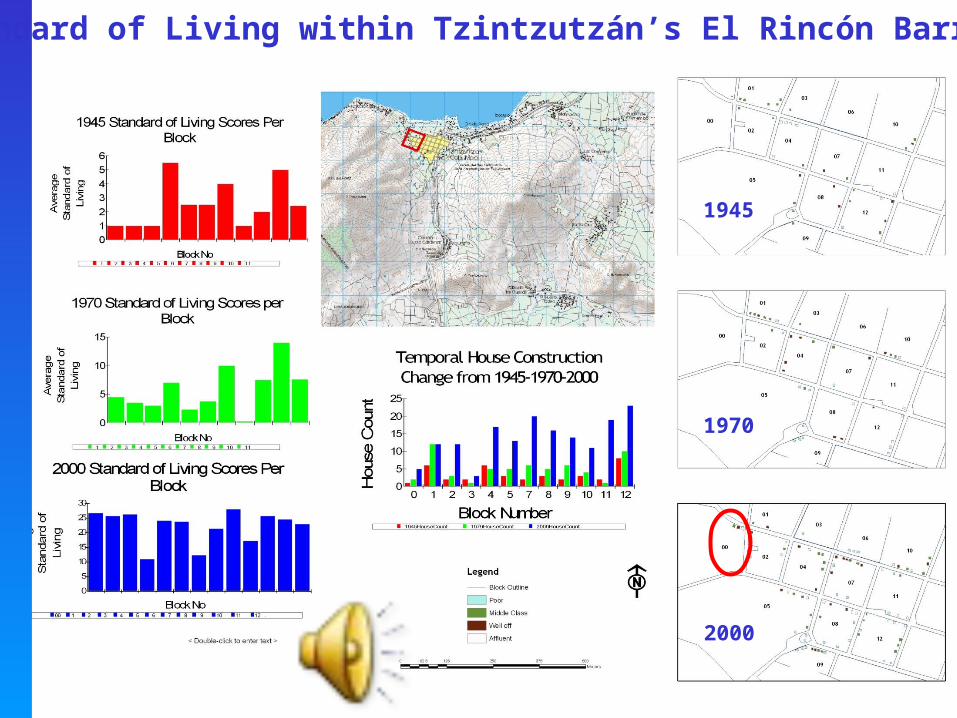
The social data that will be used for analysis does not only contain information on the blocks, lots, and houses from decade to decade, but also a grading system of affluence that has put a value on items such as stove, hearths, glass windows, stories of houses, and possession of luxury items such as cars or air-condition, to name a few. This is a standard way that cultural anthropologists have used to grade the progression of a societal system from basic amenities to a more complex living system as the time progresses.
It is rare to have social and economic data for one specific area that spans 60 years in such great detail.
Analysis will follow in two steps: One will be a quantitative evaluation of the density of house building through time within the city. The second step will be a statistical evaluation of the living standards of the people within the 13 blocks based on the award system included in the census for 1945, 1970 and 2000.
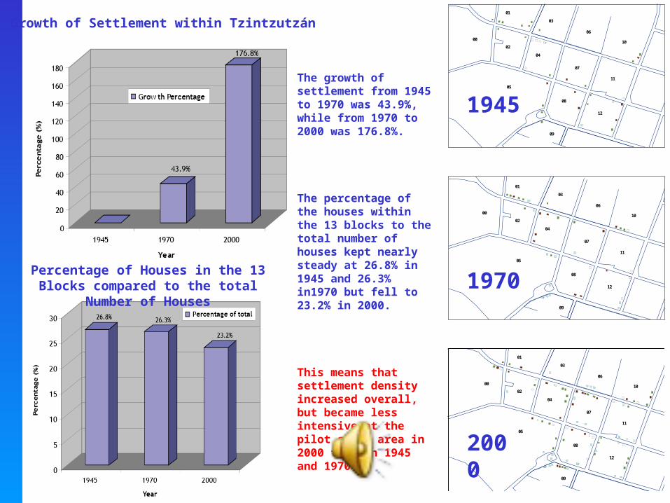
The growth of settlement from 1945 to 1970 was 43.9%, while from 1970 to 2000 was 176.8%.
The percentage of the houses within the 13 blocks to the total number of houses kept nearly steady at 26.8% in 1945 and 26.3% in1970 but fell to 23.2% in 2000.
This means that settlement density increased overall,but became less intensive at the pilot study area in 2000 than in 1945 and 1970.
01
0002
03
04
05
06
07
08
09
10
11
12
01
0002
03
04
05
06
07
08
09
10
11
12
01
0002
03
04
05
06
07
08
09
10
11
12
01
0002
03
04
05
06
07
08
09
10
11
12
1945
1970
2000
Growth of Settlement within Tzintzutzán
Percentage of Houses in the 13 Blocks compared to the total
Number of Houses
Standard of Living within Tzintzutzán’s El Rincón Barrio
1945
1970
2000
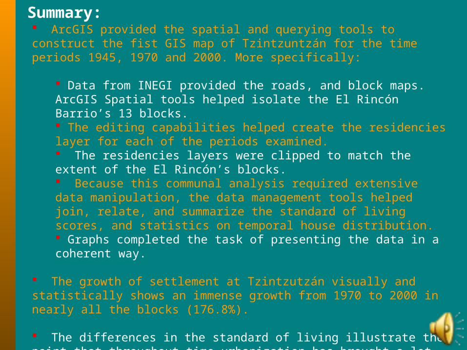
Summary: ArcGIS provided the spatial and querying tools to construct the fist GIS map of Tzintzuntzán for the time periods 1945, 1970 and 2000. More specifically:
Data from INEGI provided the roads, and block maps. ArcGIS Spatial tools helped isolate the El Rincón Barrio’s 13 blocks. The editing capabilities helped create the residencies layer for each of the periods examined. The residencies layers were clipped to match the extent of the El Rincón’s blocks. Because this communal analysis required extensive data manipulation, the data management tools helped join, relate, and summarize the standard of living scores, and statistics on temporal house distribution. Graphs completed the task of presenting the data in a coherent way.
The growth of settlement at Tzintzutzán visually and statistically shows an immense growth from 1970 to 2000 in nearly all the blocks (176.8%).
The differences in the standard of living illustrate the point that throughout time urbanization has brought a lot of amenities to the community, enhancing the quality of life for the residents. There were transitional periods between the decades of 1970 to 2000 that can be interpreted due to political climate, migration to other areas, influx of new people and intense urbanization.
Sources:
Kemper, R. (1977) Migration and Adaptation: Tzintzuntzán Peasants in Mexico City. Beverly Hills, CA: Sage Publications.
Brandes, S. (1988) Power and Persuasion: Fiestas and Social Control in Rural Mexico. Philadelphia: University of Pennsylvania Press.
Cahn, P. S. (2003) All Religions are Good in Tzintzuntzán: Evangelicals in Catholic Mexico. Austin: University of Texas Press.
Foster, G.M. (1967) Tzintzuntzán: Mexican Peasants in a Changing World. Boston: Little, Brown. Foster, G.M. and G. Ospina (1948) Empire’s Children: The People of
Tzintzuntzán. Smisthonian Institution, Institute of Social Anthropology, Publication No. 6. Mexico, D.F.: Imprenta Nuevo Mundo. Foster, G.M. and G. Ospina (2000) Los Hijos del Imperio: La Gente De
Tzintzuntzán. Zamora, Michoacán: El Colegio de Michoacán. (Translation of Foster and Ospina 1948)
Mexican Census Bureau (INEGI): Provided Spatial Data for the construction of the layout of the city of Tzintzuntzán (roads, blocks).
Ethnographic Data for 1945 credited to G.M. Foster. Ethnographic Data and Images for 1970 and 2000 credited to R. Kemper.