geometry in seismic
TRANSCRIPT
seismic acquisition geometry
Gathered by : maryam seyed mahmoudi
Dear master: dr.Ali misaghi
1

2
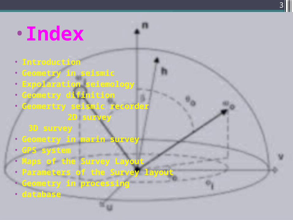
index•Index• Introduction• Geometry in seismic• Expolaration seiemology• Geometry difinition• Geomertry seismic recorder 2D survey 3D survey• Geometry in marin survey• GPS system• Maps of the Survey Layout• Parameters of the Survey layout• Geometry in processing• database
3
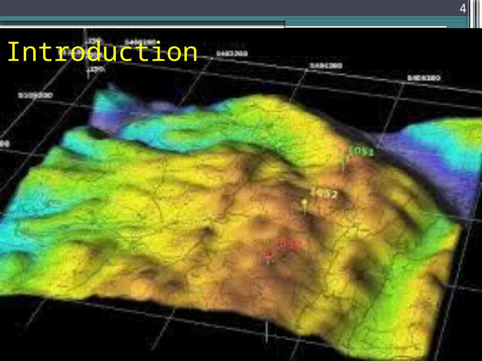
Introduction4
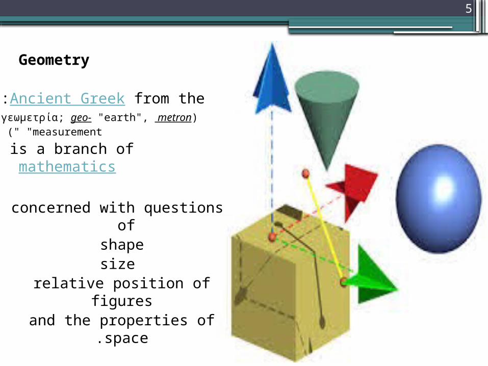
Geometry
from the Ancient Greek:( γεωμετρία; geo- "earth", metron
"measurement )" is a branch of
mathematics
concerned with questions of
shape size
relative position of figures
and the properties of space.
5
in seismic
6
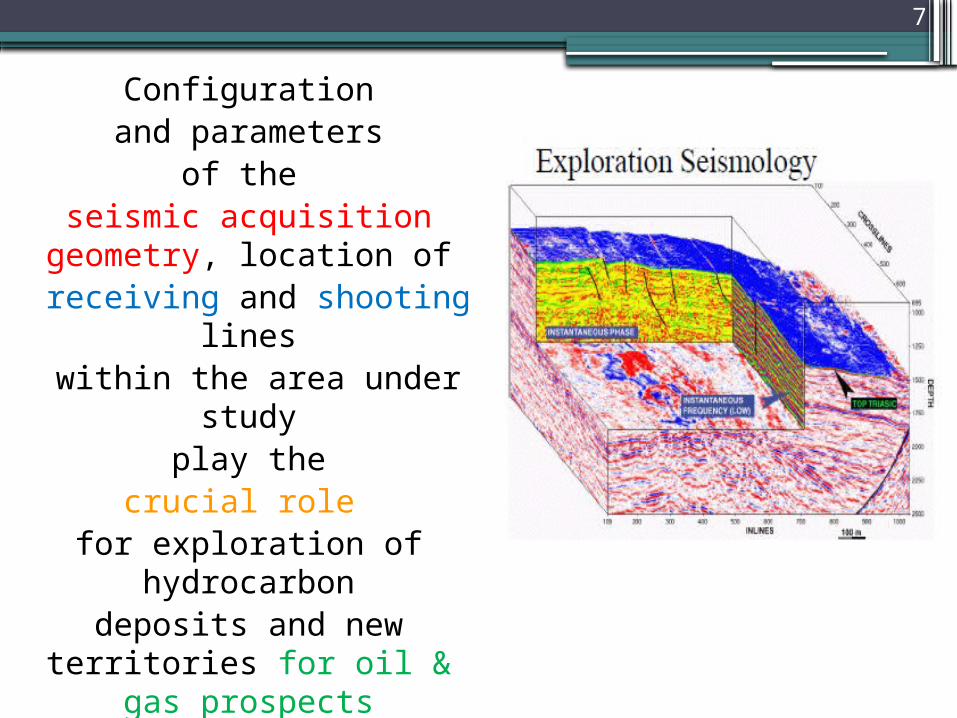
Configuration and parameters
of the seismic acquisition
geometry, location of receiving and shooting
lines within the area under
study play the
crucial role for exploration of
hydrocarbondeposits and new
territories for oil & gas prospects
7
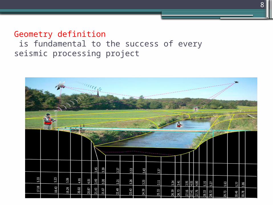
Geometry definition is fundamental to the success of every seismic processing project
8
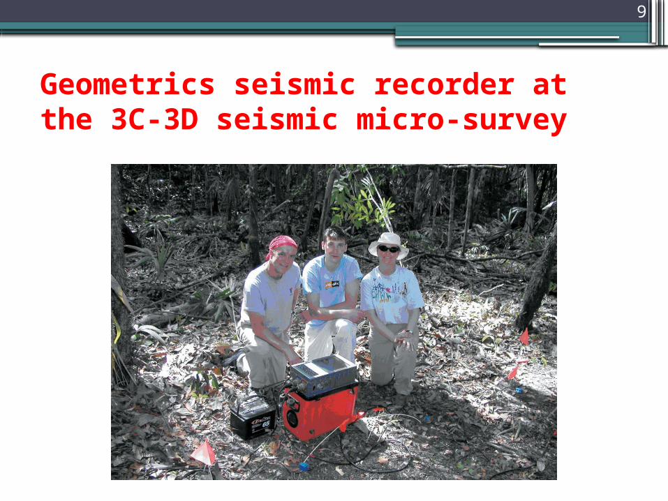
Geometrics seismic recorder at the 3C-3D seismic micro-survey
9
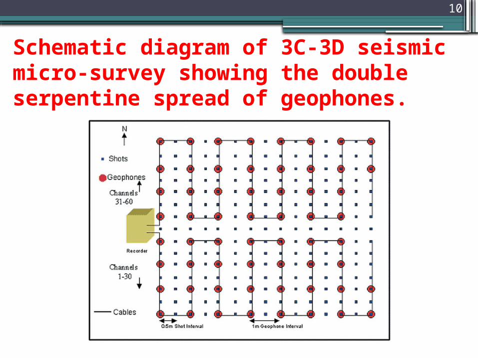
Schematic diagram of 3C-3D seismic micro-survey showing the double serpentine spread of geophones.
10
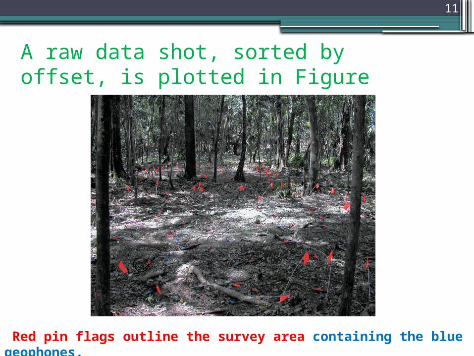
A raw data shot, sorted by offset, is plotted in Figure
Red pin flags outline the survey area containing the blue geophones.
11
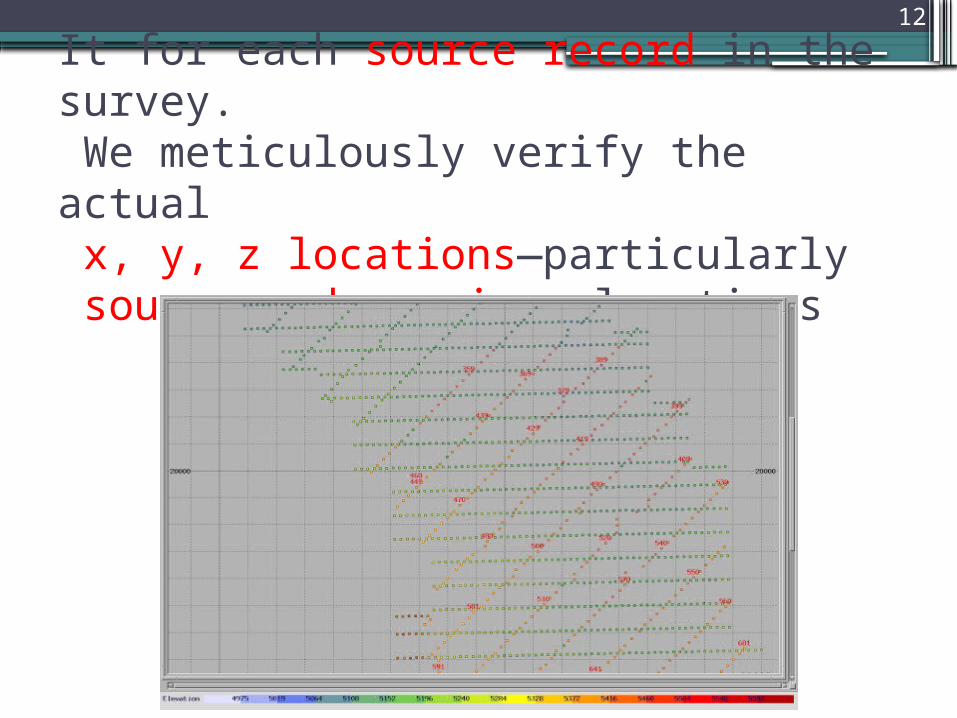
It for each source record in the survey. We meticulously verify the actual x, y, z locations—particularly source and receiver locations
12
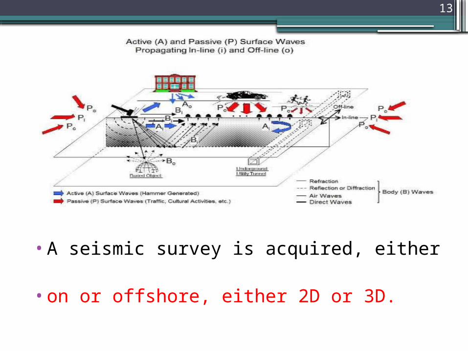
•A seismic survey is acquired, either
•on or offshore, either 2D or 3D.
13
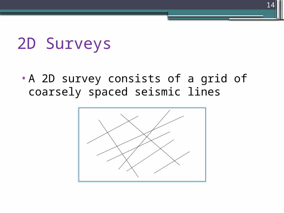
2D Surveys
•A 2D survey consists of a grid of coarsely spaced seismic lines
14
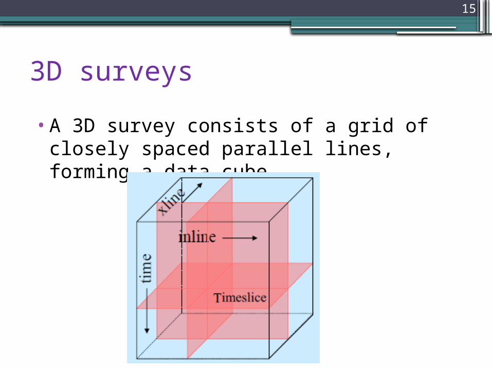
3D surveys•A 3D survey consists of a grid of closely spaced parallel lines, forming a data cube
15
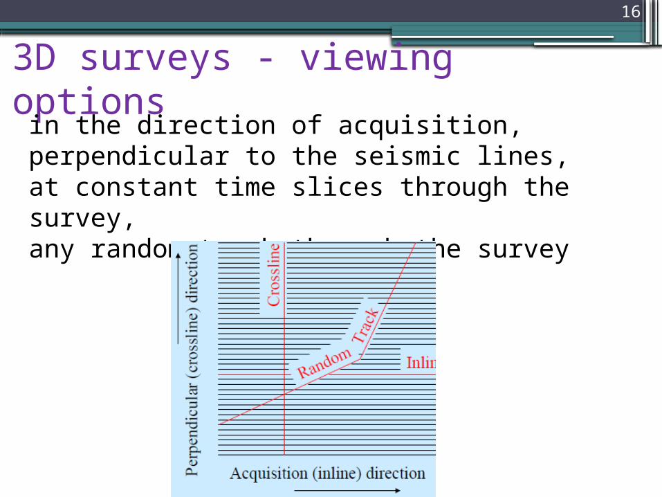
3D surveys - viewing optionsin the direction of acquisition, perpendicular to the seismic lines,at constant time slices through the survey,any random track through the survey
16
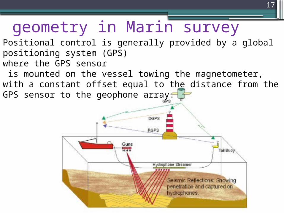
geometry in Marin surveyPositional control is generally provided by a global positioning system )GPS( where the GPS sensor is mounted on the vessel towing the magnetometer, with a constant offset equal to the distance from the GPS sensor to the geophone array.
17
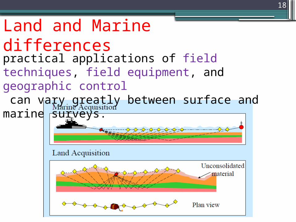
Land and Marine differencespractical applications of field techniques, field equipment, and geographic control can vary greatly between surface and marine surveys.
18
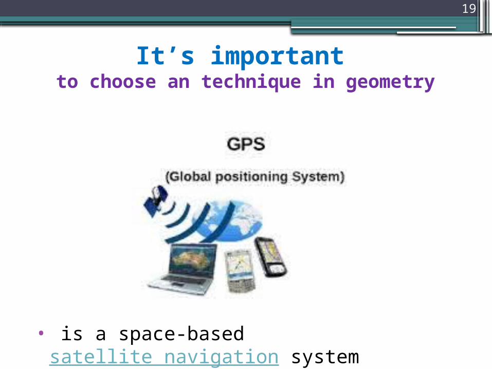
It’s important to choose an technique in geometry
• is a space-based satellite navigation system
19
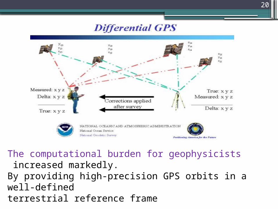
The computational burden for geophysicists increased markedly.By providing high-precision GPS orbits in a well-definedterrestrial reference frame
20

It is maintained by the United States government and is freely accessible to anyone with a GPS receiver.
21
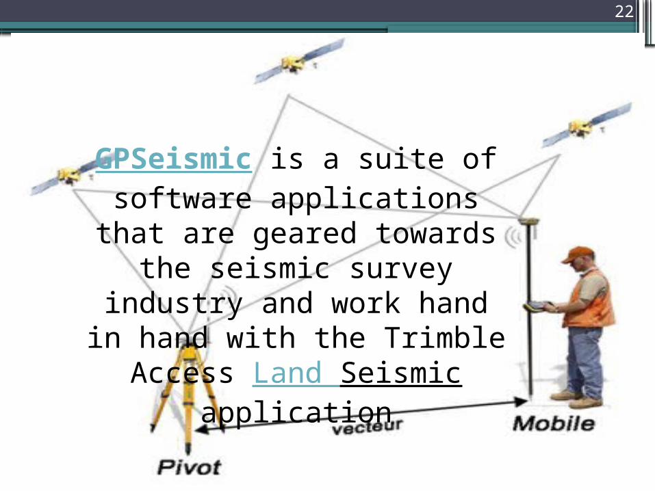
GPSeismic is a suite of software applications that are geared towards
the seismic survey industry and work hand in hand with the Trimble
Access Land Seismicapplication
22
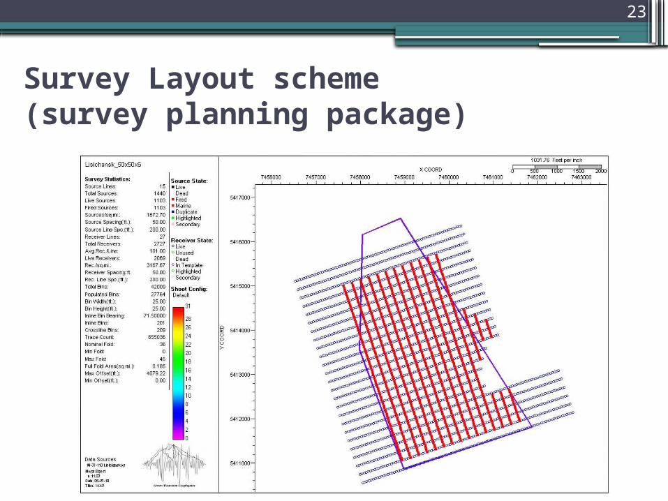
Survey Layout scheme (survey planning package)
23
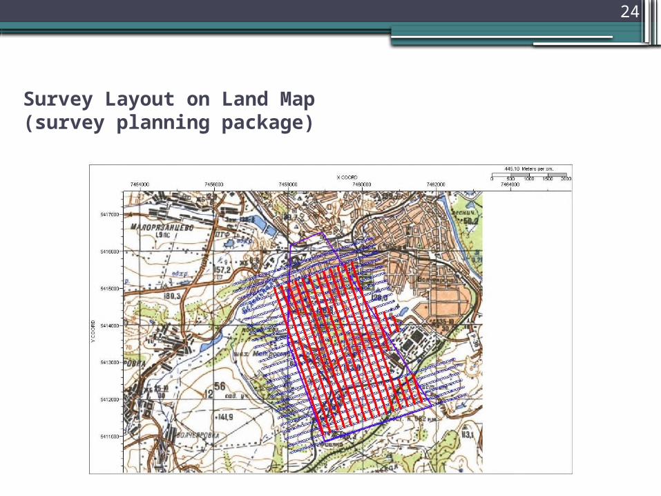
Survey Layout on Land Map (survey planning package)
24
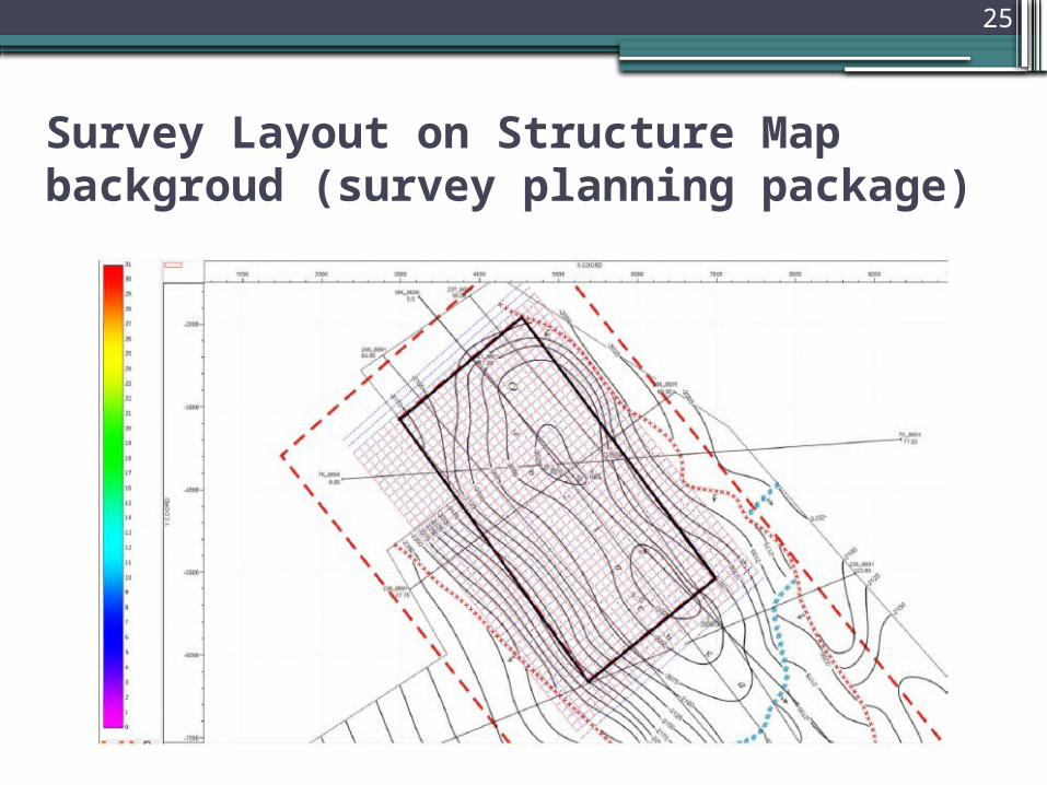
Survey Layout on Structure Map backgroud (survey planning package)
25
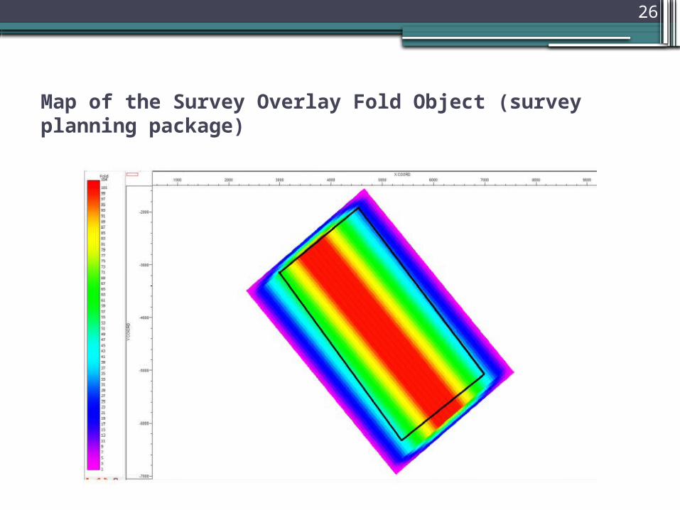
Map of the Survey Overlay Fold Object (survey planning package)
26
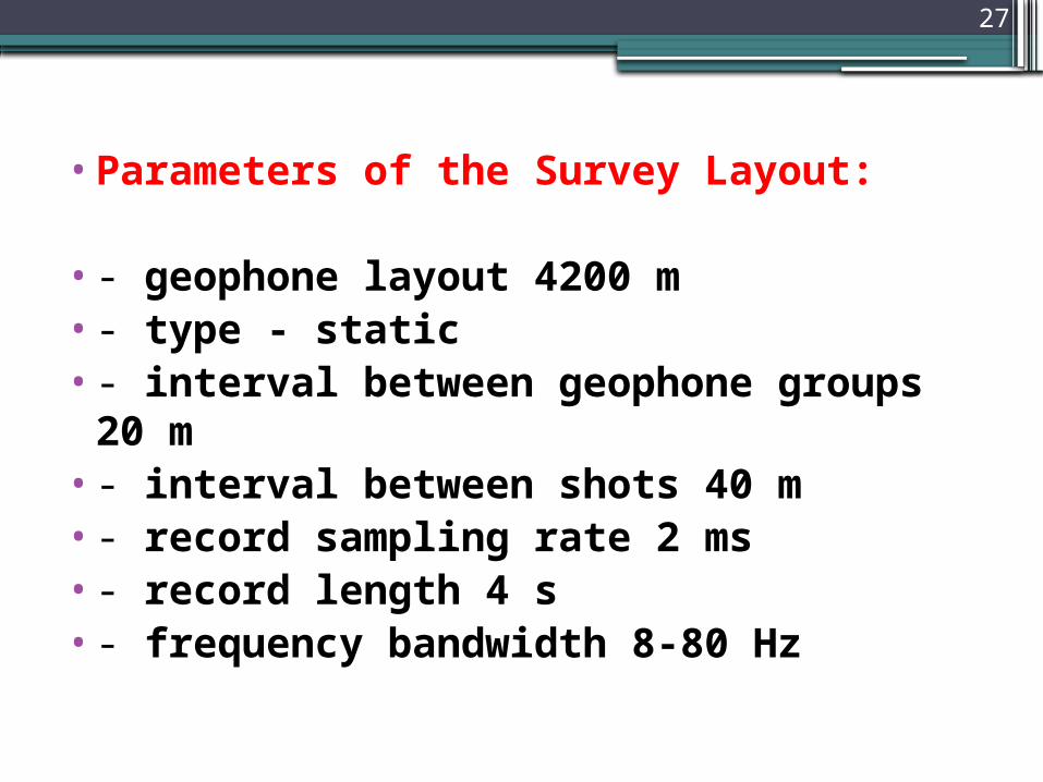
•Parameters of the Survey Layout:
•- geophone layout 4200 m•- type - static•- interval between geophone groups 20 m
•- interval between shots 40 m•- record sampling rate 2 ms•- record length 4 s•- frequency bandwidth 8-80 Hz
27
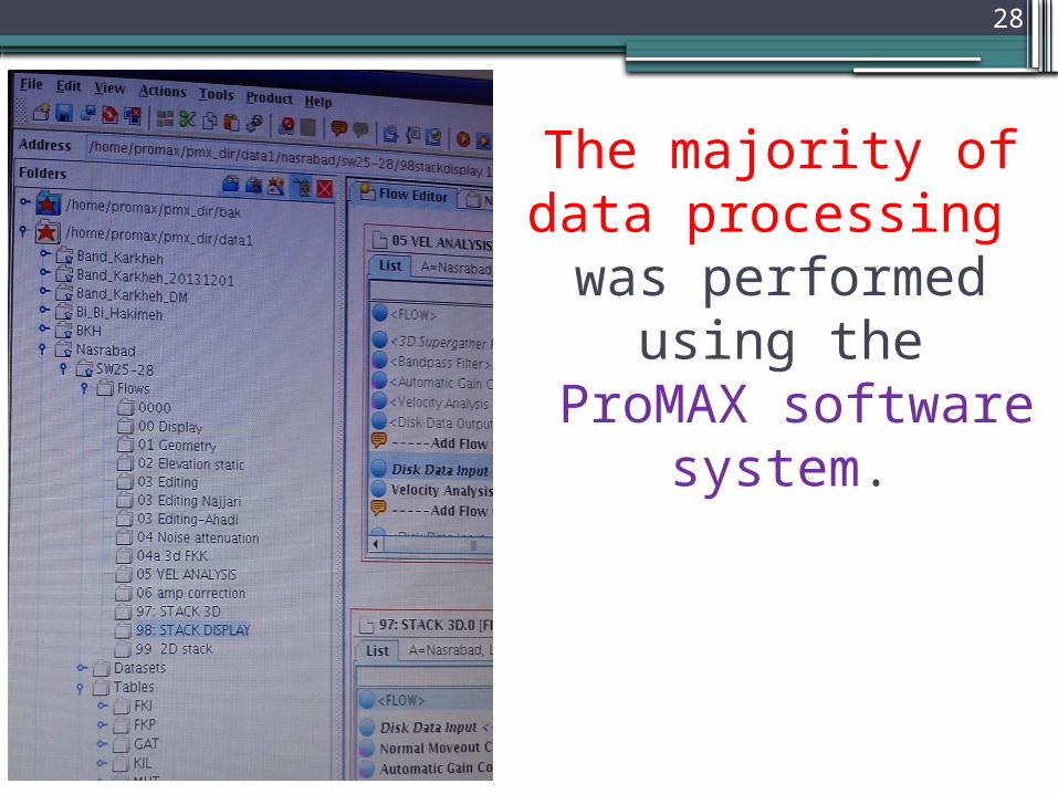
The majority of data processing was performed using the
ProMAX software system.
28
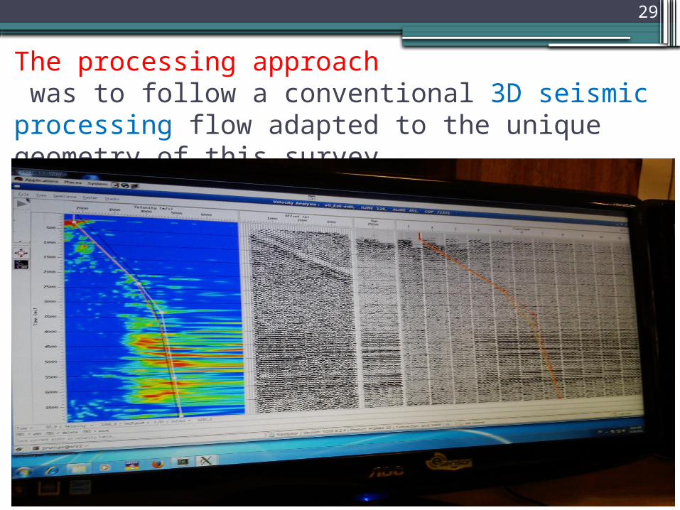
The processing approach was to follow a conventional 3D seismic processing flow adapted to the unique geometry of this survey
29
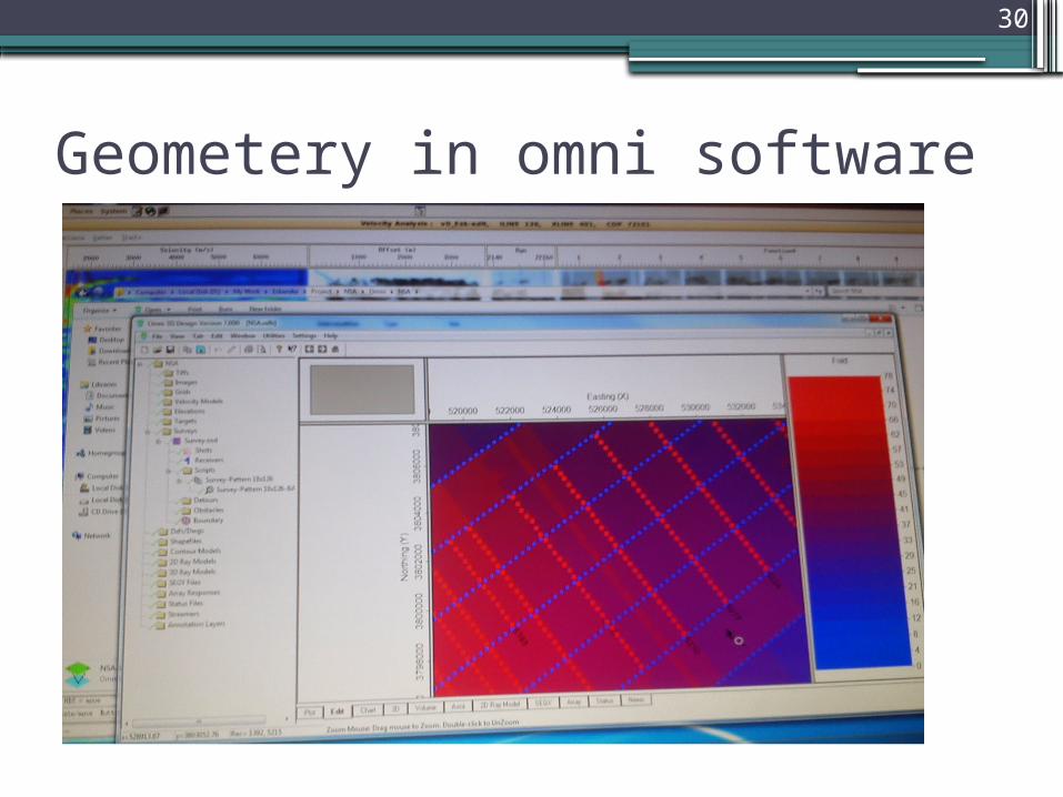
Geometery in omni software
30
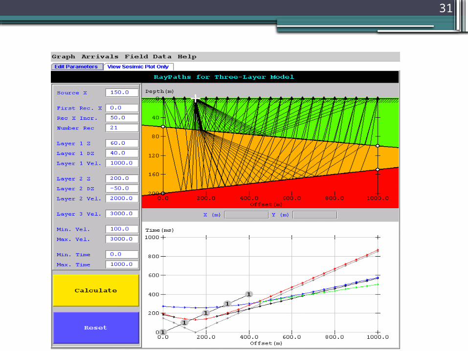
31
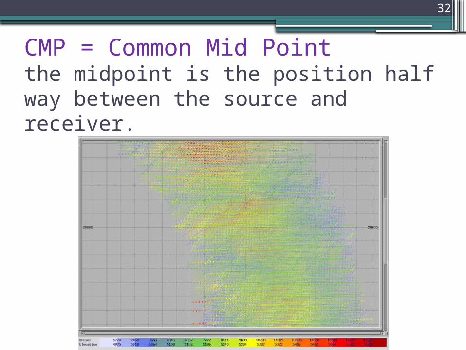
CMP = Common Mid Point the midpoint is the position half way between the source and receiver.
32
database•When merging seismic data with coordinate data• you are actually setting up a database)of sorts(
• contains:
• all of the survey information•; such as shot point definitions, source and receiver coordinates, and elevations.
33
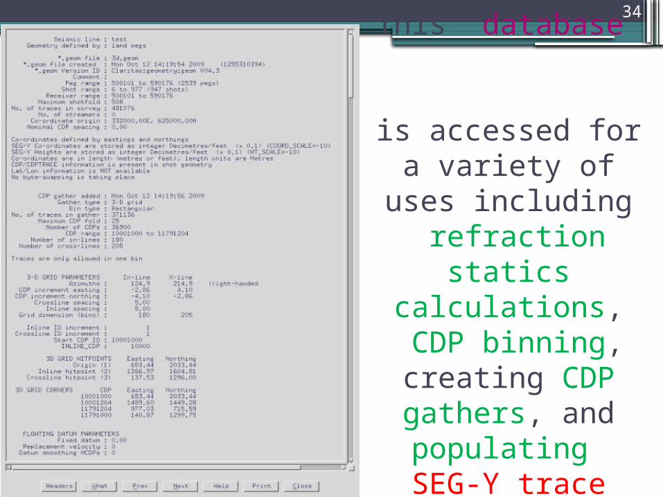
This ‘database’
is accessed for a variety of uses including refraction
statics calculations, CDP binning, creating CDP gathers, and populating SEG-Y trace
headers
34