corus steelworks dba, oldbury, sandwell mbc
TRANSCRIPT
Project No. 1461
July 2006
Former Corus Steelworks, Tipton
Archaeological Impact Assessment (phase 1)
By
Shane Kelleher
For
David Wilson Homes (West Midlands)
For further information please contact: Alex Jones (Director)
Birmingham Archaeology The University of Birmingham
Edgbaston Birmingham B15 2TT Tel: 0121 414 5513 Fax: 0121 414 5516
E-Mail: [email protected] Web Address: http://www.arch-ant.bham.ac.uk/bufau/
Former Corus Steelworks, Tipton.
Former Corus Steel Works, Bloomfield Road, Tipton.
CONTENTS
1 INTRODUCTION ................................................................................................. 1
2 SITE LOCATION, GEOLOGY, AND PRESENT CHARACTER..................................... 1
3 AIMS AND OBJECTIVES...................................................................................... 1
4 METHODOLOGY.................................................................................................. 2
5 PREVIOUS ARCHAEOLOGICAL WORK ................................................................. 2
6 HISTORICAL BACKGROUND ............................................................................... 2
7 HISTORICAL DEVELOPMENT OF THE STUDY AREA ............................................. 5
8 AREAS OF ARCHAEOLOGICAL POTENTIAL (FIG 16)............................................ 6
9 ASSESSMENT OF THE BUILT HERITAGE.............................................................. 7
PHASING .............................................................................................................. 7 ASSESSMENT ......................................................................................................... 8
10 RESEARCH STRATEGY ........................................................................................ 9
BELOW GROUND ARCHAEOLOGY .................................................................................... 9 ABOVE GROUND ARCHAEOLOGY .................................................................................... 9
11 ACKNOWLEDGEMENTS ..................................................................................... 10
12 SOURCES.......................................................................................................... 11
12.1 PRIMARY SOURCES ......................................................................................... 11 12.2 SECONDARY SOURCES...................................................................................... 11 12.3 CARTOGRAPHIC SOURCES.................................................................................. 12 12.4 INTERNET SOURCES ........................................................................................ 12
Appendix 1: Historic Map Regression and Analysis.................................................... 13 Appendix 2: Building Descriptions.......................................................................... 15 Appendix 3: Summary Sheet ................................................................................ 19 Appendix 4: Written Scheme of Investigation .............................................................. Appendix 5: Sandwell MBC Brief ................................................................................
Former Corus Steelworks, Tipton.
SUMMARY
In June 2006, Birmingham Archaeology undertook an archaeological impact assessment at the former CORUS steelworks, Bloomfield Road, Tipton, West Midlands. The work was commissioned by David Wilson Homes (West Midlands) in order to fulfil a condition attached to planning permission to redevelop the site. A desk-based assessment of all relevant readily available published and unpublished documentary sources was carried out. A rapid survey and a digital photograph record of all standing buildings in the study area were also undertaken. The assessment revealed a site with a long history of iron working. It is possible that a 13th-century iron mill was located here. Documentary sources refer to James Watt’s first commercial steam engine being installed on this site in 1776. In 1829 Joseph Hall built Bloomfield Ironworks on the site of an earlier ironworks. Here he perfected his ‘puddling’ method of refining the raw material and gained international recognition for his BBH brand. The Bloomfield Ironworks closed in the early 20th-century, and were replaced by Bloomfield Colliery, which was replaced by the 1930s by Brymill Steelworks who partook in two phases of construction in the 1920s and in the late 1950s. The site was utilised until recently by Corus Steelworks who constructed their Firsteel Cold Mill and Service Centre here. The existing buildings date from after the clearance of the site to accommodate the colliery after 1904. Three buildings of early to mid 20th-century date are of good architectural and historical quality to warrant preservation by record. Recommendations are made for the detailed recording of these; archaeological evaluations in specific areas of archaeological potential, and for the monitoring of future ground breaking activities on the site of earlier works.
Former Corus Steelworks, Tipton.
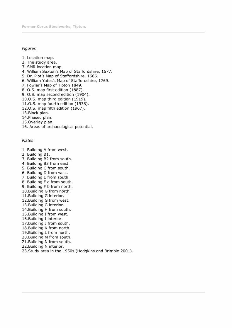
Figures
1. Location map. 2. The study area. 3. SMR location map.4. William Saxton’s Map of Staffordshire, 1577. 5. Dr. Plot’s Map of Staffordshire, 1686. 6. William Yates’s Map of Staffordshire, 1769. 7. Fowler’s Map of Tipton 1849. 8. O.S. map first edition (1887). 9. O.S. map second edition (1904). 10.O.S. map third edition (1919). 11.O.S. map fourth edition (1938). 12.O.S. map fifth edition (1967). 13.Block plan. 14.Phased plan. 15.Overlay plan. 16. Areas of archaeological potential.
Plates
1. Building A from west. 2. Building B1. 3. Building B2 from south. 4. Building B3 from east. 5. Building C from south. 6. Building D from west. 7. Building E from south. 8. Building F a from south. 9. Building F b from north. 10.Building G from north. 11.Building G interior. 12.Building G from west. 13.Building G interior. 14.Building H from south. 15.Building I from west. 16.Building I interior. 17.Building J from south. 18.Building K from north. 19.Building L from north. 20.Building M from south. 21.Building N from south. 22.Building N interior. 23.Study area in the 1950s (Hodgkins and Brimble 2001).
Former Corus Steelworks, Tipton.
Former Corus Steel Works, Bloomfield Road, Tipton ARCHAEOLOGICAL IMPACT ASSESSMENT (PHASE 1), 2006.
1 INTRODUCTION
In June 2006 Birmingham Archaeology carried out an archaeological impact assessment for the former CORUS steelworks, Bloomfield Road, Tipton, West Midlands (hereafter referred to as the study area). The work was commissioned by David Wilson Homes in advance of a proposed redevelopment of the site (Planning Application Number DC/05/45017) (TGCSWBO6).
This report outlines the results of the assessment, which was carried out between the 22nd and the 30th of June 2006, and which was prepared in accordance with the Institute of Field Archaeologists Standard and Guidance for Archaeological Desk-Based Assessment (IFA 1999).
The assessment conformed to a brief produced by Sandwell Metropolitan Borough Council, and a Written Scheme of Investigation (Birmingham Archaeology 2006), which was approved by the Local Planning Authority prior to implementation in accordance with guidelines laid down in Planning Policy Guidance Note 16 (DoE 1990).
2 SITE LOCATION, GEOLOGY, AND PRESENT CHARACTER
The site is located at Bloomfield Road, Tipton, West Midlands. It is approximately 1¼ miles north of Dudley, 1½ miles southwest of Coseley, 4½ southeast of Wolverhampton, and 9 miles northwest of Birmingham. It is centred on NGR SO 95409353 (Fig. 1).
The underlying geology is carboniferous middle coal measures, which consist of grey shales, clays and fireclays, with sandstones, coal seams, ironstones, and marine bands (Geological Survey Solid and Drift map of Staffordshire, 1:50000, 2004). Tipton’s soil has been described historically as being ‘clayey with subsoil clay’ (Kelly’s Directory of Staffordshire, 1896).
The present character of the site is hardstanding. The site is bounded by Bloomfield Road to the west, Brown Lion Street to the north, part of Barnfield Road and Barnfield Trading Estate to the south, and a public path/former railway line and playing fields to the east. Most of the standing buildings in the study area were still in use until recently by CORUS steelworks.
3 AIMS AND OBJECTIVES
The principle aim of the project was to assess the survival and potential significance of any archaeology within the study area by collating existing archaeological and historical information for the site and its immediate environs.
More specific aims were to:
To establish the origins, chronology, technical history and significance of the site. To consider the presence and significance of any buried archaeological remains. To formulate a research strategy for the further assessment and recording of the resource in advance of and during development.
Former Corus Steelworks, Tipton.
To produce a detailed inventory and assessment of the upstanding fabric in accordance with current best practice, in particular its historical development, typology, spatial layout, technology, process flow and working conditions.
This information will be used to inform a mitigation strategy for future archaeological work on the site (see Section 10 below).
4 METHODOLOGY
A search of all relevant and readily available published and non-published documentary sources, including historic maps and photographs, was carried out in the Smethwick Library local studies section, Birmingham Central Library, Tipton Library, and the Library of the University of Birmingham. A search of the National Monuments Record was carried out, and the Sandwell Metropolitan Borough Council Sites and Monuments Record, the main source of archaeological information for the borough, was also consulted.
In addition, a walkover of the study area was undertaken in order to assess the topography and any above-ground archaeology, including standing buildings. A rapid survey of these standing buildings was carried out, and each building was digitally photographed using a Nikon D50 SLR camera.
5 PREVIOUS ARCHAEOLOGICAL WORK
A search of the National Monuments Record and the Sites and Monuments Record (Fig 3) shows that there had not been any previous archaeological work carried out at the study area or within 800 metres of it.
6 HISTORICAL BACKGROUND
W.H. Duignan, the authority on Staffordshire place names, traces the development of the placename Tipton, or Tibbington, as it has also been known historically, from the Anglo Saxon feminine personal name Tibbe (Duignan 1902, 153). Hence, meaning the town of Tibbe, or the settlement of Tibbe. Cockin (2000, 587) proposes an alternative provenance noting that the original name may have been Tipstone, which would signify the name, is related to a stave or a spear shaped stone. It is first recorded as Tibintone in the Domesday Book, and as Tibinton and Tybeton from the mid 13th-century. It may also derive from St. Tibbe or St. Tybbe, the patroness of hunting who died in 696. However, the former is the more likely provenance. This is corroborated by Mills (2003, 463), and Watts (2004, 619) who note that it refers to an estate associated with Tibba, an Old English personal name. The Domesday Book (1086) informs us that ‘in Tibintone five carucates of land were held for the Bishop of Lichfield by one William’ (Hackwood 2000, 3).
Until about 1700 Tipton was a small village surrounded by fields (Raven 2004, 318) and was ‘even considered as a pretty place’ prior to ‘ mans eager search for the wealth hidden below its surface’ (Hackwood 2000, 1). The only documented event of note to have occurred in the locality was the Battle of Tipton Green in 1644. In 1621 Dud Dudley (a resident of Tipton) claimed to be the first to smelt iron with coal. Thus providing an even greater impetus for the residents of Tipton to exploit their dual resources. In 1712 Thomas Newcomen installed the first of his revolutionary steam cylinder and piston beam engines at Lord Dudley’s Coneygre
Former Corus Steelworks, Tipton.
Colliery in Tipton (Raven 2004, 318). James Watt’s first commercial steam engine was installed in the Bloomfield area of Tipton in 1776 (Dudley 1972, 115).
Tipton continued to ‘grow in a scruffy formless fashion’ (Pallister 1976, 184). Until the end of the 18th-century Tipton was a ‘comparatively unimportant industrial parish’ (Court 1938, 185), its main produce up to this were small metal wares such as nails, screws, and edge tools. The minor coal, iron, and limestone workings that had their roots in medieval times were expanding. Between 1801 and 1901 the population had increased by eight times. Tipton ‘mushroomed’ in this period ‘into a thriving but shapeless town which embodies the effects of the industrial revolution at their worst’ (Pallister 1976, 205).
Tipton became the scene of great ironworking and coal mining activities, with a corresponding growth in heavy industry. The geology of the area was ideal for industrial growth, its unprecedented wealth in mineral and fuel resources ensured that its inhabitants had learnt how best to exploit these resources from an early date. It became a centre of industrial innovation and invention. Tipton became an important centre of this industrial innovation. In Tipton ‘Vulcan is everywhere supreme and from the thousands of hearths that constitute his altars, never cease to arise columns of incense. To the Tiptonian therefore, a smoke laden sky is always regarded as the outward visible sign of the towns prosperity’ (Hackwood 2000, i).
Tipton is situated in an area abounding with rich resources of iron and coal. This wealth has helped shape its character and identity. This characterisation is nowhere more obvious than in the 19th-century trade directories. These sources describe Tipton as a place where ‘the coal mines are said to be inexhaustible’ (Pigot and Co. Directory, 1828/29); where ‘the parish is celebrated for the richness of its coal and ironstone, and for the number and extent of the iron furnaces, forges, and rolling and slitting mills’ (History, Gazetteer & Directory of Staffordshire, 1834). It is an area, which is ‘celebrated for the richness of its ironmines, and the number of its ironworks’ (Staffordshire General and Commercial Directory 1818); and a place ‘noted for its extensive trade in iron’ (Kelly’s Directory of Staffordshire, 1896, Post Office Directory, 1850).
The expansion of these industries was further augmented by developments in transportation. The extension of the canal system into the area from the 1860s, and later the railways from the mid 19th-century, saw an increased sphere of demand for, and consequently a greater output of, the industrial product from the area. The extent of the canal system in Tipton earned it the epithet ‘Venice of the Midlands’, or as it is locally known ‘Tip’n on-the-cut’: http://www.laws.sandwell.gov.uk/ccm/content/sandwelldirect/leisuredirect/history/historyofsandwell.en;jsessionid=bSFc8Hn6BSQ4. This canal network grew to such an extent to serve the expanding industries, that by 1828 the sinuosity of the canal was such that it exceeded ‘twenty miles within the parish, and an inland navigation (was) afforded by it to all parts of the kingdom’ (Pigot and Co. 1828/29). By the end of the 18th-century Bloomfield Colliery, to the east of the study area, one of the first deep coal mines in the Black Country, was reaching depths of over 300 feet. By 1801 there were six iron firms in Tipton, manufacturing nails, fireirons, fenders, and hinges for local and foreign markets. This expansion of the iron industry was further augmented by the Napoleonic Wars. At the beginning of the 19th-century Tipton ‘had thus become an exceedingly busy and prosperous Black Country town, with an extraordinary variety of industries, many of which had close business links’ (Court 1938, 185).
In 1829 the Bloomfield Ironworks was set up in the study area by Joseph Hall. This was to become one of the most successful ironworks in the country, and gained international recognition for the quality of its wares. Hall bought the land at Bloomfield in partnership with Thomas Lewis and built a small ironworks. Here he set about conducting a series of experiments. He was later joined by two new partners, Richard Bradley and William Barrows,
Former Corus Steelworks, Tipton.
and built up a very large and prosperous business. A Mr Bramah later succeeded Mr Bradley. In 1846 Barrow and Hall became joint owners, until the death of Hall in 1862. Over 200 years previous, Dud Dudley had invented how to produce the raw material, now through his experimentations at Bloomfield, Hall had invented the process for refining it (Parkes, 7). This process became known as ‘pig boiling’ or ‘puddling’, which ‘produced a purer and more uniform metal from practically any normal pig’ (Allen 1966, 14). Gale describes this process in detail:
Pig iron was charged into the furnace in the usual way, the fettling or lining of bull-dog and scale being repaired before charging as required. The metal was then melted down and in due course it began to work, as the oxygen from the fettling united with the carbon in the iron. The reaction was violent, and for about half an hour the surface of the metal boiled, with bubbles of carbon monoxide breaking through, and burning with little blue flames or puddler’s candles. Because of this violent ebullition, the process became known as pig boiling or wet puddling’. (Gale 1966, 68)
His improvements greatly reduced the cost of production, increased outputs, and were the basis of the prosperity of the Black Country in the mid 19th-century (Greenslade and Jenkins 1967, 122). The BBH brand of iron produced at Bloomfield was held in a very high esteem, and it acquired world-wide popularity for both ‘durability and toughness’ (Parks 1915,223). Hall’s own book ‘The Iron Question’ (1957) illustrates the increased production capacity; ‘taking the Bloomfield firm say in 1831… the produce of that time, being the time that they commenced, was about 50 tons a week, and now they average 900 tons per week’. This growth in production meant that the firm not only drew upon large supplies of pig iron and bar iron from the local area (estimated at 30,000 tons a year), but also sourced its supplies from much further afield. Pig iron was obtained from Shropshire, the Forest of Dean, and Wales. Scrap iron was purchased from Birmingham, charcoal from the Forest of Dean and Birmingham, and cinder and ‘hammer slug’ from Goldshill and other works (Greenslade and Jenkins 1967, 128). By 1863 the ironworks were the largest in south Staffordshire. The firm was producing heavy ironwork for railways, steam engine boilers, chains, anchors, and cables. Probably the most famous piece produced at these works was the Great Eastern Anchor in 1866, which was at the time the largest anchor in the world. In 1872 the firm employed over 800 staff, producing over 40,000 tons a year from 100 puddling furnaces and 8 mills (Hackwood 2000, 172).
By the mid-1870s the iron industry was entering into its last phase. The Black Country ironworkers were beginning to feel the weight of competition from other areas with better ore supplies and more modern plant. The production of mild steel at this time was also having an effect. Bloomfield’s sister works at the Factory Iron Works in Tipton, and the Tipton Green Ironworks were closed down in 1877 and 1879 respectively. Bloomfield itself carried on until 1902 when it was shut down, and offered for sale in Birmingham newspapers (Gale 1966, 121). The site was sold in 1904 for the sake of the coal underneath. Gale (1966, 122) mentions a plan and sale catalogue issued when the works were put on the market (Gale found this at Tipton Library. A search for this catalogue has of yet proved fruitless). The plans show:
‘a typical, if rather larger than usual Black Country ironworks. Bloomfield Ironworks had been built, as was the case with almost every other ironworks in the district, on the banks of the canal, but had later been connected with the mainline railway by sidings. The works were, except for pig iron (the firm was unusual for a large one in the Black Country as it had never owned blast furnaces) entirely self-sufficient. They had bulldog kilns, bulldog being still an important fettling material, their own foundry and fitting shops for maintenance purposes, and extensive roll-turning equipment. The plan shows clearly the haphazard way in which the works had grown up, producing a unit that was far from efficient. It must in fairness be added, however that although this condition applied very generally to the works of the Black Country, it was by no
Former Corus Steelworks, Tipton.
means confined to ironworks or to the Black Country itself. There was ample land in the occupation of the firm, but the various rolling mills lay clustered together and were with the puddling furnaces, at all angles. Altogether just over 18 acres, were fenced off, but only a small part of this area was occupied with buildings. The rolling mills were under cover and roofs were provided for such departments as had valuable machinery, such as lathes, but quite a number of puddling furnaces had no protection from the weather at all.
It is interesting to see, too, that while waste heat was used to some extent, several of the puddling furnaces still had their own individual chimneystacks, and were not connected by a boiler at all. Similarly several boilers of that cylindrical egg-ended type were used, and these were fired in coal. The Bloomfield works were in every way a typical 19th-century plant, and it is doubtful if they could have survived unaltered much longer’.
The Bloomfield Hall Colliery was closed on the 21st of January 1921 with the ending of working on the Thick Seam (HMSO 1929). This was subsequently replaced by the Brymill Steelworks. Which in turn was taken over by Tipton Bright Bar Firsteel Mill and Service Centre (Corus).
7 HISTORICAL DEVELOPMENT OF THE STUDY AREA
The study area has long been associated with the production of iron. It is this continuation that characterises the development of the site.
Whilst the name Bloomfield may at first appear to be associated with the production of iron. It is, however, more likely that the area was named after Robert de Blomere who lived at Shrubbery Hall at Bloomfield in the 13th-century (Cockin 2000, 69). It is possible that the Bloomfield Ironworks were built on the site of a medieval iron-working mill associated with Robert de Blomere (Tipton Parish Records). If so, this would be one of the earliest iron-working mills in the Borough. However, there is no evidence for the exact location of this mill.
A smithy is recorded in the area in 1683 as ‘Ye Bloom-Smythes’ (Hackwood 2000, 155).
In 1776, (as seen in section 6) James Watt’s first commercial steam engine was constructed for an ironworks/colliery in close proximity to, or in the study area (Dudley 1972, 115, Gale 1966, 30), the exact location of this is unknown.
The first map to show Tipton and Bloomfield in detail is Fowler’s Map of Staffordshire, 1849 (Fig 7). This shows the extent of the works at this time. Joseph Hall’s iron works at this time would have been well established. There are large works buildings to the south of the site, which is bound here by the canal. There are further buildings towards the centre of the site. There are residential/cottage industry buildings lined along Bloomfield Road. These may be associated with the site in the form of workers housing or ancillary industries.
By the first edition O.S. map in 1887 (Fig 8) it is obvious that the works had not expanded much since the previous map. Some buildings had been built to the east of centre of the site, while the London and North West Railway line had been constructed to the east with two sets
Former Corus Steelworks, Tipton.
of sidings providing access to the site. Tibbington Collieries can be clearly seen to the east of the study area. Brown Lion Street, which was named after a public house in the area, had been constructed to the north and forms the north boundary of the site. The canal had been extended northwards (basin) to give access to the centre of the site.
The second edition O.S. map (1904) (Fig 9) shows the study area as it was at the demise of Bloomfield Ironworks. The site was about to be sold and become Bloomfield Hall Colliery. There do not appear to have been any significant developments since 1887.
The 1919 O.S. map (Fig 10) shows the extent of the denudation and clearance of the site in order to accommodate the colliery. The Bloomfield Hall shafts are located to the south of the site where the main factory buildings once stood. The railway sidings to the east had been extended southwards to meet with the new colliery. The development along Bloomfield Road, and Brown Lion Street do not appear to have been affected by this clearance. There was an allotment garden in the northeast corner of the site. The canal extension/basin to the south, seen in 1887, had been filled in.
By 1938 (Fig 11) the Bloomfield Hall Colliery has been replaced by the Brymill Steel Works (Rolling Mills). There are two large mill/factory structures to the south of the site. The railway siding is connected to the most easterly of these, building I is part of this structure, whilst building C has been constructed by this time. There are a number of small structures to the west of this; these probably had an administrational function.
By 1967 (Fig 12) the canal to the south had been infilled, and the area to the southwest of this had been acquired by the firm. Engineering works buildings had been built here, including buildings J and L. Larger steelworks buildings have replaced the large structures in the south of the study area. The railway sidings were now gone. Buildings A, D, F, M, and N had been constructed. All of the development along Brown Lion Street and Bloomfield Road had been demolished. Building N had been constructed in the early years of World War Two. Buildings A (offices) and D (laboratory) were constructed in 1959 as part of the clearance of the old houses on Bloomfield Road (Plate 23).
Between 1967 and the present day the large steel mill buildings in the south half of the study area have been replaced yet again by buildings B and G. Buildings E, part of F, and K were built during this period.
The works were recently closed, and are now part of a proposed residential development.
8 AREAS OF ARCHAEOLOGICAL POTENTIAL (FIG 16)
The earliest putative evidence for human activity at the study area is the 13th-century iron-mill associated with Robert de Blomere. However, there is no evidence for the exact location of this early mill. This lack of evidence in addition to no visible presence of a water supply such as a river or a stream in this area may mean that the medieval mill was located elsewhere. Continuity of function has been a significant factor in the development of this site. Figure 15 shows that, despite periods of denudation, clearance, and redevelopment, the proprietors of the study area located their main works buildings in the same area, i.e. the southern part of the site. The proximity of the canal to this part of the must have one of the major factors in this particular location. This probably signifies that any works built here after the canal was extended in 1794 were probably built in this specific area. Therefore, this area, now largely covered by buildings B and G, must be described as an archaeologically sensitive area. It must
Former Corus Steelworks, Tipton.
be noted however, that the period of clearance after 1904 may have had seriously detrimental effects on the archaeological record. It is unlikely that, much if any, of the built fabric prior to this period survived. It is more likely that smaller objects of the material culture of the earlier works, such as pottery, clay pipes, and smaller industrial wares, may be recovered. The recovery of such evidence from the past may shed much more light on the sequence of construction, form, process flow, and the way of life at the study area prior to the late 1920s. It may also help trace evidence for the location of James Watt’s steam engine.
The residential/cottage industry dwellings that lined Bloomfield Road and Brown Lion Street, many of which seem to have been built prior to Fowler’s map in 1849, may provide some interesting evidence about the study area in the early Victorian period, if not earlier. These may even stand on the site of earlier structures associated with earlier works in the study area. Whilst all of these were removed in the late 1950s (Plate 23), it is possible that traces of the structures themselves remain underground. There is also likely to be evidence remaining of the specific function of these buildings, that may shed more light on whether they were purely domestic, or if they did have an industrial function as ancillaries to the ironworks. It may even be possible to identify the site of the Brown Lion Pub, which gave its name to the street.
Another area of archaeological potential is the infill of the canal in the south west of the study area, this was infilled around the same time that the buildings lining Bloomfield Road and Brown Lion Street were demolished. The debris from this clearance may have been used to backfill the canal.
9 ASSESSMENT OF THE BUILT HERITAGE
Phasing
The phasing of the standing buildings is based on the sequence of construction depicted on the historic and ordnance survey maps (Appendix 1) in concert with a site inspection (Fig. 14). Five distinct phases have been identified. None of the surviving buildings in the study area pre-date the Bloomfield Hall Colliery seen on the 1919 O.S. map (Fig. 10). The historic (Fig. 7), and first (Fig. 8) and second (Fig.9) editions of the O.S. maps display some structural alterations or additions in the study area from 1849 to the clearance of the site after 1904 to accommodate the change of use from ironworks to coal works. There are three extant phases of building and development in the study area.
Phase 0 (Pre 1829)
The site prior to Joseph Hall’s Bloomfield Ironworks. None of the buildings in the study area survive from this phase.
Phase 1 (1829-1904)
This phase represents the steady expansion of Bloomfield Ironworks from its inception in 1829 to its final demise in 1904. None of the buildings in the study area survive from this phase.
Phase 2 (1904-1919)
This phase represents the clearance of the site to accommodate the Bloomfield Hall Colliery. The railway sidings have been extended into the southwest of the study area in order to give access to these new works. None of the buildings in the study area survive from this phase.
Former Corus Steelworks, Tipton.
Phase 3 (1920s-1938)
This phase represents the demise of the colliery and the construction of the Brymill Steel Works at the study area. This saw the construction of two large factory/works buildings in the southwest of the study area; these were largely removed and dismantled prior to the next phase. Buildings C (Plate 5) and I (Plate 15 and 16), and very small sections of building B3 survive from this phase.
Phase 4 (1938-1967)
Large-scale changes can be seen during this phase. The linear residential/cottage industry dwellings that faced Bloomfield Road and Brown Lion Street since before 1849 have now been demolished and removed. There was also an extensive programme of remodelling and landscaping of the site. Buildings A (Plate 1), D (Plate 6), F (Plates 8 and 9), J (Plate 17), L (Plate 19), M (Plate 20), N (Plates 21 and 22), and parts of buildings B1 (Plate 2) and G (Plates 10, 11, 12, and 13) survive from this phase. The large factory/works buildings seen in the previous phase were replaced by larger structures; these were constructed on similar alignments and orientations (Fig. 15). However, no evidence remains internally of these Phase 3 buildings. Phase 4 also saw the infilling of the canal and the accession of part of the south bank of this by the Steelworks, where it constructed engineering works buildings, including buildings J and L. The railway sidings also appear to have been removed by the end of this phase.
Phase 5 (Post-1967)
This phase represents a period of improvements and modernisation at the study area, and saw a great increase in factory floor space. Buildings B1 (Plate 2), B2 (Plate 3), B3 (Plate 4), B4, E (Plate 7), G (Plates 10,11, 12, and 13), K (Plate 18), and part of F (Plates 8 and 9) date from this phase. Very small areas of buildings B1, B3, G, possibly date from the previous period. Buildings B1, B2, B3, and K are an example of the modernisation of plant during this period, while building E had an administrational function.
Assessment
The study area has been characterised by two periods of mass demolition and denudation. The ironworks founded by Joseph Hall in the late 1820s, which were progressively expanded until the beginning of the 20th-century, were completely dismantled and demolished to accommodate the Bloomfield Hall Colliery. A further period of clearance can be seen in the late 1950s/ early 1960s where the houses/cottage industries that had lined both Bloomfield Road and Brown Lion Street for over a century were torn down to enable the construction of new offices, laboratories and garden frontage.
The progressive development of the study area has ensured that there is little of significance remaining. However there are three particularly interesting structures still in-situ.
The earliest surviving structure in the study area is building I, which, with its Belfast trusses and segmental arched gables is a relatively complete and architecturally coherent small industrial building which probably dates from the mid to late 1920s/ early 1930s.
Former Corus Steelworks, Tipton.
Building C probably dates from the late 1930s. This building was built during a boom period for the steel industry in the build up to the Second World War. These type of buildings were constructed quite rapidly; this may have been a requirement at this site, as production, labour, and the demand for steel increased in the pre-war period. This building (workers canteen and dining area) was probably built in response to the 1937 Factories Act, which laid out much better provision for staff welfare on works such as this. The particular style of this structure, ‘rustic pastiche’, may have been inspired by a greater access to motor transport and trips to the countryside in the 1930s, contrasting the ‘rustic’ countryside with the ‘modern’ city/workplace. (Steve Litherland). The excellent condition, and rarity of this structure, along with its obvious continuing aesthetic appeal, ensures that it is of some significance.
Structure N; the air raid shelter is another interesting reminder of this wartime period. This was more than likely constructed during the phoney war (late 1939) or in the early years of the next decade. Its proximity to the administrational buildings, and its small size, probably means that this was reserved for management at the steel works. It was probably one of a number of air raid shelters on site. Air raid shelters of this size, type, and condition are a rare survival in the Black Country (Kirsty Nichols).
10 RESEARCH STRATEGY
Below ground archaeology
It is recommended that an evaluation/s be undertaken in the north portion of the study area in order to establish the historic function of this part of the site. It may be that this part of the study area contained the putative medieval mill, and possibly the area where James Watt’s first commercial steam engine was located. It is recommended that evaluations should be undertaken at areas on Brown Lion Street and Bloomfield Road to understand the extent of archaeological survival such as Victorian cellars after the clearance of these areas in the late 1950s. It is also recommended that a watching brief be undertaken during clearance and ground breaking activities at buildings B and G, with a provision for further archaeological work should archaeology be found. Evaluations in these areas would probably prove futile due to the large amount of development, clearance, and redevelopment in the last 150 years. To get an understanding of the archaeological and historical record in this central/southern part of the study area it is recommended that evaluations should be undertaken in one or more of the non-developed areas surrounding structures B and G. If the canal infill is to be removed, it is recommended that a watching brief of this work be carried out.
Above ground archaeology
It is not considered that any of the buildings affected by the proposed development scheme is of sufficient architectural or of historic interest to warrant statutory protection. PPG15 (1994) sets out strict criteria for deciding which buildings merit inclusion on the statutory lists: -
-architectural interest: the lists are meant to include all buildings which are of importance to the nation for the interest of their architectural design, decoration and craftsmanship; also important examples of particular building types and techniques (e.g. buildings displaying technological innovation or virtuosity) and significant plan forms;
Former Corus Steelworks, Tipton.
-historic interest: this includes buildings which illustrate important aspects of the nation’s social, economic, cultural or military history;
-close historical associations with nationally important people or events;
-group value, especially where buildings comprise an important architectural or historic unity or a fine example of planning (e.g. squares, terraces or model villages).
Not all these criteria will be relevant to every case, but a particular building may qualify under more than one of them.
If assessed under these criteria, it is clear that none of the buildings in the study area should be considered nationally important.
Nevertheless, the continuity of industrial function at this site for at least 170 years has ensured that an interesting composite of industrial and associated buildings survives. Of particular interest are buildings C, I and N. These are certainly worthy of preservation by record in some measure.
Varying RCHME levels of record are recommended for these buildings according to their significance.
Level 3
Buildings C and N.
Level 2
Building I
Level 1
Buildings B1, B3, and G; with a view to identifying and understanding earlier fabric.
The final decision for further archaeological mitigation lies with the Borough Planning Archaeologist.
11 ACKNOWLEDGEMENTS
The project was commissioned by David Wilson Homes (West Midlands). Thanks are due to Darren Cutler of Harris Lamb ltd. and Jonathan Stackhouse of David Wilson Homes for their co-operation and assistance throughout the project. Thanks are also due to Fay de Souza of Sandwell Metropolitan Borough Council, Maureen Waldron of Smethwick Library local studies section, and to Ron Moss and Keith Hodgkins of the Black Country society. Thanks also go to G Eyre-Morgan [the Borough Archaeologist]; who monitored the project on behalf of Sandwell Metropolitan Borough Council. Thanks must also go to Steve Litherland and Kirsty Nichols of Birmingham Archaeology for their assistance in interpreting the 1930s structures. The assessment was undertaken by Shane Kelleher. The building recording was carried out by Malcolm Hislop and Shane Kelleher. The photography was carried out by Malcolm Hislop. Shane Kelleher produced the written report, which was illustrated by Nigel Dodds and edited by Malcolm Hislop who also monitored the project for Birmingham Archaeology.
Birmingham Archaeology 10
Former Corus Steelworks, Tipton.
12 SOURCES
12.1 Primary Sources
History, Gazetteer & Directory of Staffordshire, 1834.
Kelly’s Directory of Staffordshire, 1896.
Pigot and Co. Directory of Cheshire, Cumbria… [Part 2:Notts-York & North Wales], 1828/29.
Post Office Directory of Birmingham, Staffordshire, and Worcestershire, 1850.
Staffordshire General and Commercial Directory, 1818.
Tipton Parish Records.
12.2 Secondary Sources
Allen G.C. 1966 The Industrial Development of Birmingham and the Black Country 1860-1927,London, Frank Cass and Co. Ltd.
Court, W. H. B. 1938 The Rise of the Midland Industries 1600-1838, London, Oxford University Press.
Department of the Environment (DoE) 1990 Planning Policy Guidance Note 16: Archaeology and Planning.
Department of the Environment (DoE) 1994 Planning Policy Guidance Note 15:Planning and the Historic Environment.
Dudley 1972 County Borough of Dudley. Official Guide, Dudley, Dudley Borough Council.
Duignan, W.H. 1902 Staffordshire Place Names, London, Oxford University Press.
Gale, W. K. 1966 The Black Country Iron Industry, London, The Iron and Steel Institute.
Greenslade, M. W. and Jenkins, J.G. 1967 A History of the County of Stafford Vol 2, London, Oxford University Press for the Institute of Historical Research.
Hackwood, F. W. 2000 A History of Tipton, Studley, Brewin.
Hall. J 1857 The Iron Question, London, Hamilton Adams and co.
HMSO 1929 Catalogue of Plans of Abandoned Mines Vol. II HMSO.
Birmingham Archaeology 11
Former Corus Steelworks, Tipton.
Hodgkins, K. and Brimble, J. 2001 Britain in Old Photographs: Tipton, a third selection,London, Sutton.
Institute of Field Archaeologists (IFA) 1999 Standard and Guidance for Archaeological Desk-Based Assessment, rev. edn.
Mills, A.D. 2003 The Oxford Dictionary of British Placenames, Oxford, Oxford University Press.
Pallister, D.M. 1976 The Staffordshire Landscape, London, Hodder and Stoughton.
Parks, J 1915 A History of Tipton, Tipton, Elton and Brown Ltd.
Raven, M 2004 A Guide to Staffordshire and the Black Country, the Potteries and the Peak. London, Gardners Books.
Watts, V 2004 The Cambridge Dictionary of English Placenames, Cambridge, Cambridge University Press.
12.3 Cartographic Sources
1577 William Saxton’s Map of Staffordshire.
1686 Dr. Plot’s Map of Staffordshire, from The Natural History of Staffordshire.
1769 William Yates’s Map of the County of Staffordshire.
1849 Fowler’s Map of Tipton.
1886 Ordnance Survey Map 1:2500, Staffordshire Sheet LXVII.7.
1903 Ordnance Survey Map 1:2500 Staffordshire Sheet.
1919 Ordnance Survey Map 1:2500, Staffordshire sheet LXVII.7.
1938 Ordnance Survey Map 25”, Worcestershire sheet 1…7.
1967 Ordnance Survey Map 25” Worcestershire sheet 1…7.
2004 Geological Survey 1:50000 Solid and Drift Map of Staffordshire.
12.4 Internet Sources
http://www.laws.sandwell.gov.uk/ccm/content/sandwelldirect/leisuredirect/history/historyofsandwell.en;jsessionid=bSFc8Hn6BSQ4
Birmingham Archaeology 12
Former Corus Steelworks, Tipton.
Appendix 1: Historic Map Regression and Analysis
Saxton’s Map of Staffordshire 1577. Tipton- not in enough detail
Plot’s Natural History of Staffordshire map 1686.Tipton- shows church in Tipton along bank of river.
Yates’s map of the county of Staffordshire 1769. Tipton- shows church and some scattered development.
Fowler’s Map of Tipton 1849. Bloomfield Ironworks is shown in good detail. To the west of the site it shows the road (Bloomfield Road?), to the south is the Birmingham Canal/River. Brown Lion Street is not present. There are a number of structures on the site, the southern extent of these face onto the watercourse. There are large areas of unutilised land to the east and north east.
OS map 1887. Bloomfield Works (iron) is shown in good detail. Site is bound by Brown Lion Street to the north, Tramway (Bloomfield Road) to the west, The canal to the south, and the L&NWR railway line to the east, to the east of this are the ‘Tibbington Collieries’. Railway sidings give the ironworks access to the railways. The area to the immediate south of Brown Lion Street appears to have a more residential or smaller industry function. To the south of this towards the canal are larger industrial buildings. Bloomfield house is on the south side of the canal.
OS map 1904. Minimal variations to the 1887 map.
OS map 1919. The smaller buildings along the edge of Bloomfield Rd appear similar, the large and medium sized industrial buildings in the centre of the site are gone. The ironworks has been replaced by ‘Bloomfield Hall Colliery’. An allotment garden is in the area of building F.
OS map 1938.
Bloomfield Hall Colliery now gone. This has been replaced by ‘Brymill Steel Works’ (Rolling Mills) where there are two large rectangular buildings with offshoots roughly on a ne-sw orientation, the most easterly one is met by the offshoot of the railway. There is more development along Brown Lion Street, and towards the centre of the site.
OS map 1967.
Now known as Brymill Steel Works. Most development along Brown Lion street and Bloomfield Road is now gone. Three square shaped buildings remain at the east end of Brown Lion Street. There are three large rectangular shaped buildings in the north half of the site: these are probably buildings A C and D. Air raid shelter can be seen. The two large buildings on the lower portion of the site have been replaced (or possibly added to) by two larger buildings on similar orientations (similar to B1 and G). Canal is not marked on the map. There is a large rectangular building to the east of Brown Lion Street; this is the east portion of building F.
Birmingham Archaeology 13
Former Corus Steelworks, Tipton.
Building J appears on this map, building K is marked as an engineering works, however this is not the current building. Buildings L1 and L2 are also on this map.
Of the Current Buildings
A. Appears on 1967 map. It does not appear before this.
B. West wall of B3 seems to correspond with west wall of a building in 1967. Part of it possibly corresponds with a west wall of a building in 1938.
C. Appears on 1967 map. It also seems to appear on 1938 map, albeit without its east side. As this is timber framed weather-boarding it may signify that it was put up on the site of a former building. However its seems to be of this pre-war period.
D. Appears on the 1967 map. It does not appear before this.
E. Does not appear on 1967 map.
F. The western (brick) portion of this appears on the 1967 map.
G. Parts of the northeast, south, and southeast walls of this building correspond with those on 1967 map. These do not appear on previous maps.
H. This appears on the 1967 map. It does not seem to appear prior to this.
I. This appears on the 1938 and 1967 maps. It does not appear prior to this.
J. This appears on the 1967 map. It does not appear prior to this.
K. This does not appear on the 1967 map. There is a building on the site of this building but it is unlikely to remain within.
L. L1 and L2 feature on the 1967 map. It is possible that L1 features on the 1938 map.
M. This seems to feature on the 1967 map. It is not seen prior to this.
N. This appears on the 1967 map. It is not seen before this.
Birmingham Archaeology 14
Former Corus Steelworks, Tipton.
Appendix 2: Building Descriptions
Building A (Plate 1)
Office/administration/sales building. 1938-1967. Brownish red brick laid in Flemish Bond. It has two storeys, with flat roof. Aligned north/south with west elevation facing onto Bloomfield Road. It has eight bays with steel-framed windows, which have cut sandstone hoods and sills. Flat roof has sandstone coping. There is a large lit sign ‘TIPTON BRIGHT BAR’ on west elevation. The south face of the ‘L’ has same coping- one storey with six bays with similar treatment of the windows. Projecting from the flat roof is an east/west facing ‘turret’.
Building B1 (Plate 2)
Steelworks. Post 1967- late 20th century. This is largely rectangular in plan. It is orientated north/south with the west elevation facing onto Bloomfield Road. It has a red brick lower portion laid in Flemish bond, some of which has been rendered over. The upper section of the wall is of corrugated steel with large steel-framed windows in places. Extensions to the east are of a late 20th-century date.
Building B2 (Plate 3)
Firsteel cold mill. Post 1967- late 20th-century. This is rectangular in plan and is orientated north/south. The lower floor of east wall is of red brick in stretcher bond; the upper floor is of painted corrugated steel, PVC windows and doors. The south wall is of corrugated steel with no windows; the west wall is similar.
Building B3 (Plate 4)
Warehouse/general industrial building. Post 1938, possibly some earlier sections. This has a long rectangular plan and it is orientated north/south. It is of varying types of red brick laid in stretcher bond. The south section is similar to B4. The lower portions are of red brick in stretcher bond. The upper is mainly of painted corrugated steel. The south gable is shouldered and coped with cement. Additions to the east wall are more recent in red brick in Flemish bond.
Building B4
Electrical Substation and general works building. Post 1967. This ‘L’ shaped with one storey and flat roof. Lower (south) part of the ‘L’ is red brick in Flemish bond. This is an electrical substation. Upper part of ‘L’ is orientated north/south. This is of brown brick in Flemish bond with steel frame windows with soldier arches. Windows only on east side.
Birmingham Archaeology 15
Former Corus Steelworks, Tipton.
Building C (Plate 5)
Workers canteen/dining area. 1919-1938. This is weather-boarded with a brick plinth and a gabled felt roof. It is rectangular in plan. Its principal elevation (south) has eighteen bays with two porches at bay five and last bay to east. There is a large area of fenestration to the east of centre. The east and west returns have two bays, the upper gable of the west return has pseudo-Tudor style timber framing with white plaster infill. There are lavatories and kitchens to the rear.
Building D (Plate 6)
Office/laboratory block. 1938-1967. Orientated north/south, its west elevation faces onto Bloomfield road. Single storied, the principal west elevation has nine bays with a south of centre porch. It is of red brick in Flemish bond, with a flat roof (single storey), the steel frame windows have concrete surrounds, it has soldier eaves with cement coping.
Building E (Plate 7)
Training/induction centre. Post 1967- late 20th-century. This is orientated northeast/southwest and is rectangular in plan. This is a multi-fenestrated, timber framed, one storey prefab style building with steel insert sheeting on a concrete plinth. It has thirty-eight bays, and a flat felt roof, wit
h six bays to sides.
Building F (Plate 8 and 9)
Warehouse/workshop. 1938-1967, and post 1967. Large single-storey workshop. Steel-framed with brick infill panels laid in stretcher bond, and corrugated asbestos roof. 12 bays of alternately wide and narrow steel-framed windows with flat-faced glazing bars. Concrete floor with lightweight steel roof trusses. Large late 20th-century extension to the west.
Building G: (Plate 10, 11, 12, 13)
Foundry. Post 1967. Largely late 20th century with some patches of earlier brickwork, but no significant features. The exterior is mostly clad in corrugated steel. The interior has a concrete floor and is divided by steel framework into a series of large bays, separately roofed with lightweight steel trusses.
Birmingham Archaeology 16
Former Corus Steelworks, Tipton.
Building H: (Plate 14)
Workshop. Mid-20th-century. Orange/brown zig-zag textured bricks and corrugated asbestos roof. Single-storey, 8- bay building with metal-framed windows, and doors to bays 2 and 5 (from the left).
Building I: (Plates 15 and 16)
Maintenance workshop. 1919-1938. Single-storey maintenance workshop. Red brick laid in Flemish stretcher bond with concrete window lintels. Two bay front with a pair of segmental arched gables. Vehicular entrance to the left-hand bay with roller shutter door, two central fixed-light windows with wooden frames and chamfered blue brick sills, and door and window to right hand bay. The roofs of both bays are carried on Belfast trusses.
Building J (Plate 17)
Warehouse/workshop. 1938-1967. This one storey building is rectangular in plan, with north and south gables. The south façade is painted red brick in Flemish stretcher bond, and has a large vehicular opening with ramp, to the west of this are four windows of varying sizes, all have steel frames. The east face has eight bays; the five windows are multipane with upper hoppers, all of which are steel framed. The south door of this façade is blocked- this and the central door have wooden lintels. The north gable is painted breeze-block with brick edges. The west wall is of red brick in Flemish garden wall bond. This has an asbestos tiled roof.
Building K (Plate 18)
Steel Service Centre. Late 20th-century. This is rectangular in plan with a rectangular projection to northeast. It is orientated northeast to southwest. This has lower courses of brick pilasters in stretcher bond with splayed concrete copings with brick and plaster render infill. The walls above this are corrugated steel. There are PVC windows in west face of projecting wall. The main building is gable ended. It has a corrugated steel roof.
Building L1 (Plate 19)
Workshop. 1938-1967. This rectangular structure with gable ends is orientated northeast/southwest. This is five bay by two bay one storey building. The plinth is of red brick in stretcher bond on a cement platform. The entrance is on the east elevation through a brick porch. The windows are blocked and have soldier heads and sills. Th walls are cement render, with wooden eaves and pvc guttering. There is an asbestos tiled roof. There is a shaped finial on north gable; this gable has red brick in stretcher bond exposed in areas where render has eroded. West wall has wooden porch to L2.
Birmingham Archaeology 17
Former Corus Steelworks, Tipton.
Building L2 (Plate 19)
Workshop/general administration. 1938-1967. This is rectangular in plan and is connected to L1 by a wooden porch. The walls are cement render. There are six bays in east wall; there is a chamfered concrete pilaster between the three most southern windows. The windows are steel framed with external hinges and wooden sills; there is a large doorway/ gateway on north façade. The west wall is obscured by vegetation, it is not cement rendered and has red brick laid in stretcher bond.
Building M (Plate 20)
Toilet Block 1938-1967. This is a single storey building in red brick laid in Flemish bond, the southwest facing doorway has a soldier arched head, There are small steel-framed windows at returns and cement coping on flat roof. It has a glazed brick interior in stretcher bond.
Building N (Plate 21 and 22)
Air raid shelter. Late 1930s/1940s. Concrete structure buried beneath an earth bank. Entrance at west end is protected by brick anti-blast walls. Inside, the structure has been obscured by having been lined with steel mesh and cement render but the shouldered profile is clear. At the east end there is an escape hatch with steel ladder in situ.
Birmingham Archaeology 18
Former Corus Steelworks, Tipton.
Appendix 3: Summary Sheet
SANDWELL MBC SITES AND MONUMENTS SUMMARY SHEET
Site name/Address: Former Corus Steelworks, Bloomfield Road, Tipton.
Borough: NGR: SO 95409353 Sandwell Type of Work: Site Code: Archaeological Impact Assessment Location-of-Finds/Curating Museum: N/A
Date of Work: 04/07/06
Title of Report: Former Corus Steelworks, Tipton. Archaeological Impact Assessment (phase 1).
SUMMARY OF FIELDWORK RESULTS: The assessment revealed a site with a long history of iron working. It is possible that a 13th-century iron mill was located here. Documentary sources refer to James Watt’s first commercial steam engine being installed on this site in 1776. In 1829 Joseph Hall built Bloomfield Ironworks on the site of an earlier ironworks. Here he perfected his ‘puddling’ method of refining the raw material and gained international recognition for his BBH brand. The Bloomfield Ironworks closed in the early 20th-century, and were replaced by Bloomfield Colliery, which was replaced by the 1930s by Brymill Steelworks who partook in two phases of construction in the 1920s and in the late 1950s. The site was utilised until recently by Corus Steelworks who constructed their Firsteel Cold Mill and Service Centre here. The existing buildings date from after the clearance of the site to accommodate the colliery after 1904. Three buildings of early to mid 20th-century date are of good architectural and historical quality to warrant preservation by record. Recommendations are made for the detailed recording of these; archaeological evaluations in specific areas of archaeological potential, and for the monitoring of future ground breaking activities on the site of earlier works.
Author of Summary: Date of Summary: Shane Kelleher 04/07/06
Birmingham Archaeology 19
Former Corus Steelworks, Tipton.
Appendix 4: Written Scheme of Investigation
Former Corus Steel Works, Bloomfield Road, Tipton Archaeological Impact Assessment Phase 1
Written Scheme of Investigation
1.0 Introduction
This written scheme of investigation describes a programme of archaeological work to be undertaken at the former CORUS steelworks, Bloomfield Road, Tipton. The archaeological impact assessment has been commissioned by David Wilson Homes (West Midlands) in order to fulfil a condition attached to planning permission (Application DC/05/45017) to redevelop the site. The area has a long history of iron working, and it is possible that such activities had been taking place on the site even prior to the erection of the Bloomfield Ironworks in 1826. It is possible that the assessment may identify the need for a second phase of archaeological work in the form of trial trenching and/or historic building recording.
2.0 Site Location
The site is located on the east side of Bloomfield Road, Tipton, West Midlands, centred on NGR SO 95409353.
3.0 Objectives
To establish the origins, chronology, technical history and significance of the site. To consider the presence and significance of any buried archaeological remains. To formulate a research strategy for the further assessment and recording of the resource in advance of and during development. To produce a detailed inventory and assessment of the upstanding fabric in accordance with current best practice, in particular its historical development, typology, spatial layout, technology, process flow and working conditions.
4.0 Methods
Documentary Research
A search will be made of all relevant readily available published and unpublished documentary sources including historic maps, drawings and photographs. Depositories consulted will include Smethwick Library local studies section, Birmingham University libraries, pertinent county record offices, the National Monuments Record at Swindon, and Sandwell Sites and Monuments Record. Ron Moss of the Black Country Society will also be consulted.
Drawn Record
A large-scale block plan of the site will be produced based on the existing Ordnance Survey map. This will denote areas of below-ground archaeological potential as well as identifying and phasing individual structures, features, areas and significant boundaries.
Written Record
Birmingham Archaeology 20
Former Corus Steelworks, Tipton.
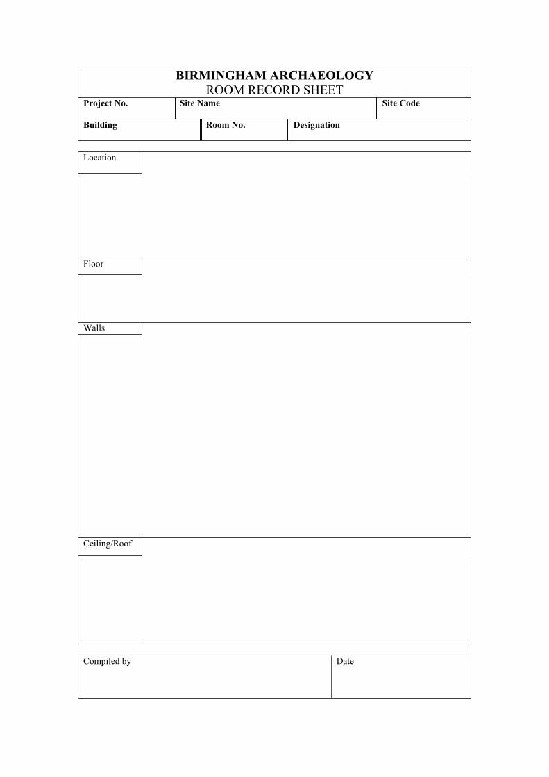
Written descriptions will be made of all those structures, features, areas and significant boundaries shown on the block plan. These will be compiled on pro-forma building and room record sheets (see Appendices to this written scheme).
Photographic Record
At least one high resolution digital photograph will be produced for each heritage asset using a Nikon D50 SLR camera.
5.0 Staffing and Standards
The project will be managed for Birmingham Archaeology by Malcolm Hislop BA, PhD, MIFA, and the principal fieldworker will be Shane Kelleher BA, MA, MA. Both are specialists in the archaeology of buildings. All staff will be appropriately qualified and experienced for their roles in the project and will adhere to the Institute of Field Archaeologists’ Code of Conduct and all current health and safety regulations.
6.0 Reporting
The results of the assessment will be presented in a report containing the following information:
Non-technical summary Introduction Site location ObjectivesMethodsHistorical and archaeological background Historical development Description of the site and buildings Assessment of the below ground archaeology Assessment of the built heritage Research Strategy Acknowledgements SourcesAppropriate illustrations including historic maps, drawings and photographs
In addition a summary report will be submitted for publication in West Midlands Archaeology.
Birmingham Archaeology 21
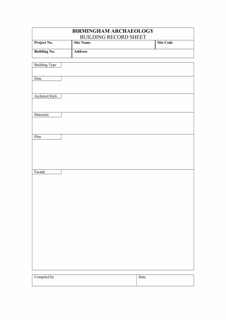
BIRMINGHAM ARCHAEOLOGY BUILDING RECORD SHEET
Project No. Site Name Site Code
Building No.
Address
Building Type
Date
Architect/Style
Materials
Plan
Facade
Compiled by Date
BIRMINGHAM ARCHAEOLOGY ROOM RECORD SHEET
Project No. Site Name Site Code
Building
Room No. Designation
Location
Floor
Walls
Ceiling/Roof
Compiled by Date
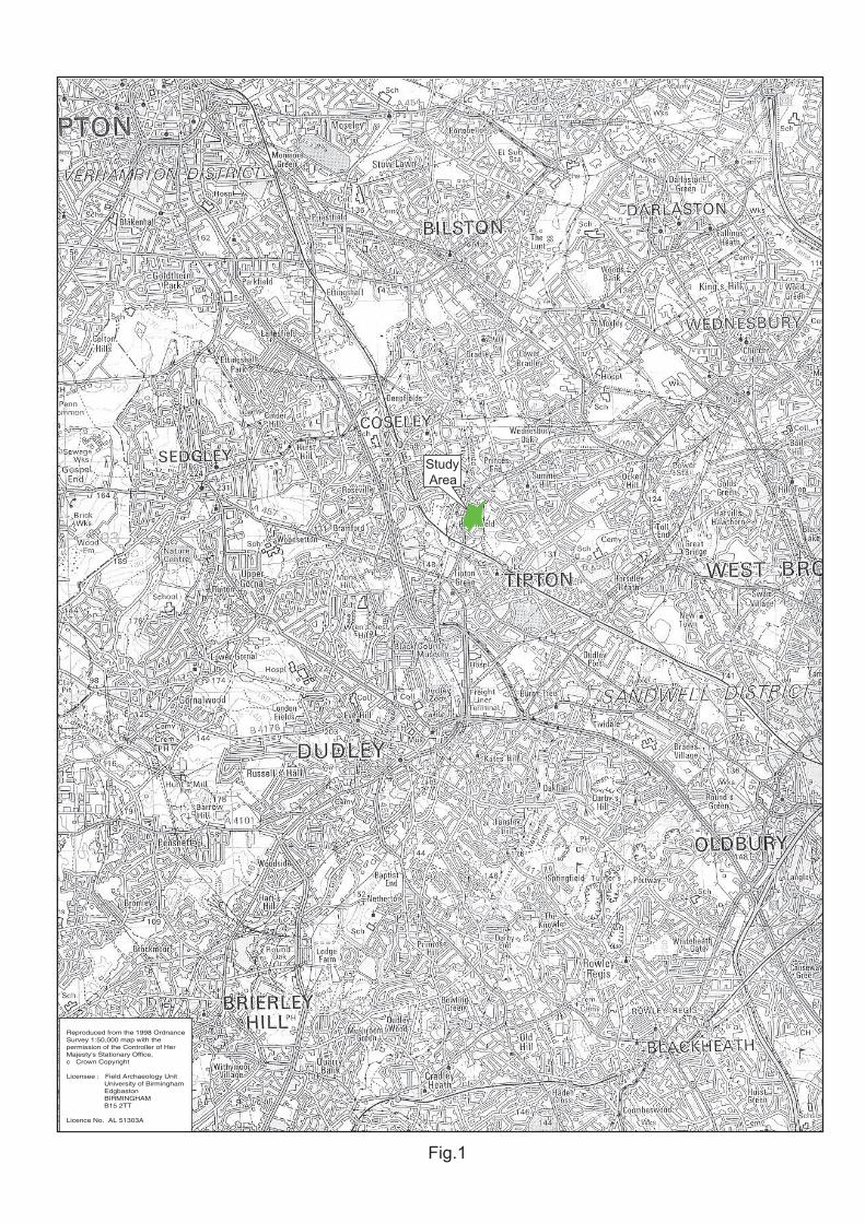
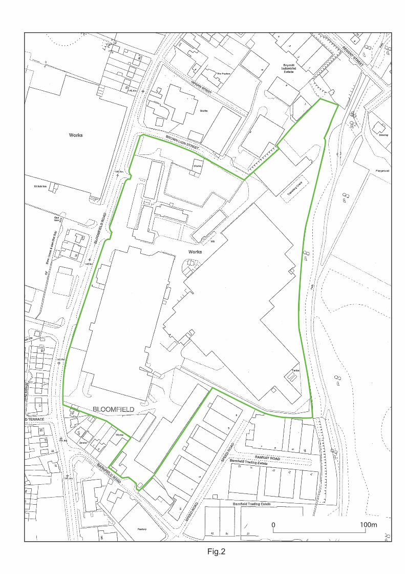
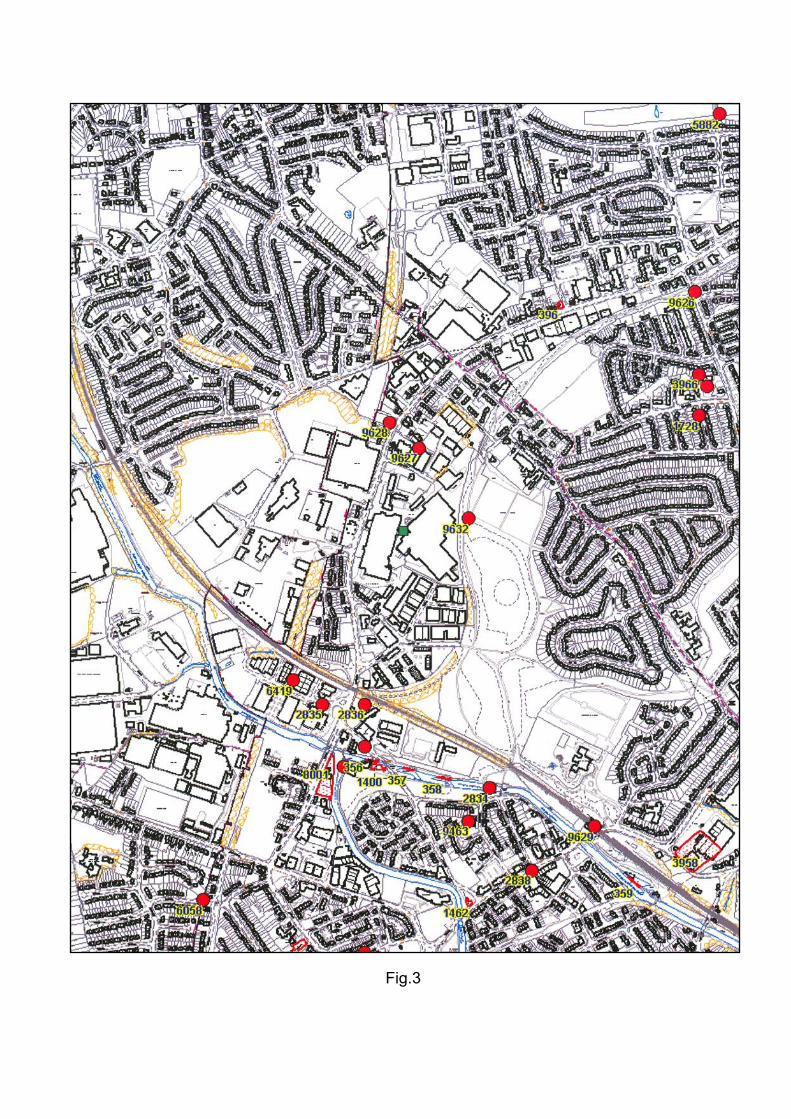
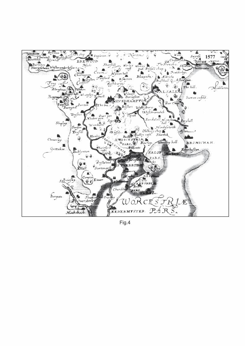
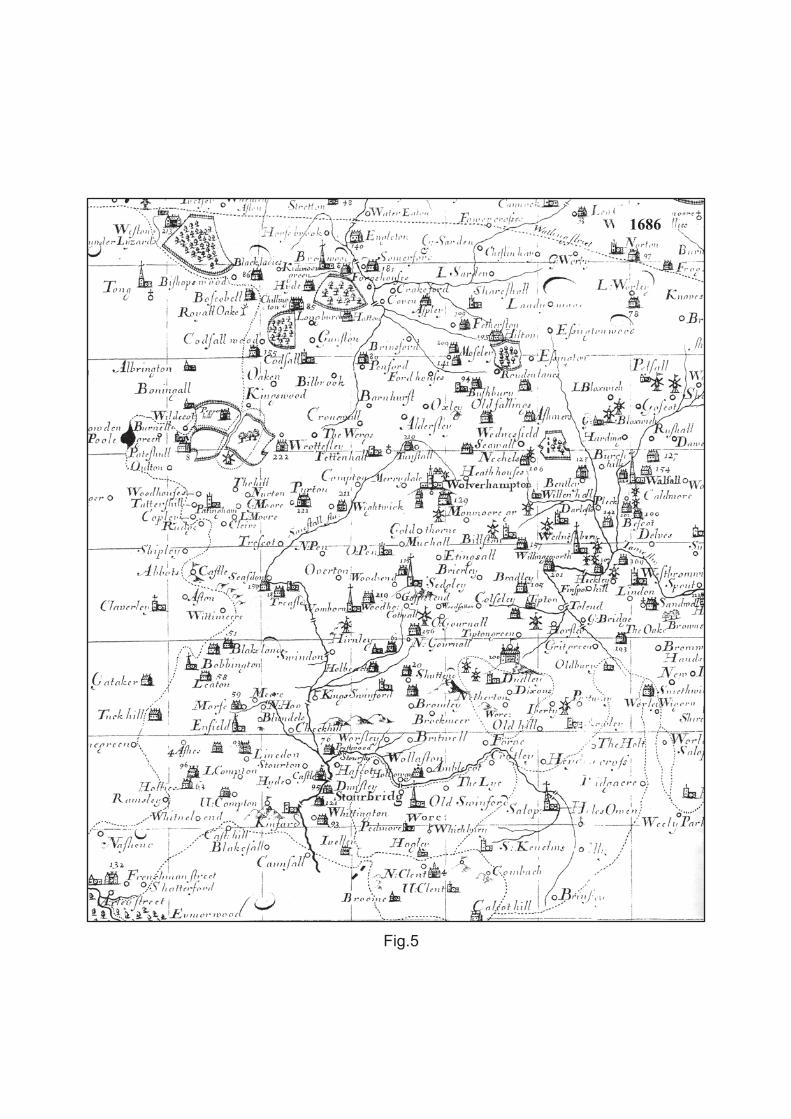
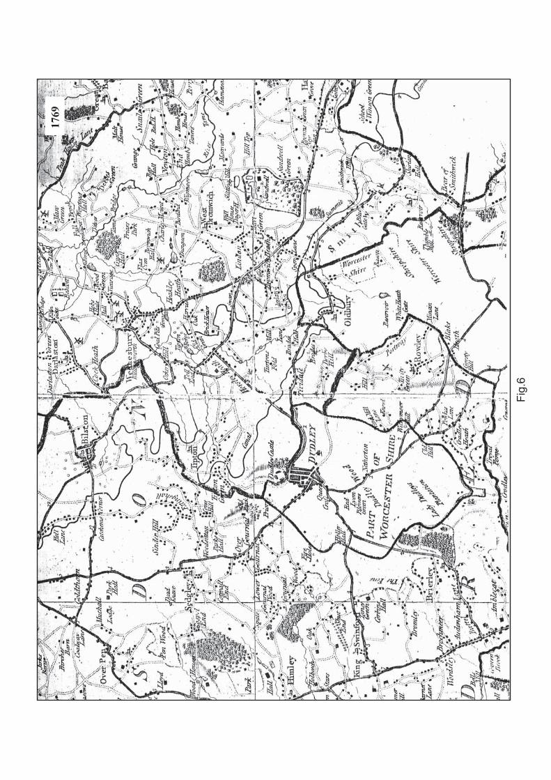
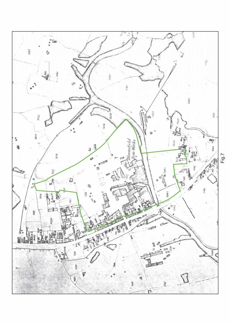
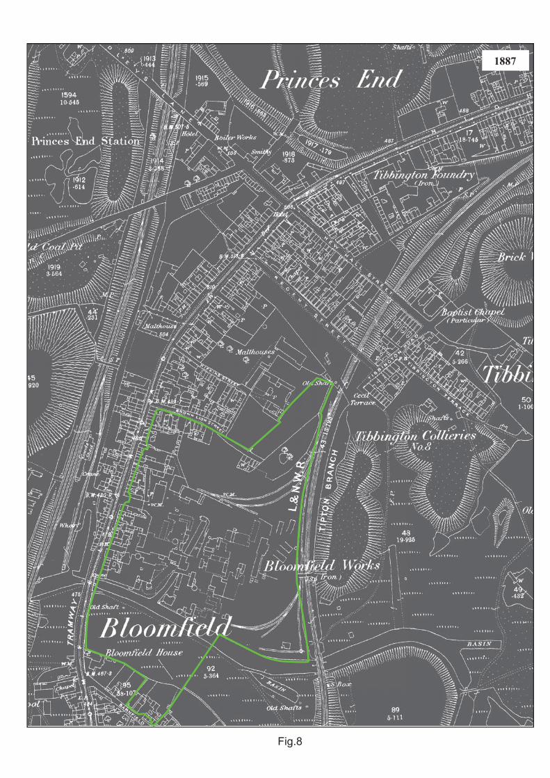
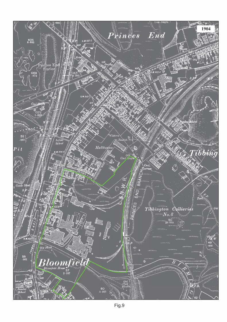
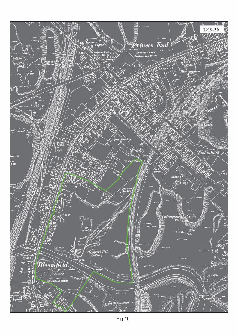
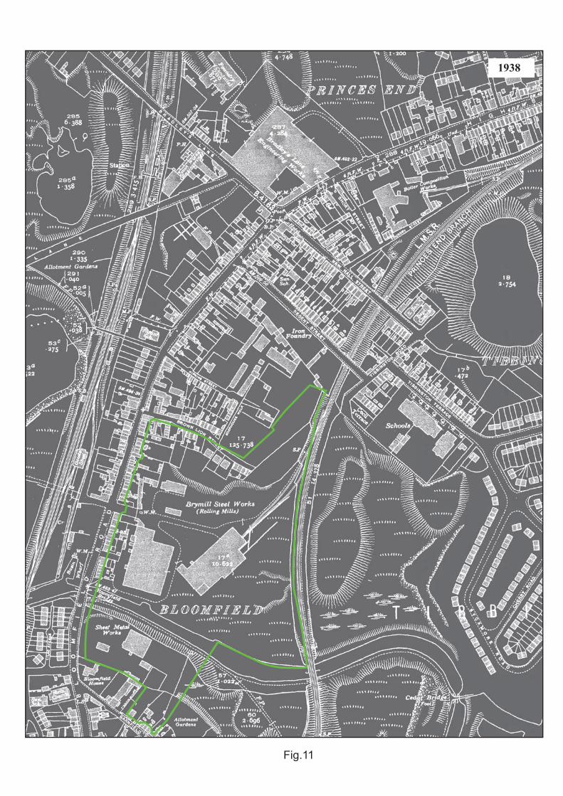
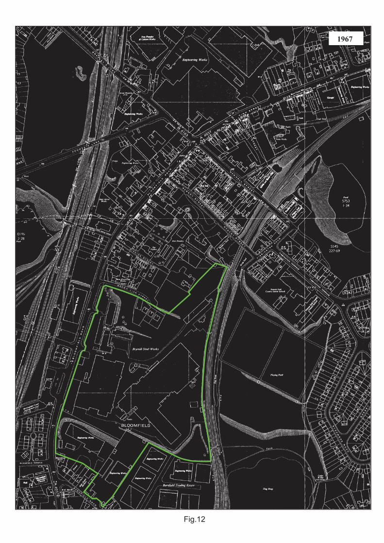
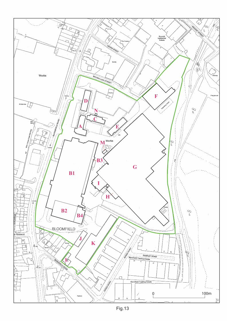
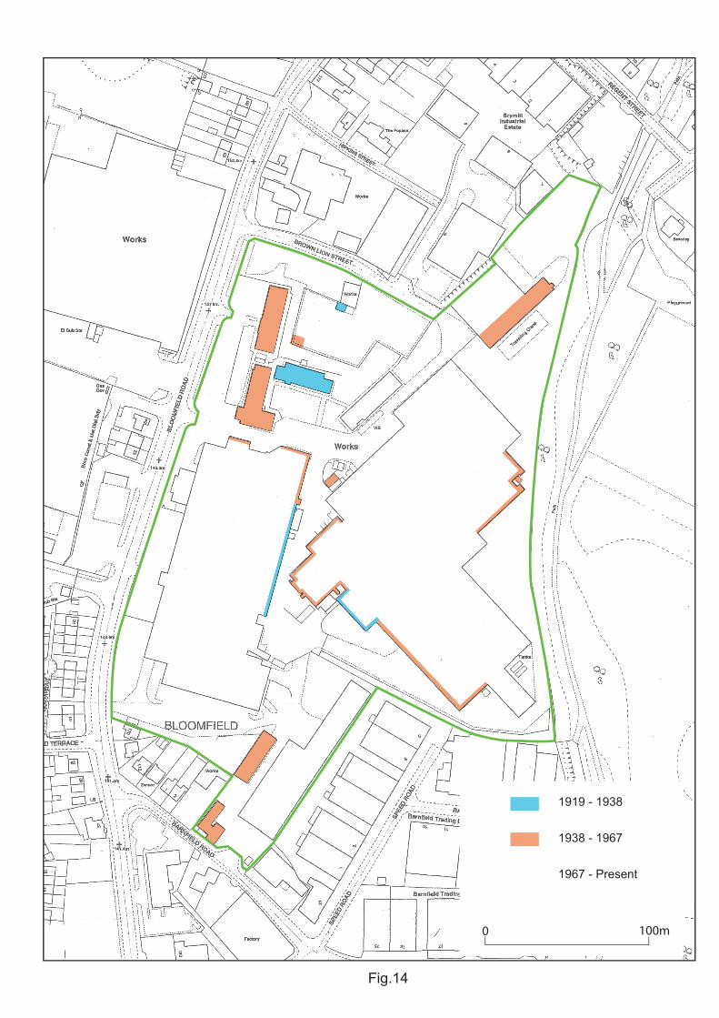
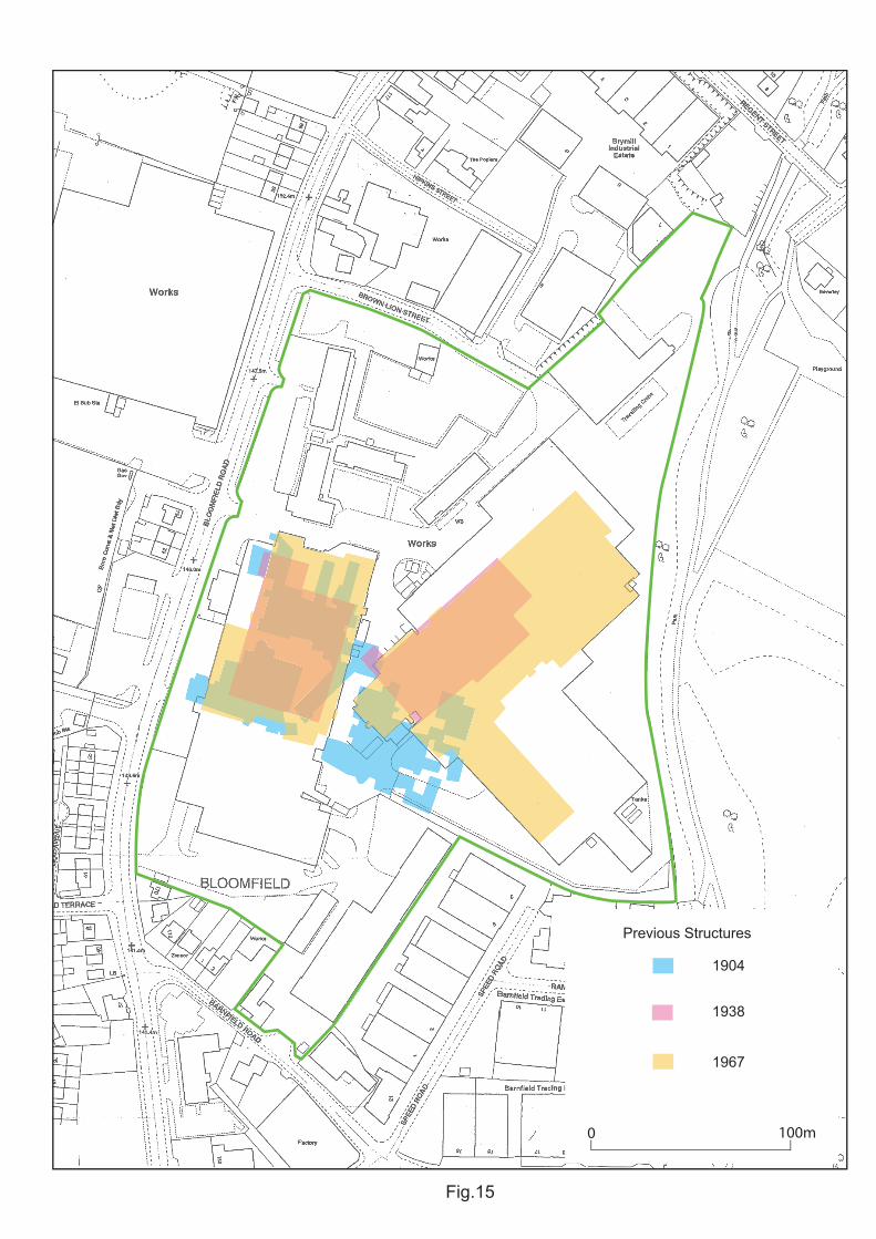
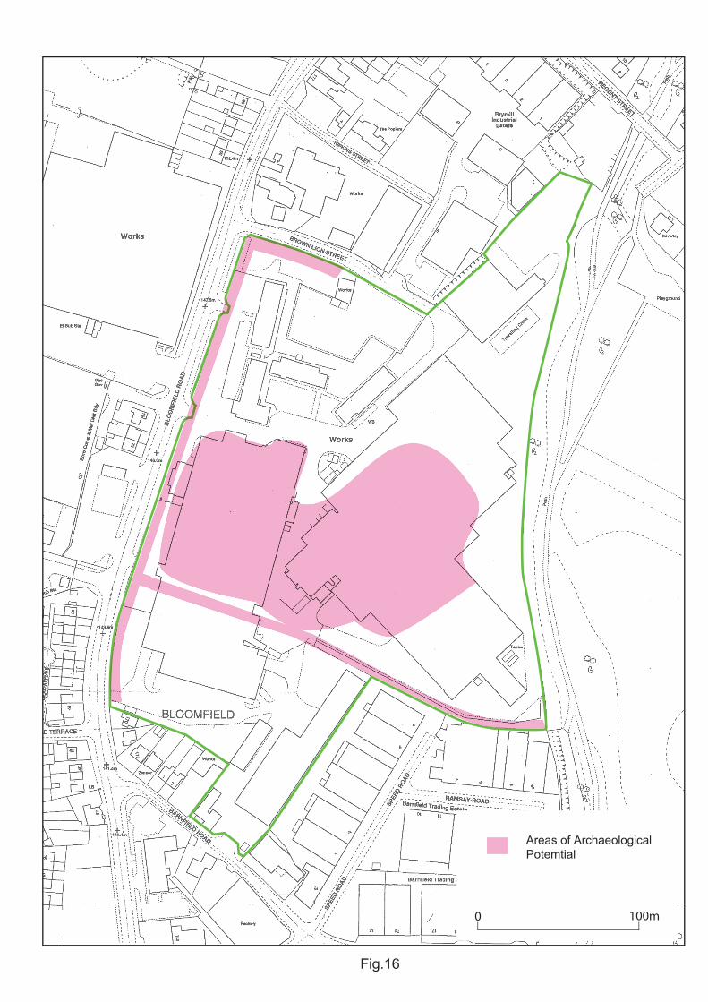
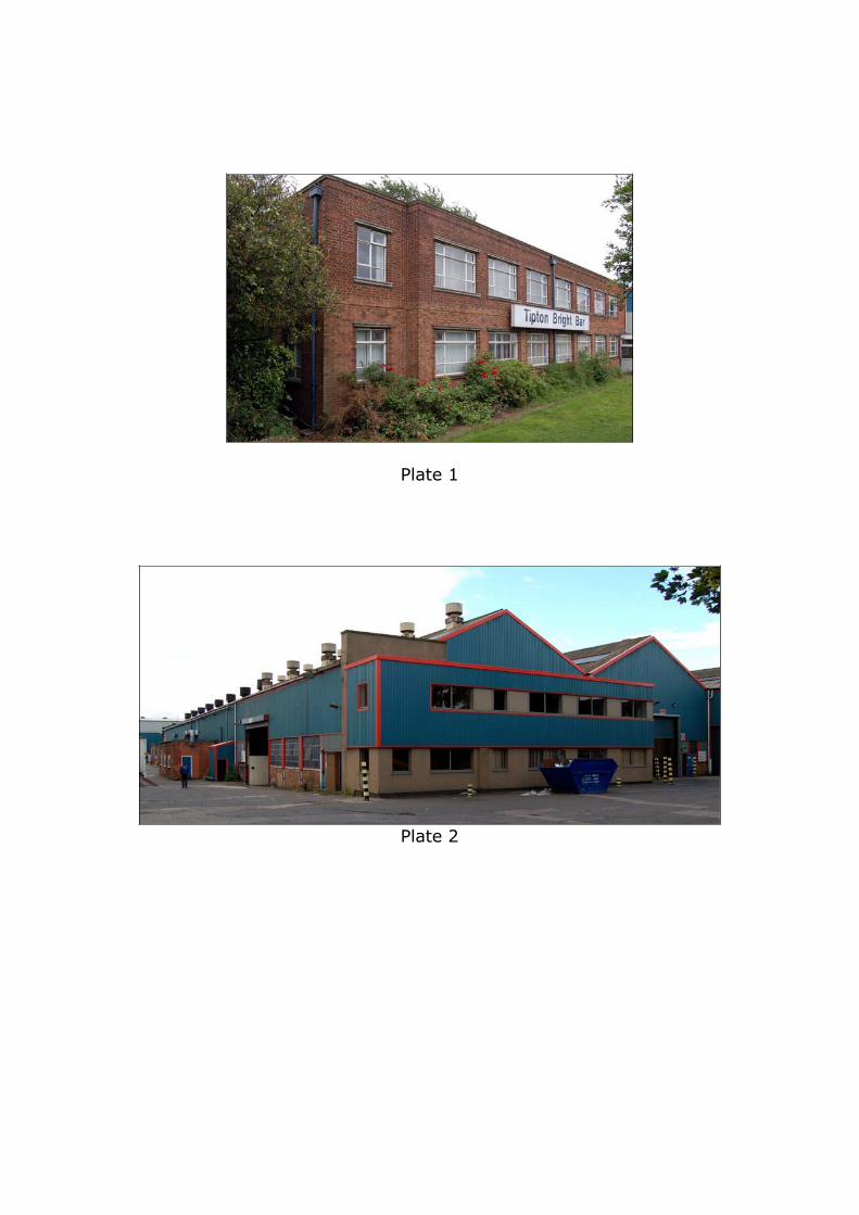
Plate 1
Plate 2
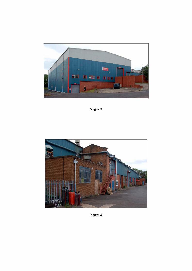
Plate 3
Plate 4
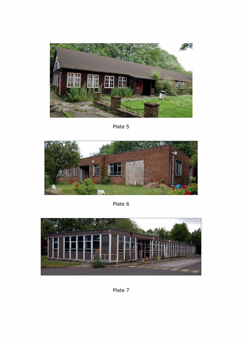
Plate 5
Plate 6
Plate 7
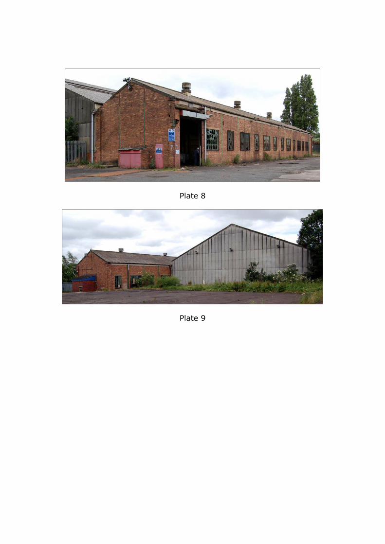
Plate 8
Plate 9
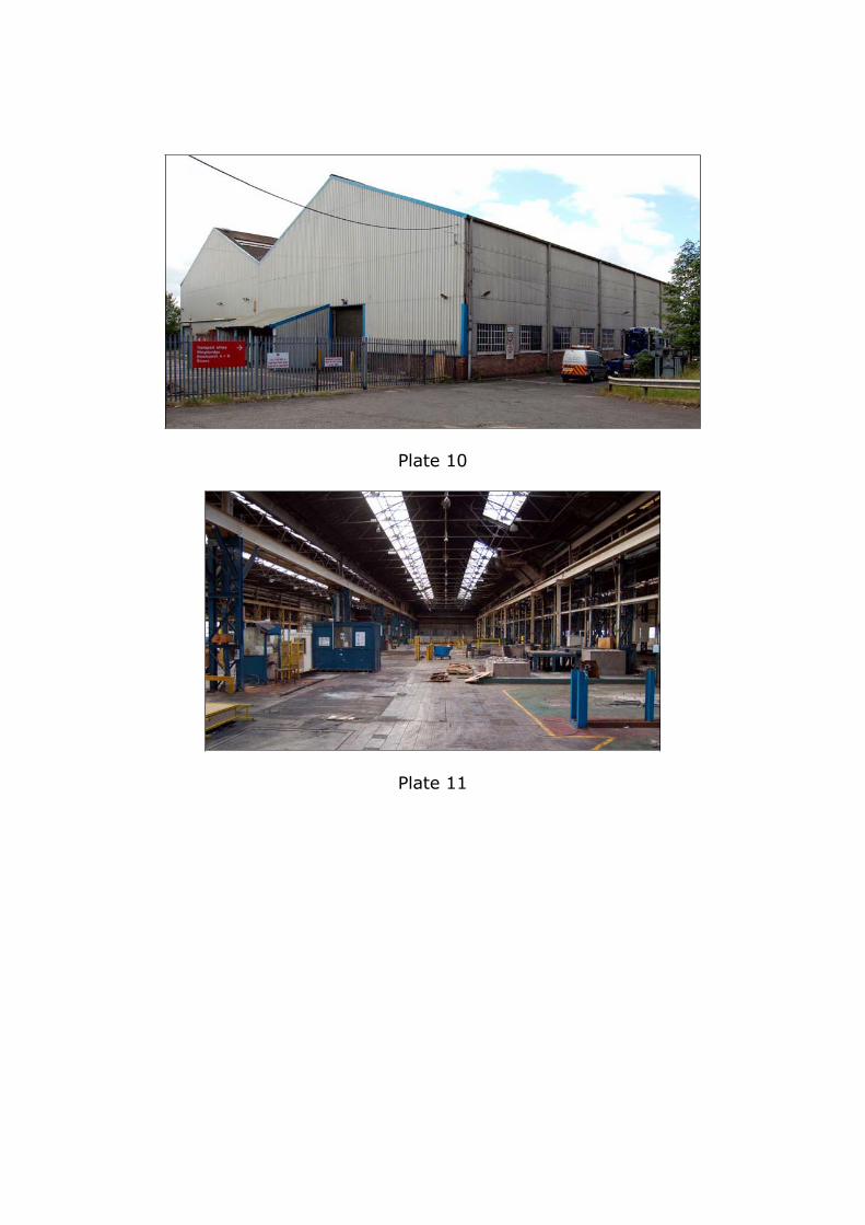
Plate 10
Plate 11
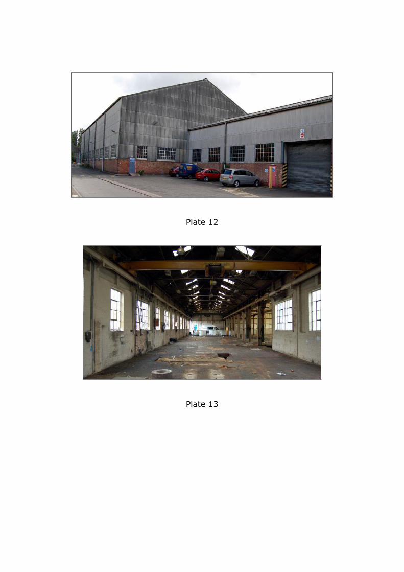
Plate 12
Plate 13
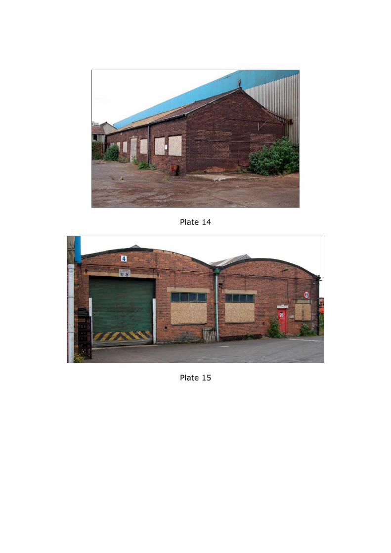
Plate 14
Plate 15
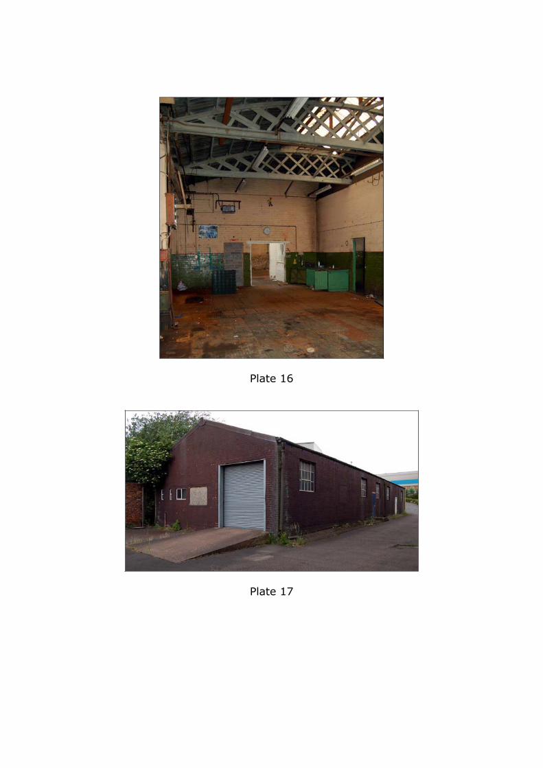
Plate 16
Plate 17
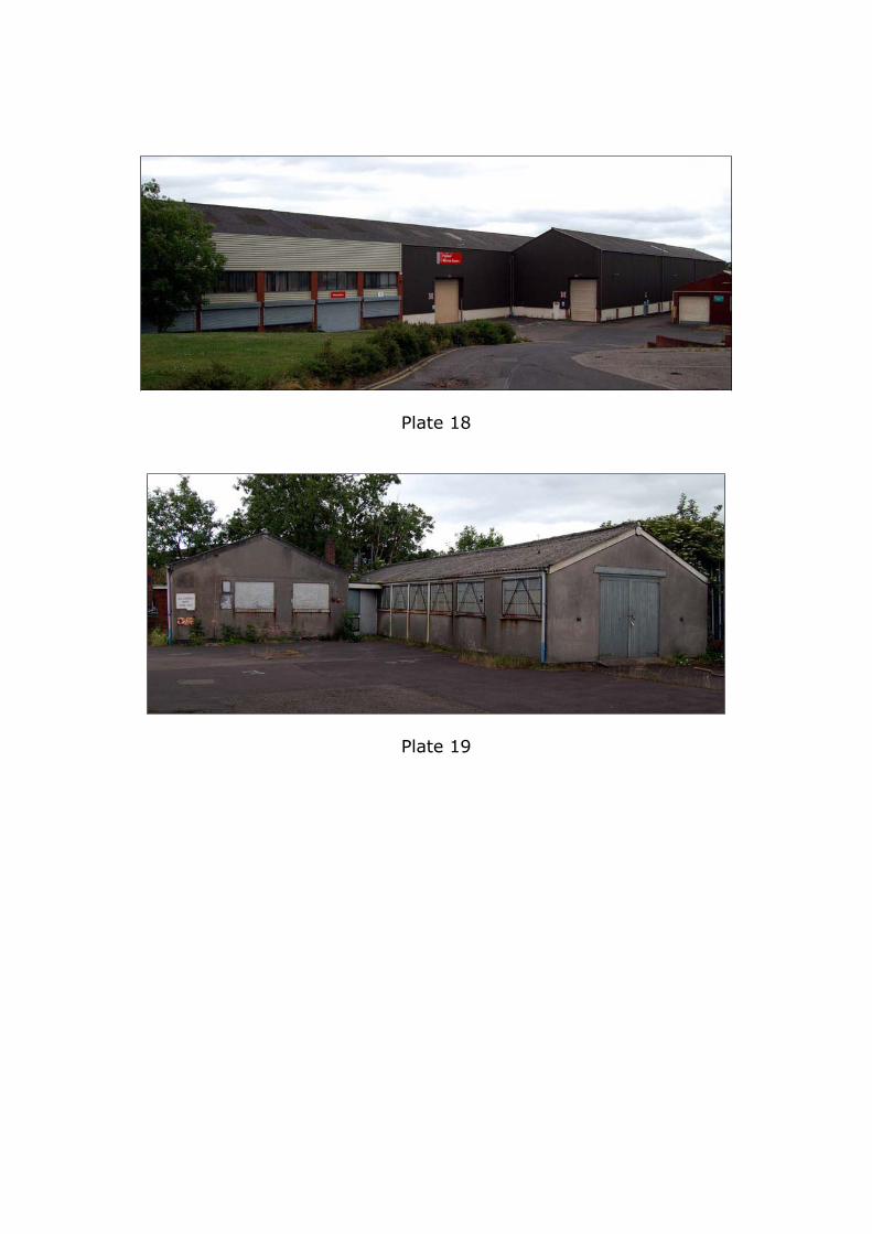
Plate 18
Plate 19
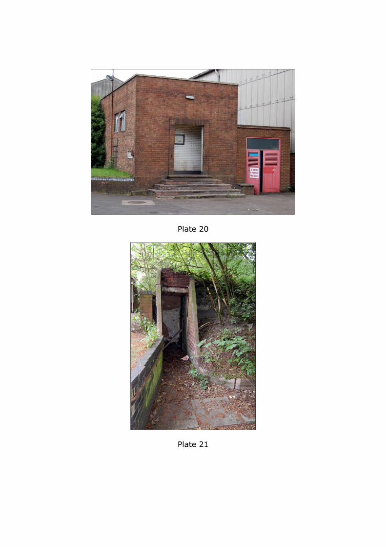
Plate 20
Plate 21
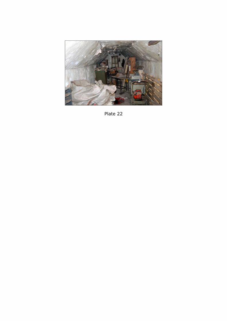
Plate 22