annual review - united states fish and wildlife service · annual review the northwestern atlantic...
TRANSCRIPT
Northwestern Atlantic Marine Bird Conservation Cooperative
ANNUAL REVIEWThe Northwestern Atlantic Marine Bird Conservation Cooperative is an independent, multi-disciplinary, international group working in cooperation to understand and address issues faced by birds in their marine environment.
In this Annual Review:• The Northwestern Atlantic
Marine Bird Conservation Cooperative 2014 Annual Meeting
• Atlantic Marine Assessment Program for Protected Species
• Compendium• Black-capped Petrel Research
and Conservation Activities• Seabird tracking in the
Caribbean and the Gulf of Mexico
• Sea Duck Joint Venture: Atlantic and Great Lakes Sea Duck Migration Study
• Biodiversity Research Institute - Offshore Surveys, Contaminants, and Data Management Projects
• Field Guide to Beached Birds of the Southeastern United States published!
• Foraging and Migration Ecology of Arctic and Common Terns
• The Gulf of Maine Coastal Ecosystem Survey
• Evaluating Staging Site Use by Endangered NW Atlantic Roseate Terns
• Mid-Atlantic Diving Bird Satellite Tracking Study
• Atlantic Marine Bird Modeling, Mapping and Regional Spatial Planning Support at NOAA’s National Centers for Coastal Ocean Science
The Northwestern Atlantic Marine Bird Conservation Cooperative 2014 Annual MeetingThe Northwestern Atlantic Marine Bird Conservation Cooperative (Coop) met February 26-28, 2014, in Hershey, Pennsylvania, in conjunction with the Atlantic Flyway Technical Section meetings. More than thirty partners attended the meeting, representing USFWS, USGS, BOEM, States, NGO’s and Universities. After a day of project updates, members participated in breakout sessions to focus on habitat and forage fish, data management, distribution and abundance, off-shore wind energy and outreach issues and needs. One product that was started at the Coop meeting and completed in 2014 is a list of vulnerable Marine Birds species that was sent to State Coordinators to help inform State Wildlife Action plans.
The next Coop meeting is scheduled to take place ahead of the Waterbird Society (http://www.waterbirds.org/) meeting, Bar Harbor, Maine August 10 -11, 2015.
Contact: Kirsten Luke, Atlantic Coast Joint [email protected]
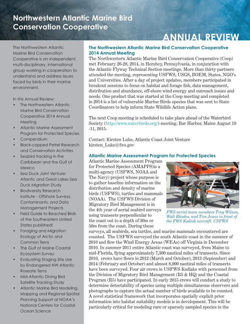
Atlantic Marine Assessment Program for Protected SpeciesAtlantic Marine Assessment Program for Protected Species (AMAPPS)is a multi-agency (USFWS, NOAA and The Navy) project whose purpose is to gather baseline information on the distribution and density of marine birds (USFWS), turtles and mammals (NOAA). The USFWS Division of Migratory Bird Management is in the 4th year of aerial seabird surveys using transects perpendicular to the coast out to a depth of 30m or 50m from the coast. During these surveys, all seabirds, sea turtles, and marine mammals encountered are counted. The USFWS surveyed the south Atlantic coast in the summer of 2010 and flew the Wind Energy Areas (WEAs) off Virginia in December 2010. In summer 2011 entire Atlantic coast was surveyed, from Maine to mid-Florida, flying approximately 7,300 nautical miles of transects. Since 2010, crews have flown in 2012 (March and October), 2013 (September) and 2014 (February and October) and almost 8,000 nautical miles of transects have been surveyed. Four air crews in USFWS Kodiaks with personnel from the Division of Migratory Bird Management (R5 & HQ) and the Coastal Program (R5) have participated. In early 2015 crews will conduct a study to determine detectability of species using multiple simultaneous observers and photographs to capture the actual number of birds available to be counted. A novel statistical framework that incorporates spatially explicit prior information into habitat suitability models is in development. This will be particularly critical for modeling rare or sparsely sampled species in the
FWS aerial team members Troy Wilson, Walt Rhodes, and Tim Jones in front of the FWS Kodiak aircraft. USFWS
survey, because expert maps or the results of past analyses can be leveraged. In addition to developing the theory for these analyses, an R package is being developed, which will facilitate others using these tools.
Contact: Tim Jones, U.S. Fish and Wildlife Service, [email protected]
Seabird Tracking in the Caribbean and the Gulf of MexicoIn April, Patrick Jodice, Grupo Jaragua and ABC initiated the first satellite tracking of Black-capped Petrels. They used solar-powered PTTs to track breeding and post-breeding movements of three Diablotins nesting at Lomo del Toro in the Dominican Republic. The resulting tracks can be seen at atlanticseabirds.org. This year’s work in the Caribbean also included a tracking study of three Magnificent Frigatebirds breeding in the British Virgin Islands. Analysis of previous GLS tracking of seabirds in the Bahamas, Saint Eustatius and Tobago is in progress. Efforts in the Caribbean have been funded by USFWS, NFWF, and other sources. Each project has a collaborator from the home island and much of the work has grown out of the 2012 Seabird Capacity Building workshop. In the Gulf of Mexico, the South Carolina Cooperative Research Unit is studying the impact of oil and gas development on the ecology of Brown pelicans, through a project funded by BOEM. Work, which includes satellite tracking of 85 BRPE, diet composition and analysis of contaminants, was initiated in 2013 and is led by Juliet Lamb (PhD Candidate at Clemson Univ.). In Mexico, Caroline Poli (Master’s student at Clemson Univ.) tracked breeding Masked Booby and analyzed their foraging movements. While still under development, the website atlanticseabirds.org aims to showcase the tracking research conducted in the western Atlantic. At the moment, the work of Patrick Jodice, Rob Ronconi, Linda Welch, and Iain Stenhouse is listed but pages will be created to highlight the research of other scientists as well.
Contact: Patrick Jodice, SC Cooperative Research Unit, Clemson University, [email protected]
Black-capped Petrel (Pterodroma hasitata) Research and Conservation ActivitiesGrupo Jaragua (GJ) monitored 47 active Black-capped Petrel (BCPE) nests during 2014 at Loma del Toro, Dominican Republic and Morne Vincent, Haiti. Fledging success was approximately 75%. GJ monitored 18 petrel nests on the northern Massif de la Selle, Haiti. 61% had chicks. This area is highly threatened by conversion to grazing. Without immediate intervention, the important petrel nesting area here may soon be destroyed.
Environmental Protection in the Caribbean, GJ, and Société Audubon Haiti (SAH) used marine radar to determine BCPE flight corridors and nest activity centers at 12 stations in Hispaniola during February and March 2014. New activity centers were identified in Sierra de Neiba and the northern Sierra de Bahoruco, Dominican Republic. Conservation Metrics, GJ, and SAH collaborated on acoustic monitoring of BCPEs on Hispaniola. A new
Black-capped Petrel with satellite transmitter. ABC
high density area was discovered along the cliffs of Seguin, Haiti. In April 2014, Platform Transmitter Terminal (PTT) satellite transmitters were deployed on three breeding adult BCPEs trapped in Sierra de Bahoruco National Park. The project is a collaboration of American Bird Conservancy, GJ, U.S. Geological Survey, Clemson University, and Instituto Tecnologico de Santo Domingo. These are first BCPEs ever tracked using any technology. Two PTTs provided data for 4.5 mo and the third is still transmitting. The birds foraged mostly in the southern Caribbean Sea during chick provisioning. Post-breeding, the birds moved to Gulf Stream and adjacent North Atlantic waters north to east of the Delmarva Peninsula. The last tagged bird returned to its breeding site on November 5th after traveling over 600 miles in 60 hours. See http://www.atlanticseabirds.org/bcpe-new.
Contact: George E. Wallace, Vice President for Oceans and Islands, American Bird Conservancy, [email protected]
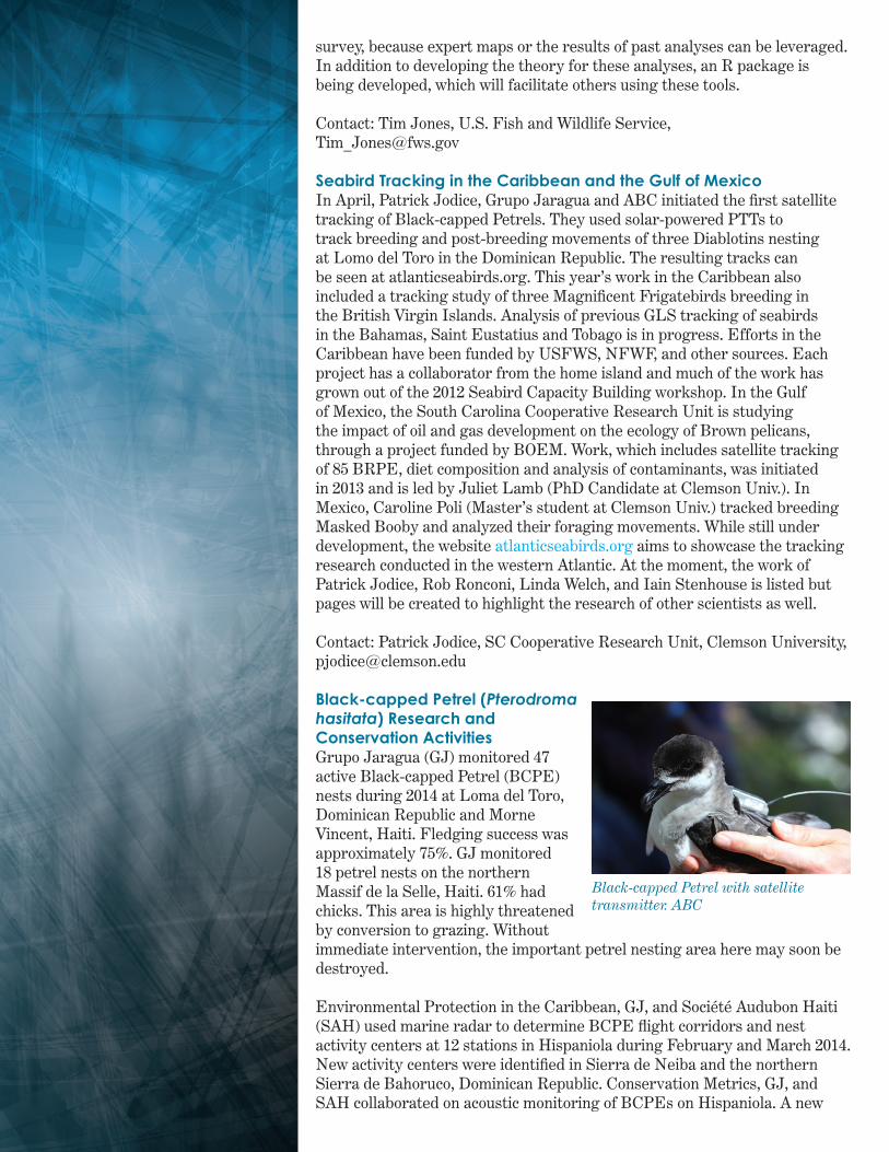
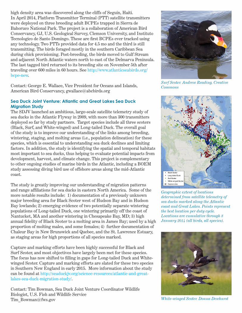
Sea Duck Joint Venture: Atlantic and Great Lakes Sea Duck Migration StudyThe SDJV launched an ambitious, large-scale satellite telemetry study of sea ducks in the Atlantic Flyway in 2009, with more than 300 transmitters deployed so far by study partners. Target species include all three scoters (Black, Surf, and White-winged) and Long-tailed Duck. The overall goal of the study is to improve our understanding of the links among breeding, wintering, staging, and molting areas (i.e., population delineation) for these species, which is essential to understanding sea duck declines and limiting factors. In addition, the study is identifying the spatial and temporal habitats most important to sea ducks, thus helping to evaluate potential impacts from development, harvest, and climate change. This project is complementary to other ongoing studies of marine birds in the Atlantic, including a BOEM study assessing diving bird use of offshore areas along the mid-Atlantic coast.
The study is greatly improving our understanding of migration patterns and range affiliations for sea ducks in eastern North America. Some of the more notable results include: 1) documentation of a previously unknown major breeding area for Black Scoter west of Hudson Bay and in Hudson Bay lowlands; 2) emerging evidence of two potentially separate wintering populations of Long-tailed Duck, one wintering primarily off the coast of Nantucket, MA and another wintering in Chesapeake Bay, MD; 3) high annual fidelity of Black Scoter to a molting area in James Bay; used by a high proportion of molting males, and some females; 4) further documentation of Chaleur Bay in New Brunswick and Quebec, and the St. Lawrence Estuary, as staging areas for high proportions of all species marked.
Capture and marking efforts have been highly successful for Black and Surf Scoter, and most objectives have largely been met for these species. The focus has now shifted to filling in gaps for Long-tailed Duck and White-winged Scoter. Capture and marking efforts are slated for these two species in Southern New England in early 2015. More information about the study can be found at http://seaduckjv.org/science-resources/atlantic-and-great-lakes-sea-duck-migration-study/.
Contact: Tim Bowman, Sea Duck Joint Venture Coordinator Wildlife Biologist, U.S. Fish and Wildlife [email protected]
Surf Scoter. Andrew Reading, Creative Commons
Geographic extent of locations determined from satellite telemetry of sea ducks marked along the Atlantic coast and Great Lakes. Points represent the best location per duty cycle. Locations are cumulative through 8 January 2014 (all birds, all species).
White-winged Scoter. Donna Dewhurst

Biodiversity Research Institute - Offshore Surveys, Contaminants, and Data Management ProjectsOn behalf of the Department of Energy (DOE), and the State of Maryland, the Biodiversity Research Institute (BRI) in Portland, Maine, completed its second year of broad-scale baseline surveys for seabirds, marine mammals, and sea turtles in the mid-Atlantic region, using a combination of aerial surveys (employing high-definition videography) and boat-based surveys. High-definition video has proved to be an effective method, capturing distribution and abundance information on a broad range of marine taxa in a single survey platform. As part of this project, BRI has carried out a direct comparison of high definition video aerial and boat-based survey methods, the results of which are currently under review. This continuing project is a broad collaboration between BRI and HiDef Aerial Surveying, Inc., based in the UK, as well as the City University of New York (Richard Veit), North Carolina State University (Beth Gardner and Holly Goyert), and Duke University Marine Laboratory (Ari Friedlaender and David Johnston).
ContaminantsWith support from the Maine Outdoor Heritage Fund, BRI (Iain Stenhouse) led a study of mercury exposure in four focal species breeding at colonies in the Gulf of Maine, including the Common Eider, Leach’s Storm-Petrel, Double-crested Cormorant, and Black Guillemot. They compared contaminant levels found in 2013 with previous results from 1998-2006, and found significant increases in mercury in all species, except the Leach’s Storm-Petrel, which was high to begin with and remained stable. Project partners included the Maine Dept. of Inland Fisheries & Wildlife, and the National Audubon Society’s Seabird Restoration Program, without whose assistance in collecting blood samples the assessment would not have been possible.
Data ManagementBRI (Andrew Gilbert) continues to manage tracking data from several projects involving large numbers of satellite tags. The first is part of the multi-year collaborative work of the Seaduck Joint Venture. Hundreds of implanted satellite tags have been deployed over the last decade and work is ongoing to collect, organize, filter, and map these data for analyzing the spatial patterns of seaduck species. A second project, funded by the Bureau of Ocean Energy Management (BOEM), seeks to understand the winter and migratory movements of Northern Gannet, Red-throated Loon, and Surf Scoter in relation to potential offshore wind development in the mid-Atlantic region. These data are similarly managed for eventual analysis and mapping. An online mapping portal is being developed for collaborators to provide near-real time data display.
Offshore Survey SoftwareBRI recently received an award from BOEM to develop a Mobile Avian Survey Data Collection Application – an offshore survey ‘app’ – for use on small devices, such as tablets. They will be working closely with Tilson Government Services, LLC, to develop this software over the next year. If you regularly use data collection software on offshore surveys and have thoughts on what works / what doesn’t, contact Andrew Gilbert at BRI ([email protected]).
Contact: Iain Stenhouse, Marine Bird Program Director, Biodiversity Research [email protected]
Crew from BRI band sea ducks. BRI
Black Guillemot are one of the species being studied for mercury exposure. Brian Gratwicke, Creative Commons
The Northwestern Atlantic Marine Bird
Conservation Cooperative
website is temproarily unavailable. It is finding a new home soon with the USFWS Northeast
Region Division of Migratory Birds. Look for an
announcement soon!
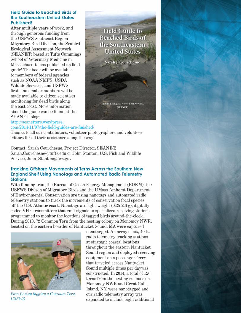
Field Guide to Beached Birds of the Southeastern United States Published!After multiple years of work, and through generous funding from the USFWS Southeast Region Migratory Bird Division, the Seabird Ecological Assessment Network (SEANET) based at Tufts Cummings School of Veterinary Medicine in Massachusetts has published its field guide! The book will be available to members of federal agencies such as NOAA NMFS, USDA Wildlife Services, and USFWS first, and smaller numbers will be made available to citizen scientists monitoring for dead birds along the east coast. More information about the guide can be found at the SEANET blog:http://seanetters.wordpress.com/2014/11/07/the-field-guides-are-finished/Thanks to all our contributors, volunteer photographers and volunteer editors for all their assistance along the way!
Contact: Sarah Courchesne, Project Director, SEANET,[email protected] or John Stanton, U.S. Fish and Wildlife Service, [email protected]
Tracking Offshore Movements of Terns Across the Southern New England Shelf Using Nanotags and Automated Radio Telemetry StationsWith funding from the Bureau of Ocean Energy Management (BOEM), the USFWS Divison of Migratory Birds and the UMass Amherst Department of Environmental Conservation are using nanotags and automated radio telemetry stations to track the movements of conservation focal species off the U.S. Atlantic coast. Nanotags are light-weight (0.25-2.6 g), digitally coded VHF transmitters that emit signals to specialized receiving stations programmed to monitor the locations of tagged birds around-the-clock. During 2013, 72 Common Tern from the nesting colony on Monomoy NWR, located on the eastern boarder of Nantucket Sound, MA were captured
nanotagged. An array of six, 40 ft. radio telemetry tracking stations at strategic coastal locations throughout the eastern Nantucket Sound region and deployed receiving equipment on a passenger ferry that traveled across Nantucket Sound multiple times per daywas constructed. In 2014, a total of 126 terns from the nesting colonies on Monomoy NWR and Great Gull Island, NY, were nanotagged and our radio telemetry array was expanded to include eight additional
Pam Loring tagging a Common Tern. USFWS
coastal and offshore sites distributed from Cape Cod, MA to Long Island, NY. During each field season, birds were manually relocated using land-based, boat-based, and aerial telemetry techniques. Between 2013 and 2014, eight million detections of nano-tagged terns moving throughout the southern New England continental shelf region during their breeding, post-breeding, and pre-migratory staging periods were collected. In addition, the telemetry array has detected over 200 individuals representing a variety of taxa (including seabirds, shorebirds, songbirds, and bats) that were nano-tagged by collaborators from Canada to the mid-Atlantic and passed through the southern New England region during migration. Following the success of the pilot work, new funding was received from BOEM to expand the study in 2015 to track federally endangered Roseate Tern and federally threatened Piping Plover, and to install several new receiving towers at key sites along the coast and offshore islands of southern New England and New York.
Project contact: Pam Loring, University of Massachusetts & [email protected]
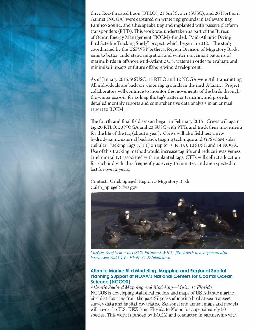
The Gulf of Maine Coastal Ecosystem SurveyMany questions remain concerning the structure and function of the ecologically and economically important Gulf of Maine coastal marine ecosystem. These questions include those surrounding the at-sea ecology of marine birds, such as their distribution, abundance and habitat use patterns. Researchers sought to quantify and investigate these patterns this summer during the first Gulf of Maine ecosystem survey, a project supported by the State Wildlife Grant Competitive Grant Program and lead by the Maine Department of Inland Fisheries and Wildlife. From June 30th to July 17th, a multidisciplinary team of researchers completed integrated, ecosystem surveys from Cape Cod Bay to Jonesport (for more details, visit: http://gomces.wordpress.com). Within this area,
transects were distributed in an attempt to capture waters that spanned significant depth gradients and that were near seabird colonies, major basins and other areas of interest. Along these transects, the team collected a plethora of data across many different trophic levels, including the distribution and abundance of marine birds and mammals. These data will be used to investigate species habitat use patterns, and ultimately, synthesize species-specific information to calculate biological hotspot index values for the Gulf of Maine coastal ecosystem zone. The team has already started analyzing data and prepping for the next survey, in the winter of 2014/15. With funding support for another summer and winter survey, this project hopes to help answer critical questions concerning the Gulf of Maine coastal ecosystem while also filling information gaps on the distribution and abundance of marine birds within this zone.
Contacts: Andrew Allyn, PhD Student, University of Massachusetts Amherst [email protected] or Kelsey Sullivan, Game Bird Biologist, Maine Department of Inland Fisheries and Wildlife, [email protected]
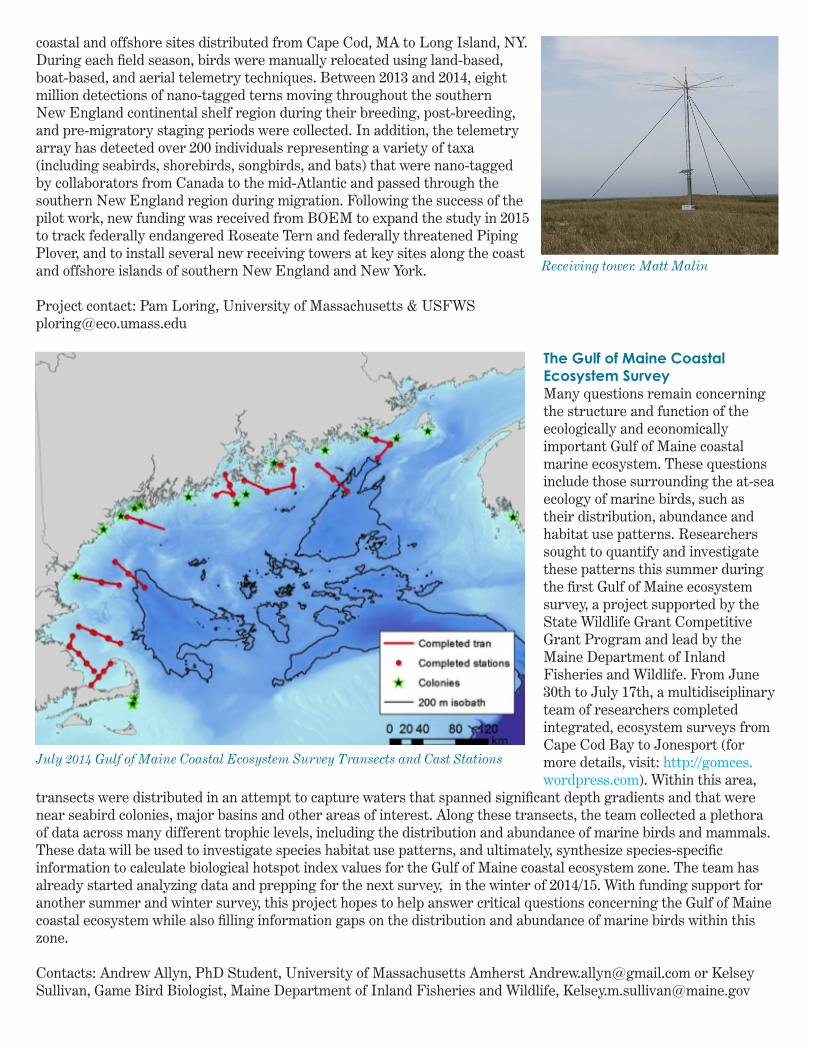
Receiving tower. Matt Malin
July 2014 Gulf of Maine Coastal Ecosystem Survey Transects and Cast Stations

Evaluating Staging Site Use by Endangered NW Atlantic Rose-ate TernsSince 2011 the USGS Patuxent Wildlife Research Center (PWRC) has conducted long-term cooperative research on metapopulation dynamics and ecology of the endangered NW Atlantic breeding population of Roseate Tern (ROST). This work is coordinated by Jeff Spendelow in collaboration with colleagues at the US National Park Service’s Cape Cod National Seashore (CACO), US Fish and Wildlife Service, Canadian Wildlife Service, and MassAudubon’s Coastal Waterbird Program. Fieldwork is being conducted at staging sites in the “Cape & Islands” area of southeastern Massachusetts from late July through September to better understand spatiotemporal variation in how these sites are being used by first year and adult ROSTs from breeding areas throughout the range (Nova Scotia-New York). In 2014, project collaborators colorbanded more than 1,150 ROSTs with coded 3-character plastic field-readable bands. In addition, CACO funded two M.S. projects to:1. Categorize, quantify, and evaluate the impacts of different types of disturbances to mixed species tern flocks (Melissa Althouse, SUNY-Syracuse), and
2. Examine how disturbance and other factors may impact the bond between parents and fledglings and effect postfledging survival (Kayla Davis, Virgina Tech).
Jeff Spendelow also conducted fieldwork in late June (about a month earlier than 2011-2012) to collect more information about the use and importance of staging sites to nonbreeding adults. This work comes after recent evidence of higher summer use of the Cape & Islands area by ROST than previously thought. Such higher use puts the population at greater risk of threats such as hurricanes, oil spills, and habitat modification occurring in this area. Contact: Jeff Spendelow, Research Wildlife Biologist, U.S. Geological Survey, [email protected]
Mid-Atlantic Diving Bird Satellite Tracking StudyDespite wicked winter weather along the Mid-Atlantic coast in 2014, field crews from USGS Patuxent Wildlife Research Center and Biodiversity Research Institute, with support from partners at Memorial University of Newfoundland, North Carolina Wildlife Resources Commission and U.S. Fish and Wildlife Service (USFWS) Pilot Biologists, worked tirelessly from January to April to meet satellite tagging goals for three species of marine diving birds. Twenty-
Red-throated Loon. Greg Smith, Creative Commons
three Red-throated Loon (RTLO), 21 Surf Scoter (SUSC), and 20 Northern Gannet (NOGA) were captured on wintering grounds in Delaware Bay, Pamlico Sound, and Chesapeake Bay and implanted with passive platform transponders (PTTs). This work was undertaken as part of the Bureau of Ocean Energy Management (BOEM)-funded, “Mid-Atlantic Diving Bird Satellite Tracking Study” project, which began in 2012. The study, coordinated by the USFWS Northeast Region Division of Migratory Birds, aims to better understand migration and winter movement patterns of marine birds in offshore Mid-Atlantic U.S. waters in order to evaluate and minimize impacts of future offshore wind development.
As of January 2015, 9 SUSC, 15 RTLO and 12 NOGA were still transmitting. All individuals are back on wintering grounds in the mid-Atlantic. Project collaborators will continue to monitor the movements of the birds through the winter season, for as long the tag’s batteries transmit, and provide detailed monthly reports and comprehensive data analysis in an annual report to BOEM.
The fourth and final field season began in February 2015. Crews will again tag 20 RTLO, 20 NOGA and 20 SUSC with PTTs and track their movements for the life of the tag (about a year). Crews will also field test a new hydrodynamic external backpack tagging technique and GPS-GSM solar Cellular Tracking Tags (CTT) on up to 10 RTLO, 10 SUSC and 14 NOGA. Use of this tracking method would increase tag life and reduce invasiveness (and mortality) associated with implanted tags. CTTs will collect a location for each individual as frequently as every 15 minutes, and are expected to last for over 2 years.
Contact: Caleb Spiegel, Region 5 Migratory [email protected]
Atlantic Marine Bird Modeling, Mapping and Regional Spatial Planning Support at NOAA’s National Centers for Coastal Ocean Science (NCCOS)Atlantic Seabird Mapping and Modeling—Maine to FloridaNCCOS is developing statistical models and maps of US Atlantic marine bird distributions from the past 37 years of marine bird at-sea transect survey data and habitat covariates. Seasonal and annual maps and models will cover the U.S. EEZ from Florida to Maine for approximately 50 species. This work is funded by BOEM and conducted in partnership with
Captive Surf Scoter at USGS Patuxent W.R.C. fitted with new experimental harnesses and CTTs. Photo: C. Kilchenstein

USGS, USFWS, and other Federal, public, academic and NGO partners. Models of occurrence and abundance will be integrated with vulnerability and sensitivity indices to develop a comprehensive suite of high-resolution (2km) map products, with associated accuracy assessments, to aid in spatial planning and environmental assessment of offshore wind facilities. Initial results were presented at the Pacific Seabird Group Annual Meeting in San Jose, CA in February 2015, and an interim report will be available in June 2015. NCCOS is soliciting experts to review maps of marine bird relative occurrence, abundance, diversity, persistence, and aggregation probability, and the underlying statistical models. Models will be reviewed, validated, and updated with new data over the next year, and a final report and digital data products are expected to be available by June 2016. In the meantime, results of previous modeling efforts in the NY Bight are available on the NCCOS website, and Mid-Atlantic regional results are available on the Multipurpose Marine Cadastre (http://coast.noaa.gov/mmcviewer/). Characterizing Marine Life for Spatial Planning in the Northeast and Mid-Atlantic Regions of the United StatesThe National Ocean Policy, established by Presidential Executive Order in 2010, called for the formation of nine Regional Planning Bodies (RPBs) to better manage the nation’s oceans and coasts. The Northeast RPB is the first in the nation to begin this planning process, and NCCOS is supporting the marine life assessment component of that process by forming a unique partnership with Duke University and NOAA Fisheries to compile comprehensive syntheses of models and data on marine birds, mammals, and fish and develop stakeholder and manager-driven decision support products. These products will be provided to the Northeast Regional Ocean Council (NROC) and Northeast RPB by August 2015 for distribution on public data portals and use by the RPB to inform development of the Northeast Regional Ocean Plan. A similar effort will follow to support the Mid-Atlantic RPB. Statistical Analyses to Support Guidelines for Marine Avian Sampling: Phase IVIn January 2012 NCCOS and USGS began a BOEM-funded study focused on statistical power analysis for marine bird relative abundance and occurrence “hotspot” and “coldspot” detection, with a goal of supporting statistically-based guidelines for timing, frequency, and spatial distribution of marine bird surveys needed to guide placement of offshore renewable energy facilities. Phases I-III of this project were completed in December 2012 and the report and supplementary information are available online by navigating to http://www2.coastalscience.noaa.gov/publications/search.aspx and searching for “avian sampling”. Phase IV of this project, to be conducted by NCCOS from August 2015-September 2016, involves further refinement of statistical guidelines for hotspot and coldspot detection at different spatial and temporal scales, for particular species of interest, and for different phases of renewable energy project lifecycles. Contact: Brian Kinlan, Marine Spatial Ecologist & Modeling/Assessment Technical Team Lead, NOAANOS/NCCOS Biogeography Branch, [email protected]
An example of bird data from the Multipurpose Marine Cadastre
Many of the Cooperatives research goes beyond birds and collects important data on marine life, like sea turtles. Photo courtesy of Creative Commons