noaa poes program on orbit satellite performance · noaa poes program on orbit satellite...
TRANSCRIPT
NOAA POES PROGRAMOn Orbit Satellite Performance
October 2007
Chris O’Connors, NOAA/NESDIS/OSDPD
2
TOPICS
• STATUS OF OPERATIONAL SATELLITES– NOAA-15 through 18– Drift rates and Equator Crossing Times
• SATELLITE CONSTELLATION STATUS– NOAA-15 through 18 (data recovery priority)– Instrument and Subsystem Status– Real-time Orbits
• NSV Development and Status• GEONETCast Americas summary
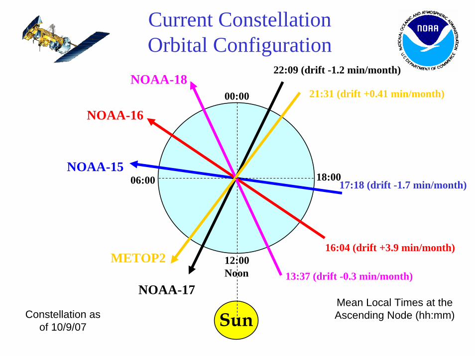
Sun
Current Constellation Orbital Configuration
NOAA-15
NOAA-16
NOAA-18
METOP2
NOAA-17
17:18 (drift -1.7 min/month)
16:04 (drift +3.9 min/month)
22:09 (drift -1.2 min/month)
13:37 (drift -0.3 min/month)
21:31 (drift +0.41 min/month)
12:00Noon
00:00
18:00
Constellation as of 10/9/07
Mean Local Times at the Ascending Node (hh:mm)
06:00

Looking down at the North Pole with the orbit planes relative to the sun line
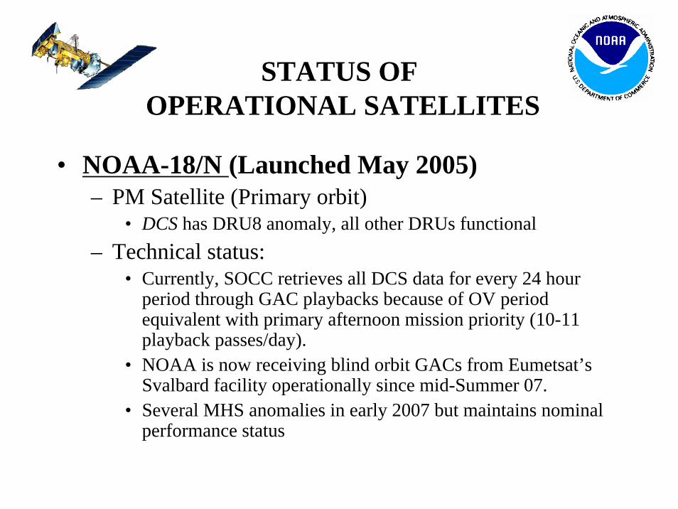
STATUS OFOPERATIONAL SATELLITES
• NOAA-18/N (Launched May 2005)– PM Satellite (Primary orbit)
• DCS has DRU8 anomaly, all other DRUs functional– Technical status:
• Currently, SOCC retrieves all DCS data for every 24 hour period through GAC playbacks because of OV period equivalent with primary afternoon mission priority (10-11 playback passes/day).
• NOAA is now receiving blind orbit GACs from Eumetsat’s Svalbard facility operationally since mid-Summer 07.
• Several MHS anomalies in early 2007 but maintains nominal performance status
4
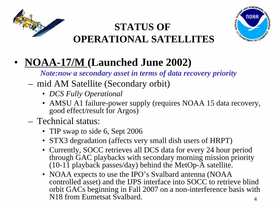
• NOAA-17/M
STATUS OFOPERATIONAL SATELLITES
(Launched June 2002) Note:now a secondary asset in terms of data recovery priority
– mid AM Satellite (Secondary orbit)• DCS Fully Operational• AMSU A1 failure-power supply (requires NOAA 15 data recovery,
good effect/result for Argos)– Technical status:
• TIP swap to side 6, Sept 2006• STX3 degradation (affects very small dish users of HRPT)• Currently, SOCC retrieves all DCS data for every 24 hour period
through GAC playbacks with secondary morning mission priority (10-11 playback passes/day) behind the MetOp-A satellite.
• NOAA expects to use the IPO’s Svalbard antenna (NOAA controlled asset) and the IJPS interface into SOCC to retrieve blind orbit GACs beginning in Fall 2007 on a non-interference basis with N18 from Eumetsat Svalbard.
5
STATUS OFOPERATIONAL SATELLITES
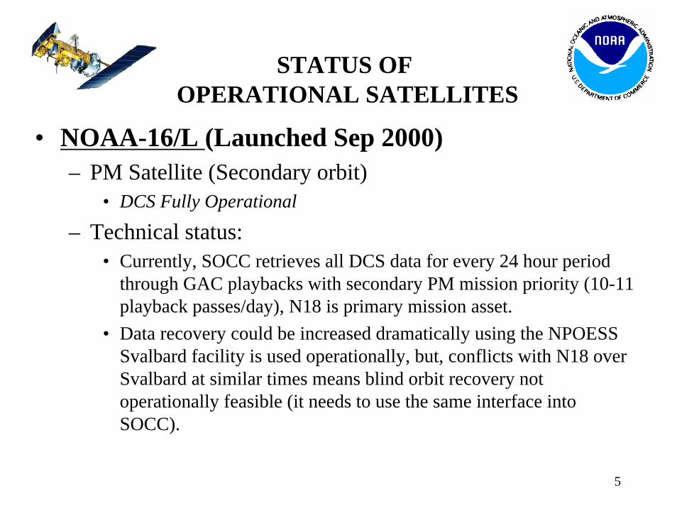
• NOAA-16/L (Launched Sep 2000)– PM Satellite (Secondary orbit)
• DCS Fully Operational
– Technical status:• Currently, SOCC retrieves all DCS data for every 24 hour period
through GAC playbacks with secondary PM mission priority (10-11 playback passes/day), N18 is primary mission asset.
• Data recovery could be increased dramatically using the NPOESS Svalbard facility is used operationally, but, conflicts with N18 over Svalbard at similar times means blind orbit recovery not operationally feasible (it needs to use the same interface into SOCC).
6
STATUS OFOPERATIONAL SATELLITES
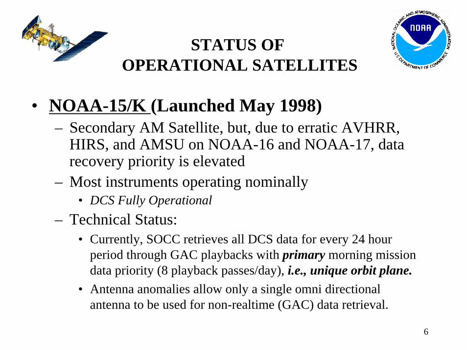
• NOAA-15/K (Launched May 1998)– Secondary AM Satellite, but, due to erratic AVHRR,
HIRS, and AMSU on NOAA-16 and NOAA-17, data recovery priority is elevated
– Most instruments operating nominally• DCS Fully Operational
– Technical Status:• Currently, SOCC retrieves all DCS data for every 24 hour
period through GAC playbacks with primary morning mission data priority (8 playback passes/day), i.e., unique orbit plane.
• Antenna anomalies allow only a single omni directional antenna to be used for non-realtime (GAC) data retrieval.
7
STATUS OFOPERATIONAL SATELLITES
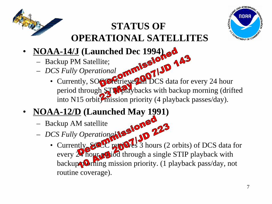
• NOAA-14/J (Launched Dec 1994)– Backup PM Satellite;– DCS Fully Operational
• Currently, SOCC retrieves all DCS data for every 24 hour period through STIP playbacks with backup morning (drifted into N15 orbit) mission priority (4 playback passes/day).
• NOAA-12/D (Launched May 1991)– Backup AM satellite– DCS Fully Operational
• Currently, SOCC retrieves 3 hours (2 orbits) of DCS data for every 24 hour period through a single STIP playback with backup morning mission priority. (1 playback pass/day, not routine coverage).
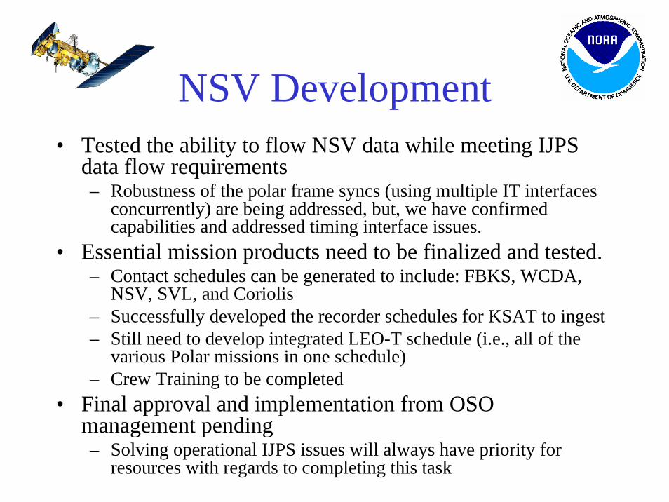
NSV Development• Tested the ability to flow NSV data while meeting IJPS
data flow requirements– Robustness of the polar frame syncs (using multiple IT interfaces
concurrently) are being addressed, but, we have confirmed capabilities and addressed timing interface issues.
• Essential mission products need to be finalized and tested.– Contact schedules can be generated to include: FBKS, WCDA,
NSV, SVL, and Coriolis– Successfully developed the recorder schedules for KSAT to ingest– Still need to develop integrated LEO-T schedule (i.e., all of the
various Polar missions in one schedule)– Crew Training to be completed
• Final approval and implementation from OSO management pending– Solving operational IJPS issues will always have priority for
resources with regards to completing this task
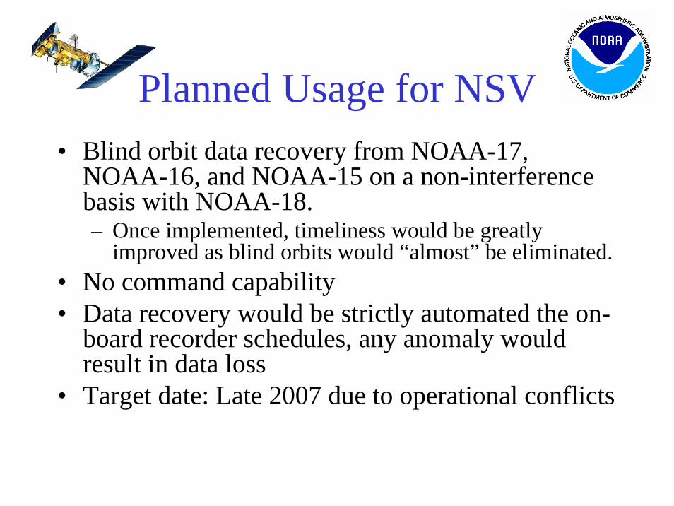
Planned Usage for NSV• Blind orbit data recovery from NOAA-17,
NOAA-16, and NOAA-15 on a non-interference basis with NOAA-18.– Once implemented, timeliness would be greatly
improved as blind orbits would “almost” be eliminated.• No command capability• Data recovery would be strictly automated the on-
board recorder schedules, any anomaly would result in data loss
• Target date: Late 2007 due to operational conflicts
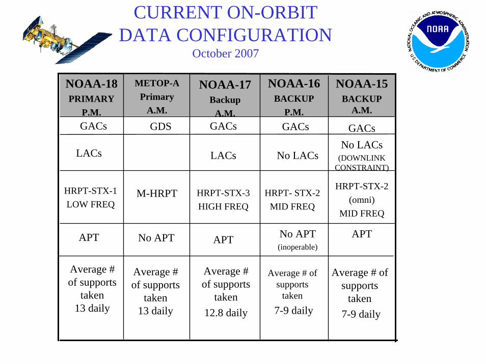
CURRENT ON-ORBIT DATA CONFIGURATION
October 2007
Average # of supports
taken 13 daily
APT
HRPT-STX-1LOW FREQ
LACs
GACs
NOAA-18PRIMARY
P.M.
Average # of supports
taken7-9 daily
Average # of supports
taken7-9 daily
Average # of supports
taken12.8 daily
APTNo APT(inoperable)
APT
HRPT-STX-2(omni)
MID FREQ
HRPT- STX-2MID FREQ
HRPT-STX-3 HIGH FREQ
No LACs(DOWNLINK
CONSTRAINT)No LACsLACs
GACsGACsGACs
NOAA-15BACKUP
A.M.
NOAA-16BACKUP
P.M.
NOAA-17Backup
A.M.
METOP-APrimary
A.M.
No APT
GDS
M-HRPT
Average # of supports
taken 13 daily
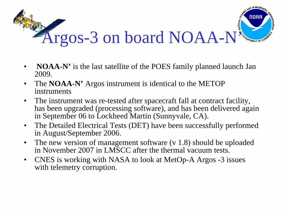
Argos-3 on board NOAA-N’• NOAA-N’ is the last satellite of the POES family planned launch Jan
2009.• The NOAA-N’ Argos instrument is identical to the METOP
instruments• The instrument was re-tested after spacecraft fall at contract facility,
has been upgraded (processing software), and has been delivered again in September 06 to Lockheed Martin (Sunnyvale, CA).
• The Detailed Electrical Tests (DET) have been successfully performed in August/September 2006.
• The new version of management software (v 1.8) should be uploaded in November 2007 in LMSCC after the thermal vacuum tests.
• CNES is working with NASA to look at MetOp-A Argos -3 issues with telemetry corruption.
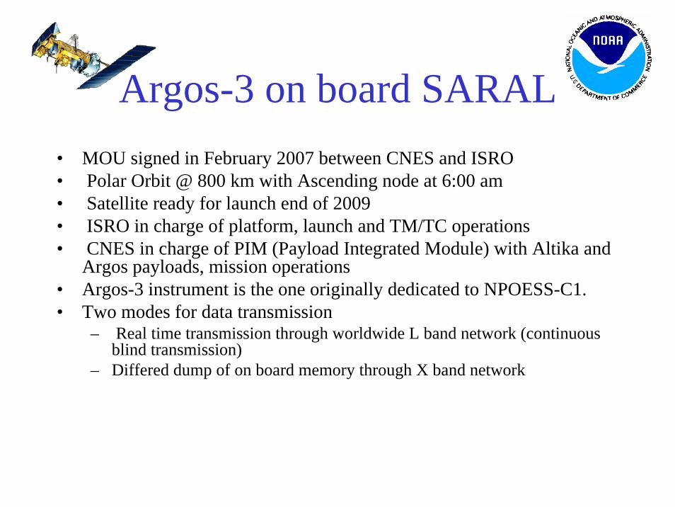
Argos-3 on board SARAL• MOU signed in February 2007 between CNES and ISRO• Polar Orbit @ 800 km with Ascending node at 6:00 am• Satellite ready for launch end of 2009• ISRO in charge of platform, launch and TM/TC operations• CNES in charge of PIM (Payload Integrated Module) with Altika and
Argos payloads, mission operations• Argos-3 instrument is the one originally dedicated to NPOESS-C1. • Two modes for data transmission
– Real time transmission through worldwide L band network (continuous blind transmission)
– Differed dump of on board memory through X band network
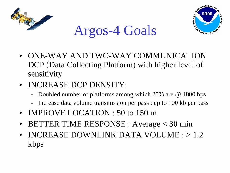
Argos-4 Goals
• ONE-WAY AND TWO-WAY COMMUNICATION DCP (Data Collecting Platform) with higher level of sensitivity
• INCREASE DCP DENSITY:- Doubled number of platforms among which 25% are @ 4800 bps- Increase data volume transmission per pass : up to 100 kb per pass
• IMPROVE LOCATION : 50 to 150 m• BETTER TIME RESPONSE : Average < 30 min• INCREASE DOWNLINK DATA VOLUME : > 1.2
kbps
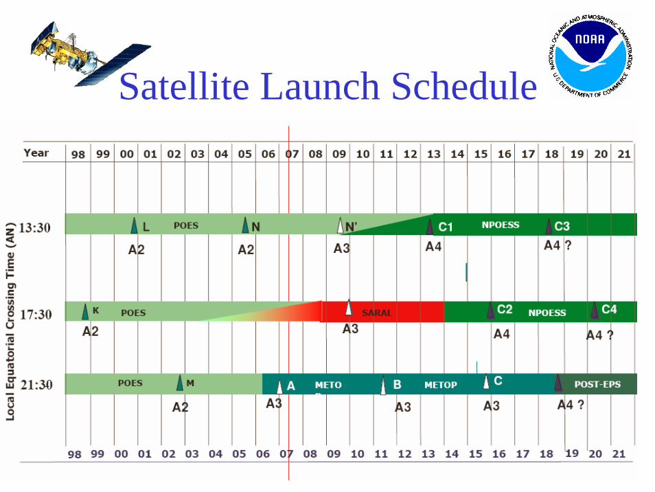
Satellite Launch Schedule
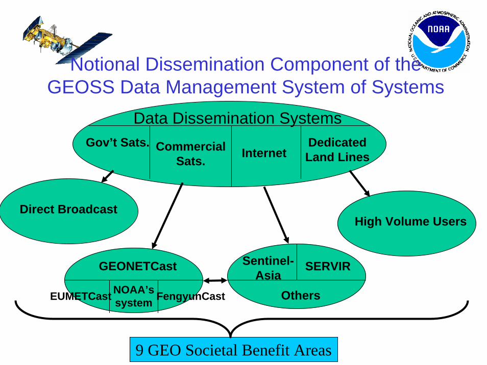
Data Dissemination SystemsGov’t Sats. Commercial
Sats. InternetDedicated Land Lines
GEONETCast
Direct Broadcast
NOAA’s systemEUMETCast FengyunCast
Sentinel-Asia
SERVIR
High Volume Users
9 GEO Societal Benefit Areas
Others
Notional Dissemination Component of the GEOSS Data Management System of Systems
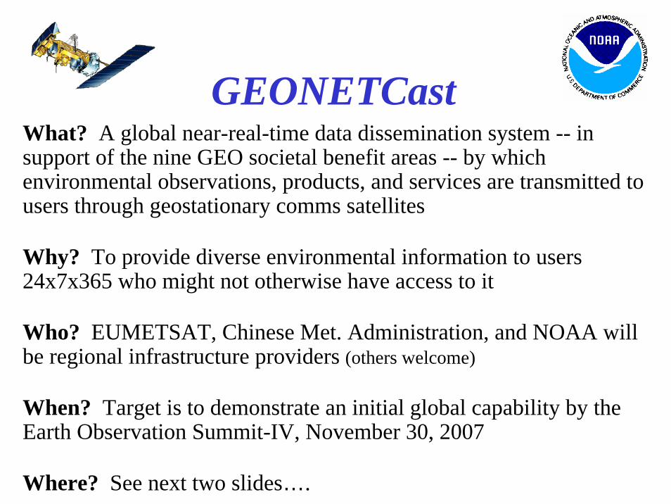
GEONETCastWhat? A global near-real-time data dissemination system -- in support of the nine GEO societal benefit areas -- by which environmental observations, products, and services are transmitted to users through geostationary comms satellites
Why? To provide diverse environmental information to users 24x7x365 who might not otherwise have access to it
Who? EUMETSAT, Chinese Met. Administration, and NOAA will be regional infrastructure providers (others welcome)
When? Target is to demonstrate an initial global capability by the Earth Observation Summit-IV, November 30, 2007
Where? See next two slides….
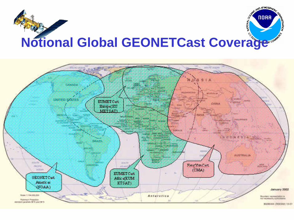
Notional Global GEONETCast Coverage
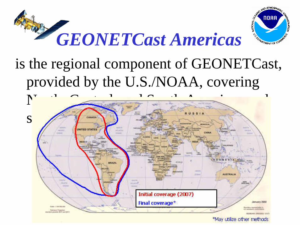
GEONETCast Americasis the regional component of GEONETCast,
provided by the U.S./NOAA, covering North, Central, and South Americas and surrounding ocean areas
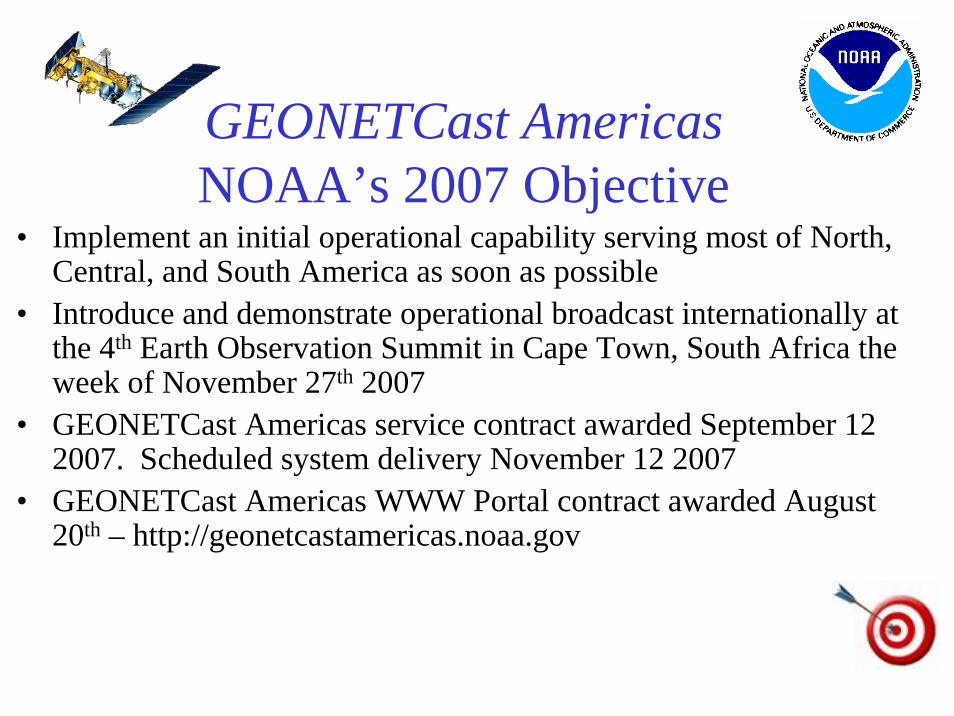
GEONETCast AmericasNOAA’s 2007 Objective
• Implement an initial operational capability serving most of North, Central, and South America as soon as possible
• Introduce and demonstrate operational broadcast internationally at the 4th Earth Observation Summit in Cape Town, South Africa the week of November 27th 2007
• GEONETCast Americas service contract awarded September 12 2007. Scheduled system delivery November 12 2007
• GEONETCast Americas WWW Portal contract awarded August 20th – http://geonetcastamericas.noaa.gov
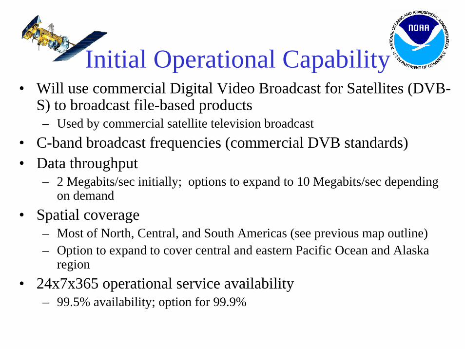
Initial Operational Capability• Will use commercial Digital Video Broadcast for Satellites (DVB-
S) to broadcast file-based products– Used by commercial satellite television broadcast
• C-band broadcast frequencies (commercial DVB standards)• Data throughput
– 2 Megabits/sec initially; options to expand to 10 Megabits/sec depending on demand
• Spatial coverage– Most of North, Central, and South Americas (see previous map outline)– Option to expand to cover central and eastern Pacific Ocean and Alaska
region• 24x7x365 operational service availability
– 99.5% availability; option for 99.9%
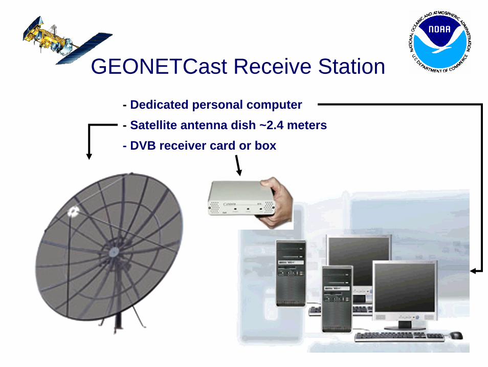
GEONETCast Receive Station- Dedicated personal computer- Satellite antenna dish ~2.4 meters- DVB receiver card or box
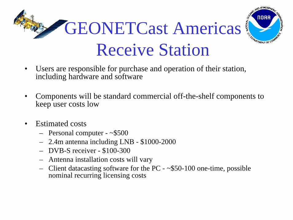
GEONETCast Americas Receive Station
• Users are responsible for purchase and operation of their station, including hardware and software
• Components will be standard commercial off-the-shelf components to keep user costs low
• Estimated costs– Personal computer - ~$500– 2.4m antenna including LNB - $1000-2000– DVB-S receiver - $100-300– Antenna installation costs will vary– Client datacasting software for the PC - ~$50-100 one-time, possible
nominal recurring licensing costs
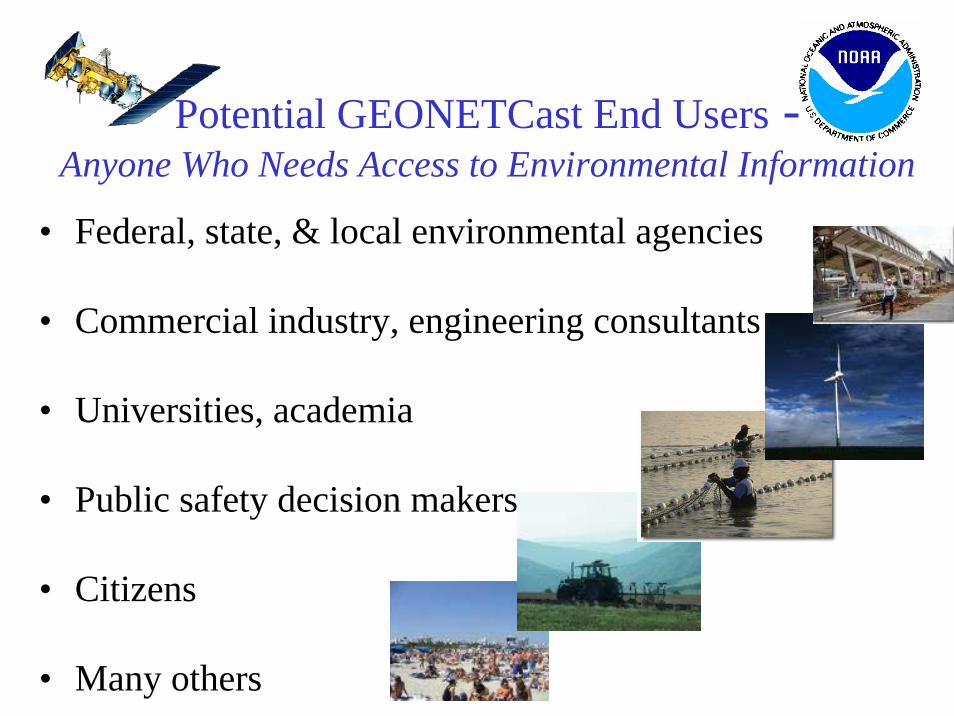
Potential GEONETCast End Users -Anyone Who Needs Access to Environmental Information
• Federal, state, & local environmental agencies
• Commercial industry, engineering consultants
• Universities, academia
• Public safety decision makers
• Citizens
• Many others