xxxix part a - international society for photogrammetry and
TRANSCRIPT
THE INTERNATIONAL ARCHIVES OF THE PHOTOGRAMMETRY, REMOTE SENSING AND SPATIAL INFORMATION SCIENCES
ARCHIVES INTERNATIONALES DE PHOTOGRAMMÉTRIE, DE LA TÉLÉDÉTECTION ET DE L’INFORMATION SPATIALE
INTERNATIONALES ARCHIV FÜR PHOTOGRAMMETRIE, FERNERKUNDUNG UND RAUMBEZOGENE INFORMATIONSWISSENSCHAFTEN
.
International Society for Photogrammetry and Remote Sensing Société Internationale de Photogrammétrie et de Télédétection Internationale Gesellschaft für Photogrammetrie und Fernerkundung
XXIInd Congress XXIIe Congrés XXII. Kongress
PROCEEDINGS AND RESULTS
ISSN 1682-1750
VOLUME VOLUME BAND
XXXIX
PART TOME TEIL A
Edited by: Orhan ALTAN, Ian DOWMAN, John TRINDER
Published by International Society for Photogrammetry and Remote Sensing Publié par le Société Internationale de Photogrammétrie et de Télédétection
Herausgegeben vom Internationalen Internationale Gesellschaft für Photogrammetrie und Fernerkundung
THE INTERNATIONAL ARCHIVES OF THE PHOTOGRAMMETRY, REMOTE SENSING AND SPATIAL INFORMATION SCIENCES
ARCHIVES INTERNATIONALES DE PHOTOGRAMMÉTRIE, DE LA TÉLÉDÉTECTION ET DE L’INFORMATION SPATIALE
INTERNATIONALES ARCHIV FÜR PHOTOGRAMMETRIE, FERNERKUNDUNG UND RAUMBEZOGENE INFORMATIONSWISSENSCHAFTEN
.
XXIInd Congress XXIIe Congrés XXII. Kongress
International Society for Photogrammetry and Remote Sensing Société Internationale de Photogrammétrie et de Télédétection Internationale Gesellschaft für Photogrammetrie und Fernerkundung
PROCEEDINGS AND RESULTS
ISSN 1682-1750
VOLUME VOLUME BAND XXXIX
PART TOME TEIL A
Edited by: Orhan ALTAN, Ian DOWMAN, John TRINDER
Published by International Society for Photogrammetry and Remote Sensing Publié par le Société Internationale de Photogrammétrie et de Télédétection
Herausgegeben vom Internationalen Internationale Gesellschaft für Photogrammetrie und Fernerkundung
ISPRS Council 2008-2012
President Orhan Altan Turkey
Secretary General Chen Jun PR China
Congress Director Cliff Ogleby Australia
Treasurer Mike Renslow USA
First Vice President Ian Dowman United Kingdom
Second Vice President Ammatzia Peled Israel
International Archives of Photogrammetry, Remote Sensing and Spatial Information Sciences (IAPRS&SIS)
Founded by Eduard Dolezal (Austria) in 1913
Volume XXXIX, Part A
Proceedings and Results
Editorial Team
Editorial Team Orhan Altan Turkey
Ian Dowman United Kingdom
John C. Trinder Australia
Design and Layout Emin Ozgur Avsar Turkey
Printing Office Cenkler Matbaasi Turkey
Copyright 2013 - 2014 ISPRS and by each author for his/her part
The publisher is not responsible for any opinion or statement made in this text, nor can they be held responsible for
any typing or content errors.
3
Table of Contents WELCOME TO THE XXIInd ISPRS CONGRESS ............................................................................. 6
WELCOME FROM CONGRESS DIRECTOR, CLIFF OGLEBY ................................................ 7 ISPRS 2008 – 2012 .............................................................................................................................. 8
COUNCIL 2008-2012...................................................................................................................... 9 TECHNICAL COMMISSION PRESIDENTS 2008-2012 ........................................................... 10
FINANCIAL COMMISSION 2008-2012 ..................................................................................... 10 ISPRS REGIONAL REPRESENTATIVES 2008-2012................................................................ 11 EDITORS OF ISPRS PUBLICATIONS 2008-2012 ..................................................................... 11 ISPRS HONORARY MEMBERS 2008-2012 .............................................................................. 13 ISPRS FELLOWS 2008-2012 ....................................................................................................... 13 TECHNICAL COMMISSIONS AND WORKING GROUPS 2008-2012 ................................... 14
ISPRS 2012 – 2016 ............................................................................................................................ 37
COUNCIL 2012-2016.................................................................................................................... 38 TECHNICAL COMMISSION PRESIDENTS 2012-2016 ........................................................... 39 FINANCIAL COMMISSION 2012-2016 ..................................................................................... 39 ISPRS REGIONAL REPRESENTATIVES 2012-2016................................................................ 40 EDITORS OF ISPRS PUBLICATIONS 2012-2016 ..................................................................... 40 ISPRS HONORARY MEMBERS 2012-2016 .............................................................................. 42 ISPRS FELLOWS 2012-2016 ....................................................................................................... 42 ORDINARY MEMBERS 2012-2016 ............................................................................................ 43 ASSOCIATE MEMBERS 2012-2016 ........................................................................................... 47 REGIONAL MEMBERS 2012-2016 ............................................................................................ 48 SUSTAINING MEMBERS 2012-2016 ......................................................................................... 49
OPENING CEREMONY AND FIRST PLENARY SESSION ........................................................ 52
OPENING CEREMONY ............................................................................................................... 53 OPENING SPEECH BY CLIFF OGLEBY, CONGRESS DIRECTOR ....................................... 53 WELCOME SPEECH BY ORHAN ALTAN, ISPRS PRESIDENT ............................................ 53
FIRST PLENARY SESSION ........................................................................................................ 56 ISPRS AWARDS 2012 ...................................................................................................................... 57
ISPRS Honorary Members............................................................................................................. 58 ISPRS Fellows ............................................................................................................................... 59 The Brock Gold Medal .................................................................................................................. 61 The Otto von Gruber Award .......................................................................................................... 61 The U.V. Helava Award ................................................................................................................ 62 The Frederick J. Doyle Award ....................................................................................................... 62
The Eduard Doležal Award ............................................................................................................ 63 Karl Kraus Medal ........................................................................................................................... 63 The Schwidefsky Medal................................................................................................................. 64 The Willem Schermerhorn Award ................................................................................................. 64 The Samuel Gamble Award ........................................................................................................... 64 The Wang Zhizuo Award ............................................................................................................... 65 The Giuseppe Inghilleri Award ...................................................................................................... 65 President's Citations ....................................................................................................................... 66 CATCON Prize .............................................................................................................................. 67 Young Authors Awards ................................................................................................................. 67
4
Youth Forum Awards..................................................................................................................... 68 Best ePoster Awards ...................................................................................................................... 68 LIST OF ISPRS AWARD WINNERS .......................................................................................... 69
CONGRESS GALA DINNER........................................................................................................... 72 OBITUARIES .................................................................................................................................... 79
HANS GEORG JERIE (1929 - 2008)............................................................................................ 80 HANS KNOOP (1935 - 2009) ....................................................................................................... 81 JÖRG ALBERTZ (1936 - 2010) .................................................................................................... 81 ROBERT “BOB” MOSES (1948 - 2010) ...................................................................................... 82 VLADISLAV KONSTANTINOVICH LVOV (1933 - 2011) ...................................................... 82
DAVID TAIT (1943 - 2011) .......................................................................................................... 82 HANS-KARSTEN MEIER (1925 – 2011) .................................................................................... 83 TUAN-CHIH CHEN (1943 - 2011)............................................................................................... 84 MYRIAM ARDILA TORRES (1953 - 2011) ............................................................................... 85 IAN HARLEY (1932 – 2011) ........................................................................................................ 85
GEORGE ZARZYCKI (1925 - 2012) ........................................................................................... 85 GENERAL ASSEMBLIES................................................................................................................ 86
ORDINARY MEMBER DELEGATES and ADVISERS to ISPRS GENERAL ASSEMBLY ... 87 DELEGATES and ADVISERS (NON-VOTING) to ISPRS GENERAL ASSEMBLY .............. 90 AGENDA of ISPRS GENERAL ASSEMBLIES .......................................................................... 91 DECISIONS of THE GENERAL ASSEMBLIES......................................................................... 92 MINUTES of ISPRS GENERAL ASSEMBLIES ......................................................................... 93 REPORT of ISPRS PRESIDENT ORHAN ALTAN .................................................................. 106 REPORT of ISPRS SECRETARY GENERAL CHEN JUN ...................................................... 110 REPORT of ISPRS TREASURER MIKE RENSLOW .............................................................. 117
REPORT of ISPRS FINANCIAL COMMISSION CHAIR LENA HALOUNOVÁ ................. 120 REPORT on INTER–ORGANIZATIONAL RELATIONS PRESENTED by SECRETARY GENERAL CHEN JUN ............................................................................................................... 122
REPORT of the EDITOR-IN-CHIEF of the ISPRS JOURNAL GEORGE VOSSELMAN ...... 125 REPORT of the EDITOR-IN-CHIEF of the ISPRS INTERNATIONAL JOURNAL of GEO-INFORMATION WOLFGANG KAINZ .................................................................................... 130 REPORT of ISPRS eBULLETIN CHEN JUN ............................................................................ 134 REPORT of ISPRS WEB MASTER MARKUS ENGLICH....................................................... 134
REPORT of ISPRS BOOK SERIES EDITOR PAUL APLIN .................................................... 135 REPORT of ISAC (INTERNATIONAL SCIENTIFIC ADVISORY COMMITTEE) by CHAIR, ARMIN GRUEN.......................................................................................................................... 137 REPORT of IPAC (INTERNATIONAL POLICY ADVISORY COMMITTEE) by CHAIR RAINER SANDAU .................................................................................................................... 138 REPORT of AD-HOC GROUP ON STANDARDS by CHAIR WOLFGANG KRESSE ......... 143
REPORT of ISPRS REGIONAL RPRESENTATIVE for AFRICA by HUSSEIN FARAH and OLAJIDE KUFONIYI ................................................................................................................. 143 REPORT of ISPRS REGIONAL RPRESENTATIVE for SOUTH-EAST ASIA by NGUYEN DINH DUONG ............................................................................................................................ 145 REPORT of ISPRS REGIONAL RPRESENTATIVE for LATIN-AMERICA by Mike Renslow ...................................................................................................................................................... 146
SCIENTIFIC PROGRAM ............................................................................................................... 148
OVERALL PROGRAM .............................................................................................................. 149
5
Daily Program .............................................................................................................................. 150
ORAL PRSENTATION AND ePOSTERS ................................................................................. 156 STUDENT CONSORTIUM ........................................................................................................ 157
EXHIBITION AND SOCIAL PROGRAM ..................................................................................... 158
EXHIBITORS .............................................................................................................................. 159
CONGRESS SOCIAL PROGRAM............................................................................................. 172 CLOSING CEREMONY ................................................................................................................. 173
ADDRESS of OUTGOING CONGRESS DIRECTOR CLIFF OGLEBY ................................. 174 ADDRESS of OUTGOING PRESIDENT ORHAN ALTAN ..................................................... 174
ADDRESS of INCOMING PRESIDENT CHEN JUN ............................................................... 175 ADDRESS of INCOMING CONGRESS DIRECTOR LENA HALOUNOVÁ......................... 177
RESOLUTIONS .............................................................................................................................. 178 HISTORY ........................................................................................................................................ 188
THE INTERNATIONAL ARCHIVES OF THE PHOTOGRAMMETRY, REMOTE SENSING AND SPATIAL INFORMATION SCIENCES ............................................................................. 189 CHRONOLOGY OF ISPRS ........................................................................................................ 192
ISPRS COMMITTEES .................................................................................................................... 197
THE INTERNATIONAL POLICY ADVISORY COMMITTEE (IPAC) .................................. 198 THE INTERNATIONAL SCIENCE ADVISORY COMMITTEE (ISAC) ................................ 198
THE INTERNATIONAL COMMITTEE ON REMOTE SENSING OF ENVIRONMENT (ICORSE) ..................................................................................................................................... 198 INTERNATIONAL COMMITTEE FOR ARCHITECTURAL PHOTOGRAMMETRY (CIPA) ...................................................................................................................................................... 199
LEGISLATIVE DOCUMENTS ...................................................................................................... 200
STATUTES .................................................................................................................................. 201 BYLAWS ..................................................................................................................................... 205 ISPRS AWARDS POLICY ......................................................................................................... 217
THE BROCK GOLD MEDAL AWARD ................................................................................ 217 THE OTTO VON GRUBER AWARD ................................................................................... 218 THE SAMUEL GAMBLE AWARD ...................................................................................... 219 THE SCHWIDEFSKY MEDAL ............................................................................................. 220 THE SCHERMERHORN AWARD ........................................................................................ 220 The Eduard Dolezal Award ...................................................................................................... 221 The U.V. Helava Award .......................................................................................................... 222 THE WANG ZHIZHUO AWARD.......................................................................................... 222 THE GIUSEPPE INGHILLERI AWARD .............................................................................. 223 THE KARL KRAUS MEDAL ................................................................................................ 223 THE FREDERICK J. DOYLE AWARD ................................................................................ 224
GUIDELINES FOR CANDIDATES FOR MEMBERS OF THE COUNCIL ............................ 226
GUIDELINES FOR MEMBERS PLANNING TO HOST AN ISPRS CONGRESS ................. 226 GUIDELINES FOR HOSTING A TECHNICAL COMMISSION ............................................ 227
GUIDELINES FOR CONDUCTING A WORKING GROUP ................................................... 228 GUIDELINES FOR ISPRS FINANCIAL COMMISSION ........................................................ 229 TERMS OF REFERENCE FOR SUSTAINING MEMBERS .................................................... 229

6
ISPRS 2012
WELCOME TO THE XXII nd ISPRS CONGRESS
Welcome from Congress Director, Cliff Ogleby
7
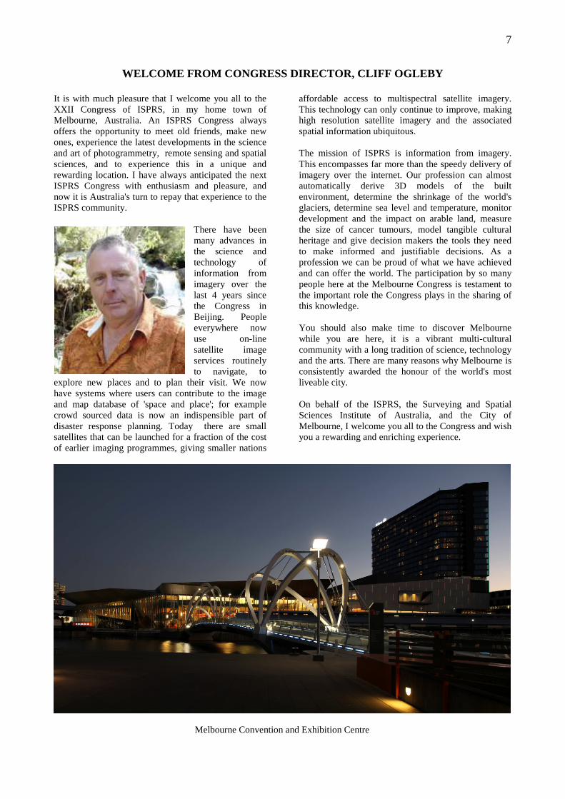
WELCOME FROM CONGRESS DIRECTOR, CLIFF OGLEBY It is with much pleasure that I welcome you all to the XXII Congress of ISPRS, in my home town of Melbourne, Australia. An ISPRS Congress always offers the opportunity to meet old friends, make new ones, experience the latest developments in the science and art of photogrammetry, remote sensing and spatial sciences, and to experience this in a unique and rewarding location. I have always anticipated the next ISPRS Congress with enthusiasm and pleasure, and now it is Australia's turn to repay that experience to the ISPRS community.
There have been many advances in the science and technology of information from imagery over the last 4 years since the Congress in Beijing. People everywhere now use on-line satellite image services routinely to navigate, to
explore new places and to plan their visit. We now have systems where users can contribute to the image and map database of 'space and place'; for example crowd sourced data is now an indispensible part of disaster response planning. Today there are small satellites that can be launched for a fraction of the cost of earlier imaging programmes, giving smaller nations
affordable access to multispectral satellite imagery. This technology can only continue to improve, making high resolution satellite imagery and the associated spatial information ubiquitous. The mission of ISPRS is information from imagery. This encompasses far more than the speedy delivery of imagery over the internet. Our profession can almost automatically derive 3D models of the built environment, determine the shrinkage of the world's glaciers, determine sea level and temperature, monitor development and the impact on arable land, measure the size of cancer tumours, model tangible cultural heritage and give decision makers the tools they need to make informed and justifiable decisions. As a profession we can be proud of what we have achieved and can offer the world. The participation by so many people here at the Melbourne Congress is testament to the important role the Congress plays in the sharing of this knowledge. You should also make time to discover Melbourne while you are here, it is a vibrant multi-cultural community with a long tradition of science, technology and the arts. There are many reasons why Melbourne is consistently awarded the honour of the world's most liveable city. On behalf of the ISPRS, the Surveying and Spatial Sciences Institute of Australia, and the City of Melbourne, I welcome you all to the Congress and wish you a rewarding and enriching experience.
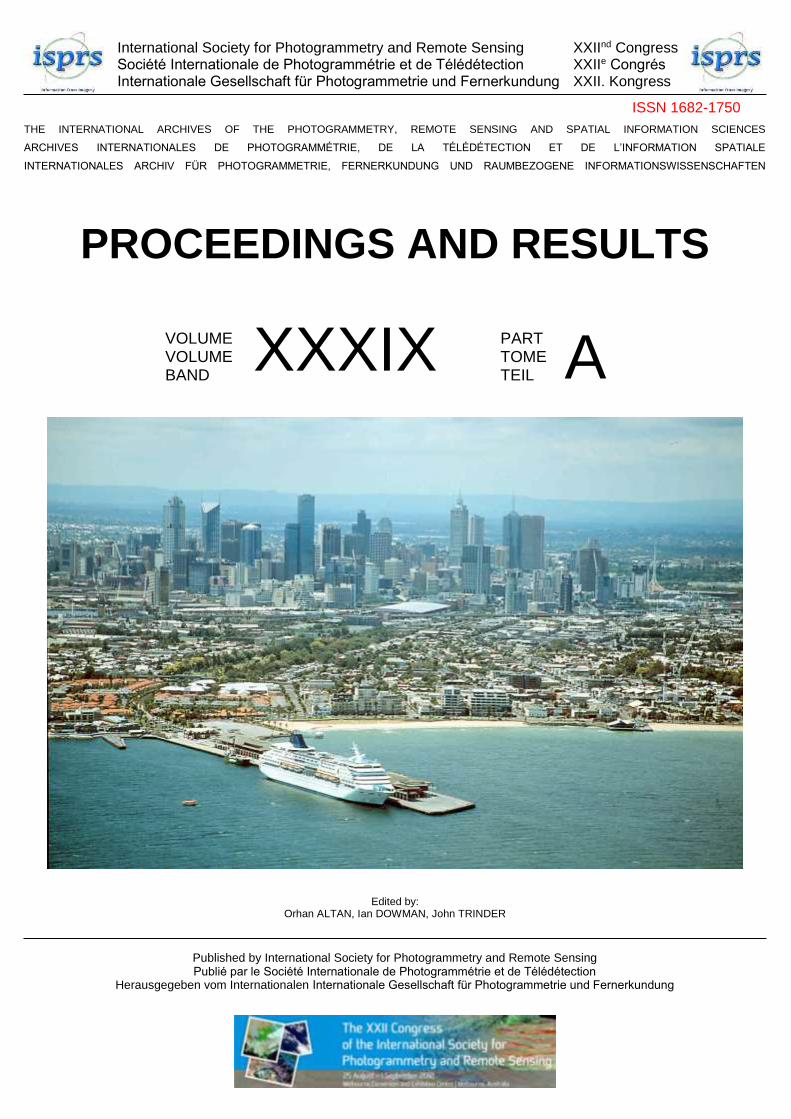
Melbourne Convention and Exhibition Centre
8
ISPRS 2012
ISPRS 2008 – 2012
The ISPRS Council
Technical Commission Presidents
Financial Commission
Editors of ISPRS Publications
ISPRS Regional Representatives
ISPRS Honorary Members
ISPRS Fellows
Technical Commissions (TC) and Working Groups (WG)
9
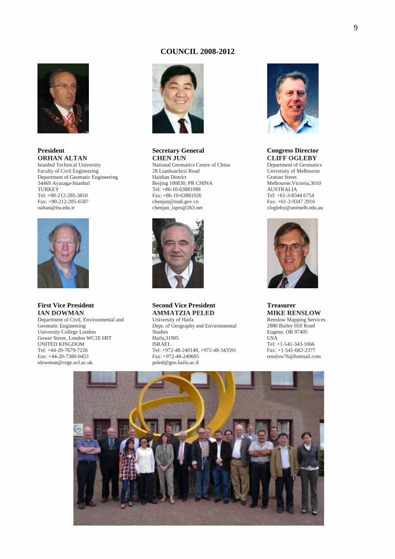
COUNCIL 2008-2012
President ORHAN ALTAN Istanbul Technical University Faculty of Civil Engineering Department of Geomatic Engineering 34469 Ayazaga-Istanbul TURKEY Tel: +90-212-285-3810 Fax: +90-212-285-6587 [email protected]
First Vice President IAN DOWMAN Department of Civil, Environmental and Geomatic Engineering University College London Gower Street, London WC1E 6BT UNITED KINGDOM Tel: +44-20-7679-7226 Fax: +44-20-7380-0453 [email protected]
Secretary General CHEN JUN National Geomatics Centre of China 28 Lianhuachixi Road Haidian District Beijing 100830, PR CHINA Tel: +86-10-63881088 Fax: +86-10-63881026 [email protected] [email protected]
Second Vice President AMMATZIA PELED University of Haifa Dept. of Geography and Environmental Studies Haifa,31905 ISRAEL Tel: +972-48-240148, +972-48-343591 Fax: +972-48-249605 [email protected]
Congress Director CLIFF OGLEBY Department of Geomatics University of Melbourne Grattan Street Melbourne,Victoria,3010 AUSTRALIA Tel: +61-3-8344 6754 Fax: +61-3-9347 2916 [email protected]
Treasurer MIKE RENSLOW Renslow Mapping Services 2880 Bailey Hill Road Eugene, OR 97405 USA Tel: +1-541-343-1066 Fax: +1-541-682-2377 [email protected]
10
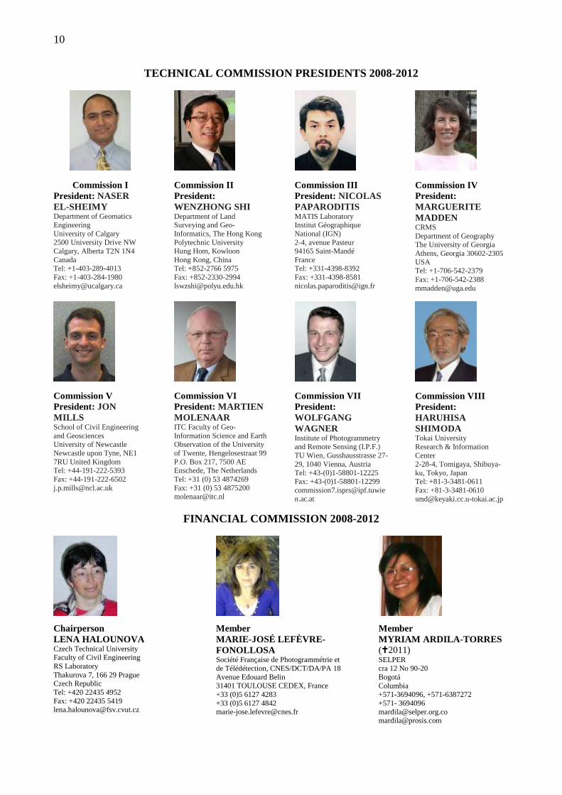
TECHNICAL COMMISSION PRESIDENTS 2008-2012
Commission I President: NASER EL-SHEIMY Department of Geomatics Engineering University of Calgary 2500 University Drive NW Calgary, Alberta T2N 1N4 Canada Tel: +1-403-289-4013 Fax: +1-403-284-1980 [email protected]
Commission V President: JON MILLS School of Civil Engineering and Geosciences University of Newcastle Newcastle upon Tyne, NE1 7RU United Kingdom Tel: +44-191-222-5393 Fax: +44-191-222-6502 [email protected]
Commission II President: WENZHONG SHI Department of Land Surveying and Geo-Informatics, The Hong Kong Polytechnic University Hung Hom, Kowloon Hong Kong, China Tel: +852-2766 5975 Fax: +852-2330-2994 [email protected]
Commission VI President: MARTIEN MOLENAAR ITC Faculty of Geo-Information Science and Earth Observation of the University of Twente, Hengelosestraat 99 P.O. Box 217, 7500 AE Enschede, The Netherlands Tel: +31 (0) 53 4874269 Fax: +31 (0) 53 4875200 [email protected]
Commission III President: NICOLAS PAPARODITIS MATIS Laboratory Institut Géographique National (IGN) 2-4, avenue Pasteur 94165 Saint-Mandé France Tel: +331-4398-8392 Fax: +331-4398-8581 [email protected]
Commission VII President: WOLFGANG WAGNER Institute of Photogrammetry and Remote Sensing (I.P.F.) TU Wien, Gusshausstrasse 27-29, 1040 Vienna, Austria Tel: +43-(0)1-58801-12225 Fax: +43-(0)1-58801-12299 [email protected]
Commission IV President: MARGUERITE MADDEN CRMS Department of Geography The University of Georgia Athens, Georgia 30602-2305 USA Tel: +1-706-542-2379 Fax: +1-706-542-2388 [email protected]
Commission VIII President: HARUHISA SHIMODA Tokai University Research & Information Center 2-28-4, Tomigaya, Shibuya-ku, Tokyo, Japan Tel: +81-3-3481-0611 Fax: +81-3-3481-0610 [email protected]
FINANCIAL COMMISSION 2008-2012
Chairperson LENA HALOUNOVA Czech Technical University Faculty of Civil Engineering RS Laboratory Thakurova 7, 166 29 Prague Czech Republic Tel: +420 22435 4952 Fax: +420 22435 5419 [email protected]
Member MARIE-JOSÉ LEFÈVRE-FONOLLOSA Société Française de Photogrammétrie et de Télédétection, CNES/DCT/DA/PA 18 Avenue Edouard Belin 31401 TOULOUSE CEDEX, France +33 (0)5 6127 4283 +33 (0)5 6127 4842 [email protected]
Member MYRIAM ARDILA-TORRES (�2011) SELPER cra 12 No 90-20 Bogotá Columbia +571-3694096, +571-6387272 +571- 3694096 [email protected] [email protected]
11
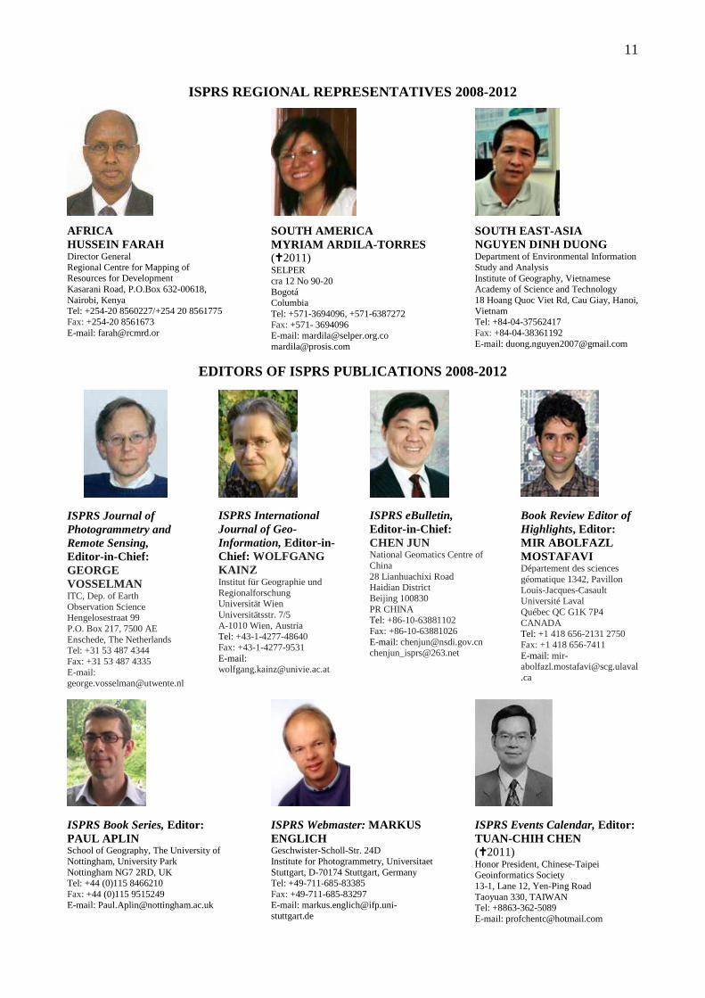
ISPRS REGIONAL REPRESENTATIVES 2008-2012
AFRICA HUSSEIN FARAH Director General Regional Centre for Mapping of Resources for Development Kasarani Road, P.O.Box 632-00618, Nairobi, Kenya Tel: +254-20 8560227/+254 20 8561775 Fax: +254-20 8561673 E-mail: [email protected]
SOUTH AMERICA MYRIAM ARDILA-TORRES (�2011) SELPER cra 12 No 90-20 Bogotá Columbia Tel: +571-3694096, +571-6387272 Fax: +571- 3694096 E-mail: [email protected] [email protected]
SOUTH EAST-ASIA NGUYEN DINH DUONG Department of Environmental Information Study and Analysis Institute of Geography, Vietnamese Academy of Science and Technology 18 Hoang Quoc Viet Rd, Cau Giay, Hanoi, Vietnam Tel: +84-04-37562417 Fax: +84-04-38361192 E-mail: [email protected]
EDITORS OF ISPRS PUBLICATIONS 2008-2012
ISPRS Journal of Photogrammetry and Remote Sensing, Editor-in-Chief: GEORGE VOSSELMAN ITC, Dep. of Earth Observation Science Hengelosestraat 99 P.O. Box 217, 7500 AE Enschede, The Netherlands Tel: +31 53 487 4344 Fax: +31 53 487 4335 E-mail: [email protected]
ISPRS International Journal of Geo-Information, Editor-in-Chief: WOLFGANG KAINZ Institut für Geographie und Regionalforschung Universität Wien Universitätsstr. 7/5 A-1010 Wien, Austria Tel: +43-1-4277-48640 Fax: +43-1-4277-9531 E-mail: [email protected]
ISPRS eBulletin, Editor-in-Chief: CHEN JUN National Geomatics Centre of China 28 Lianhuachixi Road Haidian District Beijing 100830 PR CHINA Tel: +86-10-63881102 Fax: +86-10-63881026 E-mail: [email protected] [email protected]
Book Review Editor of Highlights, Editor: MIR ABOLFAZL MOSTAFAVI Département des sciences géomatique 1342, Pavillon Louis-Jacques-Casault Université Laval Québec QC G1K 7P4 CANADA Tel: +1 418 656-2131 2750 Fax: +1 418 656-7411 E-mail: [email protected]
ISPRS Book Series, Editor: PAUL APLIN School of Geography, The University of Nottingham, University Park Nottingham NG7 2RD, UK Tel: +44 (0)115 8466210 Fax: +44 (0)115 9515249 E-mail: [email protected]
ISPRS Webmaster: MARKUS ENGLICH Geschwister-Scholl-Str. 24D Institute for Photogrammetry, Universitaet Stuttgart, D-70174 Stuttgart, Germany Tel: +49-711-685-83385 Fax: +49-711-685-83297 E-mail: [email protected]
ISPRS Events Calendar, Editor: TUAN-CHIH CHEN (�2011) Honor President, Chinese-Taipei Geoinformatics Society 13-1, Lane 12, Yen-Ping Road Taoyuan 330, TAIWAN Tel: +8863-362-5089 E-mail: [email protected]
12
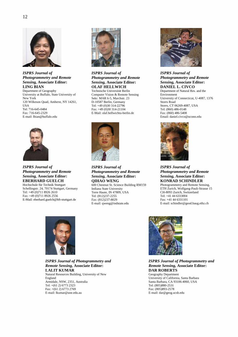
ISPRS Journal of Photogrammetry and Remote Sensing, Associate Editor: LING BIAN Department of Geography University at Buffalo, State University of New York 120 Wilkeson Quad, Amherst, NY 14261, USA Tel: 716-645-0484 Fax: 716-645-2329 E-mail: [email protected]
ISPRS Journal of Photogrammetry and Remote Sensing, Associate Editor: EBERHARD GUELCH Hochschule für Technik Stuttgart Schellingstr. 24, 70174 Stuttgart, Germany Tel: +49 (0)711 8926 2610 Fax: +49 (0)711 8926 2556 E-Mail: [email protected]
ISPRS Journal of Photogrammetry and Remote Sensing, Associate Editor: OLAF HELLWICH Technische Universität Berlin Computer Vision & Remote Sensing Sekr. MAR 6-5, Marchstr. 23 D-10587 Berlin, Germany Tel: +49 (0)30 314-22796 Fax: +49 (0)30 314-21104 E-Mail: olaf.hellwichtu-berlin.de
ISPRS Journal of Photogrammetry and Remote Sensing, Associate Editor: QIHAO WENG 600 Chestnut St. Science Building RM159 Indiana State University Terre Haute, IN 47809, USA Tel: (812)237-2255 Fax: (812)237-8029 E-mail: [email protected]
ISPRS Journal of Photogrammetry and Remote Sensing, Associate Editor: DANIEL L. CIVCO Department of Natural Res. and the Environment University of Connecticut, U-4087, 1376 Storrs Road Storrs, CT 06269-4087, USA Tel: (860) 486-0148 Fax: (860) 486-5408 Email: [email protected]
ISPRS Journal of Photogrammetry and Remote Sensing, Associate Editor: KONRAD SCHINDLER Photogrammetry and Remote Sensing, ETH Zurich, Wolfgang-Pauli-Strasse 15 CH-8093 Zurich, Switzerland Tel: +41 44 6333004 Fax: +41 44 6331101 E-mail: [email protected]
ISPRS Journal of Photogrammetry and Remote Sensing, Associate Editor: LALIT KUMAR Natural Resources Building, University of New England Armidale, NSW, 2351, Australia Tel: +(61 2) 6773 2323 Fax: +(61 2) 6773 2769 E-mail: [email protected]
ISPRS Journal of Photogrammetry and Remote Sensing, Associate Editor: DAR ROBERTS Geography Department University of California, Santa Barbara Santa Barbara, CA 93106-4060, USA Tel: (805)880-2531 Fax: (805)893-2578 E-mail: [email protected]
13
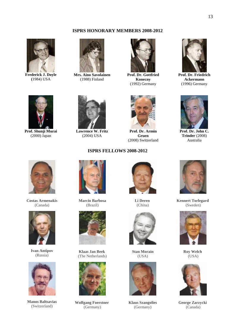
ISPRS HONORARY MEMBERS 2008-2012
Frederick J. Doyle
(1984) USA
Mrs. Aino Savolainen
(1988) Finland
Prof. Dr. Gottfried
Konecny (1992) Germany
Prof. Dr. Friedrich
Ackermann (1996) Germany
Prof. Shunji Murai
(2000) Japan
Lawrence W. Fritz
(2004) USA
Prof. Dr. Armin
Gruen (2008) Switzerland
Prof. Dr. John C. Trinder (2008)
Australia
ISPRS FELLOWS 2008-2012
Costas Armenakis (Canada)
Ivan Antipov (Russia)
Manos Baltsavias (Switzerland)
Marcio Barbosa (Brazil)
Klaas Jan Beek (The Netherlands)
Wolfgang Foerstner (Germany)
Li Deren (China)
Stan Morain (USA)
Klaus Szangolies (Germany)
Kennert Torlegard (Sweden)
Roy Welch (USA)
George Zarzycki (Canada)
14
TECHNICAL COMMISSIONS AND WORKING GROUPS 2008-2012
Commission I - Image Data Acquısıtıon - Sensors and Platforms
President Naser El-Sheimy Department of Geomatics Engineering University of Calgary 2500 University Drive NW Calgary, Alberta T2N 1N4 Canada Tel: + 1 403 220 7587 Fax: + 1 403 284 1980 E-mail: [email protected] Vice President Mohamed M. R. Mostafa Applanix-A Trimble Company 85 Leek Crescent Richmond Hill, Ontario L4B 3B3 Canada Tel: + 1 905 709 4600 ext.274 E-mail: [email protected] Url: www.applanix.com Secretary Steve H.L. Liang Department of Geomatics Engineering Schulich School of Engineering University of Calgary 2500 University Drive NW Calgary, Alberta T2N 1N4 Canada Tel: + 1 403 220 4703 Fax: + 1 403 284 1980 E-mail: [email protected] Commission I – Terms of Reference - Design and realization of digital
aerial and spaceborne missions for Earth observation
- Design, construction, characterization, and installation of imaging and non-imaging sensors (including Optical, IR, SAR, IFSAR, lidar, etc.)
- Standardization of definitions and measurements of sensor parameters
- Integration of imaging and non-imaging sensors with other relevant systems
- Geometric and radiometric properties, quality standards, and factors affecting data quality
- Testing, calibration and evaluation of sensors (including laboratory, in-flight, inter-calibration and test fields)
- Integrated platform guidance, navigation, positioning and orientation
- Data reception and pre-processing - On-board pre-processing of data and
autonomous systems - Systems and media for recording
sensor data, auxiliary data (time,
position, attitude, etc.) and film scanners
- Image and non-image data transfer standards
WG I/1: Standardization of Airborne Platform Interface Chair Andrew C. Roberts Airborne Science Program NASA-HQ, Mail Suite 3B74 300 E Street SW, Washington, DC 20546-0001, USA Tel: + 1 202 358 7212 Fax: + 1 202 358 2770 E-mail: [email protected] Co-Chair Jean-Louis Brenguier METEO-FRANCE Head Experimental Research CNRM/GMEI/D 42, av. Coriolis 31057 Toulouse Cedex 01 France Tel: + 33 5 61 07 93 21 Fax: + 33 5 61 07 96 27 E-mail: [email protected] Secretary James R. Huning SAIC, 1441 Rhode Island Ave, NW Unit 217 Washington, DC 20005, USA Tel: + 1 202 518 6116 E-mail: [email protected] WG I/1 Terms of Reference - Coordinate a forum for discussion
between the international airborne science communities
- Develop airborne sensor interface format standards in coordination with other working groups to promote maximum sensor portability between aircrafts increasing science yield from the sensors
- Develop airborne satellite data relay systems use for science research programs between aircraft and ground in coordination with other working groups
- Develop an airborne science literature search to identify peer reviewed published papers and citations and make a available in a data base
- Support the regulatory agencies in supporting airborne science sensor certification and approval requirements for Lidar, Dropsonde
and electromagnetic spectrum emissions
- Maintain an inventory of the international airborne science capabilities and report annually
- Develop a forum to discuss transnational access system(s) for airborne users
- Support the use of UAS vehicle activity for science observations in civil and restricted airspace on an international basis and engage the ICAO
- Promote the education and outreach on an international basis of airborne based science activity
- Develop a forum to coordinate expert international workshops in categories of airborne science sensors for both
- Remote Sensing and in situ systems. WG I/2: LIDAR, SAR and Optical Sensors for Airborne and Spaceborne Platforms Chair Boris Jutzi Forschungsinstitut für Optronik und Mustererkennung (FGAN-FOM) Research Institute for Optronics and Pattern Recognition Gutleuthausstr. 1, 76275 Ettlingen Germany Tel: + 49 7243 992-337 Fax: + 49 7243 992-299 E-mail: [email protected] Co-Chair Charles Toth Center for Mapping The Ohio State University 470 Hitchcock Hall, 2070 Neil Avenue Columbus, OH 43210-1275, USA Tel: + 1614 292 7681 Fax: + 1614 292 2957 E-mail: [email protected] Co-Chair Franz Meyer Earth and Planetary Remote Sensing Geophysical Institute University of Alaska Fairbanks 903 Koyukuk Dr., P.O. Box 757320 Fairbanks, Alaska 99775-7320 USA Tel: + 1 907 474 7767 Fax: + 1 907 474 6441 E-mail: [email protected]
15
Secretary Naci Yastikli Yildiz Technical University Department of Geodetic and Photogrammetric Engineering Davutpasa Cad., 34210 Esenler, Istanbul, Turkey Tel: + 90 212 383 5328 Fax: + 90 212 261 6762 E-mail: [email protected] WG I/2 Terms of Reference - Evaluation and assessment of
systems for processing and integrating SAR, lidar and optical data
- Address challenges in low-frequency spaceborne SAR system design and data processing
- Address challenges and applications of high-resolution spaceborne SAR systems (e.g. TerraSAR-X, Cosmo Skymed)
- Evaluation of Systems for generation DEMs (Resolution I.3)
- Evaluation of Multi-frequency SAR, polarimetric InSAR systems
- Evaluation of Multi-pulse and full-waveform lidar
- Evaluation of Range imaging with array sensor systems
- Data quality and performance validation of SAR, lidar and optical systems
- Liaison with external groups such as CEOS, IGARSS and EuroSDR
WG I/3: Multi-Platform Multi-Sensor Inter-Calibration Chair Ayman Habib Department of Geomatics Engineering The University of Calgary 2500 University Dr NW Calgary AB, Canada T2N 1N4 Canada Tel: + 1 403 210 7105 Fax: + 1 403 284 1980 E-mail: [email protected] Co-Chair Mostafa Madani Security, Government & Infrastructure (SG&I) Division Intergraph Corporation P.O. Box 6695, Huntsville, AL 35824, USA Tel: + 1 256 730 1814 Fax: + 1 256 730 2096 E-mail: [email protected] Co-Chair Cheng Wang School of Electronic Science and Engineering National University of Defense Technology, 47 Yanwachi Street
Changsha, Hunan, 410073, China Tel: + 86 731 4575724 Fax: + 86 731 4575791 E-mail: [email protected] Secretary Taher Hassan Mobile Multi-sensor Research Group Department of Geomatics Engineering The University of Calgary 2500 University Dr. N.W. Calgary, Alberta, Canada T2N 1N4, Canada Tel: + 1 (403) 220 8149 Fax: + 1 (403) 284 1980 E-mail: [email protected] WG I/3 Terms of Reference - Multi-platform data acquisition and
inter-calibration - Investigate multi-source data quality
control and quality assurance methods for land-, air-, and space-borne imaging and ranging systems – collaborate with WG II/4
- Develop workflow guidelines for system calibration (sensors and inter-sensors)
- Collaborate and liaise with EuroSDR (Comm I) in the development of commonly accepted standards procedures for the inter-calibration and testing of Multi-Platform Multi–Sensor systems
WG I/4: Geometric and Radiometric Modelling of Optical Spaceborne Sensors Chair Peter Reinartz Photogrammetry and Image Analysis, Remote Sensing Technology Institute German Aerospace Centre (DLR) Muenchnerstr. 20, 82234 Wessling Germany Tel: + 49 8153 28 2757 Fax: + 49 8153 28 1444 E-mail: [email protected] Co-Chair Daniela Poli European Commission, Joint Research Centre (JRC) Institute for the Protection and Security of the Citizen, (IPSC) Via E.Fermi 2749, 21027 Ispra (VA) Italy, TP 267 Tel: + 39 0332 789241 Fax: + 39 0332 785154 E-mail: [email protected] Co-Chair Karsten Jacobsen Leibniz University Hannover Institute of Photogrammetry and Geoinformation Nienburger Str. 1, D-30167 Hannover, Germany
Tel: + 49 511 762 2485 Fax: + 49 511 762 2483 E-mail: [email protected] Secretary Gurcan Buyuksalih BIMTAS Tophanelioglu Cad. ISKI Hismet Binasi No. 62 K.3-4, 34460 Altunizadeii-Istanbul, Turkey Tel: + 90 532 697 5749 Fax: + 90 216 474 9930 E-mail: [email protected] WG I/4 Terms of Reference - Geometric / radiometric
calibration/evaluation of optical space sensors including laboratory (including long-term stability) and in-flight calibration activities (connections to CEOS working group IVOS)
- Comparison of existing and evolving algorithms for geometrical modelling of optical space images
- Analysis of available direct sensor orientation and modelling changes during satellite lifetime
- Evaluation of line sensors for DEM generation (cooperation with WG VII/2 Digital Elevation Models by Radar)
WG I/5: Integrated Systems for Sensor Georeferencing and Navigation Chair Jan Skaloud EPFL-TOPO, Station 18 CH-1015 Lausanne, Switzerland Tel: + 41 21 693 2753 Fax: + 41 24 693 5740 E-mail: [email protected] Co-Chair Ismael Colomina Institut de Geomàtica Parc Mediterrani de la Tecnologia Avda. del Canal Olímpic s/n E-08860 Castelldefels, Spain Tel: + 34 93 556 92 85 Fax: + 34 93 556 92 92 E-mail: [email protected] Co-Chair Michael Cramer Institut für Photogrammetrie (ifp) Universität Stuttgart Geschwister-Scholl-Straße 24 D D-70174 Stuttgart, Germany Tel: + 49 711 685 84118 Fax: + 49 711 685 83297 E-mail: [email protected]
16
Secretary Klaus Legat Vermessung AVT-ZT GmbH Eichenweg 42 A - 6460 Imst, Austria Tel: + 43 5412 6930 Fax: + 43 5412 6930 26 E-mail: [email protected] WG I/5 Terms of Reference - Algorithmic aspects of direct
georeferencing of active and passive sensors used in marine, land, airborne, and spaceborne environments
- Navigation technology and the methods of sensor orientation in urban, indoor and forested environments
- Co-registration of heterogeneous data sets for integrated sensor navigation, orientation and calibration
- Georeferencing by integrated sensor orientation: models and adjustment procedures
- Investigate challenges and implementation issues of real-time georeferencing
- Navigation redundancy, robustness and reliability: impact of system integration
- Standards and protocols in direct georeferencing and sensor orientation
WG I/6: Small Satellites for Earth Observation Chair ZhenGe Qiu Key Laboratory of Geoinformatics State Bureau of Surveying and Mapping Chinese Academy of Surveying and Mapping 16 Beitaiping Rd., Haidian Dist. Beijing 100039, China Tel: + 86 10 68245953 Fax: + 86 10 68217248 E-mail: [email protected]; [email protected]
Co-Chair Ugur Murat Leloglu Information Technologies and Electronics Research Institute The Scientific and Technical Research Council of Turkey TUBITAK-BILTEN-ODTU 06531, Ankara, Turkey Tel: + 90 312 210 13 10 / 1170 Fax: + 90 312 210 13 15 E-mail: [email protected] Co-Chair Xiaoliang Wu CSIRO Mathematical and Information Sciences The Leeuwin Centre, 65 Brockway Rd, Floreat Park, WA Private Bag No. 5, PO Wembley 6913 Australia Tel: + 61 8 9333 6162 Fax: + 61 8 9333 6121 E-mail: [email protected] Secretary WenXia Xu System Department, China Academy of Space Technology No.102 Youyi Ave, Haidian, Beijing 100094 China Tel: + 86 10 68747037 Fax: + 86 10 68744355 E-mail: [email protected] WG I/6 Terms of Reference - User requirements for designing and
realizing small satellite missions, including constellations, for Earth observation.
- Inventory of small satellite missions for Earth observation and system performances
- Assessment of the benefits of small satellites compared to other sources of information
- Implementation of a forum for industrial and developing countries to share their results, experiences and recommendations
- Cooperation with other ISPRS WGs in Commissions III, IV and VII
IC WG I/V: Unmanned Vehicle Systems (UVS) for Mapping and Monitoring Applications Chair Jurgen Everaerts VITO Remote Sensing Research Unit Boeretang 200, BE-2400 Mol Belgium Tel: + 32 14 336 834 Fax: + 32 14 322 795 E-mail: [email protected] Co-Chair Henri Eisenbeiss ETH Zurich Swiss Federal Institute of Technology Institute of Geodesy and Photogrammetry (IGP) HIL D 52.4, Wolfgang-Pauli-Strasse 15, CH-8093 Zurich Switzerland Tel: + 41 44 633 3287 Fax: + 41 44 633 1101 E-mail: [email protected] Secretary Kris Nackaerts VITO, Remote Sensing Research Unit Boeretang 200, BE-2400 Mol Belgium Tel: + 32 14 336 858 Fax: + 32 14 322 795 E-mail: [email protected] IC WG I/V Terms of Reference - UVS specific issues related to
navigation and position/orientation determination
- UVS platforms & instruments for photogrammetry and remote sensing. especially low-cost, consumer-type
- UVS as a tool for remote sensing instrument prototyping
- UVS as a tool for teaching all aspects of photogrammetry & remote sensing
- Document and compare UVS systems in photogrammetry and remote sensing, in terms of cost, performance, application and quality
- Liaison with Com III, VIII and EuroSDR
Commission II – Theory and Concepts of Spatial Information Science
President Wenzhong (John) Shi Department of Land Surveying and Geo-Informatics The Hong Kong Polytechnic University Hung Hom, Kowloon Hong Kong, China Tel: + 852 2766 5975 Fax: + 852 2330 2994
E-mail: [email protected] Secretary Eric Guilbert Department of Land Surveying and Geo-Informatics The Hong Kong Polytechnic University Hung Hom, Kowloon Hong Kong, China Tel: + 852 3400 3662
Fax: + 852 2330 2994 E-mail: [email protected] Commission II – Terms of Reference - Fundamentals of spatial database
design, spatial data structures, spatial analysis and geostatistics, spatial querying, spatial reasoning, spatial and temporal modelling
17
- Aggregation, generalization, abstraction and rendering of image and vector data
- Spatial decision support systems - Processing, analysis and modelling
of multi-dimensional geospatial data - System integration and modelling
aspects for data and geoinformation processing
- Interoperability of heterogeneous spatial information systems
- Semantic and geometric integration of heterogeneous spatial information
- Communication and visualization of spatial data
- Data mining, filtering, retrieval and dissemination
- Spatial data quality and spatial model quality
WG II/1: Cognition and Modelling of Space and Time Chair Xinming Tang Key Lab of GIS Chinese Academy of Surveying and Mapping 16 Beitaiping Rd., Haidian District Beijing 100039, China Tel: + 86 10 68245953 Fax: + 86 10 68217248 E-mail: [email protected] Co-Chair Stephan Winter Department of Geomatics The University of Melbourne Victoria 3010, Australia Tel: + 61 3 8344 7875 Fax: + 61 3 9347 2916 E-mail: [email protected] Co-Chair Lingkui Meng Department of Spatial Information Engineering School of Remote Sensing and Information Engineering Wuhan University, China Tel: + 86 27 6877 8392 E-mail: [email protected] Secretary Bisheng Yang State Key Laboratory of Information Engineering in Surveying, Mapping and Remote Sensing (LIESMARS) Wuhan University, Wuhan, China Tel: + 86 27 6877 8035 E-mail: [email protected] WG II/1 Terms of Reference - Concept and theory of Modelling
space and time - Cognition of space and time - Spatial and spatio-temporal data
models and structures
- Spatial and spatio-temporal topology and relationships
- Spatio-temporal data indexing and query for vector-based spatial data
- Computational geometry for spatio-temporal Modelling
WG II/2: Multi-Scale Representation of Spatial Data Chair Monika Sester Institute of Cartography and Geoinformatics Leibniz Universität Hannover Appelstraße 9a D-30167 Hannover, Germany Tel: + 49 511 7623588 Fax: + 49 511 7622780 E-mail: [email protected] Co-Chair Lars Harrie GIS-centre, Lund University Sölvegatan 12, SE-223 62 Lund Sweden Tel: + 46 (46) 222 01 55 Fax: + 46 (46) 222 83 91 E-mail: [email protected] Secretary Jan-Henrik Haunert Institute of Cartography and Geoinformatics Leibniz Universität Hannover Appelstraße 9a D-30167 Hannover, Germany Tel: + 49 511 762 19369 Fax: + 49 511 762 2780 E-mail: [email protected] WG II/2 Terms of Reference - Generalization and abstraction of
vector and raster data - Semantic generalization of data
models - Development of open standard
services for generalization operations
- Quality-based generalization: control and evaluation
- Context interpretation: important structures in the data have to be interpreted before they can be generalized
- Development of multiscale and multiple representation analysis tools to exploit the existing hierarchies and
- relationships especially in the context distributed data, e.g. in geosensor networks
- Generalization of spatio-temporal information
- Multiple representation Modelling, storage and analysis of city models (e.g. CityGML)
- Continuous generalization: incremental streaming of multi-scale data
- Information aggregation from multi-scale spatial data
WG II/3: Spatial Analysis and Data Mining Chair Liu Yaolin School of Resource & Environmental Sciences Wuhan University Wuhan 430079, China Tel: + 86 27 68778552 Fax: + 86 27 68778893 E-mail: [email protected] Url: http://lazarus.elte.hu/cet/cv/cv-yaolin.htm Co-Chair Tao Cheng Department of Civil and Environmental and Geomatic Engineering University College Landon (UCL) 112 Chadwick Building, Gower Street WC1E 6BT London, United Kingdom Tel: +44 0 20 7679 2738 E-mail: [email protected] Co-Chair Abdülvahit Torun Mapping Cartography Department 06100 Cebeci, Ankara, Turkey Tel: + 90 312 5952129 E-mail: [email protected]; [email protected] Secretary Shuliang Wang International School of Software Data Mining Laboratory Wuhan University, Wuhan 430072 China Tel: + 86 27 6877 8883 E-mail: [email protected] WG II/3 Terms of Reference - Theory of spatial analysis - Spatial reasoning processes - Information discovery in spatial
databases - Spatial analysis models and methods - Spatial data mining models - Intelligent computation in spatial
analysis - Spatial analysis and data mining
applications WG II/4: Uncertainty Modelling and Quality Control for Spatial Data Chair Alfred Stein Department of Earth Observation Science, International Institute for Geo-Information Science and, Earth
18
Observation (ITC), PO Box 6, 7500 AA Enschede, The Netherlands Tel: + 31 53 4874552 Fax: + 31 53 4874335 E-mail: [email protected] Co-Chair Gerhard Joos Danish National Space Center DTU Informatics Department of Informatics and Mathematical Modelling Technical University of Denmark Richard Petersens Plads Building 321, room 219 2800 Lyngby, Denmark Tel: + 45 4525 5984 E-mail: [email protected] Co-Chair Hande Demirel Istanbul Technical University Faculty of Civil Engineering Division of Photogrammetry 34469, Maslak, Istanbul, Turkey Tel: + 90 212 2856110 Fax: + 90 212 2856587 E-mail: [email protected] [email protected] Secretary M. R. Delavar Dept. of Surveying and Geomatics Engineering Faculty of Engineering, University of Tehran, North Kargar, P.O.Box 11365-4563, Iran Tel: + 98 21 61114257 Fax: + 98 21 88008837 E-mail: [email protected] WG II/4 Terms of Reference - Understanding uncertainties in
spatial data - Quality control for spatio-temporal
data - Modelling error propagation in
spatial analysis - Presentation of quality information
by metadata in GIS - Quality of spatio-temporal model WG II/5: Multidimensional and Mobile Data Models Chair Alias Abdul Rahman Faculty of Geoinformation Science and Engineering University of Technology Malaysia 81318 UTM Skudai, Johor, Malaysia Tel: + 60 7 5530806 E-mail: [email protected] Co-Chair Christopher Gold School of Computing University of Glamorgan Pontypridd, CF37 1DL, Wales
United Kingdom Tel: +44 (1443) 654265 Fax: +44 (1443) 482715 E-mail: [email protected] Co-Chair Ozgun Akcay Division of Photogrammetry Istanbul Technical University 34469 Ayazaga, Istanbul, Turkey E-mail: [email protected] Secretary Pawel Boguslawski University of Glamorgan Faculty of Advanced Technology Room J344, Pontypridd, CF37 1DL, Wales, United Kingdom E-mail: [email protected] WG II/5 Terms of Reference - Data modelling and computational
algorithms for multidimensional GIS - Dynamic GIS with applications,
such as for the marine environment - Methodology and algorithms for
dynamic operations in GIS - Design and development of
databases for dynamic and multi-dimensional GIS
- Data model and methods for information representation for GIS on mobile devices
- Collaborate with other communities, such as location-based services, computational geometry
WG II/7: Geo-Visualization and Virtual Reality Chair Christopher J. Pettit Department of Primary Industries Victoria, Australia Tel: + 61 3 83412407 Fax: + 61 3 93476056 E-mail: [email protected] Co-Chair Andy Hudson-Smith Centre for Advanced Spatial Analysis University College London 1-19 Torrington Place London, WC1E 7HB United Kingdom Tel: + 44 (0)20 7679 1782 Fax: + 44 (0)20 7813 2843 E-mail: [email protected] Secretary Jean-Philippe Aurambout Department of Primary Industries Victoria, Australia Tel: + 61 3 83412407 Fax: + 61 3 93476056 E-mail: [email protected]
WG II/6 Terms of Reference - Enhanced communication of
geographical data, information, and knowledge
- Geovisualization (including the Web)
- Novel methods and tools for exploring geographical decision spaces
- Exploration of tools and techniques for visualizing space and time
- Usability testing of geographical visualization and virtual reality
- Development and application of Immersive and semi-immersive virtual reality
- Enchantment of Geo-communication by Geo-visualization and Virtual Reality
WG II/7: Spatial Decision Support and Location-Based Services Chair Ali Sharifi Department of Urban and Regional Planning and Geoinformation Management ITC, P.O. Box 6,7500 AA Enschede The Netherlands Tel: +31 (53) 4874261 Fax: +31 (53) 4874575 E-mail: [email protected] Co-Chair Shattri Mansor Spatial and Numerical Modeling Laboratory Institute of Advanced Technology (ITMA) University of Putra Malaysia (UPM) 43400 Serdang, Selangor, Malaysia Tel: + 603 8946 7543 Fax: + 603 8656 6061 E-mail: [email protected] Co-Chair Masatoshi Arikawa Center for Spatial Information Science The University of Tokyo 5-1-5, Kashiwa-no-ha, Kashiwa City, Chiba 277-8568, Japan Tel: + 81 4 7136 4305 Fax: + 81 4 7136 4292 E-mail: [email protected] Secretary Rainer Laudien Geography, GIS & RS University of Cologne D-50923, Cologne, Germany Tel: + 49 221 470 7428 Fax: + 49 221 470 1638 E-mail: [email protected] WG II/7 Terms of Reference - Theory, concepts, design and
development of Spatial Planning Support Systems (SPSS)
19
- Model integration, component based modelling, Community/participatory modelling (bio-physical and socioeconomicmodels)
- Theory, concepts, design and development of Spatial Decision Support Systems (SDSS)
- Theory concepts and application of Spatial Multiple Criteria Decision Analysis (SMCDA) in single and group environment
- Theories and concepts of decision supports using vague information
- Design and development of Collaborative Spatial Decision Support Systems, (CSDSS), considering various modelling techniques, and requirements of different user-groups (style, functionality, etc.)
- Theory, concepts, design and development of Integrated Planning and Decision Support Systems (IPDSS)
- Concepts, theory and application of Location Based technology
- Clarifying technical and social principles of location-based services (LBS)
- Designing a prototype of future society based on LBS which will serve as both urban infrastructure and the media
Inter-Commission (IC) WG II/IV: Semantic Data Interoperability and Ontology for Geospatial Information Chair Ryosuke Shibasaki Center for Spatial Information Science University of Tokyo 4-6-1 Komaba, Meguro-ku, Tokyo 153-8585, Japan Tel: + 81 (3) 5452 6412 Fax: + 81 (3) 5452 6414 E-mail: [email protected] [email protected] Co-Chair Marinos Kavouras Faculty of Rural & Surveying Engineering National Technical University of Athens (NTUA), 9 Iroon Politechniou str., 15780 Zografou Campu, Athens, Greece Tel: + 30 210 7722731 Fax: + 30 210 7722670 E-mail: [email protected] [email protected] Co-Chair Mir Abolfazl Mostafavi Geomatics Department Laval University Poste 2750, Quebec G1 K 7P4 Canada
Tel: + 1 418 656 2131 Fax: + 1 418 656 7411 E-mail: [email protected] Secretary Margarita Kokla Cartography Laboratory School of Rural and Surveying Engineering National Technical University of Athens (NTUA) 9 Iroon Politechniou str. 15780, Zografou Campus, Athens Greece Tel: + 30 210 7722637 Fax: + 30 210 7722734 E-mail: [email protected] IC WG II/IV Terms of Reference - Assess ontologies and geo-semantics
as they relate to the integration and harmonisation of heterogeneous data
- Discuss and develop methods for semantic and geospatial data(base) interoperability
- Continue developments on geo-spatiotemporal knowledge representation
- Focus on data interoperability for applications in Interactive Transportation Systems (ITS)
Commission III –Photogrammetric Computer Vision and Image Analysis
President Nicolas Paparoditis MATIS Laboratory Institut Géographique National(IGN) 2-4 avenue Pasteur 94165 Saint-Mandé, France Tel: + 331 4398 8392 Fax: + 331 4398 8581 E-mail: [email protected] Vice-President Marc Pierrot-Deseilligny MATIS Laboratory Institut Géographique National(IGN) 2-4 avenue Pasteur 94165 Saint-Mandé, France Tel: + 331 4398 8000 ext.7335 Fax: + 331 4398 8581 E-mail: [email protected] Secretary Clément Mallet MATIS Laboratory Institut Géographique National 2-4 avenue Pasteur 94165 Saint-Mandé, France Tel: + 331 4398 8000 ext.7566 Fax: + 331 4398 8581 E-mail: [email protected]
Commission III – Terms of Reference - Algorithms for geometric analysis of
image data regardless of scale - Geometric analyses of IR, SAR,
IFSAR and lidar - Automated feature and attribute
extraction techniques and methodologies from multi-sensor, multi-resolution, multispectral,
- hyperspectral, and multi-temporal imagery
- Fundamental research into image understanding for object detection, recognition, identification and reconstruction
- DEM generation and integration of three-dimensional modelling concepts into image analysis processes
- Integration of spatial information systems and object models for object recognition
- Sensor pose determination (including auxiliary information)
- Projective and multi-view geometry - Image sequence analysis - Algorithms for including features in
the orientation processes
- Spatial, spectral and temporal properties of natural and human-formed objects
WG III/1: Pose Estimation and Surface Reconstruction from Image and/or Range Data
Chair
Helmut Mayer Institute of Geoinformatics and Computer Vision Bundeswehr University Munich 85577 Neubiberg, Germany Tel: + 49 89 6004 3429 Fax: + 49 89 6004 4090 E-mail: [email protected] Co-Chair Jan-Michael Frahm Department of Computer Science University of North Carolina Campus Box 3175, Sitterson Hall Chapel Hill, NC 27599-3175, USA Tel: + 1 919 962 1703 Fax: + 1 919 962 1799 E-mail: [email protected]
20
Co-Chair Christoph Strecha Computer Vision laboratory EPFL / IC / ISIM BC 308 (Batiment BC) 1015 Lausanne Switzerland Tel: + 41 21 693 76 21 Fax: + 41 21 693 75 20 E-mail: [email protected] Secretary Yongjun Zhang School of Remote Sensing and Information Engineering Wuhan University 129 Luoyu Road, Wuhan 430079 China Tel: + 86 27 68778010 E-mail: [email protected] WG III/1 Terms of Reference - Investigating different camera
models (perspective, projective, generic, non-linear distortions, frame and line sensors)
- Developing robust self-calibration methods (without markers)
- Developing robust orientation methods without markers
- Using different features: points, lines, conics, silhouettes, etc for image calibration/orientation
- Bundle-block adjustment - Studying multi-view image matching
and surface reconstruction techniques
- Studying optimization-based image matching and surface reconstruction techniques
- Studying the combination of images and other sensors (GPS/INS, terrestrial/aerial laser-scanners) for calibration,
- orientation and surface reconstruction
- Real-time calibration, orientation and surface reconstruction
- Management of huge image blocks - Comparison and benchmarking of
calibration, orientation, and surface reconstruction techniques
WG III/2: 3D Point Cloud Processing
Chair
Frédéric Bretar MATIS Laboratory Institut Géographique National 2-4 avenue Pasteur 94165 Saint-Mandé France Tel: + 33 1 43 98 84 38 Fax: + 33 1 43 98 85 81 E-mail: [email protected]
Co-Chair George Vosselman ITC, Department of Earth Observation Science, Hengelosestraat 99 P.O. Box 6, 7500 AA Enschede The Netherlands Tel: + 31 53 487 4344 Fax: + 31 53 487 4335 E-mail: [email protected] Co-Chair Qingming Zhan School of Urban Design Wuhan University, Dong Hu Nan Lu 8 Wuhan, Hubei 430072, China Tel: + 86 27 68772147 Fax: + 86 27 68773062 E-mail: [email protected] Secretary Adrien Chauve CEMAGREF Montpellier and MATIS Laboratory Institut Géographique National 2-4 avenue Pasteur 94165 Saint-Mandé, France Tel: + 33 1 43 98 80 00 ext.7361 Fax: + 33 1 43 98 85 81 E-mail: [email protected] WG III/2 Terms of Reference - Information extraction from point
clouds and surface models - Registration of point clouds and
surface models - Classification/segmentation of
natural and urban areas from point clouds
- Analysis of full-waveform lidar data - Data management systems - Feature extraction and 3D modelling - Quality analysis of the data WG III/3: Image Analysis for Indexation and Image Retrieval Chair Matthieu Cord LIP6, Université Paris VI 104 Avenue du Président Kennedy 75016 Paris, France Tel: + 33 1 44 27 71 39 E-mail: [email protected] Co-Chair Michel Roux Département Traitement du Signal et des Images, Telecom Paris Tech 46, rue Barrault 75634 Paris Cedex 13, France Tel: + 33 1 45 81 81 28 Fax: + 33 1 45 81 37 94 E-mail: [email protected] Secretary Olivier Tournaire MATIS Laboratory Institut Géographique National 2-4, avenue Pasteur
94165 Saint-Mandé, France Tel: + 33 1 43 98 80 00 ext.71 25 Fax: + 33 1 43 98 85 81 E-mail: [email protected] WG III/3 Terms of Reference - Information mining in large satellite,
aerial and street view image archives - Satellite, aerial and street-view
image indexing and retrieval - Machine learning and context aware
image understanding - Image semantics and knowledge
representation - Integration of heterogeneous
features: textural, spectral and geometrical attributes
- Integration of low and high level features (points, segments, regions, graphs, etc) in the indexation and retrieval processes
- Integration of 3D information and spatial relations between the features
- Multi-resolution image indexing - Image retrieval for georeferencing
and pose estimation - Management of huge heterogeneous
data sets WG III/4: Complex Scene Analysis and 3D Reconstruction
Chair
Franz Rottensteiner Institute of Photogrammetry and GeoInformation Leibniz University Hannover Nienburger Str.1, D-30167 Hannover Germany Tel: + 49 511 762 3893 Fax: + 49 511 762 2483 E-mail: [email protected] Co-Chair Caroline Baillard SIRADEL, 3 allée Adolphe Bobière CS 24343, 35043 Rennes, France Tel: + 33 (0)2 23 48 05 00 Fax: + 33 (0)2 23 48 05 99 E-mail: [email protected] Co-Chair Gunho Sohn GEOICT, York University Toronto, M3J 1P3, Canada Tel: + 1 416 650 8011 E-mail: [email protected] Secretary Markus Gerke International Institute for Geo-Information Science and Earth Observation (ITC) Hengelosestraat 99 P.O. Box 6, 7500 AA Enschede The Netherlands E-mail: [email protected]
21
WG III/4 Terms of Reference - Extraction of buildings, roads,
vehicles, vegetation, and other objects for the generation and update of high-resolution 3D city models and road databases from aerial, spaceborne and terrestrial data
- Automatic and semi-automatic urban models with various levels of detail
- Interpreting the image data, by itself and together with information from urban GIS data, CAD models, etc.
- Developing analysis tools and models required to integrate information about multiple object classes and their interconnections within complex scenes
- Study of trade-off between geometry and radiometry/texture for visualization
- Efficiency and quality assessment and dependency on the quality of the input data
WG III/5: Image Sequence Analysis
Chair Uwe Stilla Photogrammetry and Remote Sensing Technische Universitaet Muenchen Arcisstr. 21 80333 Munich, Germany Tel: + 49 89 289 22671 Fax: + 49 89 280 9573 E-mail: [email protected] Co-Chair Chris Mc Glone Science Applications International Corporation (SAIC) Spatial Tech. & Concept Division 14668 Lee Rd Chantilly, VA 20151, USA Tel: + 1 703 676 9228 Fax: + 1 703 676 9300 E-mail: [email protected]
Co-Chair Stefan Hinz Remote Sensing Technology Technische Universitaet Muenchen Arcisstr. 21, 80333 Munich Germany Tel: + 49 89 289 23880 Fax: + 49 89 280 9573 E-mail: [email protected] Secretary Matthias Butenuth Remote Sensing Technology Technische Universitaet Muenchen Arcisstr. 21, 80333 Munich Germany Tel: + 49 89 289 23857 Fax: + 49 89 280 9573 E-mail: [email protected] WG III/5 Terms of Reference - Studying camera and camera
network calibration from image sequences including cameras with non-standard
- geometry and variable frame rates - Studying ego-motion determination
for navigation, georeferencing and object reconstruction
- Studying detection, reconstruction, classification and tracking of single and multiple objects in image sequences
- Studying event reconstruction from image sequences as well as single and multiple video streams
- Investigating the quality assessment of calibration, orientation and object detection using image sequences
- Benchmarking of calibration, orientation and object detection techniques using image sequences
IC WG III/VII: Pattern Recognition in Remote Sensing Chair Wolfgang Förstner Institute of Photogrammetry
Bonn University Nussallee 15,53115 Bonn, Germany Tel: + 49 228 732 2713 Fax: + 49 228 732 2712 E-mail: [email protected] Co-Chair Jie Shan School of Civil Engineering Purdue University 550 Stadium Mall Drive West Lafayette, IN 47907-2051 USA Tel: + 1 765 494 2168 Fax: + 1 765 496 7996 E-mail: [email protected] Co-Chair Selim Aksoy Department of Computer Engineering Bilkent University Bilkent, 06800, Ankara, Turkey Tel: + 90 312 290 3405 Fax: + 90 312 266 4047 E-mail: [email protected] Secretary Björn Waske University of Iceland Faculty of Electrical and Computer Engineering, Hajarðarhagi 2-6 107 Reykjavik, Iceland Tel: + 354 525 4670 Fax: + 354 525 4632 E-mail: [email protected] IC WG III/VII Terms of Reference - Statistical and non-statistical
methods for pattern recognition - Pixel-based and object-based
methods - Graphical models (random fields,
Bayesian nets) and stochastic grammars
- Scale space methods - Data fusion - Quality and uncertainty in pattern
recognition - Benchmarking
Commission IV – Geodatabases and Digital Mapping
President
Marguerite Madden Center for Remote Sensing and Mapping Science, (CRMS) Department of Geography University of Georgia Athens, Georgia 30602-2305, USA Tel: + 1 706 542 2379 Fax: + 1 706 542 2388 E-mail: [email protected] Secretary Thomas R. Jordan Center for Remote Sensing and Mapping Science, (CRMS) Department of Geography
University of Georgia Athens, Georgia, 30602-2305, USA Tel: + 1 706 542 2372 Fax: + 1 706 542 2388 E-mail: [email protected] Commission IV - Terms of Reference - Development, access and
management of spatio-temporal databases
- Spatial data infrastructures - Image-based geospatial databases
- Data libraries, data clearinghouses, data warehouses, distributed archives and access to remote data sources, including metadata and digital data standards
- Web based access, retrieval and dissemination of spatial data, including web-based location-based services
- Integration of spatial information systems and image analysis for database-driven change detection, data capture and updating
- Dynamic spatial information systems, spatial data revision and versioning
22
- Interfacing 3D models with facility management systems
- Database generation for digital topographic and thematic mapping (including Ortho-images and digital terrain models)
- Digital landscape modelling and visualisation, and large scale urban models
- Global environmental databases and mapping
- Extraterrestrial mapping and spatial information systems
- Analysis of systems and their components for automated and semi-automated digital mapping and geoinformation systems
- Analysis of industry needs and design of systems for production and update of geoinformation
WG IV/1: Geospatial Data Infrastructure Chair Jie Jiang National Geomatics Center of China 1 Baishengcun, Zizhuyuan Beijing 100048, China Tel: + 86 10 68416045 Fax: + 86 10 68424101 E-mail: [email protected]; [email protected]; [email protected] Co-Chair Michael P. Finn Center of Excellence for Geospatial Information Science U.S. Geological Survey Denver Federal Center Box 25046, Mail Stop 510 Denver, CO 80225, USA Tel: + 1 303 202 4544 Fax: + 1 303 202 4020 E-mail: [email protected] Co-Chair E. Pattabhi Rama Rao Indian National Centre for Ocean Information Services “Ocean Valley” Postal Bag No.21 IDA Jeedimetla P.O. Hyderabad-500 055, India Tel: + 91 40 23895008/ 23886008 Fax: + 91 40 23892910 E-mail: [email protected] Secretary Xinyan Zheng National Geomatics Center of China 1 Baishengcun, Zizhuyuan Beijing 100048, China Tel: + 86 10 68416045 Fax: + 86 10 68424101 E-mail: [email protected]
WG IV/1 Terms of Reference - Development and management of
multi-level (national, regional and global) geospatial databases
- Synchronization of disparate geospatial resources to provide a useful, usable, and enabling framework that can be integrated with environmental and socio-economic data for research, discovery and web services characterized by broad access and “end-to-end” coordination
- Further development of high performance networks and communication technologies for efficient data handling, distributed and federated repositories, human-centred visualization, and applications to improve web-based geospatial services and analysis
- Contribution towards open source principles, metadata and open standards of service, system architectures, and geospatial information
- Cooperation and liaison with international efforts (GEOSS, Digital Earth, UNSDI, INSPIRE and GMES), and organizations (GSDI, WGISS, ICA, OGC, W3C, ISO and EuroSDR)
WG IV/2: Automatic Geospatial Data Acquisition and Image-Based Databases Chair Christian Heipke Institute of Photogrammetry and GeoInformation Leibniz Universitaet Hannover Nienburger Str. 1 D-30167 Hannover, Germany Tel: + 49 511 762 2482 Fax: + 49 511 762 2483 E-mail: [email protected] [email protected] Co-Chair Peggy Agouris Dept. of Geography & Geoinformation Science, George Mason University 4400 University Dr., MSN 6C3 Fairfax, VA 22030, USA Tel: + 1 703 993 9265 Fax: + 1 703 993 9230 E-mail: [email protected] Co-Chair Younian Wang ERDAS, Inc., 5051 Peachtree Corners Circle, Suite 100 Norcross, GA 30092, USA Tel: + 1 770 776 3478 Fax: + 1 770 776 3500 E-mail: [email protected]
Secretary Soenke Mueller Institute of Photogrammetry and GeoInformation Leibniz Universitaet Hannover Nienburger Str.1, D-30167 Hannover Germany Tel: + 49 511 762 4922 Fax: + 49 511 762 2483 E-mail: [email protected] WG IV/2 Terms of Reference - Research using multi-modal images
for dynamic updating of geodatabases linked to sensor networks
- Characteristics of multi-dimensional, multi-scale, spatio-temporal image databases
- Use of innovative methods for creating, accessing, indexing, and analyzing spatio-temporal image databases
- Evaluation and use of semi-automated and automated algorithms for update, change detection and quality control using image-based databases
- Facilitation of the integration of these algorithms into digital photogrammetric and GIS workstations, enterprise and web-based photogrammetric systems
- Collaboration with ISPRS TC II, TCIII, TC IV WGs, IC WG IV/VIII and EuroSDR
WG IV/3: Mapping From High Resolution Data Chair Pradeep Srivastava Signal and Image Processing Group Space Applications Centre (ISRO) Ahmedabad 380 058, India Tel: + 91 79 2691 4148 Fax: + 91 79 2691 5827 E-mail: [email protected] Co-Chair David Holland Ordnance Survey Room C530, Romsey Road, Southampton, UK Tel: + 44 23 80 792808 Fax: + 44 23 80 792078 E-mail: [email protected] Co-Chair Zhanguo He Aerophotogrammetry & Remote Sensing of China Coal, (ARSC) Jianxijie 3, Xi’an, Shanxi Province China Tel: + 86 29 8785 2462 Fax: + 86 29 8785 6141 E-mail: [email protected] (correspondence by Mao Yaobao)
23
Secretary Mr. Amitabh Signal and Image Processing Group Space Applications Centre (ISRO) Ahmedabad 380 058, India Tel: + 91 79 2691 4148 Fax: + 91 79 2691 5827 E-mail: [email protected] WG IV/3 Terms of Reference - To investigate the update of
topographic vector datasets, digital terrain models, orthoimages and thematic (landcover) datasets from high-resolution satellite and airborne imagery with emphasis on mapping in a production environment
- To assess links between high resolution images and mapping tools, developed through research and their implementation in mapping agencies
- To investigate how synergy may be achieved between the various sensors (high resolution and other), for topographic and thematic mapping
- To determine optimum methodologies for the integration of mapping data with high resolution images, to aid in the extraction of terrain information
- In collaboration with other ISPRS Working Groups, evaluate the information content and accuracy of the new highresolution sensors
- To contribute to work on standardising the description of raster and vector contents of digital maps
WG IV/4: Virtual Globes and Context-Aware Visualisation Chair Jianya Gong State Key Lab of Information Engineering in Surveying Mapping and Remote Sensing (LIESMARS), 129 Luoyu Road Wuhan University Wuhan, Hubei 430079, China Tel: + 86 27 6877 8003 (o); + 86 139 0719 6939 (c) Fax: + 86 27 6877 8003 E-mail: [email protected]; [email protected] Co-Chair Geoffrey J. Hay Foothills Facility for Remote Sensing and GIScience Earth Sciences, Room 904 Department of Geography University of Calgary 2500 University Dr. NW Calgary, Alberta T2N 1N4, Canada Tel: + 1 403 220 4768 Fax: + 1 403 282 6561
E-mail: [email protected] Co-Chair Maged N Kamel Boulos Faculty of Health and Social Work University of Plymouth C410, Portland Square Building, Drake Circus Plymouth, Devon PL4 8AA United Kingdom Tel: + 44 (0) 1752 586530 Fax: + 44 (0) 8701 656488 E-mail: [email protected] Secretary Peng Yue State Key Lab of Information Engineering in Surveying Mapping and Remote Sensing (LIESMARS), 129 Luoyu Road Wuhan University Wuhan, Hubei, 430079, China Tel: + 86 159 94282186 Fax: + 86 27 68778003 E-mail: [email protected] WG IV/4 Terms of Reference - Assessment of remote sensing data
for generating and visualizing landscape and models
- Database generation for digital topographic and thematic mapping (including orthoimages and digital terrain models)
- Integration of multi-source and multi-scale data in local and regional landscape modelling and visualization applications
- Application of dynamic models for integrating multi-temporal landscape data sets
- Application and assessment of advanced visualization, virtual reality and multimedia methods for 2-D, 3-D and 4-D mapping tasks in stand-alone, mobile or web-based environments
- Use of virtual globes for geospatial data integration, visualization and analysis
- Assessment of context-aware visualization and analysis of image data and geodatabases
WG IV/5: Distributed and Web-Based Geoinformation Services and Applications Chair Songnian Li Geomatics Engineering Department of Civil Engineering Ryerson University 350 Victoria St., Toronto Ontario M5B 2K3, Canada Tel: + 416 979 5000 6450 Fax: + 416 979 5122 E-mail: [email protected]
Co-Chair Maria Antonia Brovelli Politecnico Di Milano Diiar Polo Regionale Como Faculty of Engineering, Via Valleggio, 11, 22100 Como, Italy Tel: + 39 031 332 7517 Fax: + 39 031 332 7519 E-mail: [email protected] Co-Chair Bert Veenendaal Department of Spatial Sciences Curtin University of Technology GPO Box U1987 Perth, Western Australia 6845 Australia Tel: + 61 8 9266 7676 Fax: + 61 8 9266 2703 E-mail: [email protected] Secretary Suzana Dragicevic Spatial Analysis and Modelling Laboratory Department of Geography Simon Fraser University 8888 University Drive Burnaby, BC, V5A 1S6, Canada Tel: + 778 782 24621 E-mail: [email protected] WG IV/5 Terms of Reference - Development of web-based
geospatial data processing, integration, services and applications
- Web-based geospatial information visualization, including raster-based spatial analysis with integration of web-based visualisation systems and web-based spatiotemporal analysis
- Integration of open source solutions and open standards/specifications
- Development of web-based spatial decision support systems, public participation GIS, and disaster management support systems
- Development of mobile and ubiquitous geospatial services and applications with adaptive and context-aware processing and visualisation
- Integration of spatial data in information-mobility services and development of Internet and web-based virtual and collaborative geospatial environments
- Development and applications of web-based multidimensional GIS
- Quality assessment of Internet- and web-based geospatial processes and applications
- Cooperation with related commissions and/or working groups, ICA (Internet and Mapping Commission), WGISS, FIG, etc.
24
WG IV/6: Global DEM Interoperability Chair Jan-Peter Muller Mullard Space Science Laboratory Department of Space and Climate Physics, University College London Holmbury St. Mary Dorking Surrey,RH5 6NT, United Kingdom Tel: + 44 1483 204151 Fax: + 44 1483 278312 E-mail: [email protected] Co-Chair Dean Gesch U.S. Geological Survey Earth Resources Observation and Science Center, 47914 252nd Street Sioux Falls, SD 57198-0001, USA Tel: + 1 605 594 6055 Fax: + 1 605 594 6529 E-mail: [email protected] Co-Chair Takeo Tadono Earth Observation Research Center (EORC) Japan Aerospace Exploration Agency (JAXA), 2-1-1, Sengen Tsukuba, Ibaraki 305-8505, Japan Tel: + 81 29 868 2472 Fax: + 81 29 868 2961 E-mail: [email protected] Secretary Shih-Yuan Lin Dept. of Space and Climate Physics University College London Holmbury St. Mary Dorking, Surrey RH5 6NT United Kingdom Tel: + 44 1483 204245 Fax: + 44 1483 278312 E-mail: [email protected] WG IV/6 Terms of Reference - Review technical progress on global
DEM creation which meets the GEO goal of public domain, 30m, freely available data of the entire Earth's land surface and the bathymetry of the Earth's continental shelves
- Discuss and promote best methods for characterising the errors of these DEMs including best practice for validation in the context of GEO guidelines on Cal/Val
- Assess co-registration and data fusion based on error characterisation of multiple DEM data sources
- Discuss issues of standardised formats for DEM data and their map visualisations and display
- Discuss and promote best methods for interoperability through OGC-compliant protocols
WG IV/7: Planetary Mapping and Databases Chair Jürgen Oberst Institute for Planetary Research German Aerospace Center(DLR) Rutherfordstrasse 2, D-12489 Berlin Germany Tel: + 49 30 67055 336 Fax: + 49 30 67055 402 E-mail: [email protected] Co-Chair Kaichang Di Institute of Remote Sensing Applications Chinese Academy of Sciences PO.Box 9718 Datun Road, Chaoyang District, Beijing 100101, China Tel: + 86 10 64868229 E-mail: [email protected] Co-Chair Paul M. Schenk Planetary Geology Lunar and Planetary Institute 3600 Bay Area Blvd. Houston, Texas 77058, USA Tel: + 1 281 486 2157 E-mail: [email protected] Secretary Marita Wählisch Institute for Planetary Research German Aerospace Center(DLR) Planetary Geodesy Rutherfordstra 2, D-12489 Berlin Germany Tel: + 49 30 67055 348 Fax: + 49 30 67055 402 E-mail: [email protected] WG IV/7 Terms of Reference - Development of advanced
techniques in data acquisition, processing, and analysis pertaining to the mapping of celestial bodies
- Definition or evaluation of reference systems, coordinate systems, map sheet definitions, etc. and their standardization
- Development of spatial information systems to support extraterrestrial exploration and science
- Web based delivery of extraterrestrial map products and GIS data
- Cooperation with related working groups viz. IAU, NASA, ESA, ISRO, JAXA and other space organisations and liaisons with the ICA Commission on Planetary Cartography
WG IV/8: 3D Spatial Data Integration for Disaster Management and Environmental Monitoring Chair Sisi Zlatanova OTB Research Institute for Housing, Urban and, Mobility Studies Technical Univ. Delft Jaffalaan 9, 2628 BX, Delft The Netherlands Tel: + 31 15 278 2714 Fax: + 31 15 278 2745 E-mail: [email protected] Co-Chair Bo Huang Department of Geography and Resource Management Chinese University of Hong Kong Hong Kong, China Tel: + 852 2609 6536 Fax: + 852 2603 5006 E-mail: [email protected] Co-Chair Jiyeong Lee Department of Geoinformatics The University of Seoul 90 Jeonnong-dong, Dongdaemun-gu Seoul 130-743, South Korea Tel: + 82 2 2210 5750 Fax: + 82 2 2246 0186 E-mail: [email protected] Secretary William Sin Department of Geography and Resource Management Chinese University of Hong Kong Hong Kong, China Tel: + 852 2609 6536 Fax: + 852 2603 5006 E-mail: [email protected] WG IV/8 Terms of Reference - 3D data models (geometry, topology,
semantics), algorithms and standards for integration of data from different
- domains (e.g. geology, meteorology, ocean)
- 3D data structures, algorithms and standards for integration of BIM, CAD and GIS models for seamless
- (indoor/outdoor) navigation and evacuation
- 3D data models for management of geo-sensor data and their integration with other 3D information
- Data models allowing for efficient 3D visualization (including indoor) on different front-ends
- Analysis of 3D disaster management and environmental modelling needs for production and updating of spatial information
25
IC WG IV/II: Geo-Sensor Networking and Geogrid Chair Anthony Stefanidis Department of Geography and Geoinformation Science George Mason University 4400 University Drive, MS 6C3 Fairfax, VA 22030, USA Tel: + 1 703 993 9237 Fax: + 1 703 993 9299 E-mail: [email protected] Co-Chair Steve H.L. Liang Department of Geomatics Engineering Schulich School of Engineering The University of Calgary 2500 University Drive NW Calgary, Alberta T2N 1N4, Canada Tel: + 1 403 220 4703 Fax: + 1 403 284 1980 E-mail: [email protected] Co-Chair Matt Duckham Department of Geomatics Engineering University of Melbourne Victoria 3010, Australia Tel: + 61 3 8344 6935 Fax: + 61 3 9347 2916 E-mail: [email protected] Secretary Caixia Wang Department of Geography and Geoinformation Science George Mason University 4400 University Drive, MS 6C3 Fairfax, VA 22030, USA Tel: + 1 703 993 1212 Fax: + 1 703 993 9299 E-mail: [email protected] IC WG IV/II Terms of Reference - Geo-sensor networks including their
use in dynamic scenarios - Investigate efficient ways to
visualise and analyse the resulting,
sometimes rather unconventional data streams
- Investigate data models for dynamic management, analysis and archiving of sensor data
- In-network computing versus centralized data processing
- Grid computing for geoinformatics - Collaboration with ISPRS WG IV/5,
IV/8 IC WG IV/VIII: Updating and Maintenance of Core Spatial Databases Chair Ammatzia Peled University of Haifa Dept. of Geography and Environmental Studies Haifa 31905, Israel Tel: + 972 48 240418; + 972 48 343591 Fax: + 972 48 249605; + 972 48 343763 E-mail: [email protected]; [email protected] Co-Chair Costas Armenakis Geomatics Engineering Department of Earth and Space Science and Engineering York University 4700 Keele Str, Toronto, Ontario M3J 1P3, Canada Tel: + 416 736 2100 ext.55221 Fax: + 416 736 5817 E-mail: [email protected] Co-Chair Zhao Renliang Research Lab. of Dynamic and Multidimentional GISs National Geomatics Center of China (NGCC) 1 Baishengcun, Zizhuyuan, Beijing, 100048, China Tel: + 86 10 6843 9095 Fax: + 86 10 6842 4101
E-mail: [email protected]; [email protected] Secretary Andrea Ajmar Information Technology for Humanitarian Assistance, Cooperation and Action (ITHACA) Politecnico di Torino, Turin 10138 Italy Tel: + 39 011 1975 1852 Fax: + 39 011 1975 1122 E-mail: [email protected] IC WG IV/VIII Terms of Reference - Automated and autonomous
processes for imaging data-based updating of core spatial databases
- Development of strategy and processes for efficient maintenance of core spatial databases at the 2 5-D and 3D levels
- at local, regional and global scales - Updating process through efficient
use of information intelligence embedded within the spatial databases
- Theoretical and operational aspects of incremental updating and versioning of vector and raster core spatial databases
- Automated algorithms for security and commercial-based versioning of core spatial databases
- Study of the special needs for maintaining spatial database subsets for disaster response and recovery efforts and for
- search and rescue operations - Collaboration with national mapping
agencies for understanding operational needs for updating and maintenance of
- core databases and other groups, such as EuroSDR, Global Mapping, UNSDI, GSDI and ISPRS WGs
Commission V – Close-Range Sensing: Analysis and Applications
President Jon Mills School of Civil Engineering and Geosciences Newcastle University Newcastle upon Tyne, NE1 7RU United Kingdom Tel: + 44 191 222 5393 Fax: + 44 191 222 6502 E-mail: [email protected] Secretary David Barber c/o School of Civil Engineering and Geosciences
Newcastle University Newcastle upon Tyne, NE1 7RU United Kingdom Tel: + 44 (0) 7811 697540 E-mail: [email protected] Commission V – Terms of Reference - Systems and algorithms for real-time
imaging, mobile mapping and video processing
- Photogrammetric vision metrology technologies with special consideration of CAD/CAM and spatial information systems
- Integration and fusion of multiple data sources for advanced object extraction and modelling
- Laser scanning for 3-D representation of objects and scenes
- Close-range image sequence analysis procedures
- Vision-based techniques for visualization, simulation, robotics and animation
- Vision metrology systems and industrial applications
- Photogrammetric techniques in biomedical engineering and human motion studies
26
- Techniques for architectural, archaeological and cultural heritage applications
WG V/1: Vision Metrology-Best Practice, Systems and Applications Chair Stuart Robson Department of Civil, Environmental and Geomatic Engineering University College London London, WC1E 6BT, United Kingdom Tel: + 44 (0) 207 679 2726 Fax: + 44 (0) 207 380 0453 E-mail: [email protected] Co-Chair Jean-Angelo Beraldin NRC Institute for Information Technology, 1200 Montreal Road Building M-50, Room 352 Ottawa, ON K1A 0R6, Canada Tel: + 1 (613) 990 6871 Fax: + 1 (613) 952 0215 E-mail: [email protected] Co-Chair Thomas Luhmann Institute of Applied Photogrammetry and Geoinformatics University of Applied Sciences D-26121 Oldenburg, Germany Tel: + 49 441 7708 3172 Fax: + 49 441 7708 3170 E-mail: [email protected] WG V/1 Terms of Reference - Performance evaluation including
definition of accuracy in vision metrology, best practice and contribution to international standards
- System developments and industrial applications including hybrid systems and colour processing
- Colour processing, recognising that many commercial-off-the-shelf systems incorporate colour sensors
- Camera-controlled robot and machine guidance
- 6DOF measurements (including optical sensor navigation)
- Large volume (sub millimetre capability at object scales of greater than 10 metres)
- Very close range (micrometre capabilities at object scales of less than 1 metre)
WG V/2: Cultural Heritage Data Acquisition and Processing Chair Paul Bryan English Heritage 37 Tanner Row, York, YO1 6WP United Kingdom
Tel : + 44 (0) 1904 601999 E-mail: [email protected] Co-Chair Bharat Lohani Department of Civil Engineering IIT Kanpur, Kanpur 208 016 India Tel: + 91 (512) 259 7413 0 E-mail: [email protected] Co-Chair Fulvio Rinaudo Politecnico di Torino, DITAG Corso Duca degli Abruzzi 24 10129 Torino, Italy Tel: +39 011 090 76 59 E-mail: [email protected] WG V/2 Terms of Reference - Development and promotion of
measurement techniques, from close range through to satellite, and spatial information systems applicable to cultural heritage
- Integration of measurement techniques supporting the documentation, monitoring and presentational requirements of the archaeology, architecture, conservation and archiving communities
- Development and dissemination of best-practice protocols to aid appropriate application across related cultural heritage fields
- Development and promotion of low-cost, rapid, innovative, automated, commercial and open-source approaches
- Development and promotion of UAV platforms applicable to cultural heritage
- Close co-operation with related disciplines, national / international groups (e.g. CIPA) and other ISPRS working and regional groups
WG V/3: Terrestrial Laser Scanning and 3D Imaging Chair Derek Lichti Department of Geomatics Engineering The University of Calgary 2500 University Dr NW Calgary, AB Canada T2N 1N4 Canada Tel: + 1 403 210 9495 Fax: + 1 403 284 1980 E-mail: [email protected] Co-Chair Hans-Gerd Maas Institute of Photogrammetry and Remote Sensing Dresden University of Technology Helmholtzstr. 10, D-01069 Dresden
Germany Tel: + 49 (0) 351 463 32859 (secretary 33680) Fax: + 49 (0) 351 463 37266 E-mail: [email protected] Co-Chair Marco Scaioni Department of Building Environment Science and Technology Politecnico di Milano via M. d'Oggiono 18/a 23900 Lecco, Italy Tel: + 39 02 2399 8787 Fax: + 39 02 2399 8771 E-mail: [email protected] Secretary Pedro Arias-Sánchez Department of Natural Resources Engineering Cartographic Engineering Unit University of Vigo, Mining School Maxwell street s/n. 36310, Vigo, Spain Tel: + 34 986 813 645; + 34 647 343 276 Fax: + 34 986 811 924 E-mail: [email protected] WG V/3 Terms of Reference - Geometric and radiometric sensor
modelling and calibration of terrestrial laser scanners
- Automated and robust methods for point cloud registration
- Integration of terrestrial laser scanning and other sensors on static and kinematic platforms (in collaboration with WG V/5 and IC WG V/I)
- Feature extraction, 3D object modelling and scene classification (in collaboration with WG III/2 and WG V/4)
- Processing methods for range cameras and other 3D imaging sensors, in particular range camera image sequences (in collaboration with WG V/5)
WG V/4: Image-Based and Range-Based 3D Modelling Chair Fabio Remondino 3D Optical Metrology Group Smart Optical Sensors and Interfaces (SOI), B. Kessler Foundation (FBK) 38050 Povo, Trento, Italy Tel: + 39 0461 314 914 Fax: + 39 0461 314 930 E-mail: [email protected] Co-Chair Jan Böhm Institut für Photogrammetrie Universität Stuttgart Geschwister-Scholl-Str.24D
27
D-70174 Stuttgart, Germany Tel: + 49 711 685 84110 Fax: + 49 711 685 83297 E-mail: [email protected] Co-Chair Qing Zhu State Key Laboratory of Information Engineering in Surveying, Mapping and Remote Sensing Wuhan University, P.O. Box C.310 129 LuoYu Road, Wuhan, Hubei 430079, China Tel: + 86 27 68778322 Fax: + 86 27 68778229 E-mail: [email protected] WG V/4 Terms of Reference - Stimulate the development of
algorithms and software tools for (automated) geometric modelling using different data sources
- Promote integrated processing of point clouds, image and video data for the generation of realistic 3D models usable in virtual environments, animations, games, museums, etc.
- Benchmark the quality of 3D models generated through software tools and create standard datasets
- Consider efficiency and interoperability of models for Virtual Environment applications (e.g. simplification, standards)
- Address special requirements of 3D models for cultural heritage, architecture, engineering, construction (e.g. metric precision, geo-reference, annotation)
WG V/5: Image Sensor Technology Chair Ralf Reulke Humboldt-Universität zu Berlin Institut für Informatik, Computer Vision, Unter den Linden 6 10099 Berlin, Germany Tel: + 49 30 2093 3044 Fax: + 49 30 2093 3045 E-mail: [email protected] Co-Chair Michael Chapman Department of Civil Engineering Ryerson University 350 Victoria Street Toronto,Ontario M5B 2K3, Canada Tel: + 1 416 979 5000 ext. 6461 Tel: + 1 416 979 5122 E-mail: [email protected]
Co-Chair Martin Smith Institute of Engineering Surveying and Space Geodesy (IESSG) The University of Nottingham University Park, Nottingham NG7 2RD, United Kingdom Tel: + 44 115 951 3885 Fax: + 44 115 951 3881 E-mail: [email protected] Secretary Andreas Luber German Aerospace Center Institute of Transportation Systems Rutherfordstraße 2 12489 Berlin, Germany Tel: + 49 30 67055 317 Fax: + 49 30 67055 202 E-mail: [email protected] WG V/5 Terms of Reference - Design, characterization, calibration
and evaluation of imaging sensors for close range photogrammetry and terrestrial application
- Evaluation of image sensors (CCD, CMOS, IR-Bolometer), thermal systems and time-of-flight based range image sensors
- Evaluation of non-standard imaging principles (panoramic cameras, fisheye systems, catadioptric sensors and other omni-directional vision techniques)
- Geometric and radiometric properties of image data, quality standards, and factors (environmental and others) affecting data quality
- Integrated sensors / sensor fusion (synchronization and metric aspects, alignment of different sensors)
- Multiple camera / multiple sensing systems and solutions for outdoor applications (surveillance and traffic object recognition)
WG V/6: Close Range Morphological Measurement for the Earth Sciences Chair Jim Chandler Dept. of Civil and Building Engineering Loughborough University LE11 3TU, United Kingdom Tel: + 44 1509 222624 E-mail: [email protected] Co-chair Simon Buckley Centre for Integrated Petroleum Research, University of Bergen PO Box 7800 N-5020 Bergen, Norway
Tel: + 47 5558 3458 E-mail: [email protected] Co-chair Greg Hancock School of Environmental and Life Sciences, The University of Newcastle University Drive, Callaghan NSW 2308, Australia Tel: + 61 2 4921 5080 E-mail: [email protected] Secretary Rene Wackrow Dept. of Civil and Building Engineering Loughborough University LE11 3TU, United Kingdom E-mail: [email protected] WG V/6 Terms of Reference - To increase awareness of close-range
photogrammetry and laser scanning to enable wider and wiser application within the earth sciences
- Educate and inform “non-geomatic” users of the existence and benefits of involvement with ISPRS
- Identify and promote differing small format camera calibration requirements and approaches, suitable for scales of enquiry relevant for close-range activities
- Develop, and make freely available, ‘best-practice’ guidelines for non-expert users of consumer grade digital cameras (e.g. simplifying “3x3 rules”) and terrestrial laser scanners
- Identify and rank the key qualities of spatial data necessary for numerical simulation and physical modelling
IC WG V/I: Land-Based Mobile Mapping Systems Chair Jonathan Li University of Waterloo Department of Geography & Environmental Management 200 University Avenue West Waterloo, Ontario, N2L 3G1, Canada Tel: + 1 519 888 4567 ext. 34504 Fax: + 1 519 746 0658 E-mail: [email protected] Co-Chair Qinquan Li Wuhan University Transportation Research Center 129 Luoyu Road Wuhan, Hubei 430072, China Tel: + 86 27 6875 6512 Fax: + 86 27 6875 6661 E-mail: [email protected]
28
Co-Chair Antonio Maria Garcia Tommaselli São Paulo State University Departamento de Cartografia Rua Roberto Simonsen 305, CP 468 19060-900, Presidente Prudente, São Paulo, Brazil Tel: + 1 18 3229 5325/5388 Fax: + 1 18 3223 1534 E-mail: [email protected] Secretary João Fernando Custódio da Silva São Paulo State University Departamento de Cartografia Rua Roberto Simonsen 305, CP 468
19060-900, Presidente Prudente, São Paulo, Brazil Tel: + 1 18 3229 5325/5388 Fax: + 1 18 3223 1534 E-mail: [email protected] IC WG V/I Terms of Reference - Design, development and evaluation
of integrated, multi-sensor, land-based mobile mapping systems
- Design and development of real-time data processing algorithms for land-based mobile mapping systems
- Automation of information extraction from land-based mobile imaging and ranging sensor data
- Development of novel applications in transportation infrastructure mapping and assessment, including pavement and asset mapping, emergency response
- Cooperation with ICA, IAG, FIG, and other ISPRS WGs on 3D mobile mapping; image indexing and retrieval; 3D object reconstruction and city modelling; point cloud processing; sensor integration and multiple sensing solutions; and applications in LBS and disaster management
Commission VI – Education and Outreach
President
Martien Molenaar International Institute for Geo-information Science and Earth Observation (ITC) Hengelosestraat 99 P.O. Box 6, 7500 AA Enschede The Netherlands Tel: + 31 (0) 53 4874269 Fax: + 31 (0) 53 4875200 E-mail: [email protected] Vice President Olajide Kufoniyi P.O. Box 4031 University of Ibadan Post Office Ibadan, Oyo State, Nigeria Tel: + 234 8037251141; + 234 8056168292 E-mail: [email protected] Secretary Tsehaie Woldai International Institute for Geo-Information Science and Earth Observation (ITC) Hengelosestraat 99, P.O. Box 6 7500 AA Enschede, The Netherlands Tel: +31 (0) 534874279 Fax: +31 (0) 534874336 E-mail: [email protected] Commission VI – Terms of Reference - Promotion of education and training
at fundamental, advanced and professional levels
- Promotion of technology transfer, considering account regional needs and resources
- Computer-assisted teaching, training and distance learning
- Innovative techniques for information dissemination on the Internet
- Promotion of youth forum and innovative outreach activities
- Assist the Council in the promotion of ISPRS activities in the regions
- Quality enhancement of content and format of ISPRS publications and Internet home pages
WG VI/1: Web Based Education Chair Henny Mills Geomatics Teaching Associate School of Civil Engineering & Geosciences Newcastle University Newcastle upon Tyne, NE1 7RU United Kingdom Tel: + 44 191 222 5042 Fax: + 44 191 222 6502 E-mail: [email protected] Co-Chair Joel Fisler University Zuerich Multimedia and E-Learning Services (MELS), Winterthurerstr. 197 CH-8057 Zuerich, Switzerland Tel: + 41 44 635 5252 E-mail: [email protected] Secretary Katri Koistinen Institute of Photogrammetry and Remote Sensing Helsinki University of Technology P.O. Box 1200 FIN-02015 HUT, Finland Tel: + 358 9 451 3895 Fax: + 358 9 465 077 E-mail: [email protected] WG VI/1 Terms of Reference Exchange information and expertise and stimulate the development of tools and methods for web based education and elearning with emphasis on the following topics: - The use of open source material - E-learning methods - Modern trends: Social software - Use of web tool for teaching, e.g.
Wiki
- Availability of courseware (software) for teaching on the web
- Maintain and update information on education and open source material on ISPRS Website
- Didactical aspects of e-learning - Modern trends in teaching: blogs,
podcast, RSS feeds, social networking, Wiki
- Tools for web based training and education
- Requirements for e-learning WG VI/2: E-Delivery oOf Education Services Chair Gerhard König Geodesy and Geoinformation Science Technical University Berlin Strasse des 17. Juni 135, H12 D-10623 Berlin, Germany Tel: + 49 30 314 23338 Sec: + 49 30 314 23205 Fax: + 49 30 314 28991 E-mail: [email protected] Co-Chair Peter (Tian-Yuan) Shih Department of Civil Engineering National Chiao-Tung University 1001 Ta-Hsueh Road, Hsinchu Chinese Taipei Tel: + 886 35712121 ext.54940 Fax: + 886 35716257 E-mail: [email protected] Secretary Christiane Katterfeld University of Hannover Appelstr. 9a, D-30167 Hannover Germany Tel: + 49 511 76219369 Fax: + 49 511 7622780 E-mail: [email protected]
29
WG VI/2 Terms of Reference Exchange information and expertise and stimulate the development of e-delivery of educational services with emphasis on the following topics: - Collection, analysis, dissemination
and promotion of material, software and data (hardcopy and/or softcopy) for elearning including computer assisted teaching and distance learning
- Investigation of the role of e-learning in modern education and training such as material, methodologies and tools
- Assessment and evaluation of highly interactive multimedia material and the transformation of tertiary level courses in remote sensing, photogrammetry and SIS
- Denominate best practice examples - Collecting of information on
distance education courses - Organization of software contest
CATCON for promotion and dissemination of free educational software
WG VI/3: Cross Border Education 1: Frameworks for Cross-Border Education Chair Sjaak J.J. Beerens International Institute for Geo-Information Science and Earth Observation (ITC) P.O. Box 6, 7500 AA Enschede The Netherlands Tel: + 31 53 4874225 Fax: + 31 53 4874200 E-mail: [email protected] Co-Chair Tao Cheng Department of Civil and Environmental and Geomatic Engineering University College Landon (UCL) 112 Chadwick Building, Gower Street WC1E 6BT London, United Kingdom Tel: + 44 (0) 20 7679 2738 Fax: + 44 (0) 20 7380 0453 E-mail: [email protected] Secretary M.J. (Marie-José) Verkroost Bureau Education Affairs International Institute for Geo-Information Science and Earth Observation (ITC) P.O. Box 6, 7500 AA Enschede The Netherlands Tel: + 31 53 4874348 Fax: + 31 53 4874238 E-mail: [email protected]
WG VI/3 Terms of Reference Exchange information and expertise of institutional and legal aspects of cross-border education with emphasis on the following topics: - Institutional and legal frameworks - National and international
frameworks - quality standards and - credit transfer systems WG VI/4: Cross-Border Education 2: Joint Educational Programs Chair Olajide Kufoniyi P.O. Box 4031 University of Ibadan Post Office Ibadan, Oyo State, Nigeria Tel: + 234 8037251141; + 234 8056168292 E-mail: [email protected] Co-Chair V.K. Dadhwal Indian Institute of Remote Sensing (IIRS), 4-Kalidas Road, Dehradun Uttranchal-248001, India Tel: + 91 135 2524101 Fax: + 91 135 2741987 E-mail: [email protected] Secretary P.L.N. Raju Geoinformatics Division Indian Institute of Remote Sensing 4 Kalidas Road, Post Box No. 135 Dehradun, Uttarakhand, India Tel: + 91 135 2524123 (O); + 91 135 2742895 (R) Fax: + 91 135 2741987; + 91 135 2748041 E-mail: [email protected] WG VI/4 Terms of Reference Exchange information and expertise and stimulate the development of cross-border educational services with emphasis on the following topics: - Inventory & evaluation of joint
educational programs (JEPs) - Classification of existing JEPs - Development of core curricula &
educational modules - Decentralized delivery chains for
educational services - Capacity building - Best practices for joint education WG VI/5: Promotion of the Profession to Young People Chair Manos Baltsavias Institute of Geodesy and Photogrammetry Wolfgang-Pauli-Str. 15, ETH Zurich CH-8093 Zurich, Switzerland Tel: + 41 44 633 30 42
Fax: + 41 44 633 11 01 E-mail: [email protected] Co-Chair Nguyen Dinh Duong Department of Environmental Information Study and Analysis Institute of Geography VAST 18 Hoang Quoc Viet Rd. Cau Giay, Hanoi, Vietnam Tel: + 84 4 7562417 Fax: + 84 4 8361192 E-mail: [email protected] Secretary Shiro Ochi Dept. of Environment School of Agriculture Kinki University 3327-204, Nakamachi Nara,631-8505, Japan Tel: + 81 742 43 9238 Fax: + 81 742 43 1593 E-mail: [email protected] Student Consortium Board Chair Cemal Özgür Kıvılcım Istanbul Technical University Istanbul, Turkey Tel: + 90 535 562 81 03 E-mail: [email protected] WG VI/5 Terms of Reference - Promotion of advances in
photogrammetry, remote sensing and spatial information sciences to undergraduate and postgraduate students and young researchers
- Promotion of international cooperation and social cohesion among the youth
- Creation of adequate conditions and platforms for broader and more efficient involvement of youth into ISPRS activities, including financial aspects, facilitating their ISPRS participation and activities, and support by sponsors
- Promotion and support of the Student Consortium (SC)
- In close cooperation with the SC, advice and support in preparing activity plans, organization of summer schools and other activities defined in the ISPRS SC Statutes. Organisation of youth events, where SC has no local support and main responsibility for organising the technical programme of SC activities during Congresses
- Facilitation of the continuity of the SC and provision of an interface to TC VI, Council, other ISPRS TCs and WGs and regional and international organisations, especially sister societies and ISPRS members. Cooperation, especially with the WG VI/6: The Technology Transfer Caravan
30
- Promotion of international mobility for undergraduate and postgraduate students and young researchers, making also use of international funding capabilities, like EU research programmes, and encouragement of relevant organisations to facilitate international student exchange and training programs at various levels
WG VI/6-Special Interest Group "Technology Transfer Caravan" Chair Armin Gruen ETH Zurich Wolfgang-Pauli-Str. 15, CH-8093 Zurich, Switzerland Tel: + 41 44 633 3038; + 41 44 633 3055 Sec: + 41 44 633 3157 Fax: + 41 44 633 1101 E-mail: [email protected]; [email protected] Co-Chair Shunji Murai (Asia) Japan Association of Surveyors 1-3-4 Koishikawa, Bunkyo-ku, Tokyo 112-0002, Japan Tel: + 81 3 3815 5751 Fax: + 81 3 5805 7507 E-mail: [email protected] Co-Chair Petros Patias (Europe, in particular Balkan countries) Faculty of Rural & Surveying Engineering The Aristotle University of Thessaloniki, Univ. Box 473, GR-54124 Thessalonik, Greece
Tel: + 30 2310 996116 Fax: + 30 2310 996128 E-mail: [email protected] Secretary Takahiro Endo Institute of Industrial Science University of Tokyo 4-6-1 Komaba, Meguro, Tokyo 153-8505, Japan Tel: + 81 03 5452 6846 Fax: + 81 03 5452 6408 E-mail: [email protected] Regional Coordinators Vincent Tao (North America, Great China Region) Microsoft Virtual Earth Local Search and MSN, Microsoft Corporation One Microsoft Way Redmond, WA 98052, USA Tel: + 1 425 7070320 Fax: + 1 425 9367329 E-mail: [email protected] Regional Coordinators Lal Samarakoon (South East Asia, also serving JAXA as interface) Geoinformatics Center Asian Institute of Technology (AIT) PO Box 4, Klong Luang, Pathumthani, 12120, Thailand Tel: + 66 2 524 6487 Fax: + 66 2 524 6147
Regional Coordinators Heinz Ruther (Africa) Principal Investigator "African Cultural Heritage Sites & Landscapes project, Geomatics Division University of Cape Town Private bag, Rondebosch 7700 South Africa Tel: + 27 21 650 2327 Fax: + 27 21 650 3572 E-mail [email protected] Special Interest Group Terms of Reference - Transfer of knowledge and
technology by initiating and organizing seminars, tutorials and workshops with special consideration of the needs of developing countries
- Focus on countries with less favourable opportunities for advanced education, also particularly in Africa and Latin America
- Establishment of links to Balkan countries
- Preparation and delivery of seminars for PhD level summer schools
- Development of teaching material for mobile, caravan-type teaching and training projects
- Initiation and support of e-learning and remote teaching activities with focus on integration of high-tech elements in teaching and training
- Support of events with strong participation of young scientists and students
- Solicitation of support from potential sponsors (system manufacturers, government agencies, NGO/NPOs, foundations etc.) for the projects and activities
Commission VII - Thematic Processing, Modelling and Analysis of Remotely Sensed Data
President Wolfgang Wagner Institute of Photogrammetry and Remote Sensing, (I.P.F.) Vienna University of Technology (TU Wien), Gusshausstrasse 27-29, 1040 Vienna, Austria Tel: + 43 (0)1 58801 12225 Fax: + 43 (0)1 58801 12299 E-mail: [email protected] Vice-President Juha Hyyppä Remote Sensing and Photogrammetry Finnish Geodetic Institute Geodeetinrinne 2, P.O. Box 15 FI-02431 Masala, Finland Tel: + 358 9 29555306 E-mail: [email protected]
Secretary Wouter Dorigo Institute of Photogrammetry and Remote Sensing (I.P.F.) Vienna University of Technology (TU Wien), Gusshausstrasse 27-29, 1040 Vienna, Austria Tel: + 43 (0)1 58801 12243 Fax: + 43 (0)1 58801 12299 E-mail: [email protected] Commission VII – Terms of Reference - Relationship between spectral,
radiometric and temporal properties of objects and surfaces, their physical and chemical properties and their variations
- Image classification and analysis methodologies
- Analysis of characteristics of multi-spectral, hyperspectral, multi-sensor,
microwave and multi-temporal image data for extraction of attribute information
- Methodologies of computer-assisted interpretation and analysis of remotely sensed data
- Validation of data and information using laboratory and in-situ methodologies
- Improving atmospheric modelling for radiometric correction
- Multi-source data fusion and integration techniques
- Modelling of satellite data derived parameters
- Global databases and determination of indicators of change for global modelling, monitoring and sustainable development
- Integration of remote sensing and GIS techniques
31
- Aerosol and particulate detection and identification
WG VII/1: Physical Modelling and Signatures in Remote Sensing Chair Michael Schaepman Environmental Sciences Department Centre for Geo-Information PO Box 47, 6700 AA Wageningen The Netherlands Tel: + 31 317 47 46 45 Fax: + 31 317 41 90 00 E-mail: [email protected] Co-Chair Shunlin Liang Department of Geography University of Maryland 2181 LeFrak Hall College Park, MD 20742, USA Tel: + 1 301 405 4556 Fax: + 1 301 314 9299 E-mail: [email protected] Co-Chair Mitsunori Yoshimura Remote Sensing Technology Center of Japan, Roppongi First Bldg.12F,1-9-9, Roppongi,, Minato-ku, Tokyo 106-0032, Japan Tel: + 81 3 5561 4538 Fax: + 81 3 5574 8515 E-mail: [email protected] Secretary Mathias Kneubühler University of Zurich Department of Geography Remote Sensing Laboratories (RSL) Winterthurerstrasse 190 8057 Zurich, Switzerland Tel: + 41 44 635 52 46 Fax: + 41 44 635 68 46 E-mail: [email protected] WG VII/1 Terms of Reference - Study the relationship of spectral,
directional, temporal, and polarimetric properties of objects, as well as their
- physical and chemical properties and variations
- Research on advanced quantitative, physical based retrieval of biophysical and biochemical parameters
- Research of methods based on full spectral signatures using assimilation, inversion, and neural networks
- Study spectrodirectional ('the combination of multiple view angles with imaginary spectrometers') data acquisition
- potential and subsequent retrieval methods
WG VII/2: SAR Interferometry Chair Uwe Sörgel Institute of Photogrammetry and GeoInformation Leibniz Universität Hannover Nienburger Str.1 D-30167 Hannover, Germany Tel: + 49 511 762 2981 Fax: + 49 511 762 2483 E-mail: [email protected] Co-Chair Rudiger Gens Alaska Satellite Facility, Geophysical Institute, University of Alaska Fairbanks, Koyukuk Dr. P.O. Box 757320 Fairbanks, AK 99775-7320, USA Tel: + 1 907 4747621 Fax: + 1 907 4746441 E-mail: [email protected] Co-Chair Michele Crosetto Institute of Geomatics Park Mediterrani de la Tecnologia, Av. del Canal, Olímpic s/n, E-08860 Castelldefels, Barcelona Spain Tel: + 34 93 556 9294 Fax: + 34 93 556 9292 E-mail: [email protected] WG VII/2 Terms of Reference - Generation and evaluation of DEMs
derived by interferometric processing of airborne and space-borne SAR imagery
- Object extraction from InSAR data - Differential SAR Interferometry and
Persistent Scatterer Interferometry - Ground based SAR Interferometry WG VII/3: Information Extraction from Hyperspectral Data Chair Arnold Dekker Inland and Coastal Water Remote Sensing, CSIRO Land and Water GPO Box 1666 Canberra, ACT 2601, Australia Tel: + 61 2 6246 5821 Fax: + 61 2 6246 5800 E-mail: [email protected] Co-Chair Eyal Ben-Dor Remote Sensing Laboratory The Geography and Human Environment Department Tel Aviv University P.O.Box 39040, Ramat Aviv 69978 Tel Aviv, Israel Tel: + 972 3 6407049 Fax: + 972 3 6406243 E-mail: bendor @post.tau.ac.il
Co-Chair Megan Lewis School of Earth & Environmental Sciences, University of Adelaide Adelaide, SA 5005, Australia Tel: + 61 8 8303 6522 Fax: + 61 8 8303 6717 E-mail: [email protected] WG VII/3 Terms of Reference - Ground based validation and
radiometric calibration of hyperspectral data
- Optical, NIR, SWIR and thermal imaging spectroscopy
- Operationalising and standardising (pre-)processing and methodological approaches
- Atmospheric parameter retrieval and atmospheric corrections
- Data and sensor fusion for improved parameter retrieval (combination with other remote sensing data (lidar, SAR,
- multi-angular) and a priori information)
- Mixture models for data analysis - Data compression and band selection
algorithms WG VII/4: Methods for Land Cover Classification Chair Yun Zhang Department of Geodesy and Geomatics Engineering University of New Brunswick P.O.Box 4400 Fredericton NB, E3B 5A3, Canada Tel: + 1 506 453 5140 Fax: + 1 506 453 4943 E-mail: [email protected] Co-Chair Julian Smit Division of Geomatics University of Cape Town Private Bag Rondebosch Cape Town 7701, South Africa Tel: + 27 21 6503573 Fax: + 27 21 6503572 E-mail: [email protected] Co-Chair Roman Arbiol Institut Cartografie de Catalunya (ICC) Parc de Montjuic E-08038 Barcelona, Spain Tel: + 34 9356 71500 Fax: + 34 9356 71567 E-mail: [email protected] Secretary Peijun Li Institute of Remote Sensing and GIS Peking University Beijing 100871, China Tel: + 86 10 62757364
32
Fax: + 86 10 62757364 E-mail: [email protected] WG VII/4 Terms of Reference - Image classification techniques and
new algorithms for the extraction of thematic information including pixel-based classification, object-based classification, and artificial intelligent based classification, and synergism between classification approaches
- Image analysis methodologies for thematic information extraction including context analysis, texture analysis, image segmentation, and other analysis
- Advanced and practical methodologies of Computer Assisted Interpretation (CAI) and analysis of remotely sensed data, including expert systems and knowledge based tools to help the human interpretation of images
- Enhanced methodologies for thematic data extraction using emerging sensor data sources, multiple view sensors and thermal sensors
- New methodologies for classification quality assessment
WG VII/5: Methods for Change Detection and Process Modelling Chair Qiming Zhou Department of Geography Hong Kong Baptist University Kowloon Tong, Kowloon Hong Kong, China Tel: + 852 34115048 Fax: + 852 34115990 E-mail: [email protected] Co-Chair Jean-Francois Crétaux Laboratoire d´Etudes en Géophysique et Océanographie Spatiales (LEGOS) 18 avenue Edouard Belin 31400 Toulouse, France Tel: + 33 5 61 33 29 89 Fax: + 33 5 61 25 32 05 E-mail: [email protected] Co-Chair Georg Bareth Department of Geography University of Cologne Albertus-Magnus-Platz 50923 Köln, Germany Tel: + 49 221 470 6552 Fax: + 49 221 470 4917 E-mail: [email protected]
Secretary Haigang Sui State Key Laboratory of Information Engineering in Surveying, Mapping and Remote Sensing (LIESMARS) Wuhan University 129 Luoyu Road, Wuhan, Hubei 430079, China Tel: + 86 27 68778061 Fax: + 86 27 68778229 E-mail: [email protected] WG VII/5 Terms of Reference - Analysis of characteristics of multi-
temporal data for extraction of attribute information
- Methodologies of computer assisted interpretation and analysis of multi-temporal data
- Temporal pattern recognition and time series analysis and Modelling
- Methodologies for global monitoring, Modelling and prediction
- Methodologies for extracting essential climate variables from long-term satellite observations
- Algorithms and methods for monitoring and tracking changing objects
- Data integration and change detection for updating
WG VII/6: Remote Sensing Data Fusion Chair Jixian Zhang Chinese Academy of Surveying and Mapping 16 Beitaiping Road, Haidian District Beijing 100039, China Tel: + 86 10 88229375 Fax: + 86 10 68218654 E-mail: [email protected] Co-Chair Zhong Lu U.S. Geological Survey EROS Center & Cascades Volcano Observatory 1300 SE Cardinal Court, Building 10, Suite 100 Vancouver, WA 98683-9589, USA Tel: + 1 360 993 8911 Fax: + 1 360 993 8981 E-mail: [email protected] Secretary Yu Zeng Chinese Academy of Surveying and Mapping 16 Beitaiping Road Haidian District Beijing 100039, China Tel: + 86 10 88217728 Fax: + 86 10 68211420 E-mail: [email protected]
WG VII/6 Terms of Reference - Automatic registration of images
with different sensor, different resolution, and different acquisition mode
- Concept study and methodology development of data fusion at different processing levels, especially at feature and decision level
- Multi-source/multi-sensor data fusion and integration methodologies, such as fusing laser scanning data with images, fusing high-resolution satellite optical imagery with high-resolution SAR imagery, etc.
- Applications of data fusion to feature extraction, object recognition, classification, mapping, disaster monitoring, change detection, etc.
- Information mining from multi-platform, multi-source, multi-scale, spatial-temporal data, e.g, geometric information, topological information, statistical information, etc.
WG VII/7: Theory and Experiments in Radar and LIDAR Chair Niko Verhoest Laboratory of Hydrology and Water Management, Ghent University Coupure links 653, B-9000 Ghent Belgium Tel: + 32 9 264 61 38 Fax: + 32 9 264 62 36 E-mail: [email protected] Co-Chair Sanna Kaasalainen Remote Sensing and Photogrammetry Department Finnish Geodetic Institute Geodeetinrinne 2 P.O. Box 15, 02431 Masala, Finland Tel: + 358 9 29555213 Fax: + 358 9 29555200 E-mail: [email protected] Co-Chair W. Gareth Rees Scott Polar Research Institute University of Cambridge Lensfield Road Cambridge CB2 1ER United Kingdom Tel: + 44 1223 336540 Fax: + 44 1223 336549 E-mail: [email protected] WG VII/7 Terms of Reference - Polarimetric radar remote sensing for
the retrieval of geophysical parameters
- Full-waveform laser scanning
33
- Radiometric calibration in radar and lidar remote sensing
- Scaling in radar and lidar remote sensing
- Physical radar and lidar backscatter models
- Experiments using both radar and lidar
- Synergetic use of lidar and radar for retrieval of geophysical parameters
- Multi-temporal radar and lidar remote sensing
- Terrestrial measurements for validation and calibration
Commission VIII – Remote Sensing Applications and Policies
President Haruhisa Shimoda Tokai University Research & Information Center 2-28-4, Tomigaya, Shibuya-ku, Tokyo Japan Tel: + 81 3 3481 0611 Fax: + 81 3 3481 0610 E-mail: [email protected] Vice President Yasushi Horikawa Japan Aerospace Exploration Agency-JAXA 2-1-1 Sengen, Tsukuba-shi, Ibaraki Japan Tel: + 81 29 868 5075 Fax: + 81 29 868 5963 E-mail: [email protected] Secretary Mitsuharu Tokunaga Kanazawa Institute of Technology 7-1, Ohgigaoka, Nonoichi, Ishikawa 921-8501 Japan Tel: + 81 76 248 4716 Fax: + 81 76 294 6713 E-mail: [email protected] Commission VIII – Terms of Reference - Forestry, vegetation, agricultural and
biodiversity studies and applications; - Hydrology, oceanography, coastal
zone, snow and ice applications; - Atmospheric and weather studies
and applications; - Geology, pedology and
geomorphology studies and applications;
- Monitoring and management of land and water resources;
- Land use, human impact and ecosystem analyses;
- Disaster monitoring, mitigation and damage assessment;
- Hazardous waste and environmental pollution assessment;
- Infrastructure, transportation and communications studies and applications;
- Satellite and aerial remote sensing policies;
- Cooperation with international environmental programs and strategies;
- Earth Observation activities to support sustainable development.
WG VIII/1: Disaster Management Chair Piero Boccardo Politecnico di Torino Via Pier Carlo Boggio, 61, 10138 Torino, Italy Tel: + 39 011 19751851 Fax: + 39 011 19751111 E-mail: [email protected] Co-Chair T. Srinivasa Kumar Indian National Centre for Ocean Information Services "Ocean Valley", PB No. 21, IDA Jeedimetla P.O. Hyderabad - 500 055, Andhra Pradesh India Tel: + 91 40 2389 5006/2388 6006 Fax: + 91 40 2389 5001 E-mail: [email protected] Co-Chair Robert Backhaus UN-SPIDER Bonn UNOOSA Agency UN-Campus Bonn "Langer Eugen" Hermann-Ehlers-Str. 10, D-53113 Bonn, Germany E-mail: [email protected] Secretary Fabio Giulio Tonolo ITHACA-Information Technology for Humanitarian Assistance, Cooperation and Action Via P.C. Boggio61, 10138 Torino Italy Tel: + 39 011 1975 1853 Fax: + 39 011 1975 1122 E-mail: [email protected] WG VIII/1 Terms of Reference - Generation of vulnerability and
hazard zone maps for different type of disasters, such as forest fire, cyclone, floods, drought, volcano eruptions, earthquakes, land slides etc. and identification & assessment of potential risk zones
- Integrate remotely sensed observations and communication strategies with enhanced predictive modelling capabilities for disaster
detection, early warning, monitoring, and damage assessment
- Development of disaster management plans for pre, during and post disaster situations and enhance support for early warning systems, emergency events mitigation and decision making
- Collaborate with GEO and take part in GEO task where appropriate
WG VIII/2: Health Chair Amelia Budge Earth Data Analysis Center, University of New Mexico MSC01-1110,1, Albuquerque, USA Tel: + 1 505 277 3622 ext.231 Fax: + 1 505 277 3614 E-mail: [email protected] Co-Chair Richard Kiang Earth Science Data Operations Group NASA Goddard Space Flight Center 8800 Greenbelt Road, Greenbelt, Maryland 20771, USA Tel: + 1 301 614 5375 Fax: + 1 301 614 6268 E-mail: [email protected] Secretary Stanley Morain Earth Data Analysis Center University of New Mexico MSC01-1110,1, Albuquerque, New Mexico 87131-0001, USA Tel: + 1 505 277 3622 ext.228 Fax: + 1 505 277 3614 E-mail: [email protected] WG VIII/2 Terms of Reference - Integrate Earth observations
products with enhanced predictive modelling capabilities for early warning and surveillance of environmental impacts on human health in co-operation with other international, national, and regional organizations and activities.
- Participate in the ICSU initiatives including the GeoUnions Health Group and the Science for Health and Well-being (SHWB).
- Take a leadership role in appropriate GEO health tasks in accordance with the 10-year implementation plan.
34
- Contribute to the ISPRS book series focusing on environmental effects on human health.
- Develop a registry for human health projects and products that use Earth observations and kindred technologies.
- Bridge the Earth observing communities of practice and human health communities of practice by including health professionals in ISPRS sanctioned technical sessions, workshops, and symposia.
WG VIII/3: Atmosphere, Climate and Weather Chair Tatsuya Yokota Center for Global Environmental Research National Institute for Environmental Studies 16-2 Onogawa, Tsukuba, 305-8506 Japan Tel: + 81 29 850 2550 Fax: + 81 29 850 2219 E-mail: [email protected] Co-Chair Jhoon Kim Rm.545, Dept. of Atmospheric Sciences, Yonsei University 134 Sinchon-dong, Seodaemoon-gu, Seoul 120-749, Korea Tel: + 82 2 2123 5682 Fax: + 82 2 365 5163 E-mail: [email protected] WG VIII/3 Terms of Reference - Enhance retrieving and monitoring
status and effects of clouds and aerosols.
- Enhance retrieving and monitoring status and effects of atmospheric greenhouse gases, like carbon dioxide, methane, etc.
- Enhance retrieving and monitoring capabilities of atmospheric minor constituents and aerosols both in stratosphere and troposphere.
- Enhance the monitoring capabilities of atmospheric winds.
- Increase the accuracy of atmospheric radiative forcing to contribute to the climate models.
- Increase the knowledge of atmospheric processes to improve the climate models.
- Improve the quality of remote sensing data input to numerical weather forecast system to increase the accuracy of weather forecasting and nowcasting.
- Collaborate with GEO and take part in GEO task where appropriate.
WG VIII/4: Water Chair Taikan Oki Institute of Industrial Science Univ. of Tokyo 4-6-1 Meguro-ku, Komaba, Tokyo 153-8505, Japan Tel: + 81 3 5452 6382 Fax: + 81 3 5452 6383 E-mail: [email protected] Co-Chair Wesley Berg Department of Atmospheric Science Colorado State Univ. Fort Collins, CO 80523-1371, USA Tel: + 1 970 491 3443 Fax: + 1 970 491 8449 E-mail: [email protected] Co-Chair Peter Troch Department of Hydrology and Water Resources John W. Harshbarger Building 1133 E James E. Rogers Way Tucson, AZ 85721, USA Tel: + 1 (520) 626 1277 Fax: + 1 (520) 621 1422 E-mail: [email protected] Regional Coordinator Christian D. Kummerow Dept. of Atmospheric Science Colorado State University Fort Collins, CO 80523, USA Tel: + 1 970 491 7473 Fax: + 1 970 491 8449 E-mail: [email protected] WG VIII/4 Terms of Reference - Implement remotely sensed data to
monitor and investigate discharge of pollutants into water transportation and storage system for investigating sedimentation in reservoirs and contamination of water resources
- Adopt remotely sensed data for monitoring quality and quantity of water resources
- Integrate remote sensing and GIS data for rainfall runoff modelling
- Enhance the capability of monitoring global rainfall as well as snowfall
- Improve the retrieval of soil moisture and latent heat for better understanding of water and energy cycle
- Collaborate with GEO and take part in GEO task where appropriate
WG VIII/5: Energy and Solid Earth Chair Thomas Cudahy CSIRO Exploration and Mining
Australian Resources Research Centre (ARRC) PO Box 1130, Bentley WA 6102 Australia Tel: + 61 8 6436 8630 Fax: + 61 8 6436 8586 E-mail: [email protected] Co-Chair Yoshiki Ninomiya Geological Remote Sensing Research Group Geological Survey of Japan, AIST Central 7, 1-1-1, Higashi, Tsukuba, Ibaraki, 3058567, Japan Tel: + 81 298 61 3975 Fax: + 81 298 61 3788 E-mail: [email protected] Co-Chair Carlos Roberto de Souza Filho Post-graduate Program in Geosciences Department of Geology and Natural Resources Geosciences Institute, University of Campinas PO Box 6152, Brazil Tel: + 55 19 35214535 Fax: + 55 19 32891097 E-mail: [email protected] Secretary Ian Lau CSIRO Exploration and Mining Australian Resources Research Centre 26 Dick Perry Avenue, Kensington, WA, Australia Tel: + 61 8 6436 8646 Fax: + 61 8 6436 8586 E-mail: [email protected] WG VIII/5 Terms of Reference - Adopt remote sensing data to non-
renewable resource exploration, exploitation and related environmental monitoring, especially energy (hydrocarbons, geothermal and uranium) and minerals (precious, base metals and commercial minerals).
- Further the implementation and integration of higher level remote sensing products tailored for geological and geomorphological mapping, especially publicly available, continental-scale mapping opportunities.
- Help facilitate the development of geological and geomorphological product standards and related error assessment derived from remote sensing data
- Foster technology transfer through the sharing of convincing geological and geomorhological case histories derived from remote sensing data
- Help develop mechanisms that facilitate the uptake of geologic and geomorphologic remote sensing
35
information products into Earth science applications, especially understanding the 3D and 4D (temporal) nature of the solid Earth, such as tectonic activity, hydrocarbon and minerals systems, water catchment modelling and monitoring, soil processes ( erosion, acidity, salinity and carbon), and dune systems(with Com.4/2 & 5/6)
- Collaborate with other ICSU GeoUnions; collaborate with GEO and take part in GEO task where appropriate
WG VIII/6: Agriculture, Ecosystems and Bio-Diversity Chair Shibendu Shankar Ray Remote Sensing Applications Area Space Applications Centre, ISRO Ahmedabad-380 015, India Tel: + 91 79 26914002 Fax: + 91 79 26915823 E-mail: [email protected] Co-Chair Yoshiaki Honda Center for Environmental Remote Sensing (CEReS), Chiba University 1-33 Yayoi-cho, Inage-ku, Chiba 263-8522, Japan Tel: + 81 43 290 3845 Fax: + 81 43 290 3857 E-mail: [email protected] Co-Chair Ross S. Lunetta U.S. Environmental Protection Agency National Exposure Research Laboratory Research Triangle Park, NC 27711, USA Tel: + 1 919 541 4256 E-mail: [email protected] Secretary N. R. Patel Indian Institute of Remote Sensing National Remote Sensing Centre, ISRO 4, Kalidas Road Dehradun-248001, India Tel: + 91 135 274 5526 Fax: + 91 135 274 1987 E-mail: [email protected] WG VIII/6 Terms of Reference - Define protocols and methodologies
to efficiently and economically utilize remote sensing inputs to monitor crop production, crop vigor, and stresses for making agricultural decisions
- Development of techniques towards use of remote sensing data and GIS tools for site-specific management of agriculture
- Development of techniques towards use of remote sensing data and GIS tools for monitoring and analyzing human impacts to natural resources
- Improve the knowledge of carbon and nutrient cycles in vegetation
- Enhance the use of active sensors to evaluate and monitor biological and physical processes, which are important in agriculture ecosystems
- Improve the retrieval of crop land and grassland information from remote sensing data through advances in procedures and models for inventorying and monitoring of vegetation resources and biomass
- Study and promote vegetation bio-diversity and sustainable application with respect to the convention of bio-diversity
- Improve regional/global monitoring of mangroves using remote sensing data
- Assess climate change impact on vegetation using Earth observation data and forecasting models
- Integrate remote sensing data, in-situ and other measurements into a GIS domain to monitor and facilitate study and research of wet lands, and monitor spatial and temporal changes in the wet land and processes of wet land degradation
- Implement remote sensing and geospatial methodologies in support of sustainable development in wet lands and wet land resources assessment
- Collaborate with GEO and take part in GEO task where appropriate
WG VIII/7: Forestry Chair Haruo Sawada Institute of Industrial Science University of Tokyo 4-6-1 Meguro-ku, Komaba, Tokyo 153-8505, Japan Tel: + 81 3 5452 6409 Fax: + 81 3 3479 2762 E-mail: [email protected] Co-Chair Yousif Hussin International Institute for Geo-Information Science and Earth Observation (ITC) PO Box 6, 7500 AA Enschede The Netherlands Tel: + 31 (0) 53 487444 E-mail: [email protected] Co-Chair Ronald McRoberts Northern Research Station, US Forest Service 1992 Folwell Ave, St. Paul, MN 55108 USA
Tel: + 1 651 649 5174 E-mail: [email protected] Secretary Hirata Yasumasa Forestry and Forest Research Institute 1 Matsunosato, Kukizaki, Ibaraki, 305-8687 Japan Tel: + 81 29 829 8314 E-mail: [email protected] WG VIII/7 Terms of Reference - Enhance the use of active sensors to
evaluate and monitor biological and physical processes, which are important in
- forest ecosystems. (with Com.1/2) - Improve the retrieval of forest
information from remote sensing data through advances in procedures and models for
- inventorying and monitoring of forest resources, stocks and biomass.
- Apply remote sensing techniques and GIS tools to support forest management tasks. (with Com. 4/2, 4)
- Improve the knowledge of carbon cycle including NPP and NEP estimates using land remote sensing data
- Collaborate with GEO and take part in GEO task where appropriate
WG VIII/8: Land Chair Alfredo R. Huete Department of Soil, Water and Environmental Science Univ. of Arizona 429 Shantz Bldg. #38, University of Arizona Tucson, AZ 85721-0038, USA Tel: + 1 520 621 3228 Fax: + 1 520 621 1647 E-mail: [email protected] Co-Chair Carsten Juergens Geomatics/Remote Sensing Group Geography Department Ruhr Univ. D-44780 Bochum, Germany Tel: + 49 234 32 23376 Fax: + 49 234 32 14877 E-mail: [email protected] Co-Chair Ryutarou Tateishi Center for Environmental Remote Sensing (CEReS) Chiba University 1-33 Yayoi-cho, Inage-ku, Chiba 263-8522, Japan Tel: + 81 43 290 3850 Fax: + 81 43 290 3850 E-mail: [email protected]

36
Secretary Dennis G. Dye Southwest Geographic Science Center U.S. Geological Survey 2255 N. Gemini Dr., Flagstaff, AZ 86001, USA Tel: + 1 928 556 7029 Fax: + 1 928 556 7169 E-mail: [email protected] WG VIII/8 Terms of Reference - Improve the accuracy of land cover
mapping and generate global and regional land cover maps
- Improve the accuracy of land cover change detection and generate global and regional land cover change maps
- Apply improved interpretation and mapping methods for urban, sub-urban and peri-urban land cover in transition to help for better urban planning using remote sensing data
- Monitor urban environment and land cover change for the study of urbanization structure and development processes
- Use remote sensing and GIS for infrastructure development of urban settlements
- Explore, document and monitor natural and cultural heritages (with Com 5)
- Integrate remote sensing data, in-situ measurements and other geospatial data to facilitate research, applications, and monitoring of arid lands, rangelands and soils
- Improve the monitoring of spatial and temporal environmental changes in arid environments and processes of land degradation, desertification, salinization, wind and water erosion, ecohydrology, and biogeochemical cycling
- Implement remote sensing and geospatial methodologies in support of sustainable development in arid lands, land resources assessment and management of arid and dry lands
- Collaborate with organisations such as FAO to improve land use classification schemes
- Collaborate with GEO and take part in GEO task where appropriate
WG VIII/9: Oceans Chair Tim Liu Jet Propulsion Laboratory California Institute of Technology MS 300-323, 4800 Oak Grove Drive Pasadena, CA 91109, USA Tel: + 1 818 354 2394 Fax: + 1 818 393 6720 E-mail: [email protected] Co-Chair Joji Ishizaka Faculty of Fisheries Nagasaki Univ. 1-14 Bunkyo, Nagasaki 852-8521 Japan Tel: + 81 95 819 2804 Fax: + 81 95 819 2804 E-mail: [email protected] Co-Chair Samantha Lavender Marine Institute / SEOES University of Plymouth Portland Square A403, Plymouth PL4 8AA, United Kingdom Tel: + 44 1752 584588 Tel: + 44 1752 584710 E-mail: [email protected] WG VIII/9 Terms of Reference - Measure, characterize, understand,
and predict, the storage and transport of momentum, heat, water (salinity), and greenhouse gases in the ocean and the surface signatures (temperature, salinity, dynamic topography) of ocean response and the surface forcing (wind stress, fresh water, turbulent and radiative heat flux) from diurnal to decadal time scales, and from coastal to open oceans.
- Understand ocean's role in the changes and interaction among the biological, chemical, and energy/water cycles in the oceans and their influence on terrestrial and cryospheric changes.
- Coordinate present and future space missions related to ocean observation, and the calibration, validation, and dissemination of their data.
- Collaborate with GEO and take part in GEO task where appropriate
WG VIII/10: Cryosphere Chair Josefino Comiso NASA Goddard Space Flight Center Cryospheric Sciences Branch, Code 614.1 Greenbelt, MD 20771, USA Tel: + 1 301 614 5708 Fax: + 1 301 614 5644 E-mail: [email protected] Co-Chair Beata Csatho Department of Geology University at Buffalo SUNY, 411 Cooke Hall, Buffalo, NY 14260-1350, USA Tel: + 1 716 645 6800 / 3921 Fax: + 1 716 645 3999 E-mail: [email protected] Secretary Kohei Cho Research & Information Center Tokai University 2-28-4, Tomigaya, Shibuya-ku Tokyo, 151-0063, Japan Tel: + 813 3481 0611 Fax: + 813 3481 0610 E-mail: [email protected] WG VIII/10 Terms of Reference - Improve the retrieval of geophysical
parameters relevant to the different elements of the cryosphere.
- Develop strategies and algorithms for assimilating remotely sensed data in models of polar processes.
- Develop long term records and study on-going changes in polar regions.
- Study the changes of ice sheets in Antarctic and Greenland.
- Study the trends and changes of glaciers and glacier lakes.
- Study the trends and changes of sea ice.
- Study the trends and changes of snow cover and snow albedo.
- Monitor the thaw process and changes of permafrost.
- Collaborate with GEO and take part in GEO task where appropriate
37
ISPRS 2012
ISPRS 2012 – 2016
The ISPRS Council
Technical Commission Presidents
Financial Commission
Editors of ISPRS Publications
ISPRS Regional Representatives
ISPRS Honorary Members
ISPRS Fellows
Ordinary Members
Associate Members
Sustaining Members
Regional Members
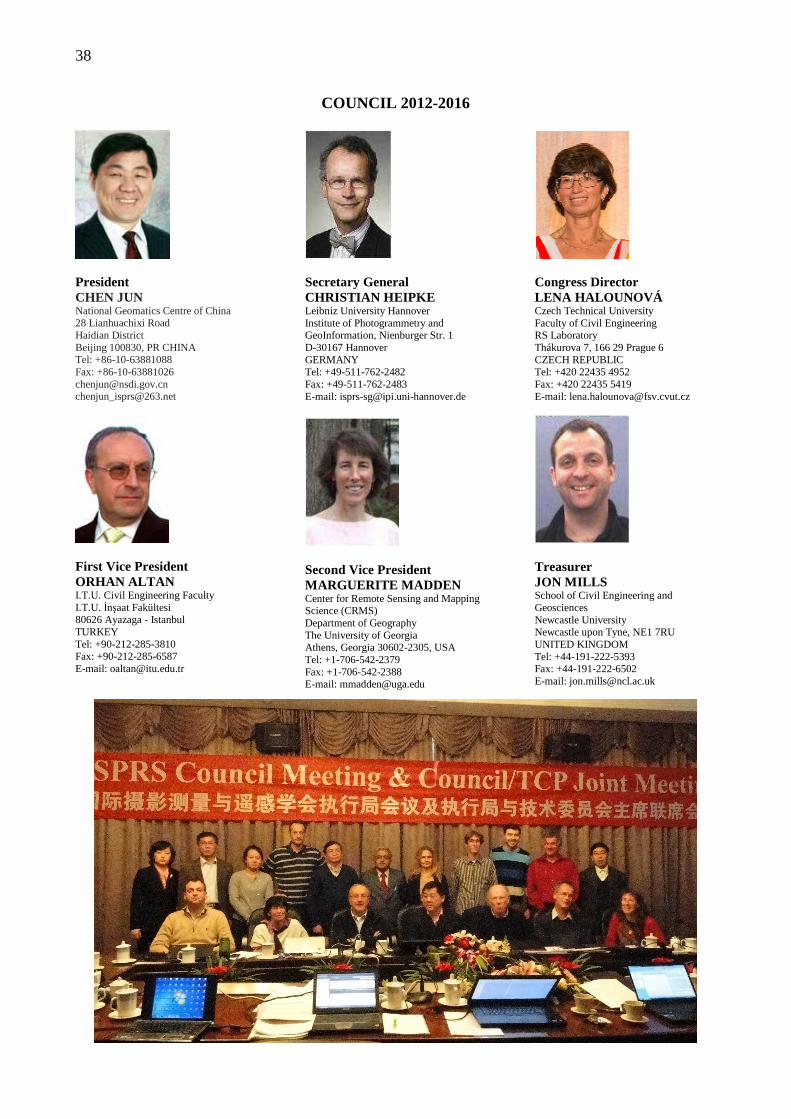
38
COUNCIL 2012-2016
President CHEN JUN National Geomatics Centre of China 28 Lianhuachixi Road Haidian District Beijing 100830, PR CHINA Tel: +86-10-63881088 Fax: +86-10-63881026 [email protected] [email protected]
First Vice President ORHAN ALTAN I.T.U. Civil Engineering Faculty I.T.U. İnşaat Fakültesi 80626 Ayazaga - Istanbul TURKEY Tel: +90-212-285-3810 Fax: +90-212-285-6587 E-mail: [email protected]
Secretary General CHRISTIAN HEIPKE Leibniz University Hannover Institute of Photogrammetry and GeoInformation, Nienburger Str. 1 D-30167 Hannover GERMANY Tel: +49-511-762-2482 Fax: +49-511-762-2483 E-mail: [email protected]
Second Vice President MARGUERITE MADDEN Center for Remote Sensing and Mapping Science (CRMS) Department of Geography The University of Georgia Athens, Georgia 30602-2305, USA Tel: +1-706-542-2379 Fax: +1-706-542-2388 E-mail: [email protected]
Congress Director LENA HALOUNOVÁ Czech Technical University Faculty of Civil Engineering RS Laboratory Thákurova 7, 166 29 Prague 6 CZECH REPUBLIC Tel: +420 22435 4952 Fax: +420 22435 5419 E-mail: [email protected]
Treasurer JON MILLS School of Civil Engineering and Geosciences Newcastle University Newcastle upon Tyne, NE1 7RU UNITED KINGDOM Tel: +44-191-222-5393 Fax: +44-191-222-6502 E-mail: [email protected]
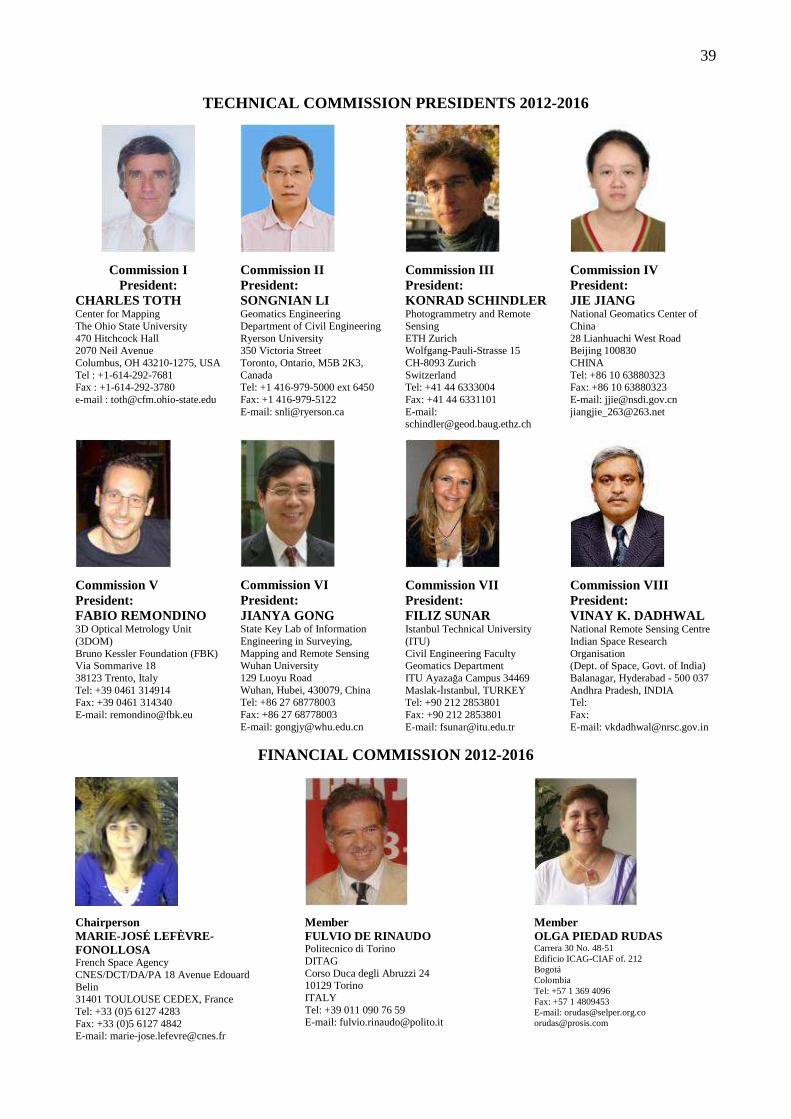
39
TECHNICAL COMMISSION PRESIDENTS 2012-2016
Commission I President:
CHARLES TOTH Center for Mapping The Ohio State University 470 Hitchcock Hall 2070 Neil Avenue Columbus, OH 43210-1275, USA Tel : +1-614-292-7681 Fax : +1-614-292-3780 e-mail : [email protected]
Commission II President: SONGNIAN LI Geomatics Engineering Department of Civil Engineering Ryerson University 350 Victoria Street Toronto, Ontario, M5B 2K3, Canada Tel: +1 416-979-5000 ext 6450 Fax: +1 416-979-5122 E-mail: [email protected]
Commission III President: KONRAD SCHINDLER Photogrammetry and Remote Sensing ETH Zurich Wolfgang-Pauli-Strasse 15 CH-8093 Zurich Switzerland Tel: +41 44 6333004 Fax: +41 44 6331101 E-mail: [email protected]
Commission IV President: JIE JIANG National Geomatics Center of China 28 Lianhuachi West Road Beijing 100830 CHINA Tel: +86 10 63880323 Fax: +86 10 63880323 E-mail: [email protected] [email protected]
Commission V President: FABIO REMONDINO 3D Optical Metrology Unit (3DOM) Bruno Kessler Foundation (FBK) Via Sommarive 18 38123 Trento, Italy Tel: +39 0461 314914 Fax: +39 0461 314340 E-mail: [email protected]
Commission VI President: JIANYA GONG State Key Lab of Information Engineering in Surveying, Mapping and Remote Sensing Wuhan University 129 Luoyu Road Wuhan, Hubei, 430079, China Tel: +86 27 68778003 Fax: +86 27 68778003 E-mail: [email protected]
Commission VII President: FILIZ SUNAR Istanbul Technical University (ITU) Civil Engineering Faculty Geomatics Department ITU Ayazağa Campus 34469 Maslak-İıstanbul, TURKEY Tel: +90 212 2853801 Fax: +90 212 2853801 E-mail: [email protected]
Commission VIII President: VINAY K. DADHWAL National Remote Sensing Centre Indian Space Research Organisation (Dept. of Space, Govt. of India) Balanagar, Hyderabad - 500 037 Andhra Pradesh, INDIA Tel: Fax: E-mail: [email protected]
FINANCIAL COMMISSION 2012-2016
Chairperson MARIE-JOSÉ LEFÈVRE-FONOLLOSA French Space Agency CNES/DCT/DA/PA 18 Avenue Edouard Belin 31401 TOULOUSE CEDEX, France Tel: +33 (0)5 6127 4283 Fax: +33 (0)5 6127 4842 E-mail: [email protected]
Member FULVIO DE RINAUDO Politecnico di Torino DITAG Corso Duca degli Abruzzi 24 10129 Torino ITALY Tel: +39 011 090 76 59 E-mail: [email protected]
Member OLGA PIEDAD RUDAS Carrera 30 No. 48-51 Edificio ICAG-CIAF of. 212 Bogotá Colombia Tel: +57 1 369 4096 Fax: +57 1 4809453 E-mail: [email protected] [email protected]
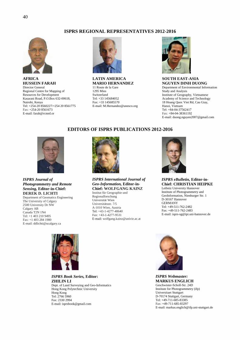
40
ISPRS REGIONAL REPRESENTATIVES 2012-2016
AFRICA HUSSEIN FARAH Director General Regional Centre for Mapping of Resources for Development Kasarani Road, P.O.Box 632-00618, Nairobi, Kenya Tel: +254-20 8560227/+254 20 8561775 Fax: +254-20 8561673 E-mail: [email protected]
LATIN AMERICA MARIO HERNANDEZ 11 Route de la Gare 1295 Mies Switzerland Tel: +33 145684052 Fax: +33 145685570 E-mail: [email protected]
SOUTH EAST-ASIA NGUYEN DINH DUONG Department of Environmental Information Study and Analysis Institute of Geography, Vietnamese Academy of Science and Technology 18 Hoang Quoc Viet Rd, Cau Giay, Hanoi, Vietnam Tel: +84-04-37562417 Fax: +84-04-38361192 E-mail: [email protected]
EDITORS OF ISPRS PUBLICATIONS 2012-2016
ISPRS Journal of Photogrammetry and Remote Sensing, Editor-in-Chief:
DEREK D. LICHTI Department of Geomatics Engineering The University of Calgary 2500 University Dr NW Calgary AB Canada T2N 1N4 Tel: +1 403 210 9495 Fax: +1 403 284 1980 E-mail: [email protected]
ISPRS International Journal of Geo-Information, Editor-in-Chief: WOLFGANG KAINZ Institut für Geographie und Regionalforschung Universität Wien Universitätsstr. 7/5 A-1010 Wien, Austria Tel: +43-1-4277-48640 Fax: +43-1-4277-9531 E-mail: [email protected]
ISPRS eBulletin, Editor-in-Chief: CHRISTIAN HEIPKE Leibniz University Hannover Institute of Photogrammetry and GeoInformation, Nienburger Str. 1 D-30167 Hannover GERMANY Tel: +49-511-762-2482 Fax: +49-511-762-2483 E-mail: [email protected]
ISPRS Book Series, Editor: ZHILIN LI Dept. of Land Surveying and Geo-Informatics Hong Kong Polytechnic University Hong Kong Tel: 2766 5960 Fax: 2330 2994 E-mail: [email protected]
ISPRS Webmaster: MARKUS ENGLICH Geschwister-Scholl-Str. 24D Institute for Photogrammetry (ifp) Universitaet Stuttgart D-70174 Stuttgart, Germany Tel: +49-711-685-83385 Fax: +49-711-685-83297 E-mail: [email protected]
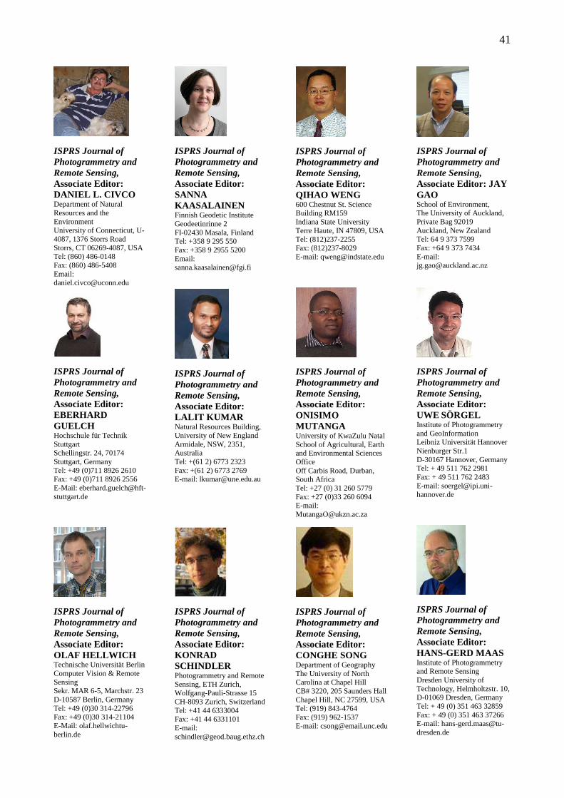
41
ISPRS Journal of Photogrammetry and Remote Sensing, Associate Editor: DANIEL L. CIVCO Department of Natural Resources and the Environment University of Connecticut, U-4087, 1376 Storrs Road Storrs, CT 06269-4087, USA Tel: (860) 486-0148 Fax: (860) 486-5408 Email: [email protected]
ISPRS Journal of Photogrammetry and Remote Sensing, Associate Editor: EBERHARD GUELCH Hochschule für Technik Stuttgart Schellingstr. 24, 70174 Stuttgart, Germany Tel: +49 (0)711 8926 2610 Fax: +49 (0)711 8926 2556 E-Mail: [email protected]
ISPRS Journal of Photogrammetry and Remote Sensing, Associate Editor: OLAF HELLWICH Technische Universität Berlin Computer Vision & Remote Sensing Sekr. MAR 6-5, Marchstr. 23 D-10587 Berlin, Germany Tel: +49 (0)30 314-22796 Fax: +49 (0)30 314-21104 E-Mail: olaf.hellwichtu-berlin.de
ISPRS Journal of Photogrammetry and Remote Sensing, Associate Editor: SANNA KAASALAINEN Finnish Geodetic Institute Geodeetinrinne 2 FI-02430 Masala, Finland Tel: +358 9 295 550 Fax: +358 9 2955 5200 Email: [email protected]
ISPRS Journal of Photogrammetry and Remote Sensing, Associate Editor: LALIT KUMAR Natural Resources Building, University of New England Armidale, NSW, 2351, Australia Tel: +(61 2) 6773 2323 Fax: +(61 2) 6773 2769 E-mail: [email protected]
ISPRS Journal of Photogrammetry and Remote Sensing, Associate Editor: KONRAD SCHINDLER Photogrammetry and Remote Sensing, ETH Zurich, Wolfgang-Pauli-Strasse 15 CH-8093 Zurich, Switzerland Tel: +41 44 6333004 Fax: +41 44 6331101 E-mail: [email protected]
ISPRS Journal of Photogrammetry and Remote Sensing, Associate Editor: QIHAO WENG 600 Chestnut St. Science Building RM159 Indiana State University Terre Haute, IN 47809, USA Tel: (812)237-2255 Fax: (812)237-8029 E-mail: [email protected]
ISPRS Journal of Photogrammetry and Remote Sensing, Associate Editor: ONISIMO MUTANGA University of KwaZulu Natal School of Agricultural, Earth and Environmental Sciences Office Off Carbis Road, Durban, South Africa Tel: +27 (0) 31 260 5779 Fax: +27 (0)33 260 6094 E-mail: [email protected]
ISPRS Journal of Photogrammetry and Remote Sensing, Associate Editor: CONGHE SONG Department of Geography The University of North Carolina at Chapel Hill CB# 3220, 205 Saunders Hall Chapel Hill, NC 27599, USA Tel: (919) 843-4764 Fax: (919) 962-1537 E-mail: [email protected]
ISPRS Journal of Photogrammetry and Remote Sensing, Associate Editor: JAY GAO School of Environment, The University of Auckland, Private Bag 92019 Auckland, New Zealand Tel: 64 9 373 7599 Fax: +64 9 373 7434 E-mail: [email protected]
ISPRS Journal of Photogrammetry and Remote Sensing, Associate Editor: UWE SÖRGEL Institute of Photogrammetry and GeoInformation Leibniz Universität Hannover Nienburger Str.1 D-30167 Hannover, Germany Tel: + 49 511 762 2981 Fax: + 49 511 762 2483 E-mail: [email protected]
ISPRS Journal of Photogrammetry and Remote Sensing, Associate Editor: HANS-GERD MAAS Institute of Photogrammetry and Remote Sensing Dresden University of Technology, Helmholtzstr. 10, D-01069 Dresden, Germany Tel: + 49 (0) 351 463 32859 Fax: + 49 (0) 351 463 37266 E-mail: [email protected]
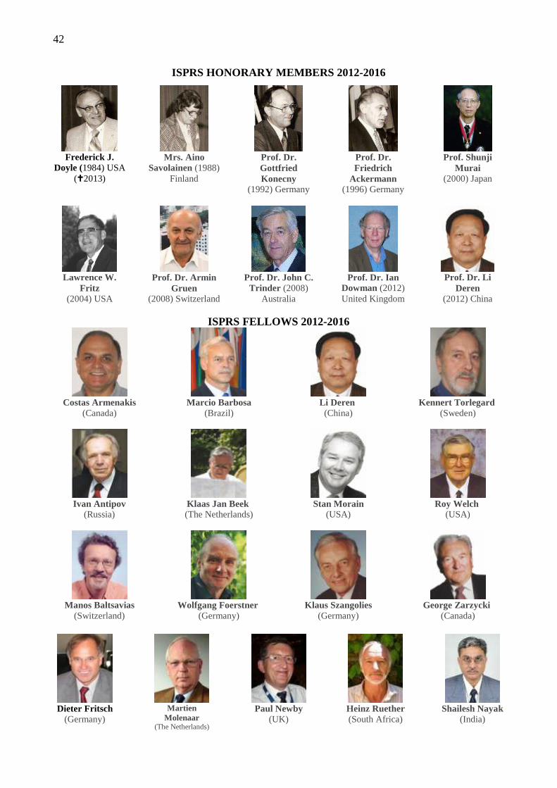
42
ISPRS HONORARY MEMBERS 2012-2016
Frederick J.
Doyle (1984) USA (�2013)
Mrs. Aino
Savolainen (1988) Finland
Prof. Dr. Gottfried Konecny
(1992) Germany
Prof. Dr. Friedrich
Ackermann (1996) Germany
Prof. Shunji
Murai (2000) Japan
Lawrence W.
Fritz (2004) USA
Prof. Dr. Armin
Gruen (2008) Switzerland
Prof. Dr. John C. Trinder (2008)
Australia
Prof. Dr. Ian
Dowman (2012) United Kingdom
Prof. Dr. Li
Deren (2012) China
ISPRS FELLOWS 2012-2016
Costas Armenakis
(Canada)
Ivan Antipov
(Russia)
Manos Baltsavias
(Switzerland)
Marcio Barbosa
(Brazil)
Klaas Jan Beek (The Netherlands)
Wolfgang Foerstner
(Germany)
Li Deren (China)
Stan Morain
(USA)
Klaus Szangolies
(Germany)
Kennert Torlegard
(Sweden)
Roy Welch
(USA)
George Zarzycki
(Canada)
Dieter Fritsch
(Germany)
Martien
Molenaar (The Netherlands)
Paul Newby
(UK)
Heinz Ruether (South Africa)
Shailesh Nayak
(India)
43
ORDINARY MEMBERS 2012-2016
Country Category Name
Algeria 3 Institut National de Cartographie et de Télédétection
Argentina 2 Argentine Association for Photogrammetry & Related Sciences
Australia 5 Surveying and Spatial Sciences Institute - Remote Sensing &
Photogrammetry Commission
Austria 4 Österreichische Gesellschaft fuer Vermessung & GeoInformation
Azerbaijan 2 Azerbaijan representation of ISPRS - Baku State University
Bangladesh 1 Center for Environmental and Geographic Information Services
Belgium 4 National Geographical Institute
Botswana 1 Dept. of Surveys & Mapping - Government of Botswana
Brazil 5 Brazilian Society of Cartography-1. Sociedade Brasileira de Cartografia
Brunei Darussalam 1 Survey Department, Ministry of Development
Bulgaria 2 Union of Surveyors & Land Managers in Bulgaria
Burkina Faso 1 Institut Geographique du Burkina
Cameroon 1 La Cameroon Geomat
Canada 8 Canadian Institute of Geomatics
Chile 1 Sociedad Chilena de Fotogrametria y Percepcion Remota
China 8 Chinese Society of Geodesy Photogrammetry & Cartography
China Taipei 4 Chinese Tapei Society of Photogrammetry & Remote Sensing
Colombia 2 Sociedad Colombiana de Fotogrametria y Percepcion Remota-SELPER
capitulo Colombia
Croatia 2 Croatian Geodetic Society - Sec. for Photogrammetry, RS and
Geoinformations
Cuba 1 GEOCUBA
Cyprus 2 Department of Lands and Surveys
Czech Republic 2 Society for Photogrammetry and Remote Sensing
44
Country Category Name
Denmark 3 GeoForum Danmark
Egypt 2 Egyptian Committee of Surveying & Mapping
El Salvador 3 Instituto Geografico Nacional
Ethiopia 1 Ethiopian Mapping Agency
Finland 3 Finnish Society of Photogrammetry & Remote Sensing
France 6 Société Française de Fotogrammétrie et de Télédétection
Germany 8 Deutsche Gesellschaft für Photogrammetrie, Fernerkundung und
Geoinformation e.V.
Ghana 1 The Society for Photogrammetry & Remote Sensing
Greece 2 Hellenic Society for Photogrammetry & Remote Sensing
Hong Kong 2 Hong Kong Institute of Surveyors
Hungary 3 Hungarian Society of Surveying, Mapping and Remote Sensing
India 6 Indian Society for Remote Sensing
Indonesia 1 Indonesian Surveyors Association
Iran 3 National Cartographic Center of Iran
Iraq 1 State Commission on Survey
Ireland 2 Irish Society of Surveying, Photogrammetry & Remote Sensing
Israel 3 Israeli Society of Photogrammetry & Remote Sensing
Italy 6 Societa’ Italiana di Fotogrammetria e Topografia
Japan 7 Japan Society of Photogrammetry & Remote Sensing
Jordan 4 Royal Jordanian Geographic Centre
Kenya 1 Kenya Nat'l Committee for Photogrammetry & Remote Sensing
Korea 2 Korean Society of Surveying, Geodesy, Photogrammetry and
Cartography
Kuwait 2 Directorate of Survey Department - Kuwait Municipality
Latvia 1 Latvian Society of Geodesy & Photogrammetry
45
Country Category Name
Libya 1 Surveying Department of Libya
Lithuania 1 Lithuanian Committee for Photogrammetry & Remote Sensing
Malawi 2 Surveys Department Malawi
Malaysia 2 Department of Survey & Mapping Malaysia (JUPEM)
Mexico 2 National Institute of Statistics and Geography (INEGI)
Mongolia 1 Mongolian Nat'l Society for Photogrammetry & Remote Sensing
Morocco 3 Agence Nationale de la Conservation fonciere de Cadastre et de la
Cartographie
Myanmar 2 Myanmar Survey Department
Namibia 1 Directorate of Survey & Mapping, Ministry of Lands and Resettlement
Nepal 1 Nepal Remote Sensing and Photogrammetric Society
Netherlands 4 Geo-Information Netherlands
New Zealand 2 Land Information New Zealand
Nigeria 1 Geoinformation Society of Nigeria
Norway 3 GeoForum
Pakistan 1 Survey of Pakistan
Peru 1 Direccion General de Aerofotografia
Philippines 1 Philippine Society of Photogrammetry & Remote Sensing
Poland 3 Polish Society for Photogrammetry and Remote Sensing
Portugal 2 Direção Geral do Território
Qatar 1 Qatar Center for GIS
Romania 2 Romanian Society for Photogrammetry & Remote Sensing
Russian Federation 8 Federal Service of State Registration, Cadastre and Cartography
(Rosreestr)
Saudi Arabia 4 General Commission for Survey
Senegal 1 Centre de Suivi Ecologique
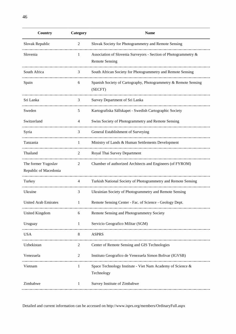
46
Country Category Name
Slovak Republic 2 Slovak Society for Photogrammetry and Remote Sensing
Slovenia 1 Association of Slovenia Surveyors - Section of Photogrammetry &
Remote Sensing
South Africa 3 South African Society for Photogrammetry and Remote Sensing
Spain 6 Spanish Society of Cartography, Photogrammetry & Remote Sensing
(SECFT)
Sri Lanka 3 Survey Department of Sri Lanka
Sweden 5 Kartografiska Sällskapet - Swedish Cartographic Society
Switzerland 4 Swiss Society of Photogrammetry and Remote Sensing
Syria 3 General Establishment of Surveying
Tanzania 1 Ministry of Lands & Human Settlements Development
Thailand 2 Royal Thai Survey Department
The former Yugoslav
Republic of Macedonia
2 Chamber of authorized Architects and Engineers (of FYROM)
Turkey 4 Turkish National Society of Photogrammetry and Remote Sensing
Ukraine 3 Ukrainian Society of Photogrammetry and Remote Sensing
United Arab Emirates 1 Remote Sensing Center - Fac. of Science - Geology Dept.
United Kingdom 6 Remote Sensing and Photogrammetry Society
Uruguay 1 Servicio Geografico Militar (SGM)
USA 8 ASPRS
Uzbekistan 2 Center of Remote Sensing and GIS Technologies
Venezuela 2 Instituto Geografico de Venezuela Simon Bolivar (IGVSB)
Vietnam 1 Space Technology Institute - Viet Nam Academy of Science &
Technology
Zimbabwe 1 Survey Institute of Zimbabwe
Detailed and current information can be accessed on http://www.isprs.org/members/OrdinaryFull.aspx
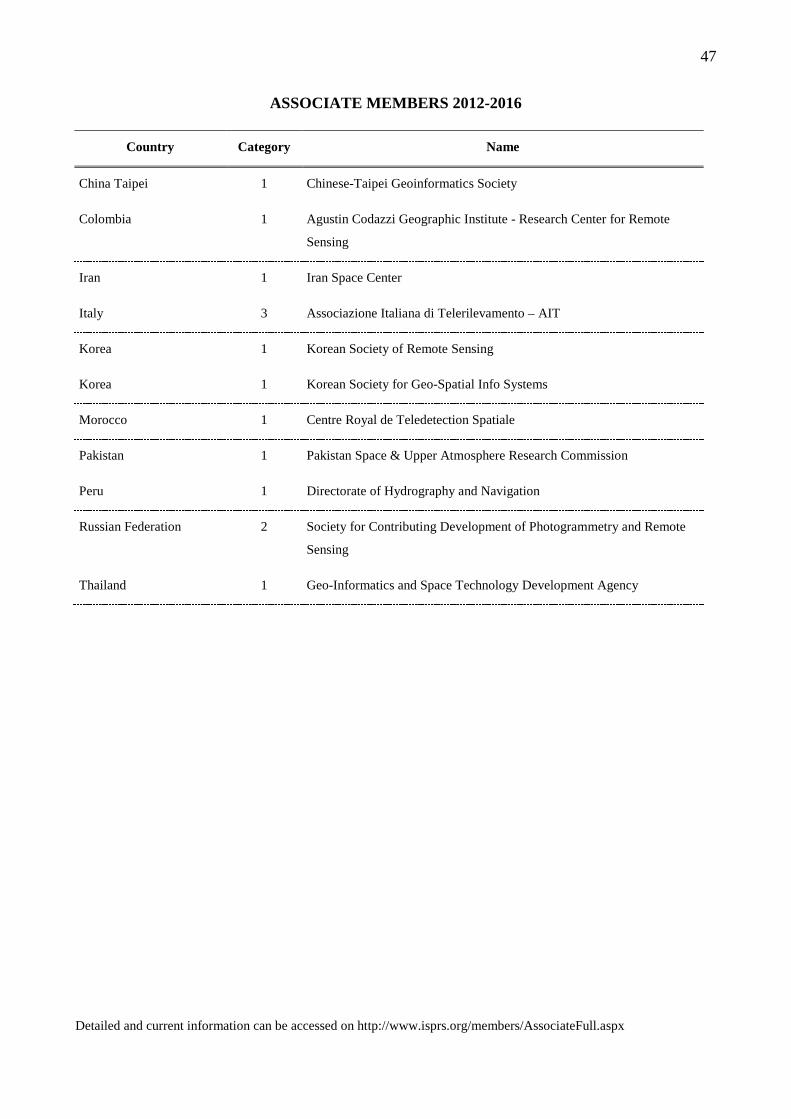
47
ASSOCIATE MEMBERS 2012-2016
Country Category Name
China Taipei 1 Chinese-Taipei Geoinformatics Society
Colombia 1 Agustin Codazzi Geographic Institute - Research Center for Remote
Sensing
Iran 1 Iran Space Center
Italy 3 Associazione Italiana di Telerilevamento – AIT
Korea 1 Korean Society of Remote Sensing
Korea 1 Korean Society for Geo-Spatial Info Systems
Morocco 1 Centre Royal de Teledetection Spatiale
Pakistan 1 Pakistan Space & Upper Atmosphere Research Commission
Peru 1 Directorate of Hydrography and Navigation
Russian Federation 2 Society for Contributing Development of Photogrammetry and Remote
Sensing
Thailand 1 Geo-Informatics and Space Technology Development Agency
Detailed and current information can be accessed on http://www.isprs.org/members/AssociateFull.aspx
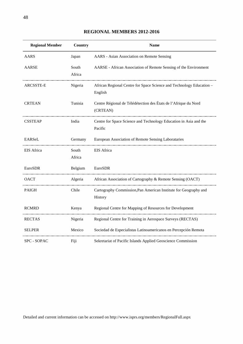
48
REGIONAL MEMBERS 2012-2016
Regional Member Country Name
AARS Japan AARS - Asian Association on Remote Sensing
AARSE South
Africa
AARSE - African Association of Remote Sensing of the Environment
ARCSSTE-E Nigeria African Regional Centre for Space Science and Technology Education –
English
CRTEAN Tunisia Centre Régional de Télédétection des États de l’Afrique du Nord
(CRTEAN)
CSSTEAP India Centre for Space Science and Technology Education in Asia and the
Pacific
EARSeL Germany European Association of Remote Sensing Laborataries
EIS Africa South
Africa
EIS Africa
EuroSDR Belgium EuroSDR
OACT Algeria African Association of Cartography & Remote Sensing (OACT)
PAIGH Chile Cartography Commission,Pan American Institute for Geography and
History
RCMRD Kenya Regional Centre for Mapping of Resources for Development
RECTAS Nigeria Regional Centre for Training in Aerospace Surveys (RECTAS)
SELPER Mexico Sociedad de Especialistas Latinoamericanos en Percepción Remota
SPC - SOPAC Fiji Sekretariat of Pacific Islands Applied Geoscience Commission
Detailed and current information can be accessed on http://www.isprs.org/members/RegionalFull.aspx

49
SUSTAINING MEMBERS 2012-2016
Name Country
Adam Technology Australia
Aero Asahi Corporation Japan
Airborne Hydrography AB Sweden
Applanix Corporation Canada
Asia Air Survey Co. Ltd Japan
ASTRIUM - GEO-Information Services Germany
BAE Systems USA
Beijing GEOWAY Software Co., Ltd. China
Center for Spatial Information Systems Research (CSISR), University of Haifa Israel
COWI A/S Denmark
CycloMedia Technology B.V. Netherlands
DICA -sez. Geodesy and Geomatics - Politecnico di Milano Italy
DSM Geodata Limited United Kingdom
Dubai Municipality - GIS Department United Arab Emirates
Earth Data Analysis Center USA
Emi Mapping Information Construction and Transportation Industry Co. Turkey
Esri USA
ETH Zurich - Institute of Geodesy & Photogrammetry Switzerland
Fac. of Geodesy, Univ. of Architecture, Civil Engineering and Geodesy - Sofia Bulgaria
FM-International Oy FINNMAP Finland
GATEWING NV Belgium
GEO:CONNEXION Ltd. United Kingdom
GeoCad 93 Ltdi. Bulgaria
Geocarto International Centre Hong Kong
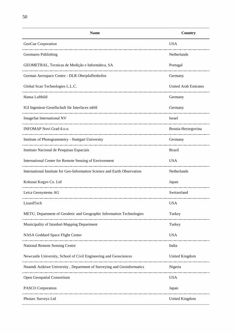
50
Name Country
GeoCue Corporation USA
Geomares Publishing Netherlands
GEOMETRAL, Tecnicas de Medição e Informática, SA Portugal
German Aerospace Centre - DLR Oberpfaffenhofen Germany
Global Scan Technologies L.L.C. United Arab Emirates
Hansa Luftbild Germany
IGI Ingenieur-Gesellschaft für Interfaces mbH Germany
ImageSat International NV Israel
INFOMAP Novi Grad d.o.o. Bosnia-Herzegovina
Institute of Photogrammetry - Stuttgart University Germany
Instituto Nacional de Pesquisas Espaciais Brazil
International Center for Remote Sensing of Environment USA
International Institute for Geo-Information Science and Earth Observation Netherlands
Kokusai Kogyo Co. Ltd Japan
Leica Geosystems AG Switzerland
LizardTech USA
METU, Department of Geodetic and Geographic Information Technologies Turkey
Municipality of Istanbul-Mapping Department Turkey
NASA Goddard Space Flight Center USA
National Remote Sensing Centre India
Newcastle University, School of Civil Engineering and Geosciences United Kingdom
Nnamdi Azikiwe University , Department of Surveying and Geoinformatics Nigeria
Open Geospatial Consortium USA
PASCO Corporation Japan
Photarc Surveys Ltd United Kingdom
51
Name Country
RACURS Russian Federation
Ramani Geosystems Kenya
SeaGate Institute of Technology Nepal
SENSON LTD Georgia
Shaanxi Tirain Technology Company Limited China
Siberian State Academy of Geodesy Russian Federation
Silver Data Spatial-GIS Co. Ltd., Xiamen China
Société des Etudes de Projets et Réalisation des Travaux Morocco
The University of Nottingham United Kingdom
TRACK’AIR B.V. Netherlands
Trimble Navigation Limited USA
TÜBİTAK UZAY - Space Technologies Research Institute Turkey
UCL, Department of Civil, Environmental and Geomatic Engineering United Kingdom
University of Calgary Department of Geomatics Engineering Canada
University Teknologi Malaysia, Fakulti Kejuruteraan Sains Malaysia
Vexcel Imaging GmbH Austria
Vietnam Association of Geodesy, Cartography and Remote Sensing Vietnam
Virtual Geomatics USA
Yildiz Technical University, Division of Photogrammetry Turkey
Detailed and current information can be accessed on http://www.isprs.org/members/SustainingFull.aspx
52
ISPRS 2012
OPENING CEREMONY AND FIRST PLENARY SESSION
Opening Ceremony
Opening Speech by Cliff Ogleby, Congress Director
Welcome Speech by Orhan Altan, ISPRS President
First Plenary Session
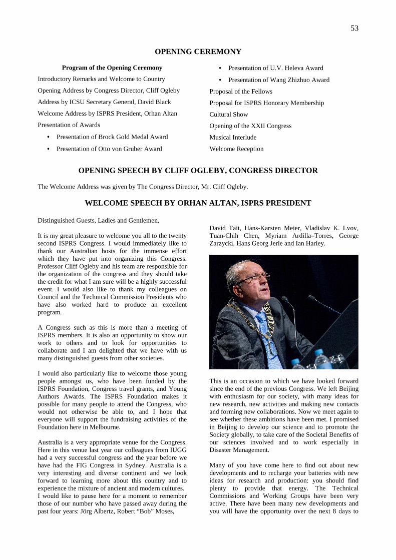
53
OPENING CEREMONY
Program of the Opening Ceremony
Introductory Remarks and Welcome to Country
Opening Address by Congress Director, Cliff Ogleby
Address by ICSU Secretary General, David Black
Welcome Address by ISPRS President, Orhan Altan
Presentation of Awards
• Presentation of Brock Gold Medal Award
• Presentation of Otto von Gruber Award
• Presentation of U.V. Heleva Award
• Presentation of Wang Zhizhuo Award
Proposal of the Fellows
Proposal for ISPRS Honorary Membership
Cultural Show
Opening of the XXII Congress
Musical Interlude
Welcome Reception
OPENING SPEECH BY CLIFF OGLEBY, CONGRESS DIRECTOR The Welcome Address was given by The Congress Director, Mr. Cliff Ogleby.
WELCOME SPEECH BY ORHAN ALTAN, ISPRS PRESIDENT
Distinguished Guests, Ladies and Gentlemen, It is my great pleasure to welcome you all to the twenty second ISPRS Congress. I would immediately like to thank our Australian hosts for the immense effort which they have put into organizing this Congress. Professor Cliff Ogleby and his team are responsible for the organization of the congress and they should take the credit for what I am sure will be a highly successful event. I would also like to thank my colleagues on Council and the Technical Commission Presidents who have also worked hard to produce an excellent program. A Congress such as this is more than a meeting of ISPRS members. It is also an opportunity to show our work to others and to look for opportunities to collaborate and I am delighted that we have with us many distinguished guests from other societies. I would also particularly like to welcome those young people amongst us, who have been funded by the ISPRS Foundation, Congress travel grants, and Young Authors Awards. The ISPRS Foundation makes it possible for many people to attend the Congress, who would not otherwise be able to, and I hope that everyone will support the fundraising activities of the Foundation here in Melbourne. Australia is a very appropriate venue for the Congress. Here in this venue last year our colleagues from IUGG had a very successful congress and the year before we have had the FIG Congress in Sydney. Australia is a very interesting and diverse continent and we look forward to learning more about this country and to experience the mixture of ancient and modern cultures. I would like to pause here for a moment to remember those of our number who have passed away during the past four years: Jörg Albertz, Robert “Bob” Moses,
David Tait, Hans-Karsten Meier, Vladislav K. Lvov, Tuan-Chih Chen, Myriam Ardilla–Torres, George Zarzycki, Hans Georg Jerie and Ian Harley.
This is an occasion to which we have looked forward since the end of the previous Congress. We left Beijing with enthusiasm for our society, with many ideas for new research, new activities and making new contacts and forming new collaborations. Now we meet again to see whether these ambitions have been met. I promised in Beijing to develop our science and to promote the Society globally, to take care of the Societal Benefits of our sciences involved and to work especially in Disaster Management. Many of you have come here to find out about new developments and to recharge your batteries with new ideas for research and production: you should find plenty to provide that energy. The Technical Commissions and Working Groups have been very active. There have been many new developments and you will have the opportunity over the next 8 days to
54
hear about these in detail. I would like to mention here some of the highlights of our work. We have focused on developing new technologies in sensors and platforms, but more on improving the productivity of airborne investigations, through facilitating collaborations and standards. LIDAR technology has been making consistent progress in terms of technology advancement and broadening applications. Interest has increased in water penetrating airborne laser scanning systems for investigating costal zones as well as rivers, which enable broader participation and enhanced utilization of resources. The progress of the optical space-borne sensors since 2008 has been dominated by the new very high resolution sensors such as WorldView-2, GeoEye-1 and lately Pleiades-1 in addition to the Cartosat-2-series, Kompsat-5 and Resurs P N1. Together with the group of satellites with slightly lower resolutions the imaging capacity has been significantly improved, supported by extremely high flexibility in imaging capabilities for e.g. UAVs (Unmanned Aerial Vehicles) are highly developed flight systems, which can be used for a great variety of applications, such as monitoring of natural hazards (landslides, flooding and volcanoes etc.) and the documentation of archaeological excavations, gravel pits, and construction sites. With the increasingly mature nature of non-contact optical 3D measurement systems, dissemination of best practice has been a common theme across Commission V. 3D imaging devices, both for professional and consumer use, have received significant scientific attention, as has object recognition from point clouds. There has been a broadening of the field of applications requiring reality-based 3D models and a rise in the use of mobile mapping and UAVs for a wide variety of applications, including cultural heritage and earth sciences. Different versions of open-source photogrammetric software are now available, while laser scanning prices have started to decrease. The integration of image and range data is regarded as optimal in scientific applications and in cases of large and complex scenes. ISPRS was active in the transfer of knowledge of new methods and working models for e-based learning, especially for the transfer of new knowledge to the professional community, to young people and in regions where access to new knowledge is limited. In this domain and for the organization of support for young professionals and students, ISPRS has been very active. Major advances have been achieved in connecting spatial information science with other domains and other societies. A strong linking with the international
society for spatial data quality was established, and the highly successful Spatial Statistics conference was organized. The General Assembly of ISPRS is meeting during the Congress. This is the supreme body of ISPRS and will elect officers for the next four years and discuss issues which will affect the way the Society is administered. If you wish to make input to these discussions you should talk to your national delegate. So for those especially interested in the science there is plenty to keep you busy for the next eight days. But ISPRS is not only concerned with research and production. Our mission also includes development of international cooperation for the advancement of knowledge, research, development and education in the photogrammetry, remote sensing and spatial information sciences, and to use this to contribute to the well being of humanity and the sustainability of the environment. The challenge is to fulfill this mission and to do this responsibly. During the Closing Ceremony in Beijing I mentioned “I feel very privileged to be following in the footsteps of my predecessors commencing with Doležal and followed by many others including Doyle, Konecny, Torlegaard, Murai, Fritz, Trinder and Dowman”. I am very happy that we celebrated the “Centenary of ISPRS” in its birthplace in Vienna 2 years ago with a series of events which we will remember for many years. Also in Beijing I have said “It is my opinion that in ISPRS we should give “Environmental Monitoring and Sustainable Development”, “Disaster Management” and “Food Security” high priority in our activities. I believe that our sciences and technologies can contribute greatly to environmental issues of the globe. Now I am very happy to say that especially in “Disaster Management and Geo-spatial Information Use” ISPRS is one of the “lead organizations”. Also in Beijing I mentioned “a high ranking priority should be Publicizing our Science and Technology to the general population. This can also be formulated as “Outreach of ISPRS”. For this we had to prepare not only scientific papers but also the translation of “Scientific Achievements of ISPRS into common language”. I am also very happy that we have done many things in achieving this goal. This was made possible by working within ICSU, The International Council for Science. The ICSU GeoUnions have influenced the work of ICSU, and I am delighted that we have been awarded a grant for Mapping GeoUnions to the ICSU Framework for Sustainable Health and Wellbeing and our contributions was very valuable to the ICSU project “EXTREME NATURAL HAZARDS AND SOCIETAL IMPLICATION (ENHANS). I was elected at the last General Assembly to the ICSU Executive Board. We are very happy that David Black, Secretary General of ICSU will address us later today.
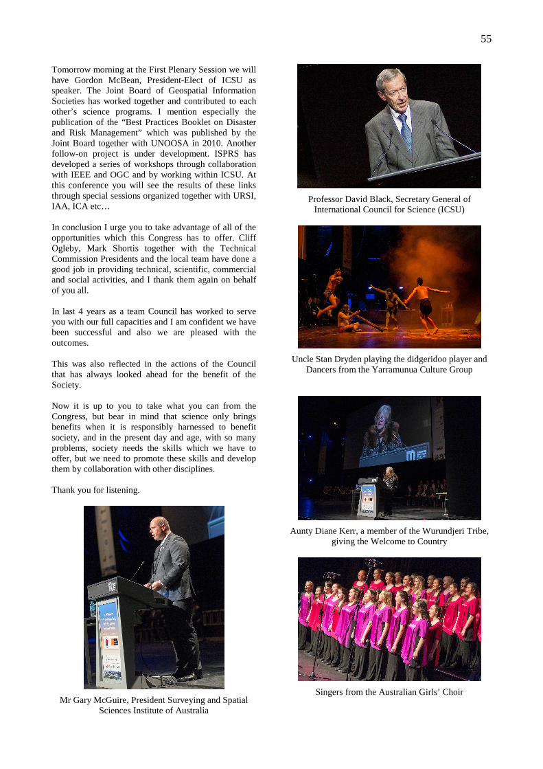
55
Tomorrow morning at the First Plenary Session we will have Gordon McBean, President-Elect of ICSU as speaker. The Joint Board of Geospatial Information Societies has worked together and contributed to each other’s science programs. I mention especially the publication of the “Best Practices Booklet on Disaster and Risk Management” which was published by the Joint Board together with UNOOSA in 2010. Another follow-on project is under development. ISPRS has developed a series of workshops through collaboration with IEEE and OGC and by working within ICSU. At this conference you will see the results of these links through special sessions organized together with URSI, IAA, ICA etc… In conclusion I urge you to take advantage of all of the opportunities which this Congress has to offer. Cliff Ogleby, Mark Shortis together with the Technical Commission Presidents and the local team have done a good job in providing technical, scientific, commercial and social activities, and I thank them again on behalf of you all. In last 4 years as a team Council has worked to serve you with our full capacities and I am confident we have been successful and also we are pleased with the outcomes. This was also reflected in the actions of the Council that has always looked ahead for the benefit of the Society. Now it is up to you to take what you can from the Congress, but bear in mind that science only brings benefits when it is responsibly harnessed to benefit society, and in the present day and age, with so many problems, society needs the skills which we have to offer, but we need to promote these skills and develop them by collaboration with other disciplines. Thank you for listening.
Mr Gary McGuire, President Surveying and Spatial Sciences Institute of Australia
Professor David Black, Secretary General of International Council for Science (ICSU)
Uncle Stan Dryden playing the didgeridoo player and Dancers from the Yarramunua Culture Group
Aunty Diane Kerr, a member of the Wurundjeri Tribe, giving the Welcome to Country
Singers from the Australian Girls’ Choir
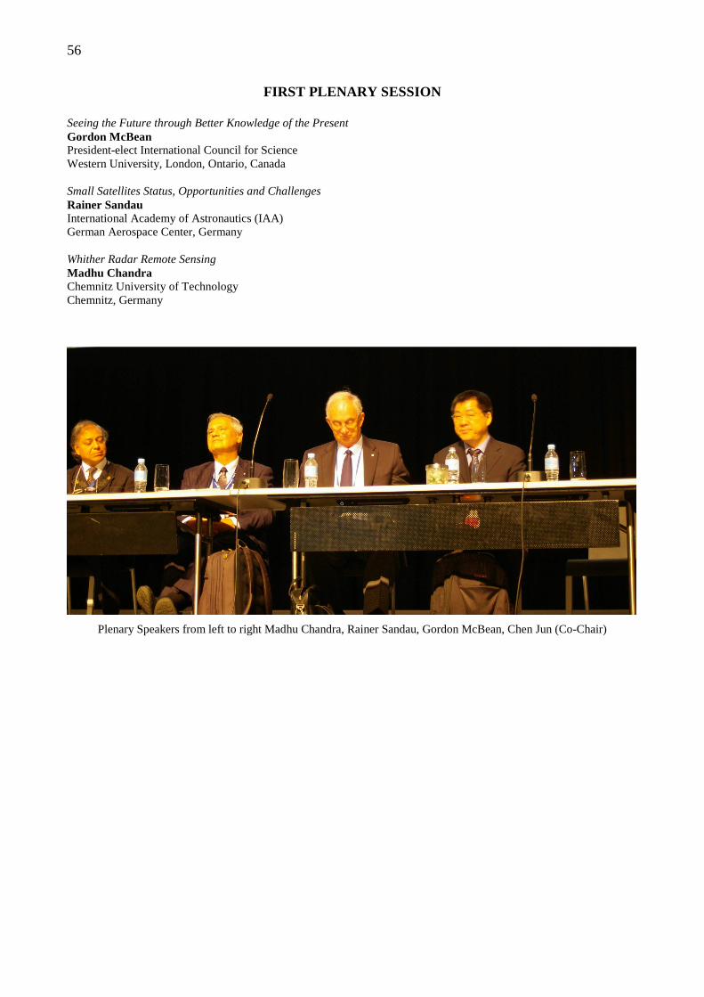
56
FIRST PLENARY SESSION
Seeing the Future through Better Knowledge of the Present Gordon McBean President-elect International Council for Science Western University, London, Ontario, Canada Small Satellites Status, Opportunities and Challenges Rainer Sandau International Academy of Astronautics (IAA) German Aerospace Center, Germany Whither Radar Remote Sensing Madhu Chandra Chemnitz University of Technology Chemnitz, Germany
Plenary Speakers from left to right Madhu Chandra, Rainer Sandau, Gordon McBean, Chen Jun (Co-Chair)
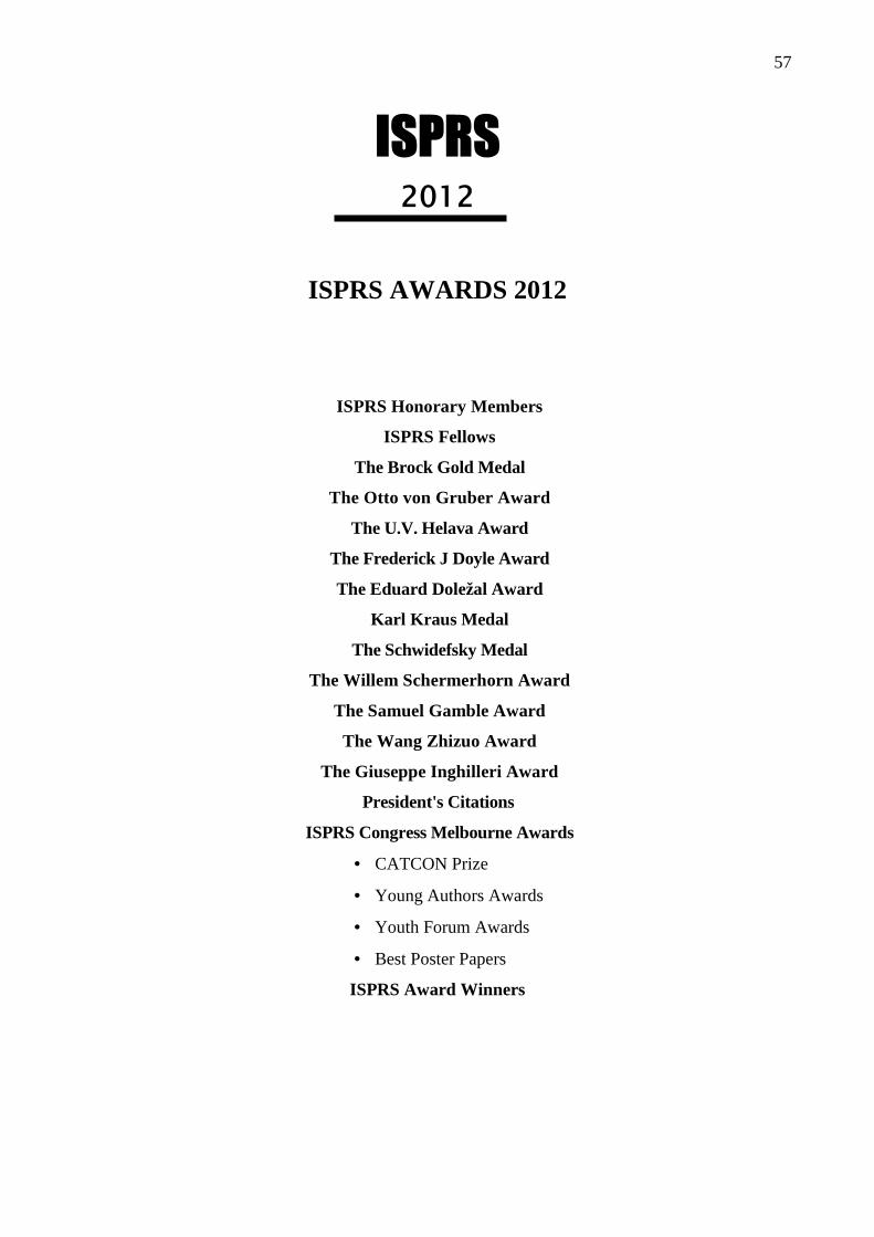
57
ISPRS 2012
ISPRS AWARDS 2012
ISPRS Honorary Members
ISPRS Fellows
The Brock Gold Medal
The Otto von Gruber Award
The U.V. Helava Award
The Frederick J Doyle Award
The Eduard Doležal Award
Karl Kraus Medal
The Schwidefsky Medal
The Willem Schermerhorn Award
The Samuel Gamble Award
The Wang Zhizuo Award
The Giuseppe Inghilleri Award
President's Citations
ISPRS Congress Melbourne Awards
• CATCON Prize
• Young Authors Awards
• Youth Forum Awards
• Best Poster Papers
ISPRS Award Winners
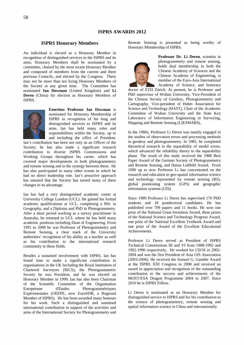
58
ISPRS AWARDS 2012
ISPRS Honorary Members An individual is elected as a Honorary Member in recognition of distinguished services to the ISPRS and its aims. Honorary Members shall be nominated by a committee, chaired by the most recent Honorary Member and composed of members from the current and three previous Councils, and elected by the Congress. There may not be more than ten living Honorary Members of the Society at any given time. The Committee has nominated Ian Dowman (United Kingdom) and Li Deren (China) for election as Honorary Members of ISPRS.
Emeritus Professor Ian Dowman is nominated for Honorary Membership of ISPRS in recognition of his long and distinguished services to ISPRS and its aims. Ian has held many roles and responsibilities within the Society, up to and including the office of President.
Ian’s contribution has been not only as an Officer of the Society; he has also made a significant research contribution to diverse ISPRS Commissions and Working Groups throughout his career, which has covered major developments in both photogrammetry and remote sensing and in the synergy between them. He has also participated in many other events in which he had no direct leadership role. Ian’s proactive approach has ensured that the Society has turned many of these changes to its advantage. Ian has had a very distinguished academic career at University College London (UCL). He gained his formal academic qualifications at UCL, completing a BSc in Geography, and a Diploma and PhD in Photogrammetry. After a short period working as a survey practitioner in Australia, he returned to UCL where he has held many academic positions including Dean of Engineering. From 1991 to 2008 he was Professor of Photogrammetry and Remote Sensing, a clear mark of the University authorities’ recognition of his ability as a teacher as well as his contribution to the international research community in these fields. Besides a sustained involvement with ISPRS, Ian has found time to make a significant contribution to organisations in the UK Including the Royal Institution of Chartered Surveyors (RICS), the Photogrammetric Society he was President, and he was elected an Honorary Member in 1999. Ian has also been Chairman of the Scientific Committee of the Organisation Européenne d'Etudes Photogrammétriques Expérimentales (OEEPE, now EuroSDR, a Regional Member of ISPRS). He has been awarded many honours for his work. Such a distinguished and sustained international contribution in support of the activities and aims of the International Society for Photogrammetry and
Remote Sensing is presented as being worthy of Honorary Membership of ISPRS.
Professor Dr. Li Deren, scientist in photogrammetry and remote sensing, holds dual membership in both the Chinese Academy of Sciences and the Chinese Academy of Engineering, is member of the Euro-Asia International Academy of Science, and honorary
doctor of ETH Zürich. At present, he is Professor and PhD supervisor of Wuhan University, Vice-President of the Chinese Society of Geodesy, Photogrammetry and Cartography, Vice-president of Hubei Association for Science and Technology (HAST), Chair of the Academic Committee of Wuhan University and the State Key Laboratory of Information Engineering in Surveying, Mapping and Remote Sensing (LIESMARS). In the 1980s, Professor Li Deren was mainly engaged in the studies of observation errors and processing methods in geodesy and photogrammetry. In 1985, he completed theoretical research in the separability of model errors, which advanced the reliability theory to the separability phase. The result of this study received the 1988 Best Paper Award of the German Society of Photogrammetry and Remote Sensing, and Hansa Luftbild Award. From 1990 up to now Professor Li has concentrated on the research and education in geo-spatial information science and technology represented by remote sensing (RS), global positioning system (GPS) and geographic information systems (GIS). Since 1989 Professor Li Deren has supervised 170 PhD students and 18 postdoctoral candidates. He has published over 709 papers and 11 books. He won one prize of the National Great Invention Award, three prizes of the National Science and Technology Progress Award, one prize of the National Excellent Textbook Award and one prize of the Award of the Excellent Educational Achievements. Professor Li Deren served as President of ISPRS Technical Commissions III and VI from 1988-1992 and 1992-1996 respectively. He worked for CEOS in 2002-2004 and was the first President of Asia GIS Association (2003-2006). He received the Samuel G. Gamble Award at the ISPRS XXI Congress in 2008 and received an award in appreciation and recognition of the outstanding contribution to the success and achievements of the MOST/ESA Dragon Programme 2004 to 2007. Since 2010 he is ISPRS Fellow. Li Deren is nominated as an Honorary Member for distinguished service to ISPRS and for his contribution to the science of photogrammetry, remote sensing and spatial information science in China and internationally.
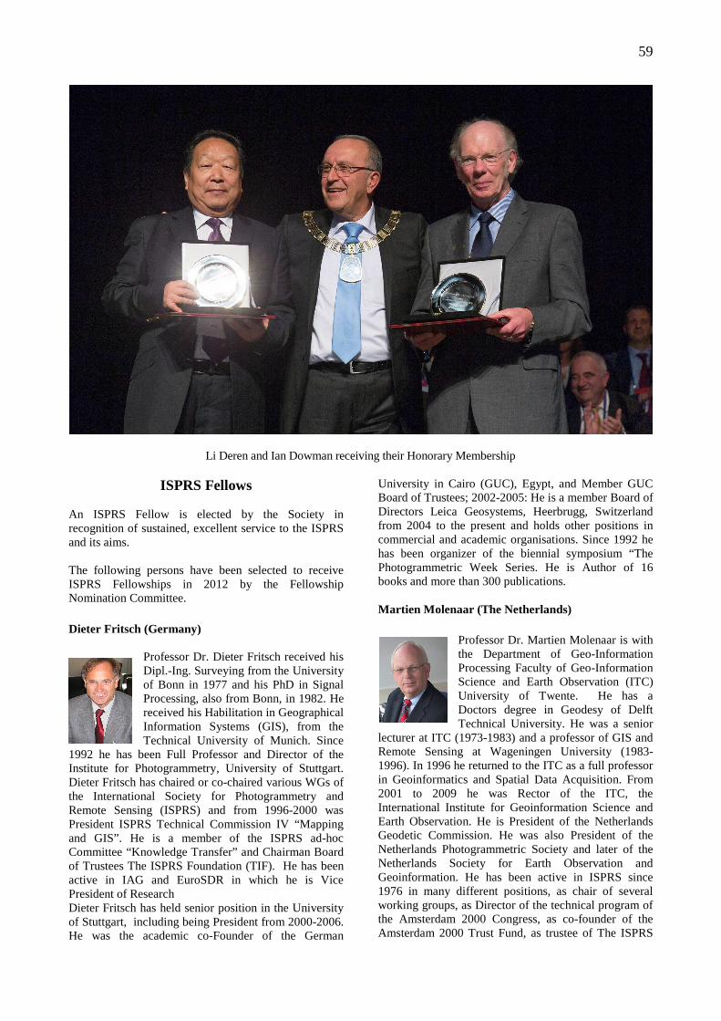
59
Li Deren and Ian Dowman receiving their Honorary Membership
ISPRS Fellows An ISPRS Fellow is elected by the Society in recognition of sustained, excellent service to the ISPRS and its aims. The following persons have been selected to receive ISPRS Fellowships in 2012 by the Fellowship Nomination Committee. Dieter Fritsch (Germany)
Professor Dr. Dieter Fritsch received his Dipl.-Ing. Surveying from the University of Bonn in 1977 and his PhD in Signal Processing, also from Bonn, in 1982. He received his Habilitation in Geographical Information Systems (GIS), from the Technical University of Munich. Since
1992 he has been Full Professor and Director of the Institute for Photogrammetry, University of Stuttgart. Dieter Fritsch has chaired or co-chaired various WGs of the International Society for Photogrammetry and Remote Sensing (ISPRS) and from 1996-2000 was President ISPRS Technical Commission IV “Mapping and GIS”. He is a member of the ISPRS ad-hoc Committee “Knowledge Transfer” and Chairman Board of Trustees The ISPRS Foundation (TIF). He has been active in IAG and EuroSDR in which he is Vice President of Research Dieter Fritsch has held senior position in the University of Stuttgart, including being President from 2000-2006. He was the academic co-Founder of the German
University in Cairo (GUC), Egypt, and Member GUC Board of Trustees; 2002-2005: He is a member Board of Directors Leica Geosystems, Heerbrugg, Switzerland from 2004 to the present and holds other positions in commercial and academic organisations. Since 1992 he has been organizer of the biennial symposium “The Photogrammetric Week Series. He is Author of 16 books and more than 300 publications. Martien Molenaar (The Netherlands)
Professor Dr. Martien Molenaar is with the Department of Geo-Information Processing Faculty of Geo-Information Science and Earth Observation (ITC) University of Twente. He has a Doctors degree in Geodesy of Delft Technical University. He was a senior
lecturer at ITC (1973-1983) and a professor of GIS and Remote Sensing at Wageningen University (1983-1996). In 1996 he returned to the ITC as a full professor in Geoinformatics and Spatial Data Acquisition. From 2001 to 2009 he was Rector of the ITC, the International Institute for Geoinformation Science and Earth Observation. He is President of the Netherlands Geodetic Commission. He was also President of the Netherlands Photogrammetric Society and later of the Netherlands Society for Earth Observation and Geoinformation. He has been active in ISPRS since 1976 in many different positions, as chair of several working groups, as Director of the technical program of the Amsterdam 2000 Congress, as co-founder of the Amsterdam 2000 Trust Fund, as trustee of The ISPRS
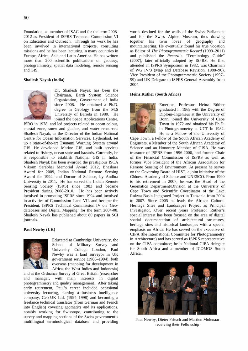
60
Foundation, as member of ISAC and for the term 2008-2012 as President of ISPRS Technical Commission VI on Education and Outreach. Through his work he has been involved in international projects, consulting missions and he has been lecturing in many countries in Europe, Africa, Asia and Latin America. He has written more than 200 scientific publications on geodesy, photogrammetry, spatial data modeling, remote sensing and GIS. Shailesh Nayak (India)
Dr. Shailesh Nayak has been the Chairman, Earth System Science Organization, Government of India since 2008. He obtained a Ph.D. degree in Geology from the M.S University of Baroda in 1980. He joined the Space Applications Centre,
ISRO in 1978, and led projects related to ocean colour, coastal zone, snow and glacier, and water resources. Shailesh Nayak, as the Director of the Indian National Centre for Ocean Information Services, Hyderabad, set up a state-of-the-art Tsunami Warning System around GIS. He developed Marine GIS, and built services related to fishery, ocean state and hazards. Currently, he is responsible to establish National GIS in India. Shailesh Nayak has been awarded the prestigious ISCA Vikram Sarabhai Memorial Award 2012, Bhaskara Award for 2009, Indian National Remote Sensing Award for 1994, and Doctor of Science, by Andhra University in 2011. He has served the Indian Remote Sensing Society (ISRS) since 1983 and became President during 2008-2010. He has been actively involved in promoting ISPRS since 1994 and involved in activities of Commission I and VII, and became the President, ISPRS Technical Commission IV on ‘Geo-databases and Digital Mapping’ for the term 2004-08. Shailesh Nayak has published about 80 papers in SCI journals. Paul Newby (UK)
Educated at Cambridge University, the School of Military Survey and University College London, Paul Newby was a land surveyor in UK government service (1966–1994), both overseas (mapping for development in Africa, the West Indies and Indonesia)
and at the Ordnance Survey of Great Britain (researcher and manager, with main interests in digital photogrammetry and quality management). After taking early retirement, Paul’s career included occasional university lecturing, starting a business intelligence company, Geo-UK Ltd. (1994–1998) and becoming a freelance technical translator (from German and French into English) covering geomatics and its applications, notably working for Swisstopo, contributing to the survey and mapping sections of the Swiss government’s multilingual terminological database and providing
words destined for the walls of the Swiss Parliament and for the Swiss Alpine Museum, thus drawing together his twin loves of geography and mountaineering. He eventually found his true vocation as Editor of The Photogrammetric Record (1999–2011) and published the Record’s “Terminology Guide” (2007), later officially adopted by ISPRS. He first attended an ISPRS Symposium in 1982, was Chairman of WG IV/3 (Map and Database Revision, 1988–96), Vice President of the Photogrammetric Society (1997–99) and UK Delegate to ISPRS General Assembly from 2004. Heinz Rüther (South Africa)
Emeritus Professor Heinz Rüther graduated in 1969 with the Degree of Diplom–Ingenieur at the University of Bonn, joined the University of Cape Town in 1972 and obtained his Ph.D. in Photogrammetry at UCT in 1982. He is a Fellow of the University of
Cape Town, a Fellow of the South African Academy of Engineers, a Member of the South African Academy of Science and an Honorary Member of GISA. He was treasurer of ISPRS from 1996-2000, and former Chair of the Financial Commission of ISPRS as well as former Vice President of the African Association for Remote Sensing of Environment. At present he serves on the Governing Board of HIST, a joint initiative of the Chinese Academy of Science and UNESCO. From 1990 to his retirement in 2007, he was the Head of the Geomatics Department/Division at the University of Cape Town and Scientific Coordinator of the Lake Rukwa Basin Integrated Project in Tanzania from 2004 to 2007. Since 2005 he leads the African Cultural Heritage Sites and Landscapes Project as Principal Investigator. Over recent years Professor Rüther’s special interest has been focused on the area of digital spatial documentation of architectural structures, heritage sites and historical landscapes with a special emphasis on Africa. He has served on the executive of CIPA (the International Committee for Photogrammetry in Architecture) and has served as ISPRS representative on the CIPA committee; he is National CIPA delegate for South Africa and a member of ICOMOS South Africa.
Paul Newby, Dieter Fritsch and Martien Molenaar receiving their Fellowship
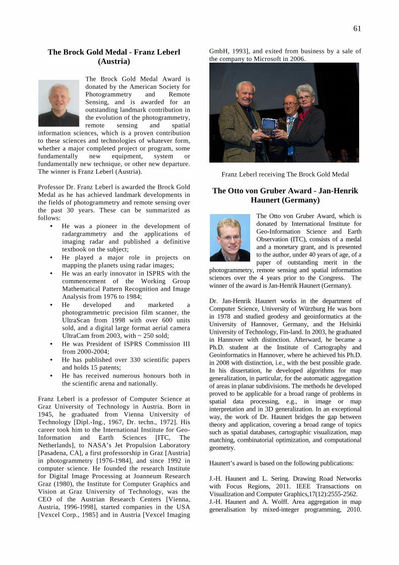
61
The Brock Gold Medal - Franz Leberl (Austria)
The Brock Gold Medal Award is donated by the American Society for Photogrammetry and Remote Sensing, and is awarded for an outstanding landmark contribution in the evolution of the photogrammetry, remote sensing and spatial
information sciences, which is a proven contribution to these sciences and technologies of whatever form, whether a major completed project or program, some fundamentally new equipment, system or fundamentally new technique, or other new departure. The winner is Franz Leberl (Austria). Professor Dr. Franz Leberl is awarded the Brock Gold Medal as he has achieved landmark developments in the fields of photogrammetry and remote sensing over the past 30 years. These can be summarized as follows:
• He was a pioneer in the development of radargrammetry and the applications of imaging radar and published a definitive textbook on the subject;
• He played a major role in projects on mapping the planets using radar images;
• He was an early innovator in ISPRS with the commencement of the Working Group Mathematical Pattern Recognition and Image Analysis from 1976 to 1984;
• He developed and marketed a photogrammetric precision film scanner, the UltraScan from 1998 with over 600 units sold, and a digital large format aerial camera UltraCam from 2003, with ~ 250 sold;
• He was President of ISPRS Commission III from 2000-2004;
• He has published over 330 scientific papers and holds 15 patents;
• He has received numerous honours both in the scientific arena and nationally.
Franz Leberl is a professor of Computer Science at Graz University of Technology in Austria. Born in 1945, he graduated from Vienna University of Technology [Dipl.-Ing., 1967, Dr. techn., 1972]. His career took him to the International Institute for Geo-Information and Earth Sciences [ITC, The Netherlands], to NASA’s Jet Propulsion Laboratory [Pasadena, CA], a first professorship in Graz [Austria] in photogrammetry [1976-1984], and since 1992 in computer science. He founded the research Institute for Digital Image Processing at Joanneum Research Graz (1980), the Institute for Computer Graphics and Vision at Graz University of Technology, was the CEO of the Austrian Research Centers [Vienna, Austria, 1996-1998], started companies in the USA [Vexcel Corp., 1985] and in Austria [Vexcel Imaging
GmbH, 1993], and exited from business by a sale of the company to Microsoft in 2006.
Franz Leberl receiving The Brock Gold Medal The Otto von Gruber Award - Jan-Henrik
Haunert (Germany)
The Otto von Gruber Award, which is donated by International Institute for Geo-Information Science and Earth Observation (ITC), consists of a medal and a monetary grant, and is presented to the author, under 40 years of age, of a paper of outstanding merit in the
photogrammetry, remote sensing and spatial information sciences over the 4 years prior to the Congress. The winner of the award is Jan-Henrik Haunert (Germany). Dr. Jan-Henrik Haunert works in the department of Computer Science, University of Würzburg He was born in 1978 and studied geodesy and geoinformatics at the University of Hannover, Germany, and the Helsinki University of Technology, Fin-land. In 2003, he graduated in Hannover with distinction. Afterward, he became a Ph.D. student at the Institute of Cartography and Geoinformatics in Hannover, where he achieved his Ph.D. in 2008 with distinction, i.e., with the best possible grade. In his dissertation, he developed algorithms for map generalization, in particular, for the automatic aggregation of areas in planar subdivisions. The methods he developed proved to be applicable for a broad range of problems in spatial data processing, e.g., in image or map interpretation and in 3D generalization. In an exceptional way, the work of Dr. Haunert bridges the gap between theory and application, covering a broad range of topics such as spatial databases, cartographic visualization, map matching, combinatorial optimization, and computational geometry. Haunert’s award is based on the following publications: J.-H. Haunert and L. Sering. Drawing Road Networks with Focus Regions, 2011. IEEE Transactions on Visualization and Computer Graphics,17(12):2555-2562. J.-H. Haunert and A. Wolff. Area aggregation in map generalisation by mixed-integer programming, 2010.
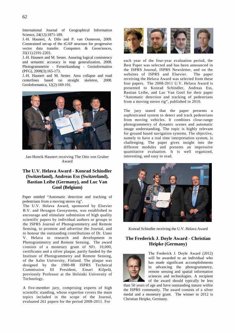
62
International Journal of Geographical Information Science, 24(12):1871-189. J.-H. Haunert, A. Dilo and P. van Oosterom, 2009. Constrained set-up of the tGAP structure for progressive vector data transfer. Computers & Geosciences, 35(11):2191-2203. J.-H. Haunert and M. Sester. Assuring logical consistency and semantic accuracy in map generalization, 2008. Photogrammetrie - Fernerkundung - Geoinformation (PFG), 2008(3):165-173. J.-H. Haunert and M. Sester. Area collapse and road centerlines based on straight skeleton, 2008. GeoInformatica, 12(2):169-191.
Jan-Henrik Haunert receiving The Otto von Gruber Award
The U.V. Helava Award - Konrad Schindler
(Switzerland), Andreas Ess (Switzerland), Bastian Leibe (Germany), and Luc Van
Gool (Belgium) Paper entitled “Automatic detection and tracking of pedestrians from a moving stereo rig". The U.V. Helava Award, sponsored by Elsevier B.V. and Hexagon Geosystems, was established to encourage and stimulate submission of high quality scientific papers by individual authors or groups to the ISPRS Journal of Photogrammetry and Remote Sensing, to promote and advertise the Journal, and to honour the outstanding contributions of Dr. Uuno V. Helava to research and development in Photogrammetry and Remote Sensing. The award consists of a monetary grant of SFr. 10,000, certificates and a silver plaque, partly funded by the Institute of Photogrammetry and Remote Sensing, of the Aalto University, Finland. The plaque was designed by the 1980-88 ISPRS Technical Commission III President, Einari Kilpelä, previously Professor at the Helsinki University of Technology. A five-member jury, comprising experts of high scientific standing, whose expertise covers the main topics included in the scope of the Journal, evaluated 261 papers for the period 2008-2011. For
each year of the four-year evaluation period, the Best Paper was selected and has been announced in the ISPRS Journal, ISPRS Newsletter, and on the websites of ISPRS and Elsevier. The paper receiving the Helava Award was selected from these four papers. The 2008-2011 U.V. Helava Award is presented to Konrad Schindler, Andreas Ess, Bastian Leibe, and Luc Van Gool for their paper “Automatic detection and tracking of pedestrians from a moving stereo rig”, published in 2010. The jury stated that the paper presents a sophisticated system to detect and track pedestrians from moving vehicles. It combines close-range photogrammetry of dynamic scenes and automatic image understanding. The topic is highly relevant for ground based navigation systems. The objective, namely to have a real time interpretation system, is challenging. The paper gives insight into the different modules and presents an impressive quantitative evaluation. It is well organized, interesting, and easy to read.
Konrad Schindler receiving the U.V. Helava Award The Frederick J. Doyle Award - Christian
Heipke (Germany)
The Frederick J. Doyle Award (2012) will be awarded to an individual who has made significant accomplishments in advancing the photogrammetry, remote sensing and spatial information sciences and technologies. A recipient of the award should typically be less
than 50 years of age and have outstanding stature within the ISPRS community. The award consists of a silver medal and a monetary grant. The winner in 2012 is Christian Heipke, Germany.
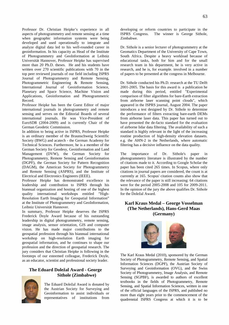
63
Professor Dr. Christian Heipke’s experience in all aspects of photogrammetry and remote sensing at a time when geographic information systems were being developed and used operationally to integrate and analyze digital data led to his well-rounded career in geoinformation. In his capacity as Head of the Institute of Photogrammetry and GeoInformation at Leibniz Universität Hannover, Professor Heipke has supervised more than 20 Ph.D. theses. He and his students have written over 270 scientific publications with 70 in the top peer reviewed journals of our field including ISPRS Journal of Photogrammetry and Remote Sensing, Photogrammetric Engineering & Remote Sensing, International Journal of Geoinformation Science, Planetary and Space Science, Machine Vision and Applications, Geoinformation and Photogrammetric Record. Professor Heipke has been the Guest Editor of major international journals in photogrammetry and remote sensing and serves on the Editorial Boards of several international journals. He was Vice-President of EuroSDR (2004-2009) and is currently Chair of the German Geodetic Commission. In addition to being active in ISPRS, Professor Heipke is an ordinary member of the Braunschweig Scientific Society (BWG) and acatech - the German Academy for Technical Sciences. Furthermore, he is a member of the German Society for Geodesy, Geoinformation and Land Management (DVW), the German Society for Photogrammetry, Remote Sensing and Geoinformation (DGPF), the German Society for Pattern Recognition (DAGM), the American Society for Photogrammetry and Remote Sensing (ASPRS), and the Institute of Electrical and Electronics Engineers (IEEE). Professor Heipke has demonstrated excellence in leadership and contribution to ISPRS through his biannual organization and hosting of one of the highest quality international workshops entitled ”High-Resolution Earth Imaging for Geospatial Information” at the Institute of Photogrammetry and GeoInformation, Leibniz Universität Hannover. In summary, Professor Heipke deserves the ISPRS Frederick Doyle Award because of his outstanding leadership in digital photogrammetry, remote sensing, image analysis, sensor orientation, GIS and computer vision. He has made major contributions to the geospatial profession through his biannual international workshop on high-resolution Earth imaging for geospatial information, and he continues to shape our profession and the direction of geospatial research. The jury considers that Christian Heipke is following in the footsteps of our esteemed colleague, Frederick Doyle, as an educator, scientist and professional society leader.
The Eduard Doležal Award - George Sithole (Zimbabwe)
The Eduard Doležal Award is donated by the Austrian Society for Surveying and Geoinformation to assist individuals or representatives of institutions from
developing or reform countries to participate in the ISPRS Congress. The winner is George Sithole, Zimbabwe. Dr. Sithole is a senior lecturer of photogrammetry at the Geomatics Department of the University of Cape Town, South Africa. Despite a heavy workload because of educational tasks, both for him and for the small research team in his department, he is very active in research, and he is, for example. involved in a number of papers to be presented at the congress in Melbourne. Dr. Sithole conducted his Ph.D. research at the TU Delft 2001-2005. The basis for this award is a publication he made during this period, entitled "Experimental comparison of filter algorithms for bare-Earth extraction from airborne laser scanning point clouds", which appeared in the ISPRS journal, August 2004. The paper introduces a test designed by Dr. Sithole to determine the performance of filters extracting bare-earth DEMs from airborne laser data. This paper has turned out to have presented the de-facto standard for the evaluation of airborne lidar data filtering. The availability of such a standard is highly relevant in the light of the increasing routine production of high-density elevation datasets. e.g. the AHN-2 in the Netherlands, where automatic filtering has a decisive influence on the data quality. The importance of Dr. Sithole's paper in photogrammetry literature is illustrated by the number of citations made to it. According to Google Scholar the paper has been cited 265 times. In Scopus, where only citations in journal papers are considered, the count is at currently at 165. Scopus' citation counts also show that the relevance of the paper is still increasing: 64 citations were for the period 2005-2008 and 105 for 2009-2011. In the opinion of the jury the above qualifies Dr. Sithole for the Doležal Award.
Karl Kraus Medal – George Vosselman (The Netherlands), Hans-Gerd Maas
(Germany)
The Karl Kraus Medal (2010), sponsored by the German Society of Photogrammetry, Remote Sensing, and Spatial Information Sciences (DGPF), the Austrian Society of Surveying and Geoinformation (OVG), and the Swiss Society of Photogrammetry, Image Analysis, and Remote Sensing (SGPBF), is awarded to authors of excellent textbooks in the fields of Photogrammetry, Remote Sensing, and Spatial Information Sciences, written in one of the official languages of the ISPRS, and published no more than eight years prior to the commencement of the quadrennial ISPRS Congress at which it is to be
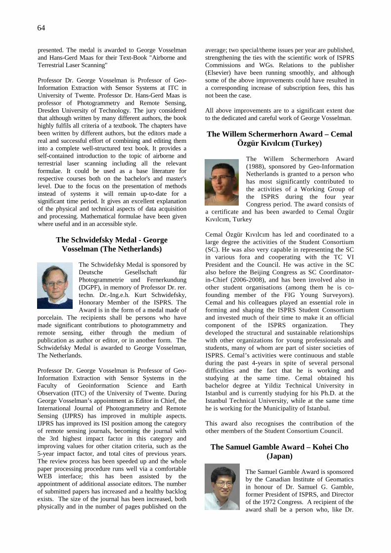
64
presented. The medal is awarded to George Vosselman and Hans-Gerd Maas for their Text-Book "Airborne and Terrestrial Laser Scanning" Professor Dr. George Vosselman is Professor of Geo-Information Extraction with Sensor Systems at ITC in University of Twente. Professor Dr. Hans-Gerd Maas is professor of Photogrammetry and Remote Sensing, Dresden University of Technology. The jury considered that although written by many different authors, the book highly fulfils all criteria of a textbook. The chapters have been written by different authors, but the editors made a real and successful effort of combining and editing them into a complete well-structured text book. It provides a self-contained introduction to the topic of airborne and terrestrial laser scanning including all the relevant formulae. It could be used as a base literature for respective courses both on the bachelor's and master's level. Due to the focus on the presentation of methods instead of systems it will remain up-to-date for a significant time period. It gives an excellent explanation of the physical and technical aspects of data acquisition and processing. Mathematical formulae have been given where useful and in an accessible style.
The Schwidefsky Medal - George Vosselman (The Netherlands)
The Schwidefsky Medal is sponsored by Deutsche Gesellschaft für Photogrammetrie und Fernerkundung (DGPF), in memory of Professor Dr. rer. techn. Dr.-Ing.e.h. Kurt Schwidefsky, Honorary Member of the ISPRS. The Award is in the form of a medal made of
porcelain. The recipients shall be persons who have made significant contributions to photogrammetry and remote sensing, either through the medium of publication as author or editor, or in another form. The Schwidefsky Medal is awarded to George Vosselman, The Netherlands. Professor Dr. George Vosselman is Professor of Geo-Information Extraction with Sensor Systems in the Faculty of Geoinformation Science and Earth Observation (ITC) of the University of Twente. During George Vosselman’s appointment as Editor in Chief, the International Journal of Photogrammetry and Remote Sensing (IJPRS) has improved in multiple aspects. IJPRS has improved its ISI position among the category of remote sensing journals, becoming the journal with the 3rd highest impact factor in this category and improving values for other citation criteria, such as the 5-year impact factor, and total cites of previous years. The review process has been speeded up and the whole paper processing procedure runs well via a comfortable WEB interface; this has been assisted by the appointment of additional associate editors. The number of submitted papers has increased and a healthy backlog exists. The size of the journal has been increased, both physically and in the number of pages published on the
average; two special/theme issues per year are published, strengthening the ties with the scientific work of ISPRS Commissions and WGs. Relations to the publisher (Elsevier) have been running smoothly, and although some of the above improvements could have resulted in a corresponding increase of subscription fees, this has not been the case. All above improvements are to a significant extent due to the dedicated and careful work of George Vosselman. The Willem Schermerhorn Award – Cemal
Özgür Kıvılcım (Turkey)
The Willem Schermerhorn Award (1988), sponsored by Geo-Information Netherlands is granted to a person who has most significantly contributed to the activities of a Working Group of the ISPRS during the four year Congress period. The award consists of
a certificate and has been awarded to Cemal Özgür Kıvılcım, Turkey Cemal Özgür Kıvılcım has led and coordinated to a large degree the activities of the Student Consortium (SC). He was also very capable in representing the SC in various fora and cooperating with the TC VI President and the Council. He was active in the SC also before the Beijing Congress as SC Coordinator-in-Chief (2006-2008), and has been involved also in other student organisations (among them he is co-founding member of the FIG Young Surveyors). Cemal and his colleagues played an essential role in forming and shaping the ISPRS Student Consortium and invested much of their time to make it an official component of the ISPRS organization. They developed the structural and sustainable relationships with other organizations for young professionals and students, many of whom are part of sister societies of ISPRS. Cemal’s activities were continuous and stable during the past 4-years in spite of several personal difficulties and the fact that he is working and studying at the same time. Cemal obtained his bachelor degree at Yildiz Technical University in Istanbul and is currently studying for his Ph.D. at the Istanbul Technical University, while at the same time he is working for the Municipality of Istanbul. This award also recognises the contribution of the other members of the Student Consortium Council.
The Samuel Gamble Award – Kohei Cho (Japan)
The Samuel Gamble Award is sponsored by the Canadian Institute of Geomatics in honour of Dr. Samuel G. Gamble, former President of ISPRS, and Director of the 1972 Congress. A recipient of the award shall be a person who, like Dr.
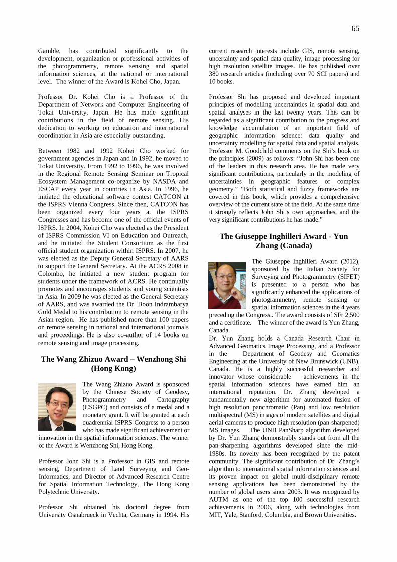
65
Gamble, has contributed significantly to the development, organization or professional activities of the photogrammetry, remote sensing and spatial information sciences, at the national or international level. The winner of the Award is Kohei Cho, Japan. Professor Dr. Kohei Cho is a Professor of the Department of Network and Computer Engineering of Tokai University, Japan. He has made significant contributions in the field of remote sensing. His dedication to working on education and international coordination in Asia are especially outstanding. Between 1982 and 1992 Kohei Cho worked for government agencies in Japan and in 1992, he moved to Tokai University. From 1992 to 1996, he was involved in the Regional Remote Sensing Seminar on Tropical Ecosystem Management co-organize by NASDA and ESCAP every year in countries in Asia. In 1996, he initiated the educational software contest CATCON at the ISPRS Vienna Congress. Since then, CATCON has been organized every four years at the ISPRS Congresses and has become one of the official events of ISPRS. In 2004, Kohei Cho was elected as the President of ISPRS Commission VI on Education and Outreach, and he initiated the Student Consortium as the first official student organization within ISPRS. In 2007, he was elected as the Deputy General Secretary of AARS to support the General Secretary. At the ACRS 2008 in Colombo, he initiated a new student program for students under the framework of ACRS. He continually promotes and encourages students and young scientists in Asia. In 2009 he was elected as the General Secretary of AARS, and was awarded the Dr. Boon Indrambarya Gold Medal to his contribution to remote sensing in the Asian region. He has published more than 100 papers on remote sensing in national and international journals and proceedings. He is also co-author of 14 books on remote sensing and image processing. The Wang Zhizuo Award – Wenzhong Shi
(Hong Kong)
The Wang Zhizuo Award is sponsored by the Chinese Society of Geodesy, Photogrammetry and Cartography (CSGPC) and consists of a medal and a monetary grant. It will be granted at each quadrennial ISPRS Congress to a person who has made significant achievement or
innovation in the spatial information sciences. The winner of the Award is Wenzhong Shi, Hong Kong. Professor John Shi is a Professor in GIS and remote sensing, Department of Land Surveying and Geo-Informatics, and Director of Advanced Research Centre for Spatial Information Technology, The Hong Kong Polytechnic University. Professor Shi obtained his doctoral degree from University Osnabrueck in Vechta, Germany in 1994. His
current research interests include GIS, remote sensing, uncertainty and spatial data quality, image processing for high resolution satellite images. He has published over 380 research articles (including over 70 SCI papers) and 10 books. Professor Shi has proposed and developed important principles of modelling uncertainties in spatial data and spatial analyses in the last twenty years. This can be regarded as a significant contribution to the progress and knowledge accumulation of an important field of geographic information science: data quality and uncertainty modelling for spatial data and spatial analysis. Professor M. Goodchild comments on the Shi’s book on the principles (2009) as follows: “John Shi has been one of the leaders in this research area. He has made very significant contributions, particularly in the modeling of uncertainties in geographic features of complex geometry.” “Both statistical and fuzzy frameworks are covered in this book, which provides a comprehensive overview of the current state of the field. At the same time it strongly reflects John Shi’s own approaches, and the very significant contributions he has made.”
The Giuseppe Inghilleri Award - Yun Zhang (Canada)
The Giuseppe Inghilleri Award (2012), sponsored by the Italian Society for Surveying and Photogrammetry (SIFET) is presented to a person who has significantly enhanced the applications of photogrammetry, remote sensing or spatial information sciences in the 4 years
preceding the Congress.. The award consists of SFr 2,500 and a certificate. The winner of the award is Yun Zhang, Canada. Dr. Yun Zhang holds a Canada Research Chair in Advanced Geomatics Image Processing, and a Professor in the Department of Geodesy and Geomatics Engineering at the University of New Brunswick (UNB), Canada. He is a highly successful researcher and innovator whose considerable achievements in the spatial information sciences have earned him an international reputation. Dr. Zhang developed a fundamentally new algorithm for automated fusion of high resolution panchromatic (Pan) and low resolution multispectral (MS) images of modern satellites and digital aerial cameras to produce high resolution (pan-sharpened) MS images. The UNB PanSharp algorithm developed by Dr. Yun Zhang demonstrably stands out from all the pan-sharpening algorithms developed since the mid-1980s. Its novelty has been recognized by the patent community. The significant contribution of Dr. Zhang’s algorithm to international spatial information sciences and its proven impact on global multi-disciplinary remote sensing applications has been demonstrated by the number of global users since 2003. It was recognized by AUTM as one of the top 100 successful research achievements in 2006, along with technologies from MIT, Yale, Stanford, Columbia, and Brown Universities.
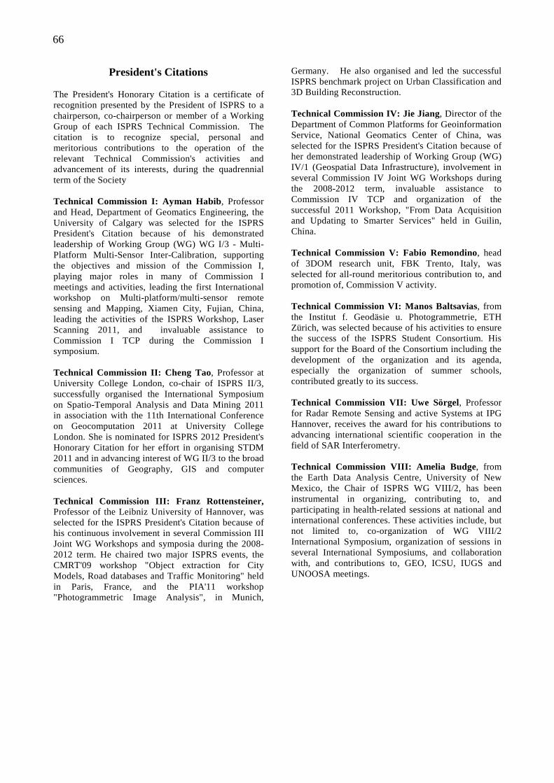
66
President's Citations The President's Honorary Citation is a certificate of recognition presented by the President of ISPRS to a chairperson, co-chairperson or member of a Working Group of each ISPRS Technical Commission. The citation is to recognize special, personal and meritorious contributions to the operation of the relevant Technical Commission's activities and advancement of its interests, during the quadrennial term of the Society Technical Commission I: Ayman Habib, Professor and Head, Department of Geomatics Engineering, the University of Calgary was selected for the ISPRS President's Citation because of his demonstrated leadership of Working Group (WG) WG I/3 - Multi-Platform Multi-Sensor Inter-Calibration, supporting the objectives and mission of the Commission I, playing major roles in many of Commission I meetings and activities, leading the first International workshop on Multi-platform/multi-sensor remote sensing and Mapping, Xiamen City, Fujian, China, leading the activities of the ISPRS Workshop, Laser Scanning 2011, and invaluable assistance to Commission I TCP during the Commission I symposium. Technical Commission II: Cheng Tao, Professor at University College London, co-chair of ISPRS II/3, successfully organised the International Symposium on Spatio-Temporal Analysis and Data Mining 2011 in association with the 11th International Conference on Geocomputation 2011 at University College London. She is nominated for ISPRS 2012 President's Honorary Citation for her effort in organising STDM 2011 and in advancing interest of WG II/3 to the broad communities of Geography, GIS and computer sciences. Technical Commission III: Franz Rottensteiner, Professor of the Leibniz University of Hannover, was selected for the ISPRS President's Citation because of his continuous involvement in several Commission III Joint WG Workshops and symposia during the 2008-2012 term. He chaired two major ISPRS events, the CMRT'09 workshop "Object extraction for City Models, Road databases and Traffic Monitoring" held in Paris, France, and the PIA'11 workshop "Photogrammetric Image Analysis", in Munich,
Germany. He also organised and led the successful ISPRS benchmark project on Urban Classification and 3D Building Reconstruction. Technical Commission IV: Jie Jiang, Director of the Department of Common Platforms for Geoinformation Service, National Geomatics Center of China, was selected for the ISPRS President's Citation because of her demonstrated leadership of Working Group (WG) IV/1 (Geospatial Data Infrastructure), involvement in several Commission IV Joint WG Workshops during the 2008-2012 term, invaluable assistance to Commission IV TCP and organization of the successful 2011 Workshop, "From Data Acquisition and Updating to Smarter Services" held in Guilin, China. Technical Commission V: Fabio Remondino, head of 3DOM research unit, FBK Trento, Italy, was selected for all-round meritorious contribution to, and promotion of, Commission V activity. Technical Commission VI: Manos Baltsavias, from the Institut f. Geodäsie u. Photogrammetrie, ETH Zürich, was selected because of his activities to ensure the success of the ISPRS Student Consortium. His support for the Board of the Consortium including the development of the organization and its agenda, especially the organization of summer schools, contributed greatly to its success. Technical Commission VII: Uwe Sörgel, Professor for Radar Remote Sensing and active Systems at IPG Hannover, receives the award for his contributions to advancing international scientific cooperation in the field of SAR Interferometry. Technical Commission VIII: Amelia Budge, from the Earth Data Analysis Centre, University of New Mexico, the Chair of ISPRS WG VIII/2, has been instrumental in organizing, contributing to, and participating in health-related sessions at national and international conferences. These activities include, but not limited to, co-organization of WG VIII/2 International Symposium, organization of sessions in several International Symposiums, and collaboration with, and contributions to, GEO, ICSU, IUGS and UNOOSA meetings.
67
CATCON Prize At the Congress, the CATCON Prizes (199 a software Computer Assisted Teaching Contest, was organized by ISPRS Technical Commission VI and funded by The ISPRS Foundation. The main objective of the contest is to promote the development and dissemination of good, user-friendly software packages, www contents and data sets for computer assisted teaching, which preferably are non-commercial and free. Typically the prizes consist of a Gold Award (SFr. 3,000), Silver Award (SFr. 2,500), and Bronze Award (SFr. 1,500) and a certificate. Technical Commission WG VI/2 organized the sixth contest for Computer Assisted Teaching CONtest “CATCON 6” at the ISPRS Congress, Melbourne, Australia, on Thursday, 30 August, 2012. The main objective of the contest is to promote the development and dissemination of effective, educational and user-friendly:
• multimedia tutorials, • podcasts, • simulations and virtual environments, • information packages or data sets, and • application software • designed and used specifically for computer
assisted teaching (CAT) in photogrammetry, remote sensing or GIS.
In general, the CAT tutorial, software or data set is preferred to be non-commercial and provided to users without licence charges or other fees for not-for-profit use. Since many ISPRS attendees have been interested in this contest at three previous Congresses, this is a very good opportunity to show the effectiveness and utility of your CAT product.
Award Contestant Entry
Gold
CHF 3000
M.P. Imhof, M.T. Cox, D.W. Harvey, G.E. Heemskerk, and C.J. Pettit
Future Farming Systems Research Division
Department of Primary Industries, Australia
Landscape Visualisation on the Internet
Silver
CHF 2500
Diego Gonzalez-Aguilera, Diego Guerrero, David Hernandez-Lopez, Pablo Rodriguez-Gonzalvez, Marc Pierrot, Jesus Fernandez-Hernandez
University of Salamanca, Spain
PW, Photogrammetry Workbench
Bronze
CHF 1500
Aguiar, R.A. Brito, J.L.N.S. Badolato, I.S. Bernardo Filho, O. Coelho Filho, L.C.T. Pupin, P.A.B. Reolon, P.F. Ribeiro, J. Ribeiro, J.A. Silveira, F.J.C. Silveira, M.T.
The Rio de Janeiro State University (UERJ), Cartographic Engineering, Brazil
The E-FOTO project
Young Authors Awards
The prizes for Best Papers by Young Authors, are sponsored by donor organizations and by ISPRS to authors
who are less than 35 years old and are the sole authors of a high quality paper presented at the Congress.
TC Author (Country) Paper
I Rongfu Tang (Germany) A Rigorous and Flexible Calibration Method for Digital Airborne Camera Systems
IV Xiaoliang Meng (China) Field ground truthing data collector-a mobile toolkit for image analysis and processing
V Shun Hirose (Japan) Simple Room Shape Modelling with Sparse 3D Point Information using Photogrammetry and Application Software
VII Janja Avbelj (Germany) Spectral Information Retrieval for Sub-Pixel Building Edge Detection
VII Maryam Mohammadi (Germany) Road Classification and Condition Determination using Hyperspectral Imagery
VIII Gay Jane P Perez (Philippines) Observed Changes and Vulnerability of Philippine Forestry and Agriculture
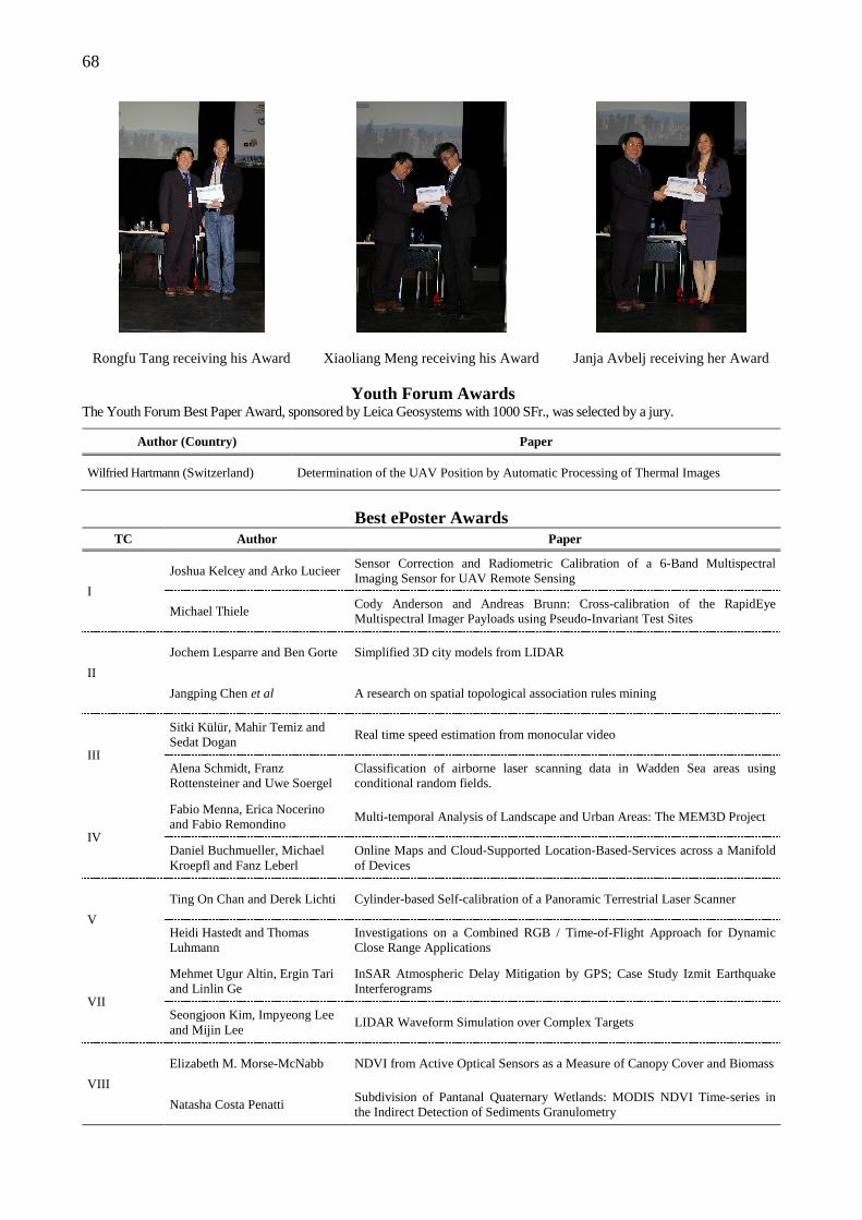
68
Rongfu Tang receiving his Award
Xiaoliang Meng receiving his Award
Janja Avbelj receiving her Award
Youth Forum Awards The Youth Forum Best Paper Award, sponsored by Leica Geosystems with 1000 SFr., was selected by a jury.
Author (Country) Paper
Wilfried Hartmann (Switzerland) Determination of the UAV Position by Automatic Processing of Thermal Images
Best ePoster Awards
TC Author Paper
I
Joshua Kelcey and Arko Lucieer Sensor Correction and Radiometric Calibration of a 6-Band Multispectral Imaging Sensor for UAV Remote Sensing
Michael Thiele Cody Anderson and Andreas Brunn: Cross-calibration of the RapidEye Multispectral Imager Payloads using Pseudo-Invariant Test Sites
II
Jochem Lesparre and Ben Gorte Simplified 3D city models from LIDAR
Jangping Chen et al A research on spatial topological association rules mining
III
Sitki Külür, Mahir Temiz and Sedat Dogan
Real time speed estimation from monocular video
Alena Schmidt, Franz Rottensteiner and Uwe Soergel
Classification of airborne laser scanning data in Wadden Sea areas using conditional random fields.
IV
Fabio Menna, Erica Nocerino and Fabio Remondino
Multi-temporal Analysis of Landscape and Urban Areas: The MEM3D Project
Daniel Buchmueller, Michael Kroepfl and Fanz Leberl
Online Maps and Cloud-Supported Location-Based-Services across a Manifold of Devices
V
Ting On Chan and Derek Lichti Cylinder-based Self-calibration of a Panoramic Terrestrial Laser Scanner
Heidi Hastedt and Thomas Luhmann
Investigations on a Combined RGB / Time-of-Flight Approach for Dynamic Close Range Applications
VII
Mehmet Ugur Altin, Ergin Tari and Linlin Ge
InSAR Atmospheric Delay Mitigation by GPS; Case Study Izmit Earthquake Interferograms
Seongjoon Kim, Impyeong Lee and Mijin Lee
LIDAR Waveform Simulation over Complex Targets
VIII
Elizabeth M. Morse-McNabb NDVI from Active Optical Sensors as a Measure of Canopy Cover and Biomass
Natasha Costa Penatti Subdivision of Pantanal Quaternary Wetlands: MODIS NDVI Time-series in the Indirect Detection of Sediments Granulometry
69
LIST OF ISPRS AWARD WINNERS Brock Gold Medal (founded 1952) 1956 L Bertele (Switzerland) 1960 W. Schermerhorn (The Netherlands) 1968 H. Schmidt (USA) 1972 U.V. Helava (Canada) 1976 F. Ackermann (Germany) 1980 G. Hobrough (Canada) 1984 F.J. Doyle (USA) 1988 D. Brown (USA) 1992 G. Brachet (France) 1996 Y.S. Tjuflin (Russia) 2000 J. Dangermond (USA) 2004 K. Kasturirangan (India) 2008 A. Grün (Switzerland) 2012 F. Leberl (Austria) Otto von Gruber Award (founded 1960) 1964 F. Ackermann (Germany) 1968 E. Ebner (Germany) 1972 J. Hohle (Germany) 1976 F. Leberl (Austria) 1980 A. Grun (Switzerland)) 1988 P. Curran (Great Britain) 1992 C. Heipke (Germany) 1996 H-G Maas (Switzerland) 2000 H. Mayer (Germany)
M.G. Vosselman (The Netherlands) 2004 S. Heuel (Switzerland) 2008 M. Butenuth (Germany) 2012 Jan-Henrik Haunert (Germany) Samuel Gamble Award (founded 1988) 1988 O. Coker (Nigeria) B.A. Sikilo (Kenya) A.J. van der Weele (The Netherlands) 1992 M. Carbonnell (France) G. Hildebrandt (Germany) S. Vibulsresth (Thailand) 1996 P. Waldhausl (Austria) M.A. Figueroa (Chile) 2000 A. Abiodun (Germany) B. Foster (Australia) 2004 R. Harris (UK),
H. Nyapola (Kenya), V. Savinykh (Russia)
2008 W. K. Ottichilo (Kenya), J. Kufoniyi (Nigeria) L. Deren (China)
2012 K. Cho (Japan)
Schwidefsky Medal (founded 1988) 1988 K. Rinner (Austria)
G.C. Tewinkel (USA) 1992 K. Atkinson (Great Britain)
W. Hofman (Germany) 1996 J.B. Case (USA)
A.P. Cracknell (United Kingdom) 2000 G. Ducher (France)
L.R.A. Narayan (India) 2004 E. Baltsavias (Switzerland)
Z. Li (Hong Kong) 2008 G. Kemper (Germany)
K. Szangolies (Germany) 2012 G. Vosselman (The Netherlands) Schermerhorn Award (founded 1988) 1988 G. Guyot (France) 1992 I. Dowman (United Kingdom) 1996 D.M. McKeown (USA) 2000 T. Woldai (The Netherlands) 2004 M. Madden (USA) 2008 S. Zlatanova (The Netherlands) 2012 C. Ö. Kıvılcım (Turkey) The Eduard Doležal Award (founded 1992) 1996 0. Ayeni (Nigeria)
F. Batuk (Turkey) A. Bujakiewicz (Poland) G. Coskun (Turkey) M.. Dalati (Syria) M. Ebrahim (Egypt) J. Gong (China) S. Jayatilaka (Sri Lanka) R. Kaczynski (Poland) A. Kirsanov (Russia) M. Koudmani (Syria) S. Mayabu (Zaire) L. Narayan (India) N. Ononiwu (Nigeria) C. Robbi (Brazil) J. Ru (China) M. Saandar (Mongolia) N. Shahriari (Iran) P. Sharma (India) B. Shrestha (Nepal) V. Sokolova (Russia) K. Sukup (Czech Rep.) M. Talbi (Tunisia) A. Tommaselli (Brazil) V. Vainauskas (Lithuania) R. Zhang (China) Ethiopian Mapping Authority (Ethiopia) Institut Agronomique et Veterinaire Hassan II (Morocco)
70
Romanian Society for Photogrammetry and Remote Sensing (Romania) University of Mining & Metallurgy (Poland)
2000 P. Tarikhi (Iran) U.R. Rao (India) I. Katzarsky (Bulgaria)
2004 J. Jie (China) 2008 N. D. Duong (Vietnam) 2012 G. Sithole (Zimbabwe) The Gino Cassinis Award (founded 1997) 2000 W. Förstner (Germany) 2004 S. S. C.Wu (USA) 2008 Z. Li (Hong Kong) The Helava Award (founded 1998) 2000 M. Sinning-Meister (Germany)
A. Grün (Switzerland) H. Dan (Switzerland)
2004 Changno Lee (South Korea) James S. Bethel (USA)
2008 H. Grabner (Switzerland) T. T. Nguyen (Austria) B. Gruber (Austria) H. Bischof (Austria)
2012 K. Schindler (Switzerland) A. Ess (Switzerland) B. Leibe (Germany) L. V. Gool (Belgium)
The Wang Zhizhuo (founded 1998) 2008 C. Gold (UK) 2012 J. Shi (Hong Kong) The Giuseppe Inghilleri Award (founded 2008) 2012 Y. Zhang (Canada) The Karl Kraus Medal (founded 2009) 2012 G. Vosselman (The Netherlands)
H.-G. Maas (Germany) The Frederick J. Doyle Award (founded 2010) 2012 C. Heipke (Germany)
The President's Honorary Citations 2000 K. Jacobsen (Germany)
C. Heipke (Germany) B. Csatho (USA) E. Baltsavias (Switzerland) S. El-Hakim (Canada) T.M. Sausen (Brazil) A. Rosenqvist (Italy)
2004 K. Jacobsen (Germany) C. Heipke (Germany) H. Mayer (Germany) M. Sester (Germany) G. Fangi (Italy) M. Baltsavias (Switzerland) K. Staenz (Canada)
2008 K. Jacobsen (Germany) M. Sester (Germany) J. Hyyppa (Finnland) V. Rodehorst (Germany) D. Lichti (Canada) N. Pfeifer (Austria) M. Fras (Slovenia) Z. Jixian (China) P. Boccardo (Italy) A. Budge (USA)
2012 A. Habib (Canada) C. Tao (UK) F. Rottensteiner (Germany) J. Jiang (China) F. Remondino (Italy) M. Baltsavias (Switzerland) U. Sörgel (Germany) A. Budge (USA)
Honorable Mentions for Distinguished Members of Technical Commissions 1996 P. Patias (Greece)
J. Labonte (Canada) I. Colomina (Spain) R. Tateishi (Japan) M. Shortis (Australia) K. Cho (Japan) G. Guyot (France)
CATCON Awards 1996 Gold J. Hohle (Denmark)
Silver N.D. Duong (Vietnam) Bronze G. Jianya (China)
RADARSAT International (Canada) 2000 Gold P. Grussenmeyer (France)
P. Drap (France) Silver Q. Zhou (China)
J. Hohle (Denmark) 2004 Gold J. Haig (Germany) Silver M. Fluehler (Switzerland)
Bronze S. Sharma (India) 2008 Gold R. Kaden (Germany)
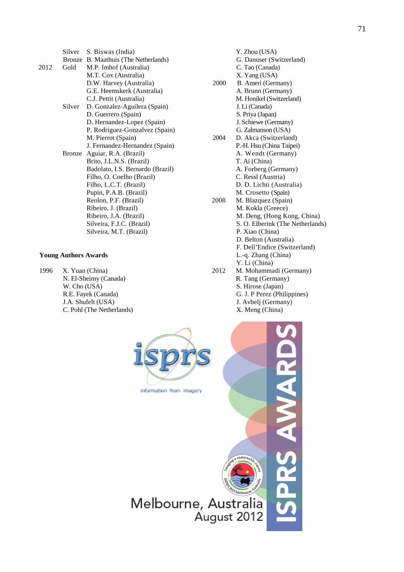
71
Silver S. Biswas (India) Bronze B. Maathuis (The Netherlands)
2012 Gold M.P. Imhof (Australia) M.T. Cox (Australia) D.W. Harvey (Australia) G.E. Heemskerk (Australia) C.J. Pettit (Australia)
Silver D. Gonzalez-Aguilera (Spain) D. Guerrero (Spain) D. Hernandez-Lopez (Spain) P. Rodriguez-Gonzalvez (Spain) M. Pierrot (Spain) J. Fernandez-Hernandez (Spain)
Bronze Aguiar, R.A. (Brazil) Brito, J.L.N.S. (Brazil) Badolato, I.S. Bernardo (Brazil) Filho, O. Coelho (Brazil) Filho, L.C.T. (Brazil) Pupin, P.A.B. (Brazil) Reolon, P.F. (Brazil) Ribeiro, J. (Brazil) Ribeiro, J.A. (Brazil) Silveira, F.J.C. (Brazil) Silveira, M.T. (Brazil)
Young Authors Awards 1996 X. Yuan (China)
N. El-Sheimy (Canada) W. Cho (USA) R.E. Fayek (Canada) J.A. Shufelt (USA) C. Pohl (The Netherlands)
Y. Zhou (USA) G. Danuser (Switzerland) C. Tao (Canada) X. Yang (USA)
2000 B. Ameri (Germany) A. Brunn (Germany)
M. Honikel (Switzerland) J. Li (Canada) S. Priya (Japan) J. Schiewe (Germany) G. Zalmanson (USA)
2004 D. Akca (Switzerland) P.-H. Hsu (China Taipei) A. Wendt (Germany) T. Ai (China) A. Forberg (Germany) C. Ressl (Austria) D. D. Lichti (Australia) M. Crosetto (Spain) 2008 M. Blazquez (Spain)
M. Kokla (Greece) M. Deng, (Hong Kong, China) S. O. Elberink (The Netherlands) P. Xiao (China) D. Belton (Australia) F. Dell’Endice (Switzerland) L.-q. Zhang (China) Y. Li (China)
2012 M. Mohammadi (Germany) R. Tang (Germany) S. Hirose (Japan) G. J. P Perez (Philippines) J. Avbelj (Germany) X. Meng (China)

72
ISPRS 2012
CONGRESS GALA DINNER
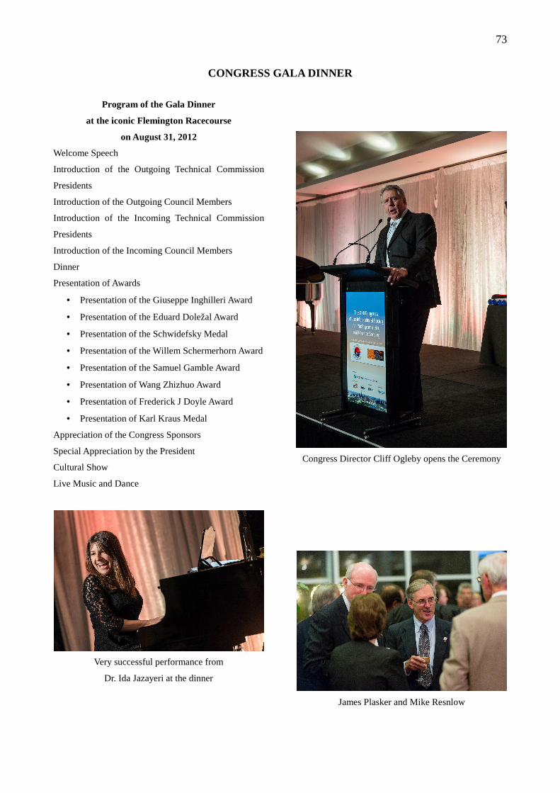
73
CONGRESS GALA DINNER
Program of the Gala Dinner
at the iconic Flemington Racecourse
on August 31, 2012 Welcome Speech
Introduction of the Outgoing Technical Commission
Presidents
Introduction of the Outgoing Council Members
Introduction of the Incoming Technical Commission
Presidents
Introduction of the Incoming Council Members
Dinner
Presentation of Awards
• Presentation of the Giuseppe Inghilleri Award
• Presentation of the Eduard Doležal Award
• Presentation of the Schwidefsky Medal
• Presentation of the Willem Schermerhorn Award
• Presentation of the Samuel Gamble Award
• Presentation of Wang Zhizhuo Award
• Presentation of Frederick J Doyle Award
• Presentation of Karl Kraus Medal
Appreciation of the Congress Sponsors
Special Appreciation by the President
Cultural Show
Live Music and Dance
Very successful performance from
Dr. Ida Jazayeri at the dinner
Congress Director Cliff Ogleby opens the Ceremony
James Plasker and Mike Resnlow
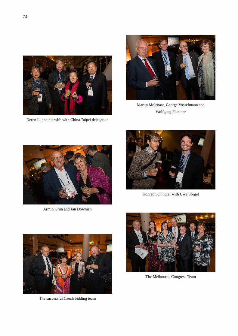
74
Deren Li and his wife with China Taipei delegation
Armin Grün and Jan Dowman
The successful Czech bidding team
Martin Molenaar, George Vosselmann and
Wolfgang Förstner
Konrad Schindler with Uwe Sörgel
The Melbourne Congress Team
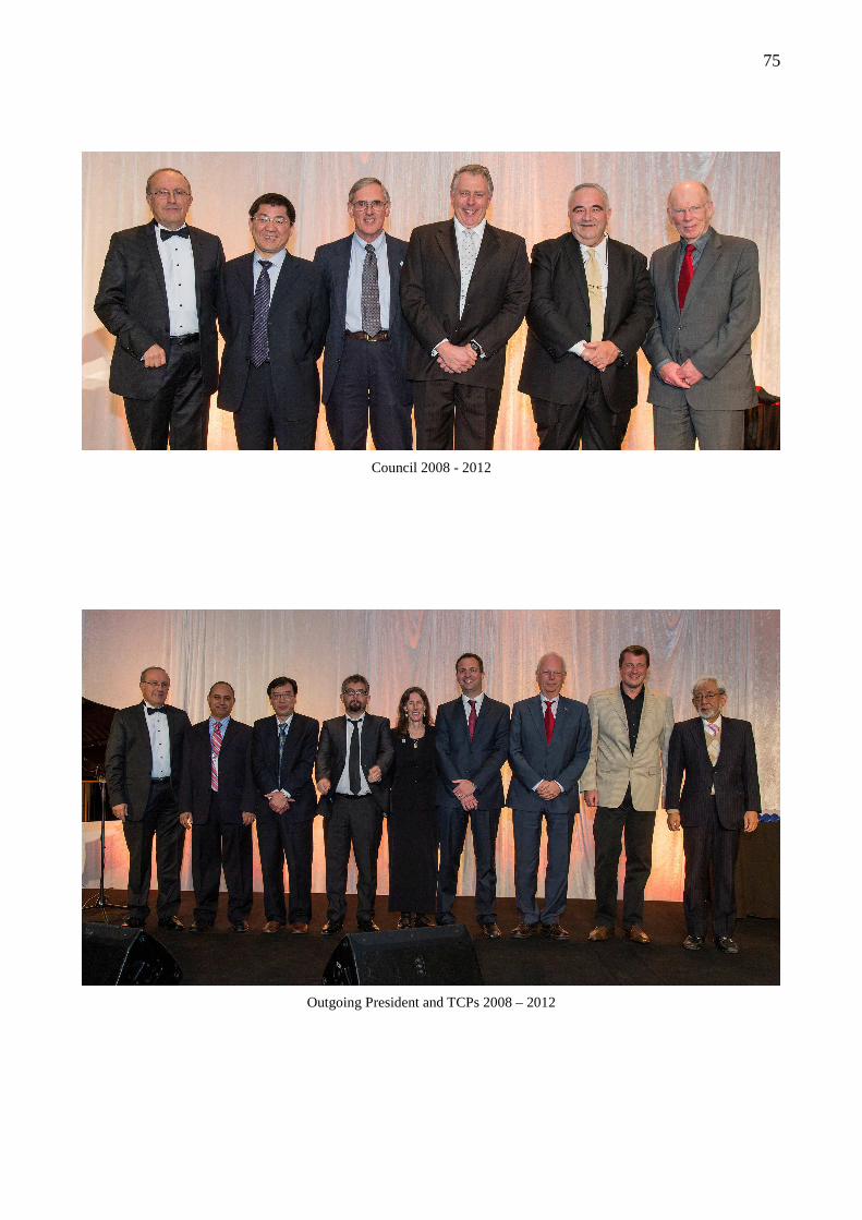
75
Council 2008 - 2012
Outgoing President and TCPs 2008 – 2012
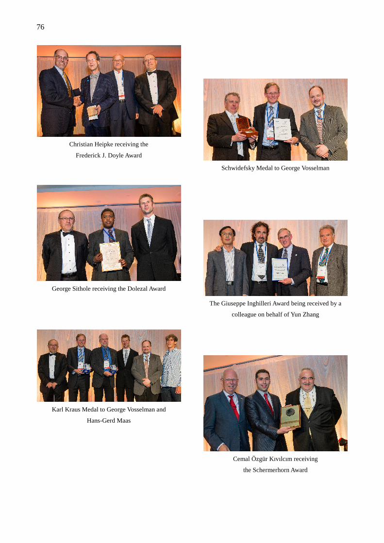
76
Christian Heipke receiving the
Frederick J. Doyle Award
George Sithole receiving the Dolezal Award
Karl Kraus Medal to George Vosselman and
Hans-Gerd Maas
Schwidefsky Medal to George Vosselman
The Giuseppe Inghilleri Award being received by a
colleague on behalf of Yun Zhang
Cemal Özgür Kıvılcım receiving
the Schermerhorn Award
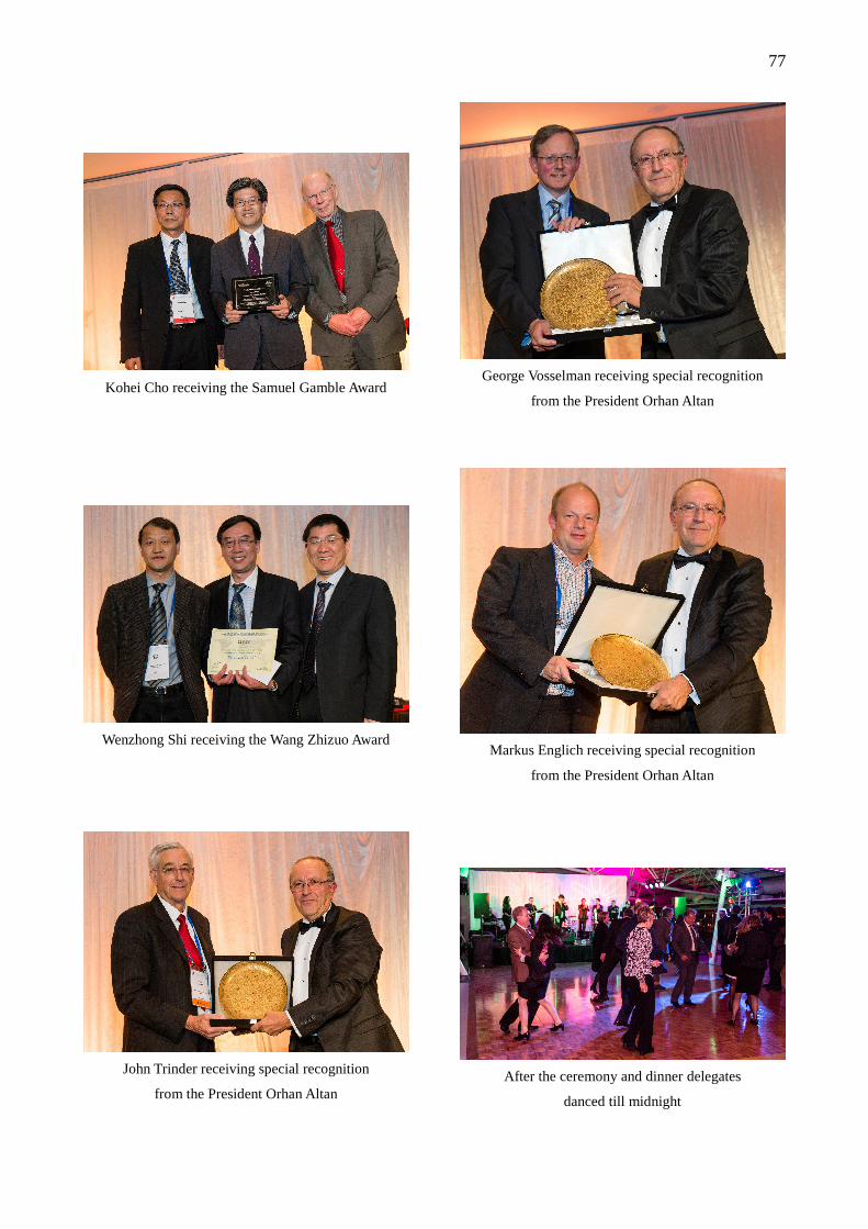
77
Kohei Cho receiving the Samuel Gamble Award
Wenzhong Shi receiving the Wang Zhizuo Award
John Trinder receiving special recognition
from the President Orhan Altan
George Vosselman receiving special recognition
from the President Orhan Altan
Markus Englich receiving special recognition
from the President Orhan Altan
After the ceremony and dinner delegates
danced till midnight
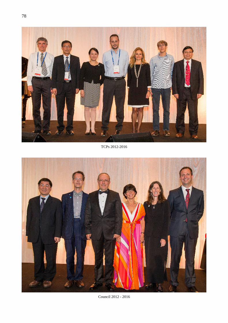
78
TCPs 2012-2016
Council 2012 - 2016
79
ISPRS 2012
OBITUARIES
Hans Georg Jerie
Hans Knoop
Jörg Albertz
Robert “Bob” Moses
David Tait
Vladislav K. Lvov
Hans-Karsten Meıer
Tuan-Chih Chen
Myriam Ardila Torres
Ian Harley
George Zarzycki
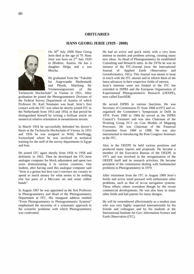
80
OBITUARIES
HANS GEORG JERIE (1929 - 2008)
On 30th July 2008 Hans Georg Jerie died at the age of 79. Hans Jerie was born on 2nd July 1929 in Bludenz, Austria. He has a daughter Helga and a son Mischa. He graduated from the “Fakultät fur Angewandte Mathematik und Physik, Abteilung für Vermessungswesen of the
Technische Hochschule” in Vienna in 1951. After graduation he joined the Photogrammetric Division of the Federal Survey Department of Austria of which Professor Dr. Karl Neumaier was head. Jerie’s first contact with the ITC was when he shortly joined ITC in the Netherlands from 1953 and 1954, in that period he distinguished himself by writing a brilliant article on numerical relative orientation in mountainous terrain. In March 1954 he successfully defended his doctor’s thesis at the Technische Hochschule of Vienna. In 1955 and 1956 he was assigned to Wild, Heerbrugg, Switzerland where he was involved in technical training for the staff of the survey departments in Egypt and Iran. He joined ITC again shortly from 1956 to 1958 and definitely in 1963. Then he developed the ITC-Jerie analogue computer for block adjustment and spent two years demonstrating it in various countries. One student, after having used this analogue computer said “Jerie is a genius but how can I convince my country to spend so much money for what seems to be nothing else but parts of a Meccano set and some rubber bands”. In August 1967 he was appointed as the first Professor in Photogrammetry and Head of the Photogrammetry Department at ITC. His inaugural address entitled “From Photogrammetry to Photogrammetric Systems” emphasised the necessity of a systematic approach to the scientific problems with which Photogrammetry was confronted.
He had an active and quick mind, with a very keen interest in models and problem solving, creating many new ideas. As Head of Photogrammetry he established Consulting and Research units. In the 1970s he was an initiator of the ITC-Journal (now the International Journal of Applied Earth Observation and Geoinformatics, JAG). This Journal was meant to keep in touch with the ITC alumni and to inform them of the latest advances in their respective fields of interest. Jerie’s interests were not limited to the ITC but extended to ISPRS and the European Organisation of Experimental Photogrammetric Research (OEEPE), now called EuroSDR. He served ISPRS in various functions. He was Secretary of Commission IV from 1968 to1972 and co-organised the Committee’s Symposium in Delft in 1970. From 1980 to 1984 he served as the ISPRS Council’s Treasurer and was also Chairman of the Working Group IV/1 on Cost Models of Mapping Processes. He was Chairman of the Financial Committee from 1984 to 1988. He was also instrumental in introducing the Post Congress Seminars at the ITC. Also in the OEEPE he held various positions and produced many reports and proposals. He became a member of the Executive Bureau of the OEEPE in 1971 and was involved in the reorganisation of the OEEPE itself and its research activities. He became president of the commission dealing with fundamental problems in Photogrammetry in 1979. After retirement from the ITC in August 1989 Jerie’s fertile and active mind pursued with enthusiasm other problems, such as that of in-car navigation systems. These efforts where overtaken though by the recent commercial developments. He was also busy in many other fields and had patents for many designs. He will be remembered affectionately as a modest man who was very highly respected internationally by his friends and colleagues and by his students at the International Institute for Geo- Information Science and Earth Observation (ITC).
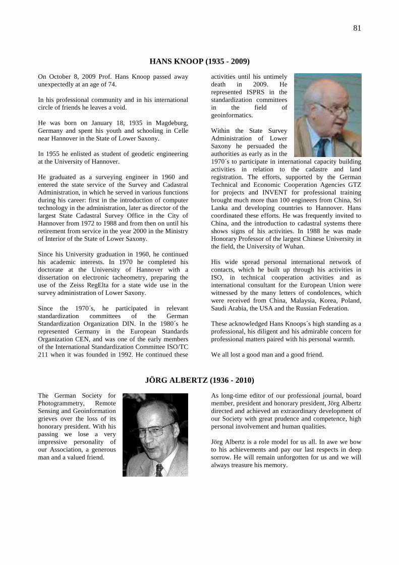
81
HANS KNOOP (1935 - 2009)
On October 8, 2009 Prof. Hans Knoop passed away unexpectedly at an age of 74. In his professional community and in his international circle of friends he leaves a void. He was born on January 18, 1935 in Magdeburg, Germany and spent his youth and schooling in Celle near Hannover in the State of Lower Saxony. In 1955 he enlisted as student of geodetic engineering at the University of Hannover. He graduated as a surveying engineer in 1960 and entered the state service of the Survey and Cadastral Administration, in which he served in various functions during his career: first in the introduction of computer technology in the administration, later as director of the largest State Cadastral Survey Office in the City of Hannover from 1972 to 1988 and from then on until his retirement from service in the year 2000 in the Ministry of Interior of the State of Lower Saxony. Since his University graduation in 1960, he continued his academic interests. In 1970 he completed his doctorate at the University of Hannover with a dissertation on electronic tacheometry, preparing the use of the Zeiss RegElta for a state wide use in the survey administration of Lower Saxony. Since the 1970´s, he participated in relevant standardization committees of the German Standardization Organization DIN. In the 1980´s he represented Germany in the European Standards Organization CEN, and was one of the early members of the International Standardization Committee ISO/TC 211 when it was founded in 1992. He continued these
activities until his untimely death in 2009. He represented ISPRS in the standardization committees in the field of geoinformatics. Within the State Survey Administration of Lower Saxony he persuaded the authorities as early as in the 1970´s to participate in international capacity building activities in relation to the cadastre and land registration. The efforts, supported by the German Technical and Economic Cooperation Agencies GTZ for projects and INVENT for professional training brought much more than 100 engineers from China, Sri Lanka and developing countries to Hannover. Hans coordinated these efforts. He was frequently invited to China, and the introduction to cadastral systems there shows signs of his activities. In 1988 he was made Honorary Professor of the largest Chinese University in the field, the University of Wuhan. His wide spread personal international network of contacts, which he built up through his activities in ISO, in technical cooperation activities and as international consultant for the European Union were witnessed by the many letters of condolences, which were received from China, Malaysia, Korea, Poland, Saudi Arabia, the USA and the Russian Federation. These acknowledged Hans Knoops´s high standing as a professional, his diligent and his admirable concern for professional matters paired with his personal warmth. We all lost a good man and a good friend.
JÖRG ALBERTZ (1936 - 2010) The German Society for Photogrammetry, Remote Sensing and Geoinformation grieves over the loss of its honorary president. With his passing we lose a very impressive personality of our Association, a generous man and a valued friend.
As long-time editor of our professional journal, board member, president and honorary president, Jörg Albertz directed and achieved an extraordinary development of our Society with great prudence and competence, high personal involvement and human qualities. Jörg Albertz is a role model for us all. In awe we bow to his achievements and pay our last respects in deep sorrow. He will remain unforgotten for us and we will always treasure his memory.
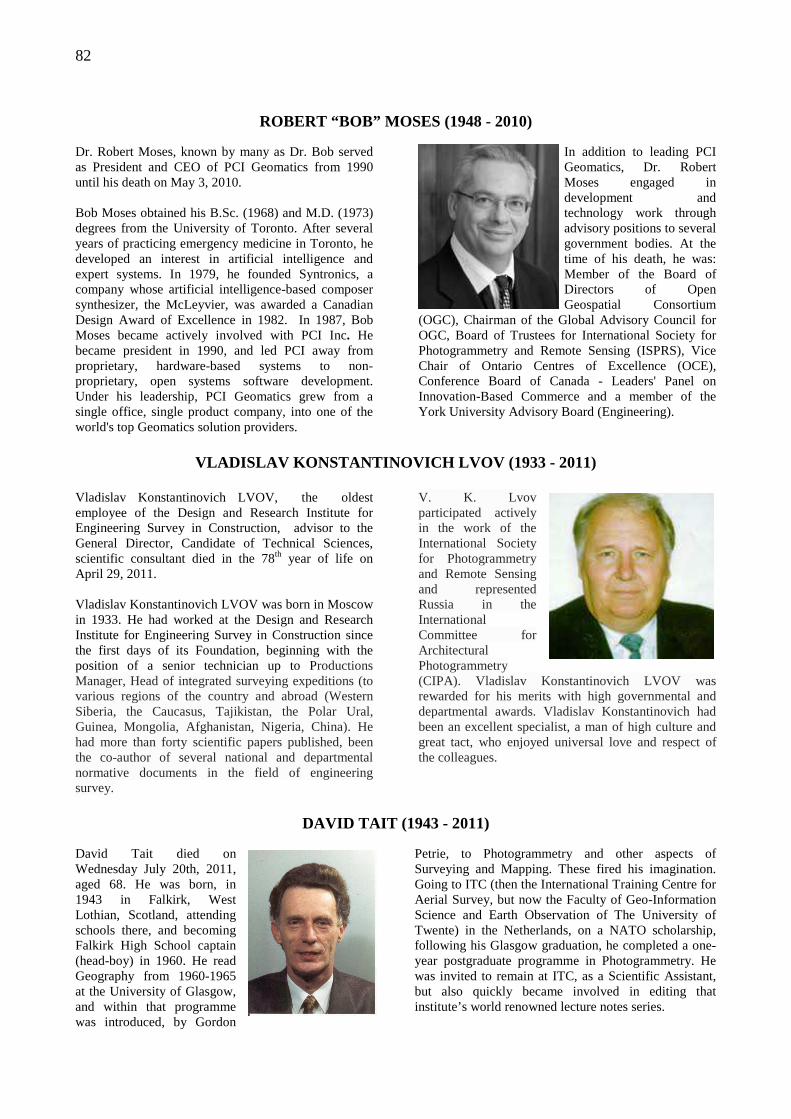
82
ROBERT “BOB” MOSES (1948 - 2010)
Dr. Robert Moses, known by many as Dr. Bob served as President and CEO of PCI Geomatics from 1990 until his death on May 3, 2010. Bob Moses obtained his B.Sc. (1968) and M.D. (1973) degrees from the University of Toronto. After several years of practicing emergency medicine in Toronto, he developed an interest in artificial intelligence and expert systems. In 1979, he founded Syntronics, a company whose artificial intelligence-based composer synthesizer, the McLeyvier, was awarded a Canadian Design Award of Excellence in 1982. In 1987, Bob Moses became actively involved with PCI Inc. He became president in 1990, and led PCI away from proprietary, hardware-based systems to non-proprietary, open systems software development. Under his leadership, PCI Geomatics grew from a single office, single product company, into one of the world's top Geomatics solution providers.
In addition to leading PCI Geomatics, Dr. Robert Moses engaged in development and technology work through advisory positions to several government bodies. At the time of his death, he was: Member of the Board of Directors of Open Geospatial Consortium
(OGC), Chairman of the Global Advisory Council for OGC, Board of Trustees for International Society for Photogrammetry and Remote Sensing (ISPRS), Vice Chair of Ontario Centres of Excellence (OCE), Conference Board of Canada - Leaders' Panel on Innovation-Based Commerce and a member of the York University Advisory Board (Engineering).
VLADISLAV KONSTANTINOVICH LVOV (1933 - 2011)
Vladislav Konstantinovich LVOV, the oldest employee of the Design and Research Institute for Engineering Survey in Construction, advisor to the General Director, Candidate of Technical Sciences, scientific consultant died in the 78th year of life on April 29, 2011. Vladislav Konstantinovich LVOV was born in Moscow in 1933. He had worked at the Design and Research Institute for Engineering Survey in Construction since the first days of its Foundation, beginning with the position of a senior technician up to Productions Manager, Head of integrated surveying expeditions (to various regions of the country and abroad (Western Siberia, the Caucasus, Tajikistan, the Polar Ural, Guinea, Mongolia, Afghanistan, Nigeria, China). He had more than forty scientific papers published, been the co-author of several national and departmental normative documents in the field of engineering survey.
V. K. Lvov participated actively in the work of the International Society for Photogrammetry and Remote Sensing and represented Russia in the International Committee for Architectural Photogrammetry (CIPA). Vladislav Konstantinovich LVOV was rewarded for his merits with high governmental and departmental awards. Vladislav Konstantinovich had been an excellent specialist, a man of high culture and great tact, who enjoyed universal love and respect of the colleagues.
DAVID TAIT (1943 - 2011)
David Tait died on Wednesday July 20th, 2011, aged 68. He was born, in 1943 in Falkirk, West Lothian, Scotland, attending schools there, and becoming Falkirk High School captain (head-boy) in 1960. He read Geography from 1960-1965 at the University of Glasgow, and within that programme was introduced, by Gordon
Petrie, to Photogrammetry and other aspects of Surveying and Mapping. These fired his imagination. Going to ITC (then the International Training Centre for Aerial Survey, but now the Faculty of Geo-Information Science and Earth Observation of The University of Twente) in the Netherlands, on a NATO scholarship, following his Glasgow graduation, he completed a one-year postgraduate programme in Photogrammetry. He was invited to remain at ITC, as a Scientific Assistant, but also quickly became involved in editing that institute’s world renowned lecture notes series.
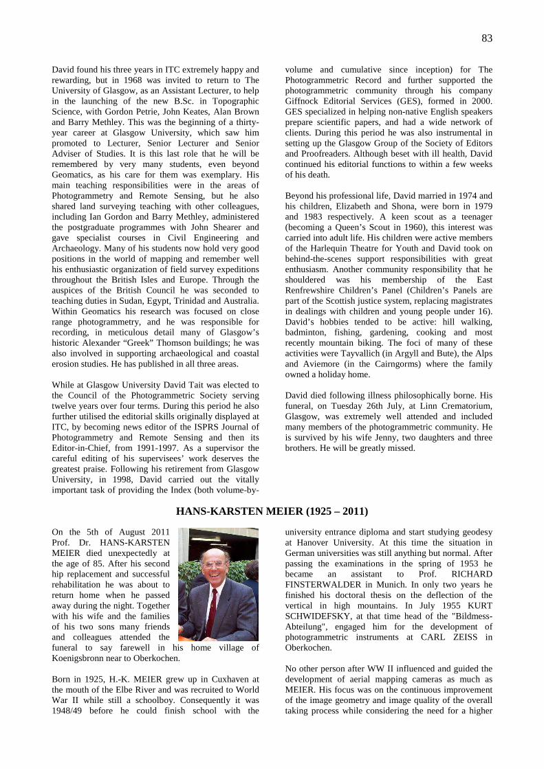
83
David found his three years in ITC extremely happy and rewarding, but in 1968 was invited to return to The University of Glasgow, as an Assistant Lecturer, to help in the launching of the new B.Sc. in Topographic Science, with Gordon Petrie, John Keates, Alan Brown and Barry Methley. This was the beginning of a thirty-year career at Glasgow University, which saw him promoted to Lecturer, Senior Lecturer and Senior Adviser of Studies. It is this last role that he will be remembered by very many students, even beyond Geomatics, as his care for them was exemplary. His main teaching responsibilities were in the areas of Photogrammetry and Remote Sensing, but he also shared land surveying teaching with other colleagues, including Ian Gordon and Barry Methley, administered the postgraduate programmes with John Shearer and gave specialist courses in Civil Engineering and Archaeology. Many of his students now hold very good positions in the world of mapping and remember well his enthusiastic organization of field survey expeditions throughout the British Isles and Europe. Through the auspices of the British Council he was seconded to teaching duties in Sudan, Egypt, Trinidad and Australia. Within Geomatics his research was focused on close range photogrammetry, and he was responsible for recording, in meticulous detail many of Glasgow’s historic Alexander “Greek” Thomson buildings; he was also involved in supporting archaeological and coastal erosion studies. He has published in all three areas. While at Glasgow University David Tait was elected to the Council of the Photogrammetric Society serving twelve years over four terms. During this period he also further utilised the editorial skills originally displayed at ITC, by becoming news editor of the ISPRS Journal of Photogrammetry and Remote Sensing and then its Editor-in-Chief, from 1991-1997. As a supervisor the careful editing of his supervisees’ work deserves the greatest praise. Following his retirement from Glasgow University, in 1998, David carried out the vitally important task of providing the Index (both volume-by-
volume and cumulative since inception) for The Photogrammetric Record and further supported the photogrammetric community through his company Giffnock Editorial Services (GES), formed in 2000. GES specialized in helping non-native English speakers prepare scientific papers, and had a wide network of clients. During this period he was also instrumental in setting up the Glasgow Group of the Society of Editors and Proofreaders. Although beset with ill health, David continued his editorial functions to within a few weeks of his death. Beyond his professional life, David married in 1974 and his children, Elizabeth and Shona, were born in 1979 and 1983 respectively. A keen scout as a teenager (becoming a Queen’s Scout in 1960), this interest was carried into adult life. His children were active members of the Harlequin Theatre for Youth and David took on behind-the-scenes support responsibilities with great enthusiasm. Another community responsibility that he shouldered was his membership of the East Renfrewshire Children’s Panel (Children’s Panels are part of the Scottish justice system, replacing magistrates in dealings with children and young people under 16). David’s hobbies tended to be active: hill walking, badminton, fishing, gardening, cooking and most recently mountain biking. The foci of many of these activities were Tayvallich (in Argyll and Bute), the Alps and Aviemore (in the Cairngorms) where the family owned a holiday home. David died following illness philosophically borne. His funeral, on Tuesday 26th July, at Linn Crematorium, Glasgow, was extremely well attended and included many members of the photogrammetric community. He is survived by his wife Jenny, two daughters and three brothers. He will be greatly missed.
HANS-KARSTEN MEIER (1925 – 2011)
On the 5th of August 2011 Prof. Dr. HANS-KARSTEN MEIER died unexpectedly at the age of 85. After his second hip replacement and successful rehabilitation he was about to return home when he passed away during the night. Together with his wife and the families of his two sons many friends and colleagues attended the funeral to say farewell in his home village of Koenigsbronn near to Oberkochen. Born in 1925, H.-K. MEIER grew up in Cuxhaven at the mouth of the Elbe River and was recruited to World War II while still a schoolboy. Consequently it was 1948/49 before he could finish school with the
university entrance diploma and start studying geodesy at Hanover University. At this time the situation in German universities was still anything but normal. After passing the examinations in the spring of 1953 he became an assistant to Prof. RICHARD FINSTERWALDER in Munich. In only two years he finished his doctoral thesis on the deflection of the vertical in high mountains. In July 1955 KURT SCHWIDEFSKY, at that time head of the "Bildmess-Abteilung", engaged him for the development of photogrammetric instruments at CARL ZEISS in Oberkochen. No other person after WW II influenced and guided the development of aerial mapping cameras as much as MEIER. His focus was on the continuous improvement of the image geometry and image quality of the overall taking process while considering the need for a higher
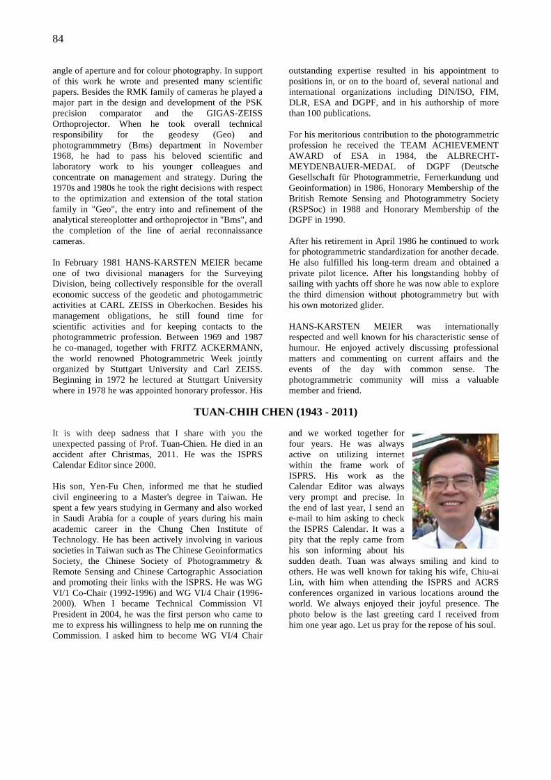
84
angle of aperture and for colour photography. In support of this work he wrote and presented many scientific papers. Besides the RMK family of cameras he played a major part in the design and development of the PSK precision comparator and the GIGAS-ZEISS Orthoprojector. When he took overall technical responsibility for the geodesy (Geo) and photogrammmetry (Bms) department in November 1968, he had to pass his beloved scientific and laboratory work to his younger colleagues and concentrate on management and strategy. During the 1970s and 1980s he took the right decisions with respect to the optimization and extension of the total station family in "Geo", the entry into and refinement of the analytical stereoplotter and orthoprojector in "Bms", and the completion of the line of aerial reconnaissance cameras. In February 1981 HANS-KARSTEN MEIER became one of two divisional managers for the Surveying Division, being collectively responsible for the overall economic success of the geodetic and photogammetric activities at CARL ZEISS in Oberkochen. Besides his management obligations, he still found time for scientific activities and for keeping contacts to the photogrammetric profession. Between 1969 and 1987 he co-managed, together with FRITZ ACKERMANN, the world renowned Photogrammetric Week jointly organized by Stuttgart University and Carl ZEISS. Beginning in 1972 he lectured at Stuttgart University where in 1978 he was appointed honorary professor. His
outstanding expertise resulted in his appointment to positions in, or on to the board of, several national and international organizations including DIN/ISO, FIM, DLR, ESA and DGPF, and in his authorship of more than 100 publications. For his meritorious contribution to the photogrammetric profession he received the TEAM ACHIEVEMENT AWARD of ESA in 1984, the ALBRECHT-MEYDENBAUER-MEDAL of DGPF (Deutsche Gesellschaft für Photogrammetrie, Fernerkundung und Geoinformation) in 1986, Honorary Membership of the British Remote Sensing and Photogrammetry Society (RSPSoc) in 1988 and Honorary Membership of the DGPF in 1990. After his retirement in April 1986 he continued to work for photogrammetric standardization for another decade. He also fulfilled his long-term dream and obtained a private pilot licence. After his longstanding hobby of sailing with yachts off shore he was now able to explore the third dimension without photogrammetry but with his own motorized glider. HANS-KARSTEN MEIER was internationally respected and well known for his characteristic sense of humour. He enjoyed actively discussing professional matters and commenting on current affairs and the events of the day with common sense. The photogrammetric community will miss a valuable member and friend.
TUAN-CHIH CHEN (1943 - 2011) It is with deep sadness that I share with you the unexpected passing of Prof. Tuan-Chien. He died in an accident after Christmas, 2011. He was the ISPRS Calendar Editor since 2000. His son, Yen-Fu Chen, informed me that he studied civil engineering to a Master's degree in Taiwan. He spent a few years studying in Germany and also worked in Saudi Arabia for a couple of years during his main academic career in the Chung Chen Institute of Technology. He has been actively involving in various societies in Taiwan such as The Chinese Geoinformatics Society, the Chinese Society of Photogrammetry & Remote Sensing and Chinese Cartographic Association and promoting their links with the ISPRS. He was WG VI/1 Co-Chair (1992-1996) and WG VI/4 Chair (1996-2000). When I became Technical Commission VI President in 2004, he was the first person who came to me to express his willingness to help me on running the Commission. I asked him to become WG VI/4 Chair
and we worked together for four years. He was always active on utilizing internet within the frame work of ISPRS. His work as the Calendar Editor was always very prompt and precise. In the end of last year, I send an e-mail to him asking to check the ISPRS Calendar. It was a pity that the reply came from his son informing about his sudden death. Tuan was always smiling and kind to others. He was well known for taking his wife, Chiu-ai Lin, with him when attending the ISPRS and ACRS conferences organized in various locations around the world. We always enjoyed their joyful presence. The photo below is the last greeting card I received from him one year ago. Let us pray for the repose of his soul.
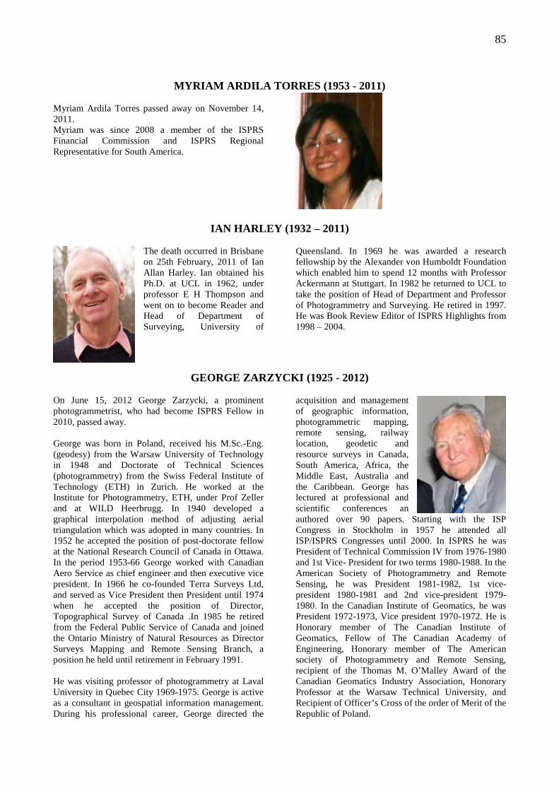
85
MYRIAM ARDILA TORRES (1953 - 2011)
Myriam Ardila Torres passed away on November 14, 2011. Myriam was since 2008 a member of the ISPRS Financial Commission and ISPRS Regional Representative for South America.
IAN HARLEY (1932 – 2011)
The death occurred in Brisbane on 25th February, 2011 of Ian Allan Harley. Ian obtained his Ph.D. at UCL in 1962, under professor E H Thompson and went on to become Reader and Head of Department of Surveying, University of
Queensland. In 1969 he was awarded a research fellowship by the Alexander von Humboldt Foundation which enabled him to spend 12 months with Professor Ackermann at Stuttgart. In 1982 he returned to UCL to take the position of Head of Department and Professor of Photogrammetry and Surveying. He retired in 1997. He was Book Review Editor of ISPRS Highlights from 1998 – 2004.
GEORGE ZARZYCKI (1925 - 2012)
On June 15, 2012 George Zarzycki, a prominent photogrammetrist, who had become ISPRS Fellow in 2010, passed away. George was born in Poland, received his M.Sc.-Eng. (geodesy) from the Warsaw University of Technology in 1948 and Doctorate of Technical Sciences (photogrammetry) from the Swiss Federal Institute of Technology (ETH) in Zurich. He worked at the Institute for Photogrammetry, ETH, under Prof Zeller and at WILD Heerbrugg. In 1940 developed a graphical interpolation method of adjusting aerial triangulation which was adopted in many countries. In 1952 he accepted the position of post-doctorate fellow at the National Research Council of Canada in Ottawa. In the period 1953-66 George worked with Canadian Aero Service as chief engineer and then executive vice president. In 1966 he co-founded Terra Surveys Ltd, and served as Vice President then President until 1974 when he accepted the position of Director, Topographical Survey of Canada .In 1985 he retired from the Federal Public Service of Canada and joined the Ontario Ministry of Natural Resources as Director Surveys Mapping and Remote Sensing Branch, a position he held until retirement in February 1991. He was visiting professor of photogrammetry at Laval University in Quebec City 1969-1975. George is active as a consultant in geospatial information management. During his professional career, George directed the
acquisition and management of geographic information, photogrammetric mapping, remote sensing, railway location, geodetic and resource surveys in Canada, South America, Africa, the Middle East, Australia and the Caribbean. George has lectured at professional and scientific conferences an authored over 90 papers. Starting with the ISP Congress in Stockholm in 1957 he attended all ISP/ISPRS Congresses until 2000. In ISPRS he was President of Technical Commission IV from 1976-1980 and 1st Vice- President for two terms 1980-1988. In the American Society of Photogrammetry and Remote Sensing, he was President 1981-1982, 1st vice-president 1980-1981 and 2nd vice-president 1979-1980. In the Canadian Institute of Geomatics, he was President 1972-1973, Vice president 1970-1972. He is Honorary member of The Canadian Institute of Geomatics, Fellow of The Canadian Academy of Engineering, Honorary member of The American society of Photogrammetry and Remote Sensing, recipient of the Thomas M. O’Malley Award of the Canadian Geomatics Industry Association, Honorary Professor at the Warsaw Technical University, and Recipient of Officer’s Cross of the order of Merit of the Republic of Poland.
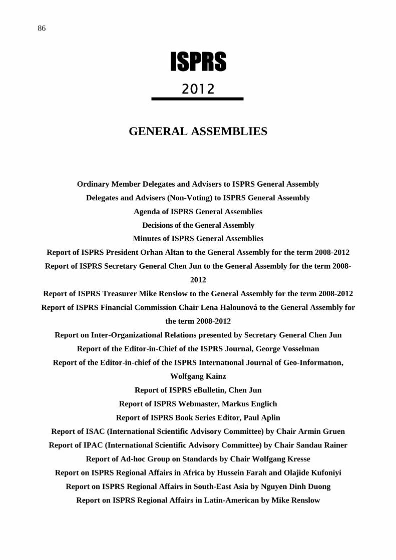
86
ISPRS 2012
GENERAL ASSEMBLIES
Ordinary Member Delegates and Advisers to ISPRS General Assembly
Delegates and Advisers (Non-Voting) to ISPRS General Assembly
Agenda of ISPRS General Assemblies
Decisions of the General Assembly
Minutes of ISPRS General Assemblies
Report of ISPRS President Orhan Altan to the General Assembly for the term 2008-2012
Report of ISPRS Secretary General Chen Jun to the General Assembly for the term 2008-
2012
Report of ISPRS Treasurer Mike Renslow to the General Assembly for the term 2008-2012
Report of ISPRS Financial Commission Chair Lena Halounová to the General Assembly for
the term 2008-2012
Report on Inter-Organizational Relations presented by Secretary General Chen Jun
Report of the Editor-in-Chief of the ISPRS Journal, George Vosselman
Report of the Editor-in-chief of the ISPRS Internatıonal Journal of Geo-Informatıon,
Wolfgang Kainz
Report of ISPRS eBulletin, Chen Jun
Report of ISPRS Webmaster, Markus Englich
Report of ISPRS Book Series Editor, Paul Aplin
Report of ISAC (International Scientific Advisory Committee) by Chair Armin Gruen
Report of IPAC (International Scientific Advisory Committee) by Chair Sandau Rainer
Report of Ad-hoc Group on Standards by Chair Wolfgang Kresse
Report on ISPRS Regional Affairs in Africa by Hussein Farah and Olajide Kufoniyi
Report on ISPRS Regional Affairs in South-East Asia by Nguyen Dinh Duong
Report on ISPRS Regional Affairs in Latin-American by Mike Renslow
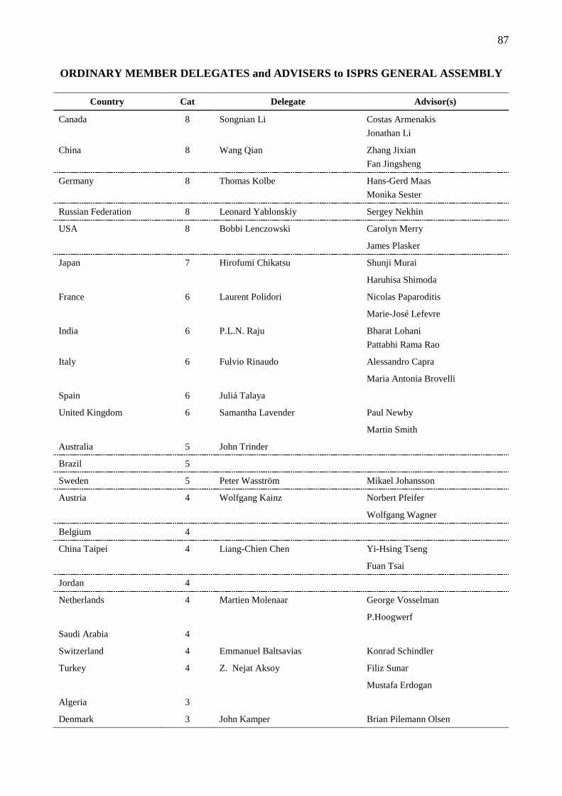
87
ORDINARY MEMBER DELEGATES and ADVISERS to ISPRS GENERAL ASSEMBLY
Country Cat Delegate Advisor(s)
Canada 8 Songnian Li Costas Armenakis
Jonathan Li
China 8 Wang Qian Zhang Jixian
Fan Jingsheng
Germany 8 Thomas Kolbe Hans-Gerd Maas
Monika Sester
Russian Federation 8 Leonard Yablonskiy Sergey Nekhin
USA 8 Bobbi Lenczowski Carolyn Merry
James Plasker
Japan 7 Hirofumi Chikatsu Shunji Murai
Haruhisa Shimoda
France 6 Laurent Polidori Nicolas Paparoditis
Marie-José Lefevre
India 6 P.L.N. Raju Bharat Lohani
Pattabhi Rama Rao
Italy 6 Fulvio Rinaudo Alessandro Capra
Maria Antonia Brovelli
Spain 6 Juliá Talaya
United Kingdom 6 Samantha Lavender Paul Newby
Martin Smith
Australia 5 John Trinder
Brazil 5
Sweden 5 Peter Wasström Mikael Johansson
Austria 4 Wolfgang Kainz Norbert Pfeifer
Wolfgang Wagner
Belgium 4
China Taipei 4 Liang-Chien Chen Yi-Hsing Tseng
Fuan Tsai
Jordan 4
Netherlands 4 Martien Molenaar George Vosselman
P.Hoogwerf
Saudi Arabia 4
Switzerland 4 Emmanuel Baltsavias Konrad Schindler
Turkey 4 Z. Nejat Aksoy Filiz Sunar
Mustafa Erdogan
Algeria 3
Denmark 3 John Kamper Brian Pilemann Olsen
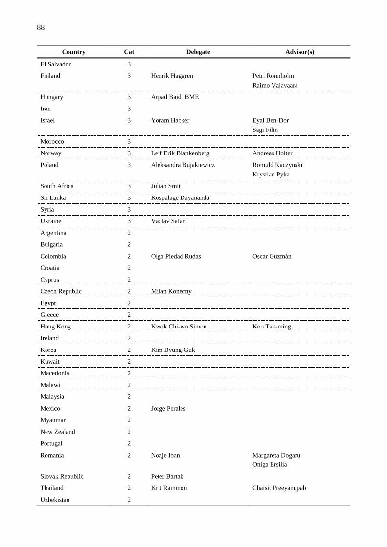
88
Country Cat Delegate Advisor(s)
El Salvador 3
Finland 3 Henrik Haggren Petri Ronnholm
Raimo Vajavaara
Hungary 3 Arpad Baidi BME
Iran 3
Israel 3 Yoram Hacker Eyal Ben-Dor
Sagi Filin
Morocco 3
Norway 3 Leif Erik Blankenberg Andreas Holter
Poland 3 Aleksandra Bujakiewicz Romuld Kaczynski
Krystian Pyka
South Africa 3 Julian Smit
Sri Lanka 3 Kospalage Dayananda
Syria 3
Ukraine 3 Vaclav Safar
Argentina 2
Bulgaria 2
Colombia 2 Olga Piedad Rudas Oscar Guzmán
Croatia 2
Cyprus 2
Czech Republic 2 Milan Konecny
Egypt 2
Greece 2
Hong Kong 2 Kwok Chi-wo Simon Koo Tak-ming
Ireland 2
Korea 2 Kim Byung-Guk
Kuwait 2
Macedonia 2
Malawi 2
Malaysia 2
Mexico 2 Jorge Perales
Myanmar 2
New Zealand 2
Portugal 2
Romania 2 Noaje Ioan Margareta Dogaru
Oniga Ersilia
Slovak Republic 2 Peter Bartak
Thailand 2 Krit Rammon Chaisit Preeyanupab
Uzbekistan 2
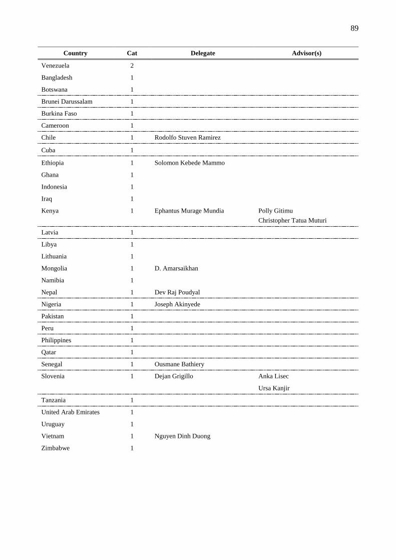
89
Country Cat Delegate Advisor(s)
Venezuela 2
Bangladesh 1
Botswana 1
Brunei Darussalam 1
Burkina Faso 1
Cameroon 1
Chile 1 Rodolfo Stuven Ramirez
Cuba 1
Ethiopia 1 Solomon Kebede Mammo
Ghana 1
Indonesia 1
Iraq 1
Kenya 1 Ephantus Murage Mundia Polly Gitimu
Christopher Tatua Muturi
Latvia 1
Libya 1
Lithuania 1
Mongolia 1 D. Amarsaikhan
Namibia 1
Nepal 1 Dev Raj Poudyal
Nigeria 1 Joseph Akinyede
Pakistan 1
Peru 1
Philippines 1
Qatar 1
Senegal 1 Ousmane Bathiery
Slovenia 1 Dejan Grigillo Anka Lisec
Ursa Kanjir
Tanzania 1
United Arab Emirates 1
Uruguay 1
Vietnam 1 Nguyen Dinh Duong
Zimbabwe 1
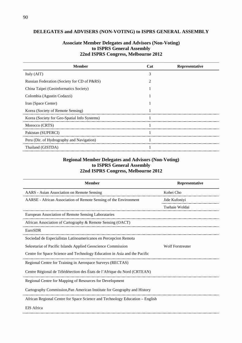
90
DELEGATES and ADVISERS (NON-VOTING) to ISPRS GENERAL ASSEMBLY
Associate Member Delegates and Advisors (Non-Voting) to ISPRS General Assembly
22nd ISPRS Congress, Melbourne 2012
Member Cat Representative
Italy (AIT) 3
Russian Federation (Society for CD of P&RS) 2
China Taipei (Geoinformatics Society) 1
Colombia (Agustin Codazzi) 1
Iran (Space Center) 1
Korea (Society of Remote Sensing) 1
Korea (Society for Geo-Spatial Info Systems) 1
Morocco (CRTS) 1
Pakistan (SUPERCI) 1
Peru (Dir. of Hydrography and Navigation) 1
Thailand (GISTDA) 1
Regional Member Delegates and Advisors (Non-Voting)
to ISPRS General Assembly 22nd ISPRS Congress, Melbourne 2012
Member Representative
AARS - Asian Association on Remote Sensing Kohei Cho
AARSE - African Association of Remote Sensing of the Environment Jide Kufoniyi
Tsehaie Woldai
European Association of Remote Sensing Laborataries
African Association of Cartography & Remote Sensing (OACT)
EuroSDR
Sociedad de Especialistas Latinoamericanos en Percepcion Remota
Sekretariat of Pacific Islands Applied Geoscience Commission Wolf Forstreuter
Centre for Space Science and Technology Education in Asia and the Pacific
Regional Centre for Training in Aerospace Surveys (RECTAS)
Centre Régional de Télédétection des États de l’Afrique du Nord (CRTEAN)
Regional Centre for Mapping of Resources for Development
Cartography Commission,Pan American Institute for Geography and History
African Regional Centre for Space Science and Technology Education – English
EIS Africa
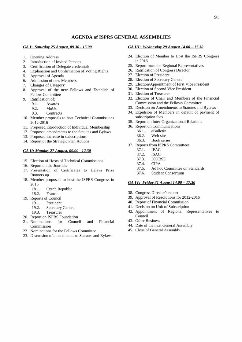
91
AGENDA of ISPRS GENERAL ASSEMBLIES
GA I: Saturday 25 August, 09.30 - 15.00 1. Opening Address 2. Introduction of Invited Persons 3. Certification of Delegate credentials 4. Explanation and Confirmation of Voting Rights 5. Approval of Agenda 6. Admission of new Members 7. Changes of Category 8. Approval of the new Fellows and Establish of
Fellow Committee 9. Ratification of:
9.1. Awards 9.2. MoUs 9.3. Contracts
10. Member proposals to host Technical Commissions 2012-2016
11. Proposed introduction of Individual Membership 12. Proposed amendments to the Statutes and Bylaws 13. Proposed increase in subscriptions 14. Report of the Strategic Plan Actions GA II: Monday 27 August, 09.00 - 12.30 15. Election of Hosts of Technical Commissions 16. Report on the Journals 17. Presentation of Certificates to Helava Prize
Runners up 18. Member proposals to host the ISPRS Congress in
2016 18.1. Czech Republic 18.2. France
19. Reports of Council 19.1. President 19.2. Secretary General 19.3. Treasurer
20. Report on ISPRS Foundation 21. Nominations for Council and Financial
Commission 22. Nominations for the Fellows Committee 23. Discussion of amendments to Statutes and Bylaws
GA III: Wednesday 29 August 14.00 – 17.30 24. Election of Member to Host the ISPRS Congress
in 2016 25. Report from the Regional Representatives 26. Ratification of Congress Director 27. Election of President 28. Election of Secretary General 29. Election/Appointment of First Vice President 30. Election of Second Vice President 31. Election of Treasurer 32. Election of Chair and Members of the Financial
Commission and the Fellows Committee 33. Decision on Amendments to Statutes and Bylaws 34. Expulsion of Members in default of payment of
subscription fees 35. Report on Inter-Organizational Relations 36. Report on Communications
36.1. eBulletin 36.2. Web site 36.3. Book series
37. Reports from ISPRS Committees 37.1. IPAC 37.2. ISAC 37.3. ICORSE 37.4. CIPA 37.5. Ad hoc Committee on Standards 37.6. Student Consortium
GA IV: Friday 31 August 14.00 – 17.30 38. Congress Director's report 39. Approval of Resolutions for 2012-2016 40. Report of Financial Commission 41. Decision on Unit of Subscription 42. Appointment of Regional Representatives to
Council 43. Other Business 44. Date of the next General Assembly 45. Close of General Assembly
92
DECISIONS of THE GENERAL ASSEMBLIES
The General Assembly:
Approved the Agenda The General Assembly:
Approved the following new members which had been admitted since the Beijing Congress: 4 new Ordinary Members:
Instituto Geográfico Português Center of Remote Sensing and GIS Technologies Uzbekistan South African Society for Photogrammetry and Remote Sensing Chamber of authorized Architects and Engineers Former Yugoslav Republic of Macedonia
1 new Associate Member: Directorate of Hydrography and Navigation Peru
2 new Regional Members: African Regional Centre for Space Science and Technology Education – English EIS Africa
11 new Sustaining Members
The General Assembly: Approved the appointment of the following new Fellows:
Dieter Fritsch (Germany) Martien Molenaar (The Netherlands) Shailesh Nayak (India) Paul Newby (UK) Heinz Ruther (South Africa)
The General Assembly:
Ratified changes to Awards, MoUs and Contracts Establishment of Two New Awards:
Fred Doyle Award Inghilleri Award
Changes in existing Awards Otto von Gruber Award Schermerhorn Award Karl Kraus Award
MOUs – new agreements with 9 professional societies: AARSE EIS‐AFRICA ifpUS EARSeL SELPER AARS OGC LARS RAC –(Russian Academy of Cosmonautics)
Three contracts have been signed: International Journal for Geo‐Information Publishing XXII Congress with SSSI of Australia Copernicus GmbH for managing abstracts and papers for ISPRS events
The General Assembly:
Elected the following Members to host Technical Commissions:
TC1: USA TC2: Canada TC3: Switzerland TC4: China TC5: Italy TC6: China TC7: Turkey TC8: India
The General Assembly:
Ratified the appointment of: Lena Halounova (Czech Republic) as the Congress Director Orhan Altan (Turkey) as First Vice President
The General Assembly:
Elected the following Members of Council: Chen Jun (China) as President Christian Heipke (Germany) as Secretary General Marguerite Madden (USA) as Second Vice President Jon Mills (UK) as Treasurer
The General Assembly:
Elected as Members of the Financial Commission: Marie‐José Lefèvre‐Fonollosa (France), Fluvio de Rinaudo (Italy) Olga Piedad Rudas (Columbia)
The General Assembly:
Elected as members of the Fellows Committee: John Shi (Hong Kong) Stefan Nebiker (Switzerland)
The General Assembly:
Accepted the application of the Azerbaijan Society for Photogrammetry and Remote Sensing (ASFRS) to become an Ordinary Member category 2
The General Assembly: Agreed the following changes to the Status and Bylaws:
Article 7 of the Statutes VI Article 7 of Bylaw IX Article 7 of Bylaw XIII
Agreed to postpone a decision on Article 7 of Bylaw VI subject to a new proposal from Council.
The General Assembly:
Approved of the Resolutions of the Congress
The General Assembly: Elected the following as Regional Representative to Council:
Africa: Hussein Farah East Asia: Nguyen Dinh Duong Latin-America: Mario Hernandez
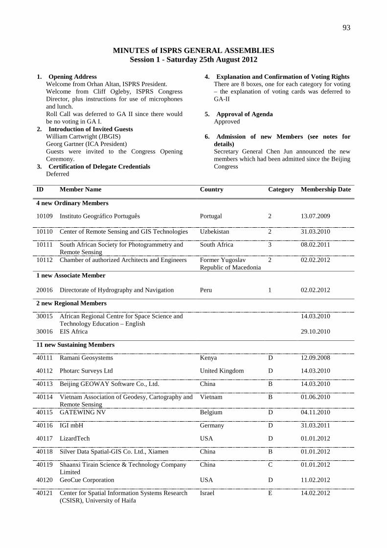
93
MINUTES of ISPRS GENERAL ASSEMBLIES Session 1 - Saturday 25th August 2012
1. Opening Address
Welcome from Orhan Altan, ISPRS President. Welcome from Cliff Ogleby, ISPRS Congress Director, plus instructions for use of microphones and lunch. Roll Call was deferred to GA II since there would be no voting in GA I.
2. Introduction of Invited Guests William Cartwright (JBGIS) Georg Gartner (ICA President) Guests were invited to the Congress Opening Ceremony.
3. Certification of Delegate Credentials Deferred
4. Explanation and Confirmation of Voting Rights There are 8 boxes, one for each category for voting – the explanation of voting cards was deferred to GA-II
5. Approval of Agenda
Approved 6. Admission of new Members (see notes for
details) Secretary General Chen Jun announced the new members which had been admitted since the Beijing Congress
ID Member Name Country Category Membership Date
4 new Ordinary Members
10109 Instituto Geográfico Português Portugal 2 13.07.2009
10110 Center of Remote Sensing and GIS Technologies Uzbekistan 2 31.03.2010
10111 South African Society for Photogrammetry and Remote Sensing
South Africa 3 08.02.2011
10112 Chamber of authorized Architects and Engineers Former Yugoslav Republic of Macedonia
2 02.02.2012
1 new Associate Member
20016 Directorate of Hydrography and Navigation Peru 1 02.02.2012
2 new Regional Members
30015 African Regional Centre for Space Science and Technology Education – English
14.03.2010
30016 EIS Africa 29.10.2010
11 new Sustaining Members
40111 Ramani Geosystems Kenya D 12.09.2008
40112 Photarc Surveys Ltd United Kingdom D 14.03.2010
40113 Beijing GEOWAY Software Co., Ltd. China B 14.03.2010
40114 Vietnam Association of Geodesy, Cartography and Remote Sensing
Vietnam B 01.06.2010
40115 GATEWING NV Belgium D 04.11.2010
40116 IGI mbH Germany D 31.03.2011
40117 LizardTech USA D 01.01.2012
40118 Silver Data Spatial-GIS Co. Ltd., Xiamen China B 01.01.2012
40119 Shaanxi Tirain Science & Technology Company Limited
China C 01.01.2012
40120 GeoCue Corporation USA D 11.02.2012
40121 Center for Spatial Information Systems Research (CSISR), University of Haifa
Israel E 14.02.2012
94
7. Changes of Category No changes were presented
8. Approval of the new Fellows and Establishment
of Fellow Committee Recommendations from Fellows Committee explained by John Trinder (from 15 nominees): Dieter Fritsch (Germany) Martien Molenaar (The Netherlands) Shailesh Nayak (India) Paul Newby (UK) Heinz Ruther (South Africa)
Recommendations were approved and the new fellows were congratulated by President Altan. Fellows Committee was disbanded and Council requested nominations for Fellow Committee for the next 4 years.
9. Ratification of Awards, MoUs and Contracts
Changes since the Centenary General Assembly in 2010: Two New Awards:
Fred Doyle Award Inghilleri Award
Changes in existing awards:
Otto von Gruber Award - changes to Article 4, Schermerhorn Award – changes to Article 5. Karl Kraus Award – a recommended change to timing of publication of books to 8 years from the close of nominations rather than the date of Congress. This has been agreed to by the sponsors.
MOUs – new agreements with 9 professional societies:
AARSE EIS-AFRICA ifpUS EARSel SELPER AARS OGC LARS RAC – (Russian Academy of Cosmonautics)
Three contracts have been signed:
International Journal for Geo-Information Publishing XXII Congress with SSSI of Australia Copernicus GmbH for managing abstracts and papers for ISPRS events
All of the above changes were approved.
10. Member Proposals to Host Technical
Commissions 2012-2016 TCP II - Canada (Songnian Li, Costas Armenakis) Proposed Candidates:
President: Songnian Li Secretary: Suzanna Dragicevic
Proposed Country: Canada ISPRS member for about 60 years; First GIS in operation was in Canada ISPRS Congress Ottawa 1972 plus previous hosting of various Technical Commissions Support for hosting TC II from CIG and Ryerson University
Proposed Event Joint international conference with CIG, CCAAC and SDH: 3-4 days with high quality international papers, exhibitions, workshops, technical/social tours and publications
Proposed Venue: Downtown Toronto, September 2014.
Working Groups to cover: Processing, analysis and modeling of spatial & temporal data Multi-scale and multi-dimensional representation and models of spatial data Spatial data and model quality Integration of heterogeneous spatial information & systems Spatial planning and decision support systems Communication and visualization of spatial data Cloud computing for processing and analyzing big spatial data and geo-statistics
Inter-Commission Activities: Semantic interoperability and ontology Geo-sensor data and moving objects data handling Spatial data, information and location-based services
Major Activities: ISPRS book series Special journal issues Midterm symposium Joint workshops and conferences between TC II WGs and other WGs in other commissions
Future Cooperation: TC IV and VII; ICA Commissions on Cognitive Visualization, Data Quality and Geo-visualisation FIG Commission 3 IGU Commission on GIS and MGS GEO – Global Land Cover Task SB-02
TCP III – Konrad Schindler (Switzerland) Proposed Country: Switzerland
SSPF/SSPT founded in 1928; 2 ISPRS congresses, 1 presidency, 6 council members, 5 commission presidencies, ISPRS editor in chief (1997-2004), 4 active universities
Proposed Candidates: President: Konrad Schindler Vice President: Manos Baltsavias Secretary: Wilfried Harmann
Topics Photogrammetric computer vision and image analysis
95
Early processing – image indexing, dense matching High-level processing – classification, object detection, automatic mapping, object extraction Point-cloud processing – management, classification and understanding Image sequences and dynamics – tracking, flow analysis
Goals: Commission III Symposium: Photogrammetric Computer Vision – September 2014 Zurich with European conference on computer vision; use double-blind peer review process as before; Specialised Workshops: best in conjunction with other conferences or meetings for greater impact and attendance Benchmarking and validation – create and run rigorous benchmarks; focus of activities
Structure Moderate number of working groups – avoid fragmentation, too small for critical mass (5-7 WG at most) Eg: 1. Orientation, image indexing, matching; 2. Point cloud processing; 3. Classification, detection, object reconstruction; 4. Image sequences etc.
TCP IV – Jiang Jie (China) CSGPC Proposed Candidates:
President: Jiang Jie (NGCC) Secretary: Wang Qian (sec. WG IV/1)
Proposed Country: China CSGPC – ordinary member in category 8; established 1959, comprising 18 techical commissions and 31 provincial branches, 1900 fellows, more than 10,000 ordinary members
Support for Jiang Jie’s candidacy from the National Geomatics Center of China. Sponsors will be available for TC symposium; Proposed TC Symposium
Late summer/early autumn in 2014, China with an expected 300-400 participants Publications – proceedings of the Symposium + special journal issues; She will encourage related workshops etc.
TCP I – Charles Toth (USA) Proposed Country: USA
ASPRS: established 78 years ago and has more than 5,000 members, 6 divisions, 19 committees, 17 regions; has its own PE&RS journal; many ISPRS Council members in the past, has hosted many TCs/WGs, student awards and ISPRS Foundation
Proposed Candidates: President: Charles Toth who has been active for 20 years especially in TC I; Secretary: Boris Jutzi
Proposed Event:
Inter-Congress symposium with ASPRS PECORA 19 Fall Conference in Denver, November 17-20, 2014
TC I current structure – 6 WGs + Inter-Commission WG I/V for UAVs Vision for future: exploit potential of improved quality and increasing volume including CalVal activities:
Fully digital, multisensory data acquisition (large volume of diverse data from multiple platforms) Advanced integrated systems for sensor geo-referencing (orientation) and navigation (based on navigation and imaging sensors) New methodology for QA/QC processes Moving toward near real-time information extraction
TC V – Fabio Remondino (Italy) introduced by Canada Proposed Candidates:
President: Fabio Remondino Sec: Fabio Menna
Support from SIFET/ASITA New proposed title for TC V: Close-range Imaging, Analysis and Applications – which is a better reflection of TC’s activities. Now has 6 WG + 2 Inter-Commission WG with TC I and TC V Name Changes for WG:
WG V/4: 3D-Modellling: methodologies and best practice WG V/6: close-range measurement for earth and medical applications
Vision for TC V: Reinforce data & sensor fusion techniques for object extraction and scene analysis Fortify mobile mapping developments Strengthen the use of low-cost hardware for metric applications Investigate web-based solutions for 3D reconstructions and crowd sourced images/data as input for metric applications Seek medical applications Attract more scientists and engineers to TC V activities Propose benchmarking datasets for sensors investigation, evaluation of algorithm performances, etc. Strengthen collaborations with TC III and TC I Seek collaborations with EuroSDR
Midterm Symposium 2014- will be held in Riva del Garda, Trento, Italy which is a good location, with appropriate facilities and costs, at the end of June 2014 (close to TC III), involving 3 days with a commercial exhibition, tutorials, papers. etc The proposed Budget includes €400 registration fee. Fabio’s experience: organized 2 ISPRS workshops, 4 3D-Arch; 3 SPIE video-metrics;4 summer schools
TC VI - Jianya Gong (China) Proposed Candidates:
96
President: Jianya Gong Proposing 6 WGs– WG VI/6 will be new. The international summer schools for high level education for China and Russia have been running biennially and the TC wishes to extend it to other countries Also plan to:
Establish a Web-based platform for educational/research resource sharing and cooperative research, A joint tutorial with ICA Commission on Education and Training in Mongolia in 2013, A joint symposium with ICA Commission on Education and Training in Wuhan in 2014, A joint tutorial with ICA Commission on Education and Training in Africa in 2015.
TC VII – Jixian Zhang (China) Proposed Candidates:
President: Jixian Zhang Secretary: Yu Zeng Plus 5 office staff from CASM There is over RMB 1 Million per year to run office plus international travel from CASM, CSGPC and NASG
Some changes to WGs structure are planned but former chairs and co-chairs welcome to continue to serve TC VII. Preliminary proposal for a new WG: In-situ Measurements and its Automation. WG will be encouraged to hold at least one workshop, especially in 2013 and 2015. Proposed Mid-term Symposium in Lijiang in August 2014 with a proposed registration fee of US$350. 450 participants are anticipated. Support is available from CASM. Anticipated outputs:
A book entitled Advances in Modelling and Analysis of Remotely Sensed Data Two special issues on remote sensing data processing and modelling Publications from working groups Regular articles for ISPRS Highlights
TC VII – Filiz Sunar (Turkey) Proposed Candidates:
President: Filiz Sunar Vice-President: Wolfgang Wagner (Austria) Vice-President: Malcolm Taberner (UK) Secretary: Ayda Akkartal Aktas (Turkey)
Plan to: Expand and improve existing programs within the WGs by, for example, encouraging new novel, and exciting research in the field of ground observations; Promote the importance of remote sensing and information extraction; Encouraging a positive,collaborative attitude with TCs and other Societies; Encourage greater participation and cooperation from other disciplines. Cooperation with ICORSE, URSI and IAA
Proposed Commission VII Midterm symposium
Istanbul 9-12 September 2014, at Istanbul Technical University, lasting 3.5 day with 3 plenary sessions etc. Registration fees €340.
TC VIII – Prof Raju on behalf of Vinay Dadhwal (India) Proposed Country: India
India has hosted 3 commissions (I, VII and IV), 3 TC Symposia, 5 ISPRS WG workshops(IV – 3, V – 1, VI- 2, VIII- 2), and has taken an active EO role in many operational applications areas and satellite missions (10 operational satellites, 187 transponders); ISRS has more than 4000 members, a quarterly journal and other books, an annual seminar etc.
Proposed Candidates: President: Vinay Dadhwal Secretary: P.L.N. Raju
Proposed Midterm Symposium: “Remote Sensing – Touching Lives” in Kochi, Jaipur or Chennai; the likely cost will: USD 100,000 with a planned registration fee of USD 250; 400 participants are anticipated. ISRS has supported from ISRO, MES, MEF, MA and others
11. Proposed introduction of Individual
Membership (Ian Dowman)
Benefits to ISPRS: individuals feel part of ISPRS, especially in countries without active Ordinary membership individuals will be eligible for benefits, e.g. travel grants provides income; and provides a mailing list.
Benefits to individuals: ISPRS eBulletin and other correspondence preference for awarding of ISPRS/TIF travel grants certificate of membership access to ISPRS website member resources member discounts in book series access to publication in ISPRS GI journal at reduced rates
Cost CHF 30 pa; students CHF 20; 4 year membership CHF 100 (students: CHF 60) There are some concerns expressed by members: It could take members from OdMs (but it is proposed that applications can be ‘controlled’ by OdM in each country of residence – i.e. each country can control and administer the process for its residents (process to be approved by ISPRS Council).
97
General Discussion: Benefits to individuals must not harm national societies, eg ASPRS.
Council response: It is expected that active OdM would already provide connection to ISPRS, but there are some OdM who feel they might be threatened by individual membership. This is aimed at professionals who do not have good access to ISPRS through their OdM. Concern was also expressed by the Dutch society – this might lead to individuals not being part of their local society. Question: Can individual members hold positions in ISPRS? Answer: ‘No’ Services still to be determined by the new Council. Individual members will not get any benefits that are not available to OdM, so there are no advantages to professionals joining ISPRS rather than their local society.
12. Proposed Amendments to the Statutes and Bylaws Presented by Ammatzia Peled Annals of Photogrammetry, Remote Sensing and SIS which are separate from the Archives to distinguish them as reviewed papers have been added to the Bylaws where appropriate. This changes will be announced via ISPRS website, etc. Item 12.A Statutes – Change to VI Membership 7. Individual Members. Individuals who wish to be involved with the activities and mission of the Society. Item 12.B Bylaw VI - Membership Fellows
6. Fellows (a) Candidates shall be nominated by any Member of the Society or by Council. The nomination shall be considered by the Fellows Committee, and recommendations for the award of Fellowship shall be made to the General Assembly which will elect the Fellows. (b) The Fellows Committee shall be composed of 5 members from Fellows selected by Council (2), an Honorary Member selected by the Honorary Members (1), and individuals elected by the General Assembly (2). The Committee shall select a Chair from amongst their number. Members of the Fellows Committee are ineligible for nomination. (c) The maximum number of Fellows at any one time shall be 30, excluding those Fellows subsequently elected as Honorary Members. Up
to 5 Fellows may be elected in any one General Assembly. This is replacing the version below that was adopted at Beijing, 2008 6. Fellows (a) Candidates shall be nominated by any Member of the Society or by Council. The nomination shall be considered by the Fellows Committee, and recommendations for the award of Fellowship shall be made to the General Assembly which will elect the Fellows. (b) The Fellows Committee shall be composed of 5 members made up from Fellows selected by Council (2), an Honorary Member selected by the Honorary Members (1), and individuals elected by the General Assembly (2). The Committee shall select a Chair from amongst their number. Members of the Fellows Committee are ineligible for nomination. (note: the first Fellows Committee will have 4 members elected by the GA, and 1 Honorary Member). (c) The maximum number of Fellows at any one time shall be 30. Up to 5 Fellows may be elected in any one General Assembly. (note: in the first election in 2010, up to 12 fellows may be elected)
Individual Members – new clause 7. Individual Members a. An application for Individual Membership shall be addressed in writing to the Secretary General and shall include a full statement of the applicant's role in the fields of photogrammetry and/or remote sensing and/or spatial information. b. Applications may be submitted as follows: By individuals who reside in a Country that has no Ordinary Member affiliated with ISPRS; By individuals who reside in a Country that has a non-active Ordinary Member affiliated with ISPRS; By individuals who reside in a Country that has an active Ordinary Member affiliated with ISPRS with no restrictions regarding individual membership in ISPRS; Through the Ordinary Member affiliated with ISPRS that has restrictions on individual membership in ISPRS; c. Council shall consider each application and make the final decision on admission of an applicant. d. Council shall have the authority to cancel Individual Membership: in case of action manifestly contrary to the interests and objectives of the Society; in case of repeated default in payment of subscription fees.
Finances: Bylaw XV 4. The subscription fees of Individual Members, Sustaining Members and Regional Members,
98
established by the Council, shall be ratified by the General Assembly.
Congress: Bylaw IX 7. The Ordinary Member organizing the Congress shall sign a contract with the Society and be responsible for ensuring that adequate provisions are made for the Congress. The Ordinary Member shall obtain the necessary financial support for this purpose. The Ordinary Member shall be responsible for financing the Congress, including the preparation and publication of The International Archives and Annals of the Photogrammetry, Remote Sensing and Spatial Information Sciences relating to the Congress. For this purpose it shall have the cooperation of the Technical Commissions and of the Council.
New Commission names: TC I Sensors and platforms for remote sensing TC IV Geospatial databases and location based services. TC V Close-range imaging analysis and applications TC VI Education, technology transfer and capacity development
Presentation by Switzerland Expression of support for students should be mentioned in bylaws Propose that students pay < 50% fees for congresses and summer schools without a late penalty – this would require a change in Finances bylaw. The President said that Council supports the idea but decided that the proposal contains too much detail to be in bylaws, so Council advises against this proposal. A further proposal will be submitted by Switzerland.
13. Proposed increase in subscriptions (Mike
Renslow, ISPRS Treasurer) Proposed increase of 115 CHF to 130 CHF to offset rising costs and loss of external funding and continue to support members. Total increase in revenue is ~20,000 CHF per years. There has been no increase in subscriptions since January 2009 but ISPRS has increased its web presence and publications and now has greater collaboration with other societies. Internal revenue includes membership fees, symposia and congress revenue plus royalties. All are down about 15%. External revenue includes funding from home institutions, donations, and host support. Costs: include Website, Journal, Student support activities, and operating expenses.
Total income for the current 4 years: CHF 576,799 (68% from member fees) Total cost: CHF 612,358 Shortfall: CHF 11,862 Potential increased revenue: CHF 20,646 Proposed rate schedule if increase is approved is detailed in notes. The proposal will be discussed at GA IV.
14. Report of the Strategic Plan Actions (Ian
Dowman) Implementation Status: Printed version of report in notes. The Strategic Plan was approved in Vienna. Subsequently 3 task forces have been set up in last 2 years. Actions so far:
New journal: Int. J. Geo-Information (full report later) New Int. Annals of PRS and SIS with double blind peer review Copernicus will support ISPRS meeting organisers ISPRS eBulletin Individual Membership proposal (discussed above) Other publications, eg. GDRM booklet with UNOOSA and JBGIS Blog site set up but not public yet Council meetings on Skype for cost saving Funding from UNOOSA and TIF to support Africa/Asia Develop Body of Knowledge for curriculum development Ongoing Actions: Updating Orange Book Strengthen capacity building – changes to commission VI Website upgrades Future: Some actions have been limited by funding. Item 2.1 – list of experts – difficult to vet Role of women is a task for next council
Sustaining members - no success with requests for increased support More funds needed for permanent secretariat, and marketing and promotion. Permanent HQ for ISPRS (Item 4.7)
funding issues passed on to new council need to define role of office-bearers further explore other options, possibly sharing services with other organisations.
The Strategic Plan will be a continuing task for the next Council.
99
Session 2 - Monday 27th August 2012
15. Election of Hosts of Technical Commissions Secretary General Chen Jun provided explanation of voting rights for ordinary members at GA. There are 90 OdMs in ISPRS: 44 were entitled to vote and 33 were present at GA New OdMs admitted to GA were granted voting rights after payment of 2012 subscription fees. Roll Call:
All countries were present except: Czech Republic, Israel, Malaysia, Mexico, Slovak Republic (126 maximum votes)
Results of Election of Hosts of Technical Commissions:
(Only TC7 had two nominations and hence required a vote – all other TCs had single nominations). The final list of elected Technical Commission Presidents (TCP) is: TC I: USA TC II: Canada TC III: Switzerland TC IV: China TC V: Italy TC VI: China TC VII: Turkey TC VIII: India
16. Report on the Journals: 1. ISPRS International Journal of Photogrammetry and Remote Sensing: George Vosselman (editor-in-chief)
• Growth in submissions, acceptance rate decreasing (27% in 2011)
• Move to time-based publishing by Elsevier • Decreasing paper subscriptions, increasing
online downloads • Increase in impact factor (2.885 in 2011) and
citations • 2008-2011 U.V. Helava Award to: Konrad
Schindler, Andreas Ess, Bastian Leibe and Luc Van Gool
• Changes to Elsevier contract (valid to 2016) include an increase in issues, subscription fee, page numbers, additional associate editors.
• Derek Lichti (U. Calgary) appointed new Editor-in-Chief as of Jan 2013
Certificate of appreciation presented by President Altan to George Vosselman. 2. ISPRS International Journal of Geo-Information: Wolfgang Kainz (Editor-in-Chief), published by MDPI
• Open access journal, preparation started in 2010 • Broad scope of journal covering all aspects of ISPRS Technical Commissions
• 8 published papers so far, high rate of rejection to protect quality in start-up phase • Shorter processing time: average of 60 days • High viewing of papers; increasing visits to webpage • 5 special issues in pipeline (2012-13) • Requests from the Editor-in-Chief: - council members should write position papers about key topics of ISPRS - TCPs should write position papers about respective TC - TCPs should encourage WGs to publish workshop results - New council to discuss fee waiver period extension with MDPI
Certificate of appreciation presented by President to Wolfgang Kainz.
17. Presentation of Certificates, Helava Prize
Runners Up: • 200: Helmut Grabner, Thuy Thi Nguyen, Barbara Gruber and Horst Bischof • 2009: Jérôme Korona, Etienne Berthier, Marc Bernard, Frederique Remy and Eric Thouvenot • 2011: Christopher Gold and Hugo Ledoux
18. Member Proposals to host the 23rd ISPRS
Congress in 2016: 18.1 Czech Republic (Prague): 12-19 July 2016, Prague Congress Centre Presenter: Lena Halounova
• Theme: “From human history to the future with spatial information” • Proposed Organizing Committee: Karel Pavelka, Milan Konečný, Leoš Svoboda, Václav Šafář • Presented video showcasing historical and cultural aspects of Prague, as well as infrastructure that can support Congress needs, including Summer School (Czech Technical University in Telč) • Proposed fees • CSPRS will donate 1% of fees to ISPRS Foundation • Prague will result in the first female Congress Director
18.2 France (Paris): Presenter: Nicolas Paparoditis
• France has long tradition of involvement in ISPRS and provided major scientific and technical contributions • Priority to have accessible and open event • Paris an attractive venue from historical, cultural and infrastructure aspects • Congress exhibition in heart of event to increase interaction between industry and academia
100
• Commitments: balanced scientific program; attractive youth program; not-for-profit event; inter-generation event; 100% English-speaking event • New features: poster proceedings; indoor robotic challenges; ISPRS Olympics • Many possibilities for social program • Efficient and experienced organizing committee
19. Reports of Council:
19.1 President: Orhan Altan • Overview of President’s responsibilities • Strategic issues:
- Promotion of ISPRS - Greater interaction and engagement with
members; newly appointed regional representatives
- Collaboration with relevant organizations: JBGIS, GEO/GEOSS, IEEE and OGC (through ICSU), UN-GGIM
- Increased activities and engagement in under-represented areas: organization of meetings in Africa and Latin America
• Ongoing actions from 2010 Strategic Plan - Revised TC Terms of Reference - Attracting donations to ISPRS Foundation
• Scientific activities • Interaction and engagement with members • Communications and publications • Introduction of conference management service • Representation of ISPRS at various conferences and meetings • Recognized of efforts of Council, TCPs, Regional Representatives, Committee Chairs, Editors; Gerhard Kemper; support for Secretary General, Treasurer and President • Society in healthy state but always more work to undertake in future. Certificate of Appreciation presented by President to three individuals from Turkey who provided support. 19.2 Secretary General: Chen Jun
• Overview of Sec-Gen’s responsibilities • 11 council meetings, 5 joint meetings and 6 tele-
meetings over last 4 years • Prepared working documents and drafted minutes • Approved 91 events (53% reports submitted) and 39
Archives Numbers – conference organizers need to improve reporting on these events for the future
• Membership management: membership changes and database maintenance
• Overview of ISPRS publications: ISPRS e-bulletin, ISPRS webpages, ISPRS Journals, ISPRS Archives, ISPRS page on GIM magazine
• Communication channels (external): ISPRS brochures (10000 copies), ISPRS Awards brochure
(300 copies), Silver Book, banners, correspondence with international organizations
• Communication channels (internal): website preparation, distribution of conference information from TCPs and WG to ISPRS email distribution list, query management
• Special thanks to Dr. Wang Qian, Mr Fan Jingsheng, Mrs Hu Junhong, Ms Chen Chen, ISPRS Council colleagues, John Trinder and Ian Dowman and others. Certificate of Appreciation presented by President to Mrs Hu Junhong and Ms Chen Chen. 19.3 Treasurer: Mike Renslow
• Overview – global economic circumstances, impact on non-profit organizations and ISPRS and its members
• Increasing scope of finances over the last 10 years and cost of doing business
• Notable trends: - High levels of in-kind support needed from OdMs
and StMs to support Council activities - Increased time demand on Treasurer due to e-
commerce, security and email; more time working with membership
- Treasurer’s Position has become a Financial Manager having legal and fiduciary responsibility
- Term transactions increased from around 400 to around 3000
- Focused effort on transparency - Need for professional assistance and services
• Council’s Responsibilities and Actions - Development and adoption of formal Financial
Policy in 2009 - Oversight from Financial Commission
Next term considerations: upgrade software, review and update Financial Policy document, work with Regional Representatives to maintain regional membership list
20. Report on The ISPRS Foundation Presenter: Dieter Fritsch • Overview of TIF • Overview of mode of operation • Overview of Board of Trustees • 4 Committees: Marketing and Promotions, Grants
Evaluation, Large Grants Procurement, Audit • Finance Update: - Financial Bylaws according to US legislation,
recognised as ‘publicly supported organization’ and exempt from taxation
- Operational costs of TIF dependent on donations therefore aim to increase donations
- Trust Fund Amsterdam closed in 2011 - ISPRS Foundation Investment Policy approved in 2006 • Update on Grants 2008-12 (total spend approx.
$150000)
101
• Large Grants Committee prepared a 3 step process to be implemented in next 4 years to increase fundraising
• 2011 Annual Report was available at the Congress 21. Nominations for Council:
President: Chen Jun (China) Secretary General: Ammatzia Peled (Israel), Christian Heipke (Germany), Cliff Ogleby (Australia) 1VP: Orhan Altan (Turkey) 2VP: Marguerite Madden (USA) Congress Director: Nicolas Paparoditis (France), Lena Halounova (Czech Republic) Treasurer: John Mills (United Kingdom) Presentations by Secretary General Nominations:
1. Cliff Ogleby - Outlined his commitments to the role in terms of
maintaining and enhancing reputation of ISPRS, support for operation and management of ISPRS, seeking new opportunities, improving communications
- Developing new initiatives across different areas - Outlined past achievements and how these will
contribute to and continue through to new role as Secretary General
- Commitment of support from University of Melbourne and Surveying and Spatial Sciences Institute
2. Christian Heipke - Outlined his personal experiences and
qualifications for the position of Secretary General including involvement with Strategic Commission and Hannover Workshop, Dean of Civil Engineering and home university
- Outlined his perspective on ISPRS and the importance of his work in Society in three main areas
- Roots and main focus of ISPRS is scientific, therefore ISPRS needs to remain the premier scientific organization in the face of growing interest in geospatial domain and competition from related disciplines
- Opportunities for improvement needs to be addressed: increase impact on geospatial information at large; more activity WGs with critical mass and impact; adaptation of meeting schedule to obtain more coherence and visibility both internal and external; further adaptation to ISPRS publication to improve quality, distribution and citation indices; better integration of both national mapping agencies and private companies; better cooperation with other sister societies to avoid duplication; more consistent internal management of the society including a review of role of Council members and rigid selection procedures; fees should be in line with global financial situation
- Changes should respect views of ISPRS members, from which Council gets its mandate
3. Ammatzia Peled - Provided overview of personal history,
qualifications and ISPRS experiences including 2 terms on Council
- Provided outline of his potential contribution to the role, as well as support from home university
- Broad scope of relationships with a variety of international societies
Meeting adjourned at 1pm. Nominations for Financial Commission: Presentation of candidates for the Sec. General:
22. Nomination for the Fellows Committee: Postponed till GA-III
23. Discussion of Amendments to Statutes and
Bylaws: Postponed till GA-III
Session 3 - Wednesday 29th August 2012
24. Election of Member to Host the ISPRS Congress in 2016
The agenda item left from last GA II will be combined with Item 33. The President acknowledged Amelia Budge for her assistance to the Treasurer with an award. New Ordinary Members have been added and are eligible to vote. Roll Call: All countries present except: Mexico
The President provided explanation of how to vote (by country name) 40 members are entitled to vote, 155 maximum votes
25. Report from the Regional Representatives:
1. Summary Report: Africa Dr. Hussein Farah Regional Centre for Mapping of Resources for Development (RCMRD) Nairobi
• Regional Memebers introduced in 2008 for objectives and aims of ISPRS to reach Africa. • In 2009: workshops held to explore Disaster Management and Humanitarian Assistance using
102
Earth Observation from 23rd – 25th October as well as two additional seminars. • In 2010: signed MoU between ISPRS and African Association of Remote Sensing, and between EIS Africa, and participated in ISPRS Centenary Celebration • In 2011: Workshop on global geospatial data resources for planning and Lake Victoria Basin Regional Planning Workshop • In 2012: Workshop on Free Open Source Geospatial Software • Future activities planned: Workshop in Morocco Nov 2012, Membership Drive, One Week Summer School at RCMRD in June 2013 and ISPRS Technical Commissions and Working Group events.
2. Summary Report: Southeast Asia: Dr. Nguyen
Dinh Duong, Institute of Geography, Vietnam • 12 countries in SEA, only 7 countries are members of ISPRS • Dr. Nguyen Dinh Duong has been actively involved since 2009 • SEA Regional representative works closely with ISPRS WG V1/5 and successfully organised the 5th Summer School in Hanoi in 2010, Taiwan in 2011 and ACRS2012 in Thailand.
• SEA Regional representative has convinced the Vietnam Association of Geodesy, Cartography, Remote Sensing and VGCR to become new Sustaining ISPRS Member • Next activities include to re-establish communication with existing ISPRS members in the region; to coordinate various joint activities between AARS and ISPRS; to promotes ISPRS in the region through organisation ISPRS special session during Asian conference on remote sensing.
26. Ratification of the Congress Director:
• Following the vote by the General Assembly, the 2016 Congress will be held in Prague, Czech Republic. • The President therefore requested ratification of Lena Halounova as the new Congress Director, which was carried by acclamation.
27. Election of the President
Chen Jun was elected as the new ISPRS President by acclamation.
28. Election of the Secretary General (vote)
• President explained the rules for the voting process. The new SG must receive 51% of the votes.
• A clear majority of 68% of votes were received for Christian Heipke from Germany.
29. Election/Appointment of First Vice President
• First Vice President Ian Dowman took the chair and asked the GA to approve Orhan Altan (Turkey) as
the next First Vice President. This was approved by acclamation
30. Election/Appointment of Second Vice President
• Marguerite Madden (USA) was elected as Second Vice President by acclamation.
31. Election of Treasurer
• Jon Mills (UK) was elected as Treasurer by acclamation.
32. Election of Chair and Members of the Financial Commission and the Fellows Committee
• Nominations for France, Turkey and USA were
made for the Finance Committee () but these were all ruled inadmissible because people from these countries already held position on Council or as TCPs.
• President informed that the Council is still waiting for the nominations of the Fellows Committee
33. Decision on Amendments to Statues and Bylaws
• All changes proposed by the Second Vice President
were accepted except for Individual membership. • Individual membership
The ASPRS proposed Option A & B as alternative formulas for Individual Membership Option B – An application for individual membership from countries without an Ordinary or Associate Member present shall be addressed in writing to the SG and shall include a full statement of the applicant’s role in the fields of photogrammetry and or remote sensing and/or spatial information Option A – More complicated. Places the responsibility with the SG to determine annually whether each OdM or AM wishes to restrict Individual Membership.
• Austria, Slovak Republic, Switzerland, Italy, Germany state that the GA needs to see better documentation before making a decision.
• President asked for a response from the GA – did the GA want to introduce Individual Membership?
- After a ballot vote, 62% of the casted votes were in favour to introduce the Individual Membership.
• The President also asked if Individual Membership should be restricted or not restricted, The GA voted for unrestricted Individual Membership.
• The General Assembly agreed that the next Council revisits this issue and possibly votes later by postal vote.
103
• Bylaw changes proposed by Switzerland - (a) Fees for students should be set at a level
which will enable a good attendance by students and should be around 50% of the regular registration fee.
- (b) The Congress should include appropriate activities proposed by the Student Consortium. These could include a Youth Forum during the Congress and a ‘Summer School’ before or after the Congress.
• The delegate from Canada proposed that the 50%
deduction should be of the early registration fee, not the regular registration fee.
- The President withdrew this from the agenda and requested further consideration of this item before GA IV.
• 2VP explained the further changes regarding the
ontology in the Technical Commission documentations (TCV, and TCVI).
34. Expulsion of Members in Default of Payment of
Subscription Fees • There is no expulsion 35. Report on Inter-Organisational Relations
• Chen Jun reported. Highlighting collaborations with - The United Nations (Office of Outer Space
Affairs (OOSA), Global Geographic Information Management (GGIM)).
- International Umbrella Organisations such as ICSU, ISO, International Council for Science (ICSU), Group on Earth Observation (GEO),
- Other International Societies (Joint Board of Geospatial Information Societies (JBGIS) comprising of FIG, ICA, IHO, AIG and ISPRS.
ISPRS will continue to develop and conduct collaboration with other key organisations such as IGO
36. Report on Communications
36.1 ISPRS eBulletin • Every year the Council will publish 6-8 issues of
the official bulletin of the society. • Chen Jun asked the GA to provide news items for
the eBulletin • Currently only 50% response for request for
eBulletin. The SG needs better support. • The President asked the Ordinary Members to
distribute and support this initiative 36.2 Website
• Markus Englich reported: • The ISPRS website moved from ETH Zurich to the
University of Stuttgart four years ago. • They host 961 aspx files, 3000 html files and more
than 17000 PDFs and more than 50,000 papers. • Most visited areas: Publications, Calendar, Job
Opportunities.
• Most visited pages: Archives papers, Documents about events.
• Visitors from all over the world with concentration in Europe, USA, Japan, Australia, East Asia.
• Archives are one of the most important products of ISPRS. Therefore more time has been spent provide better access to the archives.
• In 2011, agreement signed to capture and host proceedings by Copernicus for a better accessibility of the archives.
• Other activities include a detailed documentation of the Centenary celebrations; ISPRS eBulletin replaced the former ISPRS Highlights; On-line awards nomination system; since 2009 the locations of the events is included in the ISPRS calendar. The President acknowledged Markus’s valuable contributions. 36.3 Book Series
• Paul Aplin (UK) reported: • Since Beijing, three volumes have been published
(Vol. 8, 9 &10) and from a qualitative point of view, they were a tremendous success.
• Paul is concerned that in quantitative terms, three volumes in 4 years in not enough.
• Sales figures are modest but fairly strong considering the context.
• As a community, particularly the senior academics, there needs to be more communication to promote the Book Series.
• Volume 11 is in press, and there is only one other volume planned.
• The Book Series needs to go back to its original intent, which is to report on the technical conferences that take place.
• There are incentives and opportunities available for the ISPRS community to engage with the Book Series.
• Paul Aplin stood down as the editor and the Council has appointed a new editor, Prof. Zhilin Li, from The Hong Kong Polytechnic University.
37. Reports from ISPRS Committees
37.1 IPAC • Rainer Sandau reported: • IPAC provides information and advice to the
Council according to ToRs. • International collaborations have been achieved
with (International Academy of Astronautics (IAA), European Space Policy Institutes (ESPI), and Russian Academy of Astronautics named Tsiolkowski (RAATS)).
• 1 book, 1 book chapter, 6 conference papers published. 37.2 ISAC
• Armin Gruen reported: • Established 8 years ago, Armin has chaired the
committee for 8 years.
104
• The 14 members have been very active. • The Chairman would like to express his sincere
thanks to all those members who have contributed to the Committee’s work over the past period.
• The flow of information between Council and ISAC needs improvement.
• Armin Gruen will step down as Chairman and the Council has appointed Ian Dowman as the new Chairman 37.3 ICORSE
• No report. 37.4 CIPA
• Disappearing heritage due to conflicts. • Challenges include: identification of heritage
places, aging build environment, consistency and reliability of information, fragmented standards and guidelines, longevity of information, and conflict
• Members are from ISPRS/CIPA/ICOMOS • Around 10 publications. • Future activities include the EuroMed conference in
2012, and the 24th CIPA symposium in Strasbourg, France 2013.
• Propose that the ISPRS engage CIPA further for UNESCO related resolutions. 37.5 Ad Hoc Committee on Standards
• No report. 37.6 Student Consortium
• Mission: to promote the Society to the next generation.
• First Youth Forum in 2004, Istanbul. • Has been an integral part of ISPRS. • Aim to achieve national and regional networks. • Representatives all around the world. 800 members
from 87 countries. Stronger representation in Europe and Asia.
• Developed website, quarterly newsletters. • Outlook – continuous promotion of the Consortium. • It is suggested to make the Student Consortium a
permanent part of the ISPRS, defined by the Bylaws. The President assures the future support of the Student Consortium.
Session 4 - Friday 31st August 2012
New items:
1. Application from AFSRS to become ordinary member category 2 - Approved 2. Finance committee – 2 new members proposed: Fluvio de Rinaudo (Italy) and Olga Piedad Rudas (Columbia) – both were accepted 3. Fellows committee – propose John Shi (Hong Kong) and Stefan Nebiker (Switzerland) – both approved 4. The GA agreed the following changes to the Bylaws: Revised versions of the proposed additions to Article 7 of Bylaw IX and Article 7 of Bylaw XIII as proposed by Switzerland were approved subject to the amendments listed below.
BYLAW IX - Congress 7. a. Fees for students should be set at a level which will enable a good attendance by students and should be no more than 50% in general of the early registration fee. around 50% of the regular registration fee. b. The Congress should include appropriate activities proposed by the Student Consortium. These could include a Youth Forum during the Congress and a ‘Summer School’ before or after the Congress.
BYLAW XIII - Technical Commissions 7. Each Commission is expected to organize an International Symposium. The Symposium should include appropriate activities designed to attract students and the fee for students should be set at a level which will enable a good attendance by students and should be no more than 50% in general of the early registration fee. around 50% of the regular registration fee.
38. Congress Director’s Report
Report from Cliff Ogelby, ISPRS 2012 Congress Director, Deferred
39. Approval of Resolutions for 2012-2016
Ian Dowman
General Recommendations for organization of society –
0.1 Commendation to SSSI and ISPRS 2012 committee 0.2 Capacity building 0.3 Importance of ranking publications 0.4 Cooperation with other professional spatial groups
Technical Resolutions TC I:
1.1 Data Quality 1.2 DSM/DTM
105
1.3 Integrated Sensor Geo-referencing and Navigation
TC II: 2.1 Multi-layer data in DSS 2.2 Geo-computing 2.3 Uncertainty modeling 2.4 Geo-visualisation
TC III: 3.1 Links with computer sciences and robotics 3.2 Big data models 3.3 Data fusion
TC IV: 4.1 Interoperable GIS 4.2 Geospatial infrastructure 4.3 Emergency support data 4.4 Planetary research
TC V: 5.1 Gaming sensors 5.2 Mobile mapping 5.3 Open source and web-based imagery
TC VI: 6.1 Cooperation for educational outcomes 6.2 Promotion of professional to students
TC VII: 7.1 In-situ measurements
TC VIII: 8.1 Global change studies 8.2 Society Benefit applications 8.3 Collaboration with global science programs and communities
All approved.
40. Report of Financial Commission
1 January 2008 – 31 July 2012 Part 1: Financial Planning and Budgeting Policies Part 2: Accounting and Operating Policies Final report is summarized as follows:
1. Revenue and subscriptions: membership fees increased since 1997; dividends reduced last 6 months 2. Expenses – total expenses reduced since 2008; student initiatives have increased (principally summer schools); balance very variable 2008 to 2012; publications highest expenses 2010 (6 journals/series) 3. Assets – total has small increase due to 2012 Congress 4. Conclusion – stable finances; decreased 2009-2012 due to pre-payment for 2012 congress
Thanks for Mike Renslow (Treasurer) and assistant, Amelia Budge. Additional comments by President:
2. Reduced costs of Council travel due to Skype meetings 3. President supported by own government 4. Chen Jun also supported by his employer
41. Decision on Unit of Subscription Mike Renslow: Discusses Proposal for Unit Subscription increase
- difficult budgets for many Ordinary Member countries - fee increase would cause some countries to change membership categories or even cancel subscriptions - Council suggesting that fee increase now inappropriate, so the recommendation to remove this item from agenda for this meeting.
42. Appointment of Regional Representative to
Council Council proposed: Africa: Hussein Farah East Asia: Nguyen Dinh Duong Latin-America: Mario Hernandez Approved by acclamation
43. Other Business Presentation: ISPRS Study on the Status of Mapping in the World
Project supported by Council and led by Prof. Gottried Konecny (presentation to be placed on ISPRS Website) 1986 study: 33.5% of world mapped at 1:25,000, annual update only 5% (different statistics for other scales) Project 2012: (with UN) reviewing current status of national maps and related products for 69 countries:
- Gaps in responses from India, Russia, Eastern Europe plus parts of Africa and South America
- 28 countries have geo-portals for viewing or delivering digital maps
- Over 50% countries sell their data – others free or restricted
- 74% have on demand satellite acquisition - Need to increase participants and quality of
responses - International map vendors exist: EastView
Geospatial, ILH Germany - Still to be achieved: additional data from non-
participants; data analysis and report 38. Congress Director’s Report
Report from Cliff Ogleby, ISPRS 2012 Congress Director Final report in Part A of Congress Archives Thanks to Mark Shortis for Technical Program
1941 registered participants from 74 countries (500 from Australia, 320 from China, 156 from Germany, 114 from Japan) 71 day registrations Many on-site full registrations 78 exhibitors over 25% from China; included large and small companies 292 double blind, refereed papers for Annals Over 787 conference papers for archives 30 invited papers
106
11 plenary presentations 382 short/interactive 95 participants in 3 well-attended workshops/tutorials 65 participants in technical tours Digital posters – more popular with young participants Conference app – will be updated for next few weeks 1532 at welcome reception 18 participants at football/soccer 492 for congress dinner (only ~280 in early August)
159 social tours (penguins most popular) AUD much stronger (75c to 105c) from Congress bid so participant cost rose 25% Congress broke even 6 weeks ago Feedback from Congress has been very positive
44. Date of Next General Assembly
July 2016, Prague 45. Close of General Assembly
15:35: Thanks from President
REPORT of ISPRS PRESIDENT ORHAN ALTAN to the GENERAL ASSEMBLY for the TERM 2008–2012
Distinguished Delegates, Representatives, Advisors and Guests, Ladies and Gentlemen
1. INTRODUCTION
It is my pleasure to present my report at the XXIInd Congress of ISPRS. It has been an honor and privilege to have served as President of ISPRS for the past 4 years and I am very thankful for the support of so many colleagues and associates during my term of office. I have had the opportunity to meet many people from sister societies, from government organizations and from other groups who have an interest in ISPRS and in the science which we promote.
I will report to this General Assembly (GA) on the activities and achievements of the Council during the past 4 years, and my assessment of the current status of the Society. I will touch on some topics which will be covered in more detail by the people responsible.
As President of ISPRS, during the closing ceremony at the Beijing Congress in 2008, I said that ISPRS should prioritize environmental monitoring and sustainable development, and looking back I realize that we established several Working Groups on Environmental issues to operate during the term 2008-2012 and I think we have achieved some good results on these aspects.
These priorities are reflected in the preamble of the Strategic Plain of the Society, which was approved in Vienna at the Centenary Celebrations of the ISPRS, : “as the mission of ISPRS… to advance the photogrammetry, remote sensing and spatial information sciences through international cooperation in research, development and education for the benefit of society and for environmental sustainability;… Implementation of the strategy will produce an efficient, professional organization, ready to meet the challenges of changes to the environment.”
2. COUNCIL ACTIVITIES
2.1 Meetings
The Council convened ten formal meetings during this inter-Congress term, on five of these occasions also with the Technical Commission Presidents. Transition meetings were also held of Council and of Council with the Commission Presidents soon after the elections were decided at the Beijing Congress in 2008, to review goals, responsibilities, guidelines and future meetings. Council has also met informally on occasions when four or more members have been together at other meetings. In the last 2 years we have used Skype teleconferencing quite often. Details of the Council and Joint Meetings will be reported on by the Secretary General.
Minutes of these meetings have been published in ISPRS Highlights and eBulletin and also on our Society‘s webpage. I want to express my gratitude for the generosity of the Members who hosted and provided support to convene these meetings.
2.2 Strategic issues
2.2.1 Outline
Technologies in photogrammetry and remote sensing have changed enormously over the past 100 years. They were originally based on hardcopy images and outputs, and processing methods, prior to the development of computers, were aimed at avoiding computations because of their complexity. Today’s images are digital and the processing is likewise digital. As well, multispectral digital imaging from aircraft and satellites are far more readily available than in the past. Management of spatial data has become inherently part of the processing of information derived by image processing. Hence ISPRS now has two Technical Commissions dealing with spatial information acquisition, processing and management.
107
ISPRS today is also governed by Statutes and Bylaws that ensure that the Society is well managed and is very active in attracting many high quality scientists to work on the ISPRS Council and to manage its scientific activities. Therefore ISPRS today has developed from the strong foundation introduced by the early leaders based on photogrammetry, into a leading broadly based Society dealing with all aspects of ‘information from imagery’
Among the Vision Definitions we have stressed; “… the voice of ISPRS will be heard in meeting environmental and societal challenges, from galactic phenomena to the microscopic”; and in the Strategy Definition we have said: “use core disciplines in applications such as disaster management, health, cultural heritage and maintenance of a sustainable environment” and “develop interest in key international issues such as working towards the Millennium Development Goals and climate change”.
Realizing that the strategic plan approved in 2000, at the Amsterdam Congress, needed to be renewed in order to cope with the different developments in our sciences and new developments associated with the Society; and to ensure that it is organized to meet the challenges and be recognized as the premier organization to collect and manage spatial information based on imagery, we have discussed and approved the new strategic plan during the Centenary General Assembly in Vienna in 2010. You have heard of and will hear more on the implementation results of this Plan during the General Assemblies.
2.2.2 Promotion of ISPRS
The brochures of ISPRS have been widely circulated by the Headquarters in Beijing and the ISPRS Profile which was developed by the team at the Technical University of Istanbul has also been widely used. The outcomes from meetings, published as The International Archives of Photogrammetry, Remote Sensing and Spatial Information Sciences are important promotional material of the Society and they have been placed on the Society’s web site for free use.
2.2.3 Greater interaction and engagement with Members
ISPRS is a ‘Society of Societies’ with a mandate to include members from all regions around the world. The Society adheres to the Statutes and Bylaws of ISPRS which specify that the ‘Society pursues its aims without any discrimination on grounds of race, religion, nationality, or political philosophy’. Through the ISPRS Technical Commissions, we aim to attract people from as many countries as possible to participate in their activities. The newly appointed Regional Representatives from Africa, Latin America and Asia are a further demonstration of the Society’s commitment to include participants from all parts of the world. Recent meetings with these representatives have proved to be very fruitful and have led to new collaborative initiatives for these regions. As well, the
ISPRS Council has been very active in visiting as many national members, regional members and international organizations to encourage participation in ISPRS activities.
Most of the ISPRS Officers and Working Group chairs are from the developed world and people from Africa, Latin America and parts of South East Asia are not well represented, and are little heard of within ISPRS. As a first step towards rectifying this, open meetings have been held at conferences in these regions in which a presentation has been given on ISPRS and discussion held to obtain views from both members and non-members. Meetings have been held in Pretoria, Hanoi, Taiwan, Santiago de Chile and several other parts.
2.2.4 Collaboration with relevant organizations
A full report on collaboration will be given by the Secretary General. Major applications of our technologies have especially included managing and monitoring natural and man-made disasters. The ‘JBGIS Best Practices Booklet on Geo-Information for Risk and Disaster Management’ launched at the UN Office of Outer Space Affairs (UN-OOSA) on 2 July 2010 during the ISPRS Centenary Celebrations, document a number of examples of these applications. This publication demonstrates the excellent cooperation between ISPRS and UN-SPIDER in applying remote sensing technologies for disaster monitoring, management of relief for victims and documenting the impacts of the disasters. Another follow-on project is under development. In addition, ISPRS is a member organization of the Group on Earth Observation (GEO), which is making significant advances in the development of the Global Earth Observation System of Systems (GEOSS). Achievements of GEOSS are many, but they include: the GEOSS data sharing principles; the Geo Web portal; and GEOSS clearinghouse for searching data, information and services registries containing information about GEOSS components. ISPRS has developed a series of workshops on GEO through collaboration with IEEE and OGC and by working within ICSU. At this conference you will see the results of these links through special sessions organized together with URSI, IAA, and ICA, etc. ISPRS has also joined The UN initiative on Global Geospatial Information Management (GGIM) which brings together most of the organizations involved with geospatial data.
2.2.5 Organization of meetings in Africa and Latin America
I believe that the recognition of ISPRS in Africa has significantly increased during the past four years. I have attended and contributed to 2 meetings of the UN, Economic Commission for Africa, Committee on Development Information (CODI), and meetings of Africa GIS, AARSE and FIG. Two Workshops have been held in Africa and a third is being organized for October this year. I have to mention the strong engagement of First Vice President Ian Dowman
108
especially in these parts of the world. With his efforts we have also organized the first “Latin American Remote Sensing Week” in Chile. A further engagement is under discussion. Our collaboration within ICSU GeoUnions has been very fruitful. The ICSU GeoUnions have influenced the work of ICSU, and I am delighted that we have been awarded a grant for Mapping GeoUnions to the ICSU Framework for Sustainable Health and Wellbeing, Focus on sub-Saharan African Cities and our contributions were very valuable to the ICSU project “EXTREME NATURAL HAZARDS AND SOCIETAL IMPLICATION (ENHANS). I was nominated by the GeoUnions and elected at the last General Assembly in Rome to the ICSU Executive Board. ISPRS organizes together with UNOOSA a conference series on the “Applications of Socio-Economic Benefits“.We have organized several capacity building workshops in Africa in collaboration with IEEE, UNECA and US Department of State. We are also planning more workshops with ICA. In South America we worked with SAF, the photogrammetric service in Chile to organize LARS, the Latin American Remote Sensing Conference.
3. ONGOING ACTIONS FROM THE 2010 STRATEGIC PLAN
3.1 Outline
Council dedicated considerable time and financial resources for the preparation of the Strategic Plan. I am very happy to say that with its new form and content we have up-to-date plan and Council is giving high priority to its implement. Therefore we have placed extra items for discussion on the agenda for this General Assembly covering actions from the Strategic Plan.
3.2 Commission ToRs
The Terms of Reference of the Technical Commissions were completely revised in 2004 at the Istanbul Congress. However, both Council and the TCPs agreed that the basic concept was correct, but some modifications are required, so we will have some discussions on the ToRs at this meeting.
3.3 ISPRS Foundation
Progress in attracting donations to the Foundation has not been as good as hoped. Nevertheless the Foundation has attracted donations and performed a useful role in allocating funds, mainly for travel to conferences for people from developing countries. A separate report on the Foundation will be made to the General Assembly.
4. SCIENTIFIC ACTIVITIES
The main activities of ISPRS have been the meetings organized by Technical Commissions and Working Groups. These are reported on in detail by the Secretary General. The most important events were the Commission Symposia held in 2010. The Commission Presidents have done anexcellent job in ensuring that
all relevant areas ofscience have been covered by working groups and although not all working groups have been active, most have organized at least one meeting during the four year period. Of particular significance have been the joint meetings and it is pleasing tosee a number of meetings becoming regular events, such as the Hannover Workshops on use of high resolution imaging, the Photogrammetric Image Analysis Workshop (PIA), Mobile Mapping Technology (MMT) and Gi4DM. Some of these meetings have been jointly organized with other societies. The meetings of ISPRS Committees, CIPA and ICORSE are also internationally recognized biennial events.
Council is advised on scientific matters by the International Science Advisory Committee, and on policy issues by the International Science Advisory Committee (IPAC) which are permanent committees of ISPRS. The four year cycle of ISPRS can mean that new developments are not taken on-board as quickly asnecessary; we look forthe advice from ISAC on which topics should be urgently pursued.
In 2004 we set up an ad hoc Committee on Standards to co-ordinate work on standards across the Commissions and Working Groups, and to represent ISPRS at ISO and other standards groups. I am grateful to Wolfgang Kresse for his continued chairing of this committee and for the support of Hans Knoop in representing ISPRS at ISO until his untimely death.
5. COMMUNICATIONS
The main means of communication within the Society and externally have not changed except for their formats. A major change was from ISPRS Highlights to an eBulletin. Detailed reports will be given by the editors. The ISPRS Journal of Photogrammetry and Remote Sensing has continued to flourish under the editorship of George Vosselman, with the help of the Associate Editors. A new contact with Elsevier is currently being negotiated.
We have a new an online journal “ISPRS International Journal of Geo-Information” with the aim of providing an advanced forum for the science and technology of geographic information. This is being managed by the editor-in-chief Wolfgang Kainz and several of Editorial Board members and published by the MDPI.
We have signed contracts with event organizers who have continued to produce the International Archives of the Photogrammetry Remote Sensing and Spatial Information Sciences, mainly as softcopy and most proceedings are now available on the ISPRS website, although there have been some difficulties because of editors not producing proceedings in the required format.
As one of the oldest international societies in the field of geo-sciences, ISPRS has a very good reputation for organizing a number of high standard scientific events each year, which promotes an understanding of the role
109
of imagery and the utilization of geo-spatial information for all of society. However, ISPRS does not provide infrastructure and organizational support to most of the meeting organizers, except for the guidelines and electronic advertisements (ISPRS calendar and ISPRS ebulletin). Every organizer of an ISPRS workshop or symposium has to learn about and take care of all aspects relevant to the organization of the meeting. After some discussion during the opening business meeting during ISPRS centenary in Vienna and a number of meetings with Technical Commission Presidents and Working Group officers, ISPRS Council decided to introduce a conference management service provided by Copernicus Gesellschaft mbH.
The major purpose of the conference management service is to assist ISPRS event organizers to facilitate the management of their events. With the professional conference organizational support, scientists from academia or governmental organizations will be able to focus on their academic work or scientific programs. Another motivation for using such a conference management service is to raise the academic standards of ISPRS sponsored events. Having the publications of ISPRS events included in the important scientific publication databases will be the next step to follow. The ISPRS Council will work together with Copernicus to achieve this in the near future.
Another new publication is the ISPRS Annals of the Photogrammetry, Remote Sensing and Spatial Information Sciences and you are witnessing this for the first time at this Congress. It is dedicated for the publication of the double blind review papers and 4 Technical Commissions have made use of this opportunity at this Congress. The Book Series, edited by Paul Aplin has produced 4 volumes and of particular note is Advances in Photogrammetry, Remote Sensing and Spatial Information Sciences.
The ISPRS website has developed well under the control of Markus Englich from University of Stuttgart.
6. MEMBERSHIP
I have noted already the problem of members in arrears and the Secretary General will report on membership.
7. ADMINISTRATION AND OPERATIONAL MATTERS
7.1 The Society Headquarters
The day to day running of the Society is the responsibility of the Secretary General. Chen Jun has set up an efficient organization in Beijing and has made good use of the tools provided by previous Councils, particularly the membership database. Good communication has been established with Members and the Society has been well run. The smooth running of the office in Beijing, and the management by Chen Jun has ensured that the Society has prospered during the past four years.
7.2 Finance
The Treasurer has run the financial side of the Society very well and made a number of important innovations This, along with a number of issues which should be discussed by the new Council are set out in the Treasurer's report. With his wide knowledge of financial affairs Mike Renslow assisted by Amy Budge who also assisted the previous Treasurer, many improvements in our budget, income and expenses has been achieved. This has resulted in an efficiently run Treasurer's office. The GA is aware of the proposal to raise subscription and I hope that you will support this to enable the Society to continue to operate on a strong financial basis; an increase in activities of ISPRS is highly desirable and this will be possible with a healthier bank balance.
7.3 Representing the Society
During the past four years, I have had the opportunity to visit many countries for the purpose of representing ISPRS at meetings and conferences. The Society has also been represented by other members of Council when appropriate. I have always tried to visit ISPRS member organizations in those countries in which we are represented. I have also met representatives from other countries at conferences and meetings. I am very grateful to those members who have shown me hospitality during the past four years and very much appreciate the opportunity to experience their culture and discuss local and global issues. Meetings with our Regional members have also been very productive and we have ongoing discussions with EuroSDR and AARSE about closer collaboration.
I have formed the opinion from these visits and discussions that ISPRS play an important role in bringing people together from different countries, that it can make a significant contribution to the international development of photogrammetry and remote sensing, and that our involvement with ICSU and the United Nations gives our members opportunities for developing national programs.
8. RECOGNITION OF CONTRIBUTIONS OF THE COUNCIL AND ISPRS OFFICERS
An organization such as ISPRS should develop and growstronger over the years. Hence the achievements of the 2008 - 2012 Council are built on the contribution of those which went before it. In particular I would like to mention the actions, which resulted from the Strategic Plan approved in 2010 and the engagement with other organizations, which resulted from that. However, we must take responsibility for what has been achieved during the last four years and what could not have been achieved without a committed and dedicated team. The President relies heavily on his fellow Council members. I have already paid tribute to Secretary General Chen Jun and Treasurer Mike Renslow but the experience and wise advice from 1st Vice President Ian Dowman and the insightful comment and attention to detail of 2nd Vice President
110
Ammatzia Peled have been invaluable in the discussions of Council. I do not need to repeat what a good job Congress Director Cliff Ogleby has done in organizing the Congress, and he has also made useful contributions to all aspects of Council discussion. Many hundreds of hours of personal, as well as employer time, have been spent by all of the Council in undertaking their duties. The Society should be very grateful for having such a totally committed Council. I acknowledge the contributions of the Technical Commission Presidents and their secretaries who were all very committed to their task, their WGs chairs, co-chairs and secretaries, the Financial Commission, the publication editors, chairs and members of ISPRS permanent committees, IPAC, ISAC, ICORSE and CIPA and our Regional representatives. I cannot name all of these people, but the work of ISPRS has been team effort. The role of President is indeed very challenging, but I am grateful to my supervisors at Istanbul Technical University, who have permitted me to hold Council positions in ISPRS, including the presidency. I am indebted to my colleagues at the Institute for Photogrammetry and
Remote Sensing who undertake my duties in my absence. I wish also to thank to the Turkish Government for their financial support given to me.
9. SUMMARY OF STATUS OF THE SOCIETY
I hope that I have indeed promoted the interests of
the Society during this time. That is one of the
responsibilities of the President, but I have certainly
learned a lot, and gained understanding of many
aspects of science and of the cultures within our global
community and, I hope, used this to benefit ISPRS.
This has been possible because of the interest and
respect of many people in the work of ISPRS, and I
sincerely thank all those who have extended their
hospitality to the Society and to me as President
during the past four years. In conclusion I believe that
in August 2012 the Society is in a healthy state. There
is always more work to do and I am confident that this
will continue under the new President. I thank the
General Assembly for the support and ask them to
accept this report.
Orhan Altan, President
REPORT of ISPRS SECRETARY GENERAL CHEN JUN to the GENERAL ASSEMBLY for the TERM 2008–2012
Distinguished Delegates, Ladies and Gentlemen,
It is my great pleasure to present my report on the activities of the Secretary General since the last Congress in Beijing in 2008. As Secretary General, I was responsible for the running of the Society, in particular for business meetings and events co-ordination, membership management, publications of the Society; communication within and outside the society and headquarters management. I also attended a number of meetings on behalf of the Society and represented the Society on occasions in place of the President.
1. Coordination of Business meetings and events
1.1 Council and joint meetings with TCPs
During the last four years, 9 council meetings and 4 joint meetings with TCPs had organized as listed in Table 1. SG and headquarter secretariat had prepared working documents and drafted minutes for those business meetings with the guidance of the president and the help of other council members. A number of ISPRS members have assisted and sponsored the organization of these business meetings.
Table 1. Council Meetings and Joint Meetings with TCPS (2008-2012)
No Dates Venue Business Meetings 1 12 July 2008 Beijing, China CM, JM 2 11-15 October 2008 Zurich, Switzerland CM, JM 3 7-9 March 2009 Baltimore, USA CM 4 2-9 September 2009 Enschede, Netherlands
Stuttgart, Germany CM, JM
5 14-17 March 2010 Haifa, Israel CM 6 3 July 2010 Vienna, Austria CM 7 16-20 November 2010 Orlando, USA CM, JM 8 1-3 May 2011 Antalya, Turkey CM 9 22-26 August 2011 Melbourne, Australia CM, JM 10 15-17 February 2012 Beijing, China CM 11 16-20 April 2012 Paris, France CM, JM
Since April 2011, council started to meet on the internet via Skype. 6 Tele-meetings were organized
(Table 2). It has been recognized as an efficient communication way for exchanging ideas and makes fast decisions.
111
Table 2. Council Tele-meetings
No Dates Attendees 1 6 April 2011 Council 2 4 November 2011 Council 3 12 December 2011 Council 4 13 January 2012 Council 5 6 July 2012 Council 6 7 August 2012 Council
1.2 ISPRS sponsored events
ISPRS Technical Commissions (TC) and Working groups have organized a number of conferences and workshops, and other events with ISPRS sponsorship. A new event application form was designed by headquarters for facilitating the application and management of ISPRS sponsored events, and it has been included in the Orange Book (Appendix 19:
http://www.isprs.org/documents/orangebook.aspx). Since the Beijing Congress, 91 events have been approved by SG. Table 3 lists the event numbers organized by every TC. Among them, 89 events were closed and 47 report/proceedings (53%) were submitted to ISPRS HQ. 39 Archives Numbers (TC Symposia not included) were given and 27(60%) have delivered their CD to ISPRS website for online access.
Table 3. Event numbers organized by every TC
TC Organized Closed Submitted Summary/Proceeding Rate of Received/Organized
TC I 15 14 7 50%
TC II 15 15 6 40%
TC III 4 4 3 75%
TC IV 19 18 12 67%
TC V 12 12 7 58%
TC VI 8 8 4 50%
TC VII 10 10 4 40%
TC VIII 8 8 4 50%
1.3 ISPRS special GA during its Centenary Celebration ISPRS celebrated the centenary of its founding at the Vienna University of Technology on 4th July 2010, with a wide international participation of more than 350 people, including many representatives from related international organizations, in the same building as its foundation on 4th July 1910. An extraordinary General Assembly (July 4, 2010) was organized during the ISPRS Centenary Celebrations.
2. Membership management Since Beijing Congress, a numbers of new members have been gained, including 4 new ordinary members, 1 associate member, 2 regional members and 11 sustaining members.
2.1 New members admitted 1) Ordinary members
The following Ordinary Members have been admitted since the Beijing Congress:
Table 4. Ordinary Members admitted since the Beijing Congress
ID Member Name Country Category Membership Date
10109 Instituto Geográfico Português Portugal 2 13.07.2009
10110 Center of Remote Sensing and GIS Technologies
Uzbekistan 2 31.03.2010
10111 South African Society for Photogrammetry and Remote Sensing
South Africa 3 08.02.2011
10112 Chamber of authorized Architects and Engineers
Former Yugoslav Republic of Macedonia
2 02.02.2012
There are currently 90 Ordinary Members.
2) Associate members
The following Associate Members have been admitted since the Beijing Congress:
112
Table 5. Associate Member admitted since the Beijing Congress
ID Member Name Country Category Membership Date
20016 Directorate of Hydrography and Navigation Peru 1 02.02.2012
There are currently 11 Associate Members.
3) Regional members
The following Regional Members has been admitted since the Beijing Congress:
Table 6. Regional Members admitted since the Beijing Congress
ID Member Name Membership Date 30015 African Regional Centre for Space Science and Technology Education – English 14.03.2010 30016 EIS Africa 29.10.2010
There are currently 14 Regional Members.
4) Sustaining members
The following Sustaining Members have been admitted since the Beijing Congress:
Table 7. Sustaining Members admitted since the Beijing Congress
ID Member Name Country Category Membership Date
40111 Ramani Geosystems Kenya D 12.09.2008
40112 Photarc Surveys Ltd United Kingdom
D 14.03.2010
40113 Beijing GEOWAY Software Co., Ltd. China B 14.03.2010
40114 Vietnam Association of Geodesy, Cartography and Remote Sensing
Vietnam B 01.06.2010
40115 GATEWING NV Belgium D 04.11.2010
40116 IGI mbH Germany D 31.03.2011
40117 LizardTech USA D 01.01.2012
40118 Silver Data Spatial-GIS Co. Ltd., Xiamen China B 01.01.2012
40119 Shaanxi Tirain Science & Technology Company Limited
China C 01.01.2012
40120 GeoCue Corporation USA D 11.02.2012
4011 Center for Spatial Information Systems (CSISR), University of Haifa
Israel E 14.02.2012
There are currently 79 Sustaining Members.
2.2 Database maintenance
The Headquarters staff updates the ISPRS database continuously with a closed collaboration with ISPRS Treasurer. The major updates including 43 Ordinary members, 6 Associate members, 8 Regional members and 52 Sustaining members. The up-to-date information has been sent to ISPRS council members for management purpose and to Webmaster for website updating. For instance, it is used by the Treasurer to generate invoices and trace the accounts of Members.
3....Publications
3.1 ISPRS eBulletin (Highlights)
ISPRS Highlights was official bulletin of the Society. Three issues of ISPRS Highlights were published in each of 2009 and 2010. Since the beginning of 2011, it was replaced by ISPRS eBulletin with 6-8 issues per year. SG is responsible for the collection of materials
and webmaster Markus is responsible for putting the eBulletin on the website. 7 Issues were publicized in 2011, and 3 issues have been published this year. The e-Bulletin is sent to 4000 individuals via webmaster, moreover, many societies such as ASPRS or Swiss Society distributed the bulletin to their members. However the actual number now can be estimated at over 10.000 as many distribute this new version of so called “ISPRS eBulletin” to their members internally.
3.2 ISPRS Web pages
Markus Englich, at the Institute of Photogrammetry of the University of Stuttgart has been the ISPRS webmaster for the past 4 years and has efficiently and enthusiastically managed the ISPRS website. After the Beijing Congress the “yellow pages” were replaced by a new layout with a permanent available menu structure. He has submitted a separate report to the General Assembly.
113
3.3 ISPRS Journals
1) ISPRS Journal of Photogrammetry and Remote Sensing
The ISPRS Journal is the premier publication in this area and has continued to maintain high standards during the four year period under the editorship of George Vosselman and the associate editors Daniel L. Civco, Eberhard Gülch, Olaf Hellwich, Lalit Kumar, Dar Roberts, Konrad Schindler and Qihao Weng. The ISPRS Journal experienced a rapid growth since 2010. A full report by the editor George Vosselman will be presented to the General Assembly.
2) ISPRS International Journal of Geo-Information
In 2010, a newly open access journal “ISPRS International Journal of Geo-Information” was founded. In December 2010, Wolfgang Kainz became the Editor-in-Chief of the ISPRS International Journal
of Geo-Information invited by ISPRS President, Orhan ALTAN. The contract between ISPRS and MDPI was signed on 8 August 2011; an editorial was published on 8 September 2011. This was the official date that the journal was visible on the web. The first full paper appeared in February 2012; the first issue was officially published in June 2012. A full report by the editor Wolfgang Kainz will be presented to the General Assembly.
3.4. International Archives of the Photogrammetry, Remote Sensing and Spatial Information Sciences
46 volumes of ISPRS archives (including TC Symposia) have been publicized since the Beijing Congress. Details can be found in Table 8. A number of workshop proceedings have been published that are not part of the Archives; some proceedings have only been produced on digital media.
Table 8. Archive B Volumes approved for publication
Vol. No. Title Comm/WG
XXXVIII-4/C1 GEOBIA 2008 - Pixels, Objects, Intelligence GEOgraphic Object Based Image Analysis for the 21st Century
IV/4
XXXVIII-5/W1 3D-ARCH 09: 3D Virtual Reconstruction and Visualization of Complex Architectures
V/4
XXXVIII-6/C2 4th SC and WG VI/5 Summer School VI/5
XXXVIII-7/W2 International Conference on Land Surface Radiation & Energy Budgets: Observations, Modeling & Analysis
VII/1
XXXVIII-3-4/C3 GeoWeb 2009 Academic Track - Cityscapes III/4, IV/8-5
XXXVIII-8/W3 ISPRS Ahmedabad 2009 Workshop 'Impact of Climate Change on Agriculture VIII/6
XXXVIII-7/C4 International Conference on Geo-spatial Solutions for Emergency Management and the 50th Anniversary of the Chinese Academy of Surveying and Mapping
IV/VIII, II/1, IV/8-4, VIII/1
XXXVIII-3/W4 CMRT09 III/4+5
XXXVIII-8/C5 Latin American Remote Sensing Week (LARS)
XXXVIII-1-4-7/W5 ISPRS Hannover Workshop 2009: High-Resolution Earth Imaging for Geospatial Information
I/2-4, IV/2-3, VII/2
XXXVIII-2/C6 Spatial Data Quality: from Process to Decisions II/4
XXXVIII-1/W6 Third International Workshop "The Future of Remote Sensing"
I/V
XXXVIII-4/C7 GEOBIA 2010 Geographic Object-Based Image Analysis IV/4
XXXVIII-6/W7 E-Learning Tools, Techniques and Applications VI/1-2
XXXVIII-3/W8 Laserscanning09 III/2, I/2, V/3, VII/7
XXXVIII-4-8-2/W9 Core Spatial Databases - Updating, Maintenance and Services – from Theory to Practice
IV/VIII, II/4, IV/1-2-8, VIII/1
XXXVIII-4/W10 Virtual Changing Globe for Visualisation and Analysis IV/4, VII/5
XXXVIII-2/W11 Workshop on Quality, Scale & Analysis Aspects of City Models II/2-3-4
XXXVIII part 1 ISPRS Commission I Mid-Term Symposium ′Image Data Acquisition - Sensors & Platforms′
Comm I Symposium
114
XXXVIII part 2 ISPRS Commission II Mid-Term Symposium ′Theory, Data Handling and Modelling in GeoSpatial Information Science′
Comm II Symposium
XXXVIII part 3A+B ISPRS Commission III Mid-Term Symposium ′Photogrammetric Computer Vision and Image Analysis′
Comm III Symposium
XXXVIII part 4 ISPRS Commission IV Mid-Term Symposium ′Geodatabases & Digital Mapping′
Comm IV Symposium
XXXVIII part 5 ISPRS Commission V Mid-Term Symposium ′Close Range Image Measurement Techniques′
Comm V Symposium
XXXVIII part 6 ISPRS Mid-Term Symposium Commission VI ′Cross-Border Education for Global Geo-information′
Comm VI Symposium
XXXVIII part 7A+B ISPRS Commission VII Mid-Term Symposium ′100 Years ISPRS - Advancing Remote Sensing Science′
Comm VII Symposium
XXXVIII part 8 ISPRS Commission VIII Mid-Term Symposium ′Networking the World with Remote Sensing′
Comm VIII Symposium
XXXVIII-5/W12 ISPRS Workshop Laser Scanning 2011 V/3-1, I/3-2, III/2-4, VII/7,
XXXVIII-4/W13 WebMGS 2010 - 1st International Workshop on Pervasive Web Mapping, Geoprocessing and Services
IV/5-4, IV/1, IV/II
XXXVIII-4-8/W14 Joint International Workshop of ISPRS WG IV/1, WG VIII/1 and WG IV/3 on ‘Geospatial Data Cyber Infrastructure and Real-time Services with special emphasis on Disaster Management’
IV/1-3, VIII/1
XXXVIII-4/W15 5th International Conference on 3D GeoInformation IV/8
XXXVIII-5/W16 4th ISPRS International Workshop 3D-ARCH 2011: ″3D Virtual Reconstruction and Visualization of Complex Architectures″
V/4
XXXVIII-1/W17 ISPRS Istanbul Workshop 2010 ″Modeling of optical airborne and space borne sensors″
I/4
XXXVIII-5/C18 XXIIIth International CIPA-HD Symposium
XXXVIII-4/W18 International Workshop on Multinational Geomatics Capacity Building - Achievements and Challenges
IV/4
XXXVIII-5/C19 Selection of papers from the Athens Symposium (2007) and Kyoto Symposium (2009)
XXXVIII-4/W19 ISPRS Hannover Workshop 2011: High-Resolution Earth Imaging for Geospatial Information
I/4, III/4, IV/2, VII/2
XXXVIII-8/W20 ISPRS Bhopal 2011 Workshop Earth Observation for Terrestrial Ecosystem
VIII/6-8
XXXVIII-4/C21 28th Urban Data Management Symposium IV/8
XXXVIII-1/C22 International Conference on Unmanned Aerial Vehicle in Geomatics (UAV-g) I/V
XXXVIII-3/W22 PIA11:Photogrammetric Image Analysis I/2, III/1-4, III/5
XXXVIII-8/C23 Advances in Geospatial Technologies for Health VIII/2
XXXVIII-2/W24 ISPRS working group workshop on Dynamic and Multi-dimensional GIS (DMGIS’ 2011)
II/IV, II/5-1, VII/5, III/2, IV/VIII
XXXVIII-4/W25 Geospatial Data Infrastructure: from data acquisition and updating to smarter services
IV/1-2-4-5-7, IV/VIII
XXXVIII-4/C26 5th International Conference on 3D GeoInformation (3D Geoinfo 2012) IV/8
XXXVIII-6/W27 ISPRS Workshop Commissions VI/1 - VI/2 E-Learning 2011 within ACRS VI/1- 2
XXXVIII-7/W28 ISPRS Workshop on Remote Sensing and GIS Methods for Change Detection and Spatio-temporal Modelling
VII/5
115
On the July 2011, ISPRS council decided to introduce a conference management service provided by Copernicus Gesellschaft mbH. ISPRS signed the service contract with Copernicus and it will last until end of 2014. The major purpose of the conference management service is to assist ISPRS event organizers to facilitate the management of their event. With the professional conference organizational support, scientists from academia or governmental organizations will be able to be focused on their academic work or scientific programs. Copernicus provides abstract, paper and program management (service package A) as well as the registration management (service package B). ISPRS WGs are definite to use the Copernicus services, moreover, it's MANDATORY to use Service package A if publishing a proceedings in ISPRS Archives. ISPRS WG IV/8 has experienced this service for 5th International Conference on 3D GeoInformation (3D Geoinfo 2012).
In addition, Volume XXXVII Part A, the Proceedings and Results of the Beijing Congress, has been published and sent to members and Council.
3.5 ISPRS Book Series
A report from the editor Paul Aplin will be presented to the General Assembly. Zhilin Li from Hong Kong Polytech University will be the new Book Series Editor after the XXII Congress.
3.6 ISPRS page on GIM Magazine
ISPRS continuously publicizes its latest and important information on one page in the GIM Magazine. 47 “ISPRS Pages” have been prepared by Council members, TCPs or other ISPRS officers about our activities and meetings.
4、、、、Communications
4.1 Information dissemination
The headquarters has distributed all ISPRS related information to its members, sponsored events via email or postage.
1) ISPRS Brochures: 10000 copies have been printed and 70% have been sent to different conference/workshops.
2) ISPRS Awards Brochure: 3000 copies have been printed and 90% have been sent to different conference/workshops before the deadline of awards submission.
3) Silver Book (ISPRS Organization and Program, 2008-2012): 200 copies have been printed and 80% have been sent to members, council and international organizations.
4) Banners: ISPRS banners have also been produced and brought to a number of ISPRS related events, such as ICSU Assembly, ISPRS TC symposia, etc.
4.2 Internal Communication
Since the beginning of this four years period (2008-2012), a template for website preparation was distributed to all Technical Commissions and WGs, for establishing and maintaining their websites with similar layout and information context. Per the request of Council, HQ staff performed a continual checking of the websites of TCs and WGs and reported to Council and TCPs for further improvement.
On one side, the headquarters transmitted the conference information from TCPs and WG officers to ISPRS long email lists. On the other side, we responded the queries from WGs, members and distributed the announcements/advertisements to the entirety.
4.3 External Communication
HQ and SG had represented ISPRS in its dealings with international institutions or organizations (such as ICSU, GEO…) to ensure the contact details to be up to date and that ISPRS details are correct.
4.4 Representing ISPRS to different Conferences
Members of Council also met at international meetings, particularly the ISPRS Symposia, and held ad hoc meetings. Apart from the Council Meetings and Joint Meetings, the Secretary General has attended about 27 international conferences to represent ISPRS as shown in Table 5.
Table 9. ISPRS events attended by SG
No. Dates Venue Event Tasks 1 28-29 December
2008 Wuhan, China International Conference on
Erath Observation Gave a welcome speech at the opening
2 7 January 2009 Hainan, China PCGIAP workshop on SDI Gave a tutorial 3 25-29 May 2009 Chengdu, China Second International
Conference on Earth Observation for Global Changes (EOGC2009)
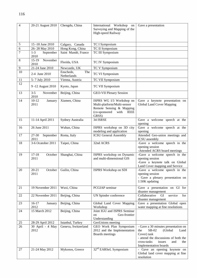
116
4 20-21 August 2010 Chengdu, China International Workshop on Surveying and Mapping of the High-speed Railway
Gave a presentation
5 15 -18 June 2010 Calgary,Canada TC I Symposium 6 26- 28 May 2010 Hong Kong, China TC II Symposium 7 1-3 September
2010 Saint Mandé, France TC III Symposium
8 15-19 November 2010
Florida, USA TC IV Symposium
9 21-24 June 2010 Newcastle, UK TC V Symposium 10
2-4 June 2010 Enschede, The Netherlands
TC VI Symposium
11 5- 7 July 2010 Vienna, Austria TC VII Symposium 12
9 -12 August 2010 Kyoto, Japan TC VII Symposium
13 3-5 November 2010
Beijing, China GEO-VII Plenary Session
14 10-12 January 2011
Xiamen, China ISPRS WG I/3 Workshop on Multi-platform/Multi-sensor Remote Sensing & Mapping (co-sponsored with IEEE GRSS)
Gave a keynote presentation on Global Land Cover Mapping
15 11-14 April 2011 Sydney Australia 34 ISRSE Gave a welcome speech at the opening
16 26 June 2011 Wuhan, China ISPRS workshop on 3D city modeling and application
Gave a welcome speech at the opening
17 27-30 September 2011
Roma, Italy ICSU General Assembly Attended Geo-union meetings and ICSU assembly
18 3-6 Ocatober 2011 Taipei, China 32nd ACRS -Gave a welcome speech in the opening session -Attended ACRS board meetings
19 17-18 October 2011
Shanghai, China ISPRS workshop on Dynamic and multi-dimensional GIS
-Gave a welcome speech in the opening session -Gave a keynote talk on Global Land Cover mapping and Service
20 20-21 October 2011
Guilin, China ISPRS Workshop on SDI -Gave a welcome speech in the opening session - Gave a plenary presentation on 1:50K updating
21 19 November 2011 Wuxi, China PCGIAP seminar Gave a presentation on GI for disaster management
22 22 November 2011 Beijing, China UN Spinder conference Collaborative GI service for disaster management
23 16-17 January 2012
Beijing, China Global Land Cover Mapping Workshop
Gave a presentation Global open water mapping at fine resolutions
24 15 March 2012 Beijing, China Joint IGU and ISPRS Seminar on Geo-frontier Understanding
25 28-29 April 2012 Istanbul, Turkey GeoUnions meeting 26 30 April - 4 May
2012 Geneva, Switzerland GEO Work Plan Symposium
2012 and the Implementation Boards meetings
- Gave a 30 minutes presentation on the SB-02 (Global Land Cover) task - attend the discussions of both the cross-tasks issues and the Implementation boards
27 21-24 May 2012 Mykonos, Greece 32nd EARSeL Symposium - Gave an opening keynote on Global land cover mapping at fine resolution
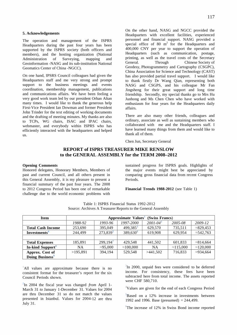
117
5. Acknowledgements
The operation and management of the ISPRS Headquarters during the past four years has been supported by the ISPRS society (both officers and members), and the hosting organization (National Administration of Surveying, mapping and Geoinformation -NASG and its sub-institution National Geomatics Center of China -NGCC).
On one hand, IPSRS Council colleagues had given the Headquarters staff and me very strong and prompt support to the business meetings and events coordination, membership management, publications and communications affairs. We have been feeling a very good work team led by our president Orhan Altan many times. I would like to thank the generous help First-Vice President Ian Dowman and former President John Trinder for the text editing of working documents and the drafting of meeting minutes. My thanks are also to TCPs, WG chairs, ISAC and IPAC chairs, webmaster, and everybody within ISPRS who has efficiently interacted with the headquarters and helped us.
On the other hand, NASG and NGCC provided the Headquarters with excellent facilities, experienced personnel and financial support. NASG provided a special office of 80 m2 for the Headquarters and 400,000 CNY per year to support the operation of Headquarters (such as communication, postage, printing, as well as the travel costs of the Secretary General. Through Chinese Society of Geodesy, Photogrammetry and Cartography (CSGPC), China Association for Science and Technology (CAST) has also provided partial travel support. I would like to thank firstly Dr Wang Qian, representing both NASG and CSGPS, and his colleague Mr Fan Jingsheng for their great support and long time friendship. Secondly, my special thanks go to Mrs Hu Junhong and Ms Chen Chen who have worked with enthusiasm for four years for the Headquarters daily affairs.
There are also many other friends, colleagues and ordinary, associate as well as sustaining members who collaborated with me and the Headquarters staff. I have learned many things from them and would like to thank all of them.
Chen Jun, Secretary General
REPORT of ISPRS TREASURER MIKE RENSLOW to the GENERAL ASSEMBLY for the TERM 2008–2012
Opening Comments Honored delegates, Honorary Members, Members of past and current Council, and all others present in this General Assembly, it is my pleasure to present a financial summary of the past four years. The 2008 to 2012 Congress Period has been one of remarkable challenge due to the world economic problems with
sustained progress for ISPRS goals. Highlights of the major events might best be appreciated by comparing gross financial data from recent Congress Periods. Financial Trends 1988-2012 (see Table 1)
Table 1: ISPRS Financial Status 1992-2012
Source: Archives A Treasurer Reports to the General Assembly
Item Approximate Values1 (Swiss Francs) 1988-92 1993-96 1997-2000 2001-042 2005-08 2009-12 Total Cash Income 253,690 395,049 499,3853 629,570 735,511 ≈829,453 Investments4 244,499 273,8395 389,6306 619,908 629,954 ≈542,763
Total Expenses 185,891 299,1947 429,548 441,502 601,833 ≈814,664 In-kind Support8 NA ≈95,000 ≈100,000 NA ≈115,000 ≈120,000 Approx. Cost of Doing Business9
>195,891 394,194 529,548 >441,502 716,833 ≈934,664
1All values are approximate because there is no consistent format for the treasurer’s report for the six Council Periods shown.
2In 2004 the fiscal year was changed from April 1-March 31 to January 1-December 31. Values for 2004 are thru December 31 so do not match the values presented in Istanbul. Values for 2004-12 are thru July 31.
3In 2000, unpaid fees were considered to be deferred income. For consistency, these fees have been subtracted here from total income. The assets reported were CHF 580,710.
4Values are given for the end of each Congress Period
5Based on a 12% increase in investments between 1992 and 1996. Base (presumed) = 244,499.
6The increase of 12% in Swiss Bond income reported
118
for the 1992-1996 period reportedly dropped 6% by 2000. Diversification into other investments helped to maintain value.
7No specific figure for expenses was given during this Council Period so the amount was derived by subtracting Net Cash Income (95,855) from Total Cash Income (395,049).
8In-kind support consists of complimentary contributions to reduce ISPRS costs for Council Meetings and Council administrative costs. Cash donations are recorded in UBS bank statements. Complimentary support is estimated.
9Total expenses plus estimated in-kind support.
Notable Trends
1. Costs for Council activities are rising and could not be sustained without high levels of in-kind support from Ordinary and Sustaining members.
2. Incremental development in e-Commerce, the information age, and banking practices have not only increased the Treasurer’s responsibilities, but also the amount of time required to perform them. The Treasurer’s role has migrated away from that of bank teller receiving and making payments toward that of being a financial manager having legal and fiduciary responsibilities to the Society, as well as being answerable to the Society’s Financial Committee, tax accountant, the State of Maryland and Internal Revenue Service of the United States. The evolution of this transition is traced below:
(a) Since 1996, there have been a growing number of UBS accounts to manage and an explosive growth in the number of accounting transactions (400 in 1988-1992 period compared to several thousand in the 2008-2012 period);
(b) Since 2000, there has been an increasing amount of time devoted to mail, email, telecommunications, and electronic meetings (Skype, WebEx, Messenger;
(c) Since 2004, there has been an increasing amount of time devoted to
(i) communicating with members and Society contractors regarding methods of payment and banking instructions, and
(ii) preparing and sending letters to members and/or their embassies to settle arrears;
(d) Since incorporation of the Society in 2004, there have been additional responsibilities for oversight and compliance;
(e) Since 2004, it has become necessary to learn rudiments of e-banking for wire transfers and enabling credit card payments; and,
(f) Since 2008, UBS has added new levels of security to their on-line banking clients.
2008-2012 Financial Operations
1. Accounting System:
The accounting system created by Ammatzia and Rachel Peled in the 2000-2004 period has been used with only minor changes. This system requires maintenance by both the Secretary General and the Treasurer; and it contains functions that require “work-around” solutions. For the convenience of future Treasurers, it has been documented, and some commercial-off-the-shelf (COTS) software (MS Office) is used for efficiency (i.e., MS Excel).
Since 2008 and the world’s financial instability, International banking regulations have been increasingly restrictive. Accordingly, there have been many changes in UBS banking policies toward its international customers.
Other banking issues are:
• UBS prohibits members from sending checks for annual fees directly to the bank. They require payments by check to be passed through the ISPRS Treasurer and forwarded to UBS along with an official bank deposit form.
• The bank encourages electronic transfers. For EU countries, UBS charges a fee for each transaction (only ‘within Switzerland’ transfers are free). Also, members outside the EU who use electronic services often involve 3rd party banks in Europe or the USA that extract fees for their services. Moreover these transactions can take weeks to clear before a deposit is made into the appropriate UBS account. These measures, while typically safer than payments by mail, all add complexity and time to transactions, and require more email traffic between Treasurer and member to monitor the transaction.
• In 2010, the Treasurer (being from the U.S.) was designated the ‘financial agent’ for ISPRS. This designation is not required for Treasurers residing in the EU countries or the UK.
2. Incorporation:
The Society’s incorporation in the state of Maryland, USA as a not-for-profit (that is, tax exempt) organization works well. It adds additional responsibility to the ISPRS Treasurer, and requires professional assistance in the USA to complete and submit annual financial and property forms, most notably the IRS-990 and the State of Maryland Personal Property forms. As with changes in banking regulations, there are changes in these forms each year that, if not submitted, can result in ISPRS being “out-of-compliance” and losing its tax-exempt status. I recommend that attention to this matter, and to other recommendations in this report, be given systematic attention.
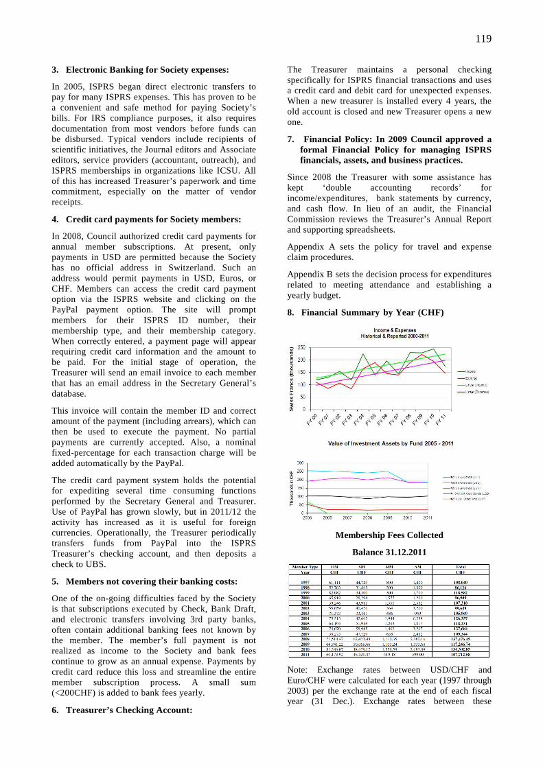
119
3. Electronic Banking for Society expenses:
In 2005, ISPRS began direct electronic transfers to pay for many ISPRS expenses. This has proven to be a convenient and safe method for paying Society’s bills. For IRS compliance purposes, it also requires documentation from most vendors before funds can be disbursed. Typical vendors include recipients of scientific initiatives, the Journal editors and Associate editors, service providers (accountant, outreach), and ISPRS memberships in organizations like ICSU. All of this has increased Treasurer’s paperwork and time commitment, especially on the matter of vendor receipts.
4. Credit card payments for Society members:
In 2008, Council authorized credit card payments for annual member subscriptions. At present, only payments in USD are permitted because the Society has no official address in Switzerland. Such an address would permit payments in USD, Euros, or CHF. Members can access the credit card payment option via the ISPRS website and clicking on the PayPal payment option. The site will prompt members for their ISPRS ID number, their membership type, and their membership category. When correctly entered, a payment page will appear requiring credit card information and the amount to be paid. For the initial stage of operation, the Treasurer will send an email invoice to each member that has an email address in the Secretary General’s database.
This invoice will contain the member ID and correct amount of the payment (including arrears), which can then be used to execute the payment. No partial payments are currently accepted. Also, a nominal fixed-percentage for each transaction charge will be added automatically by the PayPal.
The credit card payment system holds the potential for expediting several time consuming functions performed by the Secretary General and Treasurer. Use of PayPal has grown slowly, but in 2011/12 the activity has increased as it is useful for foreign currencies. Operationally, the Treasurer periodically transfers funds from PayPal into the ISPRS Treasurer’s checking account, and then deposits a check to UBS.
5. Members not covering their banking costs:
One of the on-going difficulties faced by the Society is that subscriptions executed by Check, Bank Draft, and electronic transfers involving 3rd party banks, often contain additional banking fees not known by the member. The member’s full payment is not realized as income to the Society and bank fees continue to grow as an annual expense. Payments by credit card reduce this loss and streamline the entire member subscription process. A small sum (<200CHF) is added to bank fees yearly.
6. Treasurer’s Checking Account:
The Treasurer maintains a personal checking specifically for ISPRS financial transactions and uses a credit card and debit card for unexpected expenses. When a new treasurer is installed every 4 years, the old account is closed and new Treasurer opens a new one.
7. Financial Policy: In 2009 Council approved a formal Financial Policy for managing ISPRS financials, assets, and business practices.
Since 2008 the Treasurer with some assistance has kept ‘double accounting records’ for income/expenditures, bank statements by currency, and cash flow. In lieu of an audit, the Financial Commission reviews the Treasurer’s Annual Report and supporting spreadsheets.
Appendix A sets the policy for travel and expense claim procedures.
Appendix B sets the decision process for expenditures related to meeting attendance and establishing a yearly budget.
8. Financial Summary by Year (CHF)
Membership Fees Collected
Balance 31.12.2011
Note: Exchange rates between USD/CHF and Euro/CHF were calculated for each year (1997 through 2003) per the exchange rate at the end of each fiscal year (31 Dec.). Exchange rates between these
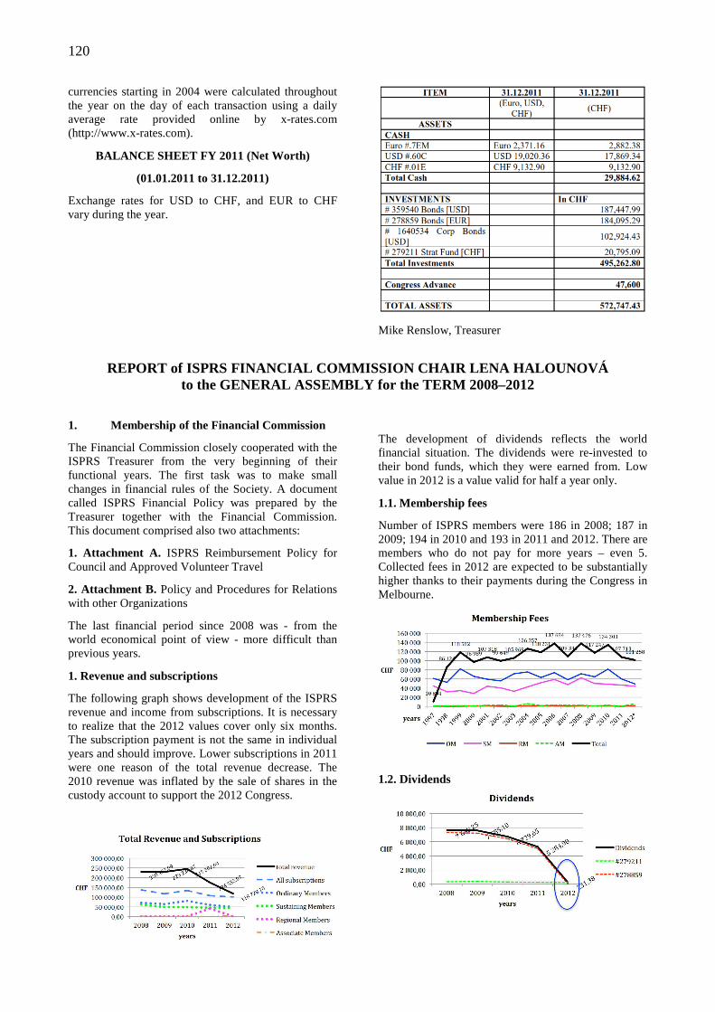
120
currencies starting in 2004 were calculated throughout the year on the day of each transaction using a daily average rate provided online by x-rates.com (http://www.x-rates.com).
BALANCE SHEET FY 2011 (Net Worth)
(01.01.2011 to 31.12.2011)
Exchange rates for USD to CHF, and EUR to CHF vary during the year.
Mike Renslow, Treasurer
REPORT of ISPRS FINANCIAL COMMISSION CHAIR LENA HAL OUNOVÁ
to the GENERAL ASSEMBLY for the TERM 2008–2012
1. Membership of the Financial Commission
The Financial Commission closely cooperated with the ISPRS Treasurer from the very beginning of their functional years. The first task was to make small changes in financial rules of the Society. A document called ISPRS Financial Policy was prepared by the Treasurer together with the Financial Commission. This document comprised also two attachments:
1. Attachment A. ISPRS Reimbursement Policy for Council and Approved Volunteer Travel
2. Attachment B. Policy and Procedures for Relations with other Organizations
The last financial period since 2008 was - from the world economical point of view - more difficult than previous years.
1. Revenue and subscriptions
The following graph shows development of the ISPRS revenue and income from subscriptions. It is necessary to realize that the 2012 values cover only six months. The subscription payment is not the same in individual years and should improve. Lower subscriptions in 2011 were one reason of the total revenue decrease. The 2010 revenue was inflated by the sale of shares in the custody account to support the 2012 Congress.
The development of dividends reflects the world financial situation. The dividends were re-invested to their bond funds, which they were earned from. Low value in 2012 is a value valid for half a year only.
1.1. Membership fees
Number of ISPRS members were 186 in 2008; 187 in 2009; 194 in 2010 and 193 in 2011 and 2012. There are members who do not pay for more years – even 5. Collected fees in 2012 are expected to be substantially higher thanks to their payments during the Congress in Melbourne.
1.2. Dividends
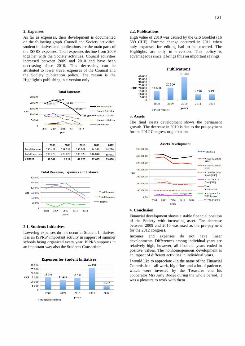
121
2. Expenses As far as expenses, their development is documented on the following graph. Council and Society activities, student initiatives and publications are the main parts of the ISPRS expenses. Total expenses decline from 2009 together with the Society activities. Council activities increased between 2009 and 2010 and have been decreasing since 2010. This decreasing can be attributed to lower travel expenses of the Council and the Society publication policy. The reason is the Highlight’s publishing in e-version only.
2.1. Students Initiatives Lowering expenses do not occur at Student Initiatives. It is an ISPRS’ important activity in support of summer schools being organized every year. ISPRS supports in an important way also the Students Consortium.
2.2. Publications High value of 2010 was caused by the GIS Booklet (16 589 CHF). Extreme change occurred in 2011 when only expanses for editing had to be covered. The Highlights are only in e-version. This policy is advantageous since it brings thus an important savings.
3. Assets The final assets development shows the permanent growth. The decrease in 2010 is due to the pre-payment for the 2012 Congress organization.
4. Conclusion Financial development shows a stable financial position of the Society with increasing asset. The decrease between 2009 and 2010 was used as the pre-payment for the 2012 congress.
Incomes and expenses do not have linear developments. Differences among individual years are relatively high, however, all financial years ended in positive values. The nonhomogeneous development is an impact of different activities in individual years.
I would like to appreciate - in the name of the Financial Commission - all work, big effort and a lot of patience, which were invested by the Treasurer and his cooperator Mrs Amy Budge during the whole period. It was a pleasure to work with them.
122
REPORT on INTER–ORGANIZATIONAL RELATIONS PRESENTED by SECRETARY GENERAL CHEN JUN
1. Introduction As the foremost scientific society in the field of photogrammetry, remote sensing and spatial information sciences, ISPRS aims at developing international cooperation with other organisations. This has been done through representing the photogrammetry, remote sensing and spatial
information science communities to a number of intergovernmental organisations and to other international societies,co-organizing joint events and projects. The table below gives a summary of ISPRS relationships with international organisations, divided into intergovernmental bodies, international umbrella organisation and other international societies.
Organisation ISPRS Status Activities in
2008-2012 Representatives
United Nations
UN Economic and Social
Council (ECOSOC)
Accredited
NGO
None
UN ECA Committee on
Development Information
(CODIST)
Accredited
NGO
Attended
CODIST
meetings
Ian Dowman
UN Statistics Division Accredited
NGO
Ian Dowman
COPUOS
UN office of Outer Space
Affairs (OOSA)
Observer Attended
meetings
Two joint
projects:
Booklet,
VALID
Orhan Altan
Rainer Sandau
FAO MoU signed
2007
Orhan Altan
GGIM Partner Attended
meetings
Questionnaire
of mapping in
the world
Ian Dowman
Ammatzia Peled
Chen Jun
International umbrella
organisations
International Council of Science
(ICSU)
Member Attended
meetings
Orhan Altan
elected as EB
member
Orhan Altan
Chen Jun
Ian Dowman
Group on Earth Observation
(GEO)
Participating
Organisation
Attended
Meetings
Global land
cover mapping
Chen Jun
Orhan Altan
Ian Dowman
Committee on Earth Observation
Satellites (CEOS)
Associate Collaboration
through GEO
Orhan Altan
Ian Dowman
International Standards
Organisation (ISO)
Liaison
member
Wolfgang Kresse
Open GIS Consortium (OGC) MoU signed Ian Dowman
Ammatzia Peled
COSPAR Became a Attended Ian Dowman
123
member in
2004
meetings Rainer Sandau
Other
international
societies
Joint Board of Geospatial
Information Societies
Member Orhan Altan
Chen Jun
Ian Dowman
GeoUnions Member Orhan Altan
Ian Dowman
International Society for Optical
Engineering (SPIE)
MoU signed Comm V
IEEE-GRSS MoU signed Joint workshops Ian Dowman
CRTEAN Associate
2003
Correspondence
ION MoU signed Ian Dowman
Some additional information on the major inter-organisational activities are described in the following paragraphs.
2. UN
1) Office of Outer Space Affairs (OOSA)
OOSA supported people from developing countries to attend ISPRS Centenary Celebration, ISPRS Commission VII Symposium and 2 workshops in Africa. ISPRS has good cooperation with Mazlan Othman Director of OOSA and there was a good response from the GIS for the United Nations and the International Community Conference in Geneva, Switzerland in April 2012.
A new joint project, VALID, was proposed by the JBGIS and UNOOSA, as the continuation of the Booklet on Geo-spatial Information for Disaster and Risk Management: Examples and Best Practices’. A round table discussion was organized by Orhan Altan in the evening of 5 May 2011, during the Gi4DM 2011.
ISPRS has jointly organized with UNOOSA workshops on EO Benefits for Society. Two workshops have been held, in Istanbul and Hanoi, and a third meeting will be held on Santiago, Chile from 12-16 November 2012. Orhan Altan and Ian Dowman will attend with Stanley Morain.
2) Committee on the Peaceful Uses of Outer Space (COPUOS)
COPUOS is organised by the Office of Outer Space Affairs (OOSA) from the UN Office in Vienna. ISPRS has a Memorandum of Understanding (MoU) with the Director of the Office of Outer Space Affairs on cooperation between the two organizations. Items in the MoU include: joint co-sponsorship annually of an event (workshop, seminar, tutorial. etc.); coordination of schedules, events, topics and/or specialist needs in pre-planning related activities; jointly seeking financial support and identification of relevant high-quality specialists and lecturers for United Nations led events that require photogrammetric, remote sensing and
Geographic Information Systems expertise; inclusion of joint events in the quadrennial ISPRS Congress, and in relevant quadrennial ISPRS Commission Symposia and Working Group activities; the provision by ISPRS of scientific and technological expertise through reviews, evaluations or recommendations on space matters related to remote sensing; and facilitation and initiation of opportunities for fellowships, grants and awards in remote sensing, photogrammetry and geo- spatial information sciences.
Orhan Altan introduced Rainer Sandau as the representative of ISPRS to the UNCOPOUS after Beijing Congress. Rainer Sandau has represented ISPRS in the Science and Technology sub-committee meetings in February, and Orhan Altan the COPOUS General Assembly in June each year.
3) Global Geographic Information Management (GGIM)
A resolution on Global Geographic Information Management (GGIM) was adopted by the 18th UN Regional Cartographic Conference for Asia and the Pacific. The first meeting was held in Seoul, Korea and was attended by Ian Dowman. The Second Preparatory Meeting on GGIM was held in New York in August 2012. Because of the proximity of this meeting to the Congress, ISPRS was not represented. ISPRS and GGIM have launched a joint project for the survey of current status of the mapping in the world. Gottfried Konecney is leading this project with the assistance from ISPRS WG IV/2(Automatic Geospatial Data Acquisition and Image-Based Databases) and ICWG IV/VIII (Updating and Maintenance of Core Spatial Databases) as well as ISPRS headquarters, a questionnaire has been sent to all nations through UN channels and ISPRS members. A final analysis of the survey results is still under preparation.
4) UN SPIDER
ISPRS initiated the publication of the Booklet on ‘Best Practices for Disaster and Risk Management’ together with UN SPIDER. It was publicized in July 2010 and it is now on the UN SPIDER and ISPRS web pages. It
124
has been downloaded and even purchased from the Libraries many times by high quality Universities worldwide. Hence it is listed in ISI. ISPRS together with JBGIS has commenced a new project VALID with UN SPIDER as follow-on from the first booklet.
3. International umbrella organisations
1) International Council for Science (ICSU)
ICSU is a non-governmental organization founded in 1931 to bring together natural scientists in international scientific endeavour. It comprises 113 multi-disciplinary National Scientific Members, Associates and Observers (scientific research councils or science academies) and 29 international, single-discipline Scientific Unions to provide a wide spectrum of scientific expertise, enabling members to address major international, interdisciplinary issues which none can handle alone. ISPRS became a full Union Member of ICSU in 2002 and attended the triennial plenary meetings in Mozambique in 2008 and Rome in 2011.
Orhan Altan was elected as a member of the Executive Board of the ICSU in Rome in September 2011. Orhan Altan and Ian Dowman attended the ICSU GA in Mozambique. Good responses have been received from Asian and Latin American regional offices.
ISPRS has been involved in the discussions on the formulation of a joint research proposal to ICSU on “Extreme Natural Hazards and Societal Implication (ENHANS)" with IUGG as the Leading Applicant. This application has been approved by ICSU an awarded 30,000 EUR. ISPRS recommended Piero Boccardo, Robert Backhaus and Sisi Zlatanova as the co—investigators of this project. So far ISPRS has participated in 2 ICSU projects on remote sensing applications.
2) Group on Earth Observation (GEO)
The group on earth Observation (GEO) has now been operating for seven years and ISPRS has been active through its committees and task teams and also through organising workshops on the Global Earth Observing System of Systems (GEOSS). ISPRS has collaborated with IEEE and OGC under the umbrella of GEO to organise a series of workshops to provide a forum for discussing the architecture and user applications of the GEOSS, these include on line demonstrations by OGC on the web services which will be part of GEOSS and feedback sessions for user comment.
Stanley Morain continues to serve the User Interface Committee of GEO, Ian Dowman attended GEOVI plenary held in Washington, DC from 17-18th November 2009. Chen Jun attended the GEOVII plenary and ministerial summit in Beijing at the beginning of November 2010. Chen Jun is now co-chairing the project on global land cover (GEO Task SB-2) in which ISPRS is a contributor. ISPRS will follow this issue by setting up an inter-commission working group on global land cover mapping and
services. Orhan Altan and Ian Dowman attended plenary VIII in Istanbul.
3) Committee on Earth Observing Satellites (CEOS)
ISPRS is a CEOS Associate but in view of the establishment of GEO has decided to concentrate its resources on GEO and has attended only 1 plenary during the past 4 years.
4) International Organization for Standardization (ISO)
ISPRS is a liaison member of several ISO Technical Committees and has a commitment to supporting efforts to establish standards for data format and transfer. ISPRS also supports efforts for interoperability and data transfer through the Open GIS Consortium (OGC). In order to implement the tasks, an ad hoc Group on Standards has been set up under the chairmanship of Wolfgang Kresse. The role of the committee is to co-ordinate WG input to standards organisations such as ISO, OGC and to regional and national standards organisations and for a; to encourage Working Group liaison with standards organisations and to promote ISPRS to standards organisations. The committee will make a separate report to the GA.
5) OGC
ISPRS signed an MOU with OGC in 2010 and is interested in developing a closer collaboration between OGC. Crowd sourcing to improve geodata quality and disaster mapping are two topics of common interests for future cooperation. A meeting with Steven Ramage was organized on May 5, 2011. A special session with OGC is being held at the Congress and further discussions will take place on future collaboration.
An International Workshop on Multi-platform/Multi-sensor Remote Sensing & Mapping initiated by ISPRS WG was co-sponsored with IEEE GRSS and successfully organized on Jan. 2011 in Xiamen, China.
4. Other international societies
1) Joint Board of Geospatial Information Societies (JBGIS)
The Joint Board of Geospatial Information Societies (JBGIS) comprising FIG, ICA, IHO, AIG, ISPRS, IMTA, GSDI and ISCGM is the main vehicle for inter society collaboration.
The Risk and Disaster Management Committee had the role of co-ordinating the many initiatives in these areas and has recommended that each organisation within JBGIS organises sessions on disaster management topics during their main conferences. The societies should also provide experts to UN conferences and other UN activities and also nominate a contact person or working group for disaster management. The
125
GI4DM conference series is recognised as the main international event in this area.
ISPRS Council supported as lead organization the document: Ad hoc Committee on Risk and Disaster Management’ for JBGIS. ISPRS has been very active in JBGIS with a strong presence, especially in the field of capacity building and disaster mapping.
Orhan Altan has completed his chairmanship of the ad-hoc committee for Risk and disaster management. Orhan Altan has presented the new project called “VALID” at JBGIS meeting.
3) International Cartographic Association (ICA)
ICA is developing a workshop in Africa with modules relevant to ICA and they are suggesting that ISPRS provide modules in its areas of expertise. Volunteers are being sought to develop the modules.
4) GSDI
ISPRS have finalized a MoU with GSDI, both Orhan Altan and Abbas Rajabifard signed the MoU. GSDI President wishes to develop procedures for real outputs from the collaboration between ISPRS and GSDI.
5) Other relationships
The collaboration with InterGeo was discussed with Olaf Freier, Managing Director of HINTE. The MoU with INTERGEO needs to be drafted for further collaboration. Cliff Ogleby worked on organization a “Sustaining Members Meeting” INTERGEO 2010 in Cologne and on Video Conference to be broadcast. ISPRS has participated and shared a booth with the GGS Company from Germany to all INTERGEO Exhibitions.
REPORT of the EDITOR-IN-CHIEF of the ISPRS JOURNAL GEORGE VOSSELMAN
Summary of major developments While 2008-2009 was more or less business as usual, the ISPRS Journal of Photogrammetry and Remote Sensing experienced a rapid growth since 2010. The dramatically rising number of submissions (section 1.1) led to a strong increase in the number of publications (section 2.1), intermediate discussions with Elsevier to increase the page budget (section 6.2), a heavy work load for the editors, and an expansion of the editorial team (section 5). The number of papers downloaded from ScienceDirect as well as the number of citations to papers published in the ISPRS Journal doubled in the past four years, just as they already did in the 2004-2007 period. The U.V. Helava Award for the best paper of the years 2008-2011 has been awarded to Konrad Schindler, Andreas Ess, Bastian Leibe and Luc Van Gool for their paper “Automatic detection and tracking of pedestrians from a moving stereo rig by”.
1. Handling of manuscripts
1.1 Manuscript submissions After four years with 160-180 submissions per year, the number of submissions suddenly increased by 80% in 2010 and slightly further increased in 2011. The number of submissions in the first half year of 2012 shows another 10% increase compared to the same period in 2011.
Year 2008 2009 2010 2011 # submitted manuscripts
164 161 292 318
1.2 Acceptance rate Currently, about 27% of the papers submitted to the ISPRS Journal is accepted for publication. The tendency over the last four years is a small decrease in the percentage of accepted papers. Papers that are very likely to receive unfavourable reviews are not sent to reviewers but rejected on the basis of the editor’s arguments only. This holds for about 30% of the papers. All other papers are typically examined by two reviewers.
Year 2008 2009 2010 2011 # final decisions 180 155 208 303 # accepted papers
57 55 59 82
# rejected papers
123 100 149 221
Acceptance percentage
32% 35% 28% 27%
Plagiarism occurred (or was noticed) clearly less than in the previous period of four years. Occasionally, manuscripts were submitted that were previously published at a conference. Publication of such work is only allowed if the journal manuscript is significantly extended or otherwise enhanced compared to the conference publication.
1.3 Processing times per stage On the average in the last four years it took about half a year to reach a final decision on the acceptance or rejection of a submitted manuscript. This is longer than
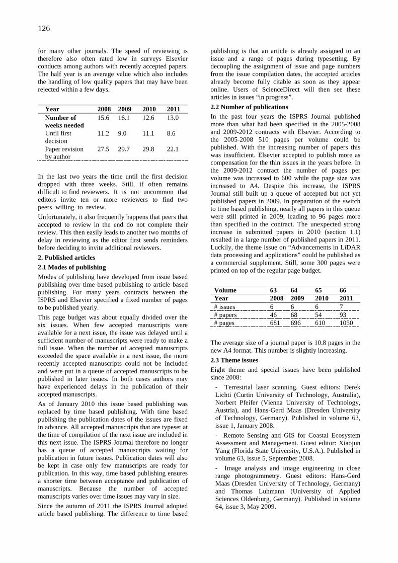
126
for many other journals. The speed of reviewing is therefore also often rated low in surveys Elsevier conducts among authors with recently accepted papers. The half year is an average value which also includes the handling of low quality papers that may have been rejected within a few days.
Year 2008 2009 2010 2011 Number of weeks needed
15.6 16.1 12.6 13.0
Until first decision
11.2 9.0 11.1 8.6
Paper revision by author
27.5 29.7 29.8 22.1
In the last two years the time until the first decision dropped with three weeks. Still, if often remains difficult to find reviewers. It is not uncommon that editors invite ten or more reviewers to find two peers willing to review.
Unfortunately, it also frequently happens that peers that accepted to review in the end do not complete their review. This then easily leads to another two months of delay in reviewing as the editor first sends reminders before deciding to invite additional reviewers.
2. Published articles
2.1 Modes of publishing Modes of publishing have developed from issue based publishing over time based publishing to article based publishing. For many years contracts between the ISPRS and Elsevier specified a fixed number of pages to be published yearly.
This page budget was about equally divided over the six issues. When few accepted manuscripts were available for a next issue, the issue was delayed until a sufficient number of manuscripts were ready to make a full issue. When the number of accepted manuscripts exceeded the space available in a next issue, the more recently accepted manuscripts could not be included and were put in a queue of accepted manuscripts to be published in later issues. In both cases authors may have experienced delays in the publication of their accepted manuscripts.
As of January 2010 this issue based publishing was replaced by time based publishing. With time based publishing the publication dates of the issues are fixed in advance. All accepted manuscripts that are typeset at the time of compilation of the next issue are included in this next issue. The ISPRS Journal therefore no longer has a queue of accepted manuscripts waiting for publication in future issues. Publication dates will also be kept in case only few manuscripts are ready for publication. In this way, time based publishing ensures a shorter time between acceptance and publication of manuscripts. Because the number of accepted manuscripts varies over time issues may vary in size.
Since the autumn of 2011 the ISPRS Journal adopted article based publishing. The difference to time based
publishing is that an article is already assigned to an issue and a range of pages during typesetting. By decoupling the assignment of issue and page numbers from the issue compilation dates, the accepted articles already become fully citable as soon as they appear online. Users of ScienceDirect will then see these articles in issues “in progress”.
2.2 Number of publications In the past four years the ISPRS Journal published more than what had been specified in the 2005-2008 and 2009-2012 contracts with Elsevier. According to the 2005-2008 510 pages per volume could be published. With the increasing number of papers this was insufficient. Elsevier accepted to publish more as compensation for the thin issues in the years before. In the 2009-2012 contract the number of pages per volume was increased to 600 while the page size was increased to A4. Despite this increase, the ISPRS Journal still built up a queue of accepted but not yet published papers in 2009. In preparation of the switch to time based publishing, nearly all papers in this queue were still printed in 2009, leading to 96 pages more than specified in the contract. The unexpected strong increase in submitted papers in 2010 (section 1.1) resulted in a large number of published papers in 2011. Luckily, the theme issue on “Advancements in LiDAR data processing and applications” could be published as a commercial supplement. Still, some 300 pages were printed on top of the regular page budget.
Volume 63 64 65 66 Year 2008 2009 2010 2011 # issues 6 6 6 7 # papers 46 68 54 93 # pages 681 696 610 1050
The average size of a journal paper is 10.8 pages in the new A4 format. This number is slightly increasing.
2.3 Theme issues Eight theme and special issues have been published since 2008:
- Terrestrial laser scanning. Guest editors: Derek Lichti (Curtin University of Technology, Australia), Norbert Pfeifer (Vienna University of Technology, Austria), and Hans-Gerd Maas (Dresden University of Technology, Germany). Published in volume 63, issue 1, January 2008.
- Remote Sensing and GIS for Coastal Ecosystem Assessment and Management. Guest editor: Xiaojun Yang (Florida State University, U.S.A.). Published in volume 63, issue 5, September 2008.
- Image analysis and image engineering in close range photogrammetry. Guest editors: Hans-Gerd Maas (Dresden University of Technology, Germany) and Thomas Luhmann (University of Applied Sciences Oldenburg, Germany). Published in volume 64, issue 3, May 2009.
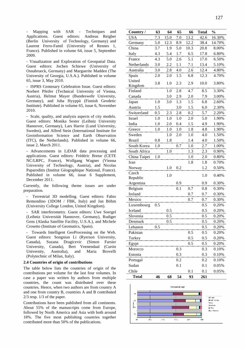
127
- Mapping with SAR - Techniques and Applications. Guest editors: Andreas Reigber (Berlin University of Technology, Germany) and Laurent Ferro-Famil (University of Rennes 1, France). Published in volume 64, issue 5, September 2009.
- Visualization and Exploration of Geospatial Data. Guest editors: Jochen Schiewe (University of Osnabrueck, Germany) and Marguerite Madden (The University of Georgia, U.S.A.). Published in volume 65, issue 3, May 2010.
- ISPRS Centenary Celebration Issue. Guest editors: Norbert Pfeifer (Technical University of Vienna, Austria), Helmut Mayer (Bundeswehr University, Germany), and Juha Hyyppä (Finnish Geodetic Institute). Published in volume 65, issue 6, November 2010.
- Scale, quality, and analysis aspects of city models. Guest editors: Monika Sester (Leibniz University Hannover, Germany), Lars Harrie (Lund University, Sweden), and Alfred Stein (International Institute for Geoinformation Science and Earth Observation (ITC), the Netherlands). Published in volume 66, issue 2, March 2011.
- Advancements in LiDAR data processing and applications. Guest editors: Frédéric Bretar (CETE NC/LRPC, France), Wolfgang Wagner (Vienna University of Technology, Austria), and Nicolas Paparoditis (Institut Géographique National, France). Published in volume 66, issue 6 Supplement, December 2011.
Currently, the following theme issues are under preparation.
- Terrestrial 3D modelling. Guest editors: Fabio Remondino (3DOM / FBK, Italy) and Jan Böhm (University College London, United Kingdom).
- SAR interferometry. Guest editors: Uwe Soergel (Leibniz Universität Hannover, Germany), Rudiger Gens (Alaska Satellite Facility, U.S.A.), and Michele Crosetto (Institute of Geomatics, Spain).
- Towards Intelligent GeoProcessing on the Web. Guest editors: Songnian Li (Ryerson University, Canada), Suzana Dragicevic (Simon Farsier University, Canada), Bert Veenendaal (Curtin University, Australia), and Maria Brovelli (Polytechnic of Milan, Italy).
2.4 Countries of origin of contributions The table below lists the countries of origin of the contributions per volume for the last four volumes. In case a paper was written by authors from multiple countries, the count was distributed over these countries. Hence, when two authors are from country A and one from country B, countries A and B contributed 2/3 resp. 1/3 of the paper.
Contributions have been published from all continents. About 55% of the manuscripts come from Europe, followed by North America and Asia with both around 18%. The five most publishing countries together contributed more than 50% of the publications.
Country / Volume
63 64 65 66 Total % USA 7.3 15.0 7.0 13.2 42.6 16.30% Germany 5.0 12.3 8.9 12.2 38.4 14.70% China 3.7 1.9 5.0 10.3 20.8 8.00% Italy 4.3 5.4 1.7 6.5 17.8 6.80% France 4.3 5.0 2.6 5.1 17.0 6.50% Netherlands 3.0 2.2 1.1 7.1 13.4 5.10% Australia 3.0 2.8 4.0 2.6 12.4 4.80% Spain 2.0 2.0 1.5 6.8 12.3 4.70% United Kingdom
3.8 1.0 2.3 2.9 10.0 3.80%
Finland
1.0 2.8 4.7 8.5 3.30% Canada
3.0 2.9 2.0 7.9 3.00%
Japan 1.0 3.0 1.3 1.5 6.8 2.60% Austria 1.5
3.0 1.5 6.0 2.30%
Switzerland 0.5 2.3 2.8 0.2 5.7 2.20% Israel 1.0 1.0 1.0 2.0 5.0 1.90% India 1.0 2.0 0.4 1.5 4.9 1.90% Greece 1.0 1.0 1.0 1.8 4.8 1.90% Sweden
1.0 2.0 1.0 4.0 1.50%
Brazil 0.8 1.8
1.4 4.0 1.50% South Korea 1.0
0.7 1.0 2.7 1.00%
South Africa
1.0
1.3 2.3 0.90% China Taipei 1.0
1.0 2.0 0.80%
Iran
1.8 1.8 0.70% Norway
1.0 0.2
1.2 0.50%
Czech Republic
1.0
1.0 0.40%
Argentina
0.9
0.9 0.30% Belgium
0.1 0.7 0.8 0.30%
Ireland
0.7 0.7 0.30% Mexico
0.7 0.7 0.30%
Luxembourg 0.5
0.5 0.20% Iceland
0.5
0.5 0.20%
Slovenia
0.5
0.5 0.20% Denmark
0.5
0.5 0.20%
Lebanon 0.5
0.5 0.20% Pakistan
0.5 0.5 0.20%
Turkey
0.5 0.5 0.20% Egypt
0.5 0.5 0.20%
Morocco
0.3
0.3 0.10% Estonia
0.3
0.3 0.10%
Portugal
0.2
0.2 0.10% Sudan
0.1
0.1 0.05%
Chile 0.1 0.1 0.05% Total 46 68 54 93 261
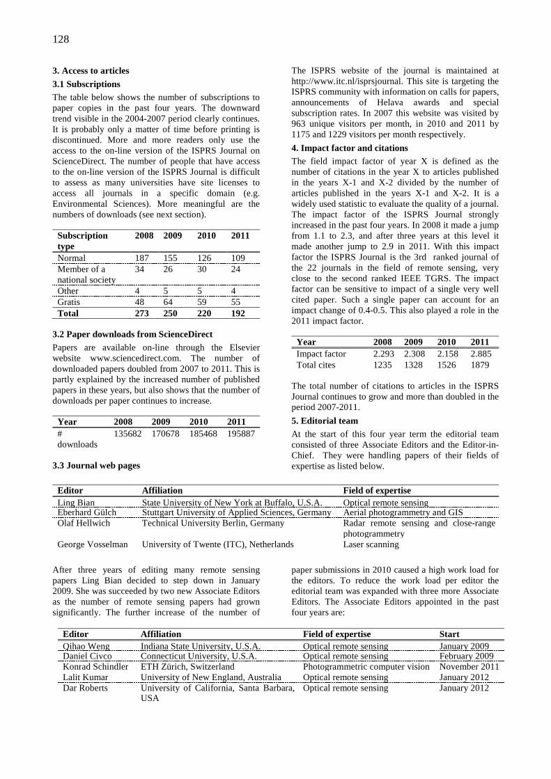
128
3. Access to articles
3.1 Subscriptions The table below shows the number of subscriptions to paper copies in the past four years. The downward trend visible in the 2004-2007 period clearly continues. It is probably only a matter of time before printing is discontinued. More and more readers only use the access to the on-line version of the ISPRS Journal on ScienceDirect. The number of people that have access to the on-line version of the ISPRS Journal is difficult to assess as many universities have site licenses to access all journals in a specific domain (e.g. Environmental Sciences). More meaningful are the numbers of downloads (see next section).
Subscription type
2008 2009 2010 2011
Normal 187 155 126 109 Member of a national society
34 26 30 24
Other 4 5 5 4 Gratis 48 64 59 55 Total 273 250 220 192
3.2 Paper downloads from ScienceDirect Papers are available on-line through the Elsevier website www.sciencedirect.com. The number of downloaded papers doubled from 2007 to 2011. This is partly explained by the increased number of published papers in these years, but also shows that the number of downloads per paper continues to increase.
Year 2008 2009 2010 2011 # downloads
135682 170678 185468 195887
3.3 Journal web pages
The ISPRS website of the journal is maintained at http://www.itc.nl/isprsjournal. This site is targeting the ISPRS community with information on calls for papers, announcements of Helava awards and special subscription rates. In 2007 this website was visited by 963 unique visitors per month, in 2010 and 2011 by 1175 and 1229 visitors per month respectively.
4. Impact factor and citations The field impact factor of year X is defined as the number of citations in the year X to articles published in the years X-1 and X-2 divided by the number of articles published in the years X-1 and X-2. It is a widely used statistic to evaluate the quality of a journal. The impact factor of the ISPRS Journal strongly increased in the past four years. In 2008 it made a jump from 1.1 to 2.3, and after three years at this level it made another jump to 2.9 in 2011. With this impact factor the ISPRS Journal is the 3rd ranked journal of the 22 journals in the field of remote sensing, very close to the second ranked IEEE TGRS. The impact factor can be sensitive to impact of a single very well cited paper. Such a single paper can account for an impact change of 0.4-0.5. This also played a role in the 2011 impact factor.
Year 2008 2009 2010 2011 Impact factor 2.293 2.308 2.158 2.885 Total cites 1235 1328 1526 1879
The total number of citations to articles in the ISPRS Journal continues to grow and more than doubled in the period 2007-2011.
5. Editorial team At the start of this four year term the editorial team consisted of three Associate Editors and the Editor-in-Chief. They were handling papers of their fields of expertise as listed below.
Editor Affiliation Field of expertise Ling Bian State University of New York at Buffalo, U.S.A. Optical remote sensing Eberhard Gülch Stuttgart University of Applied Sciences, Germany Aerial photogrammetry and GIS Olaf Hellwich Technical University Berlin, Germany Radar remote sensing and close-range
photogrammetry George Vosselman University of Twente (ITC), Netherlands Laser scanning
After three years of editing many remote sensing papers Ling Bian decided to step down in January 2009. She was succeeded by two new Associate Editors as the number of remote sensing papers had grown significantly. The further increase of the number of
paper submissions in 2010 caused a high work load for the editors. To reduce the work load per editor the editorial team was expanded with three more Associate Editors. The Associate Editors appointed in the past four years are:
Editor Affiliation Field of expertise Start Qihao Weng Indiana State University, U.S.A. Optical remote sensing January 2009 Daniel Civco Connecticut University, U.S.A. Optical remote sensing February 2009 Konrad Schindler ETH Zürich, Switzerland Photogrammetric computer vision November 2011 Lalit Kumar University of New England, Australia Optical remote sensing January 2012 Dar Roberts University of California, Santa Barbara,
USA Optical remote sensing January 2012
129
6. Elsevier
6.1 Staff changes Shortly after the Beijing congress Elsevier dissolved the position of Publishing Editor and transferred the responsibilities to the Publisher. The former Publishing Editor and Publisher both left Elsevier in the summer of 2008.
Gert-Jan Geraeds has been appointed Publisher in September 2008 and has since then been my first point of contact for all developments of the ISPRS Journal. Daily matters concerning the issue preparation and publishing are dealt with by the Journal Manager. After the retirement of Margaret Blackler, who worked with Elsevier for 33 years and has been working with many former Editors-in-Chief, the position of Journal Manager was moved to Elsevier’s Chennai office (India) and taken up by Arun Tamilselvi Sanka in May 2009. As of April 2011 this position has been taken over by Kreeti Saravanan. For preparation of theme issues the Editor-in-Chief communicates with the Publishing Content Coordinator, currently Jenny Wang in Elsevier’s Beijing office.
6.2 Deviations from the 2009-2012 contract As a result of the increased number of submissions in 2010, the budget of 600 pages for publications in 2011 was clearly insufficient. Even though 150 pages could be published in the commercial supplement on lidar, further 300 pages had to be added to the 2011 volume, as mentioned above. With Elsevier we agreed to let the journal grow in the years to come. Anticipating larger incomes in those years, Elsevier agreed to publish the additional 300 pages at no costs to the ISPRS. Elsevier and the ISPRS also agreed to increase the number of issues from 6 to 8 in 2012. The number of pages per issue will, however, have to be larger than 100. Already in the first half year (4 issues) 626 pages have been published.
6.3 Contract renewal 2013-2016 ISPRS decided to stay with Elsevier for the next term as Elsevier is clearly the leading publisher of journals on remote sensing and photogrammetry. An addendum to the current contract will be signed between ISPRS and Elsevier for publication of the ISPRS Journal of Photogrammetry and Remote Sensing in the years 2013-2016. The main points of this addendum are:
- Starting from 2013 the ISPRS Journal of Photogrammetry and Remote Sensing will be published in 12 issues with a page budget of approximately 1200 pages and a maximum of 1400 pages. A further increase is possible but will require renegotiation of the subscription fees.
- An additional Associate Editor will be appointed in January 2013. The editorial team will then consist of the Editor-in-Chief and eight Associate Editors.
- The subscription rates will increase, but not linearly with the number of published pages. While the number of pages in the contract will double from 600 to 1200, the subscription fee will increase
from $51 to $84. This subscription includes access to all articles published since 1995. The subscription fee for access to all articles published before 1995 (going back to 1937) slightly drops from $124 to $122.
7. U.V. Helava Award The U.V. Helava Award, sponsored by Elsevier B.V. and Hexagon Geosystems, is the prestigious ISPRS Award for the best publication in the ISPRS Journal in a four year period between the congresses. It was established in 1998 to encourage and stimulate submission of high quality scientific papers to the ISPRS Journal, to promote and advertise the Journal, and to honour the outstanding contributions of Dr. Uuno V. Helava to research and development in Photogrammetry and Remote Sensing. For the years 2008-2011 the Helava Award Jury, comprising five experts of high scientific standing, whose expertise covers the main topics included in the scope of the Journal, determined the best paper of each year. These best papers are
2008: On-line boosting-based car detection from aerial images by Helmut Grabner, Thuy Thi Nguyen, Barbara Gruber and Horst Bischof
2009: SPIRIT. SPOT 5 stereoscopic survey of Polar Ice: Reference Images and Topographies during the fourth International Polar Year (2007-2009) by Jérôme Korona, Etienne Berthier, Marc Bernard, Frédérique Rémy and Eric Thouvenot
2010: Automatic detection and tracking of pedestrians from a moving stereo rig by Konrad Schindler, Andreas Ess, Bastian Leibe and Luc Van Gool
2011: Modelling and analysing 3D buildings with a primal/dual data structure by Pawel Boguslawski, Christopher Gold and Hugo Ledoux
The Helava Award Jury selected the best paper of 2010 by Konrad Schindler, Andreas Ess, Bastian Leibe and Luc Van Gool as the winner of the 2008-2011 Helava Award.
8. Final remarks The number of manuscripts submitted to and published in the ISPRS Journal of Photogrammetry and Remote Sensing strongly increased in the past four years. The same also holds for many other journals and is likely to be related to the increasing emphasis universities give to ISI journal publications and citations to ISI journal publications in their research reviews. This may lead to a further increase in submissions in the coming years, but also to submissions with rather marginal innovations as authors may seek the minimum publishable unit. In the past years we’ve tried to keep a more or less constant quality threshold for accepting manuscripts, but saw the acceptance rate decreasing from 32% to 27%.
My second four-year term as Editor-in-Chief ends December this year. I decided not to continue for another term. The past eight years have been very rewarding with a lot of contacts to the associate and
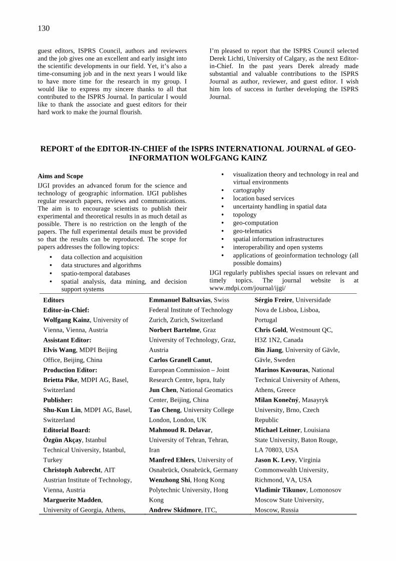
130
guest editors, ISPRS Council, authors and reviewers and the job gives one an excellent and early insight into the scientific developments in our field. Yet, it’s also a time-consuming job and in the next years I would like to have more time for the research in my group. I would like to express my sincere thanks to all that contributed to the ISPRS Journal. In particular I would like to thank the associate and guest editors for their hard work to make the journal flourish.
I’m pleased to report that the ISPRS Council selected Derek Lichti, University of Calgary, as the next Editor-in-Chief. In the past years Derek already made substantial and valuable contributions to the ISPRS Journal as author, reviewer, and guest editor. I wish him lots of success in further developing the ISPRS Journal.
REPORT of the EDITOR-IN-CHIEF of the ISPRS INTERNAT IONAL JOURNAL of GEO-INFORMATION WOLFGANG KAINZ
Aims and Scope IJGI provides an advanced forum for the science and technology of geographic information. IJGI publishes regular research papers, reviews and communications. The aim is to encourage scientists to publish their experimental and theoretical results in as much detail as possible. There is no restriction on the length of the papers. The full experimental details must be provided so that the results can be reproduced. The scope for papers addresses the following topics:
• data collection and acquisition • data structures and algorithms • spatio-temporal databases • spatial analysis, data mining, and decision
support systems
• visualization theory and technology in real and virtual environments
• cartography • location based services • uncertainty handling in spatial data • topology • geo-computation • geo-telematics • spatial information infrastructures • interoperability and open systems • applications of geoinformation technology (all
possible domains)
IJGI regularly publishes special issues on relevant and timely topics. The journal website is at www.mdpi.com/journal/ijgi/
Editors Emmanuel Baltsavias, Swiss Sérgio Freire, Universidade
Editor-in-Chief: Federal Institute of Technology Nova de Lisboa, Lisboa,
Wolfgang Kainz, University of Zurich, Zurich, Switzerland Portugal
Vienna, Vienna, Austria Norbert Bartelme, Graz Chris Gold, Westmount QC,
Assistant Editor: University of Technology, Graz, H3Z 1N2, Canada
Elvis Wang, MDPI Beijing Austria Bin Jiang, University of Gävle,
Office, Beijing, China Carlos Granell Canut, Gävle, Sweden
Production Editor: European Commission – Joint Marinos Kavouras, National
Brietta Pike, MDPI AG, Basel, Research Centre, Ispra, Italy Technical University of Athens,
Switzerland Jun Chen, National Geomatics Athens, Greece
Publisher: Center, Beijing, China Milan Konečný, Masayryk
Shu-Kun Lin , MDPI AG, Basel, Tao Cheng, University College University, Brno, Czech
Switzerland London, London, UK Republic
Editorial Board: Mahmoud R. Delavar, Michael Leitner, Louisiana
Özgün Akçay, Istanbul University of Tehran, Tehran, State University, Baton Rouge,
Technical University, Istanbul, Iran LA 70803, USA
Turkey Manfred Ehlers, University of Jason K. Levy, Virginia
Christoph Aubrecht , AIT Osnabrück, Osnabrück, Germany Commonwealth University,
Austrian Institute of Technology, Wenzhong Shi, Hong Kong Richmond, VA, USA
Vienna, Austria Polytechnic University, Hong Vladimir Tikunov , Lomonosov
Marguerite Madden, Kong Moscow State University,
University of Georgia, Athens, Andrew Skidmore, ITC, Moscow, Russia
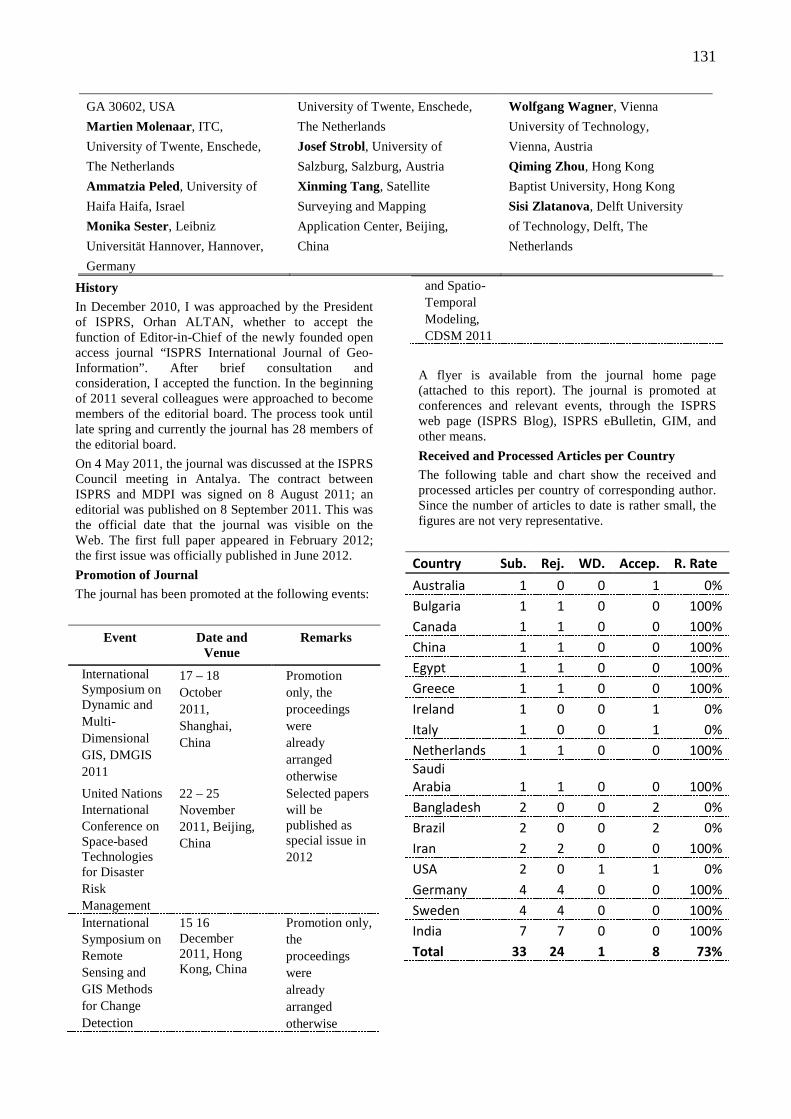
131
GA 30602, USA University of Twente, Enschede, Wolfgang Wagner, Vienna
Martien Molenaar , ITC, The Netherlands University of Technology,
University of Twente, Enschede, Josef Strobl, University of Vienna, Austria
The Netherlands Salzburg, Salzburg, Austria Qiming Zhou, Hong Kong
Ammatzia Peled, University of Xinming Tang, Satellite Baptist University, Hong Kong
Haifa Haifa, Israel Surveying and Mapping Sisi Zlatanova, Delft University
Monika Sester, Leibniz Application Center, Beijing, of Technology, Delft, The
Universität Hannover, Hannover, China Netherlands
Germany
History In December 2010, I was approached by the President of ISPRS, Orhan ALTAN, whether to accept the function of Editor-in-Chief of the newly founded open access journal “ISPRS International Journal of Geo-Information”. After brief consultation and consideration, I accepted the function. In the beginning of 2011 several colleagues were approached to become members of the editorial board. The process took until late spring and currently the journal has 28 members of the editorial board.
On 4 May 2011, the journal was discussed at the ISPRS Council meeting in Antalya. The contract between ISPRS and MDPI was signed on 8 August 2011; an editorial was published on 8 September 2011. This was the official date that the journal was visible on the Web. The first full paper appeared in February 2012; the first issue was officially published in June 2012.
Promotion of Journal The journal has been promoted at the following events:
Event Date and Venue
Remarks
International Symposium on Dynamic and Multi-Dimensional GIS, DMGIS 2011
17 – 18 October 2011, Shanghai, China
Promotion only, the proceedings were already arranged otherwise
United Nations International Conference on Space-based Technologies for Disaster Risk Management
22 – 25 November 2011, Beijing, China
Selected papers will be published as special issue in 2012
International Symposium on Remote Sensing and GIS Methods for Change Detection
15 16 December 2011, Hong Kong, China
Promotion only, the proceedings were already arranged otherwise
and Spatio-Temporal Modeling, CDSM 2011
A flyer is available from the journal home page (attached to this report). The journal is promoted at conferences and relevant events, through the ISPRS web page (ISPRS Blog), ISPRS eBulletin, GIM, and other means.
Received and Processed Articles per Country The following table and chart show the received and processed articles per country of corresponding author. Since the number of articles to date is rather small, the figures are not very representative.
Country Sub. Rej. WD. Accep. R. Rate
Australia 1 0 0 1 0%
Bulgaria 1 1 0 0 100%
Canada 1 1 0 0 100%
China 1 1 0 0 100%
Egypt 1 1 0 0 100%
Greece 1 1 0 0 100%
Ireland 1 0 0 1 0%
Italy 1 0 0 1 0%
Netherlands 1 1 0 0 100%
Saudi
Arabia 1 1 0 0 100%
Bangladesh 2 0 0 2 0%
Brazil 2 0 0 2 0%
Iran 2 2 0 0 100%
USA 2 0 1 1 0%
Germany 4 4 0 0 100%
Sweden 4 4 0 0 100%
India 7 7 0 0 100%
Total 33 24 1 8 73%
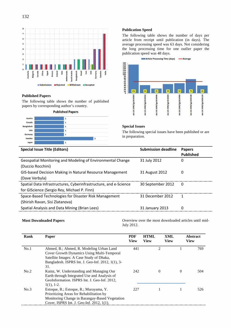
132
Published Papers The following table shows the number of published papers by corresponding author’s country.
Publication Speed The following table shows the number of days per article from receipt until publication (in days). The average processing speed was 63 days. Not considering the long processing time for one outlier paper the publication speed was 48 days.
Special Issues The following special issues have been published or are in preparation.
Special Issue Title (Editors) Submission deadline Papers
Published
Geospatial Monitoring and Modeling of Environmental Change 31 July 2012 0
(Duccio Rocchini)
GIS-based Decision Making in Natural Resource Management 31 August 2012 0
(Dave Verbyla)
Spatial Data Infrastructures, Cyberinfrastructure, and e-Science 30 September 2012 0
for GIScience (Sergio Rey, Michael P. Finn)
Space-Based Technologies for Disaster Risk Management 31 December 2012 1
(Shirish Ravan, Sisi Zlatanova)
Spatial Analysis and Data Mining (Brian Lees) 31 January 2013 0
Most Downloaded Papers Overview over the most downloaded articles until mid-July 2012.
Rank Paper PDF
View HTML View
XML View
Abstract View
No.1 Ahmed, B.; Ahmed, R. Modeling Urban Land Cover Growth Dynamics Using Multi-Temporal Satellite Images: A Case Study of Dhaka, Bangladesh. ISPRS Int. J. Geo-Inf. 2012, 1(1), 3-31.
441 2 1 769
No.2 Kainz, W. Understanding and Managing Our Earth through Integrated Use and Analysis of GeoInformation. ISPRS Int. J. Geo-Inf. 2012, 1(1), 1-2.
242 0 0 504
No.3 Estoque, R.; Estoque, R.; Murayama, Y. Prioritizing Areas for Rehabilitation by Monitoring Change in Barangay-Based Vegetation Cover. ISPRS Int. J. Geo-Inf. 2012, 1(1).
227 1 1 526
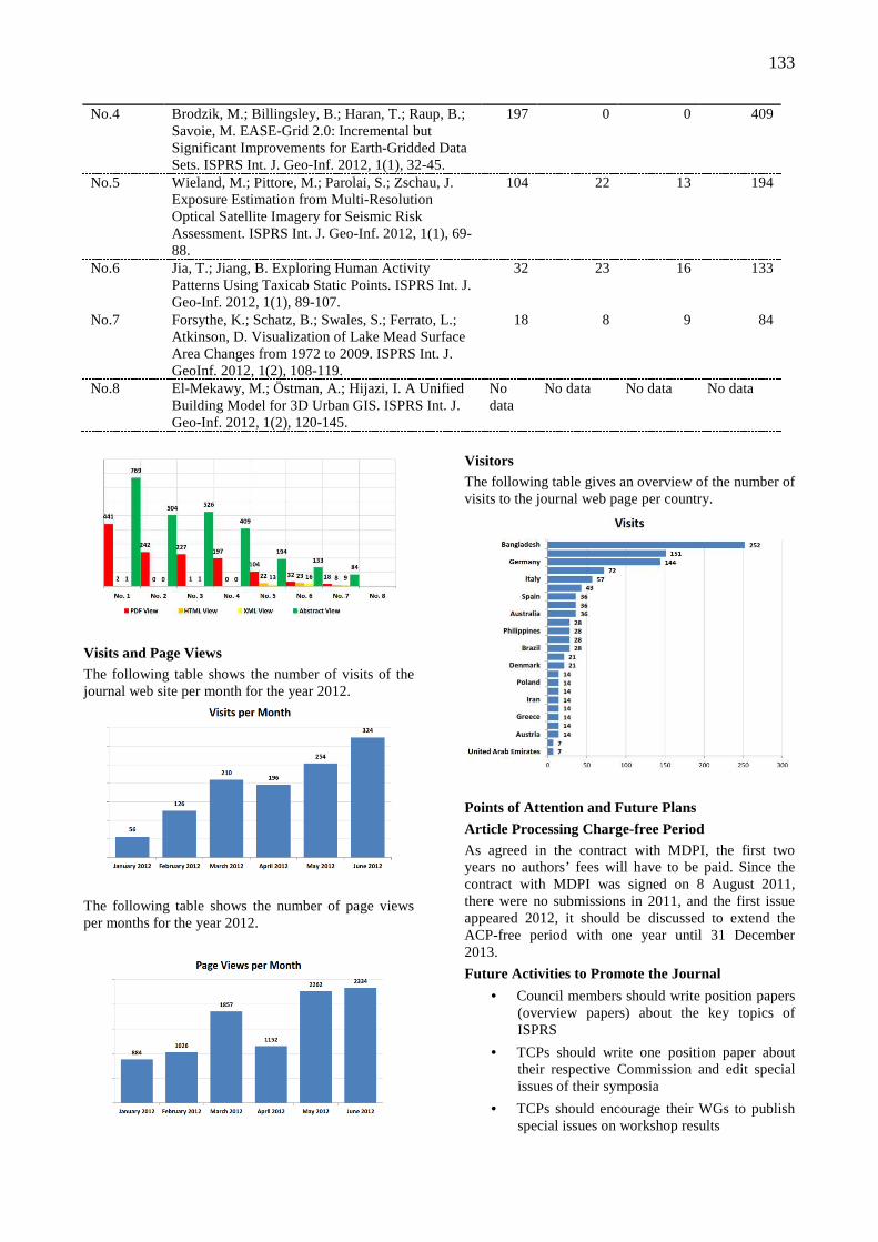
133
No.4 Brodzik, M.; Billingsley, B.; Haran, T.; Raup, B.; Savoie, M. EASE-Grid 2.0: Incremental but Significant Improvements for Earth-Gridded Data Sets. ISPRS Int. J. Geo-Inf. 2012, 1(1), 32-45.
197 0 0 409
No.5 Wieland, M.; Pittore, M.; Parolai, S.; Zschau, J. Exposure Estimation from Multi-Resolution Optical Satellite Imagery for Seismic Risk Assessment. ISPRS Int. J. Geo-Inf. 2012, 1(1), 69-88.
104 22 13 194
No.6 Jia, T.; Jiang, B. Exploring Human Activity Patterns Using Taxicab Static Points. ISPRS Int. J. Geo-Inf. 2012, 1(1), 89-107.
32 23 16 133
No.7 Forsythe, K.; Schatz, B.; Swales, S.; Ferrato, L.; Atkinson, D. Visualization of Lake Mead Surface Area Changes from 1972 to 2009. ISPRS Int. J. GeoInf. 2012, 1(2), 108-119.
18 8 9 84
No.8 El-Mekawy, M.; Östman, A.; Hijazi, I. A Unified Building Model for 3D Urban GIS. ISPRS Int. J. Geo-Inf. 2012, 1(2), 120-145.
No data
No data No data No data
Visits and Page Views The following table shows the number of visits of the journal web site per month for the year 2012.
The following table shows the number of page views per months for the year 2012.
Visitors The following table gives an overview of the number of visits to the journal web page per country.
Points of Attention and Future Plans
Article Processing Charge-free Period As agreed in the contract with MDPI, the first two years no authors’ fees will have to be paid. Since the contract with MDPI was signed on 8 August 2011, there were no submissions in 2011, and the first issue appeared 2012, it should be discussed to extend the ACP-free period with one year until 31 December 2013.
Future Activities to Promote the Journal
• Council members should write position papers (overview papers) about the key topics of ISPRS
• TCPs should write one position paper about their respective Commission and edit special issues of their symposia
• TCPs should encourage their WGs to publish special issues on workshop results
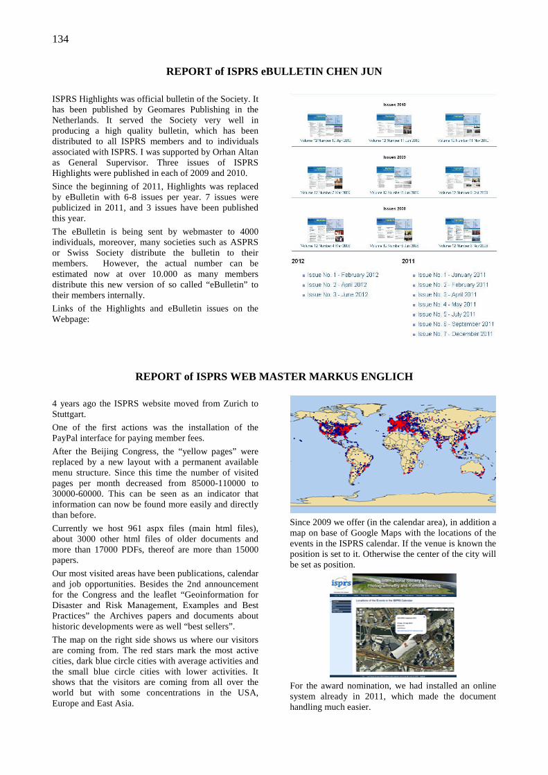
134
REPORT of ISPRS eBULLETIN CHEN JUN
ISPRS Highlights was official bulletin of the Society. It has been published by Geomares Publishing in the Netherlands. It served the Society very well in producing a high quality bulletin, which has been distributed to all ISPRS members and to individuals associated with ISPRS. I was supported by Orhan Altan as General Supervisor. Three issues of ISPRS Highlights were published in each of 2009 and 2010.
Since the beginning of 2011, Highlights was replaced by eBulletin with 6-8 issues per year. 7 issues were publicized in 2011, and 3 issues have been published this year.
The eBulletin is being sent by webmaster to 4000 individuals, moreover, many societies such as ASPRS or Swiss Society distribute the bulletin to their members. However, the actual number can be estimated now at over 10.000 as many members distribute this new version of so called “eBulletin” to their members internally.
Links of the Highlights and eBulletin issues on the Webpage:
REPORT of ISPRS WEB MASTER MARKUS ENGLICH
4 years ago the ISPRS website moved from Zurich to Stuttgart.
One of the first actions was the installation of the PayPal interface for paying member fees.
After the Beijing Congress, the “yellow pages” were replaced by a new layout with a permanent available menu structure. Since this time the number of visited pages per month decreased from 85000-110000 to 30000-60000. This can be seen as an indicator that information can now be found more easily and directly than before.
Currently we host 961 aspx files (main html files), about 3000 other html files of older documents and more than 17000 PDFs, thereof are more than 15000 papers.
Our most visited areas have been publications, calendar and job opportunities. Besides the 2nd announcement for the Congress and the leaflet “Geoinformation for Disaster and Risk Management, Examples and Best Practices” the Archives papers and documents about historic developments were as well “best sellers”.
The map on the right side shows us where our visitors are coming from. The red stars mark the most active cities, dark blue circle cities with average activities and the small blue circle cities with lower activities. It shows that the visitors are coming from all over the world but with some concentrations in the USA, Europe and East Asia.
Since 2009 we offer (in the calendar area), in addition a map on base of Google Maps with the locations of the events in the ISPRS calendar. If the venue is known the position is set to it. Otherwise the center of the city will be set as position.
For the award nomination, we had installed an online system already in 2011, which made the document handling much easier.
135
Since 2011 the ISPRS eBulletin became the official bulletin of the Society. It has replaced the former ISPRS Highlights and is generated now without third parties. It will be published every 6-8 weeks with the newest announcements, reports and other news. The frequency of the publication has been at least doubled compared to the ISPRS Highlights so that news can reach you more promptly. It will be send to the ISPRS mailing list which has actually more than 4000 addresses.
The publications/Archives are one of the most important products of ISPRS. That was the reason why there was spent some more time in this area. The directory structure was reorganized so that now all publications are stored under proceedings. This makes it much easier to search just for papers without getting results from other documents. Since there have been several requests about older papers, I have started to scan the proceedings of the congresses in Rio de Janeiro 1984, Kyoto 1988, Washington D.C. 1992 and Vienna 1996. In total more than 3100 papers were hereby added to the ISPRS website. Hamburg 1980
will follow. In addition the Amsterdam documents were split into single papers.
In 2011 ISPRS has signed a contract with Copernicus GmbH about Conference Management Packages. The Copernicus system will help the event organizers to manage abstract and paper handling.
The first proceedings were already captured and hosted by Copernicus and are integrated in our website.
To document that the ISPRS Archives are a series, all existing proceedings were transformed to a similar layout to the one of Copernicus. This should increase our chances to bring the Archives into SCOPUS.
For all available digital proceedings (not the scanned ones) list of authors and list of keywords were generated. Therefore the listed authors in the table of contents were taken and the key-words were extracted from the PDFs. In case that the whole proceedings were protected, the keyword index was not generated.
In the last 4 years the “education” area was more or less unchanged. There should come more input like tutorials or test data sets from the community in the future.
REPORT of ISPRS BOOK SERIES EDITOR PAUL APLIN
Book Series volumes Since the last ISPRS Congress, Book Series volumes 8, 9 and 10 have been published (see below), with volume 11 due for release around the time of the ISPRS Congress in Melbourne: Environmental Tracking for
Public Health Surveillance, edited by Stanley Morain and Amelia Budge. Another volume, Earth Observation Small Satellites for Remote Sensing Applications, is currently in preparation, scheduled for publication early in 2013.
Volume 8, Recent Advances in Remote Sensing and Geoinformation Processing for Land Degradation Assessment, 2009, edited by Achim Röder and Joachim Hill.
Volume 9, Advances in Web-based GIS, Mapping Services and Applications, 2011, edited by Songnian Li, Suzana Dragićević & Bert Veenendaal.
Volume 10, Advances in Geo-Spatial Information Science, 2012, edited by Wenzhong Shi, Michael Goodchild, Brian Lees and Yee Leung.
136
Reviews of published volumes Pleasingly, over the last four years, reviews of published volumes have begun to appear in journals and other literature. These are generally good, critical commentaries of the volumes. The publisher has clearly worked hard on this task, following repeated earlier requests from us at ISPRS to disseminate volumes
widely for review. All published volumes are now sent routinely to the International Journal of Geographical Information Science, the International Journal of Remote Sensing, ISPRS Highlights, Photogrammetric Engineering & Remote Sensing and The Photogrammetric Record. A selection of reviews is presented below.
Vol 4 Gao, Y. and Habib, A., 2008, Photogrammetric Engineering & Remote Sensing, 74, 397-398.
Vol 5 Graham, A.J., 2009, The Photogrammetric Record, 24, 103.
Vol 5 Yuan, M., 2009, Photogrammetric Engineering & Remote Sensing, 75, 235-236.
Vol 6 Beck, A., 2009, The Photogrammetric Record 24, 200-201.
Vol 6 Karasova, V., 2009, International Journal of Geographical Information Science, 23, 131–133.
Vol 7 Peled, A., 2008, ISPRS Highlights, No. 6 (November 2008), online (http://www.isprshighlights.org/nieuws/item.php?nieuws_id=64).
Sales figures for published volumes ISPRS Book Series volumes sell reasonably well for books in the field. More could probably be done to market and promote the volumes among the ISPRS
community, for instance by encouraging academic practitioners to adopt volumes as teaching texts and order volumes for institutional libraries. Sales figures provided by the publisher are shown below.
Vol 1 Kainz, Li & Zhou Advances in Spatial Analysis and Decision Making 262 copies
(100 bulk order)
Vol 2 Morain & Budge Post-Launch Calibration of Satellite Sensors 151 copies
Vol 3 Agouris & Croiteru Next Generation Geospatial Information 339 copies
(85 bulk order)
Vol 4 Tao & Li Advances in Mobile Mapping Technology 454 copies
(100 bulk order)
Vol 5 Tang, Liu, Zhang & Kainz Advances in Spatio-Temporal Analysis 337 copies
(100 bulk order)
Vol 6 Zlatanova & Li Geospatial Information Technology for Emergency Response
229 copies
Vol 7 Li, Chen & Baltsavias Advances in Photogrammetry, Remote Sensing and Spatial Information Sciences: 2008 ISPRS Congress Book
1059 copies
(800 bulk order)
Vol 8 Röder & Hill Recent Advances in Remote Sensing and Geoinformation Processing for Land Degradation Assessment
495 copies
(200 bulk order)
Engagement with the Book Series As reported at the Beijing Congress four years ago, although the Book Series has met with success in producing high quality scientific volumes, it probably still represents untapped potential. The visibility and recognition of the series seems limited within the ISPRS community – the ISPRS Book Series brand is not well established. Most significantly, there have been relatively few proposals for new volumes in the last four years, and some commissioned volumes have failed to reach completion. At the ISPRS General Assembly in Vienna during the 2010 Centenary
celebrations, there was discussion about an initiative to increase the quality of publications arising from ISPRS meetings. Specifically, it was suggested that conference papers should routinely be subject to full peer review, and there was discussion about the value of publications gaining bibliographic accreditation – ISI recognition, etc. Clearly, no one would argue with the benefit of increasing the standards of ISPRS publications. However, it could be argued that the ISPRS Book Series, in its current form, already provides a mechanism to generate high quality publications from ISPRS meetings. In this case, routine
137
production of such high quality conference proceedings could become a competitor to the Book Series, rather than a complementary form of ISPRS publication. I suggest that the Book Series is included in any discussion on ISPRS publishing strategy. Some effort must be made by leading members and groups of the ISPRS community (Council, Technical Commission Presidents, Working Group Chairs, National Delegates, etc.) to promote the Book Series and attract wider engagement. Perhaps of greatest importance here is to encourage more volume proposals, and the most obvious source for these is technical WG meetings. A small incentive for WG Chairmen may be to point out that the winner of the ISPRS Willem Schermerhorn Award in 2008 was Sisi Zlatanova who edited a volume of the ISPRS Book Series as part of her WG activities.
Book Series opportunities The Book Series holds great opportunity for all members of the ISPRS community. Volumes can be purchased with a 35% price discount by all individuals within ISPRS Ordinary, Associate, Regional and Sustaining members. The Book Series also provides a mechanism for editing, authoring and publishing high quality scientific work. Researchers in the spatial information sciences, and particularly ISPRS WG Chairs and TC Presidents, are encouraged to consider preparing ISPRS Book Series volumes as part of their scientific activities. Full details of the Book Series, published volumes, editing protocols and so on are provided on the website: http://www.isprs.org/publications/bookseries.html. The Book Series Editor is always happy to discuss any matters related to the series.
REPORT of ISAC (INTERNATIONAL SCIENTIFIC ADVISORY C OMMITTEE) by
CHAIR ARMIN GRUEN
This report covers the activities of ISAC during the Inter-congress period 2008-2012.
ISAC (International Science Advisory Committee) resumed its work after the ISPRS Congress in Istanbul 2004 with a crew of 12 members, covering at equal numbers (4) the major areas of interest of ISPRS Photogrammetry, Remote Sensing and GIS. In the course of time, the membership changed several times for various reasons. After the ISPRS Congress in Beijing a new membership model was implemented, with a totally new team (for the current membership see Attachment 2).
For the Terms of Reference of ISAC, please see Attachment 1 and for the ISAC Member List Attachment 2.
Throughout the 4-years period, the Committee developed and submitted opinions to the following issues and documents:
Year 2008
Discussion of the working mode, the structure and composition of ISAC. It was noted that the Committee Members’ activities varied to a great deal and that certain areas of expertise are missing in the Committee. The Chairman made a proposal to Council as to what kind of measures should be introduced in order to make the work of the Committee more efficient.
Year 2009
The activities of ISAC in 2009 were dominated by the work for the evaluation of the Terms of References of the ISPRS Working Groups. The majority of Committee Members provided for detailed and knowledgeable analyses of the proposed structures and contents for the current period of office 2008-2012.
The ISAC Chairman was also involved in the ongoing discussions concerning the strategic plan of ISPRS (e.g. he participated in the Council Meeting in Stuttgart, 7.9.2009) and in the preparations of the Centenary celebrations in Vienna July 2010.
Year 2010
+ ISAC Members evaluated the organization, conduction and results of eight ISPRS Symposia 2010. It was noted that ISAC Member attendance at Symposia was not very good.
Year 2011
+ Evaluation of Changes to Working Group specifications in the Orange Book
+ Evaluation of Changes to the Guidelines for Proposing Resolutions in the Orange Book
Year 2012
+ Review of the Draft Resolutions for the XXIInd Congress of the ISPRS, Melbourne 2012
+ Evaluation of the Terms of Reference of the Technical Commissions for Melbourne 2012
Conclusions
The work of ISAC suffered at times from a uneven amount of activities among its members. While some have been actively and timely contributing, others did not show so much interest in ISAC’s matters.
Also, the flow of information between Council and ISAC was not always at its best. In order for ISAC to work more pro-actively it is necessary that the ISAC Chairman has closer links to Council. This includes the attendance of Joint Meetings.
The Chairman of ISAC would like to express his sincere thanks to all those members who have
138
contributed to the Committee’s work over the past period.
ATTACHMENT 1
The International Science Advisory Committee (ISAC)
The ISAC has been established to support the Council and the ISPRS General Assembly in identifying and addressing important S&T trends which impact the scope of the ISPRS Commissions and the activities which should be addressed by ISPRS Working Groups. The ISAC is to ensure that ISPRS S&T activities are in proper balance and cover the breadth of the Society’s S&T mission
ISAC Terms of Reference
• Identify and prioritize scientific and technologic (S&T) trends which will impact the S&T activities of the Society and recommend actions to ISPRS Council.
• Facilitate excellence in scientific research and development and the use of proper and appropriate technology by evaluating and refining S&T Resolutions proposed in advance by ISPRS Member Organizations and Commissions for approval by the quadrennial ISPRS General Assembly.
• Collaborate with the ISPRS Council to formulate Resolutions for ISPRS General Assembly approval which will ensure that ISPRS is at the forefront of the S&T in the photogrammetry, remote sensing and spatial information sciences and covers the full breadth of the Society’s mission.
• Review proposed Working Groups Terms of Reference with Council and identify S&T gaps and overlaps and recommend corresponding fills and consolidations.
• Evaluate inputs recommended for changing the overall scope and direction of S&T activities in the Society and advise Council accordingly.
• Suggest collaborative S&T activities with other international societies and intergovernmental bodies to foster cooperation on the inter-disciplinary boundaries.
• Propose worthy candidates for recognition and awards.
ATTACHMENT 2
ISAC Membership
Originally Council decided that it is preferable to have a Committee of 12 Members who have broad experience and knowledge of the state of the sciences and technologies, and are respected experts and visionaries in the three primary disciplines embraced by ISPRS. In 2008 this concept was changed to a model where now the 14 Members represent the two categories Academia and Professional Practice. The ISAC Chair and Members are appointed by Council, not limited by term, but periodically reviewed and replaced if deemed inactive. To ensure proper representation, the ISPRS Council will strive to maintain active participation by specialists for each area of expertise. At the beginning of the reporting period (July 2008) and until now the following renowned experts have been Members of ISAC
Chairman: Armin Gruen
Members (representing Photogrammetry, Remote Sensing, Geospatial Information Sciences - Academia, Government Agencies, Industry, Professional Practice)
Academia:
Bryan Mercer, Michael Schaepman, Andrew Skidmore, Wolfgang Kainz, Monika Sester, Clive Fraser, Dieter Fritsch, Zhilin Li.
Government, Professional Practice:
Jürgen Dold, Mostafa Madani, David Holland, George Southard, Kass Green, Jiang Jie.
REPORT of IPAC (INTERNATIONAL POLICY ADVISORY COMMI TTEE) by CHAIR
RAINER SANDAU
1. Preambel
After the Beijing ISPRS Congress, IPAC was established for the four-year term 2008-2012. IPAC
consists now of twelve members coming from ten countries on five continents:
Begni, Gerard [email protected]
Chern, Rock Jeng-Shing [email protected]
Ginati, Amnon [email protected]
Mostert, Sias sias.mostert@spacecommercialse
139
Navalgund, Ranganath [email protected]
Neeck, Steven [email protected]
Niemeyer, Irmgard [email protected]
Sandau, Rainer (chair) [email protected]
Schreier, Gunter [email protected]
Schrogl, Kai-Uwe [email protected]
Von der Dunk, Frans [email protected]
Cho, George [email protected]
The members have been selected based on their knowledge of international and national policy and legislative activities related to the mission and objectives of the Society. The members represent public, private and academic sectors. In this composition IPAC was well prepared to provide substantial support to the ISPRS Council on policy issues relevant to the society.
The IPAC charter was slightly modified at the Council meeting in Zurich (see http://www.isprs.org/structure/ipac.aspx):
The role of IPAC is to advise Council on issues relevant to Society interaction with intergovernmental organizations, especially those that relate to ISPRS collaborative activities with various elements of the United Nations, the International Council of Science (ICSU), the Committee on Peaceful Uses of Outer Space (COPUOS), the Committee on Earth Observation Satellites (CEOS), and other similar organizations such as UATI, IUSS, ISO, World Bank, etc.
IPAC Terms of Reference
• Identify, coordinate and prioritize issues on which ISPRS should have a public policy.
• Provide the ISPRS Council with early warning of relevant international policy issues and recommend spokespersons on these issues.
• Provide advice for and with the ISPRS Council on policy towards international organizations in which ISPRS is represented (COPUOS, ICSU, CEOS, UATI, etc.).
• Collaborate with the ISPRS Council to provide policy advice when requested by international bodies.
• Provide advice to, and coordinate inputs of, ISPRS Commissions and Working Groups on international policy issues.
• Ensure any advocacy stances are fair and in the best interests of all segments of the ISPRS membership.
Besides fulfilling the tasks given in the ToRs of IPAC, the member composition qualifies IPAC to strengthen the ISPRS representation in international organisations (e.g. GEO, CEOS…) where appropriate in order to improve the quality of policy advice to be given to the ISPRS Council and to convey ISPRS related issues to those organisations. IPAC will also concentrate on looking for new potential connections to international NGOs having a main focus on remote sensing, as for example IAF, IAA...
Additionally, IPAC decided to take an action going beyond the IPAC’s ToRs.
Since Commission 8 “Remote Sensing Applications and Policies” (10 WGs) will not have a WG covering specifically the policy aspects, IPAC decided to feel responsible for it. In that context, IPAC members declared their willingness to deal with the following three broad policy areas:
• Regulatory aspects of RS
• Law or treaty enforcement aspects of RS
• Impact of RS imagery on privacy (individual or collective).
As a first step, IPAC members volunteered to organize a Mid-Term Symposium in collaboration with Commission 8 (2010 in Kyoto).
With the actual status of IPAC and the list of tasks, the starting conditions for the IPAC’s next term activities have been set.
2. Activities on request of the ISPRS Council
2.1. Internal reviews
IPAC reviewed
• the Terms of References of all Technical Commissions and Working Groups (Feb. 2009)
• the resolutions of Technical Commissions concerning the next four-year term (May 2012)
2.2. Representation of ISPRS at International organisations
UN COPUOS
Attendance at the 46th, 47th, 48th and 49th Session of the Scientific and Technical Subcommittee of UN
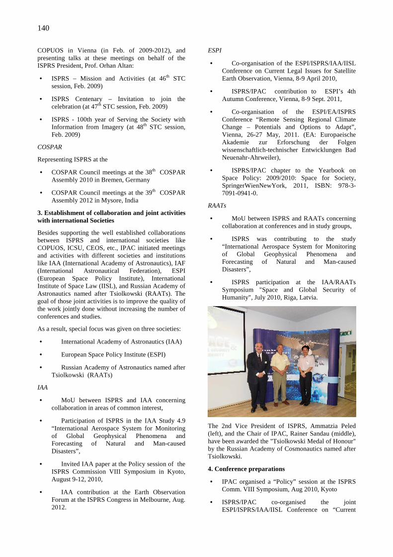
140
COPUOS in Vienna (in Feb. of 2009-2012), and presenting talks at these meetings on behalf of the ISPRS President, Prof. Orhan Altan:
• ISPRS – Mission and Activities (at 46th STC session, Feb. 2009)
• ISPRS Centenary – Invitation to join the celebration (at 47th STC session, Feb. 2009)
• ISPRS - 100th year of Serving the Society with Information from Imagery (at 48th STC session, Feb. 2009)
COSPAR
Representing ISPRS at the
• COSPAR Council meetings at the 38th COSPAR Assembly 2010 in Bremen, Germany
• COSPAR Council meetings at the 39th COSPAR Assembly 2012 in Mysore, India
3. Establishment of collaboration and joint activities with international Societies
Besides supporting the well established collaborations between ISPRS and international societies like COPUOS, ICSU, CEOS, etc., IPAC initiated meetings and activities with different societies and institutions like IAA (International Academy of Astronautics), IAF (International Astronautical Federation), ESPI (European Space Policy Institute), International Institute of Space Law (IISL), and Russian Academy of Astronautics named after Tsiolkowski (RAATs). The goal of those joint activities is to improve the quality of the work jointly done without increasing the number of conferences and studies.
As a result, special focus was given on three societies:
• International Academy of Astronautics (IAA)
• European Space Policy Institute (ESPI)
• Russian Academy of Astronautics named after Tsiolkowski (RAATs)
IAA
• MoU between ISPRS and IAA concerning collaboration in areas of common interest,
• Participation of ISPRS in the IAA Study 4.9 “International Aerospace System for Monitoring of Global Geophysical Phenomena and Forecasting of Natural and Man-caused Disasters”,
• Invited IAA paper at the Policy session of the ISPRS Commission VIII Symposium in Kyoto, August 9-12, 2010,
• IAA contribution at the Earth Observation Forum at the ISPRS Congress in Melbourne, Aug. 2012.
ESPI
• Co-organisation of the ESPI/ISPRS/IAA/IISL Conference on Current Legal Issues for Satellite Earth Observation, Vienna, 8-9 April 2010,
• ISPRS/IPAC contribution to ESPI’s 4th Autumn Conference, Vienna, 8-9 Sept. 2011,
• Co-organisation of the ESPI/EA/ISPRS Conference “Remote Sensing Regional Climate Change – Potentials and Options to Adapt”, Vienna, 26-27 May, 2011. (EA: Europaeische Akademie zur Erforschung der Folgen wissenschaftlich-technischer Entwicklungen Bad Neuenahr-Ahrweiler),
• ISPRS/IPAC chapter to the Yearbook on Space Policy: 2009/2010: Space for Society, SpringerWienNewYork, 2011, ISBN: 978-3-7091-0941-0.
RAATs
• MoU between ISPRS and RAATs concerning collaboration at conferences and in study groups,
• ISPRS was contributing to the study “International Aerospace System for Monitoring of Global Geophysical Phenomena and Forecasting of Natural and Man-caused Disasters”,
• ISPRS participation at the IAA/RAATs Symposium "Space and Global Security of Humanity", July 2010, Riga, Latvia.
The 2nd Vice President of ISPRS, Ammatzia Peled (left), and the Chair of IPAC, Rainer Sandau (middle), have been awarded the "Tsiolkowski Medal of Honour" by the Russian Academy of Cosmonautics named after Tsiolkowski.
4. Conference preparations
• IPAC organised a “Policy” session at the ISPRS Comm. VIII Symposium, Aug 2010, Kyoto
• ISPRS/IPAC co-organised the joint ESPI/ISPRS/IAA/IISL Conference on “Current
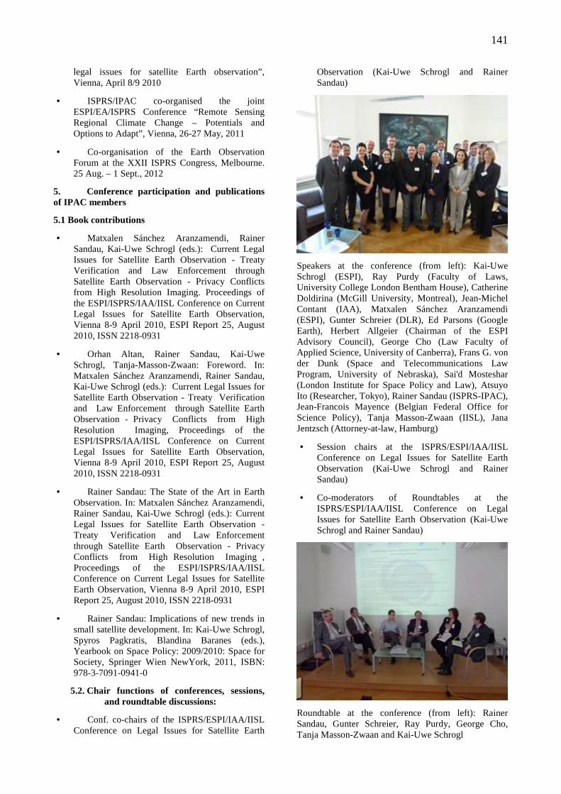
141
legal issues for satellite Earth observation”, Vienna, April 8/9 2010
• ISPRS/IPAC co-organised the joint ESPI/EA/ISPRS Conference “Remote Sensing Regional Climate Change – Potentials and Options to Adapt”, Vienna, 26-27 May, 2011
• Co-organisation of the Earth Observation Forum at the XXII ISPRS Congress, Melbourne. 25 Aug. – 1 Sept., 2012
5. Conference participation and publications of IPAC members
5.1 Book contributions
• Matxalen Sánchez Aranzamendi, Rainer Sandau, Kai-Uwe Schrogl (eds.): Current Legal Issues for Satellite Earth Observation - Treaty Verification and Law Enforcement through Satellite Earth Observation - Privacy Conflicts from High Resolution Imaging. Proceedings of the ESPI/ISPRS/IAA/IISL Conference on Current Legal Issues for Satellite Earth Observation, Vienna 8-9 April 2010, ESPI Report 25, August 2010, ISSN 2218-0931
• Orhan Altan, Rainer Sandau, Kai-Uwe Schrogl, Tanja-Masson-Zwaan: Foreword. In: Matxalen Sánchez Aranzamendi, Rainer Sandau, Kai-Uwe Schrogl (eds.): Current Legal Issues for Satellite Earth Observation - Treaty Verification and Law Enforcement through Satellite Earth Observation - Privacy Conflicts from High Resolution Imaging, Proceedings of the ESPI/ISPRS/IAA/IISL Conference on Current Legal Issues for Satellite Earth Observation, Vienna 8-9 April 2010, ESPI Report 25, August 2010, ISSN 2218-0931
• Rainer Sandau: The State of the Art in Earth Observation. In: Matxalen Sánchez Aranzamendi, Rainer Sandau, Kai-Uwe Schrogl (eds.): Current Legal Issues for Satellite Earth Observation - Treaty Verification and Law Enforcement through Satellite Earth Observation - Privacy Conflicts from High Resolution Imaging , Proceedings of the ESPI/ISPRS/IAA/IISL Conference on Current Legal Issues for Satellite Earth Observation, Vienna 8-9 April 2010, ESPI Report 25, August 2010, ISSN 2218-0931
• Rainer Sandau: Implications of new trends in small satellite development. In: Kai-Uwe Schrogl, Spyros Pagkratis, Blandina Baranes (eds.), Yearbook on Space Policy: 2009/2010: Space for Society, Springer Wien NewYork, 2011, ISBN: 978-3-7091-0941-0
5.2. Chair functions of conferences, sessions, and roundtable discussions:
• Conf. co-chairs of the ISPRS/ESPI/IAA/IISL Conference on Legal Issues for Satellite Earth
Observation (Kai-Uwe Schrogl and Rainer Sandau)
Speakers at the conference (from left): Kai-Uwe Schrogl (ESPI), Ray Purdy (Faculty of Laws, University College London Bentham House), Catherine Doldirina (McGill University, Montreal), Jean-Michel Contant (IAA), Matxalen Sánchez Aranzamendi (ESPI), Gunter Schreier (DLR), Ed Parsons (Google Earth), Herbert Allgeier (Chairman of the ESPI Advisory Council), George Cho (Law Faculty of Applied Science, University of Canberra), Frans G. von der Dunk (Space and Telecommunications Law Program, University of Nebraska), Sai'd Mosteshar (London Institute for Space Policy and Law), Atsuyo Ito (Researcher, Tokyo), Rainer Sandau (ISPRS-IPAC), Jean-Francois Mayence (Belgian Federal Office for Science Policy), Tanja Masson-Zwaan (IISL), Jana Jentzsch (Attorney-at-law, Hamburg)
• Session chairs at the ISPRS/ESPI/IAA/IISL Conference on Legal Issues for Satellite Earth Observation (Kai-Uwe Schrogl and Rainer Sandau)
• Co-moderators of Roundtables at the ISPRS/ESPI/IAA/IISL Conference on Legal Issues for Satellite Earth Observation (Kai-Uwe Schrogl and Rainer Sandau)
Roundtable at the conference (from left): Rainer Sandau, Gunter Schreier, Ray Purdy, George Cho, Tanja Masson-Zwaan and Kai-Uwe Schrogl
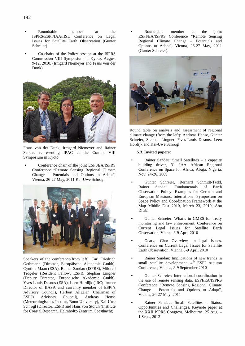
142
• Roundtable member at the ISPRS/ESPI/IAA/IISL Conference on Legal Issues for Satellite Earth Observation (Gunter Schreier)
• Co-chairs of the Policy session at the ISPRS Commission VIII Symposium in Kyoto, August 9-12, 2010, (Irmgard Niemeyer and Frans von der Dunk)
Frans von der Dunk, Irmgard Niemeyer and Rainer Sandau representing IPAC at the Comm. VIII Symposium in Kyoto
• Conference chair of the joint ESPI/EA/ISPRS Conference “Remote Sensing Regional Climate Change – Potentials and Options to Adapt”, Vienna, 26-27 May, 2011 Kai-Uwe Schrogl
Speakers of the conference(from left): Carl Friedrich Gethmann (Director, Europäische Akademie Gmbh), Cynthia Maan (ESA), Rainer Sandau (ISPRS), Mildred Trögeler (Resident Fellow, ESPI), Stephan Lingner (Deputy Director, Europäische Akademie Gmbh), Yves-Louis Desnos (ESA), Leen Hordijk (JRC; former Director of IIASA and currently member of ESPI’s Advisory Council), Herbert Allgeier (Chairman of ESPI's Advisory Council), Andreas Hense (Meteorologisches Institut, Bonn University), Kai-Uwe Schrogl (Director, ESPI) and Hans von Storch (Institute for Coastal Research, Helmholtz-Zentrum Geesthacht)
• Roundtable member at the joint ESPI/EA/ISPRS Conference “Remote Sensing Regional Climate Change – Potentials and Options to Adapt”, Vienna, 26-27 May, 2011 (Gunter Schreier).
Round table on analysis and assessment of regional climate change (from the left): Andreas Hense, Gunter Schreier, Stephan Lingner, Yves-Louis Desnos, Leen Hordijk and Kai-Uwe Schrogl
5.3. Invited papers:
• Rainer Sandau: Small Satellites – a capacity building driver, 3rd IAA African Regional Conference on Space for Africa, Abuja, Nigeria, Nov. 24-26, 2009
• Gunter Schreier, Berhard Schmidt-Tedd, Rainer Sandau: Fundamentals of Earth Observation Policy: Examples for German and European Missions. International Symposium on Space Policy and Coordination Framework at the Map Middle East 2010, March 23, 2010, Abu Dhabi
• Gunter Schreier: What’s in GMES for treaty monitoring and law enforcement, Conference on Current Legal Issues for Satellite Earth Observation, Vienna 8-9 April 2010
• Gearge Cho: Overview on legal issues. Conference on Current Legal Issues for Satellite Earth Observation, Vienna 8-9 April 2010
• Rainer Sandau: Implications of new trends in small satellite development. 4th ESPI Autumn Conference, Vienna, 8-9 September 2010
• Gunter Schreier: International coordination in the use of remote sensing data. ESPI/EA/ISPRS Conference “Remote Sensing Regional Climate Change – Potentials and Options to Adapt”, Vienna, 26-27 May, 2011
• Rainer Sandau: Small Satellites – Status, Opportunities and Challenges. Keynote paper at the XXII ISPRS Congress, Melbourne. 25 Aug. – 1 Sept., 2012
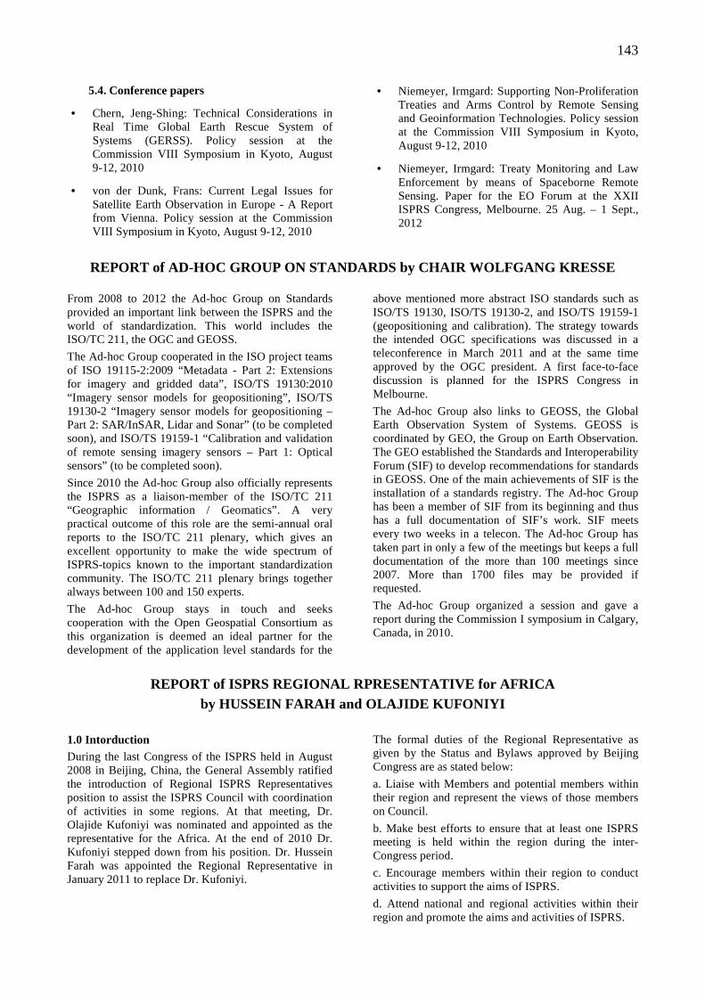
143
5.4. Conference papers
• Chern, Jeng-Shing: Technical Considerations in Real Time Global Earth Rescue System of Systems (GERSS). Policy session at the Commission VIII Symposium in Kyoto, August 9-12, 2010
• von der Dunk, Frans: Current Legal Issues for Satellite Earth Observation in Europe - A Report from Vienna. Policy session at the Commission VIII Symposium in Kyoto, August 9-12, 2010
• Niemeyer, Irmgard: Supporting Non-Proliferation Treaties and Arms Control by Remote Sensing and Geoinformation Technologies. Policy session at the Commission VIII Symposium in Kyoto, August 9-12, 2010
• Niemeyer, Irmgard: Treaty Monitoring and Law Enforcement by means of Spaceborne Remote Sensing. Paper for the EO Forum at the XXII ISPRS Congress, Melbourne. 25 Aug. – 1 Sept., 2012
REPORT of AD-HOC GROUP ON STANDARDS by CHAIR WOLFGA NG KRESSE
From 2008 to 2012 the Ad-hoc Group on Standards provided an important link between the ISPRS and the world of standardization. This world includes the ISO/TC 211, the OGC and GEOSS.
The Ad-hoc Group cooperated in the ISO project teams of ISO 19115-2:2009 “Metadata - Part 2: Extensions for imagery and gridded data”, ISO/TS 19130:2010 “Imagery sensor models for geopositioning”, ISO/TS 19130-2 “Imagery sensor models for geopositioning – Part 2: SAR/InSAR, Lidar and Sonar” (to be completed soon), and ISO/TS 19159-1 “Calibration and validation of remote sensing imagery sensors – Part 1: Optical sensors” (to be completed soon).
Since 2010 the Ad-hoc Group also officially represents the ISPRS as a liaison-member of the ISO/TC 211 “Geographic information / Geomatics”. A very practical outcome of this role are the semi-annual oral reports to the ISO/TC 211 plenary, which gives an excellent opportunity to make the wide spectrum of ISPRS-topics known to the important standardization community. The ISO/TC 211 plenary brings together always between 100 and 150 experts.
The Ad-hoc Group stays in touch and seeks cooperation with the Open Geospatial Consortium as this organization is deemed an ideal partner for the development of the application level standards for the
above mentioned more abstract ISO standards such as ISO/TS 19130, ISO/TS 19130-2, and ISO/TS 19159-1 (geopositioning and calibration). The strategy towards the intended OGC specifications was discussed in a teleconference in March 2011 and at the same time approved by the OGC president. A first face-to-face discussion is planned for the ISPRS Congress in Melbourne.
The Ad-hoc Group also links to GEOSS, the Global Earth Observation System of Systems. GEOSS is coordinated by GEO, the Group on Earth Observation. The GEO established the Standards and Interoperability Forum (SIF) to develop recommendations for standards in GEOSS. One of the main achievements of SIF is the installation of a standards registry. The Ad-hoc Group has been a member of SIF from its beginning and thus has a full documentation of SIF’s work. SIF meets every two weeks in a telecon. The Ad-hoc Group has taken part in only a few of the meetings but keeps a full documentation of the more than 100 meetings since 2007. More than 1700 files may be provided if requested.
The Ad-hoc Group organized a session and gave a report during the Commission I symposium in Calgary, Canada, in 2010.
REPORT of ISPRS REGIONAL RPRESENTATIVE for AFRICA by HUSSEIN FARAH and OLAJIDE KUFONIYI
1.0 Intorduction During the last Congress of the ISPRS held in August 2008 in Beijing, China, the General Assembly ratified the introduction of Regional ISPRS Representatives position to assist the ISPRS Council with coordination of activities in some regions. At that meeting, Dr. Olajide Kufoniyi was nominated and appointed as the representative for the Africa. At the end of 2010 Dr. Kufoniyi stepped down from his position. Dr. Hussein Farah was appointed the Regional Representative in January 2011 to replace Dr. Kufoniyi.
The formal duties of the Regional Representative as given by the Status and Bylaws approved by Beijing Congress are as stated below:
a. Liaise with Members and potential members within their region and represent the views of those members on Council.
b. Make best efforts to ensure that at least one ISPRS meeting is held within the region during the inter-Congress period.
c. Encourage members within their region to conduct activities to support the aims of ISPRS.
d. Attend national and regional activities within their region and promote the aims and activities of ISPRS.
144
e. Encourage countries and organizations within their region to become a member of ISPRS.
f. Attend meetings of the Council and Advisory Board when invited.
The major activities have been organizing and attending ISPRS events and membership drive. The details of the activities are as follows:
2.0 ISPRS Events in Africa:
2.1 AfricaGIS 2009 Workshops The following two (co-sponsored) ISPRS events took place during AfricaGIS 2009 conference from 26 – 30 October 2009 in Kampala, Uganda:
(a) A pre-conference workshop to explore Disaster Management and Humanitarian Assistance for the Global Earth Observation System of Systems – GEOSS Organised in association with ITC, UNEDRA, ICEO, OGC, UNSPIDER, and ISPRS from 23-25 October 2009.
(b) Two ISPRS TC VI Special Sessions on 27 and 28 October 2009 during the conference. Session 1 was on ‘Frameworks and curricula for cross border education in Earth Observation and Spatial Information Sciences’ while Session 2 was on ‘Methods and best practices for e-learning in Earth Observation and Spatial Information Sciences’.
2.2 MoU with African Association of Remote Sensing of the Environment A memorandum of understanding (MoU) between ISPRS and African Association of Remote Sensing of the Environment (AARSE) was signed during the General Assembly of AARSE on Thursday 28th October 2010 in Addis Ababa, Ethiopia by Prof. Ian Dowman (1st Vice President, representing ISPRS) and Dr. Tsehaie Woldai (President of AARSE at the time of signing, representing AARSE). Prof. Dowman represented ISPRS at the 8th biennial conference of AARSE in Addis Ababa, Ethiopia between 25 and 29 October 2010.
The MoU set out agreements for co-operation between the societies through exchange of information and collaboration in activities such as the organisation of joint meetings and recruitment of members and from time to time through joint projects and joint working groups.
2.3 MoU with EIS Africa A similar MoU as above was signed between ISPRS and EIS Africa in October 2010. The MoU is to support the promotion of the use of Geospatial Science and Technology for sustainable development in Africa through organizing workshops during the biannual AfricaGIS conferences organized by EIS-Africa.
2.4 ISPRS Centenary Celebration: On the invitation of Council, Dr. Kufoniyi attended the ISPRS Centenary celebration and General Assembly in July, 2010 in Austria.
2.5 Workshop on Exploiting Global Geospatial Data Resources for Planning in Africa
The workshop was pre–conference event during the Committee on Development Information, Science and Technology (CODIST) meeting held in May 2011 in Ethiopia. The main objective of the workshop was to show how global data sets can be used in Africa and to explore the requirements for using geospatial data for planning purposes, and the resources available to generate the required products and services.
The workshop was attended by over 70 CODIST delegates drawn from different African countries. A series of presentations were made focusing on the theme of the workshop “Global geospatial datasets for Planning in Africa” The major outcome from the workshop was: the insight on the availability of global datasets, global geospatial portals, as well as new geospatial technologies, for harnessing the global datasets for sustainable development. The workshop was organized jointly with United Nations Economic Commission for Africa (UNECA), Google, ESRI, EIS Africa, Regional Centre for Mapping of Resources for Development (RCMRD), EIS-Africa and AARSE.
2.6 Planned Events in 2012 There are two events scheduled for August 2012 and October 2012. The first is 5 day training on Free Open Source Geospatial Software to be held in Nairobi, Kenya 20-24 August 2012. In recent years the use of Earth Observation (EO) in the GEOSS societal benefit areas and in the support to sustainable development has been increasing at a fast pace in Africa. Free open geospatial source software will greatly contribute to the update and wider use of geospatial information in our region. This will be a big boost to our efforts for wider use of geospatial information in all sectors of national development in Africa.
The second event will be one day workshop Exploiting Global Geospatial Data Resources for Planning in Africa to be held during the African Association of Remote Sensing of the Environment (AARSE) conference to be held in Morocco 29 October - 2 November 2012. The workshop will be a continuation of a similar successful workshop held in May 2011.
2.7 ISPRS Technical Commissions and Working Groups events ISPRS Technical Commissions and Working Groups are hereby encouraged to organize events (seminars, workshops, special sessions) in Africa. These are best organized as special sessions, pre-conference or post-conference events during the biennial conference of the African Association of the Environment (AARSE) (October of even numbered years) or that of AfricaGIS (around October of odd numbered years). For more information, please contact the ISPRS Regional Representative for Africa.
3.0 Membership Drive: Africa has a total of 27 members, comprising of 17 Ordinary members, 1 Associate member, 6 Regional members and 3 Sustaining members. Membership drive
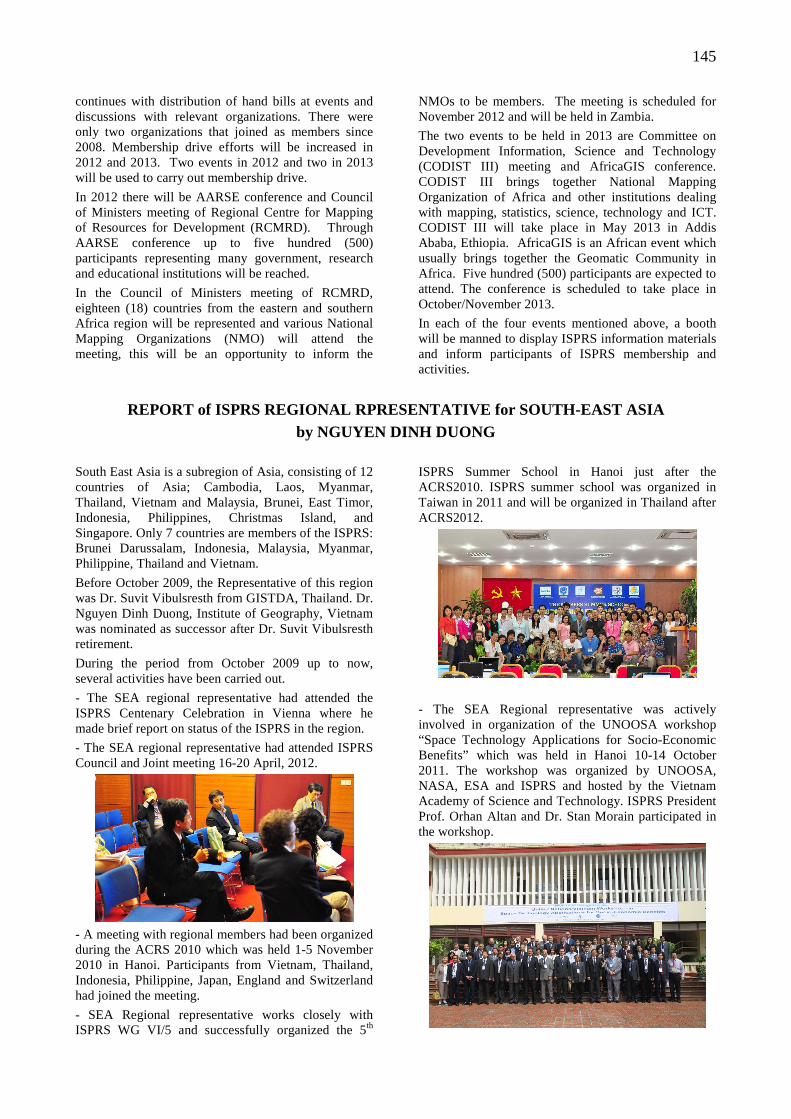
145
continues with distribution of hand bills at events and discussions with relevant organizations. There were only two organizations that joined as members since 2008. Membership drive efforts will be increased in 2012 and 2013. Two events in 2012 and two in 2013 will be used to carry out membership drive.
In 2012 there will be AARSE conference and Council of Ministers meeting of Regional Centre for Mapping of Resources for Development (RCMRD). Through AARSE conference up to five hundred (500) participants representing many government, research and educational institutions will be reached.
In the Council of Ministers meeting of RCMRD, eighteen (18) countries from the eastern and southern Africa region will be represented and various National Mapping Organizations (NMO) will attend the meeting, this will be an opportunity to inform the
NMOs to be members. The meeting is scheduled for November 2012 and will be held in Zambia.
The two events to be held in 2013 are Committee on Development Information, Science and Technology (CODIST III) meeting and AfricaGIS conference. CODIST III brings together National Mapping Organization of Africa and other institutions dealing with mapping, statistics, science, technology and ICT. CODIST III will take place in May 2013 in Addis Ababa, Ethiopia. AfricaGIS is an African event which usually brings together the Geomatic Community in Africa. Five hundred (500) participants are expected to attend. The conference is scheduled to take place in October/November 2013.
In each of the four events mentioned above, a booth will be manned to display ISPRS information materials and inform participants of ISPRS membership and activities.
REPORT of ISPRS REGIONAL RPRESENTATIVE for SOUTH-EA ST ASIA by NGUYEN DINH DUONG
South East Asia is a subregion of Asia, consisting of 12 countries of Asia; Cambodia, Laos, Myanmar, Thailand, Vietnam and Malaysia, Brunei, East Timor, Indonesia, Philippines, Christmas Island, and Singapore. Only 7 countries are members of the ISPRS: Brunei Darussalam, Indonesia, Malaysia, Myanmar, Philippine, Thailand and Vietnam.
Before October 2009, the Representative of this region was Dr. Suvit Vibulsresth from GISTDA, Thailand. Dr. Nguyen Dinh Duong, Institute of Geography, Vietnam was nominated as successor after Dr. Suvit Vibulsresth retirement.
During the period from October 2009 up to now, several activities have been carried out.
- The SEA regional representative had attended the ISPRS Centenary Celebration in Vienna where he made brief report on status of the ISPRS in the region.
- The SEA regional representative had attended ISPRS Council and Joint meeting 16-20 April, 2012.
- A meeting with regional members had been organized during the ACRS 2010 which was held 1-5 November 2010 in Hanoi. Participants from Vietnam, Thailand, Indonesia, Philippine, Japan, England and Switzerland had joined the meeting.
- SEA Regional representative works closely with ISPRS WG VI/5 and successfully organized the 5th
ISPRS Summer School in Hanoi just after the ACRS2010. ISPRS summer school was organized in Taiwan in 2011 and will be organized in Thailand after ACRS2012.
- The SEA Regional representative was actively involved in organization of the UNOOSA workshop “Space Technology Applications for Socio-Economic Benefits” which was held in Hanoi 10-14 October 2011. The workshop was organized by UNOOSA, NASA, ESA and ISPRS and hosted by the Vietnam Academy of Science and Technology. ISPRS President Prof. Orhan Altan and Dr. Stan Morain participated in the workshop.
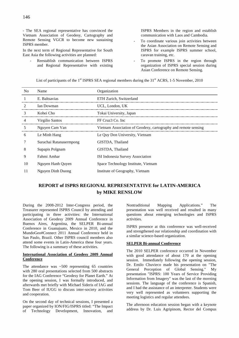
146
- The SEA regional representative has convinced the Vietnam Association of Geodesy, Cartography and Remote Sensing VGCR to become new sustaining ISPRS member.
In the next term of Regional Representative for South East Asia the following activities are planned:
- Reestablish communication between ISPRS and Regional Representative with existing
ISPRS Members in the region and establish communication with Laos and Cambodia.
- To coordinate various join activities between the Asian Association on Remote Sensing and ISPRS for example ISPRS summer school, caravan training, etc.
- To promote ISPRS in the region through organization of ISPRS special session during Asian Conference on Remote Sensing.
List of participants of the 1st ISPRS SEA regional members during the 31st ACRS, 1-5 November, 2010
No Name Organization
1 E. Baltsavias ETH Zurich, Switzerland
2 Ian Dowman UCL, London, UK
3 Kohei Cho Tokai University, Japan
4 Virgilio Santos FF Cruz3 Co. Inc
5 Nguyen Cam Van Vietnam Association of Geodesy, cartography and remote sensing
6 Le Minh Hang Le Quy Don University, Vietnam
7 Surachai Ratanasermpong GISTDA, Thailand
8 Supapis Polgnam GISTDA, Thailand
9 Fahmi Amhar ISI Indonesia Survey Association
10 Nguyen Hanh Quyen Space Technology Institute, Vietnam
11 Nguyen Dinh Duong Institute of Geography, Vietnam
REPORT of ISPRS REGIONAL REPRESENTATIVE for LATIN-A MERICA
by MIKE RENSLOW
During the 2008-2012 Inter-Congress period, the Treasurer represented ISPRS Council by attending and participating in three activities: the International Association of Geodesy 2009 Annual Conference in Buenos Aires, Argentina, the SELPER Bi-annual Conference in Guanajuato, Mexico in 2010, and the MundoGeo#Connect 2011 Annual Conference held in San Paulo, Brazil. Other ISPRS council members also attend some events in Latin-America these four years. The following is a summary of these activities.
International Association of Geodesy 2009 Annual Conference
The attendance was ~500 representing 65 countries with 280 oral presentations selected from 500 abstracts for the IAG Conference “Geodesy for Planet Earth.” At the opening session, I was formally introduced, and afterwards met briefly with Michael Sideris of IAG and Tom Beer of IUGG to discuss inter-society activities and cooperation.
On the second day of technical sessions, I presented a paper organized by ION/FIG/ISPRS titled: “The Impact of Technology Development, Innovation, and
Nontraditional Mapping Applications.” The presentation was well received and resulted in many questions about emerging technologies and ISPRS activities.
ISPRS presence at this conference was well-received and strengthened our relationship and coordination with a similar science-based organization.
SELPER Bi-annual Conference
The 2010 SELPER conference occurred in November with good attendance of about 170 at the opening session. Immediately following the opening session, Dr. Emilo Chuvieco made his presentation on "The General Perception of Global Sensing." My presentation "ISPRS: 100 Years of Service Providing Information from Imagery" was the last of the morning sessions. The language of the conference is Spanish, and I had the assistance of an interpreter. Students were very well represented as volunteers supporting the meeting logistics and regular attendees.
The afternoon education session began with a keynote address by Dr. Luis Agripinom, Rector del Compus
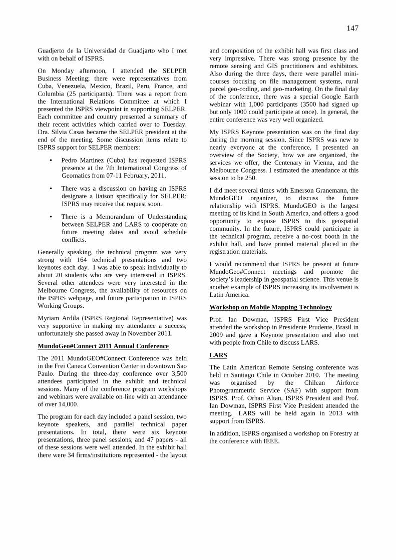
147
Guadjerto de la Universidad de Guadjarto who I met with on behalf of ISPRS.
On Monday afternoon, I attended the SELPER Business Meeting; there were representatives from Cuba, Venezuela, Mexico, Brazil, Peru, France, and Columbia (25 participants). There was a report from the International Relations Committee at which I presented the ISPRS viewpoint in supporting SELPER. Each committee and country presented a summary of their recent activities which carried over to Tuesday. Dra. Silvia Casas became the SELPER president at the end of the meeting. Some discussion items relate to ISPRS support for SELPER members:
• Pedro Martinez (Cuba) has requested ISPRS presence at the 7th International Congress of Geomatics from 07-11 February, 2011.
• There was a discussion on having an ISPRS designate a liaison specifically for SELPER; ISPRS may receive that request soon.
• There is a Memorandum of Understanding between SELPER and LARS to cooperate on future meeting dates and avoid schedule conflicts.
Generally speaking, the technical program was very strong with 164 technical presentations and two keynotes each day. I was able to speak individually to about 20 students who are very interested in ISPRS. Several other attendees were very interested in the Melbourne Congress, the availability of resources on the ISPRS webpage, and future participation in ISPRS Working Groups.
Myriam Ardila (ISPRS Regional Representative) was very supportive in making my attendance a success; unfortunately she passed away in November 2011.
MundoGeo#Connect 2011 Annual Conference
The 2011 MundoGEO#Connect Conference was held in the Frei Caneca Convention Center in downtown Sao Paulo. During the three-day conference over 3,500 attendees participated in the exhibit and technical sessions. Many of the conference program workshops and webinars were available on-line with an attendance of over 14,000.
The program for each day included a panel session, two keynote speakers, and parallel technical paper presentations. In total, there were six keynote presentations, three panel sessions, and 47 papers - all of these sessions were well attended. In the exhibit hall there were 34 firms/institutions represented - the layout
and composition of the exhibit hall was first class and very impressive. There was strong presence by the remote sensing and GIS practitioners and exhibitors. Also during the three days, there were parallel mini-courses focusing on file management systems, rural parcel geo-coding, and geo-marketing. On the final day of the conference, there was a special Google Earth webinar with 1,000 participants (3500 had signed up but only 1000 could participate at once). In general, the entire conference was very well organized.
My ISPRS Keynote presentation was on the final day during the morning session. Since ISPRS was new to nearly everyone at the conference, I presented an overview of the Society, how we are organized, the services we offer, the Centenary in Vienna, and the Melbourne Congress. I estimated the attendance at this session to be 250.
I did meet several times with Emerson Granemann, the MundoGEO organizer, to discuss the future relationship with ISPRS. MundoGEO is the largest meeting of its kind in South America, and offers a good opportunity to expose ISPRS to this geospatial community. In the future, ISPRS could participate in the technical program, receive a no-cost booth in the exhibit hall, and have printed material placed in the registration materials.
I would recommend that ISPRS be present at future MundoGeo#Connect meetings and promote the society’s leadership in geospatial science. This venue is another example of ISPRS increasing its involvement is Latin America.
Workshop on Mobile Mapping Technology
Prof. Ian Dowman, ISPRS First Vice President attended the workshop in Presidente Prudente, Brasil in 2009 and gave a Keynote presentation and also met with people from Chile to discuss LARS.
LARS
The Latin American Remote Sensing conference was held in Santiago Chile in October 2010. The meeting was organised by the Chilean Airforce Photogrammetric Service (SAF) with support from ISPRS. Prof. Orhan Altan, ISPRS President and Prof. Ian Dowman, ISPRS First Vice President attended the meeting. LARS will be held again in 2013 with support from ISPRS.
In addition, ISPRS organised a workshop on Forestry at the conference with IEEE.
148
ISPRS 2012
SCIENTIFIC PROGRAM
Overall Program
Daily Program
Oral Presentations and ePosters
Student Consortium
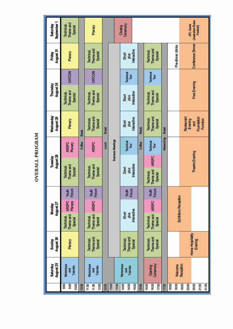
149
OV
ER
ALL
PR
OG
RA
M
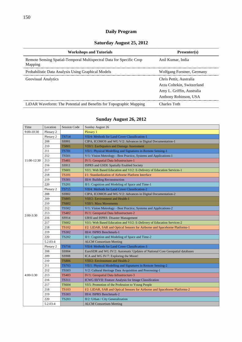
150
Daily Program
Saturday August 25, 2012
Workshops and Tutorials Presenter(s)
Remote Sensing Spatial-Temporal Multispectral Data for Specific Crop Mapping
Anil Kumar, India
Probabilistic Data Analysis Using Graphical Models Wolfgang Forstner, Germany
Geovisual Analytics Chris Pettit, Australia
Arzu Coltekin, Switzerland
Amy L. Griffin, Australia
Anthony Robinson, USA
LiDAR Waveform: The Potential and Benefits for Topographic Mapping Charles Toth
Sunday August 26, 2012
Time Location Session Code Sunday August 26
9:00-10:30 Plenary 2 Plenary 1
11:00-12:30
Plenary 2 TS714 VII/4: Methods for Land Cover Classification-1
208 SS901 CIPA, ICOMOS and WG V/2: Advances in Digital Documentation-1
210 TS801 VIII/1: Earthquakes and Damage Assessment
211 TS701 VII/1: Physical Modelling and Signatures in Remote Sensing-1
212 TS501 V/1: Vision Metrology - Best Practice, Systems and Applications-1
213 TS401 IV/1: Geospatial Data Infrastructure-1
216 SS911 ISPRS and GSDI: Spatially Enabled Society
217 TS601 VI/1: Web Based Education and VI/2: E-Delivery of Education Services-1
218 TS101 I/1: Standardization of Airborne Platform Interface
219 TS301 III/4: Building Reconstruction
220 TS201 II/1: Cognition and Modeling of Space and Time-1
2:00-3:30
Plenary 2 TS715 VII/4: Methods for Land Cover Classification-2
208 SS902 CIPA, ICOMOS and WG V/2: Advances in Digital Documentation-2
209 TS805 VIII/2: Environment and Health-1
210 TS802 VIII/1: Mass Movements
212 TS502 V/1: Vision Metrology - Best Practice, Systems and Applications-2
213 TS402 IV/1: Geospatial Data Infrastructure-2
216 SS914 URSI and ISPRS: Disaster Management
217 TS602 VI/1: Web Based Education and VI/2: E-Delivery of Education Services-2
218 TS102 I/2: LIDAR, SAR and Optical Sensors for Airborne and Spaceborne Platforms-1
219 TS302 III/4: ISPRS Benchmark-1
220 TS202 II/1: Cognition and Modeling of Space and Time-2
5.2.03-4 ALCM Consortium Meeting
4:00-5:30
Plenary 2 TS716 VII/4: Methods for Land Cover Classification-3
208 SS904 EuroSDR and WG IV/2: Automatic Updates of National Core Geospatial databases
209 SS908 ICA and WG IV/7: Exploring the Moon!
210 TS806 VIII/2: Environment and Health-2
211 TS703 VII/1: Physical Modelling and Signatures in Remote Sensing-2
212 TS503 V/2: Cultural Heritage Data Acquisition and Processing-1
213 TS403 IV/1: Geospatial Data Infrastructure-3
216 TS311 ICWG III/VII: Feature Analysis for Image Classification
217 TS604 VI/5: Promotion of the Profession to Young People
218 TS103 I/2: LIDAR, SAR and Optical Sensors for Airborne and Spaceborne Platforms-2
219 TS303 III/4: ISPRS Benchmark-2
220 TS203 II/2: Urban / City Generalization
5.2.03-4 ALCM Consortium Meeting
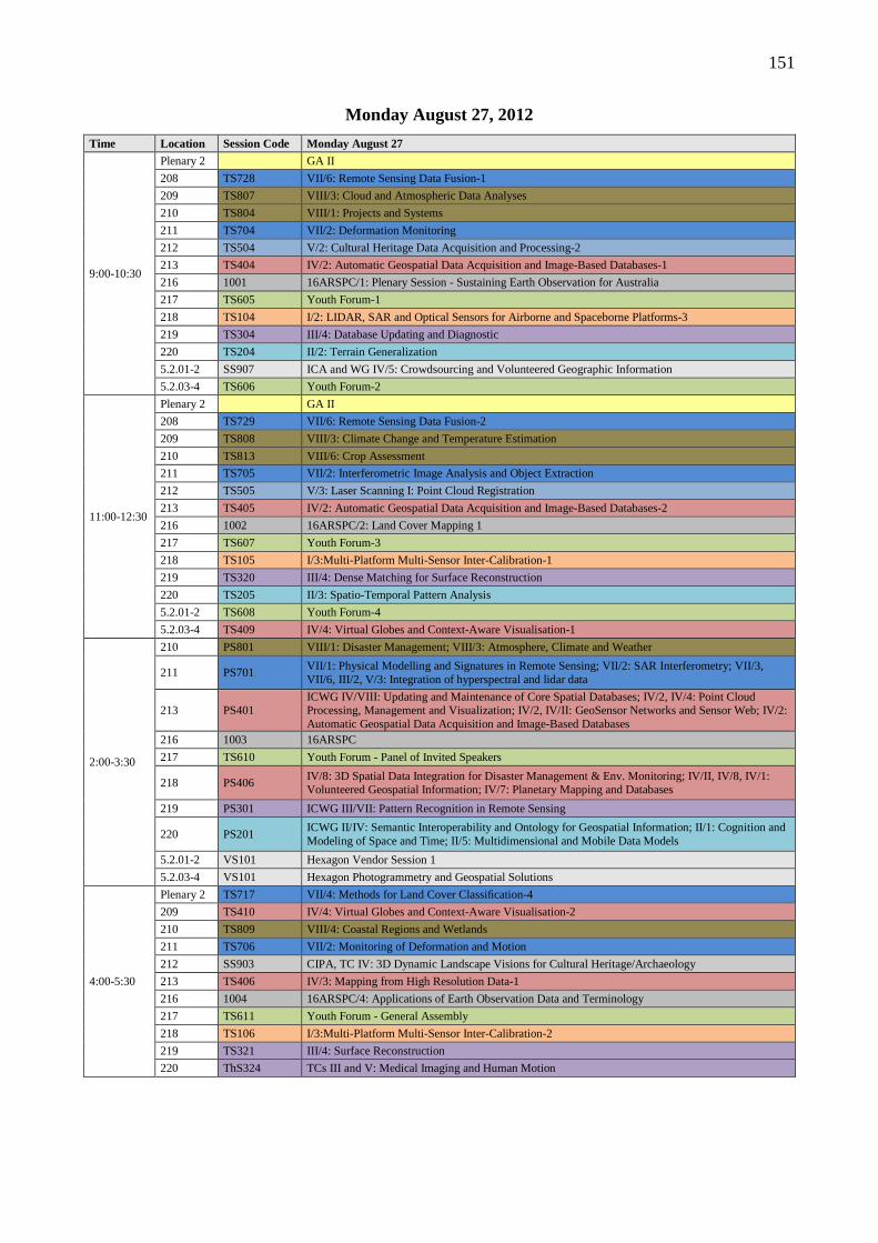
151
Monday August 27, 2012
Time Location Session Code Monday August 27
9:00-10:30
Plenary 2 GA II
208 TS728 VII/6: Remote Sensing Data Fusion-1
209 TS807 VIII/3: Cloud and Atmospheric Data Analyses
210 TS804 VIII/1: Projects and Systems
211 TS704 VII/2: Deformation Monitoring
212 TS504 V/2: Cultural Heritage Data Acquisition and Processing-2
213 TS404 IV/2: Automatic Geospatial Data Acquisition and Image-Based Databases-1
216 1001 16ARSPC/1: Plenary Session - Sustaining Earth Observation for Australia
217 TS605 Youth Forum-1
218 TS104 I/2: LIDAR, SAR and Optical Sensors for Airborne and Spaceborne Platforms-3
219 TS304 III/4: Database Updating and Diagnostic
220 TS204 II/2: Terrain Generalization
5.2.01-2 SS907 ICA and WG IV/5: Crowdsourcing and Volunteered Geographic Information
5.2.03-4 TS606 Youth Forum-2
11:00-12:30
Plenary 2 GA II
208 TS729 VII/6: Remote Sensing Data Fusion-2
209 TS808 VIII/3: Climate Change and Temperature Estimation
210 TS813 VIII/6: Crop Assessment
211 TS705 VII/2: Interferometric Image Analysis and Object Extraction
212 TS505 V/3: Laser Scanning I: Point Cloud Registration
213 TS405 IV/2: Automatic Geospatial Data Acquisition and Image-Based Databases-2
216 1002 16ARSPC/2: Land Cover Mapping 1
217 TS607 Youth Forum-3
218 TS105 I/3:Multi-Platform Multi-Sensor Inter-Calibration-1
219 TS320 III/4: Dense Matching for Surface Reconstruction
220 TS205 II/3: Spatio-Temporal Pattern Analysis
5.2.01-2 TS608 Youth Forum-4
5.2.03-4 TS409 IV/4: Virtual Globes and Context-Aware Visualisation-1
2:00-3:30
210 PS801 VIII/1: Disaster Management; VIII/3: Atmosphere, Climate and Weather
211 PS701 VII/1: Physical Modelling and Signatures in Remote Sensing; VII/2: SAR Interferometry; VII/3, VII/6, III/2, V/3: Integration of hyperspectral and lidar data
213 PS401 ICWG IV/VIII: Updating and Maintenance of Core Spatial Databases; IV/2, IV/4: Point Cloud Processing, Management and Visualization; IV/2, IV/II: GeoSensor Networks and Sensor Web; IV/2: Automatic Geospatial Data Acquisition and Image-Based Databases
216 1003 16ARSPC
217 TS610 Youth Forum - Panel of Invited Speakers
218 PS406 IV/8: 3D Spatial Data Integration for Disaster Management & Env. Monitoring; IV/II, IV/8, IV/1: Volunteered Geospatial Information; IV/7: Planetary Mapping and Databases
219 PS301 ICWG III/VII: Pattern Recognition in Remote Sensing
220 PS201 ICWG II/IV: Semantic Interoperability and Ontology for Geospatial Information; II/1: Cognition and Modeling of Space and Time; II/5: Multidimensional and Mobile Data Models
5.2.01-2 VS101 Hexagon Vendor Session 1
5.2.03-4 VS101 Hexagon Photogrammetry and Geospatial Solutions
4:00-5:30
Plenary 2 TS717 VII/4: Methods for Land Cover Classification-4
209 TS410 IV/4: Virtual Globes and Context-Aware Visualisation-2
210 TS809 VIII/4: Coastal Regions and Wetlands
211 TS706 VII/2: Monitoring of Deformation and Motion
212 SS903 CIPA, TC IV: 3D Dynamic Landscape Visions for Cultural Heritage/Archaeology
213 TS406 IV/3: Mapping from High Resolution Data-1
216 1004 16ARSPC/4: Applications of Earth Observation Data and Terminology
217 TS611 Youth Forum - General Assembly
218 TS106 I/3:Multi-Platform Multi-Sensor Inter-Calibration-2
219 TS321 III/4: Surface Reconstruction
220 ThS324 TCs III and V: Medical Imaging and Human Motion
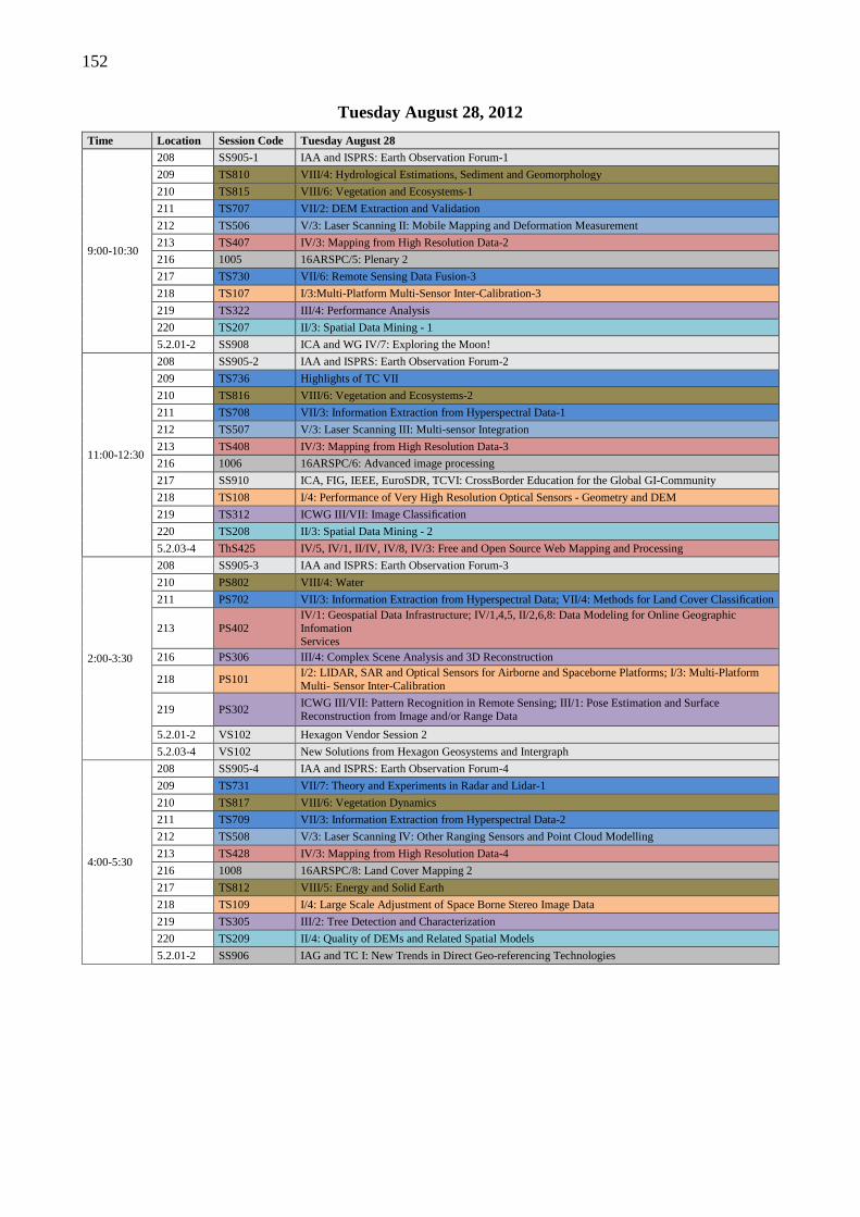
152
Tuesday August 28, 2012
Time Location Session Code Tuesday August 28
9:00-10:30
208 SS905-1 IAA and ISPRS: Earth Observation Forum-1
209 TS810 VIII/4: Hydrological Estimations, Sediment and Geomorphology
210 TS815 VIII/6: Vegetation and Ecosystems-1
211 TS707 VII/2: DEM Extraction and Validation
212 TS506 V/3: Laser Scanning II: Mobile Mapping and Deformation Measurement
213 TS407 IV/3: Mapping from High Resolution Data-2
216 1005 16ARSPC/5: Plenary 2
217 TS730 VII/6: Remote Sensing Data Fusion-3
218 TS107 I/3:Multi-Platform Multi-Sensor Inter-Calibration-3
219 TS322 III/4: Performance Analysis
220 TS207 II/3: Spatial Data Mining - 1
5.2.01-2 SS908 ICA and WG IV/7: Exploring the Moon!
11:00-12:30
208 SS905-2 IAA and ISPRS: Earth Observation Forum-2
209 TS736 Highlights of TC VII
210 TS816 VIII/6: Vegetation and Ecosystems-2
211 TS708 VII/3: Information Extraction from Hyperspectral Data-1
212 TS507 V/3: Laser Scanning III: Multi-sensor Integration
213 TS408 IV/3: Mapping from High Resolution Data-3
216 1006 16ARSPC/6: Advanced image processing
217 SS910 ICA, FIG, IEEE, EuroSDR, TCVI: CrossBorder Education for the Global GI-Community
218 TS108 I/4: Performance of Very High Resolution Optical Sensors - Geometry and DEM
219 TS312 ICWG III/VII: Image Classification
220 TS208 II/3: Spatial Data Mining - 2
5.2.03-4 ThS425 IV/5, IV/1, II/IV, IV/8, IV/3: Free and Open Source Web Mapping and Processing
2:00-3:30
208 SS905-3 IAA and ISPRS: Earth Observation Forum-3
210 PS802 VIII/4: Water
211 PS702 VII/3: Information Extraction from Hyperspectral Data; VII/4: Methods for Land Cover Classification
213 PS402 IV/1: Geospatial Data Infrastructure; IV/1,4,5, II/2,6,8: Data Modeling for Online Geographic Infomation Services
216 PS306 III/4: Complex Scene Analysis and 3D Reconstruction
218 PS101 I/2: LIDAR, SAR and Optical Sensors for Airborne and Spaceborne Platforms; I/3: Multi-Platform Multi- Sensor Inter-Calibration
219 PS302 ICWG III/VII: Pattern Recognition in Remote Sensing; III/1: Pose Estimation and Surface Reconstruction from Image and/or Range Data
5.2.01-2 VS102 Hexagon Vendor Session 2
5.2.03-4 VS102 New Solutions from Hexagon Geosystems and Intergraph
4:00-5:30
208 SS905-4 IAA and ISPRS: Earth Observation Forum-4
209 TS731 VII/7: Theory and Experiments in Radar and Lidar-1
210 TS817 VIII/6: Vegetation Dynamics
211 TS709 VII/3: Information Extraction from Hyperspectral Data-2
212 TS508 V/3: Laser Scanning IV: Other Ranging Sensors and Point Cloud Modelling
213 TS428 IV/3: Mapping from High Resolution Data-4
216 1008 16ARSPC/8: Land Cover Mapping 2
217 TS812 VIII/5: Energy and Solid Earth
218 TS109 I/4: Large Scale Adjustment of Space Borne Stereo Image Data
219 TS305 III/2: Tree Detection and Characterization
220 TS209 II/4: Quality of DEMs and Related Spatial Models
5.2.01-2 SS906 IAG and TC I: New Trends in Direct Geo-referencing Technologies
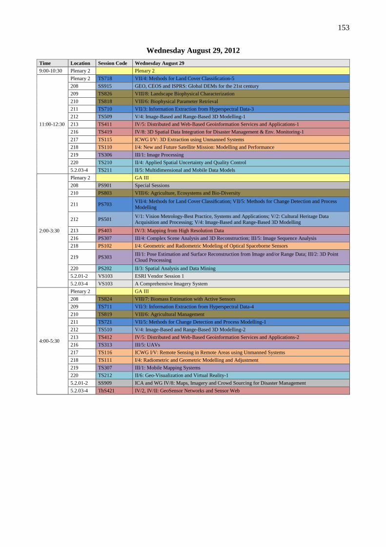
153
Wednesday August 29, 2012
Time Location Session Code Wednesday August 29
9:00-10:30 Plenary 2 Plenary 2
11:00-12:30
Plenary 2 TS718 VII/4: Methods for Land Cover Classification-5
208 SS915 GEO, CEOS and ISPRS: Global DEMs for the 21st century
209 TS826 VIII/8: Landscape Biophysical Characterization
210 TS818 VIII/6: Biophysical Parameter Retrieval
211 TS710 VII/3: Information Extraction from Hyperspectral Data-3
212 TS509 V/4: Image-Based and Range-Based 3D Modelling-1
213 TS411 IV/5: Distributed and Web-Based Geoinformation Services and Applications-1
216 TS419 IV/8: 3D Spatial Data Integration for Disaster Management & Env. Monitoring-1
217 TS115 ICWG I/V: 3D Extraction using Unmanned Systems
218 TS110 I/4: New and Future Satellite Mission: Modelling and Performance
219 TS306 III/1: Image Processing
220 TS210 II/4: Applied Spatial Uncertainty and Quality Control
5.2.03-4 TS211 II/5: Multidimensional and Mobile Data Models
2:00-3:30
Plenary 2 GA III
208 PS901 Special Sessions
210 PS803 VIII/6: Agriculture, Ecosystems and Bio-Diversity
211 PS703 VII/4: Methods for Land Cover Classification; VII/5: Methods for Change Detection and Process Modelling
212 PS501 V/1: Vision Metrology-Best Practice, Systems and Applications; V/2: Cultural Heritage Data Acquisition and Processing; V/4: Image-Based and Range-Based 3D Modelling
213 PS403 IV/3: Mapping from High Resolution Data
216 PS307 III/4: Complex Scene Analysis and 3D Reconstruction; III/5: Image Sequence Analysis
218 PS102 I/4: Geometric and Radiometric Modeling of Optical Spaceborne Sensors
219 PS303 III/1: Pose Estimation and Surface Reconstruction from Image and/or Range Data; III/2: 3D Point Cloud Processing
220 PS202 II/3: Spatial Analysis and Data Mining
5.2.01-2 VS103 ESRI Vendor Session 1
5.2.03-4 VS103 A Comprehensive Imagery System
4:00-5:30
Plenary 2 GA III
208 TS824 VIII/7: Biomass Estimation with Active Sensors
209 TS711 VII/3: Information Extraction from Hyperspectral Data-4
210 TS819 VIII/6: Agricultural Management
211 TS721 VII/5: Methods for Change Detection and Process Modelling-1
212 TS510 V/4: Image-Based and Range-Based 3D Modelling-2
213 TS412 IV/5: Distributed and Web-Based Geoinformation Services and Applications-2
216 TS313 III/5: UAVs
217 TS116 ICWG I/V: Remote Sensing in Remote Areas using Unmanned Systems
218 TS111 I/4: Radiometric and Geometric Modelling and Adjustment
219 TS307 III/1: Mobile Mapping Systems
220 TS212 II/6: Geo-Visualization and Virtual Reality-1
5.2.01-2 SS909 ICA and WG IV/8: Maps, Imagery and Crowd Sourcing for Disaster Management
5.2.03-4 ThS421 IV/2, IV/II: GeoSensor Networks and Sensor Web
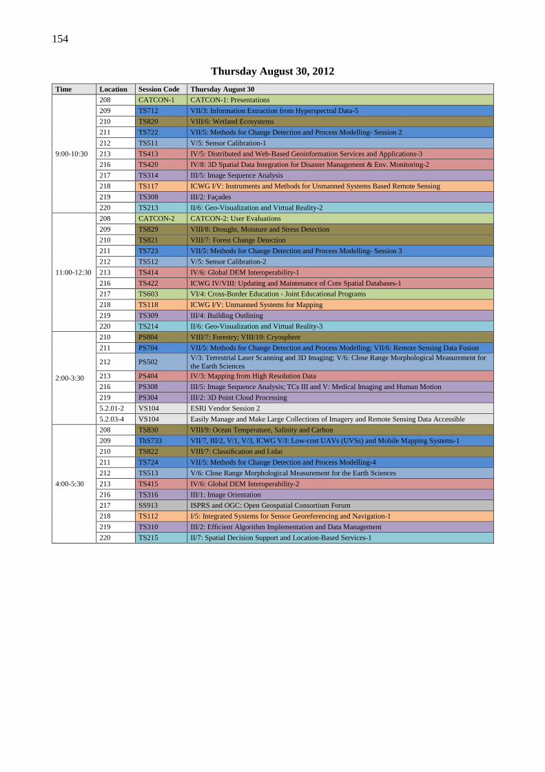
154
Thursday August 30, 2012
Time Location Session Code Thursday August 30
9:00-10:30
208 CATCON-1 CATCON-1: Presentations
209 TS712 VII/3: Information Extraction from Hyperspectral Data-5
210 TS820 VIII/6: Wetland Ecosystems
211 TS722 VII/5: Methods for Change Detection and Process Modelling- Session 2
212 TS511 V/5: Sensor Calibration-1
213 TS413 IV/5: Distributed and Web-Based Geoinformation Services and Applications-3
216 TS420 IV/8: 3D Spatial Data Integration for Disaster Management & Env. Monitoring-2
217 TS314 III/5: Image Sequence Analysis
218 TS117 ICWG I/V: Instruments and Methods for Unmanned Systems Based Remote Sensing
219 TS308 III/2: Façades
220 TS213 II/6: Geo-Visualization and Virtual Reality-2
11:00-12:30
208 CATCON-2 CATCON-2: User Evaluations
209 TS829 VIII/8: Drought, Moisture and Stress Detection
210 TS821 VIII/7: Forest Change Detection
211 TS723 VII/5: Methods for Change Detection and Process Modelling- Session 3
212 TS512 V/5: Sensor Calibration-2
213 TS414 IV/6: Global DEM Interoperability-1
216 TS422 ICWG IV/VIII: Updating and Maintenance of Core Spatial Databases-1
217 TS603 VI/4: Cross-Border Education - Joint Educational Programs
218 TS118 ICWG I/V: Unmanned Systems for Mapping
219 TS309 III/4: Building Outlining
220 TS214 II/6: Geo-Visualization and Virtual Reality-3
2:00-3:30
210 PS804 VIII/7: Forestry; VIII/10: Cryosphere
211 PS704 VII/5: Methods for Change Detection and Process Modelling; VII/6: Remote Sensing Data Fusion
212 PS502 V/3: Terrestrial Laser Scanning and 3D Imaging; V/6: Close Range Morphological Measurement for the Earth Sciences
213 PS404 IV/3: Mapping from High Resolution Data
216 PS308 III/5: Image Sequence Analysis; TCs III and V: Medical Imaging and Human Motion
219 PS304 III/2: 3D Point Cloud Processing
5.2.01-2 VS104 ESRI Vendor Session 2
5.2.03-4 VS104 Easily Manage and Make Large Collections of Imagery and Remote Sensing Data Accessible
4:00-5:30
208 TS830 VIII/9: Ocean Temperature, Salinity and Carbon
209 ThS733 VII/7, III/2, V/1, V/3, ICWG V/I: Low-cost UAVs (UVSs) and Mobile Mapping Systems-1
210 TS822 VIII/7: Classification and Lidar
211 TS724 VII/5: Methods for Change Detection and Process Modelling-4
212 TS513 V/6: Close Range Morphological Measurement for the Earth Sciences
213 TS415 IV/6: Global DEM Interoperability-2
216 TS316 III/1: Image Orientation
217 SS913 ISPRS and OGC: Open Geospatial Consortium Forum
218 TS112 I/5: Integrated Systems for Sensor Georeferencing and Navigation-1
219 TS310 III/2: Efficient Algorithm Implementation and Data Management
220 TS215 II/7: Spatial Decision Support and Location-Based Services-1
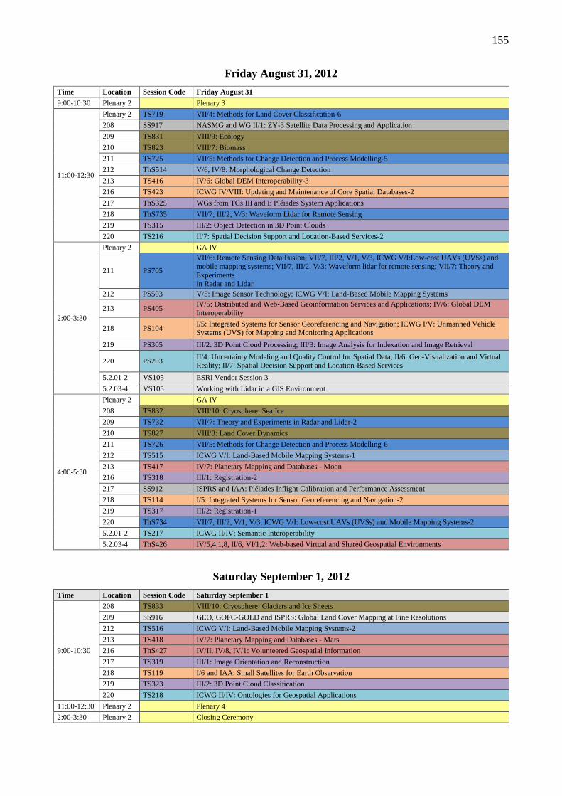
155
Friday August 31, 2012
Time Location Session Code Friday August 31
9:00-10:30 Plenary 2 Plenary 3
11:00-12:30
Plenary 2 TS719 VII/4: Methods for Land Cover Classification-6
208 SS917 NASMG and WG II/1: ZY-3 Satellite Data Processing and Application
209 TS831 VIII/9: Ecology
210 TS823 VIII/7: Biomass
211 TS725 VII/5: Methods for Change Detection and Process Modelling-5
212 ThS514 V/6, IV/8: Morphological Change Detection
213 TS416 IV/6: Global DEM Interoperability-3
216 TS423 ICWG IV/VIII: Updating and Maintenance of Core Spatial Databases-2
217 ThS325 WGs from TCs III and I: Pléïades System Applications
218 ThS735 VII/7, III/2, V/3: Waveform Lidar for Remote Sensing
219 TS315 III/2: Object Detection in 3D Point Clouds
220 TS216 II/7: Spatial Decision Support and Location-Based Services-2
2:00-3:30
Plenary 2 GA IV
211 PS705
VII/6: Remote Sensing Data Fusion; VII/7, III/2, V/1, V/3, ICWG V/I:Low-cost UAVs (UVSs) and mobile mapping systems; VII/7, III/2, V/3: Waveform lidar for remote sensing; VII/7: Theory and Experiments in Radar and Lidar
212 PS503 V/5: Image Sensor Technology; ICWG V/I: Land-Based Mobile Mapping Systems
213 PS405 IV/5: Distributed and Web-Based Geoinformation Services and Applications; IV/6: Global DEM Interoperability
218 PS104 I/5: Integrated Systems for Sensor Georeferencing and Navigation; ICWG I/V: Unmanned Vehicle Systems (UVS) for Mapping and Monitoring Applications
219 PS305 III/2: 3D Point Cloud Processing; III/3: Image Analysis for Indexation and Image Retrieval
220 PS203 II/4: Uncertainty Modeling and Quality Control for Spatial Data; II/6: Geo-Visualization and Virtual Reality; II/7: Spatial Decision Support and Location-Based Services
5.2.01-2 VS105 ESRI Vendor Session 3
5.2.03-4 VS105 Working with Lidar in a GIS Environment
4:00-5:30
Plenary 2 GA IV
208 TS832 VIII/10: Cryosphere: Sea Ice
209 TS732 VII/7: Theory and Experiments in Radar and Lidar-2
210 TS827 VIII/8: Land Cover Dynamics
211 TS726 VII/5: Methods for Change Detection and Process Modelling-6
212 TS515 ICWG V/I: Land-Based Mobile Mapping Systems-1
213 TS417 IV/7: Planetary Mapping and Databases - Moon
216 TS318 III/1: Registration-2
217 SS912 ISPRS and IAA: Pléïades Inflight Calibration and Performance Assessment
218 TS114 I/5: Integrated Systems for Sensor Georeferencing and Navigation-2
219 TS317 III/2: Registration-1
220 ThS734 VII/7, III/2, V/1, V/3, ICWG V/I: Low-cost UAVs (UVSs) and Mobile Mapping Systems-2
5.2.01-2 TS217 ICWG II/IV: Semantic Interoperability
5.2.03-4 ThS426 IV/5,4,1,8, II/6, VI/1,2: Web-based Virtual and Shared Geospatial Environments
Saturday September 1, 2012
Time Location Session Code Saturday September 1
9:00-10:30
208 TS833 VIII/10: Cryosphere: Glaciers and Ice Sheets
209 SS916 GEO, GOFC-GOLD and ISPRS: Global Land Cover Mapping at Fine Resolutions
212 TS516 ICWG V/I: Land-Based Mobile Mapping Systems-2
213 TS418 IV/7: Planetary Mapping and Databases - Mars
216 ThS427 IV/II, IV/8, IV/1: Volunteered Geospatial Information
217 TS319 III/1: Image Orientation and Reconstruction
218 TS119 I/6 and IAA: Small Satellites for Earth Observation
219 TS323 III/2: 3D Point Cloud Classification
220 TS218 ICWG II/IV: Ontologies for Geospatial Applications
11:00-12:30 Plenary 2 Plenary 4
2:00-3:30 Plenary 2 Closing Ceremony
156
ORAL PRSENTATION AND ePOSTERS
INVITED AND ORAL (TECHNICAL SESSION) PRESENTATIONS Invited and oral presentations will be delivered in technical sessions of 90 minutes duration. Invited presentations are 30-35 minutes duration. Oral presentations are 17-22 minutes duration. Exact schedules for every session will be published in the Final Programme. The duration of each presentation includes question time and changeover time. Guidelines for the presentations: • Landscape format orientation. • 16:9 aspect ratio (horizontal span : vertical span). • Use a clean sans serif font such as Arial; minimum
font size 20 point. • No more than 5 dot points on any slide. • For invited presentations, no more than 35 slides.
• For oral presentations, no more than 20 slides. • Use images and diagrams frequently rather than too
much text (no death by PowerPoint!!). • Image quality must be sufficient for a 1920 by 1080
projected display. • PDF, PPS or PPSX (PowerPoint Show) documents
only. • Maximum file size 5Mb. • No embedded video. Use a ‘place holder’ image in
the presentation if necessary.
• External video files can be used if you use your own notebook PC or Mac for the presentation. You are still required to upload your presentation into the online system (without the video).
SHORT + INTERACTIVE (ePOSTER SESSION) PRESENTATIONS
Short+Interactive presentations will be delivered in ePoster sessions of 90 minutes duration. Presenting authors will give a 3 minute presentation and have the opportunity to discuss their ePoster with delegates using iPads connected to large screen monitors in the exhibit area and outside the meeting rooms, or using any Internet-capable mobile device (eg notebook PCs, tablet PCs, smartphones). Your ePoster needs to serve both purposes, so you have a choice of a single page poster or a short (PowerPoint style) presentation of no more than 5 slides. Guidelines for the ePosters: • Landscape format orientation. • 16:9 aspect ratio (horizontal span : vertical span). • Use a clean sans serif font such as Arial; minimum
font size 20 point.
• Either a single page, detailed poster, or up to 5, less detailed, slides.
• No more than 5 dot points on any slide. • Use images and diagrams frequently rather than too
much text (no death by PowerPoint!!). • Image quality must be sufficient for a 1 metre
diagonal, 1920 by 1080 LCD display screen. • PDF, PPS or PPSX (Powerpoint Show) documents
only. • Maximum file size 5Mb. • No embedded video and no Flash animations
(incompatible with iPads). You must use a pre-loaded presentation, use of notebook PCs or similar devices will not be allowed to avoid delays during changeovers between speakers.

157
STUDENT CONSORTIUM The XXII ISPRS Congress that was held the in Melbourne from 25 Aug. to 1 Sept. 2012 was a huge success. The Congress provided a great opportunity to demonstrate the advancements and applications of new technologies and promote the professions to students and young scientists. For the promotion of the Congress to youths and young scientists and to link their networks and communications, the Student Consortium (SC) and related ISPRS WG VI/5 organised many activities. At the booth in the exhibition, the SC also prepared ISPRS-SC newsletters for delivering its latest information for participants.
Technical session of Youth Forum
The core among these activities was the Youth Forum, which included four technical sessions, a panel discussion, and the SC General Assembly on 27 Aug. In the technical sessions, 15 student presenters from 9 different countries participated in this contest to introduce their research results. Their topics covered UAV technologies, image matching, data registration, 3D modelling, and others. The Youth Forum’s Best Paper Award, sponsored by Leica Geosystems with 1000 SFr., was selected by a jury. This award went to Mr. Wilfried Hartmann, ETH Zürich, for his paper titled “Determination of the UAV Position by Automatic Processing of Thermal Images”. In the panel discussion, three invited speakers, Professor Carolyn Merry (Ohio State Univ.), Professor Kohei Cho (past President of ISPRS Technical Commission VI and AARS General Secretary) and Mr. Jack Ickes (Leica
Geosystems), gave several brief speeches and discussed the future vision for youths. The discussed issues, which were proposed by the SC, covered working experience, employment and academic opportunities. These speakers also encouraged youths to face their future careers. In the SC General Assembly, officers from the ISPRS Council, including the President and Secretary General and the WG VI/5 gave several short speeches about the historical development of the SC and the future visions. Considering the future situation within the next four years, the SC General Assembly also refined the articles of SC statutes. To encourage youths to participate in ISPRS events, financial support was considered to be one of the solutions, including low registration fees, scholarship, etc. On the other hand, the SC General Assembly elected six new SC board members for the next four years. Based on the international cooperation perspective, the SC will also connect to the Asian Student Group, which belongs to the student chapter of Asian Association on Remote Sensing (AARS), for network expansion. In addition, the African region is also a possibility to cooperate for the organisation of ISPRS-SC Summer School. Within the last four years, the SC has achieved several events to promote students and young scientists. Regarding their contributions, Professor Manos Baltsavias (Chair of the ISPRS Working Group “Promotion of the Profession to Young People”) and Cemal Özgür Kivilcim (Past Chairperson of ISPRS-SC) were awarded President’s Citations and The Willem Schermerhorn Award, respectively. After the closing ceremony of XXII ISPRS Congress, the SC will continue and strengthen the existing activities and distribute newsletters to promote youths’ participation within ISPRS.
SC and WG VI/5 past and current officers with the Technical Commission VI past President, Prof. Martien Molenaar (including the photographer at bottom right)
158
ISPRS 2012
EXHIBITION AND SOCIAL PROGRAM
Exhibitors
Congress Social Program
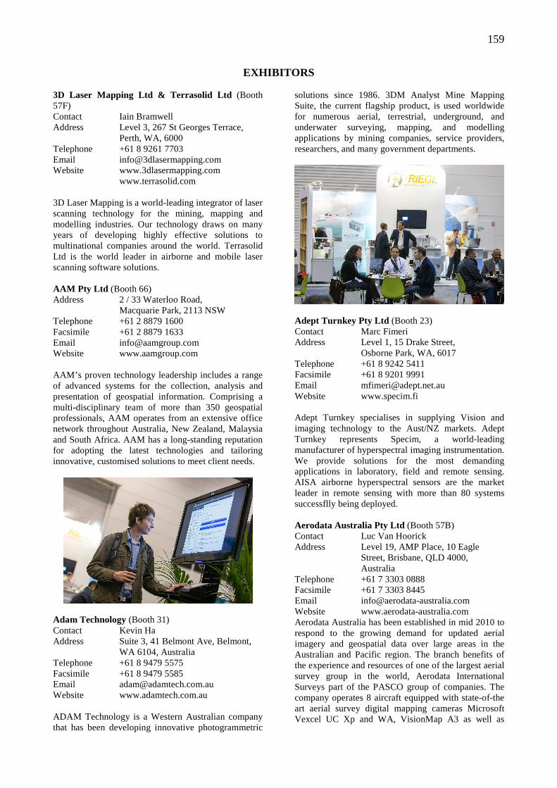
159
EXHIBITORS 3D Laser Mapping Ltd & Terrasolid Ltd (Booth 57F) Contact Iain Bramwell Address Level 3, 267 St Georges Terrace, Perth, WA, 6000 Telephone +61 8 9261 7703 Email [email protected] Website www.3dlasermapping.com www.terrasolid.com 3D Laser Mapping is a world-leading integrator of laser scanning technology for the mining, mapping and modelling industries. Our technology draws on many years of developing highly effective solutions to multinational companies around the world. Terrasolid Ltd is the world leader in airborne and mobile laser scanning software solutions. AAM Pty Ltd (Booth 66) Address 2 / 33 Waterloo Road, Macquarie Park, 2113 NSW Telephone +61 2 8879 1600 Facsimile +61 2 8879 1633 Email [email protected] Website www.aamgroup.com AAM’s proven technology leadership includes a range of advanced systems for the collection, analysis and presentation of geospatial information. Comprising a multi-disciplinary team of more than 350 geospatial professionals, AAM operates from an extensive office network throughout Australia, New Zealand, Malaysia and South Africa. AAM has a long-standing reputation for adopting the latest technologies and tailoring innovative, customised solutions to meet client needs.
Adam Technology (Booth 31) Contact Kevin Ha Address Suite 3, 41 Belmont Ave, Belmont, WA 6104, Australia Telephone +61 8 9479 5575 Facsimile +61 8 9479 5585 Email [email protected] Website www.adamtech.com.au ADAM Technology is a Western Australian company that has been developing innovative photogrammetric
solutions since 1986. 3DM Analyst Mine Mapping Suite, the current flagship product, is used worldwide for numerous aerial, terrestrial, underground, and underwater surveying, mapping, and modelling applications by mining companies, service providers, researchers, and many government departments.
Adept Turnkey Pty Ltd (Booth 23) Contact Marc Fimeri Address Level 1, 15 Drake Street, Osborne Park, WA, 6017 Telephone +61 8 9242 5411 Facsimile +61 8 9201 9991 Email [email protected] Website www.specim.fi Adept Turnkey specialises in supplying Vision and imaging technology to the Aust/NZ markets. Adept Turnkey represents Specim, a world-leading manufacturer of hyperspectral imaging instrumentation. We provide solutions for the most demanding applications in laboratory, field and remote sensing. AISA airborne hyperspectral sensors are the market leader in remote sensing with more than 80 systems successflly being deployed. Aerodata Australia Pty Ltd (Booth 57B) Contact Luc Van Hoorick Address Level 19, AMP Place, 10 Eagle Street, Brisbane, QLD 4000, Australia Telephone +61 7 3303 0888 Facsimile +61 7 3303 8445 Email [email protected] Website www.aerodata-australia.com Aerodata Australia has been established in mid 2010 to respond to the growing demand for updated aerial imagery and geospatial data over large areas in the Australian and Pacific region. The branch benefits of the experience and resources of one of the largest aerial survey group in the world, Aerodata International Surveys part of the PASCO group of companies. The company operates 8 aircraft equipped with state-of-the art aerial survey digital mapping cameras Microsoft Vexcel UC Xp and WA, VisionMap A3 as well as
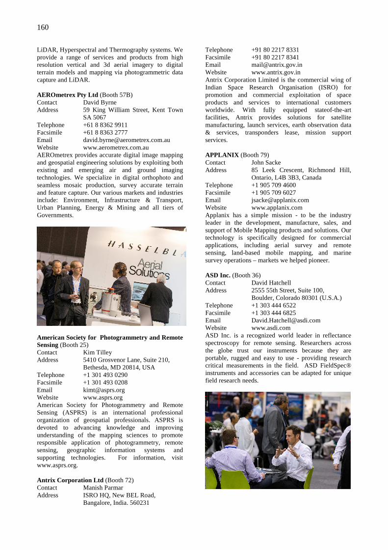
160
LiDAR, Hyperspectral and Thermography systems. We provide a range of services and products from high resolution vertical and 3d aerial imagery to digital terrain models and mapping via photogrammetric data capture and LiDAR. AEROmetrex Pty Ltd (Booth 57B) Contact David Byrne Address 59 King William Street, Kent Town SA 5067 Telephone +61 8 8362 9911 Facsimile +61 8 8363 2777 Email [email protected] Website www.aerometrex.com.au AEROmetrex provides accurate digital image mapping and geospatial engineering solutions by exploiting both existing and emerging air and ground imaging technologies. We specialize in digital orthophoto and seamless mosaic production, survey accurate terrain and feature capture. Our various markets and industries include: Environment, Infrastructure & Transport, Urban Planning, Energy & Mining and all tiers of Governments.
American Society for Photogrammetry and Remote Sensing (Booth 25) Contact Kim Tilley Address 5410 Grosvenor Lane, Suite 210, Bethesda, MD 20814, USA Telephone +1 301 493 0290 Facsimile +1 301 493 0208 Email [email protected] Website www.asprs.org American Society for Photogrammetry and Remote Sensing (ASPRS) is an international professional organization of geospatial professionals. ASPRS is devoted to advancing knowledge and improving understanding of the mapping sciences to promote responsible application of photogrammetry, remote sensing, geographic information systems and supporting technologies. For information, visit www.asprs.org. Antrix Corporation Ltd (Booth 72) Contact Manish Parmar Address ISRO HQ, New BEL Road, Bangalore, India. 560231
Telephone +91 80 2217 8331 Facsimile +91 80 2217 8341 Email [email protected] Website www.antrix.gov.in Antrix Corporation Limited is the commercial wing of Indian Space Research Organisation (ISRO) for promotion and commercial exploitation of space products and services to international customers worldwide. With fully equipped stateof-the-art facilities, Antrix provides solutions for satellite manufacturing, launch services, earth observation data & services, transponders lease, mission support services. APPLANIX (Booth 79) Contact John Sacke Address 85 Leek Crescent, Richmond Hill, Ontario, L4B 3B3, Canada Telephone +1 905 709 4600 Facsimile +1 905 709 6027 Email [email protected] Website www.applanix.com Applanix has a simple mission - to be the industry leader in the development, manufacture, sales, and support of Mobile Mapping products and solutions. Our technology is specifically designed for commercial applications, including aerial survey and remote sensing, land-based mobile mapping, and marine survey operations – markets we helped pioneer. ASD Inc. (Booth 36) Contact David Hatchell Address 2555 55th Street, Suite 100, Boulder, Colorado 80301 (U.S.A.) Telephone +1 303 444 6522 Facsimile +1 303 444 6825 Email [email protected] Website www.asdi.com ASD Inc. is a recognized world leader in reflectance spectroscopy for remote sensing. Researchers across the globe trust our instruments because they are portable, rugged and easy to use - providing research critical measurements in the field. ASD FieldSpec® instruments and accessories can be adapted for unique field research needs.
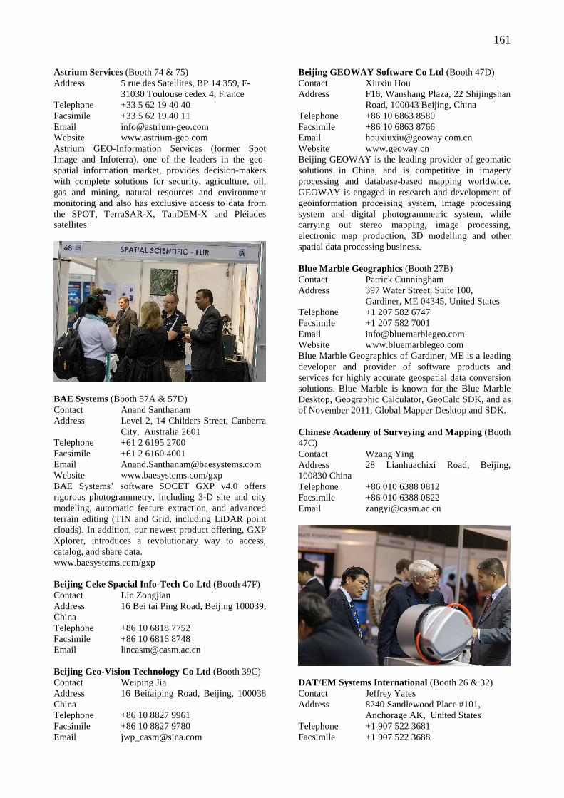
161
Astrium Services (Booth 74 & 75) Address 5 rue des Satellites, BP 14 359, F- 31030 Toulouse cedex 4, France Telephone +33 5 62 19 40 40 Facsimile +33 5 62 19 40 11 Email [email protected] Website www.astrium-geo.com Astrium GEO-Information Services (former Spot Image and Infoterra), one of the leaders in the geo-spatial information market, provides decision-makers with complete solutions for security, agriculture, oil, gas and mining, natural resources and environment monitoring and also has exclusive access to data from the SPOT, TerraSAR-X, TanDEM-X and Pléiades satellites.
BAE Systems (Booth 57A & 57D) Contact Anand Santhanam Address Level 2, 14 Childers Street, Canberra City, Australia 2601 Telephone +61 2 6195 2700 Facsimile +61 2 6160 4001 Email [email protected] Website www.baesystems.com/gxp BAE Systems’ software SOCET GXP v4.0 offers rigorous photogrammetry, including 3-D site and city modeling, automatic feature extraction, and advanced terrain editing (TIN and Grid, including LiDAR point clouds). In addition, our newest product offering, GXP Xplorer, introduces a revolutionary way to access, catalog, and share data. www.baesystems.com/gxp Beijing Ceke Spacial Info-Tech Co Ltd (Booth 47F) Contact Lin Zongjian Address 16 Bei tai Ping Road, Beijing 100039, China Telephone +86 10 6818 7752 Facsimile +86 10 6816 8748 Email [email protected] Beijing Geo-Vision Technology Co Ltd (Booth 39C) Contact Weiping Jia Address 16 Beitaiping Road, Beijing, 100038 China Telephone +86 10 8827 9961 Facsimile +86 10 8827 9780 Email [email protected]
Beijing GEOWAY Software Co Ltd (Booth 47D) Contact Xiuxiu Hou Address F16, Wanshang Plaza, 22 Shijingshan Road, 100043 Beijing, China Telephone +86 10 6863 8580 Facsimile +86 10 6863 8766 Email [email protected] Website www.geoway.cn Beijing GEOWAY is the leading provider of geomatic solutions in China, and is competitive in imagery processing and database-based mapping worldwide. GEOWAY is engaged in research and development of geoinformation processing system, image processing system and digital photogrammetric system, while carrying out stereo mapping, image processing, electronic map production, 3D modelling and other spatial data processing business. Blue Marble Geographics (Booth 27B) Contact Patrick Cunningham Address 397 Water Street, Suite 100, Gardiner, ME 04345, United States Telephone +1 207 582 6747 Facsimile +1 207 582 7001 Email [email protected] Website www.bluemarblegeo.com Blue Marble Geographics of Gardiner, ME is a leading developer and provider of software products and services for highly accurate geospatial data conversion solutions. Blue Marble is known for the Blue Marble Desktop, Geographic Calculator, GeoCalc SDK, and as of November 2011, Global Mapper Desktop and SDK. Chinese Academy of Surveying and Mapping (Booth 47C) Contact Wzang Ying Address 28 Lianhuachixi Road, Beijing, 100830 China Telephone +86 010 6388 0812 Facsimile +86 010 6388 0822 Email [email protected]
DAT/EM Systems International (Booth 26 & 32) Contact Jeffrey Yates Address 8240 Sandlewood Place #101, Anchorage AK, United States Telephone +1 907 522 3681 Facsimile +1 907 522 3688

162
Email [email protected] Website Datem.com DAT/EM Systems International is a leader in the development of software for digital mapping and photogrammetric applications. DAT/EM Systems serves over 500 photogrammetric firms, engineering firms, and government agencies in more than 70 countries worldwide. We take pride in a reputation for delivering quality systems and superior customer service t a fair price. Earthmine, Inc (Booth 76) Contact Anthony Fassero Address 2390A 4th Street, Berkley CA, 94710, United States Telephone +1 510 768 7001 Facsimile +1 510 295 2871 Email [email protected] Website www.earthmine.com Earthmine is a world leader in 3D street-level imagery delivering a full end-to-end solution including collection hardware, software and cloud-based hosting. Eastdawn Corporation (Booth 29B & 29C) Contact Daniella Li Address 10th Floor, Sinosteel Plaza, Haidian District, Beijing 100080 China Telephone +86 106 268 6799 Facsimile +86 106 268 6790 Email [email protected] Elsevier BV (Booth 7) Contact Anita Olfers Address Radarweg 29, 1043 NX Amsterdam, The Netherlands Telephone +31 20 485 3003 Facsimile +31 20 485 3228 Email [email protected] Website www.elsevier.com Elsevier is the leading publisher in remote sensing and photogrammetry, renowned for its high quality and high impact factor journals, offering a variety of open access solutions. Elsevier partners with experts worldwide to drive innovation. Elsevier publishes the ISPRS Journal of Photogrammetry and Remote Sensing.
Environmental Systems Research Institute, Inc (Booth 28D) Contact Tim Flewelling Address 380 New York Street Redlands CA 92373 USA Telephone +1 909 793 2853 Facsimile +1 909 307 3102 Email [email protected] Esri (Booth 28C & 28D) Address 380 New York St. Redlands, CA 92373 Telephone +1 909 793 2853 Email [email protected] Website www.esri.com Esri® develops geographic information systems solutions used by more than a million people on any given day and over 350,000 organizations worldwide. Our main product, ArcGIS, is a comprehensive imagery system for managing, visualizing, analyzing and disseminating all forms of geospatial data.
Euclideon (Booth 51) Contact Tamaryn Osborne Address 3/8 Miller Street, Murrarie QLD 4216 Email [email protected] Website www.euclidoen.com Exelis Visual Information Solutions (Booth 28E) Contact Eduardo Iturrate Address 4990 Pearl East Circle, Boulder, CO 80301, USA Telephone +1 303 786 9900 Facsimile +1 303 786 9909 Email [email protected] Website www.exelisvis.com Exelis VIS offers software solutions that help geographers, GIS specialists, and scientists make important discoveries using remotely sensed imagery. Regardless of the kinds of data you use, from airborne and spaceborne imagery to complex numerical and LiDAR data, Exelis products allow you to access and analyze data and disseminate results.
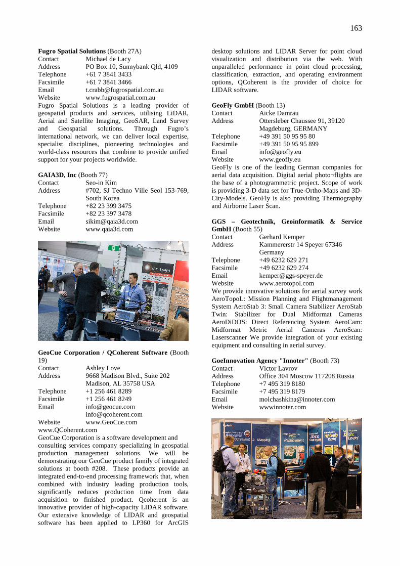
163
Fugro Spatial Solutions (Booth 27A) Contact Michael de Lacy Address PO Box 10, Sunnybank Qld, 4109 Telephone +61 7 3841 3433 Facsimile +61 7 3841 3466 Email [email protected] Website www.fugrospatial.com.au Fugro Spatial Solutions is a leading provider of geospatial products and services, utilising LiDAR, Aerial and Satellite Imaging, GeoSAR, Land Survey and Geospatial solutions. Through Fugro’s international network, we can deliver local expertise, specialist disciplines, pioneering technologies and world-class resources that combine to provide unified support for your projects worldwide. GAIA3D, Inc (Booth 77) Contact Seo-in Kim Address #702, SJ Techno Ville Seol 153-769, South Korea Telephone +82 23 399 3475 Facsimile +82 23 397 3478 Email [email protected] Website www.qaia3d.com
GeoCue Corporation / QCoherent Software (Booth 19) Contact Ashley Love Address 9668 Madison Blvd., Suite 202 Madison, AL 35758 USA Telephone +1 256 461 8289 Facsimile +1 256 461 8249 Email [email protected] [email protected] Website www.GeoCue.com www.QCoherent.com GeoCue Corporation is a software development and consulting services company specializing in geospatial production management solutions. We will be demonstrating our GeoCue product family of integrated solutions at booth #208. These products provide an integrated end-to-end processing framework that, when combined with industry leading production tools, significantly reduces production time from data acquisition to finished product. Qcoherent is an innovative provider of high-capacity LIDAR software. Our extensive knowledge of LIDAR and geospatial software has been applied to LP360 for ArcGIS
desktop solutions and LIDAR Server for point cloud visualization and distribution via the web. With unparalleled performance in point cloud processing, classification, extraction, and operating environment options, QCoherent is the provider of choice for LIDAR software. GeoFly GmbH (Booth 13) Contact Aicke Damrau Address Ottersleber Chaussee 91, 39120 Magdeburg, GERMANY Telephone +49 391 50 95 95 80 Facsimile +49 391 50 95 95 899 Email [email protected] Website www.geofly.eu GeoFly is one of the leading German companies for aerial data acquisition. Digital aerial photo¬flights are the base of a photogrammetric project. Scope of work is providing 3-D data set for True-Ortho-Maps and 3D-City-Models. GeoFly is also providing Thermography and Airborne Laser Scan. GGS – Geotechnik, Geoinformatik & Service GmbH (Booth 55) Contact Gerhard Kemper Address Kammererstr 14 Speyer 67346 Germany Telephone +49 6232 629 271 Facsimile +49 6232 629 274 Email [email protected] Website www.aerotopol.com We provide innovative solutions for aerial survey work AeroTopoL: Mission Planning and Flightmanagement System AeroStab 3: Small Camera Stabilizer AeroStab Twin: Stabilizer for Dual Midformat Cameras AeroDiDOS: Direct Referencing System AeroCam: Midformat Metric Aerial Cameras AeroScan: Laserscanner We provide integration of your existing equipment and consulting in aerial survey. GoeInnovation Agency "Innoter" (Booth 73) Contact Victor Lavrov Address Office 304 Moscow 117208 Russia Telephone +7 495 319 8180 Facsimile +7 495 319 8179 Email [email protected] Website wwwinnoter.com
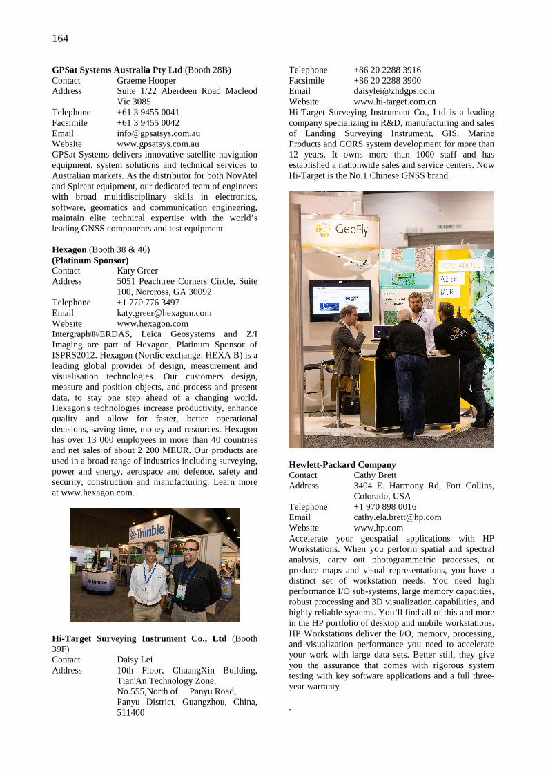
164
GPSat Systems Australia Pty Ltd (Booth 28B) Contact Graeme Hooper Address Suite 1/22 Aberdeen Road Macleod Vic 3085 Telephone +61 3 9455 0041 Facsimile +61 3 9455 0042 Email [email protected] Website www.gpsatsys.com.au GPSat Systems delivers innovative satellite navigation equipment, system solutions and technical services to Australian markets. As the distributor for both NovAtel and Spirent equipment, our dedicated team of engineers with broad multidisciplinary skills in electronics, software, geomatics and communication engineering, maintain elite technical expertise with the world’s leading GNSS components and test equipment. Hexagon (Booth 38 & 46) (Platinum Sponsor) Contact Katy Greer Address 5051 Peachtree Corners Circle, Suite 100, Norcross, GA 30092 Telephone +1 770 776 3497 Email [email protected] Website www.hexagon.com Intergraph®/ERDAS, Leica Geosystems and Z/I Imaging are part of Hexagon, Platinum Sponsor of ISPRS2012. Hexagon (Nordic exchange: HEXA B) is a leading global provider of design, measurement and visualisation technologies. Our customers design, measure and position objects, and process and present data, to stay one step ahead of a changing world. Hexagon's technologies increase productivity, enhance quality and allow for faster, better operational decisions, saving time, money and resources. Hexagon has over 13 000 employees in more than 40 countries and net sales of about 2 200 MEUR. Our products are used in a broad range of industries including surveying, power and energy, aerospace and defence, safety and security, construction and manufacturing. Learn more at www.hexagon.com.
Hi-Target Surveying Instrument Co., Ltd (Booth 39F) Contact Daisy Lei Address 10th Floor, ChuangXin Building, Tian'An Technology Zone, No.555,North of Panyu Road, Panyu District, Guangzhou, China, 511400
Telephone +86 20 2288 3916 Facsimile +86 20 2288 3900 Email [email protected] Website www.hi-target.com.cn Hi-Target Surveying Instrument Co., Ltd is a leading company specializing in R&D, manufacturing and sales of Landing Surveying Instrument, GIS, Marine Products and CORS system development for more than 12 years. It owns more than 1000 staff and has established a nationwide sales and service centers. Now Hi-Target is the No.1 Chinese GNSS brand.
Hewlett-Packard Company Contact Cathy Brett Address 3404 E. Harmony Rd, Fort Collins, Colorado, USA Telephone +1 970 898 0016 Email [email protected] Website www.hp.com Accelerate your geospatial applications with HP Workstations. When you perform spatial and spectral analysis, carry out photogrammetric processes, or produce maps and visual representations, you have a distinct set of workstation needs. You need high performance I/O sub-systems, large memory capacities, robust processing and 3D visualization capabilities, and highly reliable systems. You’ll find all of this and more in the HP portfolio of desktop and mobile workstations. HP Workstations deliver the I/O, memory, processing, and visualization performance you need to accelerate your work with large data sets. Better still, they give you the assurance that comes with rigorous system testing with key software applications and a full three-year warranty .
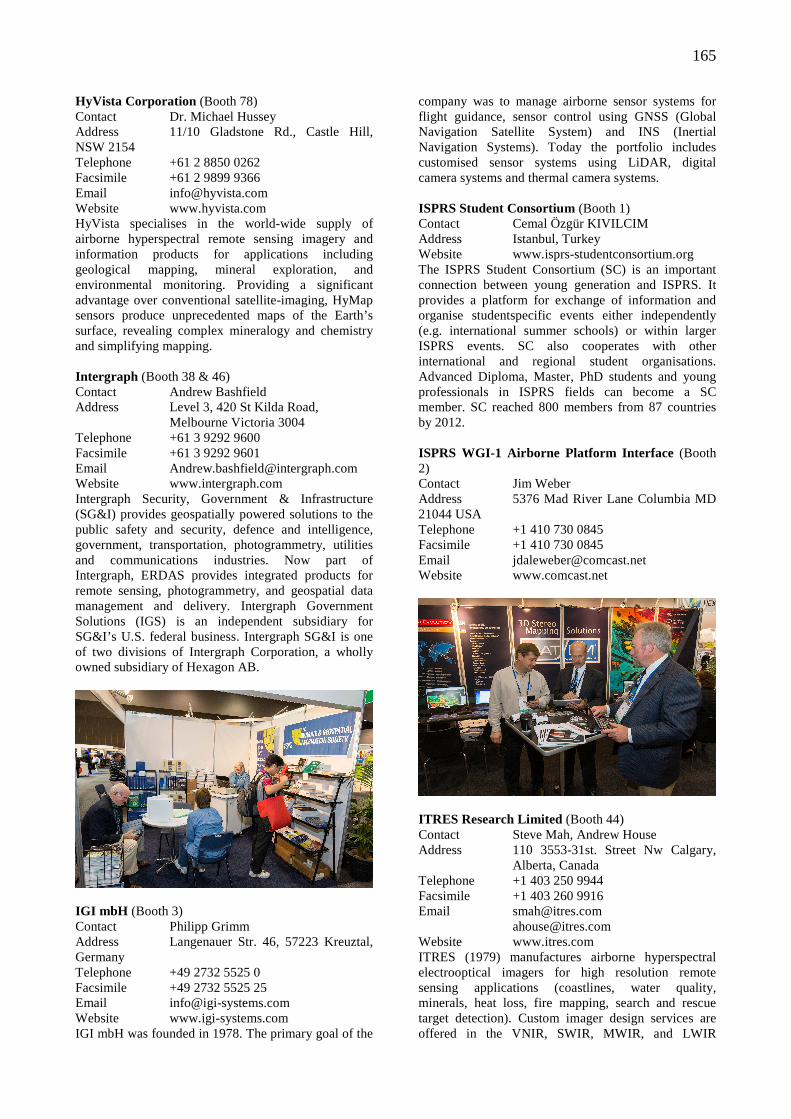
165
HyVista Corporation (Booth 78) Contact Dr. Michael Hussey Address 11/10 Gladstone Rd., Castle Hill, NSW 2154 Telephone +61 2 8850 0262 Facsimile +61 2 9899 9366 Email [email protected] Website www.hyvista.com HyVista specialises in the world-wide supply of airborne hyperspectral remote sensing imagery and information products for applications including geological mapping, mineral exploration, and environmental monitoring. Providing a significant advantage over conventional satellite-imaging, HyMap sensors produce unprecedented maps of the Earth’s surface, revealing complex mineralogy and chemistry and simplifying mapping. Intergraph (Booth 38 & 46) Contact Andrew Bashfield Address Level 3, 420 St Kilda Road, Melbourne Victoria 3004 Telephone +61 3 9292 9600 Facsimile +61 3 9292 9601 Email [email protected] Website www.intergraph.com Intergraph Security, Government & Infrastructure (SG&I) provides geospatially powered solutions to the public safety and security, defence and intelligence, government, transportation, photogrammetry, utilities and communications industries. Now part of Intergraph, ERDAS provides integrated products for remote sensing, photogrammetry, and geospatial data management and delivery. Intergraph Government Solutions (IGS) is an independent subsidiary for SG&I’s U.S. federal business. Intergraph SG&I is one of two divisions of Intergraph Corporation, a wholly owned subsidiary of Hexagon AB.
IGI mbH (Booth 3) Contact Philipp Grimm Address Langenauer Str. 46, 57223 Kreuztal, Germany Telephone +49 2732 5525 0 Facsimile +49 2732 5525 25 Email [email protected] Website www.igi-systems.com IGI mbH was founded in 1978. The primary goal of the
company was to manage airborne sensor systems for flight guidance, sensor control using GNSS (Global Navigation Satellite System) and INS (Inertial Navigation Systems). Today the portfolio includes customised sensor systems using LiDAR, digital camera systems and thermal camera systems. ISPRS Student Consortium (Booth 1) Contact Cemal Özgür KIVILCIM Address Istanbul, Turkey Website www.isprs-studentconsortium.org The ISPRS Student Consortium (SC) is an important connection between young generation and ISPRS. It provides a platform for exchange of information and organise studentspecific events either independently (e.g. international summer schools) or within larger ISPRS events. SC also cooperates with other international and regional student organisations. Advanced Diploma, Master, PhD students and young professionals in ISPRS fields can become a SC member. SC reached 800 members from 87 countries by 2012. ISPRS WGI-1 Airborne Platform Interface (Booth 2) Contact Jim Weber Address 5376 Mad River Lane Columbia MD 21044 USA Telephone +1 410 730 0845 Facsimile +1 410 730 0845 Email [email protected] Website www.comcast.net
ITRES Research Limited (Booth 44) Contact Steve Mah, Andrew House Address 110 3553-31st. Street Nw Calgary, Alberta, Canada Telephone +1 403 250 9944 Facsimile +1 403 260 9916 Email [email protected] [email protected] Website www.itres.com ITRES (1979) manufactures airborne hyperspectral electrooptical imagers for high resolution remote sensing applications (coastlines, water quality, minerals, heat loss, fire mapping, search and rescue target detection). Custom imager design services are offered in the VNIR, SWIR, MWIR, and LWIR
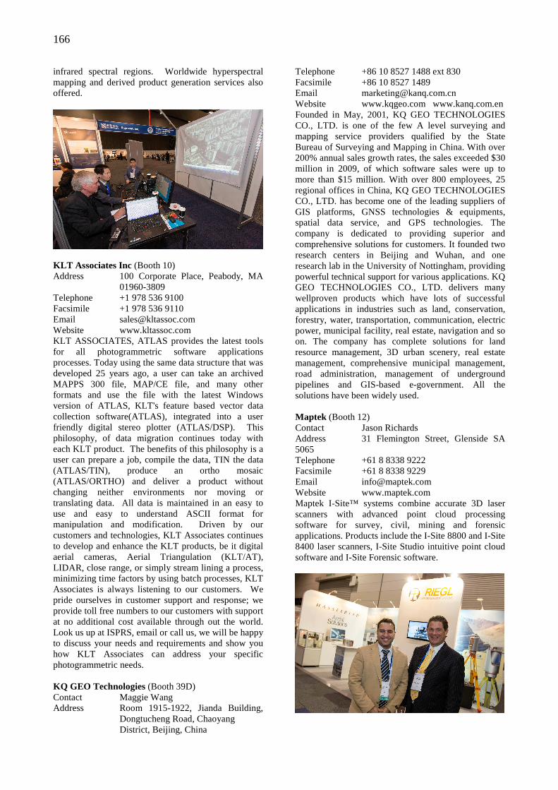
166
infrared spectral regions. Worldwide hyperspectral mapping and derived product generation services also offered.
KLT Associates Inc (Booth 10) Address 100 Corporate Place, Peabody, MA 01960-3809 Telephone +1 978 536 9100 Facsimile +1 978 536 9110 Email [email protected] Website www.kltassoc.com KLT ASSOCIATES, ATLAS provides the latest tools for all photogrammetric software applications processes. Today using the same data structure that was developed 25 years ago, a user can take an archived MAPPS 300 file, MAP/CE file, and many other formats and use the file with the latest Windows version of ATLAS, KLT's feature based vector data collection software(ATLAS), integrated into a user friendly digital stereo plotter (ATLAS/DSP). This philosophy, of data migration continues today with each KLT product. The benefits of this philosophy is a user can prepare a job, compile the data, TIN the data (ATLAS/TIN), produce an ortho mosaic (ATLAS/ORTHO) and deliver a product without changing neither environments nor moving or translating data. All data is maintained in an easy to use and easy to understand ASCII format for manipulation and modification. Driven by our customers and technologies, KLT Associates continues to develop and enhance the KLT products, be it digital aerial cameras, Aerial Triangulation (KLT/AT), LIDAR, close range, or simply stream lining a process, minimizing time factors by using batch processes, KLT Associates is always listening to our customers. We pride ourselves in customer support and response; we provide toll free numbers to our customers with support at no additional cost available through out the world. Look us up at ISPRS, email or call us, we will be happy to discuss your needs and requirements and show you how KLT Associates can address your specific photogrammetric needs. KQ GEO Technologies (Booth 39D) Contact Maggie Wang Address Room 1915-1922, Jianda Building, Dongtucheng Road, Chaoyang District, Beijing, China
Telephone +86 10 8527 1488 ext 830 Facsimile +86 10 8527 1489 Email [email protected] Website www.kqgeo.com www.kanq.com.en Founded in May, 2001, KQ GEO TECHNOLOGIES CO., LTD. is one of the few A level surveying and mapping service providers qualified by the State Bureau of Surveying and Mapping in China. With over 200% annual sales growth rates, the sales exceeded $30 million in 2009, of which software sales were up to more than $15 million. With over 800 employees, 25 regional offices in China, KQ GEO TECHNOLOGIES CO., LTD. has become one of the leading suppliers of GIS platforms, GNSS technologies & equipments, spatial data service, and GPS technologies. The company is dedicated to providing superior and comprehensive solutions for customers. It founded two research centers in Beijing and Wuhan, and one research lab in the University of Nottingham, providing powerful technical support for various applications. KQ GEO TECHNOLOGIES CO., LTD. delivers many wellproven products which have lots of successful applications in industries such as land, conservation, forestry, water, transportation, communication, electric power, municipal facility, real estate, navigation and so on. The company has complete solutions for land resource management, 3D urban scenery, real estate management, comprehensive municipal management, road administration, management of underground pipelines and GIS-based e-government. All the solutions have been widely used. Maptek (Booth 12) Contact Jason Richards Address 31 Flemington Street, Glenside SA 5065 Telephone +61 8 8338 9222 Facsimile +61 8 8338 9229 Email [email protected] Website www.maptek.com Maptek I-Site™ systems combine accurate 3D laser scanners with advanced point cloud processing software for survey, civil, mining and forensic applications. Products include the I-Site 8800 and I-Site 8400 laser scanners, I-Site Studio intuitive point cloud software and I-Site Forensic software.
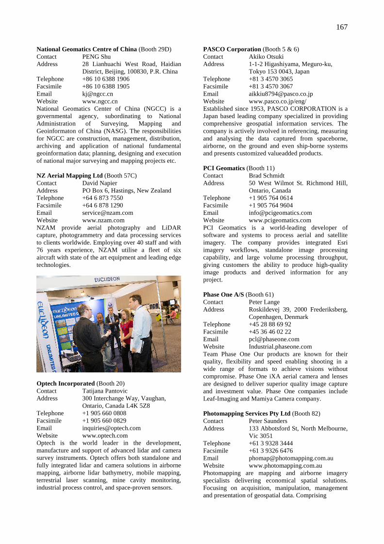
167
National Geomatics Centre of China (Booth 29D) Contact PENG Shu Address 28 Lianhuachi West Road, Haidian District, Beijing, 100830, P.R. China Telephone +86 10 6388 1906 Facsimile +86 10 6388 1905 Email [email protected] Website www.ngcc.cn National Geomatics Center of China (NGCC) is a governmental agency, subordinating to National Administration of Surveying, Mapping and Geoinformaton of China (NASG). The responsibilities for NGCC are construction, management, distribution, archiving and application of national fundamental geoinformation data; planning, designing and execution of national major surveying and mapping projects etc. NZ Aerial Mapping Ltd (Booth 57C) Contact David Napier Address PO Box 6, Hastings, New Zealand Telephone +64 6 873 7550 Facsimile +64 6 878 1290 Email [email protected] Website www.nzam.com NZAM provide aerial photography and LiDAR capture, photogrammetry and data processing services to clients worldwide. Employing over 40 staff and with 76 years experience, NZAM utilise a fleet of six aircraft with state of the art equipment and leading edge technologies.
Optech Incorporated (Booth 20) Contact Tatijana Pantovic Address 300 Interchange Way, Vaughan, Ontario, Canada L4K 5Z8 Telephone +1 905 660 0808 Facsimile +1 905 660 0829 Email [email protected] Website www.optech.com Optech is the world leader in the development, manufacture and support of advanced lidar and camera survey instruments. Optech offers both standalone and fully integrated lidar and camera solutions in airborne mapping, airborne lidar bathymetry, mobile mapping, terrestrial laser scanning, mine cavity monitoring, industrial process control, and space-proven sensors.
PASCO Corporation (Booth 5 & 6) Contact Akiko Otsuki Address 1-1-2 Higashiyama, Meguro-ku, Tokyo 153 0043, Japan Telephone +81 3 4570 3065 Facsimile +81 3 4570 3067 Email [email protected] Website www.pasco.co.jp/eng/ Established since 1953, PASCO CORPORATION is a Japan based leading company specialized in providing comprehensive geospatial information services. The company is actively involved in referencing, measuring and analysing the data captured from spaceborne, airborne, on the ground and even ship-borne systems and presents customized valueadded products. PCI Geomatics (Booth 11) Contact Brad Schmidt Address 50 West Wilmot St. Richmond Hill, Ontario, Canada Telephone +1 905 764 0614 Facsimile +1 905 764 9604 Email [email protected] Website www.pcigeomatics.com PCI Geomatics is a world-leading developer of software and systems to process aerial and satellite imagery. The company provides integrated Esri imagery workflows, standalone image processing capability, and large volume processing throughput, giving customers the ability to produce high-quality image products and derived information for any project. Phase One A/S (Booth 61) Contact Peter Lange Address Roskildevej 39, 2000 Frederiksberg, Copenhagen, Denmark Telephone +45 28 88 69 92 Facsimile +45 36 46 02 22 Email [email protected] Website Industrial.phaseone.com Team Phase One Our products are known for their quality, flexibility and speed enabling shooting in a wide range of formats to achieve visions without compromise. Phase One iXA aerial camera and lenses are designed to deliver superior quality image capture and investment value. Phase One companies include Leaf-Imaging and Mamiya Camera company. Photomapping Services Pty Ltd (Booth 82) Contact Peter Saunders Address 133 Abbotsford St, North Melbourne, Vic 3051 Telephone +61 3 9328 3444 Facsimile +61 3 9326 6476 Email [email protected] Website www.photomapping.com.au Photomapping are mapping and airborne imagery specialists delivering economical spatial solutions. Focusing on acquisition, manipulation, management and presentation of geospatial data. Comprising
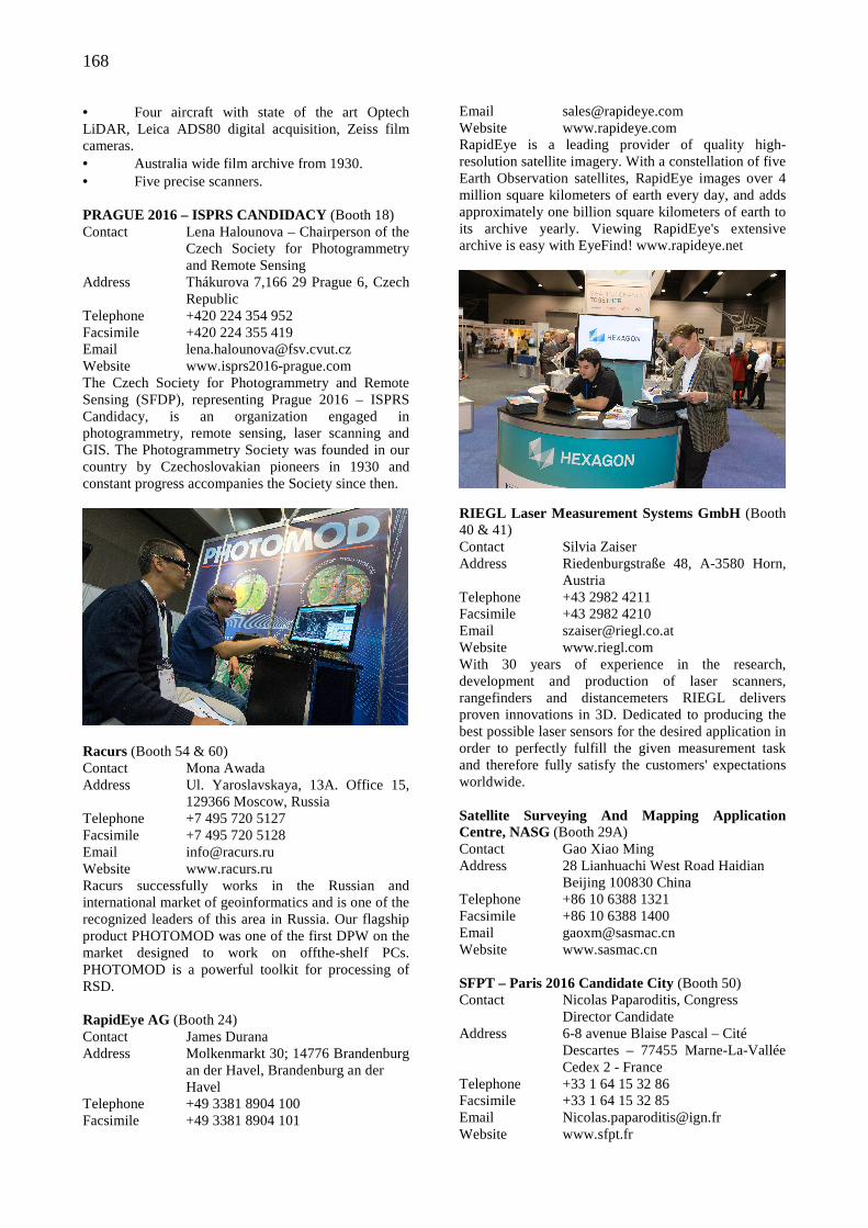
168
• Four aircraft with state of the art Optech LiDAR, Leica ADS80 digital acquisition, Zeiss film cameras. • Australia wide film archive from 1930. • Five precise scanners. PRAGUE 2016 – ISPRS CANDIDACY (Booth 18) Contact Lena Halounova – Chairperson of the Czech Society for Photogrammetry and Remote Sensing Address Thákurova 7,166 29 Prague 6, Czech Republic Telephone +420 224 354 952 Facsimile +420 224 355 419 Email [email protected] Website www.isprs2016-prague.com The Czech Society for Photogrammetry and Remote Sensing (SFDP), representing Prague 2016 – ISPRS Candidacy, is an organization engaged in photogrammetry, remote sensing, laser scanning and GIS. The Photogrammetry Society was founded in our country by Czechoslovakian pioneers in 1930 and constant progress accompanies the Society since then.
Racurs (Booth 54 & 60) Contact Mona Awada Address Ul. Yaroslavskaya, 13A. Office 15, 129366 Moscow, Russia Telephone +7 495 720 5127 Facsimile +7 495 720 5128 Email [email protected] Website www.racurs.ru Racurs successfully works in the Russian and international market of geoinformatics and is one of the recognized leaders of this area in Russia. Our flagship product PHOTOMOD was one of the first DPW on the market designed to work on offthe-shelf PCs. PHOTOMOD is a powerful toolkit for processing of RSD. RapidEye AG (Booth 24) Contact James Durana Address Molkenmarkt 30; 14776 Brandenburg an der Havel, Brandenburg an der Havel Telephone +49 3381 8904 100 Facsimile +49 3381 8904 101
Email [email protected] Website www.rapideye.com RapidEye is a leading provider of quality high-resolution satellite imagery. With a constellation of five Earth Observation satellites, RapidEye images over 4 million square kilometers of earth every day, and adds approximately one billion square kilometers of earth to its archive yearly. Viewing RapidEye's extensive archive is easy with EyeFind! www.rapideye.net
RIEGL Laser Measurement Systems GmbH (Booth 40 & 41) Contact Silvia Zaiser Address Riedenburgstraße 48, A-3580 Horn, Austria Telephone +43 2982 4211 Facsimile +43 2982 4210 Email [email protected] Website www.riegl.com With 30 years of experience in the research, development and production of laser scanners, rangefinders and distancemeters RIEGL delivers proven innovations in 3D. Dedicated to producing the best possible laser sensors for the desired application in order to perfectly fulfill the given measurement task and therefore fully satisfy the customers' expectations worldwide. Satellite Surveying And Mapping Application Centre, NASG (Booth 29A) Contact Gao Xiao Ming Address 28 Lianhuachi West Road Haidian Beijing 100830 China Telephone +86 10 6388 1321 Facsimile +86 10 6388 1400 Email [email protected] Website www.sasmac.cn SFPT – Paris 2016 Candidate City (Booth 50) Contact Nicolas Paparoditis, Congress Director Candidate Address 6-8 avenue Blaise Pascal – Cité Descartes – 77455 Marne-La-Vallée Cedex 2 - France Telephone +33 1 64 15 32 86 Facsimile +33 1 64 15 32 85 Email [email protected] Website www.sfpt.fr
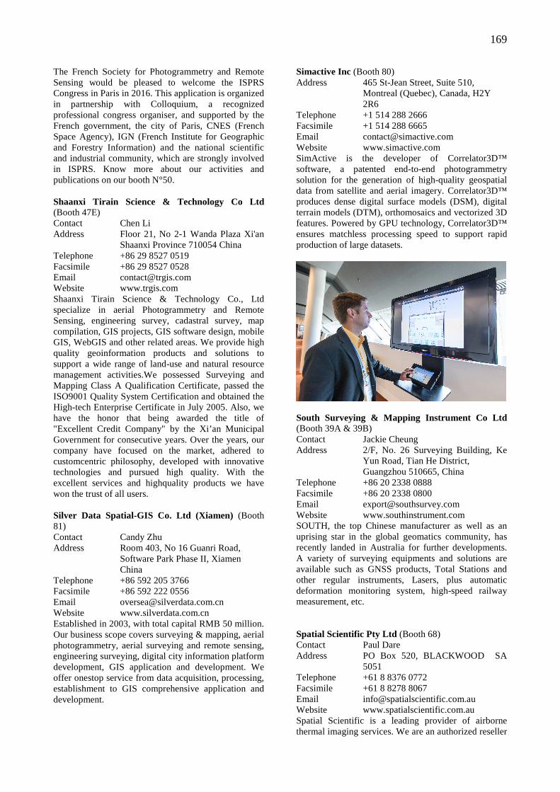
169
The French Society for Photogrammetry and Remote Sensing would be pleased to welcome the ISPRS Congress in Paris in 2016. This application is organized in partnership with Colloquium, a recognized professional congress organiser, and supported by the French government, the city of Paris, CNES (French Space Agency), IGN (French Institute for Geographic and Forestry Information) and the national scientific and industrial community, which are strongly involved in ISPRS. Know more about our activities and publications on our booth N°50. Shaanxi Tirain Science & Technology Co Ltd (Booth 47E) Contact Chen Li Address Floor 21, No 2-1 Wanda Plaza Xi'an Shaanxi Province 710054 China Telephone +86 29 8527 0519 Facsimile +86 29 8527 0528 Email [email protected] Website www.trgis.com Shaanxi Tirain Science & Technology Co., Ltd specialize in aerial Photogrammetry and Remote Sensing, engineering survey, cadastral survey, map compilation, GIS projects, GIS software design, mobile GIS, WebGIS and other related areas. We provide high quality geoinformation products and solutions to support a wide range of land-use and natural resource management activities.We possessed Surveying and Mapping Class A Qualification Certificate, passed the ISO9001 Quality System Certification and obtained the High-tech Enterprise Certificate in July 2005. Also, we have the honor that being awarded the title of "Excellent Credit Company" by the Xi’an Municipal Government for consecutive years. Over the years, our company have focused on the market, adhered to customcentric philosophy, developed with innovative technologies and pursued high quality. With the excellent services and highquality products we have won the trust of all users. Silver Data Spatial-GIS Co. Ltd (Xiamen) (Booth 81) Contact Candy Zhu Address Room 403, No 16 Guanri Road, Software Park Phase II, Xiamen China Telephone +86 592 205 3766 Facsimile +86 592 222 0556 Email [email protected] Website www.silverdata.com.cn Established in 2003, with total capital RMB 50 million. Our business scope covers surveying & mapping, aerial photogrammetry, aerial surveying and remote sensing, engineering surveying, digital city information platform development, GIS application and development. We offer onestop service from data acquisition, processing, establishment to GIS comprehensive application and development.
Simactive Inc (Booth 80) Address 465 St-Jean Street, Suite 510, Montreal (Quebec), Canada, H2Y 2R6 Telephone +1 514 288 2666 Facsimile +1 514 288 6665 Email [email protected] Website www.simactive.com SimActive is the developer of Correlator3D™ software, a patented end-to-end photogrammetry solution for the generation of high-quality geospatial data from satellite and aerial imagery. Correlator3D™ produces dense digital surface models (DSM), digital terrain models (DTM), orthomosaics and vectorized 3D features. Powered by GPU technology, Correlator3D™ ensures matchless processing speed to support rapid production of large datasets.
South Surveying & Mapping Instrument Co Ltd (Booth 39A & 39B) Contact Jackie Cheung Address 2/F, No. 26 Surveying Building, Ke Yun Road, Tian He District, Guangzhou 510665, China Telephone +86 20 2338 0888 Facsimile +86 20 2338 0800 Email [email protected] Website www.southinstrument.com SOUTH, the top Chinese manufacturer as well as an uprising star in the global geomatics community, has recently landed in Australia for further developments. A variety of surveying equipments and solutions are available such as GNSS products, Total Stations and other regular instruments, Lasers, plus automatic deformation monitoring system, high-speed railway measurement, etc. Spatial Scientific Pty Ltd (Booth 68) Contact Paul Dare Address PO Box 520, BLACKWOOD SA 5051 Telephone +61 8 8376 0772 Facsimile +61 8 8278 8067 Email [email protected] Website www.spatialscientific.com.au Spatial Scientific is a leading provider of airborne thermal imaging services. We are an authorized reseller
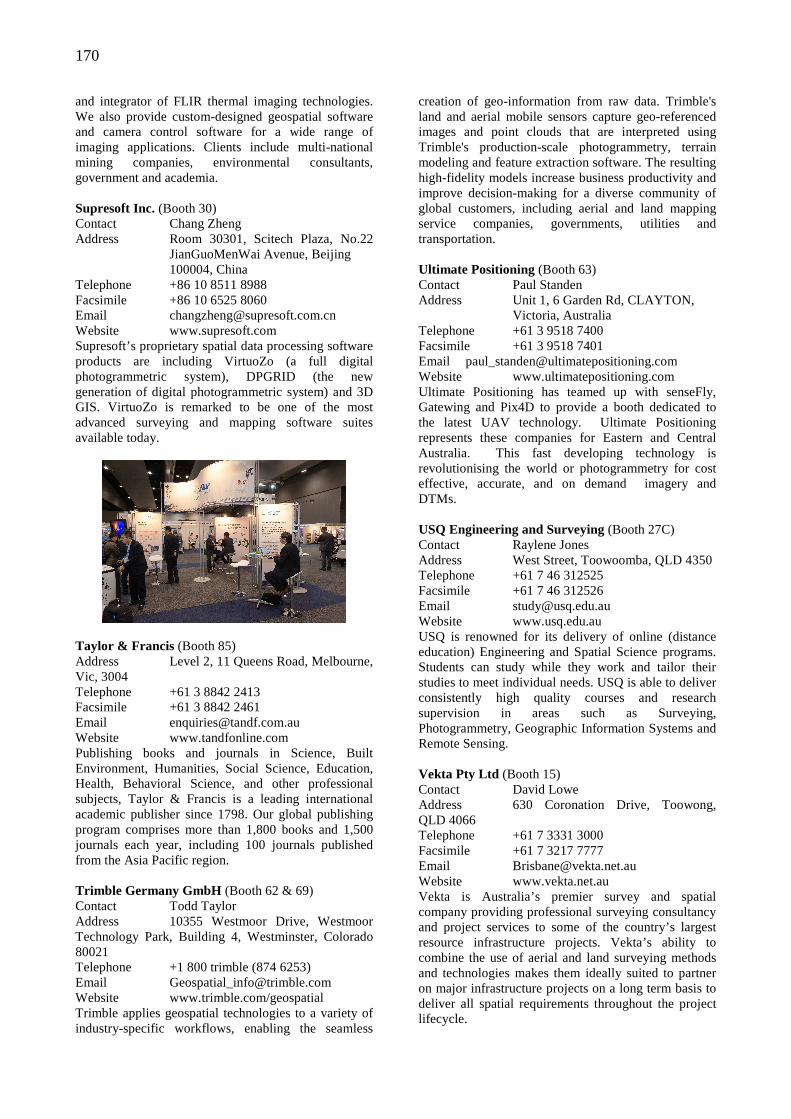
170
and integrator of FLIR thermal imaging technologies. We also provide custom-designed geospatial software and camera control software for a wide range of imaging applications. Clients include multi-national mining companies, environmental consultants, government and academia. Supresoft Inc. (Booth 30) Contact Chang Zheng Address Room 30301, Scitech Plaza, No.22 JianGuoMenWai Avenue, Beijing 100004, China Telephone +86 10 8511 8988 Facsimile +86 10 6525 8060 Email [email protected] Website www.supresoft.com Supresoft’s proprietary spatial data processing software products are including VirtuoZo (a full digital photogrammetric system), DPGRID (the new generation of digital photogrammetric system) and 3D GIS. VirtuoZo is remarked to be one of the most advanced surveying and mapping software suites available today.
Taylor & Francis (Booth 85) Address Level 2, 11 Queens Road, Melbourne, Vic, 3004 Telephone +61 3 8842 2413 Facsimile +61 3 8842 2461 Email [email protected] Website www.tandfonline.com Publishing books and journals in Science, Built Environment, Humanities, Social Science, Education, Health, Behavioral Science, and other professional subjects, Taylor & Francis is a leading international academic publisher since 1798. Our global publishing program comprises more than 1,800 books and 1,500 journals each year, including 100 journals published from the Asia Pacific region. Trimble Germany GmbH (Booth 62 & 69) Contact Todd Taylor Address 10355 Westmoor Drive, Westmoor Technology Park, Building 4, Westminster, Colorado 80021 Telephone +1 800 trimble (874 6253) Email [email protected] Website www.trimble.com/geospatial Trimble applies geospatial technologies to a variety of industry-specific workflows, enabling the seamless
creation of geo-information from raw data. Trimble's land and aerial mobile sensors capture geo-referenced images and point clouds that are interpreted using Trimble's production-scale photogrammetry, terrain modeling and feature extraction software. The resulting high-fidelity models increase business productivity and improve decision-making for a diverse community of global customers, including aerial and land mapping service companies, governments, utilities and transportation. Ultimate Positioning (Booth 63) Contact Paul Standen Address Unit 1, 6 Garden Rd, CLAYTON, Victoria, Australia Telephone +61 3 9518 7400 Facsimile +61 3 9518 7401 Email [email protected] Website www.ultimatepositioning.com Ultimate Positioning has teamed up with senseFly, Gatewing and Pix4D to provide a booth dedicated to the latest UAV technology. Ultimate Positioning represents these companies for Eastern and Central Australia. This fast developing technology is revolutionising the world or photogrammetry for cost effective, accurate, and on demand imagery and DTMs. USQ Engineering and Surveying (Booth 27C) Contact Raylene Jones Address West Street, Toowoomba, QLD 4350 Telephone +61 7 46 312525 Facsimile +61 7 46 312526 Email [email protected] Website www.usq.edu.au USQ is renowned for its delivery of online (distance education) Engineering and Spatial Science programs. Students can study while they work and tailor their studies to meet individual needs. USQ is able to deliver consistently high quality courses and research supervision in areas such as Surveying, Photogrammetry, Geographic Information Systems and Remote Sensing. Vekta Pty Ltd (Booth 15) Contact David Lowe Address 630 Coronation Drive, Toowong, QLD 4066 Telephone +61 7 3331 3000 Facsimile +61 7 3217 7777 Email [email protected] Website www.vekta.net.au Vekta is Australia’s premier survey and spatial company providing professional surveying consultancy and project services to some of the country’s largest resource infrastructure projects. Vekta’s ability to combine the use of aerial and land surveying methods and technologies makes them ideally suited to partner on major infrastructure projects on a long term basis to deliver all spatial requirements throughout the project lifecycle.
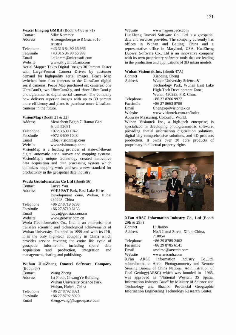
171
Vexcel Imaging GMBH (Booth 64,65 & 71) Contact Silke Kemmer Address Anzengrubergasse 8 Graz 8010 Austria Telephone +43 316 84 90 66 966 Facsimile +43 316 84 90 66 999 Email [email protected] Website www.iFlyUltraCam.com Aerial Mapper Takes Digital Images 30 Percent Faster with Large-Format Camera Driven by customer demand for highquality aerial images, Peace Map switched from film cameras to the UltraCam digital aerial cameras. Peace Map purchased six cameras: one UltraCamD, two UltraCamXp, and three UltraCamLp photogrammetric digital aerial cameras. The company now delivers superior images with up to 30 percent more efficiency and plans to purchase more UltraCam cameras in the future. VisionMap (Booth 21 & 22) Address Menachem Begin 7, Ramat Gan, Israel 52681 Telephone +972 3 609 1042 Facsimile +972 3 609 1043 Email [email protected] Website www.visionmap.com VisionMap is a leading provider of state-of-the-art digital automatic aerial survey and mapping systems. VisionMap’s unique technology created innovative data acquisition and data processing system which optimizes mapping work and sets a new standard for productivity in the geospatial data industry. Wuda Geoinformatics Co Ltd (Booth 56) Contact Lucya Yan Address WHU S&T Park, East Lake Hi-te Development Zone, Wuhan, Hubai 430223, China Telephone +86 27 8719 6288 Facsimile +86 27 8719 6133 Email [email protected] Website www.geostar.com.cn Wuda Geoinformatics Co., Ltd. is an enterprise that transfers scientific and technological achievements of Wuhan University. Founded in 1999 and with its IPR, it is the only high-tech company in China which provides service covering the entire life cycle of geospatial information, including spatial data acquisition and production, integration and management, sharing and publishing. Wuhan HuaZheng Duowei Software Company (Booth 67) Contact Wang Zheng Address 1st Floor, ChuangYe Building, Wuhan University Science Park, Wuhan, Hubei , China Telephone +86 27 8792 8021 Facsimile +86 27 8792 8020 Email [email protected]
Website www.hzgeospace.com HuaZheng Duowei Software Co., Ltd is a geospatial data and services provider. The company currently has offices in Wuhan and Beijing, China and a representative office in Maryland, USA. HuaZheng Duowei Software Co., Ltd is an innovative company with its own proprietary software tools that are leading in the production and applications of 3D urban models. Wuhan Visiontek Inc. (Booth 47A) Contact Xiaoqing Cheng Address Wuhan University Science & Technology Park, Wuhan East Lake High-Tech Development Zone, Wuhan 430223, P.R. China Telephone +86 27 8266 9977 Facsimile +86 27 8663 8700 Email [email protected] Website www.visiontek.com.cn/index Accurate Measuring, Colourful World. Wuhan Visiontek Inc., a high-tech enterprise, is specialized in developing photogrammetric software, providing spatial information digitization solutions, digital city comprehensive solutions, and 4D products production. It owns over 20 core products of proprietary intellectual property rights.
Xi'an ARSC Information Industry Co., Ltd (Booth 29E & 29F) Contact Li Jianbo Address No.3 Jianxi Street, Xi’an, China, 710054 Telephone +86 29 8785 2462 Facsimile +86 29 8785 6141 Email [email protected] Website www.arscmh.com Xi’an ARSC Information Industry Co.,Ltd, subordinated to Aerial Photogrammetry and Remote Sensing Bureau of China National Administration of Coal Geology(ARSC) which was founded in 1965, was approved as “National Western 3S Spatial Information Industry Base” by Ministry of Science and Technology and Shaanxi Provincial Geographic Information Engineering Technology Research Center.
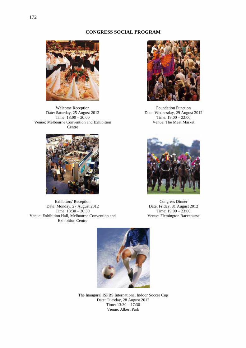
172
CONGRESS SOCIAL PROGRAM
Welcome Reception Date: Saturday, 25 August 2012
Time: 18:00 – 20:00 Venue: Melbourne Convention and Exhibition
Centre
Exhibitors' Reception Date: Monday, 27 August 2012
Time: 18:30 – 20:30 Venue: Exhibition Hall, Melbourne Convention and
Exhibition Centre
Foundation Function Date: Wednesday, 29 August 2012
Time: 19:00 – 22:00 Venue: The Meat Market
Congress Dinner Date: Friday, 31 August 2012
Time: 19:00 – 23:00 Venue: Flemington Racecourse
The Inaugural ISPRS International Indoor Soccer Cup Date: Tuesday, 28 August 2012
Time: 13:30 – 17:30 Venue: Albert Park
173
ISPRS 2012
CLOSING CEREMONY
Congress Director’s Report at Closing Session, Cliff Ogleby
Address of Outgoing President, Orhan Altan
Address of Incoming President, Chen Jun
Address of Incoming Congress Director, Lena Halounová
174
ADDRESS of OUTGOING CONGRESS DIRECTOR CLIFF OGLEBY Please see the Congress Director’s Report in the report on the General Assemblies.
ADDRESS of OUTGOING PRESIDENT ORHAN ALTAN
Congress Director Cliff Ogleby, Distinguished guests, Ladies and Gentlemen, We have nearly reached the end of a very exciting Congress and I very much hope that all of you will take home pleasant memories and new ideas and information for your work. We have heard from the TCPs about the technical highlights of the Congress and I am sure that every one of you will have enjoyed participation in other activities. We have had successful meeting of the General Assembly as you have heard from the Secretary General. I am very happy that the themes which I mentioned in my opening speech of collaboration and applying science to the benefit of society have been echoed in many meetings and presentations during the Congress. This is the end of my term of office as president and all that is left for me to do is to thank many people for their help and support during the past four years. Whatever has been achieved could not have been done without a committed and dedicated team. Of course we have had disagreements but we have overcome these and indeed strengthened our understanding of each other and moved on. Let me start with my colleagues on Council. Secretary General Chen Jun has set up an efficient organization in Beijing and ensured that Council has been supported by this. Treasurer Mike Renslow has also run a well-managed office of the treasurer and has made sure that we hand over a good system and a sound financial situation to his successor. I have benefited enormously from the experience and wise advice from 1st Vice President Ian Dowman and from the insightful comment and attention to detail of 2nd Vice President Ammatzia Peled. I do not need to repeat what a good job Congress Cliff Ogleby and his team has done in organizing the Congress, and he has also made useful contributions to all aspects of Council discussion. Council has been supported by a strong team of TCPs who have provided the framework and encouragement for a strong
technical program; this has also been made possible by the work of the working group chairs and co-chairs. And of course the local organizing committee for the Congress has done a fantastic job, they have been efficient and friendly and anxious to make sure that both Council and participants have a good Congress. I would particularly like to mention one person who have done a great job on the scientific committee and the publications: Mark Shortis has done a great job in putting together the technical program and liaising with the Technical Commission Presidents. And I have been well supported by my colleagues in my Institute in Istanbul. There is one person without whom my involvement in ISPRS for 12 years would have not been possible: that is my wife Melike. She has put up with my absences and helped me both materially and emotionally when we have been working together. I could not have done this job without her and I missed her presence in the last 2 years. Council has a responsibility to run ISPRS for the benefit of you all-its members and participants in the Congress. If you go away from Melbourne with new knowledge, new friends and inspiration for the coming four years, we can be satisfied with a job will be done and I can pass the responsibilities of the office to the new president. I have served the Society to the best of my ability This brings me to my final duty as president of ISPRS to pass the chain of office over to Chen Jun your president for the next four years. I believe that ISPRS is in a strong and well placed to continue its role of promoting our science, and I am quite sure that Chen Jun will do an excellent job in all aspects of the work of ISPRS. I congratulate him on his election and wish him well for his term as President. I have given him the Congress Flag in Istanbul and I handover him the Presidents gavel pass the chain.

175
Presentation of Chain of Office
ADDRESS of INCOMING PRESIDENT CHEN JUN Distinguished Guests, Ladies and Gentleman: It is my great honour to accept the position of ISPRS President for the next four years. I would like to thank the General Assembly, our delegates and all of you, for trusting me and voting for me. I would like invite you to look at the following picture which was taken in Sept. 1982 during ISPRS Com VII symposium held in Toulouse, France. At this time I was a student, and my professor Max Guy, brought me to the symposium. From the picture, you can find Dr. Sherman Wu, Professor Xu Guanhua (who became the Minister of Science and Technology of China in 1990s). As I spoke French, I helped some Chinese delegates to translate their speech into French to Gottfried Konecny. Gottfried Konecny translated that into English to John Trinder. Then English-France-Chinese. It was my first experience to attend an ISPRS Conference. I enjoyed it very much and I started to learn about ISPRS.
Since then, I spent thirty years to learn about ISPRS. When I learn, I also grow up. I submitted my first paper to the 16th Congress in 1984. It was selected as an oral presentation and I submitted some papers to the 17th Congress. I attended the following ISPRS Congresses in Washington, Vienna, Amsterdam, Istanbul, Beijing, and then here. When I was teaching at Wuhan University, I organized the first ISPRS workshop in 1992. From there, I learnt how to organize ISPRS workshops and how to present papers at ISPRS
176
conferences. Later on I became a working group chair in 1996 to 2000. In the following years I served as Technical Commission President, Congress Director and Secretary General. It has been a long journey, but I have learned about the traditions of ISPRS. How we submit papers, how we review papers, do presentations, and also the importance of contacts made through ISPRS. I have learnt who ISPRS people are, where they are from, and who are working groups chairs and TCPs, and how to serve. I got trained, I made friends, I saw familiar ISPRS faces, I gained experience and also shaped my career. So it’s very important and I love ISPRS. I will do my best to serve ISPRS. We know that ISPRS is a society with long history, with high reputation, with strong influence, as you can see from this Congress. But we also face great challenges like strong competition, increasing demands, and educational opportunities. The first thing we should do is to implement the ISPRS Strategic plan and provide stronger scientific voices. A key requirement is to advance the science of Photogrammetry, Remote Sensing and Spatial Information Science. Another thing is to enhance communication with other societies. We need to keep our valuable traditions, but as Wolfgang Wagner has said we need to adapt to the new environment. So we need to conduct all necessary reforms, maybe changing the conference structures so that we keep a strong scientific voice, and provide better service for society. A key organization for ISPRS is ICSU (the International Council for Science). ICSU is looking at how science can contribute to knowledge on global change, for instance, how could we forecast future environmental conditions and their consequences for people? How could we develop and integrate the observations systems to manage global and regional environmental changes? How could we anticipate, avoid and manage disruptive global environmental change? As the society of Photogrammetry and Remote Sensing, we are facing grand challenges, society needs more information as Prof. Gorden Mcbean said at the first plenary, he would ask us, the specialist society for photogrammetry, remote sensing and SIS to provide reliable information on topics such as land cover, applications of imagery, and many others. So we need also more effective analysis and simulation, more advanced visualization and representation technologies. I would say from this Congress, we have already done a lot of things; we have very good communication, integration and collaboration with other societies. But still have long way to go. What I would suggest that with a new Council and new TCPs and Working Groups, we should try to provide a stronger scientific voice from ISPRS. For instance, we have to define what are the major scientific and technical challenges which we are facing? What are the key issues to be addressed? What are the latest developments? To do that, we need Council, TCPs,
Working Group Chairs, and many of you to work together to develop a good vision of the future. For instance, we should generate some vision papers and a research and development agenda. During the General Assembly, we have decided to continue our book series with both author and edited books and edited proceedings. Prof. Zhilin Li is new editor and he would like to publish some authored books next year. We should promote special issues for cutting edge developments for our journals. The second thing I think we can do is to have closer collaboration with others. We have some priority areas like disaster, health, land cover change, and many others. And we should have Inter-disciplinary research with other societies like Joint Board of GIS on disaster; GEO on Land cover change , we had very special session with GEO; OGC on web service; IEEE CV on Benchmarks; ICA on Image Maps; IGU on Border Area Studies; EuroSDR on capacity building. There is also GGIM. Gottfried has done very good job on the current status of global surveying, and mapping. But this is why we need collaboration among academia, industry and users. and it is necessary to invite people from these three different groups to meet together. We have done this but I think we should have more. We also need to do something that Orhan has already done: produce booklets; generate test data and technical guidelines; produce survey reports, even Webpage systems. Another issue is how to optimize ISPRS conferences (congress, symposia, workshops). Could we have an annual ISPRS conference plus mini-workshops? Now many workshops symposium are very big, several hundred people. In fact we need mini-workshops for in depth discussion. Workshops allow us to work together. We need to bring more scientists and young people to join ISPRS events and activities. During last four years, Commission VIII symposia have brought brilliant remote sensing scientists to ISPRS and we need to keep this. We need our annals and Journal of GeoInformation cited. We should also set up a distinguished speaker program. I remember last year, Prof. Deren Li, the new Honorary Member, gave keynote speeches at six ISPRS workshops organized in China. And how can we enable TCPs and WG officers to concentrate on scientific work? On leadership, Orhan has made some progress, but we need to continue to do that. For instance, he looked into establishing permanent headquarters and to provide help to TCPs and WG officers to organize the events. On another issue we have some comments on how to improve selection of ISPRS officers? For all that, I think I will not be able to do everything on my own. I rely very much on Council, TCPs and Working Group chairs and co-chairs; on ISAC, IPAC, editors, Regional Representatives, and other ISPRS officers; and also we rely on Ordinary Members, Regional Member, Sustaining Members, Associate Members and Honorary Members, Fellows; and of
177
course I need the help of my organization to bring me with very good and strong support which Orhan mentioned, very good staff, the necessary budget and a very good office for our organization. I work for the National Geomatics Center of China, a sub-organization of the Administration of Surveying, Mapping and Geoinformation of China. This time they have set people
help me on the General Assembly, also Chinese Society of Geodesy, Photogrammetry and Cartography has provided help and support. And of course all of you. I take this opportunity to give thanks and appreciation to Cliff Ogleby and Mark Shortis, Chris Bellman and Sara, thanks for your wonderful work for Congress.
ADDRESS of INCOMING CONGRESS DIRECTOR LENA HALOUNOV Á Mr. President, ladies and gentlemen, Let me to welcome you to the next ISPRS Congress to Prague. The motto of the Congress: From Human History to the Future with Spatial Information should remind to all of us that our predecessors invented many tools we are using today: maps. We have only improved in their preparation, the amount of information pieces, presentation and distribution, aerial photographs, which are being used together with other/newer image data, etc. We can overlay image data with map vector data and attribute data all in various different ways. It is the technical and scientific development and inherited knowledge forming the present state of art of spatial sciences. The date of the XXIIIrd ISPRS Congress in 2016 is 12 – 19 July in the Czech Republic. The Czech Republic is located in the centre of Europe, its area is 78 000 sq.km. Czech, the official language, is a Slavonic one which uses the Latin alphabet. The country still uses its own currency – Czech crown. Prague is a city with more than 1,3 million inhabitants. The city is situated on the 14th longitude and 50th latitude N.E. Prague in July should offer you nice warm summer weather. The Congress will take place in the Prague Congress Centre, which offers sufficient number of halls of various sizes suitable for the ISPRS Congress. Prague
is easy to reach by plane, train, bus or car. The Congress Centre is just a few steps from the Prague Metro. The Prague public transport is well laid out and use of metro, trams, buses, trains and boats is free of charge for all Congress participants. Prague boasts many hotels – two of the largest are in the vicinity of the Congress Centre. Prague is a beautiful city, which can be characterized as an architectural and artistic gem cut through many centuries. Looking at Google Earth, you can find hundreds of photographs of Prague’s treasures. Charles Bridge, Prague Castle, Wenceslas Square, the Municipality House, the Dancing House – just a few photographs from Prague would entice you. There are other places in the country, which are beautiful and worth seeing and visiting – Kutná Hora, Karlovy Vary, Kroměříž, Český Krumlov, Karlštejn. I would like to welcome you to come and take part in the 2016 Congress both during the scientific plenary and working group sessions, business presentations, exhibitions, technical tours, and as well as various social events such as the ice breaking party, dinner of exhibitors, congress dinner, plus optional tours in and out of Prague. I hope to see you in Prague!
178
ISPRS 2012
RESOLUTIONS
Approved Resolutions of the XXIInd ISPRS Congress - Melbourne 2012
179
APPROVED RESOLUTIONS OF THE XXII nd ISPRS CONGRESS MELBOURNE 2012
General Resolutions
Resolution 0.1 Appreciation to Australian SSSI and the organisers of the Congress
The Congress commends: The Australian SSSI, its president Gary Maguire, the Congress Director Cliff Ogleby, the Technical Programme Director, Mark Shortis, the Local Organising Committee and the Congress PCO, ICMS Pty Ltd. for their excellent work which has resulted in a very successful Congress.
Resolution 0.2 ISPRS approach to capacity building The Congress Noting: - the many international organisations in the
geospatial community which are involved in capacity building (CB);
- the importance of GEO, CEOSS and GGIM in capacity building;
- the need to avoid duplication of effort in times of economic austerity.
Recognising: - that technological and scientific progress in the
domain of earth observation and geoinformation provision is very fast;
- that the application domains of this technology are continuously increasing and becoming more complex;
- the absolute necessity for collaboration and efficient use of resources;
- the need for coordinated action within ISPRS to make use of the expertise within Technical Commissions and to liaise with the international network of which ISPRS is part.
Recommends: - that all capacity building (CB) activities be
coordinated by Council; - that a member of Council be appointed as CB
coordinator to work with all Technical Commissions and with the Regional Representatives to ensure a coherent ISPRS programme of capacity building;
- that an item be included in the ISPRS budget to allow the CB coordinator to meet with other international bodies and to provide seed funding for capacity building projects;
- that ISPRS and her sister societies stimulate their professional and academic participants to make their expertise available for knowledge transfer and exchange in this context;
- that ISPRS stimulates her Technical Commissions to develop structured approaches for the dissemination of new knowledge in the context of lifelong learning and capacity development;2
- that Technical Commission VI should be responsible for dissemination of knowledge and should be an action-oriented agent of ISPRS and
that the President of TC VI should work closely with the CB coordinator to implement ISPRS capacity-building programmes.
Resolution 0.3 Importance of scientific publishing in high-ranked journals
The Congress Noting: - that the competition for research funding between
disciplines is tougher than ever; - that the qualifications of experts are found from
databases such ISI Web of Knowledge and Scopus, and using indexes such as H-index;
- that the work done in the field of ISPRS is not properly indexed on lists such asISI.
Recognising: - that the disciplines of ISPRS are competing with
other disciplines for space in universities, and that the scientific merits and indicators found in databases such as those mentioned above play an important role in decisionmaking;
- the possibilities of open-access publishing. Recommends: - that ISPRS facilitates more possibilities for
scientific publishing in high-ranked journals (listed in ISI Web and Scopus);
- that ISPRS activates open access publishing possibilities in cooperation with the professionals in the open-access publishing field;
- that conferences organised by ISPRS should cooperate in special issues of high-ranked journals.
Resolution 0.4 Cooperation with other organisations and groups in the spatial information science domain
The Congress Noting: - the variety of organisations and groups dealing with
spatial information science (IGU, ICA, GIScience, AGILE, etc.);
- the increasing number of workshops, symposia and conferences in this discipline.
Recognising: - the determination of ISPRS to further strengthen its
position in the spatial information science domain; - the importance for spatial information science of
image data, as well as quick data capture and data update by a variety of distributed sensors;
- the need to transfer contributions and strengths of ISPRS research in this domain to other organisations.
Recommends: - that cooperation with other organisations be further
strengthened in order to identify key research issues;
- the organisation of joint workshops and symposia with other organisations (IGU, ICA and others);
180
- increasing the attractiveness of ISPRS events through reviewed publications and highly interactive workshops.
Technical Resolutions
Resolution I.1 New paradigm for quality assurance and quality control of modern mapping systems The Congress
Noting: - that there is significant improvement in direct
georeferencing technology, which is allowing for substantial reduction of the control requirements for photogrammetric and lidarmapping;
- that miniaturisation of modern mapping systems such as cameras and laser scanners is becoming the norm for cost-effective mapping;
- that the employment of multi-unit mapping systems (multi-camera or multi-scanner systems) allows for larger coverage of mapped areas using fewer paths;
- that the end user is interested in the original data acquired by the system as well as derived products from such data.
Recognising: - that achieving the potential accuracy from these
multi-unit mapping systems is contingent on accurate sensor modelling and calibration and estimation of the system parameters while considering various deviations from the assumed acquisition geometry;
- that maintaining the economic gains from newly available mapping systems requires the development of cost-effective in-situ calibration procedures;
- that the increasing volume and varying format of collected data pose additional challenges in verifying the quality of data products delivered to the end user and even more challenges in the quality control of the delivered data products.
Recommends: - investigation of established sensor modelling
procedures to see if they are the best approach to handle multi-unit mapping systems (for example the concept of the exterior orientation parameters of the individual images might not be appropriate for dealing with imagery captured by multi-camera systems);
- development of better procedures for in-situ calibration of multi-unit mapping systems while increasing the flexibility of the data collection and control configuration;
- development of standardised procedures for investigating the stability of the estimated parameters while considering the needs of the end user (for example statistical testing of temporal calibration parameters might not be the best approach for system stability analysis);
- linking the quality control and quality assurance activities by considering hybrid approaches that can be used for verifying the quality of the delivered data while offering the possibility of improving the system calibration in case of identified problems;
- extending the quality control process to include the outcome of the data processing activities.
Resolution I.2 Digital surface and terrain models from spaceborne data
The Congress Noting: - the continuing increase in high resolution
stereoscopic data acquisition capabilities from space;
- the increasing use of SAR and interferometric SAR for DEM generation;
- the need for accurate and detailed DEMs, also covering many areas with no availability of high resolution DEM and for applications where a higher DEM repetition rate is necessary;
- the simultaneous availability of multispectral information for improved stereo data evaluation.
Recognising: - the need for the development of robust techniques
for DSM and DTM generation using spaceborne data with different viewing angles and resolutions;
- the potential of satellite-borne high-resolution optical stereo and multispectral data to derive city models.
Recommends: - the investigation and comparison of DEM
generation methodologies (both DSM and DTM) based on high-resolution stereo sensors and SAR interferometry;
- the development of validation and quality measures for DEM data from space;
- the continuation and intensification of work to combine and correct datasets such as ASTER and SRTM using the Geoscience Laser Altimeter System (GLAS) or other high-order elevation data in order to produce global, high-quality DSMs;
- the collaboration with other Technical Commissions on the applicability to city modelling and more frequent coverage for 3D change detection and other applications.
Resolution I.3 Integrated systems for sensor georeferencing (orientation) and navigation
The Congress Noting: - the rapid expansion of new multi-sensor platforms
devoted to mobile mapping and operating from the ground, water or air (operation from the latter may be achieved in autonomous mode),
- while the procedures for fusing sensor observations inherited from the past engage models and/or
- estimation methods that are less appropriate to the new hardware and do not fully exploit the observation redundancy in terms of detection and elimination of systematic errors (in navigation as well as in optical sensor data);
- the foreseen extension of GNSS with the GLONASS update and the upcoming deployment of Galileo, but the relative “fragility” of all GNSS signals to electromagnetic interference and the

181
dependency of direct georeferencing and navigation performance on its availability;
- the evolution of inertial technology that will gradually lead to the replacement of the larger, costly, yet more precise and reliable tactical-grade instruments with smaller, less expensive Micro Electro Mechanical Systems (MEMS) inertial measurement units (IMUs) of lower quality but with the possibility of redundant configurations;
- the absence of standards and regulation in the rapidly expanding market for mobile mapping from autonomous platforms that would reflect the real robustness and reliability of unmanned aerial vehicle (UAV)systems;
- the limitations of currently available models for inertial sensors and IMUs in the context of the high precision, accuracy and reliability requirements of photogrammetry, vision-based and vision-aided navigation.
Recognising: - the need for development of new sensor fusion
procedures that reach beyond the separate or - cascaded adjustment of navigation and sensor data; - the necessity of developing new algorithms for
navigation, guidance and control of UAVs with mapping payload for increased performance, robustness and autonomy in the absence of GNSS signals;
- the need to develop new models for sensor and systems of lower quality employed in mobile mapping and direct georeferencing (e.g. low-cost cameras, MEMS IMUs, etc.);
- the need to establish new approaches when determining or certifying new platforms for unmanned mapping operations;
- the need to develop integrity concepts and measures for vision-based and vision-aided indoor and outdoor navigation systems.
Recommends: - initiation of, and support for, the development of
new models and estimation procedures that integrate optical sensors and navigation data at measurement level and their optimisation for both real-time and post-processing;
- the integration of the concept of geodetic-like robustness and reliability in the design of new unmanned mapping platforms while increasing their autonomy and integrity in the absence or perturbation of GNSS positioning;
- investigation and establishment of links between vision-based and vision-aided navigation and navigation integrity;
- the enhancement of the modelling and estimation procedures for redundant MEMS IMU configurationsin the service of direct georeferencing and sensor orientation;
- the investigation of the potential of using swarms of UAVs for better estimation of the navigation parameters through collaborative navigation solutions;
- collaboration with other international organisations on unifying standardisation of measures related to
mapping quality from mobile platforms and proposing new concepts for estimating the reliability of new unmanned mapping systems.
Resolution II.1 Multi-dimensional, multi-thematic and multi-resolution spatial information for spatial decision-support systems
The Congress Noting: - the increasing availability of spatial data at different
temporal, thematic and geometric - resolutions; - that many urgent issues facing mankind require
detailed spatial data; - the development of geosensor network technology
allowing distributed sensors to measure and locally communicate geospatial information;
- the availability of moving-point datasets representing spatial phenomena or spatio-temporal behaviour.
Recognising: - the critical role of explicit semantics and ontologies
of geospatial data; - the potential of such data for decision support; - the need for data integration in order to exploit the
richness of the individual datasets; - the need to identify appropriate spatial information
for dedicated applications via the Internet. Recommends: - the development of methods and tools for the
mining of multi-resolution spatio-temporal data, and its semantic, geometric and topological integration and analysis;
- the development of methods and algorithms for moving-point data representation, storage, analysis and visualisation;
- the establishment and development of techniques for integration of intelligent sensor data;
- the development of efficient representation and storage methods for multi-dimensional and multi-temporal data;
- the establishment of benchmarks and sample datasets for testing proposed solutions in spatial data handling and for quality control.
Resolution II.2 Pervasive geocomputing and services
The Congress Noting: - the newly emerging cloud computing technology; - the general trends towards miniaturisation, and
towards ubiquitous and wearable computing; - new applications of spatial data and geocomputing, e.g. in traffic and personal navigation;
- the fast emergence of Web 2.0; - the paramount role of the Internet and location-
based services, and of ‘virtual globes’ in society. Recognising: - the increasing potential of the World Wide Web for
dissemination of spatial information;
182
- that ‘virtual globes’ offer a more intuitive view of spatial phenomena for a wider audience than conventional maps;
- the challenges of efficient storage and processing of vast amounts of spatial data.
Recommends: - the development of cloud computing for geospatial
modelling and simulation; - the encouragement of research in pervasive
geocomputing; - the development of geospatial data processing
techniques using distributed services and other advanced developments in general purpose computing;
- the development of Web and mobile search engines for spatio-temporal data.
Resolution II.3 Uncertainty modelling and quality control for spatial data and analyses
The Congress Noting: - the trend of demand for ever higher quality of
spatial data from GIS users; - the existence of errors in spatial data and
uncertainties in spatial analyses and modelling; - the potential of new solutions for error modelling
and uncertainty analyses for spatial data. Recognising: - the importance of high quality spatial data for
spatial decision making; - the challenges of effective modelling uncertainties
in complex spatial data; - the importance of recognition of quality problems
in spatial data by general GIS users, especially those using Internet GIS whose data quality is not ensured.
Recommends: - investigation of new mathematical theories for
uncertainty modelling of spatial data and analyses; - the development of effective methods of
uncertainty modelling for multi-resolution and multi-temporal spatial data;
- the encouragement of research on spatial data quality control including the implications of crowd sourcing;
- the implementation of advanced methods of spatial data quality checking and control on commercial GIS software, towards possible inclusion in national and international data quality standards.
Resolution II.4 Geovisualisation of multi-dimensional data
The Congress Noting: - an increasing demand by the general public for
visualisation of spatial data; - the wide availability of mobile and Web-based
visualisation products; - the availability of huge, complex, multi-
dimensional geospatial datasets, and the development of new visualisation devices such as globe displays, smart paper and touch tables.
Recognising: - that the integrated visualisation of multi-
dimensional data offers major challenges; - that visualisation plays an important role in all
ISPRS disciplines; - the need for collaborative visualisation using a
variety of devices. Recommends: - research into novel visualisation technologies for
spatial data; - the development of strategies and methods for
collaborative geovisualisation of dynamic phenomena in cooperation with TC IV;
- the development of advanced methods for visualisation of, visual analytics for, and interaction with, multi-dimensional heterogeneous data, complementing the work of TC IV.
Resolution III.1 Building enhanced links between the communities of photogrammetry, remote sensing, computer science and robotics
The Congress Noting: - that photogrammetric concepts and tools are being
developed and redeveloped in the robotics field especially for the localisation of robots;
- that maps are used more and more for the analysis of the surroundings of robots and the planning of trajectories;
- that remote sensing imagery and data, and their processing, are taking a larger place in the computer graphics community.
Recognising: - that past resolutions on the convergence between
photogrammetry and computer vision techniques have had positive effects on our disciplines;
- that tools to visualise, edit, interact and manage updates with huge 3D models and/or point clouds are being successfully developed in the computer graphics community;
- that interesting work is being carried out in the field known as photometric computer vision or photometric computer graphics, for radiometric and shadow correction to increase readability and seamlessness of images.
Recommends - that the positive work in bringing the
photogrammetric and computer vision communities together should be continued;
- bringing together our community with the robotics and computer graphics community
- the co-organisation of workshops with these different communities;
- research on the generation of maps for autonomous navigation;
- the development of hybrid models for image correction, unlighting and relighting.
183
Resolution III.2 Developing models and scaling processing methods to manage “big data” collections
The Congress Noting: - that some datasets (known as “big data”) are
becoming so large and complex that they become awkward to work with using on-hand database management tools;
- that the volumes of data acquired by mobile mapping systems is increasing significantly;
- that image-based sensor networks (e.g. CCTV camera networks) needing real-time processing are also developing fast.
Recognising: - that many applications in our field require quick-
response mapping or would require real-time or near real-time processing;
- that having large collections of data allows the use of better statistical models for applications such as object detection, object reconstruction or data mining.
Recommends: - the development of models and methods for scaling
the analysis and object extraction with GPU, multi-CPU or hybrid architectures;
- the development of new models and processing techniques for applications such as data mining or image retrieval that may benefit from the availability of large datasets.
Resolution III.3 Data fusion for object extraction and scene analysis
The Congress Noting: - that many mapping systems are equipped with
ranging, imaging and positioning sensors; - that polarimetric and multi-frequency SAR is
becoming increasingly used. Recognising: - that processing in a sufficiently short time to avoid
congesting production lines is a major constraint; - that the processing of each source of imagery on its
own is not optimal; - that positioning information is important for
aligning the data acquired by ranging and imaging sensors.
Recommends: - the development of methods and algorithms mixing
data from imaging, ranging and positioning systems for object extraction and scene analysis.
Resolution IV.1 Data acquisition, update and automation for creating and maintaining interoperable geospatial databases
The Congress Noting: - the increasing role of interoperable distributed
geospatial databases created and maintained by different nations, regions, cities, agencies and the private sector;
- the increased awareness of standards in data models and database technology to support weband loud-based parallel processing and query;
- the acquisition of an increasing amount of high-resolution digital images and high-accuracy point clouds from many diverse platforms, but in particular from unmanned aerial vehicles (UAVs), and in geosensor networks collecting and analysing spatial data in a collaborative way;
- the increased availability of data gathered through crowd sourcing, social media and other means of participative data acquisition;
- the increased availability of high-performance software and hardware for data acquisition and processing, including image and vector data and ancillary information.
Recognising: - the lack, in many cases, of the necessary up-to-date
and properly integrated data for time-critical applications;
- the relatively slow progress in developing interoperable, multi-scale, multi-dimensional data models and databases serving the needs of the geospatial community;
- the need to further understand geosensors and geosensor networks to fully exploit their potential in developing proactive geospatial systems and applications;
- the difficulties in assessing the impact of current research tools for many users responsible for geospatial data acquisition and update and database maintenance;
- the lack of established procedures for integration and common use of authoritative and participative data.
Recommends: - the promotion of the use of new sensors, platforms
and geosensor networks for the fast acquisition and update of geospatial data;
- the intensification of development and experimental usage of multi-scale, interoperable geospatial and spatio-temporal 2D and 3D databases in activities such as pilot studies and benchmarking atthe local, regional, national and global level;
- - the organisation of comparative tests of the results available in the scientific literature in order to assess and improve existing tools for semi-automatic and automatic data acquisition and update from images and ancillary data with a special emphasis on open-source solutions;
- the intensification of development of methods and good practice examples for database maintenance and quality control including fast access, indexing, query and search mechanisms.
Resolution IV.2 Geospatial infrastructures and web/cloud-based services for managing, displaying, disseminating and exploring multi-sensor data
The Congress Noting: - the increased access to terabytes of geospatial
information over cyber infrastructure has
184
continuously changed the way people work, live and play, but a lack of sufficient processing power remains;
- mapping services having emerged as the new way to allow a multitude of users to post, consume, compare and analyse data collaboratively;
- the trend of providing automatic, analytical, shared and open source web/cloud services, using the web/cloud as the managing, processing and computing platforms for geospatial information;
- the trend towards miniaturisation, and ubiquitous and wearable computing;
- the increasing demand-driven availability of web-based visualisation tools and of new visualisation devices;
- the increased interest in real-time monitoring of dynamic phenomena and moving objects;
- advances in cyber-infrastructure network and communicating technologies, especially the more recent cloud computing technologies.
- Recognising: - the potential for accessing massively scaled
computing infrastructure and new web/cloud services for online processing of static and dynamic geospatial and spatio-temporal information and data-intensive problems;
- the value of “virtual globes” for processing and dissemination of geospatial data, processes and phenomena;
- the integrated multi-user collaborative visualisation of multi-dimensional data offering major challenges in research and development;
- international activities for standardisation of service, system architectures and geospatial information, processes and workflows such as those from ISO and from OGC.
Recommends: - research into novel online multi-dimensional
visualisation technologies for spatial data, geospatial analytics and methods for collaborative geovisualisation of dynamic phenomena in cooperation
- with ISPRS Technical Commission II, International Cartographic Association (ICA) and Open Geospatial Consortium (OGC);
- further development of cloud-based, server-based, location-based, network-centred, distributed and federated architectures for geospatial services and analysis including grid computing;
- the development of applications for dynamic management, analysis, service and archiving of multi-sensor data over the web;
- investigation of social and organisational issues related to web/cloud-based services for managing, displaying, disseminating and exploring multi-sensor data.
Resolution IV.3 Multi-dimensional spatial databases for safety and security, relief management and monitoring.
The Congress Noting: - the role of geospatial data in sustainable
development and time-critical applications; - the advances in designing and developing multi-
dimensional geospatial databases, standards and tools;
- the increased cooperation between international standardisation bodies involved in developing specifications, standards and regulations for collecting and preserving geospatial data in different domains;
- the maturity of geospatial and multi-media database management systems.
Recognising: - the increased demand for geospatial information in
supporting safety and security, relief monitoring and managing activities;
- the increasing importance of harmonised geospatial data as a common base for many aspects of safety and security, environmental monitoring and sustainable development;
- the significantly increased role of geospatial data in understanding time-dependent processes and phenomena related to global change;
- the increased need for integration of multi-scale, indoor/outdoor, above/under and land/water/air geospatial data for time-critical decision making;
- the increased need for user-centred, context-aware, knowledge-based software to be used by a larger group of professionals dealing with security and environmental issues.
Recommends: - the intensification of development of integrated
indoor/outdoor, above/under surface geospatial databases in support of safety and security, relief and environmental monitoring applications;
- dedicated research efforts on semantics in geospatial data and semantic mapping of geospatial databases;
- the organisation of comparative tests and best-practice applications and pilot projects, the better to demonstrate the value of accurate and reliable geospatial information to other players in the fields of security and relief operations and in global change;
- strengthening research on bridging 3D geospatial and spatio-temporal data structures and models considering different needs and representations of the above-mentioned disciplines.
Resolution IV.4 Geodatabases for extraterrestrial research
The Congress Noting: - the advances in sensors, platforms and programmes
for remote sensing of the planets, satellites and small bodies of the solar system;
185
- the interest of the general public in planetary and other extraterrestrial datasets and results of planetary exploration.
Recognising: - the increased demand for, and availability of,
spatial information in supporting solar system exploration;
- the need to process the available and increasingly voluminous extraterrestrial datasets,
- particularly for the Moon, the planet Mars and Sun-Earth interactions, in an integrated and harmonised way in order to provide a solid base for their scientific exploitation;
- the need to study the history of the planets and other extraterrestrial bodies in order to learn more about future scenarios of the Earth and to provide valuable contributions to sustainable planning.
Recommends: - that the development of integrated spatial databases
for extraterrestrial applications should be intensified;
- the strengthening of research and development of observing and analysis technologies for extraterrestrial remote sensing and mapping;
- the forging of collaborations with the other Commissions and Working Groups of ISPRS to apply the widest range of state-of-the-art analysis and mapping techniques to problems involving planetary data.
Resolution V.1 Low cost 3D sensors
The Congress Noting: - the widespread availability and ubiquity of
relatively low cost 3D sensors; - the increasing development and maturity of
smartphone technology; - the increased interest in the application of such
sensors to measurement. Recognising: - the need for rigorous yet tractable calibration,
orientation and recognition algorithms. Recommends - that ISPRS research activity on 3D sensors be
strengthened in the application and development of low-cost sensors for measurement purposes.
Resolution V.2 Mobile mapping
The Congress Noting: - the increase in the number of commercially
operational mobile mapping systems comprising integrated navigation sensors and multiple passive and active imaging sensors;
- the consequential growth of the mobile data collection industry.
Recognising: - the need for fast and accurate algorithms to
recognise patterns in huge volumes of collected point clouds.
Recommends - increased research activity into automated object
recognition from point clouds collected by mobile platforms;
- closer cooperation between ISPRS Commissions I, III and V, as well as external organisations (e.g. FIG and EuroSDR) concerning such systems.
Resolution V.3 Object reconstruction using consumer-grade imagery and open-source, web-based software
The Congress Noting: - the increasing demand for non-specialist
applications of image-based spatial data; - the wide availability of accessible web-based
solutions capable of generating 3D data from consumer image sources (e.g. Microsoft Photosynth/Autodesk 123-D Catch).
Recognising: - the desire to maintain precision and accuracy as
important aspects of photogrammetric solutions. Recommends: - investigation of the potential for precise three-
dimensional spatial reconstruction of objects online from crowd-sourced image and associated data;
- identification of ways to engage non-photogrammetrists with the ISPRS community.
Resolution VI.1 Cooperation with sister societies on education for lifelong learning and capacity development
The Congress Noting: - that the technology and societal conditions of earth
observation and geoinformation provision are developing very fast;
- that the application domains of this technology are also continuously expanding and becoming more complex;
- that these developments lead to continuous development of processes and working conditions for the provision and use of spatial information;
- that GI organisations and professionals should continuously update and upgrade their knowledge;
- that in many countries and/or regions ofthe world the development of the geo-information sector is lagging behind and requires support to catch up with global standards.
Recognising: - the fact that in many regions educational and
training capacity in the geo-information field is insufficient;
- the insufficiency of provisions for lifelong learning; - the complexity and wide coverage of the domain of
the provision and use of spatial information; - the still growing needs for professionals and
organisations working in this domain. Recommends: - that ISPRS and her sister societies ICA, FIG,
EuroSDR and others should develop joint action
186
programmes for the provision of educational and training facilities;
- that these facilities focus especially on the needs for lifelong learning and capacity development;
- that these societies stimulate and develop joint activities with leading educational institutions in this domain;
- that these societies stimulate their professional and academic participants to make their expertise available for knowledge transfer and exchange in this context.
Resolution VI.2 Promotion of the profession to students and young scientists
The Congress Noting: - that the number of students continues to be too low
for the viability of the profession and the availability of graduates who form the future core of ISPRS;
- the increasing possibilities for student mobility between institutions during their education and training.
Recognising: - the need to promote the profession and recruit
young professionals for the photogrammetry, remote sensing and spatial information sciences.
Recommends: - the continuation and active promotion of the ISPRS
Youth Forum and Student Consortium; - that the cooperation of the ISPRS Youth Forum
with related groups in sister societies of ISPRS - should be stimulated and supported; - the encouragement of relevant organisations to
facilitate international student exchange and - technical training programmes at all levels; - that the Student Consortium should be supported
with funding for its activities.
Resolution VII.1 Importance of in-situ measurements in remote sensing processes
The Congress Noting: - that sensor technology is developing very rapidly; - the possibility of using high-quality measurements
from novel sensors as in-situ data together with airborne and spaceborne remote sensing data, for example terrestrial laser scanning and hyperspectral imagery as a source of data for in-situ measurements in large-area remote sensing processes;
- that these developments lead to continuous development of processes and working conditions for the provision and use of spatial information.
Recognising: - the need to foster development in the area of in-situ
measurements and their automation. Recommends: - the development of in-situ measurements and earth
observation production processes including advanced in-situ solutions, within ISPRS TC VII and in cooperation with ISPRS TCsI, III and V.17
Resolution VII.2 Releasing and indexing of remote sensing datasets
The Congress Noting: - the increasing demand for, and availability
of,remote sensing datasets; - the increasing need for standardisation related to
remote sensing data as called for by GEO, GCOS, IPCC and other organisations.
Recognising: - the emergence of data citation indices offered by
publishing houses; - a culture of free sharing of datasets; - the increasing use of Digital Object Identifiers
(DOI) for datasets. Recommends: - that the ISPRS community should develop quality
control and standardisation procedures for certifying relevant remote sensing datasets;
- that ISPRS should consider the introduction of ISPRS-owned DOIs and the development of procedures for the assignment of these DOIs to datasets which have passed the procedures for quality control and have been found to comply with the required standards.
Resolution VIII.1 Global change studies
The Congress Noting: - that remote sensing data and models are monitoring
changes in relationships between the earth’s oceans, land, and atmosphere;
- that these changes impact the wellbeing of the earth’s environment and populations;
- that global climate change is happening and islikely to impact ecosystems, livelihoods, and human health;
- that many measurements pertaining to atmospheric constituents and profiles are available from a network of space and in-situ systems;
- that major initiatives now under way will lead to significant new insights into global processes and decades of valuable polar research..
Recognising: - the need to address underlying issues such as
climate change, water, and health, that impact the wellbeing of the earth and its environment and inhabitants;
- the continuous need for monitoring of essential climate variables, and understanding of the bio-geo-chemical cycle and of atmospheric processes;
- the need for short-, medium- and long-term weather forecasting;
- the capability of remote sensing technologies to provide valuable inputs to polar research;
- the obligation to allow free access to relevant data under the UN Remote Sensing Principles.
Recommends - that ISPRS prioritises activities which address
global climate change; - integration of ground observation and satellite data
for developing long-term calibrated records of
187
weather and climate variables to improve analysis of the impact of climate variability and change;
- the development of models that assimilate remote sensing and in-situ data to describe bio-geo-chemical cycle;
- the development of strategies, methods, and algorithms for integrating remotely sensed data in researching and monitoring cryospheric regions;
- continuing monitoring of land use and land cover change, with special emphasis on global land cover.
Resolution VIII.2 Applications for the benefit of society
The Congress Noting: - that significant contributions are being made by
remote sensing technologies to facilitate natural resource mapping, monitoring and inventories, including agriculture, land, water, forests, ecosystems andminerals;
- the contributions made by geoinformatics and space technology in disaster management;
- that rapid, unplanned urbanisation and industrialisation worldwide is causing environmental degradation, including air pollution which may impact human health and the environment;
- the importance of exploration and sustainable utilisation of energy resources and the environmental impacts of energy production and consumption.
Recognising: - that remote sensing applications for food security,
water, and ecosystems generally have been restricted to mapping at different resolutions and in isolation;
- the benefits and impacts of remotely sensed data in monitoring urbanisation;
- the improved spatial, spectral and temporal capabilities of new sensor technologies;
- that information resulting from earth observation can improve health studies and disease prevention;
- the urgent need for protection of mineral resources and energy supplies;
- the scattered nature of research studies into the understanding of disaster precursors and the development of early warning models;
- the obligation to allow free access to relevant data under the UN Remote Sensing Principles.
Recommends: - that greater use should be made of remote sensing
and GIS for food, water, and environmental security and in understanding the processes and fluxes in the bio-geosphere;
- that greater emphasis should be placed on developing better early warning models and mitigation techniques for disasters;
- the integration of the Earth observing systems with modelling capabilities for early warning and
surveillance of environmental impacts on human health;
- investigation of the use of remote sensing technologies in managing energy and mineral resources, and exploring the potential of renewable energy sources.
Resolution VIII.3 Collaboration with global and applied sciences programmes and user communities
The Congress Noting: - that the mission, vision and strategy of the ISPRS
Strategic Plan of July 2010 promotes interdisciplinary collaboration aimed atintegrating ISPRS with global activities;
- that global organisations and programmes are promoting and using applications of earth observing data and models for climate change and variability, and for societal and economic benefits;
- that local, national, and international policies are driven by environmental and economic changes;
- the importance of engaging with both space and end-user agencies in support of policy decisions.
Recognising: - the need for ISPRS to contribute to, and participate
in, ongoing global organisations and programs, such as GEO, UNOOSA, ICSU, GGIM, IUGS, CEOS and IEEE GRSS;
- the need to bridge the gap between geospatial technologies and the user communities they serve;
- that long-term quality-controlled spaceborne derived data records are of critical importance for both climate-related research and operational remote sensing applications;
- the need to engage deciders and policy makers in processes for developing useful products.
Recommends: - the designation of working group representatives to
actively serve and interact with kindred organisations and programmes, such as GEO, IMO, ICSU and IPY;
- interaction with the science and modelling communities which integrate their results to produce remote sensing products;
- the assimilation ofremote sensing products with geospatial systems for end-user applications;
- the education of end-user communities in the use ofremote sensing products;
- the organisation of workshops and symposia to focus on emerging topics such as global change and related policy and environmental issues;
- that ISPRS should engage with both space agencies and end-user agencies to provide the case for
- supporting current and future missions; - the expansion of ISPRS efforts to quantify the
socioe-conomic benefits of remote sensing applications;
- that ISPRS should offer to contribute technical sessions to professional organisations that are relevant to the aims and goals of ISPRS.
188
ISPRS 2012
HISTORY
The International Archives of Photogrammetry, Remote Sensing and
Spatial Information Science
Chronology of ISPRS
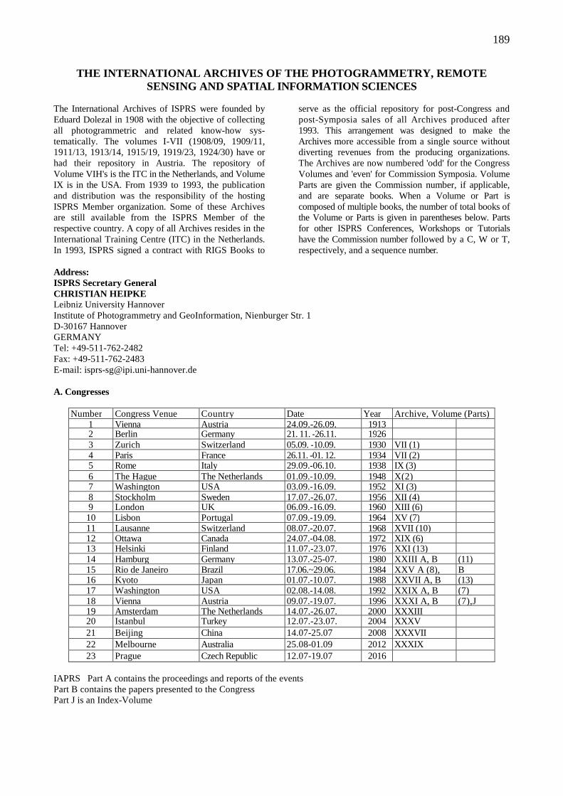
189
THE INTERNATIONAL ARCHIVES OF THE PHOTOGRAMMETRY, R EMOTE SENSING AND SPATIAL INFORMATION SCIENCES
The International Archives of ISPRS were founded by Eduard Dolezal in 1908 with the objective of collecting all photogrammetric and related know-how sys-tematically. The volumes I-VII (1908/09, 1909/11, 1911/13, 1913/14, 1915/19, 1919/23, 1924/30) have or had their repository in Austria. The repository of Volume VIH's is the ITC in the Netherlands, and Volume IX is in the USA. From 1939 to 1993, the publication and distribution was the responsibility of the hosting ISPRS Member organization. Some of these Archives are still available from the ISPRS Member of the respective country. A copy of all Archives resides in the International Training Centre (ITC) in the Netherlands. In 1993, ISPRS signed a contract with RIGS Books to
serve as the official repository for post-Congress and post-Symposia sales of all Archives produced after 1993. This arrangement was designed to make the Archives more accessible from a single source without diverting revenues from the producing organizations. The Archives are now numbered 'odd' for the Congress Volumes and 'even' for Commission Symposia. Volume Parts are given the Commission number, if applicable, and are separate books. When a Volume or Part is composed of multiple books, the number of total books of the Volume or Parts is given in parentheses below. Parts for other ISPRS Conferences, Workshops or Tutorials have the Commission number followed by a C, W or T, respectively, and a sequence number.
Address: ISPRS Secretary General CHRISTIAN HEIPKE Leibniz University Hannover Institute of Photogrammetry and GeoInformation, Nienburger Str. 1 D-30167 Hannover GERMANY Tel: +49-511-762-2482 Fax: +49-511-762-2483 E-mail: [email protected] A. Congresses
Number Congress Venue Country Date Year Archive, Volume (Parts) 1 Vienna Austria 24.09.-26.09. 1913 2 Berlin Germany 21. 11. -26.11. 1926 3 Zurich Switzerland 05.09. -10.09. 1930 VII (1) 4 Paris France 26.11. -01. 12. 1934 VII (2) 5 Rome Italy 29.09.-06.10. 1938 IX (3) 6 The Hague The Netherlands 01.09.-10.09. 1948 X(2) 7 Washington USA 03.09.-16.09. 1952 XI (3) 8 Stockholm Sweden 17.07.-26.07. 1956 XII (4) 9 London UK 06.09.-16.09. 1960 XIII (6) 10 Lisbon Portugal 07.09.-19.09. 1964 XV (7) 11 Lausanne Switzerland 08.07.-20.07. 1968 XVII (10) 12 Ottawa Canada 24.07.-04.08. 1972 XIX (6) 13 Helsinki Finland 11.07.-23.07. 1976 XXI (13) 14 Hamburg Germany 13.07.-25-07. 1980 XXIII A, B (11) 15 Rio de Janeiro Brazil 17.06.~29.06. 1984 XXV A (8), B 16 Kyoto Japan 01.07.-10.07. 1988 XXVII A, B (13) 17 Washington USA 02.08.-14.08. 1992 XXIX A, B (7) 18 Vienna Austria 09.07.-19.07. 1996 XXXI A, B (7),J 19 Amsterdam The Netherlands 14.07.-26.07. 2000 XXXIII 20 Istanbul
. Turkey 12.07.-23.07. 2004 XXXV
21 Beijing China 14.07-25.07 2008 XXXVII 22 Melbourne Australia 25.08-01.09 2012 XXXIX
23 Prague Czech Republic 12.07-19.07 2016 IAPRS Part A contains the proceedings and reports of the events Part B contains the papers presented to the Congress Part J is an Index-Volume
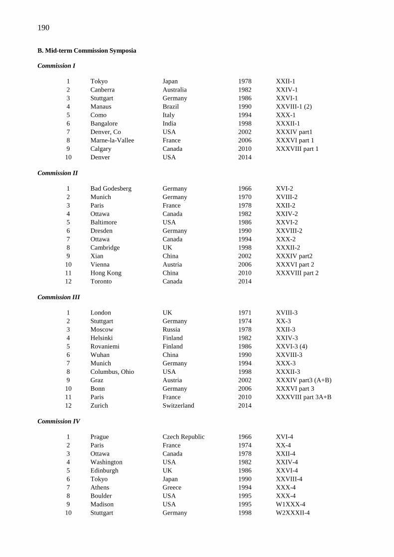
190
B. Mid-term Commission Symposia Commission I
1 Tokyo Japan 1978 XXII-1 2 Canberra Australia 1982 XXIV-1 3 Stuttgart Germany 1986 XXVI-1 4 Manaus Brazil 1990 XXVIII-1 (2) 5 Como Italy 1994 XXX-1 6 Bangalore India 1998 XXXII-1 7 Denver, Co USA 2002 XXXIV part1 8 Marne-la-Vallee France 2006 XXXVI part 1 9 Calgary Canada 2010 XXXVIII part 1 10 Denver USA 2014
Commission II
1 Bad Godesberg Germany 1966 XVI-2 2 Munich Germany 1970 XVIII-2 3 Paris France 1978 XXII-2 4 Ottawa Canada 1982 XXIV-2 5 Baltimore USA 1986 XXVI-2 6 Dresden Germany 1990 XXVIII-2 7 Ottawa Canada 1994 XXX-2 8 Cambridge UK 1998 XXXII-2 9 Xian China 2002 XXXIV part2 10 Vienna Austria 2006 XXXVI part 2 11 Hong Kong China 2010 XXXVIII part 2 12 Toronto Canada 2014
Commission III
1 London UK 1971 XVIII-3 2 Stuttgart Germany 1974 XX-3 3 Moscow Russia 1978 XXII-3 4 Helsinki Finland 1982 XXIV-3 5 Rovaniemi Finland 1986 XXVI-3 (4) 6 Wuhan China 1990 XXVIII-3 7 Munich Germany 1994 XXX-3 8 Columbus, Ohio USA 1998 XXXII-3 9 Graz Austria 2002 XXXIV part3 (A+B) 10 Bonn Germany 2006 XXXVI part 3 11 Paris France 2010 XXXVIII part 3A+B 12 Zurich Switzerland 2014
Commission IV
1 Prague Czech Republic 1966 XVI-4 2 Paris France 1974 XX-4 3 Ottawa Canada 1978 XXII-4 4 Washington USA 1982 XXIV-4 5 Edinburgh UK 1986 XXVI-4 6 Tokyo Japan 1990 XXVIII-4 7 Athens Greece 1994 XXX-4 8 Boulder USA 1995 XXX-4 9 Madison USA 1995 W1XXX-4 10 Stuttgart Germany 1998 W2XXXII-4
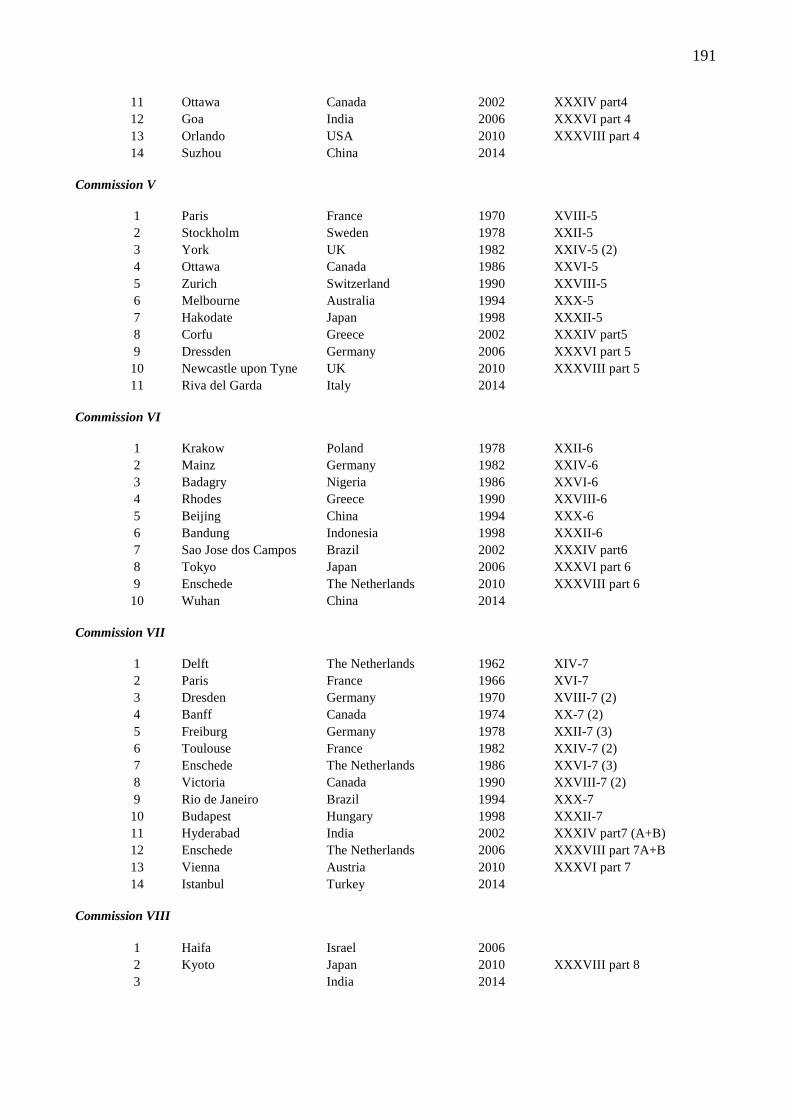
191
11 Ottawa Canada 2002 XXXIV part4 12 Goa India 2006 XXXVI part 4 13 Orlando USA 2010 XXXVIII part 4 14 Suzhou China 2014
Commission V
1 Paris France 1970 XVIII-5 2 Stockholm Sweden 1978 XXII-5 3 York UK 1982 XXIV-5 (2) 4 Ottawa Canada 1986 XXVI-5 5 Zurich Switzerland 1990 XXVIII-5 6 Melbourne Australia 1994 XXX-5 7 Hakodate Japan 1998 XXXII-5 8 Corfu Greece 2002 XXXIV part5 9 Dressden Germany 2006 XXXVI part 5 10 Newcastle upon Tyne UK 2010 XXXVIII part 5 11 Riva del Garda Italy 2014
Commission VI
1 Krakow Poland 1978 XXII-6 2 Mainz Germany 1982 XXIV-6 3 Badagry Nigeria 1986 XXVI-6 4 Rhodes Greece 1990 XXVIII-6 5 Beijing China 1994 XXX-6 6 Bandung Indonesia 1998 XXXII-6 7 Sao Jose dos Campos Brazil 2002 XXXIV part6 8 Tokyo Japan 2006 XXXVI part 6 9 Enschede The Netherlands 2010 XXXVIII part 6 10 Wuhan China 2014
Commission VII
1 Delft The Netherlands 1962 XIV-7 2 Paris France 1966 XVI-7 3 Dresden Germany 1970 XVIII-7 (2) 4 Banff Canada 1974 XX-7 (2) 5 Freiburg Germany 1978 XXII-7 (3) 6 Toulouse France 1982 XXIV-7 (2) 7 Enschede The Netherlands 1986 XXVI-7 (3) 8 Victoria Canada 1990 XXVIII-7 (2) 9 Rio de Janeiro Brazil 1994 XXX-7 10 Budapest Hungary 1998 XXXII-7 11 Hyderabad India 2002 XXXIV part7 (A+B) 12 Enschede The Netherlands 2006 XXXVIII part 7A+B 13 Vienna Austria 2010 XXXVI part 7 14 Istanbul Turkey 2014
Commission VIII
1 Haifa Israel 2006 2 Kyoto Japan 2010 XXXVIII part 8 3 India 2014
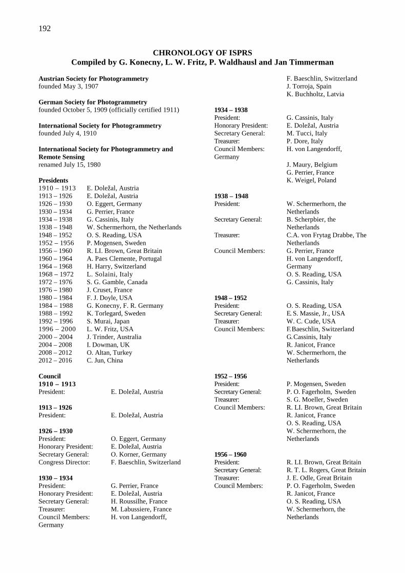
192
CHRONOLOGY OF ISPRS Compiled by G. Konecny, L. W. Fritz, P. Waldhausl and Jan Timmerman
Austrian Society for Photogrammetry founded May 3, 1907 German Society for Photogrammetry founded October 5, 1909 (officially certified 1911) International Society for Photogrammetry founded July 4, 1910 International Society for Photogrammetry and Remote Sensing renamed July 15, 1980 Presidents 1910 – 1913 E. Doležal, Austria 1913 – 1926 E. Doležal, Austria 1926 – 1930 O. Eggert, Germany 1930 – 1934 G. Perrier, France 1934 – 1938 G. Cassinis, Italy 1938 – 1948 W. Schermerhorn, the Netherlands 1948 – 1952 O. S. Reading, USA 1952 – 1956 P. Mogensen, Sweden 1956 – 1960 R. LI. Brown, Great Britain 1960 – 1964 A. Paes Clemente, Portugal 1964 – 1968 H. Harry, Switzerland 1968 – 1972 L. Solaini, Italy 1972 – 1976 S. G. Gamble, Canada 1976 – 1980 J. Cruset, France 1980 – 1984 F. J. Doyle, USA 1984 – 1988 G. Konecny, F. R. Germany 1988 – 1992 K. Torlegard, Sweden 1992 – 1996 S. Murai, Japan 1996 – 2000 L. W. Fritz, USA 2000 – 2004 J. Trinder, Australia 2004 – 2008 I. Dowman, UK 2008 – 2012 O. Altan, Turkey 2012 – 2016 C. Jun, China Council 1910 – 1913 President: E. Doležal, Austria 1913 – 1926 President: E. Doležal, Austria 1926 – 1930 President: O. Eggert, Germany Honorary President: E. Doležal, Austria Secretary General: O. Korner, Germany Congress Director: F. Baeschlin, Switzerland 1930 – 1934 President: G. Perrier, France Honorary President: E. Doležal, Austria Secretary General: H. Roussilhe, France Treasurer: M. Labussiere, France Council Members: H. von Langendorff, Germany
F. Baeschlin, Switzerland J. Torroja, Spain K. Buchholtz, Latvia 1934 – 1938 President: G. Cassinis, Italy Honorary President: E. Doležal, Austria Secretary General: M. Tucci, Italy Treasurer: P. Dore, Italy Council Members: H. von Langendorff, Germany J. Maury, Belgium G. Perrier, France K. Weigel, Poland 1938 – 1948 President: W. Schermerhorn, the Netherlands Secretary General: B. Scherpbier, the Netherlands Treasurer: C.A. von Frytag Drabbe, The Netherlands Council Members: G. Perrier, France H. von Langendorff, Germany O. S. Reading, USA G. Cassinis, Italy 1948 – 1952 President: O. S. Reading, USA Secretary General: E. S. Massie, Jr., USA Treasurer: W. C. Cude, USA Council Members: F. Baeschlin, Switzerland G. Cassinis, Italy R. Janicot, France W. Schermerhorn, the Netherlands 1952 – 1956 President: P. Mogensen, Sweden Secretary General: P. O. Fagerholm, Sweden Treasurer: S. G. Moeller, Sweden Council Members: R. LI. Brown, Great Britain R. Janicot, France O. S. Reading, USA W. Schermerhorn, the Netherlands 1956 – 1960 President: R. LI. Brown, Great Britain Secretary General: R. T. L. Rogers, Great Britain Treasurer: J. E. Odle, Great Britain Council Members: P. O. Fagerholm, Sweden R. Janicot, France O. S. Reading, USA W. Schermerhorn, the Netherlands
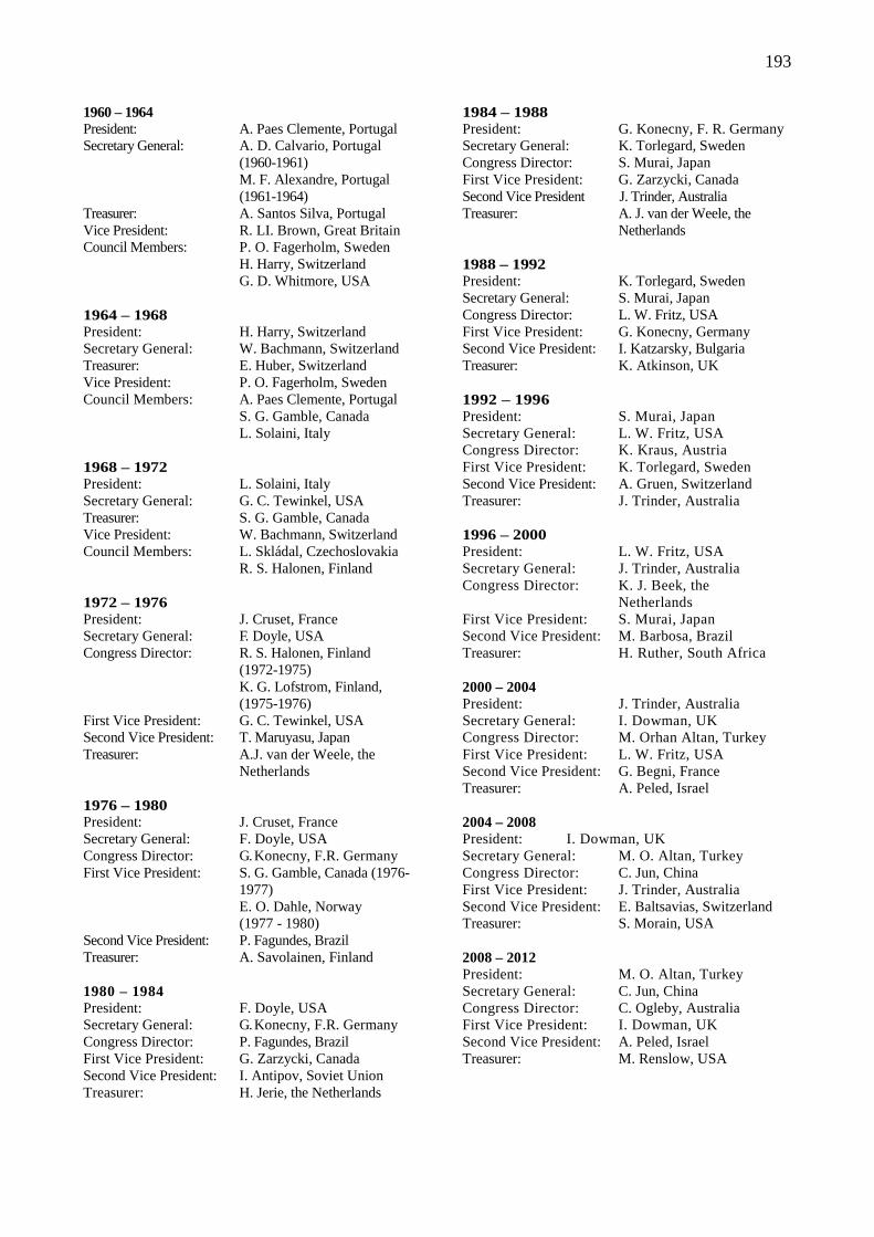
193
1960 – 1964 President: A. Paes Clemente, Portugal Secretary General: A. D. Calvario, Portugal (1960-1961) M. F. Alexandre, Portugal (1961-1964) Treasurer: A. Santos Silva, Portugal Vice President: R. LI. Brown, Great Britain Council Members: P. O. Fagerholm, Sweden H. Harry, Switzerland G. D. Whitmore, USA 1964 – 1968 President: H. Harry, Switzerland Secretary General: W. Bachmann, Switzerland Treasurer: E. Huber, Switzerland Vice President: P. O. Fagerholm, Sweden Council Members: A. Paes Clemente, Portugal S. G. Gamble, Canada L. Solaini, Italy 1968 – 1972 President: L. Solaini, Italy Secretary General: G. C. Tewinkel, USA Treasurer: S. G. Gamble, Canada Vice President: W. Bachmann, Switzerland Council Members: L. Skládal, Czechoslovakia R. S. Halonen, Finland 1972 – 1976 President: J. Cruset, France Secretary General: F. Doyle, USA Congress Director: R. S. Halonen, Finland (1972-1975) K. G. Lofstrom, Finland, (1975-1976) First Vice President: G. C. Tewinkel, USA Second Vice President: T. Maruyasu, Japan Treasurer: A.J. van der Weele, the Netherlands 1976 – 1980 President: J. Cruset, France Secretary General: F. Doyle, USA Congress Director: G. Konecny, F.R. Germany First Vice President: S. G. Gamble, Canada (1976- 1977) E. O. Dahle, Norway (1977 - 1980) Second Vice President: P. Fagundes, Brazil Treasurer: A. Savolainen, Finland 1980 – 1984 President: F. Doyle, USA Secretary General: G. Konecny, F.R. Germany Congress Director: P. Fagundes, Brazil First Vice President: G. Zarzycki, Canada Second Vice President: I. Antipov, Soviet Union Treasurer: H. Jerie, the Netherlands
1984 – 1988 President: G. Konecny, F. R. Germany Secretary General: K. Torlegard, Sweden Congress Director: S. Murai, Japan First Vice President: G. Zarzycki, Canada Second Vice President J. Trinder, Australia Treasurer: A. J. van der Weele, the Netherlands 1988 – 1992 President: K. Torlegard, Sweden Secretary General: S. Murai, Japan Congress Director: L. W. Fritz, USA First Vice President: G. Konecny, Germany Second Vice President: I. Katzarsky, Bulgaria Treasurer: K. Atkinson, UK 1992 – 1996 President: S. Murai, Japan Secretary General: L. W. Fritz, USA Congress Director: K. Kraus, Austria First Vice President: K. Torlegard, Sweden Second Vice President: A. Gruen, Switzerland Treasurer: J. Trinder, Australia 1996 – 2000 President: L. W. Fritz, USA Secretary General: J. Trinder, Australia Congress Director: K. J. Beek, the Netherlands First Vice President: S. Murai, Japan Second Vice President: M. Barbosa, Brazil Treasurer: H. Ruther, South Africa 2000 – 2004 President: J. Trinder, Australia Secretary General: I. Dowman, UK Congress Director: M. Orhan Altan, Turkey First Vice President: L. W. Fritz, USA Second Vice President: G. Begni, France Treasurer: A. Peled, Israel 2004 – 2008 President: I. Dowman, UK Secretary General: M. O. Altan, Turkey Congress Director: C. Jun, China First Vice President: J. Trinder, Australia Second Vice President: E. Baltsavias, Switzerland Treasurer: S. Morain, USA 2008 – 2012 President: M. O. Altan, Turkey Secretary General: C. Jun, China Congress Director: C. Ogleby, Australia First Vice President: I. Dowman, UK Second Vice President: A. Peled, Israel Treasurer: M. Renslow, USA
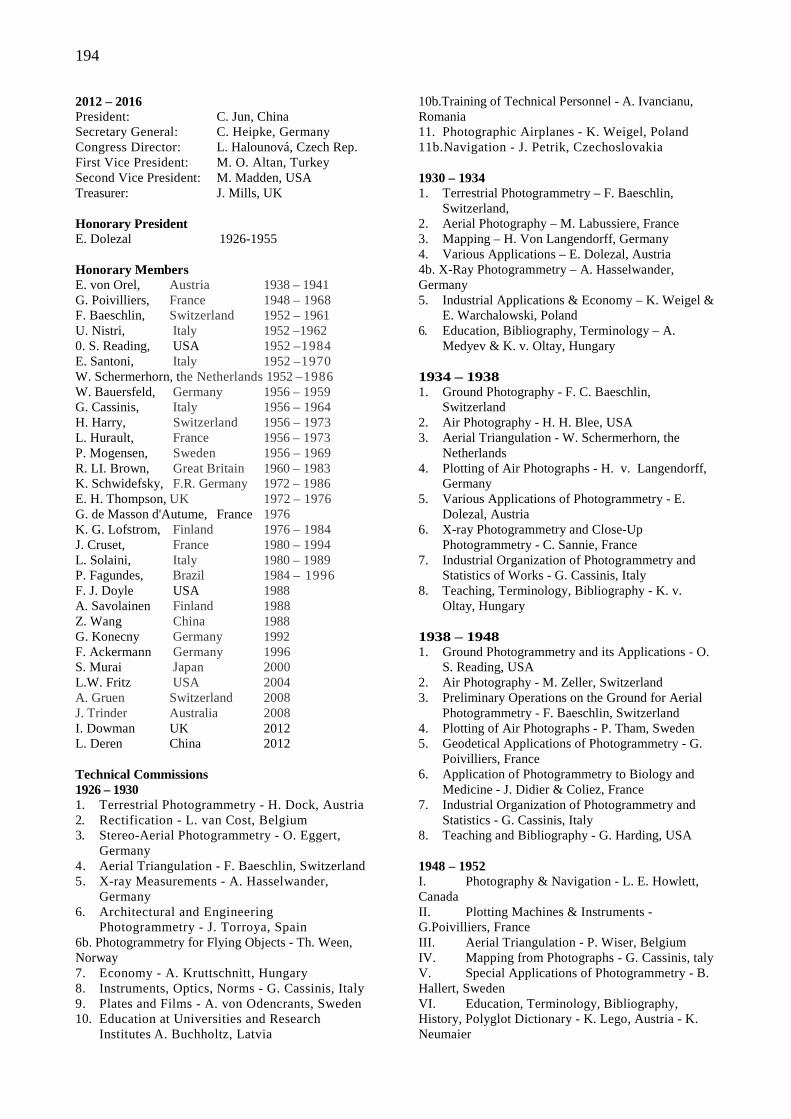
194
2012 – 2016 President: C. Jun, China Secretary General: C. Heipke, Germany Congress Director: L. Halounová, Czech Rep. First Vice President: M. O. Altan, Turkey Second Vice President: M. Madden, USA Treasurer: J. Mills, UK Honorary President E. Dolezal 1926-1955 Honorary Members E. von Orel, Austria 1938 – 1941 G. Poivilliers, France 1948 – 1968 F. Baeschlin, Switzerland 1952 – 1961 U. Nistri, Italy 1952 –1962 0. S. Reading, USA 1952 –1984 E. Santoni, Italy 1952 –1970 W. Schermerhorn, the Netherlands 1952 –1986 W. Bauersfeld, Germany 1956 – 1959 G. Cassinis, Italy 1956 – 1964 H. Harry, Switzerland 1956 – 1973 L. Hurault, France 1956 – 1973 P. Mogensen, Sweden 1956 – 1969 R. LI. Brown, Great Britain 1960 – 1983 K. Schwidefsky, F.R. Germany 1972 – 1986 E. H. Thompson, UK 1972 – 1976 G. de Masson d'Autume, France 1976 K. G. Lofstrom, Finland 1976 – 1984 J. Cruset, France 1980 – 1994 L. Solaini, Italy 1980 – 1989 P. Fagundes, Brazil 1984 – 1996 F. J. Doyle USA 1988 A. Savolainen Finland 1988 Z. Wang China 1988 G. Konecny Germany 1992 F. Ackermann Germany 1996 S. Murai Japan 2000 L.W. Fritz USA 2004 A. Gruen Switzerland 2008 J. Trinder Australia 2008 I. Dowman UK 2012 L. Deren China 2012 Technical Commissions 1926 – 1930 1. Terrestrial Photogrammetry - H. Dock, Austria 2. Rectification - L. van Cost, Belgium 3. Stereo-Aerial Photogrammetry - O. Eggert,
Germany 4. Aerial Triangulation - F. Baeschlin, Switzerland 5. X-ray Measurements - A. Hasselwander,
Germany 6. Architectural and Engineering
Photogrammetry - J. Torroya, Spain 6b. Photogrammetry for Flying Objects - Th. Ween, Norway 7. Economy - A. Kruttschnitt, Hungary 8. Instruments, Optics, Norms - G. Cassinis, Italy 9. Plates and Films - A. von Odencrants, Sweden 10. Education at Universities and Research
Institutes A. Buchholtz, Latvia
10b.Training of Technical Personnel - A. Ivancianu, Romania 11. Photographic Airplanes - K. Weigel, Poland 11b.Navigation - J. Petrik, Czechoslovakia 1930 – 1934 1. Terrestrial Photogrammetry – F. Baeschlin,
Switzerland, 2. Aerial Photography – M. Labussiere, France 3. Mapping – H. Von Langendorff, Germany 4. Various Applications – E. Dolezal, Austria 4b. X-Ray Photogrammetry – A. Hasselwander, Germany 5. Industrial Applications & Economy – K. Weigel &
E. Warchalowski, Poland 6. Education, Bibliography, Terminology – A.
Medyev & K. v. Oltay, Hungary 1934 – 1938 1. Ground Photography - F. C. Baeschlin,
Switzerland 2. Air Photography - H. H. Blee, USA 3. Aerial Triangulation - W. Schermerhorn, the
Netherlands 4. Plotting of Air Photographs - H. v. Langendorff,
Germany 5. Various Applications of Photogrammetry - E.
Dolezal, Austria 6. X-ray Photogrammetry and Close-Up
Photogrammetry - C. Sannie, France 7. Industrial Organization of Photogrammetry and
Statistics of Works - G. Cassinis, Italy 8. Teaching, Terminology, Bibliography - K. v.
Oltay, Hungary 1938 – 1948 1. Ground Photogrammetry and its Applications - O.
S. Reading, USA 2. Air Photography - M. Zeller, Switzerland 3. Preliminary Operations on the Ground for Aerial
Photogrammetry - F. Baeschlin, Switzerland 4. Plotting of Air Photographs - P. Tham, Sweden 5. Geodetical Applications of Photogrammetry - G.
Poivilliers, France 6. Application of Photogrammetry to Biology and
Medicine - J. Didier & Coliez, France 7. Industrial Organization of Photogrammetry and
Statistics - G. Cassinis, Italy 8. Teaching and Bibliography - G. Harding, USA 1948 – 1952 I. Photography & Navigation - L. E. Howlett, Canada II. Plotting Machines & Instruments - G.Poivilliers, France III. Aerial Triangulation - P. Wiser, Belgium IV. Mapping from Photographs - G. Cassinis, taly V. Special Applications of Photogrammetry - B. Hallert, Sweden VI. Education, Terminology, Bibliography, History, Polyglot Dictionary - K. Lego, Austria - K. Neumaier
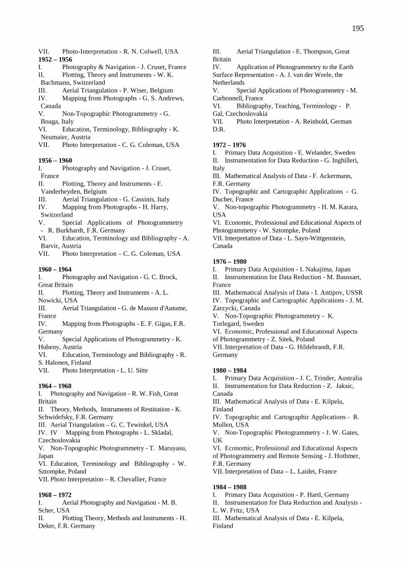
195
VII. Photo-Interpretation - R. N. Colwell, USA 1952 – 1956 I. Photography & Navigation - J. Cruset, France II. Plotting, Theory and Instruments - W. K. Bachmann, Switzerland
III. Aerial Triangulation - P. Wiser, Belgium IV. Mapping from Photographs - G. S. Andrews, Canada
V. Non-Topographic Photogrammetry - G. Boaga, Italy
VI. Education, Terminology, Bibliography - K. Neumaier, Austria
VII. Photo Interpretation - C. G. Coleman, USA 1956 – 1960 I. Photography and Navigation - J. Cruset, France
II. Plotting, Theory and Instruments - F. Vanderheyden, Belgium
III. Aerial Triangulation - G. Cassinis, Italy IV. Mapping from Photographs - H. Harry, Switzerland
V. Special Applications of Photogrammetry - R. Burkhardt, F.R. Germany
VI. Education, Terminology and Bibliography - A. Barvir, Austria
VII. Photo Interpretation – C. G. Coleman, USA 1960 – 1964 I. Photography and Navigation - G. C. Brock, Great Britain II. Plotting, Theory and Instruments - A. L. Nowicki, USA III. Aerial Triangulation - G. de Masson d'Autume, France IV. Mapping from Photographs - E. F. Gigas, F.R. Germany V. Special Applications of Photogrammetry - K. Hubeny, Austria VI. Education, Terminology and Bibliography - R. S. Halonen, Finland VII. Photo Interpretation - L. U. Sitte 1964 – 1968 I. Photography and Navigation - R. W. Fish, Great Britain II. Theory, Methods, Instruments of Restitution - K. Schwidefsky, F.R. Germany III. Aerial Triangulation – G. C. Tewinkel, USA IV. IV Mapping from Photographs - L. Skladal, Czechoslovakia V. Non-Topographic Photogrammetry - T. Maruyasu, Japan VI. Education, Terminology and Bibliography - W. Sztompke, Poland VII. Photo Interpretation – R. Chevallier, France 1968 – 1972 I. Aerial Photography and Navigation - M. B. Scher, USA II. Plotting Theory, Methods and Instruments - H. Deker, F.R. Germany
III. Aerial Triangulation - E. Thompson, Great Britain IV. Application of Photogrammetry to the Earth Surface Representation - A. J. van der Weele, the Netherlands V. Special Applications of Photogrammetry - M. Carbonnell, France VI. Bibliography, Teaching, Terminology - P. Gal, Czechoslovakia VII. Photo Interpretation - A. Reinhold, German D.R. 1972 – 1976 I. Primary Data Acquisition - E. Welander, Sweden II. Instrumentation for Data Reduction - G. Inghilleri, Italy III. Mathematical Analysis of Data - F. Ackermann, F.R. Germany IV. Topographic and Cartographic Applications - G. Ducher, France V. Non-topographic Photogrammetry - H. M. Karara, USA VI. Economic, Professional and Educational Aspects of Photogrammetry - W. Sztompke, Poland VII. Interpretation of Data - L. Sayn-Wittgenstein, Canada 1976 – 1980 I. Primary Data Acquisition - I. Nakajima, Japan II. Instrumentation for Data Reduction - M. Baussart, France III. Mathematical Analysis of Data - I. Antipov, USSR IV. Topographic and Cartographic Applications - J. M. Zarzycki, Canada V. Non-Topographic Photogrammetry - K. Torlegard, Sweden VI. Economic, Professional and Educational Aspects of Photogrammetry - Z. Sitek, Poland VII. Interpretation of Data - G. Hildebrandt, F.R. Germany 1980 – 1984 I. Primary Data Acquisition - J. C. Trinder, Australia II. Instrumentation for Data Reduction - Z. Jaksic, Canada III. Mathematical Analysis of Data - E. Kilpela, Finland IV. Topographic and Cartographic Applications - R. Mullen, USA V. Non-Topographic Photogrammetry - J. W. Gates, UK VI. Economic, Professional and Educational Aspects of Photogrammetry and Remote Sensing - J. Hothmer, F.R. Germany VII. Interpretation of Data – L. Laidet, France 1984 – 1988 I. Primary Data Acquisition - P. Hartl, Germany II. Instrumentation for Data Reduction and Analysis - L. W. Fritz, USA III. Mathematical Analysis of Data - E. Kilpela, Finland
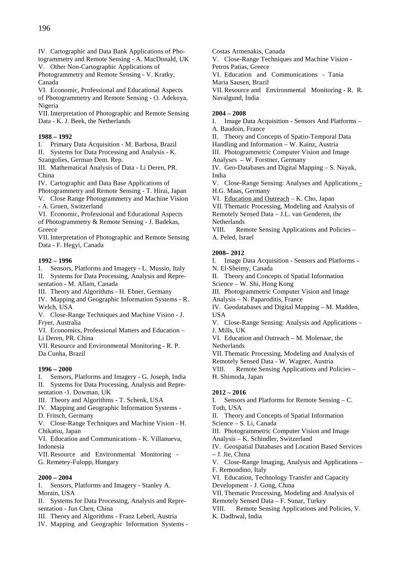
196
IV. Cartographic and Data Bank Applications of Pho-togrammetry and Remote Sensing - A. MacDonald, UK V. Other Non-Cartographic Applications of Photogrammetry and Remote Sensing - V. Kratky, Canada VI. Economic, Professional and Educational Aspects of Photogrammetry and Remote Sensing - O. Adekoya, Nigeria VII. Interpretation of Photographic and Remote Sensing Data - K. J. Beek, the Netherlands 1988 – 1992 I. Primary Data Acquisition - M. Barbosa, Brazil II. Systems for Data Processing and Analysis - K. Szangolies, German Dem. Rep. III. Mathematical Analysis of Data - Li Deren, PR. China IV. Cartographic and Data Base Applications of Photogrammetry and Remote Sensing - T. Hirai, Japan V. Close Range Photogrammetry and Machine Vision - A. Gruen, Switzerland VI. Economic, Professional and Educational Aspects of Photogrammetry & Remote Sensing - J. Badekas, Greece VII. Interpretation of Photographic and Remote Sensing Data - F. Hegyi, Canada 1992 – 1996 I. Sensors, Platforms and Imagery - L. Mussio, Italy II. Systems for Data Processing, Analysis and Repre-sentation - M. Allam, Canada III. Theory and Algorithms - H. Ebner, Germany IV. Mapping and Geographic Information Systems - R. Welch, USA V. Close-Range Techniques and Machine Vision - J. Fryer, Australia VI. Economics, Professional Matters and Education – Li Deren, PR. China VII. Resource and Environmental Monitoring - R. P. Da Cunha, Brazil 1996 – 2000 I. Sensors, Platforms and Imagery - G. Joseph, India II. Systems for Data Processing, Analysis and Repre-sentation -1. Dowman, UK III. Theory and Algorithms - T. Schenk, USA IV. Mapping and Geographic Information Systems - D. Fritsch, Germany V. Close-Range Techniques and Machine Vision - H. Chikatsu, Japan VI. Education and Communications - K. Villanueva, Indonesia VII. Resource and Environmental Monitoring - G. Remetey-Fulopp, Hungary 2000 – 2004 I. Sensors, Platforms and Imagery - Stanley A. Morain, USA II. Systems for Data Processing, Analysis and Repre-sentation - Jun Chen, China III. Theory and Algorithms - Franz Leberl, Austria IV. Mapping and Geographic Information Systems -
Costas Armenakis, Canada V. Close-Range Techniques and Machine Vision - Petros Patias, Greece VI. Education and Communications - Tania Maria Sausen, Brazil VII. Resource and Environmental Monitoring - R. R. Navalgund, India 2004 – 2008 I. Image Data Acquisition - Sensors And Platforms – A. Baudoin, France II. Theory and Concepts of Spatio-Temporal Data Handling and Information – W. Kainz, Austria III. Photogrammetric Computer Vision and Image Analyses – W. Forstner, Germany IV. Geo-Databases and Digital Mapping – S. Nayak, India V. Close-Range Sensing: Analyses and Applications - H.G. Maas, Germany VI. Education and Outreach – K. Cho, Japan VII. Thematic Processing, Modeling and Analysis of Remotely Sensed Data – J.L. van Genderen, the Netherlands VIII. Remote Sensing Applications and Policies – A. Peled, Israel 2008– 2012 I. Image Data Acquisition - Sensors and Platforms – N. El-Sheimy, Canada II. Theory and Concepts of Spatial Information Science – W. Shi, Hong Kong III. Photogrammetric Computer Vision and Image Analysis – N. Paparoditis, France IV. Geodatabases and Digital Mapping – M. Madden, USA V. Close-Range Sensing: Analysis and Applications –J. Mills, UK VI. Education and Outreach – M. Molenaar, the Netherlands VII. Thematic Processing, Modeling and Analysis of Remotely Sensed Data - W. Wagner, Austria VIII. Remote Sensing Applications and Policies – H. Shimoda, Japan 2012 – 2016 I. Sensors and Platforms for Remote Sensing – C. Toth, USA II. Theory and Concepts of Spatial Information Science – S. Li, Canada III. Photogrammetric Computer Vision and Image Analysis – K. Schindler, Switzerland IV. Geospatial Databases and Location Based Services – J. Jie, Chına V. Close-Range Imaging, Analysis and Applications – F. Remondino, Italy VI. Education, Technology Transfer and Capacity Development - J. Gong, Chına VII. Thematic Processing, Modeling and Analysis of Remotely Sensed Data – F. Sunar, Turkey VIII. Remote Sensing Applications and Policies, V. K. Dadhwal, India
197
ISPRS 2012
ISPRS COMMITTEES
The International Policy Advisory Committee (IPAC)
The International Science Advisory Committee (ISAC)
The International Committee on Remote Sensing of Environment (ICORSE)
International Committee for Architectural Photogram metry (CIPA)
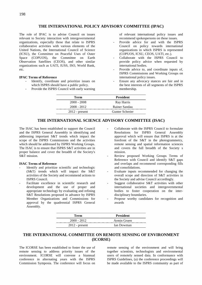
198
THE INTERNATIONAL POLICY ADVISORY COMMITTEE (IPAC) The role of IPAC is to advise Council on issues relevant to Society interaction with intergovernmental organizations, especially those that relate to ISPRS collaborative activities with various elements of the United Nations, the International Council of Science (ICSU), the Committee on Peaceful Uses of Outer Space (COPUOS), the Committee on Earth Observation Satellites (CEOS), and other similar organizations such as UATI, IUSS, ISO, World Bank, etc. IPAC Terms of Reference
- Identify, coordinate and prioritize issues on which ISPRS should have a public policy.
- Provide the ISPRS Council with early warning
of relevant international policy issues and recommend spokespersons on these issues.
- Provide advice for and with the ISPRS Council on policy towards international organizations in which ISPRS is represented (COPUOS, ICSU, CEOS, UATI, etc.).
- Collaborate with the ISPRS Council to provide policy advice when requested by international bodies.
- Provide advice to, and coordinate inputs of, ISPRS Commissions and Working Groups on international policy issues.
- Ensure any advocacy stances are fair and in the best interests of all segments of the ISPRS membership.
Term President
2000 - 2008 Ray Harris 2008 - 2012 Rainer Sandau
2012 - present Gunter Schreier
THE INTERNATIONAL SCIENCE ADVISORY COMMITTEE (ISAC) The ISAC has been established to support the Council and the ISPRS General Assembly in identifying and addressing important S&T trends which impact the scope of the ISPRS Commissions and the activities which should be addressed by ISPRS Working Groups. The ISAC is to ensure that ISPRS S&T activities are in proper balance and cover the breadth of the Society's S&T mission. ISAC Terms of Reference - Identify and prioritize scientific and technologic
(S&T) trends which will impact the S&T activities of the Society and recommend actions to ISPRS Council.
- Facilitate excellence in scientific research and development and the use of proper and appropriate technology by evaluating and refining S&T Resolutions proposed in advance by ISPRS Member Organizations and Commissions for approval by the quadrennial ISPRS General Assembly.
- Collaborate with the ISPRS Council to formulate Resolutions for ISPRS General Assembly approval which will ensure that ISPRS is at the forefront of the S&T in the photogrammetry, remote sensing and spatial information sciences and covers the full breadth of the Society s mission.
- Review proposed Working Groups Terms of Reference with Council and identify S&T gaps and overlaps and recommend corresponding fills and consolidations.
- Evaluate inputs recommended for changing the overall scope and direction of S&T activities in the Society and advise Council accordingly.
- Suggest collaborative S&T activities with other international societies and intergovernmental bodies to foster cooperation on the inter-disciplinary boundaries.
- Propose worthy candidates for recognition and awards
Term President
2000 - 2012 Armin Gruen 2012 - present Ian Dowman
THE INTERNATIONAL COMMITTEE ON REMOTE SENSING OF EN VIRONMENT
(ICORSE)
The ICORSE has been established to foster the use of remote sensing to address priority issues of the environment. ICORSE will convene a biannual conference in alternating years with the ISPRS Commission Symposia. The conference will focus on
remote sensing of the environment and will bring together scientists, technologists and environmental users of remotely sensed data. In conformance with ISPRS Guidelines, (a) the conference proceedings will be made available to the ISPRS community as part of
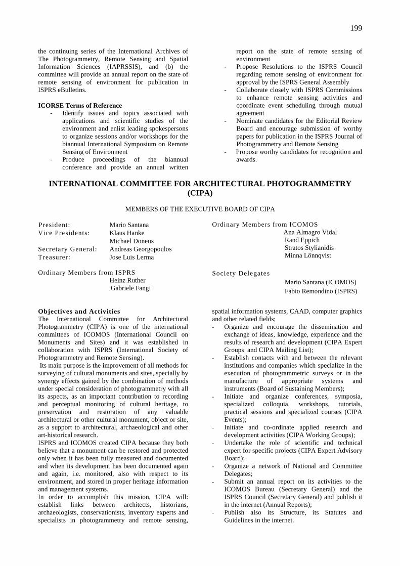
199
the continuing series of the International Archives of The Photogrammetry, Remote Sensing and Spatial Information Sciences (IAPRSSIS), and (b) the committee will provide an annual report on the state of remote sensing of environment for publication in ISPRS eBulletins. ICORSE Terms of Reference
- Identify issues and topics associated with applications and scientific studies of the environment and enlist leading spokespersons to organize sessions and/or workshops for the biannual International Symposium on Remote Sensing of Environment
- Produce proceedings of the biannual conference and provide an annual written
report on the state of remote sensing of environment
- Propose Resolutions to the ISPRS Council regarding remote sensing of environment for approval by the ISPRS General Assembly
- Collaborate closely with ISPRS Commissions to enhance remote sensing activities and coordinate event scheduling through mutual agreement
- Nominate candidates for the Editorial Review Board and encourage submission of worthy papers for publication in the ISPRS Journal of Photogrammetry and Remote Sensing
- Propose worthy candidates for recognition and awards.
INTERNATIONAL COMMITTEE FOR ARCHITECTURAL PHOTOGRAM METRY
(CIPA)
MEMBERS OF THE EXECUTIVE BOARD OF CIPA President: Mario Santana Vice Presidents: Klaus Hanke
Michael Doneus Secretary General: Andreas Georgopoulos Treasurer: Jose Luis Lerma Ordinary Members from ISPRS Heinz Ruther
Gabriele Fangi
Ordinary Members from ICOMOS Ana Almagro Vidal
Rand Eppich Stratos Stylianidis Minna Lönnqvist
Society Delegates
Mario Santana (ICOMOS) Fabio Remondino (ISPRS)
Objectives and Activities The International Committee for Architectural Photogrammetry (CIPA) is one of the international committees of ICOMOS (International Council on Monuments and Sites) and it was established in collaboration with ISPRS (International Society of Photogrammetry and Remote Sensing). Its main purpose is the improvement of all methods for surveying of cultural monuments and sites, specially by synergy effects gained by the combination of methods under special consideration of photogrammetry with all its aspects, as an important contribution to recording and perceptual monitoring of cultural heritage, to preservation and restoration of any valuable architectural or other cultural monument, object or site, as a support to architectural, archaeological and other art-historical research. ISPRS and ICOMOS created CIPA because they both believe that a monument can be restored and protected only when it has been fully measured and documented and when its development has been documented again and again, i.e. monitored, also with respect to its environment, and stored in proper heritage information and management systems. In order to accomplish this mission, CIPA will: establish links between architects, historians, archaeologists, conservationists, inventory experts and specialists in photogrammetry and remote sensing,
spatial information systems, CAAD, computer graphics and other related fields; - Organize and encourage the dissemination and
exchange of ideas, knowledge, experience and the results of research and development (CIPA Expert Groups and CIPA Mailing List);
- Establish contacts with and between the relevant institutions and companies which specialize in the execution of photogrammetric surveys or in the manufacture of appropriate systems and instruments (Board of Sustaining Members);
- Initiate and organize conferences, symposia, specialized colloquia, workshops, tutorials, practical sessions and specialized courses (CIPA Events);
- Initiate and co-ordinate applied research and development activities (CIPA Working Groups);
- Undertake the role of scientific and technical expert for specific projects (CIPA Expert Advisory Board);
- Organize a network of National and Committee Delegates;
- Submit an annual report on its activities to the ICOMOS Bureau (Secretary General) and the ISPRS Council (Secretary General) and publish it in the internet (Annual Reports);
- Publish also its Structure, its Statutes and Guidelines in the internet.
200
ISPRS
2012
LEGISLATIVE DOCUMENTS
Statutes
Bylaws
Award Policy
The Brock Gold Medal Award
The Otto von Gruber Award
The Samuel Gamble Award
The Schwidefsky Medal
The Schermerhorn Award
The Eduard Dolezal Award
The U.V. Helava Award
The Wang Zhizhuo Award
The Giuseppe Inghilleri Award
The Karl Kraus Medal
The Frederick J Doyle Award
Guidelines - Candidates for Members of Council
Guidelines - Members Planning to Host an ISPRS Congress
Guidelines for Hosting a Technical Commission
Guidelines for Conducting a Working Group
Guidelines for Isprs Financial Commission
Terms of Reference for Sustaining Members
201
STATUTES
INTERNATIONAL SOCIETY FOR
PHOTOGRAMMETRY AND REMOTE SENSING
STATUTE I - Name and Mission The International Society for Photogrammetry and Remote Sensing (hereinafter referred to as the Society) which was founded in Vienna, Austria in 1910 as 'Internationale Gesellschaft für Photogrammetrie', is a non-governmental international organization, devoted to the development of international cooperation for the advancement of knowledge, research, development, education and training in the photogrammetry, remote sensing and spatial information sciences, their integration and applications, to contribute to the well-being of humanity and the sustainability of the environment. STATUTE II - Definitions Photogrammetry and Remote Sensing is the art, science, and technology of obtaining reliable information from non-contact imaging and other sensor systems about the Earth and its environment, and other physical objects and processes through recording, measuring, analyzing and representation. Spatial Information Science is the art, science, and technology of obtaining reliable spatial, spectral and temporal relationships between physical objects, and of processes for integration with other data for analysis, portrayal and representation, independently of scale. STATUTE III - Qualifications The Society pursues its aims without any discrimination on grounds of race, religion, nationality, or political philosophy. STATUTE IV - Activities To achieve its aims, the Society shall: (a) facilitate excellence in research and development
and the proper use of appropriate technology in the photogrammetry, remote sensing and spatial information sciences, as well as the development of standards;
(b) initiate and coordinate research in the fields of the photogrammetry, remote sensing and spatial information sciences by creating Technical Commissions and Working Groups concerned with pertinent aspects of the photogrammetry, remote sensing and spatial information sciences;
(c) convene international Congresses, symposia and other meetings, with lectures, communications, discussions, and as appropriate, tutorials, exhibitions, technical visits, and social events;
(d) ensure wide international circulation of the results of research and the records of discussion by the publication of The International Archives and (peer-
reviewed) Annals of the Photogrammetry, Remote Sensing and Spatial Information Sciences, which shall form the record of Congresses and Symposia, and other scientific meetings of the Society;
(e) publish and circulate international journals, a bulletin, and other communications relevant to the interest of the Society and the community at large;
(f) stimulate the formation of national and regional Societies of the photogrammetry, remote sensing and spatial information sciences and promote exchanges between such Societies;
(g) encourage interaction of the Society and its members with the community at large, including the publication and exchange of scientific papers and journals by, and among, its national and regional Societies;
(h) encourage recognition and administer awards to honor the achievements of individuals or groups.
(i) represent the photogrammetry, remote sensing and spatial information sciences in relevant international forums;
(j) promote and facilitate education, training, and technology transfer of the photogrammetry, remote sensing and spatial information sciences;
(k) promote other appropriate actions to enhance the Society's mission.
STATUTE V - Cooperation with Other International Organizations The Society should cooperate with: (a) international and regional institutions or
organizations concerned with photogrammetry, remote sensing, image analysis, spatial information sciences, land survey, geodesy, cartography, and other relevant disciplines;
(b) inter-governmental bodies of the United Nations and other relevant, international policy-making organizations.
STATUTE VI - Membership The types of membership in the Society are: - Ordinary Members - Associate Members - Regional Members - Sustaining Members - Honorary Members - Fellows - Individual Members 1. An Ordinary Member shall be the single
organization of a country, or a geographic region thereof having an independent budget, which should represent the whole community of
202
photogrammetry, remote sensing and spatial information specialists in the country or region. (a) An Ordinary Member shall be responsible to the
Society for the proper discharge of all the duties of membership including specifically: - participating in the scientific work of the
Society, including active participation in Working Groups and Commissions;
- prompt payment of Membership subscription fee;
- actively participating in the decisions of the General Assembly;
- appointing Correspondents to the Technical Commissions and registering them with the Secretary General;
- striving to provide equitable national representation for all photogrammetric, remote sensing and spatial information specialists in its country or region;
- serving as national focal point for distribution of ISPRS information to their members;
- submitting periodic reports and news for publication in the Society's bulletin, and producing a quadrennial report for the Congress;
- demonstrating active representation of the whole of their membership in their country or region;
- encouraging interdisciplinary cooperation in scientific and technologic activities, and establishing links with relevant groups;
- forming journals and registering them with the Secretary General.
(b) Normally the Ordinary Member organization of a country shall be a national, formally constituted, representational Society. In the absence of such a Society the Ordinary Member may be: - an association of societies each having the
advancement of the photogrammetry, remote sensing and spatial information sciences among its principal objectives;
- the principal Scientific Academy of a country or its National Research Council;
- or failing these, any other institution or association of institutions whether governmental or non-governmental concerned with the sciences of photogrammetry, remote sensing and spatial information.
(c) Different categories of Ordinary Members shall be established to reflect the use of the photogrammetry, remote sensing and spatial information sciences, and the number of specialists in the organization.
2. An Associate Member shall be an organization
which represents a community of photogrammetrists and/or remote sensing specialists and/or spatial information specialists in a country, and which has a strong interest in participating in
the Society's affairs, and which is not represented by the Ordinary Member organization of the country. An Associate Member shall be responsible to the Society for the proper discharge of all the duties of membership including specifically: - participating in the scientific work of the Society,
including active participation in Working Groups and Commissions;
- prompt payment of Membership subscription fee; - promoting ISPRS activities; - participating in the discussions of the General
Assembly; - serving as a focal point for distribution of ISPRS
information to their members; - submitting periodic reports and news for
publication in the Society's bulletin; - stimulating the establishment of appropriate
means of communication. 3. A Regional Member shall be a multi-national
association of photogrammetry and/or remote sensing and/or spatial information science organizations established for the purpose of considering questions of common interest, promoting regional cooperation, convening regional conferences, etc.
4. Sustaining Members contribute to the financial support of the Society and shall be individuals, organizations, institutions, or agencies who provide hardware, software, systems and/or services, in the fields of photogrammetry and/or remote sensing and/or spatial information, and/or who are engaged in research and/or education and training.
5. Honorary Members. In recognition of
distinguished services to the ISPRS and its aims, an individual may be elected an Honorary Member of the Society.
6. Fellows. In recognition of sustained, excellent
service to the ISPRS and its aims, an individual may be elected as a Fellow of the Society.
7. Individual Members. Individuals who wish to be
involved with the activities and mission of the Society.
STATUTE VII - Organization and Administration The direction and management of the Society, including the conduct of its technical and scientific program, shall be undertaken through the following components: the Congress, the General Assembly, the Council, the Financial Commission, the Technical Commissions and the Sustaining Members Committee.
STATUTE VIII - Officers 1. The Officers of the Society shall be the President of
the Society, the other Members of the Council and

203
the Presidents of Technical Commissions. 2. The Officers shall serve from the termination of the
Congress at which they are elected or appointed until the completion of the next ensuing Congress.
STATUTE IX - Congress 1. The Congress shall consist of all photogrammetry,
remote sensing and spatial information specialists in attendance.
2. The Congress shall normally meet every four years. 3. The Congress shall be convened in plenary session
at least twice during the course of each Congress.
STATUTE X - General Assembly 1. The General Assembly shall be the supreme
authority of the Society for all decisions. It shall determine the general policy of the Society.
2. The General Assembly shall consist of the Delegates appointed by the Ordinary Members to represent them, each Ordinary Member being represented by one Delegate.
3. Delegates, Members of Council, Members of the Financial Commission, Honorary Members of the Society, Representatives of the Associate Members and Regional Members, and two Advisors per Delegate shall have the right to attend the meetings of the General Assembly.
STATUTE XI - Council 1. The Council shall consist of six individuals:
- The President of the Society - The Director of the Congress - The First Vice-President - The Secretary General - The Second Vice-President - The Treasurer
2. The General Assembly may appoint up to three Regional Representatives, from separate regions, to assist Council to coordinate activities in regions not already represented on the Council. The Regional Representatives shall be invited to attend Council Meetings as appropriate.
3. The Council shall conduct the affairs of the Society in the interval between meetings of the General Assembly in accordance with the Statutes and Bylaws and with the decisions and directives of the General Assembly and of Congress.
4. The Council shall be answerable to the General Assembly for management of Society affairs and shall guide the conduct of the General Assembly.
5. The Council shall assist the President to coordinate and guide the activities of the Technical Commissions.
6. Between meetings of the General Assembly the Council may consult Members by correspondence or otherwise.
7. The responsibilities of the members of Council are defined in the Bylaws.
STATUTE XII - Headquarters The headquarters of the Society shall be designated by the Council. STATUTE XIII - Technical Commissions 1. The scientific work of the Society shall be the
responsibility of its Technical Commissions and shall be guided by Resolutions approved by the General Assembly.
2. Responsibility for the work of each Technical Commission during the interval between two successive Congresses shall be entrusted by the General Assembly to one of the Ordinary Members or to a number of Ordinary Members who have agreed to collaborate.
3. The work of each Commission should be conducted by the Commission Board consisting of: - The Commission President - The Commission Secretary/ies - The Working Group Chairpersons - The Commission Rapporteurs - Other officers as appointed
STATUTE XIV - Financial Commission 1. At each Congress the General Assembly shall elect
a Chairperson and two members of a Financial Commission.
2. The role of the Financial Commission shall be advisory and consultative. It shall examine expenditure of all kinds incurred by the Society and suggest to the General Assembly broad lines of financial policy for the Society having regard to its scientific responsibilities.
3. Between Congresses the Financial Commission shall report directly to the Council through the Secretary General at least once a year after the annual balance sheet has been prepared and examined. It shall be present in an advisory capacity at meetings of the General Assembly.
STATUTE XV - Finances 1. Each Ordinary Member and Associate Member
shall pay annually the subscription fee assigned to its category. The amount of subscription fee for each category shall be determined by the General Assembly and may be altered by the General Assembly only at one of its ordinary meetings held during the course of a Congress.
2. Regional Members and Sustaining Members shall pay an annual subscription fee established by Council.
3. The ISPRS Foundation shall be guided by the Society and maintained as an independent entity devoted solely to support philanthropic activities of the Society.
STATUTE XVI - Voting 1. In plenary sessions of the Congress, decisions shall
be taken by a show of hands and by a simple majority of votes passed.
2. Voting in the General Assembly shall be conducted
204
as follows: (a) Only Delegates shall have the right to vote. (b) No Delegate shall represent or vote for any
Ordinary Member other than his/her own. (c) Voting shall not be by proxy. (d) If the President or any Delegate so requests, the
vote shall be taken by secret ballot. (e) Each Delegate shall have a number of votes
equal to the category of the Ordinary Member which he/she represents.
(f) The adoption of Resolutions concerning admission of new Ordinary Members, Associate Members or Regional Members, cancellation of membership, alteration to the Statutes or the Bylaws, dissolution of the Society or its amalgamation with another international organization, shall require at least three-quarters of the votes cast to be in favor of the Resolution. Decision on all other matters shall be approved by a simple majority of the votes cast.
(g) Associate Members and Regional Members shall have observer status in the General Assembly with no voting rights, but with full discussion privileges.
3. Recourse to a vote by correspondence shall only be permitted in exceptional cases. This procedure shall be taken only when the Council considers it necessary to reach a decision without awaiting a meeting of the General Assembly.
STATUTE XVII - Regulations and Directives The Council shall be entitled to issue provisional Regulations and Directives to provide guidance in transitory situations, and such shall be valid until considered at the next Congress. STATUTE XVIII - Languages 1. The official languages of the Society shall be
English, French and German. 2. The English Text of the present Statutes and
Bylaws shall be considered to be the definitive
version. STATUTE XIX - Dissolution and Amalgamation Only the General Assembly may approve a decision on dissolution of the Society or amalgamation of the society with another international body. An extraordinary meeting must be specially called for that sole purpose. For such an extraordinary meeting three clear calendar months notice shall be given to all Ordinary Members in writing, requesting them to send Delegates thereto. STATUTE XX - Amendments to Statutes and Bylaws 1. Only the General Assembly has authority to amend
the Statutes and Bylaws. 2. The Statutes may be amended under the following
conditions: (a) An amendment may be formulated in writing by
an Ordinary Member and addressed to the Secretary General not less than 10 months prior to the date fixed for the meeting of the General Assembly at which it is to be considered. Such an amendment shall be supported by at least one other Ordinary Member.
(b) Amendments may be formulated by the Council or a committee appointed by the Council. In such a case there shall be no necessity for supporting these amendments by an Ordinary Member.
(c) The Secretary General shall inform all Ordinary Members on the proposed amendments at least six months prior to the date fixed for the meeting of the General Assembly at which they are to be considered.
3. The Bylaws may be amended under the following conditions: (a) At least 48 hours must be given Delegates prior
to discussing amendments to the Society Bylaws.
(b) No Bylaw that contravenes the Statutes shall be valid.
Original Statutes adopted by the General Assembly of the 11th Congress, July 1968, at Lausanne, Switzerland. Statutes amended by the General Assembly of the 12th Congress, August 1972, at Ottawa, Canada. Statutes amended by the General Assembly of the 14th Congress, July 1980, at Hamburg, Federal Republic of Germany. Statutes amended by the General Assembly of the 15th Congress, June 1984, at Rio de Janeiro, Brazil. Statutes amended by the General Assembly of the 16th Congress, July 1988, at Kyoto Japan. Statutes amended by the General Assembly of the 18th Congress, July 1996, at Vienna, Austria. Statutes amended by the General Assembly of the 19th Congress, July 2000, at Amsterdam, The Netherlands. Statutes amended by the General Assembly of the 20th Congress, July 2004, at Istanbul, Turkey. Statutes amended by the General Assembly of the 21st Congress, July 2008, at Beijing, China. Statutes amended by the General Assembly of the 22nd Congress, August 2012, at Melbourne, Australia.
President: Orhan Altan (2008-2012) Secretary General: Chen Jun (2008-2012)
205
BYLAWS
INTERNATIONAL SOCIETY FOR
PHOTOGRAMMETRY AND REMOTE SENSING
BYLAW I - Name and Mission The short title of the International Society for Photogrammetry and Remote Sensing shall be ISPRS with the motto “Information from Imagery” and these initials and motto shall be used in all the official languages of the Society and on flags, logos, stationery, etc. of the Society and its subordinate bodies. BYLAW II - Definitions 1. The Society's scientific interests shall include the
photogrammetry, remote sensing, and spatial information sciences and related disciplines, as well as applications in cartography, geodesy, surveying, natural, Earth and engineering sciences, and environmental monitoring and protection. Further applications include industrial design and manufacturing, architecture and monument preservation, medicine and others.
2. For elective offices, nationality shall be that of the Ordinary Member which nominates the candidate and the candidate shall, at time of election, be a permanent resident of the nation of the Ordinary Member.
BYLAW III - Qualifications The Society subscribes to the declaration adopted in 1958 by the 8th General Assembly of the International Council for Science (ICSU), concerning non-discrimination on the basis of politics, nationality, religion, race, or gender. BYLAW IV - Activities In addition to the activities in Statute IV the Society may do all other things incidental or conducive to the Society's aims, provided such acts do not contravene the Statutes or Bylaws of the Society or the laws of the country in which they are done, or the general principles to which the Society subscribes. BYLAW V - Cooperation With Other International Organizations In its policy of cooperation the Society shall support consolidation of international societies committed to the promotion of the united profession of photogrammetry, remote sensing, spatial information sciences, cartography, geodesy, and surveying, as well as affiliation with other relevant international organizations. BYLAW VI - Membership 1. Ordinary Members
(a) An application for Ordinary Membership in the Society shall be addressed to the Secretary
General and be accompanied by a description of the photogrammetric, remote sensing and spatial information science activities in the country or geographic region thereof having an independent budget, and of the nature of the organization making application, including specifically its statutes, aims, standing in the country, relations with other organizations concerned with the photogrammetry, remote sensing and spatial information sciences, and its administrative and financial structure.
(b) The application shall state the category in which Ordinary Membership is requested. The category chosen should be broadly related to the number of photogrammetrists and/or remote sensing and/or spatial information specialists represented by the applicant, and the uses made of the photogrammetry, remote sensing and spatial information sciences in the country concerned. The table below indicates the category to which an Ordinary Member should belong.
Number of Active Specialists Category
less than 26 1
26 to 50 2
51 to 150 3
151 to 250 4
251 to 400 5
401 to 600 6
601 to 800 7
more than 800 8
(c) The Council shall review each application
received and if it estimates that the proposed category is inappropriate, the Secretary General shall return the application. The Secretary General shall report every application received to all Members and shall inform them of the opinion of the Council thereon.
(d) The admission of an Ordinary Member shall be decided by vote of the General Assembly, or with approval of Council, by a vote by correspondence. The Secretary General shall declare the result of the vote to all Members and to the organization seeking admission.
(e) An Ordinary Member may at any time raise its category; it may not lower it without the previous assent of the General Assembly.
(f) To retain its good standing as Ordinary Member
206
requires fulfilment of its responsibilities outlined in the Statutes.
(g) The cancellation of Ordinary Membership may be declared by the General Assembly: - in the case of action manifestly contrary to the
interests and objectives of the Society; - in the case of repeated default in the payment
of subscription fees in spite of a demand for payment which the Treasurer shall send to the defaulting Ordinary Member at least six months prior to the meeting of the General Assembly.
(h) An Ordinary Member may resign from the Society by a declaration in writing addressed to the Secretary General. The Council shall act upon the declaration and shall inform all Members as quickly as possible.
(i) When an Ordinary Member leaves the Society, whether by resignation or by exclusion, it shall thereby forfeit all rights in the Society.
2. Associate Members
(a) An application for Associate Membership in the Society shall be addressed to the Secretary General and be accompanied by a description of the photogrammetry, remote sensing and spatial information science activities in the country and of the nature of the organization making application, including specifically its statutes, aims, standing in the country, relations with other organizations concerned with photogrammetry, and/or remote sensing, and/or spatial information sciences, and its administrative and financial structure.
(b) The application shall state the category in which Associate Membership is requested. The category chosen should be broadly related to the number of photogrammetrists and/or remote sensing and/or spatial information specialists represented by the applicant, and the uses made of the photogrammetry, remote sensing and spatial information sciences in the country concerned. The table below indicates the category to which an Associate Member should belong.
Number of Active Specialists Category
less than 51 1
51 to 250 2
251 to 600 3
more than 600 4
(c) The Council shall review each application
received and shall consult with the Ordinary Member of the country, and the Secretary General shall report every application received to all Members and shall inform them of the opinion of the Council thereon.
(d) The admission of an Associate Member shall be decided by vote of the General Assembly, or
with approval of Council, by a vote by correspondence. The Secretary General shall declare the result of the vote to all Members and to the organization seeking admission.
(e) An Associate Member can upgrade its membership to Ordinary Member: - at any time by uniting or cooperating with the
Ordinary Member of its country, or - by vote of the General Assembly, after
consultation by Council with the Ordinary Member and demonstration by appropriate documentation, of more active participation in areas of study of ISPRS and larger representation of the whole community of specialists in the country, than the current Ordinary Member. The new category will be determined according to Bylaw VI.1.(b).
(f) The cancellation of Associate Membership may be declared by the General Assembly: - in the case of action manifestly contrary to the
interests and objectives of the Society; - in the case of repeated default in the payment
of subscription fees in spite of a demand for payment which the Treasurer shall send to the defaulting Associate Member at least six months prior to the meeting of the General Assembly.
(g) An Associate Member may resign from the Society by a declaration in writing addressed to the Secretary General. The Council shall act upon the declaration and shall inform all Members as quickly as possible.
3. Regional Members (a) An application for Regional Membership shall
be submitted to the Secretary General and shall include a full listing of the associated organizations, the charter of the Regional Member, and names of current officers.
(b) The Council shall assure that the charter of the Regional Member conforms to the Statutes and Bylaws of the Society. The Secretary General shall report every application received to all Members and shall inform them of the opinion of the Council.
(c) The admission of Regional Members shall be decided by vote of the General Assembly, or with approval of Council, by a vote by correspondence.
(d) The cancellation of Regional Membership may be declared by the General Assembly: - in the case of action manifestly contrary to the
interests and objectives of the Society; - in the case of repeated default in the payment
of subscription fees in spite of a demand for payment which the Treasurer shall send to the defaulting Regional Member at least six months prior to the meeting of the General Assembly.
207
4. Sustaining Members (a) An application for Sustaining Membership shall
be addressed in writing to the Secretary General and shall include a full statement of the applicant's role in the fields of photogrammetry and/or remote sensing and/or spatial information.
(b) Council shall consider each application and make the final decision on admission of an applicant.
(c) Sustaining Members may appoint a committee to represent the exhibitors in the planning and operation of scientific and technical exhibits sponsored by the Society. The recommendations of the Sustaining Members Committee are advisory to the Congress Director.
(d) The Congress Director of the Society shall convene a Sustaining Members meeting at least once during each Congress.
(e) Council shall have the authority to cancel Sustaining Membership: - in case of action manifestly contrary to the
interests and objectives of the Society; - in case of repeated default in payment of
subscription fees.
5. Honorary Members (a) There may not be more than ten living Honorary
Members of the Society at any given time. (b) Honorary Members are elected by the Congress
in Plenary Session. A maximum of two Honorary Members may be elected at any Congress.
(c) Candidates for Honorary Membership may be proposed by any of the Member organizations of the Society. Proposals shall summarize the accomplishments of the candidate and be submitted to the Secretary General at least one year before the next Congress.
(d) Honorary Members shall be nominated by a 7-member committee appointed by the Council. The committee shall include three honorary members, three members from the three previous Councils plus one current Council member and shall be chaired by the most recent Honorary Member.
(e) Honorary Members shall have the right to attend all meetings of the Society and its constituent parts except for Council meetings. They shall not be required to pay registration fees for any Society function.
6. Fellows
(a) Candidates shall be nominated by any Member of the Society or by Council. The nomination shall be considered by the Fellows Committee, and recommendations for the award of Fellowship shall be made to the General Assembly which will elect the Fellows.
(b) The Fellows Committee shall be composed of 5 members from Fellows selected by Council (2),
an Honorary Member selected by the Honorary Members (1), and individuals elected by the General Assembly (2). The Committee shall select a Chair from amongst their number. Members of the Fellows Committee are ineligible for nomination.
(c) The maximum number of Fellows at any one time shall be 30, excluding those Fellows subsequently elected as Honorary Members. Up to 5 Fellows may be elected in any one General Assembly.
BYLAW VII - Organization and Administration 1. The chairs of the Permanent Committees, the Chair
of the Finance Committee, the Editor in Chief of the ISPRS Journal, the Book Series Editor, the ISPRS Webmaster, the Editor of Highlights and the Regional Representatives shall comprise the Advisory Board. The Advisory Board shall meet with Council at least once during the inter Congress period.
2. Committees may be appointed by the Council to report on special topics or to address issues in support of Council. The membership of a Committee shall consist of a Chairperson appointed by the President and additional members shall be selected by the Chairperson with the approval of the President. International representation among Committee Members shall be encouraged. A committee shall be instituted when the Terms of Reference for the Committee have been approved by Council. The term of an Ad-Hoc Committee shall coincide with the inter-congress period. The term of a Permanent Committee shall be indefinite and may only be dissolved at the end of an inter-Congress period by consensus of the Council. The Chairperson shall prepare a report on Committee activities for presentation to each regular meeting of the General Assembly. Permanent Committees of the Society are: - International Committee on Remote Sensing of
the Environment (ICORSE) - International Policy Advisory Committee (IPAC) - International Science Advisory Committee
(ISAC) BYLAW VIII - Officers 1. The President of the Society, the Second
Vice-President, the Secretary General and the Treasurer shall be elected by the General Assembly. Ordinary Members may submit nominations for members of Council to the Secretary General not later than four months prior to the meeting of the General Assembly at the time of a Congress. The Council will review the recommendations and submit nominations to the General Assembly.
2. In order to assist continuity the outgoing President shall be appointed the incoming First Vice-President as of right without election. Should he/she decline the office it shall be offered successively in the following order to:
208
- the outgoing Secretary General - the outgoing Vice-Presidents in turn, past
Presidents excepted - the outgoing Treasurer - the outgoing Director of the Congress. Should all these decline the office, it shall be filled by election by the General Assembly.
3. The Director of the Congress shall be proposed by the Ordinary Member organizing the Congress and shall be confirmed by the General Assembly.
4. The First Vice-President who has been appointed to that office without election and the Director of the Congress may be of any nationality. Of the remaining members of the Council no two shall be of the same nationality.
5. No person shall hold the office of President for two consecutive terms. No person who has held the offices of President and First Vice-President consecutively in that order shall be eligible for a further consecutive term of office as President. The choice of person to become President shall not otherwise be restricted by virtue of any office in the Society which he/she holds or has held in the past.
6. No more than three Council members may remain on Council from one inter-Congress period to the next. An outgoing elected member of Council shall not be eligible for election to any office on the incoming Council other than to that of President of the Society or Secretary General. After the lapse of one inter-congress period he/she shall again become eligible for election to the Council.
7. The Council shall fill by co-option all vacancies occurring through the death or long-term disability of any of its members other than the President. When filling the post of Treasurer by co-option, the Council shall first consult all Ordinary Members, by correspondence or otherwise, and shall take account of the views expressed.
8. No member of Council shall be a member of the Financial Commission.
9. The Presidents of Technical Commissions shall be nominated by the Ordinary Members seeking responsibility for Technical Commissions. The General Assembly selecting the Ordinary Member responsible for a Commission shall confirm the Commission President. In case of necessity a Commission President may be confirmed by the Council.
BYLAW IX - Congress 1. The Congress site shall be selected by the General
Assembly from proposals made by Ordinary Members. Such proposals shall include the dates, physical facilities, preliminary financial plans, and the name of the proposed Congress Director.
2. The Ordinary Member organizing the Congress shall sign a contract with the Society and be responsible for ensuring that adequate provisions are made for the Congress. The Ordinary Member shall obtain the necessary financial support for this purpose. The Ordinary Member shall be responsible
for financing the Congress, including the preparation and publication of The International Archives and Annals of the Photogrammetry, Remote Sensing and Spatial Information Sciences relating to the Congress. For this purpose it shall have the cooperation of the Technical Commissions and of the Council.
3. The activities of the Congress shall be prepared and carried through by a Congress Committee and chaired by the Congress Director. All other members of the Congress Committee shall be appointed by the Ordinary Member organizing the Congress. The Congress Committee shall have the responsibility for organizing the Congress on the administrative and financial levels.
4. Only persons in the following categories may take part in the activities of the Congress: (a) Persons who are associated with a Member and
have paid the Congress fee; (b) Honorary Members of the Society; (c) Persons specially invited by the President either
on account of their personal standing or as representatives of other scientific organizations. They shall not be required to pay the Congress fee;
(d) Persons who have received the general invitation and have paid the Congress fee.
5. Congress meeting in plenary session shall: (a) review the decisions of the General Assembly; (b) witness the award of Medals and other
distinctions of the Society; (c) elect the Honorary Members of the Society.
6. The Technical Commissions shall meet during the Congress for the purpose of: (a) reports by the Presidents on activities of the
Commissions during the inter-congress period; (b) presentation of technical papers, tutorials and/or
poster sessions on topics covered by the Commissions in programmed technical sessions determined by Commission Presidents and the Council;
(c) formulation of Resolutions. 7. Congress considerations for students.
(a) Fees for students should be set at a level which will enable a good attendance by students and should be no more than 50% in general of the early registration fee.
(b) The Congress should include appropriate activities proposed by the Student Consortium. These could include a Youth Forum during the Congress and a `Summer School' before or after the Congress.
BYLAW X - General Assembly 1. The President shall convene the General Assembly
to one or more meetings in the course of every Congress.
2. In the interval between Congresses the President may convene the General Assembly to an extraordinary meeting to discuss a single Resolution that has the support of at least two Ordinary Members. The Resolution in question
209
shall be made available in writing to all Ordinary Members, Associate Members and Regional Members at least three calendar months in advance of the meeting. Whenever called upon in writing by not less than three-quarters of the Members, the President shall convene an extraordinary meeting.
3. Prior to every Congress and prior to every extraordinary meeting of the General Assembly each Ordinary Member shall appoint one Delegate to represent it at the General Assembly. Such appointments shall have no permanency and shall be valid only for the duration of the Congress or of the extraordinary meeting. No member of the Council shall be appointed as a Delegate. Associate Members and Regional Members may appoint Representatives to the General Assembly.
4. Each Ordinary Member Delegate authorized to vote at the General Assembly shall present his/her credentials to the Secretary General on his/her arrival at the Congress or at the extraordinary meeting. The Secretary General shall compile a list of Ordinary Members, their Delegate and two Advisors, their voting rights, their subscription fees paid or in default and shall report thereon in writing to the President. Each Representative of an Associate Member and of a Regional Member shall present his/her credentials to the Secretary General on arrival at the Congress or the extraordinary meeting. The Secretary General shall prepare a list of Associate Members and Regional Members and their Representatives, their subscription fees paid or in default, and shall report thereon in writing to the President.
5. Each Delegate may be accompanied at the General Assembly by not more than two Advisors. Only Delegates shall have the right to vote. An Advisor shall have the right to speak only upon the invitation of his/her own Delegate and with the permission of the President. If the appointed Delegate is unable to serve for any reason, one of the Advisors may serve as Delegate with permission of the President.
6. An Ordinary Member that has not paid its subscription fees up to and including the year before the General Assembly shall have no voting rights at the General Assembly and shall not be entitled to bid for positions on the Council, the Financial Commission, or to host a Technical Commission.
7. Observers may be invited to attend the General Assembly only by the President.
8. The General Assembly shall: (a) review the implementation of directives adopted
by the General Assembly and Congress; (b) review the decisions taken by the Council since
the last Congress; (c) consider the reports and proposals of the
Council and Financial Commission and Committees;
(d) define the policy to be pursued by the new Council;
(e) decide upon the admission of new Ordinary
Members, Associate Members and Regional Members;
(f) decide upon the exclusion of Ordinary Members, Associate Members and Regional Members;
(g) decide upon the transference of an Ordinary and/or Associate Member from one category to another;
(h) determine the value of the subscription unit; (i) elect the President, the elected members of
Council and the members of the Financial Commission;
(j) choose the Ordinary Member to organize the next Congress;
(k) confirm the Congress Director; (l) choose the Ordinary Members and confirm
Commission Presidents to be responsible for the Technical Commissions during the next four-year period;
(m) amend the Statutes and the Bylaws; (n) approve Resolutions of the Technical
Commissions, Members and Committees; (o) ratify Memorandums of Understanding and
similar formal agreements with international organizations;
(p) elect Fellows of The Society; (q) appoint Regional Representatives
9. All items to be discussed at the General Assembly must be included in a preliminary agenda sent in advance to all Members. A matter or a candidature not appearing on the agenda of the General Assembly shall not be considered by the General Assembly unless, by direction of the Council and through the agency of the Secretary General, the matter has been brought to the notice of all Delegates at least 24 hours before the meeting and unless the General Assembly first pass a formal vote that it be considered.
BYLAW XI - Council 1. The Council shall constantly pursue the general
policy of the Society and maintain the Society in a state of continual scientific activity.
2. A Council meeting shall be held at least once during each calendar year. All Council members are expected to participate fully in these meetings and to avoid representation by surrogates or proxy.
3. The Council may prepare Terms of Reference, and issue Guidelines and instructions as necessary to implement the directives of the General Assembly.
4. In exceptional circumstances the Council may act without approval of the General Assembly, and such actions shall be valid until considered at the next meeting of the General Assembly. But all questions relating to exclusion of an Ordinary Member, Associate Member or Regional Member, lowering of the category of an Ordinary Member, value of the unit of subscription, alteration of the Statutes or Bylaws, and dissolution of the Society or its amalgamation with another international organization must be referred to the General Assembly and decisions thereon shall be taken only
210
by the General Assembly. 5. Regional Representation. A maximum of three
Regional Representatives may be appointed to assist Council to coordinate activities in regions not adequately represented on the Council. They shall be proposed by Council and be confirmed by the General Assembly. A Regional Representative may not serve in that capacity for more than two consecutive inter-Congress periods. No Regional Representative shall have the same nationality as any member of the Council. The Regional Representatives shall: (a) Liaise with Members and potential members
within their region and represent the views of those members on Council.
(b) Make best efforts to ensure that at least one ISPRS meeting is held within the region during the inter-Congress period.
(c) Encourage members and organisations within their region to support the aims of ISPRS and become Members of ISPRS.
(d) Attend national and regional activities within their region and promote the aims and activities of ISPRS.
(e) Attend meetings of the Council and Advisory Board when invited.
6. The President of the Society shall: (a) convene and preside over the plenary sessions
of Congress, the General Assembly and the Council; he/she may, however, delegate the Director of the Congress to preside at Congress plenary sessions;
(b) coordinate the activities of the Technical Commissions and Working Groups, according to the decisions and intentions of the General Assembly and the Congress;
(c) represent the Society in its dealings with national or international institutions or organizations whose activities are of interest to the Society;
(d) cooperate with other international organizations concerned with photogrammetry, remote sensing, spatial information science, cartography, geodesy, surveying, and other similar disciplines;
(e) communicate to Members: - not less than twelve months in advance of the
Congress, the date and place of the next meeting of Congress;
- not less than three months in advance of the Congress, the Agenda of the General Assembly accompanied by an explanation of the purpose and import of the items of Agenda, especially those relating to the admission or exclusion of an Ordinary Member, Associate Member or Regional Member, changes in value of unit of subscription and modifications to the Statutes;
- not less than one month in advance of the Congress, the names of the Ordinary Members which have proposed to organize the next
Congress; - not less than one month in advance of the
Congress, the names of the Ordinary Members which have proposed to be responsible for each of the Technical Commissions for the next four-year period and the names of their proposed Commission Presidents;
(f) inform Members in writing of the decisions taken at extraordinary meetings of the General Assembly.
7. The Congress Director shall: (a) be Chairperson of the Congress Committee; (b) represent the Ordinary Member responsible for
the Congress in all matters relating to its organization;
(c) correspond with Ordinary Members, Associate Members, Regional Members, Technical Commissions, Working Groups, Committees and the Sustaining Members Committee concerning the scientific and social programs of the Congress;
(d) report to the Council the measures being taken to assure the publication of The International Archives and Annals of the Photogrammetry, Remote Sensing and Spatial Information Sciences relating to that Congress and shall be available for consultation on the planning of all matters related to the forthcoming Congress.
8. The First Vice-President shall: (a) assist the President in his/her duties when called
upon by the President to do so; (b) act for the President should he/she be prevented
by circumstances outside his/her control from fulfilling his/her duties;
(c) serve as the Chairperson of the Resolutions Committee to coordinate Resolutions from the Technical Commissions, Members and Committees for consideration by the General Assembly;
(d) coordinate the proper and timely procedures for the awards.
9. The Second Vice-President shall: (a) assist the President in any manner requested by
President; (b) fulfill the responsibilities of the First Vice-
President should he/she be prevented from acting;
(c) review, maintain and update the Statutes, Bylaws and Guidelines.
10. The Secretary General shall: (a) perform the duties of Secretary of the General
Assembly, of the Council and of the Congress meeting in plenary session, arrange the meetings of these bodies, and draw and distribute their agenda and minutes at the proper time;
(b) at the request of the President, represent the Society in its dealings with national or international institutions or organizations whose activities are of interest to the Society;
(c) deal with the correspondence of the Society and ensure the keeping of the records, and distribute
211
to Members relevant information and communication;
(d) collate the reports of the Technical Commissions and distribute information concerning the Commissions;
(e) collaborate with the Congress Committee and the Boards of the Technical Commissions concerning the recording and writing up of all proceedings and concerning the publication of the Archives and Annals (contents, presentation, distribution);
(f) ensure timely preparation and dissemination of Society publications;
(g) ensure that the decisions taken at Congresses are speedily carried out;
(h) receive the credentials of Delegates, Advisors and Representatives appointed by Ordinary Members, Associate Members and Regional Members to represent them at the Congress and report in writing to the President on their voting rights.
(i) coordinate the scheduling of all events of the Society.
11. The Treasurer shall: (a) complete the accounts for hand over to the new
Treasurer within two months of the end of the Congress. The new Treasurer shall replace the outgoing Treasurer on receipt of the final accounts;
(b) issue annual invoices one month before the upcoming fiscal year in which the fee is due to Ordinary Members, Associate Members, Regional Members, and Sustaining Members and inform them of the proper procedures for remittance of subscription fees. The Treasurer shall send periodic reminders to those in arrears;
(c) collect the funds of the Society and administer them in accordance with the decisions of the General Assembly and the instructions of the Council;
(d) keep account of all financial transactions and submit a statement of accounts at the end of each fiscal year to the Financial Commission for audit;
(e) assemble the complete accounts of the Society for the four-year term at the end of the fiscal year prior to the Congress and submit them to the Financial Commission for audit;
(f) submit to the Secretary General prior to the meeting of the General Assembly a list of Ordinary Members, Associate Members and Regional Members that have not yet paid their annual subscription fee up to and including the year prior to the General Assembly;
(g) submit a financial statement to each Council meeting and a summary financial report to the General Assembly.
BYLAW XII - Headquarters Provided that the Statutes and Bylaws of the Society do not run counter to the laws pertaining to associations in the country where the Secretary General is domiciled,
the residence of the Secretary General shall be the headquarters of the Society, except when the Council decides for a more convenient alternative. BYLAW XIII - Technical Commissions 1. The main tasks of a Technical Commission shall
be: (a) to follow the technical and scientific progress
within its field and report thereon to the Congress;
(b) to provide initiative in technical and scientific progress, especially by establishing Working Groups, arranging International Symposia, and organizing experiments on research;
(c) to identify the results of research and development in order to present them for discussion at the Congress;
(d) to propose actions leading to the promotion and evaluation of the photogrammetry, remote sensing and spatial information sciences, and to assist the Council in defending these proposals to the authorities concerned;
(e) to assist in international standardization activities in subject matters related to the photogrammetry , remote sensing and spatial information sciences;
(f) to promote continuing education by organizing tutorials;
(g) to report to Council on the implementation of their program in accordance with Bylaws and Technical Resolutions.
(h) to submit an annual report on its areas of responsibility to the Society. The report should include activities and the state of the science and technology of the Commission and Working Groups.
2. Activities in the photogrammetry, remote sensing and spatial information sciences shall be divided into eight areas of major interest and each area shall be entrusted to a Technical Commission. The areas of responsibility for the Technical Commissions shall be as follows:
Commission I: Sensors and Platforms for Remote Sensing - Design and realization of digital aerial and
spaceborne missions for Earth observation; - Design, construction, characterization, and
installation of imaging and non-imaging sensors (including Optical, IR, SAR, IFSAR, LIDAR, etc.);
- Standardization of definitions and measurements of sensor parameters;
- Integration of imaging and non-imaging sensors with other relevant systems;
- Geometric and radiometric properties, quality standards, and factors affecting data quality;
- Test, calibration and evaluation of sensors (including laboratory, in-flight, inter-calibration and test fields);
212
- Integrated platform guidance, navigation, positioning and orientation;
- Data reception and pre-processing; - On-board preprocessing of data and autonomous
systems; - Systems and media for recording sensor data,
auxiliary data (time, position, attitude, etc.) and film scanners;
- Image and non-image data transfer standards. Commission II: Theory and Concepts of Spatial Information Science - Fundamentals of spatial database design, spatial
data structures, spatial analysis and geostatistics, spatial querying, spatial reasoning, spatial and temporal modeling;
- Aggregation, generalization, abstraction and rendering of image and vector data;
- Spatial decision support systems; - Processing, analysis and modeling of multi-
dimensional geospatial data; - System integration and modeling aspects for data
and geoinformation processing; - Interoperability of heterogeneous spatial
information systems; - Semantic and geometric integration of
heterogeneous spatial information; - Communication and visualization of spatial data; - Data mining, filtering, retrieval and
dissemination; - Spatial data quality and spatial model quality. Commission III: Photogrammetric Computer Vision and Image Analysis - Algorithms for geometric analysis of image data
regardless of scale; - Geometric analyses of IR, SAR, IFSAR and
LIDAR; - Automated feature and attribute extraction
techniques and methodologies from multi-sensor, multi-resolution, multi-spectral, hyperspectral, and multi-temporal imagery;
- Fundamental research into image understanding for object detection, recognition, identification and reconstruction;
- DEM generation and integration of three-dimensional modeling concepts into image analysis processes;
- Integration of spatial information systems and object models for object recognition;
- Sensor pose determination (including auxiliary information);
- Projective and multi-view geometry; - Image sequence analysis; - Algorithms for including features in the
orientation processes; - Spatial, spectral and temporal properties of
natural and human-formed objects. Commission IV: Geospatial Databases and Location Based Services - Development, access and management of spatio-
temporal databases; - Spatial data infrastructures; - Image-based geospatial databases; - Data libraries, data clearinghouses, data
warehouses, distributed archives and access to remote data sources, including metadata and digital data standards;
- Web based access, retrieval and dissemination of spatial data, including web-based location-based services;
- Integration of spatial information systems and image analysis for database-driven change detection, data capture and updating;
- Dynamic spatial information systems, spatial data revision and versioning;
- Interfacing 3D models with facility management systems;
- Database generation for digital topographic and thematic mapping (including orthoimages and digital terrain models);
- Digital landscape modeling and visualization, and large scale urban models;
- Global environmental databases and mapping; - Extraterrestrial mapping and spatial information
systems; - Analysis of systems and their components for
automated and semi-automated digital mapping and geoinformation systems;
- Analysis of industry needs and design of systems for production and update of geoinformation.
Commission V: Close-range Imaging, Analysis and Applications - Systems and algorithms for real-time imaging,
mobile mapping and video processing; - Photogrammetric vision metrology technologies
with sChanpecial consideration of CAD/CAM and spatial information systems;
- Integration and fusion of multiple data sources for advanced object extraction and modeling;
- Laser scanning for 3-D representation of objects and scenes;
- Close-range image sequence analysis procedures; - Vision-based techniques for visualization,
simulation, robotics and animation; - Vision metrology systems and industrial
applications; - Photogrammetric techniques in biomedical
engineering and human motion studies; - Techniques for architectural, archaeological and
cultural heritage applications.
213
Commission VI: Education, Technology Transfer and Capacity Development - Promotion of education and training at
fundamental, advanced and professional levels; - Promotion of technology transfer, considering
account regional needs and resources; - Computer-assisted teaching, training and distance
learning; - Innovative techniques for information
dissemination on the Internet; - Promotion of youth forum and innovative
outreach activities; - Assist the Council in the promotion of ISPRS
activities in the regions; - Quality enhancement of content and format of
ISPRS publications and Internet home pages. Commission VII: Thematic Processing, Modeling and Analyses of Remotely Sensed Data - Relationship between spectral, radiometric and
temporal properties of objects, their physical and chemical properties and their variations;
- Image classification and analysis methodologies; - Analysis of characteristics of multi-spectral,
hyperspectral, multi-sensor, microwave and multi-temporal image data for extraction of attribute information;
- Methodologies of computer-assisted interpretation and analysis of remotely sensed data;
- Validation of data and information using laboratory and in-situ methodologies;
- Improving atmospheric modeling for radiometric correction;
- Multi-source data fusion and integration techniques;
- Modeling of satellite data derived parameters; - Global databases and determination of indicators
of change for global modeling, monitoring and sustainable development;
- Integration of remote sensing and GIS techniques; - Aerosol and particulate detection and
identification. Commission VIII: Remote Sensing Applications and Policies - Forestry, vegetation, agricultural and biodiversity
studies and applications; - Hydrology, oceanography, coastal zone, snow and
ice applications; - Atmospheric and weather studies and
applications; - Geology, pedology and geomorphology studies
and applications; - Monitoring and management of land and water
resources; - Land use, human impact and ecosystem analyses; - Disaster monitoring, mitigation and damage
assessment;
- Hazardous waste and environmental pollution assessment;
- Infrastructure, transportation and communications studies and applications;
- Satellite and aerial remote sensing policies; - Cooperation with international environmental
programs and strategies; - Earth Observation activities to support sustainable
development. 3. An Ordinary Member (or Ordinary Members)
seeking responsibility for a Technical Commission shall submit to the Secretary General an application which includes the activities and the name of the proposed Commission President. This application shall be submitted at least four months prior to the commencement date of the Congress.
4. In choosing the Ordinary Member or group of Ordinary Members to be entrusted with the responsibility for the work of a Commission, the General Assembly shall take into consideration all relevant factors, including in particular: - the various Ordinary Members willing to
undertake the responsibility; - the scientific and technical ability available to
each candidate; - the professional standing and ability of the person
proposed as Commission President; - the ability and willingness of each Ordinary
Member and other organizations in its country to support a Commission;
- the program of Commission activities proposed by the Ordinary Members and in particular the Working Groups, their chairpersons and the events contemplated.
5. The Ordinary Member (or Ordinary Members) entrusted with a Technical Commission shall assume responsibility for the technical and financial management of the Commission. It shall prepare the Commission and Working Group reports and be responsible for production of the Proceedings of its Symposium for publication in the Archives and/or Annals.
6. A Technical Commission shall be autonomous in scientific matters but the Commission President shall keep the President of the Society and the Council fully and promptly informed of all its activities and the progress of its work. The Presidents of Commissions shall meet with the Council as and when necessary to coordinate the work of the Commissions.
7. Each Commission is expected to organize an International Symposium in the period between two Congresses. Before arranging an International Symposium the Commission shall obtain the consent of the Council. Ordinary Members organizing an International Symposium shall sign a contract with the Society and be responsible for ensuring that adequate provisions are made for the Symposium. Such Symposia shall be devoted to the
214
field of the Commission and preparation for the ensuing Congress. Two or more Technical Commissions may collaborate to organize a joint Symposium as a single event. The Symposium should include appropriate activities designed to attract students and the fee for students should be set at a level which will enable a good attendance by students and should be no more than 50% in general of the early registration fee.
8. The Commission President shall have the right to invite a limited but sufficient number of persons to join the Commission Board as Commission Rapporteurs for a particular field of interest to the Commission. Such Rapporteurs shall be chosen entirely at the President's own discretion, for the special knowledge or facilities they may possess which will enable them to give the assistance desired. They may be invited from any country and international representation shall be encouraged. They need not be Ordinary Member or Associate Member Correspondents but may perform that duty in addition.
9. Each Ordinary Member and Associate Member shall be entitled to appoint one Correspondent to each Commission. It may change its Correspondent or appoint a substitute at any time.
10. The Commission Board shall review the Resolutions approved by the Congress and identify subjects or problems requiring detailed study, trials or experimental research. It shall establish Working Groups to undertake these investigations and it shall ensure that all measures outlined in the Resolutions are covered by Working Group activities. If, in this connection, important divergences of opinion should arise within or between Commissions, the Council shall determine the course of action. The terms of reference and duration of the Working Groups shall be strictly limited and clearly defined by the Commission Board and approved by Council. A subdivision of the field of a Commission into Working Groups acting virtually as independent Commissions shall not be permissible.
11. The Working Group shall consist of: - the Chairperson of the Working Group; - optionally a Co-Chairperson; - a group of specialists chosen by the Chairperson,
not in consideration of country but of qualification and commitment;
- other interested, competent specialists who have indicated a commitment to contribute and participate.
12. A Working Group may be appointed to study a problem pertinent to the fields of more than one Commission. It shall then be called an Inter-Commission Working Group. The President of the initiating Commission shall notify the Council of the intention and reach agreement with the Presidents of other Commissions concerned. The Council shall pronounce on the advisability of setting up such an Inter-Commission Working
Group, determine if need be the terms of reference and duration of its mission and designate the Commission which it most concerns and within which it shall make its report. Such a Working Group shall not be permitted to develop gradually into any kind of independent Commission.
13. Each Working Group shall report annually to the Commission President concerned, in addition to reporting through the appropriate Commission at the Congress. When a Working Group has treated its subject sufficiently for the time being, or has been found to be inactive, the Council shall dissolve the Working Group, normally on the initiative of the Chairperson of the Group or the President of the Commission concerned.
14. At least six months in advance of a Congress, the President of each Technical Commission shall form a committee to prepare Resolutions for the Commission. This Committee shall identify the more important problems requiring solution and submit to Council Resolutions on the work needed to solve them, no later than three months in advance of the Congress.
15. Prior to the Congress, the First Vice-President shall form the Resolutions Committee, which shall coordinate the Resolutions of all Technical Commissions, Members and Committees with regard to practicality, shall ensure that they are set down in suitable standard form and are presented in at least one of the official languages of the Society.
16. During a Congress or Symposium all photogrammetric, remote sensing and spatial information specialists rightfully present shall be free to participate in all activities of a Technical Commission.
BYLAW XIV - Financial Commission 1. Each member of the Financial Commission shall be
of a different nationality. No member of the Financial Commission shall be of the same nationality as any member of Council. Delegates to the General Assembly shall not be excluded from serving as members of the Financial Commission.
2. The Financial Commission shall advise the Council on all financial matters at any time upon the request of the Council.
3. The outgoing Financial Commission shall continue to serve after the Congress to ensure that the outgoing Treasurer hands over the accounts and funds of the Society to the new Treasurer within two months of the Congress. The new Financial Commission shall replace the outgoing Financial Commission at the same time as the changeover of Treasurers, and report to the Council that the changeover has been satisfactorily accomplished.
4. The Financial Commission shall examine and audit accounts of the Treasurer once every year, and submit its recommendations to the Council.
5. In the event that a member of the Financial Commission becomes unable to continue in office, on the advice of the remaining members of the Commission, the Council may approve a
215
replacement. BYLAW XV - Finances 1. The fiscal year of the Society shall be 1st January to
31st December. All annual subscription fees of Ordinary Members, Associate Members, Regional Members and Sustaining Members shall be paid before the end of the fiscal year.
2. The annual subscription fee paid by an Ordinary or Associate Member shall be defined through the number of units of subscription assigned to its category of Membership in accordance with the following table:
Category 1 2 3 4 5 6 7 8
Subscription Units
Ordinary Member 1 2 6 10 16 24 32 48
Associate Member 1 6 12 24
3. The value of the subscription unit shall be fixed by
the General Assembly. 4. The subscription fees of Sustaining Members and
Regional Members, established by the Council, shall be ratified by the General Assembly.
5. Bank accounts of the Society shall be held in the names of two persons, namely the President and the Treasurer.
6. Gifts and legacies offered to the Society may be accepted by The ISPRS Foundation Council and ratified by the General Assembly.
7. Finances of the Society shall be controlled as follows: (a) An annual budget for revenues and
expenditures for each fiscal year shall be prepared by the Treasurer, examined in detail by the Financial Commission, and passed on to the Council for approval, one month prior to the end of the fiscal year.
(b) Recommendations for grants to support philanthropic activities of the Society shall be prepared by the Council and forwarded to the Board of Trustees of the ISPRS Foundation for action.
(c) Additional expenditures for routine operations can be approved by the Treasurer. Expenditures for extraordinary items must receive Council's approval.
BYLAW XVI - Voting 1. A quorum for convening a General Assembly shall
require that the Ordinary Member delegates representing fifty percent (50%) of the total sum of eligible votes be present at the commencement of the General Assembly at which the voting is taking place.
2. When a vote by correspondence is taken in respect of admission of a new Ordinary Member, Associate Member or Regional Member, voting papers shall be sent electronically or by airmail to every
Ordinary Member eligible to vote with the final date for the return of the vote set at three months after the mailing. All ballots not returned by the time limit set will be recorded as considered to be favorable votes. A decision to admit the applicant a new Ordinary Member, Associate Member or Regional Member shall be declared after the time limit set has expired, provided that three-quarters of the votes cast are in favor of admission.
3. Members who raise their category at a General Assembly shall receive voting rights at the higher category if they have paid their annual membership subscription fee at the higher category for the fiscal year of the General Assembly.
BYLAW XVII - Regulations and Directives 1. The decisions of the Plenary Session of a
Congress and the decisions of the General Assembly shall be made known to Members and Technical Commissions of the Society without delay.
2. Except where specified otherwise a quorum of fifty percent (50%) of the total sum of eligible votes at the commencement of the General Assembly at which voting is taking place, shall be required for decisions at the General Assembly.
3. Decisions taken by the Council shall be promptly communicated to Members by the Secretary General.
4. Conflict of Interest. All individuals acting on behalf of ISPRS, whether they are on the Council, Technical Commission Presidents, Working Group officers, ISPRS Committee members, awards jury members or other individuals appointed by ISPRS to act on its behalf, shall disclose to the Council any duality of interest or possible conflict of interest, whenever the duality or conflict pertains to a matter for which this individual is required to make a decision. The Council shall decide on whether the individual can take part in further discussion or vote on the item where conflict occurs, or whether the individual should be replaced.
BYLAW XVIII - Languages During a Congress, or a Symposium of a Technical Commission, the host Ordinary Member may offer, entirely at its own expense, translation to the language of the host country. BYLAW XIX - Dissolution or Amalgamation In the instance of dissolution of the Society the funds shall be donated to a recognized international charitable organization selected by the Council and the Financial Commission. The records of the dissolution shall be deposited with the organization that has assumed responsibility for Archives and Annals. BYLAW XX - Amendments to Statutes and Bylaws Amendments to Statutes and Bylaws shall take effect at the times set by the General Assembly.

216
Original Bylaws adopted by the General Assembly of the 11th Congress, July 1968, at Lausanne, Switzerland. Bylaws amended by the General Assembly of the 12th Congress, August 1972, at Ottawa, Canada. Bylaws amended by the General Assembly of the 14th Congress, July 1980, at Hamburg, Federal Republic of Germany. Bylaws amended by the General Assembly of the 15th Congress, June 1984, at Rio de Janeiro, Brazil. Bylaws amended by the General Assembly of the 16th Congress, July 1988, at Kyoto, Japan. Bylaws amended by the General Assembly of the 17th Congress, August 1992, at Washington, D.C., USA. Bylaws amended by the General Assembly of the 18th Congress, July 1996, at Vienna, Austria. Bylaws amended by the General Assembly of the 19th Congress, July 2000, at Amsterdam, The Netherlands. Bylaws amended by the General Assembly of the 20th Congress, July 2004, at Istanbul, Turkey. Bylaws amended by the General Assembly of the 21st Congress, July 2008, at Beijing, China. Bylaws amended by the General Assembly of the 22nd Congress, August 2012, at Melbourne, Australia.
President: Orhan Altan (2008-2012) Secretary General: Chen Jun (2008-2012)
217
ISPRS AWARDS POLICY
In recognition of the value and prestige associated with ISPRS Awards, in 1998 the Council developed the following ISPRS Awards Policy, which was ratified by the ISPRS General Assembly in Amsterdam. 1. ISPRS Awards shall recognize out standing
contributions and achievements by an individual or individuals in the pursuit of, or for a major realization of, the objectives of ISPRS.
2. The Terms of Reference of ISPRS Awards shall be in accordance with the Statutes and Bylaws of the Society.
3. The Terms of Reference of ISPRS Awards shall be specified in written form in the official languages of ISPRS. They are subject to approval by the Council.
4. The Terms of Reference and background shall be communicated to ISPRS members through official documents of the Society (Silver Book, WWW Page, and ISPRS Highlights).
5. All new ISPRS Awards shall consist of a reward of substantial monetary value, or an item of high intrinsic value (a minimum of Swiss francs 2,500 or equivalent), together with a certificate or plaque of recognition.
6. In order to establish a new long-term award (for a minimum of 12 years), the sponsoring
organization shall make a commitment for a minimum period of support of 12 years in the formal proposal for the award to the President of ISPRS, for approval by Council.
7. The funding and preparation of ISPRS Awards shall be provided by the sponsoring organization and delivered to the Congress Director after the Awardee(s) have been identified.
8. Each new ISPRS Award shall be granted for a specific purpose, which shall not overlap the purpose of another ISPRS Award.
9. Presentations of ISPRS Awards shall be made at an appropriate event, preferably a plenary session or General Assembly of the Congress.
10. The recipient of an ISPRS quadrennial Award shall receive that award only once.
11. Amendment to the Terms of Reference of an ISPRS Award shall require agreement of Council with the Award sponsor. The sponsor shall then prepare the amended Terms of Reference in final form as specified in paragraph 2, for Council approval.
12. It is expected that the recipient will attend the Congress to receive the award.
THE BROCK GOLD MEDAL AWARD
Preamble The periodic Award of a gold medal was instituted in 1952 by the ISP to encourage the advancement of photogrammetry. The funds for the provision of medals were given in memory of Arthur and Norman Brock. On 22nd May, 1954 and 25th March, 1955, the Council of the ISP adopted unanimously certain rules governing the Award of the medal and further resolved that those rules should remain in force until altered by the unanimous vote of the Council which provision is still valid. On 8th May 1957 and on 20 April 1999, the Council considered alterations to the rules and subsequently by correspondence agreed by unanimous vote to alter them and rewrite them as follows: Rules governing the award 1. The medal shall be known as the Brock Gold Medal
Award and shall be awarded at the sole discretion of the Council of the ISPRS in accordance with the following rules.
2. The person to whom the Award is to be made shall be selected irrespective of nationality and solely in respect of contribution to the accomplishment to be signalized by the Award.
3. The medal shall be awarded only in respect of an outstanding landmark in the evolution of the photogrammetry, remote sensing and spatial information sciences, which shall be a proven contribution to these sciences and technologies of
whatever form, whether a major completed project or program, some fundamentally new equipment, system or fundamentally new technique, or other new departure.
4. The landmark in the evolution of the photogrammetry, remote sensing and spatial information sciences to be thus signalized by the Award of the medal shall have proven its worth as a contribution to the advancement of these fields at least two years prior to the Congress at which the Award is to be made and in general not more than some twelve years prior to the Congress.
5. Recommendations for the Award of the medal shall be made in accordance with the following rules: a. The Council shall, two years prior to each
Congress, invite the member societies to submit recommendations for recipients of the Award.
b. Every recommendation for the Award shall be made by two individuals who adhere to the ISPRS through any of the forms of membership and who are neither of the same nationality as their candidate nor of the same nationality as one another.
c. Recommendations shall be in respect of an individual and not of a group of individuals nor of any organization or commercial firm. However, as many advances in the photogrammetry, remote sensing and spatial information sciences, and in the execution of
218
projects and programs, may be largely due to team work, it shall be allowable to recommend the leader or the leading spirit of a team of workers, or such person as the team itself may think has made the most important or outstanding or fundamental contribution to their work.
d. Every recommendation shall be made in writing to the President of the ISPRS and shall be accompanied by documentation and an explanation of the grounds of the recommendation that shall be sufficiently full to enable the Council to evaluate them.
e. The nominators may consult organizations or individuals of the country in which their candidate has been working, who are involved in the photogrammetry, remote sensing and spatial information sciences, and if they do so, they must include in their documentation the advice they have received.
f. Recommendations shall be made only during the period between the close of one Congress and nine months before the opening of the next.
g. All recommendations made prior to one Congress shall lapse at the conclusion of that Congress, whether or not any medal was awarded at it. It is permissible to revive a recommendation that has lapsed by making a fresh recommendation.
6. The selection of the person to receive the medal shall be made by the Council in accordance with the following rules: a. Any member of the Council who has been
recommended for the Award shall not, while their name remains one that can still be considered, take part in the proceedings of selection or be counted as a member of Council for the purpose of calculating the proportion of votes cast under this rule.
b. Nine months before each Congress the Council shall begin to consider all recommendations received to date, and may at the same time consider the merits of the work of any other person (except a member of Council) that the
Council itself deems worthy of consideration for the Award. The Council shall complete its consideration and reach its conclusion in sufficient time to permit the preparation of the medal and its presentation at the Congress.
c. The Council may use whatever procedure it thinks fit to reach its conclusions, provided a final selection is made by vote. In such voting a Councilor of the same nationality as a candidate not yet eliminated shall have no vote and a candidate to be successful must receive the votes of not less than two thirds of those entitled to vote. Votes may be cast in person or by post.
7. The Council shall normally expect to Award one medal at each Congress. It may abstain from awarding a medal at any particular Congress, in which case it may award an additional medal at the Congress next following but not later.
8. The name of the recipient of the medal shall be announced at the Congress, and the medal shall, whenever practicable, be presented in person at the Congress by the President.
9. The medal shall not be awarded posthumously, other than in the exceptional event of the candidate dying after having been selected for the Award, in which case the Council shall decide whether to award the medal posthumously or not at all or to some other candidate.
10. A trust fund shall be established by the American Society for Photogrammetry and Remote Sensing for the provision of the Brock Award medals. The terms of the trust deed and any modifications thereof shall be subject to the approval of the American Society for Photogrammetry and Remote Sensing and by the Council of the ISPRS; it shall contain provisions for the safeguarding of the capital value of the assets and for all accrued interest to be used in the provision of medals. Trustees shall be appointed by the President of the American Society for Photogrammetry and Remote Sensing, which Society shall be responsible to report biennially to the Council of the ISPRS for the proper conduct of the affairs of the trust.
THE OTTO VON GRUBER AWARD
Preamble On the initiative of Dr. Ir. W. Schermerhorn, the Board of the ITC Foundation decided on 26th September 1961 to set aside funds for the assignment of a periodic award in memory of Otto von Gruber. The award will be made in accordance with the following amended regulations which have been approved by the Board of Governors of the ITC Foundation and the Council of The International Society for Photogrammetry and Remote Sensing. Regulations Article 1 The Award shall be known as the Otto von Gruber Award and consist of a medal and a monetary grant. It will be made every four years to the author of a paper
of outstanding merit in the photogrammetry, remote sensing and spatial information sciences. A person may be given the Award only once. Article 2 An applicant for the Award must meet the following requirements: a. The paper shall be written within the four years
immediately preceding the year of the Congress of the International Society for Photogrammetry and Remote Sensing (ISPRS) at which the Award is to be presented.
b. The applicant should not be older than 40 years on the opening day of the Congress and should have an academic degree in one of the disciplines relevant for scientific fields of ISPRS.
219
Article 3 An applicant for the Award shall submit the paper to the President of the ISPRS at least six months before the opening of the Congress. The paper may be written in any language, but must be submitted to the President in one of the official languages of ISPRS. A copy of the application shall be sent to the Board of ITC Foundation. Article 4 A jury of individuals shall appraise the papers submitted to the President and, on the basis of a majority vote of the jury members, select the best paper, the author of which shall be the recipient of the Award. The jury shall be composed as follows: a. The President of ISPRS (who will have no vote
except in the event of a tied vote); b. Three qualified individuals designated before each
Award by the following authorities: 1. The Council of the Deutsche Gesellschaft für
Photogrammetrie und Fernerkundung (DGPF). 2. The Council of the United Kingdom Remote
Sensing and Photogrammetry Society (RSPSoc).
3. The Rector of the International Institute for Geo-Information Science and Earth Observation (ITC).
c. If two of the jury members mentioned in paragraph b. wish to increase the number of members of the jury, the President of the ISPRS and the previous incumbent of the office each shall name a supplementary member who shall be of
nationalities different from each other and different from German and British.
Article 5 The jury is free to decide: a. that the Award be made to a person who has not
submitted an application provided that the requirements stated in Article 2 are complied with;
b. that no Award be made when, in its judgement, there is no paper of sufficient merit;
15. c. that two Awards be made at one Congress when, in its judgement, the papers of two candidates are of equal merit.
Article 6 The decision of the jury is final. Article 7 The result of the jury's decision shall be announced at a Plenary Session of the Congress and the Award shall then, whenever practicable, be presented to the recipient in person by the Secretary General or the President. Article 8 In case any translation of the above regulations gives rise to ambiguity, the English text will be decisive. Amendments approved by the Board of Governors of the ITC Foundation on 23rd January, 1986 and the ISPRS Council on 16th April, 1987. Further amendments approved by the ITC Foundation, the UK RSPSoc and ISPRS Council on 17June 2004
THE SAMUEL GAMBLE AWARD
Preamble In 1984 the Canadian Institute of Geomatics (formerly Surveying and Mapping) resolved to sponsor an award in honour of Dr. Samuel G. Gamble, former President of the International Society for Photogrammetry and Remote Sensing and Director of the 1972 Congress. Establishment of the award was approved by the Council of the International Society for Photogrammetry and Remote Sensing in March 1985. The award is to be granted according to the following regulations:
Regulations Article 1 The award shall be known as The Samuel Gamble Award, and it will be granted at each Congress of the International Society for Photogrammetry and Remote Sensing (ISPRS).
Article 2 Up to three awards may be made at each ISPRS Congress. Article 3 Nominations shall be submitted to the ISPRS Secretary General no later than six months prior to the Congress at which it will be presented. Candidates may not self nominate.
Article 4 A recipient of the award shall be a person who, like Dr. Gamble, has contributed significantly to the development, organization or professional activities of the photogrammetry, remote sensing and spatial information sciences, at the national or international level. Article 5 The award shall consist of a certificate, issued by the Canadian Institute of Geomatics. Article 6 The recipient(s) of the award shall be selected by a selection board consisting of the President of the Canadian Institute of Geomatics, or his or her nominee, and two individuals appointed by the Council of ISPRS. Article 7 No member of the Council of ISPRS shall be eligible to receive the award while serving on the Council. Article 8
220
The award shall be presented at an appropriate event of the ISPRS Congress.
Amendments approved by the CIG and the ISPRS Council on 5 April 2004
THE SCHWIDEFSKY MEDAL
Preamble The Deutsche Gesellschaft für Photogrammetrie und Fernerkundung (DGPF) decided to present an award in memory of Prof. Dr. rer. techn. Dr.-Ing. E.h. Kurt Schwidefsky, honorary member of the International Society for Photogrammetry and Remote Sensing (ISPRS), which is called the (Schwidefsky Medal). This medal will be awarded according to the following conditions: Article 1 Normally, the medal shall be awarded at each Congress of the International Society for Photogrammetry and Remote Sensing. Article 2 At any Congress the medal may be awarded to no more than two candidates (at the most). Article 3 The medal, manufactured in porcelain, will be presented to the recipient together with a certificate issued by the Deutsche Gesellschaft für Photogrammetrie und Fernerkundung.
Article 4 Nominations shall be submitted to the ISPRS President no later than six months prior to the Congress at which it will be presented. Candidates may self nominate. Article 5 Recipients shall be persons who have made significant contributions to the photogrammetry, remote sensing and spatial information sciences, either through the medium of publication as author or editor, or in another form. Article 6 The Award is decided on by a selection committee consisting of the President of the Deutsche Gesellschaft für Photogrammetrie und Fernerkundung, the President of ISPRS and the Secretary General of ISPRS. Article 7 The medal will be awarded at an appropriate event of the Congress. Bonn, November 1986 Amendments approved by the DGPF and the ISPRS Council on 1April 2004
THE SCHERMERHORN AWARD
Preamble In 1988 the "Nederlandse Vereniging voor Fotogrammetrie" instituted the Schermerhorn Award in memory of Prof. Dr. Ir. Willem Schermerhorn for the promotion of international activities in various areas of specialization of the photogrammetry, remote sensing and spatial information sciences. Article 1. The scientific, technical and professional achievements of ISPRS depend to a very large extent on the results presented by working groups at symposia and congresses. Activities of working groups are the corner-stone of the functioning of ISPRS. The Schermerhorn Award will recognize contributions on the working group level. Article 2. The Schermerhorn Award is granted to a member of a working group who, through his/her commitment, has achieved extremely worthwhile and successful scientific meeting(s) of a very high level, gaining sufficient interest (participation by several countries) and good reporting throughout the four year period up to an ISPRS Congress. Article 3.
The Schermerhorn Award shall consist of a plaque and monetary grant of 1,250 SFr provided by the Society “ Geo-Information Netherlands.” Article 4. Normally, the award shall be presented to the winner at each quadrennial Congress of ISPRS. Article 5. The Jury of five individuals is composed of the President of ISPRS (Chairman), a board member of Geo-Information Netherlands, the Rector of ITC, and a professor in the field of Photogrammetry, Remote Sensing and GIS of Wageningen University and Research Centre, and of Delft University of Technology. Article 6. Nominations for the Award shall reach the President of ISPRS not later than six months prior to the Congress at which it will be presented. The Jury may itself nominate candidates. Candidates may not be nominated by themselves. Article 7. The Jury may decide not to present any award. Decisions are made by simple majority vote. In case of a tie, the vote of the Chairman is the decision. The decision of the Jury is final.
221
Amendments approved by GIN and ISPRS Council in April and ratified by ISPRS GA in July 2004.
The Eduard Dolezal Award
Preamble In memory of Prof. Dr. Eduard Dolezal, the Austrian Society for Surveying and Geoinformation in 1992 has established an award which will be presented according to the following regulations on the occasion of the Congress of the International Society for Photogrammetry and Remote Sensing, beginning with the 18th Congress in Vienna. Prof. Dr. Eduard Dolezal was born the son of a weaver on 2 March 1862 in Budwitz, Moravia, studied mathematics and physics in Vienna and in 1889 became a teacher of mathematics at the Technical Secondary School in Sarajevo, Bosnia. In 1905 he was offered a chair in practical geometry at the Technical University in Vienna. Three years later, in 1908, he was elected president of the University. As early as 1896 he wrote a paper about "The Application of Photography to Practical Measuring Tasks". On 5 May 1907 he founded the Austrian and on 4 July 1910 the International Society for Photogrammetry. He served as first president of ISP until 1926. Dolezal founded the International Archives for Photogrammetry and edited the first six volumes (1908 - 1923). He also organized the first International Congress for Photogrammetry (24 to 26 September 1913) in Vienna. He died, showered with honors, on 7 July 1955 in Baden near Vienna. Those who knew Dolezal always spoke highly of his social awareness, his visions, and his methodical work, all of which aimed at international cooperation. Thus it is fitting that this award named after the founding father of ISP(RS) should acknowledge these qualities. The Eduard Dolezal Award specifically encourages activities which, in a well organized way, permanently and effectively promote the photogrammetry, remote sensing and spatial information sciences. His social awareness will be emphasized by considering only candidates from developing and reform countries. Regulations Article 1 The Eduard Dolezal Award is a grant for furtherance aimed to assist individuals or representatives of institutions from developing or reform countries to participate in the ISPRS Congress. Article 2 The Eduard Dolezal Award consists of a certificate provided to ISPRS by the Austrian Society for Surveying and Geoinformation, complimentary registration provided by the respective Congress organizer, and a limited travel and expense grant from the Eduard Dolezal Fund. The grant is to cover travel and residence expenses for at least one participant to
attend the Congress. In the case of short distance journeys, multiple grants may be awarded. Article 3 The Austrian Society for Surveying and Geoinformation shall serve as trustee to the Eduard Dolezal Fund. The amount of grant funds available for distribution will be communicated to ISPRS Secretary General nine months before each ISPRS Congress. Article 4 Applications or nominations must include all the particulars noted in Article 5 and must be filed with ISPRS Secretary General no later than seven months before the beginning of an ISPRS Congress. Article 5 Candidates for the Eduard Dolezal Award must meet the following requirements: 16. 1. They shall have completed their
studies in one of the branches represented by the ISPRS Commissions, with the foundation of their education in the subjects covered by the photogrammetry, remote sensing, and spatial information sciences.
2. They must present documentary evidence which demonstrates that they have permanently implemented a practical application of photogrammetry, remote sensing or GIS in an efficient manner; or which documents their outstanding success in a field that supports the photogrammetry, remote sensing and spatial information sciences.
3. They must be citizens of a developing or reform country.
Article 6 If multiple Eduard Dolezal Awards are granted, the winners must be of different citizenships. Article 7 The jury for the Eduard Dolezal Award shall consist of: 17. 1. The President of ISPRS (head of
jury). 2. The Secretary General of ISPRS. 3. The President of the Austrian Society for Surveying
and Geoinformation or its delegate to the ISPRS General Assembly.
4. A representative of the United Nations. The jury shall decide no later than five months before the beginning of an ISPRS Congress. Decisions will be made by a majority. In the case of a tie, the head of jury casts the deciding vote. Article 8
222
The Eduard Dolezal Award will be granted on the occasion of the ISPRS Congress by the President of ISPRS jointly with the delegate of the Austrian Society for Surveying and Geoinformation. The founding of
ISPRS by Prof. Dr. mult. Eduard Dolezal shall be called to mind during presentation of the Award. Amendments approved by Austrian Society and ISPRS Council on 21 August 2003
The U.V. Helava Award
Preamble The publisher of the ISPRS Journal of Photogrammetry and Remote Sensing (herein referred to as 'the Journal'), Elsevier B.V., and Leica Geosystems GIS & Mapping, LLC, have agreed to jointly present "The U.V. Helava Award"* to encourage and stimulate submission of high quality scientific papers by individual authors or groups to the Journal, to promote and advertise the Journal, and to honour the outstanding contributions of Dr. Uuno V. Helava to research and development in Photogrammetry and Remote Sensing. The award will be made in accordance with the following regulations. . Article 1 The award, which consists of a plaque and a grant of SFr. 10,000, will be presented every four years to the author(s) of an outstanding paper on one of the topics included in the scope of the Journal. The recipient(s) of the U.V. Helava Award shall receive the award only once. Article 2 Candidates for the award shall be authors of a paper written in English, and published exclusively in the Journal during the four year period from 1 January of a Congress year, to 31 December of the year prior to the next Congress (referred herein as 'the evaluation period'). For multiple authored papers, the grant shall be split equally among the authors; only one plaque will be given. Article 3 A five member jury, comprising experts of high scientific standing, whose expertise covers the main topics included in the scope of the Journal, shall be proposed by the Editor-in-Chief of the Journal and
approved by the ISPRS Council. Jury members shall be designated by ISPRS Council at its last meeting of the year prior to the Congress, for the four year evaluation period of the award. The Editor-in-Chief of the Journal shall serve as secretary of the jury, without voting rights. Article 4 The Jury shall select the best paper published in the Journal for each year of the evaluation period (referred to herein as 'best papers'). The author(s) of the best papers shall be announced annually in the Journal, ISPRS Highlights and ISPRS WEB site. Individuals may receive recognition as authors of best papers more than once. At the end of the four year evaluation period, the Jury shall select the most outstanding paper of the four best papers of the evaluation period, for receipt of the U.V. Helava Award. The authors of the three runner-up best papers shall receive a certificate and a one-year free subscription to the Journal. Article 5 Members of the Jury and the Editor-in-Chief shall not be eligible to receive the U.V. Helava Award or 'best paper' award. Article 6 The Award shall be presented to the recipient(s) by the President of ISPRS and a representative of each sponsor at a plenary session of the Congress. *The name "U.V. Helava" is used with kind permission from Mrs. Inkeri Helava and Dr. Heikki Helava Amendments approved by the Award Sponsors and ISPRS Council on 5 April 2004.
THE WANG ZHIZHUO AWARD
Preamble The Chinese Society of Geodesy, Photogrammetry and Cartography (CSGPC) decided in 2004 to present a periodic award for encouraging advancement of the spatial information sciences in memory of Prof. Dr. WANG Zhizhuo, initiator of photogrammetry and remote sensing in China, Professor and Honorary President of Wuhan Technical University of Surveying and Mapping, a senior Academician of the Chinese Academy of Science, and elected Honorary Member of the International Society for Photogrammetry and Remote Sensing (ISPRS) in 1988. Regulations
Article 1 The award shall be known as The Wang Zhizhuo Award and shall consist of a medal and a monetary grant (SwF 2,500). It will be granted at each quadrennial ISPRS Congress to a person who has made significant achievement or innovation in the spatial information sciences. Article 2 The significant achievement or innovation in the spatial information sciences shall be a proven contribution of whatever form; whether a fundamentally new theory or algorithm, a major completed program or project, some or a fundamentally new application. The value of the
223
achievement or innovation should be proven not less than two years or more than twelve years prior to the Congress at which the award is to be presented. Article 3 The ISPRS Council shall issue an invitation for nominations of candidates to all Ordinary, Regional and Associate Members two years in advance of each Congress. Nominations are to be submitted in writing to the President of ISPRS at least six months in advance of the Congress and shall be accompanied by documentation describing the proven contribution in sufficient detail to enable full evaluation by the ISPRS Council. Candidates may not self nominate.
Article 4 The selection of the person to receive the award shall be decided by the ISPRS Council. The ISPRS Council may use whatever procedure it thinks fit to reach its conclusion, provided the final selection is made by unanimous vote. Article 5 The name of the recipient of the award shall be announced at the Congress, and the award shall be presented to the person at an appropriate event of the Congress by a member of Council of ISPRS and a representative of the CSGPC. Award approved by the Council and ratified by the General Assembly in Istanbul, July 2004.
THE GIUSEPPE INGHILLERI AWARD
Preamble In 2008 the Italian Society for Surveying and Photogrammetry (SIFET) established an award in honour of Professor Giuseppe Inghilleri. Giuseppe Inghilleri (1924-1982), full Professor of Geodesy and Photogrammetry, was Head of the Institute of Geodesy at the Politecnico di Torino from 1962 until 1977. His scientific work greatly enhanced the mathematical and statistical foundations of photogrammetry, surveying and mapping science. In 1972, at the ISP Congress in Ottawa, he presented an innovative analytical stereo-plotter, produced in the following years by Officine Galileo. He served as President of the ISPRS Technical Commission II from 1972 – 1976 and President of the SIFET from 1979 to 1982. Regulations Article 1 The award shall be known as the "Giuseppe Inghilleri Award" and shall normally be granted at each Congress of the International Society for Photogrammetry and Remote Sensing (ISPRS). Article 2 The Giuseppe Inghilleri Award shall consist of a certificate and SwF 2,500, from the Italian Society for Surveying and Photogrammetry. Presentation shall be made at an appropriate event, preferably a plenary session or General Assembly of the Congress.
Article 3 The recipient shall be a person who has significantly enhanced the applications of photogrammetry, remote sensing or spatial information sciences in the 4 years preceding the Congress. All nominations shall be supported by appropriate documentary evidence of the candidate's work. Article 4 Nominations for the "Giuseppe Inghilleri Award" shall reach the President of ISPRS not later than 6 months prior to the Congress at which it will be presented. Candidates may not self-nominate. Article 5 The Jury of the "Giuseppe Inghilleri Award" shall consist of: • The President of ISPRS (Chair of Jury) • The Secretary General of ISPRS • The President of SIFET or its nominee. The Jury shall decide no later than 4 months before the ISPRS Congress. The decision shall be made by simple majority. The Jury may decide not to present an award. The decision of the Jury shall be final. Article 6 No Members of ISPRS Council or the Jury shall be eligible to receive the award.
THE KARL KRAUS MEDAL Preamble The ″Karl Kraus Medal″ is a prize to honour the authorship of excellent textbooks in the scientific fields of Photogrammetry, Remote Sensing, and Spatial Information Sciences. The prize is dedicated to the memory of Professor Karl Kraus, a passionate teacher and author of a number of textbooks.
Regulations Article 1 The ″Karl Kraus Medal″ is awarded to authors of excellent textbooks in the fields of Photogrammetry, Remote Sensing, and Spatial Information Sciences, written in one of the official languages of the ISPRS,
224
and published no more than eight years prior to the commencement of the quadrennial ISPRS Congress at which it is to be presented. On each occasion a maximum of two prizes can be awarded. Article 2 The prize shall consist of a medal and a certificate. Article 3 The prize shall normally be awarded at each ISPRS Congress by the President of the ISPRS and a representative from the donating organizations: the German Society of Photogrammetry, Remote Sensing, and Spatial Information Sciences (DGPF), the Austrian Society of Surveying and Geoinformation (OVG), and the Swiss Society of Photogrammetry, Image Analysis, and Remote Sensing (SGPBF). Article 4 Nomination of authors of textbooks from an Ordinary Member of the ISPRS, or by authors themselves,
together with three copies of the nominated textbook, shall reach the General Secretary of ISPRS not later than six months prior the ISPRS Congress at which it shall be presented. Article 5 The jury for the prize shall consist of: • a person, nominated by ISPRS Council and the
President of ISPRS Technical Commission VI, who is responsible for education in one of the areas of activity of ISPRS,
• the chair of the Student Consortium of ISPRS, and • the chair, who shall be nominated by the three
donating societies. Article 6 The jury may consult experts prior making its decision, which shall be final. The jury is free to decide that no prize shall be made if there are no textbooks of sufficient merit.
THE FREDERICK J. DOYLE AWARD Preamble The ISPRS White Elephant “Knowledge Transfer” Committee and the ITC Foundation decided in 2010 to honor the exemplary career of Frederick J. Doyle as a role model to inspire followers and newcomers in the photogrammetry, remote sensing and spatial information sciences and technologies. Highlights of Fred’s illustrious career included: As a Civil Engineer on a Fulbright Fellowship he attended the International Training Center (ITC) for Aerial Survey as the first student of ITC under Rector Schermerhorn. He was Chairman of the Department of Geodetic Sciences at Ohio State University. He received the NASA Exceptional Scientific Achievement Medal for the development of the Apollo Orbital Photo Science systems; was principal investigator on Landsat and Skylab; and led the scientific development and deployment of the Large Format Camera. As ISPRS President he diplomatically led international cooperation and collaboration within ISPRS and with its sister societies. For his many outstanding achievements and articulative roles in the profession as university educator, industry expert, government scientist, and professional society leader, he was granted Honorary Doctor Degrees in engineering, science and technology by four Universities, elected Honorary Member by ASPRS and ISPRS, and Honorary Fellow by ITC. Regulations Article 1 The Award shall be known as The Frederick J. Doyle Award and shall consist of a silver medal and a monetary grant. It will be bestowed every four years to an individual who, like Fred Doyle, has exhibited outstanding and sustained qualities in the profession
worthy of being emulated for inspiring new engineers and scientists to the ISPRS disciplines and has made significant accomplishments in advancing the photogrammetry, remote sensing and spatial information sciences and technologies. Inspirational qualifications should ideally include achievements in research/development and education/training. A recipient of the award should typically be less than 50 years of age and have outstanding stature within the ISPRS community. Article 2 Candidate nominations shall be made by an individual or organization adherent to the ISPRS. Every nomination shall include a brief description of the inspirational qualifications that the candidate has exhibited to merit the award. Nominations shall be submitted to the ISPRS President at least six (6) months preceding the Congress at which the award will be presented. Candidates may not self-nominate. Article 3 The jury for the Frederick J. Doyle Award shall consist of the President of ISPRS (head of jury), Chair of the ISPRS International Science Advisory Committee, and the President of the ISPRS Commission responsible for Education and Outreach. The jury shall select only one candidate to receive the Frederick J. Doyle Award at each ISPRS Congress. Article 4 The donated funds have been entrusted in a restricted investment account which shall be maintained by The ISPRS Foundation. The award shall consist of a silver medal and US$ 2,500. As appropriate and with joint approval of Council and Foundation Trustees, the

225
monetary grant may be increased in units of US$ 500 based on accrual of interest and further donations in accordance with conservative endowment principles.
Article 5 The Frederick J. Doyle Award shall be awarded during an appropriate event at each ISPRS Congress by the ISPRS President and an ISPRS Honorary Member.
226
GUIDELINES
GUIDELINES FOR CANDIDATES FOR MEMBERS OF THE COUNCI L
Individuals from any Member organization are eligible for nomination and election to positions on Council, but there are some practical considerations which must be taken into account. 1. Service as a member of the ISPRS Council is
considered an honour. That means that it does not provide any salary to the incumbent. It is also a time-consuming function. The President, the Secretary General, and the Congress Director could easily spend full time on the tasks. However, realistically, one quarter to one half time is required by these positions. The two Vice Presidents and the Treasurer find that somewhat less time is required. Potential members of Council must be prepared to make these commitments of time.
2. It is essential that Council Members, particularly the President and Secretary General, are provided with secretarial assistance, preferably multilingual, but at a minimum, fluent in one of the official languages of the Society - English, French and German. Experience has shown that about half time help is required. In general it has not been possible for the Society to pay salaries for secretarial assistance. Consequently it is necessary that the Member association or the Council member's employer is prepared to provide this amount of secretarial help.
3. Council members are required to attend a minimum of one Council meeting per year. These will usually rotate between the home locations of the officers. It is also desirable that Council members, particularly the President, Secretary
General and Congress Director attend some or all of the inter-Congress Technical Commission symposia. This means that Council members must be free to undertake international travel.
4. The Society operates on a very limited financial basis. It is therefore very useful if the officer's Member association or employer is prepared to support the international travel expenses required. However, no worthy individual would be rejected as a Council member because of inability to provide his/her own travel expenses.
5. Financial arrangements for the Society's Congress are the total responsibility of the host member. The Congress Director's related expenses for travel, secretarial assistance, communications, etc. should be included in the Congress budget.
6. Annual assessments of Members to the Society are paid in Swiss francs. These funds are during the current administration deposited in a Swiss bank account. It may also be feasible to have a bank account under the name of the Treasurer, and in his/her home location. Because the Society expenditures are international in scope, it is essential that the Treasurer be from a nation having freely convertible currency.
7. The IUSM Council (General Assembly) convenes approximately every three years. Members of ISPRS Council are delegates to this General Assembly and are expected to participate.
Members planning to nominate Council members should keep these considerations in mind. (27 Feb 1996, LWF)
GUIDELINES FOR MEMBERS PLANNING TO HOST AN ISPRS CO NGRESS
Member organizations willing to host a Congress of the International Society for Photogrammetry and Remote Sensing should consider the following items which are looked upon as prerequisite for a successful Congress operation: 1. The Member organization should designate an
individual to serve as Congress Director who will have final responsibility for all aspects of the Congress operation. The Congress Director will establish a Congress committee which will organize the technical program, all financial aspects, the secretarial work, the scientific exhibit, the technical tours, the social events, the program for family members, and attend to special tasks such as press relations, travel bureau relations, etc.
2. The Member organization will have complete financial responsibility for all aspects of the Congress organization. The Society does not provide any funds for this purpose. Although budgeting arrangements will differ from one member to another, it has been customary that one-third of the Congress expenses is met by
registration fees for individual participants, one-third by the fees paid by commercial exhibitors, and one-third by government subsidies with a total budget of about 3.5 million Swiss Francs.
3. The Member organisation will be expected to attract funds from sponsoring organisations to support the attendance at the Congress of a significant number of participants from developing countries.
4. In order to accommodate the Congress, the following physical facilities are required: a. Hotel accommodation and restaurant
facilities for approximately 2,000 persons with access to the meeting facility by public transport.
b. One large meeting room for the opening ceremonies and plenary sessions to accommodate approximately 2,000 persons with simultaneous interpretation in the official languages of the Society.
c. At least two meeting rooms for technical sessions with a capacity of
227
approximately 500 persons in each room, and with simultaneous interpretation capability for the official languages of the Society.
d. One room with capacity of 200 to 300 and simultaneous interpretation for the General Assembly. This room may also be used for technical commissions provided there is no time conflict.
e. Several smaller meeting rooms without simultaneous interpretation for other technical commission meetings.
f. A small office for each of the seven Technical Commission presidents and secretaries.
g. Small meeting rooms or offices to conduct the business of the Council of ISPRS. Typing, copying and clerical service for the President and Secretary General.
h. An exhibit hall to accommodate a net commercial exhibit of about 3000 m2.
i. Exhibit space of about 1000 m2 to accommodate scientific exhibits and poster sessions. A poster size space should be provided without charge for each national and scientific exhibit.
GUIDELINES FOR HOSTING A TECHNICAL COMMISSION
Ordinary Member organizations willing to host a Technical Commission should consider the following requirements. 1. The responsibilities and the main tasks of a
Technical Commission are well defined in Statute XIII and Bylaw XIII of ISPRS.
18. 2. The Member organization will have complete
financial responsibility for all expenses incurred by the work of the Commission. Before submitting an application to the Society for a Commission, the Member must ensure that the necessary resources are available.
3. Members wishing to host a Technical Commission
for the next four-year period shall submit an application to the Secretary General. It shall contain the name of the proposed Technical Commission President (TCP) and a provisional plan for financial arrangements.
4. The TCP should be able to spend considerable time
on Commission work, especially during the months prior to the Symposium and the next Congress. The tasks of the Commission Secretary should be undertaken by a person who can work in close cooperation with the TCP.
5. It is essential that the Commission Board be
provided with English speaking secretarial assistance. About 30 percent of the secretary's time will be needed for Commission affairs.
6. Technical Commissions are expected to host a
Symposium in the second year between Congresses (See Appendix A.2 “Guidelines for Planning ISPRS Symposia”). The subject matter is to be related to the field of the Commission. When a Symposium is convened in a developing country the topics of other Commissions may be included in the Symposium, if pre-approved by Council. The Member organization must accept full responsibility for the financing of the Symposium.
Registration fees may be charged as appropriate. A technical exhibit may be arranged, preferably within the scope of the Commission.
19. 7. An ISPRS surcharge, the level of
which will be determined by Council, will be imposed on all registrations at Commission Symposia, to contribute towards the costs of running the Society and introducing new developments.
20. 8. The TCPs must be free to undertake international
travel. They will be expected to attend joint meetings with the Council of the Society annually between Congresses. Also it may be necessary to hold Commission Board meetings with Working Group Chairpersons. All travel expenses of the TCP must be financed by the host country.
21. 9. ISPRS Council and Honorary
Members, the Chairperson of the Financial Commission and the Editor of the ISPRS Journal are entitled to register at Commission Symposia and Working Group meetings free of charge. It is expected that free accommodation will be provided to Council during the Symposium.
22. 10. One of the Technical Commissions is expected to
invite Council and Technical Commission Presidents to Council and Joint Meetings (comprising Council and Technical Commission Presidents and Secretaries) in conjunction with its Symposium. These meetings are normally scheduled for the last Symposium in the year, and have a duration of three to four days. Reports on Symposia, assessment of the performance of the Commissions, and planning for the forthcoming Congress will be important items of consideration at the Joint Meeting.
11. Before the General Assembly of ISPRS decides to
allocate a Commission to an Ordinary Member, the proposed TCP shall present to the General Assembly the envisioned scientific and technical
228
program for the Commission for the forthcoming four-year period.
12. The General Assembly will, in its election of
Technical Commission hosts, consider the merits and experience demonstrated by the proposed TCP in activities such as having been the Chairperson of a Working Group, author of an invited paper, etc.
13. The proceedings of each Commission Symposium
shall be published in the prescribed format as a Part of the Volume of The International Archives of Photogrammetry and Remote Sensing.
14. The TCPs are asked to support the Editor of the
ISPRS Journal, for example, in soliciting technical papers, and serving as a referee of papers.
23. The TCPs are required to prepare an Annual
Report as outlined in Appendix B.5, and are to
ensure that summary reports of their Commission and WG events are submitted promptly for publication in ISPRS Highlights.
24. Furthermore, the TCPs are responsible for
conformance by Working Group Chairpersons to the "Guidelines for Conducting a Working Group".
25. The Technical Commission V President, or a
Council designee, will be an ex-officio member of the CIPA Committee, and as such will be required to attend the biannual meetings of the CIPA Committee.
26. Outgoing TCPs should be prepared to attend
the post Congress Joint Meeting of Council and incoming TCPs if deemed advantageous to the operations of the Commission.
GUIDELINES FOR CONDUCTING A WORKING GROUP
The President of a Technical Commission (TCP) and the Chairpersons of the Working Groups should consider the following requirements:
1. The TCP shall be fully responsible for organizing the Working Groups and selecting the Chairpersons/Co-Chairpersons taking into consideration for the resolutions which have been approved by the General Assembly.
2. The TCP shall use his/her leadership to guide the Chairpersons/Co-Chairpersons in well defined directions with respect to the terms of reference.
27. 3. The TCP shall suggest that the Chairpersons/Co-Chairpersons select active members of a Working Group after consideration of the talents and achievements of the members and the international balance of the group.
28. 4. The Chairpersons/Co-Chairpersons shall be financially capable of attending the mid-term symposium of the relevant Technical Commission as well as the following Congress to report on Working Group activities.
5. Each WG Chair or Co-Chair shall organize one or more workshops, conferences or tutorials, preferably in odd-numbered years but at least four months from the mid-term symposia between the Congresses, in cooperation with the TCP. The dates for such meetings shall be approved by the Secretary General of the Society.
29. 6. The Chairpersons/Co-Chairpersons shall recom-mend to the TCP candidates to present
invited papers at the mid-term Symposium and/or the Congress.
30.
7. The Chairpersons/Co-Chairpersons shall report annually to the TCP according to Bylaw XIII, 13. In addition, the Chairperson/Co-Chairpersons shall report on the WG activities at the mid-term Symposium and the Congress.
8. The TCP shall review and evaluate the activity of each Working Group and report to the Council annually.
9. The TCP may replace in consultation with the Council, any Chairperson who has not been active and who has not contributed to the work of the Commission.
10. The TCP may reorganize the Working Groups in consultation with Council.
11. The TCP shall communicate with the Ordinary Member correspondents concerning the Working Group activities of the Commission.
12. The TCP shall organize a Resolutions Committee in cooperation with Working Group Chairpersons/Co-Chairpersons and prepare draft scientific and technologic Resolutions for consideration before the last Joint Meeting of TCPs with Council. The Resolutions shall conform to the standard form of the “Guidelines for Proposing ISPRS Resolutions.” The TCP shall submit a final draft of Resolutions to the First Vice-President in due time for the Congress.
229
GUIDELINES FOR ISPRS FINANCIAL COMMISSION The role of the Financial Commission of ISPRS shall be advisory and consultative, and shall involve the following responsibilities: 1. To annually examine and audit accounts of the
Treasurer and submit its findings in a report to Council no later than 31 May of each year.
2. To examine income and expenditures of the Society, and suggest to the Council and the General Assembly guidelines of financial policy, having regard to the Society's scientific and administrative responsibilities.
3. To advise the Council on all financial matters, including placement of investments and size of reserve, at any time upon the request of the Council.
4. To advise Council of the appropriateness of the annual budget prepared by the Treasurer and approved by Council
5. To examine all accounts and claims submitted by Council members and others included in the Treasurer's report, to verify their accuracy and
ensure that they are consistent with ISPRS spending policies.
6. To ensure reconciliation of accounting discrepancies and cosign with the Treasurer the annual budget, statement of receipts and payments and balance sheet by the end of May of each year and report directly to the Council through the Secretary General.
7. To be present in an advisory capacity at meetings of the General Assembly.
8. To meet at least once during its four-year term to develop financial policies.
9. To advise Council on proposals for new expenditures or new proposals that incur additional expenditure by the Society.
Draft 6/99 JCT LWF edits 6/23/99 AG/HE Edits April/8/2000
TERMS OF REFERENCE FOR SUSTAINING MEMBERS 1. Sustaining Members are individuals, organizations,
institutions or agencies who manufacture or distribute instruments, equipment or supplies, or who operate or provides services in the fields of photogrammetry, remote sensing and/or GIS, or who are engaged in research and/or education, and who contribute to the financial support of the Society.
2. Sustaining Members shall pay an annual fee
according to the invoice from the Treasurer at the beginning of each calendar year. There shall be four categories as follows:
Category A more than 750 employees 2,800 Swiss Francs B 101 - 750 employees 1,400 Swiss Francs C 26 - 100 employees 700 Swiss Francs D 1 - 25 employees 350 Swiss Francs E Educational Institution 250 Swiss Francs
Sustaining Members are encouraged to increase their
contribution but such additional contributions will not change the category of membership. A Sustaining Member who is more than two years in arrears shall be dropped from the rolls.
3. Applicants for status as Sustaining Members shall
file with the Secretary General a written statement (less than 1000 words) describing their photogrammetric and/or remote sensing activities. Applicants shall commit to membership for a minimum of four years. Application shall be approved unless two or more members of Council submit objections in writing. Any such objections
shall be forwarded to the applicant who shall have right of rebuttal.
4. The Secretary General will maintain a list of current
Sustaining Members and the description of their activities. This information will be printed in appropriate Society publications. A Sustaining Member may revise the description of activities whenever it may be necessary.
5. At an appropriate time near the end of each
Congress, the current Congress Director will schedule a meeting of the Sustaining Members to review the exhibit and other congress activities. The current Congress Director or his representative shall preside at this meeting. The incoming Congress Director will be an observer.
6. Approximately two years before each Congress, the
Secretary General will schedule and invite to a meeting of the Sustaining Members at an appropriate time and place. A preliminary agenda for the meeting will be attached to the invitation. A member of the ISPRS Council, preferably the Congress Director, shall preside at this meeting. Not less than 8 weeks before this meeting the Congress Director will distribute to the Sustaining Members a written description of the plans for the next Congress.
7. Not less than 4 weeks before the inter-Congress
scheduled Meeting, Sustaining Members shall inform the Secretary General in writing of any items they wish included on the agenda and the name of their delegate. Voting by proxy shall be allowed

230
provided it is designated in writing to the Secretary General in advance of the meeting. For the Congress meeting, designation of delegates and proxies may be made during the Congress.
8. At any meeting of the Sustaining Members, the
number of votes will be determined by membership category as follows:
Category A B C D-E
Votes 8 4 2 1 In matters related to the Congress, deliberations of
Sustaining Members shall be advisory only; the Congress Director has final authority for all Congress plans.
9. Sustaining Members will be provided with a suitable
Certificate and shall have the right to indicate in their business and professional publications that they are Sustaining Members of ISPRS.
10. Amendments to these Terms of Reference which do
not result in conflict with articles in the Statutes and Bylaws may be adopted by majority vote at any meeting of the Sustaining Members.
11. The Council recommends that the Congress Director
provide exhibition space at the Congress Sustaining Members at a discount rate.