west tamar draft local provisions schedule - tasmanian
TRANSCRIPT
West Tamar Draft Local
Provisions Schedule
Section 35F Report
The purpose of this report is to review the representations received during the exhibition of
the West Tamar Draft Local Provisions Schedule (LPS) and provide recommendations to the
Tasmanian Planning Commission pursuant to section 35F of the Land Use Planning and
Approvals Act 1993 (the Act).
2
Section 35F Report – West Tamar draft Local Provisions Schedule
Contents Statutory Requirements .......................................................................................................................... 5
Section 35F Report by planning authority to Commission about exhibition ...................................... 5
Section 34(2) LPS Criteria .................................................................................................................... 6
Meaning of terms / abbreviations .......................................................................................................... 7
Summary of representations and recommendations ............................................................................. 9
No. 1 Mark and Annette Crawford ............................................................................................... 9
No. 2 John Thompson, Conversation Landholders Tasmania .................................................... 11
No. 3 Department of Education ................................................................................................. 27
No. 4 Leah and Adam Turmine ................................................................................................... 30
No. 5 Stephen and Kassandra Jones ........................................................................................... 33
No. 6 Linda and Perry Curwen .................................................................................................... 35
No. 7 Jen Welch, GHD for Craggy Ridge Investment Corporation Pty Ltd ................................. 37
No. 8 Greg McEvoy ..................................................................................................................... 40
No. 9 Peter and Jo Voller ............................................................................................................ 43
No. 10 Gillian Zacks ....................................................................................................................... 49
No. 11 John Forbes ....................................................................................................................... 51
No. 12 TasWater ........................................................................................................................... 53
No. 13 State Emergency Services ................................................................................................. 55
No. 14 West Tamar Landcare Group ............................................................................................ 61
No. 15 Paul and Janine Targett ..................................................................................................... 63
No. 16 Louise Moylan ................................................................................................................... 65
No. 17 Tasmanian Fire Service ..................................................................................................... 67
No. 18 Mark and Rebecca Purton ................................................................................................. 70
No. 19 PDA Surveyors for Brett and Vicki Gillie ............................................................................ 74
No. 20 Woolcott Surveys for Graeme Midson ............................................................................. 77
No. 21 Woolcott Surveys for Tasmanian Timber Specialists ........................................................ 80
No. 22 John Oldenhof ................................................................................................................... 82
No. 23 GHD Pty Ltd on behalf of Greens Beach Development Super Fund ................................. 85
No. 24 Woolcott Surveys for Carlton Dixon (Jaffa International Pty Ltd) ..................................... 87
No. 25 Rebecca Green & Associates for Richard Bejah, Richard G Bejah Insurance & Financial
Services Pty Ltd ................................................................................................................................. 91
No. 26 D.J. McCullock Surveying for Mr Ralf Mueller .................................................................. 95
No. 27 Woolcott Surveys for Carlton Dixon (Jaffa International .................................................. 98
No. 28 John Padas for Department of Health ............................................................................ 102
No. 29 Charmian Eckersley and Ian McKenzie ........................................................................... 105
3
Section 35F Report – West Tamar draft Local Provisions Schedule
No. 30 Scott Older and Dianne Rabl ........................................................................................... 107
No. 31 Town Planning Solutions on behalf of owners of 62b New Ecclestone Road ................. 109
No. 32 Town Planning Solutions for Pino and Clare Tedeschi .................................................... 111
No. 33 PDA Surveyors for Don Pitt ............................................................................................. 113
No. 34 D Smith ............................................................................................................................ 118
No. 35 ERA Planning & Environment for Dourias Group Holdings ............................................. 120
No. 36 Denis Hume ..................................................................................................................... 124
No. 37 Jock Hamilton .................................................................................................................. 126
No. 38 Richard Atkinson ............................................................................................................. 130
No. 39 Inas, Ashraf and Alex Sedrak ........................................................................................... 132
No. 40 West Tamar Council ........................................................................................................ 135
No. 41 Victoria Wilkinson ........................................................................................................... 165
No. 42 Angela Peerman .............................................................................................................. 167
No. 43 Kate Springer for Elizabeth & Matthew Springer ............................................................ 169
No. 44 Woolcott Surveys for B Scott-Aitken .............................................................................. 172
No. 45 Greens Beach Golf Club .................................................................................................. 176
No. 46 Karen Poke ...................................................................................................................... 186
No. 47 Town planning Solutions for owners 899 & 977 Badger Head Road .............................. 189
No. 48 David Isaks ....................................................................................................................... 197
No. 49 Town Planning Solutions ................................................................................................. 199
No. 50 Janne & Rodney Pinnington ............................................................................................ 203
No. 51 Peter Dingemanse ........................................................................................................... 205
No. 52 Joshua Piscioneri ............................................................................................................. 208
No. 53 6tyo for Kent and Kelly Wright ........................................................................................ 213
No. 54 Peter Stoops for multiple signatories ............................................................................. 217
No. 55 Peter ................................................................................................................................ 219
No. 56 Hydro Tasmania .............................................................................................................. 221
No. 57 Department of State Growth .......................................................................................... 223
No. 58 Terry Eaton ...................................................................................................................... 229
No. 59 Leon Murray .................................................................................................................... 231
No. 60 Plan Place Pty Ltd for Nicolas Daoud and Co Pty Ltd ...................................................... 233
No. 61 GHD for TasNetworks ...................................................................................................... 240
No. 62 Sven Gunnarsson-Wiener for Scandia Documentary Photography Pty Ltd, Denver Glen
Pty Ltd, Svea Estates (Vic) Pty Ltd ................................................................................................... 251
No. 63 A Barwick ......................................................................................................................... 270
No. 64 Sukhpal Kaur ................................................................................................................... 272
4
Section 35F Report – West Tamar draft Local Provisions Schedule
No. 65 Caroline Larner ................................................................................................................ 273
No. 66 Darryl Carey ..................................................................................................................... 278
Appendix 1 – Representations (see separate attachment) ................................................................ 280
5
Section 35F Report – West Tamar draft Local Provisions Schedule
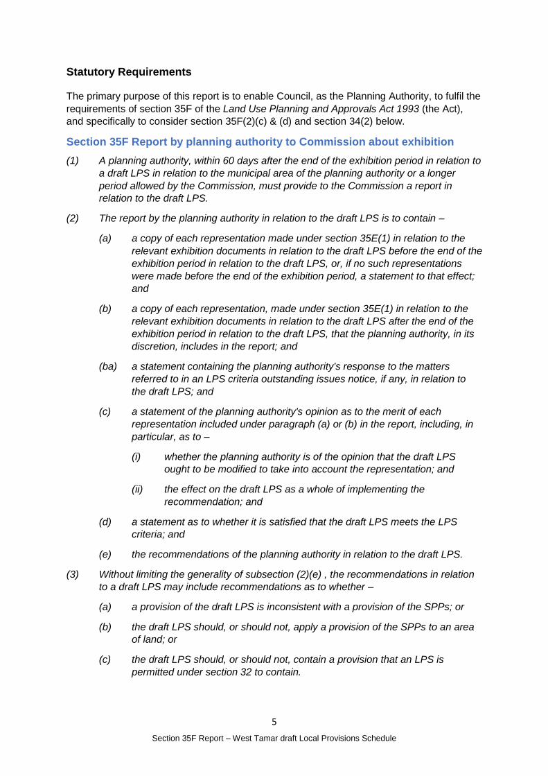
Statutory Requirements
The primary purpose of this report is to enable Council, as the Planning Authority, to fulfil the
requirements of section 35F of the Land Use Planning and Approvals Act 1993 (the Act),
and specifically to consider section 35F(2)(c) & (d) and section 34(2) below.
Section 35F Report by planning authority to Commission about exhibition
(1) A planning authority, within 60 days after the end of the exhibition period in relation to
a draft LPS in relation to the municipal area of the planning authority or a longer
period allowed by the Commission, must provide to the Commission a report in
relation to the draft LPS.
(2) The report by the planning authority in relation to the draft LPS is to contain –
(a) a copy of each representation made under section 35E(1) in relation to the
relevant exhibition documents in relation to the draft LPS before the end of the
exhibition period in relation to the draft LPS, or, if no such representations
were made before the end of the exhibition period, a statement to that effect;
and
(b) a copy of each representation, made under section 35E(1) in relation to the
relevant exhibition documents in relation to the draft LPS after the end of the
exhibition period in relation to the draft LPS, that the planning authority, in its
discretion, includes in the report; and
(ba) a statement containing the planning authority's response to the matters
referred to in an LPS criteria outstanding issues notice, if any, in relation to
the draft LPS; and
(c) a statement of the planning authority's opinion as to the merit of each
representation included under paragraph (a) or (b) in the report, including, in
particular, as to –
(i) whether the planning authority is of the opinion that the draft LPS
ought to be modified to take into account the representation; and
(ii) the effect on the draft LPS as a whole of implementing the
recommendation; and
(d) a statement as to whether it is satisfied that the draft LPS meets the LPS
criteria; and
(e) the recommendations of the planning authority in relation to the draft LPS.
(3) Without limiting the generality of subsection (2)(e) , the recommendations in relation
to a draft LPS may include recommendations as to whether –
(a) a provision of the draft LPS is inconsistent with a provision of the SPPs; or
(b) the draft LPS should, or should not, apply a provision of the SPPs to an area
of land; or
(c) the draft LPS should, or should not, contain a provision that an LPS is
permitted under section 32 to contain.
6
Section 35F Report – West Tamar draft Local Provisions Schedule
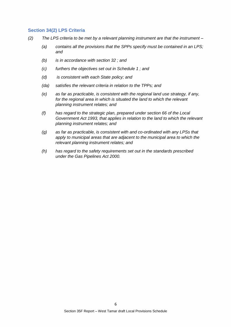
Section 34(2) LPS Criteria
(2) The LPS criteria to be met by a relevant planning instrument are that the instrument –
(a) contains all the provisions that the SPPs specify must be contained in an LPS;
and
(b) is in accordance with section 32 ; and
(c) furthers the objectives set out in Schedule 1 ; and
(d) is consistent with each State policy; and
(da) satisfies the relevant criteria in relation to the TPPs; and
(e) as far as practicable, is consistent with the regional land use strategy, if any,
for the regional area in which is situated the land to which the relevant
planning instrument relates; and
(f) has regard to the strategic plan, prepared under section 66 of the Local
Government Act 1993, that applies in relation to the land to which the relevant
planning instrument relates; and
(g) as far as practicable, is consistent with and co-ordinated with any LPSs that
apply to municipal areas that are adjacent to the municipal area to which the
relevant planning instrument relates; and
(h) has regard to the safety requirements set out in the standards prescribed
under the Gas Pipelines Act 2000.
7
Section 35F Report – West Tamar draft Local Provisions Schedule
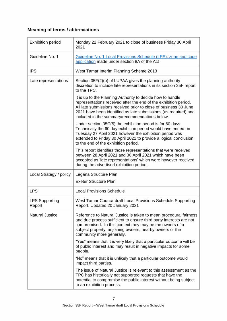
Meaning of terms / abbreviations
Exhibition period Monday 22 February 2021 to close of business Friday 30 April 2021
Guideline No. 1 Guideline No. 1 Local Provisions Schedule (LPS): zone and code application made under section 8A of the Act
IPS West Tamar Interim Planning Scheme 2013
Late representations Section 35F(2)(b) of LUPAA gives the planning authority discretion to include late representations in its section 35F report to the TPC.
It is up to the Planning Authority to decide how to handle representations received after the end of the exhibition period. All late submissions received prior to close of business 30 June 2021 have been identified as late submissions (as required) and included in the summary/recommendations below.
Under section 35C(5) the exhibition period is for 60 days. Technically the 60 day exhibition period would have ended on Tuesday 27 April 2021 however the exhibition period was extended to Friday 30 April 2021 to provide a logical conclusion to the end of the exhibition period.
This report identifies those representations that were received between 28 April 2021 and 30 April 2021 which have been accepted as ‘late representations’ which were however received during the advertised exhibition period.
Local Strategy / policy Legana Structure Plan
Exeter Structure Plan
LPS Local Provisions Schedule
LPS Supporting Report
West Tamar Council draft Local Provisions Schedule Supporting Report, Updated 20 January 2021
Natural Justice Reference to Natural Justice is taken to mean procedural fairness and due process sufficient to ensure third party interests are not compromised. In this context they may be the owners of a subject property, adjoining owners, nearby owners or the community more generally.
“Yes” means that it is very likely that a particular outcome will be of public interest and may result in negative impacts for some people.
“No” means that it is unlikely that a particular outcome would impact third parties.
The issue of Natural Justice is relevant to this assessment as the TPC has historically not supported requests that have the potential to compromise the public interest without being subject to an exhibition process.
8
Section 35F Report – West Tamar draft Local Provisions Schedule
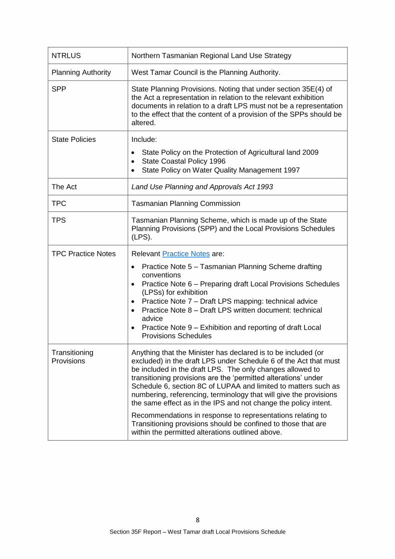
NTRLUS Northern Tasmanian Regional Land Use Strategy
Planning Authority West Tamar Council is the Planning Authority.
SPP State Planning Provisions. Noting that under section 35E(4) of the Act a representation in relation to the relevant exhibition documents in relation to a draft LPS must not be a representation to the effect that the content of a provision of the SPPs should be altered.
State Policies Include:
State Policy on the Protection of Agricultural land 2009
State Coastal Policy 1996
State Policy on Water Quality Management 1997
The Act Land Use Planning and Approvals Act 1993
TPC Tasmanian Planning Commission
TPS Tasmanian Planning Scheme, which is made up of the State Planning Provisions (SPP) and the Local Provisions Schedules (LPS).
TPC Practice Notes Relevant Practice Notes are:
Practice Note 5 – Tasmanian Planning Scheme drafting conventions
Practice Note 6 – Preparing draft Local Provisions Schedules (LPSs) for exhibition
Practice Note 7 – Draft LPS mapping: technical advice
Practice Note 8 – Draft LPS written document: technical advice
Practice Note 9 – Exhibition and reporting of draft Local Provisions Schedules
Transitioning Provisions
Anything that the Minister has declared is to be included (or excluded) in the draft LPS under Schedule 6 of the Act that must be included in the draft LPS. The only changes allowed to transitioning provisions are the ‘permitted alterations’ under Schedule 6, section 8C of LUPAA and limited to matters such as numbering, referencing, terminology that will give the provisions the same effect as in the IPS and not change the policy intent.
Recommendations in response to representations relating to Transitioning provisions should be confined to those that are within the permitted alterations outlined above.
9
Section 35F Report – West Tamar draft Local Provisions Schedule
Summary of representations and recommendations
No. 1 Mark and Annette Crawford
Matter(s) raised in the representation
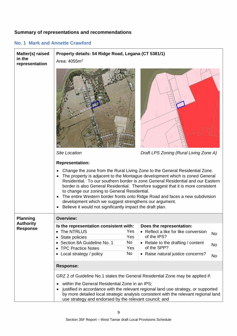
Property details: 54 Ridge Road, Legana (CT 5381/1)
Area: 4055m2
Site Location
Draft LPS Zoning (Rural Living Zone A)
Representation:
Change the zone from the Rural Living Zone to the General Residential Zone.
The property is adjacent to the Montague development which is zoned General Residential. To our southern border is zone General Residential and our Eastern border is also General Residential. Therefore suggest that it is more consistent to change our zoning to General Residential.
The entire Western border fronts onto Ridge Road and faces a new subdivision development which we suggest strengthens our argument.
Believe it would not significantly impact the draft plan.
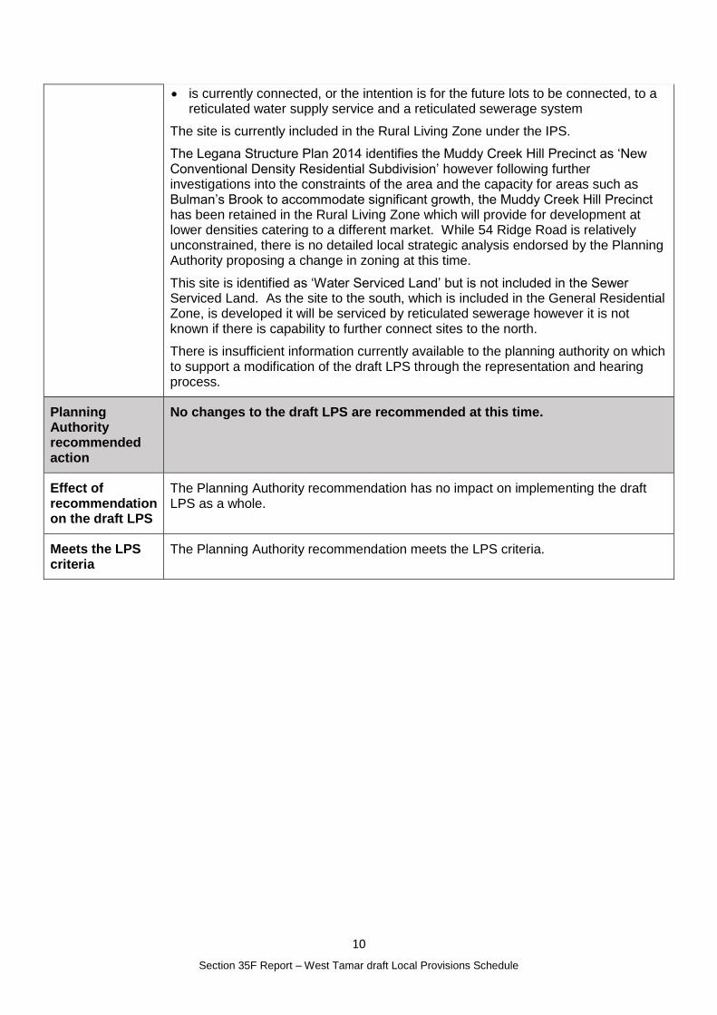
Planning Authority Response
Overview:
Is the representation consistent with: Does the representation:
The NTRLUS Yes Reflect a like for like conversion of the IPS?
No State policies Yes
Section 8A Guideline No. 1 No Relate to the drafting / content of the SPP?
No TPC Practice Notes Yes
Local strategy / policy No Raise natural justice concerns? No
Response:
GRZ 2 of Guideline No.1 states the General Residential Zone may be applied if:
within the General Residential Zone in an IPS;
justified in accordance with the relevant regional land use strategy, or supported by more detailed local strategic analysis consistent with the relevant regional land use strategy and endorsed by the relevant council; and
10
Section 35F Report – West Tamar draft Local Provisions Schedule
is currently connected, or the intention is for the future lots to be connected, to a reticulated water supply service and a reticulated sewerage system
The site is currently included in the Rural Living Zone under the IPS.
The Legana Structure Plan 2014 identifies the Muddy Creek Hill Precinct as ‘New Conventional Density Residential Subdivision’ however following further investigations into the constraints of the area and the capacity for areas such as Bulman’s Brook to accommodate significant growth, the Muddy Creek Hill Precinct has been retained in the Rural Living Zone which will provide for development at lower densities catering to a different market. While 54 Ridge Road is relatively unconstrained, there is no detailed local strategic analysis endorsed by the Planning Authority proposing a change in zoning at this time.
This site is identified as ‘Water Serviced Land’ but is not included in the Sewer Serviced Land. As the site to the south, which is included in the General Residential Zone, is developed it will be serviced by reticulated sewerage however it is not known if there is capability to further connect sites to the north.
There is insufficient information currently available to the planning authority on which to support a modification of the draft LPS through the representation and hearing process.
Planning Authority recommended action
No changes to the draft LPS are recommended at this time.
Effect of recommendation on the draft LPS
The Planning Authority recommendation has no impact on implementing the draft LPS as a whole.
Meets the LPS criteria
The Planning Authority recommendation meets the LPS criteria.
11
Section 35F Report – West Tamar draft Local Provisions Schedule
No. 2 John Thompson, Conversation Landholders Tasmania
Matter(s) raised in the representation
Property details: see specific sites below
Representation – General comments:
The nine properties identified contain land reserved for the protection of biodiversity and should be rezoned all or in part to the Landscape Conservation Zone based on Guidelines LCZ1 when read together with Guidelines RZ1 and AZ6 (of Section 8A Guideline 1), subject to landowner agreement.
The natural values within these Reserves have already been identified for protection and conservation by the Minister for Environment.
AK Consultants decision tree in Appendix 3 of the LPS Supporting report (p16) indicates that either Environmental Management or Landscape Conservation should be applied in Private Reserves where deemed appropriate as per Guideline EMZ1 or LCZ1 and LCZ2.
Landscape Conservation Zone has not been used at all with the Supporting Report stating that are no areas considered suitable for this zoning.
Titles that are fully reserved as well as titles that are partly reserved, where the non-reserved part is unsuitable for agriculture, should therefore be zoned as Landscape Conservation.
There is also a strong case for split zoning on titles containing reserved land that include agricultural use in the non-reserved parts where at least one the following conditions applies: 1. there are multiple adjoining Reserves; 2. a significantly sized Reserve spans multiple titles; or 3. a Reserve adjoins a title or titles zoned Environmental Management or Landscape Conservation.
Details of the 9 reserves are provided in the full representation including ListMap screenshots of the Tasmanian Reserve Estate (green area), Threatened Flora Points (green triangles), Threatened Fauna Points (red squares) and Threatened Native Vegetation Communities (numbered areas with ‘T’ pattern) layers. Where there are adjoining reserves these have been discussed together.
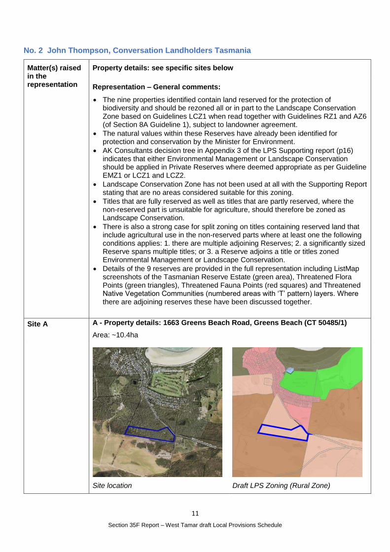
Site A A - Property details: 1663 Greens Beach Road, Greens Beach (CT 50485/1)
Area: ~10.4ha
Site location
Draft LPS Zoning (Rural Zone)
12
Section 35F Report – West Tamar draft Local Provisions Schedule
Representation:
Reserve covers an area of 9.3ha (90% of the site). Contains threatened vegetation community No 39 ‘Wetlands’ listed in Schedule 3A of the Nature Conservation Act 2002. It also contains the vulnerable Xanthorrhoea arenaria (sand grasstree) listed in Schedule 4 of the Threatened Species Protection Act 1995.
Conservation covenant area in green
Landscape Conservation Zone should be applied to all of this title. Under the General Provisions the existing residential use is permitted for this zone.
See Representation No. 6 which is consistent with this request.
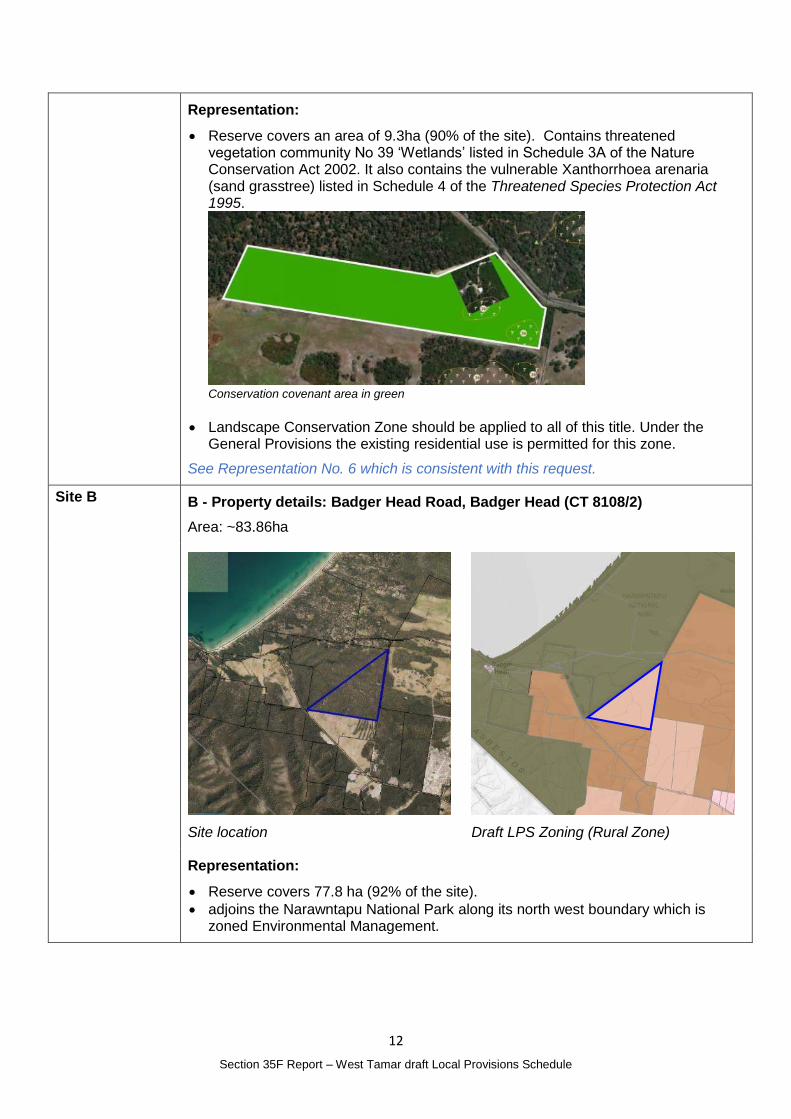
Site B B - Property details: Badger Head Road, Badger Head (CT 8108/2)
Area: ~83.86ha
Site location
Draft LPS Zoning (Rural Zone)
Representation:
Reserve covers 77.8 ha (92% of the site).
adjoins the Narawntapu National Park along its north west boundary which is zoned Environmental Management.
13
Section 35F Report – West Tamar draft Local Provisions Schedule
Conservation covenant area in green
It is proposed that the complete title is rezoned to Landscape Conservation as the non-reserved part of the title has a residential dwelling on it and is unsuitable and not used for agriculture.
See Representation No. 29 which is consistent with this request.
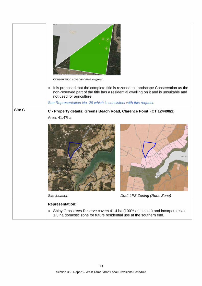
Site C C - Property details: Greens Beach Road, Clarence Point (CT 124498/1)
Area: 41.47ha
Site location
Draft LPS Zoning (Rural Zone)
Representation:
Shiny Grasstrees Reserve covers 41.4 ha (100% of the site) and incorporates a 1.3 ha domestic zone for future residential use at the southern end.
14
Section 35F Report – West Tamar draft Local Provisions Schedule
Conservation covenant area in green
Landscape Conservation Zone should be applied to all of this title.
See Representation No. 38 which is consistent with this request.
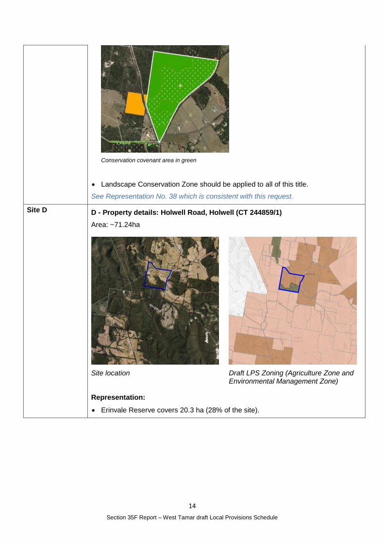
Site D D - Property details: Holwell Road, Holwell (CT 244859/1)
Area: ~71.24ha
Site location
Draft LPS Zoning (Agriculture Zone and Environmental Management Zone)
Representation:
Erinvale Reserve covers 20.3 ha (28% of the site).
15
Section 35F Report – West Tamar draft Local Provisions Schedule
Conservation covenant area in green
In the Draft Zone Map split zoning has been applied to this title with the Erinvale Reserve being zoned Environmental Management and the balance as Agriculture.
supports the application of split zones to this title but considers that Landscape Conservation zone is more appropriate than Environmental Management for reserves on private land.
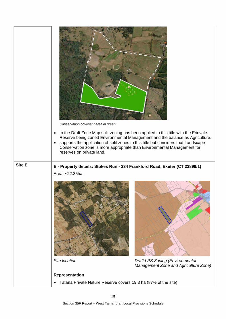
Site E E - Property details: Stokes Run - 234 Frankford Road, Exeter (CT 23899/1)
Area: ~22.35ha
Site location
Draft LPS Zoning (Environmental Management Zone and Agriculture Zone)
Representation
Tatana Private Nature Reserve covers 19.3 ha (87% of the site).
16
Section 35F Report – West Tamar draft Local Provisions Schedule
Conservation covenant area in green
In the Draft Zone Map split zoning has been applied to this title with the 19.3 ha Tatana Private Nature Reserve being zoned Environmental Management and the remaining 2.9 ha as Agriculture.
Landscape Conservation zone is more appropriate than Environmental Management for private reserves and that split zoning is not required in this case given that the 2.9 ha of non-reserved land is unsuitable and not used for agriculture.
Landscape Conservation zone will afford better protection of the threatened forest on the non-reserved land as well as providing the landowner with more flexibility in the use of the non-forested land.
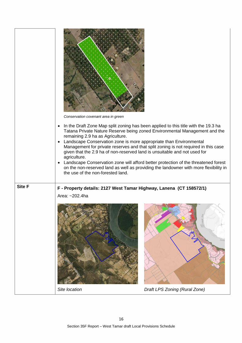
Site F F - Property details: 2127 West Tamar Highway, Lanena (CT 158572/1)
Area: ~202.4ha
Site location
Draft LPS Zoning (Rural Zone)
17
Section 35F Report – West Tamar draft Local Provisions Schedule
Representation:
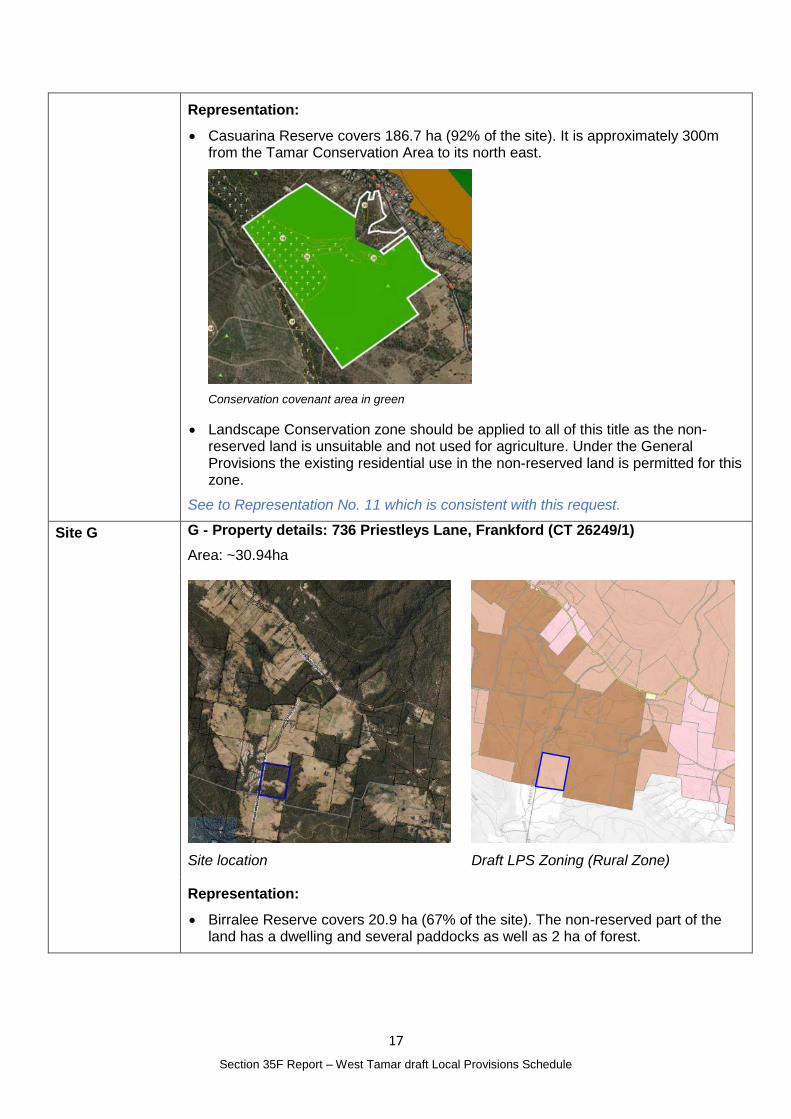
Casuarina Reserve covers 186.7 ha (92% of the site). It is approximately 300m from the Tamar Conservation Area to its north east.
Conservation covenant area in green
Landscape Conservation zone should be applied to all of this title as the non-reserved land is unsuitable and not used for agriculture. Under the General Provisions the existing residential use in the non-reserved land is permitted for this zone.
See to Representation No. 11 which is consistent with this request.
Site G G - Property details: 736 Priestleys Lane, Frankford (CT 26249/1)
Area: ~30.94ha
Site location
Draft LPS Zoning (Rural Zone)
Representation:
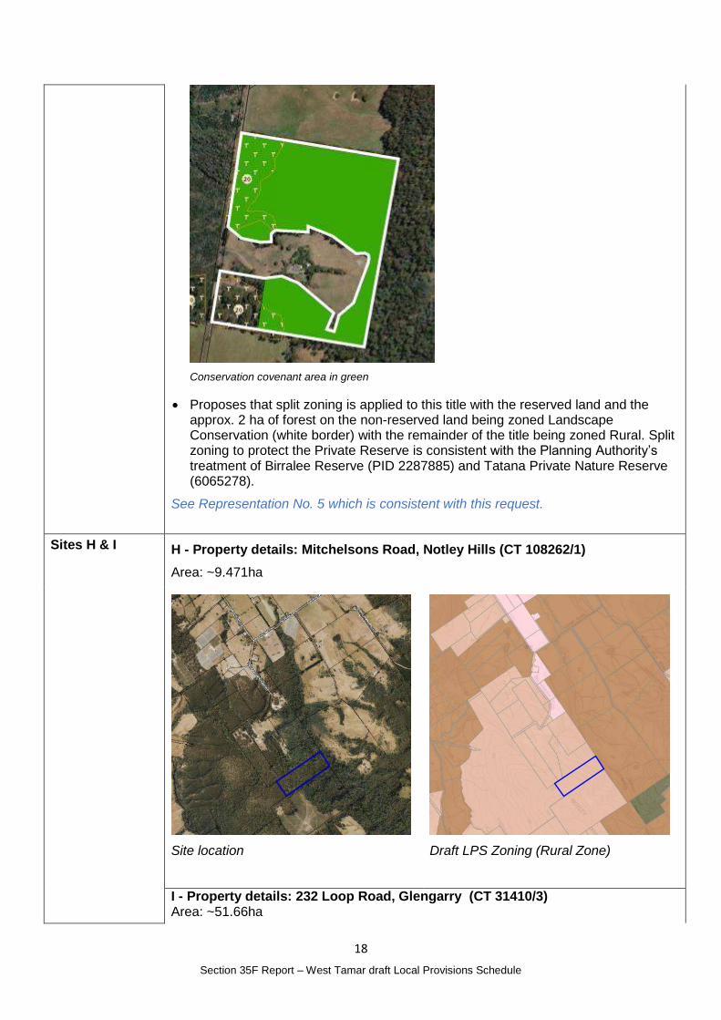
Birralee Reserve covers 20.9 ha (67% of the site). The non-reserved part of the land has a dwelling and several paddocks as well as 2 ha of forest.
18
Section 35F Report – West Tamar draft Local Provisions Schedule
Conservation covenant area in green
Proposes that split zoning is applied to this title with the reserved land and the approx. 2 ha of forest on the non-reserved land being zoned Landscape Conservation (white border) with the remainder of the title being zoned Rural. Split zoning to protect the Private Reserve is consistent with the Planning Authority’s treatment of Birralee Reserve (PID 2287885) and Tatana Private Nature Reserve (6065278).
See Representation No. 5 which is consistent with this request.
Sites H & I H - Property details: Mitchelsons Road, Notley Hills (CT 108262/1)
Area: ~9.471ha
Site location
Draft LPS Zoning (Rural Zone)
I - Property details: 232 Loop Road, Glengarry (CT 31410/3) Area: ~51.66ha
19
Section 35F Report – West Tamar draft Local Provisions Schedule
Site location
Draft LPS Zoning (Agriculture Zone)
Representation (for sites H and I)
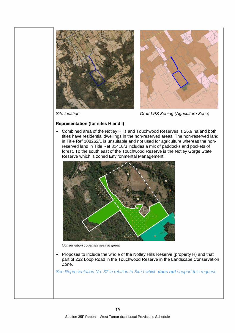
Combined area of the Notley Hills and Touchwood Reserves is 26.9 ha and both titles have residential dwellings in the non-reserved areas. The non-reserved land in Title Ref 108262/1 is unsuitable and not used for agriculture whereas the non-reserved land in Title Ref 31410/3 includes a mix of paddocks and pockets of forest. To the south east of the Touchwood Reserve is the Notley Gorge State Reserve which is zoned Environmental Management.
Conservation covenant area in green
Proposes to include the whole of the Notley Hills Reserve (property H) and that part of 232 Loop Road in the Touchwood Reserve in the Landscape Conservation Zone.
See Representation No. 37 in relation to Site I which does not support this request.
20
Section 35F Report – West Tamar draft Local Provisions Schedule
Planning Authority Response
Overview:
Is the representation consistent with: Does the representation:
The NTRLUS Yes Reflect a like for like conversion of the IPS?
No
State policies Yes
Section 8A Guideline No. 1 Yes Relate to the drafting / content of the SPP?
No
TPC Practice Notes Yes
Local strategy / policy N/A Raise natural justice concerns?
Yes
Response:
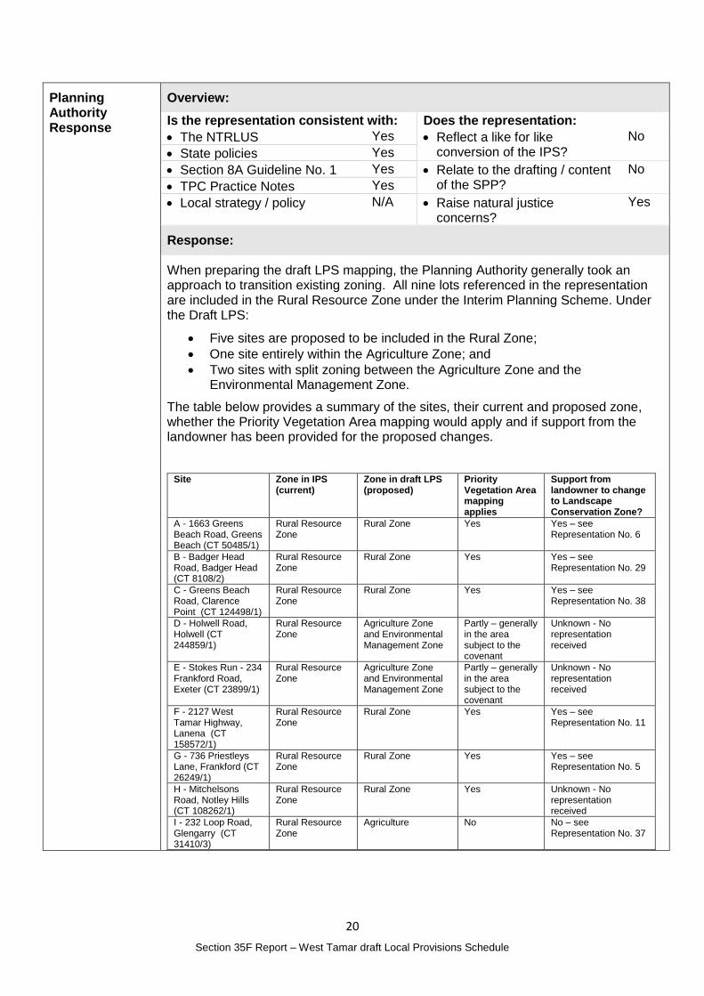
When preparing the draft LPS mapping, the Planning Authority generally took an approach to transition existing zoning. All nine lots referenced in the representation are included in the Rural Resource Zone under the Interim Planning Scheme. Under the Draft LPS:
Five sites are proposed to be included in the Rural Zone;
One site entirely within the Agriculture Zone; and
Two sites with split zoning between the Agriculture Zone and the Environmental Management Zone.
The table below provides a summary of the sites, their current and proposed zone, whether the Priority Vegetation Area mapping would apply and if support from the landowner has been provided for the proposed changes.
Site Zone in IPS (current)
Zone in draft LPS (proposed)
Priority Vegetation Area mapping applies
Support from landowner to change to Landscape Conservation Zone?
A - 1663 Greens Beach Road, Greens Beach (CT 50485/1)
Rural Resource Zone
Rural Zone Yes Yes – see Representation No. 6
B - Badger Head Road, Badger Head (CT 8108/2)
Rural Resource Zone
Rural Zone Yes Yes – see Representation No. 29
C - Greens Beach Road, Clarence Point (CT 124498/1)
Rural Resource Zone
Rural Zone Yes Yes – see Representation No. 38
D - Holwell Road, Holwell (CT 244859/1)
Rural Resource Zone
Agriculture Zone and Environmental Management Zone
Partly – generally in the area subject to the covenant
Unknown - No representation received
E - Stokes Run - 234 Frankford Road, Exeter (CT 23899/1)
Rural Resource Zone
Agriculture Zone and Environmental Management Zone
Partly – generally in the area subject to the covenant
Unknown - No representation received
F - 2127 West Tamar Highway, Lanena (CT 158572/1)
Rural Resource Zone
Rural Zone Yes Yes – see Representation No. 11
G - 736 Priestleys Lane, Frankford (CT 26249/1)
Rural Resource Zone
Rural Zone Yes Yes – see Representation No. 5
H - Mitchelsons Road, Notley Hills (CT 108262/1)
Rural Resource Zone
Rural Zone Yes Unknown - No representation received
I - 232 Loop Road, Glengarry (CT 31410/3)
Rural Resource Zone
Agriculture No No – see Representation No. 37
21
Section 35F Report – West Tamar draft Local Provisions Schedule
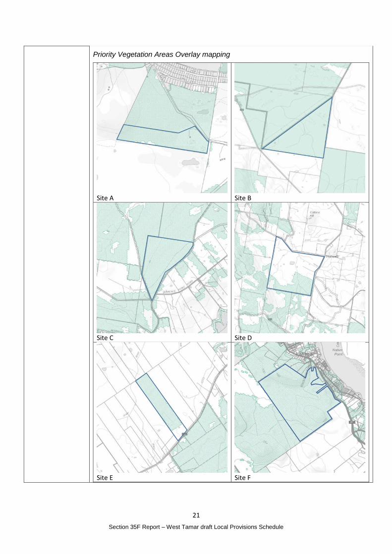
Priority Vegetation Areas Overlay mapping
Site A
Site B
Site C
Site D
Site E
Site F
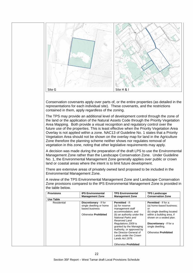
22
Section 35F Report – West Tamar draft Local Provisions Schedule
Site G
Site H & I
Conservation covenants apply over parts of, or the entire properties (as detailed in the representations for each individual site). These covenants, and the restrictions contained in them, apply regardless of the zoning.
The TPS may provide an additional level of development control through the zone of the land or the application of the Natural Assets Code through the Priority Vegetation Area Mapping. Both provide a visual recognition and regulatory control over the future use of the properties. This is least effective when the Priority Vegetation Area Overlay is not applied within a zone. NAC13 of Guideline No. 1 states that a Priority Vegetation Area should not be shown on the overlay map for land in the Agriculture Zone therefore the planning scheme neither shows nor regulates removal of vegetation in this zone, noting that other legislative requirements may apply.
A decision was made during the preparation of the draft LPS to use the Environmental Management Zone rather than the Landscape Conservation Zone. Under Guideline No. 1, the Environmental Management Zone generally applies over public or crown land or coastal areas where the intent is to limit future development.
There are extensive areas of privately owned land proposed to be included in the Environmental Management Zone.
A review of the TPS Environmental Management Zone and Landscape Conservation Zone provisions compared to the IPS Environmental Management Zone is provided in the table below.
Provisions IPS Environmental Management Zone
TPS Environmental Management Zone
TPS Landscape Conservation Zone
Use Table
Residential Discretionary - If for single dwelling or home based business Otherwise Prohibited
Permitted - If: (a) for reserve management staff accommodation; and (b) an authority under the National Parks and Reserved Land Regulations 2009 is granted by the Managing Authority, or approved by the Director-General of Lands under the Crown Lands Act 1976. Otherwise Prohibited
Permitted - If for a: (a) home-based business; or (b) single dwelling located within a building area, if shown on a sealed plan. Discretionary - If for a single dwelling. Otherwise Prohibited
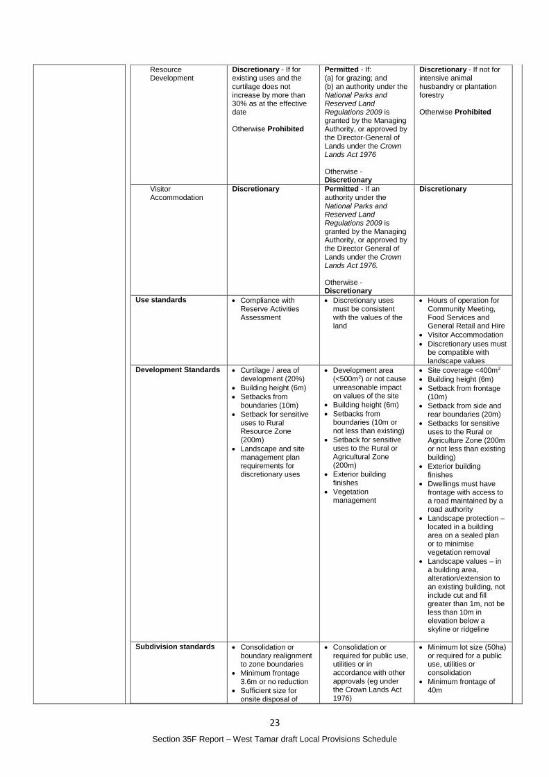
23
Section 35F Report – West Tamar draft Local Provisions Schedule
Resource Development
Discretionary - If for existing uses and the curtilage does not increase by more than 30% as at the effective date Otherwise Prohibited
Permitted - If: (a) for grazing; and (b) an authority under the National Parks and Reserved Land Regulations 2009 is granted by the Managing Authority, or approved by the Director-General of Lands under the Crown Lands Act 1976 Otherwise - Discretionary
Discretionary - If not for intensive animal husbandry or plantation forestry Otherwise Prohibited
Visitor Accommodation
Discretionary Permitted - If an authority under the National Parks and Reserved Land Regulations 2009 is granted by the Managing Authority, or approved by the Director General of Lands under the Crown Lands Act 1976. Otherwise - Discretionary
Discretionary
Use standards Compliance with Reserve Activities Assessment
Discretionary uses must be consistent with the values of the land
Hours of operation for Community Meeting, Food Services and General Retail and Hire
Visitor Accommodation
Discretionary uses must be compatible with landscape values
Development Standards Curtilage / area of development (20%)
Building height (6m)
Setbacks from boundaries (10m)
Setback for sensitive uses to Rural Resource Zone (200m)
Landscape and site management plan requirements for discretionary uses
Development area (<500m2) or not cause unreasonable impact on values of the site
Building height (6m)
Setbacks from boundaries (10m or not less than existing)
Setback for sensitive uses to the Rural or Agricultural Zone (200m)
Exterior building finishes
Vegetation management
Site coverage <400m2
Building height (6m)
Setback from frontage (10m)
Setback from side and rear boundaries (20m)
Setbacks for sensitive uses to the Rural or Agriculture Zone (200m or not less than existing building)
Exterior building finishes
Dwellings must have frontage with access to a road maintained by a road authority
Landscape protection – located in a building area on a sealed plan or to minimise vegetation removal
Landscape values – in a building area, alteration/extension to an existing building, not include cut and fill greater than 1m, not be less than 10m in elevation below a skyline or ridgeline
Subdivision standards Consolidation or boundary realignment to zone boundaries
Minimum frontage 3.6m or no reduction
Sufficient size for onsite disposal of
Consolidation or required for public use, utilities or in accordance with other approvals (eg under the Crown Lands Act 1976)
Minimum lot size (50ha) or required for a public use, utilities or consolidation
Minimum frontage of 40m
24
Section 35F Report – West Tamar draft Local Provisions Schedule
wastewater or connection to services
Vehicular access
Capable of accommodating onsite wastewater management disposal
Vehicular access to a road
Capable of accommodating on-site wastewater management system
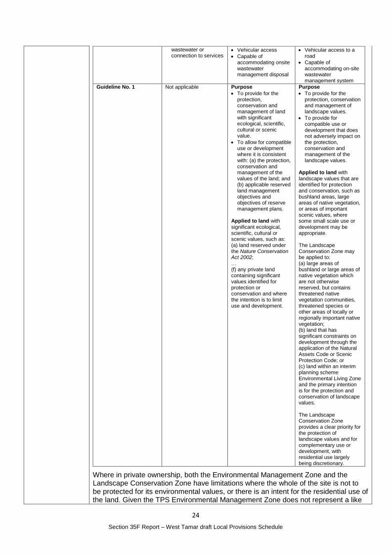
Guideline No. 1 Not applicable Purpose
To provide for the protection, conservation and management of land with significant ecological, scientific, cultural or scenic value.
To allow for compatible use or development where it is consistent with: (a) the protection, conservation and management of the values of the land; and (b) applicable reserved land management objectives and objectives of reserve management plans.
Applied to land with significant ecological, scientific, cultural or scenic values, such as: (a) land reserved under the Nature Conservation Act 2002; … (f) any private land containing significant values identified for protection or conservation and where the intention is to limit use and development.
Purpose
To provide for the protection, conservation and management of landscape values.
To provide for compatible use or development that does not adversely impact on the protection, conservation and management of the landscape values.
Applied to land with landscape values that are identified for protection and conservation, such as bushland areas, large areas of native vegetation, or areas of important scenic values, where some small scale use or development may be appropriate. The Landscape Conservation Zone may be applied to: (a) large areas of bushland or large areas of native vegetation which are not otherwise reserved, but contains threatened native vegetation communities, threatened species or other areas of locally or regionally important native vegetation; (b) land that has significant constraints on development through the application of the Natural Assets Code or Scenic Protection Code; or (c) land within an interim planning scheme Environmental Living Zone and the primary intention is for the protection and conservation of landscape values. The Landscape Conservation Zone provides a clear priority for the protection of landscape values and for complementary use or development, with residential use largely being discretionary.
Where in private ownership, both the Environmental Management Zone and the Landscape Conservation Zone have limitations where the whole of the site is not to be protected for its environmental values, or there is an intent for the residential use of the land. Given the TPS Environmental Management Zone does not represent a like
25
Section 35F Report – West Tamar draft Local Provisions Schedule
for like conversion of the IPS Environmental Management Zone, there is a potential need for a strategic review of the allocation of the Environmental Management Zone across the municipality to consider the most appropriate zone, particularly for privately owned land. As this process and the outcome is likely to be subject to public interest, it is considered appropriate to complete this assessment as a separate process potentially resulting in a future planning scheme amendment. This review should include consideration of the Tasmanian Reserve Estate whether currently included in the Environmental Management Zone or not.
In relation to the specific sites identified by the representor and in light of the identified need for a strategic review of the Environmental Management Zone, it is considered appropriate at this time to limit the changes made until such a review is completed.
Eight of the nine sites identified will be subject to the Natural Assets Code through their identification as Priority Vegetation Areas which generally aligns with the Conservation Covenants over the sites.
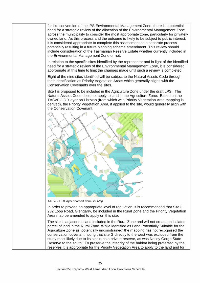
Site I is proposed to be included in the Agriculture Zone under the draft LPS. The Natural Assets Code does not apply to land in the Agriculture Zone. Based on the TASVEG 3.0 layer on ListMap (from which with Priority Vegetation Area mapping is derived), the Priority Vegetation Area, if applied to the site, would generally align with the Conservation Covenant.
TASVEG 3.0 layer sourced from List Map
In order to provide an appropriate level of regulation, it is recommended that Site I, 232 Loop Road, Glengarry, be included in the Rural Zone and the Priority Vegetation Area map be amended to apply on this site.
The site is adjacent to land included in the Rural Zone and will not create an isolated parcel of land in the Rural Zone. While identified as Land Potentially Suitable for the Agriculture Zone as ‘potentially unconstrained’ the mapping has not recognised the conservation covenant noting that site G directly to the west was excluded from the study most likely due to its status as a private reserve, as was Notley Gorge State Reserve to the south. To preserve the integrity of the habitat being protected by the reserves it is appropriate for the Priority Vegetation Area to apply to the land and for
26
Section 35F Report – West Tamar draft Local Provisions Schedule
the regulation of clearing that is afforded through the inclusion of the land in the Rural Zone is provided.
Representation No. 37, made by the owner of Site I, requests that the site be included in the Rural Zone which is consistent with this recommendation. It is not likely that the general public would have any further interest in the zoning of the site.
While the recommendation is not the same as the representation is seeking, the recommendation will ensure all of the sites affected by a conservation covenant are provided with appropriate regulation through the Natural Assets Code and allow for a future strategic review of the Environmental Management Zone.
Planning Authority recommended action
In relation to site I, 232 Loop Road, Glengarry (CT 31410/3):
Change the zone from the Agriculture Zone to the Rural Zone; and
Apply the Priority Vegetation Area map to the site.
Effect of recommendation on the draft LPS
The Planning Authority recommendation has only minor impact on implementing the draft LPS as a whole and the landowner is supportive of the change.
Meets the LPS criteria
The Planning Authority recommendation meets the LPS criteria.
27
Section 35F Report – West Tamar draft Local Provisions Schedule
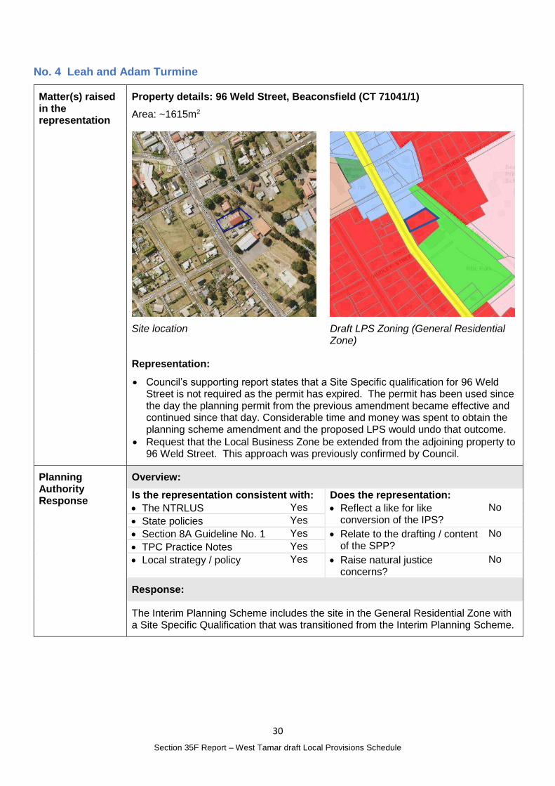
No. 3 Department of Education
Matter(s) raised in the representation
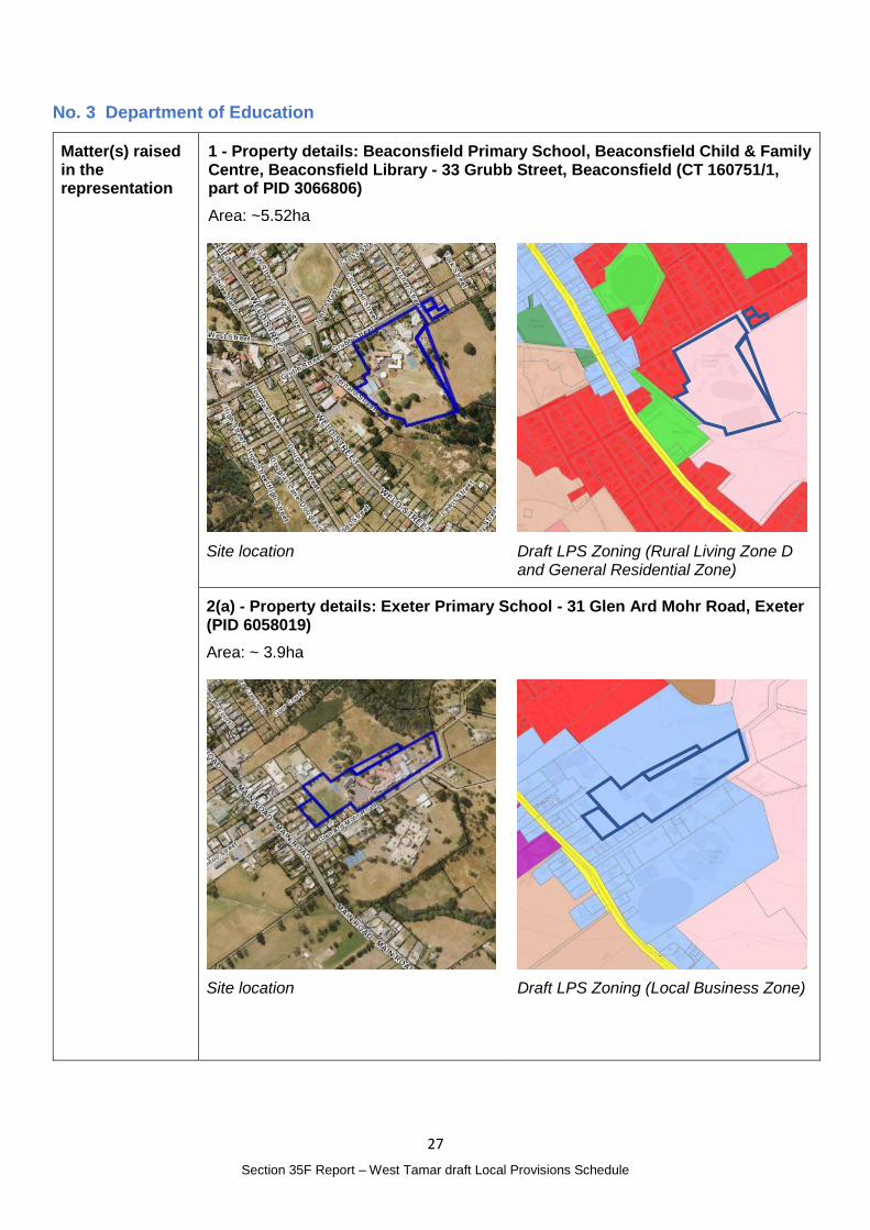
1 - Property details: Beaconsfield Primary School, Beaconsfield Child & Family Centre, Beaconsfield Library - 33 Grubb Street, Beaconsfield (CT 160751/1, part of PID 3066806)
Area: ~5.52ha
Site location
Draft LPS Zoning (Rural Living Zone D and General Residential Zone)
2(a) - Property details: Exeter Primary School - 31 Glen Ard Mohr Road, Exeter (PID 6058019)
Area: ~ 3.9ha
Site location
Draft LPS Zoning (Local Business Zone)
28
Section 35F Report – West Tamar draft Local Provisions Schedule
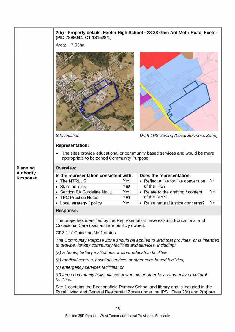
2(b) - Property details: Exeter High School - 28-38 Glen Ard Mohr Road, Exeter (PID 7898044, CT 131528/1)
Area: ~ 7.93ha
Site location
Draft LPS Zoning (Local Business Zone)
Representation:
The sites provide educational or community based services and would be more appropriate to be zoned Community Purpose.
Planning Authority Response
Overview:
Is the representation consistent with: Does the representation:
The NTRLUS Yes Reflect a like for like conversion of the IPS?
No
State policies Yes
Section 8A Guideline No. 1 Yes Relate to the drafting / content of the SPP?
No
TPC Practice Notes Yes
Local strategy / policy Yes Raise natural justice concerns? No
Response:
The properties identified by the Representation have existing Educational and Occasional Care uses and are publicly owned.
CPZ 1 of Guideline No.1 states:
The Community Purpose Zone should be applied to land that provides, or is intended to provide, for key community facilities and services, including:
(a) schools, tertiary institutions or other education facilities;
(b) medical centres, hospital services or other care-based facilities;
(c) emergency services facilities; or
(d) large community halls, places of worship or other key community or cultural facilities.
Site 1 contains the Beaconsfield Primary School and library and is included in the Rural Living and General Residential Zones under the IPS. Sites 2(a) and 2(b) are
29
Section 35F Report – West Tamar draft Local Provisions Schedule
occupied by the Exeter Primary School and Exeter High School and are included in the Local Business Zone in the IPS.
While the draft LPS has directly transitioned the zones, there is no ongoing benefit to the lots being retained in the Rural Living, General Residential or Local Business Zones.
The Community Purpose Zone is reflective of the existing uses that are of a scale that warrants inclusion in the zone. This change would reflect community expectations for the future development of the schools and associated services.
It is not anticipated that there would be any public interest in the proposed changes as they reflect existing uses and the likely community expectation that schools should be zoned to reflect both their current and future use for this purpose.
Planning Authority recommended action
Change the zone of the following properties to the Community Purpose Zone:
Beaconsfield Primary School, Beaconsfield Child & Family Centre, Beaconsfield Library - 33 Grubb Street, Beaconsfield (CT 160751/1, part of PID 3066806);
Exeter Primary School - 31 Glen Ard Mohr Road, Exeter (PID 6058019); and
Exeter High School - 28-38 Glen Ard Mohr Road, Exeter (PID 7898044, CT 131528/1).
Effect of recommendation on the draft LPS
The Planning Authority recommendation has no impact on implementing the draft LPS as a whole as the landowner is supportive of the recommended change.
Meets the LPS criteria
The Planning Authority is satisfied that the recommendation meets the LPS criteria.
30
Section 35F Report – West Tamar draft Local Provisions Schedule
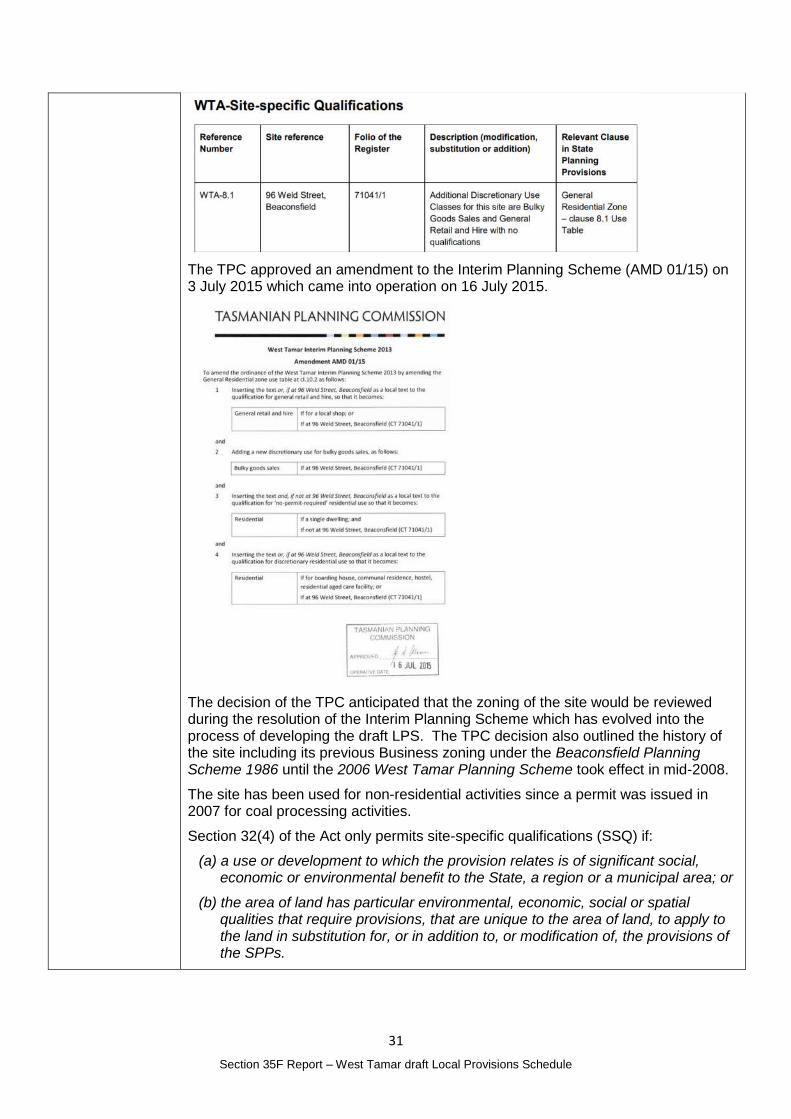
No. 4 Leah and Adam Turmine
Matter(s) raised in the representation
Property details: 96 Weld Street, Beaconsfield (CT 71041/1)
Area: ~1615m2
Site location
Draft LPS Zoning (General Residential Zone)
Representation:
Council’s supporting report states that a Site Specific qualification for 96 Weld Street is not required as the permit has expired. The permit has been used since the day the planning permit from the previous amendment became effective and continued since that day. Considerable time and money was spent to obtain the planning scheme amendment and the proposed LPS would undo that outcome.
Request that the Local Business Zone be extended from the adjoining property to 96 Weld Street. This approach was previously confirmed by Council.
Planning Authority Response
Overview:
Is the representation consistent with: Does the representation:
The NTRLUS Yes Reflect a like for like conversion of the IPS?
No
State policies Yes
Section 8A Guideline No. 1 Yes Relate to the drafting / content of the SPP?
No
TPC Practice Notes Yes
Local strategy / policy Yes Raise natural justice concerns?
No
Response:
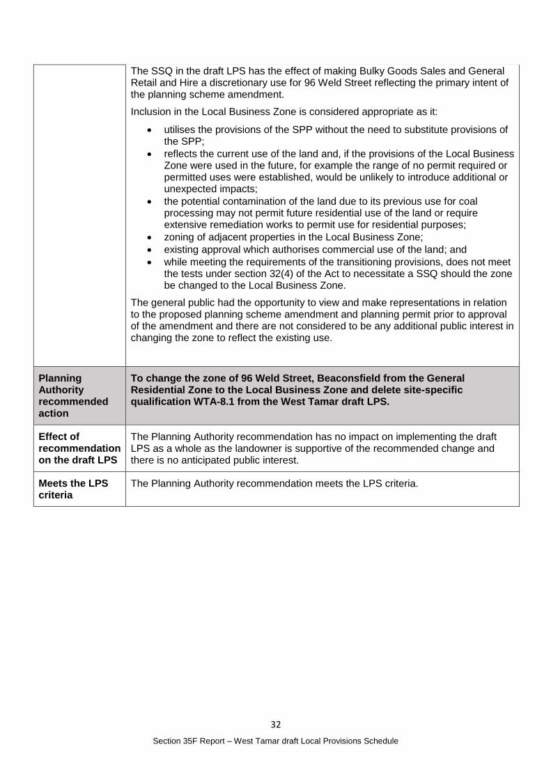
The Interim Planning Scheme includes the site in the General Residential Zone with a Site Specific Qualification that was transitioned from the Interim Planning Scheme.
31
Section 35F Report – West Tamar draft Local Provisions Schedule
The TPC approved an amendment to the Interim Planning Scheme (AMD 01/15) on 3 July 2015 which came into operation on 16 July 2015.
The decision of the TPC anticipated that the zoning of the site would be reviewed during the resolution of the Interim Planning Scheme which has evolved into the process of developing the draft LPS. The TPC decision also outlined the history of the site including its previous Business zoning under the Beaconsfield Planning Scheme 1986 until the 2006 West Tamar Planning Scheme took effect in mid-2008.
The site has been used for non-residential activities since a permit was issued in 2007 for coal processing activities.
Section 32(4) of the Act only permits site-specific qualifications (SSQ) if:
(a) a use or development to which the provision relates is of significant social, economic or environmental benefit to the State, a region or a municipal area; or
(b) the area of land has particular environmental, economic, social or spatial qualities that require provisions, that are unique to the area of land, to apply to the land in substitution for, or in addition to, or modification of, the provisions of the SPPs.
32
Section 35F Report – West Tamar draft Local Provisions Schedule
The SSQ in the draft LPS has the effect of making Bulky Goods Sales and General Retail and Hire a discretionary use for 96 Weld Street reflecting the primary intent of the planning scheme amendment.
Inclusion in the Local Business Zone is considered appropriate as it:
utilises the provisions of the SPP without the need to substitute provisions of the SPP;
reflects the current use of the land and, if the provisions of the Local Business Zone were used in the future, for example the range of no permit required or permitted uses were established, would be unlikely to introduce additional or unexpected impacts;
the potential contamination of the land due to its previous use for coal processing may not permit future residential use of the land or require extensive remediation works to permit use for residential purposes;
zoning of adjacent properties in the Local Business Zone;
existing approval which authorises commercial use of the land; and
while meeting the requirements of the transitioning provisions, does not meet the tests under section 32(4) of the Act to necessitate a SSQ should the zone be changed to the Local Business Zone.
The general public had the opportunity to view and make representations in relation to the proposed planning scheme amendment and planning permit prior to approval of the amendment and there are not considered to be any additional public interest in changing the zone to reflect the existing use.
Planning Authority recommended action
To change the zone of 96 Weld Street, Beaconsfield from the General Residential Zone to the Local Business Zone and delete site-specific qualification WTA-8.1 from the West Tamar draft LPS.
Effect of recommendation on the draft LPS
The Planning Authority recommendation has no impact on implementing the draft LPS as a whole as the landowner is supportive of the recommended change and there is no anticipated public interest.
Meets the LPS criteria
The Planning Authority recommendation meets the LPS criteria.
33
Section 35F Report – West Tamar draft Local Provisions Schedule
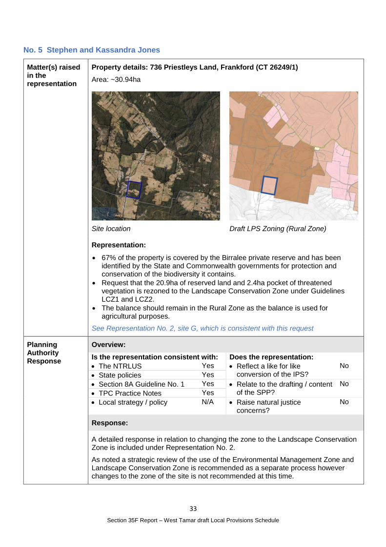
No. 5 Stephen and Kassandra Jones
Matter(s) raised in the representation
Property details: 736 Priestleys Land, Frankford (CT 26249/1)
Area: ~30.94ha
Site location
Draft LPS Zoning (Rural Zone)
Representation:
67% of the property is covered by the Birralee private reserve and has been identified by the State and Commonwealth governments for protection and conservation of the biodiversity it contains.
Request that the 20.9ha of reserved land and 2.4ha pocket of threatened vegetation is rezoned to the Landscape Conservation Zone under Guidelines LCZ1 and LCZ2.
The balance should remain in the Rural Zone as the balance is used for agricultural purposes.
See Representation No. 2, site G, which is consistent with this request
Planning Authority Response
Overview:
Is the representation consistent with: Does the representation:
The NTRLUS Yes Reflect a like for like conversion of the IPS?
No
State policies Yes
Section 8A Guideline No. 1 Yes Relate to the drafting / content of the SPP?
No
TPC Practice Notes Yes
Local strategy / policy N/A Raise natural justice concerns?
No
Response:
A detailed response in relation to changing the zone to the Landscape Conservation Zone is included under Representation No. 2.
As noted a strategic review of the use of the Environmental Management Zone and Landscape Conservation Zone is recommended as a separate process however changes to the zone of the site is not recommended at this time.

34
Section 35F Report – West Tamar draft Local Provisions Schedule
Planning Authority recommended action
No changes to the draft LPS are recommended at this time.
Effect of recommendation on the draft LPS
The Planning Authority recommendation has no impact on implementing the draft LPS as a whole.
Meets the LPS criteria
The Planning Authority is satisfied that the recommendation meets the LPS criteria.
35
Section 35F Report – West Tamar draft Local Provisions Schedule
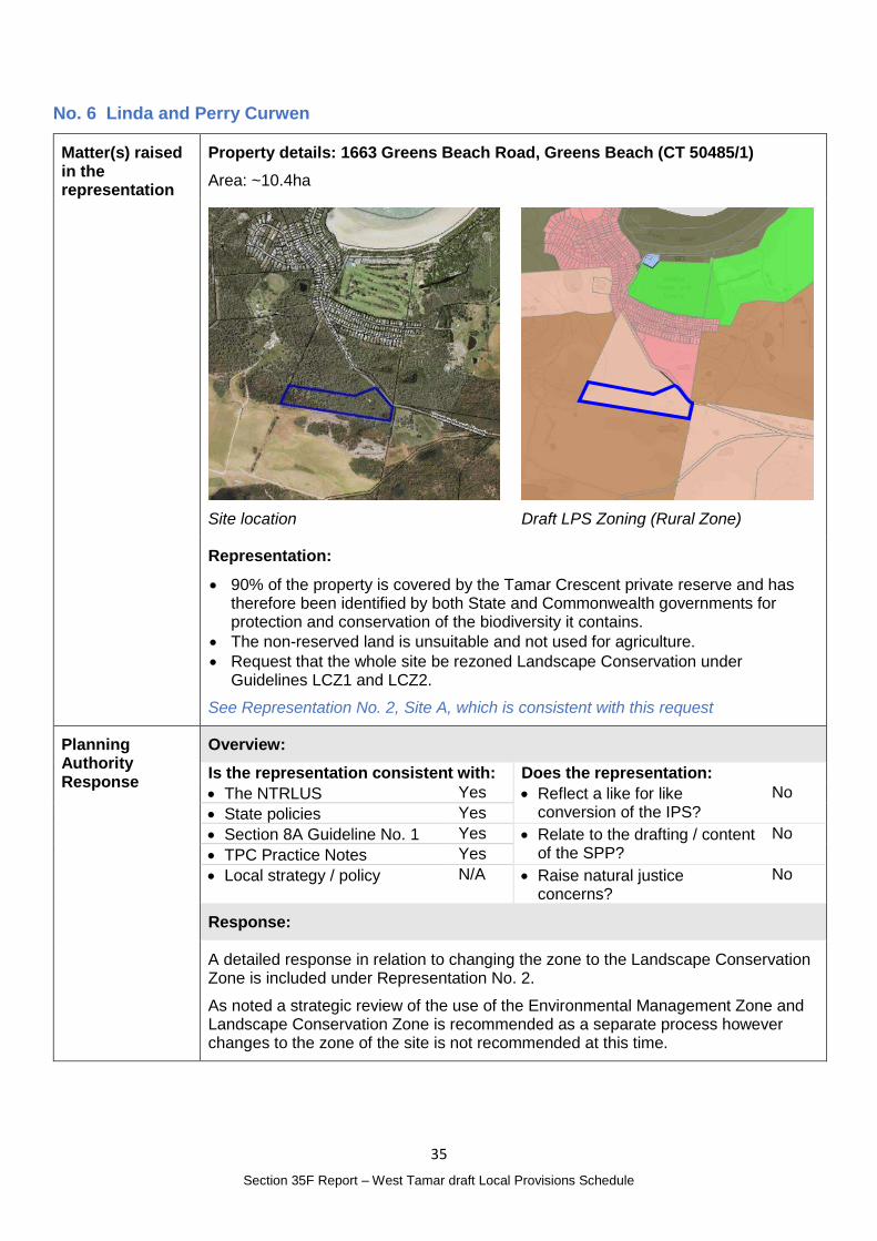
No. 6 Linda and Perry Curwen
Matter(s) raised in the representation
Property details: 1663 Greens Beach Road, Greens Beach (CT 50485/1)
Area: ~10.4ha
Site location
Draft LPS Zoning (Rural Zone)
Representation:
90% of the property is covered by the Tamar Crescent private reserve and has therefore been identified by both State and Commonwealth governments for protection and conservation of the biodiversity it contains.
The non-reserved land is unsuitable and not used for agriculture.
Request that the whole site be rezoned Landscape Conservation under Guidelines LCZ1 and LCZ2.
See Representation No. 2, Site A, which is consistent with this request
Planning Authority Response
Overview:
Is the representation consistent with: Does the representation:
The NTRLUS Yes Reflect a like for like conversion of the IPS?
No
State policies Yes
Section 8A Guideline No. 1 Yes Relate to the drafting / content of the SPP?
No
TPC Practice Notes Yes
Local strategy / policy N/A Raise natural justice concerns?
No
Response:
A detailed response in relation to changing the zone to the Landscape Conservation Zone is included under Representation No. 2.
As noted a strategic review of the use of the Environmental Management Zone and Landscape Conservation Zone is recommended as a separate process however changes to the zone of the site is not recommended at this time.

36
Section 35F Report – West Tamar draft Local Provisions Schedule
Planning Authority recommended action
No changes to the draft LPS are recommended at this time.
Effect of recommendation on the draft LPS
The Planning Authority recommendation has no impact on implementing the draft LPS as a whole.
Meets the LPS criteria
The Planning Authority is satisfied that the recommendation meets the LPS criteria.
37
Section 35F Report – West Tamar draft Local Provisions Schedule
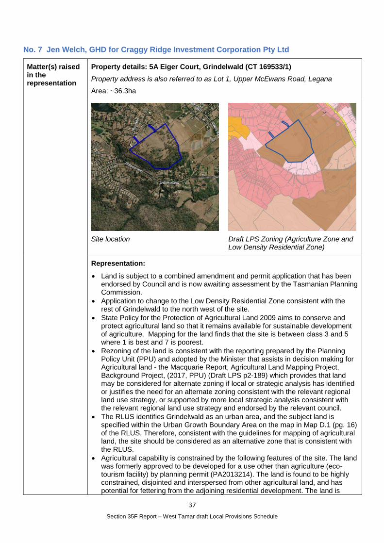
No. 7 Jen Welch, GHD for Craggy Ridge Investment Corporation Pty Ltd
Matter(s) raised in the representation
Property details: 5A Eiger Court, Grindelwald (CT 169533/1)
Property address is also referred to as Lot 1, Upper McEwans Road, Legana
Area: ~36.3ha
Site location
Draft LPS Zoning (Agriculture Zone and Low Density Residential Zone)
Representation:
Land is subject to a combined amendment and permit application that has been endorsed by Council and is now awaiting assessment by the Tasmanian Planning Commission.
Application to change to the Low Density Residential Zone consistent with the rest of Grindelwald to the north west of the site.
State Policy for the Protection of Agricultural Land 2009 aims to conserve and protect agricultural land so that it remains available for sustainable development of agriculture. Mapping for the land finds that the site is between class 3 and 5 where 1 is best and 7 is poorest.
Rezoning of the land is consistent with the reporting prepared by the Planning Policy Unit (PPU) and adopted by the Minister that assists in decision making for Agricultural land - the Macquarie Report, Agricultural Land Mapping Project, Background Project, (2017, PPU) (Draft LPS p2-189) which provides that land may be considered for alternate zoning if local or strategic analysis has identified or justifies the need for an alternate zoning consistent with the relevant regional land use strategy, or supported by more local strategic analysis consistent with the relevant regional land use strategy and endorsed by the relevant council.
The RLUS identifies Grindelwald as an urban area, and the subject land is specified within the Urban Growth Boundary Area on the map in Map D.1 (pg. 16) of the RLUS. Therefore, consistent with the guidelines for mapping of agricultural land, the site should be considered as an alternative zone that is consistent with the RLUS.
Agricultural capability is constrained by the following features of the site. The land was formerly approved to be developed for a use other than agriculture (eco-tourism facility) by planning permit (PA2013214). The land is found to be highly constrained, disjointed and interspersed from other agricultural land, and has potential for fettering from the adjoining residential development. The land is
38
Section 35F Report – West Tamar draft Local Provisions Schedule
within and accessed through the Grindelwald urban area, which is zoned Low Density Residential and has been developed for a use other than agriculture. Adjoining land is otherwise fragmented into small lots, which restricting agricultural uses. The use of the land for agriculture is constrained by its size, the adjoining residential uses within Grindelwald, natural values on the escarpment, and slopes of the escarpment are mapped as Class 5 land (moderate limitations to pastoral use) further fragmenting the land from agricultural land to the east. The site is not in an irrigation district and available water resources on the site are a limiting factor on potential agricultural activities.
It is recommended that the land is not included in the Agriculture Zone as it is within the Urban Growth Boundary and agricultural activities are fettered by the features of the site and the surrounding land uses.
It is recommended that declaration of the scheme is aligned with the decision making of the amendment.
See Representation 40 Item 2 which is consistent with this request.
Planning Authority Response
Overview:
Is the representation consistent with: Does the representation:
The NTRLUS Yes Reflect a like for like conversion of the IPS?
No
State policies Yes
Section 8A Guideline No. 1 Yes Relate to the drafting / content of the SPP?
No
TPC Practice Notes Yes
Local strategy / policy N/A Raise natural justice concerns?
No
Response:
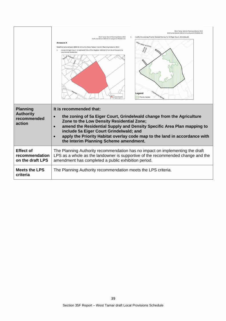
The Planning Authority initiated an amendment to the West Tamar interim Planning Scheme on 17 November 2020 which was determined by the Tasmanian Planning Commission on 12 July 2021. The amendment includes the land in the Low Density Residential Zone and amend the Priority Habitat overlay (see approved amendments below).
As the amendment has been approved by the Tasmanian Planning Commission prior to the LPS commencing, the change should be reflected in the final LPS.
The site should also be subject to the Residential Supply and Density Specific Area Plan to ensure a minimum lot size of 5000m2 is applied to the area.
The general public had the opportunity to view and make representations in relation to the proposed planning scheme amendment and permit and there are not considered to be any additional public interest in changing the zone to reflect the approved amendment.
39
Section 35F Report – West Tamar draft Local Provisions Schedule
Planning Authority recommended action
It is recommended that:
the zoning of 5a Eiger Court, Grindelwald change from the Agriculture Zone to the Low Density Residential Zone;
amend the Residential Supply and Density Specific Area Plan mapping to include 5a Eiger Court Grindelwald; and
apply the Priority Habitat overlay code map to the land in accordance with the Interim Planning Scheme amendment.
Effect of recommendation on the draft LPS
The Planning Authority recommendation has no impact on implementing the draft LPS as a whole as the landowner is supportive of the recommended change and the amendment has completed a public exhibition period.
Meets the LPS criteria
The Planning Authority recommendation meets the LPS criteria.
40
Section 35F Report – West Tamar draft Local Provisions Schedule
No. 8 Greg McEvoy
Matter(s) raised in the representation
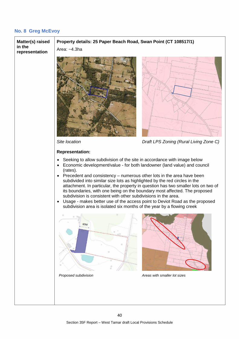
Property details: 25 Paper Beach Road, Swan Point (CT 108517/1)
Area: ~4.3ha
Site location
Draft LPS Zoning (Rural Living Zone C)
Representation:
Seeking to allow subdivision of the site in accordance with image below
Economic development/value - for both landowner (land value) and council (rates).
Precedent and consistency – numerous other lots in the area have been subdivided into similar size lots as highlighted by the red circles in the attachment. In particular, the property in question has two smaller lots on two of its boundaries, with one being on the boundary most affected. The proposed subdivision is consistent with other subdivisions in the area.
Usage - makes better use of the access point to Deviot Road as the proposed subdivision area is isolated six months of the year by a flowing creek
Proposed subdivision
Areas with smaller lot sizes
41
Section 35F Report – West Tamar draft Local Provisions Schedule
Planning Authority Response
Overview:
Is the representation consistent with: Does the representation:
The NTRLUS Yes Reflect a like for like conversion of the IPS?
No
State policies Yes
Section 8A Guideline No. 1 No Relate to the drafting / content of the SPP?
No
TPC Practice Notes Yes
Local strategy / policy N/A Raise natural justice concerns?
No
Response:
The site is included in the Rural Living Zone C which allows subdivision to 5ha and up to 20% less if performance criteria can be met.
Based on the information provided, the representor is seeking to subdivide the property with the smaller of the lots being around 8000m2. The equivalent zone category to achieve this outcome would be Rural Living Zone A which has a minimum lot size of 1ha and up to 20% less if performance criteria can be met.
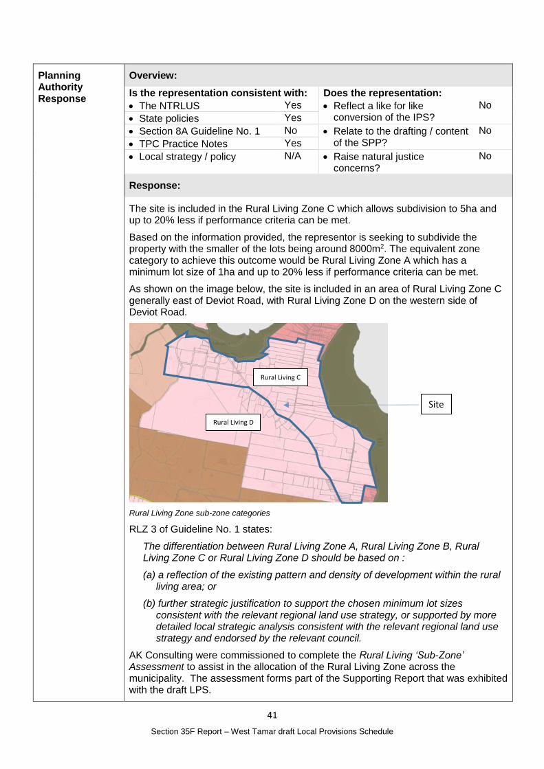
As shown on the image below, the site is included in an area of Rural Living Zone C generally east of Deviot Road, with Rural Living Zone D on the western side of Deviot Road.
Rural Living Zone sub-zone categories
RLZ 3 of Guideline No. 1 states:
The differentiation between Rural Living Zone A, Rural Living Zone B, Rural Living Zone C or Rural Living Zone D should be based on :
(a) a reflection of the existing pattern and density of development within the rural living area; or
(b) further strategic justification to support the chosen minimum lot sizes consistent with the relevant regional land use strategy, or supported by more detailed local strategic analysis consistent with the relevant regional land use strategy and endorsed by the relevant council.
AK Consulting were commissioned to complete the Rural Living ‘Sub-Zone’ Assessment to assist in the allocation of the Rural Living Zone across the municipality. The assessment forms part of the Supporting Report that was exhibited with the draft LPS.
Site
Rural Living C
Rural Living D
42
Section 35F Report – West Tamar draft Local Provisions Schedule
The Assessment identifies the site as Area ID 44 and recommended sub-zone C as it is part of ‘a large group of titles generally around 5ha, with widespread subdivision evident.’
The representor considers that additional criteria as outlined above should be applied in considering the allocation of the sub-zone for the site.
These site specific matters were not considered as part of the assessment, however the prevailing subdivision pattern / surrounding lot size was a key consideration in the allocation. The average lot size calculated by dividing the area of the precinct (304.7ha) by the number of lots (111) is 2.74ha. A review of 40 lots within 500m of the site found:
Lots ranged in size between 0.157ha and 14.5ha with the median being 2.43ha;
Those lots east of Deviot Road (and allocated to the Rural Living C subzone) ranged in size from 0.35ha to 10.46ha with the median being 4ha and the average being 4.355ha; and
There is historic subdivision into smaller rural living lots with frontage to Deviot Road however lot size generally increases further from away from Deviot Road.
At this time the Planning Authority has not completed additional strategic work that makes an alternative recommendation to the assessment completed in 2018.
Guideline No. 1 seeks to reflect existing lot sizes and density and therefore is suggesting sub-zone allocation should not provide capacity for further subdivision. The Rural Living Sub-zone Assessment found that using the Sub-Zone C would only result in two additional lots.
While the representor’s intent to subdivide is acknowledged there is insufficient information currently available to support a change to the draft LPS that would meet the requirements of Guideline No. 1.
Planning Authority recommended action
No changes to the draft LPS are recommended at this time.
Effect of recommendation on the draft LPS
The Planning Authority recommendation has no impact on implementing the draft LPS as a whole.
Meets the LPS criteria
The Planning Authority is satisfied that the recommendation meets the LPS criteria.
43
Section 35F Report – West Tamar draft Local Provisions Schedule
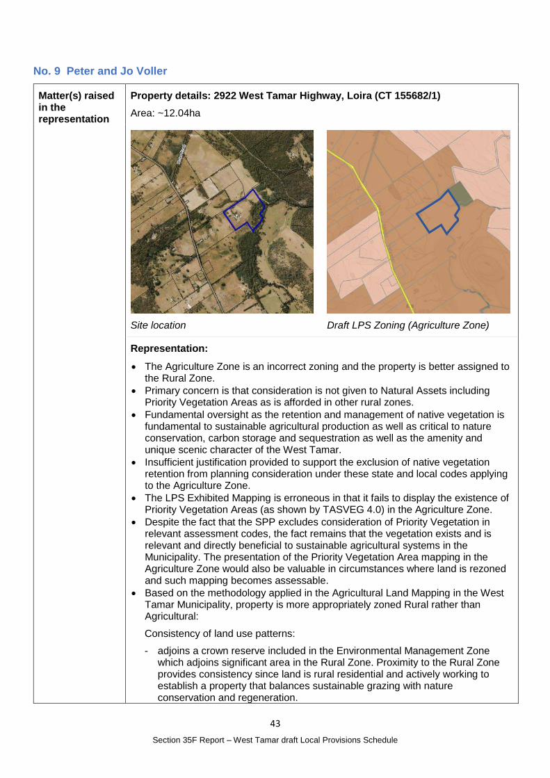
No. 9 Peter and Jo Voller
Matter(s) raised in the representation
Property details: 2922 West Tamar Highway, Loira (CT 155682/1)
Area: ~12.04ha
Site location
Draft LPS Zoning (Agriculture Zone)
Representation:
The Agriculture Zone is an incorrect zoning and the property is better assigned to the Rural Zone.
Primary concern is that consideration is not given to Natural Assets including Priority Vegetation Areas as is afforded in other rural zones.
Fundamental oversight as the retention and management of native vegetation is fundamental to sustainable agricultural production as well as critical to nature conservation, carbon storage and sequestration as well as the amenity and unique scenic character of the West Tamar.
Insufficient justification provided to support the exclusion of native vegetation retention from planning consideration under these state and local codes applying to the Agriculture Zone.
The LPS Exhibited Mapping is erroneous in that it fails to display the existence of Priority Vegetation Areas (as shown by TASVEG 4.0) in the Agriculture Zone.
Despite the fact that the SPP excludes consideration of Priority Vegetation in relevant assessment codes, the fact remains that the vegetation exists and is relevant and directly beneficial to sustainable agricultural systems in the Municipality. The presentation of the Priority Vegetation Area mapping in the Agriculture Zone would also be valuable in circumstances where land is rezoned and such mapping becomes assessable.
Based on the methodology applied in the Agricultural Land Mapping in the West Tamar Municipality, property is more appropriately zoned Rural rather than Agricultural:
Consistency of land use patterns:
- adjoins a crown reserve included in the Environmental Management Zone which adjoins significant area in the Rural Zone. Proximity to the Rural Zone provides consistency since land is rural residential and actively working to establish a property that balances sustainable grazing with nature conservation and regeneration.
44
Section 35F Report – West Tamar draft Local Provisions Schedule
- Surrounding properties are largely rural residential blocks the Agricultural Land Mapping Project correctly excluded these parcels from the Agriculture Zone.
- 8 parcels close to property included in the Rural Zone – rezoning property along with neighbouring small lots would establish a cluster which provides a consistent land use pattern
- Agricultural land capability mapping identifies property to be broadly Class 4, however riparian and low lying land on the property is unlikely to meet this criterion. This is supported by Enterprise suitability mapping due to very high to extreme frost risk.
- 2019 Land Use mapping prepared by DPIPWE identified property and many surrounding it as ‘Rural Residential without agriculture’ or ‘Residential and farm infrastructure’
- More appropriately assigned to Rural Zone on basis of diversified land use and also relevant to the application of the Priority Vegetation Area layers.
Minimum three titles to make a zone:
- Property adjoins a significant number of properties zoned rural which is considered adequate to meet this guideline
- Connection of rural zoned lots provides a corridor of lots to which the priority vegetation layer applies and provides a corridor for longer term wildlife habitat
- WT report (see page 24), Loira area was lumped into Agriculture Zone based loosely on land capability and presumed suitability for wine grape production. Additional information available on LISTmap, notably the Enterprise Versatility index (a compilation of enterprise suitability mapping layers) suggest there are areas of moderate to low enterprise versatility on the property, mainly suited for pasture and grazing
- This information suggests that the land is well suited to sub commercial rural uses and residential small property size blocks, which is what it is its present use as per Land Use mapping 2019
- the decision of the drafters of the WT Report to exclude the cluster of titles near us from the Agriculture zone (as per quote below) is justified and that a similar of not identical rationale could be applied to the bulk of small residential properties in the Loira area, including our property
The exceptions were; a cluster of titles on the northern end of the assessed area (CT 74601/1, CT 63673/1, CT 27677/1 & CT 40352/1), these titles all have existing dwellings and are small in area (3 –8ha), and a cluster of titles to the south of the assessed area were also determined to be more suitable for the Rural zone (CT 122544/1, CT 60873/11, CT 44814/1, CT 223891/1, CT 240602/1 & CT 13934/1).The two northern titles of this cluster are entirely covered in native vegetation, with the most northern title also containing a dwelling, while, remaining titles are small in area, all contain a dwelling and are constrained from being farmed in conjunction with surrounding titles because of these existing dwellings
We encourage you and West Tamar Council to consider our representation and to revisit recommendations in the WT report as they apply to the Loira area. Our primary interest is in ensuring that priority vegetation and habitat are considered in resource development activities in our area.
We encourage you and West Tamar Council to refer the matter of making Priority Vegetation Areas assessable within Agriculture Zone on the basis of the integral value of native vegetation to sustainable farming.
West Tamar Municipality is a highly diverse and ecologically important region, a core range for nationally listed mammals (such as Eastern Barred Bandicoot, Eastern Quoll, Spotted Tail Quoll ) it is critical for conservation of habitat for resident and migratory bird species and it adjoins a globally significant estuarine system, Excluding the consideration of priority vegetation from the Natural Assets
45
Section 35F Report – West Tamar draft Local Provisions Schedule
code for large areas of the municipality weakens the significance and value of these natural assets for present and future generations.
We entreat you to consider as a Council reinstating the Priority Vegetation Area mapping to land zoned Agriculture, if only as a silent reminder of the presence of these areas and to act as a trigger for resource developers to investigate further their obligations to minimise impacts on these vulnerable areas.
Relates to representation No. 10, 14, 40(12) and 62(7) in relation to the Priority Vegetation Areas overlay map
Planning Authority Response
Overview:
Is the representation consistent with: Does the representation:
The NTRLUS Yes Reflect a like for like conversion of the IPS?
Yes
State policies Yes
Section 8A Guideline No. 1 Yes Relate to the drafting / content of the SPP?
No
TPC Practice Notes Yes
Local strategy / policy N/A Raise natural justice concerns?
No
Response:
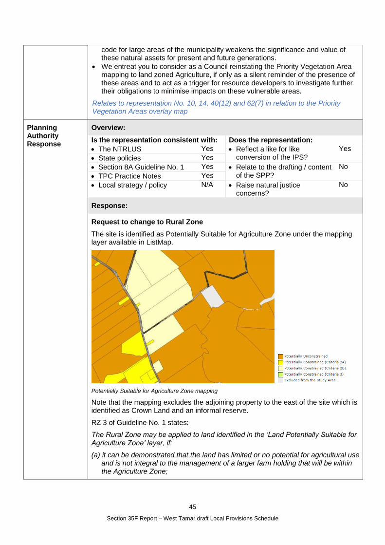
Request to change to Rural Zone
The site is identified as Potentially Suitable for Agriculture Zone under the mapping layer available in ListMap.
Potentially Suitable for Agriculture Zone mapping
Note that the mapping excludes the adjoining property to the east of the site which is identified as Crown Land and an informal reserve.
RZ 3 of Guideline No. 1 states:
The Rural Zone may be applied to land identified in the ‘Land Potentially Suitable for Agriculture Zone’ layer, if:
(a) it can be demonstrated that the land has limited or no potential for agricultural use and is not integral to the management of a larger farm holding that will be within the Agriculture Zone;
46
Section 35F Report – West Tamar draft Local Provisions Schedule
(b) it can be demonstrated that there are significant constraints to agricultural use occurring on the land;
(c) the land is identified for the protection of a strategically important naturally occurring resource which is more appropriately located in the Rural Zone and is supported by strategic analysis;
(d) the land is identified for a strategically important use or development that is more appropriately located in the Rural Zone and is supported by strategic analysis; or
(e) it can be demonstrated, by strategic analysis, that the Rural Zone is otherwise more appropriate for the land.
AK Consulting’s Agricultural Land Mapping in West Tamar Municipality identifies the site within Area 11 and makes the following observations:
In general, it was determined that there was not sufficient justification to remove titles from the Ag Zone, as the majority of the area is mapped as Class 4 Land Capability and having vineyard potential, with the majority of the titles having sufficient area to support such developments. Six of the titles mapped as ‘unconstrained’ in the centre of the assessed area are under the same ownership and appear to be farmed in conjunction as part of an agricultural enterprise with ‘commercial scale’ characteristics. Protecting this land for future agricultural use was also a driver for retaining the area in the Ag Zone. The exceptions were; a cluster of titles on the northern end of the assessed area (CT 74601/1, CT 63673/1, CT 27677/1 & CT 40352/1), these titles all have existing dwellings and are small in area (3 – 8ha), and a cluster of titles to the south of the assessed area were also determined to be more suitable for the Rural zone (CT 122544/1, CT 60873/11, CT 44814/1, CT 223891/1, CT 240602/1 & CT 13934/1). The two northern titles of this cluster are entirely covered in native vegetation, with the most northern title also containing a dwelling, while, remaining titles are small in area, all contain a dwelling and are constrained from being farmed in conjunction with surrounding titles because of these existing dwellings.
The site is on the other side of the highway to the southern cluster of lots.
Including the site in the Rural Zone will be contingent on demonstrating that criteria (a) applies and that ‘the land has limited or no potential for agricultural use and is not integral to the management of a larger farm holding that will be within the Agriculture Zone.’
The representation was not accompanied by an Agricultural Land Suitability Report however provided a detailed analysis of the agricultural capability of the site finding that this is limited due to natural values, characteristics of the land and fragmentation of the area into smaller lots that cannot reasonably be part of a larger farm holding.
TASVEG 3.0 mapping indicates the vegetation communities on the site form part of a larger connected ecosystem.
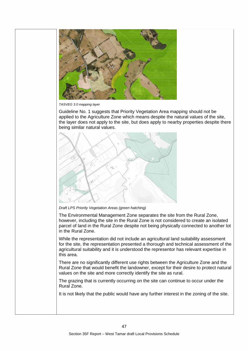
47
Section 35F Report – West Tamar draft Local Provisions Schedule
TASVEG 3.0 mapping layer
Guideline No. 1 suggests that Priority Vegetation Area mapping should not be applied to the Agriculture Zone which means despite the natural values of the site, the layer does not apply to the site, but does apply to nearby properties despite there being similar natural values.
Draft LPS Priority Vegetation Areas (green hatching)
The Environmental Management Zone separates the site from the Rural Zone, however, including the site in the Rural Zone is not considered to create an isolated parcel of land in the Rural Zone despite not being physically connected to another lot in the Rural Zone.
While the representation did not include an agricultural land suitability assessment for the site, the representation presented a thorough and technical assessment of the agricultural suitability and it is understood the representor has relevant expertise in this area.
There are no significantly different use rights between the Agriculture Zone and the Rural Zone that would benefit the landowner, except for their desire to protect natural values on the site and more correctly identify the site as rural.
The grazing that is currently occurring on the site can continue to occur under the Rural Zone.
It is not likely that the public would have any further interest in the zoning of the site.
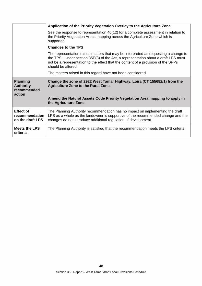
48
Section 35F Report – West Tamar draft Local Provisions Schedule
Application of the Priority Vegetation Overlay to the Agriculture Zone
See the response to representation 40(12) for a complete assessment in relation to the Priority Vegetation Areas mapping across the Agriculture Zone which is supported.
Changes to the TPS
The representation raises matters that may be interpreted as requesting a change to the TPS. Under section 35E(3) of the Act, a representation about a draft LPS must not be a representation to the effect that the content of a provision of the SPPs should be altered.
The matters raised in this regard have not been considered.
Planning Authority recommended action
Change the zone of 2922 West Tamar Highway, Loira (CT 155682/1) from the Agriculture Zone to the Rural Zone.
Amend the Natural Assets Code Priority Vegetation Area mapping to apply in the Agriculture Zone.
Effect of recommendation on the draft LPS
The Planning Authority recommendation has no impact on implementing the draft LPS as a whole as the landowner is supportive of the recommended change and the changes do not introduce additional regulation of development.
Meets the LPS criteria
The Planning Authority is satisfied that the recommendation meets the LPS criteria.
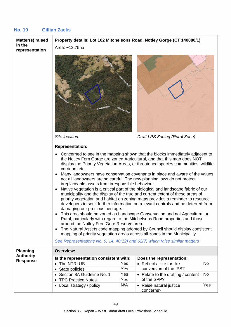
49
Section 35F Report – West Tamar draft Local Provisions Schedule
No. 10 Gillian Zacks
Matter(s) raised in the representation
Property details: Lot 102 Mitchelsons Road, Notley Gorge (CT 140080/1)
Area: ~12.75ha
Site location
Draft LPS Zoning (Rural Zone)
Representation:
Concerned to see in the mapping shown that the blocks immediately adjacent to the Notley Fern Gorge are zoned Agricultural, and that this map does NOT display the Priority Vegetation Areas, or threatened species communities, wildlife corridors etc.
Many landowners have conservation covenants in place and aware of the values, not all landowners are so careful. The new planning laws do not protect irreplaceable assets from irresponsible behaviour.
Native vegetation is a critical part of the biological and landscape fabric of our municipality and the display of the true and current extent of these areas of priority vegetation and habitat on zoning maps provides a reminder to resource developers to seek further information on relevant controls and be deterred from damaging our precious heritage.
This area should be zoned as Landscape Conservation and not Agricultural or Rural, particularly with regard to the Mitchelsons Road properties and those around the Notley Fern Gore Reserve area.
The Natural Assets code mapping adopted by Council should display consistent mapping of priority vegetation areas across all zones in the Municipality
See Representations No. 9, 14, 40(12) and 62(7) which raise similar matters
Planning Authority Response
Overview:
Is the representation consistent with: Does the representation:
The NTRLUS Yes Reflect a like for like conversion of the IPS?
No
State policies Yes
Section 8A Guideline No. 1 Yes Relate to the drafting / content of the SPP?
No
TPC Practice Notes Yes
Local strategy / policy N/A Raise natural justice concerns?
Yes
50
Section 35F Report – West Tamar draft Local Provisions Schedule
Response:
Request to apply the Landscape Conservation Zone
A detailed response in relation to changing the zone to the Landscape Conservation Zone is included under Representation No. 2.
As noted a strategic review of the use of the Environmental Management Zone and Landscape Conservation Zone is recommended as a separate process however changes to the zone of the site are not recommended at this time.
Priority Vegetation Areas mapping
See the response to representation 40(12) for a complete assessment in relation to the Priority Vegetation Areas mapping across all zone.
Planning Authority recommended action
No changes to the zoning of the site are recommended at this time.
Amend the Natural Assets Code Priority Vegetation Area mapping to apply in the Agriculture Zone.
Effect of recommendation on the draft LPS
The Planning Authority recommendation has no impact on implementing the draft LPS as a whole.
Meets the LPS criteria
The Planning Authority is satisfied that the recommendation meets the LPS criteria.
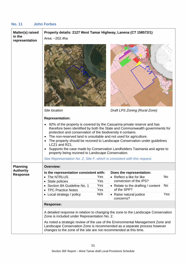
51
Section 35F Report – West Tamar draft Local Provisions Schedule
No. 11 John Forbes
Matter(s) raised in the representation
Property details: 2127 West Tamar Highway, Lanena (CT 158572/1)
Area: ~202.4ha
Site location
Draft LPS Zoning (Rural Zone)
Representation:
92% of the property is covered by the Casuarina private reserve and has therefore been identified by both the State and Commonwealth governments for protection and conservation of the biodiversity it contains.
The non-reserved land is unsuitable and not used for agriculture.
The property should be rezoned to Landscape Conservation under guidelines LCZ1 and RZ1.
Supports the case made by Conservation Landholders Tasmania and agree to property being rezoned to Landscape Conservation.
See Representation No. 2, Site F, which is consistent with this request.
Planning Authority Response
Overview:
Is the representation consistent with: Does the representation:
The NTRLUS Yes Reflect a like for like conversion of the IPS?
No
State policies Yes
Section 8A Guideline No. 1 Yes Relate to the drafting / content of the SPP?
No
TPC Practice Notes Yes
Local strategy / policy N/A Raise natural justice concerns?
Yes
Response:
A detailed response in relation to changing the zone to the Landscape Conservation Zone is included under Representation No. 2.
As noted a strategic review of the use of the Environmental Management Zone and Landscape Conservation Zone is recommended as a separate process however changes to the zone of the site are not recommended at this time.

52
Section 35F Report – West Tamar draft Local Provisions Schedule
Planning Authority recommended action
No changes to the draft LPS are recommended at this time.
Effect of recommendation on the draft LPS
The Planning Authority recommendation has no impact on implementing the draft LPS as a whole.
Meets the LPS criteria
The Planning Authority is satisfied that the recommendation meets the LPS criteria.
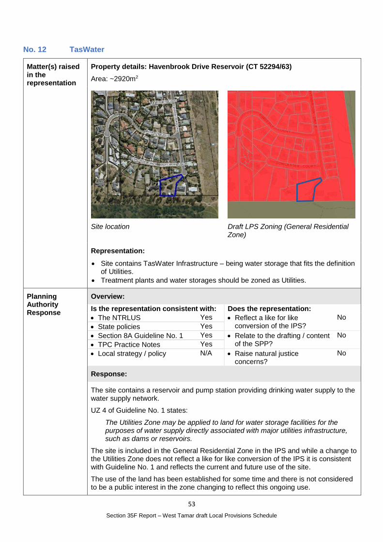
53
Section 35F Report – West Tamar draft Local Provisions Schedule
No. 12 TasWater
Matter(s) raised in the representation
Property details: Havenbrook Drive Reservoir (CT 52294/63)
Area: ~2920m2
Site location
Draft LPS Zoning (General Residential Zone)
Representation:
Site contains TasWater Infrastructure – being water storage that fits the definition of Utilities.
Treatment plants and water storages should be zoned as Utilities.
Planning Authority Response
Overview:
Is the representation consistent with: Does the representation:
The NTRLUS Yes Reflect a like for like conversion of the IPS?
No
State policies Yes
Section 8A Guideline No. 1 Yes Relate to the drafting / content of the SPP?
No
TPC Practice Notes Yes
Local strategy / policy N/A Raise natural justice concerns?
No
Response:
The site contains a reservoir and pump station providing drinking water supply to the water supply network.
UZ 4 of Guideline No. 1 states:
The Utilities Zone may be applied to land for water storage facilities for the purposes of water supply directly associated with major utilities infrastructure, such as dams or reservoirs.
The site is included in the General Residential Zone in the IPS and while a change to the Utilities Zone does not reflect a like for like conversion of the IPS it is consistent with Guideline No. 1 and reflects the current and future use of the site.
The use of the land has been established for some time and there is not considered to be a public interest in the zone changing to reflect this ongoing use.
54
Section 35F Report – West Tamar draft Local Provisions Schedule
Planning Authority recommended action
Change the zone for Havenbrook Drive Reservoir (CT 52294/63) from the General Residential Zone to the Utilities Zone.
Effect of recommendation on the draft LPS
The Planning Authority recommendation has no impact on implementing the draft LPS as a whole as the landowner is supportive of the recommended change.
Meets the LPS criteria
The Planning Authority recommendation meets the LPS criteria.
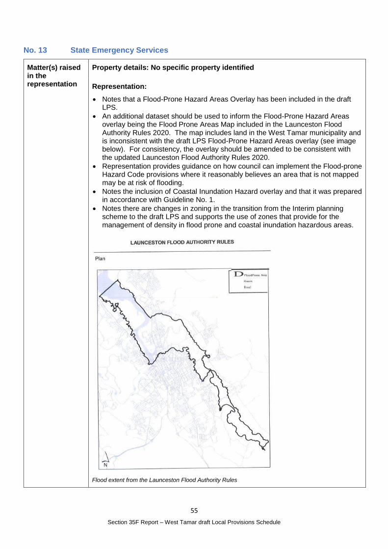
55
Section 35F Report – West Tamar draft Local Provisions Schedule
No. 13 State Emergency Services
Matter(s) raised in the representation
Property details: No specific property identified
Representation:
Notes that a Flood-Prone Hazard Areas Overlay has been included in the draft LPS.
An additional dataset should be used to inform the Flood-Prone Hazard Areas overlay being the Flood Prone Areas Map included in the Launceston Flood Authority Rules 2020. The map includes land in the West Tamar municipality and is inconsistent with the draft LPS Flood-Prone Hazard Areas overlay (see image below). For consistency, the overlay should be amended to be consistent with the updated Launceston Flood Authority Rules 2020.
Representation provides guidance on how council can implement the Flood-prone Hazard Code provisions where it reasonably believes an area that is not mapped may be at risk of flooding.
Notes the inclusion of Coastal Inundation Hazard overlay and that it was prepared in accordance with Guideline No. 1.
Notes there are changes in zoning in the transition from the Interim planning scheme to the draft LPS and supports the use of zones that provide for the management of density in flood prone and coastal inundation hazardous areas.
Flood extent from the Launceston Flood Authority Rules
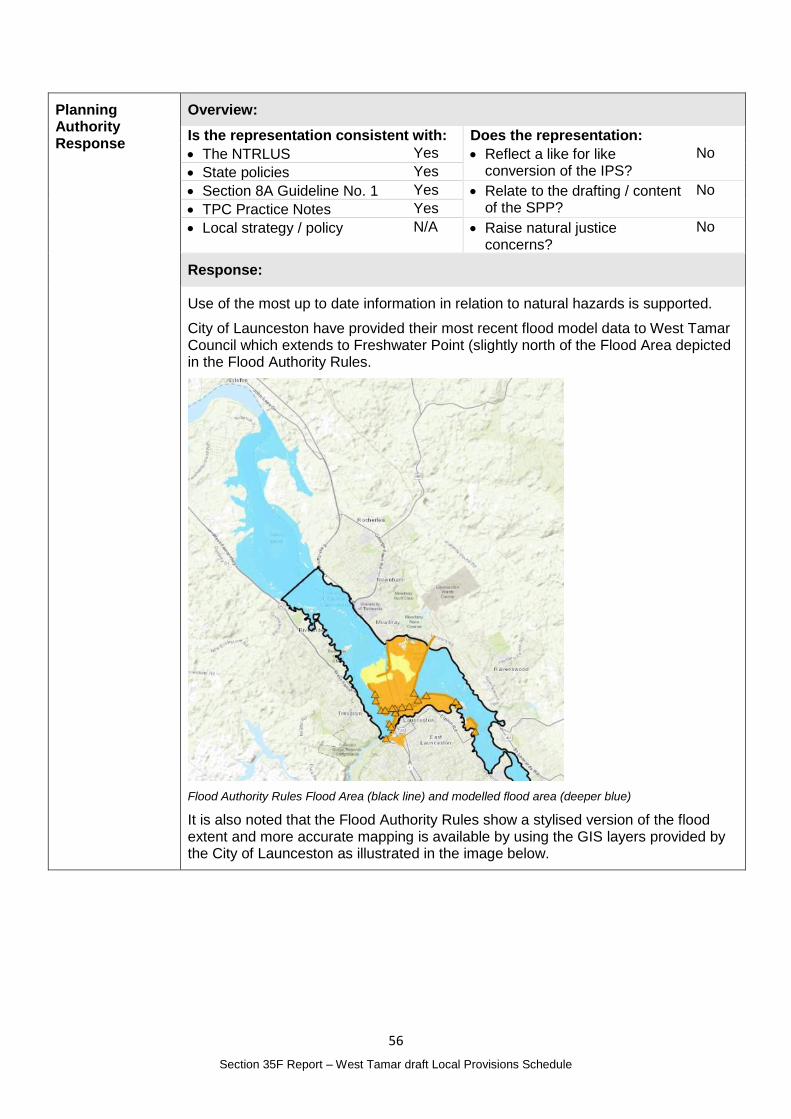
56
Section 35F Report – West Tamar draft Local Provisions Schedule
Planning Authority Response
Overview:
Is the representation consistent with: Does the representation:
The NTRLUS Yes Reflect a like for like conversion of the IPS?
No
State policies Yes
Section 8A Guideline No. 1 Yes Relate to the drafting / content of the SPP?
No
TPC Practice Notes Yes
Local strategy / policy N/A Raise natural justice concerns?
No
Response:
Use of the most up to date information in relation to natural hazards is supported.
City of Launceston have provided their most recent flood model data to West Tamar Council which extends to Freshwater Point (slightly north of the Flood Area depicted in the Flood Authority Rules.
Flood Authority Rules Flood Area (black line) and modelled flood area (deeper blue)
It is also noted that the Flood Authority Rules show a stylised version of the flood extent and more accurate mapping is available by using the GIS layers provided by the City of Launceston as illustrated in the image below.
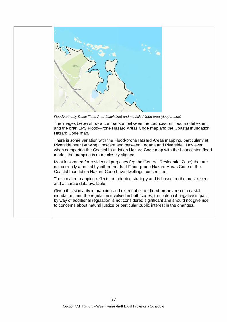
57
Section 35F Report – West Tamar draft Local Provisions Schedule
Flood Authority Rules Flood Area (black line) and modelled flood area (deeper blue)
The images below show a comparison between the Launceston flood model extent and the draft LPS Flood-Prone Hazard Areas Code map and the Coastal Inundation Hazard Code map.
There is some variation with the Flood-prone Hazard Areas mapping, particularly at Riverside near Barwing Crescent and between Legana and Riverside. However when comparing the Coastal Inundation Hazard Code map with the Launceston flood model, the mapping is more closely aligned.
Most lots zoned for residential purposes (eg the General Residential Zone) that are not currently affected by either the draft Flood-prone Hazard Areas Code or the Coastal Inundation Hazard Code have dwellings constructed.
The updated mapping reflects an adopted strategy and is based on the most recent and accurate data available.
Given this similarity in mapping and extent of either flood-prone area or coastal inundation, and the regulation involved in both codes, the potential negative impact, by way of additional regulation is not considered significant and should not give rise to concerns about natural justice or particular public interest in the changes.
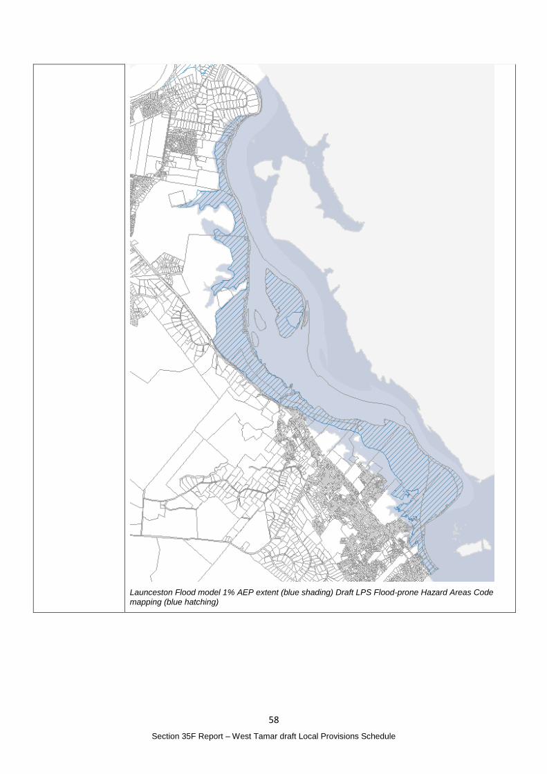
58
Section 35F Report – West Tamar draft Local Provisions Schedule
Launceston Flood model 1% AEP extent (blue shading) Draft LPS Flood-prone Hazard Areas Code mapping (blue hatching)
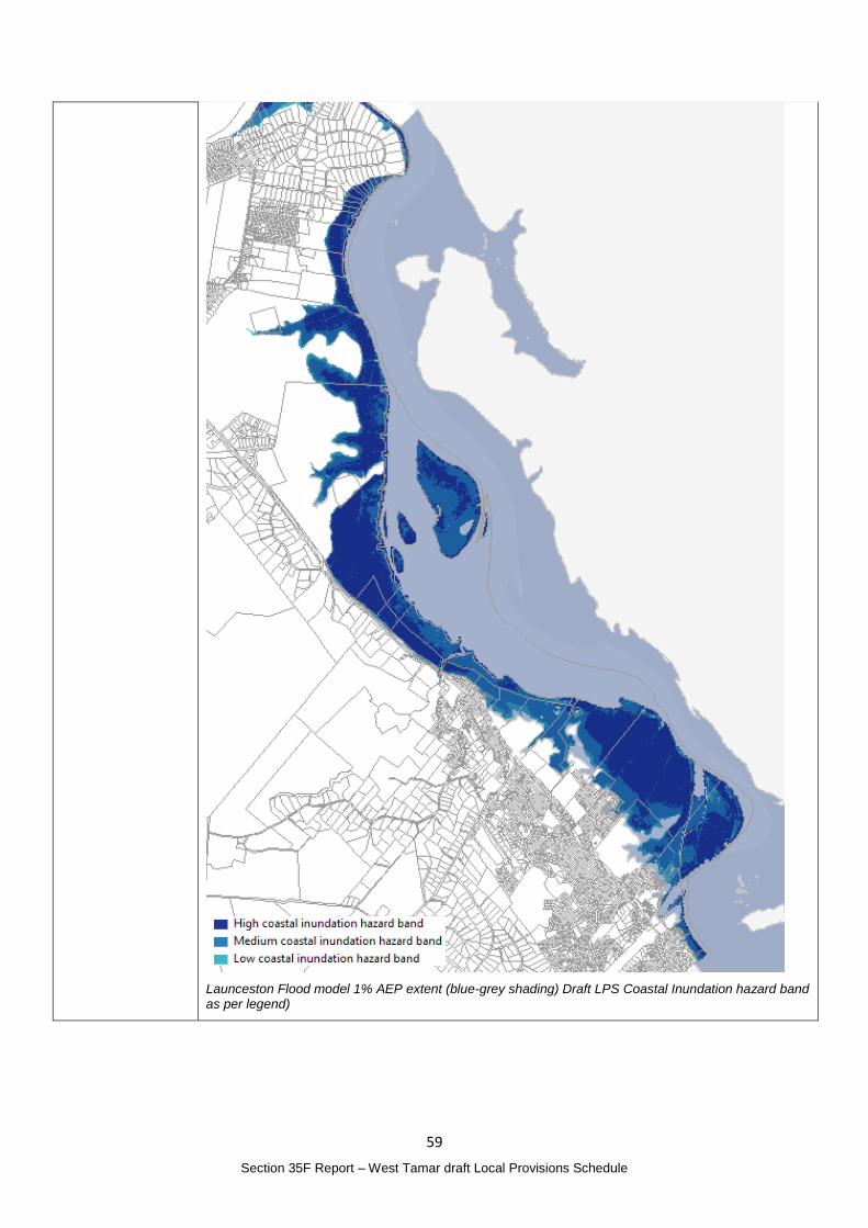
59
Section 35F Report – West Tamar draft Local Provisions Schedule
Launceston Flood model 1% AEP extent (blue-grey shading) Draft LPS Coastal Inundation hazard band as per legend)
60
Section 35F Report – West Tamar draft Local Provisions Schedule
Planning Authority recommended action
Amend the Flood-prone Hazard Areas mapping to incorporate the most recent flood modelling completed by the City of Launceston and reflected in the Launceston Flood Authority Rules.
Effect of recommendation on the draft LPS
The Planning Authority recommendation has only minor impact on implementing the draft LPS as a whole.
Meets the LPS criteria
The Planning Authority recommendation meets the LPS criteria.
61
Section 35F Report – West Tamar draft Local Provisions Schedule
No. 14 West Tamar Landcare Group
Matter(s) raised in the representation
Property details: Not applicable
Representation:
Request that the Natural Assets Code mapping display consistent mapping of Priority Vegetation Areas across all zones in the municipality.
Request that the Priority Vegetation Areas be updated using contemporary data inclusive of recent updates to TASVEG to version 4.0, mapping of threatened communities, threatened species habitats and natural wildlife corridors using consistent and transparent methodologies.
Not currently displayed in the Agriculture and Future Urban Zones.
Acknowledge that in such zones, consideration of priority vegetation in the assessment of resource development or other development is not explicitly assessed under the State Planning Provisions, but is it subject to other regulatory controls. We consider this is a fundamental oversight of the State Planning Provisions dealing with the Agriculture Zone in that retention and management of native vegetation is fundamental to healthy and sustainable agricultural production as well as critical to nature conservation, water quality protection, carbon storage and sequestration as well as the amenity and the unique scenic character of the West Tamar.
Native vegetation is a critical part of the biological and landscape fabric of our Municipality and we consider as a minimum the display of the true spatial extent of these areas of priority vegetation and habitat on zoning maps provides a reminder to resource developers to seek further information on relevant controls, and also perhaps pause for thought before acting.
We are also concerned that should there be cases where land zoning changes from zones such as Agriculture or Future Urban to a zoning where Priority Vegetation Areas are assessable, incomplete mapping of this important layer may mean that existing vegetation may not be considered under the relevant codes. We therefore consider that transparent disclosure of all Priority Vegetation Areas in the Municipality is required to allow for reasonable land use decisions by proponents irrelevant of land zoning.
West Tamar is an area of outstanding biodiversity values and native vegetation provides considerable benefits for agriculture and that to ignore the fundamental importance of natural areas in the matrix of farming is adverse to sustainable and viable systems into the future.
Believe that the great majority of present landowners in the Municipality share a similar view in regards balanced land use, and that by and large our natural systems are in good hands.
New Resource Development proposals need to protect Natural Assets including priority vegetation and landscape connectivity. We rely on planning schemes and other regulation to ensure that minimum standards are maintained across all enterprises and that land use decisions are socially, economically and environmentally sound. This is the case in the Rural Zone and we think it should apply equally in the Agriculture Zone.
Our hope is that the display of Priority Vegetation in the Natural Assets mapping across all zones will foster and support this ethic, and ethic of Landcare.
See Representations No. 9, 10, 40(12) and 62(7) which raise similar matters
62
Section 35F Report – West Tamar draft Local Provisions Schedule
Planning Authority Response
Overview:
Is the representation consistent with: Does the representation:
The NTRLUS Yes Reflect a like for like conversion of the IPS?
Yes
State policies Yes
Section 8A Guideline No. 1 Yes Relate to the drafting / content of the SPP?
Partly
TPC Practice Notes Yes
Local strategy / policy N/A Raise natural justice concerns?
No
Response:
See the response to representation 40(12) for a complete assessment in relation to the Priority Vegetation Areas mapping across the Agriculture Zone which is supported.
It is noted that the Priority Vegetation Area overlay does apply to the Future Urban Zone.
As the SPP contains the Natural Assets Code that regulates development within the Priority Vegetation Area, any proposed changes or increases in regulation cannot be addressed as part of this process.
Planning Authority recommended action
Amend the Natural Assets Code Priority Vegetation Area mapping to apply in the Agriculture Zone.
Effect of recommendation on the draft LPS
The Planning Authority recommendation has no impact on implementing the draft LPS as a whole.
Meets the LPS criteria
The Planning Authority is satisfied that the recommendation meets the LPS criteria.
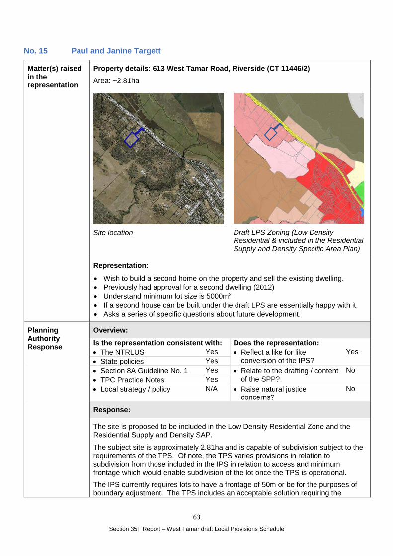
63
Section 35F Report – West Tamar draft Local Provisions Schedule
No. 15 Paul and Janine Targett
Matter(s) raised in the representation
Property details: 613 West Tamar Road, Riverside (CT 11446/2)
Area: ~2.81ha
Site location
Draft LPS Zoning (Low Density Residential & included in the Residential Supply and Density Specific Area Plan)
Representation:
Wish to build a second home on the property and sell the existing dwelling.
Previously had approval for a second dwelling (2012)
Understand minimum lot size is 5000m2
If a second house can be built under the draft LPS are essentially happy with it.
Asks a series of specific questions about future development.
Planning Authority Response
Overview:
Is the representation consistent with: Does the representation:
The NTRLUS Yes Reflect a like for like conversion of the IPS?
Yes
State policies Yes
Section 8A Guideline No. 1 Yes Relate to the drafting / content of the SPP?
No
TPC Practice Notes Yes
Local strategy / policy N/A Raise natural justice concerns?
No
Response:
The site is proposed to be included in the Low Density Residential Zone and the Residential Supply and Density SAP.
The subject site is approximately 2.81ha and is capable of subdivision subject to the requirements of the TPS. Of note, the TPS varies provisions in relation to subdivision from those included in the IPS in relation to access and minimum frontage which would enable subdivision of the lot once the TPS is operational.
The IPS currently requires lots to have a frontage of 50m or be for the purposes of boundary adjustment. The TPS includes an acceptable solution requiring the
64
Section 35F Report – West Tamar draft Local Provisions Schedule
frontage to be 20m with a corresponding Performance criteria that permits a lesser frontage if the criteria is met.
Planning Authority recommended action
No changes to the draft LPS are recommended.
Effect of recommendation on the draft LPS
The Planning Authority recommendation has no impact on implementing the draft LPS as a whole.
Meets the LPS criteria
The Planning Authority recommendation meets the LPS criteria.
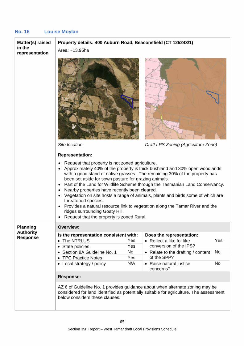
65
Section 35F Report – West Tamar draft Local Provisions Schedule
No. 16 Louise Moylan
Matter(s) raised in the representation
Property details: 400 Auburn Road, Beaconsfield (CT 125243/1)
Area: ~13.95ha
Site location
Draft LPS Zoning (Agriculture Zone)
Representation:
Request that property is not zoned agriculture.
Approximately 40% of the property is thick bushland and 30% open woodlands with a good stand of native grasses. The remaining 30% of the property has been set aside for sown pasture for grazing animals.
Part of the Land for Wildlife Scheme through the Tasmanian Land Conservancy.
Nearby properties have recently been cleared.
Vegetation on site hosts a range of animals, plants and birds some of which are threatened species.
Provides a natural resource link to vegetation along the Tamar River and the ridges surrounding Goaty Hill.
Request that the property is zoned Rural.
Planning Authority Response
Overview:
Is the representation consistent with: Does the representation:
The NTRLUS Yes Reflect a like for like conversion of the IPS?
Yes
State policies Yes
Section 8A Guideline No. 1 No Relate to the drafting / content of the SPP?
No
TPC Practice Notes Yes
Local strategy / policy N/A Raise natural justice concerns?
No
Response:
AZ 6 of Guideline No. 1 provides guidance about when alternate zoning may be considered for land identified as potentially suitable for agriculture. The assessment below considers these clauses.
66
Section 35F Report – West Tamar draft Local Provisions Schedule
AZ 6 of Guideline No. 1 Response
(a) local or regional strategic analysis has identified or justifies the need for an alternate consistent with the relevant regional land use strategy, or supported by more detailed local strategic analysis consistent with the relevant regional land use strategy and endorsed by the relevant council;
Land Potentially Suitable for Agriculture mapping identifies the site as Potentially unconstrained. No local or regional analysis has been completed that refines or challenges that designation.
(b) for the identification and protection of a strategically important naturally occurring resource which requires an alternate zoning;
There are no known strategically important natural resources on the site.
(c) for the identification and protection of significant natural values, such as priority vegetation areas as defined in the Natural Assets Code, which require an alternate zoning, such as the Landscape Conservation Zone or Environmental Management Zone;
While the site is vegetated with native vegetation, Threatened Fauna and Flora mapping does not indicate any threatened species over the site and the site is not part of the Tasmanian Reserve Estate. The Natural Assets Code Priority Vegetation Area mapping does not apply in the Agriculture Zone however the raw data indicates parts of the property along the boundary with Auburn Road may be included in the mapping if it were to apply in the zone.
(d) for the identification, provision or protection of strategically important uses that require an alternate zone; or
The site is currently used for a dwelling and limited grazing which does not constitute a strategically important.
(e) it can be demonstrated that:
(i) the land has limited or no potential for agricultural use and is not integral to the management of a larger farm holding that will be within the Agriculture Zone;
(ii) there are significant constraints to agricultural use occurring on the land; or
(iii) the Agriculture Zone is otherwise not appropriate for the land.
Based on the information provided it is difficult to determine if the land has limited or no potential for agriculture. While there is native vegetation on site, given there are exemptions and assessment process to clear land for agriculture it is not likely to be a significant constraint.
The site is within a larger area of land included in the Agriculture Zone. Changing the zone of this site would result in a single 13.9ha property in the Rural Zone.
While the representor’s efforts to preserve the environmental values of the land are supported and the limitations on the practical use of the land for agricultural purposes are acknowledged there are not sufficient grounds to change the zone of the site based on the information available.
Planning Authority recommended action
No changes to the draft LPS are recommended at this time.
Effect of recommendation on the draft LPS
The Planning Authority recommendation has no impact on implementing the draft LPS as a whole.
Meets the LPS criteria
The Planning Authority recommendation meets the LPS criteria.
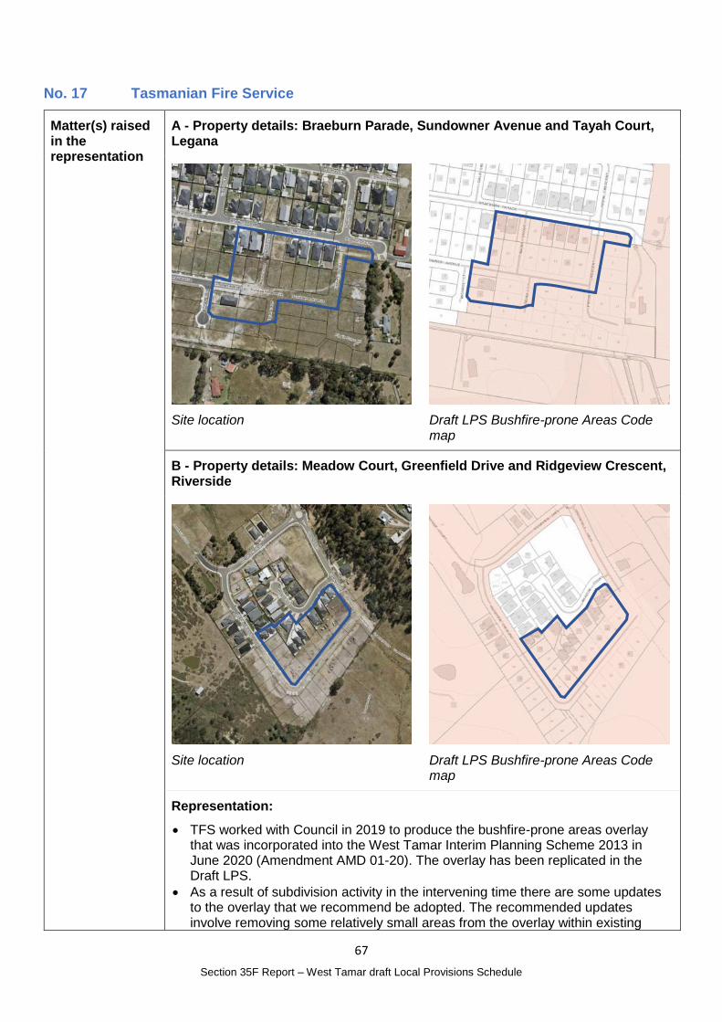
67
Section 35F Report – West Tamar draft Local Provisions Schedule
No. 17 Tasmanian Fire Service
Matter(s) raised in the representation
A - Property details: Braeburn Parade, Sundowner Avenue and Tayah Court, Legana
Site location
Draft LPS Bushfire-prone Areas Code map
B - Property details: Meadow Court, Greenfield Drive and Ridgeview Crescent, Riverside
Site location
Draft LPS Bushfire-prone Areas Code map
Representation:
TFS worked with Council in 2019 to produce the bushfire-prone areas overlay that was incorporated into the West Tamar Interim Planning Scheme 2013 in June 2020 (Amendment AMD 01-20). The overlay has been replicated in the Draft LPS.
As a result of subdivision activity in the intervening time there are some updates to the overlay that we recommend be adopted. The recommended updates involve removing some relatively small areas from the overlay within existing
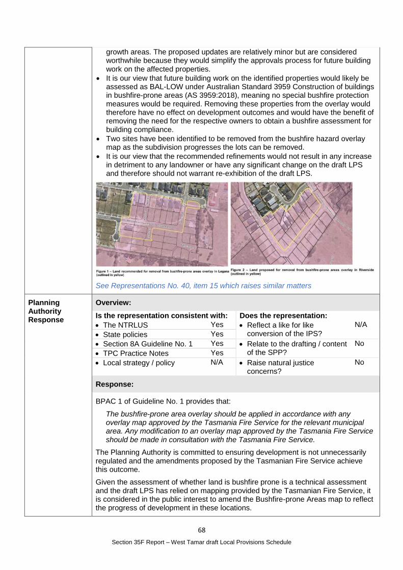
68
Section 35F Report – West Tamar draft Local Provisions Schedule
growth areas. The proposed updates are relatively minor but are considered worthwhile because they would simplify the approvals process for future building work on the affected properties.
It is our view that future building work on the identified properties would likely be assessed as BAL-LOW under Australian Standard 3959 Construction of buildings in bushfire-prone areas (AS 3959:2018), meaning no special bushfire protection measures would be required. Removing these properties from the overlay would therefore have no effect on development outcomes and would have the benefit of removing the need for the respective owners to obtain a bushfire assessment for building compliance.
Two sites have been identified to be removed from the bushfire hazard overlay map as the subdivision progresses the lots can be removed.
It is our view that the recommended refinements would not result in any increase in detriment to any landowner or have any significant change on the draft LPS and therefore should not warrant re-exhibition of the draft LPS.
See Representations No. 40, item 15 which raises similar matters
Planning Authority Response
Overview:
Is the representation consistent with: Does the representation:
The NTRLUS Yes Reflect a like for like conversion of the IPS?
N/A
State policies Yes
Section 8A Guideline No. 1 Yes Relate to the drafting / content of the SPP?
No
TPC Practice Notes Yes
Local strategy / policy N/A Raise natural justice concerns?
No
Response:
BPAC 1 of Guideline No. 1 provides that:
The bushfire-prone area overlay should be applied in accordance with any overlay map approved by the Tasmania Fire Service for the relevant municipal area. Any modification to an overlay map approved by the Tasmania Fire Service should be made in consultation with the Tasmania Fire Service.
The Planning Authority is committed to ensuring development is not unnecessarily regulated and the amendments proposed by the Tasmanian Fire Service achieve this outcome.
Given the assessment of whether land is bushfire prone is a technical assessment and the draft LPS has relied on mapping provided by the Tasmanian Fire Service, it is considered in the public interest to amend the Bushfire-prone Areas map to reflect the progress of development in these locations.
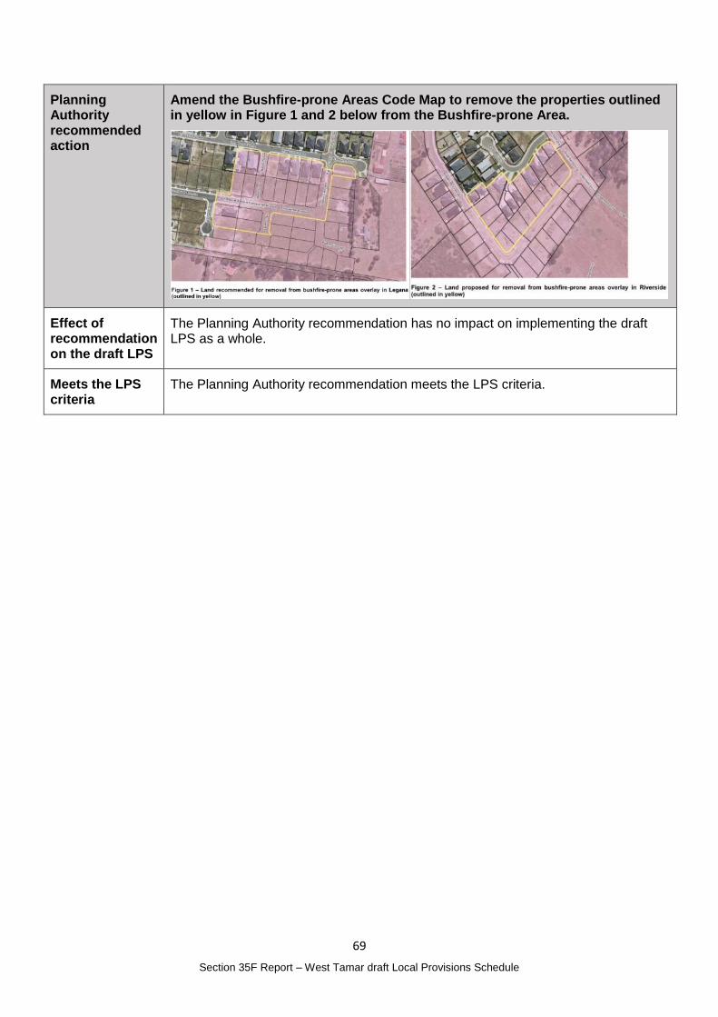
69
Section 35F Report – West Tamar draft Local Provisions Schedule
Planning Authority recommended action
Amend the Bushfire-prone Areas Code Map to remove the properties outlined in yellow in Figure 1 and 2 below from the Bushfire-prone Area.
Effect of recommendation on the draft LPS
The Planning Authority recommendation has no impact on implementing the draft LPS as a whole.
Meets the LPS criteria
The Planning Authority recommendation meets the LPS criteria.
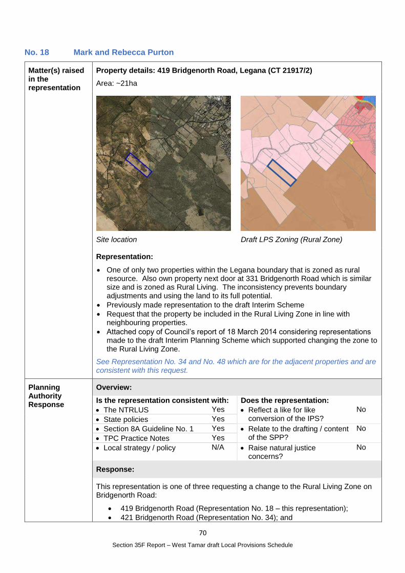
70
Section 35F Report – West Tamar draft Local Provisions Schedule
No. 18 Mark and Rebecca Purton
Matter(s) raised in the representation
Property details: 419 Bridgenorth Road, Legana (CT 21917/2)
Area: ~21ha
Site location
Draft LPS Zoning (Rural Zone)
Representation:
One of only two properties within the Legana boundary that is zoned as rural resource. Also own property next door at 331 Bridgenorth Road which is similar size and is zoned as Rural Living. The inconsistency prevents boundary adjustments and using the land to its full potential.
Previously made representation to the draft Interim Scheme
Request that the property be included in the Rural Living Zone in line with neighbouring properties.
Attached copy of Council’s report of 18 March 2014 considering representations made to the draft Interim Planning Scheme which supported changing the zone to the Rural Living Zone.
See Representation No. 34 and No. 48 which are for the adjacent properties and are consistent with this request.
Planning Authority Response
Overview:
Is the representation consistent with: Does the representation:
The NTRLUS Yes Reflect a like for like conversion of the IPS?
No
State policies Yes
Section 8A Guideline No. 1 Yes Relate to the drafting / content of the SPP?
No
TPC Practice Notes Yes
Local strategy / policy N/A Raise natural justice concerns?
No
Response:
This representation is one of three requesting a change to the Rural Living Zone on Bridgenorth Road:
419 Bridgenorth Road (Representation No. 18 – this representation);
421 Bridgenorth Road (Representation No. 34); and
71
Section 35F Report – West Tamar draft Local Provisions Schedule
437 Bridgenorth Road (Representation No. 48).
Given the three lots share a common location and request, this assessment will consider the requests collectively.
RLZ 1 of Guideline No. 1 states:
The Rural Living Zone should be applied to:
(a) residential areas with larger lots, where existing and intended use is a mix between residential and lower order rural activities (e.g. hobby farming), but priority is given to the protection of residential amenity; or
(b) land that is currently a Rural Living Zone within an interim planning scheme or a section 29 planning scheme,
unless RLZ 4 below applies.
The three lots are characteristic of, and used for rural living purposes and are constrained as a result of both their fragmentation and adjoining rural living from being viable agricultural properties.
The representor also made a representation to the Interim Planning Scheme to change the zone to Rural Living. While this was supported by the Planning Authority the change was not made prior to adoption noting the general intent for Interim Planning Schemes to be a translation from the existing planning schemes at the time.
RLZ 4 of Guideline No. 1 states:
The Rural Living Zone should not be applied to land that:
…
(c) is identified in the ‘Land Potentially Suitable for Agriculture Zone’ available on the LIST (see Agriculture Zone), unless the Rural Living Zone can be justified in accordance with the relevant regional land use strategy, or supported by more detailed local strategic analysis consistent with the relevant regional land use strategy and endorsed by the relevant council.
The land is identified a Potentially Suitable for Agriculture Zone under the mapping referenced in RLZ 4.
The Agricultural Land Mapping in West Tamar Municipality report prepared by AK Consulting which forms part of the draft LPS Supporting Report identified the area at 18 – Bridgenorth Road. It found:
Titles in this area were identified because of existing dwellings, proximity to residential zoning and mapped Land Capability. Titles were a mix of being mapped as ‘unconstrained’ and ‘potentially unconstrained’. Of the nineteen titles assessed in this area, seven were determined to be more suited the Rural Zone, due to existing dwellings, land use (generally native vegetation) and/or proximity to adjacent Rural Living zoning. Of these seven titles; five had been mapped as ‘unconstrained’ by ALMP.
The remaining twelve titles were retained in the Ag Zone because of existing ag potential and/or to provide a consistent zoning pattern.
The three lots are within the seven titles that were considered more suited to the Rural Zone and were therefore zoned as such.
D.2.2.2 of the NTRLUS describes established Rural Residential Areas as:
Predominantly residential land use, including lifestyle blocks, hobby farms and/or low density residential subdivision; and
72
Section 35F Report – West Tamar draft Local Provisions Schedule
Fragmentation of the cadastral base and property ownership; and
May include topographical constraints resulting in physical impediments to rural resource use or connectivity, including biodiversity protection and/or conservation.
The three sites are considered to meet the characteristics of an established rural residential area under the NTRLUS, with consideration of their inclusion in the Rural Living Zone considered intensification of an established Rural Residential Area, rather than the establishment of a new area.
D.2.2.2 goes onto state that intensification must balance a range of matters which are addressed below, noting that these considerations are also included in Regional Settlement Network Policy RSN-A26.
D.2.2.2 considerations for intensification Response
Impact on the agricultural and environmental values of the land and surrounding areas;
Part of 421 Bridgenorth Road is mapped as containing Threatened Native Vegetation however the use of the land for rural living purpose can be managed and addressed through future applications. The land currently, and if subdivided in the future, would be able to provide appropriate separation to agricultural resources to ensure adverse impacts are minimised.
Proximity to existing settlements containing social services; The site is approximately 6km or 8 minute drive from Legana Shopping Centre which provides for local needs and from there an additional 12km or 15 minute drive to Launceston CBD. The site is appropriately located and has good access to social services.
Land use efficiency, consolidating gaps in established rural residential land use patterns;
The sites form part of an existing rural residential area and reflect the rural living characteristics of the area.
Access to road infrastructure with capacity to support an intensified land use;
Bridgenorth Road has capacity to support the intensification of the land use, which would only result in a maximum of three additional lots.
On-site waste water system suitability; Lots of around 10 ha, if subdivision were approved in the future, will have capacity to accommodate onsite wastewater treatment and disposal.
Impact on natural values or the potential land use limitations as a result of natural values;
As above, part of number 421 contains threatened species and parts of all lots are identified in the Priority Vegetation Area. The continuing use of the sites for rural living will have no additional impact on these values. Should subdivision of the lots be proposed, an assessment of the impact of the subdivision on the natural values will be assessed at that time.
Natural Assets Code map
Impact on agricultural land and land conversion; The sites are currently proposed to be in the Rural Zone in recognition of their limited agricultural capacity.
Impact on water resources required for agricultural and environmental purposes;
The sites are not within an irrigation district.
Consideration of natural hazard management; The sites are within the Bushfire-prone Area with assessment required as per the TPS and the Building Act for future development of the land. Small parts of 419 and 437 Bridgenorth Road are subject to Landslip Hazard Areas which again would be assessed as part of future planning or building applications.
73
Section 35F Report – West Tamar draft Local Provisions Schedule
The potential hazards would not be contrary to a Rural Living Zone.
Existing land supply within the region; Each of the lots has an existing dwelling. Including the sites in the Rural Living Zone D would have the potential of producing only 3 additional lots which would not provide an oversupply of land in the region.
Potential future requirement for the land for urban purposes; and
The land is separate from the urban area and would be very unlikely to be required for urban purposes.
The ability to achieve positive environmental outcomes through rezoning
The continued use of the land for rural living purposes, and a zone that reflects this will likely minimise potential vegetation clearing and not result in additional adverse impacts. Utilising sub-zone D will also ensure lots are large and future development density would not compromise the character or environmental values.
The lots are adjacent to the Rural Living Zone D to the north and north west of the site. The minimum lot size for Rural Living Zone D is 10ha, and if the zone were to be changed it would be appropriate to include the site in this subzone given it is contiguous to other lots in this subzone and consistent with the prevailing subdivision pattern.
The site was not considered in the Rural Living Zone sub-zone assessment as it was not previously zoned Rural Living.
Including the three properties in the Rural Living Zone D would have the potential to produce one additional lot each subject to assessment of applications against the performance criteria. The addition of three lots in this locality would not be likely to result in adverse impacts on the road network, or, given the lot size limitations, restrict nearby agricultural uses as appropriate buffers could be accommodated on site.
Changing the zone of the three properties would provide a continuous area of Rural Living Zoning, be consistent with the surrounding area and not result in adverse impacts on infrastructure or the nearby agricultural uses.
Given the owners of the land were the representor’s, and the use of the land for rural living purposes would be accepted in the locality, the change in zone would not be likely to be of public interest.
Planning Authority recommended action
Change the zone of the following properties from the Rural Zone to the Rural Living Zone D:
419 Bridgenorth Road, Legana (CT 21917/2);
421 Bridgenorth Road, Legana (CT 21917/3); and
437 Bridgenorth Road, Bridgenorth (CT 250146/1).
Effect of recommendation on the draft LPS
The Planning Authority recommendation has no impact on implementing the draft LPS as a whole as all landowners are supportive of the recommended change.
Meets the LPS criteria
The Planning Authority recommendation meets the LPS criteria.
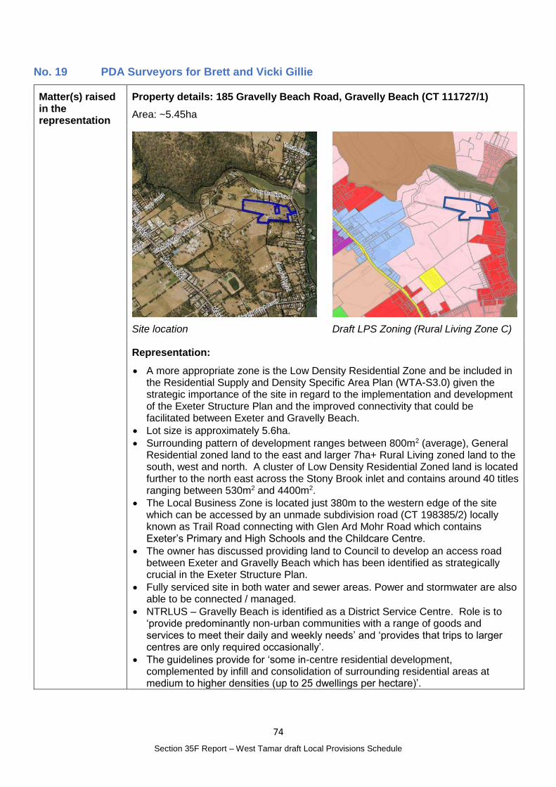
74
Section 35F Report – West Tamar draft Local Provisions Schedule
No. 19 PDA Surveyors for Brett and Vicki Gillie
Matter(s) raised in the representation
Property details: 185 Gravelly Beach Road, Gravelly Beach (CT 111727/1)
Area: ~5.45ha
Site location
Draft LPS Zoning (Rural Living Zone C)
Representation:
A more appropriate zone is the Low Density Residential Zone and be included in the Residential Supply and Density Specific Area Plan (WTA-S3.0) given the strategic importance of the site in regard to the implementation and development of the Exeter Structure Plan and the improved connectivity that could be facilitated between Exeter and Gravelly Beach.
Lot size is approximately 5.6ha.
Surrounding pattern of development ranges between 800m2 (average), General Residential zoned land to the east and larger 7ha+ Rural Living zoned land to the south, west and north. A cluster of Low Density Residential Zoned land is located further to the north east across the Stony Brook inlet and contains around 40 titles ranging between 530m2 and 4400m2.
The Local Business Zone is located just 380m to the western edge of the site which can be accessed by an unmade subdivision road (CT 198385/2) locally known as Trail Road connecting with Glen Ard Mohr Road which contains Exeter’s Primary and High Schools and the Childcare Centre.
The owner has discussed providing land to Council to develop an access road between Exeter and Gravelly Beach which has been identified as strategically crucial in the Exeter Structure Plan.
Fully serviced site in both water and sewer areas. Power and stormwater are also able to be connected / managed.
NTRLUS – Gravelly Beach is identified as a District Service Centre. Role is to ‘provide predominantly non-urban communities with a range of goods and services to meet their daily and weekly needs’ and ‘provides that trips to larger centres are only required occasionally’.
The guidelines provide for ‘some in-centre residential development, complemented by infill and consolidation of surrounding residential areas at medium to higher densities (up to 25 dwellings per hectare)’.
75
Section 35F Report – West Tamar draft Local Provisions Schedule
Improved connectivity facilitated by the development meets the transport and access guidelines – reducing commute distances and reducing pressure on the Glen Ard Mohr Road and Highway intersection.
Aligns with the Regional Settlement Network policy E2.
The Exeter Structure Plan acknowledges the strategic importance of the site in particular in relation to facilitating a strategically important road link between Gravelly Beach and Exeter.
Subdivision as a low density residential zoned parcel would facilitate a road through the centre of the property – retaining the site in the Rural Living Zone C would not permit this outcome.
Guideline No. 1 – meets the criteria for the Low Density Residential Zone – does not meet the criteria for the Rural Living Zone.
Was previously zoned Closed Residential and Utility Services and rezoned in the 2006 scheme.
When considering representations for the IPS Council referred to the preparation of the Exeter Structure Plan which would inform future outcomes (which has now been adopted) and identifies the site as suitable for development.
The Low Density Residential zone would benefit the landowner but also the broader community through improved connectivity and a positive impact on the road network.
There is minimal land available in Exeter and high demand for riverside locations with only 2 vacant lots available in the vicinity at the writing of the representation.
In accordance with the RLUS( RSN A1/ A2/ A3), the future subdivision and development of this site would be: - within an existing settlement; - would be well located and serviced to meet residential land supply demands; - would provide the ability to restructure underutilised land; and - the development would align with the Exeter Structure Plan.
See also Representation No. 30 and 66 on adjacent sites
Planning Authority Response
Overview:
Is the representation consistent with: Does the representation:
The NTRLUS Possibly Reflect a like for like conversion of the IPS?
No
State policies Yes
Section 8A Guideline No. 1 Possibly Relate to the drafting / content of the SPP?
No
TPC Practice Notes Yes
Local strategy / policy Yes Raise natural justice concerns?
Yes
Response:
The Exeter Structure Plan currently identifies this site as a ‘Strategic Privately Owned Site’ and that recommends that Council support the rezoning of the land to low density residential provided that the subdivision layout provides for public road access through the lot towards Glen Ard Mohr Road.
The Planning Authority is in the process of reviewing the Exeter Structure Plan. Part of this process will be the consideration of demand for additional housing and whether the allocation of land for residential purposes meets the demand.
While the representation is broadly consistent with the existing Structure Plan and is considered to have planning merit, the Planning Authority intends to complete the Exeter Structure Plan review and, subject to the outcome of that review, propose amendments to the LPS once the review is complete.

76
Section 35F Report – West Tamar draft Local Provisions Schedule
The review process will also consider whether proposed changes are consistent with the NTRLUS.
This process will ensure sufficient information and local planning supports any proposed changes and will provide opportunity for the public to have input into any proposed zoning changes.
Planning Authority recommended action
No changes to the draft LPS are recommended at this time.
Effect of recommendation on the draft LPS
The Planning Authority recommendation has no impact on implementing the draft LPS as a whole.
Meets the LPS criteria
The Planning Authority recommendation meets the LPS criteria.
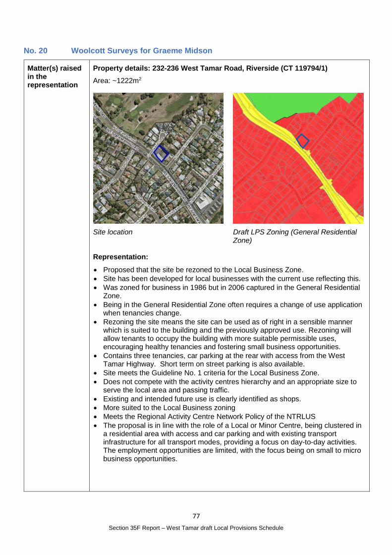
77
Section 35F Report – West Tamar draft Local Provisions Schedule
No. 20 Woolcott Surveys for Graeme Midson
Matter(s) raised in the representation
Property details: 232-236 West Tamar Road, Riverside (CT 119794/1)
Area: ~1222m2
Site location
Draft LPS Zoning (General Residential Zone)
Representation:
Proposed that the site be rezoned to the Local Business Zone.
Site has been developed for local businesses with the current use reflecting this.
Was zoned for business in 1986 but in 2006 captured in the General Residential Zone.
Being in the General Residential Zone often requires a change of use application when tenancies change.
Rezoning the site means the site can be used as of right in a sensible manner which is suited to the building and the previously approved use. Rezoning will allow tenants to occupy the building with more suitable permissible uses, encouraging healthy tenancies and fostering small business opportunities.
Contains three tenancies, car parking at the rear with access from the West Tamar Highway. Short term on street parking is also available.
Site meets the Guideline No. 1 criteria for the Local Business Zone.
Does not compete with the activity centres hierarchy and an appropriate size to serve the local area and passing traffic.
Existing and intended future use is clearly identified as shops.
More suited to the Local Business zoning
Meets the Regional Activity Centre Network Policy of the NTRLUS
The proposal is in line with the role of a Local or Minor Centre, being clustered in a residential area with access and car parking and with existing transport infrastructure for all transport modes, providing a focus on day-to-day activities. The employment opportunities are limited, with the focus being on small to micro business opportunities.
78
Section 35F Report – West Tamar draft Local Provisions Schedule
Planning Authority Response
Overview:
Is the representation consistent with: Does the representation:
The NTRLUS Yes Reflect a like for like conversion of the IPS?
No
State policies Yes
Section 8A Guideline No. 1 Yes Relate to the drafting / content of the SPP?
No
TPC Practice Notes Yes
Local strategy / policy N/A Raise natural justice concerns?
No
Response:
The draft LPS proposes to include the site in the General Residential Zone. There is a significant history associated with the site and its use for commercial /local business purposes as summarised below.
Site history / background:
1986 Beaconsfield Planning Scheme Zone: Business
2006 Planning Scheme Zone: Residential
2013 Interim Planning Scheme Zone (current): General Residential
Previous development approvals:
1987 – original building plans for the TAB on Council files
1996 – Extensions to shop
2005 – Florist shop – permitted development (at that time the other 2 tenancies were a computer retail outlet and a veterinary clinic)
2005 – Dental Prosthetist Clinic Consulting Rooms – permitted development (replacing the computer retail outlet)
Current use:
Middle tenancy - Business and Professional Service (Veterinary Centre) and
Tenancy at southern end - General Retail and Hire (florist)
Tenancy at northern end – vacant (most recently the dental posthetist clinic)
Guideline No. 1 outlines when the Local Business Zone should be used:
LBZ 3 The Local Business Zone may be used for groups of local shops and businesses in existing residential areas where there is a strategic intention to maintain such uses, and the provisions of the surrounding residential zone are not appropriate.
LBZ 4 The Local Business Zone should not be used for individual, isolated local shops or businesses within residential areas, unless:
(a) they are a use, or are of a scale, that is more appropriate for the Local Business Zone and there is an intention to maintain the use; or
(b) there is a strategic intention to expand the existing retail or business area in this locality consistent with the relevant regional land use strategy, or supported by more detailed local strategic analysis consistent with the relevant regional land use strategy and endorsed by the relevant council.
While it is acknowledged that LBZ 4 discourages spot zonings for isolated shops, it can be argued that this group of business premises, albeit in single ownership, do no operate as isolated businesses within a residential area.
LBZ 3 also anticipates use of the Local Business Zone where the provisions of the surrounding residential zone are not appropriate.
79
Section 35F Report – West Tamar draft Local Provisions Schedule
In this instance, the General Residential Zone has been applied to the site. It is not considered appropriate as the General Residential Zone provides for only a limited range of business or commercial uses as discretionary uses and does not provide the flexibility for tenancies to change without the need for a planning application. Uses such as Business and Professional Services for a professional office, are prohibited and either not permitted or require an amendment to the planning scheme which unnecessarily limits the use of a site that has already been approved for local business purposes.
Changing the zone of the site to the Local Business Zone:
Reflects the existing land use;
Reflects the strategic intent for the land to continue to be used for business purposes as it has since 1987;
Provides flexibility for tenancies to change within the limits of the Local Business Zone provisions without unnecessarily burdening future tenants with the need to amend the LPS;
Is unlikely to be of public interest given the non-residential use of the site has occurred for almost 35 years and changing tenancies is an ordinary consequence of a local business precinct.
Planning Authority recommended action
Change the zone of 232-236 West Tamar Road, Riverside (CT 119794/1) from the General Residential Zone to the Local Business Zone.
Effect of recommendation on the draft LPS
The Planning Authority recommendation has no impact on implementing the draft LPS as a whole as the landowner is supportive of the recommended change.
Meets the LPS criteria
The Planning Authority recommendation meets the LPS criteria.
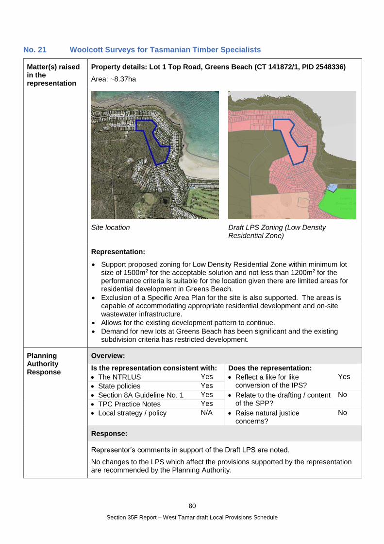
80
Section 35F Report – West Tamar draft Local Provisions Schedule
No. 21 Woolcott Surveys for Tasmanian Timber Specialists
Matter(s) raised in the representation
Property details: Lot 1 Top Road, Greens Beach (CT 141872/1, PID 2548336)
Area: ~8.37ha
Site location
Draft LPS Zoning (Low Density Residential Zone)
Representation:
Support proposed zoning for Low Density Residential Zone within minimum lot size of 1500m2 for the acceptable solution and not less than 1200m2 for the performance criteria is suitable for the location given there are limited areas for residential development in Greens Beach.
Exclusion of a Specific Area Plan for the site is also supported. The areas is capable of accommodating appropriate residential development and on-site wastewater infrastructure.
Allows for the existing development pattern to continue.
Demand for new lots at Greens Beach has been significant and the existing subdivision criteria has restricted development.
Planning Authority Response
Overview:
Is the representation consistent with: Does the representation:
The NTRLUS Yes Reflect a like for like conversion of the IPS?
Yes
State policies Yes
Section 8A Guideline No. 1 Yes Relate to the drafting / content of the SPP?
No
TPC Practice Notes Yes
Local strategy / policy N/A Raise natural justice concerns?
No
Response:
Representor’s comments in support of the Draft LPS are noted.
No changes to the LPS which affect the provisions supported by the representation are recommended by the Planning Authority.

81
Section 35F Report – West Tamar draft Local Provisions Schedule
Planning Authority recommended action
No changes to the draft LPS are recommended.
Effect of recommendation on the draft LPS
The Planning Authority recommendation has no impact on implementing the draft LPS as a whole.
Meets the LPS criteria
The Planning Authority recommendation meets the LPS criteria.
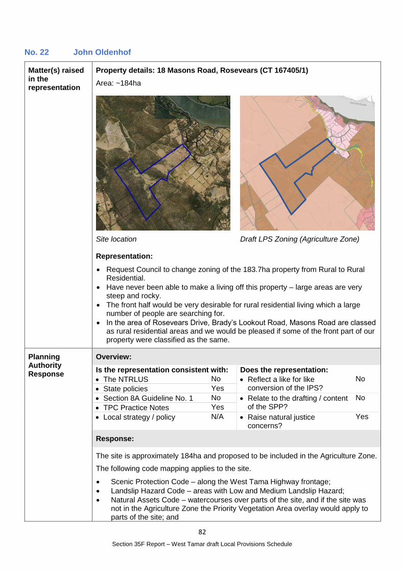
82
Section 35F Report – West Tamar draft Local Provisions Schedule
No. 22 John Oldenhof
Matter(s) raised in the representation
Property details: 18 Masons Road, Rosevears (CT 167405/1)
Area: ~184ha
Site location
Draft LPS Zoning (Agriculture Zone)
Representation:
Request Council to change zoning of the 183.7ha property from Rural to Rural Residential.
Have never been able to make a living off this property – large areas are very steep and rocky.
The front half would be very desirable for rural residential living which a large number of people are searching for.
In the area of Rosevears Drive, Brady’s Lookout Road, Masons Road are classed as rural residential areas and we would be pleased if some of the front part of our property were classified as the same.
Planning Authority Response
Overview:
Is the representation consistent with: Does the representation:
The NTRLUS No Reflect a like for like conversion of the IPS?
No
State policies Yes
Section 8A Guideline No. 1 No Relate to the drafting / content of the SPP?
No
TPC Practice Notes Yes
Local strategy / policy N/A Raise natural justice concerns?
Yes
Response:
The site is approximately 184ha and proposed to be included in the Agriculture Zone.
The following code mapping applies to the site.
Scenic Protection Code – along the West Tama Highway frontage;
Landslip Hazard Code – areas with Low and Medium Landslip Hazard;
Natural Assets Code – watercourses over parts of the site, and if the site was not in the Agriculture Zone the Priority Vegetation Area overlay would apply to parts of the site; and
83
Section 35F Report – West Tamar draft Local Provisions Schedule
Bushfire-prone Areas Code.
The Land Potentially Suitable for Agriculture Zone identifies the site as potentially unconstrained. An agricultural land suitability report was not submitted with the representation.
As the site is not currently considered to comprise larger residential lots or included in the Rural Living Zone of the IPS, RLZ 1 of Guideline No. 1 does not apply.
RLZ 2 states land that is not currently within an IPS Rural Living Zone should not be zoned unless:
(a) consistent with the relevant regional land use strategy, or supported by more detailed local strategic analysis consistent with the relevant regional land use strategy and endorsed by the relevant council; or
(b) the land is within the Environmental Living Zone in an interim planning scheme and the primary strategic intention is for residential use and development within a rural setting and a similar minimum allowable lot size is being applied, such as, applying the Rural Living Zone D where the minimum lot size is 10 ha or greater.
RLZ 2 (b) does not apply.
There is no local strategy that relevant for the subject site so consistency with the NTRLUS must be considered.
D.2.2.2 of the NTRLUS addresses Rural Residential Areas states a preference for intensification within existing Rural Residential Areas rather than the establishment of new area. The Key Planning Principles for Rural Areas outlined in D.2.2.4 includes:
Support rural living opportunities in appropriate locations (Rural Residential Area) where it does not compromise or fragment productive rural land;
Provide and maintain appropriate levels of infrastructure and services to support Rural Residential Area;
Consolidate future rural population growth within existing rural settlements and Rural Residential Area;
Recognise rural living use as a legitimate residential lifestyle subject to appropriate location criteria;
Promote ‘clustering’ of residential development in Rural Residential Area where a higher density of development is appropriate.
In response:
The statement that the land is not productive cannot be verified based on the information currently available;
Infrastructure, and in particular access arrangements for this site would require particular consideration given the frontage to the West Tamar Highway and the limited capacity of Masons Road. It is likely other infrastructure such as onsite wastewater treatment and disposal could be managed on site;
While adjacent to Rural Living Zoned land, the site is not within an existing rural settlement;
the site would be likely to be desirable for Rural Living given the views and relative proximity to Legana and Launceston;
There may be a case to be made that development of part of the site would promote clustering of residential development in a Rural Residential Area.
At this time there is not considered sufficient supporting information to recommend changing the zone over all or part of the site to the Rural Living Zone.
84
Section 35F Report – West Tamar draft Local Provisions Schedule
Changing the zone may be of public interest given the change in use rights and development potential that it would enable.
Planning Authority recommended action
No changes to the draft LPS are recommended at this time.
Effect of recommendation on the draft LPS
The Planning Authority recommendation has no impact on implementing the draft LPS as a whole.
Meets the LPS criteria
The Planning Authority recommendation meets the LPS criteria.
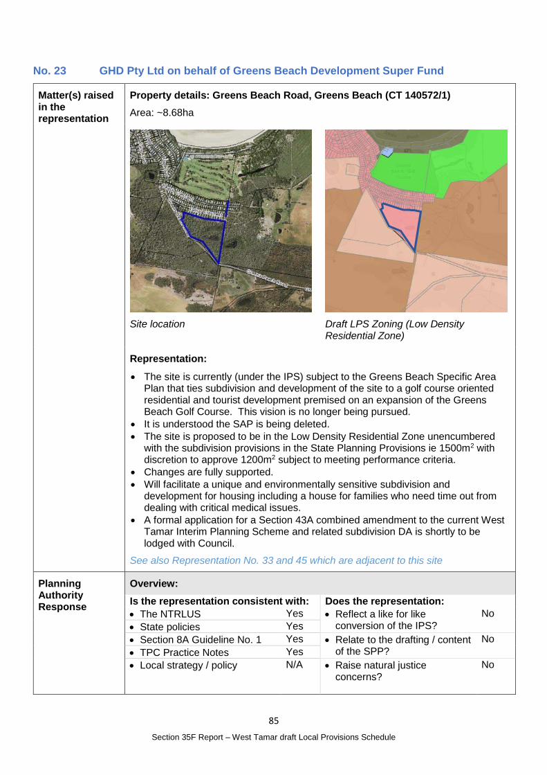
85
Section 35F Report – West Tamar draft Local Provisions Schedule
No. 23 GHD Pty Ltd on behalf of Greens Beach Development Super Fund
Matter(s) raised in the representation
Property details: Greens Beach Road, Greens Beach (CT 140572/1)
Area: ~8.68ha
Site location
Draft LPS Zoning (Low Density Residential Zone)
Representation:
The site is currently (under the IPS) subject to the Greens Beach Specific Area Plan that ties subdivision and development of the site to a golf course oriented residential and tourist development premised on an expansion of the Greens Beach Golf Course. This vision is no longer being pursued.
It is understood the SAP is being deleted.
The site is proposed to be in the Low Density Residential Zone unencumbered with the subdivision provisions in the State Planning Provisions ie 1500m2 with discretion to approve 1200m2 subject to meeting performance criteria.
Changes are fully supported.
Will facilitate a unique and environmentally sensitive subdivision and development for housing including a house for families who need time out from dealing with critical medical issues.
A formal application for a Section 43A combined amendment to the current West Tamar Interim Planning Scheme and related subdivision DA is shortly to be lodged with Council.
See also Representation No. 33 and 45 which are adjacent to this site
Planning Authority Response
Overview:
Is the representation consistent with: Does the representation:
The NTRLUS Yes Reflect a like for like conversion of the IPS?
No
State policies Yes
Section 8A Guideline No. 1 Yes Relate to the drafting / content of the SPP?
No
TPC Practice Notes Yes
Local strategy / policy N/A Raise natural justice concerns?
No
86
Section 35F Report – West Tamar draft Local Provisions Schedule
Response:
Representor’s comments in support of the Draft LPS are noted.
No changes to the LPS which affect the provisions supported by the representation are recommended by the Planning Authority.
Planning Authority recommended action
No changes to the draft LPS are recommended.
Effect of recommendation on the draft LPS
The Planning Authority recommendation has no impact on implementing the draft LPS as a whole.
Meets the LPS criteria
The Planning Authority recommendation meets the LPS criteria.
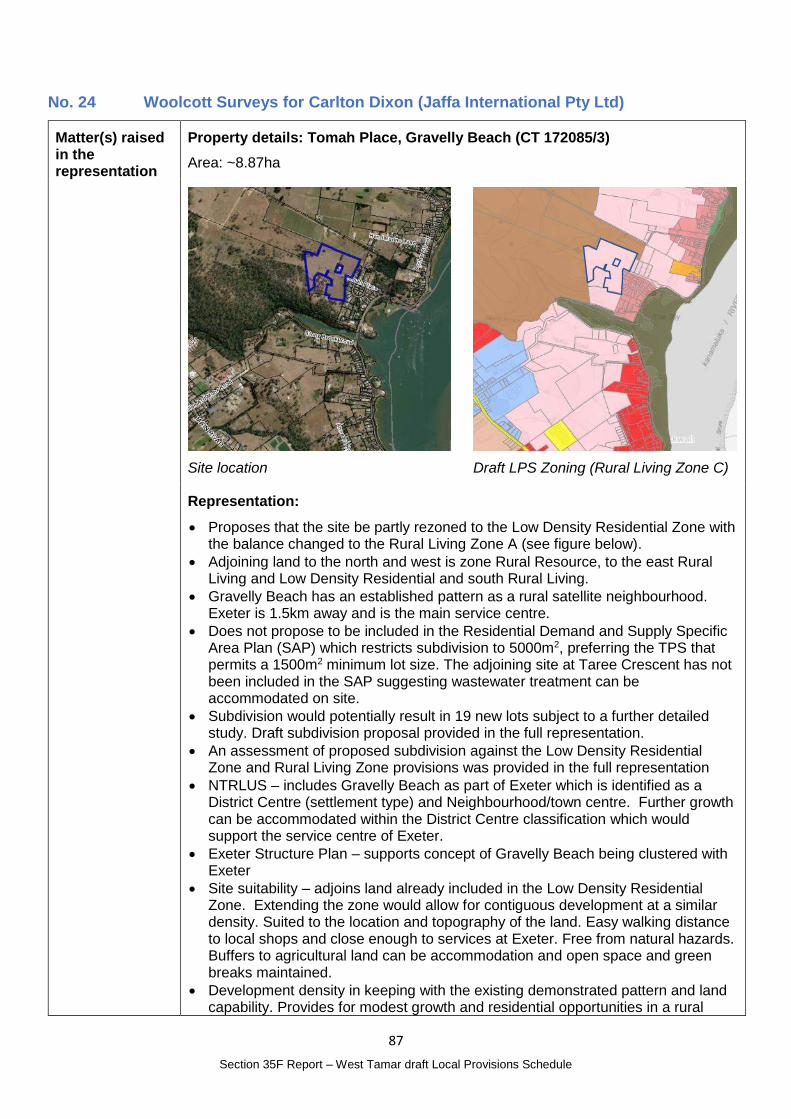
87
Section 35F Report – West Tamar draft Local Provisions Schedule
No. 24 Woolcott Surveys for Carlton Dixon (Jaffa International Pty Ltd)
Matter(s) raised in the representation
Property details: Tomah Place, Gravelly Beach (CT 172085/3)
Area: ~8.87ha
Site location
Draft LPS Zoning (Rural Living Zone C)
Representation:
Proposes that the site be partly rezoned to the Low Density Residential Zone with the balance changed to the Rural Living Zone A (see figure below).
Adjoining land to the north and west is zone Rural Resource, to the east Rural Living and Low Density Residential and south Rural Living.
Gravelly Beach has an established pattern as a rural satellite neighbourhood. Exeter is 1.5km away and is the main service centre.
Does not propose to be included in the Residential Demand and Supply Specific Area Plan (SAP) which restricts subdivision to 5000m2, preferring the TPS that permits a 1500m2 minimum lot size. The adjoining site at Taree Crescent has not been included in the SAP suggesting wastewater treatment can be accommodated on site.
Subdivision would potentially result in 19 new lots subject to a further detailed study. Draft subdivision proposal provided in the full representation.
An assessment of proposed subdivision against the Low Density Residential Zone and Rural Living Zone provisions was provided in the full representation
NTRLUS – includes Gravelly Beach as part of Exeter which is identified as a District Centre (settlement type) and Neighbourhood/town centre. Further growth can be accommodated within the District Centre classification which would support the service centre of Exeter.
Exeter Structure Plan – supports concept of Gravelly Beach being clustered with Exeter
Site suitability – adjoins land already included in the Low Density Residential Zone. Extending the zone would allow for contiguous development at a similar density. Suited to the location and topography of the land. Easy walking distance to local shops and close enough to services at Exeter. Free from natural hazards. Buffers to agricultural land can be accommodation and open space and green breaks maintained.
Development density in keeping with the existing demonstrated pattern and land capability. Provides for modest growth and residential opportunities in a rural
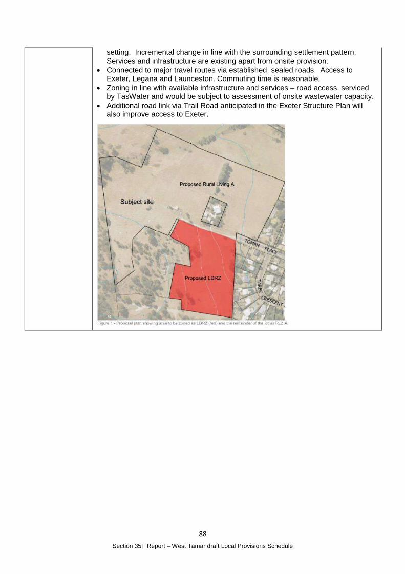
88
Section 35F Report – West Tamar draft Local Provisions Schedule
setting. Incremental change in line with the surrounding settlement pattern. Services and infrastructure are existing apart from onsite provision.
Connected to major travel routes via established, sealed roads. Access to Exeter, Legana and Launceston. Commuting time is reasonable.
Zoning in line with available infrastructure and services – road access, serviced by TasWater and would be subject to assessment of onsite wastewater capacity.
Additional road link via Trail Road anticipated in the Exeter Structure Plan will also improve access to Exeter.
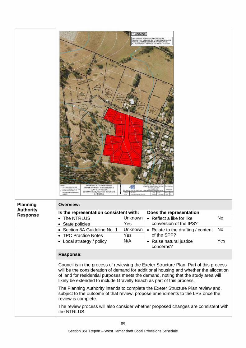
89
Section 35F Report – West Tamar draft Local Provisions Schedule
Planning Authority Response
Overview:
Is the representation consistent with: Does the representation:
The NTRLUS Unknown Reflect a like for like conversion of the IPS?
No
State policies Yes
Section 8A Guideline No. 1 Unknown Relate to the drafting / content of the SPP?
No
TPC Practice Notes Yes
Local strategy / policy N/A Raise natural justice concerns?
Yes
Response:
Council is in the process of reviewing the Exeter Structure Plan. Part of this process will be the consideration of demand for additional housing and whether the allocation of land for residential purposes meets the demand, noting that the study area will likely be extended to include Gravelly Beach as part of this process.
The Planning Authority intends to complete the Exeter Structure Plan review and, subject to the outcome of that review, propose amendments to the LPS once the review is complete.
The review process will also consider whether proposed changes are consistent with the NTRLUS.
90
Section 35F Report – West Tamar draft Local Provisions Schedule
This process will ensure sufficient information and local planning supports any proposed changes and will provide opportunity for the public to have input into any proposed zoning changes.
Planning Authority recommended action
No changes to the draft LPS are recommended at this time.
Effect of recommendation on the draft LPS
The Planning Authority recommendation has no impact on implementing the draft LPS as a whole.
Meets the LPS criteria
The Planning Authority recommendation meets the LPS criteria.
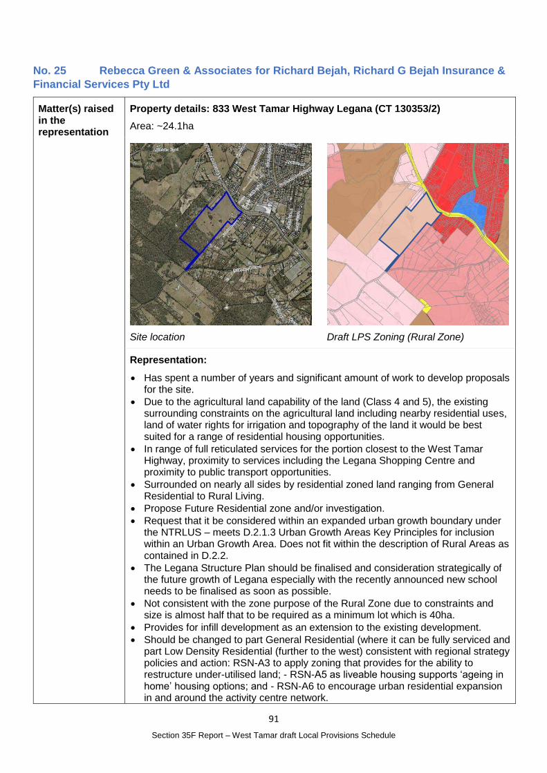
91
Section 35F Report – West Tamar draft Local Provisions Schedule
No. 25 Rebecca Green & Associates for Richard Bejah, Richard G Bejah Insurance &
Financial Services Pty Ltd
Matter(s) raised in the representation
Property details: 833 West Tamar Highway Legana (CT 130353/2)
Area: ~24.1ha
Site location
Draft LPS Zoning (Rural Zone)
Representation:
Has spent a number of years and significant amount of work to develop proposals for the site.
Due to the agricultural land capability of the land (Class 4 and 5), the existing surrounding constraints on the agricultural land including nearby residential uses, land of water rights for irrigation and topography of the land it would be best suited for a range of residential housing opportunities.
In range of full reticulated services for the portion closest to the West Tamar Highway, proximity to services including the Legana Shopping Centre and proximity to public transport opportunities.
Surrounded on nearly all sides by residential zoned land ranging from General Residential to Rural Living.
Propose Future Residential zone and/or investigation.
Request that it be considered within an expanded urban growth boundary under the NTRLUS – meets D.2.1.3 Urban Growth Areas Key Principles for inclusion within an Urban Growth Area. Does not fit within the description of Rural Areas as contained in D.2.2.
The Legana Structure Plan should be finalised and consideration strategically of the future growth of Legana especially with the recently announced new school needs to be finalised as soon as possible.
Not consistent with the zone purpose of the Rural Zone due to constraints and size is almost half that to be required as a minimum lot which is 40ha.
Provides for infill development as an extension to the existing development.
Should be changed to part General Residential (where it can be fully serviced and part Low Density Residential (further to the west) consistent with regional strategy policies and action: RSN-A3 to apply zoning that provides for the ability to restructure under-utilised land; - RSN-A5 as liveable housing supports ‘ageing in home’ housing options; and - RSN-A6 to encourage urban residential expansion in and around the activity centre network.
92
Section 35F Report – West Tamar draft Local Provisions Schedule
Supportive reports can be made available.
Planning Authority Response
Overview:
Is the representation consistent with: Does the representation:
The NTRLUS Possibly Reflect a like for like conversion of the IPS?
No
State policies Yes
Section 8A Guideline No. 1 No Relate to the drafting / content of the SPP?
No
TPC Practice Notes Yes
Local strategy / policy No Raise natural justice concerns?
Yes
Response:
The representation is requesting that part of the site be included in the General Residential Zone and part in the Low Density Residential Zone.
In relation to the proposed General Residential Zone, GRZ 2 of Guideline No. 1 is considered below.
GRZ 2 – Zone Application Guidelines Assessment comments
GRZ 2 The General Residential Zone may be applied to green-field, brown-field or grey-field areas that have been identified for future urban residential use and development if:
(a) within the General Residential Zone in an interim planning scheme; Not applicable
(b) within an equivalent zone under a section 29 planning scheme; or
Not applicable
(c) justified in accordance with the relevant regional land use strategy, or supported by more detailed local strategic analysis consistent with the relevant regional land use strategy and endorsed by the relevant council; and
The site is included in the Urban Growth Area in the NTRLUS in the Growth Corridor. D.2.1.1 states:
Growth Corridors Comprising land contiguous with existing urban areas, including greenfield land, which will be developed to accommodate projected population growth where the land has been assessed against contemporary evidence and determined as being suitable for urban development.
The site is therefore anticipated for urban development however timing for when development should occur needs to be considered and whether, given the supply of zoned land, whether additional land is required to accommodate anticipated population growth.
An assessment against the Regional Planning Policies has not been completed at this time.
(d) is currently connected, or the intention is for the future lots to be connected, to a reticulated water supply service and a reticulated sewerage system,
It is likely, as outlined in the representation, that part of the site could be serviced by reticulated water and sewerage. This determination would be part of the consideration of defining a potential boundary between the General Residential Zone and the Low Density Residential Zone.
The Low Density Zone is proposed for the rear (south western end) of the property where the topography would not support reticulated sewerage. LDRZ 1 and 4 are considered below:
93
Section 35F Report – West Tamar draft Local Provisions Schedule
Zone application guidelines Assessment comments
LDRZ 1
The Low Density Residential Zone should be applied to residential areas where one of the following conditions exist:
(a) residential areas with large lots that cannot be developed to higher densities due to any of the following constraints:
(i) lack of availability or capacity of reticulated infrastructure services, unless the constraint is intended to be resolved prior to development of the land; and
(ii) environmental constraints that limit development (e.g. land hazards, topography or slope); or
If proposed for residential development , the rear of the lot meets these characteristics
(b) small, residential settlements without the full range of infrastructure services, or constrained by the capacity of existing or planned infrastructure services; or
Not applicable
(c) existing low density residential areas characterised by a pattern of subdivision specifically planned to provide for such development, and where there is justification for a strategic intention not to support development at higher densities.
Not applicable
LDRZ 4
The Low Density Residential Zone should not be applied to land that is targeted for greenfield development unless constraints (e.g. limitations on infrastructure, or environmental considerations) have been identified that impede the area being developed to higher densities.
The NTRLUS anticipates potential urban development of the land at some time. The topography of the land means the rear of the lot is not capable of efficiently being serviced by reticulated sewerage.
The Natural Assets Code Priority Vegetation Area affects a significant proportion of this part of the site. An assessment of those values would be required to determine if any development was appropriate.
The Future Urban Zone may also be suitable for the site which would be consistent with the purpose of the zone:
30.1.1 To identify land intended for future urban use and development.
30.1.2 To ensure that development does not compromise the potential for future urban use and development of the land.
30.1.3 To support the planned rezoning of land for urban use and development in sequence with the planned expansion of infrastructure.
There is potential planning merit for the future urban development of the site – however timing for the development of the land, based on existing supply and future demand, as well as infrastructure requirements (reticulated water and sewerage as well as a coordinated approach to access) require further consideration and more detailed local planning. At this time, that local planning has not commenced and the Legana Structure Plan did not include land on the western side of the West Tamar Highway as part of the study area. The review of the NTRLUS and in particular closer examination of demand and supply for housing will support this process.
Given the strategic nature of the site, it is likely that any change in zoning to enable urban development, now or in the future, would be of public interest.
94
Section 35F Report – West Tamar draft Local Provisions Schedule
Planning Authority recommended action
No changes to the draft LPS are recommended at this time.
Effect of recommendation on the draft LPS
The Planning Authority recommendation has no impact on implementing the draft LPS as a whole.
Meets the LPS criteria
The Planning Authority recommendation meets the LPS criteria.
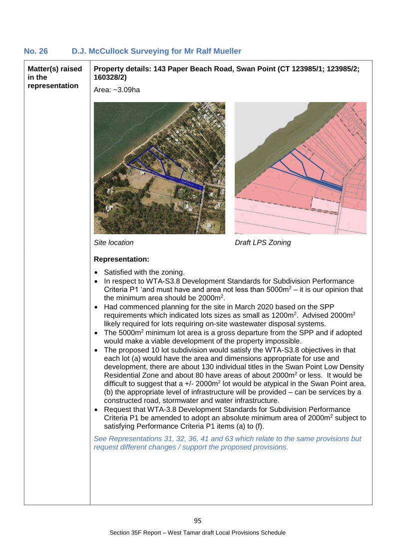
95
Section 35F Report – West Tamar draft Local Provisions Schedule
No. 26 D.J. McCullock Surveying for Mr Ralf Mueller
Matter(s) raised in the representation
Property details: 143 Paper Beach Road, Swan Point (CT 123985/1; 123985/2; 160328/2)
Area: ~3.09ha
Site location
Draft LPS Zoning
Representation:
Satisfied with the zoning.
In respect to WTA-S3.8 Development Standards for Subdivision Performance Criteria P1 ‘and must have and area not less than 5000m2 – it is our opinion that the minimum area should be 2000m2.
Had commenced planning for the site in March 2020 based on the SPP requirements which indicated lots sizes as small as 1200m2. Advised 2000m2 likely required for lots requiring on-site wastewater disposal systems.
The 5000m2 minimum lot area is a gross departure from the SPP and if adopted would make a viable development of the property impossible.
The proposed 10 lot subdivision would satisfy the WTA-S3.8 objectives in that each lot (a) would have the area and dimensions appropriate for use and development, there are about 130 individual titles in the Swan Point Low Density Residential Zone and about 80 have areas of about 2000m2 or less. It would be difficult to suggest that a +/- 2000m2 lot would be atypical in the Swan Point area. (b) the appropriate level of infrastructure will be provided – can be services by a constructed road, stormwater and water infrastructure.
Request that WTA-3.8 Development Standards for Subdivision Performance Criteria P1 be amended to adopt an absolute minimum area of 2000m2 subject to satisfying Performance Criteria P1 items (a) to (f).
See Representations 31, 32, 36, 41 and 63 which relate to the same provisions but request different changes / support the proposed provisions.
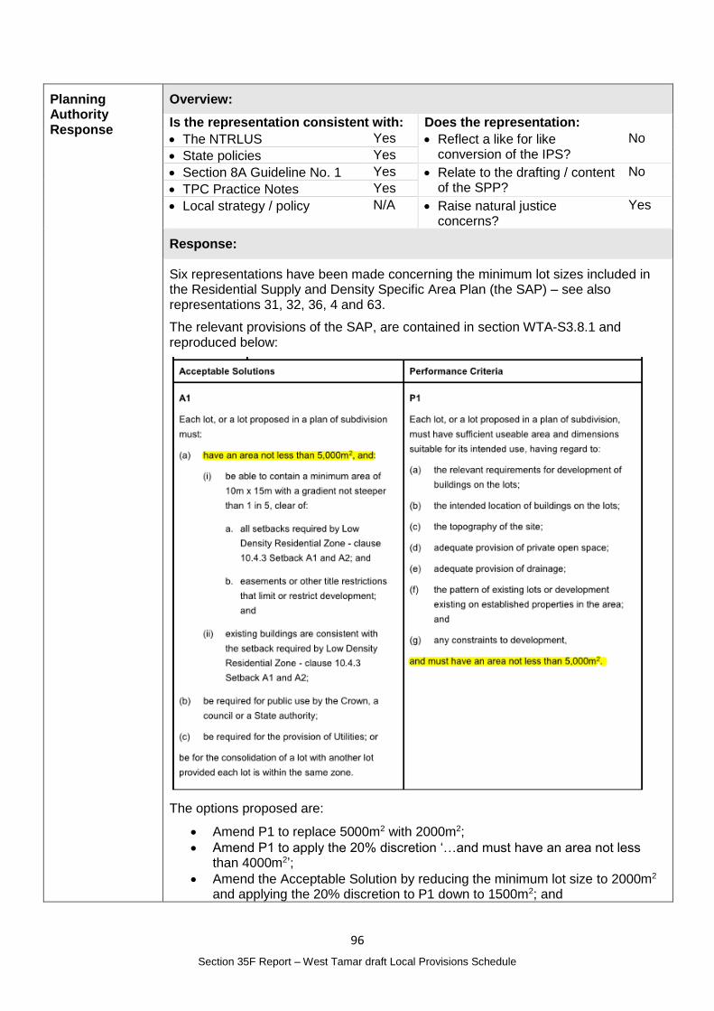
96
Section 35F Report – West Tamar draft Local Provisions Schedule
Planning Authority Response
Overview:
Is the representation consistent with: Does the representation:
The NTRLUS Yes Reflect a like for like conversion of the IPS?
No
State policies Yes
Section 8A Guideline No. 1 Yes Relate to the drafting / content of the SPP?
No
TPC Practice Notes Yes
Local strategy / policy N/A Raise natural justice concerns?
Yes
Response:
Six representations have been made concerning the minimum lot sizes included in the Residential Supply and Density Specific Area Plan (the SAP) – see also representations 31, 32, 36, 4 and 63.
The relevant provisions of the SAP, are contained in section WTA-S3.8.1 and reproduced below:
The options proposed are:
Amend P1 to replace 5000m2 with 2000m2;
Amend P1 to apply the 20% discretion ‘…and must have an area not less than 4000m2’;
Amend the Acceptable Solution by reducing the minimum lot size to 2000m2 and applying the 20% discretion to P1 down to 1500m2; and
97
Section 35F Report – West Tamar draft Local Provisions Schedule
Support for the 5000m2 minimum lot size (at Grindelwald).
The SAP was applied to the majority of land in the Low Density Residential Zone for consistency with the Interim Planning Scheme standards and in recognition of the established character of many areas and the constraints of accommodating onsite wastewater treatment and disposal (OWT&D) on smaller lots.
While it is possible that some areas could be capable of accommodating OWT&D, the Planning Authority has not undertaken site / area specific studies to determine if there is potential to reduce the minimum lot size over broader areas.
In addition, given the large extent of Low Density Residential Zoned land in the municipality, the potential impacts of increasing the potential supply by reducing the minimum lot size has not been considered – for example the impacts on the road network, water supply or natural assets have not been considered.
Further strategic planning and analysis would be necessary prior to the Planning Authority identifying an alternative minimum lot size less than 5000m2 where the SAP applies.
The inconsistency in the drafting of the SAP in relation to P1 not including a 20% discretion on the minimum lot size is noted.
The Acceptable Solution for minimum lot size for the Low Density Residential Zone in the SPP is 1500m2 and the Performance Criteria refers to lots having an area of not less than 1200m2, which is 20% less than the 1500m2 Acceptable Solution.
A similar approach is taken in the Rural Living Zone where the Performance Criteria provides discretion of not more than 20% less than the Acceptable Solution and the Landscape Conservation Zone where the Acceptable Solution for minimum lot size is 50ha and Performance Criteria provides discretion to 20ha (60% reduction).
Similarly, the Performance Criteria relating to minimum lot size in the Rural Zone and the Agriculture Zone allow a level of discretion to be applied in assessing an application for subdivision.
While applying a Performance Criteria with a minimum lot size less than the Acceptable Solutions is not likely to result in a significant increase in the supply of lots in the area subject to the SAP, the Planning Authority is of the opinion that identifying the lower lot size in the Performance Criteria will be viewed as the minimum lot size and proposals will seek to meet 4000m2 as the minimum, rather than the intended 5000m2.
Given the broad application of the SAP across the municipality, there is potential for there to be public interest in any change that is made.
Planning Authority recommended action
No changes to the draft LPS are recommended.
Effect of recommendation on the draft LPS
The Planning Authority recommendation has no impact on implementing the draft LPS as a whole.
Meets the LPS criteria
The Planning Authority recommendation meets the LPS criteria.
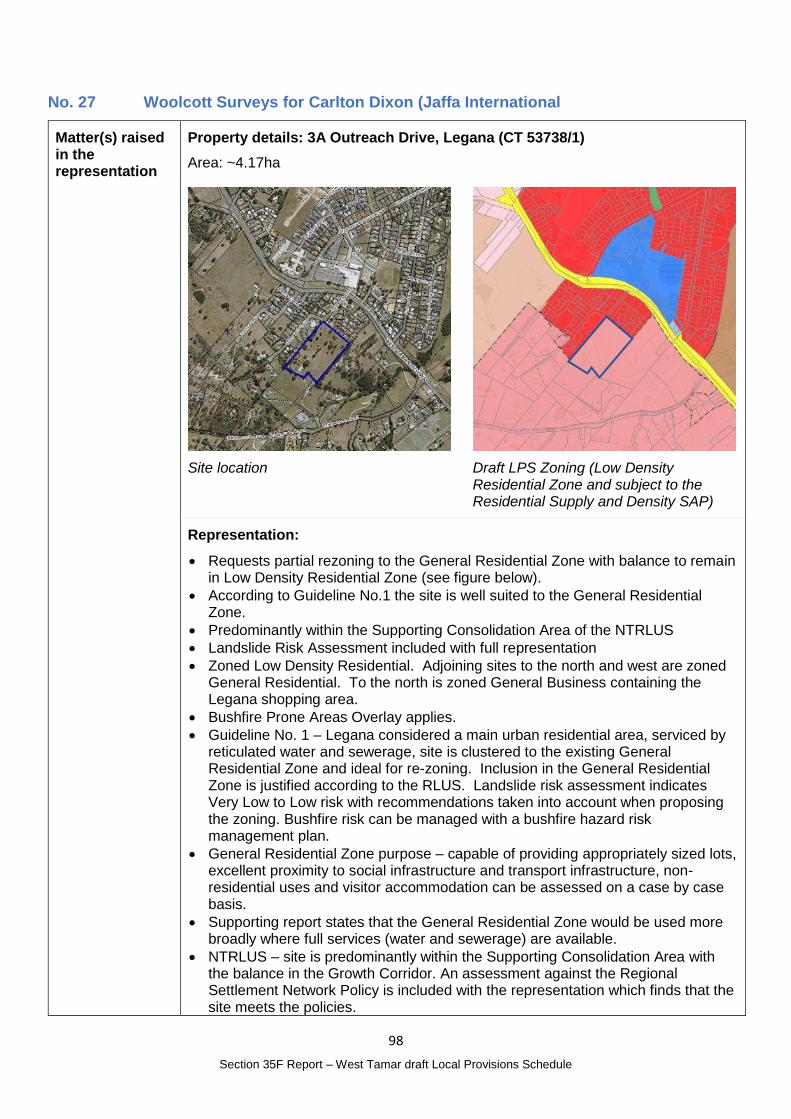
98
Section 35F Report – West Tamar draft Local Provisions Schedule
No. 27 Woolcott Surveys for Carlton Dixon (Jaffa International
Matter(s) raised in the representation
Property details: 3A Outreach Drive, Legana (CT 53738/1)
Area: ~4.17ha
Site location
Draft LPS Zoning (Low Density Residential Zone and subject to the Residential Supply and Density SAP)
Representation:
Requests partial rezoning to the General Residential Zone with balance to remain in Low Density Residential Zone (see figure below).
According to Guideline No.1 the site is well suited to the General Residential Zone.
Predominantly within the Supporting Consolidation Area of the NTRLUS
Landslide Risk Assessment included with full representation
Zoned Low Density Residential. Adjoining sites to the north and west are zoned General Residential. To the north is zoned General Business containing the Legana shopping area.
Bushfire Prone Areas Overlay applies.
Guideline No. 1 – Legana considered a main urban residential area, serviced by reticulated water and sewerage, site is clustered to the existing General Residential Zone and ideal for re-zoning. Inclusion in the General Residential Zone is justified according to the RLUS. Landslide risk assessment indicates Very Low to Low risk with recommendations taken into account when proposing the zoning. Bushfire risk can be managed with a bushfire hazard risk management plan.
General Residential Zone purpose – capable of providing appropriately sized lots, excellent proximity to social infrastructure and transport infrastructure, non-residential uses and visitor accommodation can be assessed on a case by case basis.
Supporting report states that the General Residential Zone would be used more broadly where full services (water and sewerage) are available.
NTRLUS – site is predominantly within the Supporting Consolidation Area with the balance in the Growth Corridor. An assessment against the Regional Settlement Network Policy is included with the representation which finds that the site meets the policies.
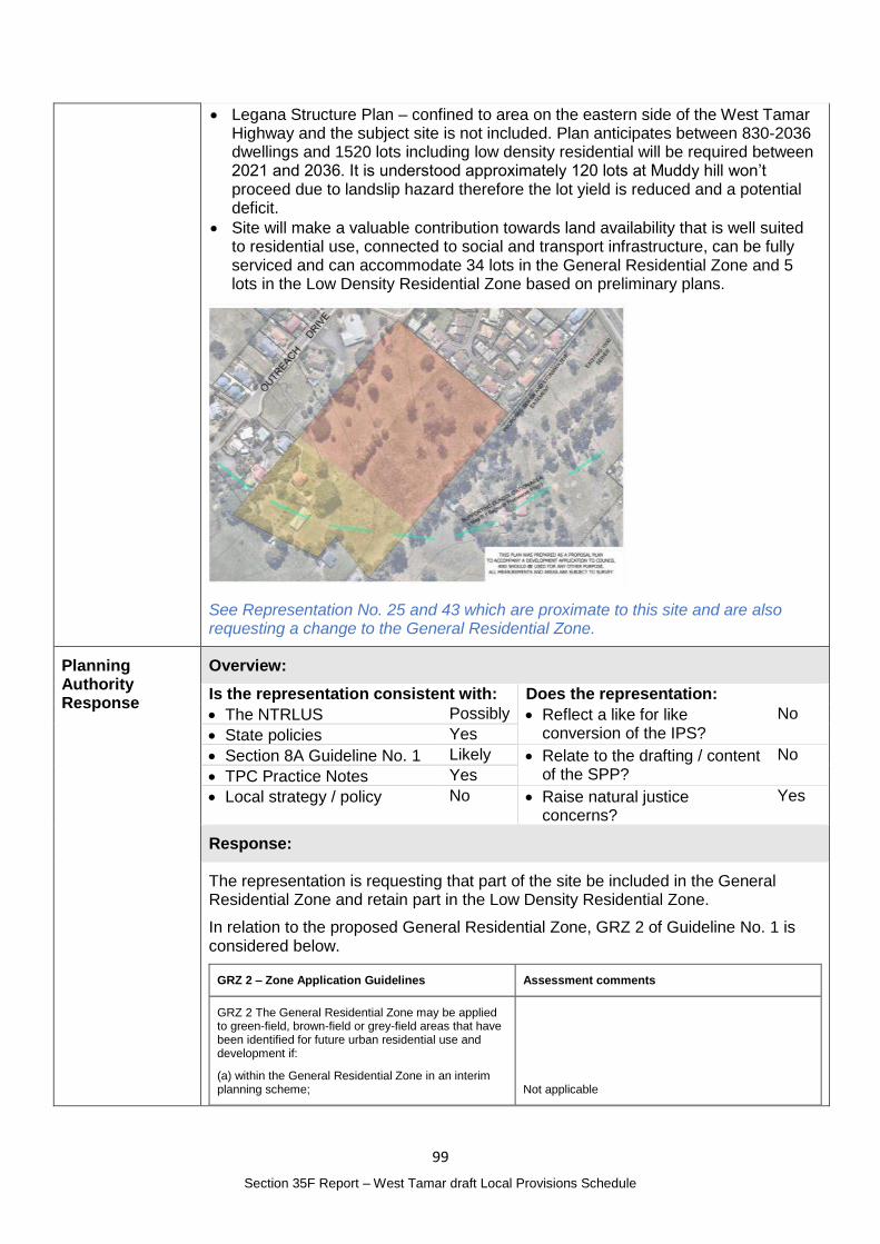
99
Section 35F Report – West Tamar draft Local Provisions Schedule
Legana Structure Plan – confined to area on the eastern side of the West Tamar Highway and the subject site is not included. Plan anticipates between 830-2036 dwellings and 1520 lots including low density residential will be required between 2021 and 2036. It is understood approximately 120 lots at Muddy hill won’t proceed due to landslip hazard therefore the lot yield is reduced and a potential deficit.
Site will make a valuable contribution towards land availability that is well suited to residential use, connected to social and transport infrastructure, can be fully serviced and can accommodate 34 lots in the General Residential Zone and 5 lots in the Low Density Residential Zone based on preliminary plans.
See Representation No. 25 and 43 which are proximate to this site and are also requesting a change to the General Residential Zone.
Planning Authority Response
Overview:
Is the representation consistent with: Does the representation:
The NTRLUS Possibly Reflect a like for like conversion of the IPS?
No
State policies Yes
Section 8A Guideline No. 1 Likely Relate to the drafting / content of the SPP?
No
TPC Practice Notes Yes
Local strategy / policy No Raise natural justice concerns?
Yes
Response:
The representation is requesting that part of the site be included in the General Residential Zone and retain part in the Low Density Residential Zone.
In relation to the proposed General Residential Zone, GRZ 2 of Guideline No. 1 is considered below.
GRZ 2 – Zone Application Guidelines Assessment comments
GRZ 2 The General Residential Zone may be applied to green-field, brown-field or grey-field areas that have been identified for future urban residential use and development if:
(a) within the General Residential Zone in an interim planning scheme; Not applicable
100
Section 35F Report – West Tamar draft Local Provisions Schedule
(b) within an equivalent zone under a section 29 planning scheme; or
Not applicable
(c) justified in accordance with the relevant regional land use strategy, or supported by more detailed local strategic analysis consistent with the relevant regional land use strategy and endorsed by the relevant council; and
The site is included in the Urban Growth Area in the NTRLUS in the Growth Corridor and part of the site is also identified as a Supporting Consolidation Area. D.2.1.1 states:
Rezoning of land for urban development in Growth Corridors will only be considered if all relevant policies and actions in the RLUS are met along with State Policies.
Supporting Consolidation Areas
Comprising land in established suburbs which is separate from Priority Consolidation Areas as shown in the Regional Framework Plan Maps D.1, D.2 and D.3;
Support reliable and effective transportation and reduce vehicle dependency;
Physically connect new urban settlements to existing communities wherever possible, or otherwise provide new development with direct transport linkages to established urban areas;
Promote cohesive communities;
Support a wide range of services and facilities;
Support access to existing or planned activity centres; and
Comprise a suitable and complementary mix of land uses to support the Regional Settlement Hierarchy and the Regional Activity Centre Hierarchy
Growth Corridors
Comprising land contiguous with existing urban areas, including greenfield land, which will be developed to accommodate projected population growth where the land has been assessed against contemporary evidence and determined as being suitable for urban development.
An assessment against the Regional Planning Policies has not been completed by the Planning Authority at this time however the representation includes an assessment against the policies which is generally supported.
The site is therefore anticipated for urban development however timing for when development should occur needs to be considered and, given the supply of zoned land, whether additional land is required to accommodate population growth at this time.
(d) is currently connected, or the intention is for the future lots to be connected, to a reticulated water supply service and a reticulated sewerage system,
It is likely, as outlined in the representation, that part of the site could be serviced by reticulated water and sewerage and is included in the TasWater Water and Sewer Serviced Land.
The Low Density Zone is proposed to be retained as the rear (south western end) of the property. This is consistent with the Draft LPS as advertised.
The Future Urban Zone may also be suitable for the site which would be consistent with the purpose of the zone:
30.1.1 To identify land intended for future urban use and development.
30.1.2 To ensure that development does not compromise the potential for future urban use and development of the land.
30.1.3 To support the planned rezoning of land for urban use and development in sequence with the planned expansion of infrastructure.
101
Section 35F Report – West Tamar draft Local Provisions Schedule
However, given the existing Low Density Residential Zoning, a change to the Future Urban Zone would essentially prevent development from occurring in any form without a planning scheme amendment which is not desirable.
There may be planning merit to change the zone to the General Residential Zone, subject to a complete assessment of a rezoning request – however timing for the development of the land, based on existing supply and future demand, as well as infrastructure requirements (reticulated water and sewerage and a coordinated approach to access) requires further consideration and more detailed local planning. At this time, that local planning has not commenced. The review of the NTRLUS and in particular closer examination of demand and supply for housing will support this process.
It is also likely that any change to the General Residential Zone would be of public interest.
Planning Authority recommended action
No changes to the draft LPS are recommended at this time.
Effect of recommendation on the draft LPS
The Planning Authority recommendation has no impact on implementing the draft LPS as a whole.
Meets the LPS criteria
The Planning Authority recommendation meets the LPS criteria.
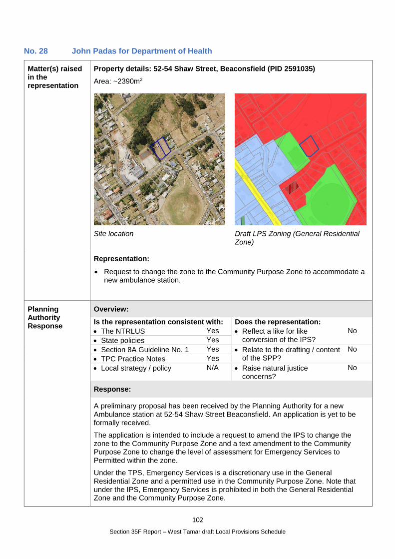
102
Section 35F Report – West Tamar draft Local Provisions Schedule
No. 28 John Padas for Department of Health
Matter(s) raised in the representation
Property details: 52-54 Shaw Street, Beaconsfield (PID 2591035)
Area: ~2390m2
Site location
Draft LPS Zoning (General Residential Zone)
Representation:
Request to change the zone to the Community Purpose Zone to accommodate a new ambulance station.
Planning Authority Response
Overview:
Is the representation consistent with: Does the representation:
The NTRLUS Yes Reflect a like for like conversion of the IPS?
No
State policies Yes
Section 8A Guideline No. 1 Yes Relate to the drafting / content of the SPP?
No
TPC Practice Notes Yes
Local strategy / policy N/A Raise natural justice concerns?
No
Response:
A preliminary proposal has been received by the Planning Authority for a new Ambulance station at 52-54 Shaw Street Beaconsfield. An application is yet to be formally received.
The application is intended to include a request to amend the IPS to change the zone to the Community Purpose Zone and a text amendment to the Community Purpose Zone to change the level of assessment for Emergency Services to Permitted within the zone.
Under the TPS, Emergency Services is a discretionary use in the General Residential Zone and a permitted use in the Community Purpose Zone. Note that under the IPS, Emergency Services is prohibited in both the General Residential Zone and the Community Purpose Zone.
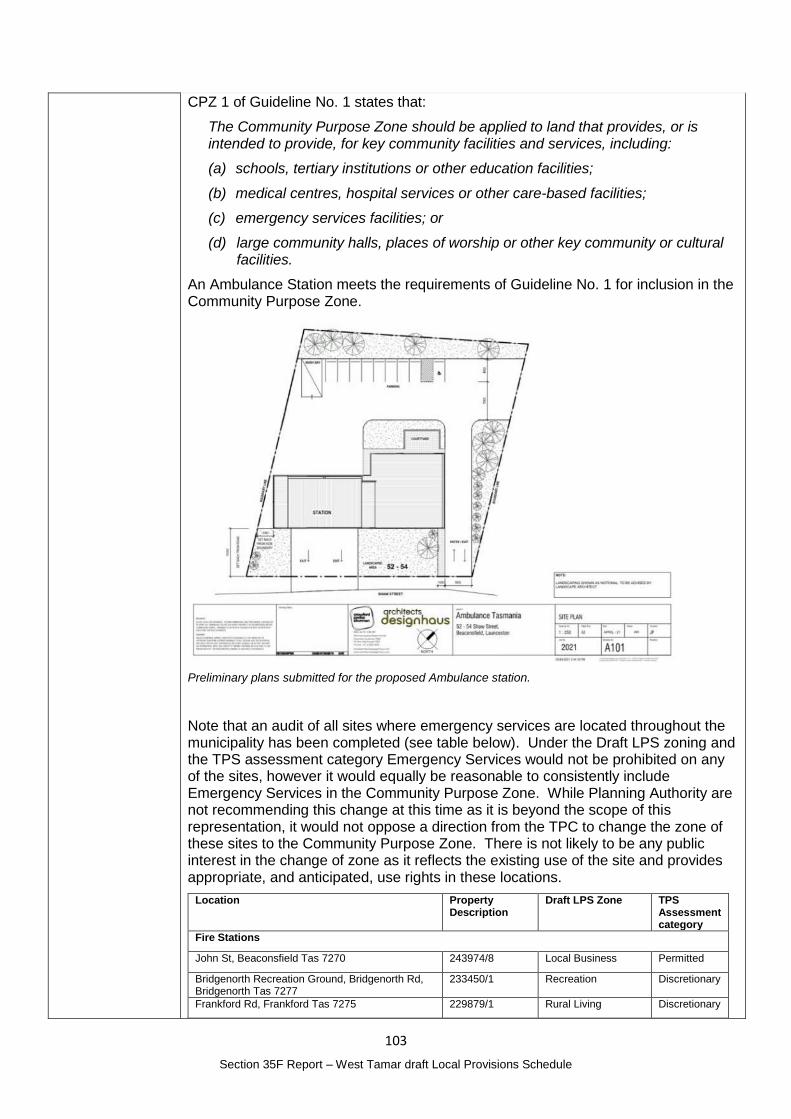
103
Section 35F Report – West Tamar draft Local Provisions Schedule
CPZ 1 of Guideline No. 1 states that:
The Community Purpose Zone should be applied to land that provides, or is intended to provide, for key community facilities and services, including:
(a) schools, tertiary institutions or other education facilities;
(b) medical centres, hospital services or other care-based facilities;
(c) emergency services facilities; or
(d) large community halls, places of worship or other key community or cultural facilities.
An Ambulance Station meets the requirements of Guideline No. 1 for inclusion in the Community Purpose Zone.
Preliminary plans submitted for the proposed Ambulance station.
Note that an audit of all sites where emergency services are located throughout the municipality has been completed (see table below). Under the Draft LPS zoning and the TPS assessment category Emergency Services would not be prohibited on any of the sites, however it would equally be reasonable to consistently include Emergency Services in the Community Purpose Zone. While Planning Authority are not recommending this change at this time as it is beyond the scope of this representation, it would not oppose a direction from the TPC to change the zone of these sites to the Community Purpose Zone. There is not likely to be any public interest in the change of zone as it reflects the existing use of the site and provides appropriate, and anticipated, use rights in these locations.
Location Property Description
Draft LPS Zone TPS Assessment category
Fire Stations
John St, Beaconsfield Tas 7270 243974/8 Local Business Permitted
Bridgenorth Recreation Ground, Bridgenorth Rd, Bridgenorth Tas 7277
233450/1 Recreation Discretionary
Frankford Rd, Frankford Tas 7275 229879/1 Rural Living Discretionary
104
Section 35F Report – West Tamar draft Local Provisions Schedule
850 Frankford Road, Glengarry Tas 7275 158850/1 Rural Permitted
4 Tomah Pl, Gravelly Beach Tas 7276 150279/1 Rural Living C Discretionary
1 Kelso Jetty Rd, Kelso Tas 7270 108045/1 Rural Living C Discretionary
18 Freshwater Point Rd, Legana Tas 7277 113125/510 General Business Permitted
430 Rowella Rd, Rowella Tas 7270 140070/2 Rural Living A Discretionary
1068 Winkleigh Rd, Winkleigh Tas 7275 146708/1 Rural Permitted
Police Stations
37 Grubb Street, Beaconsfield PID 9046639 General Residential Discretionary
69 Main Road, Exeter 54160/1 Local Business Permitted
Ambulance Stations
13 Bolton Street, Beaconsfield PID 6078984 Community Purpose Permitted
SES
57 Main Road, Exeter 24768/1 Light Industrial Permitted
Planning Authority recommended action
Provided the Interim Planning Scheme amendment is approved by the TPC, it is recommended that the zone of 52-54 Shaw Street, Beaconsfield (PID 2591035) be changed from the General Residential Zone to the Community Purpose Zone.
Effect of recommendation on the draft LPS
The Planning Authority recommendation has no impact on implementing the draft LPS as a whole as all landowners are supportive of the recommended change and the request for an amendment to the IPS will undergo public exhibition.
Meets the LPS criteria
The Planning Authority recommendation meets the LPS criteria.
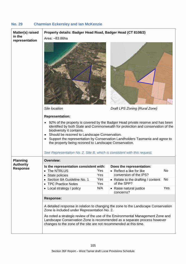
105
Section 35F Report – West Tamar draft Local Provisions Schedule
No. 29 Charmian Eckersley and Ian McKenzie
Matter(s) raised in the representation
Property details: Badger Head Road, Badger Head (CT 8108/2)
Area: ~83.86ha
Site location
Draft LPS Zoning (Rural Zone)
Representation:
92% of the property is covered by the Badger Head private reserve and has been identified by both State and Commonwealth for protection and conservation of the biodiversity it contains.
Should be rezoned to Landscape Conservation.
Support the representation by Conservation Landholders Tasmania and agree to the property being rezoned to Landscape Conservation.
See Representation No. 2, Site B, which is consistent with this request.
Planning Authority Response
Overview:
Is the representation consistent with: Does the representation:
The NTRLUS Yes Reflect a like for like conversion of the IPS?
No
State policies Yes
Section 8A Guideline No. 1 Yes Relate to the drafting / content of the SPP?
No
TPC Practice Notes Yes
Local strategy / policy N/A Raise natural justice concerns?
Yes
Response:
A detailed response in relation to changing the zone to the Landscape Conservation Zone is included under Representation No. 2.
As noted a strategic review of the use of the Environmental Management Zone and Landscape Conservation Zone is recommended as a separate process however changes to the zone of the site are not recommended at this time.
106
Section 35F Report – West Tamar draft Local Provisions Schedule
Planning Authority recommended action
No changes to the draft LPS are recommended at this time.
Effect of recommendation on the draft LPS
The Planning Authority recommendation has no impact on implementing the draft LPS as a whole.
Meets the LPS criteria
The Planning Authority is satisfied that the recommendation meets the LPS criteria.
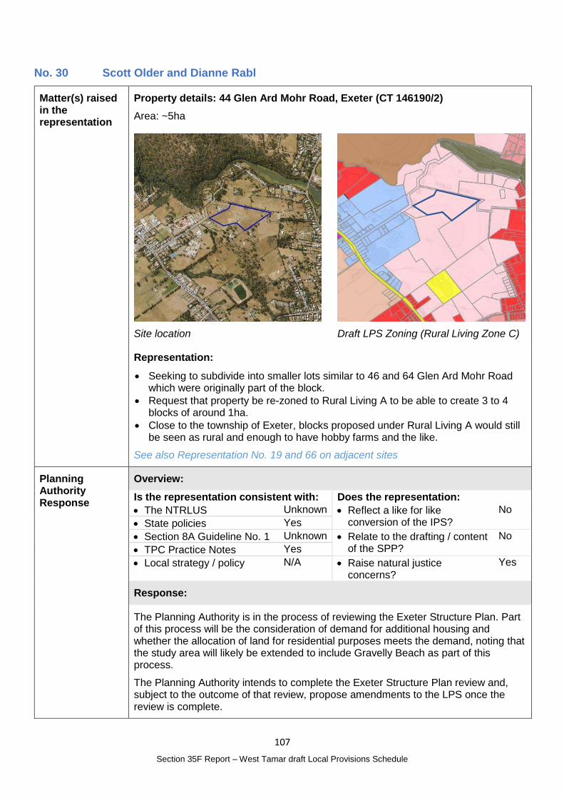
107
Section 35F Report – West Tamar draft Local Provisions Schedule
No. 30 Scott Older and Dianne Rabl
Matter(s) raised in the representation
Property details: 44 Glen Ard Mohr Road, Exeter (CT 146190/2)
Area: ~5ha
Site location
Draft LPS Zoning (Rural Living Zone C)
Representation:
Seeking to subdivide into smaller lots similar to 46 and 64 Glen Ard Mohr Road which were originally part of the block.
Request that property be re-zoned to Rural Living A to be able to create 3 to 4 blocks of around 1ha.
Close to the township of Exeter, blocks proposed under Rural Living A would still be seen as rural and enough to have hobby farms and the like.
See also Representation No. 19 and 66 on adjacent sites
Planning Authority Response
Overview:
Is the representation consistent with: Does the representation:
The NTRLUS Unknown Reflect a like for like conversion of the IPS?
No
State policies Yes
Section 8A Guideline No. 1 Unknown Relate to the drafting / content of the SPP?
No
TPC Practice Notes Yes
Local strategy / policy N/A Raise natural justice concerns?
Yes
Response:
The Planning Authority is in the process of reviewing the Exeter Structure Plan. Part of this process will be the consideration of demand for additional housing and whether the allocation of land for residential purposes meets the demand, noting that the study area will likely be extended to include Gravelly Beach as part of this process.
The Planning Authority intends to complete the Exeter Structure Plan review and, subject to the outcome of that review, propose amendments to the LPS once the review is complete.
108
Section 35F Report – West Tamar draft Local Provisions Schedule
The review process will also consider whether proposed changes are consistent with the NTRLUS.
This process will ensure sufficient information and local planning supports any proposed changes and will provide opportunity for the public to have input into any proposed zoning changes.
Planning Authority recommended action
No changes to the draft LPS are recommended at this time.
Effect of recommendation on the draft LPS
The Planning Authority recommendation has no impact on implementing the draft LPS as a whole.
Meets the LPS criteria
The Planning Authority recommendation meets the LPS criteria.
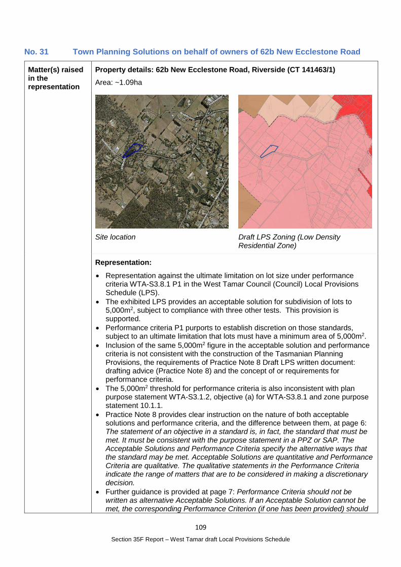
109
Section 35F Report – West Tamar draft Local Provisions Schedule
No. 31 Town Planning Solutions on behalf of owners of 62b New Ecclestone Road
Matter(s) raised in the representation
Property details: 62b New Ecclestone Road, Riverside (CT 141463/1)
Area: ~1.09ha
Site location
Draft LPS Zoning (Low Density Residential Zone)
Representation:
Representation against the ultimate limitation on lot size under performance criteria WTA-S3.8.1 P1 in the West Tamar Council (Council) Local Provisions Schedule (LPS).
The exhibited LPS provides an acceptable solution for subdivision of lots to 5,000m2, subject to compliance with three other tests. This provision is supported.
Performance criteria P1 purports to establish discretion on those standards, subject to an ultimate limitation that lots must have a minimum area of 5,000m2.
Inclusion of the same 5,000m2 figure in the acceptable solution and performance criteria is not consistent with the construction of the Tasmanian Planning Provisions, the requirements of Practice Note 8 Draft LPS written document: drafting advice (Practice Note 8) and the concept of or requirements for performance criteria.
The 5,000m2 threshold for performance criteria is also inconsistent with plan purpose statement WTA-S3.1.2, objective (a) for WTA-S3.8.1 and zone purpose statement 10.1.1.
Practice Note 8 provides clear instruction on the nature of both acceptable solutions and performance criteria, and the difference between them, at page 6: The statement of an objective in a standard is, in fact, the standard that must be met. It must be consistent with the purpose statement in a PPZ or SAP. The Acceptable Solutions and Performance Criteria specify the alternative ways that the standard may be met. Acceptable Solutions are quantitative and Performance Criteria are qualitative. The qualitative statements in the Performance Criteria indicate the range of matters that are to be considered in making a discretionary decision.
Further guidance is provided at page 7: Performance Criteria should not be written as alternative Acceptable Solutions. If an Acceptable Solution cannot be met, the corresponding Performance Criterion (if one has been provided) should

110
Section 35F Report – West Tamar draft Local Provisions Schedule
confirm the objective to be met and set out the matters to which regard must be had when the planning authority makes a decision in the exercise of its discretion. Where possible, limit the number of matters to which regard must be had under any Performance Criterion in order to clarify the decision making task.
Inclusion of the absolute minimum 5,000m2 area in the performance criteria removes the opportunity for discretion on this standard. This is contrary to both the intent and specific drafting instructions of Practice Note 8.
The drafting style of the State Planning Provisions provides discretion in relevant zones (Low Density Residential and Rural Living) that establish a convention of 20% discretion on minimum lot size. This concept is supported for the SAP.
It is requested that WTA-S3.8.1 P1 be modified to establish a discretion on the minimum lot size of 1,000 m2 or 20%, for consistency with the structure and format of similar provisions within the State Planning Provisions and compliance with Practice Note 8.
See Representation No. 32 which is consistent with this request and Representations 26, 36, 41 and 63 which relate to the same provisions but request different changes / support the proposed provisions.
Planning Authority Response
Overview:
Is the representation consistent with: Does the representation:
The NTRLUS Yes Reflect a like for like conversion of the IPS?
No
State policies Yes
Section 8A Guideline No. 1 Yes Relate to the drafting / content of the SPP?
No
TPC Practice Notes Yes
Local strategy / policy N/A Raise natural justice concerns?
Yes
Response:
A detailed response in relation to amending the provisions of the Residential Supply and Density Specific Area Plan is provided under Representation No. 26.
As noted the Planning Authority is of the opinion that the 5000m2 minimum lot size should be retained in the Performance Criteria.
Planning Authority recommended action
No changes to the draft LPS are recommended at this time.
Effect of recommendation on the draft LPS
The Planning Authority recommendation has no impact on implementing the draft LPS as a whole.
Meets the LPS criteria
The Planning Authority recommendation meets the LPS criteria.
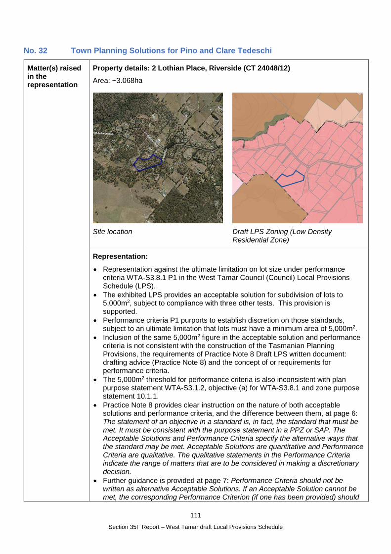
111
Section 35F Report – West Tamar draft Local Provisions Schedule
No. 32 Town Planning Solutions for Pino and Clare Tedeschi
Matter(s) raised in the representation
Property details: 2 Lothian Place, Riverside (CT 24048/12)
Area: ~3.068ha
Site location
Draft LPS Zoning (Low Density Residential Zone)
Representation:
Representation against the ultimate limitation on lot size under performance criteria WTA-S3.8.1 P1 in the West Tamar Council (Council) Local Provisions Schedule (LPS).
The exhibited LPS provides an acceptable solution for subdivision of lots to 5,000m2, subject to compliance with three other tests. This provision is supported.
Performance criteria P1 purports to establish discretion on those standards, subject to an ultimate limitation that lots must have a minimum area of 5,000m2.
Inclusion of the same 5,000m2 figure in the acceptable solution and performance criteria is not consistent with the construction of the Tasmanian Planning Provisions, the requirements of Practice Note 8 Draft LPS written document: drafting advice (Practice Note 8) and the concept of or requirements for performance criteria.
The 5,000m2 threshold for performance criteria is also inconsistent with plan purpose statement WTA-S3.1.2, objective (a) for WTA-S3.8.1 and zone purpose statement 10.1.1.
Practice Note 8 provides clear instruction on the nature of both acceptable solutions and performance criteria, and the difference between them, at page 6: The statement of an objective in a standard is, in fact, the standard that must be met. It must be consistent with the purpose statement in a PPZ or SAP. The Acceptable Solutions and Performance Criteria specify the alternative ways that the standard may be met. Acceptable Solutions are quantitative and Performance Criteria are qualitative. The qualitative statements in the Performance Criteria indicate the range of matters that are to be considered in making a discretionary decision.
Further guidance is provided at page 7: Performance Criteria should not be written as alternative Acceptable Solutions. If an Acceptable Solution cannot be met, the corresponding Performance Criterion (if one has been provided) should
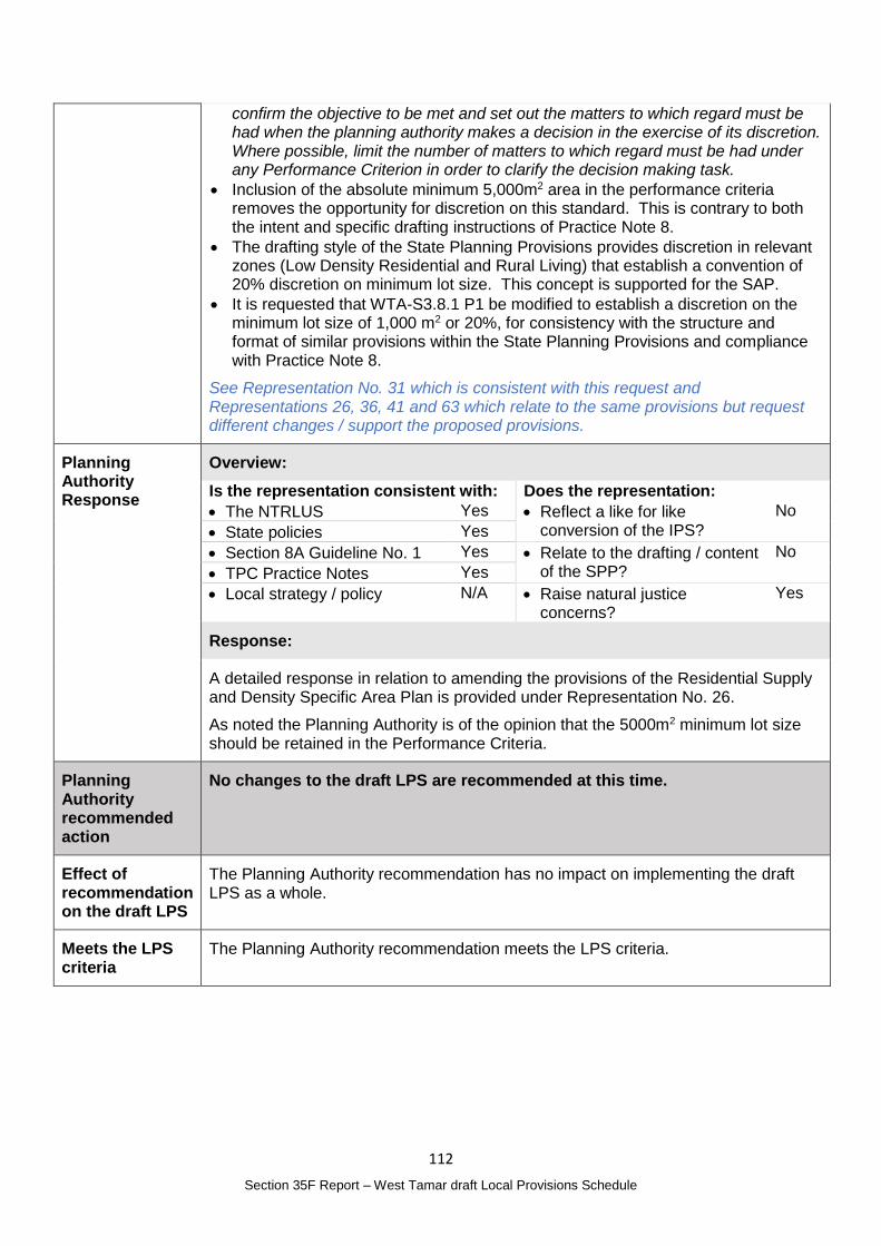
112
Section 35F Report – West Tamar draft Local Provisions Schedule
confirm the objective to be met and set out the matters to which regard must be had when the planning authority makes a decision in the exercise of its discretion. Where possible, limit the number of matters to which regard must be had under any Performance Criterion in order to clarify the decision making task.
Inclusion of the absolute minimum 5,000m2 area in the performance criteria removes the opportunity for discretion on this standard. This is contrary to both the intent and specific drafting instructions of Practice Note 8.
The drafting style of the State Planning Provisions provides discretion in relevant zones (Low Density Residential and Rural Living) that establish a convention of 20% discretion on minimum lot size. This concept is supported for the SAP.
It is requested that WTA-S3.8.1 P1 be modified to establish a discretion on the minimum lot size of 1,000 m2 or 20%, for consistency with the structure and format of similar provisions within the State Planning Provisions and compliance with Practice Note 8.
See Representation No. 31 which is consistent with this request and Representations 26, 36, 41 and 63 which relate to the same provisions but request different changes / support the proposed provisions.
Planning Authority Response
Overview:
Is the representation consistent with: Does the representation:
The NTRLUS Yes Reflect a like for like conversion of the IPS?
No
State policies Yes
Section 8A Guideline No. 1 Yes Relate to the drafting / content of the SPP?
No
TPC Practice Notes Yes
Local strategy / policy N/A Raise natural justice concerns?
Yes
Response:
A detailed response in relation to amending the provisions of the Residential Supply and Density Specific Area Plan is provided under Representation No. 26.
As noted the Planning Authority is of the opinion that the 5000m2 minimum lot size should be retained in the Performance Criteria.
Planning Authority recommended action
No changes to the draft LPS are recommended at this time.
Effect of recommendation on the draft LPS
The Planning Authority recommendation has no impact on implementing the draft LPS as a whole.
Meets the LPS criteria
The Planning Authority recommendation meets the LPS criteria.
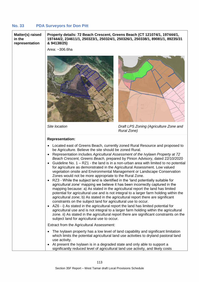
113
Section 35F Report – West Tamar draft Local Provisions Schedule
No. 33 PDA Surveyors for Don Pitt
Matter(s) raised in the representation
Property details: 72 Beach Crescent, Greens Beach (CT 121074/1, 197444/1, 197444/2, 234611/1, 250323/1, 250324/1, 250326/1, 250338/1, 89081/1, 89235/31 & 94138/25)
Area: ~306.6ha
Site location
Draft LPS Zoning (Agriculture Zone and Rural Zone)
Representation:
Located east of Greens Beach, currently zoned Rural Resource and proposed to be Agriculture. Believe the site should be zoned Rural.
Representation includes Agricultural Assessment of the Ivylawn Property at 72 Beach Crescent, Greens Beach, prepared by Pinion Advisory, dated 22/10/2020
Guideline No. 1 – RZ1 - the land is in a non-urban area with limited to no potential for agriculture as demonstrated in the Agricultural Assessment. Low valued vegetation onsite and Environmental Management or Landscape Conservation Zones would not be more appropriate to the Rural Zone.
RZ3 - While the subject land is identified in the ‘land potentially suitable for agricultural zone’ mapping we believe it has been incorrectly captured in the mapping because: a) As stated in the agricultural report the land has limited potential for agricultural use and is not integral to a larger farm holding within the agricultural zone; b) As stated in the agricultural report there are significant constraints on the subject land for agricultural use to occur.
AZ6 - i) As stated in the agricultural report the land has limited potential for agricultural use and is not integral to a larger farm holding within the agricultural zone. ii) As stated in the agricultural report there are significant constraints on the subject land for agricultural use to occur.
Extract from the Agricultural Assessment:
The Ivylawn property has a low level of land capability and significant limitation which limits the potential agricultural land use activities to dryland pastoral land use activity.
At present the Ivylawn is in a degraded state and only able to support a significantly reduced level of agricultural land use activity, and likely costs
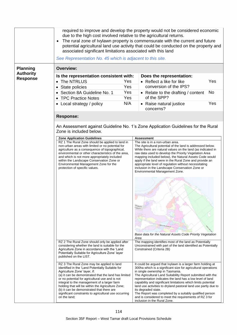
114
Section 35F Report – West Tamar draft Local Provisions Schedule
required to improve and develop the property would not be considered economic due to the high cost involved relative to the agricultural returns.
The rural zone of Ivylawn property is commensurate with the current and future potential agricultural land use activity that could be conducted on the property and associated significant limitations associated with this land
See Representation No. 45 which is adjacent to this site.
Planning Authority Response
Overview:
Is the representation consistent with: Does the representation:
The NTRLUS Yes Reflect a like for like conversion of the IPS?
Yes
State policies Yes
Section 8A Guideline No. 1 Yes Relate to the drafting / content of the SPP?
No
TPC Practice Notes Yes
Local strategy / policy N/A Raise natural justice concerns?
Yes
Response:
An Assessment against Guideline No. 1’s Zone Application Guidelines for the Rural Zone is included below.
Zone Application Guidelines Assessment
RZ 1 The Rural Zone should be applied to land in non-urban areas with limited or no potential for agriculture as a consequence of topographical, environmental or other characteristics of the area, and which is not more appropriately included within the Landscape Conservation Zone or Environmental Management Zone for the protection of specific values.
The site is in a non-urban area. The Agricultural potential of the land is addressed below. While there are natural values on the land (as indicated in raw data used to develop the Priority Vegetation Area mapping included below), the Natural Assets Code would apply if the land were in the Rural Zone and provide an appropriate level of regulation without necessitating inclusion in the Landscape Conservation Zone or Environmental Management Zone.
Base data for the Natural Assets Code Priority Vegetation Area
RZ 2 The Rural Zone should only be applied after considering whether the land is suitable for the Agriculture Zone in accordance with the ‘Land Potentially Suitable for Agriculture Zone’ layer published on the LIST.
The mapping identifies most of the land as Potentially Unconstrained with part of the land identified as Potentially Constrained (Criteria 2B)
RZ 3 The Rural Zone may be applied to land identified in the ‘Land Potentially Suitable for Agriculture Zone’ layer, if: (a) it can be demonstrated that the land has limited or no potential for agricultural use and is not integral to the management of a larger farm holding that will be within the Agriculture Zone; (b) it can be demonstrated that there are significant constraints to agricultural use occurring on the land;
It could be argued that Ivylawn is a larger farm holding at 300ha which is a significant size for agricultural operations in single ownership in Tasmania. The Agricultural Land Suitability Report submitted with the representation indicates the land has a low level of land capability and significant limitations which limits potential land use activities to dryland pastoral land use partly due to its degraded state. The Report was completed by a suitably qualified person and is considered to meet the requirements of RZ 3 for inclusion in the Rural Zone.
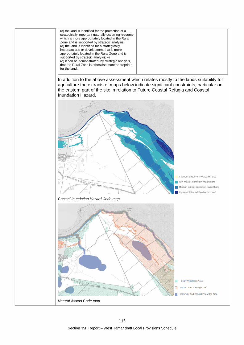
115
Section 35F Report – West Tamar draft Local Provisions Schedule
(c) the land is identified for the protection of a strategically important naturally occurring resource which is more appropriately located in the Rural Zone and is supported by strategic analysis; (d) the land is identified for a strategically important use or development that is more appropriately located in the Rural Zone and is supported by strategic analysis; or (e) it can be demonstrated, by strategic analysis, that the Rural Zone is otherwise more appropriate for the land.
In addition to the above assessment which relates mostly to the lands suitability for agriculture the extracts of maps below indicate significant constraints, particular on the eastern part of the site in relation to Future Coastal Refugia and Coastal Inundation Hazard.
Coastal Inundation Hazard Code map
Natural Assets Code map
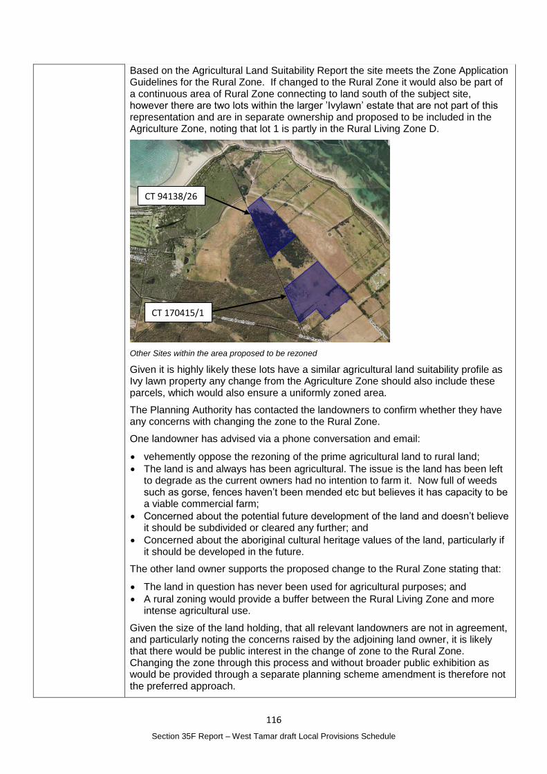
116
Section 35F Report – West Tamar draft Local Provisions Schedule
Based on the Agricultural Land Suitability Report the site meets the Zone Application Guidelines for the Rural Zone. If changed to the Rural Zone it would also be part of a continuous area of Rural Zone connecting to land south of the subject site, however there are two lots within the larger ’Ivylawn’ estate that are not part of this representation and are in separate ownership and proposed to be included in the Agriculture Zone, noting that lot 1 is partly in the Rural Living Zone D.
Other Sites within the area proposed to be rezoned
Given it is highly likely these lots have a similar agricultural land suitability profile as Ivy lawn property any change from the Agriculture Zone should also include these parcels, which would also ensure a uniformly zoned area.
The Planning Authority has contacted the landowners to confirm whether they have any concerns with changing the zone to the Rural Zone.
One landowner has advised via a phone conversation and email:
vehemently oppose the rezoning of the prime agricultural land to rural land;
The land is and always has been agricultural. The issue is the land has been left to degrade as the current owners had no intention to farm it. Now full of weeds such as gorse, fences haven’t been mended etc but believes it has capacity to be a viable commercial farm;
Concerned about the potential future development of the land and doesn’t believe it should be subdivided or cleared any further; and
Concerned about the aboriginal cultural heritage values of the land, particularly if it should be developed in the future.
The other land owner supports the proposed change to the Rural Zone stating that:
The land in question has never been used for agricultural purposes; and
A rural zoning would provide a buffer between the Rural Living Zone and more intense agricultural use.
Given the size of the land holding, that all relevant landowners are not in agreement, and particularly noting the concerns raised by the adjoining land owner, it is likely that there would be public interest in the change of zone to the Rural Zone. Changing the zone through this process and without broader public exhibition as would be provided through a separate planning scheme amendment is therefore not the preferred approach.
CT 94138/26
CT 170415/1

117
Section 35F Report – West Tamar draft Local Provisions Schedule
Planning Authority recommended action
No changes to the draft LPS are recommended at this time.
Effect of recommendation on the draft LPS
The Planning Authority recommendation has no impact on implementing the draft LPS as a whole.
Meets the LPS criteria
The Planning Authority recommendation meets the LPS criteria.
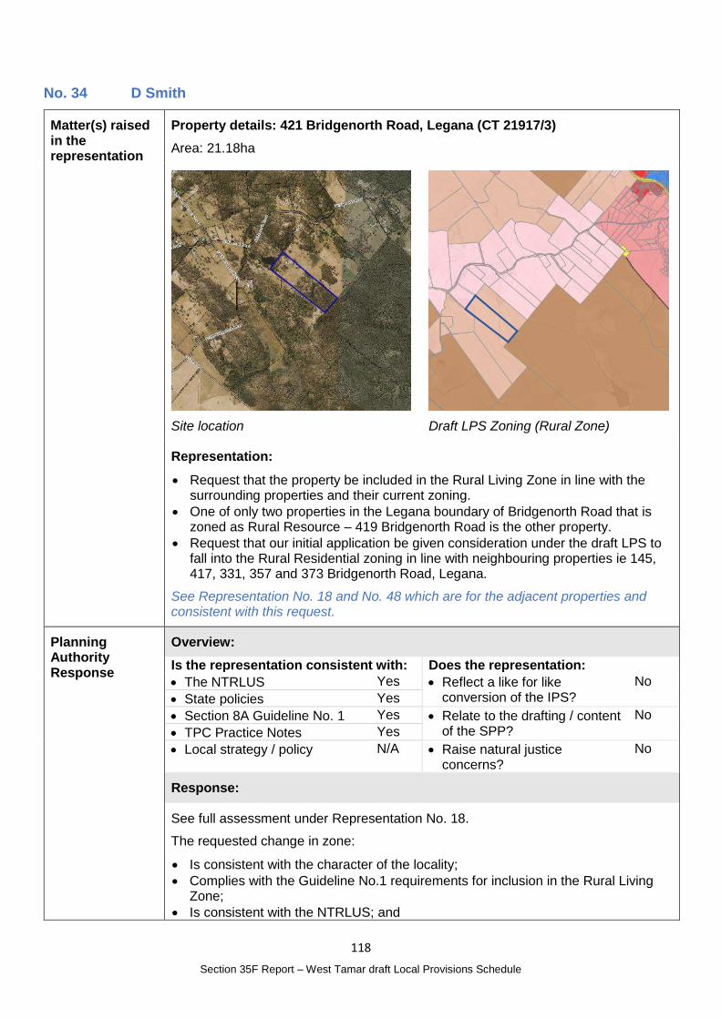
118
Section 35F Report – West Tamar draft Local Provisions Schedule
No. 34 D Smith
Matter(s) raised in the representation
Property details: 421 Bridgenorth Road, Legana (CT 21917/3)
Area: 21.18ha
Site location
Draft LPS Zoning (Rural Zone)
Representation:
Request that the property be included in the Rural Living Zone in line with the surrounding properties and their current zoning.
One of only two properties in the Legana boundary of Bridgenorth Road that is zoned as Rural Resource – 419 Bridgenorth Road is the other property.
Request that our initial application be given consideration under the draft LPS to fall into the Rural Residential zoning in line with neighbouring properties ie 145, 417, 331, 357 and 373 Bridgenorth Road, Legana.
See Representation No. 18 and No. 48 which are for the adjacent properties and consistent with this request.
Planning Authority Response
Overview:
Is the representation consistent with: Does the representation:
The NTRLUS Yes Reflect a like for like conversion of the IPS?
No
State policies Yes
Section 8A Guideline No. 1 Yes Relate to the drafting / content of the SPP?
No
TPC Practice Notes Yes
Local strategy / policy N/A Raise natural justice concerns?
No
Response:
See full assessment under Representation No. 18.
The requested change in zone:
Is consistent with the character of the locality;
Complies with the Guideline No.1 requirements for inclusion in the Rural Living Zone;
Is consistent with the NTRLUS; and
119
Section 35F Report – West Tamar draft Local Provisions Schedule
Does not compromise State policies.
Planning Authority recommended action
Change the zone of the following properties from the Rural Zone to the Rural Living Zone D:
419 Bridgenorth Road, Legana (CT 21917/2);
421 Bridgenorth Road, Legana (CT 21917/3); and
437 Bridgenorth Road, Bridgenorth (CT 250146/1).
Effect of recommendation on the draft LPS
The Planning Authority recommendation has no impact on implementing the draft LPS as a whole as all landowners are supportive of the recommended change.
Meets the LPS criteria
The Planning Authority recommendation meets the LPS criteria.
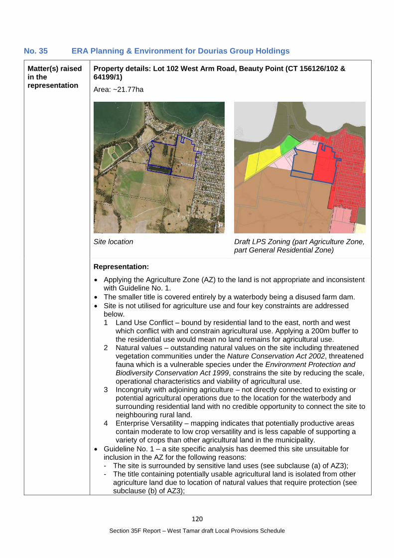
120
Section 35F Report – West Tamar draft Local Provisions Schedule
No. 35 ERA Planning & Environment for Dourias Group Holdings
Matter(s) raised in the representation
Property details: Lot 102 West Arm Road, Beauty Point (CT 156126/102 & 64199/1)
Area: ~21.77ha
Site location
Draft LPS Zoning (part Agriculture Zone, part General Residential Zone)
Representation:
Applying the Agriculture Zone (AZ) to the land is not appropriate and inconsistent with Guideline No. 1.
The smaller title is covered entirely by a waterbody being a disused farm dam.
Site is not utilised for agriculture use and four key constraints are addressed below. 1 Land Use Conflict – bound by residential land to the east, north and west
which conflict with and constrain agricultural use. Applying a 200m buffer to the residential use would mean no land remains for agricultural use.
2 Natural values – outstanding natural values on the site including threatened vegetation communities under the Nature Conservation Act 2002, threatened fauna which is a vulnerable species under the Environment Protection and Biodiversity Conservation Act 1999, constrains the site by reducing the scale, operational characteristics and viability of agricultural use.
3 Incongruity with adjoining agriculture – not directly connected to existing or potential agricultural operations due to the location for the waterbody and surrounding residential land with no credible opportunity to connect the site to neighbouring rural land.
4 Enterprise Versatility – mapping indicates that potentially productive areas contain moderate to low crop versatility and is less capable of supporting a variety of crops than other agricultural land in the municipality.
Guideline No. 1 – a site specific analysis has deemed this site unsuitable for inclusion in the AZ for the following reasons: - The site is surrounded by sensitive land uses (see subclause (a) of AZ3); - The title containing potentially usable agricultural land is isolated from other
agriculture land due to location of natural values that require protection (see subclause (b) of AZ3);
121
Section 35F Report – West Tamar draft Local Provisions Schedule
- The land is not used for agriculture, is not used in conjunction with other agricultural land, and is under different ownership (see subclause (a) and (c) of AZ3);
- The land has limited agricultural potential due to surrounding sensitive uses, small land area, presence of natural values, and limited enterprise versatility (see subclause (d) and (e) of AZ3); and
- Detailed site analysis has resulted in the identification of significant natural values. These natural values require protection under the Natural Assets Code, which cannot occur in the AZ (see subclause (e) of AZ3).
Given that the Agriculture Zone has been deemed as inappropriate Potential zones considered for the site include: - Rural Zone – Not appropriate. Rezoning would result in an isolated parcel of
land that is not contiguous with other RZ land. - Landscape Conservation Zone – Not appropriate. LPS has not identified any
land considered suitable for this zoning. - Rural Living Zone – Appropriate. Site is contiguous with other RLZ land.
Rezoning would consolidate the transition between residential and agricultural land in Beauty Point and alleviate prevailing land use conflict.
- Site facilitates a mix between residential and lower order rural activities (see subclause (a) of RLZ1). Rezoning consistent with the Northern Tasmania Regional Land Use Strategy (see subclause (a) of RLZ2 and (c) of RLZ4). Rezoning responds to a forecasted shortfall in low density housing across the municipality when existing low density supply is consumed.
- Low Density Residential Zone – Potentially appropriate. Rezoning would temporarily result in an isolated parcel of land that is not contiguous with other LDRZ land until land is subdivided. However, rezoning would consolidate the transition between residential and agricultural land in Beauty Point.
- General Residential Zone – Potentially appropriate. Site is contiguous with other GRZ land. However, rezoning would require a supporting residential supply and demand analysis.
The Rural Living Zone is considered the most appropriate zone for the site at this time.
Planning Authority Response
Overview:
Is the representation consistent with: Does the representation:
The NTRLUS No Reflect a like for like conversion of the IPS?
No
State policies Yes
Section 8A Guideline No. 1 No Relate to the drafting / content of the SPP?
No
TPC Practice Notes Yes
Local strategy / policy N/A Raise natural justice concerns?
Yes
Response:
The site is identified in the Land Potentially Suitable for Agriculture Zone mapping as Potentially Constrained (Criteria 3) with the potential constraints being residential development.
The Agricultural Land Mapping in West Tamar Municipality Report prepared by AK Consulting makes the following comments about Beauty Point (Area 5):
This area was identified due to the mix of titles mapped for the Agriculture Zone that are adjacent to Residential Zones (Low Density Residential & Rural Living) to the east and a large title owned by the Crown that was excluded from the ALMP to the west. Also, to the South West is a Conservation Area.
122
Section 35F Report – West Tamar draft Local Provisions Schedule
When undertaking the assessment in this area it was identified that there are existing mining leases and that large areas are actually crown land. This crown land cuts off the rest of the titles assessed from the wider agricultural estate. Also, the private titles in this area were all assessed as being ‘hobby scale’ or ‘lifestyle scale’ due to size, existing land use and presence of dwellings. It was determined that all titles within this area would be more appropriately zone Rural.
The proposed zones in Map 2 of the report show the site in the Agriculture Zone with the reference to the Rural Zone assumed to refer to the Rural Zone allocation further south of the site. While there are potential constraints to the land, the Agriculture Zone allocation was likely determined to provide a continuously zoned area.
AZ 6 of Guideline No. 1 suggests land identified in the Land Potentially Suitable for Agriculture Zone mapping may be considered for alternate zoning in certain circumstances.
The representor contends that the site has limited or no potential for agriculture and the Agriculture Zone should not have been applied. A site specific analysis was completed by the representor that confirmed the constraints, however an Agricultural Land Suitability Report was not submitted.
The representation is seeking to change the zone to the Rural Living Zone.
The Rural Living Zone B adjoins the site on the north and western boundaries with General Residential on the eastern half of the title.
RLZ 2 of Guideline No. 1 states:
The Rural Living Zone should not be applied to land that is not currently within an interim planning scheme Rural Living Zone, unless:
(a) consistent with the relevant regional land use strategy, or supported by more detailed local strategic analysis consistent with the relevant regional land use strategy and endorsed by the relevant council; or
(b) the land is within the Environmental Living Zone in an interim planning scheme and the primary strategic intention is for residential use and development within a rural setting and a similar minimum allowable lot size is being applied, such as, applying the Rural Living Zone D where the minimum lot size is 10 ha or greater.
Note that (b) does not apply to this site.
Local strategic analysis has not been completed for the site and the future residential demand and supply would require consideration.
Map D.2 of the NTRLUS identifies the Land Use as Rural and while it is adjacent to a Rural Residential Area, is not considered to be an established Rural Residential Area under section D.2.2.2. There is insufficient information available to complete an assessment against the Rural Residential criteria in the NTRLUS.
The site is also within the attenuation for the Beauty Point Sewage Treatment Plant and suitability for residential development needs to be considered in this context noting that the Rural Living Zone between the property and the Treatment Plan is historical and has not been densely developed. A noise and odour assessment has not been provided with the representation to address the attenuation requirements.
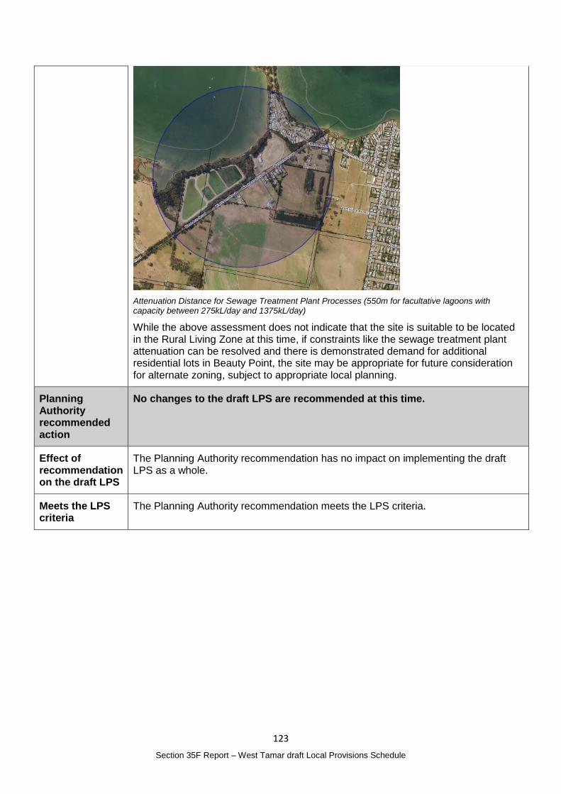
123
Section 35F Report – West Tamar draft Local Provisions Schedule
Attenuation Distance for Sewage Treatment Plant Processes (550m for facultative lagoons with capacity between 275kL/day and 1375kL/day)
While the above assessment does not indicate that the site is suitable to be located in the Rural Living Zone at this time, if constraints like the sewage treatment plant attenuation can be resolved and there is demonstrated demand for additional residential lots in Beauty Point, the site may be appropriate for future consideration for alternate zoning, subject to appropriate local planning.
Planning Authority recommended action
No changes to the draft LPS are recommended at this time.
Effect of recommendation on the draft LPS
The Planning Authority recommendation has no impact on implementing the draft LPS as a whole.
Meets the LPS criteria
The Planning Authority recommendation meets the LPS criteria.
124
Section 35F Report – West Tamar draft Local Provisions Schedule
No. 36 Denis Hume
Matter(s) raised in the representation
Property details: Not applicable
Representation:
I wish to object to the minimum lot size proposed under Development Standards for Subdivision WTA-S3.8 for the following reasons:
The minimum lot size proposed of 5,000m2 is far greater than the 1500m2 proposed under the Tasmanian Planning Provisions.
The minimum lot size is also far greater than that proposed in adjacent Tamar Valley municipalities.
Provided that appropriate infrastructure is, or can be made available successful development of LDRZ zoned land can be achieved on lots much smaller than 5,000m2. The development that has occurred at Acropolis Drive Legana is a good example.
The fact that the Performance Criteria (P1) offers no flexibility as to lot size is not consistent with your Plan Purpose Statement WTA-S3.1.2 “to provide for lots at a density appropriate to the infrastructure constraints in low density residential areas” This objective is again stated at WTA-S3.8.1.
In order to achieve greater consistency with the Tasmanian Planning Provisions, the Local Provisions Schedules of other Tamar Valley Councils and your own objectives I request the following changes be made to WTA-S3.8: - Acceptable Solutions A1 (a) - Have an area not less than 2,500 m2 - Performance Criteria P1 - Provide a discretion for lot sizes to be 20% (500 m2)
smaller than the area stipulated under the Acceptable Solutions
See Representations No. 26, 31, 32, 41and 63 which relate to the same provisions but request a different change.
Planning Authority Response
Overview:
Is the representation consistent with: Does the representation:
The NTRLUS Yes Reflect a like for like conversion of the IPS?
No
State policies Yes
Section 8A Guideline No. 1 Yes Relate to the drafting / content of the SPP?
No
TPC Practice Notes Yes
Local strategy / policy N/A Raise natural justice concerns?
Yes
Response:
A detailed response in relation to amending the provisions of the Residential Supply and Density Specific Area Plan is provided under Representation No. 26.
As noted the Planning Authority is of the opinion that the 5000m2 minimum lot size should be retained.

125
Section 35F Report – West Tamar draft Local Provisions Schedule
Planning Authority recommended action
No changes to the draft LPS are recommended.
Effect of recommendation on the draft LPS
The Planning Authority recommendation has no impact on implementing the draft LPS as a whole.
Meets the LPS criteria
The Planning Authority recommendation meets the LPS criteria.
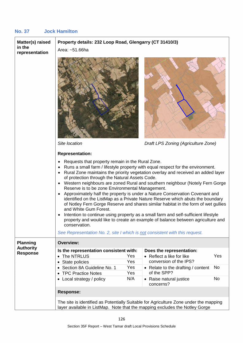
126
Section 35F Report – West Tamar draft Local Provisions Schedule
No. 37 Jock Hamilton
Matter(s) raised in the representation
Property details: 232 Loop Road, Glengarry (CT 31410/3)
Area: ~51.66ha
Site location
Draft LPS Zoning (Agriculture Zone)
Representation:
Requests that property remain in the Rural Zone.
Runs a small farm / lifestyle property with equal respect for the environment.
Rural Zone maintains the priority vegetation overlay and received an added layer of protection through the Natural Assets Code.
Western neighbours are zoned Rural and southern neighbour (Notely Fern Gorge Reserve is to be zone Environmental Management.
Approximately half the property is under a Nature Conservation Covenant and identified on the ListMap as a Private Nature Reserve which abuts the boundary of Notley Fern Gorge Reserve and shares similar habitat in the form of wet gullies and White Gum Forest.
Intention to continue using property as a small farm and self-sufficient lifestyle property and would like to create an example of balance between agriculture and conservation.
See Representation No. 2, site I which is not consistent with this request.
Planning Authority Response
Overview:
Is the representation consistent with: Does the representation:
The NTRLUS Yes Reflect a like for like conversion of the IPS?
Yes
State policies Yes
Section 8A Guideline No. 1 Yes Relate to the drafting / content of the SPP?
No
TPC Practice Notes Yes
Local strategy / policy N/A Raise natural justice concerns?
No
Response:
The site is identified as Potentially Suitable for Agriculture Zone under the mapping layer available in ListMap. Note that the mapping excludes the Notley Gorge
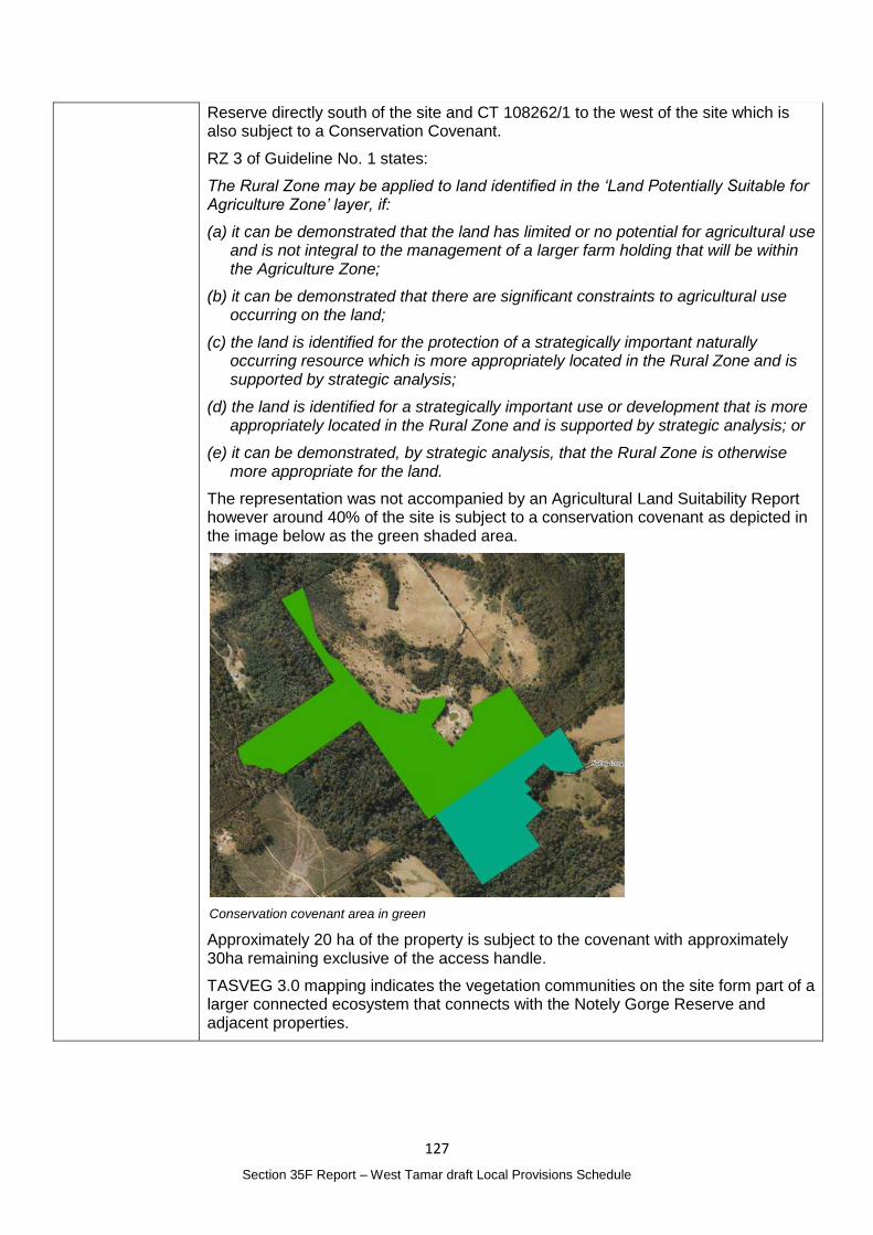
127
Section 35F Report – West Tamar draft Local Provisions Schedule
Reserve directly south of the site and CT 108262/1 to the west of the site which is also subject to a Conservation Covenant.
RZ 3 of Guideline No. 1 states:
The Rural Zone may be applied to land identified in the ‘Land Potentially Suitable for Agriculture Zone’ layer, if:
(a) it can be demonstrated that the land has limited or no potential for agricultural use and is not integral to the management of a larger farm holding that will be within the Agriculture Zone;
(b) it can be demonstrated that there are significant constraints to agricultural use occurring on the land;
(c) the land is identified for the protection of a strategically important naturally occurring resource which is more appropriately located in the Rural Zone and is supported by strategic analysis;
(d) the land is identified for a strategically important use or development that is more appropriately located in the Rural Zone and is supported by strategic analysis; or
(e) it can be demonstrated, by strategic analysis, that the Rural Zone is otherwise more appropriate for the land.
The representation was not accompanied by an Agricultural Land Suitability Report however around 40% of the site is subject to a conservation covenant as depicted in the image below as the green shaded area.
Conservation covenant area in green
Approximately 20 ha of the property is subject to the covenant with approximately 30ha remaining exclusive of the access handle.
TASVEG 3.0 mapping indicates the vegetation communities on the site form part of a larger connected ecosystem that connects with the Notely Gorge Reserve and adjacent properties.
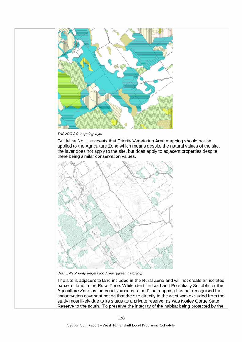
128
Section 35F Report – West Tamar draft Local Provisions Schedule
TASVEG 3.0 mapping layer
Guideline No. 1 suggests that Priority Vegetation Area mapping should not be applied to the Agriculture Zone which means despite the natural values of the site, the layer does not apply to the site, but does apply to adjacent properties despite there being similar conservation values.
Draft LPS Priority Vegetation Areas (green hatching)
The site is adjacent to land included in the Rural Zone and will not create an isolated parcel of land in the Rural Zone. While identified as Land Potentially Suitable for the Agriculture Zone as ‘potentially unconstrained’ the mapping has not recognised the conservation covenant noting that the site directly to the west was excluded from the study most likely due to its status as a private reserve, as was Notley Gorge State Reserve to the south. To preserve the integrity of the habitat being protected by the
129
Section 35F Report – West Tamar draft Local Provisions Schedule
reserves it is appropriate for the Priority Vegetation Area to apply to the land and for the regulation of clearing that is afforded through the inclusion of the land in the Rural Zone.
The grazing that is currently occurring on the site can continue to occur under the Rural Zone.
In order to provide an appropriate level of regulation and protection of its natural values, it is recommended that 232 Loop Road, Glengarry, be included in the Rural Zone and the Priority Vegetation Area map be amended to apply on this site.
It is not likely that the public would have any further interest in the zoning of the site.
Planning Authority recommended action
In relation to 232 Loop Road, Glengarry (CT 31410/3):
Change the zone from the Agriculture Zone to the Rural Zone; and
Apply the Priority Vegetation Area map to the site.
Effect of recommendation on the draft LPS
The Planning Authority recommendation has only minor impact on implementing the draft LPS as a whole and the landowner is supportive of the change.
Meets the LPS criteria
The Planning Authority recommendation meets the LPS criteria.
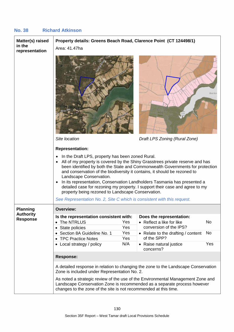
130
Section 35F Report – West Tamar draft Local Provisions Schedule
No. 38 Richard Atkinson
Matter(s) raised in the representation
Property details: Greens Beach Road, Clarence Point (CT 124498/1)
Area: 41.47ha
Site location
Draft LPS Zoning (Rural Zone)
Representation:
In the Draft LPS, property has been zoned Rural.
All of my property is covered by the Shiny Grasstrees private reserve and has been identified by both the State and Commonwealth Governments for protection and conservation of the biodiversity it contains, it should be rezoned to Landscape Conservation.
In its representation, Conservation Landholders Tasmania has presented a detailed case for rezoning my property. I support their case and agree to my property being rezoned to Landscape Conservation.
See Representation No. 2, Site C which is consistent with this request.
Planning Authority Response
Overview:
Is the representation consistent with: Does the representation:
The NTRLUS Yes Reflect a like for like conversion of the IPS?
No
State policies Yes
Section 8A Guideline No. 1 Yes Relate to the drafting / content of the SPP?
No
TPC Practice Notes Yes
Local strategy / policy N/A Raise natural justice concerns?
Yes
Response:
A detailed response in relation to changing the zone to the Landscape Conservation Zone is included under Representation No. 2.
As noted a strategic review of the use of the Environmental Management Zone and Landscape Conservation Zone is recommended as a separate process however changes to the zone of the site is not recommended at this time.

131
Section 35F Report – West Tamar draft Local Provisions Schedule
Planning Authority recommended action
No changes to the draft LPS are recommended at this time
Effect of recommendation on the draft LPS
The Planning Authority recommendation has no impact on implementing the draft LPS as a whole.
Meets the LPS criteria
The Planning Authority is satisfied that the recommendation meets the LPS criteria.
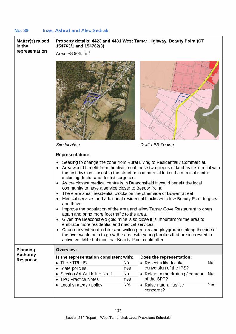
132
Section 35F Report – West Tamar draft Local Provisions Schedule
No. 39 Inas, Ashraf and Alex Sedrak
Matter(s) raised in the representation
Property details: 4423 and 4431 West Tamar Highway, Beauty Point (CT 154763/1 and 154762/3)
Area: ~8 505.4m2
Site location
Draft LPS Zoning
Representation:
Seeking to change the zone from Rural Living to Residential / Commercial.
Area would benefit from the division of these two pieces of land as residential with the first division closest to the street as commercial to build a medical centre including doctor and dentist surgeries.
As the closest medical centre is in Beaconsfield it would benefit the local community to have a service closer to Beauty Point.
There are small residential blocks on the other side of Bowen Street.
Medical services and additional residential blocks will allow Beauty Point to grow and thrive.
Improve the population of the area and allow Tamar Cove Restaurant to open again and bring more foot traffic to the area.
Given the Beaconsfield gold mine is so close it is important for the area to embrace more residential and medical services.
Council investment in bike and walking tracks and playgrounds along the side of the river would help to grow the area with young families that are interested in active work/life balance that Beauty Point could offer.
Planning Authority Response
Overview:
Is the representation consistent with: Does the representation:
The NTRLUS No Reflect a like for like conversion of the IPS?
No
State policies Yes
Section 8A Guideline No. 1 No Relate to the drafting / content of the SPP?
No
TPC Practice Notes Yes
Local strategy / policy N/A Raise natural justice concerns?
Yes
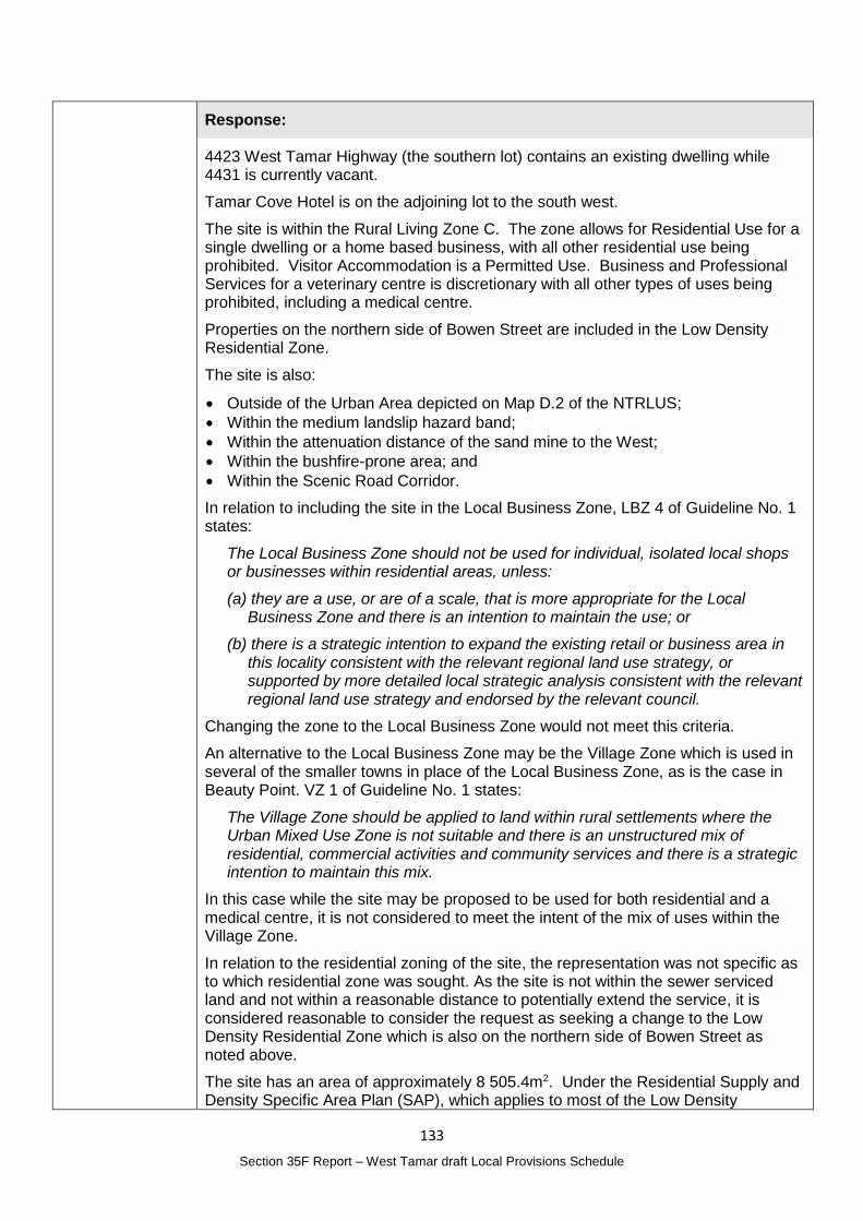
133
Section 35F Report – West Tamar draft Local Provisions Schedule
Response:
4423 West Tamar Highway (the southern lot) contains an existing dwelling while 4431 is currently vacant.
Tamar Cove Hotel is on the adjoining lot to the south west.
The site is within the Rural Living Zone C. The zone allows for Residential Use for a single dwelling or a home based business, with all other residential use being prohibited. Visitor Accommodation is a Permitted Use. Business and Professional Services for a veterinary centre is discretionary with all other types of uses being prohibited, including a medical centre.
Properties on the northern side of Bowen Street are included in the Low Density Residential Zone.
The site is also:
Outside of the Urban Area depicted on Map D.2 of the NTRLUS;
Within the medium landslip hazard band;
Within the attenuation distance of the sand mine to the West;
Within the bushfire-prone area; and
Within the Scenic Road Corridor.
In relation to including the site in the Local Business Zone, LBZ 4 of Guideline No. 1 states:
The Local Business Zone should not be used for individual, isolated local shops or businesses within residential areas, unless:
(a) they are a use, or are of a scale, that is more appropriate for the Local Business Zone and there is an intention to maintain the use; or
(b) there is a strategic intention to expand the existing retail or business area in this locality consistent with the relevant regional land use strategy, or supported by more detailed local strategic analysis consistent with the relevant regional land use strategy and endorsed by the relevant council.
Changing the zone to the Local Business Zone would not meet this criteria.
An alternative to the Local Business Zone may be the Village Zone which is used in several of the smaller towns in place of the Local Business Zone, as is the case in Beauty Point. VZ 1 of Guideline No. 1 states:
The Village Zone should be applied to land within rural settlements where the Urban Mixed Use Zone is not suitable and there is an unstructured mix of residential, commercial activities and community services and there is a strategic intention to maintain this mix.
In this case while the site may be proposed to be used for both residential and a medical centre, it is not considered to meet the intent of the mix of uses within the Village Zone.
In relation to the residential zoning of the site, the representation was not specific as to which residential zone was sought. As the site is not within the sewer serviced land and not within a reasonable distance to potentially extend the service, it is considered reasonable to consider the request as seeking a change to the Low Density Residential Zone which is also on the northern side of Bowen Street as noted above.
The site has an area of approximately 8 505.4m2. Under the Residential Supply and Density Specific Area Plan (SAP), which applies to most of the Low Density
134
Section 35F Report – West Tamar draft Local Provisions Schedule
Residential Zone, the minimum lot size is 5000m2. The smaller lots on the northern side of Bowen Road are not included in the SAP as they are existing smaller lots that could not be further subdivided under the TPS zone provisions which have a minimum lot size of 1500m2. The capacity of the land to accommodate wastewater treatment and disposal is unknown. It would be reasonable therefore to apply the SAP if the zone were to change.
LDRZ 1 of Guideline No. 1 states:
The Low Density Residential Zone should be applied to residential areas where one of the following conditions exist:
(a) residential areas with large lots that cannot be developed to higher densities due to any of the following constraints:
(i) lack of availability or capacity of reticulated infrastructure services, unless the constraint is intended to be resolved prior to development of the land; and
(ii) environmental constraints that limit development (e.g. land hazards, topography or slope); or
(b) small, residential settlements without the full range of infrastructure services, or constrained by the capacity of existing or planned infrastructure services; or
(c) existing low density residential areas characterised by a pattern of subdivision specifically planned to provide for such development, and where there is justification for a strategic intention not to support development at higher densities.
At face value, the site meets the criteria, and while there would be limited opportunity for subdivision, the use rights associated with the change require consideration. For example, a medical centre in this zone is a discretionary use compared to prohibited in the Rural Living Zone.
The site is also on the edge of the Beauty Point area, and while a medical centre as described would be a desirable to service for Beauty Point, the preferred location would be more centrally located within the township within or close to the Village Zone.
The requirements of the overlays / codes listed above also need to be considered and information about addressing these was not submitted with the representation.
A change in zone would be likely to be of public interest.
Planning Authority recommended action
No changes to the draft LPS are recommended.
Effect of recommendation on the draft LPS
The Planning Authority recommendation has no impact on implementing the draft LPS as a whole.
Meets the LPS criteria
The Planning Authority is satisfied that the recommendation meets the LPS criteria.
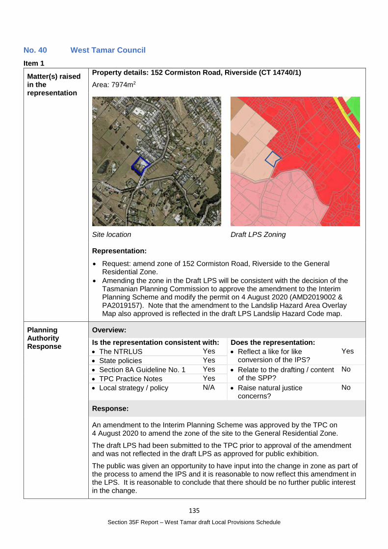
135
Section 35F Report – West Tamar draft Local Provisions Schedule
No. 40 West Tamar Council
Item 1
Matter(s) raised in the representation
Property details: 152 Cormiston Road, Riverside (CT 14740/1)
Area: 7974m2
Site location
Draft LPS Zoning
Representation:
Request: amend zone of 152 Cormiston Road, Riverside to the General Residential Zone.
Amending the zone in the Draft LPS will be consistent with the decision of the Tasmanian Planning Commission to approve the amendment to the Interim Planning Scheme and modify the permit on 4 August 2020 (AMD2019002 & PA2019157). Note that the amendment to the Landslip Hazard Area Overlay Map also approved is reflected in the draft LPS Landslip Hazard Code map.
Planning Authority Response
Overview:
Is the representation consistent with: Does the representation:
The NTRLUS Yes Reflect a like for like conversion of the IPS?
Yes
State policies Yes
Section 8A Guideline No. 1 Yes Relate to the drafting / content of the SPP?
No
TPC Practice Notes Yes
Local strategy / policy N/A Raise natural justice concerns?
No
Response:
An amendment to the Interim Planning Scheme was approved by the TPC on 4 August 2020 to amend the zone of the site to the General Residential Zone.
The draft LPS had been submitted to the TPC prior to approval of the amendment and was not reflected in the draft LPS as approved for public exhibition.
The public was given an opportunity to have input into the change in zone as part of the process to amend the IPS and it is reasonable to now reflect this amendment in the LPS. It is reasonable to conclude that there should be no further public interest in the change.
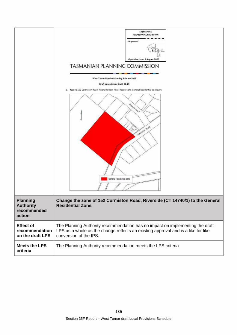
136
Section 35F Report – West Tamar draft Local Provisions Schedule
Planning Authority recommended action
Change the zone of 152 Cormiston Road, Riverside (CT 14740/1) to the General Residential Zone.
Effect of recommendation on the draft LPS
The Planning Authority recommendation has no impact on implementing the draft LPS as a whole as the change reflects an existing approval and is a like for like conversion of the IPS.
Meets the LPS criteria
The Planning Authority recommendation meets the LPS criteria.
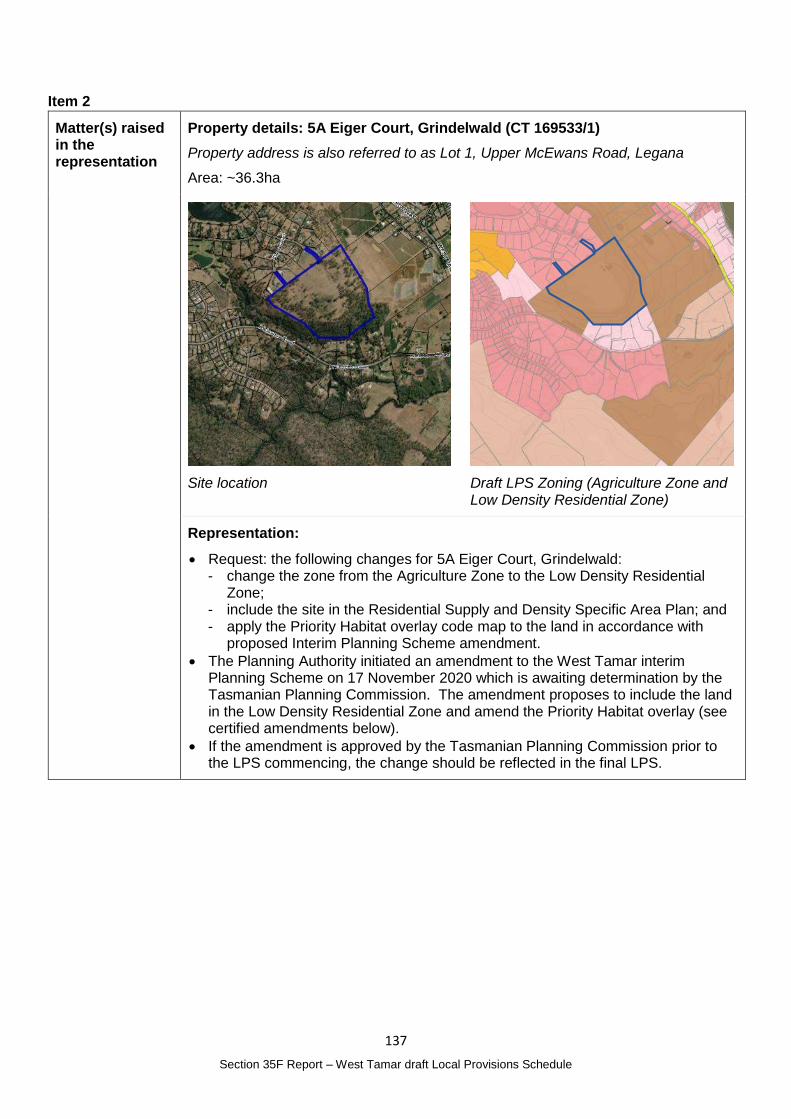
137
Section 35F Report – West Tamar draft Local Provisions Schedule
Item 2
Matter(s) raised in the representation
Property details: 5A Eiger Court, Grindelwald (CT 169533/1)
Property address is also referred to as Lot 1, Upper McEwans Road, Legana
Area: ~36.3ha
Site location
Draft LPS Zoning (Agriculture Zone and Low Density Residential Zone)
Representation:
Request: the following changes for 5A Eiger Court, Grindelwald: - change the zone from the Agriculture Zone to the Low Density Residential
Zone; - include the site in the Residential Supply and Density Specific Area Plan; and - apply the Priority Habitat overlay code map to the land in accordance with
proposed Interim Planning Scheme amendment.
The Planning Authority initiated an amendment to the West Tamar interim Planning Scheme on 17 November 2020 which is awaiting determination by the Tasmanian Planning Commission. The amendment proposes to include the land in the Low Density Residential Zone and amend the Priority Habitat overlay (see certified amendments below).
If the amendment is approved by the Tasmanian Planning Commission prior to the LPS commencing, the change should be reflected in the final LPS.
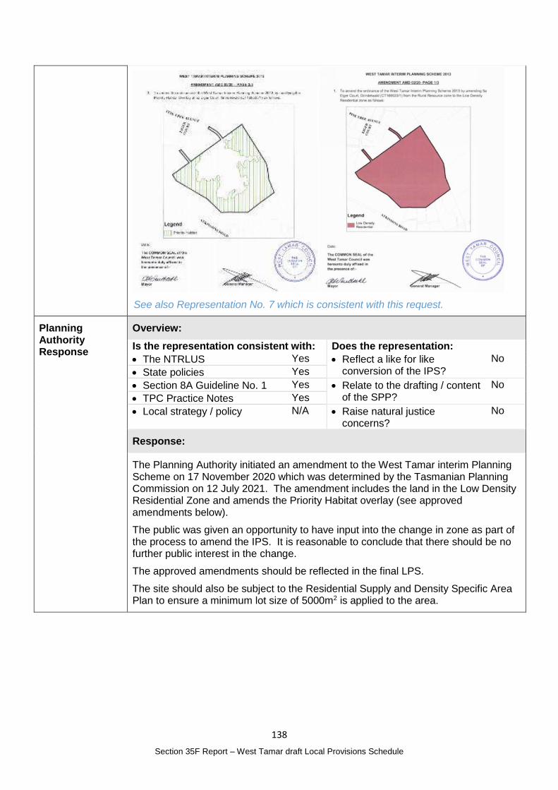
138
Section 35F Report – West Tamar draft Local Provisions Schedule
See also Representation No. 7 which is consistent with this request.
Planning Authority Response
Overview:
Is the representation consistent with: Does the representation:
The NTRLUS Yes Reflect a like for like conversion of the IPS?
No
State policies Yes
Section 8A Guideline No. 1 Yes Relate to the drafting / content of the SPP?
No
TPC Practice Notes Yes
Local strategy / policy N/A Raise natural justice concerns?
No
Response:
The Planning Authority initiated an amendment to the West Tamar interim Planning Scheme on 17 November 2020 which was determined by the Tasmanian Planning Commission on 12 July 2021. The amendment includes the land in the Low Density Residential Zone and amends the Priority Habitat overlay (see approved amendments below).
The public was given an opportunity to have input into the change in zone as part of the process to amend the IPS. It is reasonable to conclude that there should be no further public interest in the change.
The approved amendments should be reflected in the final LPS.
The site should also be subject to the Residential Supply and Density Specific Area Plan to ensure a minimum lot size of 5000m2 is applied to the area.
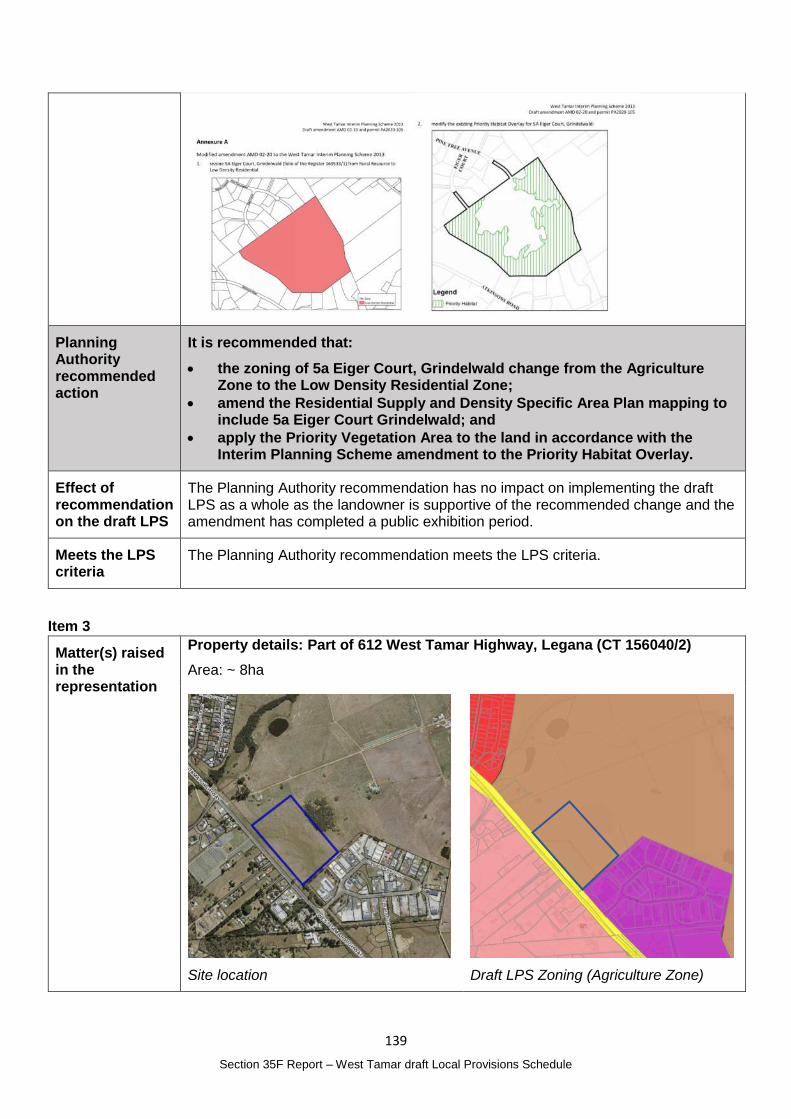
139
Section 35F Report – West Tamar draft Local Provisions Schedule
Planning Authority recommended action
It is recommended that:
the zoning of 5a Eiger Court, Grindelwald change from the Agriculture Zone to the Low Density Residential Zone;
amend the Residential Supply and Density Specific Area Plan mapping to include 5a Eiger Court Grindelwald; and
apply the Priority Vegetation Area to the land in accordance with the Interim Planning Scheme amendment to the Priority Habitat Overlay.
Effect of recommendation on the draft LPS
The Planning Authority recommendation has no impact on implementing the draft LPS as a whole as the landowner is supportive of the recommended change and the amendment has completed a public exhibition period.
Meets the LPS criteria
The Planning Authority recommendation meets the LPS criteria.
Item 3
Matter(s) raised in the representation
Property details: Part of 612 West Tamar Highway, Legana (CT 156040/2)
Area: ~ 8ha
Site location
Draft LPS Zoning (Agriculture Zone)
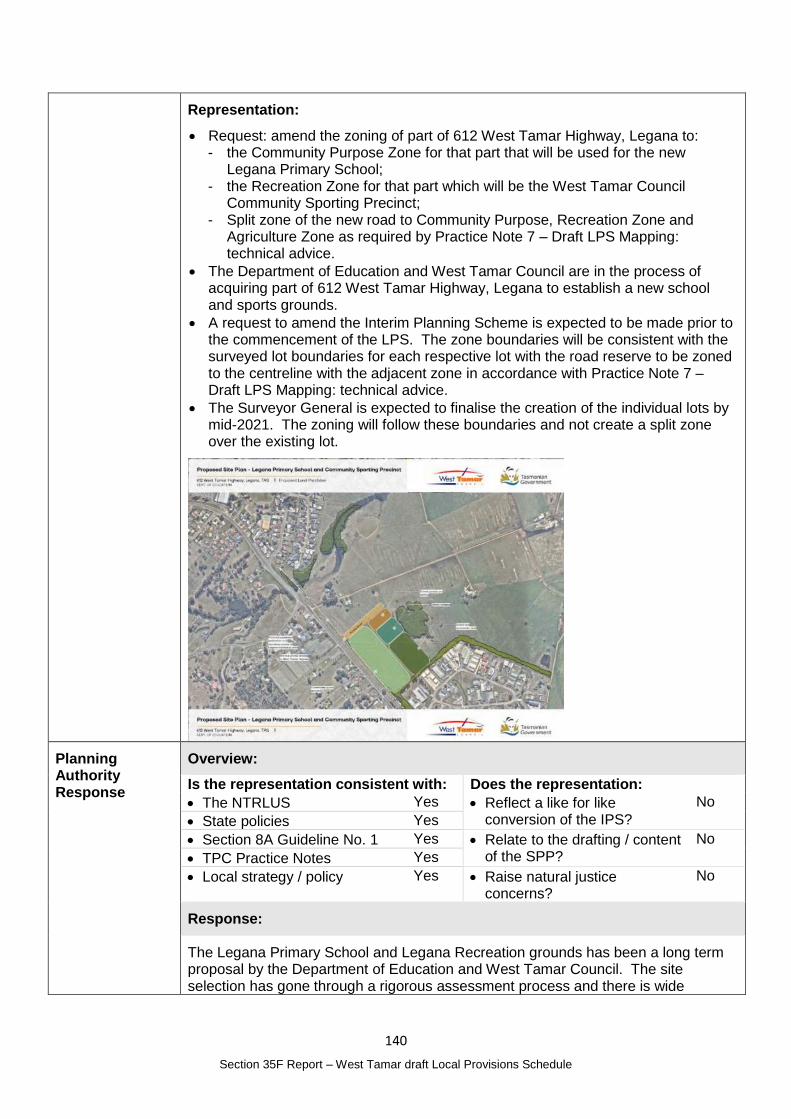
140
Section 35F Report – West Tamar draft Local Provisions Schedule
Representation:
Request: amend the zoning of part of 612 West Tamar Highway, Legana to: - the Community Purpose Zone for that part that will be used for the new
Legana Primary School; - the Recreation Zone for that part which will be the West Tamar Council
Community Sporting Precinct; - Split zone of the new road to Community Purpose, Recreation Zone and
Agriculture Zone as required by Practice Note 7 – Draft LPS Mapping: technical advice.
The Department of Education and West Tamar Council are in the process of acquiring part of 612 West Tamar Highway, Legana to establish a new school and sports grounds.
A request to amend the Interim Planning Scheme is expected to be made prior to the commencement of the LPS. The zone boundaries will be consistent with the surveyed lot boundaries for each respective lot with the road reserve to be zoned to the centreline with the adjacent zone in accordance with Practice Note 7 – Draft LPS Mapping: technical advice.
The Surveyor General is expected to finalise the creation of the individual lots by mid-2021. The zoning will follow these boundaries and not create a split zone over the existing lot.
Planning Authority Response
Overview:
Is the representation consistent with: Does the representation:
The NTRLUS Yes Reflect a like for like conversion of the IPS?
No
State policies Yes
Section 8A Guideline No. 1 Yes Relate to the drafting / content of the SPP?
No
TPC Practice Notes Yes
Local strategy / policy Yes Raise natural justice concerns?
No
Response:
The Legana Primary School and Legana Recreation grounds has been a long term proposal by the Department of Education and West Tamar Council. The site selection has gone through a rigorous assessment process and there is wide
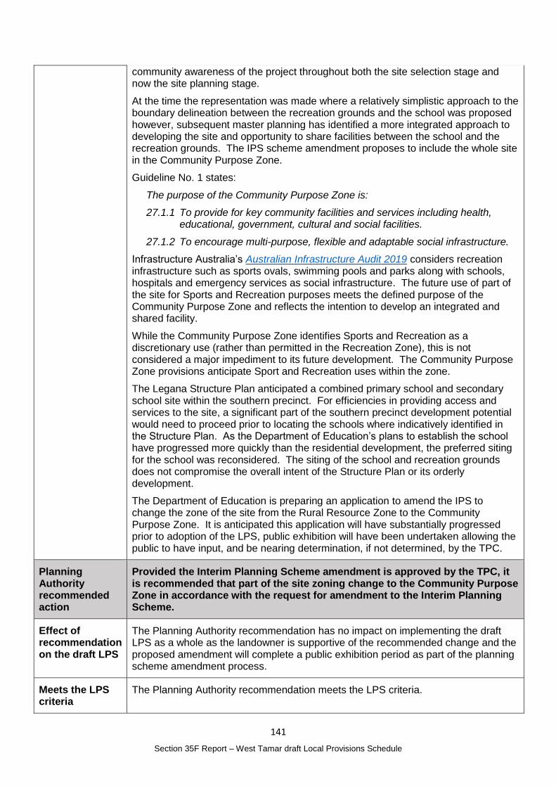
141
Section 35F Report – West Tamar draft Local Provisions Schedule
community awareness of the project throughout both the site selection stage and now the site planning stage.
At the time the representation was made where a relatively simplistic approach to the boundary delineation between the recreation grounds and the school was proposed however, subsequent master planning has identified a more integrated approach to developing the site and opportunity to share facilities between the school and the recreation grounds. The IPS scheme amendment proposes to include the whole site in the Community Purpose Zone.
Guideline No. 1 states:
The purpose of the Community Purpose Zone is:
27.1.1 To provide for key community facilities and services including health, educational, government, cultural and social facilities.
27.1.2 To encourage multi-purpose, flexible and adaptable social infrastructure.
Infrastructure Australia’s Australian Infrastructure Audit 2019 considers recreation infrastructure such as sports ovals, swimming pools and parks along with schools, hospitals and emergency services as social infrastructure. The future use of part of the site for Sports and Recreation purposes meets the defined purpose of the Community Purpose Zone and reflects the intention to develop an integrated and shared facility.
While the Community Purpose Zone identifies Sports and Recreation as a discretionary use (rather than permitted in the Recreation Zone), this is not considered a major impediment to its future development. The Community Purpose Zone provisions anticipate Sport and Recreation uses within the zone.
The Legana Structure Plan anticipated a combined primary school and secondary school site within the southern precinct. For efficiencies in providing access and services to the site, a significant part of the southern precinct development potential would need to proceed prior to locating the schools where indicatively identified in the Structure Plan. As the Department of Education’s plans to establish the school have progressed more quickly than the residential development, the preferred siting for the school was reconsidered. The siting of the school and recreation grounds does not compromise the overall intent of the Structure Plan or its orderly development.
The Department of Education is preparing an application to amend the IPS to change the zone of the site from the Rural Resource Zone to the Community Purpose Zone. It is anticipated this application will have substantially progressed prior to adoption of the LPS, public exhibition will have been undertaken allowing the public to have input, and be nearing determination, if not determined, by the TPC.
Planning Authority recommended action
Provided the Interim Planning Scheme amendment is approved by the TPC, it is recommended that part of the site zoning change to the Community Purpose Zone in accordance with the request for amendment to the Interim Planning Scheme.
Effect of recommendation on the draft LPS
The Planning Authority recommendation has no impact on implementing the draft LPS as a whole as the landowner is supportive of the recommended change and the proposed amendment will complete a public exhibition period as part of the planning scheme amendment process.
Meets the LPS criteria
The Planning Authority recommendation meets the LPS criteria.
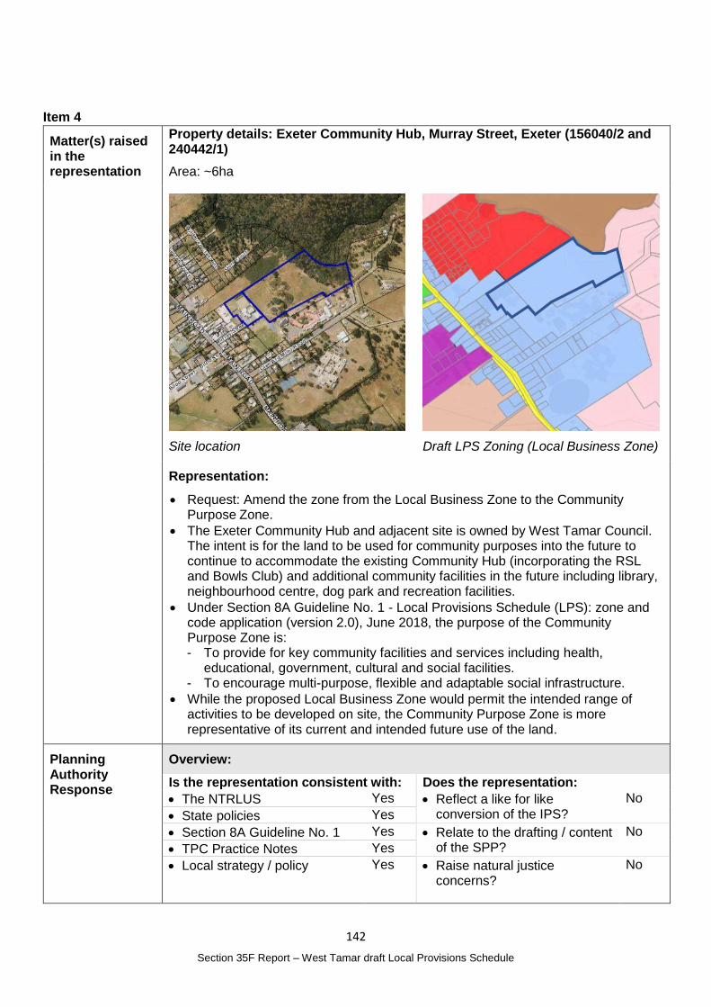
142
Section 35F Report – West Tamar draft Local Provisions Schedule
Item 4
Matter(s) raised in the representation
Property details: Exeter Community Hub, Murray Street, Exeter (156040/2 and 240442/1)
Area: ~6ha
Site location
Draft LPS Zoning (Local Business Zone)
Representation:
Request: Amend the zone from the Local Business Zone to the Community Purpose Zone.
The Exeter Community Hub and adjacent site is owned by West Tamar Council. The intent is for the land to be used for community purposes into the future to continue to accommodate the existing Community Hub (incorporating the RSL and Bowls Club) and additional community facilities in the future including library, neighbourhood centre, dog park and recreation facilities.
Under Section 8A Guideline No. 1 - Local Provisions Schedule (LPS): zone and code application (version 2.0), June 2018, the purpose of the Community Purpose Zone is: - To provide for key community facilities and services including health,
educational, government, cultural and social facilities. - To encourage multi-purpose, flexible and adaptable social infrastructure.
While the proposed Local Business Zone would permit the intended range of activities to be developed on site, the Community Purpose Zone is more representative of its current and intended future use of the land.
Planning Authority Response
Overview:
Is the representation consistent with: Does the representation:
The NTRLUS Yes Reflect a like for like conversion of the IPS?
No
State policies Yes
Section 8A Guideline No. 1 Yes Relate to the drafting / content of the SPP?
No
TPC Practice Notes Yes
Local strategy / policy Yes Raise natural justice concerns?
No
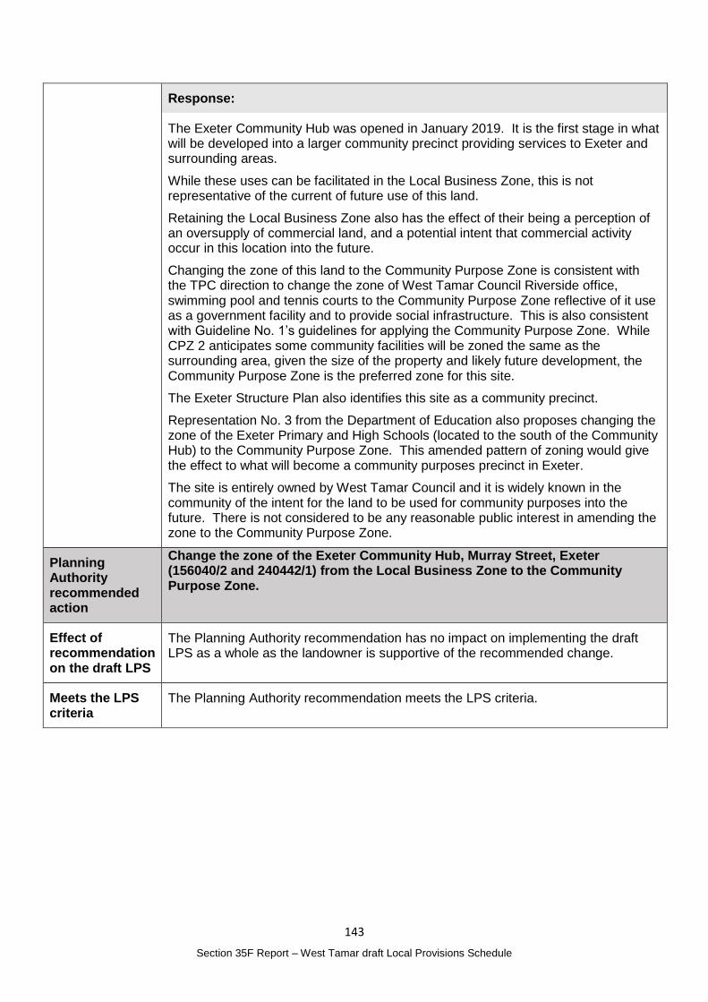
143
Section 35F Report – West Tamar draft Local Provisions Schedule
Response:
The Exeter Community Hub was opened in January 2019. It is the first stage in what will be developed into a larger community precinct providing services to Exeter and surrounding areas.
While these uses can be facilitated in the Local Business Zone, this is not representative of the current of future use of this land.
Retaining the Local Business Zone also has the effect of their being a perception of an oversupply of commercial land, and a potential intent that commercial activity occur in this location into the future.
Changing the zone of this land to the Community Purpose Zone is consistent with the TPC direction to change the zone of West Tamar Council Riverside office, swimming pool and tennis courts to the Community Purpose Zone reflective of it use as a government facility and to provide social infrastructure. This is also consistent with Guideline No. 1’s guidelines for applying the Community Purpose Zone. While CPZ 2 anticipates some community facilities will be zoned the same as the surrounding area, given the size of the property and likely future development, the Community Purpose Zone is the preferred zone for this site.
The Exeter Structure Plan also identifies this site as a community precinct.
Representation No. 3 from the Department of Education also proposes changing the zone of the Exeter Primary and High Schools (located to the south of the Community Hub) to the Community Purpose Zone. This amended pattern of zoning would give the effect to what will become a community purposes precinct in Exeter.
The site is entirely owned by West Tamar Council and it is widely known in the community of the intent for the land to be used for community purposes into the future. There is not considered to be any reasonable public interest in amending the zone to the Community Purpose Zone.
Planning Authority recommended action
Change the zone of the Exeter Community Hub, Murray Street, Exeter (156040/2 and 240442/1) from the Local Business Zone to the Community Purpose Zone.
Effect of recommendation on the draft LPS
The Planning Authority recommendation has no impact on implementing the draft LPS as a whole as the landowner is supportive of the recommended change.
Meets the LPS criteria
The Planning Authority recommendation meets the LPS criteria.
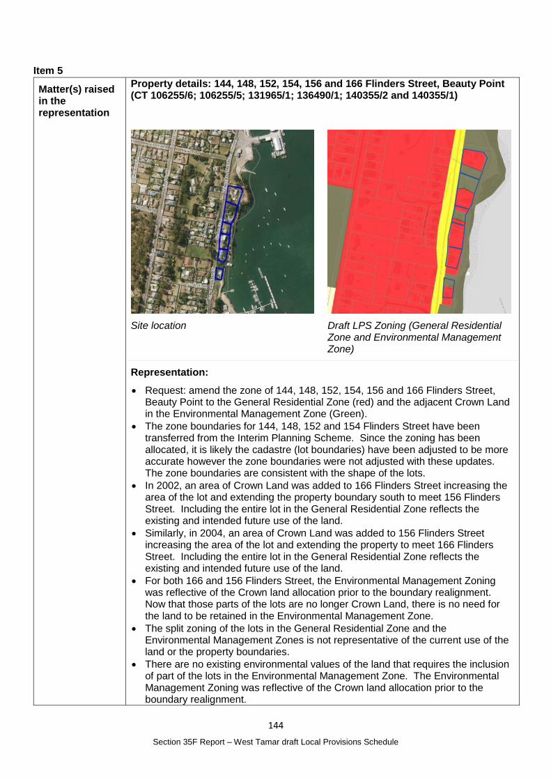
144
Section 35F Report – West Tamar draft Local Provisions Schedule
Item 5
Matter(s) raised in the representation
Property details: 144, 148, 152, 154, 156 and 166 Flinders Street, Beauty Point (CT 106255/6; 106255/5; 131965/1; 136490/1; 140355/2 and 140355/1)
Site location
Draft LPS Zoning (General Residential Zone and Environmental Management Zone)
Representation:
Request: amend the zone of 144, 148, 152, 154, 156 and 166 Flinders Street, Beauty Point to the General Residential Zone (red) and the adjacent Crown Land in the Environmental Management Zone (Green).
The zone boundaries for 144, 148, 152 and 154 Flinders Street have been transferred from the Interim Planning Scheme. Since the zoning has been allocated, it is likely the cadastre (lot boundaries) have been adjusted to be more accurate however the zone boundaries were not adjusted with these updates. The zone boundaries are consistent with the shape of the lots.
In 2002, an area of Crown Land was added to 166 Flinders Street increasing the area of the lot and extending the property boundary south to meet 156 Flinders Street. Including the entire lot in the General Residential Zone reflects the existing and intended future use of the land.
Similarly, in 2004, an area of Crown Land was added to 156 Flinders Street increasing the area of the lot and extending the property to meet 166 Flinders Street. Including the entire lot in the General Residential Zone reflects the existing and intended future use of the land.
For both 166 and 156 Flinders Street, the Environmental Management Zoning was reflective of the Crown land allocation prior to the boundary realignment. Now that those parts of the lots are no longer Crown Land, there is no need for the land to be retained in the Environmental Management Zone.
The split zoning of the lots in the General Residential Zone and the Environmental Management Zones is not representative of the current use of the land or the property boundaries.
There are no existing environmental values of the land that requires the inclusion of part of the lots in the Environmental Management Zone. The Environmental Management Zoning was reflective of the Crown land allocation prior to the boundary realignment.
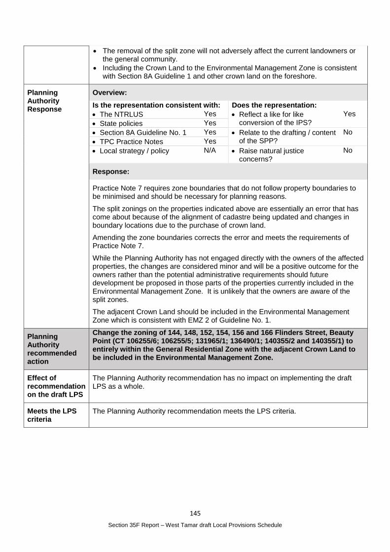
145
Section 35F Report – West Tamar draft Local Provisions Schedule
The removal of the split zone will not adversely affect the current landowners or the general community.
Including the Crown Land to the Environmental Management Zone is consistent with Section 8A Guideline 1 and other crown land on the foreshore.
Planning Authority Response
Overview:
Is the representation consistent with: Does the representation:
The NTRLUS Yes Reflect a like for like conversion of the IPS?
Yes
State policies Yes
Section 8A Guideline No. 1 Yes Relate to the drafting / content of the SPP?
No
TPC Practice Notes Yes
Local strategy / policy N/A Raise natural justice concerns?
No
Response:
Practice Note 7 requires zone boundaries that do not follow property boundaries to be minimised and should be necessary for planning reasons.
The split zonings on the properties indicated above are essentially an error that has come about because of the alignment of cadastre being updated and changes in boundary locations due to the purchase of crown land.
Amending the zone boundaries corrects the error and meets the requirements of Practice Note 7.
While the Planning Authority has not engaged directly with the owners of the affected properties, the changes are considered minor and will be a positive outcome for the owners rather than the potential administrative requirements should future development be proposed in those parts of the properties currently included in the Environmental Management Zone. It is unlikely that the owners are aware of the split zones.
The adjacent Crown Land should be included in the Environmental Management Zone which is consistent with EMZ 2 of Guideline No. 1.
Planning Authority recommended action
Change the zoning of 144, 148, 152, 154, 156 and 166 Flinders Street, Beauty Point (CT 106255/6; 106255/5; 131965/1; 136490/1; 140355/2 and 140355/1) to entirely within the General Residential Zone with the adjacent Crown Land to be included in the Environmental Management Zone.
Effect of recommendation on the draft LPS
The Planning Authority recommendation has no impact on implementing the draft LPS as a whole.
Meets the LPS criteria
The Planning Authority recommendation meets the LPS criteria.
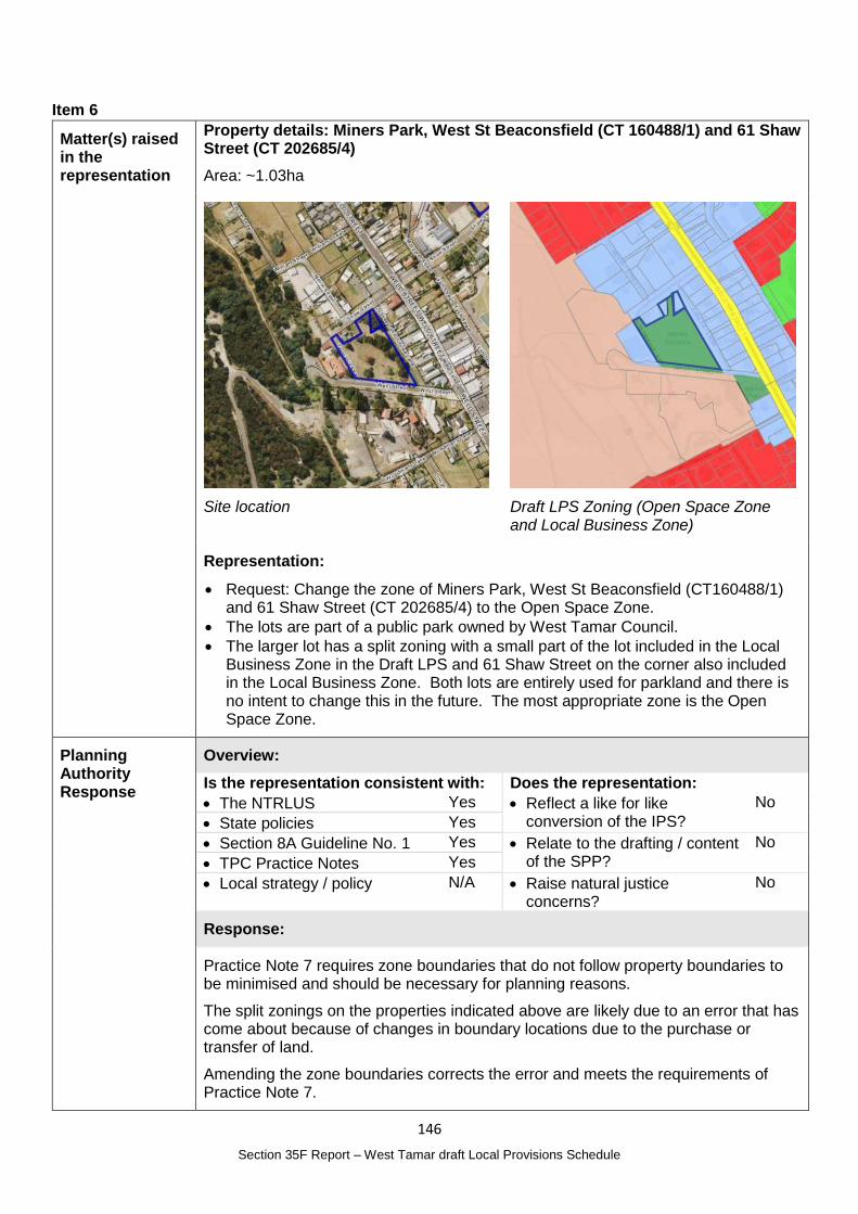
146
Section 35F Report – West Tamar draft Local Provisions Schedule
Item 6
Matter(s) raised in the representation
Property details: Miners Park, West St Beaconsfield (CT 160488/1) and 61 Shaw Street (CT 202685/4)
Area: ~1.03ha
Site location
Draft LPS Zoning (Open Space Zone and Local Business Zone)
Representation:
Request: Change the zone of Miners Park, West St Beaconsfield (CT160488/1) and 61 Shaw Street (CT 202685/4) to the Open Space Zone.
The lots are part of a public park owned by West Tamar Council.
The larger lot has a split zoning with a small part of the lot included in the Local Business Zone in the Draft LPS and 61 Shaw Street on the corner also included in the Local Business Zone. Both lots are entirely used for parkland and there is no intent to change this in the future. The most appropriate zone is the Open Space Zone.
Planning Authority Response
Overview:
Is the representation consistent with: Does the representation:
The NTRLUS Yes Reflect a like for like conversion of the IPS?
No
State policies Yes
Section 8A Guideline No. 1 Yes Relate to the drafting / content of the SPP?
No
TPC Practice Notes Yes
Local strategy / policy N/A Raise natural justice concerns?
No
Response:
Practice Note 7 requires zone boundaries that do not follow property boundaries to be minimised and should be necessary for planning reasons.
The split zonings on the properties indicated above are likely due to an error that has come about because of changes in boundary locations due to the purchase or transfer of land.
Amending the zone boundaries corrects the error and meets the requirements of Practice Note 7.
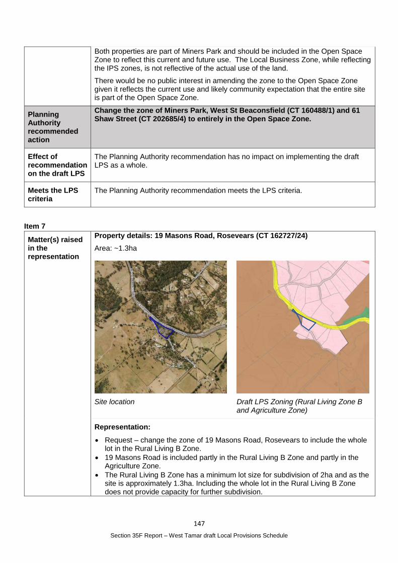
147
Section 35F Report – West Tamar draft Local Provisions Schedule
Both properties are part of Miners Park and should be included in the Open Space Zone to reflect this current and future use. The Local Business Zone, while reflecting the IPS zones, is not reflective of the actual use of the land.
There would be no public interest in amending the zone to the Open Space Zone given it reflects the current use and likely community expectation that the entire site is part of the Open Space Zone.
Planning Authority recommended action
Change the zone of Miners Park, West St Beaconsfield (CT 160488/1) and 61 Shaw Street (CT 202685/4) to entirely in the Open Space Zone.
Effect of recommendation on the draft LPS
The Planning Authority recommendation has no impact on implementing the draft LPS as a whole.
Meets the LPS criteria
The Planning Authority recommendation meets the LPS criteria.
Item 7
Matter(s) raised in the representation
Property details: 19 Masons Road, Rosevears (CT 162727/24)
Area: ~1.3ha
Site location
Draft LPS Zoning (Rural Living Zone B and Agriculture Zone)
Representation:
Request – change the zone of 19 Masons Road, Rosevears to include the whole lot in the Rural Living B Zone.
19 Masons Road is included partly in the Rural Living B Zone and partly in the Agriculture Zone.
The Rural Living B Zone has a minimum lot size for subdivision of 2ha and as the site is approximately 1.3ha. Including the whole lot in the Rural Living B Zone does not provide capacity for further subdivision.
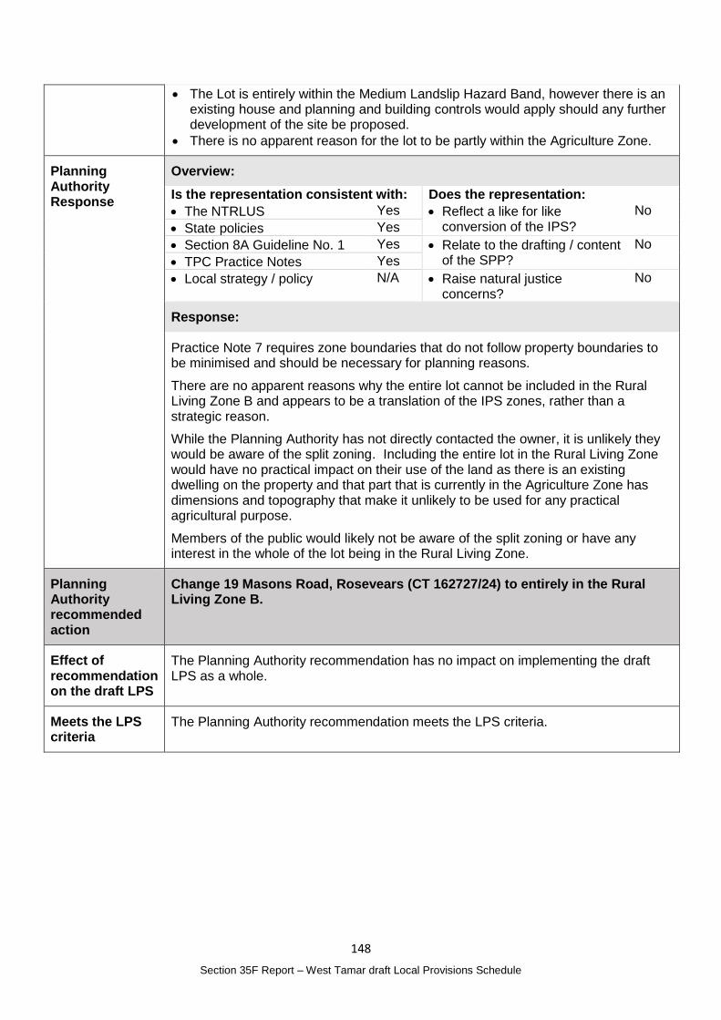
148
Section 35F Report – West Tamar draft Local Provisions Schedule
The Lot is entirely within the Medium Landslip Hazard Band, however there is an existing house and planning and building controls would apply should any further development of the site be proposed.
There is no apparent reason for the lot to be partly within the Agriculture Zone.
Planning Authority Response
Overview:
Is the representation consistent with: Does the representation:
The NTRLUS Yes Reflect a like for like conversion of the IPS?
No
State policies Yes
Section 8A Guideline No. 1 Yes Relate to the drafting / content of the SPP?
No
TPC Practice Notes Yes
Local strategy / policy N/A Raise natural justice concerns?
No
Response:
Practice Note 7 requires zone boundaries that do not follow property boundaries to be minimised and should be necessary for planning reasons.
There are no apparent reasons why the entire lot cannot be included in the Rural Living Zone B and appears to be a translation of the IPS zones, rather than a strategic reason.
While the Planning Authority has not directly contacted the owner, it is unlikely they would be aware of the split zoning. Including the entire lot in the Rural Living Zone would have no practical impact on their use of the land as there is an existing dwelling on the property and that part that is currently in the Agriculture Zone has dimensions and topography that make it unlikely to be used for any practical agricultural purpose.
Members of the public would likely not be aware of the split zoning or have any interest in the whole of the lot being in the Rural Living Zone.
Planning Authority recommended action
Change 19 Masons Road, Rosevears (CT 162727/24) to entirely in the Rural Living Zone B.
Effect of recommendation on the draft LPS
The Planning Authority recommendation has no impact on implementing the draft LPS as a whole.
Meets the LPS criteria
The Planning Authority recommendation meets the LPS criteria.
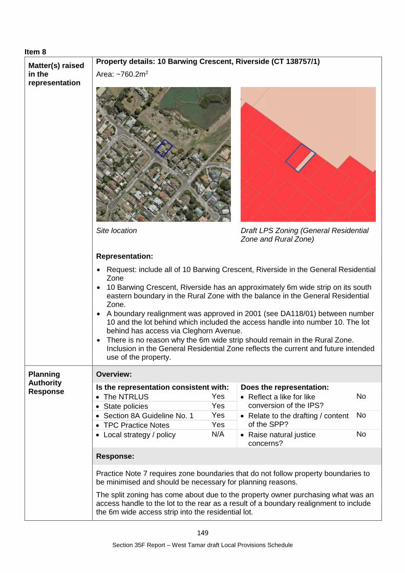
149
Section 35F Report – West Tamar draft Local Provisions Schedule
Item 8
Matter(s) raised in the representation
Property details: 10 Barwing Crescent, Riverside (CT 138757/1)
Area: ~760.2m2
Site location
Draft LPS Zoning (General Residential Zone and Rural Zone)
Representation:
Request: include all of 10 Barwing Crescent, Riverside in the General Residential Zone
10 Barwing Crescent, Riverside has an approximately 6m wide strip on its south eastern boundary in the Rural Zone with the balance in the General Residential Zone.
A boundary realignment was approved in 2001 (see DA118/01) between number 10 and the lot behind which included the access handle into number 10. The lot behind has access via Cleghorn Avenue.
There is no reason why the 6m wide strip should remain in the Rural Zone. Inclusion in the General Residential Zone reflects the current and future intended use of the property.
Planning Authority Response
Overview:
Is the representation consistent with: Does the representation:
The NTRLUS Yes Reflect a like for like conversion of the IPS?
No
State policies Yes
Section 8A Guideline No. 1 Yes Relate to the drafting / content of the SPP?
No
TPC Practice Notes Yes
Local strategy / policy N/A Raise natural justice concerns?
No
Response:
Practice Note 7 requires zone boundaries that do not follow property boundaries to be minimised and should be necessary for planning reasons.
The split zoning has come about due to the property owner purchasing what was an access handle to the lot to the rear as a result of a boundary realignment to include the 6m wide access strip into the residential lot.
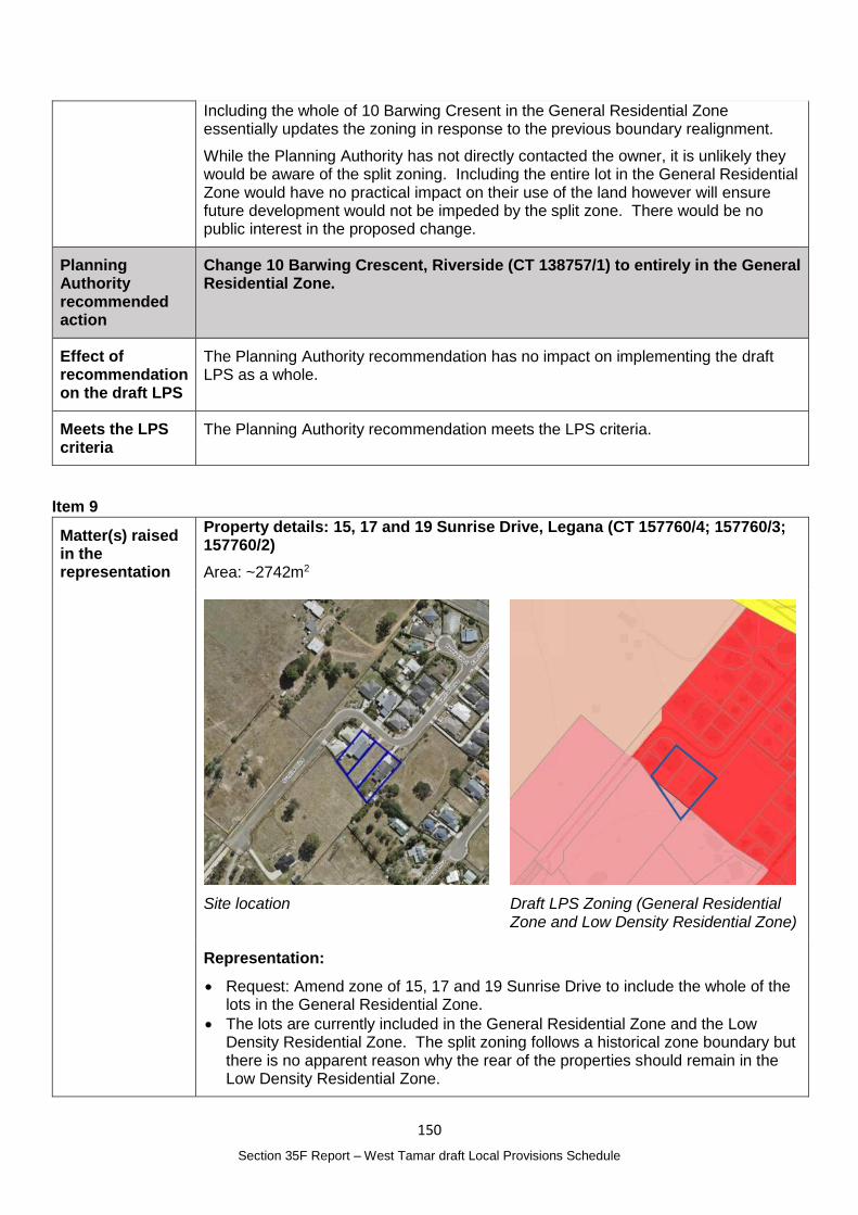
150
Section 35F Report – West Tamar draft Local Provisions Schedule
Including the whole of 10 Barwing Cresent in the General Residential Zone essentially updates the zoning in response to the previous boundary realignment.
While the Planning Authority has not directly contacted the owner, it is unlikely they would be aware of the split zoning. Including the entire lot in the General Residential Zone would have no practical impact on their use of the land however will ensure future development would not be impeded by the split zone. There would be no public interest in the proposed change.
Planning Authority recommended action
Change 10 Barwing Crescent, Riverside (CT 138757/1) to entirely in the General Residential Zone.
Effect of recommendation on the draft LPS
The Planning Authority recommendation has no impact on implementing the draft LPS as a whole.
Meets the LPS criteria
The Planning Authority recommendation meets the LPS criteria.
Item 9
Matter(s) raised in the representation
Property details: 15, 17 and 19 Sunrise Drive, Legana (CT 157760/4; 157760/3; 157760/2)
Area: ~2742m2
Site location
Draft LPS Zoning (General Residential Zone and Low Density Residential Zone)
Representation:
Request: Amend zone of 15, 17 and 19 Sunrise Drive to include the whole of the lots in the General Residential Zone.
The lots are currently included in the General Residential Zone and the Low Density Residential Zone. The split zoning follows a historical zone boundary but there is no apparent reason why the rear of the properties should remain in the Low Density Residential Zone.
151
Section 35F Report – West Tamar draft Local Provisions Schedule
Planning Authority Response
Overview:
Is the representation consistent with: Does the representation:
The NTRLUS Yes Reflect a like for like conversion of the IPS?
No
State policies Yes
Section 8A Guideline No. 1 Yes Relate to the drafting / content of the SPP?
No
TPC Practice Notes Yes
Local strategy / policy N/A Raise natural justice concerns?
No
Response:
Practice Note 7 requires zone boundaries that do not follow property boundaries to be minimised and should be necessary for planning reasons.
The General Residential Zone boundary in this location was established in the 2006 West Tamar Planning Scheme and was subsequently translated into the 2013 IPS and the draft LPS. A subsequent subdivision did not follow the zone boundary when the subject lots were created in 2009.
Including the whole of the lots in the General Residential Zone essentially updates the zoning in response to the approved subdivision.
While the Planning Authority has not directly contacted the owners, it is unlikely they would be aware of the split zoning. Including the entire lots in the General Residential Zone would have no practical impact on their use of the land however will ensure future development would not be impeded by the split zone. There would be no public interest in the proposed change.
Planning Authority recommended action
Change the zone of 15, 17 and 19 Sunrise Drive, Legana (CT 157760/4; 157760/3; 157760/2) be entirely within the General Residential Zone.
Effect of recommendation on the draft LPS
The Planning Authority recommendation has no impact on implementing the draft LPS as a whole.
Meets the LPS criteria
The Planning Authority recommendation meets the LPS criteria.
152
Section 35F Report – West Tamar draft Local Provisions Schedule
Item 10
Matter(s) raised in the representation
Property details: 103 New Ecclestone Road, Riverside (CT 179026/2)
Area: ~13.32ha
Site location
Draft LPS Zoning (Rural Living D and Agriculture Zone)
Representation:
Request: Change the Rural Living Zone to align with the boundary of 103 New Ecclestone Road with a consequential change to include the whole of 101A New Ecclestone Road in the Agriculture Zone.
A boundary realignment was approved between 103 New Ecclestone Road and 101A New Ecclestone Road in 2020 (PA2020037). The boundary was realigned to ensure existing dams were retained in each property.
Realigning the Rural Living boundary to the new boundary is logical and doesn’t change any practical use rights for 101A New Ecclestone Road which will be included entirely within the Agriculture Zone.
Planning Authority Response
Overview:
Is the representation consistent with: Does the representation:
The NTRLUS Yes Reflect a like for like conversion of the IPS?
No
State policies Yes
Section 8A Guideline No. 1 Yes Relate to the drafting / content of the SPP?
No
TPC Practice Notes Yes
Local strategy / policy N/A Raise natural justice concerns?
No
Response:
Practice Note 7 requires zone boundaries that do not follow property boundaries to be minimised and should be necessary for planning reasons.
As referenced in the representation, a boundary realignment was approved in 2020. The proposed change seeks to address the discrepancy between the zone boundary and the new boundary between 103 and 101A New Ecclestone Road.
Resolving the zone boundary between the two properties will update the zoning in response to the approved subdivision.
153
Section 35F Report – West Tamar draft Local Provisions Schedule
While the Planning Authority has not directly contacted the owners, it is unlikely they would be aware of the split zoning. Including the lots in single zones would have no practical impact on their use of the land however will ensure future development would not be impeded by the split zone. There would be no public interest in the proposed change.
Planning Authority recommended action
Change the zone of 103 New Ecclestone Road, Riverside (CT 179026/2) entirely within the Rural Living D Zone and change the zone of 101A New Ecclestone Road (CT 179026/1) to entirely within the Agriculture Zone.
Effect of recommendation on the draft LPS
The Planning Authority recommendation has no impact on implementing the draft LPS as a whole.
Meets the LPS criteria
The Planning Authority recommendation meets the LPS criteria.
Item 11
Matter(s) raised in the representation
Property details: Land included in the Agriculture Zone in the Urban Growth Area
Representation:
Request: Change the zone of all land included in the Agriculture Zone that is also in the Urban Growth Area (Growth Corridor) of the Northern Tasmania Regional Land Use Strategy to the Rural Zone
The State Policy on the Protection of Agricultural Land 2009 (PAL) aims to conserve and protect agricultural land so that it is available for sustainable development of agriculture, whilst recognising the particular importance of prime agricultural land.
The objectives of the Policy are: To enable the sustainable development of agriculture by minimising: - Conflict with or interference from other land uses; and
154
Section 35F Report – West Tamar draft Local Provisions Schedule
- Non-agricultural use or development on agricultural land that precludes the
return of that land to agricultural use.
A report prepared by the Planning Policy Unit (PPU) and adopted by the Minister that assists in decision making for Agricultural Land – the Macquarie Report, Agricultural Land Mapping Project, Background Project (2017, PPU), which provided the following guidelines for agricultural land mapping:
Land identified in the Land Potentially Suitable for Agriculture Zone mapping layer may be considered for alternate zoning if: - local or regional strategic analysis has identified or justifies the need for an
alternate zoning consistent with the relevant regional land use strategy, or
supported by more detailed local strategic analysis consistent with the
relevant regional land use strategy and endorsed by the relevant council;
The NTRLUS has identified the area indicated as within the Urban Growth Boundary on Regional Framework Plan Map D.1. Therefore, consistent with the guidelines relating to the mapping of agricultural land, the site can be considered as an alternative zone.
Given the intended future use of the land for urban use, and confirmation of this in the NTRLUS map, the Rural Zone is the most appropriate zone until urban growth occurs. The Rural Zone permits agricultural activity to continue until urban development occurs. Notably, the Rural Zone will allow the Natural Assets Code’s Priority Vegetation Layer to apply to the land which is an important consideration in determining suitability for urban development and the potential impact on natural features.
Planning Authority Response
Overview:
Is the representation consistent with: Does the representation:
The NTRLUS Yes Reflect a like for like conversion of the IPS?
Yes
State policies Yes
Section 8A Guideline No. 1 Yes Relate to the drafting / content of the SPP?
No
TPC Practice Notes Yes
Local strategy / policy Yes Raise natural justice concerns?
Possibly
Response:
While parts of the land are identified as potentially suitable for the Agriculture Zone, it is considered to meet the requirements under RZ 3 (d) and (e) of Guideline No. 1 as the NTRLUS has identified the land within the Urban Growth Corridor. The strategic analysis undertaken to develop the NTRLUS foreshadows that urban development of the land may be considered in the future. The Rural Zone therefore acts as a ‘holding’ zone rather than there being an ongoing intention for the agricultural use of the land.
While it is considered unlikely any landowners would object to change, there are a number of landowners that would be affected by the change.
Planning Authority recommended action
Change the zone of land within Agriculture Zone and the Urban Growth Area to the Rural Zone.
155
Section 35F Report – West Tamar draft Local Provisions Schedule
Effect of recommendation on the draft LPS
The Planning Authority recommendation has only minor impact on implementing the draft LPS as a whole.
Meets the LPS criteria
The Planning Authority recommendation meets the LPS criteria.
Item 12
Matter(s) raised in the representation
Property details: Natural Assets Code Priority Vegetation Area Overlay Map
Representation:
Request – amend the Natural Assets Code Priority Vegetation Area Overlay Map to apply in the Agriculture Zone.
Section 8A Guideline No. 1 – Local Provisions Schedule (LPS): zone and code application (Guideline No. 1) states that ‘the priority vegetation area overlay is intended for native vegetation that: - forms an integral part of a threatened native vegetation community as
prescribed under Schedule 3A of the Nature Conservation Act 2002; - is a threatened flora species; - forms a significant habitat for a threatened fauna species; or - has been identified as native vegetation of local importance.’
The layer is derived from TASVEG Version 3 mapping produced by the Department of Primary Industries, Parks, Water and the Environment.
Guideline No. 1 goes on to state that a priority vegetation area should not be shown on the overlay map for land that is within the Agriculture Zone, amongst others.
There are areas of significant habitat within the Agriculture Zone, and while a Forestry Practices Plan or Permit to take threatened species may still be required, the Natural Assets Code would not apply to any development. Further, as the mapping does not apply to Agriculture Zone, there is no visibility of the presence of the priority habitat and therefore a perception that the habitat is not important.
Further, where development is proposed adjacent to the Agriculture Zone, the connection and contribution of the vegetation to the local and regional biodiversity values will have the potential to not be clearly understood as there will be a perception that the values to do not extend into the Agriculture Zone.
The Natural Assets Code provides an exemption for the clearance of native vegetation within a priority vegetation area on existing pasture or crop production land. This retains certainty for agricultural producers and ensures the importance of agriculture to the economy and the intent of State Policy on the Protection of Agricultural Land 2009 continues to be advanced.
The application of the overlay map on land in the Agriculture Zone further advances Schedule 1 of the Land Use Planning and Approvals Act 1993 by promoting the sustainable development of natural and physical resources and the maintenance of ecological processes and genetic diversity.
See Representations No. 9, 10, 14, and 62(7) which raise similar matters
156
Section 35F Report – West Tamar draft Local Provisions Schedule
Planning Authority Response
Overview:
Is the representation consistent with: Does the representation:
The NTRLUS Yes Reflect a like for like conversion of the IPS?
Yes
State policies Yes
Section 8A Guideline No. 1 Yes Relate to the drafting / content of the SPP?
No
TPC Practice Notes Yes
Local strategy / policy N/A Raise natural justice concerns?
No
Response:
NAC 7 of Guideline No. 1 states:
The priority vegetation area overlay must include threatened native vegetation communities as identified in TASVEG Version 3 mapping, as published on the Department of Primary Industries, Parks, Water and the Environment’s (DPIPWE) website and available on the LIST.
NAC 8 to 12 provide additional detail about the development of the mapping layer consistent with the NAC 7.
To maintain the integrity of the data, and to understand the full extent and potential impact on the bioregion the mapping must be shown over the Agriculture Zone which is a significant area within the West Tamar municipality and contains a significant amount of priority vegetation. This information layer is important for the assessment of applications against the Natural Assets Code that are outside the Agriculture Zone to ensure the connectivity of the ecosystems is understood.
While NAC 13 is acknowledged, the selection of wording in this guideline is important. While NAC 7 uses the term ‘must’ NAC 13 states ‘A priority vegetation area should not be shown on the overlay map for land that is within the….Agriculture Zone’. The term ‘should’ provides an option of applying the guidelines whereas ‘must’ which is used in other parts of the guideline (for example NAC 7 quoted above) provides a definite direction. All other zones listed in NAC 13 are generally built-up urban areas and should be treated differently to extensive open spaces that make a strong contribution to the natural assets of the region, as is present in the Agriculture Zone.
This change is not a substantial change and does not raise any natural justice issues as it reflects scientifically derived data. Further, the Natural Assets Code does not regulate vegetation clearing if in the Agriculture Zone as detailed in C7.2.1 of the TPS so no additional regulation will be introduced as a result of this change.
Planning Authority recommended action
Amend the Natural Assets Code Priority Vegetation Area mapping to apply in the Agriculture Zone.
Effect of recommendation on the draft LPS
The Planning Authority recommendation has no impact on implementing the draft LPS as a whole.
Meets the LPS criteria
The Planning Authority is satisfied that the recommendation meets the LPS criteria.
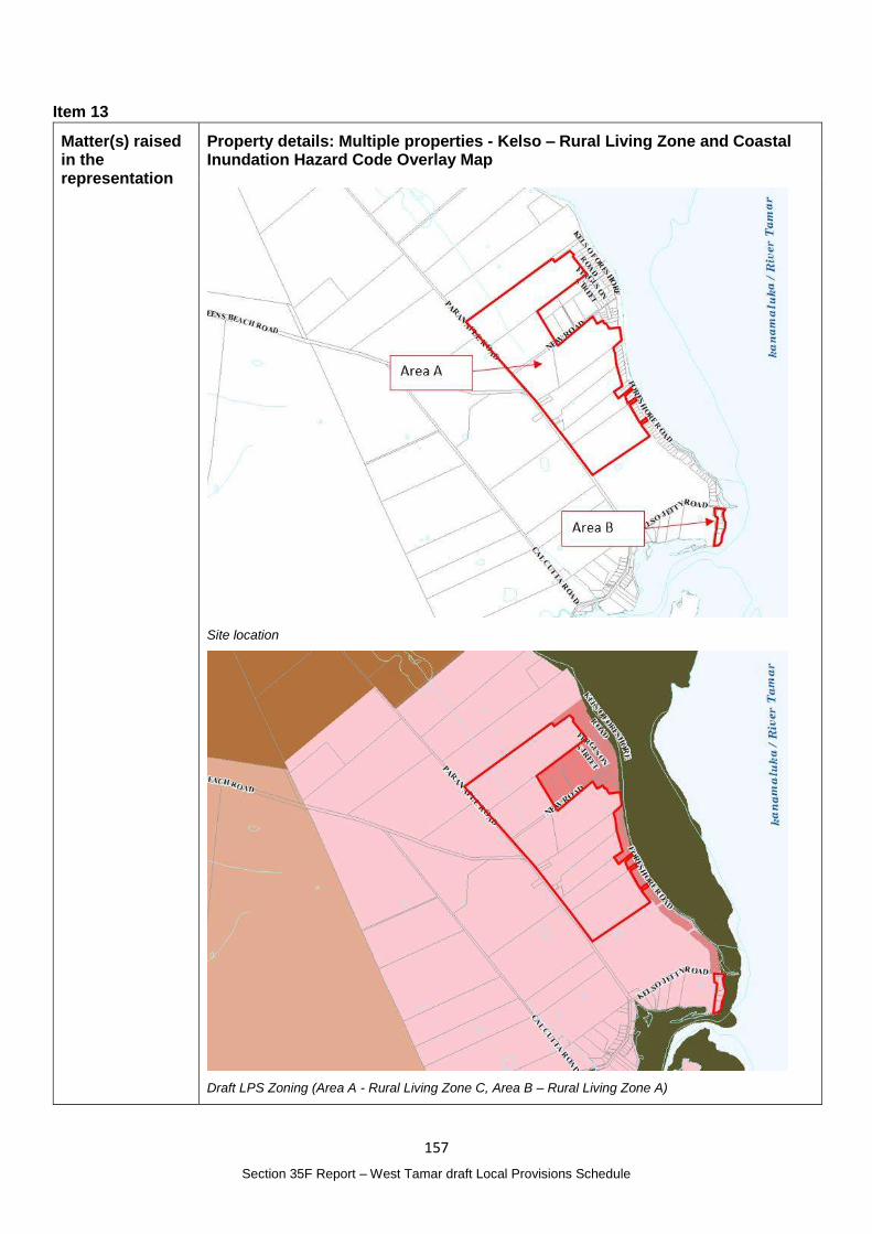
157
Section 35F Report – West Tamar draft Local Provisions Schedule
Item 13
Matter(s) raised in the representation
Property details: Multiple properties - Kelso – Rural Living Zone and Coastal Inundation Hazard Code Overlay Map
Site location
Draft LPS Zoning (Area A - Rural Living Zone C, Area B – Rural Living Zone A)
158
Section 35F Report – West Tamar draft Local Provisions Schedule
Representation:
Request: Change the zone of: - Area A from Rural Living C to the Low Density Residential Zone and include in
the Residential Density and Supply Specific Area Plan (SAP) with a minimum lot size of 5ha; and
- Area B from Rural Living Zone A to the Low Density Residential Zone.
Council have reviewed the application of the Coastal Inundation Hazard Code and overlays maps and identified that non-urban zones, which include the Rural Living Zone, are subject to provisions of the Code that requires a use to rely on a coastal location - see C11.5.2, P1.1 of the State Planning Provisions (SPP). Residential or Visitor Accommodation are not reliant on a coastal location (see C10.2.3 of the SPP).
Area A and Area B, identified to the left are predominantly included in the Medium coastal inundation hazard band which effectively prohibits use of the land for residential purposes, including to build a single dwelling.
Inclusion of these lots in the Low Density Residential Zone will enable applications for future development to demonstrate a ‘tolerable risk’ and be permitted if this can be demonstrated.
The review of the overlay maps of areas in the Rural Living Zone identified these lots as likely to be unable to accommodate a dwelling outside the hazard area. Note that this restriction also applies to the Rural Zone, Agriculture Zone and other non-urban zones, however given the intent of the Rural Living Zone is ‘to provide for residential use or development in a rural setting’ it is important to retain existing use rights.
This change will still ensure future dwellings are required to demonstrate a tolerable level of risk, consistent with the Low Density Residential Zone which is adjacent to Areas A and B.
The Lots in Area A are currently included in the Rural Living Zone C and have a minimum lot size of 5ha. Inclusion in the SAP will ensure the subdivision potential for the area is not increased.
The lots included in Area B are less than 2500m2 and could not be further subdivided if included in the Low Density Residential Zone with a minimum lot size of 1500m2.
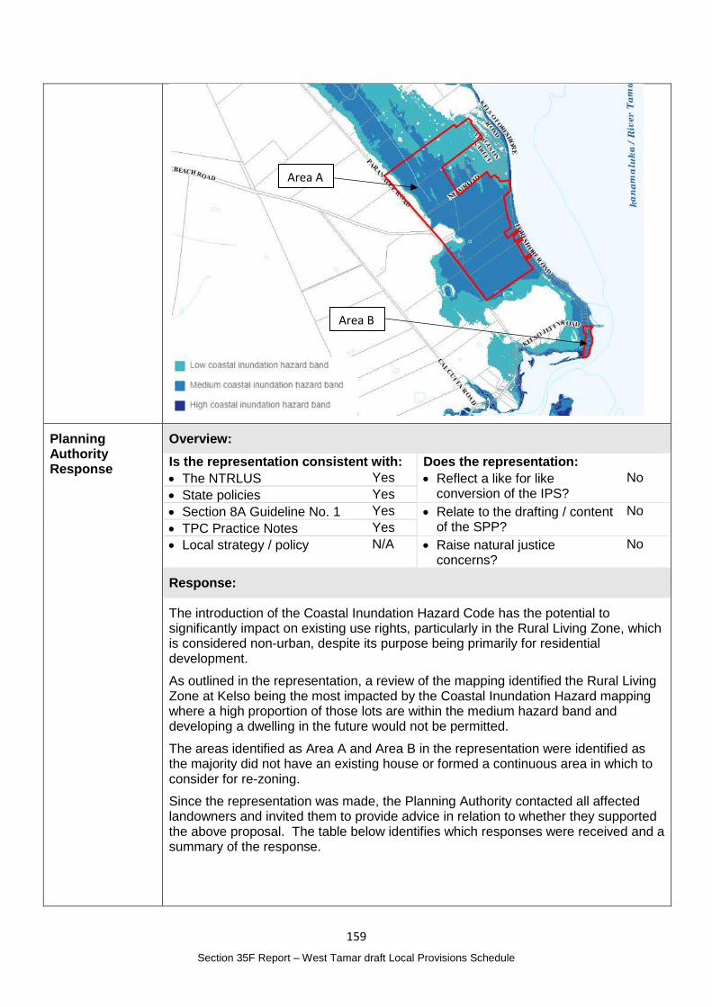
159
Section 35F Report – West Tamar draft Local Provisions Schedule
Planning Authority Response
Overview:
Is the representation consistent with: Does the representation:
The NTRLUS Yes Reflect a like for like conversion of the IPS?
No
State policies Yes
Section 8A Guideline No. 1 Yes Relate to the drafting / content of the SPP?
No
TPC Practice Notes Yes
Local strategy / policy N/A Raise natural justice concerns?
No
Response:
The introduction of the Coastal Inundation Hazard Code has the potential to significantly impact on existing use rights, particularly in the Rural Living Zone, which is considered non-urban, despite its purpose being primarily for residential development.
As outlined in the representation, a review of the mapping identified the Rural Living Zone at Kelso being the most impacted by the Coastal Inundation Hazard mapping where a high proportion of those lots are within the medium hazard band and developing a dwelling in the future would not be permitted.
The areas identified as Area A and Area B in the representation were identified as the majority did not have an existing house or formed a continuous area in which to consider for re-zoning.
Since the representation was made, the Planning Authority contacted all affected landowners and invited them to provide advice in relation to whether they supported the above proposal. The table below identifies which responses were received and a summary of the response.
Area A
Area B
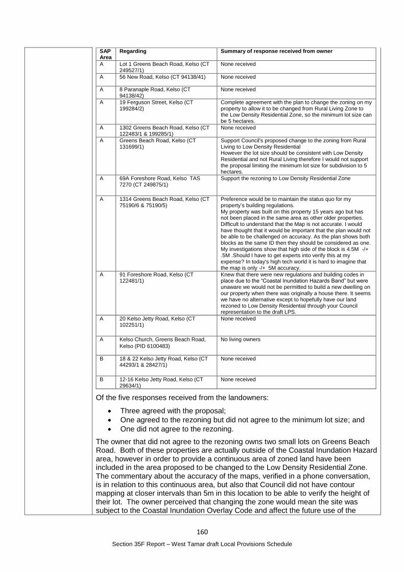
160
Section 35F Report – West Tamar draft Local Provisions Schedule
SAP Area
Regarding Summary of response received from owner
A Lot 1 Greens Beach Road, Kelso (CT 249527/1)
None received
A 56 New Road, Kelso (CT 94138/41) None received
A 8 Paranaple Road, Kelso (CT 94138/42)
None received
A 19 Ferguson Street, Kelso (CT 199284/2)
Complete agreement with the plan to change the zoning on my property to allow it to be changed from Rural Living Zone to the Low Density Residential Zone, so the minimum lot size can be 5 hectares.
A 1302 Greens Beach Road, Kelso (CT 122483/1 & 199285/1)
None received
A Greens Beach Road, Kelso (CT 131699/1)
Support Council's proposed change to the zoning from Rural Living to Low Density Residential However the lot size should be consistent with Low Density Residential and not Rural Living therefore I would not support the proposal limiting the minimum lot size for subdivision to 5 hectares.
A 69A Foreshore Road, Kelso TAS 7270 (CT 249875/1)
Support the rezoning to Low Density Residential Zone
A 1314 Greens Beach Road, Kelso (CT 75190/6 & 75190/5)
Preference would be to maintain the status quo for my property’s building regulations. My property was built on this property 15 years ago but has not been placed in the same area as other older properties. Difficult to understand that the Map is not accurate. I would have thought that it would be important that the plan would not be able to be challenged on accuracy. As the plan shows both blocks as the same ID then they should be considered as one. My investigations show that high side of the block is 4.5M -/+ .5M .Should I have to get experts into verify this at my expense? In today's high tech world it is hard to imagine that the map is only -/+ 5M accuracy.
A 91 Foreshore Road, Kelso (CT 122481/1)
Knew that there were new regulations and building codes in place due to the “Coastal Inundation Hazards Band” but were unaware we would not be permitted to build a new dwelling on our property when there was originally a house there. It seems we have no alternative except to hopefully have our land rezoned to Low Density Residential through your Council representation to the draft LPS.
A 20 Kelso Jetty Road, Kelso (CT 102251/1)
None received
A Kelso Church, Greens Beach Road,
Kelso (PID 6100483)
No living owners
B 18 & 22 Kelso Jetty Road, Kelso (CT 44293/1 & 28427/1)
None received
B 12-16 Kelso Jetty Road, Kelso (CT 29634/1)
None received
Of the five responses received from the landowners:
Three agreed with the proposal;
One agreed to the rezoning but did not agree to the minimum lot size; and
One did not agree to the rezoning.
The owner that did not agree to the rezoning owns two small lots on Greens Beach Road. Both of these properties are actually outside of the Coastal Inundation Hazard area, however in order to provide a continuous area of zoned land have been included in the area proposed to be changed to the Low Density Residential Zone. The commentary about the accuracy of the maps, verified in a phone conversation, is in relation to this continuous area, but also that Council did not have contour mapping at closer intervals than 5m in this location to be able to verify the height of their lot. The owner perceived that changing the zone would mean the site was subject to the Coastal Inundation Overlay Code and affect the future use of the
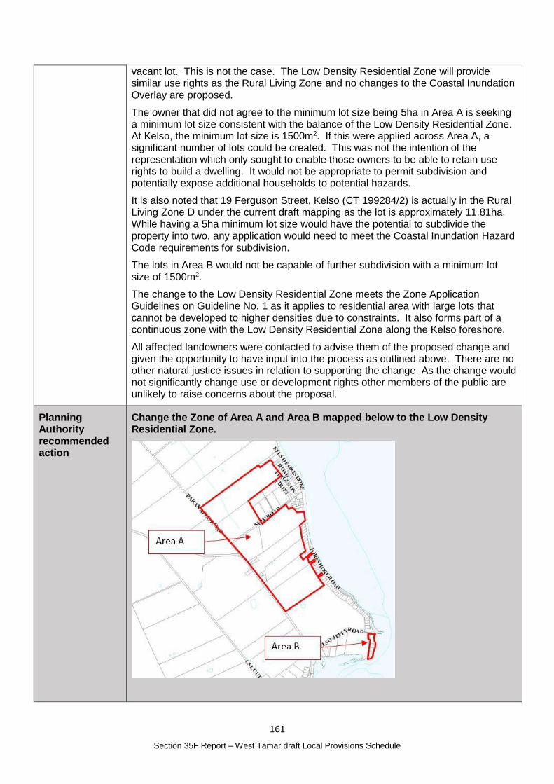
161
Section 35F Report – West Tamar draft Local Provisions Schedule
vacant lot. This is not the case. The Low Density Residential Zone will provide similar use rights as the Rural Living Zone and no changes to the Coastal Inundation Overlay are proposed.
The owner that did not agree to the minimum lot size being 5ha in Area A is seeking a minimum lot size consistent with the balance of the Low Density Residential Zone. At Kelso, the minimum lot size is 1500m2. If this were applied across Area A, a significant number of lots could be created. This was not the intention of the representation which only sought to enable those owners to be able to retain use rights to build a dwelling. It would not be appropriate to permit subdivision and potentially expose additional households to potential hazards.
It is also noted that 19 Ferguson Street, Kelso (CT 199284/2) is actually in the Rural Living Zone D under the current draft mapping as the lot is approximately 11.81ha. While having a 5ha minimum lot size would have the potential to subdivide the property into two, any application would need to meet the Coastal Inundation Hazard Code requirements for subdivision.
The lots in Area B would not be capable of further subdivision with a minimum lot size of 1500m2.
The change to the Low Density Residential Zone meets the Zone Application Guidelines on Guideline No. 1 as it applies to residential area with large lots that cannot be developed to higher densities due to constraints. It also forms part of a continuous zone with the Low Density Residential Zone along the Kelso foreshore.
All affected landowners were contacted to advise them of the proposed change and given the opportunity to have input into the process as outlined above. There are no other natural justice issues in relation to supporting the change. As the change would not significantly change use or development rights other members of the public are unlikely to raise concerns about the proposal.
Planning Authority recommended action
Change the Zone of Area A and Area B mapped below to the Low Density Residential Zone.
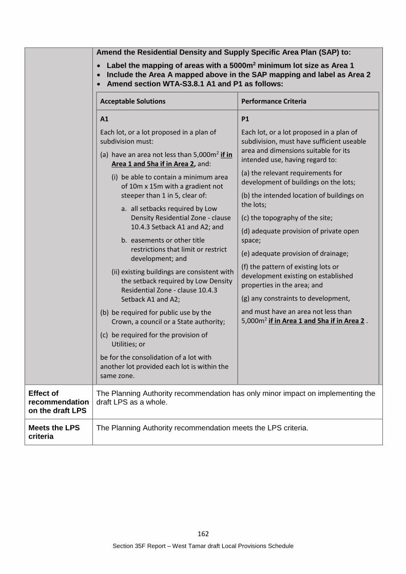
162
Section 35F Report – West Tamar draft Local Provisions Schedule
Amend the Residential Density and Supply Specific Area Plan (SAP) to:
Label the mapping of areas with a 5000m2 minimum lot size as Area 1
Include the Area A mapped above in the SAP mapping and label as Area 2
Amend section WTA-S3.8.1 A1 and P1 as follows:
Acceptable Solutions Performance Criteria
A1
Each lot, or a lot proposed in a plan of subdivision must:
(a) have an area not less than 5,000m2 if in Area 1 and 5ha if in Area 2, and:
(i) be able to contain a minimum area of 10m x 15m with a gradient not steeper than 1 in 5, clear of:
a. all setbacks required by Low Density Residential Zone - clause 10.4.3 Setback A1 and A2; and
b. easements or other title restrictions that limit or restrict development; and
(ii) existing buildings are consistent with the setback required by Low Density Residential Zone - clause 10.4.3 Setback A1 and A2;
(b) be required for public use by the Crown, a council or a State authority;
(c) be required for the provision of Utilities; or
be for the consolidation of a lot with another lot provided each lot is within the same zone.
P1
Each lot, or a lot proposed in a plan of subdivision, must have sufficient useable area and dimensions suitable for its intended use, having regard to:
(a) the relevant requirements for development of buildings on the lots;
(b) the intended location of buildings on the lots;
(c) the topography of the site;
(d) adequate provision of private open space;
(e) adequate provision of drainage;
(f) the pattern of existing lots or development existing on established properties in the area; and
(g) any constraints to development,
and must have an area not less than 5,000m2 if in Area 1 and 5ha if in Area 2 .
Effect of recommendation on the draft LPS
The Planning Authority recommendation has only minor impact on implementing the draft LPS as a whole.
Meets the LPS criteria
The Planning Authority recommendation meets the LPS criteria.
163
Section 35F Report – West Tamar draft Local Provisions Schedule
Item 14
Matter(s) raised in the representation
Property details: Multiple
Representation:
Request: Update the Safeguarding of Airports Code mapping to the version adopted in the 2020 Launceston Airport Master Plan.
Since the Draft LPS was submitted to the Tasmanian Planning Commission the 2020 Launceston Airport Master Plan was adopted. To ensure the overlay is consistent with the plans included in the Master Plan the overlay should be updated. Launceston Airport has provided an updated GIS layer.
Planning Authority Response
Overview:
Is the representation consistent with: Does the representation:
The NTRLUS Yes Reflect a like for like conversion of the IPS?
No
State policies Yes
Section 8A Guideline No. 1 Yes Relate to the drafting / content of the SPP?
No
TPC Practice Notes Yes
Local strategy / policy N/A Raise natural justice concerns?
No
Response:
SAC 4 of Guideline No. 1 states:
The airport obstacle limitation area overlay should be based on the Obstacle Limitation Surfaces (OLS) and Procedures for Air Navigation Services – Aircraft Operations (PANS-OPS) contained in the airport master plan or those otherwise adopted by the relevant airport owner of operator for the relevant airport in accordance with any accepted guidelines.
The 2020 Launceston Airport Master Plan adopted a revised Obstacle Limitation Surface. The Master Plan has undergone a process of public exhibition and approval. The application of the updated mapping in the LPS does not necessitate additional public exhibition.
Planning Authority recommended action
Change the Safeguarding or Airports Code mapping to reflect the updated Obstacle Limitation Surface adopted by the 2020 Launceston Airport Master Plan
Effect of recommendation on the draft LPS
The Planning Authority recommendation has only minor impact on implementing the draft LPS as a whole.
Meets the LPS criteria
The Planning Authority recommendation meets the LPS criteria.
164
Section 35F Report – West Tamar draft Local Provisions Schedule
Item 15
Matter(s) raised in the representation
Property details: Not applicable
Representation:
Request: Update the Bushfire-prone Areas Code mapping to ensure it is accurate prior to adoption of the LPS.
It is recommended that the overlay map be reviewed in consultation with the Tasmanian Fire Service to ensure the map remains accurate considering new development or land use changes that affect the potential bushfire hazard.
This will ensure building and planning applications are not triggering assessment for bushfire hazard where this is unnecessary ensuring red tape is appropriately reduced.
See Representation No. 17 which raise similar matters
Planning Authority Response
Overview:
Is the representation consistent with: Does the representation:
The NTRLUS Yes Reflect a like for like conversion of the IPS?
N/A
State policies Yes
Section 8A Guideline No. 1 Yes Relate to the drafting / content of the SPP?
No
TPC Practice Notes Yes
Local strategy / policy N/A Raise natural justice concerns?
No
Response:
The Tasmanian Fire Service through Representation No. 17 recommended updates to the Bushfire-prone Areas Code mapping which are recommended to be supported.
The Planning Authority intends to regularly review the mapping layer as developments progress and periodically amend the layer to ensure applicants are not unnecessarily required to complete a bushfire management plan in locations where the hazard area has been addressed through development activity.
While no additional areas to those proposed in Representation No. 17 are proposed at this time, it is intended that updates be progressed at regular intervals through the LPS amendment process. These amendments, which would be based on a technical assessment that the site is no longer in a bushfire-prone area, should be exempt from public exhibition under section 40I of the Act.
Planning Authority recommended action
No changes to the draft LPS are recommended at this time, noting the changes recommended in response to Representation No. 17 are related to this request.
Effect of recommendation on the draft LPS
The Planning Authority recommendation has no impact on implementing the draft LPS as a whole.
Meets the LPS criteria
The Planning Authority is satisfied that the recommendation meets the LPS criteria.
165
Section 35F Report – West Tamar draft Local Provisions Schedule
Representations received between 28 April 2021 and 30 April 2021
No. 41 Victoria Wilkinson
Matter(s) raised in the representation
Property details: Not applicable
Representation:
Supports the SAP applied to the new Grindelwald Low Density Residential Zone in the WTC as accepted by the Tasmanian Planning Commission and as argued in the document ‘West Tamar Local Provisions Schedule - Supporting Report – January 2021’ in relation to the retention of the 5000m2 minimum lot size.
See Representations No. 26, 31, 32, 36 and 63 which relate to the same provisions but request a different change.
Also supports the submission made by the West Tamar Landcare Group Inc. I hope the council can act on the issues raised and call on the group’s expertise in the matters raised by the submission.
See Representation No. 14 by the West Tamar Landcare Group.
Planning Authority Response
Overview:
Is the representation consistent with: Does the representation:
The NTRLUS Yes Reflect a like for like conversion of the IPS?
Yes
State policies Yes
Section 8A Guideline No. 1 Yes Relate to the drafting / content of the SPP?
No
TPC Practice Notes Yes
Local strategy / policy Yes Raise natural justice concerns?
No
Response:
Residential Supply and Density Specific Area Plan
A detailed response in relation to amending the provisions of the Residential Supply and Density Specific Area Plan is provided under Representation No. 26.
As noted the Planning Authority is of the opinion that the 5000m2 minimum lot size should be retained.
Application of the Priority Vegetation Area map to the Agriculture Zone
Landcare’s representation is seeking an amendment to the Priority Vegetation Area map to ensure it applies in the Agriculture Zone.
See the response to representation 40(12) for a complete assessment in relation to the Priority Vegetation Areas mapping across the Agriculture Zone which is supported.
166
Section 35F Report – West Tamar draft Local Provisions Schedule
Planning Authority recommended action
Amend the Natural Assets Code Priority Vegetation Area mapping to apply in the Agriculture Zone.
Effect of recommendation on the draft LPS
The Planning Authority recommendation has only minor impact on implementing the draft LPS as a whole.
Meets the LPS criteria
The Planning Authority recommendation meets the LPS criteria.
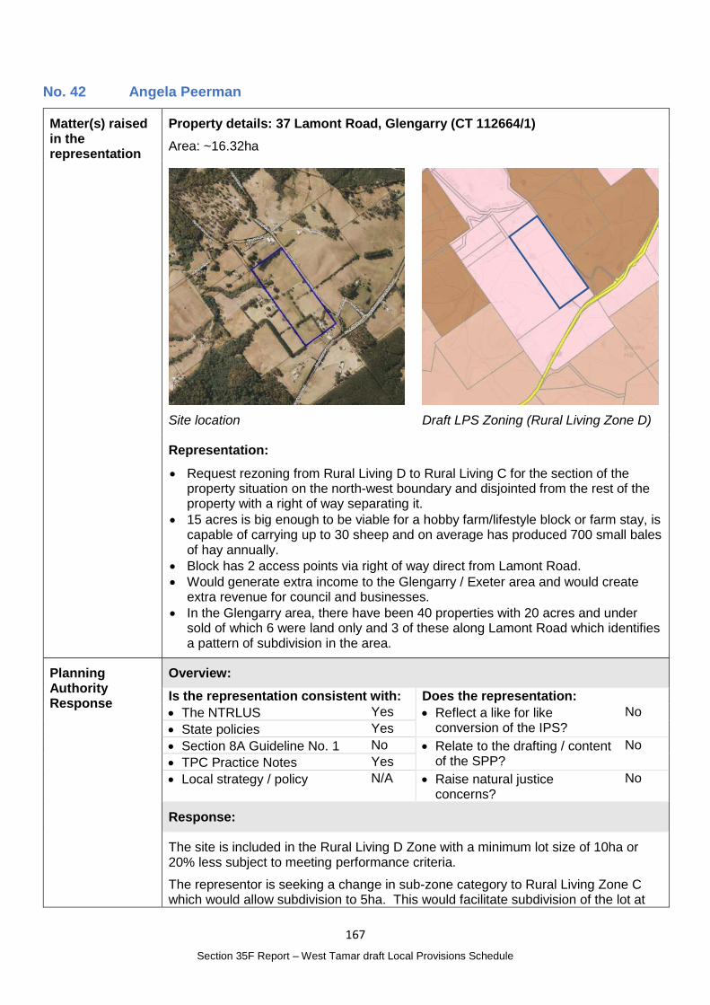
167
Section 35F Report – West Tamar draft Local Provisions Schedule
No. 42 Angela Peerman
Matter(s) raised in the representation
Property details: 37 Lamont Road, Glengarry (CT 112664/1)
Area: ~16.32ha
Site location
Draft LPS Zoning (Rural Living Zone D)
Representation:
Request rezoning from Rural Living D to Rural Living C for the section of the property situation on the north-west boundary and disjointed from the rest of the property with a right of way separating it.
15 acres is big enough to be viable for a hobby farm/lifestyle block or farm stay, is capable of carrying up to 30 sheep and on average has produced 700 small bales of hay annually.
Block has 2 access points via right of way direct from Lamont Road.
Would generate extra income to the Glengarry / Exeter area and would create extra revenue for council and businesses.
In the Glengarry area, there have been 40 properties with 20 acres and under sold of which 6 were land only and 3 of these along Lamont Road which identifies a pattern of subdivision in the area.
Planning Authority Response
Overview:
Is the representation consistent with: Does the representation:
The NTRLUS Yes Reflect a like for like conversion of the IPS?
No
State policies Yes
Section 8A Guideline No. 1 No Relate to the drafting / content of the SPP?
No
TPC Practice Notes Yes
Local strategy / policy N/A Raise natural justice concerns?
No
Response:
The site is included in the Rural Living D Zone with a minimum lot size of 10ha or 20% less subject to meeting performance criteria.
The representor is seeking a change in sub-zone category to Rural Living Zone C which would allow subdivision to 5ha. This would facilitate subdivision of the lot at
168
Section 35F Report – West Tamar draft Local Provisions Schedule
the right of way which runs through the property which would create two lots of approximately 6ha and 9ha, noting that the property could technically be subdivided into 3 lots under a Rural Living Zone C category.
All lots within the Rural Living Zone in the local area are in sub-zone category D despite some being well below the 10ha minimum.
RLZ 3 of Guideline No. 1 states:
The differentiation between Rural Living Zone A, Rural Living Zone B, Rural Living Zone C or Rural Living Zone D should be based on :
(a) a reflection of the existing pattern and density of development within the rural living area; or
(b) further strategic justification to support the chosen minimum lot sizes consistent with the relevant regional land use strategy, or supported by more detailed local strategic analysis consistent with the relevant regional land use strategy and endorsed by the relevant council.
AK Consulting were commissioned to complete the Rural Living ‘Sub-Zone’ Assessment to assist in the allocation of the Rural Living Zone across the municipality. The assessment forms part of the Supporting Report that was exhibited with the draft LPS.
The site was part of Area 30 in the Rural Living Sub-Zone Assessment. Area 30 is described as a ‘spread out grouping of titles surrounded by the AR (Agriculture and Rural) Zone.’ The total area is 335ha, with 53 titles and there would be potential for three additional lots under a Rural Living Zone D. The average lot size is 6.3ha.
Within approximately 500m of the site lot sizes in the Rural Living Zone vary between 1.01ha and 24.3ha and the average lot size is 8.8ha.
At this time the Planning Authority has not completed additional strategic work that makes an alternative recommendation to the assessment completed in 2018.
It is not preferred to have a different sub-zone category for a single lot with the sole purpose to enable subdivision.
Guideline No. 1 seeks to reflect existing lot sizes and density and therefore is suggesting subzone allocation should not provide capacity for further subdivision. The Rural Living Sub-zone Assessment found that using the Sub-Zone D would only result in three additional lots.
While the representor’s intent to subdivide is acknowledged there is insufficient information currently available to support a change to the draft LPS that would meet the requirements of Guideline No. 1.
Planning Authority recommended action
No changes to the draft LPS are recommended at this time.
Effect of recommendation on the draft LPS
The Planning Authority recommendation has no impact on implementing the draft LPS as a whole.
Meets the LPS criteria
The Planning Authority is satisfied that the recommendation meets the LPS criteria.
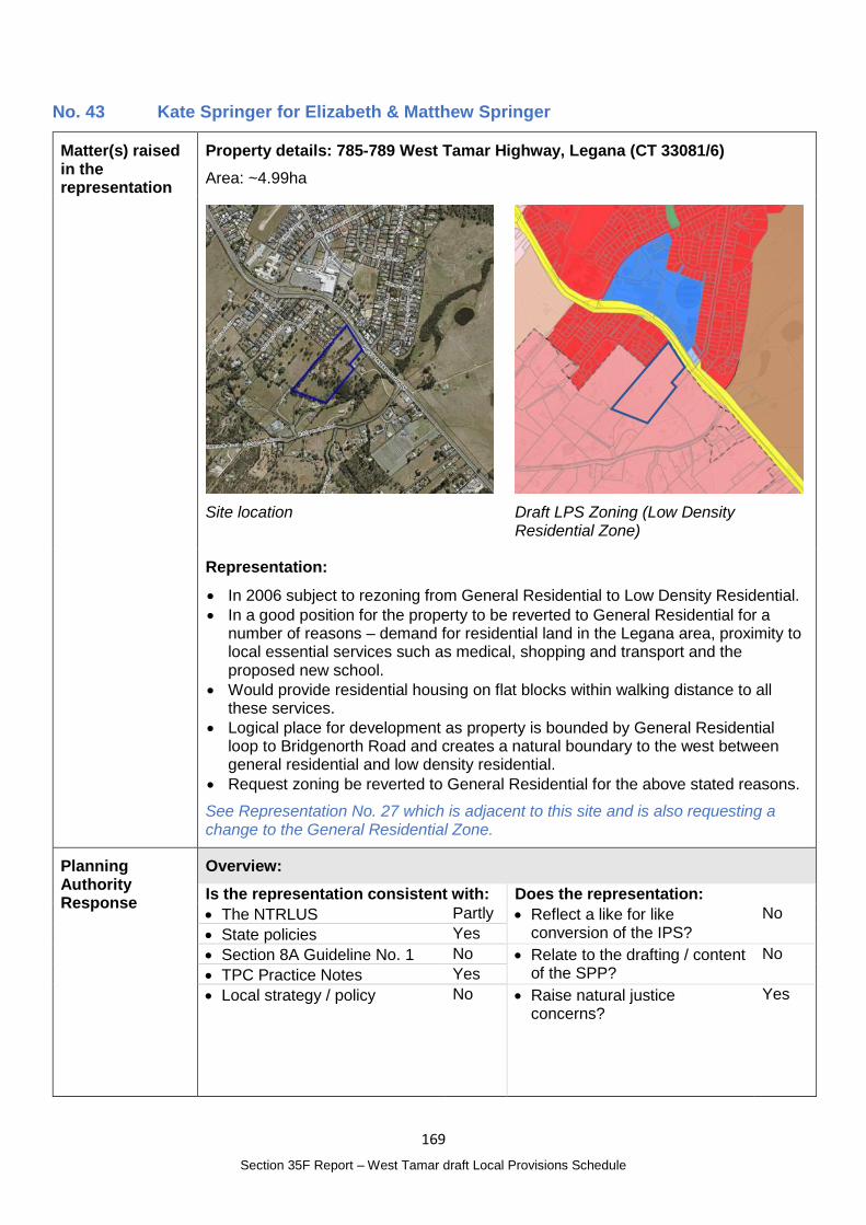
169
Section 35F Report – West Tamar draft Local Provisions Schedule
No. 43 Kate Springer for Elizabeth & Matthew Springer
Matter(s) raised in the representation
Property details: 785-789 West Tamar Highway, Legana (CT 33081/6)
Area: ~4.99ha
Site location
Draft LPS Zoning (Low Density Residential Zone)
Representation:
In 2006 subject to rezoning from General Residential to Low Density Residential.
In a good position for the property to be reverted to General Residential for a number of reasons – demand for residential land in the Legana area, proximity to local essential services such as medical, shopping and transport and the proposed new school.
Would provide residential housing on flat blocks within walking distance to all these services.
Logical place for development as property is bounded by General Residential loop to Bridgenorth Road and creates a natural boundary to the west between general residential and low density residential.
Request zoning be reverted to General Residential for the above stated reasons.
See Representation No. 27 which is adjacent to this site and is also requesting a change to the General Residential Zone.
Planning Authority Response
Overview:
Is the representation consistent with: Does the representation:
The NTRLUS Partly Reflect a like for like conversion of the IPS?
No
State policies Yes
Section 8A Guideline No. 1 No Relate to the drafting / content of the SPP?
No
TPC Practice Notes Yes
Local strategy / policy No Raise natural justice concerns?
Yes
170
Section 35F Report – West Tamar draft Local Provisions Schedule
Response:
The representation is requesting that the site be included in the General Residential Zone.
In relation to the proposed General Residential Zone, GRZ 2 of Guideline No. 1 is considered below.
GRZ 2 – Zone Application Guidelines Assessment comments
GRZ 2 The General Residential Zone may be applied to green-field, brown-field or grey-field areas that have been identified for future urban residential use and development if:
(a) within the General Residential Zone in an interim planning scheme; Not applicable
(b) within an equivalent zone under a section 29 planning scheme; or
Not applicable
(c) justified in accordance with the relevant regional land use strategy, or supported by more detailed local strategic analysis consistent with the relevant regional land use strategy and endorsed by the relevant council; and
The site is included in the Urban Growth Area in the NTRLUS in the Growth Corridor and part of the site is also identified as a Supporting Consolidation Area. D.2.1.1 states:
Rezoning of land for urban development in Growth Corridors will only be considered if all relevant policies and actions in the RLUS are met along with State Policies.
Supporting Consolidation Areas
Comprising land in established suburbs which is separate from Priority Consolidation Areas as shown in the Regional Framework Plan Maps D.1, D.2 and D.3;
Support reliable and effective transportation and reduce vehicle dependency;
Physically connect new urban settlements to existing communities wherever possible, or otherwise provide new development with direct transport linkages to established urban areas;
Promote cohesive communities;
Support a wide range of services and facilities;
Support access to existing or planned activity centres; and
Comprise a suitable and complementary mix of land uses to support the Regional Settlement Hierarchy and the Regional Activity Centre Hierarchy
Growth Corridors
Comprising land contiguous with existing urban areas, including greenfield land, which will be developed to accommodate projected population growth where the land has been assessed against contemporary evidence and determined as being suitable for urban development.
An assessment against the Regional Planning Policies has not been completed by the planning authority at this time however given the locational attributes and the assessment completed in relation to Representation No. 27 a change in zone may be considered consistent with the RLUS.
The site is therefore anticipated for urban development however timing for when development should occur needs to be considered and, given the supply of zoned land, whether additional land is required to accommodate population growth at this time.
171
Section 35F Report – West Tamar draft Local Provisions Schedule
(d) is currently connected, or the intention is for the future lots to be connected, to a reticulated water supply service and a reticulated sewerage system,
It is likely, as outlined in the representation, that part of the site could be serviced by reticulated water and sewerage and is included in the TasWater Water and Sewer Serviced Land.
The Future Urban Zone may also be suitable for the site which would be consistent with the purpose of the zone:
30.1.1 To identify land intended for future urban use and development.
30.1.2 To ensure that development does not compromise the potential for future urban use and development of the land.
30.1.3 To support the planned rezoning of land for urban use and development in sequence with the planned expansion of infrastructure.
However, given the existing Low Density Residential Zoning, a change to the Future Urban Zone would essentially prevent development from occurring in any form without a planning scheme amendment which is not desirable.
There is potentially planning merit to change the zone to the General Residential Zone, subject to a complete assessment of a rezoning request – however timing for the development of the land, based on existing supply and future demand, as well as infrastructure requirements (reticulated water and sewerage and a coordinated approach to access) require further consideration and more detailed local planning. At this time, that local planning has not commenced. The review of the NTRLUS and, in particular, closer examination of demand and supply for housing will support this process.
It is also likely that any change to the General Residential Zone would be of public interest.
Planning Authority recommended action
No changes to the draft LPS are recommended at this time.
Effect of recommendation on the draft LPS
The Planning Authority recommendation has no impact on implementing the draft LPS as a whole.
Meets the LPS criteria
The Planning Authority recommendation meets the LPS criteria.
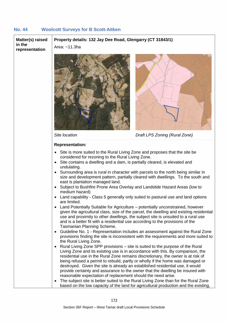
172
Section 35F Report – West Tamar draft Local Provisions Schedule
No. 44 Woolcott Surveys for B Scott-Aitken
Matter(s) raised in the representation
Property details: 132 Jay Dee Road, Glengarry (CT 31843/1)
Area: ~11.3ha
Site location
Draft LPS Zoning (Rural Zone)
Representation:
Site is more suited to the Rural Living Zone and proposes that the site be considered for rezoning to the Rural Living Zone.
Site contains a dwelling and a dam, is partially cleared, is elevated and undulating.
Surrounding area is rural in character with parcels to the north being similar in size and development pattern, partially cleared with dwellings. To the south and east is plantation managed land.
Subject to Bushfire Prone Area Overlay and Landslide Hazard Areas (low to medium hazard)
Land capability - Class 5 generally only suited to pastural use and land options are limited.
Land Potentially Suitable for Agriculture – potentially unconstrained, however given the agricultural class, size of the parcel, the dwelling and existing residential use and proximity to other dwellings, the subject site is unsuited to a rural use and is a better fit with a residential use according to the provisions of the Tasmanian Planning Scheme.
Guideline No. 1 - Representation includes an assessment against the Rural Zone provisions finding the site is inconsistent with the requirements and more suited to the Rural Living Zone.
Rural Living Zone SPP provisions – site is suited to the purpose of the Rural Living Zone and its existing use is in accordance with this. By comparison, the residential use in the Rural Zone remains discretionary, the owner is at risk of being refused a permit to rebuild, partly or wholly if the home was damaged or destroyed. Given the site is already an established residential use, it would provide certainty and assurance to the owner that the dwelling be insured with reasonable expectation of replacement should the need arise.
The subject site is better suited to the Rural Living Zone than for the Rural Zone based on the low capacity of the land for agricultural production and the existing,
173
Section 35F Report – West Tamar draft Local Provisions Schedule
well established, development pattern and, use of the land. The site is currently used similarly to rural living and fits the requirements of the zone neatly.
This submission is not made to convert rural land to residential for the purpose of future development, but to safeguard the existing residential development. Under the Rural Zone, a dwelling is listed as Discretionary. If the owner’s home was destroyed, a discretionary permit would be required to rebuild. Under the Rural Living Zone, the residential use would be protected along with the owner’s peace of mind on home security.
Rezoning the land to Rural Living will not create any spot zoning but be contiguous with the pattern to the north and will fit seamlessly to the existing zone, no further changes required.
It is therefore submitted that the subject site at 132 Jay Dee Road be included in the Rural Living Zone under the local planning provisions of the Tasmanian Planning Scheme.
Planning Authority Response
Overview:
Is the representation consistent with: Does the representation:
The NTRLUS Yes Reflect a like for like conversion of the IPS?
No
State policies Yes
Section 8A Guideline No. 1 Yes Relate to the drafting / content of the SPP?
No
TPC Practice Notes Yes
Local strategy / policy N/A Raise natural justice concerns?
No
Response:
The representation is seeking a change in zone to the Rural Living Zone.
RLZ 1 of Guideline No. 1 states:
The Rural Living Zone should be applied to:
(a) residential areas with larger lots, where existing and intended use is a mix between residential and lower order rural activities (e.g. hobby farming), but priority is given to the protection of residential amenity; or
(b) land that is currently a Rural Living Zone within an interim planning scheme or a section 29 planning scheme,
unless RLZ 4 below applies.
The lot is characteristic of, and used for rural living purposes and is constrained as a result of its size, native vegetation on site and adjoining rural living from being a viable agricultural property.
RLZ 4 of Guideline No. 1 states:
The Rural Living Zone should not be applied to land that:
…
(c) is identified in the ‘Land Potentially Suitable for Agriculture Zone’ available on the LIST (see Agriculture Zone), unless the Rural Living Zone can be justified in accordance with the relevant regional land use strategy, or supported by more detailed local strategic analysis consistent with the relevant regional land use strategy and endorsed by the relevant council.
174
Section 35F Report – West Tamar draft Local Provisions Schedule
The land is identified a Potentially Suitable for Agriculture Zone under the mapping referenced in RLZ 4.
The Agricultural Land Mapping in West Tamar Municipality report prepared by AK Consulting which forms part of the draft LPS Supporting Report identified the area at 24 – Glengarry South. It found:
The majority of titles within this area are mapped as ‘unconstrained’, however there are large areas of native vegetation and plantation forestry, which is why the area was identified for further assessment.
Titles with native vegetation or existing plantation are either adjoining a large Crown owned title that will go into the Rural Zone or near to it. Ownership, Land Capability and existing Private Timber Reserves of these titles demonstrated characteristics more suited to the Rural Zone.
D.2.2.2 of the NTRLUS describes established Rural Residential Areas as:
Predominantly residential land use, including lifestyle blocks, hobby farms and/or low density residential subdivision; and
Fragmentation of the cadastral base and property ownership; and
May include topographical constraints resulting in physical impediments to rural resource use or connectivity, including biodiversity protection and/or conservation.
The site is considered to meet the characteristics of an established rural residential area under the NTRLUS, with consideration of its inclusion in the Rural Living Zone considered intensification of an established Rural Residential Area, rather than the establishment of a new area.
D.2.2.2 goes onto state that intensification must balance a range of matters which are addressed below, noting that these considerations are also included in Regional Settlement Network Policy RSN-A26.
D.2.2.2 considerations for intensification Response
Impact on the agricultural and environmental values of the land and surrounding areas;
The Natural Assets Code mapping identified parts of the site as containing Priority Vegetation Areas and watercourses. A dwelling and associated infrastructure is already established on the property and additional impact on the natural values would not reasonably be anticipated as a result of changing the zone to Rural Living. Aerial photographs indicate there are no nearby agricultural activities with the site surrounded on 3 sides with dense vegetation.
Proximity to existing settlements containing social services; The site is approximately 11km or 11 minutes drive to Exeter or 24.6km or 23 minute drive to Legana Shopping Centre which provides for local needs and from there an additional 12km or 15 minute drive to Launceston CBD. The site is appropriately located and has good access to social services.
Land use efficiency, consolidating gaps in established rural residential land use patterns;
The site forms part of an existing rural residential area and reflects the rural living characteristics of the area.
Access to road infrastructure with capacity to support an intensified land use;
No additional lots would be able to be created if the zone were to change.
On-site waste water system suitability; The site already has an established house and associated infrastructure.
Impact on natural values or the potential land use limitations as a result of natural values;
As above, parts of the lot is identified in the Priority Vegetation Area. The continuing use of the site for rural living will have no additional impact on these values.
Impact on agricultural land and land conversion; The site is currently proposed to be in the Rural Zone in recognition of its limited agricultural capacity.
175
Section 35F Report – West Tamar draft Local Provisions Schedule
Impact on water resources required for agricultural and environmental purposes;
The site is not within an irrigation district.
Consideration of natural hazard management; Part of the site is identified as Landslip Hazard however a dwelling is established outside of this area. The site is within the Bushfire-prone Area with assessment required as per the TPS and the Building Act for future development of the land. The potential hazards would not be contrary to or prevent the continuing use of the land for rural residential purposes.
Existing land supply within the region; The lot is already used for rural residential purposes with an established house. If included in the Rural Living Zone D would provide no additional supply.
Potential future requirement for the land for urban purposes; and
The land is separate from the urban area and would be very unlikely to be required for urban purposes.
The ability to achieve positive environmental outcomes through rezoning
The continued use of the land for rural living purposes, and a zone that reflects this will likely minimise potential vegetation clearing and not result in additional adverse impacts.
The lot is adjacent to the Rural Living Zone D to the north. The minimum lot size for Rural Living Zone D is 10ha, and if the zone were to be changed it would be appropriate to include the site in this subzone given it is contiguous to other lots in this subzone and consistent with the prevailing subdivision pattern.
The site was not considered in the Rural Living Zone sub-zone assessment as it was not previously zoned Rural Living.
Including the property in the Rural Living Zone D would have the potential to produce no additional lots or result in any additional restrictions on nearby agricultural uses as the site and its use for residential purposes is established.
Changing the zone of the property would provide a continuous area of Rural Living Zoning, be consistent with the surrounding area and not result in adverse impacts on infrastructure or the nearby agricultural uses.
Given the owners of the land were the representor’s, and the use of the land for rural living purposes would be accepted in the locality, the change in zone would not be likely to be of public interest.
Planning Authority recommended action
Change the zone of 132 Jay Dee Road, Glengarry (CT 31843/1) from the Rural Zone to the Rural Living Zone D.
Effect of recommendation on the draft LPS
The Planning Authority recommendation has no impact on implementing the draft LPS as a whole as the landowner is supportive of the recommended change.
Meets the LPS criteria
The Planning Authority is satisfied that the recommendation meets the LPS criteria.
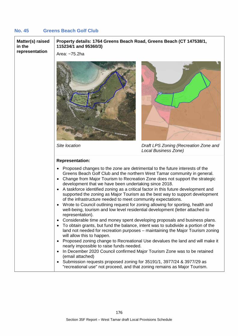
176
Section 35F Report – West Tamar draft Local Provisions Schedule
No. 45 Greens Beach Golf Club
Matter(s) raised in the representation
Property details: 1764 Greens Beach Road, Greens Beach (CT 147538/1, 115234/1 and 95360/3)
Area: ~75.2ha
Site location
Draft LPS Zoning (Recreation Zone and Local Business Zone)
Representation:
Proposed changes to the zone are detrimental to the future interests of the Greens Beach Golf Club and the northern West Tamar community in general.
Change from Major Tourism to Recreation Zone does not support the strategic development that we have been undertaking since 2018.
A taskforce identified zoning as a critical factor in this future development and supported the zoning as Major Tourism as the best way to support development of the infrastructure needed to meet community expectations.
Wrote to Council outlining request for zoning allowing for sporting, health and well-being, tourism and low level residential development (letter attached to representation).
Considerable time and money spent developing proposals and business plans.
To obtain grants, but fund the balance, intent was to subdivide a portion of the land not needed for recreation purposes – maintaining the Major Tourism zoning will allow this to happen.
Proposed zoning change to Recreational Use devalues the land and will make it nearly impossible to raise funds needed.
In December 2020 Council confirmed Major Tourism Zone was to be retained (email attached)
Submission requests proposed zoning for 35191/1, 3977/24 & 3977/29 as "recreational use" not proceed, and that zoning remains as Major Tourism.
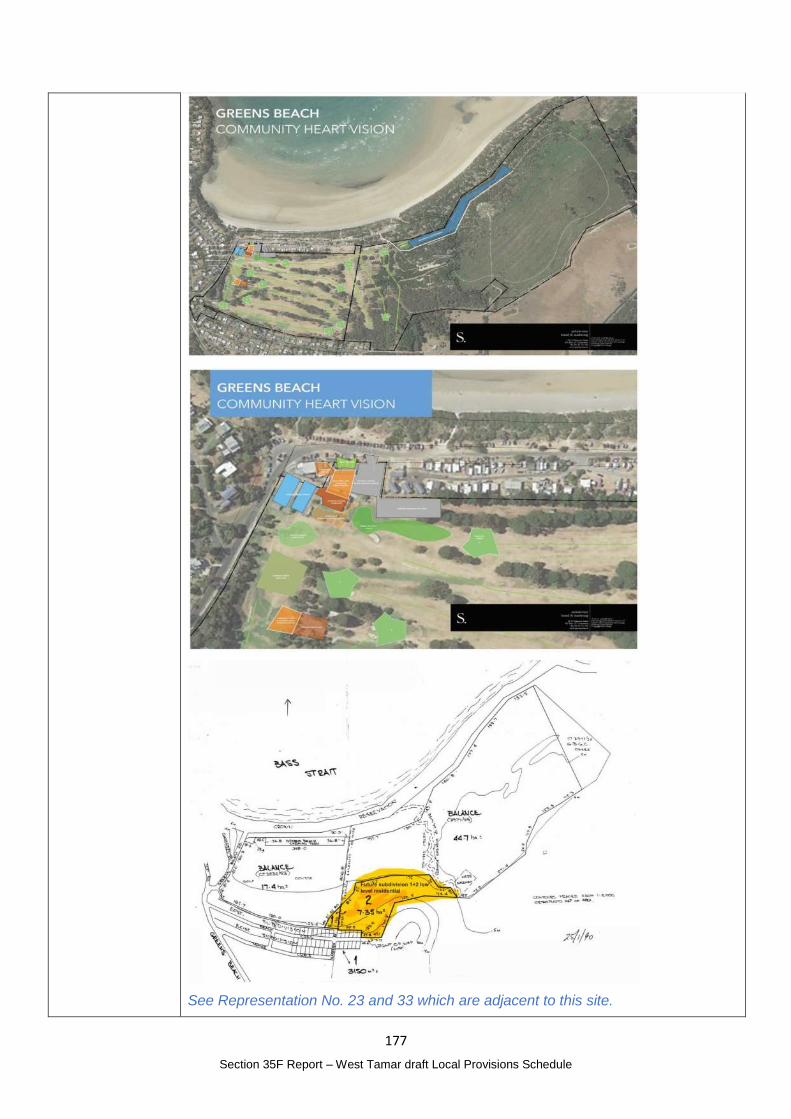
177
Section 35F Report – West Tamar draft Local Provisions Schedule
See Representation No. 23 and 33 which are adjacent to this site.
178
Section 35F Report – West Tamar draft Local Provisions Schedule
Planning Authority Response
Overview:
Is the representation consistent with: Does the representation:
The NTRLUS Yes Reflect a like for like conversion of the IPS?
Yes
State policies Yes
Section 8A Guideline No. 1 No Relate to the drafting / content of the SPP?
No
TPC Practice Notes Yes
Local strategy / policy N/A Raise natural justice concerns?
Yes
Response:
The draft LPS provides:
Local Business Zone around the clubhouse, tennis courts and associated infrastructure at the corner of Greens Beach Road; and
Recreation Zone for the balance of the land taking up the gold course and currently undeveloped land to the west of the site.
The draft LPS Local Business Zone around the clubhouse and associated facilities supports the Club’s intent for an upgrade to the clubhouse facilitates.
Under the TPS, Tourist Operation or Visitor Accommodation (if for a camping and caravan park or overnight camping area) are discretionary uses in the Recreation Zone. Residential uses and other forms of Visitor Accommodation are Prohibited.
The 2019 letter from the Golf Club attached to the representation requested removal of the SAP and ‘that any future rezoning allows for sporting, health and wellbeing, tourism and low level residential development.’ It also enclosed an updated version of the project briefing notes that illustrated their requirements – extracts of the image are included in the representation summary above. This includes a narrow strip of residential in blue along the northern boundary but did not provide additional detail in relation to the form or density of the residential development proposed. The material submitted with the representation also included an image dated 25/1/90 highlighting in yellow an area for future subdivision. This yellow area appears to correspond with the previous Reserved Residential Zoning of the property under the 1986 Beaconsfield Planning Scheme.
The Reserved Residential Zone was similar to a Future Urban Zone essentially providing a holding zone. The minimum lot size was 10ha with an 18m frontage. The equivalent uses to multiple dwellings were prohibited and a single house was discretionary.
Images of the zoning of the site from the 1986, 2006 and 2013 planning schemes are provided at the end of this response.
The request to allow residential development included in the 2019 project briefing was not reflected in the draft LPS zoning.
Council representatives met with representatives of the Golf Club on 24 June 2021 to gain a better understanding of their representation. The meeting confirmed that:
The area highlighted in yellow on the plan dated 25/1/90 is where future development is intended to occur (with the exception of the area to the eastern extent currently used for greens);
The future development proposal is likely to be consistent with the Low Density Residential Zone adjacent to the property;
Planning applications, including a planning scheme amendment for rezoning, would be a possible pathway noting they are seeking a level of certainty that
179
Section 35F Report – West Tamar draft Local Provisions Schedule
future development potential, subject to meeting planning scheme requirements, was desirable.
Note that the representation also included a copy of an email dated 23 December 2020 from Council. This was specifically in relation to an enquiry about the proposed redevelopment of the clubhouse and not the balance of the land. While it is acknowledged that a previous, and not ultimately approved version of the draft LPS mapping was used to respond to this enquiry, the Local Business Zone included in the draft LPS around the club house and surrounds would likely comply with the requirements of the TPS subject to assessment of discretionary application.
It is also noted that Representation No. 23 supports removal of the SAP noting that the underlying zone of this property (in the IPS and the draft LPS) is the Low Density Residential Zone which is consistent with their development intentions.
Interim Planning Scheme (IPS)
Under the IPS the site is included in the Major Tourism Zone and is subject to the Greens Beach Golf Specific Area Plan (SAP). The SAP was included in the IPS in response to a request by the developer to facilitate a mixed use tourism and residential development associated with the golf course, initially this was proposed through use of the Particular Purpose Zone but ultimately was included in the Major Tourism Zone with the accompanying SAP to provide detailed provisions to manage development.
The developer did not formerly make application for a combined planning application and planning scheme amendment process under the former section 43A of the Act.
Under the IPS, the purpose and objectives for the Residential Precinct of the Greens Beach Golf Specific Area Plan are:
F3.1.1 The purpose of this specific area plan is to provide for:
a) a mixed use tourism, golf, and residential venture on land adjacent the existing Greens Beach settlement; and
b) a coastal settlement that integrates residential, tourism and recreational golfing uses, with a commercial precinct that services the activities generated and contributes to the wider Greens Beach Community.
Objectives
Residential Precinct
To provide for residential use in a relaxed coastal/resort style community within an integrated golfing environment in a natural landscape setting.
The SAP also includes a masterplan identifying the four development precincts as shown below.
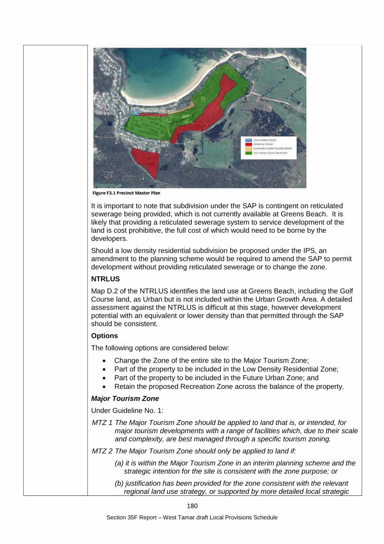
180
Section 35F Report – West Tamar draft Local Provisions Schedule
It is important to note that subdivision under the SAP is contingent on reticulated sewerage being provided, which is not currently available at Greens Beach. It is likely that providing a reticulated sewerage system to service development of the land is cost prohibitive, the full cost of which would need to be borne by the developers.
Should a low density residential subdivision be proposed under the IPS, an amendment to the planning scheme would be required to amend the SAP to permit development without providing reticulated sewerage or to change the zone.
NTRLUS
Map D.2 of the NTRLUS identifies the land use at Greens Beach, including the Golf Course land, as Urban but is not included within the Urban Growth Area. A detailed assessment against the NTRLUS is difficult at this stage, however development potential with an equivalent or lower density than that permitted through the SAP should be consistent.
Options
The following options are considered below:
Change the Zone of the entire site to the Major Tourism Zone;
Part of the property to be included in the Low Density Residential Zone;
Part of the property to be included in the Future Urban Zone; and
Retain the proposed Recreation Zone across the balance of the property.
Major Tourism Zone
Under Guideline No. 1:
MTZ 1 The Major Tourism Zone should be applied to land that is, or intended, for major tourism developments with a range of facilities which, due to their scale and complexity, are best managed through a specific tourism zoning.
MTZ 2 The Major Tourism Zone should only be applied to land if:
(a) it is within the Major Tourism Zone in an interim planning scheme and the strategic intention for the site is consistent with the zone purpose; or
(b) justification has been provided for the zone consistent with the relevant regional land use strategy, or supported by more detailed local strategic
181
Section 35F Report – West Tamar draft Local Provisions Schedule
analysis consistent with the relevant regional land use strategy and endorsed by the relevant council.
MTZ 3 The Major Tourism Zone should not be applied to land that is:
(a) only intended for a single use (e.g. Visitor Accommodation); or
(b) only intended as small-scale sites that can be more appropriately managed through an alternate zoning.
Applying the Major Tourism Zone in the draft LPS does not meet Guideline No. 1 as a major tourism development is no longer the intended use of the land. Essentially the proposed use is for singe use residential purposes separate from the golf course.
Carrying the SAP forward into the draft LPS was also not appropriate given the intent of the SAP is no longer the preferred development pattern for the site, and the provisions relating to reticulated sewerage are not considered feasible.
Low Density Residential Zone
Guideline No. 1 defines the purpose of the Low Density Residential Zone as:
10.1.1 To provide for residential use and development in residential areas where there are infrastructure or environmental constraints that limit the density, location or form of development.
10.1.2 To provide for non-residential use that does not cause an unreasonable loss of amenity, through scale, intensity, noise, traffic generation and movement, or other off site impacts.
10.1.3 To provide for Visitor Accommodation that is compatible with residential character.
Applying the Low Density Residential Zone to part of the site would provide some level of residential development of the land and provide the highest level of certainty for future development.
The density would be lower than that currently anticipated in the IPS so it would be reasonable to conclude that the impact on infrastructure and services would be lower than if the full capacity permitted in IPS were implemented.
While this solution would likely resolve the representor’s request to retain some level of development potential, the area to be included in the Low Density Residential Zone will need to be defined.
The two areas flagged by the representor for residential development are identified as Priority Vegetation Areas under the draft LPS Natural Assets Code mapping (see below). A fauna and flora assessment would be required as part of an application for subdivision or for a planning scheme amendment to determine site suitability. Based on the draft code overlay mapping, no other significant constraints have been identified, noting that capacity to provide onsite wastewater treatment and disposal is a particular consideration for coastal locations.
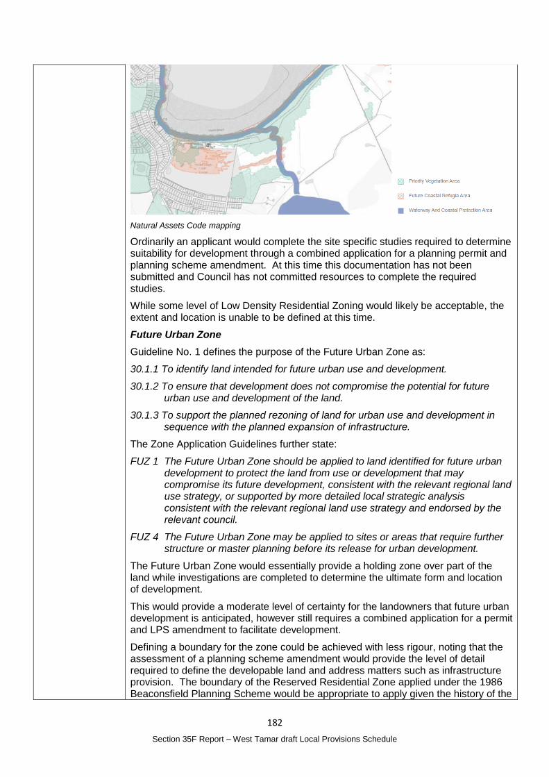
182
Section 35F Report – West Tamar draft Local Provisions Schedule
Natural Assets Code mapping
Ordinarily an applicant would complete the site specific studies required to determine suitability for development through a combined application for a planning permit and planning scheme amendment. At this time this documentation has not been submitted and Council has not committed resources to complete the required studies.
While some level of Low Density Residential Zoning would likely be acceptable, the extent and location is unable to be defined at this time.
Future Urban Zone
Guideline No. 1 defines the purpose of the Future Urban Zone as:
30.1.1 To identify land intended for future urban use and development.
30.1.2 To ensure that development does not compromise the potential for future urban use and development of the land.
30.1.3 To support the planned rezoning of land for urban use and development in sequence with the planned expansion of infrastructure.
The Zone Application Guidelines further state:
FUZ 1 The Future Urban Zone should be applied to land identified for future urban development to protect the land from use or development that may compromise its future development, consistent with the relevant regional land use strategy, or supported by more detailed local strategic analysis consistent with the relevant regional land use strategy and endorsed by the relevant council.
FUZ 4 The Future Urban Zone may be applied to sites or areas that require further structure or master planning before its release for urban development.
The Future Urban Zone would essentially provide a holding zone over part of the land while investigations are completed to determine the ultimate form and location of development.
This would provide a moderate level of certainty for the landowners that future urban development is anticipated, however still requires a combined application for a permit and LPS amendment to facilitate development.
Defining a boundary for the zone could be achieved with less rigour, noting that the assessment of a planning scheme amendment would provide the level of detail required to define the developable land and address matters such as infrastructure provision. The boundary of the Reserved Residential Zone applied under the 1986 Beaconsfield Planning Scheme would be appropriate to apply given the history of the
183
Section 35F Report – West Tamar draft Local Provisions Schedule
site, and that area is also generally consistent with the anticipated area for development under the masterplan included in the SAP.
Given the change in development intent for the site, this option is considered to provide the equivalent level of development certainty as the current IPS zoning and SAP.
No change – retain proposed Recreation Zone
Guideline No. 1 states the purpose of the Recreation Zone is:
28.1.1 To provide for active and organised recreational use and development ranging from small community facilities to major sporting facilities.
28.1.2 To provide for complementary uses that do not impact adversely on the recreational use of the land.
28.1.3 To ensure that new major sporting facilities do not cause unreasonable impacts on adjacent sensitive uses.
The Zone Application Guidelines, RecZ 1 specifically states the Recreation Zone should be applied to land used for golf courses.
The Recreation Zone reflects the current use of part of the land but does not accommodate the development intentions of the land owner, nor does it reflect the use of the western part of the property which is currently undeveloped.
Residential use or Visitor Accommodation would require a combined application, however, it would be reasonable to conclude that a change from the Recreation Zone to a residential zone would be more difficult to justify than a change from the Future Urban Zone.
Conclusion
The Major Tourism Zone is no longer an appropriate zone for the site however the zoning of the entire site in the Recreation Zone as proposed would result in a significant loss of use rights to the land owners.
There is insufficient information currently available to zone part of the site in the Low Density Residential Zone. Directly changing the zoning to the Low Density Residential Zone is also a change that is potentially of public interest and should be subject to public notification.
Given the change in development intent for the land, the Future Urban Zone would provide an equivalent level of certainty and require a combined application for a planning permit and amendment to the LPS. This will provide opportunity for the public to have input into the process of determining the future development of the land but reflect the intention embedded in the IPS that some residential development would occur on the site. The boundary of the Future Urban Zone would reasonably follow the boundary of the previous Reserved Residential Zone from the 1986 Beaconsfield Planning Scheme.
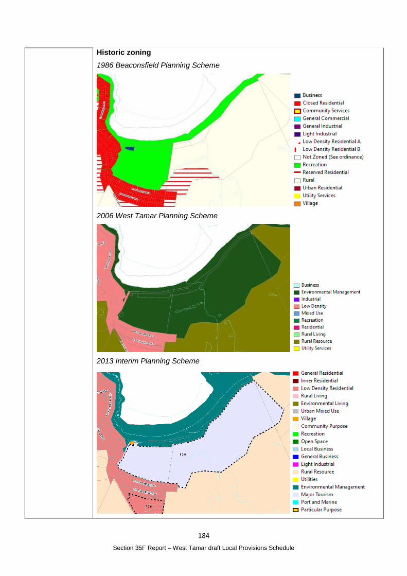
184
Section 35F Report – West Tamar draft Local Provisions Schedule
Historic zoning
1986 Beaconsfield Planning Scheme
2006 West Tamar Planning Scheme
2013 Interim Planning Scheme
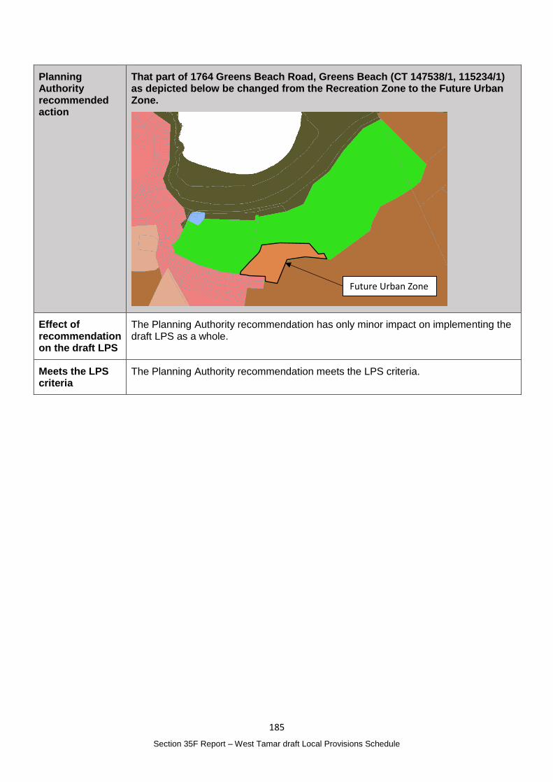
185
Section 35F Report – West Tamar draft Local Provisions Schedule
Planning Authority recommended action
That part of 1764 Greens Beach Road, Greens Beach (CT 147538/1, 115234/1) as depicted below be changed from the Recreation Zone to the Future Urban Zone.
Effect of recommendation on the draft LPS
The Planning Authority recommendation has only minor impact on implementing the draft LPS as a whole.
Meets the LPS criteria
The Planning Authority recommendation meets the LPS criteria.
Future Urban Zone
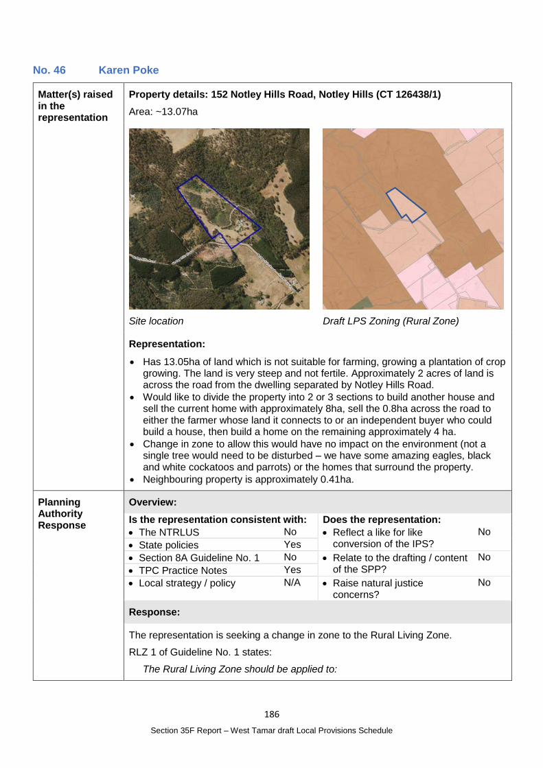
186
Section 35F Report – West Tamar draft Local Provisions Schedule
No. 46 Karen Poke
Matter(s) raised in the representation
Property details: 152 Notley Hills Road, Notley Hills (CT 126438/1)
Area: ~13.07ha
Site location
Draft LPS Zoning (Rural Zone)
Representation:
Has 13.05ha of land which is not suitable for farming, growing a plantation of crop growing. The land is very steep and not fertile. Approximately 2 acres of land is across the road from the dwelling separated by Notley Hills Road.
Would like to divide the property into 2 or 3 sections to build another house and sell the current home with approximately 8ha, sell the 0.8ha across the road to either the farmer whose land it connects to or an independent buyer who could build a house, then build a home on the remaining approximately 4 ha.
Change in zone to allow this would have no impact on the environment (not a single tree would need to be disturbed – we have some amazing eagles, black and white cockatoos and parrots) or the homes that surround the property.
Neighbouring property is approximately 0.41ha.
Planning Authority Response
Overview:
Is the representation consistent with: Does the representation:
The NTRLUS No Reflect a like for like conversion of the IPS?
No
State policies Yes
Section 8A Guideline No. 1 No Relate to the drafting / content of the SPP?
No
TPC Practice Notes Yes
Local strategy / policy N/A Raise natural justice concerns?
No
Response:
The representation is seeking a change in zone to the Rural Living Zone.
RLZ 1 of Guideline No. 1 states:
The Rural Living Zone should be applied to:
187
Section 35F Report – West Tamar draft Local Provisions Schedule
(a) residential areas with larger lots, where existing and intended use is a mix between residential and lower order rural activities (e.g. hobby farming), but priority is given to the protection of residential amenity; or
(b) land that is currently a Rural Living Zone within an interim planning scheme or a section 29 planning scheme,
unless RLZ 4 below applies.
The lot is characteristic of, and used for rural living purposes and the area is constrained as a result of its size, native vegetation on site and adjoining rural living from being viable agricultural properties.
RLZ 4 of Guideline No. 1 states:
The Rural Living Zone should not be applied to land that:
…
(c) is identified in the ‘Land Potentially Suitable for Agriculture Zone’ available on the LIST (see Agriculture Zone), unless the Rural Living Zone can be justified in accordance with the relevant regional land use strategy, or supported by more detailed local strategic analysis consistent with the relevant regional land use strategy and endorsed by the relevant council.
The land is identified a Potentially Suitable for Agriculture Zone under the mapping referenced in RLZ 4.
The Agricultural Land Mapping in West Tamar Municipality report prepared by AK Consulting which forms part of the draft LPS Supporting Report identified the area as 20 - Exeter South. It found:
Along Notley Hills Rd, there is a cluster of titles assessed as being more appropriate for the Rural Zone, due to existing dwellings, native vegetation and or existing plantations. Titles that were retained in the Ag Zone are under the same ownership with more land to the north and west. These titles appear to be part of an agricultural enterprise with ‘commercial scale’ characteristics, which is more suited to the Ag Zone.
The lot is surrounded on three sides by the Agriculture Zone and on the south western side is adjacent to the Rural Zone.
Even if there were justification to change the zone to the Rural Living Zone, a sub-zone assessment under RLZ3 of Guideline No. 1 would draw the conclusion that sub-zone category D would be most appropriate which is consistent with the Rural Living Zoned lots further south on Notley Hills Road which are in sub-zone category D with a minimum lot size of 10ha.
The Rural Living Zone D would not permit subdivision as proposed by the representor.
Additionally the area on the southern side of Notley Hills Road is approximately 635m2 and is not sufficient size to accommodate a dwelling and associated infrastructure. However, if the adjacent property owner that shares a boundary with the property did want to purchase that part of the property, clause 7.3 of the TPS could be utilised to complete a boundary adjustment.
188
Section 35F Report – West Tamar draft Local Provisions Schedule
Planning Authority recommended action
No changes to the draft LPS are recommended.
Effect of recommendation on the draft LPS
The Planning Authority recommendation has no impact on implementing the draft LPS as a whole.
Meets the LPS criteria
The Planning Authority recommendation meets the LPS criteria.
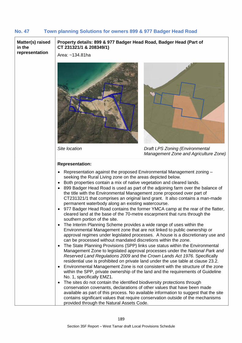
189
Section 35F Report – West Tamar draft Local Provisions Schedule
No. 47 Town planning Solutions for owners 899 & 977 Badger Head Road
Matter(s) raised in the representation
Property details: 899 & 977 Badger Head Road, Badger Head (Part of CT 231321/1 & 208349/1)
Area: ~134.81ha
Site location
Draft LPS Zoning (Environmental Management Zone and Agriculture Zone)
Representation:
Representation against the proposed Environmental Management zoning – seeking the Rural Living zone on the areas depicted below.
Both properties contain a mix of native vegetation and cleared lands.
899 Badger Head Road is used as part of the adjoining farm over the balance of the title with the Environmental Management zone proposed over part of CT231321/1 that comprises an original land grant. It also contains a man-made permanent waterbody along an existing watercourse.
977 Badger Head Road contains the former YMCA camp at the rear of the flatter, cleared land at the base of the 70-metre escarpment that runs through the southern portion of the site.
The Interim Planning Scheme provides a wide range of uses within the Environmental Management zone that are not linked to public ownership or approval regimes under legislated processes. A house is a discretionary use and can be processed without mandated discretions within the zone.
The State Planning Provisions (SPP) links use status within the Environmental Management Zone to legislated approval processes under the National Park and Reserved Land Regulations 2009 and the Crown Lands Act 1976. Specifically residential use is prohibited on private land under the use table at clause 23.2.
Environmental Management Zone is not consistent with the structure of the zone within the SPP, private ownership of the land and the requirements of Guideline No. 1, specifically EMZ1.
The sites do not contain the identified biodiversity protections through conservation covenants, declarations of other values that have been made available as part of this process. No available information to suggest that the site contains significant values that require conservation outside of the mechanisms provided through the Natural Assets Code.
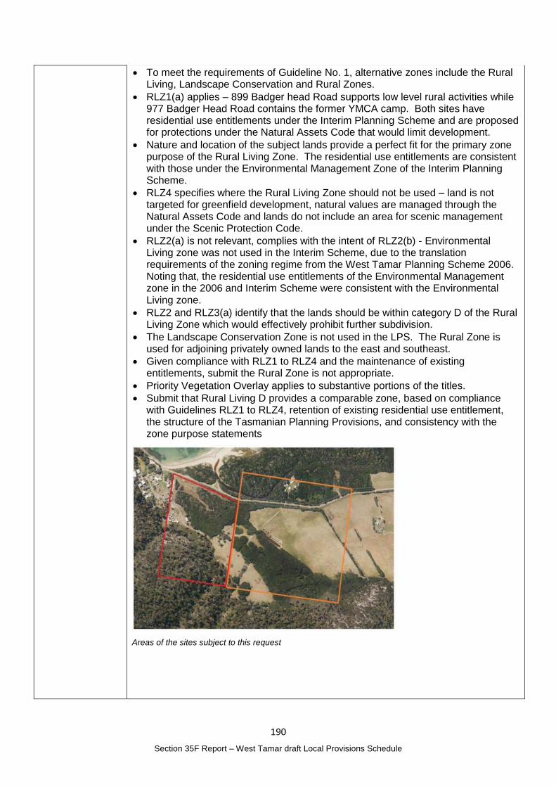
190
Section 35F Report – West Tamar draft Local Provisions Schedule
To meet the requirements of Guideline No. 1, alternative zones include the Rural Living, Landscape Conservation and Rural Zones.
RLZ1(a) applies – 899 Badger head Road supports low level rural activities while 977 Badger Head Road contains the former YMCA camp. Both sites have residential use entitlements under the Interim Planning Scheme and are proposed for protections under the Natural Assets Code that would limit development.
Nature and location of the subject lands provide a perfect fit for the primary zone purpose of the Rural Living Zone. The residential use entitlements are consistent with those under the Environmental Management Zone of the Interim Planning Scheme.
RLZ4 specifies where the Rural Living Zone should not be used – land is not targeted for greenfield development, natural values are managed through the Natural Assets Code and lands do not include an area for scenic management under the Scenic Protection Code.
RLZ2(a) is not relevant, complies with the intent of RLZ2(b) - Environmental Living zone was not used in the Interim Scheme, due to the translation requirements of the zoning regime from the West Tamar Planning Scheme 2006. Noting that, the residential use entitlements of the Environmental Management zone in the 2006 and Interim Scheme were consistent with the Environmental Living zone.
RLZ2 and RLZ3(a) identify that the lands should be within category D of the Rural Living Zone which would effectively prohibit further subdivision.
The Landscape Conservation Zone is not used in the LPS. The Rural Zone is used for adjoining privately owned lands to the east and southeast.
Given compliance with RLZ1 to RLZ4 and the maintenance of existing entitlements, submit the Rural Zone is not appropriate.
Priority Vegetation Overlay applies to substantive portions of the titles.
Submit that Rural Living D provides a comparable zone, based on compliance with Guidelines RLZ1 to RLZ4, retention of existing residential use entitlement, the structure of the Tasmanian Planning Provisions, and consistency with the zone purpose statements
Areas of the sites subject to this request
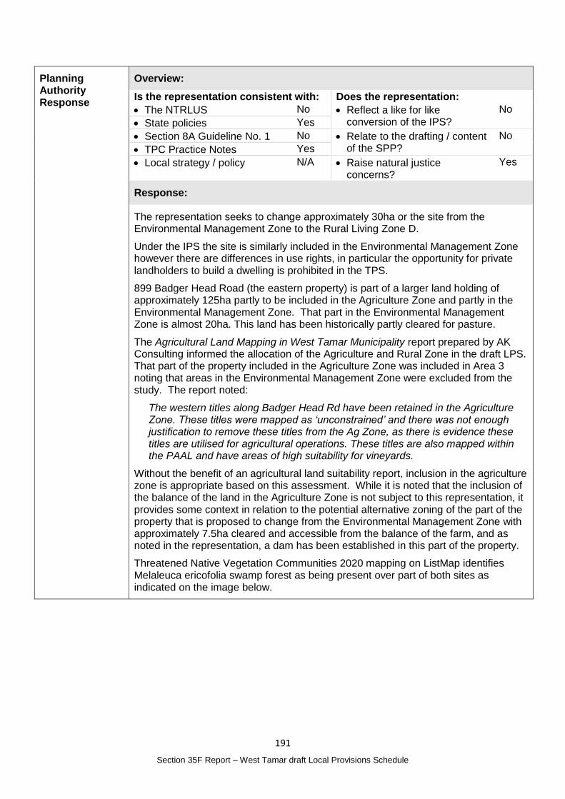
191
Section 35F Report – West Tamar draft Local Provisions Schedule
Planning Authority Response
Overview:
Is the representation consistent with: Does the representation:
The NTRLUS No Reflect a like for like conversion of the IPS?
No
State policies Yes
Section 8A Guideline No. 1 No Relate to the drafting / content of the SPP?
No
TPC Practice Notes Yes
Local strategy / policy N/A Raise natural justice concerns?
Yes
Response:
The representation seeks to change approximately 30ha or the site from the Environmental Management Zone to the Rural Living Zone D.
Under the IPS the site is similarly included in the Environmental Management Zone however there are differences in use rights, in particular the opportunity for private landholders to build a dwelling is prohibited in the TPS.
899 Badger Head Road (the eastern property) is part of a larger land holding of approximately 125ha partly to be included in the Agriculture Zone and partly in the Environmental Management Zone. That part in the Environmental Management Zone is almost 20ha. This land has been historically partly cleared for pasture.
The Agricultural Land Mapping in West Tamar Municipality report prepared by AK Consulting informed the allocation of the Agriculture and Rural Zone in the draft LPS. That part of the property included in the Agriculture Zone was included in Area 3 noting that areas in the Environmental Management Zone were excluded from the study. The report noted:
The western titles along Badger Head Rd have been retained in the Agriculture Zone. These titles were mapped as ‘unconstrained’ and there was not enough justification to remove these titles from the Ag Zone, as there is evidence these titles are utilised for agricultural operations. These titles are also mapped within the PAAL and have areas of high suitability for vineyards.
Without the benefit of an agricultural land suitability report, inclusion in the agriculture zone is appropriate based on this assessment. While it is noted that the inclusion of the balance of the land in the Agriculture Zone is not subject to this representation, it provides some context in relation to the potential alternative zoning of the part of the property that is proposed to change from the Environmental Management Zone with approximately 7.5ha cleared and accessible from the balance of the farm, and as noted in the representation, a dam has been established in this part of the property.
Threatened Native Vegetation Communities 2020 mapping on ListMap identifies Melaleuca ericofolia swamp forest as being present over part of both sites as indicated on the image below.
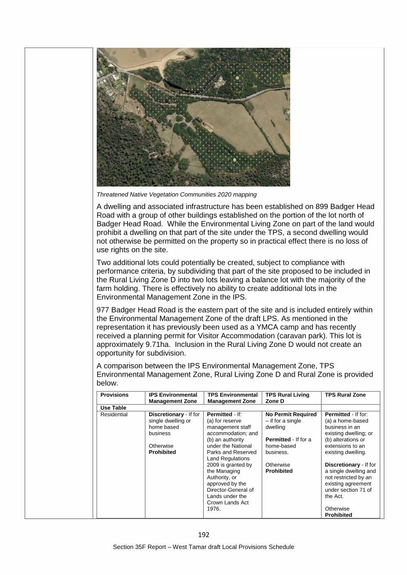
192
Section 35F Report – West Tamar draft Local Provisions Schedule
Threatened Native Vegetation Communities 2020 mapping
A dwelling and associated infrastructure has been established on 899 Badger Head Road with a group of other buildings established on the portion of the lot north of Badger Head Road. While the Environmental Living Zone on part of the land would prohibit a dwelling on that part of the site under the TPS, a second dwelling would not otherwise be permitted on the property so in practical effect there is no loss of use rights on the site.
Two additional lots could potentially be created, subject to compliance with performance criteria, by subdividing that part of the site proposed to be included in the Rural Living Zone D into two lots leaving a balance lot with the majority of the farm holding. There is effectively no ability to create additional lots in the Environmental Management Zone in the IPS.
977 Badger Head Road is the eastern part of the site and is included entirely within the Environmental Management Zone of the draft LPS. As mentioned in the representation it has previously been used as a YMCA camp and has recently received a planning permit for Visitor Accommodation (caravan park). This lot is approximately 9.71ha. Inclusion in the Rural Living Zone D would not create an opportunity for subdivision.
A comparison between the IPS Environmental Management Zone, TPS Environmental Management Zone, Rural Living Zone D and Rural Zone is provided below.
Provisions IPS Environmental Management Zone
TPS Environmental Management Zone
TPS Rural Living Zone D
TPS Rural Zone
Use Table
Residential Discretionary - If for single dwelling or home based business Otherwise Prohibited
Permitted - If: (a) for reserve management staff accommodation; and (b) an authority under the National Parks and Reserved Land Regulations 2009 is granted by the Managing Authority, or approved by the Director-General of Lands under the Crown Lands Act 1976.
No Permit Required – if for a single dwelling Permitted - If for a home-based business. Otherwise Prohibited
Permitted - If for: (a) a home-based business in an existing dwelling; or (b) alterations or extensions to an existing dwelling. Discretionary - If for a single dwelling and not restricted by an existing agreement under section 71 of the Act. Otherwise Prohibited
193
Section 35F Report – West Tamar draft Local Provisions Schedule
Otherwise Prohibited
Resource Development
Discretionary - If for existing uses and the curtilage does not increase by more than 30% as at the effective date Otherwise Prohibited
Permitted - If: (a) for grazing; and (b) an authority under the National Parks and Reserved Land Regulations 2009 is granted by the Managing Authority, or approved by the Director-General of Lands under the Crown Lands Act 1976 Otherwise - Discretionary
No Permit Required – if for grazing Discretionary - If not for (a) intensive animal husbandry or plantation forestry; or (b) not listed as No Permit Required Otherwise Prohibited
No Permit Required
Visitor Accommodation
Discretionary Permitted - If an authority under the National Parks and Reserved Land Regulations 2009 is granted by the Managing Authority, or approved by the Director General of Lands under the Crown Lands Act 1976. Otherwise - Discretionary
Permitted Permitted – if for guests accommodated within an existing building Discretionary – if not listed as Permitted
Use standards Compliance with Reserve Activities Assessment
Discretionary uses must be consistent with the values of the land
Hours of operation, external lighting and commercial vehicle movements
Visitor Accommodation
Requires a rural location for operational reasons
Must not confine or restrain existing us on adjoining properties
Minimise conversion of agricultural land
Appropriate for a rural location
Development Standards
Curtilage / area of development (20%)
Building height (6m)
Setbacks from boundaries (10m)
Setback for sensitive uses to Rural Resource Zone (200m)
Landscape and site management plan requirements for discretionary uses
Development area (<500m2) or not cause unreasonable impact on values of the site
Building height (6m)
Setbacks from boundaries (10m or not less than existing)
Setback for sensitive uses to the Rural or Agricultural Zone (200m)
Exterior building finishes
Vegetation management
Site coverage <400m2
Building height (8.5m)
Setback from frontage (20m)
Setback from side and rear boundaries (10m)
Setbacks for sensitive uses to the Rural or Agriculture Zone (200m or not less than existing building)
Building height <12m
Setbacks from all boundaries (5m)
Setbacks for sensitive uses to the Agriculture Zone (200m or not less than existing building)
Access to a road
Subdivision standards
Consolidation or boundary realignment to zone boundaries
Consolidation or required for public use, utilities or in accordance with other approvals
Minimum lot size 10ha or 20% less
Minimum frontage of 40m but not less than 3.6m
Minimum lot size 40ha
Minimum frontage 25m
194
Section 35F Report – West Tamar draft Local Provisions Schedule
Minimum frontage 3.6m or no reduction
Sufficient size for onsite disposal of wastewater or connection to services
(eg under the Crown Lands Act 1976)
Vehicular access
Capable of accommodating onsite wastewater management disposal
Vehicular access to a road
Vehicular access to a road
Guideline No. 1 Not applicable Purpose
To provide for the protection, conservation and management of land with significant ecological, scientific, cultural or scenic value.
To allow for compatible use or development where it is consistent with: (a) the protection, conservation and management of the values of the land; and (b) applicable reserved land management objectives and objectives of reserve management plans.
Applied to land with significant ecological, scientific, cultural or scenic values, such as: (a) land reserved under the Nature Conservation Act 2002; … (f) any private land containing significant values identified for protection or conservation and where the intention is to limit use and development.
Purpose
To provide for residential use or development in a rural setting where: (a) services are limited; or (b) existing natural and landscape values are to be retained.
To provide for compatible agricultural use and development that does not adversely impact on residential amenity.
To provide for other use or development that does not cause an unreasonable loss of amenity, through noise, scale, intensity, traffic generation and movement, or other off site impacts.
To provide for Visitor Accommodation that is compatible with residential character.
Applied to land (a) residential areas with larger lots, where existing and intended use is a mix between residential and lower order rural activities (e.g. hobby farming), but priority is given to the protection of residential amenity; or (b) land that is currently a Rural Living Zone within an interim planning scheme or a section 29 planning scheme, unless RLZ 4 below applies. RLZ 2 - The Rural Living Zone should not be applied to land that is not currently within an interim planning
Purpose
To provide for a range of use or development in a rural location: (a) where agricultural use is limited or marginal due to topographical, environmental or other site or regional characteristics; (b)that requires a rural location for operational reasons; (c) is compatible with agricultural use if occurring on agricultural land; (d)minimises adverse impacts on surrounding uses.
To minimise conversion of agricultural land for non-agricultural use.
To ensure that use or development is of a scale and intensity that is appropriate for a rural location and does not compromise the function of surrounding settlements.
Applied to land in non-urban areas with limited or no potential for agriculture as a consequence of topographical, environmental or other characteristics of the area, and which is not more appropriately included within the Landscape Conservation Zone or Environmental Management Zone for the protection of specific values. RZ 2 The Rural Zone should only be applied after
195
Section 35F Report – West Tamar draft Local Provisions Schedule
scheme Rural Living Zone, unless: (a) consistent with the relevant regional land use strategy, or supported by more detailed local strategic analysis consistent with the relevant regional land use strategy and endorsed by the relevant council; or (b) the land is within the Environmental Living Zone in an interim planning scheme and the primary strategic intention is for residential use and development within a rural setting and a similar minimum allowable lot size is being applied, such as, applying the Rural Living Zone D where the minimum lot size is 10 ha or greater.
considering whether the land is suitable for the Agriculture Zone in accordance with the ‘Land Potentially Suitable for Agriculture Zone’ layer published on the LIST. RZ 3 The Rural Zone may be applied to land identified in the ‘Land Potentially Suitable for Agriculture Zone’ layer, if: (a) it can be demonstrated that the land has limited or no potential for agricultural use and is not integral to the management of a larger farm holding that will be within the Agriculture Zone; (b) it can be demonstrated that there are significant constraints to agricultural use occurring on the land; (c) the land is identified for the protection of a strategically important naturally occurring resource which is more appropriately located in the Rural Zone and is supported by strategic analysis; (d) the land is identified for a strategically important use or development that is more appropriately located in the Rural Zone and is supported by strategic analysis; or (e) it can be demonstrated, by strategic analysis, that the Rural Zone is otherwise more appropriate for the land.
Given the private ownership of the land and acknowledging that the environmental values could be managed through the Natural Assets Code, the Environmental Management Zone may not be the most practical zone for the future use of the land primarily due to the restrictions relating to dwellings.
The Rural Living Zone D would confer additional use rights and have potential to permit subdivision. The Rural Zone has similar use rights as the IPS Environmental Management Zone however provides additional use rights in relation to agricultural
196
Section 35F Report – West Tamar draft Local Provisions Schedule
activities. The Natural Assets Code would apply in both zones. It is also noted that 899 Badger Head Road is part of a larger agricultural land holding and appears to be at least partly suitable for this purpose given the pasture land and dam on site.
As noted in the response to Representation No. 2, a strategic review of the use of the Environmental Management Zone is recommended as a separate process. Given this strategic work is yet to be completed changes to the zone of the site is not recommended at this time.
Any change in zone would likely be subject to public interest given the sensitive nature of the Badger Head area.
Planning Authority recommended action
No changes to the draft LPS are recommended at this time.
Effect of recommendation on the draft LPS
The Planning Authority recommendation has no impact on implementing the draft LPS as a whole.
Meets the LPS criteria
The Planning Authority recommendation meets the LPS criteria.
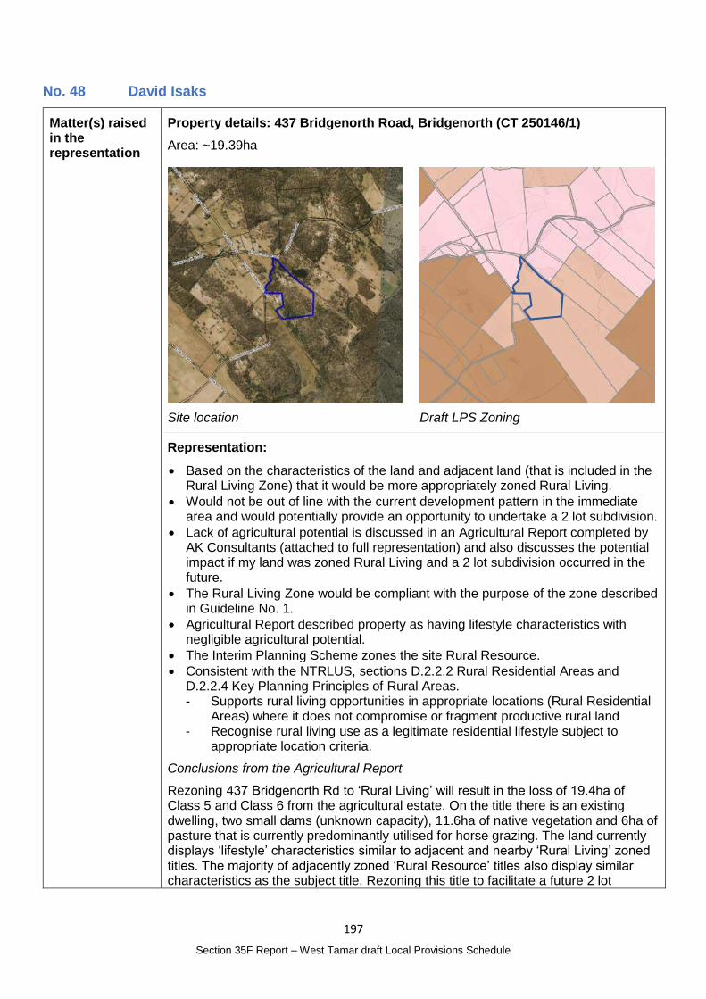
197
Section 35F Report – West Tamar draft Local Provisions Schedule
No. 48 David Isaks
Matter(s) raised in the representation
Property details: 437 Bridgenorth Road, Bridgenorth (CT 250146/1)
Area: ~19.39ha
Site location
Draft LPS Zoning
Representation:
Based on the characteristics of the land and adjacent land (that is included in the Rural Living Zone) that it would be more appropriately zoned Rural Living.
Would not be out of line with the current development pattern in the immediate area and would potentially provide an opportunity to undertake a 2 lot subdivision.
Lack of agricultural potential is discussed in an Agricultural Report completed by AK Consultants (attached to full representation) and also discusses the potential impact if my land was zoned Rural Living and a 2 lot subdivision occurred in the future.
The Rural Living Zone would be compliant with the purpose of the zone described in Guideline No. 1.
Agricultural Report described property as having lifestyle characteristics with negligible agricultural potential.
The Interim Planning Scheme zones the site Rural Resource.
Consistent with the NTRLUS, sections D.2.2.2 Rural Residential Areas and D.2.2.4 Key Planning Principles of Rural Areas. - Supports rural living opportunities in appropriate locations (Rural Residential
Areas) where it does not compromise or fragment productive rural land - Recognise rural living use as a legitimate residential lifestyle subject to
appropriate location criteria.
Conclusions from the Agricultural Report
Rezoning 437 Bridgenorth Rd to ‘Rural Living’ will result in the loss of 19.4ha of Class 5 and Class 6 from the agricultural estate. On the title there is an existing dwelling, two small dams (unknown capacity), 11.6ha of native vegetation and 6ha of pasture that is currently predominantly utilised for horse grazing. The land currently displays ‘lifestyle’ characteristics similar to adjacent and nearby ‘Rural Living’ zoned titles. The majority of adjacently zoned ‘Rural Resource’ titles also display similar characteristics as the subject title. Rezoning this title to facilitate a future 2 lot
198
Section 35F Report – West Tamar draft Local Provisions Schedule
subdivision is unlikely to place any further constraints on adjacent land than already occurs.
It is feasible to achieve appropriate separation distances between any future new dwellings and existing and potential primary industry use in the vicinity to minimise the risk of constraining agricultural use.
See Representation No. 18 and 34 on adjacent properties
Planning Authority Response
Overview:
Is the representation consistent with: Does the representation:
The NTRLUS Yes Reflect a like for like conversion of the IPS?
No
State policies Yes
Section 8A Guideline No. 1 Yes Relate to the drafting / content of the SPP?
No
TPC Practice Notes Yes
Local strategy / policy N/A Raise natural justice concerns?
No
Response:
See full assessment under Representation No. 18.
The requested change in zone:
Is consistent with the character of the locality;
Complies with the Guideline No.1 requirements for inclusion in the Rural Living Zone;
Is consistent with the NTRLUS; and
Does not compromise State policies.
Planning Authority recommended action
Change the zone of the following properties from the Rural Zone to the Rural Living Zone D:
419 Bridgenorth Road, Legana (CT 21917/2);
421 Bridgenorth Road, Legana (CT 21917/3); and
437 Bridgenorth Road, Bridgenorth (CT 250146/1).
Effect of recommendation on the draft LPS
The Planning Authority recommendation has no impact on implementing the draft LPS as a whole as all landowners are supportive of the recommended change.
Meets the LPS criteria
The Planning Authority recommendation meets the LPS criteria.
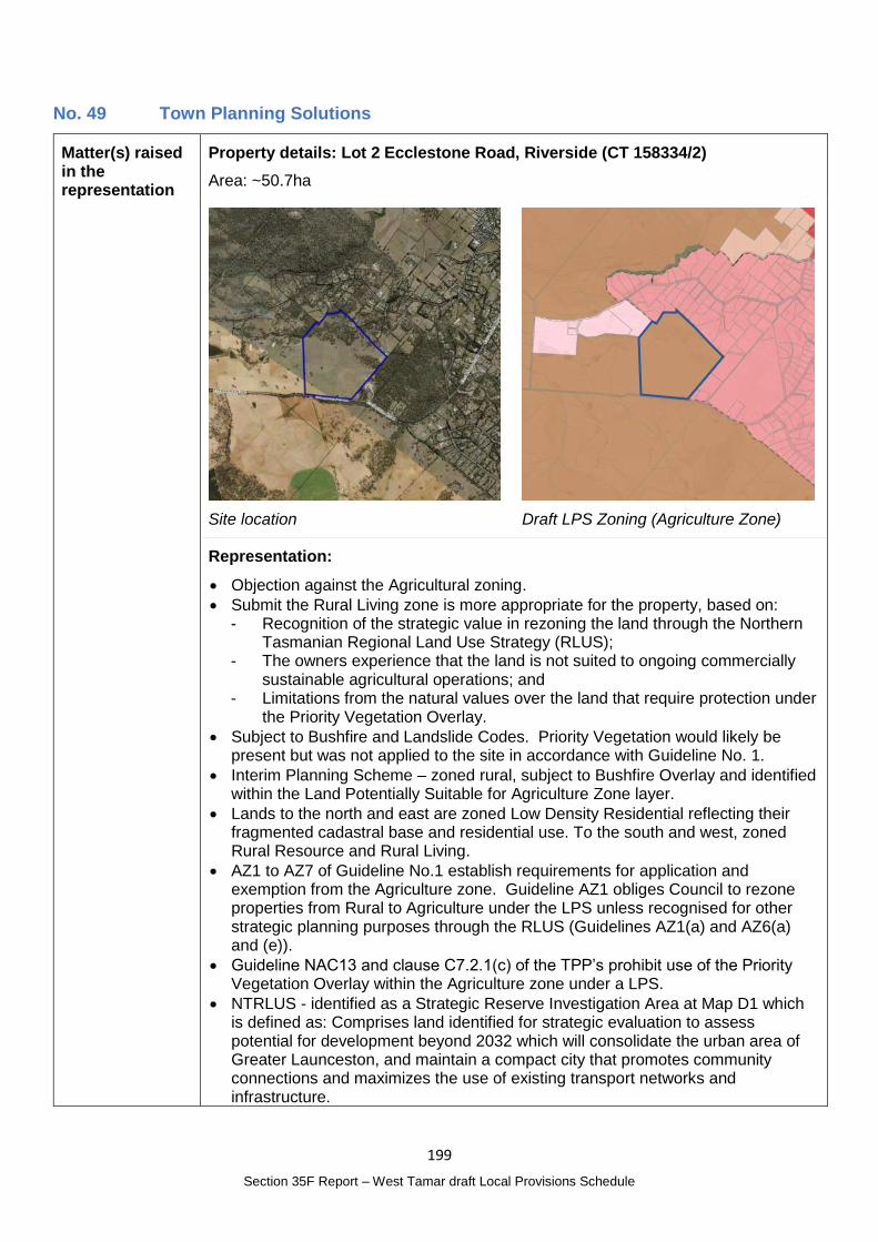
199
Section 35F Report – West Tamar draft Local Provisions Schedule
No. 49 Town Planning Solutions
Matter(s) raised in the representation
Property details: Lot 2 Ecclestone Road, Riverside (CT 158334/2)
Area: ~50.7ha
Site location
Draft LPS Zoning (Agriculture Zone)
Representation:
Objection against the Agricultural zoning.
Submit the Rural Living zone is more appropriate for the property, based on: - Recognition of the strategic value in rezoning the land through the Northern
Tasmanian Regional Land Use Strategy (RLUS); - The owners experience that the land is not suited to ongoing commercially
sustainable agricultural operations; and - Limitations from the natural values over the land that require protection under
the Priority Vegetation Overlay.
Subject to Bushfire and Landslide Codes. Priority Vegetation would likely be present but was not applied to the site in accordance with Guideline No. 1.
Interim Planning Scheme – zoned rural, subject to Bushfire Overlay and identified within the Land Potentially Suitable for Agriculture Zone layer.
Lands to the north and east are zoned Low Density Residential reflecting their fragmented cadastral base and residential use. To the south and west, zoned Rural Resource and Rural Living.
AZ1 to AZ7 of Guideline No.1 establish requirements for application and exemption from the Agriculture zone. Guideline AZ1 obliges Council to rezone properties from Rural to Agriculture under the LPS unless recognised for other strategic planning purposes through the RLUS (Guidelines AZ1(a) and AZ6(a) and (e)).
Guideline NAC13 and clause C7.2.1(c) of the TPP’s prohibit use of the Priority Vegetation Overlay within the Agriculture zone under a LPS.
NTRLUS - identified as a Strategic Reserve Investigation Area at Map D1 which is defined as: Comprises land identified for strategic evaluation to assess potential for development beyond 2032 which will consolidate the urban area of Greater Launceston, and maintain a compact city that promotes community connections and maximizes the use of existing transport networks and infrastructure.
200
Section 35F Report – West Tamar draft Local Provisions Schedule
Aware of a shortage of rural lifestyle lots within the Riverside area for at least the past two years. Empirical evidence of sales and real estate agent advice within the local property market suggests my client’s understanding is accurate and that we are in another period of unprecedented demand.
Application of the Agriculture zone to land that is recognised in the RLUS as a strategic reserve for alternative uses is not consistent with the zone purpose statements, the intent of the Guidelines for long term protection of agricultural lands, the requirements of AZ6(a) and consequentially, the intent and requirements of Guideline AZ1 for application of the Agriculture zone under a LPS.
West Tamar does not appear to have competed local strategic analysis on their future needs for the provision of rural lifestyle areas as part of this process. Notwithstanding this, designation of this land as a Strategic Reserve within the RLUS complies with the requirements of Guidelines AZ1 and AZ6 for an alternative zoning to be used.
Use of an alternative zoning is supported by the RLUS and Guideline No.1.
Agricultural operations
Limited commercial success in sustaining agricultural activities – due to relatively small size of the lot for agricultural operations, fettering of the ability to use the land for agriculture from adjoining residential uses and management of existing vegetation.
Pinion Advisory were engaged to provide specialist advice in this area to support the representation. That advice was completed for submission of this representation and will be provided as part of the hearing process.
Guideline AZ6(e) provides a basis to consider an alternative zoning for the subject title.
Natural Values
The Regional Ecosystem Modelling (REM) identifies that most of the adjoining lands are suitable for the Priority Vegetation Overlay.
Tasveg 4, which suggests that natural values would likely affect approximately 12.5ha or more of the title.
Likely to include habitat for blue pincushion, Threatened Fauna Habitat for the eastern barred bandicoot, masked owl, spotted tailed quoll and Tasmanian devil and Eucalyptus amygdalina forest and woodland on dolerite.
Use of an alternative zoning for the land will allow the Priority Vegetation Overlay to be used over the title under Guideline No.1.
Desktop investigations identify that the site will be eligible for consideration of an alternative zoning under AZ6(c) and therefore, criterion (e)(i). Currently seeking a site-specific assessment of the natural values that affect the site to further inform assessment under this criterion. We are aiming to have this information available for the future hearings on the LPS.
Alternative zones
The limitations established through the adjoining residential land uses and natural values over the title also support an alternative zoning under Guideline AZ6.
The location of the property and nature of the surrounding land uses identify that the zoning should allow for lifestyle rather than urban development, particularly noting the proximity of the title to the City of Launceston.
Low Density – The zone and resulting land use pattern adjoins the site to the north and east. LDRZ 1, 2 and 4 do not apply to the land at this time. While LDRZ 3 may apply to parts of the site, we do not consider this to be an
201
Section 35F Report – West Tamar draft Local Provisions Schedule
appropriate zoning without a detailed examination of the merits through a separate rezoning process.
Rural Living – Identification of the title as a Strategic Reserve at Map D1 of the RLUS supports use of the Rural Living zone on the land pursuant to D2.2.2, consistent with Guidelines RLZ2(a) and RLZ4(a-c).
Rural – this is not a preferred zoning for land that is strategically identified for conversion to residential lifestyle purposes, though it is identified for the type at D.2.2.2 of the RLUS.
Conclusions
Agriculture zone proposed under the LPS is not consistent with the requirements of the RLUS and Guideline No.1.
Review of alternative zones within the TPP’s identified that the Low Density Residential and Rural zones were not appropriate.
As such, we request the Rural Living D zone be applied to the land
Planning Authority Response
Overview:
Is the representation consistent with: Does the representation:
The NTRLUS No Reflect a like for like conversion of the IPS?
No
State policies Yes
Section 8A Guideline No. 1 No Relate to the drafting / content of the SPP?
No
TPC Practice Notes Yes
Local strategy / policy N/A Raise natural justice concerns?
Yes
Response:
The site is identified under the NTRLUS as a Strategic Reserve Investigation Area which is described as:
Comprises land identified for strategic evaluation to assess potential for development beyond 2032 which will consolidate the urban area of Greater Launceston, and maintain a compact city that promotes community connections and maximizes the use of existing transport networks and infrastructure.
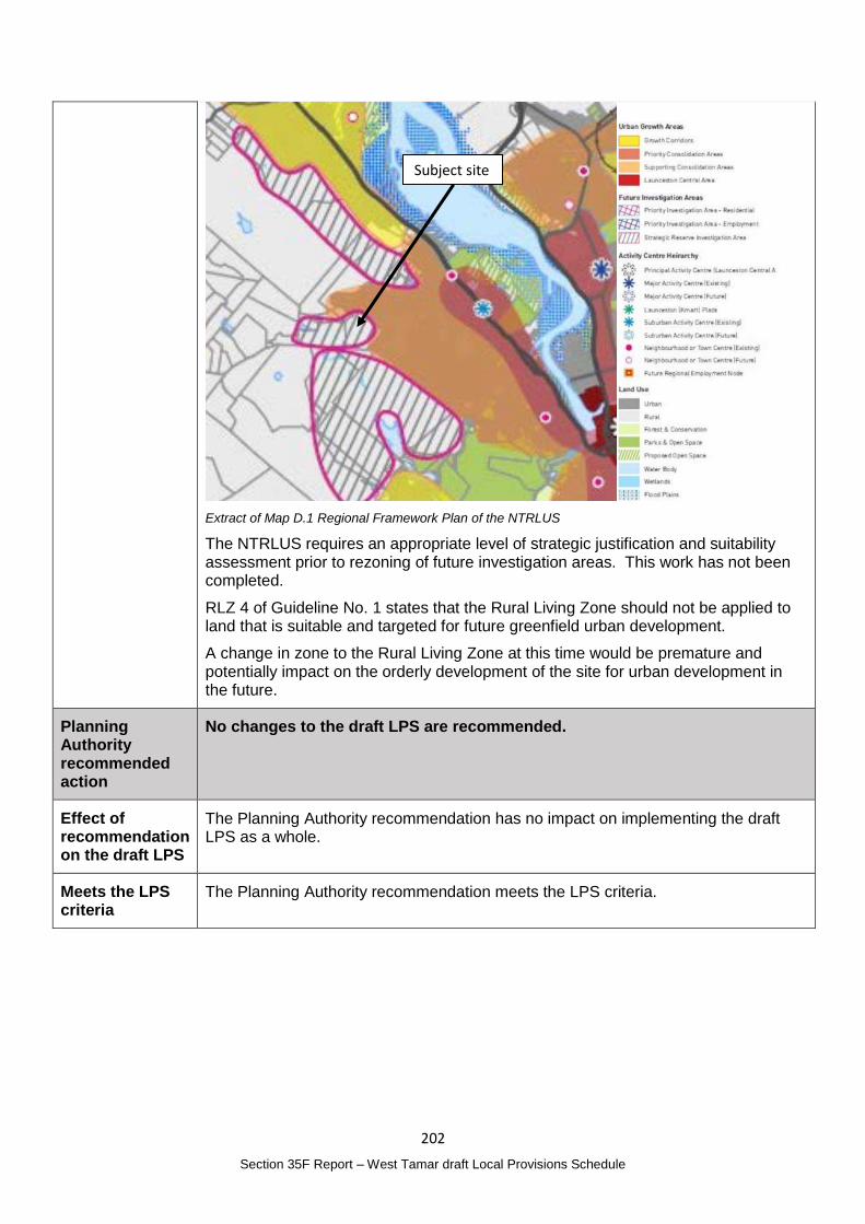
202
Section 35F Report – West Tamar draft Local Provisions Schedule
Extract of Map D.1 Regional Framework Plan of the NTRLUS
The NTRLUS requires an appropriate level of strategic justification and suitability assessment prior to rezoning of future investigation areas. This work has not been completed.
RLZ 4 of Guideline No. 1 states that the Rural Living Zone should not be applied to land that is suitable and targeted for future greenfield urban development.
A change in zone to the Rural Living Zone at this time would be premature and potentially impact on the orderly development of the site for urban development in the future.
Planning Authority recommended action
No changes to the draft LPS are recommended.
Effect of recommendation on the draft LPS
The Planning Authority recommendation has no impact on implementing the draft LPS as a whole.
Meets the LPS criteria
The Planning Authority recommendation meets the LPS criteria.
Subject site
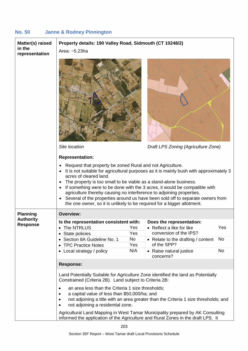
203
Section 35F Report – West Tamar draft Local Provisions Schedule
No. 50 Janne & Rodney Pinnington
Matter(s) raised in the representation
Property details: 190 Valley Road, Sidmouth (CT 10248/2)
Area: ~5.23ha
Site location
Draft LPS Zoning (Agriculture Zone)
Representation:
Request that property be zoned Rural and not Agriculture.
It is not suitable for agricultural purposes as it is mainly bush with approximately 3 acres of cleared land.
The property is too small to be viable as a stand-alone business.
If something were to be done with the 3 acres, it would be compatible with agriculture thereby causing no interference to adjoining properties.
Several of the properties around us have been sold off to separate owners from the one owner, so it is unlikely to be required for a bigger allotment.
Planning Authority Response
Overview:
Is the representation consistent with: Does the representation:
The NTRLUS Yes Reflect a like for like conversion of the IPS?
Yes
State policies Yes
Section 8A Guideline No. 1 No Relate to the drafting / content of the SPP?
No
TPC Practice Notes Yes
Local strategy / policy N/A Raise natural justice concerns?
No
Response:
Land Potentially Suitable for Agriculture Zone identified the land as Potentially Constrained (Criteria 2B). Land subject to Criteria 2B:
an area less than the Criteria 1 size thresholds;
a capital value of less than $50,000/ha; and
not adjoining a title with an area greater than the Criteria 1 size thresholds; and
not adjoining a residential zone.
Agricultural Land Mapping in West Tamar Municipality prepared by AK Consulting informed the application of the Agriculture and Rural Zones in the draft LPS. It
204
Section 35F Report – West Tamar draft Local Provisions Schedule
included the property in Area 6 – Beaconsfield, Sidmouth, and made the following observations:
It was determined that all titles south of Valley Road and east of the West Tamar Highway in this assessment area should be retained in the Ag Zone, despite the majority of these titles being mapped as ‘potentially constrained’. While there are a large number of individually owned titles with a dwelling, there are also a number of titles that are greater than 10ha without dwelling, with access to potential water resources from Cobblestone Creek and associated tributaries. There is also an existing horticultural enterprise in this area, which is adjacent to vacant ag land that could potentially be expanded in the future. In the south of this area is a title of 35ha with a dam that has a 24ML capacity. While this title has an existing dwelling and currently appears to be managed for grazing at a ‘hobby scale’, there is an existing vineyard to the south which indicates this title may also have future horticulture potential, especially with an existing water resource. Because of the agricultural attributes of this area and to provide a consistent zoning pattern, all titles were zoned Ag.
While it is acknowledged that the property is not highly valued for agriculture, the premise of maintaining a consistent zoning pattern is still relevant.
Retaining the lot in the Agriculture Zone meets Guideline No. 1.
As the lot is currently vacant, it is noted that residential use for a dwelling is a discretionary use in both the Rural and Agriculture Zones under the TPS.
Given the desktop study indicates the site is not capable of supporting an agricultural use, an applicant may be able to demonstrate compliance with section 21.3.1, P4 below.
P4 A Residential use listed as Discretionary must:
(a) be required as part of an agricultural use, having regard to:
(i) the scale of the agricultural use;
(ii) the complexity of the agricultural use;
(iii) the operational requirements of the agricultural use;
(iv) the requirement for the occupier of the dwelling to attend to the agricultural use; and
(v) proximity of the dwelling to the agricultural use; or
(b) be located on a site that:
(i) is not capable of supporting an agricultural use;
(ii) is not capable of being included with other agricultural land (regardless of ownership) for agricultural use; and
(iii) does not confine or restrain agricultural use on adjoining properties.
Planning Authority recommended action
No changes to the draft LPS are recommended.
Effect of recommendation on the draft LPS
The Planning Authority recommendation has no impact on implementing the draft LPS as a whole.
Meets the LPS criteria
The Planning Authority recommendation meets the LPS criteria.
205
Section 35F Report – West Tamar draft Local Provisions Schedule
No. 51 Peter Dingemanse
Matter(s) raised in the representation
Property details: Not applicable
Representation:
Like for like transition of the scheme is what was intended so changes should only be easy to predict, be they from writing differences in specific provisions, well considered local provisions, or consistency with local strategy.
An example of this working well is at Greens Beach. Where Low Density Zone will simply be as directed for the state and with historic and outdated provisions cleaned away.
Significant changes to local planning that will effect particularly rural municipalities or those that have significant coast/ estuary area.
Rezone of Rural Resources Zone to Agriculture Zone
The agriculture zone is the most constrained zone in the SPP’s, it effectively restricts anything other than agricultural use. This may be suitable for red dirt and irrigation districts around Devonport but not for hobby farms and rural living style lots around places like Bridgenorth.
A comparison of the use tables between West Tamar Rural Resource and SPP Agriculture zone demonstrates the significant restriction that is created. A simple example is manufacturing and processing, you can make ploughshares but will be prohibited from making aeroplane parts. Or service industry; you can service a tractor but not a bus. The intention of the scheme is not to change the local character or culture of our community; why make a joinery workshop or a stone mason in Bridgenorth prohibited because there is also a cow eating grass on the property. To be fair to the intention of the SPP, the maps that show what properties might be suitable for agriculture is not the same as defining if the Rural Zone is no longer suitable for rural land in West Tamar.
Similarly the proposed rezone will put a stop to new homes in the rural districts. To build a house on your rural land might be discretionary in both versions of the scheme, but use discretion must consider the zone purpose. Making a case for a discretionary use is difficult if the language of the zone purpose is very specifically about providing and protecting land for agriculture and agriculture only.
If all Rural Resource land in West Tamar remains as Rural Zone the land use effect will be very minor. But the effect of the proposed rezoning is significant. There is a flaw in simply following the “land for consideration” maps, they are not planning maps reflecting the zone purpose.
Rural land remapping should rather consider where some existing rural zoned land being used as living should be zoned for what it is. For example is 1095 Bridgenorth Road; 3 homes on one title without agriculture a hundred meters from the rural living zone. Or even Bridgenorth itself, it has its own footy team, why shouldn’t the properties that have homes that directly make the hamlet be able to provide for other family homes for the future.
Natural Assets Code mapping prohibiting use
Future Coastal Refugia overlay is now mapped to our low lying areas.
A careful read of the Natural Assets Code reveals that rather than engineering principles being the crucial considerations, there will be Use prohibition. Basically if it’s not relating to marine it’s not to happen, future coastal refugia areas are effectively defined as future marine reserves, and you must let the water in.
Either the code should only apply to land that West Tamar wants to reserve as refuge, or the code needs to be rewritten to create real discretion. An example is
206
Section 35F Report – West Tamar draft Local Provisions Schedule
resort could be built in a coastal hazard area via sound engineering design, but the Use is prohibited because code wants all future potential inundation areas to treated like a national park; except of course tourism is discretionary in a National park. Similar challenges are in the other sections of the code.
Like for like transition to the state scheme there should not be a broad scale additional overlay added if it prohibits Use and does not adequately provide for discretionary pathways.
Planning Authority Response
Overview:
Is the representation consistent with: Does the representation:
The NTRLUS Yes Reflect a like for like conversion of the IPS?
No
State policies Yes
Section 8A Guideline No. 1 No Relate to the drafting / content of the SPP?
Yes
TPC Practice Notes Yes
Local strategy / policy N/A Raise natural justice concerns?
Yes
Response:
Rezone from Rural Resource Zone to the Agricultural Zone
In defining the Agriculture Zone, AK Consulting were engaged to undertake an analysis of the Rural Resource Zone as detailed in the report ‘Agricultural Land Mapping in West Tamar Municipality’ included as part of the Draft LPS Supporting Report.
The report followed the Zone Application Guidelines for the Agriculture Zone of Guideline No. 1. To fully address the concerns raised by the representor an additional analysis of the Rural and Agriculture Zone allocation would be required and resources have not been allocated to this task at this time or to change all land in the Agriculture Zone to the Rural Zone which would raise significant natural justice concerns.
This report addresses several representations requesting a change from the Agriculture Zone to the Rural Zone which have been addressed individually.
Other reflections included in the representation are in relation to contents of the SPPs and how development will be regulated. Under section 35E(3) of the Act, a representation about a draft LPS must not be a representation to the effect that the content of a provision of the SPPs should be altered, however it is acknowledged there are significant limitations on future development in the Agriculture Zone.
The Rural Living Zoning has largely transferred the IPS Rural Living Zone, including in proximity to 1095 Bridgenorth Road. The TPS introduces the ability to subdivide land in the Rural Living Zone. Development of the LPS considered the sub-zone categories for the Rural Living Zone but did not consider potential expansion to the zone. Note that the owner of 1095 Bridgenorth Road did not make a representation to change their zone from the Rural Zone and their existing lawful use of the land is not affected by the introduction of the TPS.
Natural Assets Code mapping prohibiting use
The Natural Assets Code mapping, including Future Coastal Refugia, was developed in accordance with Guideline No. 1 Code Application Guidelines for the Natural Assets Code.
207
Section 35F Report – West Tamar draft Local Provisions Schedule
While it is acknowledged that the application of the mapping may affect future use rights, altering the mapping as described would also affect the validity of the mapping.
How the mapping is applied in the context of regulating use and development in these areas is detailed in the SPP. Under section 35E(3) of the Act, a representation about a draft LPS must not be a representation to the effect that the content of a provision of the SPPs should be altered. The matters raised in this regard have not been considered.
Planning Authority recommended action
No changes to the draft LPS are recommended.
Effect of recommendation on the draft LPS
The Planning Authority recommendation has no impact on implementing the draft LPS as a whole.
Meets the LPS criteria
The Planning Authority recommendation meets the LPS criteria.
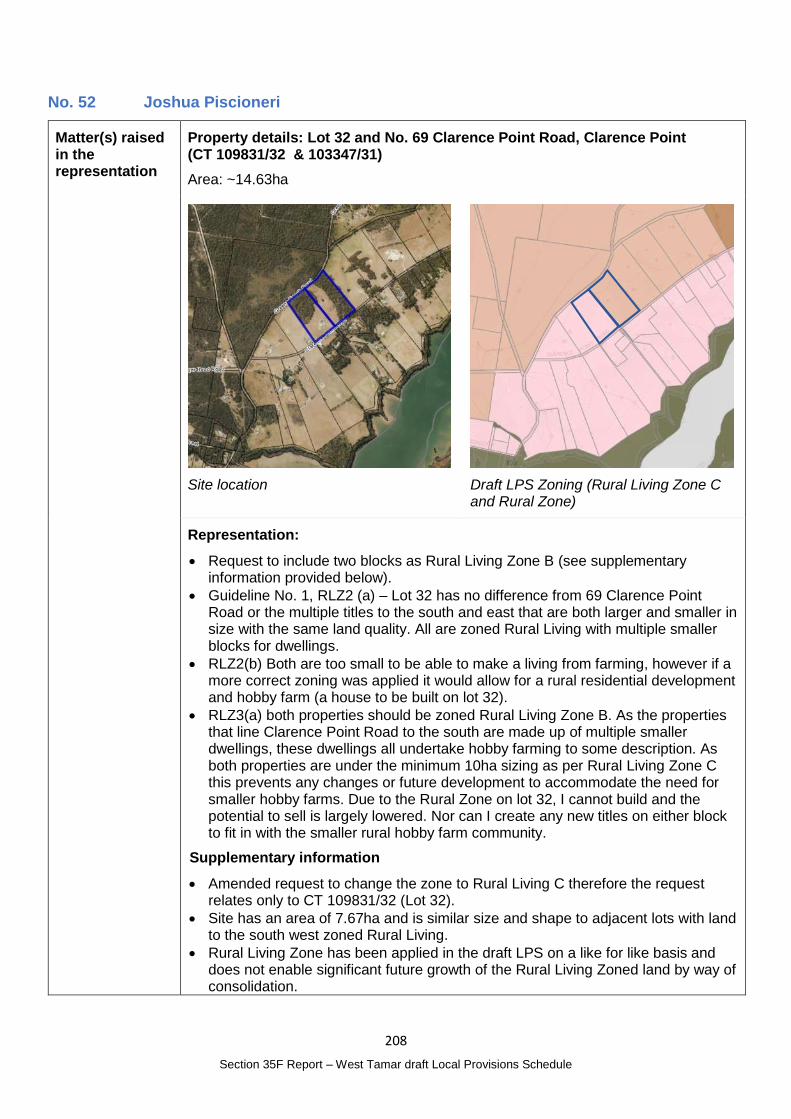
208
Section 35F Report – West Tamar draft Local Provisions Schedule
No. 52 Joshua Piscioneri
Matter(s) raised in the representation
Property details: Lot 32 and No. 69 Clarence Point Road, Clarence Point (CT 109831/32 & 103347/31)
Area: ~14.63ha
Site location
Draft LPS Zoning (Rural Living Zone C and Rural Zone)
Representation:
Request to include two blocks as Rural Living Zone B (see supplementary information provided below).
Guideline No. 1, RLZ2 (a) – Lot 32 has no difference from 69 Clarence Point Road or the multiple titles to the south and east that are both larger and smaller in size with the same land quality. All are zoned Rural Living with multiple smaller blocks for dwellings.
RLZ2(b) Both are too small to be able to make a living from farming, however if a more correct zoning was applied it would allow for a rural residential development and hobby farm (a house to be built on lot 32).
RLZ3(a) both properties should be zoned Rural Living Zone B. As the properties that line Clarence Point Road to the south are made up of multiple smaller dwellings, these dwellings all undertake hobby farming to some description. As both properties are under the minimum 10ha sizing as per Rural Living Zone C this prevents any changes or future development to accommodate the need for smaller hobby farms. Due to the Rural Zone on lot 32, I cannot build and the potential to sell is largely lowered. Nor can I create any new titles on either block to fit in with the smaller rural hobby farm community.
Supplementary information
Amended request to change the zone to Rural Living C therefore the request relates only to CT 109831/32 (Lot 32).
Site has an area of 7.67ha and is similar size and shape to adjacent lots with land to the south west zoned Rural Living.
Rural Living Zone has been applied in the draft LPS on a like for like basis and does not enable significant future growth of the Rural Living Zoned land by way of consolidation.
209
Section 35F Report – West Tamar draft Local Provisions Schedule
Most lots are at or below the minimum lot size. Assigning the site to the Rural Living Zone will provide an additional vacant lot capable of being developed in accordance with the TPS.
Consistent with RLZ 3 (a) in terms of being compatible with the existing pattern and density of development and will allow additional rural living use and development.
Consistent with the NTRLUS – prefers that demand for rural residential areas be met through the intensification of existing rural residential areas.
Representation provided an assessment against the intensification criteria.
Planning Authority Response
Overview:
Is the representation consistent with: Does the representation:
The NTRLUS Yes Reflect a like for like conversion of the IPS?
No
State policies Yes
Section 8A Guideline No. 1 Yes Relate to the drafting / content of the SPP?
No
TPC Practice Notes Yes
Local strategy / policy N/A Raise natural justice concerns?
No
Response:
As the supplementary material amended the representation to request only the change in zone of Lot 32 to the Rural Living Zone C, the initial request for both lots to be changed to Rural Living Zone B will not be considered.
RLZ 1 of Guideline No. 1 states:
The Rural Living Zone should be applied to:
(a) residential areas with larger lots, where existing and intended use is a mix between residential and lower order rural activities (e.g. hobby farming), but priority is given to the protection of residential amenity; or
(b) land that is currently a Rural Living Zone within an interim planning scheme or a section 29 planning scheme,
unless RLZ 4 below applies.
Both lots are characteristic of lots used for rural living purposes with one lot included in the Rural Living Zone and one the Rural Zone.
RLZ 4 of Guideline No. 1 states:
The Rural Living Zone should not be applied to land that:
…
(c) is identified in the ‘Land Potentially Suitable for Agriculture Zone’ available on the LIST (see Agriculture Zone), unless the Rural Living Zone can be justified in accordance with the relevant regional land use strategy, or supported by more detailed local strategic analysis consistent with the relevant regional land use strategy and endorsed by the relevant council.
The ‘Land Potentially Suitable for Agriculture Zone’ mapping identified Lot 32 as Potentially Constrained (Criteria 3). The constraints analysis places land in this category when:
an area less than the Criteria 1 size thresholds;
a capital value of less than $50,000/ha, or not adjoining a title with an area greater than the Criteria 1 size thresholds; and
210
Section 35F Report – West Tamar draft Local Provisions Schedule
adjoining a residential zone.
The mapping also identified the lots to the east of Lot 32 in the same category which demonstrates that the use of the site for residential purposes would not further fetter agricultural activities on adjacent sites.
D.2.2.2 of the NTRLUS describes established Rural Residential Areas as:
Predominantly residential land use, including lifestyle blocks, hobby farms and/or low density residential subdivision; and
Fragmentation of the cadastral base and property ownership; and
May include topographical constraints resulting in physical impediments to rural resource use or connectivity, including biodiversity protection and/or conservation.
The site is considered to meet the characteristics of an established rural residential area under the NTRLUS, with consideration of its inclusion in the Rural Living Zone considered intensification of an established Rural Residential Area, rather than the establishment of a new area.
D.2.2.2 goes onto state that intensification must balance a range of matters which are addressed below, noting that these considerations are also included in Regional Settlement Network Policy RSN-A26.
D.2.2.2 considerations for intensification Response
Impact on the agricultural and environmental values of the land and surrounding areas;
As above there is unlikely to be any impact on the agricultural values of the land or surrounding area. The site is identified as containing Priority Vegetation Area however there is sufficient cleared area on site to accommodate a dwelling without impacting the vegetation on site.
Proximity to existing settlements containing social services;
The site is approximately 9.5km or 9 minute drive from Beaconsfield which provides for local needs and from there an additional 40km or 40 minute drive to Launceston CBD. The site is appropriately located and has good access to social services.
Land use efficiency, consolidating gaps in established rural residential land use patterns;
The sites form part of an existing rural residential area and reflect the rural living characteristics of the area.
Access to road infrastructure with capacity to support an intensified land use;
The site has frontage to both Greens Beach Road and Clarence Point Road. A subdivision involving both lots would have capacity to produce at most one additional lot under the Rural Living Zone C. This would not adversely impact infrastructure in the area.
On-site waste water system suitability; Lots of 5 ha, if subdivision were approved in the future, will have capacity to accommodate onsite wastewater treatment and disposal.
Impact on natural values or the potential land use limitations as a result of natural values;
As above, part of Lot 32 is identified in the Priority Vegetation Area. The continuing use of the sites for rural living will have no additional impact on these values. Should subdivision of the lots be proposed, an assessment of the impact of the subdivision on the natural values will be assessed at that time.
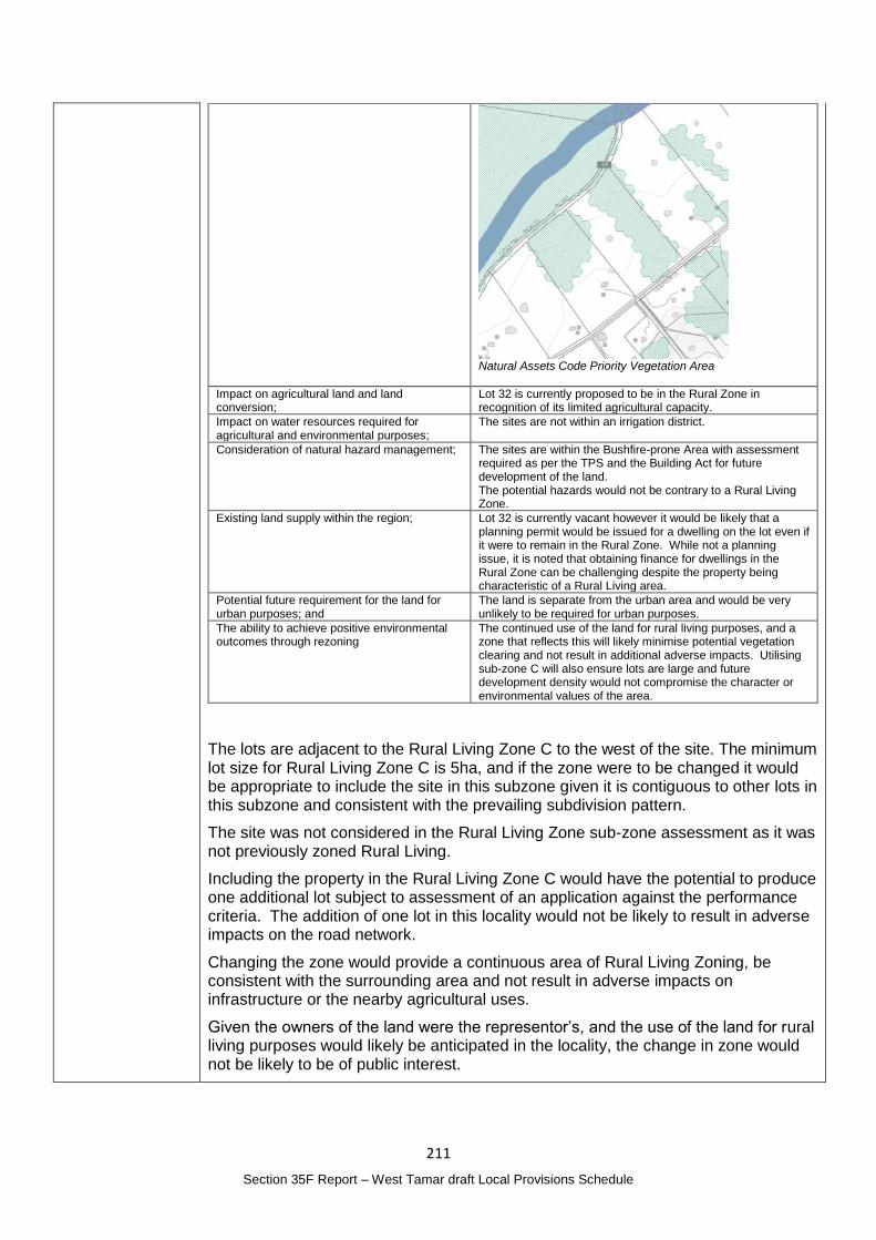
211
Section 35F Report – West Tamar draft Local Provisions Schedule
Natural Assets Code Priority Vegetation Area
Impact on agricultural land and land conversion;
Lot 32 is currently proposed to be in the Rural Zone in recognition of its limited agricultural capacity.
Impact on water resources required for agricultural and environmental purposes;
The sites are not within an irrigation district.
Consideration of natural hazard management; The sites are within the Bushfire-prone Area with assessment required as per the TPS and the Building Act for future development of the land. The potential hazards would not be contrary to a Rural Living Zone.
Existing land supply within the region; Lot 32 is currently vacant however it would be likely that a planning permit would be issued for a dwelling on the lot even if it were to remain in the Rural Zone. While not a planning issue, it is noted that obtaining finance for dwellings in the Rural Zone can be challenging despite the property being characteristic of a Rural Living area.
Potential future requirement for the land for urban purposes; and
The land is separate from the urban area and would be very unlikely to be required for urban purposes.
The ability to achieve positive environmental outcomes through rezoning
The continued use of the land for rural living purposes, and a zone that reflects this will likely minimise potential vegetation clearing and not result in additional adverse impacts. Utilising sub-zone C will also ensure lots are large and future development density would not compromise the character or environmental values of the area.
The lots are adjacent to the Rural Living Zone C to the west of the site. The minimum lot size for Rural Living Zone C is 5ha, and if the zone were to be changed it would be appropriate to include the site in this subzone given it is contiguous to other lots in this subzone and consistent with the prevailing subdivision pattern.
The site was not considered in the Rural Living Zone sub-zone assessment as it was not previously zoned Rural Living.
Including the property in the Rural Living Zone C would have the potential to produce one additional lot subject to assessment of an application against the performance criteria. The addition of one lot in this locality would not be likely to result in adverse impacts on the road network.
Changing the zone would provide a continuous area of Rural Living Zoning, be consistent with the surrounding area and not result in adverse impacts on infrastructure or the nearby agricultural uses.
Given the owners of the land were the representor’s, and the use of the land for rural living purposes would likely be anticipated in the locality, the change in zone would not be likely to be of public interest.

212
Section 35F Report – West Tamar draft Local Provisions Schedule
Planning Authority recommended action
Change the zone of Lot 32 Clarence Point Road, Clarence Point (CT 109831/32) from the Rural Zone to the Rural Living Zone C.
Effect of recommendation on the draft LPS
The Planning Authority recommendation has no impact on implementing the draft LPS as a whole as all landowners are supportive of the recommended change.
Meets the LPS criteria
The Planning Authority recommendation meets the LPS criteria.
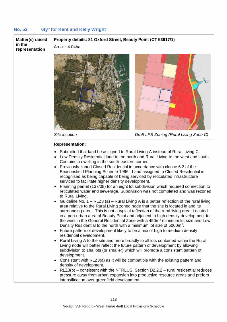
213
Section 35F Report – West Tamar draft Local Provisions Schedule
No. 53 6tyo for Kent and Kelly Wright
Matter(s) raised in the representation
Property details: 81 Oxford Street, Beauty Point (CT 53917/1)
Area: ~4.04ha
Site location
Draft LPS Zoning (Rural Living Zone C)
Representation:
Submitted that land be assigned to Rural Living A instead of Rural Living C.
Low Density Residential land to the north and Rural Living to the west and south. Contains a dwelling in the south-eastern corner.
Previously zoned Closed Residential in accordance with clause 6.2 of the Beaconsfield Planning Scheme 1996. Land assigned to Closed Residential is recognised as being capable of being serviced by reticulated infrastructure services to facilitate higher density development.
Planning permit (137/08) for an eight lot subdivision which required connection to reticulated water and sewerage. Subdivision was not completed and was rezoned to Rural Living.
Guideline No. 1 – RLZ3 (a) – Rural Living A is a better reflection of the rural living area relative to the Rural Living zoned node that the site is located in and its surrounding area. This is not a typical reflection of the rural living area. Located in a peri-urban area of Beauty Point and adjacent to high density development to the west in the General Residential Zone with a 450m2 minimum lot size and Low Density Residential to the north with a minimum lot size of 5000m2.
Future pattern of development likely to be a mix of high to medium density residential development.
Rural Living A to the site and more broadly to all lots contained within the Rural Living node will better reflect the future pattern of development by allowing subdivision to 1ha lots (or smaller) which will promote a consistent pattern of development.
Consistent with RLZ3(a) as it will be compatible with the existing pattern and density of development.
RLZ3(b) – consistent with the NTRLUS. Section D2.2.2 – rural residential reduces pressure away from urban expansion into productive resource areas and prefers intensification over greenfield development.
214
Section 35F Report – West Tamar draft Local Provisions Schedule
Representation includes an assessment against the sustainability criteria finding that the proposed change to Rural Living Zone A meets the criteria and is consistent with the strategy.
See Representation No. 35 and 60 which also relate to Beauty Point.
Planning Authority Response
Overview:
Is the representation consistent with: Does the representation:
The NTRLUS Partly Reflect a like for like conversion of the IPS?
No
State policies Yes
Section 8A Guideline No. 1 No Relate to the drafting / content of the SPP?
No
TPC Practice Notes Yes
Local strategy / policy N/A Raise natural justice concerns?
Yes
Response:
The ‘Rural Living ‘Sub-Zone’ Assessment’ completed by AK Consulting recommended the lots be included in the Rural Living Zone C as increased subdivision will further constrain agriculture.
It is noted the site is over 200m from the nearest land included in the Rural Zone and 400m from land included in the Agriculture Zone.
RLZ 3 of Guideline No. 1 provides guidance on the selection of a sub-zone which should be based on:
(a) a reflection of the existing pattern and density of development within the rural living area; or
(b) further strategic justification to support the chosen minimum lot sizes consistent with the relevant regional land use strategy, or supported by more detailed local strategic analysis consistent with the relevant regional land use strategy and endorsed by the relevant council.
Of the five lots included in the Rural Living Zone cluster, the average lot size is 3.9ha with the lots ranging in size from 1.15ha to 6.08ha. It would be difficult to draw the conclusion that adopting the Rural Living Zone A sub-zone was a reflection of the existing pattern and density of development.
Any change in sub-zone would therefore rely on meeting criteria (b).
D.2.2.2 of the NTRLUS describes established Rural Residential Areas as:
Predominantly residential land use, including lifestyle blocks, hobby farms and/or low density residential subdivision; and
Fragmentation of the cadastral base and property ownership; and
May include topographical constraints resulting in physical impediments to rural resource use or connectivity, including biodiversity protection and/or conservation.
The site is an established rural residential area under the NTRLUS, with a change in sub-zone considered intensification of an established Rural Residential Area, rather than the establishment of a new area.
D.2.2.2 goes onto state that intensification must balance a range of matters which are addressed below, noting that these considerations are also included in Regional Settlement Network Policy RSN-A26.
215
Section 35F Report – West Tamar draft Local Provisions Schedule
D.2.2.2 considerations for intensification Response
Impact on the agricultural and environmental values of the land and surrounding areas;
The site is over 200m from the nearest land included in the Rural Zone and 400m from land included in the Agriculture Zone. While the site contains vegetation on around half the site, the vegetation is not included in the Priority Vegetation Area map or as having threatened species.
In addition, the sand mine to the south of the site is afforded an attenuation distance of 300m. Council is of the understanding that vibratory screening does not occur on site, otherwise the attenuation distance would be 500m. Measured from the property boundary the site is partly affected by the attenuation distance. In the absence of a report by a suitably qualified person, the impact on the site and future residences is unknown, however it is noted that the attenuation would mostly affect the existing house on the southern part of the property.
Proximity to existing settlements containing social services;
The site is on the outskirts of the Beauty Point urban area and approximately 6km and 8 minutes-drive to Beaconsfield. The site is appropriately located and has good access to social services.
Land use efficiency, consolidating gaps in established rural residential land use patterns;
The site forms part of an existing rural residential area. While the rural living zoned land is more representative of larger lots, it is in a transition zone between the urban area of Beauty Point and the surrounding rural area. As pointed out in the representation the lower lot size would result in more efficient use of land by accommodating demand in already zoned locations.
Access to road infrastructure with capacity to support an intensified land use;
Oxford Street and the local road network would likely have capacity to accommodate the development. Any upgrades would be considered as part of the planning application process.
On-site waste water system suitability; Lots of 1 ha, if subdivision were approved in the future, will have capacity to accommodate onsite wastewater treatment and disposal.
Impact on natural values or the potential land use limitations as a result of natural values;
As above, there are no identified natural values on the property, however subdivision into 1ha lots would not require the clearing of the entire site.
Impact on agricultural land and land conversion;
As above, the site is over 200m from the nearest land included in the Rural Zone and 400m from land included in the Agriculture Zone
Impact on water resources required for agricultural and environmental purposes;
The site is not within an irrigation district.
Consideration of natural hazard management;
The site is within the Bushfire-prone Area with assessment required as per the TPS and the Building Act for future development of the land. A small part of the site is also identified in the Landslip Hazard area. The potential hazards would not be contrary or prevent development for Rural Living purposes.
Existing land supply within the region; Including the site in the Rural Living Zone A category would at most result in three additional lots. As the Rural Living Zone was categorised to minimise potential for lots to be created, the subzone assessment identified a potential 220 lots could be created noting that 72 of these lots are located in Legana within the Urban Growth Area. The change to Rural Living A would not provide an excessive amount of additional supply.
Potential future requirement for the land for urban purposes; and
There is some potential that the land could be required for urban purposes in the future. This representation, and representation No. 35 and 60 are seeking an increase in urban development / density on the edge of the Beauty Point urban area. There would be merit in undertaking a local planning exercise to strategically consider land requirements for urban purposes.
The ability to achieve positive environmental outcomes through rezoning
The consolidation / intensification of Rural Living lots in an area without identified environmental values will ease pressure on development of land with environmental values.
While the assessment against the NTRLUS polices identify there may be planning merit to intensifying the rural living area in this location, two matters require further consideration:
The potential impacts on / from the nearby sand mine; and
Whether the land may be required for urban purposes in the future.
The planning application process could be the mechanism to address and resolve the impacts from the sand mine, noting that the existing house is likely to be within
216
Section 35F Report – West Tamar draft Local Provisions Schedule
the attenuation distances with the additional lots / development sites potentially located outside the attenuation area.
Given the interest in development at Beauty Point, there is a potential need for local planning to be completed to determine future growth requirements. As this site has rural living zoned lots on the three sides providing a buffer to rural activities, it may be that local planning may identify higher intensity uses as more appropriate, however, infrastructure capacity and impacts on natural hazards, such as the potential influence on landslip areas to the west need further consideration through a local planning exercise. This local planning would also ensure the public have input into any changes made.
Planning Authority recommended action
No changes to the draft LPS are recommended at this time.
Effect of recommendation on the draft LPS
The Planning Authority recommendation has no impact on implementing the draft LPS as a whole.
Meets the LPS criteria
The Planning Authority recommendation meets the LPS criteria.
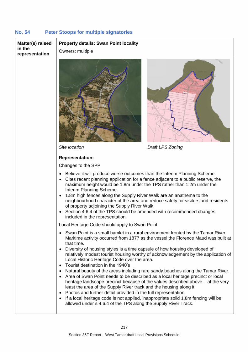
217
Section 35F Report – West Tamar draft Local Provisions Schedule
No. 54 Peter Stoops for multiple signatories
Matter(s) raised in the representation
Property details: Swan Point locality
Owners: multiple
Site location
Draft LPS Zoning
Representation:
Changes to the SPP
Believe it will produce worse outcomes than the Interim Planning Scheme.
Cites recent planning application for a fence adjacent to a public reserve, the maximum height would be 1.8m under the TPS rather than 1.2m under the Interim Planning Scheme.
1.8m high fences along the Supply River Walk are an anathema to the neighbourhood character of the area and reduce safety for visitors and residents of property adjoining the Supply River Walk.
Section 4.6.4 of the TPS should be amended with recommended changes included in the representation.
Local Heritage Code should apply to Swan Point
Swan Point is a small hamlet in a rural environment fronted by the Tamar River. Maritime activity occurred from 1877 as the vessel the Florence Maud was built at that time.
Diversity of housing styles is a time capsule of how housing developed of relatively modest tourist housing worthy of acknowledgement by the application of Local Historic Heritage Code over the area.
Tourist destination in the 1940’s
Natural beauty of the areas including rare sandy beaches along the Tamar River.
Area of Swan Point needs to be described as a local heritage precinct or local heritage landscape precinct because of the values described above – at the very least the area of the Supply River track and the housing along it.
Photos and further detail provided in the full representation.
If a local heritage code is not applied, inappropriate solid 1.8m fencing will be allowed under s 4.6.4 of the TPS along the Supply River Track.
218
Section 35F Report – West Tamar draft Local Provisions Schedule
Planning Authority Response
Overview:
Is the representation consistent with: Does the representation:
The NTRLUS N/A Reflect a like for like conversion of the IPS?
No
State policies N/A
Section 8A Guideline No. 1 No Relate to the drafting / content of the SPP?
Yes
TPC Practice Notes Yes
Local strategy / policy N/A Raise natural justice concerns?
Yes
Response:
Changes to the SPP
Under section 35E(3) of the Act, a representation about a draft LPS must not be a representation to the effect that the content of a provision of the SPPs should be altered.
The matters raised in this regard have not been considered.
Local Historic Heritage Code
The identification of a place or precinct for application of the Local Historic Heritage Code should only be undertaken where there is supporting evidence provided by a suitably qualified person detailing the significance of the place and its historic heritage values. There is insufficient information available at this time to determine the merits of the proposal put forward by the representation.
Such a change to the draft LPS would also be of public interest, particularly to those affected residents where additional regulatory requirements would apply to future development.
Planning Authority recommended action
No changes to the draft LPS are recommended.
Effect of recommendation on the draft LPS
The Planning Authority recommendation has no impact on implementing the draft LPS as a whole.
Meets the LPS criteria
The Planning Authority recommendation meets the LPS criteria.
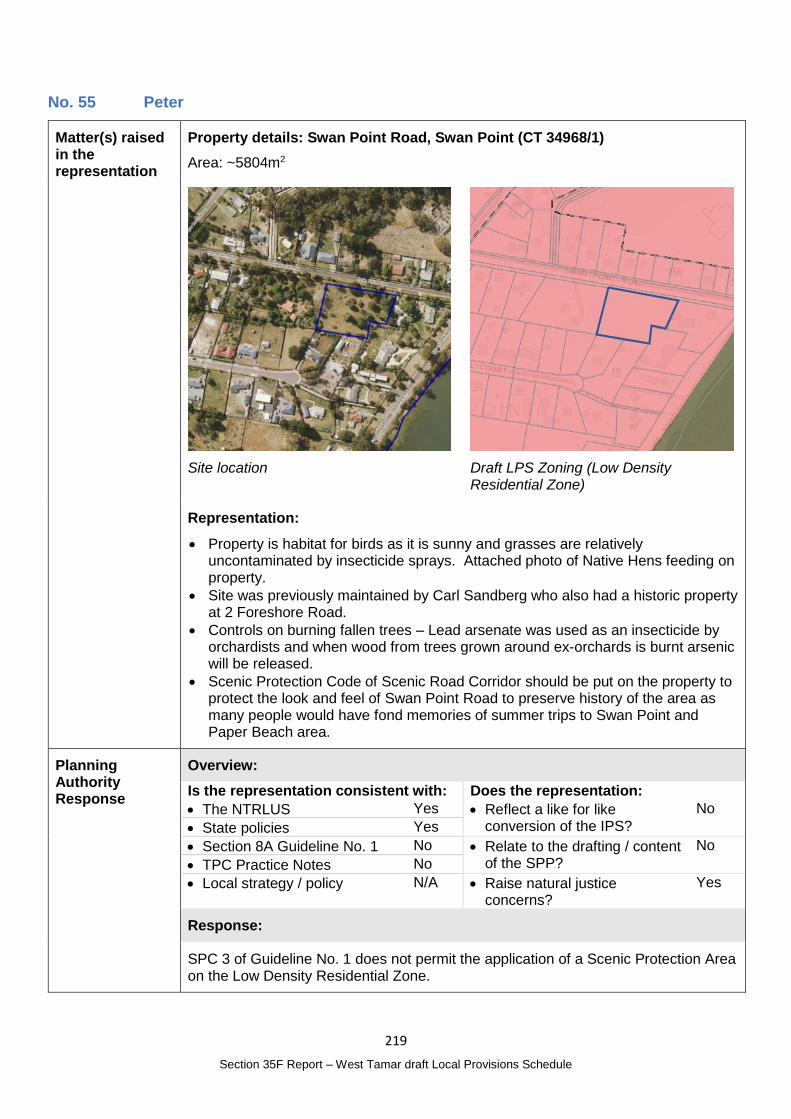
219
Section 35F Report – West Tamar draft Local Provisions Schedule
No. 55 Peter
Matter(s) raised in the representation
Property details: Swan Point Road, Swan Point (CT 34968/1)
Area: ~5804m2
Site location
Draft LPS Zoning (Low Density Residential Zone)
Representation:
Property is habitat for birds as it is sunny and grasses are relatively uncontaminated by insecticide sprays. Attached photo of Native Hens feeding on property.
Site was previously maintained by Carl Sandberg who also had a historic property at 2 Foreshore Road.
Controls on burning fallen trees – Lead arsenate was used as an insecticide by orchardists and when wood from trees grown around ex-orchards is burnt arsenic will be released.
Scenic Protection Code of Scenic Road Corridor should be put on the property to protect the look and feel of Swan Point Road to preserve history of the area as many people would have fond memories of summer trips to Swan Point and Paper Beach area.
Planning Authority Response
Overview:
Is the representation consistent with: Does the representation:
The NTRLUS Yes Reflect a like for like conversion of the IPS?
No
State policies Yes
Section 8A Guideline No. 1 No Relate to the drafting / content of the SPP?
No
TPC Practice Notes No
Local strategy / policy N/A Raise natural justice concerns?
Yes
Response:
SPC 3 of Guideline No. 1 does not permit the application of a Scenic Protection Area on the Low Density Residential Zone.
220
Section 35F Report – West Tamar draft Local Provisions Schedule
The representor does not appear to be the owner of the site in question and it is likely that natural justice issues would arise if a change were made.
Planning Authority recommended action
No changes to the draft LPS are recommended.
Effect of recommendation on the draft LPS
The Planning Authority recommendation has no impact on implementing the draft LPS as a whole.
Meets the LPS criteria
The Planning Authority recommendation meets the LPS criteria.
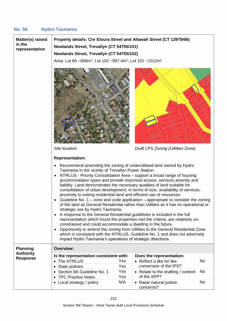
221
Section 35F Report – West Tamar draft Local Provisions Schedule
No. 56 Hydro Tasmania
Matter(s) raised in the representation
Property details: Cnr Eloura Street and Allawah Street (CT 13979/66)
Newlands Street, Trevallyn (CT 54755/101)
Newlands Street, Trevallyn (CT 54755/102)
Area: Lot 66 ~668m2; Lot 102 ~997.4m2; Lot 101 ~1012m2
Site location
Draft LPS Zoning (Utilities Zone)
Representation:
Recommend amending the zoning of underutilised land owned by Hydro Tasmania in the vicinity of Trevallyn Power Station.
NTRLUS - Priority Consolidation Area – support a broad range of housing accommodation types and provide improved access, services amenity and liability. Land demonstrates the necessary qualities of land suitable for consolidation of urban development, in terms of size, availability of services, proximity to exiting residential land and efficient use of resources.
Guideline No. 1 – zone and code application – appropriate to consider the zoning of the land as General Residential rather than Utilities as it has no operational or strategic use by Hydro Tasmania.
A response to the General Residential guidelines is included in the full representation which found the properties met the criteria, are relatively un-constrained and could accommodate a dwelling in the future.
Opportunity to amend the zoning from Utilities to the General Residential Zone which is consistent with the NTRLUS, Guideline No. 1 and does not adversely impact Hydro Tasmania’s operations of strategic directions.
Planning Authority Response
Overview:
Is the representation consistent with: Does the representation:
The NTRLUS Yes Reflect a like for like conversion of the IPS?
No
State policies Yes
Section 8A Guideline No. 1 Yes Relate to the drafting / content of the SPP?
No
TPC Practice Notes Yes
Local strategy / policy N/A Raise natural justice concerns?
No
222
Section 35F Report – West Tamar draft Local Provisions Schedule
Response:
The properties are included in the Utilities Zone under the IPS due to their ownership rather than their use for utilities.
The three lots are currently vacant and are subdivided consistent with the adjacent General Residential Zone.
Lot 66 is subject to the:
Electricity Transmission Infrastructure Protection Code (Substation Facility Buffer) – a proposal for a sensitive use on the site, including a dwelling, would be subject to the Electricity Transmission Infrastructure Protection Code and would need to demonstrate compliance with P1 of C4.5.1 to ensure the noise emissions from the substation will not cause an unreasonable loss of amenity; and
Landslip Hazard Code (Low Landslip Hazard band) – provided the future development does not involve significant works, a dwelling may not be subject to the requirements of the Landslip Hazard Code in the SPPs however requirements under the Building Act 2016 may apply.
Lots 101 and 102 is subject to the:
Electricity Transmission Infrastructure Protection Code (Electricity Transmission corridor) – Uses with potential to create dust or airborne particulates would be subject to the Code and any buildings or works would need to be outside the corridor. There is sufficient land area outside the corridor for a dwelling to be established outside of the corridor.
Natural Assets Code (Priority Vegetation Area) – the Natural Assets Code does not apply to use or development in the General Residential Zone other than subdivision. Aerial photographs indicate that the sites are not heavily vegetated.
The sites meet the requirements of Guideline No. 1 for the General Residential Zone:
Within the main urban area and are effectively infill lots not targeted for higher densities;
Within the reticulated water supply service and reticulated sewerage system;
Consistent with the NTRLUS - included in the Priority Consolidation Area; and
Are not highly constrained by hazards or natural values.
It is unlikely that changing the zone would instigate public interest given the lots are existing and are part of the existing residential area.
Planning Authority recommended action
Change the zone of the following properties to the General Residential Zone:
Cnr Eloura Street and Allawah Street (CT 13979/66);
Newlands Street, Trevallyn (CT 54755/101); and
Newlands Street, Trevallyn (CT 54755/102).
Effect of recommendation on the draft LPS
The Planning Authority recommendation has only minor impact on implementing the draft LPS as a whole and the landowner is supportive of the recommended change.
Meets the LPS criteria
The Planning Authority recommendation meets the LPS criteria.
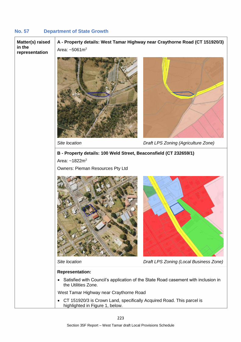
223
Section 35F Report – West Tamar draft Local Provisions Schedule
No. 57 Department of State Growth
Matter(s) raised in the representation
A - Property details: West Tamar Highway near Craythorne Road (CT 151920/3)
Area: ~5061m2
Site location
Draft LPS Zoning (Agriculture Zone)
B - Property details: 100 Weld Street, Beaconsfield (CT 232659/1)
Area: ~1822m2
Owners: Pieman Resources Pty Ltd
Site location
Draft LPS Zoning (Local Business Zone)
Representation:
Satisfied with Council’s application of the State Road casement with inclusion in the Utilities Zone.
West Tamar Highway near Craythorne Road
CT 151920/3 is Crown Land, specifically Acquired Road. This parcel is highlighted in Figure 1, below.
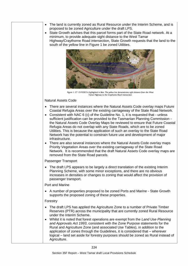
224
Section 35F Report – West Tamar draft Local Provisions Schedule
The land is currently zoned as Rural Resource under the Interim Scheme, and is proposed to be zoned Agriculture under the draft LPS.
State Growth advises that this parcel forms part of the State Road network. At a minimum, to provide adequate sight distance to the West Tamar Highway/Craythorne Road intersection, State Growth requests that the land to the south of the yellow line in Figure 1 be zoned Utilities.
Natural Assets Code
There are several instances where the Natural Assets Code overlay maps Future Coastal Refugia Areas over the existing carriageway of the State Road Network.
Consistent with NAC 6 (c) of the Guideline No. 1, it is requested that - unless sufficient justification can be provided to the Tasmanian Planning Commission - the Natural Assets Code Overlay Maps be reviewed to ensure that Future Coastal Refugia Areas do not overlap with any State Roads, which are to be zoned Utilities. This is because the application of such an overlay to the State Road Network has the potential to constrain future use and development of major infrastructure.
There are also several instances where the Natural Assets Code overlay maps Priority Vegetation Areas over the existing carriageway of the State Road Network. It is recommended that the draft Natural Assets Code overlay maps are removed from the State Road parcels.
Passenger Transport
The draft LPS appears to be largely a direct translation of the existing Interim Planning Scheme, with some minor exceptions, and there are no obvious increases in densities or changes to zoning that would affect the provision of passenger transport.
Port and Marine
A number of properties proposed to be zoned Ports and Marine - State Growth supports the proposed zoning of these properties.
Forestry
The draft LPS has applied the Agriculture Zone to a number of Private Timber Reserves (PTR) across the municipality that are currently zoned Rural Resource under the Interim Scheme.
Whilst it is noted that forest operations are exempt from the Land Use Planning and Approvals Act 1993, consistent with the Zone Purpose statements for the Rural and Agriculture Zone (and associated Use Tables), in addition to the application of zones through the Guidelines, it is considered that – wherever logical – land set aside for forestry purposes should be zoned as Rural instead of Agriculture.
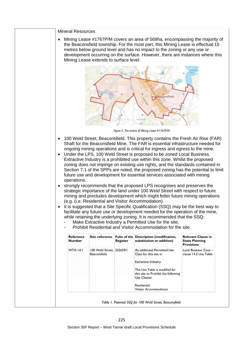
225
Section 35F Report – West Tamar draft Local Provisions Schedule
Mineral Resources
Mining Lease #1767P/M covers an area of 569ha, encompassing the majority of the Beaconsfield township. For the most part, this Mining Lease is effectual 15 metres below ground level and has no impact to the zoning or any use or development occurring on the surface. However, there are instances where this Mining Lease extends to surface level.
100 Weld Street, Beaconsfield. This property contains the Fresh Air Rise (FAR) Shaft for the Beaconsfield Mine. The FAR is essential infrastructure needed for ongoing mining operations and is critical for ingress and egress to the mine.
Under the LPS, 100 Weld Street is proposed to be zoned Local Business. Extractive Industry is a prohibited use within this zone. Whilst the proposed zoning does not impinge on existing use rights, and the standards contained in Section 7.1 of the SPPs are noted, the proposed zoning has the potential to limit future use and development for essential services associated with mining operations.
strongly recommends that the proposed LPS recognises and preserves the strategic importance of the land under 100 Weld Street with respect to future mining and precludes development which might fetter future mining operations (e.g. (i.e. Residential and Visitor Accommodation).
It is suggested that a Site Specific Qualification (SSQ) may be the best way to facilitate any future use or development needed for the operation of the mine, while retaining the underlying zoning. It is recommended that the SSQ: - Make Extractive Industry a Permitted Use for the site; - Prohibit Residential and Visitor Accommodation for the site.
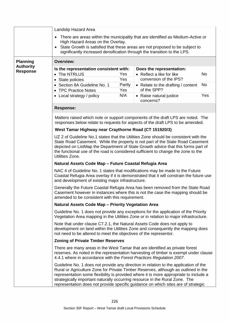
226
Section 35F Report – West Tamar draft Local Provisions Schedule
Landslip Hazard Area
There are areas within the municipality that are identified as Medium-Active or High Hazard Areas on the Overlay.
State Growth is satisfied that these areas are not proposed to be subject to significantly increased densification through the transition to the LPS.
Planning Authority Response
Overview:
Is the representation consistent with: Does the representation:
The NTRLUS Yes Reflect a like for like conversion of the IPS?
No
State policies Yes
Section 8A Guideline No. 1 Partly Relate to the drafting / content of the SPP?
No
TPC Practice Notes Yes
Local strategy / policy N/A Raise natural justice concerns?
Yes
Response:
Matters raised which note or support components of the draft LPS are noted. The responses below relate to requests for aspects of the draft LPS to be amended.
West Tamar Highway near Craythorne Road (CT 151920/3)
UZ 2 of Guideline No.1 states that the Utilities Zone should be consistent with the State Road Casement. While the property is not part of the State Road Casement depicted on ListMap the Department of State Growth advice that this forms part of the functional use of the road is considered sufficient to change the zone to the Utilities Zone.
Natural Assets Code Map – Future Coastal Refugia Area
NAC 4 of Guideline No. 1 states that modifications may be made to the Future Coastal Refugia Area overlay if it is demonstrated that it will constrain the future use and development of existing major infrastructure.
Generally the Future Coastal Refugia Area has been removed from the State Road Casement however in instances where this is not the case the mapping should be amended to be consistent with this requirement.
Natural Assets Code Map – Priority Vegetation Area
Guideline No. 1 does not provide any exceptions for the application of the Priority Vegetation Area mapping in the Utilities Zone or in relation to major infrastructure.
Note that under clause C7.2.1, the Natural Assets Code does not apply to development on land within the Utilities Zone and consequently the mapping does not need to be altered to meet the objectives of the representor.
Zoning of Private Timber Reserves
There are many areas in the West Tamar that are identified as private forest reserves. As noted in the representation harvesting of timber is exempt under clause 4.4.1 where in accordance with the Forest Practices Regulation 2007.
Guideline No. 1 does not provide any direction in relation to the application of the Rural or Agriculture Zone for Private Timber Reserves, although as outlined in the representation some flexibility is provided where it is more appropriate to include a strategically important naturally occurring resource in the Rural Zone. The representation does not provide specific guidance on which sites are of strategic
227
Section 35F Report – West Tamar draft Local Provisions Schedule
importance or provide a strategic analysis to support a change in zone from the Agriculture Zone to the Rural Zone.
While the Planning Authority is open to further discussions or receiving additional information there is insufficient information to support an amendment to the draft LPS at this time.
Mineral Resources – Request for Site Specific Qualification at 100 Weld Street Beaconsfield (CT 232659/1)
The representation seeks a site specific qualification (SSQ) over the site to both protect the opportunities for changes to the use of the site for extractive industry purposes in the future and to limit potentially incompatible uses. The request is seeking:
To make Extractive Industry a Permitted Use; and
Prohibit residential and visitor accommodation.
Extractive Industry is defined in the SPPs as:
‘use of land for extracting or removing material from the ground, other than Resource Development, and includes the treatment or processing of those materials by crushing, grinding, milling or screening on, or adjoining the land from which it is extracted. Examples include mining, quarrying, and sand mining.’
This is a broad definition and covers all aspects of extractive industry from the removal of material from the ground to its processing. As a permitted use in the Local Business Zone the provisions relating to the zone would not adequately address the range of impacts and a permitted application cannot be refused, only assessed against the Acceptable solutions, most of which are irrelevant to extractive industries or would able to be complied with. At minimum such a use should be discretionary in this location.
Section 7.1 of the TPS addresses Changes to an Existing Non-conforming Use and allows the Planning Authority, at its discretion, to approve a minor development to an existing non-conforming use. This requires consideration of impact on adjoining uses and the amenity of the surrounding area and that there be no substantial intensification of the use. Regard must also be had to the purpose and provision of the zone. This is considered sufficient to allow for future minor development to occur but also protect nearby land uses from unreasonable impacts as a result of any proposed expansion.
The representation is also seeking a SSQ that prohibits residential and visitor accommodation on the site.
100 Weld Street is owned by Pieman Resources Pty Ltd which is also the entity that owns the Beaconsfield Mine. Given the importance of the shaft for the ongoing operation of the mine it would seem unlikely that the ownership of the land would not be consistent with the ownership of the overall mine. The use of the site would therefore be managed by the owner not giving consent to incompatible uses.
Based on the information provided, a new SSQ is not considered necessary.
228
Section 35F Report – West Tamar draft Local Provisions Schedule
Planning Authority recommended action
Change the zone of the State Road property at West Tamar Highway near Craythorne Road (CT 151920/3) to the Utilities Zone.
Amend the Natural Assets Code Future Coastal Refugia Overlay map to exclude all areas that are within the State Road Casement.
Effect of recommendation on the draft LPS
The Planning Authority recommendation has no impact on implementing the draft LPS as a whole as all landowners are supportive of the recommended change.
Meets the LPS criteria
The Planning Authority recommendation meets the LPS criteria.
229
Section 35F Report – West Tamar draft Local Provisions Schedule
No. 58 Terry Eaton
Matter(s) raised in the representation
Property details: Not applicable
Representation:
C3.0 Road and Railway Assets Code – provides for a major roads definition to include ‘any other road described in another major road list in the relevant Local Provisions Schedule’. Specific reference to major roads is made in clauses C3.5 A1.5 and Table C3.1.
The major road classification is an important consideration in developing an efficient road transport network as important elements in a regional road hierarchy to serve local land uses and should be part of the State Planning Scheme.
Work may be necessary to develop guidelines for a road hierarchy. Some roads considered candidates as major roads include: - Pitt Ave – Pomona Road, Riverside; - Ecclestone Road, Riverside; - Freshwater Point Road, Legana; and - West Tamar Highway through to Beaconsfield Shopping Centre.
Planning Authority Response
Overview:
Is the representation consistent with: Does the representation:
The NTRLUS Yes Reflect a like for like conversion of the IPS?
No
State policies N/A
Section 8A Guideline No. 1 Yes Relate to the drafting / content of the SPP?
No
TPC Practice Notes Yes
Local strategy / policy Yes Raise natural justice concerns?
Likely
Response:
The TPS defines a major road as ‘a category 1, 2 or 3 road as defined in the State Road Hierarchy, and any other road described in another major roads list in the relevant Local Provisions Schedule.’
Additional provisions in the Road and Railway Code apply to land in the attenuation area in relation to setbacks to habitable buildings and consideration of noise impacts and design responses to address noise impacts.
At this time a road hierarchy has not been developed to define major roads in the municipality as requested by the representor. Consideration will be given to undertaking this work in the future.
Identifying major roads may be of interest to the public particularly given the additional regulatory requirements that would be imposed.

230
Section 35F Report – West Tamar draft Local Provisions Schedule
Planning Authority recommended action
No changes to the draft LPS are recommended at this time.
Effect of recommendation on the draft LPS
The Planning Authority recommendation has no impact on implementing the draft LPS as a whole.
Meets the LPS criteria
The Planning Authority recommendation meets the LPS criteria.
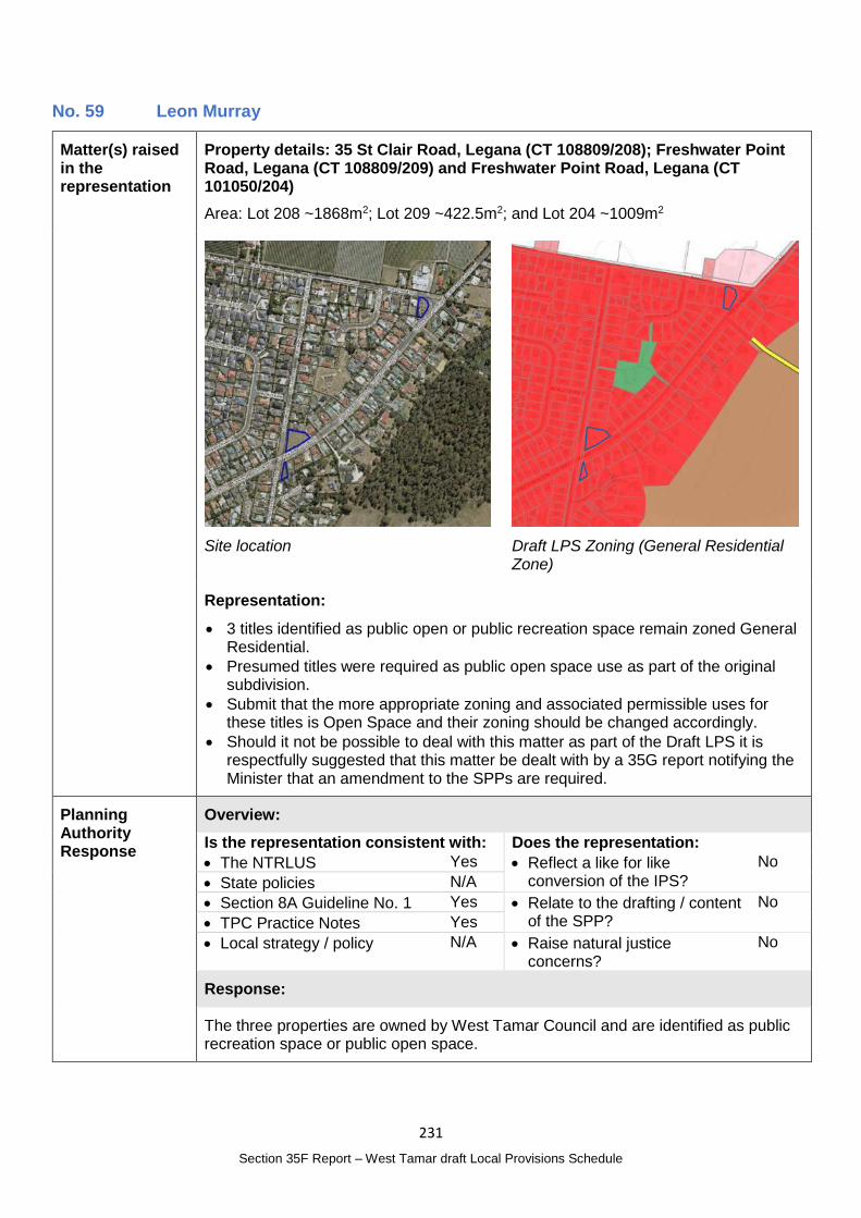
231
Section 35F Report – West Tamar draft Local Provisions Schedule
No. 59 Leon Murray
Matter(s) raised in the representation
Property details: 35 St Clair Road, Legana (CT 108809/208); Freshwater Point Road, Legana (CT 108809/209) and Freshwater Point Road, Legana (CT 101050/204)
Area: Lot 208 ~1868m2; Lot 209 ~422.5m2; and Lot 204 ~1009m2
Site location
Draft LPS Zoning (General Residential Zone)
Representation:
3 titles identified as public open or public recreation space remain zoned General Residential.
Presumed titles were required as public open space use as part of the original subdivision.
Submit that the more appropriate zoning and associated permissible uses for these titles is Open Space and their zoning should be changed accordingly.
Should it not be possible to deal with this matter as part of the Draft LPS it is respectfully suggested that this matter be dealt with by a 35G report notifying the Minister that an amendment to the SPPs are required.
Planning Authority Response
Overview:
Is the representation consistent with: Does the representation:
The NTRLUS Yes Reflect a like for like conversion of the IPS?
No
State policies N/A
Section 8A Guideline No. 1 Yes Relate to the drafting / content of the SPP?
No
TPC Practice Notes Yes
Local strategy / policy N/A Raise natural justice concerns?
No
Response:
The three properties are owned by West Tamar Council and are identified as public recreation space or public open space.
232
Section 35F Report – West Tamar draft Local Provisions Schedule
OSZ 1 of Guideline No. 1 states:
The Open Space Zone should be applied to land that provides, or is intended to provide, for the open space needs of the community, including land identified for:
(a) passive recreational opportunities; or
(b) natural or landscape amenity within an urban setting.
The three properties meet this criteria and it would be appropriate for the zoning to reflect their intended purpose. As a result there is unlikely to be public interest in the change of zone.
Planning Authority recommended action
Change the zoning of the following properties to the Open Space Zone:
35 St Clair Road, Legana (CT 108809/208);
Freshwater Point Road, Legana (CT 108809/209); and
Freshwater Point Road, Legana (CT 101050/204).
Effect of recommendation on the draft LPS
The Planning Authority recommendation has no impact on implementing the draft LPS as a whole as the landowner is supportive of the recommended change.
Meets the LPS criteria
The Planning Authority recommendation meets the LPS criteria.
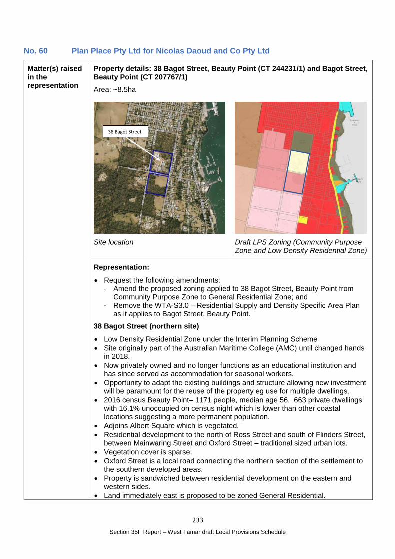
233
Section 35F Report – West Tamar draft Local Provisions Schedule
No. 60 Plan Place Pty Ltd for Nicolas Daoud and Co Pty Ltd
Matter(s) raised in the representation
Property details: 38 Bagot Street, Beauty Point (CT 244231/1) and Bagot Street, Beauty Point (CT 207767/1)
Area: ~8.5ha
Site location
Draft LPS Zoning (Community Purpose Zone and Low Density Residential Zone)
Representation:
Request the following amendments: - Amend the proposed zoning applied to 38 Bagot Street, Beauty Point from
Community Purpose Zone to General Residential Zone; and - Remove the WTA-S3.0 – Residential Supply and Density Specific Area Plan
as it applies to Bagot Street, Beauty Point.
38 Bagot Street (northern site)
Low Density Residential Zone under the Interim Planning Scheme
Site originally part of the Australian Maritime College (AMC) until changed hands in 2018.
Now privately owned and no longer functions as an educational institution and has since served as accommodation for seasonal workers.
Opportunity to adapt the existing buildings and structure allowing new investment will be paramount for the reuse of the property eg use for multiple dwellings.
2016 census Beauty Point– 1171 people, median age 56. 663 private dwellings with 16.1% unoccupied on census night which is lower than other coastal locations suggesting a more permanent population.
Adjoins Albert Square which is vegetated.
Residential development to the north of Ross Street and south of Flinders Street, between Mainwaring Street and Oxford Street – traditional sized urban lots.
Vegetation cover is sparse.
Oxford Street is a local road connecting the northern section of the settlement to the southern developed areas.
Property is sandwiched between residential development on the eastern and western sides.
Land immediately east is proposed to be zoned General Residential.
38 Bagot Street
234
Section 35F Report – West Tamar draft Local Provisions Schedule
Land immediately to the west is over 5ha and contains Eucalyptus amygdalina coastal forest and woodland. The land has development potential, and large lots in this location will provide separation to the Agriculture Zone and the Mining Lease 1904P/M to the southwest.
There are a limited number of vacant properties within the General Residential Zone at Beauty Point. There are some vacant lots with development potential along the eastern band of the settlement. Further subdivision, however, is constrained due to the Proclaimed Landslip Area A.
2006 Planning Scheme – included in the Utility Services Zone, adjoin properties were zoned Urban Residential and Rural and the adjoining sites to the west and east were in the Closed Residential Zone. (note the figure referred to shows the 1986 Beaconsfield Planning Scheme).
Guideline No. 1 - The 27.0 Community Purpose Zone application to Property 1 must achieve the zone purpose to the greatest extent possible as articulated by Clause 5.3.1 in Guideline No. 1. In this instance, the purpose of the zone is lost in that Property 1 does not serve an educational use or provide any other social infrastructure to the Beauty Point community. The 27.0 Community Purpose Zone application does not comply with CPZ 1 (a) or (d) and cannot be applied to Property 1.
The reinstatement of the Low Density Residential Zone in the draft LPS cannot achieve the desired land use outcomes. The Low Density Residential Zone does not provide a permit pathway to reuse or adapt buildings for multiple dwelling development, although a permitted pathway is provided for visitor accommodation. The application of the zone would fail to acknowledge that the Property is connected to a full range of infrastructure services.
The spatial application of the zone cannot comply with LDRZ 1 (a) (i) in Guideline No. 1.
Application of the General Residential Zone is in accordance with the instructions contained within Guideline No. 1 - mostly likely to be developed for residential use through the adaptation of existing buildings, or visitor accommodation; connected to a full range of infrastructure services.
Achieves the purpose of Clauses 8.1.1 to 8.1.4 of the General Residential Zone in the SPPs and complies with clause 3.4 of Guideline No. 1.
The application of the General Residential Zone is in accordance with GRZ 1 (a) and (b) in Guideline No. 1 as it is not targeted for higher densities; and is connected to reticulated water supply service and a reticulated sewerage system.
Consistent with the NTRLUS as it is contained within an existing settlement with access to a reticulated water supply and mains reticulated sewerage system.
Bagot Street (southern site)
Draft LPS includes site in the Low Density Residential Zone and within the WTA-S3.0 Residential Supply and Density Specific Area Plan which restricts subdivision to a minimum of 5000m2.
Seeks to remove WTA.S3.0 from the property and default provisions of the Low Density Residential Zone of the SPPs apply.
Previously part of the AMC, now privately owned.
3 frontages to Charles Street, Bagot Street and Oxford Street.
Oval and a 55m2 building on site. Standing vegetation remains on the southern and western sides of the oval. Priority vegetation on site would require on-ground field verification prior to development – once completed this will be shared with Council and the TPC.
Bushfire Hazard Management Plan will be required for future use and development proposals.
235
Section 35F Report – West Tamar draft Local Provisions Schedule
TasWater confirmed infrastructure services are available but further investigations required to substantiate any upgrades. Further information to be provided when available.
Bounded on 3 sides by residential development.
23 lots in the locality with median lot size of the nine properties fronting Oxford Street being 1970m2 and south of 5 Adley Court within frontage to Oxford Street being a median area of 792m2. Further south at 70 Oxford Street and 8 Augustus Street – large lots with development potential which are included in the General Residential Zone.
The development pattern in Beauty Point is not as described in the Supporting Report in relation to the need to larger lot sizes.
Property is ideal for intensification.
Removal of WTA-S3.0 will continue a land use pattern consistent with the established development area of the Low Density Residential Zone at Beauty Point.
Application of WTA-S3.0 across broad areas of the municipality is not consistent with the NTRLUS and has not considered specific localities.
Capacity to connect infrastructure or specific onsite wastewater management must be considered before use and development controls are enforced that inhibit the efficient use of land. Blanket approach does not achieve fair, orderly and sustainable use and development of land as desired by the Objectives of the Resource and Planning System as set out in Schedule 1 of LUPAA.
The LPS criteria of Section 32(4) and Section 34(2) of the LUPAA is not substantiated sufficiently to demonstrate the inclusion of Property 2 within the bounds of WTA-S3.0. The deviation away from the standard SPPs is not considered in context of the locality of Beauty Point.
The application of the default provisions of the Low Density Residential Zone in the SPPs achieve land use outcomes intended for Beauty Point.
The WTA-S3.0 removal from Property 2 can be supported.
Planning Authority Response
Overview:
Is the representation consistent with: Does the representation:
The NTRLUS No Reflect a like for like conversion of the IPS?
Partly
State policies Yes
Section 8A Guideline No. 1 Yes Relate to the drafting / content of the SPP?
No
TPC Practice Notes Yes
Local strategy / policy N/A Raise natural justice concerns?
Partly
Response:
38 Bagot Street, Beauty Point (northern site)
The representation requests that the zone be changed to the General Residential Zone.
The draft LPS proposes changing the zone of the northern lot, 38 Bagot Street, Beauty Point, from the Low Density Residential Zone in the IPS to the Community Purpose Zone as the site was formerly part of the University of Tasmania’s Australian Maritime College. That use ceased some time ago. The Community Purpose Zone was applied due to its former use as an institution as supported by CPZ 1 of Guideline No. 1. However as the property has now sold to a private entity, the Institution use has been abandoned.
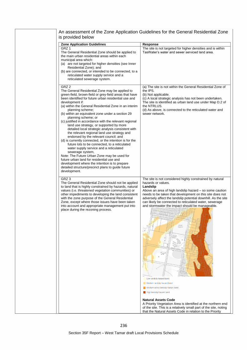
236
Section 35F Report – West Tamar draft Local Provisions Schedule
An assessment of the Zone Application Guidelines for the General Residential Zone is provided below
Zone Application Guidelines Response
GRZ 1 The General Residential Zone should be applied to the main urban residential areas within each municipal area which: (a) are not targeted for higher densities (see Inner
Residential Zone); and (b) are connected, or intended to be connected, to a
reticulated water supply service and a reticulated sewerage system.
The site is not targeted for higher densities and is within TasWater’s water and sewer serviced land area.
GRZ 2 The General Residential Zone may be applied to green-field, brown-field or grey-field areas that have been identified for future urban residential use and development if: (a) within the General Residential Zone in an interim
planning scheme; (b) within an equivalent zone under a section 29
planning scheme; or (c) justified in accordance with the relevant regional
land use strategy, or supported by more detailed local strategic analysis consistent with the relevant regional land use strategy and endorsed by the relevant council; and
(d) is currently connected, or the intention is for the future lots to be connected, to a reticulated water supply service and a reticulated sewerage system,
Note: The Future Urban Zone may be used for future urban land for residential use and development where the intention is to prepare detailed structure/precinct plans to guide future development.
(a) The site is not within the General Residential Zone of the IPS. (b) Not applicable. (c) A local strategic analysis has not been undertaken. The site is identified as urban land use under Map D.2 of the NTRLUS. (d) As above, is connected to the reticulated water and sewer network.
GRZ 3 The General Residential Zone should not be applied to land that is highly constrained by hazards, natural values (i.e. threatened vegetation communities) or other impediments to developing the land consistent with the zone purpose of the General Residential Zone, except where those issues have been taken into account and appropriate management put into place during the rezoning process.
The site is not considered highly constrained by natural hazards or values. Landslip Above an area of high landslip hazard – so some caution needs to be taken that development on this site does not adversely affect the landslip potential downhill. As the site can likely be connected to reticulated water, sewerage and stormwater the impact should be manageable.
Natural Assets Code A Priority Vegetation Area is identified at the northern end of the site. This is a relatively small part of the site, noting that the Natural Assets Code in relation to the Priority
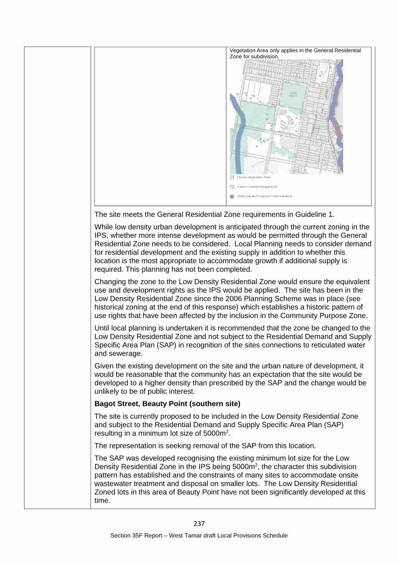
237
Section 35F Report – West Tamar draft Local Provisions Schedule
Vegetation Area only applies in the General Residential Zone for subdivision.
The site meets the General Residential Zone requirements in Guideline 1.
While low density urban development is anticipated through the current zoning in the IPS, whether more intense development as would be permitted through the General Residential Zone needs to be considered. Local Planning needs to consider demand for residential development and the existing supply in addition to whether this location is the most appropriate to accommodate growth if additional supply is required. This planning has not been completed.
Changing the zone to the Low Density Residential Zone would ensure the equivalent use and development rights as the IPS would be applied. The site has been in the Low Density Residential Zone since the 2006 Planning Scheme was in place (see historical zoning at the end of this response) which establishes a historic pattern of use rights that have been affected by the inclusion in the Community Purpose Zone.
Until local planning is undertaken it is recommended that the zone be changed to the Low Density Residential Zone and not subject to the Residential Demand and Supply Specific Area Plan (SAP) in recognition of the sites connections to reticulated water and sewerage.
Given the existing development on the site and the urban nature of development, it would be reasonable that the community has an expectation that the site would be developed to a higher density than prescribed by the SAP and the change would be unlikely to be of public interest.
Bagot Street, Beauty Point (southern site)
The site is currently proposed to be included in the Low Density Residential Zone and subject to the Residential Demand and Supply Specific Area Plan (SAP) resulting in a minimum lot size of 5000m2.
The representation is seeking removal of the SAP from this location.
The SAP was developed recognising the existing minimum lot size for the Low Density Residential Zone in the IPS being 5000m2, the character this subdivision pattern has established and the constraints of many sites to accommodate onsite wastewater treatment and disposal on smaller lots. The Low Density Residential Zoned lots in this area of Beauty Point have not been significantly developed at this time.
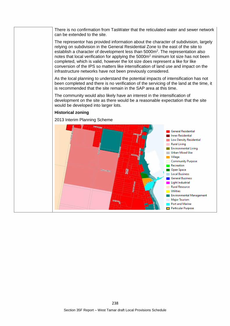
238
Section 35F Report – West Tamar draft Local Provisions Schedule
There is no confirmation from TasWater that the reticulated water and sewer network can be extended to the site.
The representor has provided information about the character of subdivision, largely relying on subdivision in the General Residential Zone to the east of the site to establish a character of development less than 5000m2. The representation also notes that local verification for applying the 5000m2 minimum lot size has not been completed, which is valid, however the lot size does represent a like for like conversion of the IPS so matters like intensification of land use and impact on the infrastructure networks have not been previously considered.
As the local planning to understand the potential impacts of intensification has not been completed and there is no verification of the servicing of the land at the time, it is recommended that the site remain in the SAP area at this time.
The community would also likely have an interest in the intensification of development on the site as there would be a reasonable expectation that the site would be developed into larger lots.
Historical zoning
2013 Interim Planning Scheme
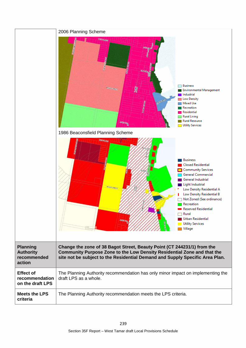
239
Section 35F Report – West Tamar draft Local Provisions Schedule
2006 Planning Scheme
1986 Beaconsfield Planning Scheme
Planning Authority recommended action
Change the zone of 38 Bagot Street, Beauty Point (CT 244231/1) from the Community Purpose Zone to the Low Density Residential Zone and that the site not be subject to the Residential Demand and Supply Specific Area Plan.
Effect of recommendation on the draft LPS
The Planning Authority recommendation has only minor impact on implementing the draft LPS as a whole.
Meets the LPS criteria
The Planning Authority recommendation meets the LPS criteria.
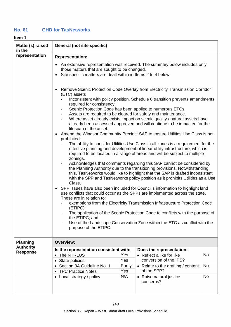
240
Section 35F Report – West Tamar draft Local Provisions Schedule
No. 61 GHD for TasNetworks
Item 1
Matter(s) raised in the representation
General (not site specific)
Representation:
An extensive representation was received. The summary below includes only those matters that are sought to be changed.
Site specific matters are dealt within in Items 2 to 4 below.
Remove Scenic Protection Code Overlay from Electricity Transmission Corridor (ETC) assets - Inconsistent with policy position. Schedule 6 transition prevents amendments
required for consistency. - Scenic Protection Code has been applied to numerous ETCs. - Assets are required to be cleared for safety and maintenance. - Where asset already exists impact on scenic quality / natural assets have
already been assessed / approved and will continue to be impacted for the lifespan of the asset.
Amend the Windsor Community Precinct SAP to ensure Utilities Use Class is not prohibited: - The ability to consider Utilities Use Class in all zones is a requirement for the
effective planning and development of linear utility infrastructure, which is required to be located in a range of areas and will be subject to multiple zonings.
- Acknowledges that comments regarding this SAP cannot be considered by the Planning Authority due to the transitioning provisions. Notwithstanding this, TasNetworks would like to highlight that the SAP is drafted inconsistent with the SPP and TasNetworks policy position as it prohibits Utilities as a Use Class.
SPP issues have also been included for Council’s information to highlight land use conflicts that could occur as the SPPs are implemented across the state. These are in relation to: - exemptions from the Electricity Transmission Infrastructure Protection Code
(ETIPC); - The application of the Scenic Protection Code to conflicts with the purpose of
the ETIPC; and - Use of the Landscape Conservation Zone within the ETC as conflict with the
purpose of the ETIPC.
Planning Authority Response
Overview:
Is the representation consistent with: Does the representation:
The NTRLUS Yes Reflect a like for like conversion of the IPS?
No
State policies Yes
Section 8A Guideline No. 1 Partly Relate to the drafting / content of the SPP?
No
TPC Practice Notes Yes
Local strategy / policy N/A Raise natural justice concerns?
No
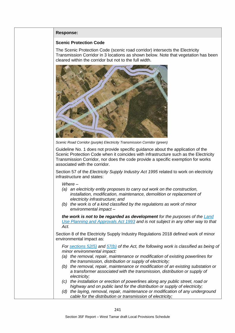
241
Section 35F Report – West Tamar draft Local Provisions Schedule
Response:
Scenic Protection Code
The Scenic Protection Code (scenic road corridor) intersects the Electricity Transmission Corridor in 3 locations as shown below. Note that vegetation has been cleared within the corridor but not to the full width.
Scenic Road Corridor (purple) Electricity Transmission Corridor (green)
Guideline No. 1 does not provide specific guidance about the application of the Scenic Protection Code when it coincides with infrastructure such as the Electricity Transmission Corridor, nor does the code provide a specific exemption for works associated with the corridor.
Section 57 of the Electricity Supply Industry Act 1995 related to work on electricity infrastructure and states:
Where – (a) an electricity entity proposes to carry out work on the construction,
installation, modification, maintenance, demolition or replacement of electricity infrastructure; and
(b) the work is of a kind classified by the regulations as work of minor environmental impact –
the work is not to be regarded as development for the purposes of the Land Use Planning and Approvals Act 1993 and is not subject in any other way to that Act.
Section 8 of the Electricity Supply Industry Regulations 2018 defined work of minor environmental impact as:
For sections 52(5) and 57(b) of the Act, the following work is classified as being of minor environmental impact: (a) the removal, repair, maintenance or modification of existing powerlines for
the transmission, distribution or supply of electricity; (b) the removal, repair, maintenance or modification of an existing substation or
a transformer associated with the transmission, distribution or supply of electricity;
(c) the installation or erection of powerlines along any public street, road or highway and on public land for the distribution or supply of electricity;
(d) the laying, removal, repair, maintenance or modification of any underground cable for the distribution or transmission of electricity;
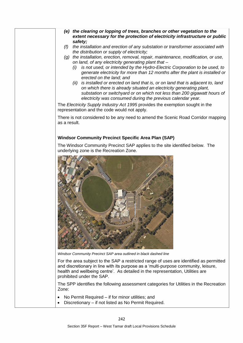
242
Section 35F Report – West Tamar draft Local Provisions Schedule
(e) the clearing or lopping of trees, branches or other vegetation to the extent necessary for the protection of electricity infrastructure or public safety;
(f) the installation and erection of any substation or transformer associated with the distribution or supply of electricity;
(g) the installation, erection, removal, repair, maintenance, modification, or use, on land, of any electricity generating plant that – (i) is not used, or intended by the Hydro-Electric Corporation to be used, to
generate electricity for more than 12 months after the plant is installed or erected on the land; and
(ii) is installed or erected on land that is, or on land that is adjacent to, land on which there is already situated an electricity generating plant, substation or switchyard or on which not less than 200 gigawatt hours of electricity was consumed during the previous calendar year.
The Electricity Supply Industry Act 1995 provides the exemption sought in the representation and the code would not apply.
There is not considered to be any need to amend the Scenic Road Corridor mapping as a result.
Windsor Community Precinct Specific Area Plan (SAP)
The Windsor Community Precinct SAP applies to the site identified below. The underlying zone is the Recreation Zone.
Windsor Community Precinct SAP area outlined in black dashed line
For the area subject to the SAP a restricted range of uses are identified as permitted and discretionary in line with its purpose as a ‘multi-purpose community, leisure, health and wellbeing centre’. As detailed in the representation, Utilities are prohibited under the SAP.
The SPP identifies the following assessment categories for Utilities in the Recreation Zone:
No Permit Required – if for minor utilities; and
Discretionary – if not listed as No Permit Required.
243
Section 35F Report – West Tamar draft Local Provisions Schedule
Utilities are defined as:
Use of land for utilities and infrastructure including:
(a) telecommunications;
(b) electricity generation;
(c) transmitting or distributing gas, oil, or electricity;
(d) transport networks;
(e) collecting, treating, transmitting, storing or distributing water; or
(f) collecting, treating, or disposing of storm or floodwater, sewage, or sullage.
Examples include an electrical sub-station or powerline, gas, water or sewerage main, optic fibre main or distribution hub, pumping station, railway line, retention basin, road, sewage treatment plant, storm or flood water drain, water storage dam and weir.
Minor utilities are defined as:
means use of land for utilities for local distribution or reticulation of services and associated infrastructure such as a footpath, cycle path, stormwater channel, water and sewer pipes, retention basin, telecommunication lines, gas pipelines or electricity substations and power lines up to but not exceeding 110kV.
While the SAP is consistent with the related provisions in the IPS, it is likely an oversight rather than a deliberate prohibition of utilities given the range of utilities that are likely present on site and may be required in the future. Ensuring Utilities are not prohibited in the precinct will achieve the intended effect of the SAP by permitting the installation of associated Utilities. The change is therefore considered to be a permitted alteration under clause 8C of Schedule 6 of the Act.
It would be a reasonable community expectation that utilities can be established in accordance with the assessment categories for the Recreation Zone and would be unlikely to result in any public interest.
Changes to the SPPs
Under section 35E(3) of the Act, a representation about a draft LPS must not be a representation to the effect that the content of a provision of the SPPs should be altered.
The matters raised in this regard have not been considered.
Planning Authority recommended action
Amend WTA-S1.5 Use Table of the Windsor Community Precinct Specific Area Plan to identify Utilities as:
No Permit Required – if for minor utilities; and
Discretionary – if not listed as No Permit Required.
Effect of recommendation on the draft LPS
The Planning Authority recommendation has no impact on implementing the draft LPS as a whole as the landowner is supportive of the recommended change.
Meets the LPS criteria
The Planning Authority recommendation meets the LPS criteria.
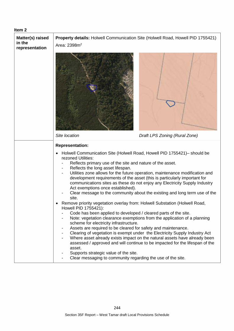
244
Section 35F Report – West Tamar draft Local Provisions Schedule
Item 2
Matter(s) raised in the representation
Property details: Holwell Communication Site (Holwell Road, Howell PID 1755421)
Area: 2398m2
Site location
Draft LPS Zoning (Rural Zone)
Representation:
Holwell Communication Site (Holwell Road, Howell PID 1755421)– should be rezoned Utilities: - Reflects primary use of the site and nature of the asset. - Reflects the long asset lifespan. - Utilities zone allows for the future operation, maintenance modification and
development requirements of the asset (this is particularly important for communications sites as these do not enjoy any Electricity Supply Industry Act exemptions once established).
- Clear message to the community about the existing and long term use of the site.
Remove priority vegetation overlay from: Holwell Substation (Holwell Road, Howell PID 1755421): - Code has been applied to developed / cleared parts of the site. - Note: vegetation clearance exemptions from the application of a planning
scheme for electricity infrastructure. - Assets are required to be cleared for safety and maintenance. - Clearing of vegetation is exempt under the Electricity Supply Industry Act - Where asset already exists impact on the natural assets have already been
assessed / approved and will continue to be impacted for the lifespan of the asset.
- Supports strategic value of the site. - Clear messaging to community regarding the use of the site.
245
Section 35F Report – West Tamar draft Local Provisions Schedule
Planning Authority Response
Overview:
Is the representation consistent with: Does the representation:
The NTRLUS Yes Reflect a like for like conversion of the IPS?
No
State policies Yes
Section 8A Guideline No. 1 No Relate to the drafting / content of the SPP?
No
TPC Practice Notes Yes
Local strategy / policy N/A Raise natural justice concerns?
No
Response:
Utilities Zoning
UZ 1 of Guideline No. 1 states that the Utilities Zone should be used for major utilities including energy production facilities. Changing the zone to the Utilities Zone meets the Zone Application Guidelines.
Priority Vegetation Area Mapping
C7.2 of the TPS (Application of the Natural Assets Code) states that the priority vegetation area applies in the Utilities Zone.
The area that has previously been cleared is approximately 1600m2. The mapping would not pick up a site that small to exclude the cleared area from the surrounding vegetated area and the values that have been identified.
As detailed under Item 1 above, section 57 of the Electricity Supply Industry Act 1995 provides broad exemptions provided they meet the relevant criteria.
Given these requirements and the exemptions afforded through legislation, it is not considered necessary to amend the Priority Vegetation Area mapping.
Planning Authority recommended action
Change the zone for Holwell Communication Site (Holwell Road, Howell PID 1755421) from the Rural Zone to the Utilities Zone.
Effect of recommendation on the draft LPS
The Planning Authority recommendation has no impact on implementing the draft LPS as a whole as the landowner is supportive of the recomended change.
Meets the LPS criteria
The Planning Authority recommendation meets the LPS criteria.
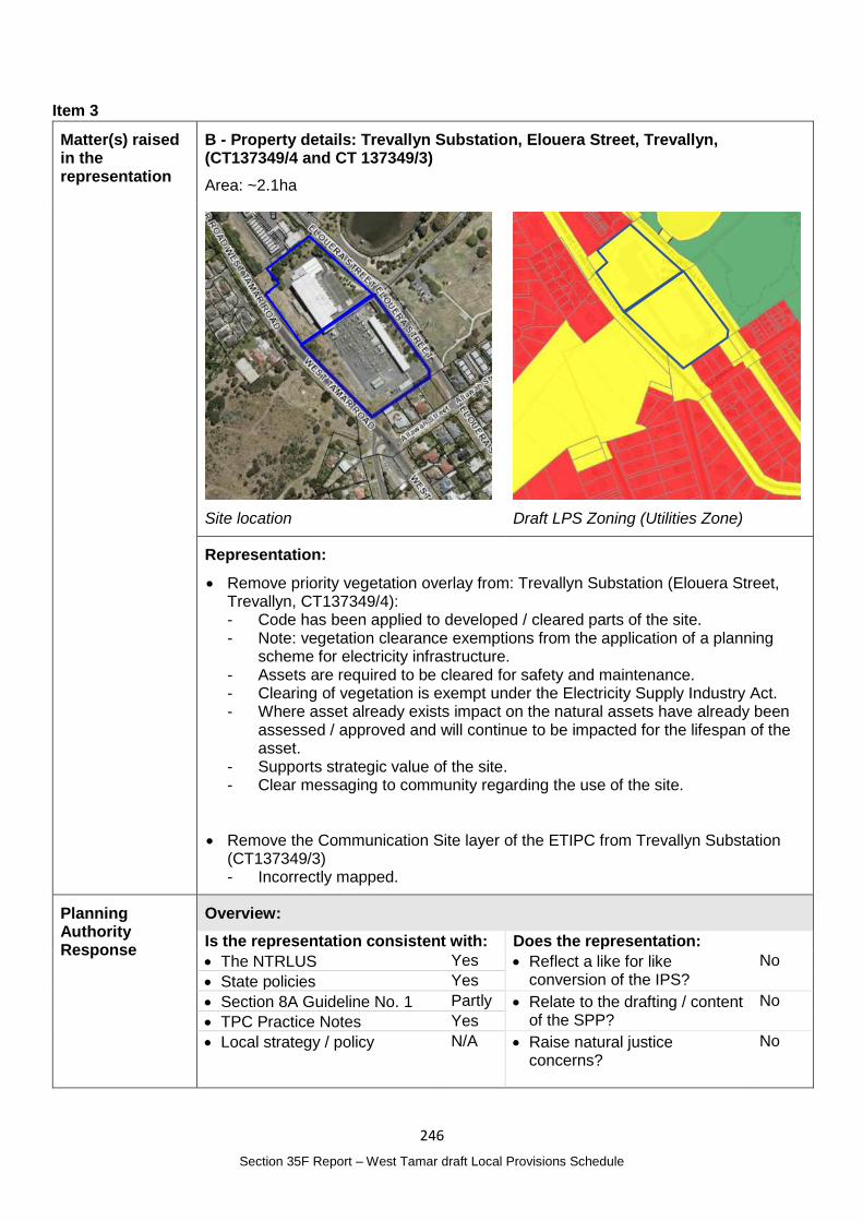
246
Section 35F Report – West Tamar draft Local Provisions Schedule
Item 3
Matter(s) raised in the representation
B - Property details: Trevallyn Substation, Elouera Street, Trevallyn, (CT137349/4 and CT 137349/3)
Area: ~2.1ha
Site location
Draft LPS Zoning (Utilities Zone)
Representation:
Remove priority vegetation overlay from: Trevallyn Substation (Elouera Street, Trevallyn, CT137349/4): - Code has been applied to developed / cleared parts of the site. - Note: vegetation clearance exemptions from the application of a planning
scheme for electricity infrastructure. - Assets are required to be cleared for safety and maintenance. - Clearing of vegetation is exempt under the Electricity Supply Industry Act. - Where asset already exists impact on the natural assets have already been
assessed / approved and will continue to be impacted for the lifespan of the asset.
- Supports strategic value of the site. - Clear messaging to community regarding the use of the site.
Remove the Communication Site layer of the ETIPC from Trevallyn Substation (CT137349/3) - Incorrectly mapped.
Planning Authority Response
Overview:
Is the representation consistent with: Does the representation:
The NTRLUS Yes Reflect a like for like conversion of the IPS?
No
State policies Yes
Section 8A Guideline No. 1 Partly Relate to the drafting / content of the SPP?
No
TPC Practice Notes Yes
Local strategy / policy N/A Raise natural justice concerns?
No
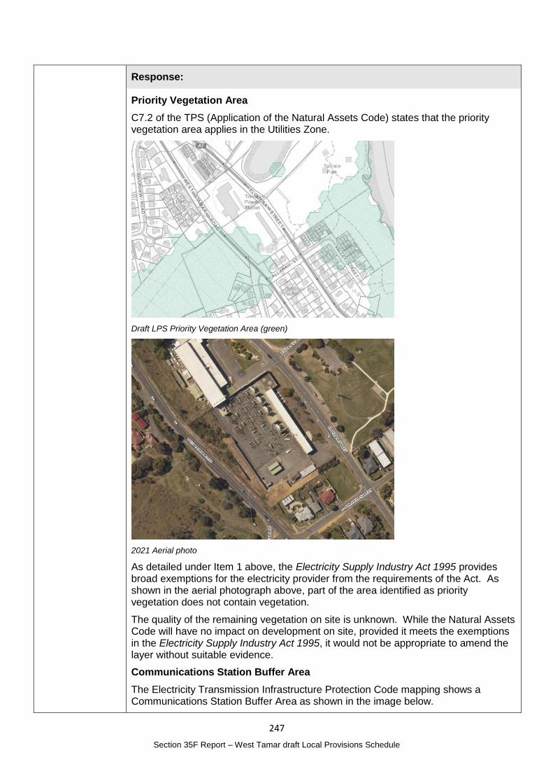
247
Section 35F Report – West Tamar draft Local Provisions Schedule
Response:
Priority Vegetation Area
C7.2 of the TPS (Application of the Natural Assets Code) states that the priority vegetation area applies in the Utilities Zone.
Draft LPS Priority Vegetation Area (green)
2021 Aerial photo
As detailed under Item 1 above, the Electricity Supply Industry Act 1995 provides broad exemptions for the electricity provider from the requirements of the Act. As shown in the aerial photograph above, part of the area identified as priority vegetation does not contain vegetation.
The quality of the remaining vegetation on site is unknown. While the Natural Assets Code will have no impact on development on site, provided it meets the exemptions in the Electricity Supply Industry Act 1995, it would not be appropriate to amend the layer without suitable evidence.
Communications Station Buffer Area
The Electricity Transmission Infrastructure Protection Code mapping shows a Communications Station Buffer Area as shown in the image below.
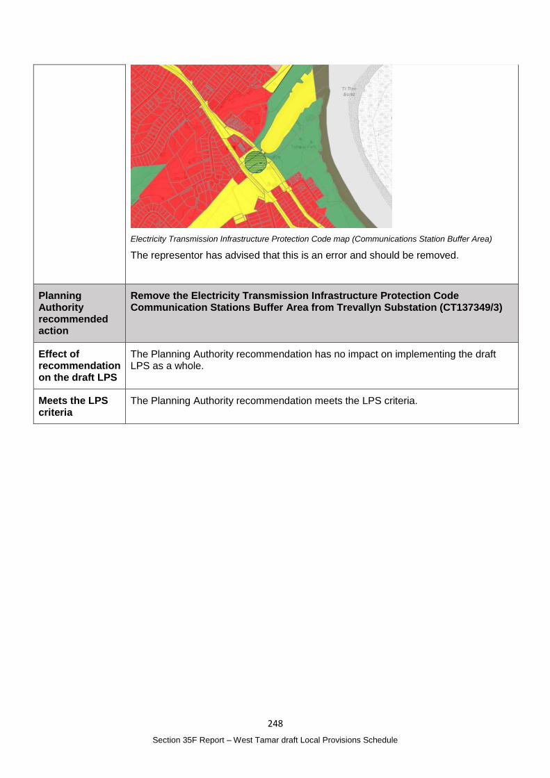
248
Section 35F Report – West Tamar draft Local Provisions Schedule
Electricity Transmission Infrastructure Protection Code map (Communications Station Buffer Area)
The representor has advised that this is an error and should be removed.
Planning Authority recommended action
Remove the Electricity Transmission Infrastructure Protection Code Communication Stations Buffer Area from Trevallyn Substation (CT137349/3)
Effect of recommendation on the draft LPS
The Planning Authority recommendation has no impact on implementing the draft LPS as a whole.
Meets the LPS criteria
The Planning Authority recommendation meets the LPS criteria.
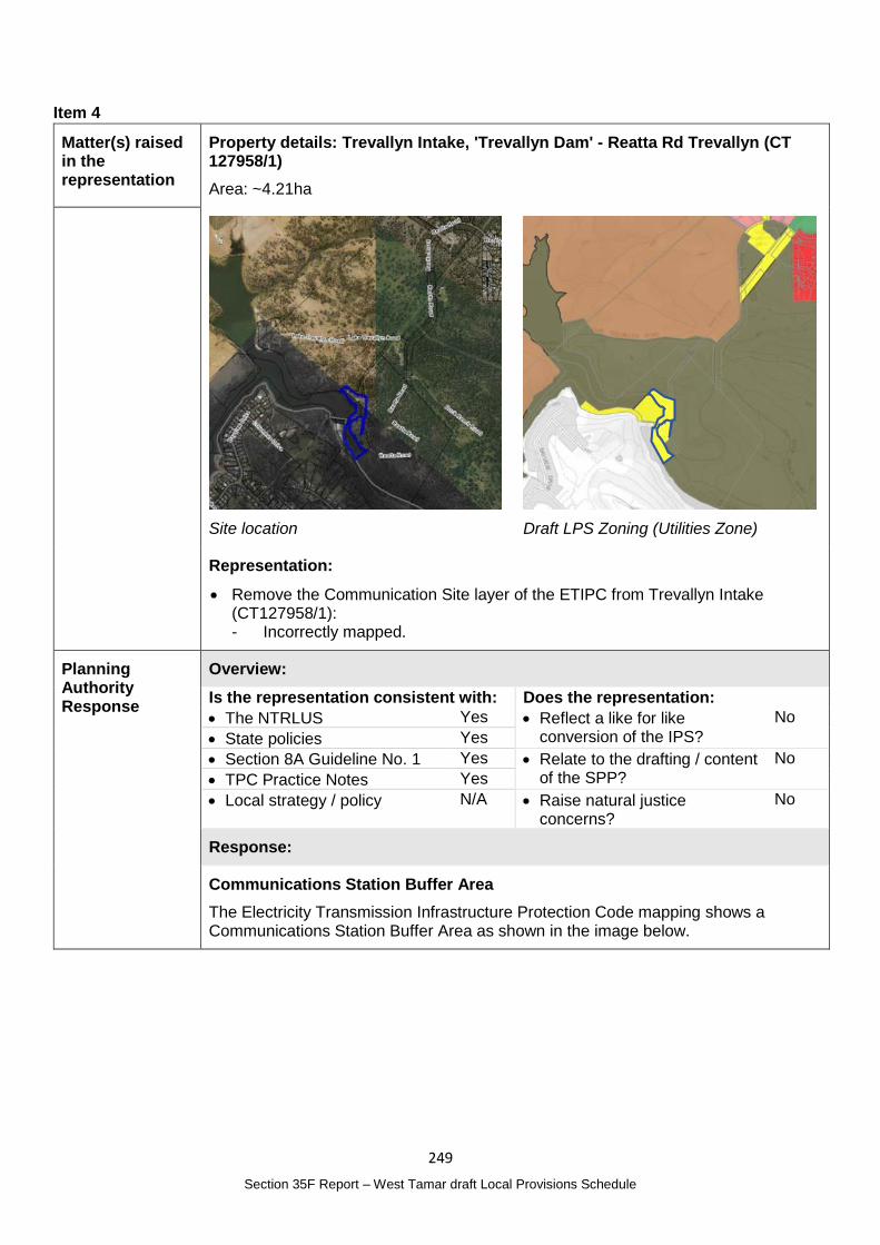
249
Section 35F Report – West Tamar draft Local Provisions Schedule
Item 4
Matter(s) raised in the representation
Property details: Trevallyn Intake, 'Trevallyn Dam' - Reatta Rd Trevallyn (CT 127958/1)
Area: ~4.21ha
Site location
Draft LPS Zoning (Utilities Zone)
Representation:
Remove the Communication Site layer of the ETIPC from Trevallyn Intake (CT127958/1): - Incorrectly mapped.
Planning Authority Response
Overview:
Is the representation consistent with: Does the representation:
The NTRLUS Yes Reflect a like for like conversion of the IPS?
No
State policies Yes
Section 8A Guideline No. 1 Yes Relate to the drafting / content of the SPP?
No
TPC Practice Notes Yes
Local strategy / policy N/A Raise natural justice concerns?
No
Response:
Communications Station Buffer Area
The Electricity Transmission Infrastructure Protection Code mapping shows a Communications Station Buffer Area as shown in the image below.
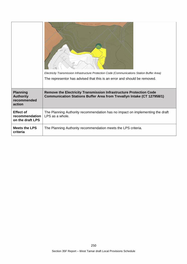
250
Section 35F Report – West Tamar draft Local Provisions Schedule
Electricity Transmission Infrastructure Protection Code (Communications Station Buffer Area)
The representor has advised that this is an error and should be removed.
Planning Authority recommended action
Remove the Electricity Transmission Infrastructure Protection Code Communication Stations Buffer Area from Trevallyn Intake (CT 127958/1)
Effect of recommendation on the draft LPS
The Planning Authority recommendation has no impact on implementing the draft LPS as a whole.
Meets the LPS criteria
The Planning Authority recommendation meets the LPS criteria.
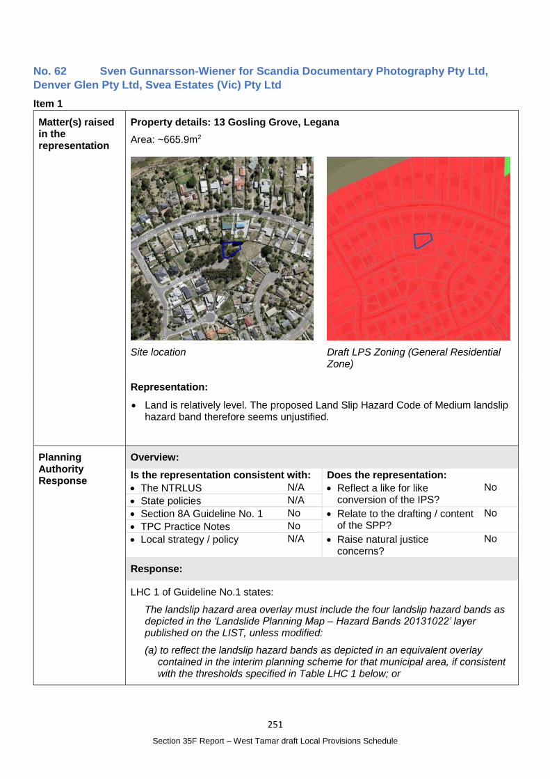
251
Section 35F Report – West Tamar draft Local Provisions Schedule
No. 62 Sven Gunnarsson-Wiener for Scandia Documentary Photography Pty Ltd,
Denver Glen Pty Ltd, Svea Estates (Vic) Pty Ltd
Item 1
Matter(s) raised in the representation
Property details: 13 Gosling Grove, Legana
Area: ~665.9m2
Site location
Draft LPS Zoning (General Residential Zone)
Representation:
Land is relatively level. The proposed Land Slip Hazard Code of Medium landslip hazard band therefore seems unjustified.
Planning Authority Response
Overview:
Is the representation consistent with: Does the representation:
The NTRLUS N/A Reflect a like for like conversion of the IPS?
No
State policies N/A
Section 8A Guideline No. 1 No Relate to the drafting / content of the SPP?
No
TPC Practice Notes No
Local strategy / policy N/A Raise natural justice concerns?
No
Response:
LHC 1 of Guideline No.1 states:
The landslip hazard area overlay must include the four landslip hazard bands as depicted in the ‘Landslide Planning Map – Hazard Bands 20131022’ layer published on the LIST, unless modified:
(a) to reflect the landslip hazard bands as depicted in an equivalent overlay contained in the interim planning scheme for that municipal area, if consistent with the thresholds specified in Table LHC 1 below; or
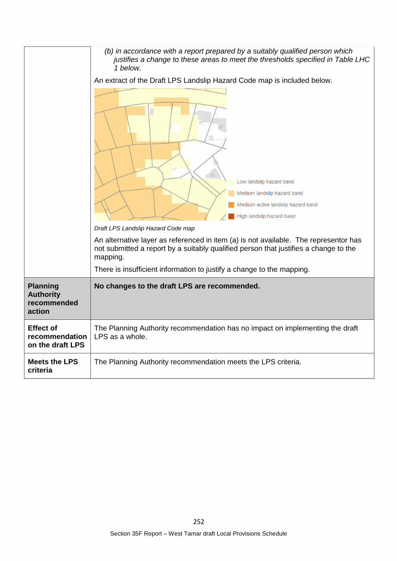
252
Section 35F Report – West Tamar draft Local Provisions Schedule
(b) in accordance with a report prepared by a suitably qualified person which justifies a change to these areas to meet the thresholds specified in Table LHC 1 below.
An extract of the Draft LPS Landslip Hazard Code map is included below.
Draft LPS Landslip Hazard Code map
An alternative layer as referenced in item (a) is not available. The representor has not submitted a report by a suitably qualified person that justifies a change to the mapping.
There is insufficient information to justify a change to the mapping.
Planning Authority recommended action
No changes to the draft LPS are recommended.
Effect of recommendation on the draft LPS
The Planning Authority recommendation has no impact on implementing the draft LPS as a whole.
Meets the LPS criteria
The Planning Authority recommendation meets the LPS criteria.
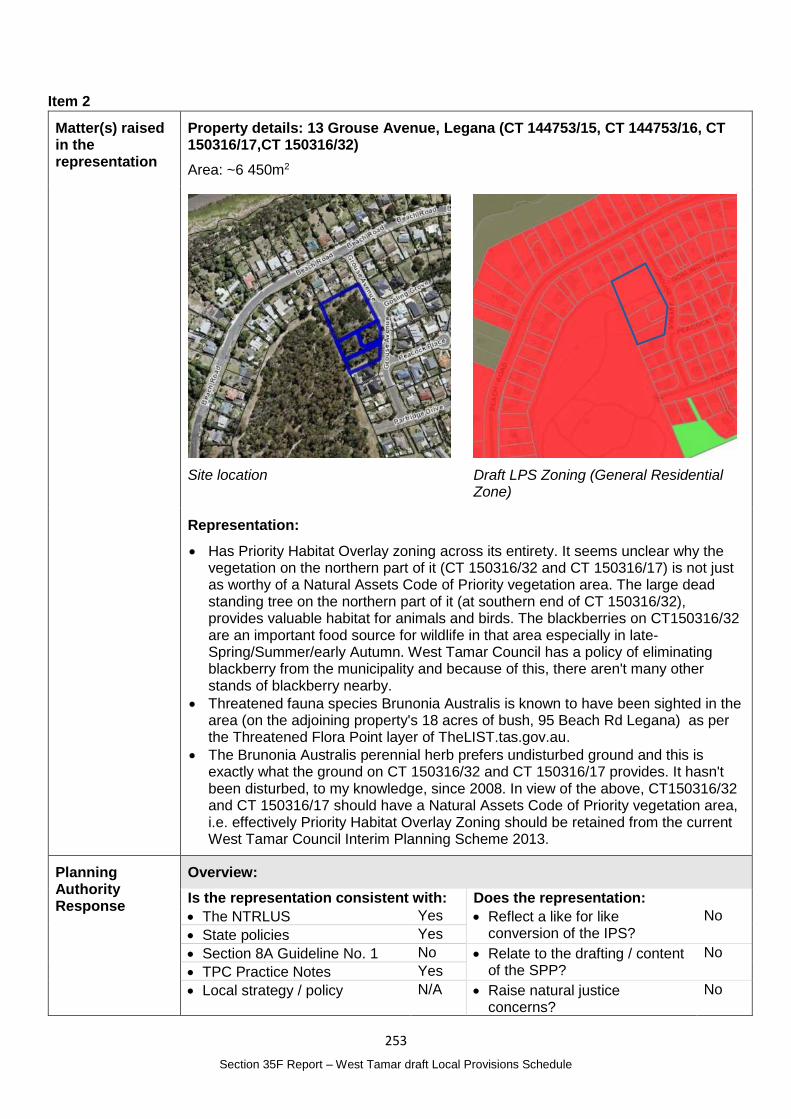
253
Section 35F Report – West Tamar draft Local Provisions Schedule
Item 2
Matter(s) raised in the representation
Property details: 13 Grouse Avenue, Legana (CT 144753/15, CT 144753/16, CT 150316/17,CT 150316/32)
Area: ~6 450m2
Site location
Draft LPS Zoning (General Residential Zone)
Representation:
Has Priority Habitat Overlay zoning across its entirety. It seems unclear why the vegetation on the northern part of it (CT 150316/32 and CT 150316/17) is not just as worthy of a Natural Assets Code of Priority vegetation area. The large dead standing tree on the northern part of it (at southern end of CT 150316/32), provides valuable habitat for animals and birds. The blackberries on CT150316/32 are an important food source for wildlife in that area especially in late-Spring/Summer/early Autumn. West Tamar Council has a policy of eliminating blackberry from the municipality and because of this, there aren't many other stands of blackberry nearby.
Threatened fauna species Brunonia Australis is known to have been sighted in the area (on the adjoining property's 18 acres of bush, 95 Beach Rd Legana) as per the Threatened Flora Point layer of TheLIST.tas.gov.au.
The Brunonia Australis perennial herb prefers undisturbed ground and this is exactly what the ground on CT 150316/32 and CT 150316/17 provides. It hasn't been disturbed, to my knowledge, since 2008. In view of the above, CT150316/32 and CT 150316/17 should have a Natural Assets Code of Priority vegetation area, i.e. effectively Priority Habitat Overlay Zoning should be retained from the current West Tamar Council Interim Planning Scheme 2013.
Planning Authority Response
Overview:
Is the representation consistent with: Does the representation:
The NTRLUS Yes Reflect a like for like conversion of the IPS?
No
State policies Yes
Section 8A Guideline No. 1 No Relate to the drafting / content of the SPP?
No
TPC Practice Notes Yes
Local strategy / policy N/A Raise natural justice concerns?
No
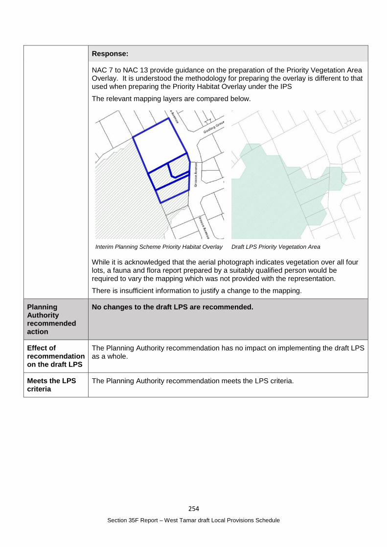
254
Section 35F Report – West Tamar draft Local Provisions Schedule
Response:
NAC 7 to NAC 13 provide guidance on the preparation of the Priority Vegetation Area Overlay. It is understood the methodology for preparing the overlay is different to that used when preparing the Priority Habitat Overlay under the IPS
The relevant mapping layers are compared below.
Interim Planning Scheme Priority Habitat Overlay
Draft LPS Priority Vegetation Area
While it is acknowledged that the aerial photograph indicates vegetation over all four lots, a fauna and flora report prepared by a suitably qualified person would be required to vary the mapping which was not provided with the representation.
There is insufficient information to justify a change to the mapping.
Planning Authority recommended action
No changes to the draft LPS are recommended.
Effect of recommendation on the draft LPS
The Planning Authority recommendation has no impact on implementing the draft LPS as a whole.
Meets the LPS criteria
The Planning Authority recommendation meets the LPS criteria.
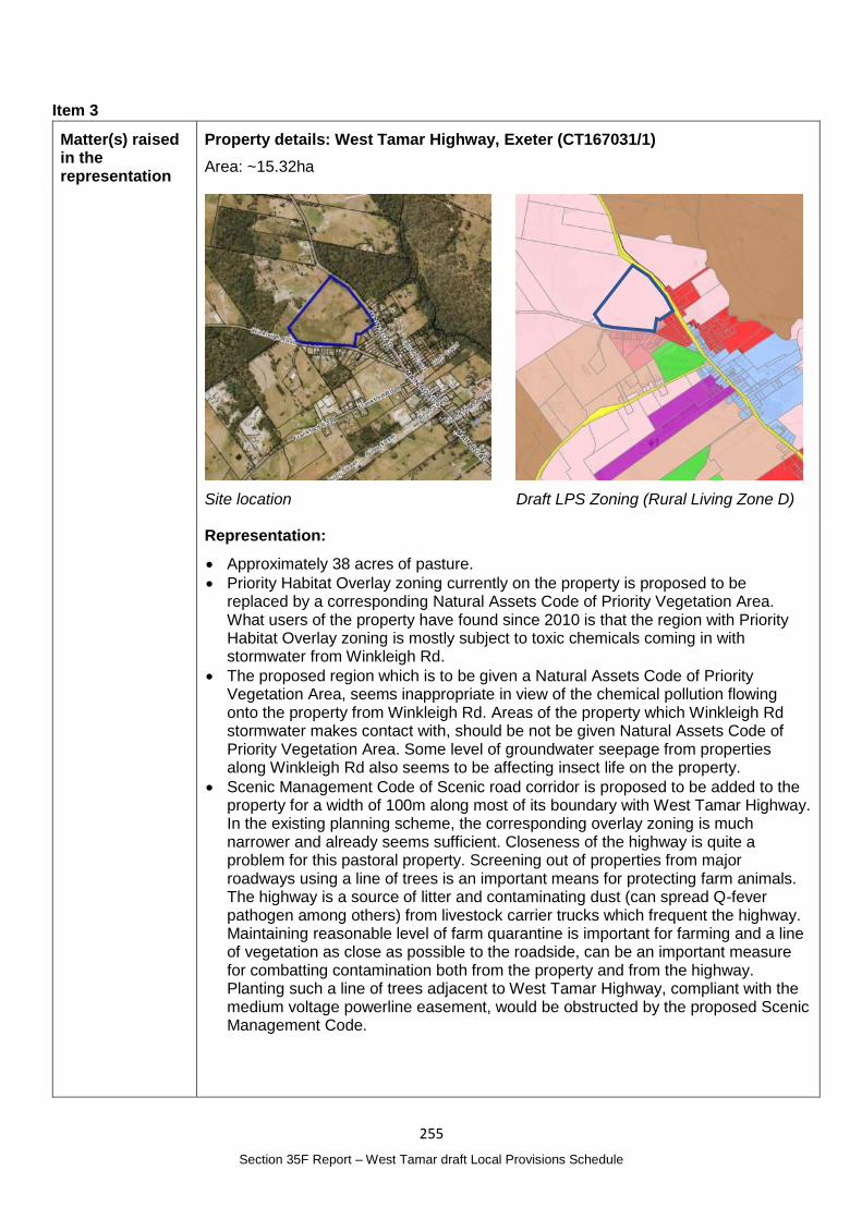
255
Section 35F Report – West Tamar draft Local Provisions Schedule
Item 3
Matter(s) raised in the representation
Property details: West Tamar Highway, Exeter (CT167031/1)
Area: ~15.32ha
Site location
Draft LPS Zoning (Rural Living Zone D)
Representation:
Approximately 38 acres of pasture.
Priority Habitat Overlay zoning currently on the property is proposed to be replaced by a corresponding Natural Assets Code of Priority Vegetation Area. What users of the property have found since 2010 is that the region with Priority Habitat Overlay zoning is mostly subject to toxic chemicals coming in with stormwater from Winkleigh Rd.
The proposed region which is to be given a Natural Assets Code of Priority Vegetation Area, seems inappropriate in view of the chemical pollution flowing onto the property from Winkleigh Rd. Areas of the property which Winkleigh Rd stormwater makes contact with, should be not be given Natural Assets Code of Priority Vegetation Area. Some level of groundwater seepage from properties along Winkleigh Rd also seems to be affecting insect life on the property.
Scenic Management Code of Scenic road corridor is proposed to be added to the property for a width of 100m along most of its boundary with West Tamar Highway. In the existing planning scheme, the corresponding overlay zoning is much narrower and already seems sufficient. Closeness of the highway is quite a problem for this pastoral property. Screening out of properties from major roadways using a line of trees is an important means for protecting farm animals. The highway is a source of litter and contaminating dust (can spread Q-fever pathogen among others) from livestock carrier trucks which frequent the highway. Maintaining reasonable level of farm quarantine is important for farming and a line of vegetation as close as possible to the roadside, can be an important measure for combatting contamination both from the property and from the highway. Planting such a line of trees adjacent to West Tamar Highway, compliant with the medium voltage powerline easement, would be obstructed by the proposed Scenic Management Code.
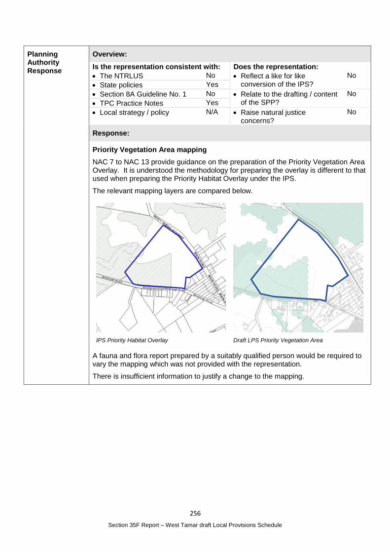
256
Section 35F Report – West Tamar draft Local Provisions Schedule
Planning Authority Response
Overview:
Is the representation consistent with: Does the representation:
The NTRLUS No Reflect a like for like conversion of the IPS?
No
State policies Yes
Section 8A Guideline No. 1 No Relate to the drafting / content of the SPP?
No
TPC Practice Notes Yes
Local strategy / policy N/A Raise natural justice concerns?
No
Response:
Priority Vegetation Area mapping
NAC 7 to NAC 13 provide guidance on the preparation of the Priority Vegetation Area Overlay. It is understood the methodology for preparing the overlay is different to that used when preparing the Priority Habitat Overlay under the IPS.
The relevant mapping layers are compared below.
IPS Priority Habitat Overlay
Draft LPS Priority Vegetation Area
A fauna and flora report prepared by a suitably qualified person would be required to vary the mapping which was not provided with the representation.
There is insufficient information to justify a change to the mapping.
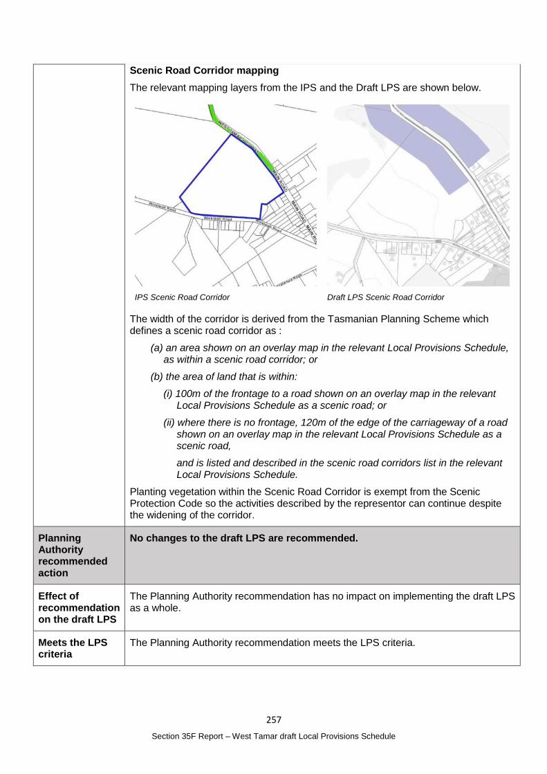
257
Section 35F Report – West Tamar draft Local Provisions Schedule
Scenic Road Corridor mapping
The relevant mapping layers from the IPS and the Draft LPS are shown below.
IPS Scenic Road Corridor
Draft LPS Scenic Road Corridor
The width of the corridor is derived from the Tasmanian Planning Scheme which defines a scenic road corridor as :
(a) an area shown on an overlay map in the relevant Local Provisions Schedule, as within a scenic road corridor; or
(b) the area of land that is within:
(i) 100m of the frontage to a road shown on an overlay map in the relevant Local Provisions Schedule as a scenic road; or
(ii) where there is no frontage, 120m of the edge of the carriageway of a road shown on an overlay map in the relevant Local Provisions Schedule as a scenic road,
and is listed and described in the scenic road corridors list in the relevant Local Provisions Schedule.
Planting vegetation within the Scenic Road Corridor is exempt from the Scenic Protection Code so the activities described by the representor can continue despite the widening of the corridor.
Planning Authority recommended action
No changes to the draft LPS are recommended.
Effect of recommendation on the draft LPS
The Planning Authority recommendation has no impact on implementing the draft LPS as a whole.
Meets the LPS criteria
The Planning Authority recommendation meets the LPS criteria.
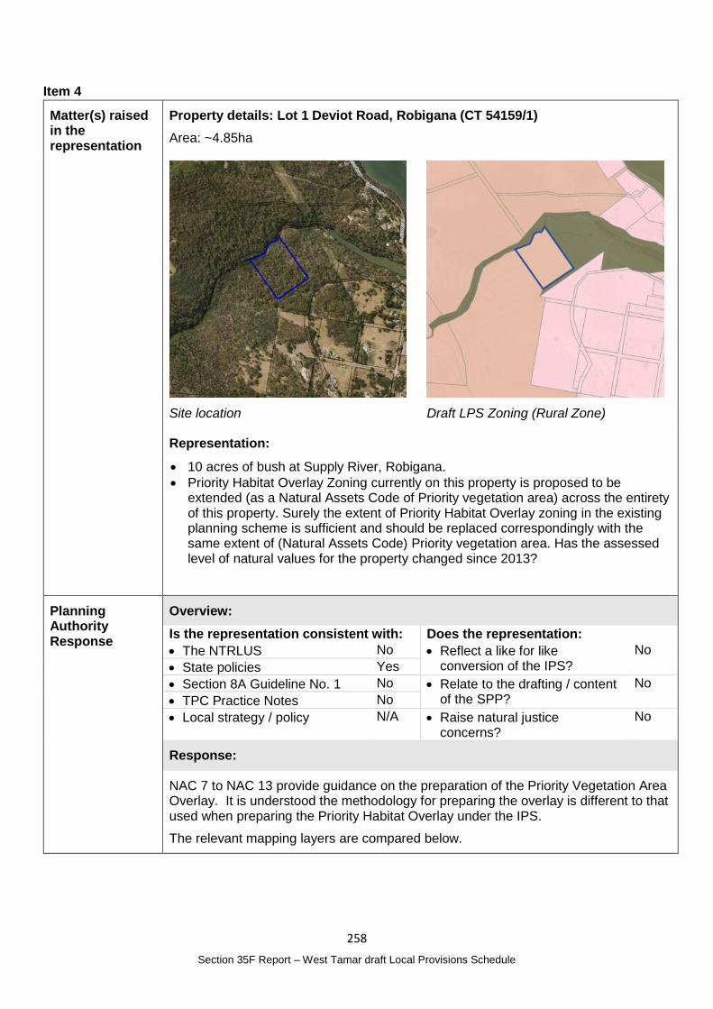
258
Section 35F Report – West Tamar draft Local Provisions Schedule
Item 4
Matter(s) raised in the representation
Property details: Lot 1 Deviot Road, Robigana (CT 54159/1)
Area: ~4.85ha
Site location
Draft LPS Zoning (Rural Zone)
Representation:
10 acres of bush at Supply River, Robigana.
Priority Habitat Overlay Zoning currently on this property is proposed to be extended (as a Natural Assets Code of Priority vegetation area) across the entirety of this property. Surely the extent of Priority Habitat Overlay zoning in the existing planning scheme is sufficient and should be replaced correspondingly with the same extent of (Natural Assets Code) Priority vegetation area. Has the assessed level of natural values for the property changed since 2013?
Planning Authority Response
Overview:
Is the representation consistent with: Does the representation:
The NTRLUS No Reflect a like for like conversion of the IPS?
No
State policies Yes
Section 8A Guideline No. 1 No Relate to the drafting / content of the SPP?
No
TPC Practice Notes No
Local strategy / policy N/A Raise natural justice concerns?
No
Response:
NAC 7 to NAC 13 provide guidance on the preparation of the Priority Vegetation Area Overlay. It is understood the methodology for preparing the overlay is different to that used when preparing the Priority Habitat Overlay under the IPS.
The relevant mapping layers are compared below.
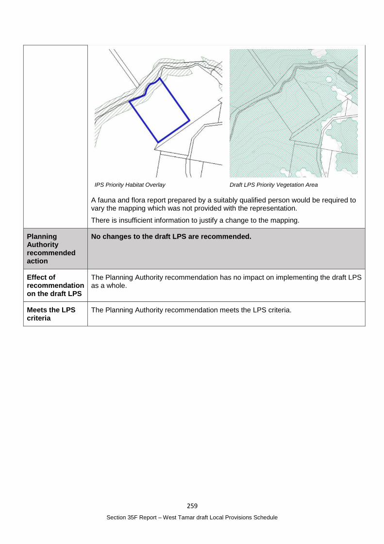
259
Section 35F Report – West Tamar draft Local Provisions Schedule
IPS Priority Habitat Overlay
Draft LPS Priority Vegetation Area
A fauna and flora report prepared by a suitably qualified person would be required to vary the mapping which was not provided with the representation.
There is insufficient information to justify a change to the mapping.
Planning Authority recommended action
No changes to the draft LPS are recommended.
Effect of recommendation on the draft LPS
The Planning Authority recommendation has no impact on implementing the draft LPS as a whole.
Meets the LPS criteria
The Planning Authority recommendation meets the LPS criteria.
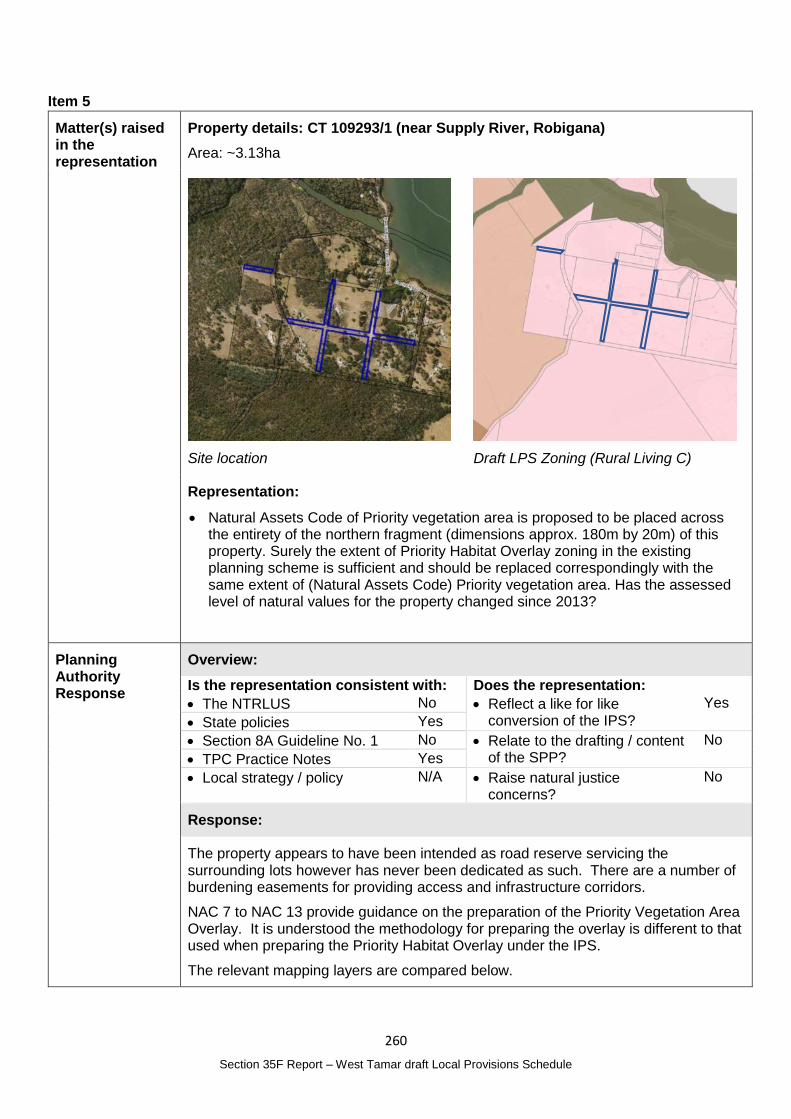
260
Section 35F Report – West Tamar draft Local Provisions Schedule
Item 5
Matter(s) raised in the representation
Property details: CT 109293/1 (near Supply River, Robigana)
Area: ~3.13ha
Site location
Draft LPS Zoning (Rural Living C)
Representation:
Natural Assets Code of Priority vegetation area is proposed to be placed across the entirety of the northern fragment (dimensions approx. 180m by 20m) of this property. Surely the extent of Priority Habitat Overlay zoning in the existing planning scheme is sufficient and should be replaced correspondingly with the same extent of (Natural Assets Code) Priority vegetation area. Has the assessed level of natural values for the property changed since 2013?
Planning Authority Response
Overview:
Is the representation consistent with: Does the representation:
The NTRLUS No Reflect a like for like conversion of the IPS?
Yes
State policies Yes
Section 8A Guideline No. 1 No Relate to the drafting / content of the SPP?
No
TPC Practice Notes Yes
Local strategy / policy N/A Raise natural justice concerns?
No
Response:
The property appears to have been intended as road reserve servicing the surrounding lots however has never been dedicated as such. There are a number of burdening easements for providing access and infrastructure corridors.
NAC 7 to NAC 13 provide guidance on the preparation of the Priority Vegetation Area Overlay. It is understood the methodology for preparing the overlay is different to that used when preparing the Priority Habitat Overlay under the IPS.
The relevant mapping layers are compared below.
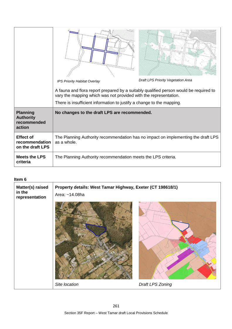
261
Section 35F Report – West Tamar draft Local Provisions Schedule
IPS Priority Habitat Overlay
Draft LPS Priority Vegetation Area
A fauna and flora report prepared by a suitably qualified person would be required to vary the mapping which was not provided with the representation.
There is insufficient information to justify a change to the mapping.
Planning Authority recommended action
No changes to the draft LPS are recommended.
Effect of recommendation on the draft LPS
The Planning Authority recommendation has no impact on implementing the draft LPS as a whole.
Meets the LPS criteria
The Planning Authority recommendation meets the LPS criteria.
Item 6
Matter(s) raised in the representation
Property details: West Tamar Highway, Exeter (CT 198618/1)
Area: ~14.08ha
Site location
Draft LPS Zoning
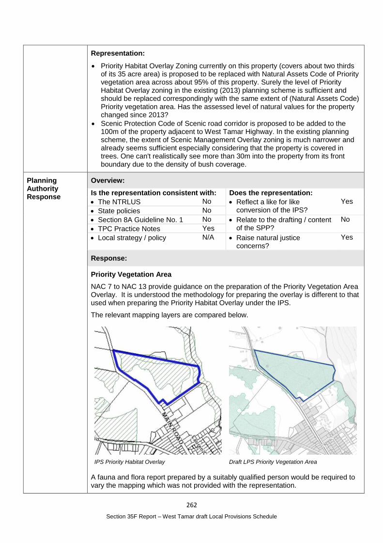
262
Section 35F Report – West Tamar draft Local Provisions Schedule
Representation:
Priority Habitat Overlay Zoning currently on this property (covers about two thirds of its 35 acre area) is proposed to be replaced with Natural Assets Code of Priority vegetation area across about 95% of this property. Surely the level of Priority Habitat Overlay zoning in the existing (2013) planning scheme is sufficient and should be replaced correspondingly with the same extent of (Natural Assets Code) Priority vegetation area. Has the assessed level of natural values for the property changed since 2013?
Scenic Protection Code of Scenic road corridor is proposed to be added to the 100m of the property adjacent to West Tamar Highway. In the existing planning scheme, the extent of Scenic Management Overlay zoning is much narrower and already seems sufficient especially considering that the property is covered in trees. One can't realistically see more than 30m into the property from its front boundary due to the density of bush coverage.
Planning Authority Response
Overview:
Is the representation consistent with: Does the representation:
The NTRLUS No Reflect a like for like conversion of the IPS?
Yes
State policies No
Section 8A Guideline No. 1 No Relate to the drafting / content of the SPP?
No
TPC Practice Notes Yes
Local strategy / policy N/A Raise natural justice concerns?
Yes
Response:
Priority Vegetation Area
NAC 7 to NAC 13 provide guidance on the preparation of the Priority Vegetation Area Overlay. It is understood the methodology for preparing the overlay is different to that used when preparing the Priority Habitat Overlay under the IPS.
The relevant mapping layers are compared below.
IPS Priority Habitat Overlay
Draft LPS Priority Vegetation Area
A fauna and flora report prepared by a suitably qualified person would be required to vary the mapping which was not provided with the representation.
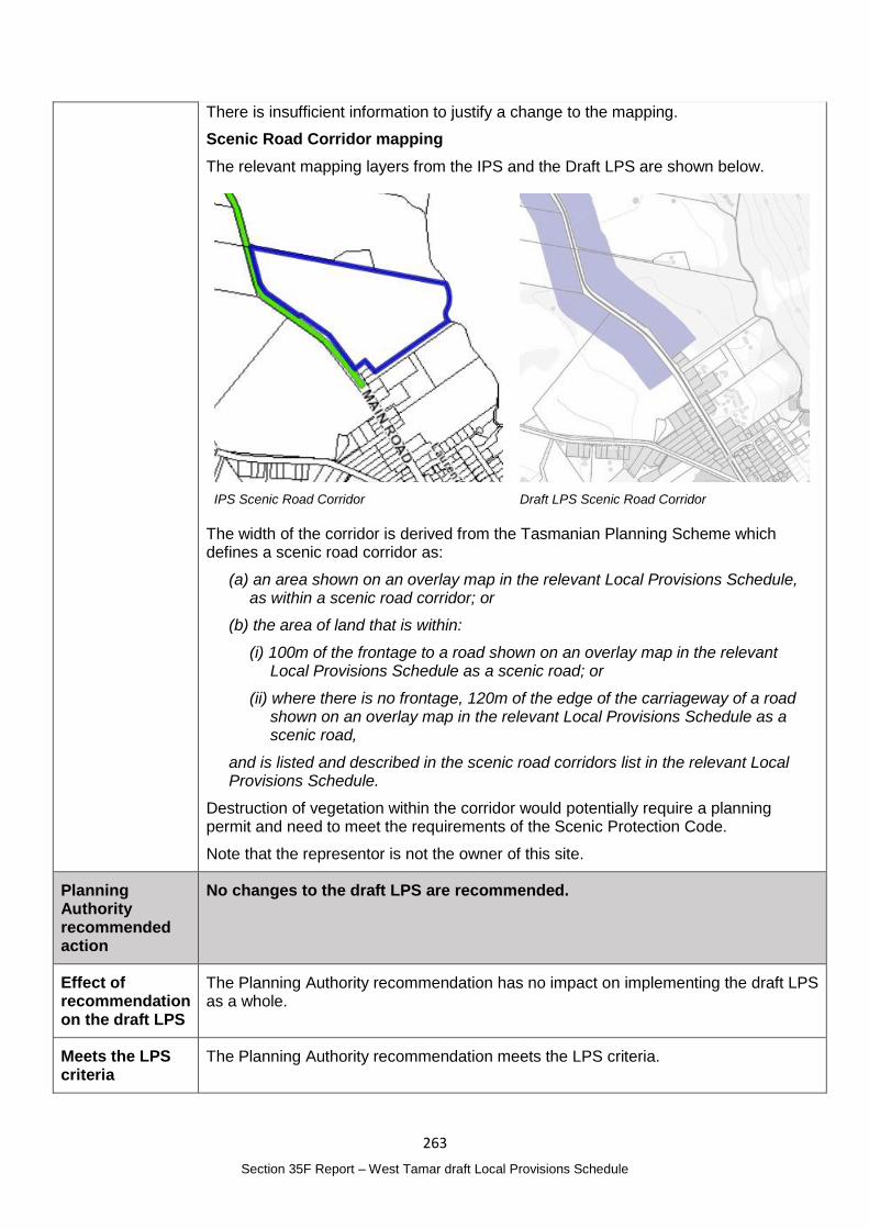
263
Section 35F Report – West Tamar draft Local Provisions Schedule
There is insufficient information to justify a change to the mapping.
Scenic Road Corridor mapping
The relevant mapping layers from the IPS and the Draft LPS are shown below.
IPS Scenic Road Corridor
Draft LPS Scenic Road Corridor
The width of the corridor is derived from the Tasmanian Planning Scheme which defines a scenic road corridor as:
(a) an area shown on an overlay map in the relevant Local Provisions Schedule, as within a scenic road corridor; or
(b) the area of land that is within:
(i) 100m of the frontage to a road shown on an overlay map in the relevant Local Provisions Schedule as a scenic road; or
(ii) where there is no frontage, 120m of the edge of the carriageway of a road shown on an overlay map in the relevant Local Provisions Schedule as a scenic road,
and is listed and described in the scenic road corridors list in the relevant Local Provisions Schedule.
Destruction of vegetation within the corridor would potentially require a planning permit and need to meet the requirements of the Scenic Protection Code.
Note that the representor is not the owner of this site.
Planning Authority recommended action
No changes to the draft LPS are recommended.
Effect of recommendation on the draft LPS
The Planning Authority recommendation has no impact on implementing the draft LPS as a whole.
Meets the LPS criteria
The Planning Authority recommendation meets the LPS criteria.
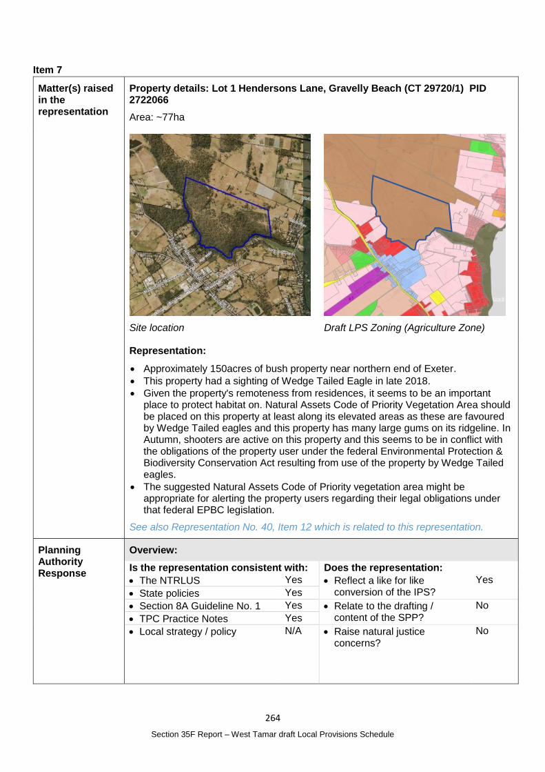
264
Section 35F Report – West Tamar draft Local Provisions Schedule
Item 7
Matter(s) raised in the representation
Property details: Lot 1 Hendersons Lane, Gravelly Beach (CT 29720/1) PID 2722066
Area: ~77ha
Site location
Draft LPS Zoning (Agriculture Zone)
Representation:
Approximately 150acres of bush property near northern end of Exeter.
This property had a sighting of Wedge Tailed Eagle in late 2018.
Given the property's remoteness from residences, it seems to be an important place to protect habitat on. Natural Assets Code of Priority Vegetation Area should be placed on this property at least along its elevated areas as these are favoured by Wedge Tailed eagles and this property has many large gums on its ridgeline. In Autumn, shooters are active on this property and this seems to be in conflict with the obligations of the property user under the federal Environmental Protection & Biodiversity Conservation Act resulting from use of the property by Wedge Tailed eagles.
The suggested Natural Assets Code of Priority vegetation area might be appropriate for alerting the property users regarding their legal obligations under that federal EPBC legislation.
See also Representation No. 40, Item 12 which is related to this representation.
Planning Authority Response
Overview:
Is the representation consistent with: Does the representation:
The NTRLUS Yes Reflect a like for like conversion of the IPS?
Yes
State policies Yes
Section 8A Guideline No. 1 Yes Relate to the drafting / content of the SPP?
No
TPC Practice Notes Yes
Local strategy / policy N/A Raise natural justice concerns?
No
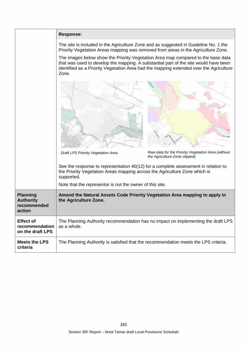
265
Section 35F Report – West Tamar draft Local Provisions Schedule
Response:
The site is included in the Agriculture Zone and as suggested in Guideline No. 1 the Priority Vegetation Areas mapping was removed from areas in the Agriculture Zone.
The images below show the Priority Vegetation Area map compared to the base data that was used to develop the mapping. A substantial part of the site would have been identified as a Priority Vegetation Area had the mapping extended over the Agriculture Zone.
Draft LPS Priority Vegetation Area
Raw data for the Priority Vegetation Area (without the Agriculture Zone clipped)
See the response to representation 40(12) for a complete assessment in relation to the Priority Vegetation Areas mapping across the Agriculture Zone which is supported.
Note that the representor is not the owner of this site.
Planning Authority recommended action
Amend the Natural Assets Code Priority Vegetation Area mapping to apply in the Agriculture Zone.
Effect of recommendation on the draft LPS
The Planning Authority recommendation has no impact on implementing the draft LPS as a whole.
Meets the LPS criteria
The Planning Authority is satisfied that the recommendation meets the LPS criteria.
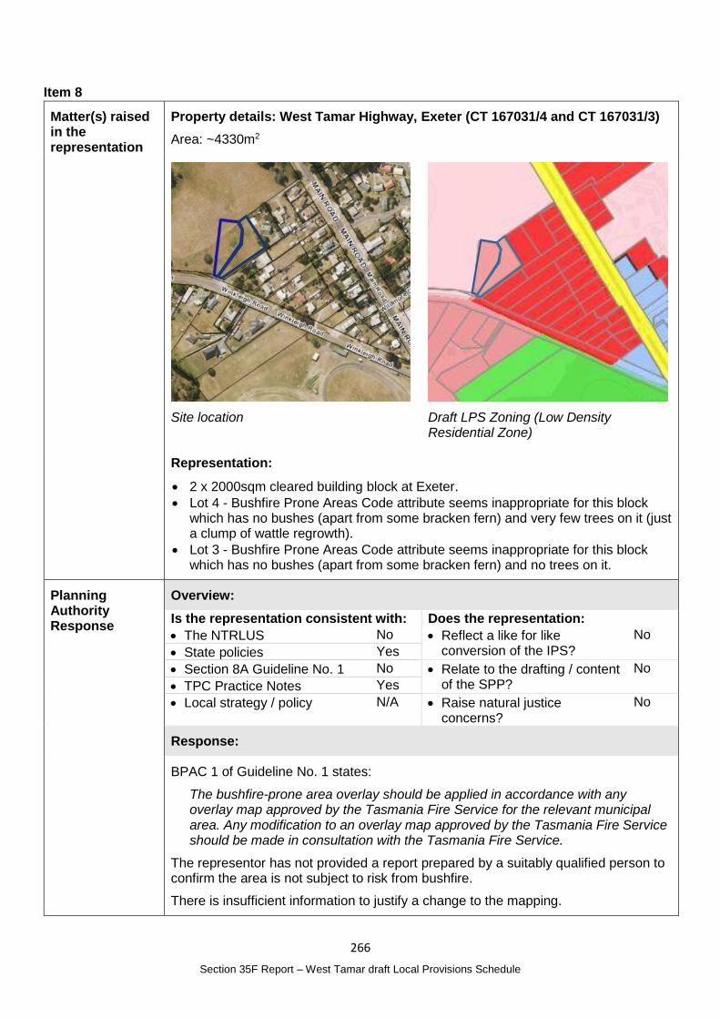
266
Section 35F Report – West Tamar draft Local Provisions Schedule
Item 8
Matter(s) raised in the representation
Property details: West Tamar Highway, Exeter (CT 167031/4 and CT 167031/3)
Area: ~4330m2
Site location
Draft LPS Zoning (Low Density Residential Zone)
Representation:
2 x 2000sqm cleared building block at Exeter.
Lot 4 - Bushfire Prone Areas Code attribute seems inappropriate for this block which has no bushes (apart from some bracken fern) and very few trees on it (just a clump of wattle regrowth).
Lot 3 - Bushfire Prone Areas Code attribute seems inappropriate for this block which has no bushes (apart from some bracken fern) and no trees on it.
Planning Authority Response
Overview:
Is the representation consistent with: Does the representation:
The NTRLUS No Reflect a like for like conversion of the IPS?
No
State policies Yes
Section 8A Guideline No. 1 No Relate to the drafting / content of the SPP?
No
TPC Practice Notes Yes
Local strategy / policy N/A Raise natural justice concerns?
No
Response:
BPAC 1 of Guideline No. 1 states:
The bushfire-prone area overlay should be applied in accordance with any overlay map approved by the Tasmania Fire Service for the relevant municipal area. Any modification to an overlay map approved by the Tasmania Fire Service should be made in consultation with the Tasmania Fire Service.
The representor has not provided a report prepared by a suitably qualified person to confirm the area is not subject to risk from bushfire.
There is insufficient information to justify a change to the mapping.
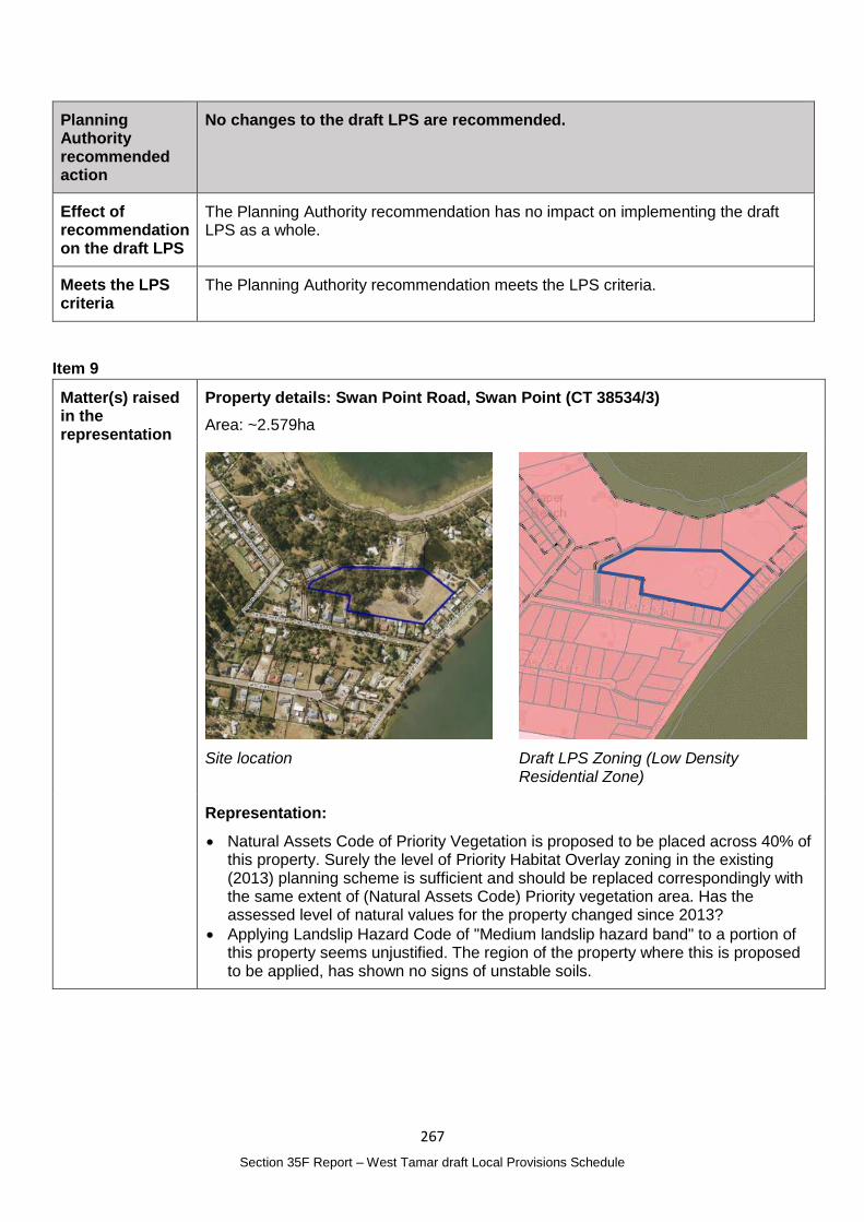
267
Section 35F Report – West Tamar draft Local Provisions Schedule
Planning Authority recommended action
No changes to the draft LPS are recommended.
Effect of recommendation on the draft LPS
The Planning Authority recommendation has no impact on implementing the draft LPS as a whole.
Meets the LPS criteria
The Planning Authority recommendation meets the LPS criteria.
Item 9
Matter(s) raised in the representation
Property details: Swan Point Road, Swan Point (CT 38534/3)
Area: ~2.579ha
Site location
Draft LPS Zoning (Low Density Residential Zone)
Representation:
Natural Assets Code of Priority Vegetation is proposed to be placed across 40% of this property. Surely the level of Priority Habitat Overlay zoning in the existing (2013) planning scheme is sufficient and should be replaced correspondingly with the same extent of (Natural Assets Code) Priority vegetation area. Has the assessed level of natural values for the property changed since 2013?
Applying Landslip Hazard Code of "Medium landslip hazard band" to a portion of this property seems unjustified. The region of the property where this is proposed to be applied, has shown no signs of unstable soils.
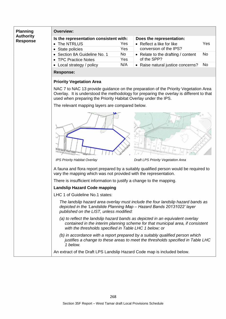
268
Section 35F Report – West Tamar draft Local Provisions Schedule
Planning Authority Response
Overview:
Is the representation consistent with: Does the representation:
The NTRLUS Yes Reflect a like for like conversion of the IPS?
Yes
State policies Yes
Section 8A Guideline No. 1 No Relate to the drafting / content of the SPP?
No
TPC Practice Notes Yes
Local strategy / policy N/A Raise natural justice concerns? No
Response:
Priority Vegetation Area
NAC 7 to NAC 13 provide guidance on the preparation of the Priority Vegetation Area Overlay. It is understood the methodology for preparing the overlay is different to that used when preparing the Priority Habitat Overlay under the IPS.
The relevant mapping layers are compared below.
IPS Priority Habitat Overlay
Draft LPS Priority Vegetation Area
A fauna and flora report prepared by a suitably qualified person would be required to vary the mapping which was not provided with the representation.
There is insufficient information to justify a change to the mapping.
Landslip Hazard Code mapping
LHC 1 of Guideline No.1 states:
The landslip hazard area overlay must include the four landslip hazard bands as depicted in the ‘Landslide Planning Map – Hazard Bands 20131022’ layer published on the LIST, unless modified:
(a) to reflect the landslip hazard bands as depicted in an equivalent overlay contained in the interim planning scheme for that municipal area, if consistent with the thresholds specified in Table LHC 1 below; or
(b) in accordance with a report prepared by a suitably qualified person which justifies a change to these areas to meet the thresholds specified in Table LHC 1 below.
An extract of the Draft LPS Landslip Hazard Code map is included below.
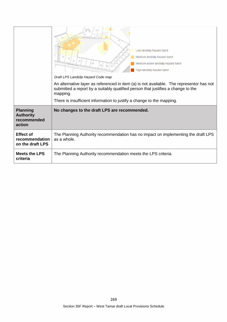
269
Section 35F Report – West Tamar draft Local Provisions Schedule
Draft LPS Landslip Hazard Code map
An alternative layer as referenced in item (a) is not available. The representor has not submitted a report by a suitably qualified person that justifies a change to the mapping.
There is insufficient information to justify a change to the mapping.
Planning Authority recommended action
No changes to the draft LPS are recommended.
Effect of recommendation on the draft LPS
The Planning Authority recommendation has no impact on implementing the draft LPS as a whole.
Meets the LPS criteria
The Planning Authority recommendation meets the LPS criteria.
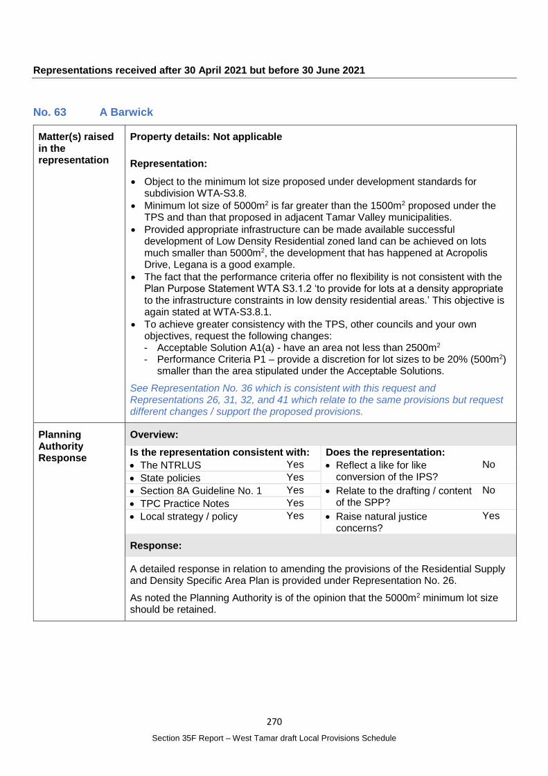
270
Section 35F Report – West Tamar draft Local Provisions Schedule
Representations received after 30 April 2021 but before 30 June 2021
No. 63 A Barwick
Matter(s) raised in the representation
Property details: Not applicable
Representation:
Object to the minimum lot size proposed under development standards for subdivision WTA-S3.8.
Minimum lot size of 5000m2 is far greater than the 1500m2 proposed under the TPS and than that proposed in adjacent Tamar Valley municipalities.
Provided appropriate infrastructure can be made available successful development of Low Density Residential zoned land can be achieved on lots much smaller than 5000m2, the development that has happened at Acropolis Drive, Legana is a good example.
The fact that the performance criteria offer no flexibility is not consistent with the Plan Purpose Statement WTA S3.1.2 ‘to provide for lots at a density appropriate to the infrastructure constraints in low density residential areas.’ This objective is again stated at WTA-S3.8.1.
To achieve greater consistency with the TPS, other councils and your own objectives, request the following changes: - Acceptable Solution A1(a) - have an area not less than 2500m2 - Performance Criteria P1 – provide a discretion for lot sizes to be 20% (500m2)
smaller than the area stipulated under the Acceptable Solutions.
See Representation No. 36 which is consistent with this request and Representations 26, 31, 32, and 41 which relate to the same provisions but request different changes / support the proposed provisions.
Planning Authority Response
Overview:
Is the representation consistent with: Does the representation:
The NTRLUS Yes Reflect a like for like conversion of the IPS?
No
State policies Yes
Section 8A Guideline No. 1 Yes Relate to the drafting / content of the SPP?
No
TPC Practice Notes Yes
Local strategy / policy Yes Raise natural justice concerns?
Yes
Response:
A detailed response in relation to amending the provisions of the Residential Supply and Density Specific Area Plan is provided under Representation No. 26.
As noted the Planning Authority is of the opinion that the 5000m2 minimum lot size should be retained.

271
Section 35F Report – West Tamar draft Local Provisions Schedule
Planning Authority recommended action
No changes to the draft LPS are recommended.
Effect of recommendation on the draft LPS
The Planning Authority recommendation has no impact on implementing the draft LPS as a whole.
Meets the LPS criteria
The Planning Authority recommendation meets the LPS criteria.
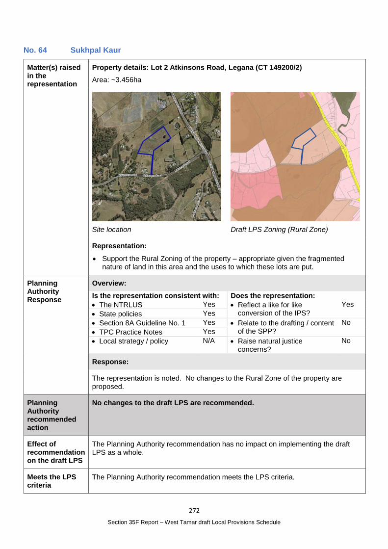
272
Section 35F Report – West Tamar draft Local Provisions Schedule
No. 64 Sukhpal Kaur
Matter(s) raised in the representation
Property details: Lot 2 Atkinsons Road, Legana (CT 149200/2)
Area: ~3.456ha
Site location
Draft LPS Zoning (Rural Zone)
Representation:
Support the Rural Zoning of the property – appropriate given the fragmented nature of land in this area and the uses to which these lots are put.
Planning Authority Response
Overview:
Is the representation consistent with: Does the representation:
The NTRLUS Yes Reflect a like for like conversion of the IPS?
Yes
State policies Yes
Section 8A Guideline No. 1 Yes Relate to the drafting / content of the SPP?
No
TPC Practice Notes Yes
Local strategy / policy N/A Raise natural justice concerns?
No
Response:
The representation is noted. No changes to the Rural Zone of the property are proposed.
Planning Authority recommended action
No changes to the draft LPS are recommended.
Effect of recommendation on the draft LPS
The Planning Authority recommendation has no impact on implementing the draft LPS as a whole.
Meets the LPS criteria
The Planning Authority recommendation meets the LPS criteria.
273
Section 35F Report – West Tamar draft Local Provisions Schedule
No. 65 Caroline Larner
Matter(s) raised in the representation
Property details: Gravelly Beach locality
Area: Not applicable
Representation:
Seek to identify and support the unique tourist attraction, environmentally sensitive and aesthetic character of the Gravelly Beach foreshore precinct within the broader estuarine tidal environment of the Tamar River.
The incorporation of the various principles and processes from policies such as the Schedule 1 objective of the Act, the State Coastal Policy and the PESRAC final report is central to an acceptable forward planning vision, particularly in light of the need for extensive local community consultation in achieving the community’s own desired outcomes.
The unique qualities of Gravelly Beach foreshore and namesake beach: - Extensive recent survey by petitioning local residents and visitors provides at
least 90% endorsement for removal of second groyne at front of the business precinct and the reinstatement of the gravelled beach for its full sweep.
- The limited plan for a short section of beach to the south of the second groyne is a very limited compromise and likely to lead to unwanted deposition of unsightly silt on the new beach as evidenced by the spoilage of beach to the south of the first groyne.
- Improved opportunities for alternative leisure activity – play areas and kayaking – an open beach would provide a much better launching point.
- Enhanced habitat – waterbirds prefer beach-side feeding rather than the rice grass beds currently in place.
- Enhanced economic activity and leisure options – restoring the beach to its former glory would offer a unique and special appeal to a variety of visitor preferences.
- Low key development – highly valued necessity as surveyed by the 2003 GHD consulting report. A high level of sensitivity is required in enhancing this site.
- Open space vs environmental protection zone – Rose Bay park, a successful reclamation project has transformed a largely mud catchment bay into a useable public space however there is a long section at the edge of this park, the rock wall abutting the water that is not well used. There is capacity in this area to accommodate further facilities. Restoring the full sweep of the former Gravelly Beach is clear in the foregoing items – sensitivity is required to preserve the precious natural qualities of the site for future generations.
Draft LPS does not support these unique qualities of Gravelly Beach: The code list does not make any reference to Gravelly Beach in relation to: - Local Historic Heritage Code (historic landscape precinct); - Natural Assets (waterway and coastal protection areas, future coastal refugia
areas, threatened native vegetation, significant habitat); - Parks and reserves; - Tourism Industry (Scenic protection code and key natural values); - Local character protected in residential zones.
Unique area of the Gravelly Beach foreshore should be classified in the form of such particular purpose zones, specific area plans and site specific qualifications in keeping with the views of the community and other visiting stakeholders to ensure it reflects the community’s expectations.
The Act limits the circumstances when these can be used which relate to:
274
Section 35F Report – West Tamar draft Local Provisions Schedule
- Significant social, environmental benefit to the State, a region or a municipal area; or
- Sites which have particular environmental, economic, social or spatial qualities that require a unique approach to the planning controls.
Requests strategic zoning changes for the Gravelly Beach foreshore and to specifically cite them in the WTA Code Lists.
Asks Council to professionally reconsider if the proposed second groyne extension of the proposed Gravelly Beach Foreshore Project is appropriate to this site, for the benefit of future generations access to an historic natural and social asset, the namesake gravelled beach.
Planning Authority Response
Overview:
Is the representation consistent with: Does the representation:
The NTRLUS Yes Reflect a like for like conversion of the IPS?
No
State policies Yes
Section 8A Guideline No. 1 No Relate to the drafting / content of the SPP?
No
TPC Practice Notes Yes
Local strategy / policy N/A Raise natural justice concerns?
Yes
Response:
The application of codes for the West Tamar draft LPS is predominantly managed through the use of zoning and code maps, rather than specifically identifying particular sites or localities in the code lists. Scenic Road Corridors and Coastal Inundation Hazard Bands AHD Levels are the exceptions.
The map below illustrates the code mapping that applies to the Gravelly Beach area. The relevant codes, including the Natural Assets Code, apply regardless of whether there is a specific item listed in the Code Lists.
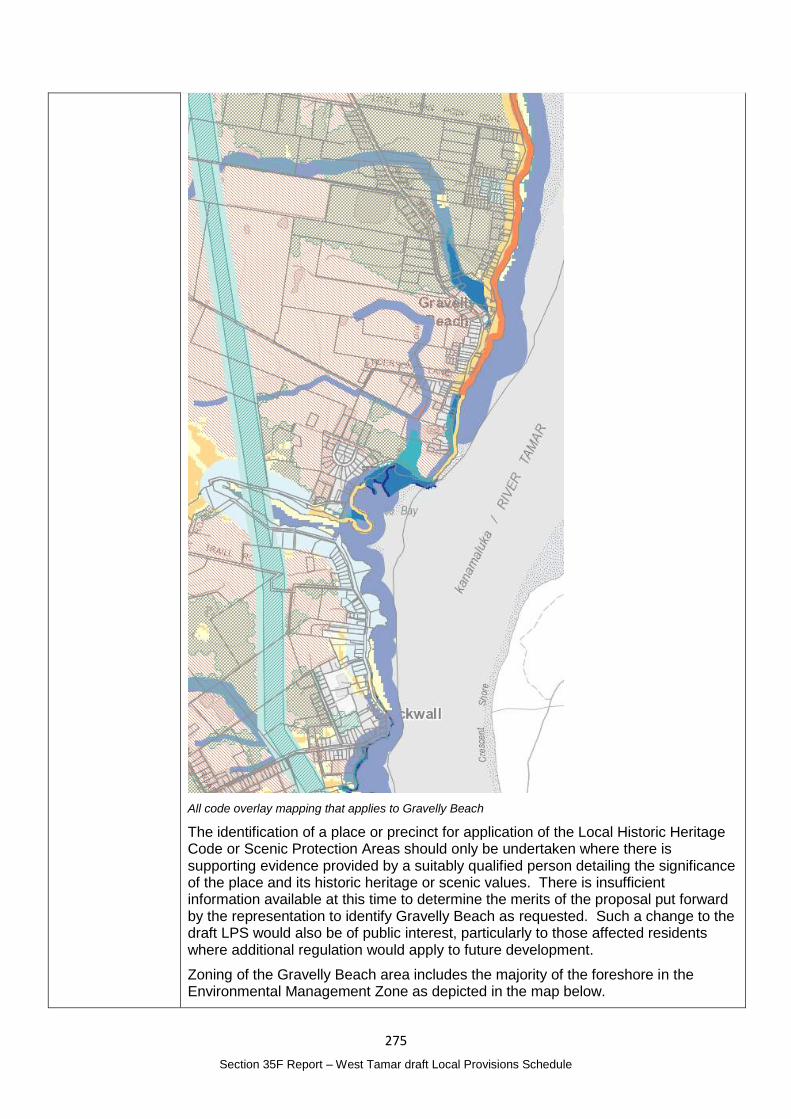
275
Section 35F Report – West Tamar draft Local Provisions Schedule
All code overlay mapping that applies to Gravelly Beach
The identification of a place or precinct for application of the Local Historic Heritage Code or Scenic Protection Areas should only be undertaken where there is supporting evidence provided by a suitably qualified person detailing the significance of the place and its historic heritage or scenic values. There is insufficient information available at this time to determine the merits of the proposal put forward by the representation to identify Gravelly Beach as requested. Such a change to the draft LPS would also be of public interest, particularly to those affected residents where additional regulation would apply to future development.
Zoning of the Gravelly Beach area includes the majority of the foreshore in the Environmental Management Zone as depicted in the map below.
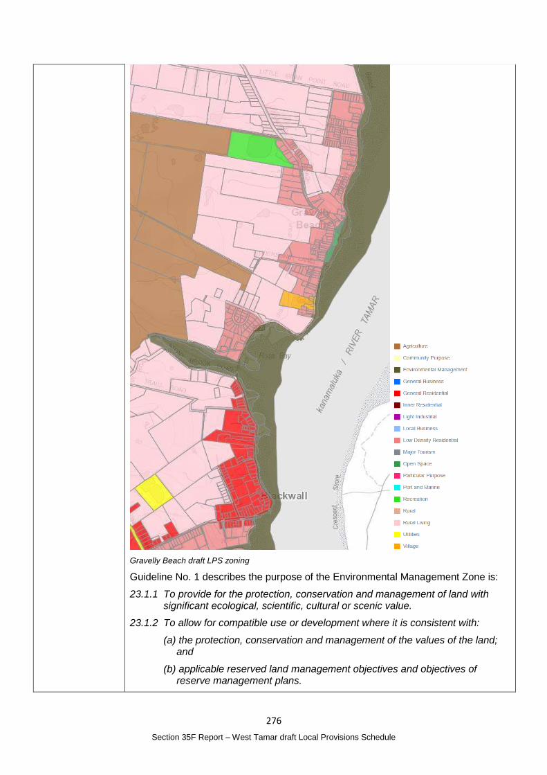
276
Section 35F Report – West Tamar draft Local Provisions Schedule
Gravelly Beach draft LPS zoning
Guideline No. 1 describes the purpose of the Environmental Management Zone is:
23.1.1 To provide for the protection, conservation and management of land with significant ecological, scientific, cultural or scenic value.
23.1.2 To allow for compatible use or development where it is consistent with:
(a) the protection, conservation and management of the values of the land; and
(b) applicable reserved land management objectives and objectives of reserve management plans.
277
Section 35F Report – West Tamar draft Local Provisions Schedule
The Environmental Management Zone is considered to be the most appropriate zone for the coastal area. Future development would be subject to relevant requirements of the TPS as they relate to the zone and any other relevant codes.
Reference to the Gravelly Beach foreshore project and whether this project is appropriate is not a relevant matter to be considered as part of the finalisation of the draft LPS.
Planning Authority recommended action
No changes to the draft LPS are recommended.
Effect of recommendation on the draft LPS
The Planning Authority recommendation has no impact on implementing the draft LPS as a whole.
Meets the LPS criteria
The Planning Authority recommendation meets the LPS criteria.
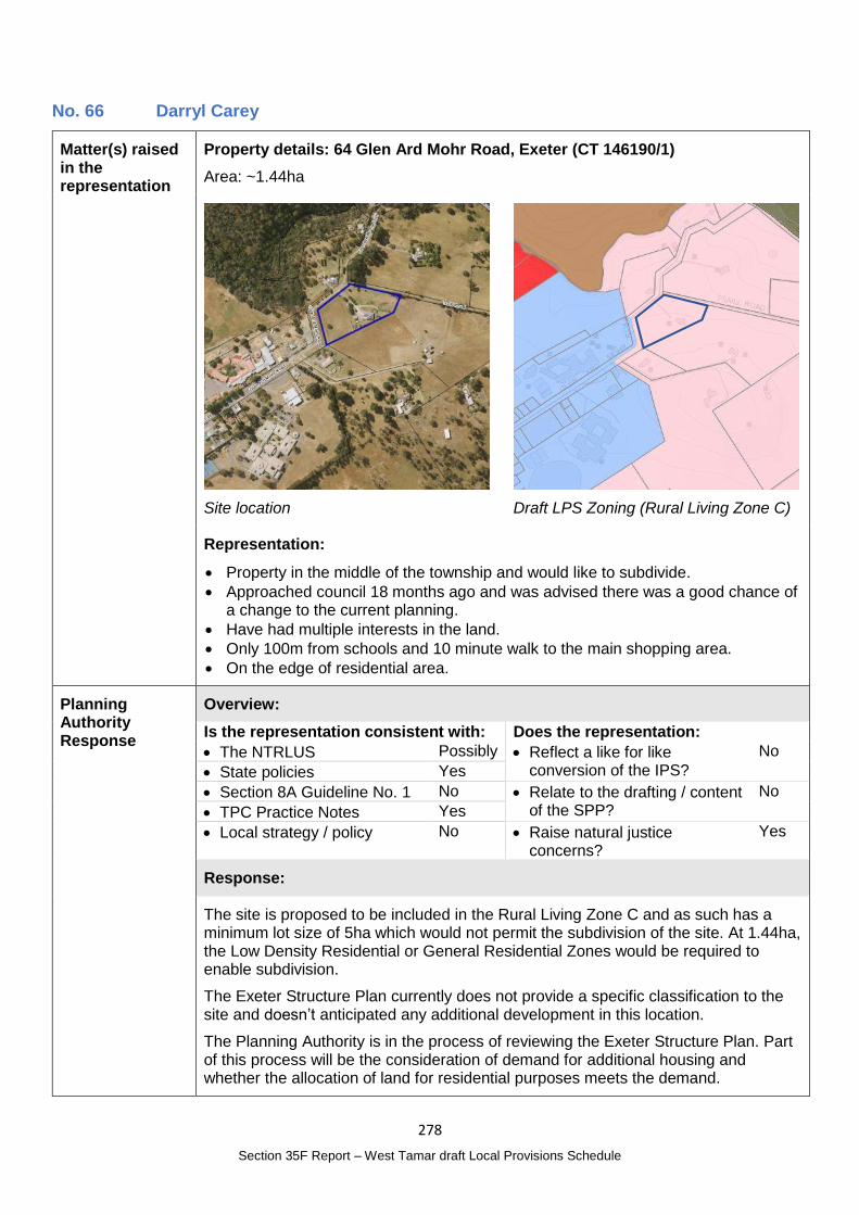
278
Section 35F Report – West Tamar draft Local Provisions Schedule
No. 66 Darryl Carey
Matter(s) raised in the representation
Property details: 64 Glen Ard Mohr Road, Exeter (CT 146190/1)
Area: ~1.44ha
Site location
Draft LPS Zoning (Rural Living Zone C)
Representation:
Property in the middle of the township and would like to subdivide.
Approached council 18 months ago and was advised there was a good chance of a change to the current planning.
Have had multiple interests in the land.
Only 100m from schools and 10 minute walk to the main shopping area.
On the edge of residential area.
Planning Authority Response
Overview:
Is the representation consistent with: Does the representation:
The NTRLUS Possibly Reflect a like for like conversion of the IPS?
No
State policies Yes
Section 8A Guideline No. 1 No Relate to the drafting / content of the SPP?
No
TPC Practice Notes Yes
Local strategy / policy No Raise natural justice concerns?
Yes
Response:
The site is proposed to be included in the Rural Living Zone C and as such has a minimum lot size of 5ha which would not permit the subdivision of the site. At 1.44ha, the Low Density Residential or General Residential Zones would be required to enable subdivision.
The Exeter Structure Plan currently does not provide a specific classification to the site and doesn’t anticipated any additional development in this location.
The Planning Authority is in the process of reviewing the Exeter Structure Plan. Part of this process will be the consideration of demand for additional housing and whether the allocation of land for residential purposes meets the demand.
279
Section 35F Report – West Tamar draft Local Provisions Schedule
While the representation raises matters, such as proximity to the services and the change may have planning merit, the Planning Authority intends to complete the Exeter Structure Plan review and, subject to the outcome of that review, propose amendments to the LPS once the review is complete.
The review process will also consider whether proposed changes are consistent with the NTRLUS.
This process will ensure sufficient information and local planning supports any proposed changes and will provide opportunity for the public to have input into any proposed zoning changes.
Planning Authority recommended action
No changes to the draft LPS are recommended at this time.
Effect of recommendation on the draft LPS
The Planning Authority recommendation has no impact on implementing the draft LPS as a whole.
Meets the LPS criteria
The Planning Authority recommendation meets the LPS criteria.
280
Section 35F Report – West Tamar draft Local Provisions Schedule
Appendix 1 – Representations (see separate attachment)