local community network in identity construction and its reproduction in natural resource management
TRANSCRIPT
Local Community Network in Identity Construction and its Reproduction in Natural Resource Management: A Case Study from the Lower Mun River Basin, Northeast Thailand
Sommai Chinnak 1
Ubon Ratchathani University, THAILAND
Abstract
Northeast Thailand--or Isan, the poorest region of Thailand, frequently witnesses conflict between the state and local inhabitants over natural resources. Southern Isan is home to indigenous Lao, Khmer, and Kuy groups, who have for centuries depended on resources from the Mun River for their livelihoods. The Mun River basin is the largest river basin in Thailand, supporting a population of 8.3 million, spanning 10 provinces and over 13,000 villages. In the name of development and drought alleviation, the Thai state has implemented 2,484 “water development projects”, including number of dams, to manage the river. As a direct product and corollary of the Thai state's discursive practices, these dams caused extensive damage to farmland and forests, and resulted in the degradation of fisheries, all with little or no compensation being offered to the local people affected by these policies. The resulting conflicts led to the formation of the grassroots Mun River Basin Community Organization Network. This paper will examine how, on one side, the state regularly invokes a discourse of development to legitimate the projects it undertakes, and how in response, members of the Mun River network strategically deploy a variety of competing discourses of environmentalism, ethnic identity, community right and local knowledge--to combat coercive and unfair state measures. Morever, by invoking these discourses, members of the network have come to regard the river and its resources as a community right, an orientation which has in turn transformed the way villagers themselves perceive their means of livelihood and traditional identity.
Keywords:
Local Community Network, Identity Construction, Natural Resources Management, The Lower Mun River Basin, Northeast Thailand.
1. Introduction: Isan, Rivers and Livelihoods
Northeast Thailand--or Isan--comprises 19 provinces and covers almost one third of Thailand; as such it is the largest region of the country. The vast
1 Associate Professor (Anthropology), The Mekong Sub-region Social Research Center
(MSSRC), Faculty of Liberal Arts, Ubon Ratchathani University, 34190. THAILAND. Email: [email protected]
2
Khorat Plateau, on the west and northwest, consists of two river basins, and stands at around 700 meters above mean sea level (msl), gradually sloping down to about 200 msl towards the Mun River Basin in the southeast. The Phuphan mountain range, cuts cross the Khorat Plateau from northwest to southeast, and divides the Plateau into two basins – the Khorat and Sakhon Nakhon basins. The Mun and Chi Rivers basins are found within the Khorat basin, their combined areas covering more than two thirds of the total area of Isan (K. Lerdsak and L. Margie, 2001:26). The main river in the Sakhon Nakhon Basin is the Songkhram River.
All the main rivers in Isan flow into the Mekong River and can be divided into three groups: the Mekong River Basin in the northwest comprising streams and rivers that flow directly into the Mekong River, including the Huang, Mun and Leoy Rivers; the Sakhon Nakhon River Basin including the Songkhram and Pung Rivers and the Nong Han Lake; the Khorat River Basin comprising two main river systems, the Chi and Mun River Basins.
The Chi and Mun River Basins include the Chi River and its tributaries including the Pong, Prom and Lampao Rivers, the Mun River and its tributaries including the Lam Takong, Lam Praprang, Lam Dom Yai and Dom Noi Rivers.
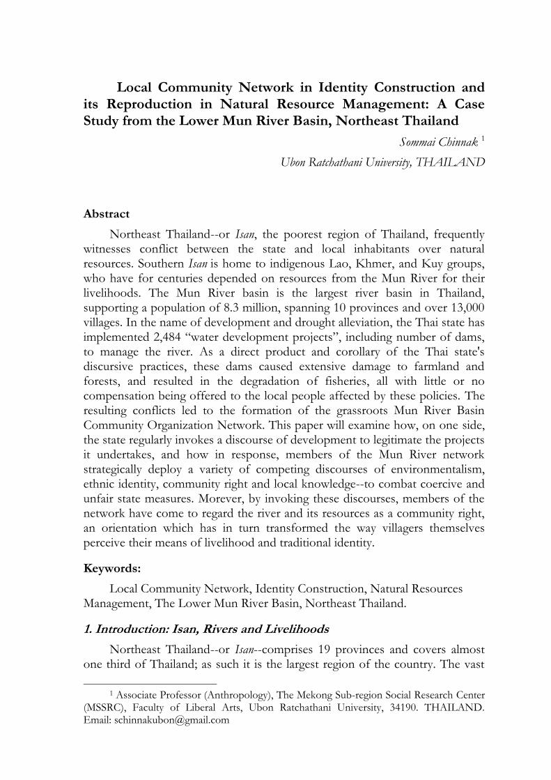
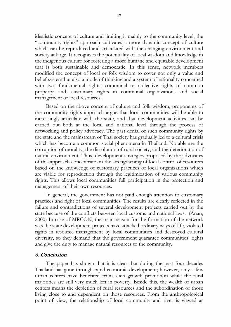
Map 1. Map of Northeast Thailand region and the rivers
(source: from The Mun River Community Organization Network –MRCON, 2005)
According to many local cultures in the Mekong Region, the legendary Naga2 created and now lives in the Mekong River. The folklore of Isan also credits the Naga with creating the Chi and Mun rivers. Descriptions of the
2 The great snake in Thai novel.
3
Naga can be found in the arts of many Mekong cultures, illustrating the shared cultural and geographical linkages as well as the significance of the river ecosystems among the people of northeastern Thailand and the Mekong Region.
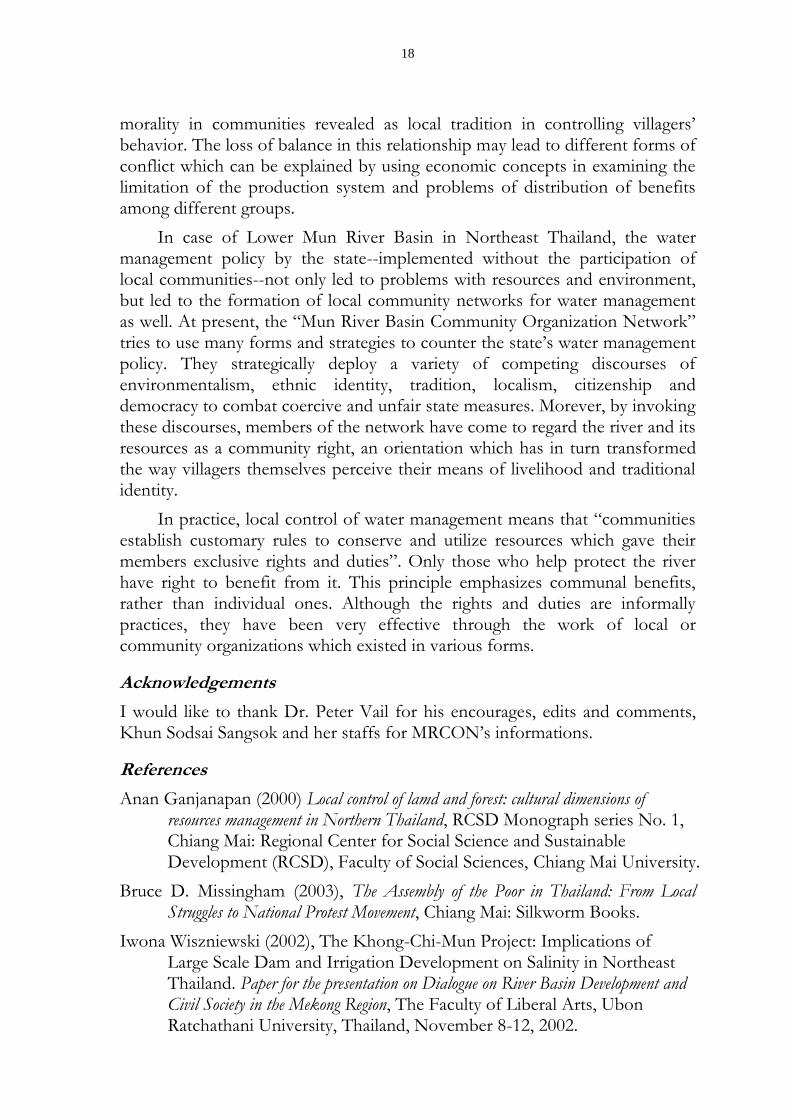
The most significant aspect of the Mun River Basin’s ecosystem is “seasonally-flooded forests”. When the Mekong, Mun and Chi rivers flood their banks, water overflows across the northeastern plains, flooding ponds and bogs and the forests, often covering large areas of the floodplains in water that is several metres deep. The flood waters may cover the land for a few months each year, depositing rich silt across the plains and creating nutrient-rich soils.
Such wetlands in Isan cover an area of 97,000 hectares, from which teo types of flood plains crucial for local livelihood can be discerned: Boong Taam (seasonally-flooded forests) and the Lan Tapak Lum Nam (the low lying plains). The Boong Taam is the low-lying land adjacent to the river or stream. The Lan Tapak Lum Nam are plains that lie immediately above the Boong Taam and are used for cultivating rice and vegetables.
For local people, there are several names that used to differentiate the types of wetland areas such as: Boong and Taam for floodplain; Kut or Long for oxbow lake; Lerng for low-lying land; Doon for deposited sediment that is collected in an oxbow lake; Kam for water that seeps into other water sources; Kui and Koo for dirt dikes or walls along a stream; Hom for a long low-lying narrow valley; Mab for an area between the banks of two adjacent streams; Hong for an area similar to Mab but smaller; Pak for the joining of two or more Long or Kud; Kew Kud for the narrow section between two oxbow lakes; and Don Taam or Non Taam for high areas of a floodplain.
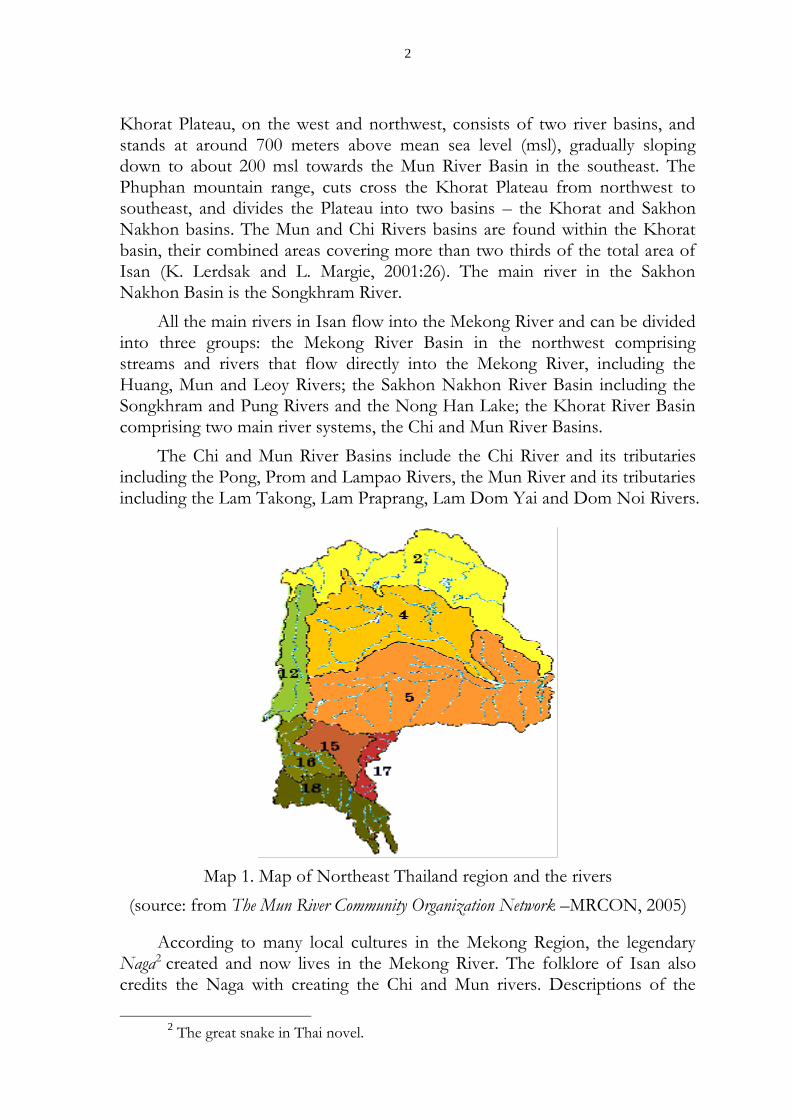
Fig.1 The feature of Boong Taam (seasonally-flooded forests)
Such detailed geographical description demonstrates the local people’s intricate understanding of the diverse ecology and functions of the floodplains and seasonally flooded forests, and their importance to local livelihoods. A unique characteristic of the Boong Taam area is that plant and animal life either have to be able to withstand floods for months at a time and then dry
4
conditions for the rest of the year, or live only during the wet or dry periods.
The Boong Taam is habitat to numerous plants and animals including water-dwelling organisms. Forests in the area can be divided into three categories: 1) Paa Boong Paa Taam, which is a deciduous forest, comprising small trees and thorny bushes that can withstand long periods of floods; 2) Paa Dip, dry and wet rain forest, found in clusters around oxbow lake or along the banks of the Mun River; and 3) Paa Kok, dipterocarp forests found in the transition area next to the low lying plains (Lan Tapak Lum Nam) or hills above 120 metres, or sand mounds along the banks of Mun River.
The Rattanaburi-Rasi Salai Boong Taam is considered the most important wetland in northeastern Thailand, and houses over 90 species of plants that are used as medical herbs by local communities, as well as a wide variety of amphibians, reptiles, birds, mammals, insects, fish, mollusks and worms. For hundreds of years, local communities have relied for food and medicine on the abundant and diverse supply of plants and animals in the flooded forest.
Local communities farming in the floodplains would prepare the land in February and March for cultivation of rice (in the dry uplands and the seasonally-flooded areas), jute, watermelon, peanuts or vegetables. The use of chemical fertilizers was unnecessary as the soil was naturally fertilized by the nutrient-rich deposits of sediment from the river during the wet season. Farmers would plant rice varieties with a short growing time so that the rice could be harvested before the floods came in October.
During May and June, rice cultivation in other areas would begin. Local people would collect Pue and Kok reeds in the flood plain to boil, dye and weave into mats or Hoo Ling wood to make charcoal. The cows and buffaloes would be taken to the flood plain to graze. Vegetables, fish and shellfish would also be collected during this time, ensuring that there was always plenty of food.
After the rice harvest in September to November, the floodplain would once again be covered by water. During this time, local people would catch fish, their fishing rights usually corresponding with the area of paddy field submerged by the flood waters. As the flood waters once more recede, the next year’s cycle of cultivation would commence. (Lerdsak and Margie, 2001:29)
2. Isan under the Development and Drought Alleviation Discourses
Isan was once a closed inland sea during three separate periods of time some 50-80 million year ago (this is known as a marine transgression). A layer of rock salt was deposition each time the sea was evaporated. Between the three marine transgressions, sediments including clay, clay stone, sandstone and siltstone were deposited and are referred to as Clastics. Collectively the Clastics and salt layers are known as the Maha Sarakham Formation. While they were
5
being deposited, the Phu Phan mountain range, which now separates the Khorat from the Sakon Nakhon Basin, was being uplifted and the two basins were gradually subsiding (sinking). This tectonic movement resulted in the folding of the Maha Sarakham Formation in a wave and an uneven deposition of the various salt and clastic layers at depths ranging between 20m to 500m below the surface. (Srisuk et al. 1999 cited in Wiszniewski, 2002: 18)
The climate of Isan is similar to that of other ‘dry tropical zone’ in Southeast Asia. In contrast to humid tropical zones, where the amount of water resulting from rainfall exceeds evaporation throughout the year, in the seasonally dry zones the evaporation exceeds the amount of rain water during the dry season. While there can be considerable dryness in the dry season, especially in the Khorat Basin, in the rainy season flooding occurs when both the Mekong and the other rivers in the northeast overflow. Dry zones are furthermore characteristic by an enormous biodiversity.
That such dry area is necessarily poverty stricken is a common, if questionable, assumption common among government officials and ‘development’ planners. The history of Khorat Plateau shows an immigration of people to settle in the region. There was prosperity, but wealth was not derived from the sale of surpluses of agricultural crops, but rather from trade in other goods. Irrigation did not serve surplus cultivation, but provided water stores allowing consumption during the dry season. Rain-fed rice production on the Khorat Plateau was unstable due to climatic circumstances and rice production was not for export. Insofar as trade was important, it was in minerals, cattle or forest products. With the increasing importance of maritime port state since the 15th century, dry zones lost their former importance and became ‘inward looking’ with population practicing subsistence agriculture, not exporting to external markets. Moreover, because of its unstable agriculture, the northeast could never supply a center or city with stable food surpluses, and this perhaps explains the Siamese Kingdom’s lack of interest in the northeast region until the 18th century (Breukers, 1999: 25).
Examining the historical context of the northeast, we can discern the emergence of those perceptions and interests which have shaped development policies of the Thai State. Chief among these is the increasing presence of the state at village level in the form of bureaucracy, officialdom and infrastructure. Reactions from people in the northeast have varied from adaptation and selectively assenting to new practices and opportunities, to armed resistance against penetration of the state with its policies and bureaucracy.
Initially, expansion in the economy of the northeast hardly brought any change, since the majority of the people continued producing mainly for their own consumption. However, by the 1970s people were increasingly forced into non-farm wage labor to obtain cash for paying taxes, purchasing agricultural tools and paying for other services including education and health care. For
6
part of the year, villagers went to Bangkok, filling the lower echelons of the labor market in new, booming industries. Alternatively, people became involved in local services and entrepreneurship. Local trade received additional impetus as a result of the improved road system and the growing local demand for commodities. Agricultural diversification became important sources of foreign exchange, which served to trigger Thailand’s economic growth.
Industrialization in the modern Thai state has been financed with surpluses drawn from the agricultural sector via provision of cheap food for the urban population, unskilled and semi-skilled labor, and government revenue coming from taxation and revenue from agricultural exports. Poverty by some estimates has declined, but inequality in income distribution has growth, to the disadvantage of the rural population. Moreover, government policies have been responsible for this in so far that they favored urban over rural development, large over small initiatives, and industry over agriculture. So despite a rural industry policy in the fourth Five Year (Economic) Plan (1977-1981) and the labeling of the 1980s as the ‘Decade of Rural Development’, the interest of policy makers and privates investors in smaller scale initiatives declined in favor of large-scale industrial development. Successive governments interfered in resource allocation in such a way that natural resources have been employed to acquire foreign exchange instead of providing the rural population with a secure source of livelihood. (Breukers, 1999: 26-27)
3. From Traditional to State Water Management: Conflicts between the State and Local Isan Communities
3.1. Traditional water management in northeastern Thailand
A network of many small and large streams covers almost the entire northeastern region, including numerous lakes, bogs and ponds created as a result of years of erosion and flooding of the meandering rivers and streams. For local communities, these sources of water are as important as the major rivers such as the Mun (or Moon) and Chi for their main sources of livelihood. Water resources also form the foundation of the cultural practices of local communities, who recognize the close relationship between these water sources and the fertility of other resources in the area, such as fish, and the biodiversity of local forest ecosystems, such as the paa taam (seasonally flooded forests)
Communities living near the major rivers use the main channels of the river of fishing because it is difficult to bring water over the high banks of rivers into the fields. Nevertheless, farmers have developed local technologies that are still in use in the Upper Mun and Phrom river areas such as traditional water wheels to bring water into their fields. Farmers also rely on small local water sources or rainwater for agriculture.
For communities living near small streams and wetlands--but further away
7
from the major rivers--low-lying bodies of water serve both as a sources of fish and as a sources of water for farming. The water can easily be diverted into the fields by hand or by using small dikes built by local communities. Underground water wells common throughout the various river basins (typically around 15 meters deep) also provide and important source of water for agriculture and consumption.
Agricultural practices and water use in Isan are complex and diverse and depend not only on the water sources available but also on the seasonal rains, soils, flooding, and other natural factors. Rice, the staple crop, is usually grown during the rainy season when rainwater is abundant. However, if the period between rains is too long, local technologies such as water wheels and dikes are often used to divert water into the paddy fields. In the dry season, crops with short growing seasons – such as jute, peanuts, chili, tobacco, watermelon and corn – are most common, cultivated only once a year for domestic consumption or for sale in village markets. These dry season cultivation areas are often scattered near streams, bogs, ponds, sites of underground wells and interspersed among rice paddy fields, and irrigated by hand. (Lerdsak and Margie, 2001:32)
3.2. Water management by the State in Isan
3.2.1. Background
The origin of water management by the State in Isan is related to the socio-political history of the region, especially during the cold war era and the spread of a particular discourse of development.
As violent conflict intensified in the countries of the Mekong Region during the Second Indochina War in the 1960s and 1970s, large parts of Isan came under the influence of--or even control of--the insurgent Communist Party of Thailand. As such, Isan assumed significant strategic and political importance for the Government of Thailand and the United States (US) military, both of which were working to ‘stop the spread of communism’. An important component of the Thai/US strategic partnership at this time included US government supplies of economic, financial, and military assistance to the Thai government.
As part of a combined counter-insurgency/development programme, the Thai/US strategic partnership aimed to control the people of Isan as well as access to the region’s natural resources. The “development” that resulted from these objectives included building infrastructure like power stations, roads and highways (the latter connecting Bangkok to important US military bases in the town of Udorn Thani and Ubon Ratchathani), and promoting intensive cash crop cultivation, as well as plans dam the Mekong River and its tributaries in the lower Mekong Region for such ‘benefits’ as flood control, irrigation, and the generation of electricity. Pushing northeasterners into the wage labor
8
market, as descried above, was also part of this process of increasing Isan dependency on the Thai government.
In fact, since the 1950s the Mekong Committee (now called the Mekong River Commission) had been conducting field surveys and collecting hydrological data regarding potential site for hydro electronic and irrigation dams throughout the Mekong Region. By the early 1960s, American engineers working with the Mekong committee had designed a cascade, or series, of seven multipurpose dams to be built on the Mekong River between Luang Prabang in Laos down to Sambor in Cambodia’s Kratie province (and including a dam at the mouth of Cambodia’s Great Lake) with the objective of providing hydroelectricity, flood control, irrigation, and improved navigation. With a total capacity of 23,300 megawatts, the seven reservoirs would be capable of storing more than one-third of the Mekong River’s annual flow. A series of large reservoirs built on the Mekong River and most of its tributaries would, it was claimed by the Mekong Committee, store water for year-round irrigation of cash crops and were designed to significantly reduce and even eliminate the annual floods of the Mekong River and its tributaries.
The political instability caused by the war in Indochina meant that most of these plans remained confined to the paper on which they were printed. Within Thailand, however, many of these projects were in fact built, most during the 30 years since planning began, and most of which, such as the Sirindhorn, Ubolrat and Pak Mun Dams, resulted in the forced resettlement of hundreds of local communities, the destruction of river ecosystems and fisheries, and the destruction of fishing-and farming-based livelihoods of tens of thousands of rural families. (Lerdsak and Margie, 2001:25,27)
3.2.2. The Politics of Irrigation
One of the water management project that have started to be implemented in Isan is the Khong-Chi-Mun (KCM) Irrigation Project - named after the Mekong River, its major tributary in northeastern Thailand, the Mun River, and the Mun’s major tributary, the Chi River – along which the project’s proposed dams and irrigation canals were built.
The KCM project is the largest irrigation project in the Mekong River Basin. The KCM was originally planned, and remains, as much of political objective as a “development” project. Poorly planned but richly funded through extensive networks of patronage and a belief that any irrigation project – no matter its size, cost, or impact – is “development”, the KCM and its proponents represent the power and influence of money and politics in Thailand. (Ibid)
The KCM would divert 6,580 million cubic metes (MCM) of water from the Mekong River. The plans are presided over by Department for Energy Development and Promotion-DEDP. The environmental impact assessment
9
was completed in 1992 by Nippon Koei Co. Ltd., SWHF Ltd., Asian Consultants, and Paul Consultants. The project would be built in 3 phases requiring a total time period of 42 years and budget of approximately US$9.1 billion. Dams, electric pumping stations, irrigation canals, and associated projects were to be built on every major river in Isan. Construction of the first phase of the project began in 1989 and continues to this day.
Since the late 1980s, successive governments in Thailand have promoted the KCM as a solution to “water shortage”, “drought” and “poverty” in the country’s northeast. The objective of the KCM project, according to its proponents, is to transform the largely rain fed cultivation areas of Isan into intensive irrigated farming so as to increase the production of agricultural crops for export.
The first phase of the project which began in 1990 includes building a total of 20 dams on the Mun and Chi rivers over 17 years. The second phase
would establish an irrigation system for 4.98 million rai 3 across 15 provinces
and would require 16 years for completion. This phase was plan to start in 1991 to coincide with the construction of Pa Mong dam – a concrete dam across the Mekong River, 20 kilometers upstream from Vientiane, Lao PDR. Phase 2 has been delayed, and so far the Pa Mong Dam has not been built. The third phase, beginning in 2017, would construct a weir and diversion system at the mouth of the Loei River, and include underground tunnels and seven reservoirs. This phase relies on international water from the construction of two dams on the Mekong main stream, the Pa Mong dam and the Upper Chiangkhan dam planned in Lao PDR.
Since 1990 at least 14 dams have been built as part of phase one. An April 1997 report on the impact of KCM by Northeast NGO-Cod, Project for Ecological Recovery, and Friends of the People reported local people living near Rasi Salai dam, built in 1992, experiencing salinisation of their farm lands, the permanent flooding of farmlands and flooded forests, and the decline of fisheries. For six years thousands of village people from Rasi Salai have protested over compensation for the loss of farmland, fisheries and flooded forests. Another very controversial dam which is part of phase one is the Pak Mun dam completed in 1994. According to newspaper reports the Pak Mun dam has destroyed more than 90 percent of the Mun River’s once productive fisheries. (Watershed, 1999: 19)
4. The Local Construction of Rights in Community Natural Resources
4.1. Thailand’s Recent Popular Movements Background
For the last two decades, community groups, farmer leaders and NGO activists in Thailand have been challenging the rationale of free-market growth
3 796,000 hectares – one rai is equal to 0.16 hectares
10
and export-led industrial development promoted principally by the National Economic and Social Development plans. (Rajesh, 2001:49)
The upsurge of popular movements in Thailand over past decade obviously share many similarities with the experience of the other part of the world – the broad base of participation rejection of old forms of organization, emphasis on environment, and role of community discourse. But there are certain ways in which the details or emphasis of the movements in Thailand have been importantly different. Some of the different are as follows: (from Pasuk, 2002:61-63)
Historical shift – a large number of movements of great variety have arisen within a very short space of time. In a broad sense, this is a result of changes in the global and local context. The end of the cold war led to the decline of dictatorship. The opening up of democratic politics has created more space for social agitation and political expression. The global discourse on topics such as rights, identity, and environmental protection has stimulated reactions within Thailand. At the same time, the rise of the modern state, market-oriented economy, and new forms of global power (hegemonic states, and dominant multinationals) has caused struggles over resources, dislocation of communities, and erosion of ways of life. In sum, the combined impact of democratization, economic growth, and globalization creates contradictory results. They encroach on people’s lives and livelihood, and at the same time they open up political opportunities and give legitimacy to social movements.
The new movements in Thailand include a wide variety of social groups. But the significant fact is the large participation by the ‘little people’ who have traditionally been excluded from a political voice. These include hill peoples, small fisherman, marginal peasants, slum dwellers, and working women. They have become more assertive than before about their rights and roles in society. This is partly explained by the passing of the Cold War and the era of dictatorial rules. But there has also been an important synergy between these various different movements. The space created by one movement is available to another. Experiences feed on one another and become cumulative. The sum of several movements is greater than their individual contributions alone.
This upsurge is significant because it represents a break from the past. Thai society has had little or no experience of mass political mobilization. Nationalism was orchestrated by the elite. With no colonial control, there was no anti-colonialist mass movement. Socialism was crushed within the context of the cold war. Hence the social movements of the 1990s represent some of the first, sustained examples of mass social action. With and ever faster pace of globalization, social movements are definitely here to stay in Thailand.
Democratic limits – in different ways, various movements express frustration over the poor operation of Thailand’s parliamentary democracy. The rapid rise of ‘money politics’ has stimulated middle class support for the movement for
11
constitutional reform and campaigns against corruption such as that in the public health ministry. The failure of representative democracy to provide any meaningful representation for poor and marginal groups has stimulated many agitation campaigns. Despite wide differences in social background, these various movements share a feeling that politicians and bureaucrats imagine themselves as a ruling caste rather than as public servants.
This shared perspective can at times become a basis for common action. The Assembly of the Poor supported the constitutional movement although the constitution was peripheral to their major concerns. Many of the activists in campaigns over the constitution and corruption have lent moral and organizational support to little people’s campaigns for rights and resources. Of course, such cooperation has strict limits. But in the short term it helps to create a ‘snowball’ effect of benefit to many contemporary movements.
Environment – over the past half century, natural resources have been captured and destroyed for private gain, with the process often justified by discourse about development and national interest. Those most sensitive to the loss of such resources are the little people who depend most heavily on nature for their livelihood and culture. The attempts to halt this process and protect both resources and livelihoods has become a trend which transcends any particular local campaign, and acts as a common base for alliance between groups of varying background.
The past pattern of Thailand’s development assumed that lots of little people could be sacrificed in the business of creating modern industrial society on the model from the west. But the recent movements show that it has become more difficult to maintain that belief. The government will have to think more seriously in pursing old policies and strategies without regards to the effects on people and their wishes.
Culture, identity and alliance – as in other developing countries, Thai social movements mobilize concepts of culture and identity to build solidarity and inspire action. This is similar to earlier western movements, but also importantly different. The cultures and identities mobilized are very often those of the poor, the peripheral, and the excluded. This gives these movements some of the moral power (against injustice) of old-style class-based action. But at the same time, the fact that these movements are not founded explicitly on class concepts and motivated by class antagonism makes it easier for them to mobilize support from a broader public. Appeals to universally acceptable concepts – protection of the environment, health for all, no corruption- make it possible for movements of the underprivileged to build support from the educated middle class, through the links forged by NGOs.
Since 1961, when Thailand’s “First National Economic Plan” was drafted following World Bank recommendations, to the Ninth National Economic and Social Development Plan being implemented from 2002 to 2006, the country’s
12
planners have strengthened the centralized state bureaucracy, promoted the construction of roads and dams, expanded the areas of large-scale tree plantations and cash crops for export, subsidized the industrial exploitation of natural resources, and opened up the Thai economy to foreign capital.
By the late 1980s, it was becoming evident that these plans were resulting in the widespread loss and destruction of natural ecosystems, loss of biological diversity, and the displacement and impoverishment of thousands of rural communities.
Conflicts over natural resources become more commonplace between the state and the private sector on one hand, and rural communities on the other. Under pressure from continual protests by village people demanding greater local control over natural resources as well as widespread criticism over the lack of people’s participation in policy planning, the NESDB invited the input and collaboration of NGO representatives in drafting the Eighth National Economic and Social Development Plan in the late-1990s.
Subsequently, the Eighth Plan document reflected many NGO perspectives, such as the need for greater administrative decentralization, transparency and accountability, and increased local control over natural resources.
In practice, however, nothing changed. The Thai bureaucracy, the various Ministries, the National Budget Bureau remained reluctant to relinquish their power and authority. As the state began implementation of the Eighth Plan, NGOs and local community groups realized that the experiment had failed: collaborating with the state’s planners would not be adequate to change the direction of conventional ‘development’. (Rajesh, 2001:49-50)
4.2. The Mun River Basin under the discourse of development
The Mun River Basin is the largest river basin in Thailand has total area 69,701 km2 or 13.6% of water basin area of the country. It area cover 10 provinces of lower Northeast region and some part of central Northeast region. It was supporting a population of 8.3 million, spanning 10 provinces and 13,529 villages. From the study of the National Economic and Social Development Committee (1993) has divided Mun River into 23 sub-basins.
Nowadays, there are a lot of water development projects along the river. These consist of 9 large projects, 100 medium projects, 1,084 smaller projects and 3,268 other projects.
From the report of MRCON, many problems occurred along the Mun River which leads to the establishment of the network. First, the basin’s ecosystems were destroyed such as sand suction and by the large-scale planting of eucalyptus. These activities have impacted water drainage and fish stocks along the river. Second, water quality has suffered as a result of waste water from urban centers, markets, hospitals and factories. Third, both soil and water
13
have been degraded through the intensive use of chemicals for agricultural activities. Fourth, problems stemming from the dam construction on the river have impacted paddy land, flood plain forest, and increased salinity. Fifth, the local officials have resisted allowing local people at the grass roots level to participate in resources management.
4.3. The Mun River Community Organization Network (MRCON) as the case study from the Lower Mun River Basin
4.3.1. The origin of the network
The Mun River Community Organization Network (MRCON) was formed by a gathering of communities which realized that the water’s problems had to be resolved cooperatively. They announced the formation of the “network” on November, 18, 1995 during a seminar at Surin Rajabhat University. The seminar focused on problems the Mun River was facing regarding natural resources and environment, as well as the infringement of citizen’s right living along the Mun river banks. They organized the network into three regions (downstream, middle stream and upstream) and sent the proposal to the government.
The objectives of MRCON are as follow;
1) To develop and empowerment the community’s organization and network for the sustainable of natural resources and environmental management of the basin.
2) To study and develop local wisdom of the basin in natural resources and environmental management and the careers appropriate for the local ecosystem which can serve the need of household, community and network.
3) To campaign and promote the local knowledge about the natural resources and environmental management of the basin to the communities, public and associated members.
4) To watch and follow the impacts and problems from the socio-economic policy and industrial to eco-cultural of the Mun river basin’s community.
4.3.2. The Members
The members of the network consisted of 10 groups from the local area of six provinces; Nakonratchasima (Up Stream), Buriram, Surin, Roi Et, Sri Saket (Middle Stream) and Ubon Ratchathani (Down Stream). Some of the
members later were the member of Assembly of the Poor.4
4The Assembly of the Poor was born when the “Mun River Declaration” was made on 10-15 December 1995 at Thammasart University and Khong Chiam, Ubon Ratchathani Province, by representatives of different local communities who have suffered the consequences of development…that have arisen in the middle of the war over natural
14
These groups were connected by the secretariat into a team called “The Mun River Basin Communities Network Project”. This team worked and was based in Surin Province.
Beside this group, the network worked with other organizations to run various activities. These included the province’s “civil society” in six provinces and as well as local and national level government organizations such as Provincial’s Public Health Center, Department of Environmental Region 5 and 7 and Department of Environment Quality Promotion.
4.3.3. The Network’s Activities Many activities have been done under the name of the network. These activities can be divided into 4 categories: (1) The empowerment of community organizations and network for resources management. These activities include training, seminars and study tours. The contents of the activities address laws concerning water, watching the river basin, seminars for discussing problems and solutions, and a study tour to facilitate the exchange of ideas and experiences about resources management within the network. (2) The study of local knowledge concerning natural resources and environmental management. There are eight projects being done by the communities and the network. These projects are as follows: - The Water Management by the State: a Case Study of Thung Samrid Project, Phimai District, Nakonratchasima Province. - The Conservation of Watershed by the Civil Society, Baan Nong Yai Community, Huai Bong Sub-district, Dan Khun Thod District, Nakonratchasima Province. - The Natural Resources and Environmental Management of the Mun Riverside Communities: a Case Study of Buriram Province. - The Local Wisdom for Water Management Model of the Middle Mun River Basin. - The Local Knowledge for Resources Management in Paa Taam (flooded plain forest) at Rasri Salai area: Sri Saket, Roi Et and Surin Province. - The Study of Water Management for Sufficiency Economy: a Case Study of Baan Wang Yang, Warinchamrab District, Ubon Ratchathani Province. - The Study of the Impact of the Sirindhon Dam Construction: a Case Study in Baan Pak Chum, Nhon Khaw Sub-district, Sirindhon District, Ubon Ratchathani Province. - The Study of Community Rights: a Case Study of Community Rights Processes of Rasi Salai Dam’s villages and Hua Na Dam.
resources, soil, water, forest, mineral sources, fisheries, etc., between the state, business, and villagers living in local communities in both the countryside and the city. (Assembly of the Poor 1997d, cited from Missighnam (2003: 15).
15
(3) Campaign for publicizing the state of knowledge and local wisdom about resources management in the basin. This activity consist of various forms: a newsletter distributed every 2 months (named Saan Mae Moon) for communicating with and educating the members of the network; songs recorded on cassette tape and CD which express the culture of the people who living along river basin; and others including member shirts and books. These materials expressed, in concrete form, the identity of the network and its members. (4) Collected fund for recovery Mun River. This activity was done by sponsoring a walking campaign for the Mun River called namely Dhamachartyarttra , which started from upstream (Nakon Ratchasima) and continued downstream to Ubon Ratchathani. This activity was set up every 2 years since 1998. In this activity, Buddhist monks are invited to perform a consecration of the river.
5. Discourses and Discursive Constructions
When we look at the activities of the network above, we find identity being constructed in different forms. These activities reflect the resistances and symbolic struggles against the state through a variety of discourses and social practices.
5.1. Discourses of Environmentalism
The environmentalism expressed by the network like the study of the Assembly of the Poor by Missingham (2003); is principally concerned with defending people’s livelihoods and community rights to manage and control local resources (in case of the network is water resource). Staking their political claims using the language of environmentalism provides a politically powerful discourse to attack development that resonates with middle-class environmentalism expressed in the media. The network asserts that capitalist development and industrialization have been ecologically destructive and have resulted in a great deal of social conflict over resources.
The environmental destructiveness of large-scale development is presented very clearly in the section of the Mun River Declaration under the heading “Dam and the Destruction of Ecology and Nature”:
In the 50 years of development of dam technology we have learned a lesson that forests, rivers and communities are destroyed and wiped out. This has been very expensive lesson about the suffering and hardship of people behind dams, and negative effects on the ecology of rivers and forests. River after river has been destroyed, their fertility destroyed. Can we summarize this lesson yet or not, that using the energy of water to generate electric power, or damming rivers to respond to the needs of consumption that know no limits—is it worth the loss of natural resources and wealth of the environment that should be passed on to generations of our children, and grandchildren to come? (Missingham, 2003: 56)
16
5.2. Discourses of Ethnic Identity
Because of the Mun River flow through many provinces of Southern Isan; the home of Thai-Korat or Lao Korat, Khmer, Kuy and Lao ethnic groups, and the member of the MCRON consist of these ethnic groups, so the ethnic identity was one of the discourse which reproduced by the network for their movement in various forms.
Some of the interest forms such as; the re-appropriated the river’s name, changing the spelling from the standard Thai-ified version “Mul” to Lao “Mun or Moon” –thereby emphasizing the Lao etymology of the world (which means ‘heritage’), expressing local Lao ethnic affiliation and solidarity, and, further, highlighting the importance and meaning of the river to others who like along its bank. (Chinnak, 2003)
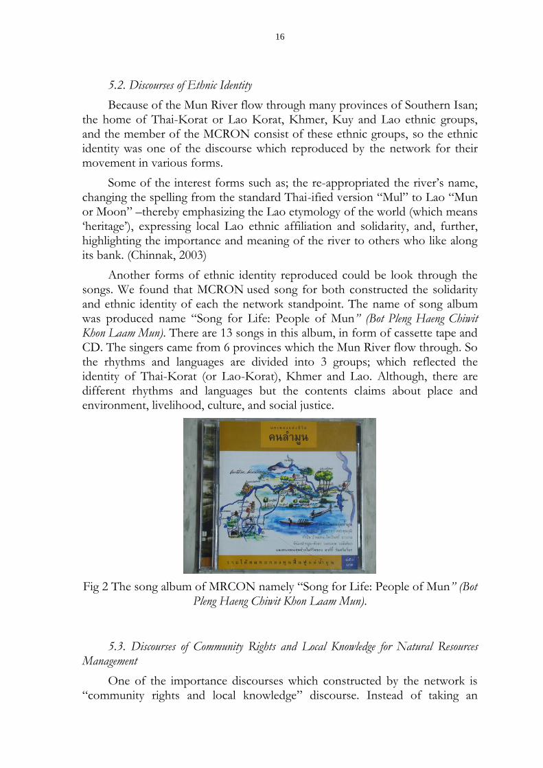
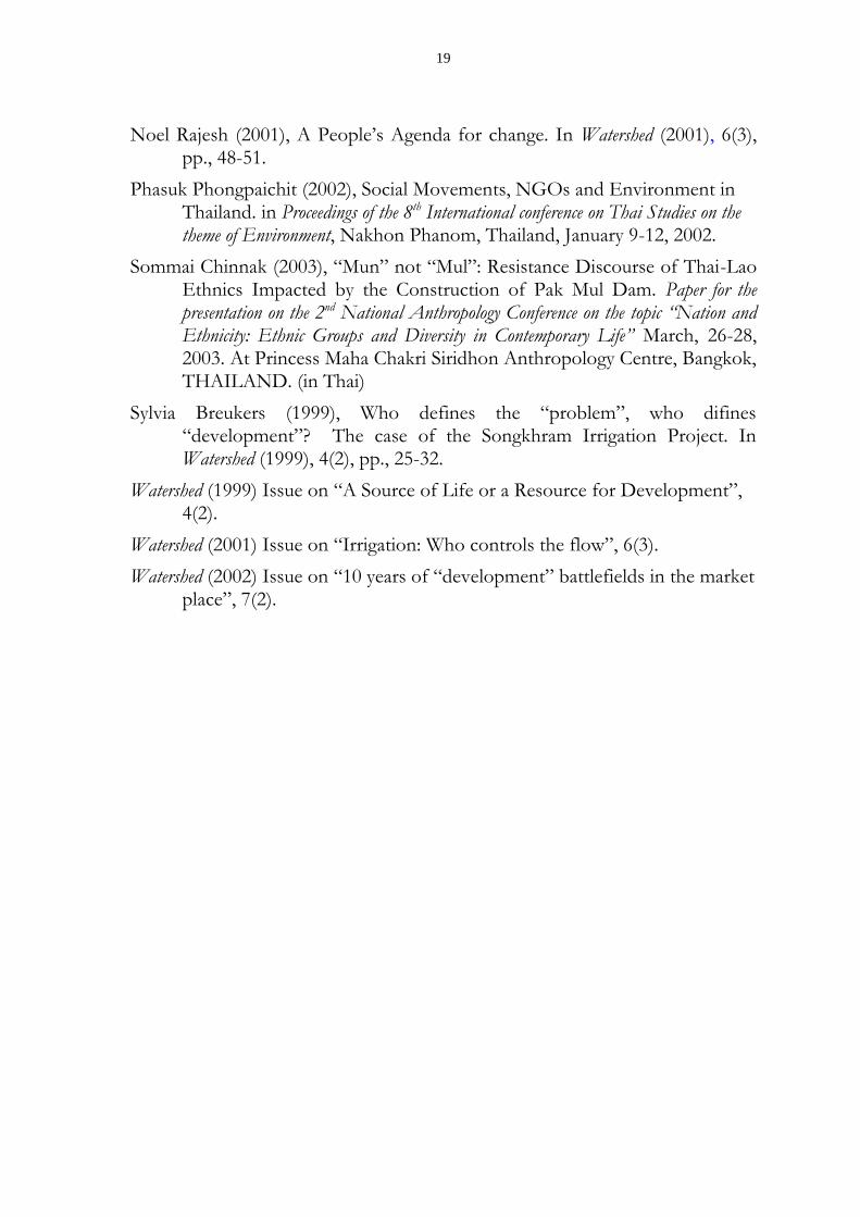
Another forms of ethnic identity reproduced could be look through the songs. We found that MCRON used song for both constructed the solidarity and ethnic identity of each the network standpoint. The name of song album was produced name “Song for Life: People of Mun” (Bot Pleng Haeng Chiwit Khon Laam Mun). There are 13 songs in this album, in form of cassette tape and CD. The singers came from 6 provinces which the Mun River flow through. So the rhythms and languages are divided into 3 groups; which reflected the identity of Thai-Korat (or Lao-Korat), Khmer and Lao. Although, there are different rhythms and languages but the contents claims about place and environment, livelihood, culture, and social justice.
Fig 2 The song album of MRCON namely “Song for Life: People of Mun” (Bot Pleng Haeng Chiwit Khon Laam Mun).
5.3. Discourses of Community Rights and Local Knowledge for Natural Resources Management
One of the importance discourses which constructed by the network is “community rights and local knowledge” discourse. Instead of taking an
17
idealistic concept of culture and limiting it mainly to the community level, the “community rights” approach cultivates a more dynamic concept of culture which can be reproduced and articulated with the changing environment and society at large. It recognizes the potentiality of local wisdom and knowledge in the indigenous culture for fostering a more humane and equitable development that is both sustainable and democratic. In this sense, network members modified the concept of local or folk wisdom to cover not only a value and belief system but also a mode of thinking and a system of rationality concerned with two fundamental rights: communal or collective rights of common property; and, customary rights in communal organizations and social management of local resources.
Based on the above concept of culture and folk wisdom, proponents of the community rights approach argue that local communities will be able to increasingly articulate with the state, and that development activities can be carried out both at the local and national level through the process of networking and policy advocacy. The past denial of such community rights by the state and the mainstream of Thai society has gradually led to a cultural crisis which has become a common social phenomena in Thailand. Notable are the corruption of morality, the dissolution of rural society, and the deterioration of natural environment. Thus, development strategies proposed by the advocates of this approach concentrate on the strengthening of local control of resources based on the knowledge of customary practices of local organizations which are viable for reproduction through the legitimization of various community rights. This allows local communities full participation in the protection and management of their own resources.
In general, the government has not paid enough attention to customary practices and right of local communities. The results are clearly reflected in the failure and contradictions of several development projects carried out by the state because of the conflicts between local customs and national laws. (Anan, 2000) In case of MRCON, the main reason for the formation of the network was the state development projects have attacked ordinary ways of life, violated rights in resource management by local communities and destroyed cultural diversity, so they demand that the government guarantee communities’ rights and give the duty to manage natural resources to the community.
6. Conclusion
The paper has shown that it is clear that during the past four decades Thailand has gone through rapid economic development; however, only a few urban centers have benefited from such growth promotion while the rural majorities are still very much left in poverty. Beside this, the wealth of urban centers means the depletion of rural resources and the subordination of those living close to and dependent on those resources. From the anthropological point of view, the relationship of local community and river is viewed as
18
morality in communities revealed as local tradition in controlling villagers’ behavior. The loss of balance in this relationship may lead to different forms of conflict which can be explained by using economic concepts in examining the limitation of the production system and problems of distribution of benefits among different groups.
In case of Lower Mun River Basin in Northeast Thailand, the water management policy by the state--implemented without the participation of local communities--not only led to problems with resources and environment, but led to the formation of local community networks for water management as well. At present, the “Mun River Basin Community Organization Network” tries to use many forms and strategies to counter the state’s water management policy. They strategically deploy a variety of competing discourses of environmentalism, ethnic identity, tradition, localism, citizenship and democracy to combat coercive and unfair state measures. Morever, by invoking these discourses, members of the network have come to regard the river and its resources as a community right, an orientation which has in turn transformed the way villagers themselves perceive their means of livelihood and traditional identity.
In practice, local control of water management means that “communities establish customary rules to conserve and utilize resources which gave their members exclusive rights and duties”. Only those who help protect the river have right to benefit from it. This principle emphasizes communal benefits, rather than individual ones. Although the rights and duties are informally practices, they have been very effective through the work of local or community organizations which existed in various forms.
Acknowledgements
I would like to thank Dr. Peter Vail for his encourages, edits and comments, Khun Sodsai Sangsok and her staffs for MRCON’s informations.
References
Anan Ganjanapan (2000) Local control of lamd and forest: cultural dimensions of resources management in Northern Thailand, RCSD Monograph series No. 1, Chiang Mai: Regional Center for Social Science and Sustainable Development (RCSD), Faculty of Social Sciences, Chiang Mai University.
Bruce D. Missingham (2003), The Assembly of the Poor in Thailand: From Local Struggles to National Protest Movement, Chiang Mai: Silkworm Books.
Iwona Wiszniewski (2002), The Khong-Chi-Mun Project: Implications of Large Scale Dam and Irrigation Development on Salinity in Northeast Thailand. Paper for the presentation on Dialogue on River Basin Development and Civil Society in the Mekong Region, The Faculty of Liberal Arts, Ubon Ratchathani University, Thailand, November 8-12, 2002.
19
Noel Rajesh (2001), A People’s Agenda for change. In Watershed (2001), 6(3), pp., 48-51.
Phasuk Phongpaichit (2002), Social Movements, NGOs and Environment in Thailand. in Proceedings of the 8th International conference on Thai Studies on the theme of Environment, Nakhon Phanom, Thailand, January 9-12, 2002.
Sommai Chinnak (2003), “Mun” not “Mul”: Resistance Discourse of Thai-Lao Ethnics Impacted by the Construction of Pak Mul Dam. Paper for the presentation on the 2nd National Anthropology Conference on the topic “Nation and Ethnicity: Ethnic Groups and Diversity in Contemporary Life” March, 26-28, 2003. At Princess Maha Chakri Siridhon Anthropology Centre, Bangkok, THAILAND. (in Thai)
Sylvia Breukers (1999), Who defines the “problem”, who difines “development”? The case of the Songkhram Irrigation Project. In Watershed (1999), 4(2), pp., 25-32.
Watershed (1999) Issue on “A Source of Life or a Resource for Development”, 4(2).
Watershed (2001) Issue on “Irrigation: Who controls the flow”, 6(3).
Watershed (2002) Issue on “10 years of “development” battlefields in the market place”, 7(2).