jawgul – a village between towers, „sudan and nubia”, vol. 17, 2013, p. 101-108
TRANSCRIPT
SUDAN & NUBIAThe Sudan Archaeological Research Society Bulletin No. 17 2013
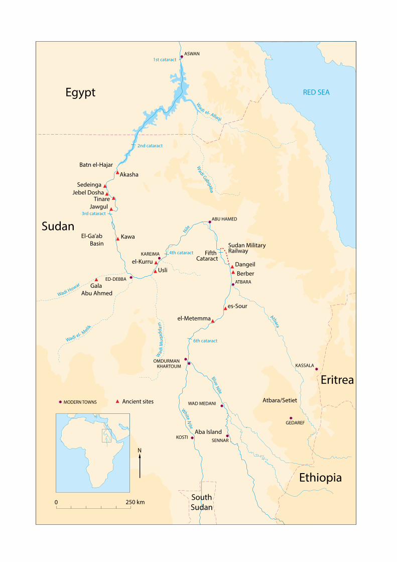
RED SEA
Wadi el- Allaqi
Blue
Nile
White N
ile
Wadi Howar
Wa
di M
uq
ad
da
m
Wadi el- Melik
6th cataract
2nd cataract
3rd cataract
4th cataract
1st cataract
Nile
Atbara
N
0 250 km
Egypt
Sudan
Ethiopia
Eritrea
MODERN TOWNS
Wad
i Gabga
ba
Ancient sites
KHARTOUM
ABU HAMED
KAREIMA
ATBARA
OMDURMAN
ASWAN
ED-DEBBA
KASSALA
WAD MEDANI
GEDAREF
KOSTISENNAR
South
Sudan
Sedeinga
Kawa
Dangeil
Gala
Abu Ahmed
El-Ga’ab
Basin
Fifth Cataract
Usli
es-Sour
Jawgul
Tinare
el-Kurru
Sudan MilitaryRailway
Batn el-Hajar
Jebel Dosha
Atbara/Setiet
el-Metemma
Berber
Aba Island
Akasha
1
Dangeil 2012: Sacred Ram – Avatar of the God Amun 70
Julie Anderson and Salah Mohamed Ahmed
Dangeil, A Preliminary Report on the Petrography 78
Meredith Brand
A Third Season of Rescue Excavations in the Meroitic 90
Cemetery at Berber, October 2012: Preliminary Report
Mahmoud Suliman Bashir
Jawgul – A Village Between Towers 101
Mariusz Drzewiecki and Piotr Maliński
The Archaeology of the Medieval and Post-Medieval 109
Fortress at Tinare in the Northern El-Mahas
Abdelrahaman Ibrahim Saeed Ali
Upper Atbara Setiet Dam Archaeological Salvage 113
Project (ASDASP), the Rescue Excavation Results
on the Western Bank of the Atbara: Preliminary Report
Murtada Bushara Mohamed, Mohammed Saad Abdalah,
Sami Elamien Mohammed and Zaki aldien Mahmoud
Archaeological, Ethnographical and Ecological 124
Project of El-Ga’ab Basin in Western Dongola:
A Report on the Second Season 2010
Yahia Fadl Tahir
Surveys at the Fifth Cataract and on the Sudan Military 131
Railway and excavations at Kawa, 2012-13
Derek A. Welsby
Archaeological Survey in El-Metemma area 137
Nada Babiker Mohammed Ibrahim
Archaeological Survey of Aba Island: 142
Preliminary Report
Ahmed Hussein Abdel Rahman Adam
From Nubia to Arizona – and back; or, Reisner 149
comes Home
William Y. Adams
Miscellaneous
Obituary 154
Michel Azim
Brigitte Gratian
Review 154
Giovanni R. Rufini 2012. Medieval Nubia. A Social
and Economic History
William Y. Adams
Contents
Reports
Lithic Material from the Late Neolithic Site of 2
es-Sour, Central Sudan
Azhari Mustafa Sadig
‘Pharaonic’ Sites in the Batn el-Hajar – the 8
‘Archaeological Survey of Sudanese Nubia’ Revisited.
David N. Edwards and A. J. Mills
A Note on the Akasha Rock-Inscriptions [21-S-29] 17
Vivian Davies
Creating a Virtual Reconstruction of the Seti I 18
Inscription at Jebel Dosha
Susie Green
Archaeobotanical Investigations at the Gala Abu
Ahmed Fortress in Lower Wadi Howar, Northern
Sudan
The Site and the Findings 24
Friederike Jesse
Phytoliths on Grinding Stones and 28
Wood Charcoal Analysis
Barbara Eichhorn
The Fruit and Seed Remains 33
Stefanie Kahlheber
New Excavations at El-Kurru: Beyond the Napatan
Royal Cemetery
Introduction 42
Geoff Emberling and Rachael J. Dann
Investigating Settlement at El-Kurru 43
Geoff Emberling
Geophysical Prospection in the Archaeological 48
Settlement of El-Kurru
Mohamed Abdelwahab Mohamed-Ali
Coring and Soundings in the El-Kurru Settlement 50
Tim Boaz Bruun Skuldbøl
Five-sided Corinthian Capitals in the Mortuary 54
Temple at El-Kurru
Jack Cheng
Geophysical Survey at the El-Kurru cemetery 56
Ed Blinkhorn
Sedeinga 2012: A Season of Unexpected Discoveries 61
Claude Rilly and Vincent Francigny
The Latest Explorations at Usli, Northern Province 66
Miroslav Bárta, Lenka Suková and Vladimír Brůna
SUDAN & NUBIAThe Sudan Archaeological Research Society Bulletin No. 17 2013
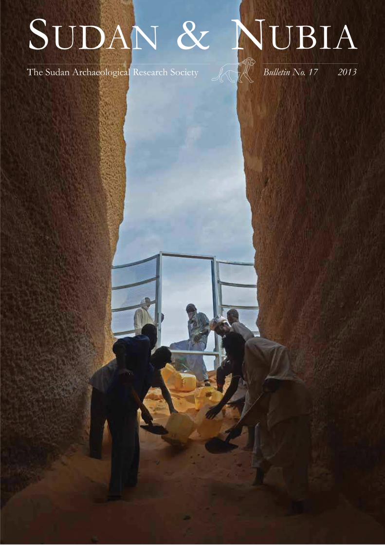
Front cover: The descendary of Tomb IV T 1 near Sedeinga
under excavation (© V. Francigny / SEDAU).
Sudan & Nubia is a peer-reviewed journal

SUDAN & NUBIA
101
Batal 1994a; 1994b). Nowadays, seasonal work outside of
Sudan, particularly in the Arab States of the Persian Gulf,
plays an important economic role in the Mahas community
(Bilal 2006). In relation to the Mahas population as a whole
(in Sudan and beyond), which is currently estimated at ap-
proximately 47,000, Jawgul is one of the smaller village
communities on the left bank of the Nile – in 1990 there
were 600 inhabitants (Osman and Edwards 2012, 20). Even
so, the village has its own omda, one of 45 omdas in the whole
of the Mahas region (Plate 1).
This paper presents the post-medieval history of Jawgul
from two perspectives. The irst is based on an ethnological study of the villagers and the second on archaeological ob-
servations. The result will show two images of the past. Will
they overlap or be complementary? Or will they be totally
incongruent?
Jawgul’s past according to the oral tradition of
its inhabitants
Jawgul is a region rich in material remains of the past. Many,
well-preserved ancient buildings can be seen in the landscape
(Plates 2 and 3). The past has also left intangible heritage
in the form of oral tradi-
tions which exist within the
local community. Contained
within is knowledge of the
past, preserved in memo-
ry and passed down from
generation to generation. It
seems that in regards to the
distant past (which is beyond
the reach of living memory)
a key role in the creation of
a traditional vision/concept
of the past is illed by the ruined buildings and other
structures mentioned ear-
lier. Therefore, tradition is
a popular interpretation of
their incidence and current
state (Osman 1992). In the
case of the inhabitants of Jawgul, the situation is rather
more complicated – their traditional views and ideas are
overlapped by historical knowledge, gained during formal
education and in some cases also scientiic knowledge from earlier researchers carrying out ieldwork in the village and the surrounding area (Hashim and Bell 2000; Osman and
Edwards 2012). The discrepancies which emerge between
this data inevitably lead to a certain confusion and disorienta-
tion. In this context it is not surprising that many of Jawgul’s
inhabitants, when questioned about the past (especially the
distant past), choose to hide behind a veil of ignorance. It
also seems possible that there is some mistrust of strangers
inquiring about the region’s past at a time when its future
is uncertain (in the context of the proposed hydroelectric
Jawgul – A Village Between
Towers Mariusz Drzewiecki and Piotr Maliński
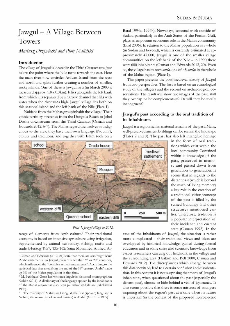
IntroductionThe village of Jawgul is located in the Third Cataract area, just
below the point where the Nile turns towards the east. Here
the main river low encircles Arduan Island from the west and north and splits further creating a number of smaller,
rocky islands. One of these is Jawgulnarti (in March 2003 it
measured approx. 1.8 x 0.3km). It lies alongside the left bank
from which it is separated by a narrow channel that ills with water when the river runs high. Jawgul village lies both on
this seasonal island and the left bank of the Nile (Plate 1).
Nubians from the Mahas group inhabit the village.1 Their
ethnic territory stretches from the Dongola Reach to Jebel
Dosha downstream from the Third Cataract (Osman and
Edwards 2012, 6-7). The Mahas regard themselves as indig-
enous to the area, they have their own language (Nobiin2),
culture and traditions, and together with Islam took on a
range of elements from Arab culture.3 Their traditional
economy is based on intensive agriculture using irrigation,
supplemented by animal husbandry, ishing, crafts and trade (Herzog 1957, 135-162; Sana Mohamed Ahmed Al-
1 Osman and Edwards (2012, 21) state that there are also “signiicant ‘Arab’ settlements” in Jawgul, present since the 19th or 20th centuries,
which inluenced the “complex settlement patterns”. According to the statistical data they cited from the end of the 19th century, ‘Arabs’ made
up 3% of the Mahas population at that time.2 M. Bechhaus-Gerst has written a linguistic-historical monograph on
Nobiin (2011). A dictionary of the language spoken by the inhabitants
of the Mahas region has also been published (Khalil and Jakobielski
1996).3 The majority of Mahas are bilingual; the irst (spoken) language is Nobiin, the second (spoken and written) is Arabic (Grifiths 1955).
Plate 1. Jawgul village in 2012.
102
power station at Kajbar, the building of which entails lood-
ing part of the Mahas region).
Despite these dificulties, ieldwork carried out in January and February 2013 obtained a certain image of the past from
the villagers. It is quite a clear picture as far as the recent
past is concerned; however, it becomes increasingly blurred
and vague as we go further back in time. The ancient times
are associated with paganism – it is thought that the Sun,
animals, rocks and stone idols were then worshipped. Some
of the Jawgul villagers believe that the ancient pagans were
of enormous height (this is a common belief held across the
Middle Nile Valley). Proof of this is meant to be the dimen-
sions of the old buildings, which are seen as the work of these
pagan-giants. According to some, the remains of this ‘pagan’
architecture were destroyed for some reason – perhaps they
simply collapsed or were ruined in long-forgotten battles and
wars. The buildings which have survived in a better condition
are thought to be the work of Christians who supposedly
lived in the region after the pagans. Some of these buildings
are viewed as places of religious cult, for example churches
(kafriinkisse). The Jawgul villagers appreciate the architecture
of these buildings, emphasising the fact that such solid and
high buildings are no longer built in the village. Some of the
ruins are regarded as dangerous places for they are allegedly
inhabited by supernatural beings (jinn) – such beliefs are
typical of Arabic-Islamic culture (Kriss and Kriss-Heinrich
1969, 15-18).
Post-Christian times in the oral tradition are associated
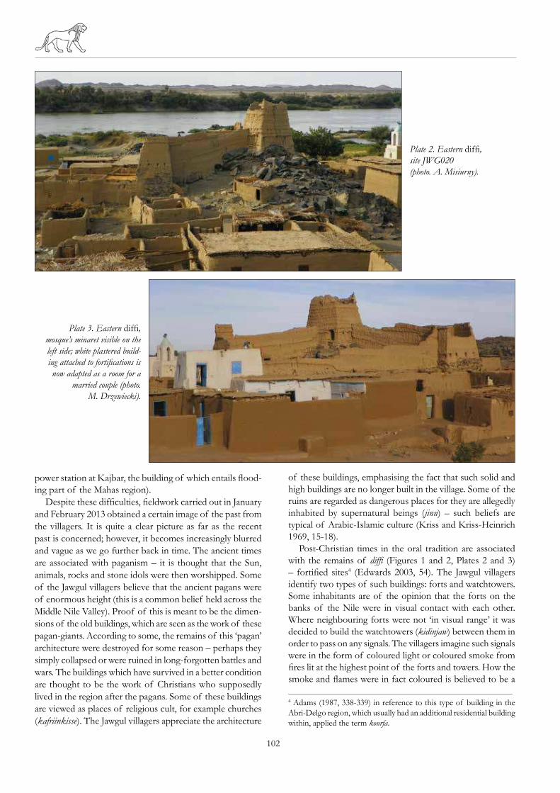
with the remains of difi (Figures 1 and 2, Plates 2 and 3)
– fortiied sites4 (Edwards 2003, 54). The Jawgul villagers
identify two types of such buildings: forts and watchtowers.
Some inhabitants are of the opinion that the forts on the
banks of the Nile were in visual contact with each other.
Where neighbouring forts were not ‘in visual range’ it was
decided to build the watchtowers (kidinjaw) between them in
order to pass on any signals. The villagers imagine such signals
were in the form of coloured light or coloured smoke from
ires lit at the highest point of the forts and towers. How the smoke and lames were in fact coloured is believed to be a
4 Adams (1987, 338-339) in reference to this type of building in the
Abri-Delgo region, which usually had an additional residential building
within, applied the term kourfa.
Plate 2. Eastern difi,
site JWG020
(photo. A. Misiurny).
Plate 3. Eastern difi,
mosque’s minaret visible on the
left side; white plastered build-
ing attached to fortiications is now adapted as a room for a
married couple (photo.
M. Drzewiecki).
SUDAN & NUBIA
103
forgotten secret, though it is thought that for purposes of
communication two or three colours were used.
The inhabitants of Jawgul appear to recognise that their
Nubian ancestors were Christian, as well as their predecessors.
Their pride at such ethnicity is visible in their appreciation
of their own culture – especially in the context of its past
signiicance. For example, the Nobiin language is regarded as ‘the mother of all languages’ - therefore supposedly the
oldest language in the world. Similarly, the waterwheel (eskale),
also considered to be an ancient Nubian invention, is the
“mother of all machines” from which all other, more complex
mechanical devices originated. According to the locals, the
introduction of the waterwheel developed farming in the river
valley and this then became the economic foundation for the
growth of the Nubian kingdoms. The craftsmanship of the
old buildings – especially the fortresses which are far larger
than any buildings currently constructed in the region – is
taken as visible proof of these prosperous times.
Another important building for the inhabitants of Jawgul
is the mosque on Jawgulnarti (Plates 1 and 3). It is a material
trace of the changes in the religious system in Nubia and the
spread of Islam (Amira Omer Siddig Osman 2004, 108-113).
When asked how long the mosque had been standing the
locals were unable to give a clear date, claiming only that it
is very, very old and was already in existence when the oldest
inhabitants were children. Other old buildings, preserved on
the island and connected directly with Islam, are the Quranic
schools. In this context Islam seems to be a religion insepara-
bly connected to education – for in order to read the Quran
it is necessary to be able to understand Arabic. A Quranic
school (khalwa) was, therefore, built on the island in which
the religious scholars instilled the language and the contents
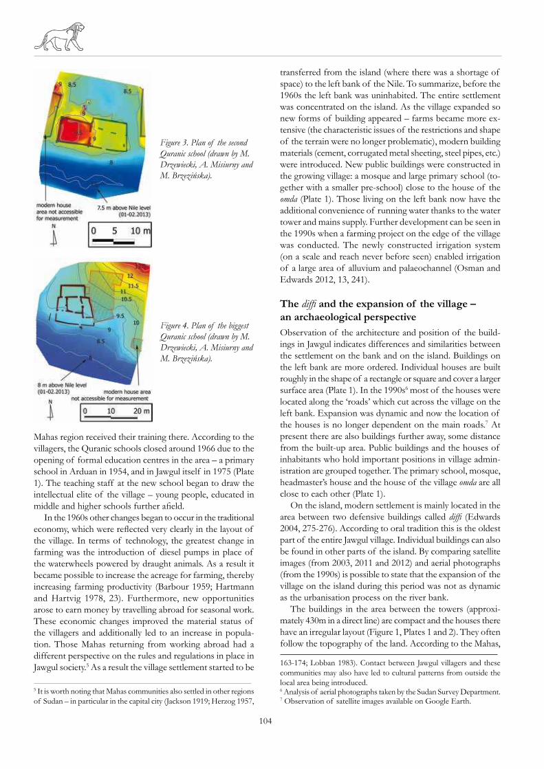
of the holy book in the students (Plates 1 and 4). A little
later two more schools (Figures 3 and 4, Plate 1) were built
(each larger than the one before). When the schools were in
use, Jawgul was famous as a centre for religious education –
many imams from various villages across the whole of the
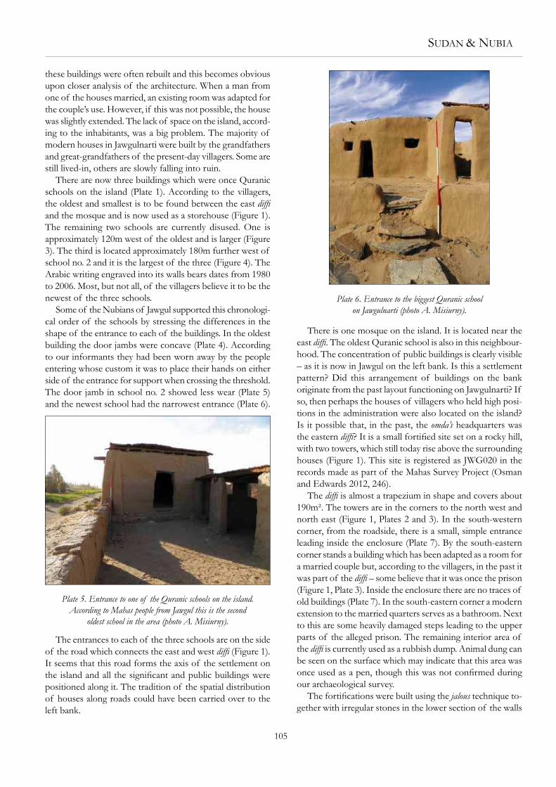
Plate 4. The smallest Quranic school on Jawgulnarti, located
between the eastern difi and the mosque (photo A. Misiurny).
Figure 1. Plan of the eastern difi (drawn by M. Drzewiecki).
Figure 2. Plan of the
western difi (drawn
by M. Drzewiecki,
A. Misiurny and M.
Brzezińska).
104
Mahas region received their training there. According to the
villagers, the Quranic schools closed around 1966 due to the
opening of formal education centres in the area – a primary
school in Arduan in 1954, and in Jawgul itself in 1975 (Plate
1). The teaching staff at the new school began to draw the
intellectual elite of the village – young people, educated in
middle and higher schools further aield.In the 1960s other changes began to occur in the traditional
economy, which were relected very clearly in the layout of the village. In terms of technology, the greatest change in
farming was the introduction of diesel pumps in place of
the waterwheels powered by draught animals. As a result it
became possible to increase the acreage for farming, thereby
increasing farming productivity (Barbour 1959; Hartmann
and Hartvig 1978, 23). Furthermore, new opportunities
arose to earn money by travelling abroad for seasonal work.
These economic changes improved the material status of
the villagers and additionally led to an increase in popula-
tion. Those Mahas returning from working abroad had a
different perspective on the rules and regulations in place in
Jawgul society.5 As a result the village settlement started to be
5 It is worth noting that Mahas communities also settled in other regions
of Sudan – in particular in the capital city (Jackson 1919; Herzog 1957,
transferred from the island (where there was a shortage of
space) to the left bank of the Nile. To summarize, before the
1960s the left bank was uninhabited. The entire settlement
was concentrated on the island. As the village expanded so
new forms of building appeared – farms became more ex-
tensive (the characteristic issues of the restrictions and shape
of the terrain were no longer problematic), modern building
materials (cement, corrugated metal sheeting, steel pipes, etc.)
were introduced. New public buildings were constructed in
the growing village: a mosque and large primary school (to-
gether with a smaller pre-school) close to the house of the
omda (Plate 1). Those living on the left bank now have the
additional convenience of running water thanks to the water
tower and mains supply. Further development can be seen in
the 1990s when a farming project on the edge of the village
was conducted. The newly constructed irrigation system
(on a scale and reach never before seen) enabled irrigation
of a large area of alluvium and palaeochannel (Osman and
Edwards 2012, 13, 241).
The difi and the expansion of the village –
an archaeological perspective
Observation of the architecture and position of the build-
ings in Jawgul indicates differences and similarities between
the settlement on the bank and on the island. Buildings on
the left bank are more ordered. Individual houses are built
roughly in the shape of a rectangle or square and cover a larger
surface area (Plate 1). In the 1990s6 most of the houses were
located along the ‘roads’ which cut across the village on the
left bank. Expansion was dynamic and now the location of
the houses is no longer dependent on the main roads.7 At
present there are also buildings further away, some distance
from the built-up area. Public buildings and the houses of
inhabitants who hold important positions in village admin-
istration are grouped together. The primary school, mosque,
headmaster’s house and the house of the village omda are all
close to each other (Plate 1).
On the island, modern settlement is mainly located in the
area between two defensive buildings called difi (Edwards
2004, 275-276). According to oral tradition this is the oldest
part of the entire Jawgul village. Individual buildings can also
be found in other parts of the island. By comparing satellite
images (from 2003, 2011 and 2012) and aerial photographs
(from the 1990s) is possible to state that the expansion of the
village on the island during this period was not as dynamic
as the urbanisation process on the river bank.
The buildings in the area between the towers (approxi-
mately 430m in a direct line) are compact and the houses there
have an irregular layout (Figure 1, Plates 1 and 2). They often
follow the topography of the land. According to the Mahas,
163-174; Lobban 1983). Contact between Jawgul villagers and these
communities may also have led to cultural patterns from outside the
local area being introduced.6 Analysis of aerial photographs taken by the Sudan Survey Department.7 Observation of satellite images available on Google Earth.
Figure 4. Plan of the biggest
Quranic school (drawn by M.
Drzewiecki, A. Misiurny and
M. Brzezińska).
Figure 3. Plan of the second
Quranic school (drawn by M.
Drzewiecki, A. Misiurny and
M. Brzezińska).
SUDAN & NUBIA
105
these buildings were often rebuilt and this becomes obvious
upon closer analysis of the architecture. When a man from
one of the houses married, an existing room was adapted for
the couple’s use. However, if this was not possible, the house
was slightly extended. The lack of space on the island, accord-
ing to the inhabitants, was a big problem. The majority of
modern houses in Jawgulnarti were built by the grandfathers
and great-grandfathers of the present-day villagers. Some are
still lived-in, others are slowly falling into ruin.
There are now three buildings which were once Quranic
schools on the island (Plate 1). According to the villagers,
the oldest and smallest is to be found between the east difi
and the mosque and is now used as a storehouse (Figure 1).
The remaining two schools are currently disused. One is
approximately 120m west of the oldest and is larger (Figure
3). The third is located approximately 180m further west of
school no. 2 and it is the largest of the three (Figure 4). The
Arabic writing engraved into its walls bears dates from 1980
to 2006. Most, but not all, of the villagers believe it to be the
newest of the three schools.
Some of the Nubians of Jawgul supported this chronologi-
cal order of the schools by stressing the differences in the
shape of the entrance to each of the buildings. In the oldest
building the door jambs were concave (Plate 4). According
to our informants they had been worn away by the people
entering whose custom it was to place their hands on either
side of the entrance for support when crossing the threshold.
The door jamb in school no. 2 showed less wear (Plate 5)
and the newest school had the narrowest entrance (Plate 6).
The entrances to each of the three schools are on the side
of the road which connects the east and west difi (Figure 1).
It seems that this road forms the axis of the settlement on
the island and all the signiicant and public buildings were positioned along it. The tradition of the spatial distribution
of houses along roads could have been carried over to the
left bank.
There is one mosque on the island. It is located near the
east difi. The oldest Quranic school is also in this neighbour-
hood. The concentration of public buildings is clearly visible
– as it is now in Jawgul on the left bank. Is this a settlement
pattern? Did this arrangement of buildings on the bank
originate from the past layout functioning on Jawgulnarti? If
so, then perhaps the houses of villagers who held high posi-
tions in the administration were also located on the island?
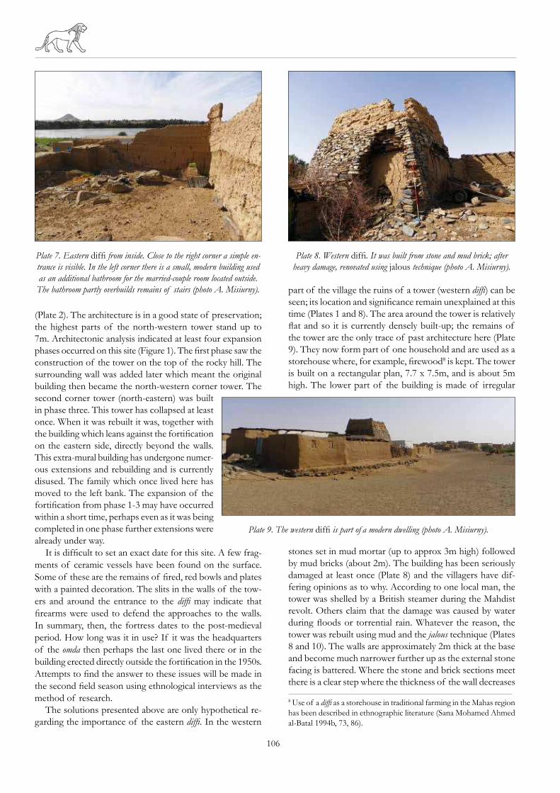
Is it possible that, in the past, the omda’s headquarters was
the eastern difi? It is a small fortiied site set on a rocky hill, with two towers, which still today rise above the surrounding
houses (Figure 1). This site is registered as JWG020 in the
records made as part of the Mahas Survey Project (Osman
and Edwards 2012, 246).
The difi is almost a trapezium in shape and covers about
190m². The towers are in the corners to the north west and
north east (Figure 1, Plates 2 and 3). In the south-western
corner, from the roadside, there is a small, simple entrance
leading inside the enclosure (Plate 7). By the south-eastern
corner stands a building which has been adapted as a room for
a married couple but, according to the villagers, in the past it
was part of the difi – some believe that it was once the prison
(Figure 1, Plate 3). Inside the enclosure there are no traces of
old buildings (Plate 7). In the south-eastern corner a modern
extension to the married quarters serves as a bathroom. Next
to this are some heavily damaged steps leading to the upper
parts of the alleged prison. The remaining interior area of
the difi is currently used as a rubbish dump. Animal dung can
be seen on the surface which may indicate that this area was
once used as a pen, though this was not conirmed during our archaeological survey.
The fortiications were built using the jalous technique to-
gether with irregular stones in the lower section of the walls
Plate 5. Entrance to one of the Quranic schools on the island.
According to Mahas people from Jawgul this is the second
oldest school in the area (photo A. Misiurny).
Plate 6. Entrance to the biggest Quranic school
on Jawgulnarti (photo A. Misiurny).
106
(Plate 2). The architecture is in a good state of preservation;
the highest parts of the north-western tower stand up to
7m. Architectonic analysis indicated at least four expansion
phases occurred on this site (Figure 1). The irst phase saw the construction of the tower on the top of the rocky hill. The
surrounding wall was added later which meant the original
building then became the north-western corner tower. The
second corner tower (north-eastern) was built
in phase three. This tower has collapsed at least
once. When it was rebuilt it was, together with
the building which leans against the fortiication on the eastern side, directly beyond the walls.
This extra-mural building has undergone numer-
ous extensions and rebuilding and is currently
disused. The family which once lived here has
moved to the left bank. The expansion of the
fortiication from phase 1-3 may have occurred within a short time, perhaps even as it was being
completed in one phase further extensions were
already under way.
It is dificult to set an exact date for this site. A few frag-
ments of ceramic vessels have been found on the surface.
Some of these are the remains of ired, red bowls and plates with a painted decoration. The slits in the walls of the tow-
ers and around the entrance to the difi may indicate that
irearms were used to defend the approaches to the walls. In summary, then, the fortress dates to the post-medieval
period. How long was it in use? If it was the headquarters
of the omda then perhaps the last one lived there or in the
building erected directly outside the fortiication in the 1950s. Attempts to ind the answer to these issues will be made in the second ield season using ethnological interviews as the method of research.
The solutions presented above are only hypothetical re-
garding the importance of the eastern difi. In the western
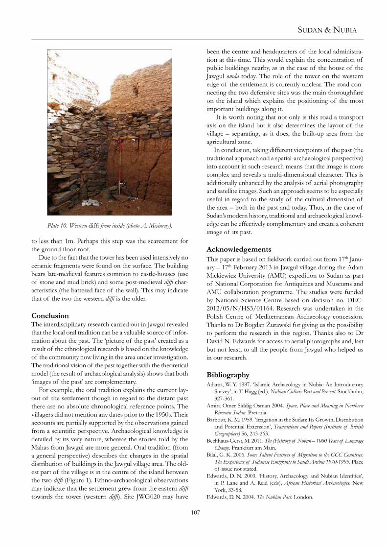
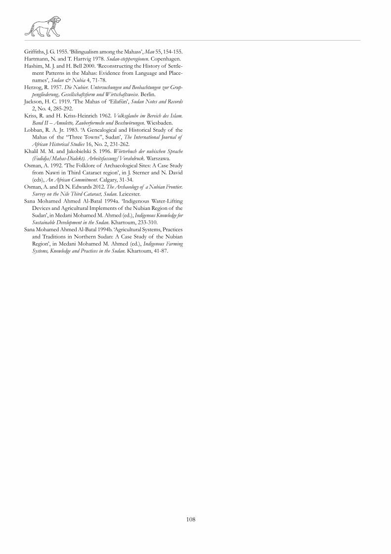
part of the village the ruins of a tower (western difi) can be
seen; its location and signiicance remain unexplained at this time (Plates 1 and 8). The area around the tower is relatively
lat and so it is currently densely built-up; the remains of the tower are the only trace of past architecture here (Plate
9). They now form part of one household and are used as a
storehouse where, for example, irewood8 is kept. The tower
is built on a rectangular plan, 7.7 x 7.5m, and is about 5m
high. The lower part of the building is made of irregular
stones set in mud mortar (up to approx 3m high) followed
by mud bricks (about 2m). The building has been seriously
damaged at least once (Plate 8) and the villagers have dif-
fering opinions as to why. According to one local man, the
tower was shelled by a British steamer during the Mahdist
revolt. Others claim that the damage was caused by water
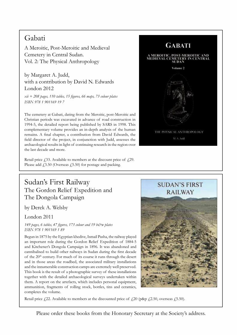
during loods or torrential rain. Whatever the reason, the tower was rebuilt using mud and the jalous technique (Plates
8 and 10). The walls are approximately 2m thick at the base
and become much narrower further up as the external stone
facing is battered. Where the stone and brick sections meet
there is a clear step where the thickness of the wall decreases
8 Use of a difi as a storehouse in traditional farming in the Mahas region
has been described in ethnographic literature (Sana Mohamed Ahmed
al-Batal 1994b, 73, 86).
Plate 7. Eastern difi from inside. Close to the right corner a simple en-
trance is visible. In the left corner there is a small, modern building used
as an additional bathroom for the married-couple room located outside.
The bathroom partly overbuilds remains of stairs (photo A. Misiurny).
Plate 8. Western difi. It was built from stone and mud brick; after
heavy damage, renovated using jalous technique (photo A. Misiurny).
Plate 9. The western difi is part of a modern dwelling (photo A. Misiurny).
SUDAN & NUBIA
107
to less than 1m. Perhaps this step was the scarcement for
the ground loor roof. Due to the fact that the tower has been used intensively no
ceramic fragments were found on the surface. The building
bears late-medieval features common to castle-houses (use
of stone and mud brick) and some post-medieval difi char-
acteristics (the battered face of the wall). This may indicate
that of the two the western difi is the older.
ConclusionThe interdisciplinary research carried out in Jawgul revealed
that the local oral tradition can be a valuable source of infor-
mation about the past. The ‘picture of the past’ created as a
result of the ethnological research is based on the knowledge
of the community now living in the area under investigation.
The traditional vision of the past together with the theoretical
model (the result of archaeological analysis) shows that both
‘images of the past’ are complementary.
For example, the oral tradition explains the current lay-
out of the settlement though in regard to the distant past
there are no absolute chronological reference points. The
villagers did not mention any dates prior to the 1950s. Their
accounts are partially supported by the observations gained
from a scientiic perspective. Archaeological knowledge is detailed by its very nature, whereas the stories told by the
Mahas from Jawgul are more general. Oral tradition (from
a general perspective) describes the changes in the spatial
distribution of buildings in the Jawgul village area. The old-
est part of the village is in the centre of the island between
the two difi (Figure 1). Ethno-archaeological observations
may indicate that the settlement grew from the eastern difi
towards the tower (western difi). Site JWG020 may have
been the centre and headquarters of the local administra-
tion at this time. This would explain the concentration of
public buildings nearby, as in the case of the house of the
Jawgul omda today. The role of the tower on the western
edge of the settlement is currently unclear. The road con-
necting the two defensive sites was the main thoroughfare
on the island which explains the positioning of the most
important buildings along it.
It is worth noting that not only is this road a transport
axis on the island but it also determines the layout of the
village – separating, as it does, the built-up area from the
agricultural zone.
In conclusion, taking different viewpoints of the past (the
traditional approach and a spatial-archaeological perspective)
into account in such research means that the image is more
complex and reveals a multi-dimensional character. This is
additionally enhanced by the analysis of aerial photography
and satellite images. Such an approach seems to be especially
useful in regard to the study of the cultural dimension of
the area – both in the past and today. Thus, in the case of
Sudan’s modern history, traditional and archaeological knowl-
edge can be effectively complimentary and create a coherent
image of its past.
Acknowledgements
This paper is based on ieldwork carried out from 17th Janu-
ary – 17th February 2013 in Jawgul village during the Adam
Mickiewicz University (AMU) expedition to Sudan as part
of National Corporation for Antiquities and Museums and
AMU collaboration programme. The studies were funded
by National Science Centre based on decision no. DEC-
2012/05/N/HS3/01164. Research was undertaken in the
Polish Centre of Mediterranean Archaeology concession.
Thanks to Dr Bogdan Żurawski for giving us the possibility to perform the research in this region. Thanks also to Dr
David N. Edwards for access to aerial photographs and, last
but not least, to all the people from Jawgul who helped us
in our research.
Bibliography
Adams, W. Y. 1987. ‘Islamic Archaeology in Nubia: An Introductory
Survey’, in T. Hägg (ed.), Nubian Culture Past and Present. Stockholm,
327-361.
Amira Omer Siddig Osman 2004. Space, Place and Meaning in Northern
Riverain Sudan. Pretoria.
Barbour, K. M. 1959. ‘Irrigation in the Sudan: Its Growth, Distribution
and Potential Extension’, Transactions and Papers (Institute of British
Geographers) 56, 243-263.
Bechhaus-Gerst, M. 2011. The (Hi)story of Nobiin – 1000 Years of Language
Change. Frankfurt am Main.
Bilal, G. K. 2006. Some Salient Features of Migration to the GCC Countries.
The Experience of Sudanese Emigrants to Saudi Arabia 1970-1995. Place
of issue not stated.
Edwards, D. N. 2003. ‘History, Archaeology and Nubian Identities’,
in P. Lane and A. Reid (eds), African Historical Archaeologies. New
York, 33-58.
Edwards, D. N. 2004. The Nubian Past. London.
Plate 10. Western difi from inside (photo A. Misiurny).
108
Grifiths, J. G. 1955. ‘Bilingualism among the Mahass’, Man 55, 154-155.
Hartmann, N. and T. Hartvig 1978. Sudan-stepperegionen. Copenhagen.
Hashim, M. J. and H. Bell 2000. ‘Reconstructing the History of Settle-
ment Patterns in the Mahas: Evidence from Language and Place-
names’, Sudan & Nubia 4, 71-78.
Herzog, R. 1957. Die Nubier. Untersuchungen und Beobachtungen zur Grup-
pengliederung, Gesellschaftsform und Wirtschaftsweise. Berlin.
Jackson, H. C. 1919. ‘The Mahas of ‘Eilafūn’, Sudan Notes and Records
2, No. 4, 285-292.
Kriss, R. and H. Kriss-Heinrich 1962. Volksglaube im Bereich des Islam.
Band II – Amulette, Zauberformeln und Beschwörungen. Wiesbaden.
Lobban, R. A. Jr. 1983. ‘A Genealogical and Historical Study of the
Mahas of the “Three Towns”, Sudan’, The International Journal of
African Historical Studies 16, No. 2, 231-262.
Khalil M. M. and Jakobielski S. 1996. Wörterbuch der nubischen Sprache
(Fadidja/Mahas-Dialekt). Arbeitsfassung/Vorabdruck. Warszawa.
Osman, A. 1992. ‘The Folklore of Archaeological Sites: A Case Study
from Nawri in Third Cataract region’, in J. Sterner and N. David
(eds), An African Commitment. Calgary, 31-34.
Osman, A. and D. N. Edwards 2012. The Archaeology of a Nubian Frontier.
Survey on the Nile Third Cataract, Sudan. Leicester.
Sana Mohamed Ahmed Al-Batal 1994a. ‘Indigenous Water-Lifting
Devices and Agricultural Implements of the Nubian Region of the
Sudan’, in Medani Mohamed M. Ahmed (ed.), Indigenous Knowledge for
Sustainable Development in the Sudan. Khartoum, 233-310.
Sana Mohamed Ahmed Al-Batal 1994b. ‘Agricultural Systems, Practices
and Traditions in Northern Sudan: A Case Study of the Nubian
Region’, in Medani Mohamed M. Ahmed (ed.), Indigenous Farming
Systems, Knowledge and Practices in the Sudan. Khartoum, 41-87.
Please order these books from the Honorary Secretary at the Society’s address.
Sudan’s First RailwayThe Gordon Relief Expedition and The Dongola Campaign
by Derek A. Welsby
London 2011
149 pages, 6 tables, 47 igures, 173 colour and 19 b&w platesISBN 978 1 901169 1 89
Begun in 1875 by the Egyptian khedive, Ismail Pasha, the railway played
an important role during the Gordon Relief Expedition of 1884-5
and Kitchener’s Dongola Campaign in 1896. It was abandoned and
cannibalised to build other railways in Sudan during the irst decade of the 20th century. For much of its course it runs through the desert
and in those areas the roadbed, the associated military installations
and the innumerable construction camps are extremely well preserved.
This book is the result of a photographic survey of these installations
together with the detailed archaeological surveys undertaken within
them. A report on the artefacts, which includes personal equipment,
ammunition, fragments of rolling stock, bottles, tins and ceramics,
completes the volume.
Retail price £22. Available to members at the discounted price of £20 (p&p £2.50, overseas £5.50).
Gabati A Meroitic, Post-Meroitic and Medieval
Cemetery in Central Sudan.
Vol. 2: The Physical Anthropology
by Margaret A. Judd,
with a contribution by David N. Edwards
London 2012
xii + 208 pages, 110 tables, 15 igures, 66 maps, 73 colour plates ISBN 978 1 901169 19 7
The cemetery at Gabati, dating from the Meroitic, post-Meroitic and
Christian periods was excavated in advance of road construction in
1994-5, the detailed report being published by SARS in 1998. This
complementary volume provides an in-depth analysis of the human
remains. A inal chapter, a contribution from David Edwards, the ield director of the project, in conjunction with Judd, assesses the archaeological results in light of continuing research in the region over
the last decade and more.
Retail price £33. Available to members at the discount price of £29.
Please add £3.50 (Overseas £5.50) for postage and packing.
THE SUDAN ARCHAEOLOGICAL RESEARCH SOCIETY ISSN NUMBER 1369-5770
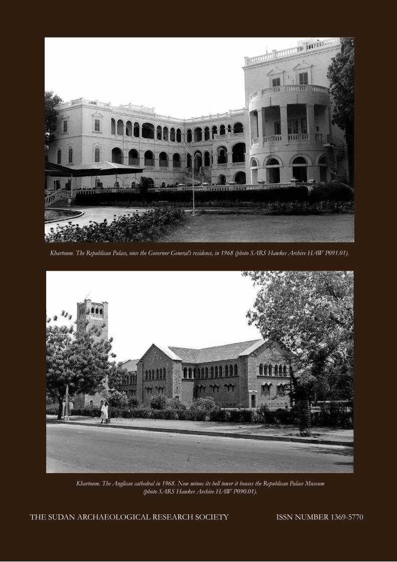
Khartoum. The Anglican cathedral in 1968. Now minus its bell tower it houses the Republican Palace Museum
(photo SARS Hawkes Archive HAW P090.01).
Khartoum. The Republican Palace, once the Governor General’s residence, in 1968 (photo SARS Hawkes Archive HAW P091.01).