daily operations briefing - disaster centerdaily+ops+briefing+07-24-2017.pdf · tropical storm...
TRANSCRIPT

•Daily Operations Briefing•Monday, July 24, 2017
8:30 a.m. EDT
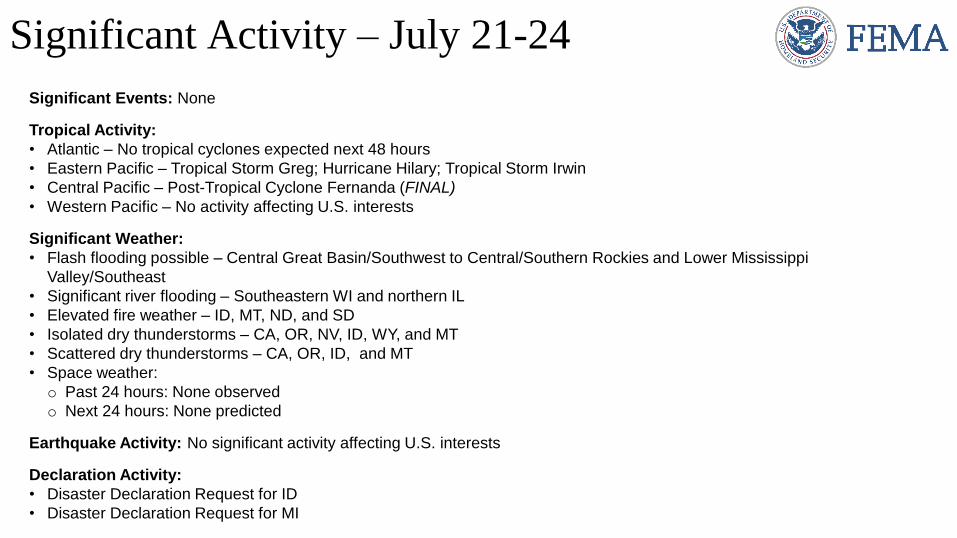
Significant Events: None
Tropical Activity:
• Atlantic – No tropical cyclones expected next 48 hours
• Eastern Pacific – Tropical Storm Greg; Hurricane Hilary; Tropical Storm Irwin
• Central Pacific – Post-Tropical Cyclone Fernanda (FINAL)
• Western Pacific – No activity affecting U.S. interests
Significant Weather:
• Flash flooding possible – Central Great Basin/Southwest to Central/Southern Rockies and Lower Mississippi
Valley/Southeast
• Significant river flooding – Southeastern WI and northern IL
• Elevated fire weather – ID, MT, ND, and SD
• Isolated dry thunderstorms – CA, OR, NV, ID, WY, and MT
• Scattered dry thunderstorms – CA, OR, ID, and MT
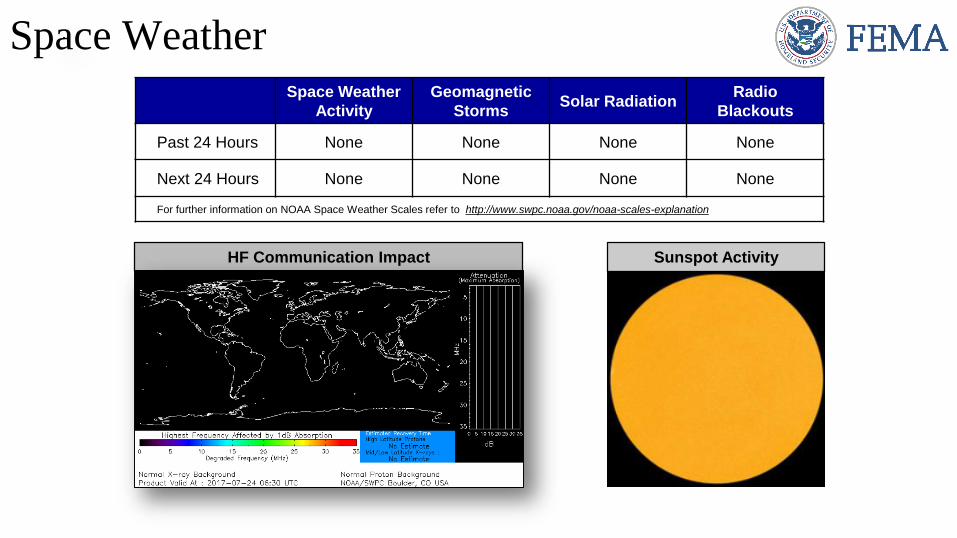
• Space weather:
o Past 24 hours: None observed
o Next 24 hours: None predicted
Earthquake Activity: No significant activity affecting U.S. interests
Declaration Activity:
• Disaster Declaration Request for ID
• Disaster Declaration Request for MI
Significant Activity – July 21-24
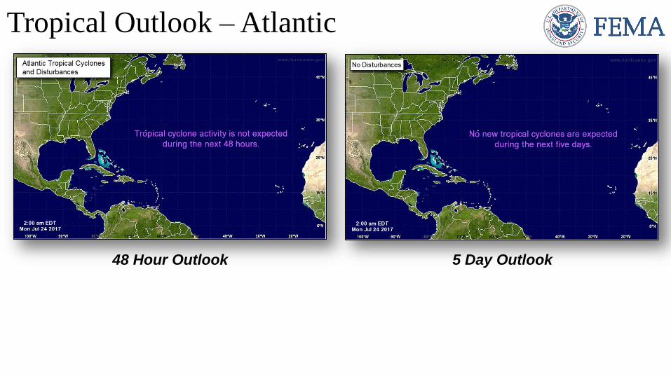
Tropical Outlook – Atlantic
48 Hour Outlook 5 Day Outlook

Based on current advisories, none of the storms below
threaten U.S. interests
Tropical Storm Greg (Advisory #28 as of 5:00 a.m. EDT)
• Located 1,565 miles WSW of Baja California, Mexico
• Moving WSW at 9 mph; maximum sustained winds 45 mph
Tropical Storm Irwin (Advisory #8 as of 5:00 a.m. EDT)
• Located 745 miles SSW of Baja California, Mexico
• Moving W at 5 mph; maximum sustained winds 50 mph
Hurricane Hilary (Advisory #12 as of 5:00 a.m. EDT)
• Located 345 miles S of Manzanillo, Mexico
• Moving WNW at 8 mph; maximum sustained winds 75 mph
• Hurricane-force winds up to 10 miles
• Continue strengthening during next 48 hours; Major hurricane by
Tuesday
Tropical Outlook – Eastern Pacific

Tropical Outlook – Central Pacific
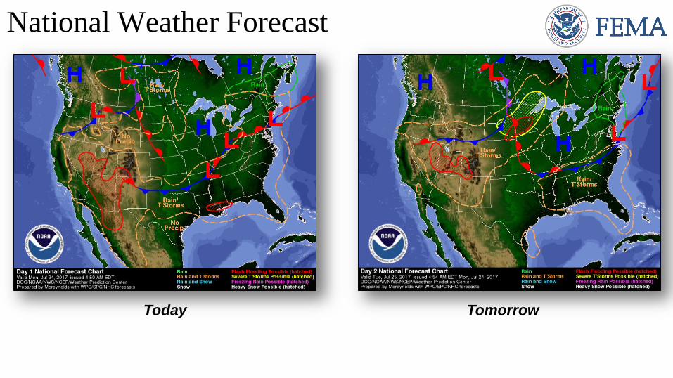
Today
National Weather Forecast
Tomorrow
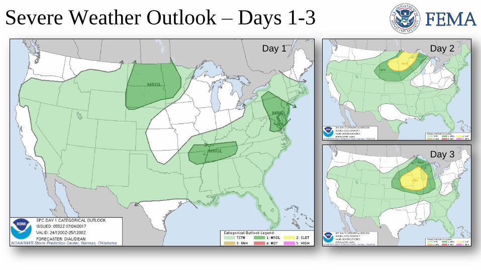
Severe Weather Outlook – Days 1-3
Day 1 Day 2
Day 3
http://www.cpc.ncep.noaa.gov/products/predictions/threats/threats.php
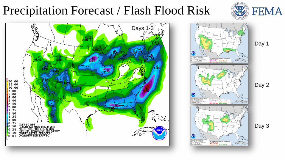
Precipitation Forecast / Flash Flood Risk
Day 1
Day 2
Day 3
Days 1-3
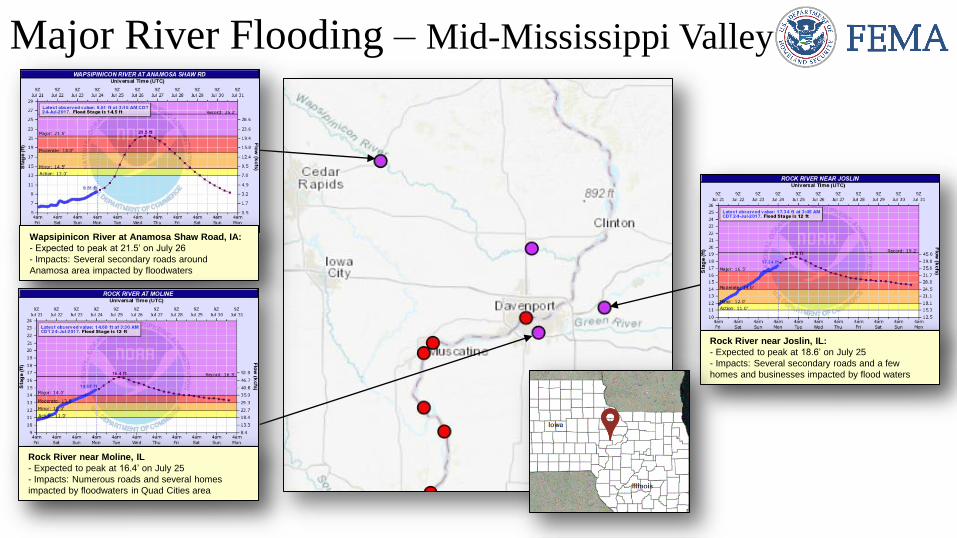
Major River Flooding – Mid-Mississippi Valley
Rock River near Joslin, IL:
- Expected to peak at 18.6’ on July 25
- Impacts: Several secondary roads and a few
homes and businesses impacted by flood waters
Wapsipinicon River at Anamosa Shaw Road, IA:
- Expected to peak at 21.5’ on July 26
- Impacts: Several secondary roads around
Anamosa area impacted by floodwaters
Rock River near Moline, IL
- Expected to peak at 16.4’ on July 25
- Impacts: Numerous roads and several homes
impacted by floodwaters in Quad Cities area
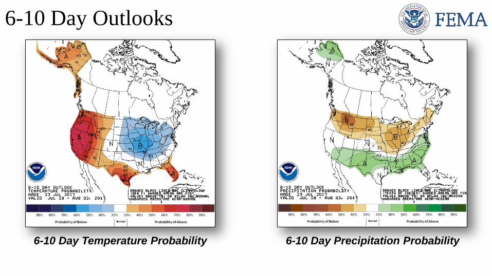
6-10 Day Outlooks
6-10 Day Temperature Probability 6-10 Day Precipitation Probability
http://www.swpc.noaa.gov/communities/aviation-community-
dashboard
http://spaceweather.com/
Space WeatherSpace Weather
Activity
Geomagnetic
StormsSolar Radiation
Radio
Blackouts
Past 24 Hours None None None None
Next 24 Hours None None None None
For further information on NOAA Space Weather Scales refer to http://www.swpc.noaa.gov/noaa-scales-explanation
HF Communication Impact Sunspot Activity
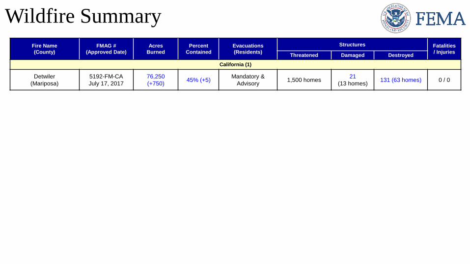
Wildfire Summary
Fire Name
(County)
FMAG #
(Approved Date)
Acres
Burned
Percent
Contained
Evacuations
(Residents)
Structures Fatalities
/ InjuriesThreatened Damaged Destroyed
California (1)
Detwiler
(Mariposa)
5192-FM-CA
July 17, 2017
76,250
(+750)45% (+5)
Mandatory &
Advisory1,500 homes
21
(13 homes)131 (63 homes) 0 / 0
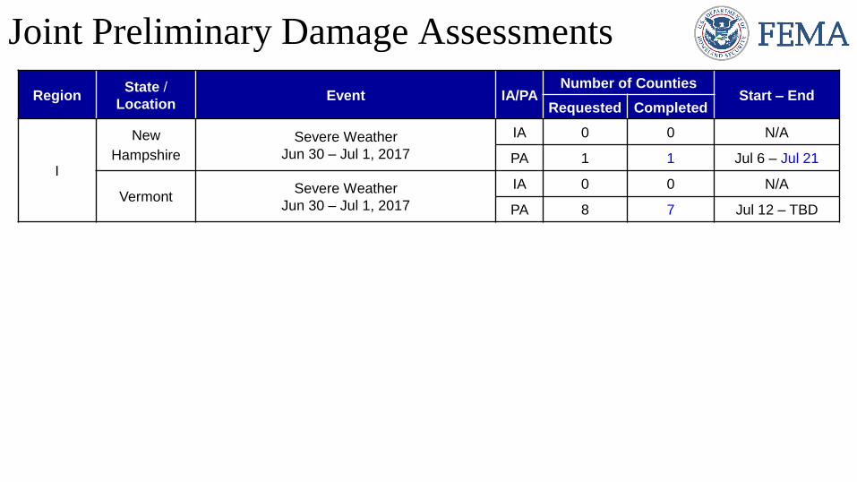
Joint Preliminary Damage Assessments
RegionState /
LocationEvent IA/PA
Number of CountiesStart – End
Requested Completed
I
New
Hampshire
Severe Weather
Jun 30 – Jul 1, 2017
IA 0 0 N/A
PA 1 1 Jul 6 – Jul 21
VermontSevere Weather
Jun 30 – Jul 1, 2017
IA 0 0 N/A
PA 8 7 Jul 12 – TBD

Declaration Request
Idaho
• Governor requested a Major Disaster Declaration on
July 20, 2017
• For flooding that occurred March 29 – June 15, 2017
• Requesting:
o Public Assistance for 2 counties
o Hazard Mitigation statewide
PA
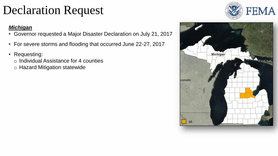
Declaration Request
Michigan
• Governor requested a Major Disaster Declaration on July 21, 2017
• For severe storms and flooding that occurred June 22-27, 2017
• Requesting:
o Individual Assistance for 4 counties
o Hazard Mitigation statewide
IA
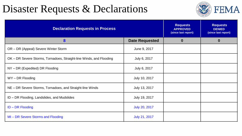
Declaration Requests in ProcessRequests
APPROVED(since last report)
Requests
DENIED(since last report)
8 Date Requested 0 0
OR – DR (Appeal) Severe Winter Storm June 9, 2017
OK – DR Severe Storms, Tornadoes, Straight-line Winds, and Flooding July 6, 2017
NY – DR (Expedited) DR Flooding July 6, 2017
WY – DR Flooding July 10, 2017
NE – DR Severe Storms, Tornadoes, and Straight-line Winds July 13, 2017
ID – DR Flooding, Landslides, and Mudslides July 19, 2017
ID – DR Flooding July 20, 2017
MI – DR Severe Storms and Flooding July 21, 2017
Disaster Requests & Declarations
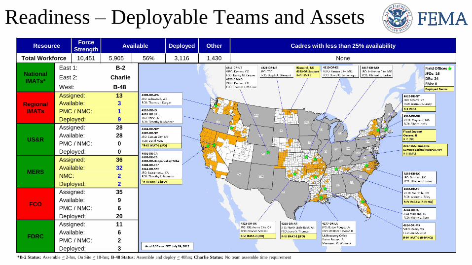
Readiness – Deployable Teams and Assets
National
IMATs*
East 1: B-2
East 2: Charlie
West: B-48
Regional
IMATs
Assigned: 13
Available: 3
PMC / NMC: 1
Deployed: 9
US&R
Assigned: 28
Available: 28
PMC / NMC: 0
Deployed: 0
MERS
Assigned: 36
Available: 32
NMC: 2
Deployed: 2
FCO
Assigned: 35
Available: 9
PMC / NMC: 6
Deployed: 20
FDRC
Assigned: 11
Available: 6
PMC / NMC: 2
Deployed: 3
ResourceForce
StrengthAvailable Deployed Other Cadres with less than 25% availability
Total Workforce 10,451 5,905 56% 3,116 1,430 None
*B-2 Status: Assemble < 2-hrs, On Site < 18-hrs; B-48 Status: Assemble and deploy < 48hrs; Charlie Status: No team assemble time requirement
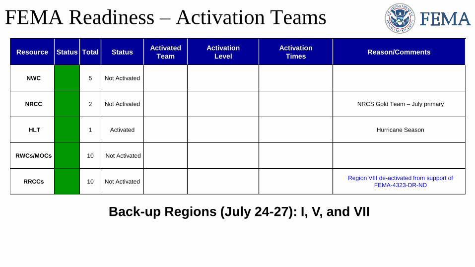
FEMA Readiness – Activation Teams
Resource Status Total StatusActivated
Team
Activation
Level
Activation
TimesReason/Comments
NWC 5 Not Activated
NRCC 2 Not Activated NRCS Gold Team – July primary
HLT 1 Activated Hurricane Season
RWCs/MOCs 10 Not Activated
RRCCs 10 Not ActivatedRegion VIII de-activated from support of
FEMA-4323-DR-ND
Back-up Regions (July 24-27): I, V, and VII