basic map knowledge for orienteering. what is a map? a symbolic picture of an area from up above it...
TRANSCRIPT
Basic Map Knowledge
For Orienteering

What is a map?
• A symbolic picture of an area from up above• It usually has a particular point of view, an
audience, and a specific purpose
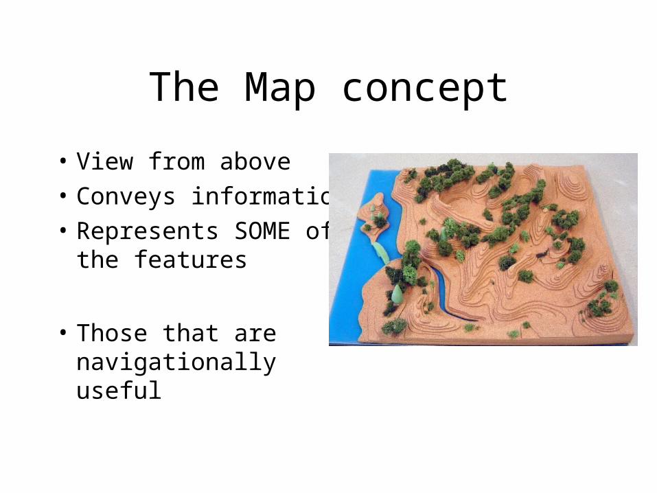
The Map concept
• View from above• Conveys information• Represents SOME of
the features
• Those that are navigationally useful
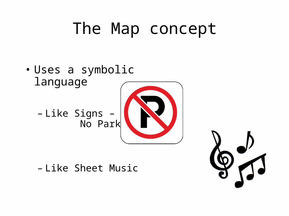
The Map concept
• Uses a symbolic language
– Like Signs – No Parking
– Like Sheet Music
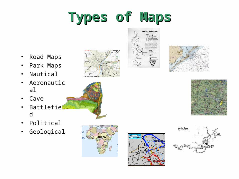
Types of MapsTypes of Maps
• Road Maps• Park Maps• Nautical• Aeronautical• Cave• Battlefield• Political• Geological

Topographical Maps
• x

Contours
• Horizontal Slices through the earth
• Like a layer cake
• Shows the lay of the land.
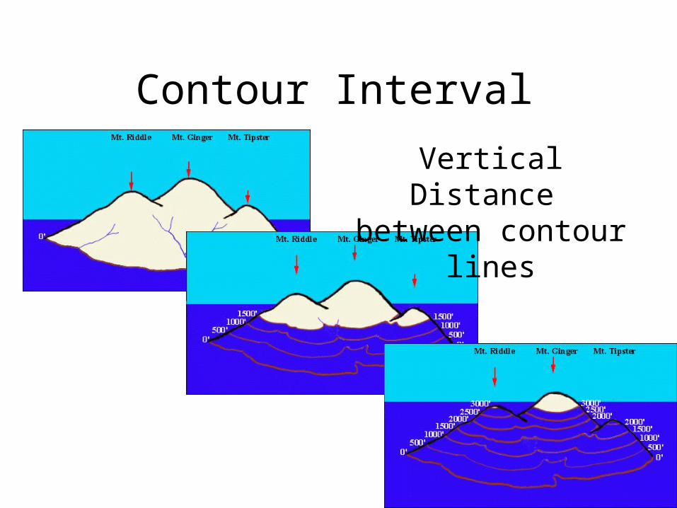
Contour Interval
Vertical Distance between contour lines

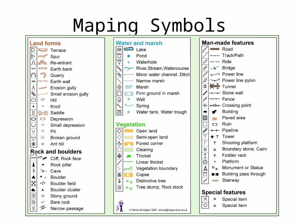
Map Symbols
• USGS Maps
• Orienteering Maps
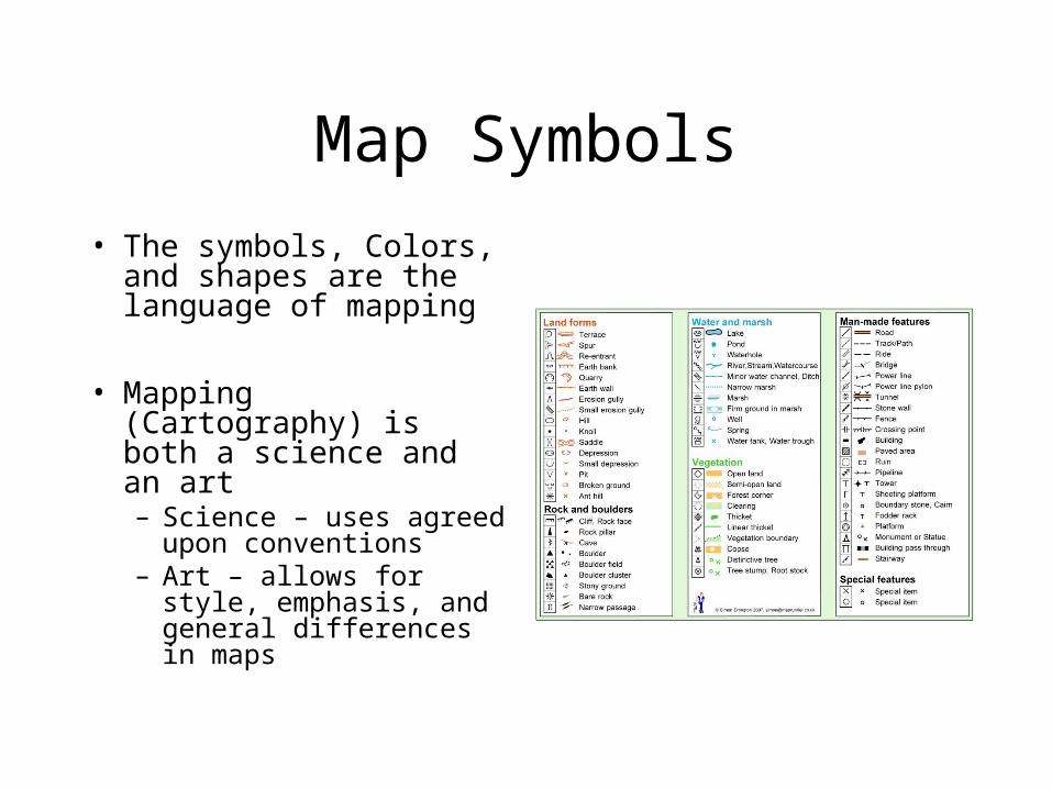
Map Symbols• The symbols, Colors, and
shapes are the language of mapping
• Mapping (Cartography) is both a science and an art– Science – uses agreed
upon conventions – Art – allows for style,
emphasis, and general differences in maps
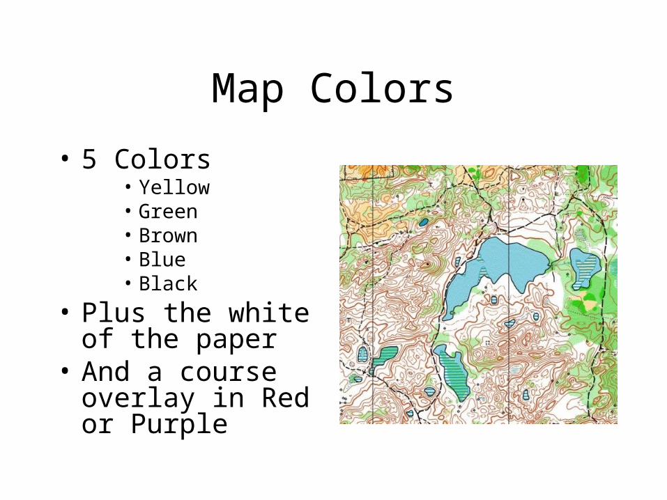
Map Colors
• 5 Colors• Yellow• Green• Brown• Blue• Black
• Plus the white of the paper
• And a course overlay in Red or Purple
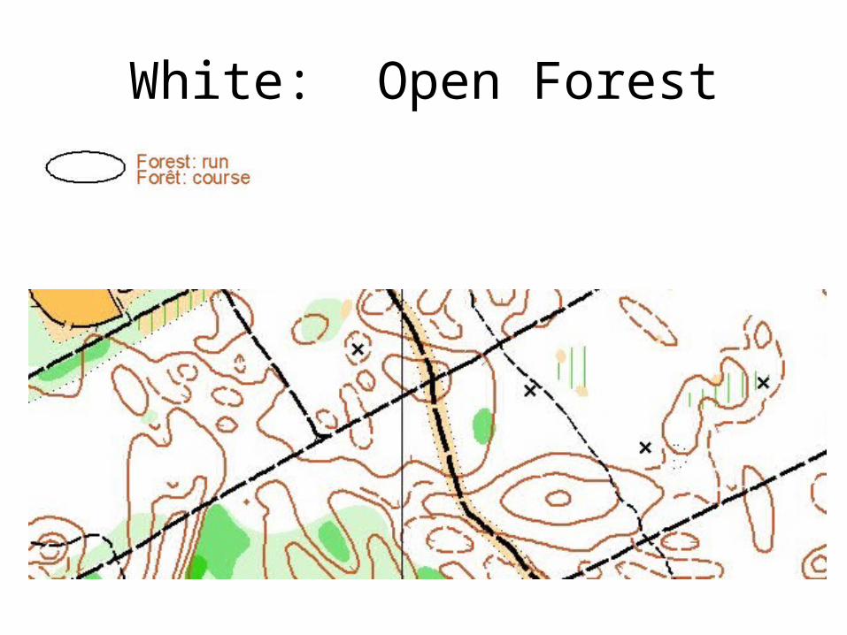
White: Open Forest
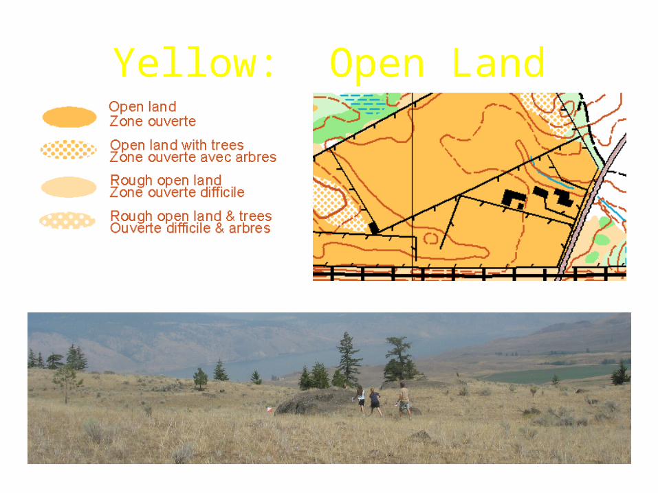
Yellow: Open Land

Green: Thicker Vegetation

Brown: Shape of the Land
Contour lines represent elevation in the landscape.

Blue: Water Features

Black: Man-Made & Rock
Maping Symbols

Orienteering Cincinnati, © 2005
Contours
• Common shapes– Reentrant (v-shape, low ground, points up hill)– Spur (u-shape, high ground)– Ridge– Saddle )(– Knoll
• enclosed circle: top of a hill• just a dot small hill

Orienteering Cincinnati, © 2005
Contours
Re-entrant• probably the most puzzling term encountered by the
beginning orienteer• kind of valley closed at one end • a re-entrant is an "entering" of the land into the hill
shallow deep
Orienteering Cincinnati, © 2005
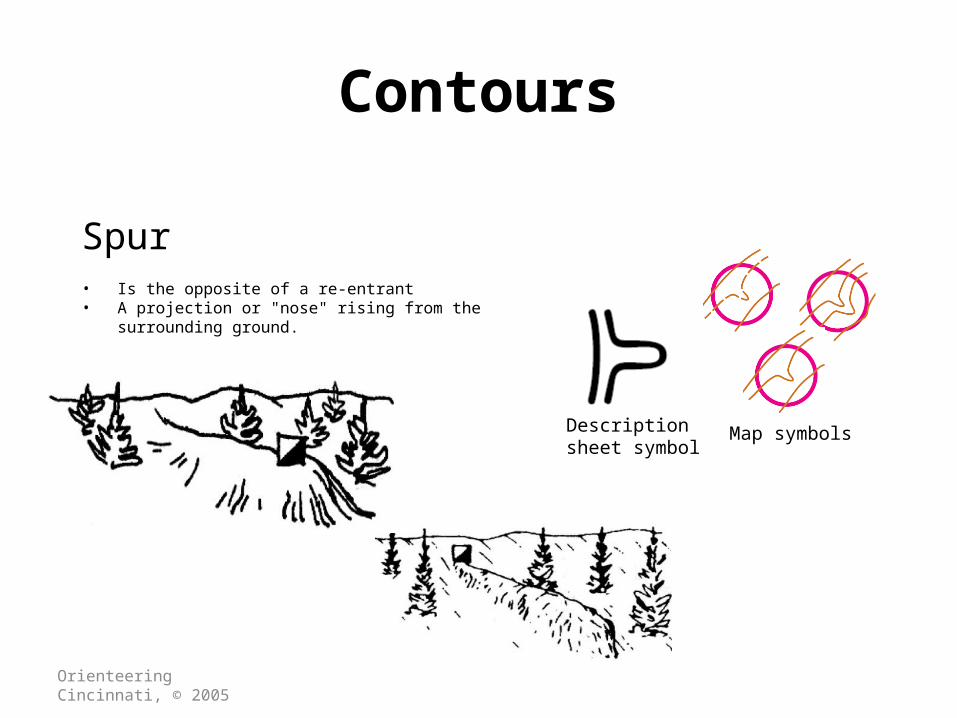
Contours
Spur • Is the opposite of a re-entrant• A projection or "nose" rising from the surrounding
ground.
Description sheet symbol
Map symbols

Orienteering Cincinnati, © 2005
Contours
Ridge • The highest point running from knoll to knoll.• The best place to travel• Easiest running
Orienteering Cincinnati, © 2005
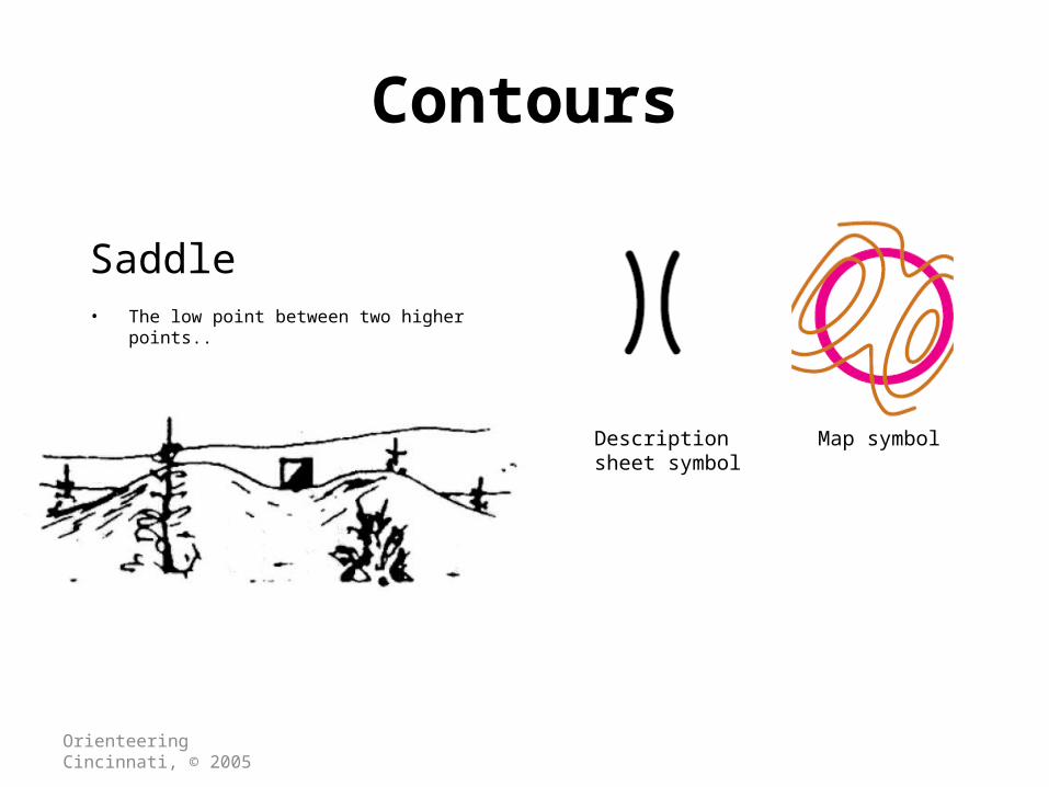
Contours
Saddle • The low point between two higher points..
Description sheet symbol
Map symbol

Orienteering Cincinnati, © 2005
Contours
Hills & knolls• Dot knoll: A small obvious mound.
• Hill: an enclosed contour line.
Knoll
Map symbolsDescription sheet symbol
Hill
Both

Orienteering Cincinnati, © 2005
Contours
• Telling up from down– Closed circles are the tops of hills– Blue lines are steams and are at the bottom of hills.– Reentrants point up from streams to hilltops – Spurs point down from hill to streams and valleys

Orienteering Cincinnati, © 2005
Contours
• Telling up from down
The re-entrant and the spurs are very similar.Are they fat spurs and deep reentrants…Or are they wide shallow reentrants with long skinny spurs?
Orienteering Cincinnati, © 2005
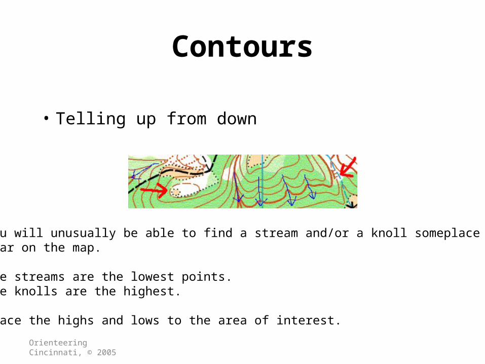
Contours
• Telling up from down
You will unusually be able to find a stream and/or a knoll someplace near on the map.
The streams are the lowest points.The knolls are the highest.
Trace the highs and lows to the area of interest.
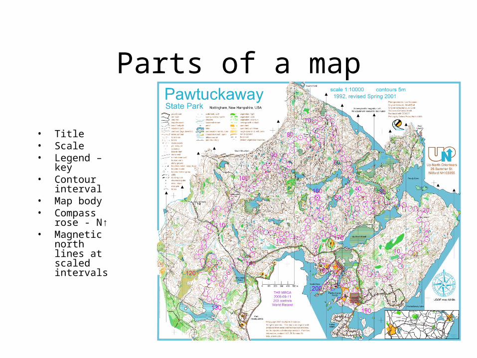
Parts of a map
• Title• Scale• Legend – key• Contour
interval• Map body• Compass rose
- N↑• Magnetic
north lines at scaled intervals
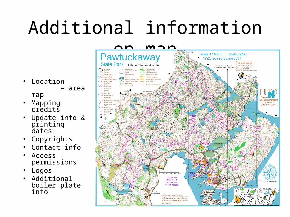
Additional information on map
• Location – area map
• Mapping credits• Update info &
printing dates• Copyrights• Contact info• Access
permissions• Logos• Additional
boiler plate info
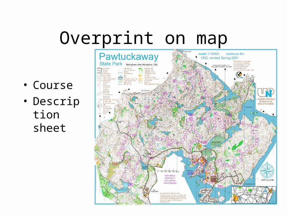
Overprint on map
• Course • Description
sheet
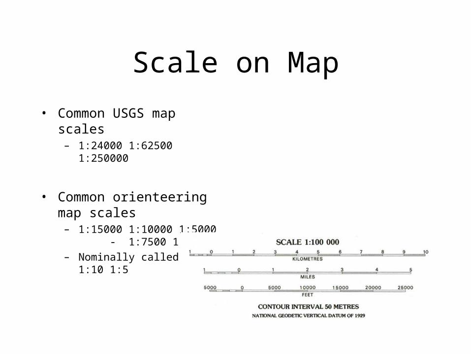
Scale on Map
• Common USGS map scales– 1:24000 1:62500 1:250000
• Common orienteering map scales – 1:15000 1:10000 1:5000 -
1:7500 1:4000 – Nominally called 1:15 1:10 1:5
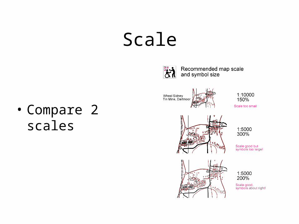
Scale
• Compare 2 scales