yangon land use & building height zoning plan1
DESCRIPTION
preTRANSCRIPT


Working Committee Members
• U Maung Maung Zaw (Head of Department, Building Department)
• U Yi Win (Head of Department, Coordination Department)
• Dr. Kyaw Latt (Advisor, YCDC)
• U Toe Aung (Head of the UPU, YCDC)
• Daw Hlaing Maw Oo (SE-Architect / Urban Planner, MOC)
• Daw Moe Moe Lwin (Director, YHT)
• Daw Tin Tin Kyi (ACE, YCDC)
• Dr. Su Su (Professor/Head, MTU, MOST)
• Daw Hla Su Myat (EC member, Consultant CQHP, AMA)
• JICA Study Team
YANGON LAND USE & BUILDING HEIGHT ZONING PLAN
Yangon City Comprehensive Land use , Zoning and Urban Design Review Working Committee


62’ ~ 78’ Area
< AMS 190’ Area
Building Height Allowed
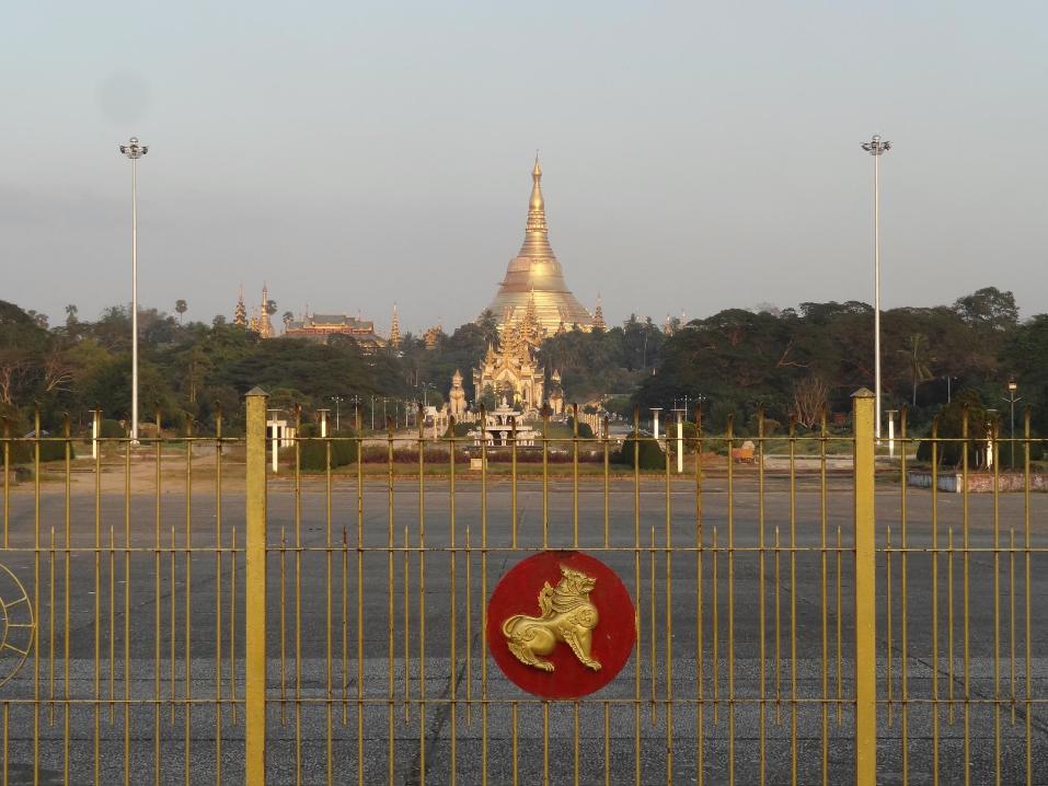
Shwe Dagon Pagoda
Conservation Zone 1
62’ ~ 78’ Area
Shwe Dagon Pagoda
Conservation Zone 2
<AMS 190’ Area

V i s u a l A x i s t o w a r d s S h w e D a g o n P a g o d a

YANGON LAND USE & BUILDING HEIGHT ZONING PLAN
Yangon City Comprehensive Land use , Zoning and Urban Design Review Working Committee

Sule Pagoda Road Sky Line
YANGON LAND USE & BUILDING HEIGHT ZONING PLAN
Yangon City Comprehensive Land use , Zoning and Urban Design Review Working Committee
YANGON LAND USE & BUILDING HEIGHT ZONING PLAN
Yangon City Comprehensive Land use , Zoning and Urban Design Review Working Committee

YANGON LAND USE & BUILDING HEIGHT ZONING PLAN
Yangon City Comprehensive Land use , Zoning and Urban Design Review Working Committee

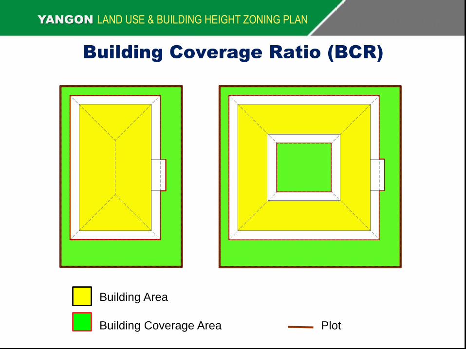
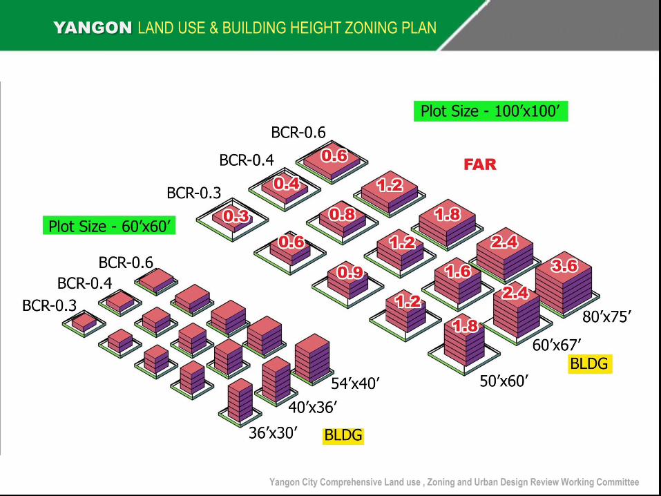
Definition of Building Coverage Ratio (BCR)
• Building Coverage Area is defined to be the area delimited by the
outer most edge line of the building when projected from the top. The
outer most edge line can be the roof line or the parapet line or
combination of both and the outer most edge of any element
protruding from the building. If and unroofed court yard is included,
the court yard area that is not under the roof may be excluded.
YANGON LAND USE & BUILDING HEIGHT ZONING PLAN
Building Coverage Ratio(BCR) = Building Coverage Area
Plot Area

Building Coverage Ratio (BCR)
YANGON LAND USE & BUILDING HEIGHT ZONING PLAN
Building Area
Plot Building Coverage Area
YANGON LAND USE & BUILDING HEIGHT ZONING PLAN
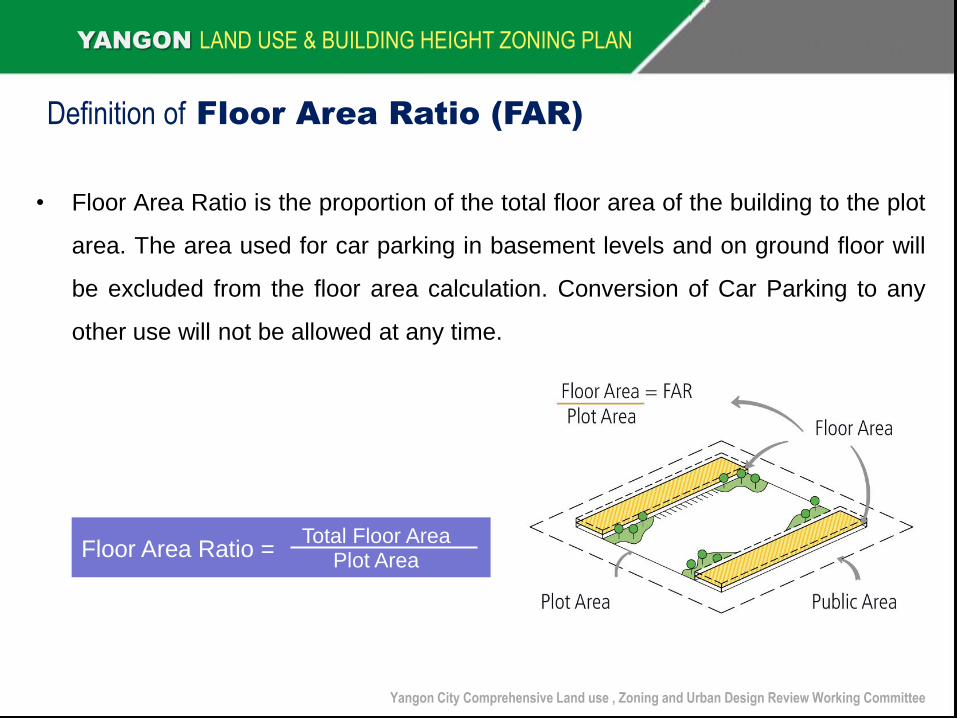
Definition of Floor Area Ratio (FAR)
Floor Area Ratio = Total Floor Area
Plot Area
Yangon City Comprehensive Land use , Zoning and Urban Design Review Working Committee
• Floor Area Ratio is the proportion of the total floor area of the building to the plot
area. The area used for car parking in basement levels and on ground floor will
be excluded from the floor area calculation. Conversion of Car Parking to any
other use will not be allowed at any time.

YANGON LAND USE & BUILDING HEIGHT ZONING PLAN
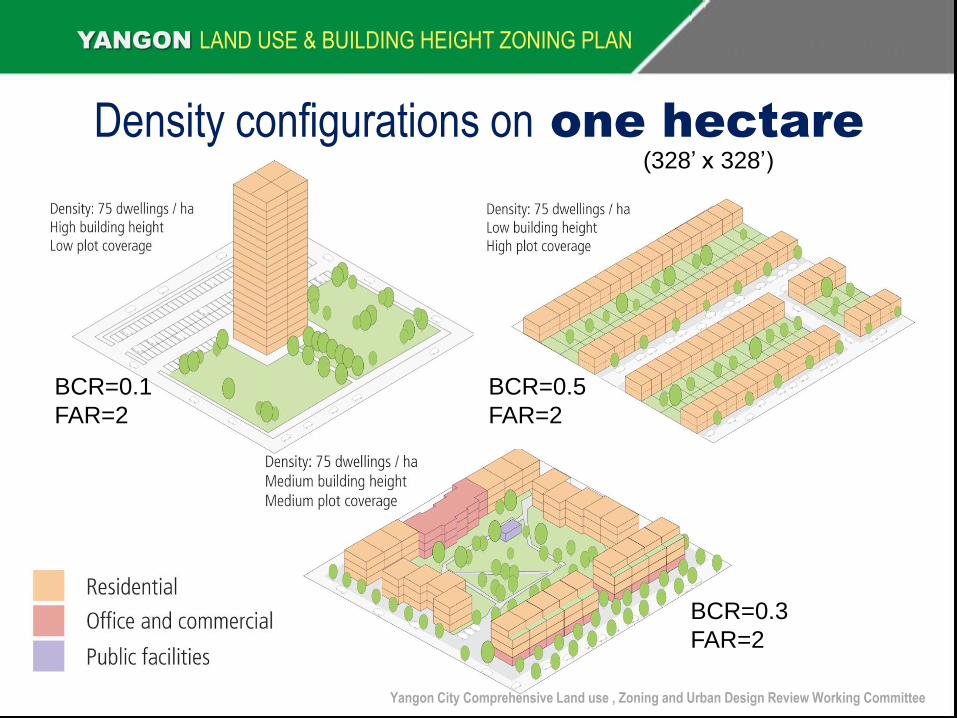
Density configurations on one hectare
Yangon City Comprehensive Land use , Zoning and Urban Design Review Working Committee
BCR=0.1
FAR=2
BCR=0.5
FAR=2
BCR=0.3
FAR=2
(328’ x 328’)
YANGON LAND USE & BUILDING HEIGHT ZONING PLAN
Yangon City Comprehensive Land use , Zoning and Urban Design Review Working Committee

Floor Area & Building Coverage Ratio Chart
No. of Storeyed
YANGON LAND USE & BUILDING HEIGHT ZONING PLAN B
C R
(B
uild
ing
Co
vera
ge R
atio
)
F A R (Floor Area Ratio)
1 1.5 2 2.5 3 3.5 4 4.5 5 5.5 6 6.5 7 7.5 8 8.5 9 9.5 10 10.5 11 11.5 12
0.1 10 15 20 25 30 35 40 45 50 55 60 65 70 75 80 85 90 95 100 105 110 115 120
0.15 6.7 10.0 13.3 16.7 20.0 23.3 26.7 30.0 33.3 36.7 40.0 43.3 46.7 50.0 53.3 56.7 60.0 63.3 66.7 70.0 73.3 76.7 80.0
0.2 5.0 7.5 10.0 12.5 15.0 17.5 20.0 22.5 25.0 27.5 30.0 32.5 35.0 37.5 40.0 42.5 45.0 47.5 50.0 52.5 55.0 57.5 60.0
0.25 4.0 6.0 8.0 10.0 12.0 14.0 16.0 18.0 20.0 22.0 24.0 26.0 28.0 30.0 32.0 34.0 36.0 38.0 40.0 42.0 44.0 46.0 48.0
0.3 3.3 5.0 6.7 8.3 10.0 11.7 13.3 15.0 16.7 18.3 20.0 21.7 23.3 25.0 26.7 28.3 30.0 31.7 33.3 35.0 36.7 38.3 40.0
0.35 2.9 4.3 5.7 7.1 8.6 10.0 11.4 12.9 14.3 15.7 17.1 18.6 20.0 21.4 22.9 24.3 25.7 27.1 28.6 30.0 31.4 32.9 34.3
0.4 2.5 3.8 5.0 6.3 7.5 8.8 10.0 11.3 12.5 13.8 15.0 16.3 17.5 18.8 20.0 21.3 22.5 23.8 25.0 26.3 27.5 28.8 30.0
0.45 2.2 3.3 4.4 5.6 6.7 7.8 8.9 10.0 11.1 12.2 13.3 14.4 15.6 16.7 17.8 18.9 20.0 21.1 22.2 23.3 24.4 25.6 26.7
0.5 2.0 3.0 4.0 5.0 6.0 7.0 8.0 9.0 10.0 11.0 12.0 13.0 14.0 15.0 16.0 17.0 18.0 19.0 20.0 21.0 22.0 23.0 24.0
0.55 1.8 2.7 3.6 4.5 5.5 6.4 7.3 8.2 9.1 10.0 10.9 11.8 12.7 13.6 14.5 15.5 16.4 17.3 18.2 19.1 20.0 20.9 21.8
0.6 1.7 2.5 3.3 4.2 5.0 5.8 6.7 7.5 8.3 9.2 10.0 10.8 11.7 12.5 13.3 14.2 15.0 15.8 16.7 17.5 18.3 19.2 20.0
0.65 1.5 2.3 3.1 3.8 4.6 5.4 6.2 6.9 7.7 8.5 9.2 10.0 10.8 11.5 12.3 13.1 13.8 14.6 15.4 16.2 16.9 17.7 18.5
0.7 1.4 2.1 2.9 3.6 4.3 5.0 5.7 6.4 7.1 7.9 8.6 9.3 10.0 10.7 11.4 12.1 12.9 13.6 14.3 15.0 15.7 16.4 17.1
0.75 1.3 2.0 2.7 3.3 4.0 4.7 5.3 6.0 6.7 7.3 8.0 8.7 9.3 10.0 10.7 11.3 12.0 12.7 13.3 14.0 14.7 15.3 16.0
0.8 1.3 1.9 2.5 3.1 3.8 4.4 5.0 5.6 6.3 6.9 7.5 8.1 8.8 9.4 10.0 10.6 11.3 11.9 12.5 13.1 13.8 14.4 15.0
0.85 1.2 1.8 2.4 2.9 3.5 4.1 4.7 5.3 5.9 6.5 7.1 7.6 8.2 8.8 9.4 10.0 10.6 11.2 11.8 12.4 12.9 13.5 14.1
0.9 1.1 1.7 2.2 2.8 3.3 3.9 4.4 5.0 5.6 6.1 6.7 7.2 7.8 8.3 8.9 9.4 10.0 10.6 11.1 11.7 12.2 12.8 13.3
0.95 1.1 1.6 2.1 2.6 3.2 3.7 4.2 4.7 5.3 5.8 6.3 6.8 7.4 7.9 8.4 8.9 9.5 10.0 10.5 11.1 11.6 12.1 12.6
1.0 1.0 1.5 2.0 2.5 3.0 3.5 4.0 4.5 5.0 5.5 6.0 6.5 7.0 7.5 8.0 8.5 9.0 9.5 10.0 10.5 11.0 11.5 12.0
Yangon City Comprehensive Land use , Zoning and Urban Design Review Working Committee
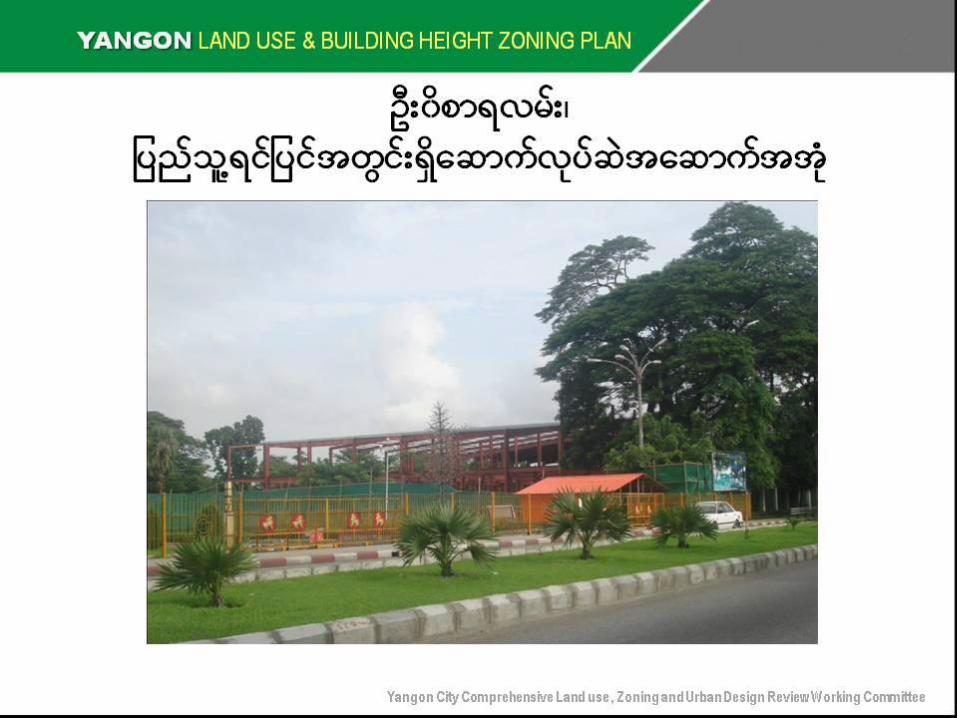
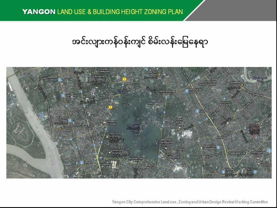
စိမ်းလန်းမမေ နှင့်မေပေ င်များဇုန်များနှင့်ပတ်သက်၍စဉ်းစားသင့်မသာအချက်များ
• ေန်ကနု်မြ ို့တငွ်အများပေ ည်သမူျားအကျိုးဌာ
စိမး်လနး်မမေ နှင့်မေပေ င်များဇုန်အဖေ စ်သတမ်ှတ်ခေ င်း
• စိမး်လနး်မမေ နှင့်မေပေ င်များဇုန်အမျိုးအစားခဲွခေ ားသတမ်ှတေ်ခင်း
• စိမး်လနး်မေမနငှ့်မေပေ င်များဇုန်အမျိုးအစားအလုိက်လက်ခအံသုံးပေ ုသင့်မသာ
မမေ အသုံးချမှုများ
YANGON LAND USE & BUILDING HEIGHT ZONING PLAN
Yangon City Comprehensive Land use , Zoning and Urban Design Review Working Committee

Now, Yangon only has 0.4 m2 of ACCESSIBLE green space per inhabitant –
New Yorkers have over 50 times more green space in their city
2
8
Yangon1
Green space per inhabitant, in m2
3.0
11.5
23.1
0.4
New York2
Paris2
Tokyo2
1 YCDC; 2 http://blog.sustainablecities.net/2011/07/13/how-many-metres-of-green-space-does-your-city-have/

Green and open spaces
Source: Frauke Kraas, Hlaing Maw Oo:
Urban Heritage: Key Considerations in Southeast Asia, Myanmar, October 2012
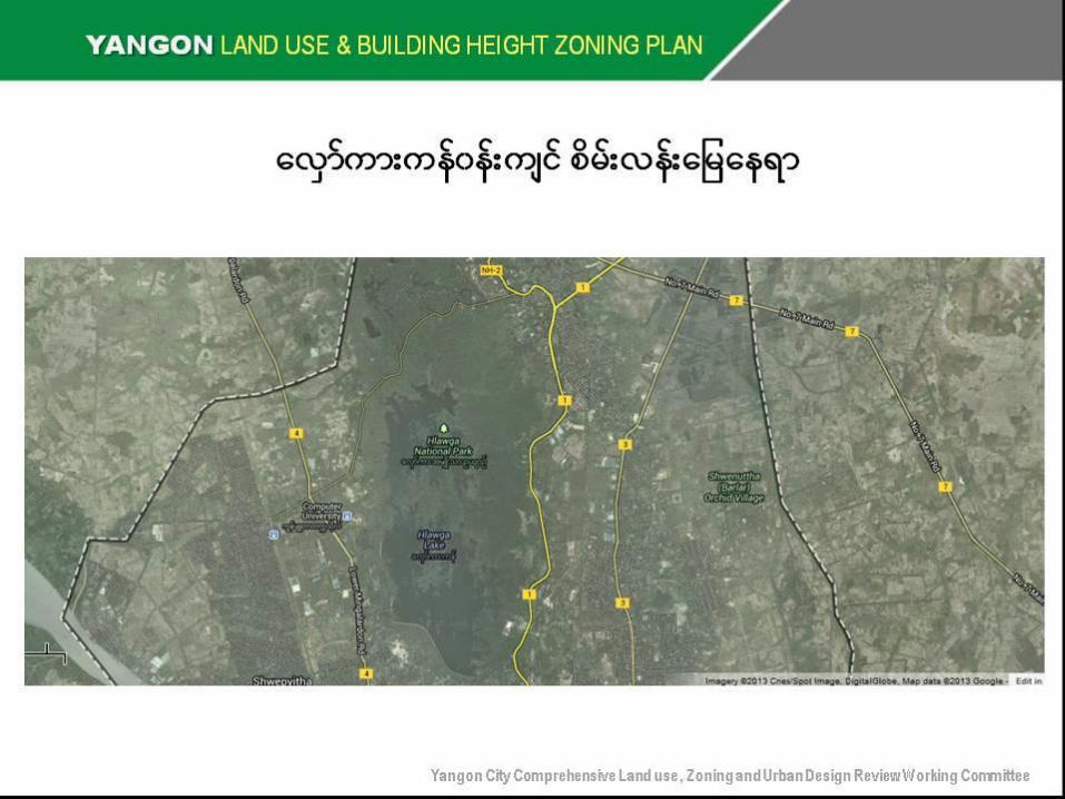
စိမ်းလန်းမမေ နှင့်မေပေ င်များဇုန်များနှင့်ပတ်သက်၍စဉ်းစားသင့်မသာအချက်များ
• စိမး်လနး်မမေ နှင့်မေပေ င်များဇုန်အလိက်ုအမြ ဲတမး်အမောကအ်အုမံျားဖေ င့်
ဖုးံလွှမး်ခွင့်ပေ ုသင့်သည့်အများေံုးမမေ ဧေယိာောခိုင်နှုန်း
• အကြ ီးေုံးမောက်လုပခ်ွင့်ပေ ုသင့်သည့်အမြ ဲတမး်အမောကအ်အံု
• စိမး်လနး်မမေ နှင့်မေပေ င်များဇုန်အမျိုးအစားအလုိက်
အများေပည်သလွူတလ်ပစ်ွာ၀င်/ထွက်ခငွ့်ပေ ုသင့်မသာဧေယိာ
YANGON LAND USE & BUILDING HEIGHT ZONING PLAN
Yangon City Comprehensive Land use , Zoning and Urban Design Review Working Committee
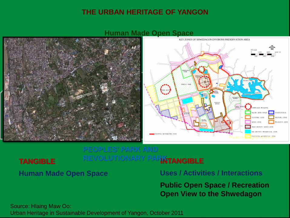
KEY ZONES OF SHWEDAGON ENVIRONS PRESERVATION AREA
THEATRENATIONAL
YUZANA
THE URBAN HERITAGE OF YANGON
TANGIBLE
Human Made Open Space
INTANGIBLE
Uses / Activities / Interactions
Public Open Space / Recreation
Open View to the Shwedagon
PEOPLES’ PARK AND
REVOLUTIONARY PARK
Photo by Regine Spohner
Human Made Open Space
Source: Hlaing Maw Oo:
Urban Heritage in Sustainable Development of Yangon, October 2011


YANGON LAND USE & BUILDING HEIGHT ZONING PLAN
Yangon City Comprehensive Land use , Zoning and Urban Design Review Working Committee
ကန်မတာ်ကြ ီးနငှ့်ပေ ည်သူ့ဥယျာဥ်စိမ်းလန်းမမေ မနော
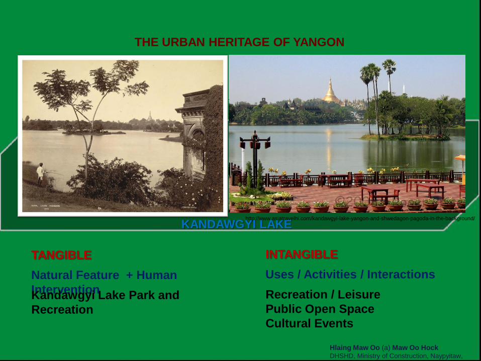
THE URBAN HERITAGE OF YANGON
Hlaing Maw Oo (a) Maw Oo Hock DHSHD, Ministry of Construction, Naypyitaw,
Myanmar
TANGIBLE
Natural Feature + Human
Intervention Kandawgyi Lake Park and
Recreation
INTANGIBLE
Uses / Activities / Interactions
Recreation / Leisure
Public Open Space
Cultural Events
KANDAWGYI LAKE http://www.asiatravelhi.com/kandawgyi-lake-yangon-and-shwedagon-pagoda-in-the-background/
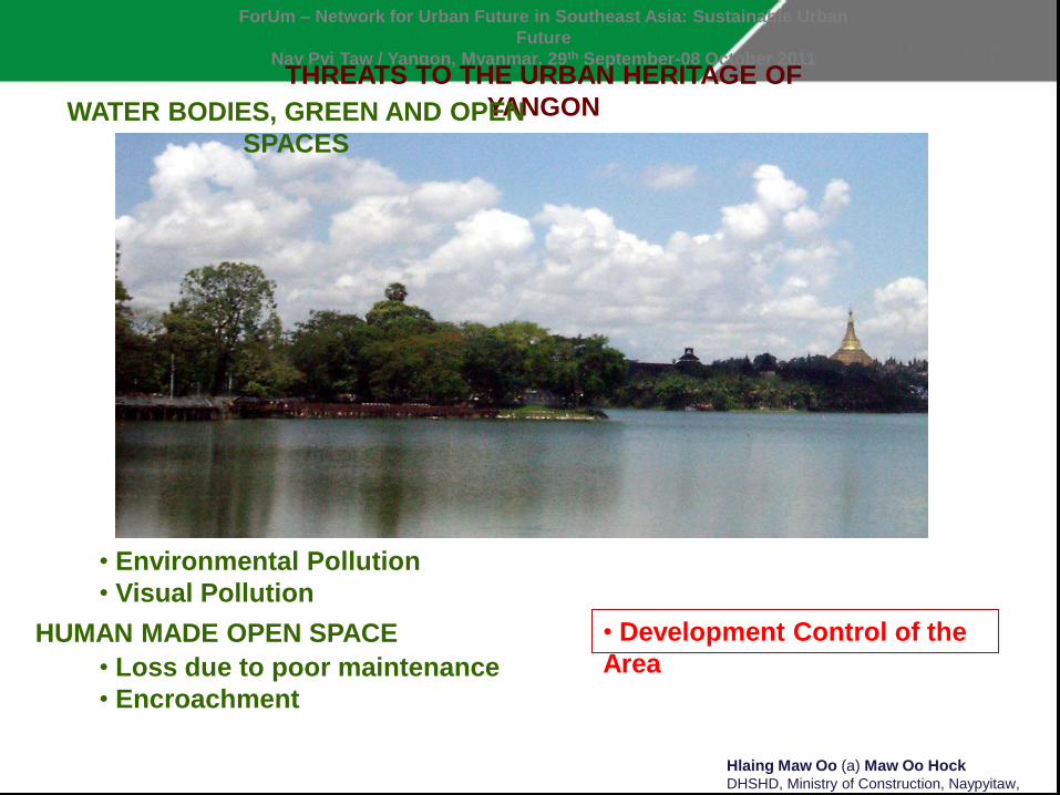
ForUm – Network for Urban Future in Southeast Asia: Sustainable Urban
Future
Nay Pyi Taw / Yangon, Myanmar. 29th September-08 October 2011 THREATS TO THE URBAN HERITAGE OF
YANGON WATER BODIES, GREEN AND OPEN
SPACES
• Environmental Pollution
• Visual Pollution
Hlaing Maw Oo (a) Maw Oo Hock DHSHD, Ministry of Construction, Naypyitaw,
Myanmar
HUMAN MADE OPEN SPACE
• Loss due to poor maintenance
• Encroachment
• Development Control of the
Area

THE URBAN HERITAGE OF YANGON
TANGIBLE HERITAGE
Natural / Geographical
Features
Human Built Environment
INTANGIBLE HERITAGE
Uses
Activities
Interactions
Culture
Uses
Activities
Interactions
TANGIBLE
Natural Feature + Human
Intervention
Yangon River + Port Facilities
INTANGIBLE
Uses / Activities / Interactions
Inland Transport
International Transport
Recreation / Public Open Space
YANGON RIVER FRONT
Photo by Regine Spohner
PEOPLE’S PERCEPTION

B A H A N T O W N S H I P
YANGON LAND USE & BUILDING HEIGHT ZONING PLAN
Yangon City Comprehensive Land use , Zoning and Urban Design Review Working Committee

D A G O N T O W N S H I P
YANGON LAND USE & BUILDING HEIGHT ZONING PLAN
Yangon City Comprehensive Land use , Zoning and Urban Design Review Working Committee
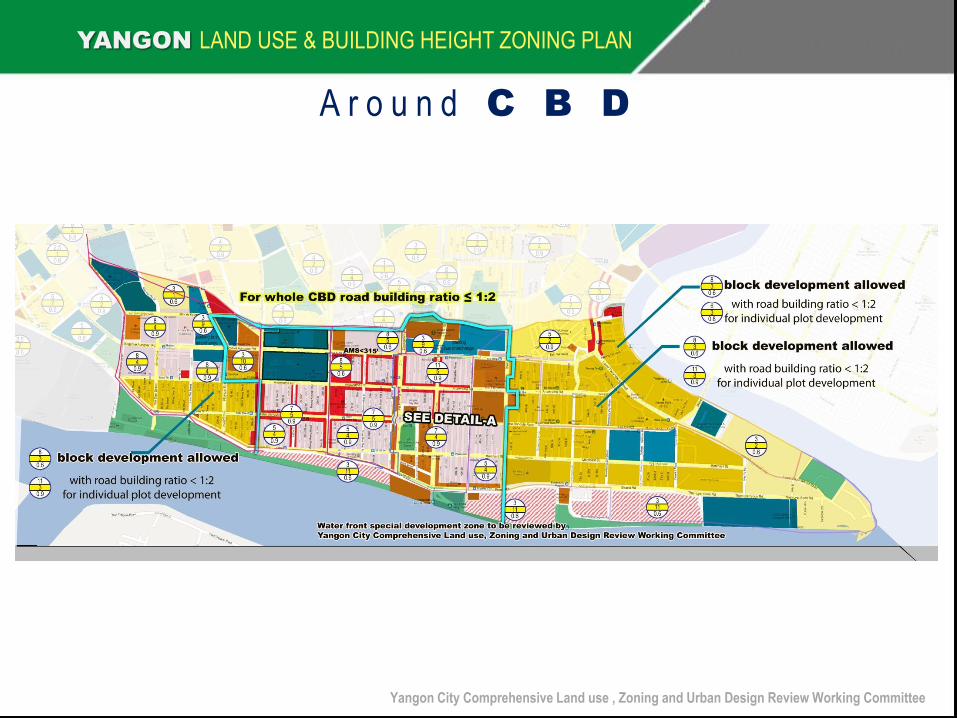
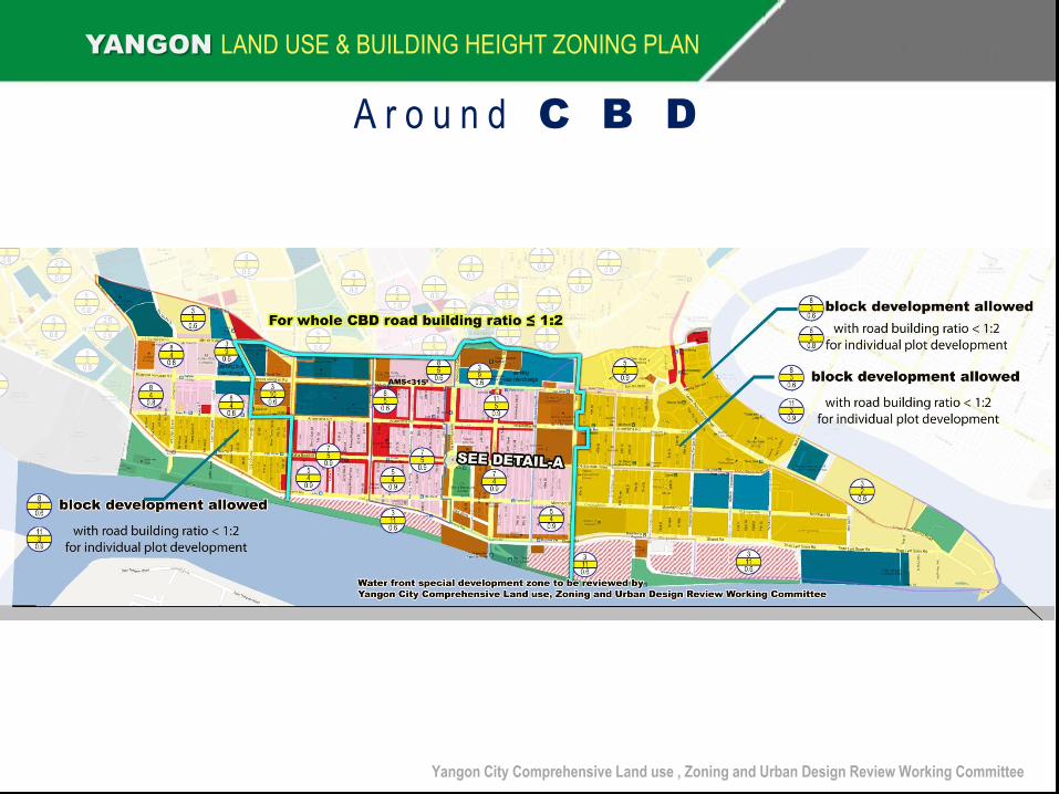
A r o u n d C B D
YANGON LAND USE & BUILDING HEIGHT ZONING PLAN
Yangon City Comprehensive Land use , Zoning and Urban Design Review Working Committee

YANGON LAND USE & BUILDING HEIGHT ZONING PLAN
Yangon City Comprehensive Land use , Zoning and Urban Design Review Working Committee

YANGON LAND USE & BUILDING HEIGHT ZONING PLAN
Yangon City Comprehensive Land use , Zoning and Urban Design Review Working Committee
A r o u n d C B D
YANGON LAND USE & BUILDING HEIGHT ZONING PLAN
Yangon City Comprehensive Land use , Zoning and Urban Design Review Working Committee

Thank you
Yangon City Comprehensive Land use , Zoning and Urban Design Review Working Committee
S h w e D a g o n P a g o d a
C i t y H a l l S a k u r a & T r a d e r s S u l e P a g o d a