water management information system for the rio …€¦ · · 2012-08-17the university of texas...
TRANSCRIPT
11
Center for Research in Water ResourcesCenter for Research in Water ResourcesThe University of Texas at AustinThe University of Texas at Austin
Water Management Information System Water Management Information System for the Rio Grande/Rio Bravo Basin for the Rio Grande/Rio Bravo Basin
Carlos PatinoDaene McKinneyDavid MaidmentOctober, 2005
22
Center for Research in Water ResourcesCenter for Research in Water ResourcesThe University of Texas at AustinThe University of Texas at Austin
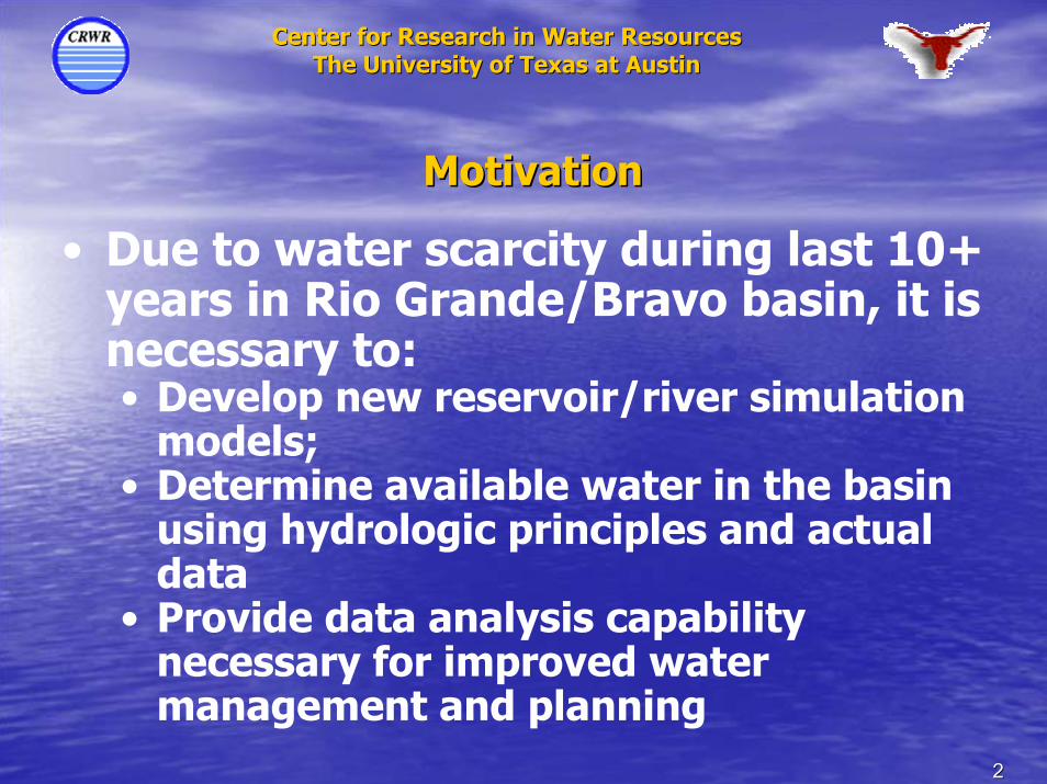
MotivationMotivation
• Due to water scarcity during last 10+ years in Rio Grande/Bravo basin, it is necessary to:• Develop new reservoir/river simulation
models;• Determine available water in the basin
using hydrologic principles and actual data
• Provide data analysis capability necessary for improved water management and planning
33
Center for Research in Water ResourcesCenter for Research in Water ResourcesThe University of Texas at AustinThe University of Texas at Austin
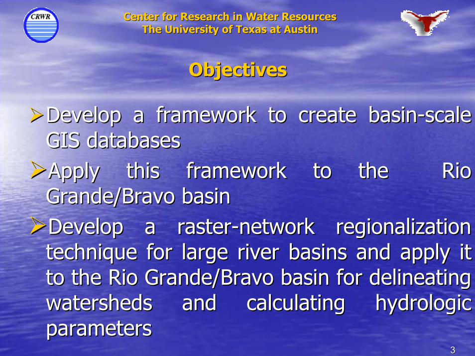
ObjectivesObjectives
Develop a framework to create basinDevelop a framework to create basin--scale scale GIS databasesGIS databasesApply this framework to the Rio Apply this framework to the Rio Grande/Bravo basinGrande/Bravo basinDevelop a rasterDevelop a raster--network regionalization network regionalization technique for large river basins and apply it technique for large river basins and apply it to the Rio Grande/Bravo basin for delineating to the Rio Grande/Bravo basin for delineating watersheds and calculating hydrologic watersheds and calculating hydrologic parametersparameters

44
Center for Research in Water ResourcesCenter for Research in Water ResourcesThe University of Texas at AustinThe University of Texas at Austin
CollaborationCollaborationParticipantsParticipants
•• University of Texas at Austin University of Texas at Austin
•• Comisión Comisión NacionalNacional del del AguaCOMISIÓN NACIONALDEL AGUA
CRWRCRWR
Agua
SupportSupport•• InstitutoInstituto MexicanoMexicano de de TecnologiaTecnologia del del
AguaAgua•• InstitutoInstituto NacionalNacional de de EstadisticaEstadistica, ,
GeografiaGeografia e e InformaticaInformatica•• Universidad Universidad AutonomaAutonoma de Ciudad de Ciudad
JuarezJuarez•• North American Development bankNorth American Development bank•• Texas Commission on Environmental Texas Commission on Environmental
QualityQuality•• IBWC/CILAIBWC/CILA
55
Center for Research in Water ResourcesCenter for Research in Water ResourcesThe University of Texas at AustinThe University of Texas at Austin
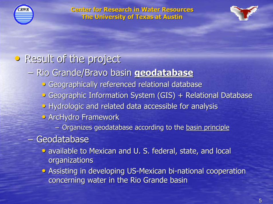
•• Result of the projectResult of the project–– Rio Grande/Bravo basin Rio Grande/Bravo basin geodatabasegeodatabase
•• Geographically referenced relational databaseGeographically referenced relational database•• Geographic Information System (GIS) + Relational DatabaseGeographic Information System (GIS) + Relational Database•• Hydrologic and related data accessible for analysisHydrologic and related data accessible for analysis•• ArcHydro FrameworkArcHydro Framework
–– Organizes geodatabase according to the Organizes geodatabase according to the basin principlebasin principle
–– Geodatabase Geodatabase •• available to Mexican and U. S. federal, state, and local available to Mexican and U. S. federal, state, and local
organizations organizations •• Assisting in developing USAssisting in developing US--Mexican biMexican bi--national cooperation national cooperation
concerning water in the Rio Grande basinconcerning water in the Rio Grande basin
66
Center for Research in Water ResourcesCenter for Research in Water ResourcesThe University of Texas at AustinThe University of Texas at Austin
0 240,000 480,000 720,000 960,000120,000Meters
-
TEXAS
NEW MEXICO
COLORADO
CHIHUAHUA
COAHUILA
DURANGO
TAMAULIPAS
NUEVO LEON
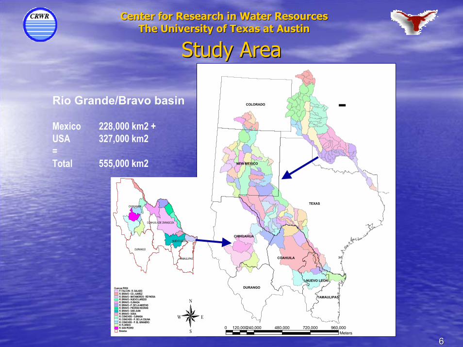
Study AreaStudy Area
Rio Grande/Bravo basin
Mexico 228,000 km2 + USA 327,000 km2 = Total 555,000 km2
CHIHUAHUA
DURANGO
TAMAULIPAS
COAHUILA DE ZARAGOZA
NUEVO LEON
Estados
Cuencas RH24P. FALCON - R. SALADOR. BRAVO - CD. JUAREZR. BRAVO - MATAMOROS - REYNOSAR. BRAVO - NUEVO LAREDOR. BRAVO - OJINAGAR. BRAVO - P. DE LA AMISTADR. BRAVO - PIEDRAS NEGRASR. BRAVO - SAN JUANR. BRAVO - SOSAR. CONCHOS - OJINAGAR. CONCHOS - P. DE LA COLINAR. CONCHOS - P. EL GRANEROR. FLORIDOR. SAN PEDRO
N
EW
S
77
Center for Research in Water ResourcesCenter for Research in Water ResourcesThe University of Texas at AustinThe University of Texas at Austin
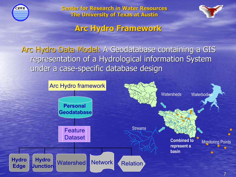
Arc Hydro FrameworkArc Hydro Framework
Arc Hydro Data Model: Arc Hydro Data Model: A Geodatabase containing a GIS A Geodatabase containing a GIS representation of a Hydrological information System representation of a Hydrological information System under a caseunder a case--specific database designspecific database design
Arc Hydro framework
Personal Geodatabase
HydroEdge
HydroJunction Watershed Network
Waterbodies
Monitoring Points
Streams
Watersheds
Combined to represent a basin
FeatureDataset
Relation
88
Center for Research in Water ResourcesCenter for Research in Water ResourcesThe University of Texas at AustinThe University of Texas at Austin
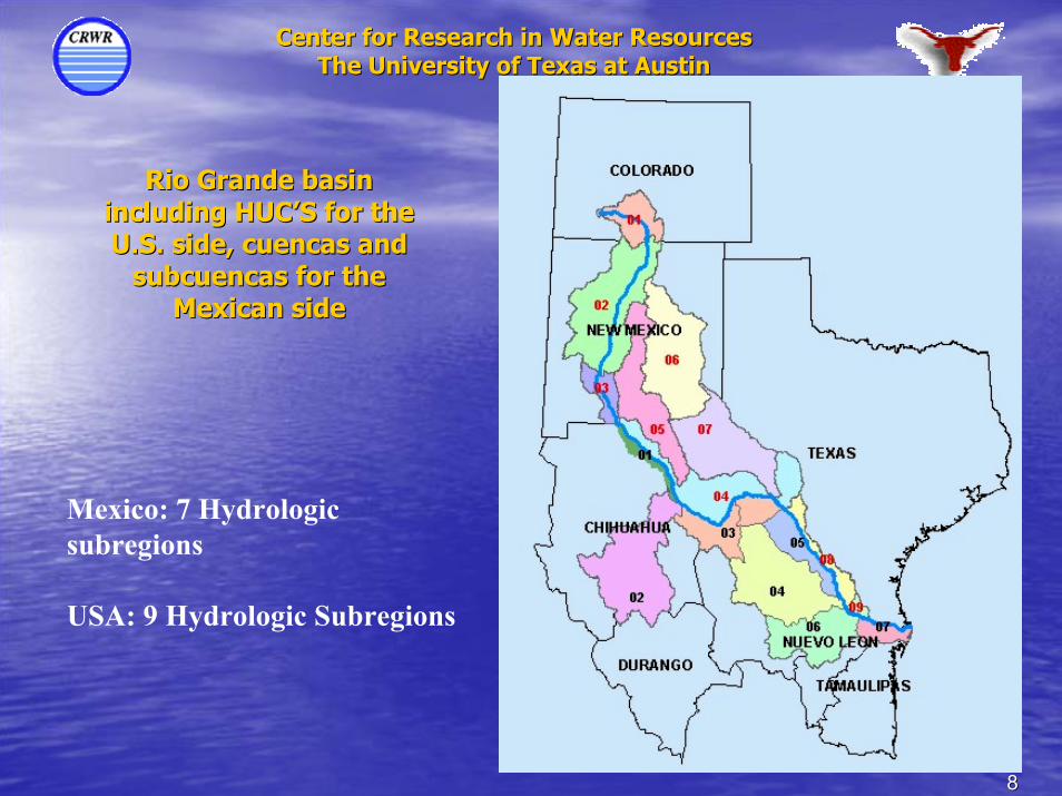
Rio Grande basin Rio Grande basin including HUCincluding HUC’’S for the S for the U.S. side, U.S. side, cuencascuencas and and
subcuencas for the subcuencas for the Mexican sideMexican side
Mexico: 7 Hydrologic subregions
USA: 9 Hydrologic Subregions
99
Center for Research in Water ResourcesCenter for Research in Water ResourcesThe University of Texas at AustinThe University of Texas at Austin
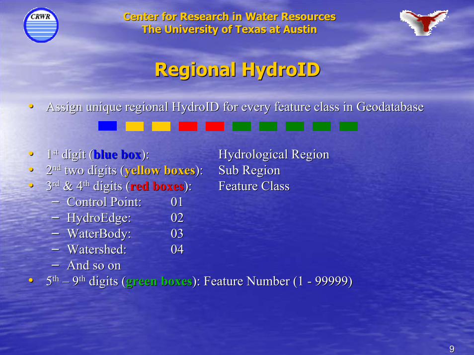
Regional HydroIDRegional HydroID
•• Assign unique regional HydroID for every feature class in GeodatAssign unique regional HydroID for every feature class in Geodatabaseabase
•• 11stst digit (digit (blue boxblue box):): Hydrological RegionHydrological Region•• 22ndnd two digits (two digits (yellow boxesyellow boxes):): Sub RegionSub Region•• 33rdrd & 4& 4thth digits (digits (red boxesred boxes):): Feature ClassFeature Class
–– Control Point:Control Point: 0101–– HydroEdge: HydroEdge: 0202–– WaterBody: WaterBody: 0303–– Watershed: Watershed: 0404–– And so onAnd so on
•• 55thth –– 99thth digits (digits (green boxesgreen boxes): Feature Number (1 ): Feature Number (1 -- 99999)99999)
1010
Center for Research in Water ResourcesCenter for Research in Water ResourcesThe University of Texas at AustinThe University of Texas at Austin
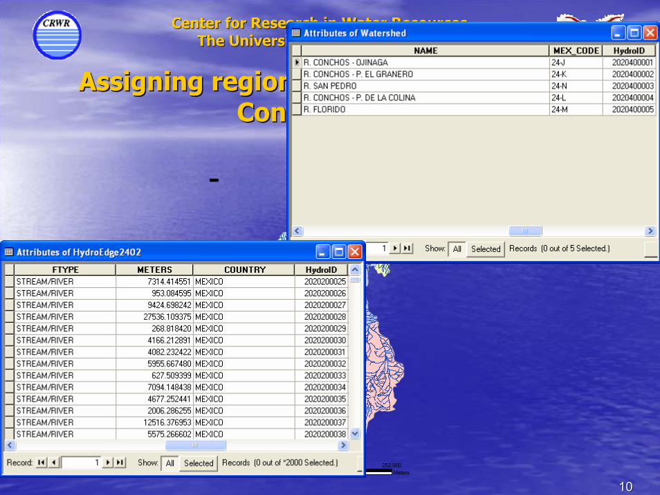
Assigning regional HydroIDs to the Rio Assigning regional HydroIDs to the Rio Conchos BasinConchos Basin
0 63,000 126,000 189,000 252,00031,500Meters
-
1111
Center for Research in Water ResourcesCenter for Research in Water ResourcesThe University of Texas at AustinThe University of Texas at Austin
-Digital Elevation Model for Mexico. Source: INEGI
0 160,000 320,000 480,000 640,00080,000Meters
-TEXAS
NEW MEXICO
CHIHUAHUA
COAHUILA
DURANGO
NUEVO LEON
TAMAULIPAS
Digital Elevation Model for U.S. Source: USGS
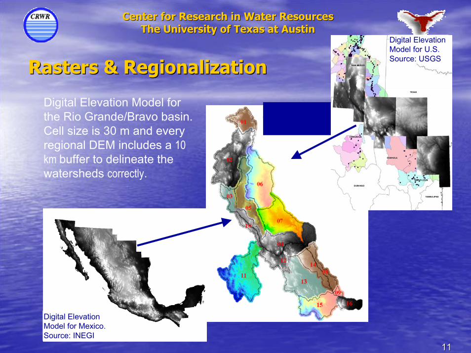
Rasters & RegionalizationRasters & Regionalization
Digital Elevation Model for the Rio Grande/Bravo basin. Cell size is 30 m and every regional DEM includes a 10 km buffer to delineate the watersheds correctly.
1212
Center for Research in Water ResourcesCenter for Research in Water ResourcesThe University of Texas at AustinThe University of Texas at Austin
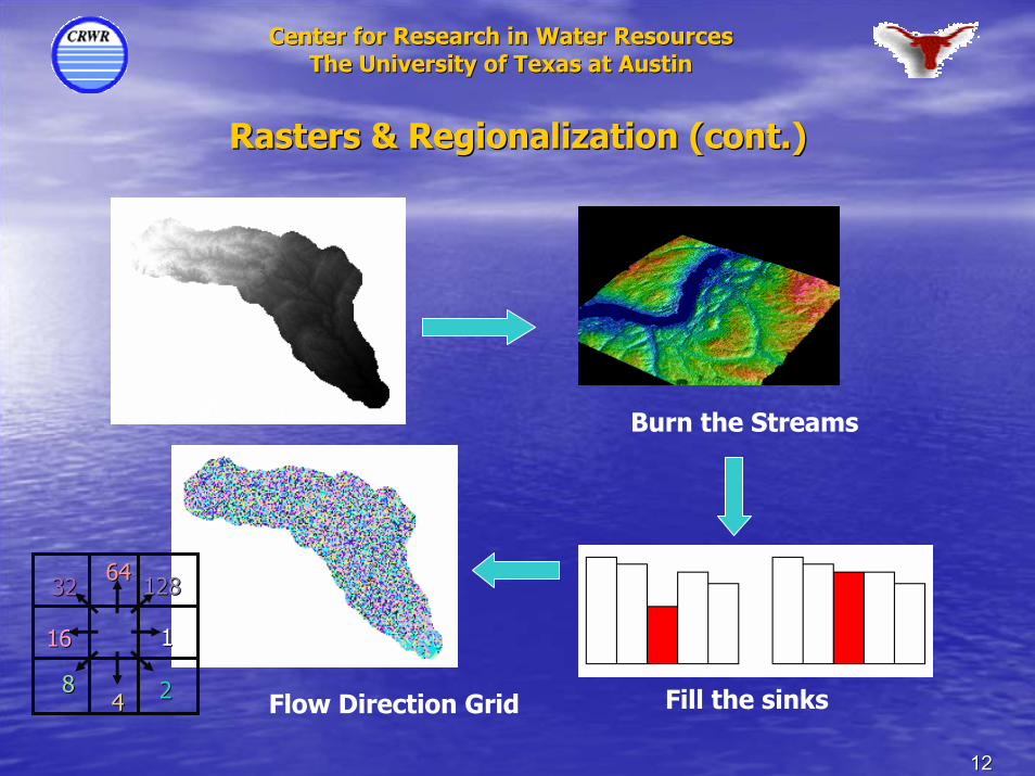
Rasters & Regionalization (cont.)Rasters & Regionalization (cont.)
Buffered DEM Burn the Streams
Flow Direction Grid
3232 6464128128
1616
8844
11
22 Fill the sinks
1313
Center for Research in Water ResourcesCenter for Research in Water ResourcesThe University of Texas at AustinThe University of Texas at Austin
Rasters & Regionalization (cont.)Rasters & Regionalization (cont.)
-
!(
!(
!(
!(
!(
!(
!(
!(!(
!(
!(
!(
!(
!(
!(
!(
!(
!(
!(
!(
!(
!(
!(
!(
!(
!(
!(
!(
!(
!(
!(
!(
!(!( !(!(
!(
!(
&
&
&
&
&
&
&
&
&
&
&
&
&
&
&
&
&
&
&
&
&&
&&&
&
&
&
&
&
&
&
&
&
&
&
&
&
&
&
&
&
&
&
&
&
&
&
&
&
&
&
0 80 160 24040
-
TEXAS
CHIHUAHUA
NEW MEXICO
COAHUILA
DURANGO
NUEVO LEON
TAMAULIPAS
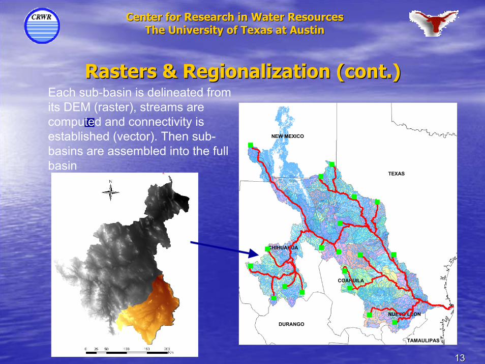
Each sub-basin is delineated from its DEM (raster), streams are computed and connectivity is established (vector). Then sub-basins are assembled into the full basin
1414
Center for Research in Water ResourcesCenter for Research in Water ResourcesThe University of Texas at AustinThe University of Texas at Austin
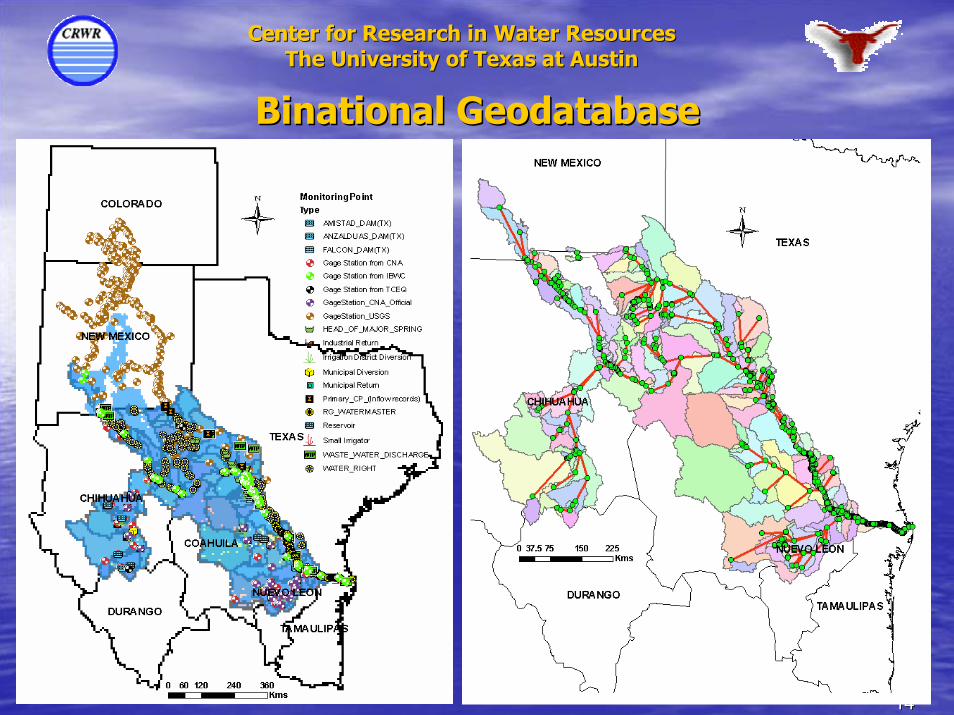
Binational GeodatabaseBinational Geodatabase
Center for Research in Water ResourcesCenter for Research in Water ResourcesThe University of Texas at AustinThe University of Texas at Austin
Regionalization process for the Río Regionalization process for the Río Grande/Bravo basinGrande/Bravo basin
DEMO in GISDEMO in GIS
1616
Center for Research in Water ResourcesCenter for Research in Water ResourcesThe University of Texas at AustinThe University of Texas at Austin
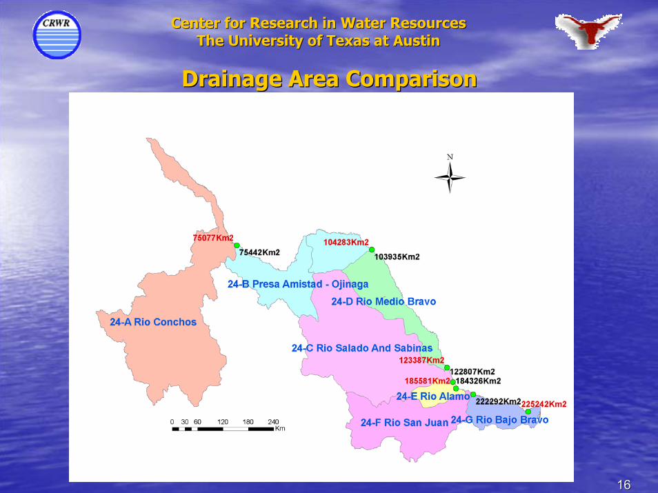
Drainage Area ComparisonDrainage Area Comparison
1717
Center for Research in Water ResourcesCenter for Research in Water ResourcesThe University of Texas at AustinThe University of Texas at Austin
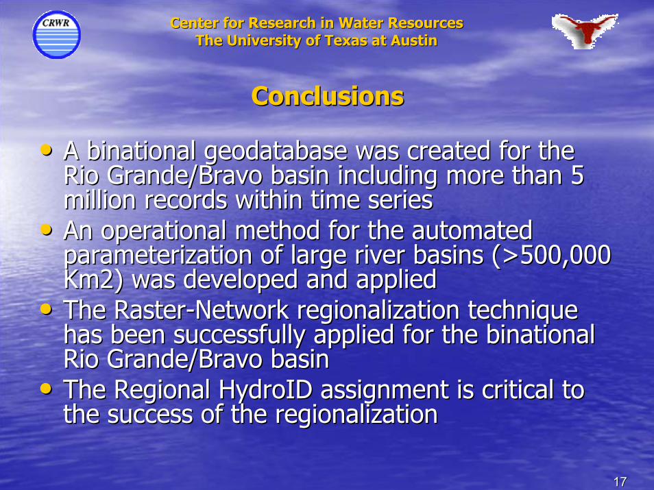
ConclusionsConclusions
•• A binational geodatabase was created for the A binational geodatabase was created for the Rio Grande/Bravo basin including more than 5 Rio Grande/Bravo basin including more than 5 million records within time seriesmillion records within time series
•• An operational method for the automated An operational method for the automated parameterization of large river basins (>500,000 parameterization of large river basins (>500,000 Km2) was developed and appliedKm2) was developed and applied
•• The RasterThe Raster--Network regionalization technique Network regionalization technique has been successfully applied for the binational has been successfully applied for the binational Rio Grande/Bravo basinRio Grande/Bravo basin
•• The Regional HydroID assignment is critical to The Regional HydroID assignment is critical to the success of the regionalizationthe success of the regionalization
1818
Center for Research in Water ResourcesCenter for Research in Water ResourcesThe University of Texas at AustinThe University of Texas at Austin
Geodatabase DistributionGeodatabase Distributionwww.crwr.utexas.edu/riogrande.shtmlwww.crwr.utexas.edu/riogrande.shtml