u o s t o n geolo g i c a thebull etin h l 1923 houston ... may 2004 bulletin... · may 2004...
TRANSCRIPT

May 2004 Houston Geological Society Bulletin 1
HO
US
TO
NGEOLO
GIC
AL
1923
The Houston Geological Society Bulletin (ISSN-018-6686) ispublished monthly except for July and August by the HoustonGeological Society, 10575 Katy Freeway, Suite 290, Houston TX77024. Subscription to this publication is included in the mem-bership dues ($20.00 annually). Subscription price for non-members within the contiguous U.S. is $30.00 per year. Forthose outside the contiguous U.S., the subscription price is$46.00 per year. Single-copy price is $3.00. Periodicalspostage paid in Houston, Texas.
POSTMASTER: Send address changes to Houston Geological SocietyBulletin, 10575 Katy Freeway, Suite 290, Houston TX 77024.
Volume 46, Number 9 May 2004
Houston Geological SocietyBulletinThe
In Every Issue5 From the President
by Craig Dingler
9 Commentary by Jeff Lund
36 GeoEvents Calendar
61 Webnotes
68 HGA/GeoWives
69 Professional Directory
....
....
....
....
....
....
....
....
....
....
....
....
....
....
....
....
....
....
....
....
....
....
....
....
....
....
....
....
....
....
.contents
Technical Meetings15 HGS Environmental and Engineering
Group Dinner MeetingRethinking the Global Carbon Cycle with GasHydrates and Seafloor Methane ThroughoutTimeby Gerald Dickens, PhD
17 GSH Breakfast MeetingAmbiguity and Sensitivity of Rock Propertiesunder Different Reservoir Conditionsby Alvaro Chaveste
19 HGS International Explorationists DinnerMeetingSequence Stratigraphy and ReservoirPrediction of the Giant Tengiz Field,Kazakhstanby L.J. (Jim) Weber, B.P. (Brent) Francis,P.M. (Mitch) Harris and Michael Clark
23 HGS Northsiders Dinner MeetingKnowledge, Resources, Respect: Flood DamageReduction and Our Communityby Michael D. Talbott
25 HGS North American ExplorationistsDinner MeetingUpper Ordovician Montoya SequenceStratigraphy and Chert Porosity in theSoutheastern Delaware Basin, West Texasby David M. Thomas, III and Huaibo Liu
29 HGS General Luncheon MeetingMeeting the Energy Challengesby Stephen A. Sonneberg
Other Features33 Gov. Rick Perry Announces Grant to
Texas Energy Center
41 2003–2004 Outstanding Student Awards
45 Guest Night 2004, Saturday, June 19,Will Feature NASA Scientist Dr. GordonMcKay on the Topic “Results From Spiritand Opportunity: Twin Rover Geologistson Mars”by Linda Sternbach
about the cover: Medano Creek is a braided stream inGreat Sand Dunes National Park. Sand in the dunes iseroded by the creek and deposited along the margin of thedune field in a series of well developed upper-flow regimebedforms. Photo taken during University of Houston FieldCamp, 1986.Photograph by William Dupré, PhD
page 41
page 45
page 33
KAZAKHSTAN
UZBEKISTAN
TURKMENISTAN
GEORGIA
AZERBAIJANARMENIA
CASPIANSEA
SYRIA
IRAN AFGHANIST
TAJ
BLACKSEA
ARALSEA
IRAQ
RUSSIA
TURKEY
Tengiz
page 19
Houston Geological Society10575 Katy Freeway, Suite 290Houston, TX 77024Office Hours: 8 a.m.–5 p.m.Phone 713-463-9476Fax 713-463-9160Reservations 713-463-8920
Office Manager: Joan [email protected] your address changes to the Office Manager
HGS Web Pagehttp://www.hgs.org
GeoJob Bankhttp://www.hgs.org

VOTE! In April, you should have received your Houston
Geological Society ballot for the election of next year’s
officers. If you still have it, please mark your choices and mail the
ballot back to the HGS office by May 7 so that it counts! Your vote
is your voice in the future of the HGS. Don’t let it go unheard!
AAPG ConventionThe AAPG annual convention comes back to Houston in spring
2006, and I am proud to announce the AAPG Executive
Committee named Charles Sternbach
general chairman. Charles wasted no time
building his team. Dan Tearpock and
Deborah Sacrey have graciously accepted
Vice-Chairman assignments. Robert
Merrill will be the technical program
coordinator. John Adamick will put
together CEO programs. Congratulations!
The HGS appreciates your efforts, dedica-
tion to the profession and volunteer
spirit.
State Board of EducationOn the educational front, the first recom-
mendation from the Earth Science Task Force Report—urging
redesignation of selected Earth science courses to meet the science
requirements for graduation from high school—was brought up
for consideration to the State Board of Education (SBOE; see the
recommendations in the October 2003 issue of the Bulletin, pages
35 and 37). Numerous letters endorsing the recommendation were
sent to SBOE members from many geoscientists, and two dozen
witnesses stood to present supporting testimony on Thursday,
February 26. The witnesses included luminaries such as astronaut
Jim Reilly, former USGS director Gordon Eaton, former UT president
Peter Flawn, as well as HGS members Marsha Bourque and
Stewart Chuber. Even so, the SBOE Committee of the Whole voted
7 for, 7 against, and 1 abstained. The next day, the recommendation
was considered again by the SBOE during formal session and
the vote was 9 for and 5 against. Ed Roy, Jr. (Trinity University),
chairman of the Earth Science Task Force, and Marcus Milling,
AGI executive director, reported that a great deal of behind the
scenes work went on between Thursday and Friday. Two more
readings and positive votes, one this month (May) and one in July,
must occur before the recommendation is finally approved.
Considerable opposition is expected at the next meeting. You
should note that this is only the first of three Task Force recom-
mendations for immediate action. There
are five more recommendations that
are considered long-term and require
changes to the existing Texas Essential
Knowledge and Skills (TEKS) and Texas
Assessment of Knowledge and Skills
(TAKS). Obviously, SBOE approval of
the recommendations is going to take
time and it will be a struggle. The HGS
executive board stands in support of the
Earth Science Task Force.
DirectoryThe next issue of the HGS/GSH
Membership Directory is going to press within the next few
months. For those of you who have changed addresses or other
contact information since the last directory was printed, my plea
to you is to make sure the HGS office has your new records. If you
have updated your details through the HGS Website, fine, but the
two databases are not yet connected! That will be remedied soon,
but in the meantime, we need your help keeping both up-to-date.
The Directory is one of my major networking and VRM (volunteer
relationship management) tools, and I don’t know how I would
get along without it. I know many members use it as much as I do.
For those of you working for companies that are potential adver-
tisers, buying some page space does get you noticed!
May 2004 Houston Geological Society Bulletin 5
President’sLetterby Craig M. Dingler
Around the Society
President’s Letter continued on page 7
The AAPG annual convention
comes back to Houston in
spring 2006, and I am proud to
announce the AAPG Executive
Committee named Charles
Sternbach general chairman.

May 2004 Houston Geological Society Bulletin 7
Guest NightLinda Sternbach is putting together the final details for Guest
Night, and she has plenty of news elsewhere in this Bulletin for
the event’s program: Martian Rocks and Mission Results. As I
write this, there are reports of the Mars rovers finding evidence
for surface water in the Red Planet’s geologic past. I am sure we
will get the inside scoop at the Guest Night talk from Dr. Gordon
McKay of the NASA Johnson Space Center. As is tradition,
a social hour and catered dinner under the dinosaurs will take
place before the main program. Tickets are limited to the 400
or so seats in the Houston Museum of Natural Science IMAX
theater. Please make your reservations early, as it is always
a sell-out!
Meetings, Classes and EventsWe have a few talks in June, but May is the last month to catch a
full schedule of dinner and luncheon meetings. Kara Bennett also
has the Continuing Education Committee regrouped and refo-
cused with two petrophysics classes this spring (see page 67).
The first is “Using Core Data in Formation Evaluation” on May
18 (see page 50). Finally, the HGS Tennis Tournament is
Saturday, May 21. Ross Davis always organizes an enjoyable and
entertaining event, and I guarantee tennis players a great time! ■
President’s Letter continued from page 5

May 2004 Houston Geological Society Bulletin 9
by Jeff LundChair of the APPEX Advisory Committee
Reply to Bulletin Editor Diane Yeager,[email protected]
Why APPEX?
Commentary
Why does AAPG (along with HGS and SIPES) bother to con-
vene a prospect and property expo when we could all just
go to the NAPE North American Prospects Expo?
The answer, I believe, is service to the membership and AAPG’s
effort to be a “lifetime career partner” to geoscientists who
increasingly find themselves working as independent prospect
generators or “free agent” consultants. It seems to be less and less
likely that any geoscientist can depend on long-term employment
security at oil companies or in the serv-
ice sector.
The final phrase in the AAPG
Constitution (Article II. Purpose) is “to
advance the professional well-being of
its members.”
Providing a reasonably priced venue for
geoscientists to present their profes-
sional work to the marketplace,
combined with an informative Forum
of speakers providing updates and
insights on the current E&P business
environment, is a significant value-
adding service that directly contributes
to the professional well-being of many
members.
The underlying role of geoscience and
the geoscientist in APPEX (AAPG
Prospect and Property Expo) events
cannot be over stated. The differentiating
concept between APPEX and other forums is the direct contact
APPEX provides between the prospect originator and the market-
place. An overwhelming amount of the world’s oil and gas is
found by the men and women of AAPG, and APPEX is AAPG’s
premier connection for explorers to link to capital. Connecting
geoscientists with capital is vital to our industry and profession.
Indeed, the APPEX mission statement reads:
“Establish U.S. and International marketplaces for the exchange of
oil and gas prospects and producing properties, which are driven
by geoscience fundamentals as well as business opportunity.”
The international component is fundamental. APPEX London is a
viable and growing event that is exporting the prospect market
concept to Europe, where, for example, the North Sea is experi-
encing a high level of renewed activity and opportunity for
entrepreneurial geoscientists for whom that tradition had not
existed. Other organizations have experimented, but APPEX
London’s geoscience emphasis is a differentiator. Perhaps APPEX
Houston and APPEX London will
evolve together and provide synergistic
value, learning from each other and
sharing new concepts in content and
format.
AAPG’s Annual Meeting and its
International Conferences are a different
animal. These are science and technology
gatherings and are a primary means
by which AAPG delivers on its other
stated purposes of: “advancing the
science of geology,” “fostering the spirit
of scientific research throughout its
membership” and “to disseminate
information”.
NAPE, a highly successful, pioneering
and more mature venue, has its own
special flavor of networking, socializing
and deal-making aligned appropriately
with its primary sponsoring organiza-
tion, the American Association of
Petroleum Landmen. I believe that both APPEX and NAPE
provide essential value-enhancing services to the sponsoring
organizations, attendees and the greater energy marketplace. Both
APPEX and NAPE are testaments to the robust creativeness of our
industry and its dedicated professionals.
I believe that both events serve related but different aspects of the
marketplace. Only history will tell us for sure if this is a correct
interpretation, but APPEX and NAPE will continue to experiment
with different approaches to
AAPG’s Annual Meeting and
its International Conferences
are a different animal. These are
science and technology gatherings
and are a primary means by
which AAPG delivers on its
other stated purposes of:
“advancing the science of geology,”
“fostering the spirit of scientific
research throughout its
membership” and
“to disseminate information”.
Commentary continued on page 11

May 2004 Houston Geological Society Bulletin 11
enhancing the value proposition each organization provides its
members. Many of us will attend both events annually and be
enriched professionally and personally by the experience.
To conclude, we need to remember that APPEX is an evolving
effort to provide a service to AAPG members. It will change and
develop, but the underlying driver is that APPEX differentiates
itself by emphasizing the fundamental role that geology and
geophysics play in E&P business transactions.
One thing is for sure: everyone in the energy industry owes a
great debt of gratitude to the many professional staff members at
the sponsoring organizations and the members, volunteers and
participants who have created and made both APPEX and NAPE
dynamic, successful and fun events!
Please plan to attend APPEX 2004 on September 14–16! ■
OOPS!Our apologies to Matt Williams for omitting the last line of
his biographical sketch on page 17 of the April Bulletin. His
biographical sketch is printed below in entirety:
MATT WILLIAMS joined Southwestern in 1998 and is currently
Staff Geologist, responsible for the Overton Field development.
In addition he has developed projects in Louisiana, south Texas
and the Permian basin for Southwestern. Matt previously had
worked for Occidental Oil and Gas in International and
Domestic Exploration and Production for which he was Chief
Geologist of Occidental of Oman. In addition, he worked for
ARCO Alaska and Tenneco Oil Company since beginning his
career in 1983. Matt has a BS degree from Texas Tech University
and a MS degree from Texas A&M University. He is a Texas
Professional Geoscientist and a member of the AAPG, Houston
Geological Society and East Texas Geological Society.
Commentary continued from page 9

May 2004 Houston Geological Society Bulletin 15
Prominent negative 13C excursions characterize several past
intervals of abrupt (<100 kyr) environmental change. These
anomalies, best exemplified by the >2.5% drop across the
Paleocene/Eocene thermal maximum (PETM) ca. 55.5 Ma, com-
mand our attention because they lack explanation with conven-
tional models for global carbon cycling. Increasingly, Earth
scientists have argued that they signify mas-
sive release of CH4 from marine gas
hydrates, although typically without consid-
ering the underlying process or the ensuing
ramifications of such an interpretation. At
the most basic level, a large, dynamic “gas
hydrate capacitor” stores and releases 13C-
depleted carbon at rates linked to external
conditions such as deep ocean temperature.
The capacitor contains three internal
reservoirs: dissolved gas, gas hydrate, and
free gas. Carbon enters and leaves these
reservoirs through microbial decomposition
of organic matter, anaerobic oxidation of
CH4 in shallow sediment, and seafloor gas venting; carbon cycles
between these reservoirs through several processes, including
fluid flow, precipitation and dissolution of gas hydrate, and
burial. Numerical simulations show that simple gas hydrate
capacitors driven by inferred changes in bottom water warming
during the PETM can generate a global 13C excursion that
mimics observations. The same modeling extended over longer
time demonstrates that variable CH4 fluxes to and from gas
hydrates can partly explain other 13C excursions, rapid and
slow, large and small, negative and positive. Although such
modeling is rudimentary (because processes and variables in
modern and ancient gas hydrate systems remain poorly
constrained), acceptance of a vast, externally regulated gas
hydrate capacitor forces us to rethink 13C records and the
operation of the global carbon cycle throughout time. ■
Biographical SketchGERALD R. DICKENS, PhD, is Associate
Professor, at the Department of Earth
Sciences, and the Shell Center
for Sustainability, Rice University,
Ho u s t o n , T X . He r e c e i v e d h i s
BS degree from
the University of
California, Davis
in 1989 and went
on to the University
of Michigan to earn his MS and PhD in
1993 and 1996, respectively. In only a few
short years he has become one of
the world’s preeminent researchers in
paleoceanography, marine geology and low-
temperature geochemistry ( 13C, etc) as a
result of his brake-through research on
methane hydrate, Permo-Triassic deep-
ocean warming and its relation to the one of
the world’s great mass extinctions. Over less than 10 years, Dr.
Dickens has prepared more than 30 papers, made numerous
presentation around the world and contributed chapters
to books and other publications on the general subject. He is
serving as a member of the Editorial Board, Geo-Marine Letters,
Springer-Verlag, and Geology, for the Geological Society of
America. He also serves as an Associate Editor for the journal
Paleoceanography, published by the American Geophysical
Union. He also serves as panel member on the Earth Systems
History (ESH) Science Steering Committee of the National
Science Foundation and as the 2002/2003 Distinguished Lecturer
of the Joint Oceanographic Institutions. He guides and supports
a number of graduate students on a variety projects and
teaches courses in oceanography, paleoceanography and
biogeochemical cycles.
by Gerald R. Dickens, PhDDepartment of Earth Sciencesand the Shell Center forSustainability, Rice University,Houston, TX
Rethinking the Global Carbon Cycle with GasHydrates and Seafloor Methane Throughout Time
At the most basic level, a
large, dynamic “gas
hydrate capacitor” stores
and releases 13C-depleted
carbon at rates linked to
external conditions such as
deep ocean temperature.
Environmental and Engineering Group Dinner Meeting
Tuesday, May 11, 2004Rudy Lechners Grill • Woodlake Square, Gessner at WestheimerSocial 5:30 p.m., Dinner 6:30 p.m.
Cost: $25 Preregistered members; $30 Nonmembers & Walk-ups
Make your reservations now on-line through the HGS website atwww.hgs.org; or, by calling 713-463-9476 or by e-mail [email protected] (include your name, meeting you are attending, phonenumber and membership ID#).
May 2004 Houston Geological Society Bulletin 17
One of the goals of seismic prospecting has been to
determine petrophysical properties of the reservoir (such
as lithology, porosity and pore fluid type) using remote
measurements, yet little has been done to analyze the ambiguity
and sensitivity of the seismic measurements to the petrophysical
properties of interest. A likely reason for this is that AVO
attributes, commonly used to reduce the risk in qualitatively
determining petrophysical properties, cannot be easily related to
physical properties of rocks given that the attributes’ amplitudes
give information about changes across
interfaces with no significant information
about the intervals above and below these
interfaces. Furthermore, common practice
has been to estimate two term AVO which
results in two attributes related to changes
of three physical properties of rocks
(P- and S-wave velocity and density) across
interfaces. Unambiguous estimation of the
three properties (Vp, Vs and r) or their
reflectivities is not possible with only two
attributes.
P- and S-wave velocities and density
determine reflection amplitude as a
function of offset, and their estimation (or attributes related to
them) from seismic data is important given that reservoir
properties in clastic reservoirs are related to these rock properties
through effective media relations.The reconstruction of P- and
S-wave velocity and densisty logs for different reservoir condi-
tions through the effective media relationships allows for the
ambiguity and sensitivity analysis of rock properties to different
reservoir conditions. The same rock properties used to analyze
sensitivity and ambiguity through well log reconstruction can be
obtained from seismic data by post-stack inversion of AVO
attributes. The resultant seismic data is a measure of rock prop-
erties of subsurface formations (not changes across interfaces)
and can be related directly to well log data.
In this presentation examples of ambiguity and sensitivity
analyses of rock properties are presented at both well log and
seismic resolution and for the case of two and three term AVO
analyses followed by post-stack inversion. ■
Biographical SketchALVARO CHAVESTE received a BS degree in Geophysical engineer-
ing from Montana College of Mineral Science and Technology
(Montana Tech) in 1982. In 1984 he joined Geophysical Services
Incorporated in Mexico where he acted as
assistant party manager of a vibroseis™
crew, area geophysicist and system manag-
er for the first interactive interpretation
system in Mexico. In 1989, when
Halliburton acquired GSI, Alvaro moved to
Halliburton Geophysical Services in
Houston where he processed 2D and 3D
seismic data. While at Halliburton, he was
technically responsible for the SRS
(Seismic Reference Services) group, which
did borehole geophysics (VSP’s synthetics,
etc). In 1994, Western Geophysical
acquired Halliburton where Alvaro became
a group leader for the 3D processing
group. During 1994 he accepted a position with The Andrew
Group, where his responsibilities included the preparation and
teaching of processing courses in Mexico and South America,
consulting, and later Manager of Mexico’s and Houston’s
processing centers. In 1999, after Core Laboratories acquired The
Andrews Group, Alvaro was asked to be Manager of the
Advanced Reservoir Geophysics Group. During his tenure at
Core Laboratories, Alvaro implemented the methodology to
reduce risk in the estimation of petrophysical properties through
estimation of rock properties (LMR), as well as pore pressure
prediction.
by Alvaro ChavesteTraceSeis, Inc.Houston, Texas
Ambiguity and Sensitivity of Rock Properties underDifferent Reservoir Conditions
The same rock properties
used to analyze sensitivity
and ambiguity through well
log reconstruction can be
obtained from seismic data
by post-stack inversion of
AVO attributes.
GSH Breakfast Meeting
Wednesday, May 12, 2004Paradigm • 820 Gessner, Suite 400 • Houston, TX 770247:00 a.m. Breakfast
Make your reservations now on-line at www.gshtx.org; or use GSH 713-463-8920 or e-mail: [email protected]

May 2004 Houston Geological Society Bulletin 19
The super-giant Tengiz field of western Kazakhstan produces
oil from an isolated Devonian and Carboniferous carbonate
platform that extends over 160 km2. Seismic and well data clearly
show two principle regions within the buildup—platform and
flank—that directly relate to reservoir quality and production
characteristics.
The supersequence stratigraphic framework was developed
through an integrated interpretation of seismic, core, log and
biostratigraphic data. An initial broad Late Devonian platform
was followed by punctuated backsteps during the Tournaisian
and Viséan. The Serpukhovian is characterized by several kilo-
meters of platform progradation. Drowning in the Early
Bashkirian halted carbonate platform growth. Paleotopographic
relief from the top of the Bashkirian platform to the basin floor
approaches 1,500 meters.
On the platform, hydrocarbons are produced from Upper Viséan
through Bashkirian grainstones and mud-lean packstones.
Multiple porosity types are recognized, but matrix permeability
is controlled primarily by intergranular porosity. Within the
flanks, in-place, upper slope, microbial boundstone and trans-
ported lower-slope boundstone debris form thick and areally
extensive mappable reservoirs. Late Viséan and Serpukhovian
reservoirs have distinctive seismic facies and production/
performance characteristics. Fractures contribute to non-matrix
permeability in these boundstones.
The coarse stratigraphic architecture was
used to further subdivide the platform
portion of the reservoir for better reservoir
characterization and reservoir modeling.
The temporal and spatial variability in
reservoir quality of the platform, as shown
by cross sections and maps, is directly related
to stratigraphy. The reservoir is also parti-
tioned based on geographic position along
a platform-to-basin profile. Time-slice
mapping of synchronous depositional
facies provides the basis for predicting
reservoir distribution and continuity. ■
AcknowledgmentsThis study was very much a team effort.
The ExxonMobil “Tengiz team” is acknowl-
edged for its hard work and many
discussions of all aspects of Tengiz geology.
Kevin Putney created porosity and isopach
by L.J. (Jim) Weber, ExxonMobil ExplorationCompany, Houston, TX Coauthors: B.P. (Brent) Francis, ExxonMobilDevelopment Company, Houston, TXP.M. (Mitch) Harris, ChevronTexaco E&PTechnology Company, San Ramon, CA andMichael Clark, ChevronTexaco, London, UK
Sequence Stratigraphy and Reservoir Prediction of the Giant Tengiz Field, Kazakhstan
International Explorationists Dinner Meeting
Monday, May 17, 2004Westchase Hilton • 9999 WestheimerSocial 5:30 p.m., Dinner 6:30 p.m.
Cost: $25 Preregistered members; $30 Nonmembers & Walk-ups
Make your reservations now on-line through the HGS website atwww.hgs.org, or by calling 713-463-9476, or by e-mail [email protected] (include your name, e-mail address, meeting you areattending, phone number and membership ID#).
KAZAKHSTAN
UZBEKISTAN
TURKMENISTAN
GEORGIA
AZERBAIJANARMENIA
CASPIANSEA
KYRGYZST
SYRIA
IRAN AFGHANISTAN
TAJIKISTAN
BLACKSEA
ARALSEA
IRAQ
RUSSIA
TURKEY
Tengiz
Location map of the super-giant Tengiz field of western Kazakhstan which produces oil from an isolated Devonian and Carboniferous carbonate platform. International Explorationists continued on page 21

May 2004 Houston Geological Society Bulletin 21
maps for the various reservoir
layers, Steve Bachtel interpreted
seismic cross sections and maps,
and Tom Kane analyzed well
production data. Ray Garber and
Phil Bassant (ChevronTexaco)
provided core descriptions, which
were instrumental in our work.
We warmly thank Jeroen Kenter
(Vrije Universiteit, Amsterdam),
Paul Brenckle (Consultant) and
Tom Heidrick (TengizChevroil)
for the many stimulating technical
discussions in the core warehouse
facility at Tengiz. Jeroen’s knowl-
edge of modern and ancient
carbonate slope settings and Paul
Brenckle’s biostratigraphic data
were invaluable to our studies.
Also, we recognize the significant
contributions of the following
p e o p l e f r o m E x xo n M o b i l
(I. Mitchell, S. Perkins, L. Vaughn,
B. Evans, P. Allred and J. Grillot) and TengizChevroil (D. Fisher,
A. Azizi, P. Bateman, C. Brown, N. Dzhamikeshev, E. Furlin,
J. Hohenberger, K. Nahm, O. Petrova, B. Robertson, L. Rowe and
A. Tyshkanbaeva). We thank TengizChevroil and its shareholder
companies (ChevronTexaco, ExxonMobil, Kazmunaigaz and
BPLukArco) for support of our studies and permission to
publish this paper.
Biographical SketchesJIM WEBER works for ExxonMobil
Exploration Company as a carbonate
stratigraphy expert, specializing in
sequence/seismic stratigraphy and
reservoir characterization. Jim has
been employed in the oil industry for
more than 15 years, working for both
Exxon and Mobil in production,
development, explorat ion and
research organizations. Past work
assignments include SE Asia, North and South America, the
Middle East and the North Caspian region. His current work
assignment involves new play identification in carbonate basins
around the world. In a recent assignment, Weber worked with
the Abu Dhabi National Oil Company to develop and instruct
subsurface and field schools in the UAE and Oman.
Dr. Weber received his PhD degree in geology at the University of
Tennessee. He received his Master’s degree from the New Mexico
Institute of Mining and Technology. He completed a BS in geology
from DePauw University. He is active in various geological
societies, including SEPM and AAPG.
PAUL M. (MITCH) HARRIS, a Carbonate
R e s e r v o i r C o n s u l t a n t w i t h
ChevronTexaco Energy Technology
Company in San Ramon, California,
performs carbonate technical support
projects, consulting, research and
training for the various operating
units of ChevronTexaco. His work
during the last 25 years has centered
on facies-related, stratigraphic and
diagenetic problems that pertain to carbonate reservoirs and
exploration plays in most carbonate basins worldwide. Mitch
received his BS and MS degrees from West Virginia University
and PhD from the University of Miami, Florida. He has
published numerous papers, edited several books and is active in
AAPG and SEPM. He has been a Distinguished Lecturer and
International Distinguished Lecturer for AAPG, and was awarded
Honorary Membership from SEPM. Mitch is also adjunct faculty
at Rice University, the University of Miami and the University of
Southern California.
International Explorationists continued from page 19 _____________________________________________________________________________________________
Carbonate geological model for Tengiz field.

May 2004 Houston Geological Society Bulletin 23
Flooding is our natural disaster—it happened before the area
was developed and it can still occur. This is not to say that we
cannot reduce the risk of flooding. We can do
that, we have done that and we continue to do
that in a more innovative and effective manner
than at any time in the Harris County Flood
Control District’s 67-year history.
Items to be presented by Mr. Talbott include
• An overview of the area’s drainage network
and how it evolved
• How our knowledge of flood risk has evolved
with experience and advances in technology
• An overview of proposed changes in the Federal Emergency
Management Agency’s Flood Insurance Rate Maps for Harris
County
• What is being done to further reduce the risk of flooding
• How projects are being integrated with appropriate regard for
“community and natural values.” ■
Bibliographical SketchMICHAEL D. TALBOTT, P.E., Director of the Harris County Flood
Control District in Houston, Texas, has been with the district for
22 years. Under his direction, the
district carries out its mission to
devise the county-
wide flood damage
reduction plan,
implement that
plan and maintain
the infrastructure.
That mission is exe-
cuted in the third
largest county in the United States, with a pop-
ulation in excess of 3.5 million, which includes
the City of Houston, the nation’s fourth largest
city. The district has jurisdiction over the primary stormwater
facilities in the county, which consist of about 1,500 channels,
totaling nearly 2,500 miles in length, as well as more than 40
regional detention basins and a 2.5 square mile wetlands mitiga-
tion bank. Mr. Talbott is active in a number of associations, local
committees and task force groups relating to storm water plan-
ning and environmental management. Mr. Talbott is a licensed
professional engineer with a Bachelor of Science in civil engi-
neering from Texas A&M University and a Master of Business
Administration from the University of Houston.
Knowledge, Resources, Respect:Flood Damage Reduction and Our Community
Flooding is our natural
disaster—it happened
before the area was
developed and it can
still occur.
by Michael D. Talbott, P.E.Harris County Flood Control DistrictHouston, Texas
HGS NorthSiders Dinner Meeting
Tuesday, May 18, 2003The Woodlands Conference Center • 2301 N. Millbend Drive • The WoodlandsSocial 5:30 p.m., Dinner 6:30 p.m.
Cost: $28 Preregistered members; $33 Nonmembers & Walk-ups
Make your reservations now on-line through the HGS website at www.hgs.org; or,by calling 713-463-9476 or by e-mail to [email protected] (include your name, emailaddress, meeting you are attending, phone number and membership ID#).
FAMILY AND FRENDS ARE WELCOME AT THIS EVENT!

May 2004 Houston Geological Society Bulletin 25
The Upper Ordovician Montoya Group, of the southeastern
Delaware Basin, was deposited approximately 450 million
years ago on a carbonate ramp in a shallow marine environment
as a 2nd-order sequence. Four formations—the Cable Canyon,
Upham, Aleman, and Cutter—comprise four unconformity-
bounded 3rd-order sequences within the Montoya: Sequence I of
LST siliciclastics and carbonates, TST limestone/chert and a HST
limestone, sequence II of TST limestone/chert and HST lime-
stone, sequence III of TST limestone/chert and HST limestone
and sequence IV of TST limestone/chert and HST carbonate.
The LST and the HST are essentially chert free. The chert-bearing
facies occurs in the TSTs where 20 to 60 percent of the rock is
chert. The upper Aleman pay zones, the primary Montoya gas
reservoir, contains a number of cyclic TST chert-bearing and
HST chert-free limestones. Movement of the silica-bearing
upwelling water from south to north resulted in early silicification
that was influenced primarily by relative sea level and sedimentary
facies. During TST deposition, the relatively higher partial pressure
of CO2 in the deeper water and the organic acid from decompo-
sition of organic matter enhanced silicification. During HST
grainstone deposition, high-energy waves, storm and tidal currents
forced the near-shore, higher temperature, higher salinity/lower
CO2 content water deeper, resulting in chert-free facies. Three
stages of silica diagenesis controlled the porosity evolution: first
stage, dissolution of metastable matrix and bioclasts as the
siliceous upwelling water began to replace the primary
interstitial water enlarged interparticle pore spaces and created
moldic porosity; second stage, silica precipitation on pore
walls to form a silica rim that partially replaced the metastable
grains resulted porous chert; and third stage, continuous silica
precipitation completely filled the pores forming tight chert.
Deposition during HST before completion of chertification
protected remaining open porosity from occlusion by continued
chert precipitation.
Three gas-reservoir intervals, Cutter, Aleman and Upham, have
been drilled and reportedly developed. The reservoir porosity in
the Cutter Formation in the northern portion of the study area
occurs primarily in the dolomite that developed within the HST
skeletal grainstone with some minor contribution from porous
and fractured chert. The Upham reservoir tested in the southern
part of the study area included porosity at the top of the HST
grainstone and fractures in the transgressive chert. The upper
Aleman is the primary Montoya pay and contains a number of
high-frequency sequences and high-frequency sequence sets of
TST chert-bearing and HST chert-free limestones. The reservoir
porosity is predominantly from the chert. Reduced interparticle,
moldic, small pore and micro porosities in the chert with some
minor porosity developed in the dolostone and limestone
provide the primary gas reservoir. The Aleman was developed
using horizontal technology in the Block 16 area by Mobil, with
the first horizontal well drilled and completed in 1999.
Production to date has been approximately 88 BCF from 40 wells
with peak production of 90 MMCFD and an estimated ultimate
recovery of approximately 400 BCF. ■
Biographical SketchDAVID M. THOMAS, III serves as Exploration Manager of the
Southern Region for Tom Brown, Inc. in Midland, Texas. He
received his undergraduate degree from the University of New
Mexico in 1977 and a Master of Science degree in geology from
the University of Oklahoma in 1997. Prior to his employment
with Tom Brown, Inc., Mr. Thomas served as a geologist for Pure
Resources, Senior Staff Geologist for Mobil E&P U.S. Inc. and
Senior Geologist for Conoco, Inc. in Midland, Texas. In Oklahoma,
he was a Research Assistant at the University of Oklahoma and
ran his own company, Trey Resources, Inc., for over 14 years.
by David M. Thomas, IIIand Huaibo Liu Tom Brown, Inc.Midland, Texas
North American ExplorationistsDinner Meeting
Monday, May 24, 2004Westchase Hilton • 9999 WestheimerSocial 5:30 p.m., Dinner 6:30 p.m.
Cost: $25 Preregistered members; $30 Nonmembers & Walk-ups
Make your reservations now on-line through the HGS website atwww.hgs.org; or, by calling 713-463-9476 or by e-mail [email protected] (include your name, email address, meeting you areattending, phone number and membership ID#).
Upper Ordovician Montoya Sequence Stratigraphyand Chert Porosity in the Southeastern Delaware
Basin, West Texas

May 2004 Houston Geological Society Bulletin 27
Mass Wasting Along Highway 71by Paul Britt
This large slump was observed in a road-cut on the south side of Highway 71
about halfway between LaGrange and Columbus during a recent drive back
from Austin. The feature is about 150 feet in diameter. The fault scarp at the
top has about 5 feet of throw, and the toe has about 3 to 4 feet of rise. It’s a good
small-scale example of the gulf coast faulting that we deal with every day.
(Snapped with Paul’s camera phone and emailed from his phone.)
Roadside GeologySend your snapshoots of roadside geology—the things that make you say
“Look at that!”—to the HGS [email protected] or HGS • 10575 Katy Freeway, Suite 290 • Houston, TX 77024
Members who have recently changed jobs,received awards related to their careers, beenelected to professional positions, or movedtheir homes are invited to update their mem-ber profile and notify the HGS Webmaster ofthe effective date. We will make a note here andrefer them to your member profile.
This service is only available to current HGSmembers. Note that both members and non-members must be logged in to read the HGSMembership Directory on line.
Austin Exploration Inc. is pleased to announcethat David Bolger has joined our company.Dave has several years of experienceworking in marine gravity, magnetics and seis-mic. He will be talking to companies aboutrecording potential field data with seismicacquisition.
Dave is based in Ireland and will be active inEurope, Africa, Middle East, Asia, and Australia.
Members on the Move

May 2004 Houston Geological Society Bulletin 29
Energy is essential to life. Low cost and abundant supplies of
energy contribute to a country’s standard of living and
economic well being. The history of energy use in any country is
one of diversity and transformation. The
progression in the United States has seen
various energy sources replaced or supple-
mented by other more efficient energy
sources over time. Muscle power, fuel-
wood, wind and waterpower were the pri-
mary sources in our independence year,
1776. Fuel shortages, economic forces and
westward expansion encouraged and led
to finding other sources of energy such
as coals. Petroleum got its start as an
illuminant and became a premier fuel with
the advent of gas and diesel engines.
Nationwide electrification created demand
for coal and petroleum-fired generation.
Demand for natural gas increased as it replaced coal in house-
hold ranges and furnaces. Environmental issues surrounding
power plants have put natural gas into a prominent role today.
Most the energy in the United States today still comes from coal,
natural gas, and crude oil (the fossil fuels). The demand for energy
in the future coupled with environmental forces will continue
the evolution in energy sources. Diversity and transformation
will without a doubt continue.
Energy is consumed in four broad sectors: residential,
commercial, industrial and transportation. Demand is increasing
from all these sectors. Many energy sources, including petroleum,
nuclear energy, coal, hydroelectricity and renewable supplies
such as wind and solar energy will contribute to future supplies.
The natural gas industry will likely meet a large part of this
demand. A few of the challenges facing the industry include the
following: surviving in an evolving and volatile marketplace,
sustaining science and technology progress, solving the “permis-
sion to do business” issues (e.g., surface land use conflicts,
increasing legal and regulatory requirements, land access, etc.),
environmentally responsible development,
and human resource shortages. Meeting
these challenges will require human inge-
nuity and cooperation amongst competing
forces in a dynamic marketplace. ■
Biographical SketchDR. STEPHEN A. SONNENBERG specializes in
sequence stratigraphy, tectonic influence
on sedimentation and petroleum geology.
A native of Billings, Montana, Sonnenberg
received BS and MS degrees in geology
from Texas A&M University and a PhD
degree in geology from the Colorado
School of Mines. He has over 20 years’
experience and is the Exploitation Manager, Northern Division
for Westport Resources in Denver, CO.
Steve is currently the President of AAPG and has served as
president of several organizations including the Rocky Mountain
Association of Geologists and Colorado Scientific Society. He
also served on the Colorado Oil and Gas Conservation
Commission from 1997 to 2003 and was the Chair of the
Commission from 1999 to 2003.
He is the recipient of the Young Alumnus Award, Outstanding
Alumnus Award and Mines Medal from the Colorado School of
Mines; Distinguished Achievement Medal from Texas A&M
University; distinguished service awards from AAPG and RMAG;
and honorary membership awards from RMAG and the
Colorado Scientific Society.
HGS General Luncheon Meeting
by Stephen A. SonnenbergAAPG President
Meeting the Energy Challenges
Wednesday, May 26, 2004Petroleum Club • 800 Bell (downtown)Social 11:15 a.m., Lunch 11:45 a.m.
Cost: $28 Preregistered members; $33 Nonmembers & Walk-ups
Make your reservations now on-line through the HGS website atwww.hgs.org; or, by calling 713-463-9476 or by e-mail [email protected] (include your name, email address, meeting you areattending, phone number and membership ID#).
The demand for energy in
the future coupled with
environmental forces will
continue the evolution in
energy sources. Diversity
and transformation will
without a doubt continue.

May 2004 Houston Geological Society Bulletin 33
Gov. Rick Perry Announces Grant to Texas Energy Center:
$3.6 Million from Texas Enterprise Fund to Bring New Jobs, Employers to State
Press Release from the Office of the GovernorRick Perry
For Immediate Release
March 15, 2004
AUSTIN – Gov. Rick Perry today announced that the Texas
Energy Center has received a $3.6 million grant from the
Texas Enterprise Fund (TEF) to help
bring additional jobs and employers to
the state.
Based in Sugar Land, the Texas Energy
Center represents a consortium of private
companies and public sector entities
working together to further develop
Texas’s potential as a national and inter-
nat ional leader in energ y-related
innovation and commerce.
“This commitment of Enterprise Fund
money not only will lead to the creation
of new, high-paying jobs in Texas but
also will help expand Texas’ reputation as
a leader in the development of new and
cleaner energy technologies and
resources,” Perry said.
The TEF grant will be used to help defray initial rental costs of
companies that move to the Energy Center. Other public entities
that have already provided economic support for the Energy
Center are Texas A&M University System’s Texas Engineering
Experiment Station, the City of
Sugar Land and Fort Bend
County.
The Texas Energy Center, which
is patterned after the highly
successful Texas Medical Center,
is an emerging cluster of leading research organizations, large
energy companies and top universities assembled to produce
vital, global energy solutions. Specific areas of focus for the
dynamic Texas Energy Center are ultra-deepwater, petroleum
exploration and production applications; advanced natural gas
technologies; clean coal, hydrogen and next generation “zero
emissions” power plants; advanced automotive fuels and
infrastructure (including low sulfur gasoline, clean diesel,
biofuels, natural gas, hydrogen and hydrogen blends); fuel cells;
and wind power.
As with other Texas Enterprise Fund
grants, the agreement contains safe-
guards to protect the state’s investment.
The Energy Center has committed to
creating 1,500 new jobs in Texas by 2009
and to maintaining these jobs until 2019.
The Energy Center also has committed
to investing at least $20 million in
new construction at its Sugar Land
headquarters. Failure to meet these
commitments would result in the
Texas Energy Center repaying funds to
the state.
Perry successfully urged the Texas
Legislature in 2003 to appropriate $295
million to the Texas Enterprise Fund to
help Texas create new jobs and grow its economy. This is the
fourth project funded with TEF money.
In June, the state committed $50 million to enhance engineering
and computer science programs at the University of Texas at
Dallas. The investment played a key role in Texas Instruments’
decision to build a new $3 billion research and manufacturing
plant in Richardson. The state also committed $1.5 million to
Maxim for a new semiconductor facility in San Antonio that will
likely create 600 new jobs over the next three to four years. Last
month, Perry announced a $35 million grant to Vought Aircraft
Industries, Inc. The Vought expansion will bring 3,000 new jobs
to Texas by 2009, making it the largest announced job gain in the
nation so far this year. ■
Contact: Kathy Walt or Robert Black 512-463-1826
“This commitment of
Enterprise Fund money not
only will lead to the creation of
new, high-paying jobs in Texas
but also will help expand
Texas’ reputation as a leader in
the development of new and
cleaner energy technologies
and resources.”

Outstanding Student Award
Wesley D. Crawford, Jr.The University of Texas
Wesley is a senior at the University
of Texas at Austin majoring in
general geology. He plans to finish
his degree in December 2004.
We s l e y i s a m e m b e r o f t h e
American Association of Petroleum
Geologists Student Chapter and the
University’s undergraduate geological society. In 2003 he won the
R.L Folk/Earle F. McBride petrography award given at the
University of Texas. He is currently working as an undergraduate
research assistant in metamorphic petrology under Dr. William
D. Carlson. After graduation, he plans to attend graduate school
to study metamorphic petrology or structural geology.
Outstanding Student AwardJennifer RohrerStephen F. Austin State University
Jennifer is a graduate student in
geology, having completed her BS
degrees magna cum laude in both
geology and chemistry at Stephen F.
Austin. She is currently working on
a thesis project in geochemistry,
studying solubility rates of arsenic
in the Weches Formation in Nacogdoches area lakes. She is a
member of AAPG, GSA, Sigma Gamma Epsilon, the SFA Cycling
Club, and the Chemistry Club. She has been President and
Secretary of the Chemistry Club and is currently Vice President
of Sigma Gamma Epsilon. As an undergraduate, Jennifer
was involved in two research projects concerning purification
of clays to determine heats of hydration and determination of
combustion energies of different types of coals. She has been a
general chemistry laboratory instructor for three and a half years
and has helped organize very successful blood drives in
Nacogdoches. She received the 2001–03 Welch Scholarship,
2002–03 Geology Faculty Award, 2003–04 Shreveport Geological
Society Scholarship, 2003 M.J. Deuth Award, 2003 Houston
Geological Society Undergraduate Scholarship and 2002
Chemistry Club Scholarship.
Outstanding Student Award
Kevin DavisRice University
Kevin received a BS degree in
chemistry from the University of
Virginia in 1997, where he also
majored in biology and minored in
environmental science. Kevin then
entered the School of Earth &
Atmospheric Sciences at Georgia
Tech and received a MS degree in Geochemistry in 2000. His
first paper, “The Role of Mg2+ as an Impurity in Calcite
Growth,” was published in the journal Science, and won the Gold
Award for Student Research by the Materials Research Society.
Kevin also received the “Best Master’s Thesis Award” from the
Georgia Tech Chapter of Sigma Xi. He has also received awards
from the Mayo Educational Foundation of the Southeast
Federation of Mineralogical Societies, the Geological Society of
America and the Mineralogical Society of America. After two
years of research at Virginia Tech, Kevin came to Rice University
in 2002 as a President’s Fellow. He recently won the Outstanding
Student Paper Award at the fall meeting of the American
Geophysical Union. After Kevin completes his PhD program he
plans to pursue a tenure-track research position and work with
the next generation of earth scientists.
Outstanding Student AwardSaleh Al-Dossary The University of Houston
Saleh Al-Dossary earned a BS from
New Mexico Tech and an MS from
Stanford University, both in geo-
physics, and is currently completing
his PhD in geophysics at the
University of Houston. Between his
MS and PhD studies, Al-Dossary
worked for Saudi Aramco in the Dhahran geophysical research
and development group, where he was a contributor to attribute
and edge-preserving smoothing developments. Saleh’s studies
focus on fracture detection using curvature analysis. Saleh has
received awards from both Saudi Aramco and from the
University of Houston.
May 2004 Houston Geological Society Bulletin 41
2003–2004 Outstanding Student AwardsThese outstanding students were selected by the geology department faculty of their respective universities.The students were presented a check and a commemorative plaque at the April General Dinner Meeting.
Outstanding Student Awards continued on page 43

May 2004 Houston Geological Society Bulletin 43
Recently, he received the Best Student Paper in Geosciences at
UH for the 2003 academic year for his presentation “Fracture-
Preserving Smoothing.” He had three abstracts accepted for the
SEG 2003 meeting in Dallas and is currently working to finish
two papers for the journal Geophysics. Saleh is expected to finish
his PhD studies this summer. He is a student member of Society
of Exploration Geophysicists (SEG) and the Houston Geological
Society (HGS). Saleh has also been active in Geophysical Society
of Houston where he just gave a talk titled “3-D Volumetric
Multispectral Estimates of Reflector Curvature and Rotation.”
Outstanding Student AwardLauren HasslerTexas A&M University
Lauren received a BS degree in
geology from Appalachian State
University in Boone, NC, and will
receive a MS degree in geology from
Texas A&M University this spring.
Her focus at TAMU has been in
structural geology and tectonics,
studying the Chaochou Fault in southern Taiwan, where she ana-
lyzed structural fabrics, surface morphology and surface
velocities to assess motion and uplift along the Chaochou fault
throughout the history of orogen development. Taiwan is an
example of an active, oblique arc-continent collision.
Understanding the history of the Chaochou Fault, a major struc-
tural feature in Taiwan, will aid in understanding the
development of the Taiwan orogen and mountain-building
processes in general. She has presented her work at the
Geological Society of America (in 2000) and at the American
Geophysical Union (in 2002 and 2003). Her future plans are to
attend law school in the fall 2004, with the intention of practicing
in the field of environmental law. She is especially interested in
water and natural resource law, oil and gas law, and international
environmental policy.
Outstanding Student AwardLynn HolikSam Houston State University
Lynn is a senior at Sam Houston State University majoring in
geology and plans to complete her degree in December 2004.
While at SHSU she has served as a member of the Student
Advisory Counsel for the Department of Geography and
Geology, whose members are chosen by the faculty in recogni-
tion of their contributions to the
department. She works as a lab
instructor and is a member of the
Golden Key International Honour
Society and the SHSU Association
of Geology Students. She is current-
ly the President of the Gamma
Chapter of Gamma Theta Upsilon.
Her undergraduate research project
focused on the trace fossil
Arthophycus. She has completed an internship at the Texas
Research Institute for Environmental Studies (TRIES), and has
worked on 3-D visualization techniques of geomorphic land-
forms in Death Valley, CA. In addition to being a full-time
student, Lynn has a fulltime job with the Harris County District
Attorney’s Office and has two small children. After graduation,
she plans to work in the field of environmental geology.
Outstanding Student AwardShawn MillerLamar University
Shawn Miller is a junior at Lamar
University majoring in geology.
She has been named to both the
President's List and Dean’s List
while she has been a student at
Lamar. She is also a member of the
Lamar University Geological
Society. Shawn first attended Lamar in the spring of 1997, then
entered the Delayed Entry Program for the Marine Corps. In the
Corps she worked as an Airframer and Hydraulicsman on
CH46E Helicopters and reached the rank of Sergeant in three
years. She ran the Hydraulics Contamination Program, had two
overseas deployments and received the Navy Achievement Medal.
She participated in U.N.-led operations in Kosovo and in
Operation Iraqi Freedom. Her active duty ended, after five years
and eight months, in August 2003 and she then returned to
Lamar University to continue work on her degree in geology.
2003–2004 Outstanding Student Awards continued from page 41 _____________________________________________________________

Everybody who remembers last year’s exciting sell-out Guest
Night program on lunar geology will want to sign up friends and
family for this year’s Guest Night program scheduled for
Saturday night, June 19. Last year featured Apollo 17 astronaut
Harrison Schmitt, who spoke on the moon’s mineral resources
and shared stories from landing on the moon in 1972. This year’s
program continues the topical space geologist theme, but the
featured planet changes to Mars!
NASA has had incredible success since January 2004 landing and
maneuvering the two rovers Spirit and Opportunity over vastly
different areas of Mars. Right in our Houston backyard, the
NASA Johnson Space Center, ARES program (Astromaterial
Research and Exploration Science) is actively involved in analyz-
ing the photos and readings from the 2004 Mars missions.
Dr. Gordon McKay will be presenting the latest analysis of the
Mars rover science investigations at HGS Guest Night, Saturday
June 19, Houston Museum of Natural Science. Dr. McKay is
manager of the Astromaterials Research Office, part of the Space
and Life Sciences Directorate. His office consists of a group of 14
PhD geologists, physicists and chemists. Their primary job is to
improve our understanding of the
origin, history and current state of
our solar system through study of
materials from space (web page:
http://ares.jsc.nasa.gov). McKay
received BA and MA degrees from
Rice University and his PhD
degree in geological sciences from the University of Oregon in
1977. His dissertation was “The petrogenesis of titanium-rich
basalts from the lunar maria and of KREEP-rich rocks from the
lunar highlands.” From 1977 to 1979 he held a National
Research Council Postdoctoral Research Associateship, studying
the petrology and chronology of Apollo 14 soil. In 1980 he was
hired as a staff scientist in the Solar System Exploration Division
at the Johnson Space Center. In 1990 he became Chief of
the Planetary Science Branch. He served as Acting Chief of
the Earth Science and Solar System Exploration Division from
1999 to 2001.
Two members of his staff, Doug Ming and Dick Morris, have
been onsite in California since January at the Jet Propulsion
Laboratory (JPL), making sense of the data from the rovers. This
team consists of about 30 scientists who evaluate and
interpret data coming back from the rovers each day,
formulate working hypotheses to explain that data,
devise strategies to validate or disprove those hypotheses,
prioritize rover science activities and ultimately put
together the sequence of investigations that the rovers
will undertake each Martian day (called a sol). They
work 12–16 hours per day, 7 days per week, and,
because they must work on Mars time, their work
schedule shifts about 1 hour later each day. Dick
Morris is also the Payload Downlink lead for the
Moessbauer and Pancam instruments. He is responsible
for validating science data returned from the rovers
and for initial science product generation and prelimi-
nary interpretation for the science team. Ming has
served throughout the mission as the lead for either
the Geochemistry and Mineralogy or the Soil and
Rock Physical Properties Science Team Groups. He is
responsible for defining the science that will be
conducted during the
See Guest Nightregistration form
on page 18
Dr. Gordon McKay Guest Night 2004 continued on page 46
May 2004 Houston Geological Society Bulletin 45
Guest Night 2004, Saturday June 19,will feature NASA scientist
Dr. Gordon McKay on the topic“Results from Spirit and Opportunity:
Twin Rover Geologists on Mars”by Linda Sternbach, HGS Guest Night coordinator

46 Houston Geological Society Bulletin May 2004
sol for these science disciplines and then translating these sci-
ence goals into specific observations and activities that the rovers
will be commanded to perform.
Dr. McKay answered some email questions in March about the
Mars rover mission and its preliminary findings:
HGS’ questions in italics:
What were you doing the night Spirit landed on Mars and sent back
photos?
Dr. McKay: I could not watch the landing
on NASA TV. Instead, I flitted between the
Webcast of NASA TV on my computer
(not the best picture quality) and the live
TV coverage on one of the news networks
(with constant rather inane commentary
by the hired expert covering up the tech-
nical comments about the progress of the
entry, descent and landing by the people
in the JPL control room). The landing was
very suspenseful—I was practically holding
my breath the whole time. Because I didn’t
have good TV coverage, I decided not to
wait up for the first pictures. I knew it
would be couple of hours until the airbags
deflated and the lander unfolded. So, after Spirit landed and
“checked in” safely, I turned in for the night.
How has the recent robotic missions to Mars impacted your depart-
ment and your personal scientific investigations at Johnson Space
Center?
Dr. McKay: First, as planetary scientists we are all absolutely
thrilled with the information coming back from the rovers.
These robotic vehicles are providing information in unprece-
dented detail from the surface of another planet. Of course it’s
too early to completely fathom the impact that the new data will
make on our understanding of Mars—the science team has only
had time to make preliminary interpretations of the raw data.
There will be a long period of data crunching to get the most
precise and accurate information about the composition and
mineralogy of the rocks and soil. Also, as I write this,
Opportunity has yet to venture out of its crater onto the plain,
and Spirit has just reached the rim of Bonneville, so there are
probably many new discoveries ahead.
However, the new information from Mars is sure to stimulate
many investigations here on Earth. For example, we are already
thinking about how we can combine the information from the
rovers with our studies of Martian meteorites and our laboratory
simulations of Martian processes to gain new information about
Mars. For example, one major question is how do the basaltic
rocks at the Spirit site compare with the basaltic Martian mete-
orites? If they are similar, then one might conclude that these
basalts are common everywhere on Mars. If they are different,
I would certainly want to conduct melting experiments to under-
stand how each type might have formed. I am eagerly waiting
for Spirit’s detailed chemical and mineralogical analyses of
those basalts.
Initial chemical and mineralogical information about the rocks
in the outcrop at the Opportunity site
also gives us ideas for future laboratory
investigations. These rocks are nothing
like any of the Martian meteorites
currently in our collections, so we will
have to be more imaginative in our
studies. For example, these rocks may
have been affected by evaporating brines,
so we could do laboratory experiments
on the effects of brines percolating
through Mars simulant material and
evaporating at the surface. As the science
team releases new information, we are
constantly discussing what we could do
here at the Johnson Space Center to help
interpret that information.
What are the important differences between the geological sites
where Spirit landed and where Opportunity landed? Are the rovers
finding the same rock results or are they very different?
Dr. McKay: The uniting theme between the two sites was that,
prior to the landings, both sites were believed to have been affected
by water. Spirit landed in Gusev crater, a broad depression
believed to once have contained a lake. Opportunity landed in a
small crater in Meridiani Planum, a broad plane that orbital
evidence suggested abounds in gray hematite. This iron-rich
mineral can form by chemical precipitation in lucustrine
environments and can also form by hydrothermal alteration or
even the thermal oxidation of volcanic materials without the
presence of water.
So far, Spirit has not seen evidence for a lake in Gusev Crater. All
rocks and soils (except for wind-blown dust) appear to be
basaltic. The only evidence to date for water is in the form of
white minerals found in cracks in one of the basaltic rocks, nick-
named Humphrey. The rock abrasion tool (RAT) drilled a
shallow hole into Humphrey, and when the microscopic imager
examined the bottom of this hole, it showed cracks filled with
white material that the science teams have suggested crystallized
from water percolating through the cracks. The water may have
come from the magma that formed the rock, or may have inter-
acted with it later. In any
Guest Night 2004 continued from page 45 ______________________________________________________________________________________________________________________
Guest Night 2004 continued on page 49
First, as planetary scientists
we are all absolutely thrilled
with the information coming
back from the rovers.
These robotic vehicles are
providing information in
unprecedented detail from
the surface of another planet.
Gue
st N
ight
200
4

May 2004 Houston Geological Society Bulletin 49
case, only a small amount of water was required to form these
minerals.
In contrast, the evidence for water at the Meridiani site is much
more exciting. Close examination of the outcropping bedrock
layers has revealed an extremely high concentration of sulfur,
probably up to several tens of weight per cent. This sulfur is in
the form of salts such as magnesium sulfate (epsom salt) and
jarosite (a hydrated iron sulfate). There are two principal
hypotheses for the origin of
these rocks. (1) They might
have formed by direct sedi-
mentation and chemical
precipitation from a standing
body of evaporating brine. (2)
They might have formed by
the chemical alteration of a
pre-existing rock layer (for
example, a pyroclastic deposit)
through which brine might
have percolated. Jarosite
formation requires acidic
conditions, and thus may
point to the rock's wet history
having been in an acidic lake
or an acidic hot springs envi-
ronment. In any case, these
rocks are totally different
from the basaltic rocks which
we believe cover most of
Mars. If they are chemical
precipitates, they might be ideal for preserving any evidence of
microbial life that might have existed on Mars. Such rocks would
be the highest priority targets for returning samples to Earth for
detailed study. The mini-TES (thermal emission spectrometer)
instrument on Opportunity has also confirmed the presence of
abundant hematite at the Meridiani site. It appears that the
hematite is concentrated in the material above the bedrock layer,
and is thus more abundant in the deposits out on the plain than
in the materials within the crater where Opportunity landed. I’m
sure we will learn much more about the hematite-rich material
over the next few weeks when Opportunity leaves the crater.
Spirit has found evidence for alteration products deposited in
cracks in Humphrey (see above). In addition, Spirit has found
abundant olivine in the basaltic rocks, as well as magnetite.
Depending on its abundance and composition, magnetite
could indicate that the basaltic rocks at Gusev formed under
more oxidizing conditions than most of the basaltic Martian
meteorites.
What ideas about the geology of Mars have been completely
changed by the results of the 2004 rover missions?
Dr. McKay: The jury is still out on this, but it’s clear that the
presence of water and probable sedimentary rocks at Meridiani
is a major discovery. Even if the rocks turn out to have been
originally pyroclastic deposits, that is still a major discovery.
But, if they are water-lain sediments, that’s huge. It has major
implications for the habitability of Mars and the possibility that
life could have existed.
Tell us about your role in the
investigation of ALH84001, the
meteorite from Mars that was
announced to possibly have
evidence of fossil life from
Mars.
Dr. McKay: My primary
interest in this sample has
been in its mineralogy and
petrology and in the origin
and history of the carbonate
globules within it. I conducted
extensive petrographic studies
of this sample using electron
microprobes and SEMs.
Based on these studies, I
believe that the carbonates
and associated silica were
deposited by fluids percolating
through fractures caused by
shock events. Subsequent to
carbonate deposition, the sample suffered at least one additional
shock event that mobilized feldspar glass and fractured the
carbonates. I have tried to leave questions of evidence for life
within this sample to my brother, Dave McKay. ■
Guest Night 2004 continued from page 46 ______________________________________________________________________________________________________________________
This year’s HGS Guest Night, Saturday June 19, will belocated at the Houston Museum of Natural Science,starting at 6:30 pm and continuing until 10 pm. Dr. Gordon McKay of NASA will speak in the IMAX theatre at about 8 pm. The night’s activities willinclude a buffet dinner, Mars meteorite exhibits, freeplanetarium show and access to the HMNS scienceexhibits. Sign up on the HGS website using a creditcard or use the fullpage ad in this issue on page 18 tosend a check to the HGS office. The event is limitedto 400 people and payment is to be made before thenight of the event to hold you and your guests’ places.
Humphrey, a rock on Mars
Gue
st N
ight
200
4

How Do We Know the Meteorites Are from Mars?Over 30 meteorites worldwide have now been identified as
Martian, based on unique chemistry. One meteorite, ALH84001,
is ancient, 4.5 billion years, and is the only sample to tell us about
Mars early history. Another meteorite in the Martian group
(EETA79001) provided the key link to Mars, because it con-
tained gases from the Martian atmosphere, which match those
measured by the Viking spacecraft that landed on Mars in 1976.
The other Martian meteorites are all geologically young, 180 mil-
lion years to 1.3 billion years.
How Did The Meteorite ALH84001 Form on Mars andGet to Earth?The meteorite cooled into solid rock about 4.5 billion years ago
beneath the Martian surface. Subsequently, the rock was exten-
sively fractured by impacts of meteorites into the Martian
surface. Very early in Martian history, when Mars was likely
warmer and wetter, a fluid is believed to have penetrated frac-
tures in the rock resulting in the formation of carbonate mineral
deposits estimated at 3.6 billion years old. Sixteen million years
ago, an asteroid struck Mars, excavating and ejecting pieces of
the rock with enough force to escape the planet. This particular
piece of Mars wandered through space until it fell in Antarctica
13,000 years ago. To be ejected from Mars a rock must reach the
escape velocity of 5 km/sec, which is more than five times the
muzzle velocity of a hunting rifle. During impact the kinetic
energy of the incoming projectile causes shock deformation,
heating, melting, and vaporization, as well as crater excavation
and ejection of target material. The Martian meteorites show low
to moderate degrees of shock that appear to require a special
mechanism to boost them to the escape velocity and eject them
from Mars. The impact
With all the excitement of the NASA rover missions to Mars,
HGS members will want to attend Guest Night on June 19 for
the “opportunity” to take a look at actual rock samples from the
planet Mars that have been collected by NASA scientists, not on
Mars, but from meteor falls in Antarctica. Several large samples
of Mars meteorites that fell to Earth are going to be transported
from NASA facilities in Johnson Space Center, in containers, to
the Houston Museum of Natural Science to be on display, up
close, for HGS members and guests to take a geologic inspection.
The Mars meteorite display will be hosted by Astromaterials
Curator at the NASA Johnson Space Center, Dr. Carlton (Carl)
Allen. This will be a great opportunity to actually inspect some
of the few Mars rock samples available in the world and ask
questions to a knowledgeable expert. His Johnson Space Center
group is responsible for the curation and distribution of NASA’s
extraterrestrial samples including the Apollo Moon rocks,
Antarctic meteorites, and cosmic dust. During this decade NASA
missions will collect samples of solar wind (Genesis) and a
comet and interplanetary dust (Stardust), and NASA will collab-
orate on a Japanese mission to sample an asteroid (Hayabusa).
During the next decade NASA will attempt to return samples of
rock and soil from Mars. The JSC Astromaterials Acquisition and
Curation Team is actively participating in these missions and has
built an Advanced Curation Laboratory in which to design and
test equipment and procedures to handle these new samples
returned from space.
Dr. Allen earned a PhD in planetary sciences from the University
of Arizona, studying the interactions between volcanoes and ice on
the Earth and Mars. As a Postdoctoral Fellow at the University of
New Mexico, he researched formation mechanisms for Martian
soil. Dr. Allen has demonstrated the extraction of oxygen from
the soil and rock of the Moon. His current research is split
between studies of bacteria in extreme environments and the
unique requirements of a Mars sample return mission. His email
contact is carlton.c.allen@ nasa.gov .
May 2004 Houston Geological Society Bulletin 51
Mars Meteorite Samples to be onDisplay at HGS Guest Night
by Linda Sternbach, HGS Guest Night coordinator
Dr. Carl Allen in Antarctica
Mars Meteorite Samples continued on page 53
The following text comes from the JSC Astromaterials webpage http://curator.jsc.nasa.gov/antmet/antmet.htm
Mar
s M
eteo
rite
sam
ples
to b
e on
Dis
play

May 2004 Houston Geological Society Bulletin 53
and shock provide an explanation for why the Martian
meteorites are all igneous rocks. Martian sedimentary rocks, and
certainly soil, may not be sufficiently consolidated to survive
the impact as intact rocks, which might later land on Earth as
meteorites.
Antarctic Collection of Mars MeteoritesAntarctica is a very special place to collect meteorites. As many
meteorites have been recovered in Antarctica as in the rest of the
world combined. This remarkable rate of meteorite discovery is
due to special conditions in
Antarctica. Meteorites fallen on
Antarctic ice are preserved for long
periods of time. The meteorites are
moved along by glacial ice, which
concentrates the meteorites where
the ice comes up against a rock
barrier, and gradually erodes away.
Dark meteorites, even small ones,
are also easy to find on the ice.
After collection, the meteorites are
shipped frozen to the Antarctic
Meteorite Processing Laboratory at
NASA Johnson Space Center. It is a
special clean lab similar to that
which houses the Apollo Moon
rocks. The meteorites are thawed
in stainless steel glove cabinets
containing nitrogen gas. This drives off all the water and ice that
could otherwise rust the metal in the meteorites. The cabinets
also keep the samples clean from many types of possible contam-
inants; therefore most samples are stored in these cabinets.
Curation of meteorites involves storing, describing, classifying,
and announcing new meteorites for study, and later splitting
them for distribution to investigators around the world. Most
meteorites are described and split into smaller chips on flow
benches using clean tools.
Identification of Martian MeteoritesScientists use mass spectrometry to measure the age and isotopic
composition of meteorites and other rocks. Meteorites (different
compositions are called chondrites, achondrites, irons, and stony
irons), to lunar and Martian meteorites, are indeed valuable
assets in exploring the origin and history of the solar system. The
young ages for several of these meteorites made more sense if the
meteorites came from a large body like a planet rather than a
small one like an asteroid. The clincher was measurement of
noble gas isotopic composition of gases in dark glass in Antarctic
meteorite EETA79001. The gases were the same composition as
those measured in the Mars atmosphere by the Viking lander
spacecraft, and distinct from gases on Earth and in other mete-
orites. An origin on Mars is thus very likely, and indeed widely
believed, for this group of 12 igneous achondrite meteorites.
However, this Martian origin is not certain, because we don't
have documented Martian rocks for comparison.
Martian meteorites tell us about several processes occurring
at various times throughout Mars’ history. The story begins
with Mars' differentiation into core, mantle and crust very soon
after planet formation at 4.5 billion years ago. The oldest
Martian meteorite crystallized from
a magma soon thereafter. The
younger Martian meteorites show
us that igneous volcanism continued
until at least 1.3 billion years and
probably 170 million years. Impacts
occurred on the surface throughout
Mars' history. Studies of the lightest
elements that make up the atmos-
phere tell us that Mars’ atmospheric
evolution was very different from
Earth. Some of the lightest gases
from Mars atmosphere were lost
to space throughout time. Many
of the Martian meteorites show
some evidence of interaction with
liquid water. Some have igneous
minerals with a little water, but
most have alteration products especially salts and clays) caused
by weathering.
Don’t miss seeing Martian meteorite samples from NASA at
HGS Guest Night, Saturday, June 19, at the Houston Museum of
Natural Science. Sign up using the HGS webpage or sign up sheet
in this issue on page 19! ■
Large sample of Mars meteorite EETA79001, collected onEarth in Antarctica.
Mars Metororite Samples continued from page 51 ____________________________________________________________________________________________________
Mar
s M
eteo
rite
sam
ples
to b
e on
Dis
play

May 2004 Houston Geological Society Bulletin 55
Oil and Gas Proven Reserve Reductions:A Geologist’s Perspective
by Arthur E. Berman
IntroductionIn early January 2004 the Royal Dutch/Shell Group announced
nearly a 4 billion barrel reduction in proven oil and gas reserves.
In February El Paso followed with a 41% reduction in its
reserves. In March Shell again reduced its reserve estimates
another 250 million barrels in one Norwegian field alone. Now
other companies including Husky
and Forest are announcing cuts and
surely we are only seeing the begin-
ning of a trend that will likely
continue at least through the end of
2004.
Newspapers and petroleum industry
journals have provided ample com-
mentary on how this situation could
have arisen ranging from executive
deception and greed to the “artistic” nature of reserve estimation.
A headline in the March 21, 2004 San Jose Mercury News
proclaims “Estimates of oil reserves based largely on guesswork”.
I have gotten calls from colleagues, family and investment ana-
lysts asking, “What does all this mean and how is it possible for
proven reserves to disappear?” I have had conversations with a
prominent New York City law firm planning a class action suit
against Royal Dutch/Shell on behalf of its shareholders asking
how they should understand the damage to their clients.
Published explanations by investment and industry pundits
emphasize failure of SEC regulations, liberal interpretations of
these guidelines by certain companies, the lack of qualified
reserve certification analysts and outright deception and corrup-
tion on the part of industry executives.
I read a thinly disguised agenda into many of these commen-
taries. The most noteworthy is an article by Ronald Harrell, CEO
of Ryder Scott Company, in which he
makes a case for the need to certify
reserve analysts to avoid recurrence of
this kind of problem (Oil and Gas
Journal, March 14, 2004). The impli-
cation is clear: don’t use ordinary
geologists, geophysicists and engi-
neers for reserve studies because they
will make mistakes; it should be a law
that only companies like mine, Ryder
Scott (and, unfortunately, our compe-
tition Netherland Sewell, Dames and Moore, etc.) be allowed to
do this important work.
Right. That will give us the same confidence that companies like
Arthur Anderson brought to the accounting world recently.
I write this article to present a perspective that, so far at least, I
have not seen in the press. There are abundant technical causes
for significant changes and re-interpretations of proven reserve
estimates particularly in fields in early phases of development.
My intent is not to apologize for the petroleum industry or to
validate the claims that reserve determination is either an art or a
science or that it is based on guesswork. My objective is simply to
describe the factors that can and regularly do create
revisions in resource assessments in the oil and
gas business. I will add that the incorporation of
modern seismic and petrophysical techniques into
the process and methodology alone may be
enlightening even to those who understand the
technical aspects of a reserve certification.
Perhaps my discomfort with reports on the current
reserve reduction issue (will some journal eventu-
ally call this “reserve-gate” so we don’t get
confused?) is symptomatic of an era in which jour-
nalists repeat press releases and information
presented at press conferences as the truth.
Apparently investigative reporting is out-of-fashion
or is not judged to have a market.
I have gotten calls from colleagues,
family and investment analysts
asking, “What does all this mean
and how is it possible for proven
reserves to disappear?”
Oil and Gas Proven Reserve continued on page 56

56 Houston Geological Society Bulletin May 2004
I have participated in reserve determinations where major
changes in both oil and gas in-place and proven reserves have
resulted solely from new technical information or interpretation
methodologies. In these cases changes were made at staff,
technical levels well in-advance of any executive direction for
change or revision.
In the case of the Shell reserve write-down there is almost no
data available to evaluate the cause of the “problem” largely
because investigative journalism is not functioning to reveal this
information. I have gleaned the following from the press:
1. Much of the Shell reductions come from two gas fields:
Gorgon in Australia and Ormen Lange in Norway. Neither of
these fields have yet produced a cubic foot of gas and partners
in both fields like ChevronTexaco and ExxonMobil have taken
a “what me worry?” public posture.
2. Another source of Shell’s write-downs is from the Niger Delta
region of Nigeria where Shell has been the main operator of oil
production for decades. Shell’s conduct is blamed by indige-
nous groups in that area for every sort of political, social and
environmental abuse. There is some evidence that Shell’s over-
statement of reserves may have been to maintain the favor of
the Nigerian government in its OPEC and national posturing.
Assuming that these are, in fact, the chief sources for Shell’s reserve
re-statements then we must evaluate two different causes for the
changes. The Niger Delta situation seems to be less technical and
more political and economic in nature. I have heard that there is a
technical issue here in the estimation of reserve replacement but
this is a separate issue in my opinion. The Gorgon-Ormen Lange
situation seems more closely related to the reserve estimation
question that has been emphasized in the press.
Oil and Gas Reserves Are Not DisappearingI want to clarify an important but not necessarily obvious point
in the reserve reduction debate of 2004: none of the reserve
reductions announced so far suggest that any oil and gas has dis-
appeared. The revisions announced by Shell and El Paso involve
moving reserves from the proven category to the probable cate-
gory; there are likely correlative shifts from the probable to the
possible category as well but I have not seen discussion beyond
the first order shift from proven to probable reserves.
I will not complicate the issue or this article by discussing the
finer points of definition that are used in the petroleum industry
for these categories nor will I digress into the SEC’s or any other
regulatory agency’s interpretation or use of those terms.
Proven reserves means what it says: the volumes of oil and gas
assigned to this category have been directly proven by tests or
reliable measurements in a well and reasonably extrapolated
beyond that well using information from other wells.
What could cause volumes of petroleum to be moved from
proven to probable? New information based on additional tests,
measurements and production history. In the early stages of field
development reserve estimation is based almost entirely on volu-
metric calculations. Simply stated this means the size of the
reservoir container (gross rock volume) above an oil or gas/water
contact reduced by the percentage of that volume not available
for petroleum recovery.
Basic Concept I: Petroleum/Water ContactIn the simplest case an oil or gas field is defined by a structural
closure above a petroleum/water contact. If the petroleum/water
contact is known then a gross volume above that contact can be
simply calculated.
In the case of Royal Dutch/Shell the big reserve reductions
occurred in fields currently under development such as Gorgon
(Australia) and Ormen Lange (Norway). In cases such as these
many wells available for free water level determination are dispos-
able exploration wells possibly drilled several years ago with
limited tests. More recently drilled appraisal wells commonly have
either drill stem tests (DSTs) conducted in cased hole and/or
actual development wells with some production history.
Oil and Gas Proven Reserve Reductions continued from page 55 ________________________________________________________________O
il an
d G
as P
rove
n R
eser
ve R
educ
tions
Mapped Gas Pool

May 2004 Houston Geological Society Bulletin 57
In the structural cross-section only one well has a drill stem test in
Reservoir “A”.
Well #5 tested significant amounts of gas and condensate but also
tested water. Has the gas/water contact been found in this well?
Factors such as the salinity of the water and the predicted volume
of water condensed from natural gas must be considered. In this
particular case some of the tested water is interpreted as forma-
tion water though some of it is probably condensed water and
water derived from formation invasion by drilling mud.
The gas/water contact is, therefore, interpreted to lie within the
tested interval of 4000-4050 meters. Should the contact be placed
at or near the bottom of the interval or somewhere higher? Every
meter higher will reduce the gross rock volume across the closure.
In an early stage of field development the contact will probably be
placed near the bottom of the tested interval. Later tests or pro-
duction might cause the contact to move either up or down. If the
contact later is moved up, for example, 10 meters this could result
in a 20% reduction in proven reserves for this reservoir. Suddenly
the Shell and El Paso reserve reductions are placed in a context
that makes them seem less extreme and, perhaps, less suspect.
Basic Concept II: Free Water LevelAll petroleum accumulations have a transition zone some inter-
val above and below the petroleum/water contact. This means
that for some height above the petroleum/water contact a combi-
nation of, in this case, gas and water will be produced. somewhat
higher above the contact water-free petroleum will be encoun-
tered and at some depth below the contact petroleum-free water
will be encountered.
In order to accurately calculate the volume of recoverable, proven
reserves in a given reservoir the free water level must be determined.
The free water level and
the petroleum/water con-
tact are not the same.
Furthermore, a free water
level can almost never be
determined by a physical
formation test but must
be determined by com-
bining well pressure test
data and capillary pres-
sure test data taken from
cores taken from the well.
Without getting involved
with the technical details
it is obvious that this
determination will be
made from a relatively
small number of intervals and samples that were taken from both
the petroleum- and water-productive intervals of a well. This is vir-
tually impossible to achieve in an exploration well and difficult
even in a development well.
A Pressure-Depth Plot
can be made with
pressures derived from
a combination of drill
stem tests, pressure
tests and production
tests. Pressures from
the gas interval
should plot on a sin-
gle pressure gradient
and pressures from
the water interval on
another. The inter-
section of these gradient lines defines the free water level.
The free water level may be definitive or not depending on the
number and type of data points; it may support or not support
drill stem or production test interpretations. An interpretation
that integrates all data must be made but this may change
as more information is gotten particularly as the field goes
on production.
Assume that a reserve estimation is determined based on methods
described for petroleum/water contact and free water level. Later
additional or better pressure test or production history informa-
tion will be gathered. If a production well prematurely produces
water the free water level interpretation must be revised upward.
If water is produced, say, after a year or so from a zone 10 meters
higher than the free water level interpretation this will result in a
20% proven reserve
Oil
and
Gas
Pro
ven
Res
erve
Red
uctio
ns
Oil and Gas Proven Reserve continued on page 58
Structural Cross-Section
Pressure-Depth Plot

58 Houston Geological Society Bulletin May 2004
reduction for this particular 50 meter-thick reservoir based
solely on water contact and free water level interpretation.
Basic Concept III: Petrophysics—Porosity, Water Saturation and PermeabilityEverything described so far has dealt with gross rock volume,
that is, the total volume of reservoir rock above the
petroleum/water contact and free water level. Not all that volume
contains petroleum and water of course. The rock only has space
available for fluids between rock grains. This is called pore space.
Unconsolidated sand on a beach, for instance, may have 35%
pore space or porosity, the unit measure of pore space percent.
Rock obviously will have less porosity due to burial compaction,
cementation and other diagenetic factors.
Most porosity data available for a reserve estimation comes from
wire-line logs that measure rock and fluid properties around the
well bore. Porosity logs give a reasonable estimate of porosity
based on certain assumptions including the density and mineral-
ogy of the rock grains as well as the composition of fluids in the
pore space.
Porosities measured from wire-line logs must be compared with
and calibrated to porosity
measurements taken from
core samples over the same
intervals of the well.
Commonly only a few core
porosity measurements are
available for every 100 or
more meters of log porosity.
An adjustment is made to the
log porosity based on com-
parison with corresponding
core porosity measurements.
From the cross-plot example
the placement of a “best fit”
line through the data points is, as always, an interpretation. If the
error range is 20% in a rock whose porosity averages 20% the
affect on overall pore volume available within the gross rock
volume may be +/- 4% of proven reserves.
Once porosity is determined the petrophysicist must then deter-
mine the percent of pore space that is filled by petroleum and
water, respectively. This is called water saturation. Water satura-
tion is determined more empirically than porosity, that is it is
deduced from porosity and other petrophysical properties. In
modern reserve determinations there is sufficient doubt about
calculated water saturations that often this is calculated as a
height function above free water level using capillary pressure
data derived from cores. I have already explained the potential
for adjustment in free water level so it is safe to say that at least an
equal chance for adjustment in water saturation is possible with
more test or production data.
A third and crucial petrophysical parameter is permeability, the
ability of fluid to move through the pore spaces in a reservoir
rock. Permeability determines how much of the petroleum
stored in the reservoir pore space can be moved and economically
produced. Since permeability is measured from core samples and
cannot be determined from wire-line logs an empirical relation-
ship between porosity and permeability must be determined by
cross-plotting. This approach has all the inherent errors already
explained in the example of cross-plotting log vs. core porosity.
The correlation or transform between porosity and permeability
becomes less reliable in lower porosity intervals of the reservoir
which volumetrically may contain significant amounts of petro-
leum especially gas due to limitations of the wire-line tool.
The combination of porosity, permeability and fluid composition
is used to determine a recovery factor, the percentage of petroleum
in-place that can be reasonably and economically produced.
Permeability has the most pronounced affect on recovery factor
of all the factors. A change in assumed permeability that results
Oil and Gas Proven Reserve Reductions continued from page 57 ________________________________________________________________O
il an
d G
as P
rove
n R
eser
ve R
educ
tions
Photomicrograph of a Sandstone Reservoir Rock
Well #1 Porosity Log

from more test or production data will have a one-to-one affect
on recovery factor and therefore proven reserves. A 20% reduction,
for instance, in overall average permeability will reduce proven
reserves by 20% for that reservoir interval.
Basic Concept IV: Seismic Definition of Structural Closure and Fluid ContactAlmost no prospects are drilled today by major oil companies
without some seismic data and few prospects are drilled without
3D seismic data. Advances in the acquisition and processing of
seismic data have been spectacular during the past decade or
so as computer technology has permitted increased imaging
capability in the subsurface.
Early in the development of an oil or gas field seismic is used as
the primary means to define structural closure and, therefore,
volumetric calculation of reserves. Since seismic data is measured
in the time domain an algorithm must be developed to convert
time structure to depth structure. Initially this is accomplished
based on a velocity model that takes into account the major,
known vertical changes in geology that affect the travel and
return time of seismic waves to and from the reservoir horizon.
Lateral changes in velocity field are far more problematic.
Velocity uncertainty is increased in areas with salt, shale or vol-
canic bodies in the sedimentary column as well as in the case of
anisotropic reservoir and non-reservoir layers.
Typically as wells are drilled the seismic structure maps are
“flexed” or mechanically manipulated to match the at-well values
for reservoir tops and bases. As understanding of the
petrophysics of both reservoir and non-reservoir rock improves
the velocity model must become more sophisticated and complex
in order to match the well data and predict development drilling
locations. At some point in field develop-
ment changes or surprises in petroleum/
water contact, free water level, porosity,
permeability and water saturation must be
incorporated into the seismic model.
Several generations of seismic processing
and acquisition commonly occur in the life
of an oil or gas field.
Seismic data is essential to carry reservoir
and fluid properties from wells to areas
between wells. As reservoir simulations and
material balance calculations become more
sophisticated with increased production his-
tory seismic interpretation is required to
define reservoir compartments, baffles and
seals as well as to provide direct imaging in
some cases of direct fluid indicators.
Increasingly seismic
attributes such as
amplitude, imped-
ance or coherence are
used to predict and
map fluid and reser-
voir properties in
developing oil and
gas fields. The process
is similar to the geo-
logic, petrophysical
methods described
previously. Seismic
attributes are cali-
brated with rock
properties measured
in wells and correlated away from the wells.
Correctly calibrated well and seismic attributes such as amplitude
or impedance allow conversion to net pay using rock property
transforms. The reservoir distribution detail that can be accom-
plished away from well control greatly exceeds what could be
done by facies and depositional environment mapping in the
past. A liability is that, as in the example shown above, the
calibrated reservoir distribution is less continuous than in the
initial assessment. In this particular case the number of wells
required to drain the field’s reserves exceeds the economic limit;
previously proven reserves must be moved into probable or even
possible categories.
It is increasingly common to perform a seismic inversion that
starts from petrophysical and lithologic well data and produces a
seismic response to
May 2004 Houston Geological Society Bulletin 59
Oil
and
Gas
Pro
ven
Res
erve
Red
uctio
ns
Oil and Gas Proven Reserve continued on page 60
Amplitude Extraction to Net Pay

match those rock properties. Detailed reservoir zonation using
sequence stratigraphy for correlation permits accurate seismic
facies identification and time-stratigraphic interpretation of seis-
mic data. This approach yields a far more realistic view of
reservoir connectivity and continuity.
Well data by definition is sparser than seismic data and the
geologic interpretation of structural and stratigraphic well infor-
mation is almost always simpler than the seismic data can
provide. As calibrated seismic imaging is used to map reservoir
quality, fluid contacts and structural configuration much can
change. A subtle variation, for instance, in the velocity model
and resulting time-depth conversion can modify the gross rock
volume under closure by significant amounts. Likewise seismic
attribute and fluid content mapping often results in important
revisions to net rock volume.
What It All MeansMost advances in sophistication of geologic and geophysical
models in the early phases of field development result in down-
ward adjustments in proven reserves. Later in the development
and life of an oil and gas field this tendency is sometimes
reversed. This is a subjective and personal observation and not a
demonstrable truth.
I present this brief and incomplete overview of some of the factors
that go into a modern field assessment to illuminate the many,
purely technical factors that can affect changes in proven reserves.
In the publicized case of Royal Dutch/Shell I cannot and should
not speculate on the reasons and motives behind the recent
downward revisions. My reaction, however, as a technical scientist
is that we should exercise caution and restraint in evaluating
announced reserve revisions until explanations are given that
go beyond the purely reactive and speculative stage we now are
experiencing. Ordinarily the considerations I have described
would not become public information until the fields were
rather fully developed and, even then, the presentation of this
information would be given in the highly technical environment
of engineering and geoscience conferences. Perhaps the controversy
and reaction to the Royal Dutch/Shell and forthcoming proven
reserve reductions will force some of this information into the
public sector. ■
60 Houston Geological Society Bulletin May 2004
Oil and Gas Proven Reserve Reductions continued from page 59 ________________________________________________________________O
il an
d G
as P
rove
n R
eser
ve R
educ
tions
Seismic Inversion
Reservoir Zonation Using Sequence Stratigraphy

The GeoJob Bank is a truly awesome
and useful feature of the HGS
Website both for employers and for those
members and web surfers who need a
job. I think most job-seekers are familiar
with the GeoJob Bank but perhaps don’t
know about or look often enough at the
“GeoJob+ Listings” that can be found at
the end of the current job listings but is
better accessed as described below.
GeoJob+ Listings contains many valu-
able links to companies that have open
positions but have not been submitted to
our Website. They are added as the
HGS’s GeoJob Banker Mike Cline
becomes aware of them. If you know of
job positions please let Mike know at
May 2004 Houston Geological Society Bulletin 61
GeoJob + Lisitings
Webnotes continued on page 63
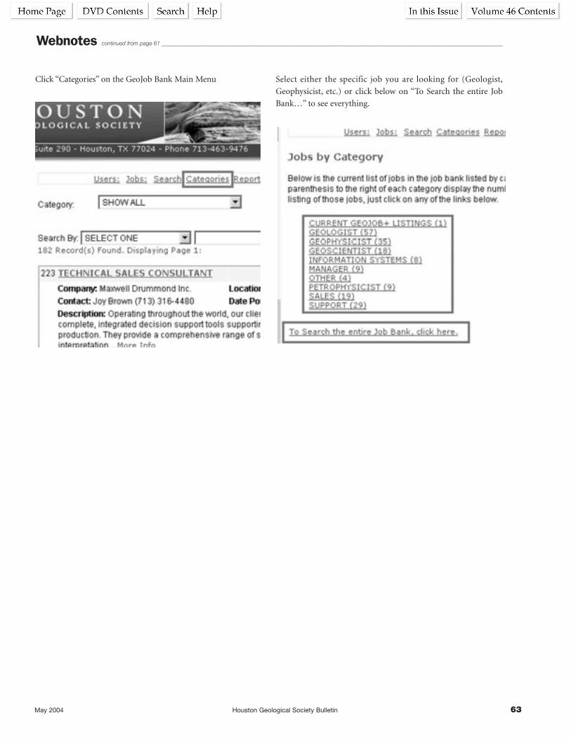
May 2004 Houston Geological Society Bulletin 63
Click “Categories” on the GeoJob Bank Main Menu Select either the specific job you are looking for (Geologist,
Geophysicist, etc.) or click below on “To Search the entire Job
Bank…” to see everything.
Webnotes continued from page 61 _________________________________________________________________________________________________________________________________________
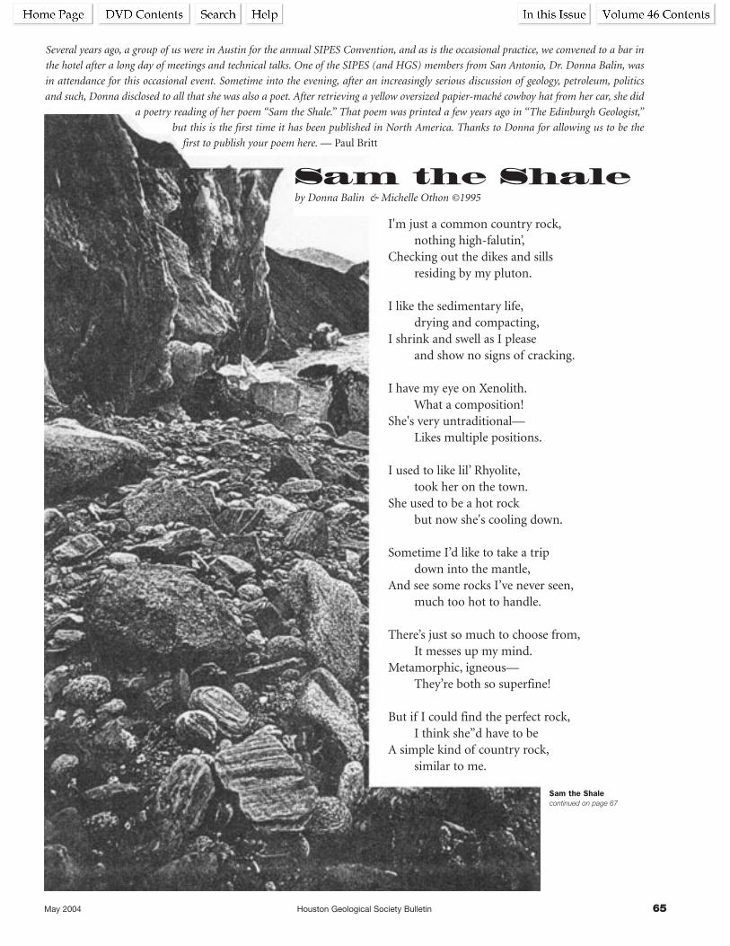
May 2004 Houston Geological Society Bulletin 65
Several years ago, a group of us were in Austin for the annual SIPES Convention, and as is the occasional practice, we convened to a bar in
the hotel after a long day of meetings and technical talks. One of the SIPES (and HGS) members from San Antonio, Dr. Donna Balin, was
in attendance for this occasional event. Sometime into the evening, after an increasingly serious discussion of geology, petroleum, politics
and such, Donna disclosed to all that she was also a poet. After retrieving a yellow oversized papier-maché cowboy hat from her car, she did
a poetry reading of her poem “Sam the Shale.” That poem was printed a few years ago in “The Edinburgh Geologist,”
but this is the first time it has been published in North America. Thanks to Donna for allowing us to be the
first to publish your poem here. — Paul Britt
Sam the Shaleby Donna Balin & Michelle Othon ©1995
I'm just a common country rock,nothing high-falutin’,
Checking out the dikes and sillsresiding by my pluton.
I like the sedimentary life,drying and compacting,
I shrink and swell as I pleaseand show no signs of cracking.
I have my eye on Xenolith.What a composition!
She's very untraditional—Likes multiple positions.
I used to like lil’ Rhyolite,took her on the town.
She used to be a hot rockbut now she's cooling down.
Sometime I’d like to take a tripdown into the mantle,
And see some rocks I’ve never seen,much too hot to handle.
There’s just so much to choose from,It messes up my mind.
Metamorphic, igneous—They’re both so superfine!
But if I could find the perfect rock,I think she”d have to be
A simple kind of country rock,similar to me.
Sam the Shale continued on page 67

May 2004 Houston Geological Society Bulletin 67
Biographical SketchDONNA F. BALIN received her BS in geology from the University of
Texas at Austin and her PhD from the University of Cambridge in
England. For her dissertation, she worked on Old Red Sandstone
fluvial and eolian sedimentation in eastern Scotland. Donna is a
consulting petroleum geologist in San Antonio (Balin &
Associates) and presently holds the position of Visiting Professor
in the Geosciences Department at Trinity University through
May 2004. She recently served as Vice President of the South
Texas Geological Society and currently serves on its Executive
Committee. She is working with her husband, Andrew R. Scott,
on two Department of Energy grants to evaluate the bioconver-
sion of coal into methane. She has been a member of the
Houston Geological Society since 1997.
MICHELLE A. OTHON received her BS in geology from the
University of Texas at San Antonio in 1996. As a student, Ms.
Othon worked for the USGS in San Antonio, and then upon
graduation, moved to Niskayuna, New York, to work for General
Electric Global Research Center as a Materials Analyst in 1998.
Currently, Ms. Othon is working in the Electron Back-Scattering
Diffraction group. Research interests include developing methods
for visualizing residual plastic strain, identification of novel phases
in diffusion multiple samples and grain size/texture analyses.
Ms. Othon’s goal in life is to maintain her literary association
with Dr. Donna Balin and continue writing “Geo-Poetry” to
touch the lives of geologists throughout the entire galaxy. In
her spare time, Ms. Othon is going back to her Texan roots and
learning to play the banjo.
Sam the Shale continued from page 65 _______________________________________________________________________________________________________________________________

HGA ANNUAL BUSINESS MEETING AND LUNCHEONby Betty Alfred, PresidentMay finds us completing a busy year for HGA with our annualbusiness meeting and luncheon and style show presented byStein Mart at the Junior League on Monday May 10th. It’s agreat way to end a successful year and I have been honored tobe your President and have been touched by the warmth andfriendship of so many. You have all been so gracious and Iextend to everyone my sincere appreciation for your support.
My thanks to a great group of officers and all the efforts of theseladies:NORMA JEAN JONES, first Vice-President, for her caring and
meticulous planning of our parties.AUDREY TOMPKINS, second Vice-President, for collecting dues
and organizing callers to encourage membership renewalsand enlisting members.
ANNE ROGERS, third Vice-President, our SOS chairman for theHGA and supervisor of our news articles for the HGSBulletin. Anne graciously hosted a board meeting for us.
JENNIFER BIANCARDI, Secretary, has recorded our minutes for usand presented them in a timely manner.
NORMA JEAN BACHO, Treasurer, has kept good financial recordsand paid all our bills.
GWINN LEWIS did a terrific job preparing our yearbook, havingour April board meeting and a Tea honoring MyrtisTrowbridge, our recipient of the HGA/HGA distinguishedservice award. Congratulations, Myrtis! We are proud of you.
MILLIE TONN, Historian/Photographer, circulated at all ourevents busy filming her photo-shoots.
LOIS MATUZAK has done a top-notch job as Editor of the ElecticLog.
Thanks to our Directors, MARGERY AMBROSE, MARY JANE
BERRYMAN, LOIS MATUZAK and JAN STEVENSON and to each ofour party chairpersons and their committees.
DAISY WOOD, who planned our always successful and popularGame Day.
Kudos to AUDREY TOMPKINS for being the chairperson of CincoMas Bridge group and DAISY WOOD, chairperson of thePetroleum Club Ladies Bridge group.
Join me in welcoming the lovely MARGARET JONES as sheassumes the responsibilities as our new President. We all wishher a wonderful year to come.
God bless you all,Betty
GeoWivesOur social year has flashed by like the landscape from a movingtrain! Geowives has not even paused for breath and aside fromour regular monthly programs we have held several play-read-ings. The last one hosted by Pat Burkman featured PaulRudnick’s “I Hate Hamlet” with Jim Wood and David Matuzakwho were incredibly effective, Jim in the role of John Barrymoreand David in the lead part of a reluctant Hamlet.reluctant Haml
HGA and GeoWives News
reluctant Hamlet. Pat Burkman also hosted the “Spring FlingMember Talent Show” on Sunday, April 25.
The May 17 annual luncheon and installation of officers at the
home of indefatigable Anne Rogers will bring our social year to
an end and …suddenly it will be summer!
We cannot end this report without blowing a kiss to Martha Lou
Broussard who organized a superb day trip to Independence and
Brenham—an event that was not only thoroughly enjoyable but
highly instructive. Linnie Edwards gave Martha Lou a hand and
the result was an outing that stimulated one’s interest and pride
in Texas history. We are already looking forward to Martha Lou’s
next year’s day trip. Bravo, Martha Lou! Gracias, Linnie! That
was the best March 13 ever.
A parting thought: With all the incredible happenings in our
world of today…aren’t we truly fortunate to be here, in the
United States of America? Well, aren’t we?
Your Prez,
Dolores Humphrey