transforming transportation and health in brownsville, texas
Upload: project-for-public-spaces-national-center-for-biking-and-walking
Post on 20-Aug-2015
124 views
TRANSCRIPT

TRANSFORMING TRANSPORTATION
AND
HEALTH
Brownsville, Texas

Presenters
• Ramiro Gonzalez- Comprehensive Planning and Redevelopment Manager
• Art Rodriguez- Health Director
• Eva Garcia- Planner and Bike Advocate

• Introduction
• The Problem
• Drive for Transformation
• Changing the Conversation
• Planning
• Putting Words into Action

Where is
Brownsville?
On the US/Mexico Border Southernmost point in the Continental United States
277 Miles from San Antonio


Population
93% Hispanic
175,210 Total population
(2013)
29 Median age
MALE
FEMALE
55% 45%

Population Pyramid

Climate
74.6°F Average annual temperature

The Problem

Health Crisis
1 in 3 people are diabetic
20% higher than
the rest of
Texas
23% higher than
the national
average
either obese
or overweight
80%
More
than
40%
Poverty level
= $20,614 for a family of 4
1/3 of
Americans will
be diabetic
In 2050

Texas Diabetes Rates: 2010
Source: The Texas Tribune

Texas Diabetes Rates: 2010
Source: The Texas Tribune

Texas Diabetes Rates: 2020
Source: The Texas Tribune

Texas Diabetes Rates: 2030
Source: The Texas Tribune

Texas Diabetes Rates: 2040
Source: The Texas Tribune

Prevalence of Self-Reported Obesity Among
Hispanic Adults,
by State, BRFSS, 2011-2013
Data not reported* 15%–<20% 20%–<25% 25%–<30% 30%–<35% ≥35%
* Sample size <50 or the relative standard error (dividing the standard error by the prevalence) ≥ 30%.

Prevalence of Self-Reported Obesity Among
Non-Hispanic Black Adults,
by State, BRFSS, 2011-2013
Data not reported* 15%–<20% 20%–<25% 25%–<30% 30%–<35% ≥35%
* Sample size <50 or the relative standard error (dividing the standard error by the prevalence) ≥ 30%.
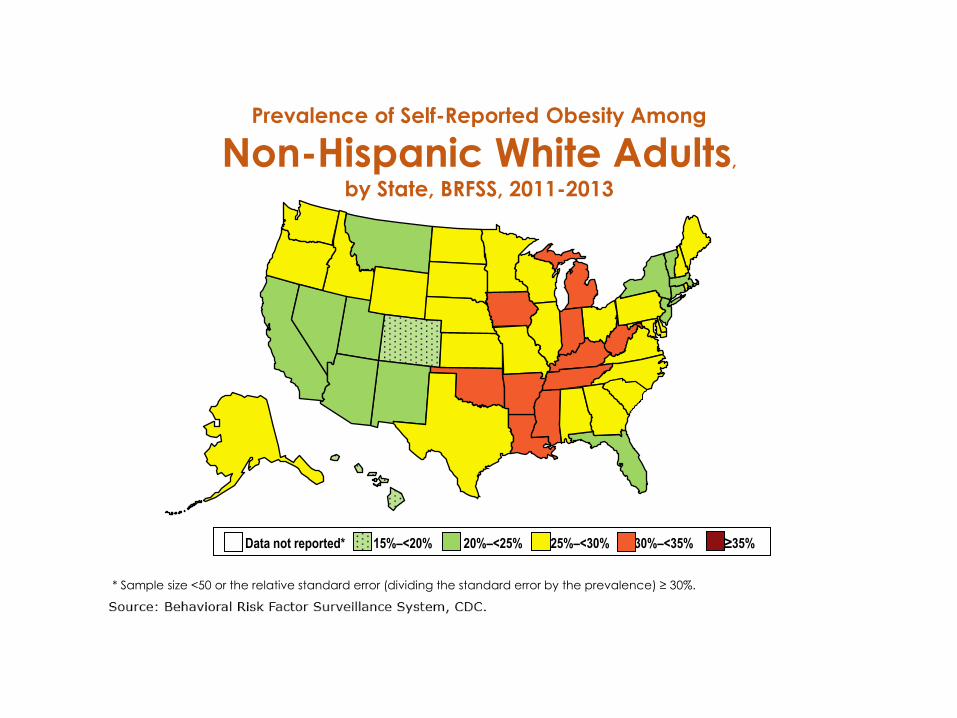
Prevalence of Self-Reported Obesity Among
Non-Hispanic White Adults,
by State, BRFSS, 2011-2013
Data not reported* 15%–<20% 20%–<25% 25%–<30% 30%–<35% ≥35%
* Sample size <50 or the relative standard error (dividing the standard error by the prevalence) ≥ 30%.

Drive for
Transformation

UT School of Public Health-Brownsville Regional Campus (2000)
• Established in 2000
• Established the Hispanic Health Research
Center
• Mission is to reduce or eliminate health
disparities that exist in Hispanics living in the
South Texas Border region and nationally
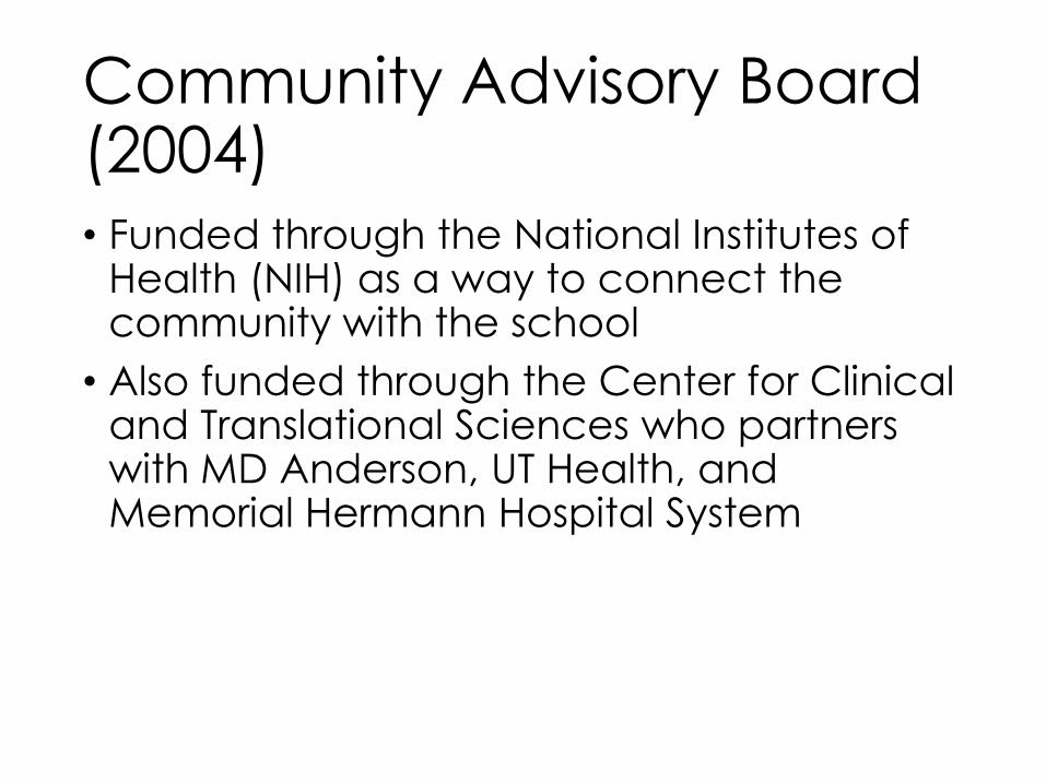
Community Advisory Board (2004) • Funded through the National Institutes of
Health (NIH) as a way to connect the community with the school
• Also funded through the Center for Clinical and Translational Sciences who partners with MD Anderson, UT Health, and Memorial Hermann Hospital System
• “With soaring rates of obesity and diabetes, we urgently needed to get the word out to our community, but also needed to work on solutions based on successful evidence-based approaches along with real stories of individuals.”
Joseph McCormick, MD, PHD, SPH Dean

CAB Programs
• Tu Salud Si Cuenta
• Brownsville Farmers Market/Brownsville Wellness Coalition
• Brownsville Community Gardens
• Biggest Loser Challenge


Changing
the Conversation

Gil Peñalosa (8-80 Cities)


TEDxBrownsville


Dan Burden (Walkable & Livable Communities)


Public Art


Planning

IN BROWNSVILLE Master Bike and Bike Plan
In cities with high levels of bicycle
riding, the average bicycle trip is between two and three miles

Why do you Walk or Bicycle in Brownsville Today?
7%
63%
26%
10%
0% 10% 20% 30% 40% 50% 60% 70%
To get to work/school/run errands
For exercise/recreation
Both
I do not currently walk or ride a bike
Why do you walk or bicycle?

Reasons not to walk or bike
(top answers shown)
- No trails/sidewalks/facilities
- Do not feel safe
- Do not own a bicycle
Biggest hurdles to walking and biking in
Brownsville (top answers shown)
- Traffic/inconsiderate drivers
- Not safe
- Not convenient/no sidewalks or trails/no
places to ride

EXISTING PEDESTRIAN AND BICYCLE NETWORK

PROPOSED PEDESTRIAN AND BICYCLE NETWORK – WITH TRAILS

PROPOSED PEDESTRIAN AND BICYCLE NETWORK
– WITH SIDEPATHS

PROPOSED PEDESTRIAN AND BICYCLE NETWORK –
WITH BIKE LANES

WITH SHARED LANE MARKINGS
PROPOSED PEDESTRIAN AND BICYCLE NETWORK
– WITH SHARED LANE MARKINGS

ULTIMATE PROXIMITY TO TRAILS AND SIDEPATHS

Southmost Nature Trail
Porter High School
Walmart

1 – Southmost Area Trail along
Drainage
BEFORE
AFTER

6th Street Continuation from Battlefield Trail into Downtown - Cycle track

3 – Downtown Pedestrian
Corridors

Connecting Communities


Putting
Words into
Action

Build A Better Block


Planning In Real Time


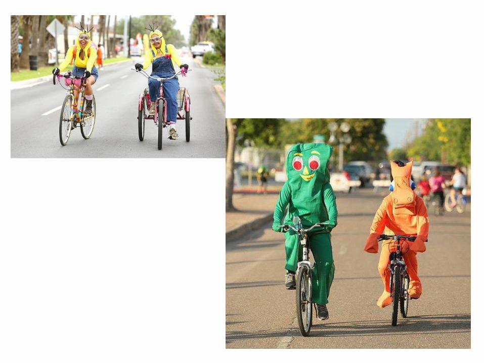


BIKE RODEOS

Bike Rack Design Contest

Best Representative of Brownsville

People’s Choice (250 Votes)

Best in Show

Policy Changes
• COMPLETE STREETS
• NACTO
• Sidewalk Ordinance
• Bike Parking
• Safe Passing Ordinance
• Smoking Ban
• Plastic Bag Ban (First City in Texas)

RESULTS

• East 6th Street Green Lane/Cycle Track: $250,000 TXDOT Grant for Sidewalk
Expansion
• Southmost Nature Trail (7 Miles CDBG/Category 7/City of Brownsville)- $4.5
million
• Resaca de la Palma Battlefield Connection (FHWA, Federal Land Access
Program, City)- $200,000
• Battlefield Trail 2.5 Mile Extension Extension through Downtown(TXDOT
Enhancement Grant)-$750,000
• Belden Trail- TPWD, CDBG, BCIC- $500,000
• Belden Trail Connect- $200,000
• Morrison Rd. Trail- $200,000
• Total Funding Acquired and Leveraged= 6.6 million


