title: pantanal - eorc.jaxa.jp · title: pantanal product leader: maycira costa affiliation:...
TRANSCRIPT

Title: Pantanal
Product Leader: Maycira CostaAffiliation: University of Victoria (UVic, Canada), Brazilian Institute for Space Science (INPE, Brazil)Product Team (confirmed members only):Kevin Telmer (Uvic, Canada)Eliel Souza (Brazilian Institute for Environmental Research, IBAMA)Agreement status: Ready to sign Preferred agreement type (individual/institutional): Individual
Project objective(s):To produce multi-temporal maps of the spatial distribution of open water, aquatic vegetation, forest (and flooded), savanna (and flooded), and dry areas of the Pantanal. Associate estimated areas to seasonal methane emissions.To use PALSAR mosaic to map fresh and brackish lakes (geochemistry) of
the entire Pantanal

0 500 km
BoliviaParaguay
Brazil
PantanalNhecolandia
RANSAR site Wetland of International Importance
~ 362,000 km2
~ 138,000 km2 high water -Brazil
~11,000 km2 water
Habitats: lakes, forest, and
aquatic vegetation
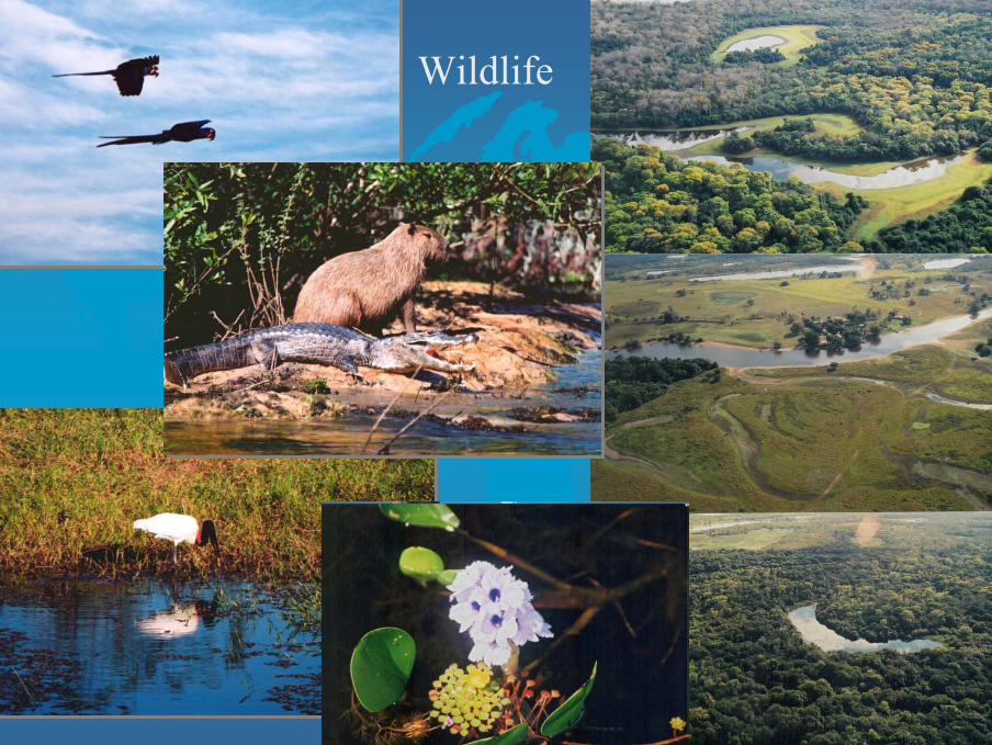
Wildlife
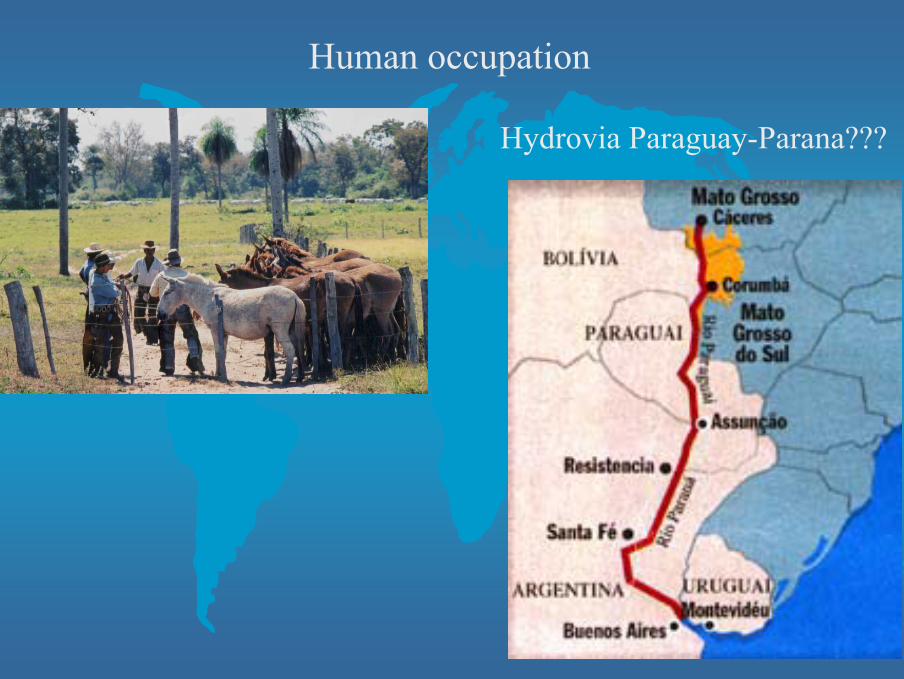
Human occupation
Hydrovia Paraguay-Parana???

A
B
C
Fresh soft
TDS<0.01g/kg
Fresh hard 1>TDS>0.01g/kg
Brackish10>TDS>1 g/kg

Pantanal
Prototype Area 1: PantanalCorresponding observation plan polygon(s): G1 (part); G3 (part)No. PALSAR paths/coverage: ~10 paths fine resolutionPALSAR request (Year 1-3): ~90 passes (3 annual coverages @30° and HH+HV; 3 annual coverages @45° and HH+HV)Input data (EORC products): PALSAR path images (Sigma-0, ortho-rectified, fine resolution)Ancillary data requests: ~ 30 JERS-1 SAR path images 1992-1997
Prototype Area 1: PantanalCorresponding observation plan polygon(s): G1 (part); G3 (part)No. PALSAR paths/coverage: ?PALSAR request (Year 1-3): 3 full coveragesInput data (EORC products): PALSAR image mosaics (Sigma-0, SRTM corr., 50m)Ancillary data requests: JERS-1 SAR (GRFM) mosaics from mid-1990’s

Prototype 1
Pantanal
Location of Prototype Areas
Pantanal
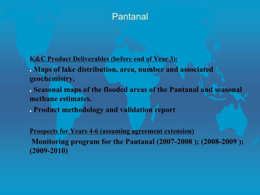
K&C Product Deliverables (before end of Year 3):Maps of lake distribution, area, number and associated
geochemistry.Seasonal maps of the flooded areas of the Pantanal and seasonal
methane estimates.Product methodology and validation report
Prospects for Years 4-6 (assuming agreement extension)Monitoring program for the Pantanal (2007-2008 ); (2008-2009 ); (2009-2010)