the taiwan-tsushima warm current system: its path … · the taiwan-tsushima warm current system...
TRANSCRIPT
Journal of Oceanography, Vol. 55, pp. 185 to 195. 1999
185Copyright The Oceanographic Society of Japan.
1. IntroductionThere are two different schools of thought regarding
the origin of the Tsushima Warm Current. One believes thatit originates around the Taiwan Strait (Fang et al., 1991). Theyregard the Tsushima Warm Current as a part of the so-calledTaiwan-Tsushima Warm Current System (hereafter referredto as the TTWCS). Isobe (1999) supported this idea througha diagnostic model of the vertically averaged vorticityequation with the long-term observed hydrographic andwind data. According to his study, the TTWCS flows alongthe isobath in the East China Sea. The wind-induced and theJEBAR terms are too small to break this flow pattern.However, he found that a large positive JEBAR term isevaluated along the shelf edge during autumn (from Octoberto December) southwest of Kyushu. Isobe (1999) insists thatthe TTWCS breaks down in autumn, and that the TsushimaWarm Current bifurcates from the Kuroshio southwest ofKyushu during this season. The other school believes thatthe current always comes from southwest of Kyushu as abranch of the Kuroshio (Lie and Cho, 1994; Hsueh et al.,1996). Huh (1982), using satellite images, suggested that theTsushima Warm Current included a repeatedly detachedwarm eddy from the Kuroshio southwest of Kyushu. Thisidea should be contained in the latter one. The abovethoughts-except for Isobe (1999)-were derived from short-term observations, e.g., data set of one-day current metermoorings (Fang et al., 1991), trajectories of the satellite-
Keywords:⋅Taiwan-TsushimaWarm CurrentSystem,
⋅East China Sea.
The Taiwan-Tsushima Warm Current System: Its Path andthe Transformation of the Water Mass in the East China Sea
ATSUHIKO ISOBE
Department of Earth System Science and Technology, Interdisciplinary Graduate School ofEngineering Sciences, Kyushu University, 6-1 Kasuga-Koen, Kasuga 816-8580, Japan
(Received 30 September 1998; in revised form 29 October 1998; accepted 13 November 1998)
Using a temperature data set from 1961 to 1990, we estimated the monthly distributionof the vertically integrated heat content in the East China Sea. We then drew the monthlymap of the horizontal heat transport, which is obtained as the difference between thevertically integrated heat content and the surface heat flux. We anticipate that itsdistribution pattern is determined mainly due to the advection by the ocean current if itexists stably in the East China Sea. The monthly map of the horizontal heat transportshowed the existence of the Taiwan-Tsushima Warm Current System (TTWCS) at leastfrom April to August. The T-S (temperature-salinity) analysis along the path of TTWCSindicated that the TTWCS changes its T-S property as it flows in the East China Seaforming the Tsushima Warm Current water. The end members of the Tsushima WarmCurrent water detected in this study are water masses in the Taiwan Strait and theKuroshio surface layer, the fresh water from the mainland of China, and the southern tipof the Yellow Sea Cold Water extending in the northern part of the East China Sea.
tracked drifters with the hydrographic data (Lie and Cho,1994), and several infrared images (Huh, 1982). Therefore,we need to confirm the origin of the Tsushima WarmCurrent using a long-term observational data set. In thisstudy, we try to reconfirm the existence of the TTWCS usinga different procedure from that used in Isobe (1999).
The water temperature is the most abundant data set inthe ocean, so we use temperature data to detect the path ofthe ocean current in this study. We first obtain the horizontaldistributions of the vertically integrated heat content usingthe temperature data set historically obtained in the EastChina Sea. The distribution of the heat content is largelyinfluenced by the sea surface heat flux, especially in theshallow shelf region, so that it is difficult to detect thecurrent path using the heat content pattern as it is. Therefore,we have to remove the contribution of the surface heat fluxfrom the heat content, and obtain the distribution of thehorizontal heat transport. Although the horizontal heattransport contains the effect of the horizontal diffusion, weanticipate that its distribution pattern is determined mainlydue to the advection by the ocean current if it exists in theEast China Sea stably.
The ocean current changes its T-S property as it flowsin the East China Sea because of the addition of the freshwater from the mainland of China, exchange of the watermass with the Kuroshio and so on. After detecting thecurrent path in the East China Sea, we compare the T-S

186 A. Isobe
Fig. 1. The study area in the East China Sea with the divided boxes. Also shown is the isobath in meters.
diagrams along the current path in order to trace the transfor-mation of the water mass. This analysis elucidates the watermasses that make up the Tsushima Warm Current water.
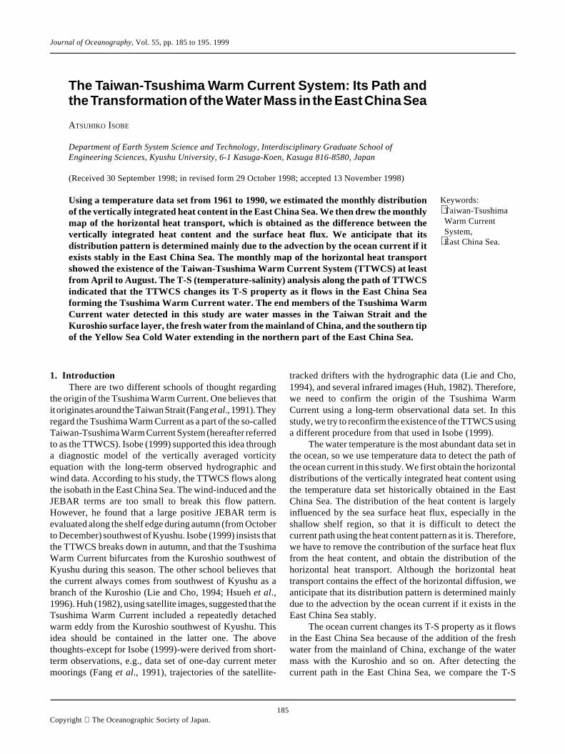
2. Data and MethodFigure 1 shows the study area, which is surrounded by
the thick line. We divided it into 62 boxes whose resolutionis 1° in both latitude and longitude.
The conservation equation of the heat content at arbi-trary depth is;
∂ cρT( )∂t
+ u ⋅ ∂∂x
cρT( ) = KH ∇ 2 cρT( ) + KZ
∂ 2 cρT( )∂z2 1( )
where c is the specific heat, ρ the water density, T is the watertemperature, u is the current vectors, and KH, KZ are thehorizontal and vertical diffusivities, respectively. We verti-cally integrate Eq. (1) from surface (z = 0) to the bottom(z = –H);
∂q
∂t= qh + qs , 2( )
where q is the vertically integrated heat content of unit area,and is expressed as follows.
q = cρ Tdz−H
0
∫ 3( )
where T is to be regarded as a representative temperatureprofile in each box. In this study, c and ρ are assumed to beconstant.
qh is the horizontal heat transport which is expressedby;
qh = cρ − ∂uT
∂x+ ∂vT
∂y
+ KH ∇ 2T
dz−H
0
∫ , 4( )
and qs is the heat flux through the sea surface.Using the temperature data from 1961 to 1990, supplied
by the Japan Oceanographic Data Center (JODC), we con-verted these data to the vertically integrated heat content (q)of unit area in each box. We omitted the water temperaturedata that exceed three times the standard deviation from itsaverage value at the same depth in each box. Also weomitted the temperature profile whose measured depth range(maximum measured depth minus minimum one) is lessthan 70 percent of the mean depth of the box. We used thetemperature data above 400 m depth because the data belowthis depth are scarce. In the case that the depth of the box ismore than 400 m, we neglected the vertical heat transport

The Taiwan-Tsushima Warm Current System 187
Fig. 2. Upper panel shows the locations at which we show the vertically integrated heat content and each term in Eq. (2). In lower fourpanels, small dots with the thin line show the vertically integrated heat content (q, cal/cm2) in each box. The broken line with theopen square indicates the temporal differentiation of q (qt, W/m2). The doted line with the closed square shows the heat flux throughthe sea surface (qs, W/m2). The thick line with the closed circle indicates the horizontal heat transport (qh, W/m2) defined by Eq.(4).

188 A. Isobe
across this depth. This assumption is considered to be validbecause the horizontal heat transport prevails in the deepoffshore region where the Kuroshio flows.
Using the all quality controlled data of q, we drew thescatter plot that denotes the annual variation of q in each box.Figure 2 shows the four examples (boxes a, b, c and d) of thescatter plot of q. The annual variation of q was fitted bysinusoidal curves using the least square method. In thisstudy, we used a function that is expressed by;
q t( ) = q0 + an sin2nπ
τt − Kn
n=1
3
∑ 5( )
where q0 is a constant, an and Kn are the amplitude and thephase lag of the n-th signal, respectively. τ is one year, whichis the longest period. Through trial and error, we determinedone-third year as the shortest signal to follow the temporalvariation of the heat content in a box. If we chose a muchhigher frequency, the fitted curve would be overly compli-cated. The thin line in Fig. 2 shows the fitted curves.
Differentiating Eq. (5), we evaluated the left-hand sideof Eq. (2), which is denoted by the broken line with opensquares in Fig. 2. In this study, the time increment wasselected to be one month. Hirose et al. (1998) supplied themonthly net heat flux through the sea surface in each 1°latitude and longitude box in the East China Sea (the dottedline with closed squares in Fig. 2). They evaluated the netheat flux using the meteorological and oceanographic dataset from 1960 to 1990 (see their text for details). Theiranalyzed period is nearly same as ours. Using their data set,we obtained the monthly distribution of the horizontal heattransport (qh) in the East China Sea as a difference between∂q/∂t and qs. In Fig. 2, qh is shown by the thick line with theclosed circles.
3. The Distribution of the Horizontal Heat Transportin the East China SeaIn Fig. 2, the boxes a and b are located in the southwest-
ern and northeastern side of the East China Sea, while theboxes c and d are located in the upstream and downstreamregion of the Kuroshio, respectively. The surface heat flux(qs) in all boxes shows a sinusoidal curve with its maximumfrom June to August. Apparently, its annual average has anegative value. On the other hand, the annual average of thehorizontal heat transport (qh) seems to be positive. Thismeans that the heat loss due to the surface heat flux is, onaverage, compensated by the horizontal heat transport in thestudy area. It is found that the qh shows its maximum in springalong the Kuroshio path (c and d). The peak of qh at box dis delayed for 1–2 months compared to that at box c. Thissuggests that the warm water moves northeastward as theKuroshio flows. The peak of qh in the shelf region of the EastChina Sea varies from summer (a) to autumn (b) with 2
months delay. This also implies the existence of thenortheastward flow that transports the warm water mass.
Figure 3 shows the monthly distribution of the horizon-tal heat transport in the East China Sea. It is found that thearea where the heat transport is greater than 300 W/m2
(hereafter referred to as the warming region) movesnortheastward in the offshore region from March to May(see the shaded area given by arrows with a closed circle).Such a warming region corresponds to the area where thetemporal variation of the heat content is large due to thehorizontal heat transport. We consider that the appearanceof such a warming region is due to the advection of the warmwater mass by the ambient mean flow. The location of thewarming region is considered to correspond to the edge ofthe warm water mass that moves with the Kuroshio. So it isconsidered that successive change of the location of thewarming region indicates the Kuroshio path, which seems tobe along the shelf edge and end at the Tokara Strait in Fig.3. The detected Kuroshio path is consistent with otherstudies (e.g., Yamashio et al., 1993). We find, too, that theother warming region moves northeastward in the shallowshelf region from April to August (see the arrows with anopen circle). The propagation speed is apparently slowerthan that along the Kuroshio path, so it is considered thatsuch a movement of the warming region is effected by theweak northeastward flow compared to the Kuroshio. Thiswarming region moves along the isobath of around 100 m,that is, the same path as TTWCS (Fang et al., 1991). Isobe(1999) also use a diagnostic model to show that the TTWCSflows along the isobath in the East China and Yellow Seas,and that wind-induced and JEBAR terms are too small todisturb this flow path. The propagation speed is estimated tobe around 10 cm/sec (800 km/ 3 months) along the 100 misobath, which is the same order as the transport density(volume transport in the unit width) of TTWCS (~10 m2/sec,Fang et al., 1991). So we consider that the movement of thewarming region from April to August is mainly due to theadvection by TTWCS that flows along the isobath in theEast China Sea.
If the Tsushima Warm Current originates around thesouthwest of Kyushu crossing the steep shelf edge, cross-shelf heat transport should be dominant there. Such a dis-tribution pattern is found at least in November and December.Isobe (1999) shows that the TTWCS breaks down in au-tumn, and that the cross-shelf transport prevails southwestof Kyushu as an origin of the Tsushima Warm Current inautumn. The distribution pattern shown in Fig. 3 is consis-tent with the seasonality of the TTWCS.
In winter (from January to March), the horizontal heattransport has a large value along the Kuroshio path. How-ever, it is difficult to describe a current path clearly in theshelf region. The intense surface cooling during mid-wintermakes the shelf region homogeneous. Therefore, the hori-zontal heat transport does not show the clear spatial pattern

The T
aiwan-T
sushima W
arm C
urrent System
189
Fig. 3. Monthly distribution of the horizontal heat transport in the East China Sea. The contour interval is 100 W/m2. The region withthe positive value is shaded: double intensity denoting more than 300 W/m2, i.e. ‘warming region’. See the text for the meaning ofarrows with open and closed circles. Also shown is the depth in meters.

190 A. Isobe
Fig. 4. T-S diagrams at the boxes that are shown in the upper panel. The warming regions are also indicated in the upper panel by brokenlines. In the lower panels, the observed T-S plots are divided into three layers, which are shown in the T-S diagram of May. Thedotted rectangular in T-S diagrams in July and August indicates the range of the cold water (see text for detail).

The Taiwan-Tsushima Warm Current System 191
from January to March, although the northeastward move-ment of the positive region from January to March impliesthe existence of the TTWCS.
4. Transformation of the Water Mass along the Pathof TTWCSThe TTWCS may be greatly altered in terms of its T-S
(temperature-salinity) property as it flows in the East ChinaSea due to the mixing process there. Now we show the T-Sdiagram within a warming region from May to August. Wethen describe the transformation of the water mass of theTTWCS. The salinity data used here are also supplied byJODC. As shown later in this section, we also use some T-S data outside of our study area, which are obtained fromJODC. Figure 4 shows the T-S diagram in May, June, Julyand August within a box in each warming region. Thelocations of each box are indicated in an upper panel. InMay, we are able to see that the temperature of the TTWCSranges between 16 and 26°C, and the salinity ranges between31.5 and 34.7 psu. In order to find the origin of this watermass, we compare this T-S diagram with those in the Taiwan
Fig. 5. T-S diagram at boxes A (Taiwan Strait) and B (Kuroshio surface layer). The observed T-S plots are divided into three layers,which are shown in the each T-S diagram.
Strait and the Kuroshio surface layer (0–100 m) in May (Fig.5). The water types of the Taiwan Strait and the Kuroshiosurface layer resemble each other, at least, in this month.These two water types are also similar to that of TTWCSwhen entering the East China Sea. It is considered that thewater passing through the Taiwan Strait and/or the Kuroshiosurface layer originally composes the TTWCS. As theTTWCS flows northeastward, less saline water is added inthe surface layer (0–30 m) in June, July and August. Thetemperature of the less saline water increases from June toJuly because of the heating through the sea surface. In Julyand August, the cold water is also added in the middle (30–50 m) and lower (>50 m) layers, which is surrounded by thedotted line in Fig. 4. The temperature of this cold waterranges between 12 to 16°C, while the salinity ranges between32 and 34.7 psu. The temperature and salinity of the coldwater in August are slightly higher than those in July. Thisimplies that the temperature and the salinity of the coldwater increase as the TTWCS flows northeastward. The T-S property in August is nearly same as that of the TsushimaWarm Current found in the Tsushima/Korea Strait in sum-

192 A. Isobe
mer (see Fig. 2 in Ogawa, 1983). We therefore conclude thatthe transformation processes of the TTWCS water arecomplete around the location of the box in August.
Now we consider the origins of the less saline wateradded to the surface layer of the TTWCS, and the cold wateradded to the middle and lower layers.
Figure 6 shows the horizontal distribution of the sur-face salinity. The less saline water extends to the south oreast from the river mouth of the Changjiang. It is found thatthe warming region intersects that low salinity region. Theintersecting area increases from May to July correspondingto the increase of the less saline water in the T-S diagram. Sowe conclude that the origin of the less saline water added tothe TTWCS is the mainland of China, especially the rivermouth of Changjiang.
Figure 7 shows the horizontal distribution of the tem-perature at 50 m depth. We can see that the warming region
Fig. 6. The horizontal distributions of the surface salinity in May, June, July and August within the study area. Contour interval is 0.5psu. Shading has been chosen to emphasize the less saline water: single, double intensity denoting, respectively, less than 34 and32 psu. Also shown are the locations of the warming region (broken line).
intersects the cold water mass that is located in the northernpart of the study area. The intersection seems to start fromJuly. This is consistent with the T-S diagram in which thecold water below 16°C starts to appear from July. So weconclude that addition of the cold water to the TTWCS ismainly due to mixing with the cold water mass extending inthe northern part of the study area.
Now we consider why the cold water below 16°Cappears in the northern part of the study area. Figure 8 showsthe monthly mean vertical distribution of the temperature inJuly along a line A-A’ (see the upper panel of Fig. 8 for itslocation). Also shown is the vertical section in February forreference. In February, we can see the cold water below10°C in the Yellow Sea, which is named the Yellow SeaCold Water (hereafter YSCW, Nakao, 1977). This watermass forms due to intense cooling in midwinter, and remainsbelow the thermocline until October, reducing its thickness

The Taiwan-Tsushima Warm Current System 193
Fig. 7. The horizontal distributions of the temperature at 50 m depth in May, June, July and August. Contour interval is 1°C. Shadinghas been chosen to emphasize the cold water less than 16°C. Also shown are the locations of the warming region (broken line).
due to the mixture with the warm upper layer (Tawara andYamagata, 1991). In Fig. 8, we can find the YSCW in thelower layer in the Yellow Sea in July, too. Although somestudies (e.g., Uda, 1934) have pointed out the southwardmovement of the YSCW in spring and summer, Tawara andYamagata (1991) show that the YSCW keeps its locationthroughout a year on the basis of 10-year mean temperaturefields in the Yellow Sea. Figure 8 also shows that the YSCWin July stays in its generation area. In Fig. 8, we also find thecold water below 16°C in the East China Sea, which is thesame water mass extending in the northern part of our studyarea. The seasonal variation of the distribution pattern ofthis cold water mass is very similar to the YSCW, so weconsider that the generation process of this cold water below16°C is same as that of the YSCW. We can regard this coldwater as the southern tip of the YSCW.
The temperature and salinity of the added cold water
increase as TTWCS flows northeastward, as mentionedpreviously. The upper panel of Fig. 9 shows the location atwhich added cold water (12 ≤ T (°C) ≤ 16, 32 ≤ S (psu) ≤34.7) has been observed in July in the lower layer (50–100m). The cold water extends from the northern part of the EastChina Sea to the Tsushima/Korea Strait. We set the boxes A,B, C and D within the study area in order to investigate thechange of the T-S property of the cold water as we gonortheast. The lower panel of Fig. 9 shows the T-S diagramof the cold water (same range as the dotted rectangular inFig. 4) at four boxes. We find that the dots move from thelower left area to the upper right as we go northeast. Thetemperature and salinity of the box D are close to those of theoriginal TTWCS water (see Fig. 4). Thus we consider thatthe mixture with the original TTWCS water mainly causesthe transformation of the cold water added to the TTWCS.The temperature and salinity of the box D are close to the T-

194 A. Isobe
S property of the Kuroshio surface water as well (see Fig. 5).The Kuroshio surface water that exists around the shelf edgewest of Kyushu may also be responsible for the transforma-tion of the T-S property of the added cold water.
5. ConclusionsThe monthly distributions of the horizontal heat
transport show a path of the TTWCS, at least from April to
Fig. 8. The monthly mean vertical distribution of the temperaturein February and July along the line A-A’. Shading has beenchosen to emphasize the cold water: single, double intensitydenoting, respectively, less than 16°C and 10°C.
August. The present study indicates that the TTWCS origi-nates around Taiwan, i.e., Taiwan Strait and the Kuroshioregion east of Taiwan. Then, TTWCS greatly changes its T-S property due to the mixing process with the surroundingwater masses as it flows in the East China Sea. We trace itstransformation process using the T-S analysis along the pathof the TTWCS from April to August. The water mass of the
Fig. 9. The upper panel shows the locations where the cold waterdefined in this study has been observed in July in the lowerlayer (50–100 m). Also shown are the locations of boxes A, B,C and D at which we show the T-S diagram in the lower panel.Note that the range of the T-S diagram is different from others(Figs. 4 and 5) in order to enlarge the T-S area of the coldwater.

The Taiwan-Tsushima Warm Current System 195
TTWCS entering the East China Sea has the same T-Sproperty as those around the Taiwan Strait and the Kuroshiosurface layer. Then the water mass of TTWCS changes dueto admixture with the freshwater from the mainland ofChina, and with the southern tip of YSCW extending in thenorthern part of the East China Sea. The horizontal mixturewith the Kuroshio surface water across the shelf edge mayalso be responsible for the formation of the Tsushima WarmCurrent water. However, it is difficult to pick up this processin the T-S diagram, because TTWCS originally has the sameT-S property as that of the Kuroshio surface water, as shownin Fig. 5.
The water masses that we have mentioned above shouldbe considered as the end members composing the TsushimaWarm Current water, although our discussion has beenqualitative. A quantitative discussion should be accomplishedin the near future. Also, we have to clarify the reason for theappearance of the warming region in the East China Sea onlyduring May-August, which has remained obscure in thisstudy.
AcknowledgementsData supplies by JODC (Data Online Service System,
J-DOSS) and Dr. Hirose, Kyushu University are gratefullyacknowledged. Thanks are also extended to two anonymousreviewers.
ReferencesFang, G., B. Zhao and Y. Zhu (1991): Water volume transport
through the Taiwan Strait and the continental shelf of the East
China Sea measured with current meters. p. 345–358. InOceanography of Asian Marginal Seas, ed. by K. Takano,Elsevier, Amsterdam.
Hirose, N., H.-C. Lee and J.-H. Yoon (1998): Surface heat flux inthe East China Sea and the Yellow Sea. J. Phys. Oceanogr. (inpress).
Hsueh, Y., H.-J. Lie and H. Ichikawa (1996): On the branching ofthe Kuroshio west of Kyushu. J. Geophys. Res., 101, 3851–3857.
Huh, O. K. (1982): Spring season flow of the Tsushima Currentand its separation from the Kuroshio: Satellite evidence. J.Geophys. Res., 87, 9687–9693.
Isobe, A. (1999): On the origin of the Tsushima Warm Current andits seasonality. Cont. Shelf Res., 19, 117–133.
Lie, H.-J. and C.-H. Cho (1994): On the origin of the TsushimaWarm Current. J. Geophys. Res., 99, 25081–25091.
Nakao, T. (1977): Oceanic variability in relation to fisheries in theEast China Sea and the Yellow Sea. J. Fac. Mar. Sci. Technol.,Tokai Univ., Special Number, 199–367.
Ogawa, Y. (1983): Seasonal changes in temperature and salinityof water flowing into the Japan Sea through the TsushimaStrait. Bull. Japan. Soc. Fish. Oceanogr., 43, 1–8 (in Japa-nese).
Tawara, S. and T. Yamagata (1991): Seasonal formation ofbottom water in the Yellow Sea and its interannual variability.Umi to Sora (Sea and Sky), 66, 273–282 (in Japanese).
Uda, M. (1934): Hydrographical researches on the normal monthlyconditions in the Japan Sea, the Yellow Sea, and the OkhotskSea. J. Imp. Fish. Exp. Sta., 5, 191–236 (in Japanese).
Yamashio, T., A. Maeda and M. Sakurai (1993): Mean positionand deviation of the Kuroshio axis in the East China Sea. Umito Sora (Sea and Sky), 69, 125–134 (in Japanese).