snow profile measurements and heir use in operative hydrologycostsnow.fmi.fi/workshops/15 -...
TRANSCRIPT

SNOW PROFILE MEASUREMENTS
AND
THEIR USE IN OPERATIVE HYDROLOGY
KATEŘINA HRUŠKOVÁ DANIELA KYSELOVÁ
SNOW CAMPAIGN SLOVAKIA, TÁLE, 15.2.2016

Catchment area: 36.01 km2
Mean elevation: 1180 m a.s.l.,
Elevation range:
max. 2043 m, min 578 m
Distance from the mouth: 7 km
Complex of crystalline rocks (mostly)
Forest area: 78 %
the upper forest border 1500 m a.s.l.
Spruce tree (upper part) & mixed
spruce and beech tree (lower part)
Annual precipitation 1199 mm
annual runoff 803 mm
runoff coefficient 0.67
Bystrianka catchmentto hydro. profile Bystrá
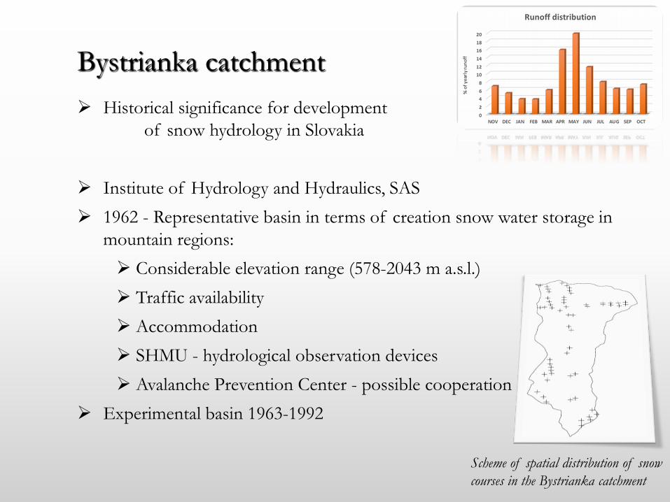
Historical significance for development
of snow hydrology in Slovakia
Institute of Hydrology and Hydraulics, SAS
1962 - Representative basin in terms of creation snow water storage in
mountain regions:
Considerable elevation range (578-2043 m a.s.l.)
Traffic availability
Accommodation
SHMU - hydrological observation devices
Avalanche Prevention Center - possible cooperation
Experimental basin 1963-1992
Bystrianka catchment
Scheme of spatial distribution of snow
courses in the Bystrianka catchment

Weekly expeditions – the 1st one in March 1963
3 or 4 times per season:
the end of JAN - beginning of snow accumulation
the turn of FEB and MAR – maximum snow pack
the end of MAR - beginning of snowmelt
APR - snowmelt & runoff
Topics
SD & SWE – point measurement,
snow courses (points – distance)
measuring equipment (errors & assessment)
site’s representativeness
comparison forest – open areas
SD & SWE changes depending on altitude
possibilities of stereophotogrammetry
Bystrianka catchment
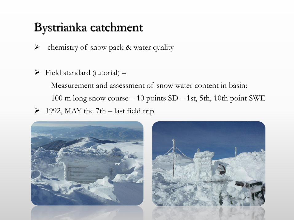
chemistry of snow pack & water quality
Field standard (tutorial) –
Measurement and assessment of snow water content in basin:
100 m long snow course – 10 points SD – 1st, 5th, 10th point SWE
1992, MAY the 7th – last field trip
Bystrianka catchment

Snow-melt runoff plays important role in runoff regime of Slovakian rivers.
Although only 20-30 % (in average) of yearly precipitation totals
accumulate in snow cover, more than 40 % of yearly runoff creates snow-
melt runoff.
Demands of water authorities, stake holders - water supply (hydropower
plants), flood protection
1982-1983 Vah river basin (dams); 1990-1991 Hron, Bodrog etc.
Snow hydrology in SHMU

Snow water content is regularly calculated for 35 profiles in river
basins of Váh, Hron, Ipeľ, Slaná, Poprad, Hornád, Bodva
and Bodrog
SHMU has obligation to provide the information about the water
content in the snow cover to state authorities and administrators of
river basins
The Act No 666/2004 Collection of Articles about flood protection
Snow hydrology in SHMU

basic input for processing of basin’s snow water supply – Snow Depth
(SD) and Snow Water Equivalent (SWE)
on Mondays, from December to March/April, real time data from 238
gauges (volunteers – phone call, proffesional)
manual measurements using standard rain gauge or weighing snow gage (SWE)
and graduated snow stakes (SD)
95 % of gauges up to 1000 m – question relating to representativeness
of network (availability in mountain terrain)
Data from snow cover network is supplemented
by the data from snow courses expedition regularly performed in mountain terrain (altitudes
above 1000 m)
Simple linear relationship between SWE and
altitude of stations
Snow water supply info:
http://www.shmu.sk/sk/?page=1&id=mim_sneh
Snow water storage

Distribution in space
ele
vati
on
zo
ne
s
percentage of gauges
Distribution according to altitude
Snow cover network

created by Division of climatology
processing of snow cover characteristics in GIS gives info about distribution
in time and space
data from network of snow gage stations (238) + virtual stations (>100, in
mountain regions, values are determined by regression model or expertise
estimation)
method: 3D interpolation with influence of topography – regularized spline
with tension (GIS environment - GRASS)
from maps of SWE operative hydrology calculates snow water supplyusing map algebra in GIS
Weekly maps of SD and SWE
Virtual stations

Example: maps of SD and SWE 22.2.2010
http://www.shmu.sk/sk/?page=1&id=klimat_tyzdennemapy&produkt_id=0
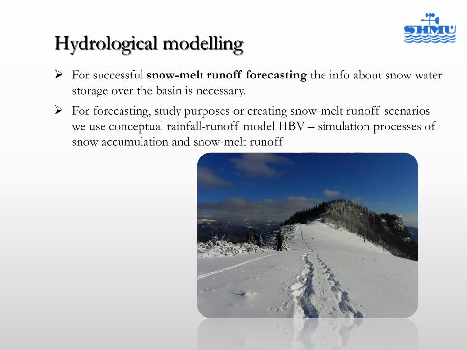
For successful snow-melt runoff forecasting the info about snow water
storage over the basin is necessary.
For forecasting, study purposes or creating snow-melt runoff scenarios
we use conceptual rainfall-runoff model HBV – simulation processes of
snow accumulation and snow-melt runoff
Hydrological modelling
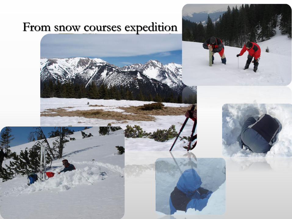
From snow courses expedition