shirlington village site history - amazon web services€¦ · the blue arrow points to the...
TRANSCRIPT
Shirlington Village Site History
Historic Preservation ProgramGLUP Study Plus
September 25, 2019
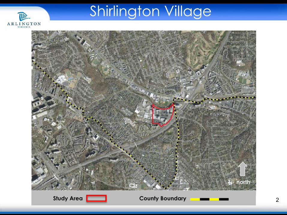
2Study Area County Boundary
north
Shirlington Village
Shirlington Village
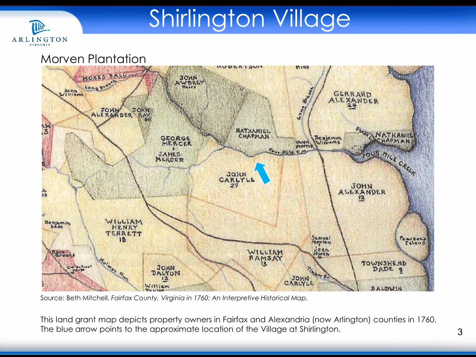
3
Source: Beth Mitchell, Fairfax County, Virginia in 1760: An Interpretive Historical Map.
This land grant map depicts property owners in Fairfax and Alexandria (now Arlington) counties in 1760. The blue arrow points to the approximate location of the Village at Shirlington.
Morven Plantation
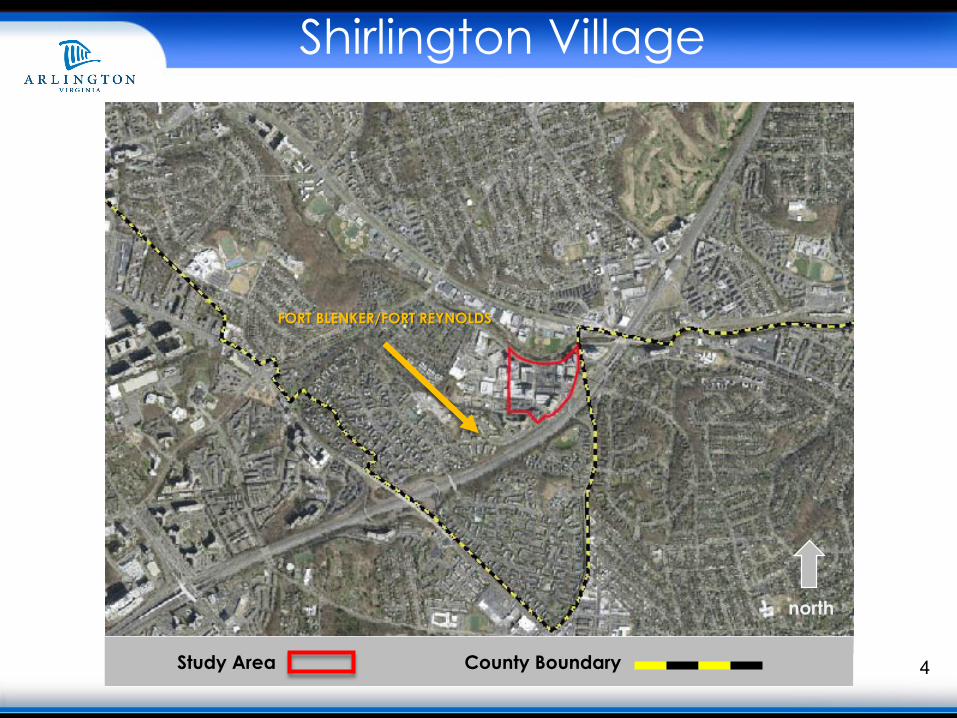
4Study Area County Boundary
north
Shirlington Village
FORT BLENKER/FORT REYNOLDS
Shirlington Village
5
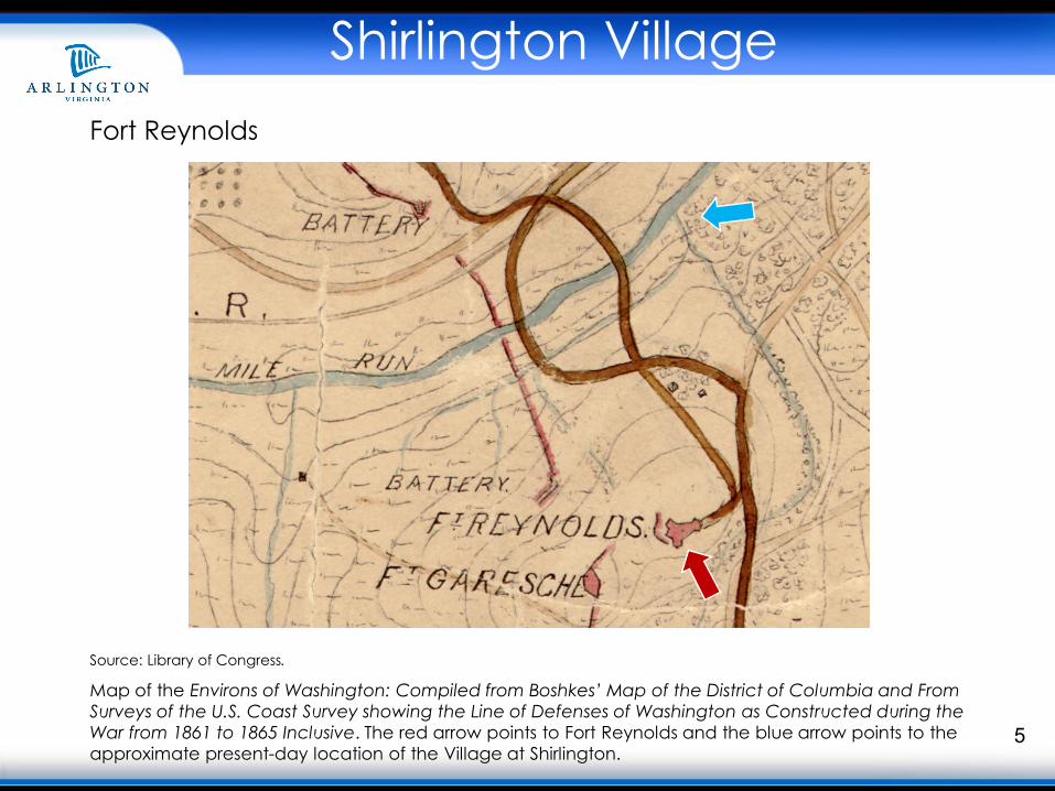
Source: Library of Congress.
Map of the Environs of Washington: Compiled from Boshkes’ Map of the District of Columbia and From Surveys of the U.S. Coast Survey showing the Line of Defenses of Washington as Constructed during the War from 1861 to 1865 Inclusive. The red arrow points to Fort Reynolds and the blue arrow points to the approximate present-day location of the Village at Shirlington.
Fort Reynolds
6Study Area County Boundary
north
Shirlington Village
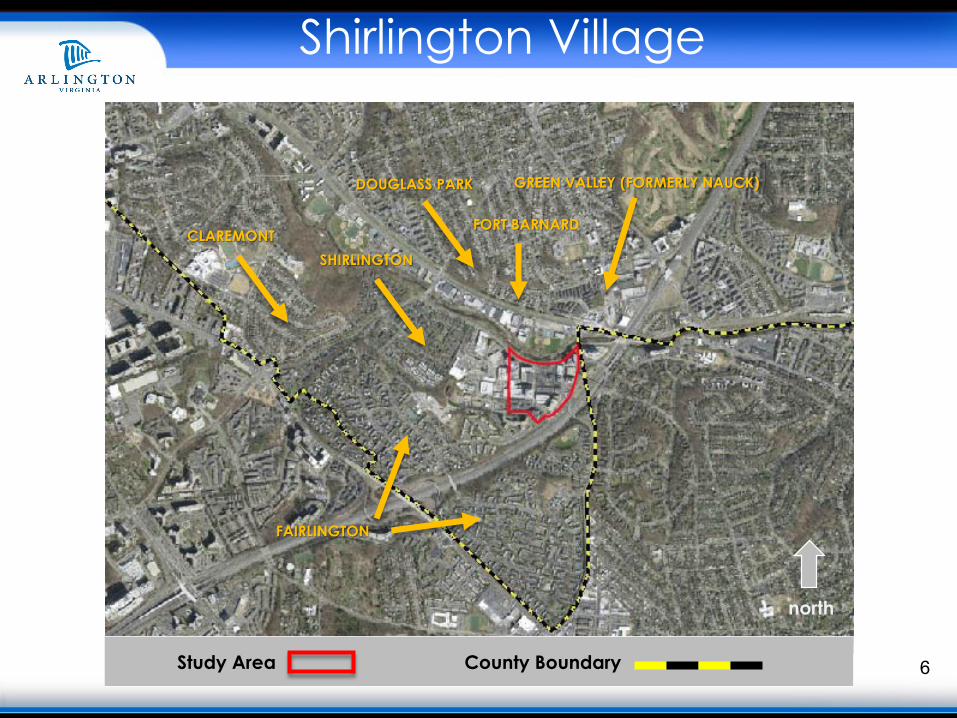
FAIRLINGTON
DOUGLASS PARK
FORT BARNARDCLAREMONT
GREEN VALLEY (FORMERLY NAUCK)
SHIRLINGTON
7Study Area County Boundary
north
Shirlington Village
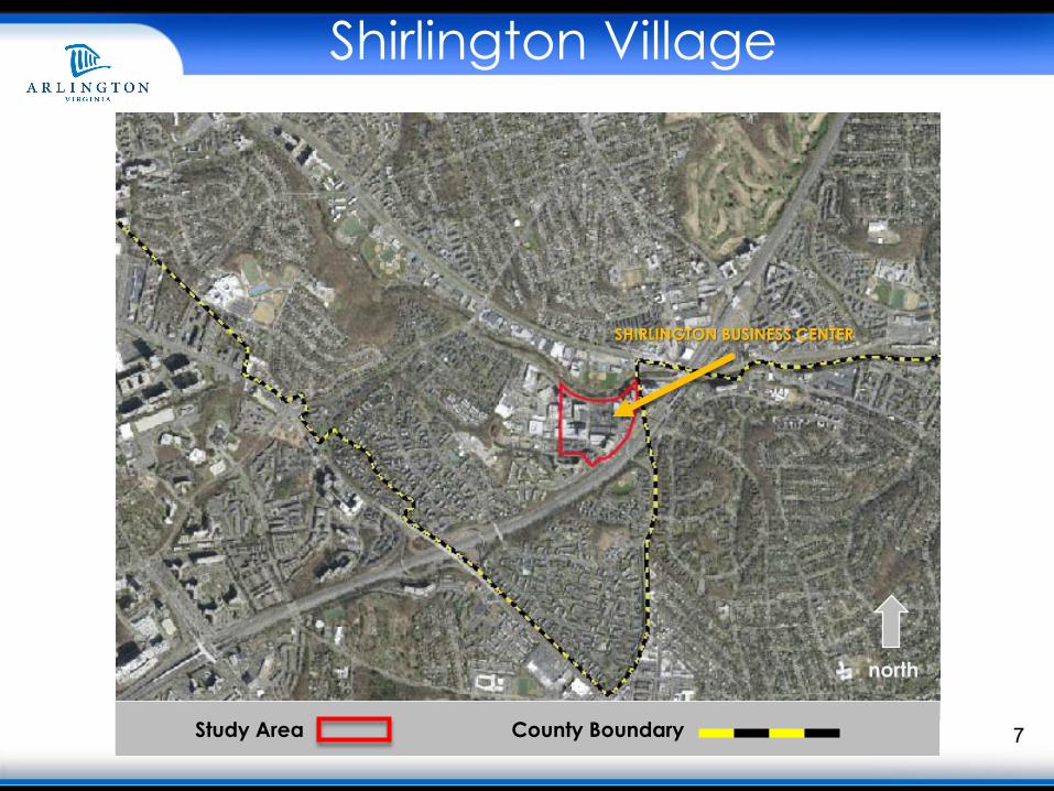
SHIRLINGTON BUSINESS CENTER
Shirlington Village
8
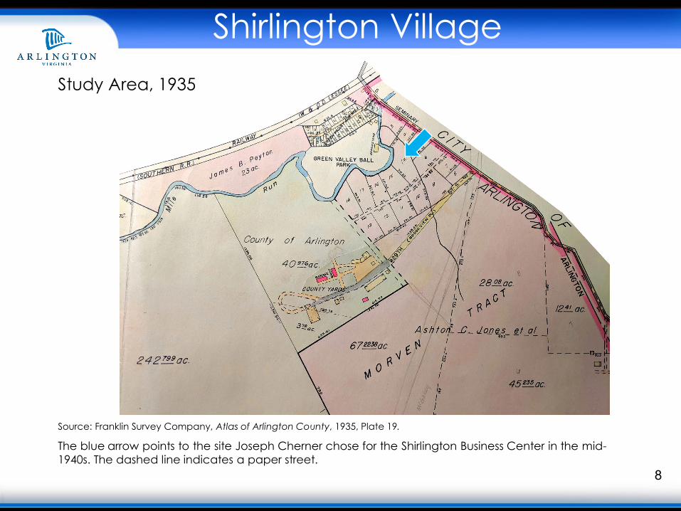
Source: Franklin Survey Company, Atlas of Arlington County, 1935, Plate 19.
The blue arrow points to the site Joseph Cherner chose for the Shirlington Business Center in the mid-1940s. The dashed line indicates a paper street.
Study Area, 1935

Shirlington Village
9
Shirlington Business Center
Sources: Gershon Fishbein, “Joseph Cherner Reveals Shirlington Plans for Expansion,” The Washington Post, November 25, 1951, Proquest(top); “Jelleff’s Advertisement,” The Evening Star, December 12, 1947, Proquest (bottom left); “Shirlington Service Station Opens,” The Evening Star, July 30, 1944, Proquest (bottom right).
Shirlington Village
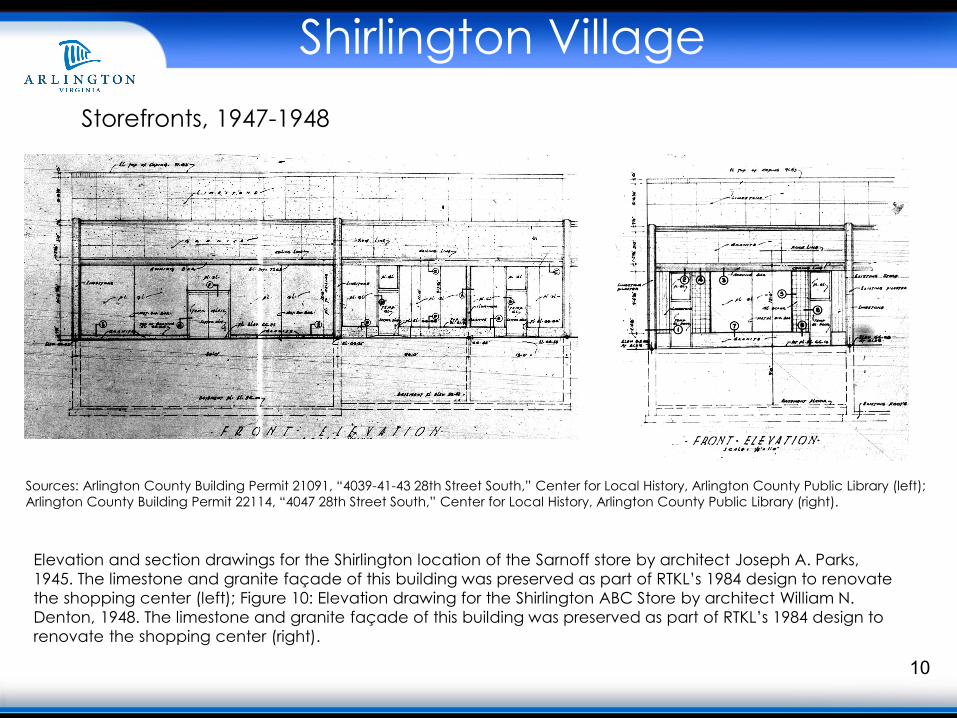
10
Storefronts, 1947-1948
Sources: Arlington County Building Permit 21091, “4039-41-43 28th Street South,” Center for Local History, Arlington County Public Library (left); Arlington County Building Permit 22114, “4047 28th Street South,” Center for Local History, Arlington County Public Library (right).
Elevation and section drawings for the Shirlington location of the Sarnoff store by architect Joseph A. Parks, 1945. The limestone and granite façade of this building was preserved as part of RTKL’s 1984 design to renovate the shopping center (left); Figure 10: Elevation drawing for the Shirlington ABC Store by architect William N. Denton, 1948. The limestone and granite façade of this building was preserved as part of RTKL’s 1984 design to renovate the shopping center (right).
Shirlington Village
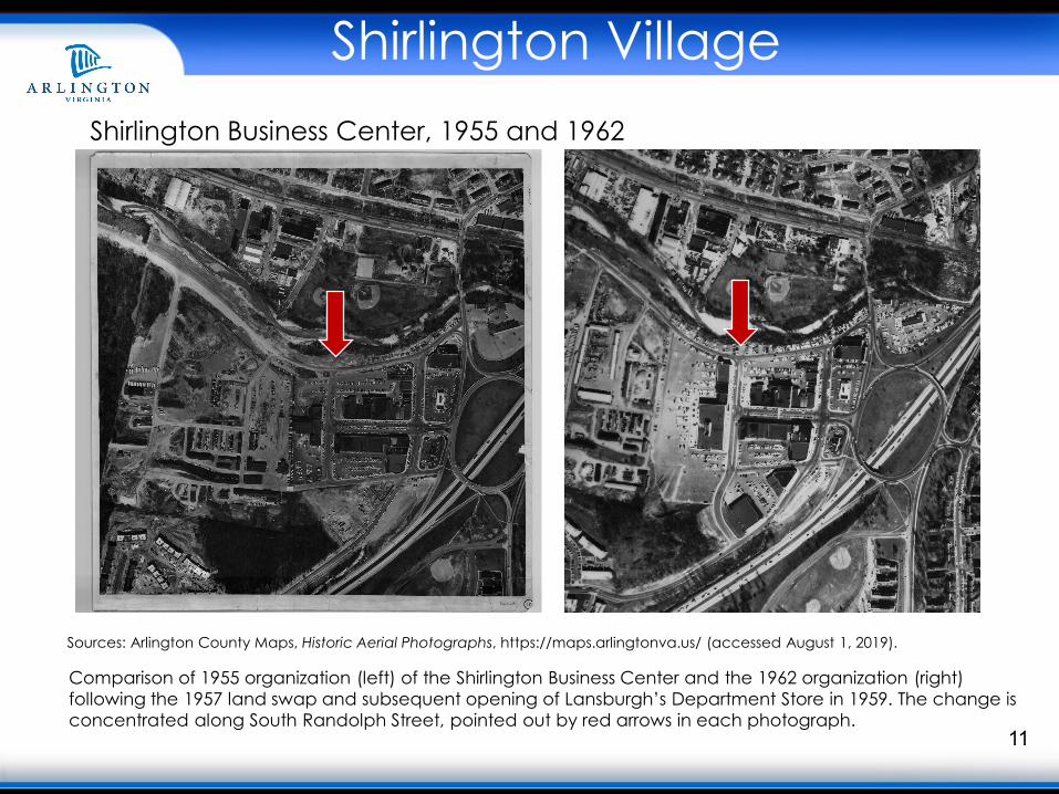
11
Shirlington Business Center, 1955 and 1962
Sources: Arlington County Maps, Historic Aerial Photographs, https://maps.arlingtonva.us/ (accessed August 1, 2019).
Comparison of 1955 organization (left) of the Shirlington Business Center and the 1962 organization (right) following the 1957 land swap and subsequent opening of Lansburgh’s Department Store in 1959. The change is concentrated along South Randolph Street, pointed out by red arrows in each photograph.
Shirlington Village
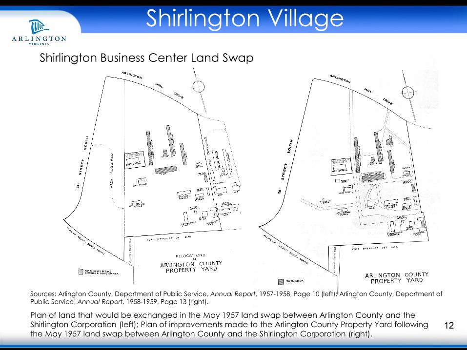
12
Shirlington Business Center Land Swap
Sources: Arlington County, Department of Public Service, Annual Report, 1957-1958, Page 10 (left); Arlington County, Department of Public Service, Annual Report, 1958-1959, Page 13 (right).
Plan of land that would be exchanged in the May 1957 land swap between Arlington County and the Shirlington Corporation (left); Plan of improvements made to the Arlington County Property Yard following the May 1957 land swap between Arlington County and the Shirlington Corporation (right).
Shirlington Village
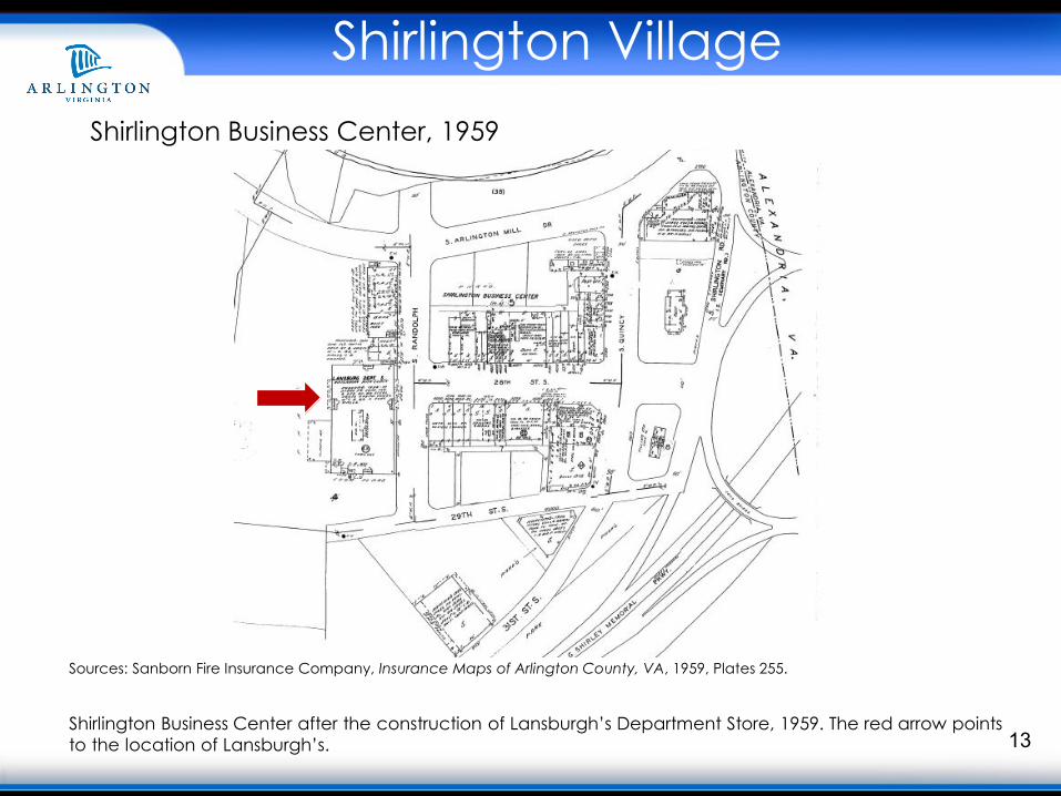
13
Shirlington Business Center, 1959
Sources: Sanborn Fire Insurance Company, Insurance Maps of Arlington County, VA, 1959, Plates 255.
Shirlington Business Center after the construction of Lansburgh’s Department Store, 1959. The red arrow points to the location of Lansburgh’s.
Shirlington Village
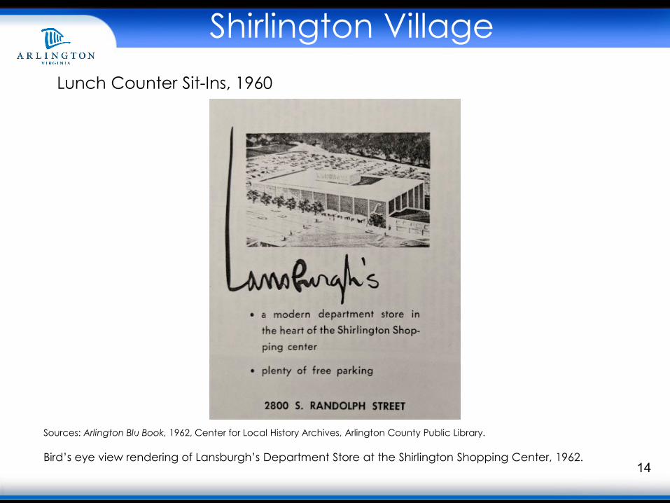
14
Lunch Counter Sit-Ins, 1960
Sources: Arlington Blu Book, 1962, Center for Local History Archives, Arlington County Public Library.
Bird’s eye view rendering of Lansburgh’s Department Store at the Shirlington Shopping Center, 1962.
Shirlington Village
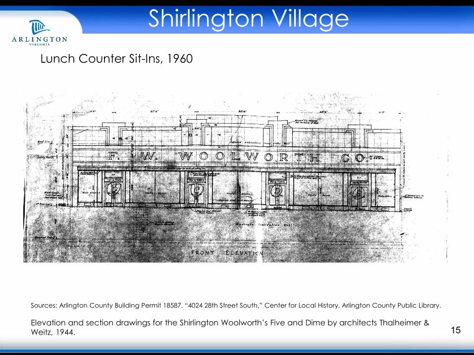
15
Lunch Counter Sit-Ins, 1960
Sources: Arlington County Building Permit 18587, “4024 28th Street South,” Center for Local History, Arlington County Public Library.
Elevation and section drawings for the Shirlington Woolworth’s Five and Dime by architects Thalheimer & Weitz, 1944.
Shirlington Village
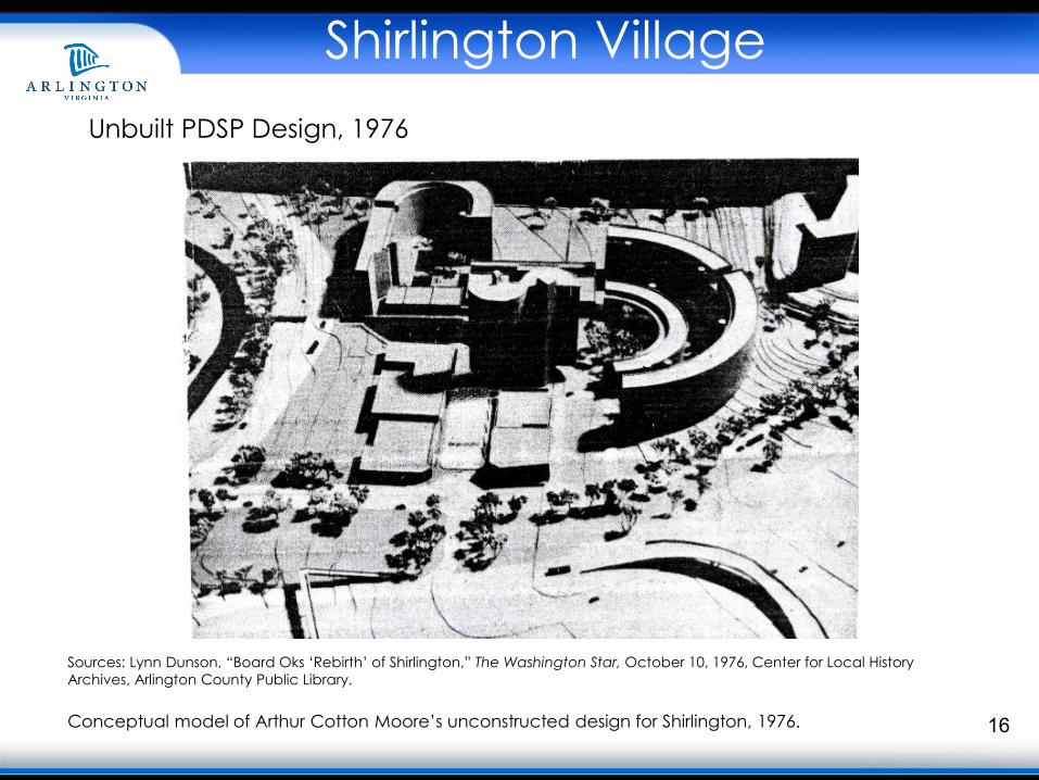
16
Unbuilt PDSP Design, 1976
Sources: Lynn Dunson, “Board Oks ‘Rebirth’ of Shirlington,” The Washington Star, October 10, 1976, Center for Local History Archives, Arlington County Public Library.
Conceptual model of Arthur Cotton Moore’s unconstructed design for Shirlington, 1976.
Shirlington Village
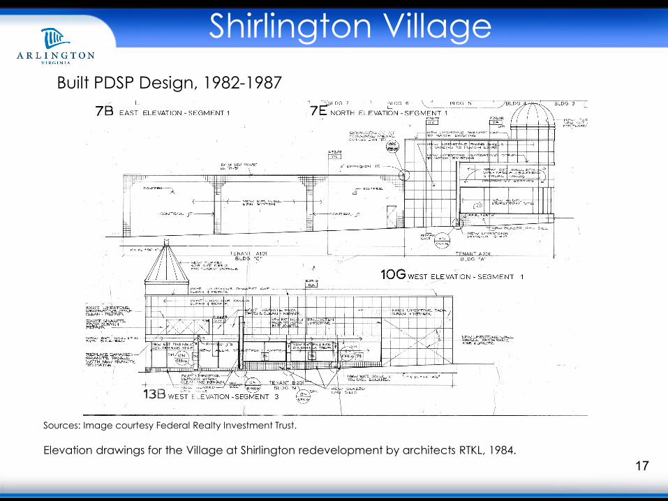
17
Sources: Image courtesy Federal Realty Investment Trust.
Elevation drawings for the Village at Shirlington redevelopment by architects RTKL, 1984.
Built PDSP Design, 1982-1987
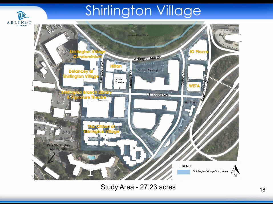
18Study Area - 27.23 acres
IO Piazza
The Citizen at Shirlington Village
Delancey at Shirlington Village
Shirlington VillageCondominium
WETA
Hilton
Shirlington Branch Library & Signature Theatre
Shirlington Village
Shirlington Village
19
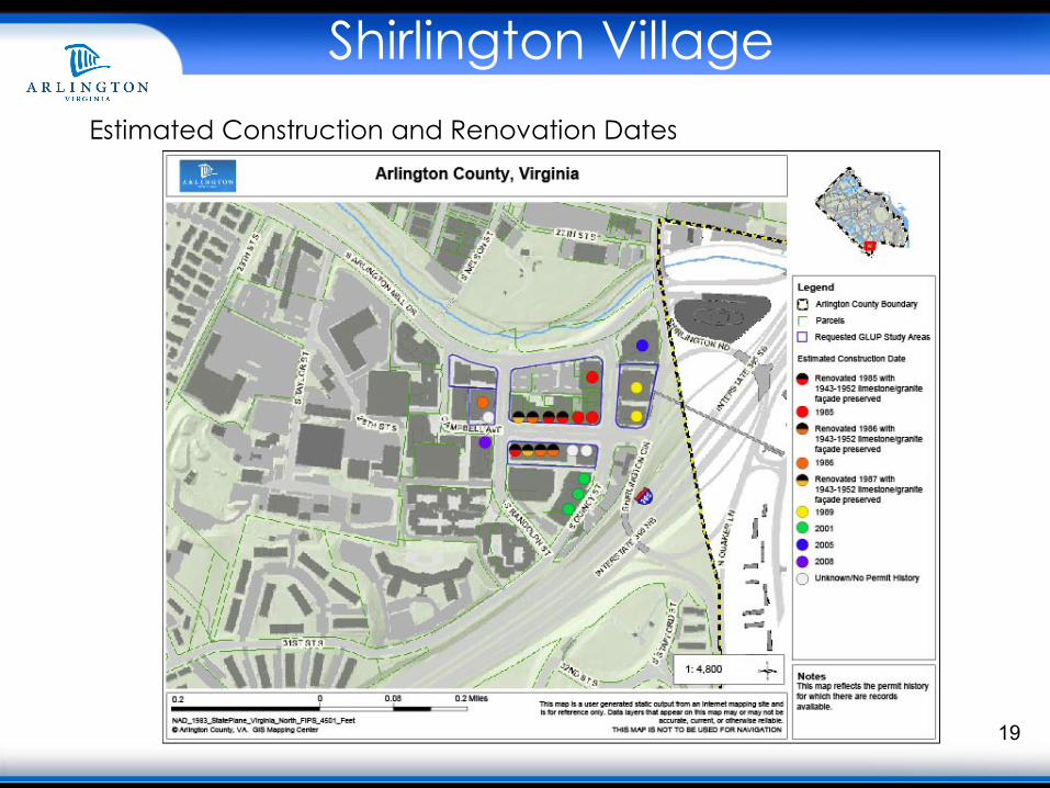
Estimated Construction and Renovation Dates
Shirlington Village
20
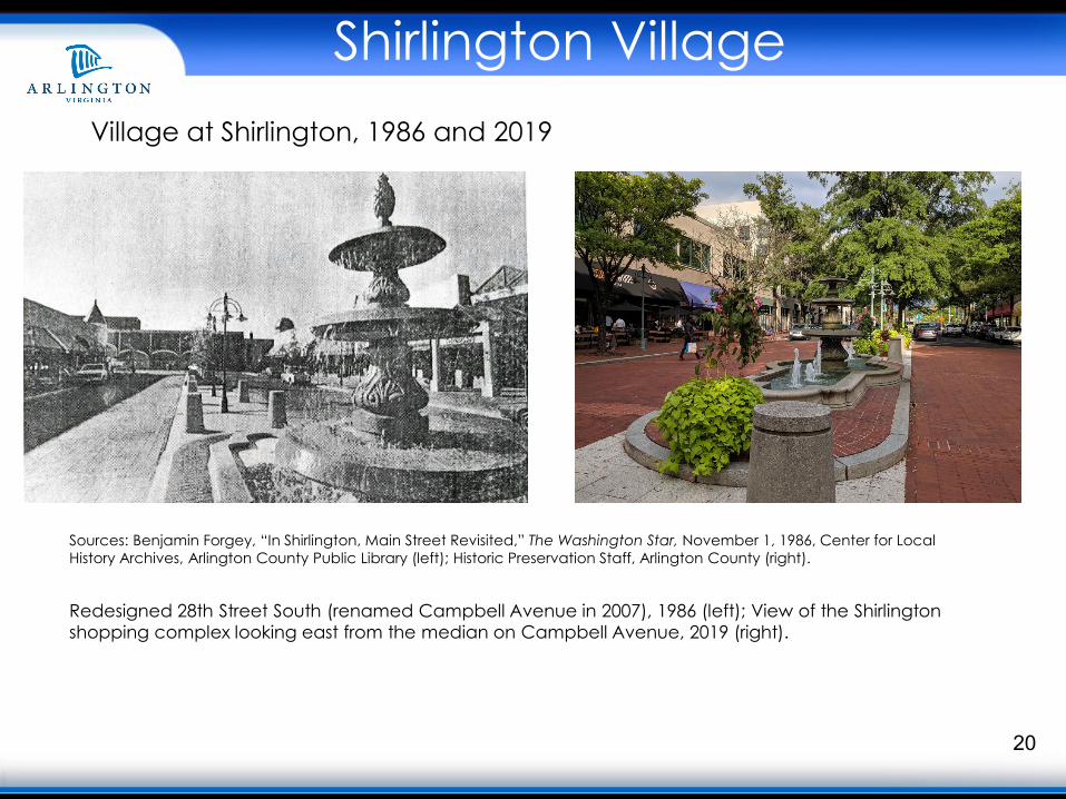
Sources: Benjamin Forgey, “In Shirlington, Main Street Revisited,” The Washington Star, November 1, 1986, Center for Local History Archives, Arlington County Public Library (left); Historic Preservation Staff, Arlington County (right).
Redesigned 28th Street South (renamed Campbell Avenue in 2007), 1986 (left); View of the Shirlingtonshopping complex looking east from the median on Campbell Avenue, 2019 (right).
Village at Shirlington, 1986 and 2019