rio arriba county design and development regulation …
TRANSCRIPT

RIO ARRIBA COUNTY DESIGN AND
DEVELOPMENT REGULATION
SYSTEM
ORDINANCE 2011-02

2
RIO ARRIBA COUNTY
DESIGN AND DEVELOPMENT REGULATION SYSTEM
BOARD OF COUNTY COMMISSIONERS
Alfredo Montoya, Commissioner
Elias Coriz, Commissioner
Felipe Martinez, Commissioner
Thomas Campos, County Manager
PLANNING AND ZONING COMMITTEE
Phil Kilgour
Benny Martinez
Randy Cordova,
Severo Gonzales
Isabel Trujillo
Pablo Manzanares
ADOPTED AS ORDINANCE NO. 2000-01
August 26, 1999
AS AMENDED ORDINANCE NO. 2009-09
May 20, 2009
AS AMENDED ORDINANCE NO. 2011-02
July 29, 2010
PLANNING AND ZONING DEPARTMENT
Patricio Garcia, Community Development Director**
Gabriel Boyle, Planning Director**
Louise Pocock, Assistant Planner*
Lucia Sanchez, Assistant Planner
Bernadette Gonzales, GIS Supervisor*
**Prepared By
*Contributing Author
3
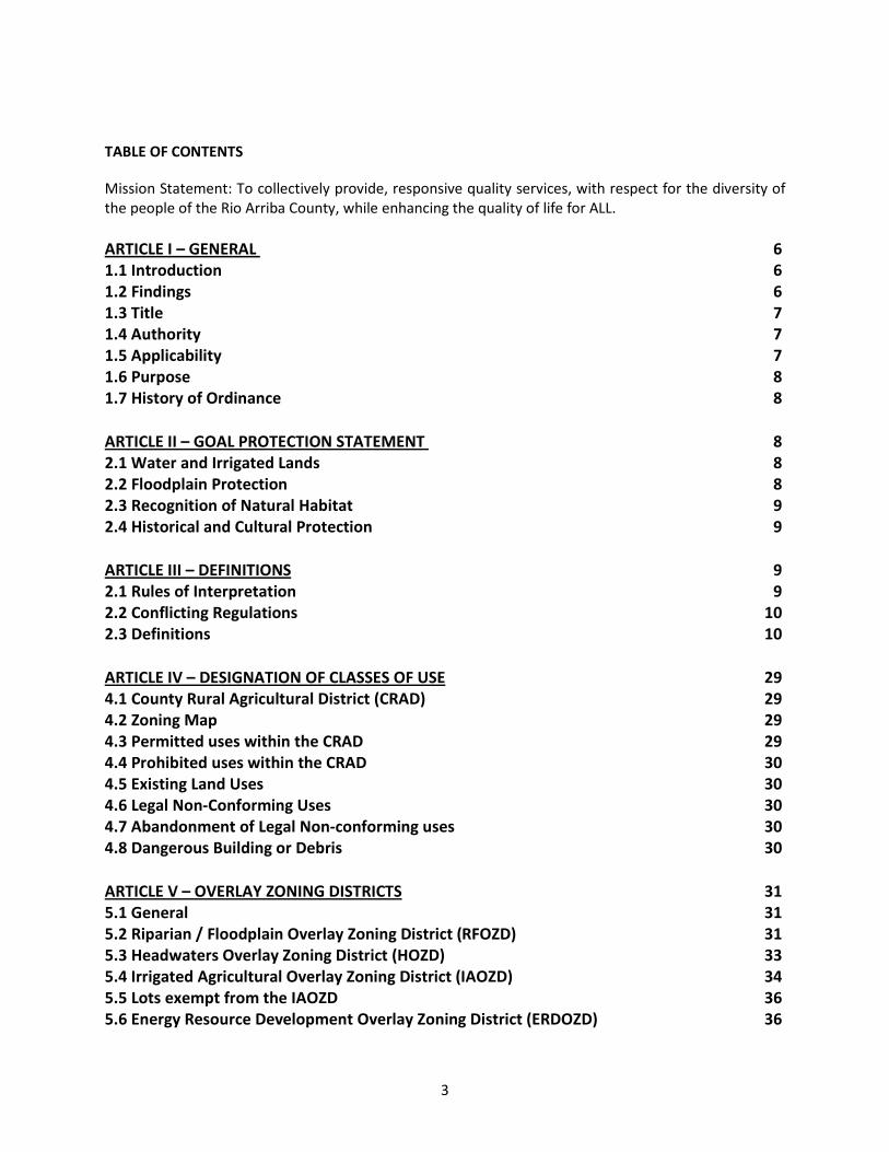
TABLE OF CONTENTS
Mission Statement: To collectively provide, responsive quality services, with respect for the diversity of
the people of the Rio Arriba County, while enhancing the quality of life for ALL.
ARTICLE I – GENERAL
1.1 Introduction
1.2 Findings
1.3 Title
1.4 Authority
1.5 Applicability
1.6 Purpose
1.7 History of Ordinance
6
6
6
7
7
7
8
8
ARTICLE II – GOAL PROTECTION STATEMENT
2.1 Water and Irrigated Lands
2.2 Floodplain Protection
2.3 Recognition of Natural Habitat
2.4 Historical and Cultural Protection
8
8
8
9
9
ARTICLE III – DEFINITIONS
2.1 Rules of Interpretation
2.2 Conflicting Regulations
2.3 Definitions
9
9
10
10
ARTICLE IV – DESIGNATION OF CLASSES OF USE
4.1 County Rural Agricultural District (CRAD)
4.2 Zoning Map
4.3 Permitted uses within the CRAD
4.4 Prohibited uses within the CRAD
4.5 Existing Land Uses
4.6 Legal Non-Conforming Uses
4.7 Abandonment of Legal Non-conforming uses
4.8 Dangerous Building or Debris
29
29
29
29
30
30
30
30
30
ARTICLE V – OVERLAY ZONING DISTRICTS
5.1 General
5.2 Riparian / Floodplain Overlay Zoning District (RFOZD)
5.3 Headwaters Overlay Zoning District (HOZD)
5.4 Irrigated Agricultural Overlay Zoning District (IAOZD)
5.5 Lots exempt from the IAOZD
5.6 Energy Resource Development Overlay Zoning District (ERDOZD)
31
31
31
33
34
36
36

4
5.7 Frontier Overlay Zoning District (FOZD)
36
ARTICLE VI – ADMINISTRATIVE PERMITS
6.1 Administrative Responsibilities
6.2 Review Process and Criteria for Administrative Permits
6.3 Exempt Land Subdivisions
6.4 Development Permit
6.5 Required Submittals for a Development Permit
6.6 Mobile Home Installation Permit
6.7 Utility Permit
6.8 Home Occupation Permit
6.9 Conditional Use Permit
6.10 Review Process and Criteria for Conditional use Permit
6.11 Required Submittals for a Conditional use Permit
6.12 Design and Development Standards Applicable to all Administrative Permits
6.13 Requirement of a Development Permit
6.14 Business License
37
37
38
38
39
39
40
41
41
43
43
44
45
48
50
ARTICLE VII – PLANNING AND ZONING COMMITTEE AND BOARD OF COUNTY
COMMISSION
7.1 Establishment of Planning and Zoning Committee
7.2 Committee Responsibilities
7.3 Commission Responsibilities
50
50
50
51
ARTICLE VIII – REQUIREMENT FOR PUBLIC HEARING AND PUBLIC NOTICE OF
APPLICATION
8.1 Public Hearing Required
8.2 Requirement of Public Notice of Application
8.3 Notice of Public Hearing
8.4 Area of Notice Defined
8.5 Opportunity to be Heard
8.6 Quasi-Judicial Hearing
51
51
52
53
53
54
54
ARTICLE IX – SPECIAL USE PERMITS
9.1 General
9.2 Review Process and Criteria for Special use Permits
9.3 Required Submittals for Special Use Permits
9.4 Requirement of Development Permit
9.5 Design and Development Standards for All Special Use Permits
54
54
55
56
57
59
ARTICLE X – MASTER PLAN FOR A PLANNED UNIT DEVELOPMENT
10.1 General
10.2 Review Process and Criteria for a Master Plan
60
60
60

5
10.3 Required Submittals for a Master Plan
61
ARTICLE XI – VARIANCES
11.1 General
11.2 Criteria for Variances
11.3 Application for Variance
11.4 Expiration of Variances
62
62
62
63
63
ARTICLE XII – APPEALS
12.1 General
12.2 Appeals of Administrative Decisions
12.3 Appeals of Planning and Zoning Decisions
12.4 Appeals of the Board of County Commissioners Decision
63
63
64
64
64
ARTICLE XIII – ADMINISTRATION AND ENFORCEMENT
13.1 General
13.2 Complaints, Investigations of Violations, and Right of Entry
13.3 Procedures Upon Discovery
13.4 Revocation of Permit
13.5 Injunction, Abatement, and other Remedies
13.6 Vested Duty to Enforce
64
64
65
65
65
66
66
ARTICLE XIV – MISCELLANEOUS
14.1 Severability
14.2 Repeal/Survivor
14.3 Amendments to the Ordinance
14.4 Effective Date
66
66
67
67
68
EXHIBIT A – COUNTY RURAL AGRICULTURAL DISTRICT (CRAD)
EXHIBIT B – RIPARIAN/FLOODPLAIN OVERLAY ZONING DISTRICT (RFOZD)
EXHIBIT C – HEADWATERS OVERLAY ZONING DISTRICT (HOZD)
EXHIBIT D – IRRIGATED AGRICULTURAL OVERLAY ZONING DISTRICT (IAOZD)
EXHIBIT E – ENERGY RESOURCE DEVELOPMENT OVERLAY ZONING DISTRICT
(ERDOZD) AND FRONTIER OVERLAY ZONING DISTRICT (FOZD)
69
70
71
72
73

6
ARTICLE I
GENERAL
1.1 Introduction
The ordinances compiled, amended, restated and supplemented by this ordinance establish a
Land Use Development Regulation System for Rio Arriba County. This Land Use Development
Regulation System will provide a framework within which future growth, land use and
development decisions within the County can take place.
In order to provide guidance to this ordinance with regards to the overarching public policy
goals for the preservation and promotion of Rio Arriba County’s natural resources, a
Comprehensive Plan has been adopted. In order to implement a viable Comprehensive Plan,
the public must be satisfied with the content. The County conducted a series of community
meetings and heard citizen views. The citizens were heard and incorporated into the document
and they expressed their views overwhelmingly in support of the Comprehensive Plan adopted
by the County.
Change is inevitable. This ordinance does not attempt to stop change. However, the County
wants to create a system of orderly development within the County to ensure that our natural
resources, land, air, water and beauty can be sustained and enjoyed by future generations. Rio
Arriba County is a special place because of the close ties between the water, land and culture.
The purpose of the Comprehensive Plan as implemented by this Ordinance is to protect these
resources and their connections to each other and the citizens.
The impacts of un-managed development on the availability of water, water quality, roads and
transportation, flood plains, critical management areas, and on traditional irrigated agricultural
lands as defined herein, must be reduced as much as possible. Planning is an ongoing process
and it is in the public interest to have and maintain control in order to prohibit certain uses
entirely, severely restrict other uses and to permit certain uses only in limited circumstances.
Enforcement of this Ordinance is essential for the County in order to protect the health, safety,
and welfare of the residents of Rio Arriba County.
1.2 Findings
This Design and Development Regulation System has been adopted with consideration to the
character of the County and its peculiar suitability for particular uses and to conserving the
value of buildings and land and encouraging the most appropriate use of land, protecting the
public, protecting water rights and water quality, flood plain management, the protection and
preservation of Bosque areas and protection of wildlife and its habitat and the scenic quality of
Rio Arriba County.
The Board Hereby finds, declares, and determines that this Ordinance:
7
(A) is an ordinance establishing, compiling, amending, adopting, restating, and
supplementing a system of land use development regulations throughout Rio Arriba
County; providing for the zoning of land in Rio Arriba County; a system of administrative
permits, conditional use permits, and special use permits for use of land in Rio Arriba
County, providing for the review of exempt land subdivisions in Rio Arriba County,
providing for variances and appeals, and providing for the administration and
enforcement of this Ordinance;
(B) this Ordinance will provide land use planning guidelines and locational criteria for use in
reviewing permitted uses and for reviewing, approving or denying requests for
administrative permits, conditional use permits, special use permits, and master plans;
(C) this Ordinance has been adopted with due consideration to the character of the county,
its peculiar suitability for particular uses and to conserving the value of buildings and
land and encouraging the most appropriate use of land throughout the County with due
consideration to the protection of water rights and water quality, and the ecological
health and balance of the land and natural resources; and
(D) that counties are granted the same powers that are granted municipalities except for
those powers that are inconsistent with statutory or constitutional limitations placed on
counties. Included in this grant of powers to the counties are those powers necessary
and proper to provide for the safety, preserve the health, promote the prosperity and
improve the morals, order, comfort and convenience of any county or its inhabitants.
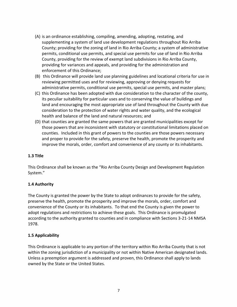
1.3 Title
This Ordinance shall be known as the “Rio Arriba County Design and Development Regulation
System.”
1.4 Authority
The County is granted the power by the State to adopt ordinances to provide for the safety,
preserve the health, promote the prosperity and improve the morals, order, comfort and
convenience of the County or its inhabitants. To that end the County is given the power to
adopt regulations and restrictions to achieve these goals. This Ordinance is promulgated
according to the authority granted to counties and in compliance with Sections 3-21-14 NMSA
1978.
1.5 Applicability
This Ordinance is applicable to any portion of the territory within Rio Arriba County that is not
within the zoning jurisdiction of a municipality or not within Native American designated lands.
Unless a preemption argument is addressed and proven, this Ordinance shall apply to lands
owned by the State or the United States.

8
1.6 Purpose
This Ordinance creates a system of land use planning and locational criteria for use in reviewing
uses permitted by right, and for reviewing, and approving or denying requests for
administrative permits conditional use permits and special use permits for; mixed uses, planned
unit developments, heavy and light industrial uses, home occupations, mining uses, tower uses,
small, medium and large scale residential uses, master plans and variances.
1.7 History of Ordinance
The predecessor Ordinance to this Ordinance was reviewed and recommended for approval by
the County Planning and Zoning Committee on July 27, 1995 and adopted by the Board of
County Commissioners on August 31, 1995. Subsequently the Ordinance was made permanent
on July 31, 1997. This Ordinance was amended in 2009 and adopted as Ordinance 2009-09 and
was finally amended and adopted in 2010 as The Rio Arriba County Design and Development
Regulation System Ordinance 2011-02.
ARTICLE II
GOAL PROTECTION STATEMENT
2.1 WATER AND IRRIGATED LANDS
The protection of water and water rights is a vital issue impacting the future of Rio Arriba
County. The Comprehensive Plan, as duly adopted by the Board of County Commissioners, the
Rio Chama Regional Water Plan Jemez y Sangre and the Water Plan for the State of New Mexico
serve as the overarching public policy documents with regards to the protection of water and
water rights.
Rio Arriba County has created the following overlay zoning districts; headwaters,
riparian/floodplain, and irrigated agricultural lands, as were prioritized as critical management
areas by the Comprehensive Plan for the protection and preservation of water sources and
storage capacity, water quality, water rights, supplementary food production, and traditional
agricultural uses and practices within the County. Please refer to the Comprehensive Plan for
additional information regarding the public policies justifying the protection and preservation
of these resources
2.2 FLOODPLAIN PROTECTION
Rio Arriba County has created an overlay zoning district for the protection of the County’s
floodplains. Please refer to the Comprehensive Plan for additional information regarding the
public policies justifying hazard mitigation and flood plain protection.

9
Special use permits, conditional use permits, and development permits shall not be issued for
any development within a flood plain until it is shown that the proposed development is in
compliance with the County’s Flood Damage Prevention Ordinance and is consistent with the
need to minimize flood damage, all utilities and facilities such as sewer, gas, electrical and
water systems are located and constructed to minimize or eliminate flood damage, adequate
drainage is provided to minimize or reduce exposure to flood hazards, and necessary permits
have been received from those agencies which approval is required by federal or state law.
2.3 RECOGNITION OF NATURAL HABITAT
Rio Arriba County is committed to preserving the headwaters, bosque, floodplain, and riparian
areas within the region from any development other than limited uses which will not interfere
with the flora, fauna, and wild creatures of the area.
Rio Arriba County has created the headwaters and the riparian/floodplain overlay zoning
districts to protect natural habitats and their natural functions found throughout the County.
Please refer to the Comprehensive Plan for additional information regarding the public policies
justifying the protection and preservation of these resources.
2.4 HISTORICAL AND CULTURAL PROTECTION
The County is committed to protection and preservation of cultural and historical resources
associated with Historical Preservation, NMSA 1978 Sections 3-22-1et seq . Please refer to the
Comprehensive Plan for additional information regarding the public policies justifying the
protection and preservation of these resources.
ARTICLE III
DEFINITIONS
3.1 RULES OF INTERPRETATION
(A) Words, phrases, and terms defined in this Ordinance shall be given the meanings set
forth below. Words, phrases, and terms not defined in this Ordinance shall be given
their usual and customary meanings except where the context clearly indicates a
different meaning.
(B) The text shall control captions, titles, and maps.
(C) The word “shall” is mandatory and not permissive; the word “may” is permissive and
not mandatory.
(D) Words used in the singular include the plural; words used in the plural include the
singular.
(E) Words used in the present tense include the future tense; words used in the future
tense include the present tense.
(F) Within this Ordinance, sections prefaced “purpose” and “findings” may be included.
Each purpose statement is intended as an official statement of legislative purpose or

10
findings. The “purpose” and “findings” statements are legislatively adopted, together
with the formal text of the Ordinance. They are intended as a legal guide to the
administration and interpretation of the Ordinance and shall be treated in the same
manner as other aspects of legislative history. Additionally, such purposes and findings
shall be considered part of the County’s Comprehensive Plan.
(G) In their interpretation and application, the provisions of this Ordinance are considered
minimal in nature.
(H) In computing any period of time prescribed or allowed by this Ordinance, the day of the
notice or final application, after which the designated period of time begins to run, is
not to be included. Further, the last day is to be included unless it is a Saturday, Sunday
or holiday recognized by the State of New Mexico or the federal government, in which
event the period runs until the next day that is not a Saturday, Sunday or such holiday.
3.2 CONFLICTING REGULATIONS
In the event of a conflict in this or any other county ordinance, rule or regulation the more
stringent conflicting requirement will be enforced. Where this Ordinance imposes more
stringent restrictions than those imposed by other federal, state or county rules, regulations,
easements, covenants, agreements, or county ordinances or resolutions, the provisions of this
Ordinance shall govern.
3.3 DEFINITIONS
Abandonment – whenever a legal nonconforming use is discontinued for a period of six (6)
months or more.
Accessory Dwelling Unit- A dwelling unit comprised of no more than fifty percent (50%) of the
total heated square footage of the single family dwelling unit located upon the same lot as the
single family dwelling unit and the use and occupancy of which is subordinate and incidental to
the use of a single family dwelling unit on the same lot.
Accessory Structure - A subordinate structure, the use of which is incidental and related to that
of the primary or principal structure or use of the same lot on which the accessory structure is
located, and which is located on the same lot as that of the primary or principal structure or
use.
Acequia – An organized system of trenches or ditches excavated on the surface of the earth to
be used as an irrigation system that may or may not be governed by an elected acequia
commission that has adopted by-laws.
Adjacent - Adjoining or nearby but not necessarily touching or abutting.
Administrative Permit - Any permit, approval or notice which the Director has the authority to
issue administratively and without the need for a public hearing as provided in this Ordinance,
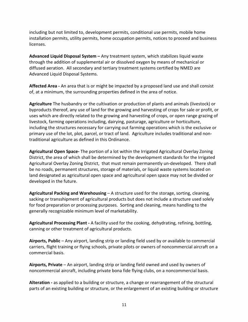
11
including but not limited to, development permits, conditional use permits, mobile home
installation permits, utility permits, home occupation permits, notices to proceed and business
licenses.
Advanced Liquid Disposal System – Any treatment system, which stabilizes liquid waste
through the addition of supplemental air or dissolved oxygen by means of mechanical or
diffused aeration. All secondary and tertiary treatment systems certified by NMED are
Advanced Liquid Disposal Systems.
Affected Area - An area that is or might be impacted by a proposed land use and shall consist
of, at a minimum, the surrounding properties defined in the area of notice.
Agriculture The husbandry or the cultivation or production of plants and animals (livestock) or
byproducts thereof, any use of land for the growing and harvesting of crops for sale or profit, or
uses which are directly related to the growing and harvesting of crops, or open range grazing of
livestock, farming operations including, dairying, pasturage, agriculture or horticulture,
including the structures necessary for carrying out farming operations which is the exclusive or
primary use of the lot, plot, parcel, or tract of land. Agriculture includes traditional and non-
traditional agriculture as defined in this Ordinance.
Agricultural Open Space- The portion of a lot within the Irrigated Agricultural Overlay Zoning
District, the area of which shall be determined by the development standards for the Irrigated
Agricultural Overlay Zoning District, that must remain permanently un-developed. There shall
be no roads, permanent structures, storage of materials, or liquid waste systems located on
land designated as agricultural open space and agricultural open space may not be divided or
developed in the future.
Agricultural Packing and Warehousing – A structure used for the storage, sorting, cleaning,
sacking or transshipment of agricultural products but does not include a structure used solely
for food preparation or processing purposes. Sorting and cleaning, means handling to the
generally recognizable minimum level of marketability.
Agricultural Processing Plant - A facility used for the cooking, dehydrating, refining, bottling,
canning or other treatment of agricultural products.
Airports, Public – Any airport, landing strip or landing field used by or available to commercial
carriers, flight training or flying schools, private pilots or owners of noncommercial aircraft on a
commercial basis.
Airports, Private – An airport, landing strip or landing field owned and used by owners of
noncommercial aircraft, including private bona fide flying clubs, on a noncommercial basis.
Alteration - as applied to a building or structure, a change or rearrangement of the structural
parts of an existing building or structure, or the enlargement of an existing building or structure

12
to cover more of the lot area, by increasing the height or by moving said structure from one
location or position to another.
Animal - Any live, vertebrate creature, domestic or wild, excluding humans.
Animal, Large - Animals that are typically described and assumed by their size, weight and/or
appearance to be large animals, such as equine, bovine, swine, ewe and other such animals.
Animal, Small – Include goats, sheep, fowl, rabbits, miniature horses and other such
comparably sized animals distinguished from those described as large animals.
Apartment- A room or suite of rooms in a multiple family dwelling unit intended, designed or
used as residence by a single family, which includes kitchen and bath accommodation, which is
for use on a rental basis.
Area - A piece of land capable of being described in such a fashion that its location may be
established and boundaries definitely ascertained.
Area of Notice – Section 8.4
Arroyo Major - Arroyo containing at least some portions mapped by FEMA containing 100-year
or at least 5 square miles of drainage.
Arroyo Minor - Arroyo containing no portions mapped by FEMA and less than 5 square miles of
drainage.
Arterial- Roads that function within the region or community to carry large volumes of traffic to
minor arterials and collector routes. Access may be limited. Major arterials provide high speed
travel and mobility for long distance trips.
Automobile sales lot - A lot arranged, designed, or used for the storage and display for sale of
more than two (2) motor vehicles, trucks, tractors or any other type of mechanical vehicle, and
where no repair work is done except for minor incidental repairs of vehicles displayed on the
premises.
Automobile Service Station - or Service Station - Any premises used for supplying gasoline and
oil at retail, direct to the customer, and including minor accessories and minor services for
automobiles, trucks, tractors, etc. but not including the repairing or replacing of motors, bodies,
or painting of motor vehicles.
Auto-Wrecking Yard - Any place where motor vehicles not in running condition, or the parts
thereof, are stored in the open and are not being restored to operation, or any land, building or
structure used for the dismantling or storing of such motor vehicles or the parts thereof.
13
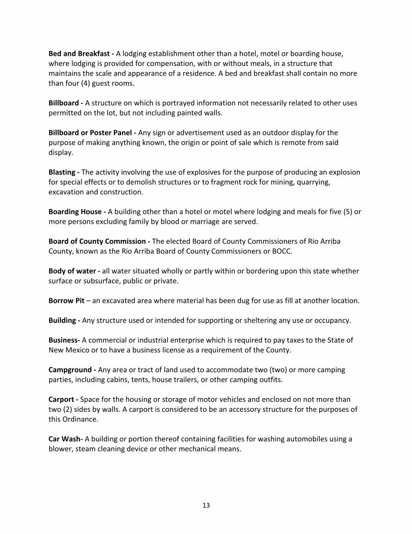
Bed and Breakfast - A lodging establishment other than a hotel, motel or boarding house,
where lodging is provided for compensation, with or without meals, in a structure that
maintains the scale and appearance of a residence. A bed and breakfast shall contain no more
than four (4) guest rooms.
Billboard - A structure on which is portrayed information not necessarily related to other uses
permitted on the lot, but not including painted walls.
Billboard or Poster Panel - Any sign or advertisement used as an outdoor display for the
purpose of making anything known, the origin or point of sale which is remote from said
display.
Blasting - The activity involving the use of explosives for the purpose of producing an explosion
for special effects or to demolish structures or to fragment rock for mining, quarrying,
excavation and construction.
Boarding House - A building other than a hotel or motel where lodging and meals for five (5) or
more persons excluding family by blood or marriage are served.
Board of County Commission - The elected Board of County Commissioners of Rio Arriba
County, known as the Rio Arriba Board of County Commissioners or BOCC.
Body of water - all water situated wholly or partly within or bordering upon this state whether
surface or subsurface, public or private.
Borrow Pit – an excavated area where material has been dug for use as fill at another location.
Building - Any structure used or intended for supporting or sheltering any use or occupancy.
Business- A commercial or industrial enterprise which is required to pay taxes to the State of
New Mexico or to have a business license as a requirement of the County.
Campground - Any area or tract of land used to accommodate two (two) or more camping
parties, including cabins, tents, house trailers, or other camping outfits.
Carport - Space for the housing or storage of motor vehicles and enclosed on not more than
two (2) sides by walls. A carport is considered to be an accessory structure for the purposes of
this Ordinance.
Car Wash- A building or portion thereof containing facilities for washing automobiles using a
blower, steam cleaning device or other mechanical means.

14
Cemetery - Land used for burial of deceased persons, and dedicated for cemetery purposes,
including columbariums, crematories, mausoleums, and mortuaries when operated in
conjunction with and within the boundaries of such cemetery.
Channel - The geographical area within the natural or artificial banks of a watercourse required
to carry continuously or intermittently flowing water.
Church - A building together with its accessory buildings and uses, where persons regularly
assemble for religious worship, and which is maintained and controlled by a religious body
organized to sustain public worship.
Clear Site Triangle - A triangle space at the street corner of a corner lot, which is bounded by
the street right-of-way lines and a line connecting points located thirty (30) feet distant from
the intersection, or projected intersection, of the street right-of-way lines, within which no
obstruction to view between three (3) feet and eight (8) feet above street level shall be placed
or maintained.
Clinic - An establishment where patients receive medical care and treatment are not lodged
overnight but admitted for out patient services.
Collector Street - A street which carries or will carry intermediate volumes of traffic from a
minor street to an arterial.
Commercial Feed Lot- An area of land where the principal use is the concentrated feeding of
livestock, fowl or other animals raised for human consumption, when the animals and/or
products derived from the animals are offered for sale. Commercial feed lots do not include
dairies.
Commercial Land Use- The use of land for purposes related to trade, business, commerce and
all aspects of buying and selling requiring a business license by the County.
Small Scale Commercial Use – the use or construction of any structure for the purposes
of commercial activity that is 2000 square feet or less in area. There shall be no small
scale commercial land uses permitted without the approval and granting of a
conditional use permit from the County.
Large Scale Commercial Use - the use or construction of any structure for the purposes
of light industrial activity that is greater than 2000 square feet in total area. There shall
be no large scale commercial land uses permitted without the approval and granting of
a special use permit from the County.
Compatibility – The condition where a development can co-exist harmoniously with the
existing and surrounding land uses, considering but not limited to the possible adverse effects
or impacts on environmentally sensitive habitats, wetlands, flood areas, steep slopes, historic,

15
cultural and archaeological artifacts and sites, noise levels, odors, glare, potential fire hazards,
explosions, visual impacts, surface and groundwater quality or quantity, adequacy of the road
or highway system to sustain traffic, stormwater detention, fire, police and emergency
response services and availability, air quality and surrounding land uses.
Community Facility- A publicly or privately-owned facility that is available to the general public,
including but not limited to a library, museum, ball field, swimming pool, recreation or cultural
center or combination thereof.
Community Water System- Means a public water system which serves at least fifteen (15)
service connections used by year-round residents or regularly serves at least twenty five (25)
year-round residents.
Comprehensive Plan – The overarching planning document duly adopted by the Board of
County Commissioners governing the future development of Rio Arriba County.
Conditional Use Permit – An administrative permit that allows for certain, low impact and
generally compatible, land uses within the CRAD, as provided in this Ordinance
Condominium - A building or group of buildings which contain two (2) or more dwelling units
with separate entrances but which share common structural elements including walls and roofs
and owned by the inhabitants of the units or their lessors.
Construction - The act of breaking ground and erecting a building or structure.
Cottage Industry - A small, individually-owned business or concern which functions without
altering the residential character of the neighborhood, and which does not create any negative
impacts on the public health, safety, and general welfare of the residents of the area.
CRAD (County Rural Agricultural District) – County Rural Agricultural District, the zoning district
which encompasses the entirety of Rio Arriba County.
Critical Habitat – A habitat determined to be important to the survival of a threatened or
endangered species and to general environmental quality, such as elk caving habitat or native
trout habitat.
Dairy – An area of land on which cows are kept for the purpose of producing dairy products in
commercial quantities, as well as the related buildings, equipment processes.
Day Care Center - An agency, organization, or individual providing daytime care of six (6) or
more children not related by blood or marriage.
Density – The number of families, persons, or housing units per unit of land, usually expressed
as “per acre.”

16
Developable Area – The portion of a lot within the Irrigated Agricultural Overlay Zoning District,
the area of which shall be determined by the development standards for the Irrigated
Agricultural Overlay Zoning District, that is allowed to be developed. All parking areas, material
storage areas and permanent structures shall be located within the boundaries of the
developable area.
Development – The making of any material change in the use or appearance of any structure or
land or the performance of any building or terrain modification, including roads. This definition
shall not be inclusive of terrain modifications made for the purposes of agriculture.
Director - The person appointed by the County Manager and approved by the Board of County
Commissioners to administer the Planning and Zoning Department, to include the subordinate
employees working for the Department to whom the Director’s authority and powers may be
delegated.
Drive In - An establishment designed or operated to serve a patron while seated in an
automobile parked in an off-street parking space.
Driveway – A private road starting on the property line accessing one property usually for
access to structures on the property.
Earth Removal - The removal or extraction of any stone, sand, gravel, loam, topsoil, or other
earth product from a lot or parcel of land.
Easement - A grant by the property owner to the public, a corporation, or persons of the use of
a tract of land for a specific purpose or purposes.
Ecosystem – a system formed by the interaction of a community of organisms with their
physical environment.
Energy Resource Development Overlay Zoning District (ERDOZD) – An overlay zoning district
found within the CRAD, regulating the extraction of hydrocarbons, which is defined and
mapped in Section 5.6 of this Ordinance. The review process and criteria for applications
relating to the extraction of hydrocarbons can be found in the Rio Arriba County Oil and Gas
Ordinance. The Energy Resource Development Overlay Zoning District is referred to as the
Energy Resource Development District (ERDD) in the Comprehensive Plan.
Expansion – An increase in intensity, area, height, size of a structure or use of land on a
property.
Extraction - The removal of surface and subsurface commodities such as; gas, oil, coal, sand,
gravel, gold, copper and other precious materials which may involve drilling, digging, trenching,

17
blasting and employment of heavy industrial machinery for commercial gain of such
commodities.
Exempt Land Divisions - The thirteen (13) land subdivision procedures that are exempted from
state and local subdivision regulations as per NMSA 3-20-1 et. al.
Family - One or more persons occupying premises and living together as a single house keeping
unit, as distinguished from a group occupying a hotel, club, fraternity, sorority, or similar
occupancy arrangements.
Fire Lane – Any area appurtenant to a building deemed necessary by the Fire Marshal or
his/her designee to remain free and clear of parked vehicles for access to such building in case
of fire or other emergency and designated by him as such.
Flood - An overflow of water onto lands not normally covered by water.
Floodplain - Relatively flat area or low lands adjoining the channel of a watercourse or a body
of standing water, which has been or may be covered by floodwater.
Floodway Fringe Area - The area immediately adjacent to the limits of a floodway.
Frontier Overlay Zoning District (FOZD) – An overlay zoning district found within the CRAD,
regulating the extraction of hydrocarbons, which is defined and mapped in Section 5.7 of this
Ordinance. The review process and criteria for applications relating to the extraction of
hydrocarbons can be found in the Rio Arriba County Oil and Gas Ordinance. The Frontier
Overlay Zoning District is referred to as the Frontier District (FD) in the Comprehensive Plan.
Garage - A building or portion thereof, other than a private storage garage, designed or used
for equipping, servicing, repairing, hiring, selling, storing or parking motor driven vehicles.
Golf Course - A comparatively large unobstructed acreage involving enough room over which to
walk or ride, point to point, over a generally prescribed course, and to strive to send a ball long
distances with variable accuracy.
Group Home - A facility wherein the operator is not legally related to the individuals supervised
and is licensed by the State; and wherein one or more individuals is provided with room, board,
specialized and distinctive care, and supervision in a family environment.
Habitat – An ecological or environmental area that is inhabited by a particular species of
animal, plant or other type of organism.
Halfway House - A residential facility for five (5) or more adults who have been institutionalized
for various reasons and released, or who have or have had physical or social disabilities which
make operation in society difficult and require the protection of a group home setting to

18
facilitate the transition to a functional member of society (e.g., former convicts, alcoholics, drug
addicts, mental patients, etc.); which provides shelter, supervision and residential rehabilitative
services.
Haul- The loading and transporting of material or equipment to or from a mining/ extraction or
heavy industrial site.
Haul Road- A road to and from a mining/ extraction or heavy industry site which has a sole
purpose of serving the mine/ extraction or heavy industrial site. A road where all transportation
activity are related to the property and its commercial activities.
Headwaters Overlay zoning District – The overlay zoning district identified and defined in
Section 5.3 of this Ordinance.
Height of Building - A vertical distance from the established average sidewalk grade or street
grade, or finished grade at the building line, whichever is the highest, to the highest point of the
building.
Heliport – A landing and take off site for a helicopter.
High Water Season – The season in which ground water is closest to the surface normally
during the spring after snow melt.
Home Occupation – The operation of a commercial use conducted in a dwelling unit provided
that said use is in compliance with the standards contained within this Ordinance.
Hotel- One (1) or more buildings with five (5) or more guest rooms in which lodging or boarding
and lodging are provided and offered to the public for compensation, and where ingress and
egress to and from all rooms is made through an inside, supervised lobby or office
Hundred Year Flood - A flood having an average frequency of occurrence on order of one (1%)
percent chance of happening in any given year.
Illegal Use - Any use, whether of a building or other structure, or of a tract of land, in which a
violation of any provision of this ordinance has been committed or shall exist.
Immediate Family Member - A husband, wife, father, stepfather, mother, stepmother, brother,
stepbrother, sister, stepsister, son, stepson, daughter, stepdaughter, grandson, step grandson,
granddaughter, step granddaughter, nephew and niece, whether related by natural birth of
adoption.
Improvements - Changes and additions to land necessary to prepare it for building sites, and
including but not limited to street paving and curbing, grading, survey, monuments, drainage
ways, sewers, fire hydrants, water mains, sidewalks, pedestrian ways and other public works.

19
Industrial Use - The treatment or processing of raw products.
Heavy Industrial Use - Where the principal use of land is for heavy industries that by
their nature may create some nuisance and which are not properly associated with or
compatible with residential, business, office and light industrial areas and may include,
but not be limited to: automobile wrecking and salvage operations, concrete
manufacturing and storage, feed, fertilizer and flour mills, lumber and saw mills,
quarrying or mining, oil and gas mining, slaughterhouses. There shall be no heavy
industrial land uses permitted without the approval and granting of a special use permit,
and all other applicable permits, by the County.
Light Industrial Use - The use of the land for industries which can be operated in a
relatively clean and quiet manner and which, when properly mitigated, will not create a
nuisance to adjacent existing land uses. Light industry may include, but not be limited
to, some of the following activities: veterinary hospitals, bakeries, offices, self storage,
and warehouses.
Small Scale Light Industrial – the use or construction of any structure for the
purposes of light industrial activity that is 2000 square feet or less in area. There
shall be no small scale light industrial land uses without the approval and
granting of a conditional use permit from the County.
Large Scale Light Industrial – the use or construction of any structure, for the
purposes of light industrial activity, that is greater than 2000 square feet in area.
There shall be no large scale light industrial land uses permitted without the
approval and granting of a special use permit by the County.
Infrastructure - Construction such as but not limited to streets, curbs, gutters, sidewalks, fire
hydrants, storm drainage facilities, water, sewer, gas, electric, telecommunication systems.
Institutional Residential Uses - Any structure intended to be used for overnight occupancy
containing five or more rooms. Institutional residential facilities may include, but not be limited
to, the following, hospitals, university dormitories, boarding schools, rest homes, halfway
houses, homeless shelters, etc.
Irrigated Agricultural Land – All lots and lands within the County that fall within the within the
irrigated agricultural overlay zoning district (IAOZD), except those, or portions of those lots, that
qualify for an exemption as provided for in this Ordinance.
Irrigated Agricultural Overlay Zoning District or IAOZD - The overlay zoning district described in
Section 5.4 of this Ordinance.

20
Junk - Scrap iron, scrap tin, scrap brass, scrap cooper, scrap lead or scrap zinc and all other
scrap metals and their alloys, and bones, rags, used cloth, used rubber, used rope, used tinfoil,
used bottles, old or used machinery, used tools, used appliances, used fixtures, used lumber,
used tires, or any other manmade discarded goods or parts that are so worn.
Junk Vehicles – Any inoperable vehicle that is not registered with the State of New Mexico.
Junk Yard - The use of premises for the open storage of old, wrecked, non-operable,
dilapidated, automobiles, and other such vehicles and parts thereof; scrap building materials,
scrap contractor’s equipment, tank cases, cans, barrels, boxes, drums, piping, bottles, glass, old
iron, machinery, rags, paper, hair, mattresses, beds, or any other kind of scrap or waste
material.
Landing Fields – One or more landing stripe that are designed for the take off and landing of
aircraft.
Landscaped Area - An area that is permanently devoted and maintained to the growing of
shrubbery, grass and other plant material or as recommended by the Planning and Zoning
Department.
Land Use - Any activity that is subject to the Rio Arriba County Design and Development
Regulation System that is conducted on, below and/or in the space above the surface of the
earth.
Legal Description - A metes and bounds description of a parcel of land filed in accordance with
the requirements of the State of New Mexico and Rio Arriba County.
Legal Nonconforming Use - The lawful use of land or buildings, or portions thereof, which use
does not conform with the use regulations of the area or current County Regulations but have
been in existence prior to the adoption of the current County Ordinances regulating the use.
Legal Nonconforming Lot - A legal lot in existence prior to the first adoption of the Rio Arriba
County Design and Development Regulation System Ordinance in 1997, and that does not meet
the minimum area requirements of this ordinance.
Livestock - Domesticated animals used or raised for resale or to produce commodities, either
for subsistence or for profit, such as food or labor or for recreational use.
Lot - A parcel of land as identified by having a single parcel identification code number in the
records of the County Assessor of Rio Arriba, and as created under the laws of the State of New
Mexico and the Ordinances of Rio Arriba County to be of at least sufficient size to meet
minimum requirements for use, coverage and area and to provide such yards and other open
spaces as are here in required and having adequate vehicle access under County Ordinance.

21
Lot Size - Except for legally non-conforming lots, a minimum of a net .75 (¾) acre lot size must
be achieved for issue of all permits by Rio Arriba County or as per New Mexico Environmental
Department (NMED) minimum standards for waste water management.
Manufactured Home - A single family dwelling unit with a heated area of at least eight hundred
sixty-four (864) square feet, and measuring at least thirty six (36) feet by twenty four (24) feet,
constructed in a factory to the standards of the United States Department of Housing and
Urban Development (HUD), the National Manufactured Housing Construction and Safety
Standards Act of 1974 (42 U.S.C. 5401 et.seq.) and the Housing and Urban Development Zone
Code II or the Uniform Building Code as amended to the date of the unit’s construction and
consistent with the Manufactured Housing Act.
Master Plan – A conceptual plan that does not allow for development but provides the
developer and the County with a concept of proposed development and guides a special use or
conditional and the development plan, as provided in this Ordinance
Migration Corridor – A route followed by animals, birds, or fish when traveling between
seasonal habitats.
Mining- The extraction of natural resources from the surface or subsurface of the earth for
commercial purposes. The following are different types of mining:
Hard Rock Mining- The extraction or removal of precious metals such as gold, copper,
zinc, nickel, lead and precious gems such as diamonds.
Sand and Gravel Mining- The extraction or removal of rock or similarly occurring
consolidated or unconsolidated, naturally occurring materials, including but not limited
to, stone, sand, gravel, aggregate, and riprap.
Gas and Oil Mining- Exploration for crude petroleum and natural gas; drilling,
completing, and equipping wells; operating separators, emulsion breakers, desilting
equipment, and field gathering lines for crude petroleum and natural gas; and all other
activities in the preparation of oil and gas up to the point of shipment from the
producing property. This includes the production of crude petroleum, the mining and
extraction of oil from oil shale and oil sands, and the production of natural gas, sulfur
recovery from natural gas, and recovery of hydrocarbon liquids.
Coal mining- Open pit mining, surface mining, and underground mining for coal.
Mixed Use Land Use - Any combination of residential, and non-residential land uses such as
agricultural, commercial, or industrial within one single given parcel or lot.

22
Small Scale Mixed Use – Any combination of one (1) single family dwelling unit, one (1)
accessory dwelling unit, one (1) accessory structure and any small scale commercial or
small scale light industrial. Small scale mixed use requires a conditional use permit.
Large Scale Mixed Use – See Planned Unit Development (PUD)
Mobile Home - Any transportable dwelling unit which meets the definition of “Manufactured
Home” contained in this ordinance.
Mobile Home Park - An area of land minimum of two and one half (2½) acres upon which four
or more trailers or mobile homes are located either free of charge or for revenue purposes, as
defined in the Rio Arriba County Mobile Home Park Ordinance No. 1992-02 and hereby
incorporated into this Ordinance.
Mobile Home Skirting – The wood, plastic, metal or other solid material used to enclose the
bottom of a mobile home, and that is required to be installed and maintained on all mobile
homes within Rio Arriba County.
Motel - A building, containing four (4) or more rooms, in which lodging, or boarding and lodging
are provided and offered to the public for compensation.
Multiple Family Dwelling Unit see also large scale residential - Including duplex, triplex,
fourplex, condominiums, cooperatives up to four (4) dwelling per lot. Multi family residential
land uses require a special use permit.
New Mexico Department of Transportation (NMDOT) – The state agency charged with
developing, maintaining and regulating the states road way system.
New Mexico Environmental Department or (NMED) - The agency of the State of New Mexico
charged with protecting the environment.
New Mexico Office of the State Engineer (NMOSE) – The agency of the State of New Mexico
charge with power over the supervision, measurement, appropriation, and distribution of all
surface and groundwater in New Mexico.
Natural Resources Conservation Service (NRCS) - The agency of the United States Department
of Agriculture that provides technical assistance to farmers, landowners and land managers.
Non-traditional Agriculture – Includes any type of processing or value added processing of
agricultural materials or products where all, or substantially, all of the materials used or
consumed in such processing come from a location other than the lot on which the processing
facility is located.

23
Nursing Home - A home for the aged or infirm in which three (3) or more persons, not of
familial relation, are received, kept or provided with food and shelter or care for
compensation, but not including hospitals, clinics or similar institutions devoted primarily to the
diagnosis and treatment of the sick or injured.
Nuisance - Any person doing an unlawful act, or omitting to perform a duty, or suffering or
permitting any condition to be or exist, which act, omission, condition or thing either:
(1) injures or endangers the comfort, repose, health or safety of others;
(2) offends decency;
(3) is offensive to the senses;
(4) unlawfully interferes with, obstructs, or tends to obstruct or renders dangerous
for passage on any public or private street, highway, sidewalk, stream ditch or
drainage;
(5) in any way renders other persons insecure in life or the use of property;
(6) essentially interferes with the comfortable enjoyment of life and property; or
(7) tends to depreciate the value of the property of others.
Office - A business that provides consulting, record keeping, the work of a professional person,
or serves as the headquarters of an organization, with or without incidental sales of goods.
Office uses include architectural firms, medical clinics, consultation, engineering firms, financial
or accounting firms, general contractor offices, insurance offices, real estate offices, law offices,
management firms and similar offices.
Open Space - That area of a lot, tract or parcel not devoted to any building or structure
designated for use by the public or private citizens for use or enjoyment.
Owner - Any person, association, partnership, or corporation which is the owner of record on
any title to real property.
Parking Space - A space adequate for parking an automobile with room for opening doors on
both sides, together with properly related access to a public street and maneuvering room
estimated at 300 square feet and measuring at least 9 feet x 18 feet and configured in such a
manner as to never require movement of another legally parked vehicle to get to or from the
street.
Party - Any person who meets at least one of the following criteria:
(1) the applicant or the applicant’s agent;
(2) the owners as shown by the records of the County Assessor, of lots comprising
application site, and lots within the area of notification for proposed action;
(3) any neighborhood association;
(4) the representatives of any department or agency of the County which may be
affected by the application; or

24
(5) a person or entity who the Planning Committee, Board of County Commissioners
or Director determines to have an interest in the subject matter of the hearing.
Pavement Structure - The combination of sub-base, base course, and surface course placed on
a sub-grade to support the traffic load and distribute it to the roadbed.
Person- Any individual, estate, trust receiver, cooperative, association, club, corporation,
company, firm, partnership, joint venture, syndicate or other entity.
Personal Service Retail Establishments- Commercial establishments that offer services on site,
which may or may not sell tangible incidental products or items. Personal service retail
establishments include art studios; barber and beauty shops; banks or financial institutions;
dance, gymnastics and martial arts studios; day care; dry cleaning and laundry; health spa or
fitness clubs; animal kennels and boarding; massage; motor vehicle service and repair; car
wash; photo processing; printing; photography and similar establishments.
Planned Community- A large, phased development that contains a range of land uses and
activities and is capable of functioning as an independent, self-sufficient unit in regard to
provision of services, employment and public facilities. Any planned community proposed in Rio
Arriba County shall apply for a special use permit for Planned Unit Development (PUD).
Planned Unit Development (PUD) - An area of land developed as a single entity according to a
plan, containing one or more residential clusters or planned unit residential developments and
one or more public, quasi-public, commercial or industrial areas in order to maintain residential
self-sufficiency. PUD uses include large scale residential uses, institutional residential uses and
resort uses. PUDs shall be required to obtain a special use permit, and any other applicable
permit, from the County, as provided for in this Ordinance.
Plat, Final - A map drawn to a scale from an accurate survey and including items set forth
herein, along with all certificates and statements set forth herein for the purpose of recording.
Plat, Preliminary - A drawing of a proposed lot subject prior to final approval.
Prefabricated Housing Unit - A structure of which the standardized integral parts (walls, roof,
windows, etc.) are factory-fabricated so that construction consists mainly of assembling and
uniting the parts at the building site, and intended to be placed on a permanent foundation,
meeting all aspects of regulations of this Ordinance. Pre-Fabs can be used for residential or
commercial uses when located in appropriate areas.
Primary Use - A land use or structure, which occupies the greater portion of the lot, or
represents the principal use made of the lot.
Quarrying - The digging out of stone or slate from an open excavation.

25
Quorum- One-half of the members of a commission, or an elected or appointed body of Rio
Arriba County, which is required to hold a meeting where action is taken by that body.
Recreational Vehicle – A vehicle on wheels with sleeping, cooking, and washing or sanitary
facilities designed to be used as a temporary dwelling unit; and defined as a recreational vehicle
by the New Mexico Vehicle Code.
Recreational Vehicle Park - Any area of land at least two and one half (2 ½) acres where travel
trailers or other nonpermanent types of shelters are erected or maintained for temporary
recreational camping activities as per Rio Arriba County Ordinance No. 1992-03 herein
incorporated in this Ordinance.
Resort Uses - Includes five (5) or more units intended to be used for overnight occupancy,
including but not limited to, summer camps, resort cabins, guest ranches, campgrounds.
Residential Cooperative- A residential dwelling unit or units owned jointly by those who occupy
its facilities.
Residential Land Use – The use of any parcel or plot for the purpose of constructing and
occupying one or more single family dwellings.
Small Scale Residential – Two to four (2-4) single family dwellings on a single lot or
parcel. There shall be no small scale residential land use permitted without the approval
and granting of a conditional use permit by the County.
Large Scale Residential – Five (5) or more single family dwellings, or any type of multi
family dwelling on a parcel. There shall be no large scale residential land use permitted
without the approval and granting of a special use permit by the County.
Retail Sales Establishments- Commercial establishments that sell specialized products or a
variety of products directly to the general public at retail prices, including but not limited to fuel
sales, convenience stores, grocery stores, supermarkets, department stores, discount stores,
gift shops and novelty stores, auto parts stores, automobile and motorized vehicle dealerships,
sporting good stores, electronic stores, photographic equipment stores, pet shops, nurseries
and greenhouses, flower and plant shops, hardware and home appliance stores, furniture
stores, toy stores, jewelry stores, pharmacies, clothing stores, package liquor sales, pawn shops
and similar establishments.
Riparian/Floodplain Overlay Zoning District – The overlay zoning district identified and defined
in Section 5.2 of this Ordinance.
Satellite Parking – Off-street parking used as a car pooling site or parking lot adjacent to
commercial or industrial sites where the subject site does not provide adequate parking spaces
as required by this Ordinance.

26
Screening and Buffering - The use of walls, thick shrubbery or similar material to minimize the
potentially adverse impact of one land use on another.
Shared Well – A well that is shared by more than one dwelling or lot.
Shopping Center - A group of commercial facilities built primarily for retailing the goods and
services utilized or consumed by a household, including the required parking areas.
Sign - Any device designed to inform or attract the attention of persons not on the premises on
which the sign is located.
Single Family Dwelling Unit- Any building or portion thereof, with a kitchen and bath facilities,
designed as a unit for occupancy of one (1) family.
Site Plan Review – Review process that provides for the systematic assessment by the County
of development proposals. The objective of the site plan review process is to ensure that the
development proposal complies with this and other applicable County ordinances, applicable
laws, the Comprehensive Plan, as well as all other design and development standards.
Solid Waste – As defined in the Rio Arriba County Solid Waste Ordinance.
Special Use Permit - A special use permit allows a specific exception to the zoning regulations
from a list of permitted uses for a particular parcel of land in a district of a particular zoning
character and requires the Board of County Commissioners approval, as provided in this
Ordinance.
Stable - A building in which domestic animals, such as horses, ponies, and cattle are sheltered
and fed, having stalls or compartments. Stables operated on a for-profit basis shall be required
to obtain either a conditional or special use permit, and a Rio Arriba County business license.
Stadium – A large building or structure with tiers of seats for spectators or other recreational
events.
Street - A corridor connecting various sections of a community or region, designed or utilized
for high vehicular speeds or for heavy volumes of traffic.
Structure - All construction, including residences, commercial buildings, free standing walls,
antennas, signs, towers, bridges, culverts, or similar uses that may require a development
permit. Corrales and fencing used for traditional agricultural purposes, as defined within this
Ordinance, shall not be consider structures for the purposes of this Ordinance.
Subdivider – Any person who creates or who has created a subdivision individually or as part of
a common promotional plan or any person engaged in the sale, lease or other conveyance of

27
subdivided land, however, “subdivider” does not include any duly licensed real estate broker or
salesperson acting on another’s account.
Subdivision – The division of a surface area of land, including land within a previously approved
subdivision, into (2) two or more parcels for the purpose of sale, lease or other conveyance or
for building development, whether immediate or future; but “subdivision” does not include-
(1) the sale, lease or other conveyance of any parcel that is thirty-five (35) acres or
larger in size within any twelve (12) month period, provided that the land has
been used primarily and continuously for agricultural purposes, in accordance
with Section 7-36-20 NMSA 1978, for the preceding three (3) years;
(2) the sale or lease of apartments, offices, stores or similar space within a building;
(3) the division of land within the boundaries of a municipality;
(4) the division of land in which only gas, oil, mineral or water rights are severed
from the surface ownership of the land;
(5) the division of land created by court order where the order creates no more than
one (1) parcel per party;
(6) the division of land for grazing or farming activities provided the land continues
to be used for grazing or farming activities;
(7) the division of land resulting in the alteration of parcel boundaries where parcels
are altered for the purpose of increasing or reducing the size of contiguous
parcels and where the number of parcels is not increased;
(8) the division of land to create burial plots in a cemetery;
(9) the division of land to create a parcel that is sold or donated as a gift to an
immediate family member; however, this exception shall be limited to allow the
seller or donor to sell or give no more than one (1) parcel per tract of land per
immediate family member;
(10) the division of land created to provide security for mortgages, liens or deeds of
trust; provided that the division of land is not the result of a seller-financed
transaction;
(11) the sale, lease or other conveyance of land that creates no parcel smaller than
one hundred forty (140) acres;
(12) the division of land to create a parcel that is donated to any trust or nonprofit
corporation granted an exemption from federal income tax, as described in
Section 501 (c)(3) of the United States Internal Revenue Code of 1986, as
amended; school, college or other institution with a defined curriculum and a
student body and faculty that conducts classed on a regular basis; or to any
church or group organized for the purpose of divine worship, religious teaching
or other specifically religious activity; or
(13) the sale, lease or other conveyance of a single parcel from a tract of land, except
from a tract within a previously approved subdivision, within any five-year
period; provided that a second or subsequent sale, lease or other conveyance
from the same tract of land within five years of the first sale, lease or other
conveyance shall be subject to the provisions of the New Mexico Subdivision Act;

28
provided further that a survey shall be filed with the County Clerk indicating the
five-year holding period for both the original tract and the newly created tract.
Towers - See Ordinance No. 2007-02.
Traditional Agriculture – An indigenous form of small scale land management, crop production
and animal husbandry that has been historically practiced within the Irrigated Agricultural
Overlay Zoning District either for subsistence or for profit, and which is dependent upon small
scale irrigation systems, such as acequias and incorporates local customs, culture and
traditions. Traditional agriculture includes the use of accessory structures, tools, and
mechanized equipment related to and used for the promotion of traditional agriculture.
Traditional agriculture does not include non-traditional agriculture, agricultural packing and
warehousing, agricultural processing plants or commercial feed lots.
Trails – Paths that in their regular use are accessed by, but not limited to, pedestrians, bicycles
and equestrian riders.
Universal Parcel Code (UPC) – The unique identifying number, as given in recorded property
records, that identifies a particular lot or parcel.
Vacation Rentals – Short term rental dwelling unit(s) rented for less than 30 days. Vacation
rentals require a permit form the County and a business license. .
Variance - A relaxation of the terms of regulations where such variance will not be contrary to
the public interest and where, owing to conditions peculiar to the property and not the result of
actions of the applicant, a literal enforcement of the Ordinance would result in unnecessary and
undue hardship. As used in this Ordinance, a variance is authorized only for height, area and
size of structure or size of yards and open spaces; establishment or expansion of a use
otherwise prohibited shall not be allowed by variance, nor shall a variance be granted because
of the presence of non conformities or similar uses in the County.
Warehouse - A structure or part of a structure, for storing goods, wares, and merchandise,
whether for the owner or the others, and whether it is a public or private warehouse.
Watercourse - Any river, stream, acequia, arroyo or drainage having a channel that gives
direction to a flow of water.
Wholesale – The sale of goods to a person or company who may sell products to the ultimate
consumer. Includes sale of products in bulk for further repackaging.

29
ARTICLE IV
DESIGNATION OF CLASSES OF USE
4.1 COUNTY RURAL AGRICULTURAL DISTRICT (CRAD)
For the purposes of this Ordinance, the Comprehensive Plan and all other applicable land use
and building ordinances, the entire County of Rio Arriba is hereby designated a County Rural
Agricultural District (CRAD).
The CRAD is a zoning district based upon the principles of performance zoning. Unlike
traditional Euclidean zoning, performance zoning does not segregate land uses. The purpose of
performance zoning is to allow flexibility for land use activity within the County, while
protecting the existing residents, character, and natural resources and environment from
incompatible uses.
Performance zoning is goal oriented and allows for a flexible approach to achieve the goals of
this Ordinance and the Comprehensive Plan.
4.2 ZONING MAP
Incorporated herein by reference are the Zoning Map and overlay zoning district maps, which
reflect current land uses in Rio Arriba County and which shall be used as a basis for the
consideration of special use permits, conditional use permits, and development permits. The
Zoning Map reflects the County Rural Agricultural District (CRAD) boundaries. Except as
otherwise provided herein, the Zoning Map may be changed only through official action by the
Board of County Commissioners and can be viewed at the Planning and Zoning Department of
the County of Rio Arriba. The Zoning Map and the related overlay zoning district maps are
attached as appendices to the Rio Arriba County Design and Development Regulation System.
4.3 PERMITTED USES WITHIN THE CRAD
(A) Within the CRAD, there exist certain permitted principal uses. All other uses are thereby
prohibited, except by the approval or granting of a conditional use permit or a special
use permit, whereby prohibited land uses can be evaluated to determine if they can be
compatible with the CRAD’s established uses.
(B) The following are permitted uses within the CRAD:
(1) traditional agriculture;
(2) the construction and occupancy of single family dwelling units and accessory
structures;
(3) public parks and public recreation areas;
(4) home occupations under the prescribed conditions of this Ordinance and any
other applicable ordinances, laws or regulations; and

30
(5) oil and gas development in the Energy Resource Development Overlay Zoning
District under the prescribed conditions of this Ordinance and any other
applicable ordinances, laws or regulations.
4.4 PROHIBITED USES WITHIN THE CRAD
(A) The following land uses are prohibited within the CRAD except by the approval and
granting of a conditional use permit, or a special sue permit by the County:
(1) every land use not permitted specifically by this Ordinance or other applicable
ordinances is prohibited; and
(2) all uses and structures which are not specifically permitted shall be prohibited in
the CRAD unless a conditional use permit or special use permit is granted
pursuant to this Ordinance or other applicable ordinances.
4.5 EXISTING LAND USES
(A) Within the County Rural Agricultural District established by this Ordinance there exist:
(1) lots;
(2) structures;
(3) uses of lots and structures; and
(4) land uses, which were lawful before this Ordinance was passed but which would
be prohibited, regulated or restricted under the terms of this Ordinance or
future amendments thereto, otherwise referred to as legal nonconforming uses
4.6 LEGAL NON-CONFORMING USES
Legal non-conforming uses shall be allowed to continue, but any enlargement, physical
expansion or extension of the non-conforming use or structure is prohibited unless the non-
conforming use or structure is brought into compliance with the requirements of this
Ordinance and any other applicable ordinances. The burden of proof in determining legal non-
conforming status shall be the responsibility of the person seeking to exercise the legal non-
conforming status.
4.7 ABANDONMENT OF LEGAL NON-CONFORMING USES
Whenever a legal nonconforming use has been discontinued for a period of six (6) consecutive
months or more, such nonconforming use shall not thereafter be re-established. Any future
use shall be in conformance with the provisions of this Ordinance and any other applicable
ordinances or regulations except in cases of historical property. All legal nonconforming uses
related to oil and gas development shall be governed by the provisions of Ordinance 2009-01.
4.8 DANGEROUS DEBRIS OR BUILDINGS
31
It is unlawful to maintain any property, any ruined damaged or dilapidated building or structure
or any premise covered with ruins, rubbish, wreckage or debris. The Director shall take action
in all such cases to proceed under the provisions of Section 3-18-5 NMSA 1978. Notice
procedures shall be as set forth in Section 3-18-5 NMSA 1978, not the notice procedures set
forth in this ordinance.
ARTICLE V
OVERLAY ZONING DISTRICTS
5.1 GENERAL
(A) Within the CRAD, there exist certain overlay zoning districts, as provided for in this
Ordinance, which may permit or restrict uses that may be otherwise permitted or
unrestricted within the CRAD.
(B) Overlay zoning districts are designated geographical areas within the County which
contain specific land use, environmental, cultural, or development characteristics which
warrant the need for more stringent design and development regulations.
(C) The overlay zoning districts contained herein have been established in accordance with
the Comprehensive Plan, to restrict development in certain parts of the County and
provide more stringent standards of development and design for certain other parts of
the County, for the protection and preservation of sensitive habitats and ecosystems,
vulnerable natural resources, water sources and storage capacity, water quality, water
rights, supplementary food production, and traditional agricultural uses and practices
within the County.
(D) The standards for the CRAD, as provided in this Ordinance, apply to the County as a
whole. The specialized standards specific to each overlay zoning district shall be
enforced in addition to the minimum CRAD standards, where applicable. Whenever
there is a discrepancy or conflict between the standards or regulations for an overlay
zoning district those that govern the CRAD, the most stringent or restrictive standard or
regulation shall apply.
(E) The list of overlay zoning districts contained in this Ordinance is not exclusive, and other
overlay zoning districts may exist and be governed by other applicable County land use
regulations.
5.2 RIPARIAN/FLOODPLAIN OVERLAY ZONING DISTRICT
(A) The Riparian/Floodplain overlay zoning district (RFOZD), an overlay zoning district
contained within the CRAD, is comprised of both a 300 foot buffer, or set-back, area
running parallel to the high water mark of water courses and the FEMA Special Flood
Hazard Areas. The primary function of this overlay zoning district is to implement the
Comprehensive Plan’s directives to protect lands that are more environmentally
sensitive to development, including but not limited to rivers, streams creeks, their
alluvium deposits, and the vegetation that surrounds these features which provide vital
natural functions such as water storage and wildlife habitat critical to the health and

32
quality of life of Rio Arriba County. The RFOZD is a Critical Management Area (CMA) as
described in the Comprehensive Plan.
(B) The boundary for the (RFOZD), a overlay zoning district contained within the CRAD, is as
shown on the map, Exhibit B of this Ordinance, which is part of the official Zoning Map
of the County.
(C) Within the RFOZD, there exist certain permitted principal uses. All other uses are
thereby prohibited unless first obtaining a conditional use permit or special use permit
to determine the compatibility with the RFOZD and comply with all applicable standards
within the RFOZD. The following uses are permitted within the RFOZD:
(1) traditional agriculture;
(2) public parks and public recreation areas; and
(3) wildlife refuges for native wildlife and fish hatcheries.
(D) In addition to all applicable submittals required by this ordinance and any other
applicable County ordinances, the following additional submittals are required for
developments proposed within the RFOZD:
(1) In addition to any hydrologic information already required, the applicant shall
submit a hydrology report containing, at a minimum, the following information:
(a) depth to ground water during the high water season;
(b) a description of the geology between surface and depth to first ground water
during the high water season;
(c) a description of the local hydrology and water quality as established by data
from the New Mexico Office State Engineer, New Mexico Environmental
Department, any available cathodic well data, the Rio Chama Regional Water
Plan, the Jemez y Sangre Regional Water Plan, and or the United States Army
Corps of Engineers;
(2) An engineered study, stamped by a certified professional, determining base flood
elevation, and demonstrating that the proposed development will not change the
100 floodplain.
(3) A narrative summary of baseline data, based on existing state and local data, of flora
and fauna within the proposed development area. This summary should contain a
description of any endangered, threatened, or sensitive species potentially impacted
by the proposed development.
(4) A letter from the Department of Game and Fish describing in detail what, if any,
potential effects the proposed development could have on the existing habitat and
ecosystem.
(5) A soils report demonstrating, at a minimum, what types of soils are present and
whether or not the soils are suitable to support the proposed development.
(6) A narrative describing any designated historical, cultural, and archeological
resources that may be impacted by the proposed development. If it is determined
that there may be an impact, the applicant should also describe any proposed
mitigation techniques.
(E) In addition to the standards in the CRAD, the RFOZD shall require the following
additional standards and requirements for all permits issued within the RFOZD:
(1) Conventional septic systems shall not be located in the RFOZD.

33
(2) No development shall be allowed in areas where the water table is within four (4)
feet of the surface, measured during high water season.
(3) There shall be no storage of materials, junk, or junk cars within the RFOZD.
5.3 HEADWATERS OVERLAY ZONING DISTRICT
(A) The Headwater Overlay Zoning District (HOZD), an overlay zoning district contained
within the CRAD, contains the high elevation and high precipitation areas of the County.
The primary function of the headwaters overlay zoning district is to implement the
Comprehensive Plan’s directives to protect lands that are potentially more sensitive to
the environmental threats posed by new land uses. The headwaters overlay zoning
district encompasses the County’s high mountain regions which, by their high rain and
snowfall accumulation and retention levels, serve as an important piece of the County’s
environmental infrastructure. These regions provide the water that feeds the
traditional acequia irrigation systems in the valleys, and also provides aquifer recharge
and storage for the County’s sub-surface water supplies. These high mountain areas are
designated by the New Mexico Department of Game and Fish as providing important
wildlife habitat, migration corridors, and breeding habitat for flora and fauna including
trout, amphibians, elk, and certain kinds of native plant species among others. The
HOZD is a Critical Management Area (CMA) as described in the Comprehensive Plan.
(B) The boundary for the (HOZD), a overlay zoning district contained within the CRAD, is as
shown on the map, Exhibit C of this Ordinance, which is part of the official Zoning Map
of the County.
(C) Within the HOZD, there exist certain permitted principal uses. All other uses are
thereby prohibited unless first obtaining a conditional use permit or special use permit
to determine the compatibility with the HOZD and comply with all applicable standards
in the HOZD. The following are permitted uses within the HOZD:
(1) traditional agriculture;
(2) public parks and public recreation areas; and
(3) wildlife refuges for native wildlife and fish hatcheries.
(D) In addition to all applicable submittals required by this ordinance and any other County
Ordinance, the following additional submittals are required for developments proposed
within the HOZD:
(1) In addition to any hydrologic information already required, the applicant shall
submit a hydrology report containing, at a minimum, the following information:
(a) depth to ground water during the high water season;
(b) a description of the geology between surface and depth to first ground water
during the high water season;
(c) a description of the local hydrology and water quality as established by data
from the New Mexico Office State Engineer, New Mexico Environmental
Department, any available cathodic well data, the Rio Chama Regional Water
Plan, the Jemez y Sangre Regional Water Plan, and or the United States Army
Corps of Engineers;

34
(2) A narrative summary of baseline data, based on existing state and local data, of flora
and fauna within the proposed development area. This summary should contain a
description of any endangered, threatened, or sensitive species potentially impacted
by the proposed development.
(3) A letter from the Department of Game and Fish describing in detail what, if any,
potential effects the proposed development could have on the existing habitat,
migration corridors, and ecosystem.
(4) A soils report demonstrating, at a minimum, what types of soils are present and
whether or not the soils are suitable to support the proposed development.
(5) A narrative describing any designated historical, cultural, and archeological
resources that may be impacted by the proposed development. If it is determined
that there may be an impact, the applicant should also describe any proposed
mitigation techniques.
(E) In addition to the standards in the CRAD, the HOZD shall maintain the following
additional standards and requirements for all permits issued within the HOZD:
(1) No residential development shall be allowed in areas where the water table is within
four (4) feet of the surface, measured during the high water season.
5.4 IRRIGATED AGRICULTURAL OVERLAY ZONING DISTRICT
(A) The Irrigated Agricultural Overlay Zoning District (IAOZD), an overlay zoning district
contained within the CRAD, contains historically irrigated or irrigable agricultural lands
within the County. The primary function of the IAOZD is to implement the
Comprehensive Plan’s directives to strengthen the traditional connections between the
people and the land by maintaining the integrity and viability of traditional agricultural
lands throughout the County. The IAOZD provides for more restrictive development
standards that limit the percentage of an irrigated or irrigable agricultural lot that can be
developed and requires that new development be clustered and organized in such a
manner as to preserve, protect and prevent the loss and fragmentation of traditional
agricultural lands. The irrigable agricultural lands of the County provide the most viable
area for agricultural production, and serve important ecological functions such as
providing for water filtration, riparian habitat, and aquifer recharge. The IAOZD is a
Critical Management Area (CMA) as described in the Comprehensive Plan.
(B) The boundary for the IAOZD, an overlay zoning district contained within the CRAD, is as
shown on the map, Exhibit D of this ordinance which is part of the official zoning map of
the County.
(C) Within the IAOZD, there exist certain permitted principal uses. All other uses are
thereby prohibited unless first obtaining a conditional use permit or special use permit
to determine the compatibility with the IAOZD and comply with all applicable standards
in the IAOZD. The following are permitted uses within the IAOZD:
(1) traditional agriculture,
(2) the construction and occupancy of single family dwelling units and accessory
structures subject to the restrictions provided herein for the IAOZD;
(3) public parks and public recreation areas; and

35
(4) wildlife refuges for native wildlife and fish hatcheries.
(D) In addition to all applicable submittals required by this ordinance and any other County
Ordinance, the following additional submittals are required for developments proposed
within the IAOZD:
(1) Applicant shall provide all documentation, to the satisfaction of the Director, of any
water rights appurtenant to the lot.
(2) A letter from NMED stating whether or not the soils will support a liquid waste
system and what kind of liquid waste system the soils will support.
(3) Site plan on survey plat depicting the proposed developable area and the proposed
location of structures and improvements.
(4) A determination of depth to groundwater during the high water season.
(E) In addition to any minimum design and development standards already required in the
CRAD, an new development within the IAOZD shall be required to adhere to the
following additional design and development standards:
(1) Only one (1) single family dwelling unit, one (1) accessory dwelling structure, and
accessory structures that are subordinate and accessory to such structures or other
permitted uses within the IAOZD, shall allowed on a lot provided they can be
contained and located within the boundaries of the developable area for such lot.
(2) No development shall be allowed in areas where the water table is within four (4)
feet of the surface as measured during the high water season.
(3) The developable area for each lot shall be prescribed and located upon the lot in
such a manner that confines and restricts development upon the lot, to the extent
development is permitted within the IAOZD, to and within an area that protects and
preserves that portion of the lot that is designated as agricultural open space and in
such a manner that protects, preserves, and prevents the loss, disruption or
fragmentation of, that portion of the lot that has been used for traditional
agriculture or is irrigable.
(4) Development within the developable area for each lot within the IAOZD, which
includes the construction and location of roads and driveways, shall be designed,
constructed and installed in such a manner that such development, structures, roads
and driveways are clustered, organized and located to create a compact form
intended to protect and preserve, and prevent the loss, disruption, or fragmentation
of that portion of the lot that is designated as agricultural open space.
(5) The portion of the lot which is documented, to the satisfaction of the director, to
never have been, at any time, irrigated or irrigable agricultural land, shall not be
subject to the IAOZD development standards and may be developed according to
the CRAD development standards.
(6) The maximum area of the lot that can be designated as the developable area shall
be as follows:
Lot size Developable Area Agricultural Open Space Requirement
.5 Up to 30% of Parcel ( up to Minimum of 70% of Parcel

36
6,540 square feet)
.5-1 acres Up to 20% of Parcel (up to Minimum of 80% of Parcel
1-2 acres Up to 15% of Parcel Minimum of 85% of Parcel
2 acres more Up to 10% of Parcel Minimum of 90% of Parcel
5.5 LOTS EXEMPT FROM THE IAOZD
(A) An owner of a lot may obtain an exemption from Section 5.4 governing development
within the IAOZD if the owner is able to demonstrate, in accordance with the
requirements of this section, that the lot, in whole or in part, has never been used at
any time for traditional agriculture and is not irrigable.
(B) In order to obtain such an exemption, the owner must submit sufficient written
documentation from the New Mexico Office of the State Engineer, any acequia
association that governs any ditches or ditch laterals in the vicinity of the lot for which
the exemption is requested and such additional documentation or information as the
Director may require. Such documentation shall be in a form acceptable to the Director
and provide confirmation that the lot, in whole or in part, has never been used at any
time for traditional agriculture and is not irrigable.
(C) The owner is required to deliver public notice of application, as per Section 8.2 of this
Ordinance, to the owners of all lots within five hundred (500) feet of the lot for which
the exemption is requested, and return proof of public notice of application as required
by Section 8.2
(D) No sooner than 15 days after the completion of such notice, the Director may grant the
exemption, based upon the written documentation to be provided by the owner in
accordance with this section, and such additional information as may become available
to the Director, if the Director concludes that the requirements for an exemption as
provided in this Section 5.5 have been met.
5.6 ENERGY RESOURCE DEVELOPMENT OVERLAY ZONING DISTRICT
(A) The Energy Resource Development Overlay Zoning District (ERDOZD), the geographical
boundaries of which are established in Ordinance 2009-01, and in Exhibit E of this
Ordinance, is an overlay zoning district contained within the CRAD. The primary function
of this overlay district is to provide for an administrative process that will govern the
extraction of hydrocarbons within the boundaries of the ERDOZD.
(B) The Required submittals and performance and development standards governing oil
and gas development in the ERDOZD are found in Ordinance 2009-01.
5.7 FRONTIER OVERLAY ZONING DISTRICT
(A) The Frontier Overlay Zoning District (FOZD), the geographical boundaries of which are
established in Ordinance 2009-01, and in Exhibit E of this Ordinance, is an overlay zoning
37
district contained within the CRAD. The primary function of this overlay district is to
establish guidelines for the extraction of hydrocarbons in areas where extensive and
historical oil and gas development has not taken place, and where natural resources
such as but not limited to water quality, quantity, flora and fauna require additional
protection.
(B) The required submittals and performance and development standards governing oil and
gas development in the FOZD are found in Ordinance 2009-01.
ARTICLE VI
ADMINISTRATIVE PERMITS
6.1 ADMINISTRATIVE RESPONSIBILITIES
In administering this Ordinance, the Planning and Zoning Department shall:
(A) Establish procedures for the review of applications in order to determine whether each
application meets the requirements for approval.
(B) Establish administrative procedures for the review and consideration for approval of the
following applications:
(1) Home Occupation Permits;
(2) Mobile Home Installation Permits;
(3) Business Licenses;
(4) Development Permits;
(5) Floodplain Permits;
(6) Sign Permits;
(7) Utility Permits;
(8) Development Permits;
(9) Oil and gas development permits in the Energy Resource Development Overlay
Zoning District (ERDOZD), as governed by the requirements of Ordinance 2009-01;
and
(10) Exempt Land Divisions
(C) Provide the clerical and technical assistance required by the County Planning and Zoning
Committee in the performance of their duties.
(D) Maintain permanent records of any maps, text amendments, and minutes of the
Planning and Zoning Committee public hearings, appeals, and documents relative to this
Ordinance and related Ordinances of Rio Arriba County.
(E) Provide office and clerical support, including the submittal of findings of fact and a staff
recommendation for action, for all actions heard by the Planning Zoning Committee and
the Board of County Commissioners.
(F) Serve as Code Administrator, Land Use Inspector, Map Review, and Rural Addressing
which responsibilities shall include, but not limited to the following:
(1) Supervise the review and approval of development permits and mobile home
installation permits to assure that they comply with the requirements of this
Ordinance and related Ordinances.

38
(2) Deny development permits and mobile home installation permit applications which
do not comply with this Ordinance and related Ordinances.
(3) Maintain files of denials of permits, which do not comply with this Ordinance and
related Ordinances.
(4) Determine when a land use is permitted or prohibited by this Ordinance and related
Ordinances.
(5) Give notice of administrative actions as required by this Ordinance and related
Ordinances and office procedures.
(6) Coordinate enforcement actions with Code enforcement, legal and proper agencies.
(7) Notify applicants of their right to appeal.
6.2 REVIEW PROCESS AND CRITERIA FOR ADMINISTRATIVE PERMITS
(A) Administrative permits shall be reviewed by the Planning and Zoning Department.
(B) The Director shall have the final authority to approve, deny, or approve with conditions
an administrative permit.
(C) Permit applications shall be reviewed for their compliance with this, and any other
applicable, ordinances, and agreement with goals and strategies of the Comprehensive
Plan.
(D) The Director shall retain the discretion to refer any of the administrative applications,
contained herein, to the Planning and Zoning Committee and Board of County
Commissioners.
6.3 EXEMPT LAND SUBDIVISIONS
(A) All exempt land subdivisions in Rio Arriba County must be approved by the Rio Arriba
County Planning and Zoning Department prior to recordation with the County Clerks
office.
(B) Applicants seeking approval for exempt land subdivisions should have a pre-application
meeting with the Planning and Zoning Department to discuss the proposal.
(C) Applicants for exempt land subdivisions approval shall submit the following information
for review in order to be considered for approval:
(1) Proof of paid taxes.
(2) Warranty deeds for the parent parcel and warranty deeds for the proposed new
parcels;
(3) Where applicable, birth certificates and marriage certificates for all persons
concerned, or signed and notarized family relation affidavits when original
documents are not available;
(4) Signed and notarized exemption affidavit form as provided by the Planning and
Zoning Department;
(5) Survey plat containing the following information:
(a) total area of the lot;
(b) net area of the lot if the lot is less than one (1) acre;
39
(c) description and depiction of access easements, utility easements, and any other
existing or proposed easements;
(d) identification of all adjoining property owners by UPC or book and page number
of the recorded deed or survey plat; and
(e) all required signatures and dates and must have been completed. The surveyor’s
signature cannot be older than sixty (60) days.
(6) Plat approval application.
(7) Mylar and two (2) copies.
(D) Applicants for exempt land subdivisions approval shall adhere to the following
standards:
(1) All exempt land subdivisions for lots located within the IAOZD must depict, on the
survey plat, the developable area, as determined by the development standards of
the IAOZD and the portion of the lot that is required to remain is agricultural open
space.
(2) For all legally non-conforming lots must include a note that the lot is legally non-
conforming and that the lot smaller in total area than what is required by current
regulations.
(3) The surveyor’s signature shall not be older than sixty (60) days.
6.4 DEVELOPMENT PERMIT
(A) A development permit shall be required for all new construction within the County.
(B) The Director or Board may require that all necessary road and utility infrastructure
improvements, including water and wastewater services constructed to NMED
standards shall be in place or bonded in an amount sufficient to assure completion of
the required improvements and in a form acceptable to the County prior to issuance of
a development permits.
6.5 REQUIRED SUBMITTALS FOR A DEVELOPMENT PERMIT
(A) Applicants for all development permits shall submit the following information for review
in order to be considered for approval:
(1) Proof of paid taxes
(2) Proof of water
(3) An approved septic tank permit issued by the New Mexico Environment Department
(4) A deed or real estate contract proving ownership of the subject property or a
notarized letter from the landowner granting permission for the construction.
(5) A survey of the property
(6) Solid waste authorization form or proof of solid waste account;
(7) A site plan depicting the following information:
(a) Lot Dimensions
(b) Location of all structures proposed and existing on the subject property
(c) Location of the well(s) and septic system
(d) Setbacks of all structures from lot lines or other structures and waterways
40
(e) Location of all waterways including: rivers, streambeds, arroyos, acequias or
springs on or near the property
(f) Existing and proposed type of location of fences, walls and signs
(8) A description of any surface water rights appurtenant to the property.
(9) Vicinity map
(10) Two (2) sets of building plans, including:
(a) Floor plans
(b) Roofing plans
(c) Wall section plans
(d) Foundation plans
(11) Completed development permit application form and non-refundable processing
fee.
(B) Applicants for a development permit associated with a special use permit should refer
to Section 9.4 for additional submittal requirements.
6.6 MOBILE HOME INSTALLATION PERMIT
(A) Mobile home installation permits shall be required prior to all movement and placement
of mobile homes in the County. All mobile home installation permit applications shall
be reviewed for compliance with the most current installation and location standards
for the placement of mobile homes, including the requirements of this Ordinance.
(B) A mobile home installation application may be approved only if the contents of that
application meet the installation and location standards for the placement of mobile
homes in effect at the time of application. An inspector authorized by the Director may
conduct a field inspection prior and post set up to assure compliance with this
Ordinance and all other applicable ordinances, federal and state law.
(C) All mobile homes shall be skirted within 90 days of receiving a mobile home installation
permit. Applicants for all mobile home installation permits shall submit the following
information for review in order to be considered for approval:
(1) Proof of paid taxes.
(2) Proof of water (well permit or community water certificate).
(3) Solid waste authorization form or proof of solid waste account;
(4) An approved septic tank permit issued by the New Mexico Environment
Department.
(5) A deed or real estate contract proving ownership of the subject property or a
notarized letter from the landowner granting permission to locate the mobile home
on the subject property.
(6) A survey of the property.
(7) A site plan depicting the following information:
(a) Lot Dimensions.
(b) Location of all structures, proposed and existing, on the subject property.
(c) Location of the well(s) and septic system.
(d) Setbacks of all structures from lot lines, other structures and waterways.

41
(e) Location of all waterways, including rivers, streambeds, arroyos or acequias on
or near the property.
(8) Vicinity map.
(9) A completed Mobile Home Installation Permit Application form and a non-
refundable processing fee.
6.7 UTILITY PERMIT
(A) No utility, including water, sewer, electric or gas, shall be connected within a
subdivision, mobile home park, or individual lot without final and/or formal approval by
the Planning and Zoning Department and issuance of a permit authorizing such
connection by the Planning and Zoning Department.
(B) The Planning and Zoning Department may require any utility connected in violation of
this section to be disconnected. A utility in violation of this section may also be fined a
civil penalty of no more than five hundred ($500) dollars.
(C) Applicants for all utility permits shall submit the following information for review in
order to be considered for approval:
(1) Proof of paid taxes.
(2) Solid waste authorization form or proof of solid waste account;
(3) An approved septic tank permit issued by the New Mexico Environment
Department.
(4) A deed or real estate contract proving ownership of the property or a notarized
letter from the landowner granting permission to locate the utilities on the subject
property.
(5) A survey of the property.
(6) A site plan depicting the following information:
(a) Lot Dimensions.
(b) Location of all structures, proposed and existing, on the subject property.
(c) Location of the well(s) and septic system.
(d) Setbacks of all structures from lot lines, other structures and waterways.
(e) Location of all waterways, including rivers, streambeds, arroyos or acequias on
or near the subject property.
(7) Vicinity map.
(8) A completed Utility Permit Application form and non-refundable processing fee.
6.8 HOME OCCUPATION PERMIT
(A) A home occupation permit shall be required prior to conducting business in the County
in a dwelling unit of any kind.
(B) The Director or Board may require that all necessary road and utility infrastructure
improvements, including water and wastewater services constructed to NMED
standards shall be in place or bonded in an amount sufficient to assure completion of
the required improvements and in a form acceptable to the County prior to issuance of
a home occupation permit.

42
(C) Applicants for all home occupation permits shall submit the following information for
review in order to be considered for approval:
(1) Proof of paid taxes.
(2) An approved septic tank permit issued by the New Mexico Environment
Department.
(3) A deed or real estate contract proving ownership of the property or a notarized
letter from the landowner granting permission for the home occupation to take
place.
(4) A survey of the property.
(5) A site plan depicting the following information:
(a) Lot Dimensions.
(b) Location of all structures, proposed and existing, on the subject property.
(c) Square footage of area to be used to conduct home occupation.
(d) Location of parking.
(e) Location of the well(s) and septic system.
(f) Setbacks of all structures from lot lines, other structures and waterways.
(g) Location of all waterways, including rivers, streambeds, arroyos or acequias on
or near the property.
(6) Vicinity map.
(7) Water report describing in detail the source of water and a water budget estimating
the amount of water to be used in the normal course of business.
(8) Narrative description of activities to be conducted, including the following
information:
(a) Estimated amount of traffic generated by business.
(b) Hours of Operation.
(c) Method of Operation.
(d) Materials and equipment to be used.
(e) Type of products to be produced, serviced or repaired.
(f) Number of employees.
(9) Floor plan of building to be used to conduct the home operation.
(10) Proposed signage
(11) Solid waste authorization form or proof of solid waste account;
(12) New Mexico Department of Transportation permit, if required
(13) Rio Arriba County business license or completed business license application
form.
(14) A completed Home Occupation Permit Application form and non-refundable
processing fee.
(D) In addition to the performance and development standards required by this, or any
other applicable ordinances, the following performance and development standards
shall also apply:
(1) Not more than two (2) persons other than members of a family residing on the
premises shall be regularly engaged in work at the site of the home occupancy.
(2) The use of the dwelling or accessory structure for the home occupation shall be
clearly incidental and subordinate to its use for residential purposes by its
43
occupants, and not more than 50% of the floor area of the dwelling shall be used to
conduct the home occupation. If an accessory structure will be utilized for the home
occupation, the home occupation must be contained on no more than 50% of the
dwelling’s square foot area.
(3) There shall be no change in the outside appearance of the building or premises, nor
other visible evidence of the conduct of the home occupation, except for one (1)
non-illuminated sign not more than one (1) square foot in area.
(4) No traffic shall be generated by such home occupation in greater volumes than
would normally be expected in a residential neighborhood,
6.9 CONDITIONAL USE PERMITS
(A) Conditional use permits are granted for proposed developments considered compatible
with the surround community and have a minimal impact on existing service and
infrastructure. The following types of development shall be considered for conditional
use permits:
(1) Small scale residential
(2) Small scale mixed use
(3) Small scale commercial
(4) Small scale light industrial
(B) All applicants for a conditional use permit shall be required to have a pre-application
meeting with the Director to determine if their proposed application meets the criteria
for a conditional use permit.
(C) Conditional use permits that include new construction shall be required to obtain a
development permit as a condition of approval. The development permit may be
applied for concurrently with the conditional use permit.
(D) The director shall have the final authority to approve, approve with conditions, or deny
a conditional use permit application.
6.10 REVIEW PROCESS AND CRITERIA FOR CONDITIONAL USE PERMITS
(A) The application for a conditional use permit shall be submitted along with the applicable
fee to the Director. The Director will review the application for completeness within
fifteen (15) working days.
(B) If an application for a conditional use permit is deemed incomplete the Director will
provide a written determination to the applicant explaining why the application is
incomplete and the manner in which the application can be made complete. Applicants
shall have thirty working (30) days to submit the additional required materials unless
the County agrees in writing to a longer time period. If the required materials are not
submitted within the given time period, the application shall be deemed withdrawn and
the applicant will not be entitled to a refund of their application fees.
(C) The Director retains the discretion to solicit opinions from State, Federal, County or
other regulatory or reviewing agencies. The application may be deemed incomplete if
the reviewing agencies’ comments or applicable permits have not been received and in
44
the Director’s opinion are necessary in order to make an informed decision. If thirty (30)
days from the date of receipt of the application have expired and the reviewing
agency(s) have not responded, the Director may proceed with the review of the
application.
(D) The Director shall review the application and make their decision based on the following
criteria:
(1) Compliance with the goals and policies of the Comprehensive Plan.
(2) Compliance with the goals and policies, and standards of this Ordinance and any
other applicable land use ordinances, laws and regulations.
(3) Compatibility with adjacent and surrounding land uses.
(4) Mitigation techniques proposed to minimize any potential negative impacts of the
development.
(5) Maintenance or improvement of existing levels of service, including but not limited
to:
(a) Access
(b) Fire and emergency response
(c) Utilities
(6) Proposed resource management techniques to be employed
(E) Upon deeming the application complete, the Director shall render a decision on the
application within thirty (30) working days.
(F) A conditional use permit application may be approved only if the contents of that
application meet the design and development standards of this Ordinance.
(G) The Director retains the discretion to refer the application for conditional use permit to
the Planning and Zoning Committee and/or Board of County Commission for final review
and approval.
6.11 REQUIRED SUBMITTALS FOR A CONDITIONAL USE PERMIT
(A) Applicants for all conditional permits shall submit the following information for review
in order to be considered for approval:
(1) Preliminary site plan (licensed professional’s stamp not required) depicting:
(a) Proposed arrangement of buildings
(b) Building profiles, including maximum heights of structures
(c) Off street parking
(d) Proposed access and vehicular circulation
(e) Existing and proposed landscape
(f) Existing and proposed type of location of fences, walls and signs.
(g) Existing or proposed screening or buffering methods
(h) Existing and proposed lighting plan
(i) Loading facilities (if applicable)
(2) A legal description of all properties to be permitted, proof of ownership in the form
of a Warranty Deed or Real Estate Contract showing legal title in the applicant, or
other legal document showing rights of use.
(3) Survey Plat.

45
(4) Vicinity Map
(5) Narrative stating:
(a) Hours of operation.
(b) Description of type and nature of business.
(c) Method(s) of operation.
(d) Number of employees.
(e) Activities involved.
(f) Material(s) and equipment used.
(g) Type(s) of product to be produced, serviced, or repaired.
(6) Solid waste disposal plan and solid waste authorization form or proof of solid waste
account;
(7) Methods to be used to minimize noise, vibration, smoke, odorous matter, toxic or
noxious matter, where applicable
(8) Water budget containing the following:
(a) Water source
(b) Water budget (gallons per day)
(c) Water quality
(d) Conservation measures to be used
(9) Method(s) for reclaiming disturbed areas, including but not limited to stabilization,
reseeding and re-contouring of disturbed areas.
(10) Approval from the New Mexico State Environment Department for liquid waste
disposal
(11) Fire protection and emergency response plan.
(12) Solid waste authorization form or proof of solid waste account;
(13) Approved access permit from the New Mexico State Highway Department, if
required
(14) Any other required permits pursuant to law or applicable ordinance.
(15) Completed conditional use permit and required fee
(B) The Director shall have the discretion to waive the requirement of certain submittals
that are not relevant or applicable to the proposed development.
(C) The Director shall have the discretion to request additional submittals, above and
beyond those required by this section, Section 6.11, if necessary to evaluate the
application’s compliance with all applicable design and development standards.
6.12 DESIGN AND DEVELOPMENT STANDARDS APPLICABLE TO ALL ADMINISTRATIVE
PERMITS
(A) All administrative permits shall be required to comply design and development
standards contained in this section, Section 6.12, and all other applicable regulations
contained within overlay zoning districts, or any other applicable Rio Arriba County
Ordinance.
(B) Unless otherwise specified, the setbacks for all of the applications in this section shall be
twenty-five (25) feet in front and back, and ten (10) feet from each side.

46
(C) Structures shall be limited to a maximum height of thirty-six (36) feet from the highest
point of the surface of the ground at the perimeter of the structure.
(D) There shall be ten (10) feet between buildings and/or structures and property lines as
measured from eave to eave of structures located on the same lot, tract, or parcel.
(E) No lot in Rio Arriba County shall be created that is less than three-quarters (.75) of one
acre unless it is provided with sewer and community water, or a shared system involving
in which cases the minimum lot size shall be 7,500 square feet provided NMED approval.
(F) The minimum required lot area for a light industrial use shall be 43,560 square feet, or
one (1) acre, unless the lot is served by a shared liquid waste and community water or
shared well, in which case the minimum lot size shall be determined by the Director.
(G) Required setbacks and minimum lot sizes for specific land uses are contained in the
table below:
SET BACKS MINIMUM LOT SIZE
Front Rear Side Height Area Width Depth
Single-Family on a
Community Sewer
System and
Community Water
System
15’ 15’ 10’ 36’ 7,500sq.ft. 60’ 70’
Single-Family on
Septic System
25’ 25’ 10’ 32,620sq.ft. 100’ 100’
Stream-Rivers 100’ 100’ From the Existing banks
Major Arroyos 50’ 50’ From the Existing banks
Minor Arroyos 25’ 25’ From the Existing banks
Acequias 15’ 15’ From the Existing banks
(H) Setbacks shall be measured from the high water mark of the bank and the setback and
yard coverage standards for odd shaped lots shall be determined by the Director.
(I) There shall be no permanent structures located on easements without written approval
of the Director and in cases of utility easements, of the utility, which holds that
easement.
(J) It shall be unlawful to land-lock any property owner.
(K) Non-dedicated streets or private drives within a lot shall be a minimum of twenty (20)
feet in width. Private drives with lengths over 750 feet in length shall 24 feet minimum
width and shall require fire marshal approval shall require adequate turn around be
provided.
(L) Permitted residential uses shall provide off-street parking for at least two (2) vehicles on
the parcel of land where the use occurs.
(M) For the purpose of this section a parking space is defined in this Ordinance. In addition,
adequate drives or aisles providing access, turning and maneuvering space shall be
provided measuring no less than twenty-four (24) feet in width for two-way traffic, and
twelve (12) feet in width for one way aisles.

47
(N) The requirement to provide parking for disabled access is as follows:
Total Parking in Lot Required Minimum Number of Accessible
Spaces
1 to 25 1
26 to 50 2
51 to 75 3
76 to 100 4
101 to 150 5
151 to 200 6
201 to 300 7
301 to 400 8
401 to 500 9
501 to 1000 2 percent of total
1001 and over 20 plus 1 for each 100 over 1000
(O) Parking areas shall be graded and surfaced with bituminous materials, concrete, or
other paving industry material and shall not cover over one-third (1/3) of any open
areas or the parcel of land on which the residential use is located.
(P) Parking requirements, as contained in the table below, shall be based on the use or type
of business. Uses not specified herein shall follow the parking requirements within the
category most analogous to that use, or as determined by the Director.
TYPE OF USE NUMBER OF PARKING SPACES
Wholesale One (1) per employee plus one (1) per
500 square feet of structure
Office and Community Facility One (1) per employee plus one (1) per
300 square feet of structure
Medical Offices One (1) per employee plus one (1) per
250 square feet of structure
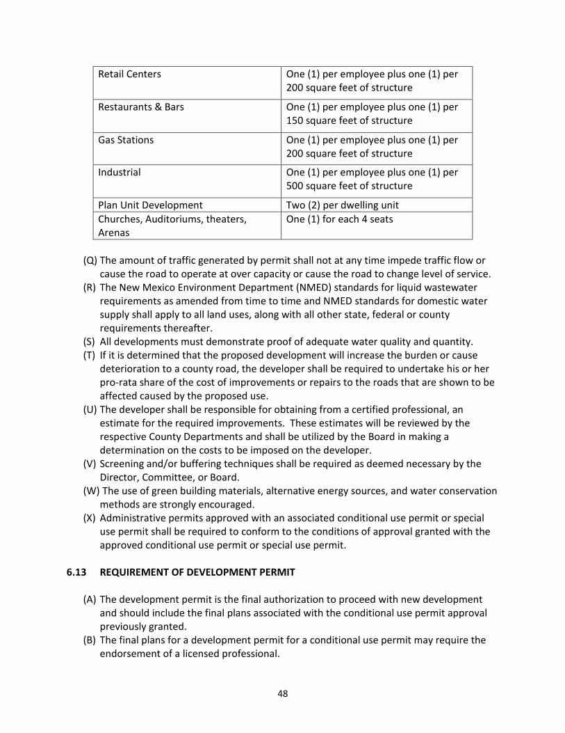
48
Retail Centers One (1) per employee plus one (1) per
200 square feet of structure
Restaurants & Bars One (1) per employee plus one (1) per
150 square feet of structure
Gas Stations One (1) per employee plus one (1) per
200 square feet of structure
Industrial One (1) per employee plus one (1) per
500 square feet of structure
Plan Unit Development Two (2) per dwelling unit
Churches, Auditoriums, theaters,
Arenas
One (1) for each 4 seats
(Q) The amount of traffic generated by permit shall not at any time impede traffic flow or
cause the road to operate at over capacity or cause the road to change level of service.
(R) The New Mexico Environment Department (NMED) standards for liquid wastewater
requirements as amended from time to time and NMED standards for domestic water
supply shall apply to all land uses, along with all other state, federal or county
requirements thereafter.
(S) All developments must demonstrate proof of adequate water quality and quantity.
(T) If it is determined that the proposed development will increase the burden or cause
deterioration to a county road, the developer shall be required to undertake his or her
pro-rata share of the cost of improvements or repairs to the roads that are shown to be
affected caused by the proposed use.
(U) The developer shall be responsible for obtaining from a certified professional, an
estimate for the required improvements. These estimates will be reviewed by the
respective County Departments and shall be utilized by the Board in making a
determination on the costs to be imposed on the developer.
(V) Screening and/or buffering techniques shall be required as deemed necessary by the
Director, Committee, or Board.
(W) The use of green building materials, alternative energy sources, and water conservation
methods are strongly encouraged.
(X) Administrative permits approved with an associated conditional use permit or special
use permit shall be required to conform to the conditions of approval granted with the
approved conditional use permit or special use permit.
6.13 REQUIREMENT OF DEVELOPMENT PERMIT
(A) The development permit is the final authorization to proceed with new development
and should include the final plans associated with the conditional use permit approval
previously granted.
(B) The final plans for a development permit for a conditional use permit may require the
endorsement of a licensed professional.

49
(C) No development permit for a special use permit shall be issued until the conditional use
permit has been approved by the Director consistent with the requirements of this
Ordinance.
(D) All conditions of approval or modifications imposed by the granting of a conditional use
permit shall be incorporated into the application for a development permit prior to the
development permit’s consideration for approval.
(E) A development permit for a special use permit may be applied for: (1) concurrently with
an application for a conditional use permit, or (2) separately, following issuance of a
conditional use permit by the Director.
(F) Applicants for a development permit associated with a special use permit shall submit
all of the required submittals required by Section 6.4 of this ordinance, as well as the
following:
(1) Approved and valid copies of all other federal, state, or local permits required.
(G) The application for a development permit shall be submitted along with the applicable
fee to the Director. The Director will review the application for completeness within
fifteen (15) working days.
(H) If an application for a development permit is deemed incomplete the Director will
provide a written determination to the applicant explaining why the application is
incomplete and the manner in which the application can be made complete. Applicants
shall have thirty working (30) days to submit the additional required materials unless
the County agrees in writing to a longer time period. If the required materials are not
submitted within the given time period, the application shall be deemed withdrawn and
the applicant will not be entitled to a refund of their application fees.
(I) The Director retains the discretion to solicit opinions from State, Federal, County or
other regulatory or reviewing agencies. The application may be deemed incomplete if
the reviewing agencies’ comments or applicable permits have not been received and in
the Director’s opinion are necessary in order to make an informed decision. If thirty (30)
days from the date of receipt of the application have expired and the reviewing
agency(s) have not responded, the Director may proceed with the review of the
application.
(J) Upon deeming the application complete, the Director shall render a decision on the
application within thirty (30) working days.
(K) A development permit application may be approved only if the contents of that
application meet the standards of the most current Uniform Building Code in effect, any
conditions of approval granted with the associated conditional use permit, and only if
the contents of that application meet the standards of this Ordinance and all other
applicable County Ordinances with respect to plans, submittal requirements, inspection
criteria and fees.
(L) The Director retains the discretion to refer the application for development permit to
the Planning and Zoning Committee and/or Board of County Commission for final review
and approval.
(M) For the required submittals, review process, criteria and design and development
standards, please see the Rio Arriba Oil and Gas Ordinance 2009-01.

50
6.14 BUSINESS LICENSE
(A) A business license shall be required prior to conducting business in the County.
(B) The Director or Board may require that all necessary road and utility infrastructure
improvements, including water and wastewater services constructed to NMED
standards shall be in place or bonded in an amount sufficient to assure completion of
the required improvements and in a form acceptable to the County prior to issuance of
a business license.
(C) Applicants for all business licenses shall submit a business license application form with
the following information for review in order to be considered for approval:
(1) Proof of paid taxes
(2) Tax Payer ID or CRS Number
(3) Applicant’s Name
(4) Physical address of business location
(5) Phone number
(6) Mailing address
(7) Business name
(8) Type of business
(9) Description of business activities
(10) Non-refundable business license fee
ARTICLE VII
PLANNING AND ZONING COMMITTEE AND BOARD OF COUNTY COMMISSIONERS
7.1 ESTABLISHMENT OF PLANNING AND ZONING COMMITTEE
(A) There is hereby established the Rio Arriba County Planning and Zoning Committee
(hereinafter, the “Committee”).
(B) The Committee shall consist of seven (7) members who shall be appointed by the Board
of County Commissioners. Administrative officials of the County, or other Counties or
Municipalities may be appointed as ex-officio-non-voting members of the Committee.
The members shall be appointed for terms of two (2) years. Vacancies occurring in the
Committee will be filled for the remainder of the unexpired term by the Board of County
Commissioners.
7.2 COMMITTEE RESPONSIBILITIES
(A) The Committee, in a public hearing, shall review and recommend approval, denial, or
approval with conditions of all special use permits, conditional use permit applications
referred by the Director, master plans, appeals, subdivisions, mobile-home parks,
variances, ordinances, regulations, planning documents and any public presentation as
per issues pertaining to nuisance, or hardship associated with land owners within the
County.

51
(B) The Committee, in a public hearing shall have the authority to approve, deny, or
approve with conditions a conditional use permit referred by the Director.
(C) The Committee, in a public hearing, shall have the authority to hear and take final action
on all appeals of the Directors decision.
(D) Additionally, the Committee may establish subcommittees of its membership for the
purpose of reviewing Planning and Zoning Department drafts of changes or
supplements to the Comprehensive Plan, and other land use ordinances as they arise.
All reviews shall be followed by a recommendation to the Board of County
Commissioners. Copies of the recommendation shall be made available to the public.
(E) The Committee shall hold at least one regular meeting per month. Regularly Scheduled
Meetings shall be held on the first Wednesday of every month at 1:30 p.m. Special
meetings may be called at any time in accordance with the Open Meetings Act of the
State of New Mexico. A quorum must be present in order for the Committee to take
action.
(F) Decisions made by the Committee may be appealed to the Board of County
Commissioners.
(G) The Committee shall hold a public hearing on any appeal of an administrative decision
when it is alleged that there is an error in the order, requirement or determination
made by the Director. The Committee shall make a recommendation to the Board of
County Commissioners to reverse, affirm, or modify the administrative decision.
(H) The Committee shall hold a public hearing on all requests for special use permits,
master plans and variances, and shall submit a record of the hearing along with its
recommendation to the Board of County Commissioners for final action.
7.3 COMMISSION RESPONSIBILITIES
(A) The Board of County Commissioners shall conduct a de novo public hearing to hear and
decide all matters previously before the Committee within sixty (60) calendar days after
the Committee recommendation. In the case of an administrative denial of a permit
request, such decision shall be final unless appealed to the Committee pursuant to the
appeal provisions of this ordinance.
(B) The Board of County Commissioners (hereinafter the “Board”) shall not be bound by any
recommendation of the Committee and shall have the final authority to interpret this
Ordinance, amend this Ordinance, approve administrative procedures, regulations and
fees, hear and approve, deny or approve with conditions all special use applications,
conditional use permit applications referred by the Director, variances, and all appeals
brought to the Board; and decide all other matters entrusted to the Board consistent
with State Law.
ARTICLE VIII
REQUIREMENT FOR PUBLIC HEARING AND PUBLIC NOTICE OF APPLICATION
8.1 PUBLIC HEARING REQUIRED

52
(A) The following shall require that separate public hearings be conducted by the Planning
and Zoning Committee and the Rio Arriba County Board of Commissioners, respectively:
(1) Special Use Permits;
(2) Variances;
(3) Appeals of administrative zoning decisions;
(4) Amendments to this ordinance or any other land use ordinance previously
promulgated by Rio Arriba County;
(5) Amendments to the Rio Arriba County Comprehensive Plan or any other planning
document previously promulgated by Rio Arriba County;
(6) Promulgation of any new land use ordinance;
(7) Promulgation of any new planning document;
(8) Any and all matters which the Director in his discretion refers to the Planning and
Zoning Committee and Board of County Commissioners;
(B) The following shall require that a public hearing be conducted by the Board of County
Commissioners:
(1) Appeals of Planning and Zoning Committee recommendations to the Board of
County Commissioners;
(2) All recommendations of the Planning and Zoning Committee to the Board of County
Commissioners;
(3) Any and all matters that the Board of County Commissioners exercises its discretion
to hear in order to be considered for approval.
8.2 REQUIREMENT OF PUBLIC NOTICE OF APPLICATION
(A) The following administrative permits may not require a public hearing, but they shall
require public notice of application:
(1) Conditional use permits
(B) The public notice of application shall include:
(1) The name of the applicant;
(2) the type of permit approval requested and the name of the project;
(3) legal description of the location requesting address including physical address and
UPC;
(4) the date by which the Director shall make their decision;
(5) the manner in which interested parties may submit comment to the Planning and
Zoning Department and the date by which comment must be submitted;
(6) the manner in which and the date by which an appeal of the Director’s decisions can
be made.
(C) The following requirements for providing public notice of application are as follows:
(1) Personal service of the notice of application sent to all property owners in the area
of notice. Personal service of notice may be accomplished by U.S. mail or courier
service. Notice provided by U.S. mail shall be sent certified with return receipts
requested. Notice provided by courier service shall confirm delivery;
(2) A copy of the notice of application shall be posted on the subject property in a
conspicuous location.

53
(D) The applicant shall be required to submit the following proof of public notice of
application to the Planning and Zoning Department within five (5) days of posting:
(1) Notarized affidavit of posting form provided by the Planning and Zoning
Department;
(2) Dated photograph of notice boards posted on property boundary;
(3) Proof of required postage to neighboring property owners
8.3 NOTICE OF PUBLIC HEARING
(A) Notice of all public hearings conducted pursuant to this ordinance or any other land use
ordinance promulgated by Rio Arriba County shall take place no less than fifteen (15)
days prior to the scheduled date of the hearing.
(B) Notice of all public hearings shall include:
(1) The name of the applicant;
(2) the type of permit approval requested and the name of the project;
(3) The date, time, place and subject matter of said public hearing.
(C) The following requirements for providing notice shall apply to all public hearings:
(1) Publication of notice of the public hearing in a newspaper of general circulation for
Rio Arriba County;
(2) Personal service of the notice of public hearing sent to all property owners in the
areas of notice. Personal service of notice may be accomplished by U.S. mail or
courier service. Notice provided by U.S. mail shall be sent certified with return
receipts requested. Notice provided by courier service shall confirm delivery;
(3) A copy of the notice of public hearing shall be posted on the subject property in a
conspicuous location.
(D) The applicant shall be required to submit the following proof of public notice to the
Planning and Zoning Department within five (5) days of posting:
(4) Notarized affidavit of posting form provided by the Planning and Zoning
Department;
(5) Dated photograph of notice boards posted on property boundary;
(6) Proof of required postage to neighboring property owners.
(E) The Director shall retain the discretion to determine which party to an application or
appeal shall be responsible for providing notice of the public hearing. The Director shall
communicate the obligation of providing notice to the responsible party within a
reasonable time prior to the expiration of the time limit established in the foregoing
section.
(F) The party responsible for providing notice of a public hearing shall provide proof of
compliance with the foregoing notice requirements to the Director.
8.4 AREA OF NOTICE DEFINED
(A) The following areas of notice shall apply:
(1) The area of notice for a conditional use permit shall be 500 feet from the edge of the
property or properties for which the conditional use permit is requested. The

54
owners of record of at least ten (10) surrounding properties shall be provided with
personal service of notice, and the area of notice shall be extended to include such
area as is required to include ten (10) separate owners of record.
(2) The area of notice for a special use permit or a master plan shall be one half (1/2)
mile from the edge of the property for which the special use permit is requested.
The owners of record of at least ten (10) surrounding properties shall be provided
with personal service of notice, and the area of notice shall be extended to include
such area as is required to include ten (10) separate owners of record.
(3) The area of notice for a variance shall be at the discretion of the Director, but is not
to exceed one (1) mile from the edge of the property for which the variance is
requested. The owners of record of at least ten (10) surrounding properties shall be
provided with personal service of notice, and the area of notice shall be extended to
include such area as is required to include ten (10) separate owners of record.
8.5 OPPORTUNITY TO BE HEARD
(A) All parties of interest, citizens of Rio Arriba County and public agencies shall have a
reasonable opportunity to be heard, to submit data, views or arguments, orally or in
writing, at any public hearing held in accordance with this ordinance or any other land
use ordinance promulgated by Rio Arriba County. Records shall be kept of all
proceedings of public bodies.
(B) All interested parties may submit comment regarding a notice of application to the
Planning and Zoning Department at any point prior to the
8.6 QUASI-JUDICIAL HEARINGS
(A) All public hearings shall be conducted as quasi-judicial hearings before the Committee
or the Board.
(B) A party as defined in this Ordinance shall be afforded an opportunity to present
evidence and argument in support of their position. The Committee or Board of County
Commissioners may impose reasonable limitations on the number of witnesses heard,
and on the nature and length of the testimony.
(C) The applicant shall have the opportunity to present their case, answer questions of the
public and the Commission and to rebut public testimony.
(D) All testimony shall be made under oath or affirmation as administered by the Director.
ARTICLE 9
SPECIAL USE PERMITS
9.1 GENERAL
(A) Special use permits are granted for proposed developments or uses that are not as
compatible because of size, intensity, and type of use and that may impact or affect

55
adjacent properties. The following types of development shall be considered for special
use permits:
(1) Large Scale Residential
(2) Large Scale Mixed Use
(3) Large Scale Commercial
(4) Large Scale Light industrial
(5) Heavy Industrial
(6) Towers
(7) Oil and gas development within the Frontier Overlay Zoning District
(B) The special use permit application process is designed to determine whether or not a
particular use is compatible with the surrounding area, and whether attaching certain
conditions to the use can increase compatibility and mitigate impacts.
(C) All applicants shall be required to have a pre-application meeting with Planning and
Zoning Staff prior to submitting their special use permit application.
9.2 REVIEW PROCESS AND CRITERIA FOR SPECIAL USE PERMITS
(A) The special use permit application shall be submitted along with the applicable fee to
the Director. The Director will review the application for completeness within thirty (30)
working days.
(B) If an application is deemed incomplete the Director will provide a written determination
to the applicant explaining why the application is incomplete and the manner in which
the application can be made complete. Applicants shall have thirty working (30) days to
submit the additional required materials unless the County agrees in writing to a longer
time period. If the required materials are not submitted within the given time period,
the application shall be deemed withdrawn and the applicant will not be entitled to a
refund of their application fees.
(C) Upon deeming the application complete, the Director shall review the application and
report findings on the application within sixty (60) working days.
(D) After the application has been reviewed by the Director and findings have been
reported, the applicant shall advertise in a form and manner as required by Article VIII
of this Ordinance.
(E) The Director retains the discretion to solicit opinions from State, Federal, County or
other regulatory or reviewing agencies. The application may be deemed incomplete if
the reviewing agencies’ comments or applicable permits have not been received and in
the Director’s opinion are necessary in order to make an informed decision. If sixty (60)
working days from the date of receipt of the application have expired and the reviewing
agency(s) have not responded, the Director may proceed to forward the application to
the Committee.
(F) The Director shall review the application and make their recommendation based on the
following criteria:
(7) Compliance with the goals and policies of the Comprehensive Plan.
(8) Compliance with the goals and policies, and standards of this Ordinance and any
other applicable land use ordinances, laws and regulations.

56
(9) Compatibility with adjacent and surrounding land uses.
(10) Mitigation techniques proposed to minimize any potential negative impacts of
the development.
(11) Maintenance or improvement of existing levels of service, including but not
limited to:
(a) Access
(b) Fire and emergency response
(c) Utilities
(12) Proposed resource management techniques to be employed
(G) The Director shall submit an analysis, written comments and a recommendation to the
Committee regarding the application.
(H) The application shall be reviewed at a public hearing of the Committee within forty-five
(45) working days from the issuance of the Director’s findings, provided the public
notice requirement in Article VIII of this Ordinance. At this time a compatibility
assessment will be discussed along with a recommendation to the Board of County
Commissioners.
(I) The Committee shall forward the application to the Board of County Commissioners
with the Committee’s recommendation. The Board of County Commissioners shall
review the application de novo at a public hearing within sixty (60) working days of the
Committee’s public hearing and approve, deny or approve with conditions. The Board
in its discretion may postpone a decision on an special use application pending further
review or the submission of further information.
9.3 REQUIRED SUBMITTALS FOR A SPECIAL USE PERMIT
(A) An application for all special use permits shall be submitted to the Director by the
applicant. Unless already required, the application shall include:
(1) All of the submittals required for a conditional use permit, as listed in Section 6.11 of
this Ordinance.
(2) Number of total acres disturbed and total acres taken out of production as a result
of the proposal.
(3) Soil survey including a description of soil type and prevalence as determined by the
NRCS and an analysis of the ability of the soil to support all aspects of the proposed
development.
(4) Wildlife and habitat quality report containing a narrative and supporting
documentation that contains at a minimum:
(a) An inventory of sensitive, threatened, and endangered species found in the area,
as identified on both Federal and State registries
(b) A review of whether or not the development is located in a key conservation
area, as mapped and defined by the New Mexico Department of Game and Fish
and the United States Fish and Wildlife Service.
(c) Analysis of how the development will impact wildlife and habitat in the affected
area and a description of the best management practices that will be used to
minimize those impacts.

57
(5) Hydrology report containing, at a minimum, the following information:
(a) Water source
(b) Water quality
(c) 40 year water plan
(d) Potential impairments to existing water rights
(e) Potential degradation of existing water quality
(f) Water conservation measures taken
(g) Office of State Engineer approval, if required
(6) Visual impact analysis to include the following:
(a) A description existing architectural style of the affected area.
(b) A photo of existing location.
(c) A description of how the proposed plan will not negatively impact the
surrounding view shed and how the proposed development meets the existing
architectural style.
(7) Methods to be used to minimize noise, vibration, smoke, odorous matter, toxic or
noxious matter.
(8) Hazardous waste disposal plan.
(9) A summary of anticipated traffic generation containing at a minimum, anticipated
trips and/or truck loads per day.
(10) An engineered drainage plan for all new proposed structures.
(B) Applicants for special use permits for mining should refer to the Rio Arriba County Sand
and Gravel mining Ordinance for a complete list of required submittals in addition to
those required by this Ordinance.
(C) Applicants for special use permits for oil or gas operations should refer to the Rio Arriba
County Oil and Gas Ordinance for a complete list of required submittals in addition to
those required by this Ordinance.
(D) The Director shall have the discretion to waive the requirement of certain submittals
that are not relevant or applicable to the proposed development.
(E) The Director shall have the discretion to request additional submittals, above and
beyond those required by this section, Section 9.3, if necessary to evaluate the
application’s compliance with all applicable design and development standards.
9.4 REQUIREMENT OF DEVELOPMENT PERMIT
(A) Except where a notice to proceed is required, the development permit is the final
authorization to proceed with new development and should include the final plans
associated with the special use permit approval previously granted.
(B) Applicants for an oil or gas special use permit shall be required to obtain a notice to
proceed as a final authorization to commence development. Please refer to the Oil and
Gas Ordinance.
(C) The final plans for a development permit for a special use permit may require the
endorsement of a licensed professional.

58
(D) No development permit for a special use permit shall be issued until the special use
permit has been approved by the Board consistent with the requirements of this
Ordinance.
(E) All conditions of approval or modifications imposed by the Board for a special use
permit shall be incorporated into the application for a development permit prior to the
development permit’s consideration for approval.
(F) The Board shall retain the discretion to require that a development permit related to an
application for a special use permit previously heard and authorized by the Board come
before the Committee and Board for final review and approval.
(G) A development permit for a special use permit may be applied for: (1) concurrently with
an application for a special use permit, or (2) separately, following issuance of a special
use permit by the Board.
(H) Applicants for a development permit associated with a special use permit shall reflect, in
the submittals required by Section 6.11 of this Ordinance, the incorporation of any
conditions of approval granted with the approval of the special use permit application
by the Board of County Commissioners.
(I) Applicants for a development permit associated with a special use permit shall submit
all of the required submittals required by Section 6.11 of this ordinance, as well as the
following:
(1) An engineered drainage plan prepared and stamped by a certified engineer and
grading plan including a terrain management plan pursuant to appendix G. of the
Land Subdivision Regulations.
(2) Approved and valid copies of all other federal, state, or local permits required.
(J) The application for a development permit shall be submitted along with the applicable
fee to the Director. The Director will review the application for completeness within
fifteen (15) working days.
(K) If an application for a development permit is deemed incomplete the Director will
provide a written determination to the applicant explaining why the application is
incomplete and the manner in which the application can be made complete. Applicants
shall have thirty working (30) days to submit the additional required materials unless
the County agrees in writing to a longer time period. If the required materials are not
submitted within the given time period, the application shall be deemed withdrawn and
the applicant will not be entitled to a refund of their application fees.
(L) The Director retains the discretion to solicit opinions from State, Federal, County or
other regulatory or reviewing agencies. The application may be deemed incomplete if
the reviewing agencies’ comments or applicable permits have not been received and in
the Director’s opinion are necessary in order to make an informed decision. If thirty (30)
days from the date of receipt of the application have expired and the reviewing
agency(s) have not responded, the Director may proceed with the review of the
application.
(M) Upon deeming the application complete, the Director shall render a decision on the
application within thirty (30) working days.
(N) A development permit application may be approved only if the contents of that
application meet the standards of the most current Uniform Building Code in effect, any

59
conditions of approval granted with the associated special use permit, and only if the
contents of that application meet the standards of this Ordinance and all other
applicable County Ordinances with respect to plans, submittal requirements, inspection
criteria and fees.
(O) The Director retains the discretion to refer the application for development permit to
the Planning and Zoning Committee and/or Board of County Commission for final review
and approval.
(P) For the required submittals, review process, criteria and design and development
standards, please see the Rio Arriba Oil and Gas Ordinance 2009-01.
9.5 DESIGN AND DEVELOPMENT STANDARDS FOR ALL SPECIAL USE PERMITS
(A) All special use permits shall comply with the minimum design and development
standards contained within this section, section 9.5.
(B) Except where there is a conflict between the minimum standards contained within this
section, Section 9.5, special use permit applications shall also comply with the design
and development standards required by Section 6.12 of this Ordinance.
(C) Internal roads shall be adequate to handle the proposed traffic that will be generated by
the proposed use.
(D) Private streets shall have a minimum surfacing width of twenty-four (24) feet.
(E) Dead end streets shall provide a turn around to accommodate all types of emergency
vehicles.
(F) Applications including large scale residential development shall provide a community
water system or shared wells and a community liquid waste system or shared septic
systems or advanced liquid waste systems for all individual liquid waste systems for all
residential units.
(G) The applicant shall comply with the design standards of their engineered drainage plan.
(H) For residential uses and institutional-residential uses having twenty-five (25) or more
dwelling units, open space shall be provided for parks and recreation.
(I) The minimum required lot width requirement for a special use permit shall be one
hundred (100) feet.
(J) The front twenty (20) feet of the lot shall be left in natural condition or developed as
landscaped area.
(K) The minimum width of a side yard shall be fifteen (15) feet.
(L) The minimum depth of a rear yard shall be twenty-five (25) feet.
(M) The maximum height of any building within the Industrial area shall be based upon the
practicability for safe fire-fighting as assessed by the fire department serving that area
except towers.
(N) Structures on lands with a special use permit that adjoin parcels on which residential
dwellings are located within one hundred (100) feet of the property line, shall be set
back twenty-five (25) feet from the property line and a minimum width of sixty (60) feet
and minimum depth of seventy (70) feet.
(O) Special use permits for heavy industrial uses abutting land occupied by any residential
use shall provide and maintain along said property line a continuous visual buffer. The

60
buffer shall be a compact evergreen hedge or other type of evergreen foliage screening,
or shall be combined fence and shrubbery screen tall enough to visually obscure the
industrial use from any residential structures and an area of five hundred (500) feet
around them but not extending beyond their lot line.
(P) Applicants for special use permits for mining should refer to the Rio Arriba County Sand
and Gravel mining Ordinance for a complete list of design and development standards in
addition to those required by this Ordinance.
(Q) Applicants for special use permits for oil or gas operations should refer to the Rio Arriba
County Oil and Gas Ordinance for a complete list of design and development standards
in addition to those required by this Ordinance.
ARTICLE X
MASTER PLANS FOR A PLANNED UNIT DEVELOPMENT
10.1 GENERAL
(A) Master plans apply to proposed projects with more than one (1) development phase or
such other projects which may elect to apply for master plan approval.
(B) A master plan is comprehensive in establishing the scope of a project, yet is less detailed
than the submittal requirements for a development permit.
(C) The Master Plan provides a means for the Committee and the Board to review projects
and the developer to obtain concept approval for a proposed development without the
necessity of expending large sums of money for required submittals for special use
permit, subdivisions and development permit approval.
(D) The master plan also provides a means for the applicant to propose and seek Board
approval for, design and development standards not contemplated by this Ordinance
and which would be specific to development subject to the master plan.
(E) Approved master plans will be required to obtain subsequent special use permit and/or
conditional use permit and development permit approval, which shall be required to
incorporate any and all conditions of the master plan approval, prior to commencing
development.
10.2 REVIEW PROCESS AND CRITERIA FOR A MASTER PLAN
(A) The application shall be submitted along with the applicable fee to the Director. The
Director will review the application for completeness within fifteen (15) working days.
(B) If changes, amendments or additional information are required to complete the
application or are otherwise requested by the Director, the applicant shall be notified
and shall submit the necessary or requested information for review as soon as possible.
(C) After the application is deemed complete by the Director, the applicant shall advertise
in a form and manner as provided in Article VIII of this Ordinance.
(D) The Director retains the discretion to solicit opinions from State, Federal, County or
other regulatory or reviewing agencies. The application may be deemed incomplete if
the reviewing agencies’ comments or applicable permits have not been received and in

61
the Director’s opinion are necessary in order to make an informed decision. If thirty (30)
days from the date of receipt of the application have expired and the reviewing
agency(s) have not responded, the Director may proceed to forward the application to
the Committee.
(E) The Director shall submit an analysis, written comments and a recommendation to the
Committee regarding the application.
(F) The application shall be reviewed at a public hearing of the Committee at its next
available meeting.
(G) The Committee shall forward the application to the Board of County Commissioners
with the Committee’s recommendation. The Board of County Commissioners shall
review the application de novo at a public hearing within sixty (60) days of the
Committee’s public hearing and approve, deny or approve with conditions. The Board
in its discretion may postpone decision on an application pending further review or the
submission of further information.
(H) When considering an application for a master plan, particular consideration will be paid
to the following:
(1) Suitability of the land to contain the proposed development.
(2) Impact to adjacent properties.
(3) Viability of the proposed phases of the project to function independently where
subsequent phases of the project are not approved or constructed.
10.3 REQUIRED SUBMITTALS FOR A MASTER PLAN
(A) An application for a master plan shall be submitted to the Director by the applicant. The
application shall include the following:
(1) Vicinity map drawn at a scale of not more than 2,000 feet to one inch showing
contours at twenty (20) feet intervals showing the relationship of the site to its
general surroundings, and the location of all existing drainage channels, water
courses and water bodies located on the parcel and within three (3) miles of the
parcel.
(2) A description and map of existing conditions on or adjacent to the site, to include
the following:
(a) Boundary Lines; bearings and distances.
(b) Easements; locations, width and purpose.
(c) The locations of all street and road names or numbers on or immediately
adjacent to the tract.
(d) Utilities on or immediately adjacent to the tract.
(3) Proof of ownership; warranty deed, real estate contract, title or certificates.
(4) A conceptual environmental plan, to include the following:
(a) Graphic representation of existing topography, natural features, slopes and flood
plain areas.
(b) Soil maps and report from Soil Conservation Service.
(c) Recreational and/or open space plan, or landscaping concepts.
(5) Liquid waste disposal plan.

62
(6) Water budget and supply plan.
(7) Solid Waste Plan.
(8) Master Plan development map depicting the proposed development in sketch form,
to include the following:
(a) Proposed vehicular and pedestrian circulation system
(b) Designation and description of proposed land uses by type, area and density
(c) Proposed site for community facilities.
(9) A phasing schedule for the master plan giving a general description of each phase of
the development.
(10) Utilities plan.
(11) Master Plan report, to include the following:
(a) The need and demand for the proposed development
(b) Public costs, operating expenses, revenues attributable to the proposed project
(c) The effects of the proposed development on natural resources and natural
features.
(d) Preliminary traffic analysis
(e) Outline or summary of restrictive covenants, (If applicable).
(12) Fire protection and emergency response plan.
ARTICLE XI
VARIANCES
11.1 GENERAL
Applications for a variance shall be submitted, reviewed, and processed, according to the same
process set forth in Section 9.2 of this Ordinance.
11.2 CRITERIA FOR VARIANCES
(A) The Board shall review applications for a variance in accordance with the following
criteria, each of which must be met:
(1) There exists exceptional or extraordinary physical conditions of the subject property,
such as irregularity, narrowness, topography or slope;
(2) because of the exceptional or extraordinary physical conditions of the subject
property, a strict application of the requirements or standards in this Ordinance
would create an undue hardship upon the applicant for the variance;
(3) The undue hardship is not self-imposed;
(4) The applicant for the variance is not attempting to ameliorate or accommodate a
condition, restriction, need, desire or hardship that is personal to the applicant;
(5) The variances, if granted, will not adversely affect the use or enjoyment of property
owned, occupied or used by persons other than the applicant;
(6) The variance, if granted, is in keeping with the intent and purposes of this Ordinance
and the Comprehensive Plan;
63
(7) The variance, if granted, will not adversely affect the health, safety and welfare of
the citizens of the County;
(8) The variance, if granted, constitutes the minimum easing of the requirements or
standards of this Ordinance in order to eliminate the undue hardship that the
applicant would otherwise suffer from a strict application of the requirements or
standards of this Ordinance from which the variance is required.
11.3 APPLICATION FOR VARIANCE
(A) Applications for a variance shall be made by completing application form(s) to be
prepared and approved by the Director and shall include such information as is
necessary to demonstrate the need for the variance in accordance with the criteria set
forth in this Article.
(B) The application for a variance must be submitted simultaneously with the application
for a special use permit or a development permit.
(C) Applications for variances will not be considered until the corresponding application for
a special use permit or development permit is deemed by the Director to be complete
as provided by this Ordinance.
(D) The Director may require the submission of such additional information as he considers
appropriate for the review and process of an application for a variance.
(E) Requests for variances will be reviewed first at a public hearing by the Committee for its
recommendation to the Board as whether the variance should be approved, approved with
conditions or denied and then by at a public hearing before the Board for its approval,
denial or approval with conditions in accordance with this Ordinance.
(F) Notice for public hearings on requests for variances shall be made in accordance with
Article VIII of this Ordinance. The applicant for a variance shall bear the costs associated
with the provision of notice required by this Ordinance.
(G) The applicant shall bear the burden of proof and shall be responsible for establishing the
need for the variance in accordance with the criteria set forth in this Section.
(H) The Board may impose conditions on the granting of any variance as necessary to carry
out the intent and purposes of this Ordinance, to protect the public health and welfare
or to ensure that any variance, when implemented, complies with the criteria for the
granting of a variance set forth in this Article.
11.4 EXPIRATION OF VARIANCES
Variances shall expire if the particular construction, development or improvement for which the
variance was requested is not substantially completed within one year after the date on which
the Board acted to grant the variance.
ARTICLE XII
APPEALS
12.1 GENERAL

64
There shall be no opportunity to appeal a recommendation, only final decisions may be
appealed.
12.2 APPEALS OF ADMINISTRATIVE DECISION
(A) Any person aggrieved by a decision of the Director may file an appeal to the Planning
and Zoning Committee.
(B) All appeals of administrative decisions shall be made within fifteen (15) days of the
decision date.
(C) Appeals shall be submitted to the Director in writing and shall include the following:
(1) The name of the individual filing the appeal;
(2) The date of the appeal;
(3) The decision from which the appeal is taken;
(4) The grounds for the appeal;
(5) Appeals fee.
(D) Once a timely appeal has been filed, a public hearing before the Planning and Zoning
Committee shall be conducted to review the administrative decision. The hearing shall
be scheduled for the next regularly-scheduled meeting of the Committee for which the
notice requirements of a public hearing can be met.
12.3 APPEALS OF PLANNING AND ZONING COMMITTEE RECOMMENDATION
(A) All matters heard by the Planning and Zoning Committee shall be heard de novo by the
Board of County Commissioners within sixty (60) days from the date of the Committee
hearing.
(B) Appeals of Planning and Zoning Committee recommendations shall be submitted to the
Director in writing and shall include the following:
(1) The name of the individual filing the appeal;
(2) The date of the appeal;
(3) The decision from which the appeal is taken;
(4) The grounds for the appeal;
12.4 APPEALS OF THE BOARD OF COUNTY COMMISSIONERS DECISION
(A) All appeals from decisions of the Board of County Commissioners shall be governed by
applicable New Mexico state statutes.
ARTICLE XIII
ADMINISTRATION AND ENFORCEMENT
13.1 GENERAL

65
(A) It shall be unlawful to construct, reconstruct, enlarge, change, maintain or use any
building or to use any land in violation of any regulation or any provision of this
Ordinance or any other applicable County ordinance or of any amendments thereto.
(B) Any person, firm, corporation or entity that violates any provision of this Ordinance
shall be subject to the penalties set forth in NMSA 1978, § 4-37-3 (1993)(as amended),
which states in part: “County ordinances may be enforced by prosecution for violations
of those ordinances in any court of competent jurisdiction of the county. Penalties for
violations of any county ordinances shall not exceed a fine of three hundred dollars
($300) or imprisonment for ninety days or both the fine and imprisonment;”
(C) The violation of any separate provision of this Ordinance shall be considered a separate
offense, and each day the violation is allowed to continue shall be considered a
separate offense.
13.2 COMPLAINTS, INVESTIGATION OF VIOLATIONS AND RIGHT OF ENTRY
(A) Whenever the Director receives a written, signed or verbal complaint alleging a violation
of the Ordinance, he shall investigate the complaint and take whatever action is
warranted.
(B) The Director and all his staff and all persons designated by him are authorized to go
upon lands within the County to make investigations of the laws, ordinances and
regulations enacted or subject to enforcement by the County and to issue citations and
to enforce this ordinance and any other applicable county ordinance. Such persons
entering such lands pursuant to this ordinance shall not be liable for civil actions in
trespass or for acts done in discharge of their duties.
13.3 PROCEDURES UPON DISCOVERY
(A) If the Director finds that any provision of this Ordinance is being violated, the Director
shall:
(1) Send a written notice to the person responsible for such violation, indicating the
nature of the violation and ordering the action necessary to correct it. Additional
written notices may be sent at the Director’s discretion.
(2) The final written notice (the initial written notice may be the final written notice)
shall be a citation charging the violation and shall advise that the Director’s decision
or order may be appealed to the Committee.
(B) In cases when delay would seriously threaten the effective enforcement of the
Ordinance or pose a danger to the public health, safety or general welfare, the Director
may seek enforcement without prior written notice or opportunity to appeal to the
Committee.
(C) Citations may be issued by the code enforcement officer of the County or any employee
or employees of the County authorized by the Director or Board to issue such citations.
13.4 REVOCATION OF PERMIT

66
Notwithstanding any other penalty or remedy provided for in this Section, the County may,
upon finding a violation of provisions of this Ordinance or any provision or condition of any
special use permit, conditional use permit, or development permit, revoke or suspend any
special use permit or development permit that the County finds to be violation upon the
same notice and public hearing requirements set forth in this Ordinance. The County
may also revoke any special use permit or development permit if it is determined
that the applicant provided false, misleading, deceptive or inaccurate information and/or
documentation to secure issuance of such special use permit or development permit.
13.5 INJUNCTION, ABATEMENT, AND OTHER REMEDIES
In the event that any building is, or is proposed to be, located, erected, constructed,
reconstructed, enlarged, changed, maintained or used in violation of this Ordinance, the
Comprehensive Plan, or any other applicable ordinance, or any amendments thereto, the
Committee, the Board of County Commissioners, the District Attorney, or any adjacent or
neighboring property owner who would be damaged by such violation, in addition to other
remedies provided by law, may seek an injunction, mandamus, or abatement of activity, or
pursue any other appropriate action, actions or proceedings to prevent, enjoin, abate or
remove such unlawful location, erection, construction, reconstruction, enlargement, change,
maintenance or use. The remedies provided herein shall be cumulative and not exclusive.
13.6 VESTED DUTY TO ENFORCE
All departments, officials, and public employees of the County which are vested with the duty
or authority to issue permits or undertake actions pursuant to the terms of this Ordinance shall
conform to the provisions of this Ordinance and shall not issue permits or undertake such
actions where the same would be in conflict with the provisions. It shall be the duty of the
Director, the County Sheriff, the County Attorney or their designated agents to enforce or cause
to be enforced the provisions of this Ordinance.
ARTICLE XIV
MISCELLANEOUS
14.1 SEVERABILITY
The provisions of this Ordinance are severable, and if any provision, sentence, clause, section,
or any part thereof, is held illegal, invalid, unconstitutional, or inapplicable to any person or
circumstance, the illegality, invalidity, unconstitutionality or inapplicability shall not affect or
impair any of the remaining provisions, sentences, clauses, sections, or parts of this Ordinance
or their application to other persons or circumstances. It is hereby declared to be the intent of
the Board of County Commissioners that this Ordinance would have been adopted even if such
illegal, invalid, or unconstitutional provision, sentence, clause, section or part had not been
included therein, and as if the person or circumstances to which the Ordinance or any part
thereof had been specifically exempted therein.

67
14.2 REPEAL/SURVIVOR
(A) The predecessor ordinances to this Ordinance reviewed and recommended for approval
by the County Planning and Zoning Committee on July 27, 1995 and adopted by the
Board of County Commissioners on August 31, 1995 and subsequently made permanent
on July 31, 1997 (the “predecessor ordinances”) and known as Design and Development
Regulation System County Ordinance No. 1996-01, and the Design and Development
Regulation System Ordinance No. 2009-09, are repealed.
(B) However, with respect to violations of the predecessor ordinances that have occurred
prior to the effective date of this Ordinance, those ordinances with respect to those
violations shall remain in full force and effect and the County may seek enforcement or
penalties for violation pursuant to their terms. In addition, provisions of other existing
County Ordinances are repealed, but only to the extent they are in conflict with
provisions of this Ordinance in that they impose less strict standards than this
Ordinance.
14.3 AMENDMENTS TO ORDINANCE
(A) Whenever a request to amend the text of this Ordinance is initiated by the Board of
County Commissioners, the Committee or the Director, the request shall be made at a
regularly scheduled meeting of either body and forwarded in writing to staff who shall
draft an appropriate revision.
(B) Any other person may also petition the Board to amend the text of this Ordinance. Any
property owner, lessee, developer or any other person may, by a petition submitted
through the Director, request the Committee to consider amendments to any section of
the text of this Ordinance or any regulations established under this Ordinance.
(C) The Committee will consider the requested amendments at a public meeting.
(D) This Ordinance may not be amended or repealed until the Board conducts a public
hearing.
(E) The Committee shall, conduct a public hearing prior to the Board’s public hearing on the
proposed amendments. The purpose of the public hearing by the Committee shall be to
consider public comments and opinions, and to consider the recommendations of the
citizens of the County. The Committee shall make its recommendation at the public
hearing and transmit its recommendation to the Board. Copies of the recommendation
shall be made available to the public.
(F) The Board shall conduct a de novo public hearing for the purpose of considering the
recommendation of the Committee, to consider public comments and opinions, and to
render a decision regarding the proposed amendments. This public hearing shall take
place at the Board’s next available public meeting following receipt of the Committee’s
recommendation.
(G) When reviewing proposed amendments to this Ordinance, the Committee and the
Board may consider, but are not limited to, the following:

68
(1) Whether the amendments would implement a new portion of the Comprehensive
Plan;
(2) Whether the amendments would implement and better achieve the goals and
objectives of the Comprehensive Plan;
(3) Whether the amendments are necessary in order to respond to State and/or Federal
legislation;
(4) Whether the amendments provide additional flexibility in meeting the objectives of
this Ordinance without lowering the general standards of this Ordinance.
14.4 EFFECTIVE DATE
Pursuant to § 4-37-7 NMSA 1978 it is hereby declared by the Board of County
Commissioners of Rio Arriba County that there is an immediate danger to the public health,
safety and welfare of Rio Arriba County and therefore this Ordinance shall take effect
immediately upon signature by the County Commissioners, signature and recording by the
County Clerk and publication by title and general summary in newspaper of general
circulation in Rio Arriba County.

EXHIBIT A – County Rural Agricultural District (CRAD)
69
!76
1
2
3
5
4
6
7
9
8
10
11
12
13
14
15
16
17
18
19
20
21
22
23
24
25
26
27
28
2930Navajo Indian
Reservation
Santa Clara
PuebloSan Juan
Pueblo
Chama
Village
City of
Española
"
!68!96
!595!537
!112
!527
!17
!221
!112!95
!115
!111 !519
!554
!110
!512
Jicarilla
Apache
Indian
Reservation
64
64
84
64
84
285
84
84285
6484
6484
550
Rio Arriba County Zoning Map Residential & Agricultural
ðñ×Þ
ÊÚ
JICARILLA APACHE RESERVATION
NAVAJO INDIAN RESERVATION
SAN JUAN INDIAN PUEBLO
SANTA CLARA INDIAN PUEBLO
CHAMA VILLAGE
ESPAÑOLA
AGRICULTURAL
RESIDENTIAL
COMMERCIAL
INDUSTRIAL
NEW ZONING CHANGES
ROADS
RIO ARRIBA COUNTY POST OFFICES
1 8 7010-ABQUIU POST OFFICE
2 8 7511-ALCALDE POST OFFICE
3 8 7515-CANJILON POST OFFICE
4 8 7516-CANONES POST OFFICE
5 8 7518-CEBOLLA POST OFFICE
6 8 7520-CHAMA POST OFFICE
7 8 7522-CHIMAYO POST OFFICE
8 8 7523-CORDOVA POST OFFICE
9 8 7012-COYOTE POST OFFICE
10 8 7527-DIXON POST OFFICE
11 8 7528-DULCE POST OFFICE
12 8 7530-EL RITO POST OFFICE
13 8 7531-EMBUDO POST OFFICE
14 8 7532-ESPAÑOLA POST OFFICE
15 8 7533-FAIRVIEW POST OFFICE
16 8 7017-GALLINA POST OFFICE
17 8 7537-HERNANDEZ POST OFFICE
18 8 7539-LA MADERA POST OFFICE
19 8 7541-LAS TABLAS POST OFFICE
20 8 7029-LINDRITH POST OFFICE
21 8 7551-LOS OJOS POST OFFICE
22 8 7547-LUMBERTON POST OFFICE
23 8 7548-MEDANALES POST OFFICE
24 8 7554-PETACA POST OFFICE
25 8 7566-SAN JUAN PUEBLO POST OFFICE
26 8 7575-TIERRA AMARILLO POST OFFICE
27 8 7578-TRUCHAS POST OFFICE
28 8 7581-VALLECITOS POST OFFICE
29 8 7582-VELARDE POST OFFICE
30 8 7064-YOUNGSVILLE POST OFFICE
ZONING LEGEND
US HIGHWAYS
! STATE HIGHWAYS
N
EW
S
August 26, 1999Exhibit ASection VIOrdinance 2000-01
PLANNING & ZONING DEPARTMENT

EXHIBIT B – Riparian/Floodplain Overlay Zoning District (RFOZD)
70

EXHIBIT C – Headwaters Overlay Zoning District (HOZD)
71

EXHIBIT D – Irrigated Agricultural Lands overlay Zoning District (IAOZD)
72

EXHIBIT E – Energy Resource Development Overlay Zoning District (ERDOZD) and Frontier Overlay Zoning
District (FOZD)
73

74
REVIEWED, APPROVED, AND ADOPTED ON THIS _______ DAY OF _______, 2010, BY THE RIO
ARRIBA BOARD OF COUNTY COMMISSIONERS.
BOARD OF COUNTY COMMISSIONERS
RIO ARRIBA COUNTY, NEW MEXICO
_____________________________________
ELIAS CORIZ
DISTRICT I COMMISSIONER
_____________________________________
ALFREDO MONTOYA
DISTRICT II COMMISSIONER
_____________________________________
FELIPE MARTINEZ
DISTRICT III COMMISSIONER
ATTEST:
____________________________
MOISES A. MORALES, JR., COUNTY CLERK
CERTIFICATE OF FILING:
I, MOISES A. MORALES, JR., County Clerk, do hereby certify that the foregoing Ordinance
designated as Ordinance 2011-01 was filed in my office on the __ day of _____ in Book
Number.
____________________________
MOISES A. MORALES, JR., COUNTY CLERK