repo rt of the working grou p on - planning...
TRANSCRIPT
REPO
SUST
ORT OF
TAINM
F THE
NABLEMANA
AS INPU
PL
G
SUB
LANNIN
GOVERN
NE
2nd
WOR
E GRAGEM
UT TO 12T
RKING
ROUNMENT
TH PLAN
BMITTED
NG COM
NMENT O
EW DEL
d October 20
G GROU
NDWAT
UP ON
ATER
D TO
MMISSIO
OF INDI
LHI
011
N
ON
IA

Working Group: Sustainable Groundwater Management 1
MEMBERS OF WORKING GROUP ON
SUSTAINABLE GROUNDWATER MANAGEMENT
DR. HIMANSHU KULKARNI, EXECUTIVE DIRECTOR, ADVANCED CENTER FOR WATER RESOURCES DEVELOPMENT AND MANAGEMENT, PUNE
CHAIRMAN
DR. S. C. DHIMAN, CHAIRMAN, CENTRAL GROUND WATER BOARD, NEW DELHI
CO-CHAIRMAN
MR. SUDHIR GARG, JOINT SECRETARY, MINISTRY OF WATER RESOURCES, NEW DELHI
MEMBER SECRETARY
MR. P. S. VIJAY SHANKAR, SAMAJ PRAGATI SAHAYOG, BAGLI (M.P.)
MEMBER
MR. T. M. VIJAY BHASKAR, JOINT SECRETARY, DEPARTMENT OF DRINKING WATER SUPPLY, MINISTRY OF RURAL DEVELOPMENT, NEW DELHI
MEMBER
MR. S. KUNAR, MEMBER (SAM) AND DIRECTOR, RAJIV GANDHI NATIONAL GROUNDWATER TRAINING INSTITUTE, NEW DELHI
MEMBER
DR. SUNDERRAJAN KRISHNAN, DIRECTOR, INREM FOUNDATION, ANAND (GUJARAT)
MEMBER
PROF. AMITA SINGH, CHAIRPERSON, CENTRE FOR STUDY OF LAW & GOVERNANCE, JAWAHAR LAL NEHRU UNIVERSITY, NEW DELHI
MEMBER
DR. V. M. TIWARI, SCIENTIST-EI, NATIONAL GEOPHYSICAL RESEARCH INSTITUTE, HYDERABAD
MEMBER
MR. V. PAUL RAJA RAO, CHAIRMAN, BHARTI INTEGRATED RURAL DEVELOPMENT SOCIETY, NANDYAL (A.P.)
MEMBER
MR. YOGESH JADEJA, SECRETARY, ARID COMMUNITIES & TECHNOLOGIES, BHUJ (GUJARAT)
MEMBER
DR. P. K. MEHROTRA, DIRECTOR(WQ), MINISTRY OF WATER RESOURCES, NEW DELHI
CO-OPT MEMBER
MR. B. M. MURALI KRISHNA RAO, DIRECTOR, ANDHRA PRADESH STATE GROUNDWATER DEPARTMENT, HYDERABAD (A.P.)
MEMBER
MR. K. M. NAGARGOJE, DIRECTOR, GROUNDWATER SURVEYS AND DEVELOPMENT AGENCY, GOVERNMENT OF MAHARASHTRA, PUNE
MEMBER
MR. A.B. PANDEY, COMMISIONER(PROJECTS), MINISTRY OF WATER RESOURCES, NEW DELHI
MEMBER
Working Group: Sustainable Groundwater Management 2
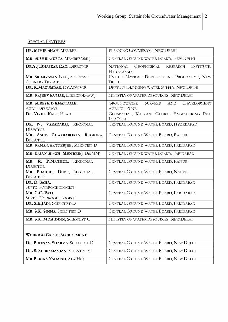
SPECIAL INVITEES
DR. MIHIR SHAH, MEMBER PLANNING COMMISSION, NEW DELHI
MR. SUSHIL GUPTA, MEMBER(SML) CENTRAL GROUND WATER BOARD, NEW DELHI
DR.Y.J.BHASKAR RAO, DIRECTOR NATIONAL GEOPHYSICAL RESEARCH INSTITUTE, HYDERABAD
MR. SRINIVASAN IYER, ASSISTANT COUNTRY DIRECTOR
UNITED NATIONS DEVELOPMENT PROGRAMME, NEW DELHI
DR. K.MAZUMDAR, DY.ADVISOR DEPT.OF DRINKING WATER SUPPLY, NEW DELHI.
MR. RAJEEV KUMAR, DIRECTOR(GW) MINISTRY OF WATER RESOURCES, NEW DELHI
MR. SURESH B KHANDALE, ADDL. DIRECTOR
GROUNDWATER SURVEYS AND DEVELOPMENT AGENCY, PUNE
DR. VIVEK KALE, HEAD GEOSPATIAL, KALYANI GLOBAL ENGINEERING PVT. LTD PUNE
DR. N. VARADARAJ, REGIONAL DIRECTOR
CENTRAL GROUND WATER BOARD, HYDERABAD
MR. ASHIS CHAKRABORTY, REGIONAL DIRECTOR
CENTRAL GROUND WATER BOARD, RAIPUR
MR. RANA CHATTERJEE, SCIENTIST-D CENTRAL GROUND WATER BOARD, FARIDABAD
MR. BAJAN SINGH, MEMBER(ED&MM) CENTRAL GROUND WATER BOARD, FARIDABAD
MR. R. P.MATHUR, REGIONAL DIRECTOR
CENTRAL GROUND WATER BOARD, RAIPUR
MR. PRADEEP DUBE, REGIONAL DIRECTOR
CENTRAL GROUND WATER BOARD, NAGPUR
DR. D. SAHA, SUPTD. HYDROGEOLOGIST
CENTRAL GROUND WATER BOARD, FARIDABAD
MR. G.C. PATI, SUPTD. HYDROGEOLOGIST
CENTRAL GROUND WATER BOARD, FARIDABAD
DR. S.K.JAIN, SCIENTIST-D CENTRAL GROUND WATER BOARD, FARIDABAD
MR. S.K. SINHA, SCIENTIST-D CENTRAL GROUND WATER BOARD, FARIDABAD
MR. S.K. MOHIDDIN, SCIENTIST-C MINISTRY OF WATER RESOURCES, NEW DELHI
WORKING GROUP SECRETARIAT
DR POONAM SHARMA, SCIENTIST-D CENTRAL GROUND WATER BOARD, NEW DELHI
DR. S. SUBRAMANIAN, SCIENTIST-C CENTRAL GROUND WATER BOARD, NEW DELHI
MR.PERIKA YADAIAH, STA(HG) CENTRAL GROUND WATER BOARD, NEW DELHI

Working Group: Sustainable Groundwater Management 3
The Working Group on Sustainable Groundwater Management was formally constituted by Planning Commission, Government of India on 15 October 2010. The group conducted its proceedings through 7 meetings conducted as follows:
Meeting date Venue
8 December 2011 Conference room, Central Ground Water Board, Jamnagar House, New Delhi
24 January 2011 Conference room, Central Ground Water Board, Jamnagar House, New Delhi
24 February 2011 Conference room, National Geophysical Research Institute, Hyderabad (Hosted by NGRI)
6 March 2011 Conference room, Central Ground Water Board, Jamnagar House, New Delhi
6 April 2011 Conference room, Central Ground Water Board, Jamnagar House, New Delhi
24 May 2011 YASHADA, Baner Road, Pune (Hosted by ACWADAM)
21 June 2011 Conference room, Central Ground Water Board, Jamnagar House, New Delhi
A larger consultation was also held in Pune on 22nd and 23rd May 2011, based on the work conducted by the Working Group. This consultation was designed as a project-end seminar conducted by ACWADAM about its groundwater management research in Madhya Pradesh. About 100 participants representing 48 organisations (Government, Civil Society and Educational – Research Institutions) discussed the salient aspects of groundwater and groundwater management in India around key presentations made by various experts, many of whom were members of the Working Group. The salient discussions from the seminar1 were immediately carried over into the formal meeting of the Working Group on 24th May 2011.
1 The seminar was attended by about 100 people from different parts of India and included Government
Agencies, Research and Education Institutions and Civil Society Organisations. Financial support for the Pune
seminar was provided by Planning Commission (Government of India) and by Sir Dorabji Tata Trust, Ford
Foundation and Arghyam Trust through grants to ACWADAM, Pune.

Working Group: Sustainable Groundwater Management 4
EXECUTIVE SUMMARY The report on “Sustainable Groundwater Management” is the outcome of rigorous
work carried out by of the Working Group set up by the Planning Commission as a part of the process to prepare the 12th Five Year Plan. The main features of the report are summarised below.
The existing methodology of groundwater resources assessment is appropriate and suitable for country-wide groundwater resources estimation, considering the present status of database available with the Central and State agencies. However, the following corrective / additional measures are suggested.
Alternative techniques of recharge estimation should be taken up in areas where assessments derived through GEC do not match with the field situations.
Micro-watershed (hard rock areas) and doab (alluvial areas) - wise assessment based on actual field estimation of recharge and discharge parameters (GEC-1997) to be taken up in few identified areas.
Utilize regional scale assessment methods like space-based measurements for validation.
All data elements need strengthening and refinements through R&D support in the form of Project Based Studies (Regional and Local scales) and should be dovetailed with the County’s Ground Water Resource Assessment. For instance,
Studies on Estimation of baseflow, recharge from streams, inflow-outflow across assessment boundary to be taken up on Pilot basis in select areas.
Continuous strengthening of database managed by the Central/ State Governments for groundwater resources estimation is required. Benchmarking of the data elements needs to be established in this regard.
To develop prognostic models of resource estimates in changing climate. • There must be a convergence of assessment of ground water in terms of quantity and
quality, for accurate estimation. • Groundwater resources assessment should be an iterative process involving evaluation
and refinement by incorporating new techniques and giving due consideration to climate change.
Aquifers are the repositories of ground water resources, hence Aquifer Mapping has been given due consideration for sustainable management of ground water in the 12th plan. Toposheets will be the base while initiating the mapping of aquifers. Aquifer mapping at the scale of 1:50000 should be initiated. Such mapping can be taken up at appropriate scales (higher or lower) as per specific requirements. Aquifer mapping shall be taken up as part of the 12th Plan as a co-ordinated effort. Led by CGWB and in close co-ordination with other organisations including research institutes and civil society organisations, aquifer mapping must lead to comprehensive groundwater management plans.

Working Group: Sustainable Groundwater Management 5
Comprehensive plan for participatory groundwater management based on the understanding and outcome of aquifer mapping shall be taken up. Stakeholders should be motivated through appropriate mechanisms by exploring the possibility of a dedicated programme on groundwater or implementation through other appropriate programmes.
Creation of state-level institutions to manage groundwater is suggested. There will be a parity of design and mandate in the development of such State level institutions, based on existing good practice. The working group also suggests creation of a network of institutions to facilitate the process of groundwater management. Strengthening the mandate and design of institutions dealing with groundwater to enable them to perform their roles is strongly recommended. Such strengthening will also draw from the fields of participatory management of resource, social science and economics.
Strengthening of Ground Water Monitoring Network by increasing density and frequency of monitoring points for ground water level and water quality is recommended. A combination of participatory measurement as well as automation shall be taken up during such strengthening. Strengthening of institutions dealing with groundwater in terms of manpower/professionals and design is recommended to enable them to perform their roles.
The technological advancements being utilized worldwide should be introduced in CGWB to upgrade the institutional, infrastructural and human resource capabilities and bring CGWB to an international level, with best possible techniques and technologies for better management of ground water resources in the country.
It is suggested that Planning Commission constitute a system at the apex level to bring coherence among different ministries dealing with groundwater, in an attempt to ensure improved groundwater management and governance.
Working Group: Sustainable Groundwater Management 6
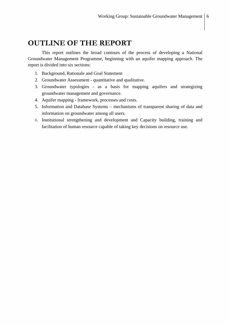
OUTLINE OF THE REPORT This report outlines the broad contours of the process of developing a National
Groundwater Management Programme, beginning with an aquifer mapping approach. The report is divided into six sections:
1. Background, Rationale and Goal Statement 2. Groundwater Assessment - quantitative and qualitative. 3. Groundwater typologies - as a basis for mapping aquifers and strategizing
groundwater management and governance. 4. Aquifer mapping - framework, processes and costs. 5. Information and Database Systems – mechanisms of transparent sharing of data and
information on groundwater among all users. 6. Institutional strengthening and development and Capacity building, training and
facilitation of human resource capable of taking key decisions on resource use.

Working Group: Sustainable Groundwater Management 7
Section 1
BACKGROUND, RATIONALE AND GOAL:
AQUIFER-BASED GROUNDWATER MANAGEMENT
PROGRAMME

Working Group: Sustainable Groundwater Management 8
1.1. BACKGROUND
The ground for this work was prepared in the year 2007, when the Planning Commission published the findings of the Expert Group on Groundwater Management and Ownership (Planning Commission, 2007). The 2007 report led to healthy discussions, including papers that either proactively critiqued the report or provided indicators of taking the report forward (Kulkarni et al, 2009; Narsimhan, 2008, Shah, 2008). These discussions have, in many ways, found their way into a specific articulation for groundwater management even within the Mid-Term Appraisal of the 11th Plan (Planning Commission, 2010). The current report is the culmination of nearly 9 months of rigorous work by the Working Group on Sustainable Groundwater Management constituted by the Planning Commission as a part of the process to prepare the 12th Five Year Plan. The report is essentially India’s vision and mission statement on managing her groundwater resources, keeping in mind the time-frame for a much longer period and not necessarily restricted to the scope of the 12th Plan. However, much of what is proposed could still be a significant component of planning and execution within the scope of the 12th Plan.
Groundwater, as a resource, is progressively moving out of the shadows of surface water hydrology, although it is part of the systemic water cycle that we all are aware of. The nature of the resource and the relative ease (and often, convenience) of decentralised access has meant that groundwater is the backbone of India’s agriculture and drinking water security. It is a common-pool resource, used by millions of farmers across the country. It remains the only drinking water source in most of India’s rural households. Many industrial units in the country depend upon groundwater. With an estimated 30 million groundwater structures, India is fast hurtling towards a serious crisis of groundwater overuse and groundwater quality deterioration. The report of the Expert Group on Groundwater Management and Ownership of the Planning Commission (2007), states that, in 2004, 28% of India’s blocks were showing alarmingly high levels of groundwater use. A recent assessment by NASA showed that during 2002 to 2008, India lost about 109 km3 of water leading to a decline in water table to the extent of 0.33 metres per annum (Tiwari et al, 2009). In addition to depletion, many parts of India report severe water quality problems, causing drinking water vulnerability. At the national level, therefore, the Mid-Term Appraisal of the 11th Plan notes that nearly 60% of all districts in India have problems related to either the quantitative availability or quality of groundwater or both. This is a serious situation warranting immediate attention.
In their submission to the Planning Commission for its MTA of the 11th Plan, Kulkarni et al (2009) recommend a National Groundwater Management Programme with five essential components for improved groundwater management and governance in the 12th Plan period. These five essentials are:
1. Aquifer mapping and delineation 2. Recharge systems and well-use efficiencies aligned to aquifers in any of India’s regions 3. Groundwater – Energy co-management

Working Group: Sustainable Groundwater Management 9
4. Participatory demand management of aquifers 5. Groundwater legislation
The desired shift from “groundwater development” to “groundwater management” needs to be embodied in a National Groundwater Management Programme integrating such a shift. There is no dedicated programme on groundwater management today. Most groundwater-related interventions are currently part of other programmes like Integrated Watershed Management Programme (IWMP), river basin management and other programmes on water resources and rural development, including the Mahatma Gandhi Rural Employment Guarantee Scheme (MGNREGS). Therefore, groundwater resources are simply perceived as a part of a specific cadastre – watersheds, landscapes, river basins, villages, blocks, districts, states etc. Aquifers2 are seldom considered. Such narrow and segmented perspectives ignore the unity and integrity of the hydrological cycle. More importantly, it ignores the common pool nature of groundwater. The delinking of groundwater from land ownership and a change in property rights regime from an ownership to a trusteeship paradigm must begin with a new, aquifer-based national programme on groundwater.
1.2. RATIONALE
Whilst there is talk about conflicts and wars on water, the parallel between oil and water ends there. Globally, the oil industry cannot function without specific reference to “oil reservoirs” or formations of rock, having the capacity to bear oil. Sadly, in India, this parallel never worked for groundwater resources! Despite efforts by CGWB, the country’s premier agency working on groundwater (and work by some State Departments and Civil Society Organisations), aquifers as groundwater bearing units never found a place in mainstream thinking on management of groundwater resources. In fact, aquifers do not figure in a central way in any of the water resource plans, particularly in regions where groundwater forms the core component of planning. Comprehensive mapping of India’s aquifers, on a priority, must become the cornerstone of developing any groundwater management programme on scale.
Specific programmes such as drinking water and sanitation still seem to be bound to sources rather than resources. This approach is restrictive and concludes at understanding groundwater prospects with a special reference to locating drinking water sources. In many ways, the objective of locating sources restricts the potential use of advanced techniques like remote sensing, geophysics and GIS-type platforms for data-management. Even today a good “strike” of groundwater is considered a sound measure of success, without any reference to the strength and potential of the aquifers behind “sources of water supply”. The utility of many advanced techniques used in such an effort is well-known, but with the absence of a clear-cut picture on aquifers, the purpose with which such exercises are conducted remains unclear in the context of managing groundwater as a common pool.
2Aquifers are rock formations capable of storing and transmitting groundwater. A complete understanding of groundwater resources is possible only through a proper understanding of such aquifers.
Working Group: Sustainable Groundwater Management 10
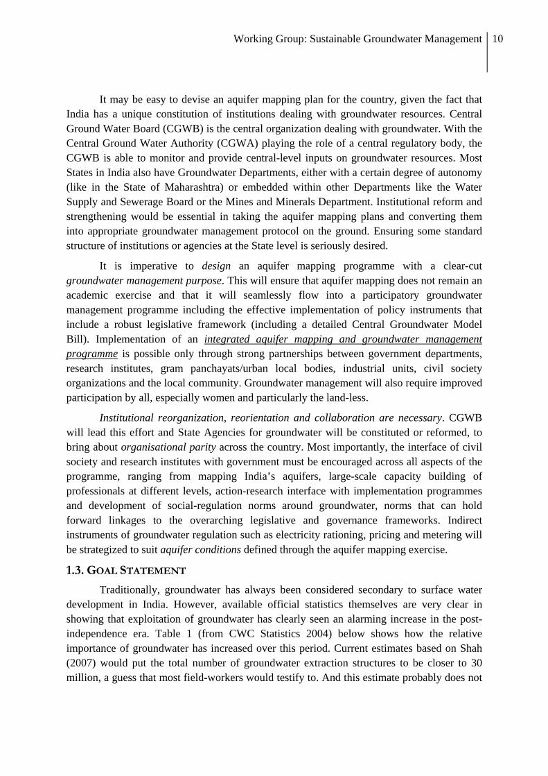
It may be easy to devise an aquifer mapping plan for the country, given the fact that India has a unique constitution of institutions dealing with groundwater resources. Central Ground Water Board (CGWB) is the central organization dealing with groundwater. With the Central Ground Water Authority (CGWA) playing the role of a central regulatory body, the CGWB is able to monitor and provide central-level inputs on groundwater resources. Most States in India also have Groundwater Departments, either with a certain degree of autonomy (like in the State of Maharashtra) or embedded within other Departments like the Water Supply and Sewerage Board or the Mines and Minerals Department. Institutional reform and strengthening would be essential in taking the aquifer mapping plans and converting them into appropriate groundwater management protocol on the ground. Ensuring some standard structure of institutions or agencies at the State level is seriously desired.
It is imperative to design an aquifer mapping programme with a clear-cut groundwater management purpose. This will ensure that aquifer mapping does not remain an academic exercise and that it will seamlessly flow into a participatory groundwater management programme including the effective implementation of policy instruments that include a robust legislative framework (including a detailed Central Groundwater Model Bill). Implementation of an integrated aquifer mapping and groundwater management programme is possible only through strong partnerships between government departments, research institutes, gram panchayats/urban local bodies, industrial units, civil society organizations and the local community. Groundwater management will also require improved participation by all, especially women and particularly the land-less.
Institutional reorganization, reorientation and collaboration are necessary. CGWB will lead this effort and State Agencies for groundwater will be constituted or reformed, to bring about organisational parity across the country. Most importantly, the interface of civil society and research institutes with government must be encouraged across all aspects of the programme, ranging from mapping India’s aquifers, large-scale capacity building of professionals at different levels, action-research interface with implementation programmes and development of social-regulation norms around groundwater, norms that can hold forward linkages to the overarching legislative and governance frameworks. Indirect instruments of groundwater regulation such as electricity rationing, pricing and metering will be strategized to suit aquifer conditions defined through the aquifer mapping exercise.
1.3. GOAL STATEMENT
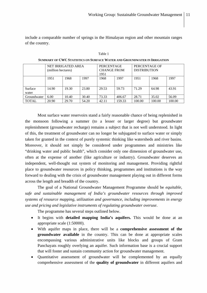
Traditionally, groundwater has always been considered secondary to surface water development in India. However, available official statistics themselves are very clear in showing that exploitation of groundwater has clearly seen an alarming increase in the post-independence era. Table 1 (from CWC Statistics 2004) below shows how the relative importance of groundwater has increased over this period. Current estimates based on Shah (2007) would put the total number of groundwater extraction structures to be closer to 30 million, a guess that most field-workers would testify to. And this estimate probably does not
Working Group: Sustainable Groundwater Management 11
include a comparable number of springs in the Himalayan region and other mountain ranges of the country.
Table 1
SUMMARY OF CWC STATISTICS ON SURFACE WATER AND GROUNDWATER IN IRRIGATION
NET IRRIGATED AREA (million hectares)
PERCENTAGE CHANGE FROM 1951
PERCENTAGE OF DISTRIBUTION
1951
1968 1997 1968 1997 1951 1968 1997
Surface water
14.90 19.30 23.80 29.53 59.73 71.29 64.98 43.91
Groundwater 6.00 10.40 30.40 73.33 406.67 28.71 35.02 56.09 TOTAL 20.90 29.70 54.20 42.11 159.33 100.00 100.00 100.00
Most surface water reservoirs stand a fairly reasonable chance of being replenished in the monsoon following a summer (to a lesser or larger degree) but groundwater replenishment (groundwater recharge) remains a subject that is not well understood. In light of this, the treatment of groundwater can no longer be subjugated to surface water or simply taken for granted in the context of purely systemic thinking like watersheds and river basins. Moreover, it should not simply be considered under programmes and ministries like “drinking water and public health”, which consider only one dimension of groundwater use, often at the expense of another (like agriculture or industry). Groundwater deserves an independent, well-thought out system of monitoring and management. Providing rightful place to groundwater resources in policy thinking, programmes and institutions is the way forward to dealing with the crisis of groundwater management playing out in different forms across the length and breadth of the country.
The goal of a National Groundwater Management Programme should be equitable, safe and sustainable management of India’s groundwater resources through improved systems of resource mapping, utilization and governance, including improvements in energy use and pricing and legislative instruments of regulating groundwater overuse.
The programme has several steps outlined below. • It begins with detailed mapping India’s aquifers. This would be done at an
appropriate scale (1:50000). • With aquifer maps in place, there will be a comprehensive assessment of the
groundwater available in the country. This can be done at appropriate scales encompassing various administrative units like blocks and groups of Gram Panchayats roughly overlying an aquifer. Such information base is a crucial support that will foster and sustain community action for groundwater management.
• Quantitative assessment of groundwater will be complemented by an equally comprehensive assessment of the quality of groundwater in different aquifers and

Working Group: Sustainable Groundwater Management 12
the potential threat of groundwater contamination. This information of groundwater quality will also form part of the information and database systems set up under the programme.
• The programme envisages a massive capacity building at all levels for mapping, quantitative and qualitative assessment and sustainable management of groundwater resources across different hydrogeological settings in the country. This massive challenge of creating an informed human resource capable of taking key decisions at all levels is a crucial part of the programme.
• Building strong partnerships and collaborations among a broad spectrum of institutions is the crux of such a programme. It envisions improved co-ordination between various institutions dealing with groundwater resources such as CGWB, state agencies, technical research institutions, civil society organizations, PRIs. It visualizes an institutional restructuring with specific roles being played by each of these. A crucial interface with the Ministry of Drinking Water and Sanitation (MoDWS) will also be established through the programme.
• The National Programme on Groundwater Management will centrally address the challenge of groundwater legislation. As mentioned above, since groundwater is a fugitive resource that does not respect administrative boundaries and distinctions, it is important that the groundwater legislation provides for a separation of rights over land from rights over water. The focus of groundwater legislation should be on protection and sustainable use of groundwater.
• The programme also realizes that groundwater management and use cannot be discussed in isolation from the patterns of energy consumption and pricing policies. Hence, a key aspect of the programme is the co-management of groundwater and energy use, with indirect instruments like pricing of electricity, subsidies etc., playing a crucial role.
• Creating consensus on the order of priority for different uses of groundwater: drinking water, water for livestock and domestic purposes, irrigation (small-holder, large scale), industrial uses, urban non-domestic; creating a system of regulation and water pricing to encourage allocation of water resource based on such priorities

Working Group: Sustainable Groundwater Management 13
Section 2
NATIONAL GROUNDWATER ASSESSMENT

Working Group: Sustainable Groundwater Management 14
2.1. NATIONAL ASSESSMENT OF GROUNDWATER RESOURCES: REVIEW OF
METHODOLOGY AND POSSIBILITIES FOR IMPROVEMENT
Assessment of groundwater resources and their utilization is conducted at periodic intervals, in India. The methodology of assessment has been subject to reviews and refinements from time to time as per the directives of National Water Policy, 2002 (MOWR, 2002). Before embarking upon a discussion on the methodology of groundwater assessment, it would be prudent to look into the objective of this exercise and the necessity of carrying out this exercise at periodic intervals.
Groundwater resources in India have been developed largely through private initiatives and investments. Managing groundwater resources in a sustainable manner has become a mandate at all levels of governance. The Government (both Central and State) launches various groundwater resources programmes like sinking wells and drilling bore holes for various purposes of water supply, artificial recharge and rainwater harvesting. Groundwater regulation is already in place in some States with Groundwater Acts, while others have their model bills that can become Groundwater Acts. Most of these programmes target sustained resource availability and sometimes attempt to deliver the mandates for groundwater management under environmental principles.
Groundwater resources assessment is carried out to estimate the degree of groundwater use in context to its availability, annual groundwater recharge and its utilization. The assessment is based on the status of groundwater utilization and long term water level trend within an administrative unit. Since Talukas/Blocks/Mandals constitute the basic administrative unit in major parts of the country, the assessment is possible at the level of a block or taluka or in the occasional case, watersheds (Maharashtra State is the only State which adopts a hydrologic unit instead of an administrative unit for such assessment).
A methodology was initiated and assessment exercises (1979-80) were carried out at the behest of erstwhile ARDC to identify the administrative units (blocks), where due to excessive withdrawal, groundwater resources were found to be depleting. The purpose of such exercises was to identify areas where financial assistance to the farmers, in the form of loan for groundwater irrigation related activities, was to be discouraged.
The methodology subsequently underwent revision, and gradually, the categorization of blocks, based on the status of groundwater utilisation, was adopted. An “index” that considered the degree of groundwater utilisation in relation to the resource available for utilisation became the basis for identification of areas for implementation of various government sponsored groundwater management schemes. The rationale for a periodic assessment took shape as realisation about the complex dynamics around groundwater utilisation patterns, recharge and availability crept in.
Working Group: Sustainable Groundwater Management 15
2.2. NATIONAL / STATE LEVEL GROUNDWATER RESOURCES ASSESSMENT
Groundwater resources of the country are jointly assessed by Central Ground Water Board (CGWB) and State Groundwater Departments as per the directives of National Water Policy, 2002, which states that ‘there should be a periodical reassessment of the groundwater potential on a scientific basis” and that “exploitation of groundwater resources should be so regulated as not to exceed the recharging possibilities”.
The existing methodology is known as Groundwater Estimation Methodology (GEC, 1997). The governing principle behind the methodology is the water balance approach. The approach involves estimation of annual groundwater recharge and quantification of groundwater extraction. The assessment units are categorized based on the percentage of groundwater withdrawal to net groundwater availability and a long term water level trend.
Groundwater recharge is estimated season-wise and source wise. Rainfall recharge during monsoon season is estimated by two methods – Water Level Fluctuation (WLF) method and Rainfall Infiltration Factor (RIF) method. In the WLF method, specific yield of an aquifer is used to determine quantities of water that are recharged to the aquifer, correlated with the rise in groundwater level. The specific yield value in the computation is determined either through field studies or using normative estimates in GEC-1997. In case of RIF method, infiltration factor values are recommended for major lithological units of the country under the GEC (1997). Recharge from other sources like canal seepage, return flow from irrigation, recharge from water bodies and tanks/ ponds are estimated using norms recommended by GEC-1997. RIF method is used in the case of rainfall recharge during the non-monsoon period.
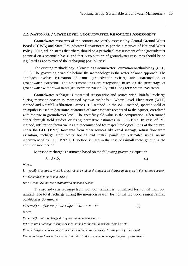
Monsoon recharge is estimated based on the following governing equation
R = S + Dg (1)
Where,
R = possible recharge, which is gross recharge minus the natural discharges in the area in the monsoon season
S = Groundwater storage increase
Dg = Gross Groundwater draft during monsoon season
The groundwater recharge from monsoon rainfall is normalized for normal monsoon rainfall. The total recharge during the monsoon season for normal monsoon season rainfall condition is obtained as:
R (normal) = Rrf (normal) + Rc + Rgw + Rsw + Rwc + Rt (2)
Where,
R (normal) = total recharge during normal monsoon season
Rrf = rainfall recharge during monsoon season for normal monsoon season rainfall
Rc = recharge due to seepage from canals in the monsoon season for the year of assessment
Rsw = recharge from surface water irrigation in the monsoon season for the year of assessment
Working Group: Sustainable Groundwater Management 16
Rgw= recharge from groundwater irrigation in the monsoon season for the year of assessment
Rwc= recharge from water conservation structures in the monsoon season for the year of assessment
Rt = recharge from tanks and ponds in the monsoon season for the year of assessment
Similarly, estimation of normal recharge during non-monsoon season is carried out by
adding normal non-monsoon rainfall recharge and recharge from other sources during non-monsoon period. Total annual recharge or annual replenishable groundwater resources means the addition of normal recharge during monsoon and non-monsoon seasons. Net annual groundwater availability is derived from annual groundwater recharge after keeping an allocation for natural discharge during the non-monsoon season, which is about 5 to 10% of the annual recharge. The assessment also requires estimation of the groundwater draft. Here again, two standard methods are used: (a) unit draft method or (b) cropping pattern method.
Unit Draft method: Ground water draft is computed by multiplying the unit draft (season-wise) of a ground water abstraction structure with the number of structure. The gross annual ground water draft would be the sum total of annual ground water draft from all abstraction structures located in the assessment unit.
Cropping pattern method: Crop water requirement (season-wise) of the crop grown in the assessment unit is multiplied with the season-wise area irrigated by ground water. The gross annual ground water draft would be the sum total of annual ground water consumption for all the crops grown through ground water irrigation in the assessment area.
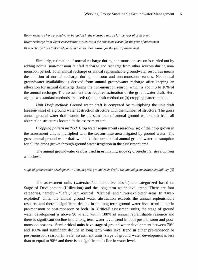
The annual groundwater draft is used in estimating stage of groundwater development as follows:
Stage of groundwater development = Annual gross groundwater draft / Net annual groundwater availability (3)
The assessment units (watershed/administrative blocks) are categorized based on
Stage of Development (Utilization) and the long term water level trend. There are four categories, namely – ‘Safe’, ‘Semi-critical’, ‘Critical’ and ‘Over-exploited’ areas. In ‘Over-exploited’ units, the annual ground water abstraction exceeds the annual replenishable resource and there is significant decline in the long-term ground water level trend either in pre-monsoon or post-monsoon or both. In ‘Critical’ assessment units, the stage of ground water development is above 90 % and within 100% of annual replenishable resource and there is significant decline in the long term water level trend in both pre-monsoon and post-monsoon seasons. Semi-critical units have stage of ground water development between 70% and 100% and significant decline in long term water level trend in either pre-monsoon or post-monsoon season. In 'Safe' assessment units, stage of ground water development is less than or equal to 90% and there is no significant decline in water level.

Working Group: Sustainable Groundwater Management 17
2.3. REVIEW OF THE GROUNDWATER ASSESSMENT
Researchers, planners, administrators and practitioners have raised concerns regarding the current methodology and approaches to the national groundwater assessement. The salient points regarding these concerns are captured through the bullets below.
• Estimates of groundwater potential and use are currently based mostly on data collected from 60000 to 70000 observation wells and piezometers. When compared with the estimates of wells numbering more than 20 Million (World Bank, 2009; Shah, 2009) this number is statistically insignificant to provide cognizable estimates.
• Units of assessment are too large in some regions and the parameters utilized for quantitative assessment through a “lumped” approach may not truly represent the entire spatial domain within the assessment unit. This situation sometimes has led to a paradoxical situation in which a smaller area within the unit categorized as overexploited may or may not represent the degree of groundwater exploitation represented through the stage of groundwater development (Kulkarni, Badarayani...et al, 2009). In such situations, adoption of smaller assessment units such as micro-watershed is desirable, although the eventual progress should be towards aquifer based assessment. Disaggregation to an appropriately representative scale is clearly desired.
• Some hard rock areas are classified as safe areas, even though there is no scope for large-scale groundwater development in such areas. This issue can be addressed by lumping the two hydrogeological aspects together - degree or extent of use within the appropriate unit and the potential of the aquifer (in terms of well yields3). Here again, the argument for an aquifer-based assessment gains strength…
• Except for problems of salinity, the existing methodology does not take into account other emergent groundwater quality issues like As, F etc. Further, the dichotomy in scales of assessment of the two types of groundwater problems – degree of groundwater utilization at the block level and above versus groundwater quality at sources and habitation (local scale) – makes it important to match these aspects of groundwater resources through a matching scale at some level. Hence, some degree of convergence in scales of quantity and quality assessment is clearly desirable. Such convergence is easy if assessments of quantity and quality are conducted for an aquifer.
• The precision of assessment is a common concern expressed by practitioners and academics alike. Since groundwater is a hidden, fugitive resource and the quantity of groundwater in an aquifer cannot be estimated accurately, there is always an inherent uncertainty in the estimation of groundwater resources. Nevertheless, the reliability of
3 Well yield implies the average yield of a well tapping the aquifer, based on ground water exploration results. Hydrogeologocial Map of India produced by CGWB presents yields of the various aquifer formations in India. These yields reflect the transmission characteristics of the aquifer.
Working Group: Sustainable Groundwater Management 18
the estimates can be improved upon by improving the quality, frequency and density of all data used in the estimation.
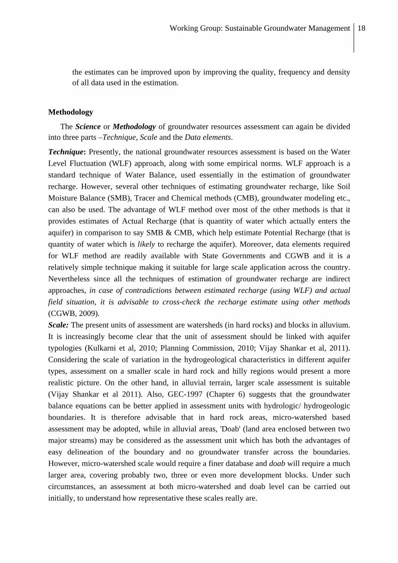
Methodology
The Science or Methodology of groundwater resources assessment can again be divided into three parts –Technique, Scale and the Data elements.
Technique: Presently, the national groundwater resources assessment is based on the Water Level Fluctuation (WLF) approach, along with some empirical norms. WLF approach is a standard technique of Water Balance, used essentially in the estimation of groundwater recharge. However, several other techniques of estimating groundwater recharge, like Soil Moisture Balance (SMB), Tracer and Chemical methods (CMB), groundwater modeling etc., can also be used. The advantage of WLF method over most of the other methods is that it provides estimates of Actual Recharge (that is quantity of water which actually enters the aquifer) in comparison to say SMB & CMB, which help estimate Potential Recharge (that is quantity of water which is likely to recharge the aquifer). Moreover, data elements required for WLF method are readily available with State Governments and CGWB and it is a relatively simple technique making it suitable for large scale application across the country. Nevertheless since all the techniques of estimation of groundwater recharge are indirect approaches, in case of contradictions between estimated recharge (using WLF) and actual field situation, it is advisable to cross-check the recharge estimate using other methods (CGWB, 2009). Scale: The present units of assessment are watersheds (in hard rocks) and blocks in alluvium. It is increasingly become clear that the unit of assessment should be linked with aquifer typologies (Kulkarni et al, 2010; Planning Commission, 2010; Vijay Shankar et al, 2011). Considering the scale of variation in the hydrogeological characteristics in different aquifer types, assessment on a smaller scale in hard rock and hilly regions would present a more realistic picture. On the other hand, in alluvial terrain, larger scale assessment is suitable (Vijay Shankar et al 2011). Also, GEC-1997 (Chapter 6) suggests that the groundwater balance equations can be better applied in assessment units with hydrologic/ hydrogeologic boundaries. It is therefore advisable that in hard rock areas, micro-watershed based assessment may be adopted, while in alluvial areas, 'Doab' (land area enclosed between two major streams) may be considered as the assessment unit which has both the advantages of easy delineation of the boundary and no groundwater transfer across the boundaries. However, micro-watershed scale would require a finer database and doab will require a much larger area, covering probably two, three or even more development blocks. Under such circumstances, an assessment at both micro-watershed and doab level can be carried out initially, to understand how representative these scales really are.

Working Group: Sustainable Groundwater Management 19
Data Elements: Three types of data elements are involved in the groundwater resources estimation.
a. Geographical details like the morphological details of the units of assessment, their areas, water bodies and drainage that form part of the units, land use pattern etc.
b. Measured data like rainfall, canal flow, water level etc. c. Normative details including parameters like specific yield, rainfall recharge
factor, canal seepage factor, irrigation return flow factor, seepage from tanks & ponds, unit draft (withdrawal) of wells etc.
The first two sets of data elements, i.e. geographical details and measured data are collected by Central and State Government agencies during their regular monitoring and survey exercises. The third set, i.e. parameter estimation, is conducted through controlled field and laboratory experiments taken up in the Water Balance Studies and other R&D studies mentioned earlier. Field based R&D studies of Water Balance Projects are used to provide the input for the applied aspect of the subject i.e. groundwater resources estimation of the entire country.
Some of the components of water balance like baseflow and recharge from streams into ground water bodies, in the existing methodology, have been excluded because data for these components is simply not available. Similarly, in alluvial terrains, inflow and outflow across the assessment boundaries are not estimated for want of data. However, successive assessments based on GEC-97 have indicated that particularly in case of some assessment units, these components of water balance have strong significance in the appropriate categorization of units.
Therefore, concerted efforts should be made to generate database on baseflow, recharge from streams, inflow and outflow across the assessment boundary, based on the methodology recommended in GEC-97 (section: 5.6.2 & 6.1.7) so that these water balance components can be added to the estimation of Ground Water Recharge and Discharge in an assessment unit.
The norms of various parameters have been revised three times in the past, viz. 1979, 1984 and 1997, to include the diversity in the hydrogeological conditions across the country. For example, norms for Specific Yield (Sy), which is one of the important parameters for recharge estimation, were set initially for 4 lithological formations (1979); in 1984 Sy ranges were developed for 10 formations and in 1997 normative estimates of Sy for 13 formations were provided. However, there is a need to further refine and modify the normative ranges of Sy and all the other parameters of resources estimation considering the diversity in hydrogeology, primarily resulting out of variable geological conditions. After 1990, no new Water Balance Project has been undertaken to relook at the norms, not just pertaining to specific yield values, but also to the overall methodology of the national groundwater assessment. Some of the State Groundwater Departments are taking up individual efforts to

Working Group: Sustainable Groundwater Management 20
estimate parameters based on field studies, although there is no concerted project for refinement of assessment parameters.
Another important constraint to a progressive improvement in the groundwater assessment involves limitations surrounding the database on geographical and measured data used in resources estimation. Data elements need to be benchmarked in order to improve upon the quality and density of the databases used in making national and state-level groundwater assessement.
Operationalisation
Currently, the national groundwater assessment is conducted every five years. The estimation is done during one year, over which conditions can be compared (for over the same period) across the country. However, once the estimation is over, corrective measures can be taken up only during the next assessment. The errors in the estimation of say an assessment unit, if any, would remain until the next assessment, which poses limitation for taking up long-term groundwater management. Further, there are certain corrective / refinement measures such as generation of specific database, estimation of certain parameters, application of alternative methods to fill gaps, cross check and application of methodology on appropriate scale, which require longer duration and more intensive field studies. Such efforts are generally not possible during the periodic assessment of groundwater resources since there is always the pressure of meeting certain “targets” within a short stipulated time, when projects are implemented. The periodic assessment can be combined with a more iterative process of assessment, which will allow for validation and refinement of groundwater resources assessment.
Linkage between groundwater assessment and management
Presently, in a majority of the cases, quantitative estimation of groundwater resources and the classification of blocks and watersheds into over-exploited, critical, semi-critical and safe categories are the sole criteria for identification of areas for implementation of various groundwater management programmes. However, several other aspects of groundwater resources need consideration during implementation of groundwater management programmes. These are: groundwater availability, groundwater accessibility and groundwater quality.
• Total Availability is the amount (volume) of water in storage beneath a given area of the land surface. This depends on Specific Yield or Storativity and the Saturated Thickness of the Aquifer. The total availability gives an idea of the potential storage in an aquifer and the amount of water actually available under various degrees of exploitation.
• Groundwater Accessibility is the measure of how easily water flows through or can be pumped from an aquifer. Groundwater Accessibility is the function of depth to water and Transmissivity (T) / Hydraulic Conductivity (K) of the aquifer.

Working Group: Sustainable Groundwater Management 21
• Groundwater Quality: At present, salinity is the only component of groundwater quality being considered in groundwater resources assessment. The question of scale arises with reference to other groundwater quality parameters since the quality estimations are mostly at sources and habitations in contrast to quantitative assessments at the block level. Aquifer-based groundwater quality understanding is almost missing from current assessments of groundwater resources in the country.
The aquifer mapping approach can help integrate the above-mentioned aspects. The aquifer mapping exercise can integrate existing information onto a GIS platform wherein different layers can be developed and one can superimpose the layers to arrive at a solution for various groundwater management programmes. Categorization maps, quality maps and water level maps are available and aquifer maps will only form the template to port this information to, particularly in an attempt to arrive at improved decision support. However, all such information should be ported to the proposed aquifer mapping framework.
An indicative hydraulic conductivity is reflected in the Hydrogeological Map of India, where well yields give a measure of the ease of groundwater pumping. Similarly, estimates of recharge are also emerging through different studies, both within and outside CGWB. However, if information is available at a more disaggregated level, such as in an atlas of aquifer maps, the managers of groundwater resources could consult such an atlas before taking decisions on various groundwater management options.
The main idea behind this approach is to go beyond the present practice of opting for a management solution based solely on the category of quantitative assessment. A set of data on various attributes of groundwater would be available to the groundwater manager. The management plans be based on the analysis of such data.
2.4. OTHER INITIATIVES
Apart from the National/ State level assessment, there are other initiatives on groundwater resources assessment taken up in the country. Based on the areal dimension and purpose of the study, these can be classified into: local Scale and regional scale assessments.
Local scale assessments Many programmes in the development sector require local-level groundwater studies.
Researchers also work intensively in small areas in order to develop an understanding of groundwater resources and groundwater problems. Such groundwater assessment includes developing groundwater budgets or estimation of groundwater recharge through sources like rainfall, canal seepage, return flow from irrigation, recharge from water bodies or aquifer-river interaction. Various techniques including physical methods like WLF, baseflow separation, water balance, SMB etc., chemical and tracer technique, and numerical groundwater flow modelling are used in such assessments, depending upon the availability of the logistic supports, domain expertise of the scientist and the objective of the study. Remote Sensing techniques like GRACE have been applied on a Regional scale in the northern part

Working Group: Sustainable Groundwater Management 22
of the country to quantify the groundwater storage change (Tiwari et. al., 2009) over larger spatial and temporal dimensions. Such studies have good value in understanding changes in regional groundwater systems such as the alluvial systems of the Indo-Gangetic region.
Another type of local scale assessment is emerging with encouraging success stories, especially from Maharashtra, Andhra Pradesh and Karnataka, where village level groundwater budgeting is being used to manage groundwater resources locally. A few more examples of using locally generated information to ascertain groundwater availability leading to improved village-level water governance, groundwater budgeting and drought-preparedness are also available. During the process of water budgeting, rainfall is measured in rain gauge stations and water levels are measured through adequate number of observation wells – all of them located within the village. The water demands for domestic uses for human and animal population are accounted. Seasonal groundwater availability is ascertained with the purpose of planning cropping, irrigation and sometimes even management of protective irrigation. This practice of water budgeting has been useful in ensuring sustainability of groundwater resources for both agriculture and domestic purposes for human and livestock in the village. Such types of groundwater assessment are emerging strongly but only in isolated locations across the country.
Regional scale assessment
Regional scale assessment forms the foundation for a national assessment of ground-water availability. The primary issues affecting ground-water availability vary from location to location and commonly require analysis in the context of ground-water flow systems to achieve any purposeful meaning. With this principle in mind, Central Ground Water Board took up twelve Water Balance Studies during the early Seventies to late Eighties in various hydrogeological settings of the country either indigenously or with International and Foreign collaboration (UNDP, Sweden, Canada, Britain etc.) for comprehensive assessment of groundwater resources at a basin scale (10,000 to 60,000 sq.km.) (Joseph, 2000). The studies in these Water Balance Projects involved disposition of the regional aquifer systems, monitoring of their attributes viz. water level and quality, establishing groundwater flow pattern, characterization of the aquifers, complete water balance involving all the input and output components - rainfall, evaporation, evapotranspiration, soil moisture balance, groundwater recharge through rainfall, groundwater extraction, canal seepage, irrigation, water bodies and river-aquifer interaction.
Multiple techniques including physical, chemical/tracer and numerical modeling approach were used for estimation of groundwater recharge and discharge. The total groundwater availability in the aquifer systems was estimated in these projects. The projects were carried out adopting the multi-disciplinary approach and involving not only CGWB and International Agencies but other Research Institutes as well like Indian Institute of Science, National Geophysical Research Institute etc. These projects enabled the development of methodologies of investigation and empirical norms for assessment of the resource potential

Working Group: Sustainable Groundwater Management 23
under various hydrogeological and hydro-climatic settings in the country. The studies also provided suitable guidelines for evolving economic and scientific design of groundwater abstraction structure and preparation of detailed development plan of the area on basin basis. Regional scale groundwater assessment is presently not in practice.
Best Practices (International experience)
Assessment of groundwater resources, across the globe, is based on respective national policies. While advanced countries with strong databases like Australia, UK, South Africa have adopted the Sustainable Yield Policy, most of the countries including India have adopted Safe Yield Policy. In USA, both the Safe / Sustainable4 Yield Policy and Planned Depletion policy are in use. Regional Scale assessments have played a key role in National level decisions on groundwater management in many countries. The geographical unit for Regional Scale assessment in the USA is Regional Aquifer Systems, while in case of Australia and South Africa, it is basin or catchment area. GIS based approach has been adopted in most of the Regional and National Scale assessments in these countries. Techniques like Groundwater Storage concept, Water Balance, Soil moisture balance, Groundwater flow modelling are used for estimation of recharge, total groundwater availability and sustainable yield of aquifers (Chatterjee & Ray, 2009).
2.5. GROUNDWATER QUALITY PROBLEM AND MONITORING
Groundwater quality has become an issue of national importance, given the significant coverage of drinking water sources tapping groundwater reserves. Even without formal statistics, it is obvious that groundwater resources support a major proportion of habitations in the country, for their drinking water needs. In this very light, the quality of drinking water has emerged as a major new concern on the horizon over the last decade or so5. Till the 1970s, quality issues were dealt with in regard to contamination of surface water sources, mainly on account of poor sanitation and waste disposal, leading to repeated incidence of water-borne diseases. But today, groundwater contamination is the main worry, with arsenic, fluoride, iron, nitrate and salinity as the major contaminants. Rock-water interaction also causes groundwater contamination, such contamination qualifying as geogenic. Biological and chemical contamination of groundwater account for a massive burden on society, leading to effects that range from morbidity to mortality. Therefore, groundwater overexploitation provides the trigger for multiple impacts on human life and
4 Safe Yield, is broadly defined as the attainment and maintenance of a long term balance between the annual amount of ground water withdrawn by pumping and the annual amount of recharge. Safe yield is equated with annual recharge. Sustainable Yield includes reserving a fraction of Safe Yield for the benefit of surface water flows and other water‐dependent ecosystems. Groundwater is a part of the Water Cycle; withdrawal of groundwater not only affects the aquifer but also the groundwater‐fed surface water systems (springs and baseflow) and the groundwater‐dependent ecosystems (wetlands and riparian vegetation). 5 Groundwater quality is, at least in part, related to the problem of over‐extraction of groundwater.
Working Group: Sustainable Groundwater Management 24
livelihoods, although the main triggers can be external to the problem of groundwater ‘overuse’. As the Planning Commission (2007) report states “…fallout of ground water overexploitation has been contamination of groundwater due to geogenic factors (i.e. because of particular geological formation at deeper levels), resulting in increased levels of fluoride, arsenic and iron. Groundwater in some parts of West Bengal and Gujarat, which is contaminated by arsenic and fluoride now, were safe at the time of independence”.
Groundwater acts as a conduit for various viral and bacterial diseases especially in shallow aquifers through mixing of sewage and infiltration from latrine pits. Diseases include minor afflictions such as Diarrhoeal, Viral and Ameobal infections to more severe diseases such as Cholera. These ailments underscore the fact that pathogenic contamination of groundwater could be the single largest challenge facing large regions of the country. States continually report an increasing number of habitations affected with quality problems. The DDWS (2009) estimates that as on 1st April 2009, there are still about 1.80 lakh quality-affected habitations in the country. And this is not a static figure. This figure was 2.17 lakhs in 2005 but this does not mean that in the last 3 years we have progressed by covering 37,000 habitations. In fact, we may have covered more but an even greater number is getting added to the list of problem habitations. Just as in the case of uncovered habitations, goalposts are continuously shifting with more and more habitations reporting “slipbacks” that include quality problems in addition to depleting sources.
India is faced with an alarming range of water quality related diseases. Estimates made for some of these water quality related health problems suggest a massive endemic nature – Fluorosis (65 million (Susheela 2001), Arsenicosis (5 million in West Bengal (WHO 2002), but several magnitudes more unestimated from Assam and Bihar). Fluorosis caused by high Fluoride in groundwater leads to crippling, skeletal problems and severe bone deformities. On the other hand, Arsenicosis leads to skin lesions and develops into cancer of lung and the bladder. There are 425000 deaths due to Diarrhea annually in India (NICED 2004).
Compounding the water quality problem further is the transmission of contaminants through food – grains, pulses, vegetables – irrigated by contaminated groundwater. The response to tackle this massive problem however, is very weak. The following points illustrate the current state of affairs:
• At present Central Ground Water Board is monitoring the ground water quality with about 15640 monitoring stations located all over India especially of shallow aquifers. There are about 3000 piezometers which are also being monitored especially for water level monitoring and not for water quality monitoring.
• Some State Ground Water Organizations are also monitoring the ground water level and quality in their respective states. Groundwater quality is being monitored especially during pre-monsoon period.

Working Group: Sustainable Groundwater Management 25
• Central Pollution Control Board, which is monitoring mainly the surface water pollution, also maintains very limited number of ground water monitoring stations (about 500) located mainly in the industrial clusters.
• Adding to this sparse monitoring network, is the lack of uniformity in sampling and water quality parameters measured.
All these lead to a data system which is not compiled, not comparable and has very low relevance to any public health problems resulting due to poor water quality. Even government agencies such as drinking water and sanitation department collect a large amount of one-time water quality data before their interventions. There is duplication of effort, very poor data sharing and an overall lack of dependable data at the national level. The result is a poor assessment of the national groundwater quality, a requirement for redefining the national groundwater assessment, which currently is only quantitative in nature.
2.6. INTEGRATING GROUNDWATER QUALITY WITH ASSESSMENT
Exploitation of groundwater is severely hampered in many parts of the world by a high magnitude of salinity (IWMI, 2001). Saline water, that is water high in Total Dissolved Solids (TDS), is expensive to treat and has widely resulted in salinization and degradation of soils, which in turn can damage crops. In addition to soil and crop damage, water with high TDS has an unpleasant taste, makes it difficult for soap to lather and corrodes any metal, especially within a borehole, which can quickly be rendered useless (MacDonald, Davies et al. 2005). Increased salinization of groundwater may be a result of groundwater overexploitation. As old as agriculture itself, increasing salinity caused by irrigation is the most widespread form of groundwater quality degradation today (Morris et al., 2003). In practical terms, it is irreversible. Once an aquifer is salinized, it would take decades to reverse by flushing out with freshwater even if such action were feasible (Foster and Chilton, 2003). This is just a case of one parameter – TDS!
The existing state of water quality data briefly described above is insufficient from providing perspectives with regard public health, agriculture or other purposes. There is very poor dependability on the existing data sets since they are very sparse and have low frequency with respect to time. Instead, it is essential to arrive at a common minimum sampling density guidelines depending on aquifer conditions, type of problems, population density and access to drinking water and attempt to reach such a density in a specified time period. Moreover, there must be a convergence of quantitative and quality assessments of groundwater resources, which are constrained today due to the mismatch of scales on which these are collected. The aquifer based programme, will provide space in forging such convergence. Ideally, we should determine the required sampling network density can be determined as follows:
Desired Sample Network Density for a Water quality parameter = Function (Aquifer type, Seriousness of Public Health Problem, Population Density and Density of drinking water sources)

Working Group: Sustainable Groundwater Management 26
The nature of sampling can be at different levels – indicative, numerical and analytical – which can be performed by different types of laboratories For example, an indicative Fluoride testing at a primary level testing for a high Fluoride level will indicate the numerical concentration of Fluoride at a secondary level and further analysis on spread and transmission can be done by the tertiary labs on a selective basis.
However, if this sort of a groundwater quality monitoring needs to be achieved, it is not possible with the current institutional and infrastructural setups. We need to think beyond the existing modes of testing and think of ideas of certification of private and public laboratories. Two examples can be cited for such a tiered structure of sampling strategy, first the one followed, for example, the mapping of Arsenic by PHED Assam and second, the salinity related sampling networks existing in coastal Gujarat, coordinated by non-governmental agencies such as the Aga Khan Rural Support Programme (AKRSP).
2.7. KEY RECOMMENDATIONS FOR THE 12TH PLAN
Water Quality Sampling
• Water quality Sampling: Minimum Water quality spatial/temporal sampling density standards are needed across the country keeping in mind aquifer characteristics, population densities and modes of access to drinking water. Through such parameters, we need to define regional requirements to meet minimum sampling standards – especially dense monitoring networks in severely water quality affected pockets. This aim should be accompanied by a timeline to achieve sustainable water quality sampling nationwide. This desired water quality sampling density can be achieved at three levels – indicative, numerical and analytical – using the three tier suggested laboratory structure described below. Also the already notified Uniform Water Quality Monitoring protocol may be followed from sample collection, storage and transportation, right down to proper analytical techniques.
• Accreditation of water quality labs with NABL: The water quality labs need to be modernized and to be accredited to NABL. It is also recommended that Analytical Quality Control in Water Quality Monitoring shall be taken up. Quality Assurance (QA) is a set of operating principles, which be strictly followed during sample collection, transportation and sample analysis.
• Strengthen the present monitoring mechanism to achieve this minimum sampling standard with the hierarchical system of referral laboratories. This would require certification of laboratories to NABL with primary, secondary and tertiary laboratories carrying out different levels of testing. Along with this, networking of laboratories is the need of the hour. Water Quality Labs especially important labs of different organizations like CGWB, CPCB, NIH, CWC and NEERI etc need to network and the data be made available at one platform.
Working Group: Sustainable Groundwater Management 27
• Provision for sampling from the piezometers shall be made. Sample collectors may be designed in consultation with the engineering division of Central Ground Water Board to obtain proper representative samples of the aquifers.
Water Quality and Health
A National Health Programme for groundwater quality related health problems needs to be created, within the Ministry of Health, so as to forge convergence with groundwater quality monitoring. This programme should include establishment of diagnostic facilities in areas with severe health implications of groundwater contamination, execution of surveys and imparting training for mitigation measures. Specifically the surveys that can be carried out immediately are those on Fluorosis (Dental Fluorosis and Skeletal Fluorosis for children especially through School Health Surveys), Arsenocosis, accurate databases for Enteretic related problems, renal stone surveys, relating incidences of other diseases such as high cancer rates to possible water quality problems such as heavy pesticide use or industrial effluents). There is a need to recognize the linkage between malnutrition and water quality related problems particularly in the context of urban/rural health poor.
Water Quality and Agriculture
Currently, a national research program on salinity related aspects to agriculture exists within the ICAR network and the focus is on loss to agricultural productivity. However, there are several other linkages as with Iron and mainly, the transmission of contaminants such as pesticides/Fluoride/Arsenic through food irrigated with contaminated groundwater. No national statement currently exists on this subject. This aspect needs to be investigated and warrants a national research on this subject, mainly through a partnership between ICAR and ICMR research laboratories.
2.8. TECHNOLOGY
Application of Advanced Geophysical Techniques
The techniques of Geophysical resistivity surveys like Vertical Electrical Sounding (VES), Resistivity Profiling, Seismic Reflection, Very Low Frequency (VLF) Electromagnetic Surveys and Geophysical Logging are in use since long for various ground water prospecting and exploration needs. The advanced geophysical techniques like 2D/3D Resistivity Imaging, Heliborne Time-domain Electromagnetic Technique and Ground Transient Electromagnetic Techniques, Ground Probing Radar, Digital Geophysical Logging etc. need to be tried and appropriately applied for groundwater and related studies.

Working Group: Sustainable Groundwater Management 28
Technology upgradation
Upgradation of technology is required to address the newer challenges in groundwater resources development and management in India. Available technologies and techniques required to be upgraded, given the advancement in technological applications in hydrogeology in different parts of the world. In fact, upgrading the institutional, infrastructural and human resource capabilities in organisations dealing with groundwater is an important factor in bringing them at par with international agencies. Equipped with best possible techniques and technologies for better management of ground water resources in the country along with the wherewithal to work with stakeholders, organisations dealing with groundwater can take on existing and newer challenges in groundwater management and help protect groundwater resources under different settings and situations, which define the contextual framework of groundwater management.

Working Group: Sustainable Groundwater Management 29
Section 3
GROUNDWATER TYPOLOGY
AND AQUIFER MANAGEMENT STRATEGIES

Working Group: Sustainable Groundwater Management 30
3.1. LOCATION-SPECIFIC TYPOLOGY: A CONCEPTUAL FRAMEWORK
Hydrogeological factors not only determine groundwater accumulation and movement, but also influence the time-factor over which impacts of groundwater overuse and/or quality decline occur and the appropriateness of supply and demand side interventions in response to a groundwater related problem. They also define the typology of groundwater resources, and form the single basic criterion to understand groundwater and groundwater-related problems in India. Appropriateness of scale and socio-economic factors must be taken into consideration, while developing a typology. The following discussion draws on inputs given to the Planning Commission by Kulkarni et al (2009), reports by CGWB (2004, 2006) and the Planning Commission Report by the Expert Group on Groundwater Management and Ownership (2007).
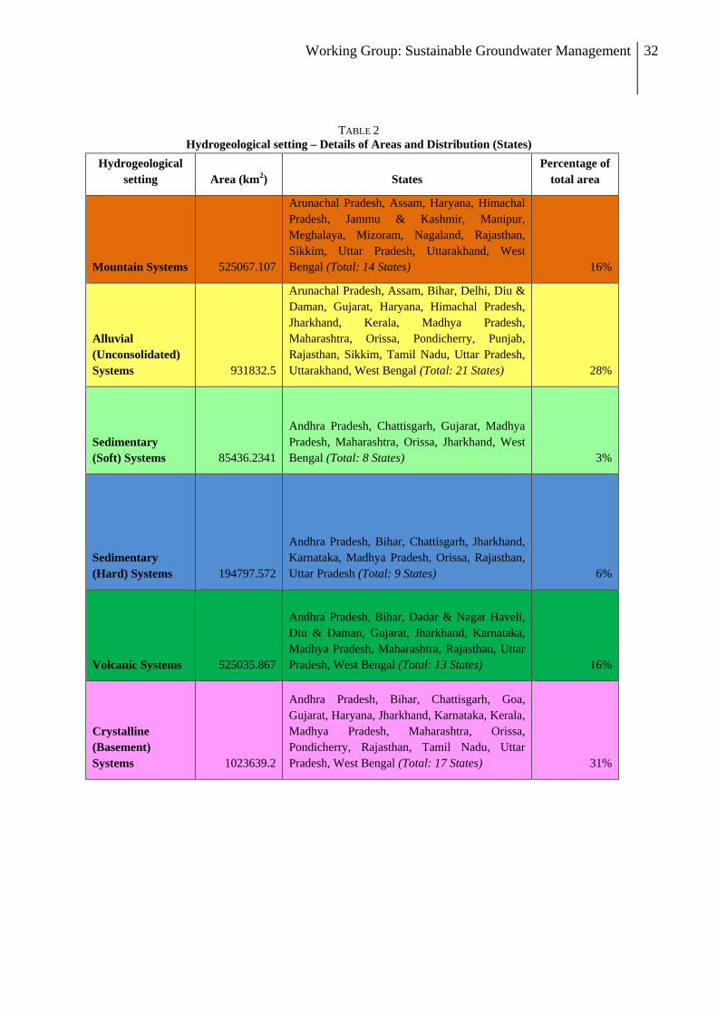
The package of responses suggested in context to the groundwater overdraft problem in India (Planning Commission, 2007; Shah, 2009) can be taken as a starting point in the development of a groundwater management strategy. However, groundwater management responses would be most effective when a tractable aquifer typology is developed for the country. Each “type” within the aquifer typology is a function of the hydrogeological setting, the stage that defines the socio-ecology of groundwater (Shah, 2009) and the stage or level of groundwater development (GEC, 1997) of the specific area. The typology should eventually also include groundwater quality and subsequently issues of health and the livelihoods. To understand this further, let us begin with a national groundwater typology including a broad strategy for ensuring drinking water security in different hydrogeological settings (Table 2 and Explanatory Note). The hydrogeological settings are based on work within and outside the Working Group but may be considered only as a starting point to develop a more robust typology, going into the operation of mapping aquifers.
Figure 1 illustrates broad hydrogeological settings as an overlay on a state boundary map of India. The map is derived from various sources and is a simple representation that attempts to show the basic driver of groundwater diversity in India - Geology. The diversity is further explained through Table 1, which not only estimates the relative proportion of area underlain by different hydrogeological settings but also the distribution of states in each setting. Figure 1 and Table 2 together represent a broad typology of groundwater settings in India. Aquifer mapping and any intervention with regard to groundwater management can use this as a good starting point for any effort on groundwater management.

Working Group: Sustainable Groundwater Management 31
FIGURE 1 Generalised hydrogeological settings along with State and District boundaries (developed from GSI, 1993;
CGWB, 2005; COMMAN, 2005) – developed by ACWADAM, Pune
Working Group: Sustainable Groundwater Management 32
TABLE 2 Hydrogeological setting – Details of Areas and Distribution (States)
Hydrogeological setting Area (km2) States
Percentage of total area
Mountain Systems 525067.107
Arunachal Pradesh, Assam, Haryana, Himachal Pradesh, Jammu & Kashmir, Manipur, Meghalaya, Mizoram, Nagaland, Rajasthan, Sikkim, Uttar Pradesh, Uttarakhand, West Bengal (Total: 14 States) 16%
Alluvial (Unconsolidated) Systems 931832.5
Arunachal Pradesh, Assam, Bihar, Delhi, Diu & Daman, Gujarat, Haryana, Himachal Pradesh, Jharkhand, Kerala, Madhya Pradesh, Maharashtra, Orissa, Pondicherry, Punjab, Rajasthan, Sikkim, Tamil Nadu, Uttar Pradesh, Uttarakhand, West Bengal (Total: 21 States) 28%
Sedimentary (Soft) Systems 85436.2341
Andhra Pradesh, Chattisgarh, Gujarat, Madhya Pradesh, Maharashtra, Orissa, Jharkhand, West Bengal (Total: 8 States) 3%
Sedimentary (Hard) Systems 194797.572
Andhra Pradesh, Bihar, Chattisgarh, Jharkhand, Karnataka, Madhya Pradesh, Orissa, Rajasthan, Uttar Pradesh (Total: 9 States) 6%
Volcanic Systems 525035.867
Andhra Pradesh, Bihar, Dadar & Nagar Haveli, Diu & Daman, Gujarat, Jharkhand, Karnataka, Madhya Pradesh, Maharashtra, Rajasthan, Uttar Pradesh, West Bengal (Total: 13 States) 16%
Crystalline (Basement) Systems 1023639.2
Andhra Pradesh, Bihar, Chattisgarh, Goa, Gujarat, Haryana, Jharkhand, Karnataka, Kerala, Madhya Pradesh, Maharashtra, Orissa, Pondicherry, Rajasthan, Tamil Nadu, Uttar Pradesh, West Bengal (Total: 17 States) 31%
Working Group: Sustainable Groundwater Management 33
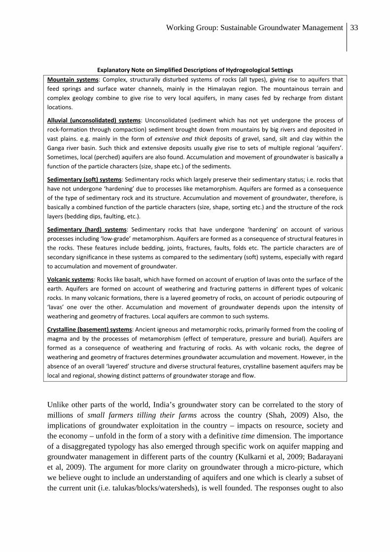
Explanatory Note on Simplified Descriptions of Hydrogeological Settings
Mountain systems: Complex, structurally disturbed systems of rocks (all types), giving rise to aquifers that feed springs and surface water channels, mainly in the Himalayan region. The mountainous terrain and complex geology combine to give rise to very local aquifers, in many cases fed by recharge from distant locations.
Alluvial (unconsolidated) systems: Unconsolidated (sediment which has not yet undergone the process of rock‐formation through compaction) sediment brought down from mountains by big rivers and deposited in vast plains. e.g. mainly in the form of extensive and thick deposits of gravel, sand, silt and clay within the Ganga river basin. Such thick and extensive deposits usually give rise to sets of multiple regional ‘aquifers’. Sometimes, local (perched) aquifers are also found. Accumulation and movement of groundwater is basically a function of the particle characters (size, shape etc.) of the sediments.
Sedimentary (soft) systems: Sedimentary rocks which largely preserve their sedimentary status; i.e. rocks that have not undergone ‘hardening’ due to processes like metamorphism. Aquifers are formed as a consequence of the type of sedimentary rock and its structure. Accumulation and movement of groundwater, therefore, is basically a combined function of the particle characters (size, shape, sorting etc.) and the structure of the rock layers (bedding dips, faulting, etc.).
Sedimentary (hard) systems: Sedimentary rocks that have undergone ‘hardening’ on account of various processes including ‘low‐grade’ metamorphism. Aquifers are formed as a consequence of structural features in the rocks. These features include bedding, joints, fractures, faults, folds etc. The particle characters are of secondary significance in these systems as compared to the sedimentary (soft) systems, especially with regard to accumulation and movement of groundwater.
Volcanic systems: Rocks like basalt, which have formed on account of eruption of lavas onto the surface of the earth. Aquifers are formed on account of weathering and fracturing patterns in different types of volcanic rocks. In many volcanic formations, there is a layered geometry of rocks, on account of periodic outpouring of ‘lavas’ one over the other. Accumulation and movement of groundwater depends upon the intensity of weathering and geometry of fractures. Local aquifers are common to such systems.
Crystalline (basement) systems: Ancient igneous and metamorphic rocks, primarily formed from the cooling of magma and by the processes of metamorphism (effect of temperature, pressure and burial). Aquifers are formed as a consequence of weathering and fracturing of rocks. As with volcanic rocks, the degree of weathering and geometry of fractures determines groundwater accumulation and movement. However, in the absence of an overall ‘layered’ structure and diverse structural features, crystalline basement aquifers may be local and regional, showing distinct patterns of groundwater storage and flow.
Unlike other parts of the world, India’s groundwater story can be correlated to the story of millions of small farmers tilling their farms across the country (Shah, 2009) Also, the implications of groundwater exploitation in the country – impacts on resource, society and the economy – unfold in the form of a story with a definitive time dimension. The importance of a disaggregated typology has also emerged through specific work on aquifer mapping and groundwater management in different parts of the country (Kulkarni et al, 2009; Badarayani et al, 2009). The argument for more clarity on groundwater through a micro-picture, which we believe ought to include an understanding of aquifers and one which is clearly a subset of the current unit (i.e. talukas/blocks/watersheds), is well founded. The responses ought to also

Working Group: Sustainable Groundwater Management 34
include the time dimension over which changes occur and the nature of impacts that can be created through various interventions.
Table 3 attempts to illustrate how a response strategy for protection of drinking water would appear after due consideration to the diversity in characteristics evident from the typology of groundwater settings in India. A tractable aquifer typology is required at a much finer scale and would prove useful in developing protocols of groundwater management in different regions of India. The aquifer typology would also provide a basis for developing detailed methodologies of mapping aquifers in each of the hydrogeological settings.
3.2. SOME LESSONS FROM THE GROUND: APPROACHES TO GROUNDWATER
MANAGEMENT
Participatory groundwater management is evolving gradually in India. It essentially involves communities observing groundwater variables and attempting local-level, groundwater planning and management. This effort is aimed at augmentation, conservation and improving patterns of groundwater use. The question is, is it possible to really scale up good groundwater management initiatives to other areas? A few key questions emerge as a response to this very question:
• How reliable is such localized understanding in the face of considerable regional variability and cross-flows of groundwater?
• How much do people really identify with the method of science and relate to it? • Can local knowledge be tapped and oriented towards better observation and decision-
making? • Can there be a mix of scientific observation and local knowledge in going towards a
more people-friendly knowledge-generation around groundwater?
In order to take the argument around participatory groundwater management further, we present here a table comparing approaches from different initiatives on groundwater management from different parts of India (Table 3). This comparative matrix has been developed after studying the following:
• The APFAMGS programme in Andhra Pradesh aimed at involving farmers in hydrologic data generation, analysis and decision making, particularly around crop-water budgeting.
• Social regulation in groundwater sharing under the AP Drought Adaptation Initiative (APDAI) involving WASSAN, in parts of AP.
• Experiences from Barefoot College, Tilonia, with a water budgeting tool known as Jal Chitra.

Working Group: Sustainable Groundwater Management 35
TABLE 3 Response Strategy Components of the Groundwater Typologies in india
Regional groundwater settings
Aquifer Scale
Spatial
Time Scale for Effects of
overuse to appear
Significance, with regard to recharge and drinking water security
Mountain systems
Highly localized aquifers but often with non-coherent village and aquifer boundaries (but more than one aquifer within the scope of a village)
Shortest
texp= 5 yrs
Local recharge systems, often outside village/watershed boundaries; depletion in natural discharge points, i.e. springs due to overexploitation through borewells; major groundwater quality impact being bacteriological contamination from ‘open sanitation’.
Alluvial (unconsolidated) systems
Regional systems of multiple aquifers (an aquifer is overlain by many villages, also each village can vertically tap parts of multiple aquifers)
Longest
texp= 25-50 years
Regional recharge systems with large-scale recharge; overexploitation trends involves successive depths of ‘aquifer tapping’ with exponentially rising costs of drilling and pumping; vulnerability of groundwater quality (geogenic and human-induced) increases at a quicker pace as compared to depletion.
Sedimentary (soft) systems
Scales are variable – from local to regional aquifers; aquifers have somewhat regional connections and more than one village is likely to tap a common aquifer beneath
Relatively long
texp= 15-20 years
Local recharge, although magnitudes of recharge can be large; drinking water impacts on the groundwater quality tend to be more pronounced than on the quantitative side
Sedimentary (hard) systems
Localized occurrence of aquifers often with coherence between watershed and aquifer boundaries; usually one village-one aquifer
Very Short
texp= 5-10 years
Local recharge systems, at places, outside village and watershed boundaries; depletion trends more on the quantitative side, with associated impacts on groundwater quality
Volcanic systems
Largely localized occurrence, often as multiple aquifers (vertical); watershed and aquifer boundaries often coherent but village may be underlain by many aquifers
Short
texp= 5-15 years
Local recharge systems, at places, outside village and watershed boundaries; depletion trends more on the quantitative side, sometimes associated impacts on groundwater quality
Crystalline (basement) systems
Two types of situations – regional and local; complex relationships between shallow and deep aquifers; some aquifers with boundaries coherent with watersheds, others extending below more than one watershed; variable scale of one village – one aquifer to many villages – one aquifer
Highly variable
texp= 5-25 years
Variable systems of recharge – regional at places, local at others; depletion concurrently affects quantities and quality, making drinking water sources highly vulnerable
texp= Time of transition from “safe” to “overexploited” condition
Working Group: Sustainable Groundwater Management 36
• Efforts by Foundation for Ecological Security (FES) at taking a micro-watershed unit for water balance and planning groundwater use along with communities at their sites in Rajasthan, MP and AP.
• Experiences of ACWADAM with SPS in Bagli, MP and with the Pani Panchayats in Maharashtra on knowledge-based, typology-driven aquifer-management strategies.
• Training programs and drinking water initiatives by ACT in Kutch on the back of training local youth as para-professionals in their quest for improved groundwater management.
• Research on documenting local groundwater knowledge in Saurashtra and Bihar by INREM Foundation.
• The Hivre Bazar model of watershed development and social regulation to manage water resources.
All the above initiatives are diverse in terms of their scale (village, aquifer, watershed) and methodology (farmers collecting data, well drillers providing information, hydrogeologists carrying out surveys, local youth being trained to map the geology). Their purpose is common though, i.e. to drive a knowledge-based, localized management of groundwater resources that emerges as a consequence of decisions taken at the scale of a village or microwatershed, decisions based on some degree of scientific understanding of groundwater resources. Of course, it goes without saying that the involvement of Government institutions in such initiatives would greatly help in the scaling up of such efforts. They would also help develop legal instruments that compliment such efforts rather than remain isolated in the form of command-and-control rules that most legislative instruments are prone to include. A good legal instrument should provide the protective cover to such initiatives rather than stress on ‘symbolic’ actions like licensing, policing and punishment, all of which fall under the purview of colonial “command and control” type interventions.
3.3. CONVERGENCE
A national typology of groundwater discussed earlier can become more fruitful, if and when the question of scale is tackled strategically. It will also be difficult to evolve a balanced system of groundwater management and governance unless efforts of aquifer mapping and groundwater management do not converge (discussed in the next section). Moreover, unless groundwater managers (including State Officers, Scientists and Practitioners) and the system of groundwater governance and regulation see eye-to-eye, the debate on how to handle groundwater crises in India will continue. In this light, given the typology of groundwater resources in India, it becomes important for local-level, intensive work on groundwater management to feed into the more central system of data management, regulatory frameworks and groundwater governance. Similarly, organizations such CGWB and some of the State Agencies can play a facilitative role in grounding their expertise through such an interface. CGWB could begin an effort of collating information on
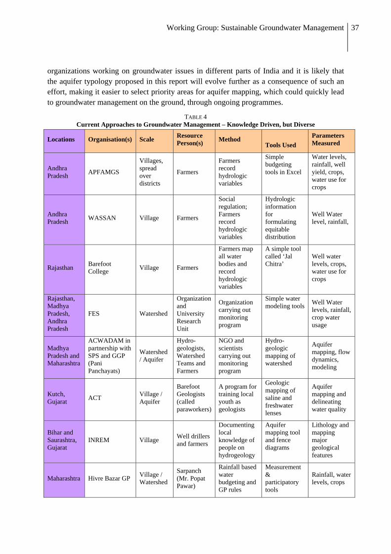
Working Group: Sustainable Groundwater Management 37
organizations working on groundwater issues in different parts of India and it is likely that the aquifer typology proposed in this report will evolve further as a consequence of such an effort, making it easier to select priority areas for aquifer mapping, which could quickly lead to groundwater management on the ground, through ongoing programmes.
TABLE 4 Current Approaches to Groundwater Management – Knowledge Driven, but Diverse
Locations Organisation(s) Scale Resource Person(s) Method
Tools Used Parameters Measured
Andhra Pradesh APFAMGS
Villages, spread over districts
Farmers
Farmers record hydrologic variables
Simple budgeting tools in Excel
Water levels, rainfall, well yield, crops, water use for crops
Andhra Pradesh WASSAN Village Farmers
Social regulation; Farmers record hydrologic variables
Hydrologic information for formulating equitable distribution
Well Water level, rainfall,
Rajasthan Barefoot College Village Farmers
Farmers map all water bodies and record hydrologic variables
A simple tool called ‘Jal Chitra’
Well water levels, crops, water use for crops
Rajasthan, Madhya Pradesh, Andhra Pradesh
FES Watershed
Organization and University Research Unit
Organization carrying out monitoring program
Simple water modeling tools Well Water
levels, rainfall, crop water usage
Madhya Pradesh and Maharashtra
ACWADAM in partnership with SPS and GGP (Pani Panchayats)
Watershed / Aquifer
Hydro-geologists, Watershed Teams and Farmers
NGO and scientists carrying out monitoring program
Hydro-geologic mapping of watershed
Aquifer mapping, flow dynamics, modeling
Kutch, Gujarat ACT Village /
Aquifer
Barefoot Geologists (called paraworkers)
A program for training local youth as geologists
Geologic mapping of saline and freshwater lenses
Aquifer mapping and delineating water quality
Bihar and Saurashtra, Gujarat
INREM Village Well drillers and farmers
Documenting local knowledge of people on hydrogeology
Aquifer mapping tool and fence diagrams
Lithology and mapping major geological features
Maharashtra Hivre Bazar GP Village / Watershed
Sarpanch (Mr. Popat Pawar)
Rainfall based water budgeting and GP rules
Measurement & participatory tools
Rainfall, water levels, crops

Working Group: Sustainable Groundwater Management 38
Section 4
NATIONAL AQUIFER MAPPING AND PARTICIPATORY
GROUNDWATER MANAGEMENT PROGRAMME
Working Group: Sustainable Groundwater Management 39
4.1. CONCEPT OF AQUIFER MAPPING
Aquifers are basic units for understanding groundwater and attempting the sustainable management of groundwater resources. Hence, the first step is to construct a disaggregated picture by carefully mapping aquifers across different hydrogeological settings and understanding their storage and transmission characteristics. One of the outputs of aquifer mapping would be the estimation of the amount of water available within each aquifer. Bringing simple modeling techniques as an input, such estimation will be able to predict groundwater availability under various scenarios – degrees of exploitation of the resource, changing patterns of water use and climate change. This estimation can then feed into understanding the contribution of the aquifer to the overall water availability within a watershed or a river basin in a given hydrogeologic configuration.
Aquifer mapping will have to go beyond the production of specific aquifer maps at appropriate scales. Each aquifer map will, in many ways, bear similarity to District Resource Maps (Geological Survey of India) and Groundwater Prospects Maps (Rajiv Gandhi National Drinking Water Mission). Aquifer maps (apart from thematic maps) will include:
A narrative description of the maps themselves. Statement of the “sustainable yield management goal” for the aquifers, stating that the average withdrawals should not exceed long-term recharge, at least as a guiding principle. Inputs / guidance for implementing artificial recharge programmes effectively, indicating plans for implementing artificial recharge for the aquifers concerned. Since the fundamental binding constraint on resource availability is on the demand side, aquifer mapping must lead to a groundwater management strategy, which includes appropriate demand-management strategies in addition to water use and recharge. Once the aquifer is mapped and its storage, transmission and quality characteristics determined, a broad set of priorities of water use can be decided. Aquifer mapping should lead to location-specific protocols and agreements within the user community as well as arriving at a robust regulatory framework through legislation. Aquifer mapping will lead to carefully oriented strategies of using indirect regulatory instruments like electricity rationing or metering as a means of groundwater regulation.
4.2. DESIGN OF THE AQUIFER MAPPING PROGRAMME
Scale
Given the diversity of scale on which aquifers exist, not only in India, but across the globe, aquifer mapping should be conducted at the scale of 1:50000 (and possibly at higher scales). Whether actual mapping of aquifers takes place at a fixed scale of 1:50000 (as proposed by CGWB) or at a flexible scale, depending upon the hydrogeological setting, some practical considerations may be kept in mind while deciding the scale of such mapping.

Working Group: Sustainable Groundwater Management 40
The Working Group has considered six hydrogeological settings described in Table 2, for the purpose of designing the current programme. Actual aquifer mapping should be kept flexible – local mapping (at high scale – say 1:10000) for local aquifers such as those in the hard rocks and more regional scale mapping for alluvial aquifers. The added advantage of such maps would be the great value they will add to the groundwater assessment exercise conducted jointly by the CGWB and State Agencies dealing with groundwater resources. Collection of point information regarding how various aquifer units are disposed in an area and what their geometry is, will help confirm the aquifer disposition and water bearing strata as well as help ascertain the ground water quality in the aquifer. Tools such as geophysical surveys and remote sensing would help facilitate such mapping and must be encouraged as much as possible.
Monitoring
Each of such aquifer units would have a dedicated system of wells for periodic water level monitoring and for monitoring of groundwater quality parameters. The appropriate density of the monitoring wells will depend on the characteristics of the aquifer systems being monitored, but even crude estimation indicates that the current density will have to be increased sufficiently to match assessment scales at aquifer levels. Moreover, hydrogeological settings will determine monitoring densities. For instance, in crystalline and hard rock formations or mountain systems with localized recharge systems, the density of observation points have to be greater than that in alluvial systems, recharge cycles being at a regional scale in the latter. Although the sample wells will be drawn from the large number of irrigation wells in the country, special type of wells can be additionally constructed to cater to specificities of each hydrogeologic setting. Other sources of information, such as remote sensing images and topographical maps will also be used in the aquifer mapping exercises. Information from all these sources will be put together to obtain three-dimensional images of the aquifer systems at the relevant scale.
Information and database
All data and information can be put up into a centralized, real-time (or close to real-time) data-management system with as short a lag as possible between data capture and data visibility. We also need to build a comprehensive database on the characteristics of groundwater stocks, flows and quality in each hydrogeological setting. In addition to water level monitoring, periodic measurement of base flows, pump tests and groundwater quality measurements will be conducted on an aquifer-basis, to assess the storage and transmission properties of aquifers. This database would enable a real-time monitoring of the status of groundwater use and implementation of remedial measures in cases where the resource is under threat from depletion and contamination. These efforts need to be dovetailed with the Development of Water Resources Information System scheme (implemented by the CWC and ISRO) or the data management system being evolved through deliberations of the Planning Commission’s Working Group on Data and Data Management – for the 12th Plan.
Working Group: Sustainable Groundwater Management 41
Establishing a web-enabled water resources information system could be one important link to the aquifer mapping and groundwater management programme.
Process of institutional collaboration
There is need to identify key institutions who can map aquifers, develop the human resource to take up this large exercise, and build their capacities; there is also need to develop capacities of the village communities to take informed decisions in groundwater management a responsibility that they can take only if they are deeply involved in a participatory aquifer mapping exercise. An allied component would be the sensitization of policy makers and State Electricity Boards to come on board with respective policy-level reforms in agriculture, industry and other such sectors that are likely to indirectly lever aquifer management plans. However the details of such sensitisation are outside the scope of this report. The exercise of mapping and building database systems itself, necessarily involves forging strong partnerships between government agencies, research institutes, PRIs, civil society organizations and the institutions of local communities. Aquifer mapping and management is also a means to break the scale barrier that constrains effective management of a resource for which information and management tools are available on a centralized, aggregated scale while utilization takes place at a highly decentralized, disaggregated scale.
The aquifer-mapping programme will involve selection of appropriately sized units. The broad division of such units as per the hydrogeological setting of an area forms the first step towards developing an aquifer mapping programme for the country (Table 5).
4.3. GROUNDWATER MANAGEMENT
Aquifer mapping outputs should lead to a groundwater management plan in any hydrogeological setting. The output from an aquifer mapping plan would vary from setting to setting but should attempt to capture the following aspects as a groundwater management protocol, across all settings:
• Relationship between surface hydrologic units (watersheds and river basins) and hydrogeologic units, i.e. aquifers.
• The broad lithological setup constituting the aquifer with some idea about the geometry of the aquifer – extent and thicknes
• Identification of groundwater recharge areas – protection and augmentation strategies. • Groundwater balance and water budgeting at the scale of a village or watershed.
Groundwater assessment at the level of each individual aquifer should be attempted in terms of groundwater storage and transmission characteristics, including the aquifer storage capacity.

Working Group: Sustainable Groundwater Management 42
TABLE 5 Aquifer mapping scales in regional hydrogeological settings of India
Regional groundwater settings
Aquifer Mapping Scale
Spatial (in hectares)
Time frame for aquifer mapping exercise
Aquifer mapping output
Mountain aquifers
Highly localized aquifers but often with non-coherent village and aquifer boundaries (but more than one aquifer within the scope of a village) – preferably two mountain watersheds – Scale ranging from 250 to 500 hectares
3 years Aquifer-spring relationship (especially with regard to the limited aquifer storages); characterization of springs (type, discharge and quality profiles); spring water conservation strategies including groundwater recharge and scale of stakeholder participation (e.g. number of villages under the influence of a single aquifer)
Alluvial aquifers (unconsolidated sediments)
Regional systems of multiple aquifers (an aquifer is overlain by many villages, also each village can vertically tap parts of multiple aquifers) – Scales ranging from 5000 to 20000 hectares
3-5 years
Aquifer management plan, with clear strategies on longer-term approaches – irrigation, drinking water and other utilities, including robust external regulatory mechanisms like power rationing, legislative framework etc.; groundwater recharge plans on large scale; aquifers, implications on groundwater quality (mainly arsenic and iron; also fluoride where such aquifers are juxtaposed with other hydrogeological settings) and health with clear strategies of mitigation
Sedimentary rock aquifers
Scales are variable – from local to regional aquifers – but not of the scale of alluvial systems (above); aquifers have somewhat regional connections and more than one village is likely to tap a common aquifer beneath – Scales ranging from 1000 to 10000 hectares
3-4 years Groundwater recharge strategies; existing and potential groundwater exploitation impacts (scarcity along with water quality issues); nature of participatory and regulatory approaches to implementing groundwater management plans keeping estimates of dynamic aquifer storages in mind
Volcanic aquifers
Largely localized occurrence, often as multiple aquifers (vertical); watershed and aquifer boundaries often coherent but village may be underlain by many aquifers – Scales ranging from 500 to 2000 hectares
2-3 years Aquifer storages, interconnectedness between aquifers (because of the layered nature of basalts) and aquifer management strategies including groundwater recharge approaches
Crystalline (basement) aquifers
Two types of situations – regional and local; complex relationships between shallow and deep aquifers; some aquifers
3-5 years Aquifer storages, groundwater recharge and groundwater quality mitigation, especially with regard to fluoride problems; scales of implementing

Working Group: Sustainable Groundwater Management 43
with boundaries coherent with watersheds, others extending below more than one watershed; variable scale of one village – one aquifer to many villages – one aquifer – Scales ranging from 500 to 10000 hectares
groundwater management solutions
• Regulatory options at community level, including the nature of gram-sabha resolutions that will enable appropriate regulatory mechanisms at the panchayat level. These may include (only an indicative list given here):
o Drilling depth (or whether to drill tube wells or bore wells at all) o Distances between wells (especially with regard to drinking water sources) o Cropping pattern
• Inputs to overarching State or Central Legislation, during acute scarcity periods, in particular.
• Comprehensive plan for participatory groundwater management based on aquifer understanding – domestic water security, food and livelihood security and eco-system security, bearing in mind principles of equitable distribution of groundwater across all stakeholders.
• Inputs to the use of indirect instruments of regulation, mainly power rationing and/or metering based on aquifer characteristics and degree of exploitation.
The groundwater management component of this programme will need to be somewhat flexible and can take off only after the aquifer mapping exercise results in a clear output on the components of groundwater management with regard to the concerned aquifer(s). Aquifer mapping will need to be a dedicated exercise whereas groundwater management could become part of implementation programmes such as Watershed Management, MGNREGS, programmes under Agriculture, National Rural Livelihoods Mission, IWMP etc. It is too early to state how groundwater management can be integrated into such programmes but separate thinking on how this will happen, either immediately after aquifer mapping efforts or subsequently as a separate “programme” in the next plan, should be explored as aquifer mapping proceeds.
4.4. INDICATIVE METHODOLOGY
The primary focus of an aquifer mapping effort should be all aquifers in the country, whether phreatic or confined. Most approaches hitherto have used a hydrogeomorphological approach along with geophysical measurements with the purpose of classifying groundwater prospects, or in simple words, to locate groundwater resources. The purpose of the proposed aquifer mapping being quite different – developing aquifer management plans – the methodology proposed here will essentially use three important criteria.

Working Group: Sustainable Groundwater Management 44
• Geological mapping at an appropriate scale, using primary and secondary information.
• Inventory of at least a representative sample of the 30 million odd wells that are supposed to be a part and parcel of India’s groundwater infrastructure.
• Water level data at each individual location. • Aquifer characteristics like transmissivity and specific yield / storativity.
These four layers of information are viewed here as constituting the basic information in mapping aquifers. In addition, the expert organization or collaborating agencies may also strategically use other tools such as remote sensing, geophysics, pumping tests etc. to supplement the basic approach of mapping aquifers and coming up with strategic aquifer plans for an area. Such institutions should also be given access to all data and information available with the CWC, CGWB and State Groundwater Departments, particularly water level data collected under India’s groundwater monitoring programmes, including the Hydrology Project. The output from an aquifer mapping exercise should essentially be in the form of an “aquifer map” which will include the following:
1. An aquifer outcrop map on a geological map of appropriate scale (Geological Survey of India is currently taking up mapping exercises on the scale of 1: 10000; such maps can also be used as the basis for creating aquifer projection onto the surface. CGWB’s current information in aquifers (at more regional scales) can also form a basis to begin work on aquifer mapping.
2. Vertical configuration of the aquifer(s) should be depicted through either appropriate cross sections or fence diagrams or other 3-D depiction models that can appropriately depict vertical boundaries.
3. Water level information (preferably a water table contour map for at least the pre and post monsoon seasons) which can be layered on top of the geological map.
4. Narrative on aquifer properties, mainly transmission, storage and groundwater quality. The narrative will explain, in simple terms, the map, cross sections and groundwater movement in the aquifer.
5. A supplementary map indicating natural recharge and discharge areas. This map will also indicate locations for carrying out recharge measures, best locations for siting public drinking water sources, best locations for community irrigation wells etc.
6. Narrative on groundwater availability in the aquifer(s), possibly under different scenarios – normal recharge, droughts, groundwater exploitation etc.
7. Protocol for aquifer management – supply and demand side – including the possibility of imposing more centralized systems of legislation (in a worse-case scenario).
Suggested Activities
• Compilation and integration of existing data from CentralAgencies, State Departments, Academic Institutions and Civil Society Organisations / NGOs.
• Identifying data gaps.
Working Group: Sustainable Groundwater Management 45
• Hydrogeological support and data gathering at village level, incorporation of well inventory, water level monitoring, insitu water quality testing, sample coding of wells with co-ordinates and altitudes, other relevant particulars; compilation of data at block/toposheet, district and state levels.
• Scientific data generation through hydrogeological mapping and allied investigations, hydrometeorological studies, geophysical investigations, ground water level and quality monitoring, soil infiltration testing, drilling of test/exploratory wells, pumping tests, isotope studies and techno-socio-economic aspects.
• Validation and documentation of all the existing data of existing newly acquired data at different levels and scales.
• Procurement of digital satellite data, image processing, merging and mosaicing, generation of various thematic layers.
• Preparation of aquifer maps on GIS platform by depicting aquifer geometry in 2D/3D • Web Based Development of Aquifer Management system and groundwater
management plan. • Publication including printing of various maps & reports for end users.
4.5. GETTING STARTED
It is felt that toposheet will be the base platform while initiating the mapping of aquifers. Toposheet will be a practical base unit as large area can be covered including the specific aquifer areas. Using toposheets will have the following advantages:
• All administrative boundaries, down to village level can be overlaid onto toposheets. • Watershed, Command areas, Catchments boundaries can be overlaid. • Georeferencing for uniform “coding” is best possible on toposheets • Secondary data with other Government Agencies are currently being brought to scale
of 1:50,000, making it a convenient scale to port different kinds of such secondary information, e.g. GSI, NRSC, Survey of India and CGWB databases are available at toposheet scale.
However, the actual execution of aquifer mapping (note, not maps) can be at a larger scale, say 1:20000 or even 1:10000. This is especially important in settings such as mountain systems like the Himalayan region, where the scale of 1:50000 will preclude capturing local aquifers and local conditions that would be required to develop groundwater management protocols.
This note, despite intensive inputs from various experts is no end unto itself where aquifer mapping and groundwater management in India is concerned. It is envisioned that groundwater management in some locations may run in parallel to the aquifer-mapping programme. An ambitious target of mapping all aquifers in the country should be kept so as to maximize on the aquifer mapping programme efforts. The approximate outlay is 10000 crores (Table 6), although a separate “programme” would need more detailed considerations

Working Group: Sustainable Groundwater Management 46
and can be developed once the concept of aquifer mapping is formalised. It becomes important to arrive at a standard protocol of mapping aquifers across the country, an exercise that should not stop at mapping aquifers alone. Although it is beyond the scope of this note to arrive at details of such a programme, certain broad guidelines could be specified:
• All hydrogeological settings, representing the national groundwater typology must be represented.
• Groundwater vulnerability (exploitation and quality) is indicated in about 60% of India’s districts, of which 30% are at some level of groundwater overexploitation or the other; hence, 30% of the area can be covered in the first phase.
• Each aquifer mapping must be located in the blocks where aquifers show indications of overexploitation (CGWB’s national assessment can be taken as a starting point to decide on these locations).
• Preference should be accorded to those locations where groundwater exploitation and quality issues run hand-in-hand.
• Consideration may be given to locations where the Government or Civil Society is working on water management – watershed development, MGNREGS, drinking water security etc. (e.g. in some of the APFMGS project areas or areas where Participatory Groundwater Management Efforts funded by different agencies are being undertaken).
Working Group: Sustainable Groundwater Management 47
PHASE 1: (4 YEARS)
The aquifer mapping should involve piloting in 150 locations representing different hydrogeological settings. These locations can be dovetailed with efforts under FAO, World Bank, MoWR, MoRD and other such initiatives where groundwater resources management forms a significant component of the efforts. Agencies with capacities in aquifer mapping – CGWB, State Agencies like GSDA, APGWD, select Civil Society Organisations with scientific capabilities and Academia (Universities and other Research Centres like NIH and NGRI) should be encouraged to take up such detailed mapping of aquifers in different areas. This would ensure a mapping effort in about 1 million hectares.
Piloting should lead to upscaling, beginning with overexploited blocks and some blocks with serious groundwater quality challenges. The upscaling phase will therefore involve about 30% of the total area or roughly 100 million hectares. The first phase should be completed within the 12TH Plan, essentially through a partnership model involving:
1. Government Agencies (Central and State), 2. Research Organisations and 3. Civil Society Organisations
All such organizations should possess strong capabilities in working on aquifer mapping and / or groundwater management. They should also possess capacities to demystify information, data and knowledge on groundwater so that such a base will feed into improved implementation and specific actions on the ground. All information collected should be fed into the centralised database and should be maintained in public domain. PHASE 2: COMPLETE NATIONAL COVERAGE
Phase-2 will also include expanding the expertise on aquifer mapping to a larger set of agencies to attempt completion of aquifer mapping in the stipulated course within the 13th Plan. It is understood that each Aquifer Mapping Project must include a “key partner” in the form of an implementing agency, an organization which can take the outputs from such a pilot into the implementation mode. Hence, organizations that have established strengths in implementing MGNREGS, Watershed Management and such programmes should be encouraged to partner in these efforts. The CGWB, as the central agency dealing with groundwater, should lead this effort, with support from various organizations.
4.6. SPECIAL FOCUS: GROUNDWATER SALINITY AND URBAN AQUIFERS
As an integral part of the aquifer mapping effort, it is necessary to look at two specific aspects of aquifer mapping and groundwater, in the 6 hydrogeological settings identified under the national groundwater typology. Firstly, the context of groundwater salinity, which will include:
• Aquifers and their differential behaviour to inland salinity as well as sea-water incursion;
• Causes for salinity and sea-water ingress in light of aquifer characteristics; • Other associated water quality problems, if any; • Groundwater recharge measures for mitigation;
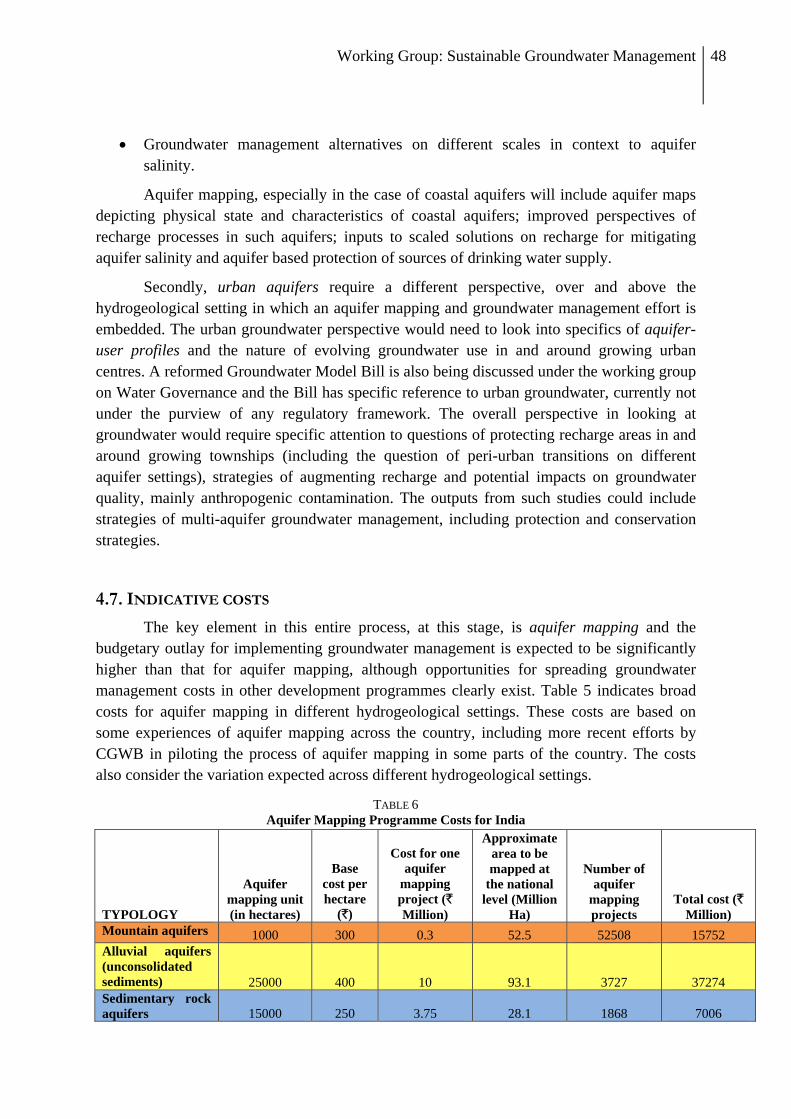
Working Group: Sustainable Groundwater Management 48
• Groundwater management alternatives on different scales in context to aquifer salinity.
Aquifer mapping, especially in the case of coastal aquifers will include aquifer maps depicting physical state and characteristics of coastal aquifers; improved perspectives of recharge processes in such aquifers; inputs to scaled solutions on recharge for mitigating aquifer salinity and aquifer based protection of sources of drinking water supply.
Secondly, urban aquifers require a different perspective, over and above the hydrogeological setting in which an aquifer mapping and groundwater management effort is embedded. The urban groundwater perspective would need to look into specifics of aquifer-user profiles and the nature of evolving groundwater use in and around growing urban centres. A reformed Groundwater Model Bill is also being discussed under the working group on Water Governance and the Bill has specific reference to urban groundwater, currently not under the purview of any regulatory framework. The overall perspective in looking at groundwater would require specific attention to questions of protecting recharge areas in and around growing townships (including the question of peri-urban transitions on different aquifer settings), strategies of augmenting recharge and potential impacts on groundwater quality, mainly anthropogenic contamination. The outputs from such studies could include strategies of multi-aquifer groundwater management, including protection and conservation strategies.
4.7. INDICATIVE COSTS
The key element in this entire process, at this stage, is aquifer mapping and the budgetary outlay for implementing groundwater management is expected to be significantly higher than that for aquifer mapping, although opportunities for spreading groundwater management costs in other development programmes clearly exist. Table 5 indicates broad costs for aquifer mapping in different hydrogeological settings. These costs are based on some experiences of aquifer mapping across the country, including more recent efforts by CGWB in piloting the process of aquifer mapping in some parts of the country. The costs also consider the variation expected across different hydrogeological settings.
TABLE 6 Aquifer Mapping Programme Costs for India
TYPOLOGY
Aquifer mapping unit (in hectares)
Base cost per hectare
(`)
Cost for one aquifer
mapping project (` Million)
Approximate area to be mapped at
the national level (Million
Ha)
Number of aquifer
mapping projects
Total cost (` Million)
Mountain aquifers 1000 300 0.3 52.5 52508 15752 Alluvial aquifers (unconsolidated sediments)
25000 400 10 93.1 3727 37274
Sedimentary rock aquifers 15000 250 3.75 28.1 1868 7006

Working Group: Sustainable Groundwater Management 49
Volcanic aquifers 10000 250 2.5 52.5 5250 13126 Crystalline (basement) aquifers 10000 250 2.5 102.4 10237 25591
TOTAL 328.6 73590 98749 i.e. approximately ` 10,000 crore
Working group thus, proposes:
• Phase I: Aquifer mapping in 100 locations covering 1,000,000 ha. i.e. 10000 km2 which comprises an area covered by about 14 toposheets. Time of completion of Phase-I is 1st year and cost would be about ` 100 crore;
• Phase-II: Aquifer mapping in an area covering 100 million ha. i.e. which is ~ 10 lakh km2, which will be covered by about 1400 toposheets. Time of completion of IInd Phase is 2-3rd year and cost would be about ` 3000 crore; and
• Phase-III: Aquifer mapping covering about 3600 toposheets in the remaining two years, with involvement of larger set of agencies. Time of completion is 4-5th year and cost would be about ` 7000 crore.
Total expenditure, with focus on aquifer mapping is ` 10000 crores. Expenditure to undertake specific groundwater management efforts drawing upon the aquifer mapping exercise will need to be developed separately, either under a specific scheme or through existing programmes of the Central and State Governments.
Section 5
INFORMATION AND DATABASE

Working Group: Sustainable Groundwater Management 50
5.1. AQUIFER RELATED DATA AND GROUNDWATER INFORMATION
The current initiative for collating all water related data into one platform at the central level in the form of the proposed NWR-IC – National Water Resources Information Centre by the Central Water Commission can be used to draw various strings of water-related data into a centralised water database. This has been discussed at length within the Working Group on Data and Data Management, constituted by Planning Commission, and hence, this report discusses only those aspects of relevance to this report.
Three aspects are expected to form the reforms in data and data management of water – representativeness, transparency and availability of data in public domain. As mentioned in the deliberations of the WG on Data and Data management, NWR-IC needs to anchor the use of data for wider dissemination. The effort at maintaining the database, error-checking and consistency and making it user-friendly, is quite challenging, but necessary. Keeping in mind the nature of users – Panchayats / Block-level Institutions, District Administration / Public Health Authorities / Irrigation Departments / NGOs etc. – the usability factor is critical and so is participation from end users, in the design of this database. NWR-IC is expected to maintain a wide array of data sets, of which groundwater data is one component. However, a centralised database, exclusively on groundwater, could be maintained at the CGWB. In this light, all groundwater data collected for different aquifers, under the aquifer mapping effort should be maintained at five levels:
1. District level groundwater database housed with the district office under each State, drawn together from the aquifer mapping effort at the Panchayat and Block levels.
2. State level groundwater database, which collates and maintains information from all districts in the State, with some analyses especially regarding a district-level aggregation of aquifer-based information.
3. Central Ground Water Board (CGWB) regional offices (ROs) will maintain data from different States under the purview of each RO.
4. Centralised groundwater database with the CGWB HQ, with a public-access mandate, also shared with RGI for training purposes.
5. The groundwater database will also be maintained by NWR-IC as part of the larger national database on water resources. Such data structure will ensure 3 levels of backup for the entire data on groundwater
(RGI, CGWB and NWR-IC). The primary level of groundwater data must include the following elements (indicative):
• One time-water level data from a representative sample of all wells (estimated to be about 30 million in number) and springs existing in the country – pre and post monsoon levels and discharges respectively – collected as part of aquifer mapping effort.

Working Group: Sustainable Groundwater Management 51
• Quarterly monitoring of water level data, spring discharges and basic water quality parameters (for two years overlapping with Aquifer Mapping effort) from an appropriately representative sample (10 to 25%) of all wells and springs.
• Dedicated observations wells and piezometers for long-term continuous monitoring – frequencies can be decided in a customized manner (in continuation with Central and State efforts under projects like Hydrology Project) – at least 200000 dedicated points for groundwater monitoring.
• Representative values of specific yield and transmissivity – from wells under the aquifer mapping effort.
• Aquifer depths, well-yields and other qualitative information.
5.2. GROUNDWATER QUALITY
A notification of standards at a national level is needed to impact enforceability to the standards for drinking water. Looking at practicality of enforcement by water supply service providers, a timeline can be associated with the standards to accord priority to adherence of different water quality parameters on an incremental basis.
Groundwater Quality Data Management is a crucial task to be undertaken at various levels. Due to wide variation in groundwater quality with space and time, there is a need for a dynamic, open access database which is a repository for all groundwater quality data collected across the country. As proposed in the recommendations here, there is need to define minimum water quality sampling standards and aim to achieve them for different water quality paramaters over time. Also proposed is a system of hierarchical referral laboratories at primary, secondary and tertiary levels that are all accredited to NABL through a certification process.
At the primary level, only indicative measurement of water quality needs to be carried out in conjunction with community and water supply or health workers. At the next secondary level laboratories, basic parameters required by the BIS standards (or enforceable standards as proposed here) need to be measured. The tertiary level laboratories would assure quality control and measure paramaters which require higher levels of instrumentation and analysis. Data management of water quality data arriving from these primary, secondary and tertiary laborotaries is important so that the data is accessible to relevant stakeholders when required. In order that this should happen, we propose the following:
• Reviving District laboratories and transforming them into District Water Quality Data Centres (DWQDC) for wider dissemination; data collection and testing through certified referral labs; personnel for awareness and communication; periodic publishing of data in local newspapers
• The 3-tier structure of laboratory – primary, secondary and tertiary (referral) – can be constituted. In this, the primary level of testing on an indicative level could be assigned to capable and interested Gram Panchayats or Schools
• There needs to be District to Village Panchayat participation for some components of participatory surveillance and qualitative aspects – periodic qualitative testing,
Working Group: Sustainable Groundwater Management 52
highlighting data needs and participating in implementation of mitigation programmes. The primary level laboratories will be at the level of several Gram Panchayats and operate in a participatory manner to flag key local water quality problem in an indicative manner.
• The data generated within a district from such laboratories should be synthesized by the DWQDC as inputs into the aquifer mapping programme. This will provide for integration of the aquifer mapping data with water quality sampling at different levels.
• At the national level, all such water quality data generated by the DWQDCs should be continuously arranged and updated into a national water data portal such as the NWR-IC.

Working Group: Sustainable Groundwater Management 53
Section 6
INSTITUTIONAL STRENGTHENING
AND CAPACITY BUILDING
Working Group: Sustainable Groundwater Management 54
6.1. GROUNDWATER GOVERNANCE
It is suggested that Planning Commission develop a system at the apex level to bring about coherence among different ministries dealing with groundwater in order to ensure improved groundwater governance. The system will continue its advisory role at different levels, during the piloting phase and the roll-out of the aquifer mapping programme. The committee will have a fair representation from the Ministries at the Central and State levels, CGWB, GSDA, academia and research institutes working specifically on groundwater (like NGRI, IITs and NIH), support organizations like NRSC, Civil Society Organisations working specifically on the science of groundwater and participatory groundwater management and independent researchers. Some overseas experts with sufficient experience of having worked in India may also be invited to the expert committee. Members of the community of users (including industrial units), farmer organizations and panchayats who have taken particular interest in protecting and conserving their groundwater resources, should also get representation in this high-powered committee.
The institutional mandate of CGWB should be strengthened to enable it to perform its role as the manager of groundwater resource, including hiring from the fields of community institutions, participatory management of resource, political economy and economics, water markets, regulatory systems, alternative uses, opportunity cost of groundwater extraction, energy management, etc). The mandate of a) management of groundwater resource and b) enabling sustainability of groundwater resource must be translated into achievable and measurable results for the CGWB. The governing body must hold the senior management of CGWB accountable for these results. This mandate requires changes in the nature of coordination among the government ministries related to groundwater (water resources/irrigation, drinking water, rural development, agriculture, urban development, pollution control and industrial effluent). These agencies must be required to assess the impact of their decisions on groundwater and report to CGWB. The Environmental Impact Appraisal conducted by the Ministry of Environment and Forests needs to include the important aspect of groundwater. MoEF must be required to seek the opinion of CGWB in all ground-water stressed regions as well as in cases where a negative impact on water quality is anticipated. CGWB may develop protocols for conducting assessment of impact on groundwater of major (industrial/urban/hydrological) interventions.
6.2. CAPACITY BUILDING IN A CASCADING FRAMEWORK
The overarching need is to set up a system of aquifer mapping and assessment leading to the National Groundwater Management Programme. The objective of the present section is to propose a process of institutional strengthening and capacity building of institutions and their human resources to undertake these tasks. The Working Group feels that we could make a good beginning of this in the 12th Five Year Plan period.

Working Group: Sustainable Groundwater Management 55
Capacity building is a cascading process through which the science of hydrogeology is progressively demystified and brought closer to the community, with a view to take informed decisions around the use of groundwater and to possibly initiate collective action regarding the conservation, augmentation, usage and overall management of groundwater. In other words, capacity building is visualised as a process of creating a knowledgebase accessible to the community as a crucial decision support to foster many sustainable groundwater management initiatives. Hence, Civil Society Organisations (CSOs) who hold experience in natural resource management and sustainable development must play a critical role in the capacity building exercise.
Central and State groundwater agencies will benefit from inputs given by the CSOs on developing sustainable groundwater management systems. The outcomes of such State-CSO partnerships will develop capacities towards informed governance of groundwater ranging from mapping and assessment to monitoring and management. CGWB is already in the process of creating a directory of capable agencies working on various groundwater issues from across the country. It would be fruitful to use such a database to pool in both resource persons as well as potential trainees in order to facilitate the process of participatory mapping and capacity building.
A crucial aspect of the capacity building process is the development of human resource capabilities both within and outside government. The human resources available in the government (Central and State) is grossly inadequate to address the challenge of assessment of groundwater resources and sustainable groundwater management. More specifically, the pool of trained hydrogeologists will need to be increased at the district and block levels, which are the cutting edge of implementation. In view of this, it becomes imperative for every State in the country to have a separate department or agency dealing with groundwater. Some States like Maharashtra and Andhra Pradesh have such structures in place but this is either weak or missing altogether.
While States gear up to establishing/strengthening groundwater departments, an interim process could begin with every district employing a team of at least two groundwater geologists who are placed with the appropriate State Groundwater Department in the District. This should become a standardized norm, irrespective of how the bureaucracy in individual States functions. They, in turn, will support ‘barefoot groundwater geologists’, at least three for every selected block. The state can increase staff capacities in the relevant departments dealing with groundwater issues like, state water resource departments, irrigation, drinking water, agriculture etc. Central support agencies or regional resource centres (similar to Support Voluntary Organisations under the erstwhile watershed programmes) would need to be developed and nurtured to provide the link between the Government structure and other Government and Civil Society Organisations working as implementers in the field.

Working Group: Sustainable Groundwater Management 56
6.3. CAPACITY BUILDING FOR AQUIFER MAPPING
The way forward will involve two sets of actions. First, capacity building will need to be undertaken at different levels; second, mechanisms for bringing about significant institutional or organizational integration and collaboration needs to be established. Capacities will need to be built or strengthened at three levels:
1. Aquifer Level: Grass-root facilitation to a cadre of geo-hydrology workers or parahydrogeologists, capable of providing information on the status of groundwater at the aquifer level to strengthen Panchayat Planning, thus improving deployment of development programmes inclusive of groundwater equitability and sustainability.
2. State Level: Training at State Government level to be in a position to assess the status of their aquifers and groundwater for developing policy and programmes.
3. National Level: National and regional organisations to provide standards for mapping, aquifer and groundwater assessment and capacity building.
The important role of collation, synthesis and management of data is the role best executed by the government, with support from various organisations. This is in line with the guiding philosophy of this report. CGWB and State Agencies should be strengthened to take on the challenge of developing a disaggregated groundwater picture in the country. Therefore, the emphasis should focus on meticulously developing the capacities of institutions and human resources within the government. CGWB and State Groundwater Boards will need to strengthen their existing capacities and develop new ones by expanding out their training mandate.
The central nodal agency to develop such capacities will be Rajiv Gandhi National Groundwater Research & Training Institute (RGI). An expert group should guide RGI to implement the capacity building programme. RGI’s own infrastructure and capacities will need to be increased to deliver this programme. Training will build capacities to develop standardized mapping of aquifers.
Cadres will be required to assist Panchayats and development programs in management of the groundwater. The same cadres can be brought forward to help map aquifers and continue as facilitators during the groundwater management phase. State level capacities will need to address the ability to collate information, analyze its implications to develop policies and inform development programs. Therefore groundwater geologists with qualifications in management and policy formulation will lead these efforts.
Towards this RGI will:
• Make a consortium of Capacity Building Institutions to train District and Block cadres of groundwater geologists for each State/Hydrological Setting drawn from State Groundwater Survey Office, State Water Resource Departments, Technical Institutions/Universities/IIT’s/IIM’s and Civil Society Organisations with the required expertise and experience.

Working Group: Sustainable Groundwater Management 57
• Develop strong partnerships for training State and Central organisations for the programme. These partner institutions will include NWA, Pune; NIRD, IIRS, NRSA, NGRI, IIT’s & IIM’s.
• Create a core group of faculty drawn from private and public institutions to develop curriculum and oversee delivery of training programmes.
• Identify inspired leadership that can provide sustainability to the training institute in order to oversee and ensure the core objective of the program is not diluted.
• Develop an Electronic Resource Centre at RGI, Raipur on groundwater system policies and management.
• Bring relevant experiences and knowledge already developed on mapping, monitoring and management of aquifers and training methodologies from within and outside the country. Linkages will be developed with centers of excellence like Groundwater Division - British Geological Survey (BGS), USGS – Groundwater Division, ITC & TNO (Delft) – Netherlands; National River Water Authority (UK); Royal Institute of Technology (RIT) – Sweden; International Groundwater Modeling Centre – Denver; International Foundation for Sciences (IFS); USAID & USEAP; and International Groundwater Resources Assessment Centre (IGRAC), to name a few.
• Coordinate with University Geology Departments and other such organisations, to ensure training and specialization in groundwater geology. Curricula need to be brought up-to-date regarding perspectives of aquifers and groundwater management, appropriately tailored to the Indian context.
• Facilitate the training in around one thirds area of the country with critical groundwater situations on priority in the 12th five year plan.
6.4. CAPACITY BUILDING FOR PARTICIPATORY GROUNDWATER MANAGEMENT
Aquifer mapping can only be successful if it is appropriately followed up with participatory groundwater management. The idea behind any capacity building exercise on groundwater management, therefore, should ensure that groundwater resources are documented, monitored and local stakeholders facilitated to manage this resource sustainably. RGI will be the Nodal Agency for this capacity building venture as well. A target of 2000 blocks (more than one thirds of the total in the country) with critical groundwater situations will be prioritized in the 12th five year plan, beginning 2013. While various capacity building programmes are being designed for higher cadres, this note defines the trainings for parahydrogeologists who will work in villages across India. It is expected that approximately 18000 to 20000 parahydrogeologists will be required to help map, monitor and facilitate management of the local groundwater, considering the atomistic nature of groundwater use in India. Table 7 is an indicative framework for a national-level capacity building exercise that will integrate aquifer mapping and groundwater management attempts by converging bottom-up and top-down approaches to break down the institutional silos in groundwater management and governance.

Working Group: Sustainable Groundwater Management 58
TABLE 7
INDICATIVE FRAMEWORK FOR CAPACITY BUILDING ON AQUIFER MAPPING AND GROUNDWATER
MANAGEMENT
Level Target Org/Individuals
Training Who Will Do /Coordinate
Centre (at RGI)
CGWB, State officials, Senior staff from Civil Society organizations
• Training of trainers – mostly in aquifer mapping and management
• Development of guidelines for aquifer mapping
• Managed aquifer recharge • Advocacy • Model Bill and legislation • Research design and collaboration
with potential partner organisations
• RGI will anchor, develop training and propose joint research projects
State State Groundwater Departments
• Aquifer mapping at 1:50000 scale • Participatory Groundwater
Management • Data gathering and compilation • Compilation of State level aquifer data
and characterization
• CGWB and State GW Dept will identify a Consortium of Capacity Building Institutions at the state level.
• This consortium will
evolve a capacity building strategy in co-ordination with experienced CSO partners and Technical Research Institutions
Civil Society, Academic and Research Institutions
• Training of Trainers at the District and Block Levels
• Aquifer mapping at disaggregated scales (1:25000 and above)
• Development of hydrogeological information and database
• Identification of key problems • Hydrogeological Surveys • Development of approaches of
mitigation or problem and overall groundwater management strategies
District Geo-hydrologists (2 per district)
• Coordination monitoring and village level mapping
• Collaboration with other Govt. Program
• District GW department with CSO Partners, Universities and Colleges
Block Barefoot Geo-hydrologist (3 per Block)
• Village level Hydrogeological mapping
• Well Monitoring and Monitoring of Groundwater Use
• A module has attached as annexure 4
• State and District GW departments in collaboration with experienced CSO partners
• Advice from technical
research institutions to be incorporated.
It is recognized that there is a shortfall of qualified geologists and very few accept living and working in remote blocks in the country. On the flip side, youth from these remote regions have shown the ability to grasp the requirements of this programme in a years’ focused training and have the commitment to live and work in these remote areas (ACT, pers.

Working Group: Sustainable Groundwater Management 59
comm. 2011). When chosen and trained with appropriate orientations, they have demonstrated abilities of communication and participation rarely seen amongst qualified technical professionals. Therefore, the programme has chosen to identify matriculate youth with the enthusiasm to be useful to their regions, as the sole criterion for the job.
RGI will identify civil society organisations capable of conducting hydrogeological investigations including aquifer mapping and of building capacities of such potential barefoot hydrogeologists. They, in turn will identify and train a team of trainers in different States, who will execute these trainings. RGI will identify a regional training institute to coordinate all trainings. The local State and District groundwater geologists, universities and others with legal/social/technical knowledge on groundwater will be brought into the trainings as resource persons so as to develop, strengthen and build a pool of hydrogeological capacities at different levels and within multiple institutions.
The objectives of the training will be to ensure that the participants
• Understand basic geology - how land and water interact over centuries to develop rocks and different aquifers;
• Understand the basic processes of groundwater accumulation and movement. • Understand how groundwater has shaped human development and the problems
associated with over-extraction and groundwater quality. • Develop skills, both technical and social, in order to prepare local groundwater maps,
monitor water and its quality in aquifers. • Learn social skills, especially in bringing local stakeholders to appreciate their own
geo-hydrology, groundwater availability and sustainable use and participate in groundwater management at the community (village/watershed/river basin) level.
The trainings are in two modules wherein the first Module is four months and the second will be completed in three months.
• Module 1 o Part A - Introduction to groundwater geology o Part B - Groundwater Mapping and Monitoring
• Module 2: Groundwater management
While modules 1 (A&B) are to be conducted one after the other, module 2 can be imparted after the barefoot geohydrologists (parahydrogeologists) have completed making the aquifer maps of their respective blocks. The Central institutions and their regional offices identified to do research, standardization of mapping and monitoring and capacity building will need to submit a human resource plan to the Planning Commission.
At the district level two cadres will be required:
1. Groundwater geologists at district headquarters – a team of a qualified geologist with groundwater training with an assistant;

Working Group: Sustainable Groundwater Management 60
2. Barefoot groundwater geologists or parahydrogeologists, at the block level – these should be local youth with a minimum qualification of having cleared their matriculation. They will undergo two modules of trainings, the General Module (module 1) will equip them with capacities to help in the generation of aquifer maps and monitor quantity/quality. The Advanced Module (module 2) will equip them with abilities to facilitate management of groundwater based on policy with local stakeholders.
There exist at least two models for community-based management of groundwater in India. The proposed programme could take lessons from these successful experiments and attempt to upscale these, albeit with appropriate modifications.
Andhra Pradesh Farmer Managed Groundwater Systems Project (APFAMGS)
APFAMGS or APFAMS, as it is popularly called, is perhaps the best known among the community management projects on groundwater in the country. Supported by FAO, It covered about 500 villages in seven drought prone districts of Andhra Pradesh viz., Anantapur, Chittoor, Cuddapah, Kurnool, Mahbubnagar, Nalgonda and Prakasam. Nearly 7,000 farmers have been trained to collect data that are important for understanding local aquifers. At more than 2,100 observation wells, farmers carry out daily and fortnightly measurements of groundwater levels, and also conduct fortnightly measurements of pump well discharges. At the aquifer level, hydrological unit members are trained to use these data for estimation of groundwater recharge into the aquifer following the end of the summer (southwest) monsoonal rains.
The core concept of APFAMGS is that sustainable management of groundwater is feasible only if users understand its occurrence, cycle, and limited availability. The project has attempted systematic demystification of the science of groundwater. The approach of APFAMGS emphasises the need to educate the community about its groundwater resources and the need to manage it sustainably. The project’s trained local cadre goes around the community and creates awareness about groundwater through a variety of communication techniques, many of them adapted to the local cultural milieu. On the basis of this increased awareness, farmers come together to form resource agreements to use available groundwater in a sustainable manner and such agreements are then taken forward to the Gram Sabha and given legal sanction. The key aspect of the project is, again, capacity building of local communities who then take care of protecting their precious resources.
The APFAMGS approach engages farmers in data collection and analysis, thereby building their understanding of the dynamics and status of groundwater in the local aquifers. The project provides farmers with the equipment and skills to collect and analyze rainfall and groundwater data. APFAMGS farmers are measuring and keeping daily track of rainfall, water levels, and well yields, calculating groundwater recharge from monsoonal rainfall, and estimating their annual water use based on planned cropping patterns. The project is essentially transforming farmers into “barefoot hydrogeologists”.
Working Group: Sustainable Groundwater Management 61
Arid Communities and Technologies (ACT) ACT is a professional voluntary organization working in arid Kachch region in Western India. ACT mainly focuses on research and training programmes for capacity building in water resource and agriculture. ACT has developed a model of decentralised capacity building of village communities through creation of an army of para-geologists, who go around mapping hydrogeology and generating awareness among the user community on groundwater. ACT’s objective with regard to the establishment of training centres is “to serve, disseminate and build capacity of traditional scientific knowledge to those people who want to work on natural resource development and management in arid to semi arid region to secure their livelihood over a long term. ACT offers perhaps the best model for capacity building of local communities to manage groundwater as common property.
6.5. TECHNOLOGY UPGRADATION
Emergent challenges in groundwater development and management in India require revamping of available techniques and equipments with which CGWB and State Agencies are currently equipped. The technological advancements being utilized worldwide should be introduced to India’s apex organisation, the CGWB. This will ensure that CGWB is upgraded in terms of institutional, infrastructural and human resource capabilities so as to bring it to an international level in the field of groundwater management.
Groundwater mapping requires techniques and technologies for exploratory drilling. Direct rotary drilling is used in alluvium / soft rock areas while Down-the-hole hammer (DTH) rigs are used to drill in hard rock areas. In some specific cases of hard rock areas, Odex attachment is also used. Percussion drilling is being used particularly in boulder formation, where the percussion method and open hole methods are practiced. Combination drilling methods are being used in bouldary / alluvium / hard rock areas, i.e. in transition areas between different hydrogeological settings. The existing fleet of rigs of CGWB has become obsolete and outdated and it is proposed to acquire new drilling rigs for alluvial, hilly and hard rock terrains to enhance the efficiency and output of drilling. Presently, CGWB uses geophysical equipments like magnetometer, seismograph, electromagnetic and analog loggers etc. International practices and techniques along with the equipments and software need to be adopted in order to bring CGWB upto international standards. State-of-art resistivity imaging equipments for 1D, 2D and 3D resistivity surveys, equipments for application of electromagnetic techniques (VLF), digital loggers along with automatic log-plot and Ground Probing Radar (GPR) need to be procured along with dedicated software for data processing and interpretation. It is proposed to upgrade the level of all chemical labs of the Board. Infrastructure facility for collection of water samples, prime mover for lifting the water sample (pumps), pump for purging the aquifer system before collecting water sample, proper facility for preserving and transportation of water sample to the laboratory, needs to be created for water sampling monitoring. Apart from these lab instruments, hand held

Working Group: Sustainable Groundwater Management 62
instruments are required for field scientists to make in-situ measurements. A dedicated vehicle with an on-board analyzer along with a generator, incubator, pumping device and cold storage device may be useful for easy sampling. Presently, CGWB has chemical equipments for analysis of water samples like ICPS, Flamephotometer, UV-VIS Spectrophotometer, Atomic Absorption Spectrophoto meter(AAS), Nephelo Turbidity meter, DO meter, Ion meter, Gas Chromatograph, TOC analyzer etc. The chemical labs should have advanced chemical analysis equipments to provide more accurate and faster analysis for water samples.
Hydrogeological studies will be rendered quicker and more efficient with support equipments such as Tablet PC / Netbook, Differential GPS, Digital cameras, Sounders, Water testing kits, for onsite use in field, which is absent in the current manner of CGWB’s functioning. Some of the practices such as the pumping test and data analyses with automatic recording support software could be more efficiently handled with such equipment. Moreover, software like ARC-GIS, Mapinfo, MODFLOW, ERDAS, RESIX PLUS, CorelDraw, AUTOCAD etc are proposed to be procured and utilized during the plan.
6.6. RESTRUCTURING AND STRENGTHENING OF CGWB
The Board needs to be adequately reinforced with additional manpower and necessary steps to restructure and strengthen its cadre. Various posts, which are presently inadequately equipped with human resources need to be brought up to requirement. During the 12th Plan, greater emphasis is being laid on sustainable ground water management, on a larger scale throughout the country through activities related to aquifer mapping, strengthening of ground water observation wells, participatory ground water management, capacity building, IEC activity, ground water resource assessment and regulation, monitoring of other schemes of ground water sector etc. It is proposed to restructure and strengthen Central Ground Water Board by increasing the numbers of posts at various levels and up-gradation of existing posts etc. for monitoring and management of the activities envisaged in the 12th Plan. It is also proposed that the offices of Regional Directorates and Divisions be created in those states where CGWB does not currently have its regional and division offices.

Working Group: Sustainable Groundwater Management 63
Section 7 SUMMARY OF RECOMMENDATIONS

Working Group: Sustainable Groundwater Management 64
7.1 GROUND WATER RESOURCES ASSESSMENT
Groundwater resources assessment should be an iterative process involving evaluation and refinement by incorporating new techniques and giving due consideration to climate change.
• Validation through alternative techniques:- The existing methodology of groundwater resources assessment is appropriate and suitable for country-wide groundwater resources estimation, considering the present status of database available with the Central and State agencies. However, the following corrective / additional measures are suggested.
1. Alternative techniques of recharge estimation should be taken up in areas where assessments derived through GEC do not match with the field situations.
2. Micro-watershed (hard rock areas) and doab (alluvial areas) - wise assessment based on actual field estimation of recharge and discharge parameters (GEC-1997) to be taken up in few identified areas.
3. Utilize regional scale assessment methods like space-based measurements for validation.
• Parameter Refinement:-
All data elements need strengthening and refinements. In this context:
i. R&D support in the form of Project based studies (Regional and local scale) should be dovetailed with the National assessment for refinement of parameters used in resources estimation, e.g. estimation of baseflow, recharge from streams, inflow-outflow across assessment boundary on Pilot basis in select areas.
ii. Continuous strengthening of database managed by the Central/ State Governments for groundwater resources estimation is required. Benchmarking of the data elements needs to be established in this regard.
iii. To develop prognostic models of resource estimates in changing climate.
There must be a convergence of assessment of groundwater in terms of quantity and quality for accurate estimation.
7.2 AQUIFER MAPPING
Approach: Toposheets will form the platform while initiating the mapping of aquifers.
Scale: Aquifer mapping at the scale of 1:50,000 scale to be initiated. Such mapping can be taken up at appropriate scales (higher or lower) as per specific requirements in phased manner during 12th and 13th Plan.
Implementation Mechanism: Aquifer mapping shall be taken up as part of the 12th Plan as a co-ordinated effort. CGWB will lead this effort in close co-ordination with State Agencies,

Working Group: Sustainable Groundwater Management 65
Research Institutions and Civil Society Organisations, to arrive at a comprehensive groundwater management plan.
7.3 PARTICIPATORY GROUNDWATER MANAGEMENT PROGRAMME
• Comprehensive plan for participatory groundwater management based on the understanding and outcome of aquifer mapping shall be taken up.
• Stakeholders should be motivated through appropriate mechanisms and programmes, exploring the possibility of a dedicated programme on groundwater or implementation through other appropriate programmes.
7.4 INSTITUTIONAL STRENGTHENING & CAPACITY BUILDING
• Strengthening the mandate, manpower/professionals and design of institutions dealing with groundwater to enable them to perform their roles. Such strengthening will also draw from the fields of participatory management of resource, social science and economics.
• Creation of State-level institutions to manage groundwater, ensuring parity of design and mandate of such institutions, based on good practice from some States.
• Creation of a network of institutions to facilitate the process of groundwater management.
It is suggested that Planning Commission constitute a system at the apex level to bring about coherence among different ministries dealing with groundwater in order to ensure improved groundwater governance.
7.5 STRENGTHENING OF GROUND WATER MONITORING NETWORK
• Increased density of monitoring points • Improved frequency of measurement
The strengthening will include a combination of participatory measurement as well as automation.
7.6 TECHNOLOGICAL UPGRADATION
The technological advancements being utilized worldwide should be introduced in CGWB to upgrade the institutional, infrastructural and human resource capabilities and bring CGWB to an international level, with best possible techniques and technologies for better management of ground water resources in the country.
• Upgradation and procurement of drilling rigs for CGWB • Procuremnt of State of the art chemical/geophysical/hydrogeological/hydrological
equipments • Procurement of latest software for data processing and analysis.

Working Group: Sustainable Groundwater Management 66
7.7 OUTLAY A gross estimated outlay is given in the Table.
Proposed Financial Outlay for Sustainable Groundwater Management requested in 12th Plan
Sr. No.
Name of the Scheme Estimated Cost (Rs in Crore)
Proposed Outlay under Central Plan (Rs in Crore)
1. Ground Water Management and Regulation 4655 Aquifer mapping 4000 Strengthening of Groundwater Monitoring
Observation Wells 100
Participatory Groundwater Management 100 Technological upgrading of laboratories,
drilling, field equipment, software etc. 305
Groundwater assessment, regulation, information dissemination etc.
100
Spill-over work of Demonstrative Artificial Recharge Project and Exploration through outsourcing
50
2. Rajiv Gandhi Training and Research Institute
100
Training and capacity building 100 3. Organisational Strengthening 75 Strengthening and restructuring of CGWB and
RGI 75
Grand total 4830 Crore

Working Group: Sustainable Groundwater Management 67
BIBLIOGRAPHY Badarayani, U., Upasani, D., Dhawan, H. and Kulkarni, H. 2009. Hydrogeological studies for improved
groundwater management strategies in the dryland areas underlain by Deccan basalts: an initiative in Purandar taluka of Pune district in Maharashtra. ACWADAM Report ACWA-H-09-1, 108p.
Burke, J.J & Moench, M. 2000. Groundwater and Society: Resources, Tensions and Opportunities. New York, United Nations. 217 pp.
Central Ground Water Board (CGWB). 2006. Dynamic Ground Water Resources of India (as on March, 2004). CGWB Publ.
Central Water Commission CWC). 2004. Water and Related Statistics, Ministry of Water Resources, Government of India, New Delhi.
Chatterjee, Rana and Ray, Ranjan (2010) Ground water estimation as a resource management tool – International experiences. Kaushik, Y.B. et. al. (eds), Proceedings of Workshop on Ground Water Resources Estimation, February 23-24, 2010, New Delhi.Central Water Commission (CWC). 2007. Water and Related Statistics, Ministry of Water Resources, Government of India, New Delhi
COMMAN. 2005. Managing groundwater resources in rural India: the community and beyond. British Geological Survey Commissioned Report CR/05/354.
DDWS. 2006, Summary of Nation-wide Statistics from Rajiv Gandhi Drinking Water Mission, Department of Drinking Water Supply, Ministry of Water Resources, GoI, New Delhi.
DDWS. 2009. Mid-term Appraisal of 11th Plan – Rural Water Supply, mimeo, Department of Drinking Water Supply, Ministry of Water Resources, GoI, New Delhi.
Dhawan, B.D. 1990. Studies in minor irrigation with special reference to ground water. New Delhi, Commonwealth. 209 pp.
Dhawan, B.D. 1995. Groundwater depletion, land degradation and irrigated agriculture in India. New Delhi, Commonwealth Publishers.
Fewtrell L., Fuge, R. and Kay, D. 2005, An estimation of the global burden of disease due to skin lesions caused by arsenic in drinking water, Journal of Water and Health, v. 32, pp. 101-107.
Foster, S. and Chilton, P. J. 2003. Groundwater: the process and global significance of aquifer degradation. Phil. Trans. Biol. Sci., 3581440: 1957–1972.
Foster, S., Lawrence, A. and Morris, B. 1998. Groundwater in urban development: assessing management needs and formulating policy strategies. World Bank Technical Paper No. 390.
Gale, I., Macdonald, D. M., Calow, R. C., Neumann, I., Moench, M., Kulkarni, H., Mudrakartha, S. and Palanisami, K. 2006. Managed Aquifer Recharge: an assessement of its role and effectiveness in watershed management. British Geological Survey Commissioned Report CR/06/107N. 80P. (Synthesis of the AGRAR case studies).
Geological Survey of India. 1993. Geological Map of India. Printed at Map Printing Division, GSI, Hyderabad.
Geological Survey of India. 1993. Geological Map of India. Printed at Map Printing Division, GSI, Hyderabad.
Groundwater Resource Estimation Committee (GEC). 1997. Groundwater resource estimation methodology. Report of the Groundwater Estimation Committee, Ministry of Water Resources, Government of India.

Working Group: Sustainable Groundwater Management 68
Groundwater Resource Estimation Committee (GEC). 2002. Groundwater resource estimation methodology.
Report of the Groundwater Estimation Committee, Ministry of Water Resources, Government of India.
Indian Agricultural Statistics, Ministry of Agriculture, Various Issues. http://dacnet.nic.in/eands/latest_2006.htm.
International Water Management Institute (IWMI). 2001. Root zone salinity management using fractional skimming wells with pressurized irrigation: inception report. Working Paper 35.
Krishnan, S. 2009. The Silently Accepted Menace of Disease Burden from Drinking Water Quality Problems. Paper Prepared for the MTA of the 11th Plan, CAREWATER, INREM Foundation, Anand.
Kulkarni, H., Deolankar S. B., Lalwani A., Joseph B. and Pawar S. 2000. Hydrogeological framework of Deccan basalt ground water systems, India. Hydrogeology Journal (Springer - Verlag), v. 8(4), pp. 368-378.
Kulkarni, H. and Vijay Shankar, P. S. 2009. Groundwater: towards and aquifer management framework. Commentary, Economic and Political Weekly, XLIV, 40. 6.
Kulkarni, H., Vijay Shankar, P. S. and Krishnan, S. 2009. Synopsis of groundwater resources in India: status, challenges and a new framework for responses. Report submitted to the Planning Commission, Government of India. ACWA Report ACWA/PC/Rep – 1.
Kulkarni, H., Badarayani, U., Upasani, D., Dhawan, H. and Gupta, R. 2009. Understanding the typology of
groundwater resources in India: key to building responses through communities. In (Eds: Kulkarni, H., Badarayani, U. and Upasani, D.) Groundwater management – Typology of challenges, opportunities and approaches. ACWA H-09-2, Arghyam-ACWADAM Publ.
Kulkarni, H., Vijay Shankar, P. S. and Krishnan, S. 2011. Groundwater governance: backing CPR principles
with a process-based approach. IASC-2011, Digital Library of The Commons, Indiana University, 20p. Vijay Shankar, P.S., Kulkarni, H. and Krishnan, S. 2011. India’s groundwater challenge and the way forward.
Special Article, Economic and Political Weekly, XLVI (2), January 8, 2011, 37-45.
Kumar, D. and Shah, T. 2004. Groundwater contamination: The emerging challenge. In: The Hindu - Survey of the Environment. pp.7-9, 11-12.
Margat, J. 1992. The overexploitation of aquifers. In I. Simmers, F. Villarroya & L.F. Robollo, eds. Selected papers on overexploitation, pp. 29–40. IAH Heise.
MacDonald, A., Davies, J., Calow, R. & Chilton, J. 2005. Developing groundwater: a guide for rural water supply. Bourton-on-Dunsmore, UK, ITDG Publishing.
Macdonald, D.M.J., Kulkarni, H., Lawrence, A.R., Deolankar, S.B., Barker, J.A. & Lalwani, A.B. 1995. Sustainable groundwater development of hard-rock aquifers: the possible conflict between irrigation and drinking water supplies from the Deccan basalts of India. British Geological Survey NERC Technical Report WC/95/52. 54 pp.
Minor Irrigation Census (Government of India). 2001. Report on Census of Minor Irrigation Schemes (1993-94). Minor Irrigation Division. Ministry of Water Resources, New Delhi.
Moench, M. 1992. Drawing down the buffer. Econimic and. Political Weekly, XXVII: A-7-A-14.Narsimhan, T. N. 2008. Groundwater management and ownership. Economic and Political Weekly, 43(7), February 22, 2008.
NICED. 2004. Estimation of the burden of diarrhoeal diseases in India, as part of WHO India National Commission for Macroeconomics and Health Background Papers.
Working Group: Sustainable Groundwater Management 69
NSSO. 2006. Morbidity, Healthcare and Condition of the Aged. Report No. 507 of the National Sample Survey 60th
Round (January – June 2004), National Sample Survey Organisation, Ministry of Statistics and Programme Implementation, Government of India, New Delhi
Planning Commission, Government of India. 2007. Report of the Expert Group on Groundwater Management and Ownership. Planning Commission, New Delhi. 61p.
Price, M. 2002. Introducing groundwater. Second edition. UK, Taylor & Francis.
Reddy, D. R. 2008. Understanding the disease of skeletal Fluorosis and ways to contain it, Telengana Jagruti, Fluorosis Vimukti Vedhika. Shah, T. 2008. Groundwater management and ownership: a rejoinder. Special Article, Economic and Political Weekly,43 (17), May 8, 2008.
Shah, T. 2009. Taming the Anarchy: Groundwater Governance in South Asia. Resources for the Future, Washington DC and International Water Management Institute, Colombo, 310p.
Shah, T. and Indu, R. 2004. Fluorosis in Gujarat: A Disaster Ahead, IWMI-Tata Program Annual Partner's Meet, Anand.
Susheela, A. K. 2001. A Treatise on Fluorosis. Fluorosis Research and Rural Development Foundation, Delhi.
Tiwari V. M., Wahr J.M. and Swenson S, (2009), Dwindling groundwater resources in northern Indian region, from satellite gravity observations, Geoph. Res. Lett., 36, L18401, doi:10.1029/2009GL039401.
Tiwari V. M., Wahr J.M. and Swenson S, (2011a), Estimation of water storage variations in the major river basins of India using GRACE satellite gravity data, IUGG General Assembly, Melbourne, 27June-7 July, 201.
Tiwari V. M, Wahr J.M, Swenson S, and Singh B, (2011b), Land Water Storage Variation over Southern India from Space Gravimetry, Curr. Sci., 101, NO. 3, 25 AUG. 2011
WHO. 2002. An overview: Gaps in health research on Arsenic Poisioning, 27th Session of WHO South-East Asia Advisory Committee on Health Research 15-18 April 2002, Dhaka, Bangladesh.
Zhonghua Nei Ke Za Zhi. 1988. Therapeutic efficacy of a calcium and magnesium. Preparation in 41 cases of endemic fluorosis. Nov, 27(11):665-7, 715.