records of survey and corner records
TRANSCRIPT

MANUAL OF INSTRUCTION FOR FILING
RECORD OF SURVEY MAPS,
CORNER RECORDS,
AND
CERTIFICATES OF CORRECTION
REVISED AUGUST 5, 2021 San Diego County Surveyor

2
CHAPTER 3 RECORDS OF SURVEY AND CORNER RECORDS Section Page
3.01 Guideline ................................................................................................................ 2
3.02 Purpose of a Record of Survey Map ....................................................................... 2
3.03 When a Record of Survey Map is Required ............................................................ 2
3.04 When a Record of Survey Map is Not Required ..................................................... 5
3.05 Responsibilities of the Private Surveyor or Engineer .............................................. 6
3.06 Processing Steps ................................................................................................... 8
3.07 Record of Survey Map Check Sheet..................................................................... 10
3.08 General Map Data ................................................................................................ 10
3.09 Miscellaneous Mapping Details. ........................................................................... 15
3.10 Sample Recorded Records of Survey................................................................... 16
3.11 Corner Records .................................................................................................... 17
3.12 Sample Filed Corner Records .............................................................................. 19
3.13 Certificates of Correction ...................................................................................... 19

3
1.01 GUIDELINE
It is the purpose of this manual to follow the procedure for filing Record of Survey Maps and Corner Records as established by the Professional Land Surveyors’ Act, the Board for Professional Engineers and Land Surveyors Board Rules, and guidelines published by the County Engineer’s Association of California on March 10, 1989 (revised March 27, 2009)
The recommended guidelines for Record of Survey Maps are not to be construed as representing the only method available or as an interpretation of the Professional Land Surveyors’ Act.
1.02 PURPOSE OF A RECORD OF SURVEY MAP
The Record of Survey Map is the means by which field surveys relating to property lines, land boundaries or other subjects are brought to public’s attention. The Professional Land Surveyors’ Act (Business and Professions Code, Chapter 15, Division 3, Section 8700 et seq.) provides two circumstances for filing a Record of Survey Map with the County Surveyor: 1) A surveyor may file any field surveys made in conformance with the practice of land surveying as defined therein. 2) A surveyor shall file all field surveys relating to land boundaries or property surveys which disclose those specific criteria defined in Section 8762(b) (i.e., material evidence, physical change, material discrepancies, alternate positioning, and/or establishment of points, lines, or boundaries, etc.). See Section 3.03
The thrust of the law is clear that all surveys relating to property be recorded, for: i) all monuments set to denote property corners, ii) boundary lines between parcel ownership, iii) in certain circumstances, the monumentation of any easements or auxiliary lines be made a public record, iv) to clarify any discrepancies found in subdivision maps, official maps, or records of survey.
1.03 WHEN A RECORD OF SURVEY MAP IS REQUIRED
“A licensed land surveyor or registered engineer establishes and is subject to the record of survey filing requirements, when he or she represents beyond a reasonable doubt or dispute the location, relocation, establishment, reestablishment or retracement of a boundary or property line to another party pursuant to the provisions of Section 8762 of the California Professional Land Surveyors’ Act. This representation includes the act of causing a boundary or property line to be accepted or recognized, to prove or demonstrate the location of the boundary or property line, the setting, resetting, or replacement of a corner, references or witness monuments or the reference of a boundary or property line by showing dimensional ties to the line in relation to physical features or monuments located on the ground.” - California Board of Registration for Professional Engineers and Land Surveyors. January 3, 2007

4
A Record of Survey Map is required of a field survey whenever any of the following conditions exist:
A. THE SURVEY DISCLOSES ANY OF THE FOLLOWING:
Material evidence or physical change, which in whole or in part does not appear on any subdivision map, official map, or Record of Survey Map previously recorded or filed in the office of the County Recorder or County Surveyor, or map or survey record maintained by the Bureau of Land Management of the United States.
"Material evidence" has been defined as evidence of sufficient importance as to affect the outcome of a court case, and includes, but is not limited to, the items mentioned in Section 8764 of the Professional Land Surveyors’ Act. "Physical change" would apply to topographic or landmark features of importance to the survey (i.e., thread of the stream, mean high water, etc.), which, if not noted, may adversely affect the interpretation of the survey. As regards monuments, physical change would include the discovery of any evidence pertinent to a monument (except as discussed above) which differs from the previous existing record of said monument.
B. THE SURVEY FINDS ANY OF THE FOLLOWING:
Material discrepancy with the information contained in any subdivision map, official map, or Record of Survey Map previously recorded or filed in the office of the county recorder or the county surveying department, or any map or survey record maintained by the Bureau of Land Management of the United States.
Section 8762(b) of the Professional Land Surveyors’ Act limits material discrepancy to the position of lines or points, or to dimensions. Factors such as the date(s) of the survey(s), the survey methods and equipment contemporaneous with said date(s), land values and the requirements of the survey(s), would combine to determine the seriousness of the discrepancy, at which time a professional judgment would be rendered to dictate the subsequent course of action.
C. THE SURVEY FINDS ANY OF THE FOLLOWING:
Evidence that, by reasonable analysis, might result in materially alternate positions of lines or points, shown on any subdivision map, official map, or Record of Survey Map previously recorded or filed in the office of the county recorder or the county surveying department, or any map or survey record maintained by the Bureau of Land Management of the United States. PLSA §8762(b)(3)
D. THE SURVEY ESTABLISHES LINES OR POINTS:
The establishment of one or more points or lines not shown on any subdivision map, official map, or Record of Survey Map, the positions of which are not ascertainable from an inspection of the subdivision map, official map, or Record of Survey Map. PLSA §8762(b)(4)

5
E. DEED DETERMINATION:
The points or lines set during the performance of a field survey of any parcel described in any deed or other instrument of title recorded in the county recorder's office are not shown on any subdivision map, official map, or Record of Survey Map.
This section requires that the Record of Survey Map show monuments both
FOUND and SET; however, the resetting of a previously recorded monument which has become dilapidated would not in and of itself require the filing of a new Record of Survey Map provided the purpose and functional identity of a previously recorded monument is maintained by the new monument, and as long as the record (of the monument) is not abrogated by the new monument, there would be no need for a new Record of Survey Map, but merely a Corner Record. When a surveyor or engineer replaces his/her own monument with one of like character, no record need be filed.
1.04 WHEN A RECORD OF SURVEY MAP IS NOT REQUIRED.
A Record of Survey Map is not required if any of the following conditions exist:
A. The survey was made by a public officer in his/her official capacity and a reproducible
copy thereof has been filed with the County Surveyor.
B. The survey was made by the United States Bureau of Land Management.
C. A subdivision map has been recorded or is in preparation for recording under the provisions of the Subdivision Map Act.
D. The survey is a retracement of lines shown on a subdivision map, Record of Survey
Map, parcel map or official map of record, where no material discrepancies with such records are found and sufficient recorded monumentation is found to establish the precise location of property comers thereon, provided that a Corner Record is filed for any property comers which are reset on such survey.
E. The survey is of a mobile home park interior lot as defined in Section 18210 of the
Health and Safety Code, provided that no Subdivision Map, Official Map, or Record of Survey Map has been filed for the interior lot or no conversion to residential ownership has occurred pursuant to Section 66428.1 of the Subdivision Map Act.
A Record of Survey Map cannot be used to create a division of land. All divisions of land must be made by means of a subdivision map, unless exempted by the Subdivision Map Act or local ordinance.
Any line shown on a Record of Survey Map which does not represent an existing title line and which creates, appears to create, or may be interpreted to create a new parcel of land should be clearly labeled as to its intended purpose.

6
1.05 RESPONSIBILITIES OF THE PRIVATE SURVEYOR OR ENGINEER.
A. WHY FILE
The Surveyor or Engineer is responsible to recognize the need to file a Record of Survey Map in accordance with Section 8762 of the Professional Land Surveyors’ Act.
B. SUBDIVISION MAP ACT
The Surveyor or Engineer must be assured that no violation of the Subdivision Map Act will be created by the filing of the Record of Survey Map.
C. ACCEPTED PRACTICES
The survey must be made in conformance with the accepted practices of land surveying in the State of California and the latest edition of the Professional Land Surveyors’ Act.
D. SUPERVISION
The survey must be made under the direct supervision of a Professional Licensed Land Surveyor, or Registered Civil Engineer authorized to practice land surveying in accordance with Section 8731 of the Professional Land Surveyors’ Act.
E. MONUMENTS
Note: In certain circumstances, the Board of Registration has deemed the practice of removing monumentation to be a violation of the Professional Land Surveyors Act. Removal is highly discouraged and should only be used in the interest of perpetuation.
Any object placed, located or used as a property line, corner or a reference to a property line or corner (including nails, hubs, and lath) shall be considered a monument and subject to the filing of records of surveys or Corner Records in all instances where the subject property line or corners are not otherwise currently legally monumented. In all other instances, the objects shall be considered placed for “Line Only” and will not trigger any filing requirements Please see section 3.03 defining the word “establish”.
In accordance with the requirements of the Professional Land Surveyors’ Act, all set monuments should be of a permanent nature and tagged or otherwise permanently identified with the Land Surveyor’s or Registered Civil Engineer's number.

7
It is recommended that all set monuments be not less than 1/2-inch reinforcing bar, or 3/4-inch I.D. steel pipe, or a 4-inch by 4-inch concrete monument or other suitable permanent point established in bedrock or concrete. Minimum pipe length should be 18 inches long unless surface conditions predicate a different length. Leads and disks are considered sufficient for concrete, block walls, footings, or on boulders and large diameter rocks.
If found monuments are accepted as corner or line monuments, they should be so noted on the map. Found monuments not accepted should be so noted on the map and referenced to the accepted line and corner monuments.
The surveyor, after having made a thorough search to recover any monumentation previously referenced or shown on prior maps or Corner Records related to a particular boundary or property line, shall show said monumentation or lack thereof on his map. Monuments not found or located shall be indicated by the acronym SFNF (searched for, not found).
F. AVAILABLE RECORDS
All information pertinent to the establishment of land boundary lines should be plainly shown or referenced on the Record of Survey Map. It shall be the responsibility of the surveyor or engineer to examine all available records in analyzing his/her survey.
G OATHS
The surveyor or engineer shall administer and certify oaths when necessary, in accordance with Section 8760 of the Professional Land Surveyors’ Act and so indicate on the map.
H. OTHER DATA NEEDED
The surveyor or engineer should supply the County Surveyor with copies of pertinent deeds, field notes, and other such evidence to aid in the exanimation of the map.
I. PRINTS AND FEES
The surveyor or engineer shall deliver to the County Surveyor the completed tracings and the required number of prints of each sheet and shall deposit the required review fees (See Sections 3.06 C & E).

8
1.06 PROCESSING STEPS.
A. MAP PREPARATION
The Record of Survey Map shall be prepared by, or under the direct supervision of, a Professional Land Surveyor or Registered Civil Engineer authorized to practice land surveying.
B. SUBMITTAL
1. Required on First Submittal:
a. Two copies of each map sheet.
b. A copy of the vesting deed that describes the parcel.
c. If the survey is of a "metes and bounds" parcel or a boundary adjustment, all senior
and/or adjoining property deeds are required.
d. Any unrecorded field notes, municipal tie books/notes/sheets, or other pertinent information/records not available on the County of San Diego Survey Records System.
e. Printouts showing closure of major figures, if available.
f. Map examination fee (see current fee schedule). The examination fee must be paid in
full for the Record of Survey Map to be examined and/or reviewed.
2. Required on subsequent submittals:
a. Two copies of each revised map sheet.
b. All previously returned materials.
c. Original mylar, check print copy, and check for Recorder’s fees (made out to “San Diego County Recorder”) when approved by the County Surveyor for submittal.
C. RECORDING FEE
At approval of submittal for signed mylars, the Surveyor or Engineer shall provide a check for the recording (filing) fee. Checks for Recorder’s fees shall be made payable to the “San Diego County Recorder”. The amount of the recording fee required shall be in accordance with the Recorder’s Office current published fee schedule. The Recorder’s fee amount for filing the Record of Survey Map shall be shown on the map, but this does not include any additional Recorder’s fees, including “SB2” fees.

9
D. NOTIFY DEPARTMENT OF PLANNING AND LAND USE
When a map is filed with the County Surveyor pursuant only to the requirements of the Professional Land Surveyors’ Act, the County Surveyor shall immediately check the latest adopted County assessment roll to verify that the Record of Survey Map does not show the division of a unit or of contiguous units into additional parcels. If the Record of Survey Map does show such a division, then the County Surveyor shall notify the Surveyor or Engineer who submitted the Record of Survey Map, that to comply with the provisions of Section 8762.5 of the Professional Land Surveyors’ Act, documentation must be presented which shows that the subdivision complies with the provisions of the Subdivision Map Act and local ordinance. If the land lies in an unincorporated portion of the County and it appears that the provisions of the Subdivision Ordinance or of the Subdivision Map Act may have been violated, the County Surveyor is required by County Ordinance to report such possible violation to the Director of Planning and Land Use to investigate and enforce the provisions of the Subdivision Ordinance and the Subdivision Map Act.
E. RECORD OF SURVEY MAP EXAMINATION
The Professional Land Surveyors’ Act requires the County Surveyor to examine the Record of Survey Map.
A checking fee is required to cover the cost of such examination. Check with the County of San Diego Land Surveying Section for the current amount.
Section 8766 states that the County Surveyor shall examine the map within twenty (20) working days or such additional time as may be mutually agreed upon with respect to: 1) Its accuracy of mathematical data and substantial compliance with the
information required in Section 8764.
2) Its compliance with Sections 8762.5, 8763, 8764.5, 8771.5 and 8772. The Record of Survey Map shall be examined, and corrections and additions shall be indicated in red on the check prints. Items that are satisfactory shall be indicated in green. The Surveyor or Engineer shall be notified when the Record of Survey Map is ready to be returned to him/her to make the required additions, corrections or answer any questions the County Surveyor may have. The Surveyor or Engineer shall pick up the Record of Survey Map in person, or if preferred, shall provide the County Surveyor with written authorization to release the Record of Survey Map to their representative. Section 8767 of the Professional Land Surveyors’ Act requires that the revised Record of Survey Map be returned to the County Surveyor within 60 days.
F. DISAGREEMENT
Should a disagreement over matters appearing on the Record of Survey Map arise

10
between the surveyor or engineer and the County Surveyor which cannot be resolved, Section 8768 of the Professional Land Surveyors’ Act provides that the County Surveyor first place on the map a statement of objections thereto. The surveyor or engineer may then add an explanation of the differences.
G. FILING THE RECORD OF SURVEY MAP WITH THE RECORDER
When the County Surveyor is satisfied that all the additions, corrections or questions have been answered or made, the County Surveyor or an authorized designee will sign the Record of Survey Map and then proceed with filing the Record of Survey Map with the County Recorder.
1.07 RECORD OF SURVEY MAP CHECK SHEET.
Please review the Record of Survey Map Check-sheet (Appendix Section 4.100) prior to submitting the map for examination. Attention to the items listed will enable a timely and complete check on the first submittal.
1.08 GENERAL MAP DATA.
The recommended title block for the map sheet should contain the essential items listed on the check sheet and should, for the sake of conformity, follow the basic format shown on the sample Record of Survey Map sheet (Appendix Section 4.500).
A. STATEMENTS
SURVEYOR’S STATEMENT: (or “ENGINEER’S STATEMENT” if prepared by an RCE)
THIS MAP CORRECTLY REPRESENTS A SURVEY MADE BY ME OR UNDER MY DIRECTION IN CONFORMANCE WITH THE REQUIREMENTS OF THE PROFESSIONAL LAND SURVEYORS’ ACT AT THE REQUEST OF (Name of person authorizing survey) IN (MONTH survey made) , 20 .
(Signature) (SEAL)
NAME, PLS/RCE NUMBER DATE

11
COUNTY SURVEYOR’S STATEMENT:
THIS MAP HAS BEEN EXAMINED IN ACCORDANCE WITH SECTION 8766 OF THE PROFESSIONAL LAND SURVEYORS’ ACT THIS OF , 20 . (SEAL)
RAYMOND L. MATHE, PLS 6185 COUNTY SURVEYOR
Any Record of Survey Map that shows a division of land according to Section 8762.5 of the Professional Land Surveyors’ Act or shows a configuration different from the current tax assessment rolls, shall contain a note indicating approval by the governing body, or that it is exempt therefrom. The following are typical notes that may apply: "SEE COUNTY OF SAN DIEGO DIVISION OF LAND PLAT NO. FINAL ACTION APPROVED "
"SEE CERTIFICATE OF COMPLIANCE RECORDED AS DOCUMENT " "THIS RECORD OF SURVEY IS BEING RECORDED AS A CONDITION FOR THE FINAL APPROVAL OF CITY OF BOUNDARY LINE ADJUSTMENT NO. " "THE FEE OWNERSHIP OF THE PROPERTY SHOWN HEREON IS VESTED, OR WILL BE VESTED, IN THE (NAME OF GOVERNMENTAL AGENCY PUBLIC UTILITY OR PUBLIC ENTITY), WHICH IS EXEMPT FROM HAVING TO FILE A PARCEL MAP UNDER SECTION 66428(a)(2) OF THE SUBDIVISION MAP ACT" "THE PARCEL SHOWN HEREON MEETS THE REQUIREMENTS OF SECTION 66412.1 OF THE SUBDIVISION MAP ACT. IT IS FOR THE PURPOSE OF FINANCING OR LEASING IN CONJUNCTION WITH THE CONSTRUCTION OF COMMERCIAL OR INDUSTRIAL BUILDINGS ON A SINGLE PARCEL. THIS PROJECT IS SUBJECT TO REVIEW UNDER LOCAL AGENCY ORDINANCES REGULATING DESIGN OR IMPROVEMENT” "THE PARCEL SHOWN HEREON IS A CELLULAR PHONE SITE WHICH IS EXEMPT FROM HAVING TO FILE A PARCEL MAP UNDER SECTION 66412(j) OF THE SUBDIVISION MAP ACT”
DAY

12
RECORDER’S STATEMENT:
FILE NO.
FILED THIS _______ DAY OF _______________ 202__ AT ______O’CLOCK __M, IN BOOK OF RECORD OF SURVEY MAPS AT PAGE , AT THE REQUEST OF (SURVEYOR/ENGINEER).
FEE: $ ERNEST J. DRONENBURG, JR. COUNTY RECORDER
BY:
DEPUTY COUNTY RECORDER
B. BASIS OF BEARINGS
Section 8764(b) of the Professional Land Surveyors’ Act requires the Record of Survey Map to have a basis of bearings. The following types are preferred:
1. A previously monumented line appearing on an existing map of public record.
Typical maps of public record are Subdivision Maps, Parcel Maps, Record of Survey Maps, City or County Surveyor Maps, and State Department of Transportation (CALTRANS) Coordinate Control or Monumentation Maps and Corner Records.
The form of the note should be substantially as follows:
"THE BASIS OF BEARINGS FOR THIS SURVEY IS THE (N, S, E, W) LINE OF (property per public record map), SHOWN HEREON AS (record bearing) PER (public record map)."
If the record bearing is in terms of the California Coordinate System, the following statement would be added to the above note:
"SAID BEARING AND THE BEARINGS SHOWN HEREON ARE IN TERMS OF THE CALIFORNIA COORDINATE SYSTEM (INDICATE CCS27 OR CCS83) ZONE 6. QUOTED BEARINGS FROM REFERENCE MAPS OR DEEDS MAY OR MAY NOT BE IN TERMS OF SAID SYSTEM."

13
2. A solar or stellar observation. The reference line may be any monumented line of the survey and need not be of prior record.
The form of the note should be substantially as follows: "THE BASIS OF BEARINGS FOR THIS SURVEY IS THE NORTH LINE OF (property per public record map) SHOWN HEREON AS (bearing), AS DETERMINED BY OBSERVATION OF (POLARIS / THE SUN).”
3. When the California Coordinate System 83 (CCS83) is used, the map must show the controlling stations used, showing the grid bearing between them, and the line or lines connecting the survey to the control stations.
Should CCS83 coordinates be shown on the map, the control scheme by which the coordinates were determined must also be shown on the map and a grid to ground factor shown with the elevation and datum of the determining station point. The map must also state that the controlling stations meet the accuracy of CSRN or better and the epoch upon which the coordinates are based. As required by Section 8813 of the Public Resources Code, if an FGCC order of accuracy is being claimed for subsequent points on the map other than controlling stations, it shall be justified by written data that shows equipment, procedures, traverse/level closures and adjustments.
The standard form of the note should be substantially as follows: "THE BASIS OF BEARINGS FOR THIS SURVEY IS THE CALIFORNIA COORDINATE SYSTEM 83, ZONE 6, NAD 83, EPOCH (Epoch Date) AS DETERMINED LOCALLY BY THE LINE BETWEEN STATIONS (Control Point) AND (Control Point), PER (Record of Survey Map showing control points) I.E., (grid bearing), SAID BEARING AND THE BEARINGS SHOWN HEREON ARE IN TERMS OF THE CALIFORNIA COORDINATE SYSTEM 83, ZONE 6. QUOTED BEARINGS FROM REFERENCE MAPS OR DEEDS MAY OR MAY NOT BE IN TERMS OF SAID SYSTEM."
Both grid north and geodetic north references shall be shown, together with the mapping angle between them at the location of convergence and include the point elevation, datum, and Combined Scale Factor.
When using the San Diego County Real Time Network as the basis of bearings, the form of the note should be substantially as follows:
“THE BASIS OF BEARINGS FOR THIS SURVEY IS THE SAN DIEGO COUNTY REAL TIME NETWORK USING CALIFORNIA COORDINATE SYSTEM 83, ZONE 6, NAD 83, EPOCH (Epoch Date), AS DETERMINED LOCALLY BY A LINE BETWEEN CONTINUOUS GLOBAL POSITIONING STATIONS (CGPS) AND/OR CONTINUOUS OPERATING REFERENCE STATIONS (CORS) (Station Name) AND (Station Name) BEING (grid bearing), AS DERIVED FROM GEODETIC VALUES PUBLISHED BY THE CALIFORNIA SPATIAL REFERENCE CENTER (CSRC) AND/OR NATIONAL GEODETIC SURVEY

14
(NGS), RESPECTIVELY AND MEETS ALL THE REQUIREMENTS OF THE CALIFORNIA PUBLIC RESOURCES CODE.
C. MAP BODY
In an effort to standardize the format with Final and Parcel Maps, the Record of Survey Map format shall also be landscape with the title block (legal description) placed in the upper right-hand corner of the sheet (See Appendix Section 4.500), certificates shall be arranged along the right-hand side and all lettering shall be placed so as to be read most conveniently from the bottom. If applicable, the legal description shall contain all of the following elements that are applicable: 1) the name of the incorporated city, 2) location, referenced to Township, Range, Section, Fractional Section, or Lot within the Public Lands System, 3) Rancho, 4) reference to any lot, parcel and block from a previously recorded map, 5) “in San Diego County, California” 6) reference to any applicable vesting deed document upon which the survey is based Adjacent subdivisions (etc.): For the sake of clarity and ease of location, adjacent subdivision maps, parcel maps, Corner Records and/or Record of Survey Map maps may be shown by light dashed lines and/or the subdivision map, parcel map, Corner Record or Record of Survey Map number. Any shading/screening of text and/or linework is not allowed.
All found monuments shall be shown as found on the map and shall be described as to type, material, height relative to the ground surface, stamping/tagging, with a reference to a record map or field book where the monument was shown as having been set or accepted for use as the corner cited. If no record can be found to substantiate the monument, indicate same by stating "NO RECORD". In all cases where the monument is used for the indicated corner, a statement of acceptance shall be made, otherwise, if the context demands, the monument shall be "NOT ACCEPTED". The acronym “SFNF” (searched for, not found) shall identify each location where monuments are not found or recovered when their presence was indicated by a previous map of record.

15
D. LEGIBILITY OF MAP DATA
Lettering should be of an open, rounded style, either vertical or slanted and of such size that it can be reproduced via microfilming or equivalent processes and still be easily read. Experience has indicated that the minimum size of lettering which will meet these requirements is 0.080" when CAD generated and 0.10” when hand drafted, with a pen size that will keep the letters open. Any shading/screening of text or linework is not allowed.
Line weight is normally used to denote a specific level of importance to that line. It has been customary to represent various types of lines as follows:
1 Lines denoting the boundary of the land requested specifically to be surveyed
are shown with heavy solid lines, the weight being usually three times greater than that of other lines on the map, unless clarity dictates otherwise.
2 Dedicated street sidelines are shown by light solid lines, with dashed linework
where fee ownership extends into the dedicated street. Survey procedure lines and non-surveyed lines (adjoining lots, subdivisions, etc.) are shown as light dashed lines
3 Other special purpose lines may be used (e.g., centerlines, City/County
boundary lines, section lines, control lines, tie lines, etc.) but should be clearly identified by note or symbol in the legend. Private road and utility easements are to be shown as dash lines.
2.02 MISCELLANEOUS MAPPING DETAILS.
A. SYMBOL; USE DISTINCTIVE SYMBOL FOR MONUMENTS:
"FOUND PER (Quote references of record maps)" (use solid filled-in type symbols)
"FOUND-NO RECORD. ACCEPTED AS (if used) "(use solid filled-in type symbols)
"SET (Identify all monuments set)” (use open or not filled-in type symbols).
Use acronym “SFNF” (searched for, not found) to identify each location where monuments are not found or recovered when their presence was indicated by a previous map of record.
A symbol legend shall be provided at a minimum on the first mapping sheet but preferable on all sheets applicable.
B. THE SCALE OF THE MAP SHALL BE LARGE ENOUGH TO SHOW INFORMATION CLEARLY
16
Use of indirect labels (data tables) should be avoided as these are generally an indication that too small a map scale is being used. If used, they should be repeated on each sheet for ease of reading.
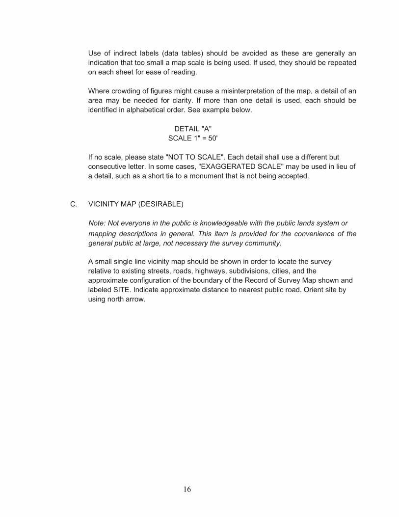
Where crowding of figures might cause a misinterpretation of the map, a detail of an area may be needed for clarity. If more than one detail is used, each should be identified in alphabetical order. See example below.
DETAIL "A"
SCALE 1" = 50'
If no scale, please state "NOT TO SCALE". Each detail shall use a different but consecutive letter. In some cases, "EXAGGERATED SCALE" may be used in lieu of a detail, such as a short tie to a monument that is not being accepted.
C. VICINITY MAP (DESIRABLE)
Note: Not everyone in the public is knowledgeable with the public lands system or mapping descriptions in general. This item is provided for the convenience of the general public at large, not necessary the survey community.
A small single line vicinity map should be shown in order to locate the survey relative to existing streets, roads, highways, subdivisions, cities, and the approximate configuration of the boundary of the Record of Survey Map shown and labeled SITE. Indicate approximate distance to nearest public road. Orient site by using north arrow.

17
3.10 SAMPLE RECORDS OF SURVEY.
The following recorded records of survey illustrate conditions commonly encountered when preparing a Record of Survey Map.
CONDITION RECORDED NUMBER
Survey procedure note 9468, 13731 & 20711
Survey of an approved "division of land plat" that is not reflected on the current County Assessor plat 7989
Survey of a road alignment 13691, 13720 & 20548
Survey of sectionalized land 8338, 13657, 13595 & 12871
Survey of lots within a block 13398, 13685 & 13711
Survey reflecting an approved boundary line adjustment plat 13444
Survey reflecting a boundary adjustment certificate of compliance 13407, 13706 & 13688
Survey reflecting a subdivision of land by a governmental agency 13505&13148
Survey by global positioning methods 11252 & 12921
Survey recorded as a condition of approval of a boundary line adjustment 13388

18
3.11 CORNER RECORDS
A. GENERAL
1. A Corner Record shall be filed for every public land survey corner or accessory which is established or restored, except "lost corners", as defined by the Manual of Instruction for the Survey of the Public Lands of the United States, and every accessory to such corner which is found, set, reset, or used as control.
After the establishment of a lost corner, a Record of Survey Map shall be filed per Sections 8773(a) and (b) of the Professional Land Surveyors’ Act (PLSA).
2. A Corner Record may be filed in lieu of a Record of Survey Map when the
survey is a retracement of lines shown on a Subdivision Map, Parcel Map, Record of Survey Map or Official Map, where no material discrepancies with such records are found and sufficient monumentation is recovered to precisely relocate the record corner positions (Section 8765d of the PLSA).
A Corner Record shall be filed to document preconstruction ties made to monuments that may be destroyed by the construction (Section 8771b of the PLSA).
A Corner Record shall be filed to document the replacement of monuments after construction (Section 8771b of the PLSA).
3. The survey of a parcel of land described by a "metes and bounds" description
and not shown on an existing subdivision map, official map, or Record of Survey Map, requires that a Record of Survey Map be filed (Section 8762e of the PLSA). For the purposes of this item, the meaning of the word “shown” is limited to a boundary or property line or property corner which was previously “established” (see section 3.03 above) on the prior map and not just dimensioned using record data or depicted as a tie line for reference.
4. Corner Records should be legibly drawn in ink or pencil, signed, and sealed. All surveyors' signatures should be in ink (preferably blue to identify original signature rather than copy). If drawn in pencil, the Corner Records should be dark
enough to microfilm well and should not flake or peel. Symbols should be large and distinctive from each other. Where record monuments are recovered, the record document should be identified. (Record includes Parcel Maps, Subdivision Maps, Record of Survey Maps, Corner Records, Public Agency field notes, tie point maps, private surveyor's plats and field notes.) In the space provided on front of the Corner Record, the surveyor shall verbally describe the procedures used to establish any property lines or reset any corners and the physical conditions of the monuments as found, set or reset. The sketch may show reference ties to identifiable objects in the vicinity of the corner.
5. For archiving and duplication purposes, text shall be minimum 0.08” if CADD
generated or 0.10” if hand drawn. Any shading of text or linework is not

19
allowed.
6. The Assessor Parcel Number shall be placed in the upper right corner of Sheet No.1. If located within an incorporated city, the city name shall be placed in the upper left corner of Sheet No.1.
7. Section 8773.1 of the Professional Land Surveyors’ Act limits a Corner Record
to a single 8.5 X 11-inch sheet which consists of a front and back. If the sketch will not fit into the space provided, multiple Corner Records or a Record of Survey Map should be considered.
8. Section 8762(b) of the Professional Land Surveyors’ Act limits
"Material Discrepancy" to the position of points or lines, or in dimensions.
B. PROCEDURE
Any Surveyor or Engineer can download the Board approved Corner Record forms from the Department of Public Works, County Surveyor’s web site in either PDF or AutoCAD format.
C. EXAMINATION AND FILING
When the Corner Record examination is complete, the County Surveyor will sign it and file it with the Survey Records Section of the Department of Public Works.
D. MISCELLANEOUS
Corner Records are examined and filed by the County Surveyor free of charge.
Once filed, the Survey Records Section will have the Corner Records scanned and added to the on-line survey record system data base. The originals are retained by the County Surveyor.
If the surveyor desires a copy of his filed Corner Record, he shall provide a self-addressed stamped envelope together with a $5.00 payment for shipping and handling.
E. SUPERSEDING CORNER RECORDS
A surveyor can use a Corner Record to correct any error on his own previously filed Corner Record. A Record of Survey Map is required to be filed when a surveyor wishes to disclose an error shown on another surveyor’s Corner Record.

20
3.12 SAMPLE FILED CORNER RECORDS.
The following filed Corner Records illustrate conditions commonly encountered when preparing a Corner Record.
CONDITION FILED NUMBER
Re-monumentation of a government land corner 5862 & 2462
Corner Record showing contours 26
Survey of lots within a block 9276, 9382 & 9331
Construction references 7022, 9337, 9340 & 9343
3.13 CERTIFICATES OF CORRECTION FOR RECORD OF SURVEY MAPS
When errors that are few and minor in nature are discovered on a recorded Record of Survey Map, a Certificate of Correction may be filed in lieu of a new Record of Survey Map to correct the error. See Appendix Section 4.500. Please contact the County Surveyor for forms, review costs and submittal steps.
A new Record of Survey Map should be filed where corrections are substantial.

21
4.500 APPENDIX SAMPLE RECORD OF SURVEY SAMPLE CORNER RECORD FORM SAMPLE CORNER RECORD FOR VERTICAL BENCHMARK REFERENCE TIES SAMPLE CERTIFICATE OF CORRECTION FOR RECORD OF SURVEY MAP

RECORD OF SURVEY MAP No. SHEET 1 OF 1 SHEET
RECORD OF SURVEY
OF (BRIEF LEGAL DESCRIPTION), IN THE (CITY IF APPLICABLE,) COUNTY OF SAN DIEGO, STATE OF CALIFORNIA. BEING FURTHER DESCRIBED IN DEED (LIST VESTING DEED), RECORDED (RECORDING DA TE) AS (DOC# OR BOOK & PAGE 0.R.)
BASIS OF BEARINGS THE BASIS OF BEARINGS FOR THIS SURVEY IS THE (DESC) LINE OF (SURVEY MAP RECORD) PER (RECORD MAP INFORMATION) I.E. N87'25'58"W
LEGEND • INDICATES FOUND (DESC) MONUMENT. UNLESS OTHERWISE NOTED.
■ INDICATES FOUND LEAD & DISC STAMPED (LS/RCE #). UNLESS OTHERWISE NOTED.
• INDICATES SET 3/4"x 18" IRON PIPE WITH DISC MARKED "(LS/RCENUMBER)".
■ INDICATES SET LEAD AND DISC MARKED "(LS/RCE NUMBER)" IN(CONCRETE/BOULDER)
( ) INDICATES RECORD DATA PER
D1 INDICATES RECORD DATA PER DEED RECORD (DATE) AS (DOC NO. XXXX-XXXXXXX OF O.R.).
SURVEYOR'S STATEMENT THIS MAP CORRECTLY REPRESENTS A SURVEY MADE BY ME OR UNDER MY DIRECTION IN CONFORMANCE WITH THE REQUIREMENTS OF THE PROFESSIONAL LAND SURVEYOR'S ACT AT THE REQUEST OF (CLIENT NAME), IN (MONTH.YEAR).
NAME, LS/RCE # DATE
COUNTY SURVEYOR'S STATEMENT THIS MAP HAS BEEN EXAMINED IN ACCORDANCE WITH SECTION 8766 OF THE PROFESSIONAL LAND SURVEYOR'S ACT THIS ____ DAY OF _____ �2021.
RAYMOND L. MATHE, P.L.S. 6185 COUNTY SURVEYOR
RECORDER'S STATEMENT FILE NUMBE,�---------FILED THIS ____ AY OF _____ 2021, AT __ O'CLOCK_M. IN BOOK OF RECORD OF SURVEY MAPS AT PAGE ___ AT THE REQUEST OF THE SAN DIEGO COUNTY SURVEYOR.
FEE:$ __ _ ERNEST J. DRONENBURG. JR. COUNTY RECORDER/ CLERK COUNTY OF SAN DIEGO
BY: DEPUTY COUNTY RECORDER
CALIFORNIA COORDINATE INDEX: (1927 DATUM) XXX-XXXX ASSESSOR'S PARCEL NUMBER(S): XXX-XXX-XX

CORNER RECORD
Agency Index Document Number
City of County of , California Brief Legal Description CORNER TYPE COORDINATES (Optional)
N. E. Government Corner Control Elevation
Meander Property Units Metric U.S. Survey Foot
Rancho Other Horizontal Datum Zone Epoch Date Date of Survey Vertical Datum
Complies with Public Resources Code §§8801-8819
Complies with Public Resources Code §§8890-8902 PLS Act Ref.: 8765(d) 8771 8773 Other:
Corner/ Monument:
Left as found Established Rebuilt Pre-Construction
Found and tagged Reestablished Referenced Post-Construction
Narrative of corner identified and monument as found, set, reset, replaced, or removed: See sheet #2 for description(s):
SURVEYOR’S STATEMENT
This Corner Record was prepared by me or under my direction in conformance with
the Professional Land Surveyors’ Act on .
Signed P.L.S. or R.C.E. No.
COUNTY SURVEYOR’S STATEMENT
This Corner Record was received
and examined and filed .
Signed P.L.S. or R.C.E. No.
Title
County Surveyor’s Comment
BPELSG-2016 Page 1 of 2

Document Number Agency Index
BPELSG-2016 Page 2 of 2


RECORDING REQUESTED BY: (Surveyor or Engineer) WHEN RECORDED MAIL TO: (Name) (Address) ______________________________________________________________________
(SPACE ABOVE THIS LINE FOR RECORDER’S USE)
CERTIFICATE OF CORRECTION PURSUANT TO Section 8770.5 of the Professional Land Surveyors Act, NOTICE IS GIVEN that Record of Survey ( No.) in the (City if applicable,) County of San Diego, State of California, filed in the Office of the County Recorder of San Diego County on, (Filing month, day, year) is being amended, and is corrected in accordance with Section 8770.5 of the Professional Land Surveyors Act as follows: List of Corrections: 1) (List each item in format shown) 2)
OWNERSHIP STATEMENT I certify that the following are the names of all the fee owners of the real property reflected on the date of the filing or recording of the original recorded map: (This information is required by the County Recorder to properly index document in the Grantor/Grantee Index.)
CERTIFICATE OF SURVEYOR (OR ENGINEER) I further certify that the above Certificate of Correction was prepared by or under the direction and control of the undersigned professional land surveyor or registered civil engineer.
_____________ (SEAL)
Name & License number ____________ Date
I, Raymond L. Mathe, the County Surveyor of the County of San Diego, State of California, certify that I have examined the foregoing Certificate of Correction and I find that the only changes shown hereon are changes provided for by Section 8770.5 of the Professional Land Surveyors Act (SEAL)
________________________ Fee: $17.00 Raymond L. Mathe, L.S. 6185 County Surveyor