presented to wisconsin department of transportation presented by brian scott srf, seh, ek and...
TRANSCRIPT

presented to
Wisconsin Department of Transportation
presented by
Brian Scott
SRF, SEH, EK and Cambridge Systematics, Inc. 7/31/07
ITS Sketch PlansCorridor Sketch Plan Methodology – Update
2
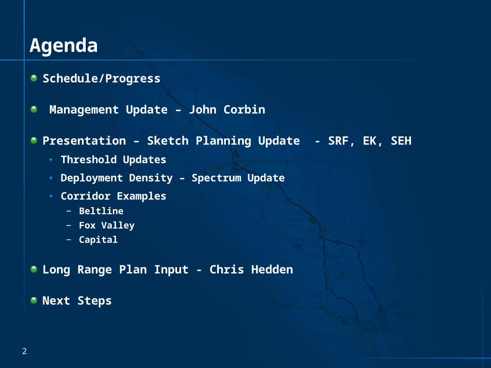
Agenda
Schedule/Progress
Management Update – John Corbin
Presentation – Sketch Planning Update - SRF, EK, SEH
• Threshold Updates
• Deployment Density – Spectrum Update
• Corridor Examples− Beltline
− Fox Valley
− Capital
Long Range Plan Input - Chris Hedden
Next Steps


Management Update

Sketch Planning Update

Thresholds Update

7
Threshold Adjustment
Original Adjusted

8
Process
Raw Data Threshold Map
Develop Raw Data Corridor Map
Smooth Segments
Analyze Smoothed Segments
Apply Operations Oriented Recommendations (Mileposts)
Next Steps
• Meeting with Regions – Operations Chiefs and Planning Chiefs
• Produce final maps and recommendations for all corridors

Deployment Density Update

10
Deployment Density – Urban Interstate/Expy

11
Deployment Density – Rural Interstate/Expy

12
Deployment Density – Urban and Rural Other

13
Beltline Corridor – Raw Threshold Data

14
Beltline Corridor – Smoothed Data

15
Beltline - Mileposts

16
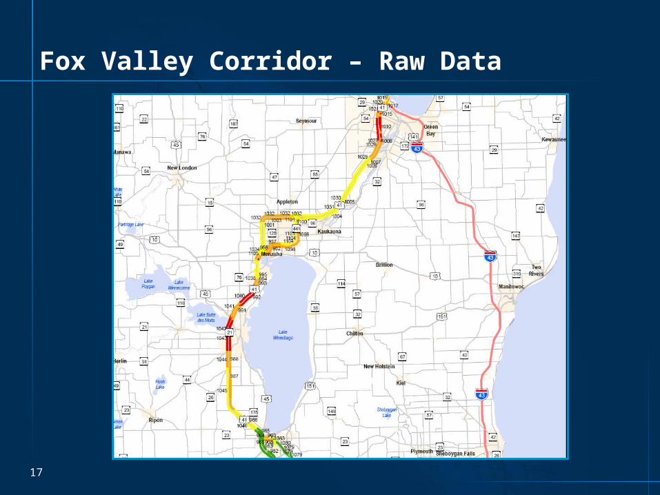
Fox Valley Corridor – Raw Data
17
Fox Valley Corridor – Raw Data
18
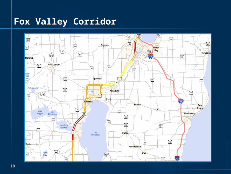
Fox Valley Corridor

19
Fox Valley Corridor
20
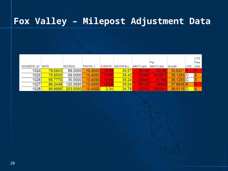
Fox Valley – Milepost Adjustment Data

21
Fox Valley Corridor – Revised Mileposts

22
Fox Valley Corridor – Revised Mileposts
23
Fox Valley Corridor
Insert SEH Methodology
24
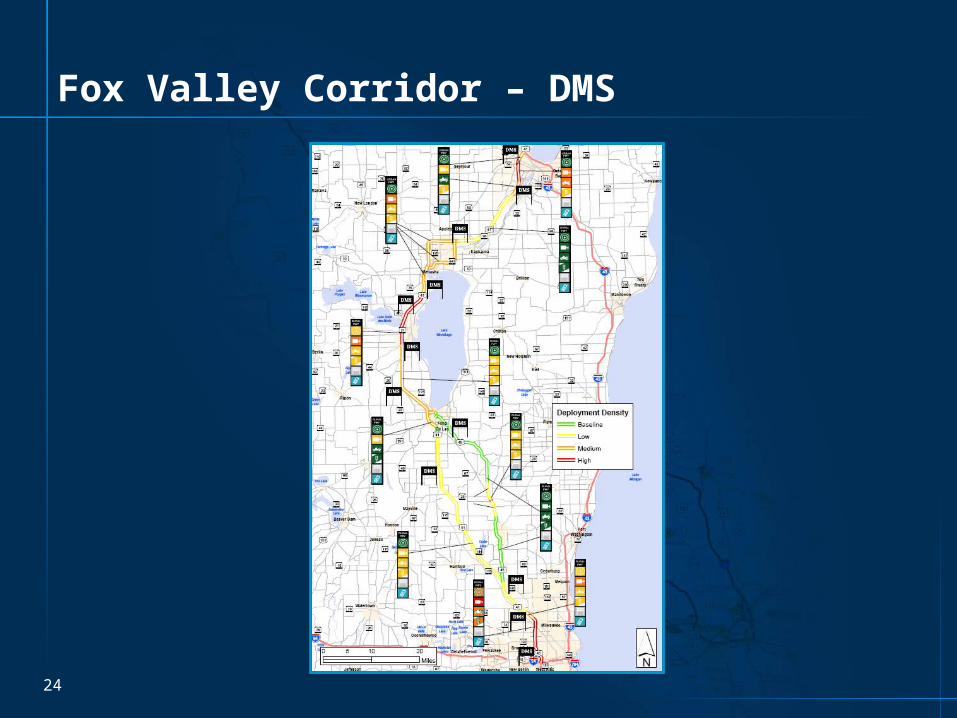
Fox Valley Corridor – DMS

25
Capitol Corridor

26
Capitol Corridor - Signals

27
Statewide – Additional Information Layers
• RWIS
• Fiber optic cable• State Patrol microwave network• State Patrol MDN

Connection 2030 Input

29
Input into Connections 2030 LRP
Submitted draft data set 7/23/07
• Only red and orange links
• Table Text Suggested
Sketch Planning data set Version 3.0 submitted
• Contains updated thresholds


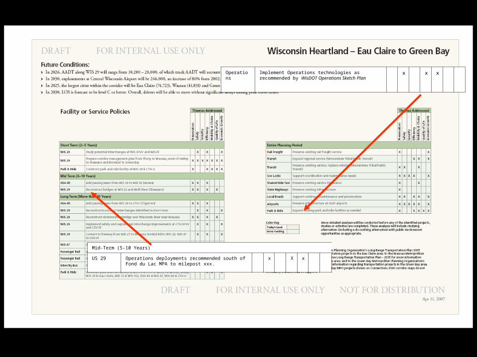
Mid-Term (5-10 Years)
US 29 Operations deployments recommended south of Fond du Lac MPA to milepost xxx.
x X x
Operations
Implement Operations technologies as recommended by WisDOT Operations Sketch Plan
x x x
Next Steps

35
Statewide Map – Signals

36
Next Steps (Short Term)
Complete SW and NE Region Maps
• Obtain consensus from WisDOT Regions & BHO
Complete SE Region Maps
Complete NW and NC Regions
Data collection – existing systems & infrastructure

37
Next Steps (Mid – Term)
Technology Scan
Validate results in Regional workshops SE, NW, NC)

38
Next Steps (Finalize)
Develop Infrastructure & Operations Plan
Aggregate Plans (Freeways, Arterials, ATIS)
Prioritize Corridors
Integrate into existing WisDOT planning processes
Apply recommendations to near-term corridor projects for implementation