
presented to
Wisconsin Department of Transportation
presented by
Brian Scott
SRF, SEH, EK and Cambridge Systematics, Inc. 7/31/07
ITS Sketch PlansCorridor Sketch Plan Methodology – Update
2
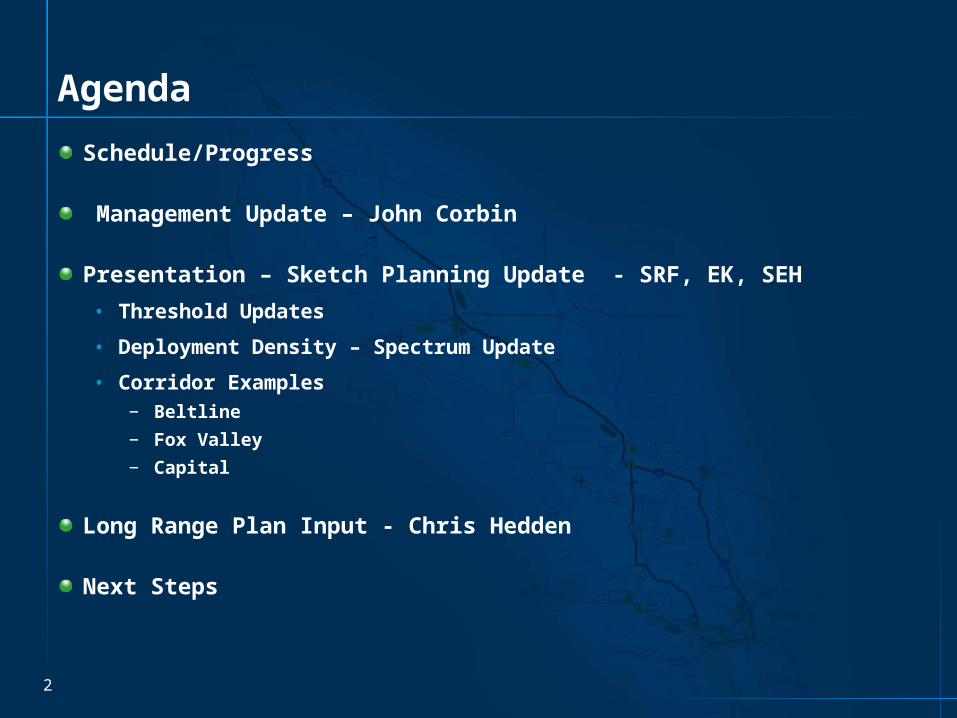
Agenda
Schedule/Progress
Management Update – John Corbin
Presentation – Sketch Planning Update - SRF, EK, SEH
• Threshold Updates
• Deployment Density – Spectrum Update
• Corridor Examples− Beltline
− Fox Valley
− Capital
Long Range Plan Input - Chris Hedden
Next Steps


Management Update

Sketch Planning Update

Thresholds Update

7
Threshold Adjustment
Original Adjusted

8
Process
Raw Data Threshold Map
Develop Raw Data Corridor Map
Smooth Segments
Analyze Smoothed Segments
Apply Operations Oriented Recommendations (Mileposts)
Next Steps
• Meeting with Regions – Operations Chiefs and Planning Chiefs
• Produce final maps and recommendations for all corridors

Deployment Density Update

10
Deployment Density – Urban Interstate/Expy

11
Deployment Density – Rural Interstate/Expy

12
Deployment Density – Urban and Rural Other

13
Beltline Corridor – Raw Threshold Data

14
Beltline Corridor – Smoothed Data

15
Beltline - Mileposts

16
Fox Valley Corridor – Raw Data
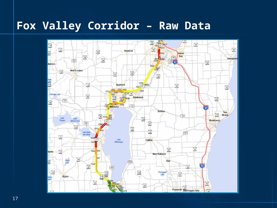
17
Fox Valley Corridor – Raw Data
18
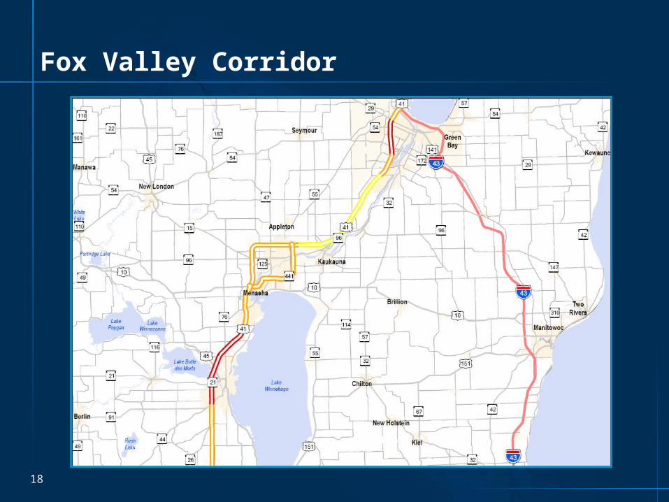
Fox Valley Corridor

19
Fox Valley Corridor
20
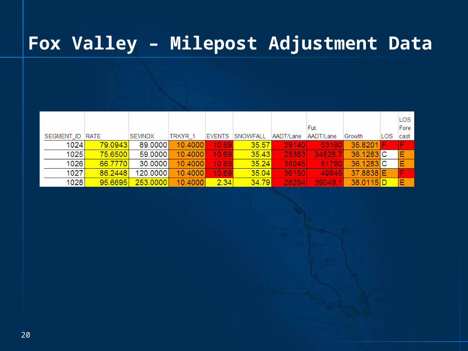
Fox Valley – Milepost Adjustment Data

21
Fox Valley Corridor – Revised Mileposts

22
Fox Valley Corridor – Revised Mileposts
23
Fox Valley Corridor
Insert SEH Methodology
24
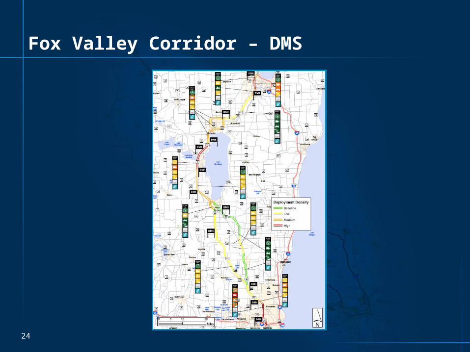
Fox Valley Corridor – DMS

25
Capitol Corridor

26
Capitol Corridor - Signals

27
Statewide – Additional Information Layers
• RWIS
• Fiber optic cable• State Patrol microwave network• State Patrol MDN

Connection 2030 Input

29
Input into Connections 2030 LRP
Submitted draft data set 7/23/07
• Only red and orange links
• Table Text Suggested
Sketch Planning data set Version 3.0 submitted
• Contains updated thresholds


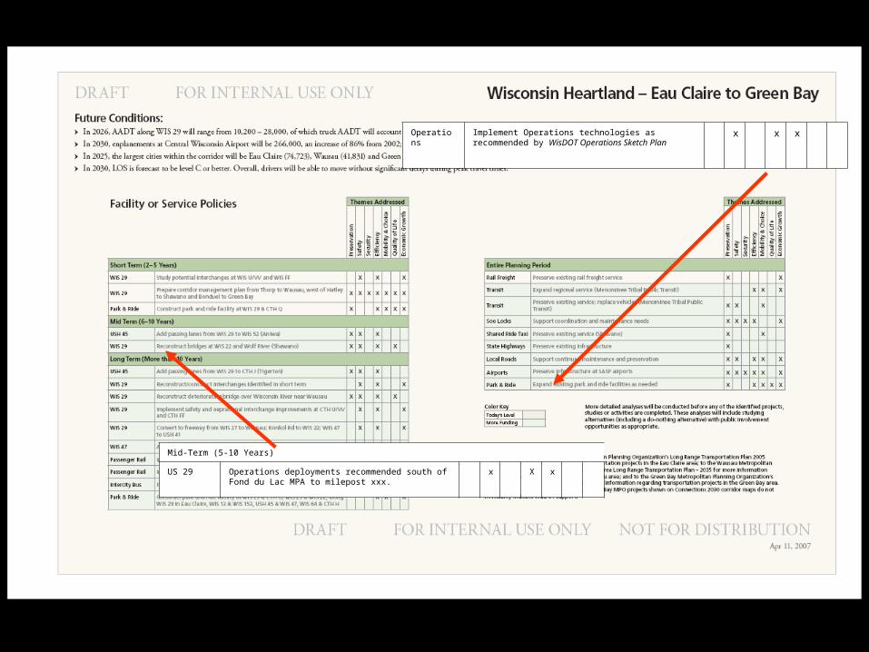
Mid-Term (5-10 Years)
US 29 Operations deployments recommended south of Fond du Lac MPA to milepost xxx.
x X x
Operations
Implement Operations technologies as recommended by WisDOT Operations Sketch Plan
x x x
Next Steps

35
Statewide Map – Signals

36
Next Steps (Short Term)
Complete SW and NE Region Maps
• Obtain consensus from WisDOT Regions & BHO
Complete SE Region Maps
Complete NW and NC Regions
Data collection – existing systems & infrastructure

37
Next Steps (Mid – Term)
Technology Scan
Validate results in Regional workshops SE, NW, NC)

38
Next Steps (Finalize)
Develop Infrastructure & Operations Plan
Aggregate Plans (Freeways, Arterials, ATIS)
Prioritize Corridors
Integrate into existing WisDOT planning processes
Apply recommendations to near-term corridor projects for implementation


