potential scenic sites analysis for the hill country conservancy nancy a. heger, managergene sipes,...
TRANSCRIPT

Potential Scenic Sites Analysis for the Potential Scenic Sites Analysis for the Hill Country Conservancy Hill Country Conservancy
Nancy A. Heger, ManagerNancy A. Heger, Manager Gene Sipes, Assistant ManagerGene Sipes, Assistant ManagerMatt Broadaway, GIS AnalystMatt Broadaway, GIS Analyst Matt Gray, Web MasterMatt Gray, Web MasterImage source: http://www.philadelphianstours.com/Image source: http://www.philadelphianstours.com/

What is “scenic” and why is it important?What is “scenic” and why is it important? Inherent notion of what scenic isInherent notion of what scenic is Agreement among viewersAgreement among viewers
• Socioeconomic groupsSocioeconomic groups• RegionsRegions• Age classes Age classes

What is “scenic” and why is it important?What is “scenic” and why is it important? Steeper or greater reliefSteeper or greater relief Water is present Water is present Diversity of vegetationDiversity of vegetation Edge effectsEdge effects More natural (less developed)More natural (less developed) Visually complexVisually complex Some Cultural ModificationsSome Cultural Modifications
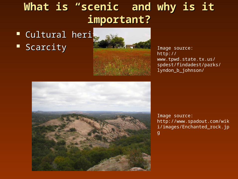
What is “scenic” and why is it important?What is “scenic” and why is it important?
Cultural heritage Cultural heritage ScarcityScarcity
Image source: http://www.spadout.com/wiki/images/Enchanted_rock.jpg
Image source:http://www.tpwd.state.tx.us/spdest/findadest/parks/lyndon_b_johnson/
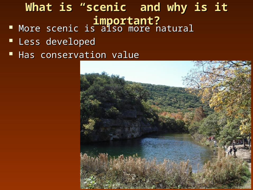
What is “scenic” and why is it important?What is “scenic” and why is it important? More scenic is also more naturalMore scenic is also more natural Less developedLess developed Has conservation valueHas conservation value

IntroductionIntroduction
Conserving places of scenic Conserving places of scenic value also conserves areas of value also conserves areas of natural or historical heritage. natural or historical heritage.
In line with the goals of the In line with the goals of the Hill Country Conservancy Hill Country Conservancy (HCC) - a non-profit group (HCC) - a non-profit group seeking to preserve parts of seeking to preserve parts of the Texas hill country.the Texas hill country.
N.E.R.D.S. will use GIS to N.E.R.D.S. will use GIS to help HCC identify areas for help HCC identify areas for future preservation.future preservation.

PurposePurpose
•Identify potential sites for future preservation by the Identify potential sites for future preservation by the Hill Country Conservancy (HCC)Hill Country Conservancy (HCC)
•Identify areas that are “scenic” as defined by factors Identify areas that are “scenic” as defined by factors such as topographical relief, proximity to water bodies, such as topographical relief, proximity to water bodies, and vegetation.and vegetation.
•Provide a map of potential scenic sites that HCC can Provide a map of potential scenic sites that HCC can use to identify areas for future preservationuse to identify areas for future preservation

ScopeScope Study region - 22 county area in Hill Country Study region - 22 county area in Hill Country
Will take approximately 3 months (6 Sept. to 13 Dec.)Will take approximately 3 months (6 Sept. to 13 Dec.)
Figure 1. Hill Country study area.

Data Layers and SourcesData Layers and Sources
Layer Projection/Datum Source
30 Meter DEM UTM Zone 15/ NAD 83 U.S. Geological Survey
Study Region State Plane Texas Central FIPS 4203/ NAD 83
Hill Country Conservancy
Urban No Projection/ NAD 83 Texas Natural Resource Information Systems
Roads No Projection/ NAD 83 Texas Natural Resource Information Systems
Water No Projection/NAD 27 Texas Department of Transportation
Historic Sites/State Parks No Projection/ NAD 83 Texas Parks and Wildlife Department
Land Use UTM Zone 14/ NAD 83 National Resource Conservation Service

30 Meter DEM30 Meter DEMBase Map for AnalysisBase Map for Analysis


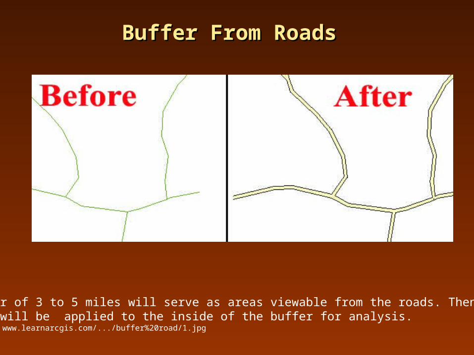
Buffer From RoadsBuffer From Roads
The buffer of 3 to 5 miles will serve as areas viewable from the roads. Then all other criteria will be applied to the inside of the buffer for analysis. Image source: www.learnarcgis.com/.../buffer%20road/1.jpg

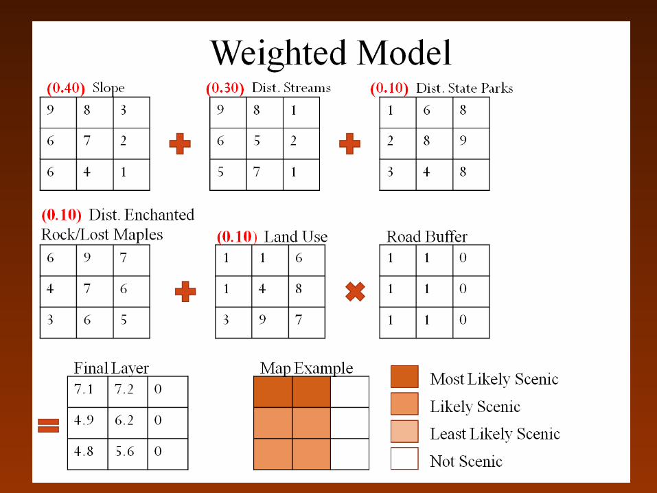
Model CriteriaModel Criteria Distance from streamsDistance from streams
Areas closest to streams preferredAreas closest to streams preferred Distance from State Parks/Historic SitesDistance from State Parks/Historic Sites
Areas closest to State Parks preferredAreas closest to State Parks preferred Distance from unique natural feature e.g. Enchanted RockDistance from unique natural feature e.g. Enchanted Rock
Areas near these features preferredAreas near these features preferred Land UseLand Use
Areas with preferred vegetation typesAreas with preferred vegetation types Topographic Variation i.e. slopeTopographic Variation i.e. slope
Areas with more relief preferredAreas with more relief preferred

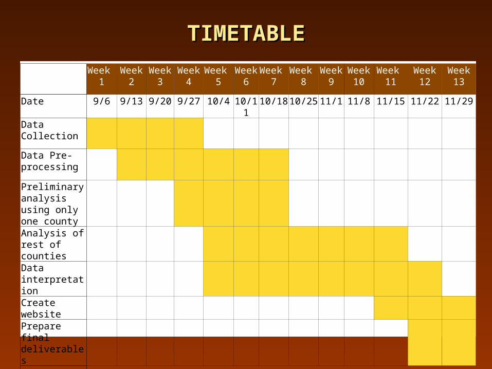
TIMETABLETIMETABLE
Week 1
Week 2
Week 3
Week 4
Week 5
Week 6
Week 7
Week 8
Week 9
Week 10
Week 11
Week 12
Week 13
Date 9/6 9/13 9/20 9/27 10/4 10/11 10/18 10/25 11/1 11/8 11/15 11/22 11/29
Data Collection
Data Pre-processing
Preliminary analysis using only one county
Analysis of rest of counties
Data interpretation
Create website
Prepare final deliverables
IMPORTANT DATESIMPORTANT DATES
•September 6- Receive Client RFP
•October 4- Proposal Presentation for Client
•October 27- Progress Report
•December 13- Final Presentation and Deliverables

FINAL DELIVERABLESFINAL DELIVERABLES Final deliverables will include:Final deliverables will include: A Detailed Final Report (2 copies)A Detailed Final Report (2 copies) Professional Poster for display in the Geography Professional Poster for display in the Geography
Department Department WebsiteWebsite CD (2 copies) containingCD (2 copies) containing
All dataAll data MetadataMetadata Proposal, Progress, and Final reportsProposal, Progress, and Final reports PosterPoster Power Point presentationPower Point presentation Instructions on how to use CD (readme file)Instructions on how to use CD (readme file)

Uses & ImplicationsUses & Implications Phase one in HCC’s plan to locate scenic areas.Phase one in HCC’s plan to locate scenic areas. Regional governments to promote tourism.Regional governments to promote tourism. Concerned groups to raise environmental awareness in the Concerned groups to raise environmental awareness in the
region.region. Information for public use. Information for public use. Model created that can be used in other areas to determine Model created that can be used in other areas to determine
scenic beauty.scenic beauty.
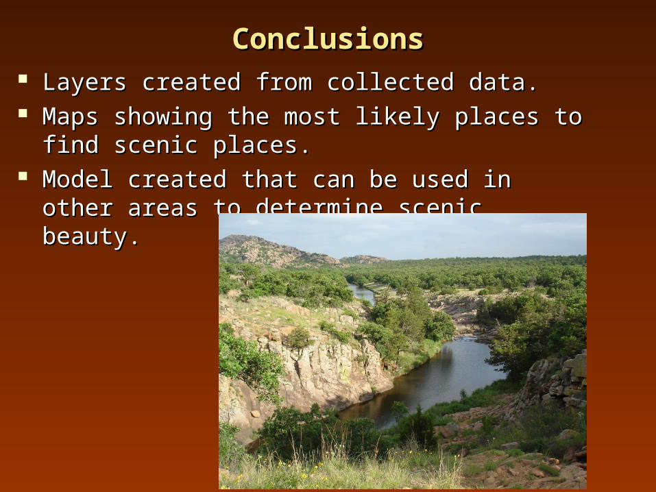
ConclusionsConclusions Layers created from collected data.Layers created from collected data. Maps showing the most likely places to find scenic Maps showing the most likely places to find scenic
places.places. Model created that can be used in other areas to Model created that can be used in other areas to
determine scenic beauty.determine scenic beauty.

The EndThe End