potential of uavs for beach profiles of low lying islands pacific islands gis&rs user conference...
TRANSCRIPT

Potential of UAVs for Beach Profiles of Low
Lying Islands
Pacific Islands GIS&RS User Conference 2012, Suva
Wolf Forstreuter

Classic Beach ProfilesClassic Beach Profiles

Image to Image Correction of Historical Photos
Image to Image Correction of Historical Photos
19681968 20002000

GIS Overlay
• Visualisation of change
• Quantitave area analysis
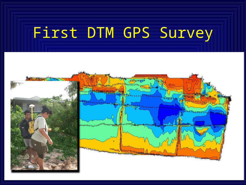
First DTM GPS Survey

RTK GPS at Suva Sandbank

The Survey Data

SimulationDTM-1 minus DTM-2

Secondary Base Station at the Beach
Line of sight to rover unit
5 hours recording parallel to base station at high school
Line of sight to rover unit
5 hours recording parallel to base station at high school
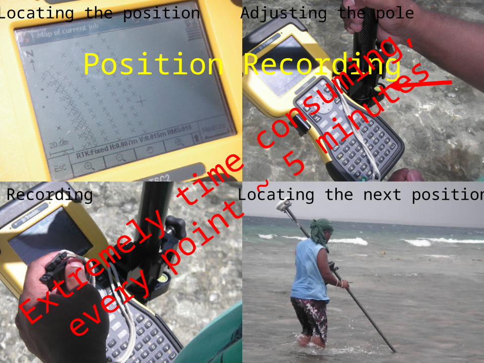
Position Recording
Locating the position Adjusting the pole
Locating the next positionRecording
Extre
mely
time co
nsum
ing,
every
point ~ 5 m
inutes

UAVs Alternative ?
• Can be transported easily to and reassembled on the Pacific Island
• Only needs one SOPAC operator• Operator based at SOPAC could
service one island after the other

The Requirements
• 20 – 30 cm contour lines– About 5 – 7 cm vertical accuracy
• Volume calculation and volume change detection after 5 years– Absolute orientation to WGS84
• DTM calculation on the island

Helicopter Type
Not optimal for stereo images

Different Fixed Wing UAVs

Talks with Different UAV Companies (fixed wing)
• Trimble Navigation• AVI System• MAVINICI• FOTOMAPY• GeoScan• AGISOFT• Drone METREX

The Virtual 3D Environment
• Calibrated cameras
• Relative -• Inner -• Absolute
orientation• Manual
analysisSoftware
has deve
loped

New Software
• Calibrates the camera from the points detected in images
• Handles the relative and inner orientation
• Needs ground reference points called image reference points
• Creates absolute oriented DTM


Image Reference Points• Stones as image reference points ?• NO

Image Reference Points
• Flat disks• Black cross• ~ 16 distributed over the block
covering all height levels• Survey grade GPS survey!

Overlap of Images
• 80 % in flight direction
• 60 % between flight strips
• 4 parallel flight strips necessary
Every RIP must be visible on 15 images

Flight Planning
• Blocks of ~ 2 km • UAV has to fly
straight lines with clear overlap

UAV Height over Ground
• Time between exposures and pixel size determines flight height
• 80 % overlap is a must
100 – 120 m

Est. Time Requirements
• Installation of main base station• Installation of secondary base
station• Establishment of RIP 1.5 h/block• Preparation of UAV incl. flight
planning 0.5• Flying UAV 0.5• DTM establishmentThree block
s / day
Three blocks /
day

Position UAV Handling
Requirements:• Handling & maintenance of UAV• Handling and updating flight
planning software• Handling survey grade GPS• Handling DTM software (photo-
grammetric knowledge)

Political Requirements:
A. Countries have to allow operating UAVs on outer islands
B. Countries have to address demand

Thanks