nws los angeles/oxnard weather briefing - venice · pdf file · 2016-10-29nws los...
TRANSCRIPT
NWS Los Angeles/Oxnard Weather Briefing
Presentation at 130 pm PST Jan. 4, 2016
Please refer to
www.weather.gov/losangeles for the latest information
Wet Pattern For Southern Cal Week of January 4, 2016
Presented on Jan 4, 2016 130 pm PST
www.weather.gov/losangeles
National Weather Service Los Angeles/Oxnard
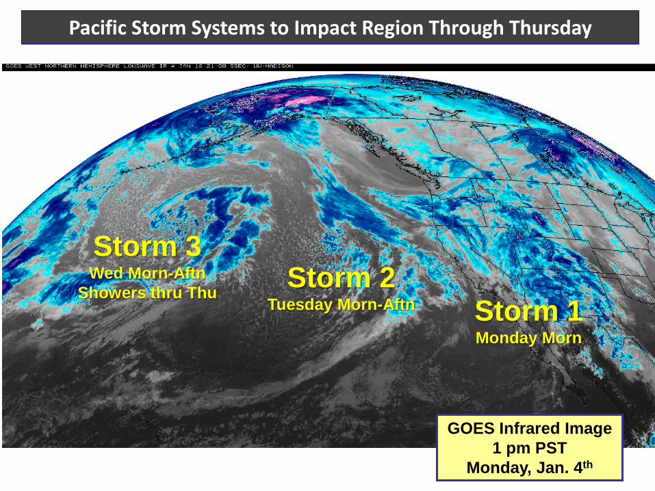
Pacific Storm Systems to Impact Region Through Thursday
GOES Infrared Image 1 pm PST
Monday, Jan. 4th
Storm 1 Monday Morn
Storm 2 Tuesday Morn-Aftn
Storm 3 Wed Morn-Aftn
Showers thru Thu
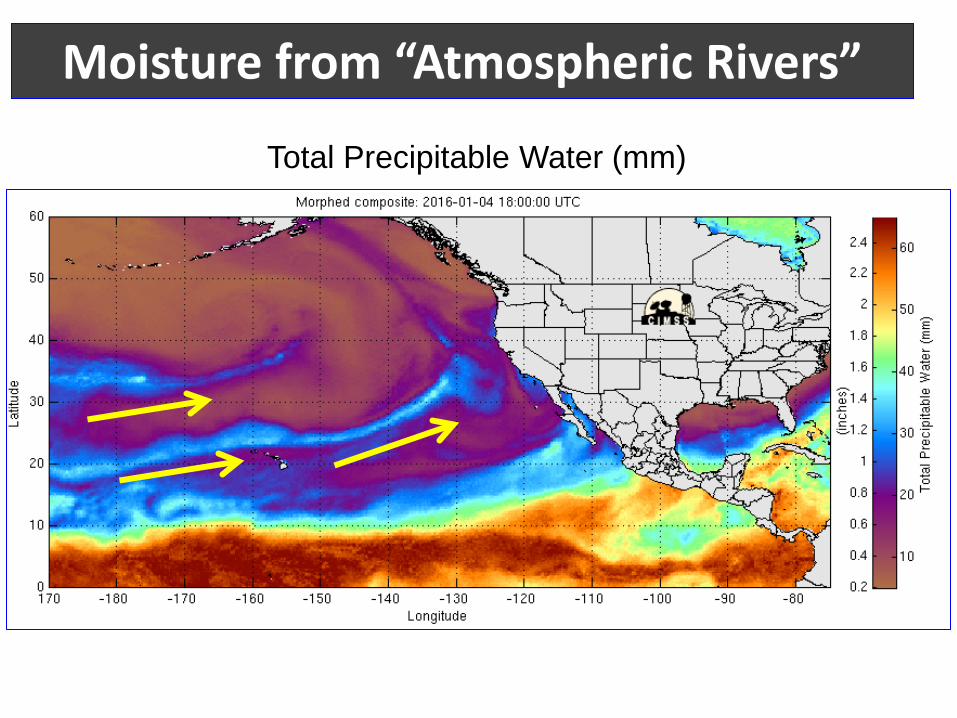
Moisture from “Atmospheric Rivers”
Total Precipitable Water (mm)
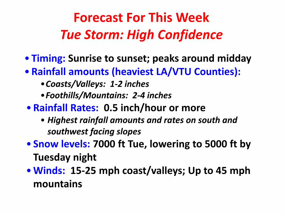
Forecast For This Week Tue Storm: High Confidence
•Timing: Sunrise to sunset; peaks around midday •Rainfall amounts (heaviest LA/VTU Counties):
•Coasts/Valleys: 1-2 inches •Foothills/Mountains: 2-4 inches
•Rainfall Rates: 0.5 inch/hour or more • Highest rainfall amounts and rates on south and
southwest facing slopes • Snow levels: 7000 ft Tue, lowering to 5000 ft by
Tuesday night •Winds: 15-25 mph coast/valleys; Up to 45 mph
mountains
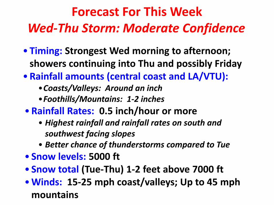
Forecast For This Week Wed-Thu Storm: Moderate Confidence
•Timing: Strongest Wed morning to afternoon; showers continuing into Thu and possibly Friday
•Rainfall amounts (central coast and LA/VTU): •Coasts/Valleys: Around an inch •Foothills/Mountains: 1-2 inches
•Rainfall Rates: 0.5 inch/hour or more • Highest rainfall and rainfall rates on south and
southwest facing slopes • Better chance of thunderstorms compared to Tue
• Snow levels: 5000 ft • Snow total (Tue-Thu) 1-2 feet above 7000 ft •Winds: 15-25 mph coast/valleys; Up to 45 mph
mountains
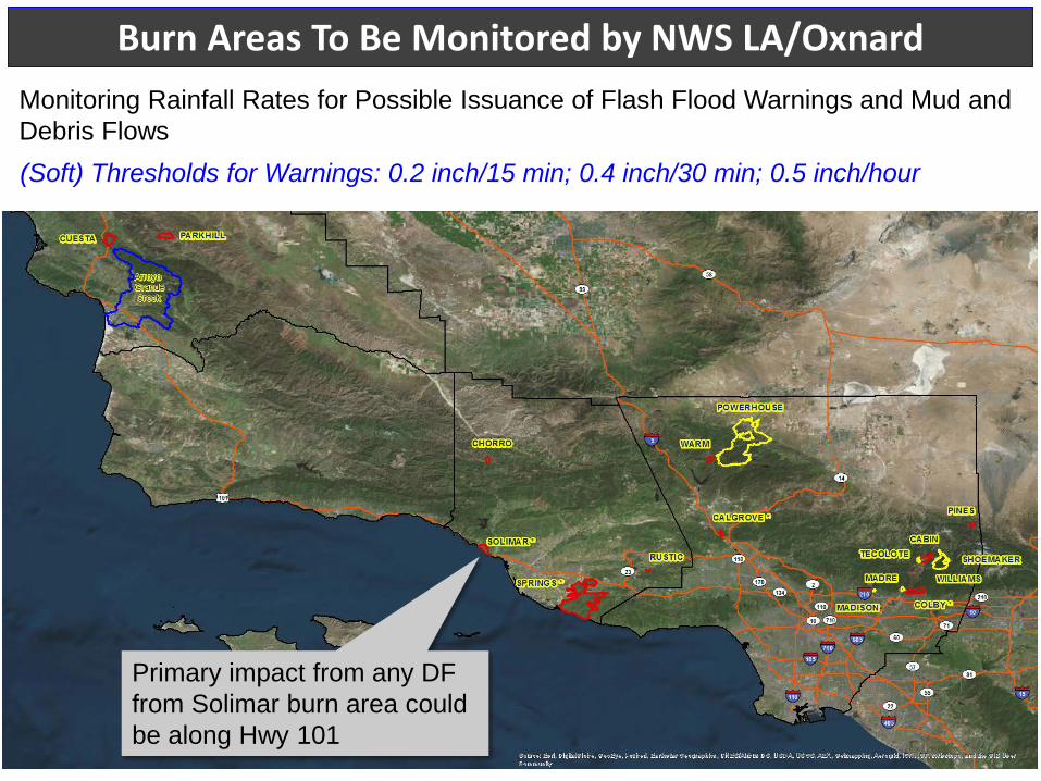
Burn Areas To Be Monitored by NWS LA/Oxnard Monitoring Rainfall Rates for Possible Issuance of Flash Flood Warnings and Mud and Debris Flows (Soft) Thresholds for Warnings: 0.2 inch/15 min; 0.4 inch/30 min; 0.5 inch/hour
Primary impact from any DF from Solimar burn area could be along Hwy 101
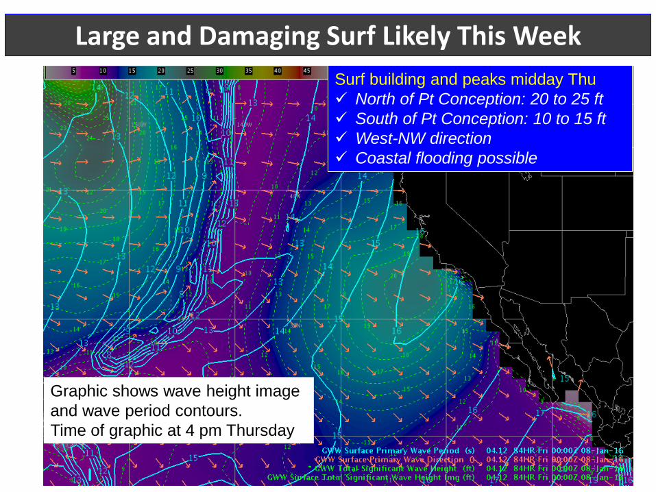
Large and Damaging Surf Likely This Week
Graphic shows wave height image and wave period contours. Time of graphic at 4 pm Thursday
Surf building and peaks midday Thu North of Pt Conception: 20 to 25 ft South of Pt Conception: 10 to 15 ft West-NW direction Coastal flooding possible
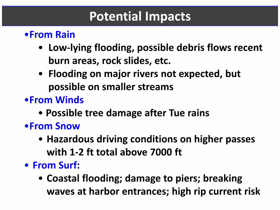
•From Rain • Low-lying flooding, possible debris flows recent
burn areas, rock slides, etc. • Flooding on major rivers not expected, but
possible on smaller streams •From Winds
• Possible tree damage after Tue rains •From Snow
• Hazardous driving conditions on higher passes with 1-2 ft total above 7000 ft
• From Surf: • Coastal flooding; damage to piers; breaking
waves at harbor entrances; high rip current risk
Potential Impacts
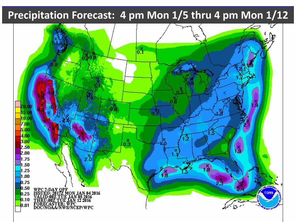
Precipitation Forecast: 4 pm Mon 1/5 thru 4 pm Mon 1/12
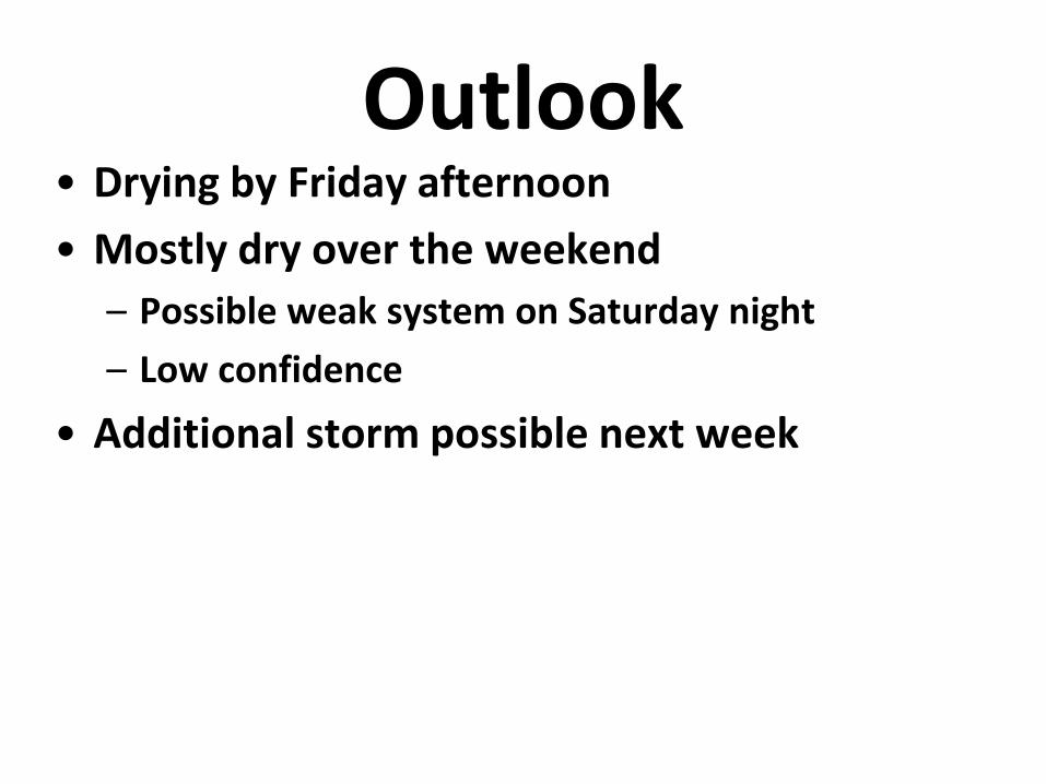
Outlook • Drying by Friday afternoon • Mostly dry over the weekend
– Possible weak system on Saturday night – Low confidence
• Additional storm possible next week
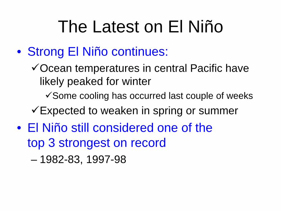
The Latest on El Niño • Strong El Niño continues: Ocean temperatures in central Pacific have
likely peaked for winter Some cooling has occurred last couple of weeks
Expected to weaken in spring or summer • El Niño still considered one of the
top 3 strongest on record – 1982-83, 1997-98
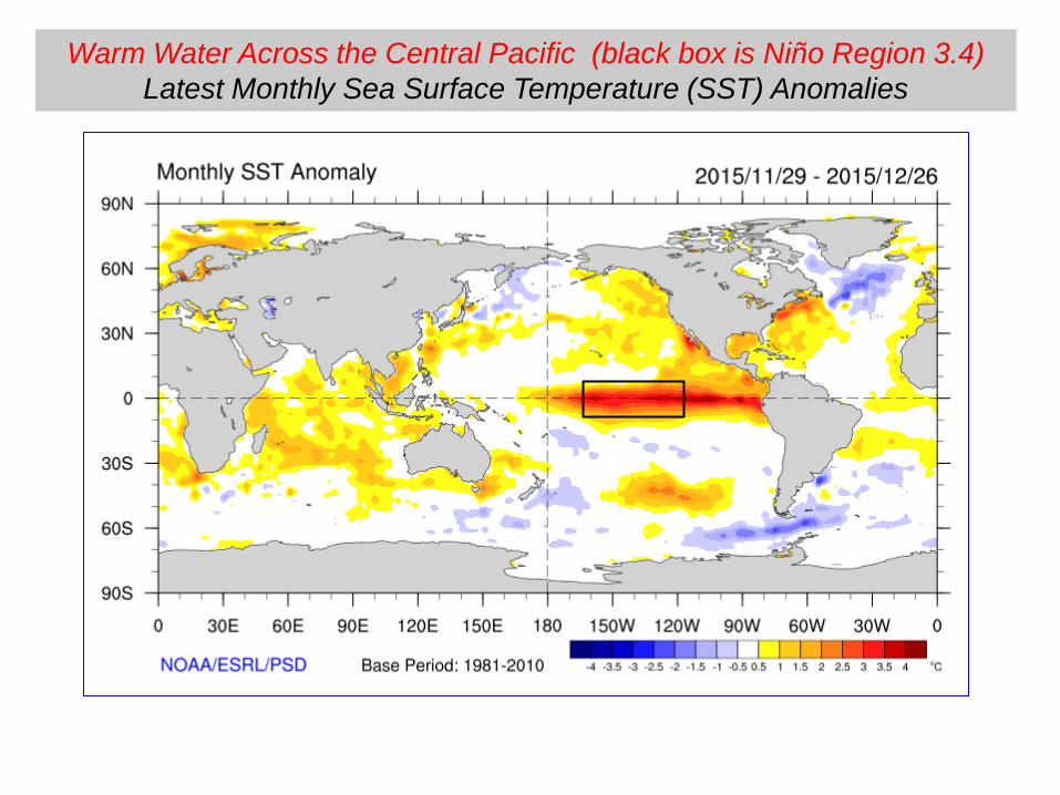
Warm Water Across the Central Pacific (black box is Niño Region 3.4) Latest Monthly Sea Surface Temperature (SST) Anomalies
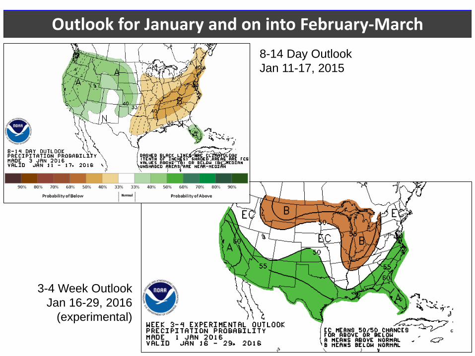
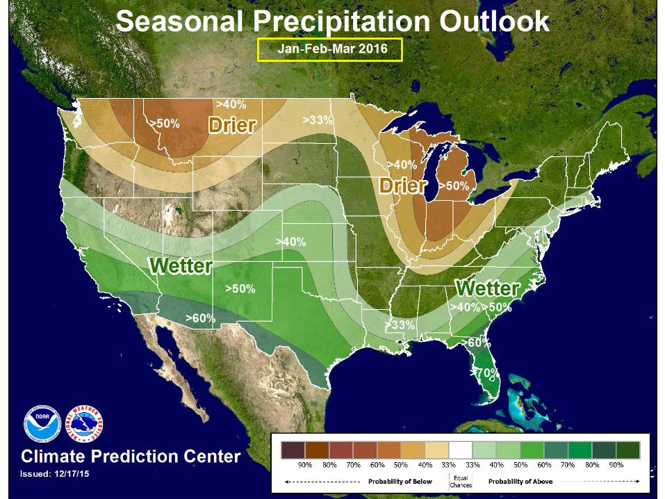
Outlook for January and on into February-March 8-14 Day Outlook Jan 11-17, 2015
3-4 Week Outlook Jan 16-29, 2016
(experimental)
Thank You
@NWSLosAngeles weather.gov/losangeles NWSLosAngeles
Mark Jackson Meteorologist in Charge
NOAA/National Weather Service Los Angeles/Oxnard, CA [email protected]
www.weather.gov/losangeles Check our website for the latest weather
forecast information