mcgregor housing project · mcgregor housing project prepared for: langeberg municipality private...
TRANSCRIPT

Page 1 of 28
BIODIVERSITY AND FRESHWATER ECOSYSTEM BASELINE SURVEY
McGregor Housing Project
Prepared for: Langeberg Municipality Private Bag X2 Ashton
6715 Tel: 023 615 8000 Fax: 023 615 2272 Email: [email protected]
Prepared by: Eco Impact Legal Consulting (Pty) Ltd P.O. Box 45070 Claremont
South Africa 7735 Tel: 021 671 1660
Fax: 088 021 671 1660 Email: [email protected]
August 2013
Page 2 of 28
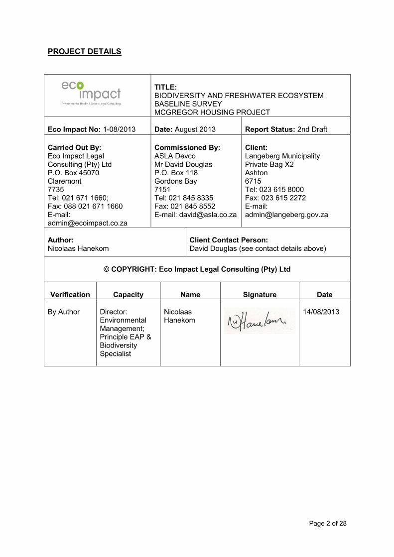
PROJECT DETAILS
TITLE: BIODIVERSITY AND FRESHWATER ECOSYSTEM BASELINE SURVEY MCGREGOR HOUSING PROJECT
Eco Impact No: 1-08/2013
Date: August 2013
Report Status: 2nd Draft
Carried Out By: Eco Impact Legal Consulting (Pty) Ltd P.O. Box 45070 Claremont 7735 Tel: 021 671 1660; Fax: 088 021 671 1660 E-mail: [email protected]
Commissioned By: ASLA Devco Mr David Douglas P.O. Box 118 Gordons Bay 7151 Tel: 021 845 8335 Fax: 021 845 8552 E-mail: [email protected]
Client: Langeberg Municipality Private Bag X2 Ashton 6715 Tel: 023 615 8000 Fax: 023 615 2272 E-mail: [email protected]
Author: Nicolaas Hanekom
Client Contact Person: David Douglas (see contact details above)
© COPYRIGHT: Eco Impact Legal Consulting (Pty) Ltd
Verification
Capacity
Name
Signature
Date
By Author
Director: Environmental Management; Principle EAP & Biodiversity Specialist
Nicolaas Hanekom
14/08/2013

Page 3 of 28
Table of Contents
Introduction ............................................................................................................................. 4 1. Background & Competency ............................................................................................... 4 2. Conditions Relating to this Report ..................................................................................... 4 3. General Preamble ............................................................................................................. 5
3.1 Fundamental Objectives .............................................................................................. 5 3.2 Guiding Principle.......................................................................................................... 5 3.3 Ascribing Value and Importance .................................................................................. 6 3.4 Importance of Management ......................................................................................... 7 3.5 Standard Caveats ........................................................................................................ 7
4. Biodiversity Survey ............................................................................................................ 8 5. Purpose and Background to the Study .............................................................................. 8 6. Description of the Study Area............................................................................................ 9
6.1. Topography .................................................................................................................13 6.2. Climate ........................................................................................................................13 6.3. Geology .......................................................................................................................13
7. Site Visits and Methods Used .........................................................................................13 8. Observations and Findings Relative to the Terms of Reference highlighted below ...........14
8.1. Describe the broad ecological characteristics of the site and surrounds: .....................14 8.2. In terms of biodiversity pattern, identify or describe, at a community and ecosystem
level- ...........................................................................................................................15 8.3. In terms of biodiversity pattern, identify or describe, at species level- ..........................19 8.4. Other pattern issues- ...................................................................................................23 8.5. The extent of alien plant cover on the site: ...................................................................23 8.6. The condition of the site in terms of current or previous land uses: ..............................23 8.7. In terms of biodiversity process, identify or describe: ...................................................23 8.8. Recommend actions that should be taken: ..................................................................25 8.9. Indicate limitations and assumptions, particularly in relation to seasonality: .................25
9. Concluding Remarks and Further Recommendations ........................................................25 10. References ......................................................................................................................26
Page 4 of 28
Introduction
This biodiversity survey is presented by Eco Impact Legal Consulting (Pty) Ltd (“Eco Impact”). This specialist study was done prior to the application for environmental authorisation. It was done as a report to be included in the application to the Department of Human Settlements to register the project as per their requirements and their Appendix A guidelines. 1. Background & Competency
Eco Impact has been appointed by ASLA DEVCO on behalf of the Langeberg Municipality as the independent biodiversity assessment specialist for this project.
Eco Impact are independent and do not have any interest in the business nor receive any payment other than fair remuneration for services rendered as required in terms of the regulations. Nicolaas Hanekom is a registered Professional Natural Scientist in the ecological science field with the South African Council for Natural Scientific Professions (“SACNASP”) and a qualified Environmental Assessment Practitioner (”EAP”) who holds a Masters Technologiae, Nature Conservation degree (“Vegetation Ecology and Biodiversity Assessment”) from the Cape Peninsula University of Technology. Hanekom further qualified in Environmental Management Systems ISO 14001:2004, at the Centre for Environmental Management, North-West University, as well as Environmental Management Systems ISO 14001:2004 Audit: Internal Auditors Course to ISO 19011:2003 level, from the Centre for Environmental Management, North-West University qualifying him to audit to ISO/SANS environmental compliance and EMS standards. Hanekom has also completed the suite of Greener Governance courses with certificates in:
An Overview of Environmental Management at the Local Government Level, Centre for Environmental Management, North-West University;
Greener Governance for Local Authorities, Centre for Environmental Management, North-West University;
Tools for Integrated Environmental Management and Governance, Centre for Environmental Management, North-West University.
Hanekom attended and obtained a certificate on Integrated Protected Area Planning at the Centre for Environmental Development, University of KwaZulu Natal and a certificate in Project Management (Theory and Practical), through CS Holdings. He has lectured in two subjects at the Cape Peninsula University of Technology. He has 14 years of environmental planning experience, working for Free State and Western Cape departments of environmental affairs, where he reviewed and commented on development (EIA) applications in the West Coast region. Hanekom has been responsible for many environmental impact assessments and several EIA applications, waste license and atmospheric emission license applications as well as being involved in the implementation of several environmental management systems.
2. Conditions Relating to this Report
Page 5 of 28
The findings, results, observations, conclusions and recommendations given in this report are based on the author‟s best scientific and professional knowledge as well as available information. Eco Impact and its staff reserve the right to modify aspects of the report including the recommendations if and when new information may become available from on-going research or further work in this field, as pertaining to this investigation.
This report may not be altered or added to without the prior written consent of the author. This restraint also refers to electronic copies of this report which are supplied as sub portion of other reports, including main reports. Similarly, any recommendations, statements, or conclusions drawn from or based on this report must specifically refer to this report. If such comments form part of a main report for this investigation, the base line report must be included in its entirety as an appendix or separate section to the main report.
3. General Preamble
3.1 Fundamental Objectives
EIA‟s and EMP‟s encompass two ultimate purposes:
Maintenance of South Africa‟s biodiversity, and
Enhancement of the quality of life of all South Africa‟s people. These two objectives are frequently perceived to be in conflict, and are fundamentally aligned to legislation via the Constitution and National Environmental: Biodiversity Act. They are, in fact, inseparably linked and fundamentally compatible. Research indicates that the availability of natural and wilderness areas are essential to the emotional, intellectual and physical well-being of urban residents, especially children (Miller 2005). To preserve biodiversity, it is necessary to focus on both pattern and process, that is, the full range of species and habitats (pattern), as well as the ecological and evolutionary processes that allow biodiversity to persist over time (Driver at al. 2003). Animals cannot survive in the absence of their habitat, and neither species nor habitat can survive in the absence of the ecological processes which sustain them. For this reason, this report may devote as much or more attention, to habitat and ecological processes than to species.
3.2 Guiding Principle
In large-scale development projects (e.g.,10ha or more) it is necessary to apply the principle that a development should not impact on habitats needed to meet conservation targets and where ecological processes could naturally occur, especially if the site contains unaltered natural habitats. This principle is based on the logical premise that unless biodiversity conservation is applied at the micro-scale of individual developments, biodiversity conservation at the macro-scale, that is, in the country as a whole, will not succeed. Important implications of this principle are that:
Large-scale developments may need to set aside portions of land specifically for conservation purposes; and
Page 6 of 28
Such portions need to be appropriately and effectively managed to preserve their ecological and biodiversity value.
3.3 Ascribing Value and Importance
There frequently is an assumption made that certain species, habitats and biotic communities have greater value and importance than others. The factors which affect value and importance, also in our view, are:
3.3.1. Ecological importance
The contributions of portions of a particular habitat to the overall ecology of an area are not all equal. Some habitat has greater importance because of the rarity factor or because of a specific role within the habitat. Wetland habitat, for example, are usually small components of a landscape in terms of area, but play a vital role in sustaining aquatic biota and in providing essential resources to terrestrial animals.
Any habitat which is needed to maintain ecological processes has added value.
3.3.2. Connectivity
A particular piece of habitat, which may have little importance itself, may acquire considerable, even critical importance and value, if it connects two other areas of ecological importance. Such “corridor” areas sustain the process and movement of biota between areas and thereby promote the long-term sustainability of ecosystems. Similarly, if an area is adjacent or connected to other areas of conservation importance, its value is increased because it functions as a part of a larger ecological system.
3.3.3. Sustainability Sustainability is a central concept because conservation aims to preserve species, habitats and ecosystem processes in the long term. In fact, the ideal of conservation is to preserve natural systems at temporal and spatial scales that allow evolutionary processes to continue indefinitely. It is therefore essential that conservation planning take into account the factors that are likely to affect the long-term sustainability of systems. Preservation of isolated patches of habitat, no matter how pristine, will not succeed if the larger processes that sustain that patch are not also preserved. In general, the smaller and more isolated a conserved area is, the more intensive the management of the area needs to be in order to maintain its character. Sustainability interacts with the allocation of value and importance. If a feature is deemed to have high value, but that value is unsustainable, its value tends to be down-graded. Conversely, a feature of lesser intrinsic value may have its value enhanced by a greater degree of sustainability.
3.3.4. Threatened status
If a species has been designated “Threatened”, its value is taken to be higher than that of a non-threatened species. Similarly, the higher the level of threat, the greater is the ascribed value. Levels of threat for species are usually objectively defined in Red Data books and the status of veld types is given in the National Spatial Biodiversity Assessment (Rouget et al. 2005). Special attention is devoted to wetland and lowland habitats because, in general, they are more threatened

Page 7 of 28
than dry land and montaine habitats, respectively. 3.3.5. Intactness
The concept applies to habitats, ecosystems and communities. If a system is perceived to be relatively undamaged and functioning normally, it is considered to be “intact”. This attribute does not imply long-term sustainability, but merely that, at the time, the habitat and its biotic community are present and functioning. Intact systems are given greater value because they are generally more functional with regard to ecological- process, -complexity, -rarity and -sensitivity than damaged, disturbed or transformed habitats. 3.3.6. Aesthetic, recreational and educational value
These aspects of value are largely context dependent. That is, the social and economic context of any particular piece of habitat and its associated biotic community is what largely determines whether it has aesthetic, recreational or educational importance. In general, the more developed and densely populated an area, the more relevant these aspects become. Such aspects need to be viewed as important to the maintenance of the quality of life, in both urban and suburban environments.
3.4 Importance of Management
The underlying assumption of development plans tend to be that certain natural features may be destroyed and other natural features must be preserved. This approach is far too simplistic to achieve the fundamental objectives of 3.1 above. If biodiversity and the quality of life of human inhabitants are to be maintained, the environment has to be managed. This principle is readily accepted for the built environment where various environmental management services are routinely provided by landowners and local authorities (e.g., refuse removal, drainage, waste-water treatment, etc.), but the principle of management is frequently ignored when applied to the more extensive and natural environment. While benign neglect may be a valid aspect of a management policy, it is never a complete solution.
3.5 Standard Caveats
Surveys such as herewith generally suffer from a number of defects that must be overtly acknowledged.
3.5.1. Limited time
A truly comprehensive survey requires systematic sampling of the entire habitat in all seasons, and at different times of day. Such thoroughness is seldom possible and therefore most records of occurrence are based on literature and reports obtained from local residents. Follow up verification of occurrence of important species is thus recommended in appropriate cases.
3.5.2. Taxonomic scope
A comprehensive survey should examine all biodiversity, not only plants,
Page 8 of 28
mammals, birds, reptiles and amphibians. It is probable that important and sensitive species of fish and invertebrate inter alia could have been overlooked in surveys limited to the above groups.
3.5.3. Limited expertise
It is not possible to be an expert on all groupings within biodiversity and all aspects of ecology. We trust that this report will sufficiently identify and address issues of likely importance, acknowledging that the full appropriate response to some of these aspects may require the inputs of other particular specialists in appropriate instances.
4. Biodiversity Survey
Ecology is essentially a multi-disciplinary science concerned with the relationship between organisms themselves and between organisms and their environment, in which the emphasis may be on the organisms, populations, communities or ecosystems. It is also the scientific study of the interactions between man, living organisms and the abiotic environment (habitats) with one another and with the non-living environment of matter and energy. It concerns substantially the structure and function of nature. An ecologist is someone who has received appropriate comprehensive training and has experience in biological studies and the analysis of the responses of organisms to the environment and to each other, which then equips a person to be an ecologist. Loss of natural habitat is the single biggest cause of biodiversity loss in South Africa and in much of the world. This means that it often makes sense to focus conservation action on preventing further habitat loss in priority ecosystems, in and out of protected areas, rather than on conserving individual species. Each plant community can therefore be considered as a different ecosystem (Bredenkamp et al. 2002). It is on the above statement and principle that the National Spatial Biodiversity Assessment is based. This National Spatial Biodiversity Assessment is further based on the phytodiversity or vegetation types. The substrate, which in turn determine the flora component, is however seen as a baseline for all ecosystem functioning. Faunal species rely on habitat and niches provided in most instances by vegetation types. It is therefore reasonable to make use of the National Spatial Biodiversity Assessment in making recommendations for this ecological and biodiversity study. Differences in environmental parameters result in differences in vegetation. Biodiversity conservation is linked to the preservation of critical habitat in priority ecosystems.
5. Purpose and Background to the Study
This biodiversity assessment covers terrestrial and aquatic aspects. It intends to inform decisions regarding the proposed McGregor housing project The National Environmental Management: Biodiversity Act (No. 10 of 2004) under Chapter 4 in particular relates to threatened and protected ecosystems and species and related threatening processes and restricted activities. This report has taken into consideration those indigenous species listed as threatened or protected species in terms of Section 56(1) of the Act.
Page 9 of 28
6. Description of the Study Area
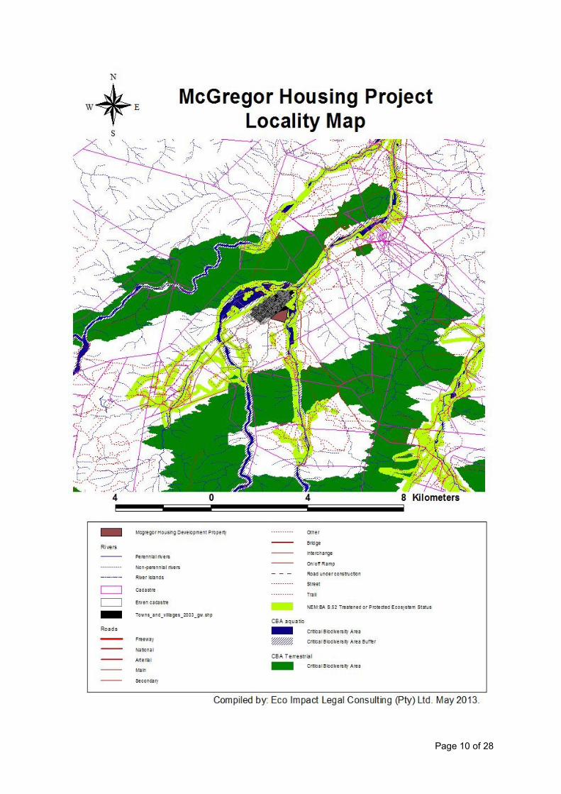
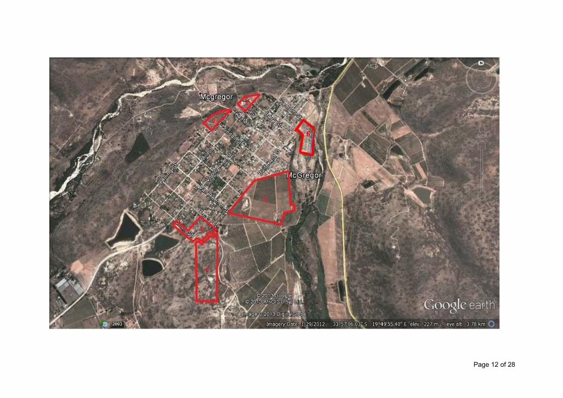
McGregor is a small village in the mountains of the Western Cape, South Africa. It is roughly 15 km east of Cape Town. According the Census 2001, the ward has a population of 10,254 people (Stats SA, 2001). McGregor is situated approximately 16 km south of Robertson. The village was established in 1861 and was originally called Lady Grey. It was renamed in 1905 in honour of Rev. Andrew McGregor, who had been the Dutch Reformed Church minister of the Robertson District for forty years. It has become somewhat of a magnet for alternative lifestyles. The local Waldorf School has roughly 167 children. It is part of the broader wine route network of the Western Cape and is situated at one end of the popular Boesmanskloof Trail to the town of Greyton to the south. The village irrigation system dates back many years. The edges of the streets have a water channel fed from the town dam. Each landowner has a slot allocated during the week where they get a few minutes to an hour of the channel flowing into their property. The time is a function of the size of the property. The sites surveyed are situated within the town of McGregor and surrounds. See maps below:
Page 10 of 28

Page 11 of 28
Page 12 of 28

Page 13 of 28
6.1. Topography
Site 1: ± 1.36ha inside the urban edge of McGregor, flat slope/even terrain with existing structures. Site 2: ± 1.93ha inside the urban edge of McGregor, flat slope/even terrain. Site 3: ± 3.14ha inside the urban edge of McGregor, relatively even slope. Site 4: ± 9.21ha outside of the urban edge of McGregor, relatively steep slope. Site 5: Erf 360 – 17.41ha. The site is situated in a valley with an undulating floodplain landscape on the eastern boundary of the site. The site has a flat to gentle slope from west to east towards the non-perennial drainage lines and floodplains to the east of the site. The highest point of the site is ±236m and the lowest ±229m above mean sea level. Site 6: Erf 397- The existing 1.5ha informal settlement site is situated on flat floodplain terrain, with an elevation of 214m above mean sea level.
6.2. Climate
The area normally receives about 201mm of rain per year and because it receives most of its rainfall during winter it has a Mediterranean climate. The chart below (lower left) shows the average rainfall values for the area per month. It receives the lowest rainfall (5mm) in December and the highest (27mm) in August. The monthly distribution of average daily maximum temperatures (centre chart below) shows that the average midday temperatures for the area range from 17.6°C in July to 29.3°C in February. The region is the coldest during July when the mercury drops to 4.8°C on average during the night. Consult the chart below (lower right) for an indication of the monthly variation of average minimum daily temperatures.
Average rainfall (mm)
27
5
J
F
M
A
M
J
J
A
S
O
N
D
Average midday temperature (°C)
30
18
J
F
M
A
M
J
J
A
S
O
N
D
Average night-time temperature (°C)
16
5
J
F
M
A
M
J
J
A
S
O
N
D
6.3. Geology
The sites are underlain by geological formations derived from shales.
7. Site Visits and Methods Used
Hanekom visited the sites on 21 May and 15 July 2013 for approximately 3 hours. The weather was warm.

Page 14 of 28
Reports on biodiversity surveys serve as input into either Environmental Scoping Reports, Impact Assessments (EIA‟s) or Management Programmes (EMP‟s). Eco Impact in doing such applies certain values and principles. Such values and principles are herewith explicitly stated so the user of this report is apprised of both approach and assumptions. This report takes into recognition the Terms of Reference for biodiversity assessments as provided by Brownlie (2005), De Villiers et al. (2005).
8. Observations and Findings Relative to the Terms of Reference highlighted below
8.1. Describe the broad ecological characteristics of the site and surrounds:
Individual plant localities were not plotted in detail. The sites were surveyed and plant communities were identified and species recorded. The habitat approach was preferred. Species collection was focused on the different plant communities present on site.
The sites in question are located in the Cape Floristic Region, one of 34 „global biodiversity hotspots‟– areas of great natural wealth that are under extreme pressure. At a regional scale, ecosystems and habitats would be those associated with the south-western parts of the Fynbos Biome. The Fynbos component accounts for 70-80% of the region‟s flora with a high degree of plant diversity at a local scale and between sites (Manning, 2007).
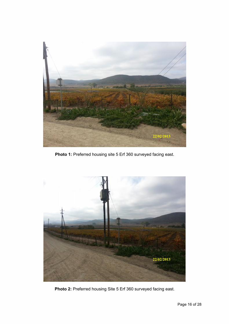
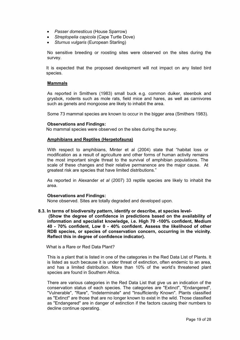
Much of the remnant lowland vegetation of the Cape Floristic Region and supporting ecosystems in these areas is either highly threatened (especially in the Fynbos Biome, which represents more than 66% of South Africa‟s Critically Endangered ecosystems) or hosts globally unique plants that have undergone unique evolutionary adaptations to their environments. Site 1: No remaining indigenous vegetation. The site has been developed. The site can only accommodate ±25 housing units and a need exists for ±500 units therefore this site was deemed not reasonable or feasible and it was not assessed any further. Site 2: Although some disturbance has occurred on site i.e. gravel roads, approximately 60% of the site is still covered with indigenous vegetation. The site vegetation is characterised as Breede Alluvium Renosterveld (“Endangered”). The site can only accommodate ±55 housing units and the need is for ±500 units therefore this site was deemed not reasonable or feasible and it was not assessed any further. Site 3: Although some disturbance has occurred on site i.e. gravel roads, approximately 40% of the site is still covered with indigenous vegetation. The site vegetation is characterised as Robertson Karoo (“Least Threatened”). The site can only accommodate ±90 housing units and the need is for ±500 units therefore this site was deemed not reasonable or feasible and it was not assessed any further. Approvals exist for a low-density residential development, thus not viable for subsidy housing. Site 4: The indigenous vegetation is classified as “least threatened” and covers at least 80% of the site. Due to the steep slope and high development cost the site was deemed not reasonable or feasible and it was not assessed any further. Site 5: Erf 360 - The whole site is totally degraded and planted with vineyards with no remaining natural vegetation on site. The eastern boundary of the site was identified as an aquatic ecological support area in order to protect the non-perennial river from

Page 15 of 28
surrounding impacts. The whole development is located away from any riparian vegetation, the river‟s floodplain and the 1 in 100 year flood line. This site was considered the preferred development site and was therefore further assessed in the report. Erf 397: The floodplain area on which the 1.5ha informal settlement is located has been classified as a Critical Biodiversity Area (“CBA”) due to the importance of the area as catchment for the adjacent Hoeks River tributary along the eastern border of the site. However, the site has been completed transformed and no indigenous vegetation remains on the 1.5ha informal settlement site. 8.2. In terms of biodiversity pattern, identify or describe, at a community and
ecosystem level-
8.2.1. The main vegetation type/s:
Erf 360 vegetation used to be characterised as Breede Alluvium Renosterveld (“Endangered”). No natural veld remaining on the property. The aquatic CBA and buffer area on the eastern boundary of the site must be excluded from the development area. Observations and Findings: No indigenous vegetation remaining on the proposed development site. 8.2.2. The types of plant communities that occur on, and in the vicinity of the sites:
No indigenous vegetation remains on the proposed development site. The flood plain with its riverine vegetation eg Phragmites australis occurs in the vicinity of the site. 8.2.3. Threatened or vulnerable ecosystems:
Erf 360: The site vegetation used to be characterised as Breede Alluvium Renosterveld (“Endangered”). The whole site is however totally degraded and planted with vineyards with no natural vegetation on site. The eastern boundary of the site was identified as an aquatic ecological support area in order to protect the non-perennial river from surrounding impacts. The whole development is located away from any riparian vegetation, the river‟s floodplain and the 1 in 100 year flood line. Erf 397: The floodplain area in which the 1.5ha informal settlement is located has been classified as a CBA due to the importance of the area as catchment for the adjacent Hoeks River tributary along the eastern border of the site. However the site has been completed transformed and no indigenous vegetation remains on the 1.5ha informal settlement site.
Page 16 of 28
Photo 1: Preferred housing site 5 Erf 360 surveyed facing east.
Photo 2: Preferred housing Site 5 Erf 360 surveyed facing east.
22/02/2013
22/02/2013

Page 17 of 28
Photo 3: Proposed new housing development site 5 32m CBA buffer area to be kept in between the proposed development and the 1:100 year floodline area.
Photo 4: Existing 1.5ha informal settlement located within the CBA floodplain area potentially to be decommissioned and rehabilated.
15/07/2013
15/07/2013

Page 18 of 28
Photo 5: Existing 1.5ha informal settlement located within the CBA floodplain area
potentially to be decommissioned and rehabilated.
8.2.4. The types of animal communities (fish, invertebrates, avifauna, mammals, reptiles):
Fish No fish species are present on the sites. No perennial drainage lines or water bodies present on the sites. Invertebrates Observations and Findings: None observed. Sites are totally degraded and developed upon. The proposed developments will not have significant impact on invertebrate species. No known rare or special species were observed or are known to occur or breed on the sites. Birds (Avifauna) 207 species are known to occur in the bigger area (Hockey et al 2006). Observations and Findings: The following bird species were observed during the survey within the study area:
Bostrychia hagedash (Hadeda)
Corvus albus (Pied Crow)
Emberiza capensis (Cape Bunting)
Numida meleagris (Helmeted Guineafowl)
15/07/2013
Page 19 of 28
Passer domesticus (House Sparrow)
Streptopelia capicola (Cape Turtle Dove)
Sturnus vulgaris (European Starling) No sensitive breeding or roosting sites were observed on the sites during the survey. It is expected that the proposed development will not impact on any listed bird species.
Mammals As reported in Smithers (1983) small buck e.g. common duiker, steenbok and grysbok, rodents such as mole rats, field mice and hares, as well as carnivores such as genets and mongoose are likely to inhabit the area. Some 73 mammal species are known to occur in the bigger area (Smithers 1983).
Observations and Findings: No mammal species were observed on the sites during the survey.
Amphibians and Reptiles (Herpetofauna) With respect to amphibians, Minter et al (2004) state that “habitat loss or modification as a result of agriculture and other forms of human activity remains the most important single threat to the survival of amphibian populations. The scale of these changes and their relative permanence are the major cause. At greatest risk are species that have limited distributions.” As reported in Alexander et al (2007) 33 reptile species are likely to inhabit the area. Observations and Findings: None observed. Sites are totally degraded and developed upon.
8.3. In terms of biodiversity pattern, identify or describe, at species level- (Show the degree of confidence in predictions based on the availability of information and specialist knowledge, i.e. High 70 -100% confident, Medium 40 - 70% confident, Low 0 - 40% confident. Assess the likelihood of other RDB species, or species of conservation concern, occurring in the vicinity. Reflect this in degree of confidence indicator).
What is a Rare or Red Data Plant?
This is a plant that is listed in one of the categories in the Red Data List of Plants. It is listed as such because it is under threat of extinction, often endemic to an area, and has a limited distribution. More than 10% of the world‟s threatened plant species are found in Southern Africa. There are various categories in the Red Data List that give us an indication of the conservation status of each species. The categories are "Extinct", "Endangered", "Vulnerable", "Rare", "Indeterminate" and "Insufficiently Known". Plants classified as "Extinct" are those that are no longer known to exist in the wild. Those classified as "Endangered" are in danger of extinction if the factors causing their numbers to decline continue operating.
Page 20 of 28
A number of factors can be responsible for a decline in the size of plant populations. They may eventually cause the extinction of a species. Once this species is lost, it can never be replaced. The most common threat too many arid plants are overgrazing. Overgrazing leads to a decrease in the number of plant species, a change in the ecological balance, and the eventual loss of plant diversity. Plant collectors that collect rare plants for trade or other purposes can pose a serious threat to some species. Fauna and flora have been classified in terms of the ever-increasing threats of over exploitation, illegal trade or habitat transformation and habitat loss. They are rated in terms of their vulnerability to extinction in Red Data books, one for each animal group. Some rare and localized plant species are known to be present in the area. Other protected species are listed under the Threatened or Protected Species regulations.
Red Data Book (“RDB”) species are defined as “Species listed under the Threatened or Protected Species Regulations” (“TOPS”). Any activity impacting on these species listed under the TOPS regulations requires a permit.
8.3.1. The viability of, and estimated population size of the TOPS and RDB
species that are present.
Red Data Listed or species listed under TOPS regulation (Vegetation) Observations and Findings: None observed. Sites are totally degraded and developed upon. (High = 70-100% confident): During the survey no conservation worthy plant species were recorded on the sites.
Red Data Listed or species listed under TOPS regulation (Reptiles and Amphibians) None observed. Sites are totally degraded and developed upon. Observation and Findings: (High = 70-100% confident): No Red Data Listed amphibian species are known to occur on site. No rare and localized species were recorded at the time of the survey.
Red Data Listed or species listed under TOPS regulation (Mammals) The following table lists the Red Data mammal species (including their status) which are predicted, or confirmed to occur in the general area and possibly within the study area (Friedman & Daly, 2004):
COMMON NAME
SCIENTIFIC NAME
RED DATA CATEGORY
PREDICTED OCCURENCE
Lesueur‟s Wing-gland Bat Cistugo lesueuri Near threatened Unlikely
Long-tailed Serotine Bat
Eptesicus hottentotus Least Concern Unlikely
Schreibers‟ Long-fingered Bat
Miniopterus schreibersii Near Threatened Possible
Temminck‟s Hairy Bat Myotis tricolor Near Threatened Possible
Cape Serotine Bat Neoromicia capensis Least Concern Possible
Egyptian Split Faced Bat
Nycteris thebaica Near threatened Possible

Page 21 of 28
Cape horseshoe bat Rhinolophus capensis Near threatened Possible
Geoffroy‟s horseshoe bat
Rhinolophus clivosus Near threatened Possible
Egyptian Fruit Bat Rousettus aegyptiacus Least Concern Unlikely
Egyptian Free-tailed Bat
Tadarida aegyptiaca Least Concern Possible
Mauritian Tomb Bat Taphozous mauritianus Least Concern Unlikely
Rock Hyrax Procavia capensis Least Concern Likely
Cape Clawless Otter Aonyx capensis Least Concern Unlikely
Water Mongoose Atilax paludinosus Least Concern Unlikely
Black-backed Jackal Canis mesomelas Least Concern Likely
Caracal Caracal caracal Least Concern Likely
Yellow Mongoose Cynictis penicillata Least Concern Possible
African Wild Cat Felis silvestris Least Concern Likely
Small Grey Mongoose Galerella pulverulenta Least Concern Likely
Small-spotted Genet Genetta genetta Least Concern Likely
Large-spotted Genet Genetta tigrina Least Concern Likely
Large Grey Mongoose Herpestes ichneumon Least Concern Likely
Striped Polecat Ictonyx striatus Least Concern Possible
Honey Badger Mellivora capensis Near Threatened Unlikely
Bat-eared Fox Otocyon megalotis Least Concern Likely
Leopard Panthera pardus Least Concern Unlikely
African Weasel Poecilogale albinucha Data deficient Unlikely
Aardwolf Proteles cristatus Least Concern Unlikely
Cape Fox Vulpes chama Least Concern Unlikely
Red Hartebeest Alcelaphus buselaphus Least Concern Unlikely
Springbok Antidorcas marsupialis Least Concern Unlikely
Black Rhinoceros Diceros bicornis bicornis
Critically Endangered
Unlikely
Cape Mountain Zebra Equus zebra zebra Vulnerable Unlikely
Klipspringer Oreotragus oreotragus Least Concern Unlikely
Grey Rhebok Pelea capreolus Least Concern Unlikely
Steenbok Raphicerus campestris Least Concern Likely
Eland Taurotragus oryx Least Concern Unlikely
Kudu Tragelaphus strepsiceros
Least Concern Unlikely
Reddish-grey Musk Shrew
Crocidura cyanea Data Deficient Unlikely
Least Dwarf Shrew Suncus infinitesimus Dara deficient Unlikely
Cape Hare Lepus capensis Least Concern Unlikely
Scrub Hare Lepus saxatilis Least Concern Possible
Hewitt‟s Red Rock Rabbit
Pronolagus saundersiae
Least Concern Unlikely
Chacma Baboon Papio ursinus Least Concern Possible
Cape Spiny Mouse Acomys subspinosus Least Threatened Unlikely
Namaqua Rock Mouse Aethomys namaquensis Least Threatened Ulikely
Common Mole Rat Cryptomys hottentotus Least Concern Unlikely
Water Rat Dasymys incorntus Near Threatened Unlikely
Grey Climbing Mouse Dendromus melanotis Least Concern Possible
Brant‟s Climbing Mouse
Dendromus mesomelas Least Concern Unlikely
Short-tailed Gerbil Desmodillus auricularis Least Concern Unlikely
Cape Mole Rat Georychus capensis Least Concern Unlikely

Page 22 of 28
Hairy Footed Gerbil Gerbillurus paeba Least Concern Unlikely
Spectacled Dormouse Graphiurus ocularis Least Concern Possible
Porcupine Hystrix africaeaustralis Least Concern Likely
Large-eared Mouse Malacothrix typica Least Concern Unlikely
Multimammate Mouse Mastornys coucha Least Concern Unlikely
Pygmy Mouse Mus minutoides Least Concern Unlikely
Verreaux's Mouse Myomyscus verreauxi Least Concern Unlikely
Vlei Rat Otomys irroratus Least Concern Unlikely
Laminate Vlei Rat Otomys laminatus Least Concern Unlikely
Saunders Vlei Rat Otomys saundersiae Least Concern Unlikely
Karoo Bush Rat Otomys unisulcatus Least Concern Unlikely
Brant‟s Whistling Rat Parotomys brantsii Least Concern Unlikely
Springhare Pedetes capensis Least Concern Possible
Striped Mouse Rhabdomys pumilio Least Concern Likely
Pouched Mouse Saccostomus campestris
Least Concern Unlikely
Krebs‟ Fat Mouse Steatomys krebsii Least Concern Unlikely
Cape Rock Elephant-shrew
Elephantulus edwardii Least Concern Unlikely
Aardvark Orycteropus afer Least Concern Unlikely
None observed. Sites are totally degraded and developed upon.
Observations and Findings: (High 70-100% confident): No rare mammal species as listed were observed during the site survey. Red Data Listed or species listed under TOPS regulation (Avifauna) Rare Listed species of avifauna of special significance could include the following: The avifauna species of special significance likely to occur within the area are:
Black Harrier Circus maurus (Near Threatened)
Lanner Falcon Falco biarmicus (Near Threatened)
Blue Crane Anthropoides paradiseus (Vulnerable)
Denham‟s Bustard Neotis denhami (Vulnerable)
Martial Eagle Polemaetus bellicosus (Vulnerable) Barnes 2000
African Fish Eagle Haliaeetus vocifer (Vulnerable)
African Marsh Harrier Circus ranivorous (Vulnerable)
Lesser Kestrel Falco naumunni (Vulnerable)
Peregrine Falcon Falco peregrinus (Near Threatened)
Greater Flamingo Phoenicopterus ruber (Near Threatened)
Lesser Flamingo Phoenicopterus minor (Near Threatened)
Great White-pelican Pelecanus onocrotalus (Near Threatened)
Agulhas Long-billed Lark Certhilauda brevirostris (Near Threatened).
Observations and Findings: (High 70-100% confident): None of the above species were observed on or near site during the survey and are more likely to occasionally visit the site and do not breed there.
Page 23 of 28
8.4. Other pattern issues-
Any significant landscape features or rare or important vegetation/faunal associations such as seasonal wetlands, alluvium, seeps, quartz patches or salt marshes in the vicinity: Erf 360: None. The site vegetation used to be characterised as Breede Alluvium Renosterveld (“Endangered”). The whole site is however totally degraded and planted with vineyards with no natural vegetation on site. The eastern boundary of the site was identified as an aquatic ecological support area in order to protect the non-perennial river from surrounding impacts. The whole development is located away from any riparian vegetation, the river‟s floodplain and the 1 in 100 year flood line.
Erf 397: The floodplain area in which the 1.5ha informal settlement is located has been classified as a Critical Biodiversity Area (“CBA”) due to the importance of the area as catchment for the adjacent Hoeks River tributary along the eastern border of the site. However the site has been completely transformed and no indigenous vegetation remains on the 1.5ha informal settlement site.
8.5. The extent of alien plant cover on the site:
None. The sites are however totally degraded and transformed with no natural vegetation on site and encroaching Phragmites reeds within the surrounding wetland areas.
8.6. The condition of the site in terms of current or previous land uses:
Erf 360: Site used for agricultural activities and planted with vineyards. Erf 397: Site was a vacant CBA floodplain area, until the current informal settlement was established.
8.7. In terms of biodiversity process, identify or describe:
8.7.1. The key ecological “drivers” of ecosystems on the site and in the vicinity, such as fire.
Erf 360: None. Site used for agricultural activities and planted with vineyards
Erf 397: Site was a vacant CBA floodplain area, until the current informal settlement was established.
8.7.2. Environmental gradients (e.g. upland-lowland), biome boundaries, soil interfaces or sand movement corridors on the site or in its vicinity.
Erf 360: The site vegetation used to be characterised as Breede Alluvium Renosterveld (“Endangered”). The whole site is however totally degraded and planted with vineyards with no natural vegetation on site. The eastern boundary of the site was identified as an aquatic ecological support area in order to protect the non-perennial river from surrounding impacts. The whole development is located away from any riparian vegetation, the river‟s floodplain and the 1 in 100 year flood line.

Page 24 of 28
Erf 397: The floodplain area in which the 1.5ha informal settlement is located has been classified as a Critical Biodiversity Area (“CBA”) due to the importance of the area as catchment for the adjacent Hoeks River tributary along the eastern border of the site. However the site has been completed transformed and no indigenous vegetation remains on the 1.5ha informal settlement site. 8.7.3. Any possible changes in key processes e.g. increased fire frequency or drainage/artificial recharge of aquatic systems. Erf 360: Any possible changes that could occur due to the proposed housing development such as an increase in stormwater runoff must be mitigated by implementing a site specific stormwater management plan. Erf 397: Potential decommissioning and rehabilitation of the informal settlement within the floodplain area will allow the natural drainage recharge processes of the site to be restored.
8.7.4. The condition and functioning of rivers and wetlands (if present) in terms of possible changes to the channel, flow regime and naturally-occurring riparian vegetation.
Erf 360: Any possible changes that could occur due to the proposed housing development such as an increase in stormwater runoff must be mitigated by implementing a site specific stormwater management plan. Erf 397: Potential decommissioning and rehabilitation of the informal settlement within the floodplain area will allow the natural drainage recharge processes of the site to be restored. 8.7.5. Would the conservation of the site lead to greater viability of the adjacent ecosystem by securing any of the functional factors listed? Erf 360: No. Erf 397: Yes
8.7.6. Does the site or neighbouring properties potentially contribute to meeting regional conservation targets for both biodiversity pattern and ecological processes?
Erf 360: The eastern boundary of the site was identified as an aquatic ecological support area in order to protect the non-perennial river from surrounding impacts. In order to protect the CBA/non-perennial river, a 32m CBA buffer area in-between the 1:100year floodline and proposed development site is to be maintained in which only stormwater management measures must be allowed. Erf 397: The relevant site has been classified as a CBA floodplain area therefore the rehabilitation and conservation of the site is important. 8.7.7. Is this a potential candidate site for conservation stewardship?
Erf 360: No - The eastern boundary of the site was identified as an Aquatic Ecological support area in order to protect the non-perennial river from surrounding impacts. In order to protect the CBA/non-perennial river, a 32m CBA buffer area in-between the 1:100year floodline and proposed development site is to be maintained

Page 25 of 28
in which only stormwater management measures must be allowed. Erf 397: The relevant site has been classified as a CBA floodplain area therefore the rehabilitation and conservation of the site is important.
8.8. Recommend actions that should be taken:
8.8.1. To prevent or, if prevention is not feasible, to mitigate impacts and restore disturbed vegetation or ecological processes.
The project implementation process should be subject to standard Environmental Management Programme (EMP) prescripts and conditions and only proceed under supervision of a competent and diligent Environmental Control Offices, both during the construction-, operational and decommissioning phases. Storm water runoff from the site must be controlled in order to prevent erosion and siltation of the ecological support area and flood plains on the eastern boundary of the property. In order to protect the CBA/non-perennial river, a 32m CBA buffer area in-between the 1:100year floodline and proposed development site is to be maintained in which only storm water management measures must be allowed.
8.8.2. Indicate how preventative and remedial actions will be scheduled to ensure long-term protection, management and restoration of affected ecosystems and biodiversity.
On-going storm water management in order to manage impacts on the floodplain and ecological support area east of the site.
8.9. Indicate limitations and assumptions, particularly in relation to seasonality:
None 9. Concluding Remarks and Further Recommendations
If strict adherence is kept to the recommendations as set out in this report and an Environmental Management Programme, the proposed development will not have a significant impact on any listed species or sensitive environments. No significant breeding, roosting or habitat on the site will be impacted upon. Most species will move out of the area into similar adjacent habitats when construction activities start.
.
The storm water runoff must be accommodated in designed and constructed storm water systems which must link into the downstream systems to prevent flooding, erosion and siltation of the drainage lines and flood plains to the east.
In order to protect the CBA/non-perennial river, a 32m CBA buffer area in-between the 1:100year floodline and proposed development site is to be maintained in which only storm water management measures must be allowed.
The project implementation process should be subject to standard Environmental Management Programme (EMP) prescripts and conditions and only proceed under supervision of a competent and diligent Environmental Control Officer, both
Page 26 of 28
during the construction-, operational and decommissioning phases.
Eco Impact is of the opinion, and based on the survey and desk study done, that the development; if designed and implemented according to the recommendations will not impact significantly on the biodiversity, or adversely affect the ecological functioning of the area.
10. References
Alexander G and Marais J. 2007. A Guide To The Reptiles Of Southern Africa. Barnes K.N. 2000. The Eskom Red Data book of birds of South Africa, Lesotho and Swaziland. BirdLife South Africa, Johannesburg. Branch W.R. (ed.) 1988. South African Red Data book – reptiles and amphibians. SA National Scientific programmes Report No. 151. CSIR, Pretoria. Bredenkamp, G.J. Henning, B., Mostert, T. & Brown, L.R. 2002. A vegetation and wildlife management plan for Folly Farm on Leeuwpoort 357 JQ. Eco-Agent cc. Brownlie S. 2005. Guideline for involving biodiversity specialists in EIA processes: Edition 1. CSIR Report No. ENV-S-C 2005 053 C. Republic of South Africa, Provincial Government of the Western Cape, Department of Environmental Affairs and Development Planning, Cape Town. Cowling R. & Heijnis C. 2001. The identification of Broad Habitat Units as biodiversity entities for systematic conservation planning in the Cape Floristic Region. SA J Bot. 67: 15 – 38. De Villiers C.C., Driver A., Brownlie S., Clark B., Day E.G., Euston-Brown D.I.W., Helme N.A., Holmes P.M., Job N., & Rebelo A.B. 2005. Fynbos Forum ecosystem guidelines for environmental assessment in the Western Cape. Fynbos Forum, c/o Botanical Society of South Africa: Conservation Unit, Kirstenbosch, Cape Town. Driver A., Cowling R.M., & Maze K. 2003. Planning for living landscapes: perspectives and lessons from South Africa. Center for Applied Biodiversity Science at Conservation International, Washington DC; Botanical Society of South Africa, Cape Town. Du Preez L. & Carruthers V. 2009. A Complete Guide to the Frogs of Southern Africa. Struik Nature, Cape Town. Friedmann Y. & Daly B. (eds) 2004. Red Data Book of the mammals of South Africa: a conservation assessment. CBSG Southern Africa, Conservation Breeding Specialist Group (SSC/IUCN), Endangered Wildlife Trust, South Africa. Helme N. & D. Raimondo. In prep. Contribution to the updated Red Data Book list of threatened plants of South Africa. Hockey PAR., Dean WRJ & Ryan PG. 2006. Roberts Birds Of Southern Africa. VIIth Edition. International Association for Impact Assessment (IAIA) 2005. Biodiversity in impact assessment. IAIA Special Publication Series No. 3. IAIA, North Dakota. Miller J.R. 2005. Biodiversity conservation and the extinction of experience. Trends in
Page 27 of 28
Ecology and Evolution. 20(8): 430-434. Pence G.Q.K. 2008 (in prep). C.A.P.E. Fine-Scale Systematic Conservation Planning Assessment: Technical Report. Produced for CapeNature. Cape Town, South Africa. Picker M, Griffiths c and Weaving A. 2004. Field Guide to Insects of Southern Africa. Struik Publishers, Cape Town. Rouget M., Reyers B., Jonas Z., Desmet P., Driver A., Maze K., Egoh B., Cowling R.M., Mucina L. & Rutherford M.C. 2005. South African National Spatial Biodiversity Assessment 2004: Technical Report. Vol. 1: Terrestrial Component. South African National Biodiversity Institute, Pretoria. Mucina L & Rutherford M.C. (eds.) 2006. Vegetation Map of South Africa, Lesotho and Swaziland: Shapefiles of basic mapping units. Beta version 4.0, February 2004, National Botanical Institute, Cape Town. Smithers RHN. 1983. Land Mammals Of Southern Africa. A field Guide.

Page 28 of 28
APPENDIX 1: DECLARATION OF INDEPENDENCE THE INDEPENDENT PERSON WHO COMPILED A SPECIALIST REPORT OR UNDERTOOK A SPECIALIST PROCESS
I Nicolaas Willem Hanekom, as the appointed independent specialist hereby declare that I:
act/ed as the independent specialist in this application;
regard the information contained in this report as it relates to my specialist input/study to be true and correct, and
do not have and will not have any financial interest in the undertaking of the activity, other than remuneration for work performed in terms of the NEMA, the Environmental Impact Assessment Regulations, 2010 and any specific environmental management Act;
have and will not have no vested interest in the proposed activity proceeding;
have disclosed, to the applicant, EAP and competent authority, any material information that have or may have the potential to influence the decision of the competent authority or the objectivity of any report, plan or document required in terms of the NEMA, the Environmental Impact Assessment Regulations, 2010 and any specific environmental management Act;
am fully aware of and meet the responsibilities in terms of NEMA, the Environmental Impact Assessment Regulations, 2010 (specifically in terms of regulation 17 of GN No. R. 543) and any specific environmental management Act, and that failure to comply with these requirements may constitute and result in disqualification;
have ensured that information containing all relevant facts in respect of the specialist input/study was distributed or made available to interested and affected parties and the public and that participation by interested and affected parties was facilitated in such a manner that all interested and affected parties were provided with a reasonable opportunity to participate and to provide comments on the specialist input/study;
have ensured that the comments of all interested and affected parties on the specialist input/study were considered, recorded and submitted to the competent authority in respect of the application;
have ensured that the names of all interested and affected parties that participated in terms of the specialist input/study were recorded in the register of interested and affected parties who participated in the public participation process;
have provided the competent authority with access to all information at my disposal regarding the application, whether such information is favourable to the applicant or not; and
am aware that a false declaration is an offence in terms of regulation 71 of GN No. R. 543.
Eco Impact is independent and does not have an interest in the business nor receive any payment other than fair remuneration for services rendered as required in terms of regulations.
Pri.Sci.Nat (Ecological Science) 400274/11
Signature of the specialist: Name of company: Eco Impact Legal Consulting (Pty) Ltd Date: 15 August 2013