land & water commissioner groundwater: gunnedah basin … · gunnedah basin: vertical...
TRANSCRIPT

What water information can tell us
LAND & WATER COMMISSIONER
Groundwater: Gunnedah Basin NSW
PUB19/241May 2019

Sedimentary basins in NSW

Section through both the Gunnedah and Clarence Moreton Basins
Poorly developed and minimal coal seams
Permian coals
No coal in New England Fold Belt

Groundwater Sources in NSW

Distribution of groundwater extraction>10,000 Production Bores>6,000 Licences90% Licences for Irrigation>89,000 Stock and Domestic Bores
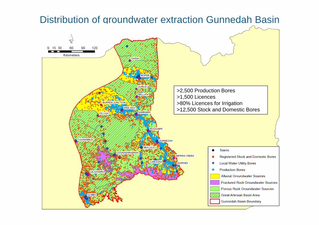
Distribution of groundwater extraction Gunnedah Basin
>2,500 Production Bores>1,500 Licences>80% Licences for Irrigation>12,500 Stock and Domestic Bores

Gunnedah Basin: Distribution and purpose of groundwater rights
Upper and Lower Namoi Alluvial Water Sources
(~215 GL/yr)
Other alluvial (total)
(~4 GL/yr)
Lower Gwydir Alluvial Water Source(~28 GL/yr)
Great Artesian Basin (total)
(~35 GL/yr)
NSW MDB Porous Rock Groundwater Source
(Gunnedah Oxley Basin)(~22 GL/yr)
Macquarie and Castlereagh Alluvial Groundwater Sources
(~22 GL/yr)
NSW MDB Fractured Rock Water Sources (basalt)
(~3 GL/yr)
Total rights ~ 340 GL

Gunnedah Basin: Areas of Permian outcrop

Gunnedah Basin: vertical distribution of groundwater rights
~3,500 stock and domestic~150 high yield
~4,500 stock and domestic~1,500 high yield
~3,500 stock and domestic~200 high yield
Total rights 340 GL
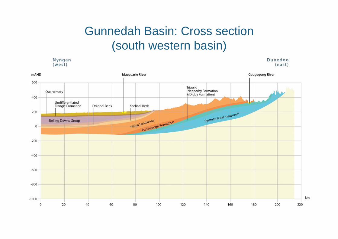
Gunnedah Basin: Cross section (south western basin)

State> 4,500 monitoring bores across >2900 sites• 70% monitor the alluvials• > 400 bores telemetered
Gunnedah Basin> 1,500 monitoring bores across >700 sites • 90% monitor the alluvials• > 100 bores telemetered
Groundwater monitoring sites

Long term rainfall trends

Groundwater levels

Groundwater levels

Groundwater levels

Groundwater levels

Groundwater levels

Groundwater levels

THANK YOU
Please direct enquiries to the NSW Land and Water Commissioner:[email protected] or (02) 6391 3429
© State of New South Wales through Department of Industry 2018. This publication is copyright. You may download, display, print and reproduce this material provided that the wording is reproduced exactly, the source is acknowledged, and the copyright, update address and disclaimer notice are retained. To copy, adapt, publish, distribute or commercialise any of this publication you will need to seek permission from the Department of Industry.
Disclaimer: The information contained in this publication is based on knowledge and understanding at the time of writing, May 2018. However, because of advances in knowledge, users are reminded of the need to ensure that the information upon which they rely is up to date and to check the currency of the information with the appropriate officer of the Department of Industry or the user’s independent advisor.