imos satellite remote sensing (including ocean colour) cmar, clw, utas, bom, curtinu, ga, aims...
TRANSCRIPT
IMOS Satellite Remote Sensing (including Ocean Colour)
CMAR, CLW, UTas, BoM, CurtinU, GA, AIMS
Edward King & SRS Team
Overview
Building infrastructure to support the use of remote sensing for marine research, both within Australia and Globally
• Data Products
– SST (Sea Surface Temperature)
– OC (Ocean Colour)
• Cal/Val
– OST (Ocean Surface Topography)
• Data Provision
– Reception Network
– Data access and management
• Linkages and Outreach

Data Products: 1. SST
Goal: Production of a Quality Controlled National data set. Is being contributed to global GHRSST project.
Includes:
•14-day AVHRR composites
•Daily AVHRR mosaics
•Hourly MTSAT
Utilises IMOS Ships of Opportunity to perform QA/QC.
NRT data streams in place, currently back-processing archive.

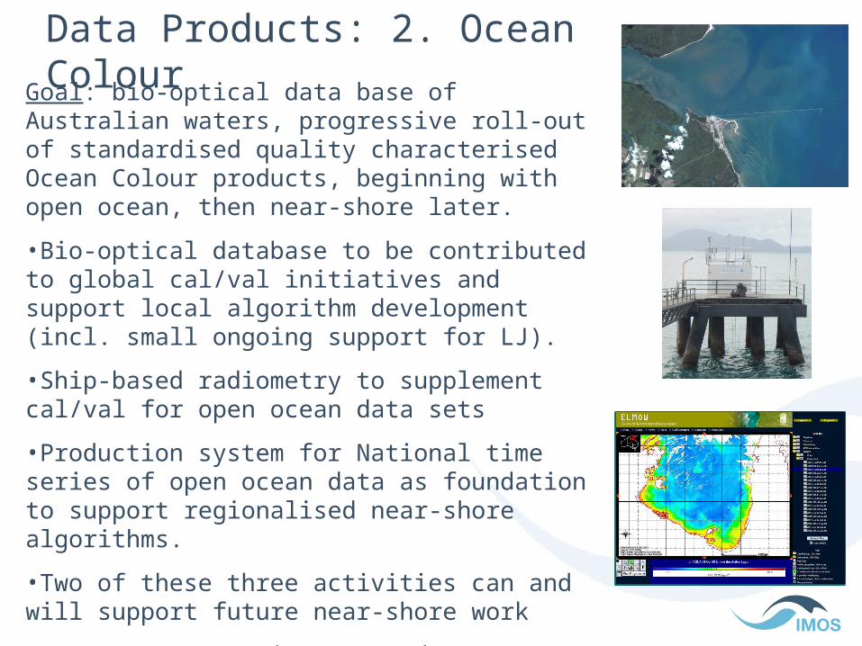
Data Products: 2. Ocean ColourGoal: bio-optical data base of Australian waters, progressive roll-out of standardised quality characterised Ocean Colour products, beginning with open ocean, then near-shore later.
•Bio-optical database to be contributed to global cal/val initiatives and support local algorithm development.
•Ship-based radiometry to supplement cal/val for open ocean data sets
•Production system for National time series of open ocean data as foundation to support regionalised near-shore algorithms.

Cal/Val OST (Altimetry)Goal: Use moorings and GPS buoys at established sites to contribute two data streams directly to the OSTM/Jason-2 mission team. The data will contribute directly to improving global products for use by the global user community.
1. Derive bias drift from global tide gauge network combined with estimates of land motion.
2. Compute absolute bias time series from GPS equipped buoys and and oceanographic instruments moored in Bass Strait and Storm Bay.

Data Provision 1: National Reception Network
IMOS support for X-band systems.
• Townsville (new)
•Hobart (upgrade)
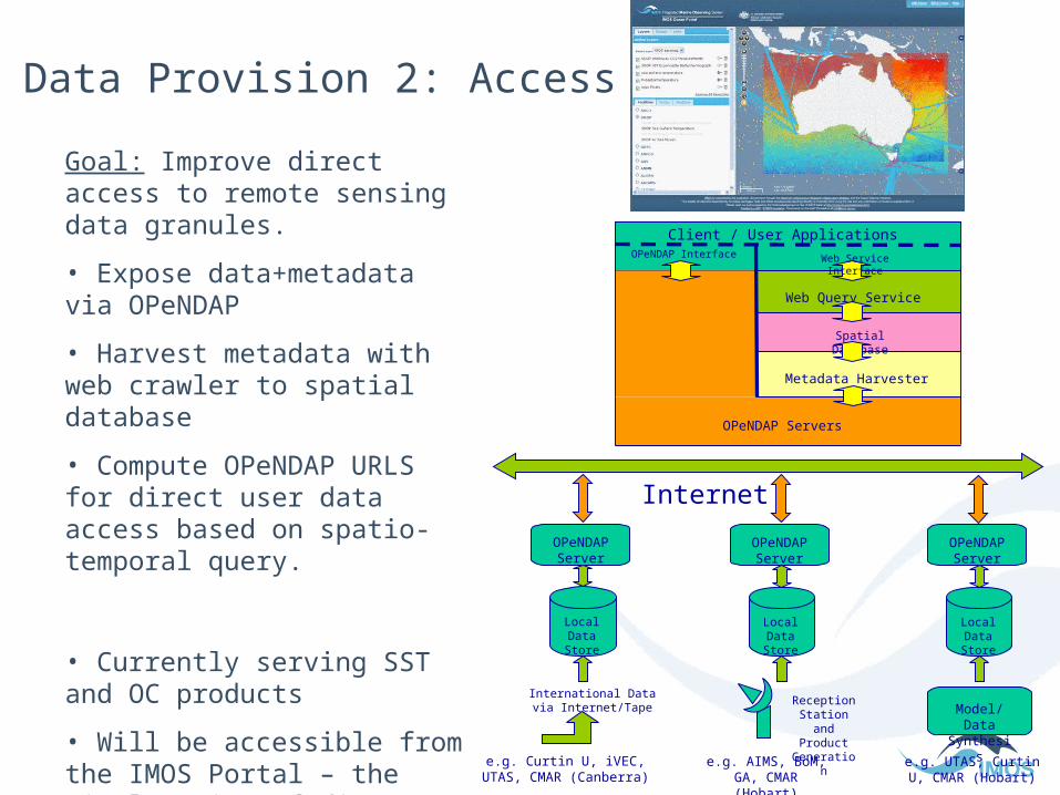
Data Provision 2: Access
OPeNDAP Server
LocalData Store
OPeNDAP Server
LocalData Store
OPeNDAP Server
LocalData Store
Reception Station and
Product Generation
International Data via Internet/Tape Model/Data
Synthesis
Internet
e.g. Curtin U, iVEC, UTAS, CMAR (Canberra)
e.g. AIMS, BoM, GA, CMAR (Hobart)
e.g. UTAS, Curtin U, CMAR (Hobart)
Client / User Applications
Metadata Harvester
Spatial Database
Web Query Service
OPeNDAP Servers
OPeNDAP Interface Web Service Interface
Goal: Improve direct access to remote sensing data granules.
• Expose data+metadata via OPeNDAP
• Harvest metadata with web crawler to spatial database
• Compute OPeNDAP URLS for direct user data access based on spatio-temporal query.
• Currently serving SST and OC products
• Will be accessible from the IMOS Portal – the single point of discovery for all IMOS data
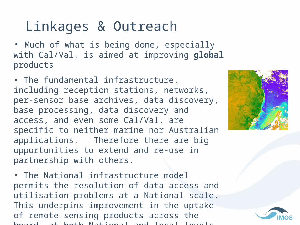
Linkages & Outreach• Much of what is being done, especially with Cal/Val, is aimed at improving global products
• The fundamental infrastructure, including reception stations, networks, per-sensor base archives, data discovery, base processing, data discovery and access, and even some Cal/Val, are specific to neither marine nor Australian applications. Therefore there are big opportunities to extend and re-use in partnership with others.
• The National infrastructure model permits the resolution of data access and utilisation problems at a National scale. This underpins improvement in the uptake of remote sensing products across the board, at both National and local levels. (But it takes work to sell the bigger view.)

Ocean Colour •Optical remote sensing relies on reflected sunlight.
•The ocean does not reflect much.
•So the signal of interest is very weak, comparable to uncertainty in calibration and atmospheric correction
•This is a very demanding measurement to make.
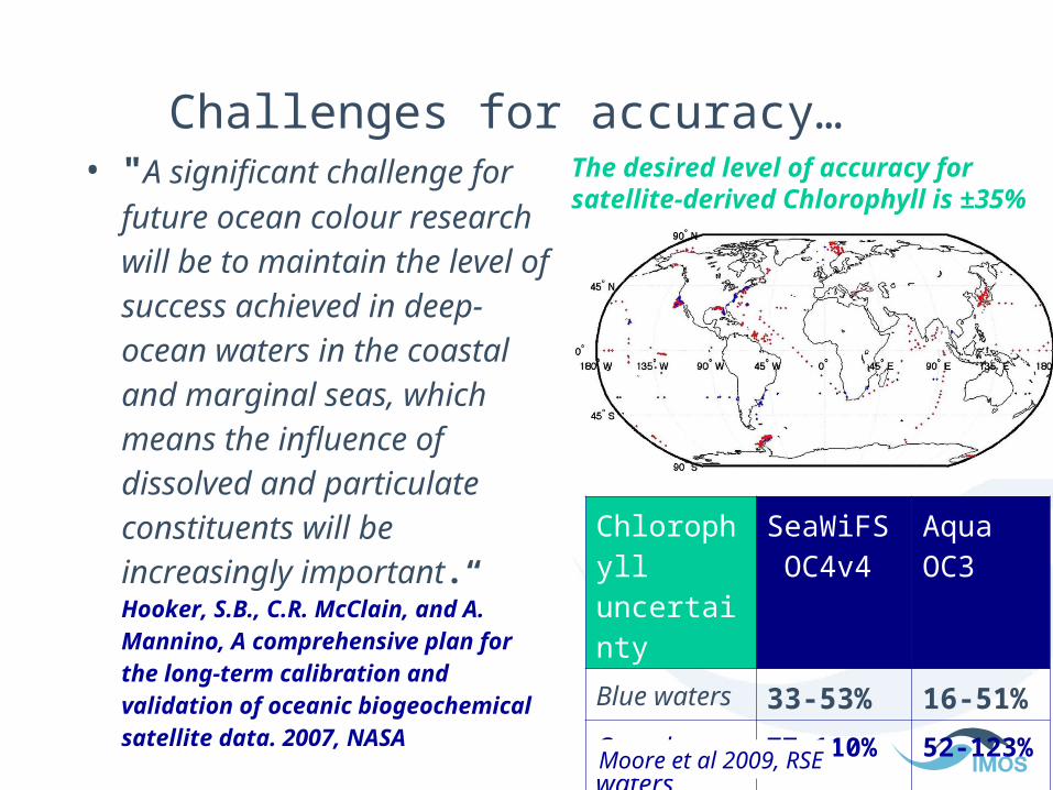
Challenges for accuracy…• "A significant challenge for
future ocean colour research will be to maintain the level of success achieved in deep-ocean waters in the coastal and marginal seas, which means the influence of dissolved and particulate constituents will be increasingly important.“Hooker, S.B., C.R. McClain, and A. Mannino, A comprehensive plan for the long-term calibration and validation of oceanic biogeochemical satellite data. 2007, NASA
Chlorophyll uncertainty
SeaWiFS OC4v4
Aqua OC3
Blue waters 33-53% 16-51%
Complex waters
77-110% 52-123%
All 77% 73%Moore et al 2009, RSE
The desired level of accuracy for satellite-derived Chlorophyll is ±35%

Data Processing Chain includes:
• data acquisition (local or via foreign space agency)
• storage & management (GB to TB of data)
• calibration (demanding)
• geo-location (largely standardised)
• atmospheric correction (demanding & scene and location specific)
• Cloud detection
• calculation of optical properties (expert required)
• access (tedious)
A break in any link of this chain can prevent use. It is a challenging chain to follow, ESPECIALLY if you are an end-user or just starting out (rather than a remote sensing expert).

The larger view (the money chain)
• End-use drives the need for research to improve knowledge. (incl. environmental monitoring and management, fed+state+local govt, fishing industry etc).
• Research drives the science case for infrastructure investment
• IMOS needs a coherent and defensible case for benefit from its NODES in order to invest in its FACILITIES
• This has been done in the open ocean, so
• current IMOS investment focus is on infrastructure to support the open ocean but with a view to paving the way for improved coastal work in future.
Data Products: 2. Ocean ColourGoal: bio-optical data base of Australian waters, progressive roll-out of standardised quality characterised Ocean Colour products, beginning with open ocean, then near-shore later.
•Bio-optical database to be contributed to global cal/val initiatives and support local algorithm development (incl. small ongoing support for LJ).
•Ship-based radiometry to supplement cal/val for open ocean data sets
•Production system for National time series of open ocean data as foundation to support regionalised near-shore algorithms.
•Two of these three activities can and will support future near-shore work
•BUT: As a community we need to get organised and aligned to clearly articulate future investment priorities.

[email protected] 02-6246-5894
Integrated Marine Observing System (IMOS)University of TasmaniaPrivate Bag 110 Hobart, TAS, 7001+61 (03) 6226 7505 T+61 (03) 6226 2107F [email protected]