gis collaboration for emergency services randy knippel gis manager dakota county 8 county...
TRANSCRIPT

GIS Collaboration For Emergency Services
Randy KnippelGIS Manager
Dakota County
8 County Collaboration GIS WorkgroupMESB NG911 Workgroup
2
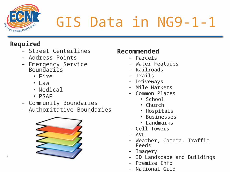
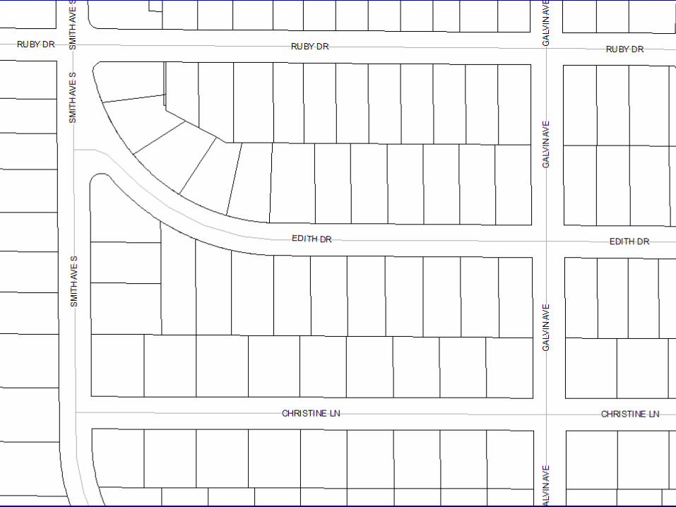
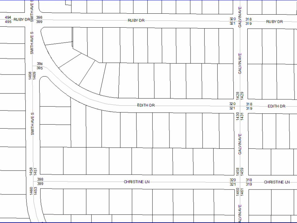
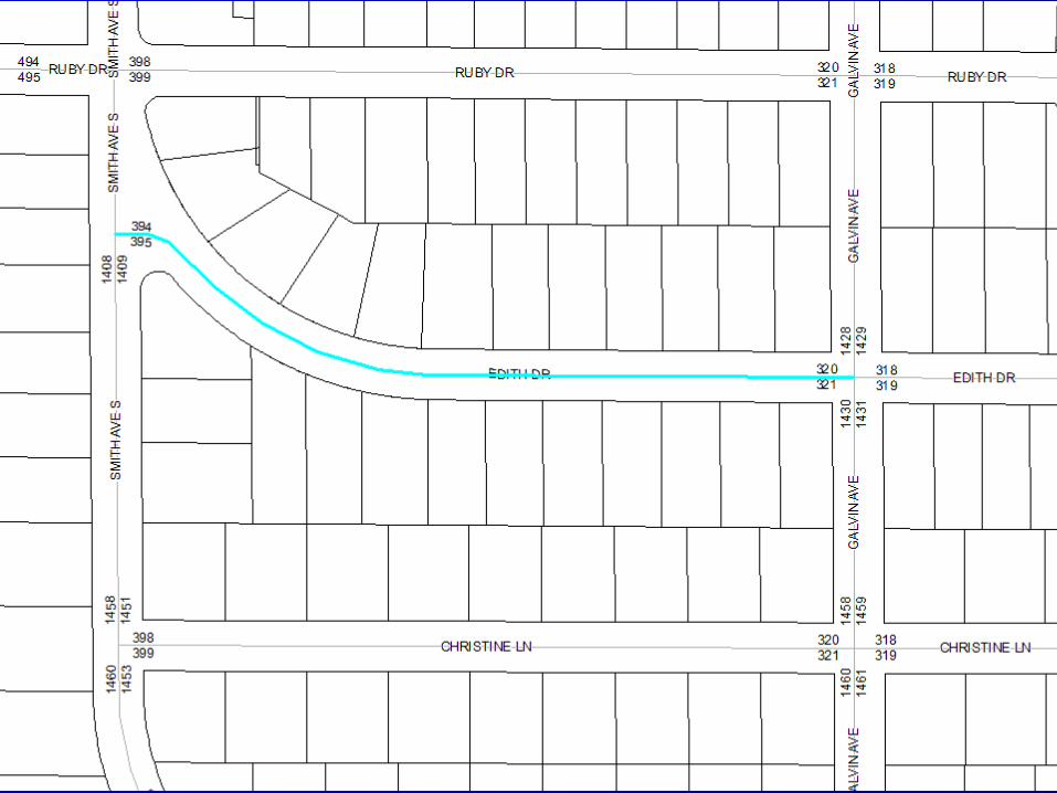
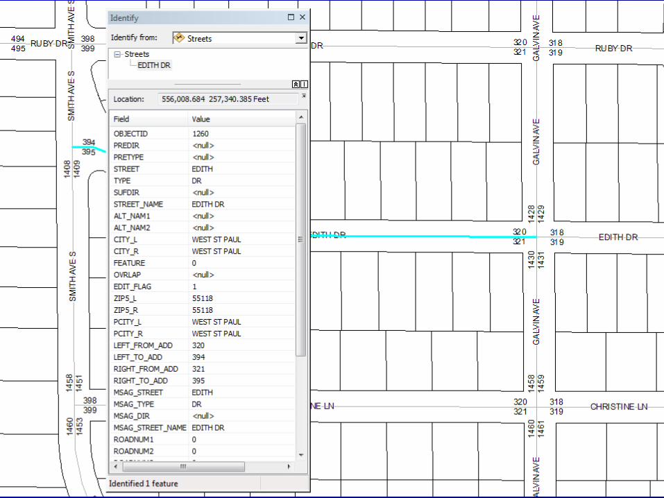
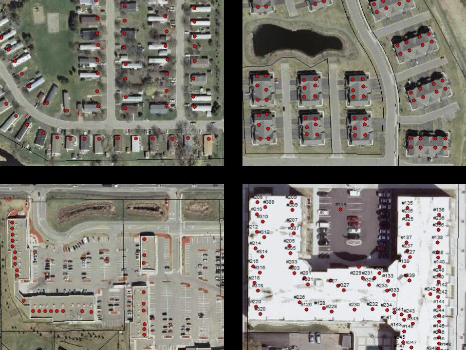
Required– Street Centerlines– Address Points– Emergency Service Boundaries
• Fire• Law• Medical• PSAP
– Community Boundaries– Authoritative Boundaries
Recommended– Parcels– Water Features– Railroads– Trails– Driveways– Mile Markers– Common Places
• School• Church• Hospitals• Businesses• Landmarks
– Cell Towers– AVL– Weather, Camera, Traffic Feeds– Imagery– 3D Landscape and Buildings– Premise Info– National Grid
GIS Data in NG9-1-1


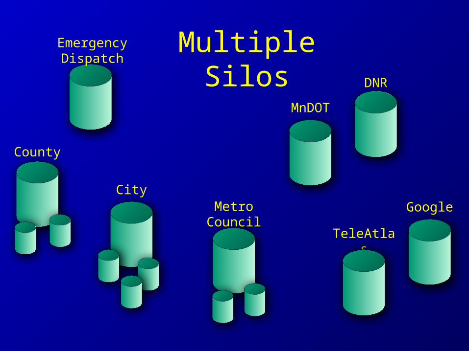
Emergency Dispatch Multiple Silos
County
CityMetro
Council
MnDOT
DNR
TeleAtlas
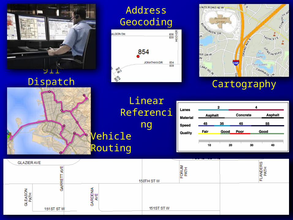
911 Dispatch
Address Geocoding
Cartography
Vehicle Routing
Linear Referencing

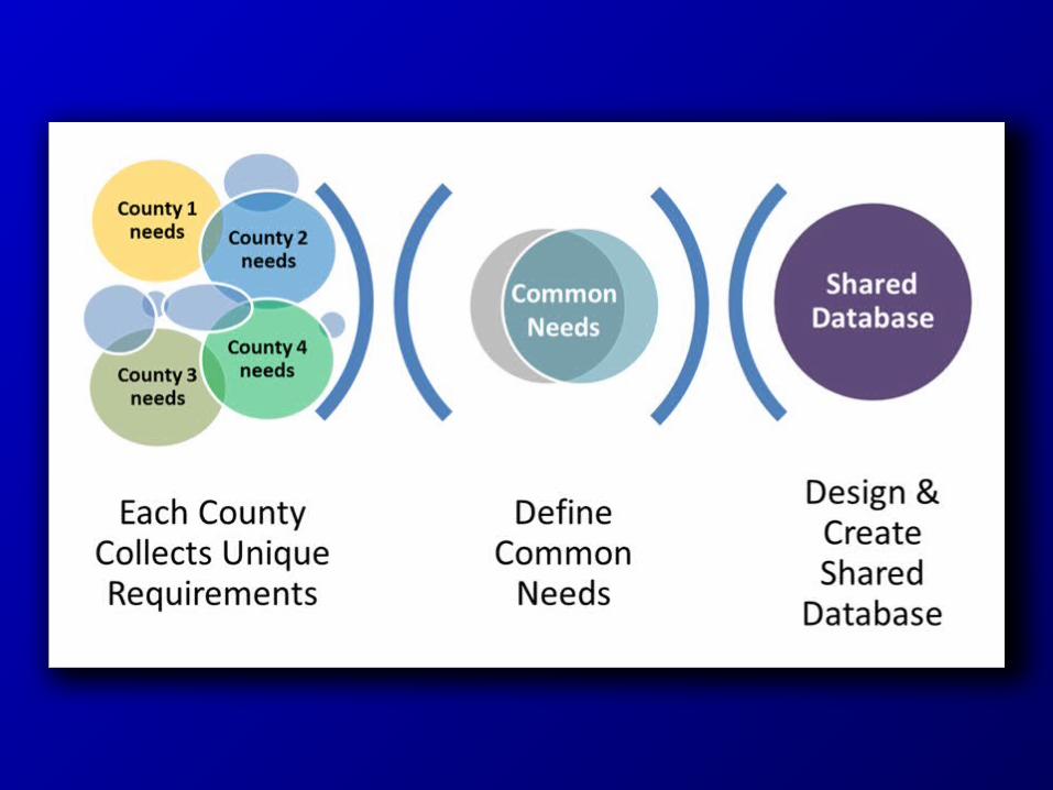
Single Authoritative
SourceEmergency Services
County
City
Metro Council
MnDOT
DNR
TeleAtlas

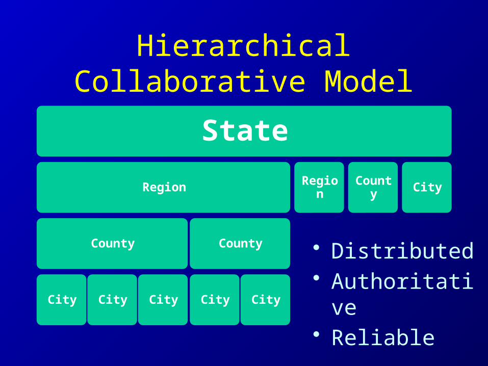
State
Region
County
City City City
County
City City
Region
County City
HierarchicalCollaborative Model
• Distributed• Authoritative• Reliable
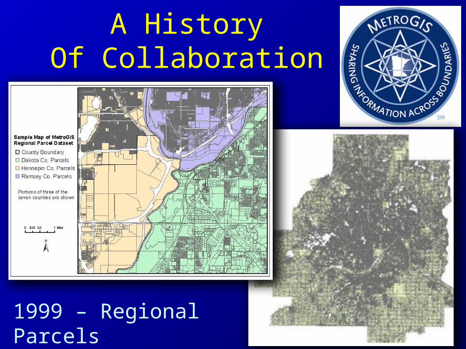
A HistoryOf Collaboration
1999 – Regional Parcels
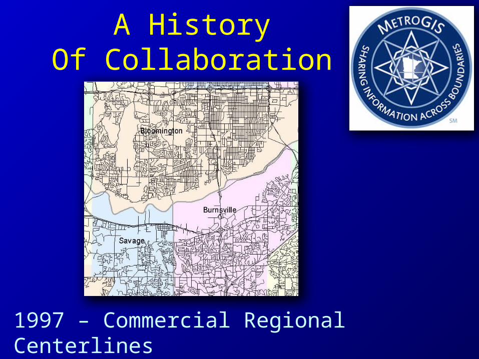
A HistoryOf Collaboration
1997 – Commercial Regional Centerlines
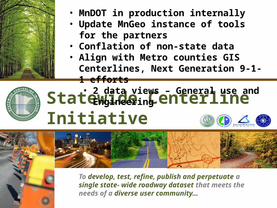
Statewide Centerline Initiative
• MnDOT in production internally• Update MnGeo instance of tools for the partners• Conflation of non-state data• Align with Metro counties GIS Centerlines, Next
Generation 9-1-1 efforts• 2 data views – General use and Engineering
To develop, test, refine, publish and perpetuate a single state- wide roadway dataset that meets the needs of a diverse user community…
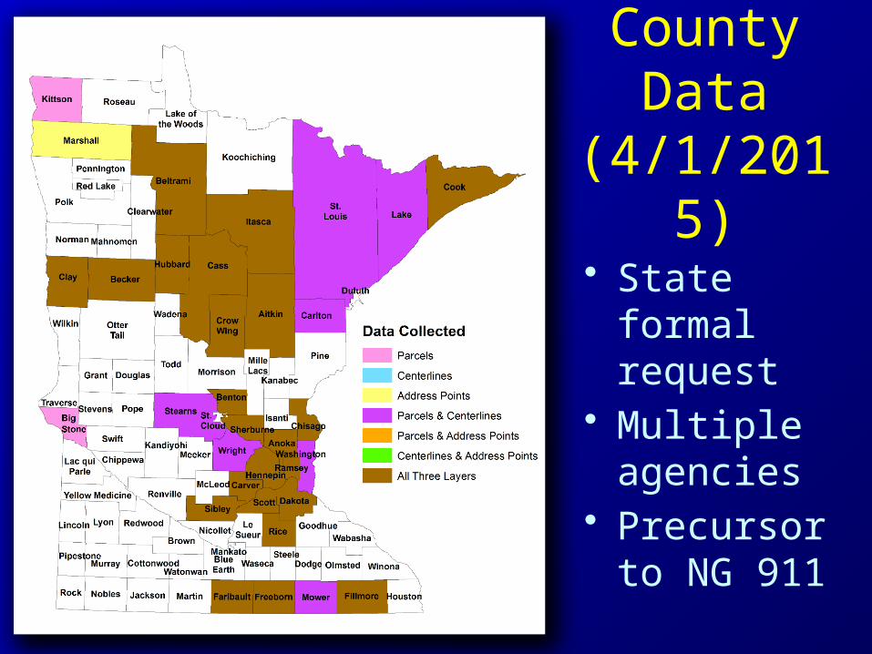
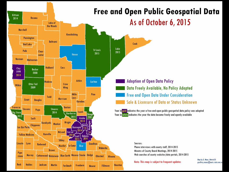
County Data
(4/1/2015)
• State formal request
• Multiple agencies
• Precursor to NG 911

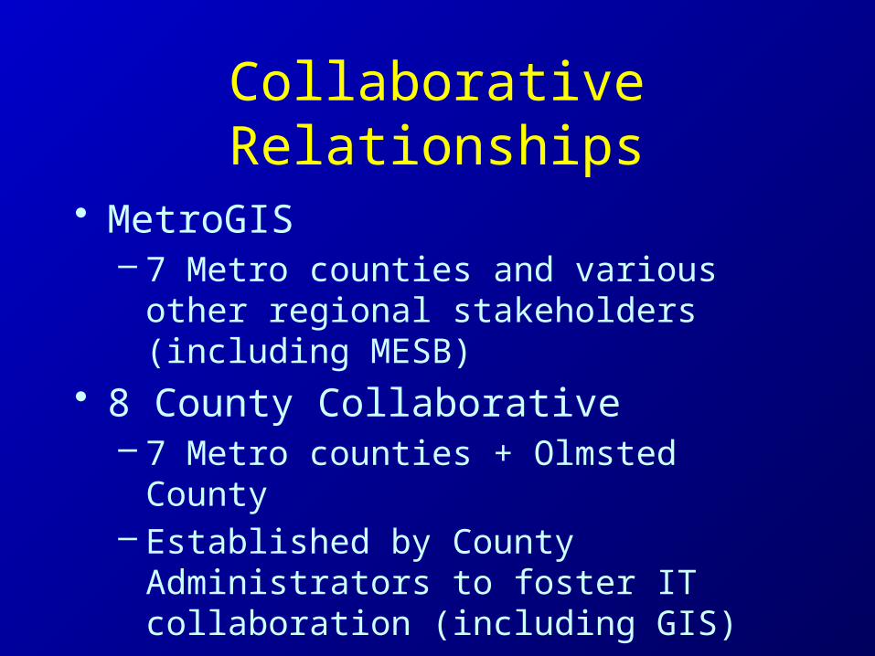
Collaborative Relationships
• MetroGIS– 7 Metro counties and various other
regional stakeholders (including MESB)• 8 County Collaborative
– 7 Metro counties + Olmsted County– Established by County Administrators to
foster IT collaboration (including GIS)• MESB NG911 Workgroup
– 9 MESB counties
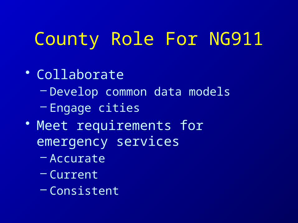
County Role For NG911
• Collaborate– Develop common data models– Engage cities
• Meet requirements for emergency services– Accurate– Current– Consistent
