1 the facility registry system 2006 gis workgroup meeting cincinnati mainstreaming locational...
TRANSCRIPT

1
The Facility Registry System
2006 GIS Workgroup MeetingCincinnati
Mainstreaming Locational Improvement In Our Work
Status Update of Locational Data Improvement

2
Purpose
Locational StatusFRS Quality Improvements
3
EPA’s architecture enables the Agency by location to describe the quality of the environment and the activities occurring at that location
4
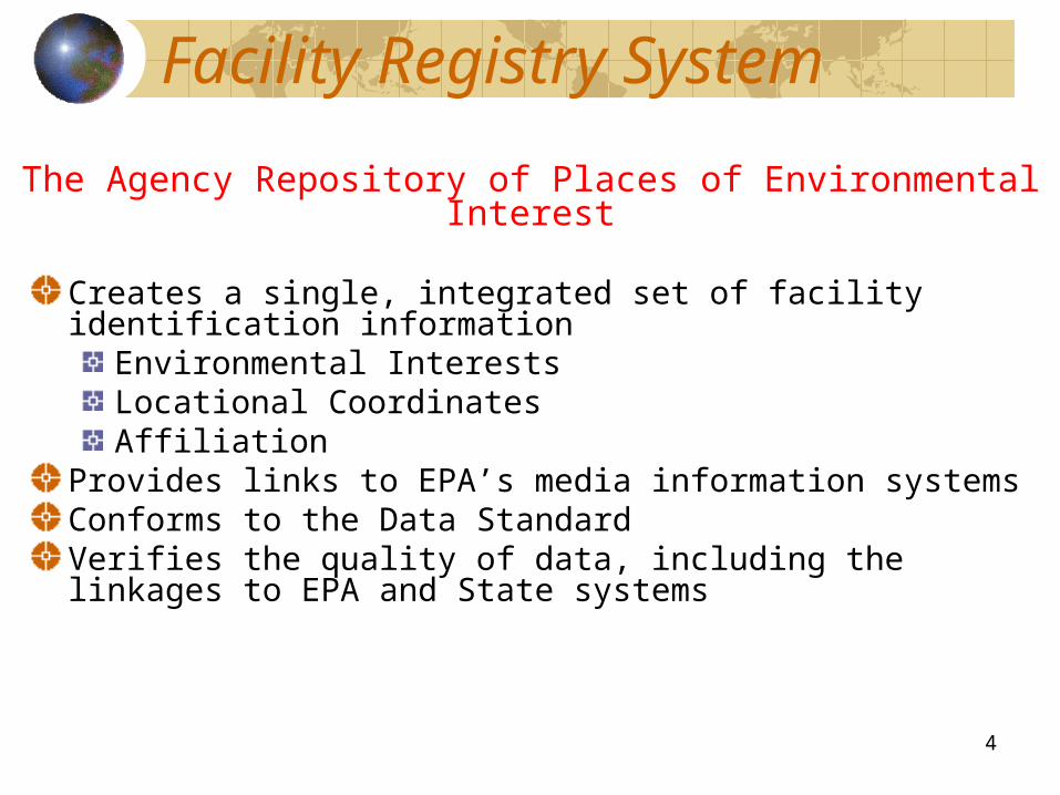
Facility Registry System
Creates a single, integrated set of facility identification information
Environmental InterestsLocational CoordinatesAffiliation
Provides links to EPA’s media information systemsConforms to the Data StandardVerifies the quality of data, including the linkages to EPA and State systems
The Agency Repository of Places of Environmental Interest

5
Snapshot of FRS Location Data
Feb 2006

6
Snapshot of FRS Location Data
Aug 2006

7
746K Have NO Lat/Long!
1,684,896 FRS 1,939,403 FRS
May 2005 Baseline August 2006 Baseline
51% without latitude/longitude859,042 records
49% with latitude/longitude825,854 records
62% withlatitude/longitude1,192,838 records
38% withoutlatitude/longitude746,565 records
MASS CLEAN UPRemoved locational points outside of U.S.
Land/Territories and Zip Code centriod points previously entered by contractors
Lat/Long data increased by 366,984 from May 2005 to August 2006

8
What Can Be Done?Who is to Do it?Where is the Data?What approach can be successful?

9
TRI
RCRAInfo
RMP
RADInfo
ICIS
NCDB
CERCLIS
Schools (new)
Partnerships with Programs
AFS
SDWIS
CAMDBS
NEI
PCS
Nat’l Performance Partnership
FRP (new)
BRACs (new)
1.9 million unique records linking to program interests such as:
10
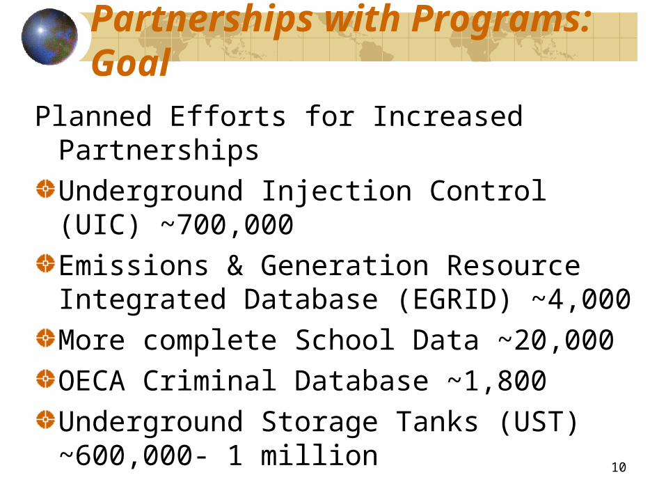
Planned Efforts for Increased Partnerships Underground Injection Control (UIC) ~700,000 Emissions & Generation Resource Integrated Database (EGRID) ~4,000More complete School Data ~20,000OECA Criminal Database ~1,800Underground Storage Tanks (UST) ~600,000- 1 million
Partnerships with Programs: Goal

11
Strategies to Locational Improvement
PartnershipsLeverage Exchange Network with StatesWork closely with Regions and Program Offices
DataData Stewardship and Data Quality Reviews Target critical data for consolidated acquisition/accessIntegrated Error Correction ProcessAutomated Processes : Geo-Coding Lat/Long
Tools and Technologies Improved Data Management Develop reusable tools

12
Partnerships with States:6 more in 2006

13
Top States for Records Without Locational Data in FRS in August 2006
2610416256Wisconsin
2533217335Indiana
2534217744Missouri
3928318585Minnesota
4895919646Ohio
674523998Arizona
4187124175Texas
4315126231Pennsylvania
3693929815Florida
3435529942North Carolina
2520730686South Carolina
2892731308Kansas
7431541400Illinois
9498068264New York
8457185264New Jersey
# WITH LAT/LONG# WITHOUT LAT/LONGSTATE
#7 (25715, 55818)
#13 (20832, 18070)
#17 (17453, 21990)
#15 (19376, 16357)
#11 (24058, 40996)
#14 (20336, 34079)
#8 (25690, 30903)
#12 (23069, 45539)
#10 (24349, 37554)
#5 (30702, 29400)
#4 (45492, 8956)
#9 (25342, 11789)
#3 (64875, 40495)
#1 (105837, 51959)
#2 (84689, 29850)
Rank # for May 2005 (Without, With)

14
Database EnhancementsFRS/LRT Redesign - ongoingGeospatially Enable Complete FRS Database -ongoing with RTPWeb Services Outbound through CDX - DoneWisconsin Pilot using GML, Web Services and
Polygonal ShapesRegional Pilot – Web Services for Locational Data - Region 1 CompleteUpgraded our geo-coding tools to better address-match in an automated process - ongoingRemoval of all ZIP Code Centroids - DoneAddition of Border Zone Indicator - DoneTribal Indicator on Tribal Country

15
Data Quality Improvement Efforts
Locational Data Clean Up of Values in the DatabaseQuality Report of FRS OverallFacilities on Tribal Land Universe – Redesign/Regional Clean UpNew Merge Script in FRS ReconciliationKatrina Support on Missing and Incorrect DataUpdates to FRS Linkage Application FRS - CDX Error Correction Service to Regulated CommunityDevelop quality checks in XML schema file structureIncreased Data Stewardship

16
Ways to Correct Data
Inform National ProgramRegional ExchangesSite Locator ToolError Tracking SystemFRS Update thru CDXLinkage ApplicationState Exchanges

17
ARC SDE Spatial Layers Available through Feature Services
Facility Site TableBorder IndicatorSite and Interest TableCERCLISRMPSDWISRCRA

18
US-Mexico Border Flag: 100km
19
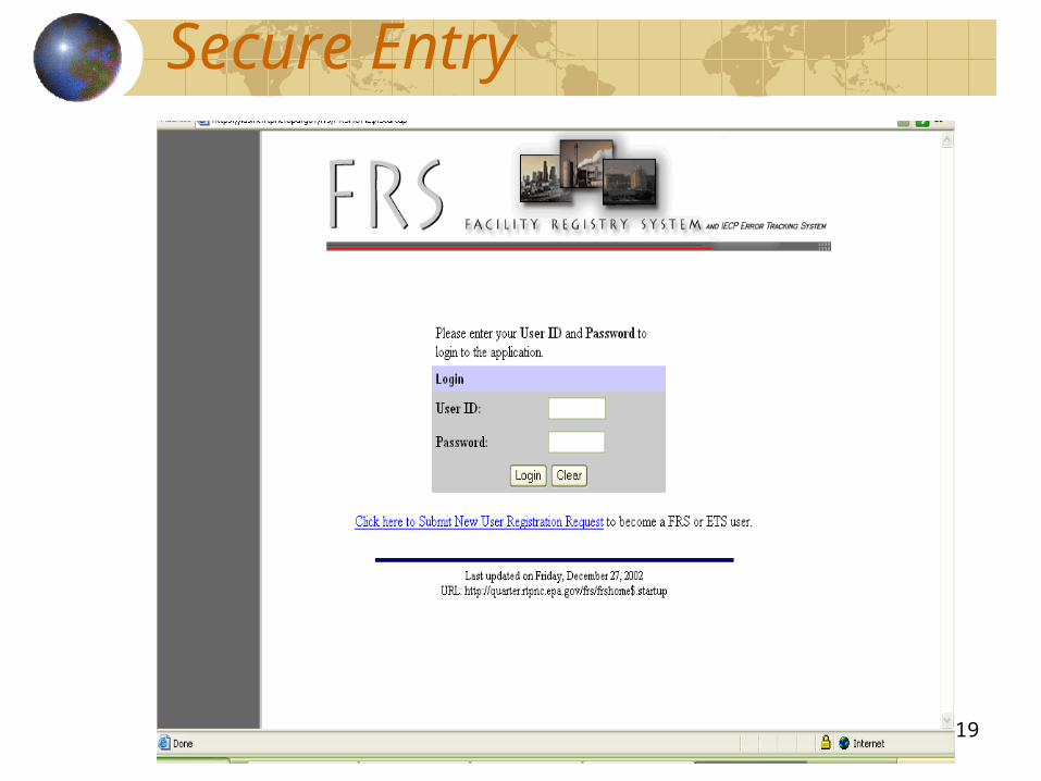
Secure Entry

20
Facility Information Update

21
Search Facilities

22
Search Results

23
Facility Detail Report

24
Merge Screen

25
Linkage Screen

26
Information Update Page

27
Comments Page

28
Select ESLT

29
Enter Search Criteria

30
Zoom to Desired Extent

31
Select Function

32
Confirm Existing Locational Data

33
Correcting Locational Date thru CDX

34
Correcting Locational Date thru CDX

35
Correcting Locational Date thru CDX

36
Correcting Locational Date thru CDX
