ghrsst xviiiiadf5c324e923ecfe4e0a-6a79b2e2bae065313f2de67bbbf078a3.r67.cf1...ghrsst xviiii qingdao,...
TRANSCRIPT
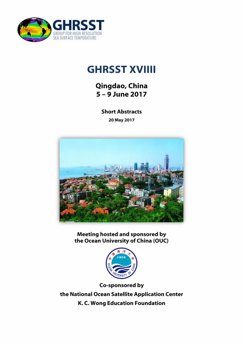
GHRSST XVIIII
Qingdao, China 5 – 9 June 2017
Short Abstracts
20 May 2017
Meeting hosted and sponsored by the Ocean University of China (OUC)
Co-sponsored by
the National Ocean Satellite Application Center
K. C. Wong Education Foundation
18th Science Team Meeting, Huanghai Hotel, Qingdao, China
5 – 9 June 2017
Page 2 of 75
Table of Contents
RECENT UPDATES TO PO.DAAC TOOLS AND SERVICES FOR OCEANOGRAPHIC DATA ................. 6
PATHFINDER VERSION 5.3 AVHRR LEVEL-2 PROCESSED GLOBAL SEA SURFACE TEMPERATURE . 7
CENTENNIAL-SCALE SURFACE TEMPERATURE VARIABILITY IN THE SOUTH CHINA SEA: A PERFECT REFLECTION OF GLOBAL OCEAN-CLIMATIC VARIABILITY CYCLES? ............................... 8
WHY IS SUMMER DOISST WARM IN THE ARCTIC AND HOW TO FIX IT ...................................... 9
IMOS SHIP SST FOR SATELLITE SST VALIDATION ..................................................................... 10
BAYESIAN CLOUD DETECTION FOR AVHRR SST RETRIEVAL ..................................................... 11
SEA SURFACE TEMPERATURE (SST) IN SOUTH CHINA SEA RETRIEVED FROM CHINESE SATELLITE FY-3B VIRR DATA ................................................................................................................... 12
DETERMINATION OF SEA SURFACE TEMPERATURE FROM CHINESE GAOFEN-5 SATELLITE ....... 13
ROUTINE ANALYSES OF SENTINEL-3A SLSTR SST EMPLOYING MONITORING & EVALUATION OF THEMATIC INFORMATION FROM SPACE (METIS) ................................................................... 14
ACSPO L3U SST PRODUCTS .................................................................................................... 15
REGIONAL VALIDATION AND POTENTIAL ENHANCEMENTS TO ............................................... 16
NOAA POLAR ACSPO SST PRODUCTS ..................................................................................... 16
ESA ACTIVITIES RELEVANT TO GHRSST ................................................................................... 17
STRATOSPHERIC AEROSOL AND IMPACTS ON INFRARED SST RETRIEVALS .............................. 18
INTERIM CLIMATE DATA RECORDS: FROM CLIMATE CHANGE INITIATIVE TO THE COPERNICUS CLIMATE CHANGE SERVICE .................................................................................................... 19
SST RETRIEVAL METHODS IN THE ESA CLIMATE CHANGE INITIATIVE ...................................... 20
RADIATIVE TRANSFER MODEL BASED BIAS CORRECTION IN INSAT-3D/3DR THERMAL OBSERVATIONS TO IMPROVE SEA SURFACE TEMPERATURE RETRIEVAL ................................. 21
MICROWAVE SST SINGLE SENSOR ERROR STATISTICS ............................................................ 22
SATELLITE SEA SURFACE TEMPERATURES ALONG THE WEST COAST OF THE UNITED STATES DURING THE 2014-2016 NORTHEAST PACIFIC MARINE HEAT WAVE ....................................... 23
USE OF ACSPO VIIRS L3U SST IN THE AUSTRALIAN BUREAU OF METEOROLOGY ..................... 24
SST QUALITY MONITOR RELEASE 2 (SQUAM2) ....................................................................... 26
MONITORING AVHRR/2 IN THE NOAA SENSOR STABILITY FOR SST (3S) VERSION 2 ................ 27
TRIAL OF INCLUDING NEW L4 SST ANALYSES IN GHRSST MULTI-PRODUCT ENSEMBLE ............ 28
CONSTRUCTING AN OCEAN DATA ASSIMILATION PRODUCT USING SATELLITE SEA SURFACE TEMPERATURE ...................................................................................................................... 29
GENERATING AN SST CLIMATE DATA RECORD FROM PASSIVE MICROWAVE OBSERVATONS .. 30

18th Science Team Meeting, Huanghai Hotel, Qingdao, China
5 – 9 June 2017
Page 3 of 75
EXTENDED RECONSTRUCTED SEA SURFACE TEMPERATURE VERSION 5 (ERSSTV5): UPGRADES, VALIDATIONS, AND INTERCOMPARISONS .............................................................................. 31
A WEBSERVICE PLATFORM FOR BIG OCEAN DATA SCIENCE .................................................... 32
ACSPO SST PRODUCTS AND MONITORING FOR GOES-16 AND HIMAWARI-8 .......................... 33
THE COMS MEASURMENTS OF SEA SURFACE TEMPERATURE AT KMA .................................... 34
QUASI-DETERMINISTIC CLOUD DETECTION FOR INFRARED SEA SURFACE TEMPERATURE RETRIEVAL FROM SATELLITE IMAGER MEASUREMENTS ......................................................... 35
CROSS CALIBRATION FOR SST ................................................................................................ 36
ANALYZE SST WITHIN THE NCEP GFS ...................................................................................... 37
THE IMPROVEMENT OF ICOADS3.0 AND ITS APPLICATION TO DOISST .................................... 38
INTER-CALIBRATION OF BRIGHTESS TEMPERATURE FROM HY-2 SCANNING MICROWAVE RADIOMETER OVER OCEAN ................................................................................................... 39
SEA SURFACE TEMPERATURE INFLUENCE ON OCEAN CARBON CYCLE ..................................... 40
LONG-TERM IMPACT OF SAMPLING BIAS IN NASA MODIS AND AVHRR-PATHFINDER LEVEL 3 SSTS ...................................................................................................................................... 41
THE IMPACT OF SAHARAN OUTFLOW ON SATELLITE RETRIEVED INFRARED SEA SURFACE TEMPERATURE ...................................................................................................................... 42
FEATURE RESOLUTION IN OSTIA L4 ANALYSES ....................................................................... 43
LONG-TERM CHANGES IN THE NORTHWESTERN ATLANTIC AND MEDITERRANEAN SST FROM 1982 TO 2016: A CONTRIBUTION OF THE OPERATIONAL OCEANOGRAPHY TO THE DETERMINATION OF THE PRESENT DAY CLIMATE ................................................................. 44
PHYSICAL RETRIEVAL AND HIGH-RESOLUTION BLENDED SST PRODUCTS AT NOAA NESDIS ..... 45
PROGRESS TOWARDS V2.0 SST CCI CLIMATE DATA RECORD .................................................. 45
LONG-TERM GLOBAL TIME SERIS OF MODIS AND VIIRS SSTS .................................................. 47
AVHRR LEVEL 1 ERRORS AND UNCERTAINTIES: THE FIDUCEO APPROACH ............................... 48
THE SISTER PROCESSOR ......................................................................................................... 49
OPERATIONS OF SENTINEL-3A SLSTR SST AND EUMETSAT ACTIVITIES .................................... 50
COMPARISONS OF SEA SURFACE TEMPERATURE ALGORITHMS FOR GEO-KOMPSAT-2A GEOSTATIONARY SATELLITE DATA ......................................................................................... 51
SHORT-TERM VARIATIONS OF SEA SURFACE CURRENTS ESTIMATED FROM GEOSTATIONARY SATELLITE SEA SURFACE TEMPERATURE IMAGES ................................................................... 52
DIURNAL CYCLES IN THE NOAA ACSPO “DEPTH” AND “SKIN” SSTS FROM THE NEW GENERATION ABI/AHI GEOSTATIONARY SENSORS ................................................................. 53
CMEMS OSI TAC PROGRESS REPORT ...................................................................................... 54

18th Science Team Meeting, Huanghai Hotel, Qingdao, China
5 – 9 June 2017
Page 4 of 75
COPERNICUS SENTINEL-3 MATCH-UP DATABASES - FELYX IN SUPPORT TO SATELLITE CAL/VAL ............................................................................................................................................. 55
IMPROVING THE ALTIMETER DERIVED GEOSTROPHIC CURRENTS USING SEA SURFACE TEMPERATURE IMAGES: FEASIBILITY STUDY AND APPLICATION ON REAL DATASETS ............. 56
A MACHINE LEARNING APPROACH FOR MSG/SEVIRI SST BIAS ESTIMATION ........................... 57
EUMETSAT OSI SAF SEA SURFACE TEMPERATURE ACTIVITIES AND PRODUCTS ....................... 58
OSI SAF SEA SURFACE TEMPERATURE REPROCESSING OF MSG/SEVIRI ARCHIVE. ................... 59
THE SENSIBILITY OF CMC ANALYSIS TO THE CHARACTERISTICS OF DIFFERENT OBSERVATION DATA SETS ............................................................................................................................ 60
RETRIEVAL OF MODIS SST WITH OPTIMAL ESTIMATION ......................................................... 61
ONGOING COMPARISON BETWEEN SENTINEL-3A SLSTR AND IASI ABOARD METOP-A AND –B 62
OVERVIEW OF SENTINEL-3 SLSTR L1 AND MARINE L2 PRODUCTS ........................................... 63
EVALUATION OF THE MULTI-SCALE HIGH RESOLUTION (MUR) ANALYSIS OF LAKE SURFACE TEMPERATURE ...................................................................................................................... 64
CEOS OCEAN VARIABLES ENABLING RESEARCH AND APPLICATIONS FOR GEO (COVERAGE) .... 65
FY-3C VIRR OPERATIONAL SEA SURFACE TEMPERATURE PRODUCT ........................................ 66
ASSESSMENT OF LANDSAT 8 TIRS SEA SURFACE TEMPERATURE RETRIEVAL ALGORITHMS...... 67
THE RESPONSE OF THE OCEAN THERMAL SKIN LAYER WITH AIR-SEA SURFACE HEAT FLUXES .. 68
EVALUATION OF THE PRECISION IN LEVEL 2 VIIRS AND AVHRR SEA SURFACE TEMPERATURE FIELDS ................................................................................................................................... 69
DEVELOPING AN ATMOSPHERIC CORRECTION OF TROPOSPHERIC DUST IN THE INFRARED SST RETRIEVAL FOR THE NOAA ACSPO SYSTEM ............................................................................ 70
CMA OCEAN DATA MERGING SYSTEM(COMS) ....................................................................... 71
EFFECT OF EMISSIVITY ON SHIPBOARD SEA SURFACE SKIN TEMPERATURE MEASUREMENTS . 72
EVALUATION OF SEA SURFACE TEMPERATURE DIURNAL VARIATION MODELS AGAINST MTSAT-1R DATA IN THE TROPICAL WARM POOL ............................................................................... 73
RECENT IMPROVEMENTS TO THE NOAA IQUAM2.10 SYSTEM ................................................ 74
A NEAR-GLOBAL PHYSICAL RETRIEVAL BASED GEOSTATIONARY SEA SURFACE TEMPERATURE REANALYSIS .......................................................................................................................... 75
18th Science Team Meeting, Huanghai Hotel, Qingdao, China
5 – 9 June 2017
Page 5 of 75
INDEX OF PRESENTERS
Armstrong, Edward ................................................... 7 Baker-Yeboah, Sheekela .......................................... 8 Banyouko Ndah, Anthony ...................................... 9 Banzon, Viva .............................................................. 10 Beggs, Helen ............................................................. 11 Bulgin, Claire ............................................................. 12 Chen, Chuqun ........................................................... 13 Chen, Yuanyuan ....................................................... 14 Dash, Prasanjit .......................................................... 15 Ding, Yanni ......................................................... 16, 17 Donlon, Craig ............................................................ 18 Embury, Owen ............................................ 19, 20, 21 Gangwar, Rishi Kumar ............................................ 22 Gentemann, Chelle .......................................... 23, 24 Govekar, Pallavi ........................................................ 25 Guan, Lei ..................................................................... 26 He, Kai .................................................................. 27, 28 Hernaman, Vanessa ................................................ 29 Hihara, Tsutomu ...................................................... 30 Høyer, Jacob .............................................................. 31 Huang, Boyin ............................................................ 32 Huang, Thomas ........................................................ 33 Ignatov, Alexander .................................................. 34 Kim, Jae-Gwan .......................................................... 35 Koner, Prabhat .......................................................... 36 Kurihara, Yukio ......................................................... 37 Li, Xu ............................................................................ 38 Liu, Chunying ............................................................ 39 Liu, Mingkun ............................................................. 40 Liu, W. Timothy......................................................... 41
Liu, Yang ..................................................................... 42 Luo, Bingkun ............................................................. 43 Mao, Chongyuan ..................................................... 44 Marullo, Salvatore.................................................... 45 Maturi, Eileen ............................................................ 46 Merchant , Christopher .......................................... 47 Minnett, Peter ........................................................... 48 Mittaz, Jonathan ...................................................... 49 Nightingale, Tim ...................................................... 50 O’Carroll, Anne ......................................................... 51 Park, Kyung-Ae .................................................. 52, 53 Petrenko, Boris ......................................................... 54 Piollé, Jean-François ........................................ 55, 56 Rio, Marie-Hélène .................................................... 57 Saux Picart, Stéphane .............................. 58, 59, 60 Surcel Colan, Dorina ............................................... 61 Szczodrak, Malgorzata ........................................... 62 Tomazic, Igor ...................................................... 63, 65 Vazquez, Jorge .................................................. 66, 67 Wang , Sujuan ........................................................... 68 Wei, Ji-An .................................................................... 69 Wong, Elizabeth W. ................................................. 70 Wu, Fan ....................................................................... 71 Xi, Xin ........................................................................... 72 Xu, Bin ......................................................................... 73 Yang, Minglun .......................................................... 74 Zhang, Haifeng ......................................................... 75 Zhou, Xinjia................................................................ 76 Zhu, Xiaofang ........................................................... 77

18th Science Team Meeting, Huanghai Hotel, Qingdao, China
5 – 9 June 2017
Page 6 of 75
RECENT UPDATES TO PO.DAAC TOOLS AND SERVICES FOR OCEANOGRAPHIC DATA
Edward M. Armstrong(1), Thomas Huang(1), Chaowei Yang(2), Vardis Tsontos(1), Mike Gangl(1), Flynn Platt(1), Aaron Plave(1), Richard Kim(1), Yongyao Jian(2),
Yun Li (2)
(1) NASA Jet Propulsion Laboratory, California Institute of Technology, 4800 Oak Grove Dr., Pasadena, CA 91109, USA, Email: [email protected]
(2) George Mason University, 4400 University Drive, Fairfax, VA 22030, USA
Abstract
This presentation will summarize recent improvements and the evolution of tools and services at The Jet Propulsion Lab (JPL) Physical Oceanography Distributed Active Archive Center (PO.DAAC) in support of the GHRSST mission. These include enhancements to the Level 2 subsetting capability, known as HiTIDE, the visualization tool SOTO, and improved web services. With HiTIDE, GHRSST Level 2 datasets can be easily spatially and temporally subsetted by specific variables. The SOTO tool now supports complete time series visualization, overlays and animations of select PO.DAAC datasets. Associated web services that in part provide the “glue” for these tools have been improved for discovery, access and subsetting of individual granules.
In addition to these core set of PO.DAAC services there is a suite of emerging technologies developed at the NASA Jet Propulsion in collaboration with various partners to address concerns of even higher volume, variety, velocity, veracity of data in the near future. The Virtual Quality Screening Service (VQSS), described at a previous meeting, is now operationally deployed and represents a web service paradigm to apply quality screening information (quality, uncertainty, and ancillary variables) to GHRSST granules and extract out subsetted SST values. Mining and Utilizing Dataset Relevancy from Oceanographic Dataset (MUDROD), in partnership with George Mason University, is a NASA funded project to improve search relevance and dataset ranking using machine learning techniques based on a) characterizing user behavior from the mining and modeling of web access logs, b) metadata for oceanographic data, and c) ontologies from SWEET, GCMD, and PO.DAAC. This project in part targeted SST datasets to improve the ranking of the wide variety of GHRSST products. And finally, the Oceanographic In-situ Interoperability Project (OIIP) project is a very recent activity to improve the accessibility of in situ data to the satellite community, addressing issues of satellite-insitu data interoperability and visualization with a focus also on emerging datasets from the marine electronic tagging community.

18th Science Team Meeting, Huanghai Hotel, Qingdao, China
5 – 9 June 2017
Page 7 of 75
PATHFINDER VERSION 5.3 AVHRR LEVEL-2 PROCESSED GLOBAL SEA SURFACE TEMPERATURE
Sheekela Baker-Yeboah(1,2), Korak Saha(1,2), Kenneth S. Casey (2), Dexin Zhang(2,3), Katherine. A. Kilpatrick(4), Susan Walsh(4), R. Evans(4), and Thomas Ryan(2)
(1) University of Maryland CICS, College Park, MD 20740, USA, Email: [email protected], [email protected];
(2) NOAA/NESDIS/National Centers for Environmental Information (NCEI), 1315 East West Highway, Silver Spring, MD 20910, USA, [email protected];
(3) Science and Technology Corporation, 21 Enterprise Parkway, Suite 150, Hampton, VA 23666-6413, [email protected];
(4) University of Miami Rosenstiel School for Marine and Atmospheric Science, 4600 Rickenbacker Causeway, Miami Florida 33143, [email protected];
(5) North Carolina State University Cooperative Institude for Climate and Satellites and Asheville, NC 28801 and NOAA/NESDIS/NCEI.
Abstract
Long-term, climate data records of global sea surface temperature (SST) are important for ocean and climate variability studies. Pathfinder global SST product from the Advanced Very High Resolution Radiometers (AVHRR) aboard NOAA polar-orbiting satellites, going back to 1981, remain the longest high resolution SST climate data record available, and are used for a variety of applications. The Pathfinder SST algorithm is based on the non-linear SST algorithm, applied consistently over the full time period of August 1981 - December 2014, to produce a validated multi-decade record of IR SST from a suite of eight AVHRR sensors with similar overpass times. Algorithm coefficients for this SST product were generated using regression analyses with co-located in situ and satellite measurements and the product is produced using the modernized NASA SeaWiFS Data Analysis System (SeaDAS6.4). The entire Pathfinder time series has recently been reprocessed by NOAA (V5.3), and for the first time GHRSST formatted L2P files are now available publicly, in addition to the standard L3 global 4km products historically produced. Validation results of the PFSST 5.3 Level-2 processed (L2P) data will be presented. This work continues the long historical aspect of Pathfinder SST products.
Poster or Talk.

18th Science Team Meeting, Huanghai Hotel, Qingdao, China
5 – 9 June 2017
Page 8 of 75
CENTENNIAL-SCALE SURFACE TEMPERATURE VARIABILITY IN THE SOUTH CHINA SEA: A PERFECT REFLECTION OF GLOBAL OCEAN-CLIMATIC
VARIABILITY CYCLES?
Anthony Banyouko Ndah
Universiti Brunei Darussalam, Jalan Tungku Link, Gadong, BSB, Brunei Darussalam Email: Email: [email protected]
Abstract
Met Office Hadley Centre's (HadISST1) Surface temperature data from 1870-2014 has been analysed for the South China Sea (SCS) using regression analysis, cumulative deviations (Buishand Range) test, standard normal heterogeneity test (SNHT) and low pass filtering technique. The aim is to examine patterns of SST variability at and beyond the seasonal scale. Overall, changes in SST in the SCS seem to follow a well-defined seasonal, inter-annual, decadal and longer term multi-decadal patterns. ‘ENSO (El Niño & La Niña) signals were found to be the dominant source of inter-annual patterns. Two significantly strong warming episodes at decadal (1932-1942) and multi-decadal (1965-1998) scales have been identified. About 98% of the SST change in the SCS occurred during these two warm periods. Finally, it has been observed that since the 1997/1998 extreme positive SST anomaly, there has been a slight decline in SST in the SCS despite frequent intense Niño warming events in 2002/2003, 2009/2010 and 2015/2016. This study concludes that the SST variability in the SCS is a perfect reflection of global ocean-atmosphere variability which proceeds in a cyclical pattern. Finally, it is recommended that absent a thorough understanding of the forcing mechanisms and drivers of the various oscillatory patterns of SST, accurately predicting regional monsoon and global changes in the ocean-atmosphere system will remain elusive. This entry is intended for poster presentation.

18th Science Team Meeting, Huanghai Hotel, Qingdao, China
5 – 9 June 2017
Page 9 of 75
WHY IS SUMMER DOISST WARM IN THE ARCTIC AND HOW TO FIX IT
Viva Banzon(1), Tom Smith(2), Mike Steele(3) ), Boyin Huang(1)
(1) NOAA/NCEI, Asheville, NC28801 Email: [email protected]
(2) NOAA/STAR, and CICS/ESSIC U. Maryland, College Park, MD Email: [email protected]
(3) Michael Steele, Polar Science Center, U. Washington, Seattle, WA Email: mas @apl.washington.edu
Abstract
A recent comparison of several sea surface temperature (SST) analyses in the Arctic by Castro et al. (2016) found that the 1/4 ° daily Optimum Interpolation Sea Surface Temperature (DOISST) performed consistently but had a warm bias relative to UpTempO buoys deployed during the Marginal ice Zone Processes Experiment. To understand the underlying cause for this bias, a re-examination of the DOISST methodology was conducted. The screening of buoy data was found to be too lax, leading to the inclusion of abnormally warm observations into the analysis. Large scale poleward smoothing allowed temperatures at 80 N to greatly influence estimated SSTs near the North Pole. Originally, the smoothing procedure was developed to infill the pole hole in the sea ice data. The pole hole is the area where there were no ice satellite observations due to the position of the orbits, and was a bigger issue early in the satellite ice record. Until recently, in situ observations have been very limited in the Arctic so DOISST computes a pseudo SST from sea ice data using a regression equation. The choice of ice-to-SST conversion method was less important than the poleward infilling in explaining the warm bias.
POSTER PRESENTATION
18th Science Team Meeting, Huanghai Hotel, Qingdao, China
5 – 9 June 2017
Page 10 of 75
IMOS SHIP SST FOR SATELLITE SST VALIDATION
Helen Beggs(1), Nicole Morgan(2) and Janice Sisson(3)
(1) Bureau of Meteorology, Melbourne, Australia, Email: [email protected]
(2) CSIRO Oceans and Atmospheres, Hobart, Australia, Email: [email protected]
(3) Bureau of Meteorology, Melbourne, Australia, Email: [email protected]
Abstract
Since 2008, the Integrated Marine Observing Project (IMOS: www.imos.org.au) has enabled accurate, quality controlled (QC’d), in situ SSTdepth observations to be supplied in near real-time from 22 Ships of Opportunity and research vessels in the Australian region. The data are valuable for satellite SST validation as they provide QC’d, independent in situ observations in coastal regions not sampled by either drifting buoys, moorings or Argo floats, and many of the vessels also provide QC’d meteorological observations, including wind speed. The data are available in ASCII format from the Global Telecommunication System (GTS), L2i netCDF format from NOAA’s iQUAM v2 portal (http://www.star.nesdis.noaa.gov/sod/sst/iquam/v2/data.html) and in IMOS netCDF format from the IMOS OPeNDAP server (http://thredds.aodn.org.au/thredds/catalog/IMOS/SOOP/SOOP-SST/catalog.html and http://thredds.aodn.org.au/thredds/catalog/IMOS/SOOP/SOOP-ASF/catalog.html).
Since March 2015, skin SST observations at ~10 micron depth have been measured routinely by the Infrared SST Autonomous Radiometer (ISAR) on Australia’s Marine National Facility, RV Investigator. The ISAR measures ocean temperatures at the same depth as infrared radiometers on satellites, and is therefore particularly useful for satellite validation. Real-time ISAR data has been available from the IMOS Ocean Portal since 26 March 2016, but without post-cruise calibration is less useful for satellite SST validation. Recently, the ISAR data were reprocessed back to March 2015 using uncertainty code supplied by Dr Werenfrid Wimmer (University of Southampton), and are available in ASCII format from CSIRO’s ocean data archive (http://www.marlin.csiro.au/). It is also intended to reprocess the ISAR data to IMOS netCDF files (containing navigation, meteorological and SST data), and netCDF L2r format to contribute to the Shipborne Radiometer Network.
The presentation will report on recent ABoM satellite SST validation activities, using the IMOS ship SST data. We will present examples of ISAR and meteorological data from the RV Investigator, and future plans for collaboration between OUC, IMOS, ABoM and CSIRO, to use the RV Investigator data to validate SSTs from Sentinel-3 SLSTR and Himawari-8.

18th Science Team Meeting, Huanghai Hotel, Qingdao, China
5 – 9 June 2017
Page 11 of 75
BAYESIAN CLOUD DETECTION FOR AVHRR SST RETRIEVAL
Claire Bulgin(1), Chris Merchant(2), Owen Embury(3)
(1) Department of Meteorology, University of Reading, UK, Email: [email protected]
(2) Department of Meteorology, University of Reading, UK, Email: [email protected]
(3) Department of Meteorology, University of Reading, UK, Email: [email protected]
Abstract
The AVHRR instrument record spans four decades providing the longest climate data record of sea surface temperature. The majority of AVHRR data are provided at one of two data resolutions: full resolution at 1.1 km in the nadir, and Global Area Coverage (GAC) nominally at 4km resolution. GAC data are an average over four full resolution pixels, but represent the equivalent of fifteen full resolution pixels in the Earth view (five across track by three along track). Cloud detection is a fundamental pre-processing step for sea surface temperature retrieval from satellite data, and critical to the production of datasets appropriate for use in climate studies. It still presents challenges in classifying features such as cloud edges, fog and pixel or sub-pixel cloud, and providing consistent masking under sunglint conditions and at sea-ice edges. We demonstrate here a Bayesian cloud detection scheme applied to both full resolution and GAC resolution data. Using SST validation statistics as a metric, the Bayesian cloud detection scheme gives better results (smaller spreads of in-sit-satellite difference) than equivalent operational cloud detection schemes (EUMETSAT mask for full resolution AVHRR data and CLAVR-X for GAC data) for most sensors in the AVHRR series: it reduces both the difference between the standard deviation and robust standard deviations of the satellite to in-situ comparisons and the absolute values, indicative of a reduction of cloud contamination in the clear-sky matches, and the corresponding reduction in nominally clear-sky coverage is reasonable (typically ~10%). We see fairly consistent results across the AVHRR data record from NOAA-06 (1979) to METOP-A (present day).
(submitted for poster presentation)

18th Science Team Meeting, Huanghai Hotel, Qingdao, China
5 – 9 June 2017
Page 12 of 75
SEA SURFACE TEMPERATURE (SST) IN SOUTH CHINA SEA RETRIEVED FROM CHINESE SATELLITE FY-3B VIRR DATA
Chuqun Chen(1)(2)*, Quanjun He(3)**, Shilin Tang (1)(2)***, Haibin Ye(1)
State key Lab of Tropical Oceanography,South China Sea Institute of Oceanology, Chinese Academy of Sciences,164 West Xingang Road, Guangzhou, China, 510301.
University of Chinese Academy of Sciences,19A Yuquan Road, Beijing, China,100049.
The Guangdong Ecological meteorological Center, 312 Dongguanzhuang Road, Guangzhou, China, 510080.
*[email protected],**[email protected];***[email protected]
Abstract
In the surface layer of the ocean, Sea Surface Temperature (SST) is the most important parameter, which is widely applied for studying water masses, air-sea interaction, marine ecosystem and environment, and other subjects. In decades, a great many satellites with thermal infrared sensors have been launched and huge thermal infrared remote sensing data were collected for detection of SST. With the continuous improvement on accuracy, the satellite remote sensing technique has become the dominant approach for SST detection.
In this report, the thermal infrared data collected by FY-3B were employed for retrieval of SST in the South China Sea. FY-3B is one of the second generation of Chinese meteorological satellite on polar orbit, it has VIRR (Visible Infrared Radiometer) sensor with 10 bands, of which, band 4 covers 10.3~11.3um and band 5 covers 11.5~12.5um, similar to NOAA/AVHRR.
The ship-measured SST dataset in 2011 and 2012 were collected and totally 20607 (of which 11419 in daytime and 9188 in nighttime) of the ship-measured SSTs were selected on consideration of the quality, the measurement time and the measurement location matching with cloudy-free Fy-3B data. Based on the well matched ship-measured SST and FY-3B VIRR data, a non-linear SST (NLSST) algorithm was developed and applied for retrieval of SST in the South China Sea. The monthly mean SST distribution image maps of South China Sea were integrated. The monthly mean SST image maps show that the maximum monthly mean SST occurs in June, although in July and August there is a stronger solar heating. It possibly due to the monsoon-induced mixing, which results in lower SST.
Keywords: FY-3B satellite, Visible Infrared Radiometer (VIRR), Sea Surface Temperature (SST), South China Sea.
Chen, Chuqun

18th Science Team Meeting, Huanghai Hotel, Qingdao, China
5 – 9 June 2017
Page 13 of 75
DETERMINATION OF SEA SURFACE TEMPERATURE FROM CHINESE GAOFEN-5 SATELLITE
Yuanyuan Chen1,2, Zhao-Liang Li1,2,*
1. Key Laboratory of Agri-informatics, Ministry of Agriculture/Institute of Agricultural Resources and Regional Planning, Chinese Academy of Agricultural Sciences, Beijing 100081, China;
2. ICube (UMR7357), UdS, CNRS, 300 Bld Sébastien Brant, CS10413, Illkirch 67412, France
Email: [email protected] (Y. Chen); [email protected] (Z.-L. Li)*
Abstract
Sea surface temperature (SST) is a significant parameter in air–sea interactions. The Chinese Gaofen-5 (GF-5) satellite, which can collect the surface information at a spatial resolution of 40-meter for thermal infrared channels, is planned to be launched in 2017. This study aims to develop the suitable algorithm that permits determining the SST from GF-5 satellite. First, the different algorithms for retrieving SST were evaluated based on the radiative transfer simulation. From the operational application point of view, the quadratic split-window algorithm was then selected and developed to determine SST from Gaofen-5 data. To correct the effect of the sea surface emissivity (SSE) on SST, the SSE values of 0.99055 and 0.98685 for two split-window channels, which were calculated based on the spectrum samples of sea water from the Johns Hopkins University (JHU), were used when top-of-atmosphere brightness temperatures were obtained. Using the simulated data, a RMSE of 0.3 K was obtained for the developed algorithm. Since the GF-5 data is not available at the time of writing this paper, ASTER_L1B data was used to test the developed algorithm and AST_08 product was used for the inter-comparison purpose to assess the retrieved SST.
18th Science Team Meeting, Huanghai Hotel, Qingdao, China
5 – 9 June 2017
Page 14 of 75
ROUTINE ANALYSES OF SENTINEL-3A SLSTR SST EMPLOYING MONITORING & EVALUATION OF THEMATIC INFORMATION FROM SPACE
(METIS)
Prasanjit Dash (1,2), Anne O’Carroll(1), Igor Tomazic(1), Jean-Francois Piolle (3), Gary Corlett(4)
(1) EUMETSAT, Darmstadt, Germany, Emails: prasanjit.dash anne.carroll [email protected]
(2) CSU CIRA, Fort Collins, CO 80521, USA, Email: [email protected]
(3) Ifremer, B rest, France, 29280, USA, Email: [email protected]
(4) Univ. of Leicester, Leicester, LE1 7RH, UK, Email: [email protected]
Abstract
A discontinuity of dual-view capability had occurred following the loss of communication with the Envisat satellite in April 2012, which carried the Advanced Along Track Scanning Radiometer ((A)ATSR). The Sea and Land Surface Temperature Radiometer (SLSTR) sensor onboard Sentinel-3A reinstates continuity to the EU flagship dual-view (A)ATSR data, with wider swath, newer channels and an accurate sensor characterization. Solid-state instrumentation and viewing philosophy is, however, one part of the challenge. For accurate retrievals, better algorithms are desirable both for cloud identification and information extraction. This is an incremental process and requires a coordinated effort by various partners, which is duly acknowledged here. Experimental global SST products at native resolution of SLSTR IR bands are being generated since 21 June, 2016. In addition, retrievals from AVHRR and IASI onboard Metop-B are also generated by EUMETSAT OSI SAF and made available publicly. To satisfy the need to routinely evaluate these products, the Monitoring and Evaluation of Thematic Information from Space (METIS) system for remotely sensed products has been recently setup. The prototype is currently accessible with password restriction at http://metis.eumetsat.int and will be open when SLSTR SST data are released publicly. The SST component of METIS, called as METIS-SST, monitors, evaluates and validates the three products mentioned above. The objective is to comprehensively evaluate the products for identifying and alerting anomalous conditions due to algorithm malfunction and steps beyond conventional validation approaches. In addition to the gold-standard in situ validation, there will be further diagnostics available for monitoring temporal and spatial stability.
Submitting for an oral presentation

18th Science Team Meeting, Huanghai Hotel, Qingdao, China
5 – 9 June 2017
Page 15 of 75
ACSPO L3U SST PRODUCTS
Yanni Ding(1), Irina Gladkova(2), Alexander Ignatov(3),
Fazlul Shahriar(4), Boris Petrenko(5), Yury Kihai(6)
STAR, NOAA NCWCP / CIRA, CSU, USA, Email: [email protected]
City College of New York, USA, Email: [email protected]
STAR, NOAA NCWCP, USA, Email: [email protected]
City College of New York, USA, Email: [email protected]
STAR, NOAA NCWCP, USA, Email: [email protected]
STAR, NOAA NCWCP, Email: [email protected]
Abstract
NOAA has started operationally generating the Advanced Clear-Sky Processor for Ocean (ACSPO) L3U (level 3 un-collated; remapped level 2 data at 0.02º resolution) product from the VIIRS onboard S-NPP in May 2016. Both L2P and L3U are reported as 10-min granule, with L3U data being significantly smaller (< 1GB/day compared to ~27 GB in L2P). The initial implementation presented at GRSST-17 has been updated, based on the extensive evaluation of the L3U product. As a result, the biases between L3U and L2P, and L3U and L4 CMC as seen in the initial implementation, have been significantly reduced, and spatial patterns are now better preserved. The full set of masking flags (cloud and ice masks, etc.) are added, consistently with ACSPO L2P GDS2 files.
The L2P-to-L3U (swath-to-equiangular) projection code employs the bi-lateral weighted averaging approach. The SST value at each grid cell is computed based on spatial proximity to the cell as well as the proximity of the SST value to median SST of the spatially-close L2 swath values. This approach is known to better reduce noise while preserving the edges, thus minimizing distortions to the high-resolution SST structure in swath L2P data.
The updated VIIRS L3U SST product has been tested experimentally at STAR since Dec. 2016, and will be implemented in NOAA operations by GRSST-18. We are also working to generate consistent L3U products for other platforms, with 0.02º resolution for high-resolution sensors, AVHRR FRAC and MODIS, and 0.08º resolution for AVHRR GAC, using the same algorithm but adjusting the weighting parameters depending upon sensor.
This presentation discusses the L3U v2 algorithm, the biases between L3U and L2P, and L3U and L4 CMC for VIIRS and other platforms. The data coverage, preservation of spatial patterns, and the performance of newly added masking flags are also presented.
Suggested format: Oral (Poster is OK)
Type: Science / Application
18th Science Team Meeting, Huanghai Hotel, Qingdao, China
5 – 9 June 2017
Page 16 of 75
REGIONAL VALIDATION AND POTENTIAL ENHANCEMENTS TO
NOAA POLAR ACSPO SST PRODUCTS
Yanni Ding(1), Alexander Ignatov(2), Michael Grossberg(3), Irina Gladkova(4), Calvin Chu(5)
NOAA STAR and CSU CIRA, USA, Email: [email protected]
NOAA STAR, Email: [email protected]
City College of New York, USA, Email: [email protected]
NOAA STAR, City College of New York, and GST Inc, USA, Email: [email protected]
City College of New York, USA, Email: [email protected]
Abstract
The ACSPO Regional Monitor for SST (ARMS; www.star.nesdis.noaa.gov/sod/sst/arms/) focuses on areas of interest to SST users (e.g., coastal and internal waters, high-latitudes, dynamic or cloudy regions), which are often challenging for SST producers (e.g., dynamic ocean may be masked by cloud mask, SST algorithms subject to large errors in the high-latitudes, etc.) ARMS complements the continuous global validation of the ACSPO products in the SST Quality Monitor (SQUAM).
Since GHRSST-17, ARMS was updated to version 2. SST images now have better resolution, and ACSPO L3U (level 3, un-collated) SST products have been included with the same masking flags as L2P. Several L4 fields (JPL MUR, Met Office OSTIA and NOAA Geo Polar Blended) have been added for comparison with ACSPO SST products and inter-comparison.
The ARMS supports development of high-quality gridded L3C/S (collated/super-collated; L2 data of the same/multiple satellites mapped into a uniform spatial grid and collated). Preliminary analyses in ARMS suggest that the collation of multiple observations requires reconciling some differences, caused by diurnal warming/cooling, variable cloud conditions and view zenith angles, for which ARMS provides plenty of examples.
This presentation discusses the updates of ARMS, and some preliminary results of validating the ACSPO SSTs in the high latitudes and coastal and dynamic regions. We check the data from different passes and satellites for consistency, taking into account various view zenith angles, cloud conditions, and diurnal warming/cooling.
Suggested format: Oral (Poster is OK)
Type: Science / Application
18th Science Team Meeting, Huanghai Hotel, Qingdao, China
5 – 9 June 2017
Page 17 of 75
ESA ACTIVITIES RELEVANT TO GHRSST
Craig Donlon
ESA/ESTEC, The Netherlands
Abstract
Sentinel-3A was launched on 4th February 2016 from Plesetsk Cosmodrome. It is an operational mission in high-inclination, low earth orbit for the provision of observational data to marine and land monitoring services. The operational character of the mission implies a high level of availability of the data products and fast delivery time, which have been important design drivers for the mission. Full performance will be achieved with a constellation of two identical satellites, separated by 180 degrees in the same orbital plane. The overall service duration is planned to be 20 years and is expected to be fulfilled by a series of several satellites. Three more Sentinel-3 satellites are in development with Sentinel-3B planned for launch in 2017. Procurement of the C and D satellites is ongoing. The mission carries the Sea and Land Surface Temperature Radiometer instrument (SLSTR) providing continuity of dual-view along-track scanning data streams established by the (A)ATSR series on board ESA’s ERS and ENVISAT satellites.
A series of new technology development and Pre-PhaseA studies for a new high resolution (~100m resolution) satellite Thermal Infrared Radiometer are in progress.
ESA is also spearheading the development of Fiducial Reference Measurements (FRM) for SST.

18th Science Team Meeting, Huanghai Hotel, Qingdao, China
5 – 9 June 2017
Page 18 of 75
STRATOSPHERIC AEROSOL AND IMPACTS ON INFRARED SST RETRIEVALS
Owen Embury(1), Chris Merchant(2), Andy Harris (3)
(1) Department of Meteorology, University of Reading, UK, Email: [email protected]
(2) Department of Meteorology, University of Reading, UK, Email: [email protected]
(3) University of Maryland, College Park, MD, U.S.A., Email: [email protected]
Introduction
Large explosive volcanic eruptions, such as Mount Pinatubo (1991) and El Chichón (1982), can inject megatons of sulphur dioxide into the stratosphere. The gas quickly forms a sulphuric acid aerosol which remains in the stratosphere for a couple of years. In addition to its direct impact on the planets climate, stratospheric aerosol can cause cold biases over 1 K in infrared SST retrievals from space.
We present here a climatology of infrared aerosol index retrieved from the High-resolution Infrared Radiation Sounder (HIRS) which has been carried on board NOAA polar orbiters since 1978. This aerosol index provides the information necessary to adapt the AVHRR SST retrievals for the present of volcanic sulphate aerosol. We show how this approach reduces the significant biases otherwise present in the AVHRR climate data record.
18th Science Team Meeting, Huanghai Hotel, Qingdao, China
5 – 9 June 2017
Page 19 of 75
INTERIM CLIMATE DATA RECORDS: FROM CLIMATE CHANGE INITIATIVE TO THE COPERNICUS CLIMATE CHANGE SERVICE
Owen Embury(1), Chris Merchant(2)
(1) Department of Meteorology, University of Reading, UK, Email: [email protected]
(2) Department of Meteorology, University of Reading, UK, Email: [email protected]
Abstract
Projects such as the ESA Climate Change Initiative for SST and NODC AVHRR Pathfinder have produced high quality Climate Data Records (CDR) of SST. With these programs the focus is providing a long-term, stable, satellite-based record suitable for use by climate modelers and researchers. By necessity of their length this involves harmonising data across from multiple different satellite data sets. However, these projects are large reprocessing efforts involving decades of satellite data and typically only produce an updated dataset every few years. This leaves a gap between the long-term CDRs and operational SST products produced in near-real time by satellite data providers.
In this presentation we outline our plans to produce Interim Climate Data Records (ICDRs) for the Copernicus Climate Change Service (C3S) and UK NERC Centre for Earth Observation (NCEO). These will take the processes developed in the ESA CCI project and operate them routinely in short-delay mode in order to produce ICDRs complimenting the CDRs in-between the major reprocessing efforts.
18th Science Team Meeting, Huanghai Hotel, Qingdao, China
5 – 9 June 2017
Page 20 of 75
SST RETRIEVAL METHODS IN THE ESA CLIMATE CHANGE INITIATIVE
Owen Embury(1), Chris Merchant(2)
(1) Department of Meteorology, University of Reading, UK, Email: [email protected]
(2) Department of Meteorology, University of Reading, UK, Email: [email protected]
Abstract
The ESA Sea Surface Temperature Climate Change Initiative (SST-CCI) aims to produce a ~35 year record of satellite-only SST. The core products are level-2 and level-3 from the Along Track Scanning Radiometer (ATSR) and Advanced Very High Resolution Radiometer (AVHRR), and a level-4 SST analysis based on the Met Office OSTIA system.
In this presentation we describe the SST retrieval algorithms used in SST-CCI. For the ATSR instruments we use a dual-view retrieval based on methods developed for the ATSR Reprocessing for Climate project. For the AVHRR instruments we use Optimal Estimation referenced to the ATSR SST for consistency. In addition to the SST we also provide estimates of the uncertainty due to uncorrelated errors, synoptically correlated errors, and sampling errors. In order to reduce the effects of instrument noise in L2P products we use a multiple-pixel retrieval.
18th Science Team Meeting, Huanghai Hotel, Qingdao, China
5 – 9 June 2017
Page 21 of 75
RADIATIVE TRANSFER MODEL BASED BIAS CORRECTION IN INSAT-3D/3DR THERMAL OBSERVATIONS TO IMPROVE SEA SURFACE TEMPERATURE
RETRIEVAL
Rishi Kumar Gangwar(1), Buddhi Prakash Jangid(2) and Pradeep Kumar Thapliyal(3)
(1) Space Applications Centre (ISRO), Jodhpur-Tekra, Ahmedabad, Gujarat, India
Email: [email protected]
(2) Space Applications Centre (ISRO), Jodhpur-Tekra, Ahmedabad, Gujarat, India
Email: [email protected]
(3) Space Applications Centre (ISRO), Jodhpur-Tekra, Ahmedabad, Gujarat, India
Email: [email protected]
Abstract
India has recently launched advanced meteorological geostationary satellite INSAT-3DR in September 2016, which is similar to the INSAT-3D that was launched in July 2013. The Imager channels in these satellites are providing accurate Sea Surface Temperature (SST) observations using split thermal infrared window and mid infrared channel over Indian Ocean region. These products are operationally generated and hosted at MOSDAC web-portal (www.mosdac.gov.in) for scientific users. Recently to improve the SST quality a Radiative Transfer (RT) model dependent bias correction procedure as a function of satellite zenith angle was applied to the INSAT-3D/3DR Thermal IR channels before using in the retrieval algorithm. This was done using collocated INSAT-3D/3DR and RT model simulated observations using ECMWF analysis. These retrieved SST products from bias corrected observations have been validated with in-situ as well MODIS SST products. The comparison analysis shows significant improvements in accuracy of SST products as compared to the previous version of operational products. When compared with in-situ, the bias in the retrieved SST got reduced from -0.69 to -0.20K and the standard deviation of the difference reduces to 0.6K from 1.4K. Comparison with MODIS derived SST products shows ~50% improvement in SST accuracy. Recently, this bias correction procedure has been implemented at MOSDAC for operational use.
Type: Oral presentation
Gangwar, Rishi Kumar
18th Science Team Meeting, Huanghai Hotel, Qingdao, China
5 – 9 June 2017
Page 22 of 75
MICROWAVE SST SINGLE SENSOR ERROR STATISTICS
Carl A. Mears1, Chelle Gentemann2, and Marty Brewer1
1Remote Sensing Systems, Santa Rosa California USA 2Earth & Space Research, Seattle Washington USA, Email: [email protected]
ABSTRACT
We have evaluated single sensor error statistics (SSES) for all satellite-borne microwave sensors that provide sea surface temperature (SST) retrievals. The satellites studied are AMSRE, AMSR2, WindSat, TMI, and GMI. The error statistics were determined by comparing with in situ ocean temperature measurements. These measurements are collected from the Global Telecommunications System (GTS) and re-distributed with additional metadata in near real-time by the US Global Ocean Data Assimilation Experiment (USGODAE). The dataset we used in this analysis is referred to as “SFCOBS” and contains surface observations from ships, moored and drifting buoys, and Coastal-Marine Automated Network (CMAN) in-situ surface temperatures. For the analysis presented here, we only use data from moored and drifting buoys because the data are of higher quality for these types of instruments. The results are presented as a function of SST and surface windspeed because these two parameters have the largest effect on microwave SST retrieval quality. We found that the statistics from the satellites that include a low frequency 6.9 GHz channel (AMSRE, AMSR2 and WindSat) show good performance over the entire range of SST and wind speed, while the satellites that lack this channel show degraded performance at SSTs below 12C, particularly at moderate to high windspeed. The results are smoothed and extended using a variational analysis to produce look-up tables that we use to rapidly calculate SSES error estimates for the MISST datasets.

18th Science Team Meeting, Huanghai Hotel, Qingdao, China
5 – 9 June 2017
Page 23 of 75
SATELLITE SEA SURFACE TEMPERATURES ALONG THE WEST COAST OF THE UNITED STATES DURING THE 2014-2016 NORTHEAST PACIFIC MARINE
HEAT WAVE
Chelle L. Gentemann(1), Melanie Fewings(2), Marisol Garcia-Reyes(3)
Earth & Space Research, Seattle, WA, USA, Email: [email protected]
Department of Marine Sciences, University of Connecticut, Groton, Connecticut, USA
Farallon Institute, Petaluma, California, USA
ABSTRACT
From January 2014 to August 2016, sea surface temperatures (SSTs) along the Washington, Oregon, and California coasts were significantly warmer than usual, reaching a maximum SST anomaly of 6.2°C off Southern California. This marine heat wave occurred alongside the Gulf of Alaska marine heat wave and resulted in major disturbances in the California Current ecosystem and massive economic impacts. Here we use satellite and blended reanalysis products to report the magnitude, extent, duration, and evolution of SSTs and wind stress anomalies along the West Coast of the continental United States during this event. Nearshore SST anomalies along the entire coast were persistent during the marine heat wave, and only abated seasonally, during spring upwelling-favorable wind stress. The coastal marine heat wave weakened in July 2016 and disappeared by September 2016.
18th Science Team Meeting, Huanghai Hotel, Qingdao, China
5 – 9 June 2017
Page 24 of 75
USE OF ACSPO VIIRS L3U SST IN THE AUSTRALIAN BUREAU OF METEOROLOGY
Pallavi Govekar, Chris Griffin, Helen Beggs and Leon Majewski
Australian Bureau of Meteorology, Melbourne, Australia
Email: [email protected]
[email protected], [email protected] and [email protected]
Abstract
Sea surface temperature (SST) products within a few kilometres of coasts that can resolve fine-scale features, such as ocean upwelling, are increasingly in demand. In response to user requirements for gap-free, highest spatial resolution, best quality and best accuracy SST data, the Australian Bureau of Meteorology (ABoM) ingests NOAA Advanced Clear-Sky Processor for Ocean (ACSPO) Visible Infrared Imaging Radiometer Suite (VIIRS) 0.02º L3U products into the ABoM Integrated Marine Observing System (IMOS) 0.02º multi-sensor L3S products. The high spatial resolution (0.75 km) and accuracy of VIIRS SST data, in conjunction with existing 1-4 km High Resolution Picture Transmission (HRPT) Advanced Very High Resolution Radiometer (AVHRR) SST data, shows significant improvement in spatial coverage. The improved L3S SST products provide better input for applications such as ReefTemp NextGen Coral Bleaching Nowcasting and IMOS OceanCurrent. It also provides useful insight into the study of SST diurnal variation and ocean upwelling in near-coastal regions. We discuss performance of the new VIIRS+AVHRR L3S products in near-coastal regions and our plan to improve other ABoM SST products by ingesting VIIRS data into those datasets such as RAMSSA and GAMSSA L4 SST analyses.
18th Science Team Meeting, Huanghai Hotel, Qingdao, China
5 – 9 June 2017
Page 25 of 75
Shipboard MEASUREMENTS OF sea surface skin temperature IN THE northwest pacific
Lei Guan, Kailin Zhang, Minglun Yang, and Liqin Qu
Department of Marine Technology, College of Information Science and Engineering
Ocean University of China, 238 Songling Road, Qingdao, 266100, China
Email: [email protected]
Abstract
Sea Surface temperature (SST) is an essential indicator for climate change. High accuracy and stability of the satellite SST products are required for long-term climate data records of global SST. It is important to routinely collect in situ sea surface skin temperature measurements for the evaluation and improvement of satellite SST products. The infrared SST autonomous radiometer (ISAR), made by the University of Southampton, has been deployed on the research vessel Dong Fang Hong II of Ocean University of China (OUC) since 2009. The skin SST measurements have been carried out during 57 cruises in the northwest Pacific. The first infrared radiometer for measurements of SST (OUCFIRST) made by OUC has a similar self-calibrating system as ISAR. The OUCFIRST has been deployed on the research vessel for testing in several cruises since 2015. Both radiometers participated in the 2016 comparison of IR brightness temperature measurements in support of satellite validation at NPL, UK. The shipboard measurements of skin SST and evaluation of the satellite SST products will be presented and discussed.
18th Science Team Meeting, Huanghai Hotel, Qingdao, China
5 – 9 June 2017
Page 26 of 75
SST QUALITY MONITOR RELEASE 2 (SQUAM2)
Kai He1,2, Xinjia Zhou1,3, Sasha Ignatov1, Maxim Kramar1,2, Prasanjit Dash3,4
1NOAA STAR, USA; Emails: [email protected]; [email protected]; [email protected]; [email protected]; [email protected]
2GST, Inc, Greenbelt, MD 20770, USA 3CSU CIRA, Fort Collins, CO 80521, USA
4EUMETSAT, Darmstadt, Germany
Abstract
The NOAA SST Quality Monitor (SQUAM) has been widely used in the SST community since its release in 2007, to monitor, validate and compare various community L2, L3 and L4 SST products. Over years, SQUAM has expanded, by adding new data products, improving stability and functionality and serving more users. However, with the introduction of new generation polar (VIIRS onboard SNPP launched in 2011 and J1 planned for launch in 2017, to be followed by J2-J4 in out years) and geostationary (ABI onboard GOES-16 launched in 2016, and follow-on GOES-S/T/U satellites, and Himawari-8/9 launched in 2014 and 2016, respectively), SQUAM is facing the need for reorganization and redesign, due to challenging data volumes and required computing and data storage and distribution resources.
The SQUAM Release 2 comprises three top-level sections, Polar L2/L3, Geo L2/L3, and Analysis L4 SSTs. The L2/L3 sections of SQUAM2 mainly focus on the NOAA Advanced Clear-Sky Processor for Ocean (ACSPO) products, which are grouped by sensors and platforms. Number of L4 references has been reduced, and now includes only CMC, OSTIA, and Reynolds OISST. For in situ reference, iQuam1 data have been replaced by iQuam2, and ARGO floats have been added. Two options – to enable SSES bias correction and switch to dynamic regression coefficients – have been added. Two ACSPO Reanalyses v1 (RAN1) data are now available for AVHRR GAC and SNPP VIIRS. In addition to daily statistics, higher level aggregations in time (monthly, yearly, full mission) were added. The new GEO section monitors Himawari-8 AHI, and soon to be available GOES-16 ABI ACSPO SSTs. In addition to the analyses in UTC time domain, SQUAM2 adds analyses in the local solar time domain, to analyze the effects of the diurnal cycle. The SQUAM2 also sees major improvements in the processing speed, as well as in the interface and web functionality, such as introducing new features of permalink and session caching.
We are available to make a real-time demo of SQUAM2, if there is interest.
Proposed for : Climate session, oral presentation

18th Science Team Meeting, Huanghai Hotel, Qingdao, China
5 – 9 June 2017
Page 27 of 75
MONITORING AVHRR/2 IN THE NOAA SENSOR STABILITY FOR SST (3S) VERSION 2
Kai He1,2, Sasha Ignatov1
1NOAA STAR, College Park, USA; Emails: [email protected]; [email protected] 2GST, Inc, Greenbelt, MD 20770, USA
Abstract
The NOAA Sensor Stability for SST (3S) system was developed to support the AVHRR SST Reanalysis (RAN) project. The 3S version 1 analyzed calibration data (gain, offset, blackbody and space counts, blackbody temperatures) and observational context (Sun and Moon positions, Equator crossing time, etc.) from seven AVHRR/3 sensors onboard five NOAA (N15 - 19) and two Metop (MA and MB) satellites, from November 1998 – present. It was specifically aimed at supporting the AVHRR GAC RAN version 1, which only included data from AVHRR/3s onboard N16, N17, N18, N19 and MA from 29 August 2002 – 31 December 2015. In preparation for the next reanalysis, RAN2 from AVHRR/2 sensors (which will initially go back to 1994 and eventually to 1981), the 3S has been updated to version 2 with two major additions: 1) five AVHRR/2 sensors (onboard N07, N09, N11, N12, and N14) have been added from August 1981 – Oct 2002, thus covering the full AVHRR SST era; and 2) monitoring of the noise equivalent differential temperature (NEDT), a quantity characterizing the instrument radiometric noise, has been added for all AVHRR/2s and AVHRR/3s. As a first step towards the future AVHRR SST RANs at NOAA, the data availability and well-being of the AVHRR/2 sensors is analyzed and displayed in the 3S v2, and NEDTs for all AVHRR instruments are analyzed. This information is critically important for the selection of the appropriate candidate sensors for the inclusion in the AVHRR GAC RAN2, and selection of the appropriate clear-sky masking and SST retrieval algorithms.
Proposed for : Poster Presentation
Type : Science/Application

18th Science Team Meeting, Huanghai Hotel, Qingdao, China
5 – 9 June 2017
Page 28 of 75
TRIAL OF INCLUDING NEW L4 SST ANALYSES IN GHRSST MULTI-PRODUCT ENSEMBLE
Vanessa Hernaman(1), Simon Good(1), and Emma Fiedler(1)
(1) Met Office, Fitzroy Road, Exeter, Devon, EX1 3PB, United Kingdom, Email: [email protected]
Abstract
The GHRSST Multi-Product Ensemble (GMPE) system runs daily at the UK Met Office, and is disseminated via the Copernicus Marine Environment Monitoring Service. The GMPE system takes L4 SST analyses from various international centres as inputs, transfers them onto a common 0.25º grid, and produces an ensemble median and standard deviation.
The current GMPE product consists of up to ten L4 SST analyses. Six new L4 analyses have become available (MUR, G1SST, DMI_OI, CMC0.1º, and two OSPO products), and trials were conducted to determine the impact of the new analyses on the ensemble median and its performance compared to Argo observational data.
The results indicated that the addition of all new L4 analyses consistently produced a GMPE median with generally cooler SSTs (relative to the baseline GMPE median produced using only the current analyses) of 0.05-0.30 Kelvin in many broad regions (e.g., west coasts of South America and central Africa; regions of the Arctic), but consistently warmer SSTs (relative to the baseline) of up to 0.40 Kelvin in specific regions (e.g., Gulf Stream; Svalbard region of the Arctic; Indonesia; Japan). When the new analyses were considered individually, the OSPO products generally produced cooler SSTs relative to the GMPE median, with the rest showing a mixture of warmer and cooler regions.
When compared to Argo observations, GMPE median performance was not greatly affected (within 0.02 Kelvin of baseline GMPE median performance), and performance of the new L4 analyses varied regionally, with CMC0.1º the most consistently high performer of the new analyses.

18th Science Team Meeting, Huanghai Hotel, Qingdao, China
5 – 9 June 2017
Page 29 of 75
CONSTRUCTING AN OCEAN DATA ASSIMILATION PRODUCT USING SATELLITE SEA SURFACE TEMPERATURE
Tsutomu Hihara(1), Yasumasa Miyazawa(2), Toru Miyama(3), Misako Kachi(4), Hiroshi Murakami(5), Yukio Kurihara(6), Noboka Ono(7), Hidenori Aiki(8)
(1) APL, JAMSTEC, Yokohama, Japan, Email: [email protected]
(2) APL, JAMSTEC, Yokohama, Japan, Email: [email protected]
(3) APL, JAMSTEC, Yokohama, Japan, Email: [email protected]
(4) EORC, JAXA, Tsukuba, Japan, Email: [email protected]
(5) EORC, JAXA, Tsukuba, Japan, Email: [email protected]
(6) EORC, JAXA, Tsukuba, Japan, Email: [email protected]
(7) EORC, JAXA, Tsukuba, Japan, Email: [email protected]
(8) ISEE, Nagoya University, Nagoya, Japan, Email: [email protected]
Abstract
The Japan Aerospace Exploration Agency (JAXA) operates the several earth observation satellites, and provides satellite sea surface temperature (SST) data. Satellite capability to detect SST fields is advancing in recent years. However, satellite SST data include some missing depending on the type of satellites and sensors, and don’t provide information on vertical oceanic conditions. This study aims at constructing a temporally and spatially uniform ocean dataset, using a data assimilation method which combines the satellite SST and the ocean model data.
Our target area is south of Japan where the Kuroshio flows. The data assimilation technique and ocean model used for the present study are the Local Ensemble Transform Kalman Filter (LETKF) and the Stony Brook Parallel Ocean Model (sbPOM), respectively. LETKF is able to represent small scale variations effectively. We assimilate the observation data including two satellite SST products: Himawari-8 and GCOM-W/AMSR2, provided by JAXA.
We show a typical result of the satellite/analysis SST and the associated vertical temperature distributions obtained in November 2016. A cyclone with cool air passed south of Japan from 23 to 24 November. The analysis data reproduce the observed SST drop caused by the weather disturbances, and reasonably estimate the SST states in the cloudy area and nearshore region missed by the satellite observation. Also, subsurface isotherms became sparse, suggesting the mixed layer deepening induced by the cyclone.
In the presentation, we will discuss usability of the satellite SST for data assimilation in detail.
Style: poster

18th Science Team Meeting, Huanghai Hotel, Qingdao, China
5 – 9 June 2017
Page 30 of 75
GENERATING AN SST CLIMATE DATA RECORD FROM PASSIVE MICROWAVE OBSERVATONS
Jacob L. Høyer(1), Jörg Steinwagner(1), Leif Toudal Pedersen(1)
(1) Danish Meteorological Institute, Denmark, Email: [email protected]
Abstract
Climate data records of SST have been developed for many years using the Infra-red sensors from. All the infrared observations are, however limited, by cloud cover and the errors typically arise from the same parameters, such as: atmospheric humidity, aerosols and so on. Microwave observations of SST are not limited by clouds offer a truly independent observational record.
This presentation will give an overview on the activities within the ESA Climate Change Initiative (CCI) project on SST on generating a climate data record from passive microwave observations. The activities include the creation of several multi-sensor match-up dataset (MMS) consisting of the AMSR-E and AMSR-2 matched against in situ observations and against AVHRR. The MMS is used for algorithm development, to test the performance of an optimal estimation algorithm. A thorough assessment of the algorithm performance has been carried out against in situ observations, where the performance of the OE state retrievals has been examined according to wind speed dependency, scan angle, atmospheric state, etc. The selected algorithm will be used to generate a climate data record from AMSR-E and AMSR2 and to assess the performance of the data set, against independent in situ observations.

18th Science Team Meeting, Huanghai Hotel, Qingdao, China
5 – 9 June 2017
Page 31 of 75
EXTENDED RECONSTRUCTED SEA SURFACE TEMPERATURE VERSION 5 (ERSSTV5): UPGRADES, VALIDATIONS, AND INTERCOMPARISONS
Boyin Huang(1), Peter W. Thorne(2), Viva F. Banzon(3), Tim Boyer(4), Gennady Chepurin(5), Jay H. Lawrimore(6), Matthew J. Menne(7), Thomas M. Smith(8), Russell S. Vose(9),
and Huai-Min Zhang(10)
(1) NOAA/NCEI, USA, Email: [email protected]
(2) Maynooth University, Ireland, Email: [email protected]
(3) NOAA/NCEI, USA, Email: [email protected]
(4) NOAA/NCEI, USA, Email: [email protected]
(5) NOAA/NCEI and University of Maryland, USA, Email: [email protected]
(6) NOAA/NCEI, USA, Email: [email protected]
(7) NOAA/NCEI, USA, Email: [email protected]
(8) NOAA/STAR and University of Maryland, USA, Email: [email protected]
(9) NOAA/NCEI, USA, Email: [email protected]
(10) NOAA/NCEI, USA, Email: [email protected]
Abstract
The monthly global 2°×2° Extended Reconstructed Sea Surface Temperature (ERSST) for 1854–2015 has been comprehensively revised and updated from version 4 to version 5. This update incorporates a new release of ICOADS R3.0, a decade of near-surface data from Argo floats, and a new estimate of centennial sea-ice from HadISST2. A number of choices in aspects of quality control, bias adjustment and interpolation have been substantively revised. The resulting ERSST estimates are less spatio-temporally smoothed, have better representation of high latitude SSTs, and ship SST biases are now calculated relative to more recent buoy measurements.
Progressive experiments have been undertaken to highlight the effects of each change in data source and/or analysis technique upon the final product. The single largest impact is that the reconstructed SST absolute series is systematically decreased by 0.077°C over the global oceans throughout the record owing to the change in ship SST final bias correction to be relative to modern buoys. Furthermore, high latitude SSTs are decreased by 0.1°–0.2°C by using sea-ice concentration from HadISST2. Changes arising from remaining innovations are mostly important at small space and time scales, primarily having an impact where and when input observations are sparse. Cross-validations and verifications with independent observation data show that the updates incorporated in ERSSTv5 have improved the representation of spatial variability over the global oceans, the magnitude of El Niño and La Niña events, and the decadal nature of SST changes in 1930s–40s when observation instruments changed rapidly. Both long (1900–2015) and short (2000–2015) term SST trends in ERSSTv5 remain significant as in ERSSTv4. Global mean anomaly series behavior, used in climate monitoring, remains largely unchanged between the two versions across a range of timescales and changes fall well within quantified uncertainties in the v4 product.
ORAL PRESENTATION

18th Science Team Meeting, Huanghai Hotel, Qingdao, China
5 – 9 June 2017
Page 32 of 75
A WEBSERVICE PLATFORM FOR BIG OCEAN DATA SCIENCE
Thomas Huang(1), Edward M. Armstrong(1), Joseph Jacob(1), Nga T. Quach(1) , Vardis Tsontos(1) , Brian Wilson(1) , Shawn Smith(2), Mark A. Bourassa(2) , Steve J. Worley(3), Chaowei Yang(4), Yongyao
Jiang(4), Yun Li(4)
1. NASA Jet Propulsion Laboratory, California Institute of Technology, 4800 Oak Grove Dr., Pasadena, CA 91109, USA, Email: [email protected]
2. Center for Ocean-Atmospheric Prediction Studies, 2000 Levy Avenue, Building A, Suite 292, Tallahassee, FL 32306-2741, USA, Email: [email protected]
3. National Center for Atmospheric Research, P.O. Box 3000, Boulder, CO 80307-3000, USA, Email: [email protected]
4. George Mason University, 4400 University Drive, Fairfax, VA 22030, USA, Email: [email protected]
Abstract
This presentation will provide an overview of OceanWorks, the webservice platform for big ocean data science at the NASA’s Physical Oceanography Distributed Active Archive Center (PO.DAAC), and to discuss the open source solutions that OceanWorks uses to enable fast analysis of Sea Surface Temperature (SST) data. Funded through the NASA’s Advance Information System Technology (AIST) Program and developed collaboratively between JPL, FSU, NCAR, and GMU, OceanWorks will be the platform for the next generation of PO.DAAC data solutions. OceanWorks is an orchestration of several previous funded NASA big ocean data solutions using cloud computing technology, which include on-the-fly data analysis (NEXUS) (Figure 1), anomaly detection (OceanXtremes) (Figure 2), matchup (DOMS) (Figure 3), quality-screened subsetting (VQSS), search relevancy (MUDROD), and web-based visualization (Common Mapping Client).
18th Science Team Meeting, Huanghai Hotel, Qingdao, China
5 – 9 June 2017
Page 33 of 75
ACSPO SST PRODUCTS AND MONITORING FOR GOES-16 AND HIMAWARI-8
Alexander Ignatov1, Irina Gladkova1,2,3, Yury Kihai1,2, Maxim Kramar1,2,
Andrew Fitzgerald3, Boris Petrenko1,2, Xinjia Zhou1,4, Kai He1,2, Yanni Ding1,4
1NOAA STAR, USA; [email protected] 2GST, Inc, Greenbelt, MD, USA
3CCNY, New York, NY, USA 4CSU CIRA, Fort Collins, CO 80521, USA
Abstract
New generation US geostationary satellite, GOES-R with the Advanced Baseline Imager (ABI) onboard, was launched on Nov. 19 2016 and renamed GOES-16 following the successful completion of initial onboard checks. A twin sensor, Advanced Himawari Imager (AHI), has been flown onboard Himawari-8 since Oct. 2014. ABI/AHI offer improved spectral coverage (5 bands at 3.7, 8.5, 10.4, 11.2, 12.3 µm), spatial resolution (2km), revisit time (10/15min), and radiometric/navigation/co-registration.
The focus of this presentation is on a new cloud masking procedure that exploits the wealth of high temporal resolution; and the new hourly ACSPO SST product and its evaluation using the redesigned and upgraded NOAA monitoring systems to include geo-related capability.
The cloud masking procedure, specifically designed for geostationary instruments, uses a combination of various time-space windows and is capable of differentiating the slower changing oceanic features from faster evolving atmospheric patterns. It leads to improved coverage, which is critically important especially in dynamic areas where traditional single-view cloud masking algorithms have consistent misclassifications.
The new hourly SST product targets users that need a diurnally resolved product but cannot afford the huge data volumes. ACSPO hourly ABI/AHI SST product will contain a representative hourly SST value in each pixel, following a continuous curve through the “upper envelope” of the original time-resolution clear-sky SST values. The resulting hourly product has larger spatial coverage and reduced spatial/temporal noise as compared to the current geostationary SST products.
Global evaluation using the SST Quality Monitor (SQUAM; www.star.nesdis.noaa.gov/sod/sst/squam/), including validation against the in situ Quality Monitor (iQuam; www.star.nesdis.noaa.gov/sod/sst/iquam/) data, and the regional evaluations in dynamic regions and coastal zones using the ACSPO Regional Monitor for SST (ARMS; www.star.nesdis.noaa.gov/sod/sst/arms/), suggest superior performance of the new generation NOAA geostationary SST products.
Proposed for : Oral Presentation
Type : Science/Application

18th Science Team Meeting, Huanghai Hotel, Qingdao, China
5 – 9 June 2017
Page 34 of 75
THE COMS MEASURMENTS OF SEA SURFACE TEMPERATURE AT KMA
Jae-Gwan Kim, Chul-Kyu Park, Chu-Yong Chung, and Seon-Kyun Baek
National Meteorological Satellite Center / KMA, Jincheon (Republic of Korea), Email: [email protected]
Abstract
National Meteorological Satellite Center (NMSC) of Korea Meteorological Administration (KMA) has been operating the first Korean meteorological geostationary satellite, COMS officially since 2011. KMA developed sixteen baseline meteorological products of the COMS observation data including sea surface temperature (SST) and they have been generated via COMS Meteorological Data Processing System (CMDPS). NMSC evaluated the accuracy and performance of SST product and tried to improve it. The COMS SST product retrieved with Multi-Channel SST algorithm. We tried to reduce biases in comparison with in-situ data and other satellite data using modification of regression coefficients in algorithm. In this presentation, we present the COMS SST retrieval and validation result compared with buoy data for numerical weather prediction model.
Kim, Jae-Gwan

18th Science Team Meeting, Huanghai Hotel, Qingdao, China
5 – 9 June 2017
Page 35 of 75
QUASI-DETERMINISTIC CLOUD DETECTION FOR INFRARED SEA SURFACE TEMPERATURE RETRIEVAL FROM SATELLITE IMAGER MEASUREMENTS
Prabhat Kumar Koner
ESSIC, University of Maryland, 5825 university research court, College Park, MD, USA
Email: [email protected]
Cloud detection is the part of the any product development from satellite infrared (IR) measurement. The product quality and error statics from IR satellite measurements are highly dependent on the cloud detection methodology. An innovative and novel cloud detection methodology, combining with spectral differences and radiative transfer calculation especially using powerful double difference method, will be presented. The quality of the new cloud detection has been compared with other prevalent cloud detection methods using error statics of the sea surface temperature (SST) retrieval and it is found that a significant increment of data coverage along with error reduction of retrieved SST. Both polar and geo-stationary orbital instruments, e.g. MODIS, VIIRS and GOES-13, are considered in this study.

18th Science Team Meeting, Huanghai Hotel, Qingdao, China
5 – 9 June 2017
Page 36 of 75
CROSS CALIBRATION FOR SST
Yukio Kurihara(1), Hiroshi Murakami(1), Misako Kachi(1)
(1) Japan Aerospace Exploration Agency (JAXA), Tsukuba, Ibaraki, Japan
Email: [email protected]
ABSTRACT
JAXA provides SST products generated by using AMSR2, Windsat, GMI, MODIS, VIIRS, and Himawari-8 data. Meanwhile, JAMSTEC in collaboration with JAXA is developing an ocean model that assimilates these products. In the assimilation, not only accuracy but also consistency in products is essential for good results. Furthermore, consistency in satellite SSTs is also important for climate monitoring. JAXA's MODIS, VIIRS, and Himawari-8 SSTs are retrieved from IR data by solving an IR radiative transfer equation. Although these SSTs are determined by solving the same equation, there are systematic differences of around 0~0.3 K between them. To improve these inconsistencies, we developed a new cross-calibration method. The new method calibrates L1 data by using SSTs retrieved from another satellite IR data. We performed the method and calibrated Himawari-8 data by using Terra/MODIS SSTs. Then, we retrieved SSTs from the calibrated Himawari-8 data and compared them with those retrieved from Terra/MODIS data. The comparison result shows an improvement in consistency in Himawari-8 and Terra/MODIS SSTs, i.e., the mean difference of 0.27 K (Terra/MODIS minus Himawari-8) has been reduced to -0.05 K by the calibration. Although the cross-calibration method still needs to be improved, it is expected to improve consistencies in satellite SST products including upcoming JAXA's GCOM-C.

18th Science Team Meeting, Huanghai Hotel, Qingdao, China
5 – 9 June 2017
Page 37 of 75
ANALYZE SST WITHIN THE NCEP GFS
Xu Li(1), John Derber(2), Shrinivas Moorthi2)
(1) IMSG at EMC/NCEP/NOAA, USA, Email: [email protected]
(2) EMC/NCEP/NOAA, USA, Email: [email protected]
(2) EMC/NCEP/NOAA, USA, Email: [email protected]
Abstract
In the current NCEP GFS, the oceanic component is represented by a single thermal variable, the Sea Surface Temperature (SST), which is prescribed with a combination of the SST analysis at the initial time and monthly SST climatology.
The term NSST (Near-Surface Sea Temperature) is introduced to describe the oceanic vertical temperature structure near the surface due to the diurnal warming and sub-layer cooling physics processes.
The NSST project aims to improve SST within the NCEP GFS by analyzing the SST together with the atmospheric analysis variables with the advanced GSI assimilation techniques and resolving the SST diurnal variability in the forecasting mode.
The foundation temperature (𝑇𝑓) is selected as the analysis variable, the high frequency variability is simulated by the NSST Model, including a diurnal warming model and a sub-layer cooling parameterization scheme.
The observations used are the satellite radiances available in NCEP GFS atmospheric data assimilation system (GSI) plus AVHRR GAC radiances and in situ sea water temperature.
All the data are assimilated directly by relating the foundation temperature to the observations with a radiative transfer model (CRTM) and NSST Model.
The evaluation of the 𝑇𝑓 analysis has shown improvement over NCEP RTG SST analysis in terms of O-B against buoys observations. The same improvement can be seen for the satellite radiance data assimilation. As to the weather prediction, there is a positive impact in tropics.
The comparison with other SST analysis products is underway.
18th Science Team Meeting, Huanghai Hotel, Qingdao, China
5 – 9 June 2017
Page 38 of 75
THE IMPROVEMENT OF ICOADS3.0 AND ITS APPLICATION TO DOISST Chunying Liu 1, William Angel 2, Eric Freeman1, Boyin Huang2,
Huai-min Zhang2
1 ERT, Inc. 14401 Sweitzer Lane Suite 300 Laurel, MD 20707 USA [email protected] 2NOAA National Centers for Environmental Information (NCEI), Asheville, NC 28801 USA
Abstract
The International Comprehensive Ocean-Atmosphere Data Set (ICOADS) Release 3.0 is the newest release with a significant increase in the number of marine reports and area of ocean coverage especially in the recent years. The 1/4° NOAA Daily Optimally Interpolated SST (DOISST), which covers the period from 1981 to present, is based on in situ, satellite, and ice data. In the current version of DOISST the in situ data is ICOADS Release 2.5.
The DOISST depends critically on the amount of marine observations and their spatial distribution. This study exhibits the improvement of ICOADS3.0 over ICOADS2.5 and explores its potential contribution to the improvement of DOISST, such as increasing coverage and decreasing uncertainty.
The metadata information in ICOADS3.0 allows us to separate the in situ marine observations by different observing systems, including the broad-scale global array of temperature/salinity profiling floats, known as Argos and the tropical in situ mooring arrays (TAO). This enables us to assess the impact of different types of in situ observations such as Argos and TAO to DOISST in the global and tropical Pacific oceans. Preliminary study shows that the combined impact of buoy and Argo observations on the global average SST is relatively large. The Southern Hemisphere SST is more affected by individual Argo or buoy observations. The impact of observations from the Tropical Atmosphere/Ocean array (TAO) on DOISST is small, because the observations from ships, drifting buoys, and Argo floats have overwhelmed the TAO observations.
Key Words: ICOADS3.0, DOISST, TAO, Argo, SST uncertainty.
Oral presentation

18th Science Team Meeting, Huanghai Hotel, Qingdao, China
5 – 9 June 2017
Page 39 of 75
INTER-CALIBRATION OF BRIGHTESS TEMPERATURE FROM HY-2 SCANNING MICROWAVE RADIOMETER OVER OCEAN
Mingkun Liu (1), Lei Guan (2), and Wei Zhao (3)
(1) Department of Marine Technology, Ocean University of China, Qingdao, China,
Email: [email protected]
(2) Department of Marine Technology, Ocean University of China, Qingdao, China,
Email: [email protected]
(3) National Satellite Ocean Application Service, State Oceanic Administration, Beijing, China, Email: [email protected]
ABSTRACT
Haiyang-2 (HY-2) is the first marine dynamic environmental satellite of China, that was launched on 16 August 2011. The scanning microwave radiometer (RM) onboard HY-2 has low frequency channels with the capability of observing sea surface temperature (SST) from space. The evaluation resultes showed the accuracy of SST from HY-2 RM is relatively low. The large difference between ascending and descending comparisons and the fluctuated bias and standard deviation indicate HY-2 RM is not well-calibrated. In this study, the Level 1B (L1B) brightness temperature of HY-2 RM are compared with the Global Precipitation Measurement (GPM) microwave radiometer (GMI) brightness temperature for the period from March 2014 to December 2015. The collocations of HY-2 RM and GPM GMI brightness temperature data are generated with the spatial window of 0.25º and the temporal window of 0.5 hour. The daily comparison results show that the biases and standard deviations of brightness temperature difference from different channels are relatively large. Except for the difference of center frequencies and Earth incidence angle between HY-2 RM and GPM GMI, the fluctuated daily biases indicate some problems exit in the calibration of HY-2 RM, such as the Earth radiation intrusion into cold mirror. The inter-calibration approach combined with radiative transfer simulation will be used to correct the brightness temperature from HY-2 RM.

18th Science Team Meeting, Huanghai Hotel, Qingdao, China
5 – 9 June 2017
Page 40 of 75
SEA SURFACE TEMPERATURE INFLUENCE ON OCEAN CARBON CYCLE
W. Timothy Liu(1) and Xiaosu Xie(2)
Jet Propulsion Laboratory, California Institute of Technology, Pasadena, CA 91109, USA.
Email: (1) [email protected], (2)[email protected]
We have developed and validated a statistical model to estimate the partial pressure (or fugacity) of carbon dioxide at sea surface (pCO2) from space-based observations of sea surface temperature (SST), chlorophyll, and salinity. More than a quarter million in situ measurements coincident with satellite data were compiled; 40,000 were randomly selected and set aside for validation and then another 40,000 were selected to train the model. We have produced and made accessible 9 years (2002–2010) of the partial pressure at 0.5 degree and daily resolutions over the global oceans. For the 40,000 data pairs used in validation, the mean difference between model predictions and measurements is –0.17 μatm and the root-mean-square (RMS) difference is 16.37 μatm; the latter is 6% of the data range of approximately 270 μatm. The outputs are found to be sensitive to variability from intra-seasonal to inter-annual and from equatorial to high-latitude oceans. They agree with 9 year times series at two tropical stations in annual phase and magnitude. SST is the dominant factor in pCO2 changes, particularly in the subtropical oceans, and chlorophyll becomes important at extra-tropical latitudes and coastal regions, where biological productivity is strong. In regions of strong water input (from river and rain), salinity is important. Our data set is shown to pick up the spring blooms at high latitudes, consistent with cruise measurements. The inter-annual anomalies of our data set follow the known response to El Nino episodes. The westward propagations of our outputs follow closely the tropical instability waves.

18th Science Team Meeting, Huanghai Hotel, Qingdao, China
5 – 9 June 2017
Page 41 of 75
LONG-TERM IMPACT OF SAMPLING BIAS IN NASA MODIS AND AVHRR-PATHFINDER LEVEL 3 SSTS
Yang Liu(1) , Kay Kilpatrick(1), Sue Walsh(1), and Peter J. Minnett(1)
(1) University of Miami, Miami, FL, USA, [email protected]
Abstract
Liu and Minnett (2016) identified sampling issues in the Level 3 NASA MODIS SST products when 4km observations are aggregated into global grids at different time and space scales, among which the sampling errors due to temporal averaging are larger and are not due to the seasonality of SSTs (Liu et al., 2017). Several dynamical and physical mechanisms involving SST-cloud correlations and feedbacks were attributed for the sampling error characteristics, which indicate potential long term effects. Here we examine this climate-scale effect by comparing the monthly time series (2002-2016) of MUR SSTs subsampled to 9km grid (Level4) and the 9km MUR SSTs sampled by MODIS 9km daily Level 3 quality masks (Pseudo-Level3). Also, the time series of 9km monthly MODIS (Level3) night-time SSTs are compared with the Level4 fields for a first-step quality check. Monthly climatology of the three composited fields shows the warm sampling biases at high latitudes are intrinsic and are not reduced at climate scales of at least a decade. The global local SST and the gap fraction trends are calculated using 14-year daily MODIS and MUR fields. The results indicate a biased trend signal for the last decade is likely to be found especially in the high latitudes. AVHRR-Pathfinder Level3 and AMSR Level3 fields are compared to elucidate the infrared sampling effects on decadal trends.
18th Science Team Meeting, Huanghai Hotel, Qingdao, China
5 – 9 June 2017
Page 42 of 75
THE IMPACT OF SAHARAN OUTFLOW ON SATELLITE RETRIEVED INFRARED SEA SURFACE TEMPERATURE
Bingkun Luo(1), Goshka Szczodrak(2), Katherine Kilpatrick(2) and Peter Minnett(2)
(1) Meteorology and Physical Oceanography Program, Rosenstiel School of Marine and Atmospheric Science, University of Miami, Miami, FL, USA, Email: [email protected]
(2) Department of Ocean Sciences, Rosenstiel School of Marine and Atmospheric Science, University of Miami, Miami, FL, USA
ABSTRACT
Infrared satellite observations of sea surface temperature (SST) have become essential for many applications in meteorology, climatology and oceanography. Users usually demand high accuracy SST data: for climate research and monitoring an absolute temperature uncertainty of 0.1K and stability of better than 0.04K per decade are required. Tropospheric aerosol concentrations increase infrared signal attenuation and prevent the retrieval of accurate satellite SST. We compare satellite-derived skin SST with measurements from the ship-based Marine-Atmospheric Emitted Radiance Interferometer (M-AERI) deployed on ships during the Aerosols and Ocean Science Expeditions (AEROSE) and with quality-controlled drifter temperatures. After match-up with in-situ SST and filtering of cloud contaminated data, the results indicate that SST retrieved from MODIS (Moderate Resolution Imaging Spectroradiometer) aboard the Terra and Aqua satellites have negative (cool) biases compared to shipboard radiometric measurements. There is also a pronounced negative bias in the Saharan outflow area that can introduce SST errors >1 K at AOD>0.5. We use Cloud-Aerosol Lidar and Infrared Pathfinder Satellite Observation (CALIPSO) datasets to study the vertical structure of aerosol effects on SST. From our studies, dust present at lower altitudes has a smaller effect on the SST errors because the higher dust layers have a larger temperature difference compared to the sea surface. What is more, SST difference is also related to the number of aerosol layers. The goal of this study is to understand the characteristics and physical mechanisms of the aerosol layer effect on satellite retrieved infrared SST, as well as to derive an empirical formula that better corrects for aerosol-related effect.
Poster presentation

18th Science Team Meeting, Huanghai Hotel, Qingdao, China
5 – 9 June 2017
Page 43 of 75
FEATURE RESOLUTION IN OSTIA L4 ANALYSES
Chongyuan Mao(1), Emma Fiedler(1) and Simon Good(1)
Met Office, Fitzroy Road, Exeter, Devon EX1 3PB, United Kingdom, Email: [email protected]
Abstracts
A new version of the OSTIA L4 processing system that uses a 3D variational data assimilation scheme (3D-VAR-OSTIA) has been developed at the Met Office, with the aim to replace the current OSTIA system that uses an OI-type (optimal interpolation) data assimilation scheme (OI-OSTIA). Spectral analysis is used to assess the feature resolution in the two versions of OSTIA L4 analyses. We focused on three regions of interest with strong horizontal sea surface temperature (SST) gradients: Gulf Stream, Kuroshio Current and Agulhas Current. Preliminary results show that the 3D-VAR-OSTIA analysis has sharper features than in the current OI-OSTIA analysis. The power spectra from the two OSTIA L4 analyses are also compared to results from the CMC 0.1 deg and Real Time Global (RTG) products. Potential further assessment of the two OSTIA L4 processing systems would be comparing the analyses with the same simulated “true” SST field (https://podaac.jpl.nasa.gov/announcements/2013-04-16_GHRSST_L4_VALUE-ADDED_ACTIVITY) assimilated into the two systems.
In addition to the adaptation of new data assimilation scheme in OSTIA system, the use of new observation data in OSTIA system is also assessed. Here the impact of ingesting SLSTR L2P SST product is tested in a trial near real time 3D VAR OSTIA system. If the data quality permits, the global and regional statistics of the pre-operational run against independent Argo floats will be compared to those from the current operational 3D VAR OSTIA system.
Short abstracts: Submit for a talk
18th Science Team Meeting, Huanghai Hotel, Qingdao, China
5 – 9 June 2017
Page 44 of 75
LONG-TERM CHANGES IN THE NORTHWESTERN ATLANTIC AND MEDITERRANEAN SST FROM 1982 TO 2016: A CONTRIBUTION OF THE
OPERATIONAL OCEANOGRAPHY TO THE DETERMINATION OF THE PRESENT DAY CLIMATE
A. Pisano1, S. Marullo1,3, V. Artale1,3, B. Buongiorno Nardelli1,2, and R. Santoleri1
(1)Institute of Atmospheric Sciences and Climate (ISAC) of the Italian National Research Council (CNR), Roma, Italy, Email: [email protected], [email protected]
(2) Institute for the Coastal Marine Environemnt (IAMC) of the Italian National Research Council (CNR), Napoli, Italy , Email: [email protected]
(3) Agenzia Nazionale per le Nuove Tecnologie, l’Eenergia e lo Sviluppo Economico Sostenibile, ENEA, Centro Ricerche Frascati , Frascati, Italy , Email: [email protected], [email protected]
Abstract
Estimating long-term SST changes is crucial to evaluate global warming impact at regional scales. Here, we analyze the Mediterranean (MED) and the Northwestern Atlantic Box (NWA) SST changes over the last 35 years (1982 - 2016) by combining reprocessed (REP) and near-real-time (NRT) data. The Italian National Research Council (CNR) has recently produced daily (nighttime), 4 km resolution REP MED level 4 datasets (REP L4), also covering the adjacent Atlantic region, based on the latest Pathfinder v5.2 AVHRR dataset (1982-2012). These data represent the longest satellite MED SST L4 time series and are freely distributed through the European Copernicus Marine Environment Monitoring Service (CMEMS). However, as Pathfinder has not yet released an update of its product, the REP data end in 2012. To fill in the gap between 2013 and 2016, we investigated the possibility to extend the time series by using the Mediterranean near real time (NRT), multi-sensor L4 SST data at Ultra-High spatial Resolution (UHR) produced by CNR, which are distributed through CMEMS and now mirrored at GHRSST. Since this product is available since 2008, the consistency with the REP has been assessed. Combining the REP L4 data (1982-2012) and a bias-corrected version of the NRT L4 data (2013-2016), we built the SST time series and provided updated estimates of the MED and NWA SST trends. The analysis shows that The Atlantic Box and The Mediterranean Sea have similar trend behavior until 2008. Afterward the Mediterranean Sea SST continued to increase while the Atlantic persisted in its warming pause.
Type of Presentation: no preference

18th Science Team Meeting, Huanghai Hotel, Qingdao, China
5 – 9 June 2017
Page 45 of 75
PHYSICAL RETRIEVAL AND HIGH-RESOLUTION BLENDED SST PRODUCTS AT NOAA NESDIS
Eileen Maturi (1), Andy Harris (2), Jonathan Mittaz (3)
Xiaofang Zhu (4), Gary Wick (5), Prabhat Koner (6), William Skirving (7)
(1) NOAA/NESDIS/STAR College Park, MD, U.S.A. [email protected]
(2) University of Maryland, CICS, College Park, MD, U.S.A. [email protected]
(3) University of Reading, Dept of Meteorology, Reading, UK [email protected]
(4) Contractor, Global Science Technology, College Park, MD, U.S.A. [email protected]
(5) NOAA/OAR/ESRL, Boulder, Co., U.S.A. [email protected]
(6) University of Maryland, CICS, College Park, MD, U.S.A. [email protected]
(7) NOAA/NESDIS/STAR Townsville, Queensland, Aus [email protected]
ABSTRACT
The National Oceanic and Atmospheric Administration’s (NOAA) Office of the National Environmental Satellite, Data and Information Service (NESDIS) generates operational geostationary Level-2P (L2P) sea surface temperature (SST) products in GHRSST GDS2.0 format from GOES-E/W and MSG-3, and blended Level 4 SST analyses to satisfy the requirements of the GHRSST users. The three geostationary satellites (longitudes 75°W, 135°W, and 0°, respectively) provide high temporal SST retrievals for most of the tropics and mid-latitudes, with the exception of a region between ~60°E and ~80°E. A process of continual development has produced regular improvements in the SST product accuracy, most recently with the implementation of a physical retrieval algorithm based on a Modified Total Least Squares algorithm (Koner et al. 2015). These operational geostationary SST L2 products are then blended with the polar operational SSTs to produce daily global, high-resolution (1/20°) SST analyses in GHRSST L4 format (day/night, night time only and diurnally corrected). AMSR-2 SSTs are now being included in these analyses to improve the quality in regions of persistent cloud cover, along with an improved diurnal adjustment.
These temperature products are used by NOAA Coral Reef Watch (CRW) to generate products for Bleaching and Alerts for coastal managers; the management of Mammals and fisheries by the National Marine Fisheries offices; and the Oceanic Heat Content (OHC) products for the national weather service for Hurricane and Typhoon intensity for the Atlantic and Pacific Basins. Reprocessed radiance data holdings for geostationary sensors using our latest SST algorithm are furthering climate applications. The resultant L2 products are, in turn, being included in the production of more than a decade of our daily 1/20 degree blended sea surface temperature product (reprocessed 2002 to 2015). The provision of this extended baseline is invaluable for improving the quality of anomaly-based products, such as those produced by NOAA CRW.
Capabilities under development include: 1) generation of surface lake temperatures for inclusion into NWS Forecast Models; 2) the generation of 1-km Regional SST analysis products; 3) using our physical retrieval algorithm to generate SSTs from Meteosat-8 over the Indian ocean and incorporate it into the blended SST analysis; and 4) a thermal stress forecasting product by combining the OHC products with the Hot Spot product to predict the minimum and maximum length of a bleaching event.
PROGRESS TOWARDS V2.0 SST CCI CLIMATE DATA RECORD
Christopher J. Merchant(1) and SST CCI Team(2)

18th Science Team Meeting, Huanghai Hotel, Qingdao, China
5 – 9 June 2017
Page 46 of 75
(1) University of Reading and National Centre for Earth Observation, Reading, RG6 6AL UK,, Email: [email protected]
(2) University of Reading; UK Met Office; University of Leicester; University of Southampton; Space Connexions Ltd; Brockmann Consult; Meteo-France; Danish Met Institute; Met Norway; European Space Agency
Abstract
The v1.0/v1.1 climate data record (CDR) for sea surface temperature (SST) from the European Space Agency (ESA) Climate Change Initiative for Sea Surface Temperature (SST CCI) addressed the period 1991 – 2010, and secured the calibration and stability of the SST measurements to the series of Along Track Scanning Radiometer instruments (ATSRs). This presentation describes the progress towards the release of V2.0, in which the SST CCI techniques are applied additional to Advance Very High Resolution Radiometers (AVHRRs) prior to and after the time period of ATSRs (1991 to 2012), to create an SST CDR spanning 1982 to 2016.
This presentation will give a scientific overview of the techniques used to achieve this, and initial validation results from the ongoing verification, validation and climate assessment activities underway prior to public release. This will cover the following points:
1. Level 1 archives used and pre-processing.
2. Stratospheric volcanic aerosol periods and forward modelling.
3. Cloud detection.
4. SST retrieval and uncertainty estimate.
5. Alternative SST estimates.
6. Higher order products.
7. Verification, validation and climate assessment.
The SST CCI processing chain will form the basis of routine delivery of an interim CDR within the framework of the Copernicus Climate Change Service, with pre-operational developments towards that service being ongoing. The SST CCI project itself has good prospects for continuation within a recently approved programme of ESA, CCI+, in which exploitation of Sentinel-3 and passive microwave data within the CDR is foreseen. The outlines of these forward prospects for V3.0 and beyond will also be presented.
Submitted for oral presentation.

18th Science Team Meeting, Huanghai Hotel, Qingdao, China
5 – 9 June 2017
Page 47 of 75
LONG-TERM GLOBAL TIME SERIS OF MODIS AND VIIRS SSTS
Peter J. Minnett(1), Katherine Kilpatrick, Guillermo Podestá, Elizabeth Williams, Yang Liu,
Susan Walsh and Miguel-Angel Izaguirre
(1) Dept. Ocean Sciences, Rosenstiel School of Marine and Atmospheric Science, University of Miami, Miami, FL, USA, [email protected]
Abstract
The generation of long-time series of consistent and accurate variables is an important step towards studying the response of the climate to changing forcing. The objective of climate fingerprinting does not necessarily require the stringent accuracies required of an SST Climate Data Record, as a long time series of consistent SSTs can provide useful information on changes in the regional and temporal structure of temperature anomalies. The SSTs derived from measurements on the two MODISs on Terra and Aqua and from VIIRS on S-NPP are retrieved using the same algorithms for cloud screening and atmospheric correction, modified for the particular characteristics of each sensor, thus ensuring a consistent time series. The presentation will provide an update on the algorithms used to retrieve the MODIS and VIIRS SSTs, and the errors and uncertainties in the derived fields.

18th Science Team Meeting, Huanghai Hotel, Qingdao, China
5 – 9 June 2017
Page 48 of 75
AVHRR LEVEL 1 ERRORS AND UNCERTAINTIES: THE FIDUCEO APPROACH
Jonathan Mittaz(1), Christopher Merchant(2), Marine Desmons(3), Emma Woolliams(4)
(1) University of Reading, Reading, UK, Email: [email protected]
(2) University of Reading, Reading, UK, Email: [email protected]
(3) University of Reading, Reading, UK, Email: [email protected]
(4) National Physical Laboratory, Teddington, UK, Email: [email protected]
Abstract
As part of the Fidelity and uncertainty in climate data records from Earth Observations (FIDUCEO) project (www.fiduceo.eu) we are creating a new improved Fundamental Climate Data Record (FCDR) for the AVHRR which will be used to generate SST CDRs. Unlike the current available AVHRR Level 1 data (such as that available from the NOAA archives), the FIDUCEO Level 1 will contain complex uncertainty information at the pixel level and higher which are based on metrological techniques. As such, the creation of this data involves a very detailed study of sources of error and uncertainty in the AVHRR, some of which can directly impact SST retrievals. In this presentation we will discuss the FIDUCEO approach to Level 1 data production and will show the different sorts of uncertainty that will be provided together with their error covariance structures. We will also discuss the FIDUCEO approach to sensor-to-sensor Harmonisation and will then show specific examples of remaining problems (such as variable noise sources) and other sources of IR calibration error (with proposed corrective solutions) that can impact SST generation. Finally we will report of the status of the FIDUCEO Level 1 data together with a description of the associated formats which range from an Easy format, an Ensemble format and a Full (all uncertainty components) format.
Submitted for an oral presentation

18th Science Team Meeting, Huanghai Hotel, Qingdao, China
5 – 9 June 2017
Page 49 of 75
THE SISTeR PROCESSOR
Tim Nightingale(1), Arrow Lee(1), Eleanor Barber(1)
(1) STFC Rutherford Appleton Laboratory, Harwell Campus, Didcot, Oxon OX11 0QX, UK, Email: [email protected]
Introduction
The SISTeR in-situ radiometer is a validation radiometer and, as such, must generate traceable estimates of SST, including estimates of the associated type A and type B uncertainties. We describe the design of a new SISTeR processor that propagates uncertainty estimates in parallel with the contributing terms to the calibration and SST equations. Rather than calculating level 2 SSTs from level 1 radiances in the traditional way, the SISTeR processor generates a synthetic SST signal count and calibrates this, to avoid double-counting calibration uncertainties. We also describe the partitioning of the SST equation to include an air temperature anomaly as, in the absence of direct measurements, the anomaly generally can be better estimated than the gross air temperature. The processor outputs level 1, 2 and 3 products. The level 2 and 3 products are generated in an “L2R” format that closely follows GHRSST product design principles and is both CF and ACDD compliant.
I’d be happy to present this either as a poster or as a talk, though I suspect it’s better suited to a poster.

18th Science Team Meeting, Huanghai Hotel, Qingdao, China
5 – 9 June 2017
Page 50 of 75
OPERATIONS OF SENTINEL-3A SLSTR SST AND EUMETSAT ACTIVITIES
Anne O’Carroll(1), Igor Tomazic(1), Prasanjit Dash(1), Jean-Francois Piolle(2), Gary Corlett(3), Craig Donlon(4)
EUMETSAT, Eumetsat-Allee 1, 64295 Darmstadt Germany
Ifremer, Brest, France
University of Leicester, United Kingdom
ESA/ESTEC, Keplerlaan 1, 2201 AZ, Noordwijk, The Netherlands
ABSTRACT
The first Copernicus Sentinel-3 satellite, Sentinel-3A, was successfully launched on 16th February 2016 from Plesetsk, with the mission to provide a consistent, long-term collection of marine (and land) data for operational ocean analysis, forecasting and service provision. The EUMETSAT marine centre has been preparing to deliver operational Sea Surface Temperature (SST) products based on measurements from the Sea and Land Surface Temperature Radiometer (SLSTR) on board Sentinel-3. Information on the Sentinel-3A SLSTR SST product, which has been developed together with ESA and industry partners, will be described.
Details of the operations of Sentinel-3 SLSTR, the scientific characteristics of the SST product, and information on the algorithm will be given. Details on how to find further information will be presented, and opportunities on how to participate in the ESA and EUMETSAT Sentinel-3 Validation Team for marine surface temperature will be described.
The SLSTR SST product is provided according to the GHRSST specification, and will additionally include some experimental fields. The Sentinel-3 Commissioning Phase was successfully completed in July 2016 and the operational SLSTR SST products are expected to be widely released in May 2017.
An overview of the first validation activities of SST from Sentinel-3A SLSTR from on-going Sentinel-3 Cal/Val activities at EUMETSAT will be explained, together with the Ocean and Sea-Ice Satellite Application Facility (OSI SAF), and the ESA Mission Performance Centre. On-going and upcoming Copernicus projects on improved drifting buoys for satellite SST validation and sea-ice cloud screening for SLSTR will be described.
In addition, further information on other EUMETSAT activities and SST products will be given, including SST from Metop-IASI, third-party data services, and an overview of other EUMETSAT missions in the context of the EUMETSAT OSI SAF.

18th Science Team Meeting, Huanghai Hotel, Qingdao, China
5 – 9 June 2017
Page 51 of 75
COMPARISONS OF SEA SURFACE TEMPERATURE ALGORITHMS FOR GEO-KOMPSAT-2A GEOSTATIONARY SATELLITE DATA
Kyung-Ae Park(1), Hye-Jin Woo(2), Alexander Ignatov(3), Boris Petrenko(4)
(1) Dep. of Earth Science Education, Seoul National University, Seoul, Korea, Email: [email protected]
(2) Dep. of Science Education, Seoul National University, Seoul, Korea, Email: [email protected]
(3) Center for Satellite Applications and Research, NOAA, Maryland, USA, Email: [email protected]
(4) Center for Satellite Applications and Research, NOAA, Maryland, USA, Email: [email protected]
ABSTRACTS
To develop sea surface temperature (SST) retrieval algorithms for GEO-KOMPSAT-2A (Geostationary - Korea Multi-Purpose Satellite-2A), we compare previously known algorithms such as MCSST and NLSST methods, as well as a recently developed hybrid algorithm and a 4-band algorithm that uses 4-channel brightness temperatures. The traditional empirical algorithms (MCSST and NLSST methods) have been widely used in spite of their local bias according to various and time-varying atmospheric conditions. SST coefficients retrieved by these algorithms are fundamentally based on a regression method between satellite-observed brightness temperatures and in-situ SST measurements from drifters or moored buoys. The hybrid algorithm, based on a regression method between the incremental values and a scaling method, is applied to estimate the coefficients of Himawari-8 data as a proxy for GK-2A data. In addition, the performance of the 4-band algorithm, as another regression method, is tested for SST estimation using Himawari-8 data. Root-mean-square (RMS) and bias errors are presented for each algorithm in comparison to drifter temperatures. The comparison with in-situ SST measurements shows that hybrid SSTs have accuracies similar to the 4-band SSTs, with RMS errors are 0.55°C and 0.48°C, respectively. However, the errors of the estimated SSTs reveal, in some cases, a significant difference between hybrid SSTs and 4-band SSTs in terms of atmospheric variables such as moisture, wind speed, and distance from the cloud edge.

18th Science Team Meeting, Huanghai Hotel, Qingdao, China
5 – 9 June 2017
Page 52 of 75
SHORT-TERM VARIATIONS OF SEA SURFACE CURRENTS ESTIMATED FROM GEOSTATIONARY SATELLITE SEA SURFACE TEMPERATURE IMAGES
Hee-Young Kim(1), Hee-Ae Kim(2), Kyung-Ae Park(3)
(1) Dep. of Science Education, Seoul National University, Seoul, Korea, Email: [email protected]
(2) Dep. of Science Education, Seoul National University, Seoul, Korea, Email: [email protected]
(3) Dep. of Earth Science Education, Seoul National University, Seoul, Korea, Email: [email protected]
ABSTRACTS
Surface geostrophic currents have long been estimated with reliable accuracy from sea surface height anomalies observed by satellite radar altimeters. However, altimeter-based oceanic current fields contain inherent errors related to the spatial distance and temporal discrepancy of measurements between altimeter tracks. Surface currents based on sequential sea surface temperature (SST) images of near-polar orbiting satellites also have disadvantages arising from the small number of data samplings due to frequent cloud cover or other atmospheric and oceanic conditions over relatively long time intervals. Such sparse samplings can be overcome, in part, by high-resolution and frequently observed geostationary satellite SST images. This study assesses the accuracy of the surface currents from subsequent Himawari-8 SST images, as a proxy for GEO-KOMPSAT-2A (Geostationary - Korea Multi-Purpose Satellite-2A) SST, by comparing the quality-controlled currents obtained by the Himawari-8 satellite with the estimated currents obtained from surface drifters in the full-disk region of Himawari-8. Analysis results reveal that the estimated current speeds and directions show good agreement with the drifter-based calculated values, with root-mean-square (bias) errors of 0.15 m/s (-0.05 m/s) and 6.1° (1.8°), respectively. The estimated current field illustrates a rotating feature around a mesoscale anticyclonic eddy, as well as the characteristic meandering pattern of the Kuroshio Current. In addition, we present short-term hourly variations of the surface current and their potential causes, and address the importance of the role of high-resolution geostationary satellite SST measurements in understanding short-term surface current variations.

18th Science Team Meeting, Huanghai Hotel, Qingdao, China
5 – 9 June 2017
Page 53 of 75
DIURNAL CYCLES IN THE NOAA ACSPO “DEPTH” AND “SKIN” SSTS FROM THE NEW GENERATION ABI/AHI GEOSTATIONARY SENSORS
Boris Petrenko1,2, Alex Ignatov1, Maxim Kramar1,2, Yury Kihai1,2 and Xinjia Zhou1,3
1NOAA STAR, USA; 2GST, Inc., USA; 3CSU CIRA, Inc., USA
Email: [email protected]
Abstract
The superior performance of the infrared radiometers flown onboard the new generation geostationary satellites, the GOES-16 Advanced Baseline Imager (ABI) and the Himawari-8 Advanced Himawari Imager (AHI), substantially improves the potential for continuous monitoring the diurnal cycle (DC) in sea surface temperature (SST). However, besides instrument capabilities, the quantitative DC monitoring requires optimization of existing SST retrieval algorithms. Significant difference in shapes and magnitudes of DCs in “skin” SST (SSTskin, directly affecting observed brightness temperatures - BTs), and “depth” SST (SSTdepth, measured by drifters and used for training SST algorithms) calls for more specific targeting the algorithms at SSTskin or SSTdepth.
Two separate algorithms, optimized for SSTskin and SSTdepth, have been implemented within the NOAA Advanced Clear-Sky Processor for Oceans (ACSPO). Both algorithms minimize regional biases using the earlier developed method of segmentation of the SST domain in the space of regressors. Regression coefficients for SSTdepth are found by unconstrained fitting in situ SSTs, whereas SSTskin
coefficients are trained under the condition that average sensitivity to SSTskin is equal to 1 within each segment. One of the factors usually limiting the precision of fitting SSTdepth with regression equations is that observed BTs are sensitive to SSTskin rather than to SSTdepth. In the ACSPO SSTdepth algorithm, the effect of this discrepancy is mitigated by accounting for its dependencies from NWP wind speed and local solar time.
The presentation describes the ACSPO SSTskin and SSTdepth algorithms. Results of testing with AHI and ABI data confirm the potential of realistic separate estimation of DCs in SSTskin and SSTdepth, including their magnitudes and positions of maxima/minima in time.
Suggested format: Oral
18th Science Team Meeting, Huanghai Hotel, Qingdao, China
5 – 9 June 2017
Page 54 of 75
CMEMS OSI TAC PROGRESS REPORT
Jean-François Piollé(1), Hervé Roquet(2), Françoise Orain(3), Bruno Buongiorno-Nardelli(4), Jacob Høyer(5), Cecilie D Wettre(6), Simon Good(7) and others
(1) CERSAT, Institut Français de Recherche pour l'Exploitation de la Mer (Ifremer), Brest, Email: [email protected]
(2) CMS, Météo-France, Lannion, France, Email: [email protected]
(3) CMS, Météo-France, Lannion, France, Email: [email protected],
(4) CNR, Napoli, Italy, Email: [email protected]
(5) DMI, Copenhagen, Denmark, Email: [email protected]
(6) Met.no, Oslo, Norway, Email: [email protected]
(7) UK Met Office, Exeter, United Kingdom, Email: [email protected]
Introduction
CMEMS (http://marine.copernicus.eu) is the follow-on to MyOcean EU project, implemented through a Delegation Agreement which has been awarded in 2014 by the European Union to Mercator-Ocean which delegates to other partners - through competitive calls - the operation of the different parts of the service which are not operated by Mercator-Ocean itself.
The WITS (Wind, Sea-ice and Temperature at the Sea Surface Service) is one of these delegated services, producing and delivering in particular a wide range of multi-sensor L3 and L4 sea surface temperature products over global and regional areas, in near real time.
A particular effort was dedicated in 2016 to the reprocessing and delivery of consistent long time series of the L4 products over all the aforementioned areas. These time series were generated from NOAA/Pathfinder v5.2 and ESA CCI datasets. This effort was strongly driven by the production of a global report on the state of the ocean by CMEMS.
18th Science Team Meeting, Huanghai Hotel, Qingdao, China
5 – 9 June 2017
Page 55 of 75
COPERNICUS SENTINEL-3 MATCH-UP DATABASES - FELYX IN SUPPORT TO SATELLITE CAL/VAL
Jean-François Piollé(1), Igor Tomazic(2), Anne O’Caroll(3), Sylvain Herlédan(4), Craig Donlon(5), Philippe Goryl(6)
(1) CERSAT, Institut Français de Recherche pour l'Exploitation de la Mer (Ifremer), Brest, France / visiting scientist in EUMETSAT, Germany, Email: [email protected]
(2) EUMETSAT, Darmstadt, Germany, Email: [email protected]
(3) EUMETSAT, Darmstadt, Germany, Email: [email protected]
(4) OceanDataLab, France, Email: [email protected]
(5) European Space Agency (ESA/ESTEC), Italy, Email: [email protected]
(6) European Space Agency (ESA/ESRIN), Italy, Email: [email protected]
Introduction
felyx is a EO data analytics tool funded by ESA and implemented by a consortium led by Ifremer. It aims at bringing to the user community a generic open source solution for the analysis and intercomparison of EO datasets, for application such as:
sensor calibration & validation
products or algorithm intercomparison
analysis of long time series of multiple parameters (climate change, trends, ...)
The basic concept of felyx is based on the extraction of file subsets (miniprods) and metrics computed on the data content of these subsets over static areas or dynamic locations (for instance over drifter or ship measurement’s times and location).
In particular, felyx is used as a critical resource in Sentinel-3 cal/val by supporting the generation of match-up databases (MDB) between Sentinel-3 instruments and in situ data sources (high resolution drifters, moored buoys and Argo floats from Coriolis service) including fiducial reference measurements from in situ radiometer data from various cruises. This performed over various versions of Sentinel-3 datasets, from real-time to non-time critical and reprocessed datasets. Other match-up databases for other Eumetsat sensors are also being developed in a consistent manner using the same inputs and collocation criteria.
In this context, felyx has become a strong and acknowledged asset in the support to SST instrument’s quality assessment and monitoring, and is of high interest for GHRSST community. In addition similar work is ongoing within GHRSST Climate Data Assessment Framework for the evaluation of sea surface temperature climate data records and to estimate their eligibility to such status.
Last, large efforts have been dedicated to integrate felyx together with other tools such as analytics tools, Naiad or jupyter notebooks, and build a fully integrated cal/val environment.
This presentation will focus on how felyx fosters Copernicus Sentinel-3 data validation framework by easing the combination and inter-comparison of high quality in situ measurements and SLSTR data.

18th Science Team Meeting, Huanghai Hotel, Qingdao, China
5 – 9 June 2017
Page 56 of 75
IMPROVING THE ALTIMETER DERIVED GEOSTROPHIC CURRENTS USING SEA SURFACE TEMPERATURE IMAGES: FEASIBILITY STUDY AND APPLICATION
ON REAL DATASETS
Marie-Hélène Rio(1), Rosalia Santoleri (2) , Daniele Ciani (2) , Guillaume Taburet (1) , Romain Bourdallé-Boudie (3)
(1) CLS, Ramonville Saint-Agne, France, Email: [email protected]
(2) ISAC-CNR, Rome, Italy, Email: [email protected]
(3) Mercator-Océan, Ramonville Saint Agne, France, Email: [email protected]
Abstrac
Accurate knowledge of spatial and temporal ocean surface currents at high resolution is essential for a variety of applications. The altimeter observing system, by providing global and repetitive measurements of the Sea Surface Height (SSH), has been by far the most exploited system to estimate and monitor ocean surface currents in the past 20 years. However it does not allow observing currents departing from the geostrophic equilibrium, nor is capable to resolve the shortest spatial scales of the currents. In order to go beyond these limits, new sensors and new methodologies must be explored. In this study, we investigate how the higher spatial and temporal resolution information from Sea Surface Temperature (SST) images can improve the altimeter derived currents by adapting a method first proposed by Piterbarg et al (2009). It consists in inverting the SST evolution equation for the velocity by prescribing the source and sink terms and by using some background information (here the altimeter derived geostrophic currents) in order to remove the uncertainty of the along-gradient velocity. The method feasibility is first tested using an Observing System Simulation Experiment (OSSE) based on model outputs from the Mercator-Ocean system. Up to 30% of improvement is obtained globally, for both component of the velocity, with maximum improvement for the meridional velocity component. The method is then applied on real SST and altimeter data over 1 year. The use of both microwave and infrared measurements is investigated. Validation is performed by comparing the altimeter background velocities and the blended altimeter+SST velocities to independent in-situ surface velocities deduced from SVP drifter trajectories. An improvement of up to 30% on the meridional velocity component is obtained in strong SST gradients areas.

18th Science Team Meeting, Huanghai Hotel, Qingdao, China
5 – 9 June 2017
Page 57 of 75
A MACHINE LEARNING APPROACH FOR MSG/SEVIRI SST BIAS ESTIMATION
Blandine Gausset(1), S. Saux Picart(1), Pierre Tandéo(2), Emmanuelle Autret(3)
(1) Météo-France, Lannion, France, Email:[email protected] (2) Télécom-Bretagne, Plouzané, France, Email:[email protected]
(3) Ifremer, Plouzané, France, Email:[email protected]
Abstract
It is increasingly important for applications such as data assimilation or climate studies to have some knowledge about the uncertainties associated with the data being used. The GHRSST has for a long time recommended SST data producers to include Single Sensor Error Statistics (SSES) within their SST products. However there is recommendation as to which method may be used to provide SSES. They are usually understood as the mean and standard deviation of the difference between satellite retrieval and a reference.
This work is an attempt at using advanced statistical methods of machine learning to predict the bias between Ocean and Sea Ice (OSI SAF) Meteosat Second Generation (MSG) SST products and ground truth considered to be drifting buoy measurements. OSI SAF MSG current product is elaborated using a multilinear algorithm using 10.8 and 12μm channels to which a correction is applied in the case of high concentration of atmospheric Saharan dusts. An algorithm correction method based on radiative transfer simulation is also used to account for seasonal and regional biases. A complete description of the retrieval methodology can be found in Le Borgne et al. (2011). However, for this study, the two corrections mentioned above have been removed. This was done to simplify interpretation of the results of statistical models for predicting bias in retrieved SST.
Here we present the results obtained using four different statisticals methods : Linear regression, Least Absolute Shrinkage and Selection Operator (LASSO), Random Forest and Generalized Additive Model (GAM).

18th Science Team Meeting, Huanghai Hotel, Qingdao, China
5 – 9 June 2017
Page 58 of 75
EUMETSAT OSI SAF SEA SURFACE TEMPERATURE ACTIVITIES AND PRODUCTS
Saux Picart S.(1), O'Carroll A.(2), Eastwood S.(3), Hoyer J.(4)
(1)Météo-France, Lannion, France, Email: [email protected] (2)EUMETSAT, Darmstadt, Germany, Email:[email protected]
(3)Norwegian Meteorological Institute, Oslo, Norway, Email:[email protected] (4)Danish Meteorological Institue, Copenhagen, Denmark, Email:[email protected]
Abstract
The Satellite Application Facilities (SAFs) are part of the EUMETSAT ground segment, they form a distributed network of thematic application facilities conducting research, development, and operational activities.
The Ocean and Sea Ice SAF is a consortium which provides comprehensive information derived from meteorological satellites at the ocean-atmosphere interface. As far as Sea Surface Temperature is concerned, the OSI SAF is currently delivering a suite of regional and global products in near real time mode. OSI SAF is processing low earth orbiters Metop and SNPP, and geostationary satellites METEOSAT and GOES.
Recent development include the production of High Latitude Level 2 product of SST and Ice Surface Temperature, METEOSAT08 Level 3 product over Indian Ocean and the reprocessing of METEOSAT archive from 2004 to 2012.
This presentation gives an overview of the SST-related OSI SAF current activities and products.
18th Science Team Meeting, Huanghai Hotel, Qingdao, China
5 – 9 June 2017
Page 59 of 75
OSI SAF SEA SURFACE TEMPERATURE REPROCESSING OF MSG/SEVIRI ARCHIVE.
S. Saux Picart(1), G. Legendre(1), A. Marsouin(1), S. Péré(1), H. Roquet(1)
(1) Météo-France, Lannion, France, Email: [email protected]
Abstract
The Ocean and Sea-Ice Satellite Application Facility (OSI-SAF) of the European Organisation for the Exploitation of Meteorological Satellites (EUMETSAT) is planning to deliver a reprocessing of Sea Surface Temperature (SST) from Spinning Enhanced Visible and Infrared Imager/Meteosat Second Generation (SEVIRI/MSG) archive (2004-2012) by the end of 2016. This reprocessing is drawing from experiences of the OSI SAF team in near real time processing of MSG/SEVIRI data.
The retrieval method consists in a non-linear split-window algorithm including the algorithm correction scheme developed by Le Borgne et al. (2011). The bias correction relies on simulations of infrared brightness temperatures performed using Numerical Weather Prediction model atmospheric profiles of water vapour and temperature, and RTTOV radiative transfer model.
The cloud mask used is the Climate SAF reprocessing of the MSG/SEVIRI archive. It is consistent over the period in consideration.
Atmospheric Saharan dusts have a strong impact on the retrieved SST, they are taken into consideration through the computation of the Saharan Dust Index (Merchant et al., 2006) which is then used to determine an empirical correction applied to SST.
The MSG/SEVIRI SST reprocessing dataset consist in hourly level 3 composite of sub-skin temperature projected onto a regular 0.05° grid over the region delimited by 60N,60S and 60W,60E.
This presentation gives an overview of the data and methods used for the reprocessing, the products and validation results against drifting buoys measurements extracted from the ERA Clim dataset.

18th Science Team Meeting, Huanghai Hotel, Qingdao, China
5 – 9 June 2017
Page 60 of 75
THE SENSIBILITY OF CMC ANALYSIS TO THE CHARACTERISTICS OF DIFFERENT OBSERVATION DATA SETS
Dorina Surcel Colan(1) and Reine Parent(1)
(1)Numerical Environmental Prediction Section, National Prediction Development Division, Meteorological Service of Canada, Environment and Climate Change Canada,
Emails: [email protected], [email protected]
ABSTRACT
In an effort to improve the accuracy of the SST analysis and to reduce the volume of dataset to be processed at the Canadian Meteorological Centre a series of sensitivity studies were carried out to evaluate the impact of characteristics of different observation data sets on the SST analysis. The influence of increasing the precision of data assimilated in the SST analysis was first evaluated using data coded in two decimals versus data coded in one decimal. The study was performed following WMO’s recommendation to replace TAC (Traditional Alphanumeric Codes) format with BURF (Binary Universal Form Representation) format for insitu observations. The second study is related to using VIIRS L3U data set instead of VIIRS L2P data set, the latter is considerable bigger in data size than the former. The third study examines the degradation of the SST analysis if satellite data is missed for a few days. Results from these numerical experiments will be presented at the meeting.

18th Science Team Meeting, Huanghai Hotel, Qingdao, China
5 – 9 June 2017
Page 61 of 75
RETRIEVAL OF MODIS SST WITH OPTIMAL ESTIMATION
Malgorzata Szczodrak1), Peter Minnett (2)
(1) Rosenstiel School of Marine and Atmospheric Science, University of Miami, Miami, FL, USA, Email: [email protected]
(2) Rosenstiel School of Marine and Atmospheric Science, University of Miami, Miami, FL, USA, Email: [email protected]
Abstract
The Optimal Estimation (OE) approach is applied to the retreival of sea surface temperature (SST) from MODIS radiance measurements in 11 μm channels and 4 μm channels. Prior knowledge is a state vector consisting of European Center for Medium Range Weather Forecast (ECMWF) interim reanalysis fields of sea surface temperature and column water vapor, and prior observations is a set of MODIS channel 31 and 32 radiances (or channel 22 and 23 radiances) calculated using line-by-line radiative transfer model (LBLRTM) of Clough et al., (2005) for all prior state vectors.
The LBLRTM was also used to compute the partial derivatives of the channel radiances with respect to the elements of the state vector (jacobian matrices). To reduce a computational effort a set of base jacobians were calculated representative of the 5 standard atmospheres (Tropical, Mid-Latitude Summer and Winter, and Subarctic Summer and Winter) and in each case for a range of SST and TCWV values. These base jacobians were then used to build jacobian matrices for the individual state vectors by selecting appropriate model atmosphere based on location and interpolating to the SST and TCWV of the a priori state.
The results of the MODIS OE SST retrieval are compared with in situ buoy measurements and with the SSTs drived using the curent MODIS non-linear SST (NLSST) verison 6 retrieval algorithm, and with concurrent AMSR-E SST measurements.

18th Science Team Meeting, Huanghai Hotel, Qingdao, China
5 – 9 June 2017
Page 62 of 75
ONGOING COMPARISON BETWEEN SENTINEL-3A SLSTR AND IASI ABOARD METOP-A AND –B
Igor Tomazic1, Anne O’Carroll1, Tim Hewison1, Jörg Ackermann1, Craig Donlon2, Jens Nieke2, Bouwe Andela2, Dorothee Coppens1, Dave Smith3, Jean-Francois Piolle4
1EUMETSAT, Darmstadt, Germany 2ESA/ESTEC, Noordwijk, The Netherlands
3RAL Space, Rutherford Appleton Laboratory, Harwell Oxford, UK 4IFREMER, 38 Rue du Port Blanc, 35800 Dinard, (France)
Abstract
Aboard the Sentinel-3 satellite is a dual view Sea and Land Surface Temperature Radiometer (SLSTR) implemented to fulfil requirements of delivering accurate reference surface ocean, land and ice temperature and to maintain continuity with ENVISAT (A)ATSR series of instruments (Donlon et al., 2012). The Infrared Atmospheric Sounding Interferometer (IASI-A) onboard Metop-A/B is used within Global Space-based Inter-Calibration System (GSICS) as a reference instrument for inter-comparison and re-calibration of other instruments. Therefore, to examine the accuracy and continuity we performed comparisons of Sentinel-3A SLSTR against Metop-A IASI measurements. Additionally, applying the same approach, we performed comparison against Metop-B IASI and using double difference method to indirectly assess the differences between Metop-A and Metop-B IASI.
The comparison encompasses SLSTR-IASI crossovers, producing collocations (matchups), applying spectral convolution to IASI radiance spectra and finally aggregating SLSTR pixels within each IASI field of view. The matchups were produced using both simultaneous nadir overpasses (SNOs) and quasi-SNOs (QSNOs) to obtain collocations over the full range of Earth-scene radiances. The SNOs were predicted using orbital modelling (for the satellite ground tracks) and QSNOs were indentified using the NAIAD open-source tool (allowing the usage of instrument swath). SNO based collocations were derived by applying GSICS collocation criteria (Hewison et al, 2013) with constraints on both the time difference (5 min) and viewing angle, where QSNOs analysis were derived using relaxed time difference (up to 20 min) and only analysing collocations over the sea to reduce the impact of temporal mismatches. The IASI hyperspectral radiances were convolved with Sentinel-3A SLSTR spectral response functions (SRF) of bands S8 and S9 (10.8 µm and 12 µm) and SLSTR L1 S8 and S9 BT nadir and oblique view measurements were aggregated (averaged) over the corresponding IASI FOV.
The results show very good consistency of radiometric calibration between SLSTR-A and both IASI-A and –B, with very small and almost constant differences (≤0.1 K) over the brightness temperature range 220 – 280 K. For colder scenes (200 – 220 K), the differences increase, with a mean value of 0.4 K, and small (but significant) differences between IASI-A and –B (≤0.1 K). Ongoing work includes assessment of QSNOs over warm scenes, analysis of SLSTR oblique view measurements, further assessment of the observed cold bias and implementing the processing in the quasi-operational context to allow routine monitoring of the SLSTR calibration.

18th Science Team Meeting, Huanghai Hotel, Qingdao, China
5 – 9 June 2017
Page 63 of 75
OVERVIEW OF SENTINEL-3 SLSTR L1 AND MARINE L2 PRODUCTS
Igor Tomazic (1), Anne O’Carroll(1), Prasanjit Dash(1,4), Francois Montagner(1), Vincenzo Santacesaria(1), Steffen Dransfeld(7), Dave Smith(2), Craig Donlon(3), Gary Corlett(5), Jean-
Francois Piolle(6)
EUMETSAT, Eumetsat-allee 1, 64295 Darmstadt (Germany), Email: [email protected] RAL Space, Rutherford Appleton Laboratory, Harwell Oxford
ESTEC/ESTEC, Keplerlaan 1, 2201 AZ, Noordwijk, The Netherlands
Associated/affiliated with CSU CIRA and NOAA NESDIS STAR, USA
The University of Leicester, University Road, Leicester,LE1 7RH, United Kingdom
IFREMER, 38 Rue du Port Blanc, 35800 Dinard, France
ESA/ESRIN, Via Galileo Galilei, 00044 Frascati, Italy
ABSTRACT
The Sentinel-3 Sea and Land Surface Temperature Radiometer (SLSTR) instrument has nine channels and dual view scanning technique with 500 m resolution in the visible and the shortwave infrared and 1 km in the thermal infrared with the aim to provide highly accurate sea surface temperature (SST) measurements.
The Sentinel-3 SLSTR set of products encompasses two user products, SLSTR L1B (SL_1_RBT___) and SLSTR L2P (SL_2_WST___) and one internal product (SL_2_WCT___) aimed for internal analysis and cal/val activities. The most comprehensive of all Sentinel-3 products is SLSTR L1B (SL_1_RBT____) that contains different spatial resolution grids: 1 km (for MWIR and TIR channels), 500 m (for VIS and SWIR channels) and tie point grid and different views: nadir and oblique (and agnostic related to tie point grid), spanning in total 111 files and almost 900 variables contained in the single product package. On the opposite side is the L2P SST product (SL_2_WST___) conforming to GHRSST (GDS2) specification.
To ensure a proper use of the data, understanding the formats, projections and associated information is a pre-requisite for the users. An overview of these three products will be given, together with Sentinel-3 SAFE (Standard Archive Format for Europe) definition, explanation of manifest files, list of measurement and annotation data files and information about the S3 SAFE filename convention. Different L1 and L2 grids and views will be presented together with the concept of orphans accompanied with the duplicate and cosmetic pixel flags. For SLSTR L2P product, we will give an overview of different sea surface temperature (SST) algorithms implemented inside the L2P product and related annotation data to help users in understanding the provided SST measurements.
Finally, we will give information how to access SLSTR L1 and L2 marine products and we will provide the list of currently available S3 reading tools so the interested users could join the Copernicus/Sentinel-3 SLSTR train.
18th Science Team Meeting, Huanghai Hotel, Qingdao, China
5 – 9 June 2017
Page 64 of 75
EVALUATION OF THE MULTI-SCALE HIGH RESOLUTION (MUR) ANALYSIS OF LAKE SURFACE TEMPERATURE
Jorge Vazquez(1), Erik Crosman(2), Toshio Michael Chin(3)
(1) Jet Propulsion Laboratory, Email: [email protected]
(2)University of Utah, Salt Lake City, Utah USA, Email: [email protected]
(3) Jet Propulsion Laboratory, Email: [email protected]
Abstract
Lake surface temperature is a critical parameter for understanding lake ecosystems, climate change, and input into numerical weather prediction models. However, obtaining sufficiently accurate and timely satellite-derived lake temperature measurements remains a challenge. Error sources include insufficient cloud-masking, large data gaps, temporal averaging errors, and image geolocation errors. In this study, we present preliminary results from a validation study of satellite-derived lake surface temperature from the NASA multi-scale high-resolution (MUR) analysis of global SST, which includes inland water bodies. MUR-derived lake temperature from three lakes are analyzed: A large lake (Lake Michigan, USA), a medium-sized lake (Lake Okeechobee, Florida, USA), and a small lake (Lake Oneida, New York, USA). The MUR lake temperature estimates are excellent over Lake Michigan, where data from multiple satellite platforms are blended with buoy data. The advantages of the MUR analysis for lake temperature include 1) Incorporation of high resolution 1-km MODIS data, 2) synthesis of multiple satellite platforms (including AVHRR), and 3) potential reduction of temporal gap errors through the multi-scale analysis technique. However, the stringent quality flags, a lack of a climatological background temperature, ice mask and adaptable interpolation scales have all been identified as potential sources of error in lake temperature estimates using MUR. Over Lake Oneida, these sources of error appear to result in large springtime biases in MUR lake temperature compared to buoy measurements.
Short abstract: submitting as an oral presentation for first choice.
18th Science Team Meeting, Huanghai Hotel, Qingdao, China
5 – 9 June 2017
Page 65 of 75
CEOS OCEAN VARIABLES ENABLING RESEARCH AND APPLICATIONS FOR GEO (COVERAGE)
Jorge Vazquez(1), Vardis Tsontos(1) Victor Zlotnicki(1)
(1) Jet Propulsion Laboratory, Email: [email protected]
ABSTRACTS
The CEOS Ocean Variables Enabling Research and Applications for GEO (COVERAGE) initiative seeks to develop a more seamless approach for delivering remote sensing data, including near real-time data streams, that are better integrated with in-situ and biological observations, in support of oceanographic and decision support applications for societal benefit. COVERAGE aligns with programmatic objectives of CEOS and the missions of GEO-MBON and Blue Planet, which are to advance and exploit synergies among the many observational programs devoted to ocean and coastal waters. COVERAGE is conceived of as 3 year R&D project focusing on implementing technologies, including cloud based solutions, to provide a data rich, web-based platform for integrated ocean data delivery and access: multi-parameter observations, easily discoverable and usable, thematically organized, available in near real-time, collocated to a common grid and including climatologies. These will be complemented by a set of value-added data services available via the COVERAGE portal including an advanced Web-based visualization interface, subsetting/extraction, data collocation/matchup and other relevant on demand processing capabilities. COVERAGE development will be organized around a priority use cases and applications identified by GEO and agency partners. The initial phase will be to develop co-located 25km products from the four Ocean Virtual Constellations, Sea Surface Temperature, Sea Level Anomaly Ocean Color, and Sea Surface Winds. This aims to stimulate work among the 4 Ocean Virtual while developing products based on the Ocean VCs. Such products as anomalies from a time mean, would build on the theme of applications with a relevance to CEOS/GEO mission and vision.
We invite feedback and discussion from the GHRSST community as we develop and implement COVERAGE around the goals and objectives to better serve users of Ocean Remote Sensing data.
Introduction (for Abstracts / Reports)
Title: CEOS Ocean Variables Enabling Research and Applications for GEO (COVERAGE)
Authors: Jorge Vazquez (presenting author), Vardis Tsontos, Victor Zlotnicki
Affiliations Jet Propulsion Laboratory/California Institute of Technology, Pasadena, California, United Sates
Email: [email protected]
Short abstract: submitting poster for first choice.

18th Science Team Meeting, Huanghai Hotel, Qingdao, China
5 – 9 June 2017
Page 66 of 75
FY-3C VIRR OPERATIONAL SEA SURFACE TEMPERATURE PRODUCT
Sujuan Wang(1),Peng Cui(2) , Peng Zhang(3),Feng Lu(4) ,Maonong Ran(5)
Sujuan Wang, National Satellite Meteorological Center, CMA ,Beijing, China, Email: [email protected]
Peng Cui, National Satellite Meteorological Center, CMA, Beijing, China, Email: [email protected]
Peng Zhang, National Satellite Meteorological Center, CMA, Beijing, China, Email: [email protected]
Feng Lu, National Satellite Meteorological Center, CMA, Beijing, China, Email: [email protected]
Maonong Ran, Beijing HuaYun Shinetek Satellite Application Engineering Technology Company Limited, Beijing, China, Email: [email protected]
ABSTRACT
As the first operational polar-orbiting satellite of the second batch of FY-3, FY-3C was launched on 23 September 2013. The visible infrared radiometer (VIRR) is a 10-channel radiometer for multi-purpose imagery with 1.1km resolution at nadir. FY-3C Satellite data is processed by data preprocessing system (DPPS) and products generation system (PGS) of FY-3C ground segment. FY-3C/VIRR L1B data from DPPS and cloud mask product from PGS are used to estimate FY3C/VIRR SST.
FY3C/VIRR granule SST is derived from the split-window MCSST algorithm and stored in 5-minute granule (2048×1800 pixels). Based on the granule SST product, the 5km longitude/latitude grid daily, 10-day and monthly SST products are also derived, stored by daytime and nighttime separately.
The validation of the FY-3C/VIRR granule SST is done by using the operational MDB, and by comparison with daily Reynolds SST. It was shown that from 1 November 2016 to 31 January 2017, comparison with drifter (FY-3C minus in situ), the bias of daytime is 0.17K with a standard deviation of 0.52K, and the bias of nighttime is 0.07K with standard deviation of 0.54K. Comparison with daily Reynolds SST (FY-3C minus Reynold), the bias of daytime is -0.08K with a standard deviation of 0.76K, and the bias of nighttime is -0.05K with standard deviation of 0.78K.
Oral presentation please.
18th Science Team Meeting, Huanghai Hotel, Qingdao, China
5 – 9 June 2017
Page 67 of 75
ASSESSMENT OF LANDSAT 8 TIRS SEA SURFACE TEMPERATURE RETRIEVAL ALGORITHMS
Ji-An Wei(1), Difeng Wang(2)
(1) State Key Laboratory of Satellite Ocean Environment Dynamic, Second Institute of Oceanography, State Oceanic Administration, Hangzhou, China, Email: [email protected]
(2) State Key Laboratory of Satellite Ocean Environment Dynamic, Second Institute of Oceanography, State Oceanic Administration, Hangzhou, China, Email: [email protected]
Short abstracts: Sea surface temperature (SST) is a crucial parameter for understanding and predicting heat exchanges, gas and momentum transfers at different scales that related to local or global climate. High resolution SST estimation with thermal infrared onboard satellites is widely used in coastal regions for environmental monitoring. Landsat 8 Thermal Infrared Sensor (TIRS) provides two thermal channels, which supplies high resolution image and has a great benefit for the SST retrieval. In this paper, we compared SST retrieval approaches between split-window (SW) algorithm and single-channel (SC) algorithm from TIRS. SST errors due to sensitive input factors including water vapor content (WVC) and sea surface emissivity (SSE) were analyzed, and in-situ buoy data were collected for the two methods’ validation. Results show that SW is less susceptible to WVC comparing with SC, whereas SW is more sensitive than SC as SSE deviation increase. An order of 0.1 𝒈/𝒄𝒎𝟐 WVC deviation would introduce an average SST errors of 0.012K and 0.070K in SW and SC, respectively. 0.005 SSE change could yield SSE errors lower than 0.4K for SC, depending on WVC and sensor bright temperature. However, SSE errors of SW owning to SSE relies on WVC, a 0.005 change in the value of SSE would generate SST errors range from 0.5K to 0.8K, which lies on the SSE variations of one or both two thermal channels. With obtaining precise input factors (WVC and SSE), algorithms validation result indicate that SW possess higher measurement accuracy than SC.
A poster.

18th Science Team Meeting, Huanghai Hotel, Qingdao, China
5 – 9 June 2017
Page 68 of 75
THE RESPONSE OF THE OCEAN THERMAL SKIN LAYER WITH AIR-SEA SURFACE HEAT FLUXES
Elizabeth W. Wong(1), Peter J. Minnett(2)
(1) University of Miami, 4600 Rickenbacker Causeway, Miami, FL 33149, Email: [email protected]
(2) University of Miami, 4600 Rickenbacker Causeway, Miami, FL 33149, Email: [email protected]
There is much evidence that the ocean is heating due to an increase in concentrations of greenhouse gases (GHG) in the atmosphere from human activities. GHGs absorb infrared (IR) radiation and re-emit the radiation back to the ocean’s surface where it is absorbed. However, the incoming longwave radiation, LWin, is absorbed within the top micrometers of the ocean’s surface, where the thermal skin layer (TSL) exists and does not directly heat the upper few meters of the ocean. We are therefore motivated to investigate the physical mechanism between the absorption of IR radiation, and its effect on heat transfer at the air-sea boundary. In this presentation, we hypothesize an indirect mechanism of the heating of the ocean and test this by investigating the variations in LWin due to cloud forcing with retrieved average TSL vertical profiles from a shipboard IR spectrometer from two research cruises. The results show the absorbed IR in the TSL adjusts the curvature of the TSL such that a lower gradient occurs at the boundary between the TSL and the mixed layer. This hinders the heat from the mixed layer to be conducted into the TSL and subsequently released back into the atmosphere. Heat in the upper few meters of the ocean, which is due to the absorption of solar radiation during the day, is thus retained, causing an increase in upper ocean heat content.

18th Science Team Meeting, Huanghai Hotel, Qingdao, China
5 – 9 June 2017
Page 69 of 75
EVALUATION OF THE PRECISION IN LEVEL 2 VIIRS AND AVHRR SEA SURFACE TEMPERATURE FIELDS
Fan Wu(1)(2), Peter Cornillon(2), Lei Guan(1) , Brahim Boussidi(2)
(1) Ocean University of China, Qingdao, Shandong, China, Email: [email protected]
(2) University of Rhode Island, Narragansett, RI, USA, Email: [email protected]
Abstract
A great deal of attention has been focused on the temporal accuracy of satellite-derived sea surface temperature (SST) fields with little attention being given to their spatial precision. Specifically, the primary measure of the quality of SST fields has been the bias and variance of selected values minus co-located (in space and time) in-situ values. Contributing values, determined by the location of the in-situ values and the necessity that the satellite-derived values be cloud free, are generally widely separated in space and time hence provide little information related to the pixel-to-pixel uncertainty in the retrievals. But the main contribution to the uncertainty in satellite-derived SST retrievals relates to atmospheric contamination and because the spatial scales of atmospheric features are, in general, large compared with the pixel separation of modern infrared sensors, the pixel-to-pixel uncertainty is often smaller than the accuracy determined from in-situ match-ups. This makes selection of satellite-derived datasets for the study of submesoscale processes, for which the spatial structure of the upper ocean is significant, problematic.
An approach developed to evaluate the spatial fidelity of satellite-derived SST fields is presented here. Applying this approach to AVHRR and VIIRS level-2 SST products, we find that VIIRS night along-scan spectra provide excellent estimates of the spectral slope from 0.75 km to 50 km. The analysis also shows more energy at day than at night. AVHRR spectra, by contrast, have elevated energy at the submesoscale due to higher noise levels, the increase in noise overwhelming the diurnal signal. Preliminary evaluation suggests instrument noise levels (standard deviations) to be approximately 0.25 K for AVHRR and 0.05 K for VIIRS, with variance in VIIRS retrievals depending on the along-scan versus along-track directions.

18th Science Team Meeting, Huanghai Hotel, Qingdao, China
5 – 9 June 2017
Page 70 of 75
DEVELOPING AN ATMOSPHERIC CORRECTION OF TROPOSPHERIC DUST IN THE INFRARED SST RETRIEVAL FOR THE NOAA ACSPO SYSTEM
Xin Xi1,2, Alexander Ignatov1
1NOAA Center for Satellite Applications and Research (STAR), 5830 University Research Court, College Park, MD 20740, USA. Email: [email protected]
2Cooperative Institute for Research in the Atmosphere, Colorado State University, Fort Collins, CO 80523, USA
Abstract
Wind-blown dust aerosol from dryland regions is known to affect sea surface temperature (SST) retrieval at infrared wavelengths. Prior studies sought to derive the dust-induced SST bias as a function of the so-called Saharan dust index (SDI), which is defined based on the deviation of dust-affected brightness temperature differences in various IR bands from aerosol-free conditions. The formulation of SST bias is derived from radiative transfer simulations, often using a limited number of atmospheric profiles and the generic aerosol data from OPAC or Haywood aerosol models, which may not fully capture the region-specific optical characteristics of dust outflow from, for instance, West Africa, Middle East, and northern China. The SDI-based method is being tested for its potential of correcting regional dust-induced SST biases within the NOAA ACSPO SST retrieval system, using the data of polar VIIRS and MODIS sensors flown onboard SNPP and Aqua, and geostationary ABI and AHI sensors flown onboard Himawari and newly launched GOES-16 platforms. The selection of sensors is due to the spectral channels centered at 3.7, 8.6, 11 and 12 microns, which are all needed for the SDI calculation according to the authors of the concept. In contrast to prior studies, we will be employing a globally representative set of SST, atmospheric water vapor, temperature and dust aerosol mixing ratio profiles from the Modern Era Retrospective Analysis for Research and Applications (MERRA version 2) reanalysis. Also, newly published data sets on dust particle size distributions and infrared refractive indices (Di Biagio et al, ACP, 2016) will be used to improve representation of regional dust spectral absorption properties. Initial results towards the algorithm design and validation against quality controlled in-situ SST measurements will be presented.
Proposed for : Poster Presentation

18th Science Team Meeting, Huanghai Hotel, Qingdao, China
5 – 9 June 2017
Page 71 of 75
CMA OCEAN DATA MERGING SYSTEM(COMS)
Bin Xu, Lei Zhang, Chunxiang Shi, Zijiang Zhou
National Meteorological Information Center, China Meteorological Administration, Beijing, China Email: [email protected]
Abstract
The CMA Ocean Data merging system(COMS) was designed to merge multi-platform ocean variable observation to provide more accurate ocean variable data sets. As the first step, global multi-platform Sea Surface Temperature(SST) Merging data has been produced. In this system, the bias of FY-3C/VIRR SST retrievals, METOPA/AVHRR SST retrievals, GCOM-W1/AMSR-2 SST retrievals, and ship SST observation data were all corrected based on PDF matching method using buoy SST observation data. After bias correction, those data and buoy SST observation data were calculated to the SST super observation. Then this SST Super observation were merged with ECMWF SST Forecasting data using Space-Time Multiscale Analysis System(STMAS) to create global 0.25° daily SST merging data. After compared with other SST data sets, COMS SST merging data can capture the main type of SST as same as other data sets, and have highly correlation coefficient with OISST, but can provide more information of typhoon. As the next step, the multi-platform Ocean Wind, Sea Ice merging data sets are under processing.

18th Science Team Meeting, Huanghai Hotel, Qingdao, China
5 – 9 June 2017
Page 72 of 75
EFFECT OF EMISSIVITY ON SHIPBOARD SEA SURFACE SKIN TEMPERATURE MEASUREMENTS
Minglun Yang(1), Lei Guan(1) , Kailin Zhang(1) , Liqin Qu(1)
(1) Department of Marine Technology, Ocean University of China, Qingdao, China,
Email: [email protected]
Abstract
Generation of Climate Data Records (CDRs) sea surface temperature (SST) from current and future satellite radiometers requires validation of satellite-derived sea surface skin temperature (SSTskin) using ship-based radiometers with calibration traceable to National Metrology Institute (NMI) standards. Two infrared radiometers are deployed on the research vessel Dong Fang Hong II of Ocean University of China (OUC) for SSTskin measurements and continuously operating in the China Seas. The infrared SST autonomous radiometer (ISAR) is a self-calibrating instrument developed by the University of Southampton. The Ocean University of China First Infrared Radiometer for measurements of SST (OUCFIRST) is made by OUC and also has a self-calibrating system for measuring SSTskin. The retrieval of SSTskin depends on both the self-calibration process and the correction for sky reflection. The accuracy of measured SSTskin is strongly influenced by the estimate of sea surface emissivity (SSE). In this study, an emissivity model is applied to calculate SSE which is used in two radiometers SSTskin retrieval process. The effect of wind speed dependent emissivity on the retrieved SSTskin during the cruises in 2013, 2014 and 2015 is analyzed. The results show that under high wind speed conditions, approximately higher than 10 m/s, the changes on derived SSTskin can reach a magnitude of 0.1 K to 0.2 K. Using in situ measurements of SST, sea and sky view radiations and sea surface net radiations, SSE are calculated and compared with the model results.

18th Science Team Meeting, Huanghai Hotel, Qingdao, China
5 – 9 June 2017
Page 73 of 75
EVALUATION OF SEA SURFACE TEMPERATURE DIURNAL VARIATION MODELS AGAINST MTSAT-1R DATA IN THE TROPICAL WARM POOL
Haifeng Zhang1, 2, 6, *, Helen Beggs3(presenting), Xiao Hua Wang1, 2, Jose Rodriguez4, Livia Thorpe4, Michael Brunke5, Leon Majewski3, and Andrew E. Kiss1, 2, 6
1School of Physical, Environmental and Mathematical Sciences, the University of New South Wales, Canberra, Australia [email protected]; [email protected]; [email protected]
2The Sino-Australian Research Centre for Coastal Management, the University of New South Wales, Canberra, Australia
3Bureau of Meteorology, Melbourne, Australia [email protected] 4Met Office Hadley Centre, Exeter, UK [email protected]
5University of Arizona, Tucson, USA [email protected] 6ARC Centre of Excellence for Climate System Science
Proper inclusion of sea surface temperature (SST) diurnal variation (DV) effects in air-sea coupled models, numerical weather prediction models, and climate models is expected to enhance the model accuracy. High quality DV parameterizations, either empirical or physical, can usefully represent DV effects provided the necessary meteorological conditions (wind speed, solar shortwave insolation, etc.) are known. In this study, we evaluate SST DV produced from four DV models, including one empirical DV parameterization (Gentemann et al., 2003, CG03 hereafter), two physical DV models (Zeng and Beljaars, 2005, ZB05 hereafter; Takaya et al., 2010, ZB+T hereafter), and one air-sea coupled model (Met Office Unified Model Global Coupled model configuration 2, UMGC2; Williams et al., 2015) which implements the ZB05 warm layer scheme. The reference SST DV data are the Australian Bureau of Meteorology reprocessed version 3 Multi-functional Transport Satellite-1R (MTSAT-1R) SST data. The study domain is the Tropical Warm Pool (90ºE-170ºE, 25ºS-15ºN) for the period 1 January to 30 April 2010. Preliminary results show that all models capture the general DV cycle well. ZB05 better estimates high DV events (~3 K), but tends to overestimate low-mid DV events (< 2 K). This overestimation of low-mid DV is largely corrected in the ZB+T model, whereas large DV is underestimated. CG03 agrees with MTSAT-1R DV cycle patterns well in terms of maximum DV amplitude distribution but estimates no DV > 3 K. This study can potentially offer some assistance in DV model selection and some guidance for DV model improvement.
References:
1) Gentemann et al. (2003), Geophys. Res. Lett., 30 (3), 1140, doi:10.1029/2002GL016291.
2) Takaya et al. (2010), J. Geophys. Res., 115, C06009, doi:10.1029/2009JC005985.
3) Williams et al. (2015), Geosci. Model Dev., 88, 1509-1524, doi: 10.5194/gmd-88-1509-2015.
4) Zeng and Beljaars (2005), Geophys. Res. Lett., 32, L14605, doi:10.1029/2005GL023030.
Oral presentation

18th Science Team Meeting, Huanghai Hotel, Qingdao, China
5 – 9 June 2017
Page 74 of 75
RECENT IMPROVEMENTS TO THE NOAA IQUAM2.10 SYSTEM
Xinjia Zhou(1,2), Alexander Ignatov(1), Feng Xu(1,3,4), Kai He(1,3)
(1) NOAA STAR, College Park, MD 20740, USA, Email: [email protected]
(2) Colorado State University CIRA, Fort Collins, CO 80523, USA
(3) GST Inc., College Park, MD 20770, USA
(4) Fudan University, Shanghai, China
The quality of in situ sea surface temperatures (SSTs) is critical for calibration and validation of satellite SSTs. NOAA has established iQuam (in situ SST Quality Monitor, www.star.nesdis.noaa.gov/sod/sst/iquam) to support a wide range of its SST Cal/Val responsibilities. The iQuam performs three major functions: 1) quality controls (QC) in situ SSTs using consensus state-of-the-art QC algorithms, adopted in the oceanic, meteorological and remote sensing communities; 2) monitors QCed SSTs online in near–real time; and 3) serves them with QC flags and indicators appended, to downstream NOAA applications (SQUAM) and to external users.
Based on experience accumulated with version 1 and beta version 2, iQuam is being upgraded to version 2.10 which includes several major updates. Following several major data outages in the input NCEP stream in late 2016, another real-time dataset produced by FNMOC and containing drifting and fixed buoy and ship SST reports, has been added in iQuam2 to improve its stability. The number of observation dropped down in Nov 2016 due to WMO's migration from Traditional Alphanumeric Code (TAC) to BUFR. Following users’ requests, several auxiliary layers have been added from NOAA AOML in iQuam2, including deployed ID (note that in contrast with WMO ID, which continues to be reported in iQuam2 and which can be reused, the deployed ID is unique for each buoy and not reused; note that it is also called AOML buoy identification number or PKey). Furthermore, buy manufacturer and drogue on/off information is added.
In addition to monthly statistics available in iQuam1, and daily statistics added in iQuam2, the iQuam2.10 webpage now additionally displays hourly distribution, to help check for data interruptions and abnormalities. Hourly density of in situ data is particularly important for creating match-ups with high temporal resolution geostationary data collected by GOES-R Advanced Baseline Imager (ABI; collects full disk data every 15min15) and Himawari-8/9 Advanced Himawari Imager (AHI; collects full disk data ever 10min).

18th Science Team Meeting, Huanghai Hotel, Qingdao, China
5 – 9 June 2017
Page 75 of 75
A NEAR-GLOBAL PHYSICAL RETRIEVAL BASED GEOSTATIONARY SEA SURFACE TEMPERATURE REANALYSIS
Xiaofang Zhu(1), Eileen Maturi(2), Andrew Harris(3),Jonathan Mittaz(4), Mark Eakin
(1) Global Science and Technology, College Park, MD, USA, Email:[email protected]
(2)NOAA/NESDIS/STAR, College Park, MD, USA Email:[email protected]
(3) University of Maryland, CICS,College Park, MD, USA. [email protected]
(4) University of Reading, Dept of Meterology, Reading, UK. [email protected]
(5)NOAA/NESDIS/CoralReefWatch, College Park, MD, USA Email:[email protected]
Abstract
Sea Surface Temperature reanalysis with near-global coverage have been generated for the year 2002-2015 using NOAA/NESDIS’s latest operational geostationary SST retrieval algorithms. The algorithm calculates SST by utilizing a fully physical retrieval scheme based on modified total least squares (MTLS, Koner et al., 2014) and a probabilistic (Bayesian) approach for cloud masking (Merchant et al., 2005). The geostationary satellites being reprocessed include GOES (GOES-8, 9, 10, 11, 12, 13 &15) satellites from NOAA; MTSAT (MTSAT1-R and MTSAT-2) satellites from Japan Meteorological Agency (JMA); and Meteosat (8, 9 and 10) from Eumetsat. The total raw data volume for geostationary sensors that reprocessed is ~200TB in various data formats (HRIT, GVAR, and MCIDAS Area File). Reprocessed geostationary SST provides a near complete coverage of the tropics and mid-latitudes with at least hourly time resolution. When validating with buoy data, the reprocessed SST show marked improvements in both standard and robust statistics when comparing with operational SST generated at the time. For GOES night time SST for instance, the bias is reduced from -0.4K to -0.1K for night time, and the SD is improved from 0.7K to 0.4K~0.5K. Across all geostationary satellite platforms, we see a 20%-30% drop in SD across using the current physical retrieval method. The resulting dataset is a high temporal resolution, low bias and standard deviation, near global coverage SST with more than a decade of time length with the potential to study many phenomena such as ocean diurnal warming and ocean fronts.