fundamentals of physical geography 1e petersen sack gabler chapter 6: air masses and weather systems
TRANSCRIPT

Fundamentals of Physical Geography 1e
Petersen
Sack
Gabler
Chapter 6: Air Masses and Weather Systems
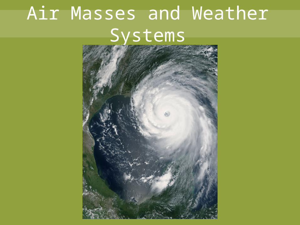
Air Masses and Weather Systems
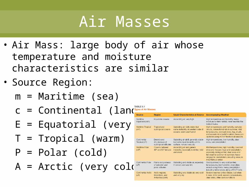
Air Masses• Air Mass: large body of air whose temperature
and moisture characteristics are similar• Source Region:
m = Maritime (sea)c = Continental (land)E = Equatorial (very warm)T = Tropical (warm)P = Polar (cold)A = Arctic (very cold)
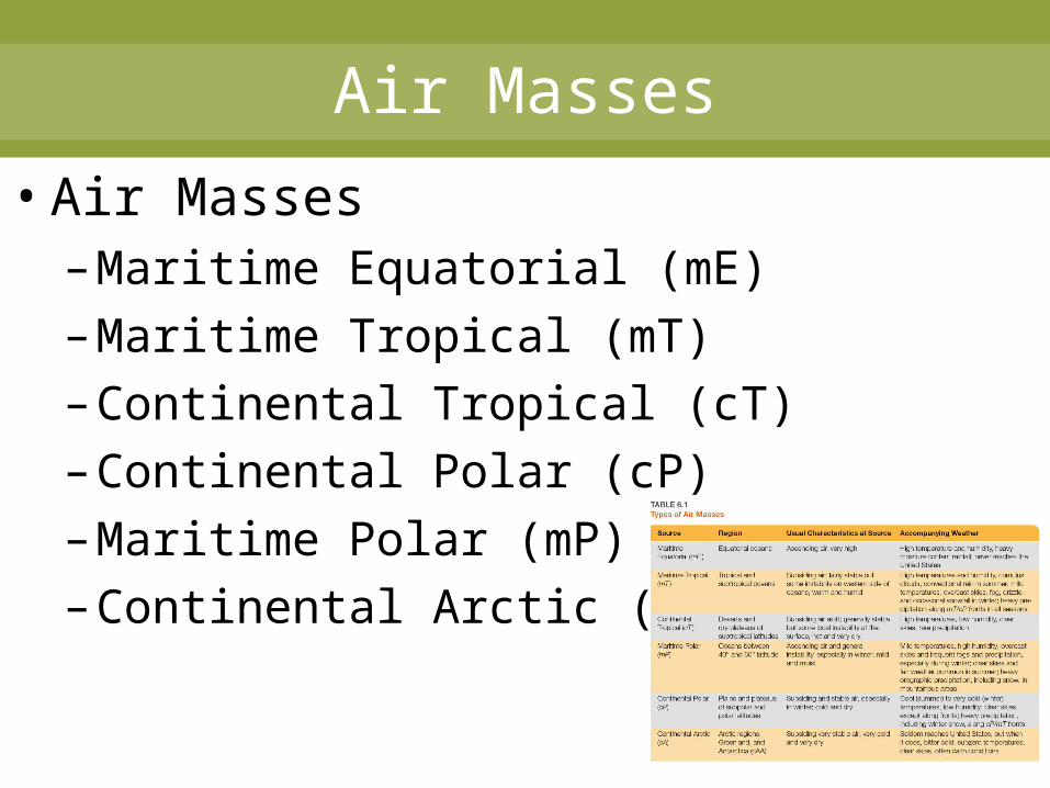
Air Masses
• Air Masses– Maritime Equatorial (mE)– Maritime Tropical (mT)– Continental Tropical (cT)– Continental Polar (cP)– Maritime Polar (mP)– Continental Arctic (cA)
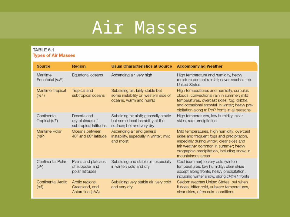
Air Masses
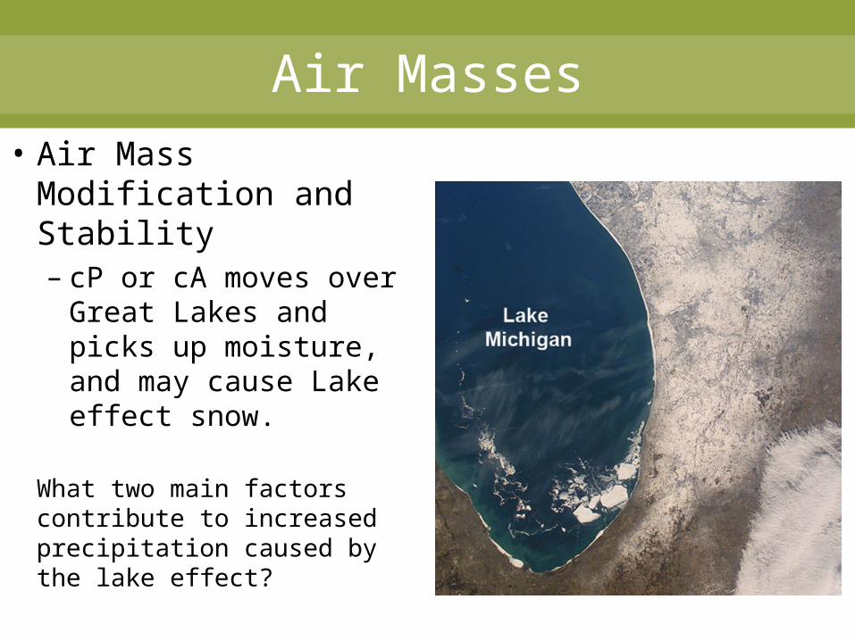
Air Masses• Air Mass
Modification and Stability– cP or cA moves over
Great Lakes and picks up moisture, and may cause Lake effect snow.
What two main factors contribute to increased precipitation caused by the lake effect?
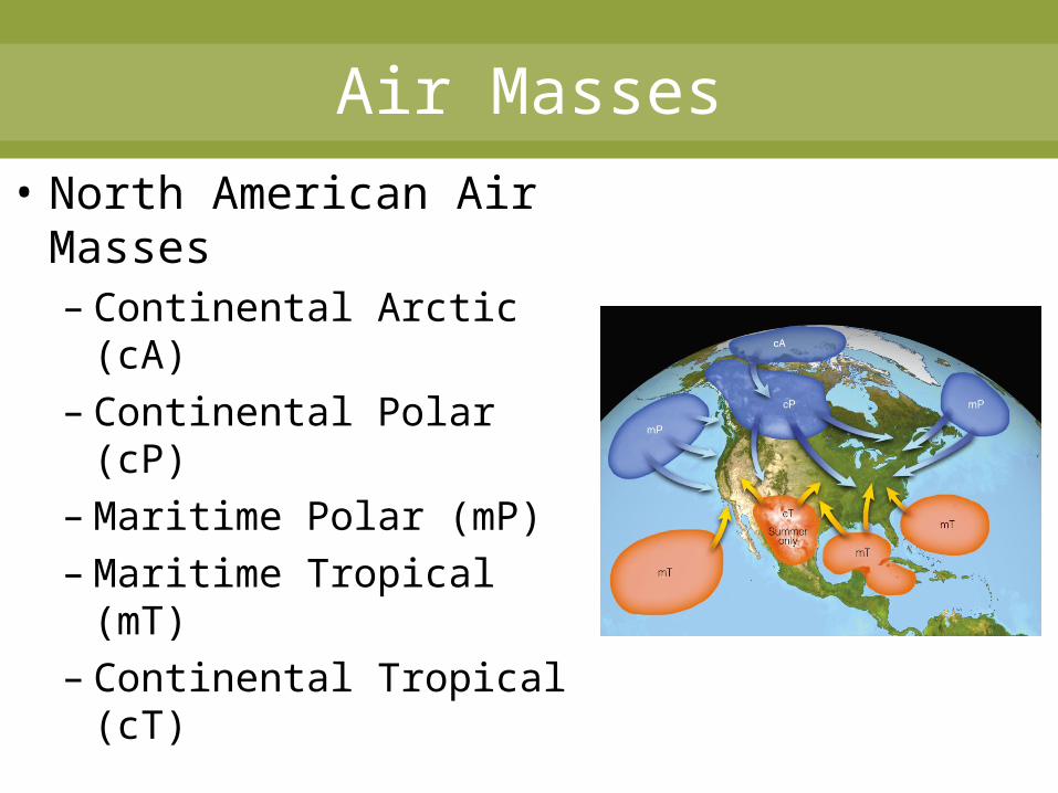
Air Masses
• North American Air Masses– Continental Arctic (cA)– Continental Polar (cP)– Maritime Polar (mP)– Maritime Tropical (mT)– Continental Tropical
(cT)
Air Masses• Continental Arctic (cA): Dry and very cold
– Occasionally impacts U.S. in the winter– Often produces record breaking cold
• Continental Polar (cP): Dry and cold– May reach Gulf of Mexico in winter – Rarely affects west coast
• Maritime Polar (mP): Moist and cool– Westerlies bring air mass to west coast,
especially in winter– Occasionally affects eastern U.S. as
Nor’easters
Air Masses
• Maritime Tropical (mT): moist and warm– May originates in Gulf of Mexico– Major impact on central and eastern U.S
• T-storms in the summer• Clashes with cP
• Continental Tropical (cT): dry and hot– Small source region (SW deserts and N.
Mexico– Dry line– Smallest player in U.S. weather
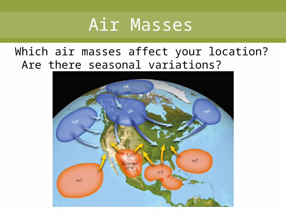
Air MassesWhich air masses affect your location? Are there seasonal variations?
Fronts
• Fronts– Clash between air masses– Sloping boundary– Generally move with westerlies– 3-dimensional– Frontal uplift– U.S. and Canada in a zone between source
regions
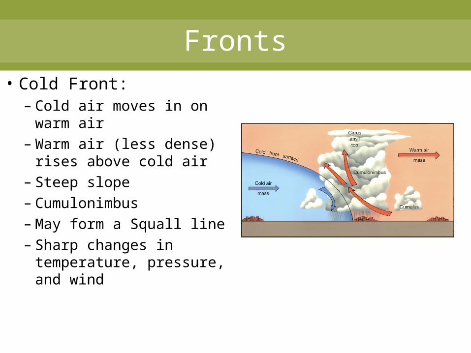
Fronts• Cold Front:
– Cold air moves in on warm air
– Warm air (less dense) rises above cold air
– Steep slope– Cumulonimbus– May form a Squall line– Sharp changes in
temperature, pressure, and wind
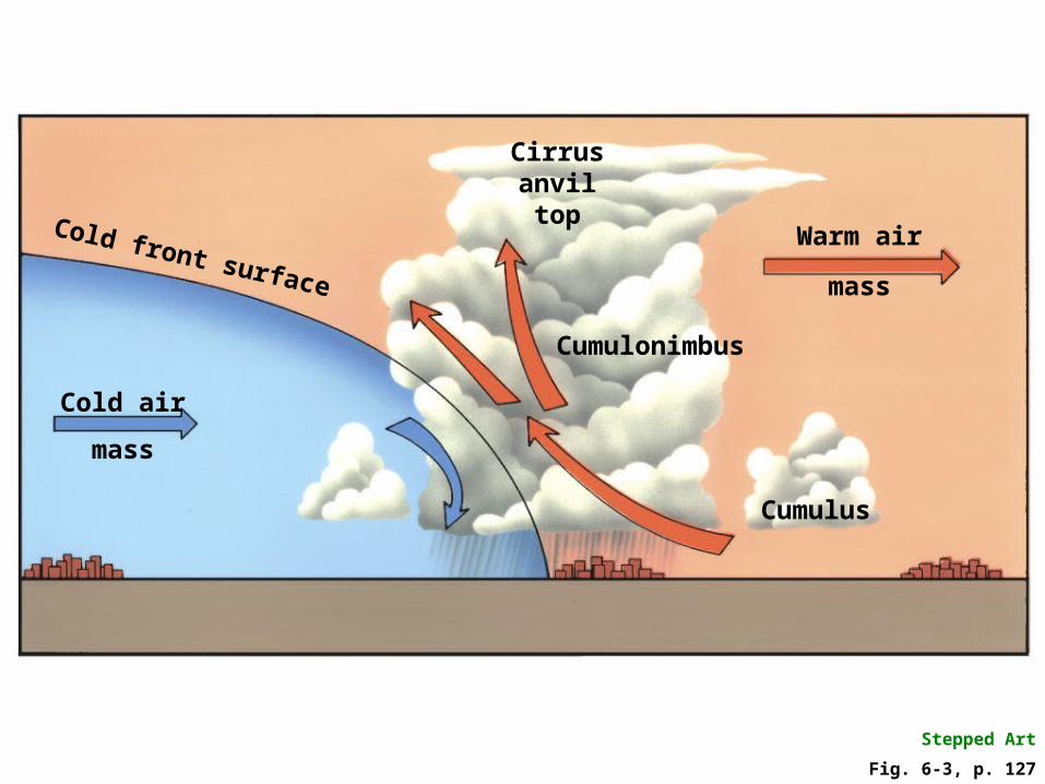
Fig. 6-3, p. 127
Stepped Art
Cold front surface
Cold air
mass
Cumulus
Warm air
mass
Cumulonimbus
Cirrusanviltop

Fronts• Warm Front:
– Warm air moves in on cooler air
– Warm air (less dense) rises above cold air
– Slope is not as steep– Light precipitation
which may last longer– Usher in warmer
conditions
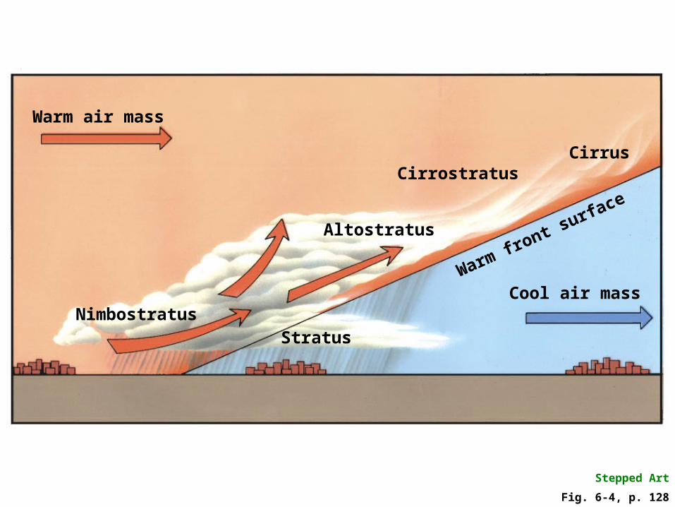
Fig. 6-4, p. 128
Stepped Art
Cool air mass
Altostratus
Cirrostratus
StratusNimbostratus
Warm air mass
Warm front surface
Cirrus

Fronts
• Stationary Front– Boundary between air masses that is not
moving– Extended period of light precip. and
occasionally strong T-storms
• Occluded Front– Cold air is overtaking warm air– Dying storm
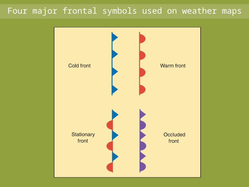
Four major frontal symbols used on weather maps
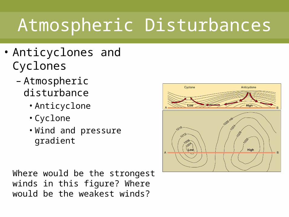
Atmospheric Disturbances• Anticyclones and
Cyclones– Atmospheric disturbance
• Anticyclone• Cyclone• Wind and pressure
gradient
Where would be the strongest winds in this figure? Where would be the weakest winds?
Atmospheric Disturbances
• Anticyclone (H)– Move with path of westerlies– Divergence, sinking air– Sources:
• Northern Canada and Arctic Polar outbreak• Subtropical High Dry and warmer weather
Atmospheric Disturbances
• Cyclones– Low pressure– Convergence and rising air– Clouds and precipitation
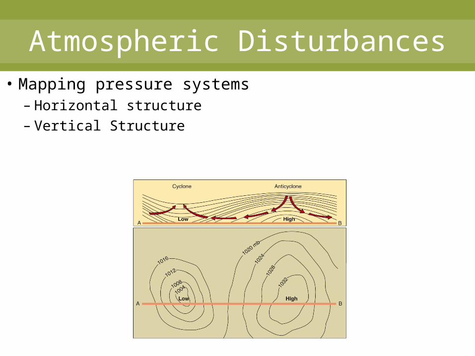
Atmospheric Disturbances• Mapping pressure systems
– Horizontal structure– Vertical Structure

Atmospheric Disturbances• General Movement
– Track of storms (mid-latitude cyclones)– What storm track influences your location?
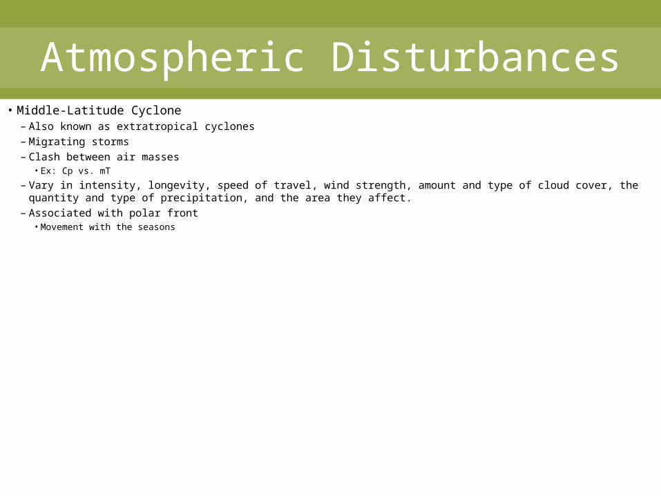
Atmospheric Disturbances• Middle-Latitude Cyclone
– Also known as extratropical cyclones– Migrating storms– Clash between air masses
• Ex: Cp vs. mT
– Vary in intensity, longevity, speed of travel, wind strength, amount and type of cloud cover, the quantity and type of precipitation, and the area they affect.
– Associated with polar front• Movement with the seasons
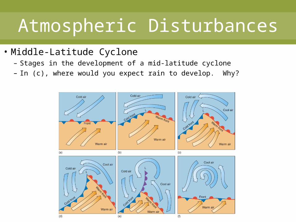
Atmospheric Disturbances• Middle-Latitude Cyclone
– Stages in the development of a mid-latitude cyclone– In (c), where would you expect rain to develop. Why?
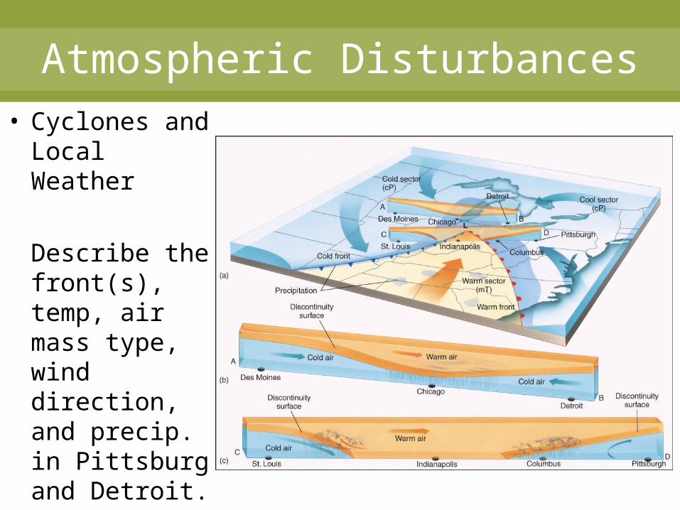
Atmospheric Disturbances• Cyclones and
Local Weather
Describe the front(s), temp, air mass type, wind direction, and precip. in Pittsburg and Detroit.
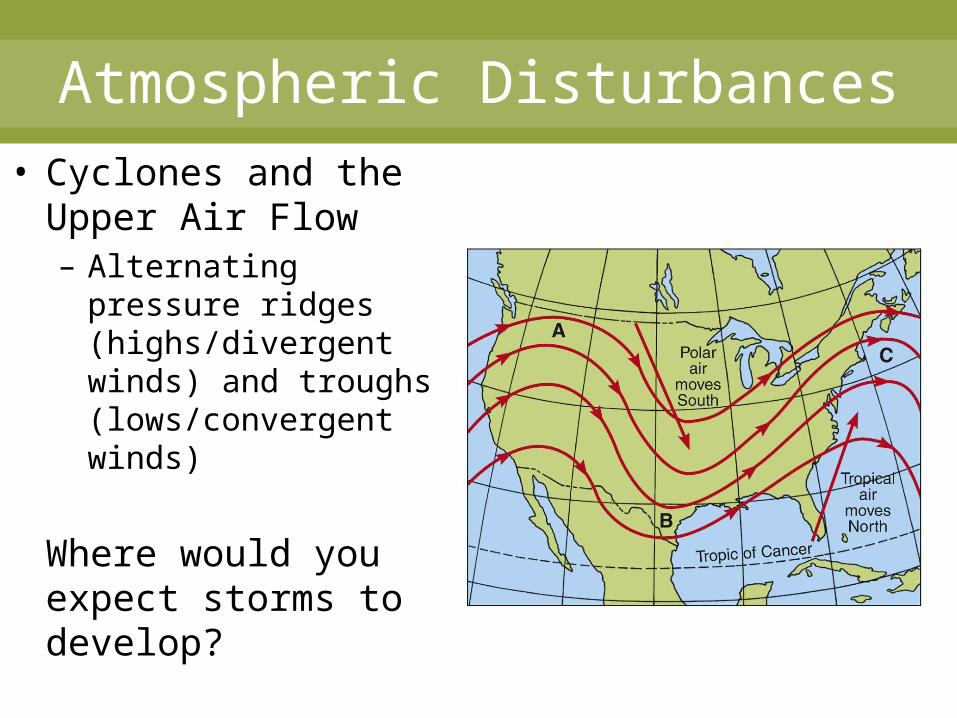
Atmospheric Disturbances• Cyclones and the
Upper Air Flow– Alternating pressure
ridges (highs/divergent winds) and troughs (lows/convergent winds)
Where would you expect storms to develop?
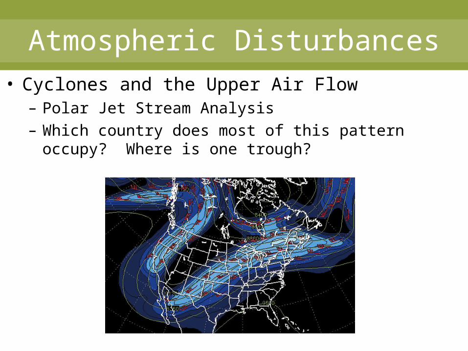
Atmospheric Disturbances• Cyclones and the Upper Air Flow
– Polar Jet Stream Analysis– Which country does most of this pattern occupy?
Where is one trough?
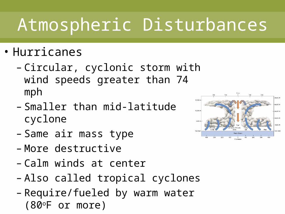
Atmospheric Disturbances• Hurricanes
– Circular, cyclonic storm with wind speeds greater than 74 mph
– Smaller than mid-latitude cyclone
– Same air mass type– More destructive– Calm winds at center– Also called tropical cyclones– Require/fueled by warm water
(80oF or more)
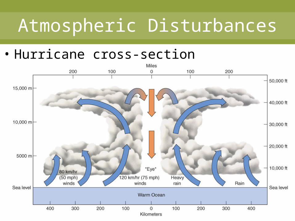
Atmospheric Disturbances
• Hurricane cross-section
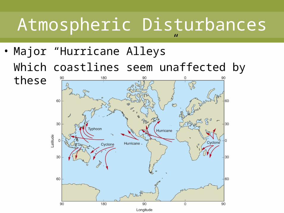
Atmospheric Disturbances• Major “Hurricane Alleys”
Which coastlines seem unaffected by these tracks?
Atmospheric Disturbances
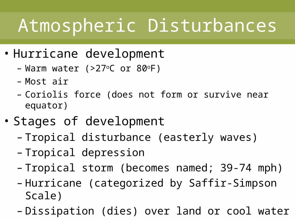
• Hurricane development– Warm water (>27oC or 80oF)– Most air– Coriolis force (does not form or survive near equator)
• Stages of development– Tropical disturbance (easterly waves)– Tropical depression– Tropical storm (becomes named; 39-74 mph)– Hurricane (categorized by Saffir-Simpson
Scale)– Dissipation (dies) over land or cool water
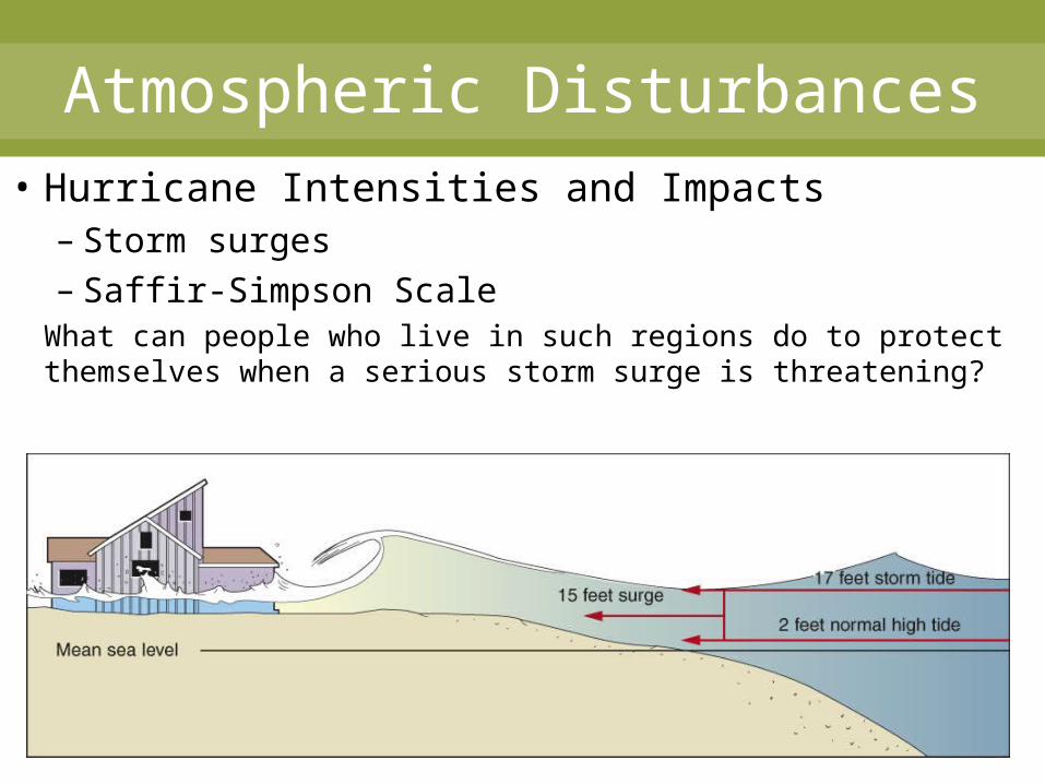
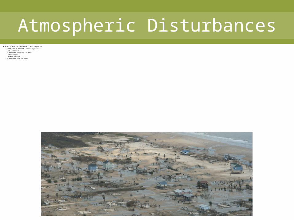
Atmospheric Disturbances• Hurricane Intensities and Impacts
– Storm surges– Saffir-Simpson Scale
What can people who live in such regions do to protect themselves when a serious storm surge is threatening?

Atmospheric Disturbances• Saffir-Simpson Hurricane Scale
Atmospheric Disturbances• Hurricane Intensities and Impacts
– 2004 was a record- breaking year• 3 in Florida
– Hurricane Katrina in 2005• New Orleans• Levee failure
– Hurricane Ike in 2008
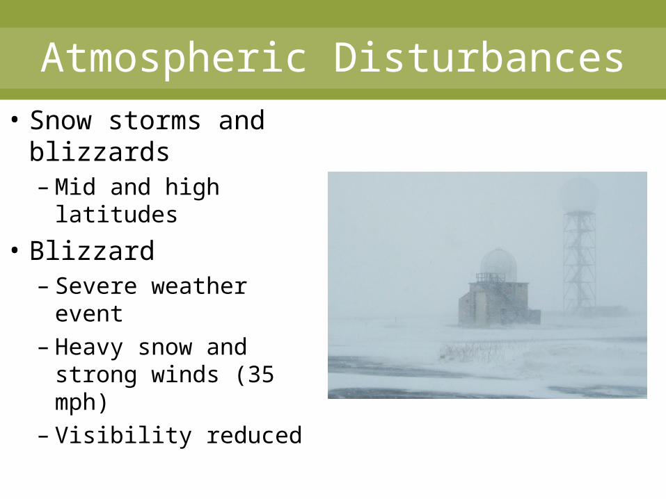
Atmospheric Disturbances• Snow storms and
blizzards– Mid and high latitudes
• Blizzard– Severe weather event– Heavy snow and
strong winds (35 mph)
– Visibility reduced
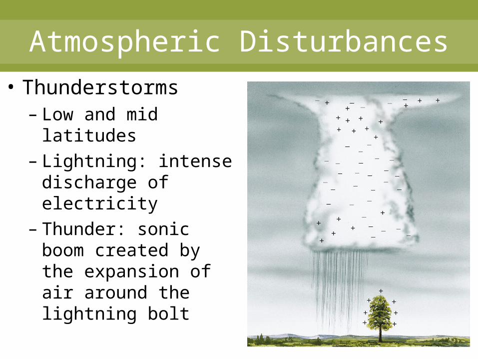
Atmospheric Disturbances• Thunderstorms
– Low and mid latitudes
– Lightning: intense discharge of electricity
– Thunder: sonic boom created by the expansion of air around the lightning bolt
Atmospheric Disturbances
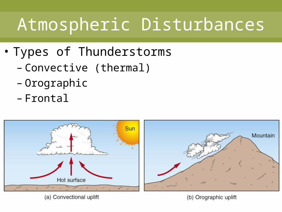
• Types of Thunderstorms– Convective (thermal)– Orographic– Frontal
Atmospheric Disturbances
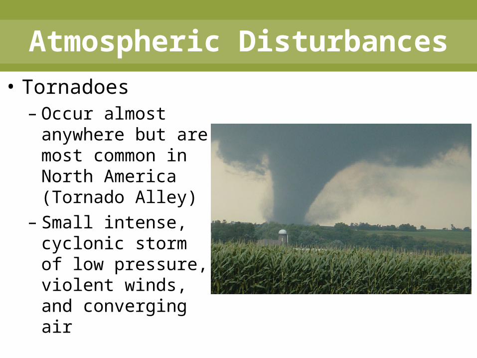
• Tornadoes– Occur almost
anywhere but are most common in North America (Tornado Alley)
– Small intense, cyclonic storm of low pressure, violent winds, and converging air
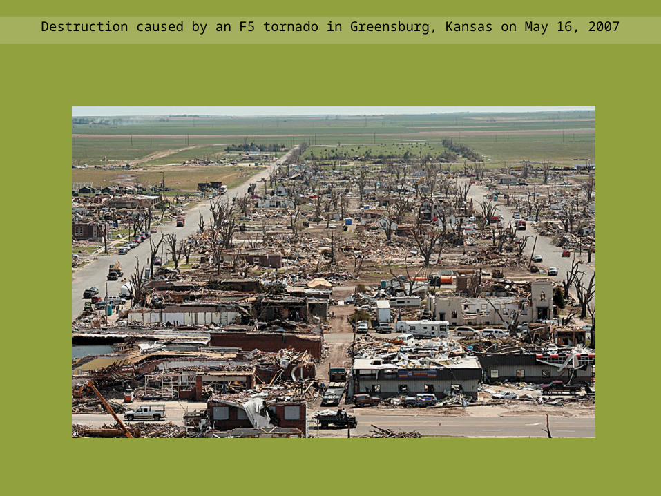
Destruction caused by an F5 tornado in Greensburg, Kansas on May 16, 2007

Atmospheric Disturbances• Tornado
– Typically small and short lived
– 80% associated with thunderstorms
– Temporal Variability• March to July• Late afternoon
or early evening
Atmospheric Disturbances
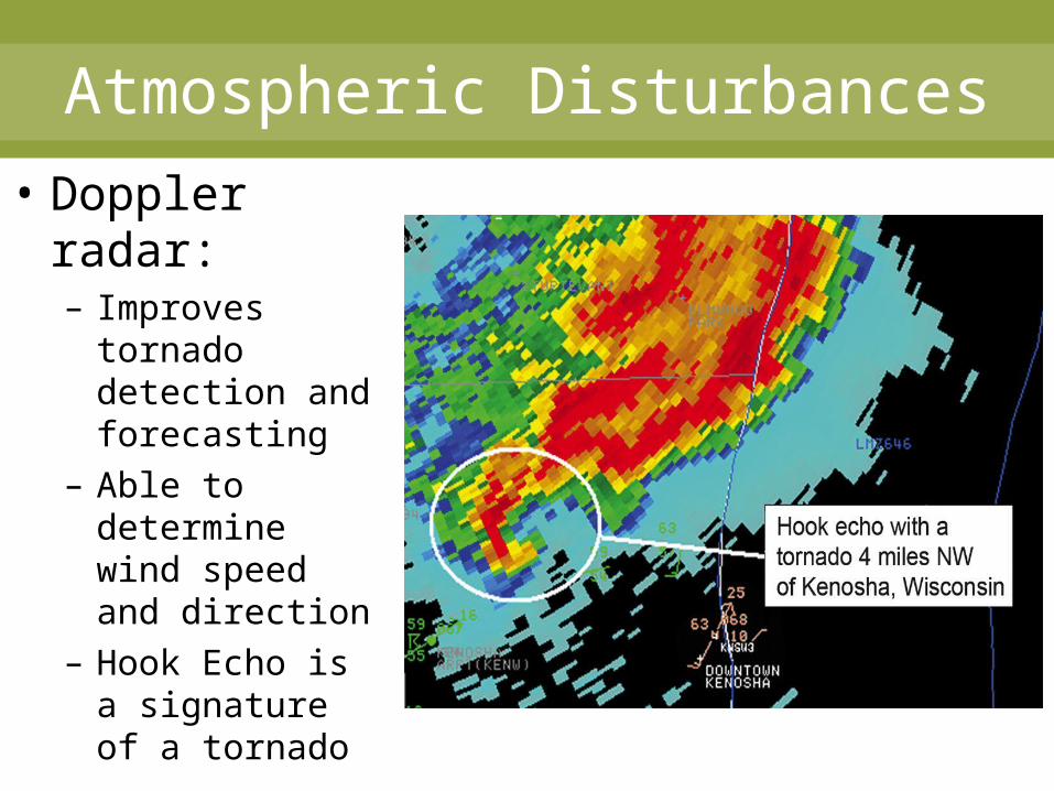
• Doppler radar:– Improves
tornado detection and forecasting
– Able to determine wind speed and direction
– Hook Echo is a signature of a tornado

Atmospheric Disturbances
• Fujita Scale (F-0 to F-5)• Enhanced Fujita Scale (EF-0 to EF-5)
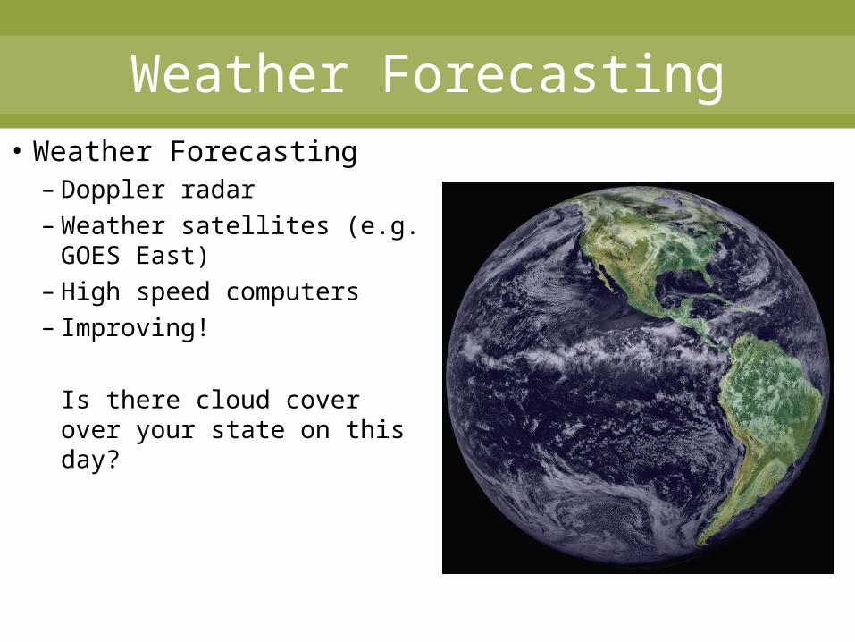
Weather Forecasting• Weather Forecasting
– Doppler radar– Weather satellites (e.g.
GOES East)– High speed computers– Improving!
Is there cloud cover over your state on this day?
Fundamentals of Physical Geography 1e
Petersen
Sack
Gabler
End of Chapter 6:
Air Masses and Weather Systems