\u003ci\u003ehess opinions\u003c/i\u003e \"classification of hydrological models for flood...
TRANSCRIPT
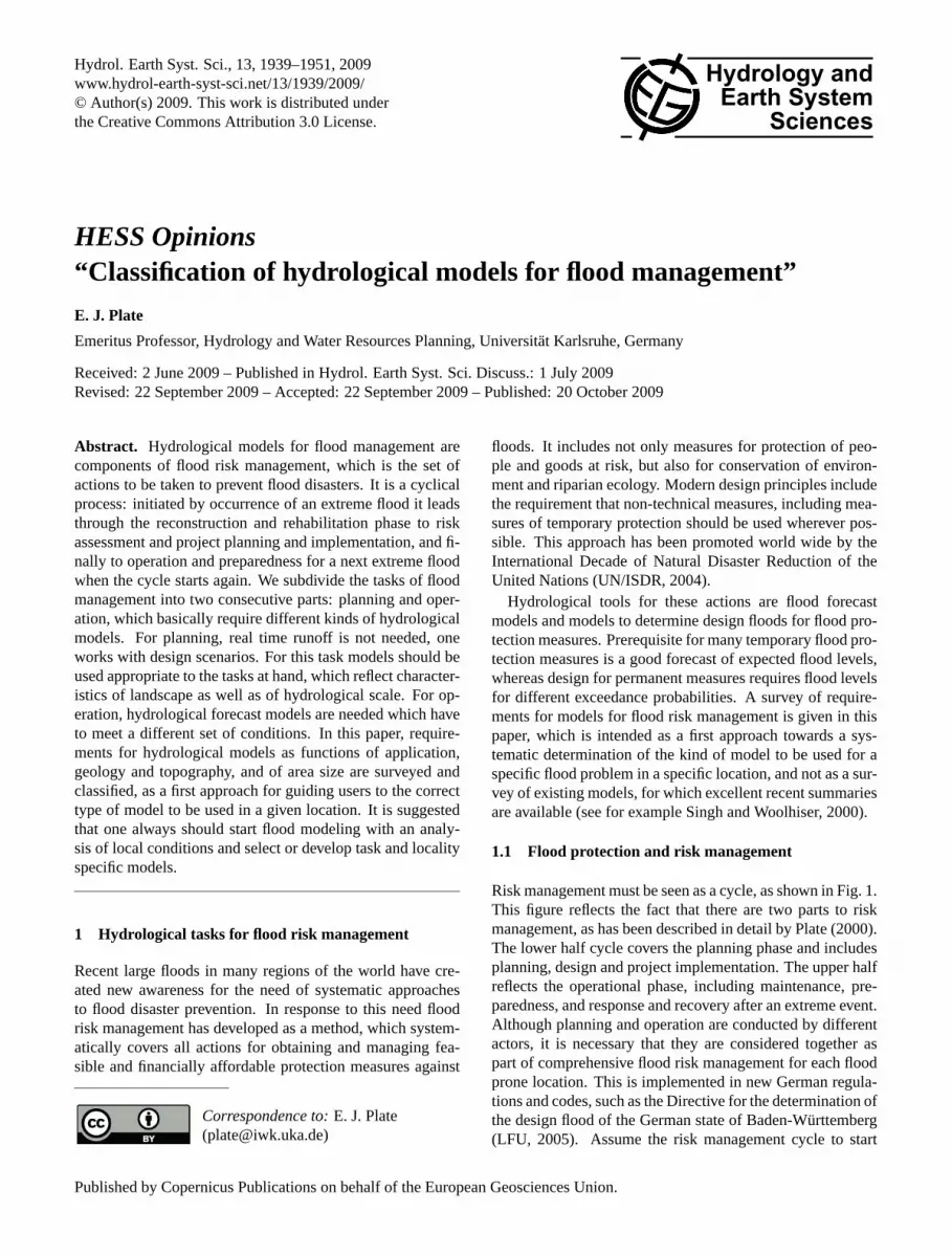
Hydrol. Earth Syst. Sci., 13, 1939–1951, 2009www.hydrol-earth-syst-sci.net/13/1939/2009/© Author(s) 2009. This work is distributed underthe Creative Commons Attribution 3.0 License.
Hydrology andEarth System
Sciences
HESS Opinions“Classification of hydrological models for flood management”
E. J. Plate
Emeritus Professor, Hydrology and Water Resources Planning, Universitat Karlsruhe, Germany
Received: 2 June 2009 – Published in Hydrol. Earth Syst. Sci. Discuss.: 1 July 2009Revised: 22 September 2009 – Accepted: 22 September 2009 – Published: 20 October 2009
Abstract. Hydrological models for flood management arecomponents of flood risk management, which is the set ofactions to be taken to prevent flood disasters. It is a cyclicalprocess: initiated by occurrence of an extreme flood it leadsthrough the reconstruction and rehabilitation phase to riskassessment and project planning and implementation, and fi-nally to operation and preparedness for a next extreme floodwhen the cycle starts again. We subdivide the tasks of floodmanagement into two consecutive parts: planning and oper-ation, which basically require different kinds of hydrologicalmodels. For planning, real time runoff is not needed, oneworks with design scenarios. For this task models should beused appropriate to the tasks at hand, which reflect character-istics of landscape as well as of hydrological scale. For op-eration, hydrological forecast models are needed which haveto meet a different set of conditions. In this paper, require-ments for hydrological models as functions of application,geology and topography, and of area size are surveyed andclassified, as a first approach for guiding users to the correcttype of model to be used in a given location. It is suggestedthat one always should start flood modeling with an analy-sis of local conditions and select or develop task and localityspecific models.
1 Hydrological tasks for flood risk management
Recent large floods in many regions of the world have cre-ated new awareness for the need of systematic approachesto flood disaster prevention. In response to this need floodrisk management has developed as a method, which system-atically covers all actions for obtaining and managing fea-sible and financially affordable protection measures against
Correspondence to:E. J. Plate([email protected])
floods. It includes not only measures for protection of peo-ple and goods at risk, but also for conservation of environ-ment and riparian ecology. Modern design principles includethe requirement that non-technical measures, including mea-sures of temporary protection should be used wherever pos-sible. This approach has been promoted world wide by theInternational Decade of Natural Disaster Reduction of theUnited Nations (UN/ISDR, 2004).
Hydrological tools for these actions are flood forecastmodels and models to determine design floods for flood pro-tection measures. Prerequisite for many temporary flood pro-tection measures is a good forecast of expected flood levels,whereas design for permanent measures requires flood levelsfor different exceedance probabilities. A survey of require-ments for models for flood risk management is given in thispaper, which is intended as a first approach towards a sys-tematic determination of the kind of model to be used for aspecific flood problem in a specific location, and not as a sur-vey of existing models, for which excellent recent summariesare available (see for example Singh and Woolhiser, 2000).
1.1 Flood protection and risk management
Risk management must be seen as a cycle, as shown in Fig. 1.This figure reflects the fact that there are two parts to riskmanagement, as has been described in detail by Plate (2000).The lower half cycle covers the planning phase and includesplanning, design and project implementation. The upper halfreflects the operational phase, including maintenance, pre-paredness, and response and recovery after an extreme event.Although planning and operation are conducted by differentactors, it is necessary that they are considered together aspart of comprehensive flood risk management for each floodprone location. This is implemented in new German regula-tions and codes, such as the Directive for the determination ofthe design flood of the German state of Baden-Wurttemberg(LFU, 2005). Assume the risk management cycle to start
Published by Copernicus Publications on behalf of the European Geosciences Union.

1940 E. J. Plate: Classification of hydrological models for flood management
17
Preparedness
Maintenance
Disaster
Risk management: Operation
Mitigation Risk assessment
Risk mitigation: Planning
Defining hazards(maps)
Hazard analysisVulnerability analysisDetermination of risk
Response
societal objectives
technical + administrativecapabilities
Planning of measures:(-technical
non - technical)Decision makingImplementation
(new) demand
Fig.1: The cycle of risk management Fig. 1. The cycle of risk management.
with a destructive flood event in the region under study ornearby. After a phase of relief and reconstruction as imme-diate response to a flood disaster, the flooding situation isreassessed and frequently leads to demands for an improvedprotection system. A planning phase is initiated, in whichoptions for meeting these demands are identified and their ef-fects evaluated. In particular, for areas that experience floodsonly infrequently, it is necessary to also develop potentialdamage scenarios for floods larger than design floods, or forsituations of breaking of dikes or dams. Damage assess-ment methods for dam breaks such as developed by Beltamiode Almeida et al. (2000) should also be used for dikes, al-though consequences of dike breaks usually are less severethan those from breaking dams that impound large reservoirs.
For each option risks must be determined through the pro-cess of risk assessment, which combines hazards – i.e. mag-nitude of flood levels and their probability of being exceeded– with vulnerabilities, i.e. potential damages for each objectat risk – buildings, highways, dikes etc. Hazards are deter-mined and expressed in hazard maps, which show areas ofinundation as functions of flood levels of given exceedanceprobability. Then the risk as expected value of damagesin the flooded areas is calculated, just as is done for indi-vidual buildings by the insurance industry. This approachhas recently been formalized within the European Commu-nity through the European Union Flood Directive (EU-FD,
EU, 2007) which requires that in accordance with principleslaid down in the Water Framework Directive (EU-WFD, EU(2000) which requires basin wide planning) risk maps are tobe prepared within a specified time frame.
With risk as important decision criterion the process of de-cision making is initiated. The EU-FD requires that plans aredrawn up for improving protection where needed, for thistask also setting a time frame, i.e. the degree of demandedprotection is established, plans to meet these demands bytechnical or non-technical means are prepared by experts,discussed by affected people and administrative bodies, andfinally decided on by the owner – in case of a private project– or by responsible political decision makers – in case of aproject in the public domain. Then the existing system isimproved, or a new system developed. For the operationalphase, finished systems are turned over to the system man-ager’s staff, who not only have to maintain the system, butwho also have to adequately respond to forewarnings: theyhave to produce and interpret forecasts from a flood fore-cast system (if it exists) and warn people at risk immediatelybefore the next extreme event. Then the management cyclestarts again.
Listed in the centre of the risk management cycle are so-cietal conditions under which flood risk management hasto be performed. They reflect the value system of the so-ciety at risk, but also available technology, and scientific
Hydrol. Earth Syst. Sci., 13, 1939–1951, 2009 www.hydrol-earth-syst-sci.net/13/1939/2009/

E. J. Plate: Classification of hydrological models for flood management 1941
understanding of the flood environment – conditions whichchange with time – due to changes in climate, but mostlydue to changes in land use and habitation (a recent study bySchumann et al., 2001 shows that today in Germany thereare no observable changes in flood runoff, which can be at-tributed unequivocally to climate change). Because of thesechanges, flood risk management is a task to be reconsideredby every generation. Today’s objective of flood protection isto provide, with due consideration to environmental require-ments and ecological and legal constraints, a safety againsttheT -year flood, whereT is the recurrence interval, and tobe prepared for floods that exceed this level.
Decisions based on recurrence intervals reflect an intuitiveassessment of the impact of protection system failure. Onlarge rivers in Germany – i.e. on Rhine, Weser and Elbe –T =200 is selected, whereas protection against storm surgesin low lying countries, as in the Netherlands, may be as highasT =10 000 or more. Furthermore, flood risk managementmust include plans for handling residual risks, i.e. risks forthe case of protection system failure, caused either by floodslarger than the design flood, or by failures due to technicaldefects or human error. The residual risk usually is definedvaguely as the risk that exists even though protective mea-sures are in place.
An important problem in modern flood risk managementis to put the decision process for flood safety on a more ob-jective base, by using a quantitative determination of residualrisk as expected damage of failure of the protection system.This aspect is not covered widely in flood management prac-tice. To a first approximation, residual risks may be calcu-lated based on the assumption that every flood exceeding thedesign flood will cause the same damage, so that risk is prod-uct of exceedance probabilityPE and damageK, whereK isusually quantified in terms of monetary units, i.e. US $. Moredetailed analyses also consider dependency of damage on de-sign flood level (Merz and Gocht, 2003), in which case riskis the expected value of damage. Residual risks are used ascomponents of cost – benefit analyses, where avoided dam-age due to a protection system is one of the benefits, whereasmonetary risks and construction costs, properly discounted(Loucks and Van Beek, 2005) are parts of the costs. Ideally,the solution that minimizes the cost benefit ratio should beselected, but in practice, monetary risk is not the only type ofrisk to be considered in flood protection planning.
Ecological damages, as well as social consequences arealso important, although there are neither tested indicatorsfor quantifying these risks, nor weights which express rel-ative importance of these indicators in comparison to mon-etary risks. Indicators and weights are expressions of thesocial value system of a society, which ultimately trans-lates into political actions. For setting priorities for such ac-tions indices could be useful, which should be functions ofweighted indicators. Assignment of weights to indicators isa political task, whereas derivation of indices is a scientificchallenge (Birkmann, 2006). As is evident from this discus-
sion, flood risk management is a process, which requires nu-merous actions at different levels and by many different per-sons. It is not really a scientific process, because the role ofscience is to identify causes and consequences and developtools, not make decisions on values. Among the tools whichscience can contribute are hydrologic and hydraulic models,which shall be considered in the remainder of this paper.
1.2 Models for operation vs. models for planning
Models for flood protection should be application oriented.For the planning phase one needs models for developingflood inundation and flood risk maps, or models for calcu-lating water levels or discharges for the design of flood pro-tection measures. Furthermore, in preparation for the opera-tional phase, models are needed to determine operation rules,for example for operation of reservoirs. Most reservoir oper-ation rules are based on scenario calculations with historicalfloods. However, today system operators want dynamic op-erational models that can be used in real time for decidingreleases in anticipation of future floods, or for controllingseries of barrages for effective dynamic storage of flood wa-ters, as needed for example on the upper Rhine, in order tomeet the protection target of the “Integrated Rhine Program”.Flood forecasting models have to be developed, tested on his-torical events, and put into service in the planning and imple-mentation phase. Such models are also needed for decisionson setting up temporary protection walls, or for evacuatingendangered population groups. Development of all plansnecessary for response to cases of extreme floods, which ex-ceed the capacity of the protection system, are part of theplanning and implementation phase of flood risk manage-ment.
Flood forecasting occurs in both phases of the flood riskmanagement cycle: during planning, the forecast model isdesigned and calibrated, and during operation its successfuloperation is prerequisite for any effective early warnings. Be-cause an effective flood forecast and early warning system isgenerally less expensive than technical measures, it often isthe most cost effective type of flood protection system, insome cases the only one, in particular for many developingcountries. This is the case for some of the large rivers of Asiaor Africa, where floods are frequent and lead to large lossesof lives – such as in 1998 on the Limpopo in Mozambique,or in 2000 on the Mekong, where more than 3000 peopledrowned. Flood forecasting is the chosen method for pre-venting, or at least reducing, such losses of lives in the future.
It follows from these descriptions that there are two im-portant categories of models to be used in flood risk man-agement: forecast models and planning models. These twotypes of models shall be discussed in the following sections.
www.hydrol-earth-syst-sci.net/13/1939/2009/ Hydrol. Earth Syst. Sci., 13, 1939–1951, 2009

1942 E. J. Plate: Classification of hydrological models for flood management
1.3 Forecast and prediction
The difference of planning vs. forecast models is illustratedin Fig. 2 (from Plate, 2007). Objective is to forecast wa-ter levelsha(t0+TF ) at timeTF later than the present timet0, whereTF is the forecasting time andha(t) is the actualvalue of the water level at timet . A forecast model is usedto forecast a valuehF (t0+TF ). The forecast model must bea function of the initial valueha(t0) at timet0, at which theforecast is made. Regardless of the forecast model used anyforecast is only an estimate, and for every forecast an errorband exists, which can be expressed by means of a pdf (prob-ability density function)fh0(t0+TF ), which depends both onh0(t0) and onTF . The largerTF , the broader the error bandbecomes, up to a limit when forecast times exceed a certainmaximum valueTP , when the initial conditions become ir-relevant, and forecasts degenerate into predictions (in the hy-drological sense), i.e.hF (t0+TF ) is a random variable withf (h) independent of time and initial value.
For flood forecasting it is of major importance that theforecast value is accurate. In many cases an erroneous fore-cast is worse than no forecast at all. People who had trusteda forecast that went wrong – for example, that forced themto evacuate an area – will not likely trust a future forecast.Consequently, development of dynamic models for real timeforecasting with as narrow an error band as possible is a ma-jor challenge for hydrological research. At this time, theoutput of most models is deterministic. An assessment ofthe error for such models is usually done (if at all) throughsensitivity analyses or scenario development, in which therange of possible values of the parameters of a model or ofthe model inputs are estimated and the results analyzed. Tra-ditional is the assessment of upper and lower bounds, but amodern trend is to determine ensembles from many combi-nations of probabilistically distributed parameters to obtainestimates in terms of probability distributions of outputs ofthe model, which then can be further analyzed to yield the en-semble average and error bounds expressed in terms of stan-dard deviations of the ensemble, i.e. Krzysztofowicz (2001).Ensemble weather forecasts have a long tradition in meteo-rology, however, the accuracy of meteorological forecasts ofrainfall is still the weakest link in improving flood forecastmodels (Todini, 2004).
For designing technical flood protection systems onlygood predictions of possible future extreme water levels forgiven exceedance probabilities are needed, and time of oc-currence is irrelevant. The classical approach is to use statis-tical extreme value analysis of data obtained at river gages.For basin wide measures this is not sufficient. Rainfall-runoffmodels (RR-models) must supplement traditional extremevalue models for flood risk management. Hydrologists arechallenged to provide these models.
18
t
tprediction time T at t
0
0
pdf of prediction of Q
Q(t)actual value of Q(t)
P
forecast time TF
uncertainty band for t 0
0h
t
h2
forecastedvalue of Q(t + T )0 F
t crit
Fig.2: Defining forecasts and predictionsFig. 2. Defining forecasts and predictions.
2 Rainfall-runoff models for flood management
Two types of RR-models for determination of floods of givenfrequencies can be distinguished. One type uses rainfallrunoff modeling of the continuum of runoff in a river. Histor-ical time series of rainfall (suitably area averaged) are usedand the resulting calculated runoff time series is comparedwith the observed runoff time series. Differences betweenvalues from observed time series and from RR-model can beinterpreted as realizations of a random process. Their meanvalue is a measure of model bias – to be corrected by pa-rameter adjustment – and their variance is a measure of un-certainty. Because different sets of parameters may yield thesame variance, (a property called “equifinality” by Beven andFreer, 2001), this method may yield good results on the av-erage for the observed time series, but it may fail when ex-trapolated, as is observed when the probability distribution ofextreme values of the observed time series of runoff at somegage is compared with a distribution of extreme values of thecalculated series.
The second type of RR-model is event based. It is not in-tended to be used for the whole time series. Its exclusivepurpose is to predict extreme values of runoff – i.e. peaks,volumes, and shapes of flood waves. When used for planningpurposes in flood risk management these models use hypo-thetical rainfall fields. These areT -year area averaged rain-fall fields that are more or less uniformly distributed over thebasin, under the assumption that theT -year area-averagedrainfall will also cause theT -year flood. For practical ap-plications of this method, the writer (see Plate et al., 1988)has always insisted on validating such models at availablegauging stations against extreme value distributions of localrunoff.
All RR-models have in common that they have to describethe physical transformation of rainfall into runoff. This re-quires a common structure for all RR-models. This commonmodel structure will be discussed in the next section.
Hydrol. Earth Syst. Sci., 13, 1939–1951, 2009 www.hydrol-earth-syst-sci.net/13/1939/2009/

E. J. Plate: Classification of hydrological models for flood management 1943
2.1 Components of RR-models
Hydrological RR-models have three levels, each associatedwith three different time scales as indicated in Fig. 3 (adaptedfrom Plate and Zehe, 2006). The data level consists of per-manent, seasonal, and event based data. Permanent are ge-ometric and geological properties of the basin: basin area,topography and geology, river network and soil composition,as well as properties that change only gradually, such as landuse: i.e. forest cover, road networks, urban developments,or large scale climate. Parameters describing agriculturalactivities and seasonal climate are associated with seasonaltime scales and determine seasonal variability of runoff co-efficients. And finally, there are data for the event time scale.These depend on the model purpose. Planning requires his-torical data, whereas forecasting requires short term and realtime event data, with time increments ranging from minutesto hours, depending on the size of the basin area.
The second level in Fig. 3 is the level of model formula-tion and development. The process of model building shouldstart with a thorough assessment of the basin under inves-tigation, orienting the model building process on availablehydro-meteorological data, but also on characteristics of thebasin, as well as on the basic requirements for decision mak-ing as is expressed through the 4-th level of Fig. 3. The deci-sion level determines the information needed, and level 3 isthus determined by level 4.
Hydrologists charged with developing a flood planning orforecast model for a basin should explore and describe its ge-ological characteristics, trace its river networks, identify sur-face and groundwater interactions. Important flow paths ofsurface and subsurface flows need to be identified from thebeginning, and appropriately reproduced in the model. Nouniversal model exists that fits everywhere. For each situa-tion and each catchment models should be built or adaptedappropriate to location and application. They should reflectlocal conditions and incorporate all important human activi-ties which may modify the rainfall runoff process. Due con-sideration should also be given to different time scales ofdifferent processes. Seasonal processes such as interactionsof groundwater and surface water may well be described bymodels using larger time steps than runoff.
2.2 Types of rainfall-runoff models for floodcalculations
In view of what has been said in Sect. 2.1 the choice of a RR-model is determined by intended application, basin scale, andavailable data, which set conditions for development of a newor adaptation of an existing model. The plethora of availableRR-models can be divided into three types: models basedon rectangular grids, models based on sub-catchments, andmodels based on response units. Topography and geometryof grid based models are derived from available large scaledigital terrain models (DTMs). From the elevation of the four
corners of a grid cell the slope of the cell is determined, andthe channel network is derived from these slopes by means ofspecial algorithms (Garbrecht and Martz, 1997; or Crowleyand He, 2005). Climate and land use variables are combinedwith grid models through geographic information systems(GIS). Catchment based models (CBMs), on the other handare vector oriented. They require subdividing the basin intosub-catchments, whose sizes and topographic characteristicshave to be derived from DTMs. This is a lengthy prepara-tory process, which has the advantage that transfer of land-scape features from topographic maps is easier facilitated,and river networks, geology, and land use can be naturally as-sociated with basin features. The third type, models based onresponse units (REM) divide catchments into units of equalrunoff formation. Both CBMs and REMs require that sub-units are connected by means of networks of channels, andall models require that due consideration be given to the hy-draulics of the channels. Usually, not the discharge is neededfor flood studies, but the water level, which only for specialconditions can be inferred from stage discharge curves. Inmost cases, it is necessary to convert discharges into stagesby means of hydraulic models, which range from stationary1-D models to instationary 2-D models, incorporating flooddevelopment over flood plains.
Grid based models are preferred for large scale continuousmodels, such as for climate investigations, but they are alsoapplied frequently for flood modeling, both for flood fore-casting (i.e. Todini, 1996) and for planning flood protectionsystems. With their help the continuum of floods is deter-mined from long term rainfall time series of observed andarea-averaged rainfall and water balances, including calcula-tions of the time series of evapo-transpiration. Such modelsare also useful for event based models, for design or for fore-cast, in order to determine the initial moisture state of thearea element.
All area models have in common that they use a verticalcomponent for determination of that part of the storm rain-fall which becomes flood runoff, and a horizontal componentfor the routing of the rainfall excess to the nearest channel ofthe river network. Models for runoff use runoff coefficientsranging from simple constants which are empirically corre-lated to soil and groundcover parameters, to sophisticatedfunctions obtained from water balance models, for which thearea element is represented by an equivalent vertical soil col-umn consisting of different layers (i.e. Todini, 1996; Refs-gaard and Storm, 1995; De Roo et al., 2000). Water balancemodels separate the rainfall (minus interception) into surfacestorage, and groundwater replenishment by means of an in-filtration – soil water transport model of varying complexity(Liang et al., 1996; Todini, 1996; Crowley and He, 2005).
Runoff is routed from the area elements – cells, sub-catchments or REMs – to the point of interest on the chan-nel network. Routing models should reflect the considera-tions of relative size of area element to channel network tobe discussed in Sect. 2.3. Simple models operate by using
www.hydrol-earth-syst-sci.net/13/1939/2009/ Hydrol. Earth Syst. Sci., 13, 1939–1951, 2009

1944 E. J. Plate: Classification of hydrological models for flood management
19
Data level
Geo-Information-Systems (GIS), Databanks Data files
Base variablesTopography, Soilproperties Geology Land use
Derived VariablesGrid points, Channel-networks, Darcy coeff.Transmissivity Erodibility etc.
GIS and Data banks
Base variablsnClimatePlant coverSeasonaldistribution of water quality
DerivedvariablesET(t)root depthyield
Distribution of precipitationin space and time, runofferosivitysoil moisture
event-scaleseasonal scalepermanent scale
Model level
Output level
Tables and maps Output models
direct output
Decision levelDecision processes
Transport modelEvent based rainfall andrunoff distribution.
Distribution of pollutants and other agents
Hydrological basic modelTopography, Digital terrain models channel network, subcatchments, long time balances of water and matter
Seasonaltransport model
Seasonal distribution ofpollutants, herbicides, fertilizers and water
Fig.3: Levels of hydrological models (adapted from PLATE & ZEHE, 2006)Fig. 3. Levels of hydrological models (adapted from Plate and Zehe, 2006).
only translation, assuming a constant velocity of runoff fromthe element. More complex models are based on linear sys-tems, applied to each element. For example, Crowley andHe (2005) use three parallel linear reservoirs, one for surfacerunoff, one for interflow, and one for baseflow, or groundwa-ter runoff.
For CBMs the RR process for each sub-catchment is de-scribed by area models, which not only reflect the soil mois-ture balance (i.e. Bronstert, 2005) but also incorporate dis-tinctive catchment features, such as local topography andland use such as urbanization and the network of roads andrailways. The connectedness of the sub-catchments followsthe channel network, in which runoff from sub-catchments isrouted downstream. Such a model can be very detailed, de-pending on the resolution into sub-catchments, and the sub-models selected for hydrological processes. How much de-tail is to be incorporated will depend on the model purpose,and on the scale of the region. Obviously, a flood model fora basin of, say, 1000 km2 does not need the same resolutionas an area of a few hectares.
2.3 RR-modeling in different landscapes
Different characteristics of landscapes should require differ-ent types of models. For example, floods in mountain val-leys have very different characteristics from floods on floodplains of large rivers. Theoretical hydrologists tend to use
the same type of model for all types of catchment, althoughit seems obvious that the model should reflect the dominat-ing processes for the type of landscape for which the modelis to be applied. We recommend to distinguish four differ-ent types of landscapes and to develop models accordingly.These are (a) high mountain ranges, (b) foothill ranges withor without vegetation, (c) large flood plains, and (d) urbanareas, as indicated schematically in Fig. 4. A fifth regionis the area affected by coastal processes, for example deltaregions which are subjected to storm surges. Such a subdi-vision is important for design of flood protection measures.From a physical point of view, it is useful to further sub-divide these area types. Within each of these areas thereexist sub-areas with their special hydrological characteris-tics, for example forested regions, or wet lands etc. – anda subdivision of sub-catchments into such characteristic sub-areas eventually leads to decomposition of sub-catchmentsinto many different REUs. Mountain areas are mainly threat-ened by flash floods – intensive and local rainfall events,which lead to rapid increase of water levels and velocities inrunoff channels. In general, river courses in these areas aredeeply incised, and flooding usually is restricted to a narrowstrip along the river, where due to high velocities damages tobank protection works and structures – as in villages wherehouses have been built too close to the creeks – can be veryheavy, aggravated by frequent occurrence of debris jams, inparticular on bridges. Frequently extensive damage occurs
Hydrol. Earth Syst. Sci., 13, 1939–1951, 2009 www.hydrol-earth-syst-sci.net/13/1939/2009/

E. J. Plate: Classification of hydrological models for flood management 1945
20
Fig.4: Types of hydrological areas
Mountain ranges
Foothill region
Aquifer
Dam
Urban area
Bed rockPlains
Fig. 4. Types of hydrological areas.
mainly on highways which for technical reasons had beenbuilt along the rivers. Flood protection in such areas consistsat most of bank protection works, more usual is a flood pro-tection strategy which on each side of the creek leaves a stripof land where no human activity is permitted, or where landuse is restricted to agriculture. In such valleys, a detailedanalysis of floods is frequently of little use: planning modelsin such areas usually are hydraulic models for extreme floodscenarios based on historical floods.
In foothill regions, or in the geologically ancient moun-tains which are typical for the State of Baden-Wuerttemberg,in Germany, extreme precipitation or snow melt usually leadto more widespread inundations than in mountain valleys,and velocities are not of the same importance. Distinguish-ing characteristics of floods in such regions is their impact onvillages and agricultural lands. Flood protection measures insuch areas consist of reduction of peak flows by means ofretention basins in the upper parts of the small rivers, andremoval of narrow sections in villages, with dikes in partic-ularly sensitive stretches of the rivers or creeks. Flood pro-tection of villages and small cities against the 10 to 30 yearflood is secured by these measures; floods of lower proba-bility are reduced, but not avoided. Usually many retentionbasins are used in a basin, each of which protects a smallarea up to a level ofT =20 to 50, and all of them in combina-tion reduce flood frequencies in the lower parts of the riversto aboutT =100 years. Dikes, although standard measuresfor flood protection for larger rivers, are rarely used on smallrivers (with catchments of a few hundred km2). For plan-ning measures in foothill regions RR-models should be used,whose structure depends on the catchment’s size, as will bedescribed in the next chapter.
In the plains of low lands velocities are even less impor-tant. Damage is mainly caused by high water levels, andin some situations due to interaction with groundwater –groundwater tables being raised in inundated areas, which in
turn flood basements or cause backing up of sewerage chan-nels. The greatest threat to human lives comes from widespread inundations, in particular when over very wide areasthe water level rises only slowly, and escape routes are cut offso that people are trapped on higher grounds, if help does notcome soon enough. Dikes are the natural measures for pro-tecting low lands, but dikes may fail, or water levels reachheights above the design height of the dike system. Todayone finds that in many parts of the world protective measuresinclude also widening of the river flood plain between dikes,by new dike lines further inland, with a double dike system.In some cases existing dikes are altogether removed, or theformerly inundated flood plains are replaced by flood pold-ers, which are flooded only when the water level in the mainriver exceeds a certain critical value. Obviously, forecastingfuture discharges or water levels for such areas is of consid-erable importance – not only for warning endangered popu-lations, but also for the purpose of operating side polders orretention basins in the catchment of the river.
Urban areas need special hydrological models, to incor-porate sewer systems and runoff conditions from streets andhouses. Hydraulic RR-models are needed to describe flood-ing from rainfall, as well as from rivers, on whose bankscities are located. In Germany, smaller natural water courseshave been made part of the local sewer system, and manyof the small creeks flowing through cities or villages havebeen confined into pipes. Extreme floods, often combinedwith debris and trash plugging, cause such pipes to overflowand produce heavy local flooding. Typical flood situationswere observed in the city of Dresden during the August floodof 2002, which was caused both by flash floods from smalltributaries flowing into the city and bank overflow of riverElbe. A third important cause of damage for Dresden wasthe raised groundwater table due to inundation of the city.Consequently, it is necessary that urban drainage models forcities are integrated into detailed RR-models of rural areas,not only to evaluate the effect of the basin river network onurban flooding, but also to assess effects of urbanization onrunoff from catchments.
2.4 Hydrological scales and their significance in floodcalculations
The choice of a RR-model is not only dependent on type ofarea, as described in the previous section. An additional deci-sion criterion for model selection is the hydrological scale ofthe area a subject which owes much of its scientific eruditionto Dooge (1986), but which will here be discussed from anapplication oriented perspective. Hydrological scales havebecome important elements of categorizing basins (Plate,1992; Bloschl and Sivapalan, 1995). Hydrological scalesare defined both by size of the area, and by locally domi-nant processes and their representation in models. Of spe-cial importance is the relative significance of overland flowas compared to runoff in the channel network of the area.
www.hydrol-earth-syst-sci.net/13/1939/2009/ Hydrol. Earth Syst. Sci., 13, 1939–1951, 2009

1946 E. J. Plate: Classification of hydrological models for flood management
This is illustrated in Fig. 5. In this figure the smallest scaleis associated with the area element a (an element roughly of1 m2). Surface runoff from this area element flows as over-land or baseflow to the nearest channel. Runoff from all areaelements in sub-areaAj combine into overland flow inputswith characteristic runoff timetC , the time of concentrationfrom areaAj . The total basin hasn sub-areas, i.e.j=1,2,...n.Runoff from each areaAj is routed through the channel net-work. The process of flow routing in the channel networkhas a characteristic timetf , the routing time. The ratio oftC /tf is a suitable indicator for selection of a model scale. Ameasure fortC is the rise time of the unit hydrograph for anarea, for which formulas are available, based on describingunit hydrographs by means of a gamma function (Ihringer,1996). A measure fortf is the flow time in the channel net-work, expressed through length and estimated velocity of themain channel of the network.
2.4.1 Point scale
The scale of the area element a, measured in m2, is called thepoint scale. At this scale,tf has no meaning. Processes onthis scale are mainly vertical, they are significant for floodmodeling only insofar as they determine the separation ofrunoff into infiltration, surface storage (and eventual evapo-transpiration) and overland flow. Processes on this scale arehighly non-linear and locally very variable, local soil char-acteristics and plant cover determine local runoff, which setsin after infitration capacity is exceeded (i.e. Bronstert, 2005).As has been shown (i.e. Zehe et al., 2005) macro-pores in-duce two types of switching mechanism in the conversionof rainfall into runoff: they are activated when the infiltra-tion capacity of the soil matrix is almost saturated and over-land flow sets in, and they lose their effect when macro-poreswhich are closed at the bottom are filled, so that only matrixinfiltration and infiltration into open macro-pores are effec-tive. Other influences on the process of converting rainfallinto runoff are local depressions and micro-topography (de-pression storage), which retain part of the runoff, or frostphenomena influencing or preventing infiltration, or local ef-fects on runoff production during snow melt. Because ofthe potential variability of point scale processes for differentarea elements a, processes on the point scale are consideredmostly for homogeneous areas, such as agricultural fields orforest areas on homogeneous soils.
2.4.2 Micro-scale
Models on the point scale are building blocks for micro scalemodels. The idea of subdividing a catchment into contribut-ing areas – i.e. different areas with similar infiltration poten-tial – assumes the existence of homogeneous or almost ho-mogeneous areas, which are aggregations of area elementsa with similar infiltration characteristics. For each of thesecontributing areas, the determination of the beginning of
21
area element atc
river gage
river sub-basin
tf
sub-area A j
Fig.5: Defining flow times in hydrological basins
Fig. 5. Defining flow times in hydrological basins.
runoff and of an area averagedtC is important for any sub-areaAj . RR-models for floods must consider these processesin detail if tf /tc is small.
More generally, Plate and Zehe (2006) define micro-scalesas the scales of models which can be described by means ofthe fundamental conservation laws of continuum physics, i.e.by means of partial differential equations. Typical models ofthis kind are hill slope models, which must be used if extremerainfall effects on surface erosion or pollutant transport haveto be considered. Extensive investigations on this scale havebeen made at Karlsruhe University as summarized in Zehe etal. (2001).
2.4.3 Meso-scale
The meso-scale is defined as that scale in which RR-modelsare described by conceptual models based on system func-tions. Basic element is one system functionuj (t) for eachof the sub-areasAj , with tcj = characteristic time of concen-tration for areaAj . For the low mountain ranges of centralGermany this scale is associated with areas ranging from 1to several km2. Usually, the sub areas have small creeks,so thattf /tc is non-zero, but their effect is included into theconcentration time. Typical for this scale are models of theunit hydrograph type. There is no clear limit in area forthe use of unit hydrograph models; its application dependson catchment characteristics and available data. Generally,in flat lands unit hydrographs can be used for larger catch-ments than in mountainous country. However, because oflack of data hydrologists are frequently forced to use unithydrographs also in other large areas. On the other hand,where data conditions are adequate (and sufficient time andresources are available), modeling on this scale can also bebased on micro-scale or grid based models, including full hy-draulic models of the channel network.
Hydrol. Earth Syst. Sci., 13, 1939–1951, 2009 www.hydrol-earth-syst-sci.net/13/1939/2009/

E. J. Plate: Classification of hydrological models for flood management 1947
The importance of meso-scale processes increases withincreasing area size. Flow in the river network increas-ingly dominates the rainfall runoff process. In order to cap-ture spatial differences, it is recommended today to sepa-rate larger catchments into sub-catchments, which are con-nected through the runoff network. Runoff from sub-areascan be calculated by means of unit hydrographs, but othermodels based on more detailed physical modeling of the rain-fall runoff process in small catchments may also be suitable.Models combining sub-catchment runoff with river networksare particularly advantageous for situations in which the ge-ological or topographic properties are very different in dif-ferent sub-catchments, causing very different runoff formingprocesses in different parts of the catchment. For example,it becomes possible to model different reaction characteris-tics of the rainfall runoff, depending on the time develop-ment of local infiltration rates. This was well illustrated inthe study of Casper et al. (2003) in the Eyach-valley of theNorthern Black Forest. He could identify numerous differ-ent sub-processes contributing to the time development of therunoff process, with large differences in runoff formation be-tween bogs with limited retention potential on one end of thespectrum, and permeable sandstone on the other end.
For meso-scale processes, the spatial and/or temporal vari-ability of the rainfall field may need to be considered. Thescale of the rainfall field is superimposed on the scale of thecatchment. Locally, it is well known that extreme rainfalls,which cause only minor floods in a large catchment, may lo-cally lead to very high runoff peaks, or to local flash floods.And for large scale rainfall events, the temporal variabilityof the rainfall field may completely mask the effect of thecatchment. A simple example may serve to illustrate thispoint. Let the area averaged rainfall field be temporally vari-able, as expressed through a rainfall intensity functionI (t)
of durationTD, where:
I (t) =1
AG
∫A
I (t, A) · dt (1)
is the rainfall averaged over the catchment areaAG. Let theunit hydrograph for the catchment be given by a functionu(t):
u(t) = f (t, TA) (2)
with characteristic timeTA (for example,TA = rise time ofthe unit hydrograph).
Assuming the runoff coefficientϕ to be independent oftime the discharge can be determined by means of the con-volution integral:
Q(t) = QB(t) + ϕ · AG ·
t∫0
I (τ ) · u(t − τ) · dτ (3)
whereAG = size of the catchment, andQB(t) is the baseflow. If the characteristic timeTD of the rainfall event is
short compared toTA, i.e.TA/TD⇒∞, thenI (t) can be ap-proximated by a delta functionI0·δ(t), and the solution ofEq. (3) is:
Q(t) = QB(t) + ϕ · I0 · AG · u(t) (4)
i.e. only catchment characteristics shape the discharge hy-drograph. For the other extreme case, i.e. forTA/TD⇒0, theunit hydrograph degenerates to unity, and:
Q(t) = QB(t) + ϕ · AG · I (t) (5)
i.e. the dynamics of the runoff process is determined exclu-sively by the dynamics of the rainfall and by its distributionin space, as expressed by Eq. (1). Equation (1) applies mostlyto small catchments, where an area average rainfall as calcu-lated by Eq. (1) is appropriate. For large spatial scales, spatialrainfall distributions as well as time distribution of area av-eraged rainfall fields need to be considered, which requiresthat the total area should be subdivided into sub-catchmentswith local area averaged rainfall inputs. Such an approachis particular important for forecasting flash floods, whereasfor design models the actual distribution of the rainfall is ofsecondary importance.
As a consequence it can be concluded that meso-scalemodels must be used also for cases where timestL and tFare of the same order of magnitude. In such cases runoff for-mation on sub-catchments is of equal importance as runoffin the channel network. This approach should be used forareas ranging from a few 10 s km2 to a few 100 s km2. Inthe writers experience it is particularly useful to subdividelarger catchment into smaller catchments according to waterdivides, and to describe runoff from sub areas (of a few km2
size) by means of unit hydrographs and runoff in channelsby means of 1-D calculations with St. Venant equations, oreven simpler by means of flood routing models, such as thewell known method of Kalinin-Miljukov. Our IHW-Modelby Ihringer et al. (1990), Ihringer (1996) and see also Plateet al. (1988) was developed based on this principle and hasbeen applied successfully for flood determinations in centralmountain regions of South and Central Germany.
2.4.4 Macro-scale
The scale of the IHW model is the scale in which runoffgenerating processes associated with characteristic timestcare of equal importance as channel flows with characteristictime tF . With further increase of catchment size, ratiotC /tFdecreases asymptotically to 0, when dynamics of the runoffprocess is fully dominated by channel flow. This is the caseof macro-scale modeling, and refers to catchment sizes rang-ing from about 1000 to several 10 000 s km2. On this scale,there is no need to model surface runoff in detail. Naturally,runoff coefficientsϕ have to be determined for all sub-areas,but retention and runoff characteristics of sub-areas can berepresented by simplified functions, such as exponential (lin-ear reservoir) functions, or by local runoff coefficientsϕA
www.hydrol-earth-syst-sci.net/13/1939/2009/ Hydrol. Earth Syst. Sci., 13, 1939–1951, 2009

1948 E. J. Plate: Classification of hydrological models for flood management
that are constant for each sub area A. However, for macroscale models the importance of the hydraulic component in-creases, which is required for converting the large dischargesof this scale into flood levels, in particular when technicalflood protection measures are planned. Such models are sub-ject of classical hydraulics (i.e. Henderson, 1966) and notdiscussed in this paper.
2.4.5 Scale transitions and uncertainties
It may seem that the best flood model would be built up bycombining point scale models into models for ever increasingscales. Apart from the fact that this approach cannot workfor larger areas because of the sheer number of elementaryarea elements to be considered, the discussion of Sect. 2.4has made clear that this approach is not necessary becausewith increase in size of the area the collective effect of thedifferent processes changes. For example, whereas on thepoint scale local distribution of macropores may be important(Zehe et al., 2001), they become insignificant when averagedover large areas the law of averages stating that with increasein the number of elements of a homogeneous ensemble thevariance of the average decreases in proportion. In the sameway, large scale features of hill slopes, such as local topogra-phy, may become insignificant when going to a macro scale.As a consequence, it is an interesting problem to find thelimit conditions from when on one can use models of a largerscale – i.e. to use macroscale models with lumped parametersinstead of hill slope models. In most cases this question can-not be answered, because for larger areas the use of a modelis data driven: the availability of data dictates what type ofmodels can be used. Nevertheless, it is necessary that foreach location a close survey is or should be conducted, inorder to identify hydrologically significant features of everyarea. For example, it should be evident that an infiltrationmodel (which determines groundwater recharge as well asrunoff coefficient) for sandy soils cannot be the same as aninfiltration model for karstic surfaces. The availability of in-formation for soil and land cover has much improved overthe years through the availability of space or remote sensingdata and GIS technology, but the routinely transformation ofspace information into hydrological parameters has yet to bedeveloped. At this time, the translation of satellite informa-tion into soil parameters etc. depends on ground truth obser-vations. This adds to the uncertainty of models, and is part ofthe epistemic uncertainty with which the modeler has to live.
3 Comparison of flood models for planning andforecasting
3.1 Advantages and disadvantages of flood models forplanning
The principal statistical tool for planning flood protectionworks is extreme value analysis. Extremes of runoff aredetermined by two independent methods (which ideally arecomplementing one another). The first and more traditionalmethod uses directly extreme values of time series for dis-charges (or water levels) for determination of design floods –typical is a flood with a recurrence interval of once every 100years – i.e. the 100 year flood. There are a number of disad-vantages to this approach. It relies on measured time seriesof water discharges (or water levels) at a point, i.e. it obvi-ously requires presence of a gage on the river near the spotfor which one wants to determine the design flood. For sta-tistical reasons it needs observations of long time series fora reasonable fit to a – generally unknown – probability dis-tribution of extremes. The most important advantage of thismethod is that it avoids uncertainties of the generating pro-cess of the extremes. There exists a vast literature on extremevalue analysis, which shall not be discussed here.
The second method uses RR-models. They also depend onstatistical inputs, this time of rainfall fields. Uncertainty ofrunoff prediction from RR-models primarily stems from pre-diction of the extreme rainfall event for the catchment, i.e.the inherent uncertainties of extents and intensities of rain-fall fields. Additional uncertainties are caused by the timevariability of soil moisture and other dynamic catchment pa-rameters needed to convert rainfall into runoff. Advantagesof RR-models are obvious. Rainfall inputs are less dependenton local conditions, and thus rainfall statistics can be general-ized for large areas. Furthermore well calibrated RR-modelscan be used for flood prediction – not only peak values – atevery point in a catchment.
Because different extreme value distributions applied tothe same data set may yield very different extreme flood peakvalues, it is actually not sufficient if only the recurrence in-terval is specified. For completeness of specifications, alsothe method of determination of the extreme values shouldbe given, as for example in the recommendations of the USInteragency Advisory Committee on Water Data (IACWD,1982). However, the actual recurrence interval for designfloods is never accurately known because of numerous po-tential errors due to model complexity (model error), incom-plete information on parameters (parameter error) or insuffi-cient or inaccurate data (data and sampling errors). The truerecurrence interval of an observed flood peak can never reallybe ascertained. An error range of±15%=30% is not uncom-mon, and this may mean – for example when determiningthe 100 year flood – to design not for the 100 year flood, butfor floods of recurrence interval of 150 or 50 year. Alreadysmall changes in the flood level may cause large changes in
Hydrol. Earth Syst. Sci., 13, 1939–1951, 2009 www.hydrol-earth-syst-sci.net/13/1939/2009/

E. J. Plate: Classification of hydrological models for flood management 1949
calculated probability. This is illustrated in Fig. 6 where ra-tios x100/x20 (i.e. of the 100-year to the 20 year flood), andratiosx1000/x100 (i.e. of the 1000 year flood to the 100 yearflood) are shown as function of coefficient of variationCVx
for the two parameter gamma distribution. (This distribu-tion has been found give best fits to long data series of largerbasins in South Germany, LfU, 1999). For two parameterdistributions, such a presentation is unique, for three param-eter distributions one obtains a family of curves with skewcoefficientCSx as third parameter.
For two parameter gamma distributionsCSx andCVx arerelated asCSx=2CVx , where the magnitude ofCSx is re-stricted by the fact that already forCSx=2 gamma distribu-tions reduce to the exponential. Thus, if one assumes an av-erage skew factor of 1, corresponding aCVx=0.5, one findsboth curves to show differences of 30% between the 1000and 100 year flood, or between the 20 year flood and the 100year flood, respectively, corresponding to a tenfold resp. five-fold range of return periods. This uncertainty has epistemicand natural causes. Epistemic uncertainty includes both dataand model uncertainty, whereas natural variability is due tothe complexity of the natural processes and catchment char-acteristics leading to runoff variability. These uncertaintiesadd up to a wide range of potential exceedance probabilities,as was well illustrated in a number of examples in a recentpaper by Merz and Thieken (2005).
It is very difficult to overcome these uncertainties. Someimprovement is found by regionalization based on manydifferent runoff gages in a region. Regionalization wasalso used by Ihringer (LfU, 2005) who developed a region-alization model, which permits to estimate the 100 yearflood peaks for every point in the German State of Baden-Wurttemberg. But it must be realized that in the end the de-cision for flood protection measures is a political decision,which leads to a politically acceptable recurrence interval,typically based on large historical floods. For example, thedesign flood for the Upper Rhine (Rhine between Basel inSwitzerland and Mannheim at the confluence of Rhine andNeckar) has approximately aT =200 years, but it is based onthe extreme value observed in 1882, (shifted in time to ac-count for Rhine corrections made after 1882, so that peaksof Neckar and Rhine floods coincide), plus freeboard. Thisapproach may appear rather simple in terms of modern hy-drology, but it had the advantage of being plausible and po-litically acceptable.
3.2 Advantages and disadvantages of forecast models
The major difference between forecasting and planning mod-els is accuracy. Flood forecast models require higher accu-racy than planning models. Flood forecast models requirethat an exact peak value is forecast, in contrast to results fromplanning models, as has been discussed in 3.1. It will neverbe possible to accurately identify the recurrence interval of anextreme event that has actually happened. It could have been
22
0 0,1 0,2 0,3 0,4 0,5 0,6 0,7 0,8 0,9 1 1,1Variationskoeffizient CV
1000
1100
1200
1300
1400
1500
1600
x100
/x20
1000
1100
1200
1300
1400
1500
1600
x100
0/x1
00
Fig.6: Ratios Q1000/Q100 and Q100/Q20 (multiplied by factor 1000) as function of coefficient of variability CVx of the two-parameter gamma-distributionFig. 6. RatiosQ1000/Q100 and Q100/Q20 (multiplied by factor
1000) as function of coefficient of variabilityCVx of the two-parameter gamma-distribution.
a more frequent, or a less frequent event. The case of floodforecasting is different, after a flood one knows for certainthat the forecast has been accurate, or accurate enough. Onthe other hand, a forecast model does not have to correctlymodel the physical basis of the rainfall-runoff process, so thatany method which is reasonable and yields acceptable resultsmay be used, for example those from regression analysis, orfrom artificial neural networks which have been trained onpast records. The overriding concern is to include the errorband in the discussion of the results, i.e. to use the probabilitydistribution of potential outcomes as basis for a purpose ori-ented forecast, for example take the ensemble average as bestestimate, and give error bands based on exceedance probabil-ities.
What is meant by a good forecast has to be specified notonly intuitively (by how the warned PAR (= people at risk)feel about the forecast) but objectively, by means of an ob-jective criterion, which is derived from past events of varyingmagnitude.of varying magnitude. Many different statisticalquantities have been suggested and used, (for some recentuses see Bravo et al., 2009, or Wu et al., 2005) which do notreally meet this requirement. Obviously, a criterion based onthe average performance of a flood hydrograph, such as thecriterion by Nash and Sutcliffe (1970) is not sufficient. Thecriterion must be geared to weigh the course of the hydro-graph of the future, as observed from a known point of thehydrograph of the past. A possible criterion could be basedon the following considerations.
It is evident that for short times (short in relation to a crit-ical time, which depends on the size of the catchment orbasin) the requirements for complexity of forecast modelsare not very high – because the discharge cannot have dis-continuities, for physical reasons. If there is no other infor-mation available, the best forecast for the near future is toforecast the value at timet0+TF as being equal to the valueat t0. The performance of a forecast, expressed through aforecasted valuehf (t+TF ) after timeTF should be judged
www.hydrol-earth-syst-sci.net/13/1939/2009/ Hydrol. Earth Syst. Sci., 13, 1939–1951, 2009

1950 E. J. Plate: Classification of hydrological models for flood management
relative to this value. This implies that the deviation of theforecasted valuehf (t+TF )−h0(t) from the present valueshould be large relative to the deviation of the actual valueha(t+TF ) from the forecasted valuehf (t+TF ), i.e. fromha(t+TF )−hf (t+TF ). In terms of quadratic deviations (toeliminate the need for sign corrections) this condition is ex-pressed by an index (Kitanides and Bras, 1980)1:
IF (TF ) = 1 −
∑n
[hf (t + TF ) − ha(t + TF )
]2
∑n
[hf (t + TF ) − h0(t)
]2(6)
for which during calibration the sums have to be taken at eachtime t=i·1t, i=1, 2, ...n over the whole forecast intervalTF =n·1t of the event, where1t is the time increment. Apositive value close to 1 ofIF (TF ) indicates good, a small oreven negative value poor performance, i.e. ifIF (TF ) is closeto 0 or even negative, the performance of the forecast is notbetter than taking the value of today (at timet) as forecast forthe value at timet+TF . It is concluded that forecast modelsare even more dependent on a good data base than planningmodels. Only many comparisons of actual with forecasteddata can establish confidence in a forecast model.
4 Conclusions
This paper makes a case for considering models for floodforecasting and models for planning of flood protection struc-tures as important but quite different tools for managing floodrisks. Flood risk management is seen as a comprehensiveapproach for handling the consequences of extreme floodevents so that they do not lead to flood disasters. The ob-jective of development or adaptation of models is their in-tended application. This requires that we distinguish modelsby scale and by topographic context: models for large basinsin topographically flat country require different approachesthan, for example, models for flash floods in mountain areas.As prerequisite of model choice a thorough understandingof local topography and climate processes is essential. Butmodels should not only reflect local scales and local terrainfeatures and geology, but they also should be determined bythe intended application. By pointing out the different con-ditions and requirements for the use of flood managementmodels, this paper is an attempt to give guidance to personsinvolved in flood management.
Differences in the types of models for planning versusmodels for flood forecasting are stressed, although the pa-per is descriptive in nature. Analytical concepts for modelstructures and calculations cannot be covered, and for detailsreferences are given which reflect mostly the experience of
1Note that this is similar to the criterion of Nash and Sut-cliffe (1970), except that heighth replaces dischargeQ, and theinitial valueh0(t) at timet replaces the average value of the com-plete hydrograph.
the author and his team at the University of Karlsruhe. Hy-drologists today must be aware that their work can serve twovery different purposes: one is to better understand nature,and the other is to provide analytical tools for helping watermanagers and design engineers to better handle their designand management problems. A better understanding of na-ture is obtained by observing, measuring, and modeling ofhydrological processes at the smallest scales and by extend-ing the resulting models to larger ones by integration overmore and more small scale area elements. Engineers, on theother hand, need models which reproduce only those modelcomponents which are relevant to quantify the runoff pro-cess with sufficient accuracy for their purposes. In lookingat planning models and forecast models for floods, the twodifferent aspects of modeling become particularly evident.
Acknowledgements.The thoughtful and extensive discussions ofan earlier draft of the paper by E. Todini and G. Bloschl are verymuch appreciated.
Edited by: H. H. G. Savenije
References
Betamio de Almeida, A. and Viseu, T. (Eds.): Dams and SafetyManagement at Downstream Valleys, Balkema, Rotterdam,247 pp., 1997.
Beven, K. and Freer, J.: Equifinality, data assimilation, and estima-tion in mechanistic modeling of complex environmental systemsusing the GLUE methodology, J. Hydrol., 249, 11–29, 2001.
Bloschl, G. and Sivapalan, M.: Scale issues in hydrological model-ing: a review, Hydrol. Process., 9, 251–290, 1995.
Bloschl, G., Grayson, R. B., and Sivapalan, M.: On the represen-tative elementary area (REA) concept and its utility in rainfall –runoff modelling, Hydrol. Process., 9, 313–330, 1995.
Bravo, J. M., Paz,A. R., Collischonn, W., Uvo, C. B., Pedrollo,O. C., and Chou, S. C.: Incorporating forecasts of rainfall in twohydrological models used for medium range streamflow forecast-ing, J. Hydrological Engineering, ASCE, 14, 435–445, 2009
Bronstert, A. (Eds.): Abflussbildung: Prozessbeschreibung undFallbeispiele, Forum fur Hydrologie und Wasserwirtschaft, DWADeutsche Vereinigung fur Wasserwirtschaft, Abwasser und Ab-fall Fachgemeinschaft Hydrologische Wissenschaften, 137 pp.,2005.
Casper, M., Volkmann, H. N., Waldenmeyer, G., and Plate, E. J.:The separation of low pathways in a sandstone catchment of theNorthern Black Forest using DOC and a nested approach, Phys.Chem. Earth, 28, 269–275, 2003.
Crowley II, T. E. and He, C.: Distributed parameter large basinrunoff model I: Model development ASCE, J. Hydrol. Eng., 10,173–181, 2005.
Dooge, J. C. I.: Scale problems in hydrology, in: Reflections on Hy-drology, edited by: N. Buras, N., American Geophysical Union,Washington, DC, USA, 85–135, 1997.
De Roo, A. P. J., Wesseling, C. G., and van Doysen, W. P. A.: Phys-ically based river basin modelling within a GIS platform: themodel LISFLOOD, Hydrol. Process., 14, 1981–1992, 2000.
Hydrol. Earth Syst. Sci., 13, 1939–1951, 2009 www.hydrol-earth-syst-sci.net/13/1939/2009/

E. J. Plate: Classification of hydrological models for flood management 1951
EU: European Union Directive 2000/60/EC of the European Par-liament and of the Council,http://eurlex.europa.eu/LexUriServ/LexUriServ.do?uri=CONSLEG:2000L0060:20011216:EN:PDF,2000.
EU: European Union Directive 2007/60/EC of the European Par-liament and of the Council,http://eurlex.europa.eu/LexUriServ/LexUriServ.do?uri=OJ:L:2007:288:0027:0034:EN:PDF, 2007.
Garbrecht, J. and Martz, L. W.: The assignment of drainage direc-tion over flat surfaces in raster digital elevation models, J. Hy-drol., 193, 204–213, 1997.
Henderson, F.M.: Open channel flow, Macmillan, New York,522 pp., 1966.
IACWD (Interagency Advisory Committee on Water Data): Bul-letin 17-B Guidelines for determining flood flow frequency:United States Geological Survey, Washington, DC, 1982.
Ihringer, J.: Hochwasser aus landlichen und stadtischen Gebieten,Z. Geol. Wissenschaft., 14, 523–530, 1996.
Ihringer, J., Beelitz, W. D., Gunther, Ch., and Kron, W.: Soft-warepaket fur Hydrologie und Wasserwirtschaft, Anwender-handbuch, Vol. 1: Hochwasseranalyse, Universitat Karlsruhe, In-stitut fur Hydrologie und Wasserwirtschaft, 1990.
Kitanides, P. and Bras, R.: Real time area forecasting with a concep-tual hydrological model. 1. Analysis of uncertainty, Water Re-sour. Res., 16, 1025–1033, 1980.
Krzysztofowicz, R.: The case for probabilistic forecasting in hy-drology, J.Hydrol., 249, 2–9, 2001.
LfU: Hochwasserabflusswahrscheinlichkeiten in Baden-Wurttemberg, Landesanstalt fur Umweltschutz, Baden-Wurttemberg, Oberirdische Gewasser, GewasserokologieNo. 54, 45 pp., 1999.
LfU: Leitfaden “Festlegung des Bemessungshochwassers bei An-lagen des technischen Hochwasserschutzes” Landesanstalt furUmweltschutz, Baden-Wurttemberg, 91 pp., 2005.
Loucks, D. P. and van Beek, E.: Water Resources System Planning,Studies and Reports in Hydrology, UNESCO, Paris, 2005.
Merz, B. and Gocht, M.: Karten fur die Hochwasservorsorge unddas Risikomanagement auf der lokalen Skale, Hydrol. Wasserbe-wirts., 47, 186–194, 2003.
Merz, B. and Thieken, A.: Separating natural and epistemic un-certainty in flood frequency analysis, J. Hydrol., 309, 114–139,2005.
Nash, I. E. and Sutcliffe, J. V.: River flow forecasting through con-ceptual models, 1., A discussion of principles, J. Hydrol., 10,282–290, 1970.
Plate, E. J., Ihringer, J., and Lutz, W. L.: Operational models forflood forecasting, J. Hydrol., 100, 489–506, 1988.
Plate, E. J.: Skalen in der Hydrologie, Zur Definition von Begrif-fen, Regionalisierung hydrologischer Parameter, Beitragssamm-lung Deutsche Forschungsgemeinschaft, Bonn, Germany, 33–44,1992.
Plate, E. J.: Flood risk and flood risk management, J. Hydrol., 267,2–11, 2000.
Plate, E. J.: Early warning and flood forecasting for large rivers withthe lower Mekong as example, Journal of Hydro-EnvironmentResearch, 1, 80–94. 2007.
Plate, E. J. and Zehe, E. (Eds.): Wasser- und Stofftransport auskleinen landlichen Einzugsgebieten, 365 pp., Schweizerbart,Stuttgart, Germany, 2008.
Refsgaard, J. C. and Storm, B.: MIKE SHE, in: Computer Mod-els of Watershed Hydrology, edited by: Singh, V. P., Water Re-sources Publications, 809–846, 1995.
Schumann, A. H., Antl, M., and Geyer, J.: Probabilistische Ab-schatzung der Unsicherheit von Aussagen zu hydrologischenAuswirkungen globaler Klimaveranderungen, Hydrologie undWasserbewirtschaftung, 45(4), 154–165, 2001.
Singh, V. J. and Woolhiser, D. A. : Mathematical modeling of wa-tershed hydrology, J. Hydrological Engineering, ASCE, 7, 270–291, 2000.
Todini, E.: The ARNO rainfall – runoff model, J. Hydrol., 175,339–382, 1996.
Todini, E.: Role and treatment of uncertainty in real time flood fore-casting, Hydrol. Process., 18, 2743–2746, 2004.
UN/ISDR: United Nations Inter-Agency Secretariat of the Interna-tional Strategy for Disaster Reduction (ISDR), Living with risk:a global review of disaster reduction initiatives, United NationsPublications, Geneva, 2004.
Wu, J. S., Hun, J., Annambhotia, S. and Bryant, S.: Artificial neu-ral networks for forecasting watershed runoff and stream flow, J.Hydrological Engineering, ASCE, 10, 216–222, 2005.
Zehe, E., Maurer, T., Ihringer, J., and Plate, E. J.: Modelling wa-ter flow and mass transport in a Loess catchment, Phys. Chem.Earth, Part B, 26, 487–507, 2001.
Zehe, E., Becker, R., Bardossy, A., and Plate, E. J.: Uncertainty ofsimulated catchment runoff response in the presence of thresh-old processes: Role of initial soil moisture and precipitation, J.Hydrol., 315, 183–202, 2005.
www.hydrol-earth-syst-sci.net/13/1939/2009/ Hydrol. Earth Syst. Sci., 13, 1939–1951, 2009