the lithuanian spatial information portal
TRANSCRIPT
2020
THE LITHUANIANSPATIALINFORMATIONPORTAL

2020
THE LITHUANIANSPATIALINFORMATIONPORTAL
Project “Development of Lithuanian Spatial Information Infrastructure by Implementing the Provisions of the INSPIRE Directive on Interoperability of Spatial Data Sets and Services (INSPIRE-2)”Information booklet
Project No. 02.3.1-CPVA-V-529-01-0013The project is funded by the European Regional Development Fund and implemented under the measure 02.3.1-CPVA-V-529 “Development of Advanced E-services” for the implementation of the European Union Funds Investment Opera-tional Programme of 2014–2020.
The project is implemented by the State Enterprise “GIS-Centras”.Duration: March 2018 – March 2021
© VĮ „GIS-Centras“, 2021
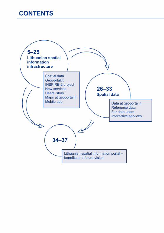
CONTENTS
5–25Lithuanian spatialinformationinfrastructure
Spatial dataGeoportal.ltINSPIRE-2 projectNew servicesUsers’ storyMaps at geoportal.ltMobile app
26–33Spatial data
Data at geoportal.ltReference dataFor data usersInteractive services
34–37
Lithuanian spatial information portal –benefits and future vision
4
GEO
POR
TAL.LT
5
GEO
POR
TAL.
LT
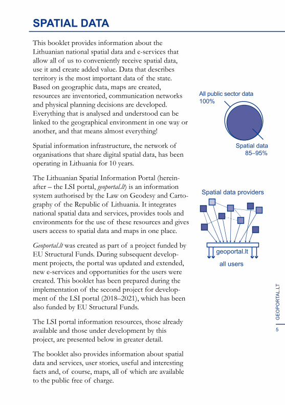
SPATIAL DATAThis booklet provides information about the Lithuanian national spatial data and e-services that allow all of us to conveniently receive spatial data, use it and create added value. Data that describes territory is the most important data of the state. Based on geographic data, maps are created, resources are inventoried, communication networks and physical planning decisions are developed. Everything that is analysed and understood can be linked to the geographical environment in one way or another, and that means almost everything!
Spatial information infrastructure, the network of organisations that share digital spatial data, has been operating in Lithuania for 10 years.
The Lithuanian Spatial Information Portal (herein-after – the LSI portal, geoportal.lt) is an information system authorised by the Law on Geodesy and Carto-graphy of the Republic of Lithuania. It integrates national spatial data and services, provides tools and environments for the use of these resources and gives users access to spatial data and maps in one place.
Geoportal.lt was created as part of a project funded by EU Structural Funds. During subsequent develop-ment projects, the portal was updated and extended, new e-services and opportunities for the users were created. This booklet has been prepared during the implementation of the second project for develop-ment of the LSI portal (2018–2021), which has been also funded by EU Structural Funds.
The LSI portal information resources, those already available and those under development by this project, are presented below in greater detail.
The booklet also provides information about spatial data and services, user stories, useful and interesting facts and, of course, maps, all of which are available to the public free of charge.
Spatial data85–95%
All public sector data100%
Spatial data providers
all users
geoportal.lt
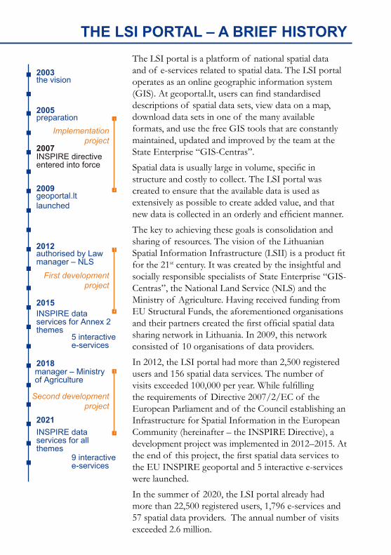
THE LSI PORTAL – A BRIEF HISTORY The LSI portal is a platform of national spatial data and of e-services related to spatial data. The LSI portal operates as an online geographic information system (GIS). At geoportal.lt, users can find standardised descriptions of spatial data sets, view data on a map, download data sets in one of the many available formats, and use the free GIS tools that are constantly maintained, updated and improved by the team at the State Enterprise “GIS-Centras”.
Spatial data is usually large in volume, specific in structure and costly to collect. The LSI portal was created to ensure that the available data is used as extensively as possible to create added value, and that new data is collected in an orderly and efficient manner.
The key to achieving these goals is consolidation and sharing of resources. The vision of the Lithuanian Spatial Information Infrastructure (LSII) is a product fit for the 21st century. It was created by the insightful and socially responsible specialists of State Enterprise “GIS-Centras”, the National Land Service (NLS) and the Ministry of Agriculture. Having received funding from EU Structural Funds, the aforementioned organisations and their partners created the first official spatial data sharing network in Lithuania. In 2009, this network consisted of 10 organisations of data providers.
In 2012, the LSI portal had more than 2,500 registered users and 156 spatial data services. The number of visits exceeded 100,000 per year. While fulfilling the requirements of Directive 2007/2/EC of the European Parliament and of the Council establishing an Infrastructure for Spatial Information in the European Community (hereinafter – the INSPIRE Directive), a development project was implemented in 2012–2015. At the end of this project, the first spatial data services to the EU INSPIRE geoportal and 5 interactive e-services were launched.
In the summer of 2020, the LSI portal already had more than 22,500 registered users, 1,796 e-services and 57 spatial data providers. The annual number of visits exceeded 2.6 million.
2003the vision
2005preparation
2007INSPIRE directiveentered into force
First developmentproject
Second developmentproject
Implementationproject
2009geoportal.ltlaunched
2012authorised by Lawmanager – NLS
2015INSPIRE data services for Annex 2 themes
INSPIRE data services for all themes
2018manager – Ministryof Agriculture
2021
5 interactivee-services
9 interactivee-services
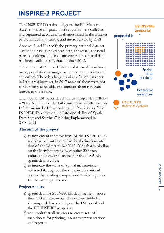
INSPIRE-2 PROJECTThe INSPIRE Directive obligates the EU Member States to make all spatial data sets, which are collected and organised according to themes listed in the annexes to the Directive, available and interoperable by 2021.
Annexes I and II specify the primary national data sets – geodetic base, topographic data, addresses, cadastral parcels, underground and land cover. This spatial data has been available in Lithuania since 2015.
The themes of Annex III include data on the environ-ment, population, managed areas, state enterprises and authorities. There is a large number of such data sets in Lithuania; however, in 2017 most of them were not conveniently accessible and some of them not even known to the public.
The second LSI portal development project INSPIRE-2 – “Development of the Lithuanian Spatial Information Infrastructure by Implementing the Provisions of the INSPIRE Directive on the Interoperability of Spatial Data Sets and Services” is being implemented in 2018–2021.
The aim of the projecta) to implement the provisions of the INSPIRE Di-
rective as set out in the plan for the implementa-tion of the Directive for 2015–2021 that is binding on the Member States, by creating 22 access points and network services for the INSPIRE spatial data themes;
b) to increase the value of spatial information, collected throughout the state, in the national context by creating comprehensive viewing tools for thematic spatial data.
Project resultsa) spatial data for 21 INSPIRE data themes – more
than 100 environmental data sets available for viewing and downloading on the LSI portal and the EU INSPIRE geoportal;
b) new tools that allow users to create sets of map sheets for printing, interactive presentations and reports.
7
GEO
POR
TAL.
LT
Interactivee-services
Spatialdata
services
geoportal.lt
ES INSPIREgeoportal
Results of theINSPIRE-2 project
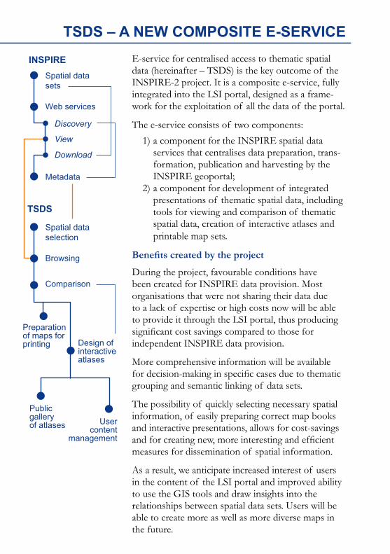
TSDS – A NEW COMPOSITE E-SERVICEE-service for centralised access to thematic spatial data (hereinafter – TSDS) is the key outcome of the INSPIRE-2 project. It is a composite e-service, fully integrated into the LSI portal, designed as a frame-work for the exploitation of all the data of the portal.
The e-service consists of two components:1) a component for the INSPIRE spatial data
services that centralises data preparation, trans-formation, publication and harvesting by the INSPIRE geoportal;
2) a component for development of integrated presentations of thematic spatial data, including tools for viewing and comparison of thematic spatial data, creation of interactive atlases and printable map sets.
Benefits created by the project
During the project, favourable conditions have been created for INSPIRE data provision. Most organisations that were not sharing their data due to a lack of expertise or high costs now will be able to provide it through the LSI portal, thus producing significant cost savings compared to those for independent INSPIRE data provision.
More comprehensive information will be available for decision-making in specific cases due to thematic grouping and semantic linking of data sets.
The possibility of quickly selecting necessary spatial information, of easily preparing correct map books and interactive presentations, allows for cost-savings and for creating new, more interesting and efficient measures for dissemination of spatial information.
As a result, we anticipate increased interest of users in the content of the LSI portal and improved ability to use the GIS tools and draw insights into the relationships between spatial data sets. Users will be able to create more as well as more diverse maps in the future.
Metadata
Web services
Discovery
View
Download
Spatial datasets
TSDS
INSPIRE
Browsing
Comparison
Preparationof maps forprinting Design of
interactiveatlases
Publicgalleryof atlases User
contentmanagement
Spatial dataselection
9
GEO
POR
TAL.
LT
MAP SHEET SETS FOR PRINTINGTSDS – E-service for centralised access to thematic spatial data is the key outcome of the INSPIRE-2 project. It is a composite e-service, fully integrated intothe LSI portal, designed as a framework for the exploitation of all the data of the portal. It is often not enough to explore a map on the screen and there is a need for a printed version. Until now, the users of the LSI portal could save the map view from the screen as an image or as a PDF file suitable for prin-ting. But if the area of interest doesn’t fit in the screen,the pages have to be generated separately. Creating a set of map pages (sheets) requires a lot of time and tedious work. In order to facilitate this task, a map printing tool that gives the user many more options to customise the end product was created during the INSPIRE-2 project as part of the TSDS e-service. The tool will be available free of charge.Even more options for map printing!
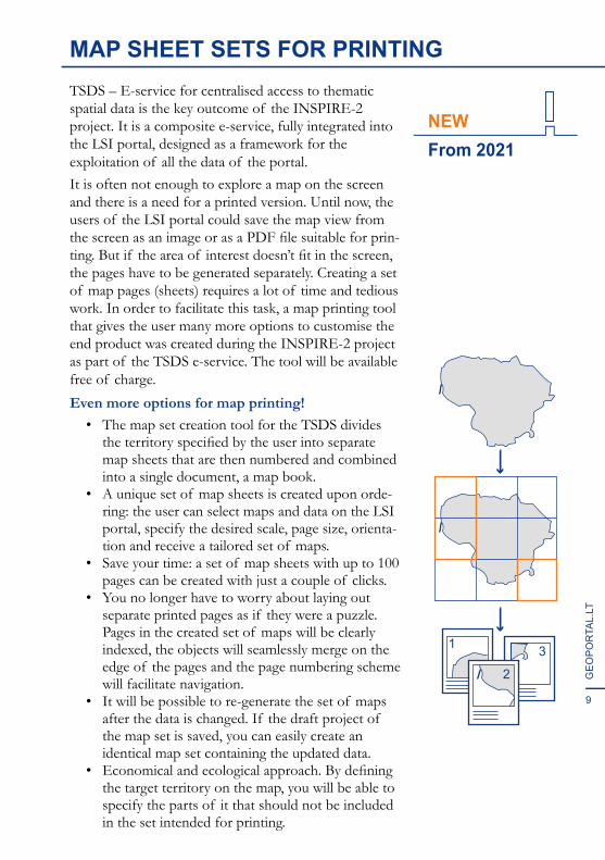
• The map set creation tool for the TSDS divides the territory specified by the user into separate map sheets that are then numbered and combined into a single document, a map book.
• A unique set of map sheets is created upon orde-ring: the user can select maps and data on the LSI portal, specify the desired scale, page size, orienta-tion and receive a tailored set of maps.
• Save your time: a set of map sheets with up to 100 pages can be created with just a couple of clicks.
• You no longer have to worry about laying out separate printed pages as if they were a puzzle. Pages in the created set of maps will be clearly indexed, the objects will seamlessly merge on the edge of the pages and the page numbering scheme will facilitate navigation.
• It will be possible to re-generate the set of maps after the data is changed. If the draft project of the map set is saved, you can easily create an identical map set containing the updated data.
• Economical and ecological approach. By defining the target territory on the map, you will be able to specify the parts of it that should not be included in the set intended for printing.
From 2021 NEW
31
2
10
GEO
POR
TAL.LT
INTERACTIVE ATLASESInteractive atlases are collections of interactive and static maps, pictures, videos and their descriptions – an interactive presentation that dynamically provides diverse information. A free tool of the TSDS e-service allows you to create interactive atlases (presentations) by using the spatial data sets of the LSI portal and your own data.
Possibilities:• Creation of web atlases with the use of
interactive maps. You can insert not only static images of a map, but also dynamic maps with layers that can be enabled/disabled, scalable and scrollable territory;
• A variety of supported content: texts, links, images, videos. If you want, your interactive atlas (presentation) can even have no maps at all!
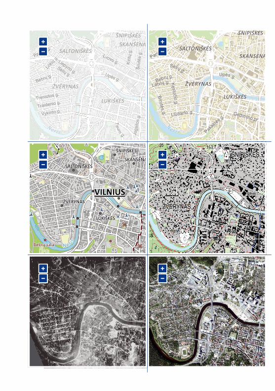
• Comparison maps – atlas pages with two or more maps on a single screen can be created. Different maps can be controlled synchronously – changing the scale or area of one map will change the scale and area of all other maps on the page;
• Object sequence map – points can be marked on the map, with names added, photos and descriptions attached in order to generate an interactive atlas that displays objects in sequence to tell their story;
• An alternative to a representative website is an interactive atlas homepage with content that you have created. There is also an option to create a unique link and share it. Atlas content can be private, public or shared with selected people only;
• Possibilities for cooperation. Create together with others: a possibility to share not only the final result but also grant the editing rights for the co-editors.
From 2021 NEW
ŽVĖRYNASŽVĖRYNAS
LUKIŠKĖSLUKIŠKĖS
ŠNIPIŠKĖSŠNIPIŠKĖS
SKANSENASSKANSENASSALTONIŠKĖSSALTONIŠKĖS
UUppėėss gg..
BBiirruuttėėssgg.. Gedimino pr.
Gedimino pr.
Paribio g.
Paribio g.
Kęstučio g.Kęstučio g.
LLaattvv iiųų gg..
LLiiuubbaarrttoo gg..
BB eebbrrųų gg..
SSėė ll iiųų gg..
PPaakkaa llnnėėss gg ..
Neris
ŽVĖRYNASŽVĖRYNAS
LUKIŠKĖSLUKIŠKĖS
ŠNIPIŠKĖSŠNIPIŠKĖSSKANSENASSKANSENAS
SALTONIŠKĖSSALTONIŠKĖS
NerisKK
ii nntt ųų
gg ..
Paribio g.
Paribio g.
TTaauurroo
gg..
Vykinto g.Vykinto g.
Treniotos g.Treniotos g.
Traidenio g.Traidenio g.
Šilu
tės
g.Ši
lutė
s g.
Liepyno g.
Liepyno g.
Lokių
g.
Lokių
g.
Joga
ilos
g.Jo
gailo
s g.
Bebrų g.Bebrų g.
Lvovo g.Lvovo g.
Sėlių g.
Sėlių g. Upės g.Upės g.
ŠNIPIŠKĖSŠNIPIŠKĖSŠNIPIŠKĖSŠNIPIŠKĖS
SS
NAS NAS
13
GEO
POR
TAL.
LT
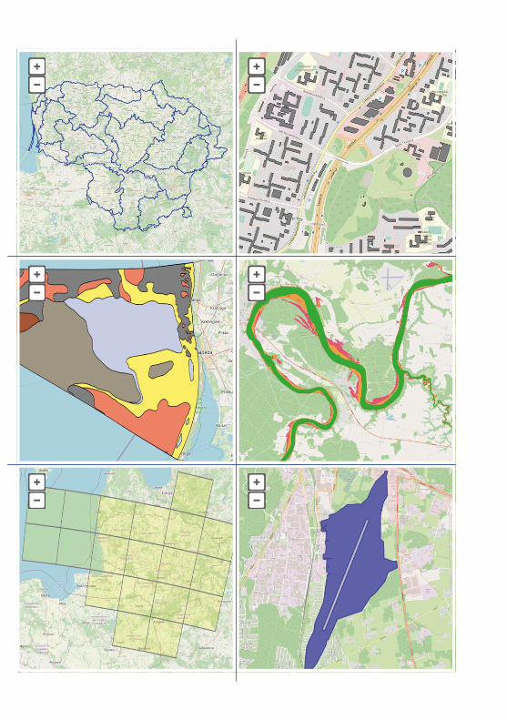
THE INSPIRE DATA SETSData sets, provided by more than 100 Lithuanian organisations, were combined during the INSPIRE-2 project, and access points to the INSPIRE data sets with 21 new themes were created. This way, we made it possible to fulfil the commitment of the state to publish by October 2021 interoperable spatial data sets that had been identified earlier. A total of 34 data sets of the INSPIRE themes are provided: 9 themes of Annex I (primary geographical data), 4 themes of Annex II (altitudes, geology, land cover, and orthophotos) and 21 themes of Annex III (various thematic data). In the EU INSPIRE geoportal, we can see that Lithuania provides more than 34 spatial data sets. This is because some data sets of primary sources are provided with restrictions and cannot be combined with the data sets that are provided without restrictions. Furthermore, some spatial data sets identified as having a high priority cannot be assigned to any of the INSPIRE themes. The INSPIRE spatial data sets of Lithuania cover the entire territory of the state and are not divided into administrative units.
Several INSPIRE data sets of Lithuania are provided for viewing only, and only a sample of the data is available for download, because a fee must be paid for the data itself. These are data sets of such themes as “Cadastral parcels”.
The INSPIRE data sets are provided in the open GML32 format in EPSG: 4258 (ETRS89) coordi-nate system. The data set, downloaded from the EU INSPIRE geoportal, can be viewed using QGIS open source software (qgis.org/downloads).
In order to see all the attribute information of a complex structure data set, the data should be viewed using software tools that can collect the code list values stored in the GML as Xlink references and provide all of the complex GML features.
inspire-geoportal.ec.europa.eu
Thematic data viewer
Priority data viewer
www.qgis.org

14
GEO
POR
TAL.LT
15
GEO
POR
TAL.
LT
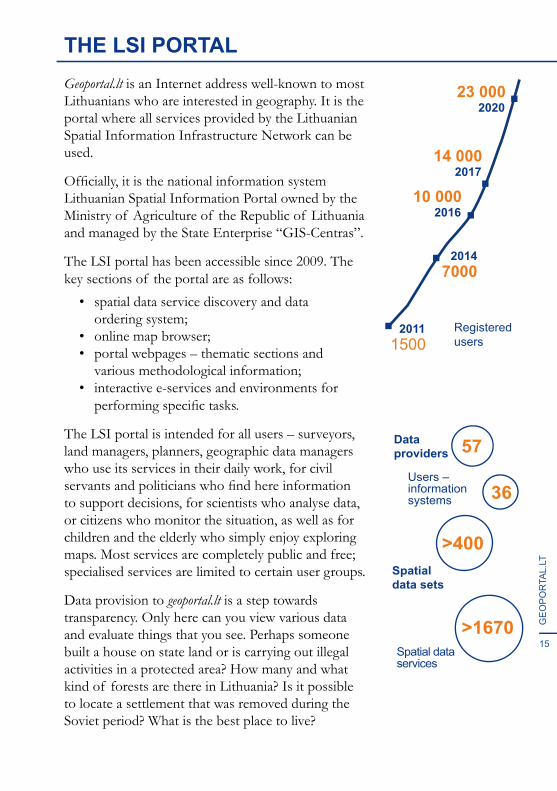
THE LSI PORTALGeoportal.lt is an Internet address well-known to most Lithuanians who are interested in geography. It is the portal where all services provided by the Lithuanian Spatial Information Infrastructure Network can be used.
Officially, it is the national information system Lithuanian Spatial Information Portal owned by the Ministry of Agriculture of the Republic of Lithuania and managed by the State Enterprise “GIS-Centras”.
The LSI portal has been accessible since 2009. The key sections of the portal are as follows:
• spatial data service discovery and data ordering system;
• online map browser; • portal webpages – thematic sections and
various methodological information;• interactive e-services and environments for
performing specific tasks.
The LSI portal is intended for all users – surveyors, land managers, planners, geographic data managers who use its services in their daily work, for civil servants and politicians who find here information to support decisions, for scientists who analyse data, or citizens who monitor the situation, as well as for children and the elderly who simply enjoy exploring maps. Most services are completely public and free; specialised services are limited to certain user groups.
Data provision to geoportal.lt is a step towards transparency. Only here can you view various data and evaluate things that you see. Perhaps someone built a house on state land or is carrying out illegal activities in a protected area? How many and what kind of forests are there in Lithuania? Is it possible to locate a settlement that was removed during the Soviet period? What is the best place to live?
2011
202023 000
201714 000
201610 000
Registeredusers1500
20147000
Dataproviders
Users – informationsystems
Spatialdata sets
Spatial dataservices
57
>400
>1670
36
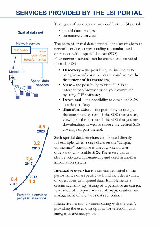
SERVICES PROVIDED BY THE LSI PORTALTwo types of services are provided by the LSI portal:
• spatial data services;• interactive e-services.
The basis of spatial data services is the set of abstract network services corresponding to standardised operations with a spatial data set (SDS).Four network services can be created and provided for each SDS:
• Discovery – the possibility to find the SDS using keywords or other criteria and access the document of its metadata;
• View – the possibility to view SDS in an internet map browser or on your computer by using GIS software;
• Download – the possibility to download SDS as a data package;
• Transformation – the possibility to change the coordinate system of the SDS that you are viewing or the format of the SDS that you are downloading, as well as choose the desired SDS coverage or part thereof.
Such spatial data services can be used directly, for example, when a user clicks on the “Display on the map” button or indirectly, when a user orders a downloadable SDS. These services can also be activated automatically and used in another information system.
Interactive e-service is a service dedicated to the performance of a specific task and includes a variety of operations with spatial data. It implements a certain scenario, e.g. issuing of a permit or an extract, formation of a report or a set of maps, creation and management of the user’s data set online.
Interactive means “communicating with the user”, providing the user with options for selection, data entry, message receipt, etc.
20204,5
Provided e-servicesper year, in millions
20130,4 2015
1,3
20172,4
20183,2
Spatial data set
Network services
Spatial dataservices
Metadata
discovery viewdownload
transformation
17
GEO
POR
TAL.
LT
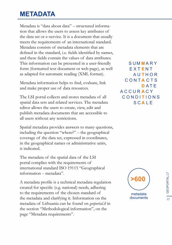
METADATAMetadata is “data about data” – structured informa-tion that allows the users to assess key attributes of the data set or e-service. It is a document that usually meets the requirements of an international standard. Metadata consists of metadata elements that are defined in the standard, i.e. fields identified by names, and these fields contain the values of data attributes. This information can be presented in a user-friendly form (formatted text document or web page), as well as adapted for automatic reading (XML format).
Metadata information helps to find, evaluate, link and make proper use of data resources.
The LSI portal collects and stores metadata of all spatial data sets and related services. The metadata editor allows the users to create, view, edit and publish metadata documents that are accessible to all users without any restrictions.
Spatial metadata provides answers to many questions, including the question “where?” – the geographical coverage of the data set, expressed in coordinates, in the geographical names or administrative units, is indicated.
The metadata of the spatial data of the LSI portal complies with the requirements of international standard ISO 19115 “Geographical information – metadata”.
A metadata profile is a technical metadata regulation created for specific (e.g. national) needs, adhering to the requirements of the chosen standard of the metadata and clarifying it. Information on the metadata of Lithuania can be found on geoportal.lt in the section “Methodological information”, on the page “Metadata requirements”.
metadatadocuments
>600
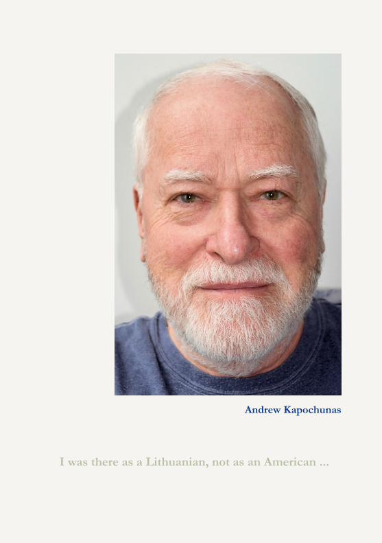
Andrew Kapochunas
I was there as a Lithuanian, not as an American ...
I have lived in 21 different places since I was born in 1947 in a German Displaced Persons camp, and I defined myself for most of my life as a rootless, displaced person – a “perkeltas žmogus.” In kindergarten in New York City, to which my family immigrated in 1949, the teachers openly called my sister and me “the little Nazis” because we were born in Germany. I became determined not to be defined by my accent – refusing to speak to my parents in Lithuanian since I was five years old, or by my name: at seven, I told my teacher that my name was Andrew, not Andrius, and so my first name was forever changed, without the benefit of legal intervention.
Growing up, unlike my three sisters, I participated in no Lithuanian youth activities and had no Lithuanian friends, by choice. After graduating college, in 1969, I spent a year travelling through Europe. On the outgoing flight, headed for Berlin, and on the spur of the moment, I decided to present myself as a German artist, returning from a visit to the US. I had studied German in school, and spoke it well enough to pass as one not only during the flight, but for half a year in Europe. In 1969, given the war in Vietnam, and resulting negative attitudes to Americans, there were advantages to being perceived as German. Two events led to a change: 1) Americans landed on the moon in July 1969 – I watched it on TV while eating dinner in a Paris bistro – and, overnight, it was again OK to be American in Europe; 2) my girlfriend from New York City, with whom I travelled that year, bought a Vespa scooter with Italian plates so that we wouldn’t have to keep hitch-hiking. So, I became Italian – not that I spoke the language, but neither did anyone else but Italians. With enough hand gestures and English spoken with a heavy Italian accent I learned from Mafia movies, I could and did pass.
Back in New York, a typical comment made to me -- not as a compliment -- by co-workers, was that I was a chameleon, consistently inconsistent in every regard, as though in a unique kind of witness protection program. My wife tells people that when we married, in 1975, I wasn’t Lithuanian. That rootlessness began to change only in 1988, when I accidentally came across and purchased an antique map of Lithuania. Staring at that map in our dining room, and my daughter’s interest in collecting Lithuanian stamps, I began thinking of myself as Lithuanian. For the first time, I identified myself as someone with roots in a specific place: my father’s family in Žiežmariai (where I have recently been able to trace back family to 1735), and my mother’s family in Sangailiškiai near Kaunas. With the advent of the Internet, and of antique Lithuanian maps for sale on eBay, I began searching for, downloading, and saving images of antique Lithuanian maps, not having a clear idea of what I would do with them.
MAPS HELPED THIS IMMIGRANT FIND HIS PLACE IN THE WORLD
19
GEO
POR
TAL.
LT
I finally created a website, LithuanianMaps.com, in 2008, adding those saved images, and updating it weekly with new images, gaining, initially, over 3,000 visitors every week. (Today, it has over 4,000 images on 65 pages.).
In January 2016, I gave an illustrated presentation at the main branch of the New York Public Library which was co-sponsored by the New York Map Society (of which I was, and still am, Secretary and Webmaster): “How Maps and Map Collecting Helped an Immigrant Find His Place in the World.” My transformation was nearly complete. A year later, in February 2017, in conjunction with an exhibition of some of my antique maps of Lithuania at the Lithuanian Consulate in New York City, I gave a revised version of that talk that included much more on my family and on my Lithuanian heritage – to an audience of not just friends and family, but to well over 50 Lithuanians from the New York area, all of them new to me. In July that same year I proudly represented the Lithuanian Cartographic Society in Washington, DC, at the International Cartographic Conference. I was there as a Lithuanian, not as an American.
20
GEO
POR
TAL.LT
Lithuanian Cartographic Societylietuvoskartografija.lt
21
GEO
POR
TAL.
LT
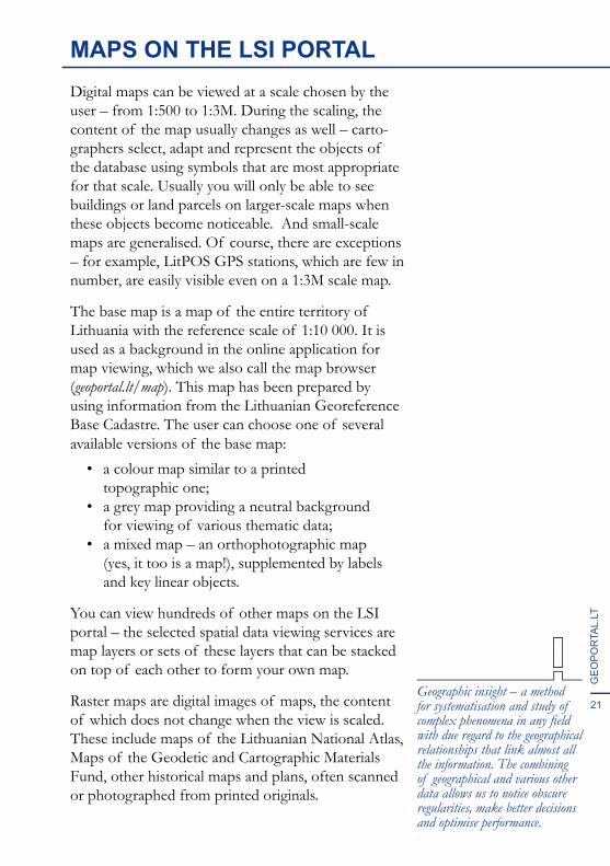
MAPS ON THE LSI PORTALDigital maps can be viewed at a scale chosen by the user – from 1:500 to 1:3M. During the scaling, the content of the map usually changes as well – carto-graphers select, adapt and represent the objects of the database using symbols that are most appropriate for that scale. Usually you will only be able to see buildings or land parcels on larger-scale maps when these objects become noticeable. And small-scale maps are generalised. Of course, there are exceptions – for example, LitPOS GPS stations, which are few in number, are easily visible even on a 1:3M scale map.
The base map is a map of the entire territory of Lithuania with the reference scale of 1:10 000. It is used as a background in the online application for map viewing, which we also call the map browser (geoportal.lt/map). This map has been prepared by using information from the Lithuanian Georeference Base Cadastre. The user can choose one of several available versions of the base map:
• a colour map similar to a printed topographic one;
• a grey map providing a neutral background for viewing of various thematic data;
• a mixed map – an orthophotographic map (yes, it too is a map!), supplemented by labels and key linear objects.
You can view hundreds of other maps on the LSI portal – the selected spatial data viewing services are map layers or sets of these layers that can be stacked on top of each other to form your own map.
Raster maps are digital images of maps, the content of which does not change when the view is scaled. These include maps of the Lithuanian National Atlas, Maps of the Geodetic and Cartographic Materials Fund, other historical maps and plans, often scanned or photographed from printed originals.
Geographic insight – a method for systematisation and study of complex phenomena in any field with due regard to the geographical relationships that link almost all the information. The combining of geographical and various other data allows us to notice obscure regularities, make better decisions and optimise performance.
23
GEO
POR
TAL.
LT
THE LSI PORTAL MAP BROWSERGIS software has been used only relatively recently – it came into widespread use only in the late 20th century. Even now, for a non-specialist it is quite complicated, it requires considerable computer resources and commercial versions are quite expensive.
The map browser is a GIS that is available online. In order to use it, only a standard web browser is required. No additional installations are needed.
The LSI portal map browser is available at geoportal.lt/map. It was created and is constantly supported, updated and improved by the State Enterprise “GIS-Centras”. The user can use the desired data view services in the browser by adding them as layers of the map content.
The base map, also known as the geoportal.lt background map, is updated every month. It was created from the data of the Lithuanian Georeference Base Cadastre. There are several versions of the base map with different designs. The level of detail of the map corresponds to a scale of 1:10 000. An orthophotographic map with the level of detail of 1:5 000 scale is also available as background for viewing other data.
Map browser tools allow you to perform various operations with the viewed data, i.e. view object data, measure distances and areas, draw a route and terrain profile, and compare two maps in the same window. You can search for objects by name and search for maps or spatial data sets by keywords or other features.
The solutions of the LSI portal map browser are reusable. A registered user can save a generated map, create one or more links on the map and share them. It is very easy to embed such a map on your web page – the required code is generated automatically and is free of charge.
that one look at a map is worth many pages of text. Humans are innately predisposed to notice various spatial relations that have not been previously seen.Scientists have still not found the reason for this yet.
Did you know ...

THE TOOLS OF MAP BROWSERP
rofil
e of
the
terr
ain
Mea
sure
men
t of a
n ar
eaR
oute
pla
nnin
g
Maršrutai
25
GEO
POR
TAL.
LT
GEOPORTAL.LT MOBILE APPMore than 400 maps on your phone!
The LSI portal mobile app for Android smartphones is useful for both professionals and cartography enthusiasts. First of all, it is a convenient tool when working in the field. No more carrying around a pile of drawings, maps and navigation equipment. You can see your location on your phone in the background of all geoportal.lt maps and data that you uploaded. This way the app helps to easily navigate in space and quickly find not only objects that are clearly visible (such as electric poles), but also things hidden underground or existing only by mutual agreement (such as boundaries of protected areas). Mark the location of a completed task on the map of the app right away – it is much safer than writing location coordinates on a piece of paper that can be blown away by the wind at any time.
After you take off your work clothes, the app can also quickly transform into a leisure assistant. It will help you plan the most convenient, shortest route to the nearest lake, measure its length, show the best spots for fishing or a nearby hill-fort you haven’t yet visited.
If you are more of a city person, the app will help you discover museums and cultural heritage sites that you somehow never noticed before and even let you take a walk through the streets of the historical city. Let us tell you a secret – this mobile app allows you to see and learn a lot of things without even leaving home.
TOP 5 of the mobile app:1) viewing geoportal.lt maps while seeing your
location at the same time;2) route planning;3) measuring length and area;4) uploading your spatial data;5) object tagging.
that if you get lost in the forest, you can call the emergency line and tell the rescuers the number of your forest quarter, which can be found on a pole marking the quarter line.
Did you know ...
Get it on Google Play
26
GEO
POR
TAL.LT
ANTRAŠTĖ
27
GEO
POR
TAL.
LT
SPATIAL DATA SETSSpatial data sets are important parts of the national information resources. These are systematically organised data sets with a purpose and a unique name. They contain information about objects that are associated with a location, whether on, under or above the land surface. Objects can be real (forests, roads) or national (for example, administrative boundaries).
When considering spatial data sets, their detail, completeness and coverage are important. Data sets of the same theme, depending on these aspects, can be very different. Data stored in data sets that cover a large territory are often less detailed. Extremely high-precision data sets often cover only small territories.
Spatial data sets can be primary or derived. Primary data is collected by direct measurement or use of remote research data – this is the most accurate and reliable data. Derived data sets are obtained by generalising, collating or supplementing data from primary sources.
National primary data sources are registers, cadastres and information system data sets. Information about them can be found in the Lithuanian Register of Registers and of State Information Systems (registrai.lt).
Georeference base cadastre is a national cadastre in which data necessary for the preparation of topographic maps of Lithuania and other thematic maps is collected.
The official national spatial data set includes natural and anthropogenic objects of the territory of the Republic of Lithuania, its exclusive economic zone and the continental shelf in the Baltic Sea.
Lithuania, summer of 2020
27595
informationsystems
registers
Maps are like milk:their information is perishable,and it is wise to checkthe date.
M. Monmonier
GEOREFERENCE BASE CADASTREGeoreference base cadastre (GRBC) is the primary set of national spatial data, the national cadastre in which natural and anthropogenic objects of the land surface are registered:
• axial lines of roads, streets and railways;• axial lines of rivers, canals and ditches;• the boundary of the territory of the Republic
of Lithuania, its exclusive economic zone and the continental shelf in the Baltic Sea;
• the boundaries of the Baltic Sea, the Curonian Lagoon, lakes, ponds and artificial impassable water bodies;
• building contours;• land boundaries;• geodetic control points.
Generation of high-quality topographic and various thematic maps requires not only the main GRBC objects, but also other information that is listed in the GRBC specification:
• nomenclature sheets of maps;• administrative boundaries;• forest quarter lines, clearings, tree strips;• other terrain and landscape objects;• high voltage power transmission lines;• gas and oil pipelines;• aeronavigation obstacles;• cultural heritage sites.
The GRBC data is constantly updated. A new version is provided on the LSI portal every month.
The GRBC is owned by the Ministry of Agriculture of the Republic of Lithuania and managed by the State Enterprise “GIS-Centras”.
The GRBC stores official, up-to-date and most accurate data of the geographical base, covering the entire territory of Lithuania.
Became operational
Reference scale
July 1, 2013
1: 10 000Number of data layers
21
land use polygons
lakes and ponds
toponyms
189 000
1 865 800
63 500
kilometres of roads
kilometres of railways
154 500
4 507
29
GEO
POR
TAL.
LT
The GRBC data is used to compile sets of smaller-scale georeference spatial data, topographic maps, base maps of the LSI portal and other portals, and various thematic maps. By using the GRBC data, various other data can be linked to a location. The GRBC data is used by all state institutions.
Only objects visible on an orthophotographic map or on the site are registered in the GRBC, regardless of the legal basis for their appearance, disappearance or change. Other information provided in the GRBC specification is collected from different data sources.
The GRBC data sources:• orthophotographic maps;• data of land surface remote scanning;• data of the national geodetic base;• municipal spatial data sets;• data of cadastral measurements (when the
persons performing measurements identify inaccuracies in the GRBC data);
• data from inspections carried out at a location by a GRBC manager.
The GRBC data is harmonised with the data of related registers and information systems:
• the names of rivers, lakes and ponds of national significance correspond to the names in the Cadastre of Rivers, Lakes and Ponds;
• street names correspond to the names in the Address Register;
• the numbers and categories of roads of national significance correspond to the numbers and categories in the Lithuanian Road Information System.
ORT10LT
GDR50LTGDR250LTERMEGM
GRBC
DATA FROMPRIMARY
SOURCES
MAPS
vectorisation
generalisation
30
GEO
POR
TAL.LT
NATIONAL REFERENCE DATAOn the LSI portal, we provide the following primary national data, covering the territory of the Republic of Lithuania:
1. GRPK (until 01-01-2018 – GDR10LT) – Georeference Base Cadastre data set;
2. GDR50LT – georeference spatial data set at scale 1:50 000;
3. GDR250LT – georeference spatial data set at scale 1:250 000;
4. GDB250LT-SR – digital raster topographic map at scale 1:250 000;
5. EBM_100LT – georeference spatial data set of the territory of Lithuania according to the requirements of the international project EuroBoundaryMap at scale 1:1 000 000;
6. ERM_250LT – georeference spatial data set according to the requirements of the international project EuroRegionalMap at scale 1:250 000;
7. EGM_1000LT – georeference spatial data set of the territory of Lithuania according to the requirements of the international project EuroGlobalMap at scale 1:1 000 000;
8. TOP50LKS topographic map in the LKS-94 coordinate system at scale 1:50 000;
9. GPDR – national geodetic base data set; 10. GV_DRLT – spatial data set of geographical
place names;11. Geoid model LIT15G of the territory of the
Republic of Lithuania, linked to the Lithuanian state altitude system LAS07.
Sea maps at scale 1:200 000 (22006-L, 82001) and 1:225 000 (82002), and orthophotographic maps and digital spatial data from land surface laser scanning points are provided as well.
that when ordering the download-able data from geoportal.lt, you can choose its coverage, layers, coordinate system and one of the available file formats.
Did you know ...
The main spatial data formats are:
.dwg – AutoCAD format;
.gdb – ESRI (ArcGIS) file geodatabase;.gml – an XML-based open Geography Markup Language for geographic data, suitable for a wide variety of data types in a single data set;.shp – ESRI GIS data set, open format.
31
GEO
POR
TAL.
LT
FOR DATA USERSSpatial data may be disseminated in accordance with the General Conditions for the Use of Spatial Data or in accordance with data use Agreements on Data Use.
The General Conditions for the Use of Spatial Data, which are accepted by users when they start to use the data, can be found in the “Help” section ofgeoportal.lt. Information on the applicable restrictionsfor use is provided in the metadata (field “Restrictions”).
When ordering certain data, the user must enter into agreements for use. In some cases, it may be necessary to confirm the identity of the user during the conclu-sion of the agreement. Information about data orders is available to the user in the “My Orders” tab in the “My Portal” section of geoportal.lt.
Digital or printed material, created by using all or part of the data obtained, must indicate the title, copyright, date, and the source of the data, for example:
Lithuanian wetland and peatland data set.© The Lithuanian Fund for Nature. 2020. www.geoportal.lt
Information about the data provider is in the metadata field “Services/resource developer contact details”. Copyrights are also indicated in the “Copyright Infor-mation” tab in the “Methodological Information” section of geoportal.lt.
If the user is a legal entity, it must submit a written request to the portal manager, including a list of authorised persons, indicating name, surname and login name of each authorised person. Legal entities may also enter into agreements for the provision of direct services of the LSI portal – under such agreements, the services of the LSI portal are provided to information systems and apps.
The LSI portal is only a data access point. The content, form and nature of the data depend on the data provider and may be changed without prior notice to the user.
that users of geoportal.lt can report data errors that they happen to notice, by indicating the location of such errors on the map. Errors are then reported to the data providers.
Did you know ...
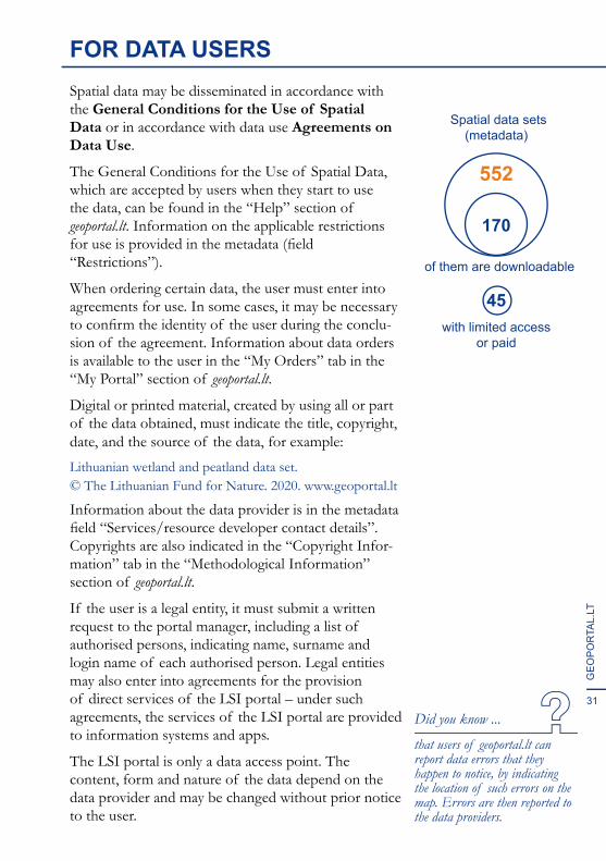
Spatial data sets(metadata)
of them are downloadable
with limited accessor paid
552
170
45

32
GEO
POR
TAL.LT
33
GEO
POR
TAL.
LT
INTERACTIVE SERVICES ON THE LSI PORTALSpatial data services are relatively simple – the user finds and views or downloads the desired data set. Interactive services allow you to perform operations that are much more complex, have their own envi-ronments, toolkits and documents that these services create. They implement certain real-life scenarios, ensuring two-way communication with the user.
Spatial data processing services. These are services designed to build products based on user’s spatial data.
• Spatial information management system; • TDS – e-service for centralised access to
thematic spatial data (being developed during the INSPIRE-2 project, it will be functional from 2021).
Information services. These are services that allow the user to explore certain types of information resources, receive reports and provide comments.
• Review and analysis of satellite data;• Place name management service;• Provision of geodetic, cartographic and
land management graphic materials;• Land fund analysis and evaluation;• Notifications about neglected land.
Administrative services – services for the perfor-mance of administrative procedures in the digital space governed by law.
• State land administration service;• Services of granting of consent by the NLS;• Issuing of conclusions on non-conformity
of land plots with area and/or boundaries of cadastral parcels;
• GRBC verification service for measurement data compliance;
• Service for providing, accepting and coordinating information of topographic plans (until 2021).
A public service is a service provided to persons in the course of performing state or municipal functions and programmes assigned by law.
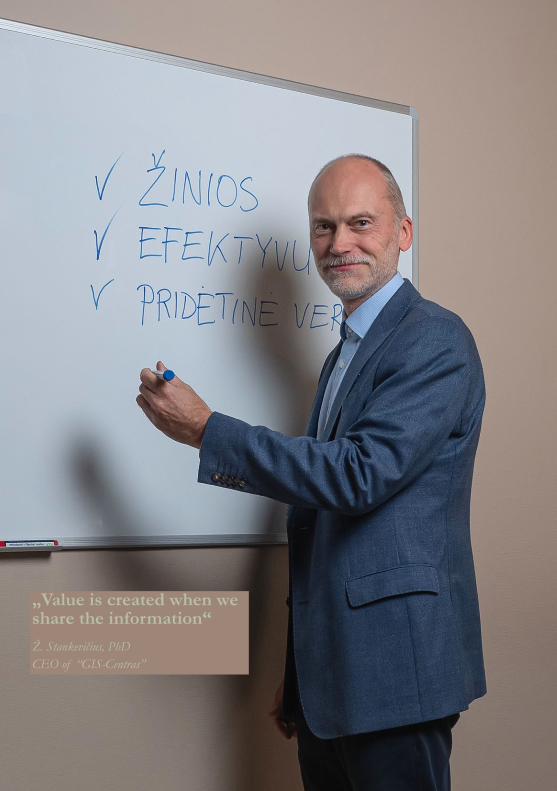
„Value is created when we share the information“Ž. Stankevičius, PhDCEO of “GIS-Centras”
35
GEO
POR
TAL.
LT
THE LSI PORTAL – BENEFITSNowadays, “geoportal” has already become a common word. Most countries have platforms for sharing spatial information resources. Such platforms are also created by municipalities and regions.Geoportals may be of different levels of complexity and maturity.
1) A portal as a directory of metadata. This is the first step in consolidation of spatial information resources, the ability to provide information on data collected in the state in one place. Metadata is usually provided publicly and is free of charge.
2) Data access point where metadata can not only be accessed, but data sets can be downloaded as well. The amount of data you can download can range from several primary data sets to hundreds or even thousands of data sets with various themes.
3) A platform where spatial data can not only be downloaded, but also viewed on a map, using measurement, route calculation and other tools of simple analysis.
4) A fully developed data review and analysis platform to provide a variety of spatial data services, including interactive ones. Its users have the ability to create and manage their own spatial data.
The LSI portal is a system of type four. It provides not only the basic spatial data services, but also a set of administrative services that are being deve-loped and consolidated, creating the potential for new information systems that take advantage of existing solutions.
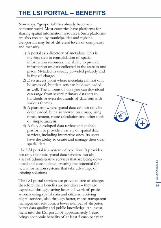
The LSI portal services are provided free of charge;therefore, their benefits are not direct – they areexpressed through saving hours of work of profe-ssionals using spatial data and citizens receiving digital services, also through better, more transparent management solutions, a lower number of disputes, better data quality and public knowledge. An invest-ment into the LSI portal of approximately 1 euro brings economic benefits of at least 5 euro per year.
36
GEO
POR
TAL.LT
THE FUTURE OF THE LSIIOver ten years of development, we have learned a lot about the use of spatial data in Lithuania. The LSI portal has also contributed to a significant increase in the use of spatial data and the geographical literacy of society. It is rewarding that the users of the LSI portal are not indifferent. They provide not only critical comments, but also useful suggestions on how existing services can be improved.
However, in many areas – healthcare, education, territorial planning – the knowledge potential that spatial data can provide is not yet fully used. Often, spatial data remains in tables or report documents and it is seldom thought to link data from a specific field to various other geographic data. E-services and systems that are insufficiently linked are still being created and developed.
However, once it is seen how useful data on a map is, it cannot be forgotten.
Every year, about 30 new data sets become available on the LSI portal. When data is available, it will inevitably be used, sooner or later. Research stimulates curiosity and the need for new information.
New data is created. The life cycle of spatial infor-mation infrastructure is never-ending. How might we want it to look like in another decade?
The LSII vision:• all processors of important Lithuanian spatial
data share them on the LSI portal;• all national spatial data is provided free of
charge – for business purposes as well;• a clear mechanism is created for providing and
using sensitive and restricted data;• more spatial data of various fields is
harmonised – mutually linked and coordinated;• more data is provided by business and
non-governmental organisations;• every citizen knows what the LSII is.
„We believe in what we do!“Geoportal.lt team
“To put a city in a book, to put the world on one sheet of paper -- maps are the most condensed humanized spaces of all...They make the landscape fit indoors, make us masters of sights we can’t see and spaces we can’t cover.”
Robert Harbison, Eccentric Spaces
“I speak to maps. And sometimes they say something back to me. This is not as strange as it sounds, nor is it an unheard of thing. Before maps, the world was limitless. It was maps that gave it shape and made it seem like territory, like something that could be possessed, not just laid waste and plundered. Maps made places on the edges of the imagination seem graspable and placable.”
Abdulrazak Gurnah, By the Sea
!R
!P
!.!.
!R
!R
!R
!R
!.
!.
!.
!.
!.
!.
!R
!R
!.
!.
!.
!.
!.
!.
!.
!R
!.
!R
!.
!.
!.
!.
!.
!.
!.
!.
!.
!.
!.
!.
!.
!.
!.
!.
!.
!.
!.
!.
!.
!.
!.
!.
!.
!.
!.
!.!.
L A T VI J
A
BA
LT
AR
US
IJ
A
L E N K I J A
R U S I J AVILNIUS
KAUNAS
TELŠIAI
PANEVĖŽYS
ŠIAULIAI
KLAIPĖDA
MARIJAMPOLĖ
UTENA
TAURAGĖ
ALYTUS
ŠILALĖ
JURBARKAS
RASEINIAI
JONIŠKIS
PRIENAI
ŠIRVINTOS
JONAVA
MAŽEIKIAI
TRAKAI
PALANGA
SKUODAS
IGNALINA
PLUNGĖ ROKIŠKIS
GARGŽDAI
KRETINGA
NAUJOJIAKMENĖ
ŠVENČIONYS
PAKRUOJIS
BIRŠTONAS
VISAGINAS
PASVALYS
ELEKTRĖNAIVILKAVIŠKIS
DRUSKININKAI
NERINGA
KALVARIJA
RADVILIŠKIS
PAGĖGIAI
ŠILUTĖ
UKMERGĖ
KAIŠIADORYSKAZLŲRŪDA
ZARASAI
BIRŽAI
MOLĖTAIKĖDAINIAI
VARĖNALAZDIJAI
KELMĖ
KUPIŠKIS
RIETAVAS
ŠAKIAI
ŠALČININKAI
ANYKŠČIAI
Ba
lt
ij
os
jū
ra
K urš ių
mario
s
!R
!P
!.!.
!R
!R
!R
!R
!.
!.
!.
!.
!.
!.
!R
!R
!.
!.
!.
!.
!.
!.
!.
!R
!.
!R
!.
!.
!.
!.
!.
!.
!.
!.
!.
!.
!.
!.
!.
!.
!.
!.
!.
!.
!.
!.
!.
!.
!.
!.
!.
!.
!.
!.!.
L A T V I J A
B A L T A R U S I J A
L E N K I J A
R U S I J AVILNIUS
KAUNAS
TELŠIAI
PANEVĖŽYS
ŠIAULIAI
KLAIPĖDA
MARIJAMPOLĖ
UTENA
TAURAGĖ
ALYTUS
ŠILALĖ
JURBARKAS
RASEINIAI
JONIŠKIS
PRIENAI
ŠIRVINTOS
JONAVA
MAŽEIKIAI
TRAKAI
PALANGA
SKUODAS
IGNALINA
PLUNGĖ ROKIŠKIS
GARGŽDAI
KRETINGA
NAUJOJIAKMENĖ
ŠVENČIONYS
PAKRUOJIS
BIRŠTONAS
VISAGINAS
PASVALYS
ELEKTRĖNAIVILKAVIŠKIS
DRUSKININKAI
NERINGA
KALVARIJA
RADVILIŠKIS
PAGĖGIAI
ŠILUTĖ
UKMERGĖ
KAIŠIADORYSKAZLŲRŪDA
ZARASAI
BIRŽAI
MOLĖTAIKĖDAINIAI
VARĖNALAZDIJAI
KELMĖ
KUPIŠKIS
RIETAVAS
ŠAKIAI
ŠALČININKAI
ANYKŠČIAIB a l t i j o s j ūr a
K urš ių m arios
!R
!P
!.!.
!R
!R
!R
!R
!.
!.
!.
!.
!.
!.
!R
!R
!.
!.
!.
!.
!.
!.
!.
!R
!.
!R
!.
!.
!.
!.
!.
!.
!.
!.
!.
!.
!.
!.
!.
!.
!.
!.
!.
!.
!.
!.
!.
!.
!.
!.
!.
!.
!.
!.!.
L A T V I J A
B A L T A R U S I J A
L E N K I J A
R U S I J AVILNIUS
KAUNAS
TELŠIAI
PANEVĖŽYS
ŠIAULIAI
KLAIPĖDA
MARIJAMPOLĖ
UTENA
TAURAGĖ
ALYTUS
ŠILALĖ
JURBARKAS
RASEINIAI
JONIŠKIS
PRIENAI
ŠIRVINTOS
JONAVA
MAŽEIKIAI
TRAKAI
PALANGA
SKUODAS
IGNALINA
PLUNGĖ ROKIŠKIS
GARGŽDAI
KRETINGA
NAUJOJIAKMENĖ
ŠVENČIONYS
PAKRUOJIS
BIRŠTONAS
VISAGINAS
PASVALYS
ELEKTRĖNAIVILKAVIŠKIS
DRUSKININKAI
NERINGA
KALVARIJA
RADVILIŠKIS
PAGĖGIAI
ŠILUTĖ
UKMERGĖ
KAIŠIADORYSKAZLŲRŪDA
ZARASAI
BIRŽAI
MOLĖTAIKĖDAINIAI
VARĖNALAZDIJAI
KELMĖ
KUPIŠKIS
RIETAVAS
ŠAKIAI
ŠALČININKAI
ANYKŠČIAIB a l t i j o s j ū ra
K urš ių m arios
!R
!P
!.!.
!R
!R
!R
!R
!.
!.
!.
!.
!.
!.
!R
!R
!.
!.
!.
!.
!.
!.
!.
!R
!.
!R
!.
!.
!.
!.
!.
!.
!.
!.
!.
!.
!.
!.
!.
!.
!.
!.
!.
!.
!.
!.
!.
!.
!.
!.
!.
!.
!.
!.!.
L A T VI J
A
BA
LT
AR
US
IJ
A
L E N K I J A
R U S I J AVILNIUS
KAUNAS
TELŠIAI
PANEVĖŽYS
ŠIAULIAI
KLAIPĖDA
MARIJAMPOLĖ
UTENA
TAURAGĖ
ALYTUS
ŠILALĖ
JURBARKAS
RASEINIAI
JONIŠKIS
PRIENAI
ŠIRVINTOS
JONAVA
MAŽEIKIAI
TRAKAI
PALANGA
SKUODAS
IGNALINA
PLUNGĖ ROKIŠKIS
GARGŽDAI
KRETINGA
NAUJOJIAKMENĖ
ŠVENČIONYS
PAKRUOJIS
BIRŠTONAS
VISAGINAS
PASVALYS
ELEKTRĖNAIVILKAVIŠKIS
DRUSKININKAI
NERINGA
KALVARIJA
RADVILIŠKIS
PAGĖGIAI
ŠILUTĖ
UKMERGĖ
KAIŠIADORYSKAZLŲRŪDA
ZARASAI
BIRŽAI
MOLĖTAIKĖDAINIAI
VARĖNALAZDIJAI
KELMĖ
KUPIŠKIS
RIETAVAS
ŠAKIAI
ŠALČININKAI
ANYKŠČIAI
Ba
lt
ij
os
jū
ra
K urš ių
mario
s
!R
!P
!.!.
!R
!R
!R
!R
!.
!.
!.
!.
!.
!.
!R
!R
!.
!.
!.
!.
!.
!.
!.
!R
!.
!R
!.
!.
!.
!.
!.
!.
!.
!.
!.
!.
!.
!.
!.
!.
!.
!.
!.
!.
!.
!.
!.
!.
!.
!.
!.
!.
!.
!.!.
L A T V I J A
B A L T A R U S I J A
L E N K I J A
R U S I J AVILNIUS
KAUNAS
TELŠIAI
PANEVĖŽYS
ŠIAULIAI
KLAIPĖDA
MARIJAMPOLĖ
UTENA
TAURAGĖ
ALYTUS
ŠILALĖ
JURBARKAS
RASEINIAI
JONIŠKIS
PRIENAI
ŠIRVINTOS
JONAVA
MAŽEIKIAI
TRAKAI
PALANGA
SKUODAS
IGNALINA
PLUNGĖ ROKIŠKIS
GARGŽDAI
KRETINGA
NAUJOJIAKMENĖ
ŠVENČIONYS
PAKRUOJIS
BIRŠTONAS
VISAGINAS
PASVALYS
ELEKTRĖNAIVILKAVIŠKIS
DRUSKININKAI
NERINGA
KALVARIJA
RADVILIŠKIS
PAGĖGIAI
ŠILUTĖ
UKMERGĖ
KAIŠIADORYSKAZLŲRŪDA
ZARASAI
BIRŽAI
MOLĖTAIKĖDAINIAI
VARĖNALAZDIJAI
KELMĖ
KUPIŠKIS
RIETAVAS
ŠAKIAI
ŠALČININKAI
ANYKŠČIAIB a l t i j o s j ūr a
K urš ių m arios
!R
!P
!.!.
!R
!R
!R
!R
!.
!.
!.
!.
!.
!.
!R
!R
!.
!.
!.
!.
!.
!.
!.
!R
!.
!R
!.
!.
!.
!.
!.
!.
!.
!.
!.
!.
!.
!.
!.
!.
!.
!.
!.
!.
!.
!.
!.
!.
!.
!.
!.
!.
!.
!.!.
L A T V I J A
B A L T A R U S I J A
L E N K I J A
R U S I J AVILNIUS
KAUNAS
TELŠIAI
PANEVĖŽYS
ŠIAULIAI
KLAIPĖDA
MARIJAMPOLĖ
UTENA
TAURAGĖ
ALYTUS
ŠILALĖ
JURBARKAS
RASEINIAI
JONIŠKIS
PRIENAI
ŠIRVINTOS
JONAVA
MAŽEIKIAI
TRAKAI
PALANGA
SKUODAS
IGNALINA
PLUNGĖ ROKIŠKIS
GARGŽDAI
KRETINGA
NAUJOJIAKMENĖ
ŠVENČIONYS
PAKRUOJIS
BIRŠTONAS
VISAGINAS
PASVALYS
ELEKTRĖNAIVILKAVIŠKIS
DRUSKININKAI
NERINGA
KALVARIJA
RADVILIŠKIS
PAGĖGIAI
ŠILUTĖ
UKMERGĖ
KAIŠIADORYSKAZLŲRŪDA
ZARASAI
BIRŽAI
MOLĖTAIKĖDAINIAI
VARĖNALAZDIJAI
KELMĖ
KUPIŠKIS
RIETAVAS
ŠAKIAI
ŠALČININKAI
ANYKŠČIAIB a l t i j o s j ū ra
K urš ių m arios
Authors of the material:
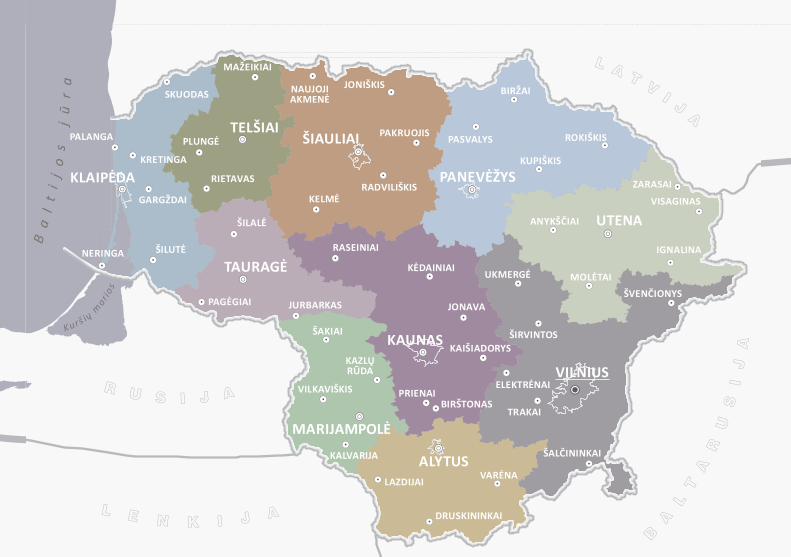
Giedrė Beconytė (texts and illustrations, unless indicated otherwise); Ugnė Andriulaitytė – text on pages 8, 9, 24;Urtė Antanavičiūtė – illustrations on pages 13, 31; Andrew Kapochunas – text on pages 18–19; Marius Marma – photos on pages 21, 33, 36;Edita Zemlevičienė – layout and illustrations on pages 10, 11, 23, 25; map on page 39.
Translation from Lithuanian: Jurgita Benaitytė.
Prepared for press by LĮ „Kriventa“
V. Pietario str. 5-3, LT-03122 Vilnius, LithuaniaTel. / fax.: +370 5 265 0629E-mail: [email protected] www.kriventa.lt
Signed for press 08-01-2021Copies 500 pcs.
THE LITHUANIAN SPATIALINFORMATION PORTAL 2020
Published by National Center for Remote Sensing and Geoinformatics “GIS-Centras”
Sėlių str. 66, LT-08109 Vilnius, LithuaniaTel.: +370 5 272 4741E-mail: [email protected] www.gis-centras.lt