takapūneke conservation report
TRANSCRIPT
TakapūnekeConservation Report
Te whenuaTe whenuaTe orangaMō te iwiNō ngā tūpunaTuku iho, tuku iho
p 2. Takapūneke Conservation Report December 2012 Christchurch City Council
Takapūneke | Conservation Report
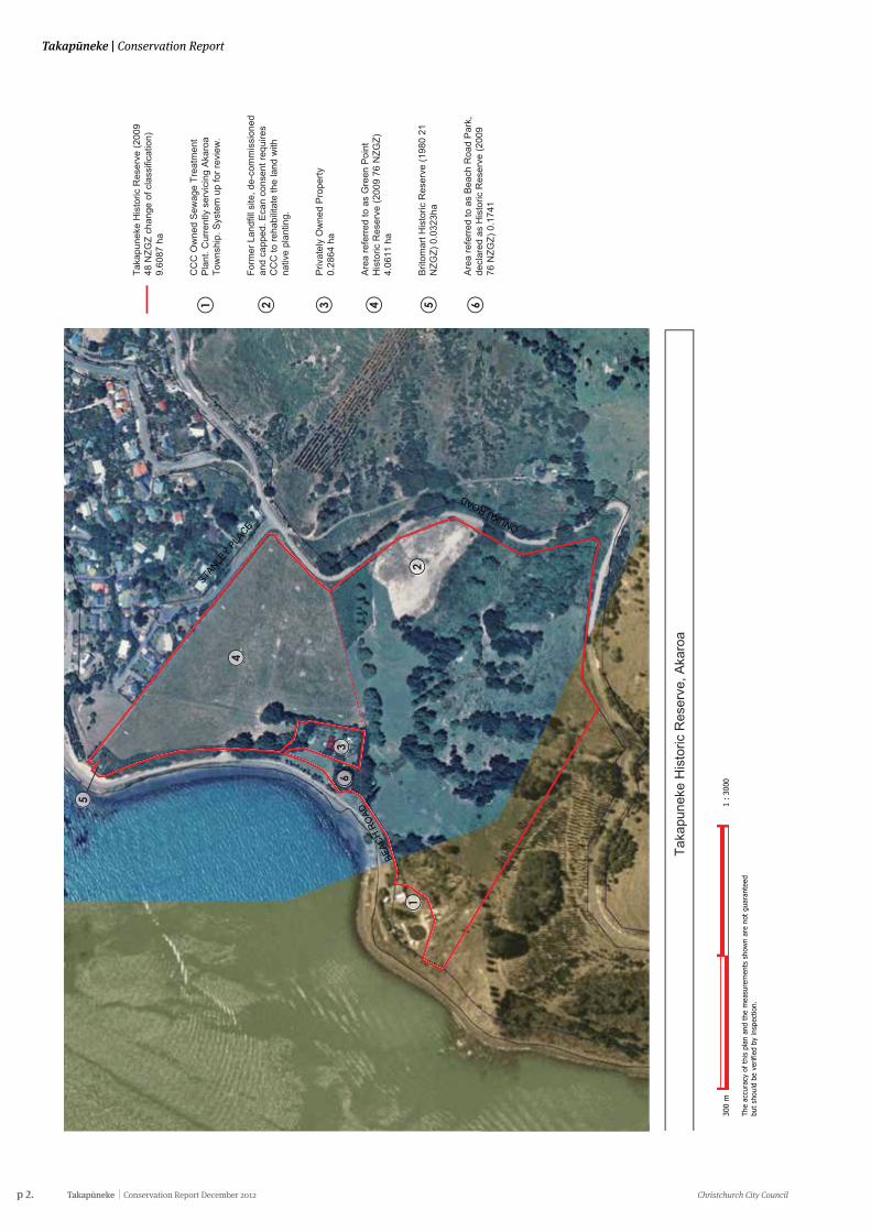
1
1
Taka
pune
ke H
isto
ric R
eser
ve (2
009
48 N
ZGZ
chan
ge o
f cla
ssifi
catio
n)
9.60
87 h
a
CC
C O
wne
d S
ewag
e Tr
eatm
ent
Pla
nt. C
urre
ntly
ser
vici
ng A
karo
a To
wns
hip.
Sys
tem
up
for r
evie
w.
Form
er L
andf
ill s
ite, d
e-co
mm
issi
oned
an
d ca
pped
. Eca
n co
nsen
t req
uire
s C
CC
to re
habi
litat
e th
e la
nd w
ith
nativ
e pl
antin
g.
Priv
atel
y O
wne
d P
rope
rty0.
2864
ha
Are
a re
ferr
ed to
as
Gre
en P
oint
H
isto
ric R
eser
ve (2
009
76 N
ZGZ)
4.
0611
ha
Brit
omar
t His
toric
Res
erve
(198
0 21
N
ZGZ)
0.0
323h
a
Are
a re
ferr
ed to
as
Bea
ch R
oad
Par
k,
decl
ared
as
His
toric
Res
erve
(200
9 76
NZG
Z) 0
.174
1
2
2
33 4
4
5
5
STANLE
Y PLA
CE ONUKU ROAD
BEAC
H RO
AD
300
m
1
: 3
000
The
accu
racy
of
this
pla
n an
d th
e m
easu
rem
ents
sho
wn
are
not
guar
ante
ed
but
shou
ld b
e ve
rifie
d by
insp
ectio
n.
Taka
pune
ke H
isto
ric R
eser
ve, A
karo
a
6
6
Christchurch City Council Conservation Report December 2012 Takapūneke p 3.
Conservation Report | Takapūneke
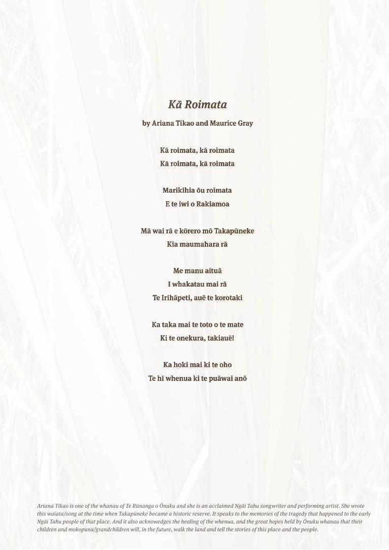
Kā Roimataby Ariana Tikao and Maurice Gray
Kā roimata, kā roimata
Kā roimata, kā roimata
Marikihia ōu roimata
E te iwi o Rakiamoa
Mā wai rā e kōrero mō Takapūneke
Kia maumahara rā
Me manu aituā
I whakatau mai rā
Te Irihāpeti, auē te korotaki
Ka taka mai te toto o te mate
Ki te onekura, takiauē!
Ka hoki mai ki te oho
Te hī whenua ki te puāwai anō
Ariana Tikao is one of the whanau of Te Rūnanga o Ōnuku and she is an acclaimed Ngāi Tahu songwriter and performing artist. She wrote this waiata/song at the time when Takapūneke became a historic reserve. It speaks to the memories of the tragedy that happened to the early Ngāi Tahu people of that place. And it also acknowedges the healing of the whenua, and the great hopes held by Ōnuku whanau that their children and mokopuna/grandchildren will, in the future, walk the land and tell the stories of this place and the people.
p 4. Takapūneke Conservation Report December 2012 Christchurch City Council
Takapūneke | Conservation Report
Contents
1. He Kupu Whakataki - Introduction 8
2. Executive Summary 9
3. Overview of Site Significance 103.1 The Takapūneke site property details 103.2 Owner requirements 11
4. Owner requirements 11
5. Legislation 125.1 Introduction 125.2 Overview 125.3 Treaty of Waitangi - Te Tiriti o Waitangi 125.4 Historic Places Act 1993 (HPA) 125.5 Local Government Act 2002 135.6 Resource Management Act 1991 (RMA) 135.7 Building Act 2004 135.8 The Reserves Act 1997 135.9 Banks Peninsula District Scheme 13
6. History 166.1 Akaroa Harbour 186.2 Te Maiharanui 216.3 The Kai Huānga Feud 226.4 Te Rauparaha and the Brig Elizabeth Incident 236.5 From Takapūneke to the Treaty of Waitangi 256.6 From Takapūneke to the Treaty 266.7 Green's Point: British Sovereignty and the French 28
7. European Occupation of Takapūneke 317.1 The Landing of Cattle 317.2 Later Farming at Takapūneke 317.3 Shipbuilding 357.4 The former Immigration Barracks 35
8. Ngāi Tahu and Takapūneke after 1830 368.1 Takapūneke and Akaroa Ngāi Tahu in the late 19th Century 368.2 Takapūneke and Akaroa Ngāi Tahu in the late 20th Century 37
Section 1. Understanding the place: Documentary evidence
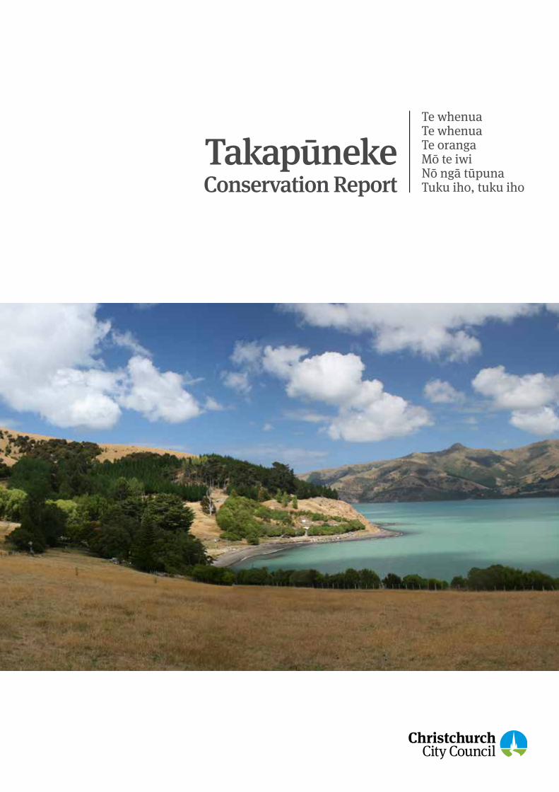
Cover Image - Takapūneke, 2009. Photograph: Malcolm Duff, NZHPT.
Christchurch City Council Conservation Report December 2012 Takapūneke p 5.
Conservation Report | Takapūneke
9. Takapūneke as Council land 409.1 Akaroa's sewage treatment works 409.2 Council purchase of the Takapūneke land 409.3 The proposed subdivision 419.4 Subdivision: A reluctant compromise 429.5 The Takapūneke Reserve 439.6 The campaign to stop the subdivision 459.7 Towards a larger reserve 46
10. Takapūneke landscape history 4810.1 Takapūneke - landscape setting within Akaroa Harbour 4910.2 Changes to the Takapūneke landscape over time 5010.3 Takapūneke - Before human occupation 5010.4 Biophysical landscape 5110.5 Cultural landscape 5110.6 Takapūneke 1832 - 1856 5210.7 Takapūneke 1856 - 1964 5310.8 Takapūneke 1964 - 1997 5710.9 Takapūneke 1997 - 2002 5810.10 Takapūneke 2002 - 2010 5910.11 Takapūneke existing physical landscape character 6110.12 Effect of power lines 6710.13 Land use 6710.14 Visual and sensory landscape qualities 6810.15 Degrees of significance 70
11. Archaeology 7411.1 Introduction 7411.2 History of archaeological investigation to date 7411.3 The history of occupation at Takapūneke 7811.4 Archaeological remains at Takapūneke 8111.5 Terraces and pits 8311.6 Umu / earth ovens 8411.7 Shell midden 8411.8 Historic midden 8511.9 Miscellaneous archaeological artefacts and features 8511.10 Buildings and structures 8611.11 Archaeological features identified during field survey 87
p 6. Takapūneke Conservation Report December 2012 Christchurch City Council
Takapūneke | Conservation Report
12. Introduction 9012.1 The Red House: historical account 9012.2 Physical evidence 9012.3 Description of the Red House: architectural form 9212.4 Heritage significance assessment 9612.5 Retention of significance 9912.6 Condition of the buildings 9912.7 Further investigations 100
13. The Immigration Barracks 10113.1 Historical account 10113.2 Physical evidence 10413.3 Comparable buildings 10613.4 Construction 10713.5 Summary of changes to the building 10913.6 Statement of significance 11013.7 Origin of Elements 10913.8 External constraints 11313.9 Further investigations 11513.10 Future use 11513.11 Recovery of significance 11513.12 Remedial work 11613.13 Former Immigration Barracks: schedule of defects and proposed work 117
14. Britomart Monument 12314.1 Historical summary 12314.2 Physical evidence 12614.3 Origin of the obelisk 12814.4 Summary of changes to the site and monument 12814.5 Statement of significance 12914.5 Condition of structure 13014.6 Future considerations 132
Section 2. Built Pākehā History
Contents
Christchurch City Council Conservation Report December 2012 Takapūneke p 7.
Conservation Report | Takapūneke
Section 3.
15. Takapūneke Chronology 136
16. Heritage significance assessment 14216.1 14216.2 142
17. Conservation principles and policies: introduction 14717.1 Principles 147
18. Policies 14818.1 Kaitiakitanga 14818.2 Cultural and spiritual significance 14818.3 Heritage documentation and interpretation 14818.4 Education, surveys and research 14918.5 Visitor management and site access 14918.6 Setting 14918.7 Landscape and ecology 15018.8 Archaeology 150
19. Conservation policies: Takapūneke European built and associated landscape heritage 152
19.1 Uses for the buildings and landscape 15219.2 Maintenance of heritage values 15219.3 Respect for different periods of built history 15319.4 Recovering built heritage values 15319.5 Built conservation process 15419.6 New work 15419.7 Conservation standards 15519.8 Recording of conservation processes 155
20. Glossary 156
21. Rāraki Pukapuka - Bibliography 158
Appendix one: Captain Stanley's map of Akaroa Harbour 162
Appendix two: Land parcel and Gazette Notice information plan Certificates of titles 164
Appendix three: ICOMOS New Zealand Charter 2010 for the Conservation of Places of Cultural Heritage Value 169
Appendix four: Archaeological matters 180
Appendix five: Florence Charter 186
p 8. Takapūneke Conservation Report December 2012 Christchurch City Council
Takapūneke | Conservation Report
1. He Kupu Whakataki – Introduction1
The Conservation Report for Akaroa’s historic Takapūneke site was commissioned by the Christchurch City Council to assist in the decision making for the future of the site, to guide the development of the Reserve Management Plan and most importantly to assist in ensuring the effective protection of Takapūneke for present and future generations.
The brief for the preparation of the Conservation Report notes that: “Takapūneke is acknowledged by Ngāi Tahu today with great sorrow for past devastation, and the protection of the land has been of paramount importance for Ngāi Tahu for many years. The action taken by the Council to recognise and protect the area as an historic reserve is a step of great importance to Ngāi Tahu”.
The Conservation Report will provide an important opportunity for the Council to work in partnership with Te Rūnanga o Ōnuku and to liaise with key stakeholders and interested parties to ensure the cultural heritage values of Takapūneke are identified and safeguarded.
The New Zealand Historic Places Trust Pouhere Taonga recognises the cultural heritage significance of Takapūneke through its registration as a wāhi tapu area. It also recognises the Akaroa waterfront as an historic area.
The Conservation Report has been prepared by a team of consultants (the authors) who were contracted by the Council: Takerei Norton, John Wilson, Wendy Hoddinott, Dave Pearson, Bridget Mosley, Jenny May and Helen Brown, Māori Heritage Advisor/Pouārahi, the New Zealand Historic Places Trust.
The authors wish to acknowledge the following people and organisations who have assisted and contributed generously to this report. Te Rūnanga o Ōnuku, George Tikao, Pere Tainui, Ngaire Tainui, Mel Tainui, George Tainui, Bernice Tainui, Milly Robinson, Bruce Rhodes, Wi Tainui, Meri Robinson, Henare Robinson, Ariana Tikao, Sir Tipene O’Regan, Harry Evison, Jim McAloon and Amos Kamo.
We have appreciated the guidance and advice of the Steering Group for this project and in particular Helen Brown, Amanda Ohs and Philippa Upton, and Andrea Lobb and Fiona Oliphant (of Mahaanui Kurataio Ltd).
Members of the Akaroa Civic Trust including Victoria Andrews, Steve Lowndes, Mere Robinson and Paul Dingwall, Jeff Hamilton, Hugh Wilson, Trevor Partridge, Michael Trotter, Colleen Stuart, Brian Allingham, Chris Jacomb, Nigel Harrison, Jan Shuttleworth, the New Zealand Historic Places Trust, the Akaroa Museum including Lynda Wallace, and the heritage and archive staff at the Christchurch City Council have all provided valuable input to this plan.
Acknowledgement of images: All sources are noted below the image. Contemporary images are by the authors and are not individually acknowledged.
1 Cover image sourced from pg 17 of the booklet Toitu Te Whenua The Land
It is essential that protection is assured for the Ngāi Tahu relationship with their whakapapa and stories by ensuring the information within this Conservation Report is not used for any public or private commercial benefit or public acclaim without the full agreement of Ngāi Tahu and Te Rūnanga o Ōnuku. No part of this Conservation Report may be used in any way without consultation and written agreement and permission of Ngāi Tahu and Te Rūnanga o Ōnuku, and the permission of the authors.
Christchurch City Council Conservation Report December 2012 Takapūneke p 9.
Conservation Report | Takapūneke
This Conservation Report was commissioned by the Christchurch City Council in order to identify a wide range of cultural heritage values of the Takapūneke site. It has been developed by a team of heritage professionals in consultation with Ōnuku Rūnanga, the Akaroa Civic Trust, the New Zealand Historic Places Trust, Mahaanui Kurataiao Ltd, the wider community and the members of the Council-led project steering group.
A conservation report is written to assist planning for any future change while maintaining heritage values. A principal purpose of the information gathered to record and evaluate the cultural heritage values is to enable the formulation of principles and policies the purpose of which is to retain those values and guide the long term use and care of the place. The conservation report is divided in to three sections: Section one considers the Māori and Pākehā history of the site, the landscape history and the archaeology; Section two considers the built Pākehā heritage; Section three contains a chronological summary of events, the heritage significance assessment, and the principle and policy statements.
The methodology for this report has been to establish an overview of the social, cultural, architectural and site history of the land and its associated structures to assist in the development of a management plan for the site. Throughout the research process, careful regard has been taken of both the tangible and intangible, through oral histories and interviews, examination of available archival material and secondary sources and examination of the site to evaluate its social, cultural and spiritual, archaeological, built and landscape heritage.
The material collected by the consultants responsible for each professional area has been evaluated, and the built structures evaluated through a specific assessment criteria, to develop an overall understanding of the heritage significance and values of Takapūneke. This has then informed the development of the principles and policies.
Takapūneke is particularly significant for its Māori heritage and cultural values. Māori heritage places are taonga tuku iho (treasures handed down), integral to Aotearoa/New Zealand’s culture and identity. The cultural heritage values of such places reside as much in their meaning, symbolism, settings and associations (intangible values) as they do in tangible physical form. Many of these heritage places constitute the basis for Māori community relationships, cultural empowerment and tribal identity2. This is particularly true for Takapūneke, which is a place of great significance to Ngāi Tahu - both for the local Rūnanga of this area (Te Rūnanga o Ōnuku and neighbouring Wairewa Rūnanga) and more widely across the iwi (tribe).
As noted in the initial brief for this conservation report there are few conservation plans that have been completed in this country for wāhi tapu sites, which are principally of intangible value and cultural landscapes. Thus in order to fully provide for the intangible cultural values of Takapūneke and to enable the tāngata whenua cultural heritage values to be strongly reflected in the document, considerable consultation, kōrero and hui with Te Rūnanga o Ōnuku and other stakeholders has been undertaken to ensure that the conservation report clearly and strongly reflects Ngāi Tahu relationships, knowledge and perspectives of Takapūneke. The conservation report has through this process attempted to address the many layers of values, history and significance of Takapūneke – for both Māori and Pākehā.
2. Executive Summary
2 Brown, H. (2009) “Māori gems handed down” in Christchurch Press in Conservation Plan Brief 2010
p 10. Takapūneke Conservation Report December 2012 Christchurch City Council
Takapūneke | Conservation Report
A range of significant Māori and Pākehā values and histories is associated with Takapūneke, making it a site of immense local and national importance. Ngāi Tahu and their tūpuna from earlier tribes – Kāti Māmoe and Waitaha – have settled, travelled and held traditional authority over an area that encompasses most of the South Island (Te Waipounamu). The area of Akaroa, the harbour, surrounding hills and the outer bays, were also strongholds for Ngāi Tahu and earlier iwi. There remains today a strongly held connection between the Ngāi Tahu whānau and hapū with the land, harbour, waters and taonga of the area.
Takapūneke became an important centre for trade between Ngāi Tahu and Pākehā in the early 19th century. Whalers and other traders visited Akaroa to replenish necessary supplies, especially food, and by the mid nineteenth century farming brought changes to the landscape. As one of the earliest European farming sites its buildings, fencing and other physical objects are of historical significance as the tangible reminder of European life on Banks Peninsula, particularly in the early years of the twentieth century.
Takapūneke is one of the most revered and sacred sites in Aotearoa, because of the tūpuna who once lived there, and because of the Brig Elizabeth incident and subsequent events that resulted in the devastation of the people who lived there in 1830. Following the 1830 massacre and fall of Ōnawe in 1832, Ngāi Tahu never lived at Takapūneke again, regarding the bay of Takapūneke as tapu because of the deaths that occurred there3. Local iwi then lived at Ōnuku, the next bay south of Takapūneke.
Events at Takapūneke provided the impetus for British intervention in New Zealand that ultimately led to the Treaty of Waitangi, and are acknowledged as a significant point in New Zealand history.
3.1 The Takapūneke site property detailsThe area referred to by Christchurch City Council as Takapūneke consists of six different land parcels, as identified in the Boundary, Land Parcel and Gazette Notice Information Plan (Appendix 2). This includes Britomart Historic Reserve, Green’s Point, Takapūneke Reserve and Beach Road Park.
The Council has completed steps to change the reserve classification of these areas to be declared as Historic Reserves, held under the Reserves Act 1977.
On 9 April 2009 the area referred to as Takapūneke Reserve (Lot 1 DP 73274 - 9.6087 ha) was changed from a local purpose (historic site) reserve to a historic reserve and was notified in the New Zealand Gazette (Notice no. 2953, NZG no. 48, 9 April 2009, p1182).
On 12 May 2009 Christchurch City Council resolved that areas referred to as Green’s Point (Lot 1 DP 73274 - 4.0611 ha) and Beach Road Park (Lot 3 DP 73274 - 0.1741 ha) be declared a historic reserve under the Reserves Act 1977. This resolution was notified in the New Zealand Gazette (Notice no. 4671, NZG no.76, 28/5/09, p1797)4.
3. Overview Of Site Significance
3 Conservation Report Brief 2010 p.12.4 Conservation Report Brief 2010 p.11.
Christchurch City Council Conservation Report December 2012 Takapūneke p 11.
Conservation Report | Takapūneke
4. Owner requirements
The brief developed by the Council for the preparation of this Conservation Report is an extensive document which has clearly outlined the Council’s role and methodology for the future of the Takapūneke site. The brief notes that:
Takapūneke is particularly significant for its Māori heritage and cultural values. Māori heritage places are taonga tuku iho (treasures handed down), integral to Aotearoa/New Zealand’s culture and identity. The cultural heritage values of such places reside as much in their meaning, symbolism, settings and associations (intangible values) as they do in tangible physical form. Many of these heritage places constitute the basis for Māori community relationships, cultural empowerment and tribal identity5. This is particularly true for Takapūneke, which is a place of great significance to Ngāi Tahu - both for the local Rūnanga of this area (Te Rūnanga o Ōnuku and neighbouring Wairewa Rūnanga) and more widely across the iwi (tribe). Council is committed to recognising this and has established a partnership and collaborative relationship with Ngāi Tahu, through Te Rūnanga o Ōnuku and working with Mahaanui Kurataiao Ltd6 (MKT), for the planning and management processes for Takapūneke.
The Conservation Report has been written to help inform the Council’s process in developing a reserve management plan for Takapūneke Historic Reserve. The reserve management plan will address key issues identified within the Conservation Report, in particular regarding its principles and policies.
5 Brown, H. “Māori Gems Handed Down”, The Press 20096 Mahaanui Kurataiao Ltd (MKT) is a company owned by the six Rūnanga of Christchurch City, including Ōnuku, and has the mandate to engage in resource management, local government and other policy and planning matters on their behalf.
p 12. Takapūneke Conservation Report December 2012 Christchurch City Council
Takapūneke | Conservation Report
5. Legislation
5.1 IntroductionCurrent legislation provides measures for any future management and development of heritage places. Consideration of all areas of current legislation and of best practice heritage management guidelines must be considered to ensure that the cultural heritage values are appropriately respected and protected before any future development or work is undertaken at Takapūneke.
5.2 Overview Regard to this should include, but not be limited to:
• The Banks Peninsula District Plan
• The Resource Management Act, 1991, and RMA Amendment Acts 2003 and 2004 (RMA)
• Historic Places Act 1993 (HPA) with particular regard to Wāhi Tapu and Wāhi Tapu areas and Archaeological Sites
• Building Act 2004
• The Reserves Act 1977
• Treaty of Waitangi
• Local Government Act (2002)
Though there is no statutory or regulatory requirement, consideration should also be given to: The ICOMOS (NZ) Charter, Te Pumanawa o ICOMOS o Aotearoa Hei Tiaki I Ngā Taonga Whenua Heke Iho o Nehe for the conservation of places of cultural heritage value. (Appendix 2)
Revised in 2010, this charter sets out principles to guide the conservation of places of cultural heritage value in New Zealand. It is intended as a frame of reference for all those who, as owners, territorial authorities, tradespeople or professionals, are involved in the different aspects of such work and aims to provide guidelines for community leaders, organisations and individuals concerned with conservation issues.
5.3 Treaty of Waitangi – Te Tiriti o Waitangi
The Te Tiriti o Waitangi recognises and guarantees the protection of tino rakatiratanga (sovereignty) and so empowers kaitiakitanga as customary trusteeship to be exercised by tāngata whenua over their taonga, such as sacred and traditional places, built heritage, traditional practices, and cultural heritage resources. Council responsibilities in relation to the Treaty are defined in statute, particularly the Local Government Act 2002, the Resource Management Act 1991, as well as iwi settlement legislation (Te Rūnanga o Ngāi Tahu Act 1996, and Ngāi Tahu Claims Settlement Act 1998).
5.4 Historic Places Act 1993 (HPA) 5.4.1. As noted previously, Takapūneke is registered by the New Zealand Historic Places Trust Pouhere Taonga as a wāhi tapu area. The extent of registration includes Lot 1 DP 73274, Lot 1 DP 76825; Blk XIII, Akaroa S.D. Note: Takapūneke Reserve (Historic Reserve) Lot 1 DP 76825; Register #: 7521.
5.4.2. The Akaroa Waterfront is registered by New Zealand the Places Trust as an historic area. This comprises the foreshore of French Bay (from Rue Brittain) including Red House Bay, Akaroa. It also encompasses the road reserve that runs around the foreshore, including the area 300 metres out from the high tide mark. Where the road reserve no longer follows the coast, the area continues at an equivalent width of the road reserve or for those properties in private ownership 300 metres out to sea from the legal boundaries, Register #: 7330 (Appendix 2).
5.4.3. The purpose of the Historic Places Act (1993) is to promote the identification, protection, preservation, and conservation of the historical and cultural heritage of New Zealand. In addition to its general heritage requirements, the Act has some specific requirements in relation to Māori, requiring all persons exercising functions and powers under the Act to recognise the relationship of Māori and their culture and traditions with their ancestral lands, water, sites, wāhi tapu, and other taonga. The Māori Heritage Council is convened under the auspices of the New Zealand Historic Places Trust and was created by Part IV of the Act. The Māori Heritage Council and te Tira o Pouhere Taonga (Māori Heritage Team) have a national leadership role to promote, facilitate and advocate for Māori heritage. The Act states that it is not lawful for any person to destroy, damage, or modify, or cause to be destroyed, damaged, or modified, the whole or any part of any archaeological site (any place in New Zealand that was associated with human activity that occurred before 1900 and is or may be able through investigation by archaeological methods to provide evidence relating to the history of New Zealand) without an archaeological authority from the Trust.
5.5 Local Government Act 20027 In fulfilling the Crown’s Treaty responsibilities the Local Government Act sets out what the Council is required to do to address this and to provide opportunities for Māori to contribute to decision-making processes, and provide relevant information to Māori for the purposes of this contribution to decision-making process, and significant decisions in relation to land or a body of water must take into account the relationship of Māori and their culture and traditions with their ancestral land, water, sites, wāhi tapu, valued flora and fauna and other taonga.
7 It is noted that both the Local Government Act and The Resource Management Act require wider community engagement.
Christchurch City Council Conservation Report December 2012 Takapūneke p 13.
Conservation Report | Takapūneke
5.6 Resource Management Act 1991 (RMA)5.6.1 The Council is required to recognise and provide for the protection of historic heritage, which is defined as including: sites of significance to Māori including wāhi tapu, archaeological sites, historic sites, structures and areas and surroundings, from inappropriate use, subdivision and development as a section 6 matter of national importance. The Council is also required to recognise and provide for the relationship of Māori and their culture and traditions with their ancestral lands, water, sites, wāhi tapu, and other taonga, and the protection of recognised customary activites. In achieving the purpose of the RMA, the Council is required to have particular regard to kaitiakitanga – the exercise of guardianship by the tāngata whenua of an area in accordance with tika Māori (Māori customary values and practices) in relation to natural and physical resources, and the ethic of stewardship. The Council must also take into account the principles of The Treaty of Waitangi, which recognises and guarantees the protection of tino rakatirataka and empowers kaitiakitanga as customary trusteeship to be exercised by tāngata whenua over their taonga, such as sacred and traditional places, built heritage, traditional practices, and cultural heritage resources
5.6.2 RMA Section 5 outlines the purpose of the Act that is to:
1. promote the sustainable management of natural and physical resources
2. sustainable management means managing the use, development, and protection of natural and physical resources in a way, or at a rate, which enables people and communities to provide for their social, economic and cultural well-being and for their health and safety while:
c. Sustaining the potential of natural and physical resources (excluding minerals to meet the reasonably foreseeable need of future generations; and
d. Safeguarding the life-supporting capacity of air, water, soil and ecosystems; and
e. Avoiding, remedying or mitigating any adverse effects on the environment
5.6.3 RMA Section 6 outlines matters of national importance, noting that in achieving the purposes of the Act all persons must recognise and provide for:
f. The relationship of Māori and their culture and traditions with their ancestral lands, water, sites, wāhi tapu, and other taonga
g. The protection of historic heritage from inappropriate subdivision, use and development. (2003 amendment)
5.6.4 Other sections of the RMA of particular note are:
S32 – Duties to consider alternatives, assess benefits and costs
S88 – Application for Resource Consents
S104 and S105 – decision-making, matters to be considered
Fourth Schedule – assessment of effects on the environment
5.7 Building Act 20048 Under the Building Act 2004 (amended March 2005), it is the owner’s responsibility to:
• apply for a building consent for any proposed building work
• provide the necessary information with the building consent application to confirm compliance with the New Zealand Building Code
• notify the Council when a change of use is proposed
• apply for a code compliance certificate on completion of building work
• ensure that inspection, maintenance and reporting procedures are carried out where required by any compliance schedule
• maintain the building in a safe and sanitary condition at all times.
The Building Act 2004 (Section 131) requires territorial authorities to develop policies on earthquake-prone buildings within their districts. In keeping with this requirement, the Christchurch City Council has adopted a policy for earthquake-prone buildings, dangerous buildings and unsanitary buildings within its district.
5.8 The Reserves Act 1977The Reserves Act 1977 is administered by the Department of Conservation. Its function is to provide for the preservation and management, for the benefit and enjoyment of the public, of areas possessing some special feature or values such as recreational use, wildlife, landscape amenity or scenic value. The Reserves Act also provides for the acquisition of land for reserves, and the classification and management of reserves9.
5.9 Banks Peninsula District PlanChapter 8 of the District Plan Issues of importance to Tāngata Whenua notes that the needs of tāngata whenua and the manner in which these needs are provided for, is a matter of significance. The plan acknowledges that the tāngata whenua have a deep spiritual association with the land and water which to them are a great taonga.
Chapter 14 addresses cultural heritage noting that Banks Peninsula has a rich legacy of human occupancy and this is reflected in the distribution of sites, buildings, places and areas of heritage value throughout the district. Such features are important for their archaeological value and their architectural and historical significance.
8 http://www.building.govt.nz 9 http://www.legislation.govt.nz/act/public/1977
p 14. Takapūneke Conservation Report December 2012 Christchurch City Council
Takapūneke | Conservation Report
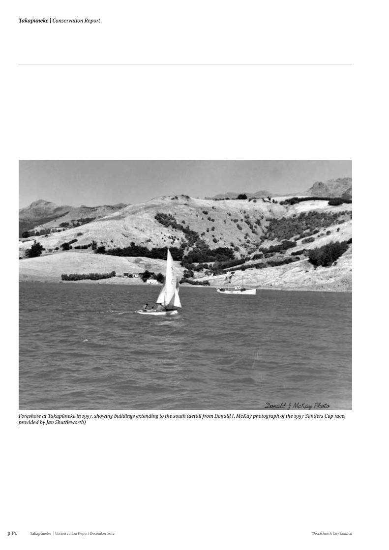
Foreshore at Takapūneke in 1957, showing buildings extending to the south (detail from Donald J. McKay photograph of the 1957 Sanders Cup race, provided by Jan Shuttleworth)

Christchurch City Council Conservation Report December 2012 Takapūneke p 15.
Conservation Report | Takapūneke
p 16. Takapūneke Conservation Report December 2012 Christchurch City Council
Takapūneke | Conservation Report
Section one
Understanding the place: Documentary evidence
Christchurch City Council Conservation Report December 2012 Takapūneke p 17.
Conservation Report | Takapūneke
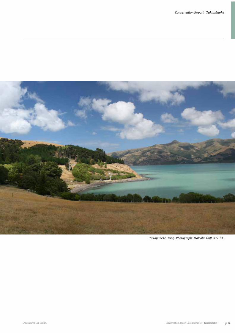
Takapūneke, 2009. Photograph: Malcolm Duff, NZHPT.
p 18. Takapūneke Conservation Report December 2012 Christchurch City Council
Takapūneke | Conservation Report
6. History
6.1 Akaroa HarbourTakapūneke is the name of an historically important Māori settlement and flax trading outpost of the Ngāi Tahu Rangatira (chief) Te Maiharanui, located at what later became known as Red House Bay in Akaroa Harbour.
When Ngāi Tahu hapū (sub-tribes) arrived at Horomaka (Banks Peninsula) in the late 16th or early 17th century several iwi, such as Rapuwai, Hāwea, Waitaha and Ngāti Māmoe, were already living on the Peninsula. Over time through warfare and intermarriage Ngāi Tahu assimilated with these other iwi to take ownership and control of Horomaka with the Ngāi Tahu Rangatira (chief) Te Ake located at the head of Akaroa Harbour.
Many of the traditions of the earlier iwi were readily inherited by Ngāi Tahu including the ancient wāhi ingoa (place names)1. Today several wāhi ingoa associated with the Waitaha tīpuna (ancestor) Rākaihautū, who was responsible for the naming and claiming of the landscape, form part of Ngāi Tahu oral tradition and cultural practice2. The striking landmark of Tuhiraki which stands across the harbour from Takapūneke is the kō (digging stick) used by Rākaihautū to dig all the principal lakes of Te Wai Pounamu (South Island)3. Tuhiraki is an important wāhi tapu (sacred site) for Akaroa Ngāi Tahu.
Takapūneke was one of many Māori settlements located throughout Akaroa Harbour. Other key settlements in the harbour included Ōnawe, Ōnuku, Ōpukutahi, Takamatua and Wainui4. The importance of the harbour’s mahinga kai (traditional food gathering practices and sites) was one of the principal reasons Akaroa was a popular area for Māori settlement.
The freshwater resources, harbour, ocean, adjacent bays, rocky shoreline and sandy beaches provided Takapūneke and other settlements in the Harbour with a variety and abundance of finfish, shellfish and other forms of seafood. Subsequently the economy of the Akaroa Māori was based on fishing, catching of sea birds and shellfish gathering.
During summer fish such as mangā (rig/dogfish/barracouta/grumpy shark), red cod, hāpuka (groper) and hokarari (ling) were taken in the warm inshore waters in large numbers. Freshwater fish, particularly inaka (whitebait), tuna (eels) and waikōura (freshwater crayfish), were also in abundance. A variety of shellfish, including pāua, mussel, pipi, tuaki (cockle), cats eye, oyster, kina and limpet, and crustaceans such as crab and kōura (crayfish), were gathered from the rocky shorelines and sandy beaches.
Since food was abundant in the summer and scarce during winter, food storage was very important. A high proportion of the foods caught during summer, such as hāpuka, tuna, inaka, mussels and pipi were preserved. They were generally cooked in an umu (steam pit), then hung in a storehouse to dry and harden, and then stored to be consumed later.
The surrounding forests would have provided an abundance and variety of forest dwelling birds such as kākā, kākāriki (New Zealand parakeet), kārearea (New Zealand falcon), kererū (New Zealand wood pigeon), kōkako, korimako (bellbird), laughing owl, mōhua (yellowhead), piopio, pīpipi, pīwakawaka (fantail), riroriro (grey warbler), tīeke (South Island saddleback) and tūī5. These birds would have been gathered by local Māori to supplement the marine food resources.
“We were at home one day and Pop Keefe who brought me up and his wife, Annie were talking about [Takapūneke]. They said you can go down there but be careful because there was a big chief that lived there and had his house there. We said “Are we allowed to go and pick mussels and other things from around the beach there?” and they said, “Oh no, I don’t think you better”...” (Interview with Nancy Robinson by Helen Brown,
2 November 2009)6.
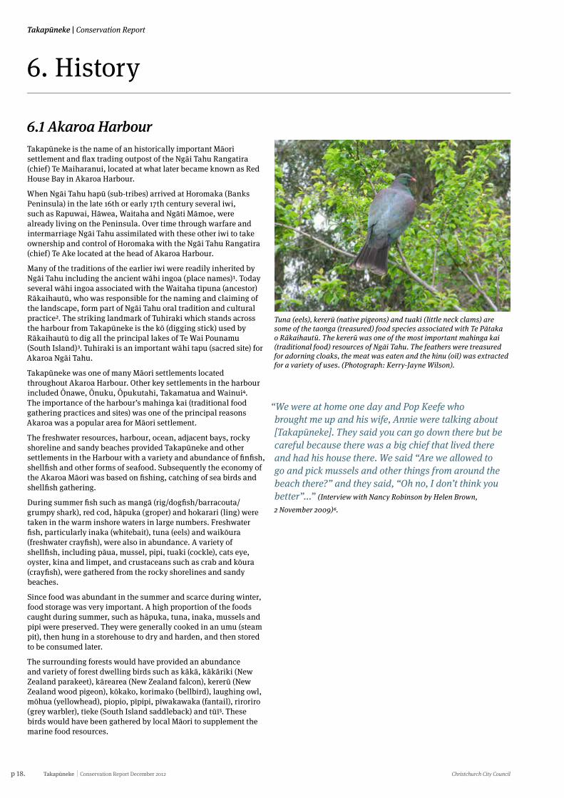
Tuna (eels), kererū (native pigeons) and tuaki (little neck clams) are some of the taonga (treasured) food species associated with Te Pātaka o Rākaihautū. The kererū was one of the most important mahinga kai (traditional food) resources of Ngāi Tahu. The feathers were treasured for adorning cloaks, the meat was eaten and the hinu (oil) was extracted for a variety of uses. (Photograph: Kerry-Jayne Wilson).
Christchurch City Council Conservation Report December 2012 Takapūneke p 19.
Conservation Report | Takapūneke
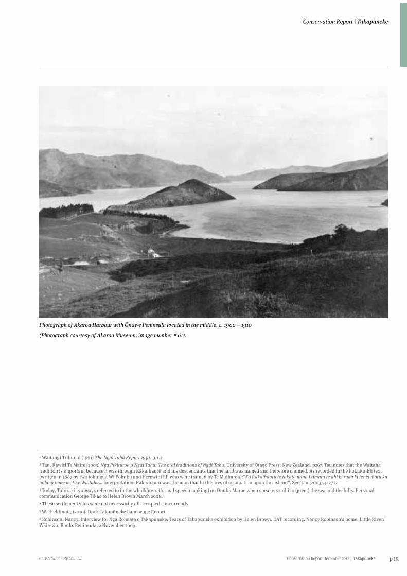
Photograph of Akaroa Harbour with Ōnawe Peninsula located in the middle, c. 1900 – 1910
(Photograph courtesy of Akaroa Museum, image number # 61).
1 Waitangi Tribunal (1991) The Ngāi Tahu Report 1991: 3.1.22 Tau, Rawiri Te Maire (2003) Nga Pikituroa o Ngāi Tahu: The oral traditions of Ngāi Tahu. University of Otago Press: New Zealand. p267. Tau notes that the Waitaha tradition is important because it was through Rākaihautū and his descendants that the land was named and therefore claimed. As recorded in the Pokuku-Eli text (written in 1887 by two tohunga, Wi Pokuku and Herewini Eli who were trained by Te Maiharoa):“Ko Rakaihautu te takata nana I timata te ahi ki ruka ki tenei motu ka nohoia tenei motu e Waitaha… Interpretation: Rakaihautu was the man that lit the fires of occupation upon this island”. See Tau (2003), p 272.3 Today, Tuhiraki is always referred to in the whaikōrero (formal speech making) on Ōnuku Marae when speakers mihi to (greet) the sea and the hills. Personal communication George Tikao to Helen Brown March 2008.4 These settlement sites were not necessarily all occupied concurrently.5 W. Hoddinott, (2010). Draft Takapūneke Landscape Report.6 Robinson, Nancy. Interview for Ngā Roimata o Takapūneke: Tears of Takapūneke exhibition by Helen Brown. DAT recording, Nancy Robinson’s home, Little River/Wairewa, Banks Peninsula, 2 November 2009.
p 20. Takapūneke Conservation Report December 2012 Christchurch City Council
Takapūneke | Conservation Report
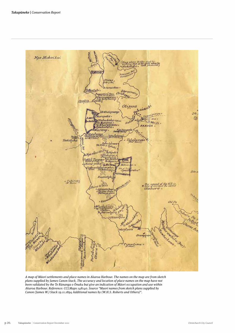
A map of Māori settlements and place names in Akaroa Harbour. The names on the map are from sketch plans supplied by James Canon Stack. The accuracy and location of place names on the map have not been validated by the Te Rūnanga o Ōnuku but give an indication of Māori occupation and use within Akaroa Harbour. Reference: CCLMaps 148140. Source "Maori names from sketch plans supplied by Canon (James W.) Stack 19.11.1894 Additional names by (W.H.S. Roberts and Others)".
Christchurch City Council Conservation Report December 2012 Takapūneke p 21.
Conservation Report | Takapūneke
6.2 Te MaiharanuiTe Maiharanui was of noble birth and a man of high mana who descended from a number of senior Ngāi Tahu lines. Te Maiharanui’s hapū (sub-tribe) was Ngāti Rangiāmoa, the noblest family of Ngāi Tahu. Te Maiharanui was the Upoko Ariki (paramount chief) for Ngāi Tūāhuriri, the Ngāi Tahu hapū based at the Ngāi Tahu stronghold of Kaiapoi.
There is debate as to whether Te Maiharanui was also the Upoko Ariki for Ngāi Tahu as an iwi. However, it is agreed that along with other Ngāi Tahu chiefs at the time Te Maiharanui was certainly highly ranked. The position of Te Maiharanui within Ngāi Tahu was buttressed by his connections with other notable figures within the iwi, including Tūhawaiki, a leading southern Ngāi Tahu chief of the first half of the 19th century, and Te Whakataupuka, another important leader of the southern Ngāi Tahu.7
Te Maiharanui married Te Whe, a daughter of a chief Ratakiri, who had been a leading chief of Akaroa in the early 19th century. Te Maiharanui and Te Whe had two sons, Te Wera and Tūtehounuku, and a daughter, Ngā Roimata. Te Wera died young.
The character of Te Maiharanui and his personality remain obscure. He was certainly revered and feared. Unfavourable opinions of his character, which are still current, reflect the prejudices of a later age against his conduct in the Kai Huānga feud. He was certainly a strong and ruthless chief, but the harsh strictures against his character and conduct are not justified when he is judged against the standards of Māori society in the 1820s.
In the first half of the 19th century flax was greatly in demand for cordage, and was one of New Zealand’s first major export commodities. Te Maiharanui was one of the first southern chiefs to see the advantage of trading with Europeans, and although Kaiapoi was the main pā of Te Maiharanui he established a base for trading with Europeans at Takapūneke, where he supplied the visiting ships with vegetables as well as with flax. Prior to Te Maiharanui establishing the trading village, Takapūneke was probably occupied and used by Akaroa Māori, particularly for food gathering.8 The earliest report of European flax trading on
Horomaka dates from 1821.9 Te Maiharanui started trading in flax around Horomaka in the 1820s.10 To facilitate his contact with flax traders, Te Maiharanui began living for much of his time at Takapūneke. By the mid 1820s, European and American whaling vessels, as well as vessels trading in flax out of Sydney, were regular callers at Takapūneke.11 Te Maiharanui probably chose Takapūneke for a trading settlement because it was sheltered but had relatively deep water reasonably close to shore. It was unlikely that the flax which was sold to European traders was grown or processed at Takapūneke itself. Some of the flax probably came from just across the harbour at Wainui, and some from as far away as Wairewa (Little River).12
By the late 1820s Te Maiharanui was so familiar with, and trusting of, European ships’ captains that he allowed his son and heir, Tūtehounuku, to leave New Zealand on a whaling ship. Te Maiharanui never saw his son again as Tūtehounuku did not return from whaling until 1834.13
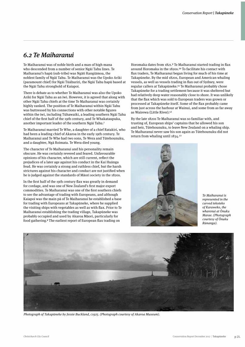
Te Maiharanui is represented in the carved tekoteko of Karaweko, the wharenui at Ōnuku Marae. (Photograph courtesy of Ōnuku Rūnanga).
Photograph of Takapūneke by Jessie Buckland, c1925. (Photograph courtesy of Akaroa Museum).
p 22. Takapūneke Conservation Report December 2012 Christchurch City Council
Takapūneke | Conservation Report
7 H. Evison, (1993) Te Waipounamu p.278 Takapūneke Hui, Ōnuku Marae, 24 July 2010. Interviewees: Wi Tainui, Bruce Rhodes, Pere Tainui, Ngaire Tainui (all from Ōnuku Rūnanga) and Jeff Hamilton (Akaroa community). Interviewer(s): Helen Brown (NZHPT) with occasional input from Andrea Lobb (MKT), Amos Kamo (Boffa Miskell) and Takerei Norton (TRoNT).9 A. Anderson (1998) The Welcome of Strangers p.7210 P. Burns (1990) Te Rauparaha p.131. Burns suggests Te Maiharanui was trading at Takapūneke as early as 1815, but this is unlikely.11 H. Evison, (2006) The Ngāi Tahu Deeds pp. 20-21; Akaroa and Banks Peninsula p.23; H. Evison, (1993) Te Wai Pounamu p.35.12 G. Ogilvie, (2007) Cradle of Canterbury p.194; W.A. Taylor, (1950) Lore and History p.77.13 Evison, ‘Akaroa bay outrage’, The Press, 6 January 1995, p. 13; Tau and Anderson, (2008) Ngāi Tahu: A Migration History p.29.14 Tau and Anderson, (2008) Ngāi Tahu: A Migration History pp.163-67.
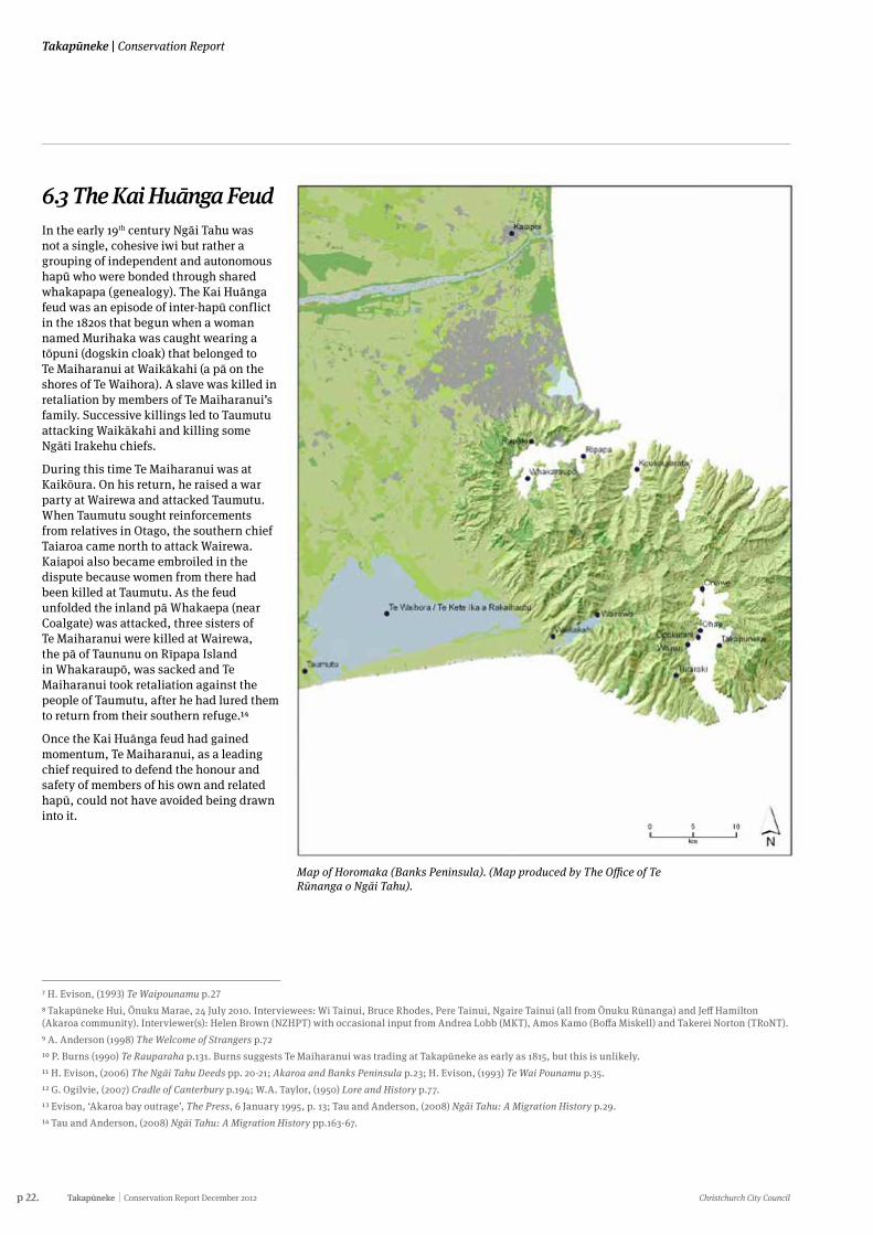
6.3 The Kai Huānga FeudIn the early 19th century Ngāi Tahu was not a single, cohesive iwi but rather a grouping of independent and autonomous hapū who were bonded through shared whakapapa (genealogy). The Kai Huānga feud was an episode of inter-hapū conflict in the 1820s that begun when a woman named Murihaka was caught wearing a tōpuni (dogskin cloak) that belonged to Te Maiharanui at Waikākahi (a pā on the shores of Te Waihora). A slave was killed in retaliation by members of Te Maiharanui’s family. Successive killings led to Taumutu attacking Waikākahi and killing some Ngāti Irakehu chiefs.
During this time Te Maiharanui was at Kaikōura. On his return, he raised a war party at Wairewa and attacked Taumutu. When Taumutu sought reinforcements from relatives in Otago, the southern chief Taiaroa came north to attack Wairewa. Kaiapoi also became embroiled in the dispute because women from there had been killed at Taumutu. As the feud unfolded the inland pā Whakaepa (near Coalgate) was attacked, three sisters of Te Maiharanui were killed at Wairewa, the pā of Taununu on Rīpapa Island in Whakaraupō, was sacked and Te Maiharanui took retaliation against the people of Taumutu, after he had lured them to return from their southern refuge.14
Once the Kai Huānga feud had gained momentum, Te Maiharanui, as a leading chief required to defend the honour and safety of members of his own and related hapū, could not have avoided being drawn into it.
Map of Horomaka (Banks Peninsula). (Map produced by The Office of Te Rūnanga o Ngāi Tahu).
Christchurch City Council Conservation Report December 2012 Takapūneke p 23.
Conservation Report | Takapūneke
6.4 Te Rauparaha and the Brig Elizabeth Incident6.4.1 Te RauparahaFrom Kāpiti Island Te Rauparaha commanded the trade in the Cook Strait region between Māori and Europeans. The trade gave Te Rauparaha, who acquired muskets, formidable strength.15 From Kāpiti, Te Rauparaha looked south, possibly hoping to take over the Ngāi Tahu trade with Europeans and to wrest from Ngāi Tahu control of the trade in pounamu (Greenstone), which was centred at Kaiapoi. Insults uttered by two Rangitāne chiefs, Nohota and Rerewhaka, are believed to have given Te Rauparaha immediate motive to attack tribes resident on Te Waipounamu.
“Well with my pōua Bill Tainui he said you don’t go through there boy. I said to him look it’s the quickest way to get to Akaroa and he said just don’t go through there and he wouldn’t explain why,” (Pere Tainui, personal
communication, 25 August 2010).
The attacks began with his descent in 1828 on Wairau and Kaikōura, ostensibly to avenge the insults. His attacks were directed against Rangitāne and Ngāti Kuia as much as against Ngāi Tahu. The following year, 1829, Te Rauparaha attacked Kāti Kuri at Kaikōura and Ōmihi (a pā located just south of Kaikōura), his reason for returning being a wish to punish a Ngāti Kahungunu chief, Kekerengu, who had taken refuge with Ngāi Tahu after a sexual transgression.
Te Rauparaha was accompanied in 1829 by his uncle, Te Pēhi Kupe, the leading ariki of Ngāti Toa. At the urging of Te Pēhi Kupe, Te Rauparaha and Ngāti Toa continued on to Kaiapoi. The motives of Te Pēhi for suggesting carrying on from Kaikōura to Kaiapoi are uncertain. He may have wished to pay Te Maiharanui (his equal as an ariki) “a social visit” or have wished to acquire pounamu.16 Te Maiharanui, who was in residence at Kaiapoi at the time of this visit, greeted Te Pēhi and engaged in trade with Ngāti Toa.17
While Te Pēhi was inside the pā with a number of other Ngāti Toa chiefs, he and his companions were killed by Ngāi Tahu. Te Pēhi fell to the Ngāi Tahu chief Tangatahara, an uncle of Te Maiharanui. Te Maiharanui participated in the killing of the Ngāti Toa chiefs inside the Kaiapoi pā.18 Te Rauparaha had remained in the Ngāti Toa camp outside the pā and escaped death. After the killings Te Rauparaha returned to Kāpiti, with a powerful new incentive to return to attack Ngāi Tahu.19
6.4.2 The Brig ElizabethTe Rauparaha returned in 1830 in the brig Elizabeth. The brig Elizabeth, captained by John Stewart and crewed by two officers, a carpenter, a cook, six seamen and two boys, left the London docks on 3 March 1830. After calling at Sydney, the Elizabeth sailed for New Zealand on a general trading voyage. It put in to Kāpiti Island seeking a cargo of flax. At Kāpiti, Te Rauparaha and Te Hiko, a son of Te Pēhi Kupe who had been killed at Kaiapoi, were planning an expedition against Ngāi Tahu to revenge the killing of the Ngāti Toa chiefs.
Against the advice of another British captain who was at Kāpiti, Stewart entered into an agreement to take Te Rauparaha and a party of his warriors to Akaroa to capture Te Maiharanui in return for a cargo of flax, which would be delivered to Stewart on their return to Kāpiti. Te Rauparaha aimed to use an apparently peaceful visit to Takapūneke to trade to get his war party close to Takapūneke without attracting attention.20
The Elizabeth sailed from Kāpiti for Akaroa on 29 October 1830. When the Elizabeth came to anchor off Takapūneke, Te Maiharanui was absent, probably at Little River supervising the cutting and preparation of flax.21 Te Rauparaha and his war party remained below decks, allowing Stewart to maintain the pretence he had come on a peaceful trading mission.22
“What we were told was that we were not to go round there. It was not a place for us because something bad had happened there. I never did go round. None of us did in my era.” (Bernice Tainui, personal communication, 31 August 2010).
On his return to Takapūneke, Te Maiharanui was invited aboard the Elizabeth by the interpreter, John Cowell, who had been told by Te Rauparaha how to recognise Te Maiharanui by his moko. Te Maiharanui, unsuspecting, went aboard with his daughter Ngā Roimata.23 Once below decks he was shackled by the chief mate, Clementson, and confronted by Te Rauparaha and Te Hiko.24 It was at this point that Te Hiko, in some accounts, parted the lips of Te Maiharanui and said “These are the teeth which ate my father”.25 As others from Takapūneke, including the wife of Te Maiharanui, Te Whe, came aboard, still not suspecting the presence of Te Rauparaha. They too were made captive. According to Clough’s account, almost all of the men from the Takapūneke settlement progressively boarded the Elizabeth throughout the day and were subsequently taken below decks where they were slain.26
15 P. Burns, (1990) Te Rauparaha, Part I, ch. 19; Part II, ch. 3.16 Paora Taki ms, p 3; P. Burns, (1990) Te Rauparaha p.147.17 Paora Taki ms, p. 3.18 Paora Taki ms, pp. 4-5.19 James Robinson Clough’s somewhat confused account states that these events actually took place at Akaroa rather than Kaiapoi – while this point does not concur with any other sources, Clough does provide specific reasoning for why fighting broke out between Ngāi Tahu and Ngāti Toa – primarily Te Rauparaha’s request, (which was fulfilled) for a young child to be prepared for him to eat. See Dr. A.C. Barker’s transcript recounting the words of James Robinson Clough in “The Onawe Festival”, Star, 23 March 1891.20 R. McNab, (1975) The Old Whaling Days pp.22-24. The charge that Te Maiharanui had been responsible for the deaths of Europeans was never substantiated. There is no evidence in what is known about the life of Te Maiharanui that he ever had cause or occasion to kill Europeans.21 Paora Taki ms, p. 9.22 Akaroa and Banks Peninsula p.40.
p 24. Takapūneke Conservation Report December 2012 Christchurch City Council
Takapūneke | Conservation Report
That evening or early the following morning Te Rauparaha and his fighting men (numbering probably between 100 and 120) went ashore, some wearing the cloaks of the slain men, and attacked the undefended kāinga (settlement).27 Its inhabitants were captured or killed and the village was burned. The number of Ngāi Tahu killed is not known for certain. It was probably around 100, but could have been “upwards of 200”. Among those killed was the father of Te Maiharanui, Whakatitiro.28
Accounts also differ on whether any English took part in the attack. It is possible some did. The following day there was a cannibal feast on shore which was the usual sequel to a successful attack on an enemy tribe. When the Ngāti Toa war party came back aboard the Elizabeth, they brought baskets of human flesh with them. The date of the attack on Takapūneke was probably 6 November 1830.29 Before the Elizabeth left Akaroa, Te Rauparaha may have attacked other settlements around the harbour.30
“We knew way back when we were kids that something was there but we didn’t realise until later in our lives that people were slaughtered there. When we climbed up and down those hills it was a funny feeling,” (Bruce Rhodes,
personal communication, 22 August 2010).
On the voyage between Takapūneke and Kāpiti, the daughter of Te Maiharanui, Ngā Roimata, aged about 11 or 12, was either strangled by one of her parents, to spare her indignities and worse, or drowned while trying to swim ashore to escape.31 Some accounts also state that Te Maiharanui was tortured on the voyage north.32 On its way to Kāpiti, the Elizabeth called at Whakaraupō (Lyttelton Harbour), but the intention of Te Rauparaha to attack the Whakaraupō Ngāi Tahu was thwarted by the escape of a captive who warned the local people.33
The Elizabeth arrived back at Kāpiti on 11 November. There, the Ngāi Tahu captives were apportioned among Ngāti Toa as slaves. Further cannibal feasting was witnessed by the British captain who had refused to take Te Rauparaha south to Horomaka. Stewart held Te Maiharanui on board the Elizabeth, probably in irons and probably for as long as six weeks, awaiting his promised cargo of flax.34 After some of the promised flax had been loaded aboard the Elizabeth, Te Maiharanui was surrendered to Te Rauparaha. He
was taken first to Kāpiti, then to the mainland opposite the island. Both he and Te Whe were tortured and killed.35
The wider historical significance of the brig Elizabeth involvement is that Stewart’s conduct was seen as highly reprehensible by the British authorities in Sydney and London, who decided that the circumstances in which the brig Elizabeth incident had occurred could not be allowed to continue.
The death of Te Maiharanui had not satisfied Te Rauparaha’s wish to avenge the deaths of the Ngāti Toa chiefs killed at Kaiapoi, and in the summer of 1831-32 Te Rauparaha came south again. Te Rauparaha laid siege to, and eventually captured, the pā at Kaiapoi, after he had succeeded in burning the palisades. The brother of Te Maiharanui, Momo, and his step-son, Iwikau, were captured at Kaiapoi, but Tangatahara escaped.36 Immediately after the fall of Kaiapoi, Te Rauparaha continued on to Horomaka and captured the Ngāi Tahu pā on the Ōnawe Peninsula, at the head of the Akaroa Harbour.37
Ōnawe had been fortified in expectation that Te Rauparaha would return. The pā was built for musket warfare and was an important example of the adaptation by Māori of their traditional pā-building practices to make their fortifications secure against muskets.38
In command of the pā was Tangatahara, an uncle of Te Maiharanui. Te Rauparaha captured the pā by subterfuge, using Ngāi Tahu prisoners taken at Kaiapoi, including Momo, to negotiate a supposed truce and as ‘cover’ for his warriors to infiltrate the pā.39 The number killed is not known. Some of the defenders of the pā escaped and participated in Ngāi Tahu’s later, successful, efforts to confine Ngāti Toa and its allies to the northern South Island.
Among those taken prisoner at Ōnawe was Karaweko, then aged about 12. After his release by Ngāti Toa in the late 1830s, Karaweko returned to Horomaka to become the leading chief of Ōnuku.40 The fall of Ōnawe was the last incident on Horomaka of the Ngāti Toa raids into Ngāi Tahu territory. Subsequently, Ngāi Tahu regrouped under southern chiefs Taiaroa and Tūhawaiki and succeeded in driving Ngāti Toa and its allied tribes out of Ngāi Tahu territory. However, the Kai Huānga Feud and Ngāti Toa attacks resulted in Banks Peninsula Ngāi Tahu ending up in a fragile state.
23 H. Evison, (1993) Te Wai Pounamu p.54; P. Burns, (1990) Te Rauparaha pp.158-59; Clough’s account states that Te Maiharanui was accompanied by his daughter, his son and his niece. See Dr. A.C. Barker’s transcript recounting the words of James Robinson Clough in “The Onawe Festival”, Star, 23 March 1891.24 H. Evison, (1993) Te Wai Pounamu p.54.25 Akaroa and Banks Peninsula p.40; P. Burns, (1990) Te Rauparaha p.159.26 Dr. A.C. Barker’s transcript recounting the words of James Robinson Clough in “The Onawe Festival”, Star, 23 March 1891.27 Ibid.28 A. Anderson, (1998) The Welcome of Strangers pp.82, 94; P. Burns, (1990) Te Rauparaha p.159; Akaroa and Banks Peninsula p.41.29 R. McNab, (1975) The Old Whaling Days pp.25-29.30 A. Anderson, (1998) The Welcome of Strangers p.82; Paora Taki ms, p.10.31 One account which states that Roimata drowned while trying to swim ashore after escaping is Shortland, Southern Districts, p.6. The eyewitness account quoted by Anderson, however, (The Welcome of Strangers, p. 82) states that Te Maiharanui hung Roimata while they were confined on board the Elizabeth. In the Paora Taki ms (p.11) it is stated simply that Roimata was put into the sea by her mother. James Robinson Clough stated that Te Maiharanui actually slayed a son rather than a daughter on board the Elizabeth as it approached Kāpiti (See Dr. A.C. Barker’s transcript recounting the words of James Robinson Clough in “The Onawe Festival”, Star, 23 March 1891.). Hansard’s account states that Te Maiharanui killed a son who might divulge the whereabouts of greenstone treasure, (Natusch, S.,(1978) The cruise of the Acheron p.90).32 Akaroa and Banks Peninsula p.41.
Christchurch City Council Conservation Report December 2012 Takapūneke p 25.
Conservation Report | Takapūneke
33 Paora Taki ms, pp. 10-11; H. Evison, (1993) Te Wai Pounamu p.54; A. Anderson, (1998) The Welcome of Strangers p.82.34 H. Evison, (1993) Te Wai Pounamu p.54.35 Paora Taki ms, p.11; R. McNab, (1975) The Old Whaling Days pp.30-32.36 Tau and Anderson, Migration History, p.182; A. Anderson, (1998) The Welcome of Strangers pp.82-85.37 J.C. Andersen, (1976) Place-Names p.140.38 Akaroa and Banks Peninsula p.43.39 A. Anderson, (1998) The Welcome of Strangers p.85. Paora Taki ms, pp.19-20; H. Evison, (1993) Te Wai Pounamu pp.61-63.40 Akaroa and Banks Peninsula pp.42-46; Tales of Banks Peninsula pp.43-48.41 H. Evison, (1993) Te Wai Pounamu p.76, note 25; P. Burns, (1990) Te Rauparaha pp.159-60. Some sources suggest that crew members of the Elizabeth spoke to British officials in Sydney about the incident, but they would be unlikely to have done so from fear of being implicated in the event.42 R. McNab, (1975) The Old Whaling Days pp.33, 401. Darling used these words in a despatch to the Secretary of State for Colonies dated 13 April 1831.43 R. McNab, (1975) The Old Whaling Days pp.386-87; H. Evison, (1993) Te Wai Pounamu pp.55-56.44 R. McNab, (1975) The Old Whaling Days pp.399-400; H. Evison, (1993) Te Wai Pounamu pp.55-56.45 R. McNab, (1975) The Old Whaling Days pp.381-82.46 R. McNab, (1975) The Old Whaling Days pp.399-401; quoting Darling to Secretary of State, 13 April 1831.47 Ibid. p.394.48 H. Evison, (1993) Te Wai Pounamu pp.55-56, 58; R. McNab (1975) The Old Whaling Days p.35. McNab summarises events in Sydney concerning the brig Elizabeth incident between mid January and mid June on pp. 32-36. Charges were made at the time Stewart left Sydney of collusion among the police, the Crown Solicitor and Sydney merchants with an interest in the Kāpiti trade who did not want the matter pursued.
6.5 From Takapūneke to the Treaty of Waitangi6.5.1 The aftermath in SydneyThe Elizabeth arrived back in Sydney, after the ‘incident’ at Takapūneke, on 14 January 1831. Word of what had happened at Takapūneke and Kāpiti reached the Governor of New South Wales, Ralph Darling, after a Ngāi Tahu survivor of the incident, Pere, who was on the Elizabeth reported the attack on Takapūneke and the killing of Te Maiharanui and Te Whe to a Sydney merchant, E.D. Browne. Browne in turn told the Governor.41
There was revulsion among some of the British population of Sydney that Stewart had allowed his ship to be used for an act of revenge in a tribal conflict. Darling believed that Stewart’s active part in the incident made him an accessory to the fact of the murder of Te Maiharanui and took steps to bring Stewart and others to justice. He was also prompted to use “every possible exertion ... to bring the offenders to justice” from a concern about the standing of the British in the eyes of Māori. There were fears British trade interests would be jeopardised unless Māori were reassured that the British would protect them. Darling considered it a case “in which the character of the nation was implicated”.42
On 5, 6 and 7 February, three weeks after the Elizabeth had returned to Sydney, depositions were taken from members of the crew of the Elizabeth, from “Pery”, described as “a native of Akaroa”, and from British merchants who had been at Kāpiti and had witnessed events there after the return of the Elizabeth from Banks Peninsula. Pere told the police in Sydney he was “the son of Mara Nui’s younger brother”. He had been on board the Elizabeth when Te Maiharanui was first seized.43
Darling also received, two months after the depositions had been taken in Sydney, information about the incident from a son of a principal chief whose father had sent him to Sydney to tell the Governor what had happened so that the white people might be punished.
This informant was accompanied when he spoke to the Governor by Pere.44 This second informant was named as “Ahu” and identified as a younger brother of Te Maiharanui. He was accompanied by another Māori named ‘Ware’.
The magistrate’s report to Darling of 7 February had described the incident as “a transaction of a criminal character ... in which the Captain of the Elizabeth Brig, John Stewart, and some other persons in that vessel took a prominent part”. A native chief had been received on board in a treacherous manner and given up to his enemies by whom he was put to death. It was conduct, the magistrate concluded, which would generally entail capital punishment on the parties implicated.45
Darling described the incident to his superiors in London as “an act of premeditated atrocity on the part of the Master and Crew of a British Vessel”. He charged that Stewart had been instrumental in a massacre “which could not have taken place but for his agency” to obtain a supply of flax.46
Stewart and others implicated in the incident were not immediately brought to trial. Disagreement about the jurisdiction of the New South Wales Courts over British subjects who committed crimes in New Zealand hampered efforts to bring Stewart to account.47
Stewart was finally brought to trial in Sydney on 16 May 1831 but after further delays Stewart was released from custody in the middle of June. He left Sydney and his subsequent fate is unknown. He was said to have perished at sea.48
p 26. Takapūneke Conservation Report December 2012 Christchurch City Council
Takapūneke | Conservation Report
49 R. McNab, (1975) The Old Whaling Days pp.34-35, 403, 407.50 R. McNab, (1975) The Old Whaling Days p.404.51 P. Burns, (1990) Te Rauparaha pp.159-60; R. McNab, (1975) The Old Whaling Days p.37; K. Sinclair, (1987) Tasman Relations p.26.52 K. Sinclair, (1987) Tasman Relations p.26; C. Orange, (2004) The Treaty pp.12, 29.53 Evison, Harry. Interview for Ngā Roimata o Takapūneke: Tears of Takapūneke exhibition. Interview by Helen Brown. DAT recording, Harry Evison’s home, Redcliffs, Christchurch, 21 October 2009.54 H. Evison, (1993) Te Wai Pounamu p.145, note 15, p. 146, note 18; Harry Evison, personal communication, 4 March 2010.55 H. Evison, (1997) The Long Dispute p.98.56 H. Evison, (1993) Te Wai Pounamu pp.130-32.
6.5.2 The response in LondonDarling sent papers about the brig Elizabeth incident to the Secretary of State for the Colonies in London on 13 April 1831. Officials in London agreed that Stewart and Clementson were guilty as accomplices before the fact in the murder of Te Maiharanui and his wife.
On 31 January 1832 the Secretary of State wrote to Darling’s successor, Burke, to express “shame and indignation” that Stewart had escaped justice in Sydney. He wrote of the sacred duty of using every possible method to rescue the natives of New Zealand from the further evils which impended over them and to deliver Britain from the disgrace and crime of having either occasioned or tolerated such enormities.49
The incident also prompted comment in London about the need for measures “for the protection of the lives and properties of the British subjects residing in New Zealand as well as the very valuable Trade of those Islands”.50
That the brig Elizabeth incident elicited in London statements both of humanitarian concern for the Māori and of interest in safeguarding Britain’s trade in New Zealand, underlines the importance of that incident in the lead up to the signing of the Treaty of Waitangi. Humanitarian impulses and commercial concerns both led in the 1830s to British decisions to intervene in New Zealand and eventually assume sovereignty over it.
In 1838, when a Select Committee of the House of Lords undertook an enquiry into “the present state of the Islands of New Zealand’, evidence on the brig Elizabeth incident was presented as part of the case in favour of British intervention.
6.6 From Takapūneke to the TreatyAlthough efforts to bring Stewart to trial failed, the incident had an immediate outcome which was an important step on the road to the proclamation by Britain of sovereignty over the country.
Darling proposed to the authorities in London early in 1831 that the British Government appoint an official resident, with an armed force at his command, to discourage such atrocities as the brig Elizabeth incident. When the British Government acted on Darling’s suggestion in 1832, it appointed a civilian, James Busby, and declined to put any forces under his command. Busby reached the Bay of Islands in 1833.51
The first formal intervention by Britain in New Zealand was an immediate and direct outcome of the brig Elizabeth incident. That intervention led in turn, though a series of events between 1833 and 1840, to the despatch of Hobson to New Zealand, the signing of the Treaty of Waitangi and the assumption by Britain of sovereignty over New Zealand.
The connection between what happened at Takapūneke in November 1830 and what happened at Waitangi in February 1840 confers great significance on Takapūneke in the general history of New Zealand. What Stewart did, and his escaping from the legal consequences of his action, more than any other single event prompted the British Government to send Busby to the Bay of Islands. Right through the 1830s, the incident continued to influence British officials and colonial administrators as the British connection with New Zealand developed through that decade.
Keith Sinclair described the brig Elizabeth incident as “the decisive incident” in the development of New Zealand’s legal relations with New South Wales. The incident brought into sharp focus two main impulses that resulted, in 1840, in New Zealand becoming British – a humanitarian concern for the welfare of the Māori and a commercial calculation that British trade with New Zealand would only flourish when proper authority was established in New Zealand.52
After the Treaty of Waitangi had been signed at the Bay of Islands on 6 February 1840, Governor Hobson sent copies of the Treaty around the country for signing by chiefs of other iwi. The Herald, under Captain Bunbury, arrived in Akaroa Harbour on 28 May.
“I think it’s a credit to all those who have assisted and most of all I think that it’s very appropriate and very satisfying that this magnificent site is to recognised as of national significance alongside the Waitangi Treaty Grounds.” (Interview with Harry Evison by Helen Brown, 21 October 2009).53
Concern that it might, like the brig Elizabeth nearly 10 years before, have Te Rauparaha aboard led to several Akaroa chiefs keeping their distance.54 When Bunbury went ashore on 28 May he made contact with two chiefs, Iwikau and Tikao. Both could afford to be sanguine about the possibility that Te Rauparaha was aboard the Herald for they had been among those captured by him in 1830 and subsequently released.55
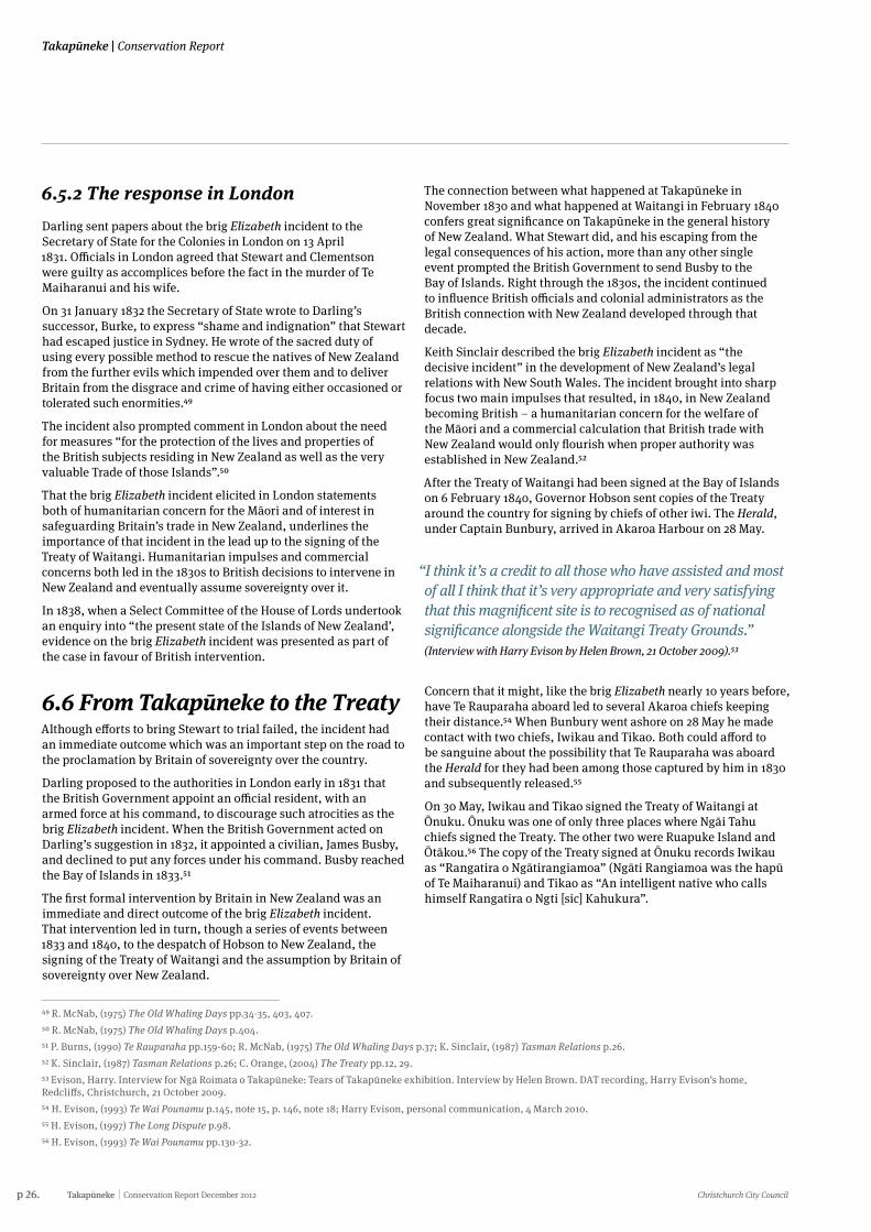
On 30 May, Iwikau and Tikao signed the Treaty of Waitangi at Ōnuku. Ōnuku was one of only three places where Ngāi Tahu chiefs signed the Treaty. The other two were Ruapuke Island and Ōtākou.56 The copy of the Treaty signed at Ōnuku records Iwikau as “Rangatira o Ngātirangiamoa” (Ngāti Rangiamoa was the hapū of Te Maiharanui) and Tikao as “An intelligent native who calls himself Rangatira o Ngti [sic] Kahukura”.
Christchurch City Council Conservation Report December 2012 Takapūneke p 27.
Conservation Report | Takapūneke
The Kāik at Ōnuku in 1882 showing the recently constructed Whare Karakia and Native School at centre left. (Burton Brothers, original held by Alexander Turnbull Library)
p 28. Takapūneke Conservation Report December 2012 Christchurch City Council
Takapūneke | Conservation Report
6.7 Green’s Point: British Sovereignty and the FrenchThe concerns which were brought into sharp focus by the brig Elizabeth incident were only one of the influences impelling the British Government towards its decision to acquire sovereignty over New Zealand.
The other major concern which influenced this decision was French imperial ambitions in the South Pacific. Green’s Point, the headland which marks the northern limit of the bay of Takapūneke, was the probable scene of an important event in the story of the British forestalling the French in claiming the South Island.
Before Hobson was sent to New Zealand to acquire British sovereignty, a French venture to colonise Banks Peninsula had been initiated by a French whaling captain, Jean Langlois. By the time the settlers sent out by the Nanto-Bordelaise Company arrived at Akaroa, New Zealand had been securely British for some months. But the impending arrival of the French prompted Hobson to despatch a British naval vessel, the Britomart, to Akaroa to demonstrate and exercise British sovereignty, to deny the French any grounds to claim sovereignty over the South Island.
After the signing of the Treaty, first at Waitangi then elsewhere in the country, Hobson proclaimed British sovereignty over New Zealand on 21 May 1840. He claimed sovereignty over the North Island by virtue of the Treaty of Waitangi and over the South Island by virtue of discovery, the Herald had not yet returned to the Bay of Islands after collecting signatures to the Treaty in the South Island.
About a month later, on 17 June 1840, Bunbury and Nias proclaimed British sovereignty over the South Island at Cloudy Bay, as the Herald was making its way north back to the Bay of Islands. Shortly afterwards, on 10 July, the French naval vessel L’Aube, under Captain Lavaud, despatched by the French Government to support the Nanto-Bordelaise Company’s colony at Akaroa, put into the Bay of Islands on 10 July. Hobson was sufficiently concerned to instruct Stanley, the captain of the Britomart, to proceed to Akaroa and hold a court of law there as an “act of civil authority”.57
The Britomart reached Akaroa on 10 August and anchored a little above Green’s Point. Stanley engaged James Clough (Robinson) to act as an interpreter and to explain the nature of the visit to local Ngāi Tahu.58 A large number of Ngāi Tahu were present the following day, 11 August, when Stanley landed and the Union Jack was raised.
The two magistrates who were with Stanley (C.B. Robinson and Michael Murphy) convened courts of law. Stanley’s reports state that courts were held under the flag on 11 August at the two parts of the bay where British subjects were already residing.59
According to Stanley’s chart of Akaroa Harbour, William Green was then living at Takapūneke and James Clough (Robinson) at Paka Ariki, later French Bay, where the French settlers were shortly to land. Clough had been living at Akaroa with Puai, a cousin of Tikao and relative of Iwikau, since 1837.60 Puai had had firsthand experience of the Ngāti Toa raids on Takapūneke and Ōnawe.61 Clough’s later recollections of the raising of the Union Jack near his own residence describe the flagpole as having been erected on “the sandy beach between the townships”. The townships in question were the French and English parts of Akaroa, which remained separate through the town’s early years. Clough recalled the British standard being run up a flagpole and muskets being fired, along with a salute by the big guns aboard the Britomart.62 Clough also recalled that he had assisted the English to find a flagstaff and that a kāhikatea was specifically felled for the purpose.63
By contrast, C.B. Robinson, who held the position of Magistrate in Akaroa for several years after the 1840 flag raising, recalled that no ceremony whatever took place, aside from the hoisting of the flag. He also said that the post for the flagpole was an old tōtara tree which had been felled by Māori for a waka (canoe).
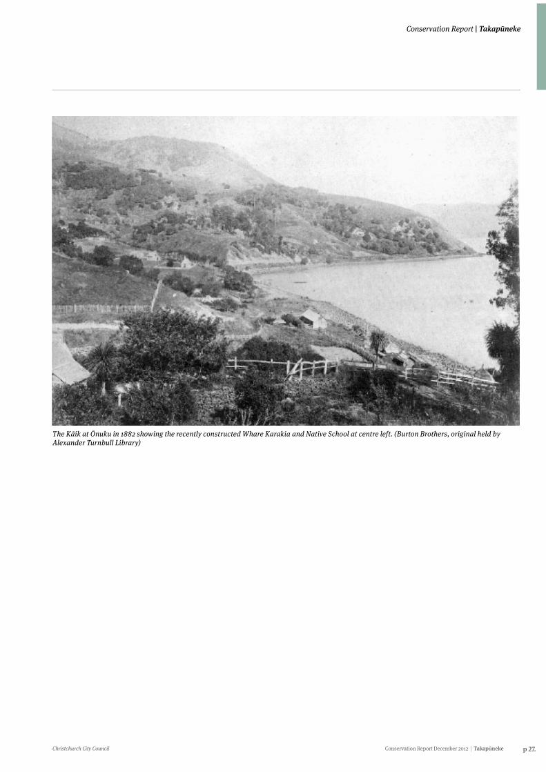
A re-enactment of the Green’s Point flag raising at the Akaroa Recreation Ground during the Akaroa Centennial celebrations in 1940. (Photograph courtesy of Akaroa Museum, image number # 151).
57 Akaroa and Banks Peninsula pp 95-98. Also see Appendix One for Captain Stanley’s map of Akaroa Harbour.58 Dr. A.C. Barker’s transcript recounting the words of James Robinson Clough in “The Onawe Festival”, Star, 23 March 1891.59 J.C Andersen, (1976) Place-Names p.20; Tales of Banks Peninsula pp.97, 151-59; Akaroa and Banks Peninsula p.98.60 Maling, Maps and Charts of Banks Peninsula. Ogilvie (2007, p21) says that James Robinson Clough was ‘living at Onuku’, but Stanley’s chart is a more reliable, primary, source for stating that he was living in Paka Ariki. See also Tales of Banks Peninsula, pp.153-55.61 In later years Clough recounted Puai’s version of these events to various parties including Dr. A.C. Barker. See Dr. A.C. Barker’s transcript recounting the words of James Robinson Clough in “The Onawe Festival”, Star, 23 March 1891.62 Akaroa and Banks Peninsula p.146; Tales of Banks Peninsula pp.151-59.63 Mosely, M. (1885) Illustrated guide to Christchurch and Neighbourhood. J.T. Smith & Co. p2.
Christchurch City Council Conservation Report December 2012 Takapūneke p 29.
Conservation Report | Takapūneke
According to his account, Ngāi Tahu took the English to the log which was located in a bush gully at the back of the Red House - the Britomart’s carpenter squared the 8ft long log and a spare yard from the Britomart was lashed to it for a flagstaff.64
Green’s house in 1840 was not on Green’s Point but in approximately the position of the present Red House. Although Green’s Point has been generally accepted as the place where Stanley raised the flag on 11 August, it has been suggested that he may have raised the flag only at the residences of Clough and Green, and not on Green’s Point itself.
The French were not far behind. The L’Aube reached Akaroa on 15 August and the Comte de Paris, which was bringing out the French settlers, on 17 August. Whether the British flag was flying on Green’s Point itself when the Comte de Paris arrived on 17 August is uncertain. Evidence suggests that it was, on a pole that may have been erected by either Rhodes or Green, after they had landed cattle at Takapūneke in November 1839 (see below) or by the crew of the Britomart, after its arrival. The geographical prominence of the point reinforces the likelihood that a British flag was flying on Green’s Point by 17 August, even if it had not been one of the two places at which Stanley raised the flag on 11 August. In 1900 Christchurch architect Samuel Farr recounted a visit he had made with C.B. Robinson (probably in the early 1850s) to the site where the flag was raised – they located the flag pole at ‘the Point’ but found that it had been “sadly cut about by relic hunters, and only about three feet of it remained out of the ground”.65
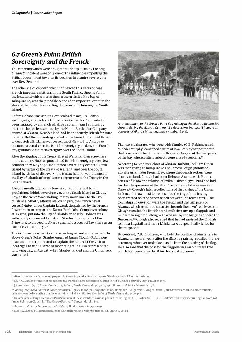
6.7.1 The Britomart MonumentThe probable site of the raising of the British flag on 11 August was not marked until the very end of the 19th century. In 1897 the 60th anniversary of the commencement of Queen Victoria’s reign was celebrated throughout the Empire. To mark that anniversary it was proposed locally that a monument be raised in Akaroa. The monument was unveiled the following year, 1898.
The monument was designed by architect, Samuel Farr, who arrived in Akaroa in March 1850 (as one of the ‘Monarch settlers’). Farr lived in Akaroa for 12 years, working as a builder and architect. He moved to Christchurch in 1862. He was probably chosen to design the monument because of his early association with Akaroa.66 Farr was also a contemporary and friend of many of the early European settlers (French, German and English) and a friend of Akaroa Ngāi Tahu, including Karaweko and Tikao.67
The monument was unveiled on 14 June 1898 by the Governor, Lord Ranfurly, before a crowd reported to number 2000. Also present were the Premier, Richard Seddon, and Bishop Julius. The inscription on the monument records that the Union Jack was again run up under a salute from the guns of HMS Tauranga and the national anthem sung.68
64 Old Akaroa. Reminiscences of Mr S.C. Farr in Star, 15 December 1900, p10.65 Old Akaroa. Reminiscences of Mr S.C. Farr in Star, 15 December 1900, p10.6667 Old Akaroa. Reminiscences of Mr S.C. Farr in Star, 15 December 1900, p10.68 J.C Andersen, (1976) Place-Names p.77; Transactions of the New Zealand Institute, vol. 40, 1908, p. 53. There is an account of the unveiling in the Press, 15 June 1898, pp. 5-6.69 Andrews, Victoria. Interview for Ngā Roimata o Takapūneke: Tears of Takapūneke exhibition. Interview by Helen Brown. DAT recording, Victoria Andrews’ home, Grehan Valley, Akaroa, 22 December 2009.
Photograph of an unidentified group at the Britomart Memorial W.A Taylor, date unknown. (Photograph courtesy of the Canterbury Museum Collection).
Detail of the inscription on the Britomart Monument, Green’s Point. (Photo: John Wilson)
“When you stand at the Britomart Memorial and you look at the landscape you can see that it’s largely unmodified and it’s been that way since 1830. There’s a house and a waste treatment plant unfortunately plus a rubbish tip at the top but even at that you can still stand at the Britomart Memorial and view this landscape which is magnificent in its own way. It tells a very tragic story but it is the story of the founding of New Zealand and that is something that is worthy of preservation.” (Interview with Victoria Andrews by Helen Brown, 22 December 2009).69
p 30. Takapūneke Conservation Report December 2012 Christchurch City Council
Takapūneke | Conservation Report
In the years immediately after it was erected, the monument was the scene of occasional events and celebrations. In 1906, F.A. Anson, who had attended the 1898 unveiling as the Chairman of the Akaroa County Council, donated a flagstaff and flag for the site.70 For a year or two the anniversary of the original demonstration of British sovereignty was celebrated at Green’s Point.71
Subsequently the practice of marking the ‘memorial day’ at Green’s Point itself appears to have ceased. When Akaroa staged its New Zealand centennial celebrations in 1940, the 1840 flag-raising was re-enacted on the Akaroa Recreation Ground, not at Green’s Point.72 It was already known in 1898 that British sovereignty had been demonstrated and not proclaimed at Green’s Point in 1840, but the original inscription on the monument read that “On this spot Captain Stanley R.N. of HMS Britomart Hoisted the British flag and the Sovereignty of Great Britain was formally proclaimed August 11th 1840”.1840 In the late 1920s the inscription was changed to read that Stanley had raised the Union Jack “to demonstrate British sovereignty to the people on Banks Peninsula and to the French corvette L’Aube”.
When the point was surveyed in 1891 for the Akaroa and Wainui Road Board, it extended further out to sea than it does now. The point, which at that time was private land, was cut back before the monument was erected in 1898. The actual site on which the flagpole was probably erected in 1840 may have been destroyed in the early 1890s.74
In 1910, the possibility of the Government’s purchasing the private land on which the monument stood, was raised. The Commissioner of Crown Lands suggested that the Government might provide a £ for £ subsidy for the purchase. A local resident immediately offered £40 but the land did not pass into public ownership at that time.75
In 1926 a small reserve was created around the monument itself. The reserve was vested periodically for set terms in the Akaroa Borough Council. Just before the reserve was surveyed and gazetted in 1926, a small area of land angling up to the monument from Beach Road was taken for road purposes. This land provided pedestrian access to the monument. Steps were built up to the monument, probably in 1939 when the existing concrete and iron pipe wall designed by Christchurch architect Paul Pascoe was erected around the monument, replacing an older wire-woven fence.76
In 1956 the Borough Council was appointed to control and manage the reserve.77 The reserve was classified as an historic reserve in 1979.78
In 1990, a further bronze plaque was attached to the north face of the monument to record that the landing of a police magistrate at Akaroa in August 1840 marked the commencement of policing on the South Island.
70 Akaroa Mail, 21 August 1906, p. 2, 21 September 1906, p. 2.71 Akaroa Mail, 14 August 1908, p. 2.72 Akaroa Centennial Celebrations, 20 April 1940.73 The Press, 18 June 1898, p. 5; Buick, p.343.74 Plan SO6836.75 Akaroa Mail, 10 June 1910, p. 2.76 Plan A6038; Beaumont and Wilson, ‘Overview’, p. 76; Certificates of Title 38/82 and 112/214.77 Plan SO6049; Gazette 1926, p. 2402.78 Gazette, 10 January 1980.
Christchurch City Council Conservation Report December 2012 Takapūneke p 31.
Conservation Report | Takapūneke
7. European Occupation of Takapūneke
7.1 The landing of cattleIn November 1839 cattle were landed at Takapūneke, thus beginning the South Island’s history of pastoral farming. On 14 October 1839, in Sydney, William Green and his wife Mary Ann signed a contract for two years with Daniel Cooper, James Holt and William Barnard Rhodes. The contract required the Greens to travel to New Zealand with Rhodes and erect buildings and run cattle on the land which the partners claimed they owned after purchasing a Captain Leathart’s deed.
The Greens arrived at Akaroa on 10 November 1839. Rhodes chose Takapūneke as the place to put the Greens and the cattle ashore because he needed to come close enough inshore for the cattle to swim to land without the barque running aground. (This was exactly the feature of Takapūneke that Te Maiharanui had taken advantage of when he established his flax-trading settlement there in the 1820s.)79 Takapūneke was also chosen for the establishment of the cattle station because there was open grazing country on the heights above the bay. The cattle were hoisted overboard with slings and swam ashore. The number of cattle could have been as few as 18, but Rhodes recalled, in 1870, landing about 50 head. This was the first cattle station established on the South Island. Rhodes left the Greens at Takapūneke.80
Green, his wife and child lived for their first weeks on Banks Peninsula in a tent on the Takapūneke side of the point that later bore his name.81 In January 1840, when the French doctor Louis Thiercelin visited Akaroa, Green, engaged in “regular farming operations”, was living in a tent “at the bottom of the bay”, which suggests close to the foreshore. Thiercelin walked from Ōnuku towards where the French settlers were to land later in the year. At the turn of a little promontory he spied a white canvas tent fenced in by a rope on posts in which Mr and Mrs Green and their servant, “newly arrived from Australia”, were living. Thiercelin described the slope above their bay as covered with dense and impenetrable forest.82
At another point in his account of his 1840 visit to Akaroa, Thiercelin recalled that the Greens were living “about half a mile from the shore”, which would have put their tent well up slope from the foreshore. D’Urville, who visited Akaroa in the Astrolabe in April 1840, described the Greens’ “moderately well-equipped farmhouse” as being “back up the valley” behind the bay.83
But on Stanley’s chart of Akaroa Harbour, drawn a few months later, Green’s house is located close to the foreshore, about where the present ‘red house’ is. It is likely Green built his house, not long after Thiercelin’s visit, close to where he had pitched his tent. Green’s was the first ‘red house’ at Takapūneke. It almost certainly gained its name from the colour it was painted.
After his contract with Rhodes, Cooper and Holt expired, Green remained in Akaroa, establishing a hotel on the Akaroa side of Green’s Point, but his connection with Takapūneke was severed. At the end of 1843, William Rhodes’ brother, George, took over responsibility for the cattle station and moved into “a red-painted wooden house down by the shore”. The interest of members of the Rhodes’ family in Takapūneke ended in 1847, when George Rhodes moved to Purau.84
7.2 Later farming at TakapūnekeFrom the 1850s until the 1970s Takapūneke was quietly farmed by successive families. Rural section 547, which included all the land of Takapūneke below the road reserve but also extended north of Green’s Point to take in the area now known as The Glen, was originally granted to Joseph Palmer and Henry John Le Cren on 19 April 1859. Palmer and Le Cren also owned the rural section above the road to Ōnuku, no. 768. Neither Palmer nor Le Cren occupied the land, which they owned only until 1862.85
In 1862, rural sections 547 and 768 were bought by Augustus White, an Akaroa businessman. White sold off three sections of land. Two of these sections were small areas on the foreshore at about the middle of the bay; one of these sections probably included the ‘red house’. The largest of the three sections White sold was a five-acre block on the south side of the bay where Wilson and Barwick established their short-lived ship-building yard (see below). After White’s bankruptcy in 1866, most of his land at Takapūneke was sold to George Scarbrough, the owner of the Bruce Hotel in Akaroa, and in 1876 the town’s first mayor. The name ‘Red House Bay’ was used to describe Takapūneke in these land transactions of the mid 1860s, so it was clearly by that time the bay’s established name, superseding Takapūneke.86
By the mid 1860s, the landscape of Takapūneke had been transformed. When Louis Thiercelin returned to Akaroa in 1864, he found that the impenetrable forests that had stopped his 1840 walk short between Takapūneke and Paka Ariki had disappeared. There remained only patches of forest on the mountain slopes and clumps of trees in the valleys. The great trees had been replaced by wheatfields and pasture.87
Scarbrough eventually re-incorporated into his Red House Bay block the three sections which White had sold in 1862. The larger area of five acres which Wilson and Barwick had sold in 1863 to Harry Haylock was bought by Scarbrough in 1870.88
The part of rural section 547 which lay north of Green’s Point (an area of 9 acres, 1 rood, 17 perches, was bought from Scarbrough’s widow in 1879 by William B. Tosswill. Tosswill sold this land in 1890 to another prominent member of the Akaroa community, James D. Garwood. (This land includes the area known as The Glen and the Stanley Place subdivision.)89
79 The Press, 28 September 1926; Ogilvie, Cradle, pp. 149-50.80 T.E. Green ‘To Akaroa and Back’, typescript held in the Akaroa Museum, pp. 2-12; Akaroa Mail, 4 January 1913, p. 2; G. Ogilvie, (2007) Cradle of Canterbury p.150; J.C Andersen, (1976) Place-Names pp.187-88; letter Colin Amodeo to John Wilson, 3 October 2001. Johnny Jones had already established a farm at Matanaka, on the Otago coast, near Waikouaiti, but it was not until a few months after Green had been landed with the cattle at Takapūneke that Jones began to run cattle at Matanaka.81 In the 1970s some of Green’s descendants claimed that William Green’s son Peter, the first white child born in Akaroa, had been gifted the land at Green’s Point by a local Māori Chief but that the land later reverted to the Crown through non payment of rates. See Daphne Harrison to NZHPT, 8 November 1971, K.W. Thomson to Ormond Wilson 12 November 1971, AWH Alsop to J.R. Allison (NZHPT) and other correspondence in New Zealand Historic Places Trust Canterbury Branch Committee archives Box 6 F34 Item36 held at Canterbury Museum.82 L. Thiercelin, (1995) Travels in Oceania pp.154-55, 161.83 G. Ogilvie, (2007) Cradle of Canterbury p156.84 Ibid.p.157; Akaroa and Banks Peninsula p.140.
p 32. Takapūneke Conservation Report December 2012 Christchurch City Council
Takapūneke | Conservation Report
85 Certificate of Title 38/82; Deeds Books 13D/347.86 G. Ogilvie, (2007) Cradle of Canterbury p.157; Deeds Books 13D/348, 15D/125, 15D/129, 15D/410.87 L. Thiercelin, (1995) Travels in Oceania p161.88 Deeds Books 18D/130, 53D/288.89 Certificate of Title 38/82; G. Ogilvie, (2007) Cradle of Canterbury pp. 43, 151.90 Deeds Books, 1W2/154.91 Deeds Books, 1W2/760.92 Plan A5684; Certificate of Title 112/214.93 Akaroa Mail, 26 February 1892 p. 2, 1 March 1892 p. 2.94 Akaroa Mail, 23 December 1884, p2.95 Akaroa Mail, 21 December 1888.96 Akaroa Mail, 29 March 1889, p2.
“I lived within 300 metres of that site for all my young life and I knew nothing. I was not told anything. Not by anybody here [at Ōnuku] or by anybody in my family at all… I am not sure when I realised the significance.” (Jeff Hamilton, personal communication, 22 August 2010)
After George Scarbrough’s death, rural section 547 passed to his wife, Charlotte.90 Charlotte died soon after George. Her trustees set about selling her property, which included the Red House Farm, in order that Charlotte’s estate could be shared among her and George’s brothers and sisters (who lived in Britain).91
The trustees had the land at Takapūneke resurveyed, creating a single block surrounding the bay The block was that part of rural section 547 which lay south of Green’s Point, an area of 35 acres 2 roods 248/10 perches (approximately 14.5 hectares). The outer boundaries of this block are almost exactly the outer boundaries of the present Takapūneke Reserve. When the block was surveyed in the first half of 1885, the Takapūneke land was occupied by Frederick Anning, an Akaroa butcher. Anning’s occupation suggests he may have been using the land to run stock. It is possible that the building known as the ‘killing shed’ which stood on the foreshore of Takapūneke until the turn of the 21st century was built by Anning.
Charlotte Scarbrough’s trustees sold this land in 1885 to John Glynan, a local farmer.92 Glynan was an Irishman who had come to New Zealand in the 1840s as a soldier. He eventually made his way to Canterbury in the 1850s and settled in Akaroa, where he worked as a bullock-driver. He accumulated enough savings to buy a home block at Ōnuku. He later bought more land at Ōnuku and then in 1885 the Takapūneke block (when it was known as Red House Bay). At the time he bought the Red House Bay land he already owned the adjoining section along the coast towards Ōnuku (rural section 4140) and also land above the road again towards Ōnuku (rural section 4963). After buying the Takapūneke land, Glynan continued to live at Ōnuku. He married in 1859 and had “a numerous family of fine stalwart young men and women”.93
Throughout the 1880s a series of much celebrated summer picnics for the children of Akaroa Borough School were held at Takapūneke on the Glynan property. The children travelled to the bay by steam launch where they enjoyed races and other amusements including pulling races on boats in the bay.94 The picnics were big community events sometimes attended by the Mayor with prizes for the winners of the sports events donated by local businesses.
Three years after John Glynan bought the Takapūneke land, on the night of 20 December 1888 and one day after the annual school picnic, “the old Red House was totally destroyed by fire”. (It is not certain whether this was Green’s original house or a house George Rhodes had built after he took over responsibility for the Rhodes’ cattle in 1843.) The Akaroa Mail reported that the house had been empty for a long time and surmised that the cause of the fire may have been due to the school picnickers leaving inflammable material behind.95 Not surprisingly, the following year the annual school picnic was held elsewhere.
In 1889 the Akaroa Borough Council, on the recommendation of a special Sanitary Committee, passed a resolution that the night soil from the town be deposited “at a point on the south side of the reef at the Red House Bay”. The scheme required the formation of a road (referred to in later correspondence as Sewage Road) around to the Red House Reef and the construction of a small causeway on the beach at the point of deposit.96 The scheme was contentious and opposed by some councillors and members of the public including the Glynan family, largely out of concern that sewage from the night cart would contaminate the roads en route.97
A plan to transport the nightsoil to Red House Bay via punt was briefly explored before being discredited.
Following a report by Messrs Wilkins and Bristow which stated that “no nuisance could possibly arise” from the scheme, it was implemented. The borough council completed their sewage scheme in 1893.98 A ton per week of night soil was deposited in deep water99 “in the harbour underneath and in front of a rocky bluff distant twenty-one chains from the old stock yard in Red House Bay and fronting the late Mr Glynan’s property”.100 The nightsoil service discontinued in April 1907 with the development of a septic tank based sewage scheme in Akaroa.101
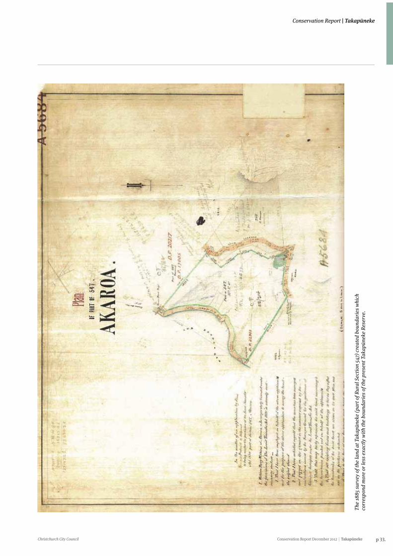
Christchurch City Council Conservation Report December 2012 Takapūneke p 33.
Conservation Report | Takapūneke
The
1885
surv
ey o
f the
land
at T
akap
ūnek
e (p
art o
f Rur
al S
ectio
n 54
7) c
reat
ed b
ound
arie
s whi
ch
corr
espo
nd m
ore
or le
ss e
xact
ly w
ith th
e bo
unda
ries o
f the
pre
sent
Tak
apūn
eke
Rese
rve.
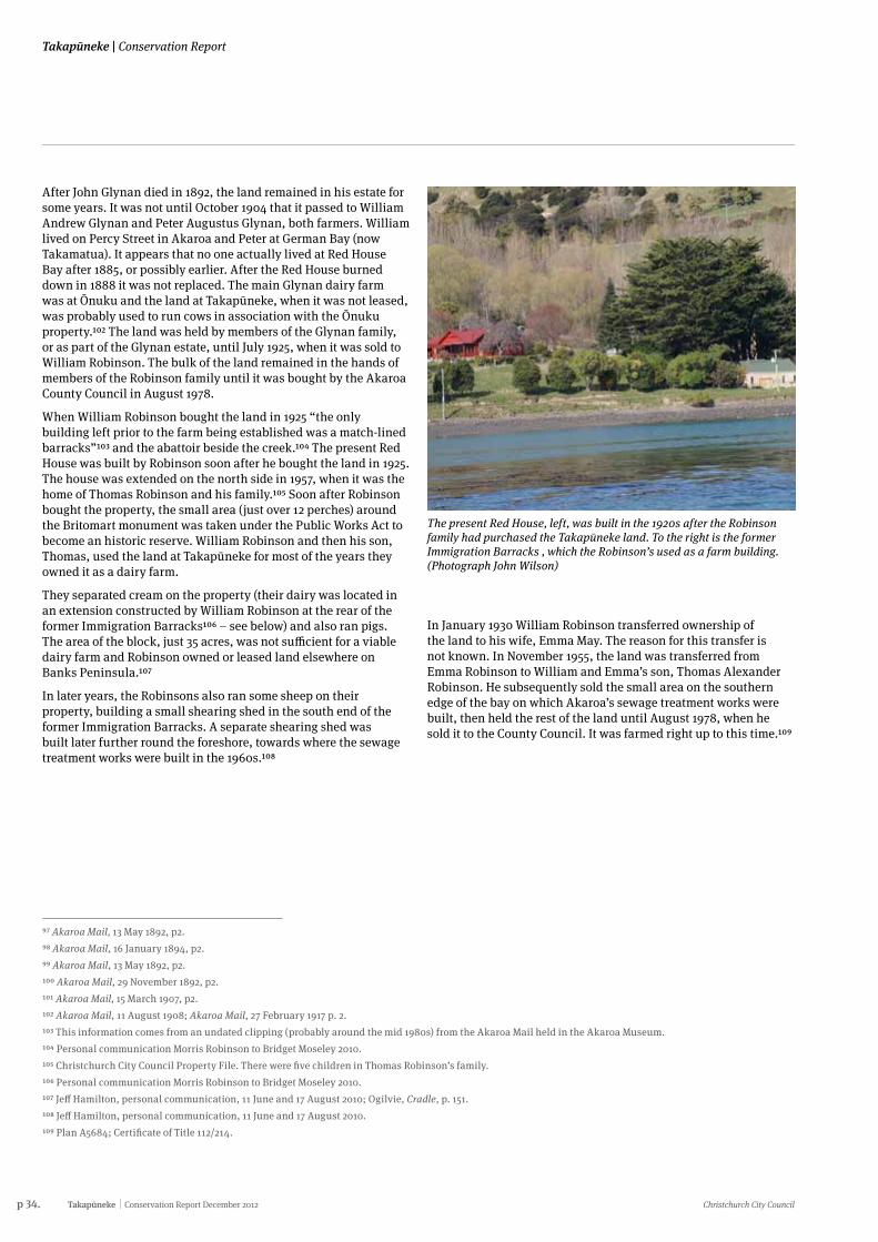
p 34. Takapūneke Conservation Report December 2012 Christchurch City Council
Takapūneke | Conservation Report
97 Akaroa Mail, 13 May 1892, p2.98 Akaroa Mail, 16 January 1894, p2.99 Akaroa Mail, 13 May 1892, p2.100 Akaroa Mail, 29 November 1892, p2.101 Akaroa Mail, 15 March 1907, p2.102 Akaroa Mail, 11 August 1908; Akaroa Mail, 27 February 1917 p. 2. 103 This information comes from an undated clipping (probably around the mid 1980s) from the Akaroa Mail held in the Akaroa Museum.104 Personal communication Morris Robinson to Bridget Moseley 2010.105 Christchurch City Council Property File. There were five children in Thomas Robinson’s family.106 Personal communication Morris Robinson to Bridget Moseley 2010.107 Jeff Hamilton, personal communication, 11 June and 17 August 2010; Ogilvie, Cradle, p. 151.108 Jeff Hamilton, personal communication, 11 June and 17 August 2010.109 Plan A5684; Certificate of Title 112/214.
The present Red House, left, was built in the 1920s after the Robinson family had purchased the Takapūneke land. To the right is the former Immigration Barracks , which the Robinson’s used as a farm building. (Photograph John Wilson)
After John Glynan died in 1892, the land remained in his estate for some years. It was not until October 1904 that it passed to William Andrew Glynan and Peter Augustus Glynan, both farmers. William lived on Percy Street in Akaroa and Peter at German Bay (now Takamatua). It appears that no one actually lived at Red House Bay after 1885, or possibly earlier. After the Red House burned down in 1888 it was not replaced. The main Glynan dairy farm was at Ōnuku and the land at Takapūneke, when it was not leased, was probably used to run cows in association with the Ōnuku property.102 The land was held by members of the Glynan family, or as part of the Glynan estate, until July 1925, when it was sold to William Robinson. The bulk of the land remained in the hands of members of the Robinson family until it was bought by the Akaroa County Council in August 1978.
When William Robinson bought the land in 1925 “the only building left prior to the farm being established was a match-lined barracks”103 and the abattoir beside the creek.104 The present Red House was built by Robinson soon after he bought the land in 1925. The house was extended on the north side in 1957, when it was the home of Thomas Robinson and his family.105 Soon after Robinson bought the property, the small area (just over 12 perches) around the Britomart monument was taken under the Public Works Act to become an historic reserve. William Robinson and then his son, Thomas, used the land at Takapūneke for most of the years they owned it as a dairy farm.
They separated cream on the property (their dairy was located in an extension constructed by William Robinson at the rear of the former Immigration Barracks106 – see below) and also ran pigs. The area of the block, just 35 acres, was not sufficient for a viable dairy farm and Robinson owned or leased land elsewhere on Banks Peninsula.107
In later years, the Robinsons also ran some sheep on their property, building a small shearing shed in the south end of the former Immigration Barracks. A separate shearing shed was built later further round the foreshore, towards where the sewage treatment works were built in the 1960s.108
In January 1930 William Robinson transferred ownership of the land to his wife, Emma May. The reason for this transfer is not known. In November 1955, the land was transferred from Emma Robinson to William and Emma’s son, Thomas Alexander Robinson. He subsequently sold the small area on the southern edge of the bay on which Akaroa’s sewage treatment works were built, then held the rest of the land until August 1978, when he sold it to the County Council. It was farmed right up to this time.109
Christchurch City Council Conservation Report December 2012 Takapūneke p 35.
Conservation Report | Takapūneke
110 Deeds Books 15D/129.111 Daily Southern Cross, 3 February 1863, p2112 Daily Southern Cross, 3 February 1863, p2113 Ronald A. Chapman, ‘Temporary Quarters: Immigration Accommodation in Canterbury 1840-1876, Records of the Canterbury Museum, vol. 13, December 1999, pp. 1, 20. More than 100 sites in Canterbury where accommodation for organised groups of immigrants was built or planned have been identified.114 Chapman, ‘The Demise’, Akaroa Mail, 28 December 2001, p. 17.115 AJHR 1874 D5, p. 40.
116 Chapman, ‘The Demise’, Akaroa Mail, 28 December 2001, p. 17.117 AJHR 1874 D5, p. 40.118 Illustrated New Zealand Herald, 2 July 1875, p. 7.119 Akaroa Mail, 25 March 1898.120 Akaroa Mail, 22 April 1998, p. 2; 15 July 1898, p. 2; G. Ogilvie, (2007) Cradle of Canterbury, p. 43.121 Jeff Hamilton, personal communication, 17 August 2010. 122 Akaroa Mail, 5 April 1899, p. 2; 5 September 1899, p. 2; 19 February 1901, p. 2; 20 October 1905, p. 2.123 Jeff Hamilton, personal communication, 17 August 2010.
7.3 ShipbuildingIn the 1860s Takapūneke was, briefly, the location of an early ship building yard. In October 1862, Augustus White sold five acres of land on the southern side of the bay (where the sewage treatment works were built later) to James Wilson and John Barwick.110 A ship building yard was established on the foreshore. The Takapūneke site was described as “an excellent site for their industry, having a deep sea frontage, steep incline of beach, and sound foreshore…sheltered from southerly gales, with a large quantity of timber in the vicinity, possessing also a liberal supply of fresh water and other agreements”.111 In 1862-63 a 40-ton ketch the Foam was built in the yard. On completion of the Foam a large contingent of the Akaroa community and “numerous visitors from other portions of the province” attended a ceremony to honour the builders and celebrate their achievement.112
After completing the Foam, Wilson and Barwick moved their shipbuilding operation to Duvauchelle where timber was more readily available. Wilson and Barwick sold the five acres of land in July 1863 (after owning it for just eight months) to Harry Haylock, who sold it in 1870 to Scarbrough.
7.4 The former Immigration Barracks The major surviving building on the foreshore at Takapūneke is a wooden building which began life as an Immigration Barracks built in Akaroa in 1874. Since the 1898 transfer of at least part of the original barracks to Takapūneke, the building has served different purposes.
In 1874, the immigration programme of the Vogel Government was expected to bring up to 12,000 new settlers to Canterbury. Government policy was to disperse the new labour being brought into the country for public works and farming from the ports of arrival to country districts.113 In early February 1874, the Immigration Officer of the Canterbury Provincial Government, J.E. March, visited Akaroa to enquire what work and accommodation would be available there for immigrants. He received several offers of work on farms and in sawmills. March decided to send six to eight families and 20 single men to Akaroa.114
On 19 February 1874, the Superintendent of Canterbury, William Rolleston, sent an urgent request to Vogel, the Minister for Immigration, asking that the Central Government authorise the construction of an immigration ‘depôt’ at Akaroa. Vogel immediately authorised the construction of a depot at Akaroa at a cost not exceeding £500.115
The contract to erect a building to house up to 50 immigrants was let by the Provincial Government to William Penlington for £425. The site chosen was at the corner of Bruce Terrace and Rue Jolie, near the Akaroa Hospital. The sites of both the hospital and the barracks are now occupied by the Akaroa School. The weatherboard building, with a shingle roof, was completed by 30 July. The interior was probably divided up into small rooms for families, larger rooms for single men and women and common areas for cooking and eating.116
Although Rolleston had told Vogel in his telegram of 19 February 1874 that an immigration depot was needed in Akaroa “in view of large numbers immediately to arrive”,117 the barracks were little used for that purpose. A first group of new settlers was sent to Akaroa in August 1874. In July 1875 it was reported that the barracks were “never long occupied, as the absorption of newly imported labour proceeds faster than the supply can fill the building”.118 After use of the building as an Immigration Barracks ceased, the building became dilapidated.
In January 1898, Graecen Black, an Akaroa businessman, submitted a successful tender for removal of the barracks from their original site. Black then sought tenders, on 25 January 1898, for “taking down the Immigration Barracks and re-erecting a portion of that building”. The Akaroa site had been cleared by the end of March.119 At least part of the building was transported to Takapūneke and used by Black as a crayfish canning factory.120 The small jetty which appears in photographs of Takapūneke taken in the early years of the 20th century was probably built at the time the barracks was rebuilt at Takapūneke and used to land crayfish. The jetty had disappeared by the years immediately after the end of World War II.121
The former Immigration Barracks were not used as a crayfish canning factory for long. In 1901 Black sold the business to Irvine and Stevenson who were operating another crayfish canning factory in Akaroa. Irvine and Stevenson closed down the Red House Bay factory immediately after buying it but in 1905 they re-opened it after a four year gap. The crayfish-canning factory remained working for only a short period.122
In later years the building was used for a time as a jam factory. After William Robinson bought the Takapūneke property in 1925, the barracks was used for various farm-related purposes. In the years after the end of World War II, there was a workshop in the front part of the building and a dairy behind.123 At an unknown date the southern lean-to of the building was converted for use as a small shearing shed, with yards between the building and the stream. The yards are no longer extant, but the ports in the side of the wall remain. Most recently, the building has been used to store miscellaneous household and other effects.
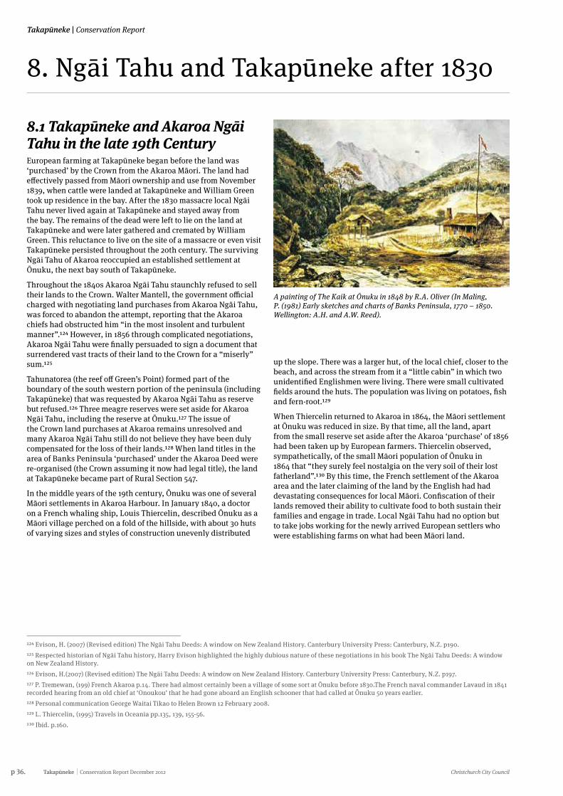
p 36. Takapūneke Conservation Report December 2012 Christchurch City Council
Takapūneke | Conservation Report
8.1 Takapūneke and Akaroa Ngāi Tahu in the late 19th CenturyEuropean farming at Takapūneke began before the land was ‘purchased’ by the Crown from the Akaroa Māori. The land had effectively passed from Māori ownership and use from November 1839, when cattle were landed at Takapūneke and William Green took up residence in the bay. After the 1830 massacre local Ngāi Tahu never lived again at Takapūneke and stayed away from the bay. The remains of the dead were left to lie on the land at Takapūneke and were later gathered and cremated by William Green. This reluctance to live on the site of a massacre or even visit Takapūneke persisted throughout the 20th century. The surviving Ngāi Tahu of Akaroa reoccupied an established settlement at Ōnuku, the next bay south of Takapūneke.
Throughout the 1840s Akaroa Ngāi Tahu staunchly refused to sell their lands to the Crown. Walter Mantell, the government official charged with negotiating land purchases from Akaroa Ngāi Tahu, was forced to abandon the attempt, reporting that the Akaroa chiefs had obstructed him “in the most insolent and turbulent manner”.124 However, in 1856 through complicated negotiations, Akaroa Ngāi Tahu were finally persuaded to sign a document that surrendered vast tracts of their land to the Crown for a “miserly” sum.125
Tahunatorea (the reef off Green’s Point) formed part of the boundary of the south western portion of the peninsula (including Takapūneke) that was requested by Akaroa Ngāi Tahu as reserve but refused.126 Three meagre reserves were set aside for Akaroa Ngāi Tahu, including the reserve at Ōnuku.127 The issue of the Crown land purchases at Akaroa remains unresolved and many Akaroa Ngāi Tahu still do not believe they have been duly compensated for the loss of their lands.128 When land titles in the area of Banks Peninsula ‘purchased’ under the Akaroa Deed were re-organised (the Crown assuming it now had legal title), the land at Takapūneke became part of Rural Section 547.
In the middle years of the 19th century, Ōnuku was one of several Māori settlements in Akaroa Harbour. In January 1840, a doctor on a French whaling ship, Louis Thiercelin, described Ōnuku as a Māori village perched on a fold of the hillside, with about 30 huts of varying sizes and styles of construction unevenly distributed
8. Ngāi Tahu and Takapūneke after 1830
A painting of The Kaik at Ōnuku in 1848 by R.A. Oliver (In Maling, P. (1981) Early sketches and charts of Banks Peninsula, 1770 – 1850. Wellington: A.H. and A.W. Reed).
124 Evison, H. (2007) (Revised edition) The Ngāi Tahu Deeds: A window on New Zealand History. Canterbury University Press: Canterbury, N.Z. p190.125 Respected historian of Ngāi Tahu history, Harry Evison highlighted the highly dubious nature of these negotiations in his book The Ngāi Tahu Deeds: A window on New Zealand History.126 Evison, H.(2007) (Revised edition) The Ngāi Tahu Deeds: A window on New Zealand History. Canterbury University Press: Canterbury, N.Z. p197.127 P. Tremewan, (199) French Akaroa p.14. There had almost certainly been a village of some sort at Ōnuku before 1830.The French naval commander Lavaud in 1841 recorded hearing from an old chief at ‘Onoukou’ that he had gone aboard an English schooner that had called at Ōnuku 50 years earlier. 128 Personal communication George Waitai Tikao to Helen Brown 12 February 2008.129 L. Thiercelin, (1995) Travels in Oceania pp.135, 139, 155-56.130 Ibid. p.160.
up the slope. There was a larger hut, of the local chief, closer to the beach, and across the stream from it a “little cabin” in which two unidentified Englishmen were living. There were small cultivated fields around the huts. The population was living on potatoes, fish and fern-root.129
When Thiercelin returned to Akaroa in 1864, the Māori settlement at Ōnuku was reduced in size. By that time, all the land, apart from the small reserve set aside after the Akaroa ‘purchase’ of 1856 had been taken up by European farmers. Thiercelin observed, sympathetically, of the small Māori population of Ōnuku in 1864 that “they surely feel nostalgia on the very soil of their lost fatherland”.130 By this time, the French settlement of the Akaroa area and the later claiming of the land by the English had had devastating consequences for local Māori. Confiscation of their lands removed their ability to cultivate food to both sustain their families and engage in trade. Local Ngāi Tahu had no option but to take jobs working for the newly arrived European settlers who were establishing farms on what had been Māori land.
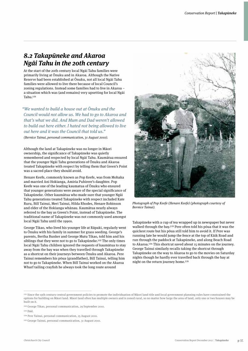
Christchurch City Council Conservation Report December 2012 Takapūneke p 37.
Conservation Report | Takapūneke
8.2 Takapūneke and Akaroa Ngāi Tahu in the 20th centuryAt the start of the 20th century local Ngāi Tahu families were primarily living at Ōnuku and in Akaroa. Although the Native Reserve had been established at Ōnuku, not all local Ngāi Tahu families were allowed to live there because of local Council’s zoning regulations. Instead some families had to live in Akaroa – a situation which was (and remains) very upsetting for local Ngāi Tahu.131
“We wanted to build a house out at Ōnuku and the Council would not allow us. We had to go to Akaroa and that’s what we did. And Mum and Dad weren’t allowed to build out here either. I hated not being allowed to live out here and it was the Council that told us.” (Bernice Tainui, personal communication, 31 August 2010).
Although the land at Takapūneke was no longer in Māori ownership, the significance of Takapūneke was quietly remembered and respected by local Ngāi Tahu. Kaumātua ensured that the younger Ngāi Tahu generations of Ōnuku and Akaroa treated Takapūneke with respect by telling them that Green’s Point was a sacred place they should avoid.
Henare Keefe, commonly known as Pop Keefe, was from Mohaka and married Ani Hokianga, Amiria Puhirere’s daughter. Pop Keefe was one of the leading kaumatua of Ōnuku who ensured that younger generations were aware of the special significance of Takapūneke. Other kaumātua who made sure that younger Ngāi Tahu generations treated Takapūneke with respect included Kate Ruru, Bill Tainui, Meri Tainui, Hilda Rhodes, Henare Robinson and elder of the Hokianga whānau. Kaumātua nearly always referred to the bay as Green’s Point, instead of Takapūneke. The traditional name of Takapūneke was not commonly used amongst local Ngāi Tahu until the 1990s.
George Tikao, who lived his younger life at Rāpaki, regularly went to Ōnuku with his family in summer for grass seeding. George’s parents, Bertha Bunker and George Mutu Tikao, told him and his siblings that they were not to go to Takapūneke.132 The only times local Ngāi Tahu children ignored the requests of kaumātua to stay away from the bay was when they travelled through Takapūneke as a shortcut on their journeys between Ōnuku and Akaroa. Pere Tainui remembers his pōua (grandfather), Bill Tainui, telling him not to go to Takapūneke. When Bill Tainui worked on the Akaroa Wharf tailing crayfish he always took the long route around
131 Since the 19th century central government policies to promote the individuation of Māori land title and local government planning rules have constrained the options for building on Māori land. Māori land often has multiple owners and is zoned rural, so no matter how large the area of land, only one or two houses may be built on it.132 George Tikao, personal communication, 29 September 2010.133 Ibid.134 Pere Tainui, personal communication, 25 August 2010.135 George Tainui, personal communication, 31 August 2010.
Photograph of Pop Keefe (Henare Keefe) (photograph courtesy of Bernice Tainui).
Takapūneke with a cup of tea wrapped up in newspaper but never walked through the bay.133 Pere often told his pōua that it was the quickest route but his pōua still told him to avoid it. If Pere was running late he would jump the fence at the top of Kāik Road and run through the paddock at Takapūneke, and along Beach Road to Akaroa.134 This shortcut saved about 15 minutes on the journey. George Tainui similarly recalls taking the shortcut through Takapūneke on the way to Akaroa to go to the movies on Saturday nights though he hardly ever travelled back through the bay at night on the return journey home.135
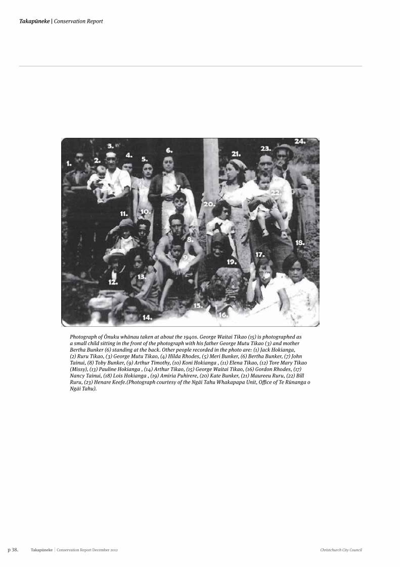
p 38. Takapūneke Conservation Report December 2012 Christchurch City Council
Takapūneke | Conservation Report
Photograph of Ōnuku whānau taken at about the 1940s. George Waitai Tikao (15) is photographed as a small child sitting in the front of the photograph with his father George Mutu Tikao (3) and mother Bertha Bunker (6) standing at the back. Other people recorded in the photo are: (1) Jack Hokianga, (2) Ruru Tikao, (3) George Mutu Tikao, (4) Hilda Rhodes, (5) Meri Bunker, (6) Bertha Bunker, (7) John Tainui, (8) Toby Bunker, (9) Arthur Timothy, (10) Koni Hokianga , (11) Elena Tikao, (12) Tore Mary Tikao (Missy), (13) Pauline Hokianga , (14) Arthur Tikao, (15) George Waitai Tikao, (16) Gordon Rhodes, (17) Nancy Tainui, (18) Lois Hokianga , (19) Amiria Puhirere, (20) Kate Bunker, (21) Maureeu Ruru, (22) Bill Ruru, (23) Henare Keefe.(Photograph courtesy of the Ngāi Tahu Whakapapa Unit, Office of Te Rūnanga o Ngāi Tahu).
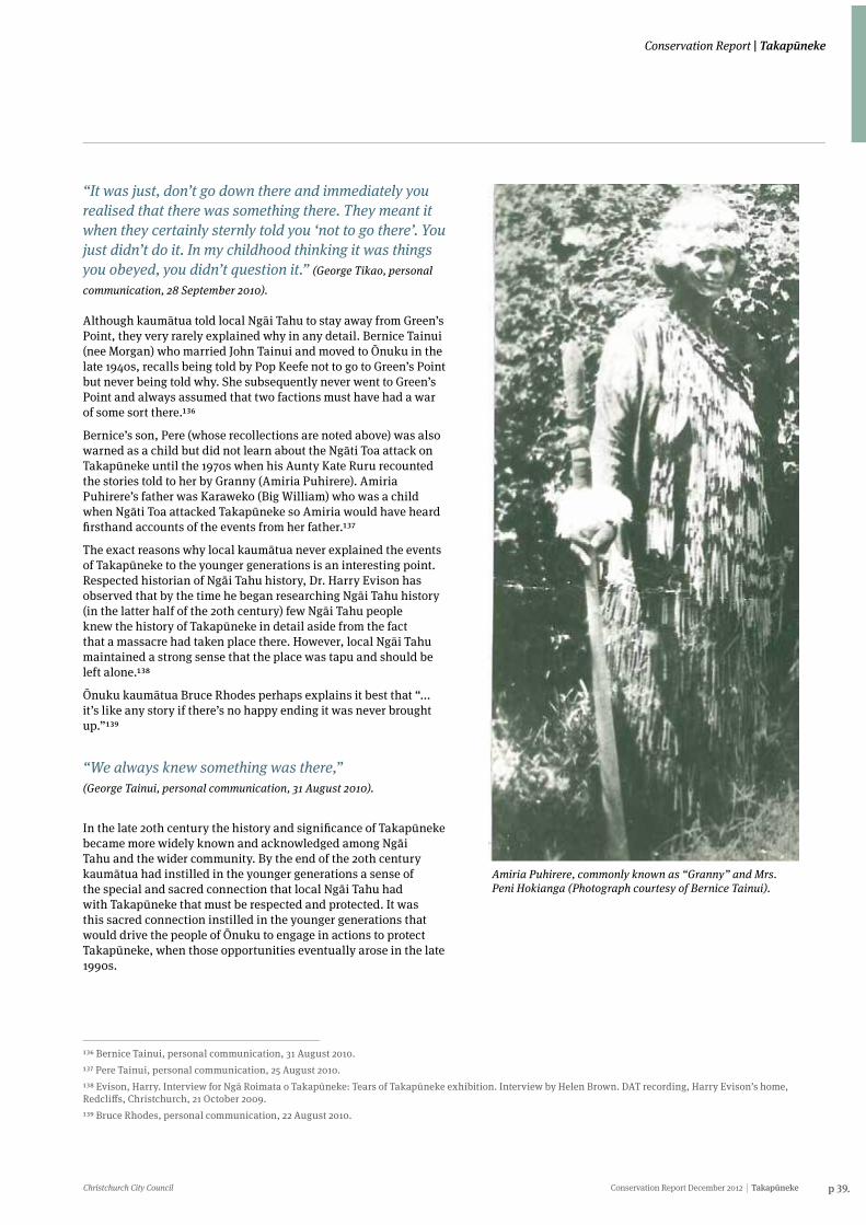
Christchurch City Council Conservation Report December 2012 Takapūneke p 39.
Conservation Report | Takapūneke
“It was just, don’t go down there and immediately you realised that there was something there. They meant it when they certainly sternly told you ‘not to go there’. You just didn’t do it. In my childhood thinking it was things you obeyed, you didn’t question it.” (George Tikao, personal
communication, 28 September 2010).
Although kaumātua told local Ngāi Tahu to stay away from Green’s Point, they very rarely explained why in any detail. Bernice Tainui (nee Morgan) who married John Tainui and moved to Ōnuku in the late 1940s, recalls being told by Pop Keefe not to go to Green’s Point but never being told why. She subsequently never went to Green’s Point and always assumed that two factions must have had a war of some sort there.136
Bernice’s son, Pere (whose recollections are noted above) was also warned as a child but did not learn about the Ngāti Toa attack on Takapūneke until the 1970s when his Aunty Kate Ruru recounted the stories told to her by Granny (Amiria Puhirere). Amiria Puhirere’s father was Karaweko (Big William) who was a child when Ngāti Toa attacked Takapūneke so Amiria would have heard firsthand accounts of the events from her father.137
The exact reasons why local kaumātua never explained the events of Takapūneke to the younger generations is an interesting point. Respected historian of Ngāi Tahu history, Dr. Harry Evison has observed that by the time he began researching Ngāi Tahu history (in the latter half of the 20th century) few Ngāi Tahu people knew the history of Takapūneke in detail aside from the fact that a massacre had taken place there. However, local Ngāi Tahu maintained a strong sense that the place was tapu and should be left alone.138
Ōnuku kaumātua Bruce Rhodes perhaps explains it best that “... it’s like any story if there’s no happy ending it was never brought up.”139
“We always knew something was there,” (George Tainui, personal communication, 31 August 2010).
In the late 20th century the history and significance of Takapūneke became more widely known and acknowledged among Ngāi Tahu and the wider community. By the end of the 20th century kaumātua had instilled in the younger generations a sense of the special and sacred connection that local Ngāi Tahu had with Takapūneke that must be respected and protected. It was this sacred connection instilled in the younger generations that would drive the people of Ōnuku to engage in actions to protect Takapūneke, when those opportunities eventually arose in the late 1990s.
136 Bernice Tainui, personal communication, 31 August 2010.137 Pere Tainui, personal communication, 25 August 2010.138 Evison, Harry. Interview for Ngā Roimata o Takapūneke: Tears of Takapūneke exhibition. Interview by Helen Brown. DAT recording, Harry Evison’s home, Redcliffs, Christchurch, 21 October 2009. 139 Bruce Rhodes, personal communication, 22 August 2010.
Amiria Puhirere, commonly known as “Granny” and Mrs. Peni Hokianga (Photograph courtesy of Bernice Tainui).
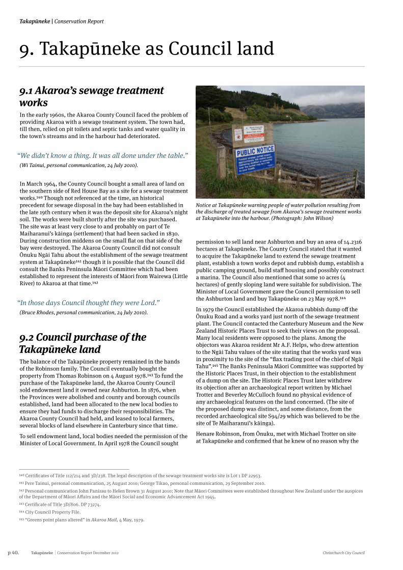
p 40. Takapūneke Conservation Report December 2012 Christchurch City Council
Takapūneke | Conservation Report
9. Takapūneke as Council land
9.1 Akaroa’s sewage treatment worksIn the early 1960s, the Akaroa County Council faced the problem of providing Akaroa with a sewage treatment system. The town had, till then, relied on pit toilets and septic tanks and water quality in the town’s streams and in the harbour had deteriorated.
“We didn’t know a thing. It was all done under the table.” (Wi Tainui, personal communication, 24 July 2010).
In March 1964, the County Council bought a small area of land on the southern side of Red House Bay as a site for a sewage treatment works.140 Though not referenced at the time, an historical precedent for sewage disposal in the bay had been established in the late 19th century when it was the deposit site for Akaroa’s night soil. The works were built shortly after the site was purchased. The site was at least very close to and probably on part of Te Maiharanui’s kāinga (settlement) that had been sacked in 1830. During construction middens on the small flat on that side of the bay were destroyed. The Akaroa County Council did not consult Ōnuku Ngāi Tahu about the establishment of the sewage treatment system at Takapūneke141 though it is possible that the Council did consult the Banks Peninsula Māori Committee which had been established to represent the interests of Māori from Wairewa (Little River) to Akaroa at that time.142
“In those days Council thought they were Lord.” (Bruce Rhodes, personal communication, 24 July 2010).
9.2 Council purchase of the Takapūneke landThe balance of the Takapūneke property remained in the hands of the Robinson family. The Council eventually bought the property from Thomas Robinson on 4 August 1978.143 To fund the purchase of the Takapūneke land, the Akaroa County Council sold endowment land it owned near Ashburton. In 1876, when the Provinces were abolished and county and borough councils established, land had been allocated to the new local bodies to ensure they had funds to discharge their responsibilities. The Akaroa County Council had held, and leased to local farmers, several blocks of land elsewhere in Canterbury since that time.
To sell endowment land, local bodies needed the permission of the Minister of Local Government. In April 1978 the Council sought
Notice at Takapūneke warning people of water pollution resulting from the discharge of treated sewage from Akaroa’s sewage treatment works at Takapūneke into the harbour. (Photograph: John Wilson)
140 Certificates of Title 112/214 and 3D/238. The legal description of the sewage treatment works site is Lot 1 DP 22953.141 Pere Tainui, personal communication, 25 August 2010; George Tikao, personal communication, 29 September 2010.142 Personal communication John Panirau to Helen Brown 31 August 2010; Note that Māori Committees were established throughout New Zealand under the auspices of the Department of Māori Affairs and the Māori Social and Economic Advancement Act 1945.143 Certificate of Title 3D/806. DP 73274.144 City Council Property File.145 “Greens point plans altered” in Akaroa Mail, 4 May, 1979.
permission to sell land near Ashburton and buy an area of 14.2316 hectares at Takapūneke. The County Council stated that it wanted to acquire the Takapūneke land to extend the sewage treatment plant, establish a town works depot and rubbish dump, establish a public camping ground, build staff housing and possibly construct a marina. The Council also mentioned that some 10 acres (4 hectares) of gently sloping land were suitable for subdivision. The Minister of Local Government gave the Council permission to sell the Ashburton land and buy Takapūneke on 23 May 1978.144
In 1979 the Council established the Akaroa rubbish dump off the Ōnuku Road and a works yard just north of the sewage treatment plant. The Council contacted the Canterbury Museum and the New Zealand Historic Places Trust to seek their views on the proposal. Many local residents were opposed to the plans. Among the objectors was Akaroa resident Mr A.F. Helps, who drew attention to the Ngāi Tahu values of the site stating that the works yard was in proximity to the site of the “flax trading post of the chief of Ngāi Tahu”.145 The Banks Peninsula Māori Committee was supported by the Historic Places Trust, in their objection to the establishment of a dump on the site. The Historic Places Trust later withdrew its objection after an archaeological report written by Michael Trotter and Beverley McCulloch found no physical evidence of any archaeological features on the land concerned. (The site of the proposed dump was distinct, and some distance, from the recorded archaeological site S94/29 which was believed to be the site of Te Maiharanui’s kāinga).
Henare Robinson, from Ōnuku, met with Michael Trotter on site at Takapūneke and confirmed that he knew of no reason why the
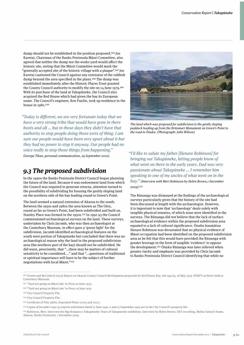
Christchurch City Council Conservation Report December 2012 Takapūneke p 41.
Conservation Report | Takapūneke
dump should not be established in the position proposed.146 Joe Karetai, Chairman of the Banks Peninsula Māori Committee, also agreed that neither the dump nor the works yard would affect the historic site, noting that the Māori Committee would mark the
“generally accepted site of the historic village with a plaque”.147 Joe Karetai cautioned the Council against any extension of the rubbish dump beyond the area specified in the plans.148 The dump was established immediately after the Historic Places Trust granted the County Council authority to modify the site on 14 June 1979.149 With its purchase of the land at Takapūneke, the Council also acquired the Red House which had given the bay its European name. The Council’s engineer, Ken Paulin, took up residence in the house in 1980.150
“Today is different, we are very fortunate today that we have a very strong tribe that would have gone in there boots and all … but in those days they didn’t have that authority to stop people doing those sorts of thing. I am sure our people would have been very upset about it but they had no power to stop it anyway. Our people had no voice really to stop those things from happening,” (George Tikao, personal communication, 29 September 2010).
9.3 The proposed subdivisionIn the 1990s the Banks Peninsula District Council began planning the future of the land. Because it was endowment land from which the Council was required to generate returns, attention turned to the possibility of subdividing for housing the gently sloping land on the northern side of the bay leading round to Green’s Point.
The land seemed a natural extension of Akaroa to the south. Between the 1950s and 1980s the area known as The Glen, round as far as Green’s Point, had been subdivided and built on. Stanley Place was formed in the 1950s.151 In 1992-93 the Council commissioned archaeological surveys on the land. These surveys, undertaken by Chris Jacomb, who was then archaeologist at the Canterbury Museum, in effect gave a ‘green light’ for the subdivision. Jacomb identified archaeological features on the south west portion of Takapūneke but concluded that there was no archaeological reason why the land in the proposed subdivision area (the northern part of the bay) should not be subdivided. He did warn, presciently, that “...there may be matters of cultural sensitivity to be considered....” and that “...questions of traditional or spiritual importance will have to be the subject of further negotiations with local Māori.”152
146 Trotter and McCulloch (1979) Report on Akaroa County Council development proposals for Red House Bay, site s94/29, 26 May 1979. NZHPT archives held at Canterbury Museum.147 “Yard not going on Māori site’ in Press 20 June 1979.148 “Yard not going on Māori site’ in Press 20 June 1979149 City Council Property File.150 City Council Property File.151 Certificate of Title 38/82; Deposited Plans 17005 and 20217.152 Copies of Jacomb’s 1992-93 reports and letters dated 17 June 1992, 6 and 15 September 1993 are in the City Council’s property file.153 Robinson, Meri. Interview for Ngā Roimata o Takapūneke: Tears of Takapūneke exhibition. Interview by Helen Brown. DAT recording, Mahia Tainui’s home, Akaroa, Banks Peninsula, 1 December 2009.
The land which was proposed for subdivision is the gently sloping paddock leading up from the Britomart Monument on Green’s Point to the road to Ōnuku. (Photograph: John Wilson)
“I’d like to salute my father [Henare Robinson] for bringing out Takapūneke, letting people know of what went on there in the early years. Dad was very passionate about Takapūneke ... I remember him speaking to one of my uncles of what went on in the bay.” (Interview with Meri Robinson by Helen Brown,1 December
2009).153
The Rūnanga was dismayed at the findings of the archaeological surveys particularly given that the history of the site had been discussed at length with the archaeologist. However, it is important to note that ‘archaeology’ deals solely with tangible physical remains, of which none were identified in the surveys. The Rūnanga did not believe that the lack of surface archaeological evidence within the proposed subdivision area equated to a lack of cultural significance. Ōnuku kaumātua Henare Robinson was devastated that no physical evidence of Māori occupation had been identified on the proposed subdivision area as he felt that this would have provided the Rūnanga with greater leverage in the form of tangible ‘evidence’ to oppose the development.154 Ōnuku Rūnanga was later relieved when greater clarity and emphasis was provided by Chris Jacomb to Banks Peninsula District Council identifying that while no
p 42. Takapūneke Conservation Report December 2012 Christchurch City Council
Takapūneke | Conservation Report
archaeological evidence had been recorded, subsurface evidence was likely in the area (see letter of 15 September 1993).
That these issues of cultural sensitivity and the traditional or spiritual importance of the land to local Māori might become matters of disagreement and debate was signalled in 1995 when historian, Harry Evison, published an article in the Christchurch Press under the title ‘Akaroa bay outrage’. The article described the events of 1830-40 and questioned the uses made of the land since the 1960s.155 No further heed was taken of the objections of local Māori and Harry Evison was later to describe the establishment of first the sewage treatment works and then the rubbish dump at Takapūneke as the ultimate in modern cultural oppression.
“Imagine” he suggested “a Māori sewage treatment works being constructed on top of a European cemetery”.156
“There was a letter written by Harry Evison, which reinforced to us how important Takapūneke is. It reinforced to us - keep fighting to get it back.” (Ngaire Tainui, personal communication, 31 August 2010).
Although by the end of the 20th century most people from Ōnuku understood that Takapūneke was sacred, it was largely through Harry Evison’s research that they learned the details of the tragic events that unfolded there.
In a subsidiary article, the Mayor of Banks Peninsula, Noeline Allan, emphasised that the Council did not have flexibility in dealing with endowment land and stated that the subdivision was in accord with the requirements of the terms under which it held the land. She did suggest that subdivision of the land could be avoided and the land set aside as a reserve if the Crown purchased the land from the Council. In the early years of the 21st century considerable effort was put into trying to persuade the Government to buy the land to relieve the local body of the requirements imposed on it by the land being endowment land.157
In 1996 the Council applied for resource consent to subdivide 4.7 hectares of land for residential development then, the following year, split land that had been on a single title since 1885 into different lots for which different uses were proposed.
154 Personal communication. John Christensen to Helen Brown, 10 December 2009; Personal communication, George Tikao to Andrea Lobb, 25 May 2012.155 Harry Evison, ‘Akaroa bay outrage’, the Press, 6 January 1995, p. 13.156 Evison, ‘Akaroa bay outrage’, The Press, 6 January 1995, p. 13.157 Christopher Moore, ‘Dilemma for council’, the Press, 6 January 1995, p. 13.158 Haylock, Peter. Interview for Ngā Roimata o Takapūneke: Tears of Takapūneke exhibition. Interview by Helen Brown. DAT recording, Peter Haylock’s home, Akaroa, Banks Peninsula, 1 December 2009.159 Pere Tainui, personal communication, 25 August 2010.
“We used to lease the Green Point land. Then the Council were going to cut it up for sections and we were against that. We knew that there was history, a burial ground there, and that [Ngāi Tahu] used to live there. We knew stories about that and we were against the Council even buying it. We were against them cutting it up for houses and I think that we thought it should have been made a reserve way back then.” (Interview with Peter Haylock by Helen Brown, 1 December 2009).158
The largest lot of 9.6087 hectares, on the southern side of the bay, was to become a reserve (Takapūneke Reserve). The second largest lot, the gently sloping land on the northern side of the bay, was to be subdivided for housing. Between these two lots were two smaller lots. One, an area of 1741 square metres on the foreshore at the middle of the bay, was intended to become the ‘Beach Road Park’. Behind this area was a further small lot, of 2864 square metres, on which stood the Red House. All these lots were put on separate titles in September 1997. On 24 October 1997, the block on which the Red House stands was sold to Kenneth Paulin, the Council’s Engineer, and his wife who had been living in the house since 1980.
9.4 Subdivision: A reluctant compromiseAnger, sadness and disappointment are among the sentiments that the Ōnuku Māori community felt towards the Council for its ongoing treatment of Takapūneke. The proposed subdivision added to the feeling of resentment towards the Council, particularly given that throughout the 20th century, local bylaws had prohibited Ngāi Tahu from building houses on their own land at Ōnuku yet the Council was content to build a subdivision only a few kilometres up the road on land of such significance to Ngāi Tahu.159
In the mid 1990s Ngāi Tahu completed their Treaty settlement with the Crown. The settlement provided Ngāi Tahu with resources that had never been available before. In 1996 Ngaire Tainui was employed by Te Rūnanga o Ōnuku as Administration Manager and Te Rūnanga o Ngāi Tahu established an environmental management unit, Kaupapa Taiao, which made assistance and expertise available to the Rūnanga for the first time in its dealings with the Council over the proposed subdivision.
Christchurch City Council Conservation Report December 2012 Takapūneke p 43.
Conservation Report | Takapūneke
After long and painful discussions the Rūnanga reluctantly agreed not to oppose the proposed subdivision in return for a number of conditions being met. The Rūnanga would sign a Heads of Agreement with the Council on condition that the Council close the dump, apologise for the past treatment of Takapūneke and dedicate the largest block (encompassing the probable site of Te Maiharanui’s kāinga) as a reserve. The land destined to become a reserve was to be symbolically gifted to the Rūnanga which would immediately gift the land back to the Council. A reserve committee of which half the members were to be nominated by the Rūnanga was to manage the new reserve. The Rūnanga agreed to lift the tapu on the block proposed for subdivision.
“I’ve always known that there was something that needed to be looked after.” (George Tikao, personal
communication, 29th September 2010).
At this time the Rūnanga believed they could not stop the subdivision and that the conditions outlined in the Heads of Agreement were the best outcome they could achieve. There was a sense of disappointment and sadness that the Rūnanga had to compromise,160 a position the Rūnanga made clear when it wrote to the Council on 13 May 1998 stating that “...the whole bay is of cultural significance...” and continuing:
It is abhorrent to Te Rūnanga o Ōnuku that this bay, which was the site of occupation and a massacre, has been defiled by both a rubbish dump and a sewage treatment plant. ... It would be Te Rūnanga o Ōnuku’s preference that no further development take place in the bay.Ōnuku cannot state strongly enough our grief at the past treatment of the site by past Councillors and officers of the Banks Peninsula District Council and its forebears.161
The Rūnanga signed the Heads of Agreement on 14 September 1998. The tapu on the land was lifted and the apology delivered by the Council on 25 September 1998. At the same ceremony, the land at Takapūneke was gifted by the Council to Ōnuku, then immediately gifted back. The dump was closed soon afterwards. The Rūnanga felt that the Heads of Agreement was the best opportunity to protect at least part of Takapūneke - allowing partial subdivision provided the Rūnanga with the leverage to protect the Takapūneke Reserve block.
True to its word, when the Council advertised for submissions on its plan to subdivide the land in 2000, the Rūnanga was not among the 14 objectors, even though it regarded the 1998 agreement as a compromise.That the Te Rūnanga o Ōnuku felt pressured in 1998 to sign the Heads of Agreement was confirmed at a meeting in 2004 to discuss the future of the land proposed for the subdivision when George Tikao, Chairman of the Te Rūnanga o Ōnuku , said that he had felt compromised in 1998 and had made what he
160 George Tikao, personal communication, 29 September 2010.161 City Council property file.162 Huddleston, Chad. (2008) The negotiation of Takapūneke: A study of Māori-state relations and the investment of value in tapu lands. A thesis submitted in partial fulfillment of the requirements for the dgree of doctor of philosophy in anthropology in the University of Canterbury. Unpublished thesis: University of Canterbury. P149. 163 The members of the original reserve committee were Theo Bunker, Wi Tainui, Ngaire Tainui, Donna Tainui, Colin Pilbrow, Ken Paulin, Terence Brocherie and Eric Ryder.164 Brittenden, Rosie. Interview for Ngā Roimata o Takapūneke: Tears of Takapūneke exhibition. Interview by Helen Brown. DAT recording, Akaroa Area School, Akaroa, 10 December 2009.
thought was the best deal he could. He restated that in the eyes of the Te Rūnanga o Ōnuku all the land surrounding Takapūneke was tapu as an urupā, and that Ōnuku had never wanted houses built on any of the land.
The proposed subdivision was put on hold in 1999 while water supply questions were investigated, but the Banks Peninsula District Council continued to insist it was bound, by the terms of the endowment on which it held the land, to secure an economic return from it and continued to plan the subdivision.
9.5 The Takapūneke ReserveThe 1998 agreement between the Council and Te Rūnanga o Ōnuku provided for the land on the southern side of the bay to become a Local Purpose (Historic Site) reserve. The creation of the reserve signalled a shift in the recognition of the value of the land on the part of the Council (from economic value to heritage value).162 Although the new reserve was not formally gazetted until 28 March 2002, a reserve management committee was formed and began work early in 1999.163
A landscape architecture firm, Lucas Associates, presented tentative plans for the development of the reserve in August 1999. Some re-vegetation was suggested, along with continued grazing of open pasture. Public use of the reserve was to be encouraged and plans made for a car park and picnic area on the foreshore. Lucas Associates suggested modifications to the subdivision plan to create better linkages between the Britomart monument and the Takapūneke Reserve. Discussions were initiated with the owner of the land immediately south of the reserve with a view to re-planting and protecting possible historic sites beyond the reserve’s boundaries.
As part of the implementation of the reserve committee’s plans, a number of buildings on the foreshore were removed. The clearance of these buildings (and of the small yards immediately south of the former Immigration Barracks and an early sheep dip) appears to have been done without any proper assessment of their heritage significance.
“It’s a really beautiful bay and it holds so much history for the peninsula so I think it’s really good that it’s being reserved and kept that way and there hasn’t been houses built because that would just ruin its history. So other generations can go and visit it and enjoy it as much as I did.” (Interview with Rosie Brittenden by Helen Brown ,10
December 2009).164
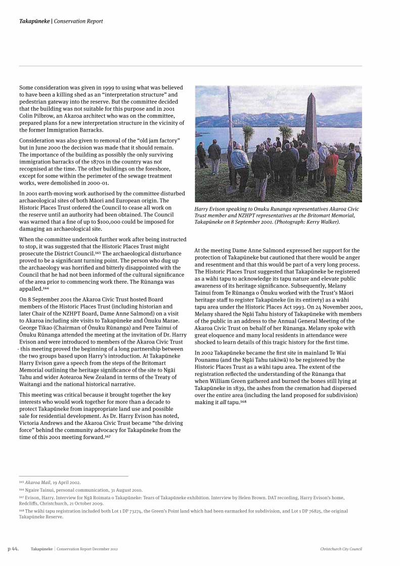
p 44. Takapūneke Conservation Report December 2012 Christchurch City Council
Takapūneke | Conservation Report
Some consideration was given in 1999 to using what was believed to have been a killing shed as an “interpretation structure” and pedestrian gateway into the reserve. But the committee decided that the building was not suitable for this purpose and in 2001 Colin Pilbrow, an Akaroa architect who was on the committee, prepared plans for a new interpretation structure in the vicinity of the former Immigration Barracks.
Consideration was also given to removal of the “old jam factory” but in June 2000 the decision was made that it should remain. The importance of the building as possibly the only surviving immigration barracks of the 1870s in the country was not recognised at the time. The other buildings on the foreshore, except for some within the perimeter of the sewage treatment works, were demolished in 2000-01.
In 2001 earth-moving work authorised by the committee disturbed archaeological sites of both Māori and European origin. The Historic Places Trust ordered the Council to cease all work on the reserve until an authority had been obtained. The Council was warned that a fine of up to $100,000 could be imposed for damaging an archaeological site.
When the committee undertook further work after being instructed to stop, it was suggested that the Historic Places Trust might prosecute the District Council.165 The archaeological disturbance proved to be a significant turning point. The person who dug up the archaeology was horrified and bitterly disappointed with the Council that he had not been informed of the cultural significance of the area prior to commencing work there. The Rūnanga was appalled.166
On 8 September 2001 the Akaroa Civic Trust hosted Board members of the Historic Places Trust (including historian and later Chair of the NZHPT Board, Dame Anne Salmond) on a visit to Akaroa including site visits to Takapūneke and Ōnuku Marae. George Tikao (Chairman of Ōnuku Rūnanga) and Pere Tainui of Ōnuku Rūnanga attended the meeting at the invitation of Dr. Harry Evison and were introduced to members of the Akaroa Civic Trust
- this meeting proved the beginning of a long partnership between the two groups based upon Harry’s introduction. At Takapūneke Harry Evison gave a speech from the steps of the Britomart Memorial outlining the heritage significance of the site to Ngāi Tahu and wider Aotearoa New Zealand in terms of the Treaty of Waitangi and the national historical narrative.
This meeting was critical because it brought together the key interests who would work together for more than a decade to protect Takapūneke from inappropriate land use and possible sale for residential development. As Dr. Harry Evison has noted, Victoria Andrews and the Akaroa Civic Trust became “the driving force” behind the community advocacy for Takapūneke from the time of this 2001 meeting forward.167
Harry Evison speaking to Onuku Runanga representatives Akaroa Civic Trust member and NZHPT representatives at the Britomart Memorial, Takapūneke on 8 September 2001. (Photograph: Kerry Walker).
165 Akaroa Mail, 19 April 2002.166 Ngaire Tainui, personal communication, 31 August 2010.167 Evison, Harry. Interview for Ngā Roimata o Takapūneke: Tears of Takapūneke exhibition. Interview by Helen Brown. DAT recording, Harry Evison’s home, Redcliffs, Christchurch, 21 October 2009.168 The wāhi tapu registration included both Lot 1 DP 73274, the Green’s Point land which had been earmarked for subdivision, and Lot 1 DP 76825, the original Takapūneke Reserve.
At the meeting Dame Anne Salmond expressed her support for the protection of Takapūneke but cautioned that there would be anger and resentment and that this would be part of a very long process. The Historic Places Trust suggested that Takapūneke be registered as a wāhi tapu to acknowledge its tapu nature and elevate public awareness of its heritage significance. Subsequently, Melany Tainui from Te Rūnanga o Ōnuku worked with the Trust’s Māori heritage staff to register Takapūneke (in its entirety) as a wāhi tapu area under the Historic Places Act 1993. On 24 November 2001, Melany shared the Ngāi Tahu history of Takapūneke with members of the public in an address to the Annual General Meeting of the Akaroa Civic Trust on behalf of her Rūnanga. Melany spoke with great eloquence and many local residents in attendance were shocked to learn details of this tragic history for the first time.
In 2002 Takapūneke became the first site in mainland Te Wai Pounamu (and the Ngāi Tahu takiwā) to be registered by the Historic Places Trust as a wāhi tapu area. The extent of the registration reflected the understanding of the Rūnanga that when William Green gathered and burned the bones still lying at Takapūneke in 1839, the ashes from the cremation had dispersed over the entire area (including the land proposed for subdivision) making it all tapu.168
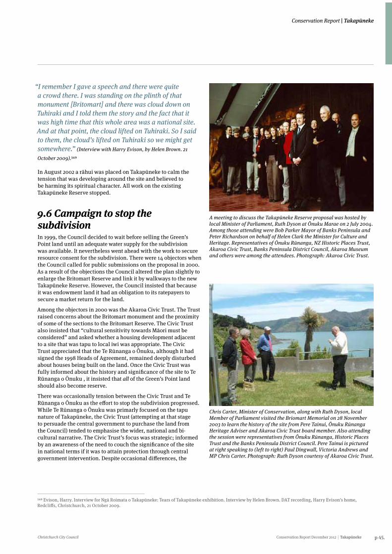
Christchurch City Council Conservation Report December 2012 Takapūneke p 45.
Conservation Report | Takapūneke
“I remember I gave a speech and there were quite a crowd there. I was standing on the plinth of that monument [Britomart] and there was cloud down on Tuhiraki and I told them the story and the fact that it was high time that this whole area was a national site. And at that point, the cloud lifted on Tuhiraki. So I said to them, the cloud’s lifted on Tuhiraki so we might get somewhere.” (Interview with Harry Evison, by Helen Brown. 21
October 2009).169
In August 2002 a rāhui was placed on Takapūneke to calm the tension that was developing around the site and believed to be harming its spiritual character. All work on the existing Takapūneke Reserve stopped.
9.6 Campaign to stop the subdivisionIn 1999, the Council decided to wait before selling the Green’s Point land until an adequate water supply for the subdivision was available. It nevertheless went ahead with the work to secure resource consent for the subdivision. There were 14 objectors when the Council called for public submissions on the proposal in 2000. As a result of the objections the Council altered the plan slightly to enlarge the Britomart Reserve and link it by walkways to the new Takapūneke Reserve. However, the Council insisted that because it was endowment land it had an obligation to its ratepayers to secure a market return for the land.
Among the objectors in 2000 was the Akaroa Civic Trust. The Trust raised concerns about the Britomart monument and the proximity of some of the sections to the Britomart Reserve. The Civic Trust also insisted that “cultural sensitivity towards Māori must be considered” and asked whether a housing development adjacent to a site that was tapu to local iwi was appropriate. The Civic Trust appreciated that the Te Rūnanga o Ōnuku, although it had signed the 1998 Heads of Agreement, remained deeply disturbed about houses being built on the land. Once the Civic Trust was fully informed about the history and significance of the site to Te Rūnanga o Ōnuku , it insisted that all of the Green’s Point land should also become reserve.
There was occasionally tension between the Civic Trust and Te Rūnanga o Ōnuku as the effort to stop the subdivision progressed. While Te Rūnanga o Ōnuku was primarly focused on the tapu nature of Takapūneke, the Civic Trust (attempting at that stage to persuade the central government to purchase the land from the Council) tended to emphasise the wider, national and bi-cultural narrative. The Civic Trust’s focus was strategic; informed by an awareness of the need to couch the significance of the site in national terms if it was to attain protection through central government intervention. Despite occasional differences, the
169 Evison, Harry. Interview for Ngā Roimata o Takapūneke: Tears of Takapūneke exhibition. Interview by Helen Brown. DAT recording, Harry Evison’s home, Redcliffs, Christchurch, 21 October 2009.
Chris Carter, Minister of Conservation, along with Ruth Dyson, local Member of Parliament visited the Briomart Memorial on 28 November 2003 to learn the history of the site from Pere Tainui, Ōnuku Rūnanga Heritage Adviser and Akaroa Civic Trust board member. Also attending the session were representatives from Ōnuku Rūnanga, Historic Places Trust and the Banks Peninsula District Council. Pere Tainui is pictured at right speaking to (left to right) Paul Dingwall, Victoria Andrews and MP Chris Carter. Photograph: Ruth Dyson courtesy of Akaroa Civic Trust.
A meeting to discuss the Takapūneke Reserve proposal was hosted by local Minister of Parliament, Ruth Dyson at Ōnuku Marae on 2 July 2004. Among those attending were Bob Parker Mayor of Banks Peninsula and Peter Richardson on behalf of Helen Clark the Minister for Culture and Heritage. Representatives of Ōnuku Rūnanga, NZ Historic Places Trust, Akaroa Civic Trust, Banks Peninsula District Council, Akaroa Museum and others were among the attendees. Photograph: Akaroa Civic Trust.
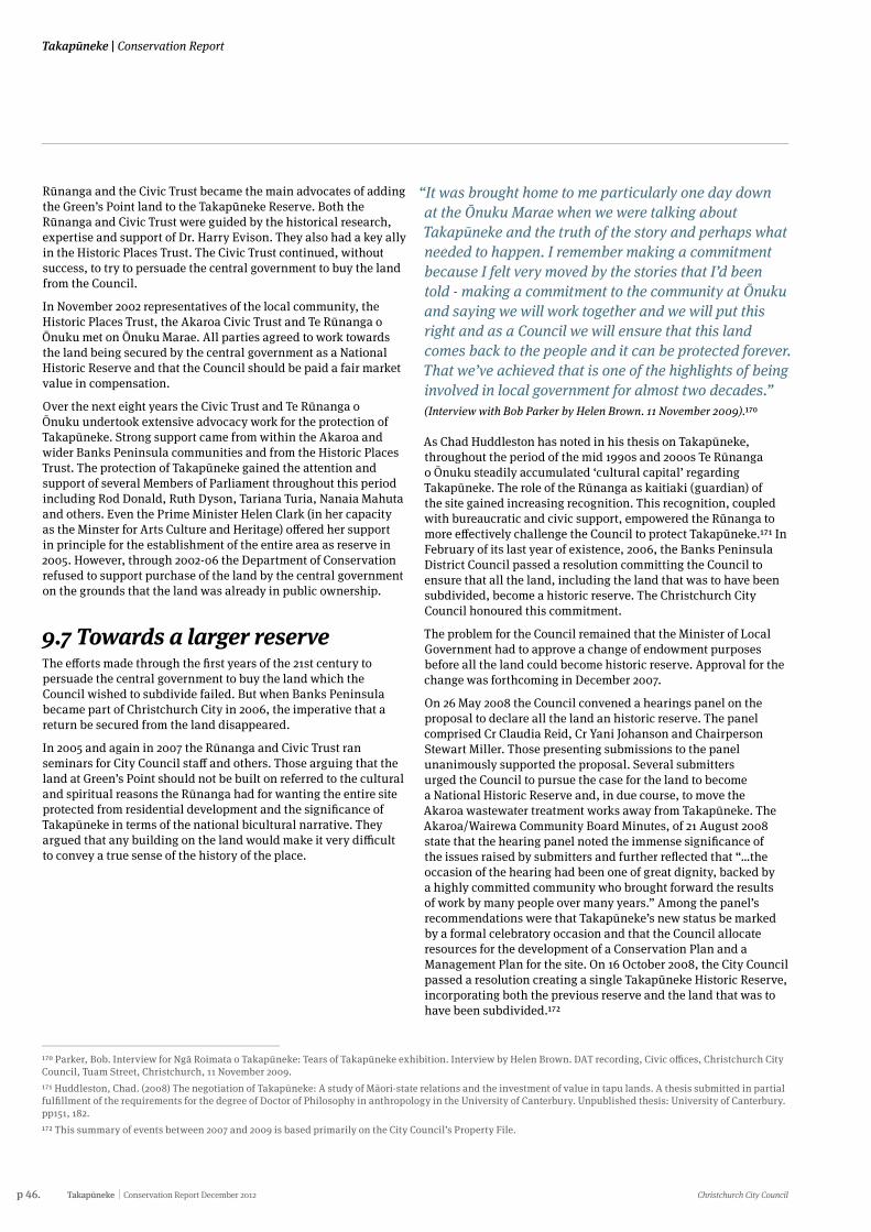
p 46. Takapūneke Conservation Report December 2012 Christchurch City Council
Takapūneke | Conservation Report
Rūnanga and the Civic Trust became the main advocates of adding the Green’s Point land to the Takapūneke Reserve. Both the Rūnanga and Civic Trust were guided by the historical research, expertise and support of Dr. Harry Evison. They also had a key ally in the Historic Places Trust. The Civic Trust continued, without success, to try to persuade the central government to buy the land from the Council.
In November 2002 representatives of the local community, the Historic Places Trust, the Akaroa Civic Trust and Te Rūnanga o Ōnuku met on Ōnuku Marae. All parties agreed to work towards the land being secured by the central government as a National Historic Reserve and that the Council should be paid a fair market value in compensation.
Over the next eight years the Civic Trust and Te Rūnanga o Ōnuku undertook extensive advocacy work for the protection of Takapūneke. Strong support came from within the Akaroa and wider Banks Peninsula communities and from the Historic Places Trust. The protection of Takapūneke gained the attention and support of several Members of Parliament throughout this period including Rod Donald, Ruth Dyson, Tariana Turia, Nanaia Mahuta and others. Even the Prime Minister Helen Clark (in her capacity as the Minster for Arts Culture and Heritage) offered her support in principle for the establishment of the entire area as reserve in 2005. However, through 2002-06 the Department of Conservation refused to support purchase of the land by the central government on the grounds that the land was already in public ownership.
9.7 Towards a larger reserveThe efforts made through the first years of the 21st century to persuade the central government to buy the land which the Council wished to subdivide failed. But when Banks Peninsula became part of Christchurch City in 2006, the imperative that a return be secured from the land disappeared.
In 2005 and again in 2007 the Rūnanga and Civic Trust ran seminars for City Council staff and others. Those arguing that the land at Green’s Point should not be built on referred to the cultural and spiritual reasons the Rūnanga had for wanting the entire site protected from residential development and the significance of Takapūneke in terms of the national bicultural narrative. They argued that any building on the land would make it very difficult to convey a true sense of the history of the place.
“It was brought home to me particularly one day down at the Ōnuku Marae when we were talking about Takapūneke and the truth of the story and perhaps what needed to happen. I remember making a commitment because I felt very moved by the stories that I’d been told - making a commitment to the community at Ōnuku and saying we will work together and we will put this right and as a Council we will ensure that this land comes back to the people and it can be protected forever. That we’ve achieved that is one of the highlights of being involved in local government for almost two decades.”
(Interview with Bob Parker by Helen Brown. 11 November 2009).170
As Chad Huddleston has noted in his thesis on Takapūneke, throughout the period of the mid 1990s and 2000s Te Rūnanga o Ōnuku steadily accumulated ‘cultural capital’ regarding Takapūneke. The role of the Rūnanga as kaitiaki (guardian) of the site gained increasing recognition. This recognition, coupled with bureaucratic and civic support, empowered the Rūnanga to more effectively challenge the Council to protect Takapūneke.171 In February of its last year of existence, 2006, the Banks Peninsula District Council passed a resolution committing the Council to ensure that all the land, including the land that was to have been subdivided, become a historic reserve. The Christchurch City Council honoured this commitment.
The problem for the Council remained that the Minister of Local Government had to approve a change of endowment purposes before all the land could become historic reserve. Approval for the change was forthcoming in December 2007.
On 26 May 2008 the Council convened a hearings panel on the proposal to declare all the land an historic reserve. The panel comprised Cr Claudia Reid, Cr Yani Johanson and Chairperson Stewart Miller. Those presenting submissions to the panel unanimously supported the proposal. Several submitters urged the Council to pursue the case for the land to become a National Historic Reserve and, in due course, to move the Akaroa wastewater treatment works away from Takapūneke. The Akaroa/Wairewa Community Board Minutes, of 21 August 2008 state that the hearing panel noted the immense significance of the issues raised by submitters and further reflected that “…the occasion of the hearing had been one of great dignity, backed by a highly committed community who brought forward the results of work by many people over many years.” Among the panel’s recommendations were that Takapūneke’s new status be marked by a formal celebratory occasion and that the Council allocate resources for the development of a Conservation Plan and a Management Plan for the site. On 16 October 2008, the City Council passed a resolution creating a single Takapūneke Historic Reserve, incorporating both the previous reserve and the land that was to have been subdivided.172
170 Parker, Bob. Interview for Ngā Roimata o Takapūneke: Tears of Takapūneke exhibition. Interview by Helen Brown. DAT recording, Civic offices, Christchurch City Council, Tuam Street, Christchurch, 11 November 2009.171 Huddleston, Chad. (2008) The negotiation of Takapūneke: A study of Māori-state relations and the investment of value in tapu lands. A thesis submitted in partial fulfillment of the requirements for the degree of Doctor of Philosophy in anthropology in the University of Canterbury. Unpublished thesis: University of Canterbury. pp151, 182.172 This summary of events between 2007 and 2009 is based primarily on the City Council’s Property File.
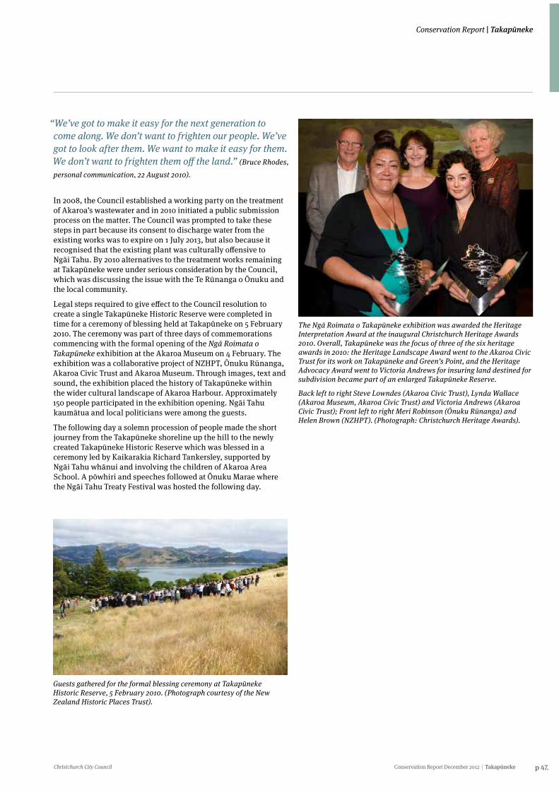
Christchurch City Council Conservation Report December 2012 Takapūneke p 47.
Conservation Report | Takapūneke
“We’ve got to make it easy for the next generation to come along. We don’t want to frighten our people. We’ve got to look after them. We want to make it easy for them. We don’t want to frighten them off the land.” (Bruce Rhodes,
personal communication, 22 August 2010).
In 2008, the Council established a working party on the treatment of Akaroa’s wastewater and in 2010 initiated a public submission process on the matter. The Council was prompted to take these steps in part because its consent to discharge water from the existing works was to expire on 1 July 2013, but also because it recognised that the existing plant was culturally offensive to Ngāi Tahu. By 2010 alternatives to the treatment works remaining at Takapūneke were under serious consideration by the Council, which was discussing the issue with the Te Rūnanga o Ōnuku and the local community.
Legal steps required to give effect to the Council resolution to create a single Takapūneke Historic Reserve were completed in time for a ceremony of blessing held at Takapūneke on 5 February 2010. The ceremony was part of three days of commemorations commencing with the formal opening of the Ngā Roimata o Takapūneke exhibition at the Akaroa Museum on 4 February. The exhibition was a collaborative project of NZHPT, Ōnuku Rūnanga, Akaroa Civic Trust and Akaroa Museum. Through images, text and sound, the exhibition placed the history of Takapūneke within the wider cultural landscape of Akaroa Harbour. Approximately 150 people participated in the exhibition opening. Ngāi Tahu kaumātua and local politicians were among the guests.
The following day a solemn procession of people made the short journey from the Takapūneke shoreline up the hill to the newly created Takapūneke Historic Reserve which was blessed in a ceremony led by Kaikarakia Richard Tankersley, supported by Ngāi Tahu whānui and involving the children of Akaroa Area School. A pōwhiri and speeches followed at Ōnuku Marae where the Ngāi Tahu Treaty Festival was hosted the following day.
Guests gathered for the formal blessing ceremony at Takapūneke Historic Reserve, 5 February 2010. (Photograph courtesy of the New Zealand Historic Places Trust).
The Ngā Roimata o Takapūneke exhibition was awarded the Heritage Interpretation Award at the inaugural Christchurch Heritage Awards 2010. Overall, Takapūneke was the focus of three of the six heritage awards in 2010: the Heritage Landscape Award went to the Akaroa Civic Trust for its work on Takapūneke and Green’s Point, and the Heritage Advocacy Award went to Victoria Andrews for insuring land destined for subdivision became part of an enlarged Takapūneke Reserve.
Back left to right Steve Lowndes (Akaroa Civic Trust), Lynda Wallace (Akaroa Museum, Akaroa Civic Trust) and Victoria Andrews (Akaroa Civic Trust); Front left to right Meri Robinson (Ōnuku Rūnanga) and Helen Brown (NZHPT). (Photograph: Christchurch Heritage Awards).
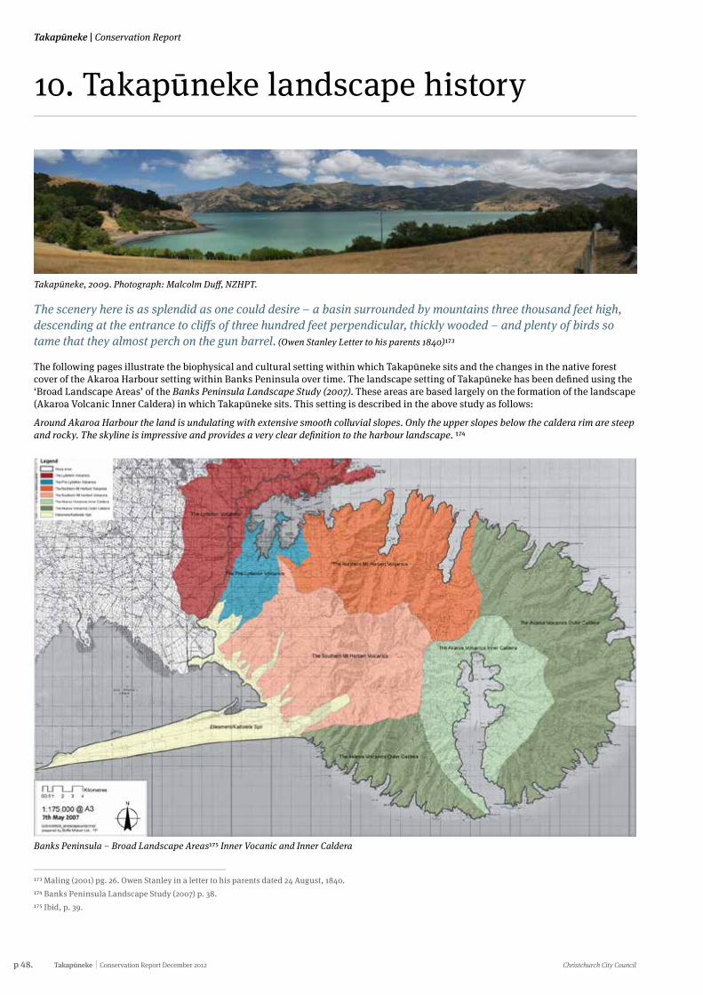
p 48. Takapūneke Conservation Report December 2012 Christchurch City Council
Takapūneke | Conservation Report
10. Takapūneke landscape history
Takapūneke, 2009. Photograph: Malcolm Duff, NZHPT.
The scenery here is as splendid as one could desire – a basin surrounded by mountains three thousand feet high, descending at the entrance to cliffs of three hundred feet perpendicular, thickly wooded – and plenty of birds so tame that they almost perch on the gun barrel. (Owen Stanley Letter to his parents 1840)173
The following pages illustrate the biophysical and cultural setting within which Takapūneke sits and the changes in the native forest cover of the Akaroa Harbour setting within Banks Peninsula over time. The landscape setting of Takapūneke has been defined using the ‘Broad Landscape Areas’ of the Banks Peninsula Landscape Study (2007). These areas are based largely on the formation of the landscape (Akaroa Volcanic Inner Caldera) in which Takapūneke sits. This setting is described in the above study as follows:
Around Akaroa Harbour the land is undulating with extensive smooth colluvial slopes. Only the upper slopes below the caldera rim are steep and rocky. The skyline is impressive and provides a very clear definition to the harbour landscape. 174
173 Maling (2001) pg. 26. Owen Stanley in a letter to his parents dated 24 August, 1840. 174 Banks Peninsula Landscape Study (2007) p. 38.175 Ibid, p. 39.
Banks Peninsula – Broad Landscape Areas175 Inner Vocanic and Inner Caldera
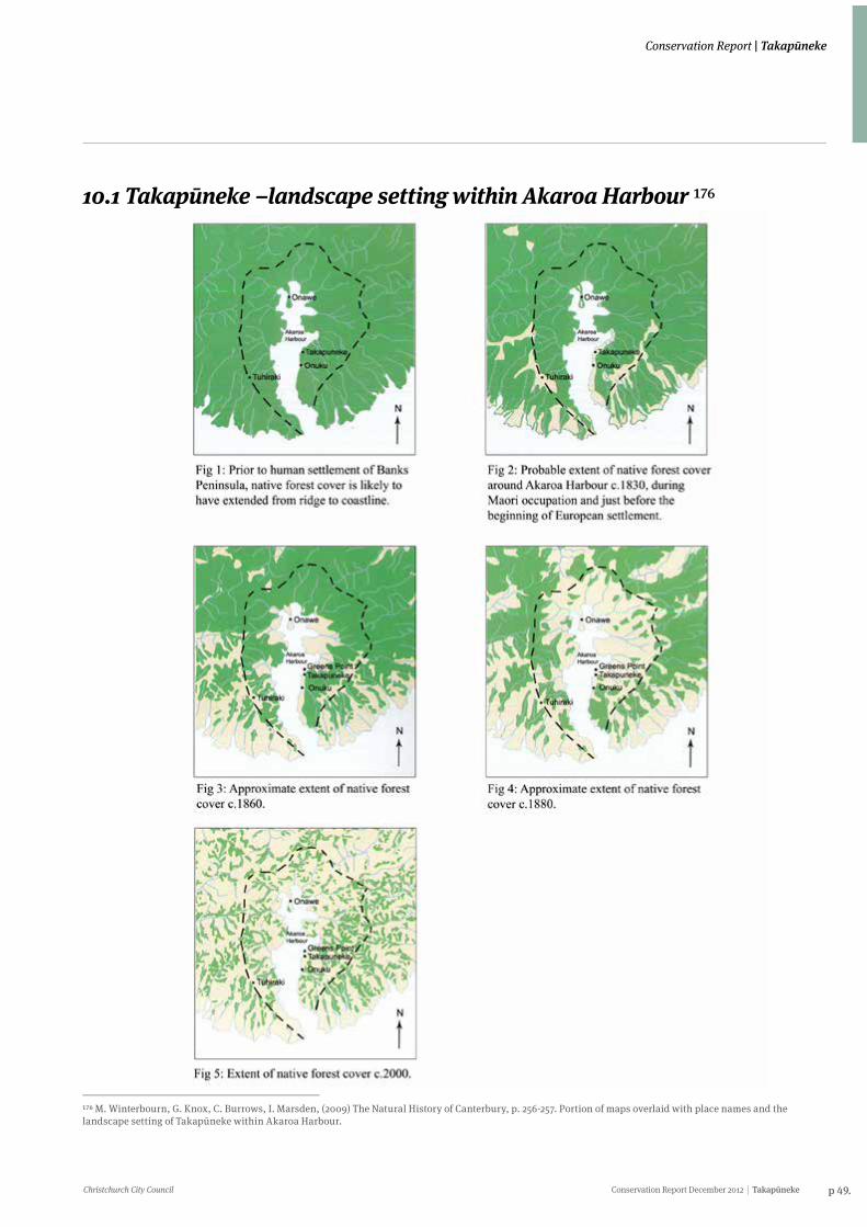
Christchurch City Council Conservation Report December 2012 Takapūneke p 49.
Conservation Report | Takapūneke
10.1 Takapūneke –landscape setting within Akaroa Harbour 176
176 M. Winterbourn, G. Knox, C. Burrows, I. Marsden, (2009) The Natural History of Canterbury, p. 256-257. Portion of maps overlaid with place names and the landscape setting of Takapūneke within Akaroa Harbour.
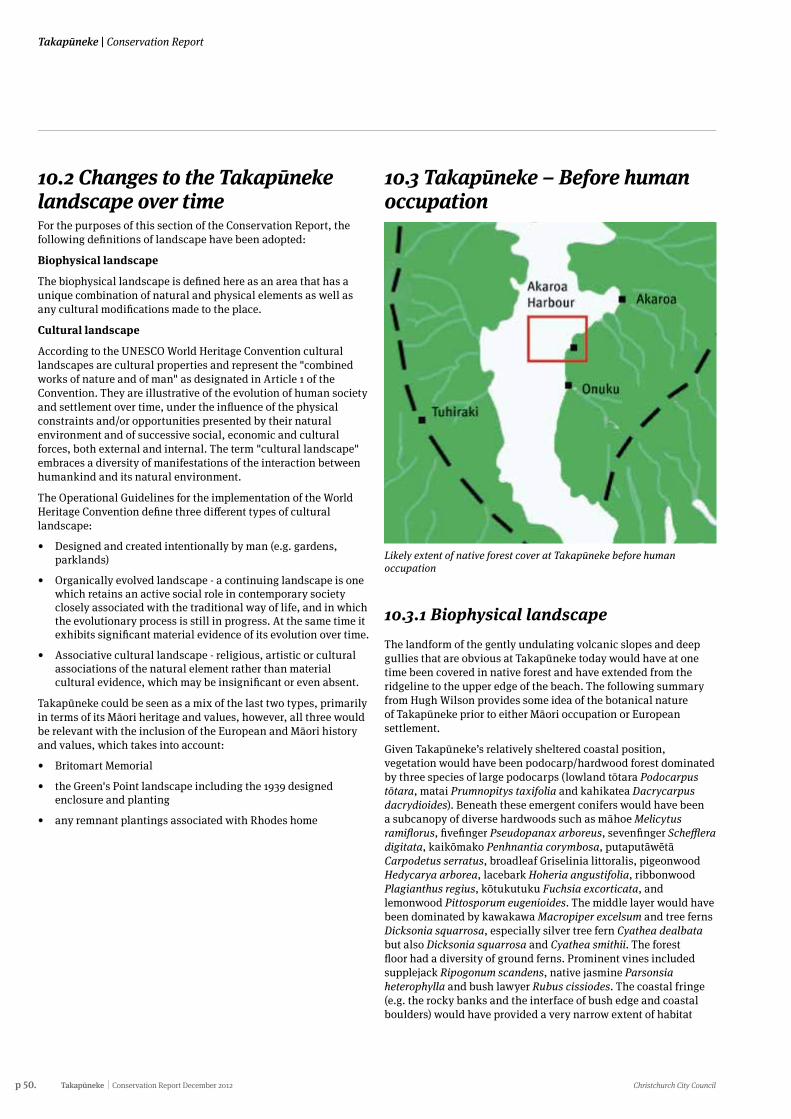
p 50. Takapūneke Conservation Report December 2012 Christchurch City Council
Takapūneke | Conservation Report
10.2 Changes to the Takapūneke landscape over timeFor the purposes of this section of the Conservation Report, the following definitions of landscape have been adopted:
Biophysical landscape
The biophysical landscape is defined here as an area that has a unique combination of natural and physical elements as well as any cultural modifications made to the place.
Cultural landscape
According to the UNESCO World Heritage Convention cultural landscapes are cultural properties and represent the "combined works of nature and of man" as designated in Article 1 of the Convention. They are illustrative of the evolution of human society and settlement over time, under the influence of the physical constraints and/or opportunities presented by their natural environment and of successive social, economic and cultural forces, both external and internal. The term "cultural landscape" embraces a diversity of manifestations of the interaction between humankind and its natural environment.
The Operational Guidelines for the implementation of the World Heritage Convention define three different types of cultural landscape:
• Designed and created intentionally by man (e.g. gardens, parklands)
• Organically evolved landscape - a continuing landscape is one which retains an active social role in contemporary society closely associated with the traditional way of life, and in which the evolutionary process is still in progress. At the same time it exhibits significant material evidence of its evolution over time.
• Associative cultural landscape - religious, artistic or cultural associations of the natural element rather than material cultural evidence, which may be insignificant or even absent.
Takapūneke could be seen as a mix of the last two types, primarily in terms of its Māori heritage and values, however, all three would be relevant with the inclusion of the European and Māori history and values, which takes into account:
• Britomart Memorial
• the Green's Point landscape including the 1939 designed enclosure and planting
• any remnant plantings associated with Rhodes home
10.3 Takapūneke – Before human occupation
10.3.1 Biophysical landscape The landform of the gently undulating volcanic slopes and deep gullies that are obvious at Takapūneke today would have at one time been covered in native forest and have extended from the ridgeline to the upper edge of the beach. The following summary from Hugh Wilson provides some idea of the botanical nature of Takapūneke prior to either Māori occupation or European settlement.
Given Takapūneke’s relatively sheltered coastal position, vegetation would have been podocarp/hardwood forest dominated by three species of large podocarps (lowland tōtara Podocarpus tōtara, matai Prumnopitys taxifolia and kahikatea Dacrycarpus dacrydioides). Beneath these emergent conifers would have been a subcanopy of diverse hardwoods such as māhoe Melicytus ramiflorus, fivefinger Pseudopanax arboreus, sevenfinger Schefflera digitata, kaikōmako Penhnantia corymbosa, putaputāwētā Carpodetus serratus, broadleaf Griselinia littoralis, pigeonwood Hedycarya arborea, lacebark Hoheria angustifolia, ribbonwood Plagianthus regius, kōtukutuku Fuchsia excorticata, and lemonwood Pittosporum eugenioides. The middle layer would have been dominated by kawakawa Macropiper excelsum and tree ferns Dicksonia squarrosa, especially silver tree fern Cyathea dealbata but also Dicksonia squarrosa and Cyathea smithii. The forest floor had a diversity of ground ferns. Prominent vines included supplejack Ripogonum scandens, native jasmine Parsonsia heterophylla and bush lawyer Rubus cissiodes. The coastal fringe (e.g. the rocky banks and the interface of bush edge and coastal boulders) would have provided a very narrow extent of habitat
Likely extent of native forest cover at Takapūneke before human occupation
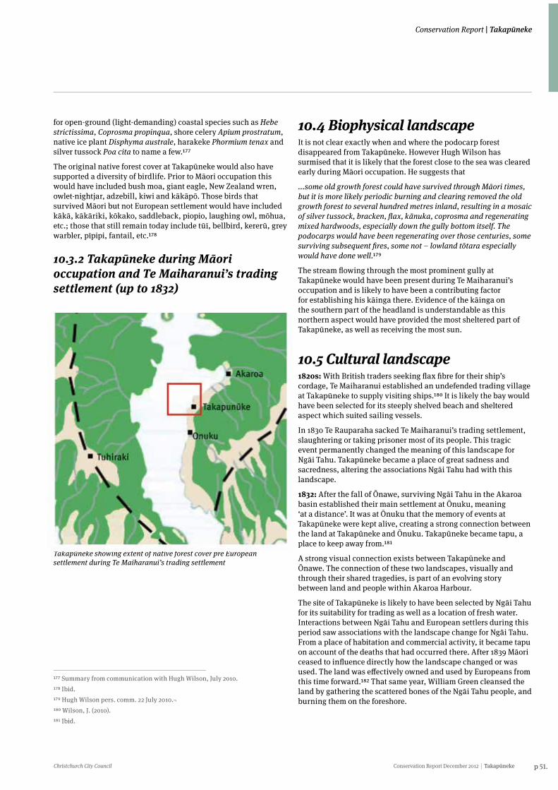
Christchurch City Council Conservation Report December 2012 Takapūneke p 51.
Conservation Report | Takapūneke
for open-ground (light-demanding) coastal species such as Hebe strictissima, Coprosma propinqua, shore celery Apium prostratum, native ice plant Disphyma australe, harakeke Phormium tenax and silver tussock Poa cita to name a few.177
The original native forest cover at Takapūneke would also have supported a diversity of birdlife. Prior to Māori occupation this would have included bush moa, giant eagle, New Zealand wren, owlet-nightjar, adzebill, kiwi and kākāpō. Those birds that survived Māori but not European settlement would have included kākā, kākāriki, kōkako, saddleback, piopio, laughing owl, mōhua, etc.; those that still remain today include tūī, bellbird, kererū, grey warbler, pīpipi, fantail, etc.178
10.3.2 Takapūneke during Māori occupation and Te Maiharanui’s trading settlement (up to 1832)
177 Summary from communication with Hugh Wilson, July 2010.178 Ibid.179 Hugh Wilson pers. comm. 22 July 2010.¬180 Wilson, J. (2010).181 Ibid.
Takapūneke showing extent of native forest cover pre European settlement during Te Maiharanui’s trading settlement
10.4 Biophysical landscapeIt is not clear exactly when and where the podocarp forest disappeared from Takapūneke. However Hugh Wilson has surmised that it is likely that the forest close to the sea was cleared early during Māori occupation. He suggests that
...some old growth forest could have survived through Māori times, but it is more likely periodic burning and clearing removed the old growth forest to several hundred metres inland, resulting in a mosaic of silver tussock, bracken, flax, kānuka, coprosma and regenerating mixed hardwoods, especially down the gully bottom itself. The podocarps would have been regenerating over those centuries, some surviving subsequent fires, some not – lowland tōtara especially would have done well.179
The stream flowing through the most prominent gully at Takapūneke would have been present during Te Maiharanui’s occupation and is likely to have been a contributing factor for establishing his kāinga there. Evidence of the kāinga on the southern part of the headland is understandable as this northern aspect would have provided the most sheltered part of Takapūneke, as well as receiving the most sun.
10.5 Cultural landscape1820s: With British traders seeking flax fibre for their ship’s cordage, Te Maiharanui established an undefended trading village at Takapūneke to supply visiting ships.180 It is likely the bay would have been selected for its steeply shelved beach and sheltered aspect which suited sailing vessels.
In 1830 Te Rauparaha sacked Te Maiharanui’s trading settlement, slaughtering or taking prisoner most of its people. This tragic event permanently changed the meaning of this landscape for Ngāi Tahu. Takapūneke became a place of great sadness and sacredness, altering the associations Ngāi Tahu had with this landscape.
1832: After the fall of Ōnawe, surviving Ngāi Tahu in the Akaroa basin established their main settlement at Ōnuku, meaning ‘at a distance’. It was at Ōnuku that the memory of events at Takapūneke were kept alive, creating a strong connection between the land at Takapūneke and Ōnuku. Takapūneke became tapu, a place to keep away from.181
A strong visual connection exists between Takapūneke and Ōnawe. The connection of these two landscapes, visually and through their shared tragedies, is part of an evolving story between land and people within Akaroa Harbour.
The site of Takapūneke is likely to have been selected by Ngāi Tahu for its suitability for trading as well as a location of fresh water. Interactions between Ngāi Tahu and European settlers during this period saw associations with the landscape change for Ngāi Tahu. From a place of habitation and commercial activity, it became tapu on account of the deaths that had occurred there. After 1839 Māori ceased to influence directly how the landscape changed or was used. The land was effectively owned and used by Europeans from this time forward.182 That same year, William Green cleansed the land by gathering the scattered bones of the Ngāi Tahu people, and burning them on the foreshore.
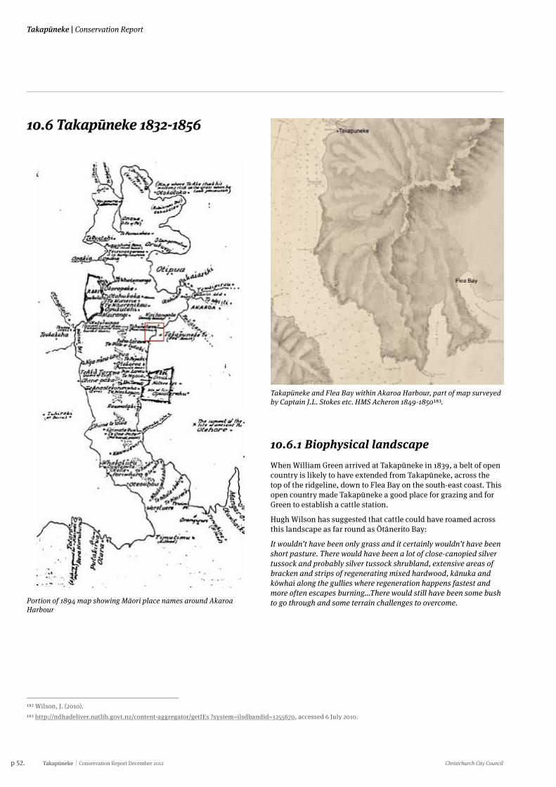
p 52. Takapūneke Conservation Report December 2012 Christchurch City Council
Takapūneke | Conservation Report
10.6 Takapūneke 1832-1856
Portion of 1894 map showing Māori place names around Akaroa Harbour
182 Wilson, J. (2010).183 http://ndhadeliver.natlib.govt.nz/content-aggregator/getIEs ?system=ilsdbandid=1255670, accessed 6 July 2010.
Takapūneke and Flea Bay within Akaroa Harbour, part of map surveyed by Captain J.L. Stokes etc. HMS Acheron 1849-1850183.
10.6.1 Biophysical landscapeWhen William Green arrived at Takapūneke in 1839, a belt of open country is likely to have extended from Takapūneke, across the top of the ridgeline, down to Flea Bay on the south-east coast. This open country made Takapūneke a good place for grazing and for Green to establish a cattle station.
Hugh Wilson has suggested that cattle could have roamed across this landscape as far round as Ōtānerito Bay:
It wouldn’t have been only grass and it certainly wouldn’t have been short pasture. There would have been a lot of close-canopied silver tussock and probably silver tussock shrubland, extensive areas of bracken and strips of regenerating mixed hardwood, kānuka and kōwhai along the gullies where regeneration happens fastest and more often escapes burning…There would still have been some bush to go through and some terrain challenges to overcome.
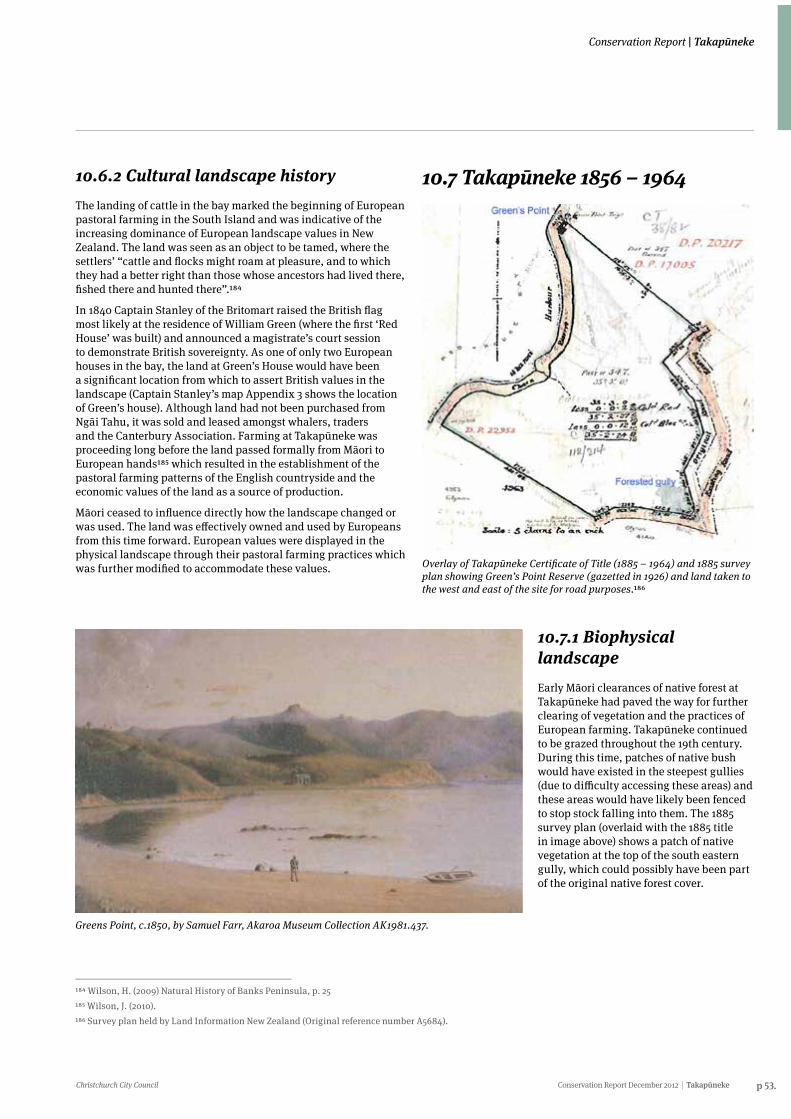
Christchurch City Council Conservation Report December 2012 Takapūneke p 53.
Conservation Report | Takapūneke
10.6.2 Cultural landscape historyThe landing of cattle in the bay marked the beginning of European pastoral farming in the South Island and was indicative of the increasing dominance of European landscape values in New Zealand. The land was seen as an object to be tamed, where the settlers’ “cattle and flocks might roam at pleasure, and to which they had a better right than those whose ancestors had lived there, fished there and hunted there”.184
In 1840 Captain Stanley of the Britomart raised the British flag most likely at the residence of William Green (where the first ‘Red House’ was built) and announced a magistrate’s court session to demonstrate British sovereignty. As one of only two European houses in the bay, the land at Green’s House would have been a significant location from which to assert British values in the landscape (Captain Stanley’s map Appendix 3 shows the location of Green’s house). Although land had not been purchased from Ngāi Tahu, it was sold and leased amongst whalers, traders and the Canterbury Association. Farming at Takapūneke was proceeding long before the land passed formally from Māori to European hands185 which resulted in the establishment of the pastoral farming patterns of the English countryside and the economic values of the land as a source of production.
Māori ceased to influence directly how the landscape changed or was used. The land was effectively owned and used by Europeans from this time forward. European values were displayed in the physical landscape through their pastoral farming practices which was further modified to accommodate these values.
184 Wilson, H. (2009) Natural History of Banks Peninsula, p. 25185 Wilson, J. (2010).186 Survey plan held by Land Information New Zealand (Original reference number A5684).
Greens Point, c.1850, by Samuel Farr, Akaroa Museum Collection AK1981.437.
10.7 Takapūneke 1856 – 1964
Overlay of Takapūneke Certificate of Title (1885 – 1964) and 1885 survey plan showing Green’s Point Reserve (gazetted in 1926) and land taken to the west and east of the site for road purposes.186
10.7.1 Biophysical landscapeEarly Māori clearances of native forest at Takapūneke had paved the way for further clearing of vegetation and the practices of European farming. Takapūneke continued to be grazed throughout the 19th century. During this time, patches of native bush would have existed in the steepest gullies (due to difficulty accessing these areas) and these areas would have likely been fenced to stop stock falling into them. The 1885 survey plan (overlaid with the 1885 title in image above) shows a patch of native vegetation at the top of the south eastern gully, which could possibly have been part of the original native forest cover.
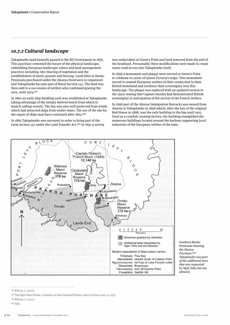
p 54. Takapūneke Conservation Report December 2012 Christchurch City Council
Takapūneke | Conservation Report
10.7.2 Cultural landscapeTakapūneke land formally passed to the NZ Government in 1856. This purchase cemented the future of the physical landscape, embedding European landscape values and land management practices including .the clearing of vegetation and the establishment of exotic grasses and fencing. Land titles in Banks Peninsula purchased under the Akaroa Deed were re-organised and Takapūneke became part of Rural Section 547. The land was then sold to a succession of settlers who continued grazing the area, until 1979.187
In 1860 an early ship building yard was established at Takapūneke taking advantage of the steeply shelved beach from which to launch sailing vessels. The bay was also well protected from winds which had attracted ships from earlier times. The use of the site for the repair of ships may have continued after 1863.189
In 1885 Takapūneke was surveyed in order to bring part of the rural section 547 under the Land Transfer Act.190 In 1891 a survey
was undertaken at Green’s Point and land removed from the end of the headland. Presumably these modifications were made to create easier road access into Takapūneke itself.
In 1898 a monument and plaque were erected at Green’s Point to celebrate 60 years of Queen Victoria’s reign. This monument served to remind European settlers of their connection to their British homeland and reinforce their sovereignty over this landscape. The plaque was replaced with an updated version in the 1920s stating that Captain Stanley had demonstrated British sovereignty in anticipation of the arrival of the French settlers.
In 1898 part of the Akaroa Immigration Barracks was moved from Akaroa to Takapūneke in 1898 which, after the loss of the original Red House in 1888, was the only building in the bay until 1925. Used as a crayfish canning factory, the building exemplified the numerous buildings located around the harbour supporting local industries of the European settlers of the time.
Southern Banks Peninsula showing the Akaroa Purchase.188 Takapūneke was part of the additional area that was requested by Ngāi Tahu but not allowed.
187 Wilson, J. (2010).188 The Ngāi Tahu Deeds: a window on New Zealand History. Harry Evison (2007, p. 197).189 Wilson, J. (2010).190 Ibid.
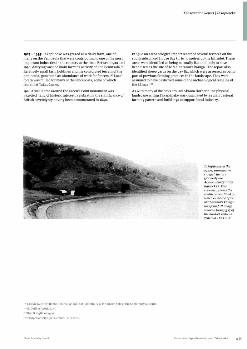
Christchurch City Council Conservation Report December 2012 Takapūneke p 55.
Conservation Report | Takapūneke
Takapūneke in the 1930s, showing the crayfish factory (formerly the Akaroa Immigration Barracks ). This view also shows the southern headland on which evidence of Te Maiharanui’s kāinga was found.191 image sourced form pg 17 of the booklet Toitū Te Whenua The Land
191 Ogilvie G. (2007) Banks Peninsula Cradle of Canterbury p. 157. Image held at the Canterbury Museum.192 G. Ogilvie (1992), p. 73.193 Ibid G. Ogilvie (1992).194 Bridget Moseley, pers. comm. (July 2010).
1925 – 1955: Takapūneke was grazed as a dairy farm, one of many on the Peninsula that were contributing to one of the most important industries in the country at the time. Between 1910 and 1930, dairying was the main farming activity on the Peninsula.192 Relatively small farm holdings and the convoluted terrain of the peninsula, generated an abundance of work for fencers.193 Local tōtara was milled for many of the fenceposts, some of which remain at Takapūneke.
1926 A small area around the Green’s Point monument was gazetted ‘land of historic interest’, celebrating the significance of British sovereignty having been demonstrated in 1840.
In 1960 an archaeological report recorded several terraces on the south side of Red House Bay (15 to 30 metres up the hillside). These areas were identified as being naturally flat and likely to have been used as the site of Te Maiharanui’s kāinga . The report also identified sheep yards on the bay flat which were assessed as being part of previous farming practices in the landscape. They were assumed to have destroyed some of the archaeological remains of the kāinga.194
As with many of the bays around Akaroa Harbour, the physical landscape within Takapūneke was dominated by a small pastoral farming pattern and buildings to support local industry.
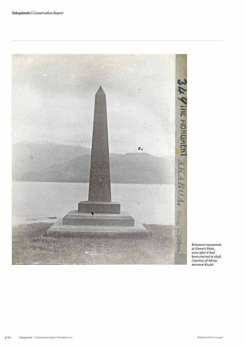
p 56. Takapūneke Conservation Report December 2012 Christchurch City Council
Takapūneke | Conservation Report
Britomart monument at Green’s Point, soon after it had been erected in 1898. Courtesy of Akroa museum #3466
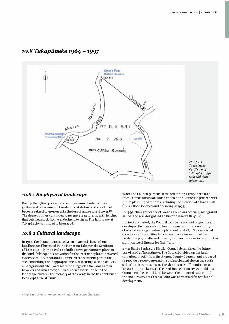
Christchurch City Council Conservation Report December 2012 Takapūneke p 57.
Conservation Report | Takapūneke
10.8 Takapūneke 1964 – 1997
Plan from Takapūneke Certificate of Title 1964 – 1997 with additional references.
10.8.1 Biophysical landscapeDuring the 1980s, poplars and willows were planted within gullies and other areas of farmland to stabilise land which had become subject to erosion with the loss of native forest cover.195 The deeper gullies continued to regenerate naturally, with fencing that deterred stock from wandering into them. The landscape at Takapūneke continued to be grazed.
10.8.2 Cultural landscape In 1964, the Council purchased a small area of the southern headland (as illustrated in the Plan from Takapūneke Certificate of Title 1964 – 1997 above) and built a sewage treatment plant on the land. Subsequent excavation for the treatment plant uncovered evidence of Te Maiharanui’s kāinga on the southern part of the site, confirming the inappropriateness of locating such an activity on a significant site. Local Māori still regarded the land as tapu however no formal recognition of their association with the landscape existed. The memory of the events in the bay continued to be kept alive at Ōnuku.
1978: The Council purchased the remaining Takapūneke land from Thomas Robinson which enabled the Council to proceed with future planning of the area including the creation of a landfill off Ōnuku Road (opened and operating in 1979).
In 1979: the significance of Green’s Point was officially recognised as the land was designated an historic reserve (R.4266).
During this period, the Council took two areas out of grazing and developed them as areas to treat the waste for the community of Akaroa (sewage treatment plant and landfill). The associated structures and activities located on these sites modified the landscape physically and visually and are intrusive in terms of the significance of the site for Ngāi Tahu.
1992: Banks Peninsula District Council determined the future use of land at Takapūneke. The Council divided up the land (inherited in 1989 from the Akaroa County Council) and proposed to provide a reserve around the archaeological site on the south side of the bay, recognising the significance of Takapūneke as Te Maiharanui’s kāinga . The ‘Red House’ property was sold to a Council employee and land between the proposed reserve and the small reserve at Green’s Point was earmarked for residential development.
195 See Land cover in next section - Physical Landscape Character.
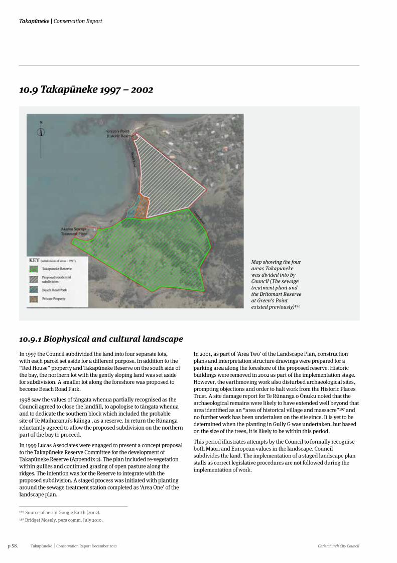
p 58. Takapūneke Conservation Report December 2012 Christchurch City Council
Takapūneke | Conservation Report
10.9 Takapūneke 1997 – 2002
Map showing the four areas Takapūneke was divided into by Council (The sewage treatment plant and the Britomart Reserve at Green’s Point existed previously)196
196 Source of aerial Google Earth (2002).197 Bridget Mosely, pers comm. July 2010.
10.9.1 Biophysical and cultural landscapeIn 1997 the Council subdivided the land into four separate lots, with each parcel set aside for a different purpose. In addition to the “Red House” property and Takapūneke Reserve on the south side of the bay, the northern lot with the gently sloping land was set aside for subdivision. A smaller lot along the foreshore was proposed to become Beach Road Park.
1998 saw the values of tāngata whenua partially recognised as the Council agreed to close the landfill, to apologise to tāngata whenua and to dedicate the southern block which included the probable site of Te Maiharanui’s kāinga , as a reserve. In return the Rūnanga reluctantly agreed to allow the proposed subdivision on the northern part of the bay to proceed.
In 1999 Lucas Associates were engaged to present a concept proposal to the Takapūneke Reserve Committee for the development of Takapūneke Reserve (Appendix 2). The plan included re-vegetation within gullies and continued grazing of open pasture along the ridges. The intention was for the Reserve to integrate with the proposed subdivision. A staged process was initiated with planting around the sewage treatment station completed as ‘Area One’ of the landscape plan.
In 2001, as part of ‘Area Two' of the Landscape Plan, construction plans and interpretation structure drawings were prepared for a parking area along the foreshore of the proposed reserve. Historic buildings were removed in 2002 as part of the implementation stage. However, the earthmoving work also disturbed archaeological sites, prompting objections and order to halt work from the Historic Places Trust. A site damage report for Te Rūnanga o Ōnuku noted that the archaeological remains were likely to have extended well beyond that area identified as an “area of historical village and massacre”197 and no further work has been undertaken on the site since. It is yet to be determined when the planting in Gully G was undertaken, but based on the size of the trees, it is likely to be within this period.
This period illustrates attempts by the Council to formally recognise both Māori and European values in the landscape. Council subdivides the land. The implementation of a staged landscape plan stalls as correct legislative procedures are not followed during the implementation of work.
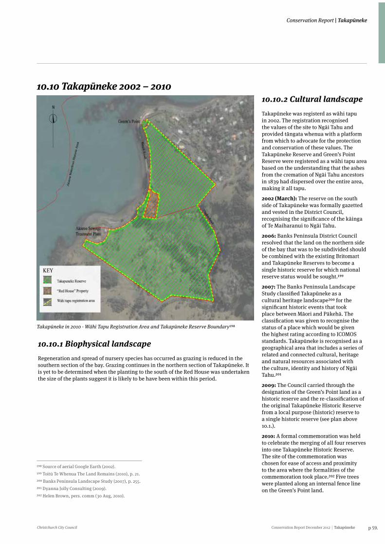
Christchurch City Council Conservation Report December 2012 Takapūneke p 59.
Conservation Report | Takapūneke
10.10 Takapūneke 2002 – 2010
Takapūneke in 2010 - Wāhi Tapu Registration Area and Takapūneke Reserve Boundary198
198 Source of aerial Google Earth (2002).199 Toitū Te Whenua The Land Remains (2010), p. 21.200 Banks Peninsula Landscape Study (2007), p. 255.201 Dyanna Jolly Consulting (2009).202 Helen Brown, pers. comm (30 Aug, 2010).
10.10.1 Biophysical landscapeRegeneration and spread of nursery species has occurred as grazing is reduced in the southern section of the bay. Grazing continues in the northern section of Takapūneke. It is yet to be determined when the planting to the south of the Red House was undertaken the size of the plants suggest it is likely to be have been within this period.
10.10.2 Cultural landscapeTakapūneke was registerd as wāhi tapu in 2002. The registration recognised the values of the site to Ngāi Tahu and provided tāngata whenua with a platform from which to advocate for the protection and conservation of these values. The Takapūneke Reserve and Green’s Point Reserve were registered as a wāhi tapu area based on the understanding that the ashes from the cremation of Ngāi Tahu ancestors in 1839 had dispersed over the entire area, making it all tapu.
2002 (March): The reserve on the south side of Takapūneke was formally gazetted and vested in the District Council, recognising the significance of the kāinga of Te Maiharanui to Ngāi Tahu.
2006: Banks Peninsula District Council resolved that the land on the northern side of the bay that was to be subdivided should be combined with the existing Britomart and Takapūneke Reserves to become a single historic reserve for which national reserve status would be sought.199
2007: The Banks Peninsula Landscape Study classified Takapūneke as a cultural heritage landscape200 for the significant historic events that took place between Māori and Pākehā. The classification was given to recognise the status of a place which would be given the highest rating according to ICOMOS standards. Takapūneke is recognised as a geographical area that includes a series of related and connected cultural, heritage and natural resources associated with the culture, identity and history of Ngāi Tahu.201
2009: The Council carried through the designation of the Green’s Point land as a historic reserve and the re-classification of the original Takapūneke Historic Reserve from a local purpose (historic) reserve to a single historic reserve (see plan above 10.1.).
2010: A formal commemoration was held to celebrate the merging of all four reserves into one Takapūneke Historic Reserve. The site of the commemoration was chosen for ease of access and proximity to the area where the formalities of the commemoration took place.202 Five trees were planted along an internal fence line on the Green’s Point land.
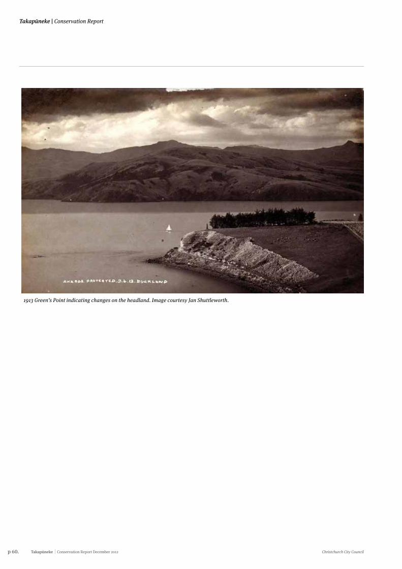
p 60. Takapūneke Conservation Report December 2012 Christchurch City Council
Takapūneke | Conservation Report
1913 Green’s Point indicating changes on the headland. Image courtesy Jan Shuttleworth.
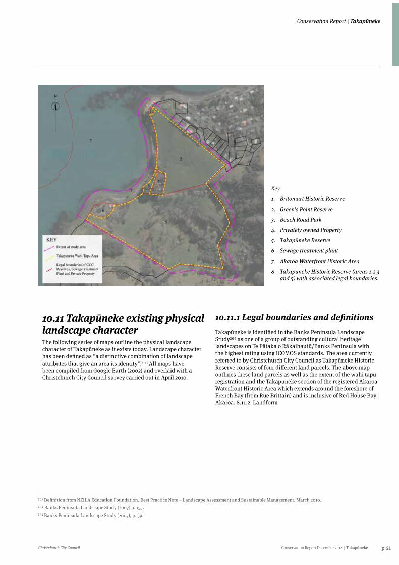
Christchurch City Council Conservation Report December 2012 Takapūneke p 61.
Conservation Report | Takapūneke
10.11 Takapūneke existing physical landscape characterThe following series of maps outline the physical landscape character of Takapūneke as it exists today. Landscape character has been defined as “a distinctive combination of landscape attributes that give an area its identity”.203 All maps have been compiled from Google Earth (2002) and overlaid with a Christchurch City Council survey carried out in April 2010.
10.11.1 Legal boundaries and definitionsTakapūneke is identified in the Banks Peninsula Landscape Study204 as one of a group of outstanding cultural heritage landscapes on Te Pātaka o Rākaihautū/Banks Peninsula with the highest rating using ICOMOS standards. The area currently referred to by Christchurch City Council as Takapūneke Historic Reserve consists of four different land parcels. The above map outlines these land parcels as well as the extent of the wāhi tapu registration and the Takapūneke section of the registered Akaroa Waterfront Historic Area which extends around the foreshore of French Bay (from Rue Brittain) and is inclusive of Red House Bay, Akaroa. 8.11.2. Landform
203 Definition from NZILA Education Foundation, Best Practice Note – Landscape Assessment and Sustainable Management, March 2010.204 Banks Peninsula Landscape Study (2007) p. 155.205 Banks Peninsula Landscape Study (2007), p. 39.
Key
1. Britomart Historic Reserve
2. Green’s Point Reserve
3. Beach Road Park
4. Privately owned Property
5. Takapūneke Reserve
6. Sewage treatment plant
7. Akaroa Waterfront Historic Area
8. Takapūneke Historic Reserve (areas 1,2 3 and 5) with associated legal boundaries.
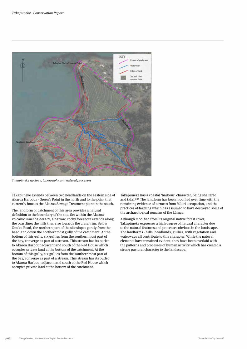
p 62. Takapūneke Conservation Report December 2012 Christchurch City Council
Takapūneke | Conservation Report
Takapūneke geology, topography and natural processes
Takapūneke extends between two headlands on the eastern side of Akaroa Harbour - Green’s Point in the north and to the point that currently houses the Akaroa Sewage Treatment plant in the south.
The landform or catchment of this area provides a natural definition to the boundary of the site. Set within the Akaroa volcanic inner caldera205, a narrow, rocky foreshore extends along the coastline; the hills then rise towards the crater rim. Below Ōnuku Road, the northern part of the site slopes gently from the headland down the northernmost gully of the catchment. At the bottom of this gully, six gullies from the southernmost part of the bay, converge as part of a stream. This stream has its outlet to Akaroa Harbour adjacent and south of the Red House which occupies private land at the bottom of the catchment. At the bottom of this gully, six gullies from the southernmost part of the bay, converge as part of a stream. This stream has its outlet to Akaroa Harbour adjacent and south of the Red House which occupies private land at the bottom of the catchment.
Takapūneke has a coastal ‘harbour’ character, being sheltered and tidal.206 The landform has been modified over time with the remaining evidence of terraces from Māori occupation, and the practices of farming which has assumed to have destroyed some of the archaeological remains of the kāinga.
Although modified from its original native forest cover, Takapūneke expresses a high degree of natural character due to the natural features and processes obvious in the landscape. The landforms - hills, headlands, gullies, with vegetation and waterways all contribute to this character. While the natural elements have remained evident, they have been overlaid with the patterns and processes of human activity which has created a strong pastoral character to the landscape.
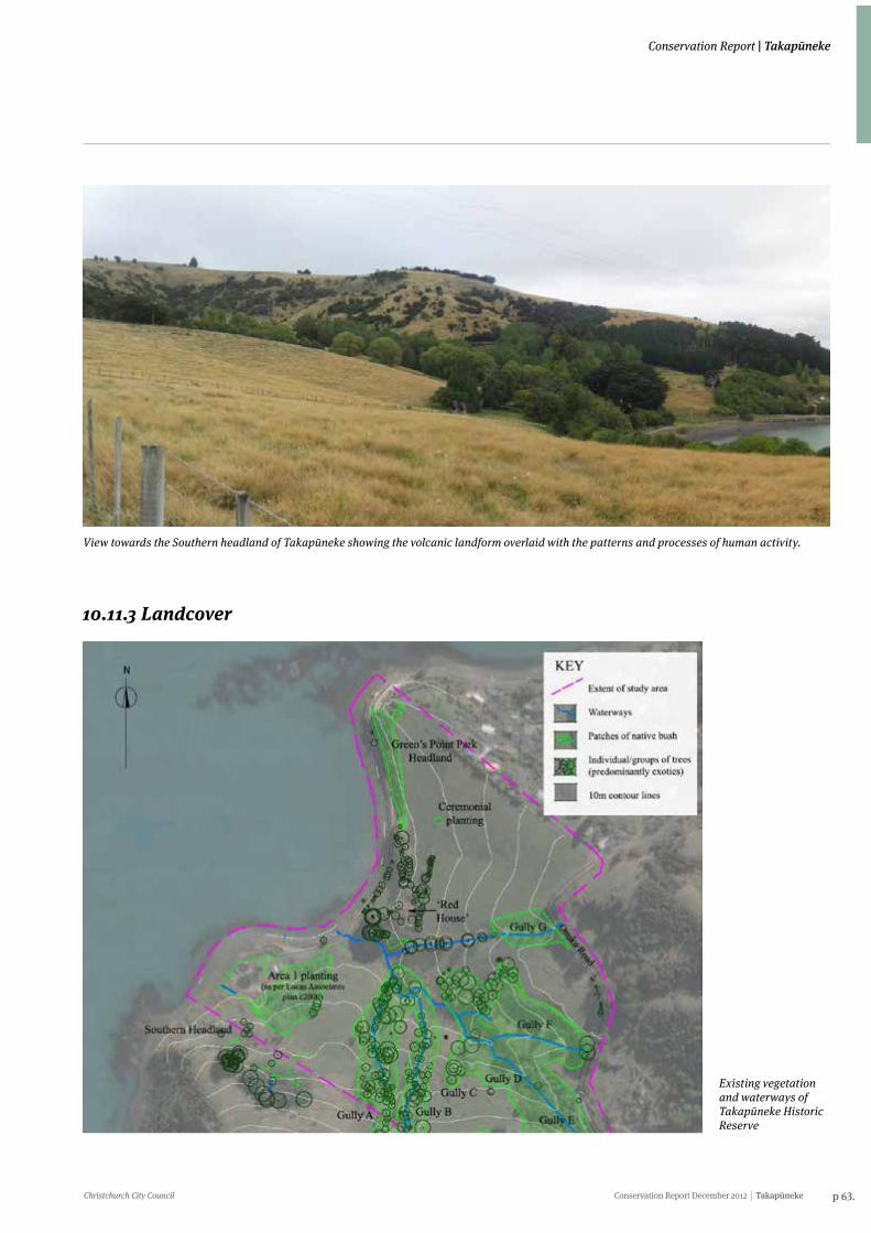
Christchurch City Council Conservation Report December 2012 Takapūneke p 63.
Conservation Report | Takapūneke
View towards the Southern headland of Takapūneke showing the volcanic landform overlaid with the patterns and processes of human activity.
10.11.3 Landcover
Existing vegetation and waterways of Takapūneke Historic Reserve
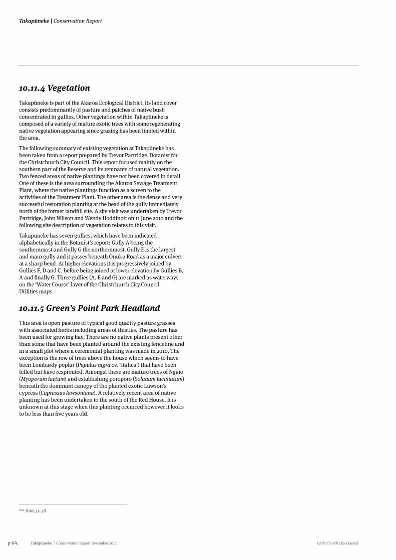
p 64. Takapūneke Conservation Report December 2012 Christchurch City Council
Takapūneke | Conservation Report
206 Ibid, p. 58.
10.11.4 VegetationTakapūneke is part of the Akaroa Ecological District. Its land cover consists predominantly of pasture and patches of native bush concentrated in gullies. Other vegetation within Takapūneke is composed of a variety of mature exotic trees with some regenerating native vegetation appearing since grazing has been limited within the area.
The following summary of existing vegetation at Takapūneke has been taken from a report prepared by Trevor Partridge, Botanist for the Christchurch City Council. This report focused mainly on the southern part of the Reserve and its remnants of natural vegetation. Two fenced areas of native plantings have not been covered in detail. One of these is the area surrounding the Akaroa Sewage Treatment Plant, where the native plantings function as a screen to the activities of the Treatment Plant. The other area is the dense and very successful restoration planting at the head of the gully immediately north of the former landfill site. A site visit was undertaken by Trevor Partridge, John Wilson and Wendy Hoddinott on 11 June 2010 and the following site description of vegetation relates to this visit.
Takapūneke has seven gullies, which have been indicated alphabetically in the Botanist’s report; Gully A being the southernmost and Gully G the northernmost. Gully E is the largest and main gully and it passes beneath Ōnuku Road as a major culvert at a sharp bend. At higher elevations it is progressively joined by Gullies F, D and C, before being joined at lower elevation by Gullies B, A and finally G. Three gullies (A, E and G) are marked as waterways on the ‘Water Course’ layer of the Christchurch City Council Utilities maps.
10.11.5 Green’s Point Park HeadlandThis area is open pasture of typical good quality pasture grasses with associated herbs including areas of thistles. The pasture has been used for growing hay. There are no native plants present other than some that have been planted around the existing fenceline and in a small plot where a ceremonial planting was made in 2010. The exception is the row of trees above the house which seems to have been Lombardy poplar (Populus nigra cv. ‘Italica’) that have been felled but have resprouted. Amongst these are mature trees of Ngāio (Myoporum laetum) and establishing poroporo (Solanum laciniatum) beneath the dominant canopy of the planted exotic Lawson’s cypress (Cupressus lawsoniana). A relatively recent area of native planting has been undertaken to the south of the Red House. It is unknown at this stage when this planting occurred however it looks to be less than five years old.
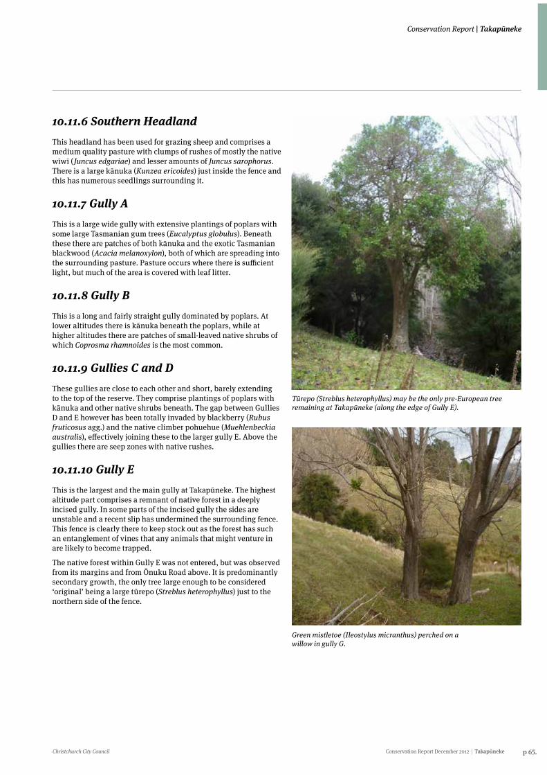
Christchurch City Council Conservation Report December 2012 Takapūneke p 65.
Conservation Report | Takapūneke
10.11.6 Southern HeadlandThis headland has been used for grazing sheep and comprises a medium quality pasture with clumps of rushes of mostly the native wīwī (Juncus edgariae) and lesser amounts of Juncus sarophorus. There is a large kānuka (Kunzea ericoides) just inside the fence and this has numerous seedlings surrounding it.
10.11.7 Gully AThis is a large wide gully with extensive plantings of poplars with some large Tasmanian gum trees (Eucalyptus globulus). Beneath these there are patches of both kānuka and the exotic Tasmanian blackwood (Acacia melanoxylon), both of which are spreading into the surrounding pasture. Pasture occurs where there is sufficient light, but much of the area is covered with leaf litter.
10.11.8 Gully BThis is a long and fairly straight gully dominated by poplars. At lower altitudes there is kānuka beneath the poplars, while at higher altitudes there are patches of small-leaved native shrubs of which Coprosma rhamnoides is the most common.
10.11.9 Gullies C and DThese gullies are close to each other and short, barely extending to the top of the reserve. They comprise plantings of poplars with kānuka and other native shrubs beneath. The gap between Gullies D and E however has been totally invaded by blackberry (Rubus fruticosus agg.) and the native climber pohuehue (Muehlenbeckia australis), effectively joining these to the larger gully E. Above the gullies there are seep zones with native rushes.
10.11.10 Gully EThis is the largest and the main gully at Takapūneke. The highest altitude part comprises a remnant of native forest in a deeply incised gully. In some parts of the incised gully the sides are unstable and a recent slip has undermined the surrounding fence. This fence is clearly there to keep stock out as the forest has such an entanglement of vines that any animals that might venture in are likely to become trapped.
The native forest within Gully E was not entered, but was observed from its margins and from Ōnuku Road above. It is predominantly secondary growth, the only tree large enough to be considered ‘original’ being a large tūrepo (Streblus heterophyllus) just to the northern side of the fence.
Tūrepo (Streblus heterophyllus) may be the only pre-European tree remaining at Takapūneke (along the edge of Gully E).
Green mistletoe (Ileostylus micranthus) perched on a willow in gully G.
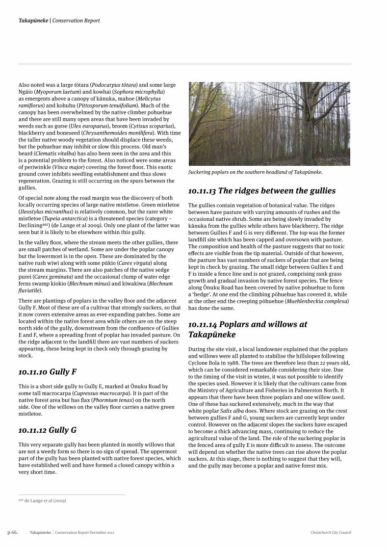
p 66. Takapūneke Conservation Report December 2012 Christchurch City Council
Takapūneke | Conservation Report
Also noted was a large tōtara (Podocarpus tōtara) and some large Ngāio (Myoporum laetum) and kowhai (Sophora microphylla) as emergents above a canopy of kānuka, mahoe (Melicytus ramiflorus) and kohuhu (Pittosporum tenuifolium). Much of the canopy has been overwhelmed by the native climber pohuehue and there are still many open areas that have been invaded by weeds such as gorse (Ulex europaeus), broom (Cytisus scoparius), blackberry and boneseed (Chrysanthemoides monilifera). With time the taller native woody vegetation should displace these weeds, but the pohuehue may inhibit or slow this process. Old man’s beard (Clematis vitalba) has also been seen in the area and this is a potential problem to the forest. Also noticed were some areas of periwinkle (Vinca major) covering the forest floor. This exotic ground cover inhibits seedling establishment and thus slows regeneration. Grazing is still occurring on the spurs between the gullies.
Of special note along the road margin was the discovery of both locally occurring species of large native mistletoe. Green mistletoe (Ileostylus micranthus) is relatively common, but the rarer white mistletoe (Tupeia antarctica) is a threatened species (category – Declining207) (de Lange et al 2009). Only one plant of the latter was seen but it is likely to be elsewhere within this gully.
In the valley floor, where the stream meets the other gullies, there are small patches of wetland. Some are under the poplar canopy but the lowermost is in the open. These are dominated by the native rush wīwī along with some pūkio (Carex virgata) along the stream margins. There are also patches of the native sedge purei (Carex geminata) and the occasional clump of water edge ferns swamp kiokio (Blechnum minus) and kiwakiwa (Blechnum fluviatile).
There are plantings of poplars in the valley floor and the adjacent Gully F. Most of these are of a cultivar that strongly suckers, so that it now covers extensive areas as ever-expanding patches. Some are located within the native forest area while others are on the steep north side of the gully, downstream from the confluence of Gullies E and F, where a spreading front of poplar has invaded pasture. On the ridge adjacent to the landfill there are vast numbers of suckers appearing, these being kept in check only through grazing by stock.
10.11.10 Gully FThis is a short side gully to Gully E, marked at Ōnuku Road by some tall macrocarpa (Cupressus macrocarpa). It is part of the native forest area but has flax (Phormium tenax) on the north side. One of the willows on the valley floor carries a native green mistletoe.
10.11.12 Gully GThis very separate gully has been planted in mostly willows that are not a weedy form so there is no sign of spread. The uppermost part of the gully has been planted with native forest species, which have established well and have formed a closed canopy within a very short time.
207 de Lange et al (2009)
Suckering poplars on the southern headland of Takapūneke.
10.11.13 The ridges between the gulliesThe gullies contain vegetation of botanical value. The ridges between have pasture with varying amounts of rushes and the occasional native shrub. Some are being slowly invaded by kānuka from the gullies while others have blackberry. The ridge between Gullies F and G is very different. The top was the former landfill site which has been capped and oversown with pasture. The composition and health of the pasture suggests that no toxic effects are visible from the tip material. Outside of that however, the pasture has vast numbers of suckers of poplar that are being kept in check by grazing. The small ridge between Gullies E and F is inside a fence line and is not grazed, comprising rank grass growth and gradual invasion by native forest species. The fence along Ōnuku Road has been covered by native pohuehue to form a ‘hedge’. At one end the climbing pōhuehue has covered it, while at the other end the creeping pōhuehue (Muehlenbeckia complexa) has done the same.
10.11.14 Poplars and willows at TakapūnekeDuring the site visit, a local landowner explained that the poplars and willows were all planted to stabilise the hillslopes following Cyclone Bola in 1988. The trees are therefore less than 22 years old, which can be considered remarkable considering their size. Due to the timing of the visit in winter, it was not possible to identify the species used. However it is likely that the cultivars came from the Ministry of Agriculture and Fisheries in Palmerston North. It appears that there have been three poplars and one willow used. One of these has suckered extensively, much in the way that white poplar Salix alba does. Where stock are grazing on the crest between gullies F and G, young suckers are currently kept under control. However on the adjacent slopes the suckers have escaped to become a thick advancing mass, continuing to reduce the agricultural value of the land. The role of the suckering poplar in the fenced area of gully E is more difficult to assess. The outcome will depend on whether the native trees can rise above the poplar suckers. At this stage, there is nothing to suggest that they will, and the gully may become a poplar and native forest mix.
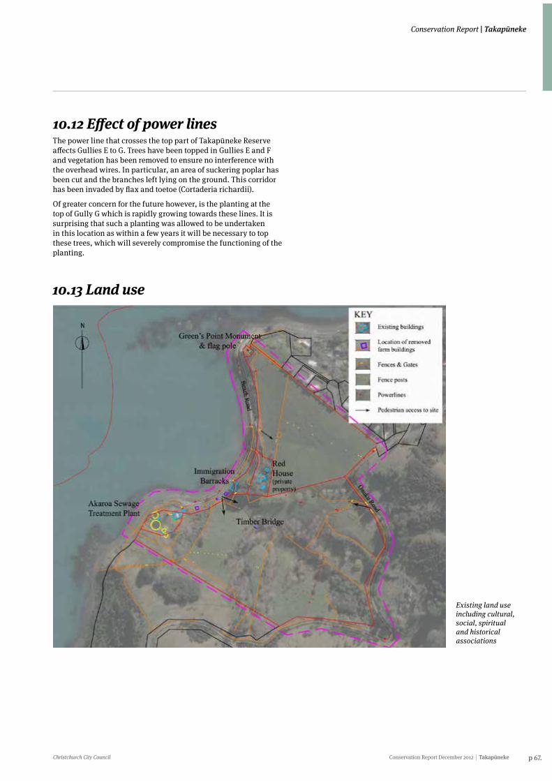
Christchurch City Council Conservation Report December 2012 Takapūneke p 67.
Conservation Report | Takapūneke
10.12 Effect of power linesThe power line that crosses the top part of Takapūneke Reserve affects Gullies E to G. Trees have been topped in Gullies E and F and vegetation has been removed to ensure no interference with the overhead wires. In particular, an area of suckering poplar has been cut and the branches left lying on the ground. This corridor has been invaded by flax and toetoe (Cortaderia richardii).
Of greater concern for the future however, is the planting at the top of Gully G which is rapidly growing towards these lines. It is surprising that such a planting was allowed to be undertaken in this location as within a few years it will be necessary to top these trees, which will severely compromise the functioning of the planting.
Existing land use including cultural, social, spiritual and historical associations
10.13 Land use
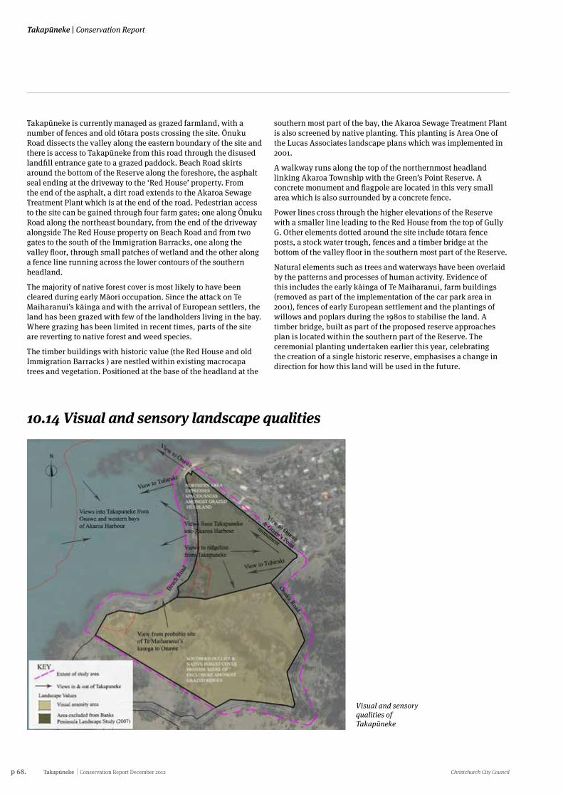
p 68. Takapūneke Conservation Report December 2012 Christchurch City Council
Takapūneke | Conservation Report
10.14 Visual and sensory landscape qualities
Visual and sensory qualities of Takapūneke
Takapūneke is currently managed as grazed farmland, with a number of fences and old tōtara posts crossing the site. Ōnuku Road dissects the valley along the eastern boundary of the site and there is access to Takapūneke from this road through the disused landfill entrance gate to a grazed paddock. Beach Road skirts around the bottom of the Reserve along the foreshore, the asphalt seal ending at the driveway to the ‘Red House’ property. From the end of the asphalt, a dirt road extends to the Akaroa Sewage Treatment Plant which is at the end of the road. Pedestrian access to the site can be gained through four farm gates; one along Ōnuku Road along the northeast boundary, from the end of the driveway alongside The Red House property on Beach Road and from two gates to the south of the Immigration Barracks, one along the valley floor, through small patches of wetland and the other along a fence line running across the lower contours of the southern headland.
The majority of native forest cover is most likely to have been cleared during early Māori occupation. Since the attack on Te Maiharanui’s kāinga and with the arrival of European settlers, the land has been grazed with few of the landholders living in the bay. Where grazing has been limited in recent times, parts of the site are reverting to native forest and weed species.
The timber buildings with historic value (the Red House and old Immigration Barracks ) are nestled within existing macrocapa trees and vegetation. Positioned at the base of the headland at the
southern most part of the bay, the Akaroa Sewage Treatment Plant is also screened by native planting. This planting is Area One of the Lucas Associates landscape plans which was implemented in 2001.
A walkway runs along the top of the northernmost headland linking Akaroa Township with the Green’s Point Reserve. A concrete monument and flagpole are located in this very small area which is also surrounded by a concrete fence.
Power lines cross through the higher elevations of the Reserve with a smaller line leading to the Red House from the top of Gully G. Other elements dotted around the site include tōtara fence posts, a stock water trough, fences and a timber bridge at the bottom of the valley floor in the southern most part of the Reserve.
Natural elements such as trees and waterways have been overlaid by the patterns and processes of human activity. Evidence of this includes the early kāinga of Te Maiharanui, farm buildings (removed as part of the implementation of the car park area in 2001), fences of early European settlement and the plantings of willows and poplars during the 1980s to stabilise the land. A timber bridge, built as part of the proposed reserve approaches plan is located within the southern part of the Reserve. The ceremonial planting undertaken earlier this year, celebrating the creation of a single historic reserve, emphasises a change in direction for how this land will be used in the future.
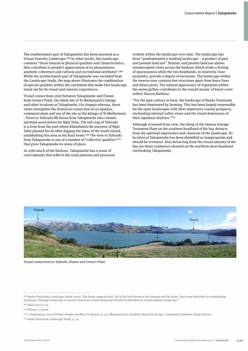
Christchurch City Council Conservation Report December 2012 Takapūneke p 69.
Conservation Report | Takapūneke
The southernmost part of Takapūneke has been assessed as a Visual Amenity Landscape.208 In other words, this landscape contains “those natural or physical qualities and characteristics…that contribute to people’s appreciation of its pleasantness, aesthetic coherence and cultural and recreational attributes”.209 While the northernmost part of Takapūneke was excluded from the Landscape Study, the map above illustrates the combination of special qualities within the catchment that make this landscape stand out for its visual and sensory experiences.
Visual connections exist between Takapūneke and Ōnawe from Green’s Point, the likely site of Te Maiharanui’s kāinga and other locations at Takapūneke. For tāngata whenua, these views strengthen the historical connection of occupation, communication and use of the site as the kāinga of Te Maiharanui. . Views to Tuhiraki/Mt Bossu from Takapūneke also contain spiritual associations for Ngāi Tahu. The tall crag of Tuhiraki is a form from the past where Rākaihautū the ancestor of Ngāi Tahu planted his kō after digging the lakes of the South Island, establishing this area as his final home.210 The view to Tuhiraki from Takapūneke is one of a number of “collective qualities”211 that gives Takapūneke its sense of place.
As with much of the harbour, Takapūneke has a sense of rural amenity that reflects the rural patterns and processes
evident within the landscape over time. The landscape has been “predominately a working landscape – a product of past and present land use”. Historic and present land use allows uninterrupted views across the harbour which evoke a feeling of spaciousness while the two headlands, in relatively close proximity, provide a degree of enclosure. The landscape within the reserve now contains few structures apart from fence lines and tōtara posts. The natural appearance of vegetation within the seven gullies contributes to the overall mosaic of forest cover within Akaroa Harbour.
“For the past century at least, the landscape of Banks Peninsula has been dominated by farming. This has been largely responsible for the open landscapes with their impressive coastal prospects, enchanting internal valley views and the visual dominance of their signature skylines.”212
Although screened from view, the siting of the Akaroa Sewage Treatment Plant on the southern headland of the bay detracts from the spiritual importance and character of the landscape. Its location at Takapūneke has been identified as inappropriate and should be reviewed. Also detracting from the visual amenity of the bay are those residences situated on the northern-most headland overlooking Takapūneke.
208 Banks Peninsula Landscape Study (2007). The Study suggests that “all of the land between the summit and the shore, that is not identified as outstanding landscape, heritage landscape or natural character coastal landscape should be identified as visual amenity landscape.” 209 Ibid (2007) p. 63.210 Wilson, J. (2010).211 J. Stephenson, (2010) Patina: People and Place in Akaroa, p. 152. Meaning those qualities shared by groups, community members, hapū and iwi.212 Banks Peninsula Landscape Study, p. 30.
Visual connections to Tuhiraki, Ōnawe and Green’s Point
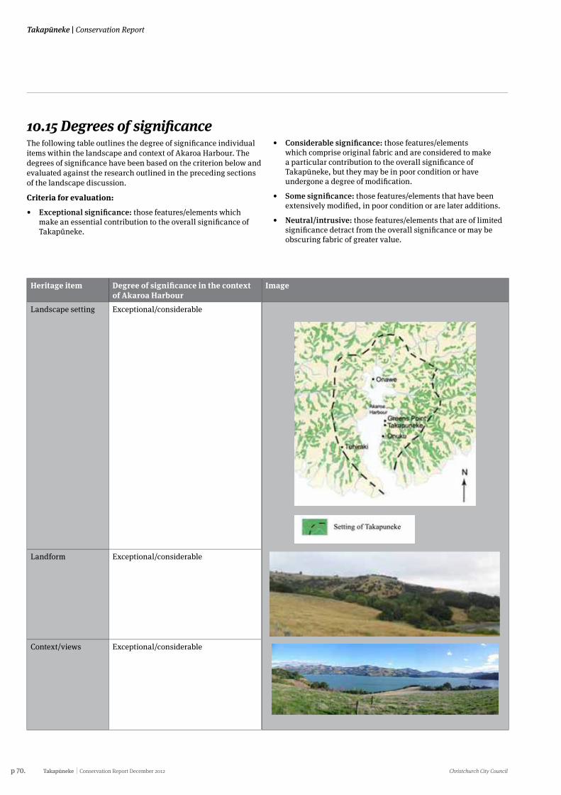
p 70. Takapūneke Conservation Report December 2012 Christchurch City Council
Takapūneke | Conservation Report
10.15 Degrees of significanceThe following table outlines the degree of significance individual items within the landscape and context of Akaroa Harbour. The degrees of significance have been based on the criterion below and evaluated against the research outlined in the preceding sections of the landscape discussion.
Criteria for evaluation:
• Exceptional significance: those features/elements which make an essential contribution to the overall significance of Takapūneke.
• Considerable significance: those features/elements which comprise original fabric and are considered to make a particular contribution to the overall significance of Takapūneke, but they may be in poor condition or have undergone a degree of modification.
• Some significance: those features/elements that have been extensively modified, in poor condition or are later additions.
• Neutral/intrusive: those features/elements that are of limited significance detract from the overall significance or may be obscuring fabric of greater value.
Heritage item Degree of significance in the context of Akaroa Harbour
Landscape setting Exceptional/considerable
Landform Exceptional/considerable
Context/views Exceptional/considerable
Image
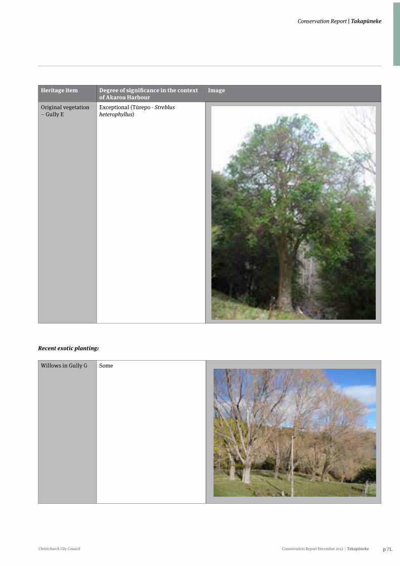
Christchurch City Council Conservation Report December 2012 Takapūneke p 71.
Conservation Report | Takapūneke
Heritage item Degree of significance in the context of Akaroa Harbour
Original vegetation – Gully E
Exceptional (Tūrepo - Streblus heterophyllus)
Image
Recent exotic planting:
Willows in Gully G Some
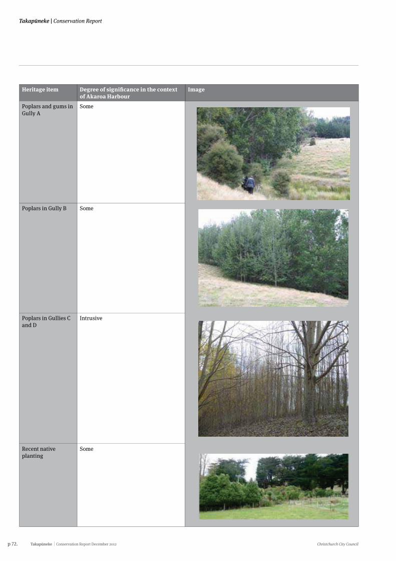
p 72. Takapūneke Conservation Report December 2012 Christchurch City Council
Takapūneke | Conservation Report
Heritage item Degree of significance in the context of Akaroa Harbour
Poplars and gums in Gully A
Some
Poplars in Gully B Some
Poplars in Gullies C and D
Intrusive
Recent native planting
Some
Image
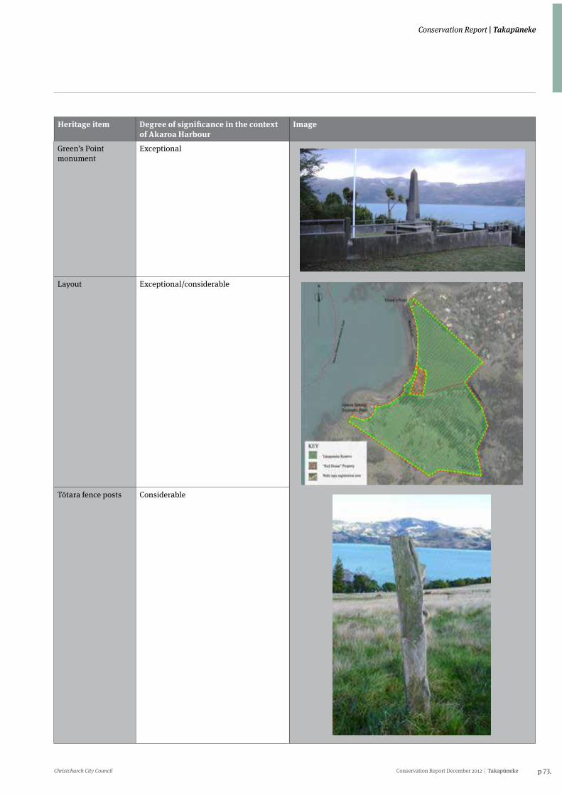
Christchurch City Council Conservation Report December 2012 Takapūneke p 73.
Conservation Report | Takapūneke
Heritage item Degree of significance in the context of Akaroa Harbour
Image
Green’s Point monument
Exceptional
Layout Exceptional/considerable
Tōtara fence posts Considerable
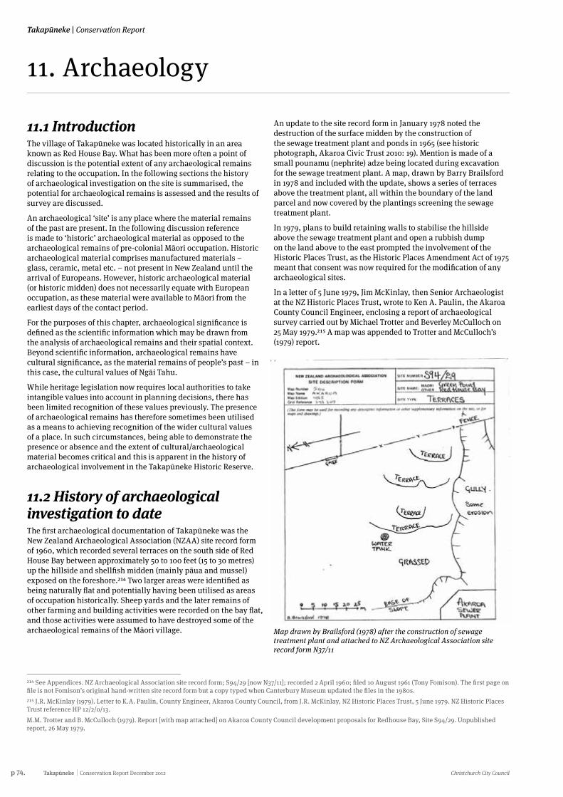
p 74. Takapūneke Conservation Report December 2012 Christchurch City Council
Takapūneke | Conservation Report
11. Archaeology
11.1 IntroductionThe village of Takapūneke was located historically in an area known as Red House Bay. What has been more often a point of discussion is the potential extent of any archaeological remains relating to the occupation. In the following sections the history of archaeological investigation on the site is summarised, the potential for archaeological remains is assessed and the results of survey are discussed.
An archaeological ‘site’ is any place where the material remains of the past are present. In the following discussion reference is made to ‘historic’ archaeological material as opposed to the archaeological remains of pre-colonial Māori occupation. Historic archaeological material comprises manufactured materials – glass, ceramic, metal etc. – not present in New Zealand until the arrival of Europeans. However, historic archaeological material (or historic midden) does not necessarily equate with European occupation, as these material were available to Māori from the earliest days of the contact period.
For the purposes of this chapter, archaeological significance is defined as the scientific information which may be drawn from the analysis of archaeological remains and their spatial context. Beyond scientific information, archaeological remains have cultural significance, as the material remains of people’s past – in this case, the cultural values of Ngāi Tahu.
While heritage legislation now requires local authorities to take intangible values into account in planning decisions, there has been limited recognition of these values previously. The presence of archaeological remains has therefore sometimes been utilised as a means to achieving recognition of the wider cultural values of a place. In such circumstances, being able to demonstrate the presence or absence and the extent of cultural/archaeological material becomes critical and this is apparent in the history of archaeological involvement in the Takapūneke Historic Reserve.
11.2 History of archaeological investigation to dateThe first archaeological documentation of Takapūneke was the New Zealand Archaeological Association (NZAA) site record form of 1960, which recorded several terraces on the south side of Red House Bay between approximately 50 to 100 feet (15 to 30 metres) up the hillside and shellfish midden (mainly pāua and mussel) exposed on the foreshore.214 Two larger areas were identified as being naturally flat and potentially having been utilised as areas of occupation historically. Sheep yards and the later remains of other farming and building activities were recorded on the bay flat, and those activities were assumed to have destroyed some of the archaeological remains of the Māori village.
An update to the site record form in January 1978 noted the destruction of the surface midden by the construction of the sewage treatment plant and ponds in 1965 (see historic photograph, Akaroa Civic Trust 2010: 19). Mention is made of a small pounamu (nephrite) adze being located during excavation for the sewage treatment plant. A map, drawn by Barry Brailsford in 1978 and included with the update, shows a series of terraces above the treatment plant, all within the boundary of the land parcel and now covered by the plantings screening the sewage treatment plant.
In 1979, plans to build retaining walls to stabilise the hillside above the sewage treatment plant and open a rubbish dump on the land above to the east prompted the involvement of the Historic Places Trust, as the Historic Places Amendment Act of 1975 meant that consent was now required for the modification of any archaeological sites.
In a letter of 5 June 1979, Jim McKinlay, then Senior Archaeologist at the NZ Historic Places Trust, wrote to Ken A. Paulin, the Akaroa County Council Engineer, enclosing a report of archaeological survey carried out by Michael Trotter and Beverley McCulloch on 25 May 1979.215 A map was appended to Trotter and McCulloch’s (1979) report.
214 See Appendices. NZ Archaeological Association site record form; S94/29 [now N37/11]; recorded 2 April 1960; filed 10 August 1961 (Tony Fomison). The first page on file is not Fomison’s original hand-written site record form but a copy typed when Canterbury Museum updated the files in the 1980s.215 J.R. McKinlay (1979). Letter to K.A. Paulin, County Engineer, Akaroa County Council, from J.R. McKinlay, NZ Historic Places Trust, 5 June 1979. NZ Historic Places Trust reference HP 12/2/0/13.M.M. Trotter and B. McCulloch (1979). Report [with map attached] on Akaroa County Council development proposals for Redhouse Bay, Site S94/29. Unpublished report, 26 May 1979.
Map drawn by Brailsford (1978) after the construction of sewage treatment plant and attached to NZ Archaeological Association site record form N37/11
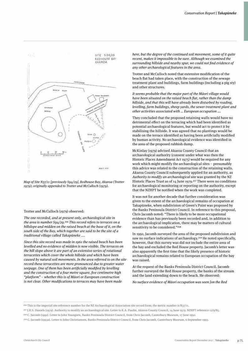
Christchurch City Council Conservation Report December 2012 Takapūneke p 75.
Conservation Report | Takapūneke
Map of Site N37/11 [previously S94/29], Redhouse Bay, Akaroa (Trotter 1979); originally appended to Trotter and McCulloch (1979).
Trotter and McCulloch (1979) observed:
The one recorded, and at present only, archaeological site in the area is number S94/29.216 This record refers to terraces on a hillslope and midden on the raised beach at the base of it, on the south side of the Bay, which together are said to be the site of a traditional village called Takapūneke ....
Since this site record was made in 1961 the raised beach has been levelled and no evidence of midden is now visible. The terraces on the hill slope above it are part of an extensive series of rotational terracettes which cover the whole hillside and which have been caused by natural soil movements. In the area referred to on the site record these terracettes are more pronounced due to greater water seepage. One of them has been artificially modified by levelling and the construction of a four metre square, five centimetre high “platform” – whether this is of Māori or European construction is not clear. Other modifications to terraces may have been made
216 This is the imperial site reference number for the NZ Archaeological Association site record form; the metric number is N37/11.217 J.R.S. Daniels (1979). Authority to modify an archaeological site. Letter to K.A. Paulin, Akaroa County Council, 14 June 1979. NZHPT reference 12/9/85.219 C. Jacomb (1992). Letter to John Youngsen, Banks Peninsula District Council, from Chris Jacomb, Canterbury Museum, 17 June 1992.220 C. Jacomb (1993a). Letter to John Christiansen, Banks Peninsula District Council, from Chris Jacomb, Canterbury Museum, 6 September 1993.
here, but the degree of the continued soil movement, some of it quite recent, makes it impossible to be sure. Although we examined the surrounding hillside and nearby spur, we could not find evidence of any other archaeological features in the area.
Trotter and McCulloch noted that extensive modification of the beach flat had taken place, with the construction of the sewage treatment plant and buildings, farm buildings (including a pig sty) and other structures.
It seems probable that the major part of the Māori village would have been situated on the raised beach flat, rather than the damp hillside, and that this will have already been disturbed by roading, levelling, farm buildings, sheep yards, the sewer treatment plant and other activities associated with … European occupation ….
They concluded that the proposed retaining walls would have no detrimental effect on the terracing which had been identified as potential archaeological features, but would act to protect it by stabilising the hillside. It was agreed that no plantings would be made on the terrace identified as having been artificially modified by human activity. No archaeological evidence was identified in the area of the proposed rubbish dump.
McKinlay (1979) advised Akaroa County Council that an archaeological authority (consent under what was then the Historic Places Amendment Act 1975) would be required for any work which might modify the archaeological sites – presumably this advice was related to the construction of the retaining walls. Akaroa County Council subsequently applied for an authority, as Authority to modify an archaeological site was granted by the NZ Historic Places Trust as of 14 June 1979.217 There were no conditions for archaeological monitoring or reporting on the authority, except that the NZHPT be notified when the work was completed.
It was not for another decade that further consideration was given to the extent of the archaeological remains of occupation at Takapūneke, when subdivision of Green’s Point was proposed by the Banks Peninsula District Council. In reference to this proposal, Chris Jacomb noted: “There is likely to be more occupational evidence than has previously been recorded and, in addition to the archaeological implication, there may be matters of cultural sensitivity to be considered.”218
In 1992, Jacomb surveyed the area of the proposed subdivision and saw no surface indications of archaeology.219 He noted specifically, however, that this survey was did not include the entire area of the bay and excluded the Red House property. Jacomb’s letter was also apparently the first time that the likely presence of historic archaeological remains related to European occupation of the bay was raised.
At the request of the Banks Peninsula District Council, Jacomb further surveyed the Red House property, the banks of the stream and the land extending down to the beach. He observed:
No surface evidence of Māori occupation was seen [on the Red
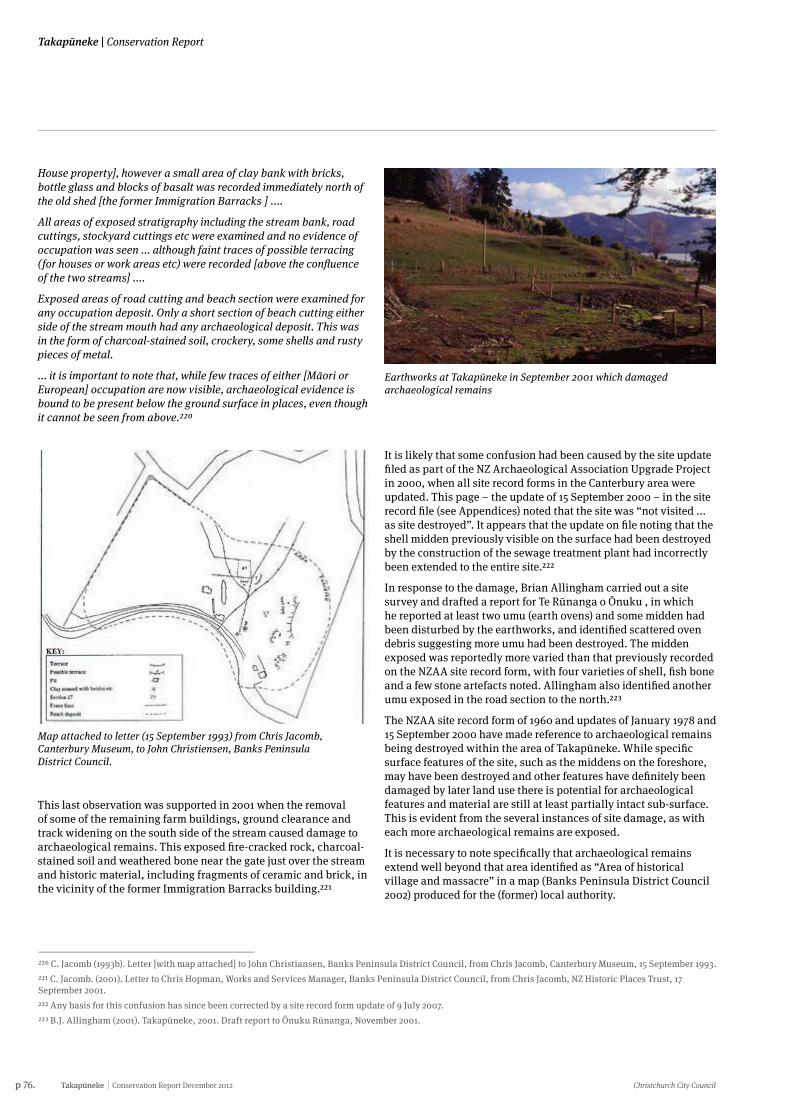
p 76. Takapūneke Conservation Report December 2012 Christchurch City Council
Takapūneke | Conservation Report
House property], however a small area of clay bank with bricks, bottle glass and blocks of basalt was recorded immediately north of the old shed [the former Immigration Barracks ] ....
All areas of exposed stratigraphy including the stream bank, road cuttings, stockyard cuttings etc were examined and no evidence of occupation was seen ... although faint traces of possible terracing (for houses or work areas etc) were recorded [above the confluence of the two streams] ....
Exposed areas of road cutting and beach section were examined for any occupation deposit. Only a short section of beach cutting either side of the stream mouth had any archaeological deposit. This was in the form of charcoal-stained soil, crockery, some shells and rusty pieces of metal.
... it is important to note that, while few traces of either [Māori or European] occupation are now visible, archaeological evidence is bound to be present below the ground surface in places, even though it cannot be seen from above.220
220 C. Jacomb (1993b). Letter [with map attached] to John Christiansen, Banks Peninsula District Council, from Chris Jacomb, Canterbury Museum, 15 September 1993.221 C. Jacomb. (2001). Letter to Chris Hopman, Works and Services Manager, Banks Peninsula District Council, from Chris Jacomb, NZ Historic Places Trust, 17 September 2001.222 Any basis for this confusion has since been corrected by a site record form update of 9 July 2007.223 B.J. Allingham (2001). Takapūneke, 2001. Draft report to Ōnuku Rūnanga, November 2001.
Map attached to letter (15 September 1993) from Chris Jacomb, Canterbury Museum, to John Christiensen, Banks Peninsula District Council.
This last observation was supported in 2001 when the removal of some of the remaining farm buildings, ground clearance and track widening on the south side of the stream caused damage to archaeological remains. This exposed fire-cracked rock, charcoal-stained soil and weathered bone near the gate just over the stream and historic material, including fragments of ceramic and brick, in the vicinity of the former Immigration Barracks building.221
It is likely that some confusion had been caused by the site update filed as part of the NZ Archaeological Association Upgrade Project in 2000, when all site record forms in the Canterbury area were updated. This page – the update of 15 September 2000 – in the site record file (see Appendices) noted that the site was “not visited ... as site destroyed”. It appears that the update on file noting that the shell midden previously visible on the surface had been destroyed by the construction of the sewage treatment plant had incorrectly been extended to the entire site.222
In response to the damage, Brian Allingham carried out a site survey and drafted a report for Te Rūnanga o Ōnuku , in which he reported at least two umu (earth ovens) and some midden had been disturbed by the earthworks, and identified scattered oven debris suggesting more umu had been destroyed. The midden exposed was reportedly more varied than that previously recorded on the NZAA site record form, with four varieties of shell, fish bone and a few stone artefacts noted. Allingham also identified another umu exposed in the road section to the north.223
The NZAA site record form of 1960 and updates of January 1978 and 15 September 2000 have made reference to archaeological remains being destroyed within the area of Takapūneke. While specific surface features of the site, such as the middens on the foreshore, may have been destroyed and other features have definitely been damaged by later land use there is potential for archaeological features and material are still at least partially intact sub-surface. This is evident from the several instances of site damage, as with each more archaeological remains are exposed.
It is necessary to note specifically that archaeological remains extend well beyond that area identified as “Area of historical village and massacre” in a map (Banks Peninsula District Council 2002) produced for the (former) local authority.
Earthworks at Takapūneke in September 2001 which damaged archaeological remains
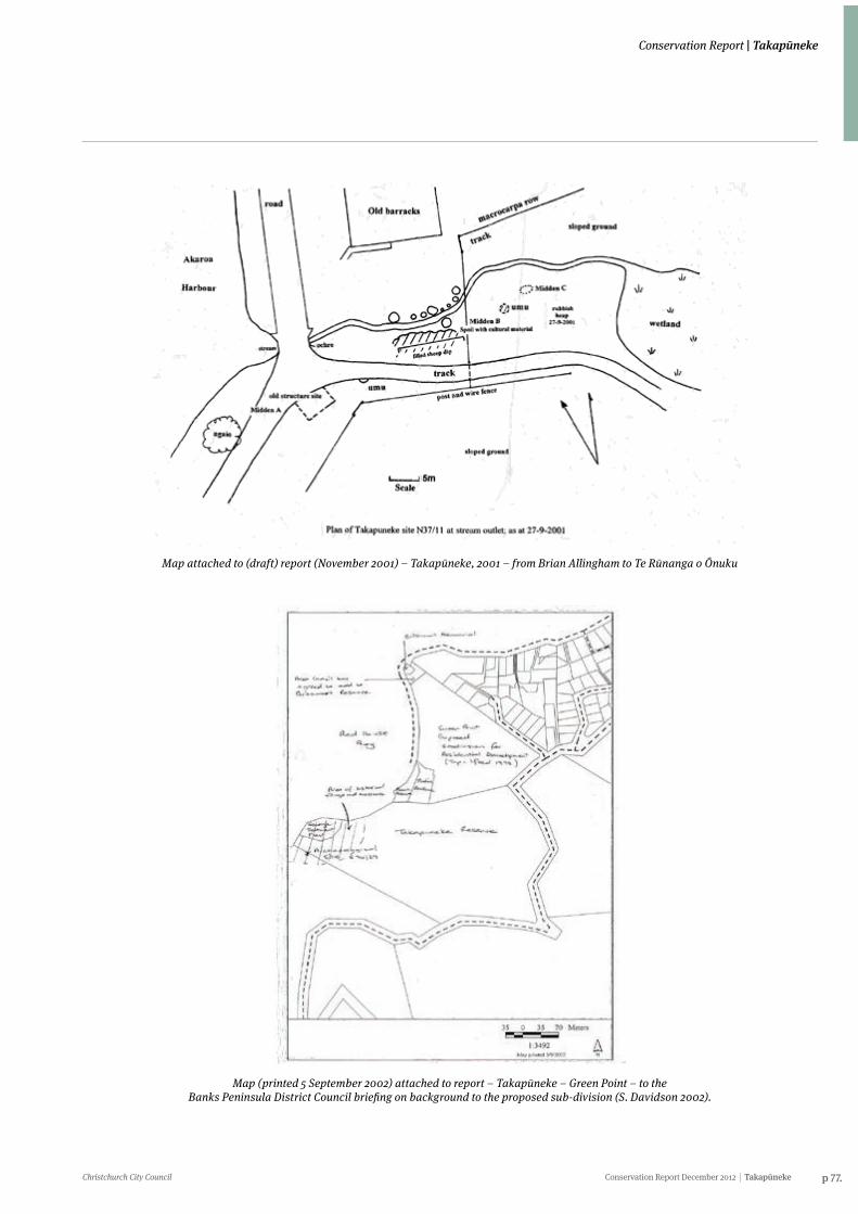
Christchurch City Council Conservation Report December 2012 Takapūneke p 77.
Conservation Report | Takapūneke
Map attached to (draft) report (November 2001) – Takapūneke, 2001 – from Brian Allingham to Te Rūnanga o Ōnuku
Map (printed 5 September 2002) attached to report – Takapūneke – Green Point – to the Banks Peninsula District Council briefing on background to the proposed sub-division (S. Davidson 2002).
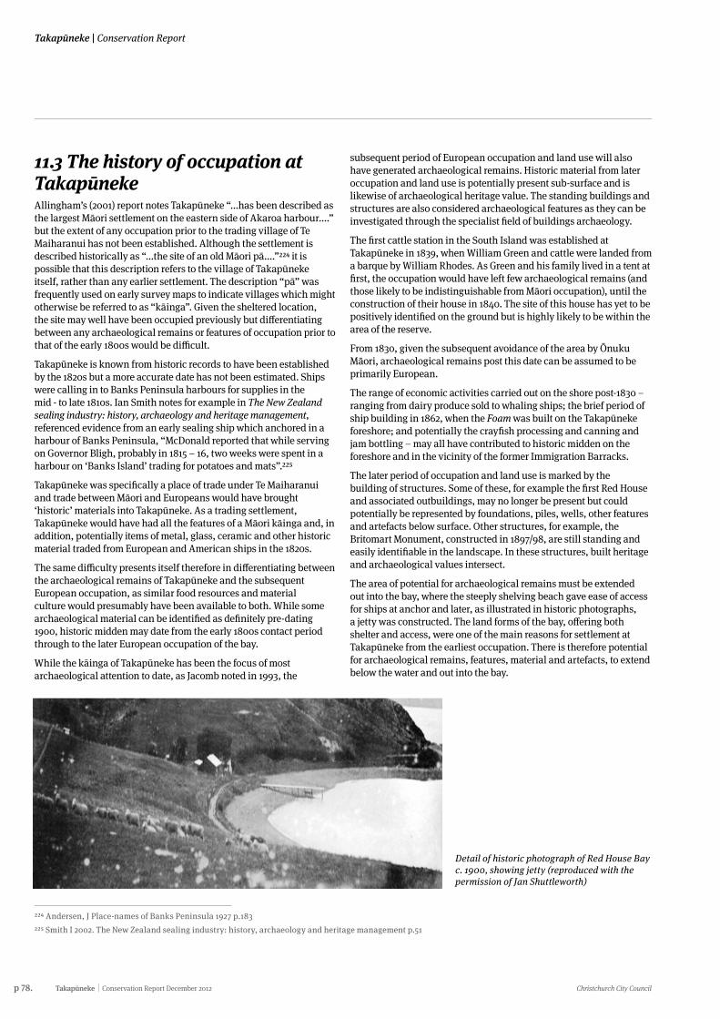
p 78. Takapūneke Conservation Report December 2012 Christchurch City Council
Takapūneke | Conservation Report
11.3 The history of occupation at TakapūnekeAllingham’s (2001) report notes Takapūneke “...has been described as the largest Māori settlement on the eastern side of Akaroa harbour....” but the extent of any occupation prior to the trading village of Te Maiharanui has not been established. Although the settlement is described historically as “...the site of an old Māori pā....”224 it is possible that this description refers to the village of Takapūneke itself, rather than any earlier settlement. The description “pā” was frequently used on early survey maps to indicate villages which might otherwise be referred to as “kāinga”. Given the sheltered location, the site may well have been occupied previously but differentiating between any archaeological remains or features of occupation prior to that of the early 1800s would be difficult.
Takapūneke is known from historic records to have been established by the 1820s but a more accurate date has not been estimated. Ships were calling in to Banks Peninsula harbours for supplies in the mid - to late 1810s. Ian Smith notes for example in The New Zealand sealing industry: history, archaeology and heritage management, referenced evidence from an early sealing ship which anchored in a harbour of Banks Peninsula, “McDonald reported that while serving on Governor Bligh, probably in 1815 – 16, two weeks were spent in a harbour on ‘Banks Island’ trading for potatoes and mats”.225
Takapūneke was specifically a place of trade under Te Maiharanui and trade between Māori and Europeans would have brought ‘historic’ materials into Takapūneke. As a trading settlement, Takapūneke would have had all the features of a Māori kāinga and, in addition, potentially items of metal, glass, ceramic and other historic material traded from European and American ships in the 1820s.
The same difficulty presents itself therefore in differentiating between the archaeological remains of Takapūneke and the subsequent European occupation, as similar food resources and material culture would presumably have been available to both. While some archaeological material can be identified as definitely pre-dating 1900, historic midden may date from the early 1800s contact period through to the later European occupation of the bay.
While the kāinga of Takapūneke has been the focus of most archaeological attention to date, as Jacomb noted in 1993, the
224 Andersen, J Place-names of Banks Peninsula 1927 p.183225 Smith I 2002. The New Zealand sealing industry: history, archaeology and heritage management p.51
subsequent period of European occupation and land use will also have generated archaeological remains. Historic material from later occupation and land use is potentially present sub-surface and is likewise of archaeological heritage value. The standing buildings and structures are also considered archaeological features as they can be investigated through the specialist field of buildings archaeology.
The first cattle station in the South Island was established at Takapūneke in 1839, when William Green and cattle were landed from a barque by William Rhodes. As Green and his family lived in a tent at first, the occupation would have left few archaeological remains (and those likely to be indistinguishable from Māori occupation), until the construction of their house in 1840. The site of this house has yet to be positively identified on the ground but is highly likely to be within the area of the reserve.
From 1830, given the subsequent avoidance of the area by Ōnuku Māori, archaeological remains post this date can be assumed to be primarily European.
The range of economic activities carried out on the shore post-1830 – ranging from dairy produce sold to whaling ships; the brief period of ship building in 1862, when the Foam was built on the Takapūneke foreshore; and potentially the crayfish processing and canning and jam bottling – may all have contributed to historic midden on the foreshore and in the vicinity of the former Immigration Barracks.
The later period of occupation and land use is marked by the building of structures. Some of these, for example the first Red House and associated outbuildings, may no longer be present but could potentially be represented by foundations, piles, wells, other features and artefacts below surface. Other structures, for example, the Britomart Monument, constructed in 1897/98, are still standing and easily identifiable in the landscape. In these structures, built heritage and archaeological values intersect.
The area of potential for archaeological remains must be extended out into the bay, where the steeply shelving beach gave ease of access for ships at anchor and later, as illustrated in historic photographs, a jetty was constructed. The land forms of the bay, offering both shelter and access, were one of the main reasons for settlement at Takapūneke from the earliest occupation. There is therefore potential for archaeological remains, features, material and artefacts, to extend below the water and out into the bay.
Detail of historic photograph of Red House Bay c. 1900, showing jetty (reproduced with the permission of Jan Shuttleworth)
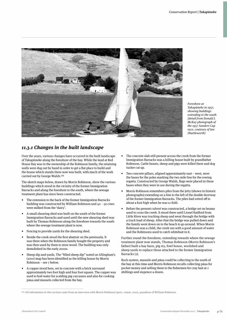
Christchurch City Council Conservation Report December 2012 Takapūneke p 79.
Conservation Report | Takapūneke
11.3.1 Changes in the built landscapeOver the years, various changes have occurred in the built landscape of Takapūneke along the foreshore of the bay. While the land at Red House Bay was in the ownership of the Robinson family, the retaining walls were dug out by hand in order to get a flat place to build and the house which stands there now was built, with much of the work carried out by George Walsh.226
The sketch maps below, drawn by Morris Robinson, show the various buildings which stood in the vicinity of the former Immigration Barracks and along the foreshore to the south, where the sewage treatment plant has since been constructed.
• The extension to the back of the former Immigration Barracks building was constructed by William Robinson and 40 – 50 cows were milked from the ‘dairy’.
• A small shearing shed was built on the south of the former Immigration Barracks and used until the new shearing shed was built by Thomas Robinson along the foreshore towards the south where the sewage treatment plant is now.
• Fencing to provide yards for the shearing shed.
• Beside the creek stood the first abattoir on the peninsula. It was there when the Robinson family bought the property and was then used by them to store wood. The building was only demolished in the early 2000s.
• Sheep dip and yards. The “filled sheep dip” noted on Allingham’s (2001) map has been identified as the killing house by Morris Robinson – see 7 below.
• A copper stood here, set in concrete with a brick surround approximately two foot high and four foot square. The copper was used to boil water for scalding pig carcasses and also for cooking pāua and mussels collected from the bay.
• The concrete slab still present across the creek from the former Immigration Barracks was a killing house built by grandfather Robinson. Cattle beasts, sheep and pigs were killed there and dog tucker cut up.
• Two concrete pillars, aligned approximately east – west, were the bases for the poles marking the two mile line for the rowing regatta. Constructed by George Walsh, flags were placed in these bases when they were in use during the regatta.
• Morris Robinson remembers piles from the jetty (shown in historic photographs) extending on a line to the left of the double doorway of the former Immigration Barracks. The piles had rotted off to about a foot high when he was a child.
• Before the present culvert was constructed, a bridge set on beams used to cross the creek. It stood there until Lionel Radford from Little River was trucking sheep and went through the bridge with a truck load of sheep. After that the bridge was pulled down and the family went down on to the beach to go around. When Morris Robinson was a child, the creek ran with a good amount of water and the Robinsons used to catch whitebait in it.
Further round the foreshore, extending towards where the sewage treatment plant now stands, Thomas Robinson (Morris Robinson’s father) built a hay barn, pig sty, fowl house, woolshed and sheep yards to replace those attached to the former Immigration Barracks (2).
Rock oysters, mussels and pāua could be collecting to the south of the bay at this time and Morris Robinson recalls collecting pāua for pocket money and selling them to the fishermen for cray bait at 2 shillings and sixpence a dozen.
226 All information in this section came from an interview with Morris Robinson (pers. comm. 2010), grandson of William Robinson.
Foreshore at Takapūneke in 1957, showing buildings extending to the south (detail from Donald J. McKay photograph of the 1957 Sanders Cup race, coutesey of Jan Shuttleworth)
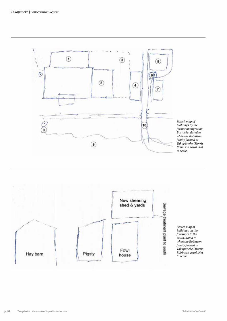
p 80. Takapūneke Conservation Report December 2012 Christchurch City Council
Takapūneke | Conservation Report
Sketch map of buildings by the former Immigration Barracks, dated to when the Robinson family farmed at Takapūneke (Morris Robinson 2010). Not to scale.
Sketch map of buildings on the foreshore to the south, dated to when the Robinson family farmed at Takapūneke (Morris Robinson 2010). Not to scale.
Christchurch City Council Conservation Report December 2012 Takapūneke p 81.
Conservation Report | Takapūneke
11.4 Archaeological remains at TakapūnekeA field survey was carried out in 2010 as part of the process of writing this report and archaeological features were mapped at that time.
Although there is no directly comparable site, archaeological features and material at Takapūneke are common throughout the country. Comparison with similar archaeological sites is therefore the best way in which to estimate the archaeological potential of Takapūneke and the early whaling stations of Banks Peninsula, especially those where there was Māori occupation prior to the arrival of Europeans, provide the nearest analogues.227
Because of this overlap of occupation, as noted above, it can be difficult to differentiate between Māori and European occupation and to determine the chronology of the various archaeological features. As Prickett notes about an area of pits and terraces at Whakaki (Island Bay): “...all [of these archaeological features] may be Māori rather than whalers’ work, and whether they pre-date or are contemporary with the whaling station is not clear”.228
As described above and in more detail elsewhere in this conservation report, Takapūneke has a long history of occupation, all of which has in turn modified the land, leaving built structures, surface features and potentially sub-surface deposits of archaeological remains. Surface visibility is limited due to vegetation, ground cover and later modification of the ground surface. However, the potential for archaeological remains is likely to be far greater than is apparent from surface survey.
The village of Takapūneke would therefore likely have comprised living, food processing/cooking and raw material processing/working areas, as well as wider areas of gardening and mahinga kai (areas of food collecting). In addition to whare or houses and takuahi (hearths), structures may have included whata or pātaka (raised storage platforms or store houses), storage pits and fencing.
Compared to what has been recovered from excavation of other kāinga and/or sites of occupation, sub-surface features and material remains may include concentrations of stained soil, charcoal and fire-cracked rocks (the remains of umu); faunal remains of animals, birds, fish and shellfish processed and/or eaten at the site; detritus from stone working; and artefacts of metal, glass and china from the early contact period. Less durable materials, such as textiles, plant material, skin, feathers and other animal remains, are unlikely to survive except in water-logged cultural deposits where decay may be arrested by anaerobic conditions.
227 Prickett, Nigel. 2002. The Archaeology of New Zealand Shore Whaling. Department of Conservation, Wellington.228 Prickett 2002, p.45229 Ōnuku Rūnanga. (No date). Takapūneke: Ngāi Tahu Wāhi Tapu burial Site, in Takapuneke – Green’s Point Historic Reserve Proposal. See also Ogilvie, G, 1990 Banks Peninsula: Cradle of Canterbury p. 156
Features dug into the earth, such as hearths, umu or storage pits, may be identifiable below the ground should the first few centimetres of vegetation and topsoil be stripped and, where structures were built, the outlines of post holes may remain.
Brian Allingham in his 2001 report to the Te Rūnanga o Ōnuku, additionally raised the practice of caching taonga in wetlands for safety and, although no such artefacts have been located to date, this may possibly have taken place at Takapūneke in the wetland below the confluence of the streams.
It should also be stressed that the area is wāhi pakanga or a field of battle. The statement contributed by Te Rūnanga o Ōnuku to the Takapūneke/Green’s Point Historic Reserve Proposal recalled that the bones of the slain had been burnt at Takapūneke; a reference to William Green both burning and burying kōiwi.229 Cremated or partly cremated human remains may therefore be present within the reserve.
11.4.1 Other kōiwi (human remains) may relate to the historic village of Takapūneke or potentially earlier occupation of the bay. Jeff Hamilton, who is cited earlier in this document (see Section 5.2), lived near the bay and recalled friends seeing kōiwi eroding from a bank above the beach, including a skull which “was lying in the soil where it came out of the bank” in the south of the bay. It is assumed that the person buried there was Māori.
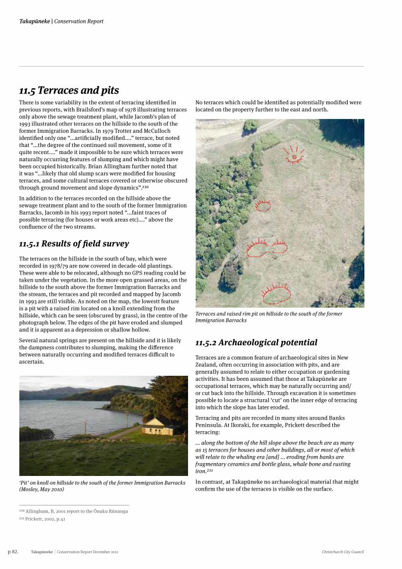
p 82. Takapūneke Conservation Report December 2012 Christchurch City Council
Takapūneke | Conservation Report
11.5 Terraces and pitsThere is some variability in the extent of terracing identified in previous reports, with Brailsford’s map of 1978 illustrating terraces only above the sewage treatment plant, while Jacomb’s plan of 1993 illustrated other terraces on the hillside to the south of the former Immigration Barracks. In 1979 Trotter and McCulloch identified only one “...artificially modified....” terrace, but noted that “...the degree of the continued soil movement, some of it quite recent....” made it impossible to be sure which terraces were naturally occurring features of slumping and which might have been occupied historically. Brian Allingham further noted that it was “...likely that old slump scars were modified for housing terraces, and some cultural terraces covered or otherwise obscured through ground movement and slope dynamics”.230
In addition to the terraces recorded on the hillside above the sewage treatment plant and to the south of the former Immigration Barracks, Jacomb in his 1993 report noted “...faint traces of possible terracing (for houses or work areas etc)....” above the confluence of the two streams.
11.5.1 Results of field survey The terraces on the hillside in the south of bay, which were recorded in 1978/79 are now covered in decade-old plantings. These were able to be relocated, although no GPS reading could be taken under the vegetation. In the more open grassed areas, on the hillside to the south above the former Immigration Barracks and the stream, the terraces and pit recorded and mapped by Jacomb in 1993 are still visible. As noted on the map, the lowestt feature is a pit with a raised rim located on a knoll extending from the hillside, which can be seen (obscured by grass), in the centre of the photograph below. The edges of the pit have eroded and slumped and it is apparent as a depression or shallow hollow.
Several natural springs are present on the hillside and it is likely the dampness contributes to slumping, making the difference between naturally occurring and modified terraces difficult to ascertain.
230 Allingham, B, 2001 report to the Ōnuku Rūnanga231 Prickett, 2002, p.41
‘Pit’ on knoll on hillside to the south of the former Immigration Barracks (Mosley, May 2010)
No terraces which could be identified as potentially modified were located on the property further to the east and north.
Terraces and raised rim pit on hillside to the south of the former Immigration Barracks
11.5.2 Archaeological potentialTerraces are a common feature of archaeological sites in New Zealand, often occurring in association with pits, and are generally assumed to relate to either occupation or gardening activities. It has been assumed that those at Takapūneke are occupational terraces, which may be naturally occurring and/or cut back into the hillside. Through excavation it is sometimes possible to locate a structural ‘cut’ on the inner edge of terracing into which the slope has later eroded.
Terracing and pits are recorded in many sites around Banks Peninsula. At Ikoraki, for example, Prickett described the terracing:
... along the bottom of the hill slope above the beach are as many as 15 terraces for houses and other buildings, all or most of which will relate to the whaling era [and] ... eroding from banks are fragmentary ceramics and bottle glass, whale bone and rusting iron.231
In contrast, at Takapūneke no archaeological material that might confirm the use of the terraces is visible on the surface.
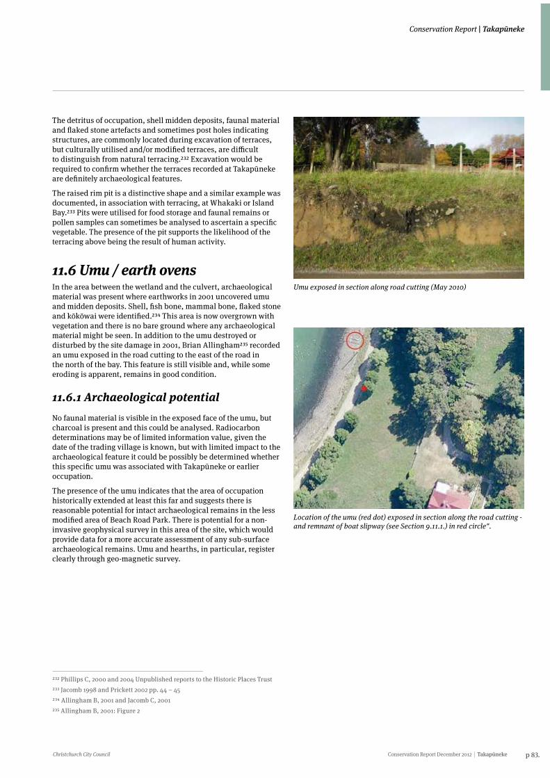
Christchurch City Council Conservation Report December 2012 Takapūneke p 83.
Conservation Report | Takapūneke
The detritus of occupation, shell midden deposits, faunal material and flaked stone artefacts and sometimes post holes indicating structures, are commonly located during excavation of terraces, but culturally utilised and/or modified terraces, are difficult to distinguish from natural terracing.232 Excavation would be required to confirm whether the terraces recorded at Takapūneke are definitely archaeological features.
The raised rim pit is a distinctive shape and a similar example was documented, in association with terracing, at Whakaki or Island Bay.233 Pits were utilised for food storage and faunal remains or pollen samples can sometimes be analysed to ascertain a specific vegetable. The presence of the pit supports the likelihood of the terracing above being the result of human activity.
232 Phillips C, 2000 and 2004 Unpublished reports to the Historic Places Trust 233 Jacomb 1998 and Prickett 2002 pp. 44 – 45 234 Allingham B, 2001 and Jacomb C, 2001 235 Allingham B, 2001: Figure 2
11.6 Umu / earth ovensIn the area between the wetland and the culvert, archaeological material was present where earthworks in 2001 uncovered umu and midden deposits. Shell, fish bone, mammal bone, flaked stone and kōkōwai were identified.234 This area is now overgrown with vegetation and there is no bare ground where any archaeological material might be seen. In addition to the umu destroyed or disturbed by the site damage in 2001, Brian Allingham235 recorded an umu exposed in the road cutting to the east of the road in the north of the bay. This feature is still visible and, while some eroding is apparent, remains in good condition.
11.6.1 Archaeological potentialNo faunal material is visible in the exposed face of the umu, but charcoal is present and this could be analysed. Radiocarbon determinations may be of limited information value, given the date of the trading village is known, but with limited impact to the archaeological feature it could be possibly be determined whether this specific umu was associated with Takapūneke or earlier occupation.
The presence of the umu indicates that the area of occupation historically extended at least this far and suggests there is reasonable potential for intact archaeological remains in the less modified area of Beach Road Park. There is potential for a non-invasive geophysical survey in this area of the site, which would provide data for a more accurate assessment of any sub-surface archaeological remains. Umu and hearths, in particular, register clearly through geo-magnetic survey.
Umu exposed in section along road cutting (May 2010)
Location of the umu (red dot) exposed in section along the road cutting - and remnant of boat slipway (see Section 9.11.1.) in red circle".
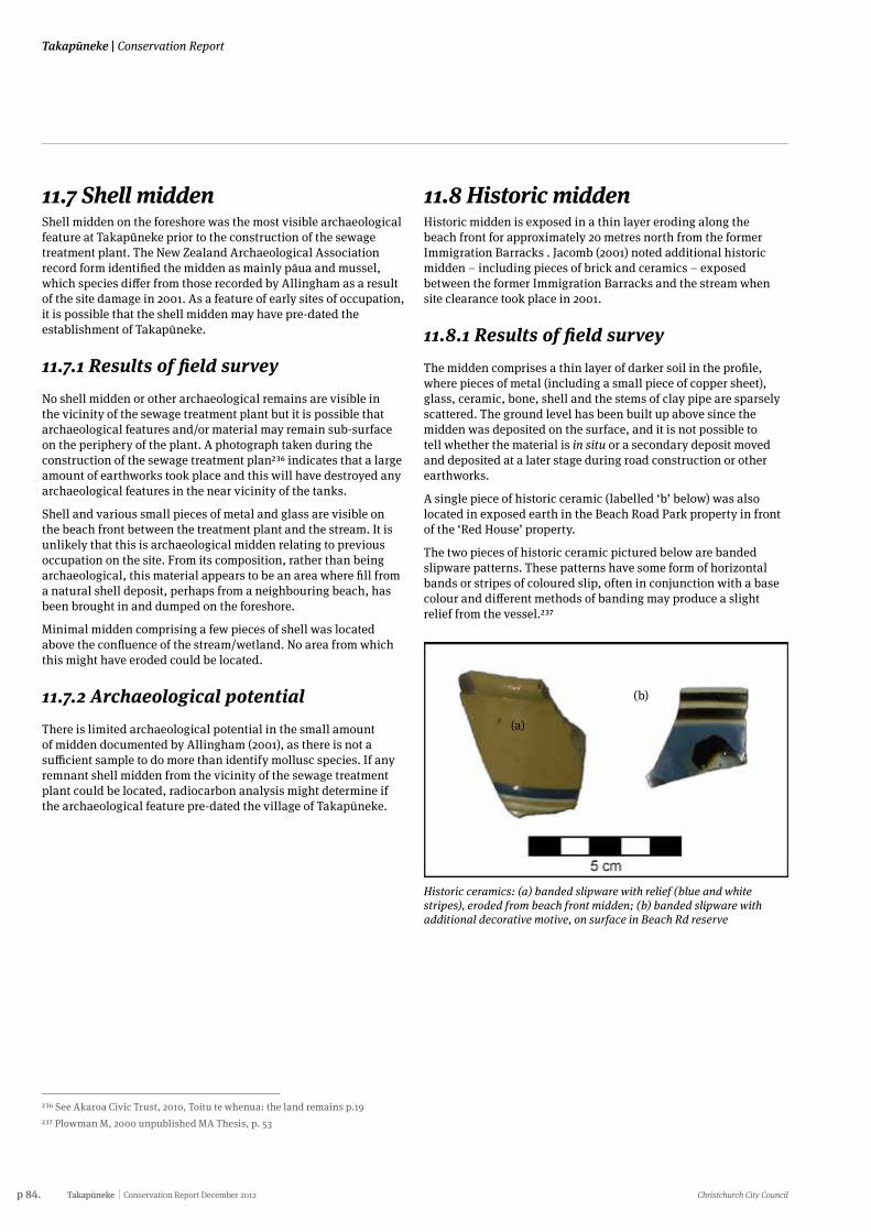
p 84. Takapūneke Conservation Report December 2012 Christchurch City Council
Takapūneke | Conservation Report
11.7 Shell middenShell midden on the foreshore was the most visible archaeological feature at Takapūneke prior to the construction of the sewage treatment plant. The New Zealand Archaeological Association record form identified the midden as mainly pāua and mussel, which species differ from those recorded by Allingham as a result of the site damage in 2001. As a feature of early sites of occupation, it is possible that the shell midden may have pre-dated the establishment of Takapūneke.
11.7.1 Results of field surveyNo shell midden or other archaeological remains are visible in the vicinity of the sewage treatment plant but it is possible that archaeological features and/or material may remain sub-surface on the periphery of the plant. A photograph taken during the construction of the sewage treatment plan236 indicates that a large amount of earthworks took place and this will have destroyed any archaeological features in the near vicinity of the tanks.
Shell and various small pieces of metal and glass are visible on the beach front between the treatment plant and the stream. It is unlikely that this is archaeological midden relating to previous occupation on the site. From its composition, rather than being archaeological, this material appears to be an area where fill from a natural shell deposit, perhaps from a neighbouring beach, has been brought in and dumped on the foreshore.
Minimal midden comprising a few pieces of shell was located above the confluence of the stream/wetland. No area from which this might have eroded could be located.
11.7.2 Archaeological potentialThere is limited archaeological potential in the small amount of midden documented by Allingham (2001), as there is not a sufficient sample to do more than identify mollusc species. If any remnant shell midden from the vicinity of the sewage treatment plant could be located, radiocarbon analysis might determine if the archaeological feature pre-dated the village of Takapūneke.
236 See Akaroa Civic Trust, 2010, Toitu te whenua: the land remains p.19237 Plowman M, 2000 unpublished MA Thesis, p. 53
11.8 Historic middenHistoric midden is exposed in a thin layer eroding along the beach front for approximately 20 metres north from the former Immigration Barracks . Jacomb (2001) noted additional historic midden – including pieces of brick and ceramics – exposed between the former Immigration Barracks and the stream when site clearance took place in 2001.
11.8.1 Results of field surveyThe midden comprises a thin layer of darker soil in the profile, where pieces of metal (including a small piece of copper sheet), glass, ceramic, bone, shell and the stems of clay pipe are sparsely scattered. The ground level has been built up above since the midden was deposited on the surface, and it is not possible to tell whether the material is in situ or a secondary deposit moved and deposited at a later stage during road construction or other earthworks.
A single piece of historic ceramic (labelled ‘b’ below) was also located in exposed earth in the Beach Road Park property in front of the ‘Red House’ property.
The two pieces of historic ceramic pictured below are banded slipware patterns. These patterns have some form of horizontal bands or stripes of coloured slip, often in conjunction with a base colour and different methods of banding may produce a slight relief from the vessel.237
Historic ceramics: (a) banded slipware with relief (blue and white stripes), eroded from beach front midden; (b) banded slipware with additional decorative motive, on surface in Beach Rd reserve
(b)
(a)
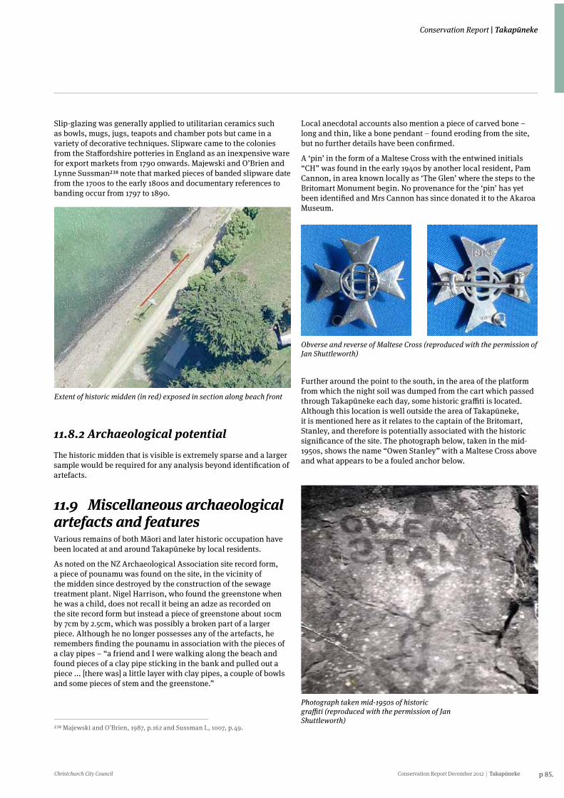
Christchurch City Council Conservation Report December 2012 Takapūneke p 85.
Conservation Report | Takapūneke
Extent of historic midden (in red) exposed in section along beach front
Slip-glazing was generally applied to utilitarian ceramics such as bowls, mugs, jugs, teapots and chamber pots but came in a variety of decorative techniques. Slipware came to the colonies from the Staffordshire potteries in England as an inexpensive ware for export markets from 1790 onwards. Majewski and O’Brien and Lynne Sussman238 note that marked pieces of banded slipware date from the 1700s to the early 1800s and documentary references to banding occur from 1797 to 1890.
238 Majewski and O’Brien, 1987, p.162 and Sussman L, 1007, p.49.
11.8.2 Archaeological potentialThe historic midden that is visible is extremely sparse and a larger sample would be required for any analysis beyond identification of artefacts.
11.9 Miscellaneous archaeological artefacts and featuresVarious remains of both Māori and later historic occupation have been located at and around Takapūneke by local residents.
As noted on the NZ Archaeological Association site record form, a piece of pounamu was found on the site, in the vicinity of the midden since destroyed by the construction of the sewage treatment plant. Nigel Harrison, who found the greenstone when he was a child, does not recall it being an adze as recorded on the site record form but instead a piece of greenstone about 10cm by 7cm by 2.5cm, which was possibly a broken part of a larger piece. Although he no longer possesses any of the artefacts, he remembers finding the pounamu in association with the pieces of a clay pipes – “a friend and I were walking along the beach and found pieces of a clay pipe sticking in the bank and pulled out a piece ... [there was] a little layer with clay pipes, a couple of bowls and some pieces of stem and the greenstone.”
Local anecdotal accounts also mention a piece of carved bone – long and thin, like a bone pendant – found eroding from the site, but no further details have been confirmed.
A ‘pin’ in the form of a Maltese Cross with the entwined initials “CH” was found in the early 1940s by another local resident, Pam Cannon, in area known locally as ‘The Glen’ where the steps to the Britomart Monument begin. No provenance for the ‘pin’ has yet been identified and Mrs Cannon has since donated it to the Akaroa Museum.
Obverse and reverse of Maltese Cross (reproduced with the permission of Jan Shuttleworth)
Further around the point to the south, in the area of the platform from which the night soil was dumped from the cart which passed through Takapūneke each day, some historic graffiti is located. Although this location is well outside the area of Takapūneke, it is mentioned here as it relates to the captain of the Britomart, Stanley, and therefore is potentially associated with the historic significance of the site. The photograph below, taken in the mid-1950s, shows the name “Owen Stanley” with a Maltese Cross above and what appears to be a fouled anchor below.
Photograph taken mid-1950s of historic graffiti (reproduced with the permission of Jan Shuttleworth)
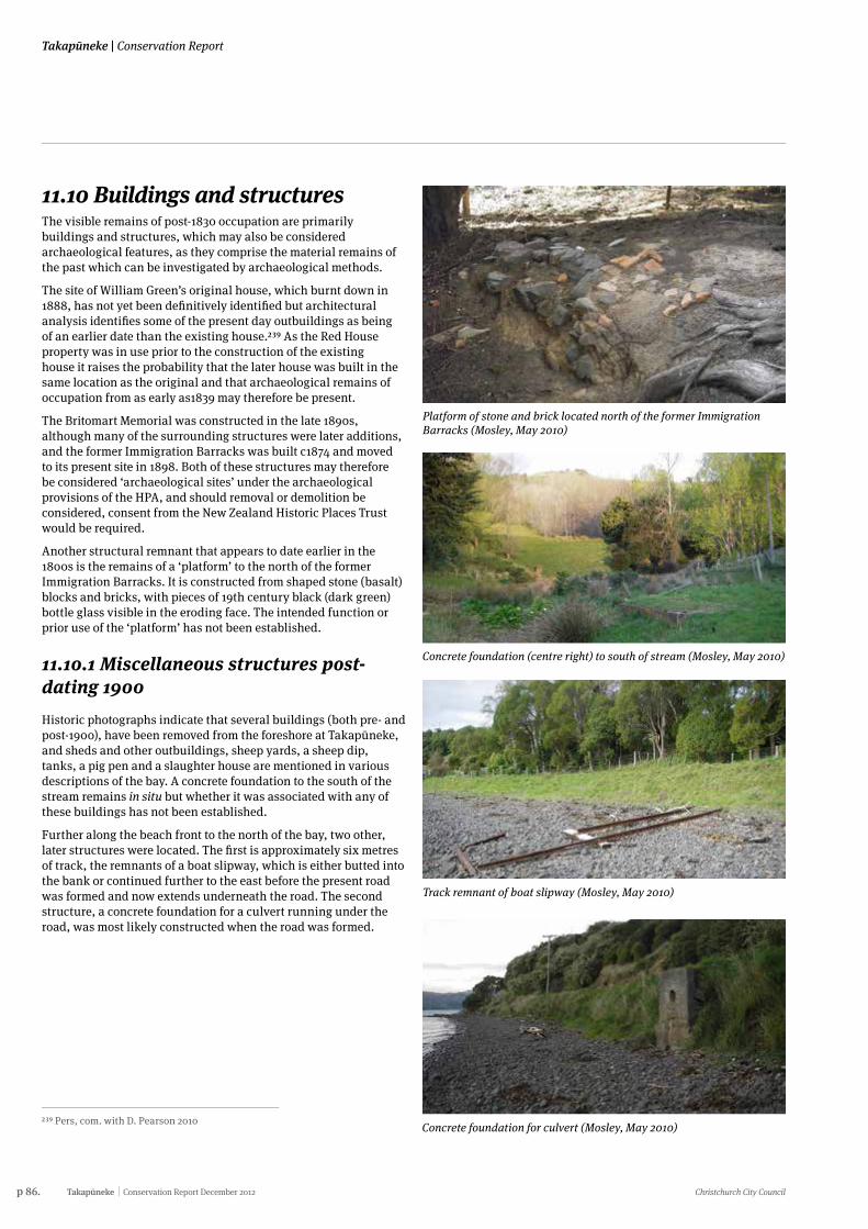
p 86. Takapūneke Conservation Report December 2012 Christchurch City Council
Takapūneke | Conservation Report
11.10 Buildings and structuresThe visible remains of post-1830 occupation are primarily buildings and structures, which may also be considered archaeological features, as they comprise the material remains of the past which can be investigated by archaeological methods.
The site of William Green’s original house, which burnt down in 1888, has not yet been definitively identified but architectural analysis identifies some of the present day outbuildings as being of an earlier date than the existing house.239 As the Red House property was in use prior to the construction of the existing house it raises the probability that the later house was built in the same location as the original and that archaeological remains of occupation from as early as1839 may therefore be present.
The Britomart Memorial was constructed in the late 1890s, although many of the surrounding structures were later additions, and the former Immigration Barracks was built c1874 and moved to its present site in 1898. Both of these structures may therefore be considered ‘archaeological sites’ under the archaeological provisions of the HPA, and should removal or demolition be considered, consent from the New Zealand Historic Places Trust would be required.
Another structural remnant that appears to date earlier in the 1800s is the remains of a ‘platform’ to the north of the former Immigration Barracks. It is constructed from shaped stone (basalt) blocks and bricks, with pieces of 19th century black (dark green) bottle glass visible in the eroding face. The intended function or prior use of the ‘platform’ has not been established.
11.10.1 Miscellaneous structures post-dating 1900Historic photographs indicate that several buildings (both pre- and post-1900), have been removed from the foreshore at Takapūneke, and sheds and other outbuildings, sheep yards, a sheep dip, tanks, a pig pen and a slaughter house are mentioned in various descriptions of the bay. A concrete foundation to the south of the stream remains in situ but whether it was associated with any of these buildings has not been established.
Further along the beach front to the north of the bay, two other, later structures were located. The first is approximately six metres of track, the remnants of a boat slipway, which is either butted into the bank or continued further to the east before the present road was formed and now extends underneath the road. The second structure, a concrete foundation for a culvert running under the road, was most likely constructed when the road was formed.
239 Pers, com. with D. Pearson 2010
Platform of stone and brick located north of the former Immigration Barracks (Mosley, May 2010)
Concrete foundation (centre right) to south of stream (Mosley, May 2010)
Track remnant of boat slipway (Mosley, May 2010)
Concrete foundation for culvert (Mosley, May 2010)
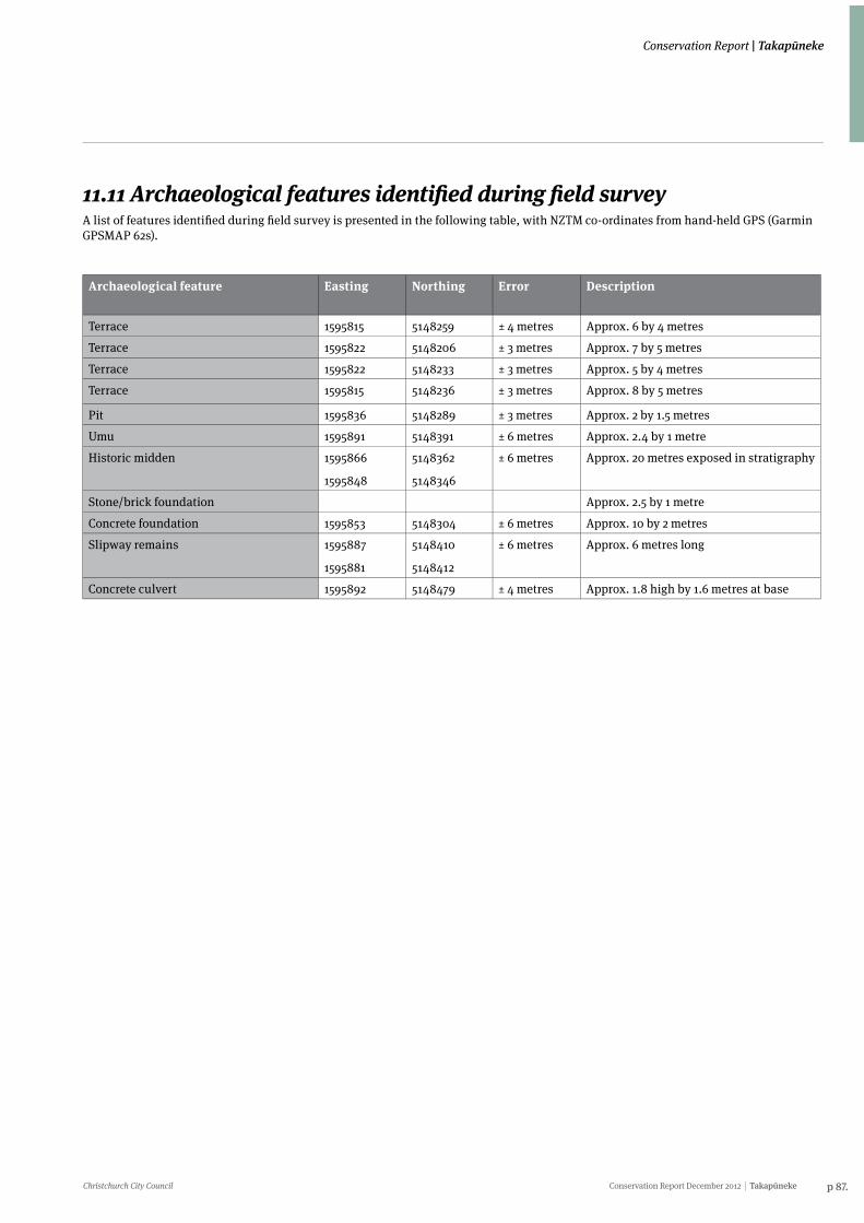
Christchurch City Council Conservation Report December 2012 Takapūneke p 87.
Conservation Report | Takapūneke
11.11 Archaeological features identified during field surveyA list of features identified during field survey is presented in the following table, with NZTM co-ordinates from hand-held GPS (Garmin GPSMAP 62s).
Archaeological feature Easting Northing Error Description
Terrace 1595815 5148259 ± 4 metres Approx. 6 by 4 metres
Terrace 1595822 5148206 ± 3 metres Approx. 7 by 5 metres
Terrace 1595822 5148233 ± 3 metres Approx. 5 by 4 metres
Terrace 1595815 5148236 ± 3 metres Approx. 8 by 5 metres
Pit 1595836 5148289 ± 3 metres Approx. 2 by 1.5 metres
Umu 1595891 5148391 ± 6 metres Approx. 2.4 by 1 metre
Historic midden 1595866
1595848
5148362
5148346
± 6 metres Approx. 20 metres exposed in stratigraphy
Stone/brick foundation Approx. 2.5 by 1 metre
Concrete foundation 1595853 5148304 ± 6 metres Approx. 10 by 2 metres
Slipway remains 1595887
1595881
5148410
5148412
± 6 metres Approx. 6 metres long
Concrete culvert 1595892 5148479 ± 4 metres Approx. 1.8 high by 1.6 metres at base
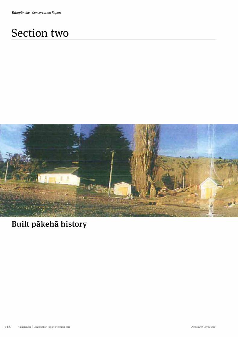
p 88. Takapūneke Conservation Report December 2012 Christchurch City Council
Takapūneke | Conservation Report
Section two
Built pākehā history
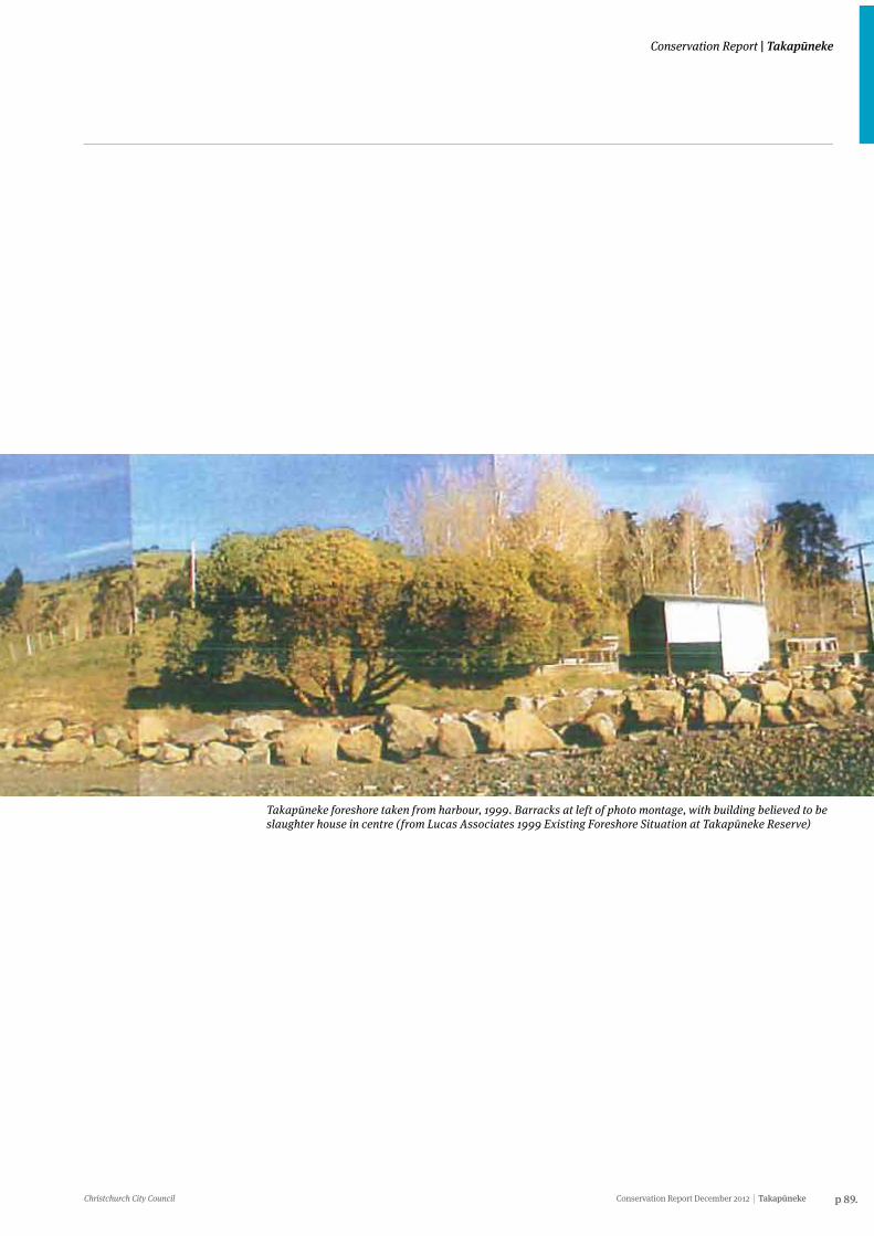
Christchurch City Council Conservation Report December 2012 Takapūneke p 89.
Conservation Report | Takapūneke
Takapūneke foreshore taken from harbour, 1999. Barracks at left of photo montage, with building believed to be slaughter house in centre (from Lucas Associates 1999 Existing Foreshore Situation at Takapūneke Reserve)
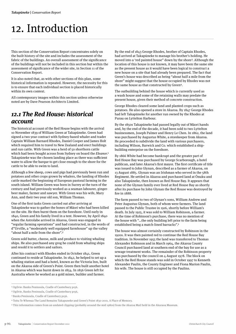
p 90. Takapūneke Conservation Report December 2012 Christchurch City Council
Takapūneke | Conservation Report
12. Introduction
This section of the Conservation Report concentrates solely on the built history of the site and includes the assessment of the fabric of the buildings. An overall assessment of the significance of the buildings will not be included in this section but within the assessment of significance of the wider site, in Section 11 of the Conservation Report.
It is also noted that, as with other sections of this plan, some historical information is repeated. However, the necessity for this is to ensure that each individual section is placed historically within its own context.
All contemporary images within this section unless otherwise noted are by Dave Pearson Architects Limited.
12.1 The Red House: historical accountThe historical account of the Red House begins with the arrival 10 November 1839 of William Green at Takapūneke. Green had signed a two year contract with Sydney-based whaler and trader Captain William Barnard Rhodes, Daniel Cooper and James Holt which required him to travel to New Zealand and erect buildings and run cattle. With Green was a herd of 50 shorthorn cattle which had been bought across from Sydney on board the Eleanor.1 Takapūneke was the chosen landing place as there was sufficient water to allow the barque to get close enough to the shore for the cattle to be able to swim to land.
Although a few sheep, cows and pigs had previously been run and potatoes and other crops grown by whalers, the landing of Rhodes cattle marked the beginning of European pastoral farming in the south island. William Green was born in Surrey at the turn of the century and had previously worked as a seaman labourer, ginger-beer maker, farmer and sawyer. With Green was his wife, Mary Ann, and their two year old son, William Thomas.
One of the first tasks Green carried out after arriving at Takapūneke was to gather the bones of Māori who had been killed on the site. He then burnt them on the foreshore. Until early in 1840, Green and his family lived in a tent. However, by April 1840 when the Astrolabe arrived in Akaroa, Green was engaged in “regular farming operations” and had constructed, in the words of d”Urville, a “moderately well equipped farmhouse” up the valley “about half a mile from the shore”.2
Green sold butter, cheese, milk and produce to visiting whaling ships. He also purchased any grog he could from whaling ships and resold it to settlers and sailors.
After his contract with Rhodes ended in October 1841, Green continued to reside at Takapūneke. In 1842, he helped to set up a whaling station and had a hotel, known as the Victoria Inn, built on the Akaroa side of Green’s Point. Green then built another hotel in Akaroa which was burnt down in 1854. In 1856 Green left for Australia where he worked as a gold miner, builder and farmer.
1 Ogilvie: Banks Peninsula, Cradle of Canterbury p156.2 Ogilvie, Banks Peninsula, Cradle of Canterbury p156, 3 Banks Peninsula, Cradle of Canterbury p156. 4 Toitu Te Whenua The Land Remains Takapuneke and Green’s Point 1830-2010, A Place of Memory.5 This information comes from an undated clipping (probably around the mid 1980s) from the Akaroa Mail held in the Akaraoa Museum.
By the end of 1843 George Rhodes, brother of Captain Rhodes, had arrived at Takapūneke to manage his brother’s holding. He moved into a ‘red painted house” down by the shore3. Although the location of this house is not known, it may have been the same site as the present house as it would have been logical to construct a new house on a site that had already been prepared. The fact that Green’s house was described as being “about half a mile from the shore” might suggest that the house occupied by Rhodes was not the same house as that constructed by Green4.
The outbuilding behind the house which is currently used as a wash house and some of the retaining walls may predate the present house, given their method of concrete construction.
George Rhodes cleared some land and planted crops such as potatoes. He also opened a store in Akaroa. By 1847 George Rhodes had left Takapūneke for another run owned by the Rhodes at Purau on Lyttelton Harbour.
By the 1850s Takapūneke had passed legally out of Māori hands and, by the end of the decade, it had been sold to two Lyttelton businessmen, Joseph Palmer and Henry Le Chen. In 1862, the land was purchased by Augustus White, a storekeeper from Akaroa. He proceeded to subdivide the land with various purchasers, including Wilson, Barwick and Co. which established a ship-building enterprise on the foreshore.
By 1866 White had become bankrupt and the greater part of Red House Bay was purchased by George Scarborough, a hotel publican, and later Akaroa’s first mayor. The first certificate of title was issued to John Glynan, described as a farmer of Akaroa, on 13 August 1885. Glynan was an Irishman who served in the 58th Regiment. He settled in Akaroa and purchased land at Ōnuku and also Takapūneke, then known as Red House Bay. It appears that none of the Glynan family ever lived at Red House Bay as shortly after its purchase by John Glynan the Red House was destroyed by fire in 1888.
The farm passed to two of Glynan’s sons, William Andrew and Peter Augustus Glynan, both of whom were farmers. The land passed to the Public Trustee in 1916, shortly before William’s death. In July 1925, it was sold to William Robinson, a farmer. At the time of Robinson’s purchase, there was no mention of the house with “…the only building left prior to the farm being established being a match-lined barracks”.5
The house was almost certainly constructed by Robinson in the 1920s. It was then painted red to continue the Red House Bay tradition. In November 1955 the land was transferred to Thomas Alexander Robinson and in March 1964, the Akaroa County Council purchased land at southern end of the bay for use as a sewage treatment works. The remainder of the Robinson property was purchased by the council on 4 August 1978. The block on which the Red House stands was sold in October 1997 to Kenneth Alexander Paulin, the County Engineer and Fiona Marion Paulin, his wife. The house is still occupied by the Paulins.
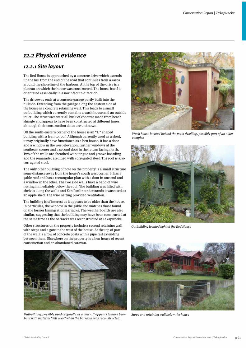
Christchurch City Council Conservation Report December 2012 Takapūneke p 91.
Conservation Report | Takapūneke
12.2 Physical evidence12.2.1 Site layoutThe Red House is approached by a concrete drive which extends up the hill from the end of the road that continues from Akaroa around the shoreline of the harbour. At the top of the drive is a plateau on which the house was constructed. The house itself is orientated essentially in a north/south direction.
The driveway ends at a concrete garage partly built into the hillside. Extending from the garage along the eastern side of the house is a concrete retaining wall. This leads to a small outbuilding which currently contains a wash house and an outside toilet. The structures were all built of concrete made from beach shingle and appear to have been constructed at different times, although their construction dates are unknown.
Off the south-eastern corner of the house is an “L “ shaped building with a lean-to roof. Although currently used as a shed, it may originally have functioned as a hen house. It has a door and a window in the west elevation, further windows at the southeast corner and a second door in the return facing north. Two of the walls are sheathed with tongue and groove boarding and the remainder are lined with corrugated steel. The roof is also corrugated steel.
The only other building of note on the property is a small structure some distance away from the house’s south west corner. It has a gable roof and has a rectangular plan with a door in one end and a window in the other. The two side walls have a band of wire netting immediately below the roof. The building was fitted with shelves along the walls and Ken Paulin understands it was used as an apple shed. The wire netting provided ventilation.
The building is of interest as it appears to be older than the house. In particular, the window in the gable end matches those found on the former Immigration Barracks. The weatherboards are also similar, suggesting that the building may have been constructed at the same time as the barracks was reconstructed at Takapūneke.
Other structures on the property include a second retaining wall with steps and a gate to the west of the house. At the top of part of the wall is a row of concrete posts with a pipe rail extending between them. Elsewhere on the property is a hen house of recent construction and an abandoned caravan.
Wash house located behind the main dwelling, possibly part of an older complex
Outbuilding located behind the Red House
Outbuilding, possibly used originally as a dairy. It appears to have been built with material “left over” when the barracks was reconstructed.
Steps and retaining wall below the house
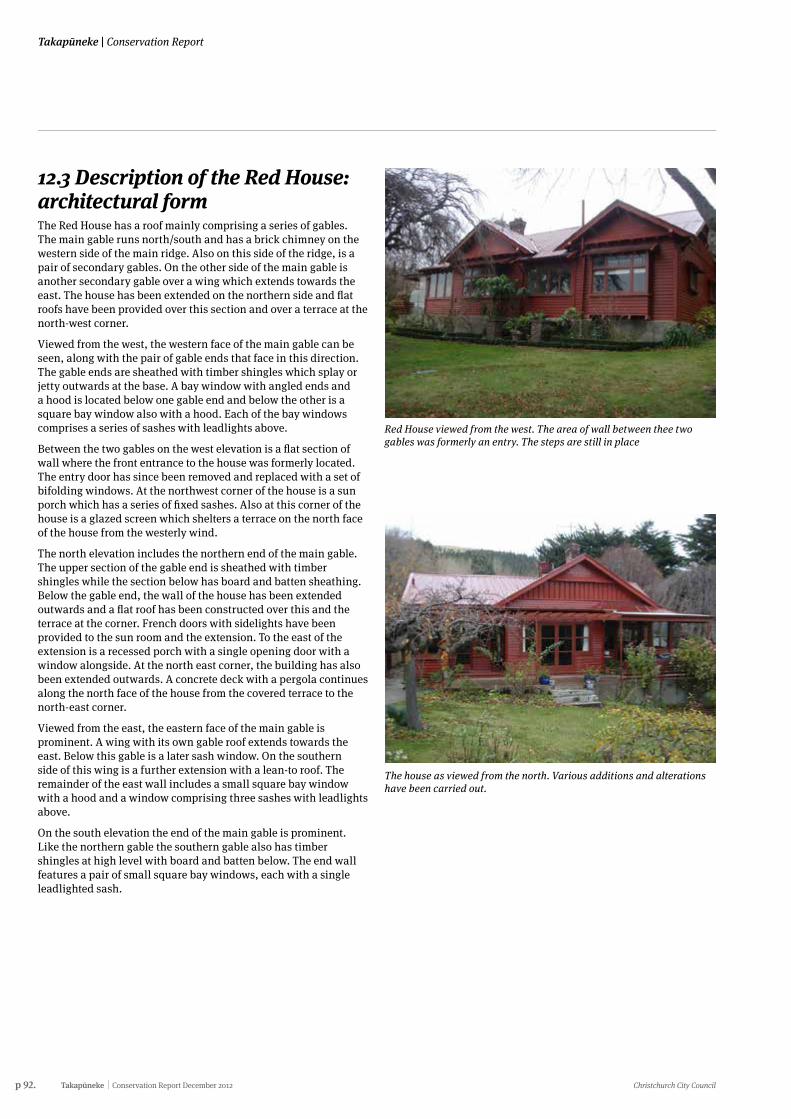
p 92. Takapūneke Conservation Report December 2012 Christchurch City Council
Takapūneke | Conservation Report
12.3 Description of the Red House: architectural formThe Red House has a roof mainly comprising a series of gables. The main gable runs north/south and has a brick chimney on the western side of the main ridge. Also on this side of the ridge, is a pair of secondary gables. On the other side of the main gable is another secondary gable over a wing which extends towards the east. The house has been extended on the northern side and flat roofs have been provided over this section and over a terrace at the north-west corner.
Viewed from the west, the western face of the main gable can be seen, along with the pair of gable ends that face in this direction. The gable ends are sheathed with timber shingles which splay or jetty outwards at the base. A bay window with angled ends and a hood is located below one gable end and below the other is a square bay window also with a hood. Each of the bay windows comprises a series of sashes with leadlights above.
Between the two gables on the west elevation is a flat section of wall where the front entrance to the house was formerly located. The entry door has since been removed and replaced with a set of bifolding windows. At the northwest corner of the house is a sun porch which has a series of fixed sashes. Also at this corner of the house is a glazed screen which shelters a terrace on the north face of the house from the westerly wind.
The north elevation includes the northern end of the main gable. The upper section of the gable end is sheathed with timber shingles while the section below has board and batten sheathing. Below the gable end, the wall of the house has been extended outwards and a flat roof has been constructed over this and the terrace at the corner. French doors with sidelights have been provided to the sun room and the extension. To the east of the extension is a recessed porch with a single opening door with a window alongside. At the north east corner, the building has also been extended outwards. A concrete deck with a pergola continues along the north face of the house from the covered terrace to the north-east corner.
Viewed from the east, the eastern face of the main gable is prominent. A wing with its own gable roof extends towards the east. Below this gable is a later sash window. On the southern side of this wing is a further extension with a lean-to roof. The remainder of the east wall includes a small square bay window with a hood and a window comprising three sashes with leadlights above.
On the south elevation the end of the main gable is prominent. Like the northern gable the southern gable also has timber shingles at high level with board and batten below. The end wall features a pair of small square bay windows, each with a single leadlighted sash.
Red House viewed from the west. The area of wall between thee two gables was formerly an entry. The steps are still in place
The house as viewed from the north. Various additions and alterations have been carried out.
Christchurch City Council Conservation Report December 2012 Takapūneke p 93.
Conservation Report | Takapūneke
12.3.1 Architectural influences The form of the Red House is based on the Californian bungalow, a style that was particularly popular in New Zealand during the 1920s and 1930s.
The word “bungalow” is a derivation of the Hindustani word “bangla” which was the name given to the bamboo and thatch houses of eastern India, near Bangladesh. When the English colonial settlers arrived in India, they looked to the local dwellings for inspiration. At the same time they wanted to maintain a social and physical distance between themselves and the local culture and, accordingly, proceeded to adapt the bangla to their own requirements.6 These early dwellings were built of mud bricks and surrounded by a verandah to keep the inhabitants cool.
The bungalow was re-interpreted in England as a coastal holiday home from about 1870. It was then exported to the West Coast of America about 1900 where, after various transformations it evolved into what became known as the Californian bungalow.7 Bungalows also commonly incorporated design elements and details adapted from the English Arts and Crafts movement which had an emphasis on hand-crafted methods of construction and used local and natural materials such as stone and timber. Treadwell contends, however, that it was the American version that was most influential in New Zealand.8
At the height of its popularity, the New Zealand bungalow had a well-defined architectural vocabulary. Roofs were generally of about 22 degrees and the rafters were exposed at the eaves. Gable ends often featured slatted or trellised ventilators. Chimneys were commonly corbelled with either a rough cast or a smooth plaster finish. The walls were usually weather boarded, although timber shingles could be fixed in gable ends or as verandah balustrading and below bow windows. Joinery generally consisted of side-hung casement sashes, although during the transition period between villas and bungalows, a house might have casement windows on the face that was seen by the public and double-hung joinery to the rear. Projecting bay windows that were either square or bowed in plan were common.
The entry porch was a feature of the bungalow and was generously proportioned, being conceived as an outdoor room. The roof over the porch would either be supported on masonry piers or more often on timber posts. The posts were commonly arranged in pairs and supported a corbel which would in turn provide support for the verandah beam. It was here that there was some suggestion of a Japanese influence.
With respect to planning, the ‘classic’ New Zealand bungalow of the 1920s had two main plan types. The first was derived from, and was practically identical to, that of the villa, being nearly symmetrical with a front entry and central hallway. The second type was asymmetrical and often entered from the side.
In general, bungalows promoted a less formal lifestyle than that to which middle-class New Zealanders had been accustomed.9 Space was used efficiently and the central hallway of the Victorian villa was often dispensed with. Boundaries between rooms became less defined and rooms regularly opened off one another, rather than being accessed from a hallway.
Sun and natural light were also seen as being important to the well being of the inhabitants of bungalows and the verandah became an extension of the living area. Houses were orientated to face a view or to allow sun and light into as many rooms as possible, instead of facing the road as villas inevitably did.
The Red House incorporates many of the architectural details commonly found in bungalows. The roofs are gabled and the roof pitches shallow with rafter ends exposed at the eaves. The bay windows with casement sashes are such as is commonly found in bungalows. The timber shingles in the gable ends with weatherboarding as the main wall sheathing are also common bungalow details.
The original entry porch on the west elevation has since been infilled. In its original form, it may also have displayed typical bungalow vocabulary.
12.3.2 The bungalow in AkaroaRelatively few houses were constructed in Akaroa during the bungalow period in the years between the two world wars. The population was relatively static and holiday-makers stayed in accommodation and boarding houses and hotels rather than in holiday homes (which only began to proliferate in the 1950s). The subdivisions of the years between the wars were mostly small.
Beaumont and Wilson10 state that Akaroa’s houses of the years between the wars have not been properly studied and that the best examples of houses in the different styles of those years, including bungalows, have not yet been located.
Among houses of comparable vintage to the Red House are the Anglican vicarage on Julius Place, 47 Rue Balguerie, and 83 Rue Lavaud, a larger house which is nevertheless in the bungalow/Arts and Crafts idiom.11
6 Treadwell, J.L. Rangitoto Island Baches 1998 p.5. discussing work of A.D. King 1995: The Bungalow: The Production of a Global Culture. Oxford University Press.7 Treadwell, J.L. p.58 ibid p.59 Ashford, Jeremy The Bungalow in New Zealand, 199410 Beaumont and Wilson, p.8611 See Beaumont and Wilson, p. 125.
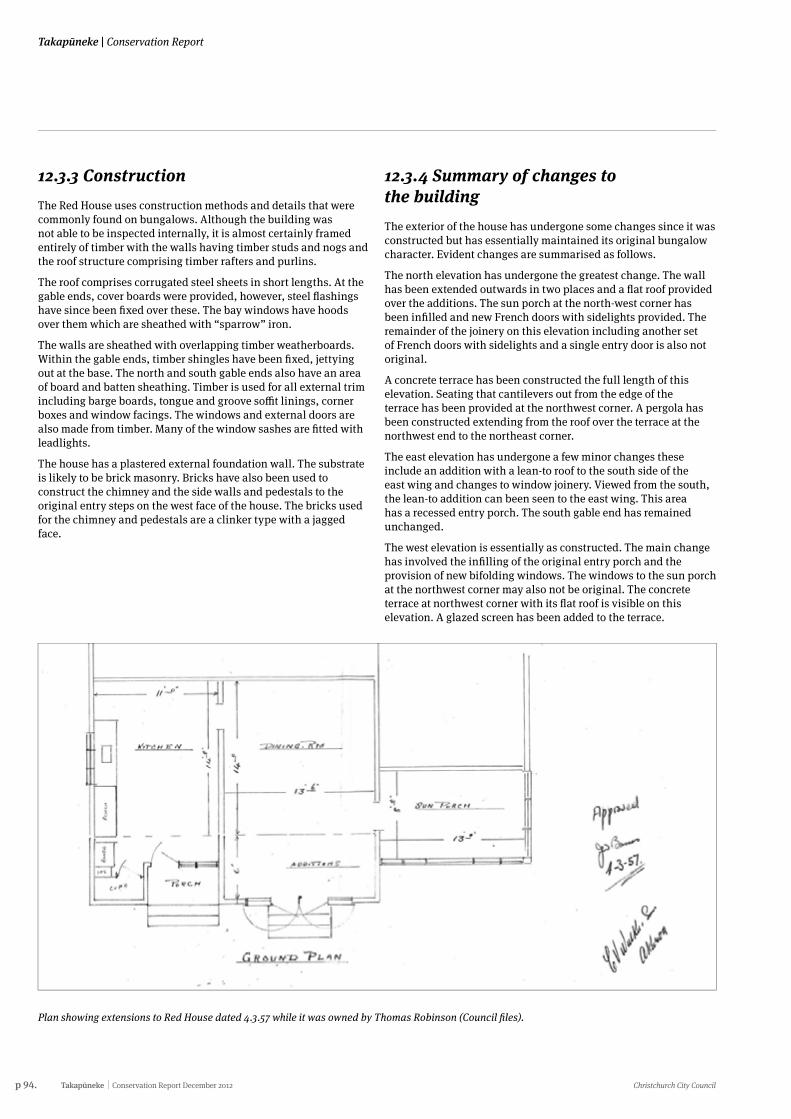
p 94. Takapūneke Conservation Report December 2012 Christchurch City Council
Takapūneke | Conservation Report
12.3.3 ConstructionThe Red House uses construction methods and details that were commonly found on bungalows. Although the building was not able to be inspected internally, it is almost certainly framed entirely of timber with the walls having timber studs and nogs and the roof structure comprising timber rafters and purlins.
The roof comprises corrugated steel sheets in short lengths. At the gable ends, cover boards were provided, however, steel flashings have since been fixed over these. The bay windows have hoods over them which are sheathed with “sparrow” iron.
The walls are sheathed with overlapping timber weatherboards. Within the gable ends, timber shingles have been fixed, jettying out at the base. The north and south gable ends also have an area of board and batten sheathing. Timber is used for all external trim including barge boards, tongue and groove soffit linings, corner boxes and window facings. The windows and external doors are also made from timber. Many of the window sashes are fitted with leadlights.
The house has a plastered external foundation wall. The substrate is likely to be brick masonry. Bricks have also been used to construct the chimney and the side walls and pedestals to the original entry steps on the west face of the house. The bricks used for the chimney and pedestals are a clinker type with a jagged face.
12.3.4 Summary of changes to the building The exterior of the house has undergone some changes since it was constructed but has essentially maintained its original bungalow character. Evident changes are summarised as follows.
The north elevation has undergone the greatest change. The wall has been extended outwards in two places and a flat roof provided over the additions. The sun porch at the north-west corner has been infilled and new French doors with sidelights provided. The remainder of the joinery on this elevation including another set of French doors with sidelights and a single entry door is also not original.
A concrete terrace has been constructed the full length of this elevation. Seating that cantilevers out from the edge of the terrace has been provided at the northwest corner. A pergola has been constructed extending from the roof over the terrace at the northwest end to the northeast corner.
The east elevation has undergone a few minor changes these include an addition with a lean-to roof to the south side of the east wing and changes to window joinery. Viewed from the south, the lean-to addition can been seen to the east wing. This area has a recessed entry porch. The south gable end has remained unchanged.
The west elevation is essentially as constructed. The main change has involved the infilling of the original entry porch and the provision of new bifolding windows. The windows to the sun porch at the northwest corner may also not be original. The concrete terrace at northwest corner with its flat roof is visible on this elevation. A glazed screen has been added to the terrace.
Plan showing extensions to Red House dated 4.3.57 while it was owned by Thomas Robinson (Council files).
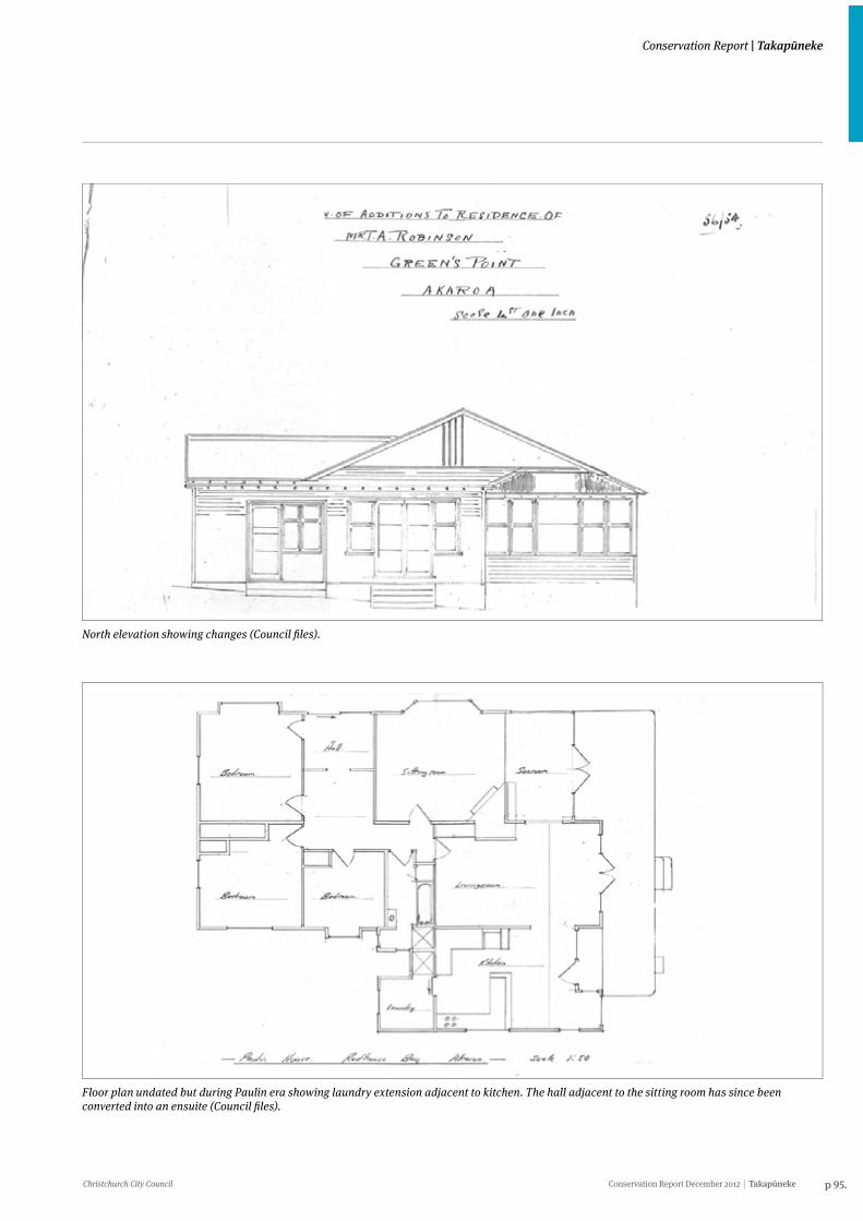
Christchurch City Council Conservation Report December 2012 Takapūneke p 95.
Conservation Report | Takapūneke
North elevation showing changes (Council files).
Floor plan undated but during Paulin era showing laundry extension adjacent to kitchen. The hall adjacent to the sitting room has since been converted into an ensuite (Council files).
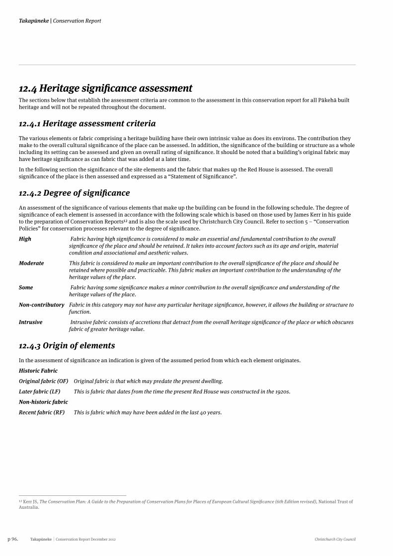
p 96. Takapūneke Conservation Report December 2012 Christchurch City Council
Takapūneke | Conservation Report
12.4 Heritage significance assessmentThe sections below that establish the assessment criteria are common to the assessment in this conservation report for all Pākehā built heritage and will not be repeated throughout the document.
12.4.1 Heritage assessment criteriaThe various elements or fabric comprising a heritage building have their own intrinsic value as does its environs. The contribution they make to the overall cultural significance of the place can be assessed. In addition, the significance of the building or structure as a whole including its setting can be assessed and given an overall rating of significance. It should be noted that a building’s original fabric may have heritage significance as can fabric that was added at a later time.
In the following section the significance of the site elements and the fabric that makes up the Red House is assessed. The overall significance of the place is then assessed and expressed as a “Statement of Significance”.
12.4.2 Degree of significanceAn assessment of the significance of various elements that make up the building can be found in the following schedule. The degree of significance of each element is assessed in accordance with the following scale which is based on those used by James Kerr in his guide to the preparation of Conservation Reports12 and is also the scale used by Christchurch City Council. Refer to section 5 – “Conservation Policies” for conservation processes relevant to the degree of significance.
High Fabric having high significance is considered to make an essential and fundamental contribution to the overall significance of the place and should be retained. It takes into account factors such as its age and origin, material condition and associational and aesthetic values.
Moderate This fabric is considered to make an important contribution to the overall significance of the place and should be retained where possible and practicable. This fabric makes an important contribution to the understanding of the heritage values of the place.
Some Fabric having some significance makes a minor contribution to the overall significance and understanding of the heritage values of the place.
Non-contributory Fabric in this category may not have any particular heritage significance, however, it allows the building or structure to function.
Intrusive Intrusive fabric consists of accretions that detract from the overall heritage significance of the place or which obscures fabric of greater heritage value.
12.4.3 Origin of elementsIn the assessment of significance an indication is given of the assumed period from which each element originates.
Historic Fabric
Original fabric (OF) Original fabric is that which may predate the present dwelling.
Later fabric (LF) This is fabric that dates from the time the present Red House was constructed in the 1920s.
Non-historic fabric
Recent fabric (RF) This is fabric which may have been added in the last 40 years.
12 Kerr JS, The Conservation Plan: A Guide to the Preparation of Conservation Plans for Places of European Cultural Significance (6th Edition revised), National Trust of Australia.
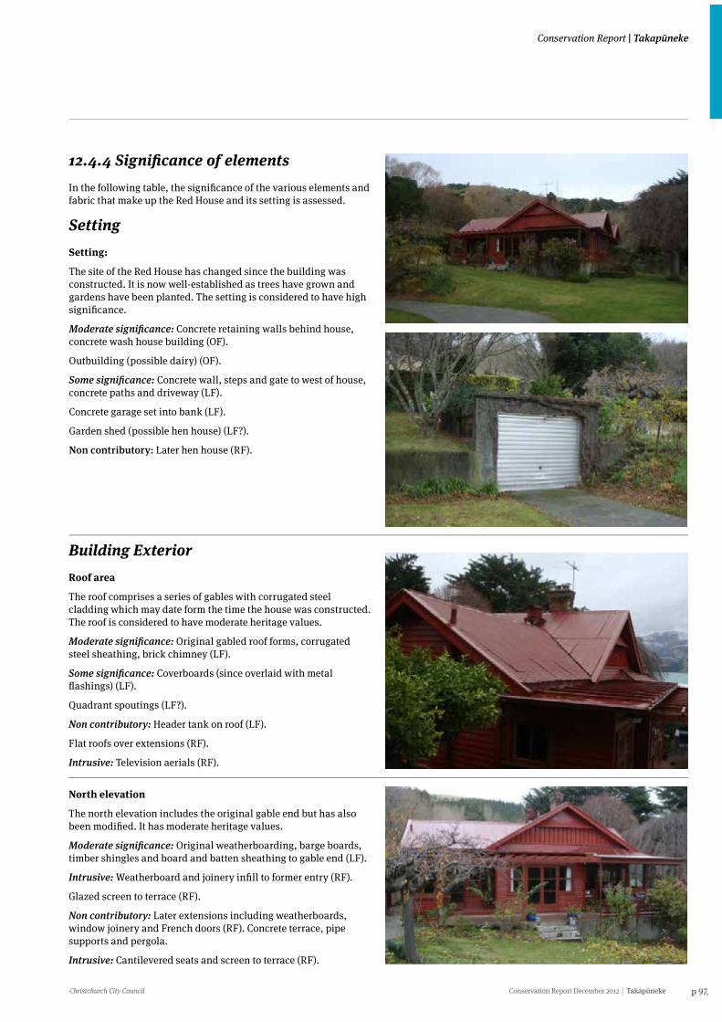
Christchurch City Council Conservation Report December 2012 Takapūneke p 97.
Conservation Report | Takapūneke
12.4.4 Significance of elementsIn the following table, the significance of the various elements and fabric that make up the Red House and its setting is assessed.
SettingSetting:
The site of the Red House has changed since the building was constructed. It is now well-established as trees have grown and gardens have been planted. The setting is considered to have high significance.
Moderate significance: Concrete retaining walls behind house, concrete wash house building (OF).
Outbuilding (possible dairy) (OF).
Some significance: Concrete wall, steps and gate to west of house, concrete paths and driveway (LF).
Concrete garage set into bank (LF).
Garden shed (possible hen house) (LF?).
Non contributory: Later hen house (RF).
Building ExteriorRoof area
The roof comprises a series of gables with corrugated steel cladding which may date form the time the house was constructed. The roof is considered to have moderate heritage values.
Moderate significance: Original gabled roof forms, corrugated steel sheathing, brick chimney (LF).
Some significance: Coverboards (since overlaid with metal flashings) (LF).
Quadrant spoutings (LF?).
Non contributory: Header tank on roof (LF).
Flat roofs over extensions (RF).
Intrusive: Television aerials (RF).
North elevation
The north elevation includes the original gable end but has also been modified. It has moderate heritage values.
Moderate significance: Original weatherboarding, barge boards, timber shingles and board and batten sheathing to gable end (LF).
Intrusive: Weatherboard and joinery infill to former entry (RF).
Glazed screen to terrace (RF).
Non contributory: Later extensions including weatherboards, window joinery and French doors (RF). Concrete terrace, pipe supports and pergola.
Intrusive: Cantilevered seats and screen to terrace (RF).
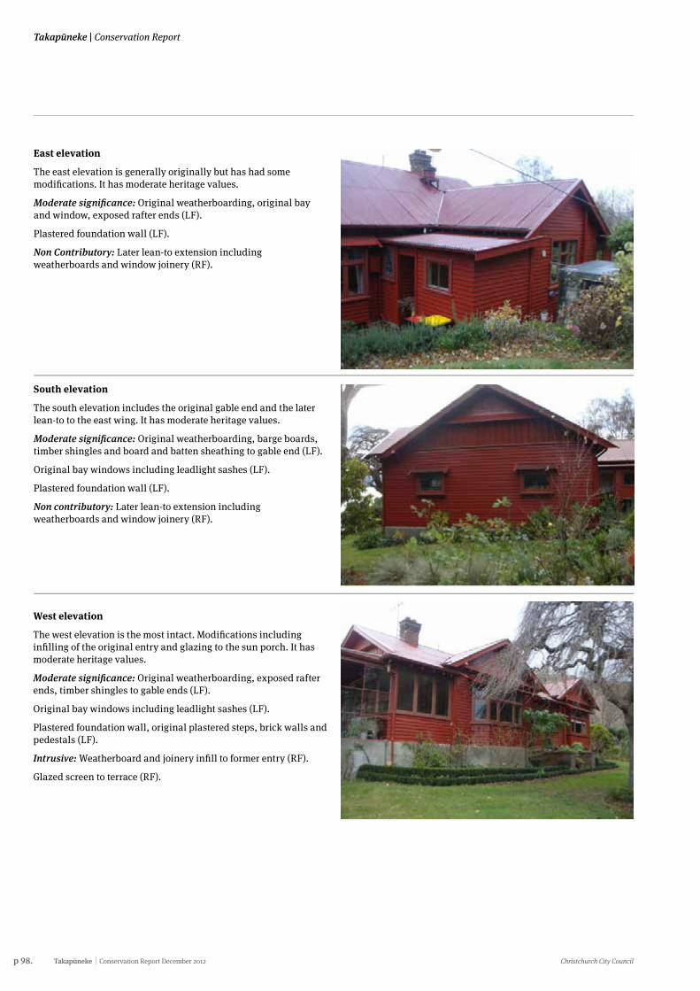
p 98. Takapūneke Conservation Report December 2012 Christchurch City Council
Takapūneke | Conservation Report
East elevation
The east elevation is generally originally but has had some modifications. It has moderate heritage values.
Moderate significance: Original weatherboarding, original bay and window, exposed rafter ends (LF).
Plastered foundation wall (LF).
Non Contributory: Later lean-to extension including weatherboards and window joinery (RF).
South elevation
The south elevation includes the original gable end and the later lean-to to the east wing. It has moderate heritage values.
Moderate significance: Original weatherboarding, barge boards, timber shingles and board and batten sheathing to gable end (LF).
Original bay windows including leadlight sashes (LF).
Plastered foundation wall (LF).
Non contributory: Later lean-to extension including weatherboards and window joinery (RF).
West elevation
The west elevation is the most intact. Modifications including infilling of the original entry and glazing to the sun porch. It has moderate heritage values.
Moderate significance: Original weatherboarding, exposed rafter ends, timber shingles to gable ends (LF).
Original bay windows including leadlight sashes (LF).
Plastered foundation wall, original plastered steps, brick walls and pedestals (LF).
Intrusive: Weatherboard and joinery infill to former entry (RF).
Glazed screen to terrace (RF).
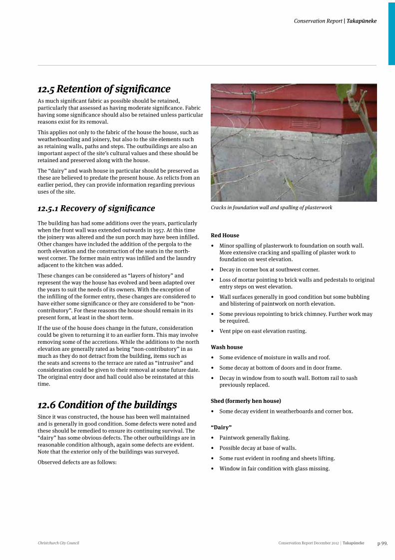
Christchurch City Council Conservation Report December 2012 Takapūneke p 99.
Conservation Report | Takapūneke
12.5 Retention of significanceAs much significant fabric as possible should be retained, particularly that assessed as having moderate significance. Fabric having some significance should also be retained unless particular reasons exist for its removal.
This applies not only to the fabric of the house the house, such as weatherboarding and joinery, but also to the site elements such as retaining walls, paths and steps. The outbuildings are also an important aspect of the site’s cultural values and these should be retained and preserved along with the house.
The “dairy” and wash house in particular should be preserved as these are believed to predate the present house. As relicts from an earlier period, they can provide information regarding previous uses of the site.
12.5.1 Recovery of significanceThe building has had some additions over the years, particularly when the front wall was extended outwards in 1957. At this time the joinery was altered and the sun porch may have been infilled. Other changes have included the addition of the pergola to the north elevation and the construction of the seats in the north-west corner. The former main entry was infilled and the laundry adjacent to the kitchen was added.
These changes can be considered as “layers of history” and represent the way the house has evolved and been adapted over the years to suit the needs of its owners. With the exception of the infilling of the former entry, these changes are considered to have either some significance or they are considered to be “non-contributory”. For these reasons the house should remain in its present form, at least in the short term.
If the use of the house does change in the future, consideration could be given to returning it to an earlier form. This may involve removing some of the accretions. While the additions to the north elevation are generally rated as being “non-contributory” in as much as they do not detract from the building, items such as the seats and screens to the terrace are rated as “intrusive” and consideration could be given to their removal at some future date. The original entry door and hall could also be reinstated at this time.
12.6 Condition of the buildingsSince it was constructed, the house has been well maintained and is generally in good condition. Some defects were noted and these should be remedied to ensure its continuing survival. The “dairy” has some obvious defects. The other outbuildings are in reasonable condition although, again some defects are evident. Note that the exterior only of the buildings was surveyed.
Observed defects are as follows:
Red House
• Minor spalling of plasterwork to foundation on south wall. More extensive cracking and spalling of plaster work to foundation on west elevation.
• Decay in corner box at southwest corner.
• Loss of mortar pointing to brick walls and pedestals to original entry steps on west elevation.
• Wall surfaces generally in good condition but some bubbling and blistering of paintwork on north elevation.
• Some previous repointing to brick chimney. Further work may be required.
• Vent pipe on east elevation rusting.
Wash house
• Some evidence of moisture in walls and roof.
• Some decay at bottom of doors and in door frame.
• Decay in window from to south wall. Bottom rail to sash previously replaced.
Shed (formerly hen house)
• Some decay evident in weatherboards and corner box.
“Dairy”
• Paintwork generally flaking.
• Possible decay at base of walls.
• Some rust evident in roofing and sheets lifting.
• Window in fair condition with glass missing.
Cracks in foundation wall and spalling of plasterwork
p 100. Takapūneke Conservation Report December 2012 Christchurch City Council
Takapūneke | Conservation Report
12.6.1 Remedial workRemedial work should be carried out to the house and the outbuildings as required. Particular attention should be paid to the “dairy” as it could deteriorate more rapidly than the other structures.
Remedial work should include the following:
Red House
• Repair foundation walls. Fill cracks and replaster where existing plaster has spalled.
• Replace decayed timberwork such as corner box at southwest corner.
• Sand back and repaint wall areas where paint has blistered.
• Repoint brickwork to pedestals and walls to former entry.Repoint chimney as required.
• Treat vent pipe on east elevation for rust.
Shed (hen house)
• Replace decayed areas of weatherboarding and trim.
“Dairy”
• Treat rusting sheets of roofing and refix. Replace extensively rusted sheets with new galvanised corrugated steel.
• Replace decayed areas of weatherboarding and trim. Only that fabric that has decayed should be replaced as a way of maintaining the building’s heritage values. Sand and repaint weatherboarding and trim.
• Repair window as required and reglaze. Sand and repaint window and door.
Wash house
• Provide waterproof coating to walls and roof to reduce moisture ingress.
• Repair door where decayed. Replace decayed section of door and window frame. Provide new bottom rail to window sash.
12.7 Further investigations• Further investigation and research should be carried out in
any effort to determine the age of the wash house behind the Red House. If it does predate the present dwelling, that would provide conclusive evidence that there was a previous house on the site.
• The “dairy” should be subject to further investigation to determine if, in fact, it was constructed from surplus material from the time when the barracks was re-erected on its present site. Subjecting the timber to a process of dendrochronology would determine if this is the case.
• Further investigations should be carried out at the house site in an effort to determine wether this was also the location of the earlier house occupied by George Rhodes. Efforts should also be made to determine whether the house constructed by William Green, and Rhodes’ house were the same dwelling.
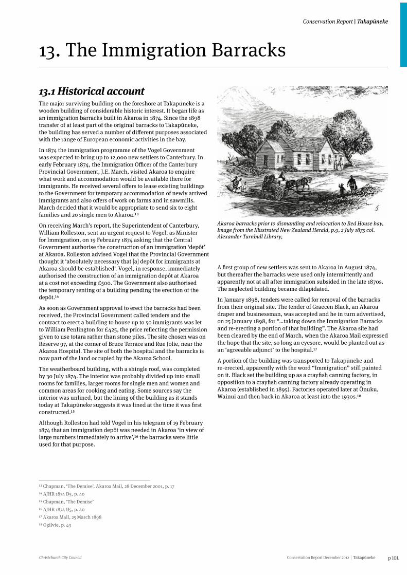
Christchurch City Council Conservation Report December 2012 Takapūneke p 101.
Conservation Report | Takapūneke
13.1 Historical accountThe major surviving building on the foreshore at Takapūneke is a wooden building of considerable historic interest. It began life as an immigration barracks built in Akaroa in 1874. Since the 1898 transfer of at least part of the original barracks to Takapūneke, the building has served a number of different purposes associated with the range of European economic activities in the bay.
In 1874 the immigration programme of the Vogel Government was expected to bring up to 12,000 new settlers to Canterbury. In early February 1874, the Immigration Officer of the Canterbury Provincial Government, J.E. March, visited Akaroa to enquire what work and accommodation would be available there for immigrants. He received several offers to lease existing buildings to the Government for temporary accommodation of newly arrived immigrants and also offers of work on farms and in sawmills. March decided that it would be appropriate to send six to eight families and 20 single men to Akaroa.13
On receiving March’s report, the Superintendent of Canterbury, William Rolleston, sent an urgent request to Vogel, as Minister for Immigration, on 19 February 1874 asking that the Central Government authorise the construction of an immigration ‘depôt’ at Akaroa. Rolleston advised Vogel that the Provincial Government thought it ‘absolutely necessary that [a] depôt for immigrants at Akaroa should be established’. Vogel, in response, immediately authorised the construction of an immigration depôt at Akaroa at a cost not exceeding £500. The Government also authorised the temporary renting of a building pending the erection of the depôt.14
As soon as Government approval to erect the barracks had been received, the Provincial Government called tenders and the contract to erect a building to house up to 50 immigrants was let to William Penlington for £425, the price reflecting the permission given to use totara rather than stone piles. The site chosen was on Reserve 97, at the corner of Bruce Terrace and Rue Jolie, near the Akaroa Hospital. The site of both the hospital and the barracks is now part of the land occupied by the Akaroa School.
The weatherboard building, with a shingle roof, was completed by 30 July 1874. The interior was probably divided up into small rooms for families, larger rooms for single men and women and common areas for cooking and eating. Some sources say the interior was unlined, but the lining of the building as it stands today at Takapūneke suggests it was lined at the time it was first constructed.15
Although Rolleston had told Vogel in his telegram of 19 February 1874 that an immigration depôt was needed in Akaroa ‘in view of large numbers immediately to arrive’,16 the barracks were little used for that purpose.
13. The Immigration Barracks
13 Chapman, ‘The Demise’, Akaroa Mail, 28 December 2001, p. 1714 AJHR 1874 D5, p. 4015 Chapman, ‘The Demise’16 AJHR 1874 D5, p. 4017 Akaroa Mail, 25 March 189818 Ogilvie, p. 43
A first group of new settlers was sent to Akaroa in August 1874, but thereafter the barracks were used only intermittently and apparently not at all after immigration subsided in the late 1870s. The neglected building became dilapidated.
In January 1898, tenders were called for removal of the barracks from their original site. The tender of Graecen Black, an Akaroa draper and businessman, was accepted and he in turn advertised, on 25 January 1898, for “…taking down the Immigration Barracks and re-erecting a portion of that building”. The Akaroa site had been cleared by the end of March, when the Akaroa Mail expressed the hope that the site, so long an eyesore, would be planted out as an ‘agreeable adjunct’ to the hospital.17
A portion of the building was transported to Takapūneke and re-erected, apparently with the word “Immigration” still painted on it. Black set the building up as a crayfish canning factory, in opposition to a crayfish canning factory already operating in Akaroa (established in 1895). Factories operated later at Ōnuku, Wainui and then back in Akaroa at least into the 1930s.18
Akaroa barracks prior to dismantling and relocation to Red House bay, Image from the Illustrated New Zealand Herald, p.9, 2 July 1875 col. Alexander Turnbull Library,
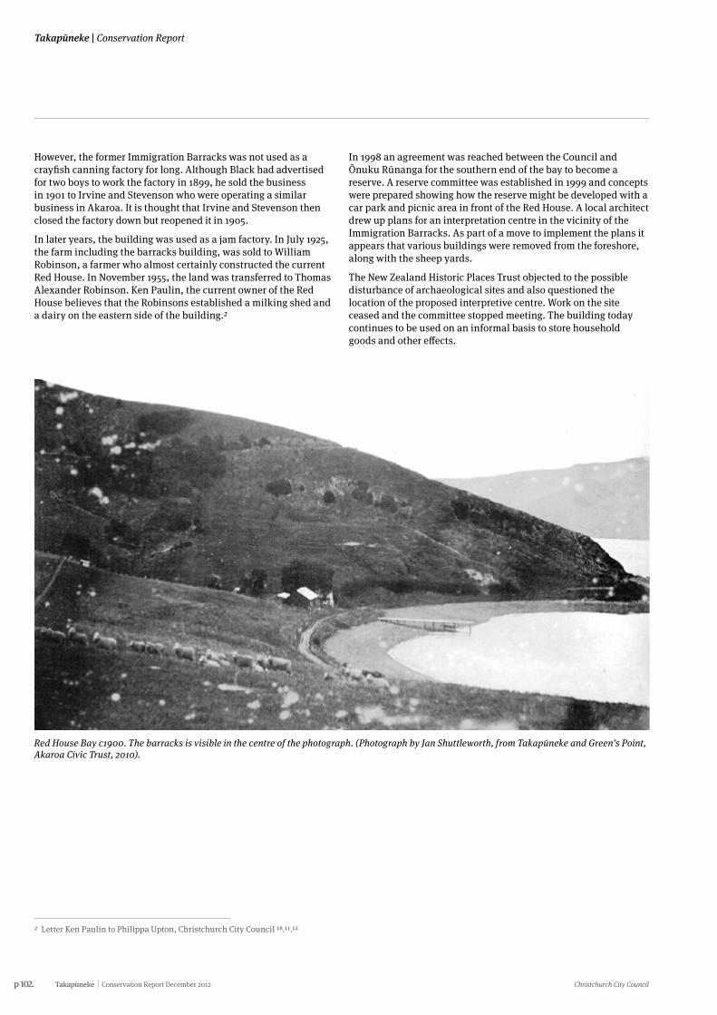
p 102. Takapūneke Conservation Report December 2012 Christchurch City Council
Takapūneke | Conservation Report
However, the former Immigration Barracks was not used as a crayfish canning factory for long. Although Black had advertised for two boys to work the factory in 1899, he sold the business in 1901 to Irvine and Stevenson who were operating a similar business in Akaroa. It is thought that Irvine and Stevenson then closed the factory down but reopened it in 1905.
In later years, the building was used as a jam factory. In July 1925, the farm including the barracks building, was sold to William Robinson, a farmer who almost certainly constructed the current Red House. In November 1955, the land was transferred to Thomas Alexander Robinson. Ken Paulin, the current owner of the Red House believes that the Robinsons established a milking shed and a dairy on the eastern side of the building.2
In 1998 an agreement was reached between the Council and Ōnuku Rūnanga for the southern end of the bay to become a reserve. A reserve committee was established in 1999 and concepts were prepared showing how the reserve might be developed with a car park and picnic area in front of the Red House. A local architect drew up plans for an interpretation centre in the vicinity of the Immigration Barracks. As part of a move to implement the plans it appears that various buildings were removed from the foreshore, along with the sheep yards.
The New Zealand Historic Places Trust objected to the possible disturbance of archaeological sites and also questioned the location of the proposed interpretive centre. Work on the site ceased and the committee stopped meeting. The building today continues to be used on an informal basis to store household goods and other effects.
Red House Bay c1900. The barracks is visible in the centre of the photograph. (Photograph by Jan Shuttleworth, from Takapūneke and Green’s Point, Akaroa Civic Trust, 2010).
2 Letter Ken Paulin to Philippa Upton, Christchurch City Council 18.11.12
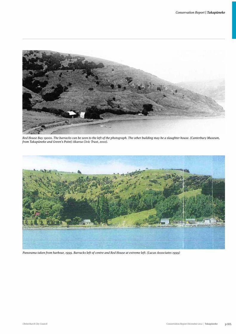
Christchurch City Council Conservation Report December 2012 Takapūneke p 103.
Conservation Report | Takapūneke
Red House Bay 1900s. The barracks can be seen to the left of the photograph. The other building may be a slaughter house. (Canterbury Museum, from Takapūneke and Green’s Point) Akaroa Civic Trust, 2010).
Panorama taken from harbour, 1999. Barracks left of centre and Red House at extreme left. (Lucas Associates 1999)
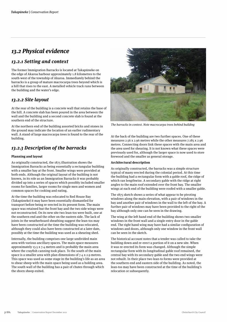
p 104. Takapūneke Conservation Report December 2012 Christchurch City Council
Takapūneke | Conservation Report
13.2 Physical evidence 13.2.1 Setting and contextThe former Immigration Barracks is located at Takapūneke on the edge of Akaroa harbour approximately 1.8 kilometres to the south-west of the township of Akaroa. Immediately behind the barracks is a group of mature macrocarpa trees beyond which is a hill that rises to the east. A metalled vehicle track runs between the building and the water’s edge.
13.2.2 Site layout At the rear of the building is a concrete wall that retains the base of the hill. A concrete slab has been poured in the area between the wall and the building and a second concrete slab is found at the southern end of the structure.
At the northern end of the building assorted bricks and stones in the ground may indicate the location of an earlier rudimentary wall. A stand of large macrocarpa trees is found to the rear of the building.
13.2.3 Description of the barracksPlanning and layout
As originally constructed, the 1875 illustration shows the Immigration Barracks as being essentially a rectangular building with a smaller bay at the front. Smaller wings were provided at both ends. Although the original layout of the building is not known, in its role as an Immigration Barracks it was probably divided up into a series of spaces which possibly included smaller rooms for families, larger rooms for single men and women and common spaces for cooking and eating.
At the time the building was relocated to Red House Bay (Takapūneke) it may have been essentially dismantled for transport before being re-erected in its present form. The main space was retained but the front bay and the two side wings were not reconstructed. On its new site two lean-tos were built, one at the southern end and the other on the eastern side. The lack of joints in the weatherboard sheathing suggest the lean-tos may have been constructed at the time the building was relocated, although they could also have been constructed at a later date, possibly at the time the building was used as a shearing shed.
Internally, the building comprises one large undivided main area with various ancillary spaces. The main space measures approximately 13.5 x 7.4 metres and is probably the main area where the crayfish canning took place. To the south of the main space is a smaller area with plan dimensions of 7.4 x 2.9 metres. This space was used as some stage in the building’s life as an area to shear sheep with the main space being used as a holding area. The south wall of the building has a pair of chutes through which the shorn sheep exited.
The barracks in context. Note macrocarpa trees behind building
At the back of the building are two further spaces. One of these measures 2.56 x 2.96 metres while the other measures 7.185 x 2.96 metres. Connecting doors link these spaces with the main area and the area used for shearing. It is not known what these spaces were previously used for, although the larger space is now used to store firewood and the smaller as general storage.
Architectural description
As originally constructed, the barracks was a simple structure typical of many erected during the colonial period. At this time the building had a rectangular form with a gable roof, the ridge of which ran lengthwise. A secondary gable with the ridge at right angles to the main roof extended over the front bay. The smaller wings at each end of the building were roofed with a smaller gable.
The 1875 sketch shows a series of what appear to be pivoting windows along the main elevation, with a pair of windows in the bay and another pair of windows in the wall to the left of the bay. A further pair of windows may have been provided to the right of the bay although only one can be seen in the drawing.
The wing at the left hand end of the building shows two smaller windows in the front wall and a single entry door in the gable end. The right hand wing may have had a similar configuration of windows and doors, although only one window in the front wall can be seen in the sketch.
The historical account notes that a tender was called to take the building down and re-erect a portion of it on a new site. When it was re-erected its form was changed. Although the simple rectangular form with its longitudinal gable roof remained, the central bay with its secondary gable and the two end wings were not rebuilt. In their place two lean-to forms were provided at the southern end and eastern side of the building. As noted, the lean-tos may have been constructed at the time of the building’s relocation or subsequently.
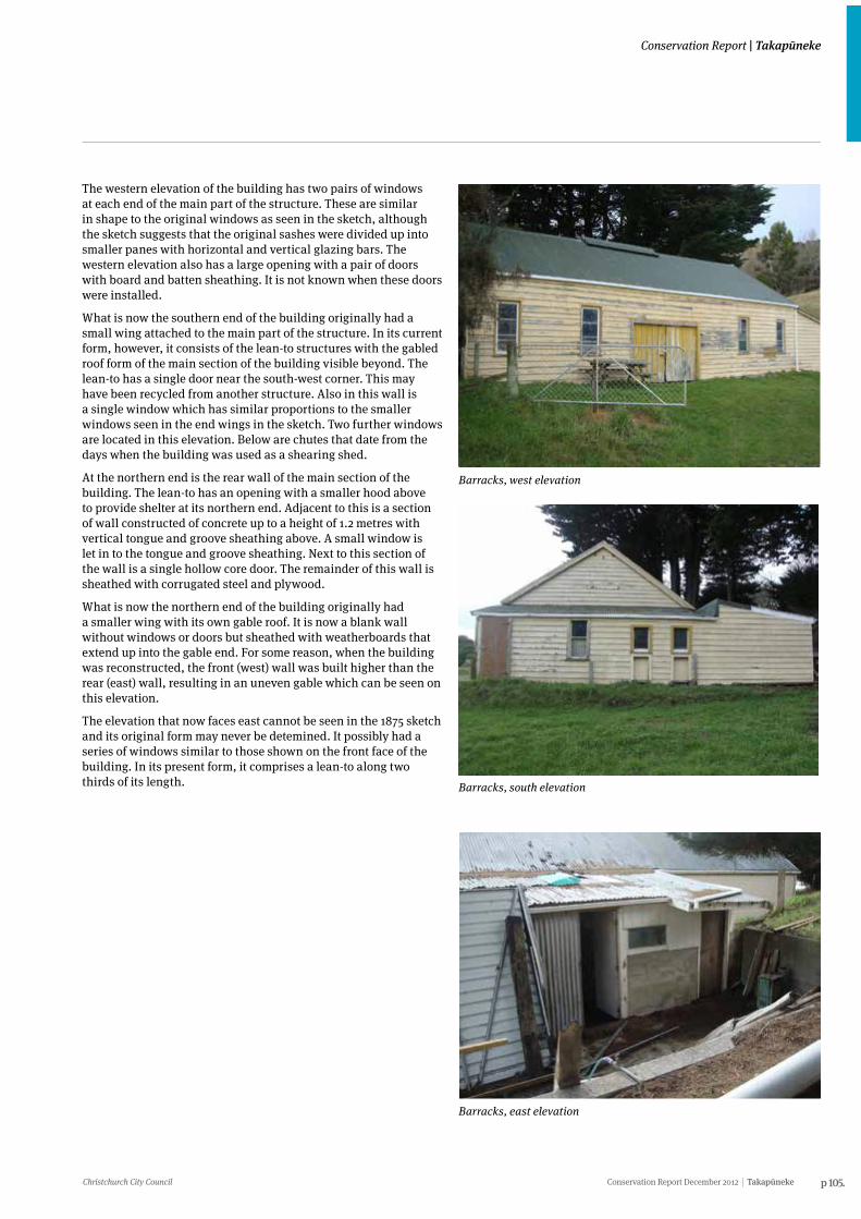
Christchurch City Council Conservation Report December 2012 Takapūneke p 105.
Conservation Report | Takapūneke
The western elevation of the building has two pairs of windows at each end of the main part of the structure. These are similar in shape to the original windows as seen in the sketch, although the sketch suggests that the original sashes were divided up into smaller panes with horizontal and vertical glazing bars. The western elevation also has a large opening with a pair of doors with board and batten sheathing. It is not known when these doors were installed.
What is now the southern end of the building originally had a small wing attached to the main part of the structure. In its current form, however, it consists of the lean-to structures with the gabled roof form of the main section of the building visible beyond. The lean-to has a single door near the south-west corner. This may have been recycled from another structure. Also in this wall is a single window which has similar proportions to the smaller windows seen in the end wings in the sketch. Two further windows are located in this elevation. Below are chutes that date from the days when the building was used as a shearing shed.
At the northern end is the rear wall of the main section of the building. The lean-to has an opening with a smaller hood above to provide shelter at its northern end. Adjacent to this is a section of wall constructed of concrete up to a height of 1.2 metres with vertical tongue and groove sheathing above. A small window is let in to the tongue and groove sheathing. Next to this section of the wall is a single hollow core door. The remainder of this wall is sheathed with corrugated steel and plywood.
What is now the northern end of the building originally had a smaller wing with its own gable roof. It is now a blank wall without windows or doors but sheathed with weatherboards that extend up into the gable end. For some reason, when the building was reconstructed, the front (west) wall was built higher than the rear (east) wall, resulting in an uneven gable which can be seen on this elevation.
The elevation that now faces east cannot be seen in the 1875 sketch and its original form may never be detemined. It possibly had a series of windows similar to those shown on the front face of the building. In its present form, it comprises a lean-to along two thirds of its length.
Barracks, west elevation
Barracks, south elevation
Barracks, east elevation
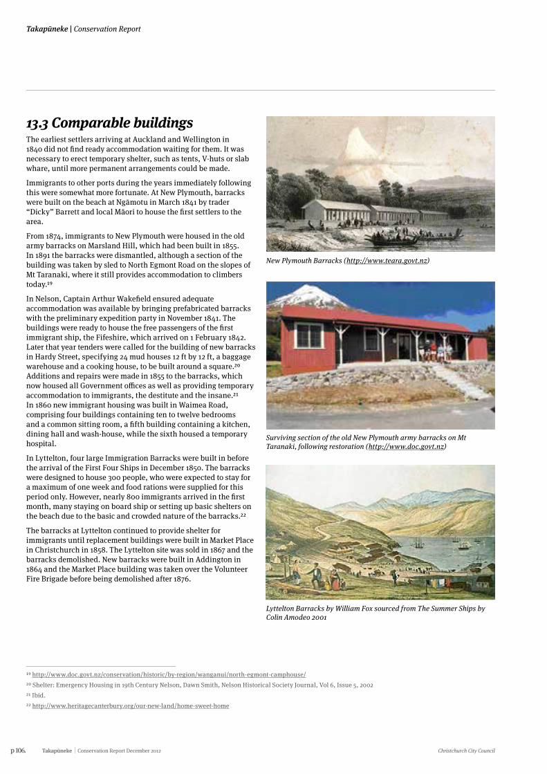
p 106. Takapūneke Conservation Report December 2012 Christchurch City Council
Takapūneke | Conservation Report
13.3 Comparable buildings The earliest settlers arriving at Auckland and Wellington in 1840 did not find ready accommodation waiting for them. It was necessary to erect temporary shelter, such as tents, V-huts or slab whare, until more permanent arrangements could be made.
Immigrants to other ports during the years immediately following this were somewhat more fortunate. At New Plymouth, barracks were built on the beach at Ngāmotu in March 1841 by trader “Dicky” Barrett and local Māori to house the first settlers to the area.
From 1874, immigrants to New Plymouth were housed in the old army barracks on Marsland Hill, which had been built in 1855. In 1891 the barracks were dismantled, although a section of the building was taken by sled to North Egmont Road on the slopes of Mt Taranaki, where it still provides accommodation to climbers today.19
In Nelson, Captain Arthur Wakefield ensured adequate accommodation was available by bringing prefabricated barracks with the preliminary expedition party in November 1841. The buildings were ready to house the free passengers of the first immigrant ship, the Fifeshire, which arrived on 1 February 1842. Later that year tenders were called for the building of new barracks in Hardy Street, specifying 24 mud houses 12 ft by 12 ft, a baggage warehouse and a cooking house, to be built around a square.20 Additions and repairs were made in 1855 to the barracks, which now housed all Government offices as well as providing temporary accommodation to immigrants, the destitute and the insane.21 In 1860 new immigrant housing was built in Waimea Road, comprising four buildings containing ten to twelve bedrooms and a common sitting room, a fifth building containing a kitchen, dining hall and wash-house, while the sixth housed a temporary hospital.
In Lyttelton, four large Immigration Barracks were built in before the arrival of the First Four Ships in December 1850. The barracks were designed to house 300 people, who were expected to stay for a maximum of one week and food rations were supplied for this period only. However, nearly 800 immigrants arrived in the first month, many staying on board ship or setting up basic shelters on the beach due to the basic and crowded nature of the barracks.22
The barracks at Lyttelton continued to provide shelter for immigrants until replacement buildings were built in Market Place in Christchurch in 1858. The Lyttelton site was sold in 1867 and the barracks demolished. New barracks were built in Addington in 1864 and the Market Place building was taken over the Volunteer Fire Brigade before being demolished after 1876.
19 http://www.doc.govt.nz/conservation/historic/by-region/wanganui/north-egmont-camphouse/20 Shelter: Emergency Housing in 19th Century Nelson, Dawn Smith, Nelson Historical Society Journal, Vol 6, Issue 5, 200221 Ibid.22 http://www.heritagecanterbury.org/our-new-land/home-sweet-home
New Plymouth Barracks (http://www.teara.govt.nz)
Surviving section of the old New Plymouth army barracks on Mt Taranaki, following restoration (http://www.doc.govt.nz)
Lyttelton Barracks by William Fox sourced from The Summer Ships by Colin Amodeo 2001
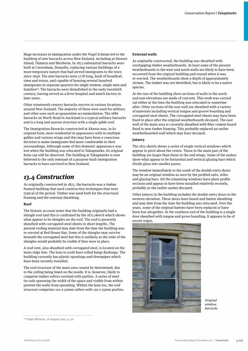
Christchurch City Council Conservation Report December 2012 Takapūneke p 107.
Conservation Report | Takapūneke
Huge increases in immigration under the Vogel Scheme led to the building of new barracks across New Zealand, including at Stewart Island, Ōāmaru and Blenheim. In 1873 substantial barracks were built at Caversham, Dunedin, replacing various buildings of a more temporary nature that had served immigrants to the town since 1848. The new barracks were 177ft long, built of broadleaf, rimu and totara, and capable of housing several hundred immigrants in separate quarters for single women, single men and families23. The barracks were demolished in the early twentieth century, having served as a fever hospital and match factory in later years.
Other nineteenth century barracks survive in various locations around New Zealand. The majority of these were used for military and other uses such as quarantine accommodation. The 1886 barracks on North Head in Auckland is a typical military barracks and is a long and narrow structure with a single gable roof.
The Immigration Barracks constructed at Akaroa was, in its original form, more residential in appearance with its multiple gables and various wings and this may have been a conscious decision to make immigrants feel more comfortable in their surroundings. Although some of this domestic appearance was lost when the building was relocated to Takapūneke, its original form can still be observed. The building at Takapūneke is now believed to the only remnant of a purpose-built immigration barracks to have survived in New Zealand.
13.4 ConstructionAs originally constructed in 1875, the barracks was a timber framed building that used construction techniques that were typical of the period. Timber was used both for the structural framing and the external sheathing.
Roof
The historic account notes that the building originally had a shingle roof and this is confirmed by the 1875 sketch which shows what appear to be shingles on the roof. The roof is presently sheathed with corrugated steel sheets in short lengths. The present roofing material may date from the time the building was re-erected at Red House Bay. Some of the shingles may survive beneath the corrugated steel but this is unlikely as the ends of the shingles would probably be visible if they were in place.
A roof vent, also sheathed with corrugated steel, is located on the main ridge line. The lean-to roofs have rolled barge flashings. The building currently has plastic spoutings and downpipes which have been recently installed.
The roof structure of the main area cannot be determined, due to the ceiling being lined on the inside. It is, however, likely to comprise timber rafters overlaid with purlins. A series of steel tie rods spanning the width of the space and visible from within prevent the walls from spreading. Within the lean-tos, the roof structure comprises 100 x 50mm rafters with 150 x 25mm purlins.
23 Otago Witness, 16 August 1905, p. 30
External walls
As originally constructed, the building was sheathed with overlapping timber weatherboards. At least some of the present weatherboards to the west and north walls are likely to have been recovered from the original building and reused when it was re-erected. The weatherboards show a depth of approximately 167mm. The timber was not identified, but is likely to be a native species.
At the rear of the building short sections of walls to the north and east elevations are made of concrete. This work was carried out either at the time the building was relocated or sometime after. Other sections of the rear wall are sheathed with a variety of materials including vertical tongue and groove boarding and corrugated steel sheets. The corrugated steel sheets may have been fixed in place after the original weatherboards decayed. The east wall of the main area is currently sheathed with fibre cement board fixed to new timber framing. This probably replaced an earlier weatherboarded wall which may have decayed.
Joinery
The 1875 sketch shows a series of single vertical windows which appear to pivot about the centre. Those to the main part of the building are larger than those in the end wings. Some of the sashes show what appear to be horizontal and vertical glazing bars which divide glass into smaller panes.
The window immediately to the south of the double entry doors may be an original window as seen by the profiled rails, stiles and glazing bars. All the remaining windows have plain profile sections and appear to have been installed relatively recently, probably as the earlier sashes decayed.
Other joinery in the building includes the double entry doors to the western elevation. These doors have board and batten sheathing and may date from the time the building was relocated. Over the years, some of the original battens have been replaced or have been lost altogether. At the southern end of the building is a single door sheathed with tongue and grove boarding. It appears to be of recent origin.
Original window, barracks
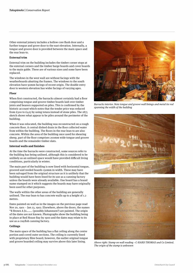
p 108. Takapūneke Conservation Report December 2012 Christchurch City Council
Takapūneke | Conservation Report
Other external joinery includes a hollow core flush door and a further tongue and grove door to the east elevation. Internally, a tongue and groove door is provided between the main space and the rear lean-to.
External trim
External trim on the building includes the timber corner stops at the external corners and the timber barge boards and cover boards to the main gable. These are of various sizes and some have been replaced.
The windows in the west wall are without facings with the weatherboards abutting the frames. The windows to the south elevation have 90mm facings of recent origin. The double entry door to western elevation has wider facings of varying ages.
Floor
When first constructed, the barracks almost certainly had a floor comprising tongue and groove timber boards laid over timber joists and bearers supported on piles. This is confirmed by the historic account which notes that the tender price was reduced from £500 to £425 by using totara instead of stone piles. The 1875 sketch shows what appear to be piles around the perimeter of the building.
When it was relocated, the building was reconstructed on a rough concrete floor. A central dished drain in the floor collected water from within the building. The floors in the rear lean-to are also concrete. Within the area of the building once used for shearing sheep, part of the floor comprises 200mm wide tongue and groove boards and the remainder timber slats.
Internal walls and finishes
At the time the barracks were constructed, some sources refer to the building has being unlined, although this is considered to be unlikely as an unlined space would have provided difficult living conditions, particularly in winter.
The main part of the building is now lined with horizontal tongue, grooved and reeded boards 150mm in width. These may have been salvaged from the original structure as it is unlikely that the building would have been lined for its use as a canning factory unless the boards were already available. One board has a brand name stamped on it which suggests the boards may have originally been used for other purposes.
The walls within the other areas of the building are generally unlined. The rear lean-to has concrete walls up to a height of 1.2 metres.
Dates painted on wall as in the images on the previous page read Nov 20, 1901 – Jan 23, 1902. Elsewhere, above the doors, the names “R Brown A Jo…….. (possibly Johannsen?) are painted. The origin of the dates are not known. Photographs show the building being in place at Red House Bay by 1900 and the dates may relate to its use as a crayfish canning factory.
Ceilings
The main space of the building has a flat ceiling along the centre portion and coved outer sections. The ceiling is currently lined with proprietary fibre board; however, the earlier original tongue and groove boarded ceiling may survive above this later lining.
Barracks interior. Note tongue and groove wall linings and metal tie rod spanning the width of the building
Above right: Stamp on wall reading –C-HARD THOMAS and Co Limited. The origin of the stamp is unknown
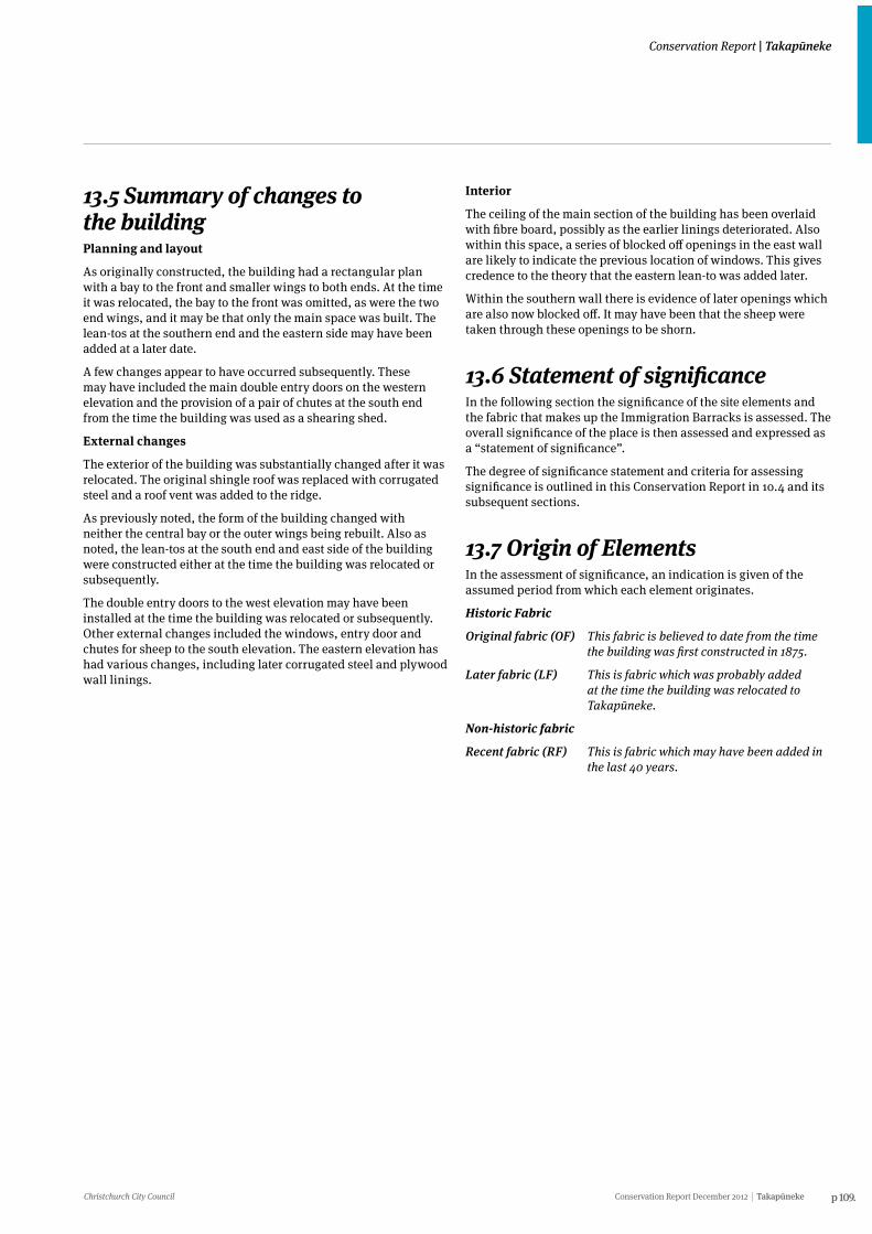
Christchurch City Council Conservation Report December 2012 Takapūneke p 109.
Conservation Report | Takapūneke
13.5 Summary of changes to the buildingPlanning and layout
As originally constructed, the building had a rectangular plan with a bay to the front and smaller wings to both ends. At the time it was relocated, the bay to the front was omitted, as were the two end wings, and it may be that only the main space was built. The lean-tos at the southern end and the eastern side may have been added at a later date.
A few changes appear to have occurred subsequently. These may have included the main double entry doors on the western elevation and the provision of a pair of chutes at the south end from the time the building was used as a shearing shed.
External changes
The exterior of the building was substantially changed after it was relocated. The original shingle roof was replaced with corrugated steel and a roof vent was added to the ridge.
As previously noted, the form of the building changed with neither the central bay or the outer wings being rebuilt. Also as noted, the lean-tos at the south end and east side of the building were constructed either at the time the building was relocated or subsequently.
The double entry doors to the west elevation may have been installed at the time the building was relocated or subsequently. Other external changes included the windows, entry door and chutes for sheep to the south elevation. The eastern elevation has had various changes, including later corrugated steel and plywood wall linings.
Interior
The ceiling of the main section of the building has been overlaid with fibre board, possibly as the earlier linings deteriorated. Also within this space, a series of blocked off openings in the east wall are likely to indicate the previous location of windows. This gives credence to the theory that the eastern lean-to was added later.
Within the southern wall there is evidence of later openings which are also now blocked off. It may have been that the sheep were taken through these openings to be shorn.
13.6 Statement of significanceIn the following section the significance of the site elements and the fabric that makes up the Immigration Barracks is assessed. The overall significance of the place is then assessed and expressed as a “statement of significance”.
The degree of significance statement and criteria for assessing significance is outlined in this Conservation Report in 10.4 and its subsequent sections.
13.7 Origin of ElementsIn the assessment of significance, an indication is given of the assumed period from which each element originates.
Historic Fabric
Original fabric (OF) This fabric is believed to date from the time the building was first constructed in 1875.
Later fabric (LF) This is fabric which was probably added at the time the building was relocated to Takapūneke.
Non-historic fabric
Recent fabric (RF) This is fabric which may have been added in the last 40 years.
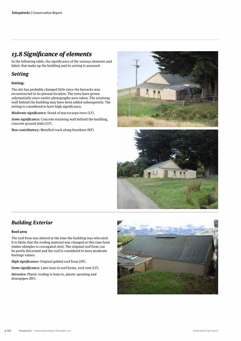
p 110. Takapūneke Conservation Report December 2012 Christchurch City Council
Takapūneke | Conservation Report
13.8 Significance of elements In the following table, the significance of the various elements and fabric that make up the building and its setting is assessed.
SettingSetting:
The site has probably changed little since the barracks was reconstructed in its present location. The trees have grown substantially since earlier photographs were taken. The retaining wall behind the building may have been added subsequently. The setting is considered to have high significance.
Moderate significance: Stand of macrocarpa trees (LF).
Some significance: Concrete retaining wall behind the building, concrete ground slabs (LF).
Non contributory: Metalled track along foreshore (RF).
Building ExteriorRoof area
The roof form was altered at the time the building was relocated. It is likely that the roofing material was changed at this time from timber shingles to corrugated steel. The original roof form can be partly discerned and the roof is considered to have moderate heritage values.
High significance: Original gabled roof form (OF).
Some significance: Later lean-to roof forms, roof vent (LF).
Intrusive: Plastic roofing to lean-to, plastic spouting and downpipes (RF).
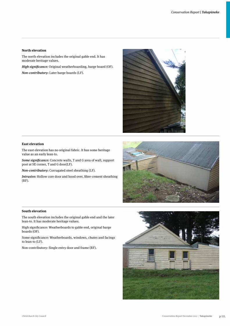
Christchurch City Council Conservation Report December 2012 Takapūneke p 111.
Conservation Report | Takapūneke
North elevation
The north elevation includes the original gable end. It has moderate heritage values.
High significance: Original weatherboarding, barge board (OF).
Non-contributory: Later barge boards (LF).
East elevation
The east elevation has no original fabric. It has some heritage value as an early lean-to.
Some significance: Concrete walls, T and G area of wall, support post at SE corner, T and G door(LF).
Non-contributory: Corrugated steel sheathing (LF).
Intrusive: Hollow core door and hood over, fibre-cement sheathing (RF).
South elevation
The south elevation includes the original gable end and the later lean-to. It has moderate heritage values.
High significance: Weatherboards to gable end, original barge boards (OF).
Some significance: Weatherboards, windows, chutes and facings to lean-to (LF).
Non-contributory: Single entry door and frame (RF).
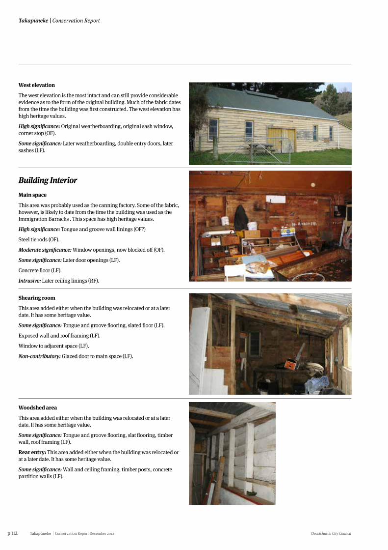
p 112. Takapūneke Conservation Report December 2012 Christchurch City Council
Takapūneke | Conservation Report
West elevation
The west elevation is the most intact and can still provide considerable evidence as to the form of the original building. Much of the fabric dates from the time the building was first constructed. The west elevation has high heritage values.
High significance: Original weatherboarding, original sash window, corner stop (OF).
Some significance: Later weatherboarding, double entry doors, later sashes (LF).
Building InteriorMain space
This area was probably used as the canning factory. Some of the fabric, however, is likely to date from the time the building was used as the Immigration Barracks . This space has high heritage values.
High significance: Tongue and groove wall linings (OF?)
Steel tie rods (OF).
Moderate significance: Window openings, now blocked off (OF).
Some significance: Later door openings (LF).
Concrete floor (LF).
Intrusive: Later ceiling linings (RF).
Shearing room
This area added either when the building was relocated or at a later date. It has some heritage value.
Some significance: Tongue and groove flooring, slated floor (LF).
Exposed wall and roof framing (LF).
Window to adjacent space (LF).
Non-contributory: Glazed door to main space (LF).
Woodshed area
This area added either when the building was relocated or at a later date. It has some heritage value.
Some significance: Tongue and groove flooring, slat flooring, timber wall, roof framing (LF).
Rear entry: This area added either when the building was relocated or at a later date. It has some heritage value.
Some significance: Wall and ceiling framing, timber posts, concrete partition walls (LF).
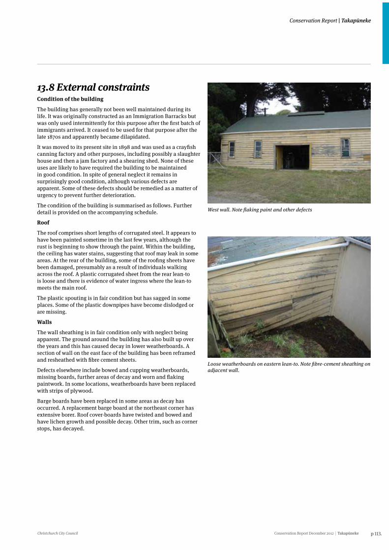
Christchurch City Council Conservation Report December 2012 Takapūneke p 113.
Conservation Report | Takapūneke
13.8 External constraints Condition of the building
The building has generally not been well maintained during its life. It was originally constructed as an Immigration Barracks but was only used intermittently for this purpose after the first batch of immigrants arrived. It ceased to be used for that purpose after the late 1870s and apparently became dilapidated.
It was moved to its present site in 1898 and was used as a crayfish canning factory and other purposes, including possibly a slaughter house and then a jam factory and a shearing shed. None of these uses are likely to have required the building to be maintained in good condition. In spite of general neglect it remains in surprisingly good condition, although various defects are apparent. Some of these defects should be remedied as a matter of urgency to prevent further deterioration.
The condition of the building is summarised as follows. Further detail is provided on the accompanying schedule.
Roof
The roof comprises short lengths of corrugated steel. It appears to have been painted sometime in the last few years, although the rust is beginning to show through the paint. Within the building, the ceiling has water stains, suggesting that roof may leak in some areas. At the rear of the building, some of the roofing sheets have been damaged, presumably as a result of individuals walking across the roof. A plastic corrugated sheet from the rear lean-to is loose and there is evidence of water ingress where the lean-to meets the main roof.
The plastic spouting is in fair condition but has sagged in some places. Some of the plastic downpipes have become dislodged or are missing.
Walls
The wall sheathing is in fair condition only with neglect being apparent. The ground around the building has also built up over the years and this has caused decay in lower weatherboards. A section of wall on the east face of the building has been reframed and resheathed with fibre cement sheets.
Defects elsewhere include bowed and cupping weatherboards, missing boards, further areas of decay and worn and flaking paintwork. In some locations, weatherboards have been replaced with strips of plywood.
Barge boards have been replaced in some areas as decay has occurred. A replacement barge board at the northeast corner has extensive borer. Roof cover-boards have twisted and bowed and have lichen growth and possible decay. Other trim, such as corner stops, has decayed.
West wall. Note flaking paint and other defects
Loose weatherboards on eastern lean-to. Note fibre-cement sheathing on adjacent wall.
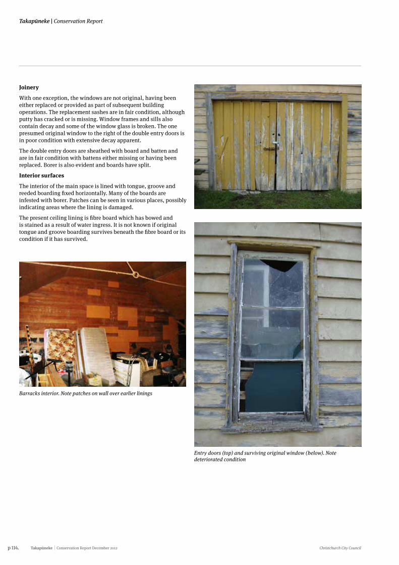
p 114. Takapūneke Conservation Report December 2012 Christchurch City Council
Takapūneke | Conservation Report
Joinery
With one exception, the windows are not original, having been either replaced or provided as part of subsequent building operations. The replacement sashes are in fair condition, although putty has cracked or is missing. Window frames and sills also contain decay and some of the window glass is broken. The one presumed original window to the right of the double entry doors is in poor condition with extensive decay apparent.
The double entry doors are sheathed with board and batten and are in fair condition with battens either missing or having been replaced. Borer is also evident and boards have split.
Interior surfaces
The interior of the main space is lined with tongue, groove and reeded boarding fixed horizontally. Many of the boards are infested with borer. Patches can be seen in various places, possibly indicating areas where the lining is damaged.
The present ceiling lining is fibre board which has bowed and is stained as a result of water ingress. It is not known if original tongue and groove boarding survives beneath the fibre board or its condition if it has survived.
Barracks interior. Note patches on wall over earlier linings
Entry doors (top) and surviving original window (below). Note deteriorated condition
Christchurch City Council Conservation Report December 2012 Takapūneke p 115.
Conservation Report | Takapūneke
13.9 Further investigations A reasonable amount of information is known about the building in its original form as a result of a sketch that was made of the building in its original location. Information is also known about its subsequent history, particularly of the various uses to which it was put after it was relocated to Takapūneke.
Less clear is the sequence of construction of the various sections of the building and the uses to which some of the ancillary spaces were put. The purpose of the concrete walls in the rear lean-to remains a mystery.
The origin of the internal linings within the main space is also unknown. It is not known whether the building was lined internally in its original location or whether the lining took place after it was relocated. Some of the boards have markings on them which may indicate an earlier use. Subjecting the boards to a process of dendrochronology would determine the age of the internal linings and it is recommended that this be carried out.
Some later linings should be removed to determine if earlier linings have survived. In particular, the ceiling should be investigated to determine if it was lined with the same tongue and groove linings as the walls.
13.10 Future useThe building was originally constructed as an immigration barracks in Akaroa but was only used for this purpose for a brief period before becoming disused after the late 1870s. It was relocated to Red House Bay where it was used for various purposes, including a crayfish canning factory, possibly a slaughter house, a jam factory and a shearing shed. It is currently used to store goods and farm implements.
None of these uses are appropriate or conducive to the building being maintained in a good condition and it is clear that a new and appropriate use will be required if it is to survive.
In any consideration of future use, retaining its heritage significance is paramount. The building is significant as being derived from a former Immigration Barracks and is the only purpose-built building of its type believed to have survived in the country. As much as possible of the building and the fabric of which it is comprised should be retained. This should include all fabric listed in the assessment of significance as having high or moderate significance. Fabric in this category includes external weatherboard sheathing and trim such as bargeboards and corner stops and what is believed to be an original sash. Internal fabric that should be retained includes tongue and groove boarding and the steel tie rods.
Much of the fabric assessed as having high heritage value is in poor condition and particular care will need to be taken if it is to survive.
13.11 Recovery of significance The building remained on its original site and in its original form for a brief period of 23 years before it was dismantled and reconstructed as a canning factory. It has remained largely in its reconstructed form for over 100 years, being the majority of its life. Various options are available or the building as follows:
Reconstruction
The barracks could theoretically be reconstructed in its original form, using the 1875 sketch as a guide, along with physical evidence afforded by the building. The reconstruction should be reasonably accurate as the sketch provides considerable detail although some areas would still be subject to conjecture, for example, the rear of the building which is not visible in the sketch. The building itself does, however, provide some evidence of the original form of this area with blocked off window openings being visible from within the main space.
If, however, the building is to remain on its present site then reconstruction to its original form would be meaningless as the building has been removed from its original site and its original contextual values have been lost. This loss of context is probably the single most compelling reason why the building should be conserved in its present form if it remains in its present location.
Conservation of the building in its present form would enable the various additions and other changes that have occurred to be retained.
An alternative may be to relocate the building back to a site that is as close as possible to its original site in Akaroa. If this were to occur, returning the building to its original form should be considered. The advantages of relocating the building would include recovering what is likely to be New Zealand’s only surviving purpose-built Immigration Barracks . The building would have considerable historic, social, cultural and educational value and this may outweigh any disadvantages of relocation.
Disadvantages of relocating the building back to Akaroa include the loss of its present contextual values that arise from its having been located at Takapūneke for over 100 years. All evidence of the building’s later history and its later uses would also be lost. Reconstruction in its original form is likely to require the removal of fabric having high significance and the introduction of a considerable amount of new material. The resulting structure may, for the most part, be a replica with little original fabric remaining. For example, the building is currently on a concrete floor and an entire new timber floor would have to be constructed.
In summary, if the building remains on its present site, it should be conserved in its present form with interpretation being provided describing its former use. The alternative may be to relocate it back to Akaroa where reconstruction to its original form could be considered.
p 116. Takapūneke Conservation Report December 2012 Christchurch City Council
Takapūneke | Conservation Report
13.12 Remedial workThe decision as to whether the building is relocated and reconstructed in its original form or whether it remains in its present form will influence other decisions that have to be made including the amount of remedial work that may be required. Whether the building remains on its present site or whether it is relocated, remedial work is urgently required if it is to survive.
If the building is retained on its present site and largely in its present form, remedial work that will be required includes the following:
Site works
The area around the building has built up over the years and particularly around the back of the building. The ground surface around the building should be lowered to its original level.
Concrete slabs behind the building at and the southern end should be cleaned of debris and water blasted.
External surfaces
Roof
Some areas of the roof, notably the western side, appear to be in reasonable condition, although some rust is apparent. Water stains in the building would indicate the roof may be leaking.
A further more detailed inspection of the roof is warranted. Existing sheets in sound condition should be retained. Where sheets have rusted or are otherwise damaged, they should be replaced with new galvanised steel corrugated sheets. The plastic sheets at the rear of the building should be replaced with corrugated steel.
The present plastic spouting and downpipes should be replaced with galvanised ogee profile spouting and galvanised downpipes.
External walls
New sections of weatherboards should be provided where existing boards have decayed, are borer infested or are missing. The cement board sheets to the rear wall should be removed and replaced with weatherboards.
New weatherboards should have a profile that matches the original. Decayed trim such as corner stops should also be replaced.
Where required, new barge boards should be provided in the original profile. New roof cover boards should also be provided. If the timber is to be painted, the timber species could either be recycled native timber or an exotic species.
All wall surfaces and trim should be sanded back and repainted. The building should be repainted in its original or an earlier colour scheme as determined by paint scrapings.
Window joinery
Every attempt should be made to repair and conserve what appears to be the remaining original window in the western wall of the building. As the sash contains extensive decay, affected sections may need to be replaced or repaired by splicing in new sections. The profile of new sections should match the original.
Elsewhere, decayed sills and frames should be repaired by replacing members or splicing in new sections. Again, the profile of new sections should match the original. The species of timber used for repairs should generally match the original as different species can have different expansion coefficients.
Broken glass should be replaced and all glass re-puttied in place. The windows should then be sanded and repainted in their original colour.
Doors
The double entry doors should be repaired by replacing decayed and borer infested areas of timber. Where battens are missing, new battens should be provided in the original profile.
The south entry door is clearly a recent intervention and is a poor fit. The hollow core door to the east elevation is similarly recent in origin. Consideration should be given to replacing these doors with more appropriate doors that fit the openings.
Internal surfaces:
Wall surfaces
The tongue and groove boarding to the walls in the main space has generally been attacked by borer, to the point where it has lost all integrity. Some holes are apparent and patches have been provided, possibly covering further holes.
The patches should be removed to determine the full extent of deterioration. New sections of tongue and groove boarding should be provided to replace damaged or borer infested boards. The entire building should be treated for borer.
Ceilings
The ceiling in the main space is covered with fibreboard which has water stains. The fibreboard should be removed to ascertain whether an earlier tongue and groove ceiling survives. The original ceiling should be repaired if possible by providing new tongue and groove boarding.
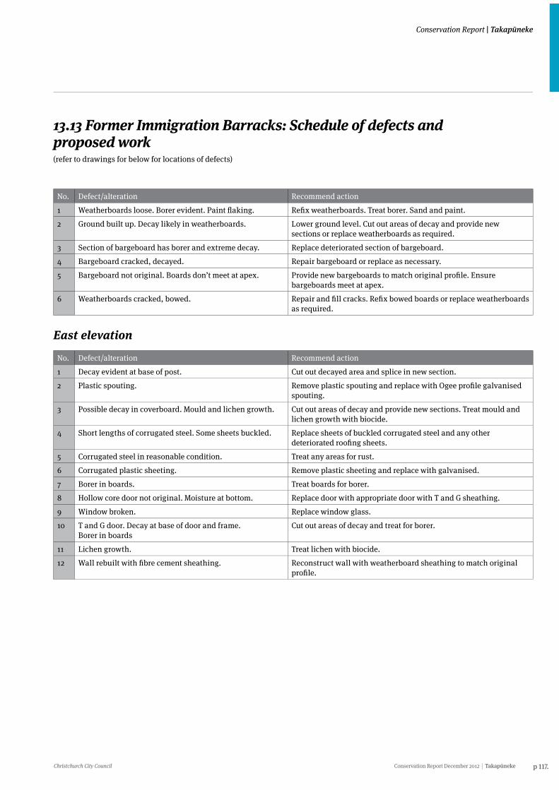
Christchurch City Council Conservation Report December 2012 Takapūneke p 117.
Conservation Report | Takapūneke
13.13 Former Immigration Barracks: Schedule of defects and proposed work(refer to drawings for below for locations of defects)
No. Defect/alteration Recommend action
1 Weatherboards loose. Borer evident. Paint flaking. Refix weatherboards. Treat borer. Sand and paint.
2 Ground built up. Decay likely in weatherboards. Lower ground level. Cut out areas of decay and provide new sections or replace weatherboards as required.
3 Section of bargeboard has borer and extreme decay. Replace deteriorated section of bargeboard.
4 Bargeboard cracked, decayed. Repair bargeboard or replace as necessary.
5 Bargeboard not original. Boards don’t meet at apex. Provide new bargeboards to match original profile. Ensure bargeboards meet at apex.
6 Weatherboards cracked, bowed. Repair and fill cracks. Refix bowed boards or replace weatherboards as required.
East elevation
No. Defect/alteration Recommend action
1 Decay evident at base of post. Cut out decayed area and splice in new section.
2 Plastic spouting. Remove plastic spouting and replace with Ogee profile galvanised spouting.
3 Possible decay in coverboard. Mould and lichen growth. Cut out areas of decay and provide new sections. Treat mould and lichen growth with biocide.
4 Short lengths of corrugated steel. Some sheets buckled. Replace sheets of buckled corrugated steel and any other deteriorated roofing sheets.
5 Corrugated steel in reasonable condition. Treat any areas for rust.
6 Corrugated plastic sheeting. Remove plastic sheeting and replace with galvanised.
7 Borer in boards. Treat boards for borer.
8 Hollow core door not original. Moisture at bottom. Replace door with appropriate door with T and G sheathing.
9 Window broken. Replace window glass.
10 T and G door. Decay at base of door and frame. Borer in boards
Cut out areas of decay and treat for borer.
11 Lichen growth. Treat lichen with biocide.
12 Wall rebuilt with fibre cement sheathing. Reconstruct wall with weatherboard sheathing to match original profile.
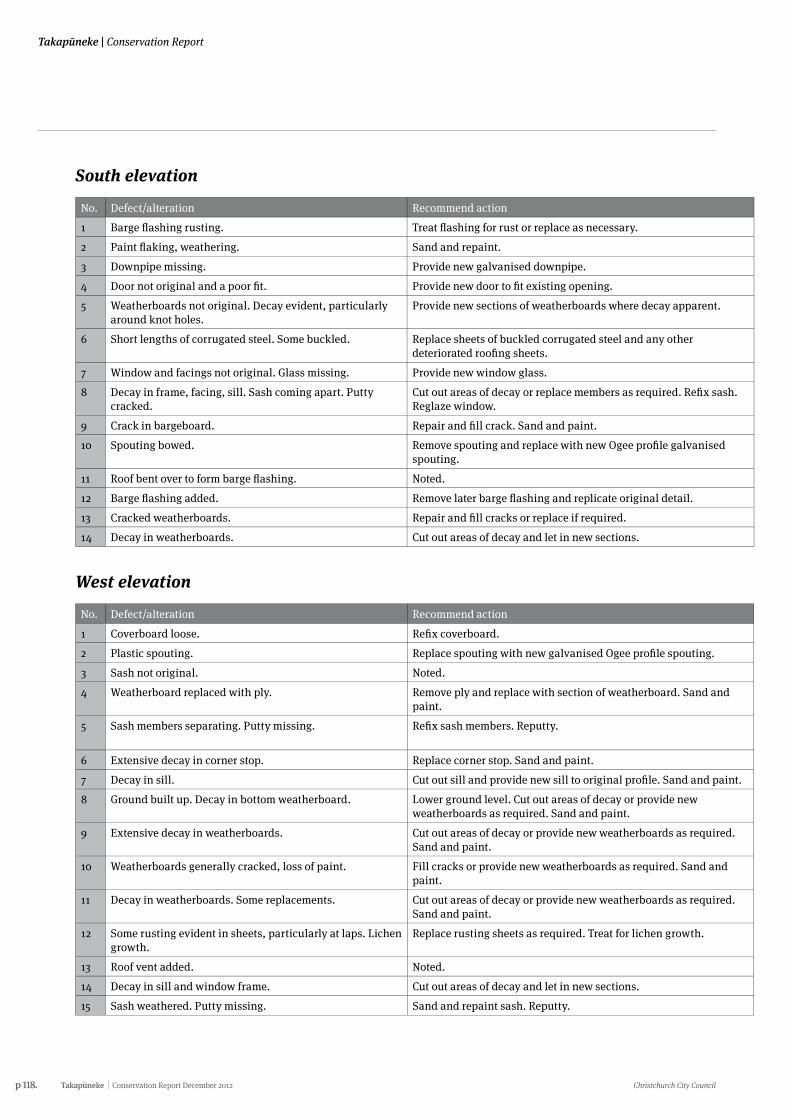
p 118. Takapūneke Conservation Report December 2012 Christchurch City Council
Takapūneke | Conservation Report
South elevation
No. Defect/alteration Recommend action
1 Barge flashing rusting. Treat flashing for rust or replace as necessary.
2 Paint flaking, weathering. Sand and repaint.
3 Downpipe missing. Provide new galvanised downpipe.
4 Door not original and a poor fit. Provide new door to fit existing opening.
5 Weatherboards not original. Decay evident, particularly around knot holes.
Provide new sections of weatherboards where decay apparent.
6 Short lengths of corrugated steel. Some buckled. Replace sheets of buckled corrugated steel and any other deteriorated roofing sheets.
7 Window and facings not original. Glass missing. Provide new window glass.
8 Decay in frame, facing, sill. Sash coming apart. Putty cracked.
Cut out areas of decay or replace members as required. Refix sash. Reglaze window.
9 Crack in bargeboard. Repair and fill crack. Sand and paint.
10 Spouting bowed. Remove spouting and replace with new Ogee profile galvanised spouting.
11 Roof bent over to form barge flashing. Noted.
12 Barge flashing added. Remove later barge flashing and replicate original detail.
13 Cracked weatherboards. Repair and fill cracks or replace if required.
14 Decay in weatherboards. Cut out areas of decay and let in new sections.
West elevation
No. Defect/alteration Recommend action
1 Coverboard loose. Refix coverboard.
2 Plastic spouting. Replace spouting with new galvanised Ogee profile spouting.
3 Sash not original. Noted.
4 Weatherboard replaced with ply. Remove ply and replace with section of weatherboard. Sand and paint.
5 Sash members separating. Putty missing. Refix sash members. Reputty.
6 Extensive decay in corner stop. Replace corner stop. Sand and paint.
7 Decay in sill. Cut out sill and provide new sill to original profile. Sand and paint.
8 Ground built up. Decay in bottom weatherboard. Lower ground level. Cut out areas of decay or provide new weatherboards as required. Sand and paint.
9 Extensive decay in weatherboards. Cut out areas of decay or provide new weatherboards as required. Sand and paint.
10 Weatherboards generally cracked, loss of paint. Fill cracks or provide new weatherboards as required. Sand and paint.
11 Decay in weatherboards. Some replacements. Cut out areas of decay or provide new weatherboards as required. Sand and paint.
12 Some rusting evident in sheets, particularly at laps. Lichen growth.
Replace rusting sheets as required. Treat for lichen growth.
13 Roof vent added. Noted.
14 Decay in sill and window frame. Cut out areas of decay and let in new sections.
15 Sash weathered. Putty missing. Sand and repaint sash. Reputty.
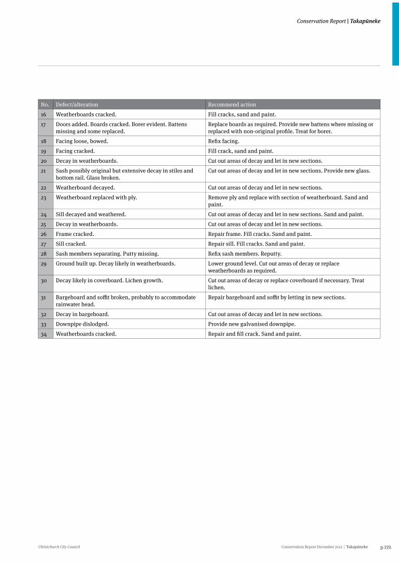
Christchurch City Council Conservation Report December 2012 Takapūneke p 119.
Conservation Report | Takapūneke
South elevation
No. Defect/alteration Recommend action
1 Barge flashing rusting. Treat flashing for rust or replace as necessary.
2 Paint flaking, weathering. Sand and repaint.
3 Downpipe missing. Provide new galvanised downpipe.
4 Door not original and a poor fit. Provide new door to fit existing opening.
5 Weatherboards not original. Decay evident, particularly around knot holes.
Provide new sections of weatherboards where decay apparent.
6 Short lengths of corrugated steel. Some buckled. Replace sheets of buckled corrugated steel and any other deteriorated roofing sheets.
7 Window and facings not original. Glass missing. Provide new window glass.
8 Decay in frame, facing, sill. Sash coming apart. Putty cracked.
Cut out areas of decay or replace members as required. Refix sash. Reglaze window.
9 Crack in bargeboard. Repair and fill crack. Sand and paint.
10 Spouting bowed. Remove spouting and replace with new Ogee profile galvanised spouting.
11 Roof bent over to form barge flashing. Noted.
12 Barge flashing added. Remove later barge flashing and replicate original detail.
13 Cracked weatherboards. Repair and fill cracks or replace if required.
14 Decay in weatherboards. Cut out areas of decay and let in new sections.
West elevation
No. Defect/alteration Recommend action
1 Coverboard loose. Refix coverboard.
2 Plastic spouting. Replace spouting with new galvanised Ogee profile spouting.
3 Sash not original. Noted.
4 Weatherboard replaced with ply. Remove ply and replace with section of weatherboard. Sand and paint.
5 Sash members separating. Putty missing. Refix sash members. Reputty.
6 Extensive decay in corner stop. Replace corner stop. Sand and paint.
7 Decay in sill. Cut out sill and provide new sill to original profile. Sand and paint.
8 Ground built up. Decay in bottom weatherboard. Lower ground level. Cut out areas of decay or provide new weatherboards as required. Sand and paint.
9 Extensive decay in weatherboards. Cut out areas of decay or provide new weatherboards as required. Sand and paint.
10 Weatherboards generally cracked, loss of paint. Fill cracks or provide new weatherboards as required. Sand and paint.
11 Decay in weatherboards. Some replacements. Cut out areas of decay or provide new weatherboards as required. Sand and paint.
12 Some rusting evident in sheets, particularly at laps. Lichen growth.
Replace rusting sheets as required. Treat for lichen growth.
13 Roof vent added. Noted.
14 Decay in sill and window frame. Cut out areas of decay and let in new sections.
15 Sash weathered. Putty missing. Sand and repaint sash. Reputty.
No. Defect/alteration Recommend action
16 Weatherboards cracked. Fill cracks, sand and paint.
17 Doors added. Boards cracked. Borer evident. Battens missing and some replaced.
Replace boards as required. Provide new battens where missing or replaced with non-original profile. Treat for borer.
18 Facing loose, bowed. Refix facing.
19 Facing cracked. Fill crack, sand and paint.
20 Decay in weatherboards. Cut out areas of decay and let in new sections.
21 Sash possibly original but extensive decay in stiles and bottom rail. Glass broken.
Cut out areas of decay and let in new sections. Provide new glass.
22 Weatherboard decayed. Cut out areas of decay and let in new sections.
23 Weatherboard replaced with ply. Remove ply and replace with section of weatherboard. Sand and paint.
24 Sill decayed and weathered. Cut out areas of decay and let in new sections. Sand and paint.
25 Decay in weatherboards. Cut out areas of decay and let in new sections.
26 Frame cracked. Repair frame. Fill cracks. Sand and paint.
27 Sill cracked. Repair sill. Fill cracks. Sand and paint.
28 Sash members separating. Putty missing. Refix sash members. Reputty.
29 Ground built up. Decay likely in weatherboards. Lower ground level. Cut out areas of decay or replace weatherboards as required.
30 Decay likely in coverboard. Lichen growth. Cut out areas of decay or replace coverboard if necessary. Treat lichen.
31 Bargeboard and soffit broken, probably to accommodate rainwater head.
Repair bargeboard and soffit by letting in new sections.
32 Decay in bargeboard. Cut out areas of decay and let in new sections.
33 Downpipe dislodged. Provide new galvanised downpipe.
34 Weatherboards cracked. Repair and fill crack. Sand and paint.
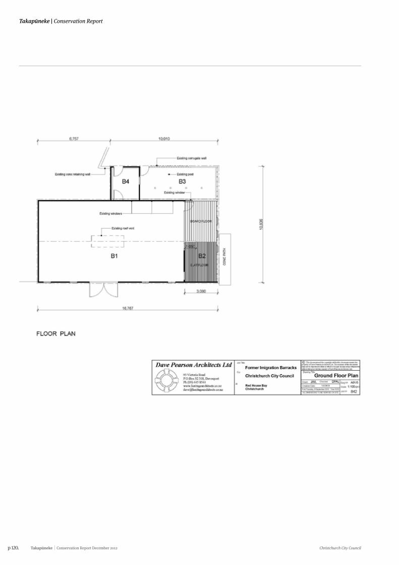
p 120. Takapūneke Conservation Report December 2012 Christchurch City Council
Takapūneke | Conservation Report
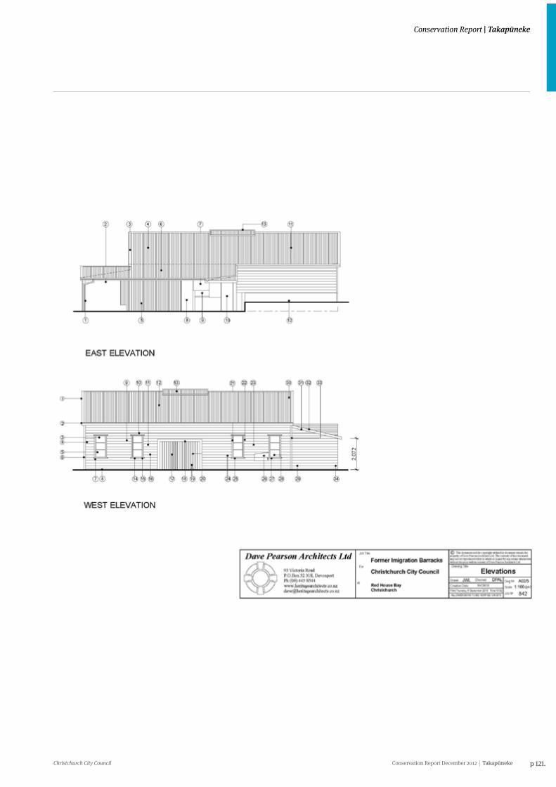
Christchurch City Council Conservation Report December 2012 Takapūneke p 121.
Conservation Report | Takapūneke
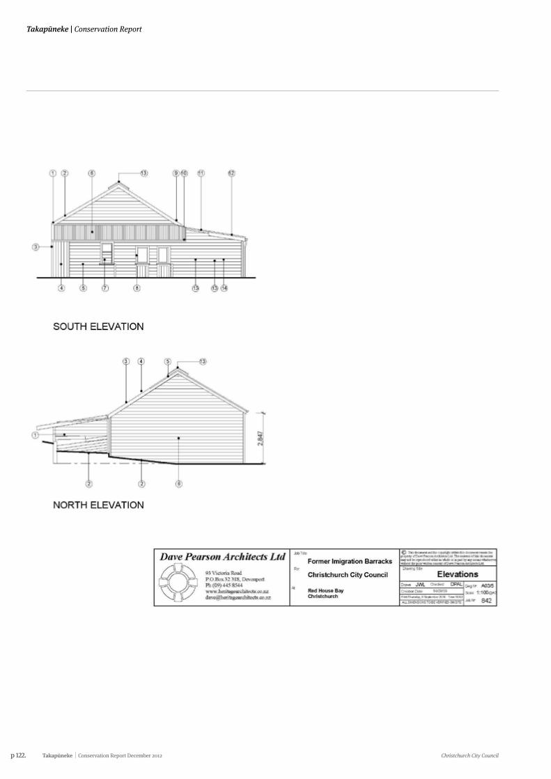
p 122. Takapūneke Conservation Report December 2012 Christchurch City Council
Takapūneke | Conservation Report
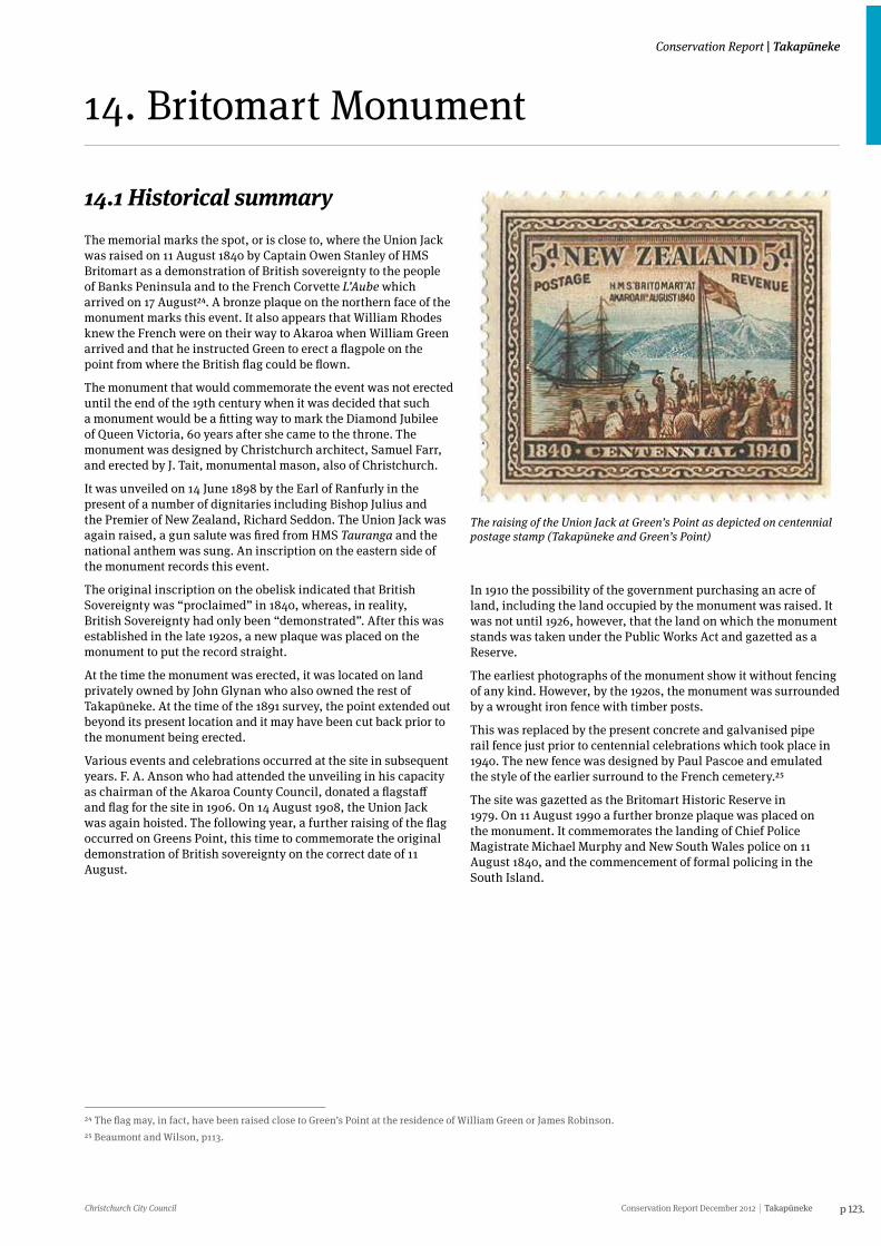
Christchurch City Council Conservation Report December 2012 Takapūneke p 123.
Conservation Report | Takapūneke
14. Britomart Monument
14.1 Historical summaryThe memorial marks the spot, or is close to, where the Union Jack was raised on 11 August 1840 by Captain Owen Stanley of HMS Britomart as a demonstration of British sovereignty to the people of Banks Peninsula and to the French Corvette L’Aube which arrived on 17 August24. A bronze plaque on the northern face of the monument marks this event. It also appears that William Rhodes knew the French were on their way to Akaroa when William Green arrived and that he instructed Green to erect a flagpole on the point from where the British flag could be flown.
The monument that would commemorate the event was not erected until the end of the 19th century when it was decided that such a monument would be a fitting way to mark the Diamond Jubilee of Queen Victoria, 60 years after she came to the throne. The monument was designed by Christchurch architect, Samuel Farr, and erected by J. Tait, monumental mason, also of Christchurch.
It was unveiled on 14 June 1898 by the Earl of Ranfurly in the present of a number of dignitaries including Bishop Julius and the Premier of New Zealand, Richard Seddon. The Union Jack was again raised, a gun salute was fired from HMS Tauranga and the national anthem was sung. An inscription on the eastern side of the monument records this event.
The original inscription on the obelisk indicated that British Sovereignty was “proclaimed” in 1840, whereas, in reality, British Sovereignty had only been “demonstrated”. After this was established in the late 1920s, a new plaque was placed on the monument to put the record straight.
At the time the monument was erected, it was located on land privately owned by John Glynan who also owned the rest of Takapūneke. At the time of the 1891 survey, the point extended out beyond its present location and it may have been cut back prior to the monument being erected.
Various events and celebrations occurred at the site in subsequent years. F. A. Anson who had attended the unveiling in his capacity as chairman of the Akaroa County Council, donated a flagstaff and flag for the site in 1906. On 14 August 1908, the Union Jack was again hoisted. The following year, a further raising of the flag occurred on Greens Point, this time to commemorate the original demonstration of British sovereignty on the correct date of 11 August.
24 The flag may, in fact, have been raised close to Green’s Point at the residence of William Green or James Robinson.25 Beaumont and Wilson, p113.
The raising of the Union Jack at Green’s Point as depicted on centennial postage stamp (Takapūneke and Green’s Point)
In 1910 the possibility of the government purchasing an acre of land, including the land occupied by the monument was raised. It was not until 1926, however, that the land on which the monument stands was taken under the Public Works Act and gazetted as a Reserve.
The earliest photographs of the monument show it without fencing of any kind. However, by the 1920s, the monument was surrounded by a wrought iron fence with timber posts.
This was replaced by the present concrete and galvanised pipe rail fence just prior to centennial celebrations which took place in 1940. The new fence was designed by Paul Pascoe and emulated the style of the earlier surround to the French cemetery.25
The site was gazetted as the Britomart Historic Reserve in 1979. On 11 August 1990 a further bronze plaque was placed on the monument. It commemorates the landing of Chief Police Magistrate Michael Murphy and New South Wales police on 11 August 1840, and the commencement of formal policing in the South Island.
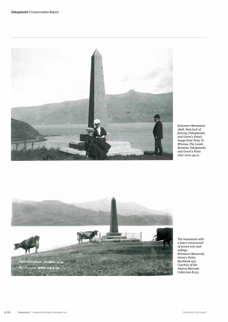
p 124. Takapūneke Conservation Report December 2012 Christchurch City Council
Takapūneke | Conservation Report
Britomart Monument 1898. Note lack of fencing (Takapūneke and Green’s Point). Image from Toitu Te Whenua The Lands Remains Takapūneke and Green’s Point 1830-2010, pg 15.
The monument with a fence constructed of woven wire and railings Britomart Memorial, Green's Point, Buckland 1931 Courtesy of the Akaroa Museum Collection #1325
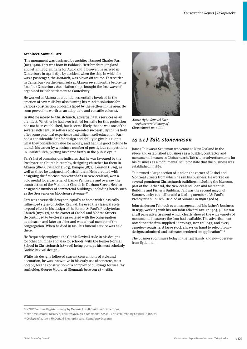
Christchurch City Council Conservation Report December 2012 Takapūneke p 125.
Conservation Report | Takapūneke
Architect: Samuel Farr
The monument was designed by architect Samuel Charles Farr (1827-1918). Farr was born in Baldock, Hertfordshire, England and left in 1849, initially for Auckland. However, he arrived in Canterbury in April 1850 by accident when the ship in which he was a passenger, the Monarch, was blown off course. Farr settled in Canterbury on the Peninsula at Akaroa seven months before the first four Canterbury Association ships brought the first wave of organised British settlement to Canterbury.
He worked at Akaroa as a builder, essentially involved in the erection of saw mills but also turning his mind to solutions for various construction problems faced by the settlers in the area. He soon proved his worth as an adaptable and versatile colonist.
In 1863 he moved to Christchurch, advertising his services as an architect. Whether he had ever trained formally for this profession has not been established, but it seems likely that he was one of the several 19th century settlers who operated successfully in this field after some practical experience and diligent self-education. Farr had a considerable flair for design and ability to give his clients what they considered value for money, and had the good fortune to launch his career by winning a number of prestigious competitions in Christchurch, putting his name firmly in the public eye.26
Farr’s list of commissions indicates that he was favoured by the Presbyterian Church hierarchy, designing churches for them in Akaroa (1863), Lyttelton (1863), Kaiapoi (1875), Leeston (1879), as well as three he designed in Christchurch. He is credited with designing the first cast iron verandahs in New Zealand, won a gold medal for a bas relief of Banks Peninsula and oversaw the construction of the Methodist Church in Durham Street. He also designed a number of commercial buildings, including hotels such as the Grosvenor on Moorhouse Avenue.27
Farr was a versatile designer, equally at home with classically influenced styles or Gothic Revival. He used the classical style to good effect in his design of the former St Paul’s Presbyterian Church (1876-77), at the corner of Cashel and Madras Streets. He continued to be closely associated with the congregation as a deacon and later an elder and was a loyal member of the congregation. When he died in 1918 his funeral service was held there.
He frequently employed the Gothic Revival style in his designs for other churches and also for schools, with the former Normal School in Christchurch (1873-76) being perhaps his most scholarly Gothic Revival design.
While his designs followed current conventions of style and decoration, he was innovative in his early use of concrete, most notably for the construction of a complex of buildings for wealthy runholder, George Moore, at Glenmark between 1875-1881.
26 NZHPT on-line Register – entry by Melanie Lovell-Smith 16 October 200127 The Architectural History of Christchurch, No 1 The Normal School, Christchurch City Council , 1982, p328 Cyclopaedia, 1903; McDonald Biography card, Canterbury Museum
Above right: Samuel Farr – Architectural History of Christchurch no.1,CCC
14.1.1 J Tait, stonemason James Tait was a Scotsman who came to New Zealand in the 1860s and established a business as a builder, contractor and monumental mason in Christchurch. Tait’s later advertisements for his business as a monumental sculptor state that the business was established in 1863.
Tait owned a large section of land on the corner of Cashel and Montreal Streets from which he ran his business. He worked on several prominent Christchurch buildings including the Museum, part of the Cathedral, the New Zealand Loan and Mercantile Building and Fisher’s Building. Tait was the second mayor of Sumner, a city councillor and a leading member of St Paul’s Presbyterian Church. He died at Sumner in 1898 aged 65.
John Anderson Tait took over management of his father’s business in 1895, working with his son John Edward Tait. In 1905, J. Tait ran a full page advertisement which clearly showed the wide variety of monumental masonry the firm had available. The advertisement noted that the firm supplied “Kerbings, iron railings, and every cemetery requisite. A large stock always on hand to select from – designs submitted and estimates tendered on application”.28
The business continues today in the Tait family and now operates from Sydenham.
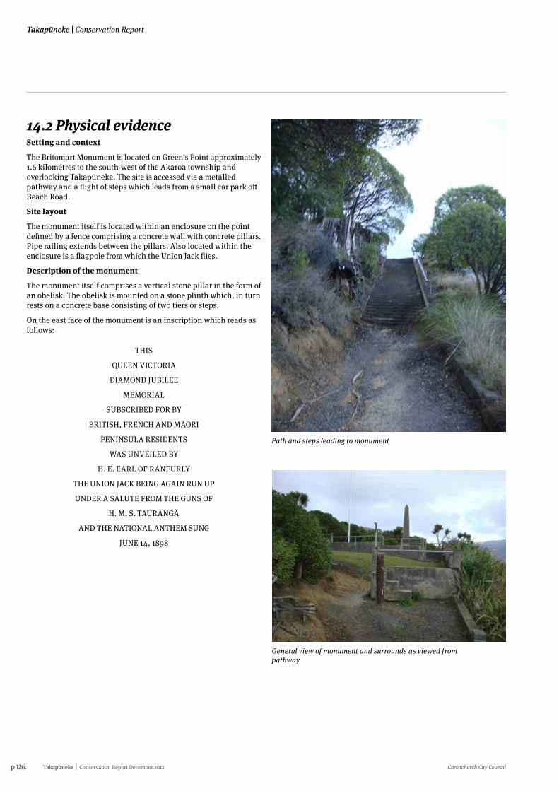
p 126. Takapūneke Conservation Report December 2012 Christchurch City Council
Takapūneke | Conservation Report
14.2 Physical evidence Setting and context
The Britomart Monument is located on Green’s Point approximately 1.6 kilometres to the south-west of the Akaroa township and overlooking Takapūneke. The site is accessed via a metalled pathway and a flight of steps which leads from a small car park off Beach Road.
Site layout
The monument itself is located within an enclosure on the point defined by a fence comprising a concrete wall with concrete pillars. Pipe railing extends between the pillars. Also located within the enclosure is a flagpole from which the Union Jack flies.
Description of the monument
The monument itself comprises a vertical stone pillar in the form of an obelisk. The obelisk is mounted on a stone plinth which, in turn rests on a concrete base consisting of two tiers or steps.
On the east face of the monument is an inscription which reads as follows:
THIS
QUEEN VICTORIA
DIAMOND JUBILEE
MEMORIAL
SUBSCRIBED FOR BY
BRITISH, FRENCH AND MĀORI
PENINSULA RESIDENTS
WAS UNVEILED BY
H. E. EARL OF RANFURLY
THE UNION JACK BEING AGAIN RUN UP
UNDER A SALUTE FROM THE GUNS OF
H. M. S. TAURANGĀ
AND THE NATIONAL ANTHEM SUNG
JUNE 14, 1898
Path and steps leading to monument
General view of monument and surrounds as viewed from pathway
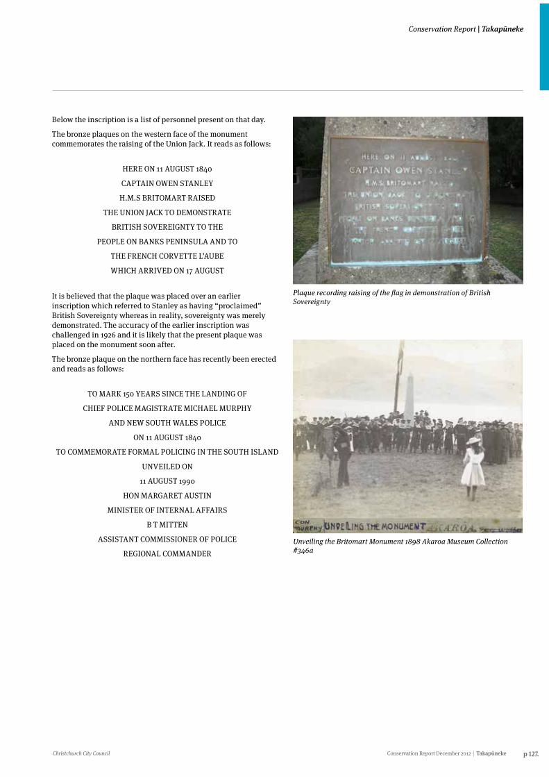
Christchurch City Council Conservation Report December 2012 Takapūneke p 127.
Conservation Report | Takapūneke
Below the inscription is a list of personnel present on that day.
The bronze plaques on the western face of the monument commemorates the raising of the Union Jack. It reads as follows:
HERE ON 11 AUGUST 1840
CAPTAIN OWEN STANLEY
H.M.S BRITOMART RAISED
THE UNION JACK TO DEMONSTRATE
BRITISH SOVEREIGNTY TO THE
PEOPLE ON BANKS PENINSULA AND TO
THE FRENCH CORVETTE L’AUBE
WHICH ARRIVED ON 17 AUGUST
It is believed that the plaque was placed over an earlier inscription which referred to Stanley as having “proclaimed” British Sovereignty whereas in reality, sovereignty was merely demonstrated. The accuracy of the earlier inscription was challenged in 1926 and it is likely that the present plaque was placed on the monument soon after.
The bronze plaque on the northern face has recently been erected and reads as follows:
TO MARK 150 YEARS SINCE THE LANDING OF
CHIEF POLICE MAGISTRATE MICHAEL MURPHY
AND NEW SOUTH WALES POLICE
ON 11 AUGUST 1840
TO COMMEMORATE FORMAL POLICING IN THE SOUTH ISLAND
UNVEILED ON
11 AUGUST 1990
HON MARGARET AUSTIN
MINISTER OF INTERNAL AFFAIRS
B T MITTEN
ASSISTANT COMMISSIONER OF POLICE
REGIONAL COMMANDER
Plaque recording raising of the flag in demonstration of British Sovereignty
Unveiling the Britomart Monument 1898 Akaroa Museum Collection #346a
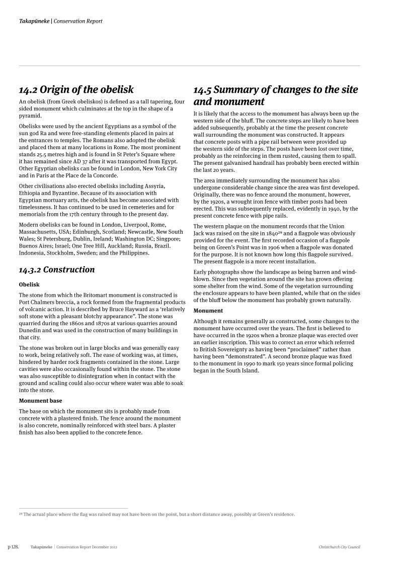
p 128. Takapūneke Conservation Report December 2012 Christchurch City Council
Takapūneke | Conservation Report
14.2 Origin of the obeliskAn obelisk (from Greek obeliskos) is defined as a tall tapering, four sided monument which culminates at the top in the shape of a pyramid.
Obelisks were used by the ancient Egyptians as a symbol of the sun god Ra and were free-standing elements placed in pairs at the entrances to temples. The Romans also adopted the obelisk and placed them at many locations in Rome. The most prominent stands 25.5 metres high and is found in St Peter’s Square where it has remained since AD 37 after it was transported from Egypt. Other Egyptian obelisks can be found in London, New York City and in Paris at the Place de la Concorde.
Other civilisations also erected obelisks including Assyria, Ethiopia and Byzantine. Because of its association with Egyptian mortuary arts, the obelisk has become associated with timelessness. It has continued to be used in cemeteries and for memorials from the 17th century through to the present day.
Modern obelisks can be found in London, Liverpool, Rome, Massachusetts, USA; Edinburgh, Scotland; Newcastle, New South Wales; St Petersburg, Dublin, Ireland; Washington DC; Singpore; Buenos Aires; Israel; One Tree Hill, Auckland; Russia, Brazil. Indonesia, Stockholm, Sweden; and the Philippines.
14.3.2 ConstructionObelisk
The stone from which the Britomart monument is constructed is Port Chalmers breccia, a rock formed from the fragmental products of volcanic action. It is described by Bruce Hayward as a ‘relatively soft stone with a pleasant blotchy appearance”. The stone was quarried during the 1860s and 1870s at various quarries around Dunedin and was used in the construction of many buildings in that city.
The stone was broken out in large blocks and was generally easy to work, being relatively soft. The ease of working was, at times, hindered by harder rock fragments contained in the stone. Large cavities were also occasionally found within the stone. The stone was also susceptible to disintegration when in contact with the ground and scaling could also occur where water was able to soak into the stone.
Monument base
The base on which the monument sits is probably made from concrete with a plastered finish. The fence around the monument is also concrete, nominally reinforced with steel bars. A plaster finish has also been applied to the concrete fence.
14.5 Summary of changes to the site and monumentIt is likely that the access to the monument has always been up the western side of the bluff. The concrete steps are likely to have been added subsequently, probably at the time the present concrete wall surrounding the monument was constructed. It appears that concrete posts with a pipe rail between were provided up the western side of the steps. The posts have been lost over time, probably as the reinforcing in them rusted, causing them to spall. The present galvanised handrail has probably been erected within the last 20 years.
The area immediately surrounding the monument has also undergone considerable change since the area was first developed. Originally, there was no fence around the monument, however, by the 1920s, a wrought iron fence with timber posts had been erected. This was subsequently replaced, evidently in 1940, by the present concrete fence with pipe rails.
The western plaque on the monument records that the Union Jack was raised on the site in 184029 and a flagpole was obviously provided for the event. The first recorded occasion of a flagpole being on Green’s Point was in 1906 when a flagpole was donated for the purpose. It is not known how long this flagpole survived. The present flagpole is a more recent installation.
Early photographs show the landscape as being barren and wind-blown. Since then vegetation around the site has grown offering some shelter from the wind. Some of the vegetation surrounding the enclosure appears to have been planted, while that on the sides of the bluff below the monument has probably grown naturally.
Monument
Although it remains generally as constructed, some changes to the monument have occurred over the years. The first is believed to have occurred in the 1920s when a bronze plaque was erected over an earlier inscription. This was to correct an error which referred to British Sovereignty as having been “proclaimed” rather than having been “demonstrated”. A second bronze plaque was fixed to the monument in 1990 to mark 150 years since formal policing began in the South Island.
29 The actual place where the flag was raised may not have been on the point, but a short distance away, possibly at Green’s residence.
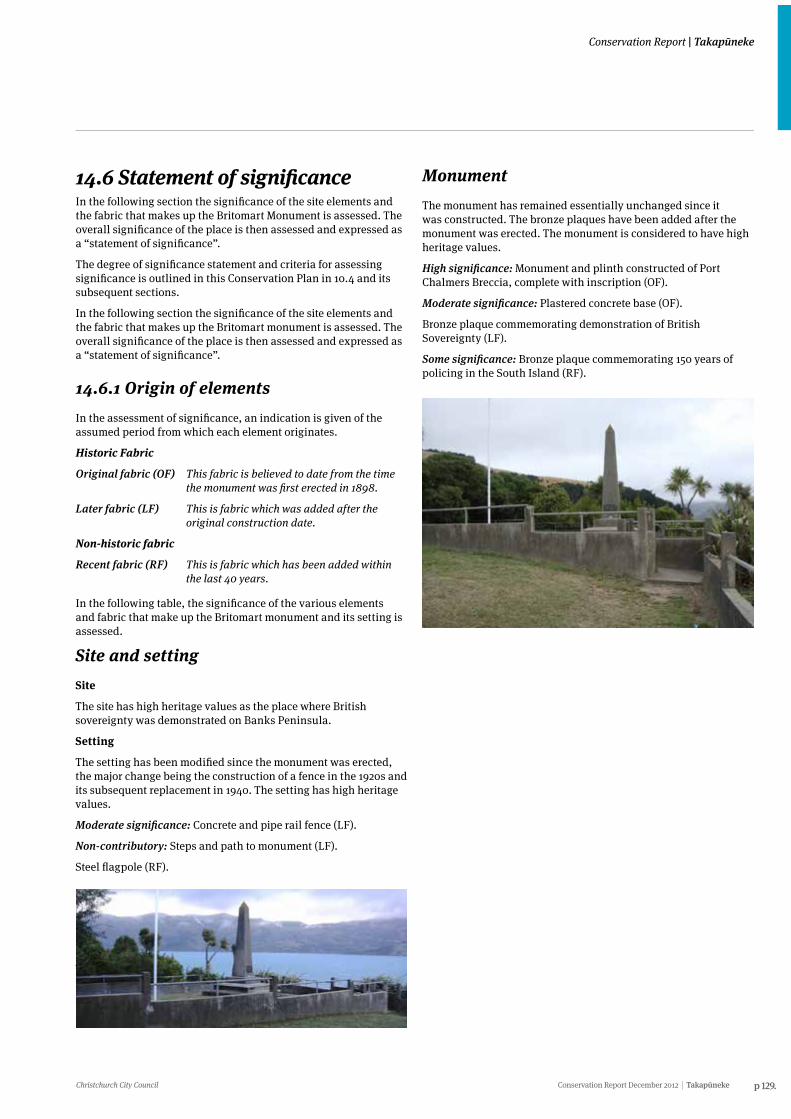
Christchurch City Council Conservation Report December 2012 Takapūneke p 129.
Conservation Report | Takapūneke
14.6 Statement of significance In the following section the significance of the site elements and the fabric that makes up the Britomart Monument is assessed. The overall significance of the place is then assessed and expressed as a “statement of significance”.
The degree of significance statement and criteria for assessing significance is outlined in this Conservation Plan in 10.4 and its subsequent sections.
In the following section the significance of the site elements and the fabric that makes up the Britomart monument is assessed. The overall significance of the place is then assessed and expressed as a “statement of significance”.
14.6.1 Origin of elementsIn the assessment of significance, an indication is given of the assumed period from which each element originates.
Historic Fabric
Original fabric (OF) This fabric is believed to date from the time the monument was first erected in 1898.
Later fabric (LF) This is fabric which was added after the original construction date.
Non-historic fabric
Recent fabric (RF) This is fabric which has been added within the last 40 years.
In the following table, the significance of the various elements and fabric that make up the Britomart monument and its setting is assessed.
Site and settingSite
The site has high heritage values as the place where British sovereignty was demonstrated on Banks Peninsula.
Setting
The setting has been modified since the monument was erected, the major change being the construction of a fence in the 1920s and its subsequent replacement in 1940. The setting has high heritage values.
Moderate significance: Concrete and pipe rail fence (LF).
Non-contributory: Steps and path to monument (LF).
Steel flagpole (RF).
MonumentThe monument has remained essentially unchanged since it was constructed. The bronze plaques have been added after the monument was erected. The monument is considered to have high heritage values.
High significance: Monument and plinth constructed of Port Chalmers Breccia, complete with inscription (OF).
Moderate significance: Plastered concrete base (OF).
Bronze plaque commemorating demonstration of British Sovereignty (LF).
Some significance: Bronze plaque commemorating 150 years of policing in the South Island (RF).
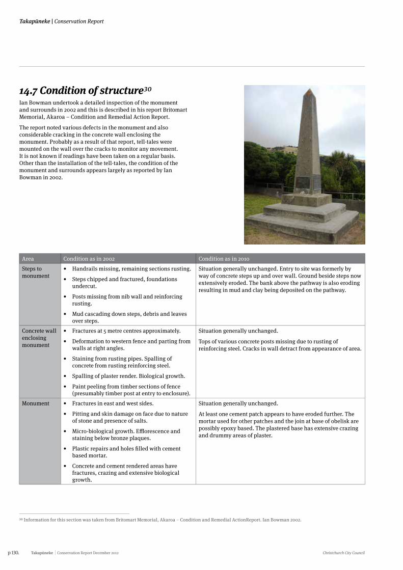
p 130. Takapūneke Conservation Report December 2012 Christchurch City Council
Takapūneke | Conservation Report
14.7 Condition of structure30Ian Bowman undertook a detailed inspection of the monument and surrounds in 2002 and this is described in his report Britomart Memorial, Akaroa – Condition and Remedial Action Report.
The report noted various defects in the monument and also considerable cracking in the concrete wall enclosing the monument. Probably as a result of that report, tell-tales were mounted on the wall over the cracks to monitor any movement. It is not known if readings have been taken on a regular basis. Other than the installation of the tell-tales, the condition of the monument and surrounds appears largely as reported by Ian Bowman in 2002.
30 Information for this section was taken from Britomart Memorial, Akaroa – Condition and Remedial ActionReport. Ian Bowman 2002.
Area Condition as in 2002 Condition as in 2010
Steps to monument
• Handrails missing, remaining sections rusting.
• Steps chipped and fractured, foundations undercut.
• Posts missing from nib wall and reinforcing rusting.
• Mud cascading down steps, debris and leaves over steps.
Situation generally unchanged. Entry to site was formerly by way of concrete steps up and over wall. Ground beside steps now extensively eroded. The bank above the pathway is also eroding resulting in mud and clay being deposited on the pathway.
Concrete wall enclosing monument
• Fractures at 5 metre centres approximately.
• Deformation to western fence and parting from walls at right angles.
• Staining from rusting pipes. Spalling of concrete from rusting reinforcing steel.
• Spalling of plaster render. Biological growth.
• Paint peeling from timber sections of fence (presumably timber post at entry to enclosure).
Situation generally unchanged.
Tops of various concrete posts missing due to rusting of reinforcing steel. Cracks in wall detract from appearance of area.
Monument • Fractures in east and west sides.
• Pitting and skin damage on face due to nature of stone and presence of salts.
• Micro-biological growth. Efflorescence and staining below bronze plaques.
• Plastic repairs and holes filled with cement based mortar.
• Concrete and cement rendered areas have fractures, crazing and extensive biological growth.
Situation generally unchanged.
At least one cement patch appears to have eroded further. The mortar used for other patches and the join at base of obelisk are possibly epoxy based. The plastered base has extensive crazing and drummy areas of plaster.
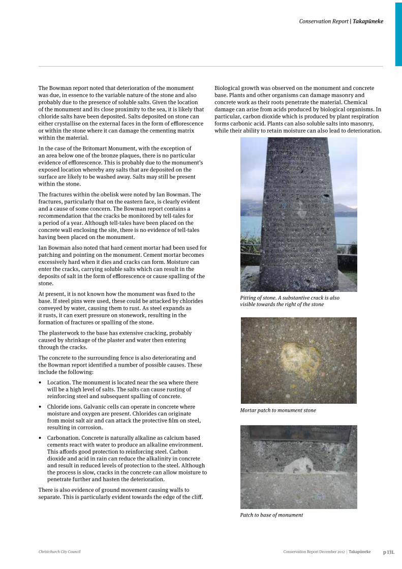
Christchurch City Council Conservation Report December 2012 Takapūneke p 131.
Conservation Report | Takapūneke
The Bowman report noted that deterioration of the monument was due, in essence to the variable nature of the stone and also probably due to the presence of soluble salts. Given the location of the monument and its close proximity to the sea, it is likely that chloride salts have been deposited. Salts deposited on stone can either crystallise on the external faces in the form of efflorescence or within the stone where it can damage the cementing matrix within the material.
In the case of the Britomart Monument, with the exception of an area below one of the bronze plaques, there is no particular evidence of efflorescence. This is probably due to the monument’s exposed location whereby any salts that are deposited on the surface are likely to be washed away. Salts may still be present within the stone.
The fractures within the obelisk were noted by Ian Bowman. The fractures, particularly that on the eastern face, is clearly evident and a cause of some concern. The Bowman report contains a recommendation that the cracks be monitored by tell-tales for a period of a year. Although tell-tales have been placed on the concrete wall enclosing the site, there is no evidence of tell-tales having been placed on the monument.
Ian Bowman also noted that hard cement mortar had been used for patching and pointing on the monument. Cement mortar becomes excessively hard when it dies and cracks can form. Moisture can enter the cracks, carrying soluble salts which can result in the deposits of salt in the form of efflorescence or cause spalling of the stone.
At present, it is not known how the monument was fixed to the base. If steel pins were used, these could be attacked by chlorides conveyed by water, causing them to rust. As steel expands as it rusts, it can exert pressure on stonework, resulting in the formation of fractures or spalling of the stone.
The plasterwork to the base has extensive cracking, probably caused by shrinkage of the plaster and water then entering through the cracks.
The concrete to the surrounding fence is also deteriorating and the Bowman report identified a number of possible causes. These include the following:
• Location. The monument is located near the sea where there will be a high level of salts. The salts can cause rusting of reinforcing steel and subsequent spalling of concrete.
• Chloride ions. Galvanic cells can operate in concrete where moisture and oxygen are present. Chlorides can originate from moist salt air and can attack the protective film on steel, resulting in corrosion.
• Carbonation. Concrete is naturally alkaline as calcium based cements react with water to produce an alkaline environment. This affords good protection to reinforcing steel. Carbon dioxide and acid in rain can reduce the alkalinity in concrete and result in reduced levels of protection to the steel. Although the process is slow, cracks in the concrete can allow moisture to penetrate further and hasten the deterioration.
There is also evidence of ground movement causing walls to separate. This is particularly evident towards the edge of the cliff.
Pitting of stone. A substantive crack is also visible towards the right of the stone
Mortar patch to monument stone
Patch to base of monument
Biological growth was observed on the monument and concrete base. Plants and other organisms can damage masonry and concrete work as their roots penetrate the material. Chemical damage can arise from acids produced by biological organisms. In particular, carbon dioxide which is produced by plant respiration forms carbonic acid. Plants can also soluble salts into masonry, while their ability to retain moisture can also lead to deterioration.
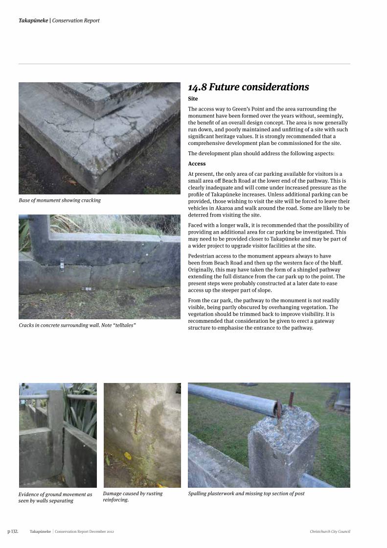
p 132. Takapūneke Conservation Report December 2012 Christchurch City Council
Takapūneke | Conservation Report
Base of monument showing cracking
Spalling plasterwork and missing top section of post
Cracks in concrete surrounding wall. Note “telltales”
Evidence of ground movement as seen by walls separating
Damage caused by rusting reinforcing.
14.8 Future considerationsSite
The access way to Green’s Point and the area surrounding the monument have been formed over the years without, seemingly, the benefit of an overall design concept. The area is now generally run down, and poorly maintained and unfitting of a site with such significant heritage values. It is strongly recommended that a comprehensive development plan be commissioned for the site.
The development plan should address the following aspects:
Access
At present, the only area of car parking available for visitors is a small area off Beach Road at the lower end of the pathway. This is clearly inadequate and will come under increased pressure as the profile of Takapūneke increases. Unless additional parking can be provided, those wishing to visit the site will be forced to leave their vehicles in Akaroa and walk around the road. Some are likely to be deterred from visiting the site.
Faced with a longer walk, it is recommended that the possibility of providing an additional area for car parking be investigated. This may need to be provided closer to Takapūneke and may be part of a wider project to upgrade visitor facilities at the site.
Pedestrian access to the monument appears always to have been from Beach Road and then up the western face of the bluff. Originally, this may have taken the form of a shingled pathway extending the full distance from the car park up to the point. The present steps were probably constructed at a later date to ease access up the steeper part of slope.
From the car park, the pathway to the monument is not readily visible, being partly obscured by overhanging vegetation. The vegetation should be trimmed back to improve visibility. It is recommended that consideration be given to erect a gateway structure to emphasise the entrance to the pathway.
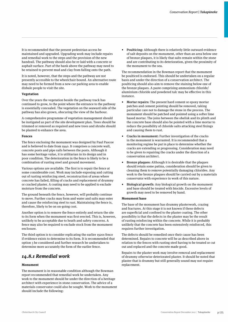
Christchurch City Council Conservation Report December 2012 Takapūneke p 133.
Conservation Report | Takapūneke
It is recommended that the present pedestrian access be maintained and upgraded. Upgrading work may include repairs and remedial work to the steps and the provision of the new handrail. The pathway should also be re-laid with a concrete or asphalt surface. Part of the bank above the pathway may need to be retained to prevent mud and clay from falling onto the path.
It is noted, however, that the steps and the pathway are not presently accessible to the wheelchair-bound. An alternative route may need to be formed from a new car parking area to enable disbale people to visit the site.
Vegetation
Over the years the vegetation beside the pathway track has continued to grow, to the point where the entrance to the pathway is essentially concealed. The vegetation on the seaward side of the pathway has also grown, obscuring the view of the harbour.
A comprehensive programme of vegetation management should be instigated as part of the site development plan. Trees should be trimmed or removed as required and new trees and shrubs should be planted to enhance the area.
Fences
The fence enclosing the monument was designed by Paul Pascoe and is believed to date from 1940. It comprises a concrete wall, concrete posts and pipe rails between the posts. Although it has some heritage value, it is utilitarian in its design and in poor condition. The deterioration in the fence is likely to be a combination of rusting steel and ground movement.
Various options are available. The first is to repair the fence at some considerable cost. Work may include exposing and cutting out of rusting reinforcing steel, reconstruction of areas where concrete has failed, filling of cracks and replacement of drummy or cracked plaster. A coating may need to be applied to exclude moisture from the concrete.
The ground beneath the fence, however, will probably continue to move. Further cracks may form and water and salts may enter and cause the reinforcing steel to rust. Maintaining the fence is, therefore, likely to be on on-going cost.
Another option is to remove the fence entirely and return the site to its form when the monument was first erected. This is, however, unlikely to be acceptable due to heath and safety concerns. A fence may also be required to exclude stock from the monument enclosure.
The third option is to consider replicating the earlier 1920s fence if evidence exists to determine to its form. It is recommended that option 3 be considered and further research be undertaken to determine more accurately the form of the earlier fence.
14.8.1 Remedial workMonument
The monument is in reasonable condition although the Bowman report recommended that remedial work be undertaken. Any work to the monument should be under the direction of a heritage architect with experience in stone conservation. The advice of a materials conservator could also be sought. Work to the monument should include the following:
• Poulticing: Although there is relatively little outward evidence of salt deposits on the monument, other than an area below one of bronze plaques, it is likely that salts remain within the stone and are contributing to its deterioration, given the proximity of the monument to the sea.
The recommendation in the Bowman report that the monument be poulticed is endorsed. This should be undertaken on a regular basis and under the direction of a conservation architect. The poulticing should also aim to remove the staining below one of the bronze plaques. A paste comprising ammonium chloride/aluminium chloride and powdered talc may be effective in this instance.
• Mortar repairs: The present hard cement or epoxy mortar patches and cement pointing should be removed, taking particular care not to damage the stone in the process. The monument should be patched and pointed using a softer lime based mortar. The joins between the obelisk and its plinth and the concrete base should also be pointed with a lime mortar to reduce the possibility of chloride salts attacking steel fixings and causing them to rust.
• Cracks in monument: Further investigation of the cracks in the monument is warranted. It is recommended that a monitoring regime be put in place to determine whether the cracks are extending or progressing. Consideration may need to be given to repairing the cracks under the direction of a conservation architect.
• Bronze plaques: Although it is desirable that the plaques should retain some patina, consideration should be given to cleaning them to remove potentially damaging chlorides. Any work to the bronze plaques should be carried out by a materials conservator with experience in work of this nature.
• Biological growth: Any biological growth on the monument and base should be treated with biocide. Excessive levels of growth may need to be removed by hand.
Monument base
The base of the monument has drummy plasterwork, crazing and fractures. At this stage it is not known if these defects are superficial and confined to the plaster coating. The other possibility is that the defects in the plaster may be the result of rusting reinforcing within the concrete. While it is probably unlikely that the concrete has been extensively reinforced, this requires further investigation.
The defects should be remedied once their cause has been determined. Repairs to concrete will be as described above in relation to the fences with rusting steel having to be treated or cut out and replaced and the concrete made good.
Repairs to the plaster work may involve removal and replacement of drummy otherwise deteriorated plaster. It should be noted that plaster that is drummy but still generally sound may not require replacement.
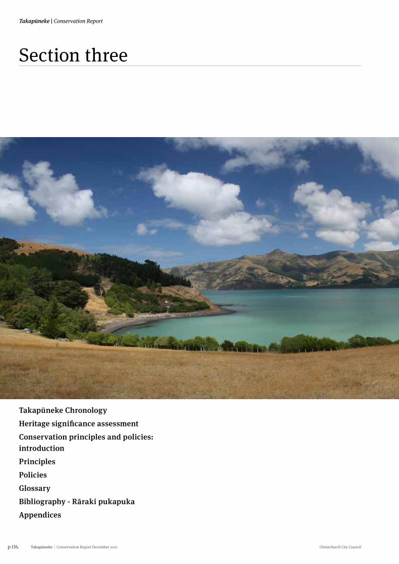
p 134. Takapūneke Conservation Report December 2012 Christchurch City Council
Takapūneke | Conservation Report
Takapūneke Chronology Heritage significance assessmentConservation principles and policies: introductionPrinciplesPoliciesGlossaryBibliography - Rāraki pukapukaAppendices
Section three
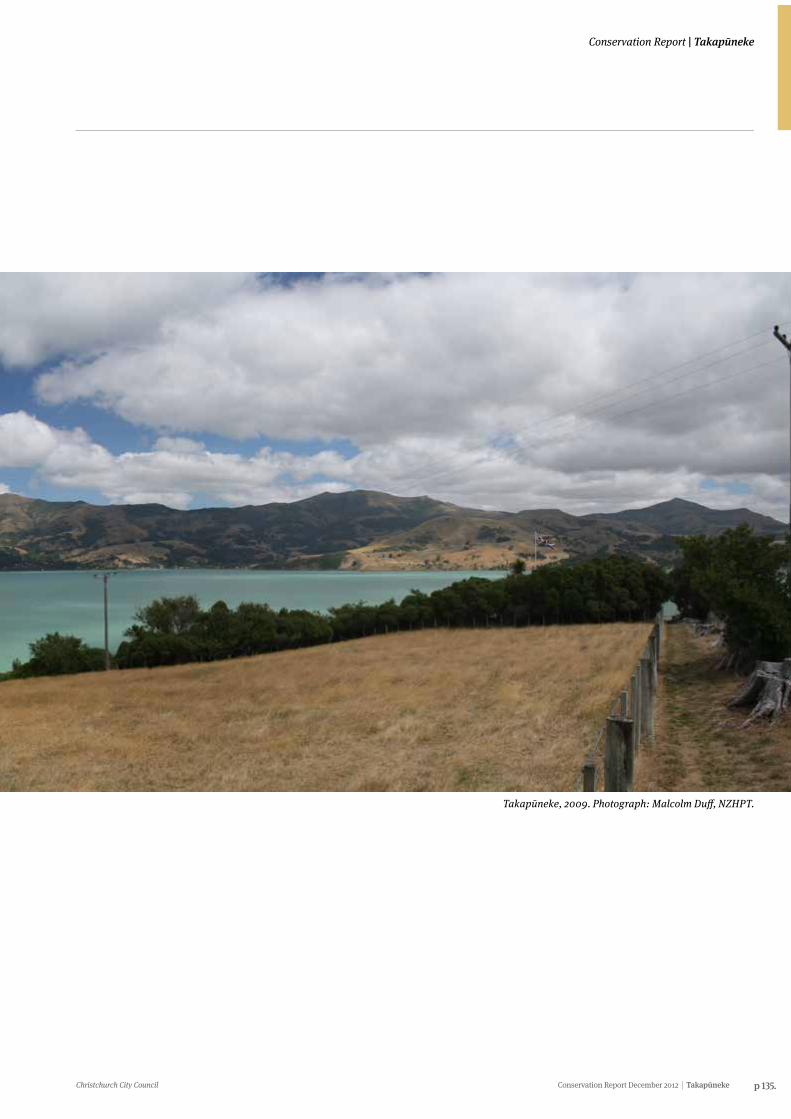
Christchurch City Council Conservation Report December 2012 Takapūneke p 135.
Conservation Report | Takapūneke
Takapūneke, 2009. Photograph: Malcolm Duff, NZHPT.
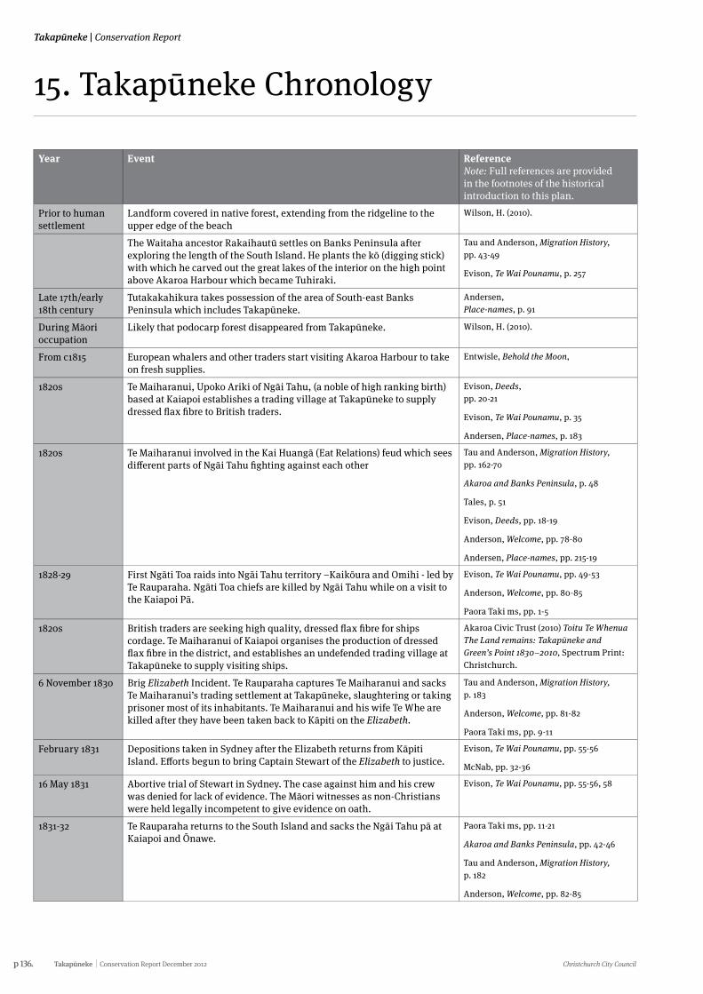
p 136. Takapūneke Conservation Report December 2012 Christchurch City Council
Takapūneke | Conservation Report
15. Takapūneke Chronology
Year Event Reference Note: Full references are provided in the footnotes of the historical introduction to this plan.
Prior to human settlement
Landform covered in native forest, extending from the ridgeline to the upper edge of the beach
Wilson, H. (2010).
The Waitaha ancestor Rakaihautū settles on Banks Peninsula after exploring the length of the South Island. He plants the kō (digging stick) with which he carved out the great lakes of the interior on the high point above Akaroa Harbour which became Tuhiraki.
Tau and Anderson, Migration History, pp. 43-49
Evison, Te Wai Pounamu, p. 257
Late 17th/early 18th century
Tutakakahikura takes possession of the area of South-east Banks Peninsula which includes Takapūneke.
Andersen, Place-names, p. 91
During Māori occupation
Likely that podocarp forest disappeared from Takapūneke. Wilson, H. (2010).
From c1815 European whalers and other traders start visiting Akaroa Harbour to take on fresh supplies.
Entwisle, Behold the Moon,
1820s Te Maiharanui, Upoko Ariki of Ngāi Tahu, (a noble of high ranking birth) based at Kaiapoi establishes a trading village at Takapūneke to supply dressed flax fibre to British traders.
Evison, Deeds, pp. 20-21
Evison, Te Wai Pounamu, p. 35
Andersen, Place-names, p. 183
1820s Te Maiharanui involved in the Kai Huangā (Eat Relations) feud which sees different parts of Ngāi Tahu fighting against each other
Tau and Anderson, Migration History, pp. 162-70
Akaroa and Banks Peninsula, p. 48
Tales, p. 51
Evison, Deeds, pp. 18-19
Anderson, Welcome, pp. 78-80
Andersen, Place-names, pp. 215-19
1828-29 First Ngāti Toa raids into Ngāi Tahu territory –Kaikōura and Omihi - led by Te Rauparaha. Ngāti Toa chiefs are killed by Ngāi Tahu while on a visit to the Kaiapoi Pā.
Evison, Te Wai Pounamu, pp. 49-53
Anderson, Welcome, pp. 80-85
Paora Taki ms, pp. 1-5
1820s British traders are seeking high quality, dressed flax fibre for ships cordage. Te Maiharanui of Kaiapoi organises the production of dressed flax fibre in the district, and establishes an undefended trading village at Takapūneke to supply visiting ships.
Akaroa Civic Trust (2010) Toitu Te Whenua The Land remains: Takapūneke and Green’s Point 1830–2010, Spectrum Print: Christchurch.
6 November 1830 Brig Elizabeth Incident. Te Rauparaha captures Te Maiharanui and sacks Te Maiharanui’s trading settlement at Takapūneke, slaughtering or taking prisoner most of its inhabitants. Te Maiharanui and his wife Te Whe are killed after they have been taken back to Kāpiti on the Elizabeth.
Tau and Anderson, Migration History, p. 183
Anderson, Welcome, pp. 81-82
Paora Taki ms, pp. 9-11
February 1831 Depositions taken in Sydney after the Elizabeth returns from Kāpiti Island. Efforts begun to bring Captain Stewart of the Elizabeth to justice.
Evison, Te Wai Pounamu, pp. 55-56
McNab, pp. 32-36
16 May 1831 Abortive trial of Stewart in Sydney. The case against him and his crew was denied for lack of evidence. The Māori witnesses as non-Christians were held legally incompetent to give evidence on oath.
Evison, Te Wai Pounamu, pp. 55-56, 58
1831-32 Te Rauparaha returns to the South Island and sacks the Ngāi Tahu pā at Kaiapoi and Ōnawe.
Paora Taki ms, pp. 11-21
Akaroa and Banks Peninsula, pp. 42-46
Tau and Anderson, Migration History, p. 182
Anderson, Welcome, pp. 82-85
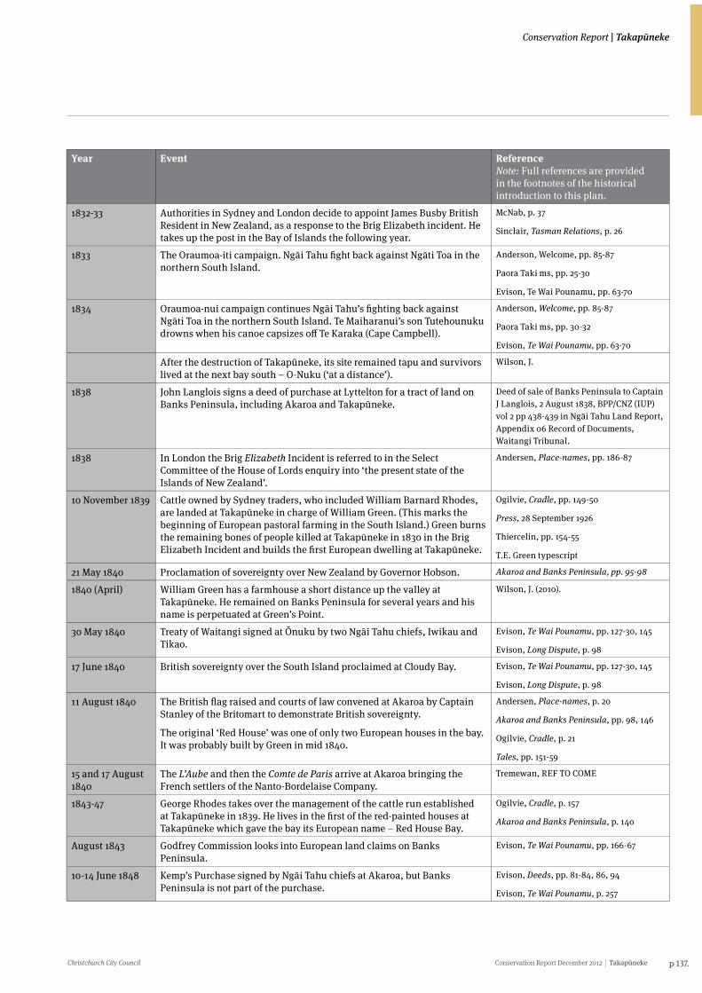
Christchurch City Council Conservation Report December 2012 Takapūneke p 137.
Conservation Report | Takapūneke
Year Event Reference Note: Full references are provided in the footnotes of the historical introduction to this plan.
1832-33 Authorities in Sydney and London decide to appoint James Busby British Resident in New Zealand, as a response to the Brig Elizabeth incident. He takes up the post in the Bay of Islands the following year.
McNab, p. 37
Sinclair, Tasman Relations, p. 26
1833 The Oraumoa-iti campaign. Ngāi Tahu fight back against Ngāti Toa in the northern South Island.
Anderson, Welcome, pp. 85-87
Paora Taki ms, pp. 25-30
Evison, Te Wai Pounamu, pp. 63-70
1834 Oraumoa-nui campaign continues Ngāi Tahu’s fighting back against Ngāti Toa in the northern South Island. Te Maiharanui’s son Tutehounuku drowns when his canoe capsizes off Te Karaka (Cape Campbell).
Anderson, Welcome, pp. 85-87
Paora Taki ms, pp. 30-32
Evison, Te Wai Pounamu, pp. 63-70
After the destruction of Takapūneke, its site remained tapu and survivors lived at the next bay south – O-Nuku (‘at a distance’).
Wilson, J.
1838 John Langlois signs a deed of purchase at Lyttelton for a tract of land on Banks Peninsula, including Akaroa and Takapūneke.
Deed of sale of Banks Peninsula to Captain J Langlois, 2 August 1838, BPP/CNZ (IUP) vol 2 pp 438-439 in Ngāi Tahu Land Report, Appendix 06 Record of Documents, Waitangi Tribunal.
1838 In London the Brig Elizabeth Incident is referred to in the Select Committee of the House of Lords enquiry into ‘the present state of the Islands of New Zealand’.
Andersen, Place-names, pp. 186-87
10 November 1839 Cattle owned by Sydney traders, who included William Barnard Rhodes, are landed at Takapūneke in charge of William Green. (This marks the beginning of European pastoral farming in the South Island.) Green burns the remaining bones of people killed at Takapūneke in 1830 in the Brig Elizabeth Incident and builds the first European dwelling at Takapūneke.
Ogilvie, Cradle, pp. 149-50
Press, 28 September 1926
Thiercelin, pp. 154-55
T.E. Green typescript
21 May 1840 Proclamation of sovereignty over New Zealand by Governor Hobson. Akaroa and Banks Peninsula, pp. 95-98
1840 (April) William Green has a farmhouse a short distance up the valley at Takapūneke. He remained on Banks Peninsula for several years and his name is perpetuated at Green’s Point.
Wilson, J. (2010).
30 May 1840 Treaty of Waitangi signed at Ōnuku by two Ngāi Tahu chiefs, Iwikau and Tikao.
Evison, Te Wai Pounamu, pp. 127-30, 145
Evison, Long Dispute, p. 98
17 June 1840 British sovereignty over the South Island proclaimed at Cloudy Bay. Evison, Te Wai Pounamu, pp. 127-30, 145
Evison, Long Dispute, p. 98
11 August 1840 The British flag raised and courts of law convened at Akaroa by Captain Stanley of the Britomart to demonstrate British sovereignty.
The original ‘Red House’ was one of only two European houses in the bay. It was probably built by Green in mid 1840.
Andersen, Place-names, p. 20
Akaroa and Banks Peninsula, pp. 98, 146
Ogilvie, Cradle, p. 21
Tales, pp. 151-59
15 and 17 August 1840
The L’Aube and then the Comte de Paris arrive at Akaroa bringing the French settlers of the Nanto-Bordelaise Company.
Tremewan, REF TO COME
1843-47 George Rhodes takes over the management of the cattle run established at Takapūneke in 1839. He lives in the first of the red-painted houses at Takapūneke which gave the bay its European name – Red House Bay.
Ogilvie, Cradle, p. 157
Akaroa and Banks Peninsula, p. 140
August 1843 Godfrey Commission looks into European land claims on Banks Peninsula.
Evison, Te Wai Pounamu, pp. 166-67
10-14 June 1848 Kemp’s Purchase signed by Ngāi Tahu chiefs at Akaroa, but Banks Peninsula is not part of the purchase.
Evison, Deeds, pp. 81-84, 86, 94
Evison, Te Wai Pounamu, p. 257
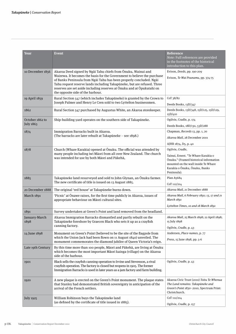
p 138. Takapūneke Conservation Report December 2012 Christchurch City Council
Takapūneke | Conservation Report
Year Event Reference Note: Full references are provided in the footnotes of the historical introduction to this plan.
10 December 1856 Akaroa Deed signed by Ngāi Tahu chiefs from Ōnuku, Wainui and Wairewa. It becomes the basis for the Government to believe the purchase of Banks Peninsula from Ngāi Tahu has been properly concluded. Ngāi Tahu request reserve lands including Takapūneke, but are refused. Three reserves are set aside including reserves at Ōnuku and at Ōpukutahi on the opposite side of the harbour.
Evison, Deeds, pp. 190-209
Evison, Te Wai Pounamu, pp. 374-75
19 April 1859 Rural Section 547 (which includes Takapūneke) is granted by the Crown to Joseph Palmer and Henry Le Cren sold to two Lyttelton businessmen.
CoT 38/82
Deeds Books, 13D/347
1862 Rural Section 547 purchased by Augustus White, an Akaroa storekeeper. Deeds Books, 13D/348, 15D/125, 15D/129, 15D/410
October 1862 to July 1863
Ship-building yard operates on the southern side of Takapūneke. Ogilvie, Cradle, p. 174
Deeds Books, 18D/130, 53D/288
1874 Immigration Barracks built in Akaroa. (The barracks are later rebuilt at Takapūneke – see 1898.)
Chapman, Records 13, pp. 1, 20
Akaroa Mail, 28 December 2001
AJHR 1874, D5, p. 40
1878 Church (Whare Karakia) opened at Ōnuku. The official was attended by many people including iwi Māori from all over New Zealand. The church was intended for use by both Māori and Pākehā,
Ogilvie, Cradle,
Tainui, Ernest. "Te Whare Karakia o Ōnuku." (Framed historical information mounted on the wall inside Te Whare Karakia o Ōnuku, Ōnuku, Banks Peninsula).
1885 Takapūneke land resurveyed and sold to John Glynan, an Ōnuku farmer. The new certificate of title is issued on 13 August 1885.
Plan A5684
CoT 112/214
20 December 1888 The original ‘red house’ at Takapūneke burns down. Akaroa Mail, 21 December 1888
March 1891 ‘Picnic’ at Ōnawe raises, for the first time publicly in Akaroa, issues of appropriate behaviour on Māori cultural sites.
Akaroa Mail, 6 February 1891; 13, 17 and 21 March 1891
Lyttelton Times, 10 and 18 March 1891
1891 Survey undertaken at Green’s Point and land removed from the headland.
January-March 1898
Akaroa Immigration Barracks dismantled and partly rebuilt on the Takapūneke foreshore by Graecen Black who sets it up as a crayfish canning factory.
Akaroa Mail, 25 March 1898; 22 April 1898; 15 July 1898
Ogilvie, Cradle, p. 43
14 June 1898 Monument on Green’s Point (believed to be the site of the flagpole from which the Union Jack had been flown on 11 August 1840) unveiled. The monument commemorates the diamond jubilee of Queen Victoria’s reign.
Andersen, Place-names, p. 77
Press, 15 June 1898, pp. 5-6
Late 19th Century By this time more than 100 people, Māori and Pākehā, are living at Ōnuku which becomes the most important Māori kainga (village) on the Akaroa side of the harbour.
1901 Black sells the crayfish canning operation to Irvine and Stevenson, a rival crayfish operation. The factory is closed but reopens in 1905. The former Immigration Barracks is used in later years as a jam factory and farm building.
Ogilvie, Cradle, p. 43
1920 A new plaque is erected on the Green’s Point monument. The plaque states that Stanley had demonstrated British sovereignty in anticipation of the arrival of the French settlers.
Akaroa Civic Trust (2010) Toitu Te Whenua The Land remains: Takapūneke and Green’s Point 1830–2010, Spectrum Print: Christchurch.
July 1925 William Robinson buys the Takapūneke land (as defined by the certificate of title issued in 1885).
CoT 112/214
Ogilvie, Cradle, p. 157
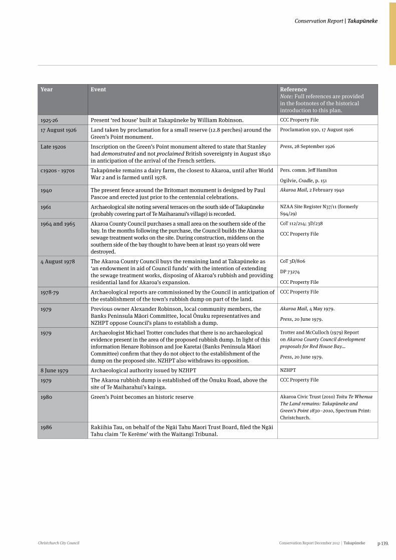
Christchurch City Council Conservation Report December 2012 Takapūneke p 139.
Conservation Report | Takapūneke
Year Event Reference Note: Full references are provided in the footnotes of the historical introduction to this plan.
10 December 1856 Akaroa Deed signed by Ngāi Tahu chiefs from Ōnuku, Wainui and Wairewa. It becomes the basis for the Government to believe the purchase of Banks Peninsula from Ngāi Tahu has been properly concluded. Ngāi Tahu request reserve lands including Takapūneke, but are refused. Three reserves are set aside including reserves at Ōnuku and at Ōpukutahi on the opposite side of the harbour.
Evison, Deeds, pp. 190-209
Evison, Te Wai Pounamu, pp. 374-75
19 April 1859 Rural Section 547 (which includes Takapūneke) is granted by the Crown to Joseph Palmer and Henry Le Cren sold to two Lyttelton businessmen.
CoT 38/82
Deeds Books, 13D/347
1862 Rural Section 547 purchased by Augustus White, an Akaroa storekeeper. Deeds Books, 13D/348, 15D/125, 15D/129, 15D/410
October 1862 to July 1863
Ship-building yard operates on the southern side of Takapūneke. Ogilvie, Cradle, p. 174
Deeds Books, 18D/130, 53D/288
1874 Immigration Barracks built in Akaroa. (The barracks are later rebuilt at Takapūneke – see 1898.)
Chapman, Records 13, pp. 1, 20
Akaroa Mail, 28 December 2001
AJHR 1874, D5, p. 40
1878 Church (Whare Karakia) opened at Ōnuku. The official was attended by many people including iwi Māori from all over New Zealand. The church was intended for use by both Māori and Pākehā,
Ogilvie, Cradle,
Tainui, Ernest. "Te Whare Karakia o Ōnuku." (Framed historical information mounted on the wall inside Te Whare Karakia o Ōnuku, Ōnuku, Banks Peninsula).
1885 Takapūneke land resurveyed and sold to John Glynan, an Ōnuku farmer. The new certificate of title is issued on 13 August 1885.
Plan A5684
CoT 112/214
20 December 1888 The original ‘red house’ at Takapūneke burns down. Akaroa Mail, 21 December 1888
March 1891 ‘Picnic’ at Ōnawe raises, for the first time publicly in Akaroa, issues of appropriate behaviour on Māori cultural sites.
Akaroa Mail, 6 February 1891; 13, 17 and 21 March 1891
Lyttelton Times, 10 and 18 March 1891
1891 Survey undertaken at Green’s Point and land removed from the headland.
January-March 1898
Akaroa Immigration Barracks dismantled and partly rebuilt on the Takapūneke foreshore by Graecen Black who sets it up as a crayfish canning factory.
Akaroa Mail, 25 March 1898; 22 April 1898; 15 July 1898
Ogilvie, Cradle, p. 43
14 June 1898 Monument on Green’s Point (believed to be the site of the flagpole from which the Union Jack had been flown on 11 August 1840) unveiled. The monument commemorates the diamond jubilee of Queen Victoria’s reign.
Andersen, Place-names, p. 77
Press, 15 June 1898, pp. 5-6
Late 19th Century By this time more than 100 people, Māori and Pākehā, are living at Ōnuku which becomes the most important Māori kainga (village) on the Akaroa side of the harbour.
1901 Black sells the crayfish canning operation to Irvine and Stevenson, a rival crayfish operation. The factory is closed but reopens in 1905. The former Immigration Barracks is used in later years as a jam factory and farm building.
Ogilvie, Cradle, p. 43
1920 A new plaque is erected on the Green’s Point monument. The plaque states that Stanley had demonstrated British sovereignty in anticipation of the arrival of the French settlers.
Akaroa Civic Trust (2010) Toitu Te Whenua The Land remains: Takapūneke and Green’s Point 1830–2010, Spectrum Print: Christchurch.
July 1925 William Robinson buys the Takapūneke land (as defined by the certificate of title issued in 1885).
CoT 112/214
Ogilvie, Cradle, p. 157
Year Event Reference Note: Full references are provided in the footnotes of the historical introduction to this plan.
1925-26 Present ‘red house’ built at Takapūneke by William Robinson. CCC Property File
17 August 1926 Land taken by proclamation for a small reserve (12.8 perches) around the Green’s Point monument.
Proclamation 930, 17 August 1926
Late 1920s Inscription on the Green’s Point monument altered to state that Stanley had demonstrated and not proclaimed British sovereignty in August 1840 in anticipation of the arrival of the French settlers.
Press, 28 September 1926
c1920s - 1970s Takapūneke remains a dairy farm, the closest to Akaroa, until after World War 2 and is farmed until 1978.
Pers. comm. Jeff Hamilton
Ogilvie, Cradle, p. 151
1940 The present fence around the Britomart monument is designed by Paul Pascoe and erected just prior to the centennial celebrations.
Akaroa Mail, 2 February 1940
1961 Archaeological site noting several terraces on the south side of Takapūneke (probably covering part of Te Maiharanui’s village) is recorded.
NZAA Site Register N37/11 (formerly S94/29)
1964 and 1965 Akaroa County Council purchases a small area on the southern side of the bay. In the months following the purchase, the Council builds the Akaroa sewage treatment works on the site. During construction, middens on the southern side of the bay thought to have been at least 150 years old were destroyed.
CoT 112/214; 3D/238
CCC Property File
4 August 1978 The Akaroa County Council buys the remaining land at Takapūneke as ‘an endowment in aid of Council funds’ with the intention of extending the sewage treatment works, disposing of Akaroa’s rubbish and providing residential land for Akaroa’s expansion.
CoT 3D/806
DP 73274
CCC Property File
1978-79 Archaeological reports are commissioned by the Council in anticipation of the establishment of the town’s rubbish dump on part of the land.
CCC Property File
1979 Previous owner Alexander Robinson, local community members, the Banks Peninsula Māori Committee, local Ōnuku representatives and NZHPT oppose Council’s plans to establish a dump.
Akaroa Mail, 4 May 1979.
Press, 20 June 1979.
1979 Archaeologist Michael Trotter concludes that there is no archaeological evidence present in the area of the proposed rubbish dump. In light of this information Henare Robinson and Joe Karetai (Banks Peninsula Māori Committee) confirm that they do not object to the establishment of the dump on the proposed site. NZHPT also withdraws its opposition.
Trotter and McCulloch (1979) Report on Akaroa County Council development proposals for Red House Bay…
Press, 20 June 1979.
8 June 1979 Archaeological authority issued by NZHPT NZHPT
1979 The Akaroa rubbish dump is established off the Ōnuku Road, above the site of Te Maiharahui’s kainga.
CCC Property File
1980 Green’s Point becomes an historic reserve Akaroa Civic Trust (2010) Toitu Te Whenua The Land remains: Takapūneke and Green’s Point 1830–2010, Spectrum Print: Christchurch.
1986 Rakiihia Tau, on behalf of the Ngāi Tahu Maori Trust Board, filed the Ngāi Tahu claim 'Te Kerēme' with the Waitangi Tribunal.
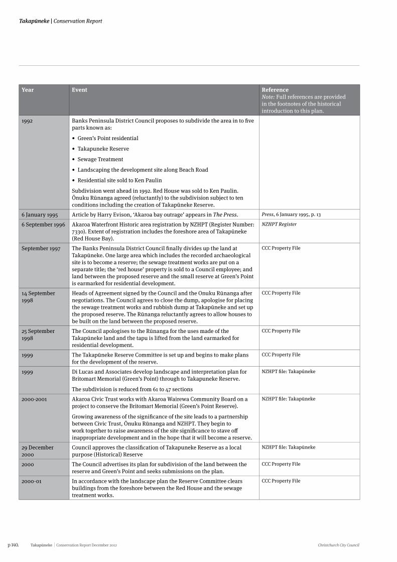
p 140. Takapūneke Conservation Report December 2012 Christchurch City Council
Takapūneke | Conservation Report
Year Event Reference Note: Full references are provided in the footnotes of the historical introduction to this plan.
1992 Banks Peninsula District Council proposes to subdivide the area in to five parts known as:
• Green’sPointresidential
• TakapunekeReserve
• SewageTreatment
• LandscapingthedevelopmentsitealongBeachRoad
• ResidentialsitesoldtoKenPaulin
Subdivision went ahead in 1992. Red House was sold to Ken Paulin. Ōnuku Rūnanga agreed (reluctantly) to the subdivision subject to ten conditions including the creation of Takapūneke Reserve.
6 January 1995 Article by Harry Evison, ‘Akaroa bay outrage’ appears in The Press. Press, 6 January 1995, p. 13
6 September 1996 Akaroa Waterfront Historic area registration by NZHPT (Register Number: 7330). Extent of registration includes the foreshore area of Takapūneke (Red House Bay).
NZHPT Register
September 1997 The Banks Peninsula District Council finally divides up the land at Takapūneke. One large area which includes the recorded archaeological site is to become a reserve; the sewage treatment works are put on a separate title; the ‘red house’ property is sold to a Council employee; and land between the proposed reserve and the small reserve at Green’s Point is earmarked for residential development.
CCC Property File
14 September 1998
Heads of Agreement signed by the Council and the Onuku Rūnanga after negotiations. The Council agrees to close the dump, apologise for placing the sewage treatment works and rubbish dump at Takapūneke and set up the proposed reserve. The Rūnanga reluctantly agrees to allow houses to be built on the land between the proposed reserve.
CCC Property File
25 September 1998
The Council apologises to the Rūnanga for the uses made of the Takapūneke land and the tapu is lifted from the land earmarked for residential development.
CCC Property File
1999 The Takapūneke Reserve Committee is set up and begins to make plans for the development of the reserve.
CCC Property File
1999 Di Lucas and Associates develop landscape and interpretation plan for Britomart Memorial (Green’s Point) through to Takapuneke Reserve.
The subdivision is reduced from 61 to 47 sections
NZHPT file: Takapūneke
2000-2001 Akaroa Civic Trust works with Akaroa Wairewa Community Board on a project to conserve the Britomart Memorial (Green’s Point Reserve).
Growing awareness of the significance of the site leads to a partnership between Civic Trust, Ōnuku Rūnanga and NZHPT. They begin to work together to raise awareness of the site significance to stave off inappropriate development and in the hope that it will become a reserve.
NZHPT file: Takapūneke
29 December 2000
Council approves the classification of Takapuneke Reserve as a local purpose (Historical) Reserve
NZHPT file: Takapūneke
2000 The Council advertises its plan for subdivision of the land between the reserve and Green’s Point and seeks submissions on the plan.
CCC Property File
2000-01 In accordance with the landscape plan the Reserve Committee clears buildings from the foreshore between the Red House and the sewage treatment works.
CCC Property File

Christchurch City Council Conservation Report December 2012 Takapūneke p 141.
Conservation Report | Takapūneke
Year Event Reference Note: Full references are provided in the footnotes of the historical introduction to this plan.
September 2001 The Historic Places Trust writes to the Banks Peninsula District Council about damage to archaeological sites resulting from work undertaken by the Reserve Committee.
Akaroa Mail, 19 April 2002
February 2002 Council opposes the NZHPT proposal for wahi tapu registration of the Green’s Point land and requests that it be limited to the reserve area.
NZHPT file: Takapūneke
28 March 2002 The Takapūneke Reserve is formally gazetted as Local Purpose (Historic Site) Reserve.
CCC Property File
May 2002 The Historic Places Trust registers the entire area, including the area to be subdivided, as wāhi tapu on the application of the Onuku Rūnanga.
NZHPT Register
2002 Conservation plan for Britomart Memorial by conservation architect Ian Bowman.
August 2002 A rahui (restriction that sets aside an area) is placed on Takapūneke because of mounting disagreement and division about the future of the land. The Reserve Committee ceases to function soon afterwards.
CCC Property File
November 2002 Meeting at Onuku Marae chaired by M.P. Ruth Dyson to discuss the future of the land proposed for subdivision.
In November 2002 representatives of the local community, the Historic Places Trust, the Akaroa Civic Trust and the Te Rūnanga o Ōnuku met on Ōnuku Marae. All parties agreed to work towards the land being secured by the central government as a National Historic Reserve and that the Council should be paid a fair market value in compensation.
NZHPT file: Takapūneke
28 November 2003
Chris Carter, Minister of Conservation and Ruth Dyson visit the Britomart Memorial with Onuku Runanga, Akaroa Civic Trust, and NZHPT representatives.
NZHPT file: Takapūneke
2003 Prime Minister Helen Clark writes to the Minister for Conservation to support acquisition of the Green’s Point Land as Historic Reserve.
NZHPT file: Takapūneke
July 2004 Ruth Dyson hosts a meeting to discuss the future of the land and including representation from the Ministry of Arts Culture and Heritage.
NZHPT file: Takapūneke
February 2006 The Banks Peninsula District Council resolves that the existing Britomart and Takapūneke Reserves should be combined with the land that was to have been subdivided to become a single historic reserve, for which national reserve status would be sought.
CCC Property File
December 2007 The Minister of Local Government grants the Christchurch City Council approval to change the endowment purposes for which the land could be used. This clears the way for all the land to become an historic reserve.
CCC Property File
26 May 2008 A Christchurch City Council Hearings Panel holds hearings in Akaroa on the proposal to create a single large historic reserve at Takapūneke. All submitters including Onuku Runanga, Akaroa Civic Trust, NZHPT, Department of Conservation and Te Runanga o Ngai Tahu, are in favour of the proposal
NZHPT file: Takapūneke
16 October 2008 The Christchurch City Council passes a resolution confirming the creation of a single large reserve.
CCC Property File
5 February 2010 Blessing of the land which was to have been subdivided and planting of commemorative trees
Akaroa Mail,
p 142. Takapūneke Conservation Report December 2012 Christchurch City Council
Takapūneke | Conservation Report
16.1 The assessment of the heritage significance of Takapūneke has been undertaken through examination of:
• documentary evidence in archives
• oral Histories and interviews
• site examination of the physical landscape and built and natural heritage
• historical photographic evidence
• secondary sources as noted
The statements under each criterion consider the site as a whole including statements about the built Pākehā heritage.
16.2The methodology and criteria used to undertake the assessment of significance has relied solely on that outlined in the Christchurch City Council’s draft heritage assessment criteria:
• Historical and social significance
• Cultural and spiritual significance
• Architectural and aesthetic significance
• Technological and craftsmanship significance
• Contextual significance
• Archaeological significance
16.2.1 Historical and Social SignificanceHistorical and social values that demonstrate or are associated with: a particular person, group, organisation, institution, event, phase or activity; the continuity and/or change of a phase or activity; social, historical, traditional, economic, political or other patterns.
There is a range of significant Māori and Pākehā values and histories associated with Takapūneke, which make it a site of immense local and national importance.
Takapūneke was the site of a substantial Ngāi Tahu trading settlement of a supreme Rangatira (chief). There too, interactions between a British sea captain, Ngāti Toa and Ngāi Tahu had devastating and far reaching consequences, and contributed significantly to the signing of the Treaty of Waitangi. It is also the site of the demonstration of British sovereignty over the South Island which occurred just before the French were able to fulfil their plans for colonisation.
Takapūneke became an important centre for trade between Ngāi Tahu and Pākehā in the early 19th century. Whalers and other traders visited Akaroa to replenish necessary supplies, especially food. Much of the land was cultivated in farmland and there was trade in timber, food and flax. The kāika at Takapūneke was under the care of the Ngāi Tahu Upoko Ariki, Te Maiharanui, hereditary spiritual leader of Ngāi Tahu, was regarded with the greatest
16. Heritage significance assessment
respect. By 1830 Takapūneke had become the site of a bustling cosmopolitan trading kāika, an important centre for trade in flax, much in demand by British shipping. In 1830 a tragedy unfolded at Takapūneke that devastated the Ngāi Tahu people of Akaroa Harbour and rendered the once thriving trading centre of Te Maiharanui a wāhi tapu.
As a result of the Brig Elizabeth incident and subsequent events leading to the devastation of the people who lived there in 1830 Takapūneke became one of Aotearoa’s most sacred sites, in particular because of the tūpuna who once lived there. Following the 1830 massacre and fall of Ōnawe in 1832, local Ngāi Tahu never lived at Takapūneke again. They regarded the bay of Takapūneke as tapu because of the deaths that occurred there.1 Ngāi Tahu of Akaroa established a settlement at Ōnuku, the next bay south of Takapūneke.
Because of the events that occurred at Takapūneke, the 1830s represent a significant point in New Zealand history, providing the impetus for British intervention in New Zealand that ultimately led to the Treaty of Waitangi. As a result of the Elizabeth incident, James Busby was appointed in 1832 to the position of British Resident of New Zealand and arrived in the Bay of Islands in 1833. This set in motion the series of events that culminated in the signing of The Treaty of Waitangi in 1840. In 1840 the northern point of the bay of Takapūneke (Green’s Point) was the site of another significant incident in New Zealand’s history: the first effective demonstration of British sovereignty with the raising of the flag and holding of a court of law. The event is commemorated by the Britomart Monument.
The Britomart monument and site are associated with Captain Owen Stanley of HMS Britomart who raised the Union Jack on or near the site in 1840, an action that was intended to demonstrate British sovereignty in New Zealand was also a demonstration aimed at the French and intended to thwart any ambitions they may have had to colonise Banks Peninsula. The monument itself was created to celebrate Queen Victoria’s diamond jubilee and was unveiled in the presence of a company of dignitaries on 14 June 1898.
In November 1839 cattle were landed at Takapūneke, marking the beginning of the South Island’s history of pastoral farming. William Green and his wife Mary Ann signed a contract for two years with Cooper, Holt and Rhodes of Sydney to travel to New Zealand with Rhodes and erect buildings and run cattle on the land which the partners claimed they owned after purchasing a Captain Leathart’s deed.
A number of landscape features at Takapūneke were likely to have been instrumental in William Rhodes choosing Takapūneke as a place to establish his cattle station. A band of more or less open country which extended from Takapūneke to Flea Bay would have provided good pasture for cattle, having been cleared of native forest cover by early Māori. Takapūneke was also known to provide good holding for the anchors of sailing ships and the depth of water would have allowed them to come close into land.
As a dairy farm, Takapūneke contributed to one of the most important industries in New Zealand during the late 19th and early 20th centuries and was certainly the main farming activity
1 Conservation Report Brief 2010 p.12.
Christchurch City Council Conservation Report December 2012 Takapūneke p 143.
Conservation Report | Takapūneke
on Banks Peninsula between 1910 and 1930. George Rhodes took over from Green in 1843 and built a house there. The locality was known as Red House Bay. Use of Takapūneke as a small farm holding, typical of many others within Akaroa Harbour, would continue for over 150 years. Other activities such as the later quarantine station for Akaroa, a meat works, rubbish dump and a sewage plant took place over that time.
The Red House and its site are also associated with William Green. According to research to date it is though that Green’s original house was constructed in 1840 though its exact location is not clear. The current house is associated with William Robinson for whom it was constructed in the 1920s. Robinson and his descendants would own the property until 1978 when it was purchased by the Akaroa County Council.
Also on the site adjacent to the Red House are the former Immigration Barracks. William Rolleston, then Superintendent of Canterbury, had lobbied the Vogel government for funds for its construction. Vogel, who was also Minister of Immigration, immediately authorised its construction for the families and individuals who arrived as immigrants in Akaroa in the 1870s. Graecen Black later relocated it to its present site in 1898 and used it as a crayfish canning factory. Black sold it to Irvine and Stevenson who briefly also operated it as a crayfish factory. The building is associated with later families including the Glynans and Robinsons who farmed the land.
Akaroa County Council purchased land at Takapūneke in the 1960s and established a rubbish dump and sewage treatment plant there. In the 1990s the Council was prompted to revise its long term plans for residential development in the bay when the cultural significance of the site was brought to public attention. Significant advocacy work by Ōnuku Rūnanga, the Akaroa Civic Trust, New Zealand Historic Places Trust and numerous other agencies and individuals followed. In 2002 Takapūneke became the first site in the South Island to be registered as a wāhi tapu area, and in 2008 was formally protected as an historic reserve by Christchurch City Council.
16.2.2 Cultural and spiritual significanceCultural and spiritual values that demonstrate or are associated with the distinctive characteristics of a way of life, philosophy, tradition, religion, or other belief, including: the symbolic or commemorative value of the place; significance to Tāngata Whenua; and/or associations with an identifiable group and esteemed by this group for its cultural values.
Takapūneke is a unique cultural and spiritual landscape of local and national significance and has layers of Māori and Pākehā history within its cultural and spiritual heritage values. It is one of the most revered and sacred sites, because of the tūpuna who once lived and died there, and in particular because of the Brig Elizabeth incident and subsequent events that witnessed the devastation of the people who lived there in 1830. Since 1830 Ngāi Tahu people have considered the bay of Takapūneke tapu on account of the deaths that occurred there.
“What we were told was that we were not to go round there. It was not a place for us because something bad had happened there. I never did go round. None of us did in my era,” (Bernice Tainui, personal communication, 31 August 2010).
The first formal intervention by Britain in New Zealand, an act that had enormous cultural and spiritual implications for generations to come, was an immediate and direct outcome of the brig Elizabeth incident. That intervention led in turn, though a series of events between 1833 and 1840, to the despatch of Hobson to New Zealand and the signing of the Treaty of Waitangi.
“I think it’s a credit to all those who have assisted and most of all I think that it’s very appropriate and very satisfying that this magnificent site is to recognised as of national significance alongside the Waitangi Treaty Grounds,” (Interview with Harry Evison by Helen Brown. 21 October 2009).
Today, Takapūneke is acknowledged by Ngāi Tahu with great sorrow for this past devastation, and the protection of the land has been of paramount importance for the local people at Ōnuku and Wairewa Rūnanga for many years.
Within the Takapūneke site, the built structures reflect the later cultural values of European settlement. For many early settlers in Canterbury, farming was their way of life and they bought with them animals and crops to pursue their chosen occupation. Banks Peninsula was a well-established farming area located close to Christchurch. Although the Red House was constructed in the 1920s, it, along with its surrounds, represents the way farming families lived on Banks Peninsula during the first half of the twentieth century. The outbuildings, including the Immigration Barracks, are an important aspect of the site and also contribute to an understanding as to how people lived on the property.
The former Immigration Barracks building has cultural values in that it demonstrates a former way of life. New immigrants and their families arrived at a port of entry in New Zealand, often without accommodation arranged. The first few months of their life in the country would be spent in the barracks while they arranged for more permanent accommodation or until they relocated away from the port. The former barracks also demonstrates a common cultural occurrence in New Zealand whereby a building that was no longer required for its original purpose would be relocated and adapted for a new use.
While it is unclear where exactly at Takapūneke that Captain Stanley raised the British flag in 1840, this act to demonstrate British sovereignty in New Zealand is a significant part of the cultural heritage of New Zealand. The monument erected at Green’s Point in 1898 to acknowledge this act and to commemorate 60 years of Queen Victoria’s reign, served to remind European settlers of their connection to Britain. The gazetting of the land around the monument in 1926 as an historic reserve further illustrated the civic pride and recognition which was held by Akaroa County’s residents for this site.
The siting of the monument on the northern headland has ensured that the monument is a powerful visual feature in the landscape. It now acts as a repository of cultural memory for the ancestors of European settlers.
p 144. Takapūneke Conservation Report December 2012 Christchurch City Council
Takapūneke | Conservation Report
16.2.3 Architectural and aesthetic significanceArchitectural and aesthetic values that demonstrate or are associated with design values, form, scale, colour, texture and material of the place.
The dominant landscape feature is the underlying volcanic landform, made obvious as the original land cover has been modified since Māori and European settlement. The clearing of original native forest cover has exposed the volcanic nature of the local landform, revealing ridgelines and headlands. The headlands north and south of Takapūneke between the ridge and the coast define the catchment of Takapūneke and provide a natural boundary to its landscape.
Aesthetically, the sense of enclosure within these headlands is accentuated by the views into Akaroa Harbour. The Banks Peninsula Landscape Study (2007) has identified Takapūneke as a Visual Amenity Landscape, noting natural science and expressiveness values such as the visibility of the “distinctive outcrops of the Akaroa volcanics [which] clearly punctuate the ridgeline”.2 These outcrops have been identified as important local features. Transient visual effects such as the fleeting clouds that come and go around Tuhiraki are also significant, as are those intangible qualities that affect people’s senses such as the sound of waves lapping on the beach and wind in the trees.
Views extend from Takapūneke across the harbour to small rural holdings and their associated dwellings. These dwellings are nestled among vegetated areas and as with the Immigration Barracks at Takapūneke, are part of the character of the harbour basin. They accentuate the pastoral associations that descendents of European settlers have had with this landscape since their arrival in Akaroa Harbour.
Relatively few houses were constructed in Akaroa between the wars and hence few examples can be found of the popular Californian bungalow style. The Red House is a good example of this architectural style in Akaroa. Although some modifications have taken place, the Red House remains readily recognisable as a bungalow. Typical Californian bungalow details include the shallow pitched gable roofs, exposed rafters at the eaves, timber shingles in the gable ends and bay windows with leadlight sashes.
The Red House has high aesthetic values deriving from its physical appearance. The entire house including walls, roofs and joinery is painted red, making it distinctive and unique.
Adjacent to the Red House is the Immigration Barracks building considered the most intact example remaining in New Zealand. In its original form, the barracks was a simple vernacular building from the colonial era. It featured gable roofs and small windows and was an economical way of providing the required space. Although it has similarities of form with other nineteenth century barracks with its gable roofs, small windows and weather-boarded walls, in its original form, at least, it also had important differences. In particular, the building had a more residential
appearance, achieved by the provision of multiple gables and secondary wings.
Although its original form was partly lost when it was relocated and it was converted into an industrial building, evidence of its original form can still be seen.
Situated at the northern end of the Takapūneke site is the Britomart Monument. It was designed by noted architect Samuel Farr and executed by stonemason, James Tait in an obelisk form. The obelisk form originated in ancient Egypt where free-standing obelisks were found at the entrance to temples. It is a form that has become associated with notions of timelessness and was subsequently adapted and used throughout the world for monuments commemorating significant events thus the obelisk at Green’s Point is an appropriate architectural form for a monument commemorating an act of British sovereignty and commemorating Queen Victoria’s Jubilee.
16.2.4 Technological and craftsmanship significanceTechnological and craftsmanship values that demonstrate or are associated with: the nature and use of materials, finishes and/or technological or constructional methods which were innovative, or of notable quality for the period.
Local tōtara was used for fence posts due to its durability. “…If milled in winter when the sap is low, [tōtara] lasts a century or more in the ground.”3 A line of tōtara fence posts remain within the northern headland and scattered around the boundary of the Takapūneke site. The longevity of tōtara as a material for fence posts is evident at Takapūneke as posts installed during the early farming period can still be seen within the existing boundary fences and also as individual posts within grazed paddocks. It is unknown when the stock water trough was added to the site, however the timber bridge is a relatively recent construction, located as part of the proposed reserve approaches implementation which began in 2001, but was halted due to concerns of the New Zealand Historic Places Trust.
The Red House provides the opportunity to observe construction techniques and materials in use during the bungalow period during the first half of the twentieth century. Construction techniques of interest include its timber framing, wall cladding and window joinery. Materials of interest include the timber shingles used as cladding in the gable ends, the leadlight glazing and brick walls to the original entry steps. In contrast the adjacent Immigration Barracks is able to demonstrate construction techniques that were in use during the nineteenth century.
Of particular interest in the barracks is the one surviving original window, the steel tie rod and other original fabric such as weatherboards. The internal tongue and groove lining is also of interest, particularly the stamped inscription, the origin of which is currently unknown.
The Britomart Monument is a good example of the use of Port
2 Banks Peninsula Landscape Study (2007) p. 144.3 Ogilvie, G. (1992).
Christchurch City Council Conservation Report December 2012 Takapūneke p 145.
Conservation Report | Takapūneke
Chalmers breccia being used to construct a memorial. It also demonstrates the stonemason’s craft as seen in the working of the stone to form the monument and the inscription describing its unveiling. The weight of the stone would have created challenges first to get it to the site from the quarry, and then to erect it on its base. The monument provides information about construction techniques of the period with respect to erecting a large memorial such as this on a plastered concrete base.
16.2.5 Contextual significanceContextual values that demonstrate or are associated with: a relationship to the environment (constructed and natural) setting, a group, precinct or streetscape; a degree of consistency in terms of scale, form, materials, texture, colour, style and/or detailing in relationship to the environment (constructed and natural), setting, a group, precinct or streetscape; a physical or visible landmark; a contribution to the character of the environment (constructed and natural) setting, a group, precinct or streetscape.
Numerous significant events are associated with sites and landmarks within Akaroa Harbour. Takapūneke is one such site, related to other places within the harbour that are within sight of one another and where associated historic events occurred. As Janet Stephenson notes: “The landscape comprising Takapūneke, Ōnawe, Green’s Point and Ōnuku is unique in that within these places, linked by Akaroa Harbour, we are able to see the story of the evolving relationship between Māori and European, culminating in the signing of the Treaty and the declaration of British sovereignty.”4 These sites have significance as part of a story that has “a collective importance…greater than their sum.”5
The cultural significance of Takapūneke is accentuated within its wider physical context, as part of a heritage landscape and so the visual connections between these sites should be maintained. The vegetation pattern within Takapūneke is typical of other bays and valleys within Akaroa Harbour. These characteristics include patches of bush which extend down the gullies and contrast with the grazed spurs.
The built elements within the context of the landscape are a physical or visible landmark that through the passage of time have become a contribution to the character of the environment. The Britomart Monument is closely associated with its environment and contributes to the character of the area. The setting of the monument, including the surrounding fence, makes an important contribution to its heritage values.
“When you stand at the Britomart Memorial and you look at the landscape you can see that it’s largely unmodified and it’s been that way since 1830. There’s a house and a waste treatment plant unfortunately plus a rubbish tip at the top but even at that you can still stand at the Britomart Memorial and view this landscape which is magnificent in its own way. It tells a very tragic
4 Janet Stephenson (2004).5 Stephenson, J. (2010) p. 165.
story but it is the story of the founding of New Zealand and that is something that is worthy of preservation,” (Interview with Victoria Andrews by Helen Brown. 22 December 2009).
The Red House was constructed in the 1920s and remains on its original site. The house also relates well to its site and the wider landscape through the use of natural materials such as timber weatherboards and joinery. The outbuildings and site elements, such as retaining walls and steps, are an important aspect of the setting. The former Immigration Barracks forms part of the group of European structures readily seen from Akaroa harbour and it has been visible on the foreshore at Takapūneke since it was relocated there around the turn of the twentieth century. The barracks and the macrocarpa trees behind provide a backdrop to the building. Together they form a composition that is a well-known landmark in the area. With the Red House it is a notable element within an important cultural landscape and makes a significant contribution to the historic character of its setting.
16.2.6 Archaeological significanceArchaeological values that demonstrate or are associated with: potential to provide archaeological information through physical evidence; an understanding about social historical, cultural, spiritual, technological or other values or past events, activities, people or phases.
The archaeological features and remains documented at Takapūneke are similar to many other sites of occupation throughout the country. However, one of the main features of the site, the shell midden, has been destroyed and only minor amounts of other archaeological material have been identified to date. While that material could be analysed to a limited extent to provide some information about the historic occupation of Takapūneke, it would not provide the comparative data that advances national or regional research questions. As there has been little archaeological research carried out in the wider Akaroa area, this lack of information increases the comparative value of any archaeological information from Takapūneke.
However, the potential for archaeological remains extends well beyond what is known to be present on the site. The presence of even limited features and remains, in combination with historic documentation of occupation, indicates far more material is present sub-surface. That potential should not be realised, as the cultural values far outweigh the archaeological. The buildings and structures on the site at Takapūneke can be considered archaeological features as there is potential through archaeological techniques, specifically ‘buildings archaeology’, to provide information regarding past uses and activities at Takapūneke.
The Britomart Memorial, the former Immigration Barracks and possibly some of the outbuildings surrounding the Red
p 146. Takapūneke Conservation Report December 2012 Christchurch City Council
Takapūneke | Conservation Report
House date prior to 1900 and therefore meet the definition of an ‘archaeological site’ as defined by the Historic Places Act. The former Immigration Barracks in particular has had many changes in use, many of which can be identified through physical changes to the building, and therefore has the most potential to provide information about activities, people and phases of occupation at Takapūneke.
16.2.7 Overall summary of significance
“I remember I gave a speech and there were quite a crowd there. I was standing on the plinth of that monument [Britomart] and there was cloud down on Tuhiraki and I told them the story and the fact that it was high time that this whole area was a national site. And at that point, the cloud lifted on Tuhiraki. So I said to them, the cloud’s lifted on Tuhiraki so we might get somewhere,” (Interview with Harry Evison by Helen Brown.
21 October 2009).
Ngāi Tahu and their tūpuna from earlier tribes – Kāti Māmoe and Waitaha – have settled, travelled and held traditional authority over an area that encompasses most of the South Island (Te Waipounamu). The area of Akaroa, the harbour, surrounding hills and the outer bays, were also strongholds for Ngāi Tahu and earlier iwi. There remains today a strongly held connection between the Ngāi Tahu whānau and hapū with the land, harbour, waters and taonga of the area.
Takapūneke became an important centre for trade between Ngāi Tahu and Pākehā in the early 19th century. Whalers and other traders visited Akaroa to replenish necessary supplies, especially food. Much of the land was cultivated in farmland and there was trade in timber, food and flax. The kāika at Takapūneke was under the care of the Ngāi Tahu Upoko Ariki, Te Maiharanui. Te Maiharanui was the hereditary spiritual leader of Ngāi Tahu, and was regarded with the greatest respect.
After the 1830 massacre local Ngāi Tahu never lived again at Takapūneke and stayed away from the bay. This reluctance to live on the site of a massacre or even visit the bay persisted throughout the 20th century. After the sacking of Takapūneke in 1830 and the fall of Ōnawe in 1832, the surviving Ngāi Tahu of Akaroa reoccupied an established settlement at Ōnuku, the next bay south of Takapūneke.
This set in motion the series of events that culminated in the signing of The Treaty of Waitangi in 1840. The northern point of the bay of Takapūneke (Green’s Point) in 1840 was the site of another significant incident in New Zealand’s history: the first effective demonstration of British sovereignty with the raising of the flag and holding of a court of law. The event is commemorated by the Britomart Memorial.
There had almost certainly been a village of some sort at Ōnuku before 1830.6 Under the Akaroa Deed of Purchase of 1856 three
native reserves were established, including one at Ōnuku. At the start of the 20th century local Ngāi Tahu families were primarily living at Ōnuku and in Akaroa. Although the Native Reserve was established at Ōnuku, not all local Ngāi Tahu families were allowed to live at Ōnuku because of the local Council’s zoning regulations. Instead some local Ngāi Tahu families had to live in Akaroa, which is still very upsetting for local Ngāi Tahu.
“We wanted to build a house out at Ōnuku and the Council would not allow us. We had to go to Akaroa and that’s what we did. And Mum and Dad weren’t allowed to build out here either. I hated not being allowed to live out here and it was the Council that told us,”
(Bernice Tainui, personal communication, 31 August 2010).
Over time European settlement has brought changes to the landscape. From 1839 the area was farmed and with that came associated buildings. Today the Red House and its outbuildings, which stand on the site of earlier buildings, has since the 1920s been associated with farming activities since the 1920s and as such are the tangible reminder of a previous way of life, on Banks Peninsula, particularly in the early years of the twentieth century. Equally the former Immigration Barracks has cultural values in that it demonstrates a former way of life. New immigrants and their families arrived at a port of entry in New Zealand, often without accommodation arranged and often the first few months of their life in the country would be spent in the barracks until they were able to relocate.
Although the land at Takapūneke moved from Māori ownership, the significance of Takapūneke was remembered and respected by the local Ngāi Tahu people. Local kaumātua ensured that the younger Ngāi Tahu generations of Ōnuku and Akaroa treated Takapūneke with respect. Takapūneke is a unique cultural and spiritual landscape of national significance and has layers of Māori and Pākehā history within its cultural and spiritual heritage values. It is one of Aotearoa’s most revered and sacred sites.
The cultural heritage significance of Takapūneke is accentuated within its wider physical context, as part of a special and significant cultural and spiritual heritage landscape, thus, kaitiakitanga by the tāngata whenua is of particular importance for Takapūneke. As noted earlier the specific landscape features are unique in that within these places, linked by Akaroa Harbour, are held the tangible and intangible histories, objects and places through which we are able to gather together the threads of history, past and present, that tell of the evolving relationship between Māori and European.
This landscape and its associated tangible and intangible cultural heritage values are unequivocally of national and international significance.
6 P. Tremewan, (199) French Akaroa p.14. The French naval commander Lavaud in 1841 recorded hearing from an old chief at ‘Onoukou’ that he had gone aboard an English schooner that had called at Ōnuku 50 years earlier.
Christchurch City Council Conservation Report December 2012 Takapūneke p 147.
Conservation Report | Takapūneke
The purpose of this Conservation Report is to establish a guide with principles and policies which take account of all relevant constraints and requirements, including legislation and regulatory matters, which affect the site as outlined in Section 3. This Conservation Report will inform and guide the heritage considerations of the Reserve Management Plan for Takapūneke.
Following on from the assessment and statements of significance, and taking into account statutory requirements, these general principles and policies have been developed from an understanding of the site’s cultural and social history, its cultural and spiritual significance, and its architectural, contextual and technological significance. In saying this, it has been well documented throughout this Conservation Report that through its layers of Māori and Pākehā history and cultural heritage values, Takapūneke is a unique cultural landscape of national and international significance
These general principles and the policy statements have taken careful regard of this and the principles and policies have been developed in consultation with Ōnuku Rūnanga, Mahaanui Kurataiao Ltd and the project steering group. The principles and policies in this section should guide the conservation of the site, its future use and any proposed change.
17. Principles:
17.1. Key principle: As a general principle do as much as necessary, and as little as possible in order to maintain the site without diminishing the tangible and intangible heritage fabric and values.
17.2. To take into account the principles of Te Tiriti o Waitangi, including to work in partnership with Ngāi Tahu through Ōnuku Rūnanga, in achieving the sustainable management of natural and physical resources.
17.3. That a copy of this building Conservation Report be placed with Ngāi Tahu, through Te Rūnanga o Ōnuku, the New Zealand Historic Places Trust and appropriate units of the Christchurch City Council to assist any decision making for Takapūneke. The Conservation Report should also be available for public inspection and scrutiny.
17. Conservation principles and policies: introduction
17.4. That this Conservation Report be reviewed approximately every five years to ensure that its principles and policies effectively guide the conservation management of Takapūneke.
No Conservation Report should ever be considered to be a final or completed document. The Conservation Report for Takapūneke and, in particular, the conservation policies, should be reviewed from time to time, for example, every five years. It should also be able to be revised and amended to incorporate new information.
17.5. That all decisions affecting Takapūneke are informed by sound conservation practice and principles including those outlined in the ICOMOS NZ Charter (2010). (Appendix three).
Any work on all elements of the site should be undertaken with care. In particular all elements identified in this plan as having heritage significance should be carried out using only conservation professionals or trades people experienced in working in that particular area. With respect to the built heritage, any replacement of fabric should only be undertaken where it has ceased to function properly or is considered structurally unsound and should be replaced on a like for like basis. Any landscape work and planting should not diminish heritage values. Any new planting should be clearly identified as being new work and not detract from existing heritage features.
17.6. That any unnecessary ground disturbance is avoided in areas where archaeological remains are recorded or suspected.
Where ground disturbance cannot be avoided the legal requirements of the Historic Places Act 1993 apply. The Act states that it is not lawful for any person to destroy, damage, or modify, or cause to be destroyed, damaged, or modified, the whole or any part of any archaeological site (any place in new Zealand that was associated with human activity that occurred before 1900 and is or may be able through investigation by archaeological methods to provide evidence relating to the history of New Zealand) without an archaeological authority from the Trust. (see Legislation 3.4.3.)
17.7. That any future change or development must have regard to the heritage matters within the District Plan and the matters for heritage protection under the RMA
p 148. Takapūneke Conservation Report December 2012 Christchurch City Council
Takapūneke | Conservation Report
18. Policies
18.1 KaitiakitangaRecognition of the special relationship, responsibilities and guardianship role of the tangata whenua with regard to Takapūneke.
Explanation
Kaitiakitanga is the exercise of guardianship by tangata whenua of an area in accordance with tīkanga Māori (Māori customary values and practices) in relation to natural and physical resources. The Treaty of Waitangi recognises and guarantees the protection of tino rangatiratanga (sovereignty) and empowers kaitiakitanga as a customary practice exercised by tangata whenua over their taonga, such as sacred and traditional places, built heritage, traditional practices and cultural heritage resources. Kaitiakitanga is in some ways similar to the concept of stewardship where people are the guardians and protectors of places, objects and ideas of value to them.
Recommendations
All matters relating to Takapūneke must
• give effect to the principles of the Treaty of Waitangi
• Ensure the mana of Ngāi Tahu is upheld through acknowledgement of Ngāi Tahu as manawhenua and kaitiaki through a formal agreement between Christchurch City Council and Te Rūnanga o Ōnuku for the ongoing management and use of Takapūneke.
• Ensure that Te Rūnanga o Ōnuku is appropriately involved in the preparation of any further management plans for Takapūneke (i.e. Reserve Management Plan, Interpretation Plan, Archaeological Management Plan, Planting Plan) through an appointed iwi representative on Committee or otherwise.
18.2 Cultural and spiritual significanceRecognition and protection of the cultural and spiritual significance of Takapūneke to Ngāi Tahu through partnership with Te Rūnanga o Ōnuku and to the wider community through ongoing engagement and consultation.
Explanation
Takapūneke is acknowledged by Ngāi Tahu today with great sorrow for past devastation and loss. Protection of the land is of paramount importance. It is crucial there is recognition and protection of wāhi tapu, and the other Ngāi Tahu cultural and spiritual values of Takapūneke, as the primary values of the site. The site has considerable historical significance to the wider community through its tangible and intangible European heritage. It is important that the Council works in partnership with Te Rūnanga o Ōnuku and liaises with key stakeholders and the wider community to ensure the cultural heritage values of Takapūneke are safeguarded.
Recommendations
1. Enable active participation of Te Rūnanga o Ōnuku and community representatives in reserve management and public use decisions.
2. Recognise and support Ngāi Tahu tikanga and kawa for events and ceremonies.
3. Work with Te Rūnanga o Ōnuku and the wider community to recognise, respect and research tangible and intangible heritage fabric and values.
18.3 Heritage documentation and interpretation Develop a heritage documentation and interpretation plan for off-site and on-site interpretation of the Māori and Pākehā history of Takapūneke.
Explanation
Interpretation for this reserve should include both the Māori and Pākehā history. Development of an interpretation plan is recommended to provide for better understanding of the area’s significance and connection to features in the surrounding cultural heritage landscape.
Recommendations
4. That an interpretation plan is developed for the reserve in conjunction with Te Rūnanga o Ōnuku. Interpretation should be developed in a manner that strongly reflects the cultural and spiritual significance to Ngāi Tahu and the local Ōnuku people and describes the history of the site and promotes an appreciation of its wāhi tapu and wider historical significance.
5. Ensure installations, for example information panels, structures and signage reflect the significant tāngata whenua and European heritage of Takapūneke and do not conflict with the cultural and spiritual values identified by Ngāi Tahu and the wider community. Te Rūnanga o Ōnuku will be the primary leader for, and decision-maker on matters regarding Ngāi Tahu cultural heritage. .
6. All interpretation should seek to support an inter-generational understanding within Ngāi Tahu of the history and importance of Takapūneke.
7. Interpretation should use bilingual signage and appropriate Māori names for signage.
Christchurch City Council Conservation Report December 2012 Takapūneke p 149.
Conservation Report | Takapūneke
7 (2010) p. 43
18.4 Education, surveys and research Foster public and community understanding of Takapūneke and the cultural and spiritual values held by Ngāi Tahu for Takapūneke through education, surveys and research.
Explanation
Developing a culturally appropriate public education programme for Takapūneke is vitally important to ensure public and community understanding of the area. Education strategies should address matters such as cultural significance, history and values, and include a programme for events to foster education and information sharing.
A wealth of information and records reflect the history and significance of Takapūneke. It is recommended that a comprehensive study is undertaken to gather and record the oral history and traditions held by Ngāi Tahu and members of the local community. This will ensure that the significance and values ascribed to the area by the local community is retained for posterity.
Recommendations
8. Prepare culturally appropriate on-site and off-site public information, programmes and events, e.g. on-site interpretations and installations, brochures and web content on the history and values of Takapūneke.
9. Offsite documentation and interpretation should include consideration of the development of educational resources; archives development (oral histories, film, photographs, publications), and an inventory of taonga with provenance to Takapūneke);
10. Ensure support for Te Rūnanga o Ōnuku to enable a tāngata whenua role in information sharing on Takapūneke and appropriate Te Rūnanga o Ōnuku involvement in information and education programmes.
18.5 Visitor management and site accessPolicy
Develop and implement a visitor management plan and implement a site access plan to ensure appropriate activities take place on site.
Explanation
Takapūneke will become accessible to the public. Visitor access at Takapūneke should be controlled by restricting access to certain areas and establishing a series of guided walking tracks that will lead visitors through the Historic Reserve in appropriate areas. This action will safeguard specific cultural and spiritual values to Ngāi Tahu and the wider community and help protect archaeological sites.
However, in keeping with the Christchurch City Council draft Public Open Space Strategy,7 and as part of the wider context within the harbour basin and of walkways within the area, it is
also appropriate to allow public access into the site, respecting the meaning the site has for tāngata whenua and their aspirations for its future. The Christchurch City Council has developed a policy initiative in the Akaroa section of the draft Public Open Space Strategy which includes “…develop[ing] access onto appropriate parts of Takapūneke in consultation with Te Rūnanga ō Ōnuku and New Zealand Historic Places Trust and in keeping with the conservation and reserve management plans.”
Recommendations
11. Activities and access, events and ceremonies planned for Takapūneke should be managed to avoid the potential for conflict with Ngāi Tahu tikanga, kawa and values.
12. Activities and access to the reserve should be managed through the provision of adequate signage.
Develop well-defined, simple and robust pathways to safeguard visitors from accessing areas of specific cultural and archaeological sensitivity and where the landform may be unstable or pose health and safety issues.
18.6 Setting Recognise the significant broader cultural landscape that Takapūneke sits within.
Explanation
It is important that the Takapūneke Reserve area is not considered in isolation but that all proposed change is considered within the wider context of Akaroa basin. View shafts to identified cultural sites of significance must be protected. Takapūneke is linked to many other culturally significant sites in the Akaroa Harbour, such as Tuhiraki (Mount Bossu), Ōpukutahi, Wainui and Ōnawe Peninsula. The visual links between Takapūneke and other culturally significant features within Akaroa harbour provide a greater appreciation of the significance of Takapūneke in a wider context of Akaroa.
Recommendations
13. Future use of Takapūneke would be enhanced by the preparation of a landscape master plan that considers both Māori and Pākehā values within the wider context of Akaroa Harbour.
14. Ensure protection of view shafts to places of cultural significance within Akaroa and taking account of the impact of land use changes and structures on this cultural landscape and Takapūneke.
15. Provide appropriate buffers from existing activities and future development around Takapūneke, with appropriate conditions to be agreed with Te Rūnanga o Ōnuku e.g. land use and land use changes on neighbouring properties, roadways and walkways.
16. Views and interpretation from pathways and access points connecting reserve features to the wider landscape should be provided for.
17. Zoning or District Plan changes, applications for resource consents/concessions should include an adequate assessment of visual impacts.
p 150. Takapūneke Conservation Report December 2012 Christchurch City Council
Takapūneke | Conservation Report
18.7 Landscape and ecologyProtect, conserve and/or restore the natural heritage and ecology of Takapūneke.
Explanation
It is appropriate to retain significant elements of past use and practices that have occurred at Takapūneke to allow the associations people have with the landscape to continue. This may include the removal or appropriate management of intrusive vegetation, restoration of indigenous plant species balanced with the retention of grazed areas. However, the future management of the Takapūneke landscape should enable the introduction of new landscape elements in a form that does not detract from its spiritual and cultural heritage values.
All new plantings should be part of re-vegetation initiatives as outlined in the Banks Peninsula Biodiversity Concept Plan.
“The concept recognises the existence of strategically located clusters of remnant or second growth vegetation that provide core habitat for indigenous invertebrates, birds and lizards and the potential to create greater habitat links between these remnants, especially for organisms that are unable to move across large expanses of highly modified landscape.”8
Recommendations
1. Develop a vegetation plan within the overarching landscape master plan to protect and manage existing vegetation and to restore native vegetation in appropriate areas, while protecting spiritual and cultural heritage values. This plan should include guidance on the management or removal of existing vegetation/weeds, management of grassed areas, and use of endemic native species and species that are recognised for their mahinga kai values where appropriate.
2. All seeds and plants should be ecologically sourced from within the Akaroa Ecological District and links established with native forest cover in adjacent properties.
3. Develop culturally appropriate plans to protect and manage the stream and wetland areas of Takapūneke Reserve and any existing memorial trees or new plantings at Takapūneke,
4. Advocate for the protection and appropriate management of the wider area, including the foreshore and coastal waters, and in the planning context for buffer zones, protection and management of upper catchment and the foreshore of the broader Takapūneke area.
8 Christchurch City Council Biodiversity Strategy 2008-2035, p. 25.
18.8 ArchaeologyTo protect and conserve the archaeological heritage values of Takapūneke.
Explanation
Because of the high cultural significance of Takapūneke, the protection of heritage values should take precedence over amenity values. Any earthworks planned at Takapūneke will require consultation with the New Zealand Historic Places Trust, as the heritage agency with responsibility for managing archaeology.
This should take place early in any planning process and specific plans be discussed with the Archaeologist and Pouārahi/Māori Heritage Adviser to determine whether an authority under the Historic Places Act is required. Consultation with Te Rūnanga o Ōnuku is also required as part of this statutory process.
High potential for archaeological remains below the ground surface has been identified thus any proposed change must avoid disturbing any material remains of the past. Archaeological features and material have been exposed and damaged on occasion at Takapūneke. While care can be taken to avoid identified archaeological remains; it is likely that additional archaeological features/material will be present under the ground.
It should be stressed that ‘earthworks’ is defined as any disturbance below the ground surface, including the clearance of vegetation (unless it is being cut at ground level); landscaping; planting; track formation; erecting fences, signs or interpretation panels; building demolition or removal; and site clearance.
With respect to the grazing of the land, consideration must be given to the appropriate choice (sheep vs. cattle) and cycling of stock throughout the seasons. This is required to avoid damage to terraces, along fence lines and in damp areas. If stock is to be run on the reserve, cattle should be excluded from areas where archaeological remains have been identified and/or removed during winter when damage is more likely to be caused.
There is a limited amount that can be done to stem erosion but consistent monitoring enables the investigation of larger erosion events, like slips, where archaeological material may be exposed.
Recommendations
1. All activities at Takapūneke should be undertaken with the intent of avoidance of archaeology with nil or minimal impact on archaeological features.
2. Any earthworks including (but not limited to) tree maintenance or planting, creation of tracks, installation of structures and signage etc. that have the potential to affect archaeological remains require an archaeological authority from NZHPT as a legal requirement. For all earthworks requiring an authority, a qualified archaeologist (subject to section 17 of the Historic
Christchurch City Council Conservation Report December 2012 Takapūneke p 151.
Conservation Report | Takapūneke
Places Act 1993) and an iwi advisor from Te Rūnanga o Ōnuku should monitor all earthworks. As a matter of principle, the Christchurch City Council supports the engagement at Takapūneke of qualified archaeologists who are approved by Te Rūnanga o Ōnuku. Monitoring will ensure as much information as possible is gained should archaeological remains be disturbed and that appropriate responses to cultural materials are implemented.
3. Commission an archaeologist to prepare an archaeological assessment to a standard that fulfils the requirements of the Historic Places Act. This assessment will inform all archaeological authority applications at Takapūneke and will provide detailed information about where an authority is required and where an accidental discovery protocol may suffice.
4. Develop an accidental discovery protocol in consultation with NZHPT and Te Rūnanga o Ōnuku for use at Takapūneke only in cases where NZHPT has determined that an authority is not required.
5. Develop a strategy as part of the Takapūneke Management Plan to ensure that appropriate methods of livestock grazing, planting, vegetation maintenance and control are used within the reserve in order to protect archaeological values – known or unknown.
6. Develop a monitoring programme within the Takapūneke Management Plan to monitor the archaeological sites at Takapūneke in terms of the impacts of land use, erosion, and public access.

p 152. Takapūneke Conservation Report December 2012 Christchurch City Council
Takapūneke | Conservation Report
19. Conservation Policies: Takapūneke European built and associated landscape heritage
19.1 Uses for the buildings and landscapePolicy
Any new use or change proposed for the buildings and associated landscape of European heritage value at Takapūneke should not detract from the heritage values.
Explanation
Wherever possible, a heritage building should continue to be used for the purpose for which it was built as a way of maintaining its heritage values. However, this is not always possible when a new role needs to be found for it. This is recognised by the ICOMOS Charter which states, "...the conservation of a place is usually facilitated by it serving a socially, culturally or economically viable purpose".
The barracks building at Takapūneke was relocated and substantially altered at the time. Since it was relocated, it has been used for a variety of purposes. It is now used as storage space and to house vehicles and is in a neglected condition. Any proposed new use should contribute to its long term survival.
The land was farmed and cultivated in the European tradition of farming from 1839 until the 1960s. While the Council ownership has brought other (albeit non sympathetic), uses, the land has continued to be grazed since this time and there is considerable evidence such as fencing related to European farming practice.
Recommendations
1. The Red House has always been used as a residence and it is appropriate that this use continues, at least in the short to medium term. Other uses may be appropriate in the longer term. The Red House may, for example, be used for activities associated with the reserve.
2. Within the recommendation to prepare a landscape master plan, the overall layout of the built European heritage and its associated landscape values must be considered.
19.2 Maintenance of heritage valuesPolicy
Fabric, including remnants of pastoral activity such as fencing, and identified as having heritage value, should be retained as a way of conserving the cultural significance of European historic buildings and landscape.
Explanation
Takapūneke is considered one of a ‘network of sites’ located within
9 Banks Peninsula Landscape Study (2007) p. 30.
Akaroa Harbour and as such its significance is accentuated within its wider physical context, as part of a heritage landscape. “For the past century at least, the landscape of the Banks Peninsula has been dominated by farming. This has been largely responsible for the open landscapes with their impressive coastal prospects, enchanting internal valley views and the visual dominance of their signature skylines.”9
The combination of the setting, volcanic landform, regenerating native forest cover, patterns and processes of pastoral farming (including buildings), and views make a significant contribution to the heritage values of Takapūneke.
Within this landscape the surviving original fabric in the barracks building and the stone obelisk is considered to have high heritage value. Much of the fabric of the Red House and outbuildings is considered to have moderate heritage values. Significant fabric should be subject to the following processes as outlined in the recommendations below.
Recommendations
1. High significance: Fabric rated as having high significance should be retained in its present form. This includes original external fabric such as weatherboards and trim on the barracks and the stone obelisk of the Britomart Monument.
2. Moderate significance: Fabric having moderate significance should be retained unless extraordinary circumstances require its removal. This includes the majority of the external fabric on the Red House and its outbuildings. It also includes the base of the monument.
3. Some significance: Fabric having some significance should generally be retained where possible, although a greater degree of change may be permitted. Fabric having some significance includes the later fabric on the barracks and the concrete and pipe rail surround to the monument.
4. Non-contributory: Fabric assessed as having non-contributory significance may enable the structures to function although it has little heritage value. This fabric may be retained, providing fabric of greater significance is not obscured.
5. It is recommended that consideration be given to Article 7 of the Florence Charter (1982) (Appendix 3) which states that “…the historic garden cannot be isolated from its own particular environment, whether urban or rural, artificial or natural.
6. In any proposed changes it is critical to ensure visual connections are maintained between Takapūneke and its physical setting of Akaroa Harbour, including the cultural links with Ōnawe, Green’s Point and Tuhiraki.
Christchurch City Council Conservation Report December 2012 Takapūneke p 153.
Conservation Report | Takapūneke
19.3 Respect for different periods of built historyThe contribution that fabric from different periods makes on the overall significance of the place should be considered.
Explanation
The ICOMOS Charter states “the evidence of time and the contributions of all periods should be respected”.
Takapūneke is a place where layering has occurred over time from its Māori history through to the later Pākehā farming history. The landscape of Takapūneke shows evidence of change, from the original native forest cover through to the modifications that both Māori and European settlers have made to the site over time. These ‘layers’ in the landscape show what the landscape was like before people arrived, the way people lived and their interactions with it. For European settlers, the significance of Takapūneke was essentially as a pastoral landscape, one that had been cleared of its native forest cover and was considered of value as a working landscape, for its productive value in the grazing of cattle.
The buildings have also been altered and extended and now contain fabric from different periods. The barracks building was modified when it was relocated and adapted for new purposes. Further additions have subsequently been constructed. The Red House also appears to have been extended on at least two occasions since it was first constructed.
Changes can be considered in two ways. Additions to a building generally arise from a particular need such as a requirement for additional space and providing they do not detract from the building’s overall heritage values, they can be regarded as ‘layers of history’. As such, they make a contribution to the overall significance of the place and consideration should be given to their retention.
The changes to the Barracks and the Red House constitute ‘layers of history’ and provide evidence of how the building was adapted to meet the changing needs of its occupants and farming and business practices. However change can also detract from the overall heritage values of a place. In this situation consideration may be given to their removal.
Recommendations
1. That in any decision making consideration be given to Article 10 from the Florence Charter (1982) which states that “...in any work of maintenance, conservation, restoration or reconstruction of an historic garden10, or of any part of it, all its constituent features must be dealt with simultaneously. To isolate the various operations would damage the unity of the whole.”
2. Remnant and regenerating native vegetation and the pastoral landscape are of significance to Takapūneke and a landscape master plan should be prepared to guide establishing a balance between the two.
3. As noted, the changes to the Immigration Barracks and Red House can be considered to have some value as ‘layers of history’ so the value of these additions should be considered before further changes are made.
19.4 Recovering built heritage valuesThe European buildings should be returned to a known earlier form where such work would enhance their heritage values.
Explanation
Work to recover significance remains one of the fundamental aims of building conservation. Such work may involve processes of restoration, reconstruction and the removal of accretions as defined above. It should always be based on physical evidence, as well as documented evidence such as historic photographs.
The barracks is the only immigration barracks known to have survived in New Zealand and as such it has national significance. The building was later relocated and adapted for other uses and modified accordingly. Fabric from this later period is considered to have some significance. Nevertheless, the building’s primary values arise from its original use and consideration should be given to recovering these values at some future date.
Recovery of significance may involve the following processes:
Recommendations
1. Relocation: The barracks was originally constructed at Akaroa and relocated to Takapūneke in 1898. Should the building no longer be required at Takapūneke at some future date, consideration should be given to relocating it back to a suitable site in Akaroa.
2. Restoration: Restoration of a heritage building of significance may involve reassembly or reinstatement of items, meaning putting components back in position. It may also involve the removal of accretions, particularly intrusive items that detract from heritage values. Within the barracks, a number of items are considered to be intrusive including recent linings and doors. These could be removed as a way of recovering the building’s heritage values.
3. Reconstruction: Reconstruction involves the use of new material to rebuild an item in its original form. Sufficient physical or documentary evidence should exist to enable the reconstruction to be accurate. New material should generally match the original and date stamping may be a way of indicating to future generations that reconstructive work has taken place.
4. In the case of the barracks, its form changed when it was relocated to Takapūneke and this form is now part of its history. However, if it was ever to be returned to Akaroa, consideration should be given to reconstructing it in its original form as seen in the sketch made prior to its relocation.
10 “The term, “historic garden”, is equally applicable to small gardens and to large parks, whether formal or “landscape”. Article 6, Florence Charter.
p 154. Takapūneke Conservation Report December 2012 Christchurch City Council
Takapūneke | Conservation Report
19.5 Built conservation processWork to the European buildings at Takapūneke should seek to preserve significant fabric or elements that make up the building.
Explanation
Any work that is undertaken on the Pākehā buildings at Takapūneke or the Britomart Monument should reflect the significance of the item being worked on. Its significance may be compromised if it is subjected to inappropriate activities.
Recommendations
1. Stabilisation: Stabilisation involves protecting fabric from decay or slowing down processes of decay. Within the barracks, in particular, much of the historic fabric is in poor condition with timber decaying where affected by water. Borer is also widespread within the tongue and groove linings. Conservation work should seek to stabilise as much of the fabric as possible as a way of ensuring the building’s heritage values are preserved. The Britomart Monument is showing signs of deterioration, due to its exposed environment and attack by salts. The stonework should be stabilised by techniques of poulticing to remove the salts.
2. Repairs and remedial work: Repair work should also aim to conserve as much original or significant fabric as possible. Material should only be replaced where it has ceased to function adequately or where, due to deterioration, it is placing other fabric at risk. Material that has weathered but is still in sound condition should be respected as evidence of the building’s history.
• Repair and remedial work should be of a similar quality to the original building. It should also generally match the original in terms of materials used, detailing and profile.
• Little repair and remedial work has been carried out at on the barracks building over the years. As a consequence, the building is now at a point where remedial work is urgently required if it is to survive for the future.
• The Britomart Monument has been subject to inappropriate repairs over the years to its detriment. Appropriate remedial work should now be carried out.
3. Maintenance: Once remedial work to the barracks has been completed, a planned regime of regular maintenance should be implemented and maintenance carried out as required. This applies particularly to fabric having high or moderate significance as a way of preventing decay and ensuring the building’s heritage values are preserved. A programme of regular maintenance should be undertaken on the Britomart Monument. In particular, it should be regularly poulticed to remove harmful salts. Joints should be repointed as required to prevent water from entering the structure.
19.6 New workNew work should respect the integrity and cultural heritage values of the site and buildings and be should be discernible as such. All conservation work to the site as a whole should be undertaken to ensure minimum intervention.
Explanation
The use of the former barracks may change as the profile of Takapūneke is raised. Any new services such as lighting and other work may be required to enable it to fulfil a new role. Work may also be required to enable it to comply with current building codes. This may include toilet facilities, facilities for persons with disabilities, fire egress and compliance with earthquake codes.
Recommendations
1. Any new work, including landscape work and planting, should not diminish heritage values and should be clearly identified as being new work and not detract from existing heritage features. New work should also respect and be sympathetic to the architectural qualities of the original buildings and associated setting and be as unobtrusive as possible and confined to areas having lesser significance.
2. Where possible, areas subject to intervention should be able to be returned to their present or an earlier form at a future date. Significant material that needs to be removed should be stored for possible future reinstatement.
3. Tōtara fence posts are of considerable significance to the site and there is merit in their retention within any proposed new work.
4. The Britomart Monument and its surrounds are regarded as an important cultural site and object and all conservation work to it should be undertaken to ensure the minimum intervention and only be undertaken on an as much as is needed to ensure its future retention basis.
5. All work should be thoroughly documented. Copies of documentation should be held by the Christchurch City Council.
Christchurch City Council Conservation Report December 2012 Takapūneke p 155.
Conservation Report | Takapūneke
19.7 Conservation standardsAppropriate standards should be maintained whenever work is carried out on the European built heritage at Takapūneke.
Explanation
Ill-advised work can have a detrimental effect on historic fabric and can compromise the heritage values of a heritage building. In order to preserve the heritage values of the European built heritage at Takapūneke, all work should conform to principles set out in the ICOMOS (NZ) Charter and in accordance with international standards for the conservation of places having cultural significance.
Recommendations
Any proposals for work involving either the buildings or the site should be discussed at an early stage with the heritage advisors at Christchurch City Council and the New Zealand Historic Places Trust. This will ensure that the work is generally in accordance with the principles as set down in the conservation report and with recognised conservation practices.
19.8 Recording of conservation processesConservation processes and other activities involving intervention should be recorded.
Explanation
Recording is particularly important in areas where changes are occurring or where fabric is being removed or modified. Any additional information that is uncovered during the course of work to the buildings also should be recorded as it may add to an understanding of the cultural significance of the place.
Recommendations
A record should be made by plan, photograph or other means of the activities to which the European buildings at Takapūneke are subjected and placed in an appropriate archive. This will ensure that a comprehensive account of the place is maintained for future reference.
p 156. Takapūneke Conservation Report December 2012 Christchurch City Council
Takapūneke | Conservation Report
20. Glossary
archaeological feature – a ‘feature’ resulting from human activity, which may include earthworks, such as terraces or pits, or sub-surface features, such as post holes, pits or hearths. Unlike archaeological artefacts, archaeological features are not portable and are therefore destroyed by excavation.
archaeological artefacts – any artefacts found that can provide data from its analysis, which typically includes bone, stone, shell, glass, metal, ceramic and clay pipe.
archaeological site – any place where archaeological features and/or archaeological artefacts are located or found. The Historic Places Act provides a legal definition of an ‘archaeological site’ (see Appendices) which sets a limit of pre-1900 but this definition only applies to the legal requirements of the archaeological provisions of the Historic Places Act.
Archaeological Authority – consent document (similar to building/resource consent) under the archaeological provisions of the Historic Places WAct giving permission to damage, modify or destroy an ‘archaeological site’.
barque – a type of ship, specifically one with three or more masts, square-rigged on all but the last mast, which is fore-and-aft-rigged.
buildings archaeology – a subset of archaeological investigation which reconstructs the history of existing buildings and/or structures, using the building itself as an ‘archaeological site’. It includes identification of changes over time (additions or removals) and analysis of materials and construction techniques.
caldera – a large basin-shaped volcanic depression created by an eruption of great force, collapse of the volcanic cone inwards or a gradual reduction of an extinct or dormant volcano by erosion. The diameter of the caldera should be many times that of the original volcanic vent.
colluvial – a heterogeneous mixture of weathered materials transported down slope by gravitational forces and deposited at the foot of a slope.
cultural heritage value – see Heritage value
expressiveness – the degree to which the natural processes (geomorphologic, hydrologic, wind, coastal and cultural) are actively displayed in the landscape.
hapū – sub-tribe
harakeke – flax
heritage value (used interchangeably with cultural heritage value) – Values of a heritage item which relate to its historical, social, cultural, spiritual, architectural, artistic, landmark, archaeological, technological, craftsmanship, building group or setting significance. (Christchurch City Plan Definition).
historic heritage – The natural and physical resources that contribute to an understanding and appreciation of New Zealand’s history and cultures, deriving from any of the following qualities: Archaeological; architectural; cultural; historic; scientific; technological; and includes historic sites, structures, places and areas; and archaeological sites; and sites of significance to Māori, including wāhi tapu; and surroundings associated with the natural and physical resources. (Resource Management Act).
Horomaka – Banks Peninsula
HPA – the Historic Places Act 1993
ICOMOS – the International Council on Monuments and Sites, an international non-governmental organisation of heritage professionals.
ICOMOS NZ Charter – “Te Pumanawa o ICOMOS o Aotearoa Hei Tiaki I Ngā Taonga Whenua Heke Iho o Nehe is a set of guidelines on cultural heritage conservation, produced by ICOMOS New Zealand. The NZ Charter is widely used in the New Zealand heritage sector and forms a recognised benchmark for conservation standards and practice. It is used by central government ministries and departments, by local bodies in district plans and heritage management, and by practitioners as guiding principles.”
iwi – tribe
Kaiapoi – Ngāi Tūāhuriri pā located north of Christchurch.
kāika – See kāinga
kāinga – Māori village, habitation, place of occupation or home.
kaitiaki – Māori guardian or steward, or natural feature/creature within an environment for protection.
Kai Huānga - "Eat Relations"
Kāpiti – Kāpiti Island
Karaweko – Ngāi Tahu Rangatira of Ōnuku
kaumātua – elders
Kawa – marae protocol - customs of the marae and wharenui, particularly those related to formal activities such as pōhiri, speeches and mihimihi.
kōkōwai – red ochre
landscape character – ‘refers to the combination of traits that distinguish any particular area of land. It is determined by the inter-relationship of three components:
• Landform – reflects the geology, topography and attendant natural processes such as erosion, hydrology and weathering
• Land cover – includes vegetation and water bodies, and reflects the biological processes such as plant succession and soil formation
• Land use – reflects cultural and social processes such as farming, tourism, and transport ends and can also include spiritual and historical associations that give added meaning to places.
mahinga kai – process of gathering food and the area from which it is gathered
manawhenua – tribal authority over ancestral lands and waters; power associated with possession and occupation of tribal land; associated with tino Rangatiratanga
midden – kitchen rubbish or refuse. This term is used to describe archaeological features comprising both Māori and European rubbish, which typically is piled in a heap (such as shell middens on the foreshore) or buried in a rubbish pit
Christchurch City Council Conservation Report December 2012 Takapūneke p 157.
Conservation Report | Takapūneke
Ngā Roimata – the daughter of Te Maiharanui
Ngāi Tahu – Iwi who has ownership and control for the majority of Te Waipounamu
Ngāi Te Ruahikihiki – Hapū of Ngāi Tahu based at Taumutu on the southern shores of Te Waihora
Ngāi Tūāhuriri – Ngāi Tahu hapū based at Kaiapoi
Ngāti Irakehu – Ngāi Tahu hapū based on Horomaka
Ngāti Toa – Iwi based at Kāpiti
NZAA – the New Zealand Archaeological Association
NZHPT – the New Zealand Historic Places Trust Pouhere Taonga
Ōnawe – Ngāi Tahu pā at Ōnawe Peninsula in Akaroa Harbour
Ōnuku – Ngāi Tahu settlement at Ōnuku in Akaroa Harbour
outstanding landscape – is a landscape that is particularly notable at a local, district, regional or national scale. An outstanding natural landscape is a landscape that is notable due to the expression of natural elements, patterns and processes
pā – Settlement
pātaka – storehouse raised on posts
pōua – Grandfather
pounamu – greenstone, nephrite, jade
rangatira – Chief
restoration – returning a place as nearly as possible to a known earlier state by reassembly, reinstatement and/or the removal of extraneous additions (ICOMOS New Zealand Charter, 1993)
RMA – Resource Management Act 1991
rūnanga – Tribal or sub-tribal council. A Māori equivalent of local government formed to protect and defend the Rangatiratanga, the tūranga waewae and the cultural and social values of their members
rural amenity – commonly understood as a sense of spaciousness, privacy, quietness and the absence of traffic, an environment relatively uncluttered by structure and artificial features, a clean environment characterised by fresh air, clean water, etc
shell midden – an archaeological feature consisting mainly of discarded mollusc shells
site record form – document within the NZ Archaeological Association site recording scheme containing information collected about a particular archaeological site in New Zealand
site recording scheme – project begun by the NZ Archaeological Association in 1956 to collect data about archaeological sites in New Zealand – see http://www.archsite.org.nz/about.aspx
slipware or banded slipware – a type of historic ceramic, identified by glazing using a particular technique
Taiaroa – Ngāi Tahu Rangatira from Ōtākou (Otago Peninsula)
Takiwā – ancestral area of Te Rūnanga o Ōnuku, centres on Ōnuku and the hills and coasts of Akaroa to the adjoining takiwā of Te Rūnanga o Koukourārata and Wairewa Rūnanga
takuahi – hearth, stones let into the floor of a house for the fire
Tāngata whenua – The local people or people of the land – people born of the whenua i.e. of the placenta and of the land where the people’s ancestors have lived and where their placenta are buried
Tangatahara – Ngāi Tahu Rangatira from Wairewa and an uncle of Te Maiharanui
taonga – prized possessions, including both tangible and intangible treasures
Taumutu - Ngāi Te Ruahikihiki settlement at the southern end of Te Waihora
Te Maiharanui – Ngāi Tūāhuriri ariki who established the trading outpost at Takapūneke
Te Pēhi Kupe – Ngāti Toa Rangatira and an uncle of Te Rauparaha
Te Rauparaha – Ngāti Toa Rangatira
Te Rūnanga o Ngāi Tahu – the body corporate established by legislation as the representative of Ngāi Tahu Whānui (all Ngāi Tahu whānau)
Te Rūnanga o Ōnuku or Ōnuku Rūnanga – the Papatipu Rūnanga (one of eighteen within Ngāi Tahu) that represents the members of Ōnuku i.e., those with ancestral links to the takiwā of Ōnuku
Te Waipounamu – The South Island
Te Waihora – Lake Ellesmere
Te Whakataupuka – Ngāi Tahu Rangatira from southern Te Waipounamu
Te Whe – Te Maiharanui’s wife
tikangā Māori - Māori traditions, customs, lore or law; the correct Māori way
Tūhawaiki – Ngāi Tahu Rangatira from southern Te Waipounamu
Tūtehounuku – Te Maiharanui’s son
tūpuna/tīpuna – Ancestors
umu – earth oven
upoko ariki – Paramount chief
visual amenity landscape – Those natural or physical qualities and characteristics of an area that contribute to people’s appreciation of its pleasantness, aesthetic coherence and cultural and recreational attributes (RMA 1991).
wāhi ingoa – place name
wāhi pakanga – battle field, battle ground
Wairewa – Little River
Waikākahi – Pā on the north-eastern shore of Te Waihora
Whakaepa – Pā near Coalgate
Whakaraupō – Lyttelton Harbour
whare – house, dwelling, hut
whata – elevated storage platform
p 158. Takapūneke Conservation Report December 2012 Christchurch City Council
Takapūneke | Conservation Report
21. Rāraki Pukapuka – Bibliography
BooksArden, S., and Bowman, I. (2004). The New Zealand Period House. Random House New Zealand Ltd.
Akaroa and Banks Peninsula 1840-1940 Story of French Colonising Venture and Early Whaling Activities The First Settlement of Canterbury (1940). Akaroa: Akaroa Mail Co. Ltd.
Akaroa Civic Trust (2010). Toitu Te Whenua The Land remains: Takapūneke and Green’s Point 1830–2010. Christchurch: Spectrum Print.
Amodeo, C. (2001) The Summer Ships, Caxton Press, Christchurch.
Andersen, J.C. (1976). Place-Names of Banks Peninsula: A Topographical History. New Zealand Board of Science and Art. Manual No. 6. Christchurch: Capper Press.
Anderson, A. (1998). The Welcome of Strangers An ethnohistory of southern Māori A.D. 1650-1850. Dunedin: University of Otago Press.
Ashford, J. (1994). The Bungalow of New Zealand. New Zealand: Penguin Books.
Bowron, G., and Harris, J. (2000). Preparing Conservation Reports. Wellington: New Zealand Historic Places Trust Heritage Guidelines No. 4.
Buick, T. L. (1911). An Old New Zealander Te Rauparaha. London: Whitcombe and Tombs
Buick, T. (1980). The French at Akaroa An Adventure in Colonization. Christchurch: Caper Press.
Burns, P. (1980). Te Rauparaha A New Perspective. Wellington: A. H. and A. W. Reed.
Evison, H. (1993). Te Waipounamu The Green’stone Island A History of the Southern Māori during the European Colonization of New Zealand. Wellington and Christchurch: Aoraki Press.
Evison, H. (1997). The Long Dispute Māori Land Rights and European Colonisation in Southern New Zealand. Christchurch: Canterbury University Press.
Evison, H. (2006). The Ngāi Tahu Deeds A Window on New Zealand History. Christchurch: Canterbury University Press.
Jacobson, H. (1893). Tales of Banks Peninsula (2nd ed.). Akaroa: H.C. Jacobson
Jones, K. L. (2007). Caring for archaeological sites: practical guidelines for protecting and managing archaeological sites in New Zealand. Wellington: Department of Conservation Te Papa Atawhai.
Kerr, J. S. (2004). The Conservation Report – A Guide to the Preparation ofConservation Reports for Places of European Significance (6th ed.). Sydney: National Trust of Australia.
Lambourn, A. (1995). Major Thomas Bunbury Envoy Extraordinary. Waikanae: Heritage Press.
Lubbock, A. (1968). Owen Stanley R.N Captain of the ‘Rattlesnake’. Melbourne: Heinemann.
Maling, P. (1981). Early sketches and charts of Banks Peninsula, 1770 – 1850. Wellington: A.H. and A.W. Reed Ltd.
McLintock, A. H. (1966). Encyclopedia of New Zealand (Vol. 2, pp. 42 – 44). Wellington: Government Printer.
McNab, R. (1975). The Old Whaling Days A History of Southern New Zealand from 1830 to 1840. Auckland: Golden Press.
Ministry for the Environment (2000). The impact of rural subdivision and development on landscape values. Wellington.
Ogilvie, G. (1990). Banks Peninsula Cradle of Canterbury. Wellington: GP Publications.
Ogilvie, G. (1992) Picturing the Peninsula. Christchurch: Hazard Press.
Ogilvie, G. (2007) Banks Peninsula Cradle of Canterbury.Christchurch: Phillips and King Publishers.
Orange, C. (2004). The Treaty of Waitangi. Wellington: Bridget Williams Books.
Orbell, M. (1995). The Illustrated Encyclopedia of Māori Myth and Legend. Christchurch: Canterbury University Press.
Prickett, Nigel. (2002). The Archaeology of New Zealand Shore Whaling Wellington:Department of Conservation
Salmond, J. (1986). Old New Zealand Houses 1800 – 1840. Auckland: Reed Methuen.
Sinclair, K. (1987). Tasman Relations New Zealand and Australia 1788-1988, Auckland: Auckland University Press.
Smith, I. W. G. (2002). The New Zealand sealing industry: history, archaeology and heritage management. Wellington: Department of Conservation.
Stacpoole, J. (1976). Colonial Architecture in New Zealand. Wellington: Reed.
Stephenson, J., Abbott, M., and Ruru, J. (2010). Patina: People and Place in Akaroa in Beyond the Scene Landscape and Identity in Aotearoa New Zealand. Dunedin: Otago University Press.
Sussman, L. (1997). Mocha, banded, cat’s eye, and other factory-made slipware. Studies in Northeast Historical Archaeology No.1. Boston: Council for Northeast Historical Archaeology.
Tales of Banks Peninsula (1893). (2nd ed.) Akaroa: H.C. Jacobson, “Mail” Office.
Tau, T. M., and Anderson, A. (2008). Ngāi Tahu A Migration History The Carrington Text. Wellington and Christchurch: Bridget Williams Books in association with Te Rūnanga o Ngāi Tahu.
Taylor, W. A. (1950). Lore and History of the South Island Māori. Christchurch: Bascands.
Thiercelin, L. (1995) Travels in Oceania Memoirs of a Whaling Ship’s Doctor 1866. Translated and edited by Christiane Mortelier. Dunedin: University of Otago Press.
Tremewan, P. (1990). French Akaroa. Christchurch: University of Canterbury Press.
Whitcombe and Tombes (2010). Canterbury Old and New 1850-1900. Christchurch: General Books LLC
Wilson, H. (2009). Natural history of Banks Peninsula. Christchurch: Canterbury University Press
Winterbourne, M., Knox, G., Burrows, C., and Marsden, I. (2008). The Natural History of Canterbury. Christchurch: Canterbury University Press.
Christchurch City Council Conservation Report December 2012 Takapūneke p 159.
Conservation Report | Takapūneke
Journals and magazinesBain, R., Bain, H., and Bain, P. (2004). Heipipi Pa (Hawkes Bay): a practical example of weed control on an archaeological site. Archaeology in New Zealand, 47(1) pp. 24 - 30.
de Lange, P. J., Norton, D.A., Courtney, S. P., Heenan, P. A., Barkla, J. W., Cameron, E. K., Hitchmough, R., and Townsend, A. J. (2009). Threatened and uncommon plants of New Zealand. New Zealand Journal of Botany 47, pp. 61-96.
Leonard, M. (2005). Takapūneke – the other Waitangi. Heritage New Zealand, Autumn.
Majewski, T and O’Brien, M. J. (1987). The use and misuse of nineteenth-century English and American ceramics in archaeological analysis. Advances in Archaeological Method and Theory 11, pp. 97 - 209.
Leaflets, pamphlets, etcAkaroa Centennial Celebrations 20 April 1940 Souvenir Programme
Akaroa Tourist Guide Book, (Akaroa, no date [prior to1940])
Akaroa Village Walk Series, Britomart Monument, (Akaroa Civic Trust, 2000, compilation: Suky Thompson, Brent Martin)
Ngāi Tahu Treaty Festival 2010, Ōnuku Marae, (Compiled Ariana Tikao)
Toitu Te Whenua The Land Remains Takapūneke and Green’s Point 1830-2010, (Akaroa Civic Trust, Akaroa, 2010)
MapsCCLMaps 148140. Source "Māori names from sketch plans supplied by Canon (James W.) Stack 19.11.94 ... Additional names by (W.H.S. Roberts and Others)".
Great Britain. Hydrographic Office. (1880) Akaroa Harbour [cartographic material] / surveyed by Captn.J. L. Stokes, etc. H.M.S. Acheron, 1849-50. London: Admiralty.
Retrieved 15 July 2010 from Admiralty. http://ndhadeliver.natlib.govt.nz/content-aggregator/getIEs?system=ilsdbandid=1255670.
NZ Department of Lands and Survey (1984), Map of the County of Akaroa, 1891, shewing Road Board districts etc. ... [cartographic material]. Christchurch: Lyttleton Times, Lith., 1891. Retrieved 15 July 2010 from http://ndhadeliver.natlib.govt.nz/content-aggregator/getIEs?system=ilsdbandid=1256328
Memos and minutesPaulin, K. (1999). Memo to Geoff Larter and Barry Gardiner, Akaroa Sewage Treatment Plant – Takapūneke Reserve Development.
New Zealand Institute of Landscape Architects – Education Foundation (March 2010) Best Practice Note: Landscape Assessment and Sustainable Management.
Stephenson, J. (2004). A Heritage Landscape. Presentation at the meeting to discuss Takapūneke/Greens Point National Historic Reserve Proposal, Akaroa, Friday 2 July 2004.
Takapūneke Reserve Management Committee (2002). Minutes of the 21st meeting of the Takapūneke Reserve Committee held at the Akaroa Service Centre on Friday 5 April 2002.
Newspaper articlesAkaroa Mail
• 23 December 1884
• 21 December 1888
• 29 March 1889
• 6 February 1891
• 10, 13, 17, 20 March 1891
• 26 February 1892
• 1 March 1892
• 13 May 1892
• 29 November 1892
• 16 January 1894
• 15 May 1903
• 15 March 1907
• 27 February 1917
• 9 June 1908
• 7 July 1908
• 11 August 1908
• 28 March 1911
• 14 January 1913, p. 2
• 2 February 1940
• 4 May 1979
• 28 December 2001, p. 17, Ron Chapman ‘The demise of Akaroa’s little-used 1874 Immigration Barracks’
• 3 June 2005, p. 8, John Wilson ‘Takapūneke A Place as Important as Waitangi’
• 25 August 2006
• 22 September 2006
• 1 December 2006
Daily Southern Cross
• 3 February 1863
The Press
• 15 June 1898, pp. 5-6
• 18 June 1898, p. 5
• 28 September 1926, Supplement ‘Lovely Akaroa’
• 6 January 1995, p. 13, Harry Evison, ‘Akaroa bay outrage’
• 20 June 1979
Lyttelton Times
• 10, 17, 18 March 1891
Star
• 23 March 1891
• 15 December 1900
p 160. Takapūneke Conservation Report December 2012 Christchurch City Council
Takapūneke | Conservation Report
Periodical articlesAndersen, Johannes C., (1920). ‘The Mission of the “Britomart” at Akaroa in August, 1840”, Transactions of the New Zealand Institute, Vol. LII, pp. 78-89. Wellington: Government Printer.
PlansBanks Peninsula District Plan (incorporating all amendments to 2006)
1999/2000 Lucas Associates Landscape Architects – Concept plan for Reserves, sourced from CCC archives.
2001 C.A. Pilbrow Registered Architects – Interpretation Structures, layout of parking area and reserve approaches, sourced from CCC archives.
Lucas Associates, Landscape Architects – Concept plan for Reserves, 1999/2000, CCC archives.
ReportsAkaroa Basin Settlements Study Section Three: Identifying Preferred Options – Council Directives and Planning
http://www.ccc.govt.nz/thecouncil/policiesreportsstrategies/areaplans/akaroaharbourbasin/theissues.aspx
Allingham, Brian J. 2001. Takapūneke, 2001. Draft of report to Te Rūnanga o Ōnuku , November 2001.
Banks Peninsula Landscape Study (2007)
Bowman, Ian, 2002, Britomart Memorial, Akaroa, Condition and Remedial Action Report.
Christchurch City Council Biodiversity Strategy 2008–2035
Christchurch City Council Draft Open Space Strategy 2010-2040
Cultural Values Report: Takamatua to Takapūneke, prepared by Dyanna Jolly Consulting at the request of Mahaanui Kurataiao for the Christchurch City Council City Plan Team, July 2009.
Te Rūnanga o Ōnuku . Takapūneke: Ngāi Tahu Wāhi Tapu Burial Site, in Takapūneke – Green’s Point Historic Reserve Proposal.
Trotter and McCulloch (1979) Report on Akaroa County Council development proposals for Red House Bay, site s94/29, 26 May 1979. NZHPT archives held at Canterbury Museum.
Waitangi Tribunal (1991) The Ngāi Tahu Report 1991
UnpublishedCampbell, M., and Furey, L. (2007). Archaeological investigations at the Westney farmstead, Mangere. Unpublished report prepared for the NZ Historic Places Trust.
‘Events as told by Paora Taki in respect of cross-claim by Kurahaupō Waka Society Joe Tukapua and M.N. Sadd’. Typescript supplied by The Office of Te Rūnanga o Ngāi Tahu
Hoddinott, W. (2010). ‘Takapūneke Landscape Report’.
Huddleston, Chad. (2008) The negotiation of Takapūneke: A study of Māori-state relations and the investment of value in tapu lands. A thesis submitted in partial fulfillment of the requirements for the dgree of doctor of philosophy in anthropology in the University of Canterbury. Unpublished thesis: University of Canterbury
Jacomb, C. (2008). Final report on archaeological deconstruction of the former Sunnyside Hospital (M36/385) Administration Building under HPA authority 2007/169. Unpublished report prepared for Ngāi Tahu Property Ltd.
Phillips, C. (2000). Monitoring of terrace and midden site T11/857, Te Mata, Thames Coast. Unpublished report to the NZ Historic Places Trust.
Phillips, C. (2004). Final report of Section 18 investigation, pit/terrace/midden site (R11/330), TuraNgā Hill, 209 Broomfields Road, Whitford. Unpublished report to the NZ Historic Places Trust.
Plowman, M. (2000). The archaeological use of historic ceramics as indicators of status and class: His Majesty’s Theatre ceramic assemblage: a case study (Unpublished MA dissertation) Department of Anthropology, University of Auckland.
Green, T. E., ‘To Akaroa and Back’, typescript held by Akaroa Museum.
Trotter, M. M., and McCulloch, B. (1979). Report of Akaroa County Council development proposals for Redhouse Bay, Site S94/29. Unpublished report to Akaroa County Council, 26 May 1979. Four pages, including map, attached to letter of Jim R. McKinlay, 5 June 1979.
Wilson, J. and Beaumont, L. (2009). ‘Akaroa Historical Overview’. A Report Prepared for Keri Davis-Miller, City Plan Team, Christchurch City.
Huddleston, Chad. (2008) The negotiation of Takapūneke: A study of Māori-state relations and the investment of value in tapu lands. A thesis submitted in partial fulfillment of the requirements for the dgree of doctor of philosophy in anthropology in the University of Canterbury. Unpublished thesis: University of Canterbury
WebsitesAuthor unknown (2010). ICOMOS-IFLA International Committee for Historic Gardens (1982, December 15). Historic Gardens. Retrieved August 2, 2010, from http://www.international.icomos.org/e_floren.htm
http://en.wikipedia.org/wiki/Obelisque
Jolly, D. (2009). Cultural Values Report: Takamatua to Takapūneke. Retrieved 15 July 2010, from http://www.resources.ccc.govt.nz/files/CulturalValuesReport.pdf
http://www.teara.govt.nz
Wilson, J. (2008). A place as Important as Waitangi? Retrieved from http://www.phanza.org.nz/node/176
http://www.teara.govt.nz
Wilson, J. (2008). A place as Important as Waitangi? Retrieved from http://www.phanza.org.nz/node/176
Christchurch City Council Conservation Report December 2012 Takapūneke p 161.
Conservation Report | Takapūneke
Other sourcesAndersen, J. C. (1927). Place-names of Banks Peninsula: a topographical history. New Zealand Board of Science and Art, Manual No. 6, Wellington.
Andrews, V. (2009). Interview for Ngā Roimata o Takapūneke: Tears of Takapūneke exhibition. Interview by Helen Brown. Victoria Andrews’ home, Grehan Valley, Akaroa.
Appendices to the Journal of the House of Representatives, 1874, D5
Beaumont L., and Wilson J. (2009). Akaroa Heritage Overview.
Brittenden, R. (2009). Interview for Ngā Roimata o Takapūneke: Tears of Takapūneke exhibition. Interview by Helen Brown. Akaroa Area School, Akaroa, 10 December.
Lavaud, C. F., (1986). ‘Rapport general ...’. In P. Tremewan (Eds.), Canterbury Mongraphs for Teachers of French, 12th series, no. 1.
Christchurch City Council, Property files, Beach Road, Akaroa.
Cyclopedia 1903
Department of Conservation (1995): Camphouse, North Egmont, Taranaki: Heritage Inventory
Department of Conservation (1995): Camphouse, North Egmont, Taranaki:Conservation Report
Evison, H. (2009). Interview for Ngā Roimata o Takapūneke: Tears of Takapūneke exhibition. Interview by Helen Brown. Harry Evison’s home, Redcliffs, Christchurch, 21 October.
Haylock, P. (2009). Interview for Ngā Roimata o Takapūneke: Tears of Takapūneke exhibition. Interview by Helen Brown. Peter Haylock’s home, Akaroa, Banks Peninsula, 1 December.
New Zealand Historic Places Trust Canterbury Branch Committee archives Box 6 F34 Item 36, Canterbury Museum.
ICOMOS. 1995. ICOMOS New Zealand Charter for the conservation of places of cultural heritage value. ICOMOS, Auckland.
ICOMOS. (revised 2010). ICOMOS New Zealand Charter for the conservation of places of cultural heritage value. ICOMOS, Auckland.
Jacomb, C. (1992). Letter to John Youngsten, Banks Peninsula District Council, from Chris Jacomb, Canterbury Museum, 17 June 1992.
Jacomb, C. (1993). Letter to John Christiansen, Banks Peninsula District Council, from Chris Jacomb, Canterbury Museum, 6 September.
Jacomb, C. (1993). Letter [results of archaeological survey with map attached] to John Christiansen, Banks Peninsula District Council, from Chris Jacomb, Canterbury Museum, 15 September.
Jacomb, C. (2001). Letter to Chris Hopman, Works and Services Manager, Banks Peninsula District Council, from Chris Jacomb, NZ Historic Places Trust, 17 September.
McDonald Biography Card. Canterbury Museum.
McDonald, J. (n.d.). Evidence of J. McDonald (pp. 4569 – 4581), in evidence (general) of John T. Bigge, taken in New South Wales 1819 – 1821. Bonwick Transcripts, being a collection of transcripts
from material mainly in the Public Records Office, London, and from other sources relating to New South Wales and Australia, transcribed by James Bonwick and assistants, 1887 – 1902. BT 11 (Series 1), Microfilm CY 1552. Manuscripts collection, Mitchell Library, State Library of New South Wales, Sydney.
McKinlay, J. R. 1979. Letter [with archaeological survey report from Michael Trotter and Berverley McCulloch attached] to the County Engineer, Akaroa County Council, from J. R. McKinlay, NZ Historic Places Trust, 5 June 1979. NZ Historic Places Trust reference HP 12/2/0/13.
New Zealand Archaeological Association. 1961. Site record form for Takapūneke / Red House Bay, N37/11 (originally recorded as S94/29), 2 April 1960. Updates and map (Brailsford 1978) added later as indicated by dates.
New Zealand Historic Places Trust. 1979. Authority to modify an archaeological site, granted to Akaroa County Council as of 14 June 1979. NZ Historic Places Trust reference HP 12/9/85.
Parker, B. (2009). Interview for Ngā Roimata o Takapūneke: Tears of Takapūneke exhibition. Interview by Helen Brown. Civic offices, Christchurch City Council, Tuam Street, Christchurch, 11 November.
Robinson, M. (2009). Interview for Ngā Roimata o Takapūneke: Tears of Takapūneke exhibition. Interview by Helen Brown. Mahia Tainui’s home, Akaroa, Banks Peninsula, 1 December.
Robinson, N. (2009). Interview for Ngā Roimata o Takapūneke: Tears of Takapūneke exhibition by Helen Brown. Nancy Robinson’s home, Little River/Wairewa, Banks Peninsula, 2 November.
Tainui, P. (2010). Interview for Takapūneke Conservation Management Plan by Takerei Norton. Te Waipounamu House, Hereford St, Christchurch, 25 August.
Takapūneke Hui, Ōnuku Marae, 24 July 2010. Interviewees: Wi Tainui, Bruce Rhodes, Pere Tainui, Ngaire Tainui (all from Te Rūnanga o Ōnuku ) and Jeff Hamilton (Akaroa community). Interviewer(s): Helen Brown (NZHPT) with occasional input from Andrea Lobb (MKT), Amos Kamo (Boffa Miskell) and Takerei Norton (TRoNT).
Tikao, G. (2010). Interview for Takapūneke Conservation Management Plan by Takerei Norton. George Tikao’s home, Christchurch, 28 September.
Trade advertisements, 1905 (Canterbury Central Library).
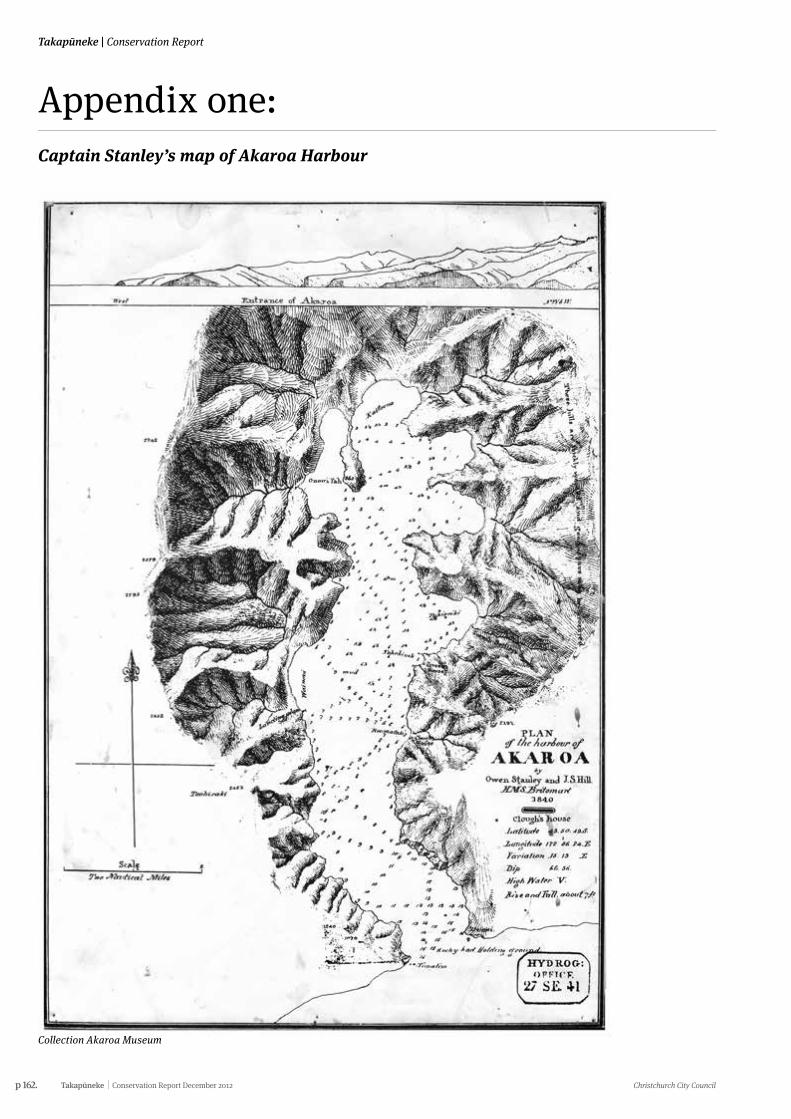
p 162. Takapūneke Conservation Report December 2012 Christchurch City Council
Takapūneke | Conservation Report
Appendix one:Captain Stanley’s map of Akaroa Harbour
Collection Akaroa Museum
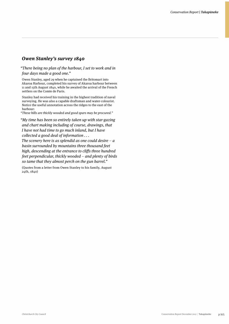
Christchurch City Council Conservation Report December 2012 Takapūneke p 163.
Conservation Report | Takapūneke
Owen Stanley’s survey 1840
“There being no plan of the harbour, I set to work and in four days made a good one.”Owen Stanley, aged 29 when he captained the Britomart into Akaroa Harbour, completed his survey of Akaroa harbour between 11 and 15th August 1840, while he awaited the arrival of the French settlers on the Comte de Paris.
Stanley had received his training in the highest tradition of naval surveying. He was also a capable draftsman and water-colourist.Notice the useful annotation across the ridges to the east of the harbour:
“These hills are thickly wooded and good spars may be procured.”
“My time has been so entirely taken up with star-gazing and chart making including of course, drawings, that I have not had time to go much inland, but I have collected a good deal of information . . .The scenery here is as splendid as one could desire – a basin surrounded by mountains three thousand feet high, descending at the entrance to cliffs three hundred feet perpendicular, thickly wooded – and plenty of birds so tame that they almost perch on the gun barrel.”(Quotes from a letter from Owen Stanley to his family, August 24th, 1840)
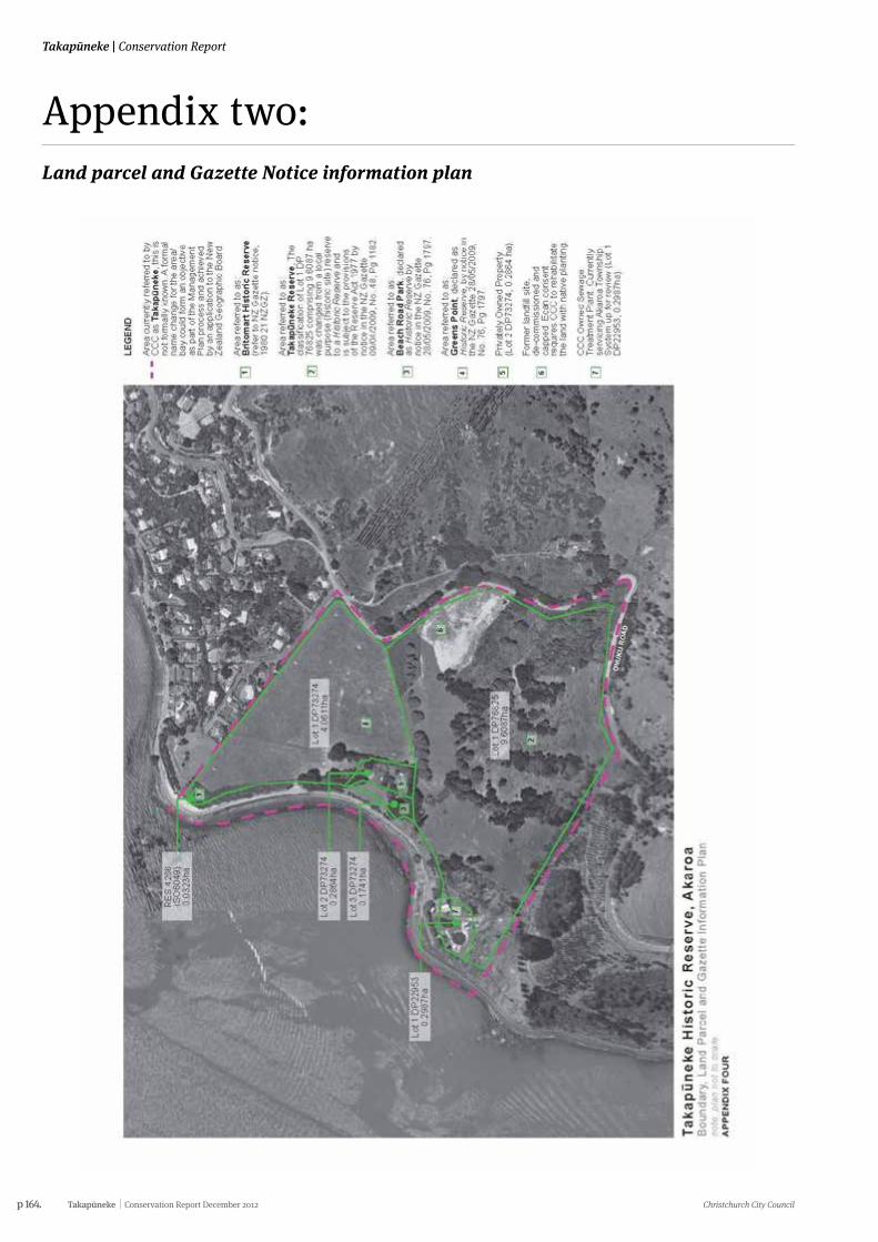
p 164. Takapūneke Conservation Report December 2012 Christchurch City Council
Takapūneke | Conservation Report
Appendix two:Land parcel and Gazette Notice information plan
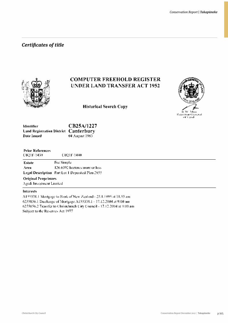
Christchurch City Council Conservation Report December 2012 Takapūneke p 165.
Conservation Report | Takapūneke
Certificates of title
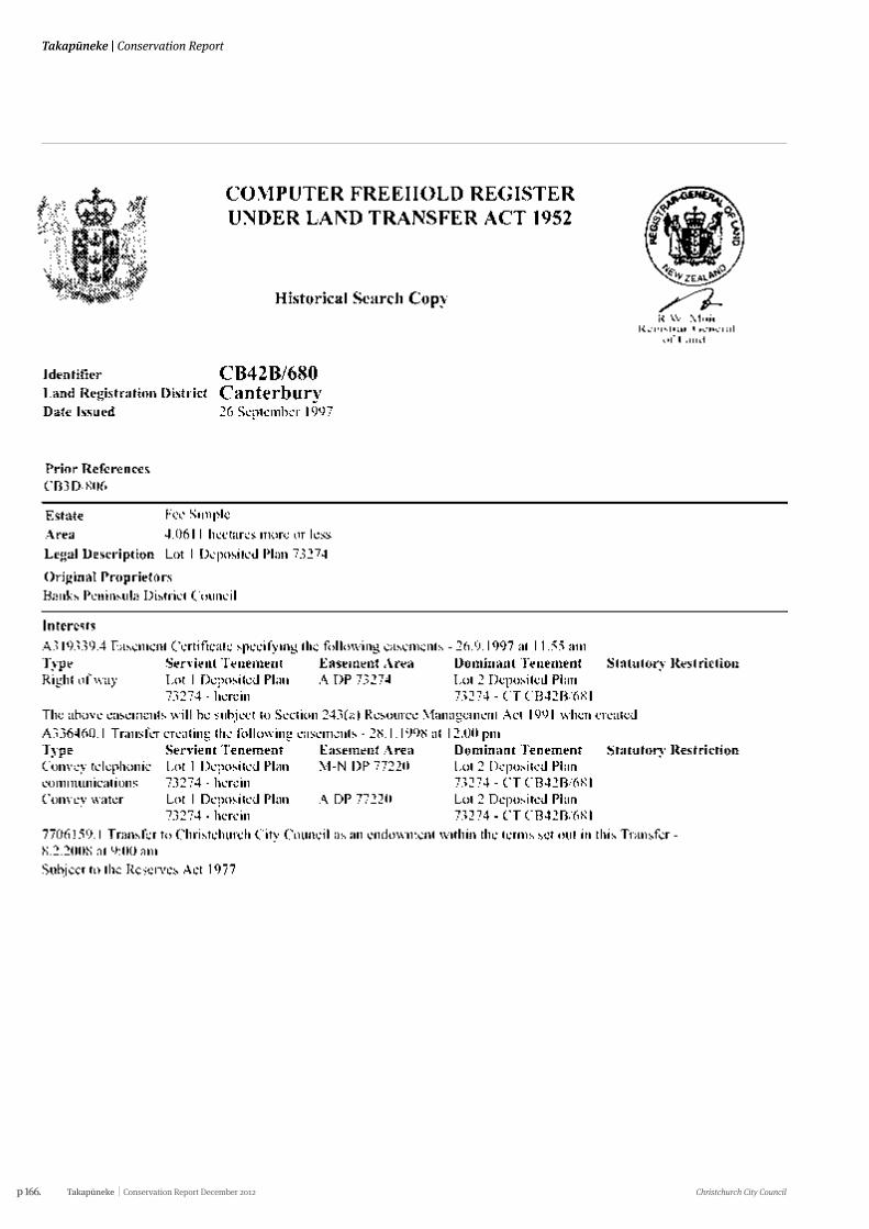
p 166. Takapūneke Conservation Report December 2012 Christchurch City Council
Takapūneke | Conservation Report
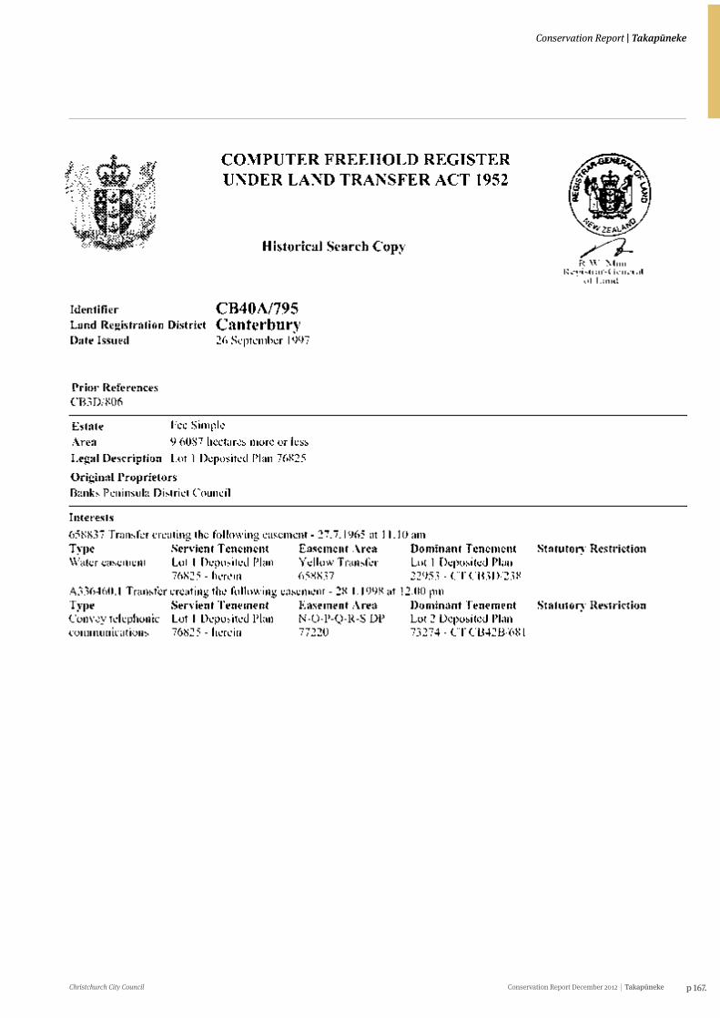
Christchurch City Council Conservation Report December 2012 Takapūneke p 167.
Conservation Report | Takapūneke
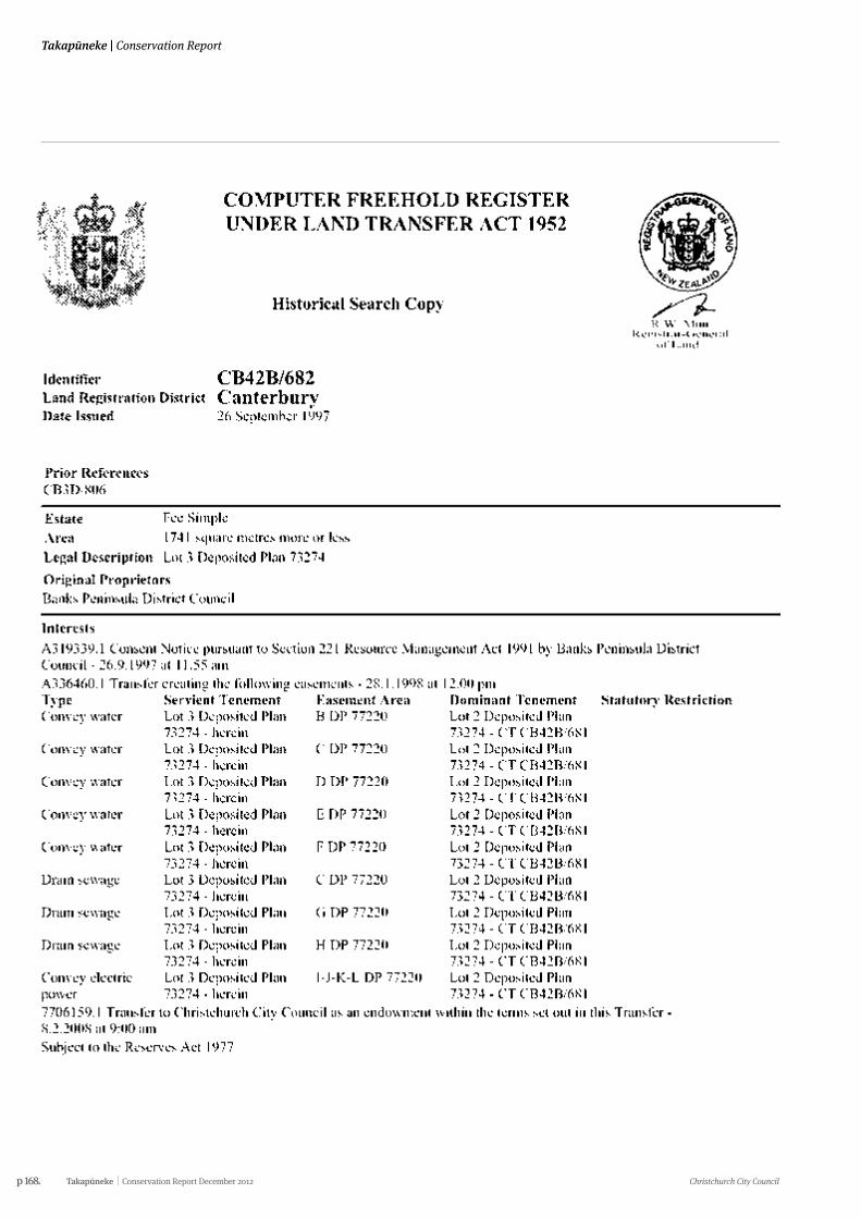
p 168. Takapūneke Conservation Report December 2012 Christchurch City Council
Takapūneke | Conservation Report
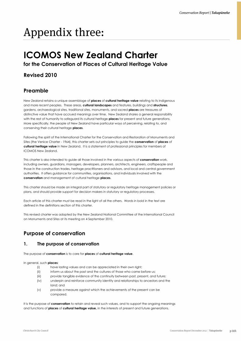
Christchurch City Council Conservation Report December 2012 Takapūneke p 169.
Conservation Report | Takapūneke
Appendix three:
ICOMOS New Zealand Charter 2010 Page 1
ICOMOS New Zealand Charter for the Conservation of Places of Cultural Heritage Value
Revised 2010
Preamble New Zealand retains a unique assemblage of places of cultural heritage value relating to its indigenous and more recent peoples. These areas, cultural landscapes and features, buildings and structures, gardens, archaeological sites, traditional sites, monuments, and sacred places are treasures of distinctive value that have accrued meanings over time. New Zealand shares a general responsibility with the rest of humanity to safeguard its cultural heritage places for present and future generations. More specifically, the people of New Zealand have particular ways of perceiving, relating to, and conserving their cultural heritage places. Following the spirit of the International Charter for the Conservation and Restoration of Monuments and Sites (the Venice Charter - 1964), this charter sets out principles to guide the conservation of places of cultural heritage value in New Zealand. It is a statement of professional principles for members of ICOMOS New Zealand. This charter is also intended to guide all those involved in the various aspects of conservation work, including owners, guardians, managers, developers, planners, architects, engineers, craftspeople and those in the construction trades, heritage practitioners and advisors, and local and central government authorities. It offers guidance for communities, organisations, and individuals involved with the conservation and management of cultural heritage places. This charter should be made an integral part of statutory or regulatory heritage management policies or plans, and should provide support for decision makers in statutory or regulatory processes. Each article of this charter must be read in the light of all the others. Words in bold in the text are defined in the definitions section of this charter. This revised charter was adopted by the New Zealand National Committee of the International Council on Monuments and Sites at its meeting on 4 September 2010.
Purpose of conservation
1. The purpose of conservation The purpose of conservation is to care for places of cultural heritage value. In general, such places:
(i) have lasting values and can be appreciated in their own right; (ii) inform us about the past and the cultures of those who came before us; (iii) provide tangible evidence of the continuity between past, present, and future; (iv) underpin and reinforce community identity and relationships to ancestors and the
land; and (v) provide a measure against which the achievements of the present can be
compared. It is the purpose of conservation to retain and reveal such values, and to support the ongoing meanings and functions of places of cultural heritage value, in the interests of present and future generations.
ICOMOS New Zealand Charter 2010 Page 2
Conservation principles 2. Understanding cultural heritage value Conservation of a place should be based on an understanding and appreciation of all aspects of its cultural heritage value, both tangible and intangible. All available forms of knowledge and evidence provide the means of understanding a place and its cultural heritage value and cultural heritage significance. Cultural heritage value should be understood through consultation with connected people, systematic documentary and oral research, physical investigation and recording of the place, and other relevant methods. All relevant cultural heritage values should be recognised, respected, and, where appropriate, revealed, including values which differ, conflict, or compete. The policy for managing all aspects of a place, including its conservation and its use, and the implementation of the policy, must be based on an understanding of its cultural heritage value.
3. Indigenous cultural heritage The indigenous cultural heritage of tangata whenua relates to whanau, hapu, and iwi groups. It shapes identity and enhances well-being, and it has particular cultural meanings and values for the present, and associations with those who have gone before. Indigenous cultural heritage brings with it responsibilities of guardianship and the practical application and passing on of associated knowledge, traditional skills, and practices. The Treaty of Waitangi is the founding document of our nation. Article 2 of the Treaty recognises and guarantees the protection of tino rangatiratanga, and so empowers kaitiakitanga as customary trusteeship to be exercised by tangata whenua. This customary trusteeship is exercised over their taonga, such as sacred and traditional places, built heritage, traditional practices, and other cultural heritage resources. This obligation extends beyond current legal ownership wherever such cultural heritage exists. Particular matauranga, or knowledge of cultural heritage meaning, value, and practice, is associated with places. Matauranga is sustained and transmitted through oral, written, and physical forms determined by tangata whenua. The conservation of such places is therefore conditional on decisions made in associated tangata whenua communities, and should proceed only in this context. In particular, protocols of access, authority, ritual, and practice are determined at a local level and should be respected.
4. Planning for conservation Conservation should be subject to prior documented assessment and planning. All conservation work should be based on a conservation plan which identifies the cultural heritage value and cultural heritage significance of the place, the conservation policies, and the extent of the recommended works. The conservation plan should give the highest priority to the authenticity and integrity of the place. Other guiding documents such as, but not limited to, management plans, cyclical maintenance plans, specifications for conservation work, interpretation plans, risk mitigation plans, or emergency plans should be guided by a conservation plan.
p 170. Takapūneke Conservation Report December 2012 Christchurch City Council
Takapūneke | Conservation Report
ICOMOS New Zealand Charter 2010 Page 1
ICOMOS New Zealand Charter for the Conservation of Places of Cultural Heritage Value
Revised 2010
Preamble New Zealand retains a unique assemblage of places of cultural heritage value relating to its indigenous and more recent peoples. These areas, cultural landscapes and features, buildings and structures, gardens, archaeological sites, traditional sites, monuments, and sacred places are treasures of distinctive value that have accrued meanings over time. New Zealand shares a general responsibility with the rest of humanity to safeguard its cultural heritage places for present and future generations. More specifically, the people of New Zealand have particular ways of perceiving, relating to, and conserving their cultural heritage places. Following the spirit of the International Charter for the Conservation and Restoration of Monuments and Sites (the Venice Charter - 1964), this charter sets out principles to guide the conservation of places of cultural heritage value in New Zealand. It is a statement of professional principles for members of ICOMOS New Zealand. This charter is also intended to guide all those involved in the various aspects of conservation work, including owners, guardians, managers, developers, planners, architects, engineers, craftspeople and those in the construction trades, heritage practitioners and advisors, and local and central government authorities. It offers guidance for communities, organisations, and individuals involved with the conservation and management of cultural heritage places. This charter should be made an integral part of statutory or regulatory heritage management policies or plans, and should provide support for decision makers in statutory or regulatory processes. Each article of this charter must be read in the light of all the others. Words in bold in the text are defined in the definitions section of this charter. This revised charter was adopted by the New Zealand National Committee of the International Council on Monuments and Sites at its meeting on 4 September 2010.
Purpose of conservation
1. The purpose of conservation The purpose of conservation is to care for places of cultural heritage value. In general, such places:
(i) have lasting values and can be appreciated in their own right; (ii) inform us about the past and the cultures of those who came before us; (iii) provide tangible evidence of the continuity between past, present, and future; (iv) underpin and reinforce community identity and relationships to ancestors and the
land; and (v) provide a measure against which the achievements of the present can be
compared. It is the purpose of conservation to retain and reveal such values, and to support the ongoing meanings and functions of places of cultural heritage value, in the interests of present and future generations.
ICOMOS New Zealand Charter 2010 Page 2
Conservation principles 2. Understanding cultural heritage value Conservation of a place should be based on an understanding and appreciation of all aspects of its cultural heritage value, both tangible and intangible. All available forms of knowledge and evidence provide the means of understanding a place and its cultural heritage value and cultural heritage significance. Cultural heritage value should be understood through consultation with connected people, systematic documentary and oral research, physical investigation and recording of the place, and other relevant methods. All relevant cultural heritage values should be recognised, respected, and, where appropriate, revealed, including values which differ, conflict, or compete. The policy for managing all aspects of a place, including its conservation and its use, and the implementation of the policy, must be based on an understanding of its cultural heritage value.
3. Indigenous cultural heritage The indigenous cultural heritage of tangata whenua relates to whanau, hapu, and iwi groups. It shapes identity and enhances well-being, and it has particular cultural meanings and values for the present, and associations with those who have gone before. Indigenous cultural heritage brings with it responsibilities of guardianship and the practical application and passing on of associated knowledge, traditional skills, and practices. The Treaty of Waitangi is the founding document of our nation. Article 2 of the Treaty recognises and guarantees the protection of tino rangatiratanga, and so empowers kaitiakitanga as customary trusteeship to be exercised by tangata whenua. This customary trusteeship is exercised over their taonga, such as sacred and traditional places, built heritage, traditional practices, and other cultural heritage resources. This obligation extends beyond current legal ownership wherever such cultural heritage exists. Particular matauranga, or knowledge of cultural heritage meaning, value, and practice, is associated with places. Matauranga is sustained and transmitted through oral, written, and physical forms determined by tangata whenua. The conservation of such places is therefore conditional on decisions made in associated tangata whenua communities, and should proceed only in this context. In particular, protocols of access, authority, ritual, and practice are determined at a local level and should be respected.
4. Planning for conservation Conservation should be subject to prior documented assessment and planning. All conservation work should be based on a conservation plan which identifies the cultural heritage value and cultural heritage significance of the place, the conservation policies, and the extent of the recommended works. The conservation plan should give the highest priority to the authenticity and integrity of the place. Other guiding documents such as, but not limited to, management plans, cyclical maintenance plans, specifications for conservation work, interpretation plans, risk mitigation plans, or emergency plans should be guided by a conservation plan.
Christchurch City Council Conservation Report December 2012 Takapūneke p 171.
Conservation Report | Takapūneke
ICOMOS New Zealand Charter 2010 Page 3
5. Respect for surviving evidence and knowledge Conservation maintains and reveals the authenticity and integrity of a place, and involves the least possible loss of fabric or evidence of cultural heritage value. Respect for all forms of knowledge and existing evidence, of both tangible and intangible values, is essential to the authenticity and integrity of the place. Conservation recognises the evidence of time and the contributions of all periods. The conservation of a place should identify and respect all aspects of its cultural heritage value without unwarranted emphasis on any one value at the expense of others. The removal or obscuring of any physical evidence of any period or activity should be minimised, and should be explicitly justified where it does occur. The fabric of a particular period or activity may be obscured or removed if assessment shows that its removal would not diminish the cultural heritage value of the place. In conservation, evidence of the functions and intangible meanings of places of cultural heritage value should be respected. 6. Minimum intervention Work undertaken at a place of cultural heritage value should involve the least degree of intervention consistent with conservation and the principles of this charter. Intervention should be the minimum necessary to ensure the retention of tangible and intangible values and the continuation of uses integral to those values. The removal of fabric or the alteration of features and spaces that have cultural heritage value should be avoided. 7. Physical investigation Physical investigation of a place provides primary evidence that cannot be gained from any other source. Physical investigation should be carried out according to currently accepted professional standards, and should be documented through systematic recording. Invasive investigation of fabric of any period should be carried out only where knowledge may be significantly extended, or where it is necessary to establish the existence of fabric of cultural heritage value, or where it is necessary for conservation work, or where such fabric is about to be damaged or destroyed or made inaccessible. The extent of invasive investigation should minimise the disturbance of significant fabric.
8. Use The conservation of a place of cultural heritage value is usually facilitated by the place serving a useful purpose. Where the use of a place is integral to its cultural heritage value, that use should be retained. Where a change of use is proposed, the new use should be compatible with the cultural heritage value of the place, and should have little or no adverse effect on the cultural heritage value.
ICOMOS New Zealand Charter 2010 Page 4
9. Setting Where the setting of a place is integral to its cultural heritage value, that setting should be conserved with the place itself. If the setting no longer contributes to the cultural heritage value of the place, and if reconstruction of the setting can be justified, any reconstruction of the setting should be based on an understanding of all aspects of the cultural heritage value of the place.
10. Relocation The on-going association of a structure or feature of cultural heritage value with its location, site, curtilage, and setting is essential to its authenticity and integrity. Therefore, a structure or feature of cultural heritage value should remain on its original site.
Relocation of a structure or feature of cultural heritage value, where its removal is required in order to clear its site for a different purpose or construction, or where its removal is required to enable its use on a different site, is not a desirable outcome and is not a conservation process.
In exceptional circumstances, a structure of cultural heritage value may be relocated if its current site is in imminent danger, and if all other means of retaining the structure in its current location have been exhausted. In this event, the new location should provide a setting compatible with the cultural heritage value of the structure. 11. Documentation and archiving The cultural heritage value and cultural heritage significance of a place, and all aspects of its conservation, should be fully documented to ensure that this information is available to present and future generations. Documentation includes information about all changes to the place and any decisions made during the conservation process. Documentation should be carried out to archival standards to maximise the longevity of the record, and should be placed in an appropriate archival repository. Documentation should be made available to connected people and other interested parties. Where reasons for confidentiality exist, such as security, privacy, or cultural appropriateness, some information may not always be publicly accessible.
12. Recording Evidence provided by the fabric of a place should be identified and understood through systematic research, recording, and analysis. Recording is an essential part of the physical investigation of a place. It informs and guides the conservation process and its planning. Systematic recording should occur prior to, during, and following any intervention. It should include the recording of new evidence revealed, and any fabric obscured or removed. Recording of the changes to a place should continue throughout its life.
p 172. Takapūneke Conservation Report December 2012 Christchurch City Council
Takapūneke | Conservation Report
ICOMOS New Zealand Charter 2010 Page 3
5. Respect for surviving evidence and knowledge Conservation maintains and reveals the authenticity and integrity of a place, and involves the least possible loss of fabric or evidence of cultural heritage value. Respect for all forms of knowledge and existing evidence, of both tangible and intangible values, is essential to the authenticity and integrity of the place. Conservation recognises the evidence of time and the contributions of all periods. The conservation of a place should identify and respect all aspects of its cultural heritage value without unwarranted emphasis on any one value at the expense of others. The removal or obscuring of any physical evidence of any period or activity should be minimised, and should be explicitly justified where it does occur. The fabric of a particular period or activity may be obscured or removed if assessment shows that its removal would not diminish the cultural heritage value of the place. In conservation, evidence of the functions and intangible meanings of places of cultural heritage value should be respected. 6. Minimum intervention Work undertaken at a place of cultural heritage value should involve the least degree of intervention consistent with conservation and the principles of this charter. Intervention should be the minimum necessary to ensure the retention of tangible and intangible values and the continuation of uses integral to those values. The removal of fabric or the alteration of features and spaces that have cultural heritage value should be avoided. 7. Physical investigation Physical investigation of a place provides primary evidence that cannot be gained from any other source. Physical investigation should be carried out according to currently accepted professional standards, and should be documented through systematic recording. Invasive investigation of fabric of any period should be carried out only where knowledge may be significantly extended, or where it is necessary to establish the existence of fabric of cultural heritage value, or where it is necessary for conservation work, or where such fabric is about to be damaged or destroyed or made inaccessible. The extent of invasive investigation should minimise the disturbance of significant fabric.
8. Use The conservation of a place of cultural heritage value is usually facilitated by the place serving a useful purpose. Where the use of a place is integral to its cultural heritage value, that use should be retained. Where a change of use is proposed, the new use should be compatible with the cultural heritage value of the place, and should have little or no adverse effect on the cultural heritage value.
ICOMOS New Zealand Charter 2010 Page 4
9. Setting Where the setting of a place is integral to its cultural heritage value, that setting should be conserved with the place itself. If the setting no longer contributes to the cultural heritage value of the place, and if reconstruction of the setting can be justified, any reconstruction of the setting should be based on an understanding of all aspects of the cultural heritage value of the place.
10. Relocation The on-going association of a structure or feature of cultural heritage value with its location, site, curtilage, and setting is essential to its authenticity and integrity. Therefore, a structure or feature of cultural heritage value should remain on its original site.
Relocation of a structure or feature of cultural heritage value, where its removal is required in order to clear its site for a different purpose or construction, or where its removal is required to enable its use on a different site, is not a desirable outcome and is not a conservation process.
In exceptional circumstances, a structure of cultural heritage value may be relocated if its current site is in imminent danger, and if all other means of retaining the structure in its current location have been exhausted. In this event, the new location should provide a setting compatible with the cultural heritage value of the structure. 11. Documentation and archiving The cultural heritage value and cultural heritage significance of a place, and all aspects of its conservation, should be fully documented to ensure that this information is available to present and future generations. Documentation includes information about all changes to the place and any decisions made during the conservation process. Documentation should be carried out to archival standards to maximise the longevity of the record, and should be placed in an appropriate archival repository. Documentation should be made available to connected people and other interested parties. Where reasons for confidentiality exist, such as security, privacy, or cultural appropriateness, some information may not always be publicly accessible.
12. Recording Evidence provided by the fabric of a place should be identified and understood through systematic research, recording, and analysis. Recording is an essential part of the physical investigation of a place. It informs and guides the conservation process and its planning. Systematic recording should occur prior to, during, and following any intervention. It should include the recording of new evidence revealed, and any fabric obscured or removed. Recording of the changes to a place should continue throughout its life.
Christchurch City Council Conservation Report December 2012 Takapūneke p 173.
Conservation Report | Takapūneke
ICOMOS New Zealand Charter 2010 Page 5
13. Fixtures, fittings, and contents Fixtures, fittings, and contents that are integral to the cultural heritage value of a place should be retained and conserved with the place. Such fixtures, fittings, and contents may include carving, painting, weaving, stained glass, wallpaper, surface decoration, works of art, equipment and machinery, furniture, and personal belongings. Conservation of any such material should involve specialist conservation expertise appropriate to the material. Where it is necessary to remove any such material, it should be recorded, retained, and protected, until such time as it can be reinstated.
Conservation processes and practice 14. Conservation plans A conservation plan, based on the principles of this charter, should:
(i) be based on a comprehensive understanding of the cultural heritage value of the
place and assessment of its cultural heritage significance;
(ii) include an assessment of the fabric of the place, and its condition;
(iii) give the highest priority to the authenticity and integrity of the place;
(iv) include the entirety of the place, including the setting;
(v) be prepared by objective professionals in appropriate disciplines;
(vi) consider the needs, abilities, and resources of connected people;
(vii) not be influenced by prior expectations of change or development;
(viii) specify conservation policies to guide decision making and to guide any work to be
undertaken;
(ix) make recommendations for the conservation of the place; and
(x) be regularly revised and kept up to date.
15. Conservation projects Conservation projects should include the following:
(i) consultation with interested parties and connected people, continuing throughout
the project;
(ii) opportunities for interested parties and connected people to contribute to and
participate in the project;
(iii) research into documentary and oral history, using all relevant sources and repositories
of knowledge;
(iv) physical investigation of the place as appropriate;
(v) use of all appropriate methods of recording, such as written, drawn, and
photographic;
(vi) the preparation of a conservation plan which meets the principles of this charter;
(vii) guidance on appropriate use of the place;
(viii) the implementation of any planned conservation work;
(ix) the documentation of the conservation work as it proceeds; and
(x) where appropriate, the deposit of all records in an archival repository. A conservation project must not be commenced until any required statutory authorisation has been granted.
ICOMOS New Zealand Charter 2010 Page 6
16. Professional, trade, and craft skills All aspects of conservation work should be planned, directed, supervised, and undertaken by people with appropriate conservation training and experience directly relevant to the project. All conservation disciplines, arts, crafts, trades, and traditional skills and practices that are relevant to the project should be applied and promoted.
17. Degrees of intervention for conservation purposes Following research, recording, assessment, and planning, intervention for conservation purposes may include, in increasing degrees of intervention:
(i) preservation, through stabilisation, maintenance, or repair; (ii) restoration, through reassembly, reinstatement, or removal; (iii) reconstruction; and (iv) adaptation.
In many conservation projects a range of processes may be utilised. Where appropriate, conservation processes may be applied to individual parts or components of a place of cultural heritage value. The extent of any intervention for conservation purposes should be guided by the cultural heritage value of a place and the policies for its management as identified in a conservation plan. Any intervention which would reduce or compromise cultural heritage value is undesirable and should not occur. Preference should be given to the least degree of intervention, consistent with this charter. Re-creation, meaning the conjectural reconstruction of a structure or place; replication, meaning to make a copy of an existing or former structure or place; or the construction of generalised representations of typical features or structures, are not conservation processes and are outside the scope of this charter. 18. Preservation Preservation of a place involves as little intervention as possible, to ensure its long-term survival and the continuation of its cultural heritage value. Preservation processes should not obscure or remove the patina of age, particularly where it contributes to the authenticity and integrity of the place, or where it contributes to the structural stability of materials.
i. Stabilisation
Processes of decay should be slowed by providing treatment or support.
ii. Maintenance
A place of cultural heritage value should be maintained regularly. Maintenance should be carried out according to a plan or work programme.
iii. Repair
Repair of a place of cultural heritage value should utilise matching or similar materials. Where it is necessary to employ new materials, they should be distinguishable by experts, and should be documented.
p 174. Takapūneke Conservation Report December 2012 Christchurch City Council
Takapūneke | Conservation Report
ICOMOS New Zealand Charter 2010 Page 5
13. Fixtures, fittings, and contents Fixtures, fittings, and contents that are integral to the cultural heritage value of a place should be retained and conserved with the place. Such fixtures, fittings, and contents may include carving, painting, weaving, stained glass, wallpaper, surface decoration, works of art, equipment and machinery, furniture, and personal belongings. Conservation of any such material should involve specialist conservation expertise appropriate to the material. Where it is necessary to remove any such material, it should be recorded, retained, and protected, until such time as it can be reinstated.
Conservation processes and practice 14. Conservation plans A conservation plan, based on the principles of this charter, should:
(i) be based on a comprehensive understanding of the cultural heritage value of the
place and assessment of its cultural heritage significance;
(ii) include an assessment of the fabric of the place, and its condition;
(iii) give the highest priority to the authenticity and integrity of the place;
(iv) include the entirety of the place, including the setting;
(v) be prepared by objective professionals in appropriate disciplines;
(vi) consider the needs, abilities, and resources of connected people;
(vii) not be influenced by prior expectations of change or development;
(viii) specify conservation policies to guide decision making and to guide any work to be
undertaken;
(ix) make recommendations for the conservation of the place; and
(x) be regularly revised and kept up to date.
15. Conservation projects Conservation projects should include the following:
(i) consultation with interested parties and connected people, continuing throughout
the project;
(ii) opportunities for interested parties and connected people to contribute to and
participate in the project;
(iii) research into documentary and oral history, using all relevant sources and repositories
of knowledge;
(iv) physical investigation of the place as appropriate;
(v) use of all appropriate methods of recording, such as written, drawn, and
photographic;
(vi) the preparation of a conservation plan which meets the principles of this charter;
(vii) guidance on appropriate use of the place;
(viii) the implementation of any planned conservation work;
(ix) the documentation of the conservation work as it proceeds; and
(x) where appropriate, the deposit of all records in an archival repository. A conservation project must not be commenced until any required statutory authorisation has been granted.
ICOMOS New Zealand Charter 2010 Page 6
16. Professional, trade, and craft skills All aspects of conservation work should be planned, directed, supervised, and undertaken by people with appropriate conservation training and experience directly relevant to the project. All conservation disciplines, arts, crafts, trades, and traditional skills and practices that are relevant to the project should be applied and promoted.
17. Degrees of intervention for conservation purposes Following research, recording, assessment, and planning, intervention for conservation purposes may include, in increasing degrees of intervention:
(i) preservation, through stabilisation, maintenance, or repair; (ii) restoration, through reassembly, reinstatement, or removal; (iii) reconstruction; and (iv) adaptation.
In many conservation projects a range of processes may be utilised. Where appropriate, conservation processes may be applied to individual parts or components of a place of cultural heritage value. The extent of any intervention for conservation purposes should be guided by the cultural heritage value of a place and the policies for its management as identified in a conservation plan. Any intervention which would reduce or compromise cultural heritage value is undesirable and should not occur. Preference should be given to the least degree of intervention, consistent with this charter. Re-creation, meaning the conjectural reconstruction of a structure or place; replication, meaning to make a copy of an existing or former structure or place; or the construction of generalised representations of typical features or structures, are not conservation processes and are outside the scope of this charter. 18. Preservation Preservation of a place involves as little intervention as possible, to ensure its long-term survival and the continuation of its cultural heritage value. Preservation processes should not obscure or remove the patina of age, particularly where it contributes to the authenticity and integrity of the place, or where it contributes to the structural stability of materials.
i. Stabilisation
Processes of decay should be slowed by providing treatment or support.
ii. Maintenance
A place of cultural heritage value should be maintained regularly. Maintenance should be carried out according to a plan or work programme.
iii. Repair
Repair of a place of cultural heritage value should utilise matching or similar materials. Where it is necessary to employ new materials, they should be distinguishable by experts, and should be documented.
Christchurch City Council Conservation Report December 2012 Takapūneke p 175.
Conservation Report | Takapūneke
ICOMOS New Zealand Charter 2010 Page 7
Traditional methods and materials should be given preference in conservation work. Repair of a technically higher standard than that achieved with the existing materials or construction practices may be justified only where the stability or life expectancy of the site or material is increased, where the new material is compatible with the old, and where the cultural heritage value is not diminished.
19. Restoration The process of restoration typically involves reassembly and reinstatement, and may involve the removal of accretions that detract from the cultural heritage value of a place. Restoration is based on respect for existing fabric, and on the identification and analysis of all available evidence, so that the cultural heritage value of a place is recovered or revealed. Restoration should be carried out only if the cultural heritage value of the place is recovered or revealed by the process. Restoration does not involve conjecture.
i. Reassembly and reinstatement Reassembly uses existing material and, through the process of reinstatement, returns it to its former position. Reassembly is more likely to involve work on part of a place rather than the whole place. ii. Removal Occasionally, existing fabric may need to be permanently removed from a place. This may be for reasons of advanced decay, or loss of structural integrity, or because particular fabric has been identified in a conservation plan as detracting from the cultural heritage value of the place. The fabric removed should be systematically recorded before and during its removal. In some cases it may be appropriate to store, on a long-term basis, material of evidential value that has been removed.
20. Reconstruction Reconstruction is distinguished from restoration by the introduction of new material to replace material that has been lost. Reconstruction is appropriate if it is essential to the function, integrity, intangible value, or understanding of a place, if sufficient physical and documentary evidence exists to minimise conjecture, and if surviving cultural heritage value is preserved. Reconstructed elements should not usually constitute the majority of a place or structure. 21. Adaptation The conservation of a place of cultural heritage value is usually facilitated by the place serving a useful purpose. Proposals for adaptation of a place may arise from maintaining its continuing use, or from a proposed change of use.
ICOMOS New Zealand Charter 2010 Page 8
Alterations and additions may be acceptable where they are necessary for a compatible use of the place. Any change should be the minimum necessary, should be substantially reversible, and should have little or no adverse effect on the cultural heritage value of the place. Any alterations or additions should be compatible with the original form and fabric of the place, and should avoid inappropriate or incompatible contrasts of form, scale, mass, colour, and material. Adaptation should not dominate or substantially obscure the original form and fabric, and should not adversely affect the setting of a place of cultural heritage value. New work should complement the original form and fabric. 22. Non-intervention In some circumstances, assessment of the cultural heritage value of a place may show that it is not desirable to undertake any conservation intervention at that time. This approach may be appropriate where undisturbed constancy of intangible values, such as the spiritual associations of a sacred place, may be more important than its physical attributes. 23. Interpretation Interpretation actively enhances public understanding of all aspects of places of cultural heritage value and their conservation. Relevant cultural protocols are integral to that understanding, and should be identified and observed. Where appropriate, interpretation should assist the understanding of tangible and intangible values of a place which may not be readily perceived, such as the sequence of construction and change, and the meanings and associations of the place for connected people. Any interpretation should respect the cultural heritage value of a place. Interpretation methods should be appropriate to the place. Physical interventions for interpretation purposes should not detract from the experience of the place, and should not have an adverse effect on its tangible or intangible values. 24. Risk mitigation Places of cultural heritage value may be vulnerable to natural disasters such as flood, storm, or earthquake; or to humanly induced threats and risks such as those arising from earthworks, subdivision and development, buildings works, or wilful damage or neglect. In order to safeguard cultural heritage value, planning for risk mitigation and emergency management is necessary. Potential risks to any place of cultural heritage value should be assessed. Where appropriate, a risk mitigation plan, an emergency plan, and/or a protection plan should be prepared, and implemented as far as possible, with reference to a conservation plan.
p 176. Takapūneke Conservation Report December 2012 Christchurch City Council
Takapūneke | Conservation Report
ICOMOS New Zealand Charter 2010 Page 7
Traditional methods and materials should be given preference in conservation work. Repair of a technically higher standard than that achieved with the existing materials or construction practices may be justified only where the stability or life expectancy of the site or material is increased, where the new material is compatible with the old, and where the cultural heritage value is not diminished.
19. Restoration The process of restoration typically involves reassembly and reinstatement, and may involve the removal of accretions that detract from the cultural heritage value of a place. Restoration is based on respect for existing fabric, and on the identification and analysis of all available evidence, so that the cultural heritage value of a place is recovered or revealed. Restoration should be carried out only if the cultural heritage value of the place is recovered or revealed by the process. Restoration does not involve conjecture.
i. Reassembly and reinstatement Reassembly uses existing material and, through the process of reinstatement, returns it to its former position. Reassembly is more likely to involve work on part of a place rather than the whole place. ii. Removal Occasionally, existing fabric may need to be permanently removed from a place. This may be for reasons of advanced decay, or loss of structural integrity, or because particular fabric has been identified in a conservation plan as detracting from the cultural heritage value of the place. The fabric removed should be systematically recorded before and during its removal. In some cases it may be appropriate to store, on a long-term basis, material of evidential value that has been removed.
20. Reconstruction Reconstruction is distinguished from restoration by the introduction of new material to replace material that has been lost. Reconstruction is appropriate if it is essential to the function, integrity, intangible value, or understanding of a place, if sufficient physical and documentary evidence exists to minimise conjecture, and if surviving cultural heritage value is preserved. Reconstructed elements should not usually constitute the majority of a place or structure. 21. Adaptation The conservation of a place of cultural heritage value is usually facilitated by the place serving a useful purpose. Proposals for adaptation of a place may arise from maintaining its continuing use, or from a proposed change of use.
ICOMOS New Zealand Charter 2010 Page 8
Alterations and additions may be acceptable where they are necessary for a compatible use of the place. Any change should be the minimum necessary, should be substantially reversible, and should have little or no adverse effect on the cultural heritage value of the place. Any alterations or additions should be compatible with the original form and fabric of the place, and should avoid inappropriate or incompatible contrasts of form, scale, mass, colour, and material. Adaptation should not dominate or substantially obscure the original form and fabric, and should not adversely affect the setting of a place of cultural heritage value. New work should complement the original form and fabric. 22. Non-intervention In some circumstances, assessment of the cultural heritage value of a place may show that it is not desirable to undertake any conservation intervention at that time. This approach may be appropriate where undisturbed constancy of intangible values, such as the spiritual associations of a sacred place, may be more important than its physical attributes. 23. Interpretation Interpretation actively enhances public understanding of all aspects of places of cultural heritage value and their conservation. Relevant cultural protocols are integral to that understanding, and should be identified and observed. Where appropriate, interpretation should assist the understanding of tangible and intangible values of a place which may not be readily perceived, such as the sequence of construction and change, and the meanings and associations of the place for connected people. Any interpretation should respect the cultural heritage value of a place. Interpretation methods should be appropriate to the place. Physical interventions for interpretation purposes should not detract from the experience of the place, and should not have an adverse effect on its tangible or intangible values. 24. Risk mitigation Places of cultural heritage value may be vulnerable to natural disasters such as flood, storm, or earthquake; or to humanly induced threats and risks such as those arising from earthworks, subdivision and development, buildings works, or wilful damage or neglect. In order to safeguard cultural heritage value, planning for risk mitigation and emergency management is necessary. Potential risks to any place of cultural heritage value should be assessed. Where appropriate, a risk mitigation plan, an emergency plan, and/or a protection plan should be prepared, and implemented as far as possible, with reference to a conservation plan.
Christchurch City Council Conservation Report December 2012 Takapūneke p 177.
Conservation Report | Takapūneke
ICOMOS New Zealand Charter 2010 Page 9
Definitions For the purposes of this charter: Adaptation means the process(es) of modifying a place for a compatible use while retaining its cultural
heritage value. Adaptation processes include alteration and addition. Authenticity means the credibility or truthfulness of the surviving evidence and knowledge of the cultural
heritage value of a place. Relevant evidence includes form and design, substance and fabric, technology and craftsmanship, location and surroundings, context and setting, use and function, traditions, spiritual essence, and sense of place, and includes tangible and intangible values. Assessment of authenticity is based on identification and analysis of relevant evidence and knowledge, and respect for its cultural context.
Compatible use means a use which is consistent with the cultural heritage value of a place, and which
has little or no adverse impact on its authenticity and integrity. Connected people means any groups, organisations, or individuals having a sense of association with or
responsibility for a place of cultural heritage value. Conservation means all the processes of understanding and caring for a place so as to safeguard its
cultural heritage value. Conservation is based on respect for the existing fabric, associations, meanings, and use of the place. It requires a cautious approach of doing as much work as necessary but as little as possible, and retaining authenticity and integrity, to ensure that the place and its values are passed on to future generations.
Conservation plan means an objective report which documents the history, fabric, and cultural heritage
value of a place, assesses its cultural heritage significance, describes the condition of the place, outlines conservation policies for managing the place, and makes recommendations for the conservation of the place.
Contents means moveable objects, collections, chattels, documents, works of art, and ephemera that
are not fixed or fitted to a place, and which have been assessed as being integral to its cultural heritage value.
Cultural heritage significance means the cultural heritage value of a place relative to other similar or
comparable places, recognising the particular cultural context of the place. Cultural heritage value/s means possessing aesthetic, archaeological, architectural, commemorative,
functional, historical, landscape, monumental, scientific, social, spiritual, symbolic, technological, traditional, or other tangible or intangible values, associated with human activity.
Cultural landscapes means an area possessing cultural heritage value arising from the relationships
between people and the environment. Cultural landscapes may have been designed, such as gardens, or may have evolved from human settlement and land use over time, resulting in a diversity of distinctive landscapes in different areas. Associative cultural landscapes, such as sacred mountains, may lack tangible cultural elements but may have strong intangible cultural or spiritual associations.
Documentation means collecting, recording, keeping, and managing information about a place and its
cultural heritage value, including information about its history, fabric, and meaning; information about decisions taken; and information about physical changes and interventions made to the place.
ICOMOS New Zealand Charter 2010 Page 10
Fabric means all the physical material of a place, including subsurface material, structures, and interior and exterior surfaces including the patina of age; and including fixtures and fittings, and gardens and plantings.
Hapu means a section of a large tribe of the tangata whenua. Intangible value means the abstract cultural heritage value of the meanings or associations of a place,
including commemorative, historical, social, spiritual, symbolic, or traditional values. Integrity means the wholeness or intactness of a place, including its meaning and sense of place, and
all the tangible and intangible attributes and elements necessary to express its cultural heritage value.
Intervention means any activity that causes disturbance of or alteration to a place or its fabric.
Intervention includes archaeological excavation, invasive investigation of built structures, and any intervention for conservation purposes.
Iwi means a tribe of the tangata whenua. Kaitiakitanga means the duty of customary trusteeship, stewardship, guardianship, and protection of
land, resources, or taonga. Maintenance means regular and on-going protective care of a place to prevent deterioration and to
retain its cultural heritage value. Matauranga means traditional or cultural knowledge of the tangata whenua. Non-intervention means to choose not to undertake any activity that causes disturbance of or
alteration to a place or its fabric. Place means any land having cultural heritage value in New Zealand, including areas; cultural
landscapes; buildings, structures, and monuments; groups of buildings, structures, or monuments; gardens and plantings; archaeological sites and features; traditional sites; sacred places; townscapes and streetscapes; and settlements. Place may also include land covered by water, and any body of water. Place includes the setting of any such place.
Preservation means to maintain a place with as little change as possible. Reassembly means to put existing but disarticulated parts of a structure back together. Reconstruction means to build again as closely as possible to a documented earlier form, using new
materials. Recording means the process of capturing information and creating an archival record of the fabric
and setting of a place, including its configuration, condition, use, and change over time. Reinstatement means to put material components of a place, including the products of reassembly,
back in position. Repair means to make good decayed or damaged fabric using identical, closely similar, or otherwise
appropriate material. Restoration means to return a place to a known earlier form, by reassembly and reinstatement, and/or
by removal of elements that detract from its cultural heritage value. Setting means the area around and/or adjacent to a place of cultural heritage value that is integral to
its function, meaning, and relationships. Setting includes the structures, outbuildings, features, gardens, curtilage, airspace, and accessways forming the spatial context of the place or used
p 178. Takapūneke Conservation Report December 2012 Christchurch City Council
Takapūneke | Conservation Report
ICOMOS New Zealand Charter 2010 Page 9
Definitions For the purposes of this charter: Adaptation means the process(es) of modifying a place for a compatible use while retaining its cultural
heritage value. Adaptation processes include alteration and addition. Authenticity means the credibility or truthfulness of the surviving evidence and knowledge of the cultural
heritage value of a place. Relevant evidence includes form and design, substance and fabric, technology and craftsmanship, location and surroundings, context and setting, use and function, traditions, spiritual essence, and sense of place, and includes tangible and intangible values. Assessment of authenticity is based on identification and analysis of relevant evidence and knowledge, and respect for its cultural context.
Compatible use means a use which is consistent with the cultural heritage value of a place, and which
has little or no adverse impact on its authenticity and integrity. Connected people means any groups, organisations, or individuals having a sense of association with or
responsibility for a place of cultural heritage value. Conservation means all the processes of understanding and caring for a place so as to safeguard its
cultural heritage value. Conservation is based on respect for the existing fabric, associations, meanings, and use of the place. It requires a cautious approach of doing as much work as necessary but as little as possible, and retaining authenticity and integrity, to ensure that the place and its values are passed on to future generations.
Conservation plan means an objective report which documents the history, fabric, and cultural heritage
value of a place, assesses its cultural heritage significance, describes the condition of the place, outlines conservation policies for managing the place, and makes recommendations for the conservation of the place.
Contents means moveable objects, collections, chattels, documents, works of art, and ephemera that
are not fixed or fitted to a place, and which have been assessed as being integral to its cultural heritage value.
Cultural heritage significance means the cultural heritage value of a place relative to other similar or
comparable places, recognising the particular cultural context of the place. Cultural heritage value/s means possessing aesthetic, archaeological, architectural, commemorative,
functional, historical, landscape, monumental, scientific, social, spiritual, symbolic, technological, traditional, or other tangible or intangible values, associated with human activity.
Cultural landscapes means an area possessing cultural heritage value arising from the relationships
between people and the environment. Cultural landscapes may have been designed, such as gardens, or may have evolved from human settlement and land use over time, resulting in a diversity of distinctive landscapes in different areas. Associative cultural landscapes, such as sacred mountains, may lack tangible cultural elements but may have strong intangible cultural or spiritual associations.
Documentation means collecting, recording, keeping, and managing information about a place and its
cultural heritage value, including information about its history, fabric, and meaning; information about decisions taken; and information about physical changes and interventions made to the place.
ICOMOS New Zealand Charter 2010 Page 10
Fabric means all the physical material of a place, including subsurface material, structures, and interior and exterior surfaces including the patina of age; and including fixtures and fittings, and gardens and plantings.
Hapu means a section of a large tribe of the tangata whenua. Intangible value means the abstract cultural heritage value of the meanings or associations of a place,
including commemorative, historical, social, spiritual, symbolic, or traditional values. Integrity means the wholeness or intactness of a place, including its meaning and sense of place, and
all the tangible and intangible attributes and elements necessary to express its cultural heritage value.
Intervention means any activity that causes disturbance of or alteration to a place or its fabric.
Intervention includes archaeological excavation, invasive investigation of built structures, and any intervention for conservation purposes.
Iwi means a tribe of the tangata whenua. Kaitiakitanga means the duty of customary trusteeship, stewardship, guardianship, and protection of
land, resources, or taonga. Maintenance means regular and on-going protective care of a place to prevent deterioration and to
retain its cultural heritage value. Matauranga means traditional or cultural knowledge of the tangata whenua. Non-intervention means to choose not to undertake any activity that causes disturbance of or
alteration to a place or its fabric. Place means any land having cultural heritage value in New Zealand, including areas; cultural
landscapes; buildings, structures, and monuments; groups of buildings, structures, or monuments; gardens and plantings; archaeological sites and features; traditional sites; sacred places; townscapes and streetscapes; and settlements. Place may also include land covered by water, and any body of water. Place includes the setting of any such place.
Preservation means to maintain a place with as little change as possible. Reassembly means to put existing but disarticulated parts of a structure back together. Reconstruction means to build again as closely as possible to a documented earlier form, using new
materials. Recording means the process of capturing information and creating an archival record of the fabric
and setting of a place, including its configuration, condition, use, and change over time. Reinstatement means to put material components of a place, including the products of reassembly,
back in position. Repair means to make good decayed or damaged fabric using identical, closely similar, or otherwise
appropriate material. Restoration means to return a place to a known earlier form, by reassembly and reinstatement, and/or
by removal of elements that detract from its cultural heritage value. Setting means the area around and/or adjacent to a place of cultural heritage value that is integral to
its function, meaning, and relationships. Setting includes the structures, outbuildings, features, gardens, curtilage, airspace, and accessways forming the spatial context of the place or used
Christchurch City Council Conservation Report December 2012 Takapūneke p 179.
Conservation Report | Takapūneke
ICOMOS New Zealand Charter 2010 Page 11
in association with the place. Setting also includes cultural landscapes, townscapes, and streetscapes; perspectives, views, and viewshafts to and from a place; and relationships with other places which contribute to the cultural heritage value of the place. Setting may extend beyond the area defined by legal title, and may include a buffer zone necessary for the long-term protection of the cultural heritage value of the place.
Stabilisation means the arrest or slowing of the processes of decay. Structure means any building, standing remains, equipment, device, or other facility made by people
and which is fixed to the land. Tangata whenua means generally the original indigenous inhabitants of the land; and means
specifically the people exercising kaitiakitanga over particular land, resources, or taonga. Tangible value means the physically observable cultural heritage value of a place, including
archaeological, architectural, landscape, monumental, scientific, or technological values. Taonga means anything highly prized for its cultural, economic, historical, spiritual, or traditional value,
including land and natural and cultural resources. Tino rangatiratanga means the exercise of full chieftainship, authority, and responsibility. Use means the functions of a place, and the activities and practices that may occur at the place. The
functions, activities, and practices may in themselves be of cultural heritage value. Whanau means an extended family which is part of a hapu or iwi. ISBN 978-0-473-17116-2 (PDF) English language text first published 1993 Bilingual text first published 1995 Revised text Copyright © 2010 ICOMOS New Zealand (Inc.) / Te Mana O Nga Pouwhenua O Te Ao – The New Zealand National Committee of the International Council on Monuments and Sites. No part of this publication may be reproduced, stored in a retrieval system, or transmitted by any other means without the prior permission of the copyright holder. This revised text replaces the 1993 and 1995 versions and should be referenced as the ICOMOS New Zealand Charter for the Conservation of Places of Cultural Heritage Value (ICOMOS New Zealand Charter 2010). This revision incorporates changes in conservation philosophy and best practice since 1993 and is the only version of the ICOMOS New Zealand Charter approved by ICOMOS New Zealand (Inc.) for use. Copies of this charter may be obtained from ICOMOS NZ (Inc.) P O Box 90 851 Victoria Street West, Auckland 1142, New Zealand.
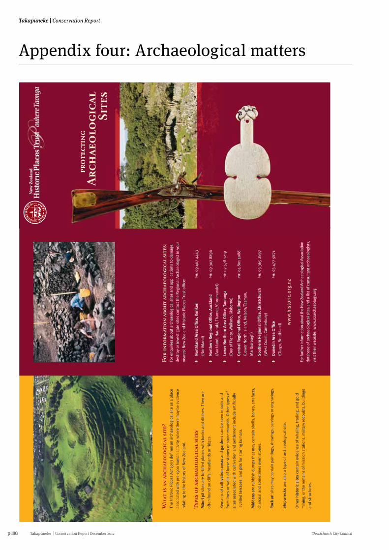
p 180. Takapūneke Conservation Report December 2012 Christchurch City Council
Takapūneke | Conservation Report
Appendix four: Archaeological matters
Wh
at is
an
arc
hae
olo
gica
l si
te?
The
His
tori
c P
lace
s A
ct 1
993
defin
es a
n ar
chae
olog
ical
sit
e as
a p
lace
asso
ciat
ed w
ith p
re-1
900
hum
an a
ctiv
ity, w
here
ther
e m
ay b
e ev
iden
ce
rela
ting
to th
e hi
stor
y of
New
Zea
land
.
Type
s o
f ar
chae
olo
gica
l si
tes
Mäo
ri pä
site
s ar
e fo
rtifi
ed p
lace
s w
ith
bank
s an
d di
tche
s. T
hey
are
ofte
n fo
und
on c
liffs
, hea
dlan
ds o
r rid
ges.
Rem
ains
of c
ulti
vati
on a
reas
and
gar
dens
can
be
seen
in s
oils
and
from
line
s or
wal
ls o
f loo
se s
tone
s or
sto
ne m
ound
s. O
ther
type
s of
site
s as
soci
ated
wit
h cu
ltiv
atio
n an
d se
ttle
men
t inc
lude
art
ifici
ally
leve
lled
terr
aces
, and
pit
s fo
r sto
ring
kum
ara.
Mid
dens
are
rubb
ish
dum
ps th
at m
ay c
onta
in s
hells
, bon
es, a
rtef
acts
,
char
coal
and
som
etim
es o
ven
ston
es.
Rock
art
site
s m
ay c
onta
in p
aint
ings
, dra
win
gs, c
arvi
ngs
or e
ngra
ving
s.
Shi
pwre
cks
are
also
a ty
pe o
f arc
haeo
logi
cal s
ite.
Oth
er h
isto
ric
site
s co
ntai
n ev
iden
ce o
f wha
ling,
trad
ing,
and
gol
d
min
ing,
or t
he re
mai
ns o
f mis
sion
sta
tions
, mili
tary
redo
ubts
, bui
ldin
gs
and
stru
ctur
es.
For
info
rmat
ion
abo
ut
arch
aeo
logi
cal
site
s:Fo
r enq
uiri
es a
bout
arc
haeo
logi
cal s
ites
and
appl
icat
ions
to d
amag
e,
dest
roy
or in
vest
igat
e si
tes
cont
act t
he R
egio
nal A
rcha
eolo
gist
in y
our
near
est N
ew Z
eala
nd H
isto
ric
Plac
es T
rust
o÷
ce:
�N
orth
land
Are
a O
÷ce
, Ker
iker
iph
: 09
407
4443
(Nor
thla
nd)
�N
orth
ern
Regi
onal
O÷
ce, A
uckl
and
ph: 0
9 30
7 88
96
(Auc
klan
d, H
aura
ki, T
ham
es/C
orom
ande
l)
�Lo
wer
Nor
ther
n Ar
ea O
÷ce
, Tau
rang
aph
: 07
578
1219
(Bay
of P
lent
y, W
aika
to, G
isbo
rne)
�Ce
ntra
l Reg
iona
l O÷
ce, W
ellin
gton
ph: 0
4 80
1 50
88
(Low
er N
orth
Isla
nd, N
elso
n/Ta
sman
,
Mar
lbor
ough
)
�So
uthe
rn R
egio
nal O
÷ce
, Chr
istc
hurc
hph
: 03
365
2897
(Wes
t Coa
st, C
ante
rbur
y)
�D
uned
in A
rea
O÷
ceph
: 03
477
9871
(Ota
go, S
outh
land
) ww
w.h
isto
ric.
org
.nz
For f
urth
er in
form
atio
n ab
out t
he N
ew Z
eala
nd A
rcha
eolo
gica
l Ass
ocia
tion
data
base
of a
rcha
eolo
gica
l site
s an
d a
list o
f con
sulta
nt a
rcha
eolo
gist
s,
visi
t the
ir w
ebsi
te; w
ww
.nza
rcha
eolo
gy.o
rg
pro
tect
ing
Arc
hae
olo
gica
lSi
tes
Arc
haeo
logi
cal s
ites
are
irre
plac
eabl
e pa
rts
of o
ur h
erit
age.
The
y ar
e pr
otec
ted
by t
he H
isto
ric
Plac
es A
ct 1
993.
The
New
Zea
land
His
tori
c Pl
aces
Trus
t w
ants
to
wor
k w
ith
you
to id
enti
fy, p
rote
ct, p
rese
rve
and
cons
erve
our
arc
haeo
logi
cal s
ites
. It
mat
ters
to
us a
ll.
Ho
w d
o i
fin
d o
ut
abo
ut
arch
aeo
logi
cal
site
s o
n m
y pr
ope
rty?
The
New
Zea
land
His
toric
Pla
ces
Trus
t's
arch
aeol
ogis
ts o
r you
r reg
iona
l
Trus
t O÷
ce c
an p
rovi
de in
form
atio
n ab
out a
rcha
eolo
gica
l sit
es. T
he
New
Zea
land
Arc
haeo
logi
cal A
ssoc
iati
on h
as a
nat
iona
l dat
abas
e of
reco
rded
arc
haeo
logi
cal s
ites
.
You
coul
d al
so e
mpl
oy a
n ar
chae
olog
ist t
o do
an
arch
aeol
ogic
al s
urve
y
of y
our p
rope
rty.
The
y w
ill b
e ab
le to
iden
tify
, rec
ord,
and
ass
ess
any
arch
aeol
ogic
al s
ites
that
may
be
pres
ent.
Wh
at a
re y
ou
r re
spo
nsi
bili
ties
?If
you
own,
occ
upy
or a
re re
spon
sibl
e fo
r lan
d, it
may
con
tain
an
arch
aeol
ogic
al s
ite. T
hese
site
s ar
e pr
otec
ted
in la
w. T
his
leafl
et e
xpla
ins
�W
hat a
n ar
chae
olog
ical
sit
e is
�H
ow it
is p
rote
cted
�W
hat y
ou d
o w
hen
wor
king
wit
h a
site
�H
ow y
ou c
an lo
ok a
fter
an
arch
aeol
ogic
al s
ite
�W
ho to
con
tact
for i
nfor
mat
ion
and
advi
ce.
Wh
at p
rote
ctio
n d
oes
the
law
giv
e ar
chae
olo
gica
l si
tes?
The
His
toric
Pla
ces
Act 1
993
mak
es it
unl
awfu
l for
any
per
son
to d
estr
oy,
dam
age
or m
odify
the
who
le o
r any
par
t of a
n ar
chae
olog
ical
sit
e,
whe
ther
or n
ot th
e la
nd o
n w
hich
the
site
is lo
cate
d is
des
igna
ted,
or
a re
sour
ce o
r bui
ldin
g co
nsen
t has
bee
n is
sued
, wit
hout
the
prio
r
auth
orit
y of
the
Trus
t.
It a
lso
prov
ides
for s
ubst
antia
l pen
altie
s fo
r una
utho
rise
d de
stru
ctio
n,
dam
age
or m
odifi
cati
on.
Wh
at if
i pl
an t
o d
o w
ork
that
may
dam
age
an a
rch
aeo
logi
cal
site
?If
ther
e is
a c
hanc
e yo
u m
ay d
amag
e a
site
, you
mus
t app
ly to
the
New
Zeal
and
His
tori
c Pl
aces
Tru
st fo
r per
mis
sion
to d
o so
. The
Tru
st c
an
advi
se y
ou o
f the
mos
t sui
tabl
e co
urse
of a
ctio
n.
If yo
u un
cove
r a p
revi
ousl
y un
know
n si
te d
urin
g ea
rthw
orks
, you
may
also
nee
d pe
rmis
sion
to c
ontin
ue. Y
ou m
ust s
top
any
wor
k th
at w
ould
affe
ct th
e si
te a
nd c
onta
ct th
e Tr
ust f
or a
dvic
e on
how
to p
roce
ed.
Imag
esIn
side
spr
ead,
clo
ckw
ise
from
left
: Rem
ains
of B
runn
er In
dust
rial
Com
plex
, Wes
tCo
ast (
nzh
pt);
Vie
w lo
okin
g do
wn
Haw
kest
one
Stre
et, W
ellin
gton
184
5(?)
Sam
uel
C. B
rees
(atl
, a-1
09-0
21);
She
ll m
idde
n, Ö
mah
a Co
ast,
Nor
thla
nd (n
zhpt
); M
äori
rock
art
, Fre
nchm
an’s
Gul
ly, S
outh
Can
terb
ury
(nzh
pt)
Fron
t cov
er: O
tuat
aua
Ston
efiel
ds (d
oc)
; Flin
tloc
k m
uske
t (te
pap
a, g
h008
078)
;Ko
tiat
e/ha
nd c
lub,
(te
papa
, me0
1417
3) |
Insi
de c
over
: Pä
at M
änge
re M
ount
ain/
TePa
ne ö
Mat
aaho
, Auc
klan
d Ke
vin
Jone
s (d
oc)
| B
ack
cove
r: A
rcha
eolo
gica
l exc
avat
ion
of C
hine
se g
old-
min
ing
sett
lem
ent,
Cro
mw
ell,
Ota
go (n
zhpt
)
Can
an
yon
e d
istu
rban
arc
hae
olo
gica
l si
te in
ord
er t
o s
tud
y it
?A
ny p
erso
n w
ishi
ng to
car
ry o
ut a
n in
vest
igat
ion
that
mig
ht d
istu
rb
an a
rcha
eolo
gica
l site
in a
ny w
ay m
ust a
pply
to th
e Tr
ust f
or p
erm
issi
on
to d
o so
.
Ho
w c
an i
loo
k af
ter
an a
rch
aeo
logi
cal
site
?Th
is w
ill d
epen
d on
the
type
of s
ite, l
ocal
env
ironm
ent c
ondi
tions
and
the
land
use
. If y
ou a
re d
evel
opin
g la
nd th
at c
onta
ins
arch
aeol
ogic
al
site
s, tr
y to
avo
id th
e si
tes
if po
ssib
le.
For m
ost r
ural
sit
es, g
rass
gra
zed
by s
heep
giv
es th
e be
st p
rote
ctio
n.
Regu
lar t
ram
plin
g by
hea
vier
ani
mal
s su
ch a
s ho
rses
and
cat
tle
can
erod
e th
e si
te. L
arge
pla
nts,
vin
es a
nd tr
ees
caus
e da
mag
e w
hen
thei
r
root
s gr
ow th
roug
h th
e si
te, a
nd fu
rthe
r dam
age
can
occu
r whe
n th
ey
are
rem
oved
, har
vest
ed, o
r blo
w o
ver.
You
mig
ht a
lso
wis
h to
pla
ce a
cov
enan
t ove
r the
site
, reg
iste
r the
site
wit
h th
e Tr
ust,
or c
reat
e a
rese
rve
to e
nsur
e it
s fu
ture
pro
tect
ion.
If
you
wou
ld li
ke a
dvic
e on
the
best
man
agem
ent a
nd p
rote
ctio
n fo
r
your
par
ticu
lar s
ite(
s), p
leas
e co
ntac
t the
Tru
st.
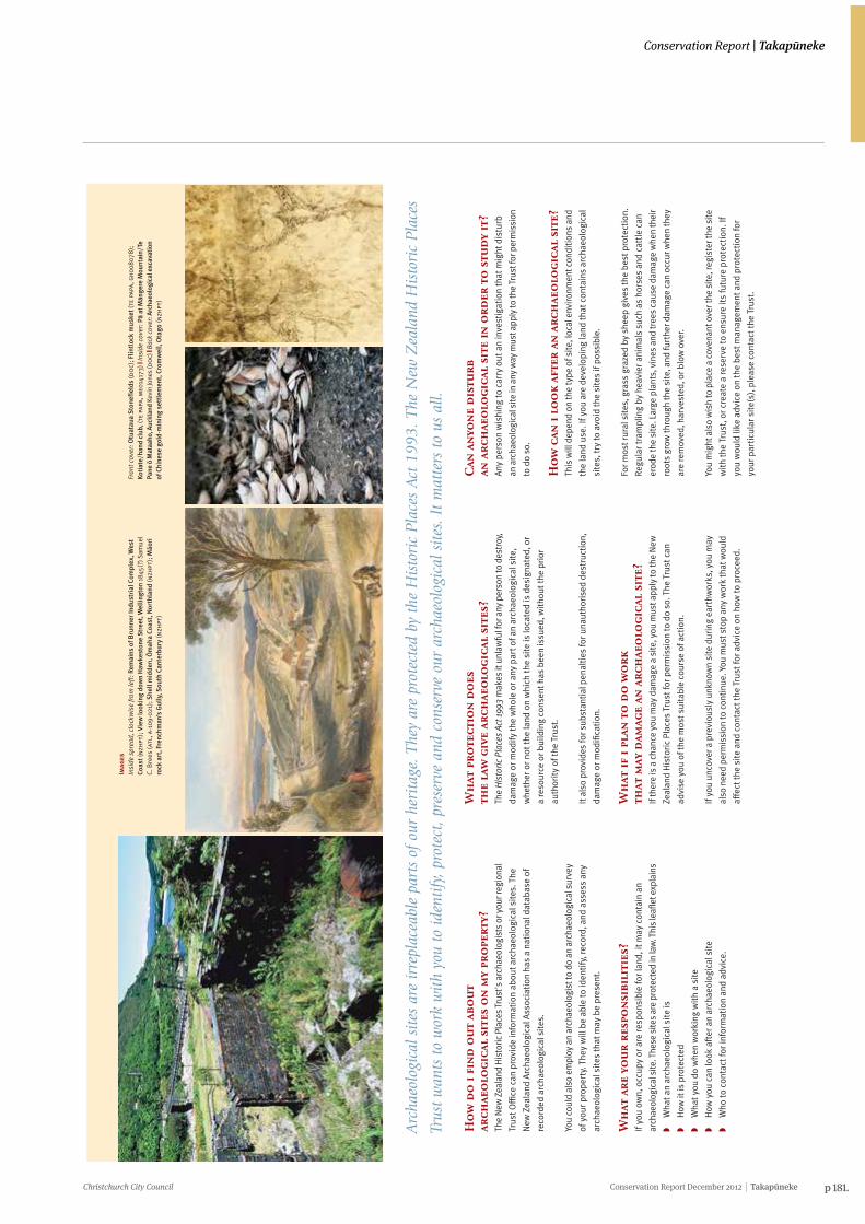
Christchurch City Council Conservation Report December 2012 Takapūneke p 181.
Conservation Report | Takapūneke
Wh
at is
an
arc
hae
olo
gica
l si
te?
The
His
tori
c P
lace
s A
ct 1
993
defin
es a
n ar
chae
olog
ical
sit
e as
a p
lace
asso
ciat
ed w
ith p
re-1
900
hum
an a
ctiv
ity, w
here
ther
e m
ay b
e ev
iden
ce
rela
ting
to th
e hi
stor
y of
New
Zea
land
.
Type
s o
f ar
chae
olo
gica
l si
tes
Mäo
ri pä
site
s ar
e fo
rtifi
ed p
lace
s w
ith
bank
s an
d di
tche
s. T
hey
are
ofte
n fo
und
on c
liffs
, hea
dlan
ds o
r rid
ges.
Rem
ains
of c
ulti
vati
on a
reas
and
gar
dens
can
be
seen
in s
oils
and
from
line
s or
wal
ls o
f loo
se s
tone
s or
sto
ne m
ound
s. O
ther
type
s of
site
s as
soci
ated
wit
h cu
ltiv
atio
n an
d se
ttle
men
t inc
lude
art
ifici
ally
leve
lled
terr
aces
, and
pit
s fo
r sto
ring
kum
ara.
Mid
dens
are
rubb
ish
dum
ps th
at m
ay c
onta
in s
hells
, bon
es, a
rtef
acts
,
char
coal
and
som
etim
es o
ven
ston
es.
Rock
art
site
s m
ay c
onta
in p
aint
ings
, dra
win
gs, c
arvi
ngs
or e
ngra
ving
s.
Shi
pwre
cks
are
also
a ty
pe o
f arc
haeo
logi
cal s
ite.
Oth
er h
isto
ric
site
s co
ntai
n ev
iden
ce o
f wha
ling,
trad
ing,
and
gol
d
min
ing,
or t
he re
mai
ns o
f mis
sion
sta
tions
, mili
tary
redo
ubts
, bui
ldin
gs
and
stru
ctur
es.
For
info
rmat
ion
abo
ut
arch
aeo
logi
cal
site
s:Fo
r enq
uiri
es a
bout
arc
haeo
logi
cal s
ites
and
appl
icat
ions
to d
amag
e,
dest
roy
or in
vest
igat
e si
tes
cont
act t
he R
egio
nal A
rcha
eolo
gist
in y
our
near
est N
ew Z
eala
nd H
isto
ric
Plac
es T
rust
o÷
ce:
�N
orth
land
Are
a O
÷ce
, Ker
iker
iph
: 09
407
4443
(Nor
thla
nd)
�N
orth
ern
Regi
onal
O÷
ce, A
uckl
and
ph: 0
9 30
7 88
96
(Auc
klan
d, H
aura
ki, T
ham
es/C
orom
ande
l)
�Lo
wer
Nor
ther
n Ar
ea O
÷ce
, Tau
rang
aph
: 07
578
1219
(Bay
of P
lent
y, W
aika
to, G
isbo
rne)
�Ce
ntra
l Reg
iona
l O÷
ce, W
ellin
gton
ph: 0
4 80
1 50
88
(Low
er N
orth
Isla
nd, N
elso
n/Ta
sman
,
Mar
lbor
ough
)
�So
uthe
rn R
egio
nal O
÷ce
, Chr
istc
hurc
hph
: 03
365
2897
(Wes
t Coa
st, C
ante
rbur
y)
�D
uned
in A
rea
O÷
ceph
: 03
477
9871
(Ota
go, S
outh
land
) ww
w.h
isto
ric.
org
.nz
For f
urth
er in
form
atio
n ab
out t
he N
ew Z
eala
nd A
rcha
eolo
gica
l Ass
ocia
tion
data
base
of a
rcha
eolo
gica
l site
s an
d a
list o
f con
sulta
nt a
rcha
eolo
gist
s,
visi
t the
ir w
ebsi
te; w
ww
.nza
rcha
eolo
gy.o
rg
pro
tect
ing
Arc
hae
olo
gica
lSi
tes
Arc
haeo
logi
cal s
ites
are
irre
plac
eabl
e pa
rts
of o
ur h
erit
age.
The
y ar
e pr
otec
ted
by t
he H
isto
ric
Plac
es A
ct 1
993.
The
New
Zea
land
His
tori
c Pl
aces
Trus
t w
ants
to
wor
k w
ith
you
to id
enti
fy, p
rote
ct, p
rese
rve
and
cons
erve
our
arc
haeo
logi
cal s
ites
. It
mat
ters
to
us a
ll.
Ho
w d
o i
fin
d o
ut
abo
ut
arch
aeo
logi
cal
site
s o
n m
y pr
ope
rty?
The
New
Zea
land
His
toric
Pla
ces
Trus
t's
arch
aeol
ogis
ts o
r you
r reg
iona
l
Trus
t O÷
ce c
an p
rovi
de in
form
atio
n ab
out a
rcha
eolo
gica
l sit
es. T
he
New
Zea
land
Arc
haeo
logi
cal A
ssoc
iati
on h
as a
nat
iona
l dat
abas
e of
reco
rded
arc
haeo
logi
cal s
ites
.
You
coul
d al
so e
mpl
oy a
n ar
chae
olog
ist t
o do
an
arch
aeol
ogic
al s
urve
y
of y
our p
rope
rty.
The
y w
ill b
e ab
le to
iden
tify
, rec
ord,
and
ass
ess
any
arch
aeol
ogic
al s
ites
that
may
be
pres
ent.
Wh
at a
re y
ou
r re
spo
nsi
bili
ties
?If
you
own,
occ
upy
or a
re re
spon
sibl
e fo
r lan
d, it
may
con
tain
an
arch
aeol
ogic
al s
ite. T
hese
site
s ar
e pr
otec
ted
in la
w. T
his
leafl
et e
xpla
ins
�W
hat a
n ar
chae
olog
ical
sit
e is
�H
ow it
is p
rote
cted
�W
hat y
ou d
o w
hen
wor
king
wit
h a
site
�H
ow y
ou c
an lo
ok a
fter
an
arch
aeol
ogic
al s
ite
�W
ho to
con
tact
for i
nfor
mat
ion
and
advi
ce.
Wh
at p
rote
ctio
n d
oes
the
law
giv
e ar
chae
olo
gica
l si
tes?
The
His
toric
Pla
ces
Act 1
993
mak
es it
unl
awfu
l for
any
per
son
to d
estr
oy,
dam
age
or m
odify
the
who
le o
r any
par
t of a
n ar
chae
olog
ical
sit
e,
whe
ther
or n
ot th
e la
nd o
n w
hich
the
site
is lo
cate
d is
des
igna
ted,
or
a re
sour
ce o
r bui
ldin
g co
nsen
t has
bee
n is
sued
, wit
hout
the
prio
r
auth
orit
y of
the
Trus
t.
It a
lso
prov
ides
for s
ubst
antia
l pen
altie
s fo
r una
utho
rise
d de
stru
ctio
n,
dam
age
or m
odifi
cati
on.
Wh
at if
i pl
an t
o d
o w
ork
that
may
dam
age
an a
rch
aeo
logi
cal
site
?If
ther
e is
a c
hanc
e yo
u m
ay d
amag
e a
site
, you
mus
t app
ly to
the
New
Zeal
and
His
tori
c Pl
aces
Tru
st fo
r per
mis
sion
to d
o so
. The
Tru
st c
an
advi
se y
ou o
f the
mos
t sui
tabl
e co
urse
of a
ctio
n.
If yo
u un
cove
r a p
revi
ousl
y un
know
n si
te d
urin
g ea
rthw
orks
, you
may
also
nee
d pe
rmis
sion
to c
ontin
ue. Y
ou m
ust s
top
any
wor
k th
at w
ould
affe
ct th
e si
te a
nd c
onta
ct th
e Tr
ust f
or a
dvic
e on
how
to p
roce
ed.
Imag
esIn
side
spr
ead,
clo
ckw
ise
from
left
: Rem
ains
of B
runn
er In
dust
rial
Com
plex
, Wes
tCo
ast (
nzh
pt);
Vie
w lo
okin
g do
wn
Haw
kest
one
Stre
et, W
ellin
gton
184
5(?)
Sam
uel
C. B
rees
(atl
, a-1
09-0
21);
She
ll m
idde
n, Ö
mah
a Co
ast,
Nor
thla
nd (n
zhpt
); M
äori
rock
art
, Fre
nchm
an’s
Gul
ly, S
outh
Can
terb
ury
(nzh
pt)
Fron
t cov
er: O
tuat
aua
Ston
efiel
ds (d
oc)
; Flin
tloc
k m
uske
t (te
pap
a, g
h008
078)
;Ko
tiat
e/ha
nd c
lub,
(te
papa
, me0
1417
3) |
Insi
de c
over
: Pä
at M
änge
re M
ount
ain/
TePa
ne ö
Mat
aaho
, Auc
klan
d Ke
vin
Jone
s (d
oc)
| B
ack
cove
r: A
rcha
eolo
gica
l exc
avat
ion
of C
hine
se g
old-
min
ing
sett
lem
ent,
Cro
mw
ell,
Ota
go (n
zhpt
)
Can
an
yon
e d
istu
rban
arc
hae
olo
gica
l si
te in
ord
er t
o s
tud
y it
?A
ny p
erso
n w
ishi
ng to
car
ry o
ut a
n in
vest
igat
ion
that
mig
ht d
istu
rb
an a
rcha
eolo
gica
l site
in a
ny w
ay m
ust a
pply
to th
e Tr
ust f
or p
erm
issi
on
to d
o so
.
Ho
w c
an i
loo
k af
ter
an a
rch
aeo
logi
cal
site
?Th
is w
ill d
epen
d on
the
type
of s
ite, l
ocal
env
ironm
ent c
ondi
tions
and
the
land
use
. If y
ou a
re d
evel
opin
g la
nd th
at c
onta
ins
arch
aeol
ogic
al
site
s, tr
y to
avo
id th
e si
tes
if po
ssib
le.
For m
ost r
ural
sit
es, g
rass
gra
zed
by s
heep
giv
es th
e be
st p
rote
ctio
n.
Regu
lar t
ram
plin
g by
hea
vier
ani
mal
s su
ch a
s ho
rses
and
cat
tle
can
erod
e th
e si
te. L
arge
pla
nts,
vin
es a
nd tr
ees
caus
e da
mag
e w
hen
thei
r
root
s gr
ow th
roug
h th
e si
te, a
nd fu
rthe
r dam
age
can
occu
r whe
n th
ey
are
rem
oved
, har
vest
ed, o
r blo
w o
ver.
You
mig
ht a
lso
wis
h to
pla
ce a
cov
enan
t ove
r the
site
, reg
iste
r the
site
wit
h th
e Tr
ust,
or c
reat
e a
rese
rve
to e
nsur
e it
s fu
ture
pro
tect
ion.
If
you
wou
ld li
ke a
dvic
e on
the
best
man
agem
ent a
nd p
rote
ctio
n fo
r
your
par
ticu
lar s
ite(
s), p
leas
e co
ntac
t the
Tru
st.
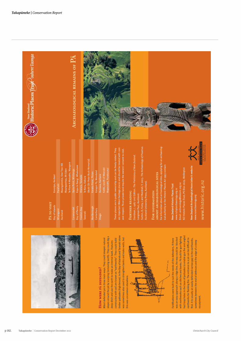
p 182. Takapūneke Conservation Report December 2012 Christchurch City Council
Takapūneke | Conservation Report
Ho
w w
ere
pä d
efen
ded
?Mäo
ri d
efen
ded
pä in
thre
e m
ain
way
s. T
hey
coul
d st
eepe
n na
tura
l
slop
es a
roun
d th
e pä
by
scar
ping
(rem
ovin
g ea
rth)
. The
y co
uld
dig
a
deep
dit
ch a
nd u
se th
e ea
rth
to m
ake
an in
tern
al b
ank.
Fea
ture
s
cons
truc
ted
wit
h so
il ar
e kn
own
as “
eart
hwor
ks”.
The
y co
uld
build
timbe
r pal
isad
es (h
igh
fenc
es).
In th
e B
ay o
f Isl
ands
and
Tar
anak
i sto
ne
was
som
etim
es a
lso
used
to s
tren
gthe
n ba
nks
and
mak
e w
alls
, but
this
was
unc
omm
on e
lsew
here
.
Fort
ifica
tion
s w
ere
built
to s
uit t
he n
eeds
of t
he d
efen
ders
. If t
here
was
an
easy
app
roac
h al
ong
a ri
dge
line,
the
way
cou
ld b
e b
lock
ed
wit
h ea
rthw
orks
suc
h as
dit
ches
and
ban
ks. P
ä bu
ilt fo
r gun
figh
ting
had
loop
hol
es in
the
base
of p
alis
ades
to e
nabl
e gu
n fir
e an
d an
gled
eart
hwor
ks fo
r flan
king
fire
. The
ent
ranc
e to
a pä
can
be d
ifficu
lt to
find.
It is
usu
ally
an
easi
ly d
efen
ded
narr
ow g
ap in
the
eart
hwor
ks,
som
etim
es b
etw
een
the
end
of d
efen
ces
and
the
edge
of a
ste
ep
esca
rpm
ent.
Pä
to v
isit
Bay
of I
slan
ds
Koro
ripo
, Ker
iker
i
Wha
ngar
ei
Para
haki
Auc
klan
dM
aung
akie
kie,
One
Tre
e H
ill
Mau
ngaw
hau,
Mt E
den
Te P
ane
A M
ataa
ho, M
ange
re
Coro
man
del
Opi
to P
oint
, Whi
tian
ga
Bay
of P
lent
yKa
pu te
Ran
gi, W
haka
tane
Haw
kes
Bay
Ota
tara
, Tar
adal
e
Tara
naki
Te K
oru,
Oak
ura
Oko
ki (S
ir P
eter
Buc
k M
emor
ial)
Mar
lbor
ough
Kara
ka P
oint
, Pic
ton
Cant
erbu
ryKa
iapo
i Pä,
Woo
dend
Ota
goH
uria
wa,
Kar
itan
e
Kati
ki, s
outh
of M
oera
ki
Map
outa
hi, P
urak
aunu
i
Thes
e pl
aces
are
in p
ublic
ow
ners
hip
and
can
be fr
eely
vis
ited
. The
y
are
impo
rtan
t Mäo
ri h
erit
age
plac
es a
nd s
houl
d be
trea
ted
wit
h ca
re
and
resp
ect.
Pä
on p
riva
te la
nd re
quir
e th
e ow
ners
’ con
sent
to v
isit
.
Furt
her
rea
din
gD
avid
son,
J. 1
987
2nd
Edit
ion.
The
Pre
hist
ory
of N
ew Z
eala
nd.
Long
man
Pau
l, A
uckl
and.
Sutt
on, D
, Fur
ey, L
and
Mar
shal
l, Y.
200
3. T
he A
rcha
eolo
gy o
f Pou
erua
.
Auc
klan
d U
nive
rsit
y Pr
ess,
Auc
klan
d.
For
info
rmat
ion
abo
ut
arch
aeo
logi
cal
site
sFo
r inf
orm
atio
n ab
out a
rcha
eolo
gica
l site
s, a
pply
ing
for a
n ar
chae
olog
-
ical
aut
hori
ty o
r the
His
tori
c P
lace
s A
ct 1
993
cont
act:
New
Zea
land
His
tori
c Pl
aces
Tru
st
ww
w.n
zhpt
arch
aeol
ogy.
org.
nz
Emai
l: ar
chae
olog
y@hi
stor
ic.o
rg.n
z
NZ
His
tori
c Pl
aces
Tru
st, P
O B
ox 2
629,
Wel
lingt
on
New
Zea
land
Arc
haeo
logi
cal A
ssoc
iati
on’s
web
site
ww
w.n
zarc
haeo
logy
.org
ww
w.h
isto
ric.
org
.nz
Arc
hae
olo
gica
l re
mai
ns
of Pä
Wh
at is
a pä?
A pä
is a
fort
ified
pla
ce b
uilt
by
Mäo
ri. P
ä ar
e as
soci
ated
wit
h a
grou
p
of re
late
d pe
ople
and
var
y in
siz
e fr
om th
ose
built
for w
hana
u (a
larg
e
fam
ily) t
o ha
pu o
r iw
i (tr
ibe)
of s
ever
al h
undr
ed p
eopl
e. In
the
past
,
they
wer
e bu
ilt a
s re
fuge
from
att
ack
duri
ng ti
mes
of w
ar, b
ut a
lso
had
man
y ot
her u
ses.
The
y w
ere
secu
re p
lace
s to
live
and
sto
re fo
od, t
hey
wer
e re
side
nces
for i
mpo
rtan
t peo
ple
and
cent
res
for l
earn
ing,
cra
fts
and
hort
icul
ture
. Pä
wer
e no
t liv
ed in
all
the
tim
e; a
ccor
ding
to th
e
seas
on, p
eopl
e m
ay h
ave
been
aw
ay fi
shin
g or
col
lect
ing
bird
s, o
r
look
ing
afte
r gar
dens
. Peo
ple
may
hav
e liv
ed in
ope
n se
ttle
men
ts m
ost
of th
e ti
me,
onl
y go
ing
to th
e pä
in ti
mes
of t
roub
le.
Wh
ere
are
pä f
ou
nd
?Th
e ar
chae
olog
ical
rem
ains
of p
ä ca
n be
ver
y ob
viou
s in
the
land
scap
e.
They
are
oft
en lo
cate
d on
nat
ural
ly d
efen
sibl
e hi
gh p
oint
s, s
uch
as th
e
end
of a
ste
ep-s
ided
ridg
e, a
coa
stal
hea
dlan
d or
an
isol
ated
hill
. Pä
wer
e al
so b
uilt
at t
he e
dge
of s
wam
ps a
nd s
omet
imes
on
flat l
and.
In m
any
case
s pä
can
be
reco
gnis
ed fr
om a
dis
tanc
e by
thei
r pro
file
on th
e sk
ylin
e, s
uch
as a
flat
pla
tfor
m, t
he ‘v
’ sha
ped
notc
h of
a
defe
nsiv
e di
tch
or a
ser
ies
of s
teps
(ter
race
s) c
ut in
to th
e hi
llsid
e to
mak
e le
vel a
reas
.
Wh
at is
insi
de
a pä
?Th
ere
is n
o se
t pla
n fo
r the
insi
de o
f pä,
the
layo
ut d
epen
ds o
n th
e
natu
re o
f eac
h si
te a
nd it
s pu
rpos
e. A
rcha
eolo
gica
l rem
ains
of p
lace
s
that
wer
e co
mm
only
foun
d in
side
may
stil
l be
seen
. The
tihi
(pla
tfor
m)
is a
larg
e fla
t are
a at
the
top,
oft
en a
ssoc
iate
d w
ith
impo
rtan
t peo
ple.
Terr
aces
are
art
ifici
ally
leve
lled
area
s th
at p
rovi
ded
flat a
reas
for
activ
ities
and
bui
ldin
gs. R
ecta
ngul
ar o
r cir
cula
r dep
ress
ions
are
oft
en
the
rem
ains
of p
its
for s
tori
ng k
umar
a. A
rcha
eolo
gica
l exc
avat
ion
has
show
n th
at th
ese
pits
wer
e or
igin
ally
up
to a
met
re d
eep
and
wer
e
cove
red
by a
pit
ched
roof
.
Wh
en w
ere
pä b
uil
t?Th
e ea
rlie
st d
ate
for d
efen
ded
site
s, o
btai
ned
by a
rcha
e-
olog
ists
usi
ng ra
dioc
arbo
n da
ting
tech
niqu
es, i
s th
e 16
th
cent
ury.
Man
y pä
con
tinu
ed to
be
built
and
live
d in
unt
il
the
earl
y 19
th c
entu
ry .
Pä w
ere
seen
and
des
crib
ed b
y
Capt
ain
Jam
es C
ook
in 1
770
and
by E
urop
ean
mis
sion
arie
s
and
trav
elle
rs in
the
earl
y 18
00s.
Aft
er th
e ar
riva
l of t
he
mus
ket,
trad
ition
al s
tyle
s of
pä
cons
truc
tion
wer
e m
odifi
ed
to s
uit fi
ghti
ng w
ith
guns
and
art
iller
y. In
som
e pl
aces
, pä
rem
ain
in u
se to
day.
Pro
tect
ing
arch
aeo
logi
cal
site
sPä
are
an
irre
plac
eabl
e pa
rt o
f our
her
itag
e. T
hey
are
arch
aeol
ogic
al
site
s an
d ar
e pr
otec
ted
by th
e H
isto
ric
Pla
ces
Act
199
3. If
you
wis
h to
do a
ny w
ork
that
may
aff
ect a
n ar
chae
olog
ical
site
you
mus
t obt
ain
an
auth
ority
from
the
New
Zea
land
His
tori
c Pl
aces
Tru
st b
efor
e yo
u be
gin.
It is
an
offe
nce
to m
odify
, dam
age
or d
estr
oy a
n ar
chae
olog
ical
sit
e
wit
hout
the
wri
tten
aut
hori
ty o
f the
Tru
st.
Imag
esIn
side
spr
ead,
clo
ckw
ise
from
top
left
: Mot
upoi
Pah
wit
h To
ngar
iro,
184
4. G
eorg
eF.
Ang
as (a
tl, a
-196
-022
); P
a at
Ota
utu,
Sou
th T
aran
aki,
Kevi
n Jo
nes
(do
c); F
rom
the
Pah
Pipi
tea,
Por
t Nic
hols
on, 1
840.
Will
iam
Mei
n Sm
ith (a
tl, c
-011
-005
); P
rese
ntda
y Ra
ngir
iri Pä,
Wai
kato
(nzh
pt);
Ear
thw
orks
at R
angi
riri
Pä,
186
3. C
harle
s H
eaph
y
(atl
a-1
45-0
05) |
Fro
nt c
over
: Pä
at O
ne T
ree
Hill
/Mau
ngak
ieki
e, K
evin
Jone
s (d
oc)
;Pa
lisad
e ca
rvin
g/Te
kote
ko (T
e Pa
pa) |
Insi
de c
over
: Tan
e-nu
i-a-
Ran
gi Pä,
Haw
kes
Bay
, 185
9. H
enry
S. B
ates
(atl
, no
n-a
tl-0
008)
; Fig
htin
g st
ages
and
pal
isad
e.O
taka
nini
Pä,
Sou
th K
aipa
ra, 1
971.
P. B
ellw
ood
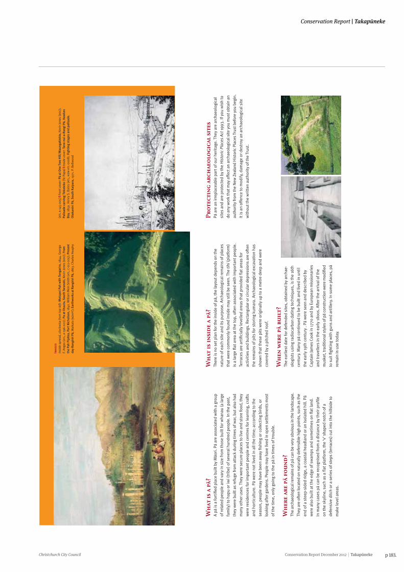
Christchurch City Council Conservation Report December 2012 Takapūneke p 183.
Conservation Report | Takapūneke
Ho
w w
ere
pä d
efen
ded
?Mäo
ri d
efen
ded
pä in
thre
e m
ain
way
s. T
hey
coul
d st
eepe
n na
tura
l
slop
es a
roun
d th
e pä
by
scar
ping
(rem
ovin
g ea
rth)
. The
y co
uld
dig
a
deep
dit
ch a
nd u
se th
e ea
rth
to m
ake
an in
tern
al b
ank.
Fea
ture
s
cons
truc
ted
wit
h so
il ar
e kn
own
as “
eart
hwor
ks”.
The
y co
uld
build
timbe
r pal
isad
es (h
igh
fenc
es).
In th
e B
ay o
f Isl
ands
and
Tar
anak
i sto
ne
was
som
etim
es a
lso
used
to s
tren
gthe
n ba
nks
and
mak
e w
alls
, but
this
was
unc
omm
on e
lsew
here
.
Fort
ifica
tion
s w
ere
built
to s
uit t
he n
eeds
of t
he d
efen
ders
. If t
here
was
an
easy
app
roac
h al
ong
a ri
dge
line,
the
way
cou
ld b
e b
lock
ed
wit
h ea
rthw
orks
suc
h as
dit
ches
and
ban
ks. P
ä bu
ilt fo
r gun
figh
ting
had
loop
hol
es in
the
base
of p
alis
ades
to e
nabl
e gu
n fir
e an
d an
gled
eart
hwor
ks fo
r flan
king
fire
. The
ent
ranc
e to
a pä
can
be d
ifficu
lt to
find.
It is
usu
ally
an
easi
ly d
efen
ded
narr
ow g
ap in
the
eart
hwor
ks,
som
etim
es b
etw
een
the
end
of d
efen
ces
and
the
edge
of a
ste
ep
esca
rpm
ent.
Pä
to v
isit
Bay
of I
slan
ds
Koro
ripo
, Ker
iker
i
Wha
ngar
ei
Para
haki
Auc
klan
dM
aung
akie
kie,
One
Tre
e H
ill
Mau
ngaw
hau,
Mt E
den
Te P
ane
A M
ataa
ho, M
ange
re
Coro
man
del
Opi
to P
oint
, Whi
tian
ga
Bay
of P
lent
yKa
pu te
Ran
gi, W
haka
tane
Haw
kes
Bay
Ota
tara
, Tar
adal
e
Tara
naki
Te K
oru,
Oak
ura
Oko
ki (S
ir P
eter
Buc
k M
emor
ial)
Mar
lbor
ough
Kara
ka P
oint
, Pic
ton
Cant
erbu
ryKa
iapo
i Pä,
Woo
dend
Ota
goH
uria
wa,
Kar
itan
e
Kati
ki, s
outh
of M
oera
ki
Map
outa
hi, P
urak
aunu
i
Thes
e pl
aces
are
in p
ublic
ow
ners
hip
and
can
be fr
eely
vis
ited
. The
y
are
impo
rtan
t Mäo
ri h
erit
age
plac
es a
nd s
houl
d be
trea
ted
wit
h ca
re
and
resp
ect.
Pä
on p
riva
te la
nd re
quir
e th
e ow
ners
’ con
sent
to v
isit
.
Furt
her
rea
din
gD
avid
son,
J. 1
987
2nd
Edit
ion.
The
Pre
hist
ory
of N
ew Z
eala
nd.
Long
man
Pau
l, A
uckl
and.
Sutt
on, D
, Fur
ey, L
and
Mar
shal
l, Y.
200
3. T
he A
rcha
eolo
gy o
f Pou
erua
.
Auc
klan
d U
nive
rsit
y Pr
ess,
Auc
klan
d.
For
info
rmat
ion
abo
ut
arch
aeo
logi
cal
site
sFo
r inf
orm
atio
n ab
out a
rcha
eolo
gica
l site
s, a
pply
ing
for a
n ar
chae
olog
-
ical
aut
hori
ty o
r the
His
tori
c P
lace
s A
ct 1
993
cont
act:
New
Zea
land
His
tori
c Pl
aces
Tru
st
ww
w.n
zhpt
arch
aeol
ogy.
org.
nz
Emai
l: ar
chae
olog
y@hi
stor
ic.o
rg.n
z
NZ
His
tori
c Pl
aces
Tru
st, P
O B
ox 2
629,
Wel
lingt
on
New
Zea
land
Arc
haeo
logi
cal A
ssoc
iati
on’s
web
site
ww
w.n
zarc
haeo
logy
.org
ww
w.h
isto
ric.
org
.nz
Arc
hae
olo
gica
l re
mai
ns
of Pä
Wh
at is
a pä?
A pä
is a
fort
ified
pla
ce b
uilt
by
Mäo
ri. P
ä ar
e as
soci
ated
wit
h a
grou
p
of re
late
d pe
ople
and
var
y in
siz
e fr
om th
ose
built
for w
hana
u (a
larg
e
fam
ily) t
o ha
pu o
r iw
i (tr
ibe)
of s
ever
al h
undr
ed p
eopl
e. In
the
past
,
they
wer
e bu
ilt a
s re
fuge
from
att
ack
duri
ng ti
mes
of w
ar, b
ut a
lso
had
man
y ot
her u
ses.
The
y w
ere
secu
re p
lace
s to
live
and
sto
re fo
od, t
hey
wer
e re
side
nces
for i
mpo
rtan
t peo
ple
and
cent
res
for l
earn
ing,
cra
fts
and
hort
icul
ture
. Pä
wer
e no
t liv
ed in
all
the
tim
e; a
ccor
ding
to th
e
seas
on, p
eopl
e m
ay h
ave
been
aw
ay fi
shin
g or
col
lect
ing
bird
s, o
r
look
ing
afte
r gar
dens
. Peo
ple
may
hav
e liv
ed in
ope
n se
ttle
men
ts m
ost
of th
e ti
me,
onl
y go
ing
to th
e pä
in ti
mes
of t
roub
le.
Wh
ere
are
pä f
ou
nd
?Th
e ar
chae
olog
ical
rem
ains
of p
ä ca
n be
ver
y ob
viou
s in
the
land
scap
e.
They
are
oft
en lo
cate
d on
nat
ural
ly d
efen
sibl
e hi
gh p
oint
s, s
uch
as th
e
end
of a
ste
ep-s
ided
ridg
e, a
coa
stal
hea
dlan
d or
an
isol
ated
hill
. Pä
wer
e al
so b
uilt
at t
he e
dge
of s
wam
ps a
nd s
omet
imes
on
flat l
and.
In m
any
case
s pä
can
be
reco
gnis
ed fr
om a
dis
tanc
e by
thei
r pro
file
on th
e sk
ylin
e, s
uch
as a
flat
pla
tfor
m, t
he ‘v
’ sha
ped
notc
h of
a
defe
nsiv
e di
tch
or a
ser
ies
of s
teps
(ter
race
s) c
ut in
to th
e hi
llsid
e to
mak
e le
vel a
reas
.
Wh
at is
insi
de
a pä
?Th
ere
is n
o se
t pla
n fo
r the
insi
de o
f pä,
the
layo
ut d
epen
ds o
n th
e
natu
re o
f eac
h si
te a
nd it
s pu
rpos
e. A
rcha
eolo
gica
l rem
ains
of p
lace
s
that
wer
e co
mm
only
foun
d in
side
may
stil
l be
seen
. The
tihi
(pla
tfor
m)
is a
larg
e fla
t are
a at
the
top,
oft
en a
ssoc
iate
d w
ith
impo
rtan
t peo
ple.
Terr
aces
are
art
ifici
ally
leve
lled
area
s th
at p
rovi
ded
flat a
reas
for
activ
ities
and
bui
ldin
gs. R
ecta
ngul
ar o
r cir
cula
r dep
ress
ions
are
oft
en
the
rem
ains
of p
its
for s
tori
ng k
umar
a. A
rcha
eolo
gica
l exc
avat
ion
has
show
n th
at th
ese
pits
wer
e or
igin
ally
up
to a
met
re d
eep
and
wer
e
cove
red
by a
pit
ched
roof
.
Wh
en w
ere
pä b
uil
t?Th
e ea
rlie
st d
ate
for d
efen
ded
site
s, o
btai
ned
by a
rcha
e-
olog
ists
usi
ng ra
dioc
arbo
n da
ting
tech
niqu
es, i
s th
e 16
th
cent
ury.
Man
y pä
con
tinu
ed to
be
built
and
live
d in
unt
il
the
earl
y 19
th c
entu
ry .
Pä w
ere
seen
and
des
crib
ed b
y
Capt
ain
Jam
es C
ook
in 1
770
and
by E
urop
ean
mis
sion
arie
s
and
trav
elle
rs in
the
earl
y 18
00s.
Aft
er th
e ar
riva
l of t
he
mus
ket,
trad
ition
al s
tyle
s of
pä
cons
truc
tion
wer
e m
odifi
ed
to s
uit fi
ghti
ng w
ith
guns
and
art
iller
y. In
som
e pl
aces
, pä
rem
ain
in u
se to
day.
Pro
tect
ing
arch
aeo
logi
cal
site
sPä
are
an
irre
plac
eabl
e pa
rt o
f our
her
itag
e. T
hey
are
arch
aeol
ogic
al
site
s an
d ar
e pr
otec
ted
by th
e H
isto
ric
Pla
ces
Act
199
3. If
you
wis
h to
do a
ny w
ork
that
may
aff
ect a
n ar
chae
olog
ical
site
you
mus
t obt
ain
an
auth
ority
from
the
New
Zea
land
His
tori
c Pl
aces
Tru
st b
efor
e yo
u be
gin.
It is
an
offe
nce
to m
odify
, dam
age
or d
estr
oy a
n ar
chae
olog
ical
sit
e
wit
hout
the
wri
tten
aut
hori
ty o
f the
Tru
st.
Imag
esIn
side
spr
ead,
clo
ckw
ise
from
top
left
: Mot
upoi
Pah
wit
h To
ngar
iro,
184
4. G
eorg
eF.
Ang
as (a
tl, a
-196
-022
); P
a at
Ota
utu,
Sou
th T
aran
aki,
Kevi
n Jo
nes
(do
c); F
rom
the
Pah
Pipi
tea,
Por
t Nic
hols
on, 1
840.
Will
iam
Mei
n Sm
ith (a
tl, c
-011
-005
); P
rese
ntda
y Ra
ngir
iri Pä,
Wai
kato
(nzh
pt);
Ear
thw
orks
at R
angi
riri
Pä,
186
3. C
harle
s H
eaph
y
(atl
a-1
45-0
05) |
Fro
nt c
over
: Pä
at O
ne T
ree
Hill
/Mau
ngak
ieki
e, K
evin
Jone
s (d
oc)
;Pa
lisad
e ca
rvin
g/Te
kote
ko (T
e Pa
pa) |
Insi
de c
over
: Tan
e-nu
i-a-
Ran
gi Pä,
Haw
kes
Bay
, 185
9. H
enry
S. B
ates
(atl
, no
n-a
tl-0
008)
; Fig
htin
g st
ages
and
pal
isad
e.O
taka
nini
Pä,
Sou
th K
aipa
ra, 1
971.
P. B
ellw
ood
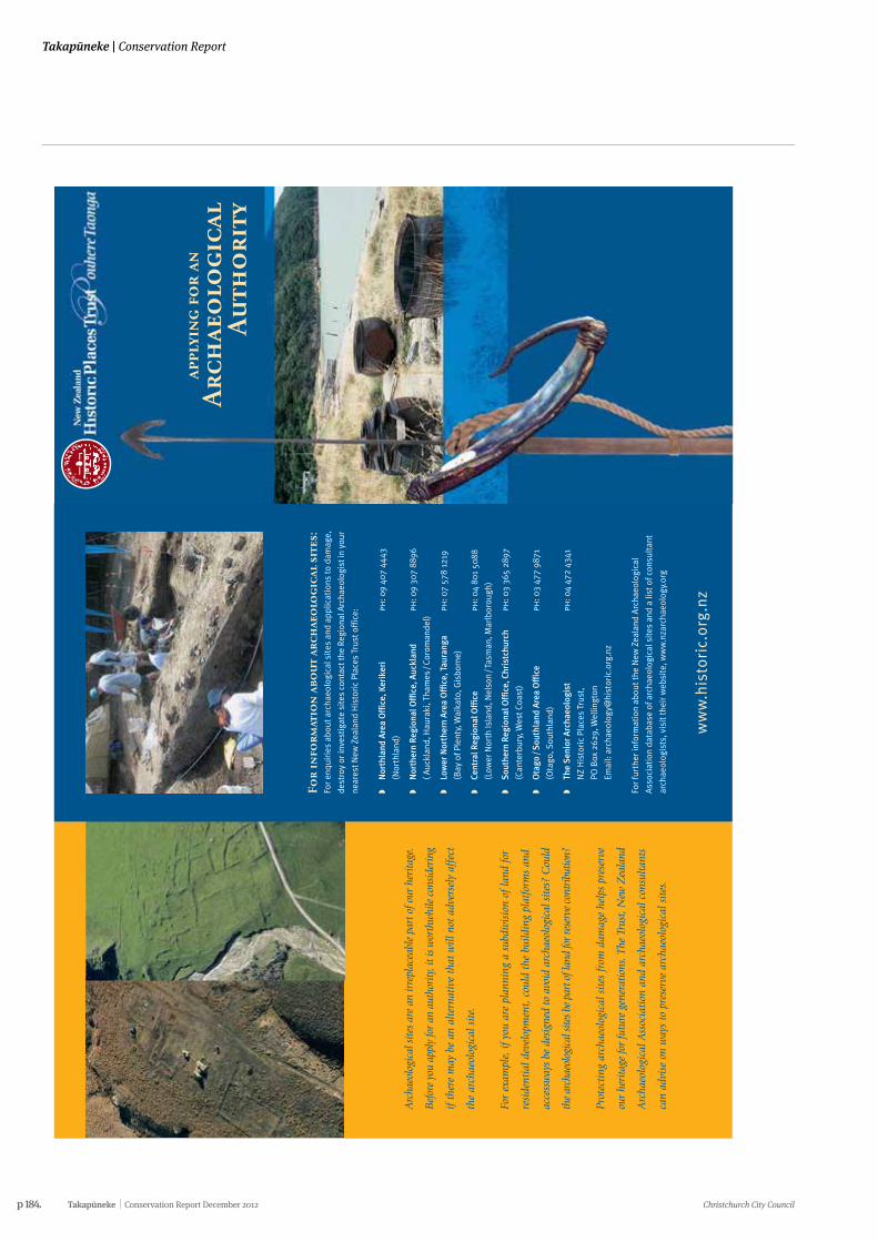
p 184. Takapūneke Conservation Report December 2012 Christchurch City Council
Takapūneke | Conservation Report
Arc
haeo
logi
cal s
ites
are
an ir
repl
acea
ble
part
of o
ur h
erita
ge.
Bef
ore
you
appl
y fo
r an
aut
hori
ty, i
t is w
orth
whi
le c
onsi
deri
ng
if th
ere
may
be
an a
ltern
ativ
e th
at w
ill n
ot a
dver
sely
aff
ect
the
arch
aeol
ogic
al s
ite.
For
exam
ple,
if y
ou a
re p
lann
ing
a su
bdiv
isio
n of
land
for
resi
dent
ial d
evel
opm
ent,
cou
ld t
he b
uild
ing
plat
form
s an
d
acce
ssw
ays
be d
esig
ned
to a
void
arc
haeo
logi
cal s
ites?
Cou
ld
the
arch
aeol
ogic
al si
tes b
e pa
rt o
f lan
d fo
r res
erve
con
trib
utio
n?
Prot
ecti
ng a
rcha
eolo
gica
l sit
es f
rom
dam
age
help
s pr
eser
ve
our
heri
tage
for
futu
re g
ener
atio
ns. T
he T
rust
, New
Zea
land
Arc
haeo
logi
cal A
ssoc
iati
on a
nd a
rcha
eolo
gica
l con
sulta
nts
can
advi
se o
n w
ays
to p
rese
rve
arch
aeol
ogic
al s
ites
.
For
info
rmat
ion
abo
ut
arch
aeo
logi
cal
site
s:Fo
r enq
uiri
es a
bout
arc
haeo
logi
cal s
ites
and
app
licat
ions
to d
amag
e,
dest
roy
or in
vest
igat
e si
tes
cont
act t
he R
egio
nal A
rcha
eolo
gist
in y
our
near
est N
ew Z
eala
nd H
isto
ric
Plac
es T
rust
off
ice:
�N
orth
land
Are
a O
ffic
e, K
erik
eri
ph: 0
9 40
7 44
43
(Nor
thla
nd)
�N
orth
ern
Regi
onal
Offi
ce, A
uckl
and
ph: 0
9 30
7 88
96
( Auc
klan
d, H
aura
ki, T
ham
es /
Coro
man
del)
�Lo
wer
Nor
ther
n A
rea
Offi
ce, T
aura
nga
ph: 0
7 57
8 12
19
(Bay
of P
lent
y, W
aika
to, G
isbo
rne)
�Ce
ntra
l Reg
iona
l Offi
ceph
: 04
801
5088
(Low
er N
orth
Isla
nd, N
elso
n / T
asm
an, M
arlb
orou
gh)
�S
outh
ern
Regi
onal
Offi
ce, C
hris
tchu
rch
ph: 0
3 36
5 28
97
(Can
terb
ury,
Wes
t Coa
st)
�O
tago
/ S
outh
land
Are
a O
ffic
eph
: 03
477
9871
(Ota
go, S
outh
land
)
�Th
e S
enio
r Arc
haeo
logi
stph
: 04
472
4341
NZ
His
tori
c Pl
aces
Tru
st,
PO B
ox 2
629,
Wel
lingt
on
Emai
l: ar
chae
olog
y@hi
stor
ic.o
rg.n
z
For f
urth
er in
form
atio
n ab
out t
he N
ew Z
eala
nd A
rcha
eolo
gica
l
Ass
ocia
tion
dat
abas
e of
arc
haeo
logi
cal s
ites
and
a li
st o
f con
sult
ant
arch
aeol
ogis
ts, v
isit
thei
r web
site
, ww
w.n
zarc
haeo
logy
.org
ww
w.h
isto
ric.
org
.nz
appl
yin
g fo
r an
A
rch
aeo
logi
cal
Au
tho
rity
Arc
haeo
logi
cal s
ites
are
irre
plac
eabl
e pa
rts
of o
ur h
erit
age.
The
y ar
e pr
otec
ted
by t
he H
isto
ric
Plac
es A
ct 1
993.
The
New
Zea
land
His
tori
c Pl
aces
Trus
t w
ants
to
wor
k w
ith
you
to id
enti
fy, p
rote
ct, p
rese
rve
and
cons
erve
our
arc
haeo
logi
cal s
ites
. It
mat
ters
to
us a
ll.
Ho
w d
o i
fin
d o
ut
abo
ut
arch
aeo
logi
cal
site
s o
n m
y pr
ope
rty?
The
New
Zea
land
His
toric
Pla
ces
Trus
t's
arch
aeol
ogis
ts o
r you
r reg
iona
l
Trus
t O÷
ce c
an p
rovi
de in
form
atio
n ab
out a
rcha
eolo
gica
l sit
es. T
he
New
Zea
land
Arc
haeo
logi
cal A
ssoc
iati
on h
as a
nat
iona
l dat
abas
e of
reco
rded
arc
haeo
logi
cal s
ites
.
You
coul
d al
so e
mpl
oy a
n ar
chae
olog
ist t
o do
an
arch
aeol
ogic
al s
urve
y
of y
our p
rope
rty.
The
y w
ill b
e ab
le to
iden
tify
, rec
ord,
and
ass
ess
any
arch
aeol
ogic
al s
ites
that
may
be
pres
ent.
Wh
at a
re y
ou
r re
spo
nsi
bili
ties
?If
you
own,
occ
upy
or a
re re
spon
sibl
e fo
r lan
d, it
may
con
tain
an
arch
aeol
ogic
al s
ite. T
hese
site
s ar
e pr
otec
ted
in la
w. T
his
leafl
et e
xpla
ins
�W
hat a
n ar
chae
olog
ical
sit
e is
�H
ow it
is p
rote
cted
�W
hat y
ou d
o w
hen
wor
king
wit
h a
site
�H
ow y
ou c
an lo
ok a
fter
an
arch
aeol
ogic
al s
ite
�W
ho to
con
tact
for i
nfor
mat
ion
and
advi
ce.
Wh
at p
rote
ctio
n d
oes
the
law
giv
e ar
chae
olo
gica
l si
tes?
The
His
toric
Pla
ces
Act 1
993
mak
es it
unl
awfu
l for
any
per
son
to d
estr
oy,
dam
age
or m
odify
the
who
le o
r any
par
t of a
n ar
chae
olog
ical
sit
e,
whe
ther
or n
ot th
e la
nd o
n w
hich
the
site
is lo
cate
d is
des
igna
ted,
or
a re
sour
ce o
r bui
ldin
g co
nsen
t has
bee
n is
sued
, wit
hout
the
prio
r
auth
orit
y of
the
Trus
t.
It a
lso
prov
ides
for s
ubst
antia
l pen
altie
s fo
r una
utho
rise
d de
stru
ctio
n,
dam
age
or m
odifi
cati
on.
Wh
at if
i pl
an t
o d
o w
ork
that
may
dam
age
an a
rch
aeo
logi
cal
site
?If
ther
e is
a c
hanc
e yo
u m
ay d
amag
e a
site
, you
mus
t app
ly to
the
New
Zeal
and
His
tori
c Pl
aces
Tru
st fo
r per
mis
sion
to d
o so
. The
Tru
st c
an
advi
se y
ou o
f the
mos
t sui
tabl
e co
urse
of a
ctio
n.
If yo
u un
cove
r a p
revi
ousl
y un
know
n si
te d
urin
g ea
rthw
orks
, you
may
also
nee
d pe
rmis
sion
to c
ontin
ue. Y
ou m
ust s
top
any
wor
k th
at w
ould
affe
ct th
e si
te a
nd c
onta
ct th
e Tr
ust f
or a
dvic
e on
how
to p
roce
ed.
Imag
esIn
side
spr
ead,
clo
ckw
ise
from
left
: Rem
ains
of B
runn
er In
dust
rial
Com
plex
, Wes
tCo
ast (
nzh
pt);
Vie
w lo
okin
g do
wn
Haw
kest
one
Stre
et, W
ellin
gton
184
5(?)
Sam
uel
C. B
rees
(atl
, a-1
09-0
21);
She
ll m
idde
n, Ö
mah
a Co
ast,
Nor
thla
nd (n
zhpt
); M
äori
rock
art
, Fre
nchm
an’s
Gul
ly, S
outh
Can
terb
ury
(nzh
pt)
Fron
t cov
er: O
tuat
aua
Ston
efiel
ds (d
oc)
; Flin
tloc
k m
uske
t (te
pap
a, g
h008
078)
;Ko
tiat
e/ha
nd c
lub,
(te
papa
, me0
1417
3) |
Insi
de c
over
: Pä
at M
änge
re M
ount
ain/
TePa
ne ö
Mat
aaho
, Auc
klan
d Ke
vin
Jone
s (d
oc)
| B
ack
cove
r: A
rcha
eolo
gica
l exc
avat
ion
of C
hine
se g
old-
min
ing
sett
lem
ent,
Cro
mw
ell,
Ota
go (n
zhpt
)
Can
an
yon
e d
istu
rban
arc
hae
olo
gica
l si
te in
ord
er t
o s
tud
y it
?A
ny p
erso
n w
ishi
ng to
car
ry o
ut a
n in
vest
igat
ion
that
mig
ht d
istu
rb
an a
rcha
eolo
gica
l site
in a
ny w
ay m
ust a
pply
to th
e Tr
ust f
or p
erm
issi
on
to d
o so
.
Ho
w c
an i
loo
k af
ter
an a
rch
aeo
logi
cal
site
?Th
is w
ill d
epen
d on
the
type
of s
ite, l
ocal
env
ironm
ent c
ondi
tions
and
the
land
use
. If y
ou a
re d
evel
opin
g la
nd th
at c
onta
ins
arch
aeol
ogic
al
site
s, tr
y to
avo
id th
e si
tes
if po
ssib
le.
For m
ost r
ural
sit
es, g
rass
gra
zed
by s
heep
giv
es th
e be
st p
rote
ctio
n.
Regu
lar t
ram
plin
g by
hea
vier
ani
mal
s su
ch a
s ho
rses
and
cat
tle
can
erod
e th
e si
te. L
arge
pla
nts,
vin
es a
nd tr
ees
caus
e da
mag
e w
hen
thei
r
root
s gr
ow th
roug
h th
e si
te, a
nd fu
rthe
r dam
age
can
occu
r whe
n th
ey
are
rem
oved
, har
vest
ed, o
r blo
w o
ver.
You
mig
ht a
lso
wis
h to
pla
ce a
cov
enan
t ove
r the
site
, reg
iste
r the
site
wit
h th
e Tr
ust,
or c
reat
e a
rese
rve
to e
nsur
e it
s fu
ture
pro
tect
ion.
If
you
wou
ld li
ke a
dvic
e on
the
best
man
agem
ent a
nd p
rote
ctio
n fo
r
your
par
ticu
lar s
ite(
s), p
leas
e co
ntac
t the
Tru
st.

Christchurch City Council Conservation Report December 2012 Takapūneke p 185.
Conservation Report | Takapūneke
p 186. Takapūneke Conservation Report December 2012 Christchurch City Council
Takapūneke | Conservation Report
Appendix five:
HISTORIC GARDENS (THE FLORENCE CHARTER 1981)
Adopted by ICOMOS in December 1982.
PREAMBLE
The ICOMOS-IFLA International Committee for Historic Gardens, meeting in Florence on 21 May 1981, decided to draw up a charter on the preservation of historic gardens which would bear the name of that town. The present Florence Charter was drafted by the Committee and registered by ICOMOS on 15 December 1982 as an addendum to the Venice Charter covering the specific field concerned.
DEFINITIONS AND OBJECTIVES
Article 1.
"A historic garden is an architectural and horticultural composition of interest to the public from the historical or artistic point of view". As such, it is to be considered as a monument.
Article 2.
"The historic garden is an architectural composition whose constituents are primarily vegetal and therefore living, which means that they are perishable and renewable." Thus its appearance reflects the perpetual balance between the cycle of the seasons, the growth and decay of nature and the desire of the artist and craftsman to keep it permanently unchanged.
Article 3.
As a monument, the historic garden must be preserved in accordance with the spirit of the Venice Charter. However, since it is a living monument, its preservation must be governed by specific rules which are the subject of the Present charter.
Article 4.
The architectural composition of the historic garden includes:
• Its plan and its topography.
• Its vegetation, including its species, proportions, colour schemes, spacing and respective heights.
• Its structural and decorative features.
• Its water, running or still, reflecting the sky.
Article 5.
As the expression of the direct affinity between civilisation and nature, and as a place of enjoyment suited to meditation or repose, the garden thus acquires the cosmic significance of an idealised image of the world, a "paradise" in the etymological sense of the term, and yet a testimony to a culture, a style, an age, and often to the originality of a creative artist.
Article 6.
The term "historic garden" is equally applicable to small gardens and to large parks, whether formal or "landscape".
Article 7.
Whether or not it is associated with a building in which case it is an inseparable complement, the historic garden cannot be isolated from its own particular environment, whether urban or rural, artificial or natural.
Article 8.
A historic site is a specific landscape associated with a memorable act, as, for example, a major historic event; a well-known myth; an epic combat; or the subject of a famous picture.
Article 9.
The preservation of historic gardens depends on their identification and listing. They require several kinds of action, namely maintenance, conservation and restoration. In certain cases, reconstruction may be recommended. The authenticity of a historic garden depends as much on the design and scale of its various parts as on its decorative features and on the choice of plant or inorganic materials adopted for each of its parts.
MAINTENANCE, CONSERVATION, RESTORATION, RECONSTRUCTION
Article 10.
In any work of maintenance, conservation, restoration or reconstruction of a historic garden, or of any part of it, all its constituent features must be dealt with simultaneously. To isolate the various operations would damage the unity of the whole.
MAINTENANCE AND CONSERVATION
Article 11.
Continuous maintenance of historic gardens is of paramount importance. Since the principal material is vegetal, the preservation of the garden in an unchanged condition requires both prompt replacements when required and a long-term programme of periodic renewal (clear felling and replanting with mature specimens).
Article 12.
Those species of trees, shrubs, plants and flowers to be replaced periodically must be selected with regard for established and recognised practice in each botanical and horticultural region, and with the aim to determine the species initially grown and to preserve them.
Christchurch City Council Conservation Report December 2012 Takapūneke p 187.
Conservation Report | Takapūneke
HISTORIC GARDENS (THE FLORENCE CHARTER 1981)
Adopted by ICOMOS in December 1982.
PREAMBLE
The ICOMOS-IFLA International Committee for Historic Gardens, meeting in Florence on 21 May 1981, decided to draw up a charter on the preservation of historic gardens which would bear the name of that town. The present Florence Charter was drafted by the Committee and registered by ICOMOS on 15 December 1982 as an addendum to the Venice Charter covering the specific field concerned.
DEFINITIONS AND OBJECTIVES
Article 1.
"A historic garden is an architectural and horticultural composition of interest to the public from the historical or artistic point of view". As such, it is to be considered as a monument.
Article 2.
"The historic garden is an architectural composition whose constituents are primarily vegetal and therefore living, which means that they are perishable and renewable." Thus its appearance reflects the perpetual balance between the cycle of the seasons, the growth and decay of nature and the desire of the artist and craftsman to keep it permanently unchanged.
Article 3.
As a monument, the historic garden must be preserved in accordance with the spirit of the Venice Charter. However, since it is a living monument, its preservation must be governed by specific rules which are the subject of the Present charter.
Article 4.
The architectural composition of the historic garden includes:
• Its plan and its topography.
• Its vegetation, including its species, proportions, colour schemes, spacing and respective heights.
• Its structural and decorative features.
• Its water, running or still, reflecting the sky.
Article 5.
As the expression of the direct affinity between civilisation and nature, and as a place of enjoyment suited to meditation or repose, the garden thus acquires the cosmic significance of an idealised image of the world, a "paradise" in the etymological sense of the term, and yet a testimony to a culture, a style, an age, and often to the originality of a creative artist.
Article 6.
The term "historic garden" is equally applicable to small gardens and to large parks, whether formal or "landscape".
Article 7.
Whether or not it is associated with a building in which case it is an inseparable complement, the historic garden cannot be isolated from its own particular environment, whether urban or rural, artificial or natural.
Article 8.
A historic site is a specific landscape associated with a memorable act, as, for example, a major historic event; a well-known myth; an epic combat; or the subject of a famous picture.
Article 9.
The preservation of historic gardens depends on their identification and listing. They require several kinds of action, namely maintenance, conservation and restoration. In certain cases, reconstruction may be recommended. The authenticity of a historic garden depends as much on the design and scale of its various parts as on its decorative features and on the choice of plant or inorganic materials adopted for each of its parts.
MAINTENANCE, CONSERVATION, RESTORATION, RECONSTRUCTION
Article 10.
In any work of maintenance, conservation, restoration or reconstruction of a historic garden, or of any part of it, all its constituent features must be dealt with simultaneously. To isolate the various operations would damage the unity of the whole.
MAINTENANCE AND CONSERVATION
Article 11.
Continuous maintenance of historic gardens is of paramount importance. Since the principal material is vegetal, the preservation of the garden in an unchanged condition requires both prompt replacements when required and a long-term programme of periodic renewal (clear felling and replanting with mature specimens).
Article 12.
Those species of trees, shrubs, plants and flowers to be replaced periodically must be selected with regard for established and recognised practice in each botanical and horticultural region, and with the aim to determine the species initially grown and to preserve them.
p 188. Takapūneke Conservation Report December 2012 Christchurch City Council
Takapūneke | Conservation Report
Article 13.
The permanent or movable architectural, sculptural or decorative features which form an integral part of the historic garden must be removed or displaced only insofar as this is essential for their conservation or restoration. The replacement or restoration of any such jeopardised features must be effected in accordance with the principles of the Venice Charter, and the date of any complete replacement must be indicated.
Article 14.
The historic garden must be preserved in appropriate surroundings. Any alteration to the physical environment which will endanger the ecological equilibrium must be prohibited. These applications are applicable to all aspects of the infrastructure, whether internal or external (drainage works, irrigation systems, roads, car parks, fences, caretaking facilities, visitors' amenities, etc.).
RESTORATION AND RECONSTRUCTION
Article 15.
No restoration work and, above all, no reconstruction work on a historic garden shall be undertaken without thorough prior research to ensure that such work is scientifically executed and which will involve everything from excavation to the assembling of records relating to the garden in question and to similar gardens. Before any practical work starts, a project must be prepared on the basis of said research and must be submitted to a group of experts for joint examination and approval.
Article 16.
Restoration work must respect the successive stages of evolution of the garden concerned. In principle, no one period should be given precedence over any other, except in exceptional cases where the degree of damage or destruction affecting certain parts of a garden may be such that it is decided to reconstruct it on the basis of the traces that survive or of unimpeachable documentary evidence. Such reconstruction work might be undertaken more particularly on the parts of the garden nearest to the building it contains in order to bring out their significance in the design.
Article 17.
Where a garden has completely disappeared or there exists no more than conjectural evidence of its successive stages a reconstruction could not be considered a historic garden.
USE
Article 18.
While any historic garden is designed to be seen and walked about in, access to it must be restricted to the extent demanded by its size and vulnerability, so that its physical fabric and cultural message may be preserved.
Article 19.
By reason of its nature and purpose, a historic garden is a peaceful place conducive to human contacts, silence and awareness of nature. This conception of its everyday use must contrast with its role on those rare occasions when it accommodates a festivity. Thus, the conditions of such occasional use of a historic garden should be clearly defined, in order that any such festivity may itself serve to enhance the visual effect of the garden instead of
perverting or damaging it.
Article 20.
While historic gardens may be suitable for quiet games as a daily occurrence, separate areas appropriate for active and lively games and sports should also be laid out adjacent to the historic garden, so that the needs of the public may be satisfied in this respect without prejudice to the conservation of the gardens and landscapes.
Article 21.
The work of maintenance and conservation, the timing of which is determined by season and brief operations which serve to restore the garden's authenticity, must always take precedence over the requirements of public use. All arrangements for visits to historic gardens must be subjected to regulations that ensure the spirit of the place is preserved.
Article 22.
If a garden is walled, its walls may not be removed without prior examination of all the possible consequences liable to lead to changes in its atmosphere and to affect its preservation.
LEGAL AND ADMINISTRATIVE PROTECTION
Article 23.
It is the task of the responsible authorities to adopt, on the advice of qualified experts, the appropriate legal and administrative measures for the identification, listing and protection of historic gardens. The preservation of such gardens must be provided for within the framework of land-use plans and such provision must be duly mentioned in documents relating to regional and local planning. It is also the task of the responsible authorities to adopt, with the advice of qualified experts, the financial measures which will facilitate the maintenance, conservation and restoration, and, where necessary, the reconstruction of historic gardens.
Article 24.
The historic garden is one of the features of the patrimony whose survival, by reason of its nature, requires intensive, continuous care by trained experts. Suitable provision should therefore be made for the training of such persons, whether historians, architects, landscape architects, gardeners or botanists. Care should also be taken to ensure that there is regular propagation of the plant varieties necessary for maintenance or restoration.
Article 25.
Interest in historic gardens should be stimulated by every kind of activity capable of emphasising their true value as part of the patrimony and making for improved knowledge and appreciation of them: promotion of scientific research; international exchange and circulation of information; publications, including works designed for the general public; the encouragement of public access under suitable control and use of the media to develop awareness of the need for due respect for nature and the historic heritage. The most outstanding of the historic gardens shall be proposed for inclusion in the World Heritage List.
Nota Bene
The above recommendations are applicable to all the historic gardens in the world.
Additional clauses applicable to specific types of gardens may be subsequently appended to the present Charter with brief descriptions of the said types.
Christchurch City Council Conservation Report December 2012 Takapūneke p 189.
Conservation Report | Takapūneke
Article 13.
The permanent or movable architectural, sculptural or decorative features which form an integral part of the historic garden must be removed or displaced only insofar as this is essential for their conservation or restoration. The replacement or restoration of any such jeopardised features must be effected in accordance with the principles of the Venice Charter, and the date of any complete replacement must be indicated.
Article 14.
The historic garden must be preserved in appropriate surroundings. Any alteration to the physical environment which will endanger the ecological equilibrium must be prohibited. These applications are applicable to all aspects of the infrastructure, whether internal or external (drainage works, irrigation systems, roads, car parks, fences, caretaking facilities, visitors' amenities, etc.).
RESTORATION AND RECONSTRUCTION
Article 15.
No restoration work and, above all, no reconstruction work on a historic garden shall be undertaken without thorough prior research to ensure that such work is scientifically executed and which will involve everything from excavation to the assembling of records relating to the garden in question and to similar gardens. Before any practical work starts, a project must be prepared on the basis of said research and must be submitted to a group of experts for joint examination and approval.
Article 16.
Restoration work must respect the successive stages of evolution of the garden concerned. In principle, no one period should be given precedence over any other, except in exceptional cases where the degree of damage or destruction affecting certain parts of a garden may be such that it is decided to reconstruct it on the basis of the traces that survive or of unimpeachable documentary evidence. Such reconstruction work might be undertaken more particularly on the parts of the garden nearest to the building it contains in order to bring out their significance in the design.
Article 17.
Where a garden has completely disappeared or there exists no more than conjectural evidence of its successive stages a reconstruction could not be considered a historic garden.
USE
Article 18.
While any historic garden is designed to be seen and walked about in, access to it must be restricted to the extent demanded by its size and vulnerability, so that its physical fabric and cultural message may be preserved.
Article 19.
By reason of its nature and purpose, a historic garden is a peaceful place conducive to human contacts, silence and awareness of nature. This conception of its everyday use must contrast with its role on those rare occasions when it accommodates a festivity. Thus, the conditions of such occasional use of a historic garden should be clearly defined, in order that any such festivity may itself serve to enhance the visual effect of the garden instead of
perverting or damaging it.
Article 20.
While historic gardens may be suitable for quiet games as a daily occurrence, separate areas appropriate for active and lively games and sports should also be laid out adjacent to the historic garden, so that the needs of the public may be satisfied in this respect without prejudice to the conservation of the gardens and landscapes.
Article 21.
The work of maintenance and conservation, the timing of which is determined by season and brief operations which serve to restore the garden's authenticity, must always take precedence over the requirements of public use. All arrangements for visits to historic gardens must be subjected to regulations that ensure the spirit of the place is preserved.
Article 22.
If a garden is walled, its walls may not be removed without prior examination of all the possible consequences liable to lead to changes in its atmosphere and to affect its preservation.
LEGAL AND ADMINISTRATIVE PROTECTION
Article 23.
It is the task of the responsible authorities to adopt, on the advice of qualified experts, the appropriate legal and administrative measures for the identification, listing and protection of historic gardens. The preservation of such gardens must be provided for within the framework of land-use plans and such provision must be duly mentioned in documents relating to regional and local planning. It is also the task of the responsible authorities to adopt, with the advice of qualified experts, the financial measures which will facilitate the maintenance, conservation and restoration, and, where necessary, the reconstruction of historic gardens.
Article 24.
The historic garden is one of the features of the patrimony whose survival, by reason of its nature, requires intensive, continuous care by trained experts. Suitable provision should therefore be made for the training of such persons, whether historians, architects, landscape architects, gardeners or botanists. Care should also be taken to ensure that there is regular propagation of the plant varieties necessary for maintenance or restoration.
Article 25.
Interest in historic gardens should be stimulated by every kind of activity capable of emphasising their true value as part of the patrimony and making for improved knowledge and appreciation of them: promotion of scientific research; international exchange and circulation of information; publications, including works designed for the general public; the encouragement of public access under suitable control and use of the media to develop awareness of the need for due respect for nature and the historic heritage. The most outstanding of the historic gardens shall be proposed for inclusion in the World Heritage List.
Nota Bene
The above recommendations are applicable to all the historic gardens in the world.
Additional clauses applicable to specific types of gardens may be subsequently appended to the present Charter with brief descriptions of the said types.
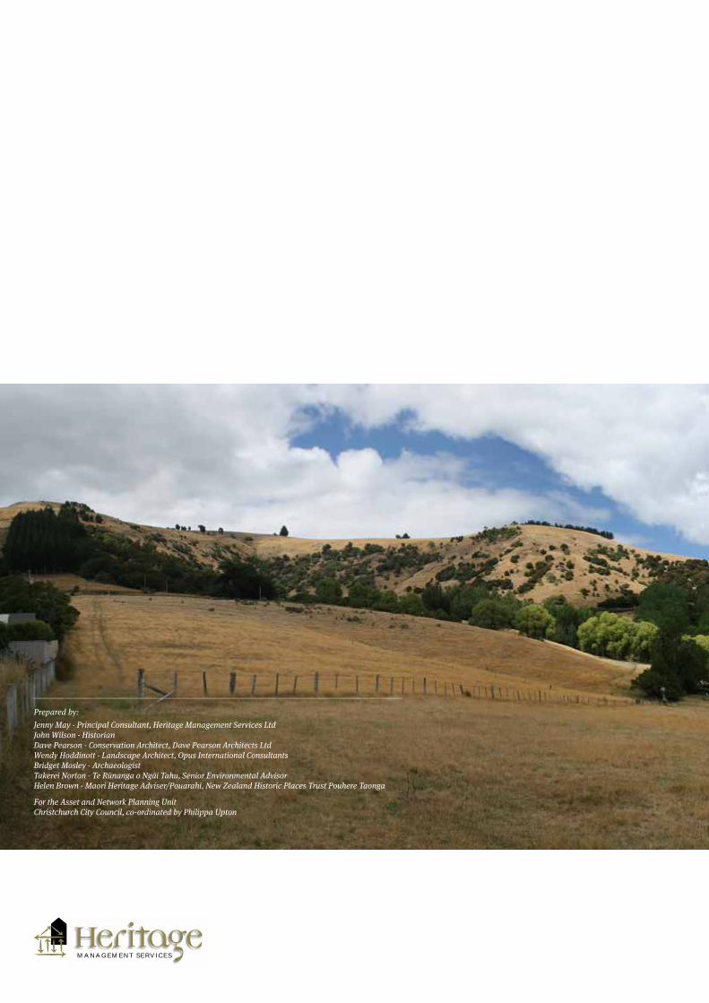
Prepared by:Jenny May - Principal Consultant, Heritage Management Services LtdJohn Wilson - HistorianDave Pearson - Conservation Architect, Dave Pearson Architects LtdWendy Hoddinott - Landscape Architect, Opus International ConsultantsBridget Mosley - Archaeologist Takerei Norton - Te Rūnanga o Ngāi Tahu, Senior Environmental AdvisorHelen Brown - Maori Heritage Adviser/Pouarahi, New Zealand Historic Places Trust Pouhere Taonga
For the Asset and Network Planning Unit Christchurch City Council, co-ordinated by Philippa Upton
M A N A G E M E N T S E R V I C E S