mount keira scout camp: conservation analysis report
TRANSCRIPT
ROBERTSON & HINDMARSH PTY LTDVERSION 1.3MAY 2013
MOUNT KEIRA SCOUT CAMP
CONSERVATION ANALYSIS REPORT
Robertson & Hindmarsh Pty LtdMay 2013 : Version 1.3
2
MT KEIRA
SCOUT CAMP
CONSERVATION
ANALYSIS REPORT
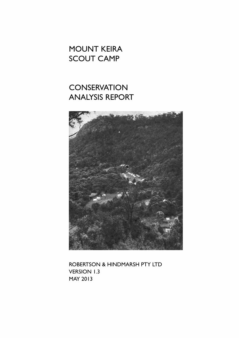
Front cover illustration:
View of the Mount Keira Scout Camp from Mount Keira
Source: Pix Magazine, December 1950, p.16
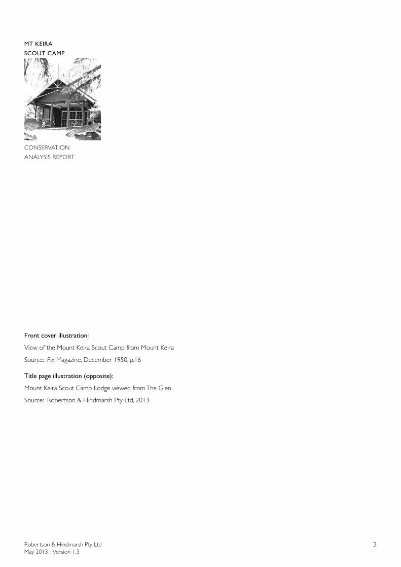
Title page illustration (opposite):
Mount Keira Scout Camp Lodge viewed from The Glen
Source: Robertson & Hindmarsh Pty Ltd, 2013
Robertson & Hindmarsh Pty LtdMay 2013 : Version 1.3
3
MT KEIRA
SCOUT CAMP
CONSERVATION
ANALYSIS REPORT
MOUNT KEIRA SCOUT CAMP
CONSERVATION ANALYSIS REPORT
ROBERTSON & HINDMARSH PTY LTDVERSION 1.3
MAY 2013

© Copyright State of NSW and the Office of Environment and Heritage
Disclaimer
This report was prepared by Robertson & Hindmarsh Pty Ltd in good faith exercising all due care and attention, but no representation or warranty, express or implied, is made as to the relevance, accuracy, completeness or fitness for purpose of this document in respect of any particular user’s circumstances. Users of this document should satisfy themselves concerning its application to, and where necessary seek expert advice in respect of, their situation. The views expressed within are not necessarily the views of the Office of Environment and Heritage (OEH) and may not represent OEH policy.
Copyright material
Every attempt has been made to identify and contact illustrative material copyright holders for permission to reproduce those images. If any copyright holder has not been contacted they can contact the authors of the report at Robertson & Hindmarsh Pty Ltd, Architects, email address: [email protected]
Where copyright permission has been granted by the copyright holder, it is for the display of this report on the website of the NSW National Parks and Wildlife Service. Permission has not been granted for any other use.
The printed copies of this report are printed on environmentally sustainable paper.

Robertson & Hindmarsh Pty LtdMay 2013 : Version 1.3
5
MT KEIRA
SCOUT CAMP
CONSERVATION
ANALYSIS REPORT
TABLE OF CONTENTS
Executive Summary 9
1.0 Introduction 11 1.1 Commissioning 11 1.2 Site Location and Ownership 11 1.3 Precinct Locations 17 1.4 Report Objectives & Outcomes 17 1.5 Scope of Conservation Analysis 17
1.6 Study Method 181.7 Documentary Sources 181.8 Report Limitations 181.9 Further Research 191.10 Report Team & Authorship 191.11 Stakeholders, Contributors & Acknowledgements 191.12 Report Versions 201.13 Abbreviations 21
2.0 Historical Analysis 232.1 Chronology 23
2.2 Historical Outline 34 2.2.1 Overview of Aboriginal Significance of Mount Keira 34 2.2.2 Coal Mining and Farming at Mt Keira 35 2.2.3 The Slack Fires 48 2.2.4 Miners’ Farms 50 2.2.5 Ventilating Shafts (1870s) 51 2.2.6 Mount Keira Apple Orchards 53 2.2.7 Scenic Lookouts and Tourism 54 2.2.8 Defence Works 59 2.2.9 Australian Iron & Steel Company 60 2.2.10 The Russell’s Farm 61 2.2.11 The Hoskins’ Charitable Donations 62 2.3 History of the Scouting Movement 63 2.3.1 Robert Baden-Powell 63 2.3.2 The Scouting Movement 64 2.3.3 Scouting in Australia 65 2.3.4 Scouting in NSW 68 2.4 Mount Keira Scout Camp 71 2.4.1 Scouting in the Illawarra 71 2.4.2 Guardians of Our Wildlife 81
Robertson & Hindmarsh Pty LtdMay 2013 : Version 1.3
6
MT KEIRA
SCOUT CAMP
CONSERVATION
ANALYSIS REPORT
3.0 Physical Analysis - Landscape, Buildings & Structures 83 3.1 General Description of the Site 83 3.2 Scout Camp Precincts 88 3.3 Precinct A - Main Camping Flat 90
3.4 Precinct B - Lodge and Swimming Pool 983.5 Precinct C - Chapel 1143.6 Precinct D - Cubs’ Area 1193.7 Precinct E - Camp Kitchen, Camp Fire Circle & Rovers 1253.8 Precinct F - Service Area 1383.9 Precinct G - Car Park, Northcott Flat & Entrance Road 1473.10 Precinct H - Ring’s Farm & Scout Camp Water Supply 1533.11 Axis, Views and Vistas 160 3.12 Curtilage 162
4.0 Historical Archaeological Analysis 164 4.1 Historic Land Use and Archaeological Potential 164 4.2 Assessment of Archaeological Potential 172 4.3 Discussion of Archaeological Significance 172 4.4 Statement of Heritage Significance 174 4.5 Statement of Archaeological Significance 175
5.0 Comparative Analysis 176 5.1 Scout Camps Generally 176 5.2 Baden-Powell Scout Centre, Pennant Hills 178 5.3 Camp Coutts, Waterfall 184 5.4 Comparison of Selected Scout Camps with Mount Keira Scout Camp 193 5.5 Analysis of Australian Scout Camp Designs 194 5.6 The Designers 195
6.0 CulturalSignificance 209
6.1 Introduction 209 6.2 Existing Assessments of Significance 210 6.3 Basis of Assessment 212 6.4 Statement of Cultural Significance 212 6.5 Discussion of Individual Levels of Significance 216 6.6 Individual Levels of Significance - Items 218 6.7 Individual Levels of Significance - Elements of Items 221
7.0 Bibliography 228 7.1 Published 228 7.2 Newspapers and Magazines 229 7.3 Unpublished Reports, Manuscripts and Pictures 231 7.4 Electronic 233
Robertson & Hindmarsh Pty LtdMay 2013 : Version 1.3
7
MT KEIRA
SCOUT CAMP
CONSERVATION
ANALYSIS REPORT
Appendices Appendix 1 Scout Promise & Scout Law 234Appendix 2 Regions of Scouts in NSW 235Appendix 3 Comparative Chart of Selected Scout Camps 236Appendix 4 List of Sorensen Landscaping Projects 237Appendix 5 Page from Sorensen Diaries, December 1939 238Appendix 6 Deed of Conveyance and Agreement to Donate, AIS & Minister for Lands, 3 December 1979 239 Appendix 7 Building Permit, 1940 (Warden’s Cottage) 254Appendix 8 Building Permit 1989 (Female Ablution Block) 255Appendix 9 National Trust of Australia (NSW) Illawarra Escarpment Landscape Conservation Area Listing Map 257Appendix 10 NSW National Parks and Wildlife Service HHIMS Listing Card 258Appendix 11 Map of Scout Licence Area, Mount Keira Scout Camp 259Appendix 12 Maps and Original Building Plans 261 Appendix 13 Plan of Significant Trees, 2013 290
VOLUME 2
Historic Heritage Information Management System (HHIMS) Inventory Sheets1. List of HHIMS inventory sheets2. A1 A.S. Hoskins Gateway3. A2 Sorensen Memorial Pathway4. A3, A4 & A5 Main Camping Flat, power huts & Baden Powell Commemorative Grove5. B1, B3 & B4 Lodge cleared area, stone walls, sundial, flagpole & bell6. B2 Paths from Main Camping Flat to Lodge7. B5 The Lodge8. B7 Swimming Pool9. C Chapel and paths to Chapel (including the site of the Wishing Tree)10. D2 Cub Lair Kitchen11. D3 Cub Lair Jungle Circle 12. E1 Main Campfire Circle 13. E2 Camp Kitchen14. E3 Camp HQ/Control Centre15. E5 Charles Jackson Chalet16. E6 Mount Keira Rover Den17. E7 Rovers’ Amphitheatre 18. F4 Camp Warden’s Cottage19. F5 Male Ablution Block20. G2 & G7 Camp Access Road & Old Mount Keira Road21. G3 Main Car Park22. G4 Northcott Flat23. G8 Site of the mine ventilation furnace shaft 24. H Site of former Ring’s Farm Buildings25. H Ring’s Farm & Scout Camp Water Supply

Robertson & Hindmarsh Pty LtdMay 2013 : Version 1.3
8
MT KEIRA
SCOUT CAMP
CONSERVATION
ANALYSIS REPORT

Robertson & Hindmarsh Pty LtdMay 2013 : Version 1.3
9
MT KEIRA
SCOUT CAMP
CONSERVATION
ANALYSIS REPORT
EXECUTIVE SUMMARY
The Mount Keira Scout Camp is a rare instance of a scout camp in occupying a leased area within an area of national park/state forest in New South Wales. The historical reasons for this lie in the philanthropy of local industrialist and supporter of the scout movement, Mr A.S. (“Sid”) Hoskins, who supplied the site for the establishment of the scout camp on his company’s mining lease land. He not only supplied the land but financed the design and construction of the landscape by landscape designer and contractor, Paul Sorensen, and buildings by brother-in-law architect, Geoffrey Loveridge. The site later became part of what is now the Illawarra Escarpment State Conservation Area.
The 1940 opening of the camp was filmed by Cinesound Newsreel and shown around Australia as part of Australia’s morale-boosting, anti-fascist war effort.
This Conservation Analysis Report was commissioned by the NSW Office of Environment and Heritage (National Parks and Wildlife Service) as the first stage of the process to identify and manage the unique built and natural heritage assets of the Mount Keira Scout Camp site within the Illawarra Escarpment State Conservation Area.
SUMMARY STATEMENT OF CULTURAL SIGNIFICANCE
The Mount Keira Scout Camp is significant aesthetically for its location high on the Illawarra Escarpment with its dramatic vistas and views over the Illawarra and for the considered layout of the camp as a series of cleared glades and levelled platforms forming a hierarchy of spaces as one moves through the site from east to west; from the mundane world of the car park, through the long main camping area aligned with the two high landscape features (Mount Keira and Robertson’s Lookout), to the well-designed community building (the Lodge), to the spiritually-charged open air Chapel at the end of the symbolic axis.
The Mount Keira Scout Camp is significant aesthetically for the high quality of the design of the initial buildings on the site designed by the Hoskins’ architect, Geoffrey Loveridge, with respect to the Lodge and the continuance of the Lodge’s design aesthetic in later buildings designed by the drafting office of AI&S and BHP with respect to the Rovers Den, and the Camp Warden’s Cottage refurbishment. The design aesthetic refers directly to the rustic, American frontiersman buildings admired by Lord Baden-Powell and constructed at the Scouting Movement’s main base at Gilwell Park in London.
The Mount Keira Scout Camp is significant for its association with important figures at a state, national and international levels; Mr A.S. (“Sid”) Hoskins of Australian Iron and Steel, landscape designer Paul Sorensen, World Chief Guide Lady Baden-Powell, and HRH the Duchess of Gloucester and her two sons, Prince William and Prince Richard of Gloucester.
The Mount Keira Scout Camp is significant for its physical environment with more than 70 species of rainforest trees, for the exotic plantings and stone hardworks by noted landscape designer, Paul Sorensen, and because it supports a number of endangered ecological communities (including the Illawarra Escarpment Sub-tropical Rainforest), and threatened plant and animal species.
Mount Keira Scout Camp is significant as an early New South Wales scout camp forming part of the worldwide Scouting movement and its significance from a morale-boosting, propaganda aspect as depicted in the wartime 1940 Cinesound Newsreel as a wholesome counter to the youth movements of fascist Italy and Germany.

Robertson & Hindmarsh Pty LtdMay 2013 : Version 1.3
10
MT KEIRA
SCOUT CAMP
CONSERVATION
ANALYSIS REPORT
Robertson & Hindmarsh Pty LtdMay 2013 : Version 1.3
11
MT KEIRA
SCOUT CAMP
CONSERVATION
ANALYSIS REPORT
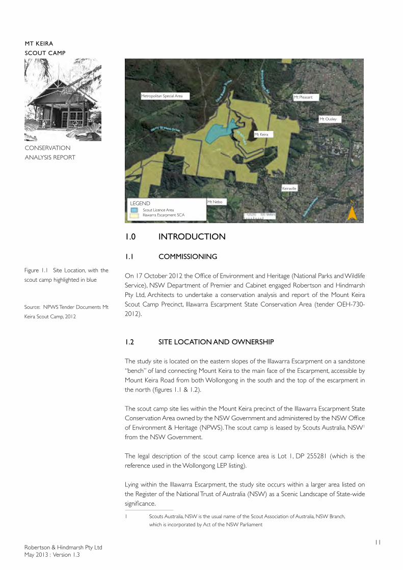
Figure 1.1 Site Location, with the
scout camp highlighted in blue
Source: NPWS Tender Documents Mt
Keira Scout Camp, 2012
1.0 INTRODUCTION
1.1 COMMISSIONING
On 17 October 2012 the Office of Environment and Heritage (National Parks and Wildlife Service), NSW Department of Premier and Cabinet engaged Robertson and Hindmarsh Pty Ltd, Architects to undertake a conservation analysis and report of the Mount Keira Scout Camp Precinct, Illawarra Escarpment State Conservation Area (tender OEH-730-2012).
1.2 SITE LOCATION AND OWNERSHIP
The study site is located on the eastern slopes of the Illawarra Escarpment on a sandstone “bench” of land connecting Mount Keira to the main face of the Escarpment, accessible by Mount Keira Road from both Wollongong in the south and the top of the escarpment in the north (figures 1.1 & 1.2).
The scout camp site lies within the Mount Keira precinct of the Illawarra Escarpment State Conservation Area owned by the NSW Government and administered by the NSW Office of Environment & Heritage (NPWS). The scout camp is leased by Scouts Australia, NSW1 from the NSW Government.
The legal description of the scout camp licence area is Lot 1, DP 255281 (which is the reference used in the Wollongong LEP listing).
Lying within the Illawarra Escarpment, the study site occurs within a larger area listed on the Register of the National Trust of Australia (NSW) as a Scenic Landscape of State-wide significance.
1 Scouts Australia, NSW is the usual name of the Scout Association of Australia, NSW Branch,
which is incorporated by Act of the NSW Parliament
LEGENDScout Licence AreaIllawarra Escarpment SCA
Keiraville
Mt Nebo
Metropolitan Special Area Mt Pleasant
Mt Ousley
Mt Keira
Robertson & Hindmarsh Pty LtdMay 2013 : Version 1.3
12
MT KEIRA
SCOUT CAMP
CONSERVATION
ANALYSIS REPORT
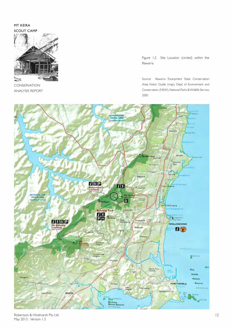
Figure 1.2 Site Location (circled) within the
Illawarra
Source: Illawarra Escarpment State Conservation
Area, Visitor Guide (map), Dept of Environment and
Conservation (NSW), National Parks & Wildlife Service,
2005
Robertson & Hindmarsh Pty LtdMay 2013 : Version 1.3
13
MT KEIRA
SCOUT CAMP
CONSERVATION
ANALYSIS REPORT
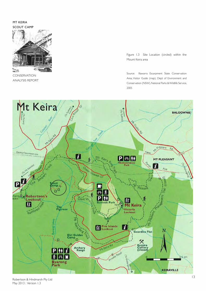
Figure 1.3 Site Location (circled) within the
Mount Keira area
Source: Illawarra Escarpment State Conservation
Area, Visitor Guide (map), Dept of Environment and
Conservation (NSW), National Parks & Wildlife Service,
2005
Robertson & Hindmarsh Pty LtdMay 2013 : Version 1.3
14
MT KEIRA
SCOUT CAMP
CONSERVATION
ANALYSIS REPORT
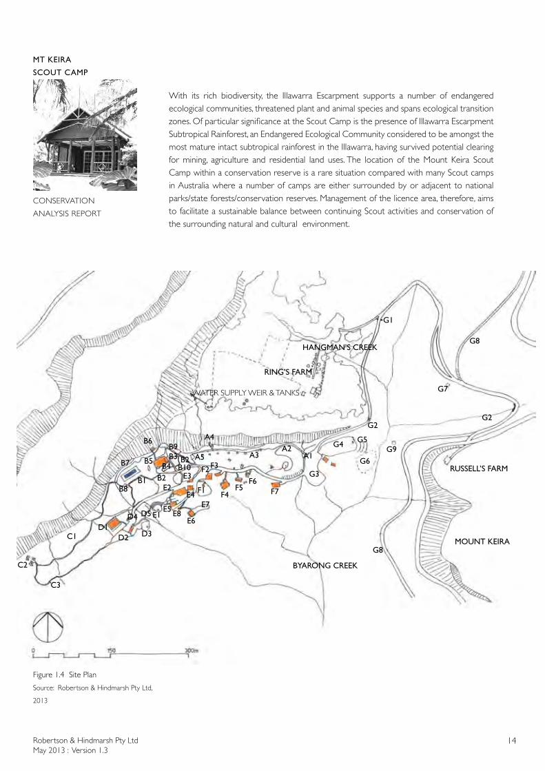
With its rich biodiversity, the Illawarra Escarpment supports a number of endangered ecological communities, threatened plant and animal species and spans ecological transition zones. Of particular significance at the Scout Camp is the presence of Illawarra Escarpment Subtropical Rainforest, an Endangered Ecological Community considered to be amongst the most mature intact subtropical rainforest in the Illawarra, having survived potential clearing for mining, agriculture and residential land uses. The location of the Mount Keira Scout Camp within a conservation reserve is a rare situation compared with many Scout camps in Australia where a number of camps are either surrounded by or adjacent to national parks/state forests/conservation reserves. Management of the licence area, therefore, aims to facilitate a sustainable balance between continuing Scout activities and conservation of the surrounding natural and cultural environment.
Figure 1.4 Site Plan
Source: Robertson & Hindmarsh Pty Ltd,
2013
A1A2
A3
A4
A5
B1
B5B4
B3 B2
B6
B7
B8
B9
B10B2
C1
C2
C3
D1D2 D3
D4 D5
E3
E4
E5E6
E7E8
E2
E1
F1
F2F3
F4F5
F6F7
G1
G2
G3
G4
G6
G7
G2
G9
G8
G8
MOUNT KEIRA
HANGMAN’S CREEK
BYARONG CREEK
RING’S FARM
WATER SUPPLY WEIR & TANKS
RUSSELL’S FARM
G5
Robertson & Hindmarsh Pty LtdMay 2013 : Version 1.3
15
MT KEIRA
SCOUT CAMP
CONSERVATION
ANALYSIS REPORT
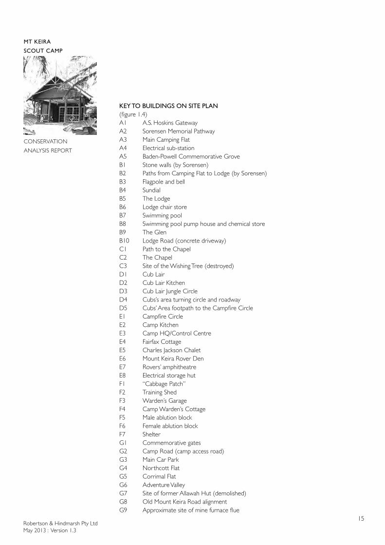
KEY TO BUILDINGS ON SITE PLAN (figure 1.4) A1 A.S. Hoskins GatewayA2 Sorensen Memorial PathwayA3 Main Camping FlatA4 Electrical sub-stationA5 Baden-Powell Commemorative GroveB1 Stone walls (by Sorensen)B2 Paths from Camping Flat to Lodge (by Sorensen)B3 Flagpole and bellB4 SundialB5 The LodgeB6 Lodge chair storeB7 Swimming poolB8 Swimming pool pump house and chemical storeB9 The GlenB10 Lodge Road (concrete driveway)C1 Path to the ChapelC2 The ChapelC3 Site of the Wishing Tree (destroyed)D1 Cub LairD2 Cub Lair KitchenD3 Cub Lair Jungle CircleD4 Cubs’s area turning circle and roadwayD5 Cubs’ Area footpath to the Campfire CircleE1 Campfire CircleE2 Camp KitchenE3 Camp HQ/Control CentreE4 Fairfax CottageE5 Charles Jackson ChaletE6 Mount Keira Rover DenE7 Rovers’ amphitheatreE8 Electrical storage hutF1 “Cabbage Patch”F2 Training ShedF3 Warden’s GarageF4 Camp Warden’s CottageF5 Male ablution blockF6 Female ablution blockF7 ShelterG1 Commemorative gatesG2 Camp Road (camp access road)G3 Main Car ParkG4 Northcott FlatG5 Corrimal FlatG6 Adventure ValleyG7 Site of former Allawah Hut (demolished)G8 Old Mount Keira Road alignmentG9 Approximate site of mine furnace flue
Robertson & Hindmarsh Pty LtdMay 2013 : Version 1.3
16
MT KEIRA
SCOUT CAMP
CONSERVATION
ANALYSIS REPORT
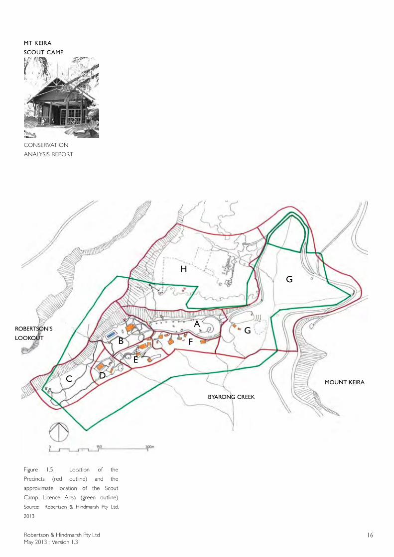
Figure 1.5 Location of the
Precincts (red outline) and the
approximate location of the Scout
Camp Licence Area (green outline)
Source: Robertson & Hindmarsh Pty Ltd,
2013
ROBERTSON’S
LOOKOUT
MOUNT KEIRA
BYARONG CREEK
D
A
B
C
E
FG
HG
Robertson & Hindmarsh Pty LtdMay 2013 : Version 1.3
17
MT KEIRA
SCOUT CAMP
CONSERVATION
ANALYSIS REPORT
1.3 PRECINCT LOCATIONS
The study site has been divided into a number of precincts (figure 1.5) which are described in the physical analysis of the landscape, flora & fauna and the buildings, with more detailed maps of each precinct. These precincts do not reflect any Scout licence boundaries but reflect functional and symbolic areas of the Camp and the surrounding adjoining areas of the non-licence area of the Illawarra Escarpment State Conservation Area.
Precinct A - Main Camping Flat Precinct B - Lodge and Swimming Pool Precinct C - Chapel Precinct D - Cubs’ Area Precinct E - Camp Kitchen, Camp Fire Circle & Rovers Precinct F - Service Area Precinct G - Car Park, Northcott Flat & Entrance Road Precinct H - Ring’s Farm & Scout Camp Water Supply
1.4 REPORT OBJECTIVES AND OUTCOMES
The key project objectives and outcomes required by the brief to tenderers dated 19 September 2012 are:
Objectives:(a) To prepare an engaging, authoritative and illustrated contextual history of the
Mount Keira Scout Camp site;(b) To identify and record the cultural features/elements of the site, and to update
OEH Historic Heritage Information Management System (HHIMS) database. This includes landscape, horticultural, built, movable heritage and archaeological features;
(c) To assess its cultural significance as an entity and for each of the key features or buildings. The significance assessment must meet the NSW Heritage Office criteria; and
(d) To produce a site plan clearly identifying all of the features and buildings and defining the curtilage of the heritage site and an archaeological zoning plan.
Outcomes:1) To support the long-term conservation and management of the study area;2) To ensure best practice management of cultural heritage values; and3) To inform a future Conservation Management Plan for the study area.
1.5 SCOPE OF CONSERVATION ANALYSIS
The report scope is limited to the following contents by the brief from NPWS and is not intended to be a complete conservation management plan but is the first part of a future conservation management plan:1. Executive Summary2. Introduction 3. Historical Analysis4. Physical Analysis5. Archaeological Analysis
Robertson & Hindmarsh Pty LtdMay 2013 : Version 1.3
18
MT KEIRA
SCOUT CAMP
CONSERVATION
ANALYSIS REPORT
6. Assessment of Cultural Significance: Comparative Analysis Definition of Curtilage Statement of Significance Gradings of Significance7. Bibliography8. Historic Heritage Information Management System (HHIMS) Inventory Sheets
1.6 STUDY METHOD
In general, this Conservation Analysis follows the format as set out in The Conservation Plan by J. S. Kerr, The Guidelines to the Burra Charter – Conservation Policy and the NSW Heritage Manual, in addition to examining issues particular to this site.
1.7 DOCUMENTARY SOURCES
A complete list of the documentary sources is located in the bibliography of this report.
1.8 REPORT LIMITATIONS
The limitations of this study are:
• The location of the archives of BHP-Billiton (including the former Broken Hill Proprietary Ltd and Australian Iron & Steel Co Ltd) in Melbourne precluded a physical examination of those archives.
• The location of the Mount Keira mine plans in the Maitland office of the NSW Department of Trade and Investment, Regional Infrastructure and Services precluded a physical examination of those plans.
• The location of the Hoskins Family archives is not known and so they could not be researched.
• The lack of documentation (other than brief diary entries) by Paul Sorensen regarding his work at Mount Keira Scout Camp limits any definitive statement regarding what works Sorensen undertook. The works undertaken by him for Sid Hoskins at Gleniffer Brae in Wollongong and examination of the scout camp site are the major sources of the extent of Sorensen’s landscape design and construction work at the camp.
• Only two scout camps other than Mount Keira Scout Camp were physically inspected as a part of the research for the comparative analysis section of this report.

Robertson & Hindmarsh Pty LtdMay 2013 : Version 1.3
19
MT KEIRA
SCOUT CAMP
CONSERVATION
ANALYSIS REPORT
1.9 FURTHER RESEARCH
Further research is required in the following areas:
• The extent and type of works undertaken by the Hoskins Family architect (and architect for the first Mount Keira Scout Camp buildings), Geoffrey Loveridge, is required.
• The extent and type of works undertaken by the other identified architects of some of the Mount Keira Scout Camp buildings, Ralph I’A. Bloomfield and H. Smith, is required.
• The Hoskins Family archives need to be located so that additional photographs and documents relating to the Mount Keira Scout Camp and to the work of Geoffrey Loveridge for the family can be examined.
• Past Camp Warden Don Stone’s wife may have photographs relating to the Mount Keira Scout Camp.
• The location of the mine shafts & all of the associated above ground infrastructure including ventilation systems.
1.10 REPORT TEAM & AUTHORSHIP
The Report team included:
Project director, Architect, Heritage Architect: Dr Scott Robertson, ARAIA, BSc (Arch), B Arch (Hons), M B Env (Building Conservation), PhD.
Architect, Horticulturalist: Jan Robertson, ARAIA, BSc (Arch), B Arch (Hons), Cert Hort (Hons), Grad Dip Env Science.
Architectural Historian: Dr Noni Boyd, B Arch, MSc (Architectural Conservation), PhD.
Archaeologists: Tony Lowe, BA, MA. Dr Mary Casey, BA (Hons), M B Env, PhD. Nicholas Pitt, BA (Hons)
1.11 STAKEHOLDERS, CONTRIBUTORS AND ACKNOWLEDGEMENTS
Robertson and Hindmarsh Pty Ltd would like to thank the following people for the assistance provided during the preparation of this conservation report:
NSW Government: Helen Jessup, Ranger, Illawarra Area, Office of Environment & Heritage,
Robertson & Hindmarsh Pty LtdMay 2013 : Version 1.3
20
MT KEIRA
SCOUT CAMP
CONSERVATION
ANALYSIS REPORT
NSW Dept of Premier & Cabinet [based in Wollongong], Jane McKenzie, Historic Heritage Project Officer, Policy & Planning Section, Regional Operations Group, Office of Environment & Heritage, NSW Dept of Premier & Cabinet [based in Hurstville], Shirley Goodwin, Project Officer, PACS Coastal, Office of Environment & Heritage, NSW Dept of Premier & Cabinet [based in Coffs Harbour], Karen Inglis, Land Information Coordinator, Mineral Resources Branch, Titles Section, Mine Mapping, NSW Dept of Trade and Investment, Regional Infrastructure and Services [based in Maitland], Greg Kininmonth, Team Leader – Environment, South-East region, Environmental Sustainability Unit, Mineral Resources, NSW Dept of Trade and Investment, Regional Infrastructure and Services [based in Wollongong]
Scouts Australia, NSW: Ron Critcher, Chairman, Mount Keira Scout Camp Committee, Graham Noble, Camp Warden, Mount Keira Scout Camp, Joe Attard, Scouting Memorabilia Centre, Belfield, Lisa Marmora, Baden-Powell Scout Centre, Pennant Hills, Allan Songberg & Bob Shaw, Camp Coutts Scout Camp, Waterfall
Illawarra community: Frank Cook, BHP Billiton Illawarra Coal, Bob Kininmonth, Geoff Mould, Brian Sheldon, Local Studies Librarians, Wollongong City Library
Others: Julie Blyth, Librarian & Archivist, National Trust of Australia (NSW), Howard (“Chick”) Carey, Elston Hynd, Marta Wojcicki, Records Governance Specialist, BHP Billiton, Melbourne
1.12 REPORT VERSIONS
Version 1.0 of this report (containing only some of the preliminary chapters) was submitted for comment on 28 November 2012. Comments were received on 5 December 2012 and incorporated into Version 1.1 of the report.
Version 1.1 of this report (containing Chapters 1 & 2) was submitted for comment on 25 January 2013. Comments were received on 8 & 13 February 2013 and incorporated into Version 1.2 of the report.
Version 1.2 of this report (containing Chapters 1 to 6 and the Bibliography) was submitted for comment on 1 March 2013. Comments were received on 14 & 19 March 2013 and in May 2013 and incorporated into Version 1.3 of the report.
This is Version 1.3 of the Conservation Analysis Report and it has been submitted as the final report.

Robertson & Hindmarsh Pty LtdMay 2013 : Version 1.3
21
MT KEIRA
SCOUT CAMP
CONSERVATION
ANALYSIS REPORT
1.13 ABBREVIATIONS
AIA Australian Institute of Architects (formerly RAIA)
AIS Australian Iron & Steel Pty Ltd (a subsidiary of BHP and now part of Bluescope Steel)
AONSW Archives Office of NSW (Now State Records of NSW (SRNSW))
AO Map Map held in the State Records of NSW, now SR Map
AO Plan Plan held in the State Records of NSW, now SR Plan
BHP Broken Hill Proprietary Ltd (now part of BHP Billiton)
DA Development Application
DCP Development Control Plan
DMR NSW Department of Main Roads (later known as the Roads and Traffic Authority and now known as Roads and Maritime)
HHIMS Historic Heritage Information Management System (managed by the OEH (National Parks & Wildlife Service))
HO NSW Heritage Office (former)now known as the NSW Office of Environment & Heritage (Heritage Branch)(part of the NSW Department of Premier and Cabinet)
ICOMOS International Council on Monuments and Sites
IESA Illawarra Escarpment Scenic Area
LEP Local Environmental Plan
ML Mitchell Library, SLNSW
NAA National Archives of Australia
NLA National Library of Australia
NPWS NSW National Parks & Wildlife Service (former)now known as the Office of Environment & Heritage (National Parks & Wildlife Service) (part of the NSW Department of Premier and Cabinet)
NT National Trust of Australia
OEH Office of Environment & Heritage, NSW Department of Premier and Cabinet
Robertson & Hindmarsh Pty LtdMay 2013 : Version 1.3
22
MT KEIRA
SCOUT CAMP
CONSERVATION
ANALYSIS REPORT
PWD NSW Public Works Department (former) now part of the NSW Department of Finance and Services
RAHS Royal Australian Historical Society
RAIA Royal Australian Institute of Architects (now AIA)
REP Regional Environmental Plan
RNE Register of the National Estate
SA Scouts Australia (usual name for Scout Association of Australia)
SA, NSW Scouts Australia, NSW (usual name for Scout Association of Australia, NSW Branch)
SG Sydney Gazette
SG & NSWA Sydney Gazette & NSW Advertiser
SH Sydney Herald
SHI State Heritage Inventory
SHR State Heritage Register
SHR Abbreviation used on plans for SHOWER
SLNSW State Library of NSW
SLV State Library of Victoria
SMH Sydney Morning Herald
SRNSW State Records of NSW
Robertson & Hindmarsh Pty LtdMay 2013 : Version 1.3
23
MT KEIRA
SCOUT CAMP
CONSERVATION
ANALYSIS REPORT
2.0 HISTORICAL ANALYSIS
2.1 CHRONOLOGY
Pre 1788 Wodi Wodi (Dharawal) people living in the Illawarra
Djerra (aboriginal name for Mt Keira)
1770 Captain Cook sails along the east coast of Australia
1788 Arrival of the First Fleet - Sydney Cove
1816 First land grants in the Illawarra
1819 Perry’s map names Coal Cliff
1819 Illawarra 11,400 acres [4,611 hectares] granted, residual disposable
1819 Counties of Camden and Westmoreland proclaimed1
c. 1822 O’Briens Road built, linking Mt Kembla and Mt Keira
1825 Land in vicinity granted to James Stares Spearing by Governor Brisbane
Named Paulsgrove (portions 7 & 8 Parish of Wollongong)
1829 James Shoobert purchases a farm near Wollongong
1832 Paulsgrove now 400 acres [162 hectares] of cleared land including two water mills, a windmill, orchards, etc
1834 Governor Bourke visits the Illawarra and orders construction of a road
1834 Mt Keira Road built with convict labour. Shown on maps sent to England by Thomas Mitchell. Stockade site shown on later maps
1835 Conrad Martens spends 10 days in the Illawarra sketching
(probably travels down Mitchell’s new road)
1835 Paulsgrove sold to Colonel John Leahy (renamed Mt Keera)
1836-44 Construction of basin at Wollongong Harbour by convicts under the supervision of the Royal Engineers
1839 Coal discovered at Mount Keira by William Branwhite Clarke
1839 Death of Colonel Leahy
1839 Subdivision of the Keelogues grant that shows site of watermill to north west of Mount Keera House (within the Keelogues grant). Note that the Scout Camp study area is located above the Keelogues grant
1841 Formal Grant of Mount Keera issued to Robert and Charles Campbell (who subdivided the land)
1842 Colonel Leahy’s Mt Keera to be sold (subdivision plans) Mount Keera House, Gardens over the Mill Brook, crops. Additional house to the south east, stock yards (further south again). Also locates Dr John Osborne’s residence to the east. [study site to the north west of Mt Keera House]
1842 Plan of the town of Wollongong with sketch of Mount-Keera House and Garden. Mount-Keera, Road to Appin etc
1 SG&NSWA 21 August 1819
Robertson & Hindmarsh Pty LtdMay 2013 : Version 1.3
24
MT KEIRA
SCOUT CAMP
CONSERVATION
ANALYSIS REPORT
1842 Sketch of the house attributed to Conrad Martens
1842 Captain Shannon occupying Mount Keera House 2
1842 Shoobert purchases land formerly owned by Spearing and Leahy
1843 Keera Vale built for Roger Therry (No 30 Bukari Street)
1844 Convict-built basin at Wollongong Harbour completed
1848 Mining operations at Mount Keira: Albert Coal Mine, Wongawilli and Bulli seams (on James Shoobert’s land). Coal carted to the harbour in carts. First southern colliery
1848 Australian Agricultural Company’s monopoly lifted
1851 Mount Keera Estate for sale, Mr James Shoobert, Advertisements from March – May: House and garden to be let, including vines and oranges
1855-1856 Henry Osborne purchases a series of lots in the vicinity of Mount Keira including Lots 101-106.
1856 Albert Coal mine sold to Henry Osborne
James Shoobert moves to Balmain
1857 New mine shaft at the Osborne Wallsend Colliery
1857 Gold found near American Creek (Mount Kembla) and at Mount Keira
1857 Robert Stephenson Smyth Baden-Powell born, Paddington, London (22/2/1857)
1861 Mount Keira Tramways Act Three private tramways built to the three mines Mount Kembla, Mount Keira and Mount Pleasant
1861-68 Belmore Basin constructed to enlarge the capacity of the harbour at Wollongong. Coal Staithes built
1867 Balliere’s Directory lists 10 miners living at Mount Keira and one mine manager, Mr Crain
1871 Twelve Stall stable built on Mount Keira (at the tramway line)
1872 Post Office directory lists Pratt, Porter and McGoldrick but not Ring
By 1874 Mr Wiley who lives on Mount Keira acts as a guide for visitors wishing to climb the mountain
1877 Map of the Mount Keira tramway (to intersection with Mount Pleasant)
1878 Proposed railway tunnel under Mount Keira from Wollongong to Douglass Park (21 miles). Not proceeded with
1878 ‘Ventilation headings’ at Mount Kembla known as Pratts (with horse access), Porters, Rings and McGoldricks3
1878-79 Steam locomotives introduced on the private lines
1880 Mines draught horses sold
1881 Ironstone found at Mount Keira
1881 Furnace erected by the Mount Pleasant Coal Company to make iron from local stone
2 Australian Chronicle 20 April 1842 and coloured plan of the town on Wollongong (Baseline)
3 Illawarracoal.com timeline 3
Robertson & Hindmarsh Pty LtdMay 2013 : Version 1.3
25
MT KEIRA
SCOUT CAMP
CONSERVATION
ANALYSIS REPORT
1882 Collapse of the large furnace chimney over the main tunnel at Mount Keira
1886 Charles Hoskins’ first son, Henry Guildford born
1888 Railway Sydney-Wollongong commences
1889 Charles Hoskins’ second son, Cecil Harold born
1890 Paul Sorensen born in Copenhagen
1892 Charles Hoskins’ third son, Arthur Sidney (Sid), born
1893 Geoffrey Loveridge born in Bowral
1900 James Porters’ State Relief Board apprentice James Summer dies after being bitten by a black snake. Porter was one of the Mount Keira farmers
1901 Ebenezer Vickery puchases Mount Keira Mine from the Osborne family
Vickery sells other mines
1902 Sorensen enrols in horticulture at Horsholm Teknisk Scole, Copenhagen & begins working for Lars Nielsen, landscape designer, on work including the summer house of Queen Alexandra
1906 Unoccupied cottage on Mount Keira owned by Mr F Ring destroyed by fire
1907 Brownsea Island, Poole, UK experimental boys’ camp organised by Baden- Powell
1908 G & C Hoskins Limited purchase Eskbank Ironworks, Lithgow
1908 Baden-Powell’s Scouting For Boys published in 6 parts
1908 Scouting comes to Australia
1908 Mary McGoldrick breaks leg walking from Mount Keira to Figtree
First electrical mine fan introduced at Newcastle
1910 Coal Mines Regulation (Ventilation) required continuous ventilation
1912 Baden-Powell visits Australia and attends a Scout Camp held in May at Cooks River, Earlwood
1913 Cecil Hoskins marries Dorothy Gwynn Loveridge
1914-1918 World War I
1915 Sorensen arrives in Melbourne, Australia as an assisted passage migrant and works for 8 months at Pleasant Hills farm, Yarrawonga then at Ormond Plant farm for 18 months
1915-1919 Geoffrey Loveridge serves in World War I
1916 Sorensen builds gardens at Carrington Hotel, Katoomba
1916 Charles Hoskins acquires Wongawilli Colliery
1916 Guildford Hoskins (eldest son of Charles Hoskins) killed in gas explosion
1917 Sorensen opens landscaping business and nursery in Katoomba
1917 Sorensen designs and builds garden at Westella, Katoomba (now vanished)
1917 Sid Hoskins marries Helen Madeline (Madge) Loveridge, sister of Dorothy
1919 Sorensen marries Anestina Hillenberg
Robertson & Hindmarsh Pty LtdMay 2013 : Version 1.3
26
MT KEIRA
SCOUT CAMP
CONSERVATION
ANALYSIS REPORT
1919 Sorensen designs and builds garden at Shenstone, Leura
1919 Gilwell Park donated to the Scout Association of the United Kingdom
1920 Gilwell Park established as a woodcraft centre for Scouts
1920 Hoskins Iron & Steel company formed in Lithgow
1920 Sorensen’s first son, Derrick born
1920 Sorensen moves his nursery to Leura
1920s Sorensen designs gardens for Blue Mountains guest houses including: Sylvan Mists, Katoomba (1920) (now vanished) Gabo, Leura (1923) Metcalfe Garden, Leura (1924) (now vanished) Thomson Garden, Leura (now vanished) & Tralee, Leura (1926) Dean Park, Leura (now vanished) & Leuralla, Leura (1928)
1920s Inventor of the Gilwell scout’s woggle, Bill Shankley accompanied Sir Alfred Pickford, the Headquarters Commissioner for Overseas Scouts on an official tour of Australia
1921/1922 Land purchased from the family of William Charles Wentworth by Hoskins family in Port Kembla for their steel works
1921 First Wollongong Scout Troop established
1921 Sorensen’s second son, Neville born
1922 First world census puts the number of Scouts across the globe at 1,019,205 (2004 edition of Scouting For Boys, p.vi)
1923 Port Kembla Scout Troup established
First Gilwell Training Camp in NSW held at Middle Head
1923 5 week miner’s strike at Mount Keira
1924 Charles Hoskins purchases 400 acres of land near Port Kembla from William C. Wentworth
1924 Parish Hall opened on church site, Lithgow; a gift of the Hoskins family
1924 Cecil Hoskins becomes Chairman of the 1st Edgecliff Scout Troop
1924 McGoldricks buy land at Gwynneville
1925 Cecil & Sid Hoskins become Joint Managing Directors on the formation of Australian Iron & Steel Ltd (AIS)
1925 Fans replace furnaces at Mount Kembla
1926 Charles Hoskins dies (14/2/1926)
1926 The use of furnaces were prohibited in NSW mines (except for very shallow mines)
1926 Road suitable for motorists to the summit of Mount Keira
1927 Formation of Southern Portland Cement Ltd, Berrima (a subsidiary of Australian Iron & Steel Ltd)
1927 Hoskins family builds the Literary Institute at Lithgow in memory of Charles Hoskins
Robertson & Hindmarsh Pty LtdMay 2013 : Version 1.3
27
MT KEIRA
SCOUT CAMP
CONSERVATION
ANALYSIS REPORT
1927 Baden-Powell visits Australia
1927 Women joined as Cubmasters in Australia
1928 Cecil and Sidney Hoskins established AIS at Port Kembla
1928 Sorensen’s third son, Ib, born
1928 Hoskins Memorial Church (designed by John Barr) at Lithgow completed (memorial to Guildford Hoskins); grounds landscaped by Sorensen; first sermon delivered by Rev A.P. Campbell, a close friend of the Hoskins family
1928 Sid Hoskins purchases 75 acres [30 hectares] of the Fitzgerald’s dairy farm at Keiraville for a future house site
1928 Agreement to establish scout training camp at Yellow Rock Creek, west of Dapto
1929 Australian Scout Corroboree at Lake Illawarra
1929 First scout camp site at junction of Macquarie Rivulet & Yellow Rock Creek, near Albion Park
1930 Sid Hoskins lives in a rented house at Dapto for four years
1930 Scout Coroboree at Lake Illawarra – included tour to Mount Kembla and Mount Keira, January
1930s Coal production slumped
1930s Sorensen designs gardens at: La Vista, Wentworth Falls Cheppen, Leura (1931) Holmwood, Leura, Jemmalong, Blackheath & Heaton Lodge, Mudgee (1932) Fjellheim, & Sospal, Leura (1933) Fjellheim II, Wentworth Falls (1936) Beresford Grant Gardens, & Moreton, Warrawee (1937)
1931 Baden-Powell visits Australia; Scout Rally held at Government House, Sydney; visits Canberra; Melbourne; Kiewa River, Victoria (where he fishes) and Kongboll Station, Victoria
1931 150 miners at Mount Keira mines dismissed. Main section of the mine to be closed
1931 Illicit still discovered ‘at a lonely spot at the back of Mount Keira’
1932 Madge Hoskins becomes Divisional Commissioner for Girl Guides
1933 Sorensen commissioned by Henri Van de Velde to design and construct garden at Everglades, Leura
1934 Mr & Mrs Sidney Hoskins move to Wollongong for four years before moving into their new house Gleniffer Brae
1934 Baden-Powell visits Australia for first Australian Scout Jamboree held at Frankston, Victoria (the first international gathering of scouts held outside of Europe, 10,000 scouts camped out)
1935 Rocky Basin scout camp established on the upper reaches of Mullet Creek at Avondale (3km south of Dapto) using material from disused building from Hoskins Colliery, Lithgow
Robertson & Hindmarsh Pty LtdMay 2013 : Version 1.3
28
MT KEIRA
SCOUT CAMP
CONSERVATION
ANALYSIS REPORT
1935 Australian Iron & Steel Ltd becomes a subsidiary of BHP
1935 Geoffrey Loveridge qualifies as an architect
1936 Port Kembla Rover Scouts are constructing a camp fire circle and a shrine for Investiture ceremonies at Rocky Basin. The Wollongong Rotary Club has undertaken the construction of a headquarters hut, kitchen, and assembly hall
1936 Official opening of the Rocky Basin Camp by Sir Kelso King
1936 The Rocky Basin Lodge was made from materials salvaged from the disused shower block at Hoskins colliery at Lithgow (later reused at Mount Keira as the building now known as the Camp Warden’s Cottage)
1936 Green Hills & Hillside erected for Hoskins/Australian Iron & Steel Co. as company guest houses, Figtree. Architect unknown
1936 Garden at Invergowrie, Exeter for Cecil and Dorothy Hoskins by Sorensen
House designed by Geoffrey Loveridge
1936 Garden at Redlands, Mittagong by Sorensen
1937 Gleniffer Brae erected for Sidney and Madeline Hoskins Architect Geoffrey Loveridge (brother of Madeline)
1937 Australian Iron & Steel, a subsidiary of BHP, acquires two additional mines
Bulli and Mount Keira to supply the steel works
1938 Garden at Gleniffer Brae designed and constructed by Paul Sorensen
1938 Sorensen landscapes grounds of Southern Portland Cement works at Berrima (Cecil Hoskins was its Chairman & Managing Director)
1938-39 A series of potential sites for the scout camp in the vicinity of Mount Keira (at least nine) were inspected before a decision was made
1939 Outbreak of World War II
Gardens at Green Hills & Hillside, Figtree by Sorensen
1939-40 Mount Keira Scout Camp complex commenced on 550 acres [222.75 hectares], including building road from Rings’ Farm road, relocating the lodge from Rocky Basin to be Quartermasters store. Complex included swimming pool, Lodge (designed by G. Loveridge), camp fire circle and main camping flat and water & power supply
1940 Mount Keira Scout Camp officially opened 9 November 1940 by the State Governor & Chief Scout, Lord Wakehurst and Camp Chapel dedicated 10 November by Rev A P Campbell (the same reverend who made the first sermon at Lithgow Church in 1928)
Opening attended by 800 Scouts, Cubs, Girl Guides & Brownies and 2,000 members of the public
1940 Tom Rainbird appointed as Camp Caretaker, Mount Keira Scout Camp
1940 Sorensen is commissioned by Henri Van de Velde to landscape roof of Feltex House, Sydney
1940-41 Mount Keira Road widened and bitumined (DMR)

Robertson & Hindmarsh Pty LtdMay 2013 : Version 1.3
29
MT KEIRA
SCOUT CAMP
CONSERVATION
ANALYSIS REPORT
1941 Scout’s Easter Camp. 200 scouts will go under canvas at the district Scout Camp at Mount Keira
1941 Dave Walsh appointed as first resident Camp Warden, Mount Keira Scout Camp
1941 Corrimal Flats established and sundial erected at Mount Keira Scout Camp
1941 Lord Baden-Powell dies at his home, “Paxtu” in Kenya (8/1/1941)
1942 28th Brigade occupy the Mount Keira Scout Camp for 7 months (January onwards)
1942 Sorensen’s son, Derrick, killed in action in Europe
1942 Mount Ousley Road constructed to provide an additional access route (for defence purposes) to the Illawarra
1943 Sorensen’s second son, Neville, killed in action in Europe. After the war Cecil Hoskins suggested that Sorensen construct a memorial to both of his sons in the grounds of the Lithgow Hoskins Memorial Church
mid 1940s Sorensen leases Old Rectory, Berrima and commences constructing a second nursery
1940s Sorensen designs and constructs gardens at Mahratta, Warrawee (1941) Cherry Dell, Greenslopes, Saskatoon, Leura & Trevlyn, Wentworth Falls (1946) and Neubeck House, Lidsdale (1949)
1943 Port Kembla & Wollongong Rover Huts constructed at Mount Keira Scout Camp (Port Kembla Hut no longer exists)
1944 Store and camp kitchen built & Camp Warden moves into Quartermaster Store at Mount Keira Scout Camp
1946 Diggers Rest Home opened, on land leased from the Hoskins (until 1979)
1946 Cecil Hoskins appointed Foundation President of the South Coast and Tablelands Area of the Boy Scouts Association
1946 Bush fires threaten the Mount Keira Scout Camp and the Digger’s Rest Home
1946 Illawarra Natural History Society formed
1947 Kemira Tunnel to link the two mines Mount Keira and Mount Kembla commenced
1947 Easter (April): Jacaranda planted by Governor Northcott at the camp entrance. Other trees planted by Miss M. Northcott and the Chief Commissioner
1947 Planting of two commemorative Illawarra Flame trees by Prince William & Prince Richard of Gloucester at Mount Keira Scout Camp
By 1948 Aerial photograph shows new access road
1948 Combined scout & guide camp at Mount Keira Scout Camp; visited by Lady Baden-Powell (Jacaranda tree planted)
1948 Fauna Protection Act (NSW Act 47 1948)
1948 Dispute regarding the construction of the tunnel to link the Mount Keira and Mount Kembla mines resulted in the General Coal Strike
Robertson & Hindmarsh Pty LtdMay 2013 : Version 1.3
30
MT KEIRA
SCOUT CAMP
CONSERVATION
ANALYSIS REPORT
1949 Illawarra Natural History Society lobby for nature reserve at the Barren Grounds near Kiama
1950 Two week summer holiday camp for the Crippled Children’s Association (AWW) at Mount Keira Scout Camp
1950 AI & S Holding declared a Fauna Protection District (Gazetted 4 August 1950) (including portions 101-107)
1950 John Thurman, Camp Chief of Gilwell Park, England visited Mount Keira Scout Camp (21/2/50)
1950s Sorensen designs and constructs gardens including: Ballantyre, Casillis; Boogadah, Binnaway; Cherry Bank, Leura & Pine Hills, Bathurst (1950), Blue Mist, Leura; Rannock, Blayney & Bethune, Orange (1951), Black Rock, Merriwa (1954), Whispering Pines, Blackheath & Pitlochry, Merriwa (1955)
1951 Additional camping flats (formerly Corrimal Flats, now known as Northcott Flat) built at Mount Keira Scout Camp
1951 Building approval granted by City of Greater Wollongong for War Memorial Cub Lair at Mount Keira Scout Camp – building permit No C51/831 on 4/12/51
1951 Bob-a-Job scheme introduced as an annual fund raiser for the Scouts
1953/4 New ablution block & Duty Hut built at Mount Keira Scout Camp
1953 State wide Wild Turkey survey by Fauna Protection Panel & Royal Australasian Ornithologist’s Union
1953 Concern expressed that Brush Turkeys no longer seen in ranges behind Wollongong or Nowra
1954 Royal Australasian Ornithologist’s Union Annual Congress held at Mount Keira Scout Camp. Delegates from Australasia. 188 Species observed
1954 First Nature Reserve establised, John Gould Reserve
1955 Quartermaster Store extended at Mount Keira Scout Camp
1957 Original campfire circle abandoned and new campfire circle in current location built at Mount Keira Scout Camp
1958 Cub Lair, Mount Keira Scout Camp opened by Lady Baden-Powell
1958 Fauna Protection Board introduce Wildlife Refuge system
Conversion of Faunal districts begins
1959 A.S. (“Mr Sid”) Hoskins dies (23/8/1959)
1960s Sorensen designs and constructs gardens including: Calleen, Cowra Talltrees, Leura (1960) Field Garden, Pymble & Proctor Garden, Wahroonga (1961) Mereworth, Berrima (1966)
Alterations to the long established gardens at Fernhill, Mulgoa & Rock Forest, Bathurst (now vanished) (1969)
1960 New access road from car park to Lodge built & memorial gate to Sid
Robertson & Hindmarsh Pty LtdMay 2013 : Version 1.3
31
MT KEIRA
SCOUT CAMP
CONSERVATION
ANALYSIS REPORT
Hoskins unveiled at Mount Keira Scout Camp (designed by architect, Harry Smith)
1960 Cecil Hoskins receives knighthood for services to Australia
1964 New swimming pool filtration plant installed & original water supply to pool made redundant at Mount Keira Scout Camp
1964 Wildlife Refuge No. 93 AI&S Holdings of 3,550 acres [1,437 hectares] gazetted 19 June 1964 (amended in December 1966)
1965 37th Church Anniversary address given by Sir Robert Menzies, Prime Minister of Australia at Hoskins Memorial Church, Lithgow
1966 Cub Lair Kitchen and Dining built at Mount Keira Scout Camp. Designed by Wollongong-based architect Ralph I’Anson Bloomfield
1966 Cecil Hoskins retires as Foundation President of the South Coast and Tablelands Area of the Boy Scouts Association
1966 Wildlife Refuge No. 93 revoked (annotation on Parish Map)
1967 National Parks & Wildlife Act comes into force
1967 Charles Jackson Chalet built at Mount Keira Scout Camp (designed by Ralph l’Anson Bloomfield)
1967 Chief Scout Commissioners of states, State Scout Presidents and members of the Australian Boy Scouts Association held their Annual General Meeting at Mount Keira, the first time held outside a capital city
1968 Storm Shelter & Training Hut built at Mount Keira Scout Camp
1968 Site for a Rhododendron Garden selected on land owned by Australian Iron & Steel. Initially 6 acres
1970s Sorensen designs and constructs gardens including: Aola, Peats Ridge (1970) Barakee, Orange; Ulinda, Binnaway; Goollooinboin, Glen Davis; & Rogers Garden, Mount Wilson (now vanished) (1971)
1970 Madge Hoskins opens Wollongong Botanic Gardens (part of Gleniffer Brae site donated by the Hoskins to the council) [Mrs Hoskins idea]
1971 Sir Cecil Hoskins dies (8/3/1971)
1971 South Coast Conservation Society & Illawarra Natural History Society propose a multi-purpose regional park be established along the escarpment
1972 1,000 red cedar seedlings planted by scouts on the Illawarra Escarpment
1974 Time capsule (to be opened 2025) buried at Mount Keira Scout Camp near north eastern corner of Lodge verandah
1979 Deed of agreement between AI&S and the Minister of Lands donating five separate parcels of land in the escarpment into pubic ownership
1979 Diggers Rest Home relocated to Corrimal
1980 Australian Iron and Steel donated its Mount Keira lands to the NSW Government on 14 January and on the same day the NSW Government agreed to allow the following occupiers to remain on the “Donation Lands without charge ...”:
Robertson & Hindmarsh Pty LtdMay 2013 : Version 1.3
32
MT KEIRA
SCOUT CAMP
CONSERVATION
ANALYSIS REPORT
The Scout Association of Australia - South Coast and Tablelands Area, Girl Guides Association (NSW), and Australian Rhododendron Society - Illawarra Branch
1980 Illawarra State Recreation Area gazetted
(name changed in 1984, gazetted 1985)
1980s Sorensen designs and constructs gardens including Forest Park, Kulnura (1982)
1982 Don Stone appointed Camp Warden, Mount Keira Scout Camp
1982 Kitchen in Lodge remodelled at Mount Keira Scout Camp
1983 Don & Anne Stone become Camp Wardens at Mount Keira Scout Camp
1983 Paul Sorensen dies in Leura (12/9/1983)
1983 A few days after Sorensen’s death, Australian Institute of Landscape Architects offers Sorensen Honorary Life Fellowship
1985 Name of State Recreation Area altered to Illawarra Escarpment State Recreation Area October 1884 but not gazetted until March 1985
1985 Girls toilet block built at main camping flat & flagpole replaced at Mount Keira Scout Camp
1986 Grove of Illawarra Flame trees planted (Rover Grove), Patrol Place remodelled and Pantry added to Camp Kitchen at Mount Keira Scout Camp
1988 Ib Sorensen and his wife sell the Sorensen Nursery
1988 Wollongong Rover Hut renamed Mount Keira Rover Den, new garage built for Camp Warden & Training Hut remodelled at Mount Keira Scout Camp
1989 Baden-Powell Commemorative Grove (water feature, garden and 7 flag poles) built at Mount Keira Scout Camp
1989 Former Scouts Area Commissioner for South Coast & Tablelands, Charles Jackson, dies (30/9/1989)
1990 Lower camping flats abandoned for new adventure valley at Mount Keira Scout Camp
1991 Mount Keira Mine closed. Longest operating coal mine in Australia
1992 Storm shelter upgraded, Duty Hut replaced, pool fence installed, ablution block refurbished, bell installed in Cub Lair Kitchen & Lodge kitchen remodelled at Mount Keira Scout Camp
1993 Brick fire bases installed at two campfire circles at Mount Keira Scout Camp
1995 Two new 100,000 litre water tanks installed & Chapel at Mount Keira Scout Camp upgraded
1997 Lodge verandah repaired at Mount Keira Scout Camp
1998 Storms resulted in major landslips in the Illawarra
Scout Camp within the area affected by Illawarra storm event in August. Based on site visits in September 1998, independent geotechnical report prepared by Woodward-Clyde Pty Lyd identifying potential risks and recommended actions/remediation

Robertson & Hindmarsh Pty LtdMay 2013 : Version 1.3
33
MT KEIRA
SCOUT CAMP
CONSERVATION
ANALYSIS REPORT
1998 Camp Kitchen extended & main roof to Lodge replaced at Mount Keira Scout Camp
1998 Rainfall monitoring implemented at the Mount Keira Scout Camp
1999 Workshop added to Training Hut at Mount Keira Scout Camp
2000 Original electricity transformer and switch room replaced at Mount Keira Scout Camp
2002 Phil & Saffron Hodson appointed Camp Wardens, Mount Keira Scout Camp
2002 Section of road (from memorial gates to cattle grid) concreted
2002 Adventure Valley, Mount Keira Scout Camp closed for repairs (remains closed)
2002 The Glen, Mount Keira Scout Camp established
2002 New paving to swimming pool at Mount Keira Scout Camp
2002 Bushfire destroys water supply pipes from tanks to Mount Keira Scout Camp
2002 Independent geotechnical and hydrology assessment report submitted by URS Australia Pty Ltd to develop an Occupancy (Evacuation) plan for the Mount Keira Scout Camp by analysing rainfall records to evaluate rainfall thresholds which have triggered past landslides
2002 Illawarra State Recreation Area name changed to the Illawarra Escarpment State Conservation Area.
2003 Mount Keira Rover Den kitchen refurbished with new flooring, cupboards and fixtures
2003 Don & Anne Stone retire as Camp Wardens, Mount Keira Scout Camp
2004 Greg & Kathie Mant appointed Camp Wardens, Mount Keira Scout Camp
2004 Male ablution block refurbished at Mount Keira Scout Camp
2005 Bathroom in Quartermaster Store replaced & security lighting to car park upgraded at Mount Keira Scout Camp
2006 Cub Jungle Circle at Mount Keira Scout Camp completely rebuilt including construction of disabled access
2006 First three rows of seating at main campfire circle rebuilt at Mount Keira Scout Camp
2009 Graham Noble appointed Camp Warden, Mount Keira Scout Camp
2010 New biolytic sewerage system installed at Mount Keira Scout Camp
2010 Former Sorensen Nursery site, Leura, sold with partially completed town house development and including former nursery building and house
2012-13 Inspection of Mount Keira Scout Camp and preparation of Conservation Analysis Report by Robertson & Hindmarsh Pty Ltd, Architects
2013 Part of Training Centre shed at Mt Keira Scout Camp becomes Mens’ Shed
Yet to occur:
2013? New, independent power supply connected to Mount Keira Scout Camp (previously supplied by BHP)
Robertson & Hindmarsh Pty LtdMay 2013 : Version 1.3
34
MT KEIRA
SCOUT CAMP
CONSERVATION
ANALYSIS REPORT
2.2 HISTORICAL OUTLINE
2.2.1 OverviewofAboriginalsignificanceofMountKeira
Mount Keira is a cultural landscape, with a series of different patterns of use, some of which are evident in the documentary record, or in oral traditions or in the surviving physical fabric. The sporadic pattern of use of the Illawarra by Aboriginal people has been described in the Illawarra Aboriginal – An Introductory History by Michael Organ & Carol Speechley and the Illawarra Regional Heritage Study.
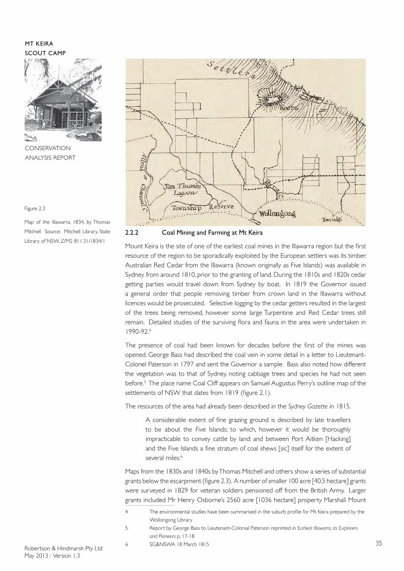
The origin of Mount Keira is described in Aboriginal dreamtime stories and the mount was a ceremonial site. The dreamtime story relating to the origin of Mount Keira and the Five Islands is symbolically represented in the Mount Keira Lookout Merrigong Environmental Sculpture called the Six Daughters of the West Wind (figure 2.2). The interpretative sign for the sculpture, by Alison Page, states:
This sculpture is about the local Aboriginal story of how the five islands off our coast and Mt Keira were created. The story goes….the west wind, Oolaboolawoo lived on the top of Merrigong (Illawarra Range) and had six daughters, Mimosa, Wilga, Lilli Pilli, Wattle, Clematis and Geera. Mimosa would scratch and fight when the girls were playing and to punish her, the west wind blew her and the rock she sat on out to sea. She landed away from the land and became an island, which none of her sisters could swim to. Mimosa’s fate should have been a lesson to her sisters who were also cast out to sea by their father.
Because Oolaboolawoo was always busy out west, the last sister Geera sat lonely on the escarpment looking at her sisters, the Five Islands, eventually allowing the animals and trees to grow on her. She turned to stone and became the mountain now known as Mt Keira.
The site where the sculptures are situated is both sacred for women and is said to have once been a place of massacre.
The top of the mountain was also a post-contact site, as was the top of Mount Kembla.1 The 1838 blanket census showed Aboriginal camps at Bulli, Wollongong and Unanderra but not up on the escarpment.2 Stories of travel routes in the Illawara have been handed down. Jeff Timbery recalled family stories of his grandfather walking between his various campsites including a campsite at Mount Keira and the salt water at North Wollongong.3 1 Aboriginal post contact map
2 Illawarra Aboriginal History p.22
3 Illawarra Aboriginal History p.28
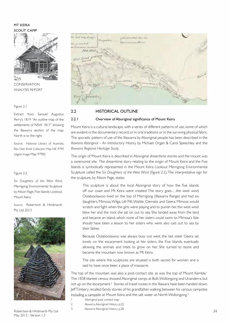
Figure 2.1
Extract from Samuel Augustus
Perry’s 1819 “An outline map of the
settlements of NSW 1817” showing
the Illawarra section of the map.
North is to the right
Source: National Library of Australia,
Rex Nan Kivell Collection Map NK 9790
(digital image Map 9790)
Figure 2.2
Six Daughters of the West Wind,
Merrigong Environmental Sculpture
by Alison Page, Five Islands Lookout,
Mount Keira
Source: Robertson & Hindmarsh
Pty Ltd, 2013
Robertson & Hindmarsh Pty LtdMay 2013 : Version 1.3
35
MT KEIRA
SCOUT CAMP
CONSERVATION
ANALYSIS REPORT
2.2.2 Coal Mining and Farming at Mt Keira
Mount Keira is the site of one of the earliest coal mines in the Illawarra region but the first resource of the region to be sporadically exploited by the European settlers was its timber. Australian Red Cedar from the Illawarra (known originally as Five Islands) was available in Sydney from around 1810, prior to the granting of land. During the 1810s and 1820s cedar getting parties would travel down from Sydney by boat. In 1819 the Governor issued a general order that people removing timber from crown land in the Illawarra without licences would be prosecuted. Selective logging by the cedar getters resulted in the largest of the trees being removed, however some large Turpentine and Red Cedar trees still remain. Detailed studies of the surviving flora and fauna in the area were undertaken in 1990-92.4
The presence of coal had been known for decades before the first of the mines was opened. George Bass had described the coal vein in some detail in a letter to Lieutenant-Colonel Paterson in 1797 and sent the Governor a sample. Bass also noted how different the vegetation was to that of Sydney, noting cabbage trees and species he had not seen before.5 The place name Coal Cliff appears on Samuel Augustus Perry’s outline map of the settlements of NSW that dates from 1819 (figure 2.1).
The resources of the area had already been described in the Sydney Gazette in 1815.
A considerable extent of fine grazing ground is described by late travellers to be about the Five Islands; to which, however it would be thoroughly impracticable to convey cattle by land: and between Port Aitken [Hacking] and the Five Islands a fine stratum of coal shews [sic] itself for the extent of several miles.6
Maps from the 1830s and 1840s by Thomas Mitchell and others show a series of substantial grants below the escarpment (figure 2.3). A number of smaller 100 acre [40.5 hectare] grants were surveyed in 1829 for veteran soldiers pensioned off from the British Army. Larger grants included Mr Henry Osborne’s 2560 acre [1036 hectare] property Marshall Mount
4 The environmental studies have been summarised in the suburb profile for Mt Keira prepared by the
Wollongong Library
5 Report by George Bass to Lieutenant-Colonial Paterson reprinted in Earliest Illawarra, its Explorers
and Pioneers p. 17-18
6 SG&NSWA 18 March 1815
Figure 2.3
Map of the Illawarra, 1834, by Thomas
Mitchell Source: Mitchell Library, State
Library of NSW, Z/M2 811.31/1834/1
Robertson & Hindmarsh Pty LtdMay 2013 : Version 1.3
36
MT KEIRA
SCOUT CAMP
CONSERVATION
ANALYSIS REPORT
near Dapto. The Osborne’s property was named for his wife, Sarah Elizabeth Marshall. Irish-born free settler Henry Osborne acquired extensive land holdings and collieries in the Illawarra and Maitland districts and pastoral properties in a network that extended to South Australia. Pumpkin Cottage, erected in 1832, was believed to have been extended in 1839 to form the substantial Colonial Georgian house that is still known as Marshall Mount.
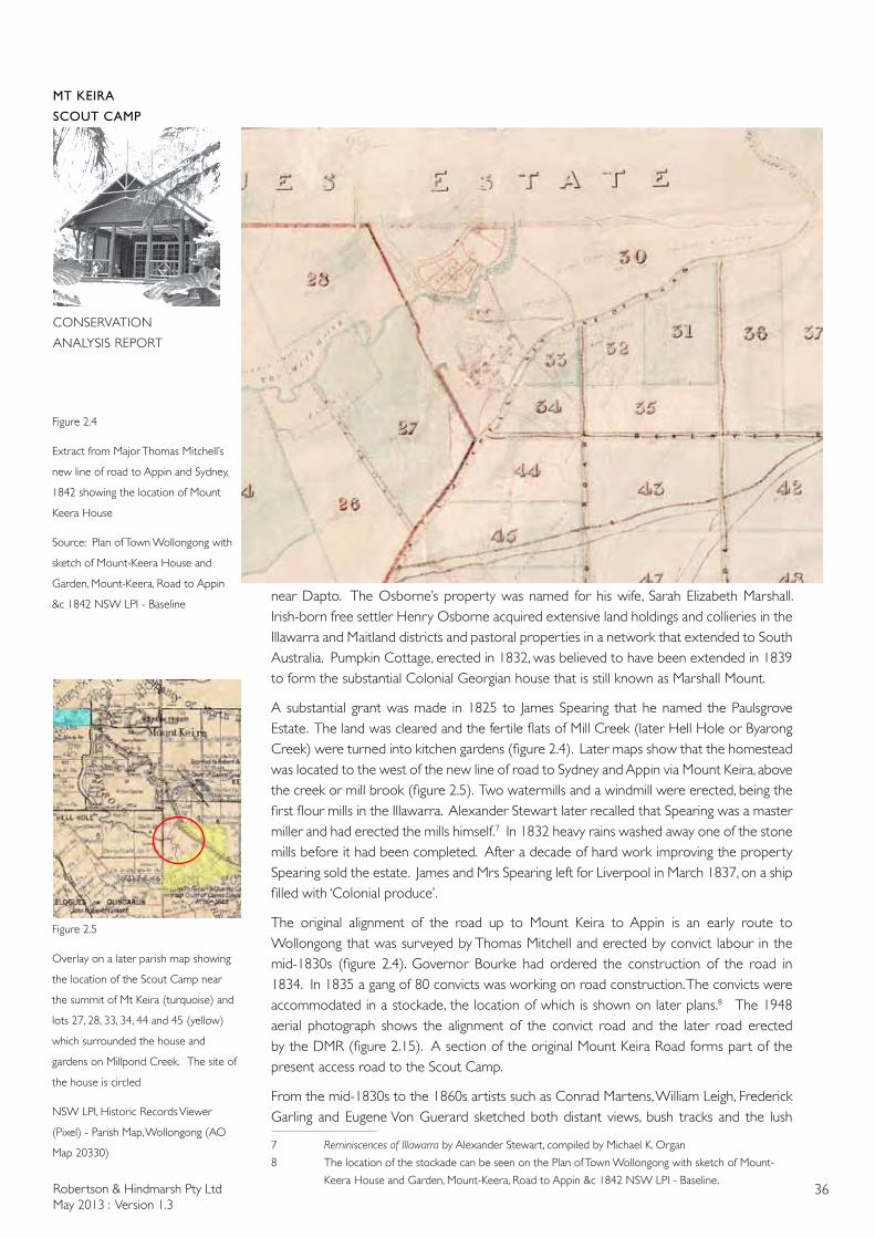
A substantial grant was made in 1825 to James Spearing that he named the Paulsgrove Estate. The land was cleared and the fertile flats of Mill Creek (later Hell Hole or Byarong Creek) were turned into kitchen gardens (figure 2.4). Later maps show that the homestead was located to the west of the new line of road to Sydney and Appin via Mount Keira, above the creek or mill brook (figure 2.5). Two watermills and a windmill were erected, being the first flour mills in the Illawarra. Alexander Stewart later recalled that Spearing was a master miller and had erected the mills himself.7 In 1832 heavy rains washed away one of the stone mills before it had been completed. After a decade of hard work improving the property Spearing sold the estate. James and Mrs Spearing left for Liverpool in March 1837, on a ship filled with ‘Colonial produce’.
The original alignment of the road up to Mount Keira to Appin is an early route to Wollongong that was surveyed by Thomas Mitchell and erected by convict labour in the mid-1830s (figure 2.4). Governor Bourke had ordered the construction of the road in 1834. In 1835 a gang of 80 convicts was working on road construction. The convicts were accommodated in a stockade, the location of which is shown on later plans.8 The 1948 aerial photograph shows the alignment of the convict road and the later road erected by the DMR (figure 2.15). A section of the original Mount Keira Road forms part of the present access road to the Scout Camp.
From the mid-1830s to the 1860s artists such as Conrad Martens, William Leigh, Frederick Garling and Eugene Von Guerard sketched both distant views, bush tracks and the lush
7 Reminiscences of Illawarra by Alexander Stewart, compiled by Michael K. Organ
8 The location of the stockade can be seen on the Plan of Town Wollongong with sketch of Mount-
Keera House and Garden, Mount-Keera, Road to Appin &c 1842 NSW LPI - Baseline.
Figure 2.4
Extract from Major Thomas Mitchell’s
new line of road to Appin and Sydney,
1842 showing the location of Mount
Keera House
Source: Plan of Town Wollongong with
sketch of Mount-Keera House and
Garden, Mount-Keera, Road to Appin
&c 1842 NSW LPI - Baseline
Figure 2.5
Overlay on a later parish map showing
the location of the Scout Camp near
the summit of Mt Keira (turquoise) and
lots 27, 28, 33, 34, 44 and 45 (yellow)
which surrounded the house and
gardens on Millpond Creek. The site of
the house is circled
NSW LPI, Historic Records Viewer
(Pixel) - Parish Map, Wollongong (AO
Map 20330)
Robertson & Hindmarsh Pty LtdMay 2013 : Version 1.3
37
MT KEIRA
SCOUT CAMP
CONSERVATION
ANALYSIS REPORT
vegetation at Mount Keira. Mrs Georgiana Lowe was also fond of the scenery in the Illawarra and would ride down from Bronte to sketch. Mitchell’s line of road provided access to good vantage points for sketching. Anne Deas Thompson, the daughter of Governor Bourke, described her journey from the Macarthurs’ property at Camden down to Wollongong Harbour made in late 1835. After picnicking on the escarpment to admire the view, the party started the descent down the old line of road [located to the south of the current Bulli Pass road], the route of which had been discovered by Charles Throsby. She described the character of the vegetation in detail.
Immediately under us the deep valley covered with wood, cabbage palms raising their heads over their companions…the descent does not commence for a mile after leaving the head of the mountain…a bridle path of deep chocolate covered soil, through a dense mass of tall shrubs, climbers, conifers and ferns of all sizes and description of the most beautiful glossy green and so thick as to shut out in some places the view of the Sea…But the most lovely of all is the graceful tree fern spreading out its branching heart in large unbending leaves forming complete shade, which they call the Umbrella…9
The old Bulli mountain route became visible following the 1968 bush fires and was traced by members of the Illawarra Historical Society at that time.10 Two days later Anne Thompson’s party went to admire the new line of road up Mount Keira.
The new line of road via Mount Keira skirted the southern side of the mountain and from there ran down the hill to Parra Creek. Presumably the shoreline was then followed to get to the harbour. In order that produce from the Illawarra could be sent up to markets in Sydney, a sheltered boat harbour was erected by convict labourers under the supervision of Major George Barney and the Royal Engineers. A town reserve was established south of the headland that sheltered the harbour and the town was laid out by Thomas Mitchell during one of his visits. Mitchell’s new line of road was too steep to be used to transport large quantities of produce.
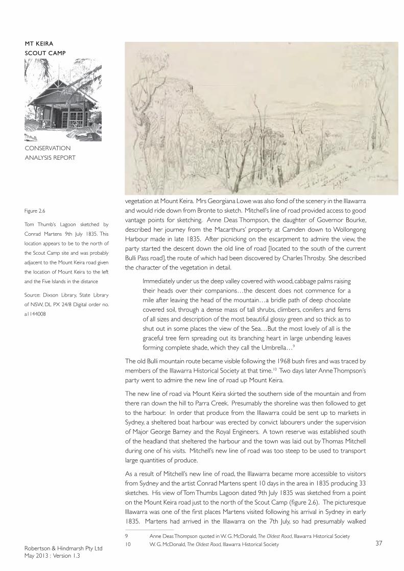
As a result of Mitchell’s new line of road, the Illawarra became more accessible to visitors from Sydney and the artist Conrad Martens spent 10 days in the area in 1835 producing 33 sketches. His view of Tom Thumbs Lagoon dated 9th July 1835 was sketched from a point on the Mount Keira road just to the north of the Scout Camp (figure 2.6). The picturesque Illawarra was one of the first places Martens visited following his arrival in Sydney in early 1835. Martens had arrived in the Illawarra on the 7th July, so had presumably walked
9 Anne Deas Thompson quoted in W. G. McDonald, The Oldest Road, Illawarra Historical Society
10 W. G. McDonald, The Oldest Road, Illawarra Historical Society
Figure 2.6
Tom Thumb’s Lagoon sketched by
Conrad Martens 9th July 1835. This
location appears to be to the north of
the Scout Camp site and was probably
adjacent to the Mount Keira road given
the location of Mount Keira to the left
and the Five Islands in the distance
Source: Dixson Library, State Library
of NSW, DL PX 24/8 Digital order no.
a1144008
Robertson & Hindmarsh Pty LtdMay 2013 : Version 1.3
38
MT KEIRA
SCOUT CAMP
CONSERVATION
ANALYSIS REPORT
back up Mitchell’s new line of road to sketch the lagoon view. F.A. Bryant, writing in 1844, complained that, despite extensive works undertaken by the convict road gangs it was still difficult to get down to the Illawarra ‘you would creep down on foot leading your horse from stone to stone.11
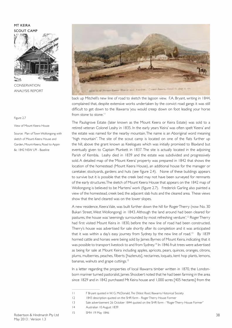
The Paulsgrove Estate (later known as the Mount Keera or Keira Estate) was sold to a retired veteran Colonel Leahy in 1835. In the early years ‘Keira’ was often spelt ‘Keera’ and the estate was named for the nearby mountain. The name is an Aboriginal word meaning “high mountain”. The site of the scout camp is located on one of the flats further up the hill, above the grant known as Keelogues which was initially promised to Blaxland but eventually given to Captain Plunkett in 1837. The site is actually located in the adjoining Parish of Kembla. Leahy died in 1839 and the estate was subdivided and progressively sold. A detailed map of the ‘Mount Keera’ property was prepared in 1842 that shows the location of the homestead (Mount Keera House), an additional house for the manager or caretaker, stockyards, gardens and huts (see figure 2.4). None of these buildings appears to survive but it is possible that the creek bed may not have been surveyed for remnants of the early structures. The sketch of Mount Keera House that appears on the 1842 map of Wollongong is believed to be Martens’ work (figure 2.7). Frederick Garling also painted a view of the homestead, creek bed, the adjacent slab huts and the cleared area. These views show that the land cleared was on the lower slopes.
A new residence, Keera Vale, was built further down the hill for Roger Therry (now No. 30 Bukari Street, West Wollongong) in 1843. Although the land around had been cleared for pastures, the house was ‘seemingly surrounded by most refreshing verdure’.12 Roger Therry had first visited Mount Keira in 1830, before the new line of road had been constructed. Therry’s house was advertised for sale shortly after its completion and it was anticipated that it was within a day’s easy journey from Sydney by the new line of road.13 By 1839 horned cattle and horses were being sold by James Byrnes of Mount Keira, indicating that it was possible to transport livestock to and from Sydney.14 In 1846 fruit trees were advertised as being for sale at Mount Keira including apples, apricots, pears, quinces, oranges, citrons, plums, mulberries, peaches, filberts [hazlenuts], nectarines, loquats, kent hop plants, lemons, bananas, walnuts and grape cuttings.15
In a letter regarding the properties of local Illawarra timber written in 1870, the London-born mariner turned pastoralist, James Shoobert noted that he had been farming in the area since 1829 and in 1842 purchased Mt Keira house and 1,000 acres [405 hectares] from the
11 F Bryant quoted in W. G. McDonald, The Oldest Road, Illawarra Historical Society
12 1843 description quoted on the SHR form - Roger Therry House Former
13 Sale advertisement 26 October 1844 quoted on the SHR form - “Roger Therry House Former”
14 Australian 10 August 1839
15 SMH 19 May 1846
Figure 2.7
View of Mount Keera House
Source: Plan of Town Wollongong with
sketch of Mount-Keera House and
Garden, Mount-Keera, Road to Appin
&c 1842 NSW LPI - Baseline
Robertson & Hindmarsh Pty LtdMay 2013 : Version 1.3
39
MT KEIRA
SCOUT CAMP
CONSERVATION
ANALYSIS REPORT
previous owners Mr Spearin[g] and Colonel Seaby [Leahy].16 Around 1847 Shoobert was supplying butter to Sydney. To distinguish his Mount Keira butter from other butters, his butter had a swan imprinted with the words ‘Mount Keira’ also imprinted. The older spelling of the name continued to be used occasionally. Shoobert had also discovered coal in the vicinity of his land, on a grant belonging to Mr Chippindall.
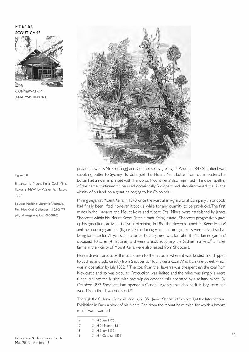
Mining began at Mount Keira in 1848, once the Australian Agricultural Company’s monopoly had finally been lifted, however it took a while for any quantity to be produced. The first mines in the Illawarra, the Mount Keira and Albert Coal Mines, were established by James Shoobert within his Mount Keera (later Mount Keira) estate. Shoobert progressively gave up his agricultural activities in favour of mining. In 1851 the eleven roomed ‘Mt Keera House’ and surrounding gardens (figure 2.7), including vines and orange trees were advertised as being for lease for 21 years and Shoobert’s dairy herd was for sale. The ‘far famed gardens’ occupied 10 acres [4 hectares] and were already supplying the Sydney markets.17 Smaller farms in the vicinity of Mount Keira were also leased from Shoobert.
Horse-drawn carts took the coal down to the harbour where it was loaded and shipped to Sydney and sold directly from Shoobert’s Mount Keira Coal Wharf, Erskine-Street, which was in operation by July 1852.18 The coal from the Illawarra was cheaper than the coal from Newcastle and so was popular. Production was limited and the mine was simply ‘a mere tunnel cut into the hillside’ with one skip on wooden rails operated by a solitary miner. By October 1853 Shoobert had opened a General Agency that also dealt in hay, corn and wood from the Illawarra district.19
Through the Colonial Commissioners, in 1854, James Shoobert exhibited, at the International Exhibition in Paris, a block of his Albert Coal from the Mount Keira mine, for which a bronze medal was awarded.
16 SMH 2 July 1870
17 SMH 21 March 1851
18 SMH 5 July 1852
19 SMH 4 October 1853
Figure 2.8
Entrance to Mount Keira Coal Mine,
Illawarra, NSW by Walter G. Mason,
1857
Source: National Library of Australia,
Rex Nan Kivell Collection NK2106/77
(digital image nla.pic-an8008816)
Robertson & Hindmarsh Pty LtdMay 2013 : Version 1.3
40
MT KEIRA
SCOUT CAMP
CONSERVATION
ANALYSIS REPORT
In the course of the next week it [the coal] will be in town [Wollongong?] for the inspection of the curious and those who take an interest in the resources of the district. It may be necessary for the information of distant readers, that the Albert Coal Mines are situated on the eastern side of Mount Keira, and within two miles of the town of Wollongong, which mines were opened by Mr Shoobert some six years since.20
C.S., in his Jottings in the Illawarra describes Shoobert’s mine, and a nearby mountain farm
My first visit to the mountain [Mount Keira] was under capital guidance. I had been favoured with a note of introduction to Mr S - a gentleman of very considerable property and influence in the district - who very courteously sent one of his sons, a fine smart, intelligent lad of, I think, about twelve years old, to show me the highways and byways; and a pretty severe task he had. We first took a glance at Fairy Meadow; from thence we ascended the hills, and examined the coal pits. Having made acquaintance with these depositaries of the black diamond, we cut across the country to the main road up Mount-Keira, and ascended sufficiently high to view, as I have already stated, the lake of Illawarra and the Dapto country. This, with the return to Wollongong, was about ten miles of very rough walking, but my young companion, although evidently pretty tired towards the end, bore up “like a man”; and, apart from his sturdiness, I found him a most agreeable companion.
The height of the mountain above the sea level (according to the Rev. Mr. Clarke) is 1530 feet; that of its south-west corner is 1507 feet. There are several coal seams.- That which is at present worked lies at an elevation of about 1000 feet ; it is called the Albert Seam, and is about four feet two inches in thickness. There is no pit, properly so called, but a mere tunnel out into the hill side, and so low that it is rather a painful operation to explore it to any distance. There is another tunnel in a wild looking glen, or gully, close at hand where the seam has either been worked up or abandoned, I believe the former. This old tunnel is very much more lofty and can be penetrated with ease. But there should be a miner with his lamp to guide you and such a guide can generally be procured. Unfortunately there was none on the spot at the time of my first visit and on the second occasion I was too much pressed for time, for I was to leave by the steamer that after-noon. The old tunnel in the glen, is only to be reached from the mouth of the new tunnel, by descending a very precipitous pathway, quite impracticable for ladies; but there is a path further down the road by which it may be reached with ease. It was by the steep and narrow way that I both went and returned and I got my hands pretty well scratched with briars in so doing.
Both these tunnels are on the property of Mr. Shoobert, who has six seams within 100 feet of each other, varying in thickness from three feet to about four feet ten inches. As yet only two of them has been tested. That in the gully, which was called the Mount Keira Seam, did not yield coal of so good a quality as is got from the seam at present worked. There was less gas in it and it pulverised too readily. The coal from the Albert seam is very fine. It is generally larger than that brought from the Hunter, and one founder who is in the habit of using it has stated that it is the only coal in the country with which he has been able to melt brass. At present it is, but partially worked, only just enough being sent in to supply Wollongong, and a few Sydney customers.
20 Maitland Mercury & Hunter River General Advertiser 31 July 1856 from the Illawarra Mercury 22 July
Robertson & Hindmarsh Pty LtdMay 2013 : Version 1.3
41
MT KEIRA
SCOUT CAMP
CONSERVATION
ANALYSIS REPORT
The road to the tunnel is an ascent, for the most part gradual and easy, but occasionally pretty steep. From the small plateau in front of the tunnel and from the summits of several of the lesser hills there are beautiful views of Wollongong, the Five Islands, and the Ocean. But what most attracted my attention was the romantic character of the scenery through which the road itself passed. On either hand was the richest verdure which became more semitropical in its character as we ascended the mountain. Sometimes we would pass the edge of a small precipitous glen, the sides of which were clothed with one mass of glistening foliage - the cabbage-tree, the ferns, the wild laureatinus, and innumerable other beautiful trees and shrubs which I have not enough botanical knowledge to describe. At others the narrow roadway was completely sheltered from the sun’s rays by the trees which fringed it. What a triumph of landscape gardening would it be thought in our parent land to produce, by art, such lights and shades, such groupings of foliage, such slopes and levels as are here formed by Nature.
Nor is the scenery all wild. The road passes many of those picturesque little mountain farms, which are so numerous in Illawarra. At one of these, situated not far from, “the last hill,” I and my companions halted for a few minutes. At the time I last visited the tunnel the farmhouse was a small but comfortable looking slab cottage, and the barn; situated at no great distance, was of the same materials; but there was a well-to-do air about the cottage not to be mistaken, and the farmer himself was one of the finest specimens of the English yeoman that I have yet seen at the antipodes - a sturdy, hearty, good-tempered fellow, and, like all his race, hospitable withal. Time was precious, and we could not enter his dwelling, although pressed to do so; but the ladies of the party (there were two of them) were promptly supplied with bread and butter - both home-made, and of the finest quality - and with good pure milk; Oh! The milk of Illawarra: how much more nasty, by comparison, seems the wretched, watery mixture, dignified by the name of milk, with which us poor Sydneyites are afflicted.21
Many of the early descriptions mention the panoramic views and the lush vegetation on the Mount Keira Road, a quality that is still evident today. Walter G. Mason’s sketch of the entrance to the coal mine at Mount Keira was included in the 1857 The Australian Picture Pleasure Book, illustrating the scenery, architecture, historical events, natural history, public characters &c of Australia (figure 2.8). The view had already appeared in the Illustrated Sydney News in 1855.
The development of the infrastructure and the mines in the Mount Keira area by Shoobert and later by Osborne was at their own expense, as was pointed out at a dinner held at Elliot’s Family Hotel in Wollongong in
a more sincere appreciation of the many good qualities of Mr. Shoobert, of his sterling integrity and perseverance as a man, and of the upright and conscientious manner in which he had discharged his duty as a magistrate. He had had the pleasure of knowing him for the last sixteen years, and during that time he could say with truth that Mr. Shoobert had done everything that a person in his position could do for the advancement of Illawarra. He had on several occasions, at a great cost to himself, effected repairs to the roads; he had opened the “Albert Coal Mines,” and though as yet they had not been a source of profit to him (Mr Shoobert), still it had demonstrated our mineral wealth to the colony, and it must be a source of gratification to every well-wisher of the district. When
21 Jottings in the Illawarra, SMH 27 September 1855
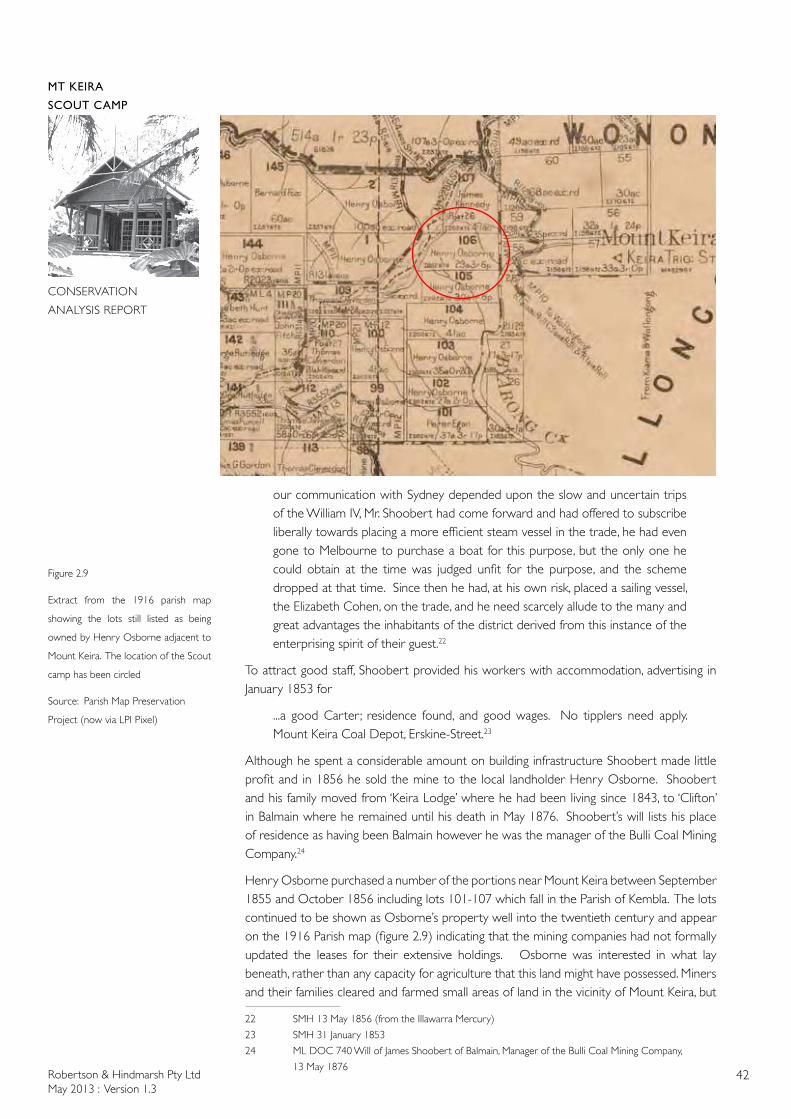
Robertson & Hindmarsh Pty LtdMay 2013 : Version 1.3
42
MT KEIRA
SCOUT CAMP
CONSERVATION
ANALYSIS REPORT
our communication with Sydney depended upon the slow and uncertain trips of the William IV, Mr. Shoobert had come forward and had offered to subscribe liberally towards placing a more efficient steam vessel in the trade, he had even gone to Melbourne to purchase a boat for this purpose, but the only one he could obtain at the time was judged unfit for the purpose, and the scheme dropped at that time. Since then he had, at his own risk, placed a sailing vessel, the Elizabeth Cohen, on the trade, and he need scarcely allude to the many and great advantages the inhabitants of the district derived from this instance of the enterprising spirit of their guest.22
To attract good staff, Shoobert provided his workers with accommodation, advertising in January 1853 for
...a good Carter ; residence found, and good wages. No tipplers need apply. Mount Keira Coal Depot, Erskine-Street.23
Although he spent a considerable amount on building infrastructure Shoobert made little profit and in 1856 he sold the mine to the local landholder Henry Osborne. Shoobert and his family moved from ‘Keira Lodge’ where he had been living since 1843, to ‘Clifton’ in Balmain where he remained until his death in May 1876. Shoobert’s will lists his place of residence as having been Balmain however he was the manager of the Bulli Coal Mining Company.24
Henry Osborne purchased a number of the portions near Mount Keira between September 1855 and October 1856 including lots 101-107 which fall in the Parish of Kembla. The lots continued to be shown as Osborne’s property well into the twentieth century and appear on the 1916 Parish map (figure 2.9) indicating that the mining companies had not formally updated the leases for their extensive holdings. Osborne was interested in what lay beneath, rather than any capacity for agriculture that this land might have possessed. Miners and their families cleared and farmed small areas of land in the vicinity of Mount Keira, but
22 SMH 13 May 1856 (from the Illawarra Mercury)
23 SMH 31 January 1853
24 ML DOC 740 Will of James Shoobert of Balmain, Manager of the Bulli Coal Mining Company,
13 May 1876
Figure 2.9
Extract from the 1916 parish map
showing the lots still listed as being
owned by Henry Osborne adjacent to
Mount Keira. The location of the Scout
camp has been circled
Source: Parish Map Preservation
Project (now via LPI Pixel)
Robertson & Hindmarsh Pty LtdMay 2013 : Version 1.3
43
MT KEIRA
SCOUT CAMP
CONSERVATION
ANALYSIS REPORT
were not granted the land or given a conditional purchase, as there are no annotations on the parish maps. They leased their land from the mining companies. The exact date of the establishment of the farms in the vicinity of the Scout Camp, including Ring’s farm, has not been determined, however the farms may be contemporary with the opening of the mines. The 1948 aerial photograph shows the clearings of the scattered farms of the miners (figure 2.15).
By 1853, smaller lots described as ‘suburban lots’, were being sold ‘near Mount Keera’ including lots on Hell Hole Creek (Byarong Creek). These lots ranged in size from 17 acres (6.9ha) to 50 acres (20ha). Mr Armstrong’s 52 acre farm at Mount Keira was sold in 1854.25 In 1859 a more detailed description of one of the farms for sale was published.
A VALUABLE DAIRY FARM, consisting of about 4 acres, situate [sic] about one mile by a good road from the town of Wollongong. The improvements comprise a comfortable hardwood cottage containing four rooms and verandah, detached dairy, laundry, barn, stockyards, &c, including all conveniences for working the farm. The land is nearly all cleared, and is securely fenced and subdivided into six paddocks. It is supplied with water by a never-failing creek, which runs through it. The richness of the soil cannot be surpassed by any in this favoured locality… and is without exception on the richest portion of the Mount Keira Estate…26
In the 1850s villas on the slopes of Mount Keira but closer to the township of Wollongong were also advertised
MOUNT KEIRA VILLA -To let, the above desirable compact and newly created family residence situated in the most salubrious part of the town, and commanding an extensive view of the ocean, Five Islands, and mountains. The house contains six (6) rooms, verandah, detached kitchen with half an acre of ground, for particulars apply to Mr ALFRED CANE, 78, Old South Head Road.27
The 1856 sale notice for Shoobert’s property including Mount Keira House and Grounds, the Mount Keira and Albert Coal Mines, Cleared Farms, Sites for Ornamental Cottages etc indicates that sections of the estate had already been leased as small farms. The spelling had now changed from Keera to Keira. In 1855 the homestead was being operated as a Ladies Boarding School.
Mrs C. Barton and Daughter will be happy to receive a select and limited number of pupils to board and educate at Mt Keira, which is pleasantly and healthfully situated in view of the ocean, having extensive grounds attached. 28
CS in his Illawarra Jottings further described Mount Keira
Another thing that struck me was the almost total absence of horticultural improvement. There were a few good gardens here and there, but they were very few. There is a very fine and extensive one near the foot of Mount Keira. It is the property of Mr. Shoobert, but is in the occupancy of Mrs. Barton, who has, in the mansion attached to it, a boarding-school for young ladies. The establishment has a good reputation; beyond this I know nothing of it, having only seen the house at a distance; but so far as the health and enjoyment of the pupils are concerned, it is difficult to imagine a more eligible position.29
The February1856 advertisement for Shoobert’s Mount Keira estate describes the various
25 SMH 25 April 1854
26 SMH 8 January 1859
27 SMH 19 June 1854
28 SMH 14 April 1855
29 SMH 26 October 1855
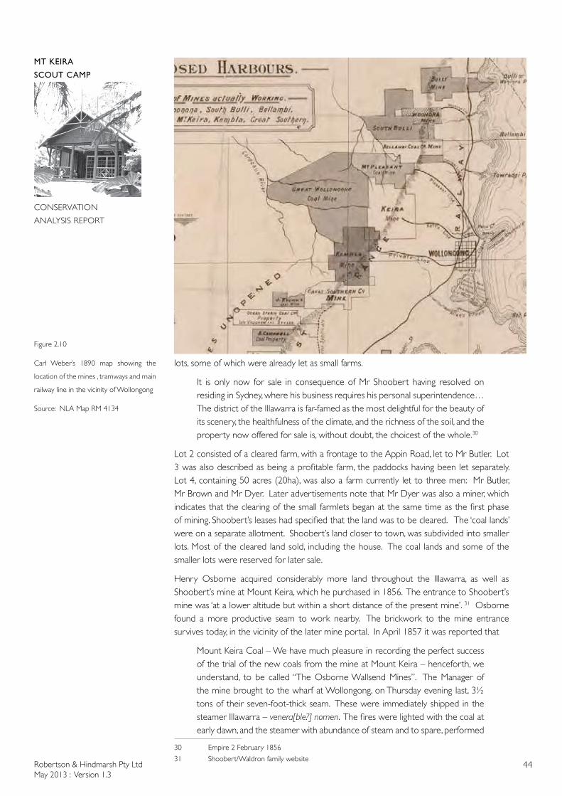
Robertson & Hindmarsh Pty LtdMay 2013 : Version 1.3
44
MT KEIRA
SCOUT CAMP
CONSERVATION
ANALYSIS REPORT
lots, some of which were already let as small farms.
It is only now for sale in consequence of Mr Shoobert having resolved on residing in Sydney, where his business requires his personal superintendence…The district of the Illawarra is far-famed as the most delightful for the beauty of its scenery, the healthfulness of the climate, and the richness of the soil, and the property now offered for sale is, without doubt, the choicest of the whole.30
Lot 2 consisted of a cleared farm, with a frontage to the Appin Road, let to Mr Butler. Lot 3 was also described as being a profitable farm, the paddocks having been let separately. Lot 4, containing 50 acres (20ha), was also a farm currently let to three men: Mr Butler, Mr Brown and Mr Dyer. Later advertisements note that Mr Dyer was also a miner, which indicates that the clearing of the small farmlets began at the same time as the first phase of mining. Shoobert’s leases had specified that the land was to be cleared. The ‘coal lands’ were on a separate allotment. Shoobert’s land closer to town, was subdivided into smaller lots. Most of the cleared land sold, including the house. The coal lands and some of the smaller lots were reserved for later sale.
Henry Osborne acquired considerably more land throughout the Illawarra, as well as Shoobert’s mine at Mount Keira, which he purchased in 1856. The entrance to Shoobert’s mine was ‘at a lower altitude but within a short distance of the present mine’. 31 Osborne found a more productive seam to work nearby. The brickwork to the mine entrance survives today, in the vicinity of the later mine portal. In April 1857 it was reported that
Mount Keira Coal – We have much pleasure in recording the perfect success of the trial of the new coals from the mine at Mount Keira – henceforth, we understand, to be called “The Osborne Wallsend Mines”. The Manager of the mine brought to the wharf at Wollongong, on Thursday evening last, 3½ tons of their seven-foot-thick seam. These were immediately shipped in the steamer Illawarra – venera[ble?] nomen. The fires were lighted with the coal at early dawn, and the steamer with abundance of steam and to spare, performed
30 Empire 2 February 1856
31 Shoobert/Waldron family website
Figure 2.10
Carl Weber’s 1890 map showing the
location of the mines , tramways and main
railway line in the vicinity of Wollongong
Source: NLA Map RM 4134

Robertson & Hindmarsh Pty LtdMay 2013 : Version 1.3
45
MT KEIRA
SCOUT CAMP
CONSERVATION
ANALYSIS REPORT
her voyage most satisfactorily and with her usual speed. The result cannot be surpassed. And now we have an export equal, if not superior, to the best coal of the Hunter…
Our black diamonds will promote commerce and add to our social industry. The coal is fine in appearance – bright and splinty [sic] – burns bright and strong and leaves no clinkers. The residium appears to be in the same proportion as the best coal in the colony. In every respect there appears no drawback whatever. As the mine advances into the mountain the manager states that the coal will improve at least 5 percent over the present quality. Taking the Osborne Wallsend seam altogether, it appears one of the finest in the world.32
The opening of the Osborne’s mine and the first shipment of coal was widely reported in the Australian press. In June 1858 the route of the proposed tramway from the mine at Mount Keira to Wollongong Harbour was published. A petition was to be presented to parliament for the tramway, which was to pass through lands owned by Osborne and Andrew Thompson.33 In 1861 a private act of Parliament was passed to enable the construction of tramways to transport the coal from the three mines: Mount Kembla, Mount Keira and Mount Pleasant. Henry Osborne did not live to see the project completed, as he died in March 1859 and the Mount Keira section of the tramway was not opened until November 1859. The tramway to the harbour was completed by May 1861. The demand for coal was such that the boat harbour was extended by the addition of a new basin commenced in 1869, that became known as the Belmore Basin. Horse drawn carts were soon replaced with steam locomotives that operated on the private tramline connecting the mines to the coal staithes at the basin. Remnants of Pit Pony stables and associated infrastructures are present today in the Illawarra Escarpment State Conservation Area near Mt Kembla Village and Farmborough Heights. This network of coal railways predates the main line from Sydney to Wollongong.
Newspaper accounts record that miners were living at Mount Keira by 1857. The miners are not likely to have been living in the same standard of accommodation as the villas at the foot of the hill.
On Tuesday last, Mr. Dyer, of Mount Keira, a coalminer, brought to our office a specimen of scale gold, which he asserts was found on Mount Keira, on or near a farm which he occupies in that locality. The specimen is very small and no Connection with any other substance. On Thursday last he for-warded to us another specimen of gold in quartz and iron and weighing in the mass, about seven pennyweights... The gold in which is estimated to be about four pennyweights presents an appearance similar to the gold found on the Wentworth gold fields. Mr. Dyer says this was also obtained at Mount Keira, and from our knowledge of him we know of no reason to doubt his statement.34
Dyer held one of the clearing leases on Shoobert’s property and probably resided in a slab hut. He does not appear to have found more gold. Other mine workers were more transient,
Escape of a successful swindler. A person named Dougherty, who resided on Mount Keira, and has recently been engaged in carrying coal from the Keira mine into town, has decamped from the district having first pushed himself into the debt of most of the storekeepers in Wollongong to the tune of about 100 pounds. He left the district on Sunday morning last, conveying a considerable quantity of
32 The Empire, 22 April 1857
33 SMH 4 June 1858
34 The Empire 18 March 1857
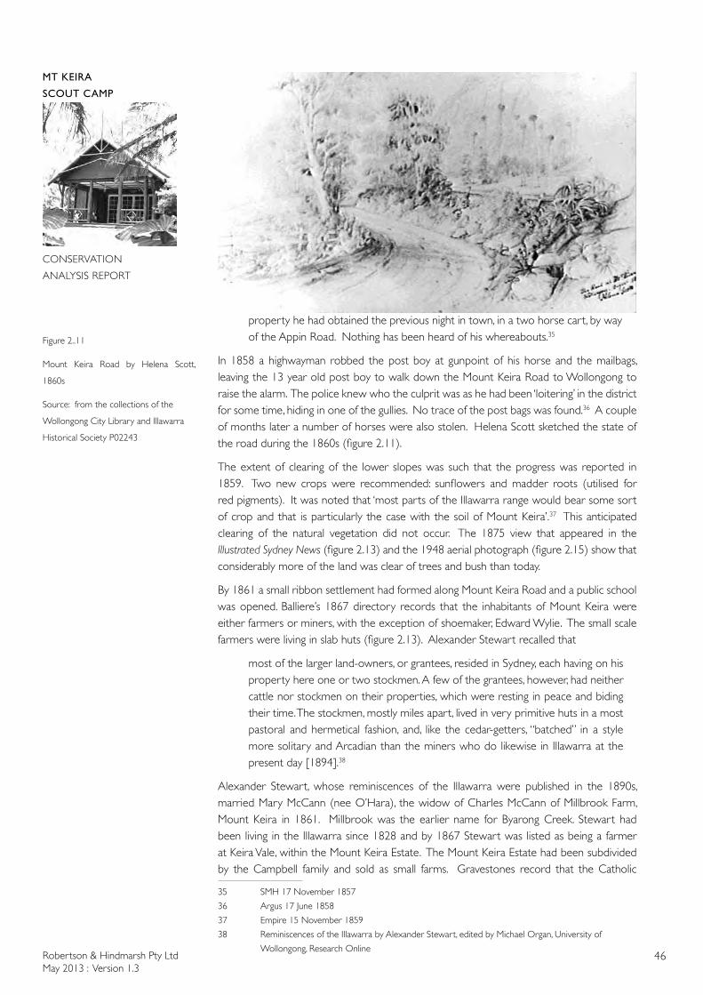
Robertson & Hindmarsh Pty LtdMay 2013 : Version 1.3
46
MT KEIRA
SCOUT CAMP
CONSERVATION
ANALYSIS REPORT
property he had obtained the previous night in town, in a two horse cart, by way of the Appin Road. Nothing has been heard of his whereabouts.35
In 1858 a highwayman robbed the post boy at gunpoint of his horse and the mailbags, leaving the 13 year old post boy to walk down the Mount Keira Road to Wollongong to raise the alarm. The police knew who the culprit was as he had been ‘loitering’ in the district for some time, hiding in one of the gullies. No trace of the post bags was found.36 A couple of months later a number of horses were also stolen. Helena Scott sketched the state of the road during the 1860s (figure 2.11).
The extent of clearing of the lower slopes was such that the progress was reported in 1859. Two new crops were recommended: sunflowers and madder roots (utilised for red pigments). It was noted that ‘most parts of the Illawarra range would bear some sort of crop and that is particularly the case with the soil of Mount Keira’.37 This anticipated clearing of the natural vegetation did not occur. The 1875 view that appeared in the Illustrated Sydney News (figure 2.13) and the 1948 aerial photograph (figure 2.15) show that considerably more of the land was clear of trees and bush than today.
By 1861 a small ribbon settlement had formed along Mount Keira Road and a public school was opened. Balliere’s 1867 directory records that the inhabitants of Mount Keira were either farmers or miners, with the exception of shoemaker, Edward Wylie. The small scale farmers were living in slab huts (figure 2.13). Alexander Stewart recalled that
most of the larger land-owners, or grantees, resided in Sydney, each having on his property here one or two stockmen. A few of the grantees, however, had neither cattle nor stockmen on their properties, which were resting in peace and biding their time. The stockmen, mostly miles apart, lived in very primitive huts in a most pastoral and hermetical fashion, and, like the cedar-getters, “batched” in a style more solitary and Arcadian than the miners who do likewise in Illawarra at the present day [1894].38
Alexander Stewart, whose reminiscences of the Illawarra were published in the 1890s, married Mary McCann (nee O’Hara), the widow of Charles McCann of Millbrook Farm, Mount Keira in 1861. Millbrook was the earlier name for Byarong Creek. Stewart had been living in the Illawarra since 1828 and by 1867 Stewart was listed as being a farmer at Keira Vale, within the Mount Keira Estate. The Mount Keira Estate had been subdivided by the Campbell family and sold as small farms. Gravestones record that the Catholic
35 SMH 17 November 1857
36 Argus 17 June 1858
37 Empire 15 November 1859
38 Reminiscences of the Illawarra by Alexander Stewart, edited by Michael Organ, University of
Wollongong, Research Online
Figure 2..11
Mount Keira Road by Helena Scott,
1860s
Source: from the collections of the
Wollongong City Library and Illawarra
Historical Society P02243

Robertson & Hindmarsh Pty LtdMay 2013 : Version 1.3
47
MT KEIRA
SCOUT CAMP
CONSERVATION
ANALYSIS REPORT
O’Hara family had been living at Mount Keira since at least 1857. The 5th Edition of the Wollongong parish map (1897-1908) shows that James O’Hara owned two small plots of land on Byarong Creek (lots 27 & 28), however the date of the land transfer is not recorded on the c. 1895 parish map.
Following the death of Henry Osborne in 1859, the Mount Keira Mine was leased by Robson and Spiers, however the operation reverted back to the Osborne family in 1871. By 1864 there were sufficient numbers of miners at the Mount Keira, Mount Pleasant and Woronora mines for a deputation to present their complaints to the ‘coal owners’. Mr Robson was the manager of the Mount Keira mines. The miners sought higher pay, claiming that the trade had increased. The mine owners, who were shipping coal to China, claimed there were other costs involved. The mine owners instructed their managers ‘to give the miners notice to quit the cottages now occupied by them unless they accept the terms proposed’.39 The sequence of parish maps show that the mine owners, particularly Osborne, owned numerous plots of land including most of the land in the vicinity of the study site. The 1895 parish map for Kembla (edition 1) and the later editions (up to edition 10) of the parish of Kembla shows the land in the vicinity of Byarong or Hell Hole Creek to the north of Keelogues (lots 99-106) as still being owned by Henry Osborne, with the exception of one lot (No 107) owned by James Kennedy. Osborne also owned extensive property in the wider area including land in the Wollongong Parish on the other side of Byarong Creek including part of the summit of Mount Keira (lot 29).
During the 1870s the coal was exported to India and China. The work was, however, intermittent. When a ship arrived, the miners would be signalled by flags raised at the now demolished signal station at Flagstaff Hill above Wollongong Harbour. As the work was intermittent, the miners were generally local farmers who supplemented their income when the coal ships arrived needing a cargo. A description appeared in the Illustrated Australian News for Home Readers in January 1871
The whole country along the Keira route is exceedingly rural and pretty; the farms and dwellings having a long settled, peaceful, country air, as if the present tenants simply inherited what others had tamed, and knew nothing themselves about pioneering.
The district is an agricultural and coal mining one; the geological formation is carbonaceous sandstone, shale, and limestone.40
The same year Mount Keira House was advertised for sale. This house appears to be the larger two storey house erected by Therry rather than the earlier single storey homestead further up the hill. Surrounding the house were large gardens and orchards, 50 acres [20 hectares] of paddocks and a further 180 acres [73 hectares] of cleared land. The lower slopes were all cleared. Further up Mount Keira it would appear that only selected level areas were cleared for cultivation or paddocks.
In the 1870s the Osborne family donated land for a public school and teacher’s residence at Mount Keira, which was designed in the Gothic Revival style by George Mansfield, the architect for the Department of Public Instruction (figure 2.12). A proposal to build a railway station at Mount Keira for ‘setting down and taking up the Wollongong passengers’ did not proceed. The line, to be erected on the ‘Fairlie Railway’ principle was to commence at the George’s River and would have terminated in the Shoalhaven.41
39 Empire 4 July 1864
40 Illustrated Australian News for Home Readers (Melbourne) 30 Jan 1871
41 SMH 2 July 1872
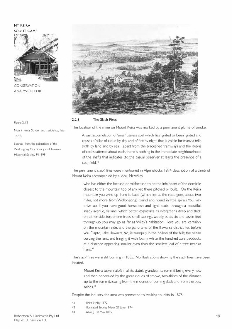
Robertson & Hindmarsh Pty LtdMay 2013 : Version 1.3
48
MT KEIRA
SCOUT CAMP
CONSERVATION
ANALYSIS REPORT
2.2.3 The Slack Fires
The location of the mine on Mount Keira was marked by a permanent plume of smoke.
A vast accumulation of ‘small’ useless coal which has ignited or been ignited and causes a ‘pillar of cloud by day and of fire by night’ that is visible for many a mile both by land and by sea…apart from the blackened tramways and the debris of coal scattered about each, there is nothing in the immediate neighbourhood of the shafts that indicates (to the casual observer at least) the presence of a coal-field.42
The permanent ‘slack’ fires were mentioned in Alpenstock’s 1874 description of a climb of Mount Keira accompanied by a local, Mr Wiley,
who has either the fortune or misfortune to be the inhabitant of the domicile closest to the mountain top of any yet there pitched or built…On the Keira mountain you wind up from its base (which lies, as the road goes, about two miles, not more, from Wollongong) round and round in little spirals. You may drive up, if you have good horseflesh and light loads, through a beautiful, shady avenue, or lane, which better expresses its evergreens deep and thick on either side; turpentine trees, small saplings, woolly butts, six and seven feet through-up you may go as far as Wiley’s habitation. Here you are certainly on the mountain side, and the panorama of the Illawarra district lies before you. Dapto, Lake Illawarra, &c, lie tranquily in the hollow of the hills; the ocean curving the land, and fringing it with foamy white; the hundred acre paddocks at a distance appearing smaller even than the smallest leaf of a tree near at hand.43
The ‘slack’ fires were still burning in 1885. No illustrations showing the slack fires have been located.
Mount Keira towers aloft in all its stately grandeur, its summit being every now and then concealed by the great clouds of smoke, two-thirds of the distance up to the summit, issuing from the mounds of burning slack and from the busy mines.44
Despite the industry, the area was promoted to ‘walking tourists’ in 1875:
42 SMH 9 May 1872
43 Illustrated Sydney News 27 June 1874
44 AT&CJ 30 May 1885
Figure 2..12
Mount Keira School and residence, late
1870s
Source: from the collections of the
Wollongong City Library and Illawarra
Historical Society P11999
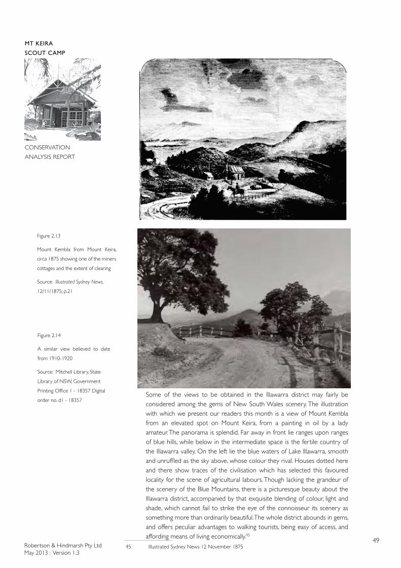
Robertson & Hindmarsh Pty LtdMay 2013 : Version 1.3
49
MT KEIRA
SCOUT CAMP
CONSERVATION
ANALYSIS REPORT
Some of the views to be obtained in the Illawarra district may fairly be considered among the gems of New South Wales scenery. The illustration with which we present our readers this month is a view of Mount Kembla from an elevated spot on Mount Keira, from a painting in oil by a lady amateur. The panorama is splendid. Far away in front lie ranges upon ranges of blue hills, while below in the intermediate space is the fertile country of the Illawarra valley. On the left lie the blue waters of Lake Illawarra, smooth and unruffled as the sky above, whose colour they rival. Houses dotted here and there show traces of the civilisation which has selected this favoured locality for the scene of agricultural labours. Though lacking the grandeur of the scenery of the Blue Mountains, there is a picturesque beauty about the Illawarra district, accompanied by that exquisite blending of colour, light and shade, which cannot fail to strike the eye of the connoisseur its scenery as something more than ordinarily beautiful. The whole district abounds in gems, and offers peculiar advantages to walking tourists, being easy of access, and affording means of living economically.45
45 Illustrated Sydney News 12 November 1875
Figure 2.13
Mount Kembla from Mount Keira,
circa 1875 showing one of the miners
cottages and the extent of clearing
Source: Illustrated Sydney News,
12/11/1875, p.21
Figure 2.14
A similar view believed to date
from 1910-1920
Source: Mitchell Library, State
Library of NSW, Government
Printing Office 1 - 18357 Digital
order no. d1 - 18357
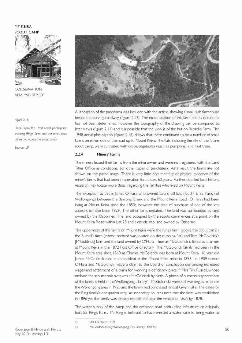
Robertson & Hindmarsh Pty LtdMay 2013 : Version 1.3
50
MT KEIRA
SCOUT CAMP
CONSERVATION
ANALYSIS REPORT
A lithograph of the panorama was included with the article, showing a small slab farmhouse beside the curving roadway (figure 2.13). The exact location of this farm and its occupants has not been determined, however the topography of the drawing can be compared to later views (figure 2.14) and it is possible that the view is of the hut on Russell’s Farm. The 1948 aerial photograph (figure 2.15) shows that there continued to be a number of small farms on either side of the road up to Mount Keira. The flats, including the site of the future scout camp, were cultivated with crops, vegetables (such as pumpkins) and fruit trees.
2.2.4 Miners’ Farms
The miners leased their farms from the mine owner and were not registered with the Land Titles Office as conditional (or other types of purchases). As a result, the farms are not shown on the parish maps. There is very little documentary or physical evidence of the miner’s farms that had been in operation for at least 60 years. Further detailed local history research may locate more detail regarding the families who lived on Mount Keira.
The exception to this is James O’Hara who owned two small lots (lot 27 & 28, Parish of Wollongong) between the Byarong Creek and the Mount Keira Road. O’Haras had been living at Mount Keira since the 1850s, however the date of purchase of one of the lots appears to have been 1929. The other lot is undated. The land was surrounded by land owned by the Osbornes. The land occupied by the scouts commences at a point on the Mount Keira Road within Lot 28 and extends into land owned by Osborne.
The uppermost of the farms on Mount Keira were the Ring’s farm (above the Scout camp), the Russell’s farm (whose orchard was located on the camping flat) and Tom McGoldrick’s [M’Goldrick] farm and the land owned by O’Hara. Thomas McGoldrick is listed as a farmer at Mount Keira in the 1872 Post Office directory. The McGoldrick family had been in the Mount Keira area since 1860, as Charles McGoldrick was born at Mount Keira. 16 year old James McGoldrick died in an accident at the Mount Keira mine in 1896. In 1909 miners O’Hara and McGoldrick made a claim to the board of conciliation demanding increased wages and settlement of a claim for ‘working a deficiency place’.46 Mrs Tilly Russell, whose orchard the scouts took over, was a McGoldrick by birth. A photo of numerous generations of the family is held in the Wollongong Library.47 McGoldricks were still working as miners in the Wollongong area in 1925 and the family had purchased land at Gwynnville. The dates for the Ring family’s occupation vary, as secondary sources note that the farm was established in 1896 yet the family was already established near the ventilation shaft by 1878.
The water supply of the camp and the entrance road both utilise infrastructure originally built for Ring’s Farm. Mr Ring is believed to have erected a water race to bring water to
46 SMH 8 March 1909
47 McGoldrick family, Wollongong City Library, P08426
Figure 2.15
Detail from the 1948 aerial photograph
showing Ring’s farm and the entry road
utilised to access the scout camp
Source: LPI
Robertson & Hindmarsh Pty LtdMay 2013 : Version 1.3
51
MT KEIRA
SCOUT CAMP
CONSERVATION
ANALYSIS REPORT
the homestead. Some evidence of the farm survives today, including fruit trees and outlines of yards. Water races were a common feature of rural homesteads in more mountainous areas of NSW and the technique probably has its origins in the water races utilised during the gold rushes of the 1850s.
The increase in production resulted in an increase in the number of miners required, with cottages provided close to the mine entrance by the mine owners. The miner’s cottages may have had cottage gardens, but did not have the extensive gardens and orchards like the farms further up the hill. Mount Keira remained a small settlement with miner’s cottages and more remote miners’ farms. Apart from the School and the School of Arts, other facilities like public houses and the post office were at Keiraville, Figtree or in Wollongong.
Take a stroll up Crown-street, the main thoroughfare of the town, and you find it lined with handsome shops, an abundance of plate glass, a substantial and imposing looking town hall, which cost four thousand five hundred pounds, four banks, hotels without number--sure sign of prosperity and the whole place as busy as an ant’s nest. It is a lively little town is Wollongong. Of course the topic of the times is coal and coal-mining, for as the town depends upon that commodity for its very existence, there is no wonder that the populace take a deep interest in doings at the mines. But the stranger must not imagine that the dust pervades the town, or that the genus miner is too much in evidence-quite the contrary. The under-ground populace inhabits villages on the slopes of Mount Keira, and only visit the town on Saturday nights, when they quaff flagons of ale innumerable, and enjoy themselves discoursing in bars, varying their platitudes with an occasional appeal to arms-and fists.48
2.2.5 Ventilating Shafts (1870s)
Fresh air for the Mount Keira mine came from the adjacent Mount Pleasant mine. A miners’ strike in 1873 resulted in the closure of the air passages on the Mount Pleasant side, making conditions unbearable on the Mount Keira side49.
It seems unaccountable that a colliery that has been working so long as has been the case with Mount Keira, should be at present without a means of obtaining a plentiful and permanent supply of fresh air independent of any other colliery or company. 50
Illawarra Coal, the Unofficial History of Coal Mining in the Illawarra, gives the date of construction of the series of ‘ventilation headings’ as being 1878. Four were constructed and were known by the names of the residents: Pratts, Porters, Rings and McGoldricks. The 1872 Post Office Directory lists three men.
McGoldrick, Thomas, Farmer, Mt Keira
Porter, James, Farmer, Keelogues
Pratt, Richard labourer, Mt Keira
The Ring family must therefore have taken up their selection between 1872 and 1878. Members of the Porter family still owned a cottage at Mount Keira in 1929, however it was unoccupied at that time.
In April 1882 the large ventilating furnace chimney on the hillside above the mine entrance
48 Illustrated Sydney News 16 August 1890
49 SMH 19 April 1873
50 SMH 3 March 1873

Robertson & Hindmarsh Pty LtdMay 2013 : Version 1.3
52
MT KEIRA
SCOUT CAMP
CONSERVATION
ANALYSIS REPORT
Figure 2.16
Detail from the 1912 Geological Map
showing the furnace shaft located to the
west of the sharp hairpin bend in the old
Mount Keira Road. The approximate site
of the Scout Camp is circled
Source: from the collections of the
Wollongong City Library and Illawarra
Historical Society (map photographed by
Robertson & Hindmarsh Pty Ltd, 2013)
collapsed. Heavy rain was believed to have contributed to the cause of the collapse.51 The purpose of the ventilating furnaces was to draw air through the network of tunnels. The furnaces were initially coal fired, as coal was available on site. To further improve ventilation, a shaft was sunk that connected the two shafts at the Mount Keira mine in 1883.52 The shafts were occasionally used to take injured miners to the surface, as occurred in August 1938:
Albert Seaward, a deputy in the Mt. Keira Colliery, sustained a fractured ankle to-day as a result of being run over by a skip of coal. He had to be taken to the surface through an air shaft, and the Illawarra Ambulance had a rough trip to convey him to hospital.53
The 1912 Geological Map shows the location of the ‘furnace shaft’ or air funnel, adjacent to the western end of the large hairpin bend (figure 2.16). No adjacent ventilation shafts within or adjacent to the miners farms are shown, however there is a ventilating shaft shown some distance away, on the plateau above, within the Osborne Wallsend Colliery. A furnace and chimney survives to the north-east of the main mine portal which was retained as part of the rehabilitation works undertaken when the Kemira mine closed. This feature is not shown on the 1912 Geological Map but is visible from the present day Mount Keira Loop Track. Mine furnaces were dangerous due to the presence of gases in the mines. Timber was often used to prop the mine shafts, which was flammable. The use of electricity to power ventilation fans, greatly reduced the risk of fire or explosion. In 1925 mine furnaces at Mount Kembla were replaced by fans. In 1929 W. Gilmour noted that a
...short distance off is heard the whine of the fan of the Mount Kembla coalmine, as it sucks the foul air from the pit 300 feet below, the mine head being five miles distant across the hills. Mr Lund maintains the revolving wheel by day and night, an alarm of his own design having been rigged up which thus sends out its warning in the event of any cessation of activity.54
A railway tunnel under the mountain connecting Wollongong to join the Great Southern Railway at Douglass Park had been proposed in 1878 but this did not proceed. In the 1880s
51 SMH 17 April 1882
52 Hank Pinkster, Planning for Mine Closures, paper given at the 204 Coal Operators Conference
53 SMH 3 August 1938
54 SMH 27 July 1929

Robertson & Hindmarsh Pty LtdMay 2013 : Version 1.3
53
MT KEIRA
SCOUT CAMP
CONSERVATION
ANALYSIS REPORT
the scale of production at the Mount Keira mine increased considerably. Steam locomotives had been ordered by the Osbornes to haul their coal to the ships waiting in the Belmore Basin. In February 1880 the draught horses from Mount Keira were sold as a ‘consequence of horse power having been superseded by steam-engines from Mount Keira Colliery to Wollongong’.55
2.2.6 Mount Keira Apple Orchards
After 1900 some of the miner’s farms appear to have been occupied part time. The farms may never have been permanently occupied as in 1906, an unoccupied cottage owned by Mr F. Ring of Mount Keira caught fire. The adjacent buildings were saved due to efforts by the neighbours.56 A 73 year old Corrimal women died in 1910 when she fell over a precipice whilst walking up to her farm at Cordeaux. The families lived in cottages in the small towns below the escarpment and walked up to their farms. In the first decades of the twentieth century apples were still grown on the slopes of Mount Keira. The climate and soils were suited to the cultivation of late harvest apples, described as being better than American apples. The Under-Secretary for Agriculture was suprised that such high quality could be achieved on coastal lands.57 A description of the apple orchards between Mount Keira and Mount Kembla noted that the selectors had been there for a century however this date is not supported by other documentary evidence.
About eleven miles from Wollongong, and directly at the back of Mount Keira, there lies sheltered between heavily wooded mountain ridges a narrow valley of wonderfully fertile soil, made no doubt by the sifting of the rich volcanic loam from the mountain side for centuries. It is a locality previously referred to in these columns by reason of the successful orchards there, and the extent and richness of the country, and its general suitability for apple growing. For about four miles after leaving Wollongong the road is good, and easily negotiated, but as soon as it begins to ascend and wind round the southern side of Mount Keira, it is easy to realise the disadvantages under which orchardists must labour in the matter of transit, and one cannot help appreciating their energy in cultivating and gathering a crop which has to be carted over eleven miles of steep winding mountain roadway. There is no need for any flights of fancy in order to form some idea of the hardships that had to be encountered by the first settlers who put up their little slab huts in the dense wilderness of this mountain valley nearly one hundred years ago. 58
The selections further up the hill are more likely to be associated with the establishment of mining. Photographs from the late nineteenth century show more houses on the lower slopes as well as agricultural land (figure 2.13). The upper slopes still retain vegetation. Bush fires threatened the Mount Keira apple orchards in November 1915. A number of young men from the local families served during World War I, some of whom were killed in action and were buried overseas, including one of the McGoldrick boys. The miners would have needed the produce from their farms during prolonged strikes, such as the five week strike at the Mount Keira mine in 1923. A substantial apple orchard, with 2,500 fruit trees, managed by A. S. Brown, the grandson of the original selector, was still in operation in 1929 near Goondarin Creek.59 Two families had long been associated with apple orchards, the Browns and the Robertsons.
55 SMH 17 February 1880
56 SMH 22 November 1906
57 SMH 24 May 1909
58 SMH 20 April 1914
59 SMH 27 July 1929
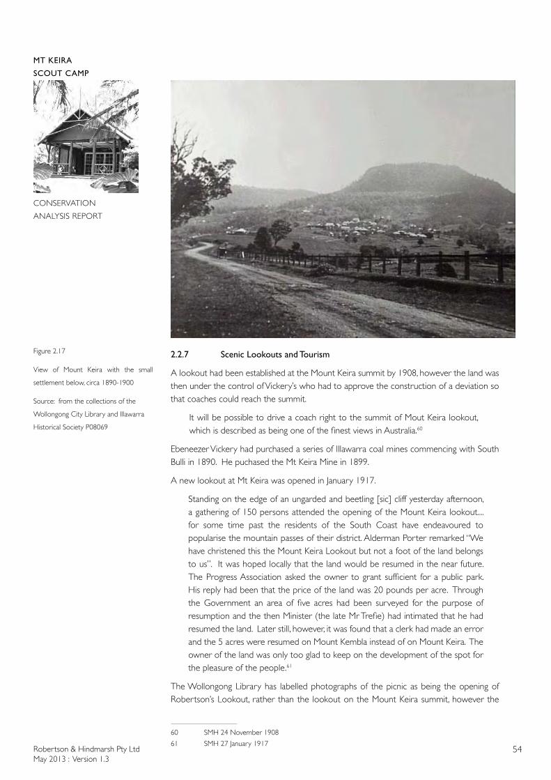
Robertson & Hindmarsh Pty LtdMay 2013 : Version 1.3
54
MT KEIRA
SCOUT CAMP
CONSERVATION
ANALYSIS REPORT
Figure 2.17
View of Mount Keira with the small
settlement below, circa 1890-1900
Source: from the collections of the
Wollongong City Library and Illawarra
Historical Society P08069
2.2.7 Scenic Lookouts and Tourism
A lookout had been established at the Mount Keira summit by 1908, however the land was then under the control of Vickery’s who had to approve the construction of a deviation so that coaches could reach the summit.
It will be possible to drive a coach right to the summit of Mout Keira lookout, which is described as being one of the finest views in Australia.60
Ebeneezer Vickery had purchased a series of Illawarra coal mines commencing with South Bulli in 1890. He puchased the Mt Keira Mine in 1899.
A new lookout at Mt Keira was opened in January 1917.
Standing on the edge of an ungarded and beetling [sic] cliff yesterday afternoon, a gathering of 150 persons attended the opening of the Mount Keira lookout.... for some time past the residents of the South Coast have endeavoured to popularise the mountain passes of their district. Alderman Porter remarked “We have christened this the Mount Keira Lookout but not a foot of the land belongs to us”. It was hoped locally that the land would be resumed in the near future. The Progress Association asked the owner to grant sufficient for a public park. His reply had been that the price of the land was 20 pounds per acre. Through the Government an area of five acres had been surveyed for the purpose of resumption and the then Minister (the late Mr Trefie) had intimated that he had resumed the land. Later still, however, it was found that a clerk had made an error and the 5 acres were resumed on Mount Kembla instead of on Mount Keira. The owner of the land was only too glad to keep on the development of the spot for the pleasure of the people.61
The Wollongong Library has labelled photographs of the picnic as being the opening of Robertson’s Lookout, rather than the lookout on the Mount Keira summit, however the
60 SMH 24 November 1908
61 SMH 27 January 1917
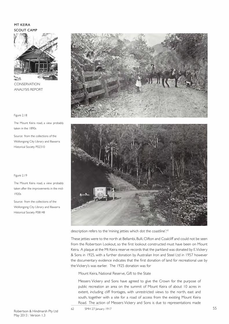
Robertson & Hindmarsh Pty LtdMay 2013 : Version 1.3
55
MT KEIRA
SCOUT CAMP
CONSERVATION
ANALYSIS REPORT
description refers to the ‘mining jetties which dot the coastline’.62
These jetties were to the north at Bellambi, Bulli, Clifton and Coalcliff and could not be seen from the Robertson Lookout, so the first lookout constructed must have been on Mount Keira. A plaque at the Mt Keira reserve records that the parkland was donated by E. Vickery & Sons in 1925, with a further donation by Australian Iron and Steel Ltd in 1957 however the documentary evidence indicates that the first donation of land for recreational use by the Vickery’s was earlier. The 1925 donation was for
Mount Keira, National Reserve, Gift to the State
Messers Vickery and Sons have agreed to give the Crown for the purpose of public recreation an area on the summit of Mount Keira of about 10 acres in extent, including cliff frontages, with unrestricted views to the north, east and south, together with a site for a road of access from the existing Mount Keira Road. The action of Messers Vickery and Sons is due to representations made
62 SMH 27 January 1917
Figure 2.18
The Mount Keira road, a view probably
taken in the 1890s
Source: from the collections of the
Wollongong City Library and Illawarra
Historical Society P02310
Figure 2.19
The Mount Keira road, a view probably
taken after the improvements in the mid-
1920s
Source: from the collections of the
Wollongong City Library and Illawarra
Historical Society P08148
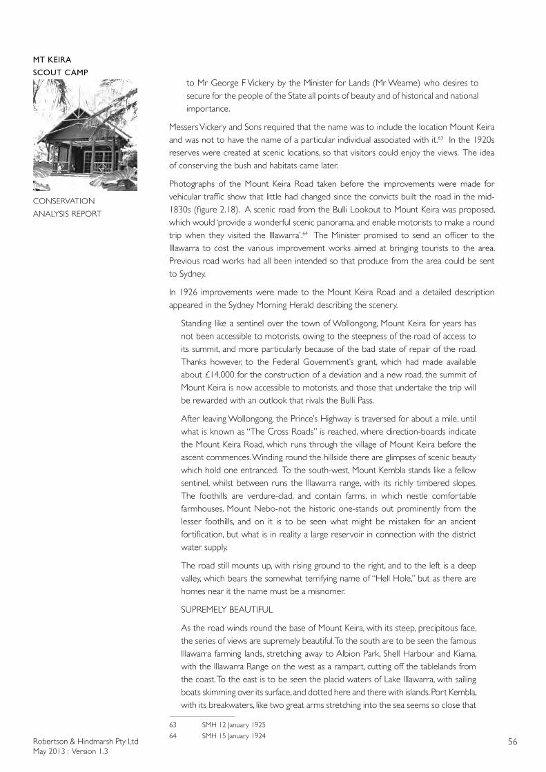
Robertson & Hindmarsh Pty LtdMay 2013 : Version 1.3
56
MT KEIRA
SCOUT CAMP
CONSERVATION
ANALYSIS REPORT
to Mr George F Vickery by the Minister for Lands (Mr Wearne) who desires to secure for the people of the State all points of beauty and of historical and national importance.
Messers Vickery and Sons required that the name was to include the location Mount Keira and was not to have the name of a particular individual associated with it.63 In the 1920s reserves were created at scenic locations, so that visitors could enjoy the views. The idea of conserving the bush and habitats came later.
Photographs of the Mount Keira Road taken before the improvements were made for vehicular traffic show that little had changed since the convicts built the road in the mid-1830s (figure 2.18). A scenic road from the Bulli Lookout to Mount Keira was proposed, which would ‘provide a wonderful scenic panorama, and enable motorists to make a round trip when they visited the Illawarra’.64 The Minister promised to send an officer to the Illawarra to cost the various improvement works aimed at bringing tourists to the area. Previous road works had all been intended so that produce from the area could be sent to Sydney.
In 1926 improvements were made to the Mount Keira Road and a detailed description appeared in the Sydney Morning Herald describing the scenery.
Standing like a sentinel over the town of Wollongong, Mount Keira for years has not been accessible to motorists, owing to the steepness of the road of access to its summit, and more particularly because of the bad state of repair of the road. Thanks however, to the Federal Government’s grant, which had made available about £14,000 for the construction of a deviation and a new road, the summit of Mount Keira is now accessible to motorists, and those that undertake the trip will be rewarded with an outlook that rivals the Bulli Pass.
After leaving Wollongong, the Prince’s Highway is traversed for about a mile, until what is known as “The Cross Roads” is reached, where direction-boards indicate the Mount Keira Road, which runs through the village of Mount Keira before the ascent commences. Winding round the hillside there are glimpses of scenic beauty which hold one entranced. To the south-west, Mount Kembla stands like a fellow sentinel, whilst between runs the Illawarra range, with its richly timbered slopes. The foothills are verdure-clad, and contain farms, in which nestle comfortable farmhouses. Mount Nebo-not the historic one-stands out prominently from the lesser foothills, and on it is to be seen what might be mistaken for an ancient fortification, but what is in reality a large reservoir in connection with the district water supply.
The road still mounts up, with rising ground to the right, and to the left is a deep valley, which bears the somewhat terrifying name of “Hell Hole,” but as there are homes near it the name must be a misnomer.
SUPREMELY BEAUTIFUL
As the road winds round the base of Mount Keira, with its steep, precipitous face, the series of views are supremely beautiful. To the south are to be seen the famous Illawarra farming lands, stretching away to Albion Park, Shell Harbour and Kiama, with the Illawarra Range on the west as a rampart, cutting off the tablelands from the coast. To the east is to be seen the placid waters of Lake Illawarra, with sailing boats skimming over its surface, and dotted here and there with islands. Port Kembla, with its breakwaters, like two great arms stretching into the sea seems so close that
63 SMH 12 January 1925
64 SMH 15 January 1924
Robertson & Hindmarsh Pty LtdMay 2013 : Version 1.3
57
MT KEIRA
SCOUT CAMP
CONSERVATION
ANALYSIS REPORT
one would almost imagine they could throw something into its harbour, and the smoke from the huge factory stacks on its shore, send up volumes of smoke, that seem to make a connecting link between land and sky.
Immediately beneath one’s foot, the town of Wollongong is spread out, and the prominent buildings can be readily picked out. The streets are easily traced to the harbour, where the lighthouse seems to be the portal for the fishing boats returning from their night of endeavour to win the members of the finny tribe from the mighty deep. The road swerves to the north-west, and the precipitous cliffs along shut out all glimpses of surrounding scenery; but the traveller is recompensed by the rich foliage of the trees and ferns along the roadside. Up and up one travels, until the top is reached. A walk to the summit holds one spellbound, for the mountain stands like a large stage set 1300 feet above the surrounding country. To the south may be seen the country already described, whilst to the east the ocean holds the eye, washing as it does numerous beaches with silvery sand from as far north as the eye can see, to Shellharbour on the south. In the immediate vicinity, to the north, are to be seen numerous villages, all nestling amidst a setting of trees, and all flanked on the west by the Illawarra range- Balgownie, Tarrawanna, Corrimal, Woonona, Belambi. They all seem [unreadable] like as the eye travels northward, until it reaches the projecting coastline at Port Hacking.
TREE FERNS AND PALMS
A return is mad[e] to the car, and the road Is followed, west and south, around the spur of the hill, until Robertson’s Lookout is reached, from which another panoramic view to the south is obtained, with a superb setting of tree ferns and palms. Immediately beneath one’s feet; whilst at intervals along the face of the precipitous cliffs little cascades of water splash from rock to rock, until the water glides gently amidst the tangled undergrowth about one thousand feet below. So wild and picturesque is the immediate vicinity that one would never imagine that hundreds of feet beneath the surface men were wielding picks winning coal. One turns reluctantly from such a scenic feast, which is enjoyed all the more on the return journey, as the eye picks out pleasant outlooks that have been missed amidst the wealth of views that were accessible to the [unreadable] upward Journey.
It is rumoured that the Government contemplate connecting the newly formed road with the roadway at the Bulli Pass. If this is done one of the finest scenic drives in Australia will be made accessible to the motorists. The construction of this road will not present any engineering difficulties, as it runs along the top of the Illawarra Range between Mount Keira and Bulli Pass - a locality which is rich in a gravel of Ironstone formation, which has proved to be admirably adapted for road making. A track exists for the greater part of the route. If this road is reformed it will make Broker’s Nose available to the public, from the top of which a panoramic view may be obtained which embraces the whole of the Illawarra district on the north, east, and south and on a fine day to the west the eye can travel to Moss Vale, Bowral, and the higher lands along the southern line.65
Robertson’s Lookout, above the Scout Camp, is named not for the local orchardists but for Major Robertson (as is the town of Robertson).
In 1928 the [state] government funded a half mile section of road from the Mt Keira Road to the lookout. It was also noted that a considerable sum of money had been spent on reforming the road, but parts of this broke away and are now being repaired. Meanwhile a strong movement is being set up for remaking the
65 SMH 17 July 1926
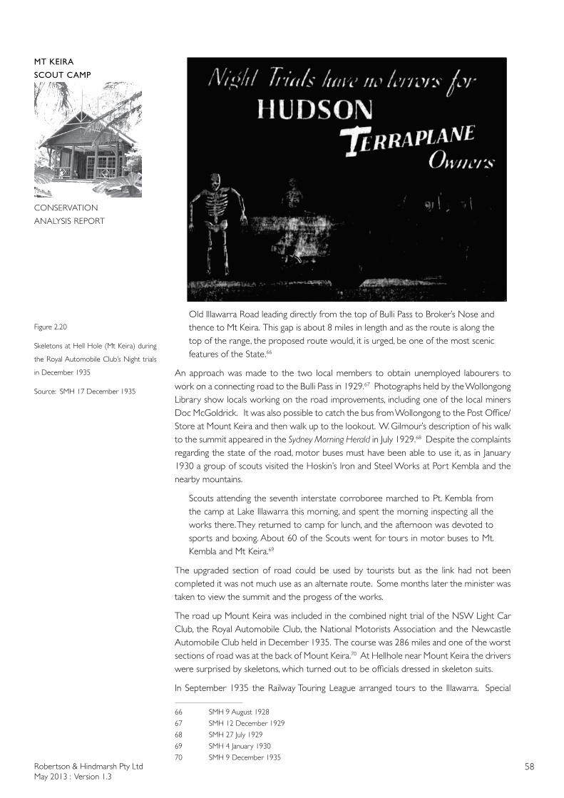
Robertson & Hindmarsh Pty LtdMay 2013 : Version 1.3
58
MT KEIRA
SCOUT CAMP
CONSERVATION
ANALYSIS REPORT
Old Illawarra Road leading directly from the top of Bulli Pass to Broker’s Nose and thence to Mt Keira. This gap is about 8 miles in length and as the route is along the top of the range, the proposed route would, it is urged, be one of the most scenic features of the State.66
An approach was made to the two local members to obtain unemployed labourers to work on a connecting road to the Bulli Pass in 1929.67 Photographs held by the Wollongong Library show locals working on the road improvements, including one of the local miners Doc McGoldrick. It was also possible to catch the bus from Wollongong to the Post Office/Store at Mount Keira and then walk up to the lookout. W. Gilmour’s description of his walk to the summit appeared in the Sydney Morning Herald in July 1929.68 Despite the complaints regarding the state of the road, motor buses must have been able to use it, as in January 1930 a group of scouts visited the Hoskin’s Iron and Steel Works at Port Kembla and the nearby mountains.
Scouts attending the seventh interstate corroboree marched to Pt. Kembla from the camp at Lake Illawarra this morning, and spent the morning inspecting all the works there. They returned to camp for lunch, and the afternoon was devoted to sports and boxing. About 60 of the Scouts went for tours in motor buses to Mt. Kembla and Mt Keira.69
The upgraded section of road could be used by tourists but as the link had not been completed it was not much use as an alternate route. Some months later the minister was taken to view the summit and the progess of the works.
The road up Mount Keira was included in the combined night trial of the NSW Light Car Club, the Royal Automobile Club, the National Motorists Association and the Newcastle Automobile Club held in December 1935. The course was 286 miles and one of the worst sections of road was at the back of Mount Keira.70 At Hellhole near Mount Keira the drivers were surprised by skeletons, which turned out to be officials dressed in skeleton suits.
In September 1935 the Railway Touring League arranged tours to the Illawarra. Special
66 SMH 9 August 1928
67 SMH 12 December 1929
68 SMH 27 July 1929
69 SMH 4 January 1930
70 SMH 9 December 1935
Figure 2.20
Skeletons at Hell Hole (Mt Keira) during
the Royal Automobile Club’s Night trials
in December 1935
Source: SMH 17 December 1935

Robertson & Hindmarsh Pty LtdMay 2013 : Version 1.3
59
MT KEIRA
SCOUT CAMP
CONSERVATION
ANALYSIS REPORT
trains were laid on from Sydney. Visitors could then take various side trips to ‘points of attraction’ such as Robertson’s Lookout and Mount Keira.71
2.2.8 Defence Works
Mt Keira had long been used as a lookout for strategic purposes. During manoeuvres in 1899, officers stationed on the top of the hill were instructed to watch for forces attempting to reach Wollongong. The troops managed to evade detection.72 This exercise was undertaken as part of a training exercise undertaken at Easter involving artillery troops from Wollongong and Bulli (who camped at Wollongong) and the local Engineers and Infantry who went up to the camp at Rookwood. 2600 men were camped at Rookword for the Easter manoeuvres, and a further 300 at Wollongong. Manoeuvres had been held the previous Easter however it was
still evident that in the matters of commissariat, transport and administration, a thorough test had not been made with a view to ascertaining where defects and weaknesses occurred.73
The Easter manoeuvres proved that the defence of Wollongong, one of the two major coal exporting ports in NSW, remained an issue. As there was no actual threat of war, no substantial improvements were made for decades.
In May 1935 it was reported that
The Illawarra Chamber of Commerce has decided to ask the Defence Department to complete the defence road, which was started when £23,000 was spent in the formation of the new Mount Keira road. The second section is from Mount Keira to the top of Bulli Pass.74
The need for improvements to the road for defence purposes continued to be stressed.
Apart from its advantages from a tourist point of view, its need as a military road was stressed in a lecture recently given at Wollongong by a military authority, who pointed out that the defence of Sydney will not be complete until this road is constructed.75
By 1937 the first stage of improvements to the Mt Keira Road had been completed.
In the afternoon, the Minister received a deputation on the top of Mount Keira, where representatives of the shire of Central Illawarra and of Wollongong and North Illawarra councils, pointed out the advantages which would be derived from the reconstruction of the road from Mount Keira to Wilton, now unfit for traffic. They stated that the Federal Government had spent £23,000 in constructing a road to the top of Mount Keira, and that if the 10 miles of the Mount Keira-Wllton road was reconstructed, it would provide one of the finest tourist round trips in the State, and would be the first link in the proposed road from the coast to Wentworth Falls.76
No such tourist road to the Blue Mountains eventuated, however the Picton Road connects Mount Keira with Wilton. As the threat of war increased an additional route to the steelworks and port at Port Kembla was needed, rather than a tourist road to the Blue Mountains.
71 SMH 30 September 1930
72 SMH 5 April 1899
73 SMH 31 March 1899
74 SMH 14 May 1935
75 SMH 22 May 1937
76 SMH 30 September 1935
Robertson & Hindmarsh Pty LtdMay 2013 : Version 1.3
60
MT KEIRA
SCOUT CAMP
CONSERVATION
ANALYSIS REPORT
Arrangements had been made for the construction of a road from the top of Bulli Pass to Mount Keira, a distance of about 14 miles. The Minister for Works and Local Government, Mr. Spooner, said yesterday that the road was considered to be of considerable importance for the protection of Wollongong and Port Kembla. Exploratory surveys had been begun, and the views of the Defence Department were being sought as to the location of the route.
“Already there is a first-class road from the Prince’s Highway to the top of Mount Keira,” said Mr. Spooner. “The proposed new road will provide an alternative route to the South Coast, near Port Kembla. At present the only routes to the upper end of the coast are the road down Bald Hill, near Stanwell Park, and Bulli Pass.”
“At the recent conference in Unanderra dealing with the establishment of an extended city of Wollongong it was emphasised that there is no direct road contact between Mount Keira, Kembla, and Kembla Heights, and the Bulli Shire. The works are to be carried out by the Public Works Department as relief works, and may provide rationed employment for about 200 single men. At more advanced stages more men may be employed, and the construction may occupy about six months. The road will be constructed to Highway Standards.77
The road to the summit was not upgraded to form a highway, rather a new road was built (now a highway) up Mount Ousley. During 1939 unemployed men from the Rockdale area were taken to a relief work camp at Mount Keira to undertake unspecified but necessary defence works. The Government’s policy of sending ’married relief workers to camp jobs in the country where they were forced to live away from their families’ was criticised.78 The DMR did undertake some improvement works to the Mount Keira Road in 1941.
During World War II, the Mount Keira Scout Camp was occupied for 7 months (from January - July 1942) by the 28th Brigade of the Australian Army. However, no signs of their presence remain today on the site except that the access road was widened for their use. The 28th Brigade was a reserve unit operating from 1941 to 1943. The camp was presumably used as a training camp. The Army must have damaged the camp, as the Boy Scouts Association sought compensation.79 A series of dedicated [telephone?] lines were erected to connect Mount Keira to Dapto, Iloura [Battery], Broughton (the Army Divisional Headquarters, Church Street, Burwood), Boronia (Hunters Hill) and Miranda. Boronia was a morse signal station. A Radar Station was established on Mount Keira Road, in one of the Australian Iron & Steel companies facilities. Weapon pits were to be erected in the school grounds by the Anti Tank Battalion and the troops were to be accommodated there. A mortar position was erected on the Old Keira Railway line. A Cadre Camp was establised at Keiraville and another unidentified facility or use (AAF P3) occurred on Mount Keira during the war.80
2.2.9 Australian Iron & Steel Company
Apart from the upgrading of the road in 1926 there is very little documentary evidence relating to the use of the Scout Camp site in the interwar years. The parish maps show that the Australian Iron & Steel holding consisted of land formerly shown as being the property of Henry Osborne, which was then under the control of the Vickery family. The parish maps do not record a date for the transfer from individual ownership to the mining companies, indicating that the land was leased rather than owned. Further research into the extensive
77 SMH 20 April 1939
78 SMH 18 Sept 1939
79 NAA Sydney SP16/4 item 836
80 NAA SP1008/1 420/60/11 file not examined
Robertson & Hindmarsh Pty LtdMay 2013 : Version 1.3
61
MT KEIRA
SCOUT CAMP
CONSERVATION
ANALYSIS REPORT
mining holding may reveal the arrangement, which is not listed in any detail on the various parish maps.
The Hoskins family, whose operations had been at Lithgow, had acquired the rights to the Wongawilli Coal Mine in 1916. Additional coal was needed to supply their Iron and Steel plants, including a new plant established at Port Kembla in the 1920s. The Hoskins family decided to move their operations, Hoskins Iron & Steel Co Limited, closer to the port at Port Kembla. From 1926 onwards, substantial infrastructure was erected or acquired. To convert the coal into coke a substantial battery of coke ovens was erected at Wongawilli. In 1928 a new company was formed to be known as Australian Iron and Steel. Rolled Steel was to be produced, rather than importing structural steel. As well as the furnaces and rolling mills at Port Kembla, a new railway line was erected between Moss Vale and Port Kembla. By 1932, when the railway line was completed, the effects of the Depression were being felt.
During this depression, the iron and steelworks established by Hoskins at Port Kembla and by the Broken Hill Proprietory Ltd at Newcastle were both short of orders, and were both rolling the same product in insufficient quantities to be fully economic. Therefore, Cecil and Sid Hoskins came to the conclusion that it would be to the interest of both companies to amalgamate and rationalise the manufacture and rolling of iron and steel products. With this in mind, they approached Mr Essington Lewis, then Managing Director of the Broken Hill Proprietory P/L, with the suggestion that BHP purchase all the shares of Australian Iron & Steel Ltd in exchange for a parcel of BHP share. This was agreed to in 1935.81
In 1937 the Australian Iron and Steel Company, which was being financed by the Broken Hill Proprietory Company, purchased two additional coal mines previously operated by Vickery’s: the Bulli Colliery and the Mount Keira Colliery which were ‘within a few miles of the steel works’. The injection of funds from BHP may have also allowed the Hoskins to erect their substantial residence, Gleniffer Brae on the slopes of Mount Keira. Like the Scout Camp, the house was set in extensive grounds landscaped by Paul Sorenson.
Sid and Madge Hoskins lived at Dapto for three years whilst the Port Kembla works were being established. They then moved to Wollongong for four years, untill Gleniffer Brae was complete. The choice of site for the scout camp was made not long after the AI&S Company had expanded its holdings to include Osborne’s land at Mount Keira and the Hoskins had moved into their new house. The scenic quality of the area was already known to a group of scouts, who had visited Mount Keira and Mount Kembla in 1930. The collieries were still being operated by the Australian Iron & Steel Company in the 1940s however Sidney Hoskins and his family moved to South Australia in 1949.
2.2.10 The Russell’s Farm
There is very little documentary evidence as to the extent that the farms were utilised between the 1920s and the establishment of a Wildlife Refuge in the 1960s. The site of the Mount Keira Scout Camp was part of the Russell’s farm. Bill Russell was a miner at the Mt Keira Colliery. His wife Matilda (Tilly) was a McGoldrick by birth. The Russells appear to have had a permissive occupancy. Part of the area chosen for the Scout Camp was the Russell’s orchard. In protest at the proposed loss of her fruit trees, Tilly Russell cut the fruit trees down. However, the relationship between the Russells and the Scouts appears to have improved, as later Tilly sold homemade snacks to the scouts. The homestead appears to have been on the other side of Mt Keira Road.
81 Sir Cecil Hoskins, The Hoskins Saga p.101
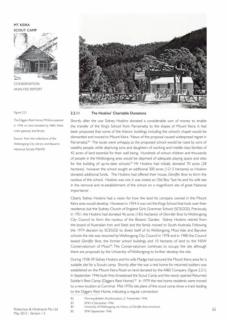
Robertson & Hindmarsh Pty LtdMay 2013 : Version 1.3
62
MT KEIRA
SCOUT CAMP
CONSERVATION
ANALYSIS REPORT
2.2.11 The Hoskins’ Charitable Donations
Shortly after the war Sidney Hoskins donated a considerable sum of money to enable the transfer of the King’s School from Parramatta to the slopes of Mount Keira. It had been proposed that some of the historic buildings including the school’s chapel would be dismantled and moved to Mount Keira. ‘News of the proposal caused widespread regret in Parramatta.’82 The locals were unhappy, as the proposed school would be ‘used by sons of wealthy people, while depriving sons and daughters of working and middle class families of 42 acres of land essential for their well being. Hundreds of school children and thousands of people in the Wollongong area would be deprived of adequate playing space and sites for the building of up-to-date schools.83 Mr Hoskins had initially donated 70 acres (28 hectares) however the school sought an additional 300 acres (121.5 hectares) so Hoskins donated additional funds. The Hoskins had offered their house, Gleniffer Brae to form the nucleus of the school. Hoskins was not, it was noted, an Old Boy “but he and his wife see in the removal and re-establishment of the school on a magnificent site of great National importance’ .
Clearly Sidney Hoskins had a vision for how the land his company owned in the Mount Keira area would develop. However, in 1954 it was not the Kings School that took over their residence, but the Sydney Church of England Girls Grammar School (SCEGGS). Previously, in 1951, the Hoskins had donated 46 acres (18.6 hectares) of Glennifer Brae to Wollongong City Council to form the nucleus of the Botanic Garden. Sidney Hoskins retired from the board of Australian Iron and Steel and the family moved to South Australia. Following the 1974 decision by SCEGGS to divest itself of its Wollongong, Moss Vale and Bayview schools the site was resumed by Wollongong City Council in 1978 and in 1980 the Council leased Gleniffer Brae, the former school buildings and 10 hectares of land to the NSW Conservatorium of Music84. The Conservatorium continues to occupy the site although there are proposals by the University of Wollongong to further develop the site.
During 1938-39 Sidney Hoskins and his wife Madge had scoured the Mount Keira area for a suitable site for a Scouts camp. Shortly after the war a rest home for returned soldiers was established on the Mount Keira Road on land donated by the AI&S Company (figure 2.21). In September 1946 bush fires threatened the Scout Camp and the newly opened Returned Soldier’s Rest Camp (Diggers Rest Home).85 In 1979 the rest home residents were moved to a new location at Corrimal. Mid-1970s site plans of the scout camp show a track leading to the Diggers Rest Home, indicating a regular connection.
82 Morning Bulletin, Rockhampton, 21 November 1946
83 SMH 6 December 194684 University of Wollongong, nd, History of Gleniffer Brae, brochure
85 SMH September 1946
Figure 2.21
The Diggers Rest Home, Mt Keira opened
in 1946 on land donated by AI&S. Note
rustic gateway and fences
Source: from the collections of the
Wollongong City Library and Illawarra
Historical Society P06440
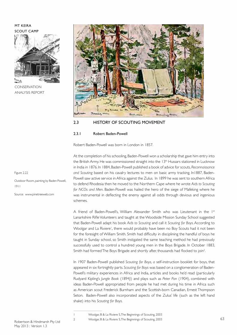
Robertson & Hindmarsh Pty LtdMay 2013 : Version 1.3
63
MT KEIRA
SCOUT CAMP
CONSERVATION
ANALYSIS REPORT
2.3 HISTORY OF SCOUTING MOVEMENT
2.3.1 Robert Baden-Powell
Robert Baden-Powell was born in London in 1857.
At the completion of his schooling, Baden-Powell won a scholarship that gave him entry into the British Army. He was commissioned straight into the 13th Hussars stationed in Lucknow in India in 1876. In 1884, Baden-Powell published a book of advice for scouts, Reconnaissance and Scouting based on his cavalry lectures to men on basic army tracking. In1887, Baden-Powell saw active service in Africa against the Zulus. In 1899 he was sent to southern Africa to defend Rhodesia then he moved to the Northern Cape where he wrote Aids to Scouting for NCOs and Men. Baden-Powell was hailed the hero of the siege of Mafeking where he was instrumental in deflecting the enemy against all odds through devious and ingenious schemes.
A friend of Baden-Powell’s, William Alexander Smith who was Lieutenant in the 1st Lanarkshire Rifle Volunteers and taught at the Woodside Mission Sunday School suggested that Baden-Powell adapt his book Aids to Scouting and call it Scouting for Boys. According to Woolgar and La Riviere1, there would probably have been no Boy Scouts had it not been for the foresight of William Smith. Smith had difficulty in disciplining the handful of boys he taught in Sunday school, so Smith instigated the same teaching method he had previously successfully used to control a hundred young men in the Boys Brigade. In October 1883, Smith had formed The Boys Brigade and shortly after, thousands had flocked to join2.
In 1907 Baden-Powell published Scouting for Boys, a self-instruction booklet for boys, that appeared in six fortnightly parts. Scouting for Boys was based on a conglomeration of Baden-Powell’s military experiences in Africa and India, articles and books he’d read (particularly Rudyard Kipling’s Jungle Book (1894)) and plays such as Peter Pan (1904), combined with ideas Baden-Powell appropriated from people he had met during his time in Africa such as American scout Frederick Burnham and the Scottish-born Canadian, Ernest Thompson Seton. Baden-Powell also incorporated aspects of the Zulus’ life (such as the left hand shake) into his Scouting for Boys.
1 Woolgar, B & La Riviere S, The Beginnings of Scouting, 2003
2 Woolgar, B & La Riviere S, The Beginnings of Scouting, 2003
Figure 2.22
Outdoor Room, painting by Baden Powell,
1911
Source: www.pinetreeweb.com
Robertson & Hindmarsh Pty LtdMay 2013 : Version 1.3
64
MT KEIRA
SCOUT CAMP
CONSERVATION
ANALYSIS REPORT
However, Baden-Powell credits his youth and schooling at Charterhouse for much of his thoughts regarding scouting. He said in an interview to the Listener in 1937
when I was a boy at Charterhouse I got a lot of fun out of trapping rabbits in woods that were out of bounds. If and when I caught one, which was not often, I skinned him and cooked him and ate him – and lived. In doing this I learned to creep silently, to know my way by landmarks, to note tracks and read their meaning, to use dry dead wood off trees…3
In 1907, when Baden-Powell returned to London from his service in Africa, he initiated the experimental Scouting Camp at Brownsea Island. Here twenty boys from different backgrounds camped for 2 weeks. The success of this camp combined with the success of Baden-Powell’s publication Scouting for Boys were the precursor to the Scouting Movement as we know it today. However, scouts we have spoken to in Australia, credit the phenomenal international success of the scouting movement not to Baden-Powell or William Smith but to the boys themselves. Boys were hungry for adventure in the 1900s and continue to yearn for adventure today.
In addition to his military skills, Baden-Powell excelled at fishing, canoeing, horse riding and was a very good watercolour artist (figure 2.22), took an interest in cinephotography and excelled at sculpture and acting.
Baden-Powell wrote 32 books between 1884 and 1941 on subjects including pigsticking, sport in war, his adventures as a spy and reconnaissance and scouting.
2.3.2 The Scouting Movement
“The global reach of the Scout movement has probably been the most extensive of any worldwide movement. Since its inception Scouting has involved close on 350 million people across the globe and today exists in nearly all of the world’s countries…”4
By 1908 Scouting had spread to Australia and Canada and the following year to India. In 1909 Chile was the first country outside the British Empire to start scouts followed by France, Scandinavia and the United States in 1910. By 1948 Scouting For Boys was still selling well with 50,000 copies being sold that year in Britain. Scouting for Boys is claimed to be the “most influential youth manual ever published”5. The book has been translated into many different languages and ranks fourth in the best-selling books of the 20th century after the Bible, the Koran and Mao’s Little Red Book.6
In 1918, William F. de Bois Maclaren who was a Scout Commissioner, purchased Gilwell Park, an estate of 53 acres near London for the scouts to use as a training centre. The estate was on the edge of Epping Forest yet only 10 miles north of London so offered an area that felt remote but was convenient for scouts to visit. In many ways, this kind of location for scouting camps has been emulated around the world with Australian scout camps such as Baden-Powell Scout Camp at Pennant Hills, Camp Coutts at Waterfall and Mount Keira at Wollongong offering a unique bush setting close to a metropolis and within walking distance of a train station.
3 www.pinetreeweb.com/bp-listener.htm
4 Boehmer, E in Baden-Powell, 2005, p.xi
5 Boehmer, E in Baden-Powell, 2005, p.xl
6 www.scouts.com.au/main.asp?iMenuID=665
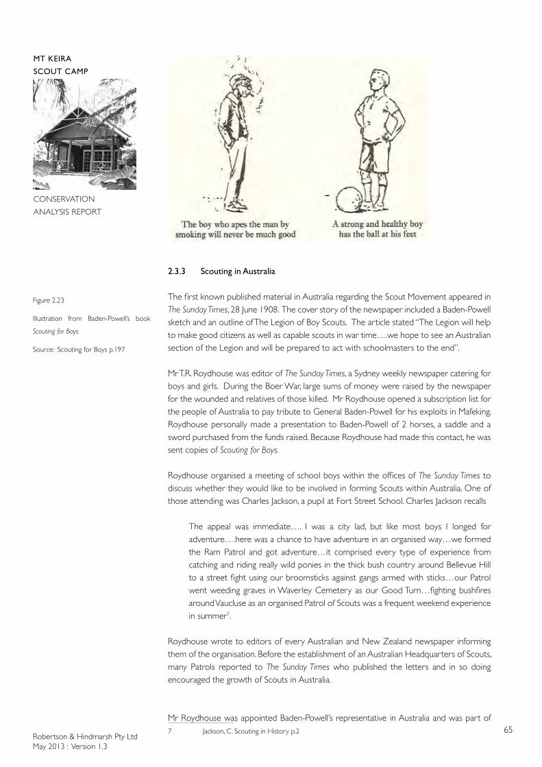
Robertson & Hindmarsh Pty LtdMay 2013 : Version 1.3
65
MT KEIRA
SCOUT CAMP
CONSERVATION
ANALYSIS REPORT
2.3.3 Scouting in Australia
The first known published material in Australia regarding the Scout Movement appeared in The Sunday Times, 28 June 1908. The cover story of the newspaper included a Baden-Powell sketch and an outline of The Legion of Boy Scouts. The article stated “The Legion will help to make good citizens as well as capable scouts in war time….we hope to see an Australian section of the Legion and will be prepared to act with schoolmasters to the end”.
Mr T.R. Roydhouse was editor of The Sunday Times, a Sydney weekly newspaper catering for boys and girls. During the Boer War, large sums of money were raised by the newspaper for the wounded and relatives of those killed. Mr Roydhouse opened a subscription list for the people of Australia to pay tribute to General Baden-Powell for his exploits in Mafeking. Roydhouse personally made a presentation to Baden-Powell of 2 horses, a saddle and a sword purchased from the funds raised. Because Roydhouse had made this contact, he was sent copies of Scouting for Boys.
Roydhouse organised a meeting of school boys within the offices of The Sunday Times to discuss whether they would like to be involved in forming Scouts within Australia. One of those attending was Charles Jackson, a pupil at Fort Street School. Charles Jackson recalls
The appeal was immediate…. I was a city lad, but like most boys I longed for adventure….here was a chance to have adventure in an organised way…we formed the Ram Patrol and got adventure…it comprised every type of experience from catching and riding really wild ponies in the thick bush country around Bellevue Hill to a street fight using our broomsticks against gangs armed with sticks…our Patrol went weeding graves in Waverley Cemetery as our Good Turn…fighting bushfires around Vaucluse as an organised Patrol of Scouts was a frequent weekend experience in summer7.
Roydhouse wrote to editors of every Australian and New Zealand newspaper informing them of the organisation. Before the establishment of an Australian Headquarters of Scouts, many Patrols reported to The Sunday Times who published the letters and in so doing encouraged the growth of Scouts in Australia.
Mr Roydhouse was appointed Baden-Powell’s representative in Australia and was part of 7 Jackson, C. Scouting in History p.2
Figure 2.23
Illustration from Baden-Powell’s book
Scouting for Boys
Source: Scouting for Boys p.197
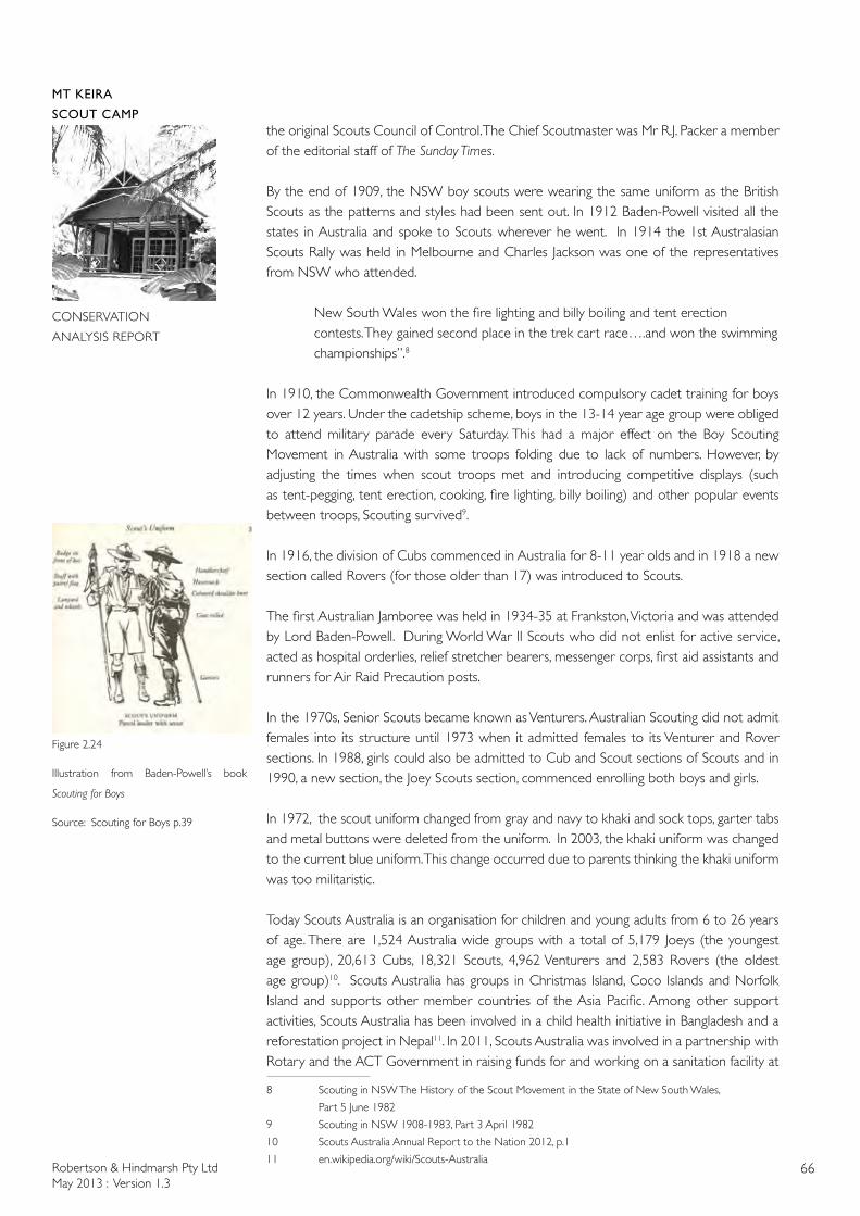
Robertson & Hindmarsh Pty LtdMay 2013 : Version 1.3
66
MT KEIRA
SCOUT CAMP
CONSERVATION
ANALYSIS REPORT
the original Scouts Council of Control. The Chief Scoutmaster was Mr R.J. Packer a member of the editorial staff of The Sunday Times.
By the end of 1909, the NSW boy scouts were wearing the same uniform as the British Scouts as the patterns and styles had been sent out. In 1912 Baden-Powell visited all the states in Australia and spoke to Scouts wherever he went. In 1914 the 1st Australasian Scouts Rally was held in Melbourne and Charles Jackson was one of the representatives from NSW who attended.
New South Wales won the fire lighting and billy boiling and tent erection contests. They gained second place in the trek cart race….and won the swimming championships”.8
In 1910, the Commonwealth Government introduced compulsory cadet training for boys over 12 years. Under the cadetship scheme, boys in the 13-14 year age group were obliged to attend military parade every Saturday. This had a major effect on the Boy Scouting Movement in Australia with some troops folding due to lack of numbers. However, by adjusting the times when scout troops met and introducing competitive displays (such as tent-pegging, tent erection, cooking, fire lighting, billy boiling) and other popular events between troops, Scouting survived9.
In 1916, the division of Cubs commenced in Australia for 8-11 year olds and in 1918 a new section called Rovers (for those older than 17) was introduced to Scouts.
The first Australian Jamboree was held in 1934-35 at Frankston, Victoria and was attended by Lord Baden-Powell. During World War II Scouts who did not enlist for active service, acted as hospital orderlies, relief stretcher bearers, messenger corps, first aid assistants and runners for Air Raid Precaution posts.
In the 1970s, Senior Scouts became known as Venturers. Australian Scouting did not admit females into its structure until 1973 when it admitted females to its Venturer and Rover sections. In 1988, girls could also be admitted to Cub and Scout sections of Scouts and in 1990, a new section, the Joey Scouts section, commenced enrolling both boys and girls.
In 1972, the scout uniform changed from gray and navy to khaki and sock tops, garter tabs and metal buttons were deleted from the uniform. In 2003, the khaki uniform was changed to the current blue uniform. This change occurred due to parents thinking the khaki uniform was too militaristic.
Today Scouts Australia is an organisation for children and young adults from 6 to 26 years of age. There are 1,524 Australia wide groups with a total of 5,179 Joeys (the youngest age group), 20,613 Cubs, 18,321 Scouts, 4,962 Venturers and 2,583 Rovers (the oldest age group)10. Scouts Australia has groups in Christmas Island, Coco Islands and Norfolk Island and supports other member countries of the Asia Pacific. Among other support activities, Scouts Australia has been involved in a child health initiative in Bangladesh and a reforestation project in Nepal11. In 2011, Scouts Australia was involved in a partnership with Rotary and the ACT Government in raising funds for and working on a sanitation facility at
8 Scouting in NSW The History of the Scout Movement in the State of New South Wales,
Part 5 June 1982
9 Scouting in NSW 1908-1983, Part 3 April 1982
10 Scouts Australia Annual Report to the Nation 2012, p.1
11 en.wikipedia.org/wiki/Scouts-Australia
Figure 2.24
Illustration from Baden-Powell’s book
Scouting for Boys
Source: Scouting for Boys p.39
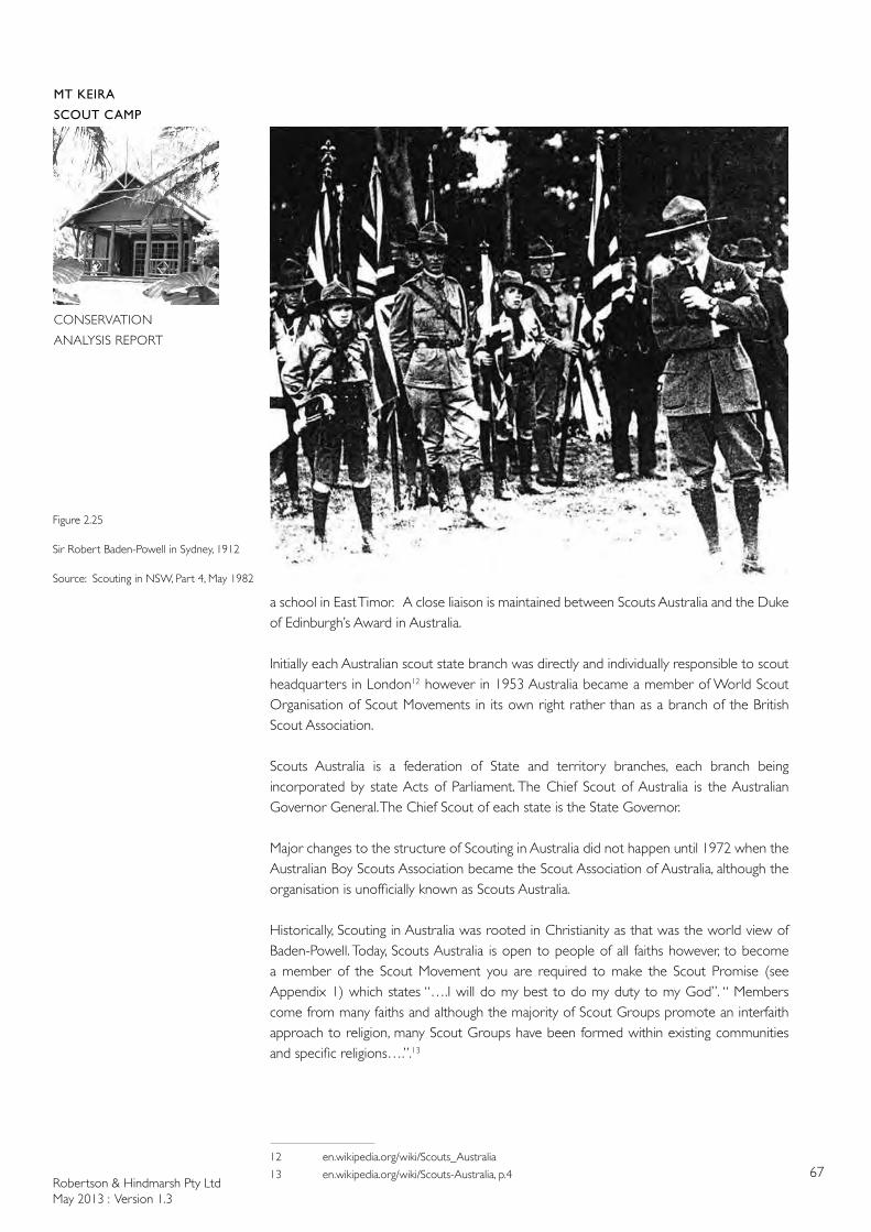
Robertson & Hindmarsh Pty LtdMay 2013 : Version 1.3
67
MT KEIRA
SCOUT CAMP
CONSERVATION
ANALYSIS REPORT
a school in East Timor. A close liaison is maintained between Scouts Australia and the Duke of Edinburgh’s Award in Australia.
Initially each Australian scout state branch was directly and individually responsible to scout headquarters in London12 however in 1953 Australia became a member of World Scout Organisation of Scout Movements in its own right rather than as a branch of the British Scout Association.
Scouts Australia is a federation of State and territory branches, each branch being incorporated by state Acts of Parliament. The Chief Scout of Australia is the Australian Governor General. The Chief Scout of each state is the State Governor.
Major changes to the structure of Scouting in Australia did not happen until 1972 when the Australian Boy Scouts Association became the Scout Association of Australia, although the organisation is unofficially known as Scouts Australia.
Historically, Scouting in Australia was rooted in Christianity as that was the world view of Baden-Powell. Today, Scouts Australia is open to people of all faiths however, to become a member of the Scout Movement you are required to make the Scout Promise (see Appendix 1) which states “….I will do my best to do my duty to my God”. “ Members come from many faiths and although the majority of Scout Groups promote an interfaith approach to religion, many Scout Groups have been formed within existing communities and specific religions….”.13
12 en.wikipedia.org/wiki/Scouts_Australia
13 en.wikipedia.org/wiki/Scouts-Australia, p.4
Figure 2.25
Sir Robert Baden-Powell in Sydney, 1912
Source: Scouting in NSW, Part 4, May 1982
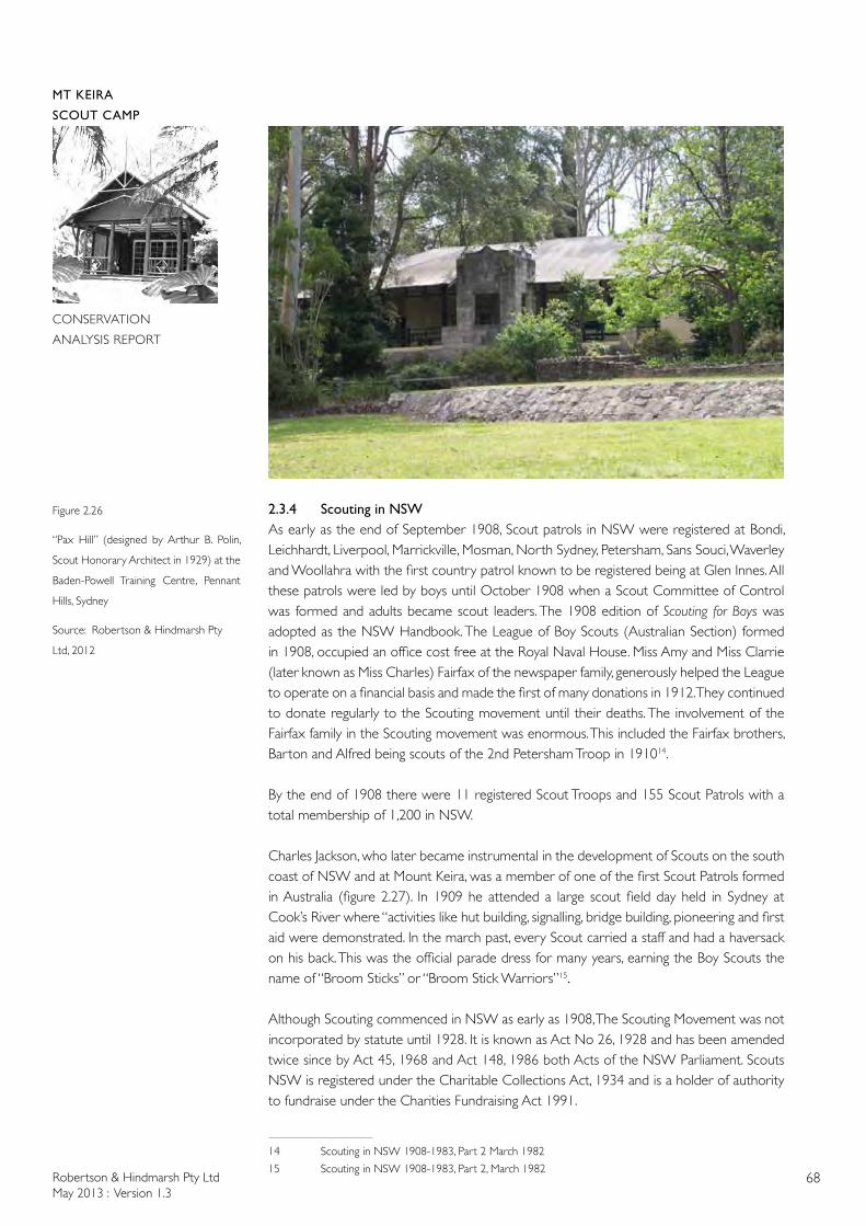
Robertson & Hindmarsh Pty LtdMay 2013 : Version 1.3
68
MT KEIRA
SCOUT CAMP
CONSERVATION
ANALYSIS REPORT
2.3.4 Scouting in NSWAs early as the end of September 1908, Scout patrols in NSW were registered at Bondi, Leichhardt, Liverpool, Marrickville, Mosman, North Sydney, Petersham, Sans Souci, Waverley and Woollahra with the first country patrol known to be registered being at Glen Innes. All these patrols were led by boys until October 1908 when a Scout Committee of Control was formed and adults became scout leaders. The 1908 edition of Scouting for Boys was adopted as the NSW Handbook. The League of Boy Scouts (Australian Section) formed in 1908, occupied an office cost free at the Royal Naval House. Miss Amy and Miss Clarrie (later known as Miss Charles) Fairfax of the newspaper family, generously helped the League to operate on a financial basis and made the first of many donations in 1912. They continued to donate regularly to the Scouting movement until their deaths. The involvement of the Fairfax family in the Scouting movement was enormous. This included the Fairfax brothers, Barton and Alfred being scouts of the 2nd Petersham Troop in 191014.
By the end of 1908 there were 11 registered Scout Troops and 155 Scout Patrols with a total membership of 1,200 in NSW.
Charles Jackson, who later became instrumental in the development of Scouts on the south coast of NSW and at Mount Keira, was a member of one of the first Scout Patrols formed in Australia (figure 2.27). In 1909 he attended a large scout field day held in Sydney at Cook’s River where “activities like hut building, signalling, bridge building, pioneering and first aid were demonstrated. In the march past, every Scout carried a staff and had a haversack on his back. This was the official parade dress for many years, earning the Boy Scouts the name of “Broom Sticks” or “Broom Stick Warriors”15.
Although Scouting commenced in NSW as early as 1908, The Scouting Movement was not incorporated by statute until 1928. It is known as Act No 26, 1928 and has been amended twice since by Act 45, 1968 and Act 148, 1986 both Acts of the NSW Parliament. Scouts NSW is registered under the Charitable Collections Act, 1934 and is a holder of authority to fundraise under the Charities Fundraising Act 1991.
14 Scouting in NSW 1908-1983, Part 2 March 1982
15 Scouting in NSW 1908-1983, Part 2, March 1982
Figure 2.26
“Pax Hill” (designed by Arthur B. Polin,
Scout Honorary Architect in 1929) at the
Baden-Powell Training Centre, Pennant
Hills, Sydney
Source: Robertson & Hindmarsh Pty
Ltd, 2012
Robertson & Hindmarsh Pty LtdMay 2013 : Version 1.3
69
MT KEIRA
SCOUT CAMP
CONSERVATION
ANALYSIS REPORT
In the 1920s most Scouting activities occurred on Saturday afternoons in the form of bush outings. Troops met for evening meetings in private homes, backyards, workshops, stables, church halls and school grounds as there were no clubrooms at that time. However, as Scouting grew, Troop Committees were formed to raise funds and undertake the legal formalities for acquiring land, submitting plans and building. The first clubrooms were acquired by 1st Cronulla, 1st Dulwich Hill, 1st Petersham, 1st Leichhardt and 1st Hurstville16.
In 1922 the NSW Minister for Lands indicated that an area of a newly established Pennant Hills Parks was to be set aside for a permanent Scout Camp. The Boy Scouts Association formally obtained a lease over the property in 1927 and in 1928 building materials were recovered from the original training camp at Frenchs Forest to create the beginnings of the Baden-Powell Training Centre at Pennant Hills. This tin shed was known as the Pallin Castle after Rover Paddy Pallin. One of the first permanent buildings completed at the Pennant Hills site was Pax Hill. In 1928 The New South Wales State Government gave its first grant, a sum of £5,000, to the NSW Scouts Association which was used in the development of the Baden-Powell Training Centre at Pennant Hills.17
Today the Scout Association holds title by Special Lease in Perpetuity over 27.2 ha at Pennant Hills. The Baden-Powell Scout Centre operates as a centre for advanced specialist training for Australia and the Asian Pacific Region18 with much of the Wood Badge Training and local conferences (in Scouting jargon known as Pow Pows, Palavas, Seeonees and Mindaries) being undertaken here.
In 1927 the Ann Fairfax Hostel in Queen Street, Newtown was presented to the Scouts by Miss Charles Fairfax in memory of her mother. The Hostel provided meals and lodgings for country and visiting Scouts and students as well as a clubroom for 1st Camperdown Troop.In 1940 the premises ceased to be used for Scouting activities19.
Scouts Australia was very supportive of out-of-work men during the Great Depression with a job registration section being established to enable older out-of-work boys to find employment. A Scout Club with some recreational facilities and a subsidised cafeteria were set up at State Scout Headquarters20.
Between 1950 to mid-1970s the Scouting Movement in NSW saw its largest growth and a decentralisation of Scouting’s administration.
By 2002 however, Scouts NSW was taking steps to centralise its adult training and development programme at The Baden-Powell Centre, Pennant Hills. The centre is one of 5 Scouts Australia NSW State Activity Centres. The other State Activity Centres are Air Activity Centre at Camden, Alpine Activity Centre at Jindabyne, Cataract Scout Centre at Appin and Water Activities Centre at Woolwich.
From 2012 there were four scout training centres in NSW located at Camp Kurrajong (Wagga Wagga), Sydney Scout Centre (Appin), Glenrock (Newcastle) and Pennant Hills. Prior to this, Mount Keira Scout Camp had been used as a training centre.21 The reduction in numbers of training centres was due to the reduction in the number of training courses being offered and the use of e-training.
16 Scouting in NSW, 1908-1983, Part 7, August 1982
17 Scouting in NSW, 1908-1983, Part 8, September 1982
18 The P.I.P. H Story p.8
19 Scouting in NSW 1908-1983, Part 8, September 1982
20 Scouting in NSW 1908-1983, Part 9, October 198221 South Coast and Tablelands Region Newsletter May 2012 p.5
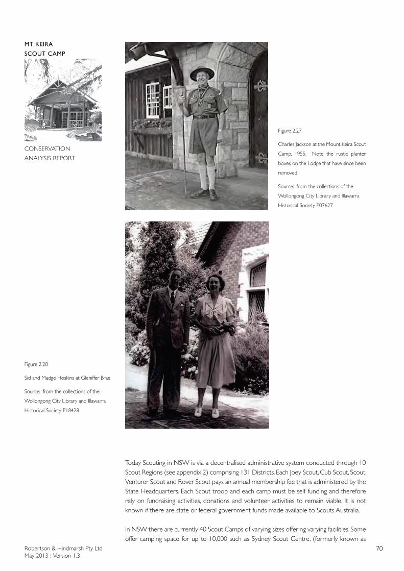
Robertson & Hindmarsh Pty LtdMay 2013 : Version 1.3
70
MT KEIRA
SCOUT CAMP
CONSERVATION
ANALYSIS REPORT
Today Scouting in NSW is via a decentralised administrative system conducted through 10 Scout Regions (see appendix 2) comprising 131 Districts. Each Joey Scout, Cub Scout, Scout, Venturer Scout and Rover Scout pays an annual membership fee that is administered by the State Headquarters. Each Scout troop and each camp must be self funding and therefore rely on fundraising activities, donations and volunteer activities to remain viable. It is not known if there are state or federal government funds made available to Scouts Australia.
In NSW there are currently 40 Scout Camps of varying sizes offering varying facilities. Some offer camping space for up to 10,000 such as Sydney Scout Centre, (formerly known as
Figure 2.28
Sid and Madge Hoskins at Gleniffer Brae
Source: from the collections of the
Wollongong City Library and Illawarra
Historical Society P18428
Figure 2.27
Charles Jackson at the Mount Keira Scout
Camp, 1955. Note the rustic planter
boxes on the Lodge that have since been
removed
Source: from the collections of the
Wollongong City Library and Illawarra
Historical Society P07627
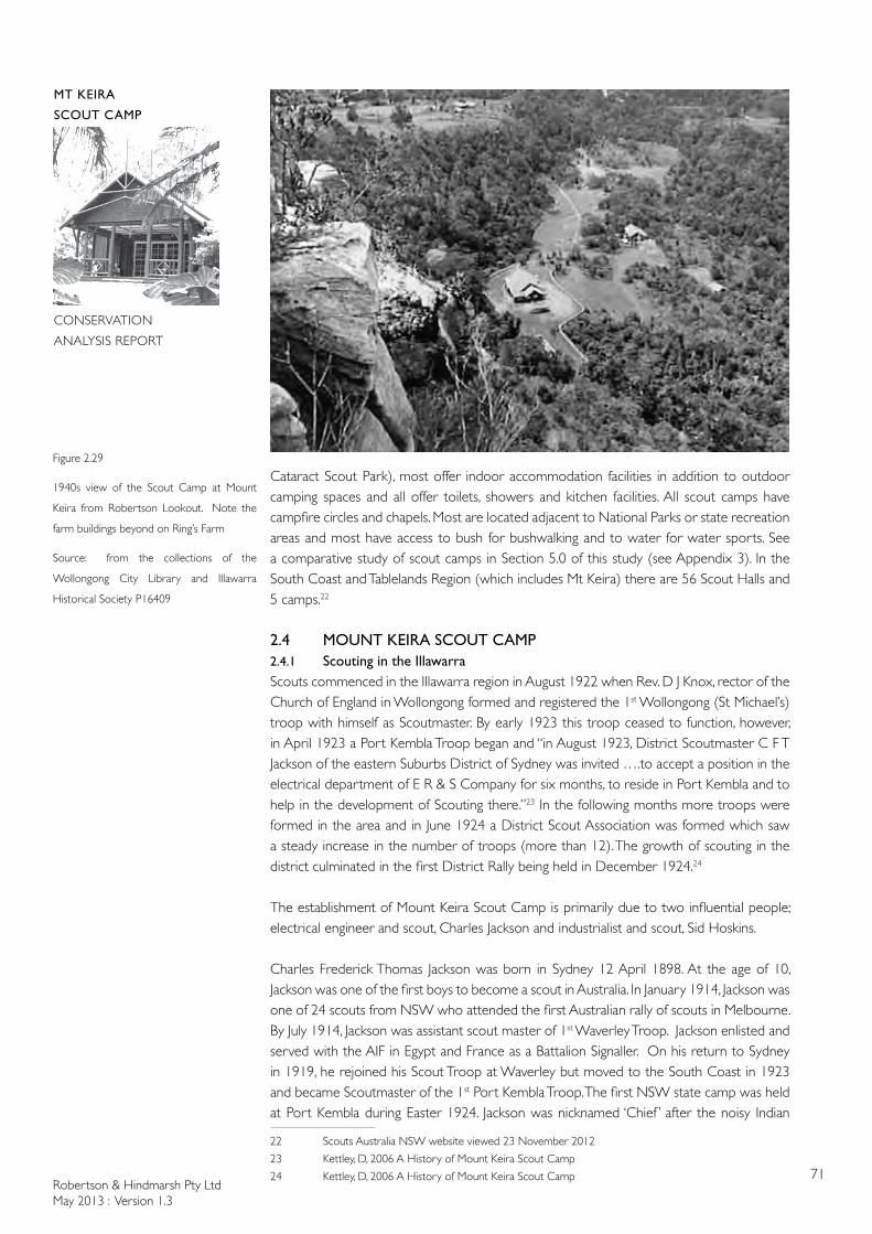
Robertson & Hindmarsh Pty LtdMay 2013 : Version 1.3
71
MT KEIRA
SCOUT CAMP
CONSERVATION
ANALYSIS REPORT
Cataract Scout Park), most offer indoor accommodation facilities in addition to outdoor camping spaces and all offer toilets, showers and kitchen facilities. All scout camps have campfire circles and chapels. Most are located adjacent to National Parks or state recreation areas and most have access to bush for bushwalking and to water for water sports. See a comparative study of scout camps in Section 5.0 of this study (see Appendix 3). In the South Coast and Tablelands Region (which includes Mt Keira) there are 56 Scout Halls and 5 camps.22
2.4 MOUNT KEIRA SCOUT CAMP2.4.1 Scouting in the IllawarraScouts commenced in the Illawarra region in August 1922 when Rev. D J Knox, rector of the Church of England in Wollongong formed and registered the 1st Wollongong (St Michael’s) troop with himself as Scoutmaster. By early 1923 this troop ceased to function, however, in April 1923 a Port Kembla Troop began and “in August 1923, District Scoutmaster C F T Jackson of the eastern Suburbs District of Sydney was invited ….to accept a position in the electrical department of E R & S Company for six months, to reside in Port Kembla and to help in the development of Scouting there.”23 In the following months more troops were formed in the area and in June 1924 a District Scout Association was formed which saw a steady increase in the number of troops (more than 12). The growth of scouting in the district culminated in the first District Rally being held in December 1924.24
The establishment of Mount Keira Scout Camp is primarily due to two influential people; electrical engineer and scout, Charles Jackson and industrialist and scout, Sid Hoskins.
Charles Frederick Thomas Jackson was born in Sydney 12 April 1898. At the age of 10, Jackson was one of the first boys to become a scout in Australia. In January 1914, Jackson was one of 24 scouts from NSW who attended the first Australian rally of scouts in Melbourne. By July 1914, Jackson was assistant scout master of 1st Waverley Troop. Jackson enlisted and served with the AIF in Egypt and France as a Battalion Signaller. On his return to Sydney in 1919, he rejoined his Scout Troop at Waverley but moved to the South Coast in 1923 and became Scoutmaster of the 1st Port Kembla Troop. The first NSW state camp was held at Port Kembla during Easter 1924. Jackson was nicknamed ‘Chief ’ after the noisy Indian
22 Scouts Australia NSW website viewed 23 November 2012
23 Kettley, D, 2006 A History of Mount Keira Scout Camp
24 Kettley, D, 2006 A History of Mount Keira Scout Camp
Figure 2.29
1940s view of the Scout Camp at Mount
Keira from Robertson Lookout. Note the
farm buildings beyond on Ring’s Farm
Source: from the collections of the
Wollongong City Library and Illawarra
Historical Society P16409
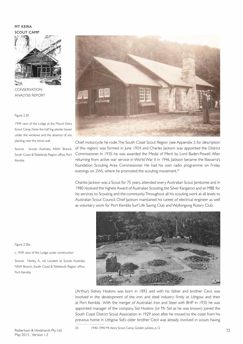
Robertson & Hindmarsh Pty LtdMay 2013 : Version 1.3
72
MT KEIRA
SCOUT CAMP
CONSERVATION
ANALYSIS REPORT
Chief motorcycle he rode. The South Coast Scout Region (see Appendix 2 for description of this region) was formed in June 1924 and Charles Jackson was appointed the District Commissioner. In 1935 he was awarded the Medal of Merit by Lord Baden-Powell. After returning from active war service in World War II in 1946, Jackson became the Illawarra’s foundation Scouting Area Commissioner. He had his own radio programme on Friday evenings on 2WL where he promoted the scouting movement.25
Charles Jackson was a Scout for 75 years, attended every Australian Scout Jamboree and in 1980 received the highest Award of Australian Scouting, the Silver Kangaroo and an MBE for his services to Scouting and the community. Throughout all his scouting work at all levels to Australian Scout Council, Chief Jackson maintained his career of electrical engineer as well as voluntary work for Port Kembla Surf Life Saving Club and Wollongong Rotary Club.
(Arthur) Sidney Hoskins was born in 1892 and with his father and brother Cecil, was involved in the development of the iron and steel industry firstly at Lithgow and then at Port Kembla. With the merger of Australian Iron and Steel with BHP in 1935 he was appointed manager of the company. Sid Hoskins (or Mr Sid as he was known) joined the South Coast District Scout Association in 1929 soon after he moved to the coast from his previous home in Lithgow. Sid’s older brother Cecil was already involved in scouts having
25 1940-1990 Mt Keira Scout Camp Golden Jubilee, p.12
Figure 2.30
1949 view of the Lodge at the Mount Keira
Scout Camp. Note the half log planter boxes
under the windows and the absence of any
planting near the stone wall
Source: Scouts Australia, NSW Branch,
South Coast & Tablelands Region office, Port
Kembla
Figure 2.30a
c. 1939 view of the Lodge under construction
Source: Harley, A., nd. Located at Scouts Australia,
NSW Branch, South Coast & Tablelands Region office,
Port Kembla
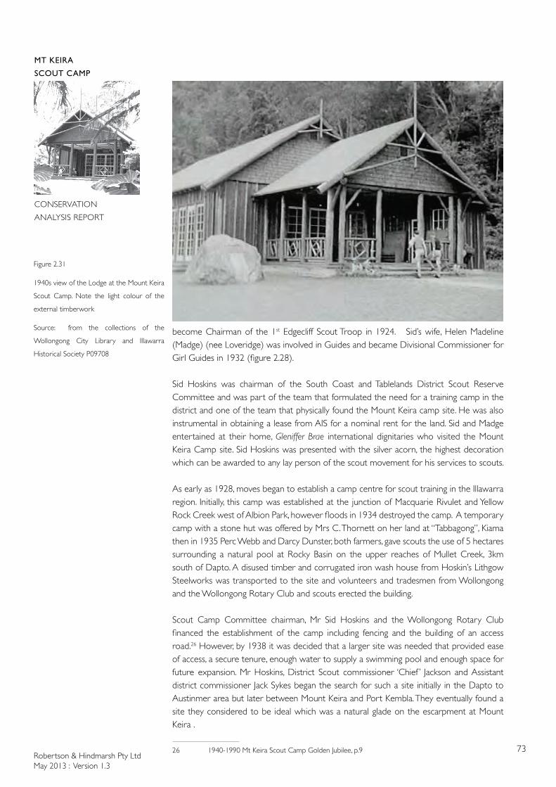
Robertson & Hindmarsh Pty LtdMay 2013 : Version 1.3
73
MT KEIRA
SCOUT CAMP
CONSERVATION
ANALYSIS REPORT
become Chairman of the 1st Edgecliff Scout Troop in 1924. Sid’s wife, Helen Madeline (Madge) (nee Loveridge) was involved in Guides and became Divisional Commissioner for Girl Guides in 1932 (figure 2.28).
Sid Hoskins was chairman of the South Coast and Tablelands District Scout Reserve Committee and was part of the team that formulated the need for a training camp in the district and one of the team that physically found the Mount Keira camp site. He was also instrumental in obtaining a lease from AIS for a nominal rent for the land. Sid and Madge entertained at their home, Gleniffer Brae international dignitaries who visited the Mount Keira Camp site. Sid Hoskins was presented with the silver acorn, the highest decoration which can be awarded to any lay person of the scout movement for his services to scouts.
As early as 1928, moves began to establish a camp centre for scout training in the Illawarra region. Initially, this camp was established at the junction of Macquarie Rivulet and Yellow Rock Creek west of Albion Park, however floods in 1934 destroyed the camp. A temporary camp with a stone hut was offered by Mrs C. Thornett on her land at “Tabbagong”, Kiama then in 1935 Perc Webb and Darcy Dunster, both farmers, gave scouts the use of 5 hectares surrounding a natural pool at Rocky Basin on the upper reaches of Mullet Creek, 3km south of Dapto. A disused timber and corrugated iron wash house from Hoskin’s Lithgow Steelworks was transported to the site and volunteers and tradesmen from Wollongong and the Wollongong Rotary Club and scouts erected the building.
Scout Camp Committee chairman, Mr Sid Hoskins and the Wollongong Rotary Club financed the establishment of the camp including fencing and the building of an access road.26 However, by 1938 it was decided that a larger site was needed that provided ease of access, a secure tenure, enough water to supply a swimming pool and enough space for future expansion. Mr Hoskins, District Scout commissioner ‘Chief ’ Jackson and Assistant district commissioner Jack Sykes began the search for such a site initially in the Dapto to Austinmer area but later between Mount Keira and Port Kembla. They eventually found a site they considered to be ideal which was a natural glade on the escarpment at Mount Keira .
26 1940-1990 Mt Keira Scout Camp Golden Jubilee, p.9
Figure 2.31
1940s view of the Lodge at the Mount Keira
Scout Camp. Note the light colour of the
external timberwork
Source: from the collections of the
Wollongong City Library and Illawarra
Historical Society P09708
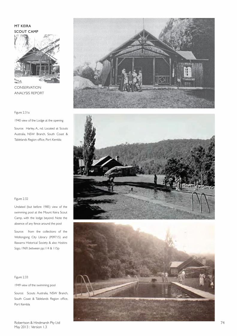
Robertson & Hindmarsh Pty LtdMay 2013 : Version 1.3
74
MT KEIRA
SCOUT CAMP
CONSERVATION
ANALYSIS REPORT
Figure 2.32
Undated (but before 1985) view of the
swimming pool at the Mount Keira Scout
Camp, with the lodge beyond. Note the
absence of any fence around the pool
Source: from the collections of the
Wollongong City Library (P09715) and
Illawarra Historical Society & also Hoskins
Saga, 1969, between pp.114 & 115p
Figure 2.33
1949 view of the swimming pool
Source: Scouts Australia, NSW Branch,
South Coast & Tablelands Region office,
Port Kembla
Figure 2.31a
1940 view of the Lodge at the opening
Source: Harley, A., nd. Located at Scouts
Australia, NSW Branch, South Coast &
Tablelands Region office, Port Kembla
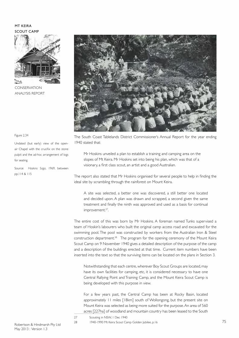
Robertson & Hindmarsh Pty LtdMay 2013 : Version 1.3
75
MT KEIRA
SCOUT CAMP
CONSERVATION
ANALYSIS REPORT
The South Coast Tablelands District Commissioner’s Annual Report for the year ending 1940 stated that:
Mr Hoskins unveiled a plan to establish a training and camping area on the slopes of Mt Keira. Mr Hoskins set into being his plan, which was that of a visionary, a first class scout, an artist and a good Australian.
The report also stated that Mr Hoskins organised for several people to help in finding the ideal site by scrambling through the rainforest on Mount Keira.
A site was selected, a better one was discovered, a still better one located and decided upon. A plan was drawn and scrapped, a second given the same treatment and finally the ninth was approved and used as a basis for continual improvement.27.
The entire cost of this was born by Mr Hoskins. A foreman named Tunks supervised a team of Hoskin’s labourers who built the original camp access road and excavated for the swimming pool. The pool was constructed by workers from the Australian Iron & Steel construction department.28 The program for the opening ceremony of the Mount Keira Scout Camp on 9 November 1940 gives a detailed description of the purpose of the camp and a description of the buildings erected at that time. Current item numbers have been inserted into the text so that the surviving items can be located on the plans in Section 3.
Notwithstanding that each centre, wherever Boy Scout Groups are located, may have its own facilities for camping, etc, it is considered necessary to have one Central Rallying Point and Training Camp, and the Mount Keira Scout Camp is being developed with this purpose in view.
For a few years past, the Central Camp has been at Rocky Basin, located approximately 11 miles [18km] south of Wollongong, but the present site on Mount Keira was selected as being more suited for the purpose. An area of 560 acres [227ha] of woodland and mountain country has been leased to the South
27 Scouting in NSW, 1 Dec 1940
28 1940-1990 Mt Keira Scout Camp Golden Jubilee, p.16
Figure 2.34
Undated (but early) view of the open-
air Chapel with the crucifix on the stone
pulpit and the ad-hoc arrangement of logs
for seating
Source: Hoskins Saga, 1969, between
pp.114 & 115
Robertson & Hindmarsh Pty LtdMay 2013 : Version 1.3
76
MT KEIRA
SCOUT CAMP
CONSERVATION
ANALYSIS REPORT
Coast and Tablelands District Boy Scout Association by Australian Iron & Steel Ltd, and as time goes on, trails will be opened up and numerous camp sites established, together with other adjuncts necessary for a camp of this kind. As it is at present, the Camp consists of:
The Lodge [B5]The Lodge [figures 2.30 & 2.31] consists of a main Hall, District Commissioner’s Office, large Bedroom for District Scouters, a special wing for Lady Cubmasters, a large Kitchen, and all necessary modern conveniences.
Quartermaster’s CabinThe Quartermaster’s cabin consists of two rooms for the Camp Warden, a large Storeroom for camp equipment and foodstuff, and is fitted with showers, wash basins, lavatories, etc.
Swimming Pool [B7] Adjoining the Lodge, is a tiled Swimming Pool [figures 2.32 & 2.33] , 75ft long, 25ft wide and 8ft deep at the deepest end. Water is fed to the Camp and Swimming Pool from a natural spring on the mountain side about 200ft above the Camp. Two 5,000 gallon storage water tanks have also been provided.
Camp Fire Circle A small bush trail leads from the Swimming Pool to the Camp Fire Circle, for the entertainment and education of the Scouts during the evenings.
Chapel [C2]Further along, there is a natural Chapel site. The first service will be held in this Chapel at 3pm on Sunday 10th November, conducted by the Rev A.P. Campbell, BA. Any of the public who may desire to attend this Service, will be heartily welcome.
Electric Light The area has been connected for electric light and power to the Australian Iron & Steel Ltd Transmission Line.29
The program then listed the Lodge’s architect, G.D. Loveridge, the Lodge’s builder, W.J. Anderson & Sons and the landscape consultant, P. Sorensen before giving the texts of the brass plaques to be unveiled at the ceremony. A series of photographs held by the Wollongong City Library show the picturesque buildings at the scout camp shortly after their completion (figures 2.31, 2.32 & 2.39).
The opening ceremony was recorded by Cinesound Newsreels and was shown around Australia, even in places such as Charters Towers, Queensland as reported in the local newspaper30. The newsreel included footage of war damage in London with footage of the idyllic scout camp at Mount Keira being in marked contrast.
At the commencement of the camp, a site caretaker, Tom Rainbird was appointed however in 1941 a resident Camp Warden, Dave Walsh was appointed. Dave Walsh served for 42
29 Opening ceremony program held in the archives of the South Coast & Tablelands Region Head
Office of Scouts Australia30 The Northern Miner, 24 December 1940
Robertson & Hindmarsh Pty LtdMay 2013 : Version 1.3
77
MT KEIRA
SCOUT CAMP
CONSERVATION
ANALYSIS REPORT
years as Camp Warden. A permanent legacy in recognition of Dave Walsh’s contribution to the environment was made in a walking track built by the NPWS and designated The Dave Walsh Track (figure 1.3). It is a 900m path that begins opposite the Scout Camp entrance and links the Mt Keira Ring Track with Summit Park at the top of Mt Keira where there is a lookout. Dave Walsh was involved with scouts for more than 68 years having joined the 1st Paddington Cub Pack in 1922 and the First Woollahra/Paddington Scouts in 1924. He studied botany, entomolgy and some geology at Technical College. He was a Bondi lifesaver and sailor. As a Rover Scout he was one of the crew that sailed on an around-the-world voyage to attend the July 1939 World Rover Moot in Scotland.31
A camp held over Easter 1941 and attended by more than 200 scouts from the south coast and the tablelands was reported in the Sydney Morning Herald.32
After the war, when petrol and other restrictions had been lifted, the scout camp was once again popular (figures 2.32 & 2.39).
FIRST CANBERRA TROOP
A party of Scouts from the troop returned on Saturday from a nine day camp at Mt. Keira, Wollongong. They report enthusiastically about the scout reserve, which is claimed by the local Scouts as the finest camping area in Australia. The weather was good throughout and, in addition to a full programme of scouting activities, the party visited the Port Kembla steelworks and the Mt Keira colliery. The camp was thoroughly enjoyed by the boys.33
The Scout Camp exhibited ‘brush forest vegetation’ at the Wildflower Show at the Barrier Field Naturalist’s show at the Broken Hill Technical College in September 1947. The scouts’ exhibit was one of 26 parcels sent to Broken Hill by Field Naturalists Clubs, Botanic Gardens, Science Schools, and the Shell Oil Company. Picking flowers from reserves was once very popular and was considered perfectly acceptable. The Field Naturalist clubs had a different perspective, members were amateur botanists and plant collectors. From the 1920s onwards wild flowers began to be protected, commencing with Boronia, Christmas Bells, Flannel Flowers, Waratahs and the Christmas Bush. The Scouts continued to exhibit their finds into the 1950s (1948, 1951, 1954). The Naturalist Badge, one of the Scout Observation badges, had been in existence since at least 1927 and required that a certain number of wild flowers be located.34 The fame of the camp continued to spread beyond the state boundaries. The Namour Chronicle described the Scouts Rendezvous located in a:
WOODLAND VALLEY
In a fold of the hills, three miles inland from Wollongong, is a tract of 560 acres [226.6ha] of woodland that forms one of Australia’s most remarkable playgrounds. It is the Mount Keira Boy Scout Camp, headquarters of the South Coast and Tablelands Boy Scouts’ Association. The valley has been leased from Australian Iron and Steel Ltd. Rental is £1 a year and the company has donated £50 to pay it for the first half century. Around the valley are scores of square miles of unspoilt bush and mountain, so that the camp forms an unrivalled centre for scouting and camping. One of the loveliest spots of the whole South Coast, the scouts’ valley is under the shoulder of Mt. Keira (1,533ft.) [467m] only three-quarters of a mile [1.2km] away. Three and a half miles off is Mt. Kembla (1,752ft.) [534m]. From an elevation of 1,000ft. [305m], the valley looks south and east, the coast spread
31 Illawarra Mercury supplement in recognition of Mount Keira’s Scout Camp Golden Jubilee
32 SMH 11 April 1941
33 Canberra Times, 12 September 1946
34 Camperdown Chronicle 11 August 1927
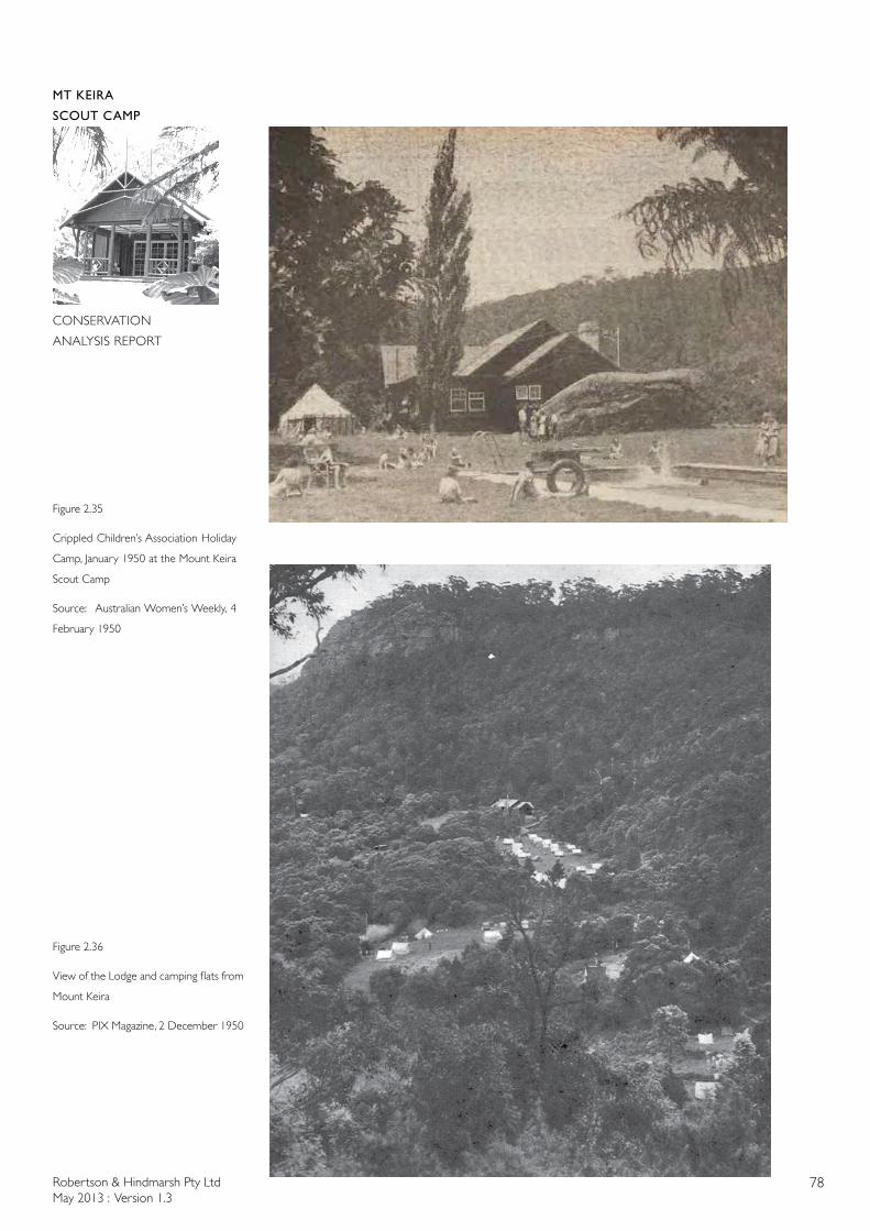
Robertson & Hindmarsh Pty LtdMay 2013 : Version 1.3
78
MT KEIRA
SCOUT CAMP
CONSERVATION
ANALYSIS REPORT
Figure 2.35
Crippled Children’s Association Holiday
Camp, January 1950 at the Mount Keira
Scout Camp
Source: Australian Women’s Weekly, 4
February 1950
Figure 2.36
View of the Lodge and camping flats from
Mount Keira
Source: PIX Magazine, 2 December 1950
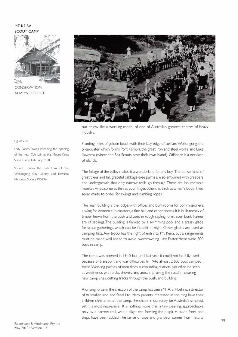
Robertson & Hindmarsh Pty LtdMay 2013 : Version 1.3
79
MT KEIRA
SCOUT CAMP
CONSERVATION
ANALYSIS REPORT
out below like a working model of one of Australia’s greatest centres of heavy industry.
Fronting miles of golden beach with their lacy edge of surf are Wollongong, the breakwater which forms Port Kembla, the great iron and steel works and Lake Illawarra (where the Sea Scouts have their own island). Offshore is a necklace of islands.
The foliage of the valley makes it a wonderland for any boy. The dense mass of great trees and tall, graceful cabbage-tree palms are so entwined with creepers and undergrowth that only narrow trails go through. There are innumerable monkey vines, some as thin as your finger, others as thick as a man’s body. They seem made to order for swings and climbing ropes.
The main building is the lodge, with offices and bunkrooms for commissioners, a wing for women cub-masters, a fine hall, and other rooms. It is built mostly of timber hewn from the bush and used in rough sapling form. Even bunk frames are of saplings. The building is flanked by a swimming pool and a grassy glade for scout gatherings, which can be floodlit at night. Other glades are used as camping fiats. Any troop has the right of entry to Mt. Keira, but arrangements must be made well ahead to avoid overcrowding. Last Easter there were 500 boys in camp.
The camp was opened in 1940, but until last year it could not be fully used because of transport and war difficulties. In 1946 almost 2,600 boys camped there. Working parties of men from surrounding districts can often be seen at week-ends with picks, shovels, and axes, improving the road in, clearing new camp sites, cutting tracks through the bush, and building.
A driving force in the creation of the camp has been Mr. A. S. Hoskins, a director of Australian Iron and Steel Ltd. Many parents interested in scouting have their children christened at the camp. The chapel must surely be Australia’s simplest, yet it is most impressive. It is nothing more than a tiny clearing, approachable only by a narrow trail, with a slight rise forming the pulpit. A stone front and steps have been added. The sense of awe and grandeur comes from natural
Figure 2.37
Lady Baden-Powell attending the opening
of the new Cub Lair at the Mount Keira
Scout Camp, February 1958
Source: from the collections of the
Wollongong City Library and Illawarra
Historical Society P15696
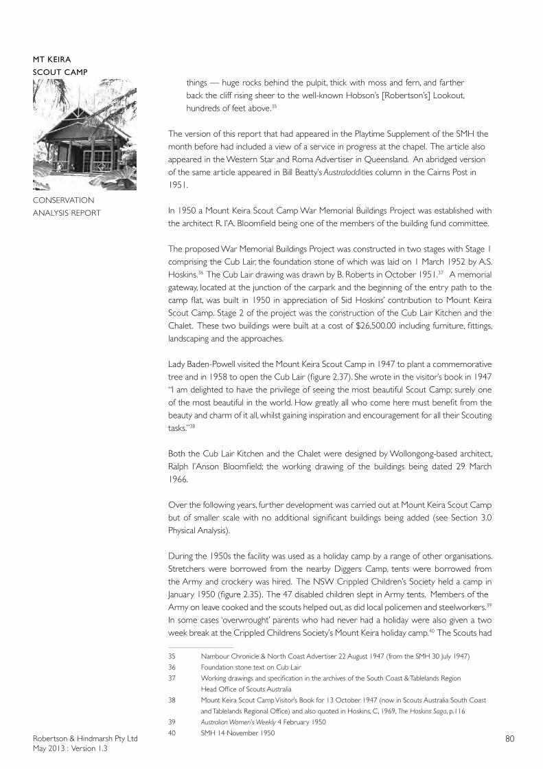
Robertson & Hindmarsh Pty LtdMay 2013 : Version 1.3
80
MT KEIRA
SCOUT CAMP
CONSERVATION
ANALYSIS REPORT
things — huge rocks behind the pulpit, thick with moss and fern, and farther back the cliff rising sheer to the well-known Hobson’s [Robertson’s] Lookout, hundreds of feet above.35
The version of this report that had appeared in the Playtime Supplement of the SMH the month before had included a view of a service in progress at the chapel. The article also appeared in the Western Star and Roma Advertiser in Queensland. An abridged version of the same article appeared in Bill Beatty’s Australoddities column in the Cairns Post in 1951.
In 1950 a Mount Keira Scout Camp War Memorial Buildings Project was established with the architect R. I’A. Bloomfield being one of the members of the building fund committee.
The proposed War Memorial Buildings Project was constructed in two stages with Stage 1 comprising the Cub Lair, the foundation stone of which was laid on 1 March 1952 by A.S. Hoskins.36 The Cub Lair drawing was drawn by B. Roberts in October 1951.37 A memorial gateway, located at the junction of the carpark and the beginning of the entry path to the camp flat, was built in 1950 in appreciation of Sid Hoskins’ contribution to Mount Keira Scout Camp. Stage 2 of the project was the construction of the Cub Lair Kitchen and the Chalet. These two buildings were built at a cost of $26,500.00 including furniture, fittings, landscaping and the approaches.
Lady Baden-Powell visited the Mount Keira Scout Camp in 1947 to plant a commemorative tree and in 1958 to open the Cub Lair (figure 2.37). She wrote in the visitor’s book in 1947 “I am delighted to have the privilege of seeing the most beautiful Scout Camp; surely one of the most beautiful in the world. How greatly all who come here must benefit from the beauty and charm of it all, whilst gaining inspiration and encouragement for all their Scouting tasks.”38
Both the Cub Lair Kitchen and the Chalet were designed by Wollongong-based architect, Ralph I’Anson Bloomfield; the working drawing of the buildings being dated 29 March 1966.
Over the following years, further development was carried out at Mount Keira Scout Camp but of smaller scale with no additional significant buildings being added (see Section 3.0 Physical Analysis).
During the 1950s the facility was used as a holiday camp by a range of other organisations. Stretchers were borrowed from the nearby Diggers Camp, tents were borrowed from the Army and crockery was hired. The NSW Crippled Children’s Society held a camp in January 1950 (figure 2.35). The 47 disabled children slept in Army tents. Members of the Army on leave cooked and the scouts helped out, as did local policemen and steelworkers.39
In some cases ‘overwrought’ parents who had never had a holiday were also given a two week break at the Crippled Childrens Society’s Mount Keira holiday camp.40 The Scouts had
35 Nambour Chronicle & North Coast Advertiser 22 August 1947 (from the SMH 30 July 1947)
36 Foundation stone text on Cub Lair
37 Working drawings and specification in the archives of the South Coast & Tablelands Region
Head Office of Scouts Australia
38 Mount Keira Scout Camp Visitor’s Book for 13 October 1947 (now in Scouts Australia South Coast
and Tablelands Regional Office) and also quoted in Hoskins, C, 1969, The Hoskins Saga, p.116
39 Australian Women’s Weekly 4 February 1950
40 SMH 14 November 1950
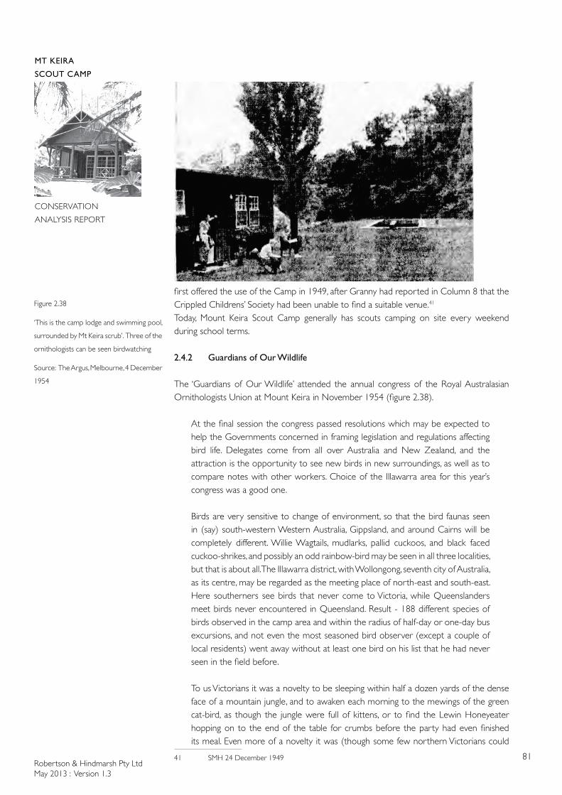
Robertson & Hindmarsh Pty LtdMay 2013 : Version 1.3
81
MT KEIRA
SCOUT CAMP
CONSERVATION
ANALYSIS REPORT
Figure 2.38
‘This is the camp lodge and swimming pool,
surrounded by Mt Keira scrub’. Three of the
ornithologists can be seen birdwatching
Source: The Argus, Melbourne, 4 December
1954
first offered the use of the Camp in 1949, after Granny had reported in Column 8 that the Crippled Childrens’ Society had been unable to find a suitable venue.41
Today, Mount Keira Scout Camp generally has scouts camping on site every weekend during school terms.
2.4.2 Guardians of Our Wildlife The ‘Guardians of Our Wildlife’ attended the annual congress of the Royal Australasian Ornithologists Union at Mount Keira in November 1954 (figure 2.38).
At the final session the congress passed resolutions which may be expected to help the Governments concerned in framing legislation and regulations affecting bird life. Delegates come from all over Australia and New Zealand, and the attraction is the opportunity to see new birds in new surroundings, as well as to compare notes with other workers. Choice of the Illawarra area for this year’s congress was a good one.
Birds are very sensitive to change of environment, so that the bird faunas seen in (say) south-western Western Australia, Gippsland, and around Cairns will be completely different. Willie Wagtails, mudlarks, pallid cuckoos, and black faced cuckoo-shrikes, and possibly an odd rainbow-bird may be seen in all three localities, but that is about all. The Illawarra district, with Wollongong, seventh city of Australia, as its centre, may be regarded as the meeting place of north-east and south-east. Here southerners see birds that never come to Victoria, while Queenslanders meet birds never encountered in Queensland. Result - 188 different species of birds observed in the camp area and within the radius of half-day or one-day bus excursions, and not even the most seasoned bird observer (except a couple of local residents) went away without at least one bird on his list that he had never seen in the field before.
To us Victorians it was a novelty to be sleeping within half a dozen yards of the dense face of a mountain jungle, and to awaken each morning to the mewings of the green cat-bird, as though the jungle were full of kittens, or to find the Lewin Honeyeater hopping on to the end of the table for crumbs before the party had even finished its meal. Even more of a novelty it was (though some few northern Victorians could
41 SMH 24 December 1949
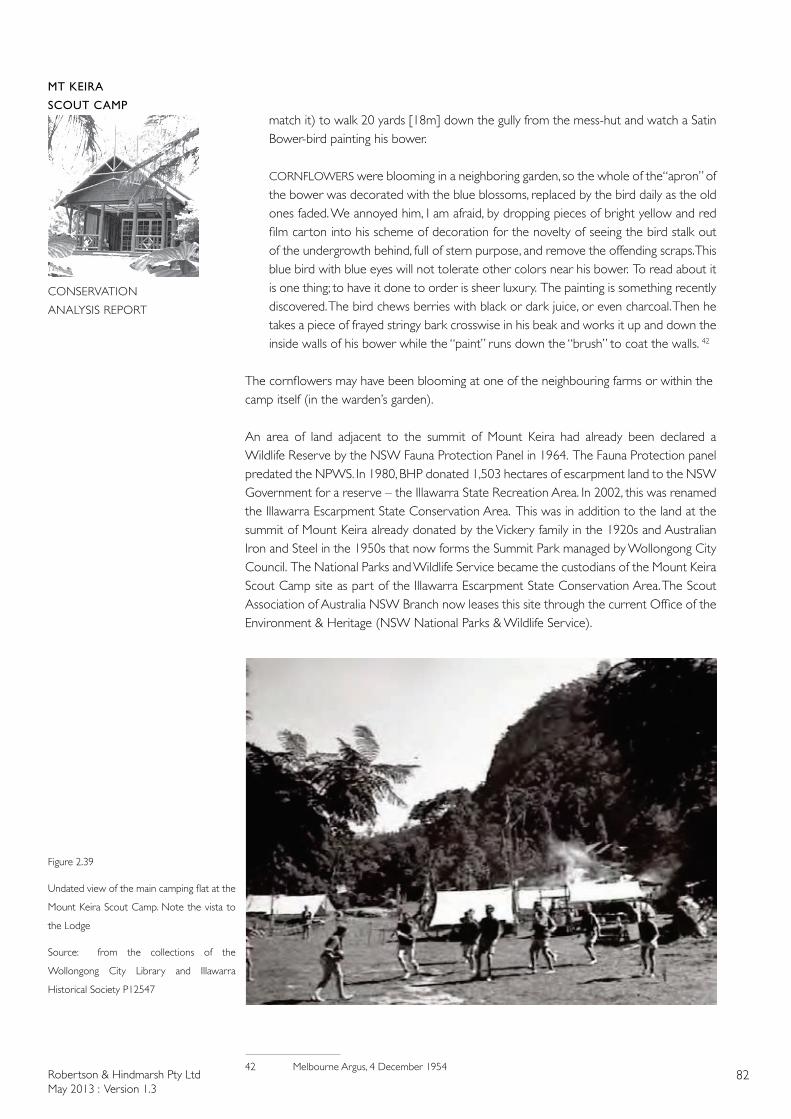
Robertson & Hindmarsh Pty LtdMay 2013 : Version 1.3
82
MT KEIRA
SCOUT CAMP
CONSERVATION
ANALYSIS REPORT
match it) to walk 20 yards [18m] down the gully from the mess-hut and watch a Satin Bower-bird painting his bower.
CORNFLOWERS were blooming in a neighboring garden, so the whole of the“apron” of the bower was decorated with the blue blossoms, replaced by the bird daily as the old ones faded. We annoyed him, I am afraid, by dropping pieces of bright yellow and red film carton into his scheme of decoration for the novelty of seeing the bird stalk out of the undergrowth behind, full of stern purpose, and remove the offending scraps. This blue bird with blue eyes will not tolerate other colors near his bower. To read about it is one thing; to have it done to order is sheer luxury. The painting is something recently discovered. The bird chews berries with black or dark juice, or even charcoal. Then he takes a piece of frayed stringy bark crosswise in his beak and works it up and down the inside walls of his bower while the “paint” runs down the “brush” to coat the walls. 42
The cornflowers may have been blooming at one of the neighbouring farms or within the camp itself (in the warden’s garden).
An area of land adjacent to the summit of Mount Keira had already been declared a Wildlife Reserve by the NSW Fauna Protection Panel in 1964. The Fauna Protection panel predated the NPWS. In 1980, BHP donated 1,503 hectares of escarpment land to the NSW Government for a reserve – the Illawarra State Recreation Area. In 2002, this was renamed the Illawarra Escarpment State Conservation Area. This was in addition to the land at the summit of Mount Keira already donated by the Vickery family in the 1920s and Australian Iron and Steel in the 1950s that now forms the Summit Park managed by Wollongong City Council. The National Parks and Wildlife Service became the custodians of the Mount Keira Scout Camp site as part of the Illawarra Escarpment State Conservation Area. The Scout Association of Australia NSW Branch now leases this site through the current Office of the Environment & Heritage (NSW National Parks & Wildlife Service).
42 Melbourne Argus, 4 December 1954
Figure 2.39
Undated view of the main camping flat at the
Mount Keira Scout Camp. Note the vista to
the Lodge
Source: from the collections of the
Wollongong City Library and Illawarra
Historical Society P12547
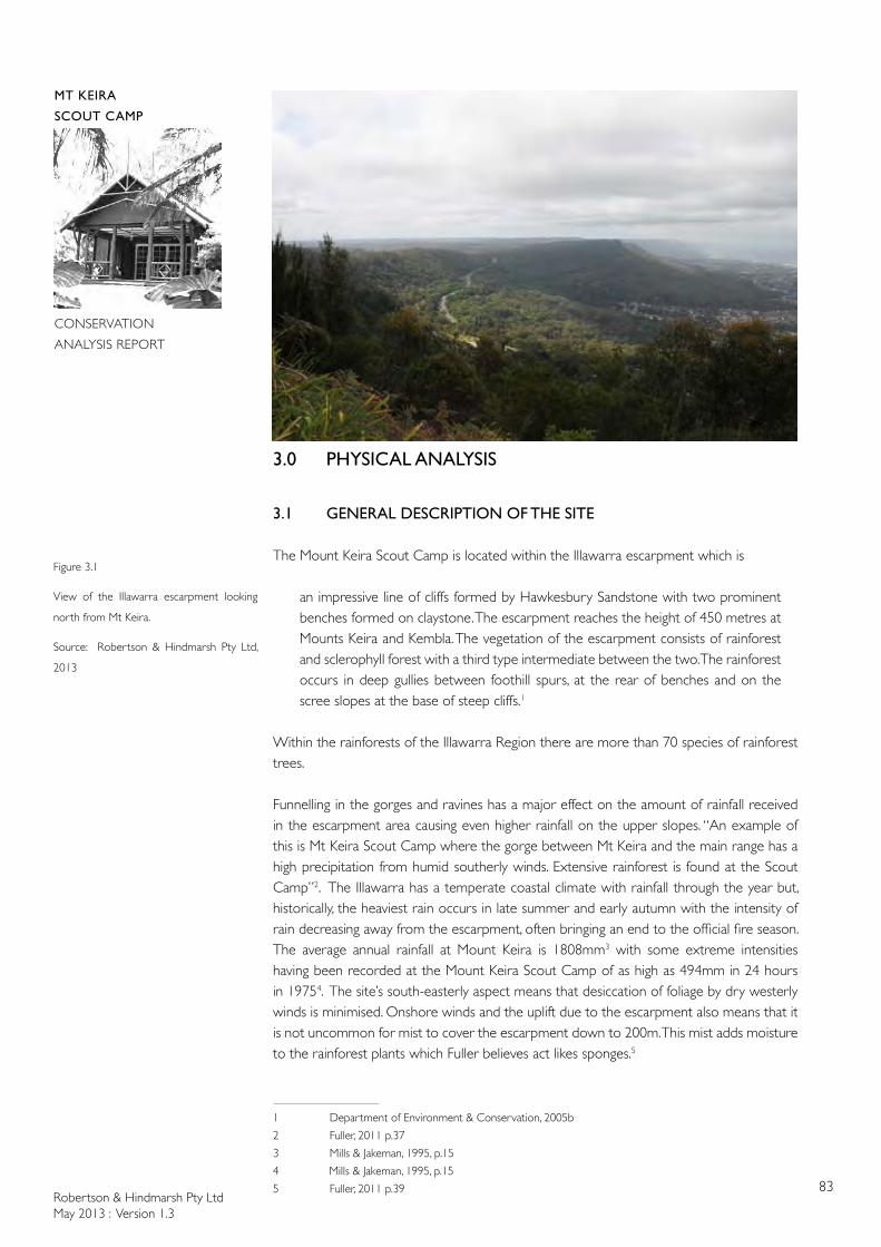
Robertson & Hindmarsh Pty LtdMay 2013 : Version 1.3
83
MT KEIRA
SCOUT CAMP
CONSERVATION
ANALYSIS REPORT
3.0 PHYSICAL ANALYSIS
3.1 GENERAL DESCRIPTION OF THE SITE
The Mount Keira Scout Camp is located within the Illawarra escarpment which is
an impressive line of cliffs formed by Hawkesbury Sandstone with two prominent benches formed on claystone. The escarpment reaches the height of 450 metres at Mounts Keira and Kembla. The vegetation of the escarpment consists of rainforest and sclerophyll forest with a third type intermediate between the two. The rainforest occurs in deep gullies between foothill spurs, at the rear of benches and on the scree slopes at the base of steep cliffs.1
Within the rainforests of the Illawarra Region there are more than 70 species of rainforest trees.
Funnelling in the gorges and ravines has a major effect on the amount of rainfall received in the escarpment area causing even higher rainfall on the upper slopes. “An example of this is Mt Keira Scout Camp where the gorge between Mt Keira and the main range has a high precipitation from humid southerly winds. Extensive rainforest is found at the Scout Camp”2. The Illawarra has a temperate coastal climate with rainfall through the year but, historically, the heaviest rain occurs in late summer and early autumn with the intensity of rain decreasing away from the escarpment, often bringing an end to the official fire season. The average annual rainfall at Mount Keira is 1808mm3 with some extreme intensities having been recorded at the Mount Keira Scout Camp of as high as 494mm in 24 hours in 19754. The site’s south-easterly aspect means that desiccation of foliage by dry westerly winds is minimised. Onshore winds and the uplift due to the escarpment also means that it is not uncommon for mist to cover the escarpment down to 200m. This mist adds moisture to the rainforest plants which Fuller believes act likes sponges.5
1 Department of Environment & Conservation, 2005b
2 Fuller, 2011 p.37
3 Mills & Jakeman, 1995, p.15
4 Mills & Jakeman, 1995, p.15
5 Fuller, 2011 p.39
Figure 3.1
View of the Illawarra escarpment looking
north from Mt Keira.
Source: Robertson & Hindmarsh Pty Ltd,
2013
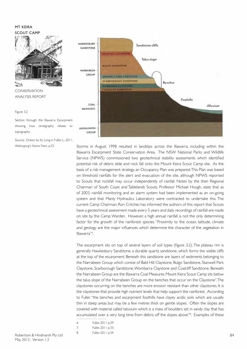
Robertson & Hindmarsh Pty LtdMay 2013 : Version 1.3
84
MT KEIRA
SCOUT CAMP
CONSERVATION
ANALYSIS REPORT
Storms in August 1998 resulted in landslips across the Illawarra, including within the Illawarra Escarpment State Conservation Area. The NSW National Parks and Wildlife Service (NPWS) commissioned two geotechnical stability assessments which identified potential risk of debris slide and rock fall onto the Mount Keira Scout Camp site. As the basis of a risk management strategy, an Occupancy Plan was prepared. This Plan was based on threshold rainfalls for the alert and evacuation of the site, although NPWS reported to Scouts that rockfall may occur independently of rainfall. Notes by the then Regional Chairman of South Coast and Tablelands Scouts, Professor Michael Hough, state that as of 2003, rainfall monitoring and an alarm system had been implemented as an on-going system and that Manly Hydraulics Laboratory were contracted to undertake this. The current Camp Chairman, Ron Critcher, has informed the authors of this report that Scouts have a geotechnical assessment made every 5 years and daily recordings of rainfall are made on site by the Camp Warden. However, a high annual rainfall is not the only determining factor for the growth of the rainforest species. “Proximity to the ocean, latitude, climate and geology are the major influences which determine the character of the vegetation in Illawarra”6.
The escarpment sits on top of several layers of soil types (figure 3.2). The plateau rim is generally Hawkesbury Sandstone, a durable quartz sandstone, which forms the visible cliffs at the top of the escarpment. Beneath this sandstone are layers of sediments belonging to the Narrabeen Group which consist of Bald Hill Claystone, Bulgo Sandstone, Stanwell Park Claystone, Scarborough Sandstone, Wombarra Claystone and Coalcliff Sandstone. Beneath the Narrabeen Group are the Illawarra Coal Measures. Mount Keira Scout Camp sits below the talus slope of the Narrabeen Group on the benches that occur on the Claystone7. The claystones occurring on the benches are more erosion resistant than other claystones. It is the claystones that provide high nutrient levels that help support the rainforest. According to Fuller “the benches and escarpment foothills have clayey acidic soils which are usually thin in steep areas but may be a few metres thick on gentle slopes. Often the slopes are covered with material called taluvium which is a mass of boulders set in sandy clay that has accumulated over a very long time from debris off the slopes above”8. Examples of these
6 Fuller, 2011 p.29
7 Fuller, 2011 p.33
8 Fuller, 2011 p.34
Figure 3.2
Section through the Illawarra Escarpment
showing how stratigraphy relates to
topography
Source: Drawn by Ky Long in Fuller, L., 2011,
Wollongong’s Native Trees, p.33
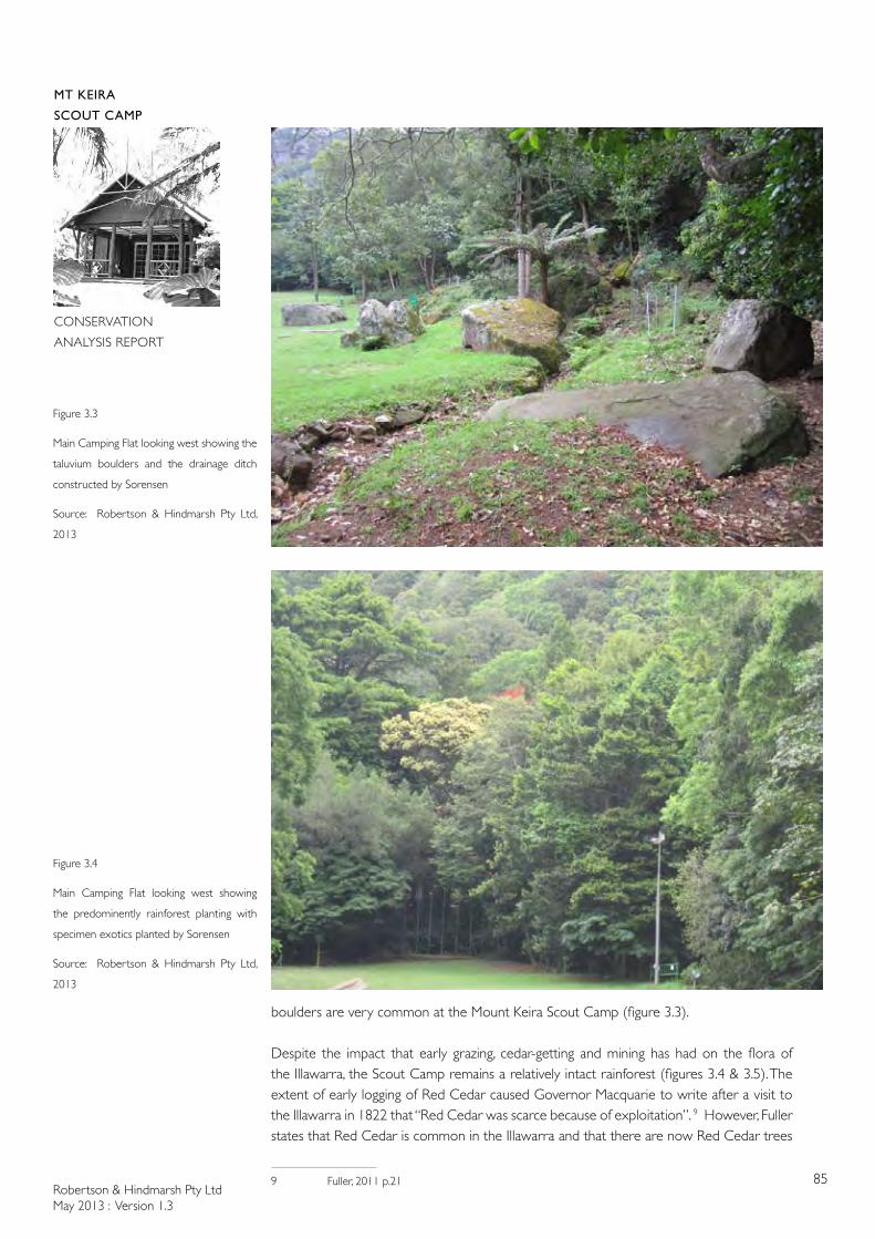
Robertson & Hindmarsh Pty LtdMay 2013 : Version 1.3
85
MT KEIRA
SCOUT CAMP
CONSERVATION
ANALYSIS REPORT
boulders are very common at the Mount Keira Scout Camp (figure 3.3).
Despite the impact that early grazing, cedar-getting and mining has had on the flora of the Illawarra, the Scout Camp remains a relatively intact rainforest (figures 3.4 & 3.5). The extent of early logging of Red Cedar caused Governor Macquarie to write after a visit to the Illawarra in 1822 that “Red Cedar was scarce because of exploitation”. 9 However, Fuller states that Red Cedar is common in the Illawarra and that there are now Red Cedar trees
9 Fuller, 2011 p.21
Figure 3.3
Main Camping Flat looking west showing the
taluvium boulders and the drainage ditch
constructed by Sorensen
Source: Robertson & Hindmarsh Pty Ltd,
2013
Figure 3.4
Main Camping Flat looking west showing
the predominently rainforest planting with
specimen exotics planted by Sorensen
Source: Robertson & Hindmarsh Pty Ltd,
2013
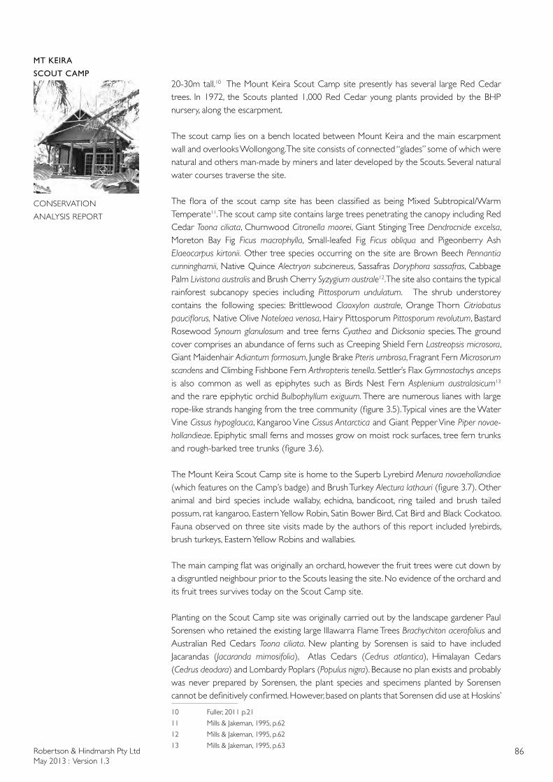
Robertson & Hindmarsh Pty LtdMay 2013 : Version 1.3
86
MT KEIRA
SCOUT CAMP
CONSERVATION
ANALYSIS REPORT
20-30m tall.10 The Mount Keira Scout Camp site presently has several large Red Cedar trees. In 1972, the Scouts planted 1,000 Red Cedar young plants provided by the BHP nursery, along the escarpment.
The scout camp lies on a bench located between Mount Keira and the main escarpment wall and overlooks Wollongong. The site consists of connected “glades” some of which were natural and others man-made by miners and later developed by the Scouts. Several natural water courses traverse the site.
The flora of the scout camp site has been classified as being Mixed Subtropical/Warm Temperate11. The scout camp site contains large trees penetrating the canopy including Red Cedar Toona ciliata, Churnwood Citronella moorei, Giant Stinging Tree Dendrocnide excelsa, Moreton Bay Fig Ficus macrophylla, Small-leafed Fig Ficus obliqua and Pigeonberry Ash Elaeocarpus kirtonii. Other tree species occurring on the site are Brown Beech Pennantia cunninghamii, Native Quince Alectryon subcinereus, Sassafras Doryphora sassafras, Cabbage Palm Livistona australis and Brush Cherry Syzygium australe12. The site also contains the typical rainforest subcanopy species including Pittosporum undulatum. The shrub understorey contains the following species: Brittlewood Claoxylon australe, Orange Thorn Citriobatus pauciflorus, Native Olive Notelaea venosa, Hairy Pittosporum Pittosporum revolutum, Bastard Rosewood Synoum glanulosum and tree ferns Cyathea and Dicksonia species. The ground cover comprises an abundance of ferns such as Creeping Shield Fern Lastreopsis microsora, Giant Maidenhair Adiantum formosum, Jungle Brake Pteris umbrosa, Fragrant Fern Microsorum scandens and Climbing Fishbone Fern Arthropteris tenella. Settler’s Flax Gymnostachys anceps is also common as well as epiphytes such as Birds Nest Fern Asplenium australasicum13 and the rare epiphytic orchid Bulbophyllum exiguum. There are numerous lianes with large rope-like strands hanging from the tree community (figure 3.5). Typical vines are the Water Vine Cissus hypoglauca, Kangaroo Vine Cissus Antarctica and Giant Pepper Vine Piper novae-hollandieae. Epiphytic small ferns and mosses grow on moist rock surfaces, tree fern trunks and rough-barked tree trunks (figure 3.6).
The Mount Keira Scout Camp site is home to the Superb Lyrebird Menura novaehollandiae (which features on the Camp’s badge) and Brush Turkey Alectura lathauri (figure 3.7). Other animal and bird species include wallaby, echidna, bandicoot, ring tailed and brush tailed possum, rat kangaroo, Eastern Yellow Robin, Satin Bower Bird, Cat Bird and Black Cockatoo. Fauna observed on three site visits made by the authors of this report included lyrebirds, brush turkeys, Eastern Yellow Robins and wallabies.
The main camping flat was originally an orchard, however the fruit trees were cut down by a disgruntled neighbour prior to the Scouts leasing the site. No evidence of the orchard and its fruit trees survives today on the Scout Camp site.
Planting on the Scout Camp site was originally carried out by the landscape gardener Paul Sorensen who retained the existing large Illawarra Flame Trees Brachychiton acerofolius and Australian Red Cedars Toona ciliata. New planting by Sorensen is said to have included Jacarandas (Jacaranda mimosifolia), Atlas Cedars (Cedrus atlantica), Himalayan Cedars (Cedrus deodara) and Lombardy Poplars (Populus nigra). Because no plan exists and probably was never prepared by Sorensen, the plant species and specimens planted by Sorensen cannot be definitively confirmed. However, based on plants that Sorensen did use at Hoskins’
10 Fuller, 2011 p.21
11 Mills & Jakeman, 1995, p.62
12 Mills & Jakeman, 1995, p.62
13 Mills & Jakeman, 1995, p.63
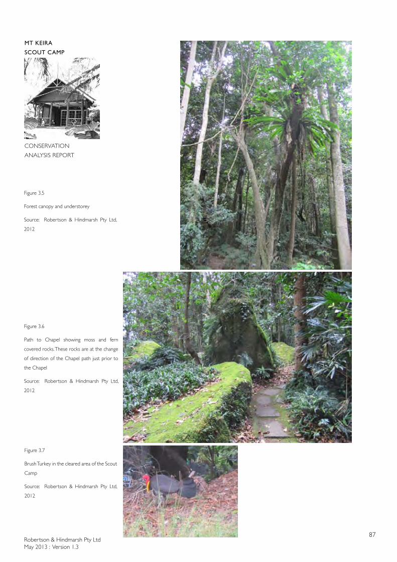
Robertson & Hindmarsh Pty LtdMay 2013 : Version 1.3
87
MT KEIRA
SCOUT CAMP
CONSERVATION
ANALYSIS REPORT
Figure 3.5
Forest canopy and understorey
Source: Robertson & Hindmarsh Pty Ltd,
2012
Figure 3.6
Path to Chapel showing moss and fern
covered rocks. These rocks are at the change
of direction of the Chapel path just prior to
the Chapel
Source: Robertson & Hindmarsh Pty Ltd,
2012
Figure 3.7
Brush Turkey in the cleared area of the Scout
Camp
Source: Robertson & Hindmarsh Pty Ltd,
2012
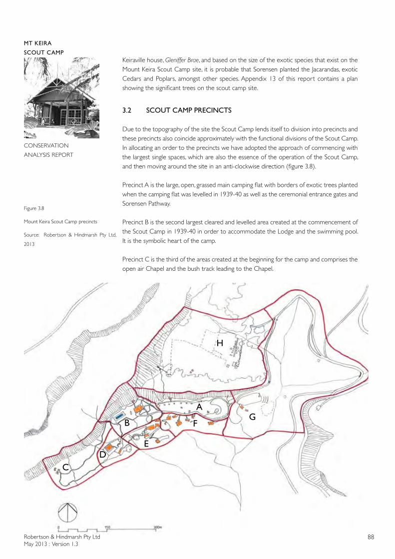
Robertson & Hindmarsh Pty LtdMay 2013 : Version 1.3
88
MT KEIRA
SCOUT CAMP
CONSERVATION
ANALYSIS REPORT
Keiraville house, Gleniffer Brae, and based on the size of the exotic species that exist on the Mount Keira Scout Camp site, it is probable that Sorensen planted the Jacarandas, exotic Cedars and Poplars, amongst other species. Appendix 13 of this report contains a plan showing the significant trees on the scout camp site.
3.2 SCOUT CAMP PRECINCTS
Due to the topography of the site the Scout Camp lends itself to division into precincts and these precincts also coincide approximately with the functional divisions of the Scout Camp. In allocating an order to the precincts we have adopted the approach of commencing with the largest single spaces, which are also the essence of the operation of the Scout Camp, and then moving around the site in an anti-clockwise direction (figure 3.8).
Precinct A is the large, open, grassed main camping flat with borders of exotic trees planted when the camping flat was levelled in 1939-40 as well as the ceremonial entrance gates and Sorensen Pathway.
Precinct B is the second largest cleared and levelled area created at the commencement of the Scout Camp in 1939-40 in order to accommodate the Lodge and the swimming pool. It is the symbolic heart of the camp.
Precinct C is the third of the areas created at the beginning for the camp and comprises the open air Chapel and the bush track leading to the Chapel.
A
H
CD
B
E
FG
Figure 3.8
Mount Keira Scout Camp precincts
Source: Robertson & Hindmarsh Pty Ltd,
2013
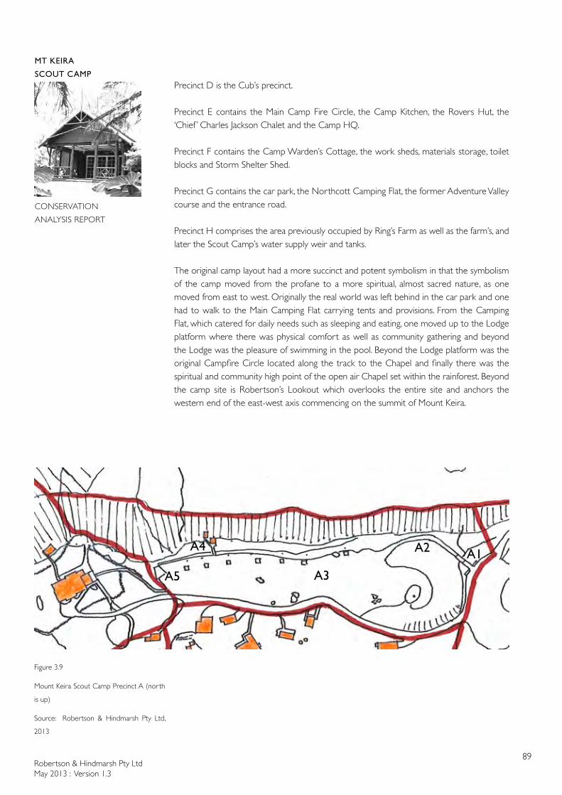
Robertson & Hindmarsh Pty LtdMay 2013 : Version 1.3
89
MT KEIRA
SCOUT CAMP
CONSERVATION
ANALYSIS REPORT
Precinct D is the Cub’s precinct.
Precinct E contains the Main Camp Fire Circle, the Camp Kitchen, the Rovers Hut, the ‘Chief ’ Charles Jackson Chalet and the Camp HQ.
Precinct F contains the Camp Warden’s Cottage, the work sheds, materials storage, toilet blocks and Storm Shelter Shed.
Precinct G contains the car park, the Northcott Camping Flat, the former Adventure Valley course and the entrance road.
Precinct H comprises the area previously occupied by Ring’s Farm as well as the farm’s, and later the Scout Camp’s water supply weir and tanks.
The original camp layout had a more succinct and potent symbolism in that the symbolism of the camp moved from the profane to a more spiritual, almost sacred nature, as one moved from east to west. Originally the real world was left behind in the car park and one had to walk to the Main Camping Flat carrying tents and provisions. From the Camping Flat, which catered for daily needs such as sleeping and eating, one moved up to the Lodge platform where there was physical comfort as well as community gathering and beyond the Lodge was the pleasure of swimming in the pool. Beyond the Lodge platform was the original Campfire Circle located along the track to the Chapel and finally there was the spiritual and community high point of the open air Chapel set within the rainforest. Beyond the camp site is Robertson’s Lookout which overlooks the entire site and anchors the western end of the east-west axis commencing on the summit of Mount Keira.
Figure 3.9
Mount Keira Scout Camp Precinct A (north
is up)
Source: Robertson & Hindmarsh Pty Ltd,
2013
A1A2
A3A5
A4
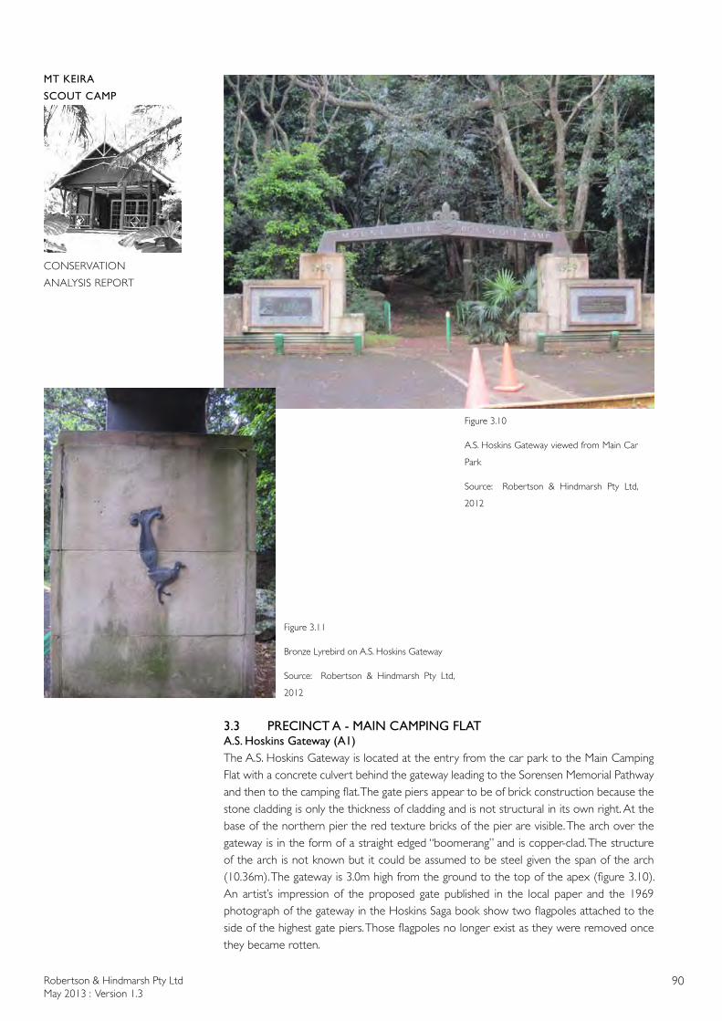
Robertson & Hindmarsh Pty LtdMay 2013 : Version 1.3
90
MT KEIRA
SCOUT CAMP
CONSERVATION
ANALYSIS REPORT
3.3 PRECINCT A - MAIN CAMPING FLATA.S. Hoskins Gateway (A1)The A.S. Hoskins Gateway is located at the entry from the car park to the Main Camping Flat with a concrete culvert behind the gateway leading to the Sorensen Memorial Pathway and then to the camping flat. The gate piers appear to be of brick construction because the stone cladding is only the thickness of cladding and is not structural in its own right. At the base of the northern pier the red texture bricks of the pier are visible. The arch over the gateway is in the form of a straight edged “boomerang” and is copper-clad. The structure of the arch is not known but it could be assumed to be steel given the span of the arch (10.36m). The gateway is 3.0m high from the ground to the top of the apex (figure 3.10). An artist’s impression of the proposed gate published in the local paper and the 1969 photograph of the gateway in the Hoskins Saga book show two flagpoles attached to the side of the highest gate piers. Those flagpoles no longer exist as they were removed once they became rotten.
Figure 3.10
A.S. Hoskins Gateway viewed from Main Car
Park
Source: Robertson & Hindmarsh Pty Ltd,
2012
Figure 3.11
Bronze Lyrebird on A.S. Hoskins Gateway
Source: Robertson & Hindmarsh Pty Ltd,
2012
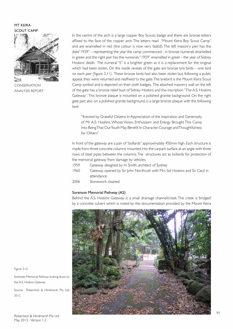
Robertson & Hindmarsh Pty LtdMay 2013 : Version 1.3
91
MT KEIRA
SCOUT CAMP
CONSERVATION
ANALYSIS REPORT
In the centre of the arch is a large copper Boy Scouts badge and there are bronze letters affixed to the face of the copper arch. The letters read “Mount Keira Boy Scout Camp” and are enamelled in red (the colour is now very faded). The left masonry pier has the date“1939” – representing the year the camp commenced - in bronze numerals enamelled in green and the right pier has the numerals “1959” enamelled in green - the year of Sidney Hoskins’ death. The numeral “5” is a brighter green as it is a replacement for the original which had been stolen. On the inside reveals of the gate are bronze lyre birds – one bird on each pier (figure 3.11). These bronze birds had also been stolen but, following a public appeal, they were returned and reaffixed to the gate. The lyrebird is the Mount Keira Scout Camp symbol and is depicted on their cloth badges. The attached masonry wall on the left of the gate has a bronze relief bust of Sidney Hoskins and the inscription “The A.S. Hoskins Gateway”. This bronze plaque is mounted on a polished granite background. On the right gate pier, also on a polished granite background, is a large bronze plaque with the following text:
“Erected by Grateful Citizens In Appreciation of the Inspiration and Generosity of Mr A.S. Hoskins, Whose Vision, Enthusiasm and Energy Brought This Camp Into Being That Our Youth May Benefit In Character, Courage and Thoughtfulness for Others”
In front of the gateway are a pair of “bollards” approximately 450mm high. Each structure is made from three concrete columns mounted into the carpark surface at an angle with three rows of steel pipes between the columns. The structures act as bollards for protection of the memorial gateway from damage by vehicles.1959 Gateway designed by H. Smith, architect of Sydney1960 Gateway opened by Sir John Northcott with Mrs Sid Hoskins and Sir Cecil in attendance2006 Stonework cleaned
Sorenson Memorial Pathway (A2)Behind the A.S. Hoskins Gateway is a small drainage channel/creek. The creek is ‘bridged’ by a concrete culvert which is noted by the documentation provided by the Mount Keira
Figure 3.12
Sorensen Memorial Pathway looking down to
the A.S. Hoskins Gateway
Source: Robertson & Hindmarsh Pty Ltd,
2012
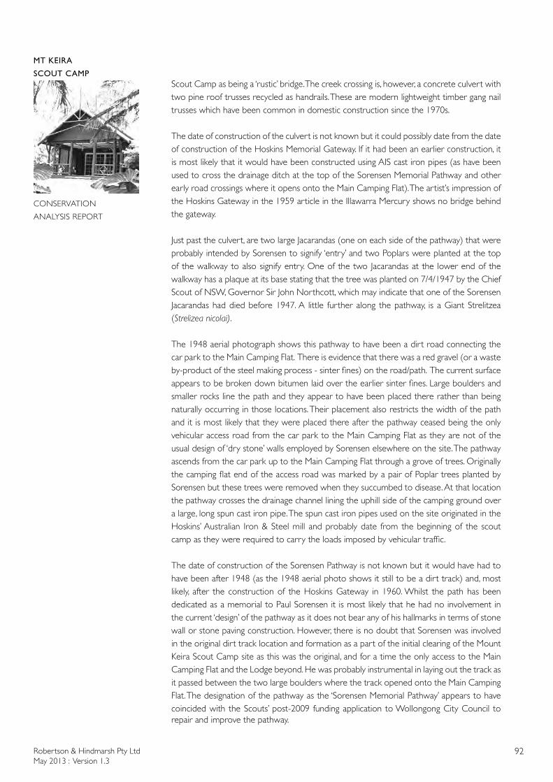
Robertson & Hindmarsh Pty LtdMay 2013 : Version 1.3
92
MT KEIRA
SCOUT CAMP
CONSERVATION
ANALYSIS REPORT
Scout Camp as being a ‘rustic’ bridge. The creek crossing is, however, a concrete culvert with two pine roof trusses recycled as handrails. These are modern lightweight timber gang nail trusses which have been common in domestic construction since the 1970s.
The date of construction of the culvert is not known but it could possibly date from the date of construction of the Hoskins Memorial Gateway. If it had been an earlier construction, it is most likely that it would have been constructed using AIS cast iron pipes (as have been used to cross the drainage ditch at the top of the Sorensen Memorial Pathway and other early road crossings where it opens onto the Main Camping Flat). The artist’s impression of the Hoskins Gateway in the 1959 article in the Illawarra Mercury shows no bridge behind the gateway.
Just past the culvert, are two large Jacarandas (one on each side of the pathway) that were probably intended by Sorensen to signify ‘entry’ and two Poplars were planted at the top of the walkway to also signify entry. One of the two Jacarandas at the lower end of the walkway has a plaque at its base stating that the tree was planted on 7/4/1947 by the Chief Scout of NSW, Governor Sir John Northcott, which may indicate that one of the Sorensen Jacarandas had died before 1947. A little further along the pathway, is a Giant Strelitzea (Strelizea nicolai).
The 1948 aerial photograph shows this pathway to have been a dirt road connecting the car park to the Main Camping Flat. There is evidence that there was a red gravel (or a waste by-product of the steel making process - sinter fines) on the road/path. The current surface appears to be broken down bitumen laid over the earlier sinter fines. Large boulders and smaller rocks line the path and they appear to have been placed there rather than being naturally occurring in those locations. Their placement also restricts the width of the path and it is most likely that they were placed there after the pathway ceased being the only vehicular access road from the car park to the Main Camping Flat as they are not of the usual design of ‘dry stone’ walls employed by Sorensen elsewhere on the site. The pathway ascends from the car park up to the Main Camping Flat through a grove of trees. Originally the camping flat end of the access road was marked by a pair of Poplar trees planted by Sorensen but these trees were removed when they succumbed to disease. At that location the pathway crosses the drainage channel lining the uphill side of the camping ground over a large, long spun cast iron pipe. The spun cast iron pipes used on the site originated in the Hoskins’ Australian Iron & Steel mill and probably date from the beginning of the scout camp as they were required to carry the loads imposed by vehicular traffic.
The date of construction of the Sorensen Pathway is not known but it would have had to have been after 1948 (as the 1948 aerial photo shows it still to be a dirt track) and, most likely, after the construction of the Hoskins Gateway in 1960. Whilst the path has been dedicated as a memorial to Paul Sorensen it is most likely that he had no involvement in the current ‘design’ of the pathway as it does not bear any of his hallmarks in terms of stone wall or stone paving construction. However, there is no doubt that Sorensen was involved in the original dirt track location and formation as a part of the initial clearing of the Mount Keira Scout Camp site as this was the original, and for a time the only access to the Main Camping Flat and the Lodge beyond. He was probably instrumental in laying out the track as it passed between the two large boulders where the track opened onto the Main Camping Flat. The designation of the pathway as the ‘Sorensen Memorial Pathway’ appears to have coincided with the Scouts’ post-2009 funding application to Wollongong City Council to repair and improve the pathway.
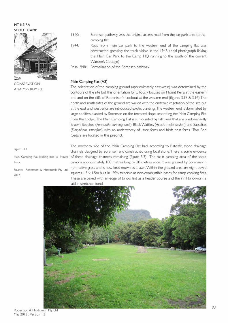
Robertson & Hindmarsh Pty LtdMay 2013 : Version 1.3
93
MT KEIRA
SCOUT CAMP
CONSERVATION
ANALYSIS REPORT
1940: Sorensen pathway was the original access road from the car park area to the camping flat
1944: Road from main car park to the western end of the camping flat was constructed (possibly the track visible in the 1948 aerial photograph linking the Main Car Park to the Camp HQ running to the south of the current Warden’s Cottage)
Post-1948: Formalisation of the Sorensen pathway
Main Camping Flat (A3)The orientation of the camping ground (approximately east-west) was determined by the contours of the site but this orientation fortuitously focuses on Mount Keira at the eastern end and on the cliffs of Robertson’s Lookout at the western end (figures 3.13 & 3.14). The north and south sides of the ground are walled with the endemic vegetation of the site but at the east and west ends are introduced exotic plantings. The western end is dominated by large conifers planted by Sorensen on the terraced slope separating the Main Camping Flat from the Lodge. The Main Camping Flat is surrounded by tall trees that are predominantly Brown Beeches (Pennantia cunninghamii), Black Wattles, (Acacia melanoxylon) and Sassafras (Doryphora sassafras) with an understorey of tree ferns and birds nest ferns. Two Red Cedars are located in this precinct.
The northern side of the Main Camping Flat had, according to Ratcliffe, stone drainage channels designed by Sorensen and constructed using local stone. There is some evidence of these drainage channels remaining (figure 3.3). The main camping area of the scout camp is approximately 100 metres long by 30 metres wide. It was grassed by Sorensen in non-native grass and is now kept mown as a lawn. Within the grassed area are eight paved squares 1.5 x 1.5m built in 1996 to serve as non-combustible bases for camp cooking fires. These are paved with an edge of bricks laid as a header course and the infill brickwork is laid in stretcher bond.
Figure 3.13
Main Camping Flat looking east to Mount
Keira
Source: Robertson & Hindmarsh Pty Ltd,
2012
Robertson & Hindmarsh Pty LtdMay 2013 : Version 1.3
94
MT KEIRA
SCOUT CAMP
CONSERVATION
ANALYSIS REPORT
Around the edge of the camping area are seven standpipes for the supply of water with lengths of water hose attached. The main access road to the upper camp runs along the southern edge of the camping area and is separated from the lawn by long lengths of logs supported horizontally above the ground to act as wheel stops (figure 3.15). The Main Camping Flat has floodlighting at the eastern and western ends. The Main Camp Flat is a designated Emergency Assembly Area.
Boulders occur randomly across the camping area and these appear to be in their original locations and were incorporated into the overall design of the camping area by Sorensen (figures, 3.13-3.15). Despite Sorensen having a crane on site it is unlikely that the boulders were placed there by him as this would have restricted the camping area. Moreover, Don Kettley states in his A History of Mount Keira Scout Camp (which is a summary of the Minutes of The South Coast and Tablelands District annual general meetings) that “a large amount of rock and boulders was removed from what is now known as the Main Flat and stacked at the end of the Flat”. This is confirmed by Bill Scarborough, as told to Alf Harley, where he states that other boulders were drilled then blown apart for use in building the steps from the Main Camping Flat up to the Lodge14. A rock in the centre of the main camping area is known as Council Rock. It is called this because Scouts made presentations for the H.R. Lee Challenge Flag competitions at this location. This competition is held annually and awards the Troop showing the best technical knowledge in activities such as first aid, bushcraft, cooking & life saving and the clearest understanding of scouting fundamentals including cooperation, helpfulness, and cheerfulness. The rock has three commemorative plaques mounted on it. These were all unveiled on 10 November 1990, the camp’s 50th anniversary. One plaque was unveiled by Mr Philip Hoskins (Sid Hoskins’ son) to commemorate the Hoskins Family’s contribution to the camp. The middle plaque was unveiled by Dr Bruce Munro, Chief Commissioner of NSW. The third plaque was unveiled by Mr Grahame Parker, Group General Manager BHP Port Kembla Steelworks in recognition of 50 years service and support to the camp by AIS and BHP.
At the eastern end of the Main Camping Flat there is a raised mound of boulders upon which stands a single white-painted timber flagpole. This area is known as Patrol Place and overlooks the Main Camping Flat (figure 3.16). Patrol Place is used as an elevated camp site and is of a size to allow a Patrol tent to be erected, hence the name. Between Patrol Place and the western end of the Sorensen Memorial Pathway are two Illawarra Flame trees, one planted on 24 January 1947 by HRH Prince William of Gloucester and the other by HRH Prince Richard of Gloucester on the same day. On the other side of the Sorensen Pathway is a Jacaranda tree planted by Lady Baden-Powell (the World Chief Guide) on 13 October 1947. These trees were planted to commemorate the visits to the scout camp by these dignitaries.
Earlier photographs and the tree identification plan prepared by the Scout Warden Dave Walsh some time after 1959 show that there were also two Lombardy Poplars located in this precinct. The Poplars are said to have been part of Sorensen’s original planting scheme, but the Poplars have since been removed due to disease (removed sometime between 1969 and 1990). The Richard Ratcliffe book on Paul Sorensen states that the entrance to the pathway at its upper end was framed by two Jacaranda trees and two large Jacarandas still exist in this location.
1940 Main Camping Flat cleared1942 Military occupied site for 7 months; no evidence of their time here remains1947 HRH the Duchess of Gloucester visited camp site and her two sons planted
14 Harley, A., nd, p.11
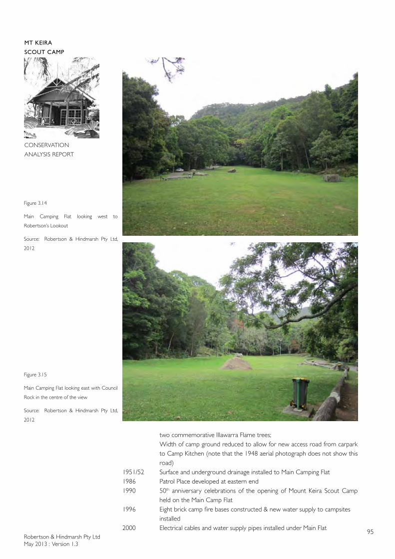
Robertson & Hindmarsh Pty LtdMay 2013 : Version 1.3
95
MT KEIRA
SCOUT CAMP
CONSERVATION
ANALYSIS REPORT
two commemorative Illawarra Flame trees; Width of camp ground reduced to allow for new access road from carpark
to Camp Kitchen (note that the 1948 aerial photograph does not show this road)
1951/52 Surface and underground drainage installed to Main Camping Flat1986 Patrol Place developed at eastern end 1990 50th anniversary celebrations of the opening of Mount Keira Scout Camp
held on the Main Camp Flat1996 Eight brick camp fire bases constructed & new water supply to campsites
installed2000 Electrical cables and water supply pipes installed under Main Flat
Figure 3.14
Main Camping Flat looking west to
Robertson’s Lookout
Source: Robertson & Hindmarsh Pty Ltd,
2012
Figure 3.15
Main Camping Flat looking east with Council
Rock in the centre of the view
Source: Robertson & Hindmarsh Pty Ltd,
2012
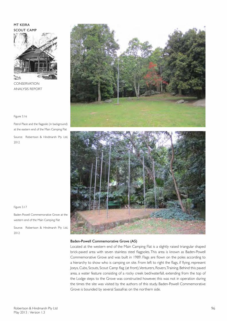
Robertson & Hindmarsh Pty LtdMay 2013 : Version 1.3
96
MT KEIRA
SCOUT CAMP
CONSERVATION
ANALYSIS REPORT
Baden-Powell Commemorative Grove (A5)Located at the western end of the Main Camping Flat is a slightly raised triangular shaped brick-paved area with seven stainless steel flagpoles. This area is known as Baden-Powell Commemorative Grove and was built in 1989. Flags are flown on the poles according to a hierarchy to show who is camping on site. From left to right the flags, if flying, represent Joeys, Cubs, Scouts, Scout Camp flag (at front), Venturers, Rovers, Training. Behind this paved area, a water feature consisting of a rocky creek bed/waterfall, extending from the top of the Lodge steps to the Grove was constructed however, this was not in operation during the times the site was visited by the authors of this study. Baden-Powell Commemorative Grove is bounded by several Sassafras on the northern side.
Figure 3.16
Patrol Place and the flagpole (in background)
at the eastern end of the Main Camping Flat
Source: Robertson & Hindmarsh Pty Ltd,
2012
Figure 3.17
Baden-Powell Commemorative Grove at the
western end of the Main Camping Flat
Source: Robertson & Hindmarsh Pty Ltd,
2012
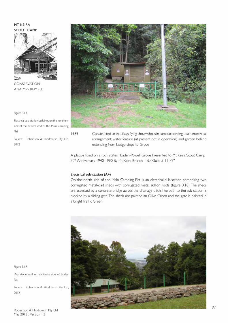
Robertson & Hindmarsh Pty LtdMay 2013 : Version 1.3
97
MT KEIRA
SCOUT CAMP
CONSERVATION
ANALYSIS REPORT
1989 Constructed so that flags flying show who is in camp according to a hierarchical arrangement; water feature (at present not in operation) and garden behind extending from Lodge steps to Grove
A plaque fixed on a rock states: “Baden-Powell Grove Presented to Mt Keira Scout Camp50th Anniversary 1940-1990 By Mt Keira Branch – B.P. Guild 5-11-89”
Electrical sub-station (A4)On the north side of the Main Camping Flat is an electrical sub-station comprising two corrugated metal-clad sheds with corrugated metal skillion roofs (figure 3.18). The sheds are accessed by a concrete bridge across the drainage ditch. The path to the sub-station is blocked by a sliding gate. The sheds are painted an Olive Green and the gate is painted in a bright Traffic Green.
Figure 3.18
Electrical sub-station buildings on the northern
side of the eastern end of the Main Camping
Flat
Source: Robertson & Hindmarsh Pty Ltd,
2012
Figure 3.19
Dry stone wall on southern side of Lodge
flat
Source: Robertson & Hindmarsh Pty Ltd,
2012
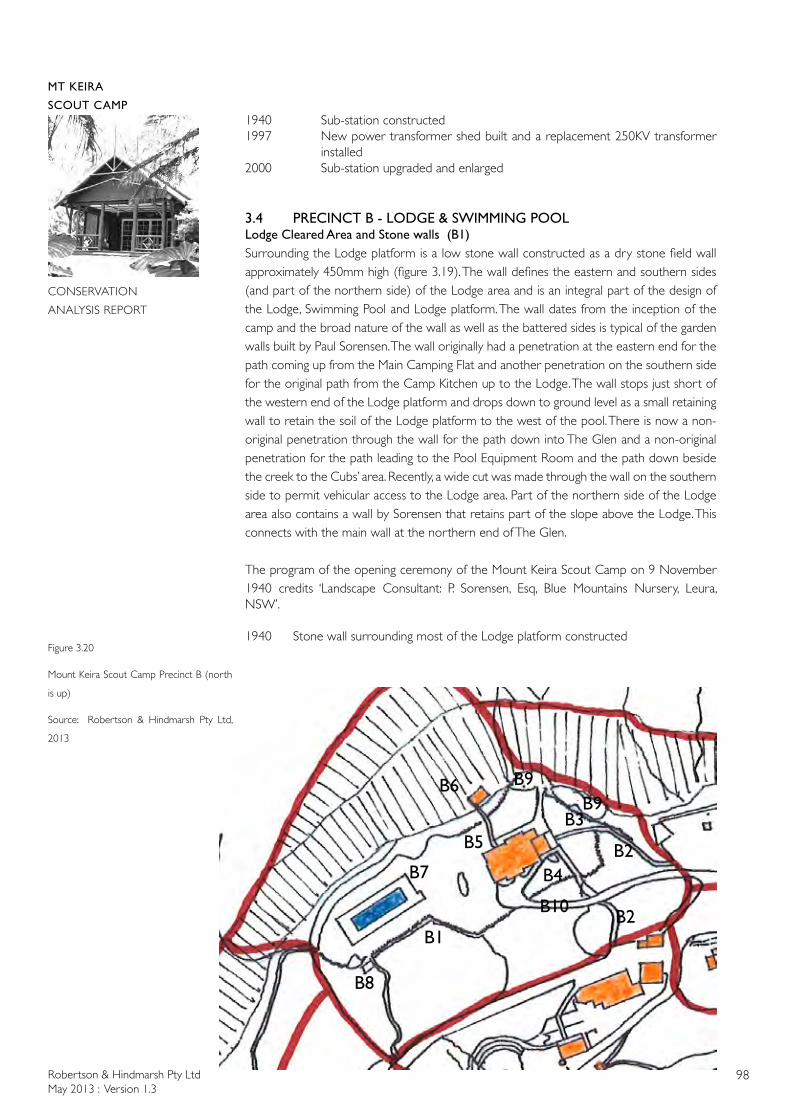
Robertson & Hindmarsh Pty LtdMay 2013 : Version 1.3
98
MT KEIRA
SCOUT CAMP
CONSERVATION
ANALYSIS REPORT
1940 Sub-station constructed1997 New power transformer shed built and a replacement 250KV transformer
installed2000 Sub-station upgraded and enlarged
3.4 PRECINCT B - LODGE & SWIMMING POOLLodge Cleared Area and Stone walls (B1)Surrounding the Lodge platform is a low stone wall constructed as a dry stone field wall approximately 450mm high (figure 3.19). The wall defines the eastern and southern sides (and part of the northern side) of the Lodge area and is an integral part of the design of the Lodge, Swimming Pool and Lodge platform. The wall dates from the inception of the camp and the broad nature of the wall as well as the battered sides is typical of the garden walls built by Paul Sorensen. The wall originally had a penetration at the eastern end for the path coming up from the Main Camping Flat and another penetration on the southern side for the original path from the Camp Kitchen up to the Lodge. The wall stops just short of the western end of the Lodge platform and drops down to ground level as a small retaining wall to retain the soil of the Lodge platform to the west of the pool. There is now a non-original penetration through the wall for the path down into The Glen and a non-original penetration for the path leading to the Pool Equipment Room and the path down beside the creek to the Cubs’ area. Recently, a wide cut was made through the wall on the southern side to permit vehicular access to the Lodge area. Part of the northern side of the Lodge area also contains a wall by Sorensen that retains part of the slope above the Lodge. This connects with the main wall at the northern end of The Glen.
The program of the opening ceremony of the Mount Keira Scout Camp on 9 November 1940 credits ‘Landscape Consultant: P. Sorensen, Esq, Blue Mountains Nursery, Leura, NSW’.
1940 Stone wall surrounding most of the Lodge platform constructedFigure 3.20
Mount Keira Scout Camp Precinct B (north
is up)
Source: Robertson & Hindmarsh Pty Ltd,
2013
B1
B7
B2
B2
B3B5
B4
B8
B9B6B9
B10
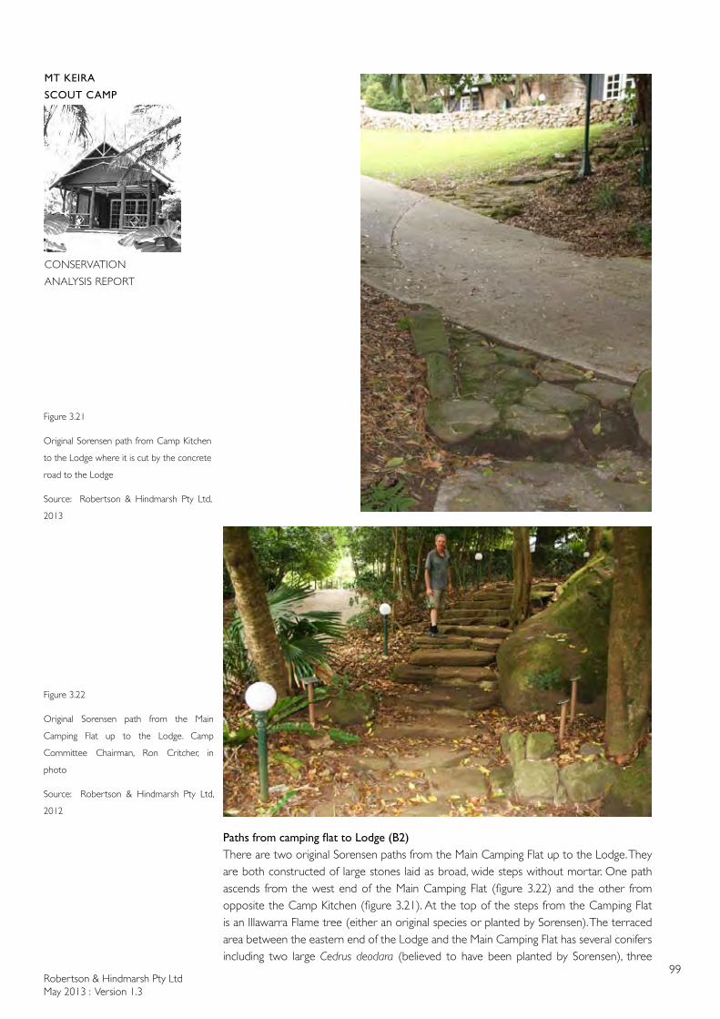
Robertson & Hindmarsh Pty LtdMay 2013 : Version 1.3
99
MT KEIRA
SCOUT CAMP
CONSERVATION
ANALYSIS REPORT
PathsfromcampingflattoLodge(B2)There are two original Sorensen paths from the Main Camping Flat up to the Lodge. They are both constructed of large stones laid as broad, wide steps without mortar. One path ascends from the west end of the Main Camping Flat (figure 3.22) and the other from opposite the Camp Kitchen (figure 3.21). At the top of the steps from the Camping Flat is an Illawarra Flame tree (either an original species or planted by Sorensen). The terraced area between the eastern end of the Lodge and the Main Camping Flat has several conifers including two large Cedrus deodara (believed to have been planted by Sorensen), three
Figure 3.21
Original Sorensen path from Camp Kitchen
to the Lodge where it is cut by the concrete
road to the Lodge
Source: Robertson & Hindmarsh Pty Ltd,
2013
Figure 3.22
Original Sorensen path from the Main
Camping Flat up to the Lodge. Camp
Committee Chairman, Ron Critcher, in
photo
Source: Robertson & Hindmarsh Pty Ltd,
2012
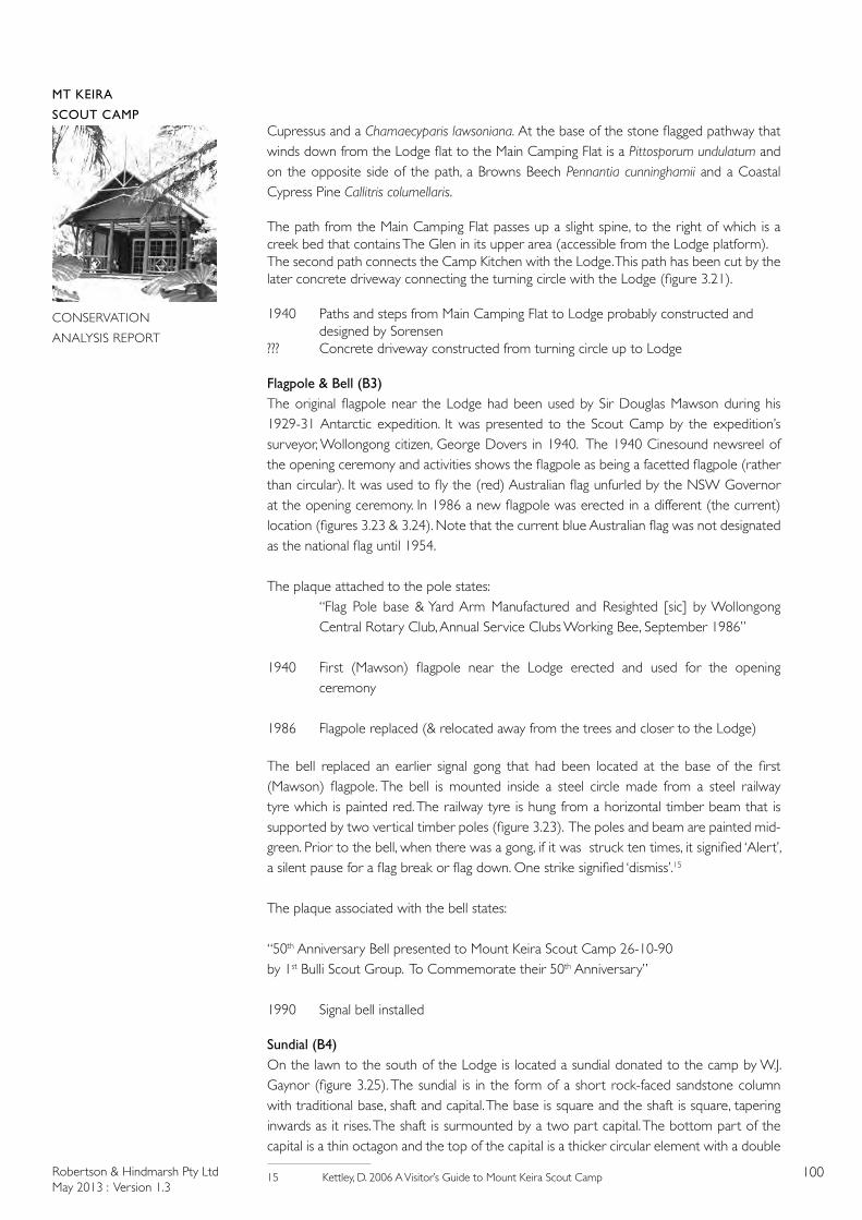
Robertson & Hindmarsh Pty LtdMay 2013 : Version 1.3
100
MT KEIRA
SCOUT CAMP
CONSERVATION
ANALYSIS REPORT
Cupressus and a Chamaecyparis lawsoniana. At the base of the stone flagged pathway that winds down from the Lodge flat to the Main Camping Flat is a Pittosporum undulatum and on the opposite side of the path, a Browns Beech Pennantia cunninghamii and a Coastal Cypress Pine Callitris columellaris.
The path from the Main Camping Flat passes up a slight spine, to the right of which is a creek bed that contains The Glen in its upper area (accessible from the Lodge platform). The second path connects the Camp Kitchen with the Lodge. This path has been cut by the later concrete driveway connecting the turning circle with the Lodge (figure 3.21).
1940 Paths and steps from Main Camping Flat to Lodge probably constructed and designed by Sorensen??? Concrete driveway constructed from turning circle up to Lodge
Flagpole & Bell (B3)The original flagpole near the Lodge had been used by Sir Douglas Mawson during his 1929-31 Antarctic expedition. It was presented to the Scout Camp by the expedition’s surveyor, Wollongong citizen, George Dovers in 1940. The 1940 Cinesound newsreel of the opening ceremony and activities shows the flagpole as being a facetted flagpole (rather than circular). It was used to fly the (red) Australian flag unfurled by the NSW Governor at the opening ceremony. In 1986 a new flagpole was erected in a different (the current) location (figures 3.23 & 3.24). Note that the current blue Australian flag was not designated as the national flag until 1954.
The plaque attached to the pole states:“Flag Pole base & Yard Arm Manufactured and Resighted [sic] by Wollongong Central Rotary Club, Annual Service Clubs Working Bee, September 1986”
1940 First (Mawson) flagpole near the Lodge erected and used for the opening ceremony
1986 Flagpole replaced (& relocated away from the trees and closer to the Lodge)
The bell replaced an earlier signal gong that had been located at the base of the first (Mawson) flagpole. The bell is mounted inside a steel circle made from a steel railway tyre which is painted red. The railway tyre is hung from a horizontal timber beam that is supported by two vertical timber poles (figure 3.23). The poles and beam are painted mid-green. Prior to the bell, when there was a gong, if it was struck ten times, it signified ‘Alert’, a silent pause for a flag break or flag down. One strike signified ‘dismiss’.15
The plaque associated with the bell states:
“50th Anniversary Bell presented to Mount Keira Scout Camp 26-10-90by 1st Bulli Scout Group. To Commemorate their 50th Anniversary”
1990 Signal bell installed
Sundial (B4)On the lawn to the south of the Lodge is located a sundial donated to the camp by W.J. Gaynor (figure 3.25). The sundial is in the form of a short rock-faced sandstone column with traditional base, shaft and capital. The base is square and the shaft is square, tapering inwards as it rises. The shaft is surmounted by a two part capital. The bottom part of the capital is a thin octagon and the top of the capital is a thicker circular element with a double
15 Kettley, D. 2006 A Visitor’s Guide to Mount Keira Scout Camp

Robertson & Hindmarsh Pty LtdMay 2013 : Version 1.3
101
MT KEIRA
SCOUT CAMP
CONSERVATION
ANALYSIS REPORT
Figure 3.23
Signal bell with flagpole behind located on
the Lodge terrace
Source: Robertson & Hindmarsh Pty Ltd,
2012
Figure 3.24
Flagpole in its second and current location to
the east of the Lodge. Note the non-original
paths and bollards
Source: Robertson & Hindmarsh Pty Ltd,
2012
Figure 3.25
Sundial located to the south of the Lodge.
Note the original Sorensen stone walling and
non-original concrete driveway and bollards
Source: Robertson & Hindmarsh Pty Ltd,
2012

Robertson & Hindmarsh Pty LtdMay 2013 : Version 1.3
102
MT KEIRA
SCOUT CAMP
CONSERVATION
ANALYSIS REPORT
bullnose edge. The bronze sundial is mounted on top of the circular element. The bronze sundial has a map of Australia depicting the states and major cities and towns. Around the circumference of the sundial are bearings to items of local interest, such as the Australian Iron and Steel Works in Port Kembla. The sundial has a dedication inscription:
This Sundial Was Presented to Mt Keira Scout Camp By W.J. Gaynor Esq, Member of the Executive Committee, 1941, The Ground Level of this Site is 1050 feet Above Sea Level16
1941 Sundial erected
Swimming Pool (B7)The swimming pool is located to the west of the Lodge and sits in the grassed area that surrounds The Lodge. There is one large rock (figure 3.26) between the Lodge and the pool against which grow two tree ferns, a Cyathea cooperi and a Dicksonia antarctica. These were planted or self sown after 1969 as they do not appear in the Hoskins Saga book of 1969.
The swimming pool is ringed with square concrete pavers and is 25m long x 7m wide x 2.4m at the deepest end (under a diving board) (figure 3.27). The pool tank is tiled in white tiles with black lane line markings on the bottom with blue waterline tiles. Originally the pool was unfenced (figures 2.31 & 2.34) but it was later fenced using a Cyclone wire fence with pipe uprights and top and bottom rails as seen in the 1985 Scout Camp brochure. This illustration also shows that the pool had concrete paving coping and an edge of concrete. The cyclone wire fence was still there in 1990 as illustrated in the 50th Anniversary Supplement in the November issue of the Illawarra Mercury. The current green metal pool safety fence with acorn tops to the vertical uprights appears to have been installed in 1991 in order to comply with pool safety standards. The area between the square concrete pavers and the pool safety fence has been paved in terra cotta pavers.
No drawings of the swimming pool have been located. The original pool at the Mount Keira Scout Camp is similar in design to the Sorensen designed swimming pool at Invergowrie.
In the historical notes supplied by the Mount Keira Scout Camp it was noted that the pool was excavated with horse and scoop and that it was fed by tank water (from rain collected on the Lodge roof). However, Sorensen’s diaries indicate that he was responsible for the excavation and construction of the pool and for the water supply system which fed the Lodge and the Pool from the spring higher up the mountain. Early photos also do not show any water tanks associated with the Lodge. Sorensen noted that the spring flowed at a rate of 150 gallons (909 litres) per hour. There was to be a 3 inch (75mm) diameter water main from the spring to the filter and two 5,000 gallon (22,730 litres) storage tanks. From the tanks the water was to be fed to the Camp through a 1½ inch (38mm) diameter main.
To the south of the pool beyond Sorensen’s low stone wall is a Cabbage Palm Livistona australis, a Koda Ehretia acuminata and a gigantic Tallowwood Eucalyptus microcorys. To the west is a large rock with a Sassafras Doryphora sassafas growing against the rock.
1940 Pool constructed (completed circa April 1940)1964 New filtration system installedpre- 1985 Cyclone wire pool fence installed 1986 New pump & filters installed1987 Pump house rebuilt1991 Pool safety fence installed (to replace cyclone wire fence) & pool tank
repaired
16 1050 feet = 320 metres
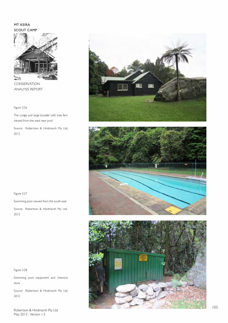
Robertson & Hindmarsh Pty LtdMay 2013 : Version 1.3
103
MT KEIRA
SCOUT CAMP
CONSERVATION
ANALYSIS REPORT
Figure 3.26
The Lodge and large boulder with tree fern
viewed from the west near pool
Source: Robertson & Hindmarsh Pty Ltd,
2012
Figure 3.27
Swimming pool viewed from the south-east
Source: Robertson & Hindmarsh Pty Ltd,
2012
Figure 3.28
Swimming pool equipment and chemical
store
Source: Robertson & Hindmarsh Pty Ltd,
2012
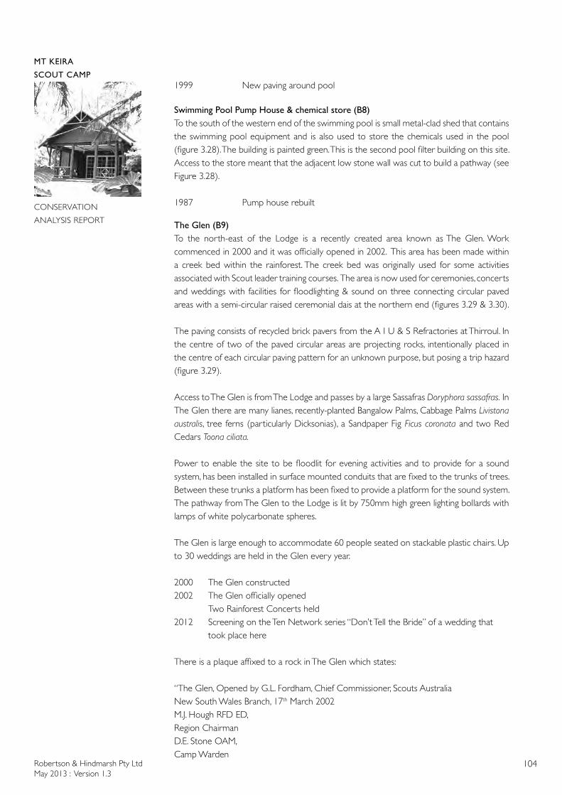
Robertson & Hindmarsh Pty LtdMay 2013 : Version 1.3
104
MT KEIRA
SCOUT CAMP
CONSERVATION
ANALYSIS REPORT
1999 New paving around pool
Swimming Pool Pump House & chemical store (B8)To the south of the western end of the swimming pool is small metal-clad shed that contains the swimming pool equipment and is also used to store the chemicals used in the pool (figure 3.28). The building is painted green. This is the second pool filter building on this site. Access to the store meant that the adjacent low stone wall was cut to build a pathway (see Figure 3.28).
1987 Pump house rebuilt
The Glen (B9)To the north-east of the Lodge is a recently created area known as The Glen. Work commenced in 2000 and it was officially opened in 2002. This area has been made within a creek bed within the rainforest. The creek bed was originally used for some activities associated with Scout leader training courses. The area is now used for ceremonies, concerts and weddings with facilities for floodlighting & sound on three connecting circular paved areas with a semi-circular raised ceremonial dais at the northern end (figures 3.29 & 3.30).
The paving consists of recycled brick pavers from the A I U & S Refractories at Thirroul. In the centre of two of the paved circular areas are projecting rocks, intentionally placed in the centre of each circular paving pattern for an unknown purpose, but posing a trip hazard (figure 3.29).
Access to The Glen is from The Lodge and passes by a large Sassafras Doryphora sassafras. In The Glen there are many lianes, recently-planted Bangalow Palms, Cabbage Palms Livistona australis, tree ferns (particularly Dicksonias), a Sandpaper Fig Ficus coronata and two Red Cedars Toona ciliata.
Power to enable the site to be floodlit for evening activities and to provide for a sound system, has been installed in surface mounted conduits that are fixed to the trunks of trees. Between these trunks a platform has been fixed to provide a platform for the sound system. The pathway from The Glen to the Lodge is lit by 750mm high green lighting bollards with lamps of white polycarbonate spheres.
The Glen is large enough to accommodate 60 people seated on stackable plastic chairs. Up to 30 weddings are held in the Glen every year.
2000 The Glen constructed2002 The Glen officially opened Two Rainforest Concerts held2012 Screening on the Ten Network series “Don’t Tell the Bride” of a wedding that took place here
There is a plaque affixed to a rock in The Glen which states:
“The Glen, Opened by G.L. Fordham, Chief Commissioner, Scouts AustraliaNew South Wales Branch, 17th March 2002M.J. Hough RFD ED, Region ChairmanD.E. Stone OAM, Camp Warden
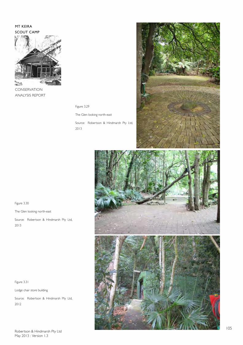
Robertson & Hindmarsh Pty LtdMay 2013 : Version 1.3
105
MT KEIRA
SCOUT CAMP
CONSERVATION
ANALYSIS REPORT
Figure 3.29
The Glen looking north-east
Source: Robertson & Hindmarsh Pty Ltd,
2013
Figure 3.30
The Glen looking north-east
Source: Robertson & Hindmarsh Pty Ltd,
2013
Figure 3.31
Lodge chair store building
Source: Robertson & Hindmarsh Pty Ltd,
2012
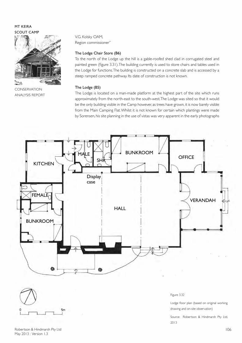
Robertson & Hindmarsh Pty LtdMay 2013 : Version 1.3
106
MT KEIRA
SCOUT CAMP
CONSERVATION
ANALYSIS REPORT
V.G. Kolsky OAM,Region commissioner”
The Lodge Chair Store (B6)To the north of the Lodge up the hill is a gable-roofed shed clad in corrugated steel and painted green (figure 3.31). The building currently is used to store chairs and tables used in the Lodge for functions. The building is constructed on a concrete slab and is accessed by a steep ramped concrete pathway. Its date of construction is not known.
The Lodge (B5)The Lodge is located on a man-made platform at the highest part of the site which runs approximately from the north-east to the south-west. The Lodge was sited so that it would be the only building visible in the Camp however, as trees have grown, it is now barely visible from the Main Camping Flat. Whilst it is not known for certain which plantings were made by Sorensen, his site planning in the use of vistas was very apparent in the early photographs
Figure 3.32
Lodge floor plan (based on original working
drawing and on-site observation)
Source: Robertson & Hindmarsh Pty Ltd,
2013
HALL
VERANDAH
OFFICEBUNKROOM
KITCHEN
FEMALE
SHRMALE
Display case
BUNKROOM
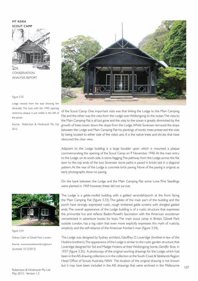
Robertson & Hindmarsh Pty LtdMay 2013 : Version 1.3
107
MT KEIRA
SCOUT CAMP
CONSERVATION
ANALYSIS REPORT
of the Scout Camp. One important vista was that linking the Lodge to the Main Camping Flat and the other was the vista from the Lodge over Wollongong to the ocean. The vista to the Main Camping Flat is all but gone and the vista to the ocean is greatly diminished by the growth of trees lower down the slope from the Lodge. Whilst Sorensen terraced the slope between the Lodge and Main Camping Flat his plantings of exotic trees preserved the vista by being located to either side of the vista’s axis. It is the native trees and shrubs that have obscured the clear view.
Adjacent to the Lodge building is a large boulder upon which is mounted a plaque commemorating the opening of the Scout Camp on 9 November 1940. At the main entry to the Lodge, on its south side, is stone flagging. The pathway from the Lodge across the flat lawn to the top ends of the two Sorensen stone paths is paved in bricks laid in a diagonal pattern. At the rear of the Lodge is concrete brick paving. None of the paving is original, as early photographs show no paving.
On the bank between the Lodge and the Main Camping Flat some Lone Pine Seedlings were planted in 1969 however, these did not survive.
The Lodge is a gable-roofed building with a gabled verandah/porch at the front facing the Main Camping Flat (figure 3.33). The gables of the main part of the building and the porch have strongly expressed rustic, rough timbered gable screens with shingled gabled ends. The overall appearance of the Lodge building is of a rustic structure that expresses the primordial hut and reflects Baden-Powell’s fascination with the American woodsman romanticised in adventure books for boys. The main scout camp in Britain, Gilwell Park outside London, has a log cabin that even more explicitly expresses this myth of rusticity, simplicity and the self-reliance of the American frontier’s man (figure 3.34).
The Lodge was designed by Sydney architect, Geoffrey D. Loveridge (brother-in-law of the Hoskins brothers). The appearance of the Lodge is similar to the rustic garden structure that Loveridge designed for Sid and Madge Hoskins at their Wollongong home, Gleniffer Brae, in 1937 (figure 3.35). A photocopy of the original working drawings for the Lodge, which had been in the AIS drawing collection, is in the collection at the South Coast & Tablelands Region Head Office of Scouts Australia, NSW. The location of the original drawing is not known but it may have been included in the AIS drawings that were archived in the Melbourne
Figure 3.33
Lodge viewed from the east showing the
Verandah. The rock with the 1940 opening
ceremony plaque is just visible in the left of
the photo
Source: Robertson & Hindmarsh Pty Ltd,
2012
Figure 3.34
Gidney Cabin at Gilwell Park, London
Source: www.scoutsrecords.org/tours
(accessed 15/12/2013)
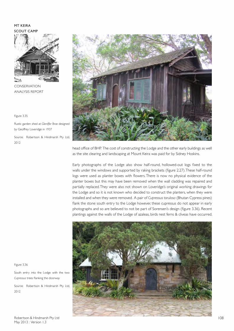
Robertson & Hindmarsh Pty LtdMay 2013 : Version 1.3
108
MT KEIRA
SCOUT CAMP
CONSERVATION
ANALYSIS REPORT
head office of BHP. The cost of constructing the Lodge and the other early buildings as well as the site clearing and landscaping at Mount Keira was paid for by Sidney Hoskins.
Early photographs of the Lodge also show half-round, hollowed-out logs fixed to the walls under the windows and supported by raking brackets (figure 2.27). These half-round logs were used as planter boxes with flowers. There is now no physical evidence of the planter boxes but this may have been removed when the wall cladding was repaired and partially replaced. They were also not shown on Loveridge’s original working drawings for the Lodge and so it is not known who decided to construct the planters, when they were installed and when they were removed. A pair of Cupressus torulosa (Bhutan Cypress pines) flank the stone south entry to the Lodge however, these cupressus do not appear in early photographs and so are believed to not be part of Sorensen’s design (figure 3.36). Recent plantings against the walls of the Lodge of azaleas, birds nest ferns & cliveas have occurred.
Figure 3.35
Rustic garden shed at Gleniffer Brae designed
by Geoffrey Loveridge in 1937
Source: Robertson & Hindmarsh Pty Ltd,
2012
Figure 3.36
South entry into the Lodge with the two
Cupressus trees flanking the doorway
Source: Robertson & Hindmarsh Pty Ltd,
2012
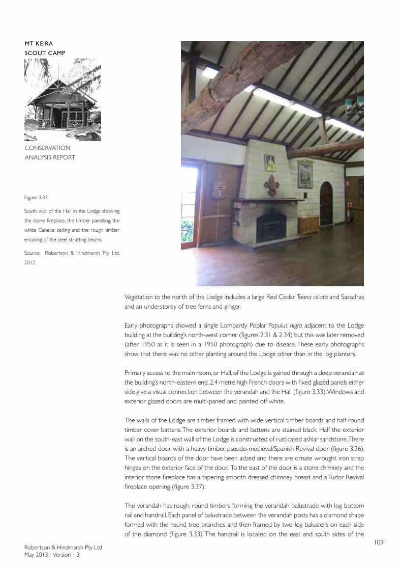
Robertson & Hindmarsh Pty LtdMay 2013 : Version 1.3
109
MT KEIRA
SCOUT CAMP
CONSERVATION
ANALYSIS REPORT
Vegetation to the north of the Lodge includes a large Red Cedar, Toona ciliata and Sassafras and an understorey of tree ferns and ginger.
Early photographs showed a single Lombardy Poplar Populus nigra adjacent to the Lodge building at the building’s north-west corner (figures 2.31 & 2.34) but this was later removed (after 1950 as it is seen in a 1950 photograph) due to disease. These early photographs show that there was no other planting around the Lodge other than in the log planters.
Primary access to the main room, or Hall, of the Lodge is gained through a deep verandah at the building’s north-eastern end. 2.4 metre high French doors with fixed glazed panels either side give a visual connection between the verandah and the Hall (figure 3.33). Windows and exterior glazed doors are multi-paned and painted off white.
The walls of the Lodge are timber framed with wide vertical timber boards and half-round timber cover battens. The exterior boards and battens are stained black. Half the exterior wall on the south-east wall of the Lodge is constructed of rusticated ashlar sandstone. There is an arched door with a heavy timber, pseudo-medieval/Spanish Revival door (figure 3.36). The vertical boards of the door have been adzed and there are ornate wrought iron strap hinges on the exterior face of the door. To the east of the door is a stone chimney and the interior stone fireplace has a tapering smooth dressed chimney breast and a Tudor Revival fireplace opening (figure 3.37).
The verandah has rough, round timbers forming the verandah balustrade with log bottom rail and handrail. Each panel of balustrade between the verandah posts has a diamond shape formed with the round tree branches and then framed by two log balusters on each side of the diamond (figure 3.33). The handrail is located on the east and south sides of the
Figure 3.37
South wall of the Hall in the Lodge showing
the stone fireplace, the timber panelling, the
white Caneite ceiling and the rough timber
encasing of the steel strutting beams
Source: Robertson & Hindmarsh Pty Ltd,
2012
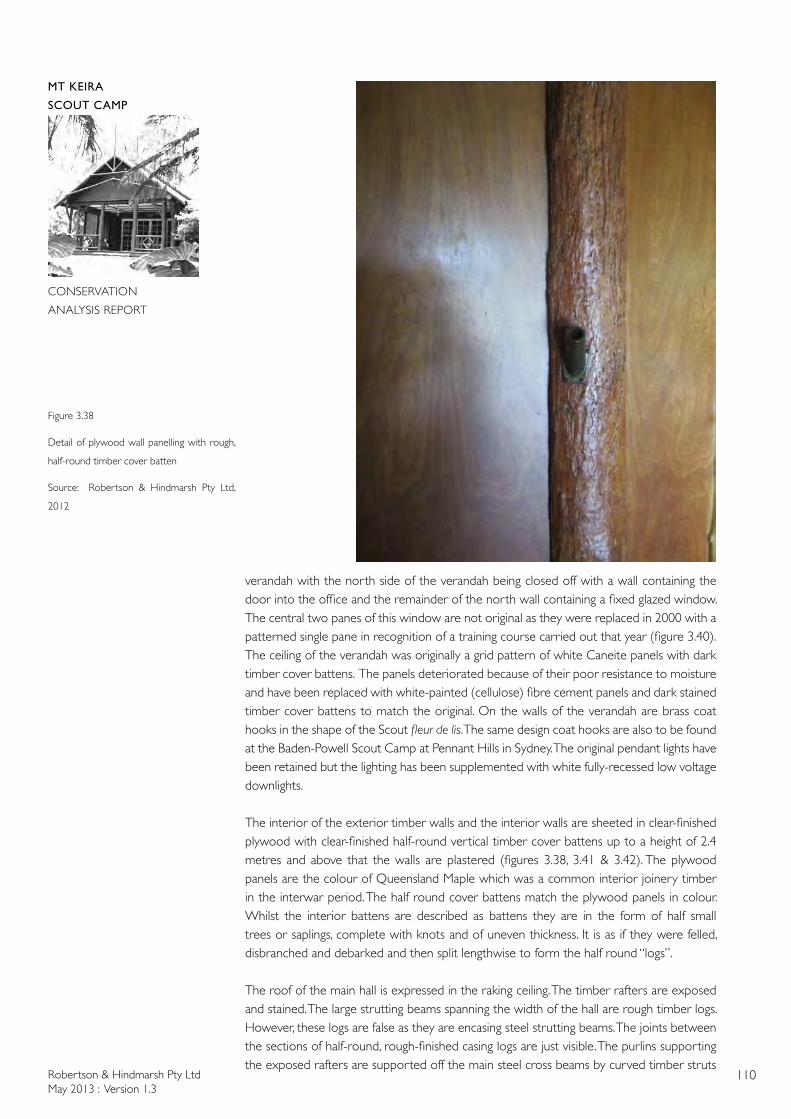
Robertson & Hindmarsh Pty LtdMay 2013 : Version 1.3
110
MT KEIRA
SCOUT CAMP
CONSERVATION
ANALYSIS REPORT
verandah with the north side of the verandah being closed off with a wall containing the door into the office and the remainder of the north wall containing a fixed glazed window. The central two panes of this window are not original as they were replaced in 2000 with a patterned single pane in recognition of a training course carried out that year (figure 3.40).The ceiling of the verandah was originally a grid pattern of white Caneite panels with dark timber cover battens. The panels deteriorated because of their poor resistance to moisture and have been replaced with white-painted (cellulose) fibre cement panels and dark stained timber cover battens to match the original. On the walls of the verandah are brass coat hooks in the shape of the Scout fleur de lis. The same design coat hooks are also to be found at the Baden-Powell Scout Camp at Pennant Hills in Sydney. The original pendant lights have been retained but the lighting has been supplemented with white fully-recessed low voltage downlights.
The interior of the exterior timber walls and the interior walls are sheeted in clear-finished plywood with clear-finished half-round vertical timber cover battens up to a height of 2.4 metres and above that the walls are plastered (figures 3.38, 3.41 & 3.42). The plywood panels are the colour of Queensland Maple which was a common interior joinery timber in the interwar period. The half round cover battens match the plywood panels in colour. Whilst the interior battens are described as battens they are in the form of half small trees or saplings, complete with knots and of uneven thickness. It is as if they were felled, disbranched and debarked and then split lengthwise to form the half round “logs”.
The roof of the main hall is expressed in the raking ceiling. The timber rafters are exposed and stained. The large strutting beams spanning the width of the hall are rough timber logs. However, these logs are false as they are encasing steel strutting beams. The joints between the sections of half-round, rough-finished casing logs are just visible. The purlins supporting the exposed rafters are supported off the main steel cross beams by curved timber struts
Figure 3.38
Detail of plywood wall panelling with rough,
half-round timber cover batten
Source: Robertson & Hindmarsh Pty Ltd,
2012
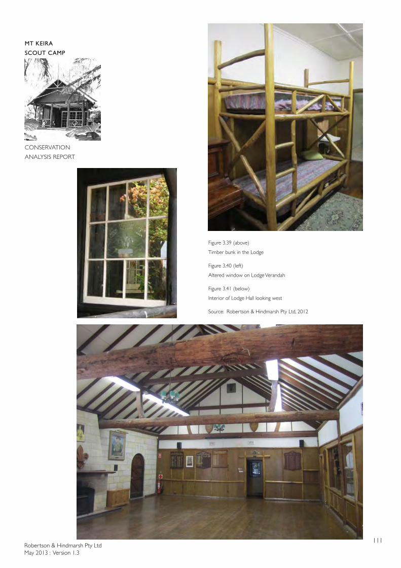
Robertson & Hindmarsh Pty LtdMay 2013 : Version 1.3
111
MT KEIRA
SCOUT CAMP
CONSERVATION
ANALYSIS REPORT
Figure 3.39 (above)
Timber bunk in the Lodge
Figure 3.40 (left)
Altered window on Lodge Verandah
Figure 3.41 (below)
Interior of Lodge Hall looking west
Source: Robertson & Hindmarsh Pty Ltd, 2012
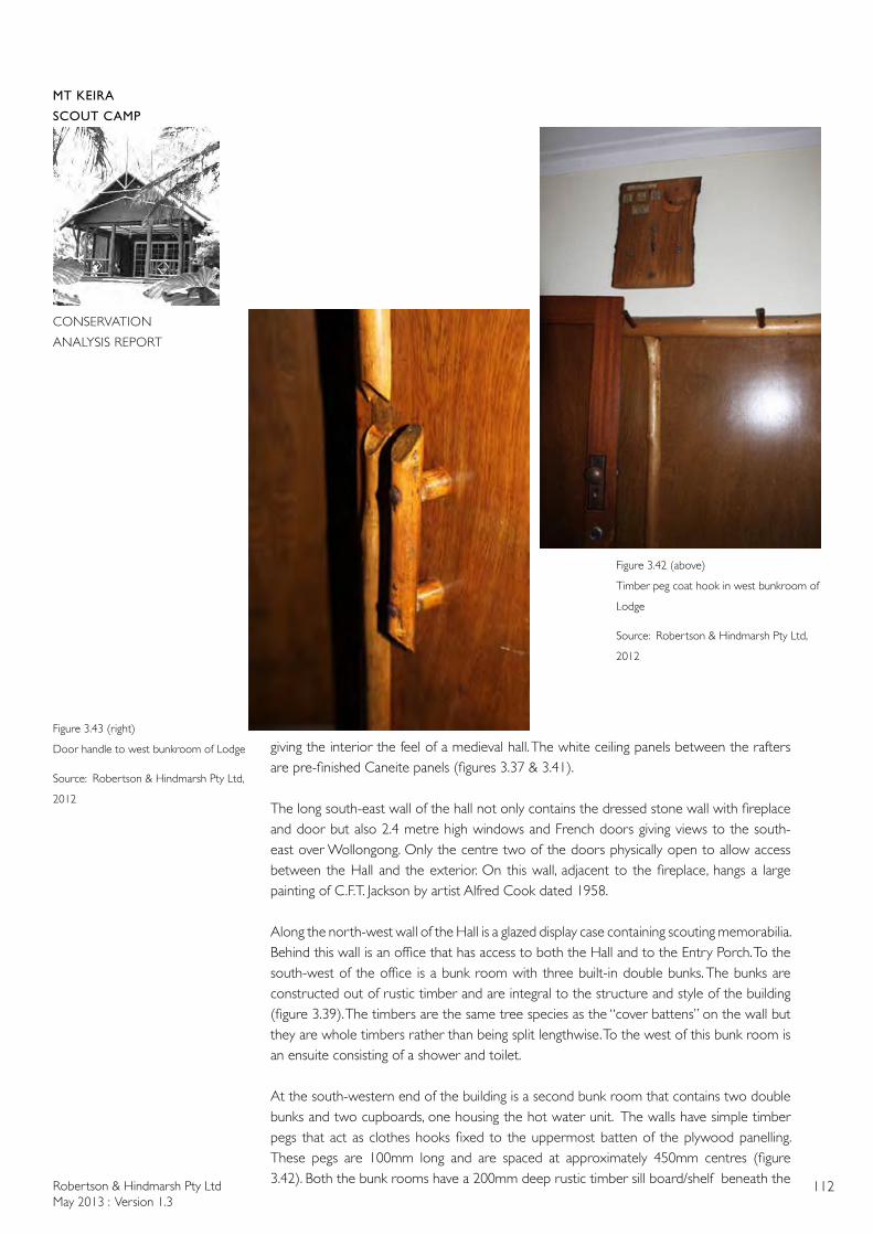
Robertson & Hindmarsh Pty LtdMay 2013 : Version 1.3
112
MT KEIRA
SCOUT CAMP
CONSERVATION
ANALYSIS REPORT
giving the interior the feel of a medieval hall. The white ceiling panels between the rafters are pre-finished Caneite panels (figures 3.37 & 3.41).
The long south-east wall of the hall not only contains the dressed stone wall with fireplace and door but also 2.4 metre high windows and French doors giving views to the south-east over Wollongong. Only the centre two of the doors physically open to allow access between the Hall and the exterior. On this wall, adjacent to the fireplace, hangs a large painting of C.F.T. Jackson by artist Alfred Cook dated 1958.
Along the north-west wall of the Hall is a glazed display case containing scouting memorabilia. Behind this wall is an office that has access to both the Hall and to the Entry Porch. To the south-west of the office is a bunk room with three built-in double bunks. The bunks are constructed out of rustic timber and are integral to the structure and style of the building (figure 3.39). The timbers are the same tree species as the “cover battens” on the wall but they are whole timbers rather than being split lengthwise. To the west of this bunk room is an ensuite consisting of a shower and toilet.
At the south-western end of the building is a second bunk room that contains two double bunks and two cupboards, one housing the hot water unit. The walls have simple timber pegs that act as clothes hooks fixed to the uppermost batten of the plywood panelling. These pegs are 100mm long and are spaced at approximately 450mm centres (figure 3.42). Both the bunk rooms have a 200mm deep rustic timber sill board/shelf beneath the
Figure 3.43 (right)
Door handle to west bunkroom of Lodge
Source: Robertson & Hindmarsh Pty Ltd,
2012
Figure 3.42 (above)
Timber peg coat hook in west bunkroom of
Lodge
Source: Robertson & Hindmarsh Pty Ltd,
2012
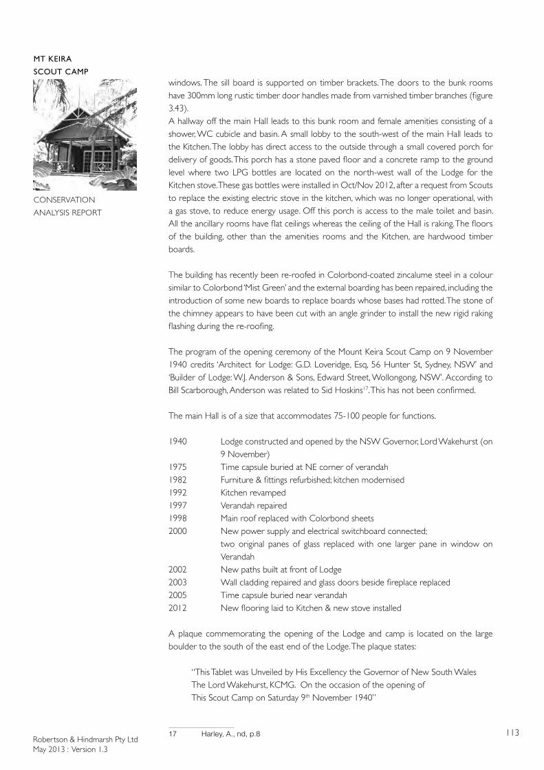
Robertson & Hindmarsh Pty LtdMay 2013 : Version 1.3
113
MT KEIRA
SCOUT CAMP
CONSERVATION
ANALYSIS REPORT
windows. The sill board is supported on timber brackets. The doors to the bunk rooms have 300mm long rustic timber door handles made from varnished timber branches (figure 3.43).A hallway off the main Hall leads to this bunk room and female amenities consisting of a shower, WC cubicle and basin. A small lobby to the south-west of the main Hall leads to the Kitchen. The lobby has direct access to the outside through a small covered porch for delivery of goods. This porch has a stone paved floor and a concrete ramp to the ground level where two LPG bottles are located on the north-west wall of the Lodge for the Kitchen stove. These gas bottles were installed in Oct/Nov 2012, after a request from Scouts to replace the existing electric stove in the kitchen, which was no longer operational, with a gas stove, to reduce energy usage. Off this porch is access to the male toilet and basin. All the ancillary rooms have flat ceilings whereas the ceiling of the Hall is raking. The floors of the building, other than the amenities rooms and the Kitchen, are hardwood timber boards.
The building has recently been re-roofed in Colorbond-coated zincalume steel in a colour similar to Colorbond ‘Mist Green’ and the external boarding has been repaired, including the introduction of some new boards to replace boards whose bases had rotted. The stone of the chimney appears to have been cut with an angle grinder to install the new rigid raking flashing during the re-roofing.
The program of the opening ceremony of the Mount Keira Scout Camp on 9 November 1940 credits ‘Architect for Lodge: G.D. Loveridge, Esq, 56 Hunter St, Sydney, NSW’ and ‘Builder of Lodge: W.J. Anderson & Sons, Edward Street, Wollongong, NSW’. According to Bill Scarborough, Anderson was related to Sid Hoskins17. This has not been confirmed.
The main Hall is of a size that accommodates 75-100 people for functions.
1940 Lodge constructed and opened by the NSW Governor, Lord Wakehurst (on 9 November)
1975 Time capsule buried at NE corner of verandah1982 Furniture & fittings refurbished; kitchen modernised1992 Kitchen revamped1997 Verandah repaired1998 Main roof replaced with Colorbond sheets2000 New power supply and electrical switchboard connected; two original panes of glass replaced with one larger pane in window on
Verandah2002 New paths built at front of Lodge2003 Wall cladding repaired and glass doors beside fireplace replaced2005 Time capsule buried near verandah2012 New flooring laid to Kitchen & new stove installed
A plaque commemorating the opening of the Lodge and camp is located on the large boulder to the south of the east end of the Lodge. The plaque states:
“This Tablet was Unveiled by His Excellency the Governor of New South Wales The Lord Wakehurst, KCMG. On the occasion of the opening of This Scout Camp on Saturday 9th November 1940”
17 Harley, A., nd, p.8
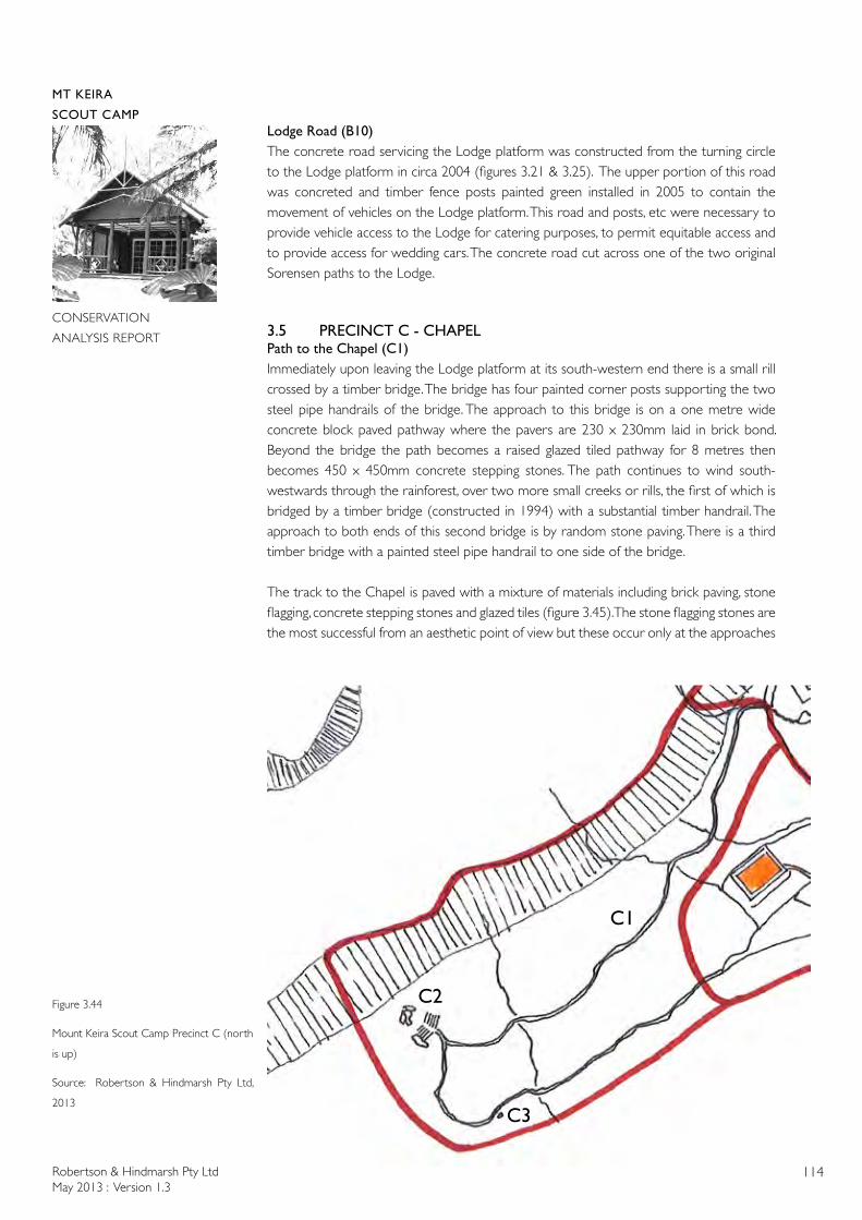
Robertson & Hindmarsh Pty LtdMay 2013 : Version 1.3
114
MT KEIRA
SCOUT CAMP
CONSERVATION
ANALYSIS REPORT
Lodge Road (B10)The concrete road servicing the Lodge platform was constructed from the turning circle to the Lodge platform in circa 2004 (figures 3.21 & 3.25). The upper portion of this road was concreted and timber fence posts painted green installed in 2005 to contain the movement of vehicles on the Lodge platform. This road and posts, etc were necessary to provide vehicle access to the Lodge for catering purposes, to permit equitable access and to provide access for wedding cars. The concrete road cut across one of the two original Sorensen paths to the Lodge.
3.5 PRECINCT C - CHAPELPath to the Chapel (C1)Immediately upon leaving the Lodge platform at its south-western end there is a small rill crossed by a timber bridge. The bridge has four painted corner posts supporting the two steel pipe handrails of the bridge. The approach to this bridge is on a one metre wide concrete block paved pathway where the pavers are 230 x 230mm laid in brick bond. Beyond the bridge the path becomes a raised glazed tiled pathway for 8 metres then becomes 450 x 450mm concrete stepping stones. The path continues to wind south-westwards through the rainforest, over two more small creeks or rills, the first of which is bridged by a timber bridge (constructed in 1994) with a substantial timber handrail. The approach to both ends of this second bridge is by random stone paving. There is a third timber bridge with a painted steel pipe handrail to one side of the bridge.
The track to the Chapel is paved with a mixture of materials including brick paving, stone flagging, concrete stepping stones and glazed tiles (figure 3.45). The stone flagging stones are the most successful from an aesthetic point of view but these occur only at the approaches
C1
C2
C3
Figure 3.44
Mount Keira Scout Camp Precinct C (north
is up)
Source: Robertson & Hindmarsh Pty Ltd,
2013
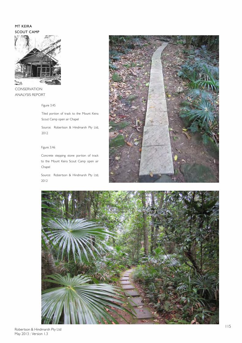
Robertson & Hindmarsh Pty LtdMay 2013 : Version 1.3
115
MT KEIRA
SCOUT CAMP
CONSERVATION
ANALYSIS REPORT
Figure 3.45
Tiled portion of track to the Mount Keira
Scout Camp open air Chapel
Source: Robertson & Hindmarsh Pty Ltd,
2012
Figure 3.46
Concrete stepping stone portion of track
to the Mount Keira Scout Camp open air
Chapel
Source: Robertson & Hindmarsh Pty Ltd,
2012
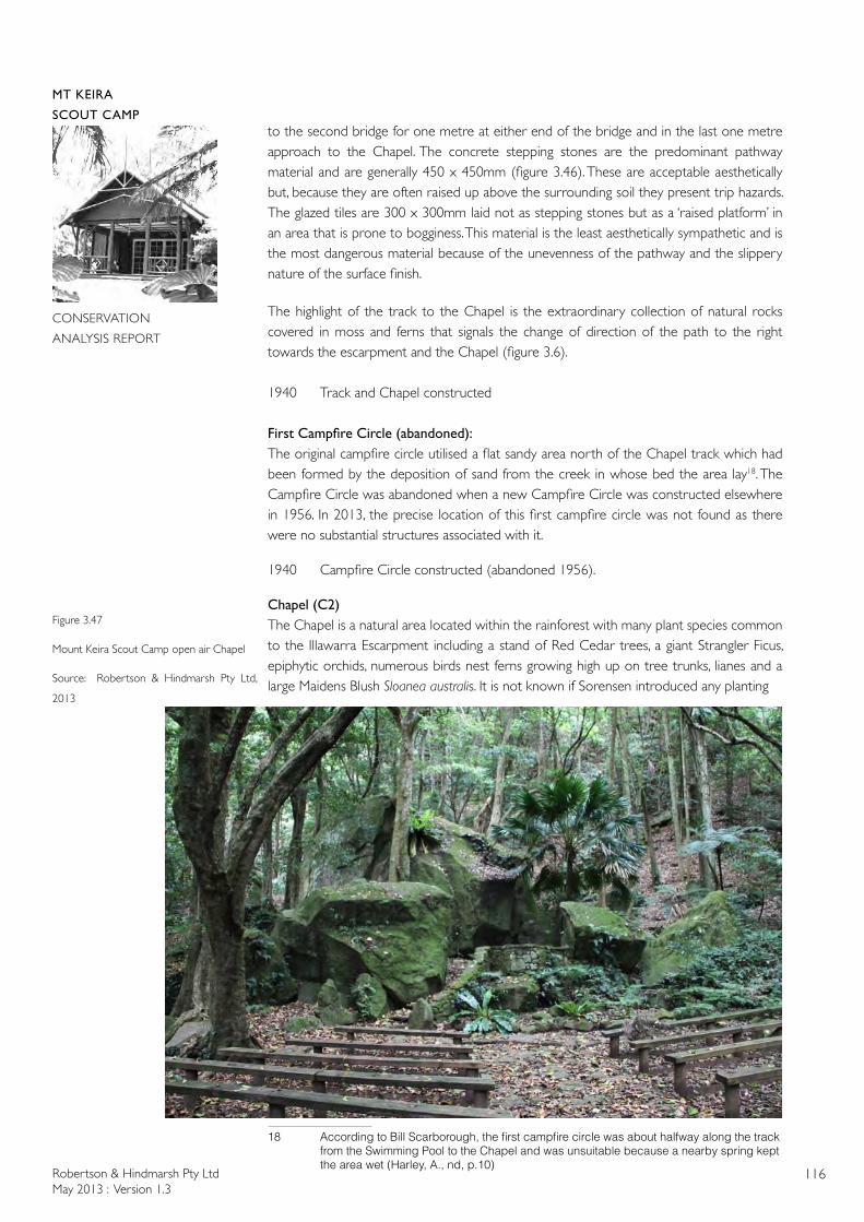
Robertson & Hindmarsh Pty LtdMay 2013 : Version 1.3
116
MT KEIRA
SCOUT CAMP
CONSERVATION
ANALYSIS REPORT
to the second bridge for one metre at either end of the bridge and in the last one metre approach to the Chapel. The concrete stepping stones are the predominant pathway material and are generally 450 x 450mm (figure 3.46). These are acceptable aesthetically but, because they are often raised up above the surrounding soil they present trip hazards. The glazed tiles are 300 x 300mm laid not as stepping stones but as a ‘raised platform’ in an area that is prone to bogginess. This material is the least aesthetically sympathetic and is the most dangerous material because of the unevenness of the pathway and the slippery nature of the surface finish.
The highlight of the track to the Chapel is the extraordinary collection of natural rocks covered in moss and ferns that signals the change of direction of the path to the right towards the escarpment and the Chapel (figure 3.6).
1940 Track and Chapel constructed
FirstCampfireCircle(abandoned):The original campfire circle utilised a flat sandy area north of the Chapel track which had been formed by the deposition of sand from the creek in whose bed the area lay18. The Campfire Circle was abandoned when a new Campfire Circle was constructed elsewhere in 1956. In 2013, the precise location of this first campfire circle was not found as there were no substantial structures associated with it.
1940 Campfire Circle constructed (abandoned 1956).
Chapel (C2)The Chapel is a natural area located within the rainforest with many plant species common to the Illawarra Escarpment including a stand of Red Cedar trees, a giant Strangler Ficus, epiphytic orchids, numerous birds nest ferns growing high up on tree trunks, lianes and a large Maidens Blush Sloanea australis. It is not known if Sorensen introduced any planting
18 AccordingtoBillScarborough,thefirstcampfirecirclewasabouthalfwayalongthetrack fromtheSwimmingPooltotheChapelandwasunsuitablebecauseanearbyspringkept theareawet(Harley,A.,nd,p.10)
Figure 3.47
Mount Keira Scout Camp open air Chapel
Source: Robertson & Hindmarsh Pty Ltd,
2013
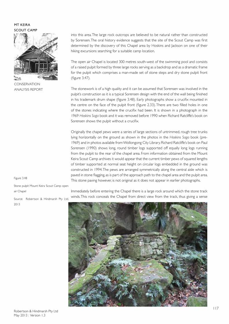
Robertson & Hindmarsh Pty LtdMay 2013 : Version 1.3
117
MT KEIRA
SCOUT CAMP
CONSERVATION
ANALYSIS REPORT
into this area. The large rock outcrops are believed to be natural rather than constructed by Sorensen. The oral history evidence suggests that the site of the Scout Camp was first determined by the discovery of this Chapel area by Hoskins and Jackson on one of their hiking excursions searching for a suitable camp location.
The open air Chapel is located 300 metres south-west of the swimming pool and consists of a raised pulpit formed by three large rocks serving as a backdrop and as a dramatic frame for the pulpit which comprises a man-made set of stone steps and dry stone pulpit front (figure 3.47).
The stonework is of a high quality and it can be assumed that Sorensen was involved in the pulpit’s construction as it is a typical Sorensen design with the end of the wall being finished in his trademark drum shape (figure 3.48). Early photographs show a crucifix mounted in the centre on the face of the pulpit front (figure 2.33). There are two filled holes in one of the stones indicating where the crucifix had been. It is shown in a photograph in the 1969 Hoskins Saga book and it was removed before 1990 when Richard Ratcliffe’s book on Sorensen shows the pulpit without a crucifix.
Originally the chapel pews were a series of large sections of untrimmed, rough tree trunks lying horizontally on the ground as shown in the photos in the Hoskins Saga book (pre-1969) and in photos available from Wollongong City Library. Richard Ratcliffe’s book on Paul Sorensen (1990) shows long, round timber logs supported off equally long logs running from the pulpit to the rear of the chapel area. From information obtained from the Mount Keira Scout Camp archives it would appear that the current timber pews of squared lengths of timber supported at normal seat height on circular logs embedded in the ground was constructed in 1994. The pews are arranged symmetrically along the central aisle which is paved in stone flagging, as is part of the approach path to the chapel area and the pulpit area. This stone paving however, is not original as it does not appear in earlier photographs.
Immediately before entering the Chapel there is a large rock around which the stone track winds. This rock conceals the Chapel from direct view from the track, thus giving a sense
Figure 3.48
Stone pulpit Mount Keira Scout Camp open
air Chapel
Source: Robertson & Hindmarsh Pty Ltd,
2013
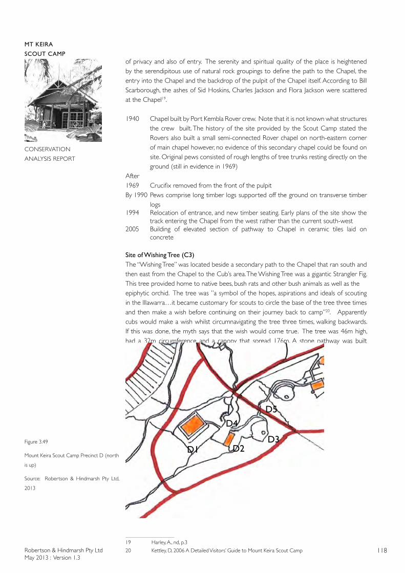
Robertson & Hindmarsh Pty LtdMay 2013 : Version 1.3
118
MT KEIRA
SCOUT CAMP
CONSERVATION
ANALYSIS REPORT
of privacy and also of entry. The serenity and spiritual quality of the place is heightened by the serendipitous use of natural rock groupings to define the path to the Chapel, the entry into the Chapel and the backdrop of the pulpit of the Chapel itself. According to Bill Scarborough, the ashes of Sid Hoskins, Charles Jackson and Flora Jackson were scattered at the Chapel19.
1940 Chapel built by Port Kembla Rover crew. Note that it is not known what structures the crew built. The history of the site provided by the Scout Camp stated the Rovers also built a small semi-connected Rover chapel on north-eastern corner of main chapel however, no evidence of this secondary chapel could be found on site. Original pews consisted of rough lengths of tree trunks resting directly on the ground (still in evidence in 1969)
After 1969 Crucifix removed from the front of the pulpitBy 1990 Pews comprise long timber logs supported off the ground on transverse timber
logs1994 Relocation of entrance, and new timber seating. Early plans of the site show the
track entering the Chapel from the west rather than the current south-west2005 Building of elevated section of pathway to Chapel in ceramic tiles laid on
concrete
Site of Wishing Tree (C3)The “Wishing Tree” was located beside a secondary path to the Chapel that ran south and then east from the Chapel to the Cub’s area. The Wishing Tree was a gigantic Strangler Fig. This tree provided home to native bees, bush rats and other bush animals as well as theepiphytic orchid. The tree was ”a symbol of the hopes, aspirations and ideals of scouting in the Illawarra…it became customary for scouts to circle the base of the tree three times and then make a wish before continuing on their journey back to camp”20. Apparently cubs would make a wish whilst circumnavigating the tree three times, walking backwards. If this was done, the myth says that the wish would come true. The tree was 46m high, had a 32m circumference and a canopy that spread 176m. A stone pathway was built circumnavigating
19 Harley, A., nd, p.3
20 Kettley, D, 2006 A Detailed Visitors’ Guide to Mount Keira Scout Camp
Figure 3.49
Mount Keira Scout Camp Precinct D (north
is up)
Source: Robertson & Hindmarsh Pty Ltd,
2013
D1D3
D4
D2
D5
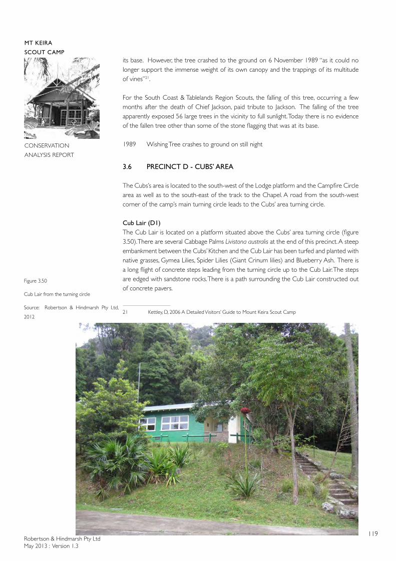
Robertson & Hindmarsh Pty LtdMay 2013 : Version 1.3
119
MT KEIRA
SCOUT CAMP
CONSERVATION
ANALYSIS REPORT
its base. However, the tree crashed to the ground on 6 November 1989 “as it could no longer support the immense weight of its own canopy and the trappings of its multitude of vines”21.
For the South Coast & Tablelands Region Scouts, the falling of this tree, occurring a few months after the death of Chief Jackson, paid tribute to Jackson. The falling of the tree apparently exposed 56 large trees in the vicinity to full sunlight. Today there is no evidence of the fallen tree other than some of the stone flagging that was at its base.
1989 Wishing Tree crashes to ground on still night
3.6 PRECINCT D - CUBS’ AREA
The Cubs’s area is located to the south-west of the Lodge platform and the Campfire Circle area as well as to the south-east of the track to the Chapel. A road from the south-west corner of the camp’s main turning circle leads to the Cubs’ area turning circle.
Cub Lair (D1)The Cub Lair is located on a platform situated above the Cubs’ area turning circle (figure 3.50). There are several Cabbage Palms Livistona australis at the end of this precinct. A steep embankment between the Cubs’ Kitchen and the Cub Lair has been turfed and planted with native grasses, Gymea Lilies, Spider Lilies (Giant Crinum lilies) and Blueberry Ash. There is a long flight of concrete steps leading from the turning circle up to the Cub Lair. The steps are edged with sandstone rocks. There is a path surrounding the Cub Lair constructed out of concrete pavers.
21 Kettley, D, 2006 A Detailed Visitors’ Guide to Mount Keira Scout Camp
Figure 3.50
Cub Lair from the turning circle
Source: Robertson & Hindmarsh Pty Ltd,
2012
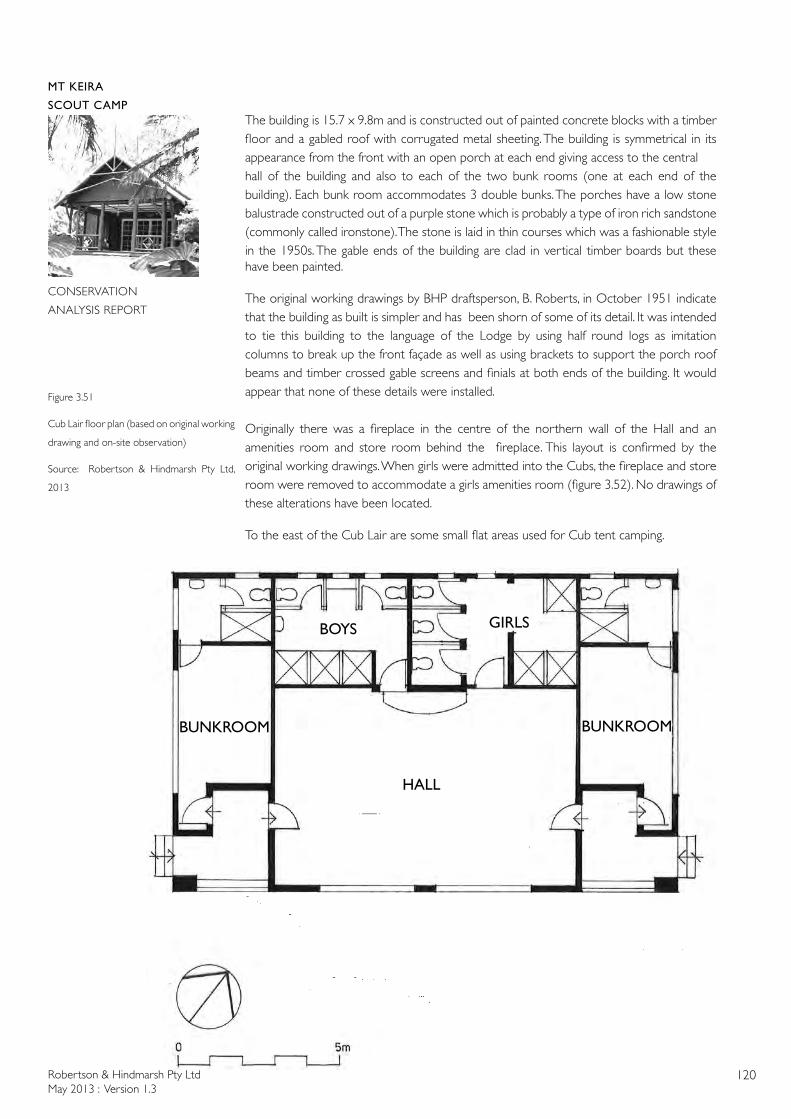
Robertson & Hindmarsh Pty LtdMay 2013 : Version 1.3
120
MT KEIRA
SCOUT CAMP
CONSERVATION
ANALYSIS REPORT
The building is 15.7 x 9.8m and is constructed out of painted concrete blocks with a timber floor and a gabled roof with corrugated metal sheeting. The building is symmetrical in its appearance from the front with an open porch at each end giving access to the centralhall of the building and also to each of the two bunk rooms (one at each end of the building). Each bunk room accommodates 3 double bunks. The porches have a low stone balustrade constructed out of a purple stone which is probably a type of iron rich sandstone (commonly called ironstone). The stone is laid in thin courses which was a fashionable style in the 1950s. The gable ends of the building are clad in vertical timber boards but these have been painted.
The original working drawings by BHP draftsperson, B. Roberts, in October 1951 indicate that the building as built is simpler and has been shorn of some of its detail. It was intended to tie this building to the language of the Lodge by using half round logs as imitation columns to break up the front façade as well as using brackets to support the porch roof beams and timber crossed gable screens and finials at both ends of the building. It would appear that none of these details were installed.
Originally there was a fireplace in the centre of the northern wall of the Hall and an amenities room and store room behind the fireplace. This layout is confirmed by the original working drawings. When girls were admitted into the Cubs, the fireplace and storeroom were removed to accommodate a girls amenities room (figure 3.52). No drawings of these alterations have been located.
To the east of the Cub Lair are some small flat areas used for Cub tent camping.
Figure 3.51
Cub Lair floor plan (based on original working
drawing and on-site observation)
Source: Robertson & Hindmarsh Pty Ltd,
2013
HALL
BUNKROOMBUNKROOM
BOYS GIRLS
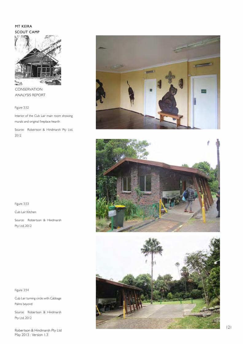
Robertson & Hindmarsh Pty LtdMay 2013 : Version 1.3
121
MT KEIRA
SCOUT CAMP
CONSERVATION
ANALYSIS REPORT
Figure 3.52
Interior of the Cub Lair main room showing
murals and original fireplace hearth
Source: Robertson & Hindmarsh Pty Ltd,
2012
Figure 3.53
Cub Lair Kitchen
Source: Robertson & Hindmarsh
Pty Ltd, 2012
Figure 3.54
Cub Lair turning circle with Cabbage
Palms beyond
Source: Robertson & Hindmarsh
Pty Ltd, 2012
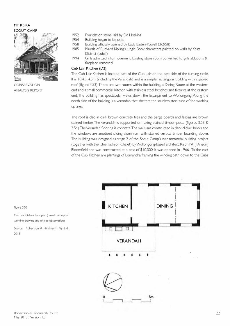
Robertson & Hindmarsh Pty LtdMay 2013 : Version 1.3
122
MT KEIRA
SCOUT CAMP
CONSERVATION
ANALYSIS REPORT
1952 Foundation stone laid by Sid Hoskins1954 Building began to be used1958 Building officially opened by Lady Baden-Powell (3/2/58)1985 Murals of Rudyard Kipling’s Jungle Book characters painted on walls by Keira District (cubs?)1994 Girls admitted into movement. Existing store room converted to girls ablutions & fireplace removedCub Lair Kitchen (D2)The Cub Lair Kitchen is located east of the Cub Lair on the east side of the turning circle. It is 10.4 x 4.5m (including the Verandah) and is a simple rectangular building with a gabled roof (figure 3.53). There are two rooms within the building, a Dining Room at the western end and a small commercial Kitchen with stainless steel benches and fixtures at the eastern end. The building has spectacular views down the Escarpment to Wollongong. Along the north side of the building is a verandah that shelters the stainless steel tubs of the washing up area.
The roof is clad in dark brown concrete tiles and the barge boards and fascias are brown stained timber. The verandah is supported on raking stained timber posts (figures 3.53 & 3.54). The Verandah flooring is concrete. The walls are constructed in dark clinker bricks and the windows are anodised sliding aluminium with stained vertical timber boarding above. The building was designed as stage 2 of the Scout Camp’s war memorial building project (together with the Chief Jackson Chalet) by Wollongong-based architect, Ralph I’A. [I’Anson] Bloomfield and was constructed at a cost of $10,000. It was opened in 1966. To the east of the Cub Kitchen are plantings of Lomandra framing the winding path down to the Cubs
Figure 3.55
Cub Lair Kitchen floor plan (based on original
working drawing and on-site observation)
Source: Robertson & Hindmarsh Pty Ltd,
2013
DININGKITCHEN
VERANDAH
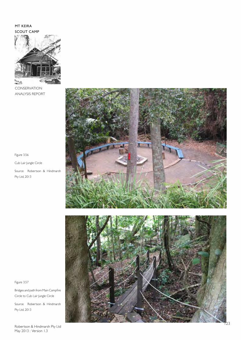
Robertson & Hindmarsh Pty LtdMay 2013 : Version 1.3
123
MT KEIRA
SCOUT CAMP
CONSERVATION
ANALYSIS REPORT
Figure 3.56
Cub Lair Jungle Circle
Source: Robertson & Hindmarsh
Pty Ltd, 2013
Figure 3.57
Bridges and path from Main Campfire
Circle to Cub Lair Jungle Circle
Source: Robertson & Hindmarsh
Pty Ltd, 2013
Robertson & Hindmarsh Pty LtdMay 2013 : Version 1.3
124
MT KEIRA
SCOUT CAMP
CONSERVATION
ANALYSIS REPORT
Jungle (Campfire) Circle and the path and bridges leading on to the Main Campfire Circle.
1966 Building opened 1998 Outdoor washing up area installed2000 Kitchen upgraded2002 Roof repaired, brickwork repointed, building repainted
Cub Lair Jungle Circle (D3)The Cub Lair Jungle (or Campfire) Circle (figure 3.56) is located east of the Cub Lair Kitchen. The Cubs’ campfire circle is a flat crushed gravel circular area containing a central brick fire pit of hexagonal shape. Surrounding the firepit are timber seats made from painted planks that are fixed to timber stumps.
1971 Cub circle built1987 Seating erected1993 Firebrick base built for fires2005 New seating, lighting, and paved access path constructed
Cubs’ Area turning circle, access road and road bridge (D4)The Cubs’ area turning circle is located to the north-west of the Lair Kitchen and south of the Cub Lair. It is paved with concrete and the bitumen access road crosses the creek to the east of the Cubs’ Area on a concrete piped culvert. It would appear that the road was constructed to permit the construction of the Cub Lair in 1952-54. This area is a designated Emergency Assembly Area.
1951 Road and turning circle constructed
Cubs’AreafootpathtotheCampfireCircle(D5)From the Cub Lair Kitchen a concrete paved path leads down across the creek to the east of the Cubs’ Area to the Campfire Circle. The pavers are 230 x 230mm. The pathway crosses over two creeks with two narrow timber planked bridges (figure 2.57). The planks are supported on galvanised angles that are fixed to timber posts. The handrails are rope
Figure 3.58
Mount Keira Scout Camp Precinct E (north
is up)
Source: Robertson & Hindmarsh Pty Ltd,
2013 E3
E4
E6
E7E8
E2
E5E1
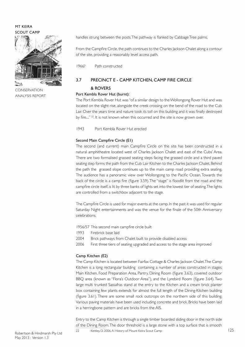
Robertson & Hindmarsh Pty LtdMay 2013 : Version 1.3
125
MT KEIRA
SCOUT CAMP
CONSERVATION
ANALYSIS REPORT
handles strung between the posts. The pathway is flanked by Cabbage Tree palms.
From the Campfire Circle, the path continues to the Charles Jackson Chalet along a contour of the site, providing a reasonably level access path.
1966? Path constructed
3.7 PRECINCT E - CAMP KITCHEN, CAMP FIRE CIRCLE
& ROVERSPort Kembla Rover Hut (burnt):The Port Kembla Rover Hut was “of a similar design to the Wollongong Rover Hut and was located on the slight rise, alongside the creek crossing on the bend of the road to the Cub Lair. Over the years time and nature took its toll on this building and it was finally destroyed by fire....” 22. It is not known when this occurred and the site is now grown over.
1943 Port Kembla Rover Hut erected
SecondMainCampfireCircle(E1)The second (and current) main Campfire Circle on the site has been constructed in a natural amphitheatre located west of Charles Jackson Chalet and east of the Cubs’ Area. There are two formalised grassed seating steps facing the grassed circle and a third paved seating step forms the path from the Cub Lair Kitchen to the Charles Jackson Chalet. Behind the path the grassed slope continues up to the main camp road providing extra seating. The audience has a panoramic view over Wollongong to the Pacific Ocean. Towards the back of the circle is a camp fire (figure 3.59). The “stage” is floodlit from the road and the campfire circle itself, is lit by three banks of lights set into the lowest tier of seating. The lights are controlled from a switchbox adjacent to the stage.
The Campfire Circle is used for major events at the camp. In the past it was used for regular Saturday Night entertainments and was the venue for the finale of the 50th Anniversary celebrations.
1956/57 This second main campfire circle built1993 Firebrick base laid2004 Brick pathways from Chalet built to provide disabled access 2006 First three tiers of seating upgraded and access to the stage area improved
Camp Kitchen (E2)The Camp Kitchen is located between Fairfax Cottage & Charles Jackson Chalet. The Camp Kitchen is a long rectangular building containing a number of areas constructed in stages; Main Kitchen, Food Preparation Area, Pantry, Dining Room (figure 3.63), covered outdoor BBQ area (known as “Flora’s Outdoor Area”), and the Lyrebird Room (figure 3.64). Two large multi trunked Sassafras stand at the entry to the Kitchen and a cream brick planter box containing few plants extends for almost the full length of the Dining-Kitchen building (figure 3.61). There are some small rock outcrops on the northern side of this building. Various paving materials have been used including concrete and brick. Bricks have been laid in a herringbone pattern and are bricks from the AIS.
Entry to the Camp Kitchen is through a single timber boarded sliding door in the north side of the Dining Room. The door threshold is a large stone with a top surface that is smooth 22 Kettley, D. 2006, A History of Mount Keira Scout Camp
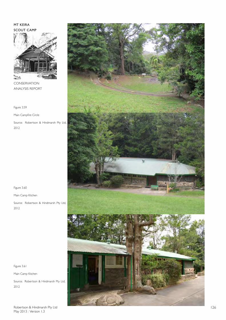
Robertson & Hindmarsh Pty LtdMay 2013 : Version 1.3
126
MT KEIRA
SCOUT CAMP
CONSERVATION
ANALYSIS REPORT
Figure 3.59
Main Campfire Circle
Source: Robertson & Hindmarsh Pty Ltd,
2012
Figure 3.60
Main Camp Kitchen
Source: Robertson & Hindmarsh Pty Ltd,
2012
Figure 3.61
Main Camp Kitchen
Source: Robertson & Hindmarsh Pty Ltd,
2012
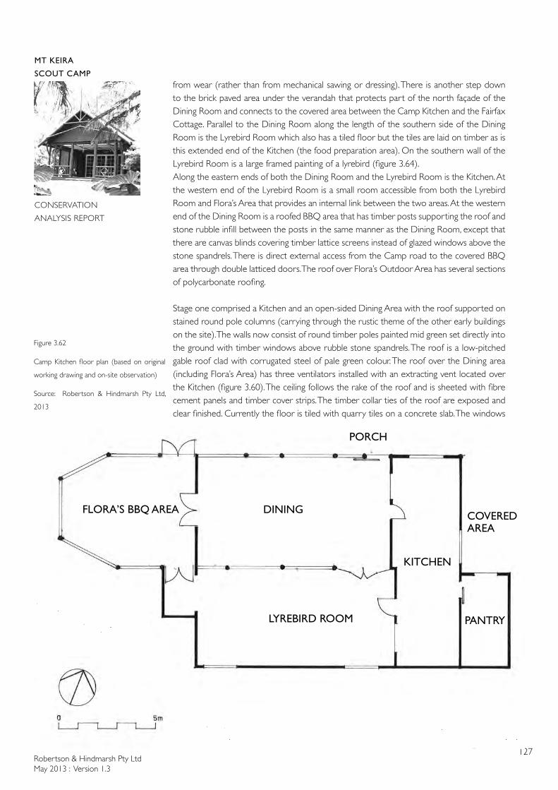
Robertson & Hindmarsh Pty LtdMay 2013 : Version 1.3
127
MT KEIRA
SCOUT CAMP
CONSERVATION
ANALYSIS REPORT
from wear (rather than from mechanical sawing or dressing). There is another step down to the brick paved area under the verandah that protects part of the north façade of the Dining Room and connects to the covered area between the Camp Kitchen and the Fairfax Cottage. Parallel to the Dining Room along the length of the southern side of the Dining Room is the Lyrebird Room which also has a tiled floor but the tiles are laid on timber as is this extended end of the Kitchen (the food preparation area). On the southern wall of the Lyrebird Room is a large framed painting of a lyrebird (figure 3.64). Along the eastern ends of both the Dining Room and the Lyrebird Room is the Kitchen. At the western end of the Lyrebird Room is a small room accessible from both the Lyrebird Room and Flora’s Area that provides an internal link between the two areas. At the western end of the Dining Room is a roofed BBQ area that has timber posts supporting the roof and stone rubble infill between the posts in the same manner as the Dining Room, except that there are canvas blinds covering timber lattice screens instead of glazed windows above the stone spandrels. There is direct external access from the Camp road to the covered BBQ area through double latticed doors. The roof over Flora’s Outdoor Area has several sections of polycarbonate roofing.
Stage one comprised a Kitchen and an open-sided Dining Area with the roof supported on stained round pole columns (carrying through the rustic theme of the other early buildings on the site). The walls now consist of round timber poles painted mid green set directly into the ground with timber windows above rubble stone spandrels. The roof is a low-pitched gable roof clad with corrugated steel of pale green colour. The roof over the Dining area (including Flora’s Area) has three ventilators installed with an extracting vent located over the Kitchen (figure 3.60). The ceiling follows the rake of the roof and is sheeted with fibre cement panels and timber cover strips. The timber collar ties of the roof are exposed and clear finished. Currently the floor is tiled with quarry tiles on a concrete slab. The windows
Figure 3.62
Camp Kitchen floor plan (based on original
working drawing and on-site observation)
Source: Robertson & Hindmarsh Pty Ltd,
2013
DINING
KITCHEN
FLORA’S BBQ AREA
LYREBIRD ROOM PANTRY
COVERED AREA
PORCH
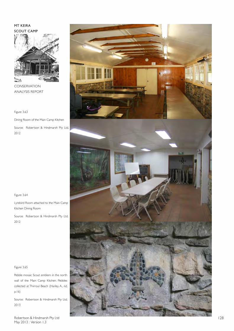
Robertson & Hindmarsh Pty LtdMay 2013 : Version 1.3
128
MT KEIRA
SCOUT CAMP
CONSERVATION
ANALYSIS REPORT
Figure 3.63
Dining Room of the Main Camp Kitchen
Source: Robertson & Hindmarsh Pty Ltd,
2012
Figure 3.64
Lyrebird Room attached to the Main Camp
Kitchen Dining Room
Source: Robertson & Hindmarsh Pty Ltd,
2012
Figure 3.65
Pebble mosaic Scout emblem in the north
wall of the Main Camp Kitchen. Pebbles
collected at Thirroul Beach (Harley, A., nd,
p.16)
Source: Robertson & Hindmarsh Pty Ltd,
2013
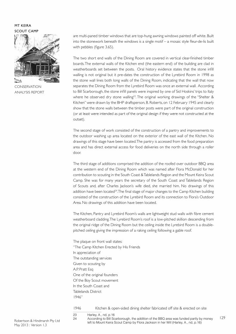
Robertson & Hindmarsh Pty LtdMay 2013 : Version 1.3
129
MT KEIRA
SCOUT CAMP
CONSERVATION
ANALYSIS REPORT
are multi-paned timber windows that are top-hung awning windows painted off white. Built into the stonework beneath the windows is a single motif – a mosaic style fleur-de-lis built with pebbles (figure 3.65).
The two short end walls of the Dining Room are covered in vertical clear-finished timber boards. The external walls of the Kitchen end (the eastern end) of the building are clad in weatherboards set between the posts. Oral history evidence states that the stone infill walling is not original but it pre-dates the construction of the Lyrebird Room in 1998 as the stone wall lines both long walls of the Dining Room, indicating that the wall that now separates the Dining Room from the Lyrebird Room was once an external wall. According to Bill Scarborough, the stone infill panels were inspired by one of Sid Hoskins’ trips to Italy where he observed dry stone walling23. The original working drawings of the “Shelter & Kitchen” were drawn by the BHP draftsperson, B. Roberts, on 12 February 1945 and clearly show that the stone walls between the timber posts were part of the original construction (or at least were intended as part of the original design if they were not constructed at the outset).
The second stage of work consisted of the construction of a pantry and improvements to the outdoor washing up area located on the exterior of the east wall of the Kitchen. No drawings of this stage have been located. The pantry is accessed from the food preparation area and has direct external access for food deliveries on the north side through a roller door.
The third stage of additions comprised the addition of the roofed over outdoor BBQ area at the western end of the Dining Room which was named after Flora McDonald for her contribution to scouting in the South Coast & Tablelands Region and the Mount Keira Scout Camp. She was for many years the secretary of the South Coast and Tablelands Region of Scouts and, after Charles Jackson’s wife died, she married him. No drawings of this addition have been located24. The final stage of major changes to the Camp Kitchen building consisted of the construction of the Lyrebird Room and its connection to Flora’s Outdoor Area. No drawings of this addition have been located.
The Kitchen, Pantry and Lyrebird Room’s walls are lightweight stud walls with fibre cement weatherboard cladding. The Lyrebird Room’s roof is a low-pitched skillion descending from the original ridge of the Dining Room but the ceiling inside the Lyrebird Room is a double-pitched ceiling giving the impression of a raking ceiling following a gable roof.
The plaque on front wall states:“The Camp Kitchen Erected by His Friends In appreciation ofThe outstanding servicesGiven to scouting byA.P. Pratt EsqOne of the original foundersOf the Boy Scout movementIn the South Coast andTablelands District1946”
1946 Kitchen & open-sided dining shelter fabricated off site & erected on site
23 Harley, A., nd, p.1624 AccordingtoBillScarborough,theadditionoftheBBQareawasfundedpartlybymoney lefttoMountKeiraScoutCampbyFloraJacksoninherWill(Harley,A.,nd,p.16)
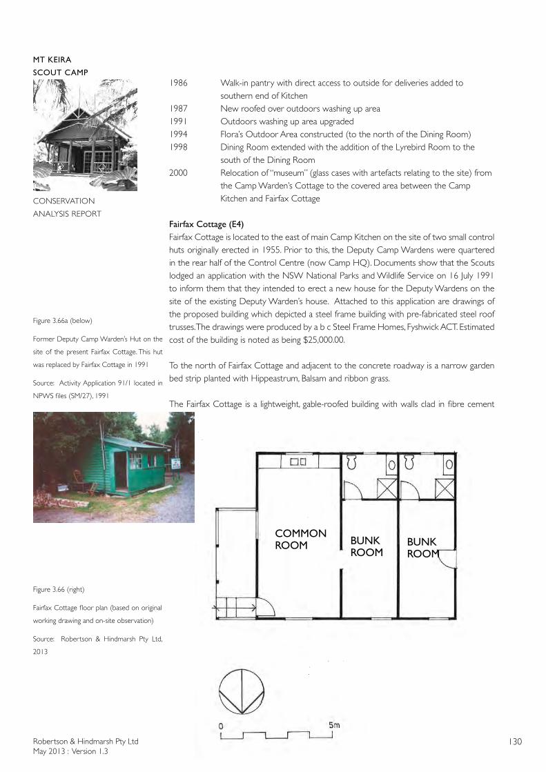
Robertson & Hindmarsh Pty LtdMay 2013 : Version 1.3
130
MT KEIRA
SCOUT CAMP
CONSERVATION
ANALYSIS REPORT
1986 Walk-in pantry with direct access to outside for deliveries added to southern end of Kitchen1987 New roofed over outdoors washing up area 1991 Outdoors washing up area upgraded1994 Flora’s Outdoor Area constructed (to the north of the Dining Room)1998 Dining Room extended with the addition of the Lyrebird Room to the south of the Dining Room2000 Relocation of “museum” (glass cases with artefacts relating to the site) from the Camp Warden’s Cottage to the covered area between the Camp Kitchen and Fairfax Cottage
Fairfax Cottage (E4)Fairfax Cottage is located to the east of main Camp Kitchen on the site of two small control huts originally erected in 1955. Prior to this, the Deputy Camp Wardens were quartered in the rear half of the Control Centre (now Camp HQ). Documents show that the Scouts lodged an application with the NSW National Parks and Wildlife Service on 16 July 1991 to inform them that they intended to erect a new house for the Deputy Wardens on the site of the existing Deputy Warden’s house. Attached to this application are drawings of the proposed building which depicted a steel frame building with pre-fabricated steel roof trusses. The drawings were produced by a b c Steel Frame Homes, Fyshwick ACT. Estimated cost of the building is noted as being $25,000.00.
To the north of Fairfax Cottage and adjacent to the concrete roadway is a narrow garden bed strip planted with Hippeastrum, Balsam and ribbon grass.
The Fairfax Cottage is a lightweight, gable-roofed building with walls clad in fibre cement
Figure 3.66 (right)
Fairfax Cottage floor plan (based on original
working drawing and on-site observation)
Source: Robertson & Hindmarsh Pty Ltd,
2013
COMMON ROOM BUNK
ROOMBUNK ROOM
Figure 3.66a (below)
Former Deputy Camp Warden’s Hut on the
site of the present Fairfax Cottage. This hut
was replaced by Fairfax Cottage in 1991
Source: Activity Application 91/1 located in
NPWS files (SM/27), 1991
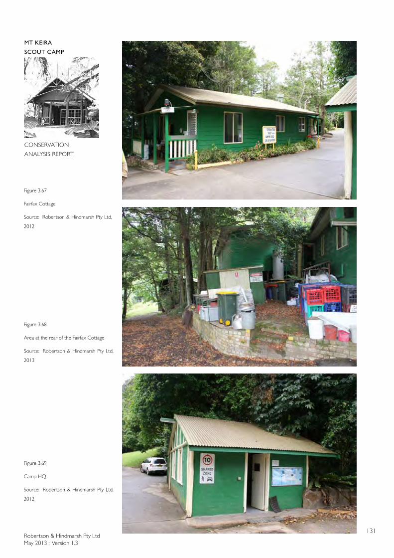
Robertson & Hindmarsh Pty LtdMay 2013 : Version 1.3
131
MT KEIRA
SCOUT CAMP
CONSERVATION
ANALYSIS REPORT
Figure 3.67
Fairfax Cottage
Source: Robertson & Hindmarsh Pty Ltd,
2012
Figure 3.68
Area at the rear of the Fairfax Cottage
Source: Robertson & Hindmarsh Pty Ltd,
2013
Figure 3.69
Camp HQ
Source: Robertson & Hindmarsh Pty Ltd,
2012

Robertson & Hindmarsh Pty LtdMay 2013 : Version 1.3
132
MT KEIRA
SCOUT CAMP
CONSERVATION
ANALYSIS REPORT
weatherboards (figure 3.67). It is 9 x 7.5m and painted mid green. The roof is olive green. There is a verandah on the east end of the building that has a polycarbonate roof. The windows are cream coloured aluminium sliding windows. The main part of the building is used for accommodating the Deputy Warden (rostered volunteer) who is on site as caretaker from 6pm Friday-6pm Sunday. This area houses a kitchenette, dining area and desk. Opening off this room is a bunk room with an ensuite bathroom.
At the west end of the building is another identical bunk room with ensuite ablutions facilities for the Camp cook. The Camp cook approaches this through a door that opens to the covered area linking the eastern end of the Camp Kitchen to Fairfax Cottage. At the rear of Fairfax Cottage is a raised brick paved area, originally built to provide an outdoor seating area but this area is currently used as a storage area for milk crates and garbage bins. The area is paved in fire bricks stamped ‘Vitrifax’ (figure 3.68).
1991 Donation by Vincent Fairfax Family Trust for construction of home for Deputy Camp Wardens and Cooks Quarters as part of the site’s 50th anniversary celebrations
1992 Fairfax Cottage officially opened by John B. Fairfax 21/3/92
Camp HQ/Control Centre (E3)The Camp Head Quarters building is located adjacent to the turning circle and opposite Fairfax Cottage. Overhanging foliage of a large Pittosporum Pittosporum undulatum rests on the roof of this building. To the west of this building are cliveas, and an Illawarra Flame Tree Brachychiton acerifolius. A Birds Nest Fern is located in a raised garden bed on the north-east of the building.
To the east of Camp HQ is a stone seat built into the rock retaining wall in 1992. Beyond the seat is another Illawarra Flame Tree, a large Brushbox Lophostemon confertus and a large moss covered boulder.
A plaque on the stone seat states:
“In recognition of significantimprovement to Mount Keira Scout Campby Illawarra Skills Development LtdSkillshare 1992”
Camp HQ is constructed of masonry and cement rendered on the outside face with round timber log corner posts and rustic external architraves to the windows and door (figure 3.69). The building is painted mid green and has an olive green corrugated metal roof. The windows are multipaned timber windows painted off white. The inside has been lined with plasterboard. The floor is a concrete slab. The addition to the rear was known as “Uncle Tom’s Cabin” and has a skillion roof and metal clad walls.
1944 Built to act as camp store & house electrical sub-board for that section of the camp
1992 Extended (“Uncle Tom’s Cabin”) at rear to store lawn mowers2003 Internal phone system upgraded (within Control Centre)2005 Building relined & converted to Office & Administration; consumable stores &
ground maintenance equipment store relocated to Training Hut

Robertson & Hindmarsh Pty LtdMay 2013 : Version 1.3
133
MT KEIRA
SCOUT CAMP
CONSERVATION
ANALYSIS REPORT
Figure 3.70
Charles Jackson Chalet floor plans (based
on original working drawing and on-site
observation)
Source: Robertson & Hindmarsh Pty Ltd,
2013
BUNK ROOM
BUNK ROOM
BUNK ROOM
BUNK ROOM
FEMALE MALE
VERANDAH
UPPER LEVEL
LOWER LEVEL
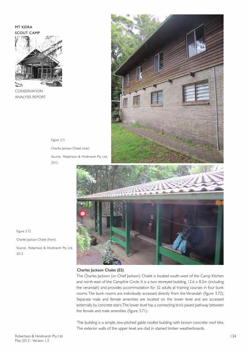
Robertson & Hindmarsh Pty LtdMay 2013 : Version 1.3
134
MT KEIRA
SCOUT CAMP
CONSERVATION
ANALYSIS REPORT
Figure 3.72
Charles Jackson Chalet (front)
Source: Robertson & Hindmarsh Pty Ltd,
2012
Figure 3.71
Charles Jackson Chalet (rear)
Source: Robertson & Hindmarsh Pty Ltd,
2012
Charles Jackson Chalet (E5)The Charles Jackson (or Chief Jackson) Chalet is located south-west of the Camp Kitchen and north-east of the Campfire Circle. It is a two storeyed building, 12.6 x 8.2m (including the verandah) and provides accommodation for 32 adults at training courses in four bunk rooms. The bunk rooms are individually accessed directly from the Verandah (figure 3.72). Separate male and female amenities are located on the lower level and are accessed externally by concrete stairs. The lower level has a connecting brick paved pathway between the female and male amenities (figure 3.71).
The building is a simple, low-pitched gable roofed building with brown concrete roof tiles. The exterior walls of the upper level are clad in stained timber weatherboards.
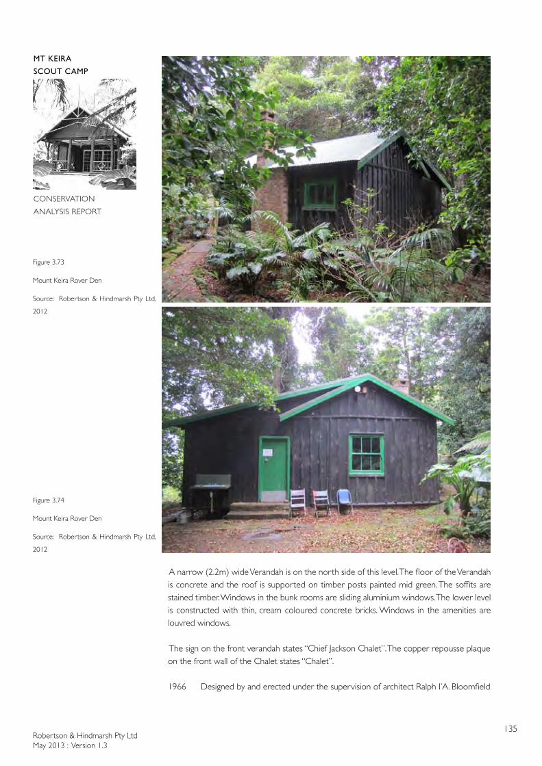
Robertson & Hindmarsh Pty LtdMay 2013 : Version 1.3
135
MT KEIRA
SCOUT CAMP
CONSERVATION
ANALYSIS REPORT
A narrow (2.2m) wide Verandah is on the north side of this level. The floor of the Verandah is concrete and the roof is supported on timber posts painted mid green. The soffits are stained timber. Windows in the bunk rooms are sliding aluminium windows. The lower level is constructed with thin, cream coloured concrete bricks. Windows in the amenities are louvred windows.
The sign on the front verandah states “Chief Jackson Chalet”. The copper repousse plaque on the front wall of the Chalet states “Chalet”.
1966 Designed by and erected under the supervision of architect Ralph I’A. Bloomfield
Figure 3.73
Mount Keira Rover Den
Source: Robertson & Hindmarsh Pty Ltd,
2012
Figure 3.74
Mount Keira Rover Den
Source: Robertson & Hindmarsh Pty Ltd,
2012
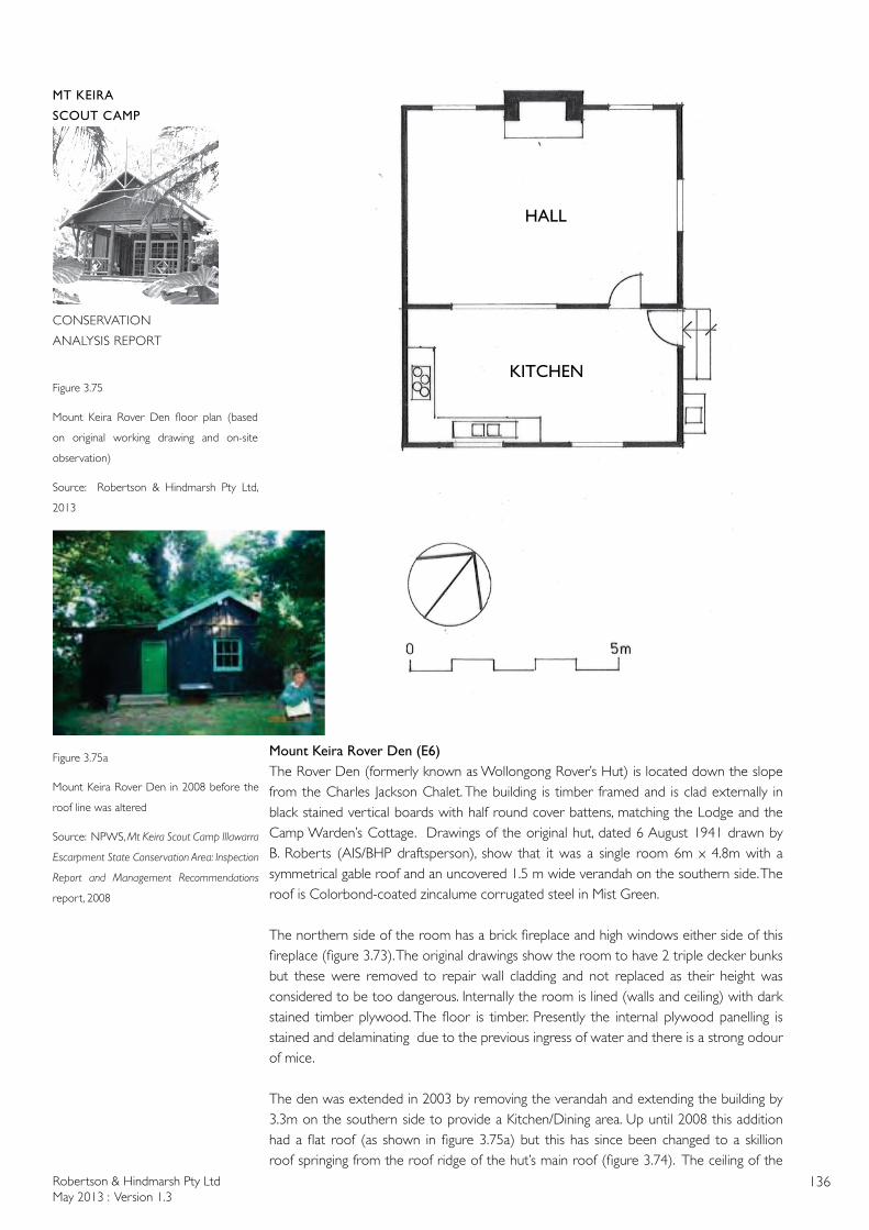
Robertson & Hindmarsh Pty LtdMay 2013 : Version 1.3
136
MT KEIRA
SCOUT CAMP
CONSERVATION
ANALYSIS REPORT
Mount Keira Rover Den (E6)The Rover Den (formerly known as Wollongong Rover’s Hut) is located down the slope from the Charles Jackson Chalet. The building is timber framed and is clad externally in black stained vertical boards with half round cover battens, matching the Lodge and the Camp Warden’s Cottage. Drawings of the original hut, dated 6 August 1941 drawn by B. Roberts (AIS/BHP draftsperson), show that it was a single room 6m x 4.8m with a symmetrical gable roof and an uncovered 1.5 m wide verandah on the southern side. The roof is Colorbond-coated zincalume corrugated steel in Mist Green.
The northern side of the room has a brick fireplace and high windows either side of this fireplace (figure 3.73). The original drawings show the room to have 2 triple decker bunks but these were removed to repair wall cladding and not replaced as their height was considered to be too dangerous. Internally the room is lined (walls and ceiling) with dark stained timber plywood. The floor is timber. Presently the internal plywood panelling is stained and delaminating due to the previous ingress of water and there is a strong odour of mice.
The den was extended in 2003 by removing the verandah and extending the building by 3.3m on the southern side to provide a Kitchen/Dining area. Up until 2008 this addition had a flat roof (as shown in figure 3.75a) but this has since been changed to a skillion roof springing from the roof ridge of the hut’s main roof (figure 3.74). The ceiling of the
Figure 3.75
Mount Keira Rover Den floor plan (based
on original working drawing and on-site
observation)
Source: Robertson & Hindmarsh Pty Ltd,
2013
HALL
KITCHEN
Figure 3.75a
Mount Keira Rover Den in 2008 before the
roof line was altered
Source: NPWS, Mt Keira Scout Camp Illawarra
Escarpment State Conservation Area: Inspection
Report and Management Recommendations
report, 2008
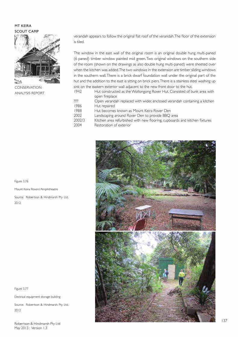
Robertson & Hindmarsh Pty LtdMay 2013 : Version 1.3
137
MT KEIRA
SCOUT CAMP
CONSERVATION
ANALYSIS REPORT
Figure 3.76
Mount Keira Rovers’ Amphitheatre
Source: Robertson & Hindmarsh Pty Ltd,
2012
Figure 3.77
Electrical equipment storage building
Source: Robertson & Hindmarsh Pty Ltd,
2012
verandah appears to follow the original flat roof of the verandah. The floor of the extension is tiled.
The window in the east wall of the original room is an original double hung multi-paned (6 paned) timber window painted mid green. Two original windows on the southern side of the room (shown on the drawings as also double hung multi-paned) were sheeted over when the kitchen was added. The two windows in the extension are timber sliding windows in the southern wall. There is a brick dwarf foundation wall under the original part of the hut and the addition to the east is sitting on brick piers. There is a stainless steel washing up sink on the eastern exterior wall adjacent to the new front door to the hut.1942 Hut constructed as the Wollongong Rover Hut. Consisted of bunk area with
open fireplace???? Open verandah replaced with wider, enclosed verandah containing a kitchen1986 Hut repaired1988 Hut becomes known as Mount Keira Rover Den2002 Landscaping around Rover Den to provide BBQ area2002/3 Kitchen area refurbished with new flooring, cupboards and kitchen fixtures 2004 Restoration of exterior
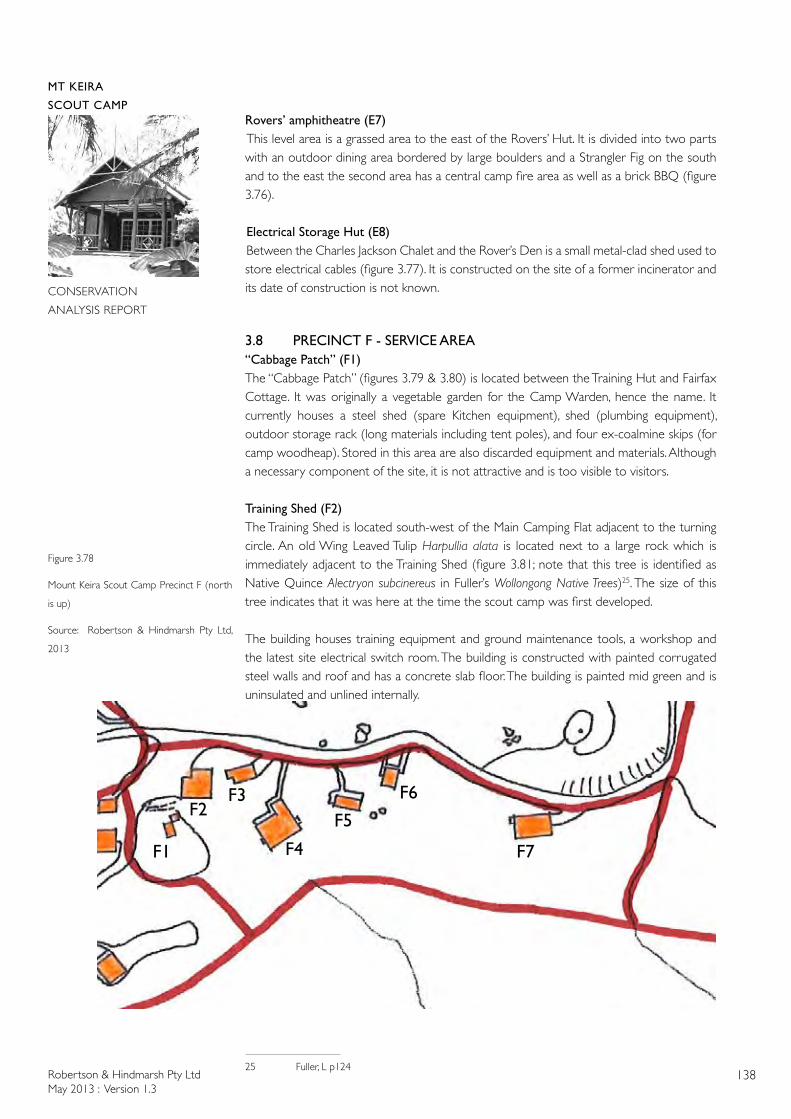
Robertson & Hindmarsh Pty LtdMay 2013 : Version 1.3
138
MT KEIRA
SCOUT CAMP
CONSERVATION
ANALYSIS REPORT
F1 F7
F6
F5
F4
F3F2
Figure 3.78
Mount Keira Scout Camp Precinct F (north
is up)
Source: Robertson & Hindmarsh Pty Ltd,
2013
Rovers’ amphitheatre (E7) This level area is a grassed area to the east of the Rovers’ Hut. It is divided into two parts with an outdoor dining area bordered by large boulders and a Strangler Fig on the south and to the east the second area has a central camp fire area as well as a brick BBQ (figure 3.76).
Electrical Storage Hut (E8)Between the Charles Jackson Chalet and the Rover’s Den is a small metal-clad shed used to store electrical cables (figure 3.77). It is constructed on the site of a former incinerator and its date of construction is not known.
3.8 PRECINCT F - SERVICE AREA“Cabbage Patch” (F1)The “Cabbage Patch” (figures 3.79 & 3.80) is located between the Training Hut and Fairfax Cottage. It was originally a vegetable garden for the Camp Warden, hence the name. It currently houses a steel shed (spare Kitchen equipment), shed (plumbing equipment), outdoor storage rack (long materials including tent poles), and four ex-coalmine skips (for camp woodheap). Stored in this area are also discarded equipment and materials. Although a necessary component of the site, it is not attractive and is too visible to visitors.
Training Shed (F2)The Training Shed is located south-west of the Main Camping Flat adjacent to the turning circle. An old Wing Leaved Tulip Harpullia alata is located next to a large rock which is immediately adjacent to the Training Shed (figure 3.81; note that this tree is identified as Native Quince Alectryon subcinereus in Fuller’s Wollongong Native Trees)25. The size of this tree indicates that it was here at the time the scout camp was first developed.
The building houses training equipment and ground maintenance tools, a workshop and the latest site electrical switch room. The building is constructed with painted corrugated steel walls and roof and has a concrete slab floor. The building is painted mid green and is uninsulated and unlined internally.
25 Fuller, L p124
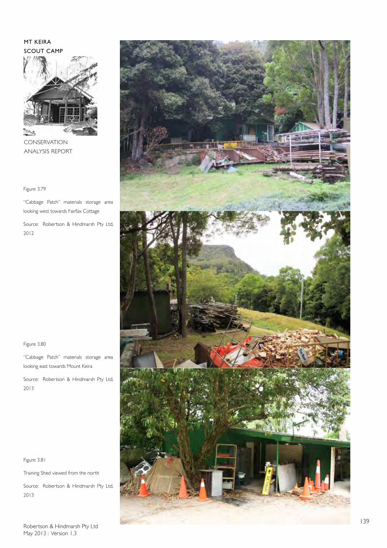
Robertson & Hindmarsh Pty LtdMay 2013 : Version 1.3
139
MT KEIRA
SCOUT CAMP
CONSERVATION
ANALYSIS REPORT
Figure 3.79
“Cabbage Patch” materials storage area
looking west towards Fairfax Cottage
Source: Robertson & Hindmarsh Pty Ltd,
2012
Figure 3.80
“Cabbage Patch” materials storage area
looking east towards Mount Keira
Source: Robertson & Hindmarsh Pty Ltd,
2013
Figure 3.81
Training Shed viewed from the north
Source: Robertson & Hindmarsh Pty Ltd,
2013
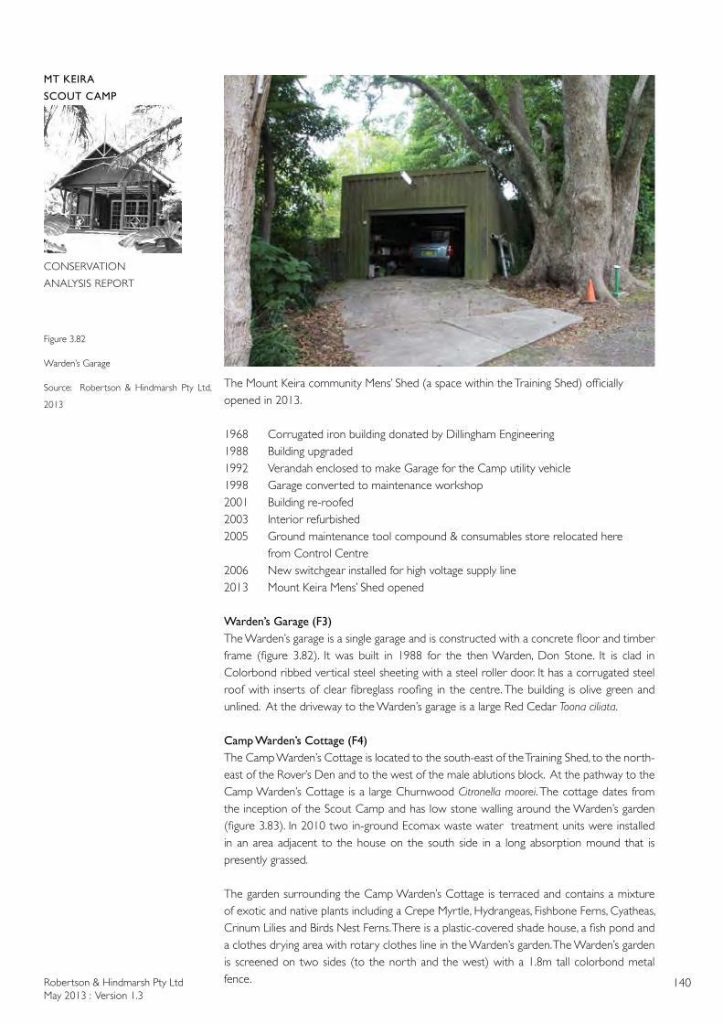
Robertson & Hindmarsh Pty LtdMay 2013 : Version 1.3
140
MT KEIRA
SCOUT CAMP
CONSERVATION
ANALYSIS REPORT
Figure 3.82
Warden’s Garage
Source: Robertson & Hindmarsh Pty Ltd,
2013
The Mount Keira community Mens’ Shed (a space within the Training Shed) officially opened in 2013.
1968 Corrugated iron building donated by Dillingham Engineering1988 Building upgraded 1992 Verandah enclosed to make Garage for the Camp utility vehicle1998 Garage converted to maintenance workshop2001 Building re-roofed2003 Interior refurbished 2005 Ground maintenance tool compound & consumables store relocated here from Control Centre2006 New switchgear installed for high voltage supply line2013 Mount Keira Mens’ Shed opened
Warden’s Garage (F3)The Warden’s garage is a single garage and is constructed with a concrete floor and timber frame (figure 3.82). It was built in 1988 for the then Warden, Don Stone. It is clad in Colorbond ribbed vertical steel sheeting with a steel roller door. It has a corrugated steel roof with inserts of clear fibreglass roofing in the centre. The building is olive green and unlined. At the driveway to the Warden’s garage is a large Red Cedar Toona ciliata.
Camp Warden’s Cottage (F4)The Camp Warden’s Cottage is located to the south-east of the Training Shed, to the north-east of the Rover’s Den and to the west of the male ablutions block. At the pathway to the Camp Warden’s Cottage is a large Churnwood Citronella moorei. The cottage dates from the inception of the Scout Camp and has low stone walling around the Warden’s garden (figure 3.83). In 2010 two in-ground Ecomax waste water treatment units were installed in an area adjacent to the house on the south side in a long absorption mound that is presently grassed.
The garden surrounding the Camp Warden’s Cottage is terraced and contains a mixture of exotic and native plants including a Crepe Myrtle, Hydrangeas, Fishbone Ferns, Cyatheas, Crinum Lilies and Birds Nest Ferns. There is a plastic-covered shade house, a fish pond and a clothes drying area with rotary clothes line in the Warden’s garden. The Warden’s garden is screened on two sides (to the north and the west) with a 1.8m tall colorbond metal fence.

Robertson & Hindmarsh Pty LtdMay 2013 : Version 1.3
141
MT KEIRA
SCOUT CAMP
CONSERVATION
ANALYSIS REPORT
Figure 3.83
Warden’s Cottage viewed from the west
Source: Robertson & Hindmarsh Pty Ltd,
2013
Figure 3.84
Camp Warden’s Cottage floor plan (based
on original working drawing and on-site
observation)
Source: Robertson & HIndmarsh Pty Ltd,
2013
LIVING
KITCHEN DINING
BEDROOM
STUDY
BATH
LDY
BEDROOM
BEDROOMVERANDAH
GAUZED ROOM
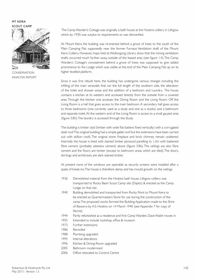
Robertson & Hindmarsh Pty LtdMay 2013 : Version 1.3
142
MT KEIRA
SCOUT CAMP
CONSERVATION
ANALYSIS REPORT
The Camp Warden’s Cottage was originally a bath house at the Hoskins colliery in Lithgow which, by 1930, was surplus to requirements so was dismantled.
At Mount Keira the building was re-erected behind a grove of trees to the south of the Main Camping Flat, supposedly near the former Furnace Ventilation shaft of the Mount Keira Colliery. However, maps held at Wollongong Library show that the mining ventilation shafts occurred much further away, outside of the leased area (see figure 1.4). The Camp Warden’s Cottage’s concealment behind a grove of trees was supposed to give added prominence to the Lodge which was visible at the end of the Main Camping Flat up on its higher levelled platform.
Since it was first rebuilt here, the building has undergone various changes including the infilling of the main verandah that ran the full length of the southern side, the alteration of the toilet and shower areas and the addition of a bedroom and Laundry. The house contains a kitchen at its western end accessed directly from the outside from a covered area. Through the kitchen one accesses the Dining Room and the Living Room. Off the Living Room is a hall that gives access to the main bedroom. A secondary hall gives access to three bedrooms (one currently used as a study and one as a studio) and a bathroom and separate toilet. At the western end of the Living Room is access to a small gauzed area (figure 3.85). The laundry is accessed through the Study.
The building is timber clad (timber with wide flat battens fixed vertically) with a corrugated steel roof. The original building had a simple gable roof but the extensions have been carried out with skillion roofs. The original stone fireplace and brick chimney remain unaltered. Internally the house is lined with stained timber plywood panelling to 1.2m with battened fibre cement (probably asbestos cement) above (figure 3.86). The ceilings are also fibre cement and the floors are timber (except to bathroom areas which are tiled). The doors, skirtings and architraves are dark stained timber.
At present none of the windows are openable as security screens were installed after a spate of break-ins. The house is therefore damp and has mould growth on the ceilings.
1936 Demolished material from the Hoskins bath house, Lithgow colliery was transported to Rocky Basin Scout Camp site (Dapto) & erected as the Camp Lodge on that site1940 Building demolished and transported from Rocky Point to Mount Keira to be erected as Quartermasters Store for use during the construction of the camp. The proposed works formed the Building Application made to the Shire of Illawarra by A.S. Hoskins on 14 March 1940 (see Appendix 7 for copy of Permit) 1944 Partly refurbished as a residence and first Camp Warden, Dave Walsh moves in1955 Extended to include tuckshop, office & museum1973 Further extensions1986 Reroofed1988 Plumbing upgraded1995 Internal alterations1996 Kitchen & Dining Room upgraded2005 Bathroom modernised2006 Office relocated to Control Centre
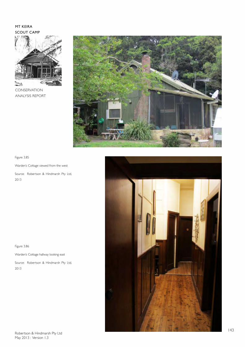
Robertson & Hindmarsh Pty LtdMay 2013 : Version 1.3
143
MT KEIRA
SCOUT CAMP
CONSERVATION
ANALYSIS REPORT
Figure 3.85
Warden’s Cottage viewed from the west
Source: Robertson & Hindmarsh Pty Ltd,
2013
Figure 3.86
Warden’s Cottage hallway looking east
Source: Robertson & Hindmarsh Pty Ltd,
2013
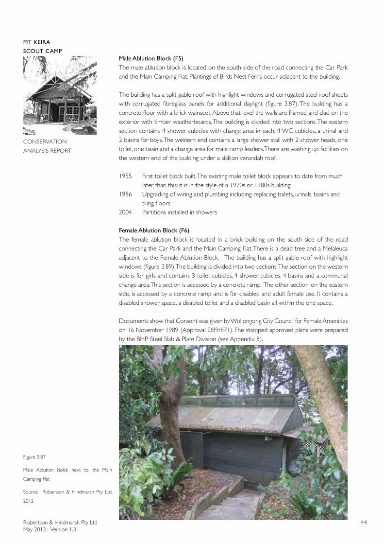
Robertson & Hindmarsh Pty LtdMay 2013 : Version 1.3
144
MT KEIRA
SCOUT CAMP
CONSERVATION
ANALYSIS REPORT
Male Ablution Block (F5)The male ablution block is located on the south side of the road connecting the Car Park and the Main Camping Flat. Plantings of Birds Nest Ferns occur adjacent to the building.
The building has a split gable roof with highlight windows and corrugated steel roof sheets with corrugated fibreglass panels for additional daylight (figure 3.87). The building has a concrete floor with a brick wainscot. Above that level the walls are framed and clad on the exterior with timber weatherboards. The building is divided into two sections. The eastern section contains 4 shower cubicles with change area in each, 4 WC cubicles, a urinal and 2 basins for boys. The western end contains a large shower stall with 2 shower heads, one toilet, one basin and a change area for male camp leaders. There are washing up facilities on the western end of the building under a skillion verandah roof.
1955 First toilet block built. The existing male toilet block appears to date from much later than this; it is in the style of a 1970s or 1980s building 1986 Upgrading of wiring and plumbing including replacing toilets, urinals, basins and tiling floors2004 Partitions installed in showers
Female Ablution Block (F6)The female ablution block is located in a brick building on the south side of the road connecting the Car Park and the Main Camping Flat. There is a dead tree and a Melaleuca adjacent to the Female Ablution Block. The building has a split gable roof with highlight windows (figure 3.89). The building is divided into two sections. The section on the western side is for girls and contains 3 toilet cubicles, 4 shower cubicles, 4 basins and a communal change area. This section is accessed by a concrete ramp. The other section, on the eastern side, is accessed by a concrete ramp and is for disabled and adult female use. It contains a disabled shower space, a disabled toilet and a disabled basin all within the one space.
Documents show that Consent was given by Wollongong City Council for Female Amenities on 16 November 1989 (Approval D89/871). The stamped approved plans were prepared by the BHP Steel Slab & Plate Division (see Appendix 8).
Figure 3.87
Male Ablution Bolck next to the Main
Camping Flat
Source: Robertson & Hindmarsh Pty Ltd,
2012
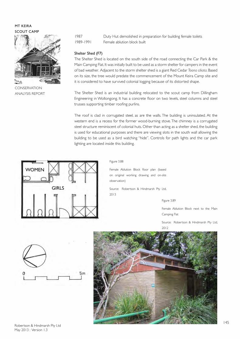
Robertson & Hindmarsh Pty LtdMay 2013 : Version 1.3
145
MT KEIRA
SCOUT CAMP
CONSERVATION
ANALYSIS REPORT
1987 Duty Hut demolished in preparation for building female toilets1989-1991 Female ablution block built Shelter Shed (F7)The Shelter Shed is located on the south side of the road connecting the Car Park & the Main Camping Flat. It was initially built to be used as a storm shelter for campers in the event of bad weather. Adjacent to the storm shelter shed is a giant Red Cedar Toona ciliata. Based on its size, the tree would predate the commencement of the Mount Keira Camp site and it is considered to have survived colonial logging because of its distorted shape.
The Shelter Shed is an industrial building relocated to the scout camp from Dillingham Engineering in Wollongong. It has a concrete floor on two levels, steel columns and steel trusses supporting timber roofing purlins.
The roof is clad in corrugated steel, as are the walls. The building is uninsulated. At the western end is a recess for the former wood-burning stove. The chimney is a corrugated steel structure reminiscent of colonial huts. Other than acting as a shelter shed, the building is used for educational purposes and there are viewing slots in the south wall allowing the building to be used as a bird watching “hide”. Controls for path lights and the car park lighting are located inside this building.
Figure 3.89
Female Ablution Block next to the Main
Camping Flat
Source: Robertson & Hindmarsh Pty Ltd,
2012
Figure 3.88
Female Ablution Block floor plan (based
on original working drawing and on-site
observation)
Source: Robertson & Hindmarsh Pty Ltd,
2013
WOMEN
GIRLS
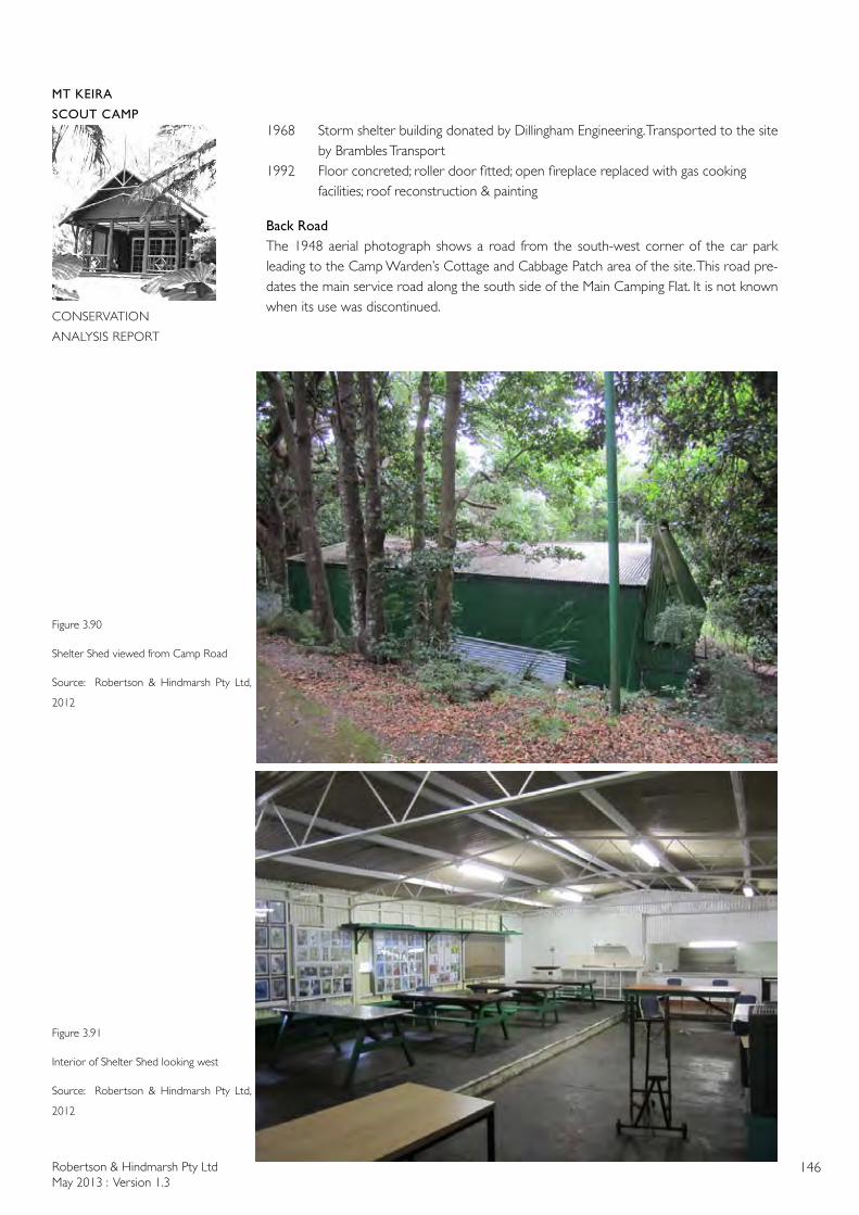
Robertson & Hindmarsh Pty LtdMay 2013 : Version 1.3
146
MT KEIRA
SCOUT CAMP
CONSERVATION
ANALYSIS REPORT
1968 Storm shelter building donated by Dillingham Engineering. Transported to the site by Brambles Transport 1992 Floor concreted; roller door fitted; open fireplace replaced with gas cooking facilities; roof reconstruction & painting
Back RoadThe 1948 aerial photograph shows a road from the south-west corner of the car park leading to the Camp Warden’s Cottage and Cabbage Patch area of the site. This road pre-dates the main service road along the south side of the Main Camping Flat. It is not known when its use was discontinued.
Figure 3.90
Shelter Shed viewed from Camp Road
Source: Robertson & Hindmarsh Pty Ltd,
2012
Figure 3.91
Interior of Shelter Shed looking west
Source: Robertson & Hindmarsh Pty Ltd,
2012
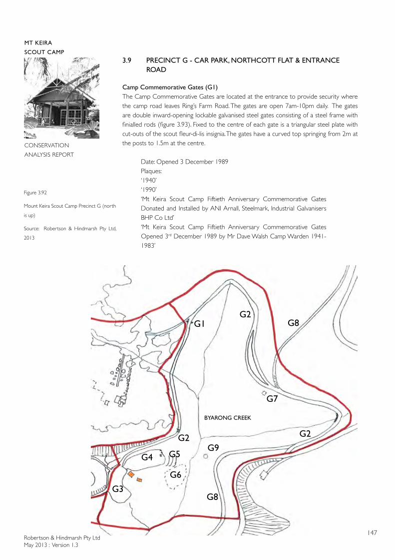
Robertson & Hindmarsh Pty LtdMay 2013 : Version 1.3
147
MT KEIRA
SCOUT CAMP
CONSERVATION
ANALYSIS REPORT
3.9 PRECINCT G - CAR PARK, NORTHCOTT FLAT & ENTRANCE ROAD
Camp Commemorative Gates (G1)The Camp Commemorative Gates are located at the entrance to provide security where the camp road leaves Ring’s Farm Road. The gates are open 7am-10pm daily. The gates are double inward-opening lockable galvanised steel gates consisting of a steel frame with finialled rods (figure 3.93). Fixed to the centre of each gate is a triangular steel plate with cut-outs of the scout fleur-di-lis insignia. The gates have a curved top springing from 2m at the posts to 1.5m at the centre.
Date: Opened 3 December 1989Plaques:‘1940’‘1990’‘Mt Keira Scout Camp Fiftieth Anniversary Commemorative Gates Donated and Installed by ANI Arnall, Steelmark, Industrial Galvanisers BHP Co Ltd’‘Mt Keira Scout Camp Fiftieth Anniversary Commemorative Gates Opened 3rd December 1989 by Mr Dave Walsh Camp Warden 1941-1983’
Figure 3.92
Mount Keira Scout Camp Precinct G (north
is up)
Source: Robertson & Hindmarsh Pty Ltd,
2013
G4
G1
G6
G3
G2
G7
G2
G2
G8
G9
G8
BYARONG CREEK
G5
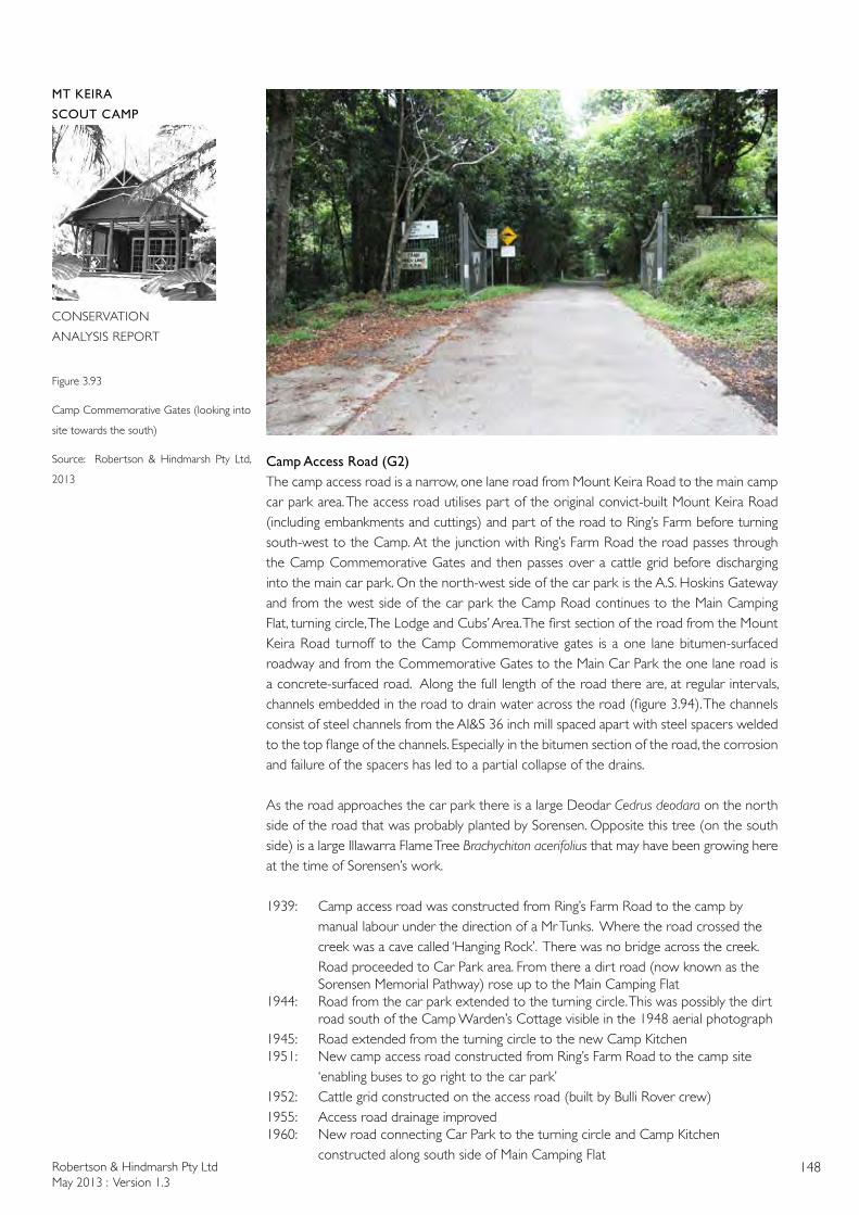
Robertson & Hindmarsh Pty LtdMay 2013 : Version 1.3
148
MT KEIRA
SCOUT CAMP
CONSERVATION
ANALYSIS REPORT
Camp Access Road (G2)The camp access road is a narrow, one lane road from Mount Keira Road to the main camp car park area. The access road utilises part of the original convict-built Mount Keira Road (including embankments and cuttings) and part of the road to Ring’s Farm before turning south-west to the Camp. At the junction with Ring’s Farm Road the road passes through the Camp Commemorative Gates and then passes over a cattle grid before discharging into the main car park. On the north-west side of the car park is the A.S. Hoskins Gateway and from the west side of the car park the Camp Road continues to the Main Camping Flat, turning circle, The Lodge and Cubs’ Area. The first section of the road from the Mount Keira Road turnoff to the Camp Commemorative gates is a one lane bitumen-surfaced roadway and from the Commemorative Gates to the Main Car Park the one lane road is a concrete-surfaced road. Along the full length of the road there are, at regular intervals, channels embedded in the road to drain water across the road (figure 3.94). The channels consist of steel channels from the AI&S 36 inch mill spaced apart with steel spacers welded to the top flange of the channels. Especially in the bitumen section of the road, the corrosion and failure of the spacers has led to a partial collapse of the drains.
As the road approaches the car park there is a large Deodar Cedrus deodara on the north side of the road that was probably planted by Sorensen. Opposite this tree (on the south side) is a large Illawarra Flame Tree Brachychiton acerifolius that may have been growing here at the time of Sorensen’s work.
1939: Camp access road was constructed from Ring’s Farm Road to the camp by manual labour under the direction of a Mr Tunks. Where the road crossed the creek was a cave called ‘Hanging Rock’. There was no bridge across the creek. Road proceeded to Car Park area. From there a dirt road (now known as the Sorensen Memorial Pathway) rose up to the Main Camping Flat1944: Road from the car park extended to the turning circle. This was possibly the dirt road south of the Camp Warden’s Cottage visible in the 1948 aerial photograph1945: Road extended from the turning circle to the new Camp Kitchen1951: New camp access road constructed from Ring’s Farm Road to the camp site ‘enabling buses to go right to the car park’1952: Cattle grid constructed on the access road (built by Bulli Rover crew)1955: Access road drainage improved1960: New road connecting Car Park to the turning circle and Camp Kitchen constructed along south side of Main Camping Flat
Figure 3.93
Camp Commemorative Gates (looking into
site towards the south)
Source: Robertson & Hindmarsh Pty Ltd,
2013
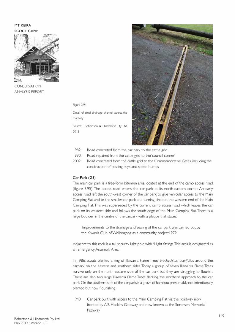
Robertson & Hindmarsh Pty LtdMay 2013 : Version 1.3
149
MT KEIRA
SCOUT CAMP
CONSERVATION
ANALYSIS REPORT
1982: Road concreted from the car park to the cattle grid1990: Road repaired from the cattle grid to the ‘council corner’2002: Road concreted from the cattle grid to the Commemorative Gates, including the construction of passing bays and speed humps
Car Park (G3)The main car park is a free-form bitumen area located at the end of the camp access road (figure 3.95). The access road enters the car park at its north-eastern corner. An early access road left the south-west corner of the car park to give vehicular access to the Main Camping Flat and to the smaller car park and turning circle at the western end of the Main Camping Flat. This was superseded by the current camp access road which leaves the car park on its western side and follows the south edge of the Main Camping Flat. There is a large boulder in the centre of the carpark with a plaque that states:
‘Improvements to the drainage and sealing of the car park was carried out by the Kiwanis Club of Wollongong as a community project1979’
Adjacent to this rock is a tall security light pole with 4 light fittings. This area is designated as an Emergency Assembly Area.
In 1986, scouts planted a ring of Illawarra Flame Trees Brachychiton acerifolius around the carpark on the eastern and southern sides. Today a group of seven Illawarra Flame Trees survive only on the north-eastern side of the car park but they are struggling to flourish. There are also two large Illawarra Flame Trees flanking the northern approach to the car park. On the southern side of the car park, is a grove of bamboo presumably not intentionally planted but now flourishing.
1940 Car park built with access to the Main Camping Flat via the roadway now fronted by A.S. Hoskins Gateway and now known as the Sorensen Memorial Pathway
Figure 3.94
Detail of steel drainage channel across the
roadway
Source: Robertson & Hindmarsh Pty Ltd,
2013
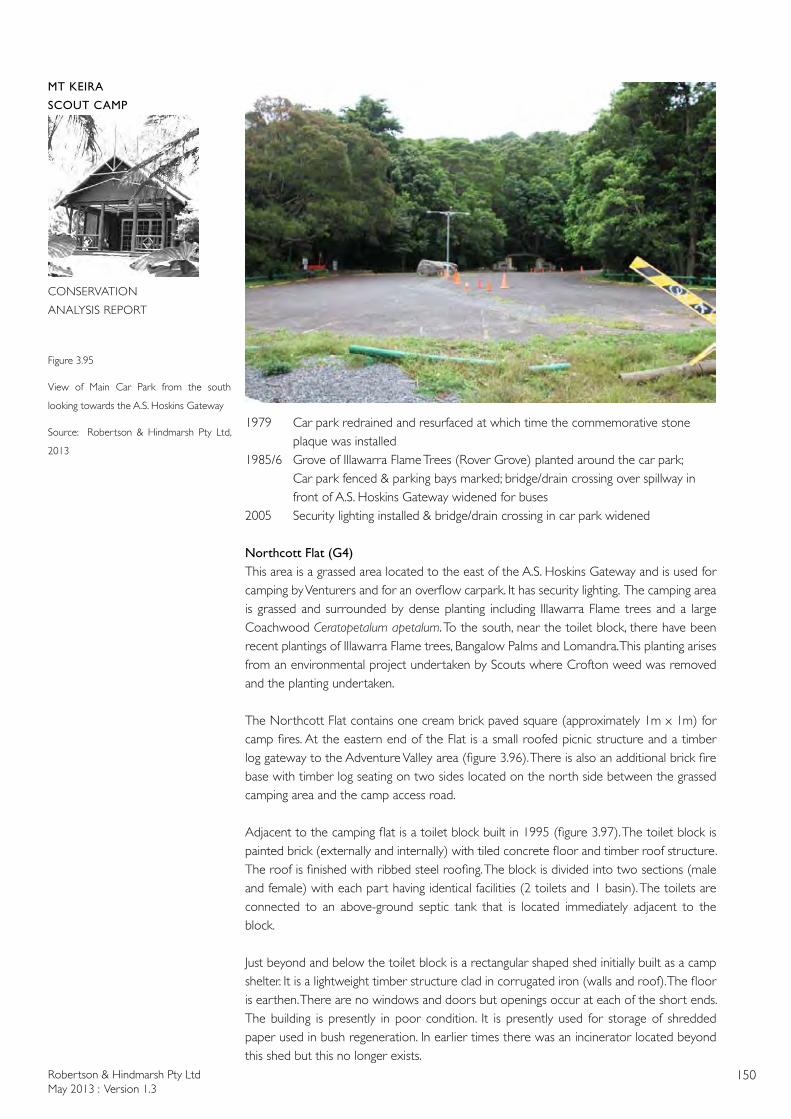
Robertson & Hindmarsh Pty LtdMay 2013 : Version 1.3
150
MT KEIRA
SCOUT CAMP
CONSERVATION
ANALYSIS REPORT
1979 Car park redrained and resurfaced at which time the commemorative stone plaque was installed
1985/6 Grove of Illawarra Flame Trees (Rover Grove) planted around the car park;Car park fenced & parking bays marked; bridge/drain crossing over spillway in front of A.S. Hoskins Gateway widened for buses
2005 Security lighting installed & bridge/drain crossing in car park widened
Northcott Flat (G4)This area is a grassed area located to the east of the A.S. Hoskins Gateway and is used for camping by Venturers and for an overflow carpark. It has security lighting. The camping area is grassed and surrounded by dense planting including Illawarra Flame trees and a large Coachwood Ceratopetalum apetalum. To the south, near the toilet block, there have been recent plantings of Illawarra Flame trees, Bangalow Palms and Lomandra. This planting arises from an environmental project undertaken by Scouts where Crofton weed was removed and the planting undertaken.
The Northcott Flat contains one cream brick paved square (approximately 1m x 1m) for camp fires. At the eastern end of the Flat is a small roofed picnic structure and a timber log gateway to the Adventure Valley area (figure 3.96). There is also an additional brick fire base with timber log seating on two sides located on the north side between the grassed camping area and the camp access road.
Adjacent to the camping flat is a toilet block built in 1995 (figure 3.97). The toilet block is painted brick (externally and internally) with tiled concrete floor and timber roof structure. The roof is finished with ribbed steel roofing. The block is divided into two sections (male and female) with each part having identical facilities (2 toilets and 1 basin). The toilets are connected to an above-ground septic tank that is located immediately adjacent to the block.
Just beyond and below the toilet block is a rectangular shaped shed initially built as a camp shelter. It is a lightweight timber structure clad in corrugated iron (walls and roof). The floor is earthen. There are no windows and doors but openings occur at each of the short ends. The building is presently in poor condition. It is presently used for storage of shredded paper used in bush regeneration. In earlier times there was an incinerator located beyond this shed but this no longer exists.
Figure 3.95
View of Main Car Park from the south
looking towards the A.S. Hoskins Gateway
Source: Robertson & Hindmarsh Pty Ltd,
2013
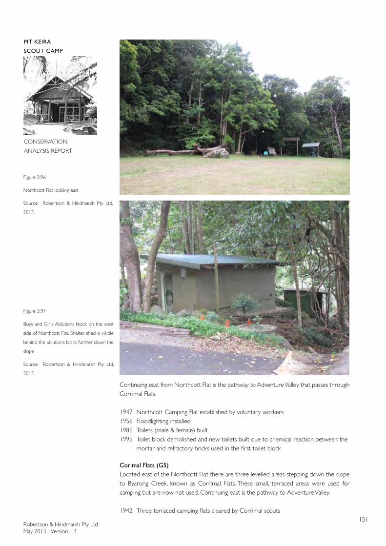
Robertson & Hindmarsh Pty LtdMay 2013 : Version 1.3
151
MT KEIRA
SCOUT CAMP
CONSERVATION
ANALYSIS REPORT
Continuing east from Northcott Flat is the pathway to Adventure Valley that passes through Corrimal Flats.
1947 Northcott Camping Flat established by voluntary workers1956 Floodlighting installed1986 Toilets (male & female) built1995 Toilet block demolished and new toilets built due to chemical reaction between the mortar and refractory bricks used in the first toilet block
Corimal Flats (G5)Located east of the Northcott Flat there are three levelled areas stepping down the slope to Byarong Creek, known as Corrimal Flats. These small, terraced areas were used for camping but are now not used. Continuing east is the pathway to Adventure Valley.
1942 Three terraced camping flats cleared by Corrimal scouts
Figure 3.96
Northcott Flat looking east
Source: Robertson & Hindmarsh Pty Ltd,
2013
Figure 3.97
Boys and Girls Ablutions block on the west
side of Northcott Flat. Shelter shed is visible
behind the ablutions block further down the
slope
Source: Robertson & Hindmarsh Pty Ltd,
2013
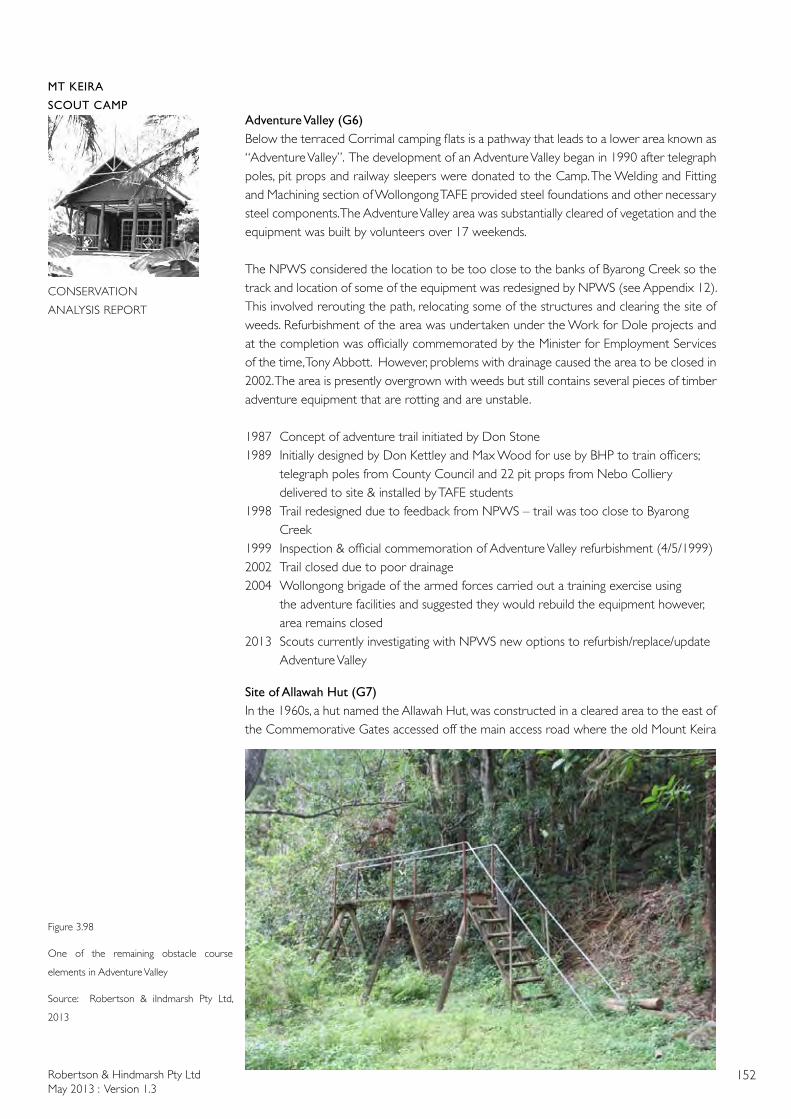
Robertson & Hindmarsh Pty LtdMay 2013 : Version 1.3
152
MT KEIRA
SCOUT CAMP
CONSERVATION
ANALYSIS REPORT
Adventure Valley (G6)Below the terraced Corrimal camping flats is a pathway that leads to a lower area known as “Adventure Valley”. The development of an Adventure Valley began in 1990 after telegraph poles, pit props and railway sleepers were donated to the Camp. The Welding and Fitting and Machining section of Wollongong TAFE provided steel foundations and other necessary steel components. The Adventure Valley area was substantially cleared of vegetation and the equipment was built by volunteers over 17 weekends.
The NPWS considered the location to be too close to the banks of Byarong Creek so the track and location of some of the equipment was redesigned by NPWS (see Appendix 12). This involved rerouting the path, relocating some of the structures and clearing the site of weeds. Refurbishment of the area was undertaken under the Work for Dole projects and at the completion was officially commemorated by the Minister for Employment Services of the time, Tony Abbott. However, problems with drainage caused the area to be closed in 2002. The area is presently overgrown with weeds but still contains several pieces of timber adventure equipment that are rotting and are unstable.
1987 Concept of adventure trail initiated by Don Stone1989 Initially designed by Don Kettley and Max Wood for use by BHP to train officers; telegraph poles from County Council and 22 pit props from Nebo Colliery delivered to site & installed by TAFE students1998 Trail redesigned due to feedback from NPWS – trail was too close to Byarong Creek1999 Inspection & official commemoration of Adventure Valley refurbishment (4/5/1999)2002 Trail closed due to poor drainage2004 Wollongong brigade of the armed forces carried out a training exercise using the adventure facilities and suggested they would rebuild the equipment however, area remains closed2013 Scouts currently investigating with NPWS new options to refurbish/replace/update Adventure Valley
Site of Allawah Hut (G7)In the 1960s, a hut named the Allawah Hut, was constructed in a cleared area to the east of the Commemorative Gates accessed off the main access road where the old Mount Keira
Figure 3.98
One of the remaining obstacle course
elements in Adventure Valley
Source: Robertson & iIndmarsh Pty Ltd,
2013
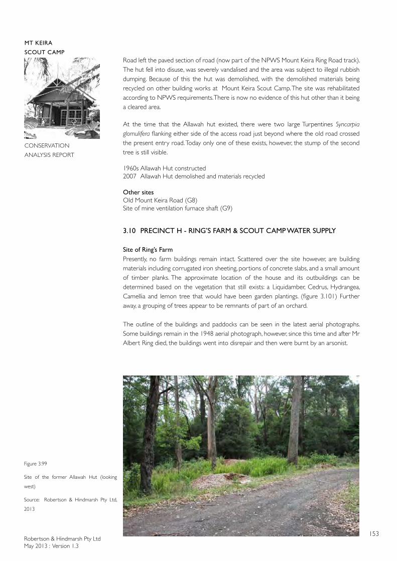
Robertson & Hindmarsh Pty LtdMay 2013 : Version 1.3
153
MT KEIRA
SCOUT CAMP
CONSERVATION
ANALYSIS REPORT
Road left the paved section of road (now part of the NPWS Mount Keira Ring Road track). The hut fell into disuse, was severely vandalised and the area was subject to illegal rubbish dumping. Because of this the hut was demolished, with the demolished materials being recycled on other building works at Mount Keira Scout Camp. The site was rehabilitated according to NPWS requirements. There is now no evidence of this hut other than it being a cleared area.
At the time that the Allawah hut existed, there were two large Turpentines Syncarpia glomulifera flanking either side of the access road just beyond where the old road crossed the present entry road. Today only one of these exists, however, the stump of the second tree is still visible.
1960s Allawah Hut constructed2007 Allawah Hut demolished and materials recycled
Other sitesOld Mount Keira Road (G8)Site of mine ventilation furnace shaft (G9)
3.10 PRECINCT H - RING’S FARM & SCOUT CAMP WATER SUPPLY
Site of Ring’s FarmPresently, no farm buildings remain intact. Scattered over the site however, are building materials including corrugated iron sheeting, portions of concrete slabs, and a small amount of timber planks. The approximate location of the house and its outbuildings can be determined based on the vegetation that still exists: a Liquidamber, Cedrus, Hydrangea, Camellia and lemon tree that would have been garden plantings. (figure 3.101) Further away, a grouping of trees appear to be remnants of part of an orchard.
The outline of the buildings and paddocks can be seen in the latest aerial photographs. Some buildings remain in the 1948 aerial photograph, however, since this time and after Mr Albert Ring died, the buildings went into disrepair and then were burnt by an arsonist.
Figure 3.99
Site of the former Allawah Hut (looking
west)
Source: Robertson & Hindmarsh Pty Ltd,
2013
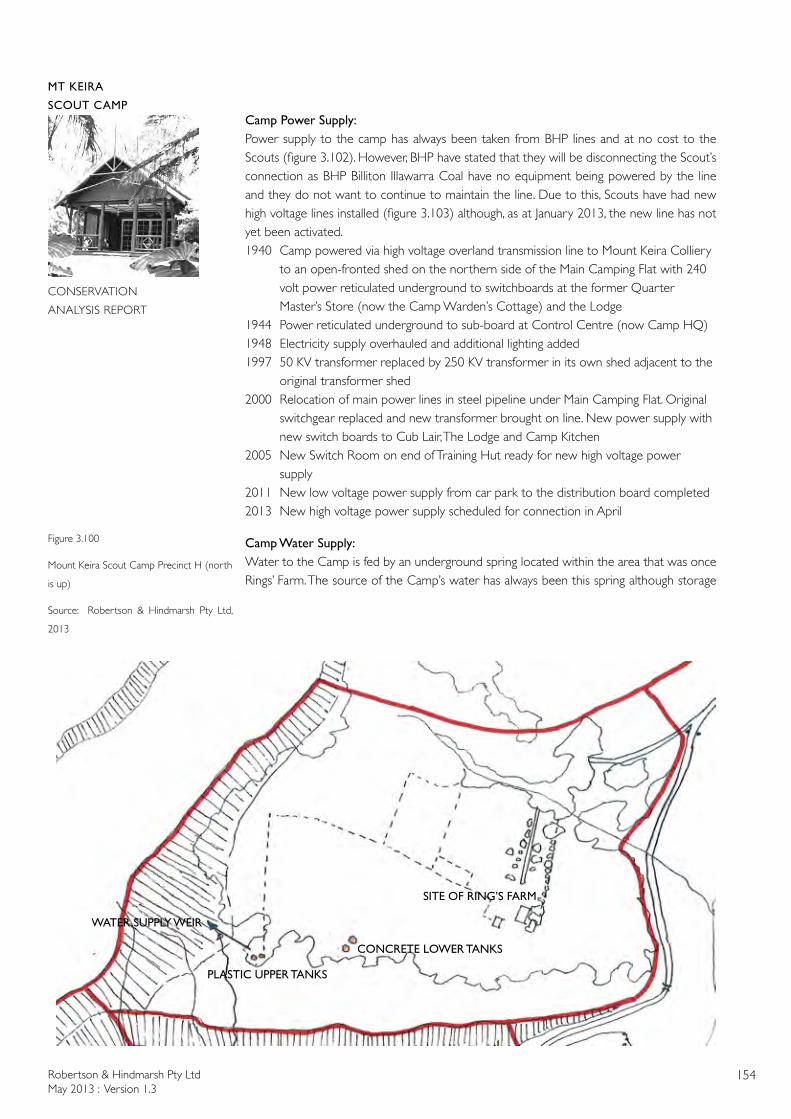
Robertson & Hindmarsh Pty LtdMay 2013 : Version 1.3
154
MT KEIRA
SCOUT CAMP
CONSERVATION
ANALYSIS REPORT
Camp Power Supply:Power supply to the camp has always been taken from BHP lines and at no cost to the Scouts (figure 3.102). However, BHP have stated that they will be disconnecting the Scout’s connection as BHP Billiton Illawarra Coal have no equipment being powered by the line and they do not want to continue to maintain the line. Due to this, Scouts have had new high voltage lines installed (figure 3.103) although, as at January 2013, the new line has not yet been activated. 1940 Camp powered via high voltage overland transmission line to Mount Keira Colliery to an open-fronted shed on the northern side of the Main Camping Flat with 240 volt power reticulated underground to switchboards at the former Quarter Master’s Store (now the Camp Warden’s Cottage) and the Lodge1944 Power reticulated underground to sub-board at Control Centre (now Camp HQ)1948 Electricity supply overhauled and additional lighting added1997 50 KV transformer replaced by 250 KV transformer in its own shed adjacent to the original transformer shed2000 Relocation of main power lines in steel pipeline under Main Camping Flat. Original switchgear replaced and new transformer brought on line. New power supply with new switch boards to Cub Lair, The Lodge and Camp Kitchen2005 New Switch Room on end of Training Hut ready for new high voltage power supply2011 New low voltage power supply from car park to the distribution board completed2013 New high voltage power supply scheduled for connection in April
Camp Water Supply:Water to the Camp is fed by an underground spring located within the area that was once Rings’ Farm. The source of the Camp’s water has always been this spring although storage
Figure 3.100
Mount Keira Scout Camp Precinct H (north
is up)
Source: Robertson & Hindmarsh Pty Ltd,
2013
WATER SUPPLY WEIR
PLASTIC UPPER TANKS
CONCRETE LOWER TANKS
SITE OF RING’S FARM
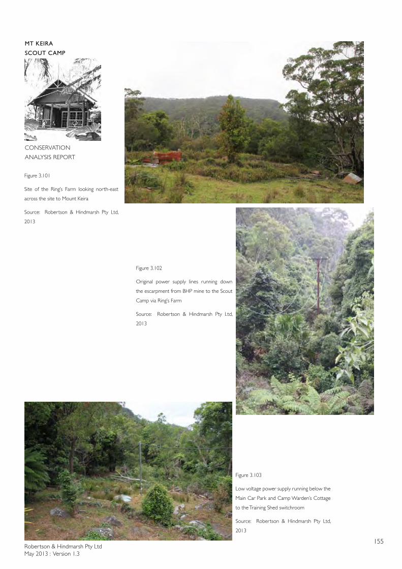
Robertson & Hindmarsh Pty LtdMay 2013 : Version 1.3
155
MT KEIRA
SCOUT CAMP
CONSERVATION
ANALYSIS REPORT
Figure 3.101
Site of the Ring’s Farm looking north-east
across the site to Mount Keira
Source: Robertson & Hindmarsh Pty Ltd,
2013
Figure 3.102
Original power supply lines running down
the escarpment from BHP mine to the Scout
Camp via Ring’s Farm
Source: Robertson & Hindmarsh Pty Ltd,
2013
Figure 3.103
Low voltage power supply running below the
Main Car Park and Camp Warden’s Cottage
to the Training Shed switchroom
Source: Robertson & Hindmarsh Pty Ltd,
2013
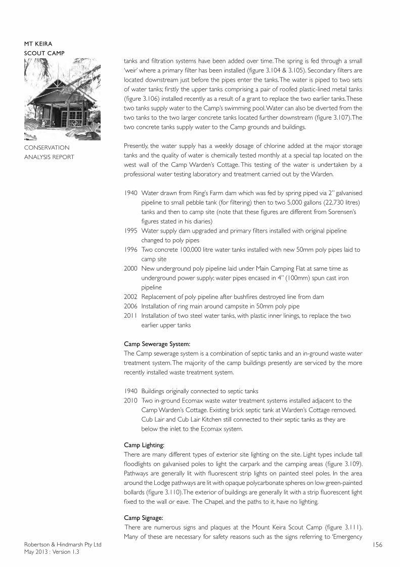
Robertson & Hindmarsh Pty LtdMay 2013 : Version 1.3
156
MT KEIRA
SCOUT CAMP
CONSERVATION
ANALYSIS REPORT
tanks and filtration systems have been added over time. The spring is fed through a small ‘weir’ where a primary filter has been installed (figure 3.104 & 3.105). Secondary filters are located downstream just before the pipes enter the tanks. The water is piped to two sets of water tanks; firstly the upper tanks comprising a pair of roofed plastic-lined metal tanks (figure 3.106) installed recently as a result of a grant to replace the two earlier tanks. These two tanks supply water to the Camp’s swimming pool. Water can also be diverted from the two tanks to the two larger concrete tanks located further downstream (figure 3.107). The two concrete tanks supply water to the Camp grounds and buildings.
Presently, the water supply has a weekly dosage of chlorine added at the major storage tanks and the quality of water is chemically tested monthly at a special tap located on the west wall of the Camp Warden’s Cottage. This testing of the water is undertaken by a professional water testing laboratory and treatment carried out by the Warden.
1940 Water drawn from Ring’s Farm dam which was fed by spring piped via 2” galvanised pipeline to small pebble tank (for filtering) then to two 5,000 gallons (22,730 litres) tanks and then to camp site (note that these figures are different from Sorensen’s figures stated in his diaries)1995 Water supply dam upgraded and primary filters installed with original pipeline changed to poly pipes1996 Two concrete 100,000 litre water tanks installed with new 50mm poly pipes laid to camp site2000 New underground poly pipeline laid under Main Camping Flat at same time as underground power supply; water pipes encased in 4” (100mm) spun cast iron pipeline 2002 Replacement of poly pipeline after bushfires destroyed line from dam2006 Installation of ring main around campsite in 50mm poly pipe 2011 Installation of two steel water tanks, with plastic inner linings, to replace the two earlier upper tanks
Camp Sewerage System:The Camp sewerage system is a combination of septic tanks and an in-ground waste water treatment system. The majority of the camp buildings presently are serviced by the more recently installed waste treatment system.
1940 Buildings originally connected to septic tanks2010 Two in-ground Ecomax waste water treatment systems installed adjacent to the Camp Warden’s Cottage. Existing brick septic tank at Warden’s Cottage removed. Cub Lair and Cub Lair Kitchen still connected to their septic tanks as they are below the inlet to the Ecomax system.
Camp Lighting:There are many different types of exterior site lighting on the site. Light types include tall floodlights on galvanised poles to light the carpark and the camping areas (figure 3.109). Pathways are generally lit with fluorescent strip lights on painted steel poles. In the area around the Lodge pathways are lit with opaque polycarbonate spheres on low green-painted bollards (figure 3.110). The exterior of buildings are generally lit with a strip fluorescent light fixed to the wall or eave. The Chapel, and the paths to it, have no lighting.
Camp Signage:There are numerous signs and plaques at the Mount Keira Scout Camp (figure 3.111). Many of these are necessary for safety reasons such as the signs referring to ‘Emergency
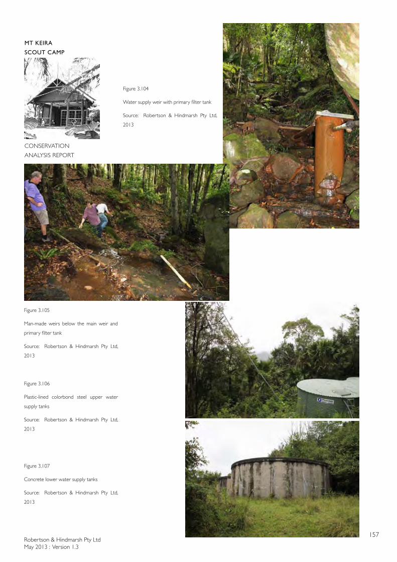
Robertson & Hindmarsh Pty LtdMay 2013 : Version 1.3
157
MT KEIRA
SCOUT CAMP
CONSERVATION
ANALYSIS REPORT
Figure 3.104
Water supply weir with primary filter tank
Source: Robertson & Hindmarsh Pty Ltd,
2013
Figure 3.105
Man-made weirs below the main weir and
primary filter tank
Source: Robertson & Hindmarsh Pty Ltd,
2013
Figure 3.106
Plastic-lined colorbond steel upper water
supply tanks
Source: Robertson & Hindmarsh Pty Ltd,
2013
Figure 3.107
Concrete lower water supply tanks
Source: Robertson & Hindmarsh Pty Ltd,
2013
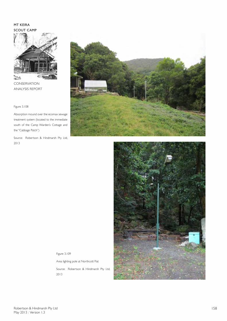
Robertson & Hindmarsh Pty LtdMay 2013 : Version 1.3
158
MT KEIRA
SCOUT CAMP
CONSERVATION
ANALYSIS REPORT
Figure 3.108
Absorption mound over the ecomax sewage
treatment system (located to the immediate
south of the Camp Warden’s Cottage and
the “Cabbage Patch”)
Source: Robertson & Hindmarsh Pty Ltd,
2013
Figure 3.109
Area lighting pole at Northcott Flat
Source: Robertson & Hindmarsh Pty Ltd,
2013
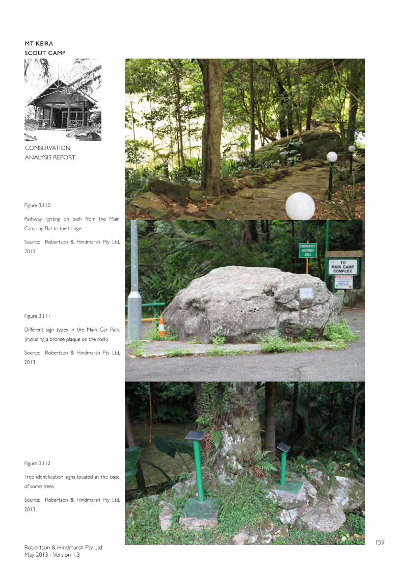
Robertson & Hindmarsh Pty LtdMay 2013 : Version 1.3
159
MT KEIRA
SCOUT CAMP
CONSERVATION
ANALYSIS REPORT
Figure 3.111
Different sign types in the Main Car Park
(including a bronze plaque on the rock)
Source: Robertson & Hindmarsh Pty Ltd,
2013
Figure 3.112
Tree identification signs located at the base
of some trees
Source: Robertson & Hindmarsh Pty Ltd,
2013
Figure 3.110
Pathway lighting on path from the Main
Camping Flat to the Lodge
Source: Robertson & Hindmarsh Pty Ltd,
2013
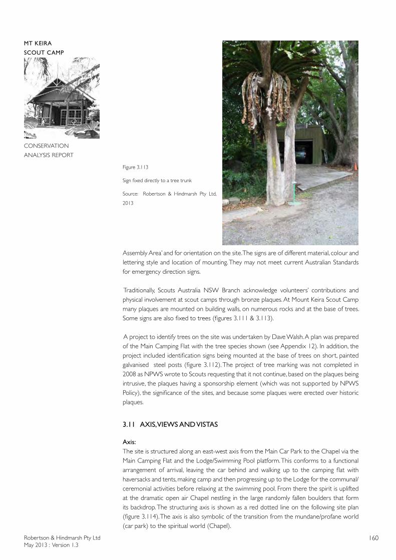
Robertson & Hindmarsh Pty LtdMay 2013 : Version 1.3
160
MT KEIRA
SCOUT CAMP
CONSERVATION
ANALYSIS REPORT
Figure 3.113
Sign fixed directly to a tree trunk
Source: Robertson & Hindmarsh Pty Ltd,
2013
Assembly Area’ and for orientation on the site. The signs are of different material, colour and lettering style and location of mounting. They may not meet current Australian Standards for emergency direction signs.
Traditionally, Scouts Australia NSW Branch acknowledge volunteers’ contributions and physical involvement at scout camps through bronze plaques. At Mount Keira Scout Camp many plaques are mounted on building walls, on numerous rocks and at the base of trees. Some signs are also fixed to trees (figures 3.111 & 3.113).
A project to identify trees on the site was undertaken by Dave Walsh. A plan was prepared of the Main Camping Flat with the tree species shown (see Appendix 12). In addition, the project included identification signs being mounted at the base of trees on short, painted galvanised steel posts (figure 3.112). The project of tree marking was not completed in 2008 as NPWS wrote to Scouts requesting that it not continue, based on the plaques being intrusive, the plaques having a sponsorship element (which was not supported by NPWS Policy), the significance of the sites, and because some plaques were erected over historic plaques.
3.11 AXIS, VIEWS AND VISTAS
Axis: The site is structured along an east-west axis from the Main Car Park to the Chapel via the Main Camping Flat and the Lodge/Swimming Pool platform. This conforms to a functional arrangement of arrival, leaving the car behind and walking up to the camping flat with haversacks and tents, making camp and then progressing up to the Lodge for the communal/ceremonial activities before relaxing at the swimming pool. From there the spirit is uplifted at the dramatic open air Chapel nestling in the large randomly fallen boulders that form its backdrop. The structuring axis is shown as a red dotted line on the following site plan (figure 3.114). The axis is also symbolic of the transition from the mundane/profane world (car park) to the spiritual world (Chapel).
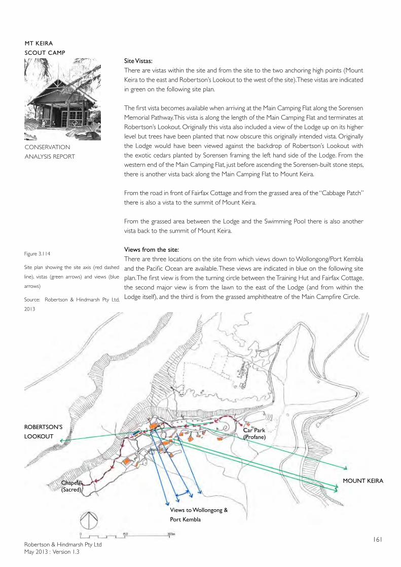
Robertson & Hindmarsh Pty LtdMay 2013 : Version 1.3
161
MT KEIRA
SCOUT CAMP
CONSERVATION
ANALYSIS REPORT
Site Vistas:There are vistas within the site and from the site to the two anchoring high points (Mount Keira to the east and Robertson’s Lookout to the west of the site). These vistas are indicated in green on the following site plan.
The first vista becomes available when arriving at the Main Camping Flat along the Sorensen Memorial Pathway. This vista is along the length of the Main Camping Flat and terminates at Robertson’s Lookout. Originally this vista also included a view of the Lodge up on its higher level but trees have been planted that now obscure this originally intended vista. Originally the Lodge would have been viewed against the backdrop of Robertson’s Lookout with the exotic cedars planted by Sorensen framing the left hand side of the Lodge. From the western end of the Main Camping Flat, just before ascending the Sorensen-built stone steps, there is another vista back along the Main Camping Flat to Mount Keira.
From the road in front of Fairfax Cottage and from the grassed area of the “Cabbage Patch” there is also a vista to the summit of Mount Keira.
From the grassed area between the Lodge and the Swimming Pool there is also another vista back to the summit of Mount Keira.
Views from the site:There are three locations on the site from which views down to Wollongong/Port Kembla and the Pacific Ocean are available. These views are indicated in blue on the following site plan. The first view is from the turning circle between the Training Hut and Fairfax Cottage, the second major view is from the lawn to the east of the Lodge (and from within the Lodge itself), and the third is from the grassed amphitheatre of the Main Campfire Circle.
Figure 3.114
Site plan showing the site axis (red dashed
line), vistas (green arrows) and views (blue
arrows)
Source: Robertson & Hindmarsh Pty Ltd,
2013
MOUNT KEIRA
ROBERTSON’S
LOOKOUTCar Park (Profane)
Chapel/ (Sacred)
Views to Wollongong &
Port Kembla
Robertson & Hindmarsh Pty LtdMay 2013 : Version 1.3
162
MT KEIRA
SCOUT CAMP
CONSERVATION
ANALYSIS REPORT
3.12 CURTILAGE
The NSW Heritage Office definition of curtilage is used as a basis for determining the heritage curtilage of the Mount Keira Scout Camp site. The Heritage Office definition is: “the term ‘heritage curtilage’ means the area of land (including land covered by water) surrounding an item or area of heritage significance which is essential for retaining and interpreting its heritage significance”.
The NSW Heritage Office publication, Heritage Curtilages, identifies four types of heritage curtilages; Lot Boundary Heritage Curtilage, Reduced Heritage Curtilage, Expanded Heritage Curtilage, and Component Heritage Curtilage. The definitions of these four types of curtilage are:
Lot Heritage Curtilage: The curtilage boundary coincides with the legal lot boundary, Reduced Heritage Curtilage: The curtilage boundary is smaller than the legal lot boundary, Expanded Heritage Curtilage: The curtilage is larger than the legal lot upon which the item is situated, Composite Heritage Curtilage: This type of curtilage applies to conservation areas and is defined by numerous legal lots aggregated to form the area.
In the context of the Mount Keira Scout Camp numerous types of curtilages overlay the site:
The Scout Licence Area could be defined as a curtilage equivalent to a Lot Heritage Curtilage. Whilst this takes into account the site needed to accommodate scouting activities it does not take into account points outside the site that are important to the understanding of the site. Nor does it take into account environmentally sensitive parts of the lease area (such as the banks of the creeks that cross the site). The Scout Licence Area is shown in Figure 1.5.
The surrounding cliffs and mountain tops (Robertson’s Lookout to the west and Mount Keira to the east) form part of the visual curtilage of the scout camp site. If development were to take place on either of those prominences the development would have an impact on the significance of the site in terms of the site being set within a natural, forest environment. Likewise, the views from the site down the Escarpment to Wollongong and Port Kembla have always been an important feature of the site and a part of its significance being away from the urban area and looking down over it – a sense of separation and otherworldliness. This expanded visual curtilage is described in Figure 3.114.
The surrounding rainforest also forms a natural visual barrier to the site. Most of the scouting activities are located within the boundary circumscribed by the rainforest around the cleared areas and the buildings. An exception to this is the path to the Chapel and the Chapel itself which are located within the rainforest. Another functional exception is the camp water supply weir and tanks which are located above the “functional area” of the camp site within the rainforest. This functional curtilage described by the endemic rainforest is also shown in Figure 1.5 with respect to Precincts A, B, C, D, E, and F. Precinct G partly follows the boundary defined by forest but it also crosses Byarong Creek and encompasses the entry road. It, therefore, includes land that should not be considered functionally part of the camp (ie the creek and its banks). Precinct H includes the water supply to the camp but also includes Ring’s Farm which is a part of the camp site from an historical point-of-view
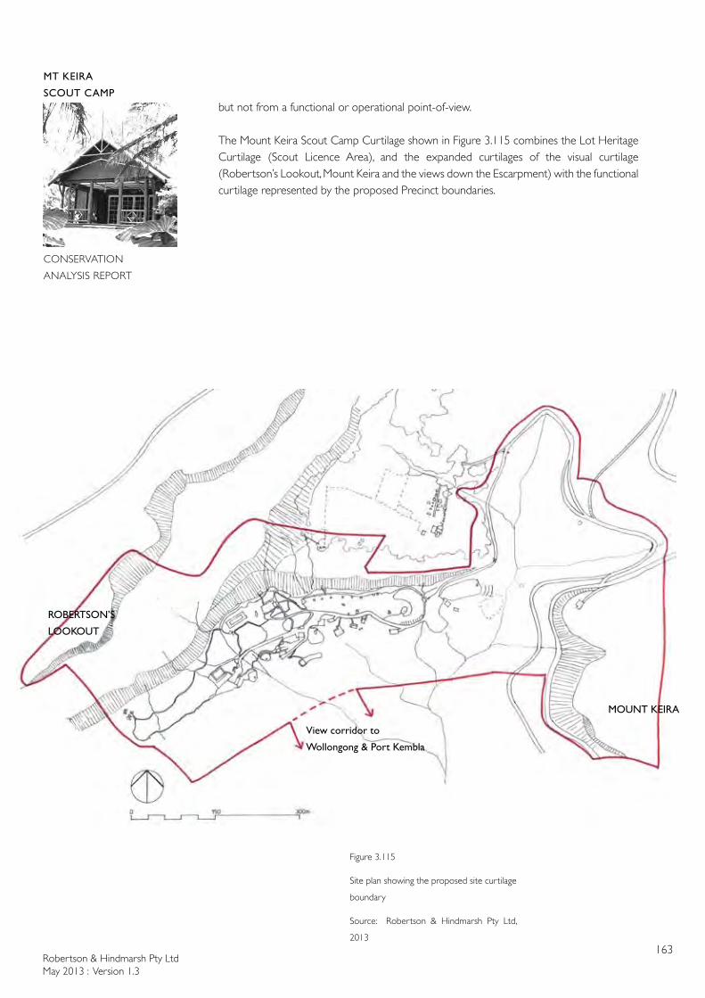
Robertson & Hindmarsh Pty LtdMay 2013 : Version 1.3
163
MT KEIRA
SCOUT CAMP
CONSERVATION
ANALYSIS REPORT
Figure 3.115
Site plan showing the proposed site curtilage
boundary
Source: Robertson & Hindmarsh Pty Ltd,
2013
MOUNT KEIRA
ROBERTSON’S
LOOKOUT
View corridor to
Wollongong & Port Kembla
but not from a functional or operational point-of-view.
The Mount Keira Scout Camp Curtilage shown in Figure 3.115 combines the Lot Heritage Curtilage (Scout Licence Area), and the expanded curtilages of the visual curtilage (Robertson’s Lookout, Mount Keira and the views down the Escarpment) with the functional curtilage represented by the proposed Precinct boundaries.
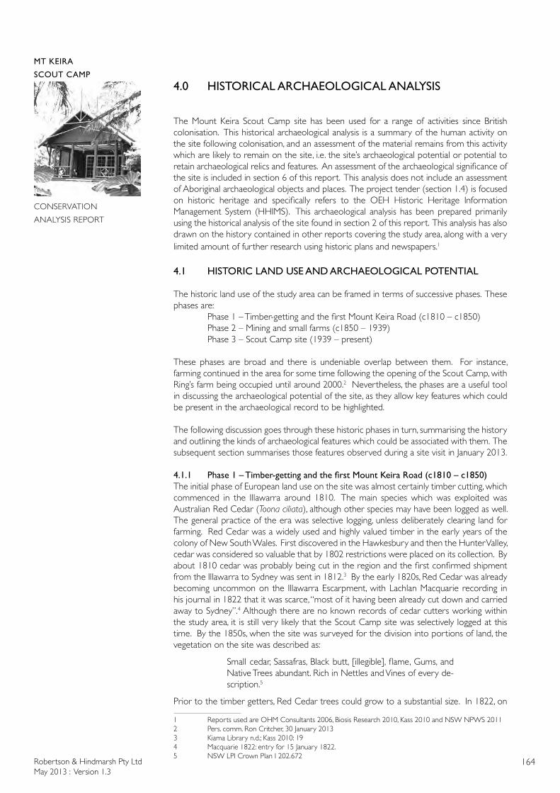
Robertson & Hindmarsh Pty LtdMay 2013 : Version 1.3
164
MT KEIRA
SCOUT CAMP
CONSERVATION
ANALYSIS REPORT
4.0 HISTORICAL ARCHAEOLOGICAL ANALYSIS
The Mount Keira Scout Camp site has been used for a range of activities since British colonisation. This historical archaeological analysis is a summary of the human activity on the site following colonisation, and an assessment of the material remains from this activity which are likely to remain on the site, i.e. the site’s archaeological potential or potential to retain archaeological relics and features. An assessment of the archaeological significance of the site is included in section 6 of this report. This analysis does not include an assessment of Aboriginal archaeological objects and places. The project tender (section 1.4) is focused on historic heritage and specifically refers to the OEH Historic Heritage Information Management System (HHIMS). This archaeological analysis has been prepared primarily using the historical analysis of the site found in section 2 of this report. This analysis has also drawn on the history contained in other reports covering the study area, along with a very limited amount of further research using historic plans and newspapers.1
4.1 HISTORIC LAND USE AND ARCHAEOLOGICAL POTENTIAL
The historic land use of the study area can be framed in terms of successive phases. These phases are: Phase 1 – Timber-getting and the first Mount Keira Road (c1810 – c1850) Phase 2 – Mining and small farms (c1850 – 1939) Phase 3 – Scout Camp site (1939 – present)
These phases are broad and there is undeniable overlap between them. For instance, farming continued in the area for some time following the opening of the Scout Camp, with Ring’s farm being occupied until around 2000.2 Nevertheless, the phases are a useful tool in discussing the archaeological potential of the site, as they allow key features which could be present in the archaeological record to be highlighted.
The following discussion goes through these historic phases in turn, summarising the history and outlining the kinds of archaeological features which could be associated with them. The subsequent section summarises those features observed during a site visit in January 2013.
4.1.1 Phase1–Timber-gettingandthefirstMountKeiraRoad(c1810–c1850)The initial phase of European land use on the site was almost certainly timber cutting, which commenced in the Illawarra around 1810. The main species which was exploited was Australian Red Cedar (Toona ciliata), although other species may have been logged as well. The general practice of the era was selective logging, unless deliberately clearing land for farming. Red Cedar was a widely used and highly valued timber in the early years of the colony of New South Wales. First discovered in the Hawkesbury and then the Hunter Valley, cedar was considered so valuable that by 1802 restrictions were placed on its collection. By about 1810 cedar was probably being cut in the region and the first confirmed shipment from the Illawarra to Sydney was sent in 1812.3 By the early 1820s, Red Cedar was already becoming uncommon on the Illawarra Escarpment, with Lachlan Macquarie recording in his journal in 1822 that it was scarce, “most of it having been already cut down and carried away to Sydney”.4 Although there are no known records of cedar cutters working within the study area, it is still very likely that the Scout Camp site was selectively logged at this time. By the 1850s, when the site was surveyed for the division into portions of land, the vegetation on the site was described as:
Small cedar, Sassafras, Black butt, [illegible], flame, Gums, and Native Trees abundant. Rich in Nettles and Vines of every de-scription.5
Prior to the timber getters, Red Cedar trees could grow to a substantial size. In 1822, on
1 Reports used are OHM Consultants 2006, Biosis Research 2010, Kass 2010 and NSW NPWS 20112 Pers. comm. Ron Critcher, 30 January 20133 Kiama Library n.d.; Kass 2010: 194 Macquarie 1822: entry for 15 January 1822.5 NSW LPI Crown Plan I 202.672
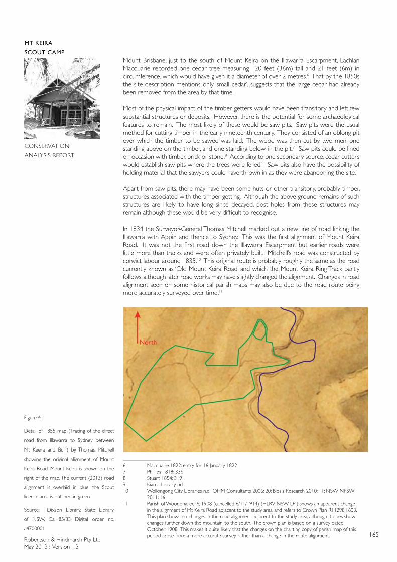
Robertson & Hindmarsh Pty LtdMay 2013 : Version 1.3
165
MT KEIRA
SCOUT CAMP
CONSERVATION
ANALYSIS REPORT
Mount Brisbane, just to the south of Mount Keira on the Illawarra Escarpment, Lachlan Macquarie recorded one cedar tree measuring 120 feet (36m) tall and 21 feet (6m) in circumference, which would have given it a diameter of over 2 metres.6 That by the 1850s the site description mentions only ‘small cedar’, suggests that the large cedar had already been removed from the area by that time.
Most of the physical impact of the timber getters would have been transitory and left few substantial structures or deposits. However, there is the potential for some archaeological features to remain. The most likely of these would be saw pits. Saw pits were the usual method for cutting timber in the early nineteenth century. They consisted of an oblong pit over which the timber to be sawed was laid. The wood was then cut by two men, one standing above on the timber, and one standing below, in the pit.7 Saw pits could be lined on occasion with timber, brick or stone.8 According to one secondary source, cedar cutters would establish saw pits where the trees were felled.9 Saw pits also have the possibility of holding material that the sawyers could have thrown in as they were abandoning the site.
Apart from saw pits, there may have been some huts or other transitory, probably timber, structures associated with the timber getting. Although the above ground remains of such structures are likely to have long since decayed, post holes from these structures may remain although these would be very difficult to recognise.
In 1834 the Surveyor-General Thomas Mitchell marked out a new line of road linking the Illawarra with Appin and thence to Sydney. This was the first alignment of Mount Keira Road. It was not the first road down the Illawarra Escarpment but earlier roads were little more than tracks and were often privately built. Mitchell’s road was constructed by convict labour around 1835.10 This original route is probably roughly the same as the road currently known as ‘Old Mount Keira Road’ and which the Mount Keira Ring Track partly follows, although later road works may have slightly changed the alignment. Changes in road alignment seen on some historical parish maps may also be due to the road route being more accurately surveyed over time.11
6 Macquarie 1822: entry for 16 January 18227 Phillips 1818: 3368 Stuart 1854: 3199 Kiama Library nd10 Wollongong City Libraries n.d.; OHM Consultants 2006: 20; Biosis Research 2010: 11; NSW NPSW 2011: 1611 Parish of Woonona, ed. 6, 1908 (cancelled 6/11/1914) (HLRV, NSW LPI) shows an apparent change in the alignment of Mt Keira Road adjacent to the study area, and refers to Crown Plan R11298.1603. This plan shows no changes in the road alignment adjacent to the study area, although it does show changes further down the mountain, to the south. The crown plan is based on a survey dated October 1908. This makes it quite likely that the changes on the charting copy of parish map of this period arose from a more accurate survey rather than a change in the route alignment.
Figure 4.1
Detail of 1855 map (Tracing of the direct
road from Illawarra to Sydney between
Mt Keera and Bulli) by Thomas Mitchell
showing the original alignment of Mount
Keira Road. Mount Keira is shown on the
right of the map. The current (2013) road
alignment is overlaid in blue, the Scout
licence area is outlined in green
Source: Dixson Library, State Library
of NSW, Ca 85/33 Digital order no.
a4700001
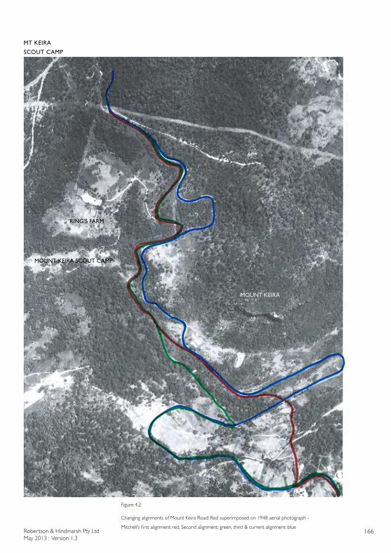
Robertson & Hindmarsh Pty LtdMay 2013 : Version 1.3
166
MT KEIRA
SCOUT CAMP
CONSERVATION
ANALYSIS REPORT
Figure 4.2
Changing alignments of Mount Keira Road: Red superimposed on 1948 aerial photograph -
Mitchell’s first alignment: red, Second alignment: green, third & current alignment: blue
MOUNT KEIRA SCOUT CAMP
MOUNT KEIRA
RING’S FARM
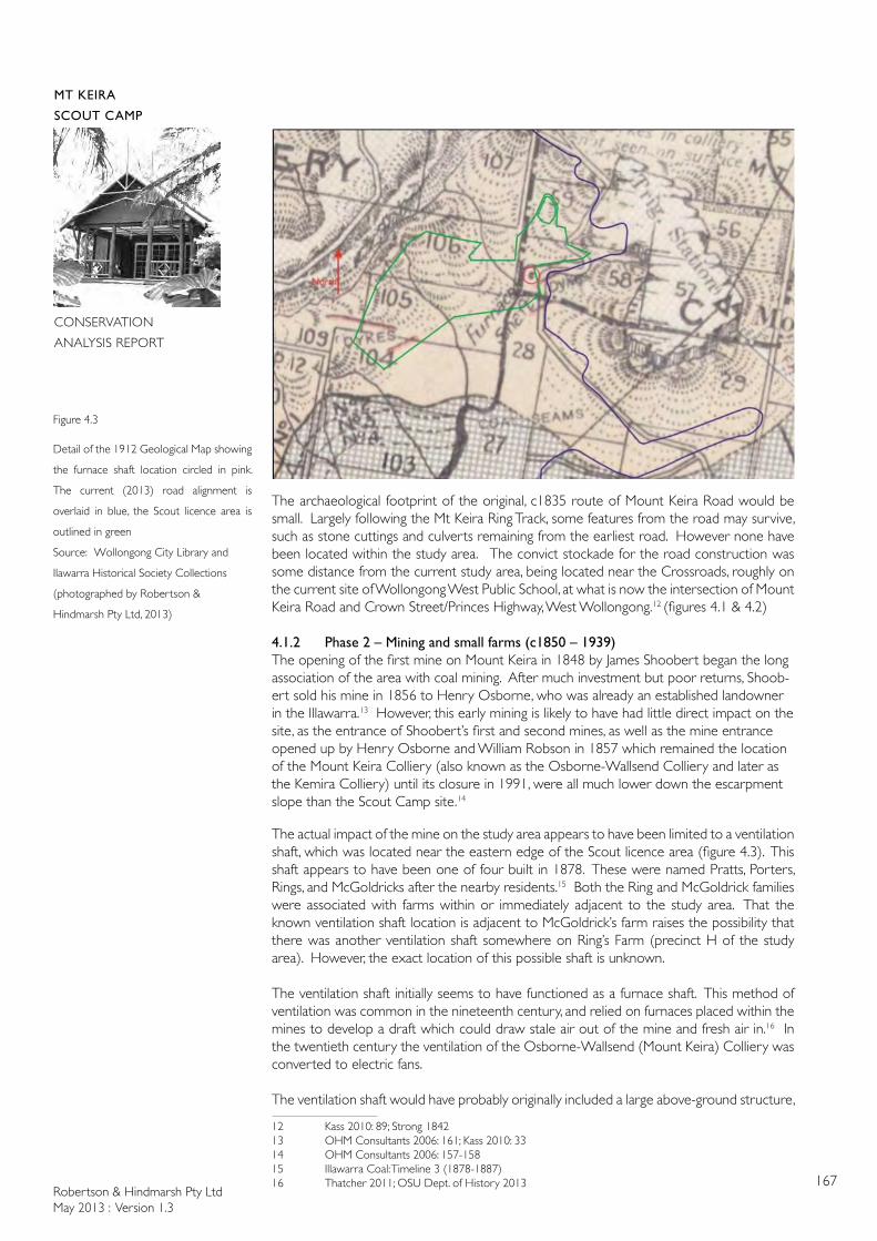
Robertson & Hindmarsh Pty LtdMay 2013 : Version 1.3
167
MT KEIRA
SCOUT CAMP
CONSERVATION
ANALYSIS REPORT
The archaeological footprint of the original, c1835 route of Mount Keira Road would be small. Largely following the Mt Keira Ring Track, some features from the road may survive, such as stone cuttings and culverts remaining from the earliest road. However none have been located within the study area. The convict stockade for the road construction was some distance from the current study area, being located near the Crossroads, roughly on the current site of Wollongong West Public School, at what is now the intersection of Mount Keira Road and Crown Street/Princes Highway, West Wollongong.12 (figures 4.1 & 4.2)
4.1.2 Phase 2 – Mining and small farms (c1850 – 1939) The opening of the first mine on Mount Keira in 1848 by James Shoobert began the long association of the area with coal mining. After much investment but poor returns, Shoob-ert sold his mine in 1856 to Henry Osborne, who was already an established landowner in the Illawarra.13 However, this early mining is likely to have had little direct impact on the site, as the entrance of Shoobert’s first and second mines, as well as the mine entrance opened up by Henry Osborne and William Robson in 1857 which remained the location of the Mount Keira Colliery (also known as the Osborne-Wallsend Colliery and later as the Kemira Colliery) until its closure in 1991, were all much lower down the escarpment slope than the Scout Camp site.14
The actual impact of the mine on the study area appears to have been limited to a ventilation shaft, which was located near the eastern edge of the Scout licence area (figure 4.3). This shaft appears to have been one of four built in 1878. These were named Pratts, Porters, Rings, and McGoldricks after the nearby residents.15 Both the Ring and McGoldrick families were associated with farms within or immediately adjacent to the study area. That the known ventilation shaft location is adjacent to McGoldrick’s farm raises the possibility that there was another ventilation shaft somewhere on Ring’s Farm (precinct H of the study area). However, the exact location of this possible shaft is unknown.
The ventilation shaft initially seems to have functioned as a furnace shaft. This method of ventilation was common in the nineteenth century, and relied on furnaces placed within the mines to develop a draft which could draw stale air out of the mine and fresh air in.16 In the twentieth century the ventilation of the Osborne-Wallsend (Mount Keira) Colliery was converted to electric fans.
The ventilation shaft would have probably originally included a large above-ground structure,
12 Kass 2010: 89; Strong 184213 OHM Consultants 2006: 161; Kass 2010: 3314 OHM Consultants 2006: 157-15815 Illawarra Coal: Timeline 3 (1878-1887)16 Thatcher 2011; OSU Dept. of History 2013
Figure 4.3
Detail of the 1912 Geological Map showing
the furnace shaft location circled in pink.
The current (2013) road alignment is
overlaid in blue, the Scout licence area is
outlined in green
Source: Wollongong City Library and
Ilawarra Historical Society Collections
(photographed by Robertson &
Hindmarsh Pty Ltd, 2013)
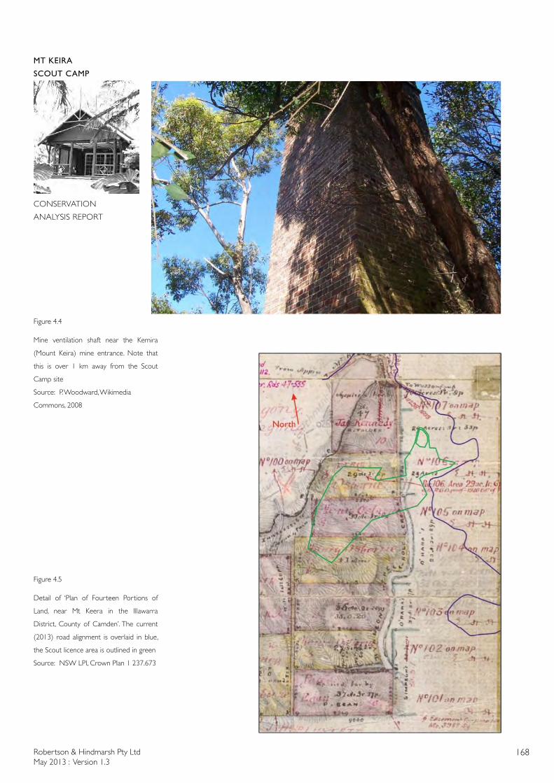
Robertson & Hindmarsh Pty LtdMay 2013 : Version 1.3
168
MT KEIRA
SCOUT CAMP
CONSERVATION
ANALYSIS REPORT
Figure 4.4
Mine ventilation shaft near the Kemira
(Mount Keira) mine entrance. Note that
this is over 1 km away from the Scout
Camp site
Source: P. Woodward, Wikimedia
Commons, 2008
Figure 4.5
Detail of ‘Plan of Fourteen Portions of
Land, near Mt Keera in the Illawarra
District, County of Camden’. The current
(2013) road alignment is overlaid in blue,
the Scout licence area is outlined in green
Source: NSW LPI, Crown Plan 1 237.673
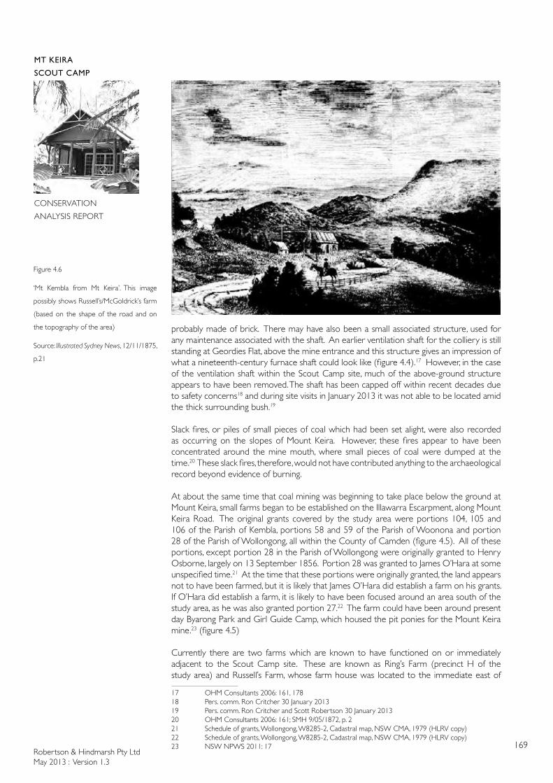
Robertson & Hindmarsh Pty LtdMay 2013 : Version 1.3
169
MT KEIRA
SCOUT CAMP
CONSERVATION
ANALYSIS REPORT
probably made of brick. There may have also been a small associated structure, used for any maintenance associated with the shaft. An earlier ventilation shaft for the colliery is still standing at Geordies Flat, above the mine entrance and this structure gives an impression of what a nineteenth-century furnace shaft could look like (figure 4.4).17 However, in the case of the ventilation shaft within the Scout Camp site, much of the above-ground structure appears to have been removed. The shaft has been capped off within recent decades due to safety concerns18 and during site visits in January 2013 it was not able to be located amid the thick surrounding bush.19
Slack fires, or piles of small pieces of coal which had been set alight, were also recorded as occurring on the slopes of Mount Keira. However, these fires appear to have been concentrated around the mine mouth, where small pieces of coal were dumped at the time.20 These slack fires, therefore, would not have contributed anything to the archaeological record beyond evidence of burning.
At about the same time that coal mining was beginning to take place below the ground at Mount Keira, small farms began to be established on the Illawarra Escarpment, along Mount Keira Road. The original grants covered by the study area were portions 104, 105 and 106 of the Parish of Kembla, portions 58 and 59 of the Parish of Woonona and portion 28 of the Parish of Wollongong, all within the County of Camden (figure 4.5). All of these portions, except portion 28 in the Parish of Wollongong were originally granted to Henry Osborne, largely on 13 September 1856. Portion 28 was granted to James O’Hara at some unspecified time.21 At the time that these portions were originally granted, the land appears not to have been farmed, but it is likely that James O’Hara did establish a farm on his grants. If O’Hara did establish a farm, it is likely to have been focused around an area south of the study area, as he was also granted portion 27.22 The farm could have been around present day Byarong Park and Girl Guide Camp, which housed the pit ponies for the Mount Keira mine.23 (figure 4.5)
Currently there are two farms which are known to have functioned on or immediately adjacent to the Scout Camp site. These are known as Ring’s Farm (precinct H of the study area) and Russell’s Farm, whose farm house was located to the immediate east of
17 OHM Consultants 2006: 161, 17818 Pers. comm. Ron Critcher 30 January 201319 Pers. comm. Ron Critcher and Scott Robertson 30 January 201320 OHM Consultants 2006: 161; SMH 9/05/1872, p. 221 Schedule of grants, Wollongong, W8285-2, Cadastral map, NSW CMA, 1979 (HLRV copy)22 Schedule of grants, Wollongong, W8285-2, Cadastral map, NSW CMA, 1979 (HLRV copy)23 NSW NPWS 2011: 17
Figure 4.6
‘Mt Kembla from Mt Keira’. This image
possibly shows Russell’s/McGoldrick’s farm
(based on the shape of the road and on
the topography of the area)
Source: Illustrated Sydney News, 12/11/1875,
p.21
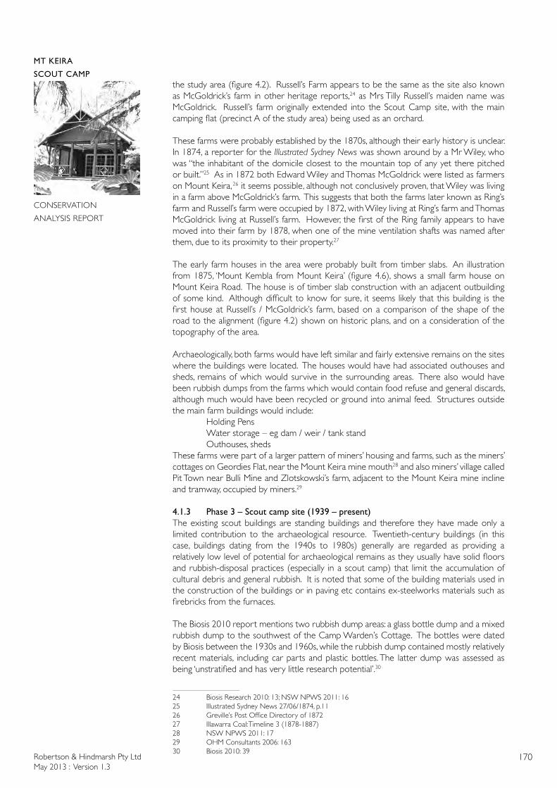
Robertson & Hindmarsh Pty LtdMay 2013 : Version 1.3
170
MT KEIRA
SCOUT CAMP
CONSERVATION
ANALYSIS REPORT
the study area (figure 4.2). Russell’s Farm appears to be the same as the site also known as McGoldrick’s farm in other heritage reports,24 as Mrs Tilly Russell’s maiden name was McGoldrick. Russell’s farm originally extended into the Scout Camp site, with the main camping flat (precinct A of the study area) being used as an orchard.
These farms were probably established by the 1870s, although their early history is unclear. In 1874, a reporter for the Illustrated Sydney News was shown around by a Mr Wiley, who was “the inhabitant of the domicile closest to the mountain top of any yet there pitched or built.”25 As in 1872 both Edward Wiley and Thomas McGoldrick were listed as farmers on Mount Keira, 26 it seems possible, although not conclusively proven, that Wiley was living in a farm above McGoldrick’s farm. This suggests that both the farms later known as Ring’s farm and Russell’s farm were occupied by 1872, with Wiley living at Ring’s farm and Thomas McGoldrick living at Russell’s farm. However, the first of the Ring family appears to have moved into their farm by 1878, when one of the mine ventilation shafts was named after them, due to its proximity to their property.27
The early farm houses in the area were probably built from timber slabs. An illustration from 1875, ‘Mount Kembla from Mount Keira’ (figure 4.6), shows a small farm house on Mount Keira Road. The house is of timber slab construction with an adjacent outbuilding of some kind. Although difficult to know for sure, it seems likely that this building is the first house at Russell’s / McGoldrick’s farm, based on a comparison of the shape of the road to the alignment (figure 4.2) shown on historic plans, and on a consideration of the topography of the area.
Archaeologically, both farms would have left similar and fairly extensive remains on the sites where the buildings were located. The houses would have had associated outhouses and sheds, remains of which would survive in the surrounding areas. There also would have been rubbish dumps from the farms which would contain food refuse and general discards, although much would have been recycled or ground into animal feed. Structures outside the main farm buildings would include: Holding Pens Water storage – eg dam / weir / tank stand Outhouses, shedsThese farms were part of a larger pattern of miners’ housing and farms, such as the miners’ cottages on Geordies Flat, near the Mount Keira mine mouth28 and also miners’ village called Pit Town near Bulli Mine and Zlotskowski’s farm, adjacent to the Mount Keira mine incline and tramway, occupied by miners.29
4.1.3 Phase 3 – Scout camp site (1939 – present)The existing scout buildings are standing buildings and therefore they have made only a limited contribution to the archaeological resource. Twentieth-century buildings (in this case, buildings dating from the 1940s to 1980s) generally are regarded as providing a relatively low level of potential for archaeological remains as they usually have solid floors and rubbish-disposal practices (especially in a scout camp) that limit the accumulation of cultural debris and general rubbish. It is noted that some of the building materials used in the construction of the buildings or in paving etc contains ex-steelworks materials such as firebricks from the furnaces.
The Biosis 2010 report mentions two rubbish dump areas: a glass bottle dump and a mixed rubbish dump to the southwest of the Camp Warden’s Cottage. The bottles were dated by Biosis between the 1930s and 1960s, while the rubbish dump contained mostly relatively recent materials, including car parts and plastic bottles. The latter dump was assessed as being ‘unstratified and has very little research potential’.30
24 Biosis Research 2010: 13; NSW NPWS 2011: 1625 Illustrated Sydney News 27/06/1874, p.1126 Greville’s Post Office Directory of 187227 Illawarra Coal: Timeline 3 (1878-1887)28 NSW NPWS 2011: 1729 OHM Consultants 2006: 16330 Biosis 2010: 39
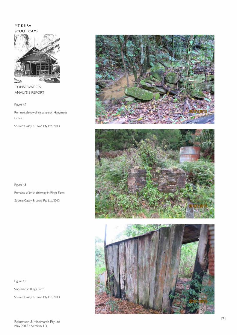
Robertson & Hindmarsh Pty LtdMay 2013 : Version 1.3
171
MT KEIRA
SCOUT CAMP
CONSERVATION
ANALYSIS REPORT
Figure 4.7
Remnant dam/weir structure on Hangman’s
Creek
Source: Casey & Lowe Pty Ltd, 2013
Figure 4.8
Remains of brick chimney in Ring’s Farm
Source: Casey & Lowe Pty Ltd, 2013
Figure 4.9
Slab shed in Ring’s Farm
Source: Casey & Lowe Pty Ltd, 2013
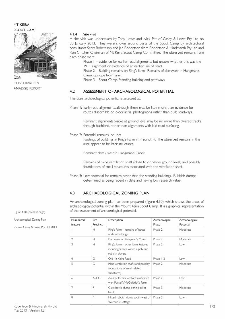
Robertson & Hindmarsh Pty LtdMay 2013 : Version 1.3
172
MT KEIRA
SCOUT CAMP
CONSERVATION
ANALYSIS REPORT
4.1.4 Site visitA site visit was undertaken by Tony Lowe and Nick Pitt of Casey & Lowe Pty Ltd on 30 January 2013. They were shown around parts of the Scout Camp by architectural consultants Scott Robertson and Jan Robertson from Robertson & Hindmarsh Pty Ltd and Ron Critcher, Chairman of Mt Keira Scout Camp Committee. The observed remains from each phase were: Phase 1 – evidence for earlier road alignments but unsure whether this was the 1911 alignment or evidence of an earlier line of road. Phase 2 – Building remains on Ring’s farm. Remains of dam/weir in Hangman’s Creek upslope from farm. Phase 3 – Scout Camp. Standing building and pathways.
4.2 ASSESSMENT OF ARCHAEOLOGICAL POTENTIAL
The site’s archaeological potential is assessed as:
Phase 1: Early road alignments, although these may be little more than evidence for routes discernible on older aerial photographs rather than built roadways.
Remnant alignments visible at ground level may be no more than cleared tracks through bushland, rather than alignments with laid road surfacing.
Phase 2: Potential remains include: Footings of buildings in Ring’s Farm in Precinct H. The observed remains in this area appear to be later structures. Remnant dam / weir in Hangman’s Creek.
Remains of mine ventilation shaft (close to or below ground level) and possibly foundations of small structures associated with the ventilation shaft.
Phase 3: Low potential for remains other than the standing buildings. Rubbish dumps determined as being recent in date and having low research value.
4.3 ARCHAEOLOGICAL ZONING PLAN
An archaeological zoning plan has been prepared (figure 4.10), which shows the areas of archaeological potential within the Mount Keira Scout Camp. It is a graphical representation of the assessment of archaeological potential.
Numbered
feature
Site
Precinct
Description Archaeological
Phase
Archaeological
Potential
1 H Ring’s Farm – remains of house
and outbuildings
Phase 2 Moderate
2 H Dam/weir on Hangman’s Creek Phase 2 Moderate
3 H Ring’s Farm – other farm features
including fences, water supply and
rubbish dumps
Phase 2 Low
4 G Old Mt Keira Road Phase 1-2 Low
5 G Mine ventilation shaft (and possibly
foundations of small related
structures)
Phase 2 Moderate
6 A & G Area of former orchard associated
with Russell’s/McGoldrick’s Farm
Phase 2 Low
7 F Glass bottle dump behind toilet
block
Phase 3 Moderate
8 F Mixed rubbish dump south-west of
Warden’s Cottage
Phase 3 Low
Figure 4.10 (on next page)
Archaeological Zoning Plan
Source: Casey & Lowe Pty Ltd, 2013
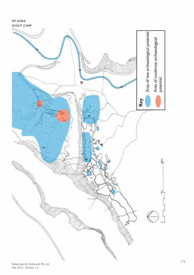
Robertson & Hindmarsh Pty LtdMay 2013 : Version 1.3
173
MT KEIRA
SCOUT CAMP
CONSERVATION
ANALYSIS REPORT
Robertson & Hindmarsh Pty LtdMay 2013 : Version 1.3
174
MT KEIRA
SCOUT CAMP
CONSERVATION
ANALYSIS REPORT
Recommendations
Recommendations based on zoning:
Archaeological Potential
Recommendations
Moderate Archaeological monitoring of all ground disturbing activities is required.
Archaeological monitoring of other works with the likelihood of disturbing remains (eg extensive clearing of vegetation directly adjacent to standing remains) is recommended.
Major works with the likelihood of impacting on the archaeological remains should be monitored by an archaeologist.
If potential remains are found, they should be assessed by an archaeologist.
Low Archaeological monitoring is generally not required for ground disturbing activities.
If potential remains are found, they should be assessed by an archaeologist.
4.4 DISCUSSION OF ARCHAEOLOGICAL SIGNIFICANCE
The significance of the archaeological remains at the Mount Keira Scout Camp can be defined by applying the significance guidelines:
Criterion(a):HistoricSignificance-(evolution) an item is important in the course, or pattern, of NSW’s cultural or natural history (or the cultural or natural history of the local area);
The potential archaeological remains are unlikely to add substantial information to the place’s historic knowledge base.
Criterion(b):AssociativeSignificance–(association)an item has strong or special association with the life or works of a person, or group of persons, or importance in NSW’s cultural or natural history (or the cultural or natural history of the local area);
The site’s archaeological remains would be associated with the scout group and with Ring’s farm.
Criterion(c):AestheticSignificance-(scenicqualities/creativeaccomplishments)an item is important in demonstrating aesthetic characteristics and/or a high degree of creative or technical achievement in NSW (or the cultural or natural history of the local area);
This criterion is unlikely to be relevant with the site’s potential archaeological remains.
Criterion(d):SocialSignificance-(contemporarycommunityesteem)an item has a strong or special association with a particular community or cultural group in NSW for social, cultural or spiritual reasons (or the cultural or natural history of the local area);
Any remains relating to the use of the land by the scouts are likely to have importance to those members interested in the history of the site.
Robertson & Hindmarsh Pty LtdMay 2013 : Version 1.3
175
MT KEIRA
SCOUT CAMP
CONSERVATION
ANALYSIS REPORT
Criterion (e):Technical/Research Significance - (archaeological, educational, researchpotentialandscientificvalues)an item has potential to yield information that will contribute to an understanding of NSW’s cultural or natural history (or the cultural or natural history of the local area);
The potential archaeological remains are unlikely to retain technical or research value.
Criterion (f): Rarityan item possesses uncommon, rare or endangered aspects of NSW’s cultural or natural history (or the cultural or natural history of the local area);
The potential remains are unlikely to be considered rare or endangered.
Criterion (g): Representativeness an item is important in demonstrating the principal characteristics of a class of NSW’s cultural or natural places of cultural or natural environments (or the cultural or natural history of the local area);
The archaeological remains on the site would include examples of farm and road building in country NSW areas and of sporting and club-type constructions.
Does the site: (a) contribute knowledge which no other resource can?
While the buildings relating to the scout camp have significance, the potential archaeological remains are unlikely to add meaningful information regarding the use of the place. The remains within Ring’s Farm appear to be of later structures which are regarded as having limited potential to provide additional information about the place’s land-use.
(b) contribute knowledge which no other site can?
While most of the remains within the site are unlikely to be repeated elsewhere, the remains are seen as having only limited ability to provide additional knowledge about the place.
(c) is the knowledge relevant to general questions about human history or other substantive problems relating to Australian History, or does it contribute to other major research questions?
Any knowledge that may be derived from the potential archaeological remains is unlikely to be able to contribute to major research questions regarding either nineteenth-century settlement of the area or the creation of the 1940s scout camp.
4.5 STATEMENT OF ARCHAEOLOGICAL SIGNIFICANCE
The archaeological remains within the Mount Keira Scout Camp are seen as being limited in nature and their ability to contribute to meaningful research is therefore restricted. Any substantive remains from the nineteenth century farms or initial scout period would have some potential to contribute knowledge and therefore may be of Local heritage significance.
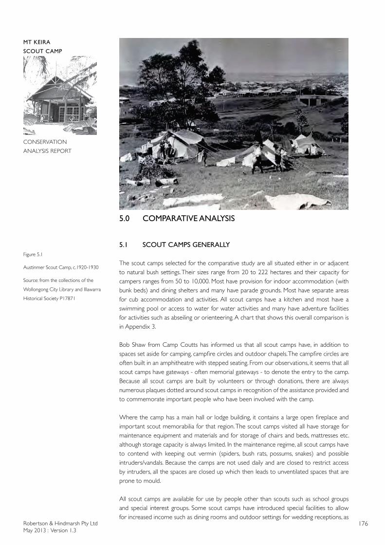
Robertson & Hindmarsh Pty LtdMay 2013 : Version 1.3
176
MT KEIRA
SCOUT CAMP
CONSERVATION
ANALYSIS REPORT
5.0 COMPARATIVE ANALYSIS
5.1 SCOUT CAMPS GENERALLY
The scout camps selected for the comparative study are all situated either in or adjacent to natural bush settings. Their sizes range from 20 to 222 hectares and their capacity for campers ranges from 50 to 10,000. Most have provision for indoor accommodation (with bunk beds) and dining shelters and many have parade grounds. Most have separate areas for cub accommodation and activities. All scout camps have a kitchen and most have a swimming pool or access to water for water activities and many have adventure facilities for activities such as abseiling or orienteering. A chart that shows this overall comparison is in Appendix 3.
Bob Shaw from Camp Coutts has informed us that all scout camps have, in addition to spaces set aside for camping, campfire circles and outdoor chapels. The campfire circles are often built in an amphitheatre with stepped seating. From our observations, it seems that all scout camps have gateways - often memorial gateways - to denote the entry to the camp. Because all scout camps are built by volunteers or through donations, there are always numerous plaques dotted around scout camps in recognition of the assistance provided and to commemorate important people who have been involved with the camp.
Where the camp has a main hall or lodge building, it contains a large open fireplace and important scout memorabilia for that region. The scout camps visited all have storage for maintenance equipment and materials and for storage of chairs and beds, mattresses etc. although storage capacity is always limited. In the maintenance regime, all scout camps have to contend with keeping out vermin (spiders, bush rats, possums, snakes) and possible intruders/vandals. Because the camps are not used daily and are closed to restrict access by intruders, all the spaces are closed up which then leads to unventilated spaces that are prone to mould.
All scout camps are available for use by people other than scouts such as school groups and special interest groups. Some scout camps have introduced special facilities to allow for increased income such as dining rooms and outdoor settings for wedding receptions, as
Figure 5.1
Austinmer Scout Camp, c.1920-1930
Source: from the collections of the
Wollongong City Library and Illawarra
Historical Society P17871
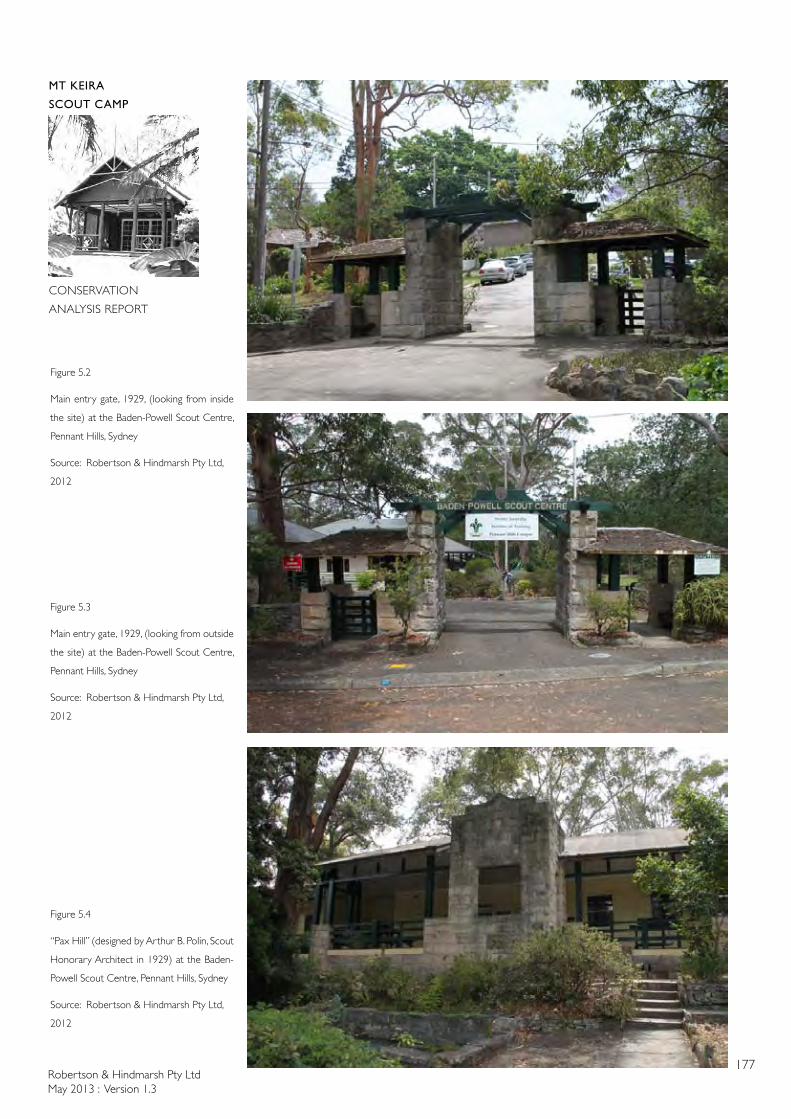
Robertson & Hindmarsh Pty LtdMay 2013 : Version 1.3
177
MT KEIRA
SCOUT CAMP
CONSERVATION
ANALYSIS REPORT
Figure 5.2
Main entry gate, 1929, (looking from inside
the site) at the Baden-Powell Scout Centre,
Pennant Hills, Sydney
Source: Robertson & Hindmarsh Pty Ltd,
2012
Figure 5.3
Main entry gate, 1929, (looking from outside
the site) at the Baden-Powell Scout Centre,
Pennant Hills, Sydney
Source: Robertson & Hindmarsh Pty Ltd,
2012
Figure 5.4
“Pax Hill” (designed by Arthur B. Polin, Scout
Honorary Architect in 1929) at the Baden-
Powell Scout Centre, Pennant Hills, Sydney
Source: Robertson & Hindmarsh Pty Ltd,
2012
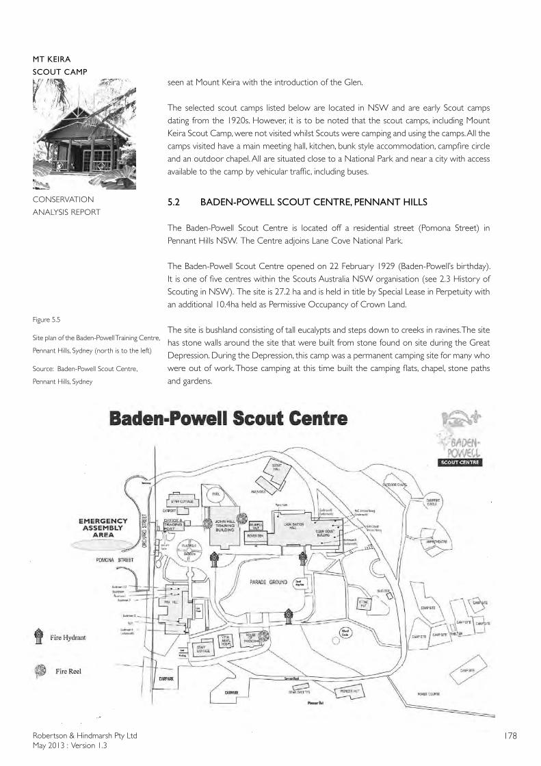
Robertson & Hindmarsh Pty LtdMay 2013 : Version 1.3
178
MT KEIRA
SCOUT CAMP
CONSERVATION
ANALYSIS REPORT
seen at Mount Keira with the introduction of the Glen.
The selected scout camps listed below are located in NSW and are early Scout camps dating from the 1920s. However, it is to be noted that the scout camps, including Mount Keira Scout Camp, were not visited whilst Scouts were camping and using the camps. All the camps visited have a main meeting hall, kitchen, bunk style accommodation, campfire circle and an outdoor chapel. All are situated close to a National Park and near a city with access available to the camp by vehicular traffic, including buses.
5.2 BADEN-POWELL SCOUT CENTRE, PENNANT HILLS
The Baden-Powell Scout Centre is located off a residential street (Pomona Street) in Pennant Hills NSW. The Centre adjoins Lane Cove National Park.
The Baden-Powell Scout Centre opened on 22 February 1929 (Baden-Powell’s birthday). It is one of five centres within the Scouts Australia NSW organisation (see 2.3 History of Scouting in NSW). The site is 27.2 ha and is held in title by Special Lease in Perpetuity with an additional 10.4ha held as Permissive Occupancy of Crown Land.
The site is bushland consisting of tall eucalypts and steps down to creeks in ravines. The site has stone walls around the site that were built from stone found on site during the Great Depression. During the Depression, this camp was a permanent camping site for many who were out of work. Those camping at this time built the camping flats, chapel, stone paths and gardens.
Figure 5.5
Site plan of the Baden-Powell Training Centre,
Pennant Hills, Sydney (north is to the left)
Source: Baden-Powell Scout Centre,
Pennant Hills, Sydney
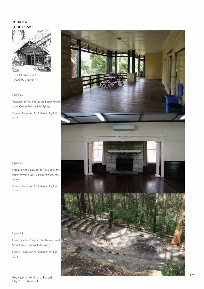
Robertson & Hindmarsh Pty LtdMay 2013 : Version 1.3
179
MT KEIRA
SCOUT CAMP
CONSERVATION
ANALYSIS REPORT
Figure 5.6
Verandah of “Pax Hill” at the Baden-Powell
Scout Centre, Pennant Hills, Sydney
Source: Robertson & Hindmarsh Pty Ltd,
2012
Figure 5.7
Fireplace in the main hall of “Pax Hill” at the
Baden-Powell Scout Centre, Pennant Hills,
Sydney
Source: Robertson & Hindmarsh Pty Ltd,
2012
Figure 5.8
Main Campfire Circle at the Baden-Powell
Scout Centre, Pennant Hills, Sydney
Source: Robertson & Hindmarsh Pty Ltd,
2012
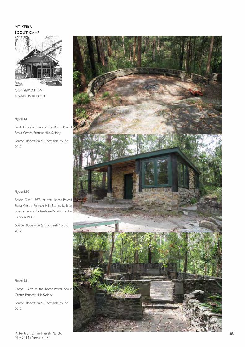
Robertson & Hindmarsh Pty LtdMay 2013 : Version 1.3
180
MT KEIRA
SCOUT CAMP
CONSERVATION
ANALYSIS REPORT
Figure 5.9
Small Campfire Circle at the Baden-Powell
Scout Centre, Pennant Hills, Sydney
Source: Robertson & Hindmarsh Pty Ltd,
2012
Figure 5.10
Rover Den, 1937, at the Baden-Powell
Scout Centre, Pennant Hills, Sydney. Built to
commemorate Baden-Powell’s visit to the
Camp in 1935
Source: Robertson & Hindmarsh Pty Ltd,
2012
Figure 5.11
Chapel, 1929, at the Baden-Powell Scout
Centre, Pennant Hills, Sydney
Source: Robertson & Hindmarsh Pty Ltd,
2012
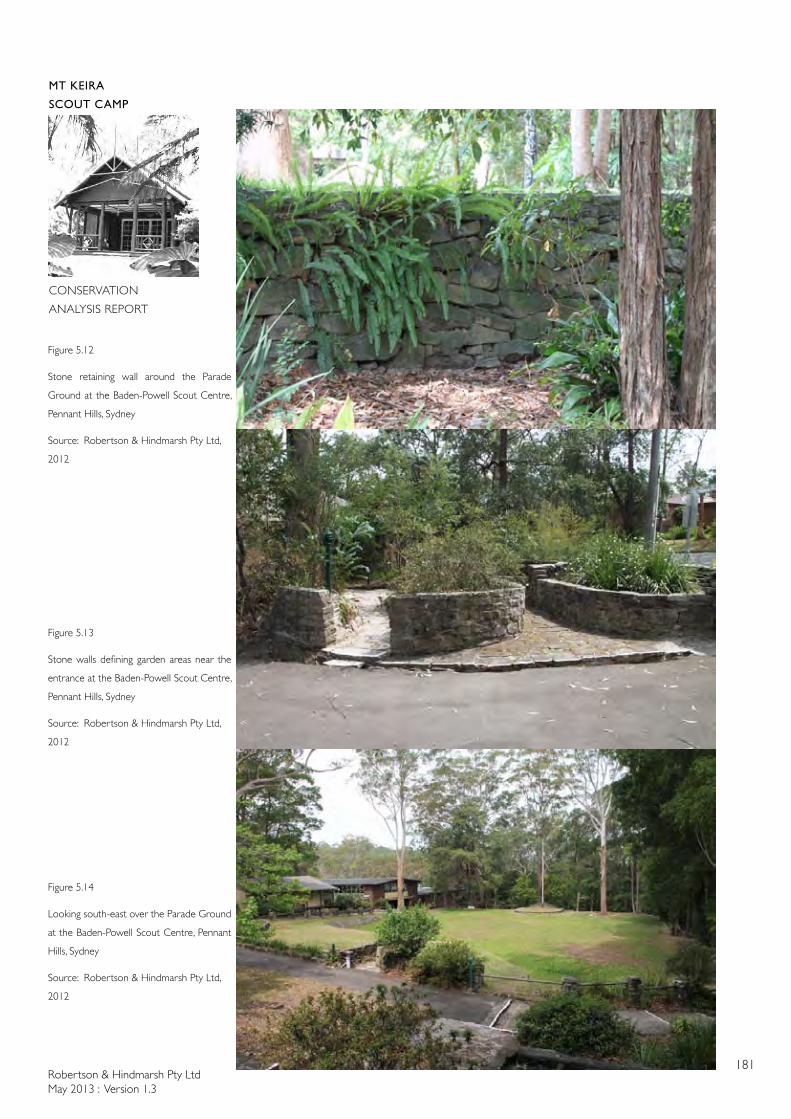
Robertson & Hindmarsh Pty LtdMay 2013 : Version 1.3
181
MT KEIRA
SCOUT CAMP
CONSERVATION
ANALYSIS REPORT
Figure 5.12
Stone retaining wall around the Parade
Ground at the Baden-Powell Scout Centre,
Pennant Hills, Sydney
Source: Robertson & Hindmarsh Pty Ltd,
2012
Figure 5.13
Stone walls defining garden areas near the
entrance at the Baden-Powell Scout Centre,
Pennant Hills, Sydney
Source: Robertson & Hindmarsh Pty Ltd,
2012
Figure 5.14
Looking south-east over the Parade Ground
at the Baden-Powell Scout Centre, Pennant
Hills, Sydney
Source: Robertson & Hindmarsh Pty Ltd,
2012
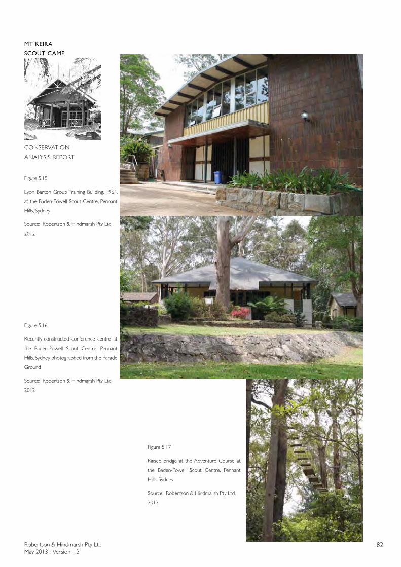
Robertson & Hindmarsh Pty LtdMay 2013 : Version 1.3
182
MT KEIRA
SCOUT CAMP
CONSERVATION
ANALYSIS REPORT
Figure 5.15
Lyon Barton Group Training Building, 1964,
at the Baden-Powell Scout Centre, Pennant
Hills, Sydney
Source: Robertson & Hindmarsh Pty Ltd,
2012
Figure 5.16
Recently-constructed conference centre at
the Baden-Powell Scout Centre, Pennant
Hills, Sydney photographed from the Parade
Ground
Source: Robertson & Hindmarsh Pty Ltd,
2012
Figure 5.17
Raised bridge at the Adventure Course at
the Baden-Powell Scout Centre, Pennant
Hills, Sydney
Source: Robertson & Hindmarsh Pty Ltd,
2012
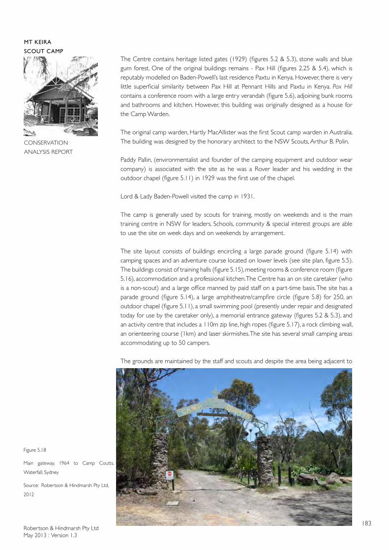
Robertson & Hindmarsh Pty LtdMay 2013 : Version 1.3
183
MT KEIRA
SCOUT CAMP
CONSERVATION
ANALYSIS REPORT
The Centre contains heritage listed gates (1929) (figures 5.2 & 5.3), stone walls and blue gum forest. One of the original buildings remains - Pax Hill (figures 2.25 & 5.4), which is reputably modelled on Baden-Powell’s last residence Paxtu in Kenya. However, there is very little superficial similarity between Pax Hill at Pennant Hills and Paxtu in Kenya. Pax Hill contains a conference room with a large entry verandah (figure 5.6), adjoining bunk rooms and bathrooms and kitchen. However, this building was originally designed as a house for the Camp Warden.
The original camp warden, Hartly MacAllister was the first Scout camp warden in Australia. The building was designed by the honorary architect to the NSW Scouts, Arthur B. Polin.
Paddy Pallin, (environmentalist and founder of the camping equipment and outdoor wear company) is associated with the site as he was a Rover leader and his wedding in the outdoor chapel (figure 5.11) in 1929 was the first use of the chapel.
Lord & Lady Baden-Powell visited the camp in 1931.
The camp is generally used by scouts for training, mostly on weekends and is the main training centre in NSW for leaders. Schools, community & special interest groups are able to use the site on week days and on weekends by arrangement.
The site layout consists of buildings encircling a large parade ground (figure 5.14) with camping spaces and an adventure course located on lower levels (see site plan, figure 5.5). The buildings consist of training halls (figure 5.15), meeting rooms & conference room (figure 5.16), accommodation and a professional kitchen. The Centre has an on site caretaker (who is a non-scout) and a large office manned by paid staff on a part-time basis. The site has a parade ground (figure 5.14), a large amphitheatre/campfire circle (figure 5.8) for 250, an outdoor chapel (figure 5.11), a small swimming pool (presently under repair and designated today for use by the caretaker only), a memorial entrance gateway (figures 5.2 & 5.3), and an activity centre that includes a 110m zip line, high ropes (figure 5.17), a rock climbing wall, an orienteering course (1km) and laser skirmishes. The site has several small camping areas accommodating up to 50 campers.
The grounds are maintained by the staff and scouts and despite the area being adjacent to
Figure 5.18
Main gateway, 1964 to Camp Coutts,
Waterfall, Sydney
Source: Robertson & Hindmarsh Pty Ltd,
2012
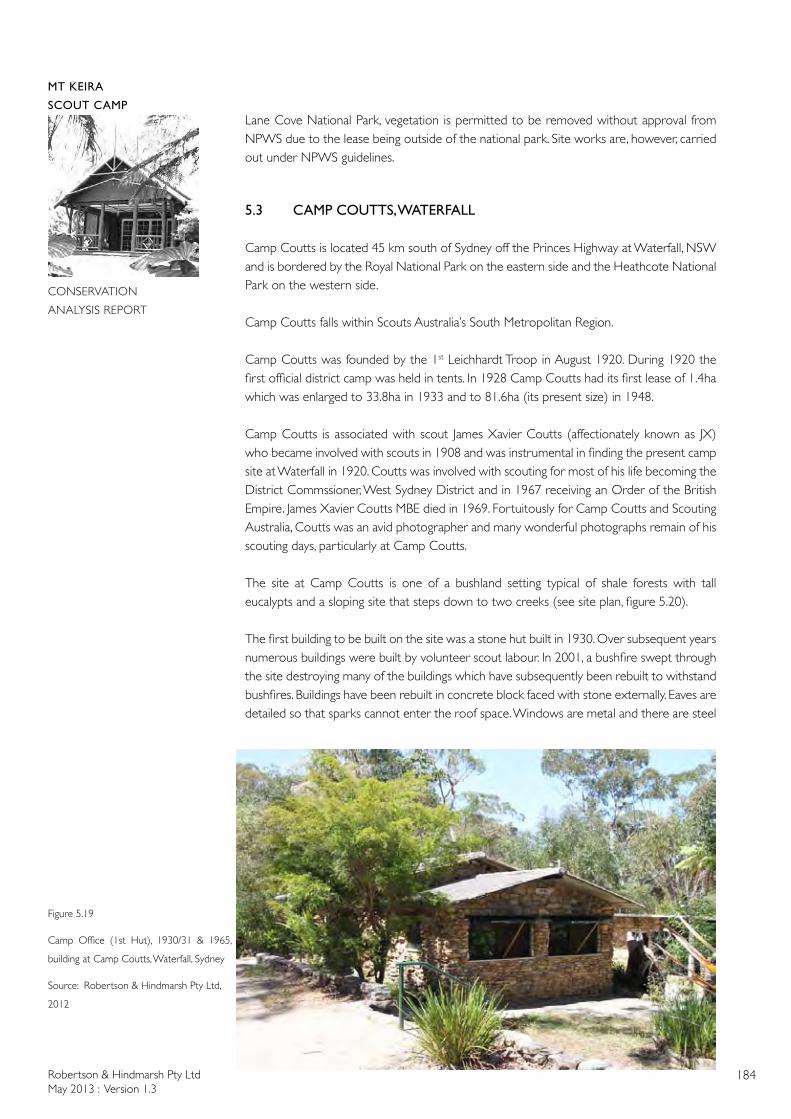
Robertson & Hindmarsh Pty LtdMay 2013 : Version 1.3
184
MT KEIRA
SCOUT CAMP
CONSERVATION
ANALYSIS REPORT
Lane Cove National Park, vegetation is permitted to be removed without approval from NPWS due to the lease being outside of the national park. Site works are, however, carried out under NPWS guidelines.
5.3 CAMP COUTTS, WATERFALL
Camp Coutts is located 45 km south of Sydney off the Princes Highway at Waterfall, NSW and is bordered by the Royal National Park on the eastern side and the Heathcote National Park on the western side.
Camp Coutts falls within Scouts Australia’s South Metropolitan Region.
Camp Coutts was founded by the 1st Leichhardt Troop in August 1920. During 1920 the first official district camp was held in tents. In 1928 Camp Coutts had its first lease of 1.4ha which was enlarged to 33.8ha in 1933 and to 81.6ha (its present size) in 1948.
Camp Coutts is associated with scout James Xavier Coutts (affectionately known as JX) who became involved with scouts in 1908 and was instrumental in finding the present camp site at Waterfall in 1920. Coutts was involved with scouting for most of his life becoming the District Commssioner, West Sydney District and in 1967 receiving an Order of the British Empire. James Xavier Coutts MBE died in 1969. Fortuitously for Camp Coutts and Scouting Australia, Coutts was an avid photographer and many wonderful photographs remain of his scouting days, particularly at Camp Coutts.
The site at Camp Coutts is one of a bushland setting typical of shale forests with tall eucalypts and a sloping site that steps down to two creeks (see site plan, figure 5.20).
The first building to be built on the site was a stone hut built in 1930. Over subsequent years numerous buildings were built by volunteer scout labour. In 2001, a bushfire swept through the site destroying many of the buildings which have subsequently been rebuilt to withstand bushfires. Buildings have been rebuilt in concrete block faced with stone externally. Eaves are detailed so that sparks cannot enter the roof space. Windows are metal and there are steel
Figure 5.19
Camp Office (1st Hut), 1930/31 & 1965,
building at Camp Coutts, Waterfall, Sydney
Source: Robertson & Hindmarsh Pty Ltd,
2012
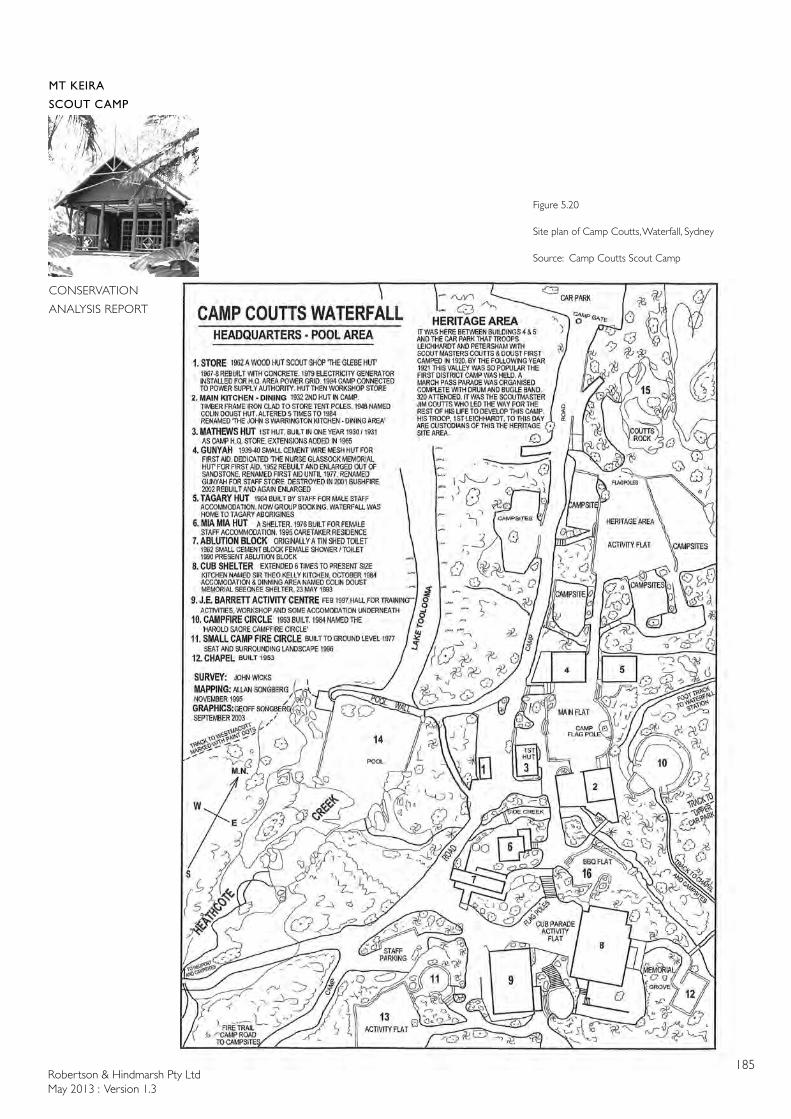
Robertson & Hindmarsh Pty LtdMay 2013 : Version 1.3
185
MT KEIRA
SCOUT CAMP
CONSERVATION
ANALYSIS REPORT
Figure 5.20
Site plan of Camp Coutts, Waterfall, Sydney
Source: Camp Coutts Scout Camp
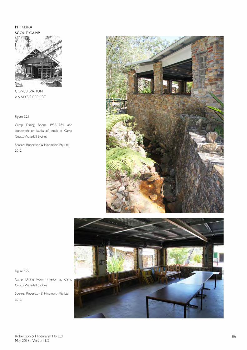
Robertson & Hindmarsh Pty LtdMay 2013 : Version 1.3
186
MT KEIRA
SCOUT CAMP
CONSERVATION
ANALYSIS REPORT
Figure 5.21
Camp Dining Room, 1932-1984, and
stonework on banks of creek at Camp
Coutts, Waterfall, Sydney
Source: Robertson & Hindmarsh Pty Ltd,
2012
Figure 5.22
Camp Dining Room interior at Camp
Coutts, Waterfall, Sydney
Source: Robertson & Hindmarsh Pty Ltd,
2012
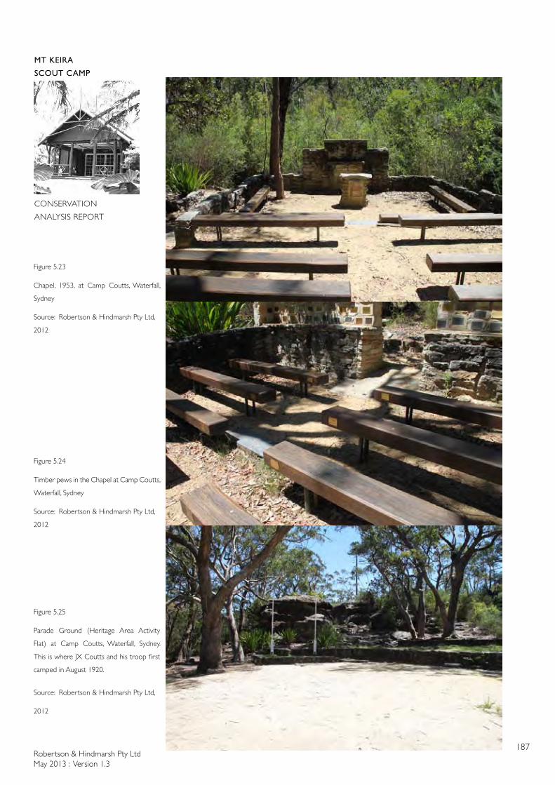
Robertson & Hindmarsh Pty LtdMay 2013 : Version 1.3
187
MT KEIRA
SCOUT CAMP
CONSERVATION
ANALYSIS REPORT
Figure 5.23
Chapel, 1953, at Camp Coutts, Waterfall,
Sydney
Source: Robertson & Hindmarsh Pty Ltd,
2012
Figure 5.24
Timber pews in the Chapel at Camp Coutts,
Waterfall, Sydney
Source: Robertson & Hindmarsh Pty Ltd,
2012
Figure 5.25
Parade Ground (Heritage Area Activity
Flat) at Camp Coutts, Waterfall, Sydney.
This is where JX Coutts and his troop first
camped in August 1920.
Source: Robertson & Hindmarsh Pty Ltd,
2012
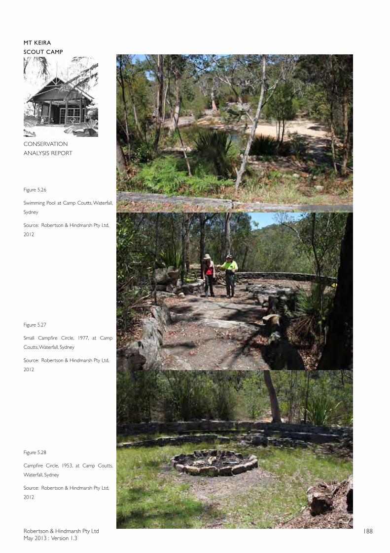
Robertson & Hindmarsh Pty LtdMay 2013 : Version 1.3
188
MT KEIRA
SCOUT CAMP
CONSERVATION
ANALYSIS REPORT
Figure 5.26
Swimming Pool at Camp Coutts, Waterfall,
Sydney
Source: Robertson & Hindmarsh Pty Ltd,
2012
Figure 5.27
Small Campfire Circle, 1977, at Camp
Coutts, Waterfall, Sydney
Source: Robertson & Hindmarsh Pty Ltd,
2012
Figure 5.28
Campfire Circle, 1953, at Camp Coutts,
Waterfall, Sydney
Source: Robertson & Hindmarsh Pty Ltd,
2012
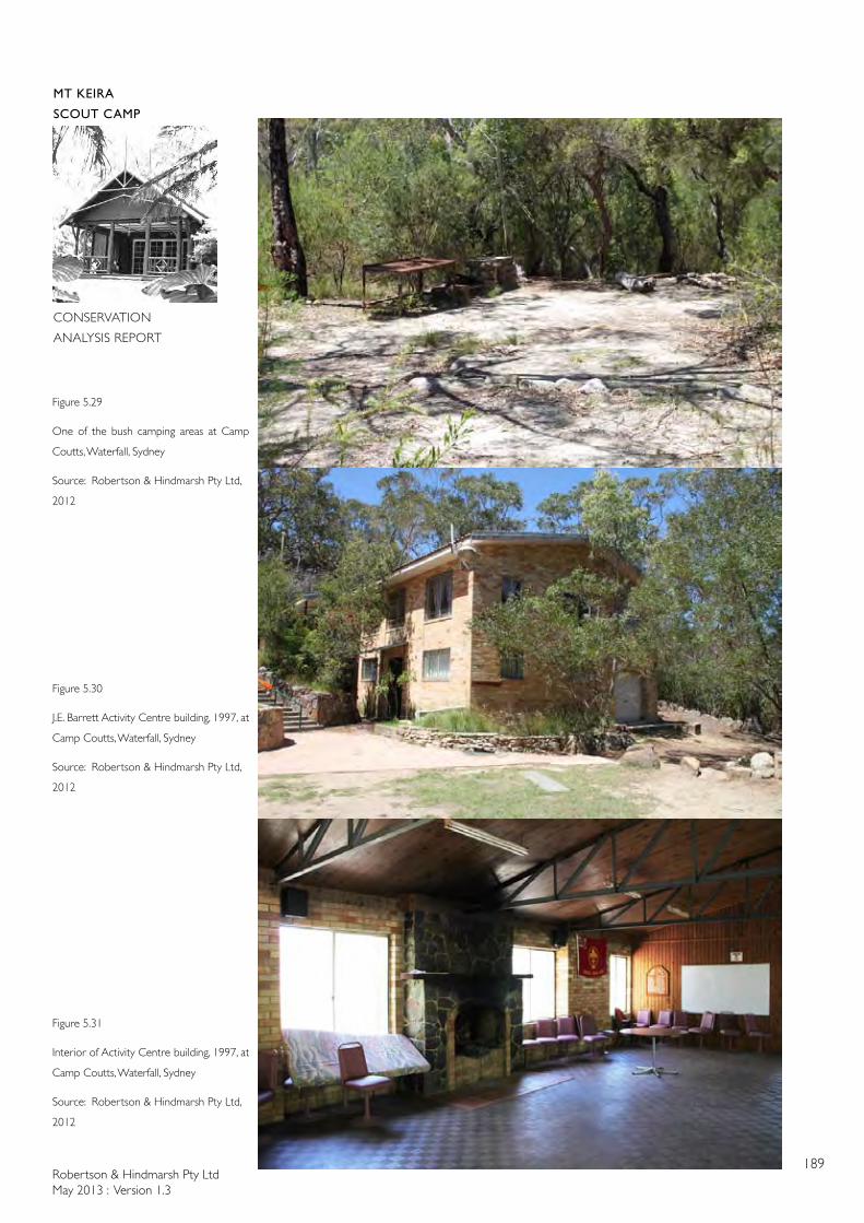
Robertson & Hindmarsh Pty LtdMay 2013 : Version 1.3
189
MT KEIRA
SCOUT CAMP
CONSERVATION
ANALYSIS REPORT
Figure 5.29
One of the bush camping areas at Camp
Coutts, Waterfall, Sydney
Source: Robertson & Hindmarsh Pty Ltd,
2012
Figure 5.30
J.E. Barrett Activity Centre building, 1997, at
Camp Coutts, Waterfall, Sydney
Source: Robertson & Hindmarsh Pty Ltd,
2012
Figure 5.31
Interior of Activity Centre building, 1997, at
Camp Coutts, Waterfall, Sydney
Source: Robertson & Hindmarsh Pty Ltd,
2012
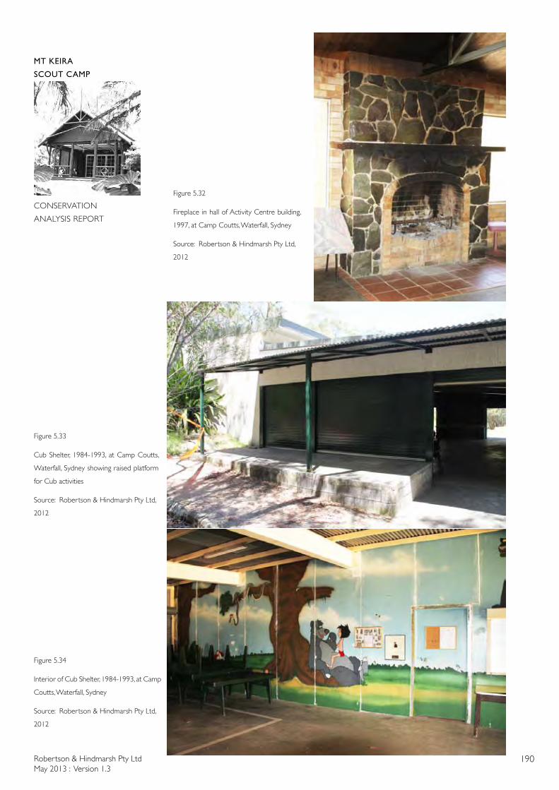
Robertson & Hindmarsh Pty LtdMay 2013 : Version 1.3
190
MT KEIRA
SCOUT CAMP
CONSERVATION
ANALYSIS REPORT
Figure 5.32
Fireplace in hall of Activity Centre building,
1997, at Camp Coutts, Waterfall, Sydney
Source: Robertson & Hindmarsh Pty Ltd,
2012
Figure 5.33
Cub Shelter, 1984-1993, at Camp Coutts,
Waterfall, Sydney showing raised platform
for Cub activities
Source: Robertson & Hindmarsh Pty Ltd,
2012
Figure 5.34
Interior of Cub Shelter, 1984-1993, at Camp
Coutts, Waterfall, Sydney
Source: Robertson & Hindmarsh Pty Ltd,
2012
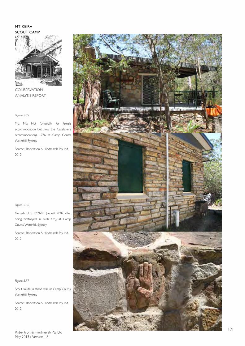
Robertson & Hindmarsh Pty LtdMay 2013 : Version 1.3
191
MT KEIRA
SCOUT CAMP
CONSERVATION
ANALYSIS REPORT
Figure 5.35
Mia Mia Hut (originally for female
accommodation but now the Caretaker’s
accommodation), 1976, at Camp Coutts,
Waterfall, Sydney
Source: Robertson & Hindmarsh Pty Ltd,
2012
Figure 5.36
Gunyah Hut, 1939-40 (rebuilt 2002 after
being destroyed in bush fire), at Camp
Coutts, Waterfall, Sydney
Source: Robertson & Hindmarsh Pty Ltd,
2012
Figure 5.37
Scout salute in stone wall at Camp Coutts,
Waterfall, Sydney
Source: Robertson & Hindmarsh Pty Ltd,
2012
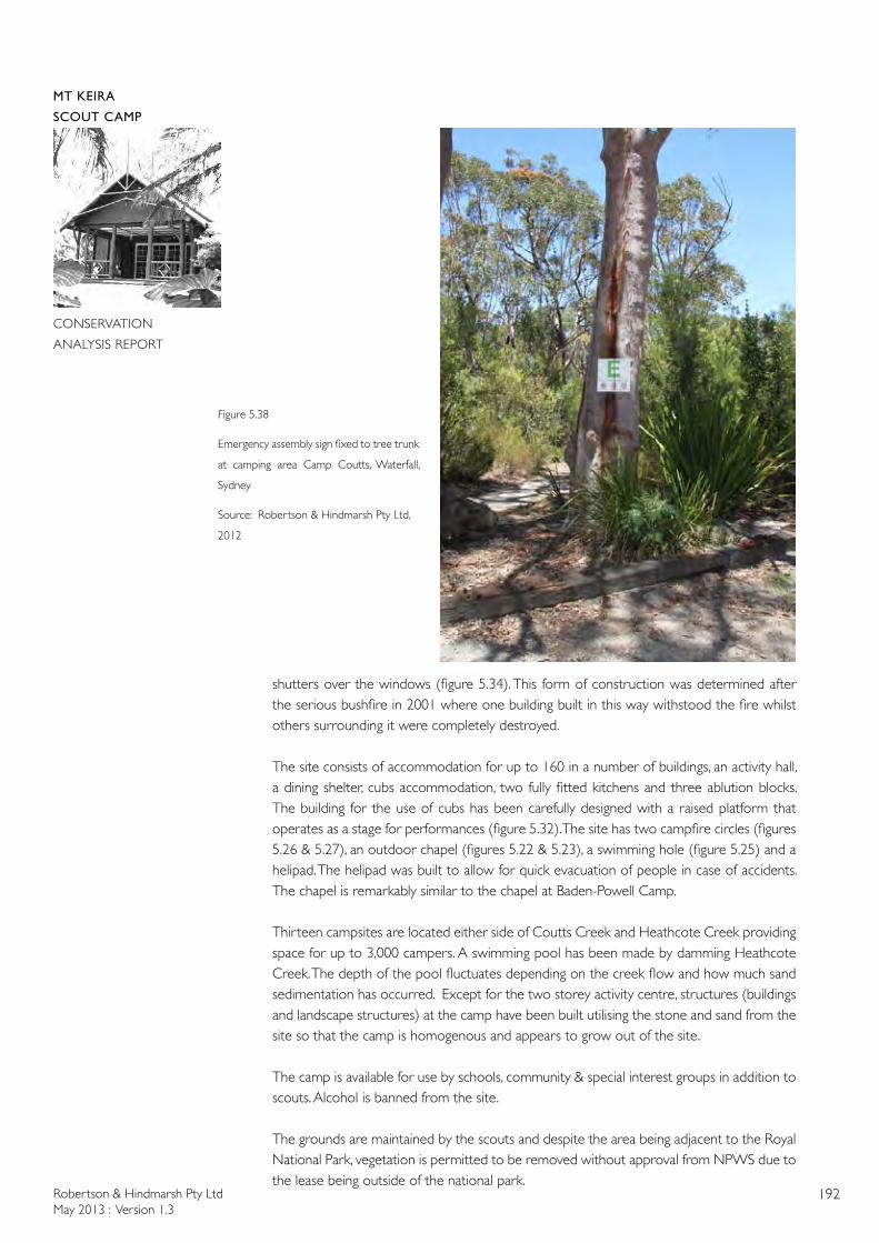
Robertson & Hindmarsh Pty LtdMay 2013 : Version 1.3
192
MT KEIRA
SCOUT CAMP
CONSERVATION
ANALYSIS REPORT
shutters over the windows (figure 5.34). This form of construction was determined after the serious bushfire in 2001 where one building built in this way withstood the fire whilst others surrounding it were completely destroyed.
The site consists of accommodation for up to 160 in a number of buildings, an activity hall, a dining shelter, cubs accommodation, two fully fitted kitchens and three ablution blocks. The building for the use of cubs has been carefully designed with a raised platform that operates as a stage for performances (figure 5.32). The site has two campfire circles (figures 5.26 & 5.27), an outdoor chapel (figures 5.22 & 5.23), a swimming hole (figure 5.25) and a helipad. The helipad was built to allow for quick evacuation of people in case of accidents. The chapel is remarkably similar to the chapel at Baden-Powell Camp.
Thirteen campsites are located either side of Coutts Creek and Heathcote Creek providing space for up to 3,000 campers. A swimming pool has been made by damming Heathcote Creek. The depth of the pool fluctuates depending on the creek flow and how much sand sedimentation has occurred. Except for the two storey activity centre, structures (buildings and landscape structures) at the camp have been built utilising the stone and sand from the site so that the camp is homogenous and appears to grow out of the site.
The camp is available for use by schools, community & special interest groups in addition to scouts. Alcohol is banned from the site.
The grounds are maintained by the scouts and despite the area being adjacent to the Royal National Park, vegetation is permitted to be removed without approval from NPWS due to the lease being outside of the national park.
Figure 5.38
Emergency assembly sign fixed to tree trunk
at camping area Camp Coutts, Waterfall,
Sydney
Source: Robertson & Hindmarsh Pty Ltd,
2012

Robertson & Hindmarsh Pty LtdMay 2013 : Version 1.3
193
MT KEIRA
SCOUT CAMP
CONSERVATION
ANALYSIS REPORT
5. 4 COMPARISON OF SELECTED SCOUT CAMPS WITH MOUNT KEIRA SCOUT CAMP
There are similarities in buildings at the different scout camps. Whilst the Baden-Powell Camp at Pennant Hills has a number of architect-designed buildings (as does Mount Keira Scout Camp) no scout camp other than Mount Keira has taken Baden-Powell’s philosophy of rusticity to the same extent as Geoffrey Loveridge’s design for the Lodge at Mount Keira. Loveridge deliberately added false rafter extension pieces in rough, unsawn timbers for the roof rafters as well as for the verandah posts and balustrade. The rustic theme of the Lodge is carried through to the use of saplings for wall cover battens and for door handles.
Australian Iron & Steels’ draftsperson, B. Roberts, who drew a number of the subsequent buildings at Mount Keira Scout Camp, tried to carry on this rustic theme with half log columns planted on the façade of the concrete block Cub Lair building but, when the false logs and rafter extensions were deleted (probably for cost reasons) the building lost its rustic references to the Lodge.
The buildings at Baden-Powell Camp, Pennant Hills are more precise in their detailing and more military in their disposition around the site (surrounding and defining the Parade Ground) whereas the layout of Mount Keira Scout Camp follows the contours of the site and subtly expresses the genius loci of the place with the visual links to Mount Keira at one end and Robertson’s Lookout at the other. Camp Coutts on the other hand, has a site layout that is organic and free and expresses its genius loci with the stone buildings growing out of the rocky, sandy site in the bushy valley.
There are some similarities with Mount Keira Lodge and Pax Hill at Pennant Hills. Both buildings have simple gabled roofs and walls of stone and timber. Both buildings have a deep verandah, a large stone fireplace and timber floors. The main hall at Camp Coutts also has a simple gabled roof, timber floors and a large stone fireplace but is a brick, two storey building.
The Dining spaces at Mount Keira and Camp Coutts are similar in that they have a covered space with no windows (at Mount Keira this occurs in the Flora BBQ area attached to the main Dining Room which originally contained no windows).
Campfire circles are similar from camp to camp. All three sites have flag poles located in open areas for ceremonies.
Provisions for camping are more limited at Pennant Hills than at Mount Keira. On the other hand, Camp Coutts has space for thousands of campers but not in one large space.
The Camp at Pennant Hills is currently used primarily for adult training courses, however their accommodation facilities are comparable to those provided at The Charles Jackson Chalet at Mount Keira Scout Camp which was built to accommodate adults at adult training courses. At both Camp Coutts and Mount Keira Scout Camp, their indoor sleeping accommodation for scouts and cubs provides rustic bunks. The open air chapel at Camp Coutts is remarkably similar to the chapel at Baden-Powell Camp in the use of stone and the layout, although Pennant Hills’ chapel does not have seating of any form. Camp Coutts has seating in the form of stained dressed timber lengths fixed to steel poles that are mounted in the ground. The chapel at Mount Keira Scout
Robertson & Hindmarsh Pty LtdMay 2013 : Version 1.3
194
MT KEIRA
SCOUT CAMP
CONSERVATION
ANALYSIS REPORT
Camp is unique in that it is a natural space with very little built form. This gives the chapel an immense sense of awe.
The Cub Lairs at Camp Coutts and Mount Keira Scout Camp both have wall murals featuring Rudyard Kipling characters from his book The Jungle Book (1894). However, Camp Coutts is unique in that it’s Cub Lair is designed for stage performances.
The three camp sites have memorial gateways at their entrances all containing Scout insignia in addition to the camp’s name and a recognition of someone important to the camp.
Baden-Powell Camp, Camp Coutts and Mount Keira Scout Camp all have sites that have been terraced to varying degrees with low stone walls. All three sites embrace the surrounding natural and heavily treed environments.
5. 5 ANALYSIS OF AUSTRALIAN SCOUT CAMP DESIGNS
It has been stressed on our inspections at all three scout camps that there is no prescribed formula for the laying out of scout camps or for the function and design of buildings. Baden-Powell’s books do not assume a fixed camp site, as his rationale for the scout movement was based on the military scouts and the military use of temporary camps or bivouacs whilst in the field. The lure of the American Wild West and the American Frontiersman informed his philosophy and this has been flexibly interpreted in the scout camps we have inspected. The Lodge at Mount Keira Scout Camp is reminiscent of the log cabin at Gilwell Park in London, however, there is no prescribed plan for the various functions of the scout camps. Baden-Powell, in his writings on the scouting movement, did not describe building types, functions or sizes. Rather, Baden-Powell believed in an outdoor environment seen in his watercolour sketch ‘house in the wood’ which is a tent-like structure (see figure 2.20). Throughout his marriage, Baden-Powell is said to have slept alone on a verandah to maintain this feeling of being outdoors.
Buildings at Australian scout camps may be inspired by what scout leaders have seen elsewhere either through travel or in books. Sid Hoskins travelled frequently to Britain for his business (probably including to Gilwell Park) and to the United States and it is likely that he was inspired by what he saw and wanted similar facilities incorporated at Mount Keira, hence the similarity between the Mount Keira Lodge and the cabin at Gilwell Park.
Because all scout camps are built with limited funds, materials and buildings are often donated or the materials are sourced directly from the site, such as the field stone at Mount Keira, Baden-Powell and Camp Coutts and the river sand being mined at Camp Coutts. Even in the early days of Mount Keira Scout Camp, Sid Hoskins and Paul Sorensen would go off into the bush of Mount Keira to source gravel and ferns!
Each camp has a different location and therefore a different geology and vegetation that gives a framework to the camp that is unique. However, in addition to this natural framework. the evolution of each camp is a product of the scouts’ and leaders’ ideas and skills at each particular camp over a considerable period of time.
In one respect, Mount Keira Scout Camp is special in that, due to the philanthropy of Sid Hoskins and his vision, the original buildings were architect-designed and purpose-built by skilled tradesmen and with a landscape gardener and horticulturalist involved in the
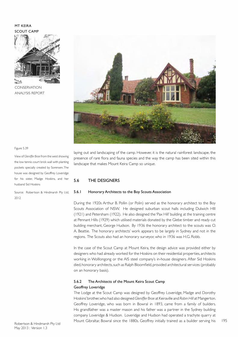
Robertson & Hindmarsh Pty LtdMay 2013 : Version 1.3
195
MT KEIRA
SCOUT CAMP
CONSERVATION
ANALYSIS REPORT
Figure 5.39
View of Gleniffer Brae from the west showing
the low tennis court brick wall with planting
pockets specially created by Sorensen. The
house was designed by Geoffrey Loveridge
for his sister, Madge Hoskins, and her
husband Sid Hoskins
Source: Robertson & Hindmarsh Pty Ltd,
2012
laying out and landscaping of the camp. However, it is the natural rainforest landscape, the presence of rare flora and fauna species and the way the camp has been sited within this landscape that makes Mount Keira Camp so unique.
5.6 THE DESIGNERS
5.6.1 Honorary Architects to the Boy Scouts Association
During the 1920s Arthur B. Pollin (or Polin) served as the honorary architect to the Boy Scouts Association of NSW. He designed suburban scout halls including Dulwich HIll (1921) and Petersham (1922). He also designed the ‘Pax Hill’ building at the training centre at Pennant Hills (1929) which utilised materials donated by the Glebe timber and ready cut building merchant, George Hudson. By 1936 the honorary architect to the scouts was O. A. Beattie. The honorary architects’ work appears to be largely in Sydney and not in the regions. The Scouts also had an honorary surveyor, who in 1936 was H.G. Robb.
In the case of the Scout Camp at Mount Keira, the design advice was provided either by designers who had already worked for the Hoskins on their residential properties, architects working in Wolllongong or the AIS steel company’s in-house designers. After Sid Hoskins died, honorary architects, such as Ralph Bloomfield, provided architectural services (probably on an honorary basis).
5.6.2 The Architects of the Mount Keira Scout CampGeoffrey LoveridgeThe Lodge at the Scout Camp was designed by Geoffrey Loveridge, Madge and Dorothy Hoskins’ brother, who had also designed Gleniffer Brae at Keiraville and Robin Hill at Mangerton. Geoffrey Loveridge, who was born in Bowral in 1893, came from a family of builders. His grandfather was a master mason and his father was a partner in the Sydney building company Loveridge & Hudson. Loveridge and Hudson had operated a trachyte quarry at Mount Gibraltar, Bowral since the 1880s. Geoffrey initially trained as a builder serving his
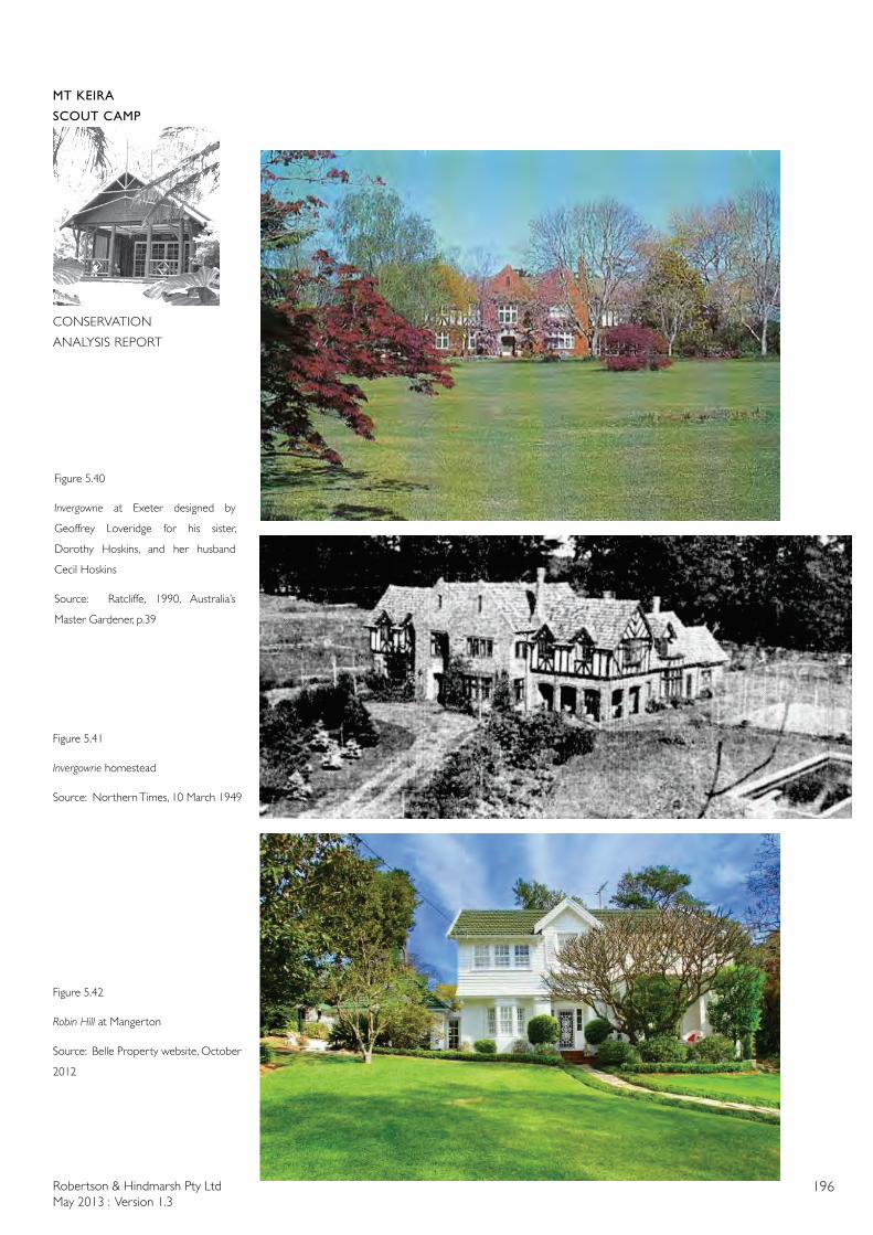
Robertson & Hindmarsh Pty LtdMay 2013 : Version 1.3
196
MT KEIRA
SCOUT CAMP
CONSERVATION
ANALYSIS REPORT
Figure 5.40
Invergowrie at Exeter designed by
Geoffrey Loveridge for his sister,
Dorothy Hoskins, and her husband
Cecil Hoskins
Source: Ratcliffe, 1990, Australia’s
Master Gardener, p.39
Figure 5.41
Invergowrie homestead
Source: Northern Times, 10 March 1949
Figure 5.42
Robin Hill at Mangerton
Source: Belle Property website, October
2012
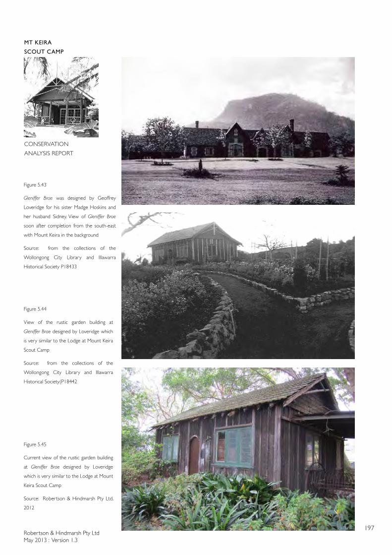
Robertson & Hindmarsh Pty LtdMay 2013 : Version 1.3
197
MT KEIRA
SCOUT CAMP
CONSERVATION
ANALYSIS REPORT
Figure 5.44
View of the rustic garden building at
Gleniffer Brae designed by Loveridge which
is very similar to the Lodge at Mount Keira
Scout Camp
Source: from the collections of the
Wollongong City Library and Illawarra
Historical Society(P18442
Figure 5.45
Current view of the rustic garden building
at Gleniffer Brae designed by Loveridge
which is very similar to the Lodge at Mount
Keira Scout Camp
Source: Robertson & Hindmarsh Pty Ltd,
2012
Figure 5.43
Gleniffer Brae was designed by Geoffrey
Loveridge for his sister Madge Hoskins and
her husband Sidney. View of Gleniffer Brae
soon after completion from the south-east
with Mount Keira in the background
Source: from the collections of the
Wollongong City Library and Illawarra
Historical Society P18433
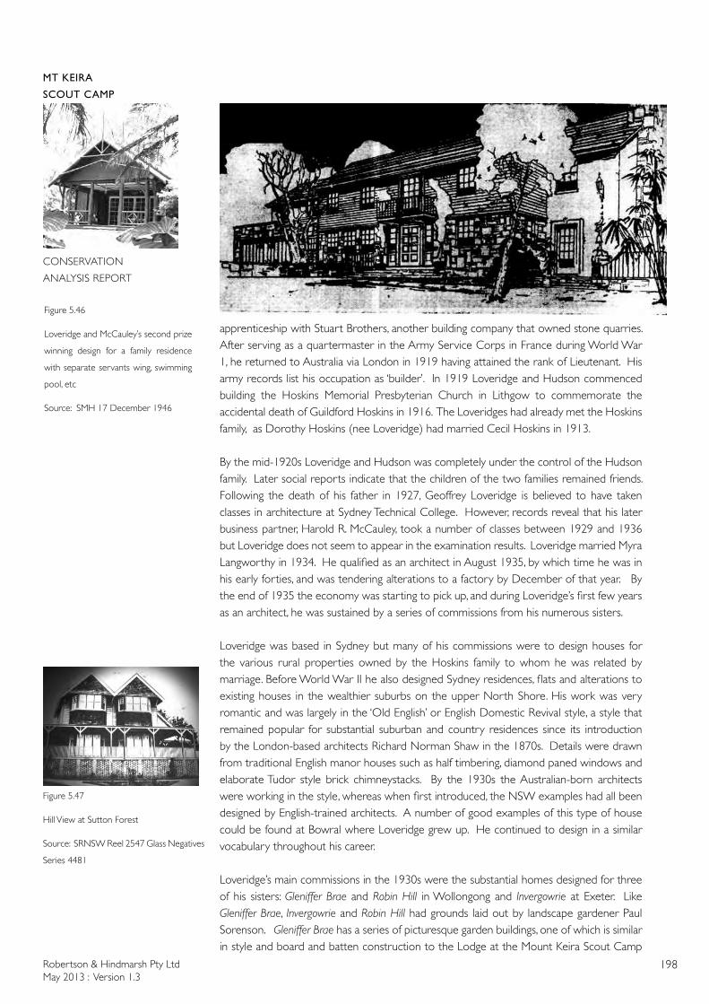
Robertson & Hindmarsh Pty LtdMay 2013 : Version 1.3
198
MT KEIRA
SCOUT CAMP
CONSERVATION
ANALYSIS REPORT
Figure 5.47
Hill View at Sutton Forest
Source: SRNSW Reel 2547 Glass Negatives
Series 4481
Figure 5.46
Loveridge and McCauley’s second prize
winning design for a family residence
with separate servants wing, swimming
pool, etc
Source: SMH 17 December 1946
apprenticeship with Stuart Brothers, another building company that owned stone quarries. After serving as a quartermaster in the Army Service Corps in France during World War 1, he returned to Australia via London in 1919 having attained the rank of Lieutenant. His army records list his occupation as ‘builder’. In 1919 Loveridge and Hudson commenced building the Hoskins Memorial Presbyterian Church in Lithgow to commemorate the accidental death of Guildford Hoskins in 1916. The Loveridges had already met the Hoskins family, as Dorothy Hoskins (nee Loveridge) had married Cecil Hoskins in 1913.
By the mid-1920s Loveridge and Hudson was completely under the control of the Hudson family. Later social reports indicate that the children of the two families remained friends. Following the death of his father in 1927, Geoffrey Loveridge is believed to have taken classes in architecture at Sydney Technical College. However, records reveal that his later business partner, Harold R. McCauley, took a number of classes between 1929 and 1936 but Loveridge does not seem to appear in the examination results. Loveridge married Myra Langworthy in 1934. He qualified as an architect in August 1935, by which time he was in his early forties, and was tendering alterations to a factory by December of that year. By the end of 1935 the economy was starting to pick up, and during Loveridge’s first few years as an architect, he was sustained by a series of commissions from his numerous sisters.
Loveridge was based in Sydney but many of his commissions were to design houses for the various rural properties owned by the Hoskins family to whom he was related by marriage. Before World War II he also designed Sydney residences, flats and alterations to existing houses in the wealthier suburbs on the upper North Shore. His work was very romantic and was largely in the ‘Old English’ or English Domestic Revival style, a style that remained popular for substantial suburban and country residences since its introduction by the London-based architects Richard Norman Shaw in the 1870s. Details were drawn from traditional English manor houses such as half timbering, diamond paned windows and elaborate Tudor style brick chimneystacks. By the 1930s the Australian-born architects were working in the style, whereas when first introduced, the NSW examples had all been designed by English-trained architects. A number of good examples of this type of house could be found at Bowral where Loveridge grew up. He continued to design in a similar vocabulary throughout his career.
Loveridge’s main commissions in the 1930s were the substantial homes designed for three of his sisters: Gleniffer Brae and Robin Hill in Wollongong and Invergowrie at Exeter. Like Gleniffer Brae, Invergowrie and Robin Hill had grounds laid out by landscape gardener Paul Sorenson. Gleniffer Brae has a series of picturesque garden buildings, one of which is similar in style and board and batten construction to the Lodge at the Mount Keira Scout Camp
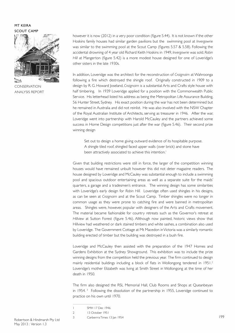
Robertson & Hindmarsh Pty LtdMay 2013 : Version 1.3
199
MT KEIRA
SCOUT CAMP
CONSERVATION
ANALYSIS REPORT
however it is now (2012) in a very poor condition (figure 5.44). It is not known if the other Hoskins family houses had similar garden pavilions but the swimming pool at Invergowrie was similar to the swimming pool at the Scout Camp (figures 5.57 & 5.58). Following the accidental drowning of 4 year old Richard Keith Hoskins in 1949, Invergowrie was sold. Robin Hill at Mangerton (figure 5.42) is a more modest house designed for one of Loveridge’s other sisters in the late 1930s.
In addition, Loveridge was the architect for the reconstruction of Craignairn at Wahroonga following a fire which destroyed the shingle roof. Originally constructed in 1909 to a design by R. G. Howard Joseland, Craignairn is a substantial Arts and Crafts style house with half timbering. In 1939 Loveridge applied for a position with the Commonwealth Public Service. His letterhead listed his address as being the Metropolitan Life Assurance Building, 56 Hunter Street, Sydney. His exact position during the war has not been determined but he remained in Australia and did not reinlist. He was also involved with the NSW Chapter of the Royal Australian Institute of Architects, serving as treasurer in 1946. After the war, Loveridge went into partnership with Harold McCauley and the partners achieved some success in Home Design competitions just after the war (figure 5.46). Their second prize winning design
Set out to design a home giving outward evidence of its hospitable purpose. A shingle tiled roof, shingled faced upper walls (over brick) and stone have been attractively associated to achieve this intention.1
Given that building restrictions were still in force, the larger of the competition winning houses would have remained unbuilt however this did not deter magazine readers. The house designed by Loveridge and McCauley was substantial enough to include a swimming pool and spacious outdoor entertaining areas as well as a separate suite for the maids’ quarters, a garage and a tradesmen’s entrance. The winning design has some similarities with Loveridge’s early design for Robin Hill. Loveridge often used shingles in his designs, as can be seen at Craignairn and at the Scout Camp. Timber shingles were no longer in common usage as they were prone to catching fire and were banned in metropolitan areas. Shingles were, however, popular with designers of the Arts and Crafts movement. The material became fashionable for country retreats such as the Governor’s retreat at Hillview at Sutton Forest (figure 5.46). Allthough now painted, historic views show that Hillview had weathered or dark stained timbers and white sashes, a combination also used by Loveridge. The Government Cottage at Mt Macedon in Victoria was a similarly romantic building erected of timber but the building was destroyed in a bush fire.
Loveridge and McCauley then assisted with the preparation of the 1947 Homes and Gardens Exhibition at the Sydney Showground. This exhibition was to include the prize winning designs from the competition held the previous year. The firm continued to design mainly residential buildings including a block of flats in Wollongong tendered in 1951.2 Loveridge’s mother Elizabeth was living at Smith Street in Wollongong at the time of her death in 1950.
The firm also designed the RSL Memorial Hall, Club Rooms and Shops at Queanbeyan in 1954. 3 Following the dissolution of the partnership in 1955, Loveridge continued to practice on his own until 1970.
1 SMH 17 Dec 1946
2 13 October 1951
3 Canberrra Times 13 Jan 1954
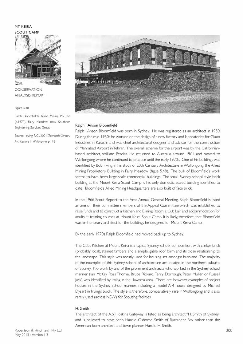
Robertson & Hindmarsh Pty LtdMay 2013 : Version 1.3
200
MT KEIRA
SCOUT CAMP
CONSERVATION
ANALYSIS REPORT
Figure 5.48
Ralph Bloomfield’s Allied Mining Pty Ltd
(c.1970), Fairy Meadow, now Southern
Engineering Services Group
Source: Irving, R.C., 2001, Twentieth Century
Architecture in Wollongong, p.118
RalphI’AnsonBloomfieldRalph I’Anson Bloomfield was born in Sydney. He was registered as an architect in 1950. During the mid-1950s he worked on the design of a new factory and laboratories for Glaxo Industries in Karachi and was chief architectural designer and advisor for the construction of Mehrabad Airport in Tehran. The overall scheme for the airport was by the Californian-based architect, William Pereira. He returned to Australia around 1961 and moved to Wollongong where he continued to practice until the early 1970s. One of his buildings was identified by Bob Irving in his study of 20th Century Architecture in Wollongong, the Allied Mining Proprietory Building in Fairy Meadow (figue 5.48). The bulk of Bloomfield’s work seems to have been large-scale commercial buildings. The small Sydney-school style brick building at the Mount Keira Scout Camp is his only domestic scaled building identified to date. Bloomfield’s Allied Mining Headquarters are also built of face brick.
In the 1966 Scout Report to the Area Annual General Meeting, Ralph Bloomfield is listed as one of their committee members of the Appeal Committee which was established to raise funds and to construct a Kitchen and Dining Room, a Cub Lair and accommodation for adults at training courses at Mount Keira Scout Camp. It is likely, therefore, that Bloomfield was an honorary architect for the buildings he designed for Mount Keira Camp.
By the early 1970s Ralph Bloomfield had moved back up to Sydney.
The Cubs Kitchen at Mount Keira is a typical Sydney-school composition, with clinker brick (probably local), stained timbers and a simple, gable roof form and, its close relationship to the landscape. This style was mostly used for housing set amongst bushland. The majority of the examples of this Sydney-school of architecture are located in the northern suburbs of Sydney. No work by any of the prominent architects who worked in the Sydney school manner (Ian McKay, Ross Thorne, Bruce Rickard, Terry Dorrough, Peter Muller or Russell Jack) was identified by Irving in the Illawarra area. There are, however, examples of project houses in the Sydney school manner, including a model A-4 house designed by Michael Dysart in Irving’s book. The style is, therefore, comparatively rare in Wollongong and is also rarely used (across NSW) for Scouting facilities.
H. SmithThe architect of the A.S. Hoskins Gateway is listed as being architect “H. Smith of Sydney” and is believed to have been Harold Osborne Smith of Burraneer Bay, rather than the American-born architect and town planner Harold H. Smith.
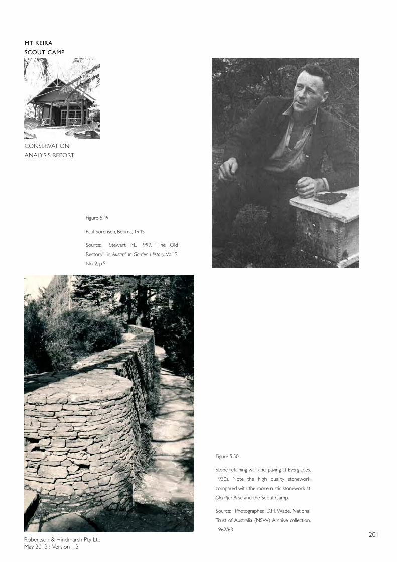
Robertson & Hindmarsh Pty LtdMay 2013 : Version 1.3
201
MT KEIRA
SCOUT CAMP
CONSERVATION
ANALYSIS REPORT
Figure 5.49
Paul Sorensen, Berima, 1945
Source: Stewart, M., 1997, “The Old
Rectory”, in Australian Garden History, Vol. 9,
No. 2, p.5
Figure 5.50
Stone retaining wall and paving at Everglades,
1930s. Note the high quality stonework
compared with the more rustic stonework at
Gleniffer Brae and the Scout Camp.
Source: Photographer, D.H. Wade, National
Trust of Australia (NSW) Archive collection,
1962/63

Robertson & Hindmarsh Pty LtdMay 2013 : Version 1.3
202
MT KEIRA
SCOUT CAMP
CONSERVATION
ANALYSIS REPORT
5.6.3 The Landscape Gardener at Mount Keira Scout Camp - Paul SorensenPaul Sorensen was engaged by Sid Hoskins to undertake the landscaping of the Mount Keira Scout Camp at the time of its initial building phase.
Paul Sorensen was born in Denmark in 1890. He undertook a horticulture course as a young boy and as part of the course was required to have 5 years practical experience which he had under the direction of Lars Nielsen, “one of Denmark’s most highly respected horticulturalists”4 and designer of Copenhagen’s public parks. At the completion of his studies, Sorensen worked in Germany, France and Switzerland before immigrating to Australia as an assisted passage migrant in 1914. After working for a brief period in Melbourne, he established a nursery and garden design business in the Blue Mountains west of Sydney. During the 1920s he designed numerous gardens in the Blue Mountains including the design and construction of the garden at Everglades, Leura. Here, mining owner Cecil Hoskins was introduced to Sorensen through a friend, Ronald Beale, a piano manufacturer who was working on the joinery in the house at Everglades. Sorensen and Hoskins became firm friends which led to several landscaping commissions including the landscaping at the AI & S Wollongong’s administrative building, the garden of Cecil Hoskin’s home Invergowrie at Exeter and Sid Hoskin’s home, Gleniffer Brae at Wollongong5.
According to Sorensen’s diaries, located at the National Trust of Australia (NSW) (see Appendix 5 for an extract), he worked on the Mount Keira Scout Camp simultaneously with the landscaping of Gleniffer Brae. Work was carried out at the camp by workmen employed by Sid Hoskins to directions given by Sorensen commencing in October 1939 with the making of the road. At the camp, Sorensen retained Australian Red Cedars, Illawarra Flame trees and large figtrees, ensuring that as little of the rainforest as possible was cleared6. However, the site was not pristine rainforest because Sorensen mentions, on 5 December 1939, that his men had to clear the site of bracken ferns, lantana and blackberries upon completion of the road. Sorensen had exotics planted – Jacarandas, Cedrus atlantica, Cedrus deodara and Poplars - to signify entry and to separate the different functional glades of the camp. In the 20 December 1939 diary entry, Sorensen states that “the boys are clearing up the site” [the area that was to become the Main Camping Flat].
Mount Keira Scout Camp was built in a rainforest which Sorensen says in his diary entry of 5 December 1939 was an “area [that] impressed [me] very much [as] a typical Swiss Mountain scenery”. Sorensen’s landscaping of the camp contained many elements seen as his trademarks. According to Oline Richards, “Sorensen designed romantic paradise gardens naturalistic in form but unlike any landscape in nature. He was an eclectic designer and delighted in growing trees from all parts of the world combining colourful deciduous cool climate trees with a wide range of conifers in rich woodland plantings which became the hallmark of his work.”7.
Other than landscaping at the Wollongong Australian Iron & Steel headquarters, the Southern Portland Cement Company at Berrima, Hoskin’s Memorial Church at Lithgow and Mount Keira Scout Camp (all commissioned by Sid Hoskins) and Feltex House roof garden, all of Sorensen’s work was residential of varying sizes (see Appendix 4 for a comprehensive list of Sorensen’s Landscaping works). However, there are elements of some of his residential works that appear in the Mount Keira Scout Camp.
4 Ratcliffe, R, 1990, Australia’s Master Gardener: Paul Sorensen and His Gardens, p.15
5 Ratcliffe, R, 1990, Australia’s Master Gardener: Paul Sorensen and His Gardens, p.52
6 Ratcliffe, R, 1990, Australia’s Master Gardener: Paul Sorensen and His Gardens, p.60
7 Richards, O, 1991, Australia’s Master Gardener in Australian Garden History Journal Vol 2, No 4, p.17
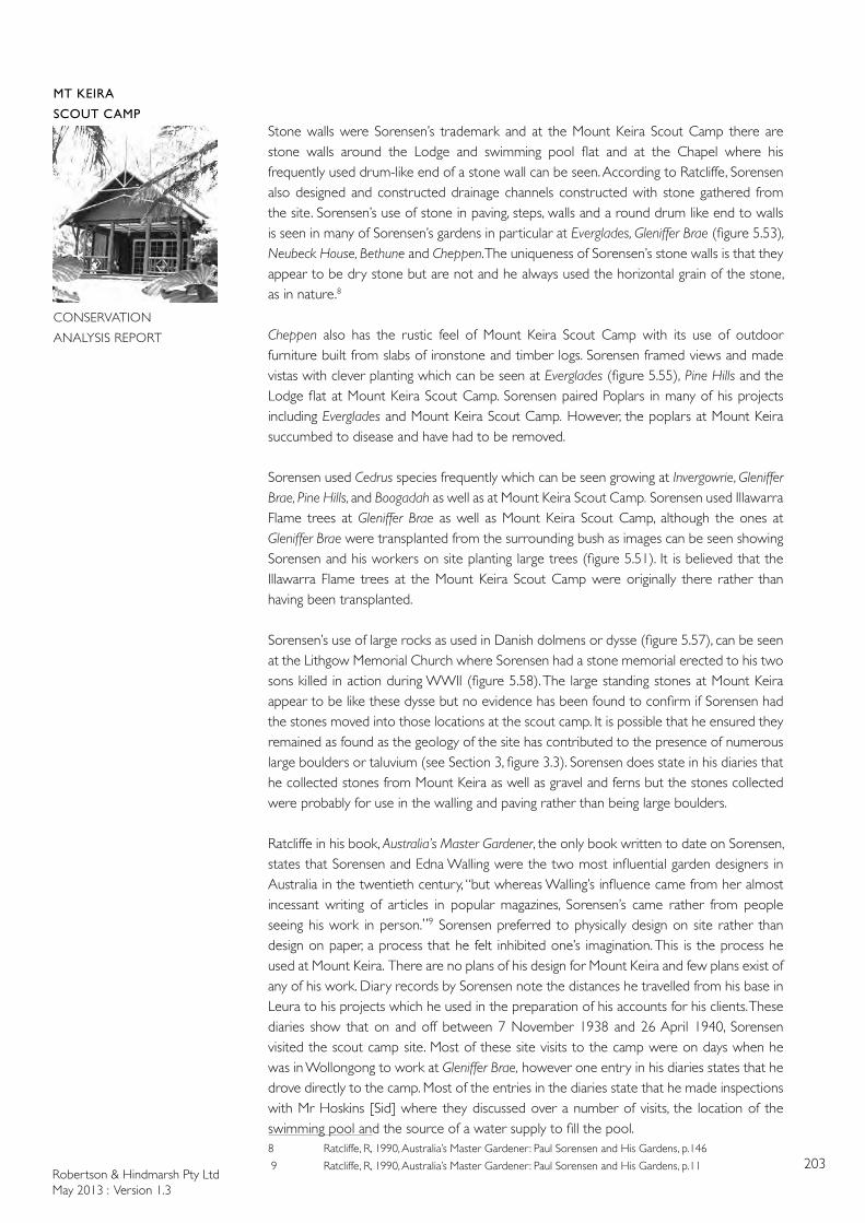
Robertson & Hindmarsh Pty LtdMay 2013 : Version 1.3
203
MT KEIRA
SCOUT CAMP
CONSERVATION
ANALYSIS REPORT
Stone walls were Sorensen’s trademark and at the Mount Keira Scout Camp there are stone walls around the Lodge and swimming pool flat and at the Chapel where his frequently used drum-like end of a stone wall can be seen. According to Ratcliffe, Sorensen also designed and constructed drainage channels constructed with stone gathered from the site. Sorensen’s use of stone in paving, steps, walls and a round drum like end to walls is seen in many of Sorensen’s gardens in particular at Everglades, Gleniffer Brae (figure 5.53), Neubeck House, Bethune and Cheppen. The uniqueness of Sorensen’s stone walls is that they appear to be dry stone but are not and he always used the horizontal grain of the stone, as in nature.8
Cheppen also has the rustic feel of Mount Keira Scout Camp with its use of outdoor furniture built from slabs of ironstone and timber logs. Sorensen framed views and made vistas with clever planting which can be seen at Everglades (figure 5.55), Pine Hills and the Lodge flat at Mount Keira Scout Camp. Sorensen paired Poplars in many of his projects including Everglades and Mount Keira Scout Camp. However, the poplars at Mount Keira succumbed to disease and have had to be removed.
Sorensen used Cedrus species frequently which can be seen growing at Invergowrie, Gleniffer Brae, Pine Hills, and Boogadah as well as at Mount Keira Scout Camp. Sorensen used Illawarra Flame trees at Gleniffer Brae as well as Mount Keira Scout Camp, although the ones at Gleniffer Brae were transplanted from the surrounding bush as images can be seen showing Sorensen and his workers on site planting large trees (figure 5.51). It is believed that the Illawarra Flame trees at the Mount Keira Scout Camp were originally there rather than having been transplanted.
Sorensen’s use of large rocks as used in Danish dolmens or dysse (figure 5.57), can be seen at the Lithgow Memorial Church where Sorensen had a stone memorial erected to his two sons killed in action during WWII (figure 5.58). The large standing stones at Mount Keira appear to be like these dysse but no evidence has been found to confirm if Sorensen had the stones moved into those locations at the scout camp. It is possible that he ensured they remained as found as the geology of the site has contributed to the presence of numerous large boulders or taluvium (see Section 3, figure 3.3). Sorensen does state in his diaries that he collected stones from Mount Keira as well as gravel and ferns but the stones collected were probably for use in the walling and paving rather than being large boulders.
Ratcliffe in his book, Australia’s Master Gardener, the only book written to date on Sorensen, states that Sorensen and Edna Walling were the two most influential garden designers in Australia in the twentieth century, “but whereas Walling’s influence came from her almost incessant writing of articles in popular magazines, Sorensen’s came rather from people seeing his work in person.”9 Sorensen preferred to physically design on site rather than design on paper, a process that he felt inhibited one’s imagination. This is the process he used at Mount Keira. There are no plans of his design for Mount Keira and few plans exist of any of his work. Diary records by Sorensen note the distances he travelled from his base in Leura to his projects which he used in the preparation of his accounts for his clients. These diaries show that on and off between 7 November 1938 and 26 April 1940, Sorensen visited the scout camp site. Most of these site visits to the camp were on days when he was in Wollongong to work at Gleniffer Brae, however one entry in his diaries states that he drove directly to the camp. Most of the entries in the diaries state that he made inspections with Mr Hoskins [Sid] where they discussed over a number of visits, the location of the swimming pool and the source of a water supply to fill the pool. 8 Ratcliffe, R, 1990, Australia’s Master Gardener: Paul Sorensen and His Gardens, p.146
9 Ratcliffe, R, 1990, Australia’s Master Gardener: Paul Sorensen and His Gardens, p.11
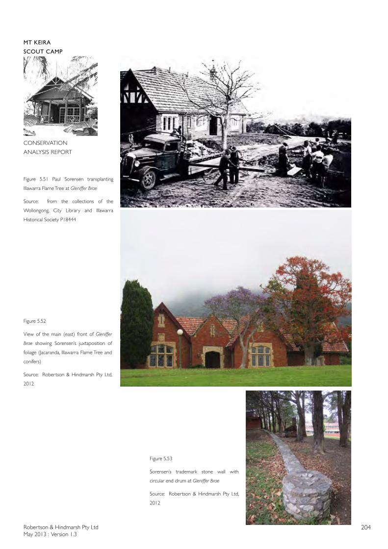
Robertson & Hindmarsh Pty LtdMay 2013 : Version 1.3
204
MT KEIRA
SCOUT CAMP
CONSERVATION
ANALYSIS REPORT
Figure 5.51 Paul Sorensen transplanting
Illawarra Flame Tree at Gleniffer Brae
Source: from the collections of the
Wollongong, City Library and Illawarra
Historical Society P18444
Figure 5.52
View of the main (east) front of Gleniffer
Brae showing Sorensen’s juxtaposition of
foliage (Jacaranda, Illawarra Flame Tree and
conifers)
Source: Robertson & Hindmarsh Pty Ltd,
2012
Figure 5.53
Sorensen’s trademark stone wall with
circular end drum at Gleniffer Brae
Source: Robertson & Hindmarsh Pty Ltd,
2012
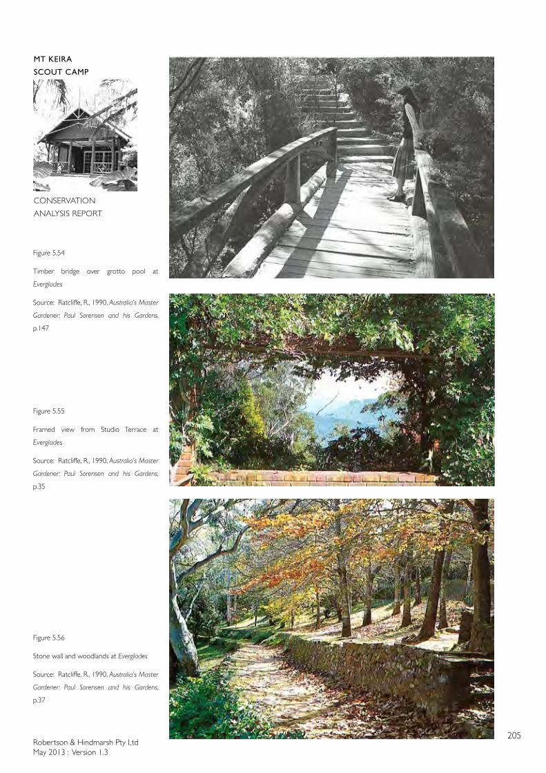
Robertson & Hindmarsh Pty LtdMay 2013 : Version 1.3
205
MT KEIRA
SCOUT CAMP
CONSERVATION
ANALYSIS REPORT
Figure 5.54
Timber bridge over grotto pool at
Everglades
Source: Ratcliffe, R., 1990, Australia’s Master
Gardener: Paul Sorensen and his Gardens,
p.147
Figure 5.55
Framed view from Studio Terrace at
Everglades
Source: Ratcliffe, R., 1990, Australia’s Master
Gardener: Paul Sorensen and his Gardens,
p.35
Figure 5.56
Stone wall and woodlands at Everglades
Source: Ratcliffe, R., 1990, Australia’s Master
Gardener: Paul Sorensen and his Gardens,
p.37
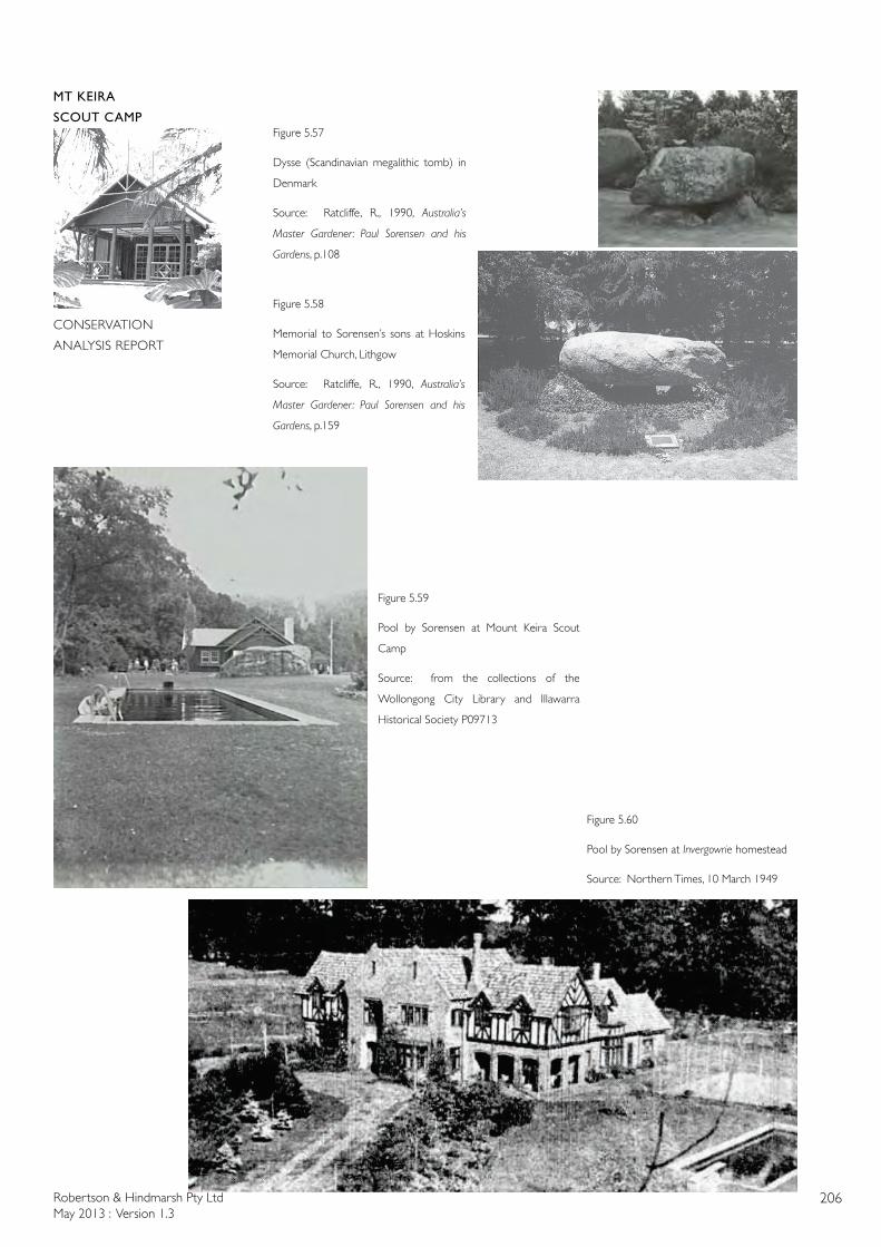
Robertson & Hindmarsh Pty LtdMay 2013 : Version 1.3
206
MT KEIRA
SCOUT CAMP
CONSERVATION
ANALYSIS REPORT
Figure 5.60
Pool by Sorensen at Invergowrie homestead
Source: Northern Times, 10 March 1949
Figure 5.57
Dysse (Scandinavian megalithic tomb) in
Denmark
Source: Ratcliffe, R., 1990, Australia’s
Master Gardener: Paul Sorensen and his
Gardens, p.108
Figure 5.58
Memorial to Sorensen’s sons at Hoskins
Memorial Church, Lithgow
Source: Ratcliffe, R., 1990, Australia’s
Master Gardener: Paul Sorensen and his
Gardens, p.159
Figure 5.59
Pool by Sorensen at Mount Keira Scout
Camp
Source: from the collections of the
Wollongong City Library and Illawarra
Historical Society P09713
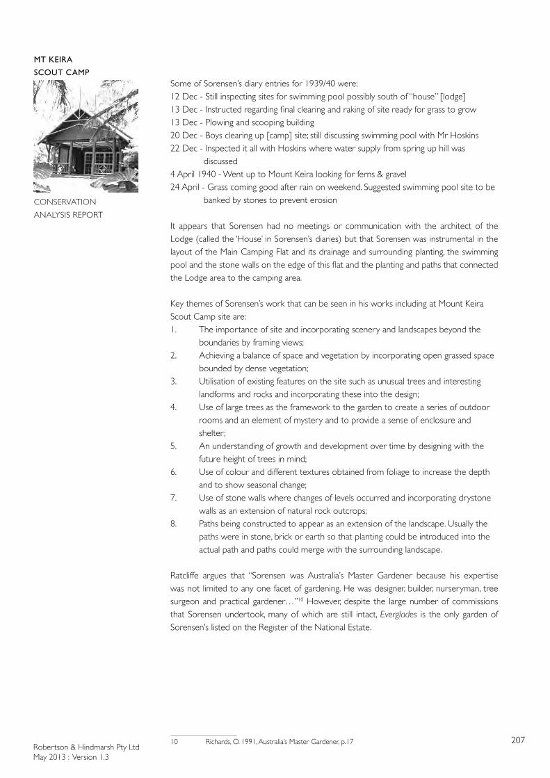
Robertson & Hindmarsh Pty LtdMay 2013 : Version 1.3
207
MT KEIRA
SCOUT CAMP
CONSERVATION
ANALYSIS REPORT
Some of Sorensen’s diary entries for 1939/40 were:12 Dec - Still inspecting sites for swimming pool possibly south of “house” [lodge]13 Dec - Instructed regarding final clearing and raking of site ready for grass to grow13 Dec - Plowing and scooping building20 Dec - Boys clearing up [camp] site; still discussing swimming pool with Mr Hoskins22 Dec - Inspected it all with Hoskins where water supply from spring up hill was discussed4 April 1940 - Went up to Mount Keira looking for ferns & gravel24 April - Grass coming good after rain on weekend. Suggested swimming pool site to be banked by stones to prevent erosion
It appears that Sorensen had no meetings or communication with the architect of the Lodge (called the ‘House’ in Sorensen’s diaries) but that Sorensen was instrumental in the layout of the Main Camping Flat and its drainage and surrounding planting, the swimming pool and the stone walls on the edge of this flat and the planting and paths that connected the Lodge area to the camping area.
Key themes of Sorensen’s work that can be seen in his works including at Mount Keira Scout Camp site are:1. The importance of site and incorporating scenery and landscapes beyond the
boundaries by framing views;2. Achieving a balance of space and vegetation by incorporating open grassed space
bounded by dense vegetation; 3. Utilisation of existing features on the site such as unusual trees and interesting
landforms and rocks and incorporating these into the design;4. Use of large trees as the framework to the garden to create a series of outdoor
rooms and an element of mystery and to provide a sense of enclosure and shelter ;
5. An understanding of growth and development over time by designing with the future height of trees in mind;
6. Use of colour and different textures obtained from foliage to increase the depth and to show seasonal change;
7. Use of stone walls where changes of levels occurred and incorporating drystone walls as an extension of natural rock outcrops;
8. Paths being constructed to appear as an extension of the landscape. Usually the paths were in stone, brick or earth so that planting could be introduced into the actual path and paths could merge with the surrounding landscape.
Ratcliffe argues that “Sorensen was Australia’s Master Gardener because his expertise was not limited to any one facet of gardening. He was designer, builder, nurseryman, tree surgeon and practical gardener…”10 However, despite the large number of commissions that Sorensen undertook, many of which are still intact, Everglades is the only garden of Sorensen’s listed on the Register of the National Estate.
10 Richards, O. 1991, Australia’s Master Gardener, p.17
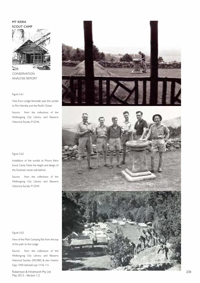
Robertson & Hindmarsh Pty LtdMay 2013 : Version 1.3
208
MT KEIRA
SCOUT CAMP
CONSERVATION
ANALYSIS REPORT
Figure 5.62
Installation of the sundial at Mount Keira
Scout Camp. Note the height and design of
the Sorensen stone wall behind
Source: from the collections of the
Wollongong City Library and Illawarra
Historical Society P12544
Figure 5.63
View of the Main Camping Flat from the top
of the path to the Lodge
Source: from the collections of the
Wollongong City Library and Illawarra
Historical Society (P02380) & also Hoskins
Saga, 1969, between pp.114 & 115
Figure 5.61
Vista from Lodge Verandah past the sundial
to Port Kembla and the Pacific Ocean
Source: from the collections of the
Wollongong City Library and Illawarra
Historical Society P12546
Robertson & Hindmarsh Pty LtdMay 2013 : Version 1.3
209
MT KEIRA
SCOUT CAMP
CONSERVATION
ANALYSIS REPORT
6.0 CULTURAL SIGNIFICANCE
6.1 INTRODUCTION
6.1.1 GENERAL
This assessment of cultural heritage significance is intended to assist in making decisions on the future conservation and management of the Mount Keira Scout Camp
6.1.2 ASSESSMENT OF SIGNIFICANCE
The following assessment of heritage significance has been prepared utilising the current evaluation criteria established by the New South Wales Heritage Council. These criteria encompass the four values in the Australia ICOMOS Burra Charter : historical significance, aesthetic significance, scientific significance, and social significance. The New South Wales Heritage Council’s evaluation criteria are:
Criterion (a) An item is important in the course, or pattern, of NSW’s cultural or natural history (or the cultural or natural history of the local area)
Criterion (b) An item has strong or special association with the life or works of a person, or group of persons, of importance in NSW’s cultural or natural history (or the cultural or natural history of the local area)
Criterion (c) An item is important in demonstrating aesthetic characteristics and/or a high degree of creative or technical achievement in NSW (or the local area)
Criterion (d) An item has strong or special association with a particular community or cultural group in NSW (or the local area) for social, cultural or spiritual reasons
Criterion (e) An item has potential to yield information that will contribute to an understanding of NSW’s cultural or natural history (or the cultural or natural history of the local area)
Criterion (f) An item possesses uncommon, rare or endangered aspects of NSW’s cultural or natural history (or the cultural or natural history of the local area)
Criterion (g) An item is important in demonstrating the principal characteristics of a class of NSW’s cultural or natural places; or cultural or natural environments, (or a class of the local area’s cultural or natural places; or cultural or natural environments)
The criteria set for the National Heritage list are similar :
Criterion (a) the place has outstanding heritage value to the nation because of the place’s importance in the course, or pattern, of Australia’s natural or cultural history
Criterion (b) the place has outstanding heritage value to the nation because of the place’s possession of uncommon, rare or endangered aspects of Australia’s natural or cultural history
Criterion (c) the place has outstanding heritage value to the nation because of the place’s potential to yield information that will contribute to an understanding of Australia’s natural or cultural history
Criterion (d) the place has outstanding heritage value to the nation because of the place’s importance in demonstrating the principal characteristics of:
(i) a class of Australia’s natural or cultural places; or
(ii) a class of Australia’s natural or cultural environments
Robertson & Hindmarsh Pty LtdMay 2013 : Version 1.3
210
MT KEIRA
SCOUT CAMP
CONSERVATION
ANALYSIS REPORT
Criterion (e) the place has outstanding heritage value to the nation because of the place’s importance in exhibiting particular aesthetic characteristics valued by a community or cultural group
Criterion (f) the place has outstanding heritage value to the nation because of the place’s importance in demonstrating a high degree of creative or technical achievement at a particular period
Criterion (g) the place has outstanding heritage value to the nation because of the place’s strong or special association with a particular community or cultural group for social, cultural or spiritual reasons
Criterion (h) the place has outstanding heritage value to the nation because of the place’s special association with the life or works of a person, or group of persons, of importance in Australia’s natural or cultural history
Criterion (i) the place has outstanding heritage value to the nation because of the place’s importance as part of Indigenous tradition
NATIONAL HERITAGE LIST THRESHOLD
The National Heritage List entries have been assessed against similar significance criteria as the State Heritage Register, but on a national level rather than state.
As well as assessing a place against criteria for its heritage value, the Australian Heritage Council is also required to apply a ‘significance threshold’. This test helps the Council to judge the level of significance of a place’s heritage value by asking ‘how important are these values?’. To reach the threshold for the National Heritage List, a place must have ‘outstanding’ heritage value to the nation. This means that it must be important to the Australian community as a whole.
To determine whether a place has ‘outstanding’ heritage values, it is compared to other, similar types of places. This allows the Council to determine if one place is ‘more’ or ‘less’ significant compared to other similar places, or if it is unique. The degree of significance can also relate to the geographic area, for instance, the extent of a place’s significance locally, regionally, nationally or internationally.
6.2 EXISTING ASSESSMENTS OF SIGNIFICANCE
6.2.1 STATUTORY - NATIONAL HERITAGE LIST
The Mount Keira Scout Camp is not listed on the National Heritage List.
6.2.2 STATUTORY - COMMONWEALTH HERITAGE LIST
The Mount Keira Scout Camp is not listed on the Commonwealth Heritage List.
6.2.3 STATUTORY - STATE HERITAGE REGISTER:
The Mount Keira Scout Camp is not listed on the NSW State Heritage Register.
6.2.4 STATUTORY - STATE HERITAGE INVENTORY
The Mount Keira Scout Camp is not listed on the State Heritage Inventory. However, this would appear to be an error as the Scout Camp site is listed on the Heritage Schedule of the Wollongong LEP and should, therefore be on the State Heritage Inventory.
Robertson & Hindmarsh Pty LtdMay 2013 : Version 1.3
211
MT KEIRA
SCOUT CAMP
CONSERVATION
ANALYSIS REPORT
6.2.5 STATUTORY - WOLLONGONG LOCAL ENVIRONMENTAL PLAN 2009
The Mount Keira Scout Camp is listed in the Heritage Schedule of the Wollongong LEP, 2009 as an item of Local significance as follows:
Mount Keira Scout Camp, Mount Keira Road, Lot 1, DP 255281, Local Item 6471
The Mount Keira Scout Camp is also listed in the Heritage Schedule of the Wollongong LEP, 2009 by virtue of being a part of the Illawarra Escarpment Landscape Heritage Conservation Area, Local Item, Wollongong LEP, 2009.
6.2.6 NON-STATUTORY (FROM FEBRUARY 2012) - THE REGISTER OF THE NATIONAL
ESTATE
The Mount Keira Scout Camp is not listed on the Register of the National Estate.
6.2.7 NON-STATUTORY - THE NATIONAL TRUST OF AUSTRALIA (NSW):
The Illawarra Escarpment State Conservation Area is listed on the National Trust of Australia (NSW) Register as a part of the Illawarra Escarpment Landscape Conservation Area.
A copy of the National Trust Listing Card is attached to this report in Appendix 9.
The Mount Keira Scout Camp is not listed separately on the National Trust of Australia (NSW) Register but forms part of the Illawarra Escarpment Landscape Conservation Area.
6.2.8 NON-STATUTORY - THE AUSTRALIAN INSTITUTE OF ARCHITECTS (NSW CHAPTER) REGISTER OF BUILDINGS OF SIGNIFICANCE:
The Mount Keira Scout Camp is not listed on the Australian Institute of Architects (NSW Chapter) Register of Buildings of Significance.
6.2.9 NON-STATUTORY - HISTORIC HERITAGE INFORMATION MANAGEMENT SYSTEM (HHIMS):
The Mount Keira Scout Camp is listed on the NSW Office of Environment & Heritage (NPWS) Historic Heritage Information Management System (HHIMS). The details are as follows:
Item ID: 11188
SHI ID: none
Status: Potential
Item Name: Mt Keira Scout Camp
Item Type: Complex
Easting: 301822
Northing: 6191009
Assessed Significance: Not assessed
Robertson & Hindmarsh Pty LtdMay 2013 : Version 1.3
212
MT KEIRA
SCOUT CAMP
CONSERVATION
ANALYSIS REPORT
Statement of Significance:
The Study Area (powerline and Ecomax sewerage project footprint areas) is potentially of local significance for its ability to demonstrate early uses of the place embodied in the surviving archaeological features. Further research is required to understand the history of the place more clearly and to contextualise the fabric that survives on the site. Local Significance (Potential). Ref Biosis Research 20091.
The site is likely to be of local significance as a good intact representative example of a scout camp. The site is an interesting collection of good representative scout buildings and infrastructure in a modified landscaped setting abutting the escarpment. The site is easily understood as a working group and its features are easily interpreted. The buildings individually may not be unusual or rare with the exception of the Lodge. However, the site is likely to be valuable at a local level as a whole group, for its association with the scouting movement both in Australia and worldwide, with BHP and the local mining industry, and the notable landscape designer Paul Sorensen. Now located within National Parks2, it has important interpretive use as evidence of these associations, and its previous use prior to the establishment of the Scout Camp.
With the exception of the Lodge, the range of buildings demonstrating the different design styles and types of materials used illustrate the typical building techniques from the different periods of development of the site. The Lodge appears to be a very particular style and construction of building. The setting is also instructive and evocative of how the camp relates to the wider landscape as it sits elevated on the side of the escarpment with great views gained of the Illawarra areas to the south. Ref: Lawrence, DEC, 2008.
A copy of the HHIMS Listing Card is attached to this report in Appendix 10.
6.3 BASIS OF ASSESSMENT
This assessment is intended to enable decisions on the future conservation and management of the place to be based on a reasonable understanding of its significance. The statement below explains the general nature of that significance and the more detailed Schedule (see ‘Schedule of Cultural Significance of Items’ in this part) the level of significance of the various elements.
6.4 STATEMENT OF CULTURAL SIGNIFICANCE
6.4.1 SUMMARY STATEMENT OF CULTURAL SIGNIFICANCE
The Mount Keira Scout Camp is significant aesthetically for its location high on the Illawarra Escarpment with its dramatic vistas and views over the Illawarra and for the considered layout of the camp as a series of cleared glades and levelled platforms forming a hierarchy of spaces as one moves through the site from east to west; from the mundane world of the car park, through the long main camping area aligned with the two high landscape features (Mount Keira and Robertson’s Lookout), to the well-designed community building (the Lodge), to the spiritually-charged open air Chapel at the end of the symbolic axis.
The Mount Keira Scout Camp is significant aesthetically for the high quality of the design of the initial buildings on the site designed by the Hoskins’ architect, Geoffrey Loveridge with
1 Note that the Biosis Research Report refered to here is dated October 2010, not 20092 AnNPWSreserve

Robertson & Hindmarsh Pty LtdMay 2013 : Version 1.3
213
MT KEIRA
SCOUT CAMP
CONSERVATION
ANALYSIS REPORT
respect to the Lodge and the continuance of the Lodge’s design aesthetic in later buildings designed by the drafting office of AI&S and BHP with respect to the Rovers Den, and the Camp Warden’s Cottage refurbishment. The design aesthetic refers directly to the rustic, American frontiersman buildings admired by Lord Baden-Powell and constructed at the Scouting Movement’s main base at Gilwell Park in London.
The Mount Keira Scout Camp is significant for its association with important figures at state, national and international levels; Mr A.S. (“Sid”) Hoskins of Australian Iron and Steel, landscape designer Paul Sorensen, World Chief Guide Lady Baden-Powell, and HRH the Duchess of Gloucester and her two sons, the young Dukes of Gloucester (Princes William and Richard).
The Mount Keira Scout Camp is significant for its physical environment with more than 70 species of rainforest trees, for the exotic plantings and stone hardworks by noted landscape designer, Paul Sorensen, and because it supports a number of endangered ecological communities (including the Illawarra Escarpment Sub-tropical Rainforest), and threatened plant and animal species.
Mount Keira Scout Camp is significant as an early New South Wales scout camp forming part of the worldwide Scouting movement and its significance from a morale-boosting, propaganda aspect as depicted in the wartime 1940 Cinesound Newsreel as a wholesome counter to the youth movements of fascist Italy and Germany.
6.4.2 SIGNIFICANCE ACCORDING TO NSW HERITAGE OFFICE CRITERIA
CRITERION CRITERION
DESCRIPTION
ANALYSIS
Criterion (a) An item is important in the course, or pattern, of NSW’s cultural or natural history (or the cultural or natural history of the local area)
The Mount Keira Scout Camp is of at least state significance as the state’s third oldest permanent scout camp (after the Baden-Powell Scout Camp and Camp Coutts)
Criterion (a) The Mount Keira Scout Camp’s national significance was recognised at the time of its opening by the NSW Chief Scout (Governor of NSW) by the national dissemination of the opening ceremony by Cinesound Newsreel film footage shown around the country in 1940.
Criterion (a) The importance of the Scouting Movement to the morale of the country was recognised and reinforced nationally in the 1940 Cinesound Newsreel of the opening of the camp when the Australian Scouting Movement was compared to the fascist youth movements of Italy and Germany.
Robertson & Hindmarsh Pty LtdMay 2013 : Version 1.3
214
MT KEIRA
SCOUT CAMP
CONSERVATION
ANALYSIS REPORT
Criterion (b) An item has strong or special association with the life or works of a person, or group of persons, of importance in NSW’s cultural or natural history (or the cultural or natural history of the local area)
The Mount Keira Scout Camp is of at least state significance for its association with important figures in the state’s history; Mr A.S. (Sid) Hoskins for his prominent role in the establishment of the iron and steel industry in NSW and Port Kembla as well as his role as a benefactor to the Scout Movement for providing the site, and the financing of the design and construction of the scout camp, architect Mr Geoffrey Loveridge for designing the initial “rustic” buildings on the site that referenced the origins of Scouting at Gilwell Park in London, landscape designer Mr Paul Sorensen for the design and construction of the camp site hardworks and landscape planting, Mr Charles Jackson for the long-time involvement in the organisation of scouting in the Illawarra and Australia (for 75 years) and his close connection with the scout camp, HRH the Duchess of Gloucester and the young Dukes of Gloucester (Princes William and Richard) for their ceremonial visit to the camp in 1947, Lady Baden-Powell for her visits to the camp in 1947 & 1958, and with the worldwide Scouting Movement itself
Criterion (b) The Mount Keira Scout Camp is of at least local significance for its association with important figures in the Illawarra’s history: Mr Dave Walsh who was a long-time warden of the camp and identified many of the rainforest species on the scout camp site. His importance to the local community has been commemorated in the naming of the track to the summit of Mount Keira as the Dave Walsh Track
Criterion (c) An item is important in demonstrating aesthetic characteristics and/or a high degree of creative or technical achievement in NSW (or the local area)
The Mount Keira Scout Camp is of at least national significance for its aesthetic qualities due to its dramatic siting on the Illawarra Escarpment and the panoramic views once enjoyed from a number of locations on the site. This aesthetic importance was recognised by Lady Baden-Powell when she wrote in the Mount Keira Scout Camp visitor’s book that the Mount Keira Scout Camp was “surely one of the most beautiful [scout camps] in the world” (1947)
Robertson & Hindmarsh Pty LtdMay 2013 : Version 1.3
215
MT KEIRA
SCOUT CAMP
CONSERVATION
ANALYSIS REPORT
Criterion (c) The Mount Keira Scout Camp is of at least national significance for its aesthetic qualities in the high quality of the design and construction of the early buildings on the site such as the Lodge, Swimming Pool, Chapel, Camp Kitchen, Rovers Den and the Warden’s Cottage.
The aesthetic importance of the camp is reinforced by cohesive design language of the earliest buildings; black stained vertical board and batten walls, off white timber windows, rustic design elements in columns, beams, balustrades and gable screens, and gable roofs.
Criterion (c) The Mount Keira Scout Camp is of at least national significance for its aesthetic qualities in the high quality of the design and construction of the hard and soft landscaping works by notable landscape designer, Paul Sorensen
Criterion (c) The Mount Keira Scout Camp is of at least national significance for its aesthetic qualities due to the embodied symbolism of the planning which leads visitors along a symbolic axis from the mundane world (the car park), through the higher levels of the camping flat and Lodge area and terminating in the spiritual highlight of the open-air Chapel
Criterion (d) An item has strong or special association with a particular community or cultural group in NSW (or the local area) for social, cultural or spiritual reasons
The Mount Keira Scout Camp is of at least state significance for its association with the establishment and development of the worldwide Scouting Movement within Australia and in fulfilling the ideals of Scouting’s founder, Lord Baden-Powell. The scout camp was and is an integral part of the Illawarra community
Criterion (e) An item has potential to yield information that will contribute to an understanding of NSW’s cultural or natural history (or the cultural or natural history of the local area)
The Mount Keira Scout Camp is of at least state significance for its physical environment with more than 70 species of rainforest trees and for the exotic plantings and stone hardworks by notable landscape designer, Paul Sorensen
Robertson & Hindmarsh Pty LtdMay 2013 : Version 1.3
216
MT KEIRA
SCOUT CAMP
CONSERVATION
ANALYSIS REPORT
.
Criterion (e) The Mount Keira Scout Camp is of at least local significance for its research potential concerning the local flora and fauna of the Illawarra Escarpment rainforest
Criterion (e) The archaeological remains within the Mount Keira Scout Camp are seen as being limited in nature and their ability to contribute to meaningful research is therefore restricted. Any substantive remains from the nineteenth-century farms or initial scout period would have some limited potential to contribute knowledge and therefore may be of Local heritage significance
Criterion (f) An item possesses uncommon, rare or endangered aspects of NSW’s cultural or natural history (or the cultural or natural history of the local area)
The Mount Keira Scout Camp is of at least state significance because it supports a number of endangered ecological communities (including the Illawarra Escarpment Sub-tropical Rainforest), and threatened plant and animal species
Criterion (g) An item is important in demonstrating the principal characteristics of a class of NSW’s cultural or natural places; or cultural or natural environments (or a class of the local area’s cultural or natural places; or cultural or natural environments)
The Mount Keira Scout Camp is of at least state significance as an excellent example of a scout camp in terms of its planning, design and physical environment.
6.5 DISCUSSION OF INDIVIDUAL LEVELS OF SIGNIFICANCE
Grading reflects the contribution the element makes to overall significance of the item (or the degree to which the significance of the item would be diminished if the component were removed or altered). The Mount Keira Scout Camp has been assessed to determine a relative grading of significance into six levels. This process examines a number of factors, including:
Original design quality
Degree of intactness and general condition
Robertson & Hindmarsh Pty LtdMay 2013 : Version 1.3
217
MT KEIRA
SCOUT CAMP
CONSERVATION
ANALYSIS REPORT
Relative age and authenticity (original, replaced)
Extent of subsequent alterations
Association with important people or events
Ability to demonstrate a rare quality, craft or construction process
This Conservation Analysis Report utilises the widely recognised standard gradings published by the NSW Department of Premier and Cabinet, Office of Environment & Heritage, Heritage Branch for assessing local or state significance.
To this has been added a ‘neutral’ grading to include modern fabric that has no heritage significance but has been installed in a similar configuration (or is a direct copy) (for example, new window sashes).
The gradings used are as follows:
GRADING DEFINITION STATUS
EXCEPTIONAL Rare or outstanding element directly contributing to an item’s Local and State significance
Fulfils criteria for Local or State listing
HIGH High degree of original fabric. Demonstrates a key element of the item’s significance. Alterations do not detract from significance
Fulfils criteria for Local or State listing
MODERATE Altered or modified elements. Elements with little heritage value, but which contribute to the overall significance of the item
Fulfils criteria for Local or State listing
LITTLE Alterations detract from significance. Difficult to interpret
Does not fulfil criteria for Local or State listing
NEUTRAL
(additional
criterion inserted
by Robertson &
Hindmarsh Pty Ltd)
Altered, modified or new elements which do not detract from the significance of the item and which do not confuse interpretation
Does not affect criteria for Local or State listing accorded by non-neutral elements
INTRUSIVE Damaging to the item’s heritage significance
Does not fulfil criteria for Local or State listing
These gradings have been established as a tool to assist in developing appropriate conservation measures for the treatment of the Mount Keira Scout Camp and the various elements. Good conservation practice encourages the focusing on change or upgrading of historical buildings and landscapes to those areas or components that make a lesser contribution to significance. The areas or components that make a greater or defining contribution to significance should generally be left intact or changed with the greatest care and respect.
Robertson & Hindmarsh Pty LtdMay 2013 : Version 1.3
218
MT KEIRA
SCOUT CAMP
CONSERVATION
ANALYSIS REPORT
6.6 INDIVIDUAL LEVELS OF SIGNIFICANCE - ITEMS
The detailed description of originality, intactness and significance of each major item on the site is in the following tables of significance. See 6.7 for individual elements of those items.
ITEM ITEM NAME DESCRIPTION/COMMENT SIGNIFICANCE
A1 A.S. Hoskins Gateway
Stone clad piers, copper arch and bronze plaques
Exceptional
A2 Sorensen Memorial Pathway
Bitumen paving over sinter base High
A3 Main Camping Flat Grassed area with boulders. Surrounded by rainforest trees and some exotic plantings
Exceptional
A4 Sub-station huts Utilitarian metal clad huts Intrusive
A5 Baden-Powell Commemorative Grove
The grouping of flagpoles is symbolically important
High
B1 Stone walls Stone walls constructed in 1939/40 by Paul Sorensen partially retaining the slope above the Lodge and defining the terrace in front of the Lodge and Swimming Pool
Exceptional
B2 Paths from Camping Flat and Kitchen to Lodge
Stone paths constructed in 1939/40 by Paul Sorensen
Exceptional
B3 Flagpole & bell Not the original flagpole or bell and not in the original location
Neutral
B4 Sundial Stone & brass sundial donated in 1941 High
B5 The Lodge Stone and dark stained timber “rustic” (yet refined) main building of the camp, designed by Geoffrey Loveridge, sets the architectural benchmark for the camp
Exceptional
B6 Lodge chair store Functional shed set amongst the trees Neutral
B7 Swimming Pool Part of the original building campaign Exceptional
B8 Swimming Pool pump house
Functional shed tucked into the trees Intrusive
B9 The Glen Brick paved areas within the creek bed Intrusive
B10 Concrete road Intrusive
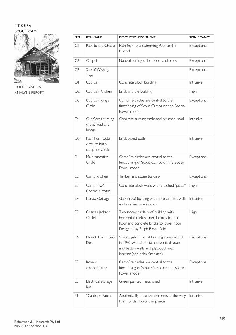
Robertson & Hindmarsh Pty LtdMay 2013 : Version 1.3
219
MT KEIRA
SCOUT CAMP
CONSERVATION
ANALYSIS REPORT
ITEM ITEM NAME DESCRIPTION/COMMENT SIGNIFICANCE
C1 Path to the Chapel Path from the Swimming Pool to the Chapel
Exceptional
C2 Chapel Natural setting of boulders and trees Exceptional
C3 Site of Wishing Tree
Exceptional
D1 Cub Lair Concrete block building Intrusive
D2 Cub Lair Kitchen Brick and tile building High
D3 Cub Lair Jungle Circle
Campfire circles are central to the functioning of Scout Camps on the Baden-Powell model
Exceptional
D4 Cubs’ area turning circle, road and bridge
Concrete turning circle and bitumen road Intrusive
D5 Path from Cubs’ Area to Main campfire Circle
Brick paved path Intrusive
E1 Main campfire Circle
Campfire circles are central to the functioning of Scout Camps on the Baden-Powell model
Exceptional
E2 Camp Kitchen Timber and stone building Exceptional
E3 Camp HQ/ Control Centre
Concrete block walls with attached “posts” High
E4 Fairfax Cottage Gable roof building with fibre cement walls and aluminium windows
Intrusive
E5 Charles Jackson Chalet
Two storey gable roof building with horizontal, dark-stained boards to top floor and concrete bricks to lower floor. Designed by Ralph Bloomfield
High
E6 Mount Keira Rover Den
Simple gable roofed building constructed in 1942 with dark stained vertical board and batten walls and plywood lined interior (and brick fireplace)
Exceptional
E7 Rovers’ amphitheatre
Campfire circles are central to the functioning of Scout Camps on the Baden-Powell model
Exceptional
E8 Electrical storage hut
Green painted metal shed Intrusive
F1 “Cabbage Patch” Aesthetically intrusive elements at the very heart of the lower camp area
Intrusive
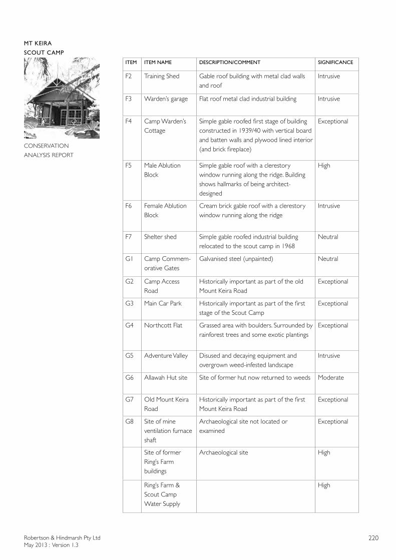
Robertson & Hindmarsh Pty LtdMay 2013 : Version 1.3
220
MT KEIRA
SCOUT CAMP
CONSERVATION
ANALYSIS REPORT
ITEM ITEM NAME DESCRIPTION/COMMENT SIGNIFICANCE
F2 Training Shed Gable roof building with metal clad walls and roof
Intrusive
F3 Warden’s garage Flat roof metal clad industrial building Intrusive
F4 Camp Warden’s Cottage
Simple gable roofed first stage of building constructed in 1939/40 with vertical board and batten walls and plywood lined interior (and brick fireplace)
Exceptional
F5 Male Ablution Block
Simple gable roof with a clerestory window running along the ridge. Building shows hallmarks of being architect-designed
High
F6 Female Ablution Block
Cream brick gable roof with a clerestory window running along the ridge
Intrusive
F7 Shelter shed Simple gable roofed industrial building relocated to the scout camp in 1968
Neutral
G1 Camp Commem-orative Gates
Galvanised steel (unpainted) Neutral
G2 Camp Access Road
Historically important as part of the old Mount Keira Road
Exceptional
G3 Main Car Park Historically important as part of the first stage of the Scout Camp
Exceptional
G4 Northcott Flat Grassed area with boulders. Surrounded by rainforest trees and some exotic plantings
Exceptional
G5 Adventure Valley Disused and decaying equipment and overgrown weed-infested landscape
Intrusive
G6 Allawah Hut site Site of former hut now returned to weeds Moderate
G7 Old Mount Keira Road
Historically important as part of the first Mount Keira Road
Exceptional
G8 Site of mine ventilation furnace shaft
Archaeological site not located or examined
Exceptional
Site of former Ring’s Farm buildings
Archaeological site High
Ring’s Farm & Scout Camp Water Supply
High
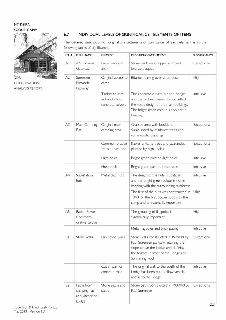
Robertson & Hindmarsh Pty LtdMay 2013 : Version 1.3
221
MT KEIRA
SCOUT CAMP
CONSERVATION
ANALYSIS REPORT
6.7 INDIVIDUAL LEVELS OF SIGNIFICANCE - ELEMENTS OF ITEMS
The detailed description of originality, intactness and significance of each element is in the following tables of significance.
ITEM ITEM NAME ELEMENT DESCRIPTION/COMMENT SIGNIFICANCE
A1 A.S. Hoskins Gateway
Gate piers and arch
Stone clad piers, copper arch and bronze plaques
Exceptional
A2 Sorensen Memorial Pathway
Original access to camp
Bitumen paving over sinter base High
Timber trusses as handrails on concrete culvert
The concrete culvert is not a bridge and the timber trusses do not reflect the rustic design of the main buildings. The bright green colour is also not in keeping
Intrusive
A3 Main Camping Flat
Original main camping area
Grassed area with boulders. Surrounded by rainforest trees and some exotic plantings
Exceptional
Commemorative trees at east end
Illawarra Flame trees and Jacarandas planted by dignatories
Exceptional
Light poles Bright green painted light poles Intrusive
Hose reels Bright green painted hose reels Intrusive
A4 Sub-station huts
Metal clad huts The design of the huts is utilitarian and the bright green colour is not in keeping with the surrounding rainforest
Intrusive
The first of the huts was constructed in 1940 for the first power supply to the camp and is historically important
High
A5 Baden-Powell Commem-orative Grove
The grouping of flagpoles is symbolically important
High
Metal flagpoles and brick paving Intrusive
B1 Stone walls Dry stone walls Stone walls constructed in 1939/40 by Paul Sorensen partially retaining the slope above the Lodge and defining the terrace in front of the Lodge and Swimming Pool
Exceptional
Cut in wall for concrete road
The original wall to the south of the Lodge has been cut to allow vehicle access to the Lodge
Intrusive
B2 Paths from camping flat and kitchen to Lodge
Stone paths and steps
Stone paths constructed in 1939/40 by Paul Sorensen
Exceptional
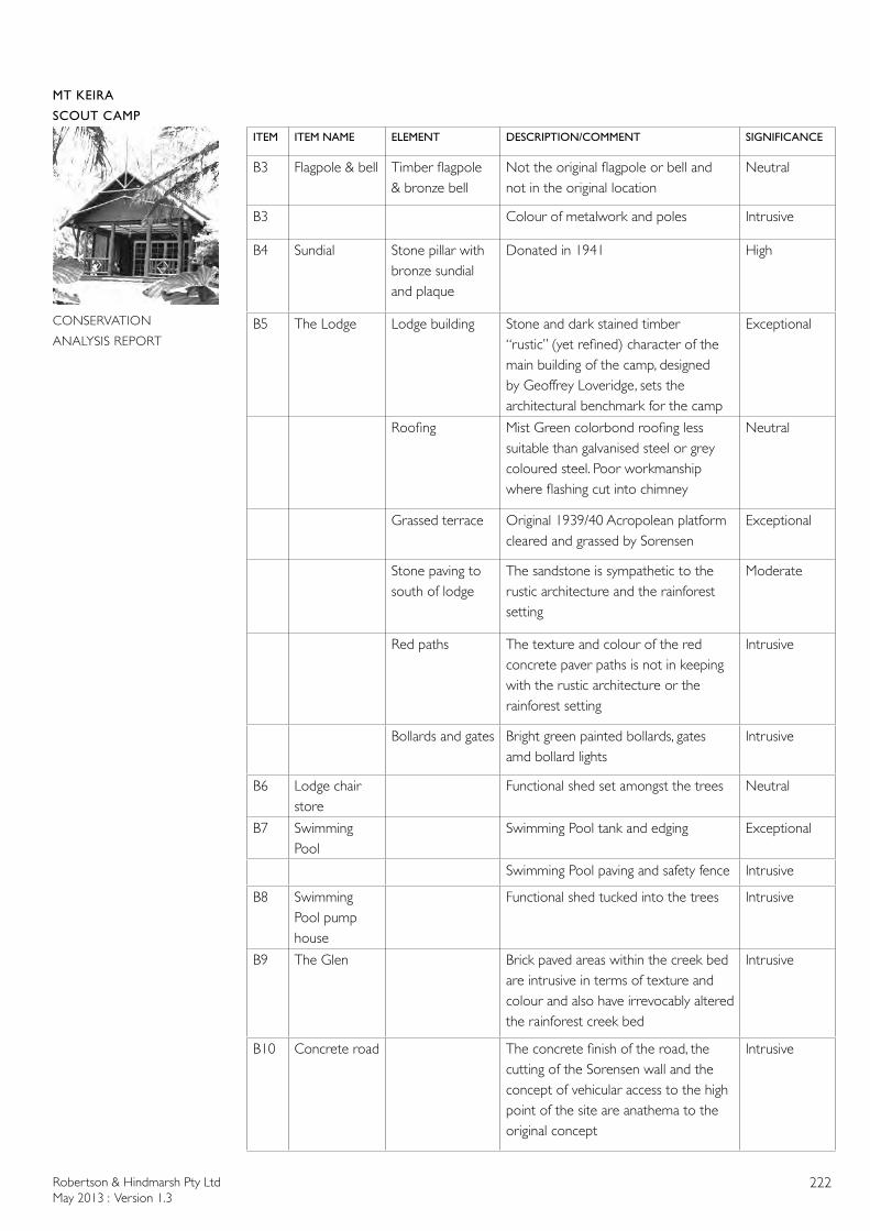
Robertson & Hindmarsh Pty LtdMay 2013 : Version 1.3
222
MT KEIRA
SCOUT CAMP
CONSERVATION
ANALYSIS REPORT
ITEM ITEM NAME ELEMENT DESCRIPTION/COMMENT SIGNIFICANCE
B3 Flagpole & bell Timber flagpole & bronze bell
Not the original flagpole or bell and not in the original location
Neutral
B3 Colour of metalwork and poles Intrusive
B4 Sundial Stone pillar with bronze sundial and plaque
Donated in 1941 High
B5 The Lodge Lodge building Stone and dark stained timber “rustic” (yet refined) character of the main building of the camp, designed by Geoffrey Loveridge, sets the architectural benchmark for the camp
Exceptional
Roofing Mist Green colorbond roofing less suitable than galvanised steel or grey coloured steel. Poor workmanship where flashing cut into chimney
Neutral
Grassed terrace Original 1939/40 Acropolean platform cleared and grassed by Sorensen
Exceptional
Stone paving to south of lodge
The sandstone is sympathetic to the rustic architecture and the rainforest setting
Moderate
Red paths The texture and colour of the red concrete paver paths is not in keeping with the rustic architecture or the rainforest setting
Intrusive
Bollards and gates Bright green painted bollards, gates amd bollard lights
Intrusive
B6 Lodge chair store
Functional shed set amongst the trees Neutral
B7 Swimming Pool
Swimming Pool tank and edging Exceptional
Swimming Pool paving and safety fence Intrusive
B8 Swimming Pool pump house
Functional shed tucked into the trees Intrusive
B9 The Glen Brick paved areas within the creek bed are intrusive in terms of texture and colour and also have irrevocably altered the rainforest creek bed
Intrusive
B10 Concrete road The concrete finish of the road, the cutting of the Sorensen wall and the concept of vehicular access to the high point of the site are anathema to the original concept
Intrusive

Robertson & Hindmarsh Pty LtdMay 2013 : Version 1.3
223
MT KEIRA
SCOUT CAMP
CONSERVATION
ANALYSIS REPORT
ITEM ITEM NAME ELEMENT DESCRIPTION/COMMENT SIGNIFICANCE
C1 Path to the Chapel
Path alignment Path alignment from the Swimming Pool to the Chapel
Exceptional
Bridges Timber bridges on path Moderate
Paving Stone paving on part of path Moderate
Paving Concrete paver stepping stones Neutral
Paving Ceramic tiles on part of path Intrusive
Path alignment Path alignment from the Cub Lair to the Chapel
Exceptional
C2 Chapel Design Use of natural setting of boulders and trees
Exceptional
Natural boulders Exceptional
Stone pulpit and steps
Constructed in 1939/40 Exceptional
Timber pews Neutral
Stone paving to Chapel
Neutral
C3 Site of Wishing Tree
Site location Exceptional
Tree Tree has disappeared and been reabsorbed into forest
Stone paving around base of tree
Barely distinguishable
D1 Cub Lair Concrete block, gable-roofed hut
The design of the Cub Lair is utilitarian and, despite the original intent of building a rustic building, the final building is undistinguished aesthetically
Intrusive
The building is historically important as it was opened by Lady Baden-Powell
High
Colour of building
The building is painted bright green Intrusive
D2 Cub Lair Kitchen
Dark clinker brick, dark stained timber and concrete tile roof designed by architect, Ralph Bloomfield. A simple, functional design of the Sydney School
High
D3 Cub Lair Jungle Circle
Use Campfire circles are central to the functioning of Scout Camps on the Baden-Powell model
Exceptional
Timber seats surrounding a fire pit Moderate
Robertson & Hindmarsh Pty LtdMay 2013 : Version 1.3
224
MT KEIRA
SCOUT CAMP
CONSERVATION
ANALYSIS REPORT
ITEM ITEM NAME ELEMENT DESCRIPTION/COMMENT SIGNIFICANCE
D4 Cubs’ area turning circle, road and bridge
Carriageway Concrete turning circle and bitumen road
Intrusive
D5 Path from Cubs’ Area to Main campfire Circle
Path and bridges Brick paved path Intrusive
Timber bridges with rope handrails Neutral
E1 Main campfire Circle
Use Campfire circles are central to the functioning of Scout Camps on the Baden-Powell model
Exceptional
Terraced grassed seating and amphitheatre surrounding a fire pit
Moderate
E2 Camp Kitchen Stone wall and timber post first stage (1946) and Flora’s BBQ Area
Design and materials Exceptional
Paint colour of timber work
Bright green Intrusive
Colour of building
The building is painted bright green Intrusive
Design and materials of Lyrebird Room and Ktichen extension
Bright green painted fibre cement Intrusive
E3 Camp HQ/ Control Centre
Gable roof design of stage one (1946)
Concrete block walls with attached “posts”
High
Colour of building
The building is painted bright green Intrusive
E4 Fairfax Cottage
Design of building Gable roof building with fibre cement walls and aluminium windows
Intrusive
Wall colour Bright green Intrusive
Roof colour Olive green Intrusive
E5 Charles Jackson Chalet
Design of building Two storey gable roof building with horizontal, dark-stained boards to top floor and concrete bricks to lower floor. Designed by Ralph Bloomfield
High
Robertson & Hindmarsh Pty LtdMay 2013 : Version 1.3
225
MT KEIRA
SCOUT CAMP
CONSERVATION
ANALYSIS REPORT
ITEM ITEM NAME ELEMENT DESCRIPTION/COMMENT SIGNIFICANCE
E6 Mount Keira Rover Den
Design of building Simple gable roofed building constructed in 1942 with dark stained vertical board and batten walls and plywood lined interior (and brick fireplace)
Exceptional
Skillion addition Addition clad in same materials as original section
High
E7 Rovers’ amphitheatre
Use Campfire circles are central to the functioning of Scout Camps on the Baden-Powell model
Exceptional
Grassed area surrounding a fire pit Moderate
E8 Electrical storage hut
Green painted metal shed Intrusive
F1 “Cabbage Patch”
Metal storage sheds, open materials storage racks, dumpsters containing firewood
Aesthetically intrusive elements at the very heart of the lower camp area
Intrusive
F2 Training Shed Design of building Gable roof building with metal clad walls and roof
Intrusive
Wall colour Bright green Intrusive
F3 Warden’s garage
Design Flat roof metal clad industrial building Intrusive
Colour of building
Olive green Intrusive
F4 Camp Warden’s Cottage
Design of building Simple gable roofed first stage of building constructed in 1939/40 with vertical board and batten walls and plywood lined interior (and brick fireplace)
Exceptional
Exterior colour of building
Olive green Intrusive
Later skillion additions
Intrusive
Enclosure of original verandah
Intrusive
Later flat roofed covered area to north
Intrusive
External metal window shutters
Shutters aesthetically and functionally intrusive
Intrusive
Robertson & Hindmarsh Pty LtdMay 2013 : Version 1.3
226
MT KEIRA
SCOUT CAMP
CONSERVATION
ANALYSIS REPORT
ITEM ITEM NAME ELEMENT DESCRIPTION/COMMENT SIGNIFICANCE
F5 Male Ablution Block
Design of building Simple gable roof with a clerestory window running along the ridge. Building shows hallmarks of being architect-designed
High
Stained timber walls
High
Brick skirt wall High
Corrugated steel roofing with fibreglass panels
Neutral
F6 Female Ablution Block
Design of building Simple gable roof with a clerestory window running along the ridge
High
Brick wall Cream bricks are not recessive Intrusive
Corrugated steel roofing with fibreglass panels
Neutral
F7 Shelter shed Design of building Simple gable roofed industrial building relocated to the scout camp in 1968
Neutral
Painted metal walling
Bright green colour Intrusive
Metal roofing Unpainted Neutral
G1 Camp Commem-orative Gates
Gates and gate posts
Galvanised steel (unpainted) Neutral
G2 Camp Access Road
First section after leaving Mount Keira Road
Historically important as part of the old Mount Keira Road
Exceptional
Stone embankment in first section
Exceptional
Bitumen road surface from Mount Keira Road to Camp gates
Neutral
Concrete surface from Camp Gates
Neutral
Steel drainage channels
Neutral
Steel cattle grid Neutral
G3 Main Car Park Historically important as part of the first stage of the Scout Camp
Exceptional

Robertson & Hindmarsh Pty LtdMay 2013 : Version 1.3
227
MT KEIRA
SCOUT CAMP
CONSERVATION
ANALYSIS REPORT
ITEM ITEM NAME ELEMENT DESCRIPTION/COMMENT SIGNIFICANCE
G3 Main Car Park continued
Aesthetically unsympathetic to surroundings
Intrusive
Signs Numerous signs of different design and some attached to trees
Intrusive
G4 Northcott Flat Overflow camping area and parking area
Grassed area with boulders. Surrounded by rainforest trees and some exotic plantings
Exceptional
Light poles Bright green painted light poles Neutral
Hose reels Bright green painted hose reels Neutral
Picnic shelter Timber, roofed picnic table and benches
Intrusive
Adventure Valley sign
Timber sign Neutral
Stepped camping flats
Disused and overgrown levelled areas Neutral
G5 Adventure Valley
Timber and steel obstacle course
Disused and decaying equipment and overgrown weed-infested landscape
Intrusive
G6 Allawah Hut site
Site of former hut now returned to weeds
Moderate
G7 Old Mount Keira Road
Original Mount Keira Road now used as walking trail
Historically important as part of the old Mount Keira Road
Exceptional
G8 Site of mine ventilation furnace shaft
Archaeological site not located or examined
Exceptional
Site of former Ring’s Farm buildings
Scattered building materials and remnants of outbuildings
Archaeological site High
Remnant fruit trees
High
Ring’s Farm & Scout Camp Water Supply
Small weir channelling spring water into primary filter
High
Secondary filter and two plastic water tanks
Design of water system Exceptional
Modern materials of tanks (plastic) Intrusive
Two concrete water tanks
Design of water system High
Material of tanks (concrete) Neutral
Robertson & Hindmarsh Pty LtdMay 2013 : Version 1.3
228
MT KEIRA
SCOUT CAMP
CONSERVATION
ANALYSIS REPORT
7.0 BIBLIOGRPAHY
7.1 PUBLISHEDBaden-Powell, Robert, 2005 [facsimile of 1908 first edition], Scouting for Boys: A Handbook for Instruction in Good Citizenship, Oxford: Oxford University Press
Buck, Glenda, 2011, The changing face of Gleniffer Brae: 1938-2011, Caringbah: Glenda Buck
Bywater, J., 1979 Rainforests of the Illawarra, Wollongong: University of Wollongong
Cupers, Kenny, 2012, “Making Camp, Landscape and Community in the Interwar German Youth Movements”, in, Architecture and Communities in Interwar Europe: Making a New World, Heynick, R. & Avermaete, T, pp116-126, Leuven: Leuven University Press
Department of Environment and Conservation, NSW, 2005a, A History of Aboriginal People of the Illawarra 1770 to 1970, Hurstville: Department of Environment and Conservation, NSW
Department of Environment and Conservation, NSW, 2005b, Murni Dhungang Jirrar : Living in the Illawarra, Hurstville: Department of Environment and Conservation, NSW
Department of Environment and Conservation, NSW, 2005c, Visitor Guide: Illawarra Escarpment State Conservation Area, Hurstville: Department of Environment and Conservation, NSW [foldout map]
Eardley, Gifford, 1968, Transporting the Black Diamond, Canberra: Traction Publications
Eklund, Erik, 2002, Steel Town: The Making and Breaking of Port Kembla, Melbourne: Melbourne University Press
Forsyth, Holly Kerr, 1998, The Australian Country Woman’s Garden, Milsons Point: Random House
Fuller, Leon, 2011, Wollongong’s Native Trees, Wollongong: Big Bean Books
Hagan, Jim & Wells, Andrew, 1997, A History of Wollongong, Wollongong: The University of Wollongong
Hoskins, Sir Cecil, 1969, The Hoskins Saga, Sydney: Halstead Press
Irving, Robert, 2001, Twentieth Century Architecture in Wollongong, Wollongong: Wollongong City Council
McDonald, W.G., 1979 [1966], Earliest Illawarra by its Explorers & Pioneers, Wollongong: Illawarra Historical Society
McDonald, W.G., 1979, The Oldest Road, Wollongong: Illawarra Historical Society
Mills, Kevin & Jakeman, Jacqueline, 1995, Rainforests of the Illawarra District, Jamberoo: Coachwood Publishing
Moore, F, Gorman P & Harrison R, 1998, At the Coalface, the human face of coal miners and their communities: an oral history of the early days, Mining and Energy Division of the Construction Forestry and Energy Union
Mount Keira Scout Camp, 1990, Mount Keira Scout Camp: 50th Anniversary Booklet, Mt Keira: Mt Keira Scout Camp
National Parks and Wildlife Service, New South Wales, 1987, Illawarra Escarpment State
Robertson & Hindmarsh Pty LtdMay 2013 : Version 1.3
229
MT KEIRA
SCOUT CAMP
CONSERVATION
ANALYSIS REPORT
Recreation Area Plan of Management, Sydney: NPWS
Organ, M. ed, 1987, Reminiscences of Illawarra by Alexander Stewart, Illawarra Historical Publications
Parsons, George, 1983, ‘Hoskins, Charles Henry (1851–1926)’, Australian Dictionary of Biography, National Centre of Biography, Canberra: Australian National University, http://adb.anu.edu.au/biography/hoskins-charles-henry-6738/text11639, accessed 9 November 2012.
Parsons, George, 1983, ‘Hoskins, Sir Cecil Harold (1889–1971)’, Australian Dictionary of Biography, National Centre of Biography, Canberra: Australian National University, http://adb.anu.edu.au/biography/hoskins-sir-cecil-harold-7072/text11639, accessed 9 November 2012.
Phillips, R., 1818, The Book of English Trades, and Library of the Useful Arts, London: J. Souter
Ratcliffe, Richard, 1990, Australia’s Master Gardener: Paul Sorensen and His Gardens, Sydney: Kangaroo Press
le Sueur, Angela, 2007, Everglades at Leura, Sydney: National Trust of Australia (NSW)
Saywell, Stuart M., 2008, The Mount Kembla Colliery Historical Story, Wollongong: Australasian Institute of Mining & Metallurgy & Coal Services Pty Ltd
Scout Association of Australia, 1973, Australian Scout Handbook, Sydney: McGraw-Hill Book Company
Scouts Australia New South Wales, 2008, Organisation and Information Manual
Songberg, Allan, 2004, The Camp Coutts Story, Waterfall NSW, no publisher
Souter, Gillian & John, 2010, Best Bush, Coast & Village Walks of The Illawarra, Warriewood: Woodslane
Spires, Robert, nd, History of Kemira Colliery 1857-1984, no publisher
Stewart, Maxine, 1997, ‘The Old Rectory’, Australian Garden History, Vol 9, Sept 1997, pp4-6
Stone, K.C., 1984, A Profile of Mount Kembla, no publisher
Stuart, R., 1854, Cyclopedia of Architecture: Historical, Descriptive, Topographical, Theoretical and Mechanical, New York: A. S. Barnes & Co
Woolgar, Brian & La Riviere, Sheila, 2003, The Beginnings of Scouting, Brownsea Island: Brian Woolgar & Sheila La Riviere
7.2 NEWSPAPERS AND MAGAZINESIllawarra Mercury:“3000 view Chief Guide”, Illawarra Mercury, 4 February 1958, p.1-3“Tribute to Work of Fine Citizen: Gateway for camp at Keira”, Illawarra Mercury, 6 August 1959, p.2“Gateway Opened by Governor of NSW”, Illawarra Mercury, 22 February 1960, p.1“Chief Scout Looks Over Camp”, Illawarra Mercury, 19 January 1961, p.1“Major Scout Camp Project Opened”, Illawarra Mercury, 10 October 1966, p.2“Chalet Tribute to S.C. Chief ”, Illawarra Mercury, 27 February 1967, p.1“A Lift for Scouts”, Illawarra Mercury, 11 March 1969, p.15“Scout Camp Appeal”, Illawarra Mercury, 13 March 1969, p.31“Capsule Records Scout Era”, Illawarra Mercury, 16 September 1974, p.11

Robertson & Hindmarsh Pty LtdMay 2013 : Version 1.3
230
MT KEIRA
SCOUT CAMP
CONSERVATION
ANALYSIS REPORT
“History Colors Idyllic Reserve”, Illawarra Mercury, 26 October 1977, p.38“IMB proves a good scout”, Illawarra Mercury, 13 December 1985, p.12“David’s Golden Memories”, Illawarra Mercury, 23 August 1990, p.16“1940 to 1990 Mt Keira Scout Camp Golden Jubilee”, Illawarra Mercury, Scout Camp 24 page Supplement, 1 November 1990
PIX:“The Story of a Million Scouts” PIX, 2 December 1950, p 15-21
South Coast Times:“Mount Keira Scout Camp Officially Opened”, South Coast Times, 15 November 1940“State Governor at Scouts’ Annual Easter Camp”, South Coast Times, 11 April 1947“Mount Keira Scout Camp”, South Coast Times, 5 April 1956, p.1“Portrait of Scout Chief Unveiled”, South Coast Times, 24 November 1958, p. 1-2“Work Starts on A.S. Hoskins Memorial Gate”, South Coast Times, 20 August 1959, p.40“Opening of Gateway”, South Coast Times, 22 February 1960, p.1, 3“Mount Keira Scout Camp”, South Coast Times, 10 October 1966, p.3“Veteran Scout Honored”, South Coast Times, 27 February 1967, p.1
Australian:10 August 1839
Canberra Times:12 September 1946
Melbourne Argus:4 December 1954
Sydney Morning Herald:19 May 184621 March 18515 July 185231 January 18534 October 185325 April 185419 June 185414 April 185527 September 185526 October 185513 May 185617 November 1857 4 June 18588 January 18592 July 18702 July 18729 May 18723 March 187319 April 187317 February 188017 April 188231 March 18995 April189922 November 190624 November 19088 March 190924 May 190920 April 191427 January 191715 January 192412 January 192517 July 19269 August 192827 July 192912 December 19294 January 193030 September 193014 May 193530 September 1935
Robertson & Hindmarsh Pty LtdMay 2013 : Version 1.3
231
MT KEIRA
SCOUT CAMP
CONSERVATION
ANALYSIS REPORT
9 December 193522 May 19373 August 193820 April 193918 September 193911 April 194130 July 194724 December 194914 November 1950
The Empire:18 March 185711 April 185715 November 18594 July 1864
Australian Women’s Weekly:4 February 1950
Reflections (National Trust of Australia (NSW):Morris, C, Tanner, H and Goad, P, Everglades at Leura: Once Australia’s Finest Modernist Garden, August-October 2002, p.10-12
7.3 UNPUBLISHED REPORTS, MANUSCRIPTS AND PICTURESBiosis Research, October 2010, Mount Keira Scout Park Proposed Power Line and Sewer Works Statement of Heritage Impact [supplied by OEH (Parks & Wildlife), Wollongong office]
Harley, A. Bill Scarborough Remembers: as Told to Alf Harley, n.d. [located at Scouts Australia South Coast & Tablelands Region office, Port Kembla]
Illawarra Industrial Archaeology Society, 1979, Gazeteer of Industrial Sites: Wollongong/Shellharbour/Kiama Districts [available at Wollongong City Library, Local Studies Section]
Kass, Terry, 2010, A Thematic History of the City of Wollongong – Final Report, report for Wollongong City Council, December 2010
Kettley, Don, November 2006, A Detailed Visitor’s Guide to Mount Keira Scout Camp [supplied by OEH (Parks & Wildlife), Wollongong office]
Kettley, Don, November 2006, A History of Mount Keira Scout Camp [supplied by OEH (Parks & Wildlife), Wollongong office]
Lawrence, Caroline & Beazley, Olwen, May 2008, Mt Keira Scout Camp Illawarra Escarpment Conservation Area Inspection Report & Management Recommendations, [supplied by OEH (Parks & Wildlife), Wollongong office]
NSW National Parks & Wildlife Service (2002); Wollongong LGA Bioregional Assessment (Part 1): Native Vegetation of the Illawarra Escarpment & Coastal Plain. Unpublished Report for the Commission of Inquiry into Planning and Development on the Illawarra Escarpment by NSW National Parks and Wildlife Service, Conservation Assessment and Data Unit, Central Conservation Programs and Planning Division [supplied by OEH (Parks & Wildlife), Wollongong office]
NSW National Parks & Wildlife Service, July 1987, Illawarra Escarpment State Recreation Area Plan of Management
NSW National Parks & Wildlife Service, 2011, Illawarra Escarpment State Conservation Area Draft Plan of Management, Office of Environment and Heritage, June 2011
Robertson & Hindmarsh Pty LtdMay 2013 : Version 1.3
232
MT KEIRA
SCOUT CAMP
CONSERVATION
ANALYSIS REPORT
OHM Consultants, 2006, Strategic Management Plan for Historic Coal Mining Sites of the Illawarra, report for Wollongong City Council and the Department of Primary Industries Mineral Resources Division
Scouts Australia, 2009, Application for a Heritage Grant to reconstruct the Sorensen Memorial Walkway at the Mt Keira Scout Camp [supplied by OEH (Parks & Wildlife), Wollongong office]
Scouting in NSW, 1 December 1940, Mount Keira
Scouting in NSW The History of the Scout Movement in the State of New South Wales 1908-1983
Jackson, C.F.T May 1965, Scouting History in Australia [supplied by The Scout Association of Australia, NSW Memorabilia Centre]
The “PIP. H” Story: A brief History of the Baden-Powell Scout Centre, Pennant Hills
Tom Thumb’s Lagoon sketched by Conrad Martens 9th July 1835,Source: ML Conrad Martens sketches of NSW DL PX 24/8
Entrance to Mount Keira Coal Mine, Illawarra, NSW by Walter G Mason c. 1855, Reprinted 1857 Source: NLA nla.pic-an8008816
Samuel Augustus Perry’s outline map of the settlements of NSW showing the Illawarra NLA Map 9790
Macquarie, Lachlan, 1822 Journal of A Tour to the Cow Pastures and Illawarra in January 1822. Original held at the Mitchell Library, Sydney, ML Ref: A786 pp.1-28 [Microfilm Reel CY303 Frames #491-544].
Thomas Mitchell’s Map of the Illawarra, ML Map Z/M2 811.31/1834/1, digital order a5442001
Mitchell, Thomas 1855 ‘Tracing of the direct road from Illawarra to Sydney between Mt. Keera and Bulli descent; still to be made, 17th August 1855/transmitted with my letter no. 55/703 T.L.M.’, Dixon Map Collection (State Library NSW) Ca 85/33, digital order number: a4700001
NSW Dept. of Lands, 1908 ‘Parish of Woonona, County of Camden’, 6th ed., AO Map 20337, Historic Parish Maps, HLRV, NSW LPI. Available at http://images.maps.nsw.gov.au/pixel.htm [accessed 11/02/2013]
NSW Dept. of Lands, [c1908] ‘Plan Shewing Land to be resumed under Public Roads Act of 1902 in connection with proposed part of road with deviation from Wollongong to Appin, Parishes of Wollongong & Woonona, County of Camden.’ Crown Plan R11298.1603.
NSW LPI, Baseline, Plan of Town Wollongong with sketch of Mount-Keera House and Gar-den, Mount-Keera, Road to Appin &c 1842
NSW LPI, [c1850-1860] ‘Plan of Fourteen Portions of Land, near Mt Keera, in the Illawarra District, County of Camden’. Crown Plan I 202.672
Weber, C. L. A. (Carl Ludwig Adalbert), 1852-1923. Illawarra coal fields and proposed harbours [cartographic material] : names of mines actually working - Bulli, Woonona, South Bulli, Bellambi, Mt. Pleasant, Mt. Keira, Great Southern, 1890. MAP RM 4134
Robertson & Hindmarsh Pty LtdMay 2013 : Version 1.3
233
MT KEIRA
SCOUT CAMP
CONSERVATION
ANALYSIS REPORT
7.4 ELECTRONICHoskins Family:jearnshaw.me.uk.tree/5/18923.htmuow.edu.au/engage/glenifferbrae/Hoskins-family/index.html
Scouting and the Mount Keira Scout Camp:The Scout Association of Australia NSW Branch, Organisation and Information Manual, 1981 amended 2008
Cinesound Review No. 520, 1939: includes 1940 segment “Scouts Mountain Camp” [at Mt Keira, Australia showing the opening ceremony, activities and buildings]. Cinesound viewed at National Film and Sound Archive, Pyrmont 22/11/12
Ian Hislop’s Scouting For Boys, 2007, BBC Four viewed on You Tube 5/11/12
Scout Activities at Gilwell Park, 1930s, viewed on You Tube 5/11/12Back to Gilwell: Mecca of the Scouting World, 1950, viewed on You Tube 5/11/12
The Illawarra, Wollongong and Mount Keira:1872 Greville’s Post Office Directory, transcribed by Kathy Pearson. Available at http://freepages.genealogy.rootsweb.ancestry.com/~hcastle/grevilles/grevilles.html [accessed 14/02/2013].
Thatcher, J S 2011 ‘Furnace’, Pleasley Colliery Web Site. Available at http://www.pleasley-colliery.org.uk/html/furnace.htm [accessed 13/02/2013].
‘Timeline 3, 1878-1887’, Illawarra Coal, an unofficial history of coal mining in the Illawarra, Available at http://www.illawarracoal.com/Timeline3.htm [accessed 13/02/2013].
Kiama Library n.d. ‘Red cedar’ Local History Articles. Available at http://www.library.kiama.nsw.gov.au/index.php?option=com_content&view=category&id=111&Itemid=237 [accessed 12/02/2013].
OSU Department of History 2013 ‘The Hazards of 19th Century Coal Mining’, Coal Mining in the Gilded Age and Progressive Era, eHistory, Ohio State University. Available at http://ehistory.osu.edu/osu/mmh/gildedage/content/HazardsCoal.cfm [accessed 13/02/2013].
Wollongong City Libraries n.d. ‘Mount Keira, Parish of Wollongong County of Cumberland’. Available at http://www.wollongong.nsw.gov.au/library/onlineresources/suburbprofiles/pages/mountkeira.aspx [accessed 12/02/2013].
Woodward, Peter 2008 ‘Coal Mine Ventilation Shaft - Mount Keira, Illawarra, Australia’, Wikimedia Commons. Photo taken 27 September 2008. Available at http://commons.wikimedia.org/wiki/File:Coal_Mine_Ventilation_Shaft_-_Mount_Keira.jpg [accessed 13/02/2013].
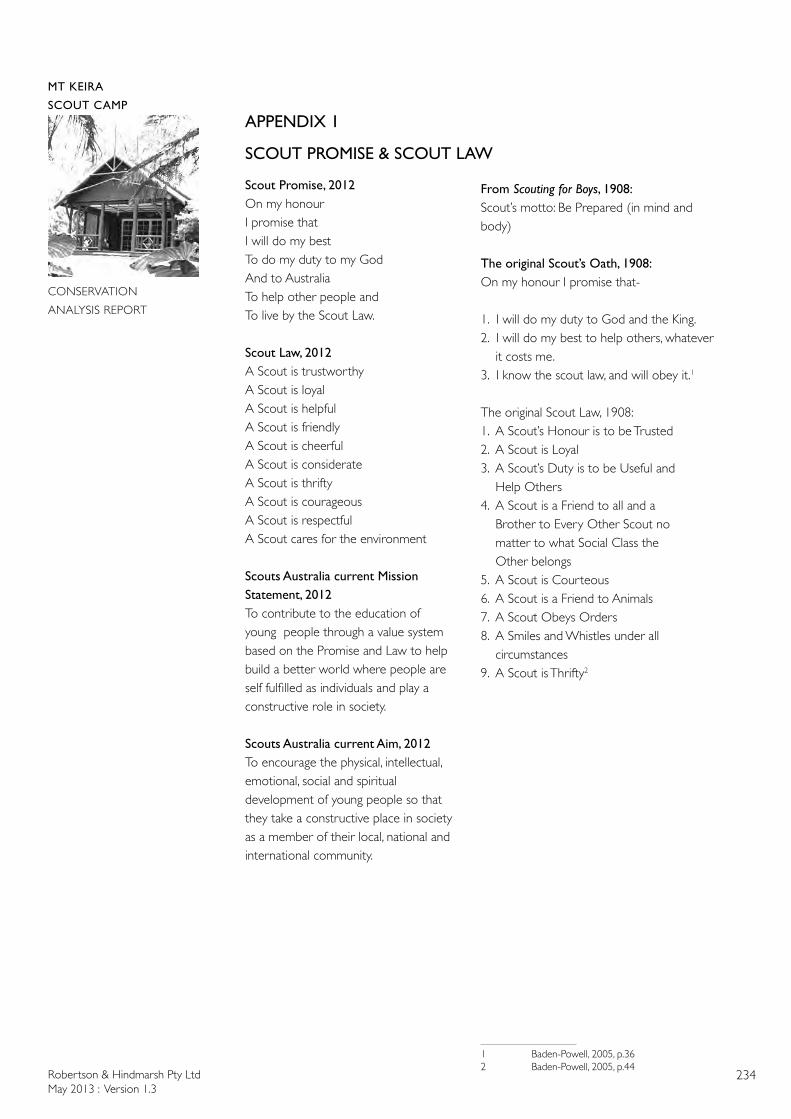
Robertson & Hindmarsh Pty LtdMay 2013 : Version 1.3
234
MT KEIRA
SCOUT CAMP
CONSERVATION
ANALYSIS REPORT
APPENDIX 1
SCOUT PROMISE & SCOUT LAW
Scout Promise, 2012On my honourI promise thatI will do my best To do my duty to my God And to Australia To help other people andTo live by the Scout Law.
Scout Law, 2012A Scout is trustworthyA Scout is loyalA Scout is helpful A Scout is friendlyA Scout is cheerfulA Scout is considerate A Scout is thrifty A Scout is courageous A Scout is respectfulA Scout cares for the environment
Scouts Australia current Mission Statement, 2012To contribute to the education of young people through a value system based on the Promise and Law to help build a better world where people are self fulfilled as individuals and play a constructive role in society.
Scouts Australia current Aim, 2012To encourage the physical, intellectual, emotional, social and spiritual development of young people so that they take a constructive place in society as a member of their local, national and international community.
From Scouting for Boys, 1908:Scout’s motto: Be Prepared (in mind and body)
The original Scout’s Oath, 1908:On my honour I promise that-
1. I will do my duty to God and the King.2. I will do my best to help others, whatever it costs me.3. I know the scout law, and will obey it.1
The original Scout Law, 1908:1. A Scout’s Honour is to be Trusted2. A Scout is Loyal3. A Scout’s Duty is to be Useful and Help Others4. A Scout is a Friend to all and a Brother to Every Other Scout no matter to what Social Class the Other belongs5. A Scout is Courteous6. A Scout is a Friend to Animals7. A Scout Obeys Orders8. A Smiles and Whistles under all circumstances9. A Scout is Thrifty2
1 Baden-Powell, 2005, p.362 Baden-Powell, 2005, p.44
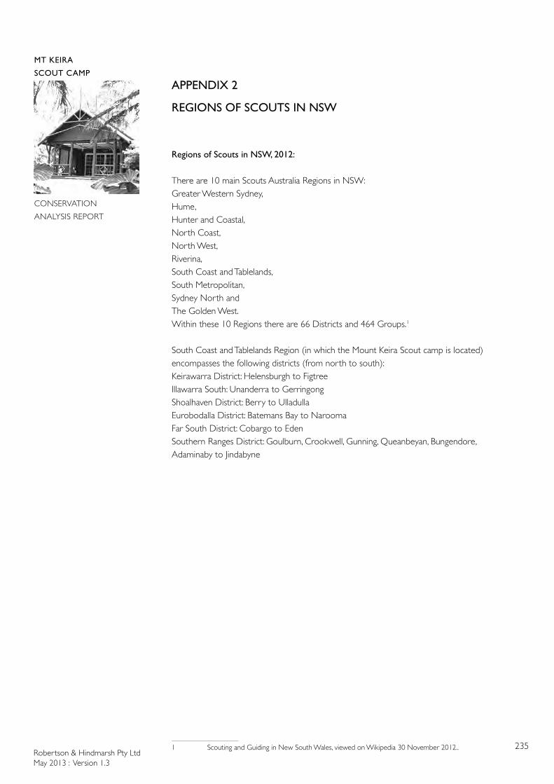
Robertson & Hindmarsh Pty LtdMay 2013 : Version 1.3
235
MT KEIRA
SCOUT CAMP
CONSERVATION
ANALYSIS REPORT
APPENDIX 2
REGIONS OF SCOUTS IN NSW
Regions of Scouts in NSW, 2012:
There are 10 main Scouts Australia Regions in NSW: Greater Western Sydney, Hume, Hunter and Coastal, North Coast, North West, Riverina, South Coast and Tablelands, South Metropolitan,Sydney North and The Golden West. Within these 10 Regions there are 66 Districts and 464 Groups.1
South Coast and Tablelands Region (in which the Mount Keira Scout camp is located) encompasses the following districts (from north to south):Keirawarra District: Helensburgh to Figtree Illawarra South: Unanderra to Gerringong Shoalhaven District: Berry to UlladullaEurobodalla District: Batemans Bay to NaroomaFar South District: Cobargo to EdenSouthern Ranges District: Goulburn, Crookwell, Gunning, Queanbeyan, Bungendore, Adaminaby to Jindabyne
1 Scouting and Guiding in New South Wales, viewed on Wikipedia 30 November 2012..
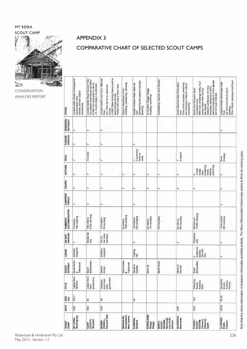
Robertson & Hindmarsh Pty LtdMay 2013 : Version 1.3
236
MT KEIRA
SCOUT CAMP
CONSERVATION
ANALYSIS REPORT
APPENDIX 3
COMPARATIVE CHART OF SELECTED SCOUT CAMPS
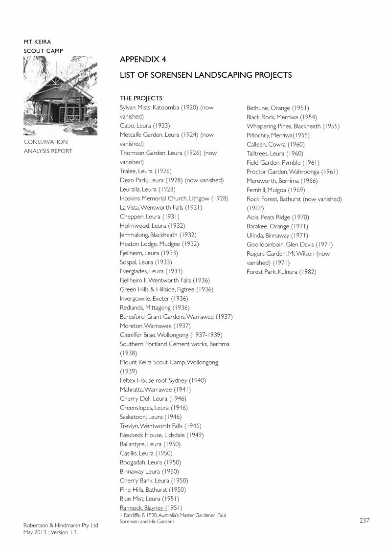
Robertson & Hindmarsh Pty LtdMay 2013 : Version 1.3
237
MT KEIRA
SCOUT CAMP
CONSERVATION
ANALYSIS REPORT
APPENDIX 4
LIST OF SORENSEN LANDSCAPING PROJECTS
THE PROJECTS1
Sylvan Mists, Katoomba (1920) (now vanished)Gabo, Leura (1923)Metcalfe Garden, Leura (1924) (now vanished)Thomson Garden, Leura (1926) (now vanished) Tralee, Leura (1926)Dean Park, Leura (1928) (now vanished) Leuralla, Leura (1928)Hoskins Memorial Church, Lithgow (1928)La Vista, Wentworth Falls (1931)Cheppen, Leura (1931)Holmwood, Leura (1932)Jemmalong, Blackheath (1932)Heaton Lodge, Mudgee (1932)Fjellheim, Leura (1933)Sospal, Leura (1933)Everglades, Leura (1933)Fjellheim II, Wentworth Falls (1936)Green Hills & Hillside, Figtree (1936)Invergowrie, Exeter (1936)Redlands, Mittagong (1936)Beresford Grant Gardens, Warrawee (1937)Moreton, Warrawee (1937)Gleniffer Brae, Wollongong (1937-1939)Southern Portland Cement works, Berrima (1938)Mount Keira Scout Camp, Wollongong (1939)Feltex House roof, Sydney (1940)Mahratta, Warrawee (1941)Cherry Dell, Leura (1946)Greenslopes, Leura (1946)Saskatoon, Leura (1946)Trevlyn, Wentworth Falls (1946)Neubeck House, Lidsdale (1949)Ballantyre, Leura (1950) Casillis, Leura (1950) Boogadah, Leura (1950) Binnaway Leura (1950)Cherry Bank, Leura (1950) Pine Hills, Bathurst (1950)Blue Mist, Leura (1951) Rannock, Blayney (1951) 1 Ratcliffe, R 1990, Australia’s Master Gardener: Paul Sorensen and His Gardens
Bethune, Orange (1951)Black Rock, Merriwa (1954)Whispering Pines, Blackheath (1955)Pitlochry, Merriwa(1955)Calleen, Cowra (1960)Talltrees, Leura (1960)Field Garden, Pymble (1961)Proctor Garden, Wahroonga (1961)Mereworth, Berrima (1966)Fernhill, Mulgoa (1969)Rock Forest, Bathurst (now vanished) (1969)Aola, Peats Ridge (1970)Barakee, Orange (1971) Ulinda, Binnaway (1971) Goollooinboin, Glen Davis (1971) Rogers Garden, Mt Wilson (now vanished) (1971)Forest Park, Kulnura (1982)
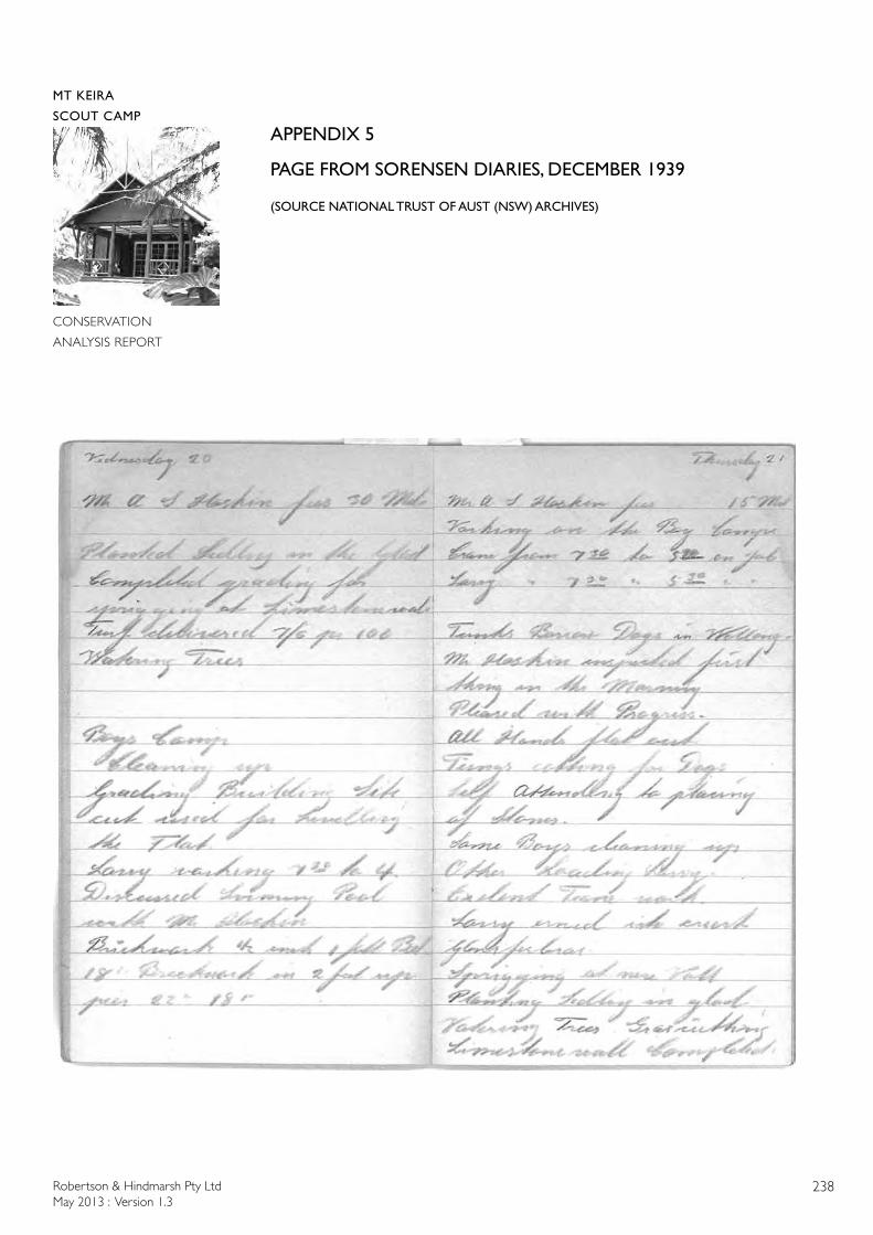
Robertson & Hindmarsh Pty LtdMay 2013 : Version 1.3
238
MT KEIRA
SCOUT CAMP
CONSERVATION
ANALYSIS REPORT
APPENDIX 5
PAGE FROM SORENSEN DIARIES, DECEMBER 1939
(SOURCE NATIONAL TRUST OF AUST (NSW) ARCHIVES)
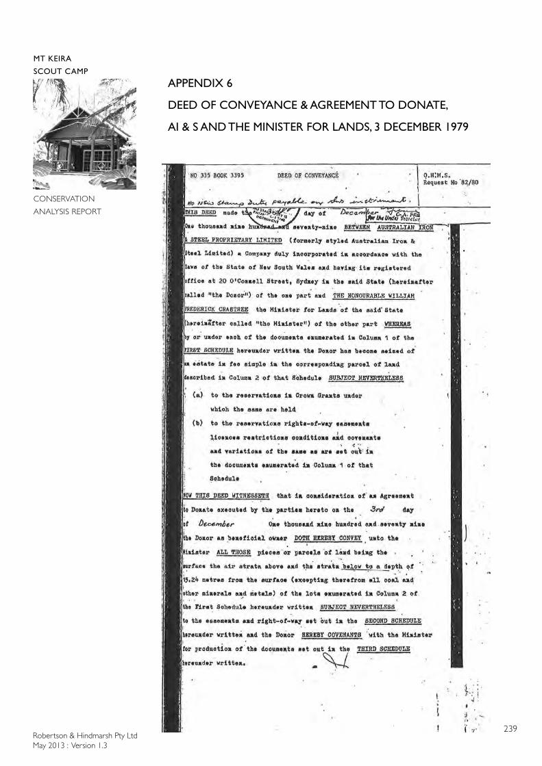
Robertson & Hindmarsh Pty LtdMay 2013 : Version 1.3
239
MT KEIRA
SCOUT CAMP
CONSERVATION
ANALYSIS REPORT
APPENDIX 6
DEED OF CONVEYANCE & AGREEMENT TO DONATE,
AI & S AND THE MINISTER FOR LANDS, 3 DECEMBER 1979
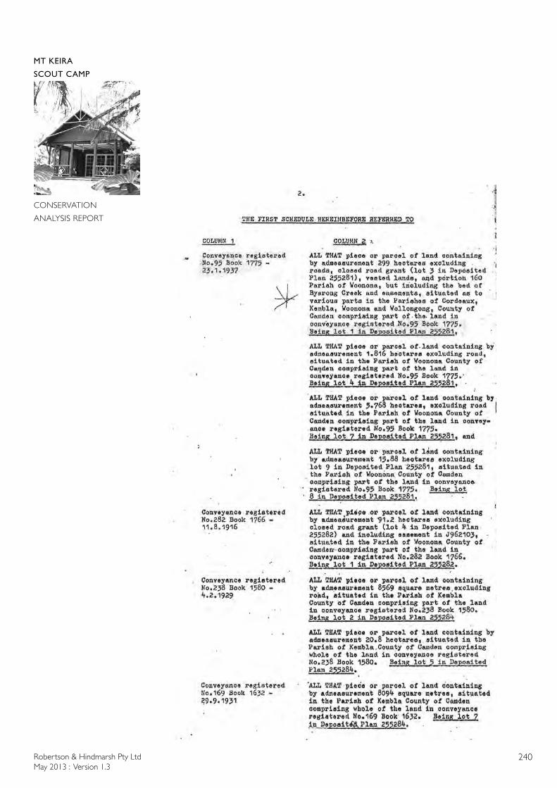
Robertson & Hindmarsh Pty LtdMay 2013 : Version 1.3
240
MT KEIRA
SCOUT CAMP
CONSERVATION
ANALYSIS REPORT
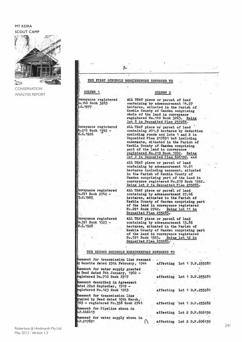
Robertson & Hindmarsh Pty LtdMay 2013 : Version 1.3
241
MT KEIRA
SCOUT CAMP
CONSERVATION
ANALYSIS REPORT
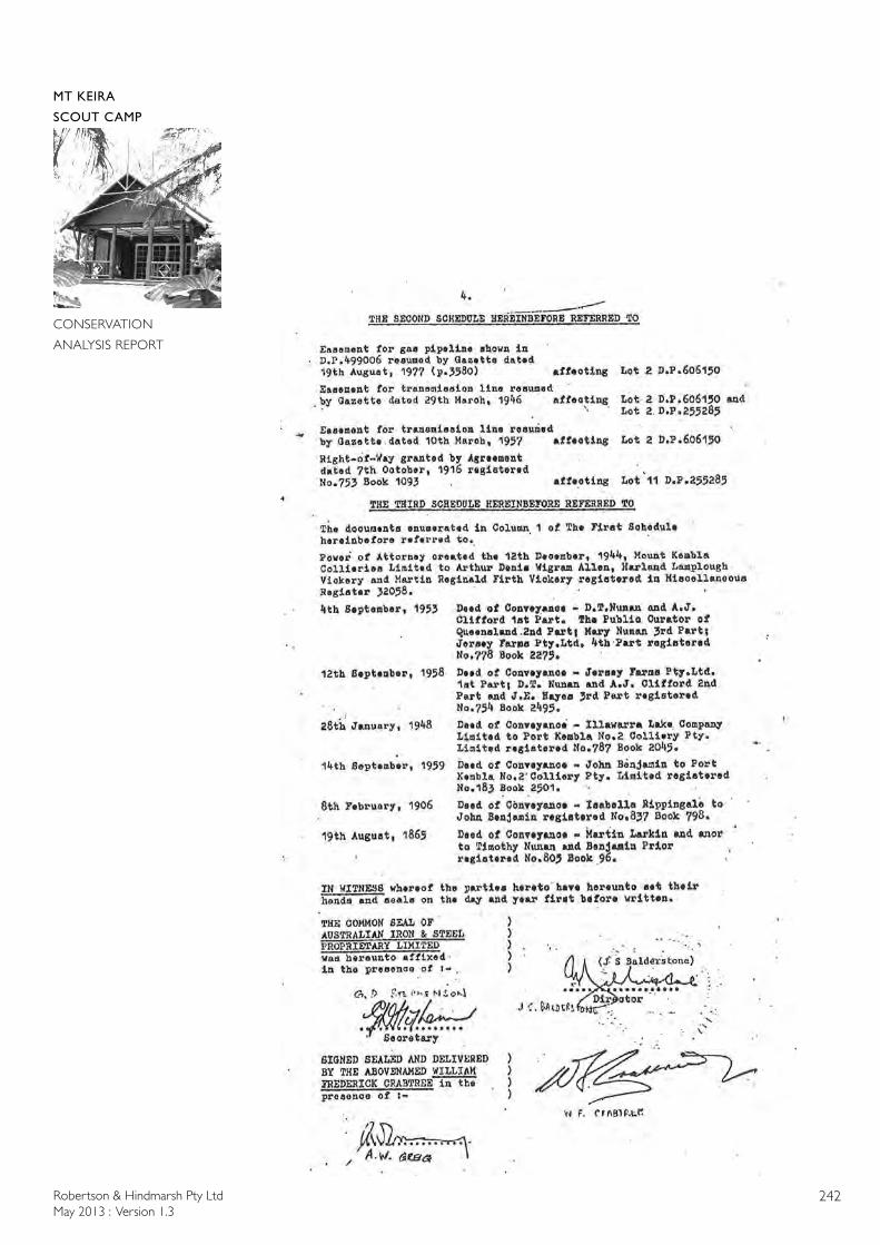
Robertson & Hindmarsh Pty LtdMay 2013 : Version 1.3
242
MT KEIRA
SCOUT CAMP
CONSERVATION
ANALYSIS REPORT
Robertson & Hindmarsh Pty LtdMay 2013 : Version 1.3
243
MT KEIRA
SCOUT CAMP
CONSERVATION
ANALYSIS REPORT
Robertson & Hindmarsh Pty LtdMay 2013 : Version 1.3
244
MT KEIRA
SCOUT CAMP
CONSERVATION
ANALYSIS REPORT
Robertson & Hindmarsh Pty LtdMay 2013 : Version 1.3
245
MT KEIRA
SCOUT CAMP
CONSERVATION
ANALYSIS REPORT
Robertson & Hindmarsh Pty LtdMay 2013 : Version 1.3
246
MT KEIRA
SCOUT CAMP
CONSERVATION
ANALYSIS REPORT
Robertson & Hindmarsh Pty LtdMay 2013 : Version 1.3
247
MT KEIRA
SCOUT CAMP
CONSERVATION
ANALYSIS REPORT
Robertson & Hindmarsh Pty LtdMay 2013 : Version 1.3
248
MT KEIRA
SCOUT CAMP
CONSERVATION
ANALYSIS REPORT
Robertson & Hindmarsh Pty LtdMay 2013 : Version 1.3
249
MT KEIRA
SCOUT CAMP
CONSERVATION
ANALYSIS REPORT
Robertson & Hindmarsh Pty LtdMay 2013 : Version 1.3
250
MT KEIRA
SCOUT CAMP
CONSERVATION
ANALYSIS REPORT
Robertson & Hindmarsh Pty LtdMay 2013 : Version 1.3
251
MT KEIRA
SCOUT CAMP
CONSERVATION
ANALYSIS REPORT
Robertson & Hindmarsh Pty LtdMay 2013 : Version 1.3
252
MT KEIRA
SCOUT CAMP
CONSERVATION
ANALYSIS REPORT
Robertson & Hindmarsh Pty LtdMay 2013 : Version 1.3
253
MT KEIRA
SCOUT CAMP
CONSERVATION
ANALYSIS REPORT
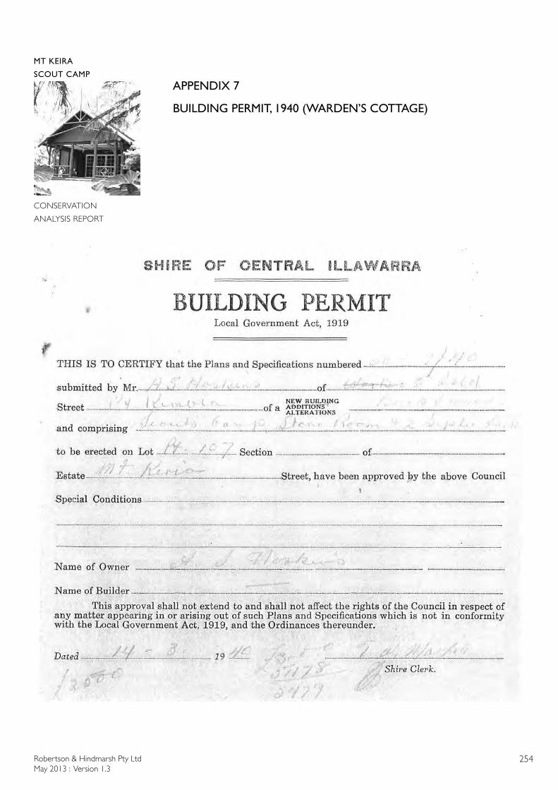
Robertson & Hindmarsh Pty LtdMay 2013 : Version 1.3
254
MT KEIRA
SCOUT CAMP
CONSERVATION
ANALYSIS REPORT
APPENDIX 7
BUILDING PERMIT, 1940 (WARDEN’S COTTAGE)
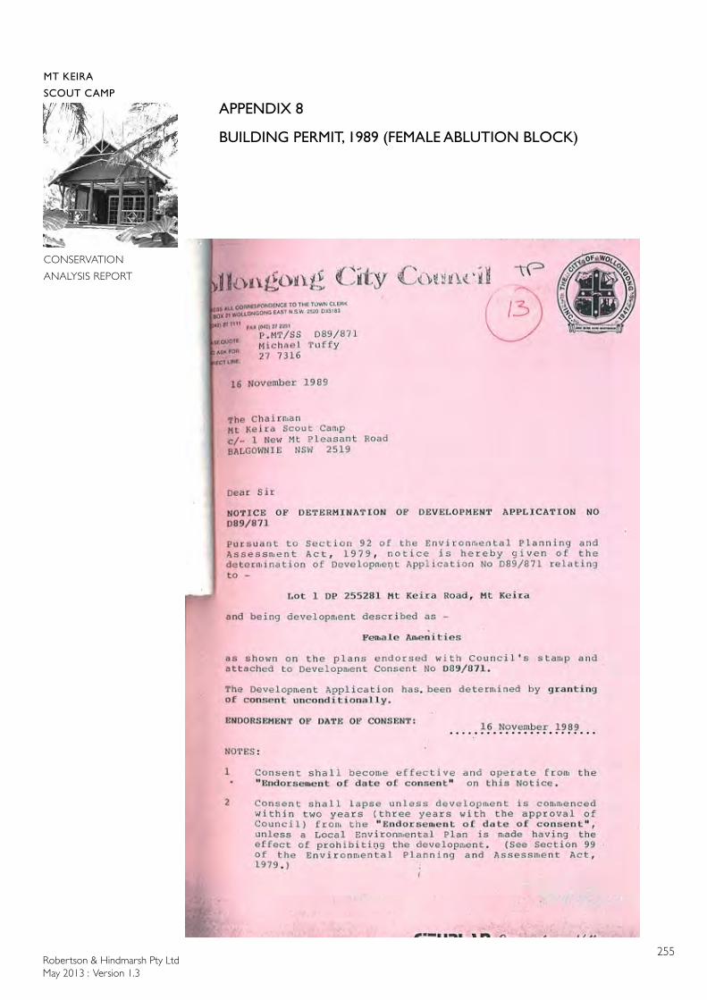
Robertson & Hindmarsh Pty LtdMay 2013 : Version 1.3
255
MT KEIRA
SCOUT CAMP
CONSERVATION
ANALYSIS REPORT
APPENDIX 8
BUILDING PERMIT, 1989 (FEMALE ABLUTION BLOCK)
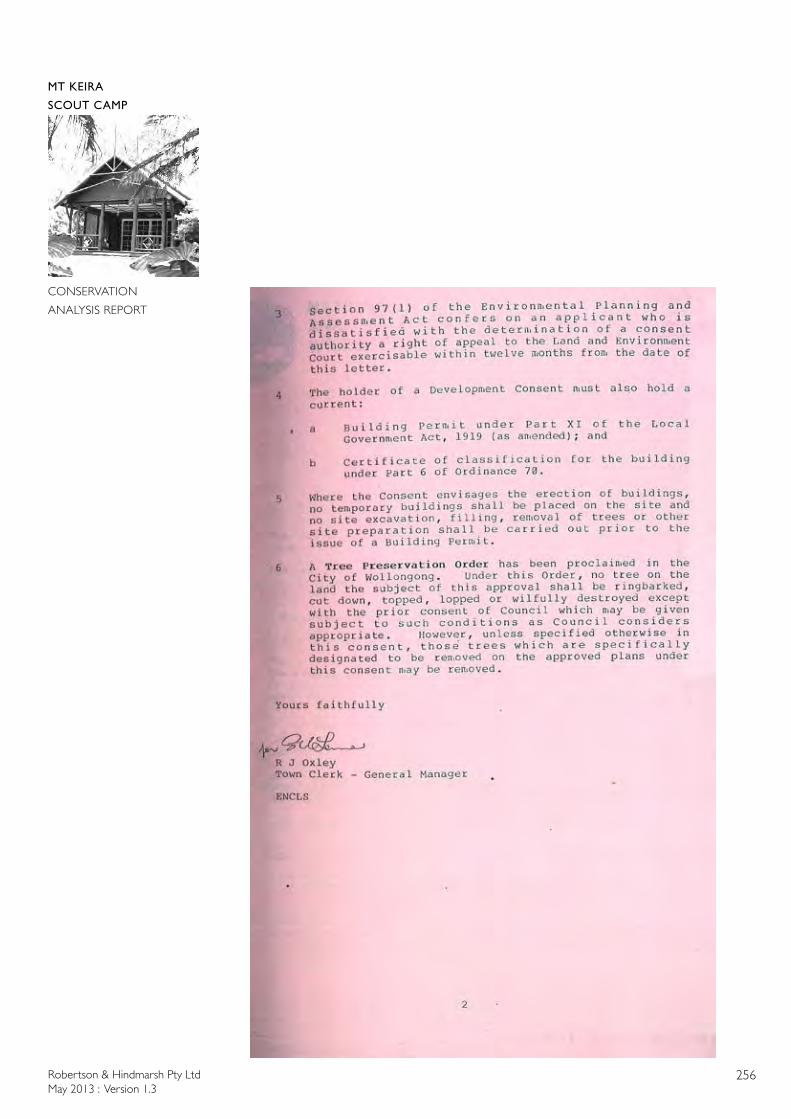
Robertson & Hindmarsh Pty LtdMay 2013 : Version 1.3
256
MT KEIRA
SCOUT CAMP
CONSERVATION
ANALYSIS REPORT
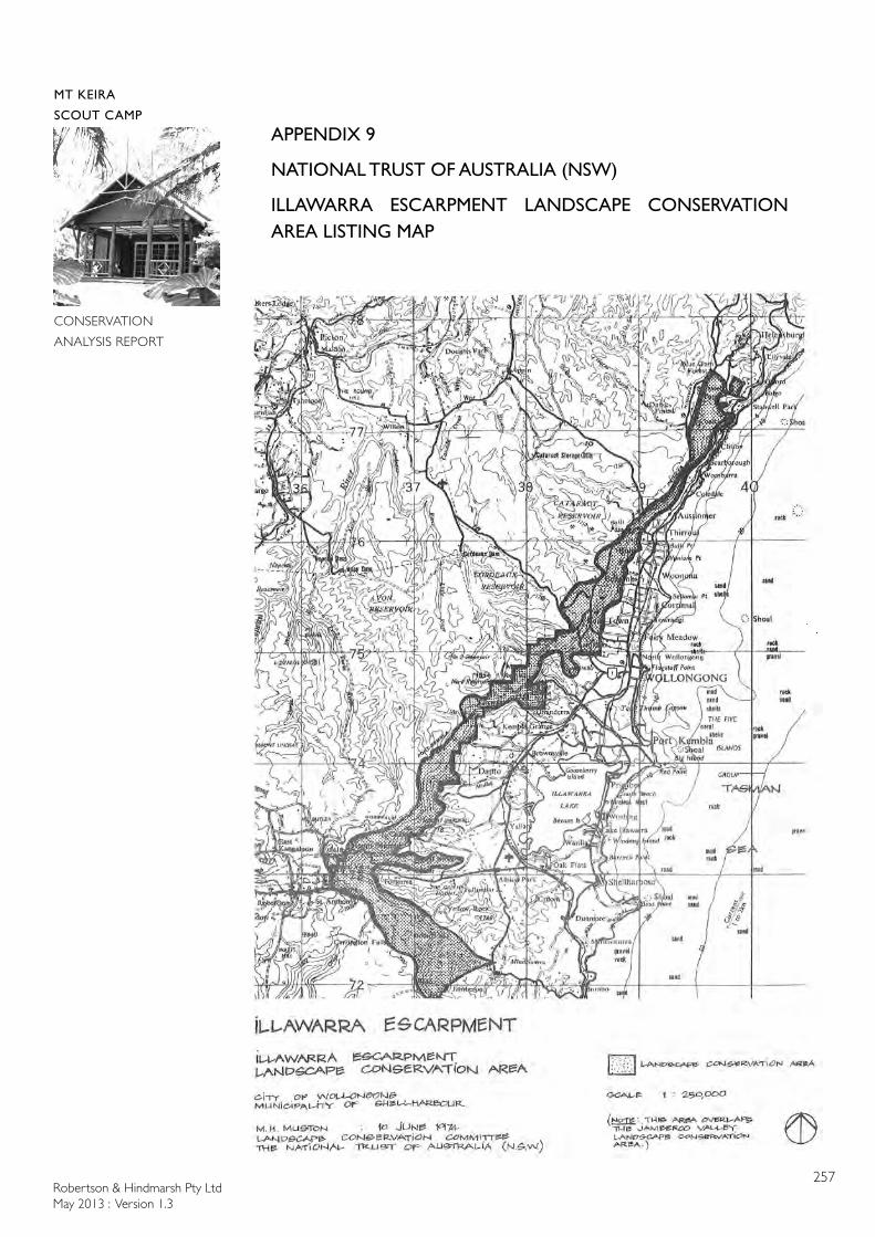
Robertson & Hindmarsh Pty LtdMay 2013 : Version 1.3
257
MT KEIRA
SCOUT CAMP
CONSERVATION
ANALYSIS REPORT
APPENDIX 9
NATIONAL TRUST OF AUSTRALIA (NSW)
ILLAWARRA ESCARPMENT LANDSCAPE CONSERVATION AREA LISTING MAP
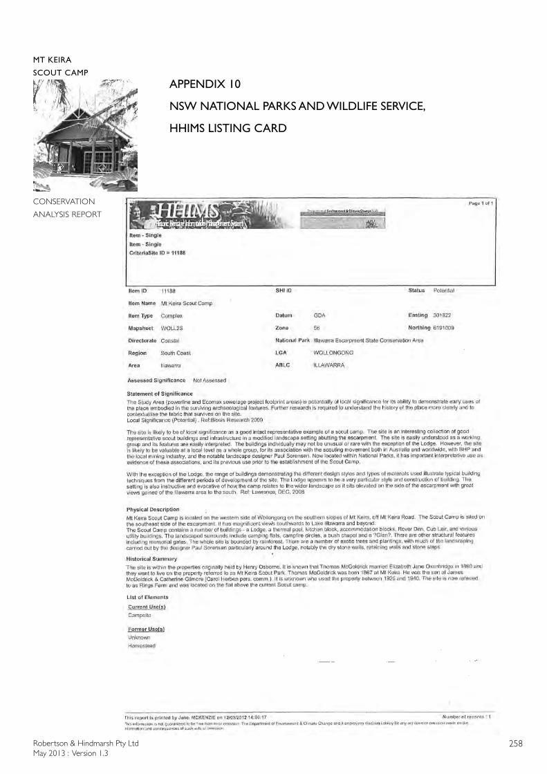
Robertson & Hindmarsh Pty LtdMay 2013 : Version 1.3
258
MT KEIRA
SCOUT CAMP
CONSERVATION
ANALYSIS REPORT
APPENDIX 10
NSW NATIONAL PARKS AND WILDLIFE SERVICE,
HHIMS LISTING CARD

Robertson & Hindmarsh Pty LtdMay 2013 : Version 1.3
259
MT KEIRA
SCOUT CAMP
CONSERVATION
ANALYSIS REPORT
APPENDIX 11
MAP OF SCOUT LICENCE AREA,
MOUNT KEIRA SCOUT CAMP

Robertson & Hindmarsh Pty LtdMay 2013 : Version 1.3
260
MT KEIRA
SCOUT CAMP
CONSERVATION
ANALYSIS REPORT
Robertson & Hindmarsh Pty LtdMay 2013 : Version 1.3
261
MT KEIRA
SCOUT CAMP
CONSERVATION
ANALYSIS REPORT
APPENDIX 12
MAPS & ORIGINAL BUILDING PLANS
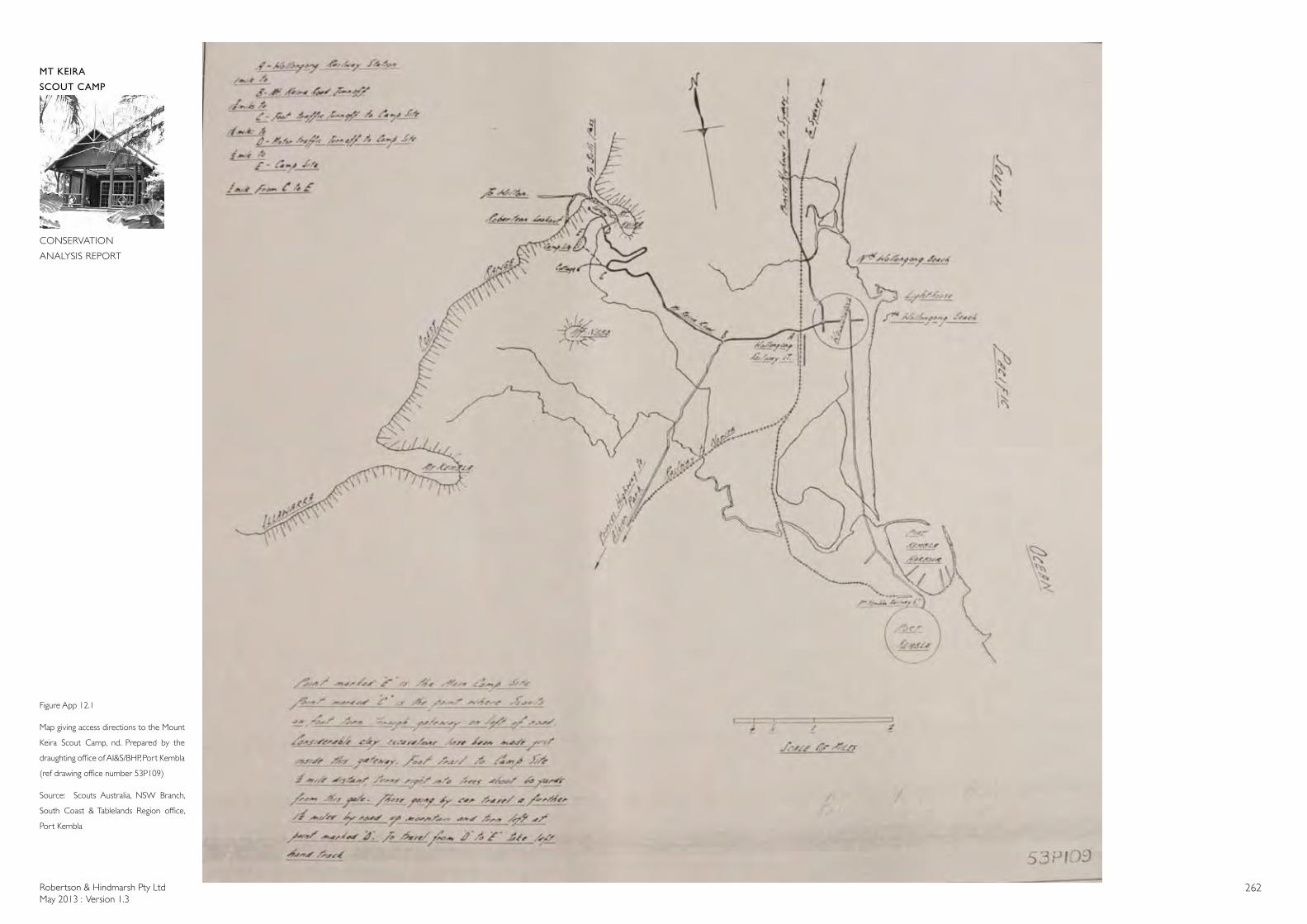
Robertson & Hindmarsh Pty LtdMay 2013 : Version 1.3
262
MT KEIRA
SCOUT CAMP
CONSERVATION
ANALYSIS REPORT
Figure App 12.1
Map giving access directions to the Mount
Keira Scout Camp, nd. Prepared by the
draughting office of AI&S/BHP, Port Kembla
(ref drawing office number 53P109)
Source: Scouts Australia, NSW Branch,
South Coast & Tablelands Region office,
Port Kembla
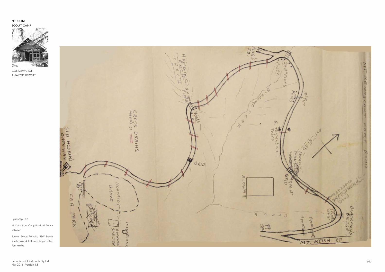
Robertson & Hindmarsh Pty LtdMay 2013 : Version 1.3
263
MT KEIRA
SCOUT CAMP
CONSERVATION
ANALYSIS REPORT
Figure App 12.2
Mt Keira Scout Camp Road, nd. Author
unknown
Source: Scouts Australia, NSW Branch,
South Coast & Tablelands Region office,
Port Kembla
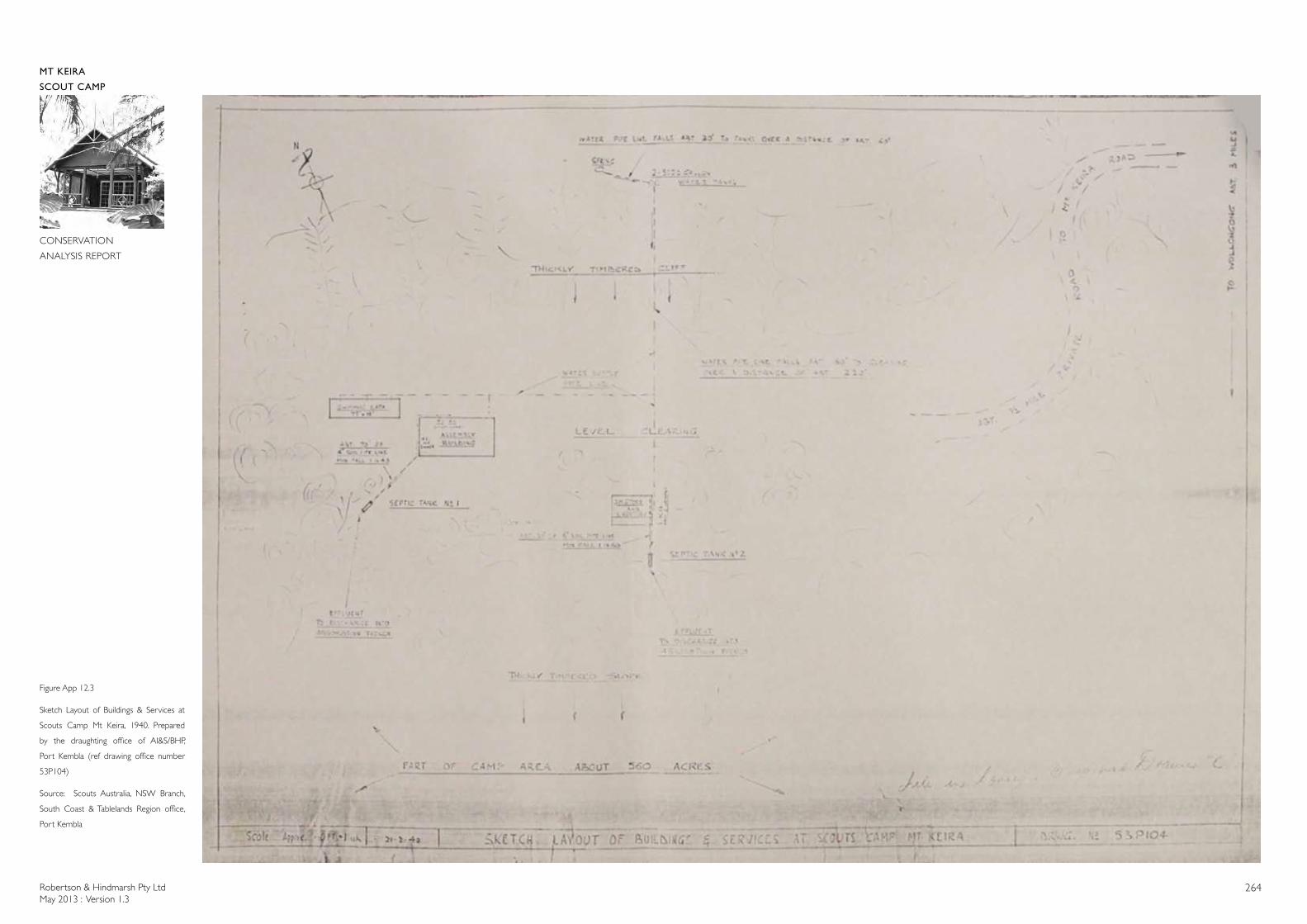
Robertson & Hindmarsh Pty LtdMay 2013 : Version 1.3
264
MT KEIRA
SCOUT CAMP
CONSERVATION
ANALYSIS REPORT
Figure App 12.3
Sketch Layout of Buildings & Services at
Scouts Camp Mt Keira, 1940. Prepared
by the draughting office of AI&S/BHP,
Port Kembla (ref drawing office number
53P104)
Source: Scouts Australia, NSW Branch,
South Coast & Tablelands Region office,
Port Kembla
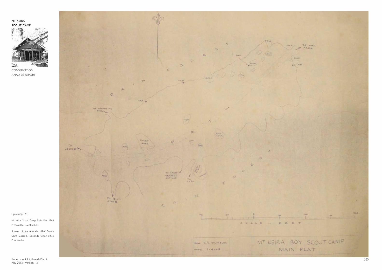
Robertson & Hindmarsh Pty LtdMay 2013 : Version 1.3
265
MT KEIRA
SCOUT CAMP
CONSERVATION
ANALYSIS REPORT
Figure App 12.4
Mt Keira Scout Camp Main Flat, 1945.
Prepared by G.V. Stumbles
Source: Scouts Australia, NSW Branch,
South Coast & Tablelands Region office,
Port Kembla
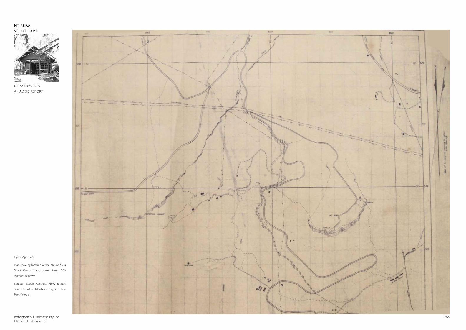
Robertson & Hindmarsh Pty LtdMay 2013 : Version 1.3
266
MT KEIRA
SCOUT CAMP
CONSERVATION
ANALYSIS REPORT
Figure App 12.5
Map showing location of the Mount Keira
Scout Camp, roads, power lines, 1966.
Author unknown
Source: Scouts Australia, NSW Branch,
South Coast & Tablelands Region office,
Port Kembla
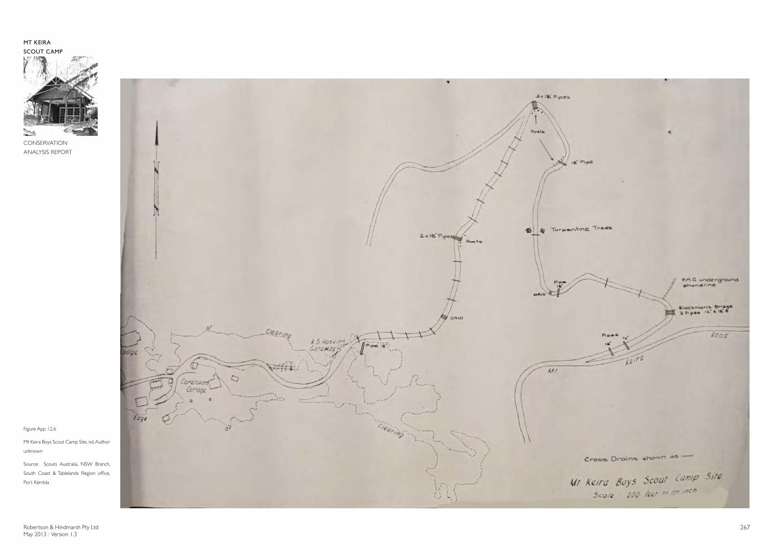
Robertson & Hindmarsh Pty LtdMay 2013 : Version 1.3
267
MT KEIRA
SCOUT CAMP
CONSERVATION
ANALYSIS REPORT
Figure App 12.6
Mt Keira Boys Scout Camp Site, nd. Author
unknown
Source: Scouts Australia, NSW Branch,
South Coast & Tablelands Region office,
Port Kembla
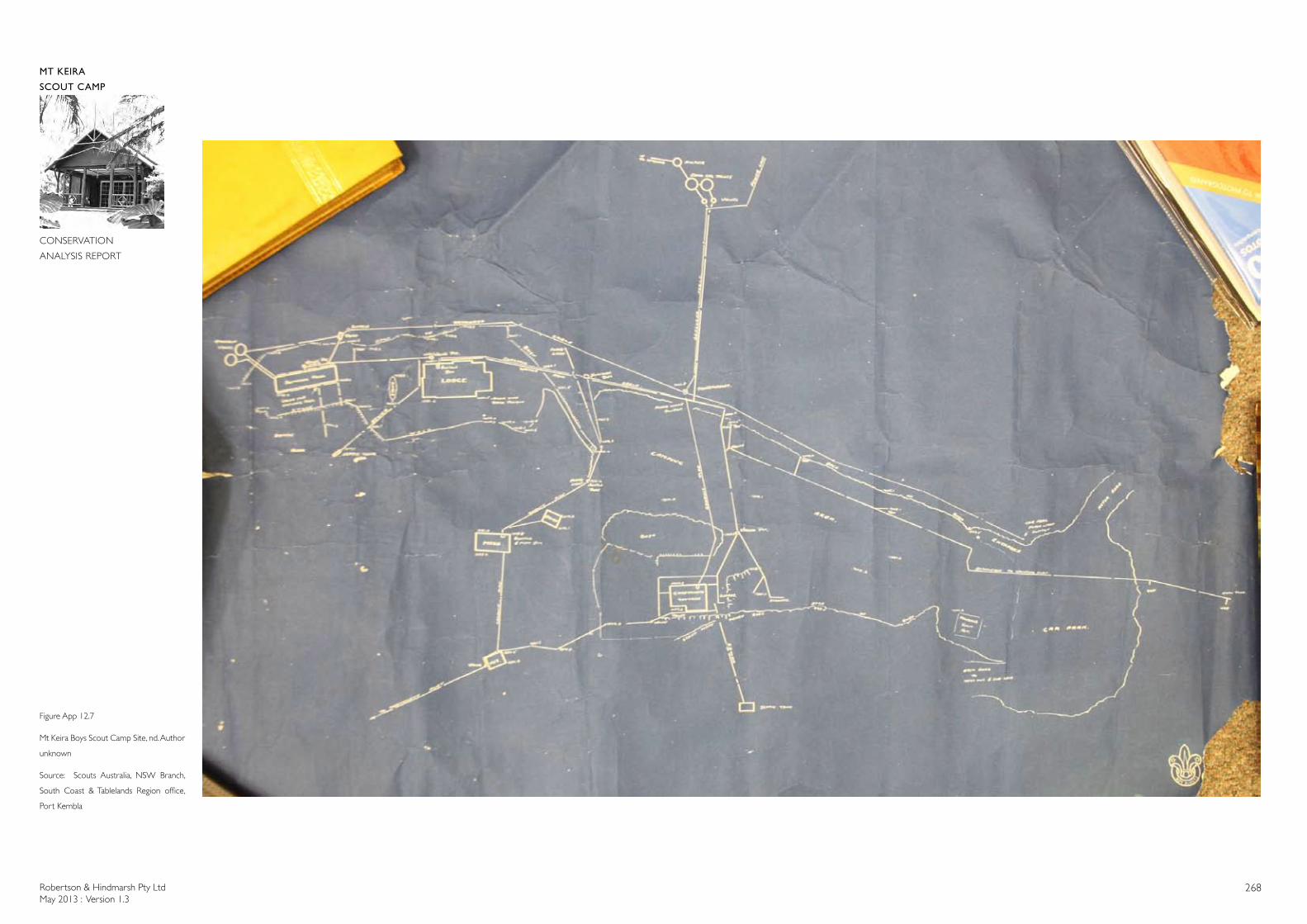
Robertson & Hindmarsh Pty LtdMay 2013 : Version 1.3
268
MT KEIRA
SCOUT CAMP
CONSERVATION
ANALYSIS REPORT
Figure App 12.7
Mt Keira Boys Scout Camp Site, nd. Author
unknown
Source: Scouts Australia, NSW Branch,
South Coast & Tablelands Region office,
Port Kembla
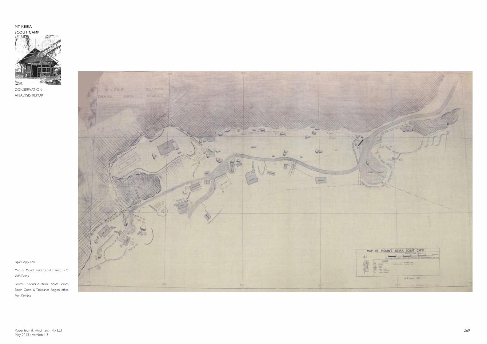
Robertson & Hindmarsh Pty LtdMay 2013 : Version 1.3
269
MT KEIRA
SCOUT CAMP
CONSERVATION
ANALYSIS REPORT
Figure App 12.8
Map of Mount Keira Scout Camp, 1975.
W.R. Evans
Source: Scouts Australia, NSW Branch,
South Coast & Tablelands Region office,
Port Kembla
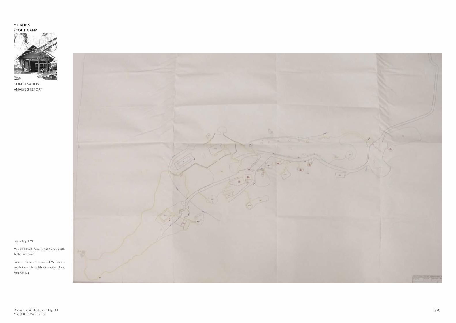
Robertson & Hindmarsh Pty LtdMay 2013 : Version 1.3
270
MT KEIRA
SCOUT CAMP
CONSERVATION
ANALYSIS REPORT
Figure App 12.9
Map of Mount Keira Scout Camp, 2001.
Author unknown
Source: Scouts Australia, NSW Branch,
South Coast & Tablelands Region office,
Port Kembla
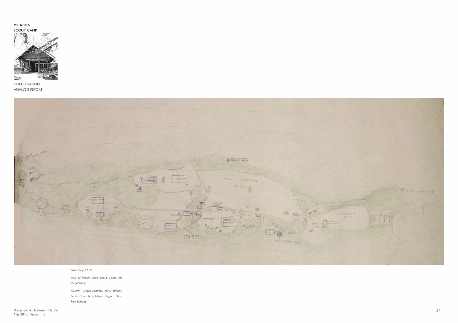
Robertson & Hindmarsh Pty LtdMay 2013 : Version 1.3
271
MT KEIRA
SCOUT CAMP
CONSERVATION
ANALYSIS REPORT
Figure App 12.10
Map of Mount Keira Scout Camp, nd.
David Walsh
Source: Scouts Australia, NSW Branch,
South Coast & Tablelands Region office,
Port Kembla
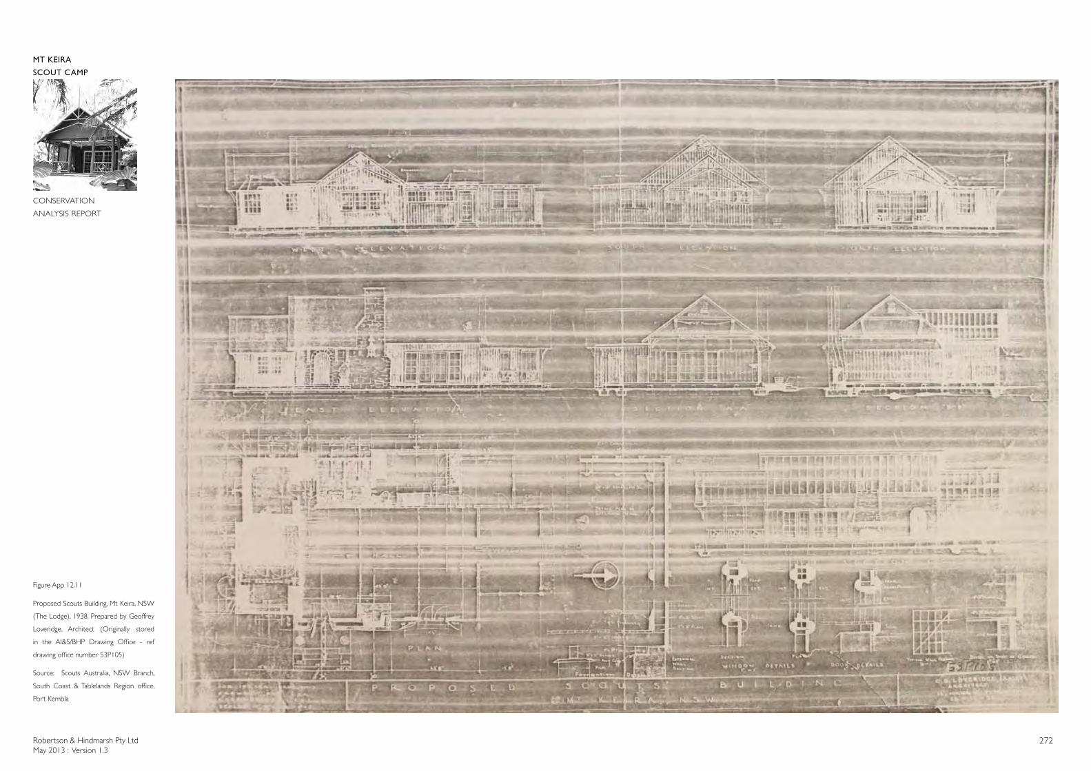
Robertson & Hindmarsh Pty LtdMay 2013 : Version 1.3
272
MT KEIRA
SCOUT CAMP
CONSERVATION
ANALYSIS REPORT
Figure App 12.11
Proposed Scouts Building, Mt Keira, NSW
(The Lodge), 1938. Prepared by Geoffrey
Loveridge, Architect (Originally stored
in the AI&S/BHP Drawing Office - ref
drawing office number 53P105)
Source: Scouts Australia, NSW Branch,
South Coast & Tablelands Region office,
Port Kembla
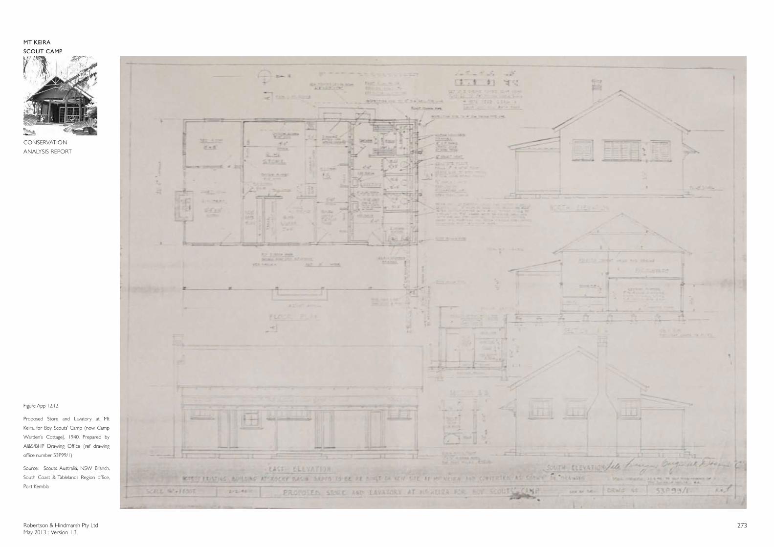
Robertson & Hindmarsh Pty LtdMay 2013 : Version 1.3
273
MT KEIRA
SCOUT CAMP
CONSERVATION
ANALYSIS REPORT
Figure App 12.12
Proposed Store and Lavatory at Mt
Keira, for Boy Scouts’ Camp (now Camp
Warden’s Cottage), 1940. Prepared by
AI&S/BHP Drawing Office (ref drawing
office number 53P99/1)
Source: Scouts Australia, NSW Branch,
South Coast & Tablelands Region office,
Port Kembla
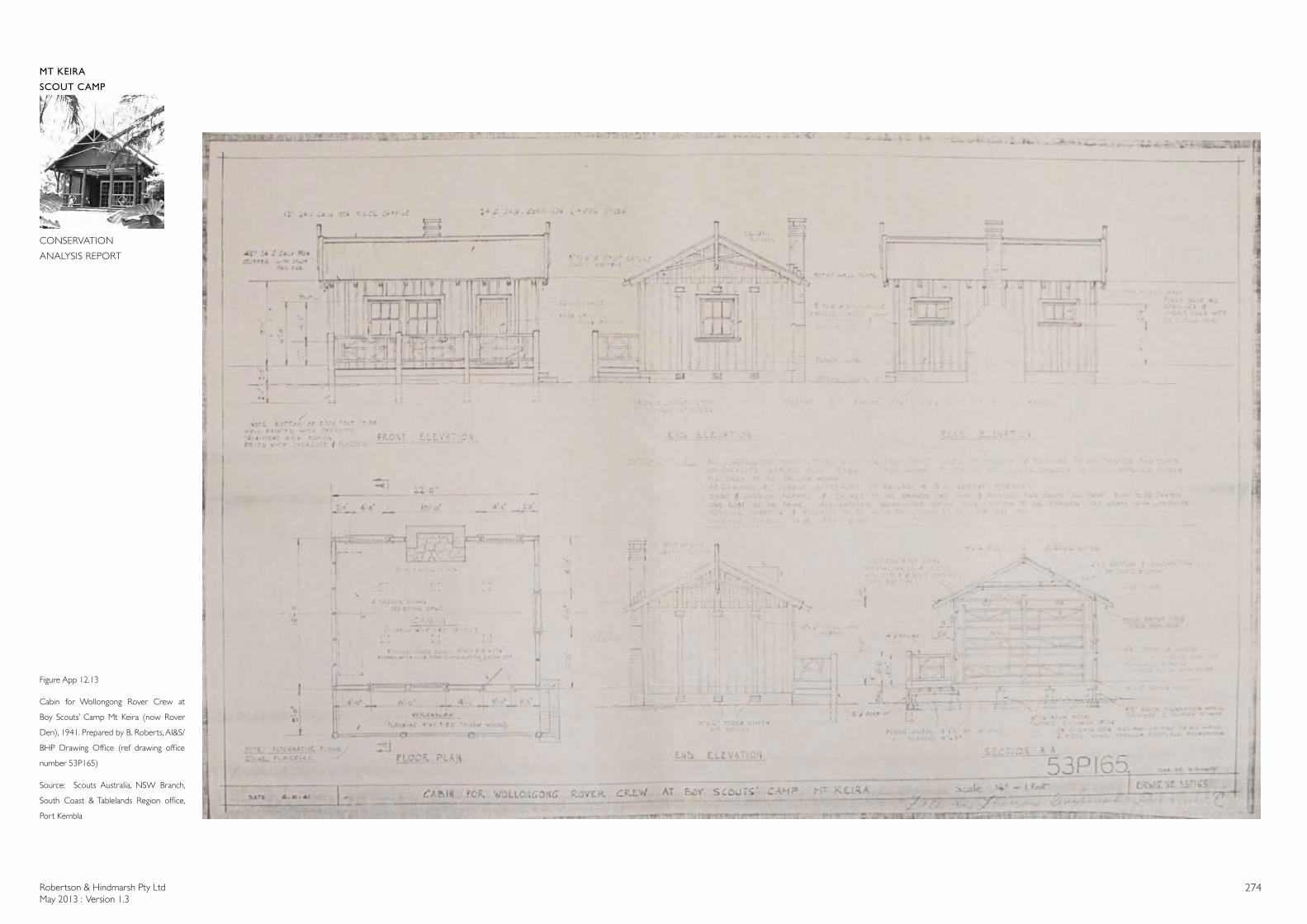
Robertson & Hindmarsh Pty LtdMay 2013 : Version 1.3
274
MT KEIRA
SCOUT CAMP
CONSERVATION
ANALYSIS REPORT
Figure App 12.13
Cabin for Wollongong Rover Crew at
Boy Scouts’ Camp Mt Keira (now Rover
Den), 1941. Prepared by B. Roberts, AI&S/
BHP Drawing Office (ref drawing office
number 53P165)
Source: Scouts Australia, NSW Branch,
South Coast & Tablelands Region office,
Port Kembla
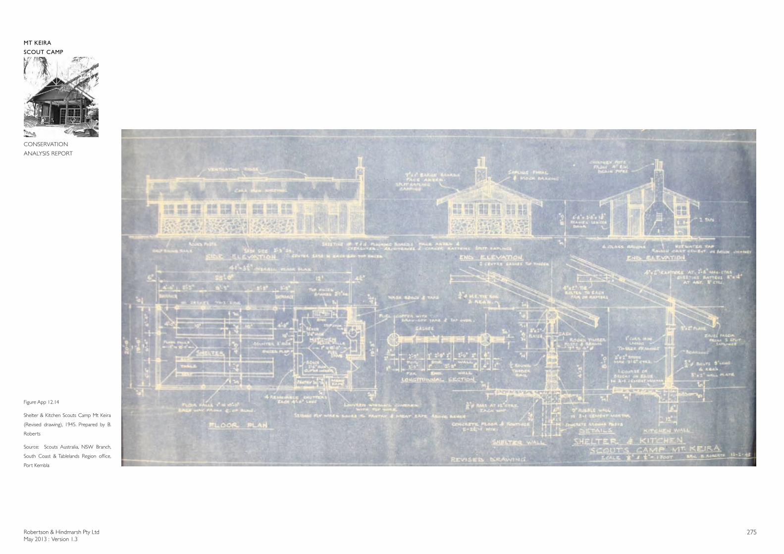
Robertson & Hindmarsh Pty LtdMay 2013 : Version 1.3
275
MT KEIRA
SCOUT CAMP
CONSERVATION
ANALYSIS REPORT
Figure App 12.14
Shelter & Kitchen Scouts Camp Mt Keira
(Revised drawing), 1945. Prepared by B.
Roberts
Source: Scouts Australia, NSW Branch,
South Coast & Tablelands Region office,
Port Kembla
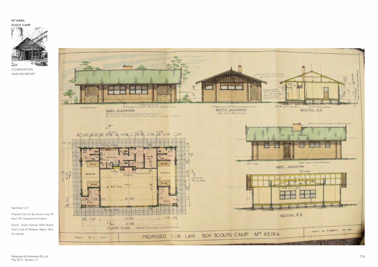
Robertson & Hindmarsh Pty LtdMay 2013 : Version 1.3
276
MT KEIRA
SCOUT CAMP
CONSERVATION
ANALYSIS REPORT
Figure App 12.15
Proposed Cub Lair Boy Scouts Camp Mt
Keira, 1951. Prepared by B. Roberts
Source: Scouts Australia, NSW Branch,
South Coast & Tablelands Region office,
Port Kembla
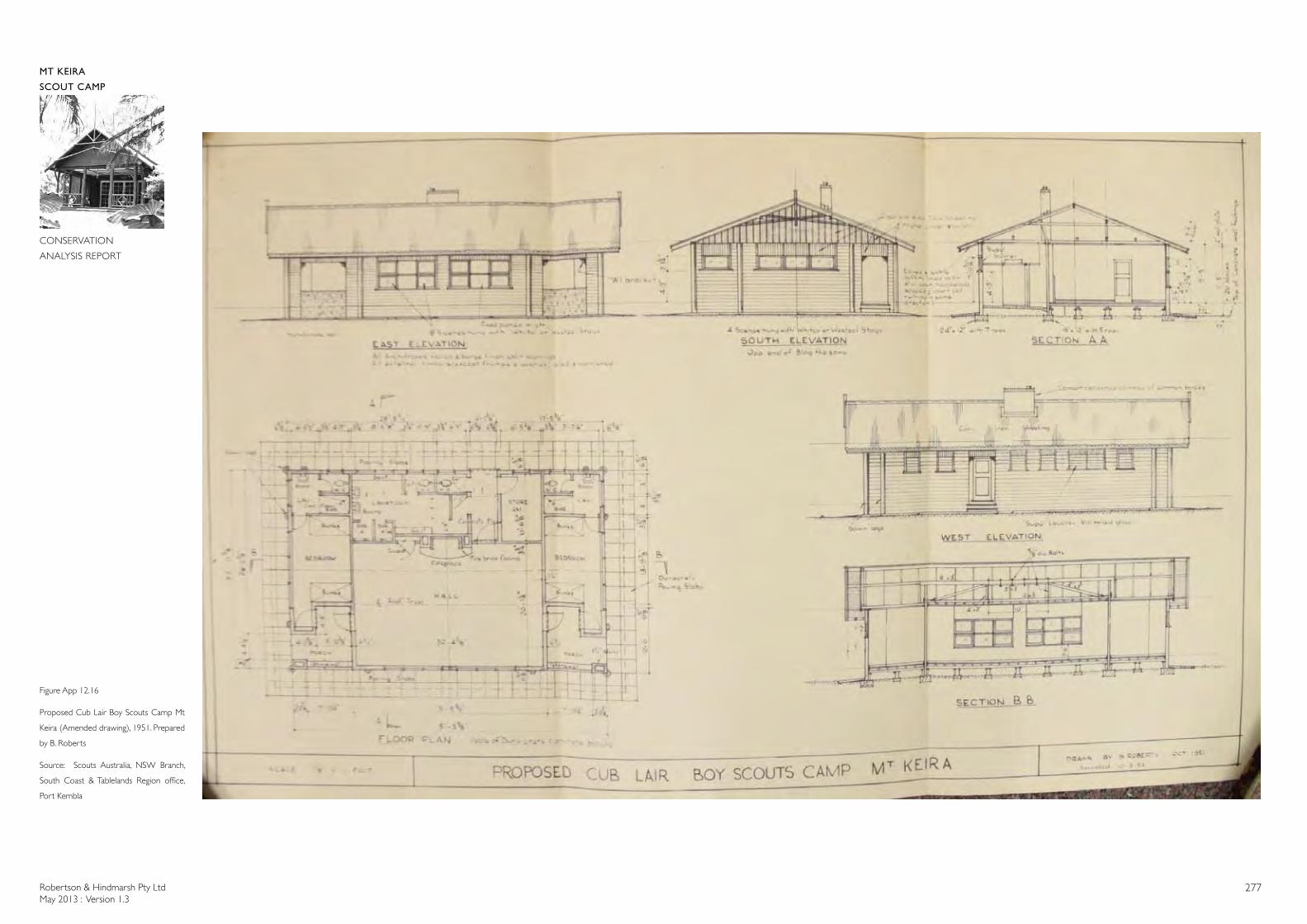
Robertson & Hindmarsh Pty LtdMay 2013 : Version 1.3
277
MT KEIRA
SCOUT CAMP
CONSERVATION
ANALYSIS REPORT
Figure App 12.16
Proposed Cub Lair Boy Scouts Camp Mt
Keira (Amended drawing), 1951. Prepared
by B. Roberts
Source: Scouts Australia, NSW Branch,
South Coast & Tablelands Region office,
Port Kembla
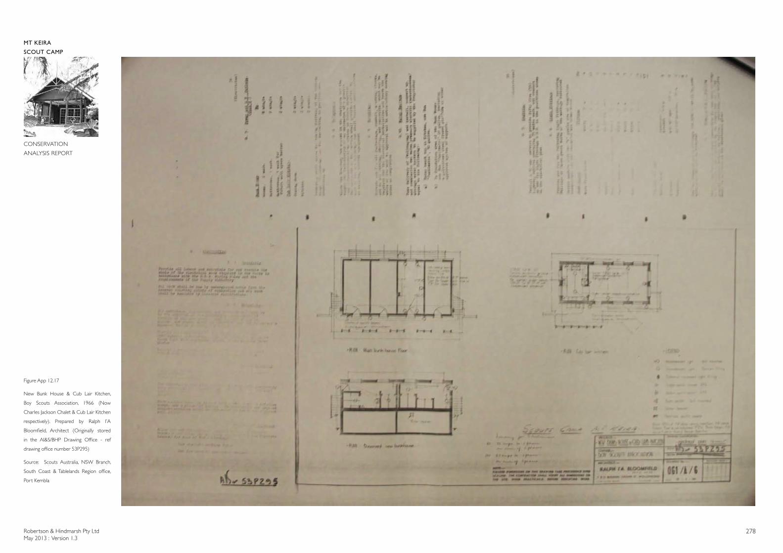
Robertson & Hindmarsh Pty LtdMay 2013 : Version 1.3
278
MT KEIRA
SCOUT CAMP
CONSERVATION
ANALYSIS REPORT
Figure App 12.17
New Bunk House & Cub Lair Kitchen,
Boy Scouts Association, 1966 (Now
Charles Jackson Chalet & Cub Lair Kitchen
respectively). Prepared by Ralph I’A
Bloomfield, Architect (Originally stored
in the AI&S/BHP Drawing Office - ref
drawing office number 53P295)
Source: Scouts Australia, NSW Branch,
South Coast & Tablelands Region office,
Port Kembla
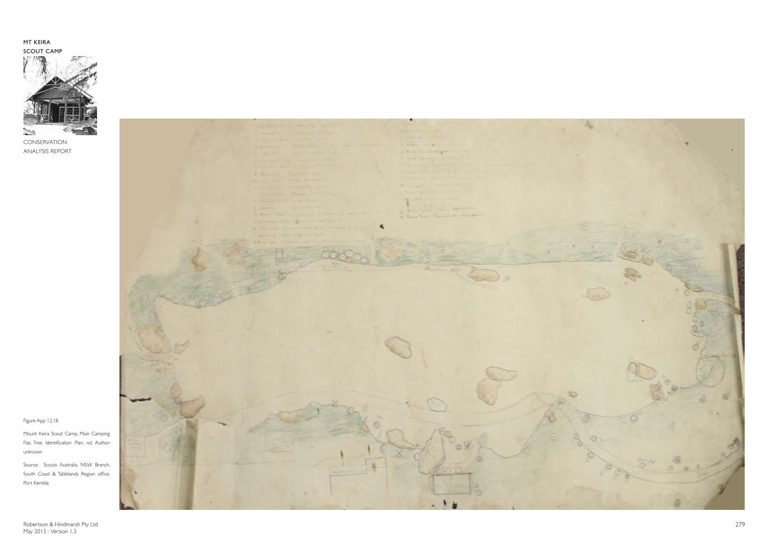
Robertson & Hindmarsh Pty LtdMay 2013 : Version 1.3
279
MT KEIRA
SCOUT CAMP
CONSERVATION
ANALYSIS REPORT
Figure App 12.18
Mount Keira Scout Camp, Main Camping
Flat, Tree Identification Plan, nd. Author
unknown
Source: Scouts Australia, NSW Branch,
South Coast & Tablelands Region office,
Port Kembla
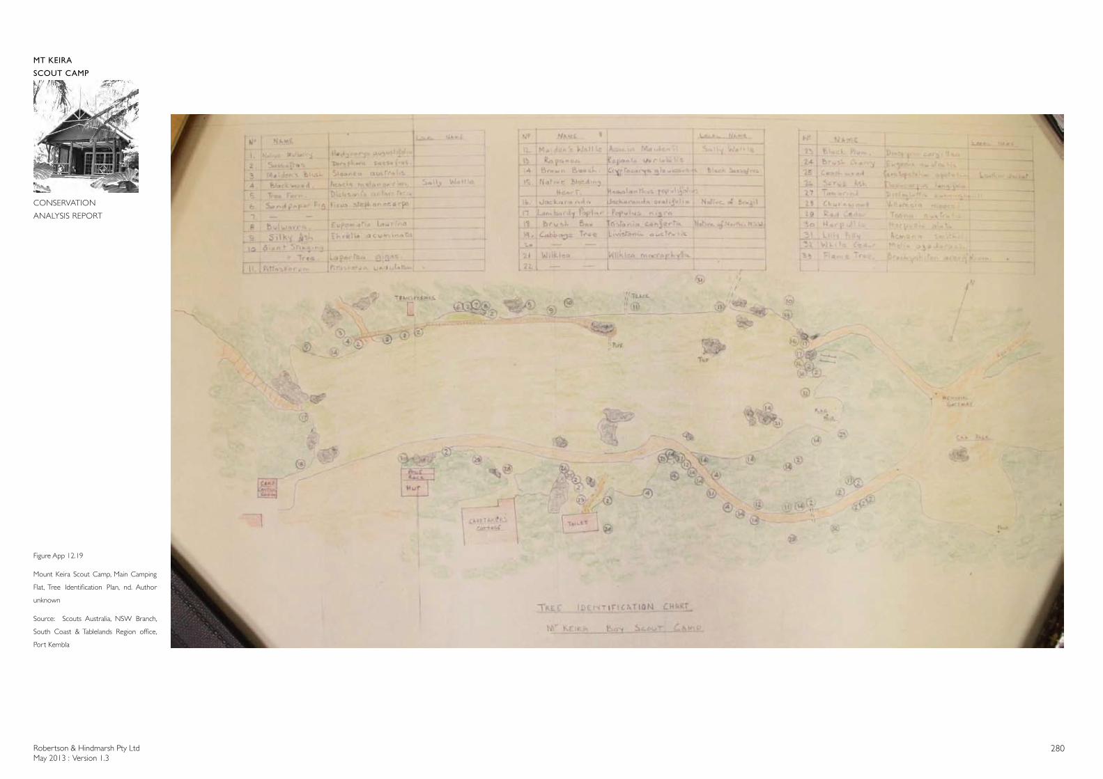
Robertson & Hindmarsh Pty LtdMay 2013 : Version 1.3
280
MT KEIRA
SCOUT CAMP
CONSERVATION
ANALYSIS REPORT
Figure App 12.19
Mount Keira Scout Camp, Main Camping
Flat, Tree Identification Plan, nd. Author
unknown
Source: Scouts Australia, NSW Branch,
South Coast & Tablelands Region office,
Port Kembla
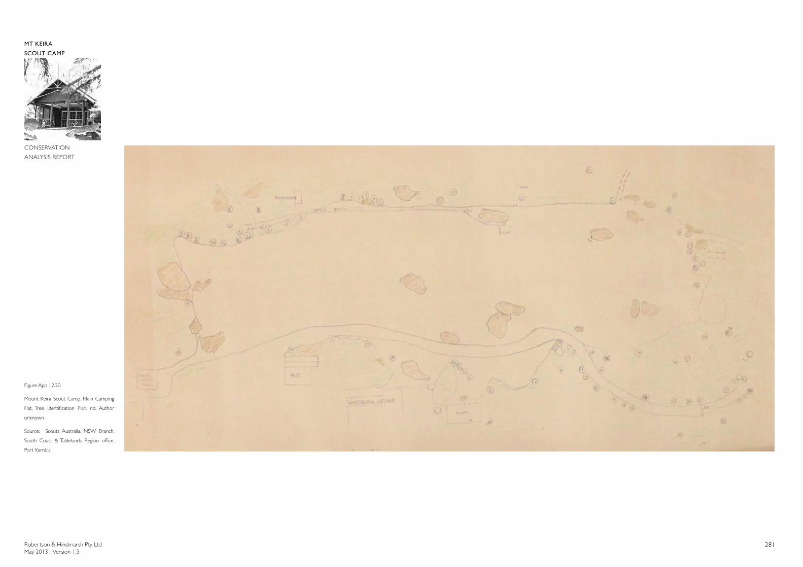
Robertson & Hindmarsh Pty LtdMay 2013 : Version 1.3
281
MT KEIRA
SCOUT CAMP
CONSERVATION
ANALYSIS REPORT
Figure App 12.20
Mount Keira Scout Camp, Main Camping
Flat, Tree Identification Plan, nd. Author
unknown
Source: Scouts Australia, NSW Branch,
South Coast & Tablelands Region office,
Port Kembla
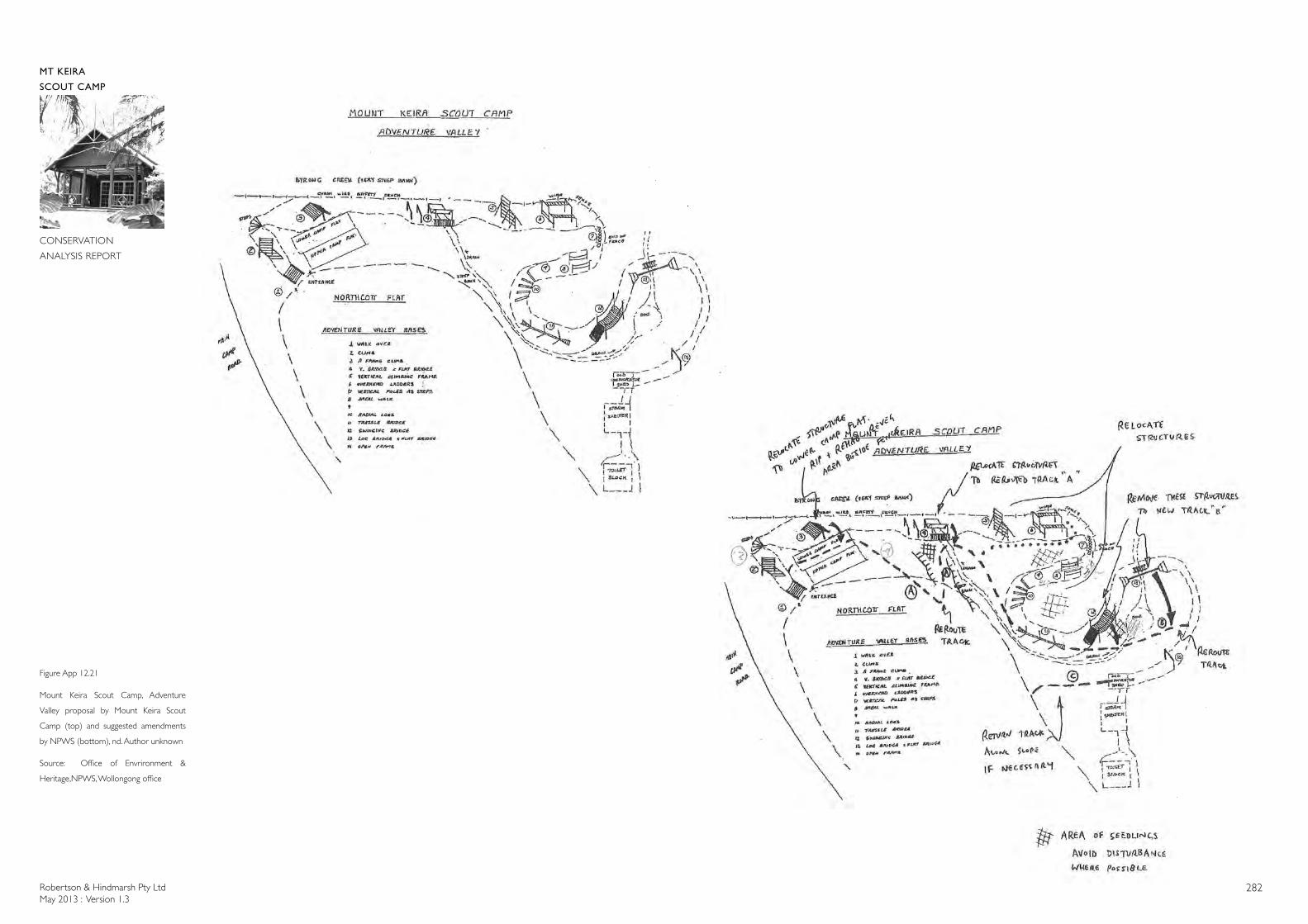
Robertson & Hindmarsh Pty LtdMay 2013 : Version 1.3
282
MT KEIRA
SCOUT CAMP
CONSERVATION
ANALYSIS REPORT
Figure App 12.21
Mount Keira Scout Camp, Adventure
Valley proposal by Mount Keira Scout
Camp (top) and suggested amendments
by NPWS (bottom), nd. Author unknown
Source: Office of Envrironment &
Heritage,NPWS, Wollongong office
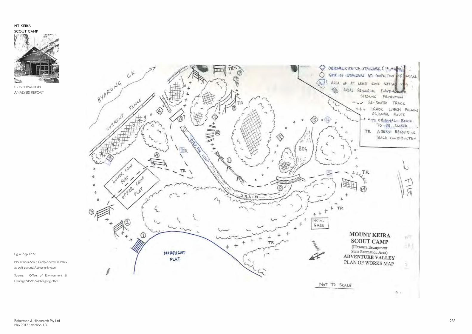
Robertson & Hindmarsh Pty LtdMay 2013 : Version 1.3
283
MT KEIRA
SCOUT CAMP
CONSERVATION
ANALYSIS REPORT
Figure App 12.22
Mount Keira Scout Camp, Adventure Valley,
as-built plan, nd. Author unknown
Source: Office of Envrironment &
Heritage,NPWS, Wollongong office
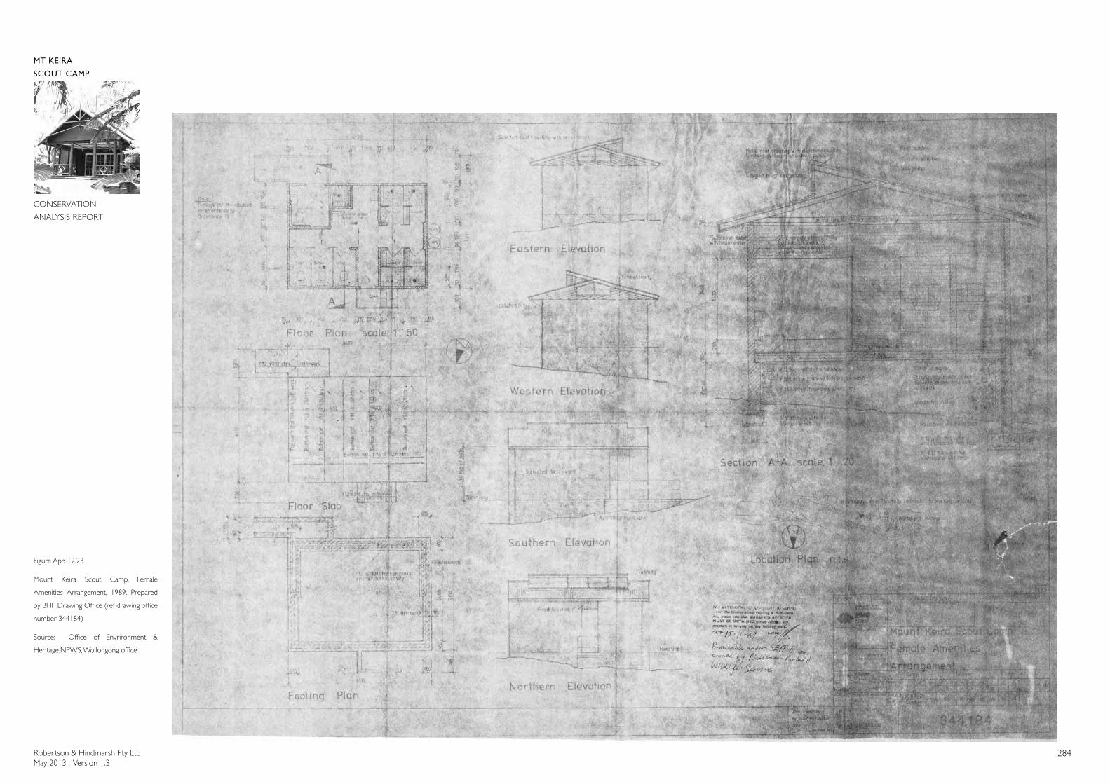
Robertson & Hindmarsh Pty LtdMay 2013 : Version 1.3
284
MT KEIRA
SCOUT CAMP
CONSERVATION
ANALYSIS REPORT
Figure App 12.23
Mount Keira Scout Camp, Female
Amenities Arrangement, 1989. Prepared
by BHP Drawing Office (ref drawing office
number 344184)
Source: Office of Envrironment &
Heritage,NPWS, Wollongong office
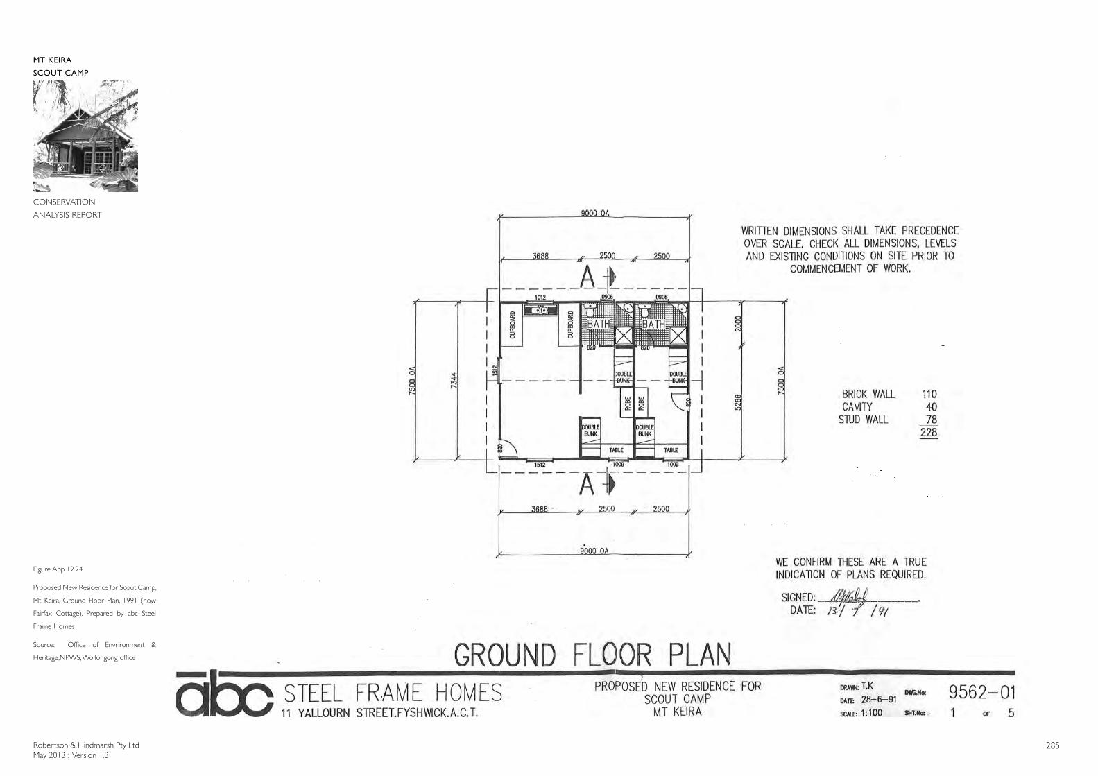
Robertson & Hindmarsh Pty LtdMay 2013 : Version 1.3
285
MT KEIRA
SCOUT CAMP
CONSERVATION
ANALYSIS REPORT
Figure App 12.24
Proposed New Residence for Scout Camp,
Mt Keira, Ground Floor Plan, 1991 (now
Fairfax Cottage). Prepared by abc Steel
Frame Homes
Source: Office of Envrironment &
Heritage,NPWS, Wollongong office
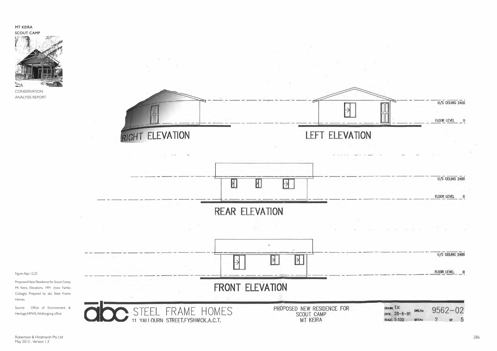
Robertson & Hindmarsh Pty LtdMay 2013 : Version 1.3
286
MT KEIRA
SCOUT CAMP
CONSERVATION
ANALYSIS REPORT
Figure App 12.25
Proposed New Residence for Scout Camp,
Mt Keira, Elevations, 1991 (now Fairfax
Cottage). Prepared by abc Steel Frame
Homes
Source: Office of Envrironment &
Heritage,NPWS, Wollongong office
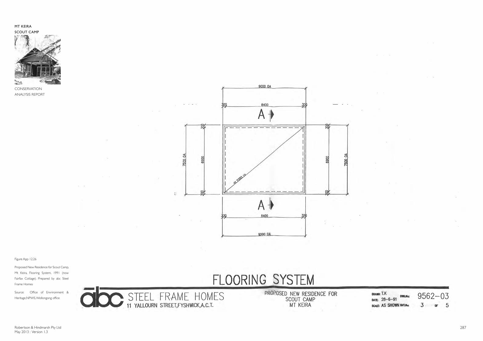
Robertson & Hindmarsh Pty LtdMay 2013 : Version 1.3
287
MT KEIRA
SCOUT CAMP
CONSERVATION
ANALYSIS REPORT
Figure App 12.26
Proposed New Residence for Scout Camp,
Mt Keira, Flooring System, 1991 (now
Fairfax Cottage). Prepared by abc Steel
Frame Homes
Source: Office of Envrironment &
Heritage,NPWS, Wollongong office
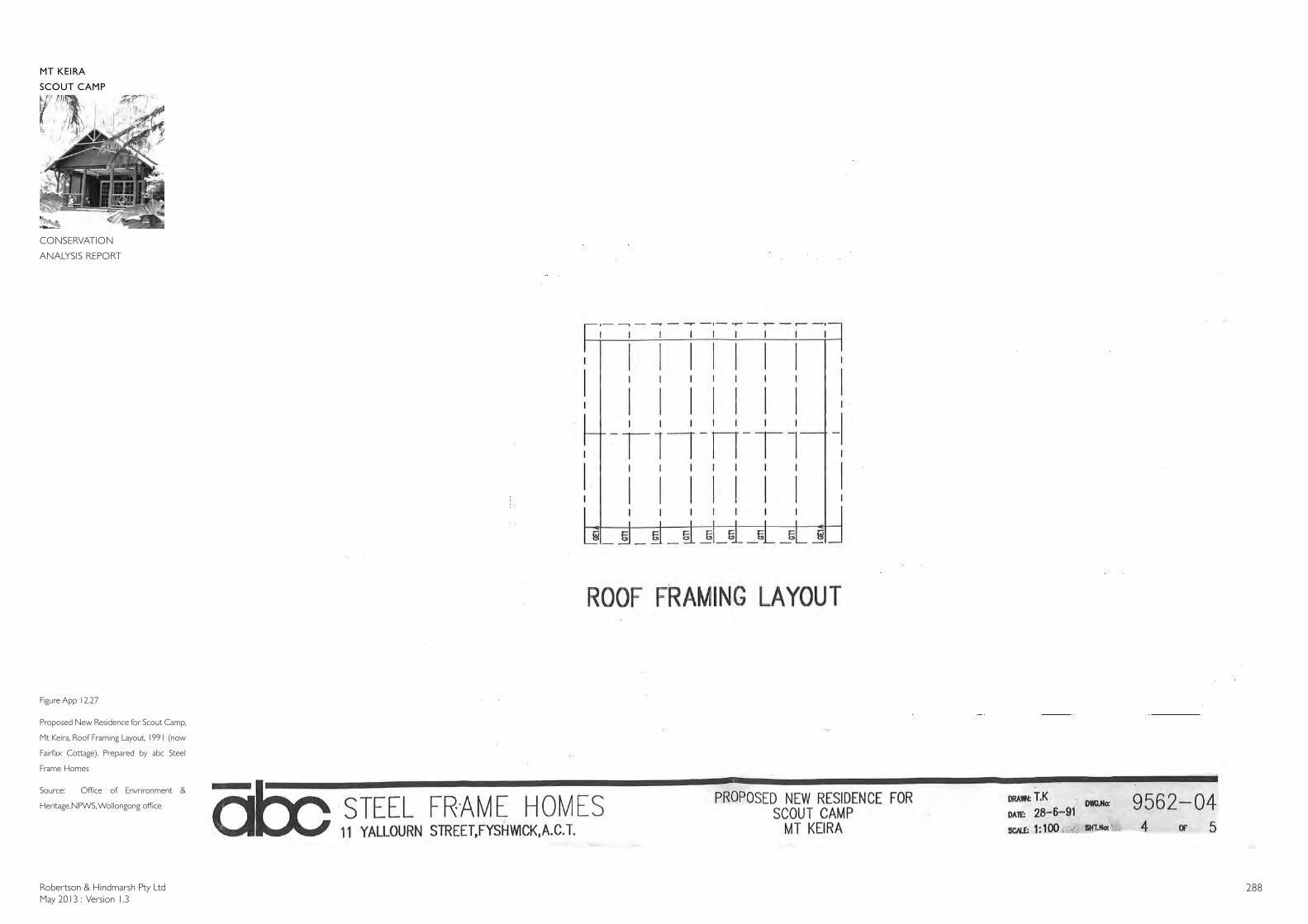
Robertson & Hindmarsh Pty LtdMay 2013 : Version 1.3
288
MT KEIRA
SCOUT CAMP
CONSERVATION
ANALYSIS REPORT
Figure App 12.27
Proposed New Residence for Scout Camp,
Mt Keira, Roof Framing Layout, 1991 (now
Fairfax Cottage). Prepared by abc Steel
Frame Homes
Source: Office of Envrironment &
Heritage,NPWS, Wollongong office
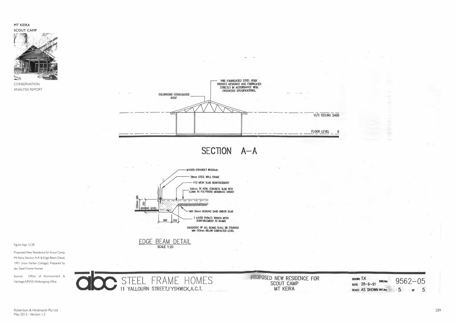
Robertson & Hindmarsh Pty LtdMay 2013 : Version 1.3
289
MT KEIRA
SCOUT CAMP
CONSERVATION
ANALYSIS REPORT
Figure App 12.28
Proposed New Residence for Scout Camp,
Mt Keira, Section A-A & Edge Beam Detail,
1991 (now Fairfax Cottage). Prepared by
abc Steel Frame Homes
Source: Office of Envrironment &
Heritage,NPWS, Wollongong office
Robertson & Hindmarsh Pty LtdMay 2013 : Version 1.3
290
APPENDIX 13
PLAN OF SIGNIFICANT TREES
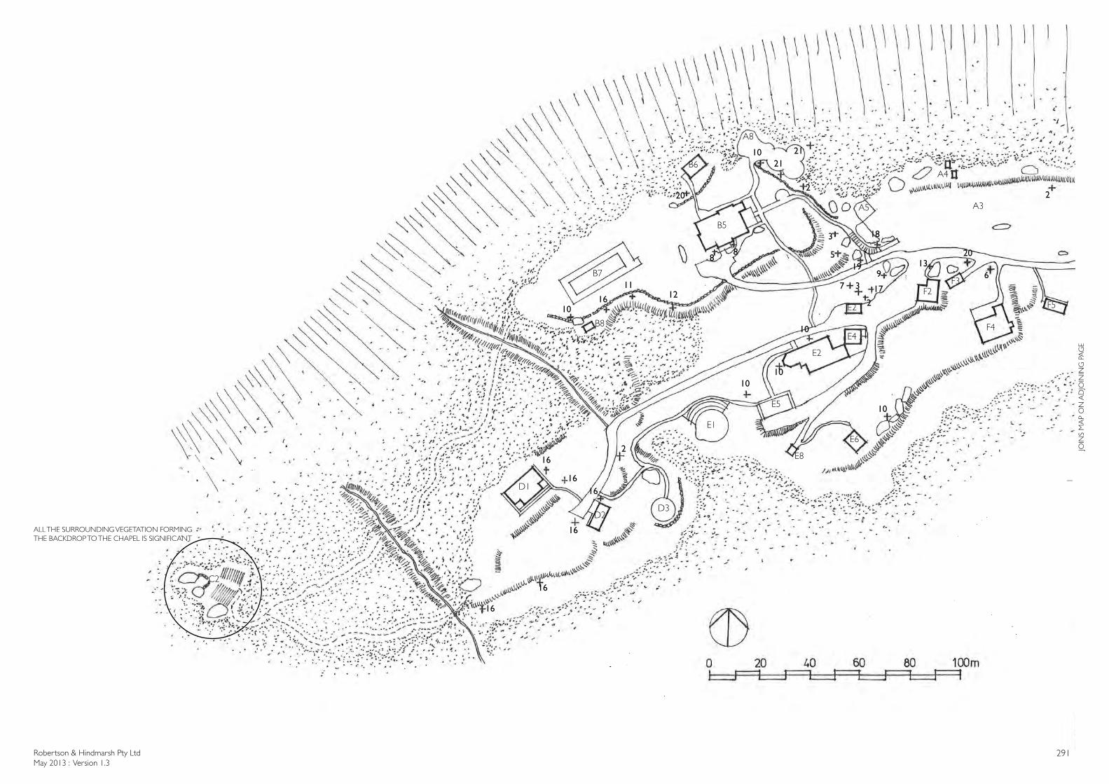
Robertson & Hindmarsh Pty LtdMay 2013 : Version 1.3
291
2
2
2
2
3
3
5
67
88
9
10
1010
10
10
10
1112
13
16
16
16
16
16
16
16
17
18
19
20
20
2121
E5
E2
E1
E8
E6
E4
E2
F2F3
F4
F5
B5
B6
B7
B8
D1
D2D3
A3A5
A8
A4
C2
JOIN
S M
AP
ON
AD
JOIN
ING
PA
GE
ALL THE SURROUNDING VEGETATION FORMING THE BACKDROP TO THE CHAPEL IS SIGNIFICANT
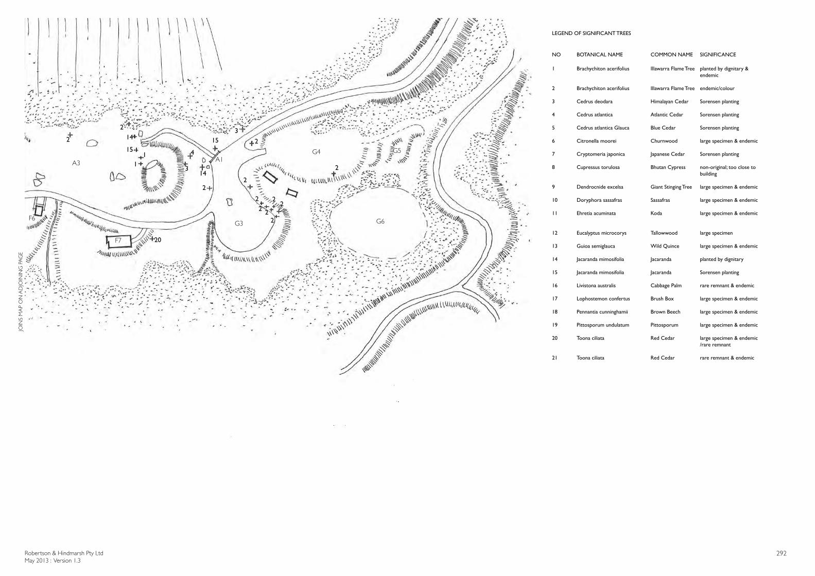
Robertson & Hindmarsh Pty LtdMay 2013 : Version 1.3
292
LEGEND OF SIGNIFICANT TREES
NO BOTANICAL NAME COMMON NAME SIGNIFICANCE
1 Brachychiton acerifolius Illawarra Flame Tree planted by dignitary &endemic
2 Brachychiton acerifolius Illawarra Flame Tree endemic/colour
3 Cedrus deodara Himalayan Cedar Sorensen planting
4 Cedrus atlantica Atlantic Cedar Sorensen planting
5 Cedrus atlantica Glauca Blue Cedar Sorensen planting
6 Citronella moorei Churnwood large specimen & endemic
7 Cryptomeria japonica Japanese Cedar Sorensen planting
8 Cupressus torulosa Bhutan Cypress non-original; too close tobuilding
9 Dendrocnide excelsa Giant Stinging Tree large specimen & endemic
10 Doryphora sassafras Sassafras large specimen & endemic
11 Ehretia acuminata Koda large specimen & endemic
12 Eucalyptus microcorys Tallowwood large specimen
13 Guioa semiglauca Wild Quince large specimen & endemic 14 Jacaranda mimosifolia Jacaranda planted by dignitary
15 Jacaranda mimosifolia Jacaranda Sorensen planting
16 Livistona australis Cabbage Palm rare remnant & endemic
17 Lophostemon confertus Brush Box large specimen & endemic
18 Pennantia cunninghamii Brown Beech large specimen & endemic
19 Pittosporum undulatum Pittosporum large specimen & endemic
20 Toona ciliata Red Cedar large specimen & endemic/rare remnant
21 Toona ciliata Red Cedar rare remnant & endemic
11
2
22
22
2
2
2
2
2
2
23
3
4
14
151514
20
F6
F7
A1A3
G4
G3
G5
G6
JOIN
S M
AP
ON
AD
JOIN
ING
PA
GE