provo municipal council - utah.gov
TRANSCRIPT
PROVO MUNICIPAL COUNCIL Work Meeting12:30 PM, Tuesday, November 27, 2018Room 310, City Conference Room351 W. Center Street, Provo, UT 84601
Agenda
Roll Call
Prayer
Business
1. A discussion on the proposed Council Meeting schedule for 2019
2. A presentation on the option for municipalities to create a local government disaster fund
3. A discussion on an ordinance amending Provo City Code to clarify that unauthorized energy generation shall not receive any rate or bill credits
4. A presentation about the Utah Valley Chamber of Commerce
5. A presentation on the Timp Kiwanis Bounous Park (TKP) LWCF Final Environmental Assessment Review (17-036)
Break
Policy Items Referred from the Planning Commission
6. A discussion on a request for amendments to Section 15.03.020(3) to update 2018 standards to 2019 standards. Citywide impact. (PLOTA20180348)
7. A discussion on a request for an Ordinance Text amendment to Section 14.34.350 Recreational Vehicle Storage and Towing Impound Yards to increase buffering requirements when adjacent to a Residential Zone (PLOTA20180216)
8. A discussion on a request for a zone change from R1.10 to Low Density Residential (LDR) for 2.94 acres of land, located at approximately 1080 E 1320 S to facilitate a 44-unit townhome development. Spring Creek Neighborhood. (PLRZ20180102)
Business
9. A report on the impact fee review process (18-099)
Closed Meeting
Adjournment
Informal discussion may be held in the Council Conference Room between 4:30 pm and 5:30 pm.
Materials and Agenda: http://publicdocuments.provo.org/OnBaseAgendaOnlineCouncil Blog: http://provocitycouncil.blogspot.com/
If you have a comment regarding items on the agenda, please email or write to Council Members. Their contact information is listed on the Provo website at: http://provo.org/government/city-council/meet-the-council
The next scheduled Regular Council Meeting will be held on 12/11/2018 12:00:00 PM at 5:30 PM in the Council Chambers, 351 West Center Street, Provo, unless otherwise noticed. The Work Session meeting start times is to be determined and will be noticed at least 24 hours prior to the meeting time, but typically begins between 1:00 and 4:00pm.
Notice of Compliance with the Americans with Disabilities Act (ADA)In compliance with the Americans with Disabilities Act, individuals needing special accommodations (including auxiliary communicative aides and services) during this meeting are invited to notify the Provo Council Office at 351 W. Center, Provo, Utah 84601, phone: (801) 852-6120 or email [email protected] at least three working days prior to the meeting. The meeting room in Provo City Center is fully accessible via the south parking garage access to the elevator. The Work Meeting is also broadcast live Provo Channel 17 at https://www.youtube.com/user/ProvoCityCouncil. For access to past Work and Council Meetings, go to playlists.
Notice of Telephonic CommunicationsOne or more Council members may participate by telephone or Internet communication in this meeting. Telephone or Internet communications will be amplified as needed so all Council members and others attending the meeting will be able to hear the person(s) participating electronically as well as those participating in person. The meeting will be conducted using the same procedures applicable to regular Municipal Council meetings.
Notice of Compliance with Public Noticing RegulationsThis meeting was noticed in compliance with Utah Code 52-4-202 and Provo City Code 14.02.010. Agendas and minutes are accessible through the Provo City website at council.provo.gov. Council Meeting agendas are available through the Utah Public Meeting Notice website at pmn.utah.gov. Email subscriptions to the Utah Public Meeting Notice are available through their website.
Network for public access is “Provo Guest”, password “provoguest”.
Jan 1 New Year's Day Jul 2
Jan 8 Work & Council Meeting Jul 9
Jan 15 Special Meeting as needed Jul 16
Jan 22 Work & Council Meeting Jul 23
Jan 29 Special Meeting as needed Jul 30
Feb 5 Work & Council Meeting Aug 6
Feb 12 Special Meeting as needed Aug 13
Feb 19 Work & Council Meeting Aug 20
Feb 26 Special Meeting as needed Aug 27
Mar 5 Work & Council Meeting Sep 3
Mar 12 Special Meeting as needed Sep 10
Mar 19 Work & Council Meeting Sep 17
Mar 26 Special Meeting as needed Sep 24
Apr 2 Special Meeting as needed Oct 1
Apr 9 Work & Council Meeting Oct 8
Apr 16 Special Meeting as needed Oct 15
Apr 23 Work & Council Meeting Oct 22
Apr 30 Special Meeting as needed Oct 29
May 7 Work & Council Meeting Nov 5
May 14 Special Budget Retreat as needed Nov 12
May 21 Work & Council Meeting Nov 19
May 28 Special Meeting as needed Nov 26
June 4 Work & Council Meeting Dec 3
June 11 Special Meeting as needed Dec 10
June 18 Work & Council Meeting Dec 17
June 25 Special Meeting as needed Dec 24
Tuesday, January 1 New Years Day Wednesday, July 24 Pioneer Day
Monday, January 21 Martin Luther King Jr. Day Monday, September 2 Labor Day
Monday, February 18 President's Day Thursday, November 28 Thanksgiving Day
Monday, May 27 Memorial Day Tuesday December 24 Christmas Eve
Thursday, July 4 Independence Day Wednesday, December 25 Christmas Day
PROVO MUNICIPAL COUNCIL
Special Meeting as needed
2019 Regular Meeting Schedule DRAFT
Special Meeting as needed
Work & Council Meeting
Special Meeting as needed
Work & Council Meeting
Special Meeting as needed
Work & Council Meeting
Primary Election 2019
Special Meeting as needed
Work & Council Meeting, Board of Canvassers
Special Meeting as needed
Work & Council Meeting
Special Meeting as needed
Work & Council Meeting
Work & Council Meeting as needed
General Election
Special Meeting as needed
Special Meeting as needed
Work & Council Meeting
Provo City Offices will be closed for these 2019 City Holidays
Special Meeting as needed
Work & Council Meeting
Work & Council Meeting, Board of Canvassers
Special Meeting as needed
Special Meeting as needed
Christmas Eve
Work & Council Meeting
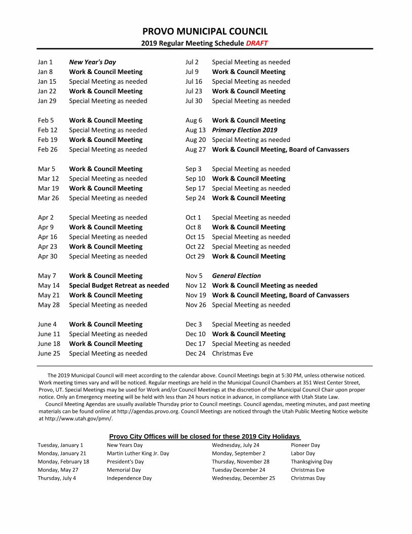
The 2019 Municipal Council will meet according to the calendar above. Council Meetings begin at 5:30 PM, unless otherwise noticed. Work meeting times vary and will be noticed. Regular meetings are held in the Municipal Council Chambers at 351 West Center Street, Provo, UT. Special Meetings may be used for Work and/or Council Meetings at the discretion of the Municipal Council Chair upon proper notice. Only an Emergency meeting will be held with less than 24 hours notice in advance, in compliance with Utah State Law.
Council Meeting Agendas are usually available Thursday prior to Council meetings. Council agendas, meeting minutes, and past meeting materials can be found online at http://agendas.provo.org. Council Meetings are noticed through the Utah Public Meeting Notice website at http://www.utah.gov/pmn/.
TIMP KIWANIS BOUNOUS PARK FINAL ENVIRONMENTAL ASSESSMENT
Section 6(f) Land Conversion
November 27, 2018
Prepared for:
Prepared by:
Final Environmental Assessment – Section 6(f) Land Conversion – Timp Kiwanis Bounous Park
November 27, 2018
2
Contents
Executive Summary………………………………………………………………………… ............. …6
Chapter 1 – Background, Purpose of and Need for Action ........................................................ 16
1.1 Background ................................................................................................................... 16
1.2 Project Location............................................................................................................. 17
1.3 Description of the Timp Kiwanis Bounous Park……………………………………………..19
1.4 Purpose and Need for Action......................................................................................... 21
Chapter 2 – Alternatives ........................................................................................................... 26
2.1 No-Action Alternative ..................................................................................................... 27
2.2 Build Alternatives………………………………………………………………...……………..27
2.3 Proposed Replacement Site #1 (Preferred Alternative) ................................................. 40
2.4 Proposed Replacement Site #2 ..................................................................................... 44
Chapter 3 – Affected Environment and Environmental Consequences ..................................... 45
3.1 Geological Resources ................................................................................................... 45
3.2 Sound (noise impacts) ................................................................................................... 45
3.3 Floodplains .................................................................................................................... 45
3.4 Wetlands ....................................................................................................................... 49
3.5 Land Use / Ownership Patterns ..................................................................................... 52
3.6 Circulation / Transportation ........................................................................................... 54
3.7 Plant / Animal / Fish Species of Special Concern and Habitat ....................................... 54
3.8 Recreation Resources, Land, Parks, Open Space, Conservation Areas, Trails, Facilities, Services, Opportunities, Public Access ............................................................................... 57
3.9 Accessibility for Populations with Disabilities ................................................................. 60
3.10 Historical / Cultural Resources .................................................................................... 60
3.11 Minority / Low-Income Populations .............................................................................. 61
3.12 Land / Structures with History of Contamination / Hazardous Materials ....................... 62
3.13 Water Resources………………………………………………………………..…………….62
Chapter 4 – Consultation and Coordination ............................................................................... 64
List of Preparers.. ...................................................................................................................... 65
Final Environmental Assessment – Section 6(f) Land Conversion – Timp Kiwanis Bounous Park
November 27, 2018
3
Table of Figures
Figure 1.1 – Original LWCF Grant Acquisition Area ................................................................ 16
Figure 1.2 – Location Map ...................................................................................................... 17
Figure 1.3 – Existing LWCF Grant Area and Vicinity Map ....................................................... 18
Figure 1.4 – Timp Kiwanis Bounous Park and Provo School District Property…………………..19
Figure 1.5 – Timp Kiwanis Bounous Park Amenities………………………………………………21
Figure 1.6 – Harmon and Fox Fields…………………………………………………………………23
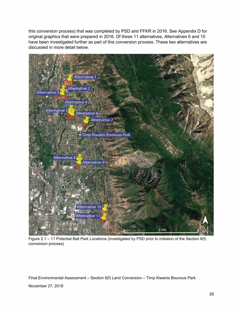
Figure 2.1 – 11 Potential Ball Park Locations .......................................................................... 28
Figure 2.2 – Alternatives 1, 2, 3 .............................................................................................. 29
Figure 2.3 – Alternatives 4, 5, 6, 7........................................................................................... 30
Figure 2.4 – Alternative 6 Ball Field Layout. ............................................................................ 31
Figure 2.5 – Alternative 6 Ball Field Layout. ............................................................................ 31
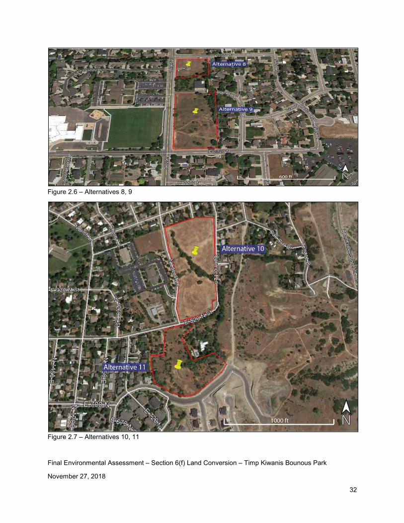
Figure 2.6 – Alternatives 8, 9 .................................................................................................. 32
Figure 2.7 – Alternatives 10, 11 .............................................................................................. 32
Figure 2.8 – Alternative 10 Ball Field Layout (Option 1)……………………………………………33
Figure 2.9 – Alternative 10 Ball Field Layout (Option 2)……………………………………………34
Figure 2.10 – 3 Potential New Sites for Replacing TKP……………………………………………35
Figure 2.11 – Proposed Grandview Site Location……………………………………….………….36
Figure 2.12 – Proposed Grandview Site……………………………...……………………………...37
Figure 2.13 – Proposed Replacement Site in the Eastern Provo Area……………………………38
Figure 2.14 – Girls’ Softball Field Layout on Boys’ Baseball Field………………...………………39
Figure 2.15 – Proposed Replacement Site #1 Location Map…………..……….………………….41
Figure 2.16 – Proposed Replacement Site #1...……………………………………………………..42
Figure 2.17 – Proposed Replacement Site #1 Concept Plan...…………………………………….43
Figure 3.1 – Provo City Floodplain Map ......................................................................... ……. 47
Figure 3.2 – Existing Dike ....................................................................................................... 49
Final Environmental Assessment – Section 6(f) Land Conversion – Timp Kiwanis Bounous Park
November 27, 2018
4
Figure 3.3 – Wetlands and Waters of the U.S. and Potential ULT Habitat. .............................. 51
Figure 3.4 – Provo City Zoning Map ........................................................................................ 53
Figure 3.5 – Potential ULT Habitat and Impact Area……………………………………………….56
Figure 3.6 – TKP Nearby Recreation Facilities ........................................................................ 58
Figure 3.7 - Nearby Recreation Facilities ................................................................................ 60
Figure 3.8 – 100’ Radius Well Protection Zone…………………………………………………..…63
Final Environmental Assessment – Section 6(f) Land Conversion – Timp Kiwanis Bounous Park
November 27, 2018
5
Appendices
Appendix A – Timp Kiwanis Bounous Park History
Appendix B – Ryan York Email Regarding the PC Well Located on TKP Property
Appendix C – Provo School District Letter to Provo City
Appendix D – 11 Potential Park Locations
Appendix E – Timp Kiwanis Bounous Park Photos
Appendix F – Proposed Replacement Site #1 Photos
Appendix G – Proposed Replacement Site #2 Photos
Appendix H – June 6, 2016 email from Robert Hunter, Provo City Public Works, addressing TKP Flooding Concerns
Appendix I – Aquatic Resource Delineation Report December 2016 and October 8, 2018 Revisions
Appendix J – Mike Pectol (USACE) email
Appendix K – Utah Division of Wildlife Resources Coordination Letters
Appendix L – Biological Inventory : Spriranthes diluvialis
Appendix M – Letter from Keith Rittel (PSD Superintendent)
Appendix N – Public Comments and Responses
Appendix O – Provo City Council Resolution – November 27, 2018
Final Environmental Assessment – Section 6(f) Land Conversion – Timp Kiwanis Bounous Park
November 27, 2018
6
Executive Summary
On January 15, 1967, Provo City was granted LWCF funds for the acquisition of 10 acres of property for a new city park located in eastern Provo, as shown in Figure 1.1 (page 16). This park was originally called Edgemont Park but is currently called the Timp Kiwanis Bounous Park (TKP). The original project proposal states “Subsequent to acquisition, the area will be improved by developing picnic facilities; a ball field; tennis courts; a tot lot; and a pavilion. Landscaping and seeding will be accomplished. Electric lighting and culinary water and sprinkling system will be installed. Sewer lines will be extended and a modern, two-unit restroom facility will be constructed.” All of these facilities have been constructed. However, the ball field was constructed by Provo School District for the Timpview High School boys’ baseball team. This baseball field is generally not available for use by the general public.
The TKP is defined as a “community park” in the current Provo City Parks and Recreation Master Plan. As shown in Figure 1.5 (page 21), existing park amenities include shade trees, picnic tables, off-street parking, restroom facilities, a play area, a volleyball area, a pavilion with tables, and a paved area. A Provo City culinary water well house also exists on the property as shown in Figure 1.5 (page 21). There is also a trail / access road on the south end of the park that provides access to this well house and to the property east of the baseball field. As shown in Figure 1.5 (page 21), the existing property boundary for TKP includes the 650 East roadway and overlap of residential property boundaries at the south end of the property.
The Purpose of and Need for Action includes the following:
• Provo School District has a need to expand the Timpview High School campus and desires to purchase the TKP property from Provo City.
• Provo School District has a need to own and manage the property being used by THS students.
• Provo City has a desire to work with PSD to address their needs and also to clear up existing Section 6(f) issues that exist at the park.
Provo School District Has a Need to Expand the Timpview High School Campus and Desires to Purchase the TKP Property from Provo City. PSD needs to purchase the TKP property from PC for the following reasons: The need to construct a girls’ softball field on campus and continue to provide open space for soccer practice, band practice, and other activities. Timpview High School does not have a girls’ softball field on campus. Out of 18 high schools in Utah County, Timpview is the only high school that does not have its own girls’ softball field on

Final Environmental Assessment – Section 6(f) Land Conversion – Timp Kiwanis Bounous Park
November 27, 2018
7
campus. Provo School District desires to proactively address this issue so they can comply with Title IX1 requirements. For many years the Timpview girls’ softball team practiced and played at a ball field located on the corner of the old Edgemont Elementary site. However, in 2017, Edgemont Elementary was rebuilt and the placement of the new school does not allow for the ball field to remain there. Members of the community, including team parents and coaches, have expressed much concern about where they will be playing in the future (see PSD letter in Appendix C).
Currently the girls’ softball team is utilizing Harmon Field with the potential of using Fox Field (see Figure 1.6, page 23) for softball games and practices while the purchase of TKP is studied as a potential location to construct a new girls’ softball field. The use of these fields is a temporary solution until a permanent solution can be provided. The distance from THS to Harmon Park and Fox Field is approximately 4.2 miles and 2.7 miles, respectively. In addition to Title IX concerns, having players, coaches, parents, and others travel is inconvenient and introduces additional safety concerns.
In 2016, PSD investigated several alternatives for addressing this issue. These alternatives are discussed in Chapter 2 of this document. During this investigation, PSD came to the conclusion that purchasing the TKP property would be the best alternative to address their concerns. PSD verbally approached PC about their desire for purchasing the park property and a formal letter (see Appendix C) was sent from Keith Rittel, PSD Superintendent, to former PC Mayor John Curtis. This letter explained the current situation and requested PC assistance investigating the possibility of PSD acquiring the TKP property. PC staff recommends selling the TKP property and working with PSD to complete the Section 6(f) conversion process. Provide an opportunity to rebuild and expand Timpview High School. Enrollment at Timpview High School has increased on a regular basis since the school was opened. The current enrollment in 2017-18 school year was 2173 students. Enrollment is projected to be 2339 students in 2023-24 and 2505 students in 2028-292.
Construction on Timpview High School was completed in 1977 and the school was open for the 1977-78 school year. The existing building is experiencing structural issues such as settlement and cracking. These structural issues need to be addressed to maintain a safe environment for students and teachers. To address these structural issues and the anticipated enrollment growth, PSD is currently investigating the possibility of rebuilding and expanding Timpview High School in the future.
1 Title IX refers to Title IX of the Education Amendments Act of 1972 and is a federal law that states “No person in the United States shall, on the basis of sex, be excluded from participation in, be denied the benefits of, or be subjected to discrimination under any education program or activity receiving federal financial assistance.”
2 Source: Bonneville Research enrollment study letter to PSD, dated April 26, 2018.
Final Environmental Assessment – Section 6(f) Land Conversion – Timp Kiwanis Bounous Park
November 27, 2018
8
The existing Timpview High School site is 29 acres. Many of the new high schools being built today are on sites in excess of 50 acres. The new Provo High School site is 39 acres. The additional 10 acres of land provided by the TKP property would help PSD address the needs being faced by the continued enrollment growth at Timpview High School. The additional space will also provide a construction a staging area, if needed. It is the intent of the school Board to build/remodel THS around the existing structure, thus leaving the green space necessary for the aforementioned athletic fields.
The following guidelines regarding campus size have been provided to school districts by the Utah State Office of Education. Based upon these guidelines, the size of the THS campus should be 52 acres.
“Size and Location. Although increasing rapidly in cost, land is still one of the least expensive education resources provided for schools. The quantity of land needed for a school facility will vary according to specific local needs, such as the number and ages of pupils, the type of building to be constructed, and the multiple uses of the site for such things as community recreational functions. The size of a school site also depends on the shape, contour, general suitability, and availability of land in the area where the building is to be located. If transportation is readily available, the size of a site is more important than location. Inadequate site size is a major factor in the obsolescence of educational facilities.
The State Office of Education suggests the following site sizes for the various grade levels shown: • K-6 school—10 acres plus one acre for each 100 students • Middle school—20 acres plus one acre for each 100 students • Junior high school—20 acres plus one acre for each 100 students • Senior high school—30 acres plus one acre for each 100 students • Combined 7-12 high school—30 acres plus one acre for each 100 students”
Provo School District has a need to own and manage the property being used by THS students. As previously stated, TKP acts as an extension of THS and is used frequently by THS students. For safety and scheduling reasons, PSD desires to own and manage this area.
• Safety. PSD has a responsibility to provide a safe environment for their students. Recent events throughout the country has highlighted the need to provide an environment where students are safe. Having the ability to own and manage access to the THS campus is an important part of PSD safety plans for THS.
• Scheduling. PSD would like to have the ability to schedule the use of the baseball field and other areas being used by THS students. Currently the property is owned by PC and is used by PSD. This “sharing“ of the property can create conflicts for both students and the general public.
Provo City has a desire to work with PSD to address their needs and also to clear up existing Section 6(f) issues that exist at the park. Students at THS are also residents of Provo City. Provo City has a desire to work with PSD to investigate the potential for selling the
Final Environmental Assessment – Section 6(f) Land Conversion – Timp Kiwanis Bounous Park
November 27, 2018
9
TKP to PSD for the reasons mentioned above. Provo City recognizes the need to follow Section 6(f) guidelines for property conversion. It is the desire or both PC and PSD to minimize impacts to the local community. Steps for minimizing impacts will be discussed later in this environmental assessment.
During the process of investigating the possibility or selling TKP to PSD, PC has discovered some Section 6(f) issues that it would like to clear up. These issues include the following: • The baseball field is operated and maintained by PSD for the THS boy’s baseball team.
There are some other users of the field but it generally does not function as a baseball field that is open for public use.
• The well and well house are not recreational uses and a conversion needs to be completed for these facilities.
• The access road on the south end of the park is not a recreation use. • There are residential properties that are encroaching into park property. PC desires to
correct this situation. • The 650 East roadway is included in the Section 6(f) boundary and is not a recreation use.
In addition to the No-Action Alternative, a total of 18 build alternatives have been considered for this project. These build alternatives include the following:
• 11 potential ball park locations that would include a new girls’ softball field and/or a new boys’ baseball field (see Appendix D). These potential ball park locations were investigated by PSD prior to the Section 6(f) conversion process was initiated and are not considered alternatives for TKP, except for Alternative 10. However, they have been included in this document because they help explain the reason the Section 6(f) conversion process was initiated for TKP.
• Three potential new sites for replacing the TKP. • The potential of sharing the boys’ baseball field with the girls’ softball field. • The potential of scheduling the boys’ baseball field so it can be shared with the public. • The potential of sharing the Edgemont Elementary field area. • The potential of using the future Canyon Road Park area.
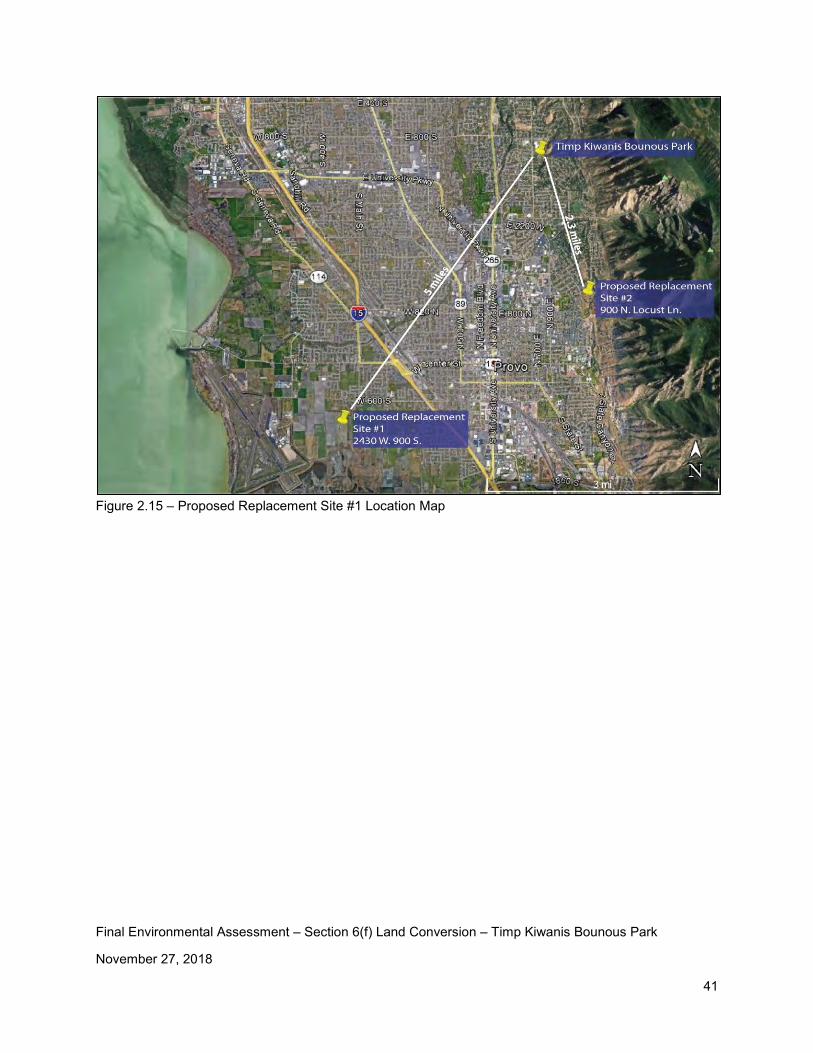
Each of these alternatives in explained in detail in Chapter 2 of this document. The preferred alternative recommended during this process is Proposed Replacement Site #1. This site is located in southwest Provo at approximately 2430 West 900 South, as shown in Figure 2.15 (page 41). This proposed site is 60 acres and is currently owned by The Church of Jesus Christ of Latter Day Saints. Provo City completed a property appraisal for this site in November 2018. The appraised value of this site is $2.16 million.
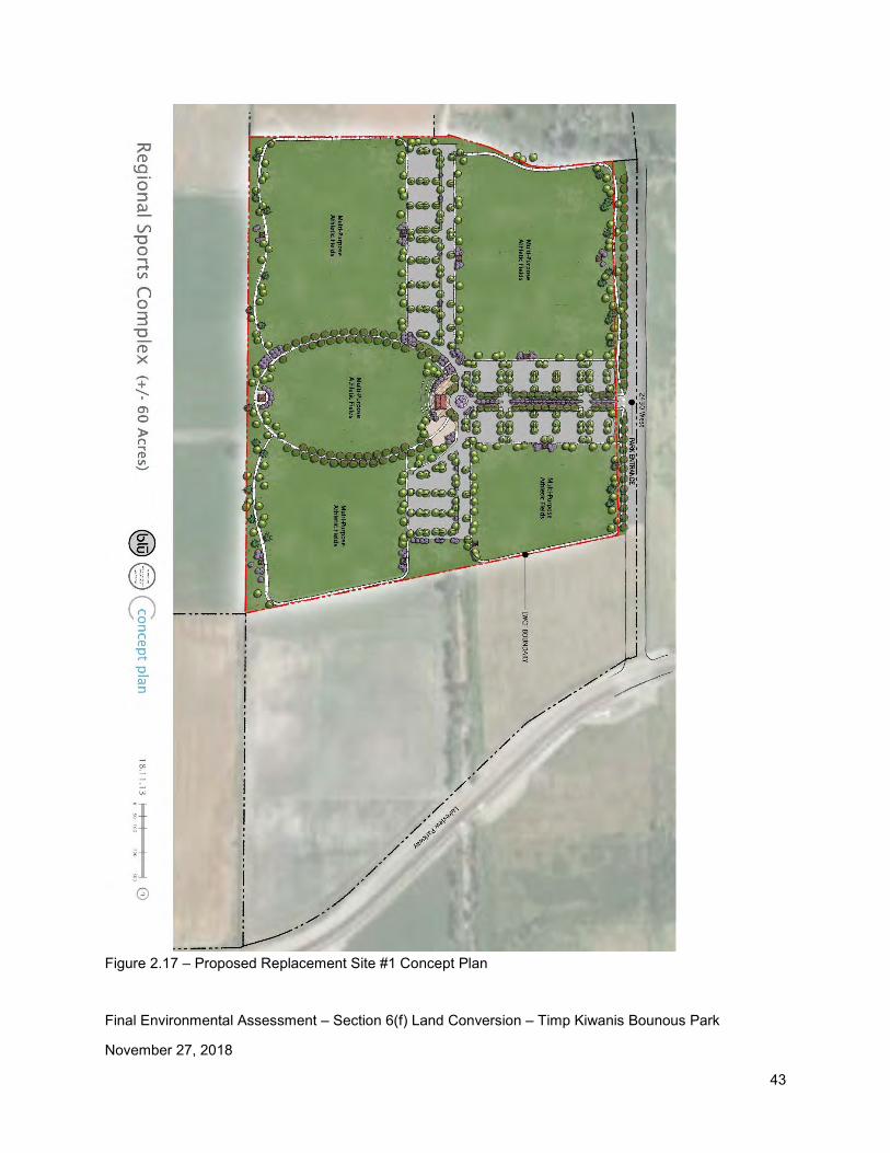
This site is planned to be a regional sports complex, called the Provo Regional Sports Complex, which will consist of the following amenities:
• Approximately 12 multi-purpose fields to be used for soccer, lacrosse, rugby, and ultimate frisbee
Final Environmental Assessment – Section 6(f) Land Conversion – Timp Kiwanis Bounous Park
November 27, 2018
10
• Restroom facilities sufficient to service those on site • Parking lot with sufficient spaces for athletes, spectators, and other members of the
public using the park • Landscaping • Concessions • Multi-use paths to provide opportunities for active and passive users • Playgrounds
A careful review of the environmental resources identified in the Project Development – Environmental Site Form (PDESF) was performed for this project. Based upon review of the PDESF, site visits, and a review of aerial mapping, the following environmental resources were studied to determine what, if any, impact may result from the proposed Section 6(f) conversion. A more detailed description of each of these resources is provided in Chapter 3.
• Geological Resources. No impacts. Additional soil analysis will be provided during design of improvements at TKP and at Preferred Alternative #1.
• Sound (noise impacts). There will be temporary noise impacts from construction activities at TKP and at Preferred Alternative #1. There will also be noise resulting from recreational activities. Construction and recreational activities will be required to abide by Provo City’s noise ordinance.
• Floodplains. TKP is not located in a designated floodplain. Reports of local flooding have been addressed by Robert Hunter, at Provo City public works (see Appendix H).
This proposed replacement site is located within both Zones A and B of Provo FIRM dated September 30, 1988 (the most current FIRM) as shown in Figure 3.1 (page 47). Zone A is considered a special flood hazard area and the definition of Zone A is “the area that will be inundated by the flood event having a 1-percent chance of being equaled or exceeded in any given year. The 1-percent annual chance flood is also referred to as the base flood or 100-year flood.”. Zone B is considered a moderate flood area and is defined as “an area between the limits of the base flood and the 0.2-percent-annual-chance (or 500-year) flood.”
There is an existing dike (levee) that runs north-south for the entire length of the proposed mitigation site (see Figure 3.2, page 49). This dike has historically helped to manage flooding in the area. As part of this project, the dike will be relocated to the eastern edge of the property and the new roadway (2430 West) will be constructed on the dike. Moving this dike will help to minimize flooding at the site. Provo City will work with FEMA to change the floodplain zoning in this area.
The water elevation of the Utah Lake is carefully controlled and monitored to avoid flooding. Several flood control measures, which include storing water at Jordanelle Reservoir and Deer Creek Reservoir, are in place to control the flow of water in the Provo River and Utah Lake. In addition, this site is bordered on the south and west sides
Final Environmental Assessment – Section 6(f) Land Conversion – Timp Kiwanis Bounous Park
November 27, 2018
11
by the Provo City Lakeshore Connector roadway. This roadway was built to act as a dike for Utah Lake. No flooding impacts to the site are anticipated. Prior to construction activities, if any, occurring on this site, PC will require the owner/developer to submit plans to the city for review of proposed changes and compliance to city regulations. This is another step that will be taken by PC to ensure that flood control on this site is properly addressed.
• Wetlands. There are no wetlands located at TKP. A wetland delineation has been completed and an Aquatic Resource and Delineation Report prepared for Proposed Replacement Site #1 in December 2016. Figure 3.3 (page 51) shows five drainage ditches and one wetland area that occur on the proposed replacement site. Additional coordination with the US Army Corps of Engineers has occurred and is ongoing. This coordination will result in a jurisdictional determination of which ditches are jurisdictional. Calculation of impacts and compensatory mitigation measures will be determined prior to construction during the Section 404 permitting phase.
• Land Use / Ownership Patterns. TKP is zoned PF as shown on the Provo City Zoning
Map (Figure 3.4, page 53). Zone PF is defined as “Public Facilities Zone: Areas of a minimum 10,000 square feet for the establishment of facilities which are maintained in public and quasi-public ownership; i.e. schools, universities, hospitals, parks and recreation, utilities, etc.” Land use in the area is residential housing, Timpview High School, Edgemont Elementary School, and Timp Kiwanis Bounous Park. Based upon the county records 2018 random property values in the area range from approximately $176,000 to $1.5 million. Proposed Replacement Site #1 is zoned A120 as shown on the Provo City Zoning Map (Figure 3.4, page 53). Zone A120 is defined as “Agricultural Zone: Principal uses include agricultural pursuits, unrestricted animal rights, and one family detached dwellings. Minimum lot size varies according to sub-zone: A1.20 ~ 20 acres.” Provo City plans to re-zone the site to PF once they own the property.
Current land use in the area is agricultural land and residential housing. Based upon the county records, 2018 random property values in the area are approximately $60,000 per acre for agricultural land. Residential property ranges from approximately $220,000 to $345,000. It should be noted that the size of residential lots varies widely in this area.
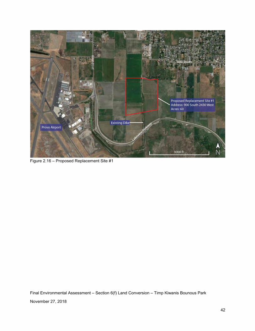
• Circulation / Transportation. TKP is easily accessible and is accessed from 650 East. There is off-site parking for park users. Access to Proposed Replacement Site #1 will be from 2430 West as shown in Figure 2.17 (page 43). 2430 West can be accessed from Lakeview Parkway and from 560 South.
Final Environmental Assessment – Section 6(f) Land Conversion – Timp Kiwanis Bounous Park
November 27, 2018
12
• Plant / Animal / Fish Species of Special Concern and Habitat. Coordination with the Utah Division of Wildlife Resources (UDWR) indicates that they do not have records of occurrence for any threatened, endangered, or sensitive species near TKP.
Coordination with the Utah Division of Wildlife Resources indicates recent records of occurrence for various species of special concern. Each of these species is discussed in section 3.7 of this document.
In addition, there are recent records of occurrence for Ute Ladies’ tresses, a federally listed threatened plant. A Ute Ladies’ tresses (Sprianthes diluvialis) survey was completed on November 23, 2016, not during the blooming season, as part of this study. The results of the survey are stated in the paragraph below.
“A small area of potential habitat was located during the survey. The area is along a ditch that is not downcut or overgrown by thick vegetation. It is dominated by grasses and sedges that are occasionally found with Spiranthes. Although this area is low potential habitat, it could not be disqualified. Therefore, this area should be surveyed again during the ULT blooming season. Overall, the site is largely disturbed and unlikely to support ULT.” Figure 3.5 (page 56) shows the potential ULT habitat location.
Further coordination has occurred with the Reeta Reber, US Fish and Wildlife Service, regarding the potential ULT habitat. Reeta recommends that ULT surveys be completed during the growing season (July-August) for three consecutive years (two years of surveys have already been performed with no plants found) to determine the existence of the plants. Provo City is planning to complete the third ULT survey in July-August of 2019.
Provo City may also choose to avoid impacting the potential ULT habitat site. This option will be investigated during design of the site.
• Recreation Resources, Land, Parks, Open Space, Conservation Areas, Trails, Facilities, Services, Opportunities, Public Access. TKP is defined as a “community park” in the current Provo City Parks and Recreation Master Plan.
According to the current Provo City Parks and Recreation Master Plan, planned park improvements for the TKP include: updating the pavilion, updating the restrooms, and considering a possible land trade with the Provo School District.
TKP is used by the local community as well as Timpview High School students. The following activities occur at this park: picnics and family activities; recreational activities including volleyball, tennis, and use of the play area; rest and relaxation; Timpview High School boys’ baseball; and Timpview High School marching band practice. Provo City also plans to build a new park, Canyon Road Park, located at 3800 North Canyon Road. Construction of the Canyon Road Park is currently planned for 2024-2025 in the current Provo City Capital Improvement Plan. Due to the importance of maintaining a community park in this area, Provo City staff is recommending to the City
Final Environmental Assessment – Section 6(f) Land Conversion – Timp Kiwanis Bounous Park
November 27, 2018
13
Council to move construction of this park up to the 2020-2022 timeframe. At the appropriate time, a neighborhood committee will organized and will be involved in the design process for this park.
Proposed Replacement Site #1is planned to be a regional sports complex, called the Provo Regional Sports Complex, which will consist of the following amenities: • Approximately 12 multi-purpose fields to be used for soccer, lacrosse, rugby, and
ultimate frisbee • Restroom facilities • Parking lot • Landscaping • Concessions • Multi-use paths • Playgrounds
The proposed regional sports complex is consistent with the 2014 Utah State Comprehensive Outdoor Recreation Plan (SCORP). Page 30 of the SCORP identifies new ball fields and courts as top priorities for municipality recreational needs. The construction of this regional sports complex helps to meet the needs identified in the SCORP better than Proposed Replacement Site #2. In addition, this park is consistent with the Provo City Parks and Recreation Master Plan.
• Accessibility for Populations with Disabilities. The site is already accessible for populations with disabilities. Proposed Replacement Site #1 design and construction of site improvements will be in accordance with ADA requirements.
• Historical / Cultural Resources. TKP was inventoried, by Certus Environmental Solutions (Certus), for cultural resources (i.e., man-made objects, sites, structures, etc. that are at least 50 years old) in November, 2016, and no such resources were found. A cultural resource inventory of the site was undertaken for Proposed Replacement Site #1 during November 2016 by Certus. Certus identified four cultural resource sites in the study area. All are previously documented sites and all are located in the replacement site study area. All of the sites are also located either wholly or partially within the Proposed Replacement Site #1 property. No previously undocumented sites were identified in the study area. The locations of the documented resources not included in this environmental assessment due to the sensitive nature of the findings. There has been extensive coordination with the Utah State Historic Preservation Office (SHPO) regarding cultural resources at this site. Coordination with the SHPO is ongoing and will continue throughout the duration of this conversion process. Measures to avoid adverse effects to the sites are identified in Section 3.10.

Final Environmental Assessment – Section 6(f) Land Conversion – Timp Kiwanis Bounous Park
November 27, 2018
14
• Minority / Low-Income Populations. Land use in the area of TKP is generally medium/high-end residential housing. Based upon the county records, 2018 random property values in the area range from approximately $176,000 to $1.5 million. Land use in the area of Proposed Replacement Site #1 is medium-end residential housing. Based upon county records, 2018 random property values in the area range from approximately $220,000 to $345,000.
Review of county records and census data indicates that there will be no adverse impacts to minority or low-income populations resulting from building a regional sports complex at this site.
• Land / Structures with History of Contamination / Hazardous Materials. A review of the State of Utah environmental databases was performed as part of this study. No contamination or hazardous materials were identified in that review.
• Water Resources A Provo City culinary water well and well house exist on the TKP property as shown in Figures 1.5 and 3.8 (pages 22 and 64, respectively). The water from this well is a critical part of Provo City’s water supply and is used on an as-needed basis. Details of this well are included in an email provided by Ryan York, Provo City Water Resources Section Manager (see Appendix B). PC does not plan to relocate the well house. There is a 100’ radius well protection zone (Zone 1) that is required around the well head (see Figure 3.8). No structures are allowed within Zone 1. Construction activities within Zone 2 (generally the entire TKP, THS, and both the football and baseball fields) are required to be reviewed by PC.
A concern was raised during the public comment period regarding the potential impact fertilizer may have on the the Utah Lake algae bloom. As follow up to this comment, Rebecca Andrus (Principal Engineer at Provo City Water Resources) was contacted regarding this issue. The following summarizes the items discussed:
• The potential to impact Utah Lake algae bloom is no greater from a park than from farming practices. Both use fertilizer (a nutrient).
• PC will use Best Management Practices as they design and maintain the site, including designing the park to avoid direct runoff into Utah Lake, not fertilizing during a rain storm, etc.
• PC is part of a Utah Lake Water Quality Study that is being completed by the State of Utah
Consultation and coordination on this project includes the following: • Ongoing and frequent coordination with Susan Zarekarizi at the Utah Division of Parks
and Recreation. • Coordination with resource agencies including the following:
o The Utah State Historic Preservation Office – cultural resources o The Utah Division of Wildlife Resources – threatened or endangered species
Final Environmental Assessment – Section 6(f) Land Conversion – Timp Kiwanis Bounous Park
November 27, 2018
15
o U.S. Fish and Wildlife Service – Ute Ladies Tresses o U.S. Army Corps of Engineers – Wetlands and Waters of the U.S.
• Coordination with the public: o Neighborhood meetings o Emails and phone calls o Provo City Council meetings o Provo City School District board meetings
o Public comment period on the original Draft Environmental Assessment
Final Environmental Assessment – Section 6(f) Land Conversion – Timp Kiwanis Bounous Park
November 27, 2018
16
Chapter 1 – Background, Purpose of and Need for Action
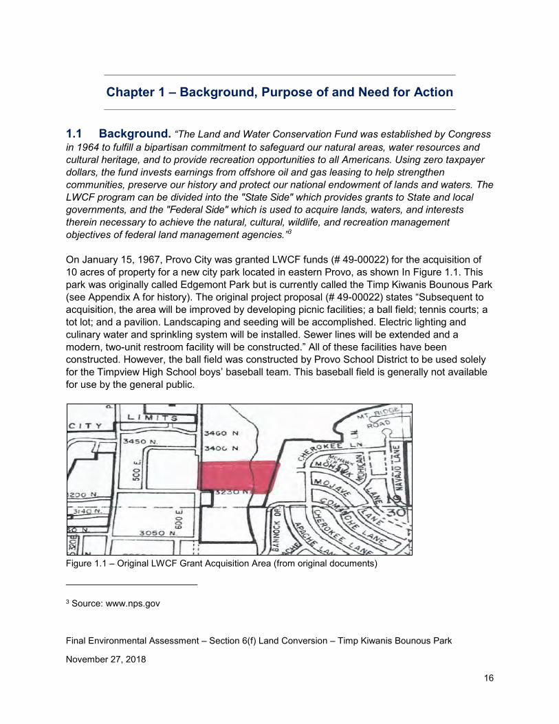
1.1 Background. “The Land and Water Conservation Fund was established by Congress in 1964 to fulfill a bipartisan commitment to safeguard our natural areas, water resources and cultural heritage, and to provide recreation opportunities to all Americans. Using zero taxpayer dollars, the fund invests earnings from offshore oil and gas leasing to help strengthen communities, preserve our history and protect our national endowment of lands and waters. The LWCF program can be divided into the "State Side" which provides grants to State and local governments, and the "Federal Side" which is used to acquire lands, waters, and interests therein necessary to achieve the natural, cultural, wildlife, and recreation management objectives of federal land management agencies.”3 On January 15, 1967, Provo City was granted LWCF funds (# 49-00022) for the acquisition of 10 acres of property for a new city park located in eastern Provo, as shown In Figure 1.1. This park was originally called Edgemont Park but is currently called the Timp Kiwanis Bounous Park (see Appendix A for history). The original project proposal (# 49-00022) states “Subsequent to acquisition, the area will be improved by developing picnic facilities; a ball field; tennis courts; a tot lot; and a pavilion. Landscaping and seeding will be accomplished. Electric lighting and culinary water and sprinkling system will be installed. Sewer lines will be extended and a modern, two-unit restroom facility will be constructed.” All of these facilities have been constructed. However, the ball field was constructed by Provo School District to be used solely for the Timpview High School boys’ baseball team. This baseball field is generally not available for use by the general public.
Figure 1.1 – Original LWCF Grant Acquisition Area (from original documents)
3 Source: www.nps.gov
Final Environmental Assessment – Section 6(f) Land Conversion – Timp Kiwanis Bounous Park
November 27, 2018
17
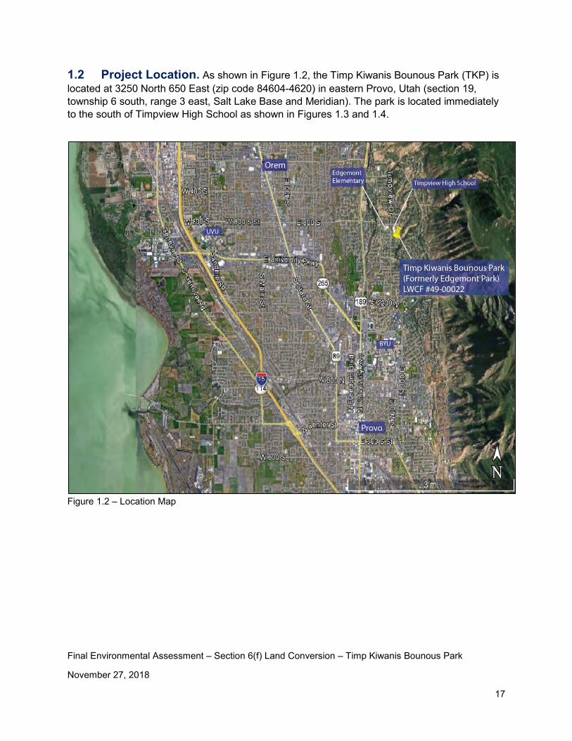
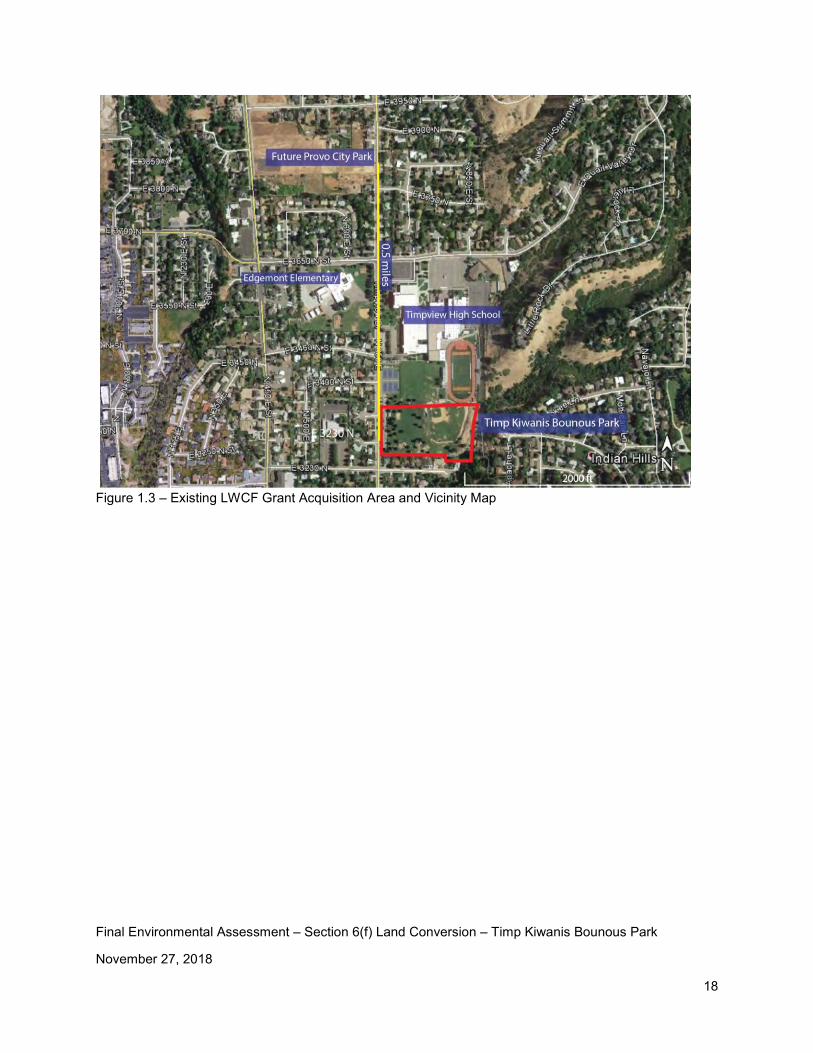
1.2 Project Location. As shown in Figure 1.2, the Timp Kiwanis Bounous Park (TKP) is located at 3250 North 650 East (zip code 84604-4620) in eastern Provo, Utah (section 19, township 6 south, range 3 east, Salt Lake Base and Meridian). The park is located immediately to the south of Timpview High School as shown in Figures 1.3 and 1.4.
Figure 1.2 – Location Map
Final Environmental Assessment – Section 6(f) Land Conversion – Timp Kiwanis Bounous Park
November 27, 2018
18
Figure 1.3 – Existing LWCF Grant Acquisition Area and Vicinity Map
Final Environmental Assessment – Section 6(f) Land Conversion – Timp Kiwanis Bounous Park
November 27, 2018
19
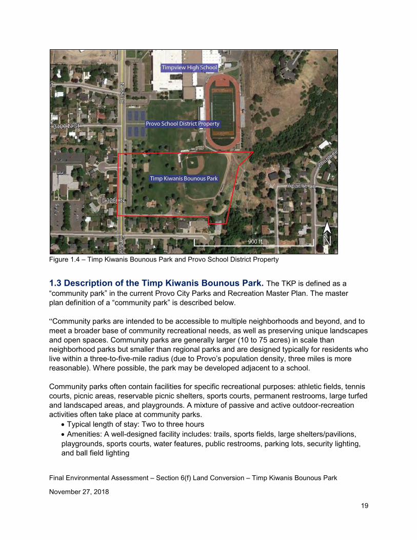
Figure 1.4 – Timp Kiwanis Bounous Park and Provo School District Property
1.3 Description of the Timp Kiwanis Bounous Park. The TKP is defined as a “community park” in the current Provo City Parks and Recreation Master Plan. The master plan definition of a “community park” is described below. “Community parks are intended to be accessible to multiple neighborhoods and beyond, and to meet a broader base of community recreational needs, as well as preserving unique landscapes and open spaces. Community parks are generally larger (10 to 75 acres) in scale than neighborhood parks but smaller than regional parks and are designed typically for residents who live within a three-to-five-mile radius (due to Provo’s population density, three miles is more reasonable). Where possible, the park may be developed adjacent to a school. Community parks often contain facilities for specific recreational purposes: athletic fields, tennis courts, picnic areas, reservable picnic shelters, sports courts, permanent restrooms, large turfed and landscaped areas, and playgrounds. A mixture of passive and active outdoor-recreation activities often take place at community parks.
• Typical length of stay: Two to three hours • Amenities: A well-designed facility includes: trails, sports fields, large shelters/pavilions, playgrounds, sports courts, water features, public restrooms, parking lots, security lighting, and ball field lighting
Final Environmental Assessment – Section 6(f) Land Conversion – Timp Kiwanis Bounous Park
November 27, 2018
20
• Revenue-producing facilities: Limited • Programming: 65% percent active, 35% passive • Signage: Limited signage throughout the park • Landscaping: Landscaping throughout the park • Parking: Sufficient to support optimal usage • Other goals: Community parks can include unique amenities or facilities that may draw users from a larger service area.”
According to the current Provo City Parks and Recreation Master Plan, planned park improvements for the TKP include: updating the pavilion, updating the restrooms, and considering a possible land trade with the Provo School District.
TKP is used by the local community as well as Timpview High School students, as shown from the list of activities below. The following activities occur at this park:
• Picnics and family activities. These activities occur year round. • Public recreational activities including volleyball, tennis, and use of the play area. These
activities occur year-round. • Rest and relaxation. These activities occur year round. • THS boys’ baseball. The baseball field is used regularly March through May. • THS marching band practice. Practices on the grass area summer, fall, and spring. • THS Cross Country. Used about once per week in July-October, for about 10-15 minutes
to stretch and warm up. • THS lacrosse. Use is based upon need in the Spring/Fall . Spring is Feb-May and Fall is
Sept-Nov. • BYU baseball camp. This camp uses the baseball field and is held for one week in July.
This camp is for any youth that wants to increase their abilities in baseball. Many THS students participate in this camp.
• Rocky Mountain Baseball. This is a league that uses the baseball field on some Saturdays in June, July and August to play tournament games. They use the baseball field about twice a month.
• Developmental baseball groups. Little league teams and high school teams from THS that practice during the summer. Practices are mostly Saturdays in July, August and September but they also used on Tuesdays and Thursdays to practice. Not used every week.
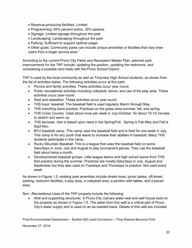
As shown in Figure 1.5, existing park amenities include shade trees, picnic tables, off-street parking, restroom facilities, a play area, a volleyball area, a pavilion with tables, and a paved area. Non –Recreational Uses of the TKP property include the following:
• Well and supporting structures. A Provo City culinary water well and well house exist on the property as shown in Figure 1.5. The water from this well is a critical part of Provo City’s water supply and is used on an as-needed basis. Details of this well are included
Final Environmental Assessment – Section 6(f) Land Conversion – Timp Kiwanis Bounous Park
November 27, 2018
21
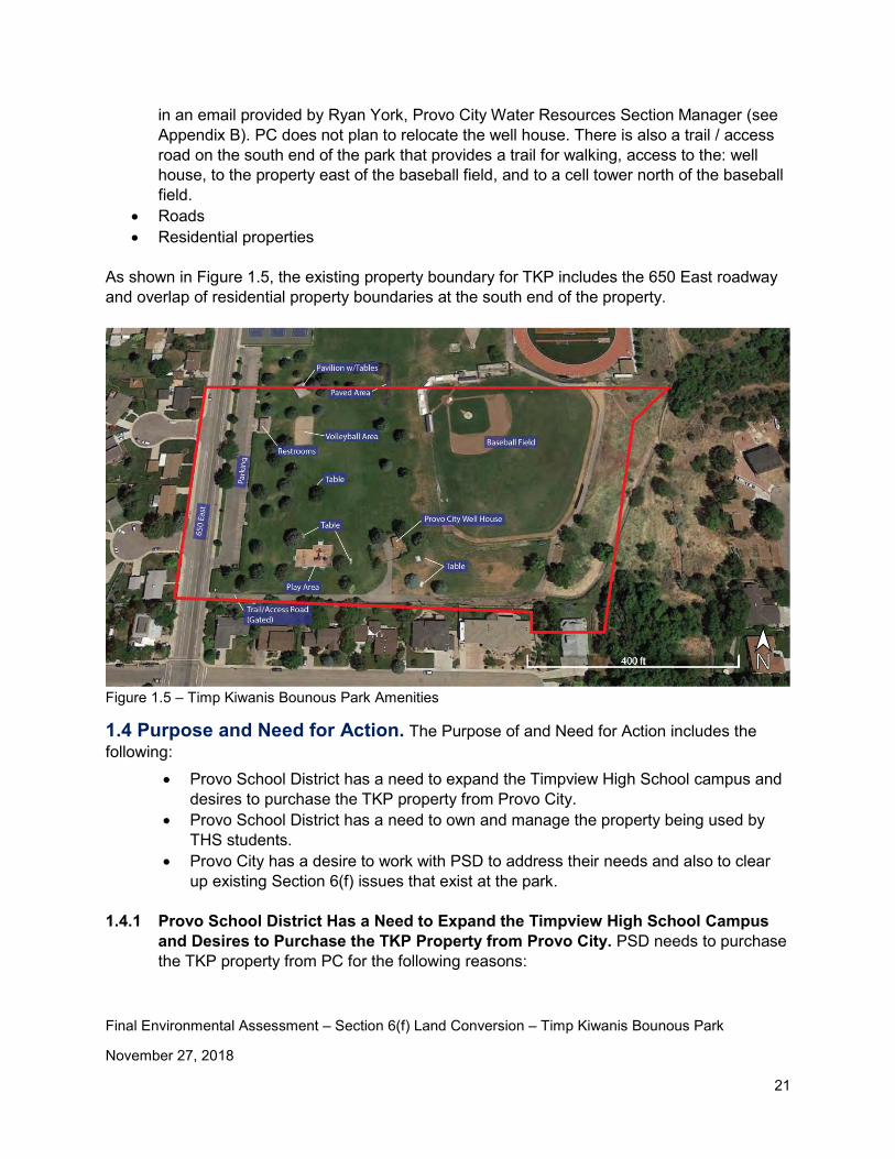
in an email provided by Ryan York, Provo City Water Resources Section Manager (see Appendix B). PC does not plan to relocate the well house. There is also a trail / access road on the south end of the park that provides a trail for walking, access to the: well house, to the property east of the baseball field, and to a cell tower north of the baseball field.
• Roads • Residential properties
As shown in Figure 1.5, the existing property boundary for TKP includes the 650 East roadway and overlap of residential property boundaries at the south end of the property.
Figure 1.5 – Timp Kiwanis Bounous Park Amenities
1.4 Purpose and Need for Action. The Purpose of and Need for Action includes the following:
• Provo School District has a need to expand the Timpview High School campus and desires to purchase the TKP property from Provo City.
• Provo School District has a need to own and manage the property being used by THS students.
• Provo City has a desire to work with PSD to address their needs and also to clear up existing Section 6(f) issues that exist at the park.
1.4.1 Provo School District Has a Need to Expand the Timpview High School Campus and Desires to Purchase the TKP Property from Provo City. PSD needs to purchase the TKP property from PC for the following reasons:
Final Environmental Assessment – Section 6(f) Land Conversion – Timp Kiwanis Bounous Park
November 27, 2018
22
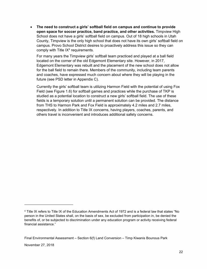
• The need to construct a girls’ softball field on campus and continue to provide open space for soccer practice, band practice, and other activities. Timpview High School does not have a girls’ softball field on campus. Out of 18 high schools in Utah County, Timpview is the only high school that does not have its own girls’ softball field on campus. Provo School District desires to proactively address this issue so they can comply with Title IX4 requirements. For many years the Timpview girls’ softball team practiced and played at a ball field located on the corner of the old Edgemont Elementary site. However, in 2017, Edgemont Elementary was rebuilt and the placement of the new school does not allow for the ball field to remain there. Members of the community, including team parents and coaches, have expressed much concern about where they will be playing in the future (see PSD letter in Appendix C).
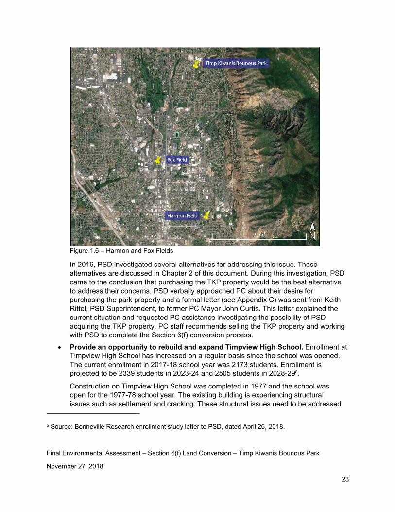
Currently the girls’ softball team is utilizing Harmon Field with the potential of using Fox Field (see Figure 1.6) for softball games and practices while the purchase of TKP is studied as a potential location to construct a new girls’ softball field. The use of these fields is a temporary solution until a permanent solution can be provided. The distance from THS to Harmon Park and Fox Field is approximately 4.2 miles and 2.7 miles, respectively. In addition to Title IX concerns, having players, coaches, parents, and others travel is inconvenient and introduces additional safety concerns.
4 Title IX refers to Title IX of the Education Amendments Act of 1972 and is a federal law that states “No person in the United States shall, on the basis of sex, be excluded from participation in, be denied the benefits of, or be subjected to discrimination under any education program or activity receiving federal financial assistance.”
Final Environmental Assessment – Section 6(f) Land Conversion – Timp Kiwanis Bounous Park
November 27, 2018
23
Figure 1.6 – Harmon and Fox Fields
In 2016, PSD investigated several alternatives for addressing this issue. These alternatives are discussed in Chapter 2 of this document. During this investigation, PSD came to the conclusion that purchasing the TKP property would be the best alternative to address their concerns. PSD verbally approached PC about their desire for purchasing the park property and a formal letter (see Appendix C) was sent from Keith Rittel, PSD Superintendent, to former PC Mayor John Curtis. This letter explained the current situation and requested PC assistance investigating the possibility of PSD acquiring the TKP property. PC staff recommends selling the TKP property and working with PSD to complete the Section 6(f) conversion process.
• Provide an opportunity to rebuild and expand Timpview High School. Enrollment at Timpview High School has increased on a regular basis since the school was opened. The current enrollment in 2017-18 school year was 2173 students. Enrollment is projected to be 2339 students in 2023-24 and 2505 students in 2028-295.
Construction on Timpview High School was completed in 1977 and the school was open for the 1977-78 school year. The existing building is experiencing structural issues such as settlement and cracking. These structural issues need to be addressed
5 Source: Bonneville Research enrollment study letter to PSD, dated April 26, 2018.
Final Environmental Assessment – Section 6(f) Land Conversion – Timp Kiwanis Bounous Park
November 27, 2018
24
to maintain a safe environment for students and teachers. To address these structural issues and the anticipated enrollment growth, PSD is currently investigating the possibility of rebuilding and expanding Timpview High School in the future.
The existing Timpview High School site is 29 acres. Many of the new high schools being built today are on sites in excess of 50 acres. The new Provo High School site is 39 acres. The additional 10 acres of land provided by the TKP property would help PSD address the needs being faced by the continued enrollment growth at Timpview High School. The additional space will also provide a construction a staging area, if needed. It is the intent of the school Board to build/remodel THS around the existing structure, thus leaving the green space necessary for the aforementioned athletic fields.
The following guidelines regarding campus size have been provided to school districts by the Utah State Office of Education. Based upon these guidelines, the size of the THS campus should be 52 acres.
“Size and Location. Although increasing rapidly in cost, land is still one of the least expensive education resources provided for schools. The quantity of land needed for a school facility will vary according to specific local needs, such as the number and ages of pupils, the type of building to be constructed, and the multiple uses of the site for such things as community recreational functions. The size of a school site also depends on the shape, contour, general suitability, and availability of land in the area where the building is to be located. If transportation is readily available, the size of a site is more important than location. Inadequate site size is a major factor in the obsolescence of educational facilities.
The State Office of Education suggests the following site sizes for the various grade levels shown: • K-6 school—10 acres plus one acre for each 100 students • Middle school—20 acres plus one acre for each 100 students • Junior high school—20 acres plus one acre for each 100 students • Senior high school—30 acres plus one acre for each 100 students • Combined 7-12 high school—30 acres plus one acre for each 100 students”
1.4.2 Provo School District has a need to own and manage the property being used by THS students. As previously stated, TKP acts as an extension of THS and is used frequently by THS students. For safety and scheduling reasons, PSD desires to own and manage this area.
• Safety. PSD has a responsibility to provide a safe environment for their students. Recent events throughout the country has highlighted the need to provide an environment where students are safe. Having the ability to manage and control access to the THS campus is an important part of PSD safety plans for THS.
• Scheduling. PSD would like to have the ability to schedule the use of the baseball field and other areas being used by THS students. Currently the property is owned by PC and
Final Environmental Assessment – Section 6(f) Land Conversion – Timp Kiwanis Bounous Park
November 27, 2018
25
is used by PSD. This “sharing“ of the property can create conflicts for both students and the general public.
1.4.3 Provo City has a desire to work with PSD to address their needs and also to clear up existing Section 6(f) issues that exist at the park. Students at THS are also residents of Provo City. Provo City has a desire to work with PSD to investigate the potential for selling the TKP to PSD for the reasons mentioned above. Provo City recognizes the need to follow Section 6(f) guidelines for property conversion. It is the desire or both PC and PSD to minimize impacts to the local community. Steps for minimizing impacts will be discussed later in this environmental assessment.
During the process of investigating the possibility or selling TKP to PSD, PC has discovered some Section 6(f) issues that it would like to clear up. These issues include the following: • The baseball field is operated and maintained by PSD for the THS boy’s baseball team.
There are some other users of the field but it generally does not function as a baseball field that is open for public use.
• The well and well house are not recreational uses and a conversion needs to be completed for these facilities.
• The access road on the south end of the park is not a recreation use. • There are residential properties that are encroaching into park property. PC desires to
correct this situation. • The 650 East roadway is included in the Section 6(f) boundary and is not a recreation use.
Final Environmental Assessment – Section 6(f) Land Conversion – Timp Kiwanis Bounous Park
November 27, 2018
26
Chapter 2 – Alternatives
To satisfy the purpose and need for action, Provo City (PC) and Provo School District (PSD) have undertaken an extensive alternatives development and screening process. A summary of the timeline of events is shown in Table 2.1. Each of the alternatives investigated are discussed in this chapter.
Time Period Action
May 2016 PSD embarks on a search to find a location for a new girls’ softball field and a boys’ baseball field. 11 different locations were investigated as shown in Table 2.2 and Appendix D. None of the sites investigated meet the required criteria. However, additional investigation was completed on two of the sites - Alternatives 6, 10.
August 2016 After an extensive inventory of potential sites for a new boys’ baseball field and girls’ softball field, PSD approaches PC about the possibility of purchasing the Timp Kiwanis Bounous Park property. PC is supportive of this action and agrees to investigate what it would take for this to happen. (see letter in Appendix C)
August 2016 PC begins research on the TKP site and realizes that the park was purchased with LWCF grant funds.
August 2016 PC initiates dialog with Susan Zarekarizi, Utah Land and Water Conservation Fund Coordinator, regarding the possible Section 6(f) conversion of the Timp Kiwanis Bounous Park (TKP) property.
August 2016 PC begins working on the Section 6(f) conversion process for the TKP property. PC hires a consultant, Clegg Consult, to assist them with the conversion process.
September 2016 PC begins investigating potential TKP replacement properties. Properties investigated include: Grandview area, Eastern Provo area, and Southwest Provo area.
September 2016 through September 2018
Evaluation of alternatives takes place. A preferred replacement site for TKP is identified in southwest Provo (Proposed Replacement Site #1). Environmental studies are performed on Proposed Replacement Site #1. A draft environmental assessment is prepared. Public coordination takes place.
Table 2.1 – Alternative Development and Screening Timeline
Final Environmental Assessment – Section 6(f) Land Conversion – Timp Kiwanis Bounous Park
November 27, 2018
27
In addition to the No-Action Alternative, a total of 18 build alternatives have been considered for this project. These build alternatives include the following:
• 11 potential ball park locations that would include a new girls’ softball field and/or a new boys’ baseball field (see Appendix D). These potential ball park locations were investigated by PSD prior to the Section 6(f) conversion process was initiated and are not considered alternatives for TKP, except for Alternative 10. However, they have been included in this document because they help explain the reason the Section 6(f) conversion process was initiated for TKP.
• Three potential new sites for replacing the TKP. • The potential of sharing the boys’ baseball field with the girls’ softball field. • The potential of scheduling the boys’ baseball field so it can be shared with the public. • The potential of sharing the Edgemont Elementary field area. • The potential of using the future Canyon Road Park area.
2.1 No-Action Alternative. The No-Action Alternative would leave things just the way they are. The No-Action Alternative is not a viable option for this project for the following reasons:
• It does not satisfy the need PSD has to construct a girls’ softball field on the THS campus while continuing to provide open space for soccer practice, band practice, and other activities.
• THS is currently on a 29-acre site. Current guidelines recommend a site size of 52 acres for a high school with the enrollment THS currently has. The bottom line, THS need more space.
• It does not allow PSD to own and maintain the property being used for THS students. Due to safety and scheduling reasons, PSD needs to own and maintain this property.
• It does not address the desire PC has to clear up several Section 6(f) compliance issues at the existing TKP site including: the baseball field, the well house, the existing roadways, and residential property encroachments.
2.2 Build Alternatives. A total of 18 build alternatives were investigated during this process. 2.2.1 - 11 Potential Ball Park Locations (investigated by PSD prior to initiation of the Section 6(f) conversion process). As previously mentioned, in 2016 PSD hired FFKR Architects to complete an inventory for potential site locations where a new Timpview boys’ baseball and girls’ softball fields could be built. Criteria for site included the following:
• The site should be located as close to Timpview High School as possible. • The site should have enough space for both a girl’s softball field and a boy’s baseball
field. • The site should have good street access and room for parking.
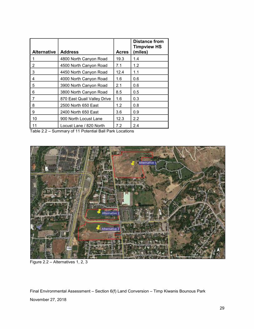
Table 2.2 provides a brief summary of the 11 potential ball park locations (see Figures 2.1 through 2.9). These alternatives went through an informal screening -process (separate from
Final Environmental Assessment – Section 6(f) Land Conversion – Timp Kiwanis Bounous Park
November 27, 2018
28
this conversion process) that was completed by PSD and FFKR in 2016. See Appendix D for original graphics that were prepared in 2016. Of these 11 alternatives, Alternatives 6 and 10 have been investigated further as part of this conversion process. These two alternatives are discussed in more detail below.
Figure 2.1 – 11 Potential Ball Park Locations (investigated by PSD prior to initiation of the Section 6(f) conversion process)
Final Environmental Assessment – Section 6(f) Land Conversion – Timp Kiwanis Bounous Park
November 27, 2018
29
Alternative Address Acres
Distance from Timpview HS (miles)
1 4800 North Canyon Road 19.3 1.4 2 4500 North Canyon Road 7.1 1.2 3 4450 North Canyon Road 12.4 1.1 4 4000 North Canyon Road 1.6 0.6 5 3900 North Canyon Road 2.1 0.6 6 3800 North Canyon Road 8.5 0.5 7 870 East Quail Valley Drive 1.6 0.3 8 2500 North 650 East 1.2 0.8 9 2400 North 650 East 3.6 0.9 10 900 North Locust Lane 12.3 2.2 11 Locust Lane / 820 North 7.2 2.4
Table 2.2 – Summary of 11 Potential Ball Park Locations
Figure 2.2 – Alternatives 1, 2, 3
Final Environmental Assessment – Section 6(f) Land Conversion – Timp Kiwanis Bounous Park
November 27, 2018
30
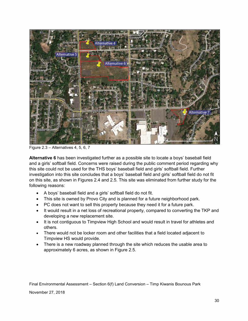
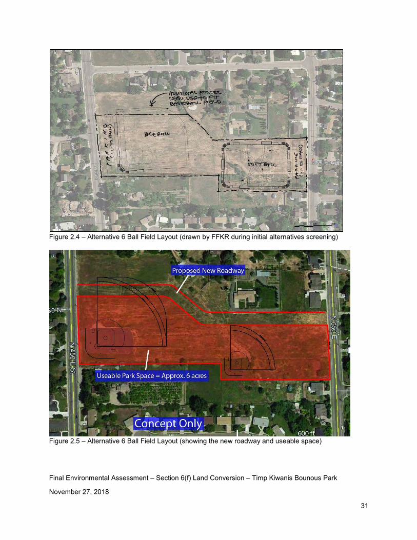
Figure 2.3 – Alternatives 4, 5, 6, 7 Alternative 6 has been investigated further as a possible site to locate a boys’ baseball field and a girls’ softball field. Concerns were raised during the public comment period regarding why this site could not be used for the THS boys’ baseball field and girls’ softball field. Further investigation into this site concludes that a boys’ baseball field and girls’ softball field do not fit on this site, as shown in Figures 2.4 and 2.5. This site was eliminated from further study for the following reasons:
• A boys’ baseball field and a girls’ softball field do not fit. • This site is owned by Provo City and is planned for a future neighborhood park. • PC does not want to sell this property because they need it for a future park. • It would result in a net loss of recreational property, compared to converting the TKP and
developing a new replacement site. • It is not contiguous to Timpview High School and would result in travel for athletes and
others. • There would not be locker room and other facilities that a field located adjacent to
Timpview HS would provide. • There is a new roadway planned through the site which reduces the usable area to
approximately 6 acres, as shown in Figure 2.5.
Final Environmental Assessment – Section 6(f) Land Conversion – Timp Kiwanis Bounous Park
November 27, 2018
31
Figure 2.4 – Alternative 6 Ball Field Layout (drawn by FFKR during initial alternatives screening)
Figure 2.5 – Alternative 6 Ball Field Layout (showing the new roadway and useable space)
Final Environmental Assessment – Section 6(f) Land Conversion – Timp Kiwanis Bounous Park
November 27, 2018
32
Figure 2.6 – Alternatives 8, 9
Figure 2.7 – Alternatives 10, 11
Final Environmental Assessment – Section 6(f) Land Conversion – Timp Kiwanis Bounous Park
November 27, 2018
33
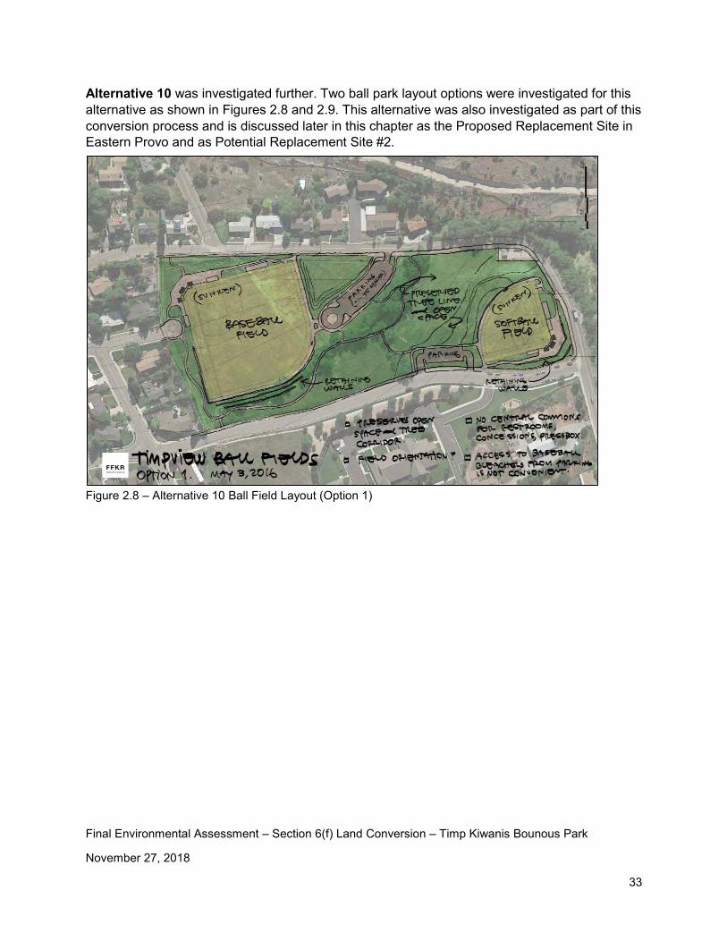
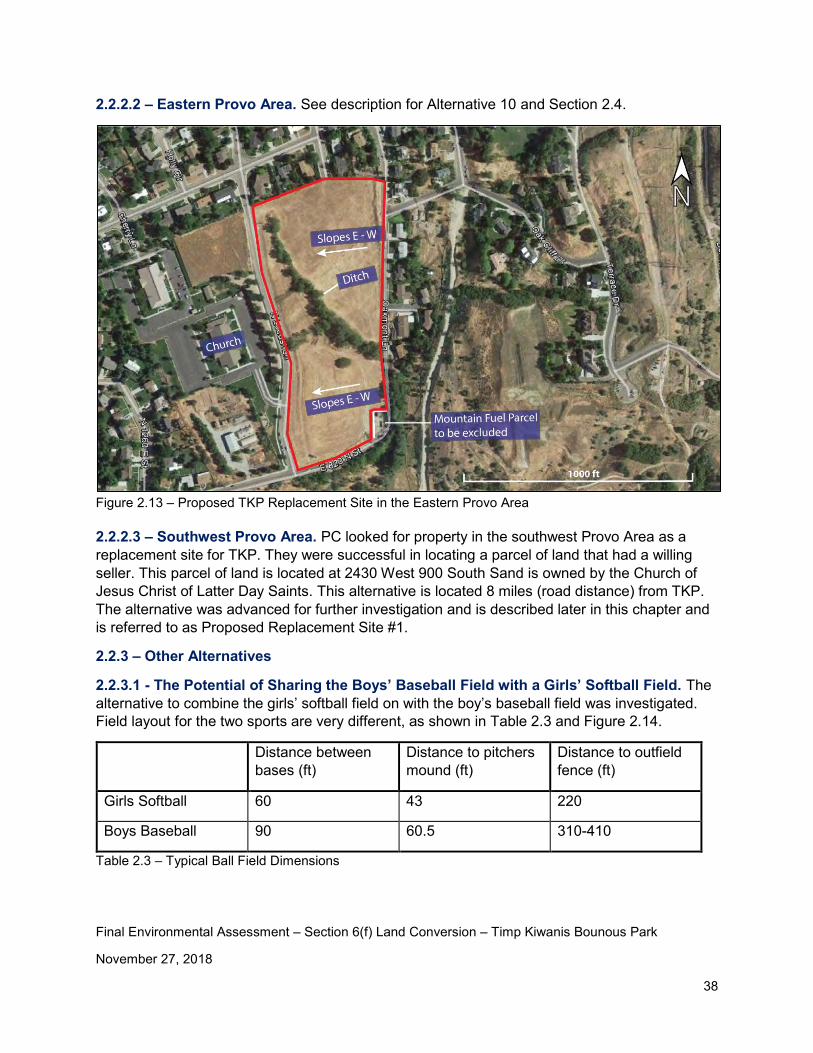
Alternative 10 was investigated further. Two ball park layout options were investigated for this alternative as shown in Figures 2.8 and 2.9. This alternative was also investigated as part of this conversion process and is discussed later in this chapter as the Proposed Replacement Site in Eastern Provo and as Potential Replacement Site #2.
Figure 2.8 – Alternative 10 Ball Field Layout (Option 1)
Final Environmental Assessment – Section 6(f) Land Conversion – Timp Kiwanis Bounous Park
November 27, 2018
34
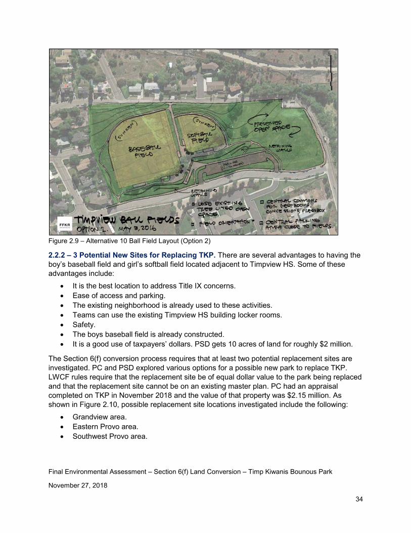
Figure 2.9 – Alternative 10 Ball Field Layout (Option 2)
2.2.2 – 3 Potential New Sites for Replacing TKP. There are several advantages to having the boy’s baseball field and girl’s softball field located adjacent to Timpview HS. Some of these advantages include:
• It is the best location to address Title IX concerns. • Ease of access and parking. • The existing neighborhood is already used to these activities. • Teams can use the existing Timpview HS building locker rooms. • Safety. • The boys baseball field is already constructed. • It is a good use of taxpayers’ dollars. PSD gets 10 acres of land for roughly $2 million.
The Section 6(f) conversion process requires that at least two potential replacement sites are investigated. PC and PSD explored various options for a possible new park to replace TKP. LWCF rules require that the replacement site be of equal dollar value to the park being replaced and that the replacement site cannot be on an existing master plan. PC had an appraisal completed on TKP in November 2018 and the value of that property was $2.15 million. As shown in Figure 2.10, possible replacement site locations investigated include the following:
• Grandview area. • Eastern Provo area. • Southwest Provo area.
Final Environmental Assessment – Section 6(f) Land Conversion – Timp Kiwanis Bounous Park
November 27, 2018
35
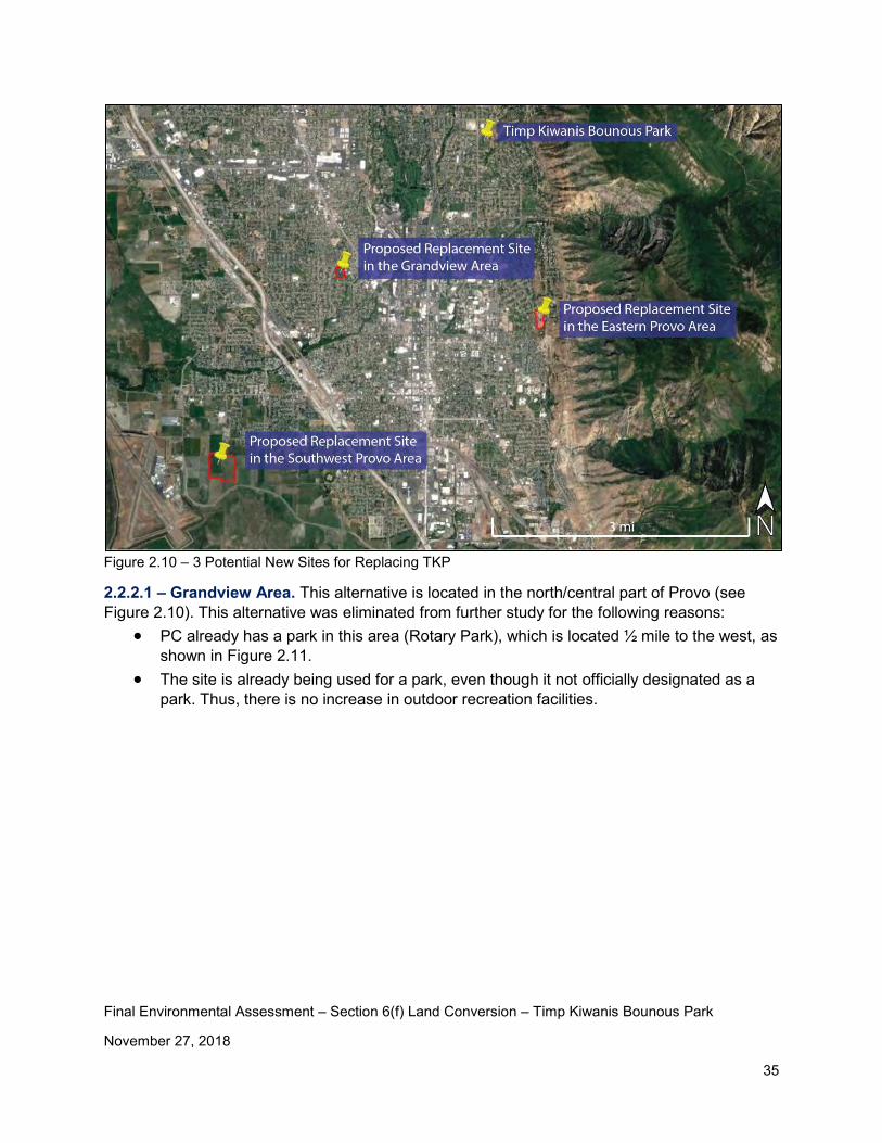
Figure 2.10 – 3 Potential New Sites for Replacing TKP
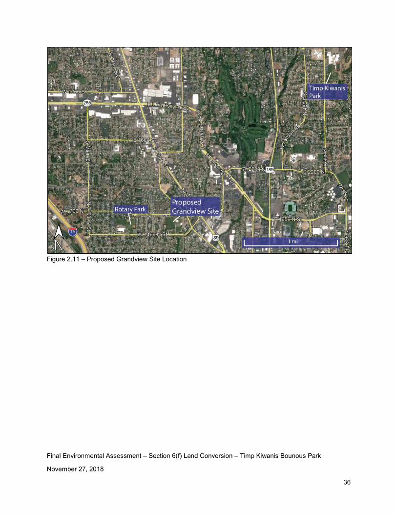
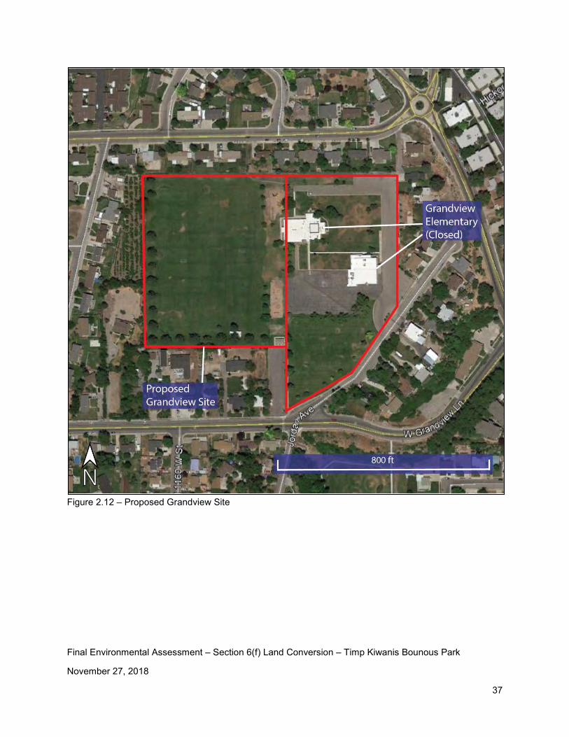
2.2.2.1 – Grandview Area. This alternative is located in the north/central part of Provo (see Figure 2.10). This alternative was eliminated from further study for the following reasons:
• PC already has a park in this area (Rotary Park), which is located ½ mile to the west, as shown in Figure 2.11.
• The site is already being used for a park, even though it not officially designated as a park. Thus, there is no increase in outdoor recreation facilities.
Final Environmental Assessment – Section 6(f) Land Conversion – Timp Kiwanis Bounous Park
November 27, 2018
36
Figure 2.11 – Proposed Grandview Site Location
Final Environmental Assessment – Section 6(f) Land Conversion – Timp Kiwanis Bounous Park
November 27, 2018
37
Figure 2.12 – Proposed Grandview Site
Final Environmental Assessment – Section 6(f) Land Conversion – Timp Kiwanis Bounous Park
November 27, 2018
38
2.2.2.2 – Eastern Provo Area. See description for Alternative 10 and Section 2.4.
Figure 2.13 – Proposed TKP Replacement Site in the Eastern Provo Area 2.2.2.3 – Southwest Provo Area. PC looked for property in the southwest Provo Area as a replacement site for TKP. They were successful in locating a parcel of land that had a willing seller. This parcel of land is located at 2430 West 900 South Sand is owned by the Church of Jesus Christ of Latter Day Saints. This alternative is located 8 miles (road distance) from TKP. The alternative was advanced for further investigation and is described later in this chapter and is referred to as Proposed Replacement Site #1.
2.2.3 – Other Alternatives
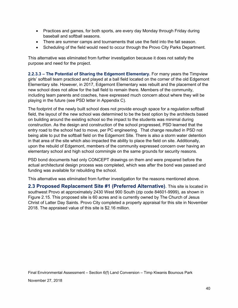
2.2.3.1 - The Potential of Sharing the Boys’ Baseball Field with a Girls’ Softball Field. The alternative to combine the girls’ softball field on with the boy’s baseball field was investigated. Field layout for the two sports are very different, as shown in Table 2.3 and Figure 2.14.
Distance between bases (ft)
Distance to pitchers mound (ft)
Distance to outfield fence (ft)
Girls Softball 60 43 220
Boys Baseball 90 60.5 310-410
Table 2.3 – Typical Ball Field Dimensions

Final Environmental Assessment – Section 6(f) Land Conversion – Timp Kiwanis Bounous Park
November 27, 2018
39
This alternative was eliminated for the following reasons: • This alternative does not meet the purpose and need. Specifically, it does not get the
current ball field into Section 6(f) compliance and it may not resolve the Title IX concerns.
• The practice and playing seasons for each sport overlap. • A temporary outfield fence would need to be installed for girls’ softball. • Scheduling would be difficult. • The infields are typically very different. Baseball is typically grass and softball is typically
dirt. • There would be challenges with the location of the pitcher’s mound and the infield bases.
Figure 2.14 – Girls’ Softball Field Layout on Boys’ Baseball Field
2.2.3.2 – The Potential of Scheduling the Boys’ Baseball Field to be Shared with the Public. This alternative would look at the possibility of scheduling the baseball field so it can be shared with the general public. Sharing the baseball field with the public would help to bring the ball field into Section 6(f) compliance. Below are some scheduling facts:
• Baseball and softball seasons run from the end of February to the end of May. The public would not be able to use the field during this time period due to the heavy school usage.
Final Environmental Assessment – Section 6(f) Land Conversion – Timp Kiwanis Bounous Park
November 27, 2018
40
• Practices and games, for both sports, are every day Monday through Friday during baseball and softball seasons.
• There are summer camps and tournaments that use the field into the fall season. • Scheduling of the field would need to occur through the Provo City Parks Department.
This alternative was eliminated from further investigation because it does not satisfy the purpose and need for the project. 2.2.3.3 – The Potential of Sharing the Edgemont Elementary. For many years the Timpview girls’ softball team practiced and played at a ball field located on the corner of the old Edgemont Elementary site. However, in 2017, Edgemont Elementary was rebuilt and the placement of the new school does not allow for the ball field to remain there. Members of the community, including team parents and coaches, have expressed much concern about where they will be playing in the future (see PSD letter in Appendix C).
The footprint of the newly built school does not provide enough space for a regulation softball field, the layout of the new school was determined to be the best option by the architects based on building around the existing school so the impact to the students was minimal during construction. As the design and construction of the school progressed, PSD learned that the entry road to the school had to move, per PC engineering. That change resulted in PSD not being able to put the softball field on the Edgemont Site. There is also a storm water detention in that area of the site which also impacted the ability to place the field on site. Additionally, upon the rebuild of Edgemont, members of the community expressed concern over having an elementary school and high school commingle on the same grounds for security reasons.
PSD bond documents had only CONCEPT drawings on them and were prepared before the actual architectural design process was completed, which was after the bond was passed and funding was available for rebuilding the school.
This alternative was eliminated from further investigation for the reasons mentioned above.
2.3 Proposed Replacement Site #1 (Preferred Alternative). This site is located in southwest Provo at approximately 2430 West 900 South (zip code 84601-9999), as shown in Figure 2.15. This proposed site is 60 acres and is currently owned by The Church of Jesus Christ of Latter Day Saints. Provo City completed a property appraisal for this site in November 2018. The appraised value of this site is $2.16 million.
Final Environmental Assessment – Section 6(f) Land Conversion – Timp Kiwanis Bounous Park
November 27, 2018
41
Figure 2.15 – Proposed Replacement Site #1 Location Map
Final Environmental Assessment – Section 6(f) Land Conversion – Timp Kiwanis Bounous Park
November 27, 2018
42
Figure 2.16 – Proposed Replacement Site #1
Final Environmental Assessment – Section 6(f) Land Conversion – Timp Kiwanis Bounous Park
November 27, 2018
43
Figure 2.17 – Proposed Replacement Site #1 Concept Plan
Final Environmental Assessment – Section 6(f) Land Conversion – Timp Kiwanis Bounous Park
November 27, 2018
44
2.4 Proposed Replacement Site #2. Proposed Replacement Site #2 (see Figure 2.15) is located at 900 North Locust Lane (zip code 84604-9999) in eastern Provo and is approximately 2.5 miles (road distance) from the Timp Kiwanis Bounous Park (see Figure 2.15). This site is approximately 12 acres and is owned by Brigham Young University. Preliminary recreation plans for this site include typical neighborhood park amenities including pavilions/picnic areas, park area, multi-purpose field, restroom facilities, paths, landscaping, and playground equipment.
This site was chosen because it is within the general area of the TKP, is likely to be of similar dollar value, and Provo School District was familiar with the site. As shown in Figure 2.13 and the photos in Appendix G, this site is currently vacant and covered with weeds. The site slopes steeply from east to west and any improvements to the site would require significant grading. There is a ditch that runs through the northern end of the property. This ditch is lined with mature trees. The very southeast corner of the property is owned by Mountain Fuel (currently Dominion Energy) and includes a building and natural gas pipe work. This piece of the property would not be included as part of the replacement site. This site was eliminated from further consideration as a viable replacement site, and further analysis, for the following reasons:
• It is located in an area of Provo that already has sufficient park coverage, with Kiwanis Park located just two blocks to the west (see Figure 2.13).
• The site consists of steep slopes and would require significant grading to make it a viable park (see Figure 2.13 and Appendix G). The amount of required grading would likely make this alternative cost prohibitive.
• There is a ditch that runs through the park (see Figure 2.13). More information regarding this ditch would need to be obtained to determine the water source, potential wetlands, etc. The ditch would likely need to be piped.
• The site is adjacent to a Mountain Fuel natural gas facility (see Figure 2.13). Having a park located adjacent to this facility is undesirable for visual and safety reasons.
• There have been no discussions with BYU regarding the purchase of this site. BYU may have future plans for the site and may not be a willing seller.
• This site does not meet the intent of Land and Water Conservation Funds and SCORP (page 30) as well as Proposed Replacement Site #1
Provo City’s Kiwanis Park, located two blocks west, has the following amenities8: baseball/softball field, barbeques, fire pits, off-street parking, playground, power, restroom, soccer field, tennis courts, pavilions, and benches.
8 Source: Provo City Parks and Recreation website
Final Environmental Assessment – Section 6(f) Land Conversion – Timp Kiwanis Bounous Park
November 27, 2018
45
Chapter 3 – Affected Environment and Environmental Consequences
A careful review of the environmental resources identified in the Project Development – Environmental Site Form (PDESF) was performed for this project. Based upon review of the PDESF, site visits, and a review of aerial mapping, the following environmental resources were studied to determine what, if any, impact may result from the proposed Section 6(f) conversion.
3.1 Geological Resources Conversion Site: The existing site is located along the east Provo bench. The geology/soils at the site consist of Lake Bonneville sediments and typical valley foothill materials. There will be no direct modifications to the site resulting from this project. However, Provo School District does plan to build a Timpview High School girls’ softball field on part of the site in the future. Additional soil analysis may be performed during design of the site and a geotechnical engineer will be consulted, if needed. Proposed Replacement Site #1: The proposed replacement site is located near the Utah Lake. The geology/soils at the site consist of Lake Bonneville sediments and typical valley fill materials. The geology/soils are not anticipated to have an impact on the proposed development/park. Additional soil analysis will be performed during design of the site and a geotechnical engineer will be consulted.
3.2 Sound (noise impacts) Conversion Site: There may be additional noise impacts at the conversion site as Provo School District constructs a new Timpview High School girls’ softball field. Temporary noise impacts would result from construction activities. Noise resulting from girls’ softball games will be temporary and similar to the noise that already exists from boys’ baseball and football games. Provo School District will comply with Provo City’s noise ordinance. Proposed Replacement Site #1: Noise at this site will consist of construction noise and also noise resulting from sporting activities. The contractor will be required to abide by Provo City’s noise ordinance during construction. Sporting activities will be required to comply with Provo City’s noise ordinance. 3.3 Floodplains Provo City participates in in the National Flood Insurance Program (NFIP) administered by the Federal Emergency Management Agency (FEMA). Communities that participate in the program are evaluated for flood hazard areas and a Flood Insurance Rate Map (FIRM) is developed for that community. In this mapping system, the flood hazard area is based on any area determined to have a 1% chance of being flooded in any given year (a “100-year flood”).
Final Environmental Assessment – Section 6(f) Land Conversion – Timp Kiwanis Bounous Park
November 27, 2018
46
Provo City has established its floodplain ordinances in Chapter 14.33 of the Provo City Code, approved August 4, 2016. Provo City will refer to these ordinances as design and development of the replacement site occurs. Conversion Site: This site is not located within a designated floodplain, as shown in Figure 3.1. However, residents in the area have reported flooding that occurred in the 1980’s from local runoff. Coordination with Provo City Public Works has occurred regarding this issue (see Robert Hunter email in Appendix H). An excerpt from this email is provided in the following two paragraphs. (It should be noted that there was severe flooding in much of Provo City and other locations in Utah in the early 1980’s. This lead to the implementation of additional flood control measures throughout much of the state, including Provo.) “It is our understanding that some located residents stated that sand bagging was required at the Timp-Kiwanis Bounous Park during at least one runoff event in the 1980s. None of our current staff remembers sand bags being needed at Timp-Kiwanis Bounous Park. But if they were needed, it was likely due to overflow in the old irrigation canal located on up the hill and on top of a berm to the east of the park. This irrigation line is old and has significant damage in some locations. During rain storm or high runoff years, the irrigation line may have historically carried some storm runoff getting into the pipe from upstream areas. However, the old irrigation line is no longer used for irrigation, and the pipe has since been intercepted into a City storm drain in Quail Valley Drive north (upstream) of the school site. The City is not aware there are any flows getting to the abandoned section east of the park site since it was intercepted at Quail Valley Drive.
That old irrigation line sits on top of a ±10’ berm that extends across a natural ravine to the east of the south portion of the school’s football field and north portion of the baseball field. This berm would stop and detain/infiltrate flows from development draining to the ravine. An 18” standpipe provides an overflow outfall from the area behind the berm, connecting to an irrigation line that runs through the baseball diamond. The City is unaware that this lower irrigation line has experienced any flooding problems. If any storm flows have made it to the irrigation line from the behind the berm, it is likely they have been very minor since the developed area discharging to the ravine is relatively minor compared to the significant available detention area behind the berm, and to reach the berm and standpipe any flows would run through several hundred to thousands of feet of unlined, natural channel that likely infiltrate some flows.”
Prior to construction activities, if any, occurring on this site, PC will require the owner/developer to submit plans to the city for review of proposed changes and compliance to city regulations. This is another step that will be taken by PC to ensure that flood control on this site is properly addressed.
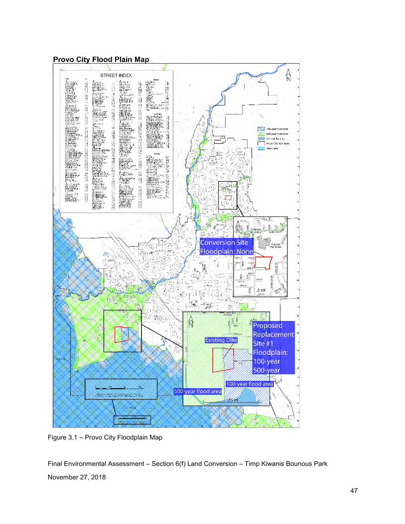
Final Environmental Assessment – Section 6(f) Land Conversion – Timp Kiwanis Bounous Park
November 27, 2018
47
Figure 3.1 – Provo City Floodplain Map
Final Environmental Assessment – Section 6(f) Land Conversion – Timp Kiwanis Bounous Park
November 27, 2018
48
Proposed Replacement Site #1: This proposed replacement site is located within both Zones A and B of Provo FIRM dated September 30, 1988 (the most current FIRM) as shown in Figure 3.1. Zone A is considered a special flood hazard area and the definition of Zone A is “the area that will be inundated by the flood event having a 1-percent chance of being equaled or exceeded in any given year. The 1-percent annual chance flood is also referred to as the base flood or 100-year flood.”9 Zone B is considered a moderate flood area and is defined as “an area between the limits of the base flood and the 0.2-percent-annual-chance (or 500-year) flood.”5
There is an existing dike (levee) that runs north-south the entire length of the proposed mitigation site (see Figure 3.2). This dike has historically helped to manage flooding in the area. As part of this project, the dike will be relocated to the eastern edge of the property and the new roadway (2430 West) will be constructed on the dike. Moving this dike will help to minimize flooding at the site. Provo City will work with FEMA to change the floodplain zoning in this area.
The water elevation of the Utah Lake is carefully controlled and monitored to avoid flooding. Several flood control measures, which include storing water at Jordanelle Reservoir and Deer Creek Reservoir, are in place to control the flow of water in the Provo River and Utah Lake. In addition, this site is bordered on the south and west by the Provo City Lakeshore Connector roadway. This roadway was built to act as a dike for Utah Lake. No flooding impacts to the site are anticipated.
9 Source: Fema.gov/flood-zones
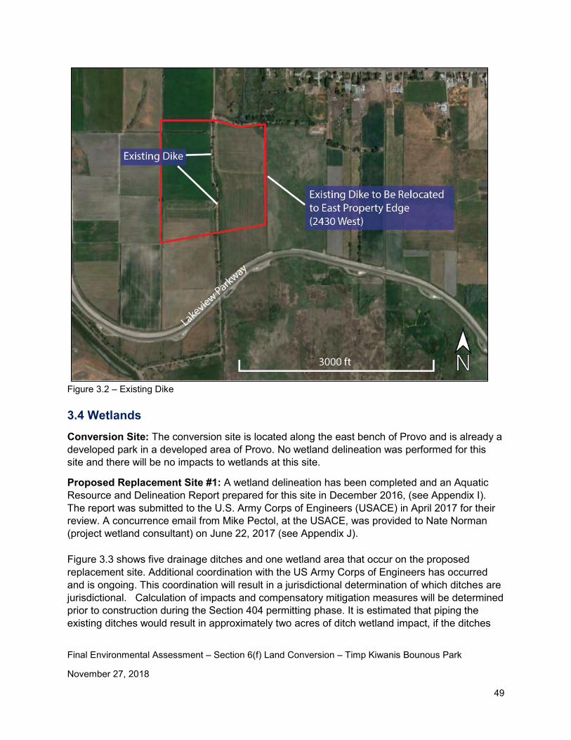
Final Environmental Assessment – Section 6(f) Land Conversion – Timp Kiwanis Bounous Park
November 27, 2018
49
Figure 3.2 – Existing Dike 3.4 Wetlands
Conversion Site: The conversion site is located along the east bench of Provo and is already a developed park in a developed area of Provo. No wetland delineation was performed for this site and there will be no impacts to wetlands at this site.
Proposed Replacement Site #1: A wetland delineation has been completed and an Aquatic Resource and Delineation Report prepared for this site in December 2016, (see Appendix I). The report was submitted to the U.S. Army Corps of Engineers (USACE) in April 2017 for their review. A concurrence email from Mike Pectol, at the USACE, was provided to Nate Norman (project wetland consultant) on June 22, 2017 (see Appendix J).
Figure 3.3 shows five drainage ditches and one wetland area that occur on the proposed replacement site. Additional coordination with the US Army Corps of Engineers has occurred and is ongoing. This coordination will result in a jurisdictional determination of which ditches are jurisdictional. Calculation of impacts and compensatory mitigation measures will be determined prior to construction during the Section 404 permitting phase. It is estimated that piping the existing ditches would result in approximately two acres of ditch wetland impact, if the ditches

Final Environmental Assessment – Section 6(f) Land Conversion – Timp Kiwanis Bounous Park
November 27, 2018
50
along the west side of the project area (D3 and D5) are avoided. A Section 404 permit could be avoided if the sports complex can be designed to avoid piping the ditches. Potential mitigation for wetland impacts could include re-routing the ditches as open water features instead of piping, using credits from Provo City’s existing wetland bank, or locating another suitable mitigation site to create wetlands. Table 3.1 shows lists the aquatic resources located within the study area.
Name Area
(Acres) Cowardin Width (feet)
Length (feet) Latitude Longitude
W1 0.621 PEM 40.22331 -111.701
D1 1.175 R4SB 20 2,559 40.22024 -111.704
D2a 0.276 R4SB 10 1,201 40.21821 -111.704
D2b 0.274 R4SB 4 2,983 40.22428 -111.704
D3 0.418 R4SB 6 3,038 40.21899 -111.707
D4 0.501 R4SB 30 727 40.22318 -111.706
D5 0.720 R4SB 15 2,092 40.22605 -111.707
Total 3.985 12,600
Table 3.1 – Aquatic Resources within the Survey Area
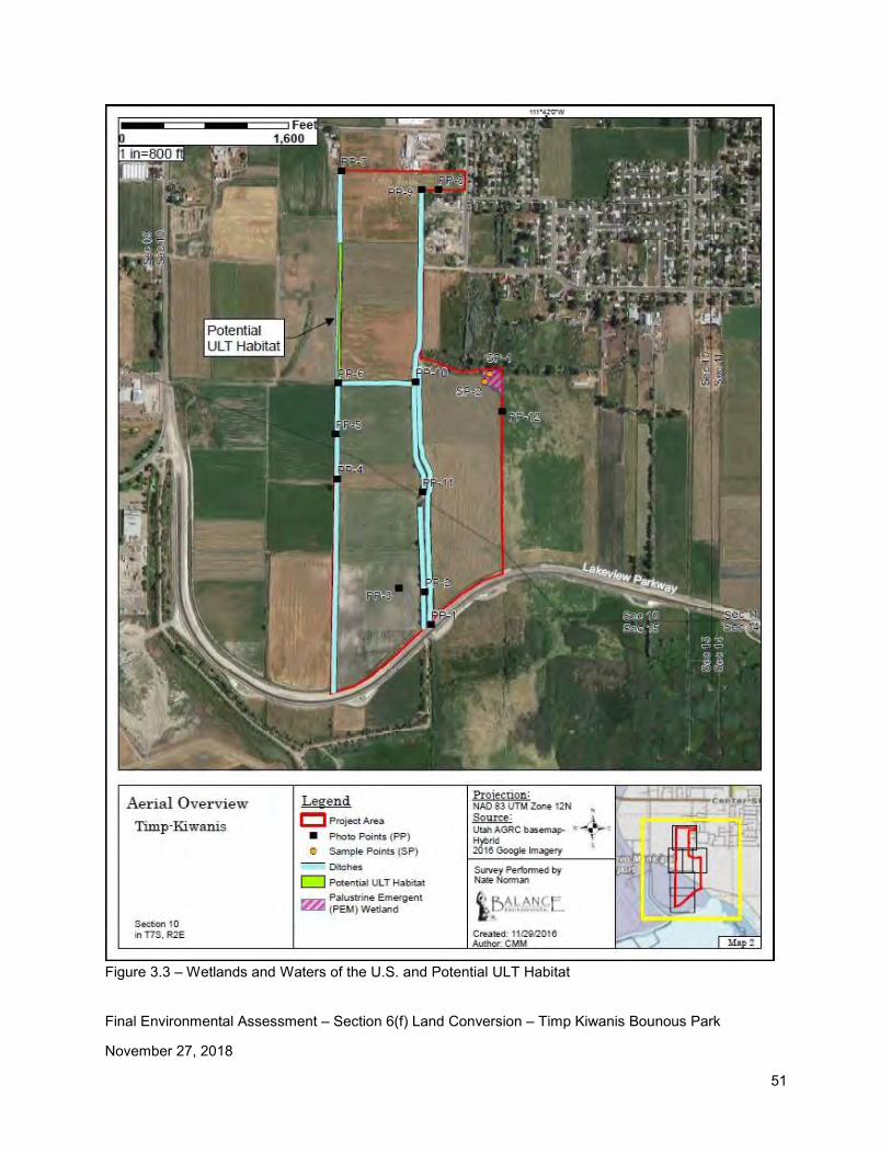
Final Environmental Assessment – Section 6(f) Land Conversion – Timp Kiwanis Bounous Park
November 27, 2018
51
Figure 3.3 – Wetlands and Waters of the U.S. and Potential ULT Habitat
Final Environmental Assessment – Section 6(f) Land Conversion – Timp Kiwanis Bounous Park
November 27, 2018
52
3.5 Land Use / Ownership Patterns In Provo City, parks are considered a “conditional use” and do not require zoning changes. Zoning changes occur through the general plan updating process which includes a public involvement component. For this document, only existing land uses are identified. Conversion Site: The conversion site is zoned PF as shown on the Provo City Zoning Map (Figure 3.4). Zone PF is defined as “Public Facilities Zone: Areas of a minimum 10,000 square feet for the establishment of facilities which are maintained in public and quasi-public ownership; i.e. schools, universities, hospitals, parks and recreation, utilities, etc.” Land use in the area is residential housing, Timpview High School, Edgemont Elementary School, and Timp Kiwanis Bounous Park. Based upon the county records 2018 random property values in the area range from approximately $176,000 to $1.5 million. Proposed Replacement Site #1: Proposed replacement site #1 is zoned A120 as shown on the Provo City Zoning Map (Figure 3.4). Zone A120 is defined as “Agricultural Zone: Principal uses include agricultural pursuits, unrestricted animal rights, and one family detached dwellings. Minimum lot size varies according to sub-zone: A1.20 ~ 20 acres.” Provo City plans to re-zone the site to PF once they own the property. Current land use in the area is agricultural land and residential housing. Based upon the county records, 2018 random property values in the area are approximately $60,000 per acre for agricultural land. Residential property ranges from approximately $220,000 to $345,000. It should be noted that the size of residential lots varies widely in this area.
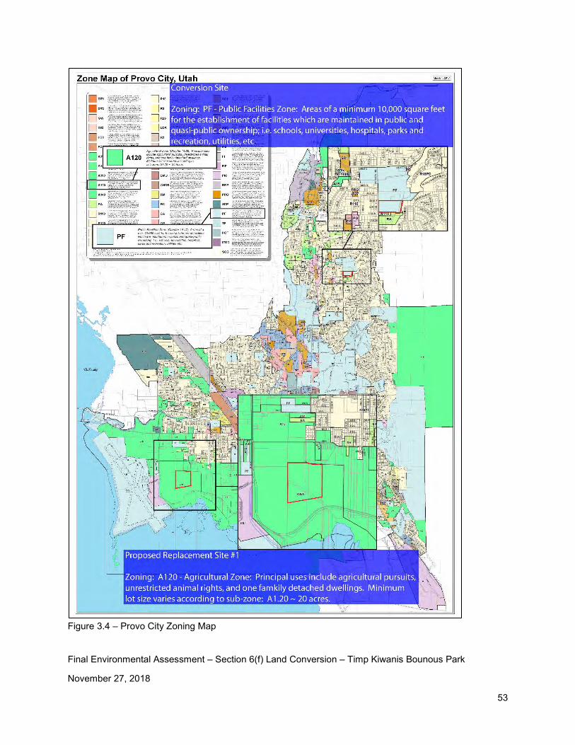
Final Environmental Assessment – Section 6(f) Land Conversion – Timp Kiwanis Bounous Park
November 27, 2018
53
Figure 3.4 – Provo City Zoning Map
Final Environmental Assessment – Section 6(f) Land Conversion – Timp Kiwanis Bounous Park
November 27, 2018
54
3.6 Circulation / Transportation
Conversion Site: This site is easily accessible and is accessed from 650 East. As shown in Figure 1.4, there is off-site parking for park users. Proposed Replacement Site #1: Access to the proposed replacement site will be from 2430 West as shown in Figure 2.16. 2430 West can be accessed from Lakeview Parkway or from 560 South. 3.7 Plant / Animal / Fish Species of Special Concern and Habitat Conversion Site: Coordination with the Utah Division of Wildlife Resources (UDWR) indicates that they do not have records of occurrence for any threatened, endangered, or sensitive species near this site (see Appendix K).
Proposed Replacement Site #1: Coordination with the Utah Division of Wildlife Resources indicates recent records of occurrence for the following species of special concern (see Appendix K).
Within a ½ mile radius UDWR has recent records for the occurrence of the American white pelican and long-billed curlew, and historical records of occurrence for California floater. In addition, within a two-mile radius there are recent records of occurrence for June sucker and yellow-billed cuckoo, and historical records for Columbia spotted frog.
American white pelican, within a ½ mile radius of the site. The American white pelican is a state wildlife species of concern (see Appendix K). Additional follow up with Mark Farmer10 indicates that there have been no specific siting’s of the American white pelican on this site. There will be no impact to the American white pelican resulting from this project.
Long-billed curlew, within a ½ mile radius of the site. Coordination with Shane Hill, Utah Division of Wildlife Resources, indicates that there would be no additional impact to Long-billed curlew habitat resulting resulting from this project.
California floater, within a ½ mile radius of the site. There will be no impact to the long-billed curlew resulting from this project.
June Sucker, within a two- mile radius of the site. The June Sucker is a federally listed endangered species and is endemic to Utah Lake and the Provo River. Discussion11 with Mark Farmer at the Utah Division of Wildlife Resources indicated that there will be no impact to the June Sucker resulting from this project because the project does not impact the Provo River.
Yellow-billed cuckoo, within a two-mile radius of the site. The Yellow-billed cuckoo is a federally listed endangered species. Additional follow up with Mark Farmer indicates that there have been
10 Email correspondence from Ron Clegg to Mark Farmer on April 26, 2017
11 Telephone conversation between Ron Clegg and Mark Farmer on December 6, 2016.
Final Environmental Assessment – Section 6(f) Land Conversion – Timp Kiwanis Bounous Park
November 27, 2018
55
no specific siting’s of the Yellow-billed cuckoo on this site. There will be no impact to the Yellow-billed cuckoo resulting from this project.
There are also historical records of occurrence of the Colombian spotted frog within a two-mile radius of the site. The Colombian spotted is a species receiving special management under a Conservation Agreement in order to preclude the need for federal listing. Additional follow up with Mark Farmer indicates that there have been no specific siting’s of the Colombian spotted frog on this site. There will be no impact to the Colombian spotted frog resulting from this project.
In addition, there are recent records of occurrence for Ute Ladies’ tresses, a federally listed threatened plant. A Ute Ladies’ tresses (Sprianthes diluvialis) survey was completed on November 23, 2016, not during the blooming season, as part of this study (see Appendix L). The results of the survey are stated in the paragraph below.
“A small area of potential habitat was located during the survey. The area is along a ditch that is not downcut or overgrown by thick vegetation. It is dominated by grasses and sedges that are occasionally found with Spiranthes. Although this area is low potential habitat, it could not be disqualified. Therefore, this area should be surveyed again during the ULT blooming season. Overall, the site is largely disturbed and unlikely to support ULT.” Figure 3.5 shows the potential ULT habitat location and the potential impact area.
Further coordination has occurred with the Reeta Reber, US Fish and Wildlife Service, regarding the potential ULT habitat. Reeta recommends that ULT surveys be completed during the growing season (July-August) for three consecutive years (two years of surveys have already been performed with no plants found) to determine the existence of the plants. Provo City is planning to complete the third ULT survey in July-August of 2019.
Provo City may also choose to avoid impacting the potential ULT habitat area. This option will be investigated during design of the site.
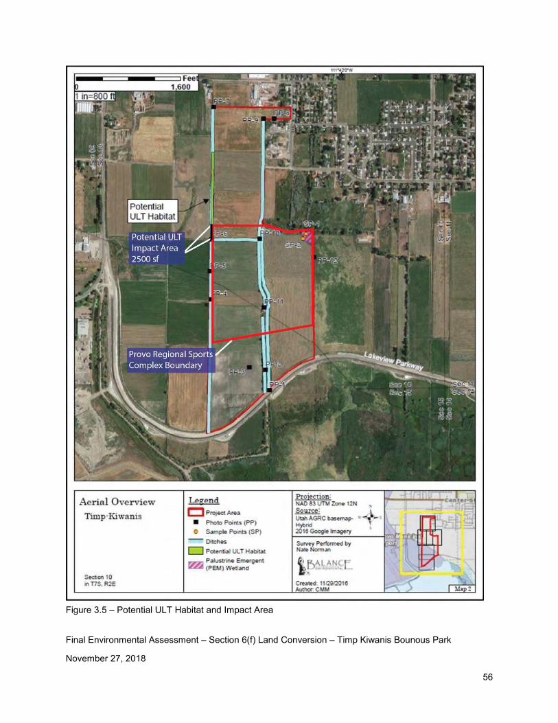
Final Environmental Assessment – Section 6(f) Land Conversion – Timp Kiwanis Bounous Park
November 27, 2018
56
Figure 3.5 – Potential ULT Habitat and Impact Area
Final Environmental Assessment – Section 6(f) Land Conversion – Timp Kiwanis Bounous Park
November 27, 2018
57
3.8 Recreation Resources, Land, Parks, Open Space, Conservation Areas, Trails, Facilities, Services, Opportunities, Public Access Conversion Site: As mentioned in Chapter 1, the TKP is defined as a “community park” in the current Provo City Parks and Recreation Master Plan. The master plan definition of a “community park” is described below. “Community parks are intended to be accessible to multiple neighborhoods and beyond, and to meet a broader base of community recreational needs, as well as preserving unique landscapes and open spaces. Community parks are generally larger (10 to 75 acres) in scale than neighborhood parks but smaller than regional parks and are designed typically for residents who live within a three-to-five-mile radius (due to Provo’s population density, three miles is more reasonable). Where possible, the park may be developed adjacent to a school. Community parks often contain facilities for specific recreational purposes: athletic fields, tennis courts, picnic areas, reservable picnic shelters, sports courts, permanent restrooms, large turfed and landscaped areas, and playgrounds. A mixture of passive and active outdoor-recreation activities often take place at community parks.
• Typical length of stay: Two to three hours • Amenities: A well-designed facility includes: trails, sports fields, large shelters/pavilions, playgrounds, sports courts, water features, public restrooms, parking lots, security lighting, and ball field lighting • Revenue-producing facilities: Limited • Programming: 65% active, 35% passive • Signage: Limited signage throughout the park • Landscaping: Landscaping throughout the park • Parking: Sufficient to support optimal usage • Other goals: Community parks can include unique amenities or facilities that may draw users from a larger service area.”
According to the current Provo City Parks and Recreation Master Plan, planned park improvements for the TKP include: updating the pavilion, updating the restrooms, and considering a possible land trade with the Provo School District.
TKP is used by the local community as well as Timpview High School students. The following activities occur at this park: picnics and family activities; recreational activities including volleyball, tennis, and use of the play area; rest and relaxation; Timpview High School boys’ baseball; and Timpview High School marching band practice. Provo City also plans to build a new park, Canyon Road Park, located at 3800 North Canyon Road as shown in Figure 3.5. Construction of the Canyon Road Park is currently planned for 2024-2025 in the current Provo City Capital Improvement Plan. Due to the importance of
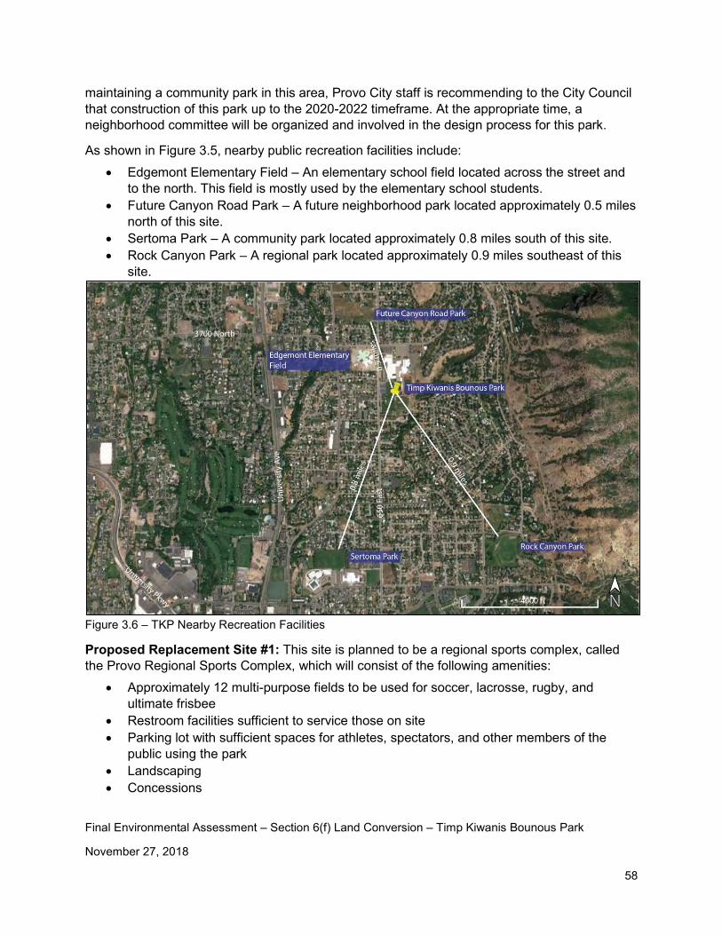
Final Environmental Assessment – Section 6(f) Land Conversion – Timp Kiwanis Bounous Park
November 27, 2018
58
maintaining a community park in this area, Provo City staff is recommending to the City Council that construction of this park up to the 2020-2022 timeframe. At the appropriate time, a neighborhood committee will be organized and involved in the design process for this park.
As shown in Figure 3.5, nearby public recreation facilities include: • Edgemont Elementary Field – An elementary school field located across the street and
to the north. This field is mostly used by the elementary school students. • Future Canyon Road Park – A future neighborhood park located approximately 0.5 miles
north of this site. • Sertoma Park – A community park located approximately 0.8 miles south of this site. • Rock Canyon Park – A regional park located approximately 0.9 miles southeast of this
site.
Figure 3.6 – TKP Nearby Recreation Facilities
Proposed Replacement Site #1: This site is planned to be a regional sports complex, called the Provo Regional Sports Complex, which will consist of the following amenities:
• Approximately 12 multi-purpose fields to be used for soccer, lacrosse, rugby, and ultimate frisbee
• Restroom facilities sufficient to service those on site • Parking lot with sufficient spaces for athletes, spectators, and other members of the
public using the park • Landscaping • Concessions
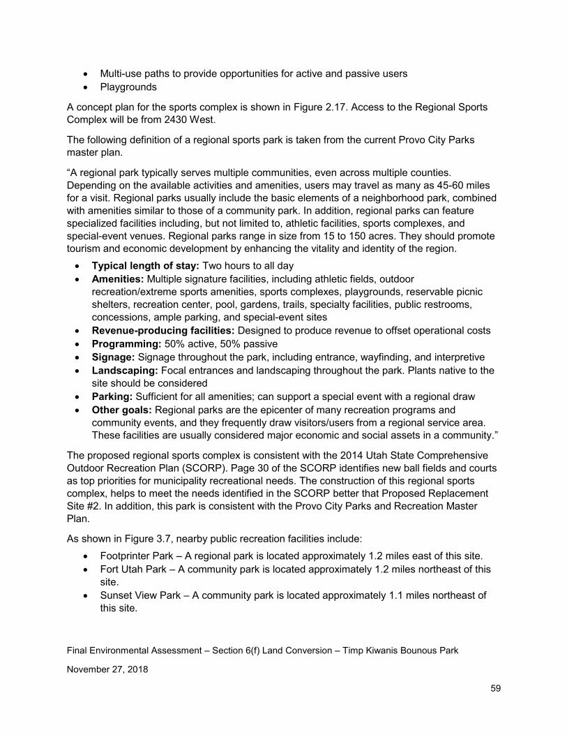
Final Environmental Assessment – Section 6(f) Land Conversion – Timp Kiwanis Bounous Park
November 27, 2018
59
• Multi-use paths to provide opportunities for active and passive users • Playgrounds
A concept plan for the sports complex is shown in Figure 2.17. Access to the Regional Sports Complex will be from 2430 West.
The following definition of a regional sports park is taken from the current Provo City Parks master plan.
“A regional park typically serves multiple communities, even across multiple counties. Depending on the available activities and amenities, users may travel as many as 45-60 miles for a visit. Regional parks usually include the basic elements of a neighborhood park, combined with amenities similar to those of a community park. In addition, regional parks can feature specialized facilities including, but not limited to, athletic facilities, sports complexes, and special-event venues. Regional parks range in size from 15 to 150 acres. They should promote tourism and economic development by enhancing the vitality and identity of the region.
• Typical length of stay: Two hours to all day • Amenities: Multiple signature facilities, including athletic fields, outdoor
recreation/extreme sports amenities, sports complexes, playgrounds, reservable picnic shelters, recreation center, pool, gardens, trails, specialty facilities, public restrooms, concessions, ample parking, and special-event sites
• Revenue-producing facilities: Designed to produce revenue to offset operational costs • Programming: 50% active, 50% passive • Signage: Signage throughout the park, including entrance, wayfinding, and interpretive • Landscaping: Focal entrances and landscaping throughout the park. Plants native to the
site should be considered • Parking: Sufficient for all amenities; can support a special event with a regional draw • Other goals: Regional parks are the epicenter of many recreation programs and
community events, and they frequently draw visitors/users from a regional service area. These facilities are usually considered major economic and social assets in a community.”
The proposed regional sports complex is consistent with the 2014 Utah State Comprehensive Outdoor Recreation Plan (SCORP). Page 30 of the SCORP identifies new ball fields and courts as top priorities for municipality recreational needs. The construction of this regional sports complex, helps to meet the needs identified in the SCORP better that Proposed Replacement Site #2. In addition, this park is consistent with the Provo City Parks and Recreation Master Plan.
As shown in Figure 3.7, nearby public recreation facilities include: • Footprinter Park – A regional park is located approximately 1.2 miles east of this site. • Fort Utah Park – A community park is located approximately 1.2 miles northeast of this
site. • Sunset View Park – A community park is located approximately 1.1 miles northeast of
this site.
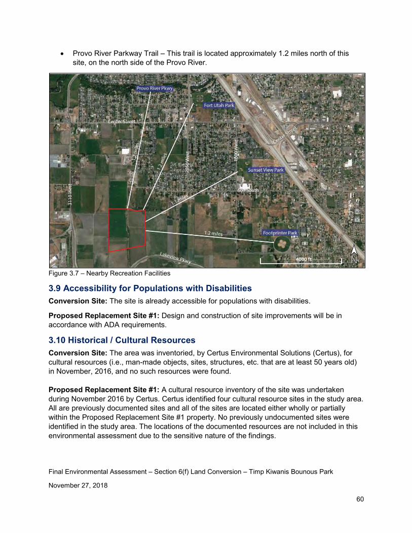
Final Environmental Assessment – Section 6(f) Land Conversion – Timp Kiwanis Bounous Park
November 27, 2018
60
• Provo River Parkway Trail – This trail is located approximately 1.2 miles north of this site, on the north side of the Provo River.
Figure 3.7 – Nearby Recreation Facilities
3.9 Accessibility for Populations with Disabilities Conversion Site: The site is already accessible for populations with disabilities.
Proposed Replacement Site #1: Design and construction of site improvements will be in accordance with ADA requirements.
3.10 Historical / Cultural Resources Conversion Site: The area was inventoried, by Certus Environmental Solutions (Certus), for cultural resources (i.e., man-made objects, sites, structures, etc. that are at least 50 years old) in November, 2016, and no such resources were found. Proposed Replacement Site #1: A cultural resource inventory of the site was undertaken during November 2016 by Certus. Certus identified four cultural resource sites in the study area. All are previously documented sites and all of the sites are located either wholly or partially within the Proposed Replacement Site #1 property. No previously undocumented sites were identified in the study area. The locations of the documented resources are not included in this environmental assessment due to the sensitive nature of the findings.
Final Environmental Assessment – Section 6(f) Land Conversion – Timp Kiwanis Bounous Park
November 27, 2018
61
There has been extensive coordination with the Utah State Historic Preservation Office (SHPO) regarding cultural resources at this site. Coordination with the SHPO is ongoing and will continue throughout the duration of this conversion process. Measures to avoid adverse effects to the sites include the following: • Recreational facilities will be located such that those requiring deeper excavation are not
located on known sites. • Ground disturbance will be limited to areas of existing fill and the previously disturbed “plow
zone” wherever possible. • Fill material will be used to raise the level of the ground surface to hold the recreational
facilities and allow for placement of at least some utilities entirely within the fill material. • Deeper utility trenching will be consolidated into a single corridor between known surface
manifestations of archaeological sites and use fill material to minimize excavation into previously undisturbed subsurface deposits.
• Implementing a pre-construction collection of a sample of surface artifacts already disinterred from their original locations by past agricultural activity (e.g., plowing)
• Construction documents will require the contractor to stop work and notify Provo City if cultural resources are discovered during construction.
• Archaeological monitoring will be employed during ground disturbance to address discoveries prior to adverse effects: o Clearly define boundaries of area subject to monitoring. o Provide instruction to construction crews on archaeological resource sensitivity and need
for and purpose of monitoring; consider including clauses in construction contracts requiring compliance with monitoring.
o Ground disturbance in materials other than known fill (modern or historic) will be monitored.
o Develop and implement a detailed monitoring plan to establish definitions of discoveries, describe procedures for addressing discoveries, define artifact collection and curation processes, outline conditions for work stoppages, and assign roles and authorities
o Include protocols for addressing discoveries of human remains
3.11 Minority / Low-Income Populations Conversion Site: As mentioned in Section 3.5, land use in the area is generally high-end residential housing. Based upon the county records, 2018 random property values in the area range from approximately $176,000 to $1.5 million.
Proposed Replacement Site #1: As mentioned in Section 3.5, land use in the area is medium-end residential housing. Based upon county records, 2018 random property values in the area range from approximately $220,000 to $345,000.
Review of county records and census data indicates that there will be no adverse impacts to minority or low-income populations resulting from building a regional sports complex at this site.
Final Environmental Assessment – Section 6(f) Land Conversion – Timp Kiwanis Bounous Park
November 27, 2018
62
3.12 Land / Structures with History of Contamination / Hazardous Materials Conversion Site: A review of the State of Utah environmental databases was performed as part of this study. No contamination or hazardous materials were identified in that review.
Proposed Replacement Site #1: A review of the State of Utah environmental databases was performed as part of this study. No contamination or hazardous materials were identified in that review.
3.13 Water Resources Conversion Site: A Provo City culinary water well and well house exist on the property as shown in Figures 1.5 and 3.8. The water from this well is a critical part of Provo City’s water supply and is used on an as-needed basis. Details of this well are included in an email provided by Ryan York, Provo City Water Resources Section Manager (see Appendix B). PC does not plan to relocate the well house. There is a 100’ radius well protection zone (Zone 1) that is required around the well head (see Figure 3.8). No structures are allowed within Zone 1. Construction activities within Zone 2 (generally the entire TKP, THS, and both the football and baseball fields) are required to be reviewed by PC.
Proposed Replacement Site #1: A concern was raised during the public comment period regarding the potential impact fertilizer may have on the Utah Lake algae bloom. As follow up to this comment, Rebecca Andrus (Principal Engineer at Provo City Water Resources) was contacted regarding this issue. The following summarizes the items discussed:
• The potential to impact Utah Lake algae bloom is no greater from a park than from farming practices. Both use fertilizer (a nutrient).
• PC will use Best Management Practices as they design and maintain the site, including designing the park to avoid direct runoff into Utah Lake, not fertilizing during a rain storm, etc.
• PC is part of a Utah Lake Water Quality Study that is being completed by the State of Utah
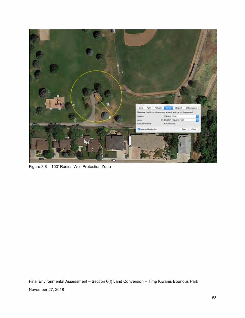
Final Environmental Assessment – Section 6(f) Land Conversion – Timp Kiwanis Bounous Park
November 27, 2018
63
Figure 3.8 – 100’ Radius Well Protection Zone
Final Environmental Assessment – Section 6(f) Land Conversion – Timp Kiwanis Bounous Park
November 27, 2018
64
Chapter 4 – Consultation and Coordination
Consultation and coordination on this project includes the following:
• Ongoing and frequent coordination with Susan Zarekarizi at the Utah Division of Parks and Recreation.
• Coordination with resource agencies including the following: o The Utah State Historic Preservation Office – cultural resources o The Utah Division of Wildlife Resources – threatened or endangered species o U.S. Fish and Wildlife Service – Ute Ladies Tresses o U.S. Army Corps of Engineers – Wetlands and Waters of the U.S.
• Coordination with the public: o Neighborhood meetings o Emails and phone calls o Provo City Council meetings o Provo City School District board meetings o Public comment period on the original Draft Environmental Assessment o Public comment period on the Revised Draft Environmental Assessment o Two public hearings
Final Environmental Assessment – Section 6(f) Land Conversion – Timp Kiwanis Bounous Park
November 27, 2018
65
List of Preparers
The following people contributed to the development of this environmental assessment.
Name Company / Entity Qualifications Document Role
Ron Clegg Clegg Consult Professional Engineer
Author
Sheri Ellis Certus Environmental Solutions
M.S. in American Studies, Principal Investigator
Cultural Resources Inventory and Report
Todd Sherman Wetland Resources Professional Wetland Scientist
Wetlands and Ute Ladies Tresses Inventories and Reports
Thomas McKenna
Provo City Parks and Recreation
Professional Landscape Architect
Provo City Project Manager and Document Reviewer
Stefanie Bryant Provo City School District
Business Administrator
Document Reviewer
Appendices
Appendix A – Timp Kiwanis Bounous Park History
Appendix B – Ryan York Email Regarding the PC Well Located on TKP Property
Appendix C – Provo School District Letter to Provo City
Appendix D – 11 Potential Park Locations
Appendix E – Timp Kiwanis Bounous Park Photos
Appendix F – Proposed Replacement Site #1 Photos
Appendix G – Proposed Replacement Site #2 Photos
Appendix H – June 6, 2016 email from Robert Hunter, Provo City Public Works, addressing TKP Flooding Concerns
Appendix I – Aquatic Resource Delineation Report December 2016 and October 8, 2018 Revisions
Appendix J – Mike Pectol (USACE) email
Appendix K – Utah Division of Wildlife Resources Coordination Letters
Appendix L – Biological Inventory : Spriranthes diluvialis
Appendix M – Letter from Keith Rittel (PSD Superintendent)
Appendix N – Public Comments and Responses
Appendix O – Provo City Council Resolution – November 27, 2018
Appendix A
Timp Kiwanis Bounous Park History

History of Timp Kiwanis Bounous Park Prepared By Tara Riddle
The history below was written by Tara Riddle, Provo City Property Coordinator/Ombudsman, and has been presented at various meetings during the course of this study.
• The park has been known as: Bounous Park, Timp-Kiwanis Park, Timp-Bounous Park and Edgemont Park.
• January 15, 1967: Provo City was granted Land Water Conservation Funds to purchase property for a new city park in North east Provo. The project described development of picnic facilities, a ball field, tennis courts, a tot lot, a two-unit restroom facility, and a pavilion.
• December 12, 1967: Provo City acquired a little over 10 acres from Junior and Maxine Bounous. The city paid the agreed value of the land which was $57,166. (Deed 13341:1967 – Serial Number 20-034-0021)
• May 29, 1969: The Bounous family signed an agreement to settle a condemnation action which Provo City had initiated for the acquisition of a right-of-way for a pedestrian walkway on the east side of the park which would provide access from the neighborhood to the east. In consideration for the property, Lawrence Bounous was paid $1,500 and Junior and Maxine Bounous received a 0.18 acre parcel of City property, which helped to straighten the southern boundary line of the park which was adjacent to property still owned by them. A condition of this agreement was that “as the time the Park is officially named, it shall bear the Bounous name.”
• June 4, 1969: Junior and Maxine Bounous donated a 0.64 acre parcel for further development of the park. The parcel is located along the hillside on the east side of the park. The value of the donation was $5,300 per acre. (Deed 6908:1969 – Serial Number 20-034-0022)
• December 30, 1986: Junior and Maxine Bounous deeded an undevelopable 0.74 acre parcel of land to Provo City. This parcel is another portion of the hillside on the east side of the park. (Deed 1038:1987 – Serial Number 20-034-001

Appendix B
Ryan York Email Regarding the PC Well Located on TKP Property
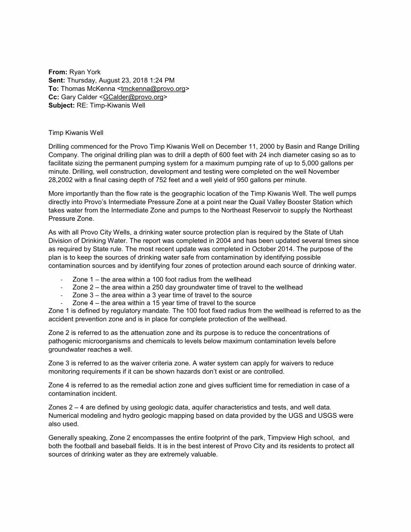
From: Ryan York Sent: Thursday, August 23, 2018 1:24 PM To: Thomas McKenna <[email protected]> Cc: Gary Calder <[email protected]> Subject: RE: Timp-Kiwanis Well
Timp Kiwanis Well
Drilling commenced for the Provo Timp Kiwanis Well on December 11, 2000 by Basin and Range Drilling Company. The original drilling plan was to drill a depth of 600 feet with 24 inch diameter casing so as to facilitate sizing the permanent pumping system for a maximum pumping rate of up to 5,000 gallons per minute. Drilling, well construction, development and testing were completed on the well November 28,2002 with a final casing depth of 752 feet and a well yield of 950 gallons per minute.
More importantly than the flow rate is the geographic location of the Timp Kiwanis Well. The well pumps directly into Provo’s Intermediate Pressure Zone at a point near the Quail Valley Booster Station which takes water from the Intermediate Zone and pumps to the Northeast Reservoir to supply the Northeast Pressure Zone.
As with all Provo City Wells, a drinking water source protection plan is required by the State of Utah Division of Drinking Water. The report was completed in 2004 and has been updated several times since as required by State rule. The most recent update was completed in October 2014. The purpose of the plan is to keep the sources of drinking water safe from contamination by identifying possible contamination sources and by identifying four zones of protection around each source of drinking water.
- Zone 1 – the area within a 100 foot radius from the wellhead - Zone 2 – the area within a 250 day groundwater time of travel to the wellhead - Zone 3 – the area within a 3 year time of travel to the source - Zone 4 – the area within a 15 year time of travel to the source
Zone 1 is defined by regulatory mandate. The 100 foot fixed radius from the wellhead is referred to as the accident prevention zone and is in place for complete protection of the wellhead.
Zone 2 is referred to as the attenuation zone and its purpose is to reduce the concentrations of pathogenic microorganisms and chemicals to levels below maximum contamination levels before groundwater reaches a well.
Zone 3 is referred to as the waiver criteria zone. A water system can apply for waivers to reduce monitoring requirements if it can be shown hazards don’t exist or are controlled.
Zone 4 is referred to as the remedial action zone and gives sufficient time for remediation in case of a contamination incident.
Zones 2 – 4 are defined by using geologic data, aquifer characteristics and tests, and well data. Numerical modeling and hydro geologic mapping based on data provided by the UGS and USGS were also used.
Generally speaking, Zone 2 encompasses the entire footprint of the park, Timpview High school, and both the football and baseball fields. It is in the best interest of Provo City and its residents to protect all sources of drinking water as they are extremely valuable.
Appendix C
Provo School District Letter to Provo City
Dated September 14, 2016
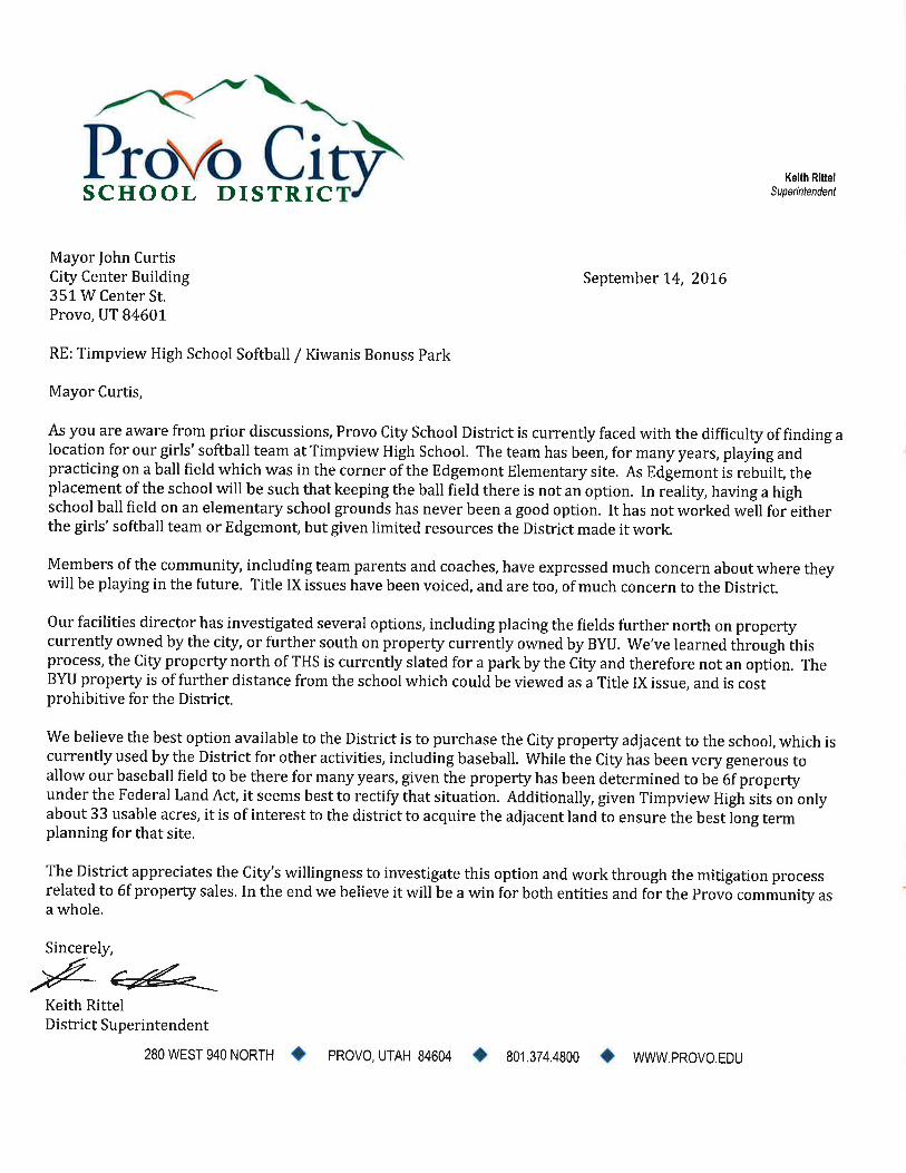
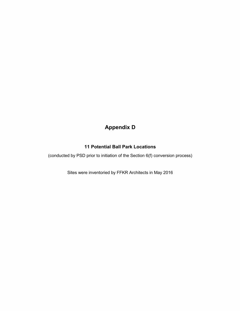
Appendix D
11 Potential Ball Park Locations
(conducted by PSD prior to initiation of the Section 6(f) conversion process)
Sites were inventoried by FFKR Architects in May 2016

BYU 12.3 ac
Foothill Ln
David Steiner 2.0 ac
Investment Groups (Las Vegas) 5.1 ac on north of Foothill
12.4 ac on south of Foothill
Linda Murdock 19.3 ac
Canyon Crest Elementary
SOFTBALL FIELD LEADS
4500 N & 4800 N Canyon Rd
Prepared by Derek Whe en on May 6, 2016
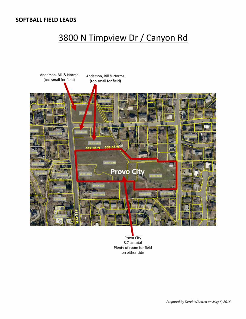
Provo City
Anderson, Bill & Norma (too small for field)
Anderson, Bill & Norma (too small for field)
Provo City 8.7 ac total
Plenty of room for field on either side
SOFTBALL FIELD LEADS
3800 N Timpview Dr / Canyon Rd
Prepared by Derek Whe en on May 6, 2016
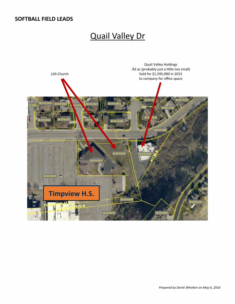
Timpview H.S.
LDS Church
Quail Valley Holdings .83 ac (probably just a li le too small)
Sold for $1,595,000 in 2015 to company for office space
SOFTBALL FIELD LEADS
Quail Valley Dr
Prepared by Derek Whe en on May 6, 2016
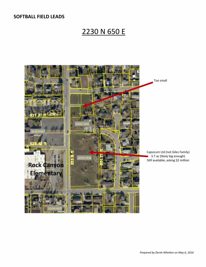
Rock Canyon Elementary
Capsicum Ltd (not Giles Family) 3.7 ac (likely big enough)
S ll available, asking $2 million
Too small
SOFTBALL FIELD LEADS
2230 N 650 E
Prepared by Derek Whe en on May 6, 2016
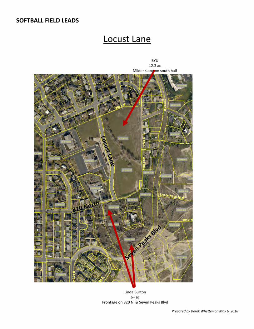
BYU 12.3 ac
Milder slope on south half
Linda Burton 6+ ac
Frontage on 820 N & Seven Peaks Blvd
SOFTBALL FIELD LEADS
Locust Lane
Prepared by Derek Whe en on May 6, 2016
Appendix E
Timp Kiwanis Bounous Park Photos
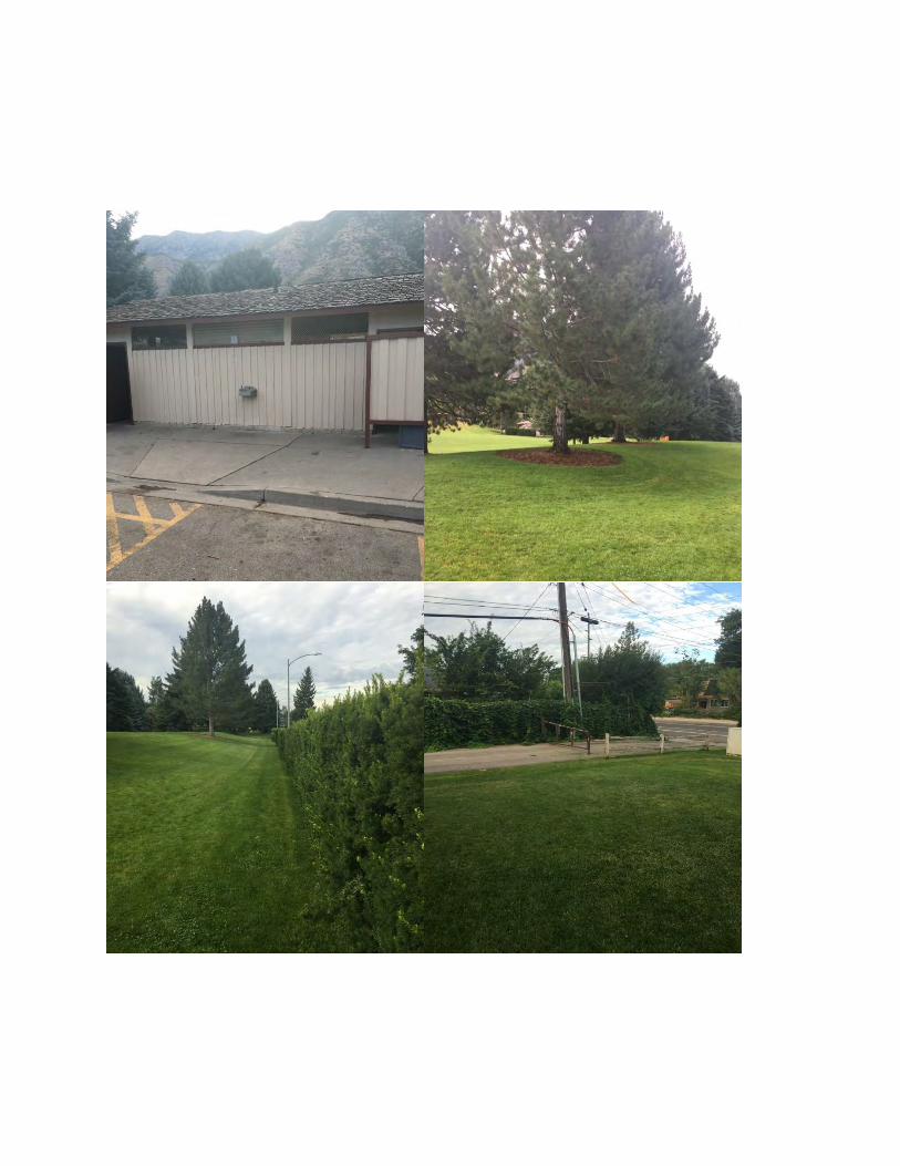
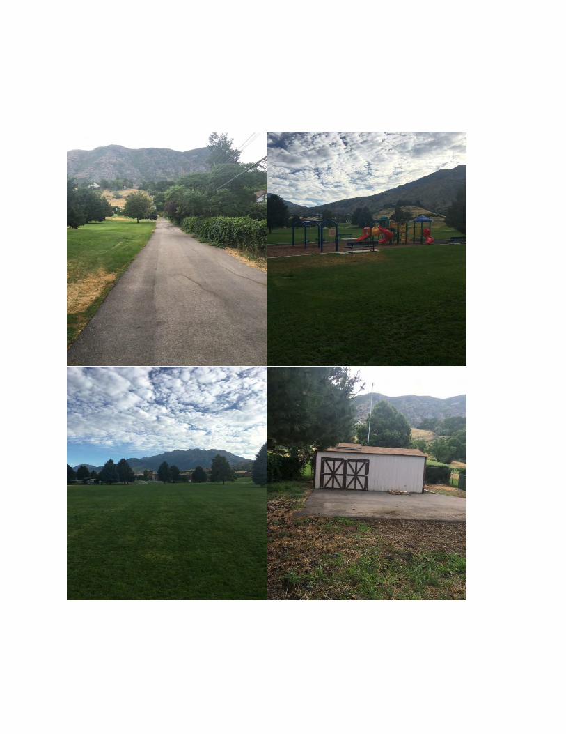
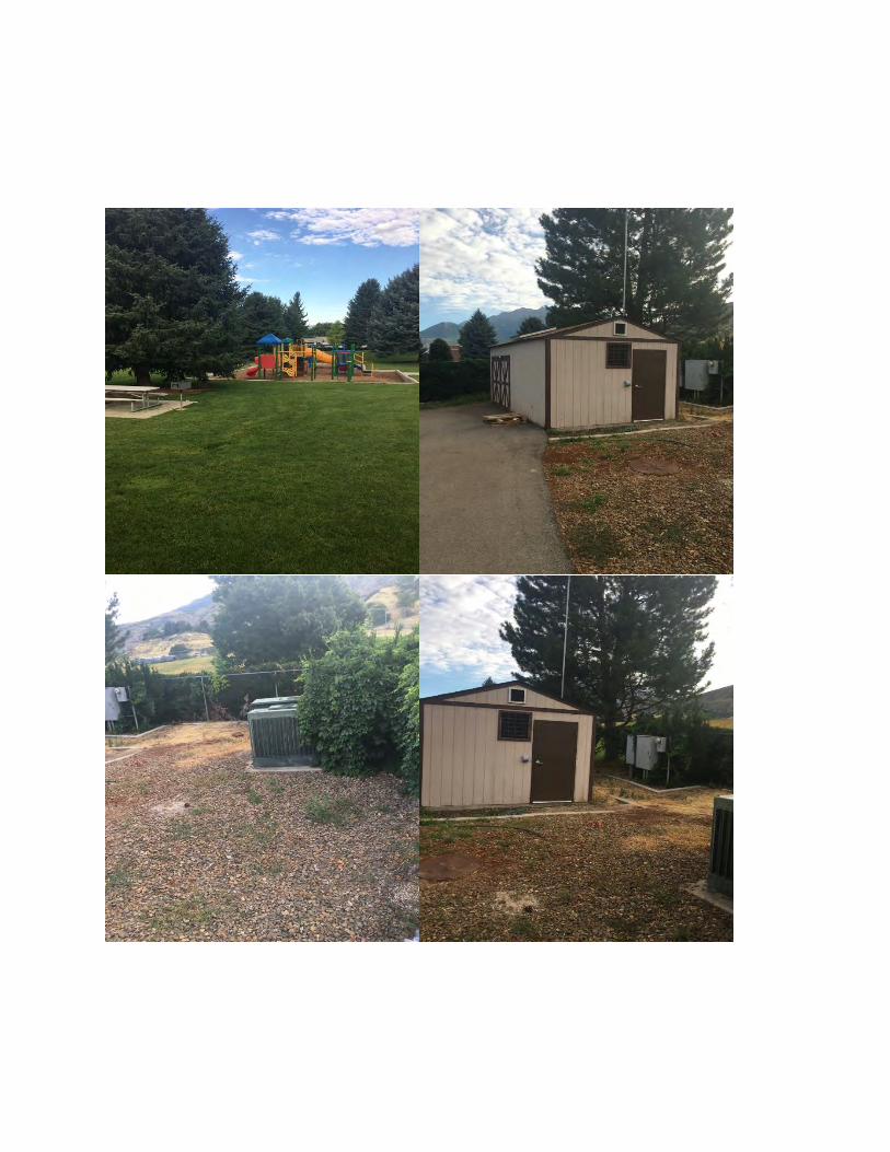
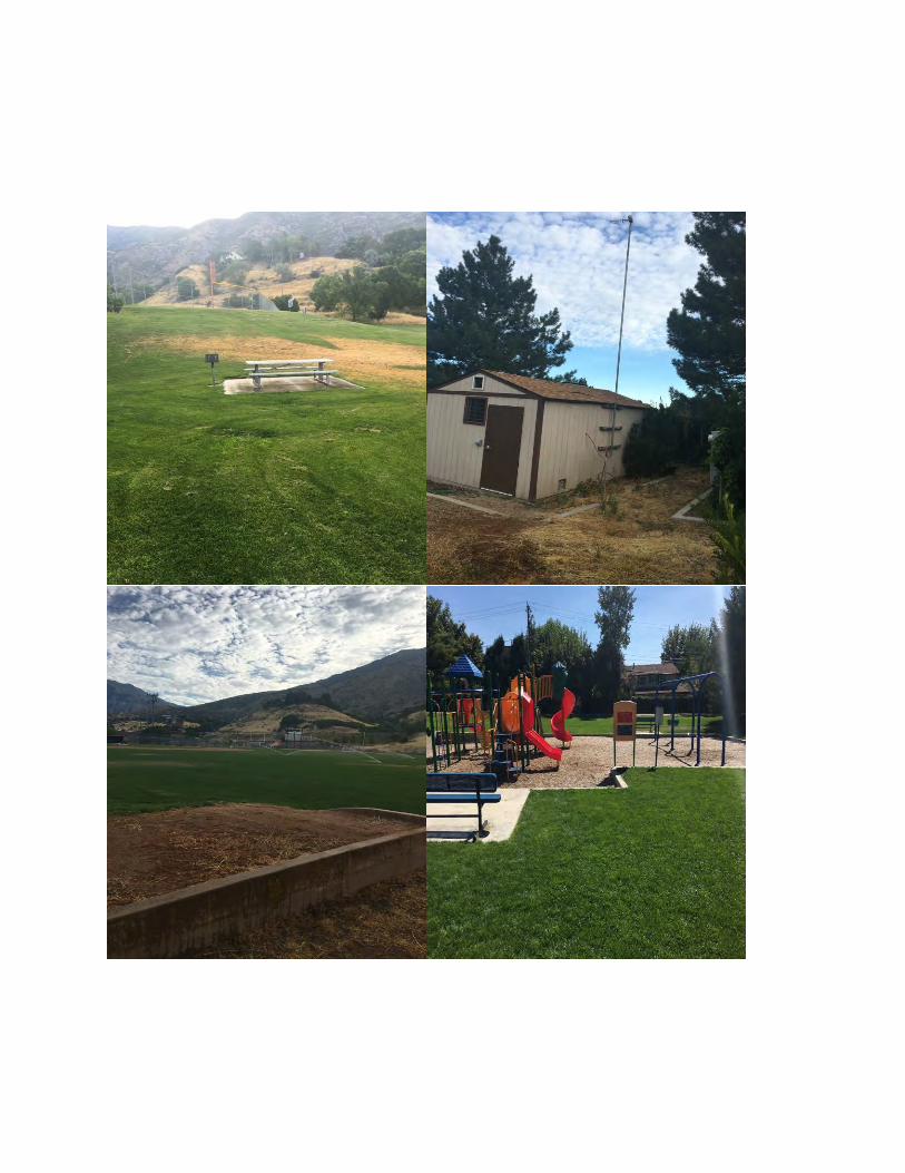
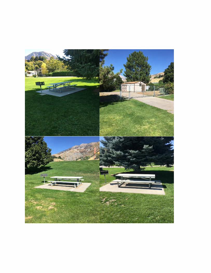
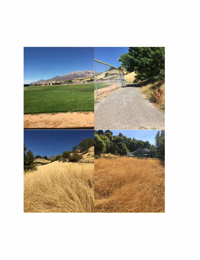
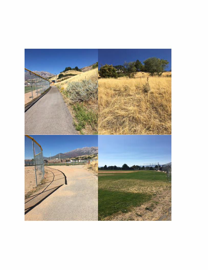
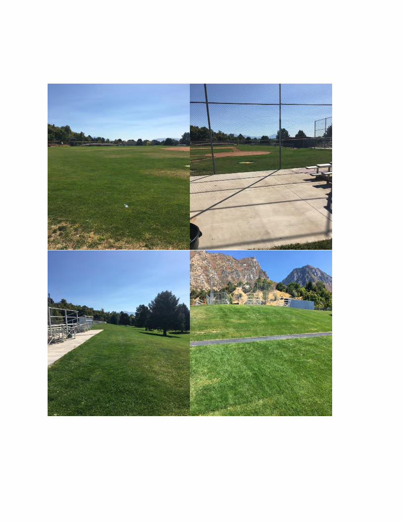
Appendix F
Proposed Replacement Site #1 Photos
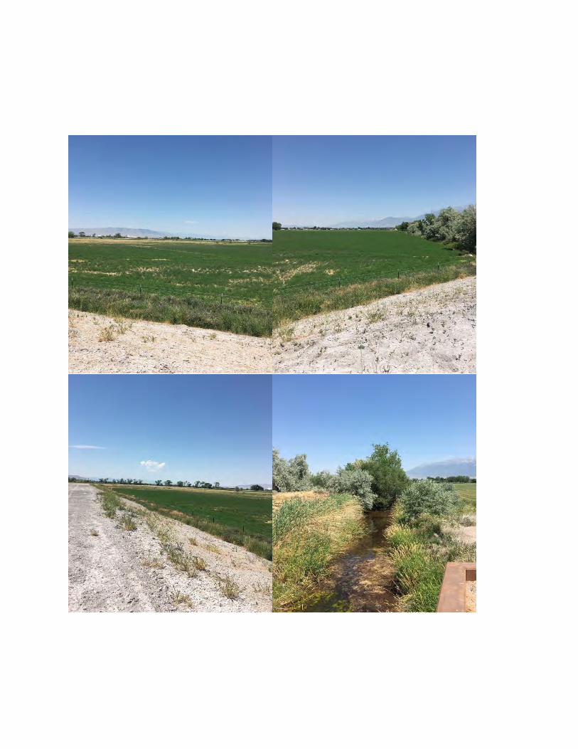
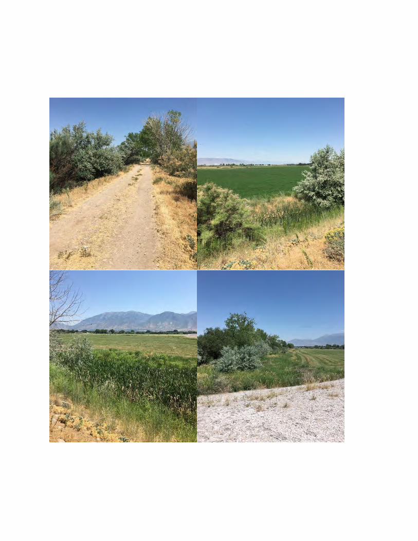
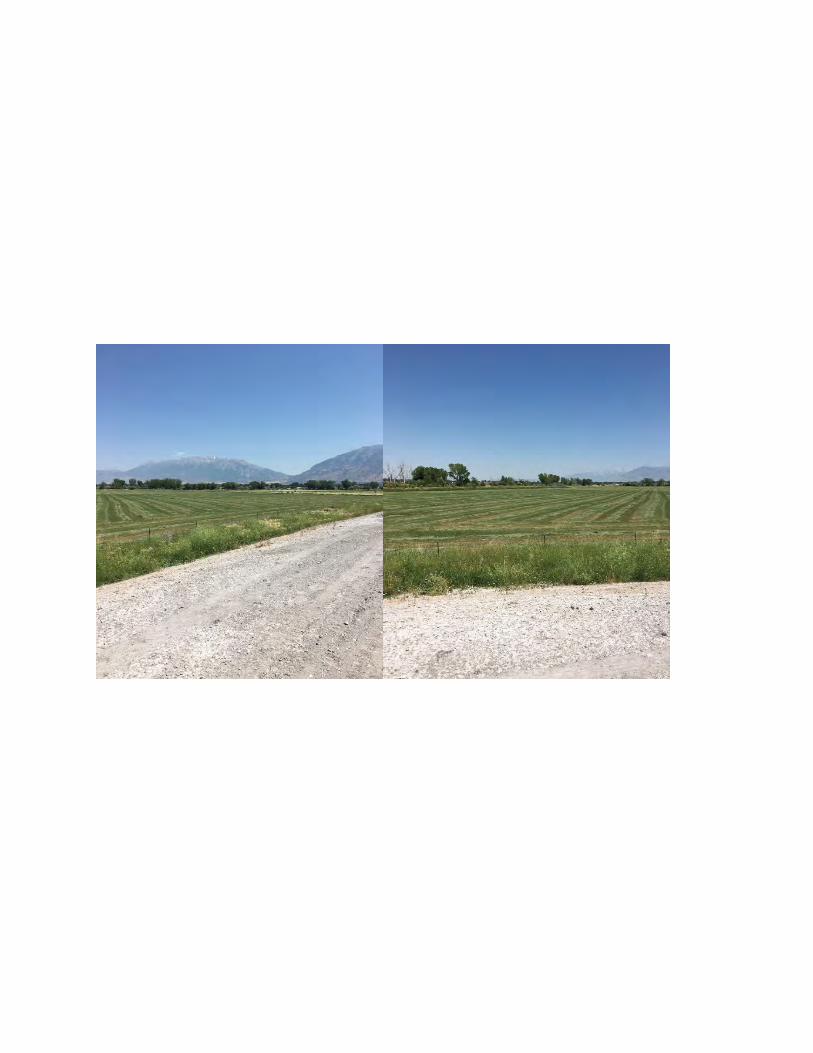
Appendix G
Proposed Replacement Site #2 Photos
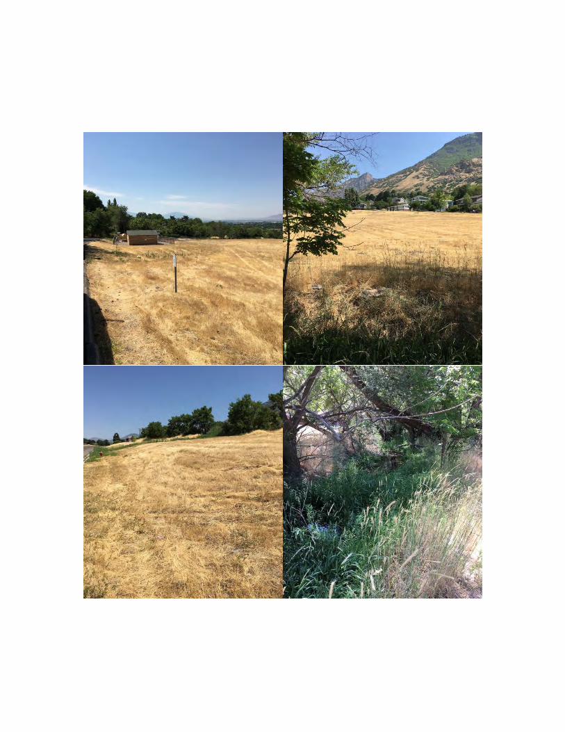
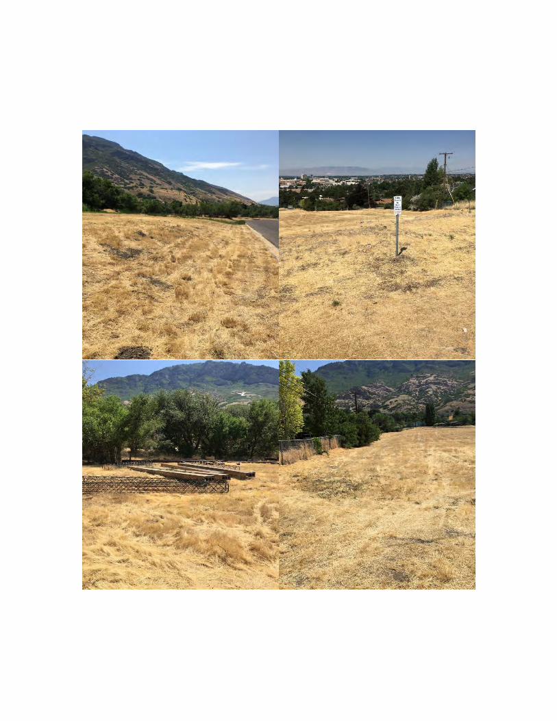
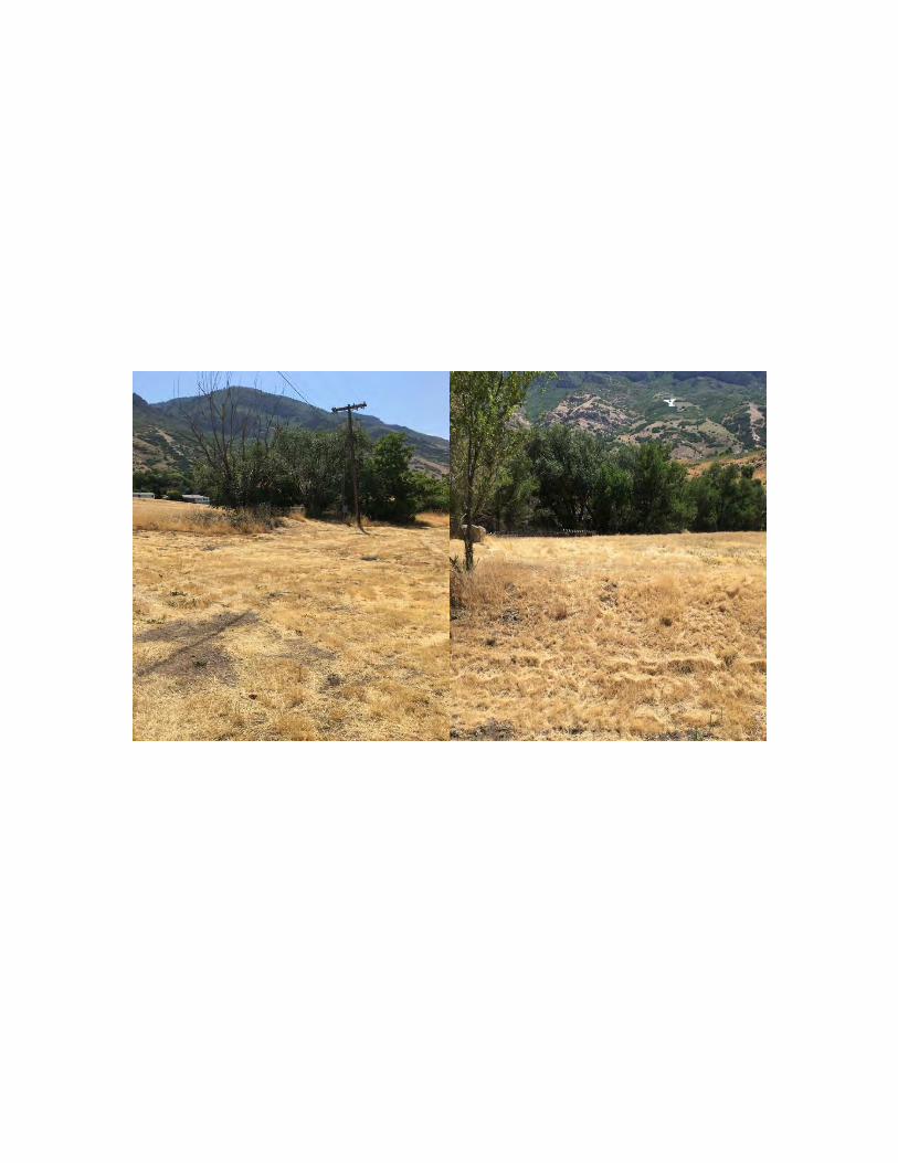
Appendix H June 6, 2018 email from Robert Hunter, Provo City Public Works, addressing TKP
flooding concerns
From: Thomas McKenna [email protected]: FW: Timp-Kiwanis Bounous
Date: June 6, 2018 at 11:04 AMTo: Ron Clegg [email protected]
CONFIDENTIALITY NOTICE: UNAUTHORIZED INTERCEPTION IS PROHIBITED BY FEDERAL LAW [Electronic Communications Privacy Act of 1986,18 U.S.C. 2701(a) and 2702(a)] This message is being sent by Provo City. It is intended exclusively for the individuals or entity to which it isaddressed. This communication may contain information that is proprietary, privileged, confidential or otherwise legally exempt from disclosure. Ifyou are not the named addressee, you are not authorized to read, print, retain, copy or disseminate this message or any part of it. If you havereceived this message in error, please notify the sender immediately by e-mail and delete all copies of the message.
From:RobertE.HunterSent:Wednesday,June06,20189:59AMTo:ThomasMcKenna<[email protected]>Cc:BrianTorgersen<[email protected]>Subject:Timp-KiwanisBounousThomas,ItisourunderstandingthatsomelocatedresidentsstatedthatsandbaggingwasrequiredattheTimp-KiwanisBounousParkduringatleastonerunoffeventinthe1980s.NoneofourcurrentstaffrememberssandbagsbeingneededatTimp-KiwanisBounousPark.Butiftheywereneeded,itwaslikelyduetooverflowintheoldirrigaVoncanallocatedonupthehillandontopofabermtotheeastofthepark.ThisirrigaVonlineisoldandhassignificantdamageinsomelocaVons.Duringrainstormorhighrunoffyears,theirrigaVonlinemayhavehistoricallycarriedsomestormrunoffgeYngintothepipefromupstreamareas.However,theoldirrigaVonlineisnolongerusedforirrigaVon,andthepipehassincebeeninterceptedintoaCitystormdraininQuailValleyDrivenorth(upstream)oftheschoolsite.TheCityisnotawarethereareanyflowsgeYngtotheabandonedsecVoneastoftheparksitesinceitwasinterceptedatQuailValleyDrive.ThatoldirrigaVonlinesitsontopofa±10’bermthatextendsacrossanaturalravinetotheeastofthesouthporVonoftheschool’sfootballfieldandnorthporVonofthebaseballfield.Thisbermwouldstopanddetain/infiltrateflowsfromdevelopmentdrainingtotheravine.An18”standpipeprovidesanoverflowoudallfromtheareabehindtheberm,connecVngtoanirrigaVonlinethatrunsthroughthebaseballdiamond.TheCityisunawarethatthislowerirrigaVonlinehasexperiencedanyfloodingproblems.IfanystormflowshavemadeittotheirrigaVonlinefromthebehindtheberm,itislikelytheyhavebeenveryminorsincethedevelopedareadischargingtotheravineisrelaVvelyminorcomparedtothesignificantavailabledetenVonareabehindtheberm,andtoreachthebermandstandpipeanyflowswouldrunthroughseveralhundredtothousandsoffeetofunlined,naturalchannelthatlikelyinfiltratesomeflows.TherearetwoitemsthathavenotcausedtheCityanyknownproblemstodate,butshouldbenoteddependingonfutureuseontheparksite.First,itistheCity’sunderstandingthatthe
noteddependingonfutureuseontheparksite.First,itistheCity’sunderstandingthattheirrigaVoncompanyslip-linedthelower,acVveirrigaVonlinerunningthroughthebaseballdiamondseveralyearsago.Thoughnoknownissueshaveoccurredsincetheslip-lining,theslip-liningmayneedtobeinspectedbeforemajorconstrucVonontheparksite,especiallyattheconnecVontotheoudallfrombehindtheberm.Second,thebermistallenoughandtheareabehinditlargeenoughthatitispossiblethestatecouldclassifyitinthefutureasadam.Thatislesslikelyandhasmuchlessimpactiftheparksiteistoremainopenareawithonlyminorstructuresappurtenanttosportsfields.However,ifmajorstructuresaretobebuilt,potenValforbreakingorbreachingofthebermmayneedtobeanalyzedsothatmajorfaciliVesarenotlocatedinthebreachpath.AlternaVvely,adetailedanalysisfordetenVon/debrisneedsmayshowthebermcouldbesignificantlylowered,therebyremovingthepotenValtobeclassifiedasadam.ItistheCity’sunderstandingthatthebermwasonlybuilttoitscurrentheighttoprovideapathfortheoldirrigaVonlineacrosstheravine.Thankyou,
Appendix I Aquatic Resource Delineation
Report December 2016
and October 8, 2018 Revisions
AQUATICRESOURCEDELINEATIONREPORT
Timp Kiwanis Park Mitigation Site Provo, Utah
PreparedFor:
1417South350East Provo,Utah84606
PreparedBy:
4720HollowRoad,NibleyUtah84321
(435)[email protected]
December2016
TimpKiwanisParkMitigationSite -ii- May9,2018AquaticResourceDelineationReport
ExecutiveSummary
InNovember2016,aWetlandandWatersoftheU.S.delineationstudywasconductedontheTimpKiwanisParkMitigationSite inUtahcounty.Thewetlanddelineationwas completed inaccordancewiththeU.S.ArmyCorpsofEngineers'1987WetlandDelineationManual(USACOE1987)andtheAridWestSupplement(USACOE2008).Waterwayswerereviewedinaccordancewiththe2008“AFieldGuidetotheIdentificationoftheOrdinaryHighWaterMark(OHWM)inthe Arid West Region of the Western United States.” The investigation revealed uplands,irrigationditches,andwetlandswithintheprojectarea.Allpotentialwetlandandwaterwayareaswithintheapproximately134-acreprojectareawerecheckedforwetlandindicators.
Onewetland,classifiedasapalustrineemergentwetland(PEM),wasfoundtotaling0.621acres.Theareadoesnotappeartohaveanoutlet;however,therewasawhiteplasticpipethatwasfoundinthewetlandthatmayconnecttheareawithundergrounddrainagethatconnectstooneoftheditches.Severalditchesthatconveyirrigationwaterordrainagewaterwerefoundontheedgesoftheagriculturalfieldsthroughoutthesite.OneoftheseditcheswasflowingatthetimeoftheinvestigationandappearstohaveaconnectiontoUtahLake.
TimpKiwanisParkMitigationSite -iii- May9,2018AquaticResourceDelineationReport
TableofContents
Page
ExecutiveSummary.................................................................................................................. iiChapter1:Introduction............................................................................................................ 1Chapter2:Location................................................................................................................... 1Chapter3:Methods.................................................................................................................. 1 Wetlands....................................................................................................................... 1 WatersoftheU.S.......................................................................................................... 2 IrrigationDitchesandCanals......................................................................................... 2Chapter4:ExistingConditions................................................................................................. 3 LandscapeSetting.......................................................................................................... 3 AquaticResources......................................................................................................... 3 Chapter5:References.............................................................................................................. 6
TablesTable1.AquaticResourceswithintheSurveyArea................................................................. 5
AppendicesAppendixA: TimpKiwanisParkMitigationSiteLocationMap.............................................. 9AppendixB: AquaticResourceDelineationMap(s)............................................................... 11AppendixC: Datasheets......................................................................................................... 19AppendixD: OnsitePhotographs........................................................................................... 24AppendixE: CrossSections.................................................................................................... 34AppendixF: SoilsDescriptions............................................................................................... 37

TimpKiwanisParkMitigationSite Error!Unknownswitchargument. May9,2018AquaticResourceDelineationReport
Chapter1.Introduction
AWetlandandWatersoftheU.S.delineationstudywasconductedinNovember2016onTimpKiwanis ParkMitigation Site. The delineation study was conducted for Provo City Parks andRecreation. The contact for the project is: Mr. Thomas McKenna, Provo City Parks andRecreation,1417South350East,Provo,Utah84606.
Withinthe134-acresite,thehydrology,andvegetationhasbeenhistoricallyseverelyalteredduetofarmingpracticessuchasirrigation,plantingandfieldleveling.Aroundtheedgesofthefields,ditcheshavebeenartificiallycreated.ItisimportanttonotethattheprojectareaisnearUtahLakeandhasexperiencedyears,whenthelakelevelwashigh,thatthegroundwaterelevationwas much higher than during the investigation. However, Lakeview Parkway was recentlycompletedbetweenthelakeandtheprojectareaandmaynowbechangingthegroundwaterhydrologyonthesite.
Chapter2.LocationTheprojectareaislocatedinUtahcounty,southoftheProvoAirportonthenortheastsideofLakeViewParkway(AppendixA:TimpKiwanisParkMitigationSiteLocationMap),onthefringeofUtahLake(Latitude40.22026,NandLongitude-111.70415W;Section10,Township7South,Range2East).TogettotheareafromSaltLakeCity:HeadsouthonI-15S,Takeexit263towardU.S. 189/UniversityAvenue for approximately ahalfmile then takea sharp left on LakeviewParkway.Theprojectsitewillbeontheleftinapproximately2miles.
Chapter3.MethodsWetlands
ThewetlanddelineationwascompletedinaccordancewiththeU.S.ArmyCorpsofEngineers'1987Wetland DelineationManual (USACOE 1987) and the AridWest Supplement (USACOE2008).Allpotentialwetlandareaswerecheckedforwetlandindicators.Thefollowingprocedurewasimplementedateachsamplepoint.
1.Theplantspecieswithina6-footradiusofthesamplepointwererecorded.Thepercentofrelativecoverforeachspecieswasdeterminedbyestimatingarealcover.TheindicatorstatusofeachspecieswasdeterminedbyusingtheNationalWetlandPlantList,version3.3(USACE2016).).Ifaplantspeciescomprisedatleast20%ofthetotalrelativecoverinitsstratum,itwas considered to be a dominant plant species. Ifmore than 50% of the dominant plantspecieshadanindicatorstatusofobligate(OBL),facultativewetland(FACW),orfacultative
TimpKiwanisParkMitigationSite Error!Unknownswitchargument. May9,2018AquaticResourceDelineationReport
(FAC),thesamplepointmetthewetlandvegetationparameter.
2.Ifpossible,an18-inch-deepsoilpitwasdugateachsamplepointtoassesssoilcharacteristics.Afterthepitwasdug,an18-inchsoilprofilewasslicedoffusingasoilspade.Thisprofilewasusedtodeterminesoilcolor,texture,andmoistureatdifferentdepthswithinthesoilprofile.Colorwas determined by comparing amoistened soil samplewith theMunsell Soil ColorCharts(Gretag/Macbeth2000).Soiltextureandmoistureweredeterminedbyfeelingthesoilsamples. If the soil characteristics met the hydric soil criteria provided in the Arid WestSupplementandtheFieldIndicatorsofHydricSoils(NRCS2006)manuals,thesamplepointmetthewetlandsoilsparameter.
3.Eachsoilpitwasexaminedtodeterminecorrelationwiththewetlandhydrologycriteria.Fieldindicatorsofperiodicsaturationand/orinundationincluderedoxfeatures,drainagepatternsinthewetland,sulfurodor,gleyedsoils,soilswithlowchroma,sedimentdeposits,saltcrust,surfacesoilcracks,orwaterstainedleaves.Ifatleastoneprimaryindicatorortwosecondaryindicatorswerepresent,thesamplepointmetthewetlandhydrologyparameter.
WatersoftheU.S.
InaccordancewiththeFieldGuidetotheIdentificationoftheOrdinaryHighWaterMark(OHWM)intheAridWestRegionoftheWesternUnitedStates(LichvarandMcColley2008),andtheUpdatedDatasheetfortheIdentificationoftheOrdinaryHighWaterMarkintheAridWestRegionoftheWesternUnitedStates(CurtisandLichvar2010),achannelsurveyforWatersoftheU.Swasconducted.ForWatersoftheU.S.,OHWMdatasheetswerecompletedforchannelsthatwerenotditches.
IrrigationDitchesandCanals
In the recent EPA and Corps guidance (EPA 2008) for waters of U.S., it states that non-tidal ditches(includingroadsideandagriculturalditches)arenotWatersoftheU.S.unlesstheyhaveabed,bank,andordinary high watermark; connect directly or through other tributaries to a traditional navigable orinterstatewater;andhaveatleastoneofthefollowingfourcharacteristics:
·Naturalstreamsthathavebeenaltered(e.g.,channelized,straightenedorrelocated);·DitchesthathavebeenexcavatedinwatersoftheU.S.,includingwetlands;·Ditchesthathaverelativelypermanentflowingorstandingwater;or·DitchesthatconnecttwoormorejurisdictionalwatersoftheU.S.
During the studyof theprojectarea,drainageswithin theprojectareawereevaluatedusingcriteriaintheFieldGuidetotheIdentificationoftheOrdinaryHighWaterMark(OHWM)intheAridWestRegionoftheWesternUnitedStates(Lichvar&McColley2008),theU.S.ArmyCorpsofEngineers'1987WetlandDelineationManual(EnvironmentalLaboratory1987),andtheAridWestSupplement(USACOE2008).
The field surveywas conducted on November 23, 2016 by Balance Environmental.Wetlandboundaries,samplepoints,watersoftheU.S.andditchesweresurveyedusingasub-meterGPSunitandmappedusingArcGISsoftware.ThesecanbeseenontheAquaticResourcesDelineation
TimpKiwanisParkMitigationSite Error!Unknownswitchargument. May9,2018AquaticResourceDelineationReport
Maps(AppendixB).Datawerecollectedatrepresentativesamplepointsandcross-sectionswithstandard routinedeterminationdata sheets,whichareprovided inAppendixC.Photosweretakenoftheaquaticresourcesandotherareasfoundonsite(AppendixD),andcrosssectionsdrawings were done for the ditches (Appendix E). A soils map and soil descriptions are inAppendixF(SoilSurveyStaff,2016).
Chapter4.ExistingConditionsLandscapeSetting
Plants foundonsitearepredominantly thosesuchasalfalfaandgrassesassociatedwithhayproductionwithafewforbsandweeds.Alongtheedgesofthefieldsassociatedwiththeditchesareshrubsandtrees.Approximately90percentoftheprecipitationinthisareaoccursasrun-off.Typically, January,February,and Juneare thedriestmonthsand JulyandAugustare thewettestmonths. It is important tonote thatdrainage for theproject areahas recentlybeenalteredduetotheconstructionofanewroadandthechangesmaynotbeentirelyknownatthistime.Manyareashavehadfilldepositedthathasbeenleveledandthefieldsarenowplantedandirrigated.Theentireareawasinvestigatedduringthesitevisit.
AquaticResources
Therewereseveralditchesandonewetlandareafoundwithintheprojectarea.Theditchesallappear tobeconstructed to take irrigationwater to the fieldsor to removeexcess irrigationwaterfromthefields.
WETLANDS
Vegetationintheprojectareaismostlyalfalfaandassociatedweedswhichdidnotmeetwetlandcriteria.WithinSamplePoint1,theonlysamplepointmeetingall3criteriatobeclassifiedasawetland, the dominant vegetation is chairmaker's bulrush (Schoenoplectus americanus) andcommonreed(Phragmitesaustralis)whicharebothwetlandspecies.
AllofthesoilsintheprojectareaareChipmansiltyclay,withvaryingamountsofsalinityanddepthstothewatertable.Chipmansiltyclayloamisclassifiedasapoorlydrained.Thesoilsfoundduringtheonsitevisitdidsomewhatcorrespondtothemappedsoils,butmuchofthesoilhadbeendisturbed.Themostimportantcharacteristicofthesoilsisthattheyhadbeenleveledandirrigated,whichhadsignificantlyalteredthearea.Onlysoilswithinsamplepointonedisplayedhydricindicators,withredoxinadepression.Otherwise,soilsweredryanddidnothavewetlandcharacteristics(AppendixCDatasheets).
Atthetimeofthedelineation,besidestheditches,nosoilsintheprojectareaweresaturatedintheupperprofile.However,intheareaofthewetland,inundationisvisibleonaerialimagery,
TimpKiwanisParkMitigationSite Error!Unknownswitchargument. May9,2018AquaticResourceDelineationReport
whichindicatesthattheareawashistoricallyinundated.Inundationonaerialphotographyisaprimaryhydrologyindicationofawetland.HydrologyforthesamplepointinthewetlandislikelyinfluencedbyreleaseofirrigationwaterandthewaterlevelofUtahLake.
IRRIGATIONCANALS/DITCHES
Severalditchesarelocatedintheprojectarea.Theseareashavebeenexcavated,channelized,piped and/or bermed. Theditches range from4 to 30 feetwide, and appear to beused forsupplying irrigation water to the fields and collecting excess irrigation water after flowingthroughthefields.Ascanbeenseeninphoto3(AppendixD),therewerealsosomesmallditchesthatwentfromthe larger irrigationditches intothefieldsbutwoulddissipate intothefields.Theseareaswerenotmappedduringtheinvestigation.
Of the 6 ditches that were mapped during the investigation, only D1 appears to be likelyconnectedtoUtahLakeviaaculvertunderLakeviewParkwayandthenintoasloughsurroundingthe airport. This was also the only ditch that had any noticeable flow at the time of theinvestigation(Photo1).
D2a,adirtditch(Photo2),startsatthesouthedgeofthepropertyandrunsalongwestsideofthelargeberm/roadwaybutasitmovestothenorth,theditchgoesintoaculvertunderafieldentranceandemergesontheothersideasaconcretelinedcanal(D2b,Photo9,11).Itthenrunsalongtheeasternedgeofthepropertytothenorth.Bothportionsofthisditchwerecompletelydryduringtheinvestigation.
Runningalongthewesternedgeoftheproperty,D3andD5didhavewaterintheditch,butonlyforaportionoftheditchandbothhadareasthatweredry(Photos4,5,&6).
D4iswideforaditchbuthasobviouslybeenconstructedasitrunsdirectlyeastwestbetweentwoalfalfafields.Itislikelythattheditchhaswidenedduetoalackofmaintenance,whichhasallowedsedimentandvegetationtoclogthecenter,pushingwaterout.
CONCLUSIONS
Therewerefivedrainagesandawetlandfoundwithintheprojectarea(Table1).Althoughthewetland does not appear to have any surface water connection to a traditional navigablewaterway(TNW),groundwater,oraconnectiontooneof theditchesmayhaveatonetimeconnectedthisareatoUtahLake,whichistheclosestTNW.OftheditchesfoundthroughoutthesitetheonlyonethatappearstobepotentiallyaWateroftheUnitedStatesisD1,whichhasanobviousbedandbank,whatappearstobepermanentwaterandaconnectiontoaTNW.Otherthan water used for irrigation of the agricultural fields, there was not any observed ordocumentedinterstateorforeigncommerceassociatedwithaquaticresourcesfoundonthesite.
ItisBalanceEnvironmental’sopinionthatbecausethewetlandappearstobeisolated,itmaynotbeconsideredjurisdictionalunderCleanWaterActSection404guidelines.However,thepipethatislocatednearthecenterofthewetlandmayhavesomedirectconnectionwithUtahLake,
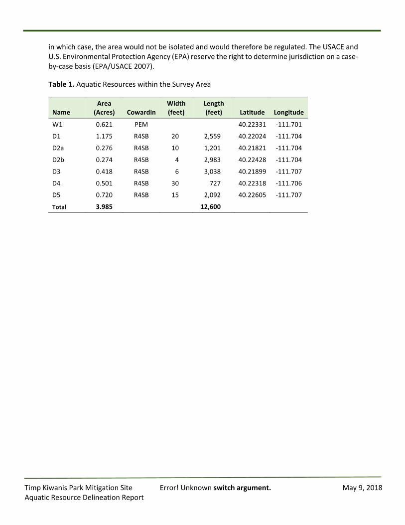
TimpKiwanisParkMitigationSite Error!Unknownswitchargument. May9,2018AquaticResourceDelineationReport
inwhichcase,theareawouldnotbeisolatedandwouldthereforeberegulated.TheUSACEandU.S.EnvironmentalProtectionAgency(EPA)reservetherighttodeterminejurisdictiononacase-by-casebasis(EPA/USACE2007).
Table1.AquaticResourceswithintheSurveyArea
NameArea(Acres) Cowardin
Width(feet)
Length(feet) Latitude Longitude
W1 0.621 PEM 40.22331 -111.701
D1 1.175 R4SB 20 2,559 40.22024 -111.704
D2a 0.276 R4SB 10 1,201 40.21821 -111.704
D2b 0.274 R4SB 4 2,983 40.22428 -111.704
D3 0.418 R4SB 6 3,038 40.21899 -111.707
D4 0.501 R4SB 30 727 40.22318 -111.706
D5 0.720 R4SB 15 2,092 40.22605 -111.707
Total 3.985 12,600
TimpKiwanisParkMitigationSite Error!Unknownswitchargument. May9,2018AquaticResourceDelineationReport
Chapter5.ReferencesCowardin,LewisM.,Carter,Virginia,Golet,FrancisC.,andLaRoe,EdwardT.1979.Classification
ofwetlandsanddeepwaterhabitatsoftheUnitedStates.FWS/OBS-79/31.U.S.FishandWildlifeService,Washington,D.C.
Curtis,KatherineE.,andLichvar,RobertW.2010.UpdatedDatasheetfortheIdentificationoftheOrdinary HighWaterMark (OHWM) in the AridWest Region of theWestern UnitedStates. ERDC/CRREL TN-10-1. U.S. Army Engineer Research and Development Center,ColdRegionsResearchandEngineeringLaboratory.
Environmental Laboratory. 1987. Corps of Engineers wetlands delineationmanual. TechnicalReportY-87-1.Vicksburg,MS:U.S.ArmyEngineerWaterways.
Environmental Protection Agency and U.S. Army Corps of Engineers (EPA/USACE). 2007.Memorandum for Director of Civil Works and U.S. EPA Regional Administrators.Washington,DC.
EnvironmentalProtectionAgency.2008.CleanWaterActJurisdictionFollowingtheU.S.SupremeCourt’sDecisioninRapanosv.UnitedStatesandCarabellv.UnitedStates.MemoissuedDecember2,2008.
Experiment Station. (http://el.erdc.usace.army.mil/wetlands/pdfs/wlman87.pdf) U.S. ArmyCorps of Engineers (USACOE). 2008. Regional Supplement to the Corps of EngineersWetland Delineation Manual: Arid West Region (Version 2.0). U.S. Army EngineerResearch and Development Center, Vicksburg, MS. http://www.spk.usace.army.mil/Portals/12/documents/regulatory/pdf/trel08-28.pdf
Kartesz.JohnT.1996.NationalListofVascularPlantSpeciesThatOccurinWetlands,BiotaofNorthAmericaProgram(BONAP),ChapelHill,NorthCarolinahttp://www.fws.gov/nwi/Plants/list96.html.
Lichvar, RobertW. andMcColley, ShawnM., 2008.A FieldGuide to the Identificationof theOrdinary HighWaterMark (OHWM) in the AridWest Region of theWestern UnitedStates.U.S.ArmyCorpsofEngineersEngineerResearchandDevelopmentCenterColdRegions Research and Engineering Laboratory, Hanover, NH.http://www.spk.usace.army.mil/Portals/12/documents/regulatory/pdf/Ordinary_High_Watermark_Manual_Aug_2008.pdf
MunsellColorServices.2000.MunsellSoilColorCharts.GretagMacbeth,NewWindsor,NewYork.
Natural Resources Conservation Service (NRCS). 2006. Field Indicators of Hydric Soils in theUnitedStates.Version6.0.
TimpKiwanisParkMitigationSite Error!Unknownswitchargument. May9,2018AquaticResourceDelineationReport
SoilConservationService(SCS).2012.U.S.DepartmentofAgriculture,SoilConservationServicesemi-controlled digital photomaps. The orthophoto maps were created by the SCS(NaturalResourcesConservationService),basedonaerialphotographytakenbetween1936and1952,withthemajorityofphotographytakenbefore1941.SaltLakeCity,UT.
Soil Survey Staff, Natural Resources Conservation Service, United States Department ofAgriculture.Web Soil Survey. Available online at http://websoilsurvey.nrcs.usda.gov/.Accessed[11/7/2016].
U.S.ArmyCorpsofEngineers.2016.NationalWetlandPlantList,version3.3.U.S.ArmyCorpsofEngineers Engineer Research and Development Center Cold Regions Research andEngineeringLaboratory,Hanover,NH.http://wetland_plants.usace.army.mil/
U.S. Climate Data, version 2.2. 2016. Accessed on 12/7/2016. Retrieved fromhttp://www.usclimatedata.com/climate/provo/utah/united-states/usut0208
U.S. Department of Agriculture (USDA). 2008. Natural Resources Conservation Service. ThePLANTSDatabase,NationalPlantDataCenter,BatonRouge,LA70874-4490USAPLANTS.http://plants.usda.gov/wetland.html.
TimpKiwanisParkMitigationSite Error!Unknownswitchargument. May9,2018AquaticResourceDelineationReport
Appendices
TimpKiwanisParkMitigationSite Error!Unknownswitchargument. May9,2018AquaticResourceDelineationReport
AppendixA:
TimpKiwanisParkMitigationSiteLocationMap
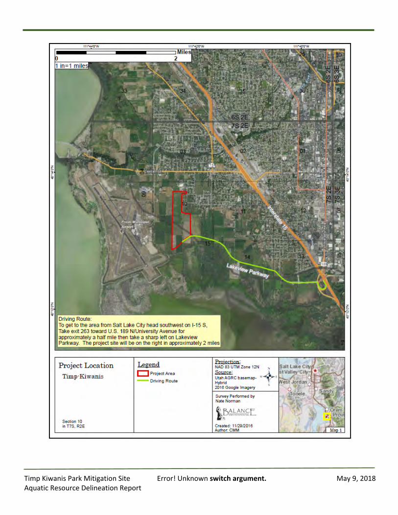
TimpKiwanisParkMitigationSite Error!Unknownswitchargument. May9,2018AquaticResourceDelineationReport
TimpKiwanisParkMitigationSite Error!Unknownswitchargument. May9,2018AquaticResourceDelineationReport
AppendixB:
AquaticResourceDelineationMaps
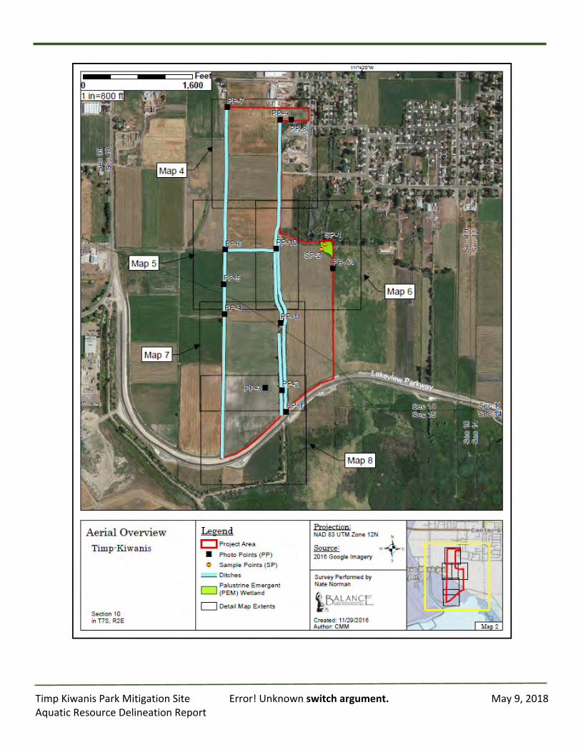
TimpKiwanisParkMitigationSite Error!Unknownswitchargument. May9,2018AquaticResourceDelineationReport
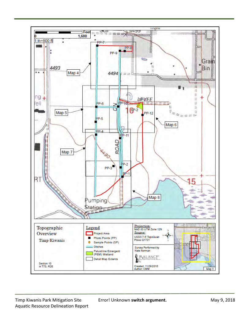
TimpKiwanisParkMitigationSite Error!Unknownswitchargument. May9,2018AquaticResourceDelineationReport
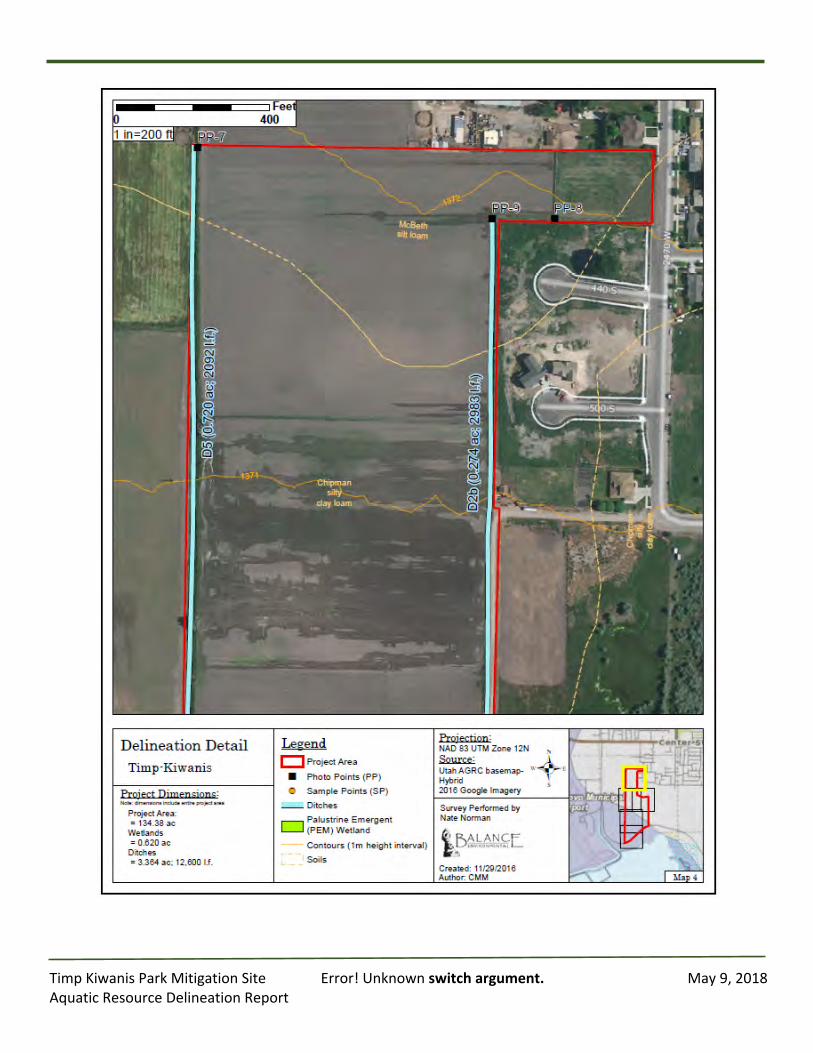
TimpKiwanisParkMitigationSite Error!Unknownswitchargument. May9,2018AquaticResourceDelineationReport
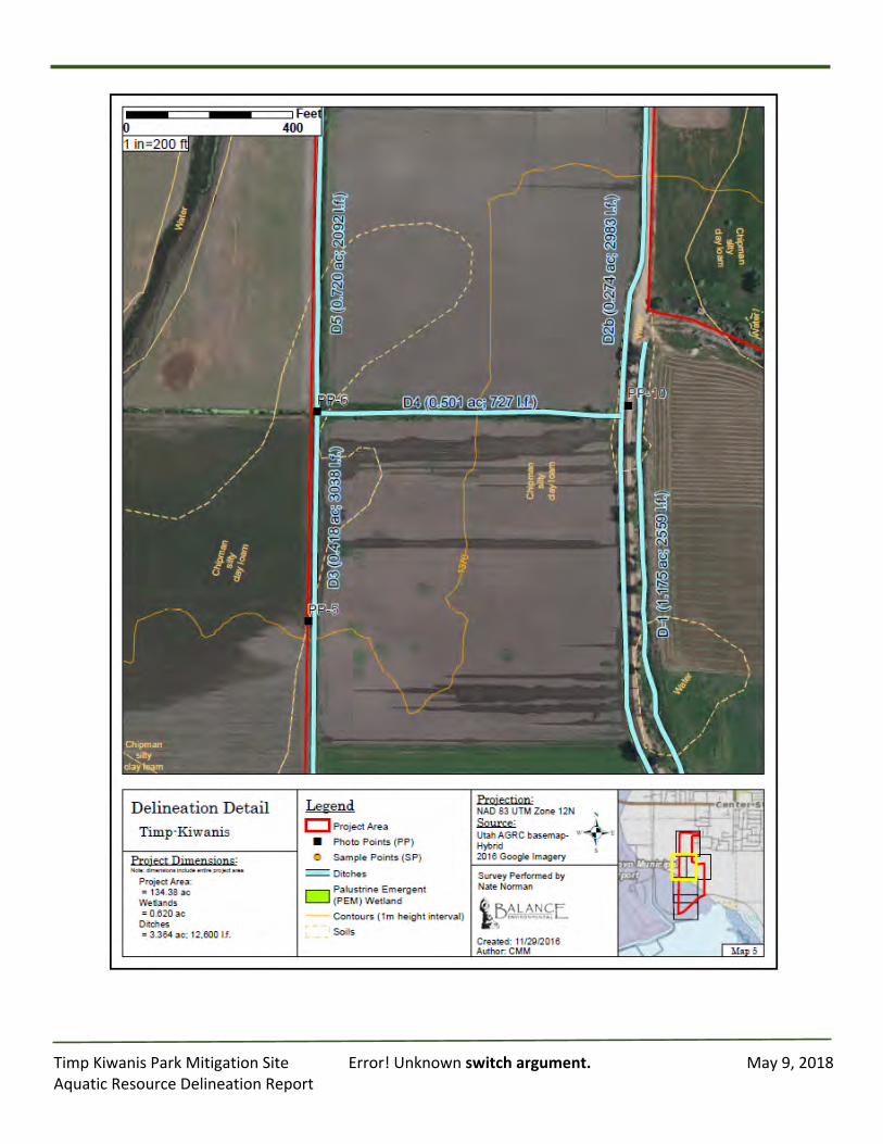
TimpKiwanisParkMitigationSite Error!Unknownswitchargument. May9,2018AquaticResourceDelineationReport
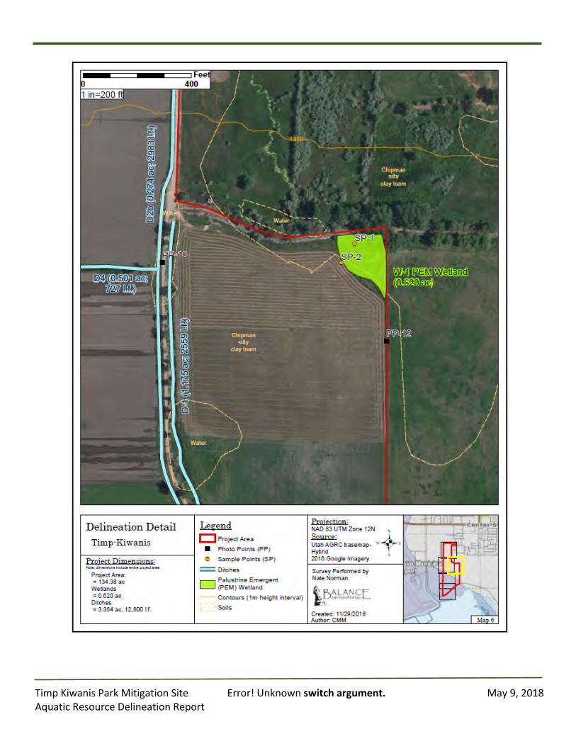
TimpKiwanisParkMitigationSite Error!Unknownswitchargument. May9,2018AquaticResourceDelineationReport

TimpKiwanisParkMitigationSite Error!Unknownswitchargument. May9,2018AquaticResourceDelineationReport
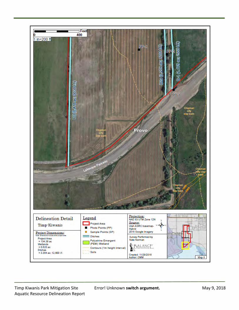
TimpKiwanisParkMitigationSite Error!Unknownswitchargument. May9,2018AquaticResourceDelineationReport
TimpKiwanisParkMitigationSite Error!Unknownswitchargument. May9,2018AquaticResourceDelineationReport
AppendixC:
Datasheets
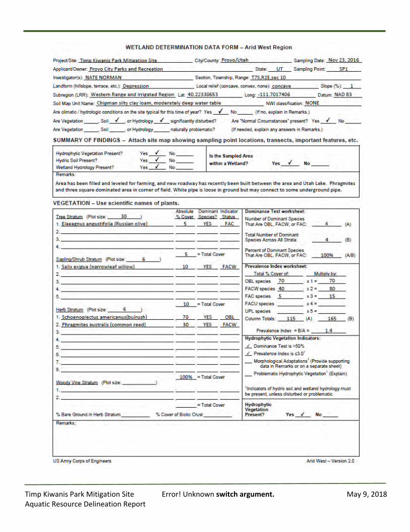
TimpKiwanisParkMitigationSite Error!Unknownswitchargument. May9,2018AquaticResourceDelineationReport
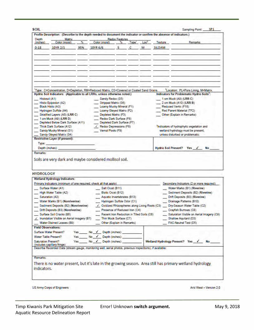
TimpKiwanisParkMitigationSite Error!Unknownswitchargument. May9,2018AquaticResourceDelineationReport
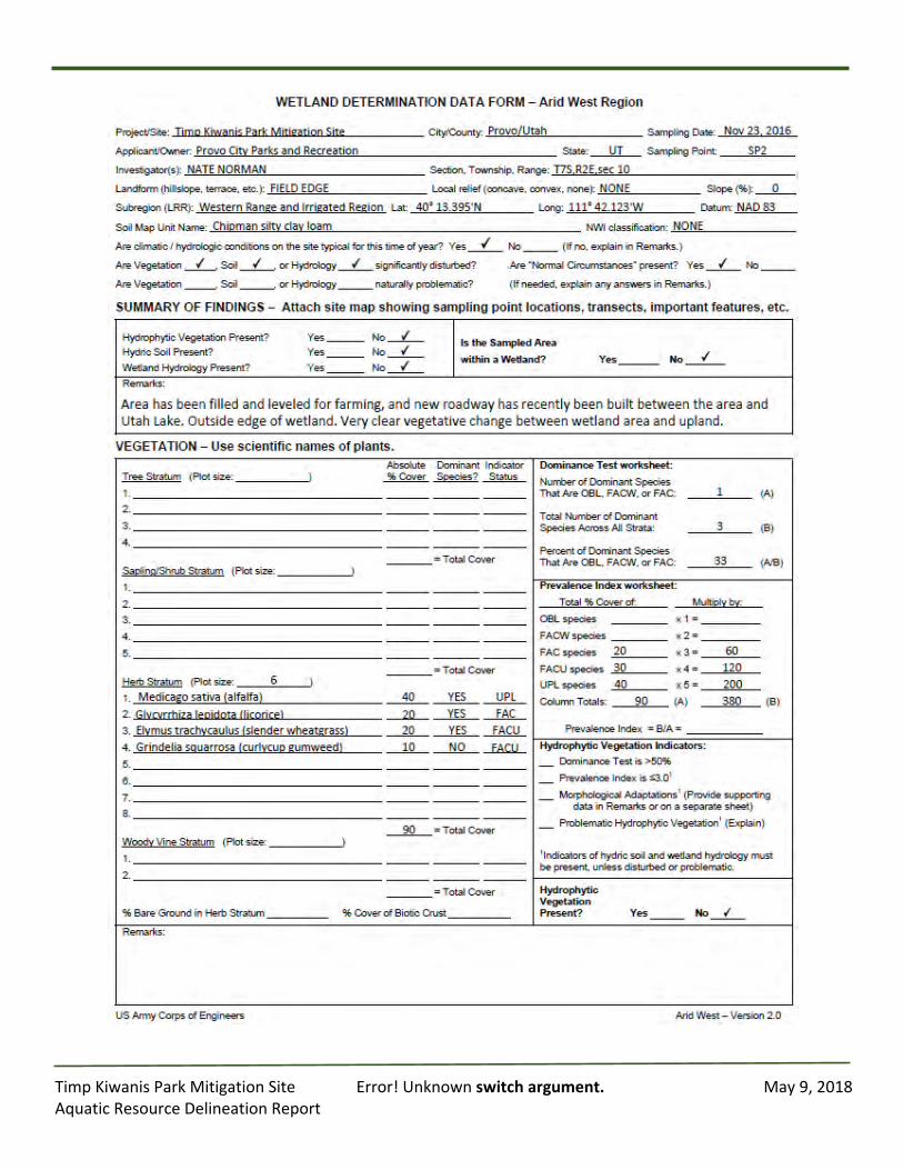
TimpKiwanisParkMitigationSite Error!Unknownswitchargument. May9,2018AquaticResourceDelineationReport
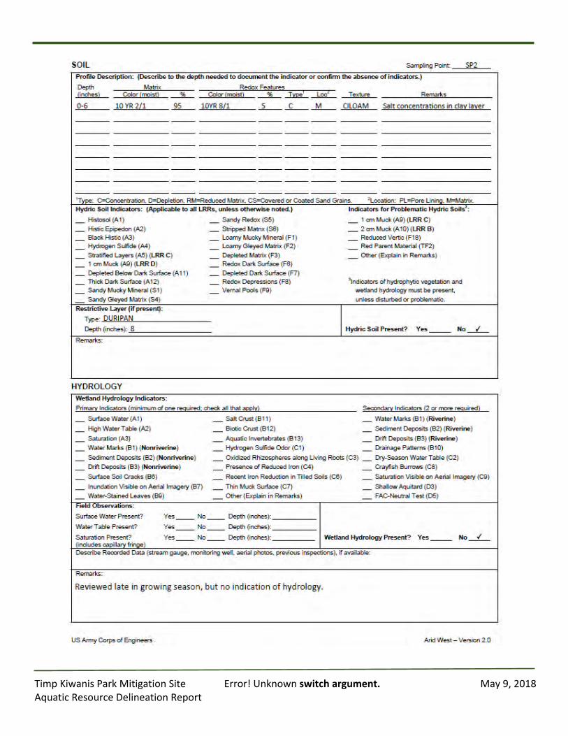
TimpKiwanisParkMitigationSite Error!Unknownswitchargument. May9,2018AquaticResourceDelineationReport
TimpKiwanisParkMitigationSite Error!Unknownswitchargument. May9,2018AquaticResourceDelineationReport
AppendixD:
Photographs
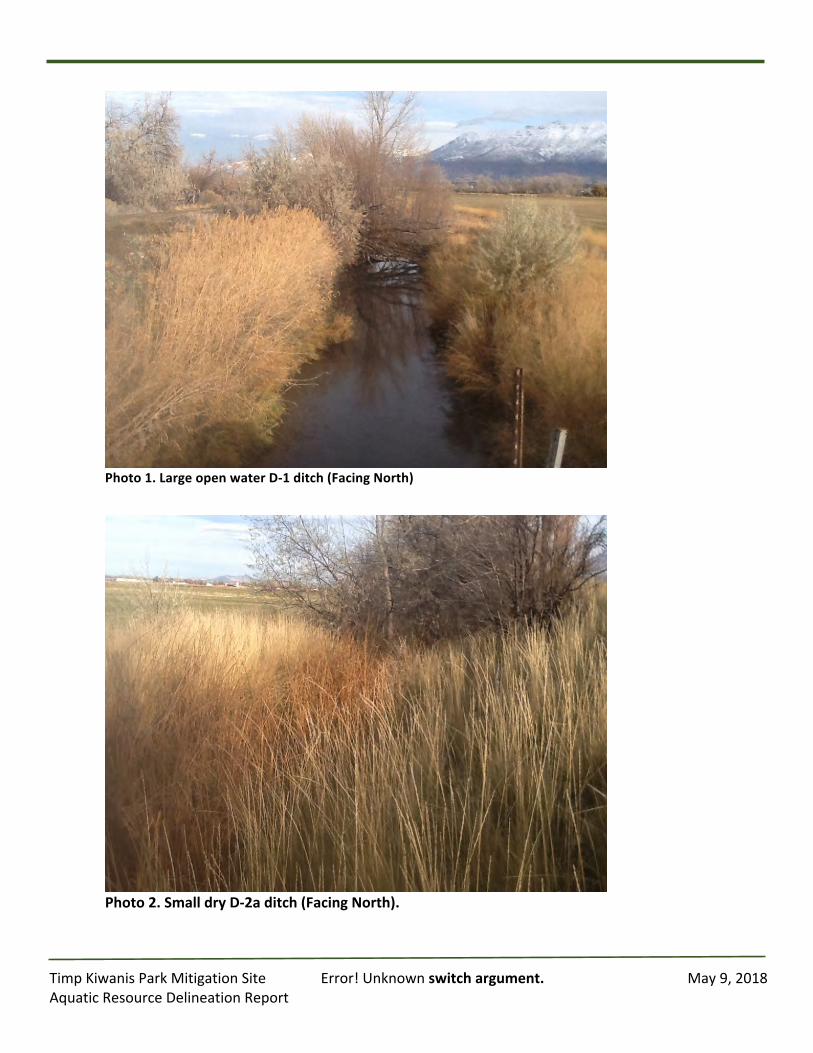
TimpKiwanisParkMitigationSite Error!Unknownswitchargument. May9,2018AquaticResourceDelineationReport
Photo1.LargeopenwaterD-1ditch(FacingNorth)
Photo2.SmalldryD-2aditch(FacingNorth).
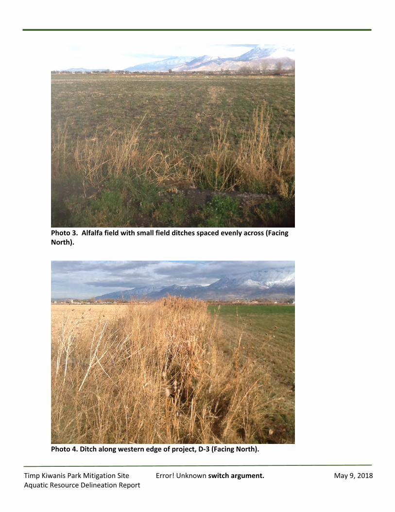
TimpKiwanisParkMitigationSite Error!Unknownswitchargument. May9,2018AquaticResourceDelineationReport
Photo3.Alfalfafieldwithsmallfieldditchesspacedevenlyacross(FacingNorth).
Photo4.Ditchalongwesternedgeofproject,D-3(FacingNorth).

TimpKiwanisParkMitigationSite Error!Unknownswitchargument. May9,2018AquaticResourceDelineationReport
Photo5.ShowingleakypipejustoffofprojectcreatessmallwetareainD-3ditch(FacingSouth).
PhotoPoint6.Openwaterinditch(D-5)goingnorthandturnswestatthispoint.(FacingNorth).
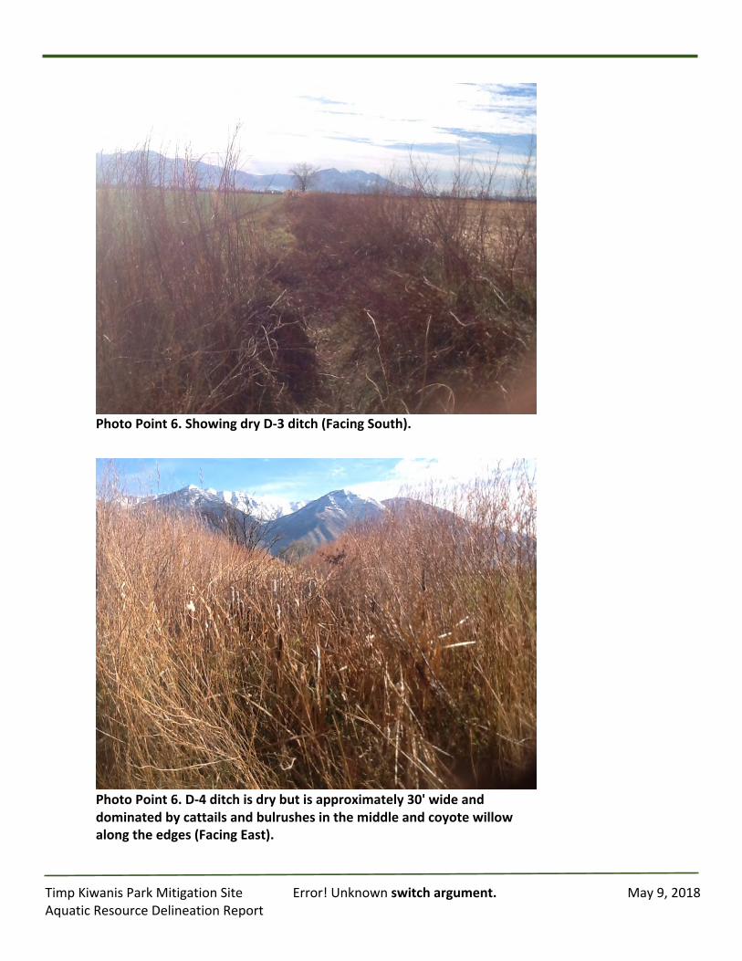
TimpKiwanisParkMitigationSite Error!Unknownswitchargument. May9,2018AquaticResourceDelineationReport
PhotoPoint6.ShowingdryD-3ditch(FacingSouth).
PhotoPoint6.D-4ditchisdrybutisapproximately30'wideanddominatedbycattailsandbulrushesinthemiddleandcoyotewillowalongtheedges(FacingEast).
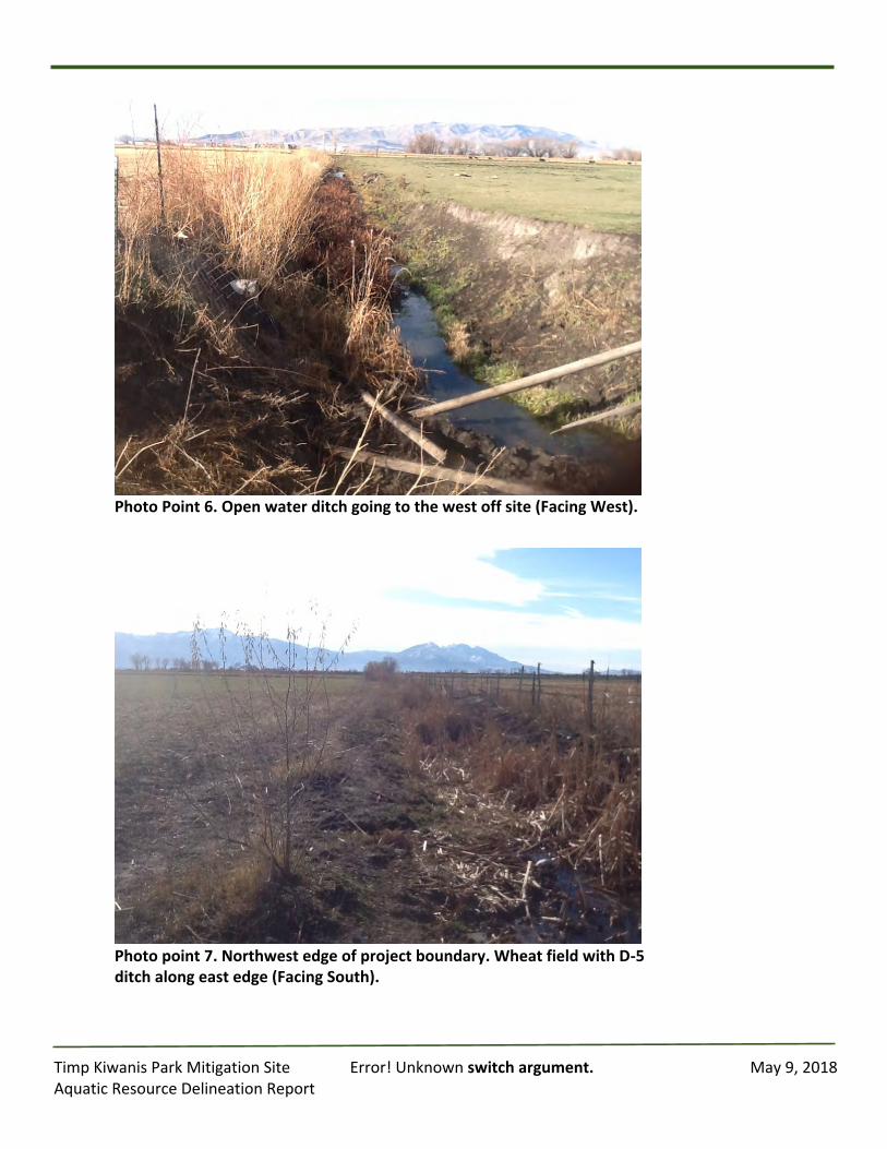
TimpKiwanisParkMitigationSite Error!Unknownswitchargument. May9,2018AquaticResourceDelineationReport
PhotoPoint6.Openwaterditchgoingtothewestoffsite(FacingWest).
Photopoint7.Northwestedgeofprojectboundary.WheatfieldwithD-5ditchalongeastedge(FacingSouth).
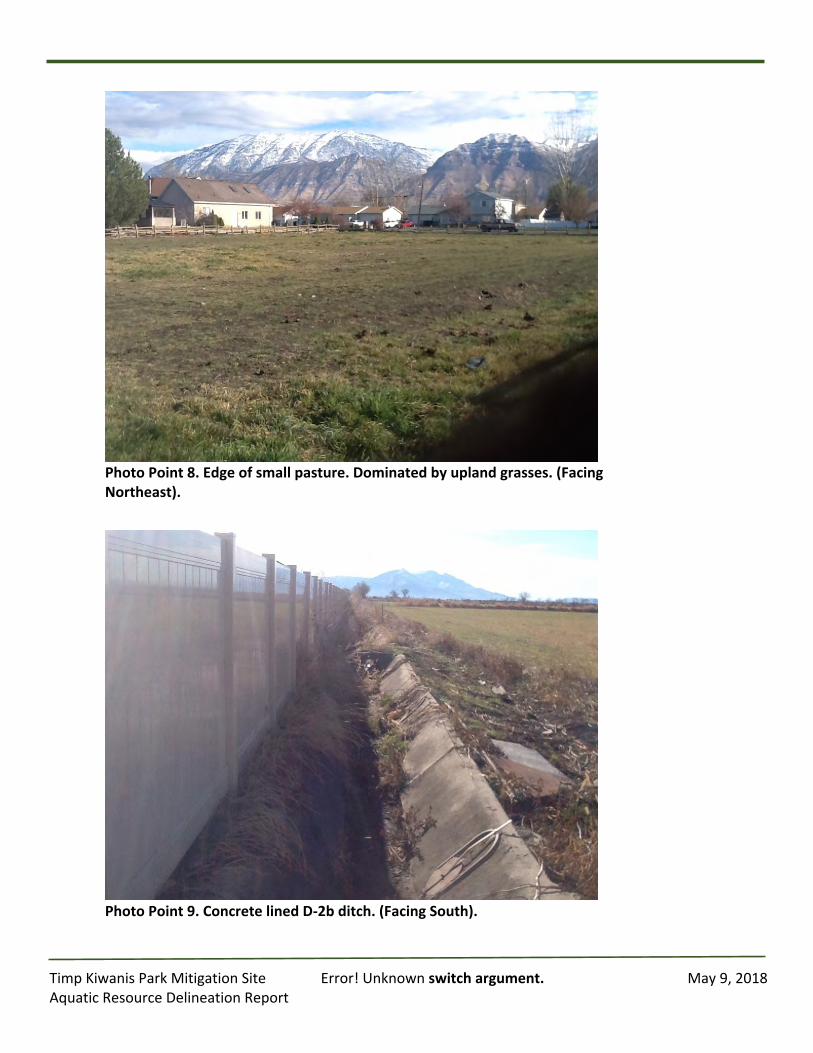
TimpKiwanisParkMitigationSite Error!Unknownswitchargument. May9,2018AquaticResourceDelineationReport
PhotoPoint8.Edgeofsmallpasture.Dominatedbyuplandgrasses.(FacingNortheast).
PhotoPoint9.ConcretelinedD-2bditch.(FacingSouth).
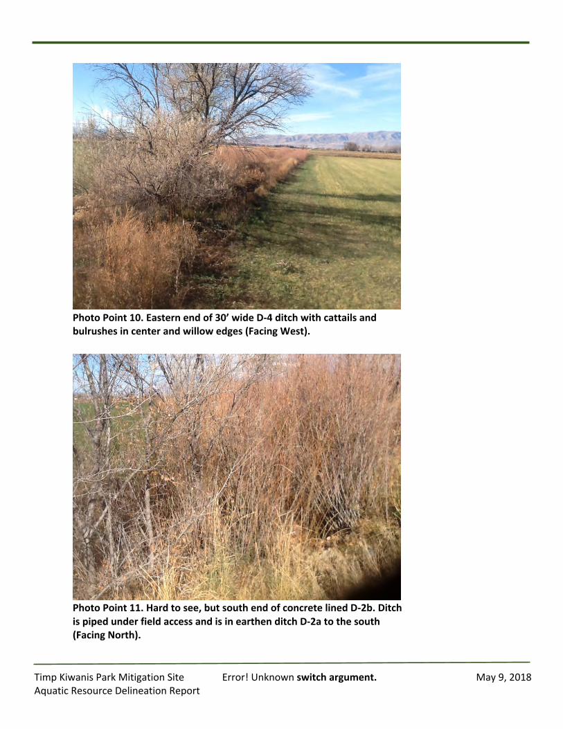
TimpKiwanisParkMitigationSite Error!Unknownswitchargument. May9,2018AquaticResourceDelineationReport
PhotoPoint10.Easternendof30’wideD-4ditchwithcattailsandbulrushesincenterandwillowedges(FacingWest).
PhotoPoint11.Hardtosee,butsouthendofconcretelinedD-2b.DitchispipedunderfieldaccessandisinearthenditchD-2atothesouth(FacingNorth).
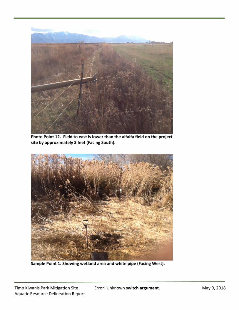
TimpKiwanisParkMitigationSite Error!Unknownswitchargument. May9,2018AquaticResourceDelineationReport
PhotoPoint12.Fieldtoeastislowerthanthealfalfafieldontheprojectsitebyapproximately3feet(FacingSouth).
SamplePoint1.Showingwetlandareaandwhitepipe(FacingWest).

TimpKiwanisParkMitigationSite Error!Unknownswitchargument. May9,2018AquaticResourceDelineationReport
Photo7.SamplePoint2,ShowingedgeofPhragmitesanduplandboundary(FacingNorth).
TimpKiwanisParkMitigationSite Error!Unknownswitchargument. May9,2018AquaticResourceDelineationReport
AppendixE:
CrossSections
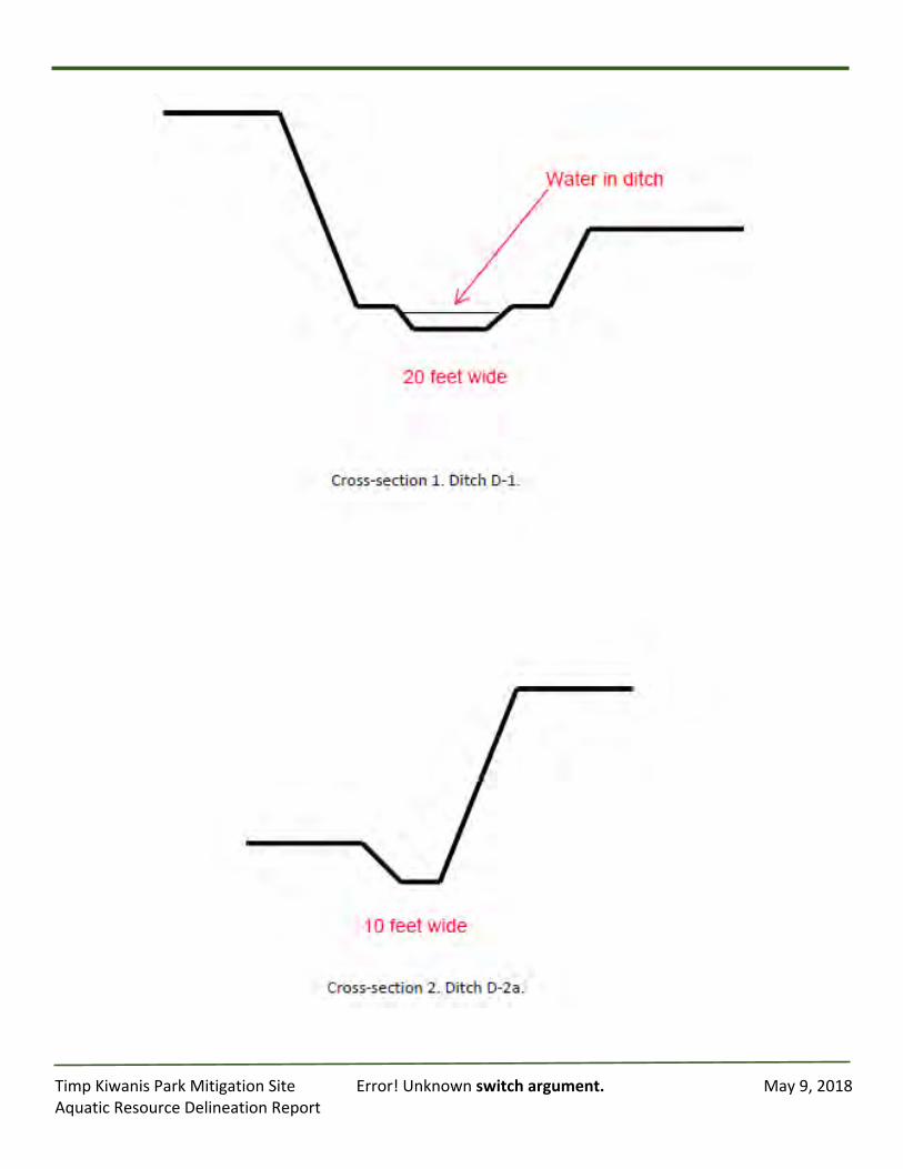
TimpKiwanisParkMitigationSite Error!Unknownswitchargument. May9,2018AquaticResourceDelineationReport
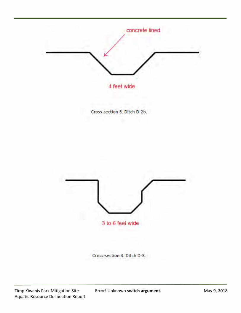
TimpKiwanisParkMitigationSite Error!Unknownswitchargument. May9,2018AquaticResourceDelineationReport

TimpKiwanisParkMitigationSite Error!Unknownswitchargument. May9,2018AquaticResourceDelineationReport
AppendixF:
SoilsDescriptions
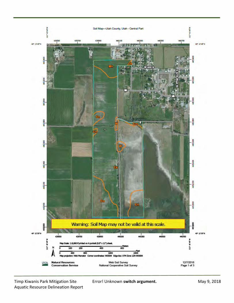
TimpKiwanisParkMitigationSite Error!Unknownswitchargument. May9,2018AquaticResourceDelineationReport
TimpKiwanisParkMitigationSite Error!Unknownswitchargument. May9,2018AquaticResourceDelineationReport
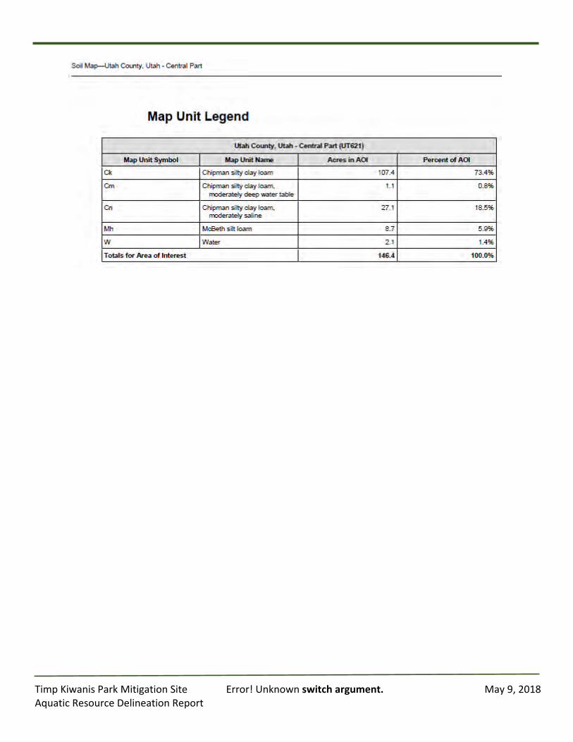
TimpKiwanisParkMitigationSite Error!Unknownswitchargument. May9,2018AquaticResourceDelineationReport
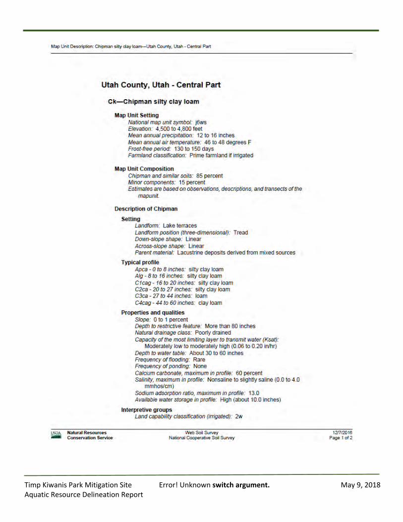
TimpKiwanisParkMitigationSite Error!Unknownswitchargument. May9,2018AquaticResourceDelineationReport
TimpKiwanisParkMitigationSite Error!Unknownswitchargument. May9,2018AquaticResourceDelineationReport
TimpKiwanisParkMitigationSite Error!Unknownswitchargument. May9,2018AquaticResourceDelineationReport
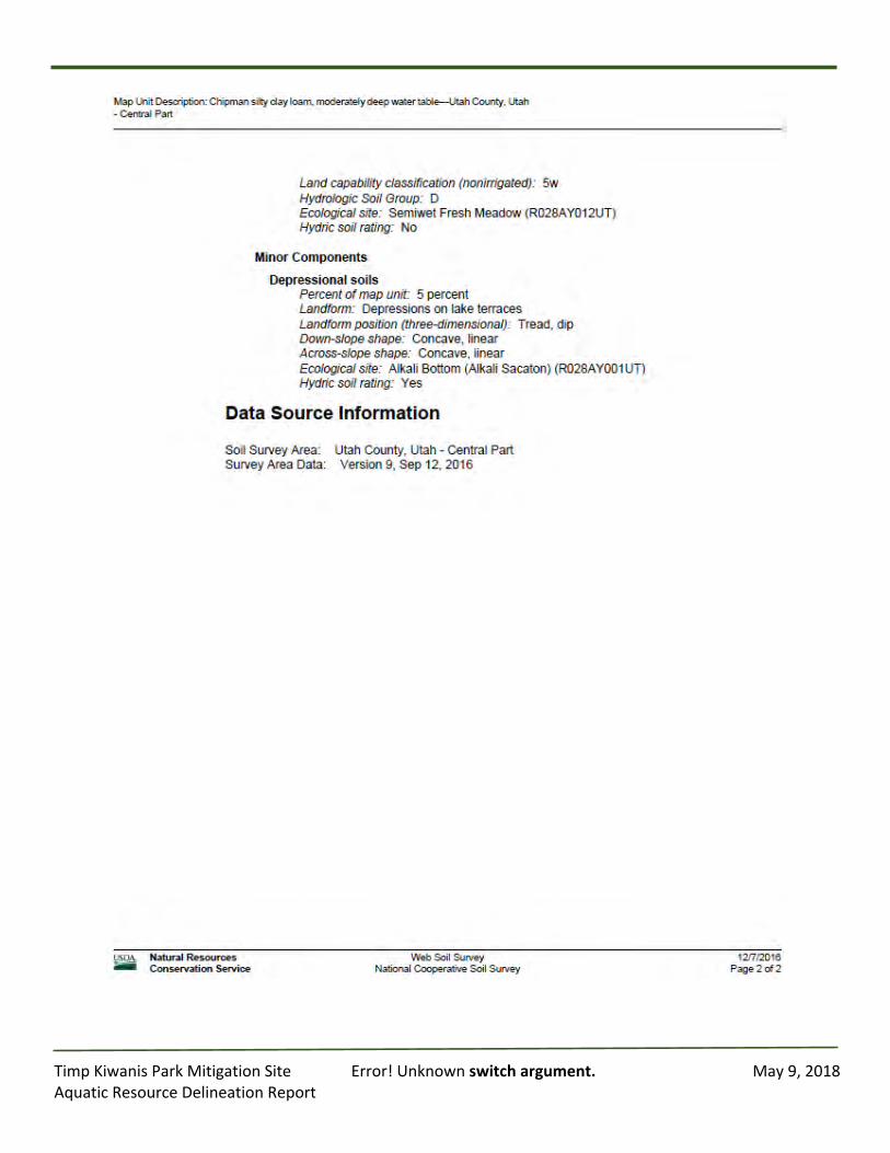
TimpKiwanisParkMitigationSite Error!Unknownswitchargument. May9,2018AquaticResourceDelineationReport
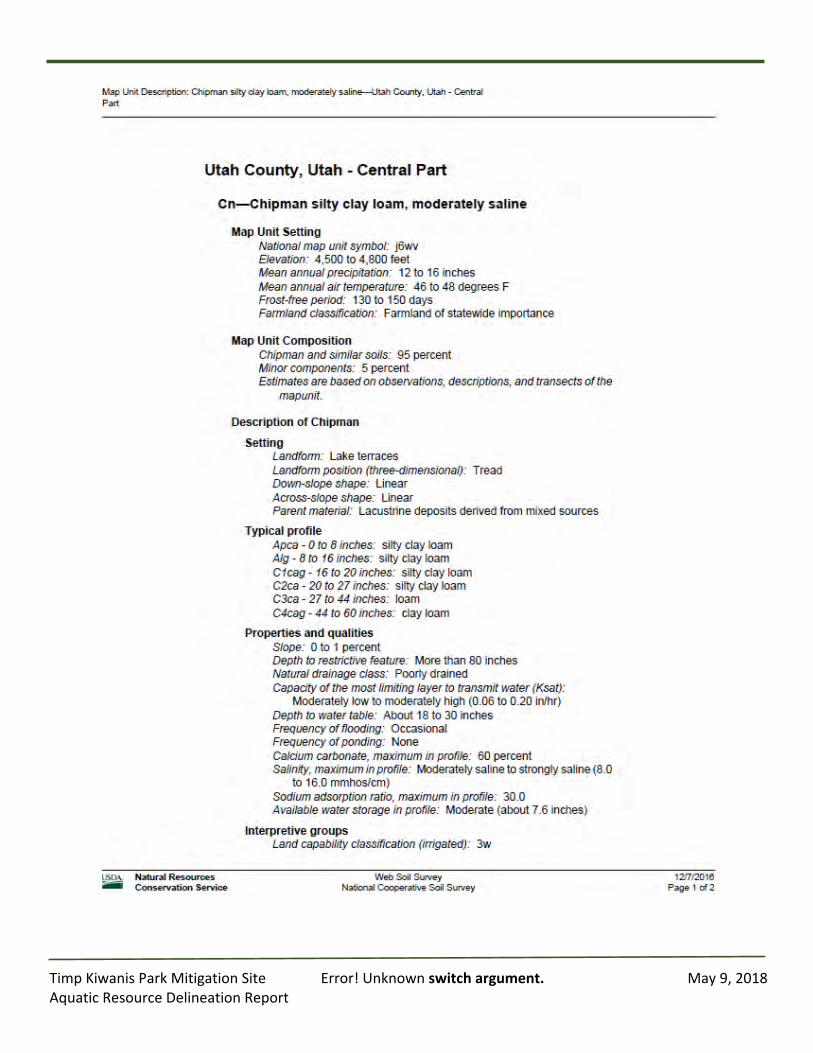
TimpKiwanisParkMitigationSite Error!Unknownswitchargument. May9,2018AquaticResourceDelineationReport
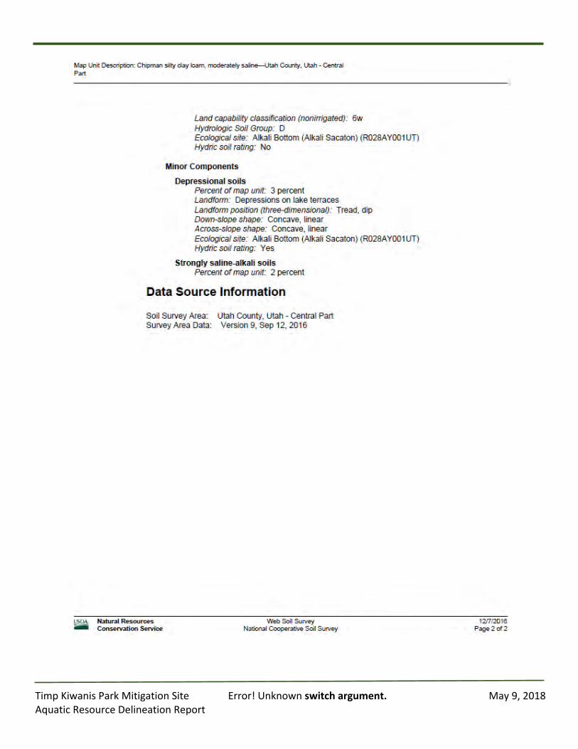
TimpKiwanisParkMitigationSite Error!Unknownswitchargument. May9,2018AquaticResourceDelineationReport
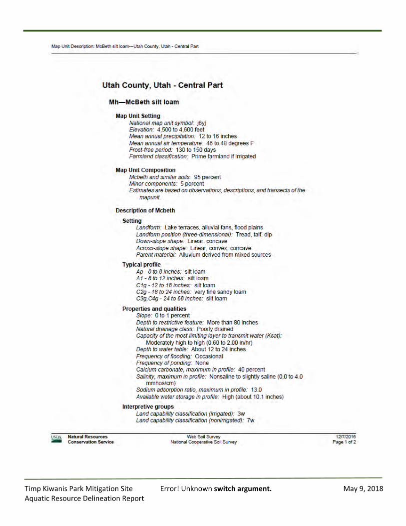
TimpKiwanisParkMitigationSite Error!Unknownswitchargument. May9,2018AquaticResourceDelineationReport
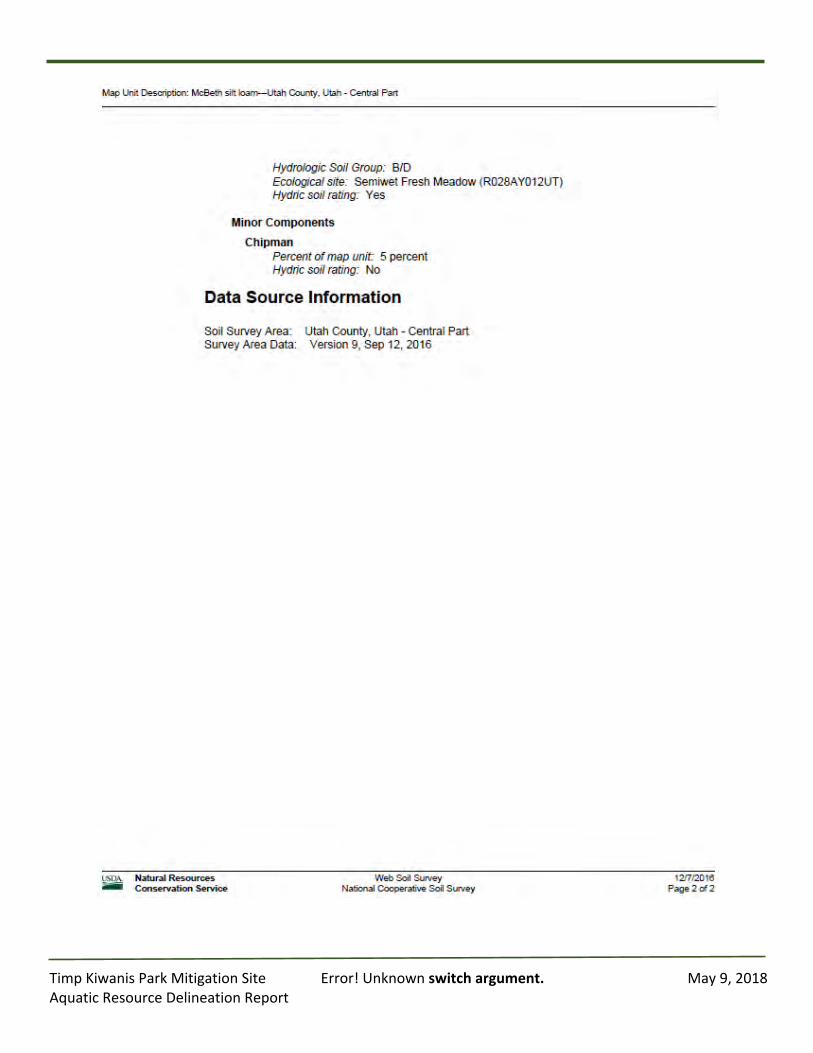
TimpKiwanisParkMitigationSite Error!Unknownswitchargument. May9,2018AquaticResourceDelineationReport
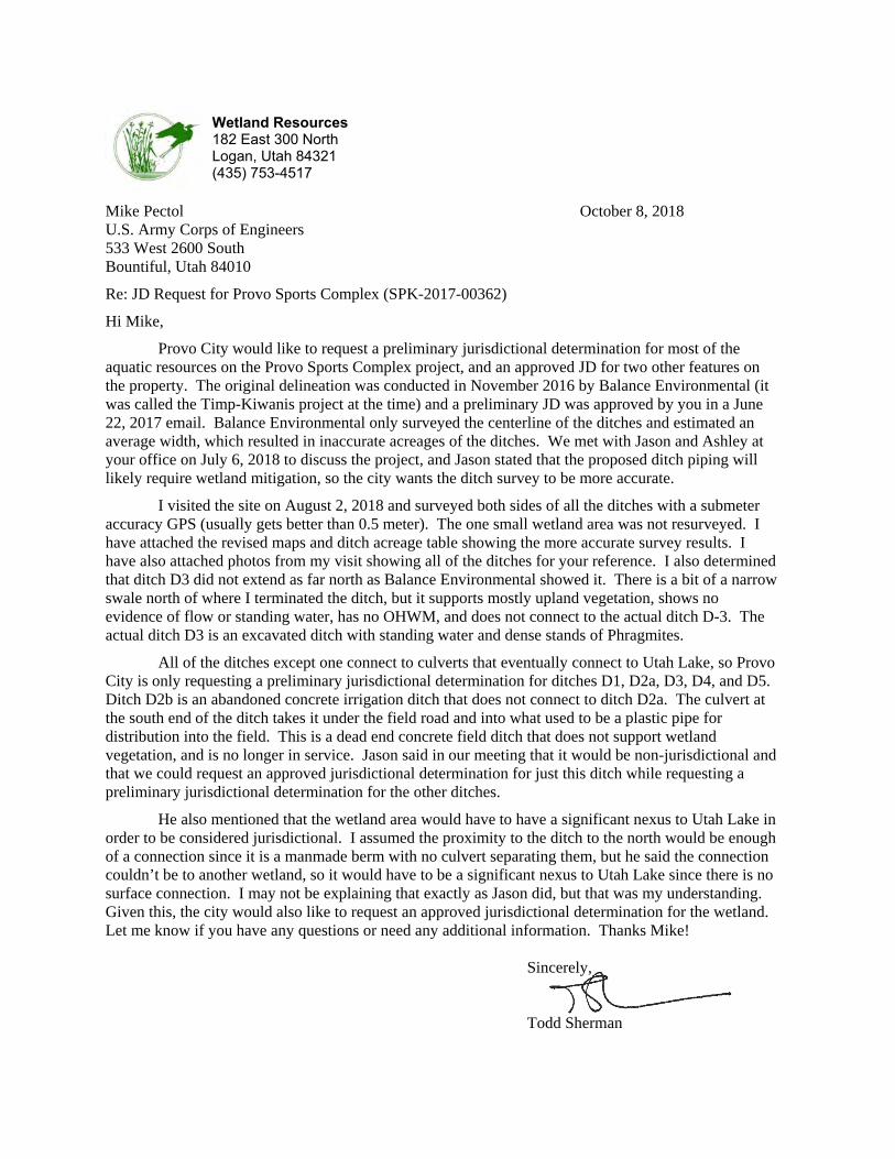
Wetland Resources 182 East 300 North Logan, Utah 84321 (435) 753-4517
Mike Pectol October 8, 2018 U.S. Army Corps of Engineers 533 West 2600 South Bountiful, Utah 84010
Re: JD Request for Provo Sports Complex (SPK-2017-00362)
Hi Mike,
Provo City would like to request a preliminary jurisdictional determination for most of the aquatic resources on the Provo Sports Complex project, and an approved JD for two other features on the property. The original delineation was conducted in November 2016 by Balance Environmental (it was called the Timp-Kiwanis project at the time) and a preliminary JD was approved by you in a June 22, 2017 email. Balance Environmental only surveyed the centerline of the ditches and estimated an average width, which resulted in inaccurate acreages of the ditches. We met with Jason and Ashley at your office on July 6, 2018 to discuss the project, and Jason stated that the proposed ditch piping will likely require wetland mitigation, so the city wants the ditch survey to be more accurate.
I visited the site on August 2, 2018 and surveyed both sides of all the ditches with a submeter accuracy GPS (usually gets better than 0.5 meter). The one small wetland area was not resurveyed. I have attached the revised maps and ditch acreage table showing the more accurate survey results. I have also attached photos from my visit showing all of the ditches for your reference. I also determined that ditch D3 did not extend as far north as Balance Environmental showed it. There is a bit of a narrow swale north of where I terminated the ditch, but it supports mostly upland vegetation, shows no evidence of flow or standing water, has no OHWM, and does not connect to the actual ditch D-3. The actual ditch D3 is an excavated ditch with standing water and dense stands of Phragmites.
All of the ditches except one connect to culverts that eventually connect to Utah Lake, so Provo City is only requesting a preliminary jurisdictional determination for ditches D1, D2a, D3, D4, and D5. Ditch D2b is an abandoned concrete irrigation ditch that does not connect to ditch D2a. The culvert at the south end of the ditch takes it under the field road and into what used to be a plastic pipe for distribution into the field. This is a dead end concrete field ditch that does not support wetland vegetation, and is no longer in service. Jason said in our meeting that it would be non-jurisdictional and that we could request an approved jurisdictional determination for just this ditch while requesting a preliminary jurisdictional determination for the other ditches.
He also mentioned that the wetland area would have to have a significant nexus to Utah Lake in order to be considered jurisdictional. I assumed the proximity to the ditch to the north would be enough of a connection since it is a manmade berm with no culvert separating them, but he said the connection couldn’t be to another wetland, so it would have to be a significant nexus to Utah Lake since there is no surface connection. I may not be explaining that exactly as Jason did, but that was my understanding. Given this, the city would also like to request an approved jurisdictional determination for the wetland. Let me know if you have any questions or need any additional information. Thanks Mike! Sincerely,
Todd Sherman
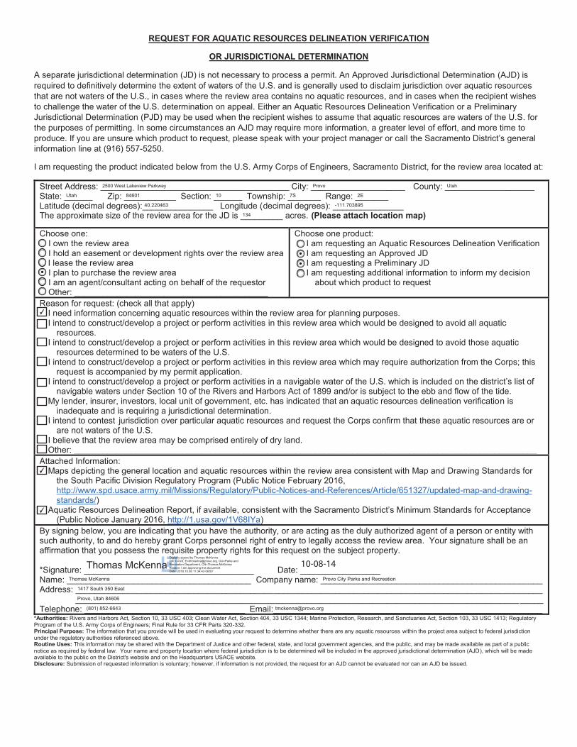
REQUEST FOR AQUATIC RESOURCES DELINEATION VERIFICATION
OR JURISDICTIONAL DETERMINATION
A separate jurisdictional determination (JD) is not necessary to process a permit. An Approved Jurisdictional Determination (AJD) is required to definitively determine the extent of waters of the U.S. and is generally used to disclaim jurisdiction over aquatic resources that are not waters of the U.S., in cases where the review area contains no aquatic resources, and in cases when the recipient wishes to challenge the water of the U.S. determination on appeal. Either an Aquatic Resources Delineation Verification or a Preliminary Jurisdictional Determination (PJD) may be used when the recipient wishes to assume that aquatic resources are waters of the U.S. for the purposes of permitting. In some circumstances an AJD may require more information, a greater level of effort, and more time to produce. If you are unsure which product to request, please speak with your project manager or call the Sacramento District’s general information line at (916) 557-5250.
I am requesting the product indicated below from the U.S. Army Corps of Engineers, Sacramento District, for the review area located at:
Street Address: ________________________________________ City: ____________________ County: ___________________ State: ______ Zip: ___________ Section: ______ Township: _______ Range: _______ Latitude (decimal degrees):_______________ Longitude (decimal degrees): _______________ The approximate size of the review area for the JD is _________ acres. (Please attach location map)
Choose one:I own the review areaI hold an easement or development rights over the review areaI lease the review areaI plan to purchase the review areaI am an agent/consultant acting on behalf of the requestorOther: _________________________________________
Choose one product:I am requesting an Aquatic Resources Delineation VerificationI am requesting an Approved JDI am requesting a Preliminary JDI am requesting additional information to inform my decision
about which product to request
Reason for request: (check all that apply)I need information concerning aquatic resources within the review area for planning purposes.I intend to construct/develop a project or perform activities in this review area which would be designed to avoid all aquatic
resources.I intend to construct/develop a project or perform activities in this review area which would be designed to avoid those aquatic
resources determined to be waters of the U.S.I intend to construct/develop a project or perform activities in this review area which may require authorization from the Corps; this
request is accompanied by my permit application.I intend to construct/develop a project or perform activities in a navigable water of the U.S. which is included on the district’s list of
navigable waters under Section 10 of the Rivers and Harbors Act of 1899 and/or is subject to the ebb and flow of the tide. My lender, insurer, investors, local unit of government, etc. has indicated that an aquatic resources delineation verification is
inadequate and is requiring a jurisdictional determination.I intend to contest jurisdiction over particular aquatic resources and request the Corps confirm that these aquatic resources are or
are not waters of the U.S.I believe that the review area may be comprised entirely of dry land.Other: __________________________________________________________________________________________________
Attached Information:Maps depicting the general location and aquatic resources within the review area consistent with Map and Drawing Standards for
the South Pacific Division Regulatory Program (Public Notice February 2016, http://www.spd.usace.army.mil/Missions/Regulatory/Public-Notices-and-References/Article/651327/updated-map-and-drawing-standards/)
Aquatic Resources Delineation Report, if available, consistent with the Sacramento District’s Minimum Standards for Acceptance (Public Notice January 2016, http://1.usa.gov/1V68IYa)
By signing below, you are indicating that you have the authority, or are acting as the duly authorized agent of a person or entity with such authority, to and do hereby grant Corps personnel right of entry to legally access the review area. Your signature shall be an affirmation that you possess the requisite property rights for this request on the subject property.
*Signature: ____________________________________ Date: _________________ Name: _______________________________________ Company name: _______________________________________________Address: ___________________________________________________________________________________________________
___________________________________________________________________________________________________Telephone: __________________________________ Email:_________________________________________________________
*Authorities: Rivers and Harbors Act, Section 10, 33 USC 403; Clean Water Act, Section 404, 33 USC 1344; Marine Protection, Research, and Sanctuaries Act, Section 103, 33 USC 1413; Regulatory Program of the U.S. Army Corps of Engineers; Final Rule for 33 CFR Parts 320-332. Principal Purpose: The information that you provide will be used in evaluating your request to determine whether there are any aquatic resources within the project area subject to federal jurisdiction under the regulatory authorities referenced above. Routine Uses: This information may be shared with the Department of Justice and other federal, state, and local government agencies, and the public, and may be made available as part of a public notice as required by federal law. Your name and property location where federal jurisdiction is to be determined will be included in the approved jurisdictional determination (AJD), which will be made available to the public on the District's website and on the Headquarters USACE website. Disclosure: Submission of requested information is voluntary; however, if information is not provided, the request for an AJD cannot be evaluated nor can an AJD be issued.
2500 West Lakeview Parkway Provo Utah
Utah 84601 10 7S 2E
40.220463 -111.703895
134
Thomas McKenna Provo City Parks and Recreation
1417 South 350 East
Provo, Utah 84606
(801) 852-6643 [email protected]
✔
✔
✔
10-08-14Thomas McKennaDigitally signed by Thomas McKennaDN: C=US, [email protected], OU=Parks and Recreation Department, CN=Thomas McKennaReason: I am approving this documentDate: 2018.10.08 11:34:42-06'00'
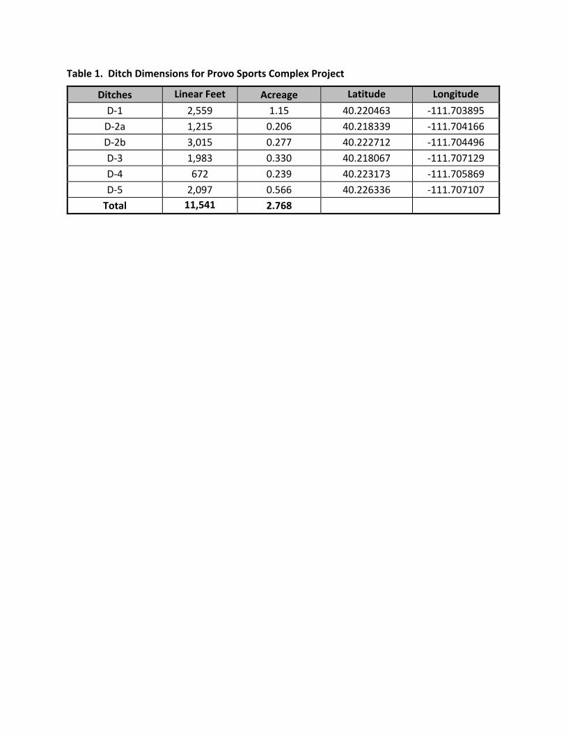
Table 1. Ditch Dimensions for Provo Sports Complex Project
Ditches Linear Feet Acreage Latitude Longitude
D‐1 2,559 1.15 40.220463 ‐111.703895
D‐2a 1,215 0.206 40.218339 ‐111.704166
D‐2b 3,015 0.277 40.222712 ‐111.704496
D‐3 1,983 0.330 40.218067 ‐111.707129
D‐4 672 0.239 40.223173 ‐111.705869
D‐5 2,097 0.566 40.226336 ‐111.707107
Total 11,541 2.768
REVISED DELINEATION MAPS
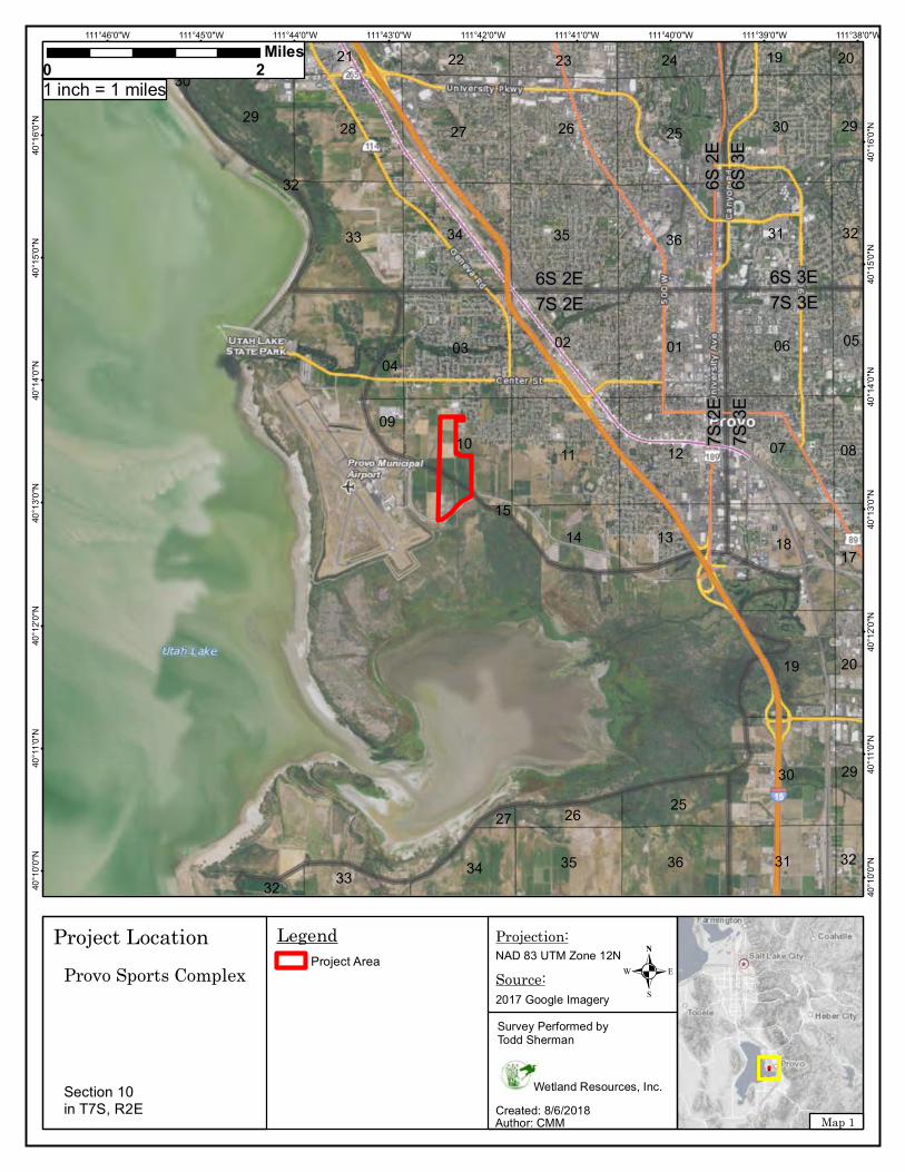
7S 2
E7S
3E
7S 2E6S 2E
7S 3E6S 3E
6S 2
E6S
3E
11
22
34
25
29
20
32
13
21
32
23
35
17
24
12
31
33
10
31
18
25
06
26
08
35
29
27
36
01
32
32
20
33
2928
15
27
05
30
03
26
04
30
14
07
19 20
19
09
34
30
02
19
36
111°38'0"W111°39'0"W111°40'0"W111°41'0"W111°42'0"W111°43'0"W111°44'0"W111°45'0"W111°46'0"W40
°16'
0"N
40°1
6'0"
N
40°1
5'0"
N
40°1
5'0"
N
40°1
4'0"
N
40°1
4'0"
N
40°1
3'0"
N
40°1
3'0"
N
40°1
2'0"
N
40°1
2'0"
N
40°1
1'0"
N
40°1
1'0"
N
40°1
0'0"
N
40°1
0'0"
N
LegendProject Area
0 2Miles
Map 1
.NAD 83 UTM Zone 12N
Author: CMMCreated: 8/6/2018
Projection:
Source:2017 Google Imagery
Wetland Resources, Inc.
Survey Performed byTodd Sherman
Project LocationProvo Sports Complex
1 inch = 1 miles
Section 10in T7S, R2E
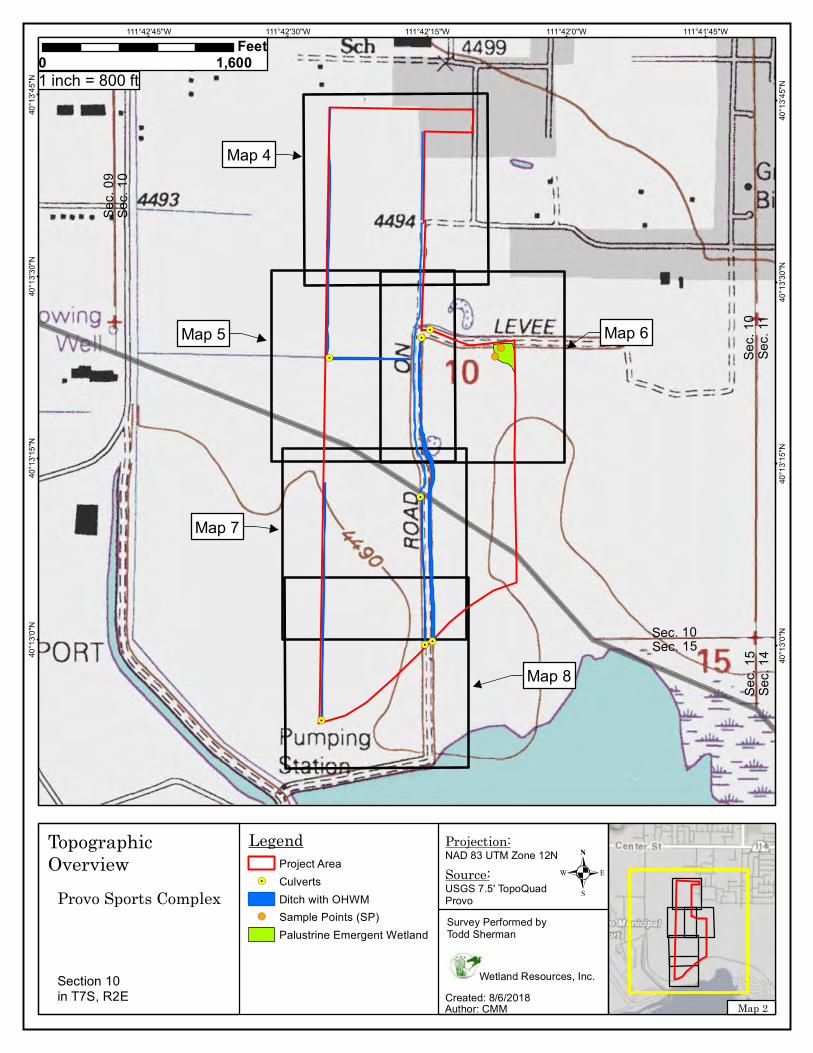
!(!(
!.!.
!.!.
!.
!.
!.
Sec.
11
Sec.
10
Sec. 10Sec. 15
Sec.
10
Sec.
09
Sec.
15
Sec.
14
111°41'45"W111°42'0"W111°42'15"W111°42'30"W111°42'45"W40
°13'
45"N
40°1
3'45
"N
40°1
3'30
"N
40°1
3'30
"N
40°1
3'15
"N
40°1
3'15
"N
40°1
3'0"
N
40°1
3'0"
N
LegendProject Area
!. CulvertsDitch with OHWM
!( Sample Points (SP)Palustrine Emergent Wetland
0 1,600Feet
Map 2
.NAD 83 UTM Zone 12N
Author: CMMCreated: 8/6/2018
Projection:
Source:USGS 7.5' TopoQuadProvo
Wetland Resources, Inc.
Survey Performed byTodd Sherman
Topographic Overview
Provo Sports Complex
1 inch = 800 ft
Map 4
Map 5 Map 6
Map 7
Map 8
Section 10in T7S, R2E
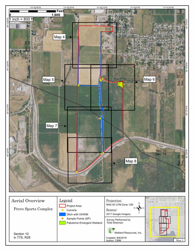
!(!(
!.!.
!.!.
!.
!.
!.
Sec.
11
Sec.
10
Sec. 10Sec. 15
Sec.
10
Sec.
09
Sec.
15
Sec.
14
111°41'45"W111°42'0"W111°42'15"W111°42'30"W111°42'45"W40
°13'
45"N
40°1
3'45
"N
40°1
3'30
"N
40°1
3'30
"N
40°1
3'15
"N
40°1
3'15
"N
40°1
3'0"
N
40°1
3'0"
N
LegendProject Area
!. CulvertsDitch with OHWM
!( Sample Points (SP)Palustrine Emergent Wetland
0 1,600Feet
Map 3
.NAD 83 UTM Zone 12N
Author: CMMCreated: 8/6/2018
Projection:
Source:2017 Google Imagery
Wetland Resources, Inc.
Survey Performed byTodd Sherman
Aerial OverviewProvo Sports Complex
1 inch = 800 ft
Map 4
Map 5 Map 6
Map 7
Map 8
Section 10in T7S, R2E
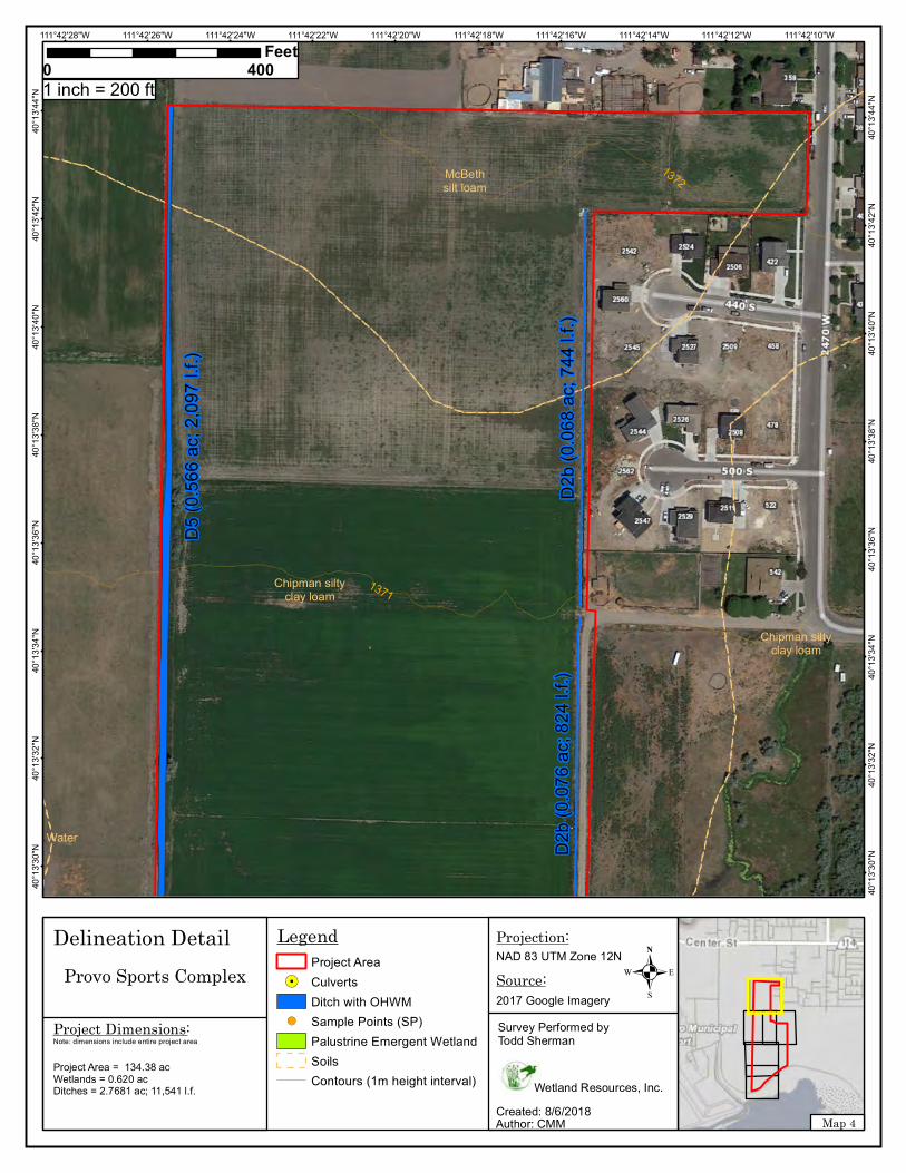
1372
1371
McBethsilt loam
Chipman siltyclay loam
Chipman siltyclay loam
Water
111°42'10"W111°42'12"W111°42'14"W111°42'16"W111°42'18"W111°42'20"W111°42'22"W111°42'24"W111°42'26"W111°42'28"W40
°13'
44"N
40°1
3'44
"N
40°1
3'42
"N
40°1
3'42
"N
40°1
3'40
"N
40°1
3'40
"N
40°1
3'38
"N
40°1
3'38
"N
40°1
3'36
"N
40°1
3'36
"N
40°1
3'34
"N
40°1
3'34
"N
40°1
3'32
"N
40°1
3'32
"N
40°1
3'30
"N
40°1
3'30
"N
LegendProject Area
!. CulvertsDitch with OHWM
!( Sample Points (SP)Palustrine Emergent WetlandSoilsContours (1m height interval)
0 400Feet
Map 4
.NAD 83 UTM Zone 12N
Author: CMMCreated: 8/6/2018
Projection:
Source:2017 Google Imagery
Wetland Resources, Inc.
Survey Performed byTodd Sherman
Delineation DetailProvo Sports Complex
1 inch = 200 ft
Project Area = 134.38 acWetlands = 0.620 acDitches = 2.7681 ac; 11,541 l.f.
Project Dimensions:Note: dimensions include entire project area
D5
(0.5
66 a
c; 2
,097
l.f.)
D2b
(0.0
68 a
c; 7
44 l.
f.)D
2b (0
.076
ac;
824
l.f.)
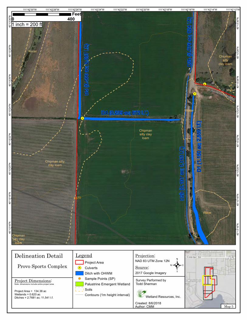
!.
!.
!.
1370
Chipmansilty clay
loam
Chipmansilty clay
loam
Chipman siltyclay loam
Chipmansilty
clay loam
Water
Water
Water
Water
111°42'12"W111°42'14"W111°42'16"W111°42'18"W111°42'20"W111°42'22"W111°42'24"W111°42'26"W111°42'28"W111°42'30"W40
°13'
30"N
40°1
3'30
"N
40°1
3'28
"N
40°1
3'28
"N
40°1
3'26
"N
40°1
3'26
"N
40°1
3'24
"N
40°1
3'24
"N
40°1
3'22
"N
40°1
3'22
"N
40°1
3'20
"N
40°1
3'20
"N
40°1
3'18
"N
40°1
3'18
"N
40°1
3'16
"N
40°1
3'16
"N
LegendProject Area
!. CulvertsDitch with OHWM
!( Sample Points (SP)Palustrine Emergent WetlandSoilsContours (1m height interval)
0 400Feet
Map 5
.NAD 83 UTM Zone 12N
Author: CMMCreated: 8/6/2018
Projection:
Source:2017 Google Imagery
Wetland Resources, Inc.
Survey Performed byTodd Sherman
Delineation DetailProvo Sports Complex
1 inch = 200 ft
Project Dimensions:Note: dimensions include entire project area
D5
(0.5
66 a
c; 2
,097
l.f.)
D2b
(0.0
76 a
c; 8
24 l.
f.)
D4 (0.239 ac; 672 l.f.)
D2b
(0.1
07 a
c; 1
,165
l.f.)
D1
(1.1
50 a
c; 2
,559
l.f.)
Project Area = 134.38 acWetlands = 0.620 acDitches = 2.7681 ac; 11,541 l.f.
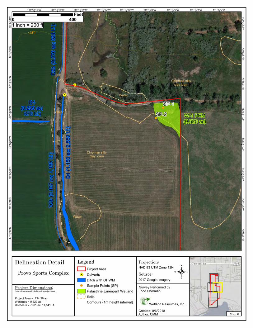
!(
!(
!.
!.
1370
SP-1
SP-2
Chipman siltyclay loam
Chipman siltyclay loam
Water
Water
Water
111°42'2"W111°42'4"W111°42'6"W111°42'8"W111°42'10"W111°42'12"W111°42'14"W111°42'16"W111°42'18"W40
°13'
30"N
40°1
3'30
"N
40°1
3'28
"N
40°1
3'28
"N
40°1
3'26
"N
40°1
3'26
"N
40°1
3'24
"N
40°1
3'24
"N
40°1
3'22
"N
40°1
3'22
"N
40°1
3'20
"N
40°1
3'20
"N
40°1
3'18
"N
40°1
3'18
"N
40°1
3'16
"N
40°1
3'16
"N
LegendProject Area
!. CulvertsDitch with OHWM
!( Sample Points (SP)Palustrine Emergent WetlandSoilsContours (1m height interval)
0 400Feet
Map 6
.NAD 83 UTM Zone 12N
Author: CMMCreated: 8/6/2018
Projection:
Source:2017 Google Imagery
Wetland Resources, Inc.
Survey Performed byTodd Sherman
Delineation DetailProvo Sports Complex
1 inch = 200 ft
Project Dimensions:Note: dimensions include entire project area
W-1 PEM(0.620 ac)
D2b
(0.0
76 a
c; 8
24 l.
f.)
D4 (0.239 ac;
672 l.f.)
D2b
(0.1
07 a
c; 1
,165
l.f.)
D1
(1.1
50 a
c; 2
,559
l.f.)
Project Area = 134.38 acWetlands = 0.620 acDitches = 2.7681 ac; 11,541 l.f.
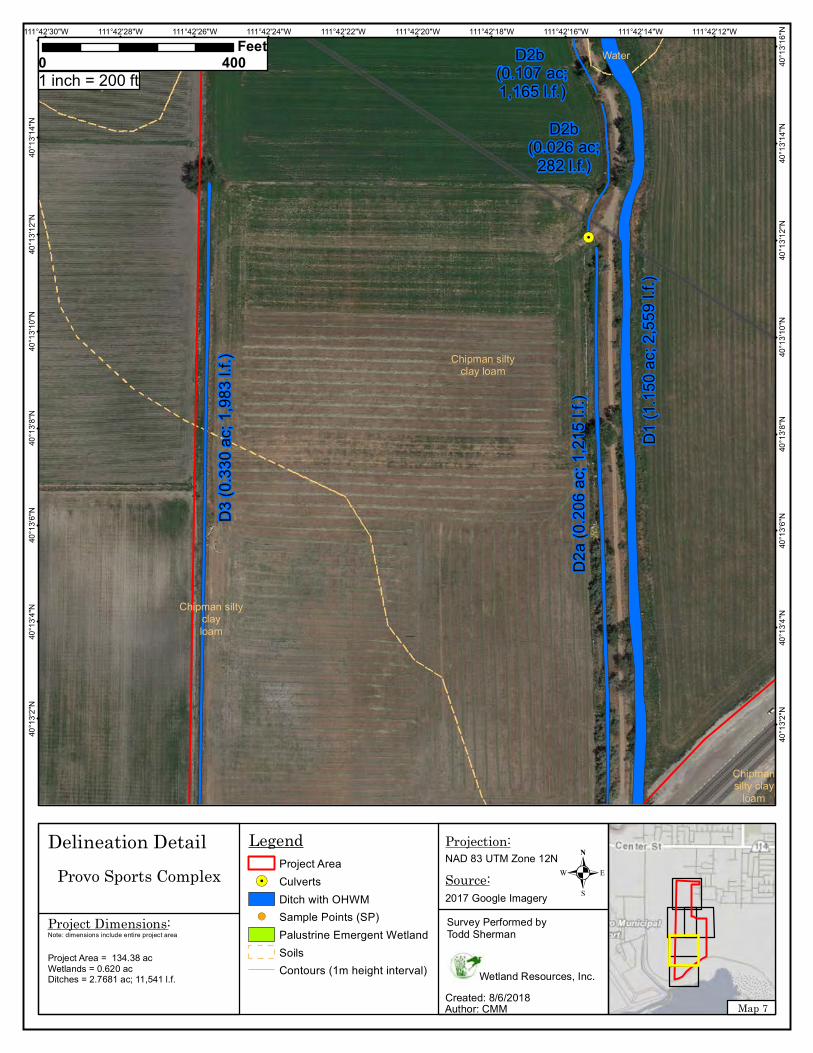
!.
!.
Chipman siltyclay loam
Chipman siltyclay loam
Chipman siltyclayloam
Water
Chipmansilty clay
loam
111°42'12"W111°42'14"W111°42'16"W111°42'18"W111°42'20"W111°42'22"W111°42'24"W111°42'26"W111°42'28"W111°42'30"W
40°1
3'16
"N
40°1
3'14
"N
40°1
3'14
"N
40°1
3'12
"N
40°1
3'12
"N
40°1
3'10
"N
40°1
3'10
"N
40°1
3'8"
N
40°1
3'8"
N
40°1
3'6"
N
40°1
3'6"
N
40°1
3'4"
N
40°1
3'4"
N
40°1
3'2"
N
40°1
3'2"
N
LegendProject Area
!. CulvertsDitch with OHWM
!( Sample Points (SP)Palustrine Emergent WetlandSoilsContours (1m height interval)
0 400Feet
Map 7
.NAD 83 UTM Zone 12N
Author: CMMCreated: 8/6/2018
Projection:
Source:2017 Google Imagery
Wetland Resources, Inc.
Survey Performed byTodd Sherman
Delineation DetailProvo Sports Complex
1 inch = 200 ft
Project Dimensions:Note: dimensions include entire project area
D3
(0.3
30 a
c; 1
,983
l.f.)
D2b(0.026 ac;
282 l.f.)
D2b (0.107 ac;1,165 l.f.)
D1
(1.1
50 a
c; 2
,559
l.f.)
D2a
(0.2
06 a
c; 1
,215
l.f.)
Project Area = 134.38 acWetlands = 0.620 acDitches = 2.7681 ac; 11,541 l.f.

!.!.
!.
1369
1368
Chipman siltyclay loam
Chipmansilty
clay loam
Chipmansilty
clay loam
Chipmansilty clay
loam
Chipman siltyclay loam
111°42'12"W111°42'14"W111°42'16"W111°42'18"W111°42'20"W111°42'22"W111°42'24"W111°42'26"W111°42'28"W111°42'30"W40
°13'
4"N
40°1
3'4"
N
40°1
3'2"
N
40°1
3'2"
N
40°1
3'0"
N
40°1
3'0"
N
40°1
2'58
"N
40°1
2'58
"N
40°1
2'56
"N
40°1
2'56
"N
40°1
2'54
"N
40°1
2'54
"N
40°1
2'52
"N
40°1
2'52
"N
40°1
2'50
"N
40°1
2'50
"N
LegendProject Area
!. CulvertsDitch with OHWM
!( Sample Points (SP)Palustrine Emergent WetlandSoilsContours (1m height interval)
0 400Feet
Map 8
.NAD 83 UTM Zone 12N
Author: CMMCreated: 8/6/2018
Projection:
Source:2017 Google Imagery
Wetland Resources, Inc.
Survey Performed byTodd Sherman
Delineation DetailProvo Sports Complex
1 inch = 200 ft
Project Dimensions:Note: dimensions include entire project area
D3
(0.3
30 a
c; 1
,983
l.f.)
Lake
view P
arkway
D1
(1.1
50 a
c; 2
,559
l.f.)
D2a
(0.2
06 a
c; 1
,215
l.f.)
Project Area = 134.38 acWetlands = 0.620 acDitches = 2.7681 ac; 11,541 l.f.
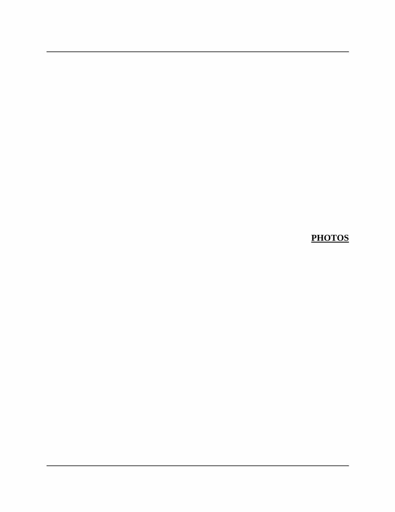
PHOTOS
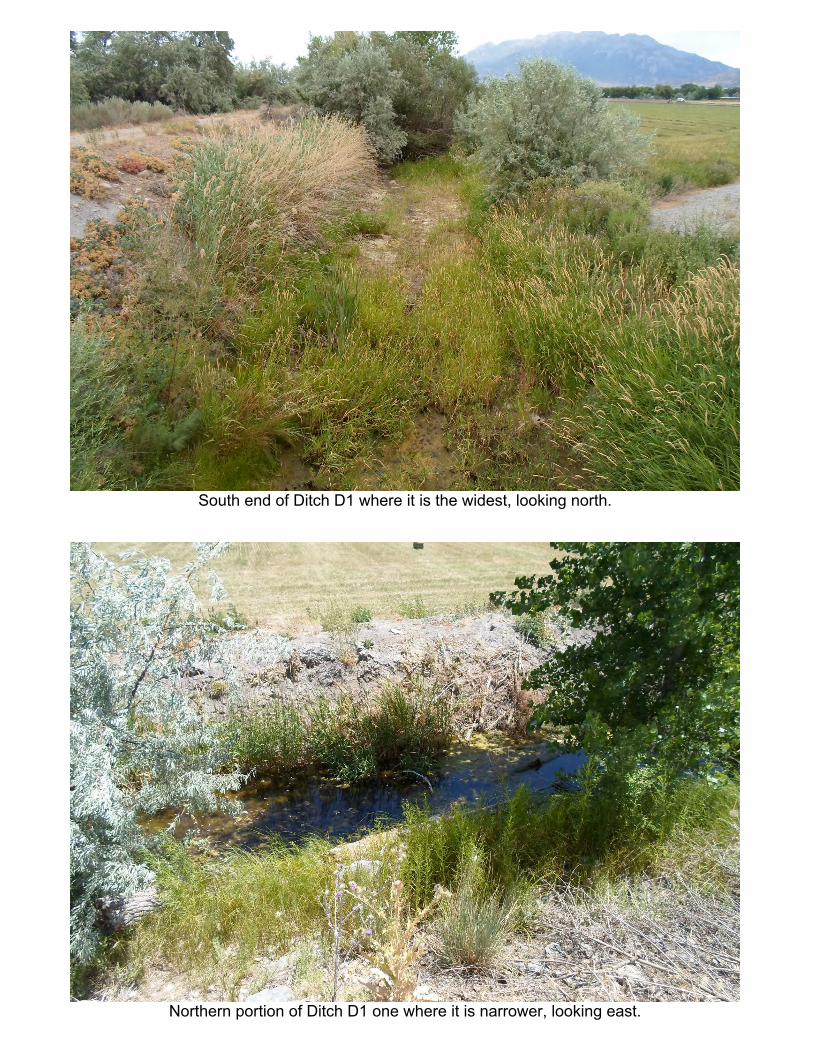
South end of Ditch D1 where it is the widest, looking north.
Northern portion of Ditch D1 one where it is narrower, looking east.

North end of Ditch D2a, looking south.
Abandoned concrete ditch D2b.
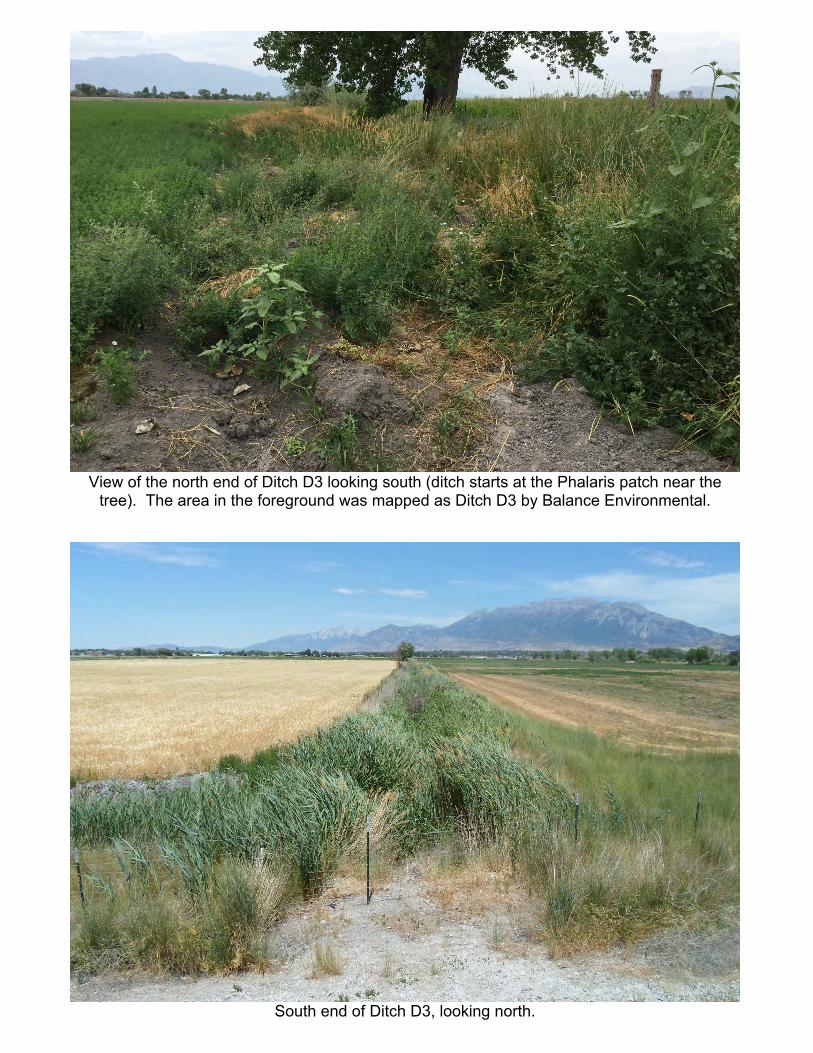
View of the north end of Ditch D3 looking south (ditch starts at the Phalaris patch near thetree). The area in the foreground was mapped as Ditch D3 by Balance Environmental.
South end of Ditch D3, looking north.
Ditch D4, looking northwest.
Ditch D5, looking north.

Appendix J Mike Pectol (USACE) email
June 22, 2017
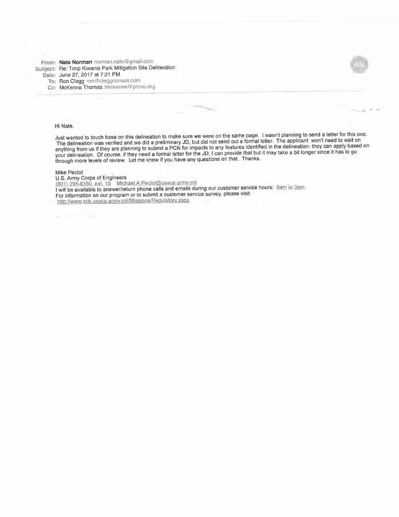
Appendix K Utah Division of Wildlife Resources Coordination Letters
December 6, 2016
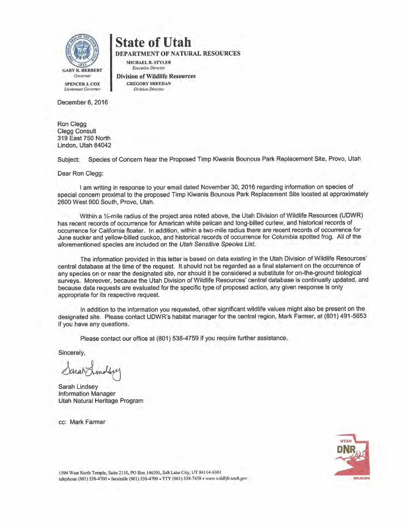
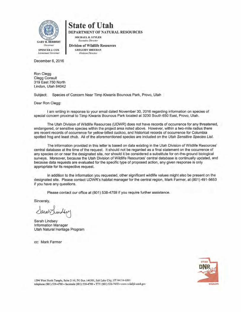

Appendix L Biological Inventory: Sprianthes diluvialis
December 2016
Biological Inventory: Spiranthes diluvialis
FOR PROPOSED TIMP KIWANIS PARK MITIGATION SITE
UTAH COUNTY, UTAH
PREPARED FOR:
1417 South 350 East Provo, Utah 84606
PREPARED BY:
4720 Hollow Road Nibley, Utah 84321
DECEMBER 2016

Timp Kiwanis Park Mitigation Site ‐ii‐ January 5, 2017 Aquatic Resource Delineation Report
Table of Contents
Page
Introduction ............................................................................................................................... 1
Species Information ....................................................................................................... 1
Project Location ............................................................................................................. 2
General Description of Project Area .............................................................................. 2
Methodology ............................................................................................................................. 3
Results ........................................................................................................................................ 3
References ................................................................................................................................. 4
Tables
Table 1. Species Observed Within the Project Area ............................................................. ... 2
Appendices
Appendix A: Habitat Characteristics and Disqualifying Habitat Qualities .............................. 6
Appendix B: Resumes/Qualifications ..................................................................................... 8
Appendix C: Maps 1 and 2 ...................................................................................................... 10
Appendix D: Photos ................................................................................................................ 13
Timp Kiwanis Park Mitigation Site ‐1‐ January 5, 2017 Aquatic Resource Delineation Report
Introduction Provo City Parks and Recreation retained Balance Environmental to conduct a botanical inventory for Ute ladies’‐tresses (Spiranthes diluvialis) (ULT). The proposed Timp Kiwanis Park Mitigation Site (project site) is located in Utah County, Utah. The south eastern portion of the site had previously been reviewed for ULT by Wetland Resources on September 6, 2016. No ULT individuals were found during the survey. Balance Environmental conducted ULT habitat assessments on the proposed site in the fall and outside of the typical bloom period for this species. The assessment of habitat criteria and habitat disqualifiers were in accordance with the U.S. Fish and Wildlife Service (USFWS) protocol (USFWS 1992, 2007, and 2011) and recent supplemental publications and studies (Arft 1995; Fertig et al. 2005). A summary of habitat characteristics and disqualifying habitat qualities can be found in Appendix A.
During Balance Environmental’s habitat assessment, it was determined that potentially suitable ULT habitat occurred within the project area along a ditch on the western edge of the site. A subsequent site visit during the plant’s blooming window will be required to accurately assess the presence or absence of ULT plants within the identified habitat.
Nate Norman of Balance Environmental completed the onsite evaluation and reporting. His qualifications can be found in Appendix B.
The intent of this report is to summarize field survey methodology, site/data analysis, and survey results to help Provo City, and agency representatives assess potential impacts.
Species Information
Ute ladies’‐tresses is within the genus Spiranthes, members of which have a distinctive floral arrangement (Dressler, 1990, 1993). The small white flowers are spirally attached along the terminus of the stem in a 3‐15 centimeter inflorescence. Each flower of ULT is typical of the orchids, and consists of three sepals and petals. The stem of the plant is somewhat long for a spiranthes orchid, ranging between 10 and 60 centimeters. The leaves are spirally arranged around the stem, are primarily located at the base of the stem, and are greatly reduced upward (Sheviak, 1984). The species name diluvialis has been derived from the Latin diluvium, meaning “of the flood” (Fertig, Black, & Wolken, 2005), indicating ULT’s affinity for water.
ULT are federally listed as threatened (USFWS, 1992c). At the time of listing in 1992, the total number of ULT was estimated to be 6,000 plants across 10 extant populations and three states (Fertig et al., 2005). Subsequent to discovery of previously unknown populations in a wider range of habitats, the estimated total number of ULT increased to over 80,000 plants across more than 50 extant populations and eight states (Fertig et al., 2005).
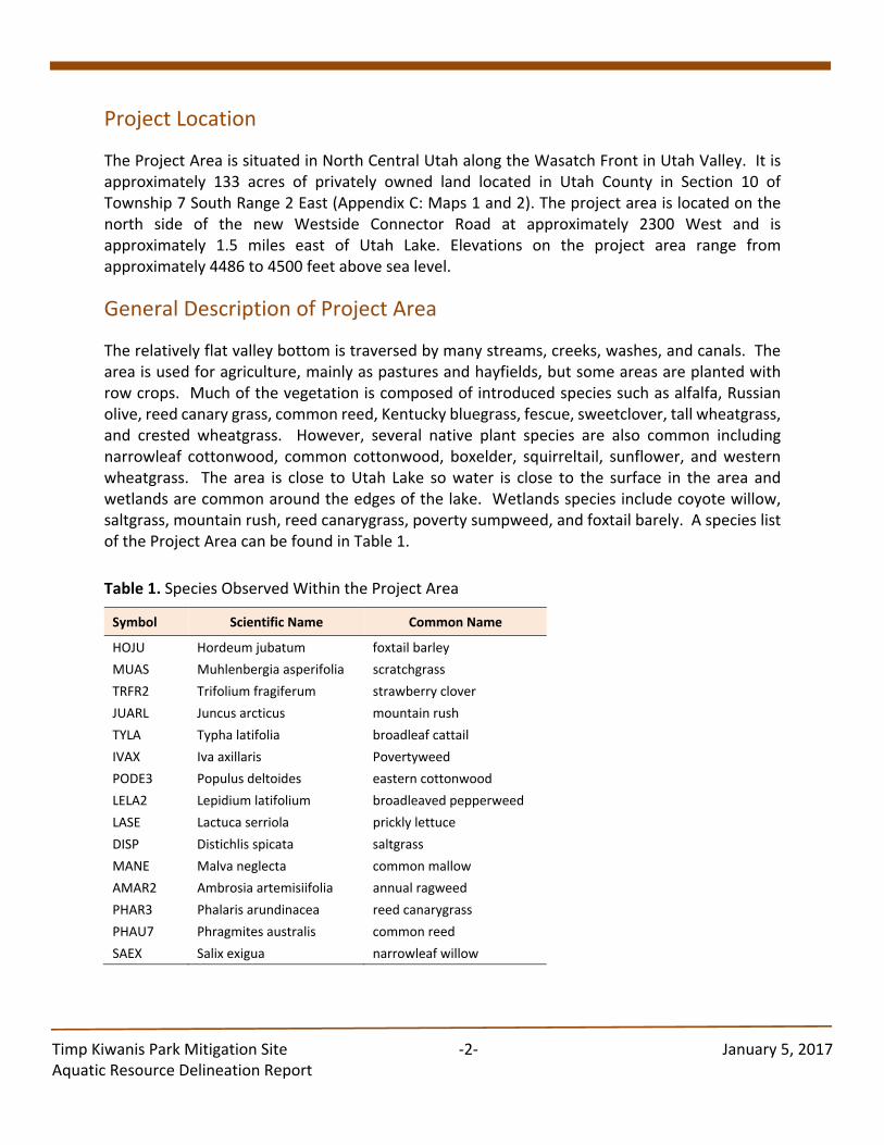
Timp Kiwanis Park Mitigation Site ‐2‐ January 5, 2017 Aquatic Resource Delineation Report
Project Location
The Project Area is situated in North Central Utah along the Wasatch Front in Utah Valley. It is approximately 133 acres of privately owned land located in Utah County in Section 10 of Township 7 South Range 2 East (Appendix C: Maps 1 and 2). The project area is located on the north side of the new Westside Connector Road at approximately 2300 West and is approximately 1.5 miles east of Utah Lake. Elevations on the project area range from approximately 4486 to 4500 feet above sea level.
General Description of Project Area
The relatively flat valley bottom is traversed by many streams, creeks, washes, and canals. The area is used for agriculture, mainly as pastures and hayfields, but some areas are planted with row crops. Much of the vegetation is composed of introduced species such as alfalfa, Russian olive, reed canary grass, common reed, Kentucky bluegrass, fescue, sweetclover, tall wheatgrass, and crested wheatgrass. However, several native plant species are also common including narrowleaf cottonwood, common cottonwood, boxelder, squirreltail, sunflower, and western wheatgrass. The area is close to Utah Lake so water is close to the surface in the area and wetlands are common around the edges of the lake. Wetlands species include coyote willow, saltgrass, mountain rush, reed canarygrass, poverty sumpweed, and foxtail barely. A species list of the Project Area can be found in Table 1.
Table 1. Species Observed Within the Project Area
Symbol Scientific Name Common Name
HOJU Hordeum jubatum foxtail barley
MUAS Muhlenbergia asperifolia scratchgrass
TRFR2 Trifolium fragiferum strawberry clover
JUARL Juncus arcticus mountain rush
TYLA Typha latifolia broadleaf cattail
IVAX Iva axillaris Povertyweed
PODE3 Populus deltoides eastern cottonwood
LELA2 Lepidium latifolium broadleaved pepperweed
LASE Lactuca serriola prickly lettuce
DISP Distichlis spicata saltgrass
MANE Malva neglecta common mallow
AMAR2 Ambrosia artemisiifolia annual ragweed
PHAR3 Phalaris arundinacea reed canarygrass
PHAU7 Phragmites australis common reed
SAEX Salix exigua narrowleaf willow
Timp Kiwanis Park Mitigation Site ‐3‐ January 5, 2017 Aquatic Resource Delineation Report
Methodology
ULT habitat surveys were conducted on November 23, 2016, to assess the presence or absence of potential habitat. Surveys were conducted in accordance with the USFWS Ute ladies’‐tresses Field Survey Guidelines (USFWS 2007) and the USFWS Utah Field Office Guidelines for Conducting and Reporting Botanical Inventories and Monitoring of Federally Listed, Proposed and Candidate Plants (USFWS 2011). Representative photographs were taken of each potentially occupied area (Appendix D). Map 2 shows the Project Area that was surveyed for ULT.
Results A small area of potential habitat was located during the survey. The area is along a ditch that is not downcut or overgrown by thick vegetation. It is dominated by grasses and sedges that are occasionally found with Spiranthes. Although this area is low potential habitat, it could not be disqualified. Therefore, this area should be surveyed again during the ULT blooming season. Overall, the site is largely disturbed and unlikely to support ULT.
Timp Kiwanis Park Mitigation Site ‐4‐ January 5, 2017 Aquatic Resource Delineation Report
References Arft, A.M. 1995. The Genetics, Demography, and Conservation Management of the Rare Orchid
Spiranthes diluvialis. PhD dissertation. University of Colorado, Boulder, CO.
Brunson, Jessi. 2012. Personal communication with Nate Norman. July 12, 2012.
Fertig, Walter, Black, Rick, and Wolken, Paige. 2005. Rangewide Status Review of Ute Ladies’ Tresses (Spiranthes diluvialis). Prepared for the U.S. Fish and Wildlife Service and the Central Utah Water Conservancy District.
US Fish and Wildlife Service. 1992. Endangered and Threatened Wildlife and Plants: Final Rule to List the Plant Spiranthes diluvialis as a Threatened Species. Federal Register 57 (12): 2048‐2054.
US Fish and Wildlife Service. 2007. Ute Ladies Tresses Field Survey Guidelines. Utah Ecological Services Field Office.
US Fish and Wildlife Service. 2011. U.S. Fish and Wildlife Service (USFWS) Utah Field Office Guidelines for Conducting and Reporting Botanical Inventories and Monitoring of Federally Listed, Proposed, and Candidate Plants.
Timp Kiwanis Park Mitigation Site ‐5‐ January 5, 2017 Aquatic Resource Delineation Report
Appendices
Timp Kiwanis Park Mitigation Site ‐6‐ January 5, 2017 Aquatic Resource Delineation Report
Appendix A:
Habitat Characteristics and Disqualifying Habitat Qualities
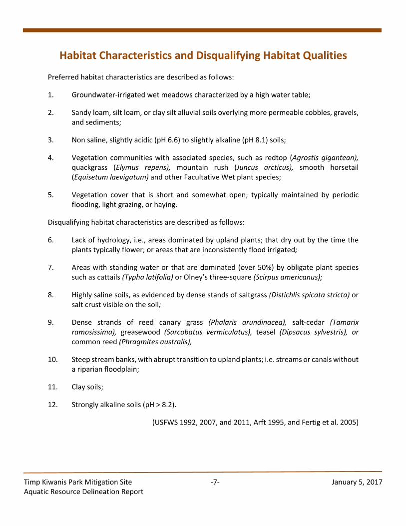
Timp Kiwanis Park Mitigation Site ‐7‐ January 5, 2017 Aquatic Resource Delineation Report
Habitat Characteristics and Disqualifying Habitat Qualities Preferred habitat characteristics are described as follows:
1. Groundwater‐irrigated wet meadows characterized by a high water table;
2. Sandy loam, silt loam, or clay silt alluvial soils overlying more permeable cobbles, gravels, and sediments;
3. Non saline, slightly acidic (pH 6.6) to slightly alkaline (pH 8.1) soils;
4. Vegetation communities with associated species, such as redtop (Agrostis gigantean), quackgrass (Elymus repens), mountain rush (Juncus arcticus), smooth horsetail (Equisetum laevigatum) and other Facultative Wet plant species;
5. Vegetation cover that is short and somewhat open; typically maintained by periodic flooding, light grazing, or haying.
Disqualifying habitat characteristics are described as follows:
6. Lack of hydrology, i.e., areas dominated by upland plants; that dry out by the time the plants typically flower; or areas that are inconsistently flood irrigated;
7. Areas with standing water or that are dominated (over 50%) by obligate plant species such as cattails (Typha latifolia) or Olney’s three‐square (Scirpus americanus);
8. Highly saline soils, as evidenced by dense stands of saltgrass (Distichlis spicata stricta) or salt crust visible on the soil;
9. Dense strands of reed canary grass (Phalaris arundinacea), salt‐cedar (Tamarix ramosissima), greasewood (Sarcobatus vermiculatus), teasel (Dipsacus sylvestris), or common reed (Phragmites australis),
10. Steep stream banks, with abrupt transition to upland plants; i.e. streams or canals without a riparian floodplain;
11. Clay soils;
12. Strongly alkaline soils (pH > 8.2).
(USFWS 1992, 2007, and 2011, Arft 1995, and Fertig et al. 2005)
Timp Kiwanis Park Mitigation Site ‐8‐ January 5, 2017 Aquatic Resource Delineation Report
Appendix B:
Resumes / Qualifications
Timp Kiwanis Park Mitigation Site ‐9‐ January 5, 2017 Aquatic Resource Delineation Report
NATE NORMAN – ENVIRONMENTAL SCIENTIST
Mr. Norman has 20 years of diversified experience in environmental science, with an emphasis on threatened and endangered species, wetlands, and riparian areas. He has conducted surveys for several rare plants in Utah, Idaho, Montana, and Nevada and found several populations of Ute ladies’‐tresses (Spiranthes diluvialis), twinleaf onion (Allium anceps), Simpson’s hedgehog cactus ‐SW Idaho ecotype, (Pediocactus simpsonii), Elko rockcress (Boechera falcifructa), Idaho penstemon (Penstemon idahoensis), and Parish’s phacelia (Phacelia parishii) among many others. In addition, Mr. Norman has conducted surveys and monitoring studies of raptors and their nests, black‐footed ferrets, pygmy rabbits, Utah prairie dogs, desert tortoise, and southwestern willow flycatchers. While completing the work for Section 404 (of the Clean Water Act) permits through the U.S. Corps of Engineers, he has completed numerous threatened and endangered species clearances. Besides conducting rare species work, he has designed or overseen the development of construction/restoration plans for various wetlands and riparian areas in Utah, Nevada, Iowa, Michigan, and Idaho. Mr. Norman holds a B.S. degree in biology from Eastern Michigan University.

Timp Kiwanis Park Mitigation Site ‐10‐ January 5, 2017 Aquatic Resource Delineation Report
Appendix C:
Maps 1 and 2
Timp Kiwanis Park Mitigation Site ‐11‐ January 5, 2017 Aquatic Resource Delineation Report
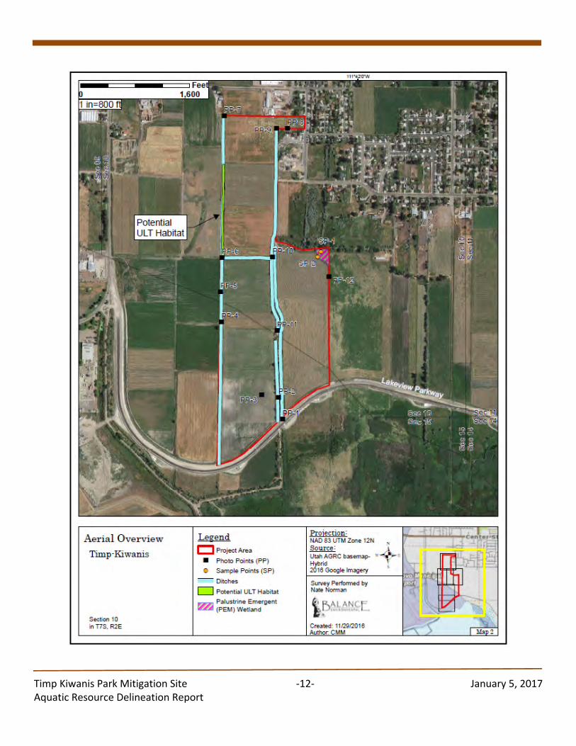
Timp Kiwanis Park Mitigation Site ‐12‐ January 5, 2017 Aquatic Resource Delineation Report
Timp Kiwanis Park Mitigation Site ‐13‐ January 5, 2017 Aquatic Resource Delineation Report
Appendix D:
Photos
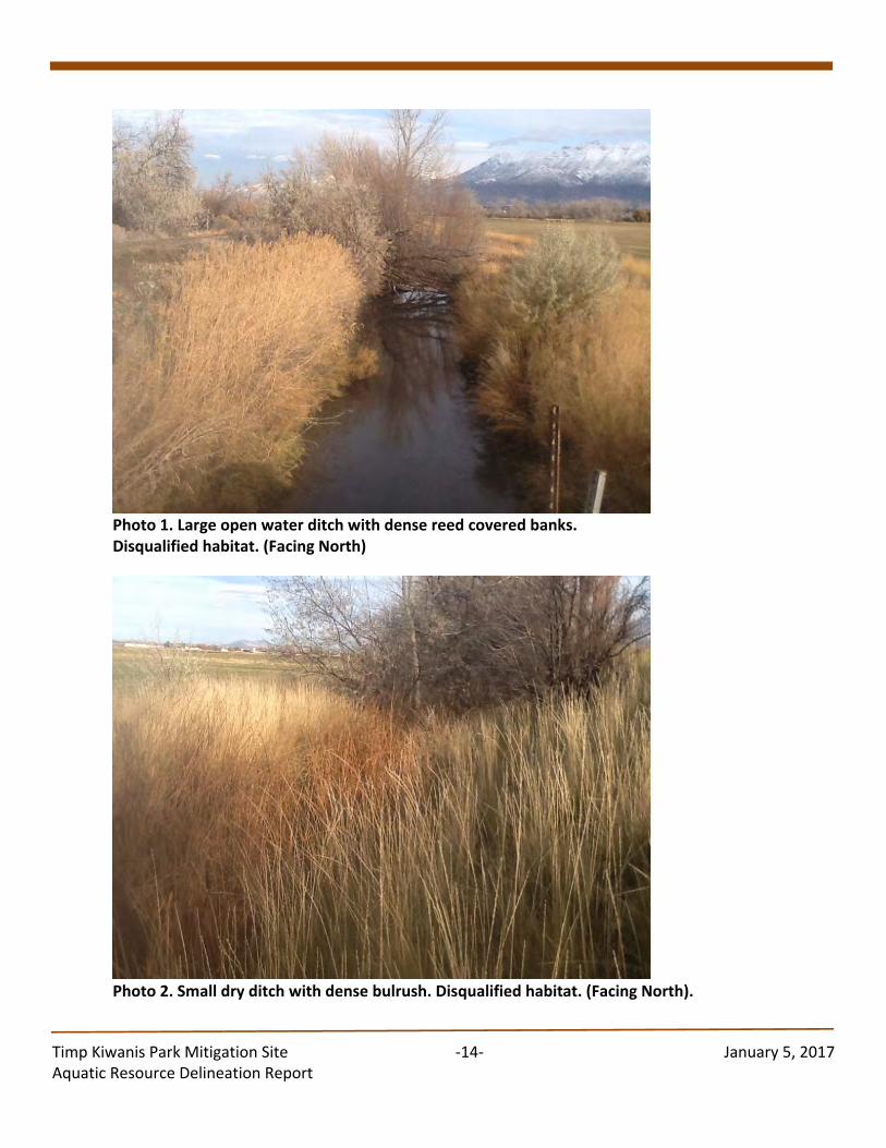
Timp Kiwanis Park Mitigation Site ‐14‐ January 5, 2017 Aquatic Resource Delineation Report
Photo 1. Large open water ditch with dense reed covered banks. Disqualified habitat. (Facing North)
Photo 2. Small dry ditch with dense bulrush. Disqualified habitat. (Facing North).
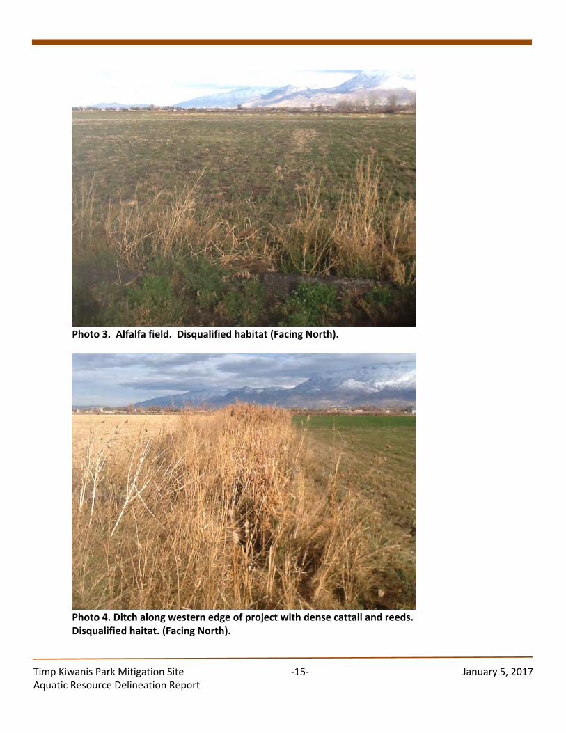
Timp Kiwanis Park Mitigation Site ‐15‐ January 5, 2017 Aquatic Resource Delineation Report
Photo 3. Alfalfa field. Disqualified habitat (Facing North).
Photo 4. Ditch along western edge of project with dense cattail and reeds. Disqualified haitat. (Facing North).
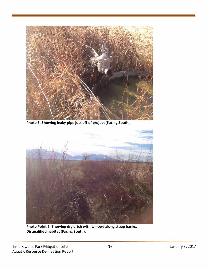
Timp Kiwanis Park Mitigation Site ‐16‐ January 5, 2017 Aquatic Resource Delineation Report
Photo 5. Showing leaky pipe just off of project (Facing South).
Photo Point 6. Showing dry ditch with willows along steep banks. Disqualified habitat (Facing South).
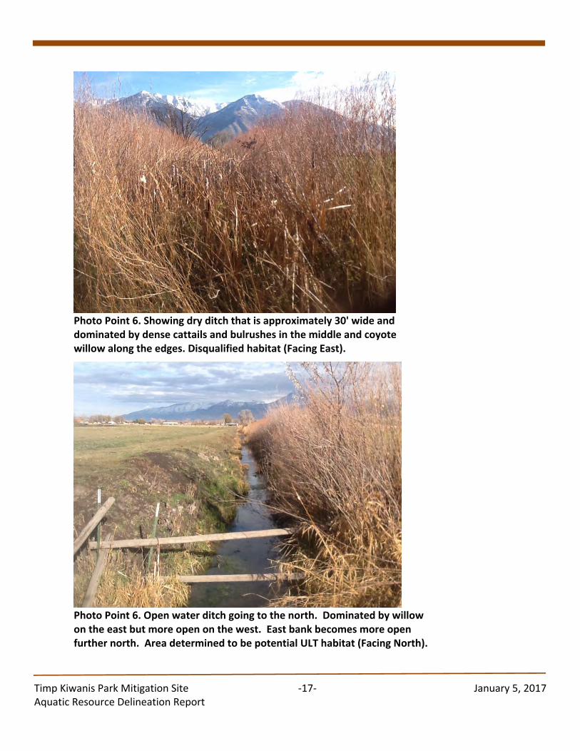
Timp Kiwanis Park Mitigation Site ‐17‐ January 5, 2017 Aquatic Resource Delineation Report
Photo Point 6. Showing dry ditch that is approximately 30' wide and dominated by dense cattails and bulrushes in the middle and coyote willow along the edges. Disqualified habitat (Facing East).
Photo Point 6. Open water ditch going to the north. Dominated by willow on the east but more open on the west. East bank becomes more open further north. Area determined to be potential ULT habitat (Facing North).
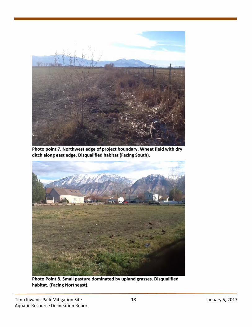
Timp Kiwanis Park Mitigation Site ‐18‐ January 5, 2017 Aquatic Resource Delineation Report
Photo point 7. Northwest edge of project boundary. Wheat field with dry ditch along east edge. Disqualified habitat (Facing South).
Photo Point 8. Small pasture dominated by upland grasses. Disqualified habitat. (Facing Northeast).
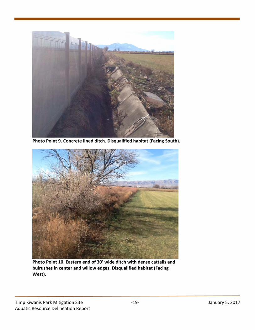
Timp Kiwanis Park Mitigation Site ‐19‐ January 5, 2017 Aquatic Resource Delineation Report
Photo Point 9. Concrete lined ditch. Disqualified habitat (Facing South).
Photo Point 10. Eastern end of 30’ wide ditch with dense cattails and bulrushes in center and willow edges. Disqualified habitat (Facing West).
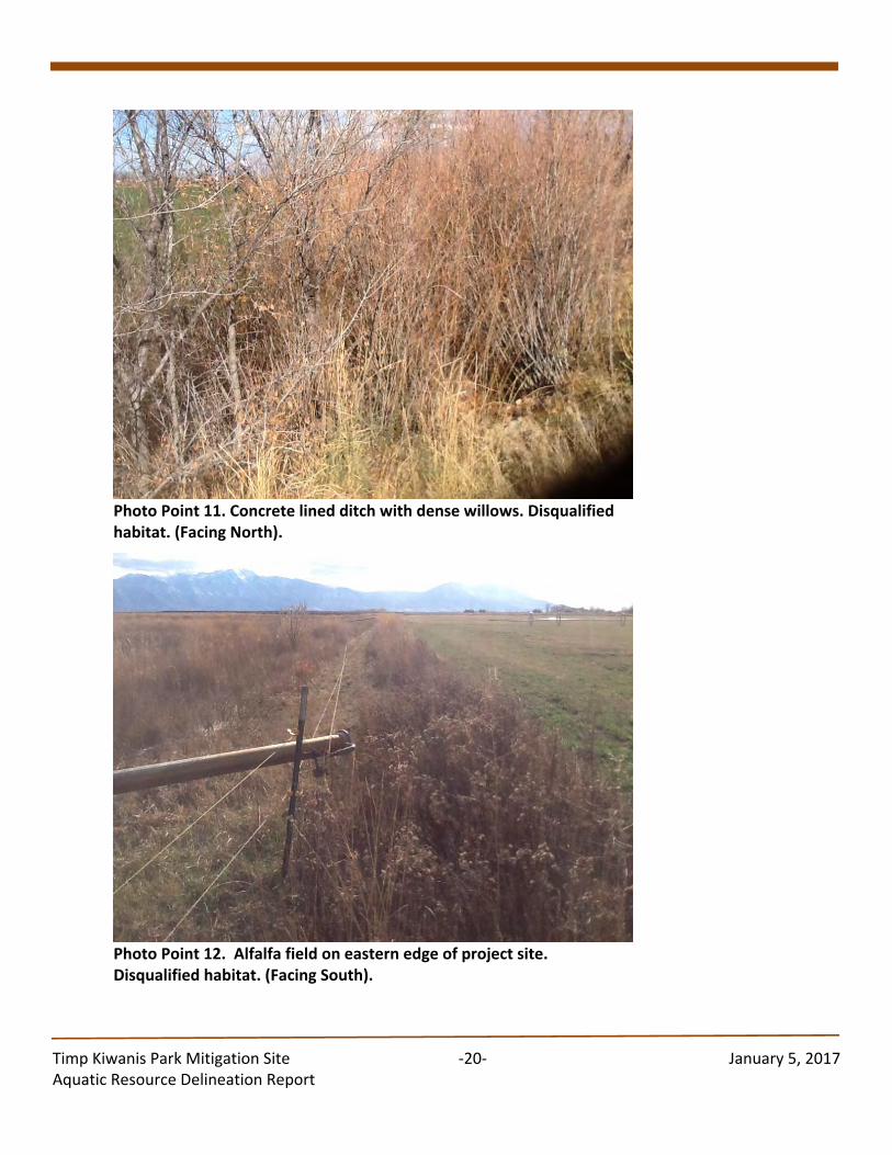
Timp Kiwanis Park Mitigation Site ‐20‐ January 5, 2017 Aquatic Resource Delineation Report
Photo Point 11. Concrete lined ditch with dense willows. Disqualified habitat. (Facing North).
Photo Point 12. Alfalfa field on eastern edge of project site. Disqualified habitat. (Facing South).
Appendix M
Letter from Keith Rittel (PSD Superintendent)
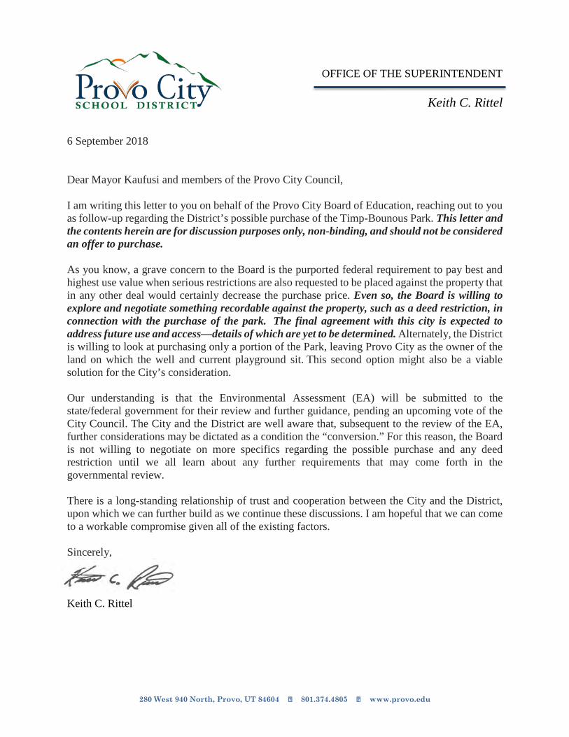
280 West 940 North, Provo, UT 84604 801.374.4805 www.provo.edu
OFFICE OF THE SUPERINTENDENT
Keith C. Rittel 6 September 2018 Dear Mayor Kaufusi and members of the Provo City Council, I am writing this letter to you on behalf of the Provo City Board of Education, reaching out to you as follow-up regarding the District’s possible purchase of the Timp-Bounous Park. This letter and the contents herein are for discussion purposes only, non-binding, and should not be considered an offer to purchase. As you know, a grave concern to the Board is the purported federal requirement to pay best and highest use value when serious restrictions are also requested to be placed against the property that in any other deal would certainly decrease the purchase price. Even so, the Board is willing to explore and negotiate something recordable against the property, such as a deed restriction, in connection with the purchase of the park. The final agreement with this city is expected to address future use and access—details of which are yet to be determined. Alternately, the District is willing to look at purchasing only a portion of the Park, leaving Provo City as the owner of the land on which the well and current playground sit. This second option might also be a viable solution for the City’s consideration. Our understanding is that the Environmental Assessment (EA) will be submitted to the state/federal government for their review and further guidance, pending an upcoming vote of the City Council. The City and the District are well aware that, subsequent to the review of the EA, further considerations may be dictated as a condition the “conversion.” For this reason, the Board is not willing to negotiate on more specifics regarding the possible purchase and any deed restriction until we all learn about any further requirements that may come forth in the governmental review. There is a long-standing relationship of trust and cooperation between the City and the District, upon which we can further build as we continue these discussions. I am hopeful that we can come to a workable compromise given all of the existing factors. Sincerely, Keith C. Rittel
Appendix N
Public Comments and Responses
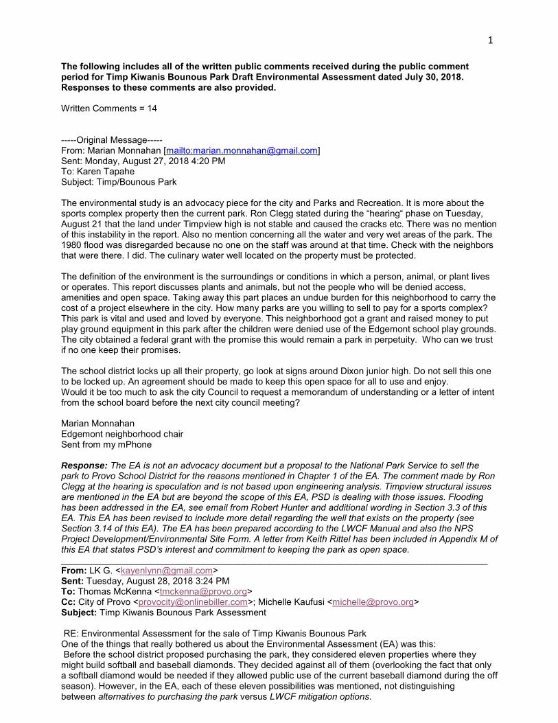
1
The following includes all of the written public comments received during the public comment period for Timp Kiwanis Bounous Park Draft Environmental Assessment dated July 30, 2018. Responses to these comments are also provided. Written Comments = 14 -----Original Message----- From: Marian Monnahan [mailto:[email protected]] Sent: Monday, August 27, 2018 4:20 PM To: Karen Tapahe Subject: Timp/Bounous Park The environmental study is an advocacy piece for the city and Parks and Recreation. It is more about the sports complex property then the current park. Ron Clegg stated during the “hearing“ phase on Tuesday, August 21 that the land under Timpview high is not stable and caused the cracks etc. There was no mention of this instability in the report. Also no mention concerning all the water and very wet areas of the park. The 1980 flood was disregarded because no one on the staff was around at that time. Check with the neighbors that were there. I did. The culinary water well located on the property must be protected. The definition of the environment is the surroundings or conditions in which a person, animal, or plant lives or operates. This report discusses plants and animals, but not the people who will be denied access, amenities and open space. Taking away this part places an undue burden for this neighborhood to carry the cost of a project elsewhere in the city. How many parks are you willing to sell to pay for a sports complex? This park is vital and used and loved by everyone. This neighborhood got a grant and raised money to put play ground equipment in this park after the children were denied use of the Edgemont school play grounds. The city obtained a federal grant with the promise this would remain a park in perpetuity. Who can we trust if no one keep their promises. The school district locks up all their property, go look at signs around Dixon junior high. Do not sell this one to be locked up. An agreement should be made to keep this open space for all to use and enjoy. Would it be too much to ask the city Council to request a memorandum of understanding or a letter of intent from the school board before the next city council meeting? Marian Monnahan Edgemont neighborhood chair Sent from my mPhone Response: The EA is not an advocacy document but a proposal to the National Park Service to sell the park to Provo School District for the reasons mentioned in Chapter 1 of the EA. The comment made by Ron Clegg at the hearing is speculation and is not based upon engineering analysis. Timpview structural issues are mentioned in the EA but are beyond the scope of this EA, PSD is dealing with those issues. Flooding has been addressed in the EA, see email from Robert Hunter and additional wording in Section 3.3 of this EA. This EA has been revised to include more detail regarding the well that exists on the property (see Section 3.14 of this EA). The EA has been prepared according to the LWCF Manual and also the NPS Project Development/Environmental Site Form. A letter from Keith Rittel has been included in Appendix M of this EA that states PSD’s interest and commitment to keeping the park as open space. ____________________________________________________________________________________ From: LK G. <[email protected]> Sent: Tuesday, August 28, 2018 3:24 PM To: Thomas McKenna <[email protected]> Cc: City of Provo <[email protected]>; Michelle Kaufusi <[email protected]> Subject: Timp Kiwanis Bounous Park Assessment RE: Environmental Assessment for the sale of Timp Kiwanis Bounous Park One of the things that really bothered us about the Environmental Assessment (EA) was this: Before the school district proposed purchasing the park, they considered eleven properties where they might build softball and baseball diamonds. They decided against all of them (overlooking the fact that only a softball diamond would be needed if they allowed public use of the current baseball diamond during the off season). However, in the EA, each of these eleven possibilities was mentioned, not distinguishing between alternatives to purchasing the park versus LWCF mitigation options.
2
In some cases, LWCF criteria were used to eliminate these alternatives to the purchase of the park (to which there would be no LWCF considerations at all, since the park would not be changing hands). It is almost as though each of these eleven alternatives was brought up merely to give the impression that many options had been considered. The EA needs to be rewritten, eliminating these spurious options and considering only the legitimate mitigation options. As written, the EA is little more than a justification of the sale of the park. Lynn Garner Edgemont Neighborhood Response: You are correct. These eleven ball park options were investigated prior to PSD looking at conversion of TKP. Of these 11 options, two of them (Alternatives 6 and 10) were looked at during this conversion process. Alternative 6 was investigated further because of potential for locat both a girls’ softball field and boys’ baseball field on that site. Upon further investigation, a boys’ baseball field and girls’ softball field do not fit on this site. Alternative 10 was investigated further as a possible replacement site for TKP (Proposed Replacement Site #2). This alternative was eliminated for reasons mentioned in Chapter 2 of this EA. Chapter 2 of this EA has been revised to clarify why the 11 ball park locations were included in this document. ____________________________________________________________________________________ From: Maren Hansen <[email protected]> Sent: Thursday, August 23, 2018 6:51 PM To: Thomas McKenna <[email protected]> Subject: Re: Timp Kiwanis Bounous Park Assessment I also wondered when a time would be that the local community can speak about these proposals? On Thu, Aug 23, 2018 at 10:36 AM Maren Hansen <[email protected]> wrote: I am just working through the environmental assessment and I noticed two big things that are missing from the description of activities held at TKP on page 9: the first is the boys & girls cross country and track teams meet regularly (daily) at this park to stretch and warm up fall and spring. This is also true of the boys & girls ultimate frisbee teams who play on the TKP field in the spring. Second, there are regular at least twice weekly pick-up ultimate frisbee games (Tues evening and Sat morning) for community members that has been in play for more than the 7 years that we've been here. Response: Chapter 1 of this EA has been revised to include these activities. ____________________________________________________________________________________ -----Original Message----- From: Anna Robison <[email protected]> Sent: Monday, August 20, 2018 5:27 PM To: Thomas McKenna <[email protected]> Subject: Timp Kiwanis Bounous Park Assessment My son is on the Timpview marching band and we are very excited about the change to this park. Right now he has to compete with multiple sports teams to have room to practice. This additional space will allow them to practice more efficiently. We are also live in the Edgemont neighborhood and are pleased with the plans to accommodate neighborhood usage as well. In summary, my family is in favor of the changes happening to the Timp Kiwanis Bounous Park. Thanks! Anna Robison Sent from my iPhone Response: Comment noted. ____________________________________________________________________________________ ----Original Message----- From: Todd <[email protected]>
3
Sent: Tuesday, August 14, 2018 6:11 PM To: Thomas McKenna <[email protected]> Subject: Timp Kiwanis Bounous Park Assessment To Whom It May Concern; I want to express my support for the conversation of the Timp Kiwanis Bounous Park for sale to the Provo City School District and the use of the proceeds to purchase new park space elsewhere in the city. This conversation is in the best interest of the broader community and better fulfills the expectations and vision of the LWCF program. The proximity of the park to a large, comprehensive high school may create unrealistic expectations for community members and the school, limiting access and full utilization of the park. I am happy to provide further detail on this position as needed. Best wishes, Todd McKee 587 N. 1420 E. Provo, Ut 84606 Response: Comment noted. ____________________________________________________________________________________ From: Jay Goodliffe [mailto:[email protected]] Sent: Tuesday, August 07, 2018 9:32 AM To: Michelle Kaufusi Subject: Bounous Park Environmental Assessment Dear Mayor Kaufusi, I appreciate your willingness to discuss Bounous Park with me and others in our neighborhood. On the Parks & Recreation project page, it states, "The public is hereby notified that Provo City, located in Utah County, intends to convert Timp-Kiwanis Bounous Park, a 10-acre piece of property obtained via Land and Water Conservation Funds (LWCF) in 1967." It is distressing to me that some Provo City council members and Parks & Recreation staff have repeatedly told me that this is all a process, that the process has just begun, that surplussing the property is just a step, and now I read that this is essentially a done deal. (Note: This is what many neighborhood members suspected all along.) Since we have appeared to have moved from the the start of the process to the end of the process, at what point did the actual process take place? I am writing concerning the Environmental Assessment of Bounous Park that will be discussed in the Work Meeting today. I have gone through the Environmental Assessment, and I will be submitting formal comments. Overall, the draft report is set up not as a neutral document, but as an advocacy document. (As I have worked as a consultant to profit, non-profit, and government entities, I have written both kinds of documents.) I expect advocacy documents from businesses, but do not expect them from the city government. Perhaps this is what is meant by those who want government to be run more like a business. If it is a clear case, a neutral reader will see the case in a neutral document. Advocacy documents are often used for a weak case. Here are some signs of an advocacy document with examples given:
Inconsistencies to favor an alternative: o Grandview Park is dismissed as a replacement because it is 3.5 miles away from Bounous
Park, p. 29. o The distance to the preferred replacement site (sports complex) is never stated explicitly in
the text. It should be stated on p. 33, when the site is described (as it is for the other sites). From Figure 2.10, p. 28, it is at least double the distance of Grandview Park. The only place I can find it is in Figure 2.15, where it says 5 miles. That must mean that the 3.5 miles to Grandview Park is by roads, and the 5 miles to the sports complex is by straight line.
Ominous regulations are raised when it might support the case:
4
o A softball field on Edgemont Elementary would "not solve the Title IX issue because the girls would need to travel further than the boys" (p. 33).
o Using existing crosswalks, a cursory glance on Google Maps shows that Edgemont Elementary and the baseball diamond are about the same distance from Timpview High School.
o Nowhere is there any statement that this is a Title IX requirement. Title IX is much more focused on quality. (See, for example, here. See also: VERONICA OLLIER v. SWEETWATER UNION HIGH SCHOOL DISTRICT, et al., 2009 U.S. Dist. LEXIS 32683.) Quality was also the softball players' parents' concern.
Spurious or missing arguments: o The alternative of bringing the existing ballfield into compliance with LWCF 6(f) regulations
(pp. 32-33) is addressed by stating four scheduling "facts" (e.g. Provo City would have to schedule the field), and then dismissed: "This alternative was eliminated from further investigation because it does not satisfy the purpose and need for the project."
o However, from a Provo City perspective, why does this not satisfy 6(f)? No argument or even connection is made explaining this; there is no statement from an LWCF representative explaining the four scheduling facts would bring the park out of compliance. (In my conversations, Susan Zarekarizi, the Lands and Environmental Coordinator at Utah State Parks and Recreation who represents LWCF in Utah, stated that those facts would comply.)
Stacking the deck: o The alternative of the property across from Rock Canyon Elementary (Alternative #9, p. 25)
is dismissed because it does not meet the criteria, even though PSD's internal documents state about the property: "Capsicum Ltd (not Giles Family) 3.7 ac (likely big enough) Still available, asking $2 million" (p. 79).
o The criterion this does not meet: "The site should be located as close to Timpview High School as possible." Of course, this rules out all alternatives except the adjacent park. The document states that even the undeveloped land a block north is "travel" and walking across the street to Edgemont Elementary is too far.
Dismissive tone against any facts or argument that do not support the case: o In a discussion of the previous flooding of Bounous Park (p. 38), “It is our understanding
that some located residents stated that sand bagging was required at the Timp-Kiwanis Bounous Park during at least one runoff event in the 1980s. None of our current staff remembers sand bags being needed at Timp-Kiwanis Bounous Park."
o How may current staff members worked at Provo City in the 1980s? Did the city dig into a berm to see if there were sandbags there? (Not mentioned.)
In the executive summary (p. 5), and in a later sections (pp. 16, 20), it is stated that, "Because the baseball field is not available for public use, nor is it planned to be, this action has inadvertently put Provo City into a situation of non-compliance with Section 6(f) regulations." It is incorrect to repeatedly state that the baseball field is not available for public use. It is used by the public (including my family). When Provo School District tried to lock up and close the field, Provo City reminded PSD that it was on PC land and could not lock it up. The Timpview HS baseball coach runs an off-season league (note: not a school league) that uses the field. (This fact is in the document: "There are summer camps and tournaments that use the field into the fall season," p. 33. Baseball and softball school seasons are in the spring.) The field is used by non-school entities, including the public. On pp. 23-25, an alternative location (#6, a block north of Timpview) for the ballfields is raised and dismissed using the following bulleted reasons (with my unbulleted comment/question below each one): • This site is owned by Provo City and is planned for a future neighborhood park. Why is it better to sell an existing neighborhood park? If Provo City felt the need to create this park when Bounous Park existed, why is it now OK to sell Bounous Park? • PC does not want to sell this property because they need it for a future park. Why is it better to sell an existing neighborhood park? • It would result in a net loss of green space. Why is it better to sell existing green space? • It is not contiguous to Timpview High School and would result in travel for athletes and others. "travel" = walk a block? (I walked further to my soccer games at SLC East High School.) • There would be noise in the neighborhood. Why is it better to add noise to an existing park than a future planned park? • There would not be locker room and other facilities that a field located adjacent to
5
Timpview HS would provide. Again, a block? And if PSD buys the land, they can build facilities there as well. I again express my puzzlement in City Parks and Recreation. In formal and informal meetings, it has become clear that the department finds maintaining Bounous Park to be more difficult than other parks, and instead of dealing with this, they would rather sell the park. Overall, I do not understand why Provo is willing to sell a 50-year-old park but unwilling to sell land that is not a park. (PSD has requested PC sell Bounous Park previously. The previous Parks and Recreation Director simply said no. Now the answer is apparently yes.) The LWCF Program Manual discusses conversion proposals here. Here is part of it: "Conversion of use process includes, but is not limited to the following:
All practical alternatives to the conversion must be evaluated and rejected on a sound basis. The property proposed for replacement must be of reasonably equivalent usefulness and location
as that being converted. Depending on the situation, and at the discretion of the NPS, replacement property need not provide identical recreation experiences or be located at the same site, provided it is in a reasonably equivalent location."
This is supposed to be addressed in the PD/ESF, which appears to be Chapter 3 in the Environment Assessment. I do not see this discussed anywhere. In fact, the document makes clear that regional sports parks (pp. 49-50) are not the same as community parks (pp. 47-48), and that Bounous Park is in northeast Provo and the proposed sports complex is in far southwest Provo, which are not "reasonably equivalent locations." I also wish to point out again that Provo School District caused their own problem by siting Edgemont Elementary so that they could not build the softball field there (again, contrary to PSD's own documents used to promote passage of the school bond), and then they asked Provo City to solve their problem by selling a park to them. How many more neighborhood parks adjacent to schools will they ask for in the future? For example, when PSD points out that they cannot control entry and exit into Kiwanis Park during school hours, and thus it is a security concern for Wasatch Elementary, will Provo City sell it to them? (Or suppose a similar timeline as Bounous Park is followed: PSD builds a facility on Kiwanis Park, and then several years later, asks to take over the whole park.) Is this a precedent that Provo City wishes to set? Further, PSD already figured out how to put a softball field on their own property. This situation can be solved by PC taking over scheduling of the baseball field and PSD building a softball field on their land. The official connection is made between selling Bounous Park and creating a regional sports park in the environmental assessment. And this (perhaps) explains why Parks & Recreation wants to sell the Bounous Park. (The only place I can find a regional sports park mentioned in city documents is in a March 7, 2017 11:30 am meeting between the City Council and the Parks & Recreation Board.) Perhaps this proposal has been discussed more extensively in the closed-door meetings. However, a sports complex should be able to get public support (or not) without the sale of a neighborhood park. Thank you for considering these concerns, Jay Goodliffe 695 E 3230 N, Provo 801.921.0850 Response: The conversion process PC is engaged in is ongoing and is not a “done deal”. PC has repeatedly sought input from the public throughout this process and continues to seek input from the public. Comments received through this public comment period have been carefully reviewed and changes have been made to the EA, where appropriate. Distances mentioned have been clarified in this version of the EA. Please refer to the response (below) to your formal comment submittal for a response to your other comments identified in this email. ____________________________________________________________________________________ 29 August 2018
Thomas McKenna Provo City Project Manager Provo Parks & Recreation 1417 S 350 E Provo, UT 84606
6
RE: Draft Environmental Assessment, Section 6(f) Land Conversion, Timp Kiwanis Bounous Park
Dear Mr. McKenna,
Thank you for the opportunity to comment on the Draft Environmental Assessment for the proposed Section 6(f) Land Conversion of Timp Kiwanis Bounous Park.
I have lived in Provo for 21 years, 8 of them adjacent to Timp Kiwanis Bounous Park (TKP). I work at Brigham Young University, teaching political science and methodology classes. I am also a partner and chief methodologist in a consulting firm that provides economic and statistical analysis to private, non-profit, and governmental entities.
I will address my comments in the order that the issues are raised in the draft environmental assessment.
Executive Summary, p. 5: “However, the ball field was constructed by Provo School District to be used solely for the Timpview High School boys’ baseball team”; also, Chapter 1.1, p. 12. At one point, the Provo School District (PSD) and Timpview High School (THS) locked up the baseball field, preventing public use. Provo City (PC) required THS to unlock the field, pointing out that it was public land. Thus, at one point, PC did not consider the ball field to be used solely by THS. If PC does so now, it is by choice, not by constraint or tradition.
Executive Summary, p. 5: “This baseball field is generally not available for use by the general public” and bullet point “Bringing Provo City Into Section 6(f) Compliance”; also, Chapter 1.1, p. 12; Chapter 1.4, p. 16; Chapter 2.1, p. 20. The statement that the “baseball field is generally not available for use by the general public” is incorrect. The baseball field is not available during the boys’ baseball season, which is in the spring. However, it is available by the general public at other times. During the summer, the baseball field is used for camps and clinics. Mike Hunter, the Athletic Director of THS, stated in a public comment in the Provo City Council meeting on August 21, 2018, that these camps and clinics are “open to the public.” (See https://youtu.be/sOUQLFlNvxs?t=1h45m39s.) During the fall, the baseball field is used for baseball games in a league not affiliated with the high school, specifically, the Rocky Mountain School of Baseball. According to their website (http://rmsb.com/fall-league/), “Anyone is welcome to organize and form a team to play in our tournaments and leagues.” It is thus open to the public. On the Saturday previous to this letter (August 25, 2018), I observed the South County Gamecocks play Gunnison (schedule here:http://smartscore.rmsb.com/schedules/games_index/94). This is not a high school league (which would violate UHSAA guidelines): there is no South County High School. It is a group of individuals who formed a team. In the winter, the baseball field is used by neighborhood residents for snow activities. Thus, for 3 seasons of the year, the field is used by the public. It would be more accurate to state that, “This baseball field is generally available for use by the general public.”
According to the LWCF State Assistance Program Manual, the project sponsor may allow an operator to provide “a public outdoor recreation opportunity” (Chapter 8-2). It also states that there may be reasonable use limitations, including the “type of users” (Chapter 8-2). Provo City—the project sponsor—is allowing PSD—an operator—to schedule the field, and PSD is scheduling the general public to use the field, except for the limitation that it be used by THS during the spring season. Thus, the current use of the field meets LWCF guidelines. If it is out of compliance, the steps necessary to bring it into compliance are minor and manageable. Note further that Provo City has not lost any grant money because of TKP, and Provo City has not been notified by LWCF agents that they are out of compliance, according to Susan Zarekarizi, Utah State Parks and Recreation Lands and Environmental Coordinator.
The fact that Provo City Parks & Recreation does not want to manage TKP is a valid concern.
This concern and Provo City’s desire to assist PSD should be weighed in whether to sell the park. But these apparently do not have the same weight as a LWCF 6(f) violation, as the LWCF concerns are repeatedly raised, even though it is not clear there is a violation.
Executive Summary, p. 5: bullet point “Addressing Timpview High School Title IX Concerns”; also Chapter 1.4, pp. 16-17; Chapter 2.1, p. 20. While Title IX concerns may have been the
7
initial impetus for PSD’s inquiry into TKP, it is no longer an issue. As shown in their latest plans, PSD plans to build the girls’ softball field on THS property. (See January 23, 2018, Provo City Council Work Meeting packet at https://www.utah.gov/pmn/files/365111.pdf, p. 13.) This can be done whether or not PC sells the land to PSD. Thus, PSD created their own potential Title IX issue when they eliminated the girls’ softball field from Edgemont Elementary, which they can solve immediately by building the softball field on land they currently own. Note further that no Title IX complaint has been filed.
PSD’s primary concern is that they would like TKP for potential expansion, space to rebuild, and
to meet Utah Board of Education guidelines for acreage at a high school. This is a valid concern, but it apparently does not have the same force of argument as a Title IX complaint, as Title IX concerns are repeatedly raised in the document, even though PSD can solve that concern without selling TKP.
Executive Summary, p. 6: “PSD verbally approached PC about their desire for purchasing the [Timp Kiwanis Bounous] park property”; also Chapter 1.4, p. 17; Chapter 2.
PSD has approached Provo City about selling TKP before, and Provo City declined to sell. In the latest round of discussions, begun in 2016 (p. 19), PSD initially approached PC about purchasing the property northwest of THS, which Provo City had acquired in the Provo City Center Temple agreement with the LDS Church. (This property is identified as Alternative 6 at 3800 North Canyon Road in the document.) Instead, Provo City officials directed PSD toward TKP. Superintendent Rittel’s letter (in Appendix C) states that this property was ruled out by Provo City, not by PSD. Thus, any statement that the Canyon Road property would be unsuitable for PSD is refuted by the fact that PSD asked for it first.
Chapter 1.1 Background, p. 12
This section does not include how the field was purchased from Junior Bounous under threat of an eminent domain action. After negotiation with PC and PSD, Junior Bounous deliberately did not sell the land to PSD, but to Provo City, with the agreement that it be a park in perpetuity. Provo City locked in this agreement by using the LWCF grant to purchase the land.
Chapter 1.3 Description of the Timp Kiwanis Bounous Park, p. 15: “A Provo City culinary water well house also exists on the property as shown in Figure 1.4. The water from this well house is a critical part of Provo City’s water supply and the well house cannot be relocated.”
Although this well is “critical,” nowhere in the document does it state how this well will be protected with the proposed sale of TKP. Even if Provo City is not concerned, an Environmental Assessment should be concerned with water quality. The well is also briefly mentioned in the Executive Summary (p. 5), but nowhere else.
Chapter 2.1 No-Action Alternative, p. 20
This alternative is ruled out as viable by the Title IX and LWCF concerns. As discussed above, no Title IX complaint has been filed, and no LWCF non-compliance notice has been made. PSD can solve any potential Title IX issue on their own. According to the LWCF Sate Assistance Program Manual, the current situation complies. If there is LWCF non-compliance, then this can be solved without selling the park. Thus, the no-action alternative is a “viable option,” contrary to the document.
Chapter 2.1.1, p. 20: “Criteria for site included the following: • The site should be located as close to Timpview High School as possible. • The site should have enough space for both a girl’s softball field and a boy’s baseball field. • The site should have good street access and room for parking.”
The first bullet point rules out every other location besides TKP, as currently applied to the other considered alternatives in the draft assessment. Thus, it is not a criterion; it is akin to issuing an RFP so specific that only one supplier could provide the requested good or service. Again, if PSD asked for the 3800 North Canyon Road site first, then it is close enough for PSD. The document implies that this site was ruled out by PSD, when it was ruled out by Provo City (Appendix C).
Chapter 2.2.1.2, pp. 23-25: “Though this site would accommodate the ball fields, it was eliminated from further study for the following reasons: • This site is owned by Provo City and is planned for a future neighborhood park.
8
• PC does not want to sell this property because they need it for a future park. • It would result in a net loss of green space. • It is not contiguous to Timpview High School and would result in travel for athletes and others. • There would be noise in the neighborhood. • There would not be locker room and other facilities that a field located adjacent to Timpview HS would provide.”
This section is about the 3800 North Canyon Road property (Alternative #6). First, note that this site meets the second criterion (space) and third criterion (access) listed above. Second, note that PSD asked for the site, which means it was close enough for PSD, the first criterion. Thus, the site meets the three stated criteria. However, it is ruled out for reasons not part of the stated criteria. The reasons given also apply to TKP, however (which I restate, in order of the bullet points above):
TKP is a site owned by Provo City, and is an existing park, and the city promised to the seller and LWCF to keep it a park in perpetuity
PC should not sell this property because it is an existing park, and the city promised to the seller and LWCF to keep it a park in perpetuity.
Since baseball and softball fields count as green space, the green space would be the same. The site was requested by PSD, which means it is close enough for PSD. Provo City ruled it
out, not PSD (see Appendix C). Even if PSD had not requested this property, it is approximately 1 block away from THS. East High School (SLC) has fields that are further away and cross busier streets.
There will be noise in whatever neighborhood the baseball and softball fields are placed. If PSD buys the land, they can build locker facilities there as well.
Chapter 2.2.1.3, p. 25: Other Alternatives
The alternative of the property across from Rock Canyon Elementary (Alternative #9, p. 25) is dismissed because it does not meet the criteria, even though PSD's internal documents state about the property: "Capsicum Ltd (not Giles Family) 3.7 ac (likely big enough) Still available, asking $2 million" (p. 79). It is not as close as other sites, but closeness is a criterion that should be balanced against other desired outcomes, such as keeping an existing park because the city promised to the seller and LWCF to keep it a park in perpetuity.
Chapter 2.2.2.1, pp. 29-30: Grandview Area as a replacement site for TKP.
Grandview Park is dismissed as a replacement because it is 3.5 miles away from TKP. The distance to the preferred replacement site (sports complex) is never stated explicitly in the text. It should be stated on p. 33, when the site is described (as it is for the other sites). From Figure 2.10, p. 28, it is at least double the distance of Grandview Park, i.e. over 7 miles. The only place the distance can be found is in Figure 2.15, p. 34, where it says 5 miles. However, the comparison is not direct, as the 3.5 miles to Grandview Park is by roads, and the 5 miles to the sports complex is by straight line. Chapter 2.2.3.2, pp. 32-33: “The Potential of Scheduling the Boys’ Baseball Field to be Shared with the Public: • Baseball and softball seasons run from the end of February to the end of May. The public would not be able to use the field during this time period due to the heavy school usage. • Practices and games, for both sports, are every day Monday through Friday during baseball and softball seasons. • There are summer camps and tournaments that use the field into the fall season. • Scheduling of the field would need to occur through the Provo City Parks Department.” The
alternative of bringing the existing ballfield into compliance with LWCF 6(f) regulations is addressed by stating the four scheduling “facts” above. The document then states: “This alternative was eliminated from further investigation because it does not satisfy the purpose and need for the project.”
It is not stated why this does not satisfy 6(f). There is no statement from an LWCF representative explaining that the four scheduling facts would bring the park out of compliance. In my conversations with Susan Zarekarizi, the Lands and Environmental Coordinator at Utah State
9
Parks and Recreation who represents LWCF in Utah, she stated that those facts would comply. To address each bullet point:
According to LWCF State Assistance Program Manual, Chapter 8-2, reasonable limits can be placed on use, including the type of users.
These limits would be for one season. As stated above, the summer camps and fall tournaments are open to the public. Scheduling of the field could be through Provo City, or Provo City can designate an operator
(LWCF State Assistance Program Manual, Chapter 8-2), as is the case now. Chapter 2.2.3.3 – The Potential of Sharing the Edgemont Elementary, p. 33
The document states that a softball field on Edgemont Elementary would “not solve the Title IX issue because the girls would need to travel further than the boys.” Using existing crosswalks, Google Maps shows that Edgemont Elementary and the baseball diamond are about the same distance from Timpview High School. Nowhere is there any statement that this is a Title IX requirement. Title IX is much more focused on quality. (See, for example, http://titleixspecialists.com/wp-content/uploads/2013/09/Q-A-Baseball- Softball-Fields.pdf. See also: Veronica Ollier v. Sweetwater Union High School District, et al., 2009 U.S. Dist. Lexis 32683.) Quality was also the softball players’ parents’ concern.
Another listed concern is that, “For safety reasons, it is preferable not to mix high school students with elementary school students.” Presumably, this concern extends to adults and elementary school students. If this is the case, then will Provo City sell all of the parks adjacent (by design) to elementary schools?: for example, Kiwanis Park (next to Wasatch), Lakeview Park (next to Lakeview), Memorial Park (next to Provo Peaks), Sertoma Park (next to Rock Canyon and Centennial), Rotary Park (next to Westridge), and Amelia Earhart Field (next to Amelia Earhart). If not, then this should also not be a reason to rule out Edgemont Elementary.
Chapter 3.3 Floodplains, p. 38 In a discussion of the previous flooding of Bounous Park, the document quotes an email from
Robert Hunter (also Appendix H): “It is our understanding that some located residents stated that sand bagging was required at the Timp-Kiwanis Bounous Park during at least one runoff event in the 1980s. None of our current staff remembers sand bags being needed at Timp-Kiwanis Bounous Park.” It is not stated how may current staff members worked at Provo City in the 1980s. Also unstated is whether the city verified whether there were sandbags by digging into a berm. Instead, the email (and the document) dismiss the concern that there have been two 100-year floods (in the 1950s and 1980s) in the last 70 years. It is not known whether the current drainage system would work without the sandbag berms; instead, Provo City is “unaware” of a problem. However, if PSD acquires TKP without restrictions, then PSD may remove the barriers created to prevent flooding. This is an environmental concern.
Chapter 3 – Affected Environment and Environmental Consequences, pp. 37-53.
The LWCF Program Manual discusses conversion proposals in Chapter 8, Section E of the LWCF State Assistance Program Manual (pp. Chapter 8-3 through Chapter 8-12). Here is part of it: “Conversion of use process includes, but is not limited to the following:
All practical alternatives to the conversion must be evaluated and rejected on a sound basis.
The property proposed for replacement must be of reasonably equivalent usefulness and location as that being converted. Depending on the situation, and at the discretion of the NPS, replacement property need not provide identical recreation experiences or be located at the same site, provided it is in a reasonably equivalent location” (LWCF State Assistance Program Manual, Chapter 8-5).
This is supposed to be addressed in the PD/ESF, which appears to be Chapter 3 in the Environment Assessment. However, this is not discussed. In fact, the document makes clear that regional sports parks (pp. 49-50) are not the same as community parks (pp. 47-48), specifically listing several characteristics that are different. The very different nature of the regional sports park is one of the
10
reasons Provo City staff and officials are in favor of selling the park to PSD. However, this very different nature is what disqualifies the sale according to LWCF guidelines, because the properties are not “reasonably equivalent usefulness.” Further, TKP is in northeast Provo and the proposed sports complex is in far southwest Provo, which are not "reasonably equivalent locations." Note that the Grandview Area is ruled out as a reasonably equivalent alternative because it is 3.5 miles away (p. 29). However, “the preferred alternative” of the sports park is further away. Thus, it should be ruled out as well.
The LWCF Program Manual states, “there may be exceptions” to the equivalent location requirement. The example exception is: “if property being converted is in an area undergoing major demographic change and the area has no existing or anticipated future need for outdoor recreation” (Chapter 8-6). The Edgemont area of Provo does not quality for this exception. Any demographic changes that Edgemont is undergoing increases the need for outdoor recreation.
General document Throughout the draft assessment, “community” concerns are raised when those concerns
favor a sale of the park (pp. 6, 17, 33). Although there are community concerns against the sale of the park (expressed publicly in neighborhood meetings, the online town hall, and Provo City Council meetings), they are never noted in the document. Thus, the document implies by omission that members of the community unanimously favor the sale of the park. This is not correct.
Thank you for your consideration of my comments.
Respectfully submitted,
Jay Goodliffe 695 E 3230 N Provo, Utah 84604 801.921.0850 [email protected]
Response: Chapter 1 of the EA has been revised to address many of the comments, including LWCF compliance issues. Title IX concerns are still valid. The referenced drawing was created at the request of the public to show that a softball field could be constructed on the north end of the property (south of THS) thus allowing more distance between the softball field and the houses to the south. However, the current uses (soccer, practices, etc) still exist and would need to be shifted to the TKP property. Thus, there is still a need for the property. The fact that there has not been a Title IX complaint filed does not mean there is not an issue. PSD does not want to wait until a complaint is filed to address the issue. The fact that a complaint has not been filed by the State regarding non-compliance does not mean there are no compliance issues or concerns. PC does not want to wait until a complaint is filed to address the issues. Although allowing another entity to operate a section of the property may be a possibility under LWCF rule, this does not meet the purpose and need of this conversion (see Section 1.3) Considering a possible land trade with PSD for TKP is part of PC’s 2013 Parks and Recreation Master Plan. (see p.115 of the Master Plan). Additional information has been added to Chapter 3 (Section 3.14) of the EA to better address concerns with the existing well located on the TKP property. More discussion has been added to the EA regarding Alternative 6, please refer to Chapter 2 of the EA. More information regarding flood control measures has been added to Chapter 3 (Section 3.3) of the EA.
11
Although the location of the proposed replacement site in southwest Provo it is still under jurisdiction of Provo City and has been well coordinated with Susan Zarekarizi at the Utah Department of Parks and Recreation. She has not expressed concerns about this site location. Through this conversion process, the Edgemont area is not losing recreation facilities, as PC plans to build the Canyon Road Park to serve the local community. This is in addition to whatever agreements take place for maintaining current uses of TKP. It is very possible that the area will end up with a net gain of recreation facilities over what is existing. Provo City has responsibility for residents throughout the entire city, including THS students and residents in southwest Provo. PC is undertaking this conversion to address the very real needs of PSD as identified in this EA. At the same time, PC desires to minimize impacts to the existing neighborhood. Through this conversion process PC is attempting to accomplish both of these goals. ____________________________________________________________________________________ -----Original Message----- From: LK G. <[email protected]> Sent: Monday, August 06, 2018 9:05 PM To: Thomas McKenna <[email protected]> Cc: Council <[email protected]>; Michelle Kaufusi <[email protected]> Subject: Timp Kiwanis Bounous Park Assessment We have read the Draft Environmental Assessment document for the conversion of Bounous Park to the TKP mitigation site. This document reads like justification for a decision already made. The arguments given are often misleading, spurious, or totally weak and, in many cases, unprofessional. We are disappointed in the quality of this assessment. The Title IX “issues" are laughable, in our opinion, and could be easily solved, yet they are always used as the reason for selling the park. Sincerely, Lynn and Kaye Garner Response: The EA is not an advocacy document but a proposal to the National Park Service to sell the park to Provo School District for the reasons mentioned in Chapter 1 of the EA. The conversion process PC is engaged in is ongoing and is not a “done deal”. PC has repeatedly sought input from the public throughout this process and continues to seek input from the public. Comments received through this public comment period have been carefully reviewed and changes have been made to the EA, where appropriate. Title IX is a very real concern for PSD and PSD does not want to wait until a complaint is filed to address the issue. ____________________________________________________________________________________ From: James Benson <[email protected]> Sent: Tuesday, August 28, 2018 11:21 PM To: Thomas McKenna <[email protected]>; [email protected]; Michelle Kaufusi <[email protected]>; Gary Winterton <[email protected]>; David Harding <[email protected]>; David Sewell <[email protected]>; George Handley <[email protected]> Subject: Environmental Assessment First I am curious as to which of the Council Members have even read the Environmental Assessment? In reading the EA it is very biased towards the sale of the Timp Bounous park which the Provo Parks Department funded. It is obvious that their intention is to have the park sold to the Provo School District. The sports park can be built without Provo City surplussing a great park in the North East area of Provo. Regards, James Benson
12
Response: The EA is not an advocacy document but a proposal to the National Park Service to sell the park to Provo School District for the reasons mentioned in Chapter 1 of the EA. The conversion process PC is engaged in is ongoing and is not a “done deal”. PC has repeatedly sought input from the public throughout this process and continues to seek input from the public. Comments received through this public comment period have been carefully reviewed and changes have been made to the EA, where appropriate. ____________________________________________________________________________________ From: Elda Benson <[email protected]> Sent: Tuesday, August 28, 2018 11:36 PM To: Thomas McKenna <[email protected]>; Michelle Kaufusi <[email protected]>; [email protected]; [email protected]; Gary Winterton <[email protected]>; David Harding <[email protected]>; David Sewell <[email protected]>; George Handley <[email protected]> Cc: [email protected] Subject: Environmental Assessment Marketing Proposal Provo City School District and Provo City Leadership,
It is distressing to me that some Provo City council members and Parks & Recreation staff have repeatedly told the community that this is all a process, that the process has just begun, that surplusing the property is just a step, and now I read that this is essentially a done deal. (Note: This is what many neighborhood members suspected all along.) Since we have appeared to have moved from the start of the process to the end of the process, at what point did the actual process take place? (per Jay Goodliffe, and I agree with his statements). I believe your EA to be a marketing proposal to justify your desires to sell the Timp Bounous Park and have skewed it to meet your objectives.
I also prefer to move forward collaboratively with the deed restriction suggested by Steve Sandberg of a conservation easement rather than fight a legal battle against the LWCF process to keep in place the city's promise, made decades ago, of maintaining the area as a park in perpetuity.
I understand the sale of this park does not impact anyone listed on this email however, you are in your positions to represent this community rather than your own agendas. The Edgemont community should not be excluded from consideration in favor of what you consider to be “ progress”. We are advocates of Timpview High and Provo City. We are not against improving Timpview High, and that can still be accomplished by keeping the Bounous Park.
Regards,
Elda Benson Response: The EA is not an advocacy document but a proposal to the National Park Service to sell the park to Provo School District for the reasons mentioned in Chapter 1 of the EA. The conversion process PC is engaged in is ongoing and is not a “done deal”. PC has repeatedly sought input from the public throughout this process and continues to seek input from the public. Comments received through this public comment period have been carefully reviewed and changes have been made to the EA, where appropriate. The EA has been revised and includes a letter from Keith Rittel regarding PSD’s interest in addressing concerns of the local community. The idea of a conservation easement, as well as other options, has been discussed by PC and PSD but no commitments will be made at this time. ____________________________________________________________________________________
13
From: Steve Sandberg <[email protected]> Sent: Tuesday, August 28, 2018 7:21 PMTo: Keith Rittel <[email protected]>; [email protected]; Michelle Kaufusi <[email protected]>; Wayne Parker <[email protected]>; Isaac Paxman <[email protected]>; Gary Winterton <[email protected]>; George Handley <[email protected]>; David Knecht <[email protected]>; Kay Van Buren <[email protected]>; David Harding <[email protected]>; David Sewell <[email protected]>; [email protected]; Scott Henderson <[email protected]>; Brian Jones <[email protected]>; [email protected]: Jay Goodliffe <[email protected]>; Kaye & Lynn Garner <[email protected]>; Marlin & LaDonn Christianson <[email protected]>Subject: A Solution: Conservation Easement for Timp Kiwanis Bounous Park Provo City School District and Provo City Leadership, I was unable to attend last week's council meeting, but I did watch it online afterward. Cutting through all the cross-currents of opinions and proposals, I believe the only way to achieve everyone's goals is for the city to require of the school district a conservation easement as a condition of selling the Timp Kiwanis Bounous Park to the school district. I say this as a neighbor of the park and as a lawyer who represents a private client that owns green space and fields and that reserves the right to prosecute trespassers! First, these three things are not synonymous, although they were used interchangeably by many of the presenters and commenters at the meeting: --Green Space (could be public or private, including all types of fields and parks; even my front yard is "green space") --Field (could be public or private, but generally has controlled access; Provo City School District can legally prevent the public from using Timpview's football field, for example) --Park (open to the public for use by the public). The LWCF money was used by the city to establish a park in perpetuity. Anything short of a conservation easement fails to preserve the right of the public to use the Timp Kiwanis Bounous Park as a park. Second, here are the benefits to a sale with a conservation easement: To the City: Provo City receives money that must be used, under LWCF requirements, to buy land elsewhere in the city to build a park. This helps southwest Provo get a terrific soccer complex that will benefit all of Provo's soccer community and bring needed amenities to a different area of Provo. Provo City Parks & Rec also is relieved of caring for a park that they don't want to manage in the first place, in part because much of it is already essentially a high school baseball field. The conservation easement also protects the city's well. To the School District: Timpview High School gets control over land so that it doesn't have to worry about losing the baseball field it has used for decades. It also gets land to build a soccer practice field (which could also be used for lacrosse or for conditioning for other sports). All of this land is contiguous to the school. The school district has represented publicly that this is all that it needs. (Note that the Title IX issue, to the extent it even qualifies as an issue, can be solved immediately if the school district builds a softball field on Timpview property it already owns. Or, if it chooses, it can delay building that field until it goes through a rebuild of Timpview High School.) To the Residents of Provo City: Provo City residents in the Edgemont area, and throughout the entire city, can access a park that has been legally protected for decades. They can use the playground without the school district restricting their use, like happened at Edgemont Elementary. They can access a pavilion and restrooms without the school district keeping them off. They won't be restricted by gates and chains, as happened when Timpview put in its new tennis courts and as often happens at the outdoor track (including this morning, when I tried to get in). And, through the conservation easement, the residents of Provo have a legal right to use the park during the hours when the school district is not using the fields. In essence, this very nearly keeps the status quo; Provo City residents already use the baseball field when it's open, but when the school district or baseball leagues have events going on, the public gives the school events priority. That could apply equally with a new soccer practice field.
14
To the Neighbors of Timp Kiwanis Bounous Park: The neighbors would create a legal entity that would hold the rights to the conservation easement to preserve the area as a park. We anticipate a carve-out that acknowledges the school district's priority in scheduling the fields. Neighbors wouldn't have to worry that an interlocal agreement will simply be voted out by a subsequent council or school board. Neighbors are also assured that the school district won't build buildings on the park land, in the same way the school district built new schools at Rock Canyon Elementary and Edgemont Elementary. Third, thanks to all of you for your public service. We're a better community for who you are and what you do. This is a great place to call home. Fourth, I sincerely believe that this is an issue where everyone's needs can be met, even if some preferences aren't met. Some of our neighbors don't want a sale at all. Some at the city don't want to continue to manage the park. Some at the school district, no doubt, would prefer unlimited abilities to build on or restrict access to the land. But the solution I propose meets everyone's essential needs. I look forward to discussing the details of a conservation easement with any of you, but particularly with the city council. I urge our city council to require a conservation easement in any sale of the park. Best, Steve P.S. As neighbors, Jay Goodliffe, Kaye Garner, and I would prefer to move forward collaboratively with the deed restriction of a conservation easement rather than fight a legal battle against the LWCF process to keep in place the city's promise, made decades ago, of maintaining the area as a park in perpetuity. I know many others feel the same way, including Junior Bounous. For everyone's convenience, here are the links to last week's relevant meeting items: • 2018-08-21 Council Meeting Packet 2.0.pdf - 8/21/18 8:31 AM • 2018-08-21 Council Meeting Summary of Action.pdf - 8/22/18 2:02 PM • August 21, 2018 Council Meeting.mp3 - 8/22/18 5:05 PM Notice Date & Time: 8/21/18 5:30 PM -8/21/18 7:00 PM Action Agenda 4. A public hearing regarding the proposed Draft Environmental Assessment (EA), Land and Water Conservation Fund (LWCF) Timp-Kiwanis Bounous Property Conversion. (17-036) Response: The EA has been revised and includes a letter from Keith Rittel regarding PSD’s interest in addressing concerns of the local community. The idea of a conservation easement, as well as other options, has been discussed by PC and PSD but no commitments will be made at this time. ____________________________________________________________________________________ From: Mannon Christianson <[email protected]> Sent: Thursday, August 30, 2018 1:00 PM To: Thomas McKenna <[email protected]> Subject: Environmental Assessment comments 30 August 2018 Thomas McKenna Provo City Parks & Recreation 1417 South 350 East Provo, Utah 84604
Regarding the Environmental Assessment and proposal for the sale of Kiwanis- Bounous Park:
15
There are a number of concerns apparent on a review of the environmental assessment. Most notably the need to protect a well which is the water source for much of the local community is not addressed. There are specific and strict criteria governing any activity near such a well.
The Kiwanis- Bounous Park was purchased with federal grant money and a park built with the express purpose of having a community park which would serve as a buffer between the high school and the adjacent neighborhoods. The proposed sale of the park to the school and the anticipated restrictions then placed on community activities on the property are in direct contradiction to the original agreements made by the city administration to the citizens as the park was developed. (A recent tour of Provo School District Properties demonstrated numerous signs threatening citizens of the penalties that would be imposed, and ordinances violated if unauthorized activity took place on the properties).
There are provisions outlined when federal grant money is used to develop a park such as the Kiwanis- Bounous Park, which allow for sale or conversion of the property. These provisions come into play if the park is no longer used for its’ original purposes, or if a near-by property which is not already on the city’s master plan can be used for similar purposes by the affected citizens. Neither of these criteria are met by the proposal advocated for in the environmental assessment. The Kiwanis- Bounous park is heavily used by the community as multiple assessments have shown. The property which has been proposed by the city to replace the park is not close to or even readily accessable to the neighborhood. A review of the proposed location of the new property shows that it is as far from the current location of the park as is possible and still be considered to be in the city limit. It is not possible to find a location further from the current park. The uses of the new property have also been described as a sports complex. Clearly replacing an open space community resource with a commercial venue is not maintaining the same purposes as required by the rules governing properties purchased with federal grant money.
We have attended the numerous community meetings held to discuss the proposal of conversion of the Kiwanis- Bounous Park. At each meeting, as demonstrated in the minutes, the overwhelming super majority expressed opposition to the proposal. The local community is not in favor of this action. We hope these factors will be more thoroughly reviewed as vetting of the proposal continues.
Marlin and LaDonn Christianson, Provo, Utah
Response: The EA has been revised (see Section 3.14) to better describe the existing well and to identify steps that will be taken to protect the well. A review of the original LWCF proposal documents indicates no mention of Timpview High School. Timpview High School was opened in 1977, approximately 10 years after award of the LWCF grant. Throughout this conversion process, PC has coordinated closely with Suzan Zarekarizi at Utah Division of Parks and Recreation to ensure the conversion process is being implemented correctly. The EA has been prepared in accordance with the LWCF Manual and the PDESF.
____________________________________________________________________________________ From: Mike Searcy <[email protected]> Sent: Friday, August 31, 2018 12:05 PM To: Thomas McKenna <[email protected]> Cc: Scott Ure <[email protected]> Subject: Comments on Draft EA: Timp Kiwanis Bounous Park Dear Thomas, I had the chance to review the Draft EA for the Timp Kiwanis Bounous Park: Section 6(f) Land Conversion. With my colleague here at BYU, we commented on the cultural resources section of the proposal (see attached). It's great to see that Provo City has done due diligence in close coordination with Utah's office of State History.
16
On a similar note, as I have had several casual conversations with Ron Clegg, he mentioned that you might be amenable to having BYU's archaeology program and students provide support in the preservation any cultural resources on this project as it moves forward. I'm currently teaching a course on Heritage Resource Management. One of my assignments is a civic engagement project in which the students collaborate with government agencies on actual projects. I would love to have them draft some potential solutions for the incorporation of the Provo Bay Site into the park plans in southwest Provo. We would then present these to you and Provo City Parks and Recreation for your consideration. What do you think? Thanks for the opportunity to comment on this EA, and please let us know how we can be of service. Sincerely, Mike ----------------------------------------------------- Michael Searcy Assistant Professor, Department of Anthropology Director, New World Archaeological Foundation Brigham Young University 862 KMBL Provo, UT 84602 801.422.5374 Response: PC will consider this proposal from Mr. Searcy if things progress. PC and PSD have reviewed the letter provided by Mr. Searcy regarding the cultural resources. The letter has not been included in this document due the sensitive nature of the information contained in the letter. ___________________________________________________________________________________ From: Sharon Memmott <[email protected]> Sent: Friday, August 31, 2018 3:24 PM To: Thomas McKenna <[email protected]> Cc: Dave Sewell - City Council <[email protected]>; David Harding <[email protected]>; George Stewart <[email protected]>; George Handley <[email protected]>; David Knecht <[email protected]>; David Knecht <[email protected]>; Kay Van Buren <[email protected]>; Gary Winterton <[email protected]>; Michelle Kaufusi <[email protected]> Subject: Timp Kiwanis Bounous Park public comment
Mr. McKenna,
I am writing to you as requested by Mr. Clegg to add my comments to this forum on the Environmental Assessment (EA) done as a requirement of the sale of the Timp Kiwanis Bounous Park (TKP).
As I mentioned in my comments before the city council, the EA mentions as one of the reasons for looking into the sale of TKP to the Provo School District (PSD) that the city is out of compliance with the LWCF funds with which the land was originally purchased due in part to being used by the baseball team frequently during the year. In reading the Federal Financial Assistance Manual about the LWCF in Chapter 8 – Post Completion and Stewardship – it seems in section D that the city can allow another organization to provide for the operation of a section of the land and that reasonable use ‘limitations may be imposed on the numbers of persons using an area or facility or the type of users, such as “hunters only” ‘ – not a huge stretch to only allow ball players on a baseball field which was in the original plans for the LWCF grant plan.
17
I was also concerned that though I didn’t have access to the direction Mr. Clegg’s firm was given, it does seem that by definition an Environmental Assessment would assess the environment of the property being sold. There is only a brief mention of there being a well house on the current TKP property, but no mention in the EA of how that well house or the surrounding area need to be handled to maintain the quality of the well water below. There is a mention that some neighbors remember some flooding in the area but that none of the staff do so the inference is that it couldn’t have been all that bad, but there is no reference to whether anyone checked if what the neighbors say is true about the current berm consisting mainly of the sandbags used to control that same flooding. There was also no mention of the water table or why many parts of the field seem to be frequently spongy or just plain wet.
A quick look at the Provo Parks website shows a little different map than we have been looking at in these discussions. Is there any consideration for selling just the north section which is currently already open and being used as the practice soccer field and allowing the south section to stay with Provo City and continue maintaining the great relationship that having parks adjacent to schools allows the neighbors and the schools?
I believe as neighbors we are concerned that the sale of this property to PSD will ultimately result in some form of development and an overall loss of green/open space in this area. If the motivation for this process is funding, it seems a more efficient use of funds for the city to sell enough of the East part of the North Canyon Rd Park to PSD for a softball field and continue maintaining TKP as it has rather than having to spend on an entirely new park. If, as PSD has suggested, their motives are purely to maintain the TKP area as open space then is there a way to put in the condition of the sale that if PSD chooses to sell the property or put up fences on the southwest corner that it reverts back to the city to maintain as a park thus relieving the neighbors most immediate concerns?
Thank for your time and effort in this process. Please feel free to contact me if you have any questions about my comments. Sharon Memmott Edgemont Neighborhood Vice Chair [email protected] Response: Regarding your comment about allowing another organization to operate a section of land under LWCF rule – Although this may be a possibility, this does not meet the purpose and need of this conversion (see Section 1.3) Also, the EA has been revised (see Section 3.14) to better describe the existing well and to identify steps that will be taken to protect the well. The letter provided by Robert Hunter, included in Appendix H, addresses flooding in detail. Additional wording has also been added to the Section 3.3 of the EA. The idea of PC maintaining ownership of the south end of the park is being considered as a possibility (see letter from Keith Rittel, included in Appendix M). As mentioned in the letter from Keith Rittel, PSD is willing to put some commitments in writing for the TKP area. PC wants to maintain ownership of all the Canyon Road Park area for a future park and new roadway.
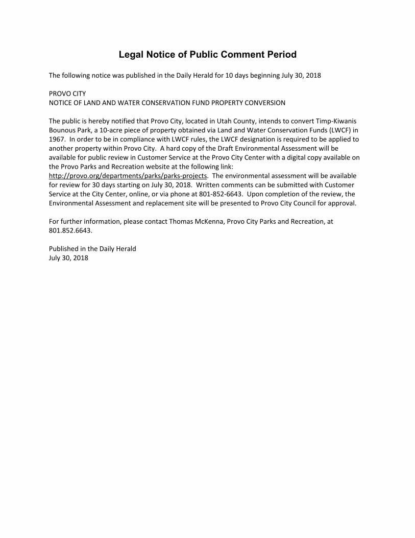
Legal Notice of Public Comment Period The following notice was published in the Daily Herald for 10 days beginning July 30, 2018 PROVO CITY NOTICE OF LAND AND WATER CONSERVATION FUND PROPERTY CONVERSION The public is hereby notified that Provo City, located in Utah County, intends to convert Timp-Kiwanis Bounous Park, a 10-acre piece of property obtained via Land and Water Conservation Funds (LWCF) in 1967. In order to be in compliance with LWCF rules, the LWCF designation is required to be applied to another property within Provo City. A hard copy of the Draft Environmental Assessment will be available for public review in Customer Service at the Provo City Center with a digital copy available on the Provo Parks and Recreation website at the following link: http://provo.org/departments/parks/parks-projects. The environmental assessment will be available for review for 30 days starting on July 30, 2018. Written comments can be submitted with Customer Service at the City Center, online, or via phone at 801-852-6643. Upon completion of the review, the Environmental Assessment and replacement site will be presented to Provo City Council for approval. For further information, please contact Thomas McKenna, Provo City Parks and Recreation, at 801.852.6643. Published in the Daily Herald July 30, 2018
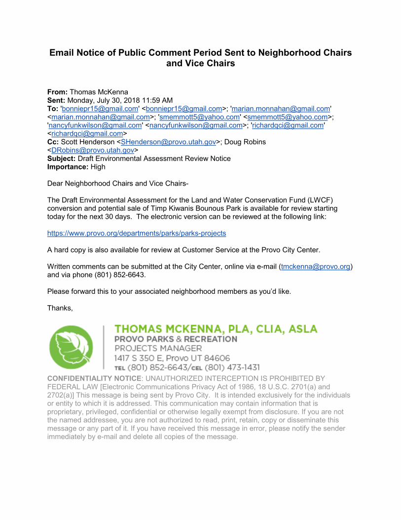
Email Notice of Public Comment Period Sent to Neighborhood Chairs and Vice Chairs
From: Thomas McKenna Sent: Monday, July 30, 2018 11:59 AM To: '[email protected]' <[email protected]>; '[email protected]' <[email protected]>; '[email protected]' <[email protected]>; '[email protected]' <[email protected]>; '[email protected]' <[email protected]> Cc: Scott Henderson <[email protected]>; Doug Robins <[email protected]> Subject: Draft Environmental Assessment Review Notice Importance: High Dear Neighborhood Chairs and Vice Chairs- The Draft Environmental Assessment for the Land and Water Conservation Fund (LWCF) conversion and potential sale of Timp Kiwanis Bounous Park is available for review starting today for the next 30 days. The electronic version can be reviewed at the following link: https://www.provo.org/departments/parks/parks-projects A hard copy is also available for review at Customer Service at the Provo City Center. Written comments can be submitted at the City Center, online via e-mail ([email protected]) and via phone (801) 852-6643. Please forward this to your associated neighborhood members as you’d like. Thanks,
CONFIDENTIALITY NOTICE: UNAUTHORIZED INTERCEPTION IS PROHIBITED BY FEDERAL LAW [Electronic Communications Privacy Act of 1986, 18 U.S.C. 2701(a) and 2702(a)] This message is being sent by Provo City. It is intended exclusively for the individuals or entity to which it is addressed. This communication may contain information that is proprietary, privileged, confidential or otherwise legally exempt from disclosure. If you are not the named addressee, you are not authorized to read, print, retain, copy or disseminate this message or any part of it. If you have received this message in error, please notify the sender immediately by e-mail and delete all copies of the message.
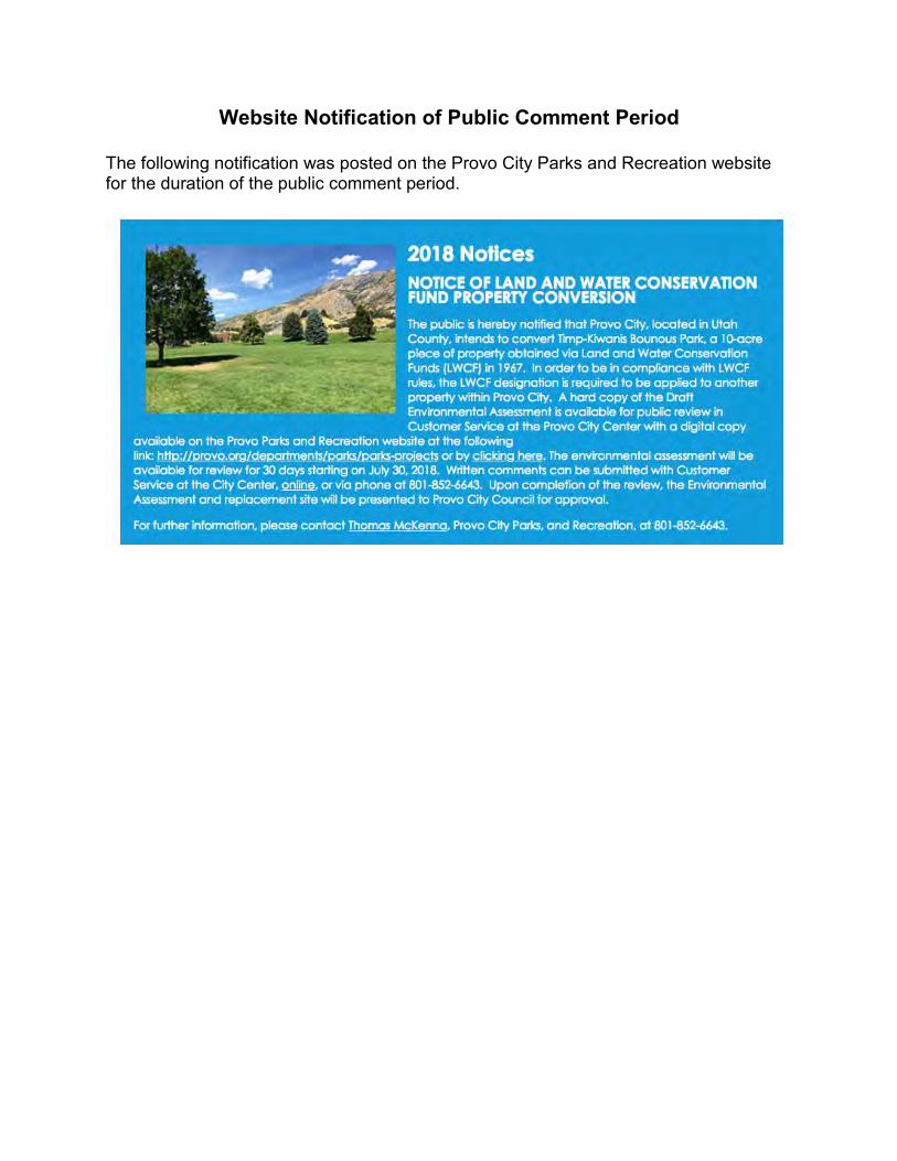
Website Notification of Public Comment Period
The following notification was posted on the Provo City Parks and Recreation website for the duration of the public comment period.

Public Hearing Notification
Notification of the public hearing was through the normal city council meeting notification process.
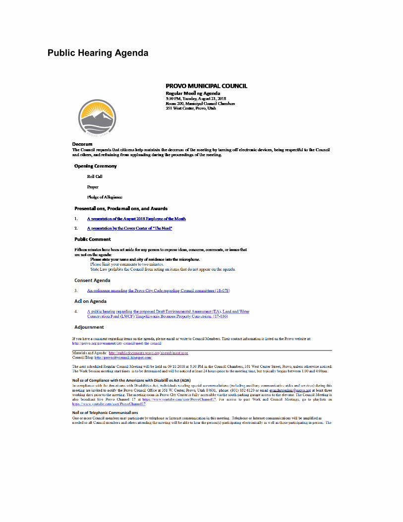
Public Hearing Agenda
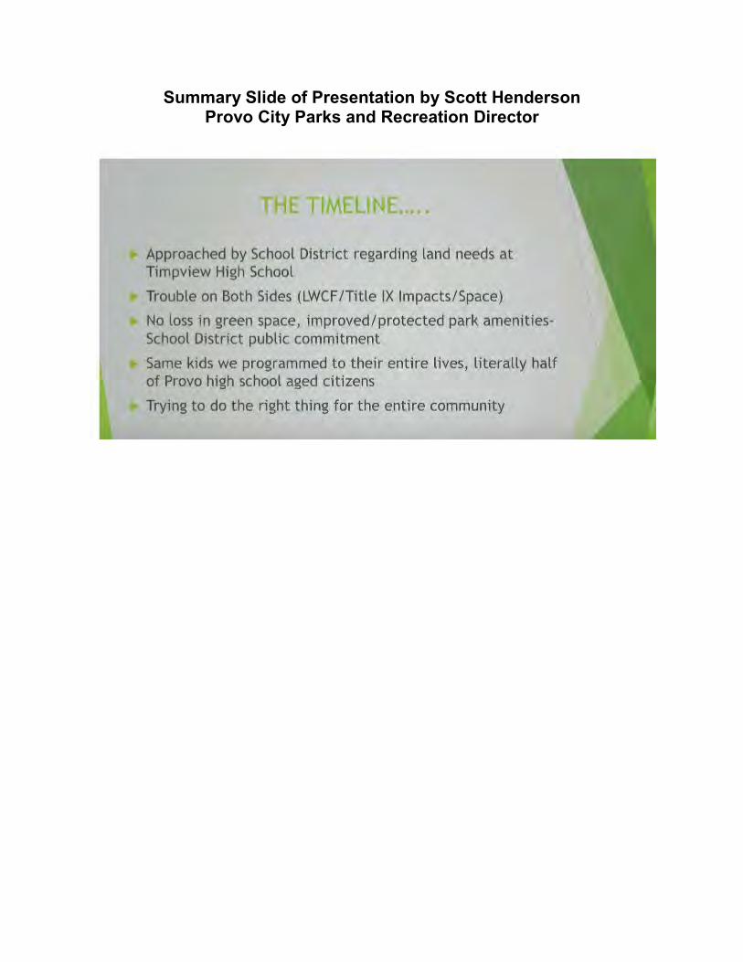
Summary Slide of Presentation by Scott Henderson Provo City Parks and Recreation Director
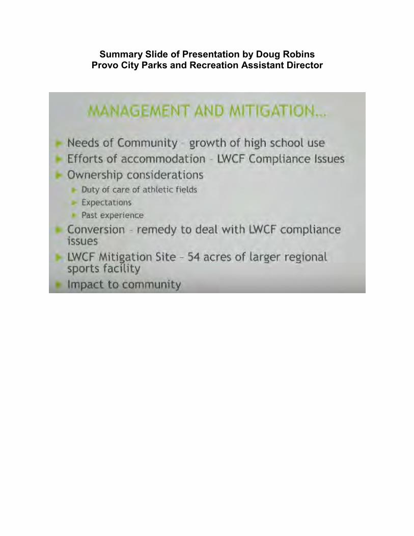
Summary Slide of Presentation by Doug Robins Provo City Parks and Recreation Assistant Director
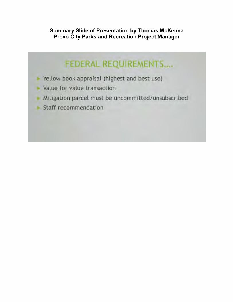
Summary Slide of Presentation by Thomas McKenna Provo City Parks and Recreation Project Manager
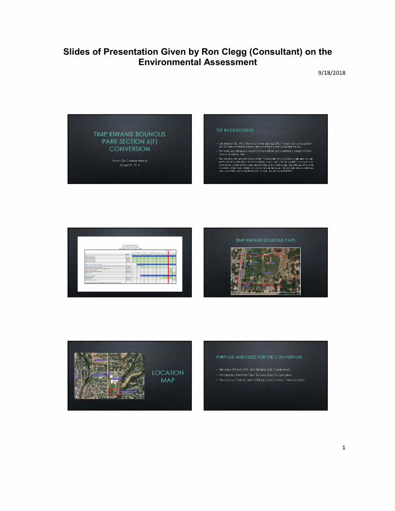
Slides of Presentation Given by Ron Clegg (Consultant) on the Environmental Assessment

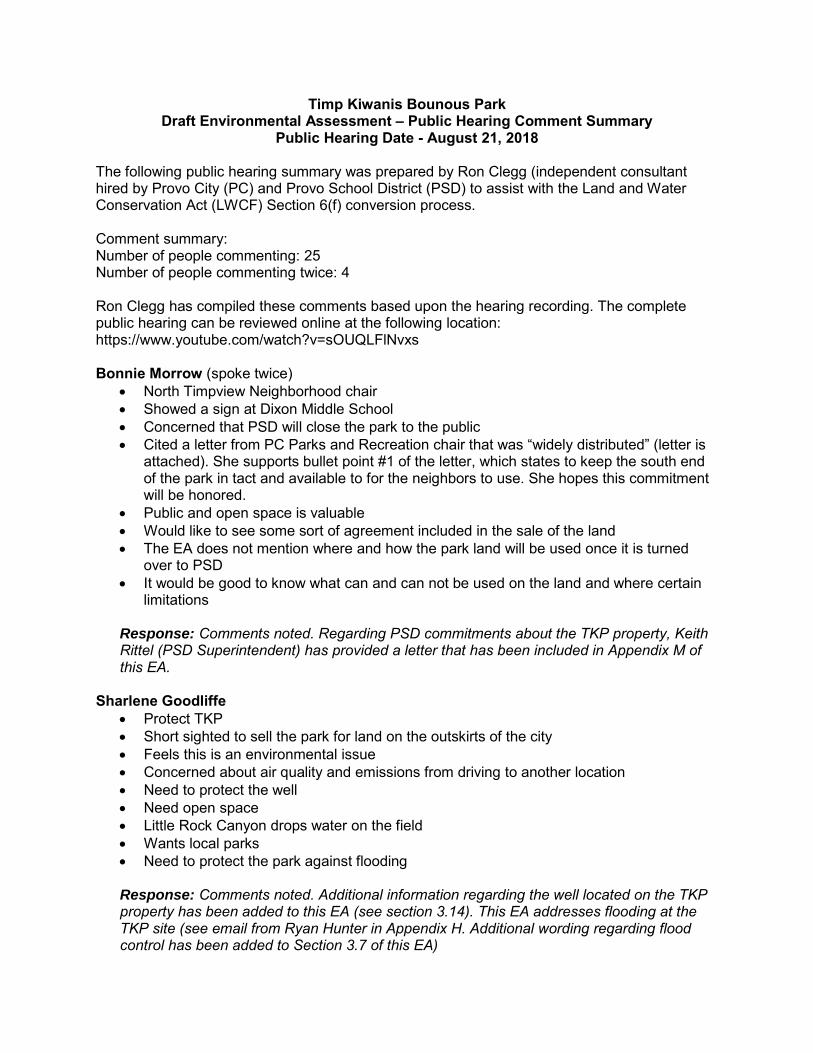
Timp Kiwanis Bounous Park Draft Environmental Assessment – Public Hearing Comment Summary
Public Hearing Date - August 21, 2018 The following public hearing summary was prepared by Ron Clegg (independent consultant hired by Provo City (PC) and Provo School District (PSD) to assist with the Land and Water Conservation Act (LWCF) Section 6(f) conversion process. Comment summary: Number of people commenting: 25 Number of people commenting twice: 4 Ron Clegg has compiled these comments based upon the hearing recording. The complete public hearing can be reviewed online at the following location: https://www.youtube.com/watch?v=sOUQLFlNvxs Bonnie Morrow (spoke twice)
• North Timpview Neighborhood chair • Showed a sign at Dixon Middle School • Concerned that PSD will close the park to the public • Cited a letter from PC Parks and Recreation chair that was “widely distributed” (letter is
attached). She supports bullet point #1 of the letter, which states to keep the south end of the park in tact and available to for the neighbors to use. She hopes this commitment will be honored.
• Public and open space is valuable • Would like to see some sort of agreement included in the sale of the land • The EA does not mention where and how the park land will be used once it is turned
over to PSD • It would be good to know what can and can not be used on the land and where certain
limitations
Response: Comments noted. Regarding PSD commitments about the TKP property, Keith Rittel (PSD Superintendent) has provided a letter that has been included in Appendix M of this EA.
Sharlene Goodliffe • Protect TKP • Short sighted to sell the park for land on the outskirts of the city • Feels this is an environmental issue • Concerned about air quality and emissions from driving to another location • Need to protect the well • Need open space • Little Rock Canyon drops water on the field • Wants local parks • Need to protect the park against flooding Response: Comments noted. Additional information regarding the well located on the TKP property has been added to this EA (see section 3.14). This EA addresses flooding at the TKP site (see email from Ryan Hunter in Appendix H. Additional wording regarding flood control has been added to Section 3.7 of this EA)
Kay Garner
• Lives in the Edgemont neighborhood • Read a letter she had prepared • Title IX – feels there is already room for a girl’s softball field and the boys’ base ball field
is already used occasionally by the public • Feels a better use of money would be to pay salaries • Concerned about school safety • TKP is important to the Edgemont neighborhood • The City is using dollars for a sports complex in another part of town • Does not want fences or locked gates
Response: Comments noted. There is already room on the THS site for a girls’ softball field. However, the existing uses of that area (soccer, practice, would need to be shifted to the TKP site, resulting in the same need for additional land. Please review the revised Chapter 1 of this EA.
Lisa Brockbank • Edgemont area resident • Her kids play at the park • Has worked with a competitive soccer club for the past six years • Need to look at the overall big picture • Kids want to participate soccer and other sports but fields are over crowded and over
used • PC does a wonderful job trying to maintain the maintain the parks and recreation areas • Should look at the big picture of what a sports complex can do for the city. Not just
sports but also economics.
Response: Comments noted. Elda Benson
• Lives in the Edgemont neighborhood • Per previous city council meeting on August 14?, the sports complex will bring $11
million revenue to the city of Provo. (Councilman Harding clarified that the $11 million is in economic activity not in City revenue)
• The city can still purchase the sports complex property without selling TKP • If the city is getting $11 million per year then she will not support bonds for schools, etc.
because there would be enough money for funding without bonds • Against bonds if PC sells Bounous park
Response: Comments noted. As clarified by Councilman Harding at the hearing, the $11 million number is annual economic activity and not revenue.
Craig Bostock (spoke twice)
• North Timpview neighborhood resident • Thanks to PSD and PC Parks and Recreation for transparency • This proposal provides a great opportunity to “double-dip” off of taxpayer dollars and get
two parks for the price of one • Would like to see THS be able to use use the park more freely
• Clubs on campus, ultimate Frisbee, HS baseball • He is an advocate for a second park in the northeast Provo area • There are very few parks in the area already • Licensed environmental health scientist • Commended Mr Clegg on EA. It is adequate for what proposed. • Talked about the well and suggest we talk to the city operators. He is not sure it is still
being used or that there is still water in the acquifer. • All of the drainages in Provo were impacted during the floods of 1983-84, including the
Little Rock Canyon drainage • May drainages have been put in place to reduce flooding • He sits on a committee that works with the algae at Utah Lake. He does not feel that the
park would impact the algae bloom. There is currently a project going on that is looking at waste water discharges into the lake.
Response: Comments noted. Additional information regarding the existing well, flooding, and potential algae bloom have been added to this EA. See Section 3.14 of this EA for the well and algae issues and Section 3.7 and Appendix H regarding flooding.
Jennifer Daley
• Lives in the Wasatch Neighborhood • Daughter in on the softball team • Safety is a concern for her. Transporting her kids to and from Fox Field and Harman
Park is not as safe as if she did not need to. Other high schools don’t need to transport their kids.
• Baseball and softball are important sports • Girls softball had three teams last year • Thinks it is important for other kids to see kids playing. It builds comradery, unity,
teamwork, etc. • Thinks it is important to have sports teams located at the school and field
Response: Comments noted.
Greg Bird
• Lives in the Provo river bottoms area, near Will’s Pit Stop • Proponent of the sale of the land • Has kids at a young age that would benefit greatly from sale of the park for additional
parks • It is more than just an issue for the neighbors next to the park • It is a community issue • Seems like a “no-brainer” to sell the park and build a sports complex • Thanks for a great idea and good proposal
Response: Comments noted.
Douglas Kohler
• Retired surgeon • Lives across the street from the park • By nature and training likes to cut away confusion and get to the heart of the matter
• TKP was originally sold by the Bounous family to PC to be kept as a park in perpetuity • Is Provo City and honorable entity whose officials honor prior commitments or is PC a
dishonorable entity that forgets prior commitments? If it is the latter, then anyone who has an agreement with or understanding with PC should pay careful attention and beware.
Response: Comments noted.
Danny Engemann (spoke twice)
• Lives in north Provo in the Indian Hills neighborhood • Thanks to the city council and PSD. This is a complex issue. • THS baseball coach • Change is inevitable • Neighborhood is changing, the school is growing, needs arise • The proposal seems to be a great solution and compromise • The school is trying to accommodate the students, sports teams, public • Sharing the field space is working but busting at the seams • There needs to be an opportunity for everyone to spread out a bit and have a place to
call home • He is at the park quite a bit • Loves seeing neighbors and families enjoying the open space • Proponent of selling the park • PSD and PC will be able to keep promises • Good compromise • Complimented Mr Clegg on the transparency of the document • Feels like this is a great process • Appreciated the way the EA discussed the alternatives • Feels that there are some great alternatives to move forward with
Response: Comments noted.
Sharon Donaldson
• Owns two homes in the neighborhood • Wants to see, in writing, what PSD will do the property. That is what she is most
concerned about.
Response: Comments noted. Regarding PSD commitments about the TKP property, Keith Rittel (PSD Superintendent) has provided a letter that has been included in Appendix M of this EA.
Fidel Montero
• THS principal • Father of 5 kids, ages 1-15 • His kids play in the park and love the park • There are hundreds if not thousands of students who use the limited space and do not
have access to the park
• At 5am this morning there were kids practicing on the football fields because they would not have access the rest of the day
• 60 boys practicing football on THS space • There was a soccer game at the same time • Lacrosse was waiting to use the field • Baseball and softball • He sees the tensions as a parent and as a school administrator • Recommends to the board to find a win-win solution • He is completely open to the neighbors using the facilities • Committed to finding a solution where kids, young people, and neighbors can go and
enjoy green space and use the park area
Response: Comments noted. Eric Weight
• PC resident and lives in the Timpview area • He is a board member of the Utah Aresenal Soccer Club, which is the largest
competitive soccer club in Utah County • The proposal for a new sports complex is critical • We are at a very critical place in the state of Utah • Allow opportunity for kids to participate • Will not happen in the middle of the city • Grateful to PC for allowing them to rent and use Sertoma Park by Centennial Middle
School • Getting pressure now from the city to do other things • The sports complex is critical for growth • It is difficult to maintain open spaces in the city and allow what needs to do • Very supportive of the proposal and feels it is a great compromise
Response: Comments noted.
Jenny Engemann
• Has 4 kids attending THS • Travels to other locations and they have better facilities than in north Provo • Having a great facility in north Provo will help the overall community and will help keep
families • Wants to keep NE Provo strong
Response: Comments noted.
Sarah
• She a THS lacrosse coach • Providing more spaces for sports and impact the lives of youth • Believes that sports and recreation help to teach life lessons and help people be better
citizens • Believes a win-win solution can be found. The fields for school use and also public use.
Response: Comments noted. Brian Smith
• Provo resident • Has coached soccer youth • President of Utah Youth Soccer • Utah Youth Soccer is in great support of transitioning the property from TKP to a Sports
Complex • Thinks the proposal in the EA is a good thing and encouraged the city council to support
it • Utah County has grown over 100% every year for the last 20 years • The number of soccer youth has gone from 30,000 to 60,00 over the last 20-30 years
and the numbers will only increase as the population grows • Youngest demographic in the State
Response: Comments noted.
Justine Jorton
• Lives in the same neighborhood as Bonnie Morrow • Concerned that the proposed sports complex is by Utah Lake and could be “buggy” in
the area, during some seasons • Hopes that the potential for bugs at the sports complex is addressed
Response: Comments noted. Provo City will utilize Best Management Practices for maintaining the proposed sports complex.
Marian Monnahan
• Edgemont neighborhood chair • Her concern is for the people in her neighborhood • Has read all 218 pages of the Draft Environmental Assessment • Looked up the definition of “environmental”. The definition is “the surroundings in which
a person or animal or plant operates”. • Does not feel that the EA addresses people portion of what environmental is • Taking away the park will put undo burden on the people in her area for the benefit of
somebody else in the city • Pitting one neighborhood against another neighborhood • We need open space • Concerned about the fact that there is not access, amenities, open space • Has seen nothing from PSD to maintain the open space • Asked the city council to request a memorandum of understanding or a letter of intent
before the the next city council meeting
Response: Comments noted. This EA has been prepared according to LWCF guidance. All of the items addressed in this EA affect the people portion of the environment. Provo City leadership has responsibility for all citizens of Provo and are trying to accommodate the needs of PSD while minimizing impacts to the local neighborhood. Regarding PSD
commitments about the TKP property, Keith Rittel (PSD Superintendent) has provided a letter that has been included in Appendix M of this EA.
Sharon Memmott
• Marian Monnahan’s vice chair • The LWCF manual says that the purpose is to increase outdoor recreation opportunities • She does not have access to the PDESF document • Has read the entire EA • She feels that Title IX (girls’ softball) would be a reasonable use of the park, per LWCF
manual • Quoted the LWCF manual • City out of compliance - the city has an option to lease the site, per LWCF • Does not feel like PC needs to sell the park • The EA does not describe the impact of building too close to the well • LWCF – yellow book – deed restriction – open space • The city could protect the site with a zoning thing as you sell it
Response: Comments noted. See response to your written comments.
Lynn Garner
• Has lived next to Bounous Park for the last 50 years • Feels that the EA is a rationalization for the sale of the park • The alternatives considered are dismissed in such an off-hand and insufficient argument
the it is appalling to him • For example, Alternative 6 was considered by PSD before ever buying the park.
Therefore, to use LWCF criteria to eliminate Alternative 6 is entirely spurious. It does not fit. The same kind of feeling runs throughout the EA.
• Feels that the EA is an argument for the sale of the park and not a mitigation document
Response: Comments noted. The EA is not an advocacy document but a proposal to the National Park Service to sell the park to Provo School District for the reasons mentioned in Chapter 1 of the EA. Chapter 2 of this EA has been revised to provide more clarity regarding alternatives considered.
Jay Goodliffe
• Lives in the Edgemont neighborhood • Wants to talk about equivalent location. The guidance which is supposed to be
addressed in Chapter 3 of the EA says “Property proposed for replacement must be of reasonably equivalent usefulness and location as the converted property. There may be exceptions.
• The exception My Clegg put up there say the place you are leaving from “Bounous Park” no longer has use and people don’t want to use it any more or demographics have shifterd and nobody is living there any more. This park does not fall into that exception.
• The park is used. People have not moved away from NE Provo. • This is not an exception that can be used to move the park. • The EA says that the proposed sports complex is a very different use than the
community park.
• Cannot be reasonably equivalent usefulness and certainly not in an equivalent location. TKP is in NE Provo and the proposed sports complex is in SW Provo.
• Flooding has not been adequately addressed in the EA • The existing well needs to be addressed in the EA • The EA says the TKP is not used by the public. As he understands it, the THS boys
baseball team cannot be practicing in the off-season. • The baseball team cannot hold official practices during the summer. Otherwise, they will
be out of compliance with the Utah High School Activities Association. • Therefore, anything going on there is not a THS activity . It may be some other type of
activity because the PC Park and Recreation decided not to schedule it. • The park is open to the public • Summer and fall must be public uses, but they may be restricted public uses. However,
they are not school uses because the school is not allowed to practice. • Therefore, the public is using it • He feels it is incorrect to say the park is “out of compliance”. He has talked to Susan
Zarekarizi and she says that PC has not lost any money and she has not stated that they are out of compliance.
• PSD says they are committed to keeping the park open. He is not worried about Dr Montero or McKay Jensen. He is worried about the next administration.
• The TKP playground is there because the neighborhood created it when Edgemont Elementary closed down their playground.
• There is plenty of history to show that PSD has not kept the park open • The stronger the agreement to keep open the more credible those commitments will be
and the more neighborhood would favor such an agreement
Response: Comments noted. See response provided to your written comments. Abby Wilson
• One of the THS girls’ softball coaches • THS is projected to grow by 10,000 students in 10 years • Something has to change. Things cannot stay the way they are.
Response: Comments noted.
Mike Hunter
• THS athletic director • Wanted to comment on summer sports activities • Even though the season is concluded there are many programs going on, as with other
high schools in the state • Camps and clinics are open to the public where kids pay a fee and develop their skills • THS is not breaking any rules or compliance issues by holding activities in the summer • THS is not doing anything against the Utah High School Activities Association protocols
or guidelines
Response: Comments noted. Brenda Tata
• A resident of the Edgemont neighborhood for 44 years • Has seen a lot of growth in the area

• Wishes that we would look at Alternative 6 more closely as an alternative to selling TKP • The sports complex is so close to Utah Lake that she is worried about the potential for
algae blooms and the potential that fertilizer, etc would have on the algae blooms • The algae blooms affect the entire valley, not just Provo
Response: Comments noted. Section 3.14 of this EA addresses the algae bloom concern. Alternative 6 was investigated further and it has been determined that a boys’ baseball field and girls’ softball field do not fit on this site. McKay Jensen
• PC resident • PSD board chairman • Appreciates engaging in this process • Does not know if anyone wants to change the nature of the well or move it • PSD does not want to substantially change the character or nature of TKP • The PSD board are Provo residents and want to live with their neighbors
Response: Comments noted.
Council Discussion
• Councilman Hadley asked if there are any more details of the interlocal agreement • McKay Jensen showed a draft agreement that was distributed to the council prior to the
meeting. This draft agreement is intended to be a back-and-forth process between PSD and PC. This draft was prepared by Wayne Parker (PC City Administrator).
• On September 11 the city council will be discussing the Final EA and voting on a resolution to approve the Final EA to submit to the National Park Service.
Response: Comments noted. It is currently planned that the November 13 city council meeting will be the meeting where the Final EA is discussed and voting on a resolution will take place.
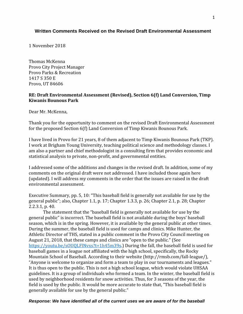
1
Written Comments Received on the Revised Draft Environmental Assessment 1 November 2018
Thomas McKenna Provo City Project Manager Provo Parks & Recreation 1417 S 350 E Provo, UT 84606
RE: Draft Environmental Assessment (Revised), Section 6(f) Land Conversion, Timp Kiwanis Bounous Park
Dear Mr. McKenna,
Thank you for the opportunity to comment on the revised Draft Environmental Assessment for the proposed Section 6(f) Land Conversion of Timp Kiwanis Bounous Park.
I have lived in Provo for 21 years, 8 of them adjacent to Timp Kiwanis Bounous Park (TKP). I work at Brigham Young University, teaching political science and methodology classes. I am also a partner and chief methodologist in a consulting firm that provides economic and statistical analysis to private, non-profit, and governmental entities.
I addressed some of the additions and changes in the revised draft. In addition, some of my comments on the original draft were not addressed. I have included those again here (updated). I will address my comments in the order that the issues are raised in the draft environmental assessment.
Executive Summary, pp. 5, 10: “This baseball field is generally not available for use by the general public”; also, Chapter 1.1, p. 17; Chapter 1.3.3, p. 26; Chapter 2.1, p. 28; Chapter 2.2.3.1, p. 40.
The statement that the “baseball field is generally not available for use by the general public” is incorrect. The baseball field is not available during the boys’ baseball season, which is in the spring. However, it is available by the general public at other times. During the summer, the baseball field is used for camps and clinics. Mike Hunter, the Athletic Director of THS, stated in a public comment in the Provo City Council meeting on August 21, 2018, that these camps and clinics are “open to the public.” (See https://youtu.be/sOUQLFlNvxs?t=1h45m39s.) During the fall, the baseball field is used for baseball games in a league not affiliated with the high school, specifically, the Rocky Mountain School of Baseball. According to their website (http://rmsb.com/fall-league/), “Anyone is welcome to organize and form a team to play in our tournaments and leagues.” It is thus open to the public. This is not a high school league, which would violate UHSAA guidelines. It is a group of individuals who formed a team. In the winter, the baseball field is used by neighborhood residents for snow activities. Thus, for 3 seasons of the year, the field is used by the public. It would be more accurate to state that, “This baseball field is generally available for use by the general public.” Response: We have identified all of the current uses we are aware of for the baseball
2
field. Whether or not the uses identified allow enough public use to meet Section 6(f) requirements will have to be determined by the State and National Park Service.
According to the LWCF State Assistance Program Manual, the project sponsor may allow an operator to provide “a public outdoor recreation opportunity” (Chapter 8-2). It also states that there may be reasonable use limitations, including the “type of users” (Chapter 8-2). Provo City—the project sponsor—is allowing PSD—an operator—to schedule the field, and PSD is scheduling the general public to use the field, except for the limitation that it be used by THS during the spring season. Thus, the current use of the field meets LWCF guidelines. If it is out of compliance, the steps necessary to bring it into compliance are minor and manageable. Note further that Provo City has not lost any grant money because of TKP, and Provo City has not been notified by LWCF agents that they are out of compliance, according to Susan Zarekarizi, Utah State Parks and Recreation Lands and Environmental Coordinator.
Response: Although allowing another entity to operate a section of the property may be a possibility under LWCF rules, this does not satisfy the purpose and need of this conversion, specifically the need for PSD to own and manage the property. Executive Summary, pp. 7, 9: “Provo School District has a need to own and manage the property being used by THS students”; also Chapter 1.3, p. 22; Chapter 1.3.2, p. 25; Chapter 2.1, p. 28.
If this is an acceptable reason to sell a park adjacent to a school, then this reason can be applied to other city parks adjacent to schools: for example, Kiwanis Park (next to Wasatch), Lakeview Park (next to Lakeview), Memorial Park (next to Provo Peaks), Sertoma Park (next to Rock Canyon and Centennial), Rotary Park (next to Westridge), and Amelia Earhart Field (next to Amelia Earhart). Will Provo City sell all of the parks adjacent to schools because Provo School District has a need to own and manage property being used by students? If not, then this should not be a reason for selling TKP.
Response: Provo is growing and schools are aging. There MAY BE additional needs in the future. As the needs of various schools arise, they will be evaluated on a case-by-case basis. The goal will be to find the best possible solution for both PC and PSD. PS - the field next to Amelia Earhart is already district property. Executive Summary, p. 8: “Provo School District desires to proactively address this issue so they can comply with Title IX requirements”; also Chapter 1.3.1, p. 23; Chapter 2.2.2, p. 35.
While Title IX concerns may have been the initial impetus for PSD’s inquiry into TKP, it is no longer an issue. As shown in their latest plans, PSD plans to build the girls’ softball field on THS property. (See January 23, 2018, Provo City Council Work Meeting packet at https://www.utah.gov/pmn/files/365111.pdf, p. 13.) This can be done whether or not PC sells the land to PSD. Thus, PSD created their own potential Title IX issue when they eliminated the girls’ softball field from Edgemont Elementary, which they can solve themselves by building the softball field on land they currently own. Note further that no Title IX complaint has been filed. Title IX concerns are repeatedly raised in the document, even though PSD can solve that concern without selling TKP. Response: The referenced drawing was created at the request of the public to show that a softball field could be constructed on the north end of the property (south of THS) thus allowing more distance between the softball field and the houses to the south. However, the current uses (soccer, practices, etc) still exist and would need to
3
be shifted to the TKP property. Thus, there is still a need for the property. The fact that there has not been a Title IX complaint filed does not mean there is not an issue. PSD does not want to wait until a complaint is filed to address the issue. The fact that a complaint has not been filed by the State regarding Section 6(f)non-compliance does not mean there are no compliance issues or concerns. PC does not want to wait until a complaint is filed to address the Section 6(f) compliance issues.
Executive Summary, p. 8: “PSD verbally approached PC about their desire for purchasing the [Timp Kiwanis Bounous] park property”; also Chapter 1.3.1, p. 24; Chapter 2.
PSD has approached Provo City about selling TKP before, and Provo City declined to
sell. In the latest round of discussions, begun in 2016 (p. 27), PSD initially approached PC about purchasing the property northwest of THS, which Provo City had acquired in the Provo City Center Temple agreement with the LDS Church. (This property is identified as Alternative 6 at 3800 North Canyon Road in the document.) Instead, Provo City officials directed PSD toward TKP. Superintendent Rittel’s letter (in Appendix C) states that this property was ruled out by Provo City, not by PSD. Thus, any statement that the 3800 North Canyon Road property would be unsuitable for PSD is refuted by the fact that PSD asked for it first. The updated document now states that a baseball field and softball field could not fit in this area. This begs a similar question: Why would PSD ask for this property if it were unsuitable? Response: The inventory completed by FFKR in 2016 identified this site as a potential site. Two renderings were prepared for this site by FFKR showing the layout of ball fields and these renderings were included in the July 30, 2018 Draft Environmental Assessment as Figures 2.4 and 2.5. Upon closer examination, one of the renderings shows various softball field layouts but no baseball field (Figure 2.4 of July 30 EA) so that figure was removed for the Revised Draft Environmental Assessment dated October 3, 2018. The other rendering (Figure 2.5 in the July 30 Draft EA) was included in the October 3 Revised Draft EA. That graphic has been updated to show a planned roadway through this property based upon the PC Transportation Master Plan. It should be noted that the original rendering showed that additional land would be needed for both a baseball field and softball field to fit on the site.
Executive Summary, p. 9: “The size of the THS campus should be 52 acres”; also Chapter 1.3.1, p. 25; Chapter 2.1, p. 28.
The document states that Timpview High School should have 52 acres of space to comply with Utah State Office of Education guidelines. The document also states that Provo School District built Provo High School on 39 acres. Since enrollment in Provo High School is about the same as Timpview High School, it should also have 52 acres of space. Provo School District recently disregarded this guideline when building Provo High School. Thus, it inconsistent that Provo School District is now using this guideline as a reason to purchase TKP.
If this reason is accepted, then this reason can also be used to purchase city parks adjacent to existing schools that are on land smaller than the Utah State Office of Education guidelines. If Provo City is not willing to sell all the school-adjacent parks to Provo School District, then it should not be a reason to sell TKP.
Response: PSD tries to adhere to the guidelines to the best of their ability, given the limited amount of available land in the City and existing school sites.
Executive Summary, p. 10: “PC has discovered some Section 6(f) issues that it would like to clear up.”
4
These issues include the well and well house, the south access road, the apparently encroaching residential properties (about which, title insurance companies would also want to know), and Timpview Drive. Does selling TKP to Provo School District solve these problems? Suppose PSD is not willing to agree to terms with Provo City on the sale of the park. How would Provo City then address these issues?
Response: PC would work with the State and NPS to amend the Section 6(f) boundary to address these items. We would need to follow their process for making any modifications. The problems identified in the Chapter 1 of the EA would still exist.
Chapter 1.1, p. 17: “However, the ball field was constructed by Provo School District to be used solely for the Timpview High School boys’ baseball team”.
At one point, the Provo School District and Timpview High School locked up the baseball field, preventing public use. Provo City required THS to unlock the field, pointing out that it was public land. Thus, at one point, PC did not consider the ball field to be used solely by THS. If PC does so now, it is by choice, not by constraint or tradition.
Response: Due to the nature and frequency of it's use, It is in the best interest of PSD and PC, due to liability and risk issues, for PSD to own and operate the ball field. Chapter 1.1 Background, p. 17; also Appendix A
This section does not include how the field was purchased from Junior Bounous under threat of an eminent domain action. After negotiation with PC and PSD, Junior Bounous deliberately did not sell the land to PSD, but to Provo City, with the agreement that it be a park in perpetuity. Provo City locked in this agreement by using the LWCF grant to purchase the land. Response: These purported terms are not memorialized in any recorded purchase agreement. This is not part of the Environmental Assessment process.
Chapter 2, Table 2.1, p. 27
The Table states that in August 2016, “PC begins research on the TKP site and realizes that the park was purchased with LWCF grant funds.” The previous Provo City Parks and Recreation director stated that Provo City would not sell TKP because it had been purchased with federal funds. Thus, Provo City has realized for many years the LWCF designation. Response: The Parks and Recreation Director does not have authority to make arbitrary decisions or policy on surplusing land. Chapter 2.2.1, p. 28: “Criteria for site included the following: • The site should be located as close to Timpview High School as possible. • The site should have enough space for both a girl’s softball field and a boy’s baseball field. • The site should have good street access and room for parking.” The first bullet point rules
out every other location besides TKP, as currently applied to the other considered alternatives in the draft assessment. Thus, it is not a criterion; it is akin to issuing an RFP so specific that only one supplier could provide the requested good or service. Again, if PSD asked for the 3800 North Canyon Road site first, then it is close enough for PSD. The document implies that this site was ruled out by PSD, when it was ruled out by Provo City (Appendix C).
5
Response: PSD internal assessments are not part of the EA. The PSD due diligence efforts have been shown to help portray the context of the alternatives investigated. Chapter 2.2.1, pp. 31-32: “Further investigation into this site concludes that a boys’ baseball field and girls’ softball field do not fit on this site.”
In the original draft, the drawing included from FFKR (PSD’s contracted firm) showed both fields fitting on Alternative 6 (original draft, Figure 2.4, p. 24). In the revised draft, a different drawing is included from FFKR that shows it does not (revised draft, Figure 2.4, p. 32). This is incongruous and inconsistent.
If the baseball field is too big for the site, then PSD could pursue purchasing the adjacent site (Alternative 5). Or Provo City could continue to allow PSD to use the baseball diamond while providing Alternative 6 for the softball field.
In the revised draft, a new reason is introduced why the baseball and softball fields could not be built in Alternative 6: “There is a new roadway planned through the site which reduces the usable area to approximately 6 acres, as shown in Figure 2.5.” It is puzzling that this new roadway plan has been discovered at this point in the process. If PSD bought the land, presumably, PSD would not build the roadway. If Provo City keeps the land and builds the roadway, then the apparently-planned park would be a net loss of recreational space if TKP is sold, contrary to the repeated statements by Provo Parks and Recreation (and in the response to my comments on the original draft, pp. 192-193), that there would be a net increase. Response: The roadway is identified in the Provo City Transportation Master plan.
The other reasons given for ruling out this property are:
“• This site is owned by Provo City and is planned for a future neighborhood park. • PC does not want to sell this property because they need it for a future park. • It would result in a net loss of recreational property, compared to converting the TKP and developing a new replacement site. • It is not contiguous to Timpview High School and would result in travel for athletes and others. • There would not be locker room and other facilities that a field located adjacent to Timpview HS would provide.”
However, the reasons given also apply to TKP (which I restate, in order of the bullet points above):
• TKP is a site owned by Provo City, and is an existing park, and the city promised to the seller and LWCF to keep it a park in perpetuity. PC should not sell this property because it is an existing park, and the city promised to the seller and LWCF to keep it a park in perpetuity. Response: Comment noted.
• By the logic given, Provo City should sell all of the parks in expensive areas (e.g. Kiwanis Park), and buy property for larger parks in less expensive areas (e.g. West Provo). Response: As indicated in Chapter 2 of the EA, an extensive alternatives development process was performed for this project. That process looked at all areas of Provo, including the east side.
• The site was requested by PSD, which means it is close enough for PSD. Provo City ruled it out, not PSD (see Appendix C). Even if PSD had not requested this property,
6
it is approximately 1 block away from THS. East High School (SLC) has fields that are further away and cross busier streets. Response: PC desires to keep the land for the future Canyon Road Park. In addition, after further analysis, the site does not fit a boys’ baseball field and a girl’s softball field because of the roadway identified in the PC Transportation Master Plan.
• If PSD buys the land, they can build locker facilities there as well. Response: PSD would develop the site according to their guidelines.
Chapter 2.2.1, p. 30: Other Alternatives
The alternative of the property across from Rock Canyon Elementary (Alternative 9, p. 30) is dismissed because it does not meet the criteria, even though PSD's internal documents state about the property: "Capsicum Ltd (not Giles Family) 3.7 ac (likely big enough) Still available, asking $2 million" (p. 78). It is not as close as other sites, but closeness is a criterion that should be balanced against other desired outcomes, such as keeping an existing park because the city promised to the seller and LWCF to keep it a park in perpetuity.
Response: PSD internal assessments are not part of the EA. The PSD due diligence efforts are shown to help portray the context of the alternatives investigated. Chapter 2.2.2 3 Potential New Sites for Replacing TKP, p. 35
The document states that “the best location to address Title IX concerns” is TKP. But the primary concern of Title IX is not distance. It is quality. (See, for example, http://titleixspecialists.com/wp-content/uploads/2013/09/Q-A-Baseball- Softball-Fields.pdf. See also: Veronica Ollier v. Sweetwater Union High School District, et al., 2009 U.S. Dist. Lexis 32683.) Quality was also the softball players’ parents’ concern as expressed in neighborhood meetings. Response: We have reviewed the linked websites. Quality is an issue. However, proximity and equality are also issues. PSD desires to have quality and equality in the facilities – thus having the girls’ softball field on-site in order to have locker rooms, etc. Those features add quality to the program and close the equality gap. There are also several other factors involved with Title IX.
Chapter 2.2.3.2, pp. 40-41: “The Potential of Scheduling the Boys’ Baseball Field to be Shared with the Public: • Baseball and softball seasons run from the end of February to the end of May. The public would not be able to use the field during this time period due to the heavy school usage. • Practices and games, for both sports, are every day Monday through Friday during baseball and softball seasons. • There are summer camps and tournaments that use the field into the fall season. • Scheduling of the field would need to occur through the Provo City Parks Department.”
The alternative of bringing the existing ballfield into compliance with LWCF 6(f) regulations is addressed by stating the four scheduling “facts” above. The document then states: “This alternative was eliminated from further investigation because it does not satisfy the purpose and need for the project.”
It is not stated why this does not satisfy 6(f). There is no statement from an LWCF representative explaining that the four scheduling facts would bring the park out of
7
compliance. In my conversations with Susan Zarekarizi, the Lands and Environmental Coordinator at Utah State Parks and Recreation who represents LWCF in Utah, she stated that those facts would comply. To address each bullet point:
• According to LWCF State Assistance Program Manual, Chapter 8-2, reasonable limits can be placed on use, including the type of users.
• These limits would be for one season. • As stated above, the summer camps and fall tournaments are open to the public. • Scheduling of the field could be through Provo City, or Provo City can designate an
operator (LWCF State Assistance Program Manual, Chapter 8-2), as is the case now. Response: Scheduling of the field does not satisfy the purpose and need because:
• Although scheduling may resolve a portion of the 6(f) issues, it is not in the best interest of either PC or PSD to have two parties involved in managing the ball field due to the liabilities and risks associated with its use.
Chapter 3.3 Floodplains, p. 46
In a discussion of the previous flooding of Bounous Park, the document quotes an email from Robert Hunter (also Appendix H): “It is our understanding that some located residents stated that sand bagging was required at the Timp-Kiwanis Bounous Park during at least one runoff event in the 1980s. None of our current staff remembers sand bags being needed at Timp-Kiwanis Bounous Park.” It is not stated how may current staff members worked at Provo City in the 1980s. Also unstated is whether the city verified whether there were sandbags by digging into a berm. Instead, the email (and the document) dismiss the concern that there have been two 100-year floods (in the 1950s and 1980s) in the last 70 years. It is not known whether the current drainage system would work without the sandbag berms; instead, Provo City is “unaware” of a problem.
Response: Robert Hunter is a professional civil engineer and a certified floodplain manager. Consultation with Greg Beckstrom, former PC storm drain manager, indicates that there has been area storm runoff in the past. The source of this runoff is the Little Rock Canyon drainage. The primary source of this runoff has been intercepted and piped where there was previous open channel flow. Greg indicated that flooding has not been a chronic issue. PSD would need to take this into account. Chapter 3 – Affected Environment and Environmental Consequences, pp. 46-64.
The LWCF Program Manual discusses conversion proposals in Chapter 8, Section E of the LWCF State Assistance Program Manual (pp. Chapter 8-3 through Chapter 8-12). Here is part of it: “Conversion of use process includes, but is not limited to the following:
• All practical alternatives to the conversion must be evaluated and rejected on a sound basis.
• The property proposed for replacement must be of reasonably equivalent usefulness and location as that being converted. Depending on the situation, and at the discretion of the NPS, replacement property need not provide identical recreation experiences or be located at the same site, provided it is in a reasonably equivalent location” (LWCF State Assistance Program Manual, Chapter 8-5).
This is supposed to be addressed in the PD/ESF, which appears to be Chapter 3 in the Environment Assessment. However, this is not discussed. In fact, the document makes clear that regional sports parks (p. 60) are not the same as community parks (p. 58), specifically listing several characteristics that are different. The very different nature of the regional sports park is one of the reasons Provo City staff and officials are in favor of selling the park
8
to PSD. However, this very different nature is what disqualifies the sale according to LWCF guidelines, because the properties are not “reasonably equivalent usefulness.” Further, TKP is in northeast Provo and the proposed sports complex is in far southwest Provo, which are not “reasonably equivalent locations.”
The LWCF Program Manual states, “there may be exceptions” to the equivalent location requirement. The example exception is: “if property being converted is in an area undergoing major demographic change and the area has no existing or anticipated future need for outdoor recreation” (Chapter 8-6). The Edgemont area of Provo does not qualify for this exception. Any demographic changes that Edgemont is undergoing increases the need for outdoor recreation.
Response: Although the location of the proposed replacement site in southwest Provo it is still under jurisdiction of Provo City and has been well coordinated with Susan Zarekarizi (LWCF Coordinator) at the Utah Department of Parks and Recreation. She has not expressed concerns about this site location. In addition, and outside of the conversion process, PC plans to build the Canyon Road Park to serve the local community. This is in addition to whatever agreements take place for maintaining current uses of TKP. It is very possible that the area will end up with a net gain of recreation facilities over what is existing. General document
Throughout the draft assessment, “community” concerns are raised when those concerns favor a sale of the park (pp. 8, 23, 41). Although there are community concerns against the sale of the park (expressed publicly in neighborhood meetings, the online town hall, and Provo City Council meetings), they are never noted in the document. Thus, the document implies by omission that members of the community unanimously favor the sale of the park. This is not correct. In fact, in any public forum where one can count votes for or against the sale of the park, the overwhelming majority of votes are against the sale of the park. Response: LWCF processes and procedures have been followed in preparing this EA. No statistically valid survey or vote has been conducted.
Thank you for your consideration of my comments.
Respectfully submitted,
Jay Goodliffe 695 E 3230 N Provo, Utah 84604 801.921.0850 [email protected]
9
From: Jay Goodliffe <[email protected]> Date: Mon, Nov 12, 2018 at 9:09 AM Subject: Concerns about Environmental Assessment of Timp Kiwanis Bounous Park To: Michelle Kaufusi <[email protected]>, The Honorable Gary Winterton <[email protected]>, <[email protected]>, The Honorable Dave Knecht <[email protected]>, The Honorable Kay Van Buren <[email protected]>, The Honorable Dave Harding <[email protected]>, The Honorable Dave Sewell <[email protected]>, <[email protected]> Cc: Wayne Parker <[email protected]>, <[email protected]>, Thomas McKenna <[email protected]>
Dear Provo City Council Members and Mayor, I am writing to express my concern over three reasons given for selling Timp Kiwanis Bounous Park in the revised draft of the Environmental Assessment. The reasons that are given, if followed as general principles, would lead to selling every Provo City park adjacent to a school. Thus, these reasons should not be used whether one supports selling Timp Kiwanis Bounous Park or not. The three concerning reasons given for selling the park are: 1. "Timpview High School does not currently meet Utah State Office of Education guidelines for site size" (p.9, and elsewhere). However, out of Provo School District's 18 schools, 17 of them do not meet the Utah State Office of Education guidelines for site size. 2. "Provo School District has a need to own and manage the property being used by THS students for safety and scheduling purposes" (p. 9, and elsewhere). However, many schools are built next to city parks, by design. These parks are used by schools and their students. 3. "Selling Timp Kiwanis Bounous Park and developing a new replacement site will yield a net increase of recreational property" (p. 31, and elsewhere). However, any property next to a school could be sold to buy a larger undeveloped property on the west side of Provo, where the replacement site is proposed. These three reasons are featured much more prominently in the revised draft than in the initial draft. Following the principles listed in the revised Draft Assessment, Provo City should sell Provo School District any properties adjacent to schools for safety and scheduling reasons, and so that the school will meet Utah State Office of Education site size guidelines. The proceeds from the park sales could then be used to purchase cheaper land to build bigger parks, resulting in a net increase in recreational space. For example, Centennial Middle School sits on 14.52 acres of land, whereas the Utah State Office of Education guidelines state that it should be 31-32 acres. Centennial Middle School uses the adjacent Sertoma Park for PE Classes and for recreation during school lunch. Selling the park to Provo School District would help meet the size guidelines, allow the school to control the space used by its students (for safety and scheduling), and allow Provo City to build a bigger park or sports complex elsewhere in the city. If these are not good reasons to sell Sertoma Park for Centennial Middle School, then they should not be reasons to sell Timp Kiwanis Bounous Park for Timpview High School. (Similar reasoning could be used for Wasatch Elementary/Kiwanis Park, Lakeview Elementary/Lakeview Park, Provo Peaks Elementary/Memorial Park, Westridge Elementary/Rotary Park, etc.) Response: Provo is growing and schools are aging. There MAY BE additional needs in the future. As the needs of various schools arise, they will be evaluated on a case-by-case basis. The goal will be to find the best possible solution for both PC and PSD. Additionally, the needs of elementary and middle schools are much different than those of a 5A athletic high school, thus the fear of the school district purchasing all adjacent parks is
10
unsubstantiated. I have stated before that the Environmental Assessment is written as an advocacy document. In an advocacy document, one first decides on the desired outcome. Then, the advocates find whatever reasons they can to support the outcome. For example, in the draft assessment, it states that Provo City "staff recommends selling the TKP property and working with PSD to complete the Section 6(f) conversion process" (p. 8, and elsewhere). And then various reasons are proposed for the sale; these reasons have changed across documents and presentations. Response: The Environmental Assessment is a process that involves reviews and revisions of the document. The Final EA is intended to incorporate comments received during the process. If this is a principled proposal, then only principles that the city would be willing to apply elsewhere should be applied in this case. While Provo School District has not yet requested Sertoma Park or other adjacent parks, the city should not a precedent it does not wish to follow in future requests. Response. Comment noted. The principles stated above should be a concern to Provo City, whether one supports selling Timp Kiwanis Bounous Park or not. Response: Comment noted. In addition, I attach the comments I made on the revised draft of the Environmental Assessment of Timp Kiwanis Bounous Park. Many of these comments I made previously on the initial draft, but were not addressed in the revision. Response: Those comments have been included above. Thank you for your consideration, Jay Goodliffe 695 E 3230 N Provo, UT 84604 801.921.0850
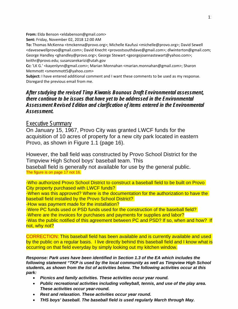
11
From: Elda Benson <[email protected]> Sent: Friday, November 02, 2018 12:00 AM To: Thomas McKenna <[email protected]>; Michelle Kaufusi <[email protected]>; David Sewell <[email protected]>; David Knecht <[email protected]>; [email protected]; George Handley <[email protected]>; George Stewart <[email protected]>; [email protected]; [email protected] Cc: 'LK G.' <[email protected]>; Marian Monnahan <[email protected]>; Sharon Memmott <[email protected]> Subject: I have entered additional comment and I want these comments to be used as my response. Disregard the previous email from me. After studying the revised Timp Kiwanis Bounous Draft Environmental assessment, there continue to be issues that have yet to be addressed in the Environmental Assessment Revised Edition and clarification of items entered in the Environmental Assessment.
Executive Summary On January 15, 1967, Provo City was granted LWCF funds for the acquisition of 10 acres of property for a new city park located in eastern Provo, as shown in Figure 1.1 (page 16). However, the ball field was constructed by Provo School District for the Timpview High School boys’ baseball team. This baseball field is generally not available for use by the general public. The figure is on page 17 not 16. -Who authorized Provo School District to construct a baseball field to be built on Provo City property purchased with LWCF funds? -When was this approved? Where is the documentation for the authorization to have the baseball field installed by the Provo School District? -How was payment made for the installation? -Were PC funds used or PSD funds used for the construction of the baseball field? -Where are the invoices for purchases and payments for supplies and labor? -Was the public notified of this agreement between PC and PSD? If so, when and how? If not, why not? CORRECTION: This baseball field has been available and is currently available and used by the public on a regular basis. I live directly behind this baseball field and I know what is occurring on that field everyday by simply looking out my kitchen window. Response: Park uses have been identified in Section 1.3 of the EA which includes the following statement “TKP is used by the local community as well as Timpview High School students, as shown from the list of activities below. The following activities occur at this park:
• Picnics and family activities. These activities occur year round. • Public recreational activities including volleyball, tennis, and use of the play area.
These activities occur year-round. • Rest and relaxation. These activities occur year round. • THS boys’ baseball. The baseball field is used regularly March through May.

12
• THS marching band practice. Practices on the grass area summer, fall, and spring. • THS Cross Country. Used about once per week in July-October, for about 10-15
minutes to stretch and warm up. • THS lacrosse. Use is based upon need in the Spring/Fall . Spring is Feb-May and Fall
is Sept-Nov. • BYU baseball camp. This camp uses the baseball field and is held for one week in
July. This camp is for any youth that wants to increase their abilities in baseball. Many THS students participate in this camp.
• Rocky Mountain Baseball. This is a league that uses the baseball field on some Saturdays in June, July and August to play tournament games. They use the baseball field about twice a month.
Developmental baseball groups. Little league teams and high school teams from THS that practice during the summer. Practices are mostly Saturdays in July, August and September but they also used on Tuesdays and Thursdays to practice. Not used every week.”
The other questions are administrative items not required by the LWCF process. There is also an access road on the south end of the park that provides access to this well house and to the property east of the baseball field. As shown in Figure 1.5 (page 21), the existing property boundary for TKP includes the 650 East roadway and overlap of residential property boundaries at the south end of the property The figure is on page 20 not 21. CORRECTION: This is not an access road. This walking path was constructed in 1977 for the children in Indian Hills to walk to Edgemont Elementary. It was initially installed with a chain-link fence on each side of the walking path. Later, the north side of the chain-link fence was removed. It is used every morning for walkers, hikers, bikers and throughout the day for others to walk between the Indian Hills neighborhood and the Edgemont neighborhood. It also provides access to the TKP park. Since the well house has been drilled, trucks now use the trail for access to the well house. Additionally, this walking trail is used by large commercial industrial trucks to access to the cell tower that resides on Timpview HS property. For safety purposes, locating a cell tower on Timpview HS property is an extremely dangerous location based on the fact that the students must navigate their way around it. If PSD is concerned as they say they are about the safety of our children, who authorized this location as an appropriate place for a cell tower. PC and PSD also allow the use of the trail for a truck to maintain the “Honey Bucket” portables located on PSD property. Coaches use the trail to drive the sports equipment to the field for the students to use during practice or for games. Spectators for games and practices also drive up this trail when the keys are given out indiscriminately and the gate is left open regardless of our repeated requests to make certain keys are only given out to authorized personnel. Response: The Final EA has been updated to identify this as a trail/access road. For decades there has been a gate to allow vehicular access to the property. There is also an access road on the south end of the park that provides access to this well house, to the property east of the baseball field, and a cell tower north of the baseball field. (pg. 22)
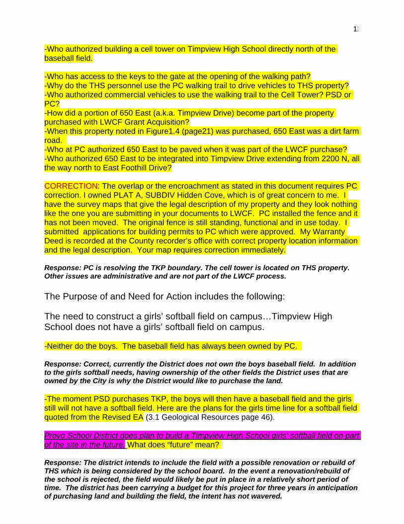
13
-Who authorized building a cell tower on Timpview High School directly north of the baseball field. -Who has access to the keys to the gate at the opening of the walking path? -Why do the THS personnel use the PC walking trail to drive vehicles to THS property? -Who authorized commercial vehicles to use the walking trail to the Cell Tower? PSD or PC? -How did a portion of 650 East (a.k.a. Timpview Drive) become part of the property purchased with LWCF Grant Acquisition? -When this property noted in Figure1.4 (page21) was purchased, 650 East was a dirt farm road. -Who at PC authorized 650 East to be paved when it was part of the LWCF purchase? -Who authorized 650 East to be integrated into Timpview Drive extending from 2200 N, all the way north to East Foothill Drive? CORRECTION: The overlap or the encroachment as stated in this document requires PC correction. I owned PLAT A, SUBDIV Hidden Cove, which is of great concern to me. I have the survey maps that give the legal description of my property and they look nothing like the one you are submitting in your documents to LWCF. PC installed the fence and it has not been moved. The original fence is still standing, functional and in use today. I submitted applications for building permits to PC which were approved. My Warranty Deed is recorded at the County recorder’s office with correct property location information and the legal description. Your map requires correction immediately. Response: PC is resolving the TKP boundary. The cell tower is located on THS property. Other issues are administrative and are not part of the LWCF process. The Purpose of and Need for Action includes the following:
The need to construct a girls’ softball field on campus…Timpview High School does not have a girls’ softball field on campus.
-Neither do the boys. The baseball field has always been owned by PC.
Response: Correct, currently the District does not own the boys baseball field. In addition to the girls softball needs, having ownership of the other fields the District uses that are owned by the City is why the District would like to purchase the land.
-The moment PSD purchases TKP, the boys will then have a baseball field and the girls still will not have a softball field. Here are the plans for the girls time line for a softball field quoted from the Revised EA (3.1 Geological Resources page 46).
Provo School District does plan to build a Timpview High School girls’ softball field on part of the site in the future. What does “future” mean?
Response: The district intends to include the field with a possible renovation or rebuild of THS which is being considered by the school board. In the event a renovation/rebuild of the school is rejected, the field would likely be put in place in a relatively short period of time. The district has been carrying a budget for this project for three years in anticipation of purchasing land and building the field, the intent has not wavered.
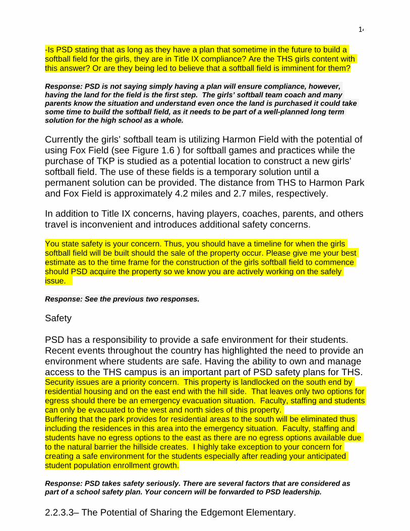
14
-Is PSD stating that as long as they have a plan that sometime in the future to build a softball field for the girls, they are in Title IX compliance? Are the THS girls content with this answer? Or are they being led to believe that a softball field is imminent for them?
Response: PSD is not saying simply having a plan will ensure compliance, however, having the land for the field is the first step. The girls’ softball team coach and many parents know the situation and understand even once the land is purchased it could take some time to build the softball field, as it needs to be part of a well-planned long term solution for the high school as a whole.
Currently the girls’ softball team is utilizing Harmon Field with the potential of using Fox Field (see Figure 1.6 ) for softball games and practices while the purchase of TKP is studied as a potential location to construct a new girls’ softball field. The use of these fields is a temporary solution until a permanent solution can be provided. The distance from THS to Harmon Park and Fox Field is approximately 4.2 miles and 2.7 miles, respectively.
In addition to Title IX concerns, having players, coaches, parents, and others travel is inconvenient and introduces additional safety concerns.
You state safety is your concern. Thus, you should have a timeline for when the girls softball field will be built should the sale of the property occur. Please give me your best estimate as to the time frame for the construction of the girls softball field to commence should PSD acquire the property so we know you are actively working on the safely issue.
Response: See the previous two responses.
Safety PSD has a responsibility to provide a safe environment for their students. Recent events throughout the country has highlighted the need to provide an environment where students are safe. Having the ability to own and manage access to the THS campus is an important part of PSD safety plans for THS. Security issues are a priority concern. This property is landlocked on the south end by residential housing and on the east end with the hill side. That leaves only two options for egress should there be an emergency evacuation situation. Faculty, staffing and students can only be evacuated to the west and north sides of this property. Buffering that the park provides for residential areas to the south will be eliminated thus including the residences in this area into the emergency situation. Faculty, staffing and students have no egress options to the east as there are no egress options available due to the natural barrier the hillside creates. I highly take exception to your concern for creating a safe environment for the students especially after reading your anticipated student population enrollment growth. Response: PSD takes safety seriously. There are several factors that are considered as part of a school safety plan. Your concern will be forwarded to PSD leadership. 2.2.3.3– The Potential of Sharing the Edgemont Elementary.
15
Additionally, upon the rebuild of Edgemont, members of the community expressed concern over having an elementary school and high school commingle on the same grounds for security reasons. While discussing safety as a concern and given the recent increase in tragic events occurring in our schools across the country, perhaps the parents that are concerned about their young children attending Edgemont Elementary need to be taken seriously. If THS is to be rebuilt, being located so close to an elementary school may not be the optimal location for THS if PC and PSD sincerely want to pursue the parents’ concerns for safety. Another location for the High School may be more appropriate and this would be the time to explore this option. Response: Safety is a serious concern for PSD. PSD has and will explore various options to address the needs at Timpview High School. The following guidelines regarding campus size have been provided to school districts by the Utah State Office of Education. Based upon these guidelines, the size of the THS campus should be 52 acres. These are guidelines, not requirements. Response: Correct. PSD tries to adhere to the guidelines to the best of their ability, given the limited amount of available land in the City and existing school sites. Scheduling. PSD would like to have the ability to schedule the use of the baseball field and other areas being used by THS students. Currently the property is owned by PC and is used by PSD. This “sharing“ of the property can create conflicts for both students and the general public. Sharing is what we should be teaching the next generation. The futility of ones thought process in using this as an issue is unfathomable to me. This “issue” is simply superfluous. Response: Scheduling of the property helps to resolve conflicts and confusion about use of the property. Having ownership and control of the property helps to manage the liability associated with the property. PSD bond documents had only CONCEPT drawings on them and were prepared before the actual architectural design process was completed , which was after the bond was passed and funding was available for rebuilding the school. BUYER BEWARE! BE FORWARNED. What is the lesson we should have learned? NEVER PASS A BOND ON CONCEPT DRAWINGS. NEVER, EVER! Response: Comment noted. 3.2 Sound (noise impacts) Provo School District will comply with Provo City’s noise ordinance. Note THS principals comments. At 5:00 a.m. the noise begins. PC noise ordinance
16
states Per PC Public Disturbances 9.06.020. Noise Measurement Procedures and Definitions. 9.06.030. Noise Limits. (a) "Day" shall be from 7 a.m. to 10 p.m. Fidel Montero •THS principal •Father of 5 kids, ages 1-15 •His kids play in the park and love the park •There are hundreds if not thousands of students who use the limited space and do not have access to the park •At 5am this morning there were kids practicing on the football fields because they would not have access the rest of the day •60 boys practicing football on THS space •There was a soccer game at the same time •Lacrosse was waiting to use the field •Baseball and softball •He sees the tensions as a parent and as a school administrator •Recommends to the board to find a win- win solution •He is completely open to the neighbors using the facilities •Committed to finding a solution where kids, young people, and neighbors can go and enjoy green space and use the park area -Yes, I have made calls to THS when the music is blaring towards my home with the stereo amplified in the early hours of the morning. -As for the thousands of students that don’t have access to the park, I need Mr. Montero to explain this comment. I have never known of hundreds let alone thousands of students that have been denied access to the park. During the week I see hundreds of students that run across the south end of the park for their Physical Education run. If any student was denied access to the park, this must be investigated and corrected. This would be criminal. Response: This comment will be passed on to Mr. Montero.
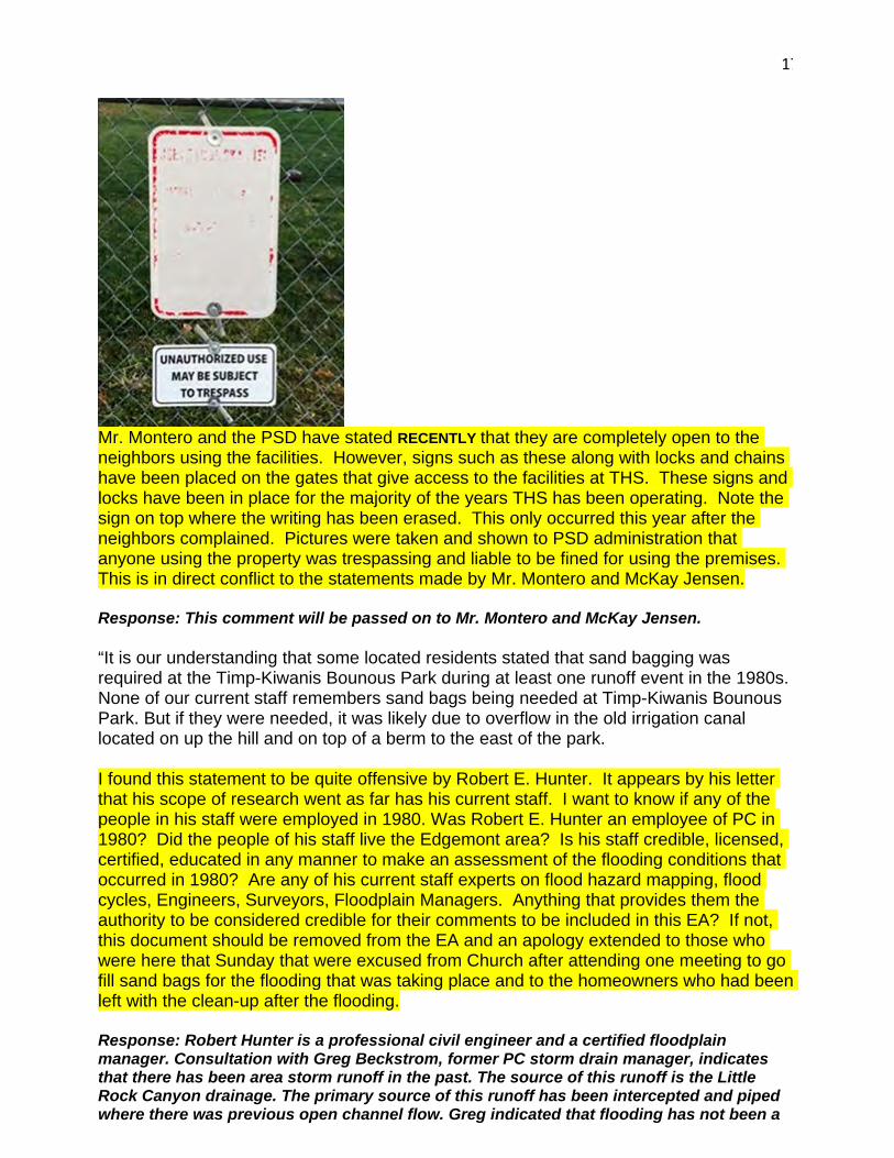
17
Mr. Montero and the PSD have stated RECENTLY that they are completely open to the neighbors using the facilities. However, signs such as these along with locks and chains have been placed on the gates that give access to the facilities at THS. These signs and locks have been in place for the majority of the years THS has been operating. Note the sign on top where the writing has been erased. This only occurred this year after the neighbors complained. Pictures were taken and shown to PSD administration that anyone using the property was trespassing and liable to be fined for using the premises. This is in direct conflict to the statements made by Mr. Montero and McKay Jensen. Response: This comment will be passed on to Mr. Montero and McKay Jensen. “It is our understanding that some located residents stated that sand bagging was required at the Timp-Kiwanis Bounous Park during at least one runoff event in the 1980s. None of our current staff remembers sand bags being needed at Timp-Kiwanis Bounous Park. But if they were needed, it was likely due to overflow in the old irrigation canal located on up the hill and on top of a berm to the east of the park. I found this statement to be quite offensive by Robert E. Hunter. It appears by his letter that his scope of research went as far has his current staff. I want to know if any of the people in his staff were employed in 1980. Was Robert E. Hunter an employee of PC in 1980? Did the people of his staff live the Edgemont area? Is his staff credible, licensed, certified, educated in any manner to make an assessment of the flooding conditions that occurred in 1980? Are any of his current staff experts on flood hazard mapping, flood cycles, Engineers, Surveyors, Floodplain Managers. Anything that provides them the authority to be considered credible for their comments to be included in this EA? If not, this document should be removed from the EA and an apology extended to those who were here that Sunday that were excused from Church after attending one meeting to go fill sand bags for the flooding that was taking place and to the homeowners who had been left with the clean-up after the flooding. Response: Robert Hunter is a professional civil engineer and a certified floodplain manager. Consultation with Greg Beckstrom, former PC storm drain manager, indicates that there has been area storm runoff in the past. The source of this runoff is the Little Rock Canyon drainage. The primary source of this runoff has been intercepted and piped where there was previous open channel flow. Greg indicated that flooding has not been a
18
chronic issue. PSD would need to take this into account. From: Ryan York Generally speaking, Zone 2 encompasses the entire footprint of the park, Timpview High school, and both the football and baseball fields. It is in the best interest of Provo City and its residents to protect all sources of drinking water as they are extremely valuable. After of 120,000 acres of property burned in Utah this summer alone, this statement must be heeded. I enjoy drinking water, I enjoy a shower, I enjoying having water to wash dishes and clothing. We forget how much water impacts our daily living. Response: Comment noted. Lastly, I need to know if the EA is or should be a neutral document. After reviewing the public comments, a clear pattern begins to emerge. Those that are in favor to sell TKP receive a “Comment noted” reference and that is the end of the communication. There is no thoughtful elaboration submitted back to the writer that could add additional information to the response. When public comments entered reflect a no confidence statement regarding the proposed sale of the TKP, there is first a rubber stamp like comment that the EA is not an Advocacy document and then the writer of the comments is advised to see various Appendixes and additional information which are difficult to locate in the document. The majority of the entries are against the sale of the park. I only counted three proponents for the sale of the park. The majority of the comments submitted are against the sale of the TKBP. Response: No statistically valid survey or vote has been conducted.
As I have stated in earlier correspondence, we support PC and we support THS. We want both to succeed and it should not come at the expense of eliminating a beautiful established park which allows green space, water reserves and recreation for the community. Response: Comment noted. May you have the wisdom and the courage to perform your duties and make your decisions with the best of intentions for our Community. Elda Benson
19
From: James Benson <[email protected]> Sent: Wednesday, October 31, 2018 12:58 AM To: Thomas McKenna <[email protected]>; James Benson <[email protected]>; David Sewell <[email protected]>; [email protected]; George Handley <[email protected]>; David Knecht <[email protected]>; George Stewart <[email protected]>; [email protected]; Elda Benson <[email protected]>; Michelle Kaufusi <[email protected]>; Marlin Christenson <[email protected]>; Jay Goodliffe <[email protected]>; LK G. <[email protected]>; Sharon Memmott <[email protected]>; Marian Monnahan <[email protected]> Subject: TIMP KIWANIS BOUNOUS PARK DRAFT ENVIRONMENTAL ASSESSMENT (REVISED) I have comments and questions on Figure 1.5 – Timp Kiwanis Bounous Park Amenities in the (Revised) Assessment section 1.3.3. Section 1.3.3 reads as follow with my comments entered below each bullet point. Provo City has a desire to work with PSD to address their needs and also to clear up existing Section 6(f) issues that exist at the park. • The baseball field is operated and maintained by PSD for the THS boy’s baseball team. There are some other users of the field but it generally does not function as a baseball field that is open for public use. Most of the year the ball field is used for other than THS use. Having PC or another entity schedule the ball field clears up the 6(f) schedule issue. Response: Scheduling of the field does not satisfy the purpose and need because:
• Although scheduling may resolve a portion of the 6(f) issues, it is not in the best interest of either PC or PSD to have two parties involved in managing the ball field due to the liabilities and risks associated with its use.
• The well and well house are not recreational uses and a conversion needs to be completed for these facilities. Please explain to me how a non recreational well and well house were placed on the park creating a 6(f) issue? Response: Through this conversion process PC desires to resolve this issue. • The access road on the south end of the park is not a recreation use. The trail became an access road when the water well, cell tower and a road access to the ball field were created. Even though the trail became a road it is used for recreation use daily for walking, biking and other activities. Thus the trail/road is not a 6(f) problem. Response: The Final EA has been updated to identify this as a trail/access road. For decades there has been a gate to allow vehicular access to the property. • There are residential properties that are encroaching into park property. PC desires to correct this situation. If the park boundary description shown on Figure 1.5 is correct, please explain to me how residential properties were surveyed, property descriptions recorded and approved by PC if the properties are actually on TKP 6(f) property? Response: PC is resolving the TKP boundary.

20
• The 650 East roadway is included in the Section 6(f) boundary and is not a recreation use. If the park boundary description shown on Figure 1.5 is correct, please explain how a main PC road got built on the 6(f) property?
Response: PC is resolving the TKP boundary.
21
From: LK G. <[email protected]> Sent: Monday, October 22, 2018 9:34 AM To: Thomas McKenna <[email protected]> Subject: comment on the revised environmental assessment for Timp Kiwanis Bounous Park Hi, Mr. McKenna, It was great to meet you during the “chat” after the recent work meeting. I appreciated your genuine friendliness. I’m assuming that I am to send my comments on the revised assessment to you, since that is how we did it last time. No instructions were given on the notice posted October 3. If that is not the case, would you please instruct me how to do it. Thank you, Kaye Garner My comments: 1. FROM THE EXECUTIVE SUMMARY: "This park was originally called Edgemont Park but is currently called the Timp Kiwanis Bounous Park (TKP).” My comment has no bearing on the sale of the park, but this is incorrect and disrespectful to the original owners and the history of the park. We have lived in this neighborhood for over 50 years and we have never heard it referred to as Edgemont Park. The document always refers to the park as TKP, totally ignoring the Bounous origin and history. Response: No disrespect is intended. We are required to use the use the name that was used in the original LWCF application, which is Edgemont Park. TKP is simply an acronym that has been used throughout the document for brevity. 2. FROM CHAPTER 3: “It is our understanding that some located residents stated that sand bagging was required at the Timp-Kiwanis Bounous Park during at least one runoff event in the 1980s. None of our current staff remembers sand bags being needed at Timp-Kiwanis Bounous Park.” We couldn’t believe this when we first read it. It is very unprofessional. It doesn’t address whether any of the current staff worked in the department in the 80s. Several public comments decried this statement but it was never addressed in the responses from the city. Response: Robert Hunter is a professional civil engineer and a certified floodplain manager. Consultation with Greg Beckstrom, former PC storm drain manager, indicates that there has been area storm runoff in the past. The source of this runoff is the Little Rock Canyon drainage. The primary source of this runoff has been intercepted and piped where there was previous open channel flow. Greg indicated that flooding has not been a chronic issue. PSD would need to take this into account.
22
Public Comments Provo City Council Meeting
November 13, 2018 Neighborhood Chairs: Marian Monnahan, Edgemont Neighborhood Chair
- 100% of the people living in the Edgemont area have been against selling the park Response: Comment noted. No statistically valid survey or vote has been conducted.
- Park is used and not sitting idle Response: Agree. This has been pointed out in the EA.
- - Federal funds were used with the promise that the park would be used in perpetuity
Response: Comment noted.
- Put in resolution that this park be used as shared open space Response: The resolution that the city council is voting on is simply to approve the document to be sent to the National Park Service for review.
Sharon Memmott, Edgemont Neighborhood Vice-Chair Items not addressed in the EA:
- Criteria for the sale is to show that it is an obsolete piece of property. Response: Section 8.E. of the LWCF State Assistance Program Manual states “Replacement property need not necessarily be directly adjacent to or close by the converted site. This policy provides the administrative flexibility to determine location recognizing that the property should meet existing public outdoor recreation needs. While generally this will involve the selection of a site serving the same community(ies) or area as the converted site, there may be exceptions…” Although the location of the proposed replacement site in southwest Provo it is still under jurisdiction of Provo City and has been well coordinated with Susan Zarekarizi (LWCF Coordinator) at the Utah Department of Parks and Recreation. She has not expressed concerns about this site location. In addition, and outside of the conversion process, PC plans to build the Canyon Road Park to serve the local community. This is in addition to whatever agreements take place for maintaining current uses of TKP. It is very possible that the area will end up with a net gain of recreation facilities over what is existing.
- The park is still being used by the neighborhood. Response: Park uses have been identified in Section 1.3 of the EA which includes the following statement “TKP is used by the local community as well as Timpview High School students, as shown from the list of activities below. The following activities occur at this park:
• Picnics and family activities. These activities occur year round. • Public recreational activities including volleyball, tennis, and use of the play area.
These activities occur year-round. • Rest and relaxation. These activities occur year round. • THS boys’ baseball. The baseball field is used regularly March through May. • THS marching band practice. Practices on the grass area summer, fall, and spring.
23
• THS Cross Country. Used about once per week in July-October, for about 10-15 minutes to stretch and warm up.
• THS lacrosse. Use is based upon need in the Spring/Fall . Spring is Feb-May and Fall is Sept-Nov.
• BYU baseball camp. This camp uses the baseball field and is held for one week in July. This camp is for any youth that wants to increase their abilities in baseball. Many THS students participate in this camp.
• Rocky Mountain Baseball. This is a league that uses the baseball field on some Saturdays in June, July and August to play tournament games. They use the baseball field about twice a month.
Developmental baseball groups. Little league teams and high school teams from THS that practice during the summer. Practices are mostly Saturdays in July, August and September but they also used on Tuesdays and Thursdays to practice. Not used every week.”
- Ballfield is one of the problems, but no mention that the property is being used by the public when the school is not using it. Response: See response above.
- It has been mentioned that everyone is against the sale, which is not so. She has been to the meetings and she would say the vast majority is against the sale, but those for it have voiced that they would like to see it continued to be used as a shared park after the sale. This is not addressed just acknowledged in the environmental assessment. Response: It is not acknowledged because it is not part of the EA. Details of the property future use may be discussed outside of the EA process.
- They are hopeful that this will be maintained as open space. Response: Details of the property future use may be discussed outside of the EA process.
- Concern about the master plan that was approved by the Council just moments before this item which included a reference to a Regional Sports Park. Response: The Westside Plan, which was approved, was initiated long after the LWCF process began. PC has carefully coordinated sequencing with the State LWCF coordinator.
- Hopeful that something in the environmental assessment or resolution in writing for
the NPS and the neighborhood understand that that portion of the property will remain as open space. Response: Details of the property future use may be discussed outside of the EA process.
Pam Jones, Edgemont Neighborhood Vice-Chair
- Upset that that assets from the NE are going to the SW without receiving an equitable return. Response: As indicated in Chapter 2 of the EA, the proposed replacement site for TKP was selected after looking at several alternatives and abiding by the rules of the Section 6(f) conversion process. Outside of the conversion process, PC is working towards even more additional parks and open space in this area.
24
- Mentioned the vacant land proposed for a park between Canyon Road and Timpview Drive. She has been told that the city does not have control over all that vacant land or if there is any plan that the city will do a park. Response: PC owns 8.7 acres of property for the proposed Canyon Road Park. There is a plan for the city to build a park at that location and the park is shown on the Parks Master Plan.
- Neighborhood is owed a reasonable promise that the neighborhood will receive a
park for the one they are giving up. Response: Outside of the conversion process, PC is working towards even more additional parks and open space in this area.
Public Comment: Lynn Garner
- Lived in the area since 1968, apparently after the sale of the property. - EA does not adequately address the history of the park. In the late 60’s, Junior
Bounous was approached by a representative of the school district who indicated that they were interested in purchasing the land owned by the Bounous family. Was given a mild threat of eminent domain. He then hired a lawyer who was able to help him work out a deal with the City with the understanding that it would remain a legacy park in perpetuity and the federal funds that were used would help guarantee it. Later found out that the lawyer that he used also was working for Provo City. Response: The EA accurately portrays the history of the park based upon written agreements that are in place. No disrespect is intended toward the Bounous family.
- To try to overturn the intent of the park seems to be a bad idea and does not honor the Bounous family for their input and they in fact did donate some of the land. Response: Comment noted.
LaDawn Christensen
- Jay Goodliffe, who has a PhD that deals with formulations of environmental assessments, has concerns about the factual accuracy of this assessment. Response: According to an internet search, Jay Goodliffe is an Associate Professor at BYU in Political Science. He has submitted comments which are being addressed.
- The need of the school district has nothing to do with the environment and its
assessment. Response: The needs of PSD are listed in the EA and are pertinent to the purpose and need for the proposed action.
- The EA should be revised before it is approved. Response: The EA is being revised before it gets submitted for approval.
- Wants to address the concept that only the 8 families along the fence want it to remain a park. She has lived on the border for at least 10 years and has witnessed how it is used. She has documented the use of the park over the last summer. She is representing the families who may not be aware of what the proposal is on the park because they are new to the neighborhood because there has been a lot of turnover. Response: Comment noted.

25
- She is also representing the document that states that it should remain as a park in
perpetuity. Response: Comment noted.
Sharlene Goodliffe.
- Focusing on one issue and seeking clarification. The draft assessment says that the school should own adjacent land for safety reasons. Response: Safety is primary concern of PSD. Owning and maintaining the property being used by THS students helps PSD better manage safety and liability concerns.
- It was my understanding in speaking with McKay Jensen and others from the School District that the park area was going to remain much as it is now and that it don’t matter who owns it. It will be green space, shared and open, there will be a playground and pavilion. Response: A letter from Keith Rittel, PSD Superintendent, is included as Appendix M to the EA. That letter addresses this issue.
- There were many promises made verbally. He assured her that the property would be maintained and accessible to the public. She has had doubts about this and the assessment affirms that it will be shut off for safety reasons. Response: See responses above. The EA does not say that access to the park will be shut off.
- Given that new idea, her second thought is that if this is going to be closed off for safety reasons, she wonders how many believe that mothers, adults, and children don’t have a tempering influence on teenagers. Because in her experience since she lives close to the park, all she has to do is stand there and not only do her teenagers but other teenagers begin to behave differently. Response: Comment noted.
- She has personally intervened with littering, both in the cleaning up afterwards and the preventing of it. She has offered garbage cans to people who have needs. She has discouraged truancy and tardiness. By just pushing her children on the swings she has helped prevent other inappropriate behavior which has been a benefit to the school, the kids, and ultimately the parents. Response: Comment noted.
- It is a mistake that the buffer zone for safety reasons we would get rid of it. A buffer zone is for safety. Response: Comment noted.
James Benson
- In the EA, it mentioned that Timpview High School needs more ground to meet some sort of standard for a high school. Response: The EA references state guidelines provided to school districts. According to those guidelines THS should have a campus of 52 acres. Acquisition of TKP still does not get PSD to 52 acres but it does help provide additional area.
- Timpview daily uses the park. They use the park all the time. Response: Correct. The uses of the park have been identified in the EA.
26
- In speaking with Superintendent Rittel, his number one priority was to get the number piece of property north of Timpview high school on Timpview Drive and for some reason the city does not want to sell it to him, but that was his priority.
- The EA simply says that the high school needs more property. Response: Response: PC desires to keep the land for the future Canyon Road Park. In addition, after further analysis, the site does not fit a boys’ baseball field and a girl’s softball field because of the roadway identified in the PC Transportation Master Plan.
- One thing not mentioned in the EA is that there is a large canal that will need an
easement. He owns some of the water for the canal. Response: Encumbrances would be considered at the time of potential sale.
- The plat map for the LWCF shows that Timpview Drive is built on that. He doesn’t know if the school is going to be buying that from the City or will it be deducted off the acreage that is going to be sold. Response: PC is resolving the TKP boundary.
Elda Benson
- Wants to focus on Brian Jones comment about the factual accuracy of the EA document. There are multiple, abundance of inaccuracies.
- Quoting from the revised EA, in the executive summary it states, “However, the ballfield was constructed by the Provo School District for the Timpview High School boys’ baseball team. This baseball field is generally not available for use by the public”. Correction: This baseball field has been available and is currently available and used by the public on a regular basis. She lives right behind the field and knows what is going on there by simply looking out her kitchen window.
- Title X and Title 9 issue: The need to construct a girls’ softball field on campus. Correction: Neither do the boys. As soon as this property is purchased, the boys will then have a baseball field and the girls will not. The Provo School district will then be at risk for Title 9 issues.
- The plan listed in the revised document says that the School District plans to build a softball field on a portion of the property. What does future mean? Does stating that you have a plan to build one in the future put you in compliance with Title 9.
- The last thing she wanted to address was the pathway. You say it is an access road, it is not an access road. It is pathway that was built in 1977 to give access to children coming from Indian Hills to walk down to the Edgemont Elementary. The Provo School District put in a cell tower. Provo City put in a well house. The Provo School District put in honey buckets. Therefore, making it an access road. It was never intended to be an access road. So, between Provo City and the Provo School District the trailway that was built for children to use to access Edgemont Elementary School, you have changed the verbiage for it to be an access road when it is simply a walking trail that is used everyday by the neighborhood as a walking trail. Response: All of the above comments are included as part of Elda Benson’s written comments, above. Please refer to the responses provided to those comments.
Derek Hansen - Usually at the park more than once a day coaching the cross country team as well
as watching the hundreds of joggers using the bathrooms that the city puts out. Response: Comment noted.
27
- It is a little disconcerting that the first version seemed like a sales pitch not an assessment of the impact of the sale form an unbiased opinion. While the updated version addresses some of the deficiencies like not mentioned that there is a well there or the berm that was developed to prevent some of the flooding. Response: The Environmental Assessment is a process that involves reviews and revisions of the document. The Final EA is intended to incorporate comments received.
- Has little confidence that this has been done in an objective way that shows the environmental impact. Response: Comment noted. The National Park Service will determine if the document is adequate.
- Concerned about this property possibly being used as a staging area and what impact that may have on the well and quality of water. Response: Section 3.13 of the EA states “.Details of this well are included in an email provided by Ryan York, Provo City Water Resources Section Manager (see Appendix B). PC does not plan to relocate the well house. There is a 100’ radius well protection zone (Zone 1) that is required around the well head (see Figure 3.8). No structures are allowed within Zone 1. Construction activities within Zone 2 (generally the entire TKP, THS, and both the football and baseball fields) are required to be reviewed by PC.”
Jay Goodliffe
- Lived in Provo for over 21 years. Reviewed the slide from the presentation and stated those reasons have been given much more prominence in the revised report and the fact that it has been given more prominence has made him concerned because this is being treated as a principal documents which will become a federal document of what the reasons are that the city should be selling the property to the school district.
- The first reason is that Provo School District needs to expand and one of the things used throughout the report is that it is short from the Utah State Public Education guidelines.
- If you look at the guidelines, out of the 18 schools that the Public School District owns, 17 of them do not meet the guidelines.
- So, if you are ready to sell the property next to Timpview High School because it needs the space, are you also ready to sell the park next to Centennial where they have 15, but the guidelines say they should have over 30 or Dixon Middle School that has 8 acres, but should have 28-29.
- Response: PSD tries to adhere to the guidelines to the best of their ability, given the limited amount of available land in the City and existing school sites. . Additionally, the needs of elementary and middle schools are much different than those of a 5A athletic high school and limited land for those schools is easier to address.
- When they are needing to expand, are you willing to sell Footprinter Park to them? - Response: Provo is growing and schools are aging. There MAY BE additional needs
in the future. As the needs of various schools arise, they will be evaluated on a case-by-case basis. The goal will be to find the best possible solution for both PC and PSD. . As previously stated, the needs of elementary and middle schools are much different than those of a 5A athletic high school.
-
28
- The second reason, the Provo School District has a need to own and manage the property used by their students for safety reasons. There are many parks adjacent to schools by design. They are being used by the students.
- His son goes to Centennial and they use Serotoma park for their recreation time and PE classes. For the same reason, should Centennial take it over that park for safety reasons because it is used by the students? Response: PSD takes safety seriously. As stated in Section 1.4.2 of the EA “PSD has a responsibility to provide a safe environment for their students. Recent events throughout the country has highlighted the need to provide an environment where students are safe. Having the ability to manage and control access to the THS campus is an important part of PSD safety plans for THS.”
- Is the Provo Council ready to sell all of the parks adjacent to schools for the same reason? If you’re not ready to do that for other parks or other schools, it shouldn’t be a reason for you to do it for Timpview High School.
- You should be using principles in in the EA that the City would be willing to abide by for any school or park.
- Response: Provo is growing and schools are aging. There MAY BE additional needs in the future. As the needs of various schools arise, they will be evaluated on a case-by-case basis. The goal will be to find the best possible solution for both PC and PSD. Additionally, the needs of elementary and middle schools are much different than those of a 5A athletic high school, thus the fear of the school district purchasing all adjacent parks is unsubstantiated
- What are the reasons you are willing to sell a park? Is it because you are able to get more space on the west side because it is less expensive on the east side. He does not feel these are good reasons. Response: The reasons are stated in Chapter 1 of the EA. They include the following: • Provo School District has a need to expand the Timpview High School campus
and desires to purchase the TKP property from Provo City. • Provo School District has a need to own and manage the property being used
by THS students. • Provo City has a desire to work with PSD to address their needs and also to
clear up existing Section 6(f) issues that exist at the park. McKay Jensen, Provo School District Board
- Where we are in the process is to determine if the 6(f) can be converted. In doing that, they are certainly interested in the property and recognize the neighbors are interested in keeping the park.
- They have looked at is something that can be a benefit to the city as a whole. - He recognizes that some people are really worried that it won’t be public access or
a public park. - When they say they need to expand that we will be putting new building over there
and that we won’t account for the well and that we are going to change the nature of the park drastically. We are not.
- As part of the EA, there is a letter included from the superintendent that was approved by the School District that says the board is willing to explore and negotiate something that is recordable against the property such as a deed restriction.
29
- Some people have said that we can’t trust the city or school board but we can put something against that property which has a deed restriction which explains how the property will be used and accessed.
- Any other details will have to wait until we get input from the federal government. - They are prepared to have something recordable against the property which will
address future use, access and we believe that will benefit the city as a whole. - There will still be a park, a pavilion, playground for kids, open space for soccer,
cross country, and grass. - This is an opportunity for the whole city that they don’t have to do.
Response: Comments noted.
Appendix O
Provo City Council Resolution
November 27, 2018
1
Memo
To: Provo Planning Commission
From: Josh Yost
Date: October 17, 2018
Re: October 24, Item 2 – Public Works Standards
Due to delays in completing the revised Public Works Standards, staff has not yet received these materials for review. As a result, no staff report has been drafted. David
Day, Public Works Development Review Coordinator, has indicated that the Standards will be distributed to the Commission as soon as possible and that he plans on making an initial presentation at the meeting.
Staff recommends the Commission hear Mr. Day’s presentation and then continue
this item to the next available meeting, November 14 2018.
Provo City Planning Commission
Report of Action November 14, 2018
Provo City Public Works Department requests amendments to Section 15.03.020(3) to update 2018 standards to 2019 standards.
City-Wide Impact. PLOTA20180348, Josh Yost, 801-852-6408
The following action was taken by the Planning Commission on the above described item at its regular meeting of
November 14, 2018:
CONTINUE
On a vote of 5:0, the Planning Commission continued the above noted application to November 14, 2018. Motion By: Shannon Ellsworth Second By: Knudsen Votes in Favor of Motion: Shannon Ellsworth, Jamin Rowan, Deborah Jensen, Andrew Howard, Robert Knudsen Deborah Jensen was present as Chair.
STAFF PRESENTATION The Staff Report to the Planning Commission provides details of the facts of the case and the Staff's analysis, conclusions, and recommendations. Key points addressed in the Staff's presentation to the Planning Commission included the following: Staff communicated that the revised standards had not yet been reviewed by staff and that David Day from Provo Public Works was present to make an initial presentation to the Commission.
APPLICANT RESPONSE Key points addressed in the applicant's presentation to the Planning Commission included the following: David Day presented the revised standards and reviewed the revision process. He shared that Public Works would like to discuss the street standards as part of the Transportation Master Plan process and that the previously adopted street standards would remain in place until the conclusion of that plan.
PLANNING COMMISSION DISCUSSION Key points discussed by the Planning Commission included the following: The commission expressed their trust in Public Works staff in the realm of technical standards related to utility construction. Ms. Ellsworth asked Mr. Day if Low Impact Development standards for storm water were included or being developed. He indicated that due to regulatory pressure, the storm water division was increasing their willingness to explore such alternatives to standard practice.
Director of Community Development See Key Land Use Policies of the Provo City General Plan, applicable Titles of the Provo City Code, and the Staff Report to the
Planning Commission for further detailed information. The Staff Report is a part of the record of the decision of this item. Where findings of the Planning Commission differ from findings of Staff, those will be noted in this Report of Action.
Legislative items are noted with an asterisk (*) and require legislative action by the Municipal Council following a public hearing;
the Planning Commission provides an advisory recommendation to the Municipal Council following a public hearing.
Administrative decisions of the Planning Commission (items not marked with an asterisk) may be appealed by submitting an application/notice of appeal, with the required application and noticing fees, to the Community Development Department, 330
West 100 South, Provo, Utah, within fourteen (14) calendar days of the Planning Commission's decision (Provo City office hours are Monday through Thursday, 7:00 a.m. to 6:00 p.m.).
BUILDING PERMITS MUST BE OBTAINED BEFORE CONSTRUCTION BEGINS
Planning Commission Staff Report Ordinance Amendment
Hearing Date: November 14, 2018
ITEM 4* Provo City Public Works Department requests amendments to Section 15.03.020(3)
to update 2018 standards to 2019 standards. City-Wide Impact. PLOTA20180348,
Josh Yost, 801-852-6408
OVERVIEW
Each year, the Provo Public Works Departments updates utility construction standards,
street design standards and other development standards. Staff is particularly interested
in those standards which have a visible impact on the built environment and clearly fall
within the purview of the Planning Commission. The standards under consideration for
revision are generally related to underground utility construction. The current street
design standards are not proposed for revision because an update to the Transportation
Master Plan is currently in progress. These street design standards will come before the
Planning Commission as part of the review of the Transportation Master Plan.
Applicant: Provo City Public Works
Staff Coordinator: Josh Yost
*Council Action Required: ALTERNATIVE ACTIONS 1. Continue to a future date to obtain additional information or to further consider information presented. The next available meeting date is November 28, at 5:30 p.m. 2. Recommend Denial of the proposed ordinance amendment. This would be a change from the Staff recommendation; the Planning Commission should state new findings.
Relevant History: The Provo Public Works Department conducts a yearly update to their standards. Neighborhood Issues: None noted. Summary of Key Issues: Staff is particularly interested in those standards which have a visible impact on the built environment. The standards under consideration for revision are generally related to underground utility construction. Staff Recommendation: Recommend Approval of Provo City Public Works Department requested amendments to Section 15.03.020(3) to update 2018 standards to 2019 standards.
Planning Commission Staff Report Item 4 January 14. 2018 Page 2
STAFF ANALYSIS
1. Provo City Code Section 14.02.020(2) sets forth the following guidelines for
consideration of ordinance text amendments:
Before recommending an amendment to this Title, the Planning Commission
shall determine whether such amendment is in the interest of the public, and is
consistent with the goals and policies of the Provo City General Plan. The
following guidelines shall be used to determine consistency with the General
Plan:
(a) Public purpose for the amendment in question.
The public purpose for the proposed amendment is to update Public
Works Standards to reflect current best practices, adhere to current
regulations and to specify desired products.
(b) Confirmation that the public purpose is best served by the amendment in
question.
The amendment in question revises only the standards where required
and provides for the responsible maintenance and development of the
city’s public utilities.
(c) Compatibility of the proposed amendment with General Plan policies,
goals, and objectives.
No General Plan policies, goals or objectives specifically address Public
Works Standards.
(d) Consistency of the proposed amendment with the General Plan=s Atiming
and sequencing@ provisions on changes of use, insofar as they are
articulated.
Not applicable.
(e) Potential of the proposed amendment to hinder or obstruct attainment of
the General Plan=s articulated policies.
Not applicable.
(f) Adverse impacts on adjacent land owners.
Planning Commission Staff Report Item 4 January 14. 2018 Page 3
No foreseeable impact.
(g) Verification of correctness in the original zoning or General Plan for the
area in question.
Not applicable.
(h) In cases where a conflict arises between the General Plan Map and
General Plan Policies, precedence shall be given to the Plan Policies.
Not applicable.
CONCLUSIONS
The proposed amendments fall within the technical realms of utility design and
maintenance and have minimal effects on the built environment. As such, staff
recommends the Planning Commission forward a positive recommendation to the City
Council.
STAFF RECOMMENDATION
Recommend Approval of Provo City Public Works Department requested amendments
to Section 15.03.020(3) to update 2018 standards to 2019 standards.

Provo City Planning Commission
Report of Action November 14, 2018
Provo City Public Works Department requests amendments to Section 15.03.020(3) to update 2018 standards to 2019 standards.
City-Wide Impact., Josh Yost, 801-852-6408 PLOTA20180348
The following action was taken by the Planning Commission on the above described item at its regular meeting of
November 14, 2018:
RECOMMEND APPROVAL
On a vote of 4:0, the Planning Commission recommended that the Municipal Council approve the above noted application. Motion By: Shannon Elsworth Second By: Robert Knudsen Votes in Favor of Motion: Shannon Elsworth, Robert Knudsen, Deborah Jensen, Dave Anderson Deborah Jensen was present as Chair. • Includes facts of the case, analysis, conclusions and recommendations outlined in the Staff Report, with any changes
noted; Planning Commission determination is generally consistent with the Staff analysis and determination.
STAFF PRESENTATION The Staff Report to the Planning Commission provides details of the facts of the case and the Staff's analysis, conclusions, and recommendations. Key points addressed in the Staff's presentation to the Planning Commission included the following: Each year, the Provo Public Works Departments updates utility construction standards, street design standards and other development standards. Staff is particularly interested in those standards which have a visible impact on the built environment and clearly fall within the purview of the Planning Commission. The standards under consideration for revision are generally related to underground utility construction. The current street design standards are not proposed for revision because an update to the Transportation Master Plan is currently in progress. These street design standards will come before the Planning Commission as part of the review of the Transportation Master Plan.
NEIGHBORHOOD MEETING DATE • City-wide application; all Neighborhood Chairs received notification.
NEIGHBORHOOD AND PUBLIC COMMENT • This item was City-wide or affected multiple neighborhoods.
CONCERNS RAISED BY PUBLIC No concerns were received.
APPLICANT RESPONSE Key points addressed in the applicant's presentation to the Planning Commission included the following: David Day described the number and type of standard drawings that were updated and offered to review them with the Commission.
PLANNING COMMISSION DISCUSSION Key points discussed by the Planning Commission included the following: The Commission declined Mr. Day’s offer to review the drawings individually and expressed their interest in reviewing street design standards in the near future.
Director of Community Development See Key Land Use Policies of the Provo City General Plan, applicable Titles of the Provo City Code, and the Staff Report to the
Planning Commission for further detailed information. The Staff Report is a part of the record of the decision of this item. Where findings of the Planning Commission differ from findings of Staff, those will be noted in this Report of Action.
Legislative items are noted with an asterisk (*) and require legislative action by the Municipal Council following a public hearing;
the Planning Commission provides an advisory recommendation to the Municipal Council following a public hearing.
Administrative decisions of the Planning Commission (items not marked with an asterisk) may be appealed by submitting an application/notice of appeal, with the required application and noticing fees, to the Community Development Department, 330
West 100 South, Provo, Utah, within fourteen (14) calendar days of the Planning Commission's decision (Provo City office hours are Monday through Thursday, 7:00 a.m. to 6:00 p.m.).
BUILDING PERMITS MUST BE OBTAINED BEFORE CONSTRUCTION BEGINS
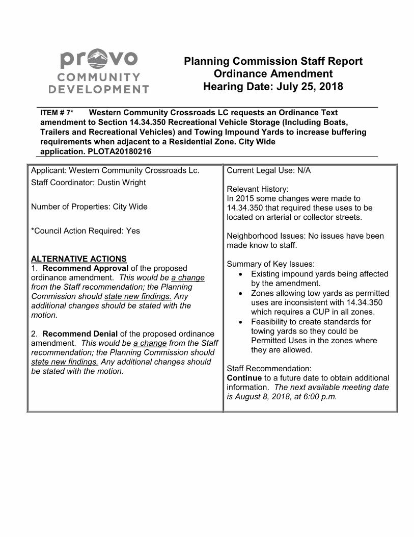
Planning Commission Staff Report Ordinance Amendment
Hearing Date: July 25, 2018
ITEM # 7* Western Community Crossroads LC requests an Ordinance Text
amendment to Section 14.34.350 Recreational Vehicle Storage (Including Boats,
Trailers and Recreational Vehicles) and Towing Impound Yards to increase buffering
requirements when adjacent to a Residential Zone. City Wide
application. PLOTA20180216
Applicant: Western Community Crossroads Lc.
Staff Coordinator: Dustin Wright
Number of Properties: City Wide
*Council Action Required: Yes ALTERNATIVE ACTIONS 1. Recommend Approval of the proposed ordinance amendment. This would be a change from the Staff recommendation; the Planning Commission should state new findings. Any additional changes should be stated with the motion. 2. Recommend Denial of the proposed ordinance amendment. This would be a change from the Staff recommendation; the Planning Commission should state new findings. Any additional changes should be stated with the motion.
Current Legal Use: N/A Relevant History: In 2015 some changes were made to 14.34.350 that required these uses to be located on arterial or collector streets. Neighborhood Issues: No issues have been made know to staff. Summary of Key Issues:
Existing impound yards being affected by the amendment.
Zones allowing tow yards as permitted uses are inconsistent with 14.34.350 which requires a CUP in all zones.
Feasibility to create standards for towing yards so they could be Permitted Uses in the zones where they are allowed.
Staff Recommendation: Continue to a future date to obtain additional information. The next available meeting date is August 8, 2018, at 6:00 p.m.
Planning Commission Staff Report Item # 7 July 25, 2018 Page 2
OVERVIEW
The applicant is requesting an amendment to 14.34.350, Recreational Vehicle Storage
and Towing Impound Yards, and other applicable code sections related to impound
yards. The amendment proposes six foot high fencing on all sides of the lot, a hedge
row on all side adjacent to residential uses, an increase from ten feet to 200 feet
setback from a residential zone boundary, and removing “gravel road base” as an
approved parking area surface.
In 14.34.350, the CM, M1, M2, and PIC zones impound yards are allowed with a
conditional use permit (CUP). However, in some of those zones, impound yards are
listed as Permitted Uses. While this section of the Code is being considered for an
amendment, it would be beneficial to examine these other applicable sections of the
Code and correct any conflicting ordinances and have staff work on applicable updates
and bring them back to the Planning Commission. It would also allow staff to identify
how the proposed changes could affect existing impound yards in the City.
FINDINGS OF FACT
1. 14.34.350 requires a CUP for impound yards in CM, M1, M2, and PIC zones.
2. Standard Land Use Code (SLU Code) 6419 - auto towing service.
3. In M1, M2, CM zones SLU 6400 is a Permitted Use.
4. In PIC, F1, CG zones 6410 is a Conditional Use.
5. 14.34.300 requires transitional standards for incompatible uses adjacent to
residential.
6. There are approximately 20 existing towing services in Provo.
STAFF ANALYSIS
Provo City Code has a section that identifies zones where impound yards can be and
are subject to a CUP. Some of the zones allow impound yards as a Permitted Use
which is conflicting with 14.34.350. A number of existing impound yards in the City have
been identified. Many of existing impound yards are adjacent to or across the street
from a residential zone.
CONCLUSIONS
The applicant has expressed concerns with the existing buffering requirements of
impound yards near residential zones. Staff finds that there are inconsistencies in the
zoning code related to impound yards and where they are Permitted or Conditional
Planning Commission Staff Report Item # 7 July 25, 2018 Page 3
Uses. Staff can examine the applicable code sections and existing towing yards in the
City and bring back more information to the Planning Commission.
STAFF RECOMMENDATION
Continue to a future date to obtain additional information. The next available meeting
date is August 8, 2018, at 6:00 p.m.
ATTACHMENTS
1. Applicant’s Proposed Text Amendment
14.34.350. Recreational Vehicle Storage (Includes Boats, Trailers, and
Recreational Vehicles) and Towing Impound Yards.
Subject to the standards set forth in Subsections (1) through (9) of this Section and the standards for
a conditional use permit set forth in Section 14.02.040, Provo City Code, storage of recreational vehicles shall
be allowed as a conditional use in A1 zones and towing impound yards shall be allowed as a conditional use in
CM, M1, M2 and PIC zones. The Planning Commission shall consider the circumstances of existing
surrounding land uses and existing improvements when applying these standards. Where circumstances
warrant it, the Commission may apply the most restrictive standards, subject to making findings justifying such
application.
(1) Every recreational vehicle storage area and towing impound yard shall be screened on one (1) or more all
sides (as determined by the Planning Commission) by an opaque wall or fence. Fence height shall be at least
eight (8) feet for recreational vehicle storage areas and at least six (6) feet for towing
impound yards. Fence height may be shorter than if built upon a permanent landscaped berm, and the
combined height of the berm and fence meets the requirements of this Subsection.
(a) Fencing appropriate to the area shall be utilized. This may include “Beauty Link” chain link, wood,
decorative block, or brick.
(b) An appropriate hedge row capable of growing to a height of at least five (5) feet at maturity may be
required along one (1) or more sides of the fence, as deemed necessary by the Planning Commission. A
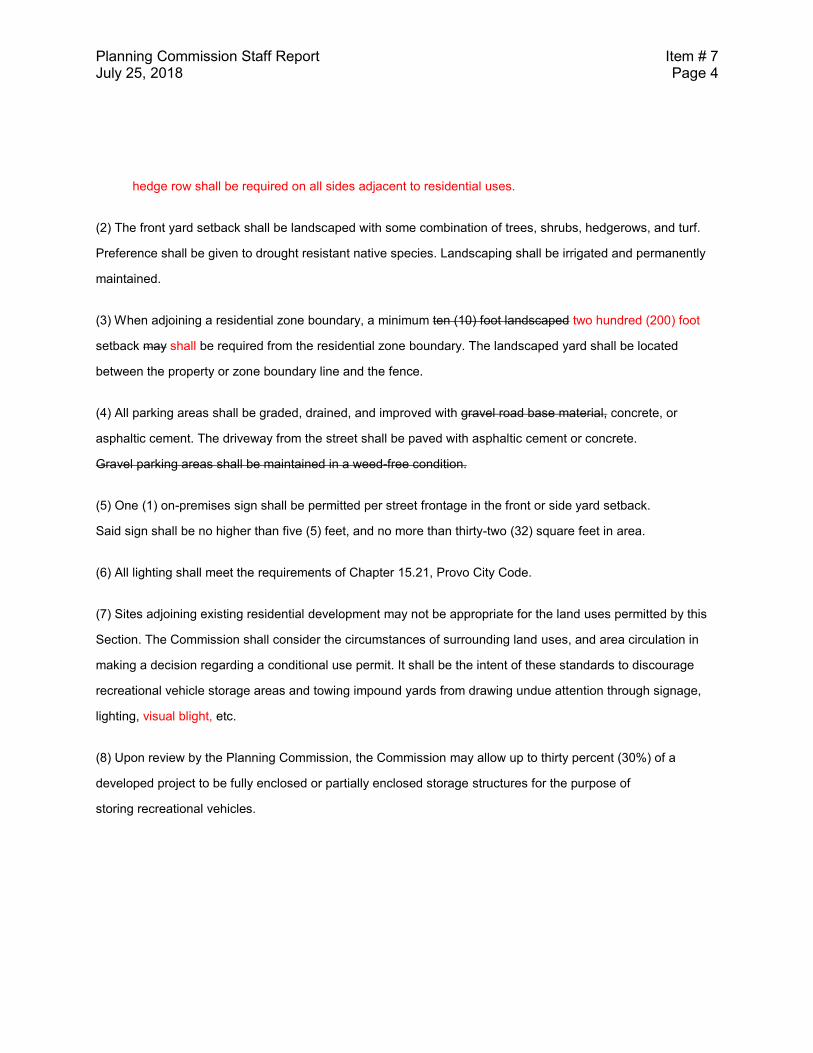
Planning Commission Staff Report Item # 7 July 25, 2018 Page 4
hedge row shall be required on all sides adjacent to residential uses.
(2) The front yard setback shall be landscaped with some combination of trees, shrubs, hedgerows, and turf.
Preference shall be given to drought resistant native species. Landscaping shall be irrigated and permanently
maintained.
(3) When adjoining a residential zone boundary, a minimum ten (10) foot landscaped two hundred (200) foot
setback may shall be required from the residential zone boundary. The landscaped yard shall be located
between the property or zone boundary line and the fence.
(4) All parking areas shall be graded, drained, and improved with gravel road base material, concrete, or
asphaltic cement. The driveway from the street shall be paved with asphaltic cement or concrete.
Gravel parking areas shall be maintained in a weed-free condition.
(5) One (1) on-premises sign shall be permitted per street frontage in the front or side yard setback.
Said sign shall be no higher than five (5) feet, and no more than thirty-two (32) square feet in area.
(6) All lighting shall meet the requirements of Chapter 15.21, Provo City Code.
(7) Sites adjoining existing residential development may not be appropriate for the land uses permitted by this
Section. The Commission shall consider the circumstances of surrounding land uses, and area circulation in
making a decision regarding a conditional use permit. It shall be the intent of these standards to discourage
recreational vehicle storage areas and towing impound yards from drawing undue attention through signage,
lighting, visual blight, etc.
(8) Upon review by the Planning Commission, the Commission may allow up to thirty percent (30%) of a
developed project to be fully enclosed or partially enclosed storage structures for the purpose of
storing recreational vehicles.
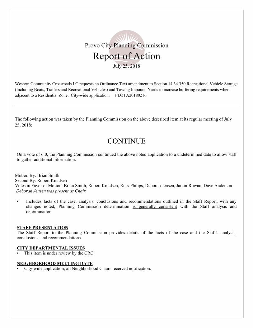
Provo City Planning Commission
Report of Action July 25, 2018
Western Community Crossroads LC requests an Ordinance Text amendment to Section 14.34.350 Recreational Vehicle Storage
(Including Boats, Trailers and Recreational Vehicles) and Towing Impound Yards to increase buffering requirements when
adjacent to a Residential Zone. City-wide application. PLOTA20180216
The following action was taken by the Planning Commission on the above described item at its regular meeting of July
25, 2018:
CONTINUE
On a vote of 6:0, the Planning Commission continued the above noted application to a undetermined date to allow staff to gather additional information.
Motion By: Brian Smith Second By: Robert Knudsen Votes in Favor of Motion: Brian Smith, Robert Knudsen, Russ Philips, Deborah Jensen, Jamin Rowan, Dave Anderson
Deborah Jensen was present as Chair.
• Includes facts of the case, analysis, conclusions and recommendations outlined in the Staff Report, with any
changes noted; Planning Commission determination is generally consistent with the Staff analysis and determination.
STAFF PRESENTATION The Staff Report to the Planning Commission provides details of the facts of the case and the Staff's analysis, conclusions, and recommendations.
CITY DEPARTMENTAL ISSUES • This item is under review by the CRC.
NEIGHBORHOOD MEETING DATE • City-wide application; all Neighborhood Chairs received notification.
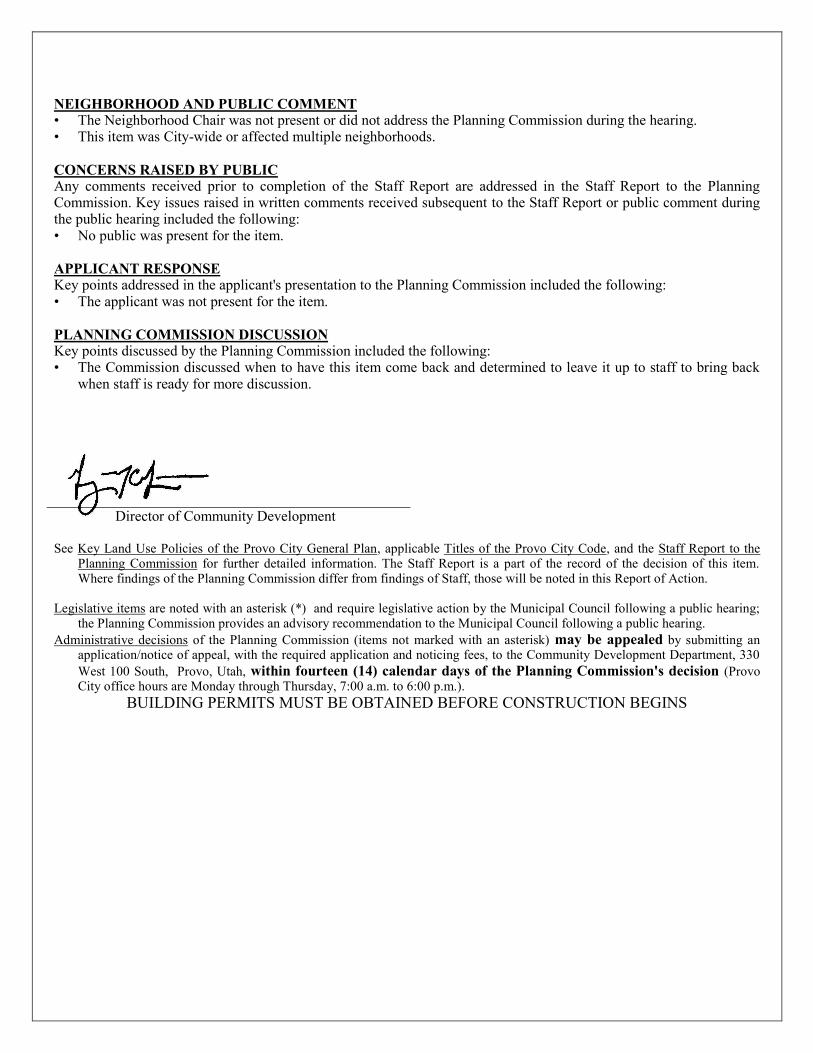
NEIGHBORHOOD AND PUBLIC COMMENT • The Neighborhood Chair was not present or did not address the Planning Commission during the hearing. • This item was City-wide or affected multiple neighborhoods.
CONCERNS RAISED BY PUBLIC Any comments received prior to completion of the Staff Report are addressed in the Staff Report to the Planning Commission. Key issues raised in written comments received subsequent to the Staff Report or public comment during the public hearing included the following: • No public was present for the item.
APPLICANT RESPONSE Key points addressed in the applicant's presentation to the Planning Commission included the following: • The applicant was not present for the item.
PLANNING COMMISSION DISCUSSION Key points discussed by the Planning Commission included the following: • The Commission discussed when to have this item come back and determined to leave it up to staff to bring back
when staff is ready for more discussion.
Director of Community Development See Key Land Use Policies of the Provo City General Plan, applicable Titles of the Provo City Code, and the Staff Report to the
Planning Commission for further detailed information. The Staff Report is a part of the record of the decision of this item. Where findings of the Planning Commission differ from findings of Staff, those will be noted in this Report of Action.
Legislative items are noted with an asterisk (*) and require legislative action by the Municipal Council following a public hearing;
the Planning Commission provides an advisory recommendation to the Municipal Council following a public hearing.
Administrative decisions of the Planning Commission (items not marked with an asterisk) may be appealed by submitting an application/notice of appeal, with the required application and noticing fees, to the Community Development Department, 330
West 100 South, Provo, Utah, within fourteen (14) calendar days of the Planning Commission's decision (Provo City office hours are Monday through Thursday, 7:00 a.m. to 6:00 p.m.).
BUILDING PERMITS MUST BE OBTAINED BEFORE CONSTRUCTION BEGINS
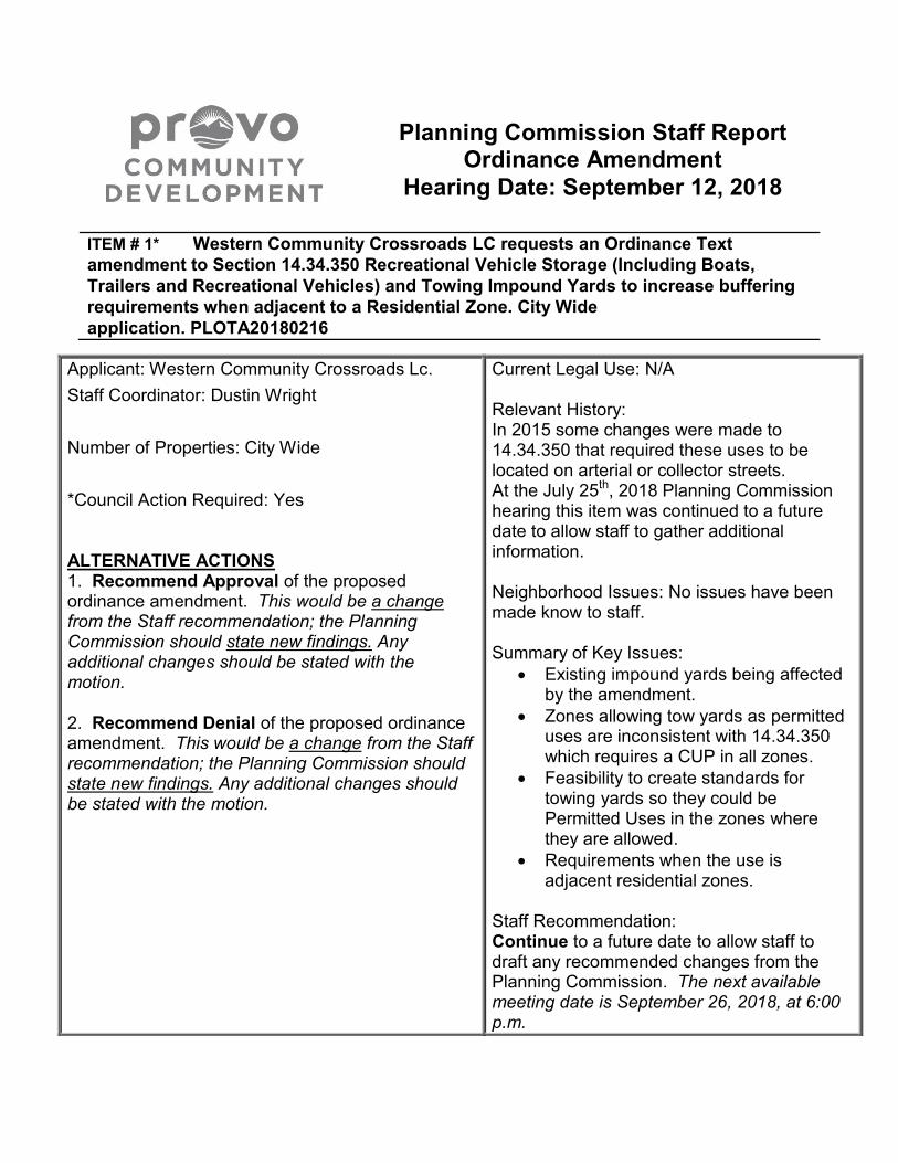
Planning Commission Staff Report Ordinance Amendment
Hearing Date: September 12, 2018
ITEM # 1* Western Community Crossroads LC requests an Ordinance Text
amendment to Section 14.34.350 Recreational Vehicle Storage (Including Boats,
Trailers and Recreational Vehicles) and Towing Impound Yards to increase buffering
requirements when adjacent to a Residential Zone. City Wide
application. PLOTA20180216
Applicant: Western Community Crossroads Lc.
Staff Coordinator: Dustin Wright
Number of Properties: City Wide
*Council Action Required: Yes ALTERNATIVE ACTIONS 1. Recommend Approval of the proposed ordinance amendment. This would be a change from the Staff recommendation; the Planning Commission should state new findings. Any additional changes should be stated with the motion. 2. Recommend Denial of the proposed ordinance amendment. This would be a change from the Staff recommendation; the Planning Commission should state new findings. Any additional changes should be stated with the motion.
Current Legal Use: N/A Relevant History: In 2015 some changes were made to 14.34.350 that required these uses to be located on arterial or collector streets. At the July 25th, 2018 Planning Commission hearing this item was continued to a future date to allow staff to gather additional information. Neighborhood Issues: No issues have been made know to staff. Summary of Key Issues:
Existing impound yards being affected by the amendment.
Zones allowing tow yards as permitted uses are inconsistent with 14.34.350 which requires a CUP in all zones.
Feasibility to create standards for towing yards so they could be Permitted Uses in the zones where they are allowed.
Requirements when the use is adjacent residential zones.
Staff Recommendation: Continue to a future date to allow staff to draft any recommended changes from the Planning Commission. The next available meeting date is September 26, 2018, at 6:00 p.m.

Planning Commission Staff Report Item # 1* September 12, 2018 Page 2
OVERVIEW
The applicant is requesting an amendment to 14.34.350, Recreational Vehicle Storage
and Towing Impound Yards, and other applicable code sections related to impound
yards. The amendment proposes six foot high fencing on all sides of the lot, a hedge
row on all side adjacent to residential uses, an increase from ten feet to 200 feet
setback from a residential zone boundary, and removing “gravel road base” as an
approved parking area surface.
Section 14.34.350, allows impound yards as a Conditional Use in the CM, M1, M2, and
PIC zones. However, in the text of some of those zones, impound yards are listed as
Permitted Uses. Additionally, the CG zone includes Impound Yards as a Conditional
Use. While this section of the Code is being considered for an amendment, it would be
beneficial to examine these other applicable sections of the Code and correct any
conflicting ordinances and have staff work on applicable updates and bring them back
to the Planning Commission. It would also allow staff to identify how the proposed
changes could affect existing impound yards in the City.
Staff has examined the zones that allow recreational vehicle storage areas and tow
yards and provided ordinance revisions that would clean up the inconsistencies in the
code and establish zones that these uses can be permitted in and outline criteria that
would have to be met. Input from the Planning Commission regarding if there are other
requirements that need to be included or if these uses should just not be allowed when
they are adjacent to a residential zone.
FINDINGS OF FACT
1. 14.34.350 requires a CUP for impound yards in CM, M1, M2, and PIC zones.
2. Standard Land Use Code (SLU Code) 6419 - auto towing service.
3. In M1, M2, CM zones SLU 6400 is a Permitted Use.
4. In PIC, F1, CG zones 6410 is a Conditional Use.
5. 14.34.300 requires transitional standards for incompatible uses adjacent to
residential.
6. There are approximately 20 existing towing services in Provo.
Planning Commission Staff Report Item # 1* September 12, 2018 Page 3
STAFF ANALYSIS
Provo City Code has a section that identifies zones where impound yards can be and
are subject to a CUP. Staff suggests that these could become permitted uses that are
subject to meeting a list of requirements that are established to mitigate impacts
associated with these uses.
Some of the zones allow impound yards as a Permitted Use which is conflicting with
14.34.350 where it says they need a Conditional Use permit. The proposed ordinance
from staff would clear this up by having 14.34.350 say they are permitted uses subject
outlined criteria being met. Feedback from the Planning Commission would be helpful in
identifying any additional requirements that should be added to the list.
Staff suggests disallowing Impound Yards in the CG Zone. The General Commercial
Zone (CG) is the least industrial of the zones listed and it has significant borders with
residential zones. Additionally, many of the CG zones are in viable commercial areas.
Do we want to allow a non-commercial use like Impound Yards in prime retail,
commercial areas?
A number of existing impound yards in the City have been identified. These would
become legally non-conforming should any new legislation is passed that they are not
compliant with. Staff has identified 16 existing towing yards with 3 being adjacent to
residential and 4 across the street from a residential zone. Zoning enforcement has not
experienced any issues with the existing lots that are adjacent to residential zones.
The applicant has proposed changing the existing 10-foot setback to a 200-foot setback
from residential. Our existing ordinance (Transitional Development Standards
14.34.300) that regulates uses with higher impacts that abut residential zones calls for a
10-foot landscaped buffer. The tow yard ordinance also has a requirement for the 10
foot buffer and staff’s recommendation would be to increase it 20 feet so that the
required fence would not be too close to a residential property. However, there is a
concern that this buffer area could become an unmaintained and an attractive nuisance
should the 20-foot, landscaped buffer fall between two fences.
There are several specific questions on which the Staff would appreciate Planning
Commission input:
1. Does the Planning Commission agree with adding conditions of approval and
making Impound Yards a Permitted Use in the specific zones listed above?
2. Should Impound Yards be allowed adjacent to residential zones?
Planning Commission Staff Report Item # 1* September 12, 2018 Page 4
3. Does the Planning Commission agree that Impound Yards should be removed
from the CG Zone?
4. Should the landscaped buffer be increased from 10 feet to 20 feet? The 10-foot
landscaped buffer that is currently required would be inside fencing or a wall that
would be placed on the property line. The adjacent property owners have no
ability to see the landscaped buffer so it only serves to push parked vehicles 10
feet away from the fence or wall.
5. Should the 10 or 20-foot landscaped buffer be required outside of the fence or
wall, so essentially creating a 20-foot setback for the fence or wall. This would
create better buffering adjacent to residential zones but it could become a no-
man’s-land if it falls between two fences or walls.
CONCLUSIONS
The applicant has expressed concerns with the existing buffering requirements of
impound yards near residential zones. Staff finds that there are inconsistencies in the
zoning code related to impound yards and where they are Permitted or Conditional
Uses. Staff has proposed ordinance revisions to clean up the inconsistencies and move
towards having them be permitted uses subject to meeting established criteria that the
Planning Commission feels would mitigate impacts related to these land uses.
STAFF RECOMMENDATION
Continue to a future date to allow staff to draft any recommended changes from the
Planning Commission. The next available meeting date is September 26, 2018, at 6:00
p.m.
ATTACHMENTS
1. Staff’s Proposed Text Amendment
2. Applicant’s Proposed Text Amendment
Attachment 1 1
14.34.350. Recreational Vehicle Storage (Includes Boats, Trailers, and 2
Recreational Vehicles) and Towing Impound Yards. 3
Subject to the standards set forth in Subsections (1) through (96) of this Section and the standards for 4
a conditional use permit set forth in Section 14.02.040, Provo City Code, storage of recreational vehicles shall 5
be allowed as a permitted use in A1 zones and towing impound yards shall be allowed as a conditional 6
permitted use in CM, M1, M2, FI and PIC zones. The Planning Commission shall consider the circumstances of 7
existing surrounding land uses and existing improvements when applying these standards. Where 8
circumstances warrant it, the Commission may apply the most restrictive standards, subject to making findings 9
justifying such application. 10
(1) Every recreational vehicle storage area and towing impound yard shall be screened on one (1) or more all 11
sides (as determined by the Planning Commission) by an opaque wall or fence. Fence height shall be at least 12
eight (8) feet for recreational vehicle storage areas and at least six (6) feet for towing 13
impound yards. Fence height may be shorter than if built upon a permanent landscaped berm, and the 14
combined height of the berm and fence meets the requirements of this Subsection. 15
(a) Fencing material appropriate to the area shall be utilized. This may shall include “Beauty Link” chain 16
link with slats, wood, decorative block, or brick. 17
(i) A masonry wall shall be required if located adjacent to a residential zone. 18
(b) An appropriate hedge row capable of growing to a height of at least five (5) feet at maturity may shall 19
be required along one (1) or more sides of the fence, as deemed necessary by the Planning 20
Commission that are adjacent to a residential zone. 21
(2) The front yard setback shall be landscaped with some combination of trees, shrubs, hedgerows, and turf. 22
Preference shall be given to drought resistant native species. Landscaping shall be irrigated and permanently 23
maintained. 24
(3) When adjoining a residential zone boundary, a minimum ten twenty (1020) foot landscaped setback may 25
shall be required from the residential zone boundary. The landscaped yard setback shall be located between 26
the property or zone boundary line and the fence. 27
Planning Commission Staff Report Item # 1* September 12, 2018 Page 6
(4) All parking areas shall be graded, drained, and improved with gravel road base material, concrete, or 28
asphaltic cement. The driveway from the street shall be paved with asphaltic cement or concrete. 29
Gravel parking areas shall be maintained in a weed-free condition. 30
(5) One (1) on-premises sign shall be permitted per street frontage in the front or side yard setback. 31
Said sign shall be no higher than five (5) feet, and no more than thirty-two (32) square feet in area. 32
(6) All lighting shall meet the requirements of Chapter 15.21, Provo City Code. 33
(7) Sites adjoining existing residential development may not be appropriate for the land uses permitted by this 34
Section. The Commission shall consider the circumstances of surrounding land uses, and area circulation in 35
making a decision regarding a conditional use permit. It shall be the intent of these standards to discourage 36
recreational vehicle storage areas and towing impound yards from drawing undue attention through signage, 37
lighting, etc. 38
(8) Upon review by the Planning Commission, the Commission may allow up to thirty percent (30%) of a 39
developed project to be fully enclosed or partially enclosed storage structures for the purpose of 40
storing recreational vehicles. 41
42
Chapter 14.24 43
CM - Heavy Commercial Zone 44
14.24.020(4) Permitted Principal Uses 45
(c) The following uses shall be permitted in the CM zone without stipulation: 46
6400 Repair services (6419 – Recreational vehicle storage and Auto towing 47
yards subject to 14.34.350) 48
49
Chapter 14.27 50
M1 - Light Manufacturing Zone. 51
14.27.020(4) Permitted Principal Uses 52
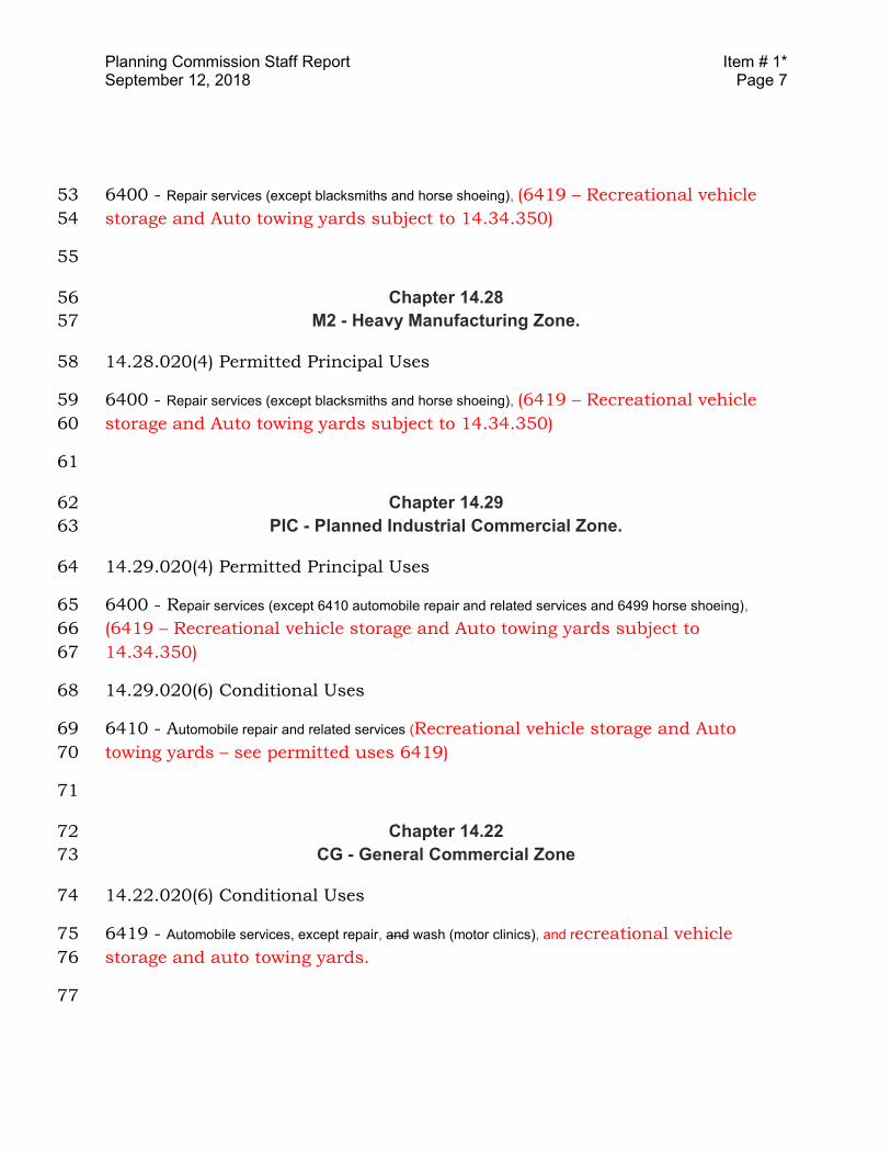
Planning Commission Staff Report Item # 1* September 12, 2018 Page 7
6400 - Repair services (except blacksmiths and horse shoeing), (6419 – Recreational vehicle 53
storage and Auto towing yards subject to 14.34.350) 54
55
Chapter 14.28 56
M2 - Heavy Manufacturing Zone. 57
14.28.020(4) Permitted Principal Uses 58
6400 - Repair services (except blacksmiths and horse shoeing), (6419 – Recreational vehicle 59
storage and Auto towing yards subject to 14.34.350) 60
61
Chapter 14.29 62
PIC - Planned Industrial Commercial Zone. 63
14.29.020(4) Permitted Principal Uses 64
6400 - Repair services (except 6410 automobile repair and related services and 6499 horse shoeing), 65
(6419 – Recreational vehicle storage and Auto towing yards subject to 66
14.34.350) 67
14.29.020(6) Conditional Uses 68
6410 - Automobile repair and related services (Recreational vehicle storage and Auto 69
towing yards – see permitted uses 6419) 70
71
Chapter 14.22 72
CG - General Commercial Zone 73
14.22.020(6) Conditional Uses 74
6419 - Automobile services, except repair, and wash (motor clinics), and recreational vehicle 75
storage and auto towing yards. 76
77
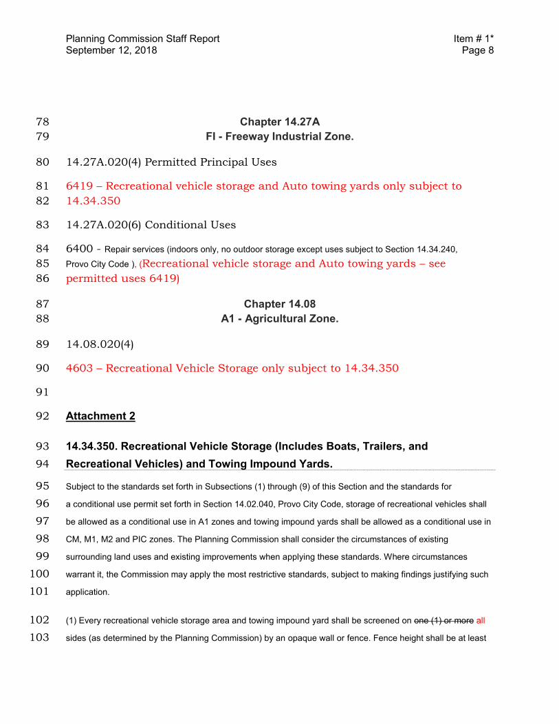
Planning Commission Staff Report Item # 1* September 12, 2018 Page 8
Chapter 14.27A 78
FI - Freeway Industrial Zone. 79
14.27A.020(4) Permitted Principal Uses 80
6419 – Recreational vehicle storage and Auto towing yards only subject to 81
14.34.350 82
14.27A.020(6) Conditional Uses 83
6400 - Repair services (indoors only, no outdoor storage except uses subject to Section 14.34.240, 84
Provo City Code ), (Recreational vehicle storage and Auto towing yards – see 85
permitted uses 6419) 86
Chapter 14.08 87
A1 - Agricultural Zone. 88
14.08.020(4) 89
4603 – Recreational Vehicle Storage only subject to 14.34.350 90
91
Attachment 2 92
14.34.350. Recreational Vehicle Storage (Includes Boats, Trailers, and 93
Recreational Vehicles) and Towing Impound Yards. 94
Subject to the standards set forth in Subsections (1) through (9) of this Section and the standards for 95
a conditional use permit set forth in Section 14.02.040, Provo City Code, storage of recreational vehicles shall 96
be allowed as a conditional use in A1 zones and towing impound yards shall be allowed as a conditional use in 97
CM, M1, M2 and PIC zones. The Planning Commission shall consider the circumstances of existing 98
surrounding land uses and existing improvements when applying these standards. Where circumstances 99
warrant it, the Commission may apply the most restrictive standards, subject to making findings justifying such 100
application. 101
(1) Every recreational vehicle storage area and towing impound yard shall be screened on one (1) or more all 102
sides (as determined by the Planning Commission) by an opaque wall or fence. Fence height shall be at least 103
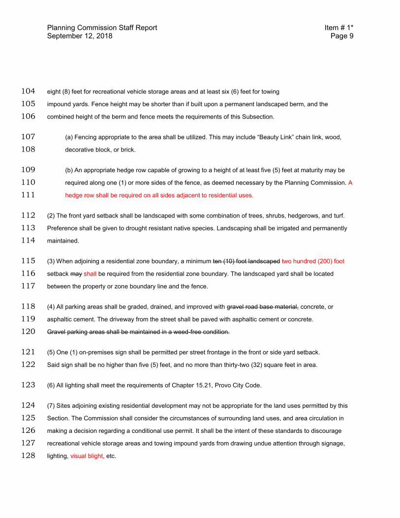
Planning Commission Staff Report Item # 1* September 12, 2018 Page 9
eight (8) feet for recreational vehicle storage areas and at least six (6) feet for towing 104
impound yards. Fence height may be shorter than if built upon a permanent landscaped berm, and the 105
combined height of the berm and fence meets the requirements of this Subsection. 106
(a) Fencing appropriate to the area shall be utilized. This may include “Beauty Link” chain link, wood, 107
decorative block, or brick. 108
(b) An appropriate hedge row capable of growing to a height of at least five (5) feet at maturity may be 109
required along one (1) or more sides of the fence, as deemed necessary by the Planning Commission. A 110
hedge row shall be required on all sides adjacent to residential uses. 111
(2) The front yard setback shall be landscaped with some combination of trees, shrubs, hedgerows, and turf. 112
Preference shall be given to drought resistant native species. Landscaping shall be irrigated and permanently 113
maintained. 114
(3) When adjoining a residential zone boundary, a minimum ten (10) foot landscaped two hundred (200) foot 115
setback may shall be required from the residential zone boundary. The landscaped yard shall be located 116
between the property or zone boundary line and the fence. 117
(4) All parking areas shall be graded, drained, and improved with gravel road base material, concrete, or 118
asphaltic cement. The driveway from the street shall be paved with asphaltic cement or concrete. 119
Gravel parking areas shall be maintained in a weed-free condition. 120
(5) One (1) on-premises sign shall be permitted per street frontage in the front or side yard setback. 121
Said sign shall be no higher than five (5) feet, and no more than thirty-two (32) square feet in area. 122
(6) All lighting shall meet the requirements of Chapter 15.21, Provo City Code. 123
(7) Sites adjoining existing residential development may not be appropriate for the land uses permitted by this 124
Section. The Commission shall consider the circumstances of surrounding land uses, and area circulation in 125
making a decision regarding a conditional use permit. It shall be the intent of these standards to discourage 126
recreational vehicle storage areas and towing impound yards from drawing undue attention through signage, 127
lighting, visual blight, etc. 128
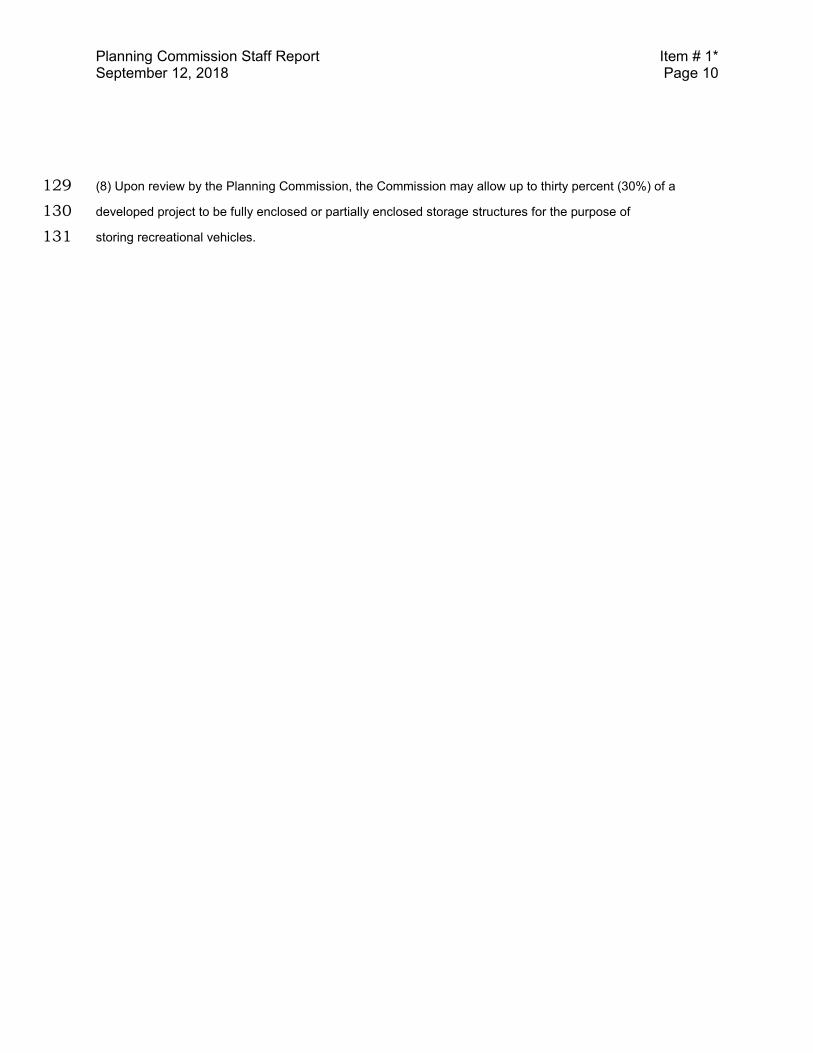
Planning Commission Staff Report Item # 1* September 12, 2018 Page 10
(8) Upon review by the Planning Commission, the Commission may allow up to thirty percent (30%) of a 129
developed project to be fully enclosed or partially enclosed storage structures for the purpose of 130
storing recreational vehicles. 131

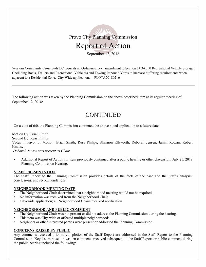
Provo City Planning Commission
Report of Action September 12, 2018
Western Community Crossroads LC requests an Ordinance Text amendment to Section 14.34.350 Recreational Vehicle Storage
(Including Boats, Trailers and Recreational Vehicles) and Towing Impound Yards to increase buffering requirements when
adjacent to a Residential Zone. City Wide application. PLOTA20180216
The following action was taken by the Planning Commission on the above described item at its regular meeting of
September 12, 2018:
CONTINUED
On a vote of 6:0, the Planning Commission continued the above noted application to a future date.
Motion By: Brian Smith Second By: Russ Philips Votes in Favor of Motion: Brian Smith, Russ Philips, Shannon Ellsworth, Deborah Jensen, Jamin Rowan, Robert Knudsen
Deborah Jensen was present as Chair.
• Additional Report of Action for item previously continued after a public hearing or other discussion: July 25, 2018
Planning Commission Hearing.
STAFF PRESENTATION The Staff Report to the Planning Commission provides details of the facts of the case and the Staff's analysis, conclusions, and recommendations.
NEIGHBORHOOD MEETING DATE • The Neighborhood Chair determined that a neighborhood meeting would not be required. • No information was received from the Neighborhood Chair. • City-wide application; all Neighborhood Chairs received notification.
NEIGHBORHOOD AND PUBLIC COMMENT • The Neighborhood Chair was not present or did not address the Planning Commission during the hearing. • This item was City-wide or affected multiple neighborhoods. • Neighbors or other interested parties were present or addressed the Planning Commission.
CONCERNS RAISED BY PUBLIC Any comments received prior to completion of the Staff Report are addressed in the Staff Report to the Planning Commission. Key issues raised in written comments received subsequent to the Staff Report or public comment during the public hearing included the following:
• The State is looking into tow yards and how they relate to surrounding uses. • There is a lot of area zoned for tow yards, but not a lot of is available for sale, or costs too much. • The Council was going to look into a 100 foot buffer for tow yards. • In some cases it seems like the issue is when there are too many operators utilizing one site for towing causing a
greater impact on adjacent uses.
APPLICANT RESPONSE Key points addressed in the applicant's presentation to the Planning Commission included the following: • A tow yard has been set up next to his property and they do not follow the existing criteria and did not get a permit. • He has a three-story development that had to have a fence and greater setback from the adjacent residential because
of the height of the building. • Hours of operation are in the middle of the night and cause problems with adjacent uses. • The 200 foot setback request will help mitigate the negative impacts from the tow yard land use.
PLANNING COMMISSION DISCUSSION Key points discussed by the Planning Commission included the following: • Encouraged staff to revise the proposed ordinance to include the removal from the CG zone; • Have tow yards and RV storage yards be a permitted use subject to outlined criteria that will have 20 to 40 feet of
buffer with trees; • Upgrade fencing requirements such as masonry and to not allow chain-link; • Additionally, staff is to determine how many operators can utilize one site; and • Be cautious or not allow next to residential.
Director of Community Development See Key Land Use Policies of the Provo City General Plan, applicable Titles of the Provo City Code, and the Staff Report to the
Planning Commission for further detailed information. The Staff Report is a part of the record of the decision of this item. Where findings of the Planning Commission differ from findings of Staff, those will be noted in this Report of Action.
Legislative items are noted with an asterisk (*) and require legislative action by the Municipal Council following a public hearing;
the Planning Commission provides an advisory recommendation to the Municipal Council following a public hearing.
Administrative decisions of the Planning Commission (items not marked with an asterisk) may be appealed by submitting an application/notice of appeal, with the required application and noticing fees, to the Community Development Department, 330
West 100 South, Provo, Utah, within fourteen (14) calendar days of the Planning Commission's decision (Provo City office hours are Monday through Thursday, 7:00 a.m. to 6:00 p.m.).
BUILDING PERMITS MUST BE OBTAINED BEFORE CONSTRUCTION BEGINS
Planning Commission Staff Report Ordinance Amendment
Hearing Date: November 14, 2018
ITEM # 5* Western Community Crossroads LC requests an Ordinance Text
amendment to Section 14.34.350 Recreational Vehicle Storage (Including Boats,
Trailers and Recreational Vehicles) and Towing Impound Yards to increase buffering
requirements when adjacent to a Residential Zone. City Wide
application. PLOTA20180216
Applicant: Western Community Crossroads Lc.
Staff Coordinator: Dustin Wright
Number of Properties: City Wide
*Council Action Required: Yes
ALTERNATIVE ACTIONS
1. Recommend Denial of the proposed ordinanceamendment. This would be a change from the Staffrecommendation; the Planning Commission shouldstate new findings. Any additional changes shouldbe stated with the motion.
2. Continue to a future date to allow staff to draftany recommended changes from the PlanningCommission. The next available meeting date isNovember 28, 2018, at 6:00 p.m.
Current Legal Use: N/A
Relevant History: In 2015 some changes were made to 14.34.350 that required these uses to be located on arterial or collector streets. At the July 25th, 2018 Planning Commission hearing this item was continued to a future date to allow staff to gather additional information. At the September 12, 2018 Planning Commission hearing the item was continued.
Neighborhood Issues: A neighborhood chair had questions about State laws for impound yards.
Summary of Key Issues:
Existing impound yards being affectedby the amendment.
Zones allowing tow yards as permitteduses are inconsistent with 14.34.350which requires a CUP in all zones.
Proposed standards for towing yardsso they could be Permitted Uses in thezones where they are allowed.
Requirements when the use isadjacent residential zones.
Staff Recommendation: Recommend Approval of the proposed ordinance amendment in Attachment 1.
Planning Commission Staff Report Item # 5* November 14, 2018 Page 2
OVERVIEW
The applicant is requesting an amendment to 14.34.350, Recreational Vehicle Storage
and Towing Impound Yards, and other applicable code sections related to impound
yards. The amendment proposes six foot high fencing on all sides of the lot, a hedge
row on all side adjacent to residential uses, an increase from ten feet to 200 feet
setback from a residential zone boundary, and removing “gravel road base” as an
approved parking area surface.
Section 14.34.350, allows impound yards as a Conditional Use in the CM, M1, M2, and
PIC zones. However, in the text of some of those zones, impound yards are listed as
Permitted Uses. Additionally, the CG zone includes Impound Yards as a Conditional
Use.
Staff has examined the zones that allow recreational vehicle storage areas and tow
yards and provided ordinance revisions that would clean up the inconsistencies in the
code and establish zones that these uses can be permitted in and outline criteria that
would have to be met for approval.
FINDINGS OF FACT
1. 14.34.350 requires a CUP for impound yards in CM, M1, M2, and PIC zones.
2. Standard Land Use Code (SLU Code) 6419 - auto towing service.
3. In M1, M2, CM zones SLU 6400 is a Permitted Use.
4. In PIC, F1, CG zones 6410 is a Conditional Use.
5. 14.34.300 requires transitional standards for incompatible uses adjacent to
residential.
6. There are approximately 20 existing towing services in Provo.
7. Three current tow yards are adjacent to residential zones.
8. Four current tow yards are across the street from residential zones.
STAFF ANALYSIS
Provo City Code has a section that identifies zones where impound yards can be and
are subject to a CUP. Staff suggests that these could become permitted uses that are
subject to meeting a list of requirements that are established to mitigate impacts
associated with these uses.
Some of the zones allow impound yards as a Permitted Use which is conflicting with
14.34.350 where it says they need a Conditional Use permit. The proposed ordinance
Planning Commission Staff Report Item # 5* November 14, 2018 Page 3
from staff would clear this up by having 14.34.350 say they are permitted uses subject
to outlined criteria being met.
Staff suggests disallowing Impound Yards in the CG Zone. The General Commercial
Zone (CG) is the least industrial of the zones listed and it has significant borders with
residential zones. Additionally, many of the CG zones are in viable commercial areas.
A number of existing impound yards in the City have been identified. These would
become legally non-conforming should any new legislation is passed that they are not
compliant with. Staff has identified 16 existing towing yards with 3 being adjacent to
residential and 4 across the street from a residential zone. Zoning enforcement has not
experienced any issues with the existing lots that are adjacent to residential zones.
The applicant has proposed changing the existing 10-foot setback to a 200-foot setback
from residential. Our existing ordinance (Transitional Development Standards
14.34.300) that regulates uses with higher impacts that abut residential zones calls for a
10-foot landscaped buffer. The tow yard ordinance also has a requirement for the 10
foot buffer and staff’s recommendation would be to increase it 20 feet so that the
required fence would not be too close to a residential property. However, there is a
concern that this buffer area could become an unmaintained and an attractive nuisance
should the 20-foot, landscaped buffer fall between two fences.
CONCLUSIONS
The applicant has expressed concerns with the existing buffering requirements of
impound yards near residential zones. Staff finds that there are inconsistencies in the
zoning code related to impound yards and where they are Permitted or Conditional
Uses. Staff has proposed ordinance revisions to clean up the inconsistencies and move
towards having them be permitted uses subject to meeting established criteria that the
Planning Commission feels would mitigate impacts related to these land uses.
STAFF RECOMMENDATION
Recommend Approval of the proposed ordinance amendment in Attachment 1.
ATTACHMENTS
1. Staff’s Proposed Text Amendment
2. Applicant’s Proposed Text Amendment
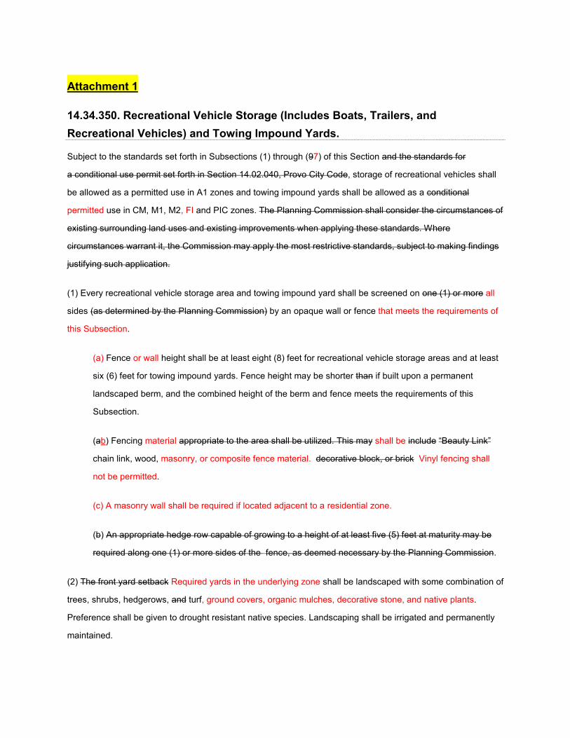
Attachment 1
14.34.350. Recreational Vehicle Storage (Includes Boats, Trailers, and
Recreational Vehicles) and Towing Impound Yards.
Subject to the standards set forth in Subsections (1) through (97) of this Section and the standards for
a conditional use permit set forth in Section 14.02.040, Provo City Code, storage of recreational vehicles shall
be allowed as a permitted use in A1 zones and towing impound yards shall be allowed as a conditional
permitted use in CM, M1, M2, FI and PIC zones. The Planning Commission shall consider the circumstances of
existing surrounding land uses and existing improvements when applying these standards. Where
circumstances warrant it, the Commission may apply the most restrictive standards, subject to making findings
justifying such application.
(1) Every recreational vehicle storage area and towing impound yard shall be screened on one (1) or more all
sides (as determined by the Planning Commission) by an opaque wall or fence that meets the requirements of
this Subsection.
(a) Fence or wall height shall be at least eight (8) feet for recreational vehicle storage areas and at least
six (6) feet for towing impound yards. Fence height may be shorter than if built upon a permanent
landscaped berm, and the combined height of the berm and fence meets the requirements of this
Subsection.
(ab) Fencing material appropriate to the area shall be utilized. This may shall be include “Beauty Link”
chain link, wood, masonry, or composite fence material. decorative block, or brick Vinyl fencing shall
not be permitted.
(c) A masonry wall shall be required if located adjacent to a residential zone.
(b) An appropriate hedge row capable of growing to a height of at least five (5) feet at maturity may be
required along one (1) or more sides of the fence, as deemed necessary by the Planning Commission.
(2) The front yard setback Required yards in the underlying zone shall be landscaped with some combination of
trees, shrubs, hedgerows, and turf, ground covers, organic mulches, decorative stone, and native plants.
Preference shall be given to drought resistant native species. Landscaping shall be irrigated and permanently
maintained.
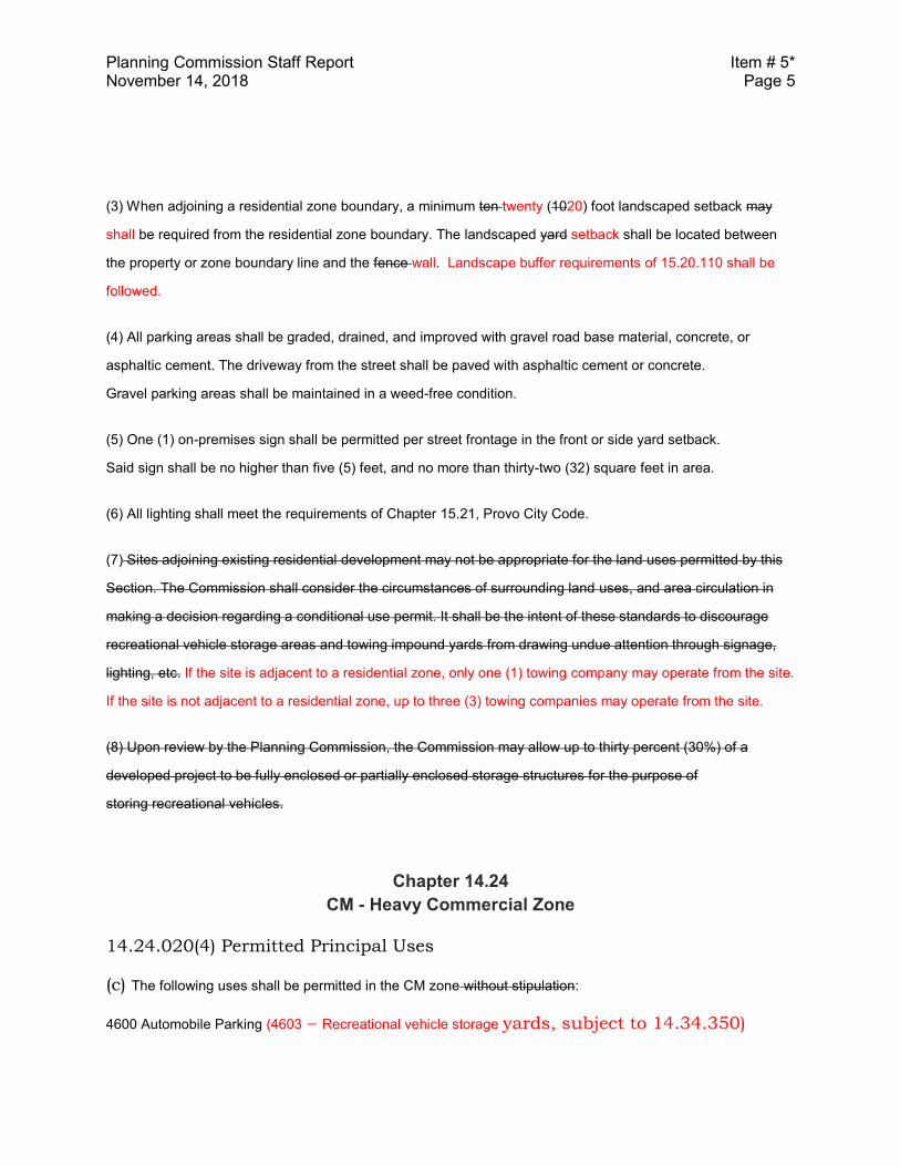
Planning Commission Staff Report Item # 5* November 14, 2018 Page 5
(3) When adjoining a residential zone boundary, a minimum ten twenty (1020) foot landscaped setback may
shall be required from the residential zone boundary. The landscaped yard setback shall be located between
the property or zone boundary line and the fence wall. Landscape buffer requirements of 15.20.110 shall be
followed.
(4) All parking areas shall be graded, drained, and improved with gravel road base material, concrete, or
asphaltic cement. The driveway from the street shall be paved with asphaltic cement or concrete.
Gravel parking areas shall be maintained in a weed-free condition.
(5) One (1) on-premises sign shall be permitted per street frontage in the front or side yard setback.
Said sign shall be no higher than five (5) feet, and no more than thirty-two (32) square feet in area.
(6) All lighting shall meet the requirements of Chapter 15.21, Provo City Code.
(7) Sites adjoining existing residential development may not be appropriate for the land uses permitted by this
Section. The Commission shall consider the circumstances of surrounding land uses, and area circulation in
making a decision regarding a conditional use permit. It shall be the intent of these standards to discourage
recreational vehicle storage areas and towing impound yards from drawing undue attention through signage,
lighting, etc. If the site is adjacent to a residential zone, only one (1) towing company may operate from the site.
If the site is not adjacent to a residential zone, up to three (3) towing companies may operate from the site.
(8) Upon review by the Planning Commission, the Commission may allow up to thirty percent (30%) of a
developed project to be fully enclosed or partially enclosed storage structures for the purpose of
storing recreational vehicles.
Chapter 14.24
CM - Heavy Commercial Zone
14.24.020(4) Permitted Principal Uses
(c) The following uses shall be permitted in the CM zone without stipulation:
4600 Automobile Parking (4603 – Recreational vehicle storage yards, subject to 14.34.350)
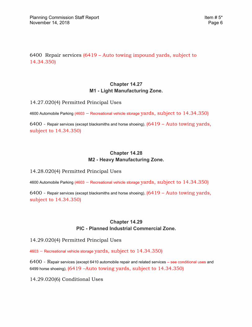
Planning Commission Staff Report Item # 5* November 14, 2018 Page 6
6400 Repair services (6419 – Auto towing impound yards, subject to
14.34.350)
Chapter 14.27
M1 - Light Manufacturing Zone.
14.27.020(4) Permitted Principal Uses
4600 Automobile Parking (4603 – Recreational vehicle storage yards, subject to 14.34.350)
6400 - Repair services (except blacksmiths and horse shoeing), (6419 – Auto towing yards,
subject to 14.34.350)
Chapter 14.28
M2 - Heavy Manufacturing Zone.
14.28.020(4) Permitted Principal Uses
4600 Automobile Parking (4603 – Recreational vehicle storage yards, subject to 14.34.350)
6400 - Repair services (except blacksmiths and horse shoeing), (6419 – Auto towing yards,
subject to 14.34.350)
Chapter 14.29
PIC - Planned Industrial Commercial Zone.
14.29.020(4) Permitted Principal Uses
4603 – Recreational vehicle storage yards, subject to 14.34.350)
6400 - Repair services (except 6410 automobile repair and related services – see conditional uses and
6499 horse shoeing), (6419 –Auto towing yards, subject to 14.34.350)
14.29.020(6) Conditional Uses
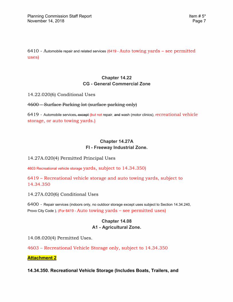
Planning Commission Staff Report Item # 5* November 14, 2018 Page 7
6410 - Automobile repair and related services (6419 - Auto towing yards – see permitted
uses)
Chapter 14.22
CG - General Commercial Zone
14.22.020(6) Conditional Uses
4600 – Surface Parking lot (surface parking only)
6419 - Automobile services, except (but not repair, and wash (motor clinics), recreational vehicle
storage, or auto towing yards.)
Chapter 14.27A
FI - Freeway Industrial Zone.
14.27A.020(4) Permitted Principal Uses
4603 Recreational vehicle storage yards, subject to 14.34.350)
6419 – Recreational vehicle storage and auto towing yards, subject to
14.34.350
14.27A.020(6) Conditional Uses
6400 - Repair services (indoors only, no outdoor storage except uses subject to Section 14.34.240,
Provo City Code ), (For 6419 - Auto towing yards – see permitted uses)
Chapter 14.08
A1 - Agricultural Zone.
14.08.020(4) Permitted Uses.
4603 – Recreational Vehicle Storage only, subject to 14.34.350
Attachment 2
14.34.350. Recreational Vehicle Storage (Includes Boats, Trailers, and
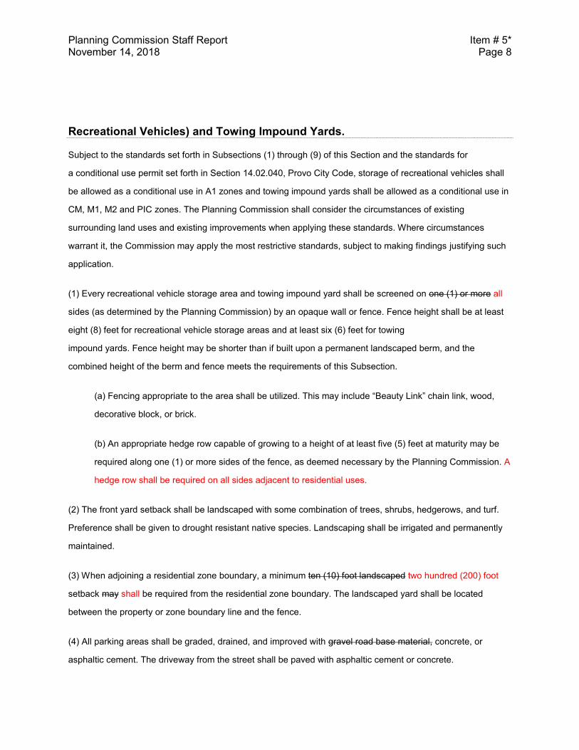
Planning Commission Staff Report Item # 5* November 14, 2018 Page 8
Recreational Vehicles) and Towing Impound Yards.
Subject to the standards set forth in Subsections (1) through (9) of this Section and the standards for
a conditional use permit set forth in Section 14.02.040, Provo City Code, storage of recreational vehicles shall
be allowed as a conditional use in A1 zones and towing impound yards shall be allowed as a conditional use in
CM, M1, M2 and PIC zones. The Planning Commission shall consider the circumstances of existing
surrounding land uses and existing improvements when applying these standards. Where circumstances
warrant it, the Commission may apply the most restrictive standards, subject to making findings justifying such
application.
(1) Every recreational vehicle storage area and towing impound yard shall be screened on one (1) or more all
sides (as determined by the Planning Commission) by an opaque wall or fence. Fence height shall be at least
eight (8) feet for recreational vehicle storage areas and at least six (6) feet for towing
impound yards. Fence height may be shorter than if built upon a permanent landscaped berm, and the
combined height of the berm and fence meets the requirements of this Subsection.
(a) Fencing appropriate to the area shall be utilized. This may include “Beauty Link” chain link, wood,
decorative block, or brick.
(b) An appropriate hedge row capable of growing to a height of at least five (5) feet at maturity may be
required along one (1) or more sides of the fence, as deemed necessary by the Planning Commission. A
hedge row shall be required on all sides adjacent to residential uses.
(2) The front yard setback shall be landscaped with some combination of trees, shrubs, hedgerows, and turf.
Preference shall be given to drought resistant native species. Landscaping shall be irrigated and permanently
maintained.
(3) When adjoining a residential zone boundary, a minimum ten (10) foot landscaped two hundred (200) foot
setback may shall be required from the residential zone boundary. The landscaped yard shall be located
between the property or zone boundary line and the fence.
(4) All parking areas shall be graded, drained, and improved with gravel road base material, concrete, or
asphaltic cement. The driveway from the street shall be paved with asphaltic cement or concrete.
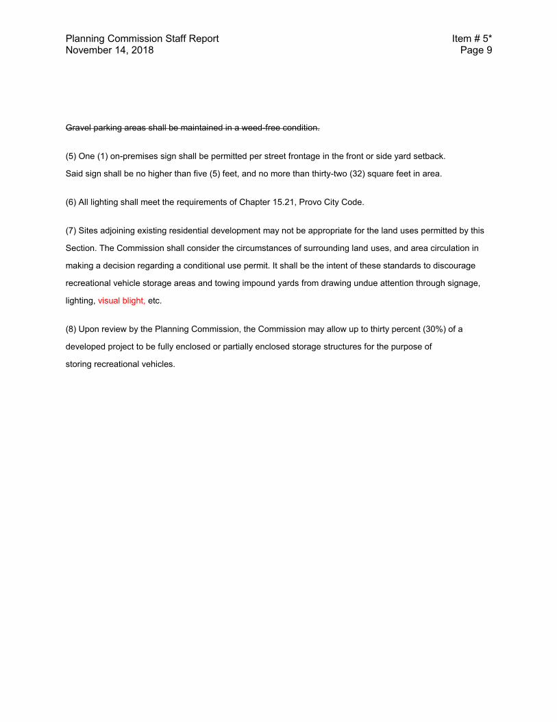
Planning Commission Staff Report Item # 5* November 14, 2018 Page 9
Gravel parking areas shall be maintained in a weed-free condition.
(5) One (1) on-premises sign shall be permitted per street frontage in the front or side yard setback.
Said sign shall be no higher than five (5) feet, and no more than thirty-two (32) square feet in area.
(6) All lighting shall meet the requirements of Chapter 15.21, Provo City Code.
(7) Sites adjoining existing residential development may not be appropriate for the land uses permitted by this
Section. The Commission shall consider the circumstances of surrounding land uses, and area circulation in
making a decision regarding a conditional use permit. It shall be the intent of these standards to discourage
recreational vehicle storage areas and towing impound yards from drawing undue attention through signage,
lighting, visual blight, etc.
(8) Upon review by the Planning Commission, the Commission may allow up to thirty percent (30%) of a
developed project to be fully enclosed or partially enclosed storage structures for the purpose of
storing recreational vehicles.
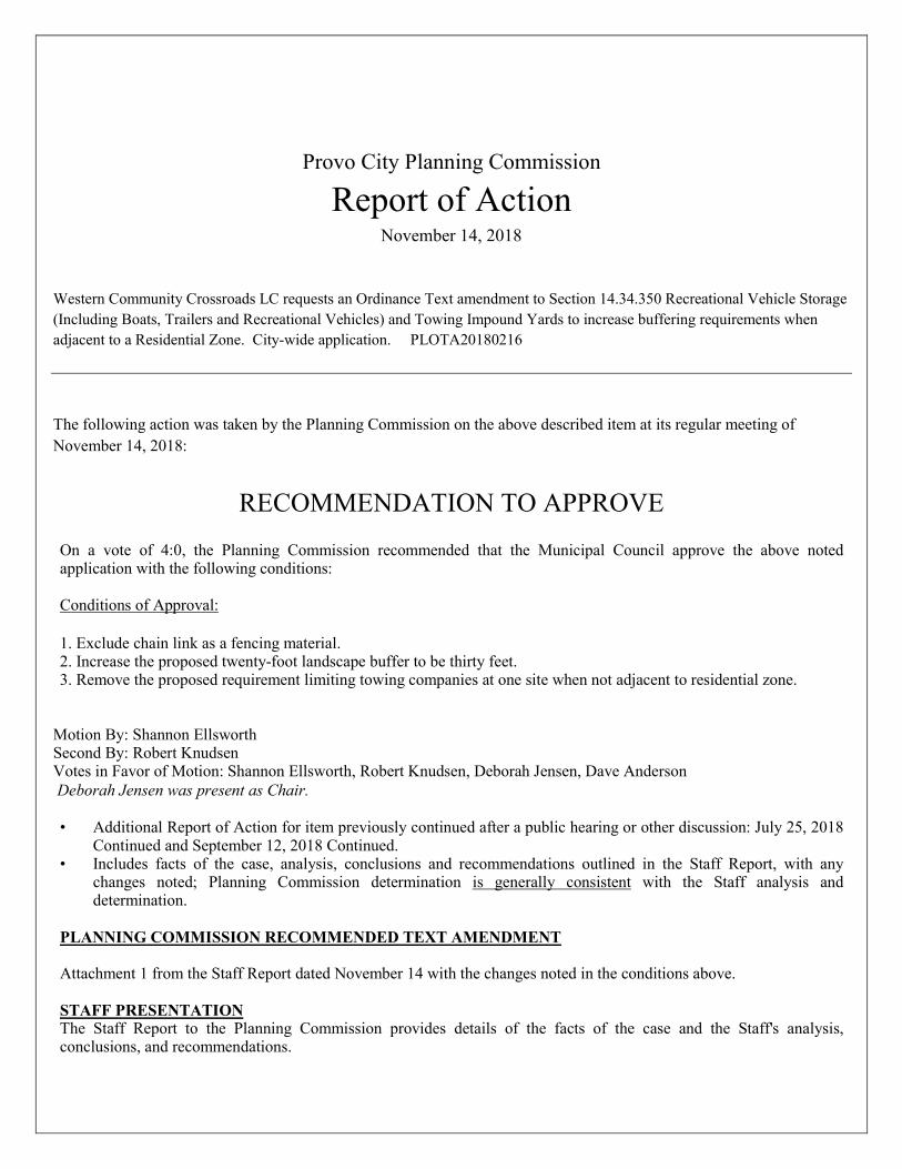
Provo City Planning Commission
Report of Action November 14, 2018
Western Community Crossroads LC requests an Ordinance Text amendment to Section 14.34.350 Recreational Vehicle Storage (Including Boats, Trailers and Recreational Vehicles) and Towing Impound Yards to increase buffering requirements when adjacent to a Residential Zone. City-wide application. PLOTA20180216 The following action was taken by the Planning Commission on the above described item at its regular meeting of November 14, 2018:
RECOMMENDATION TO APPROVE
On a vote of 4:0, the Planning Commission recommended that the Municipal Council approve the above noted application with the following conditions: Conditions of Approval: 1. Exclude chain link as a fencing material. 2. Increase the proposed twenty-foot landscape buffer to be thirty feet. 3. Remove the proposed requirement limiting towing companies at one site when not adjacent to residential zone.
Motion By: Shannon Ellsworth Second By: Robert Knudsen Votes in Favor of Motion: Shannon Ellsworth, Robert Knudsen, Deborah Jensen, Dave Anderson Deborah Jensen was present as Chair. • Additional Report of Action for item previously continued after a public hearing or other discussion: July 25, 2018
Continued and September 12, 2018 Continued. • Includes facts of the case, analysis, conclusions and recommendations outlined in the Staff Report, with any
changes noted; Planning Commission determination is generally consistent with the Staff analysis and determination.
PLANNING COMMISSION RECOMMENDED TEXT AMENDMENT
Attachment 1 from the Staff Report dated November 14 with the changes noted in the conditions above.
STAFF PRESENTATION The Staff Report to the Planning Commission provides details of the facts of the case and the Staff's analysis, conclusions, and recommendations.
NEIGHBORHOOD MEETING DATE • City-wide application; all Neighborhood Chairs received notification. NEIGHBORHOOD AND PUBLIC COMMENT • This item was City-wide or affected multiple neighborhoods. • Multiple Neighborhood Chair(s) were present or addressed the Planning Commission. • Neighbors or other interested parties were present or addressed the Planning Commission. CONCERNS RAISED BY PUBLIC Any comments received prior to completion of the Staff Report are addressed in the Staff Report to the Planning Commission. Key issues raised in written comments received subsequent to the Staff Report or public comment during the public hearing included the following: • The State of Utah has established criteria for impound yards. • The area on south State has a neighborhood plan and design criteria for the corridor that would require better
development than what is seen there now on some properties. • 40 to 50 feet of buffer would better for these uses. • Masonry fence should be on all sides when adjacent to residential. • These uses look similar to auto body yards. APPLICANT RESPONSE Key points addressed in the applicant's presentation to the Planning Commission included the following: • Fences are not always enough to separate dissimilar uses. • Having a tow yard as a permitted use could lead to oversite on regulation. • The 10 to 20 feet buffer area will not be maintained well. • 200 foot buffer will help mitigate a lot of the concerns when these uses are adjacent to residential uses. • Clarification is needed for masonry fencing to be on all sides when adjacent to residential zone.
PLANNING COMMISSION DISCUSSION Key points discussed by the Planning Commission included the following: • Providing 30 to 40 feet of buffering would allow for trees to be used in conjunction with a wall to provide adequate
buffering when the lot is adjacent to a residential zone. Evergreens would also help in screening year round and the tree spacing would be important too.
• The future land use in the area where there are tow yards on south State is Mixed Use.
________________________________________________________ Director of Community Development See Key Land Use Policies of the Provo City General Plan, applicable Titles of the Provo City Code, and the Staff Report to the
Planning Commission for further detailed information. The Staff Report is a part of the record of the decision of this item. Where findings of the Planning Commission differ from findings of Staff, those will be noted in this Report of Action.
Legislative items are noted with an asterisk (*) and require legislative action by the Municipal Council following a public hearing;
the Planning Commission provides an advisory recommendation to the Municipal Council following a public hearing. Administrative decisions of the Planning Commission (items not marked with an asterisk) may be appealed by submitting an
application/notice of appeal, with the required application and noticing fees, to the Community Development Department, 330 West 100 South, Provo, Utah, within fourteen (14) calendar days of the Planning Commission's decision (Provo City office hours are Monday through Thursday, 7:00 a.m. to 6:00 p.m.).
BUILDING PERMITS MUST BE OBTAINED BEFORE CONSTRUCTION BEGINS
1
PROVO MUNICIPAL COUNCILSTAFF REPORT
Submitter: MIVANDepartment: Community DevelopmentRequested Meeting Date: 11-27-2018
SUBJECT: Gordon Livingston requests a Zone Change from R1.10 to Low Density Residential (LDR) for 2.94 acres of land, located at approximately 1080 E 1320 S for facilitate a 44-unit townhome development. Spring Creek neighborhood. Aaron Ardmore (801) 852-6404. PLR
RECOMMENDATION
To be heard at the 11/27/18 Council MeetingSee Staff Report and Report of Action
BACKGROUND
See Staff Report and Report of Action
FISCAL IMPACT
PRESENTER’S NAME
Aaron Ardmore
REQUESTED DURATION OF PRESENTATION
10 Minutes
COMPATIBILITY WITH GENERAL PLAN POLICIES, GOALS, AND OBJECTIVES

2
CASE FILE NUMBER (FOR LAND USE ITEMS ONLY)
PLRZ20180102
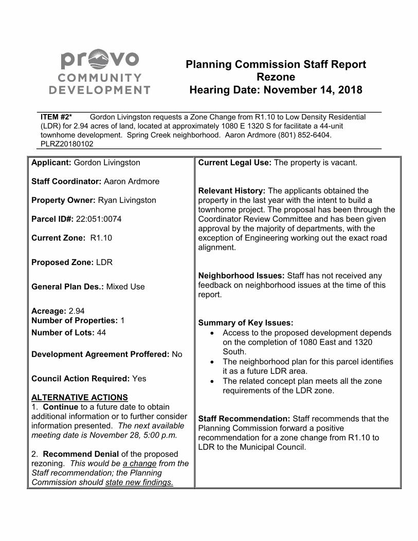
Planning Commission Staff Report Rezone
Hearing Date: November 14, 2018
ITEM #2* Gordon Livingston requests a Zone Change from R1.10 to Low Density Residential
(LDR) for 2.94 acres of land, located at approximately 1080 E 1320 S for facilitate a 44-unit
townhome development. Spring Creek neighborhood. Aaron Ardmore (801) 852-6404.
PLRZ20180102
Applicant: Gordon Livingston Staff Coordinator: Aaron Ardmore Property Owner: Ryan Livingston Parcel ID#: 22:051:0074 Current Zone: R1.10
Proposed Zone: LDR
General Plan Des.: Mixed Use
Acreage: 2.94 Number of Properties: 1
Number of Lots: 44
Development Agreement Proffered: No
Council Action Required: Yes ALTERNATIVE ACTIONS 1. Continue to a future date to obtain additional information or to further consider information presented. The next available meeting date is November 28, 5:00 p.m. 2. Recommend Denial of the proposed rezoning. This would be a change from the Staff recommendation; the Planning Commission should state new findings.
Current Legal Use: The property is vacant. Relevant History: The applicants obtained the property in the last year with the intent to build a townhome project. The proposal has been through the Coordinator Review Committee and has been given approval by the majority of departments, with the exception of Engineering working out the exact road alignment. Neighborhood Issues: Staff has not received any feedback on neighborhood issues at the time of this report. Summary of Key Issues:
Access to the proposed development depends on the completion of 1080 East and 1320 South.
The neighborhood plan for this parcel identifies it as a future LDR area.
The related concept plan meets all the zone requirements of the LDR zone.
Staff Recommendation: Staff recommends that the Planning Commission forward a positive recommendation for a zone change from R1.10 to LDR to the Municipal Council.
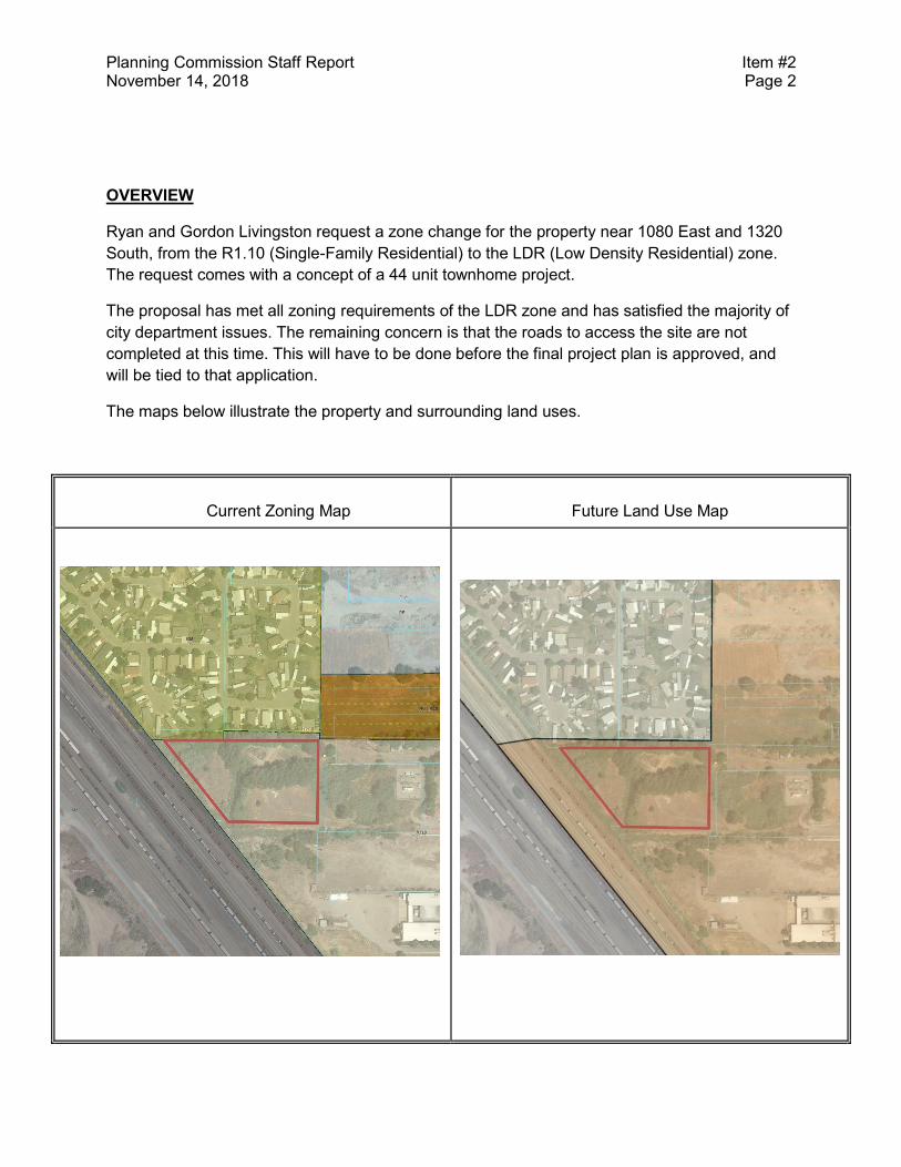
Planning Commission Staff Report Item #2 November 14, 2018 Page 2
OVERVIEW
Ryan and Gordon Livingston request a zone change for the property near 1080 East and 1320
South, from the R1.10 (Single-Family Residential) to the LDR (Low Density Residential) zone.
The request comes with a concept of a 44 unit townhome project.
The proposal has met all zoning requirements of the LDR zone and has satisfied the majority of
city department issues. The remaining concern is that the roads to access the site are not
completed at this time. This will have to be done before the final project plan is approved, and
will be tied to that application.
The maps below illustrate the property and surrounding land uses.
Current Zoning Map
Future Land Use Map
Planning Commission Staff Report Item #2 November 14, 2018 Page 3
GENERAL PLAN POLICIES
The adopted Southeast Neighborhoods Plan appendix of the General Plan shows the subject
property as part of the LDR zone in the Future Land Use map. The LDR zone allows for
townhomes with a maximum density of 15 units per acre.
FINDINGS OF FACT
1. Provo City Code Section 14.02.020(2) sets forth the following guidelines for
consideration of zoning map amendments:
Upon receipt of a petition by the Planning Commission, the Commission shall hold a
public hearing in accordance with the provisions of Section 14.02.010 of this Title and
may approve, conditionally approve, or deny the preliminary project plan. Before
recommending an amendment to this Title, the Planning Commission shall determine
whether such amendment is in the interest of the public, and is consistent with the goals
and policies of the Provo City General Plan. The following guidelines shall be used to
determine consistency with the General Plan: (responses in bold)
(a) Public purpose for the amendment in question.
The public purpose is to provide additional housing types in the southeast
area of the City, and to bring more neighborhood stability.
(b) Confirmation that the public purpose is best served by the amendment in
question.
The amendment will allow for a townhome development to more forward,
thus providing the public purpose stated above.
(c) Compatibility of the proposed amendment with General Plan policies, goals, and
objectives.
The proposed amendment will support the General Plan policies of
providing housing options and getting the density that will support a
mixed use area along South State Street.
(d) Consistency of the proposed amendment with the General Plan’s “timing and
sequencing” provisions on changes of use, insofar as they are articulated.
There is a “timing and sequencing” issue with this proposal, as the area
around the subject property is still in development. However, by the time
Planning Commission Staff Report Item #2 November 14, 2018 Page 4
that the project plan gets approval, the necessary infrastructure should be
in place.
(e) Potential of the proposed amendment to hinder or obstruct attainment of the
General Plan’s articulated policies.
The zone map amendment should not hinder or obstruct attainment of any
articulated policies.
(f) Adverse impacts on adjacent land owners.
Impacts on adjacent land owners should be positive, as it will develop
vacant land and spur necessary infrastructure for adjacent future
development. The only adverse impact would be an increase in traffic for
nearby established residential uses.
(g) Verification of correctness in the original zoning or General Plan for the area in
question.
The zoning and General Plan for the area are correct.
(h) In cases where a conflict arises between the General Plan Map and General
Plan Policies, precedence shall be given to the Plan Policies.
No conflict exists.
STAFF ANALYSIS
Staff has worked with the applicant to refine the concept plan attached to the zone map
amendment and feel that allowing the amendment will provide a good project that will
provide a needed housing type and provide more stability to the Spring Creek
neighborhood.
CONCLUSIONS
The proposed zone map amendment will provide a good development and help meet
the goals of the General Plan and Southeast Neighborhoods Plan.
STAFF RECOMMENDATION
Staff recommends that the Planning Commission forward a positive recommendation
for a zone change from R1.10 to LDR to the Municipal Council.
ATTACHMENTS
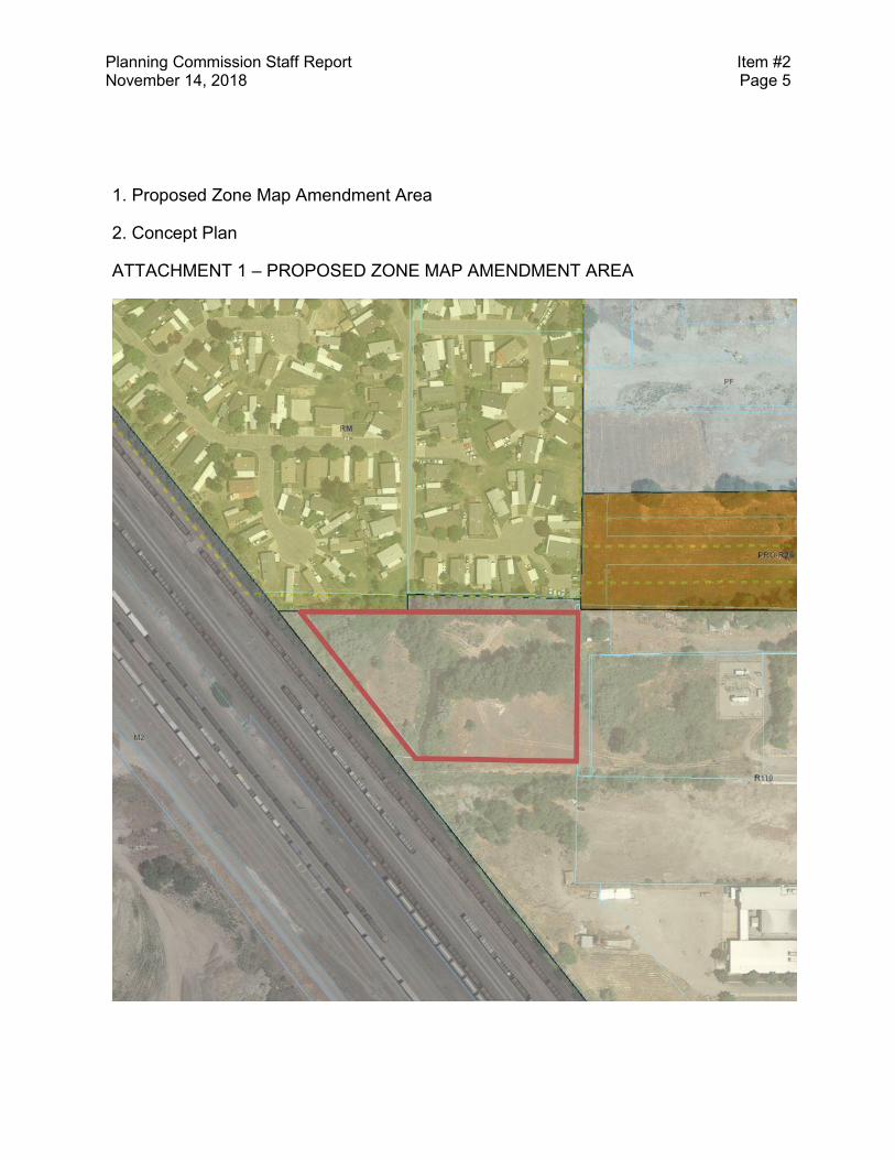
Planning Commission Staff Report Item #2 November 14, 2018 Page 5
1. Proposed Zone Map Amendment Area
2. Concept Plan
ATTACHMENT 1 – PROPOSED ZONE MAP AMENDMENT AREA

Planning Commission Staff Report Item #2 November 14, 2018 Page 6
ATTACHMENT 2 – CONCEPT PLAN
Provo City Planning Commission
Report of Action November 14, 2018
Item 2* Gordon Livingston requests a Zone Change from R1.10 to Low Density Residential (LDR) for 2.94 acres of
land, located at approximately 1080 E 1320 S to facilitate a 44-unit townhome development. Spring Creek neighborhood.
Aaron Ardmore (801) 852-6404. PLRZ20180102
The following action was taken by the Planning Commission on the above described item at its regular meeting of
November 14, 2018:
RECOMMEND APPROVAL
On a vote of 4:0, the Planning Commission recommended that the Municipal Council approve the above noted application. Motion By: Dave Anderson Second By: Robert Knudsen Votes in Favor of Motion: Dave Anderson, Robert Knudsen, Deborah Jensen, Shannon Ellsworth
Deborah Jensen was present as Chair.
• Includes facts of the case, analysis, conclusions and recommendations outlined in the Staff Report, with any changes
noted; Planning Commission determination is generally consistent with the Staff analysis and determination.
LEGAL DESCRIPTION FOR PROPERTY TO BE REZONED The property to be rezoned to the LDR Zone is described in the attached Exhibit A.
STAFF PRESENTATION The Staff Report to the Planning Commission provides details of the facts of the case and the Staff's analysis, conclusions, and recommendations. Key points addressed in the Staff's presentation to the Planning Commission included the following: An overview of the area, including zoning and the neighborhood plan recommendation.
NEIGHBORHOOD MEETING DATE • The Neighborhood Chair determined that there is neighborhood support for this plan and supports it as an asset to
Spring Creek.
NEIGHBORHOOD AND PUBLIC COMMENT • Neighbors or other interested parties were present or addressed the Planning Commission.
CONCERNS RAISED BY PUBLIC Any comments received prior to completion of the Staff Report are addressed in the Staff Report to the Planning Commission. Key issues raised in written comments received subsequent to the Staff Report or public comment during the public hearing included the following:
Steve Turley addressed the Planning Commission with his support of the proposed zone and plan, but had issues with the proposed road network and the master street plan for the area. (David Day from Engineering addressed this concern, stating that the master street plan dashed lines are conceptual for a road in the area, and that the layout may change as development occurs).
APPLICANT RESPONSE Key points addressed in the applicant's presentation to the Planning Commission included the following:
The Livingstons stated that they have experience with this type of build, and that it will be a quality development.
PLANNING COMMISSION DISCUSSION Key points discussed by the Planning Commission included the following:
Robert Knudsen inquired on the size of the units proposed with the zone change.
Discussion regarding the surrounding properties zoning and uses determined that the use was appropriate for the area.
Some discussion regarding train noise and what affect that would have on the units.
The applicant will not be building the “future road” shown on the concept plan during building.
Director of Community Development See Key Land Use Policies of the Provo City General Plan, applicable Titles of the Provo City Code, and the Staff Report to the
Planning Commission for further detailed information. The Staff Report is a part of the record of the decision of this item. Where findings of the Planning Commission differ from findings of Staff, those will be noted in this Report of Action.
Legislative items are noted with an asterisk (*) and require legislative action by the Municipal Council following a public hearing;
the Planning Commission provides an advisory recommendation to the Municipal Council following a public hearing.
Administrative decisions of the Planning Commission (items not marked with an asterisk) may be appealed by submitting an application/notice of appeal, with the required application and noticing fees, to the Community Development Department, 330
West 100 South, Provo, Utah, within fourteen (14) calendar days of the Planning Commission's decision (Provo City office hours are Monday through Thursday, 7:00 a.m. to 6:00 p.m.).
BUILDING PERMITS MUST BE OBTAINED BEFORE CONSTRUCTION BEGINS
1
PROVO MUNICIPAL COUNCILSTAFF REPORT
Submitter: BMUMFORDDepartment: CouncilRequested Meeting Date:
SUBJECT: A presentation on the establishment of the proposed impact fees (18-099)
RECOMMENDATION: Information only.
BACKGROUND: In 2004, Provo City contracted with CH2MHill to complete Impact Fee Facilities Reviews for water, wastewater (sewer), stormwater, transportation (roads), power, and parks public facilities. The consultant completed their work and on December 21, 2004, the Municipal Council adopted the Capital Facilities Plans, then on March 1, 2005, the Municipal Council passed Ordinance 2005-09 (Impact Fee Ordinance) where they adopted a three-tiered, structured, phase-in process giving between 32 and 44 months before full fee implementation scheduled to occur on January 1, 2007 for Water Impact Fees and January 1, 2008 for all other Impact Fees.
On March 21, 2006, the Council adopted Ordinance 2006-15 (Consolidated Fee Ordinance), effectively moving all fees to the Consolidated Fee Schedule where all Provo City fees are currently found. Provo City Code Chapter 15.08 (Fees) is the code reference to how Provo City handles Impact Fees.
FISCAL IMPACT: Yes
PRESENTER’S NAME: Susie Becker
REQUESTED DURATION OF PRESENTATION: 20 minutes
COMPATIBILITY WITH GENERAL PLAN POLICIES, GOALS, AND OBJECTIVES:
CITYVIEW OR ISSUE FILE NUMBER: 18-099